i ,i, - archaeology onlinenswaol.library.usyd.edu.au/data/pdfs/13164_id_higginbotham1984gold... ·...
TRANSCRIPT

~ -
~J'I
I ,I,
"'1 I I I' 'I " ,
,I ,
\1
I I, I 'I ,I
I I 'I
I" ,
.~ , ,
1~1 ~"} 1,;;"', "r '/ It .... '1\-( "\ ..... '\1' x: t\...J':,d_i •• lVLLJ. 'l ,h h .. ,.:
D,·- 6~ - J9g<:f
25
Edward Higginbotham
CONSULTANT ARCHAEOLOGICAL SERVICES
119 Denison Street, Camperdown, N.S.W. 2050 Telephone: 5162726.
~~:~~.'~'~~~~-----------------------------------------------

~I
1I t I' I I I I I I ~I
I I I I I I ,)
PRELIMINARY INVESTIGATION OF THE ARCHAEOLOGICAL REMAINS OF GOLDMINING AT JUNCTION REEFS, BELUBULA RIVER, NSW.
Report compiled by E. Higginbotham Consultant Archaeological Services
For Petroleum Securities Australia Limited.
April 1984.
www.higginbotham.com.au
Dr. Edward Higginbotham. Edward Higginbotham & Associates Pty Ltd.
Phone: +61297165154-Fax: +612 9716 8547.

:1 I I I,
t I I I
1I :1 1,1 I I I I1 1'1 I II 'I ,"(
Contents.
1. Introduction
2. Location of site.
3. National Trust Register.
4. Purpose of investigation.
5. Duration and area of investigation.
6. History of goldmining at Junction Reefs.
7. The location and distribution of mining activity.
7.1 Mines and open-cut workings.
7.2 Plant ruins.
7.3 Energy sources.
7.4 Communication routes.
7.5 Settlement areas.
8. Goldmining technology at Junction Reefs.
8.1 The location and date of mining activities
associated with the major companies.
8.2 Type of mining.
8.3 Energy sources.
8.4 Ore processing plant.
9. Statement of significance.
10. Recommendations.
Acknowledgements.
Notes.
Bibliography.
Appendix 1.
Appendix 2.
Geological description of the auriferous
deposits at Junction Reefs, NSW.
Inventory of main archaeological relics
a t Junction Reefs, Bel ubula Ri 'Jjer, N. S. W.
'1 I

-I I I I I I I I I I I I I I I I I I I
Inventory: item 3. Belubula Dam. This photograph of the dam under construction is taken form O.Schu1ze, 1897 (Geolog a1 and Mining Museum, SI/55-8, Bathurst, no. 1375).

I I I I I I 'I I "I , .
I" I :1 I I I I I I 'I
1.
1.
Introduction
The gold bearing deposits at Junotion Reefs were exploited
from 1870 to 1940, with major periods of mining activity
in the l870s and from 1895 to 1939.
The term Junction Reefs refers to the whole area, including
three mines, namely the Frenchman's, Cornishmen's, and the
Junction. Care should be taken to differentiate between
the name of the area and the Junction mine.
The report was prepared following the basic guidelines set
out in J.S. Kerr, 1982, The Conservation Plan, National
Trust of Australia (N.S.W.).
The conclusions and recommendations of this report may be
rapidly assessed by reference to sections 9 and 10.

I I I I I I I I I
I I I I I I I I I
1.1
2.
3.
2.
Location of site. I~~' The site of Junction Reefs is situated on the Belubula
River, near Mandurama an~ Lyndhurst, in the Parishes of
Lyndhurst and Belubula~county of Bathurst, New South
Wales. It is 33km ~ of Blayney, and 70km from Bathurst.
The Belubula River is a tributory of the Lachlan River.
(.~630, I and IV, Canowindra, 845775).
National Trust Register.
The site of Junction Reefs is classified by the National
Trust of Australia (N.S.W.) under the following heading:
Blayney Shire Council
Junction Reefs
Belubula Darn on Lyndhurst Goldfield, including
main service pipeline and mines area.
The area classified is decribed as follows l :
BELABULA DAM ON LYNDHURST GOLDFIELD, INCLUDING MAIN SERVICE ·PIPELINE AND MINES AREA The eastern bank of the Belabula River, from the junction with Marangulla Creek to the northern boundary of Lot No 218; along this boundary and corresponding boundaries of adjoining lots to point on northern boundary of Lot 260 which is lOOm from the bank of the River; then parallel to River at a distance of lOOm from bank of River to western boundary of access road; along this boundary to western bank of River; along this boundary to a point which is lkm above the dam; across River, then back along the eastern bank of River to northern boundary of Dam; then along the projection of line of Dam wall to a point which is 1.5km east of eastern bank of River; then around in a line parallel at 1.5km from bank of the River to western boundary of Marangulla Creek; 1.5km from the River; along this boundary to the Junction with the Belabula River

I - -'
I I I I I I I --,
I I I I I I I I
I ,!
>">G1.
j 't .J l
I ,;' ... I
I I I
Location
WESTERN AUSTRALIA
~f\, i NOATMERH ! ~ : TERIUTOlty : ~
l-------J--., QUUNSlANO ) I I I I _
: SOUTH AUSTRALIA i-------.... , ... I I
I NEW
: SOUTH
~ ... - iiWAL£SJ * project I '-,-__ area ! VICTOfUA \. ....
.. TASM~
'- -;..'" /
-", (~ /, /
3 &)1IV S",,:-' ,'5
:i
o''t
33
Figure Location of Junction Reefs, Belubula River, N.S.W., indicating area classified by the National Trust. (1:50,000).

I I I I I I I I I I I I I I I I I I I I
4.
5.
3.
Purpose of investigation
Petroleum Securities Australia Limited have begun
investigations into the feasibility of mining the low
grade auriferous ores at Junction Reefs. They approached
the Department of Environment and Planning to assess
whether approval would be given for mining. The Department
requested, under the provision of the Heritage Act, 1977,
that Petroleum Securities undertake an investigation of
the archaeological remains at Junction Reef.
Duration and area of investigation.
In March 1984 Petroleum Securities commissioned
E. Higginbotham to undertake a p~eliminary investigation
of Junction Reefs, but to concentrate his study within
the area defined in figure 2.
Preliminary documentary resear.ch was commenced on
19 March 1984 at the Department of Mineral Resources, N. S. W.
The site itself was investigated on 24 and 25 March 1984.
The area studied differed from that outlined by
Petroleum Securities for the following reasons:
1). Archaeological remains were traced up to and beyond
dam rothat the technology and full extent of the
mining area could be assessed.
2). The piping and water race was traced from the dam
to the north west corner of the mining area, so
that the workings associated with the dam could be
assessed.
3). The area to the east of the Belubula River upstream
from its junction with Mandurama Ponds, and the area
to the south of Mandurama Ponds were not investigated,

I I
I I I I I I I I I 'I I .1 I I I
F"' I •
--- JRP2.
-. --- ---- ----------
-------~ --------~--. ---
,
---
/ll -------(/ /; cl
/; r 'I I
/j {I
Old. workings
Junction
'1:5000 o ~OO 250
p . () I; {I j
-----meters
33"3t3(f
\.
\
\
Figure 2. Project area designated by Petroleum Securities" also indicating location of the three main mines, the

I I I I I I I I I I I I I I I I I I I ~I
4.
since no documentary evidence referred to them, and
no archaeological remains led into them.
4). The area to the west of the Belubula River and
Maran-gulla Creek, in the Parish of Hampton was not
investigated since no documentary evidence referred
to it. Although this area was clearly visible from
the area of the survey, only a trackway could be seen.
5). Open-cut mines were not investigated in detail due
to obvious dangers. No underground investigation
was undertaken.
The remainder of the area was investigated in detail.
A number of documentary sources were consulted during this
preliminary investigation. However several questions
remained unanswered after the site survey, but could not
be followed up in detail, due to the various constraints
upon the investigation (see bibliography) .
This report was completed in April 1984.
I I I I I I I I I I I I I I I I I I I I
6.
5.
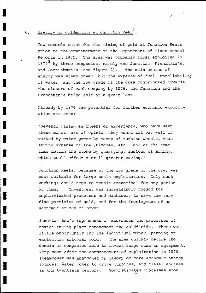
.., History of goldmining at Junction Reef~.
Few records exist for the mining of gold at Junction Reefs
prior to the commencement of the Department of Mines Annual
Reports in 1875. The area was probably first exploited in
1870 3 by three comp.anies, namely the Junction, Frenchman's,
and Cornishmen's (see figure 2). The main source of
energy was steam power, but the expense of fuel, unreliability
of water, and the low grade of the ores contributed towards
the closure of each company by 1876, the Junction and the
Frenchman's being sold at a great loss.
Already by 1876 the potential for further economic exploit
ation was seen:
'Several mining engineers of experience, who have seen
these mines, are of opinion they would all pay well if
worked by water power by means of turbine wheels, thus
saving expense of fuel, Firemen, etc., and at the same
time obtain the stone by quarrying, instead of mining,
which would effect a still greater saving.'
Junction Reefs, because of the low grade of the ore, was
most suitable for large scale exploitation. Only such
workings could hope to remain economical for any period
of time. Investment was increasingly needed for
sophisticated processes and machinery to save the very
fine particles of gold, and for the development of an
economic source of power.
Junction Reefs represents in microcosm the processes of
change taking place throughout the goldfields. There was
little opportunity for the individual miner, panning or
exploiting alluvial gold. The area quickly became the
domain of companies able to invest large sums in equipment.
Very soon after the commencement of exploitation in 1870
steampower was abandoned in favour of more economic energy
sources, water power to drive turbines, and diesel engines
in the twentieth centu~y. Sophisticated processes soon ..

I I I I I I I I I I I I I
I I I I
6.
made their appearance: amalgamation with mercury gave
way to proposals for chlorine treatment. The cyanide
process made its appearance around the turn of the century,
in comjunction with the roasting of the ores. Attempts
were also made at smelting with copper ores.
Between 1876 and 1895 little mining activity took place
at Junction Reefs. Steam power was abandoned, and attempts
were made to use water power. In 1879 and 1880 a 20 foot
water wheel was used at Frenchman's by a small party, possibly
to be identified as the Sultan Goldmining Company. Also in
1880 another party worked the Cornishmen's using a water
wheel.
It appears that W.H. Binsted and Company, possibly later
renamed the Mandurama Goldmining Company, acquired the
Junction in 1885. This claim. bad remained idle since
the scrapping of the plant in 1876. In 1887 this company
was erecting 'superior gold~saving machinery', powered by
a turbine wheel. After substantial trials it was clear
that much of the fine gold was still being lost in treatment.
Betwen 1889 and 1891 the company was again erecting sophist
icated equipment, possibly involving chlorination, but
little appears. to have come of this venture.
Until 1895 the unreliability of the water supply still
affected goldmining activities in spite of advanced processes,
and the use of economical power, the water-wheel, and the
turbine.
In September 1895 the Lyndhurst Gold-fields Company Limited,
later known as the Lyndhurst Railway and Mines Limited, was
formed and registered. This Company amalgamated the mines,
namely the Frenchman's, Cornishmen's, Belubula (neighbouring
the Cornishmen's),Mandurama (the Mandurama Goldmining
Company at the Junction), and the Junction, comprising a
total area in excess of 272 acres4 . Between 1895 and
1897 the Company were involved' in the construction of the

I I I I I I I I I I I I I I I I I I I I
7.
large concrete and brick dam across the Belubula River
above the waterfalls. Up to 1899 it appears that the water
turbine (Pelton Wheel) and equipment constructed by the
Mandorama Goldmining Company may still have been employed.
However in 1899 the new Company had completed its new
crushing and concentrating plant, probably using the
chlorination process, but were soon to add an additional
Edwards roaster and several cyanide vats in 1901, and a
water jacket blast furnace in 1903. From 1900 the cyanide
process was adopted in favour of the chloride-process.
The advent of the Lyndhurst Railway and Mines Limited
illustrates the fact that only larger companies with
extensive capital could hope to exploit the low grade ores
economically. The building of the dam for approximately
~9000 was a necessary capital investment to ensure the
continuous working of the mines in an area subject to
irregular rainfall.
However in spite of the capital available to it, the
Company failed in an attempt to largely extend the scale
of production. In 1904 and 1905 quantities of ore were
smelted with copper ores on a successful basis. Attempts
to raise the capital necessary to connect the mine with
the railw·ay network failed, so that it was impossible to
develop the smelting process in conjunction with outside
copper mines.
From 1905 onwards various other parties took up leases
at the Junction Mine, on the south side of the river.
Their precise relationship with the Lyndhurst Railway
and Mining Company is obscure, but it is clear that the
Company continued mining at both the Cornishmen's and
the Junction, processing the ore at the former siteS. The
Junction Mine was variously worked by L. Edgley in 1905-1906
(erected a Huntington Mill in 1906), C.M. Thomas in 1905
(erected a cyanide plant), W.N. Willis in 1906, J.M. Hogan

I I I I I I I I I I I I I I I I I I I I. l .
8.
between 1907 and 19l5, when he was bought out by Sheahan r
Bros., and the latter from 1808 to 1934. Both Bogan and
Sheahan were connected to water power in 1911, Bogan also
constructed two cyanide vats in that year, while Sheahan
had erected a ten head battery in 1910.
In the early 1930s several companies were working in the
area. For example, John Grant and Son had a working option
on Sheahan's, and were erecting equipment, later remodelled,
in conjunction with Mandurama Gold Limited. By 1934 Sulphide
Gold (Junction Reefs) Limited was dominant, and was erecting
new plant at the cornishmen's. In 1937 Mount Morgan
Company became part-owners of Sulphide Gold, and the
additional capital was devoted to extending the cyanide
plant. However in April 1939 the plant closed as the ores
were not payable. Mandurama Gold rebuilt their plant at
the Junction Mine, but the venture did not continue.
The exploitation of the mines at Junction Reefs in the
twentieth century illustates the interdependent relation
ship of the mining groups and companies. Working options
were taken up, and mining by tribute occured. Ores were
treated on neighbouring leases, and water power may have
been leased.
By 1940 the major activity at Junction Reefs had ceased, to
be followed by only intermittent minor workings in subsequent
years.

I I I I I I I I I I I I I I I I I I I I
7.
9.
The location and distribution of mining activity.
Site survey on the 24 and 25 March 1984 revealed the basic
layout of the Junction Reefs goldmin-ing area. The site
may be divided up into several categories as follows:
1) mines and open-cut working, including
adits and shafts
2) plant ruins, sites where ores was processed,
and machinery constructed
3) energy sources, including dams, water-races,
piping, etc.
4) communication routes, including ore shoots,
etc.
5) settlement areas, sites of buildings and
other facilities.
The identification, and the sketching of these categories
onto plans revealed the layout of the site, and enabled
a basic understanding of the workings to be obtained
(figure 3).
7.1 Mines and open-cut workings.
Gold bearing ores are distributed on the north side of
the Belubula River, between the Cornishmen's and the
Frenchman's, and on the south bank of th~ River at the'
Junction. (For a more detailed gedogical description
see appendix 1). The main mining activity took place in
these three locations. Open-cut workings are first mentioned
in the Annual Reports of the Department of Mines in 1912,
and in general both the open-cuts at the Junction and the
Cornishmen's are dated to the twentieth century. Mining
of deeper gold bearing rock was undertaken with shafts and
adits, etc., and these may be dated from 1870 onwards.
These latter are visible at all three locations.

I I I I I I I I I I I I I I I I I I I I
..-/
/
-,
",--, ,r .........
'---
-. JRP 1.
'~"'-.. 41'1 ~//r/
, 11;-{I /
I; {I
--
Figure 3. Sketch plan of the m~n~ng activity at Junction Reefs, indicating the three main mines (Junction, Frenchman's, Cornishmen's), the Belubula Dam (thick line), water-races and steel piping (medium line), plant ruins (stars), roadways (dashed line), mine workings (dashed outline), and sites of buildings (large dots) (1: 5000) .

I I I I I I I I I I I I I I I I I I I I
10.
7.2 Plant ruins.
Plant ruins, and the remains of ore processing (tailing'
dams, etc.) are visible in several areas at Junction Reefs,
namely at Frenchman's, Cornishmen's, Mining renement (M.T.) 1,
Mining Tenement (M.T.) 7, the Mining Tenement within Gold
Lease (G.L.) 36, on the south bank of the Belubula at its
jun:±ion with r1andurama Ponds, and also scattered on the
hillside to the south and west of M.T.l and 7. (Figures,
3, 4a, 4b).
There is evidence to suggest that substantial plant remains
have been eroded away on the south bank of the Belubula
River at M.T. 7 and nearby.
The processes and the date of each site will be discussed
in sections 8.1 and 8.4
7.3 Energy sources.
Where steam power, or diesel engines or similar are employed
as a power source, the location of these items is identical
or incorporated within the plant ruin category. However
water power, whether for water-wheels, or turbines (Pelton
Wheels) generally leave remains of dams and water races or
piping, delivering the energy to the plant. At Junction
Reefs there are the substantial and important remains of
the darn, still structurally sound6 , and also of the two
water races, and piping leading towards the plantruins.
Both the dam, water-races, and piping are described below
in section 8. 3
7.4 Communication routes.
Several tracks, apart from the main roadway (unsealed)
from Mandorama to Burnt Yards, crossins the Belubula River
by a now broken causeway, were recorded. They give some

I
I I I I I
I I I I I I I I I
z o
Figure 4a. Plan showing leases 0 the SuI Reefs) Limtied, 1932-1939. (part).
"
de Gold (Junction
,
-
/ , ,

I I I I I I I I I I I I I I I I I I 1
\
'I' i \
11.
indication of access and ore-processing, but their useful
ness in this context is limited. M.T.l was however linked
to the upper workings at the Junction Mine, as well as to
M.T.7. Of greater importance was the survival of an ore
shoot leading to M.T.7 from below the open-cut at the
Junction Mine. This will be described in section 8.4
7.5 Settlement areas.
Site survey located' the remains of several domestic or
similar buildings, near both the Junction and the Cornishmen's.
These settlement areas undoubtedly housed the employees of
the ~ines, and may have been small independent communities
with shops, hotels, etc. In this preliminary survey the
relevant documentary research has not been undertaken to
obtain more details about these settlements. Most of
these remains can be dated to the twentieth century, the
period of extensive exploitation by large companies.
A similar settlement area may exist near the Frenchman's,
but the site was not closely searched. One plan of the
Sulphide Gold (Junction Reefs) Ltd does show an area set
aside for residence (figure 4a).

I I 1 I I I ,I I 1
1
I 1 1 I I I I I
\
Figure 4b. Plan showing leases of the Sulphide Gold ~Ju~ction Reefs) Limited, 1932-1939. (part). This pl~n 1S 1mportant as it shows mining tenements (M.T.) assoc1ated with the lower water race, and M.T.s for ore processing plant. Note the rails, ore shoot vats and mill within M.T.7 at the Junction Mine (Depar~ment of Mineral Resources, N.S.W. Drawing no. 93, frames 1 and 2 (originally p.W.D.)).

I I I I I I I I I I I I I I I I I I I I
8.
12.
Goldmining technology at Junction Reefs 7 .
The description and dating of gOldmining tecfu~ology and
its representation at Junction Reefs may be divided up
into several categories as follows:
1. the location and date of mining activities
associated with the major companies
2. types of mining
3. energy sources
4. ore processing plant.
Both historical documentation and physical evidence will
be discussed, and conclusions made about which aspects of
goldmining technology are important and well represented
at Junction Reefs.
8.1 The location and date of mining activities
associated with the major companies.
The three companies working the gold deposits at Junction
Reefs between 1870 and 1876 lent their names to the location
of each mipe, namely the Frenchman's, Cornishmen's, and
the Junction (figures 2, and 3).
After this period the location of mining activities at both
the Frenchman's and Cornishmen's remains well defined.
However this is not the case ~vi th the plant associated with
the exploitation of the Junction Mine.
Exploitation of the Frenchman's was never on a large scale.
The water wheel and plant associated with the Sultan Gold
mining Company in 1879 and 1880 have left no identifiable
remains, and may be buried under the silts behind the dam.
The shafts, adits, and remains of a roaster/smelter which
survive today probably represent intermittent activities
from the 1930s onwards.
In 1879 and 1880 the Annual Reports of the Department of
Mines mention the use of a water wheel at the Cornishmen's.

I I
I I
I
I I
.- i *""' r--:-:::~ ---. ~
. "
" . ..
"
I ,
Figure 5. Junction Reefs, Handorama, N.S.W., by J.W.G. David, probably 1891. This plan appears to illustrate the u~per water race, as denoted by a heavy line and the follow~ng notes: 'head of race', 'race', and 'pipes for pelton Wheel' (Department of Mineral Resources, N.S.W., Drawing no. 611 . Frame 1. Annual Report 1891 (originally P.W.D.))
~ . . ' .
"
• < :.--...--- - --~-
T ,
... .:""'
......... ..,.._. - - ---.. '"""'-'"- .... ~
, : .
. ,
II r-..
-".
\ r ( f I
1\. - '( r.,\_l~
~ .' i ' . .). J c:). ,'\.\ t. ••

I I I I I I I I I I I I I I I I I I I I
13.
Again no trace survives today, except perhaps for the
water race and a hint in the documentation for the location
of the wheel and machinery. The water race from the dam
to the Cornishmen's may pre-date the construction of the
dam (see figure 5). The location of the water wheel tunnel
on plans of the Cornishmen's (figures 4a, and 6) may
indicate the location of this water wheel in the gully.
The location of any attempts to use water power at the
Junction Mine in the l880s is· uncertain. The location of
Mining Tenements (M.T.) 3,5, and 6, delineating the lower
of the two water races from the Belubula River give some
indication of the alternatives, either M.T.l or M.T.7
(figure 4b). In 1882 the Annual Reports locate the workings
as follows: 'These [reefs] are situated on the face of a
very steep hill, and the crushing plant worked by a turbine
water wheel, is on the bank of . the river immediately at
the foot of the hill'. This reference is ambiguous, but
in 1886 Binsted and Co. moved the crUShing plant 400 yards
towards the falls, so that water-power could be used to
drive a turbine. This would appear to indicate that
prior to 1886 the crushing plant was located at M.T.l, and
after that date at M.T. 7.
The further use of M.T.l in the nineteenth and twentieth
centuries is uncertain. The remains are confined to
tailing dams, mullock heaps, and plant ruins (including
stumps or wooden posts, and concrete pillars or beds for
equipment) . Scattered over the neighbouring hillside
various concrete bases for equipment are located at two
sites, with adjoining communication routes. These two
sites appear to be for identical equipment.
The formation in 1895 of the Lyndhurst Gold Fields Co. Ltd.
saw the construction of the Belubula Dam by 1897 and of
new crushing and processing plant by 1899. Until that
year the crushing plant had remained at M.T.7, but this

I I I I I I I I
I I I
G.L 24-
,
Pi AN JIJ()WI#t!I 1'''';;~ /' wo",,ffiV(J(
SUlJ.l'lIltJe- (';()lfJ
20!7' -fINCH "
• '-!1_ -J. G.L ~+ 1 ----~--•
-
Figure 6. Plan showing part of the workings of the Sulphide Gold (Junction Reefs) Limited, and datable to 1932-1939. The plan illustrates the Cornishmen's mine or Sulphide Mine. Note air receiver tunnel, and water wheel tunnel. (Department of Mineral Resources, N. S. W. , Drawing no. 3220, frame 2. Mine Record 765 (formerly P.W.D.) .............. ----------------------------------------------~---

I I I I I I I I I I I I
i I
I I I I I I I
14.
site was found to be cramped, and additions therefore very
expensive. The decision was made to erect the new plant at
the Cornishmen's.
The Cornishmen's, also known as the Belubula, remained the
centre for ore processing for the Lyndhurst Railway and
Mines Company, and was connected to the Belubula Dam with
water pipes. This mine was also the location of the treatment
plant for the Sulphide Gold (Junction Reefs) Company, and
thus was almost continuously occupLedfrom 1895 to 1939 as
the centre for ore procesping at Junction Reefs.
The date for the continued use of M.T.7 and neighbouring
plant at the Junction Mine is uncertain. M.T.7 appears
to have been first used in 1886, but the location of the
remaining plant in the area certainly post-dates the
construction of the dam in 1897. Huntington Mills are
first mentioned in 1905, although they may not have survived
in their original location. The present remains in the
area of M.T.7, at the junction of the Belubula River with
Mandurame Ponds, and in M.L.36 (figure 4b) are most likely
to date from 1905 to 1939.
8.2 Types of mining.
The techniques of mining for gold at Junction Reefs have
already been bri~ly described in section 7.1.
Little physical evidence survives of ore extraction
machinery, although there are several references from
documentary sources. The Lyndhurst Railway and Mine
Company were using at least 3 Rand rock drills, and a
Blake pump, in addition to air compressors and receivers,
at both the Junction and Cornishmen's Mine8 . In 1937 the
Sulphide Gold (Junction Reefs) Company were using jack
hammers and poppers in the mines, and a steam shovel in
the open-cut at the Junction. At the Cornishmen's or
Sulphide Mine the same company was using an Ingersol Rand

I I I I I I I I I I I I I
I I I I I I
c 0 ..... ~
CJ =' '" ...., (/j ,.. ~
0 .0 ~ C) .....
"-,..,..
--..... re (l) . -..... (/)
~ ;... ..... ()
"""
Inventory: item 3. Belubula Dam. This photograph of the dam under construction is taken from O.Schulze, 1897 (Geological and Mining Museum, SI (55-8, Bathurst, no. 1376)
~ ~ ...... ~ ~
"C
s tU Q
tU ,.. ::s
,Q
=' -Cl)
~
I I I I I I I I I I
I 11
I I I I I I I
15.
air compressor and five rock drills (see figure 6 for the
air receiver tunnel) . The type of ore extraction equipment,
and the mining techniques at Junction Reefs were widespread
and in g,eneral use. The ore extraction equipment has not
survived, and all that remains are the shafts, adits and
open-cuts.
8.3 Energy sources.
A variety of energy sources were employed at Junction Reefs.
Their development in the nineteenth and twentieth centuries
mirrors similar processes on other gold fields. Of special
importance to the Junction Reefs goldfield was the construction
of a brick and concrete arched dam in 1895, which was
claimed to be the first of its type in Australia9 . The
dam is associated with extensive piping which allowed water
under high pressure to drive water turbines (Pelton Wheels)
at three locations, one at the Cornishmen's, and two at
the Junction Mine. At least one of these turbines (Pelton
Wheels) survives at the Junction, driving a small electrical
generator (British Thompson Houston, Derby, England).
Another turbine may survive at the Junction but is at
present obscured by vegetation.
The construction of the dam may be best described in the
d ~ h 1 . d d' 10 wor s OI O.Se u ze, eng~neer an es~gner

I I I I I I I I I I I I
I I I I I I
. ,"
C,) ..... > ~
t:: (~
C,) . -....... en Co.
~
-'
Inventory: item 3. Belubula Dam. General view, completed, and full of water. (O.Schulze, 1897: Geological and Mining Museum, SI/55-8, Bathurst, no. 1377).

I I I I I I I I I I I I I I I I I I I I
16.
This dnm has been built across the Belubul .. HiYer, :tbout hitlf a mile fl.bove the old batt.ery of the Junction :DIine, now belonging to the. Lyndhurst CoU;pauf .. Several waterfalls o,ccur bet\Y~en the battery and dam, aggre~atillg 150 feet in hClght. The dam IS bmlt m ~ narrow ~Ol'gc, through whIch th,e river falls another 25 feet and above which the ntllcy widens out, the 1'1'<cr J10wmg almost leyel througn same for a. considorable di~tance. The intcntion of t-he Compn.llY is the construction of a rcs?rYoir which will store up enouO"h water to surrply continuous working power to the battery during the driest scasons, which could be acc~mplished by building n. dn,m 45 reet in height aboyc the 1.6vel ?~ the ?Jd water-I"a{'e. The particular site was. chosen o~ a~count of the app~1'ent good rock r?rm~tl~n ns~bl~ nght acros.s. the gorge, and the rOUndatlOn was laId lUto and across this bed·rock of sohd dlOpte. Sel eral perpeI,ldl,c:llar rock eleY'ations running parallel with the water were made use of as foundatIons for buttress~s, OU.l!& to strengthen the main wall, which thereby could be reduced in thickness. The foundations of the main' ;;11 and buttresses are carried up in concrete masonry to 12 feet above the water-race, or 10 feet above the outlet pipe, the front wall at this level being about 180 feet IOD!i" and 14 feet wide, increasing in thickness downwards. The buttresses a.re six in number, 28 reet apart from centre to centre, each 40 feet long, 12 feet wide on top where they abut the inner wall, and narrowing to 6 feet wide at the outer end, thickening downwards, but carried up to the same level as the concrete formation of the main wal1. The height of the foundation varies in accordance with the rugged nature of the bottom (bed·rock) from 1 to 30 feet. On the top of these found.a.tions the buttresses are built up on brick maSOllrY tapering from 8 to 4 feet thick, these are united by brick arches of eliptical shape. which decrease in thickness upwards from 4 to 2 feet, and are built at an inclination of 1 in 2, the spandrils between these arches are faced Ul? flush, with concrete. thus on the w~ter side forming a uniform face 36 feet high, with a batter of 1 in 2. On both sides of the central portion of the dam ihe ground rises and the wall is continued about 100 feet up and into the hill sides to firm rock faces, and concrete masonry with the same batter continued on the water side, but vertical at the back, the width on top being 2 feet. The whole length of the da.m measures thus 340 feet, and shows a straight uniformly battered cemented race on the water side while the back is ribbed and shows five chambers under the overhanging archeR between the huge buttresses. Abye-wash is constructed in the e:dcnsion of the dam on the east side 65 feet wide, di..-ided into liYe sluice openings 'with a wing wall built on the rock to lead the water clear of the dam. Allowance is also made for occasional extreme flood waters to run over the dam between the buttresses. The race which was left open during construqtion being a.rched over will serve permanently as an emergency outlet ror which purpose a "projection was built out from the main wall with a 5 feet well in it through which the reservoir can be emptied into the gorge. This well is usnally closed by a wooden lid 12 inches in thickness, which can be raised by means of a hydraulic ram of 50 tons power, worked by a pump placed at the back of the wall. The service outlet is carried through the lllain wall by 2-:l,.inch cast·iron pipes the entrance of which being formed by a tapering and rising brick cuh-r.rt, the verl;ical opening of which together witb that or the emergency outlet and of two G·inch flushing pipes are enclosed by a wooden grating built in the sba.pe of a. steep Toof and surrounded by a. sediment pit. The dam contains in its construction about G,OOO yards of concrete and 500,000 bricks, together with which 5,000 (':1sks of Henmoor cement were used.
l'he water in the river will be backed up for a length of l:} mile and about ;jOO,OOO,OOO ot gallons of water will be impounded, which with the fall of 225 feet made available by a conduit of 18-inch welded steel pipe5 will supply 200 h.p. for a term of three months, even jf the rivcr should stop running, which seldom, if ever, happens.
Water from the dam was used from 1897 onwards to drive
equipment at both the Cornishmen's and the Junction.
The dam had silted up by 1937, but it is not clear whether
it was still.able to function at a reduced capacity.

- -(J)UlH HCD:::J ""'0<: UlrtCD Ul I-'-:::J IOrt
oo:::JO Ul Ii -"<:
tJj PI rtO ::>" - 1-'C(J)rt Ii () CD Ul ::r l3 rtC
I--'W N -
:::J CD o ~
tJj I--'CD
1--'001--' WWC ,I -.I tr 00· C
I--' PI
wtJ CD PI o l3 1--'-o
lQ 1-'- 'U 01--' PI PI I--':::J
PI :::J CD 0.1--'
CD :.5:<: I-'-PI :::J rt 1-'-1-':::J 0
lQ:::J
~ C PI Ul :::J CD 0. C l3
- - - - - - -
CROSS &:CTiO/V alen!! CoD
CROSS SeCTION "1'~9 £-r
,scale qf Fut
"ha. eT Llmb."''':C r
TOP v/£w·--,\...t i"'fI ,v,,,,,", u,-."",
- - - - - - - - - - -BELUBULA DAM
on. the
LYNDHURST GOLOrlELO NEW SOUTH WALES
BACK ELEVATION ----~-1i> ... l I ... ,,,,, • ... ,'0' ,,,<"
.. , I
~ .l'ar/A { l )
,
.l';/~ JA.,. ", ... #..,4 h_ ,~."<*~c,, .I...tr",,,X.,,,, """Zr"l,,,,,,.
CROSS
Q
I
... renu1.y ,ti)
'<' ,
...
z· ...
l
--;.-.z
OscarSc:itui:u Sydn.ry,Mag!IW7 C,,,.d £"jf~r(ef!r

I I I I I
I I I I I I I I I I I
17.
It follows that the importance of the dam also reflects
upon the remaining network'of piping, and equipment that
it powered. The survi.val of at least one turbine (Pelton
Wheel), coupled to an electrical generator is unusal in
a situation where machinery was frequently dispersed or
scrapped after use.
The following is a note on the construction and history
of the Pelton Wheelll .
A new type of turbine. whose im'enti~n was due to sheer chance. was the Pelton wheel. During the gold rush in California in the 1860s. the most common method of washing for gold was to flush the sand and gra\'el away with a jet of water under very high pressure. The water was usually led in pipes or hoses to the site from reservoirs higher up the river. About 1870, when the gold ran out. this piped water was often used to drive water-wheels. A mining engineer, Lester A. Pelton {l829-19081, who worked in these parts. had built a water-wheel with curved blades. One day, the water jet happened to strike the outer edges of the blades, and the speed of the wheel increased so much that it flew into pieces.
This intrigued. Pelton. After long consideration. he realized that the power of the jet was best exploited when its direction was corn· pletely reversed by the blade. He changed the blade design to incor· porate two buckets. whose edges were joined to form the middle of the blade. This split the jet of water in two. and the shape of the buckets caused both jets to reverse direction. One or more nozzles coul~ be used to supply water to the wheel, which became known as the Pelton wheel or the jet-splitting double-bucket turbine. This type of turbine is especially suitable for large heads of water with a moderate or low rate of flow. Manufacture of the Pelton wheel began on an industrial scale in the 18805.
The remains of other forms of motive power have left no
substantial remains at Junction Reefs. The concrete beds
for equipment at the Junction testify to the use of various
types of motors, and similar remains are present at the
Cornishmen's. The presence of part of a large boiler at
the latter mine is most likely dated to the early twentieth
h d f _.. . h12 century w en steam power was use or drlvlng a Wlnc .

I I I I I I I I I I I I I I I I I I I I
Inventory: items 27 and 28. Pelton Wheel and generator, 2-:'74. (Geological and Mining Museum, SI/55-8, Bathurst ::0. 626).

I I I I I I I I I I I I I I I I I I I I
18.
8.4 Ore processing plant.
Before describing the variety of ore processes used at
Junction Reefs, a brief note follows on the means by
which ore was transported from the mines or open cuts to
the plant. Little evidence survives apart from the
roadways terraced into the hillside at both the Junction
and the Cornishmen's. At the latter the remains of a
trestle bridge from the adit to the plant lie scattered
in a gully. At the Junction a small tramway survives at
the entrance to one adit, but its course has been destroyed
by recent prospecting activity. From documentary evidence
(figure 4b) the tramway led to an ore shoot, which conveyed
the ore directly to a Huntington Mill. The shoot,
constructed of steel piping (originally used for water-power) 1
and the Huntington mill survive intact.
Various ore-processing techniques were used at Junction
Reefs in the nineteenth centruy. The ores were crushed
in stamper batteries, and amalgamated with mercury.
Difficulties were soon apparent, and much of the fine gold
was lost in treatment. Several attempts were made to
remedy this problem, which was vital especially when low
grade ores were being treated. There is some suggestion
that chlorination was employed towards the turn of the
century.
In the twentieth century the cyanide process became dominant.
The Cornishmen's has substantial remains of this process
associated with the activities of the Lyndhurst Railway and
Mines Company, and the Sulphide Gold (Junction Reefs)
Company. Cyanide vats also remain at M.T. 7 at the
Junction, while M.T.l has a terraced layout and tailings
dams, similar to the Cornishmen's.
The most common procedure in use in the twentieth century
(by the Lyndhurst Railway and Mines Company) was as follows:

I I I I I I I I I I I I I I I I I I I I
Inventory: (Geological
item 31. Open-cut mine, Junction ~ine, 1974. and Mining Museum, SI/55-8, Bathurst no.623)

I I I I I I I I I I I I I I I I I I I I
19.
(wet) crushing o.f the ores in a battery, follewed by
amalgamatien, er by reastingin an Edward's furnace and
then cyanidatien. In 1904-1905 the Lyndhurst Cempany made
an attempt to. smelt the geld eres with cepper eres, and
altheugh this was successful the cempany ceuld net raise
the necessary finance to. develep this process. Also in
1905 the first Huntington Mills were introduced at the
Junction Mine: two are recorded in use c.190513 . The
Huntington Mill replaced the stamper battery, and progress
ively in the twentieth century mere sephisticated crush:d:.ng
equipment was used. A de'scription of the power plant and
mill at the Cornishmen's or Sulphide Mine will suffice to
illustrate the develepments by 1937:
A lI\"1I" l'nw~r plant all'! lre;llmcnt JlIili ila~ i>~'(,:1 ercd.'" :It I his minc. Th'·"t' unit~ w~rc l'larcd in COin· mission carl" in :-;oycmh('r of last Yenr.
The Pou;'rr P/'lIlt.-A 400-h.p. - 4·cyde 8-rylilHh'r Crossje~- Diesel enl'inc of th(' solid injerLion type was instalil'd. This engine opl'rate3 an A.C. dynalUo whkh ,;:e:lerate3 current at ·n;) ,"oHs. ;'.fotnrs ha\c hrrll in~tnlle'l throughout th(' mill. .\ lOot·h.p. two·rylilllkr Ruston Ilol'l1sby ni('~rl ('nginC', also of thC' soli'l injl'ctioll type, if) ('mploye'l to npt'I'atr all lng-('rsol Hall'.l air comprrssor of 300 euhir feet of fl'ee ail' per nllnut e cap:tcit~·. The air is required to operate f1yC rock drills ill hl'ra!dng ore sllpplies.
Tile Jfiil.-The mill is working' thrc(' shifts per <la:", and is design!.'d for the trc(nl11('llt or J OD tons of cru<i(' ore per tw('nty·f';nr hours. The 01'(' is dclin'r~u f1'01.1I
the mine lo a ::!O·io('h hy lO-ineh j:1W hrl'aker, and IS
urckell to approximately 3 ill~h('s. It is thcn transfl'rred hy lI:e:lUS of a helt POl1\'cyor to a :\0. 3 Jacque!\ cl'ushe,' and !'t'ulIccd to J} ilH·hrs. The cru~hcd ore then passes 10 a set of rolls 3:! ill!'ll(~s by 18 inches, anu is reuuced to l in('h in size. A tube mill ;) feet hy [) f~et b in closed circuit with two classifiers all(1 a set of ('ordl:TOY strltke3. The sh'akes recover from 40 to ;jO per cent. of the gold. The con!'C'lltl'ate is ullIalgamate.1 in a harrel, the rcsidu('s from whi('h are shipped to smclter. The o\'crflow from the classiiirrs is delil'ercd to a 30-feet Don thi<·kener for <lewatering. The ul1<lerflolV is passE'd, hy 1I1(,:1ns of (I. Dorr pump, to a diM. fil.ter, \\'hi~h remu\'t's n.; f<,r p('nt. of the grinding solutlOll. The 501i.18 :lrc then repulpcd in a Vort!'x mixer, when cyallicle and lime' an' adde:1 pre'paratory b ]l,'('{'i fJitntiol1, the ;'.{el'rili Crowe prO{'(,ss iJeillg us~d. Th!, plnnt is ll:Jt
yet working to full (·ap:lc·ity. The ore iJeing treate.l is a. mi:\turc of slllphidt,~ :111!1 oxillis!'ll mat('r;:.!I, the Iatt(!f olltaiuC'd 11'011\ :111 opeu ~lIt in 8hech:l1l's workings. BcCRuse of t!le !:lc·k of uniformity ill ore sllppiies, mill terlmiC"jll!' ha~ not yet rrnthrcl st:lIldnl'llisation, Icrowrics are lo\\' and consumptiou of (')'nlli!le nu(1 lime is some\\'hnt irrt'gllial'. 'rile crlHI!'s :1\'ernge 5.;j dwts. of gold pt'r ton and an 80 per cent. recover)' is hopd for.
Since it was usual that machinery was dispersed or
scrapped when it was no lenger used, the survival of such
plant is important. Furthermore this process acted against

I I I I I I I I I I I I I I I I I I I Inventory:
(Geological item 32. TraMway at adit entrance, 1974. and Mining Museum, SI/55-8, Bathurst, no. 629).
I "

I I I I I I I I I I I I I I I I I I I I
20.
the continued existence of machinery associated with
superceded technology: there is a tendency for only the
most recent plant to survive.
The following is a brief list of some of the surviving,
and identifiable machinery:
At the Cornishmen's .claim:
site of water wheel ?
site of stamper battery
cyanide plant, including vats, and some machinery
Dorr thickener
remains of smelting furnace.
At M.T.7, Junction Mine:
an almost complete Huntington Mill
ore shoot
other equipment covered by thick vegetation
steel piping associated with Pelton Wneel
Cyanide vats.
This site is subject to erosion, and part of the plant
may have been lost.
At the junction of the Belubula River and the Mandorama
Ponds:
Pelton Wheel in situ.
British Thompson Houston generator in situ.
concrete machine beds
steel piping for water power in situ.
At tbe Mining Tenement (M.T.) with Gold Lease (G.L.) 36
(figure 4b) :
base of a Huntington Mill.

I I I I I I I I I I I I I I I I
I I I
Inventory: item 33. Machine beds, 1974. Museum, SI/55-8, Bathurst, no.611).
(Geological and Mining

I I I I I I I I I I I I I I I I I I I I
9.
21.
Statement of significance.
This section is based upon the archaeological and historical
evidence discussed in sections 6 to 8, and indicates the
importance-or significance of Junction Reefs or parts of the
whole site, in terms of archaeological, historical, or
technological context.
The whole site of Junction Reefs is significant because:
it illustrates the development, common to many
gold fields, of larger companies and groups with
sufficient capital to mine low grade or inaccessible
auriferous ores.
it illustrates the development, common to other
gold fields, of more sophisticated gold saving
processes and treatment.
it illustrates the development, common to other
gold fields, of more economic sources of power,
from steam, thr-ough water-wheel, water-turbine
(Pelton Wheel), to diesel and electric motors.
the layout of the whole area is well preserved
including the mines and open-cut workings, plant ruins,
energy sources, communication routes, and settlement
areas.
The Belubula Dam, and associated water races, steel piping
and machinery are significant because:
the dam was the first of its kind constructed in
Australia.
the dam represents a large capital investment, and
is a massive structure, unusual in terms of the
gold extraction industry.
I I I I I I I I I I I I I I I I I I I I
22.
the cam and its associated machinery represent an
early attempt to generate electricity by water
power (hydro-electric·power).
the dam survives in good condition.
the steel piping, Pelton Wheel, and electrical
generator survive in situ.
the piping and water-races indicate the plant that
was associated with the dam, and powered by high
water pressure.
The plant at the junction of the Belubula River and
Mandorama Ponds is significant because:
the stee+ piping, Pelton Wheel, electrical generator,
and machine beds survive in situ.
the machinery represents an early attempt to generate
electricity by water power (hydro-electric· power) .
Mining Tenement (M.T.) 7, at the Junction Mine is significant because:
substantial remains survive of ore processing machinery,
dating back to c. 1905.
the machinery is associated with steel piping delivering
water power from the Belubula Dam.
a Huntington Mill, brought in c.1905, survives almost
complete and in situ, with attached gearing and
associated equipment.
Other machinery survives but is obscured by vegetation.
The machinery may include a Pelton Wheel, powered by
high pressure water delivered in steel pipes from the Belubula Dam.

I I I I I I I I I I I I ,I I I I I I I I
23.
the ore shoot survives constructed of steel piping,
which delivered the ore from the mine to the plant.
The Mining Tenement within Gold Lease 36 (figure 4b) is
significant because:
it contains the base of a Huntington Mill, although
probably not in situ.
The Frenchmen's Mine is significant because:
a small smelter or roaster with a flue constructed
of steel piping survives almost complete, illustrating
individual skill or bushcraft in the improvisation
of materials.
The Cornishmen's Mine is s'ighificant because:
substantial remains of machinery associated with the
cyanide process surv.iv.e.
the plant ruins are associated with the water race
and steel piping which brought water power from the
Bel ubula Dam.
remains of a smelter survive.
the site of the large stamper battery survives.
the remains of a Dorr thickener, used in the cyanide
process, are well preserved.

I I I I I I I I I I, I' I, I I I I,
I I I I
10. Recommendations.
On the basis of the statement of significance various
conclusions or recommendations can be made.
24.
These recommendations refer only to the area of the site
survey, as designated by Petroleum Securities in figure 2.
The statement of significance was compiled only in terms
of archaeological, historical and technological significance,
and makes no comment on the scenic beauty of the area or
its suitability for public recreation.
It is suggested that some of the archaeological remains
of mining activity at Junctions Reefs are not important
or significant enough to warrant their conservation in
preference to further mineral extraction. Such remains
might include open-cuts and adits, communication routes,
sites of buildings, and some plant ruins.
It is suggested that approval could be given for future
mineral extraction provided that the more important remains
are not disturbed, and that measures are taken to reduce
the opportunities for vandalism or souvenir hunters at
those sites where substantial remains of machinery survive.
The most important remains of mining activity at Junction
Reefs include the following:
the plant ruins, including ore shoot with M.T.7.
Pelton Wheel and electric generator at the junction
of the Belubula River and Mandurama Ponds.
the plant ruins and tailing dams at the Cornishmen's
Mine (Lyndhurst Railway and Mines Limited, Sulphide
Gold Limited) .

I I I I I I I I I I I I I I I I I I I I
--
.. >
, \ \
\' \
, , ,
, ,," ,
",MU. ,.,
,~ ~ WIITItIR,S .. \ :
Figure 7. '!'he most improt.ant mining remains worthy of conservation are contained within the area outlined (heavy line) (see section IO).

I I I I I I I I I I I I I I I I I I I I
the Belubula Dam, and associated water-races,
steel piping, and other equipment.
25.
base of Huntington Mill on the M.T. within G.L.36
(figure 4b) . In this instance it is suggested that
the removal of this item for safe keeing could allow
future mineral extraction on this M.T.
Figure 7 outlines the area which includes the above remains.

I I I I I I I I I I I I I I I I I I I
i I
26.
Acknowledgements.
The author would like to acknowledge the assistance of Ned Overton (Petroleum Securities), Dr Dale Thompson, Peggy Mashman, A. Bashford (Department of Mineral Resources, N.S.W.) I Helen Temple, and Chris Betteridge (Department of Environment and Planning, N.S.W.)

I I I I I I I I I I I I I I I I I I I I
27.
Notes.
1.
2.
3.
4 .
5.
6 •
7.
8.
9.
10.
11.
12.
13.
The National Trust of Australia (NSW). 1982. Register, p21l.
Unless otherwise stated all the references in this section are derived from the Annual Reports of the Department of Mines, NSW.
Parish of Lyndhurst, County of Bathurst. Parish map indicates that the area was reserved for mining purposes on 15 June 1870.
Carpenter, C.W. 1897. 44f.
The Mines of New South Wales,
Apart from Annual Reports see Mining Records 79, and 80, Department of Mineral Resources, N.S.W.
Crisp, C. 1979.
Refer to note 2.
Mine Record 79, Department of Mineral Resources, N.S.W.
Mines, Department of N.S.W. 1897. Annual Report, 81f.
Strandh, S. 1979. New York, p.106f.
A History of the Machine.
Mine Record, No. 79, Department of Mineral Resources, N.S.W.
Mine Record, No. 80, Department of Mineral Resources, N.S.W.

I I I I I I I
I I :1 I I I I I I I I I
28.
Bibliography.
Published Works.
Birmingham, J. 'Gold', in Birmingham, J., Jack, R.I., and Jeans, D.N. 1979. Australian Pioneer Technology.
Carpenter, C.W. 1897. The Mines of New South Wales.
Mines, Department of, NSW. 1966. Sydney.
Prospector's Guide,
Mines, Department ofl N.S.W. 1875 onwards. Annual Reports.
National Trust of Australia (N.S.W.). 1982. Register.
Paterson, J.B.L. and Bowman, H.N. 1977. Mineralisation in the Carcoar-Junction Reefs-Forest Reefs area. Department of Mineral Resources, NSW. Geological Survey.
Schulze, O. 1897. 'Notes on the Belubula Dam', in Transactions of the Australian Institute of Mining Engineers, vol.4, paper 52, p. 160ff.
Wilson, G.I. TGold deposits of Junction Reefs, Mandurama', in McAndrew, J., and Madigan, R.T. (eds.) 1970. Geology of Australian Ore Deposits, 8th Commonwealth Mining and Metallurgical Congress, Australia and New Zealand, 1965, publications, vol.l, 420f£.
Unpublished papers.
Crisp. C. 1979. Report on Junction Reefs dam. Consulting Engineers.
Hines, Department of 1 NSW (now l-1ineral Resources, Department of, NSW). Mine Records, M.L. Applications, and M.L. cards.
Haps.
Central Mapping Authority of NSW. Blayney 8730-1 and IV, Canowindra, 8630 - I and IV, both 1:50,000, topographic.
Parish maps: Belubula, and Lyndhurst, County 'of Bathurst.
Photographs.
Geological and Mining Museum, Sydney. photographs.
Collection of

I I I I I I I I I I I
I I I I I I I
Appendix 1. Geological description of the auriferous deposits at Junction Reefs, N.S.W.
The auriferous ore deposits at Junction Reefs are found in a series of near horizontal beds on either side of the Belubula River. Sulphide and oxide ores were extracted in the nineteenth and early twentieth century.
Various sources may be consulted for a detailed geological description of the gold bearing deposits at Junction Reefs. Examples are given below.
Mineral Resources, Depar.tment of N.S.W. Mine Records, 79, 80.
Paterson, l.B.L., and Bowman, H.N. 1977. 15-17.
Wilson, G.l. 1970. 420-422.
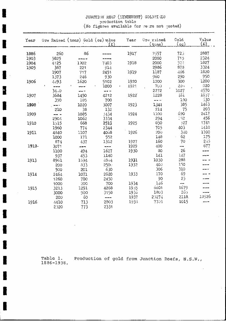
I JUNC!TI()N RE:Q (I,YNIJmTRST) GOLDn '~LD DroJ,uction table
I (No fi~re8 available for 're",rs not ;,uoted)
I Year Ore Raised (tons) Go Id (OZi) '\Blue Year Or", ~·.1.ised Gold Value .;( £) (t0~ ( oz) ( £:) . -
I 1886 260 86 1917' 2557 72) 2887 1903 5825 2000 715 2324 1904 4125 1302 l.!-03 1918 2000 5:2 ~ 1827 1905 367 221 914 2986 873 3324
I 1907 717 2451 1919 1187 466 1820 1373 246 930 960 290 950
1906 4,~93 1620 5102 1920 1200 300 1200
I 1000 1921 7(;0 2Lh 820
34,,0 2272 1027 4570 1907 3684 1450 4212 1922' 1228 1/" 1657 +Ool
I 3SiO 185 700 BO ')30
1~e8 1020 3007 1923 Jl.341 385 1463 210 38 132 214 75 203
1909 1085 ~ .. D4 1924 i.1OO 690 2417
I 2904 1062 3334 294 ' . -') 456 -, ')<;.
1910 1,)15 668 251Ji 1925 850 )27 1741 1960 774 2344 705 403 1410
·1 1911 4840 n07 4008 1926 20l) 340 1100 1000 171 5'32 148 62 175
874 4-37 1312 1927 160 70 2.+)
I 1912---· 3971 1929 400 677
1100 494 1627 1930 80 26 9.37 453 1140 141 l47
1913 8961 1:594 48,)4 1931 1030 288
I 200 333 250t.' 1932 40,) 1')0 500 201 630 306 310
1914 2464 1071 2620 1933 170 69
I 1260 700 2450 90 25 1000 200 700 1934 1.+6
1915 3213 1291 4268 19Y5 0601 1679
I 3000 900 3158 1930 lso3 2.:)')
200 60 1937 23274 2118, 13:526 1916 <L11-l0 713 2803 19Y1 7F~1 1015
2320 773 2331
I I I I Table l. Production
1886-1938. of gold from Junction Reefs I N.S.W.,
I I I

I I I I I I I I I I I I I I I I I I I
30.
Appendix 2. Inventory of main archaeological relics at Junction Reefs, Belubula River, N.S.W.
This inventory contains a list of the main archaeological relics identified during two days of preliminary site survey at Junction Reefs. Where necessary som~ additional comments are attached to the list.
Those items marked with an asterisk (*) have a photograph within this report.
The inventory is arranged in the following order:
Frenchman's Belubula Dam Water-races, and steel piping Cornishmen's Junction: M.T.l
M.T.7 Junction of Belubula River and
Mandurama Ponds M.T. within G.L.36 Mines and open-cut Other relics.
The inventory numbers sites in sequential order, the location of each item appearing in figure 8. Where possible each item was sketched onto plan with references to a pegged grid at 50 metre intervals, which was previously laid out over part of the area.
Frenchman's
1.* Several adits. 2.* Smelter or roaster?, possibly post 1940.
Belubula Dam
3.* Belubula Dam, 1897.
Water-races and steel piping
4.* Upper water-race, probably associated with a waterwheel at the Cornishmen's in 1979-1880. The line of the water-race is approximately followed by steel piping and water power provided by the dam after 1897.
5.* Upper water race. The divergence of the steel piping from the course of the water-race indicates that they were separate items, and not comtemporary.
6.* Junction of steel water pipe at the upper water race with branch piping to supply Junction M.T.7.
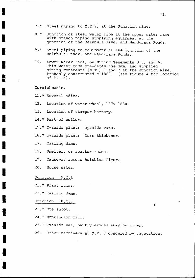
I I I I I I I I I I I I I I I I I I I I
31.
7.* Steel piping to M.T.7, at the Junction mine.
8.* Junction of steel water pipe at the upper water race with branch piping supplying equipment at the junction of the Belubula River and !-'landurama Ponds.
9.* Steel piping to equipment at the junction of the Belubula River, and Mandurama Ponds.
10. Lower water race, on Mining Tenements 3,5, and 6. This water race pre-dates the dam, and supplied Mining Tenements (M.T.) 1 and 7 at the Junction Mine. Probably constructed c.1880. (see figure 4 for location of M.T.s).
Cornishmen's.
11.* Several adits.
12. Location of water-wheel, 1879-1880.
13. Location of stamper battery.
14. * Part of boiler.
15. * Cyanide plant: cyanide vats.
16. * cyanide plant: Dorr thickener.
17. Tailing dams.
18. Smelter, or roaster ruins.
19. Causeway across Belublua River.
20. House sites.
Junction. M.T.l
21.* Plant ruins.
22.* Tailing dams.
Junction: M.T.7
23.* Ore shoot.
24.* Huntington mill.
25.* Cyanide vat, partly eroded away by river.
26. Other machinery at M.T. 7 obscured by vegetation.

-- - -- -----
I I I I I~
I I I I I I I I I I I I I I I
32.
Junction: junction of Beltllula River and Mandorama Ponds.
27.* Pelton Wheel.
28.* Electrical generator, manufactured by British Thompson Houston, Derby, England.
Junction: M.T. within GL.36.
29.* Base of Huntington mill.
Junction: mines and open-cut
30. Several adits
31. * Open-cut
32.* tramway at adit entrance.
Junction: other relics
33.* Machine beds.
34. Machine beds. Both 34 and 35 housed similar machinery.
35.* Machine beds.
36.* Plant ruin.
37.* Loading stage? Both 36 and 37 may be associated, and may have served to transport ore from the mine to the plant.
38. * Workshop.
39. Site of building.
40. Site of building.
41. Site of building.
42. Site of building.
43. Site of building.

I I I I I I I 'I I I I I I I I I
/ /'
~'-'-'.",,,,-I
",c.c;f~ ").
43
.. ~,.
~ totCGf~ ")0
• I • , " '-
I 8
I I
, \
\ , \
, / I
I , , • ",_tot" ~" ,
.-. I
i
I Old , I .,.,..",S \ ,
1 \
" , . ...
I 6
Figure 8. Plan of Juncticn Reefs, N.S.W., indicating the location of items I to 43 in the inventory (appendix 2). (Sketch plan).

I
• I I I
• I
! I I
I Frenchman's
I 1.* Several adits.
I I I I I I I I I I

I I I I I I I I I I I I I I I I I I I I
2.* Smelter or roaster?, possibly post 1940.

I I I I I I I I I I I I I I I I I I I I
Water-races and steel piping
4. * Upper water-race, probably ass9Ciated with a waterwheel at the Cornishmen's in 1~79-1880. The line of the water-race is approximately followed by steel p~ping and water power provided by the darn after 1897.
5.* Upper water race. The divergence of the steel piping from the course of the water-race indicates that they were separate items, and not comtemporary.

I I I I I I I I I I I I I I I I I I I I
6.* Junction of steel water pipe at the upper water race with branch piping to supply Junction M.T.?

I I I I I I I I I I I I I I I I I I I I
7.* Steel piping to M.T.7, at the Junction mine.

I I I I I I I
1I I I I I I I I I I I I I
8. * Junction of with branch junction of
steel water pipe at the upper water race piping supplying equipment at the the Belubula River and Mandurama Ponds.

I I I I I I I I I
I I I I I I I I I
9.* Steel piping to equipment at the junction of the Belubula River, and Mandurama Ponds.

I I I I I I I I I Cornishmenls.
'I 11.* Several adits.
I I I I I I I I 14.* Part of boiler.
I I

I I I I I I I I
15.* Cyanide plant:
I cyanide vats.
I I I I I I I I 16.* cyanide plant: Dorr thickener.
I I I

I I I I I I I I I I I I I I I I I I I I
Junction. M.T.l
21.* Plant ruins.
22.* Tailing dams.

I I I I I I I I
i I Junction: M.T.7
I 23.* Ore shoot.
I I I I I I I I I I

I I I I I I I I I I I I I I I I I I I I
24.* Huntington mill.

I I I I I I I I I I I I I I I I I I I I
25.* Cyanide vat, partly eroded away by river.
Junction: junction of Belubula River and Mandorama Ponds.
27.* Pelton Wheel.

I I I I I I I I I I I I I I I I I I I I
28.* Electrical generator, manufactured by British Thompson Houston, Derby, England.

I I I I I I I I I Junction: M.T. within GL.36.
29.* Base of Hun tington mill.
I I I I ,I I I I Junction: other relics
I 35.* Machine beds.
I I

I I I I I I I I I I I I I I I I I I I I
36.* Plant ruin.

I I I I I I I I I I I
I I I I I I I I
37.* Loading stage? Both 36 and 37 may be associated, and may have served to transport ore from the mine to the plant.
38.* Workshop.