icsu world data system for scientific research
TRANSCRIPT

http://wdc.org.ua
ICSU World Data Systemfor scientific research
07.08.2010 – AACIMP-2010 –KostiantynYefremov,
WDC for Geoinformatics and Sustainable Development, Kyiv, Ukraine

World Data Centers…
• Created 53 years ago, after IGY, to manage geophysical and solar data on a global scale
• Operated under the guidance of an ICSU Interdisciplinary Body
• Were supported by host nations• Archived and disseminated data and information to tertiary
users• Evolved to address environmental sciences and human
activities• 51 WDCs were located in 13 Countries• Good representation of geophysical and environmental
disciplines
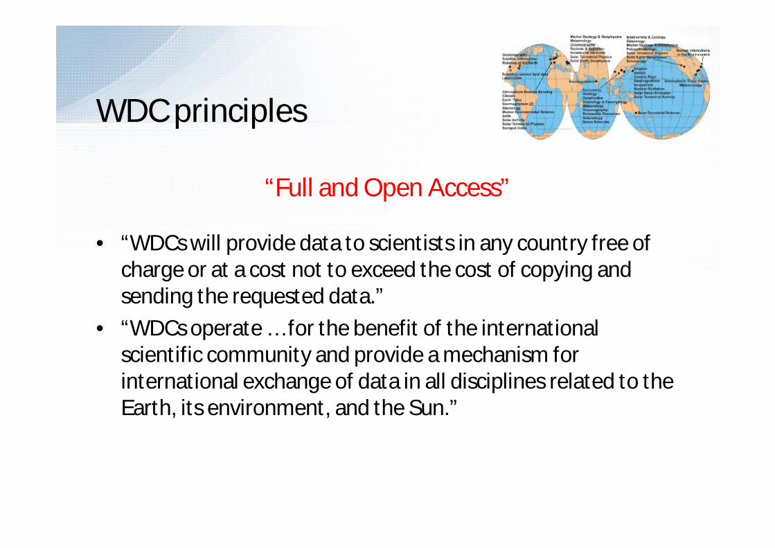
WDC principles
“Full and Open Access”
• “WDCs will provide data to scientists in any country free of charge or at a cost not to exceed the cost of copying and sending the requested data.”
• “WDCs operate … for the benefit of the international scientific community and provide a mechanism for international exchange of data in all disciplines related to the Earth, its environment, and the Sun.”

World Data System
ICSU – International Council for Science
Australia(1),Belgium(2), China(9), Denmark(1), France(1), Germany(3), India(1), Japan(8), Netherlands(1), Russian Federation(5), Ukraine(1),United Kingdom(3), USA(15)
Total – 51 WDC
World Data System Transition Team
Science directions: Airglow(1), Astronomy(1), Atmospheric Trace Gases(1), Aurora(1), Biodiversity(1), Climate(1), Cosmic Rays(1), Earth Tides(1),Geoinformatics and Sustainable Development(1), Geology(1), Geomagnetism(4), Glaciology(3), Human Interactions in the Environment(1), Ionosphere(1), Land Cover Data(1), Marine Environmental Sciences(1), Marine Geology and Geophysics(2), Meteorology(3), Nuclear Radiation(1), Oceanography(3), Paleoclimatology(1), Remotely Sensed Data(2), Renewable Resources and Environment(1), Rockets and Satellites(3), Rotation of the Earth(2), Seismology(2), Soils(1), Solar Activity(1), Solar Radio Emissions(1), Solar Terrestrial, Physics(4), Solid Earth Geophysics(3), Space Science(1), Sunspot Index(1).
RIHMI-WDC, GC RAS, IASA –Russian‐Ukrainian segment of the WDC System, December 26, 2008
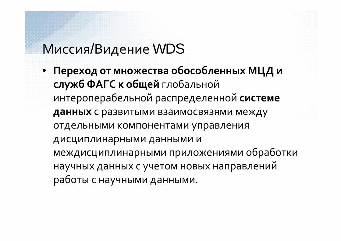
Миссия/Видение WDS• Переход от множества обособленных МЦД и
служб ФАГС к общей глобальной интероперабельной распределенной системе данных с развитыми взаимосвязями между отдельными компонентами управления дисциплинарными данными и междисциплинарными приложениями обработки научных данных с учетом новых направлений работы с научными данными.

WDS Scientific Committee
Name NationalityCilliers, Pierre South AfricanClark, David USADiepenbroek, Michael GermanGenova, Francoise FrenchHorta, Luiz Brazil/USAMinster, Jean-Bernard (chair) French/USANeilan, Ruth USARickards, Lesley BritishWatanabe, Takashi JapaneseYan, Baoping ChineseZgurovsky, Michael Ukrainian

• Decision of Presidium of the National academy of sciences (NAS) of Ukraine, Ministry of education and science of Ukraine and Geophysical center of the Russian academy of sciences (GC RAS) from April_3, 2006
• Agreement about partnership, collaboration and scientific exchange between Institute for Applied Systems Analysis (IASA) of NAS of Ukraine and Ministry of education and sciences of Ukraine and GC RAS from May 17, 2006
WDC-Ukraine creation

• Geoinformatics– solid Earth physics– solar-terrestrial physics– oceanography– cartography
• Sustainable Development in the context of Quality of Life and Security of the World Population– Systemic coordination of data of the three Sustainable
Development dimensions of:• economic• ecological• social + institutional
– Analysis of the impact of global threats on Sustainable Development
Main science directions

Main astronomical observatory of NAS of Ukrainespace geodesy and geodynamic; ultrarays; sun information
Institute of geophysics of NAS of Ukraine name of S.I. Subbotinseismology, gravimetry, thermal stream, arkheo- and paleomagnetism, magnetic measuring, current motions
Marine hydrophysical institute of NAS of Ukraine oceanological and hydro meteorological information
Scientific center for aerospace researches of Earth of Institute of Geological Sciences of NAS of Ukraineaerospace pictures for the use in geology, ecology, rural, forest and water economy,
prognostication of global changes of environment and catastrophes
Cooperating with scientific organizations
Institute of Geography of NAS of Ukraine,State Service of Geodesy and CartographyCartography data
Institute for Applied systems analysis of NAS of Ukraine and Ministry of education and sciences of UkraineSystemic coordination of data of the economic, ecological and social + institutional Sustainable Development dimensions; analysis of the impact of global threats on Sustainable Development
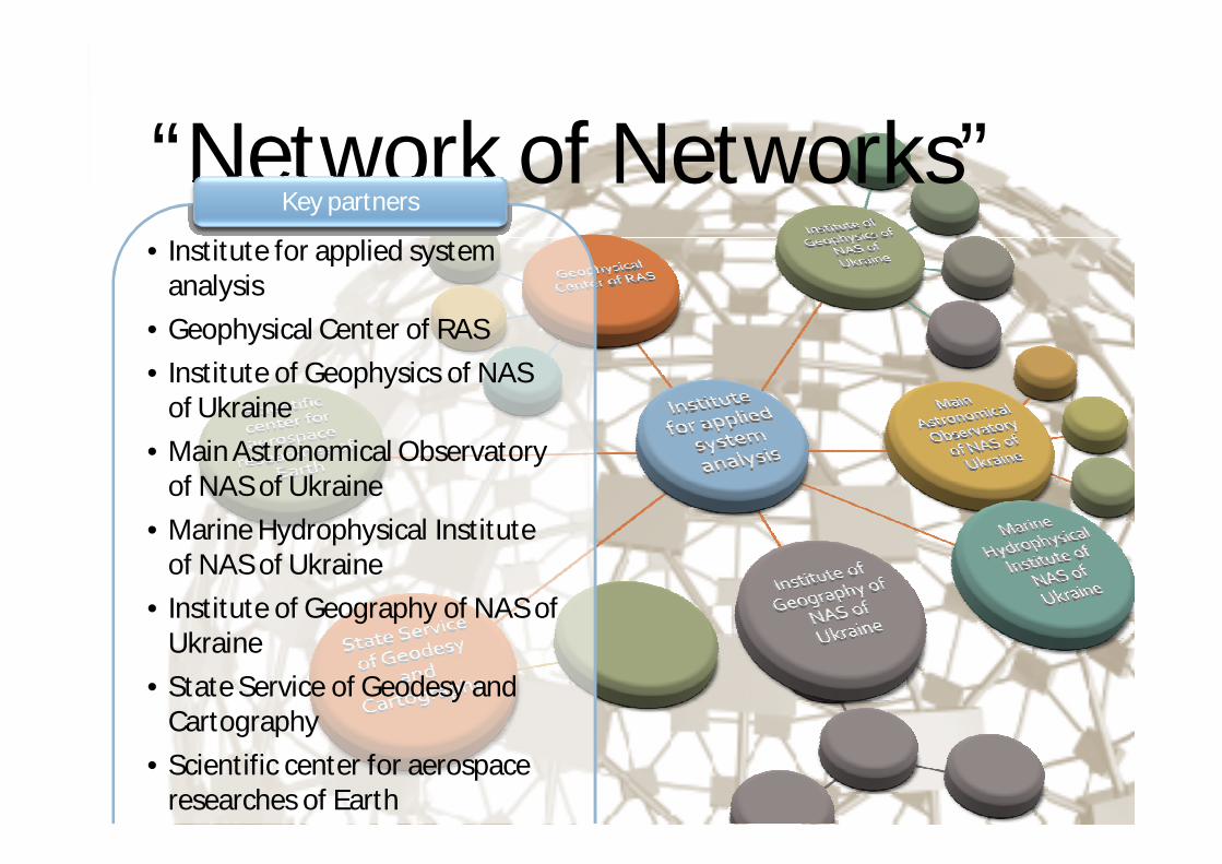
“Network of Networks”• Institute for applied system
analysis
• Geophysical Center of RAS
• Institute of Geophysics of NAS of Ukraine
• Main Astronomical Observatory of NAS of Ukraine
• Marine Hydrophysical Institute of NAS of Ukraine
• Institute of Geography of NAS of Ukraine
• State Service of Geodesy and Cartography
• Scientific center for aerospace researches of Earth
Key partners

122 computing nodes:- 44 with 2xQuadroCore Intel
Xeon E5440 @ 2.83GHz, RAM 8 GB
- 78 with 2xDualCore Intel Xeon 5160 @ 3.00GHz, RAM 4 GB
InfiniBandLustre FS Peak Performance 7 TFlopsData storage 12TB + 20TB
World Data Centers Ukrainian scientificinstitutions
WDC cooperation in Ukraine
Main and duplicate technical areas
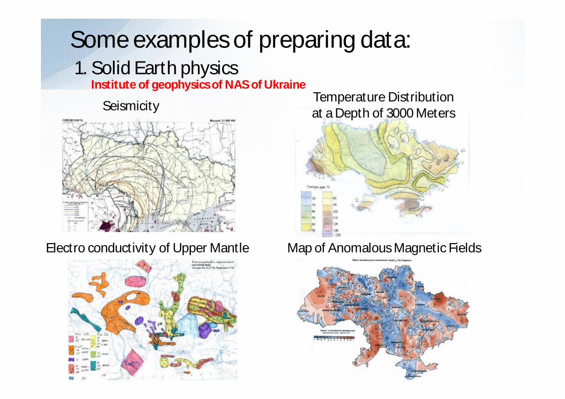
Some examples of preparing data:1. Solid Earth physics
Map of Anomalous Magnetic FieldsElectro conductivity of Upper Mantle
SeismicityTemperature Distributionat a Depth of 3000 Meters
Institute of geophysics of NAS of Ukraine

Cooperating with partners:National GIS
GEOMORPHOLOGICAL STRUCTURE (MORPHOSTRUCTURE AND MORPHOSCULPTURE)
WDC-UkraineData Storages
ArcGIS
WDC partners
http://wdc.org.ua
Geospatial Data
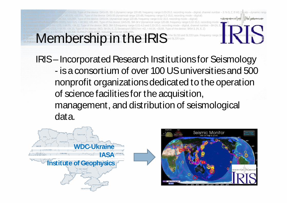
IRIS – Incorporated Research Institutions for Seismology- is a consortium of over 100 US universities and 500 nonprofit organizations dedicated to the operation of science facilities for the acquisition, management, and distribution of seismological data.
WDC-UkraineIASA
Institute of Geophysics
1.Lviv (LVV) - 1899 hm =320, = 49,820, =24,031, Type of the device: DAS-05, SD-1 (dynamic range 120 dB, frequency range 0,03-20,0, recording mode – digital, channel number – 3: N-S, Z, E-W); Guralp – dynamic range2.Uzhhorod (UZH) 1934, hm =160, = 48,629, =22,291, Type of the device: DAS-05 (dynamical range 120 dB, frequency range 0,2-15,0, recording mode – digital)3.Kosiv (KSV) 1961 hm =450, = 48,314, =25,065, Type of the device: DAS-04, (dynamical range 120 dB, frequency range 0,02-15,0, recording mode – digital)4.Kamyanets Podilskiy KMPU (2005), hm =121, = 48,563, =26,460, Type of the device: DAS-05, SM-3КV (dynamical range 120 dB, frequency range 0,02-15,0, recording mode – digital)5.Simferopol (SIM) 1954 hm =275, = 44,95, =34,12, Type of the device: SKD, SM-3 (frequency range 0,01-4,0 and 0,10-20,0, recording mode – digital, channel number – BH (N, E, Z) and EH (N,E,Z))6.Yalta (YAL) 1928 hm =23,6, = 44,48, =34,15, Type of the device: SKD, SH (N, E, Z) Sevastopol (SEV) hm =42, = 44,54, =33,68, Type of the device: SKM-3, (N, E, Z)7.Kyiv (KIEV) hm = 300, φ = 50.694, λ = 29.208. GURALP CMG-40TD. Included in the net GSN IRIS.8.Odesa - city hm = 51, φ = 46.679, λ = 30.899. The set of the recording equipment of GURALP CMG-40TD type. Seismometers of the SL210 and SL220 type. Frequency range 100 Hz, recording mode – digital9.Skvyra 2004 hm = 235, φ = 49.716, λ = 29.656. The set of the recording equipment of CSD20 type. Seismometers of the SL210 and SL220 type.10.Poltava hm = 166, φ = 49.603, λ = 34.543. The set of the recording equipment CSD20. Seismometers SL210 and SL220.Membership in the IRIS

1.Lviv (LVV) - 1899 hm =320, = 49,820, =24,031, Type of the device: DAS-05, SD-1 (dynamic range 120 dB, frequency range 0,03-20,0, recording mode – digital, channel number – 3: N-S, Z, E-W); Guralp – dynamic range2.Uzhhorod (UZH) 1934, hm =160, = 48,629, =22,291, Type of the device: DAS-05 (dynamical range 120 dB, frequency range 0,2-15,0, recording mode – digital)3.Kosiv (KSV) 1961 hm =450, = 48,314, =25,065, Type of the device: DAS-04, (dynamical range 120 dB, frequency range 0,02-15,0, recording mode – digital)4.Kamyanets Podilskiy KMPU (2005), hm =121, = 48,563, =26,460, Type of the device: DAS-05, SM-3КV (dynamical range 120 dB, frequency range 0,02-15,0, recording mode – digital)5.Simferopol (SIM) 1954 hm =275, = 44,95, =34,12, Type of the device: SKD, SM-3 (frequency range 0,01-4,0 and 0,10-20,0, recording mode – digital, channel number – BH (N, E, Z) and EH (N,E,Z))6.Yalta (YAL) 1928 hm =23,6, = 44,48, =34,15, Type of the device: SKD, SH (N, E, Z) Sevastopol (SEV) hm =42, = 44,54, =33,68, Type of the device: SKM-3, (N, E, Z)7.Kyiv (KIEV) hm = 300, φ = 50.694, λ = 29.208. GURALP CMG-40TD. Included in the net GSN IRIS.8.Odesa - city hm = 51, φ = 46.679, λ = 30.899. The set of the recording equipment of GURALP CMG-40TD type. Seismometers of the SL210 and SL220 type. Frequency range 100 Hz, recording mode – digital9.Skvyra 2004 hm = 235, φ = 49.716, λ = 29.656. The set of the recording equipment of CSD20 type. Seismometers of the SL210 and SL220 type.10.Poltava hm = 166, φ = 49.603, λ = 34.543. The set of the recording equipment CSD20. Seismometers SL210 and SL220.
Cooperation with IRISSeismological data collection system
Seismic and geophysical stations of NAS of Ukraine
Institute of geophysics of NAS of UkraineWDC-UKRAINE
Total
36stations
Development of a computerized national seismological network for information transfer and processing together with the Institute of Geophysics is planned

Some examples of preparing data:2. Solar-terrestrial physics
Main astronomical observatory of NAS of Ukraine

• SPIDR (Space Physics Interactive Data Resource) – online resource of physical space data. This is a network database server (using MySQL) and Application (JSP) for viewing, visualization and modeling of space weather data.
• SPIDR mirror in Ukraine –http://spidr.wdc.org.ua (online data synchronization with WDCB SPIDR mirror)
• Main data, stored in SPIDR:₋ solar data;₋ the ionosphere;₋ geomagnetic data;₋ interplanetary magnetic field
Some examples of preparing data:2. Solar-terrestrial physics - SPIDR
Boulder-Moscow-Kiev – http://spidr.wdc.org.ua
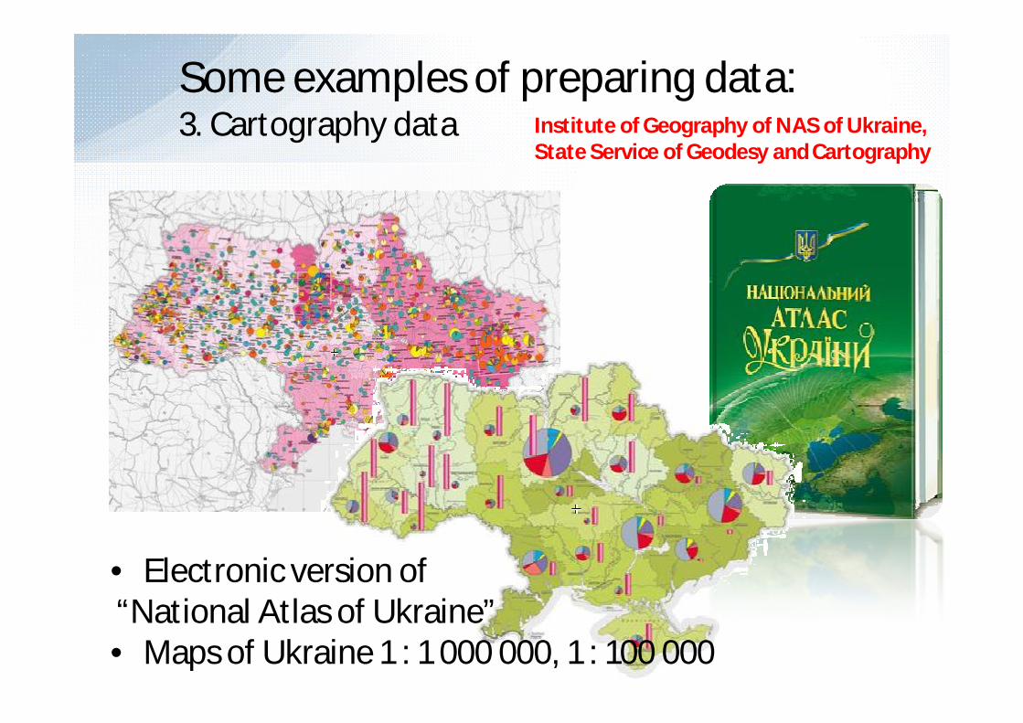
Some examples of preparing data: 3. Cartography data
• Electronic version of“National Atlas of Ukraine”• Maps of Ukraine 1 : 1 000 000, 1 : 100 000
Institute of Geography of NAS of Ukraine,State Service of Geodesy and Cartography
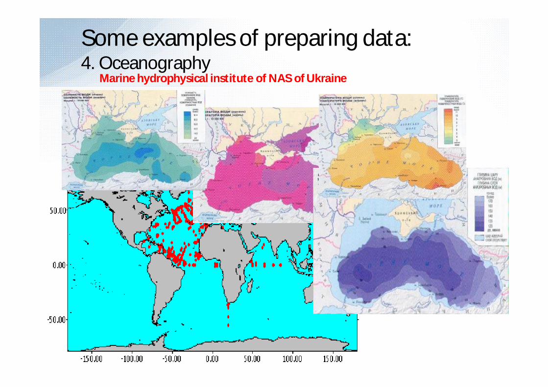
Some examples of preparing data:4. Oceanography
Marine hydrophysical institute of NAS of Ukraine
Social
EcologicalEconomical
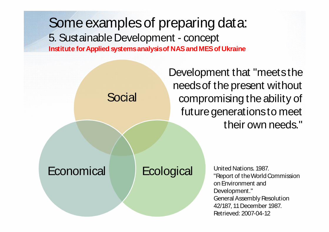
Development that "meets the needs of the present without
compromising the ability of future generations to meet
their own needs."
Some examples of preparing data:5. Sustainable Development - conceptInstitute for Applied systems analysis of NAS and MES of Ukraine
United Nations. 1987."Report of the World Commission on Environment and Development."General Assembly Resolution 42/187, 11 December 1987. Retrieved: 2007-04-12

Institute for Applied systems analysis of NAS and MES of Ukraine
Ecologicaldimension
Economicdimension
Social / Institutionaldimension
Research Group− Experts in ecology, economics and sociology−System analysts team−WDC-Ukraine team
Some examples of preparing data:5. Sustainable Development

Institute for Applied systems analysis of NAS and MES of Ukraine
Sustainable Development Global Simulation
Data and Results• Index of Sustainable Development (Isd), and
Harmonization Degree of Sustainable Development (G) for- countries- regions of Ukraine
• Creating plans and recommendations for improved level and quality of life in the context of Sustainable Development
Some examples of preparing data: 5. Sustainable Development
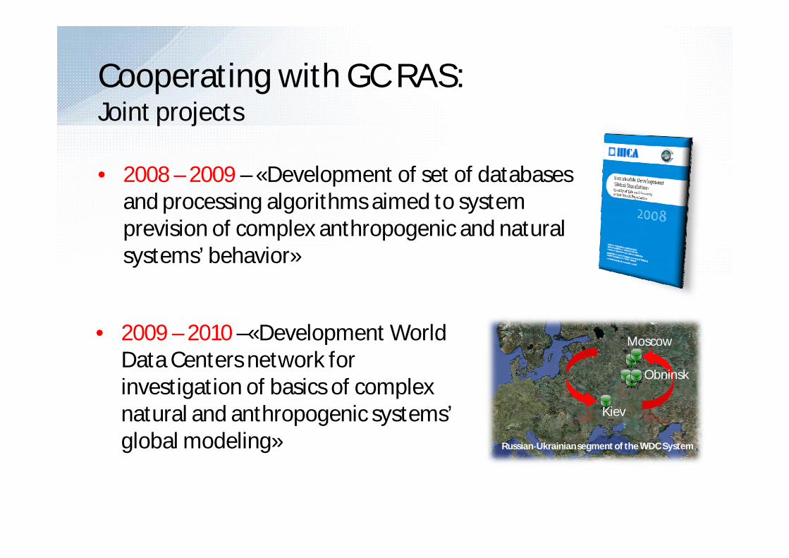
• 2008 – 2009 – «Development of set of databases and processing algorithms aimed to system prevision of complex anthropogenic and natural systems’ behavior»
Cooperating with GC RAS:Joint projects
• 2009 – 2010 –«Development World Data Centers network for investigation of basics of complex natural and anthropogenic systems’ global modeling» Russian‐Ukrainian segment of the WDC System
Moscow
Obninsk
Kiev

Форматы сбора и обмена данными
Название формата
Назначение формата
SEAGRID Для данных по морскому льдуАЭРОМЕТАКТ Для данных морских метеорологических,
актинометрических и аэрологических наблюдений НИС
IMMT3 Для данных судовых метеорологических наблюдений,проводимых на ГМС 3 разряда
ОКЕАНПЭВМ Для данных по физической океанографииПЕРСОНА Для гидрометеорологических данных береговых
станцийИНТЕРМАГНИТ Для данных по геомагнетизму(часовые и минутные)
GRIB Для данных в узлах регулярной сеткиФормат обмена Для данных научных исследований, картографических
данных и данных наблюдений, не имеющихустановленного формата.
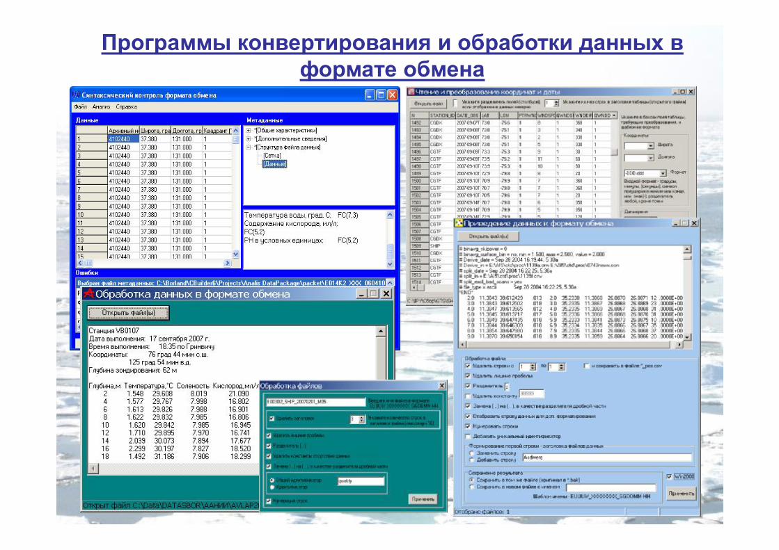
Программы конвертирования и обработки данных в формате обмена
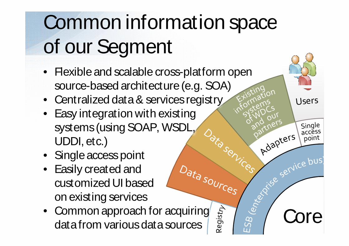
Common information spaceof our Segment
Core
• Flexible and scalable cross-platform open source-based architecture (e.g. SOA)
• Centralized data & services registry• Easy integration with existing
systems (using SOAP, WSDL,UDDI, etc.)
• Single access point• Easily created and
customized UI basedon existing services
• Common approach for acquiringdata from various data sources

The integrated information system for scientific information exchange, processing and storing
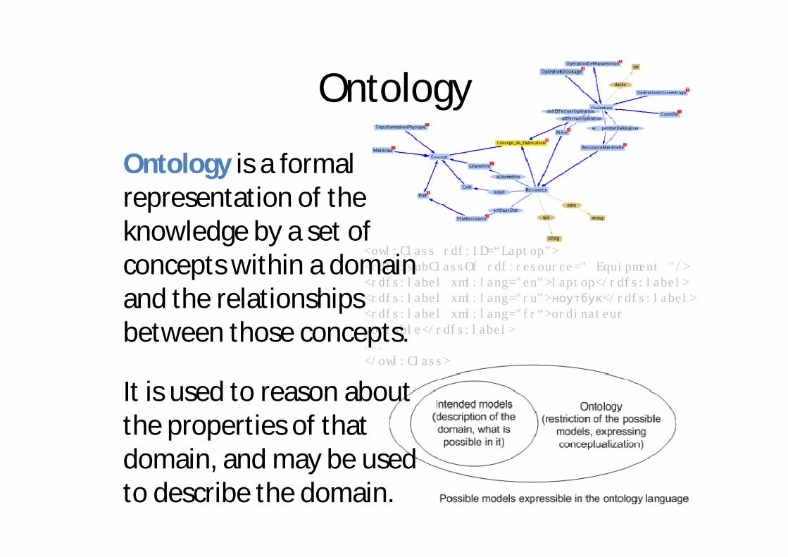
<owl:Class rdf:ID=“Laptop"> <rdfs:subClassOf rdf:resource=" Equipment "/> <rdfs:label xml:lang="en">laptop</rdfs:label> <rdfs:label xml:lang="ru">ноутбук</rdfs:label> <rdfs:label xml:lang="fr“>ordinateurportable</rdfs:label> ... </owl:Class>
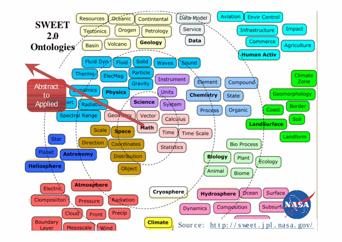
Ontology
Ontology is a formal representation of the knowledge by a set of concepts within a domain and the relationships between those concepts.
It is used to reason about the properties of that domain, and may be used to describe the domain.

Global Data System of Systems
WDS
WDCWDC
WDS
WDAS
WCD
WCD
WDC
WDAS
WCD
WCD
WDPWDP
WCD
WCD
WCD
WDC
WCD
WCD
WCD
WDAS
WCDWCD
WCD
WCD
IRIS
WDP
WCDWDC
WCD
WCD
IODE
WDAS
WCDWCD
WCD
WCD
IntermagnetUkraine
WDAS
WCDWCD
WCD
WCD
IntermagnetUkraine
IODEIODE
Biodiversity
WDP
Biodiversity
ETC
WDAS
Parallel concept to GEOSS
WDC = World Data Center
WDAS = World Data Analysis Service
WCD = World Center for Data
WDP = World Data Portal
= International
= National
= Regional
= Disciplinary
= Interdisciplinary

Vision
User
WDC
WDC
WDC
WDC
Service
Service
Data Warehouse
High-performance computing centers
WDS Segment
WDCWDS Segment
Service
ICSU bodiesThematic OrganizationsVirtual LaboratoriesObservatories & Research Centers
…

Questions?
Thank you!
Contacts:World Data Center for Geoinformatics and Sustainable DevelopmentAddress: 37, Peremohy ave., 03056, Kyiv, Ukraine.Phone: (+380 44) 406 8014 Fax: (+380 44) 241 6853 Web: http://www.wdc.org.ua