implementation strategy, programs and priorities
TRANSCRIPT

Chapter IV
IMPLEMENTATION STRATEGY,
PROGRAMS AND PRIORITIES
TECHNICAL AND FINANCIAL ASSISTANCE
The Land and Water Conservation (LWC) provides high quality engineering and technical
assistance to farmers, residents, and local units of government for natural resource protection and
remediation. A top priority for the LWC is to ensure that, through ongoing training and
professional development, LWC staff continues to provide sound, professional services based on
the best available technology, information, and research.
The LWC also administers available cost share programs to farmers and other landowners who
implement management practices that conserve natural resources. Cost share assistance is used to
help cover out-of-pocket expenses or is provided in the form of an incentive payment to offset
operational risks associated with changes to land management practices and water quality
improvements. The County will continue to strive to provide adequate financial assistance, for
both voluntary and regulated activities, and will try to attain sufficient funding to meet the goals
of this Plan. However, as mentioned in Chapter 1, the level of implementation of state and regional
programs and priorities discussed in this chapter are fully dependent on the combination of the
fiscal resource provided by the state and those that align with the priorities of the County.
The State of Wisconsin has enacted and is implementing runoff management regulation for
agricultural and urban land uses to help achieve state water quality goals. Counties are local
delivery system in their implementation through their local land and water conservation
programming. The role of the Washington County LWC is to provide technical assistance to
landowners in planning, designing, installing, and approving management plans and practices to
meet state water quality standards. This goal will be accomplished through utilizing existing
programs and ordinances. The following summarizes various state regulation, programs,
partnerships and describes past, current and future implementation efforts.
WATER QUALITY IMPLEMENTATION STRATEGY
The Land and Water Resource Management Plan is meant to direct the work of the Washington
County Land and Water Conservation through the development of goals, objectives, and activities
for a ten-year timeframe. Many organizations have plans with goals, objectives, and activities
which are related to or align with those of the Washington County Land and Water Resource
Management Plan. This plan recognizes many of the goals and objectives of water quality plans

and will use those plans to guide future implementation of conservation practices by the LWC.
Furthermore, the LWC relies on numerous tools and resources to accomplish the goals, objectives
and actions of the management plan. Focusing on building capacity within the community through
education, partnerships, and inclusion is an important method for addressing resource concerns
and building awareness of the importance of the soil and water resources throughout the County.
PRIORITY RANKING
A number of criteria will be used to determine priority focus areas for directing conservation
activity. As mentioned in Chapter III, watersheds are often used in natural resource management
and conservation priorities because land use practices impact the water quality of the stream or
lake in the watershed. That said, for this plan, prioritizing and directing workload of the Land and
Water Conservation will focus at the 12 Digit HUC level. Additionally, the factors listed below
will be used to help guide and rank areas of greatest need, as well as, identify potential areas that
will provide the greatest response to water quality initiatives and conservation improvements.
Example of how this prioritization could be utilized can be found in Appendix D.
Prioritization factors:
Phosphorus & TSS loading based on TMDLs
Impaired waters
Nine-Key Element Plan areas
Water Quality Initiatives (RCPP, Adaptive Management, WQT, MDV)
Outstanding resource waters/exceptional resource waters
Stream Order & Natural Community Designations
Highly erodible soils & modeling results (EVAAL, STEPL)
Percent agriculture land cover using the Normalized Difference Tillage Index (NDTI)
Water Quality Monitoring Data
Number of livestock operations
Groundwater contamination susceptibility & Depth the Bedrock
Lake development & MS4 Urbanized Area designations
Active partners (producer groups, lake organizations)
TOTAL MAXIMUM DAILY LOAD PLANS
Impaired waters in Wisconsin are now largely addressed through an analysis, known as a Total
Maximum Daily Load (TMDL). A TMDL is the amount of a pollutant a waterbody can receive
and still meet water quality standards. To define the TMDL for a water body, modeling is used to
determine the current pollutant loads, their sources, and the amount of reduction needed from each
source to reach the water quality goal. Water quality goals for Wisconsin surface waters are set in
Wisconsin Administrative Code NR 102: Water Quality Standards for Wisconsin Surface Waters.
A TMDL considers both Waste Load Allocation (WLA, point sources) and Load Allocation (LA,
nonpoint sources). The WLAs determined in the TMDL for point sources, such as wastewater
treatment plants or factories, are addressed through Wisconsin Pollutant Discharge Elimination
System (WPDES) permits. Nonpoint source LAs, on the other hand, are more complex and require

collaboration by many partners and stakeholders to effectively use available multi-agency
programs, education, regulations, and financial and technical resources.
A TMDL for the Rock River Basin was approved in July 2011 and a TMDL for the Milwaukee
River Basin was approved in March 2018. Elevated phosphorus, sediment, and bacteria levels in
the Milwaukee River Basin and the Rock River Basin have led to low dissolved oxygen
concentrations, degraded habitat, excessive algal growth, turbidity, and recreational impairments.
These impairments adversely affect fish and other aquatic life, water quality, recreation, and
navigation. The table below summarizes the various pollutant reductions needed from each
pollutant source to meet water quality goals in each TMDL sub-basin.
Table 16
TMDL Phosphorus and Total Suspended Solids Reduction Goals by Sub-Basin
TMDL Sub-Basin*
TMDL Percent
Phosphorus Reduction From AG
TMDL Percent Phosphorus
Reduction From Non-Permitted
Urban
TMDL Percent
Phosphorus Reduction for MS4s
TMDL Percent
TSS Reduction From AG
TMDL Percent TSS Reduction From Non-Permitted
Urban
TMDL Percent
TSS Reduction for MS4s
5 47% 47% - 52% 52% -
6 32% 32% - 36% 36% -
7 32% 32% - 36% 36% -
8 24% 24% - 24% 24% -
9 30% 30% - 20% 20% -
10 27% 27% - 24% 24% -
20 27% 27% 37% 23% 23% 40%
21 27% 27% 34% 19% 19% 40%
22 30% 30% - 36% 36% -
23 29% 29% 36% 33% 33% 47%
24 39% 39% 35% 43% 43% 47%
55 54% 54% 77% 39% 39% 66%
MI-2 49% 70% 68% 62% 68% 67%
MI-3 37% 44% 42% 70% 73% 72%
MI-4 38% 52% 50% 68% 72% 71%
MI-5 35% 47% 45% 63% 68% 67%
MI-6 62% 85% 85% 54% 68% 67%
MI-7 45% 64% 63% 68% 75% 74%
MI-10 29% 39% - 64% 65% -
MI-18 40% 69% 68% 63% 72% 71%
MI-19 40% 57% 56% 68% 73% 72%
MI-20 49% 76% 75% 68% 76% 76%
MI-21 51% 76% 75% 70% 76% 76%
MI-22 37% 50% 49% 68% 72% 71%

MI-23 38% 49% 47% 72% 75% 74%
MI-24 52% 78% 77% 60% 68% 67%
MN-1 46% 60% 59% 46% 59% 58%
MN-2 30% 43% 41% 45% 55% 54%
MN-3 38% - 55% 42% - 57%
MN-4 30% - 45% 43% - 55%
MN-5 58% - 69% 51% - 63%
MN-6 45% - 65% 42% - 67%
MN-9 49% - 60% 51% - 63%
* TMDL sub-basins with numbers are from Rock River TMDL report. Sub-basins with numbers
and letters are from Milwaukee River TMDL report.
POINT SOURCE COMPLIANCE OPTIONS FOR PHOSPHORUS AND TSS
A number of the Wisconsin Pollutant Discharge Elimination System (WPDES) permitted
communities in Washington County are exploring alternative phosphorous compliance options for
their discharges including water quality trading and adaptive management. These options allow
the point source to offset or reduce their pollution load by reducing sources of phosphorous within
specified watersheds. Currently, the County has entered into a Memorandum of Understanding
with the City of Oconomowoc for their Adaptive Management Program. The MOU recognizes a
partnership to mutually work together towards similar goals: agriculture soil health, soil
conservation, nonpoint source water pollution abatement and the installation of BMPs. LWC staff
have also met with a number of local municipalities who are exploring adaptive management or
water quality trading as a compliance option.
In addition, the County has also applied to participate in Wisconsin’s Multi-Discharger Variance
(MDV) program for the first time starting in 2020. The MDV for phosphorus extends the timeline
for point sources to comply with low-level phosphorus limits. In exchange, point sources commit
to step-wise reductions of phosphorus within their effluent as well as help to reduce nonpoint
sources of phosphorus from farm fields, cities or natural areas via specific projects designed to
improve water quality. Over time, some of the MDV projects may be converted to Water Quality
Trades.
The following WDNR webpage provides more information on the three options described above:
https://dnr.wi.gov/topic/wastewater/Phosphorus/
NINE KEY ELEMENT PLANS – SECTION 319 FUNDING
The United States Environmental Protection Agency (EPA) has identified nine key elements that
are critical for achieving improvements in water quality. The EPA requires that these nine elements
be addressed in watershed plans funded with incremental Clean Water Act section 319 funds. Plans
must address the nine elements (see below) if they are developed in support of a section 319-
funded project.
Summary of the Nine Minimum Elements:
1. Identify the causes and sources
2. Estimate pollutant loading into the watershed and the expected load reductions
3. Describe management measures that will achieve load reductions and targeted critical
areas
4. Estimate the amounts of technical and financial assistance and the relevant authorities
needed to implement the plan
5. Develop an information/education component
6. Develop a project schedule
7. Develop the interim, measurable milestones
8. Identify indicators to measure progress and make adjustments
9. Develop a monitoring component
Washington County Land & Water Conservation provided assistance in the development of Nine
Key Element watershed plans for multiple subwatersheds in the Milwaukee River Basin. The HUC
10-Cedar Creek Watershed Plan received DNR/EPA approval in June 2020. The HUC-12 North
Branch-Milwaukee River, HUC-12 Village of Newburg-Milwaukee River and the HUC-12 Town
of Fredonia-Milwaukee River (Ozaukee County) Watershed Plan is under DNR review and may
be approved in Fall 2020.
REGIONAL WATER QUALITY MANAGEMENT PLAN PR-50 (SEWRPC)
A joint planning effort designated as the “Water Quality Initiative” included the cooperative
development of the MMSD facilities planning program and the SEWRPC Regional Water Quality
Management Plan (RWQMP) updating program by WDNR, MMSD, and SEWRPC. In 2007 (and
an amendment in 2013), an update of the RWQMP was completed to integrate previous regional
water quality management efforts completed by SEWRPC and MMSD’s 2020 Facilities Plan. The
plan update was for the design year 2020 and represented a major amendment to the RWQMP for
southeastern Wisconsin.
The goal of the RWQMP was to produce a scientifically defensible and implementable plan to
improve water quality within the greater Milwaukee watersheds. The RWQMP was developed as
a framework for the management of surface water for the greater Milwaukee watersheds that would
abate existing water quality issues and allow for flexibility to address future concerns. The success
of the RWQMP is dependent on local implementation efforts including, but not limited to:
refinement and detailing of sanitary sewer service areas; the development of stormwater
management plans and sewerage system facilities plans; and the integration of the plan
recommendations into county land and water resource planning as a means for implementing the
rural land management recommendations.
The RWQMP includes planning objectives for land use development, water quality management,
outdoor recreation and open space preservation, water control facility development, plan structure
and monitoring, educational and informational programming, and objectives for water use
classifications and standards. Screening alternatives were developed to address upgrades to the
MMSD sewerage system, and BMP implementation for nonpoint source pollution reduction. The
recommended plan was comprised of elements to address plans for the following:

Land Use – recommendations under the land use plan element of the RWQMP include the
preservation of environmentally significant lands to maintain an integrated system of open
space lands throughout the study area and the preservation of the area’s most productive
farmland.
Surface Water – elements of this plan include point and nonpoint source pollution
reductions. Recommendations include, but are not limited to, upgrades to sanitary sewer
services throughout the study area, maintenance of adequate sewage collection system
capacity, and a wet weather control plan for sewer overflows. Nonpoint source control
recommendations include, but are not limited to, reduction of soil erosion from cropland,
manure and nutrient management, and the installation of riparian buffers.
STATE PERFORMANCE STANDARDS
Wisconsin Act 27 (1997-1999 Budget Bill) created significant changes to the Wisconsin
Department of Natural Resources (WDNR) Nonpoint Source Water Pollution Abatement
Program. It required the WDNR to develop performance standards for agricultural and
nonagricultural nonpoint sources of pollution; these are codified in Chapter NR 151 of the
Wisconsin Administrative Code with a goal of reducing nonpoint sources of polluted runoff to
waters of the state. The first state-wide minimum performance standards and prohibitions became
effective in 2002 and were updated in 2011 and again in 2018.
Parallel to the promulgation of NR 151, the Wisconsin Department of Agriculture, Trade and
Consumer Protection (DATCP) revised its soil and water resource management programs in
Chapter ATCP 50. Administrative code ATCP 50 prescribes conservation practices to address the
DNR’s performance standards.
AGRICULTURAL PERFORMANCE STANDARDS
The agricultural standards and prohibitions were developed to control polluted runoff from all
cropland and livestock operations while protecting Wisconsin’s water resources. These nonpoint
standards address soil erosion and nutrient runoff from cropland as well as barnyard runoff and
manure handling practices for livestock operations; details on these standards are provided below.
State administrative rules also prescribe specific cost-sharing requirements that must be met before
a landowner can be required to comply with the state standards. The minimum cost-share rate is
generally 70%, except in cases of economic hardship, whereby 90% cost-sharing is required. The
cost-sharing requirement does not apply to landowners who receive the state Farmland
Preservation income tax credit.
CROPLAND STANDARDS
Sheet, rill and wind erosion: All cropped fields shall meet the tolerable (T) soil erosion rate
established for that soil.

Tillage setback: No tillage operations may be conducted within 5 feet of the top of the
channel of surface waters.
Phosphorus index: Croplands, pastures, and winter grazing areas shall average a
phosphorus index of 6 or less over the accounting period and may not exceed a phosphorus
index of 12 in any individual year within the accounting period.
Nutrient management: Agricultural operations applying nutrients to agricultural fields shall
do so according to a nutrient management plan.
LIVESTOCK STANDARDS AND PROHIBITIONS
Manure storage facilities: All new, substantially altered, or abandoned manure storage
facilities shall be constructed, maintained or abandoned in accordance with accepted
standards. Failing and leaking existing facilities posing an imminent threat to public health
or fish and aquatic life or violate groundwater standards shall be upgraded or replaced.
Process wastewater handling: There may be no significant discharge of process wastewater
to waters of the state.
Clean water diversions: Runoff from agricultural buildings and fields shall be diverted
away from contacting feedlots, manure storage areas and barnyards located within water
quality management areas (300 feet from a stream or 1,000 feet from a lake or areas
susceptible to groundwater contamination).
No overflow of manure storage facilities.
No unconfined manure piles in a water quality management area.
No direct runoff from feedlots or stored manure into state waters.
No unlimited livestock access to waters of the state in locations where high concentrations
of animals prevent the maintenance of adequate or self–sustaining vegetative cover.
SILURIAN BEDROCK STANDARD
All crop producers and livestock producers that mechanically apply manure directly or through
contract, or other agreement, to cropland or pasture may not cause the fecal contamination of water
in a well or apply to soils that have 24 inches or less of separation between the ground surface and
apparent water table. Manure must be applied in conformance with a nutrient management plan
that meets the requirements of NR 151.075 (4) through (16). Figure 18 in Chapter III depicts the
areas of the County where bedrock is assumed to be less than 20 feet from the surface and areas
with less than two-feet.
CONSERVATION PRACTICES
Federal, State and local conservation agencies have identified four cost-effective Best
Management Practices (BMPs), including conservation tillage or no-till, cover crops, nutrient
management, and shoreline buffers. These practices have shown to offer the greatest benefit to
water quality and soil resource protection and improvement per dollar spent. The LWC will give
priority to promoting countywide the adoption of these practices and limit the promotion of other,
costlier BMPs to the Priority Farm Strategy listed below. All ATCP 50 approved conservation
practices are listed below:

Table 17
Conservation Practices used for Agricultural Performance Standards Compliance
ATCP 50 Code Cost-Shared Practices
50.62 Manure Storage Systems
50.63 Manure Storage System Closure
50.64 Barnyard Runoff Control Systems
50.65 Access Road
50.66 Trails and Walkways
50.67 Contour Farming
50.68 Cover Crop
50.69 Critical Area Stabilization
50.70 Diversions
50.705 Feed Storage Runoff Control Systems
50.71 Field Windbreak
50.72 Filter Strips
50.73 Grade Stabilization Structures
50.75 Livestock Fencing
50.76 Livestock Watering Facilities
50.77 Milking Center Waste Control Systems
50.78 Nutrient Management
50.79 Pesticide Management
50.80 Prescribed Grazing
50.81 Relocating or Abandoning Animal Feeding Operations
50.82 Residue Management
50.83 Riparian Buffers
50.84 Roofs
50.85 Roof Runoff Systems
50.86 Sediment Basins
50.87 Sinkhole Treatment
50.88 Streambank or Shoreline Protection
50.885 Stream Crossing
50.89 Stripcropping
50.90 Subsurface Drains
50.91 Terrace Systems
50.92 Underground Outlets
50.93 Waste Transfer Systems
50.94 Wastewater Treatment Strips
50.95 Water and Sediment Control Basins
50.96 Waterway Systems
50.97 Well Decommissioning
50.98 Wetland Development or Restoration
Source: DATCP-Chapter ATCP 50 (January 2018)
IMPLEMENTATION OF THE AGRICULTURAL PERFORMANCE
STANDARDS AND PRIORITY FARM STRATEGY
County Land and Water Resource Management Plans are the local mechanism to implement the
NR151 Runoff Management standards. Farms, like all major industries, must meet environmental
standards to control runoff from fields, pastures and livestock facilities to protect water quality.
However, hastily enforced performance standards could pose undue economic hardship on family
farms. Washington County recognizes that the line between resource protection and a healthy farm
community must be carefully drawn, and will follow prudent policies and procedures outlined in
ATCP 50 to guide this process. The County’s preference is that agricultural landowners and
operators comply with the state and local performance standards and prohibitions voluntarily. The
main tools of choice to accomplish voluntary compliance include: education; conservation
practices; incentives; and targeting of resources, programs, and partnerships.
In 2006 a Memorandum of Understanding (MOU) was developed and signed between the DNR
and the LWC outlining roles and responsibilities for implementing the State’s Agriculture
Performance Standards within Washington County. The following is a summary of the current
process. Updating the MOU with the DNR will be a priority in 2020 and 2021 to align the goals
and objectives with this plan, priorities of the County and conservation programs mentioned
herein, and workload.
INVENTORY AND EVALUATION OF AGRICULTURAL NONPOINT SOURCES
It is important to have current and accurate information about farmstead and cropland conditions.
Accurate and up-to-date information provides the county and state agencies a clearer picture of
workload, priority sites and potential costs. Current LWC records are inadequate as farms expand,
go out of business, modify operations, and equally notable, as the state continues to refine and add
performance standards, as mentioned above. For this reason, the LWC has decided to conduct on-
site inventories of each farm in the County in order to evaluate compliance with the states
performance standards and prohibitions. This on-site inventory will also provide an opportunity
for LWC staff to share information with farmers and landowners about new performance standards
and possible impacts on their operations.
The first priority for which farms are selected for inventory and evaluation for compliance status
will be with landowners that voluntarily seek program or technical assistant from the LWC. Second
priority will be with farms that participated in past conservation programs like the Farmland
Preservation or the Priority Watershed Program. Third in priority will be a County wide systematic
selection of farms base on the following watershed order, however target areas may be re-
prioritized at the discretion of the LWC:
1. Rock River
2. North Branch Milwaukee River
3. East West Branch Milwaukee River
4. Cedar Creek Milwaukee River
5. Rubicon River
6. Menomonee River
7. Oconomowoc River
8. Ashippun River
9. Bark River
10. Upper Fox River
During farm inventories the LWC will collect or update inventory data, this inventory will include
evaluations of all animal feeding operations, nutrient management activities and cropland erosion
rates. Once this inventory has been completed, all records will be updated in a computerized
database using GIS technology. For these reasons, modernizing inventory data is identified several
times in the work plan as an important action item.
DETERMINATIONS OF COMPLIANCE AND NOTIFICATION
The county will make determinations on whether a farm operation is in or out of compliance with
a NR 151 Agricultural Nonpoint Performance Standards and Prohibitions. The LWC will make
compliance determinations in accordance with NR 151.090 and 151.095 and will notify
landowners of their status in a systematic manner as inventories are completed. Whenever
possible, written notifications will be delivered in person. If a landowner does not agree with the
status of compliance, appeals must be made to the Land Conservation Committee within 30 days
at no cost to the landowner. DNR staff may be requested to help/assist with selected NR 151
compliance determinations.
SCHEDULE FOR IMPLEMENTING PERFORMANCE STANDARDS
The primary role of the LWC will be to gain voluntary acceptance and compliance with
performance standards through education, cost sharing and technical assistance.
LWC staff will concentrate first on gaining compliance with the most critical sites and with large
or expanding operations within the County based on the Priority Farm Strategy listed below. Since
cost share funds are limited, landowners or managers who fall under these conditions and who
have committed to cooperating voluntarily will be given first priority for the available dollars.
Second priority will be given to landowners who want to cooperate on a voluntary basis regardless
of location or priority rating. It is hopeful that this approach will inspire hesitant producers to
cooperate voluntarily.
PRIORITY FARMS STRATEGY
The Washington County priority farms strategy is to target implementation of the performance
standards and provide cost-sharing and technical assistance in areas of greatest environmental need
or threat to public health. The Washington County LWC may evaluate any property within the
County to determine compliance status if there is sufficient evidence that the NR 151 Agricultural
Nonpoint Performance Standards and Prohibitions are not being met and there is a significant
environmental impact or a threat to public health and safety. Priority farms will be identified
through using the following criteria:
1) Reports of environmental incidents, including well-contamination, fish kills and/or manure
spills/overflow events.
2) Public complaints.
3) Volunteer landowners that identify soil and water conservation issues on their farms and
request LWC assistance.
4) Watersheds with impaired waters, approved TMDLs, nine element watershed-based plans
or areas with high susceptibility for groundwater contamination.

LWC staff will use the above criteria to prioritize farms for LWC assistance and limited cost-
sharing. In the event that the number of priority farms exceeds the assistance available, the highest
priority farms will be those that have caused documented environmental incidents or are in
sensitive environmental areas, such as those with shallow depth to groundwater, water quality
management areas, or areas draining to 303(d) impaired streams. Even when cost-sharing and
technical assistance limits the number of priority farms that can be served each year, the
information and education program will target all identified priority farms. Farms may be re-
prioritized at the discretion of the LWC staff and the LCC.
A restrictive covenant is in-
pace preventing future livestock
operations at this site.
A Targeted Runoff Management
Grant provided the incentive to
move this heifer raising operation
from this location to the home farm
site and abandon the feedlot and
pasture area.

ENFORCEMENT
In cases where a site is considered by the LWC and DNR staff to be a high priority and cost sharing
is available, yet voluntary compliance does not occur within a reasonable time frame, the LWC
and DNR will issue an official Notification of Noncompliance (NON). A formal offer of cost
sharing and technical assistance will also be made when the LWC has them available. The NON
and formal offer will establish deadlines consistent with state administrative rules (i.e., NR
151.090 and 151.095) in which the responsible individual must comply with a performance
standard or be subject to enforcement under provisions of state administrative rules. If a landowner
refuses an offer of cost-sharing, the case will be referred to the appropriate nonpoint source staff
member at the DNR’s South Eastern Regional Office. These cases may lead to circumstances
where compliance can be enforced without cost sharing and civil forfeiture penalties can be issued.
All landowners and producers will be made aware of this policy and available appeals procedures
through education materials, notification letters, and on-farm visits.
Through 2019, NR151 evaluations have been conducted on over 35% of the agricultural lands in
Washington County as shown in Figure 19. The table below highlights the level of compliance
currently being achieved; however, the level of compliance can be somewhat misleading.
Compliance evaluations, conservation planning efforts and conservation practice installations
have been tracked since the adoption of the Runoff Rules (NR151) in 2002. Since then, there have
been changes to soil loss factors, mentioned previously, as well as the adoption of additional
performance standards and significant changes to the engineering requirements for many
conservation practice standards. Ownership of agricultural land and operations has also changed
since 2002 within the county. LWC staff work to maintain open communication and a working
relationship with farms operations to achieve and maintain compliance with the NR 151
performance standards and prohibitions irregardless of changes mentioned above.
Table 18
Agriculture Performance Level of Compliance
Ag Performance
Standard
Non-Compliant
Operations
Full Compliant
Operations
Compliance Level 86 225
Non-Compliant
Reason
Tolerable Soil Loss "T" 12
Waste Storage Facility 1
WQMA 15
Nutrient Management 66
Direct Discharge 25
Pit Overflow 0
Unconfined Piles 2
Unlimited Access 2

Figure 19

NON-AGRICULTURAL PERFORMANCE STANDARDS
The nonagricultural performance standards for construction, post-construction, and developed
urban area runoff are contained in Subchapters III and IV, NR 151 of the Wisconsin Administrative
Code. Subchapter III of NR 151 of the Wisconsin Administrative Code also contains the
nonagricultural performance standards to transportation facility runoff, which include all roads and
associated structures, as they apply to state, local, and private facility owners. The nonagricultural
or urban performance standards encompass two major types of land management. The first type
includes performance standards developed for areas of new development and redevelopment. This
is further subdivided to include the construction phase and the post-construction (stormwater
management) phase. The second type includes performance standards for developed urban areas.
The LWC, other county and municipal departments, and private developers and businesses are
responsible for implementing the non-agricultural performance standards. The LWC will provide
regulatory and technical assistance as described in this section and in the related work plan goals
and objectives.
CONSTRUCTION SITE EROSION CONTROL
Research shows that, on a per-acre basis, erosion and sediment delivery from construction sites is
significantly higher than from cropland. The construction site erosion control standards apply to
construction sites where land disturbing activities affect one or more acres of land. This threshold
is consistent with the timing and applicability of Federal Phase 2 Storm Water Regulations. The
standard does not apply to transportation facility sites.
The State’s performance standard requires the installation of best management practices designed
to limit sediments and other pollutants from runoff entering waters of the State or separate storm
sewers connecting to waters of the State, including:
Reduce the sediment load by 80 percent, as compared to no sediment controls.
Prevent tracking of sediment from the construction site onto public or private roadways.
Minimize the discharge of sediment as part of construction site de-watering.
Control erosion from soil stockpiles.
Storm sewer inlet protection.
Ensure proper use, storage and disposal of chemicals, cement and other compounds
used on the site.
The standard also provides for incorporating the findings of detailed stormwater management
plans, which may indicate the need for additional levels of control.
POST CONSTRUCTION STORMWATER MANAGEMENT
Once construction is complete, controlling runoff from these developed areas remains an issue.
Conventional pollutants, as well as heavy metals such as zinc, cadmium, chromium, and copper
are contained in the stormwater runoff from urban areas. These pollutants are often found in
combination with particulates such as sediment. Additionally, oils, grease, and other hydrocarbons
are contained in stormwater from urban areas. Unlike the construction phase, the best management

practices for stormwater management are permanent measures, with some exemptions for sites
with low levels of imperviousness or no exposed roads or parking areas. These proposed site
standards may be set aside where regional facilities are in place to manage stormwater from a
larger-area within the context of an approved subwatershed-level stormwater management plan.
The state’s performance standards require that best management practices be installed or applied
and maintained in accordance with a stormwater management plan to control total suspended
solids (TSS) and other pollutants carried in runoff from new development and redevelopment to
the maximum extent practicable, including:
Reduce the post-construction (TSS) by 80 percent for new development and 40 percent
for redevelopments.
Maintain pre-development peak runoff rates for the one-year and two-year, 24-hour
storm events for new developments.
Infiltrate 90%, 75% or 60% of pre-development runoff volumes for new development
with low, moderate or high imperviousness respectively.
Maintain protective areas (10-75 feet) between new impervious surfaces and lakes,
streams, and wetlands.
Control petroleum runoff (visible sheen) from fueling and vehicle maintenance areas.
Washington County Erosion Control and Stormwater Management Ordinance
Since January 1, 1998 Washington County has enforced an Erosion Control and Stormwater
Management Ordinance. Washington County amended its ordinance in 2008 and again in 2016 to
stay consistent with state requirements and changes to NR151 Administrative Code and to comply
with the Uniform Statewide Standards under s. 281.33, Stats. With each ordinance update the
County pulled together representative from local municipalities and created a model ordinance for
local adoption and consistency across municipal boundaries. Within the unincorporated areas of
the County, through Intergovernmental Agreements (IGAs), the LWC is the Administering
Authority in 8 of its 11 townships. The County’s ECSM Code replaced similar provisions that
existed in the County Land Division Ordinance since 1978.
The County Code ensures that new developments meet sediment reduction limits and also
incorporates TMDL reductions limits for redevelopments. In some TMDL reachsheds new
development may be required to reach even higher sediment reductions in order to meet targeted
goals. The County maintains a database of permanent stormwater practices and conducts follow-
up site inspections to address long-term maintenance needs. It is recognized that proper
maintenance will help minimize structure failure and possible damages, and ensure that the
facilities continue to serve their designed function. Developing a process to ensure the proper long
term maintenance of stormwater management facilities will be a focus of the LWC over the next
couple years. The IGAs identifies the County, as administering authority will do the following:
Create and maintain a computerized map and database of all stormwater
management facilities;
Conduct routine on-site inspections of stormwater management facilities based
on facility age and surrounding land use and produce a written report concerning
the current condition of each facility inspected;
If maintenance action is recommended, discuss needs and jointly establish
deadlines with the local government for the work to be completed by the
responsible party; and,
Jointly enforce maintenance requirements outlined in the inspection report. The
Town will use their special assessment authority to recover all County or Town
costs incurred if necessary.
As of 2019, the stormwater management GIS database contains records for over 310 installed
stormwater BMPs, as shown in Figure 20.
STORMWATER MANAGEMENT – DEVELOPED URBAN AREAS
Chapter NR 216 Wisconsin Administrative Code requires discharge permits for community storm
sewer systems, which collect runoff from existing urban development in the community. The DNR
issues general Municipal Separate Storm Sewer System (MS4) permits and requires communities
to apply for coverage. In general, these permits apply to all communities with a contiguous
population density of 1000 people per square mile. In 2000, Phase 1 of this permit was first applied
to communities with population of over 100,000, then in 2004, Phase II implementation, five
communities in Washington County were required to apply for coverage – the cities of Hartford
and West Bend, the Village of Germantown and Richfield and Washington County. At that time
Washington County through a successful appeal was provided an exemption. Then, in 2014
Washington County and the Villages of Jackson, Kewaskum, Slinger, and Richfield along with
the Townships of Hartford and West Bend received notice for permit coverage. As a result, the
County along with the other communities obtained a Wisconsin Pollutant Discharge Elimination
System (WPDES) permit. There are six WPDES permit requirements for an MS4 to meet;
Public education and outreach
Public involvement and participation
Illicit discharge detection and elimination
Construction site pollutant control
Post-construction site storm water management
Pollution Prevention/Good housekeeping
The LWC serves as the MS4 permit contact and plays the lead role in the development and
implementation for Washington County.

Figure 20

PROGRAM INTEGRATION
The goals of this Plan can be achieved through implementation of Federal, State, and County Soil
and Water Conservation Programs. The following are brief descriptions of each of the applicable
programs.
FEDERAL CONSERVATION PROGRAMS
There are several federal programs available to landowners and farm operations, as well as partner
agencies staff like the Natural Resource Conservation Service that help get conservation on the
ground. This Plan identifies the primary programs utilized by LWC staff that help landowners address
water quality and land management improvements.
Environmental Quality Incentives Program (EQIP)
Provides financial assistance to agricultural producers and agricultural landowners to address
natural resource concerns and deliver environmental benefits, such as improved water and air
quality, conserved ground and surface water, reduced soil erosion and sedimentation, and
improved or created wildlife habitat. Funding is available for Conservation Practices similar to
those listed previously under ATCP 50. LWC and NRCS staff work collaboratively through an
Operational Agreement to provide technical assistance based on local priority efforts explained
earlier.
EQIP uses a local workgroup of Federal, State and County Employees to determine priorities in
order to distribute federal funds to help cost share conservation practices. It is a voluntary program
designed to meet local resource concerns. The Land and Water Conservation Department works
very closely with NRCS through the EQIP. The LWC oftentimes provides technical assistance to
landowners who install practices through EQIP.
Table 19
Conservation Practices Installed through EQIP from 2015 – 2019
Year Practice was Installed
Practice Name Units 2015 2016 2017 2018 2019
Brush Management ac 4.4 4.1 7.1
Composting Facility no 1
Conservation Cover ac 41.5 17.6 7.4 710.5
Cover Crop ac 48.9 427.5 816.5
Critical Area Planting ac 0.8
Diversion ft 501.0
Fence ft 5,035.0 2,999.0
Filter Strip ac 1.5 0.9
Forage and Biomass Planting ac 8.1 12.4 0.9 15.8
Forest Management Plan - Written no 6
Grassed Waterway ac 0.6 9.0

Heavy Use Area Protection sq ft 252.0
High Tunnel System sq ft 2,160.0 2,700.0 2,160.0
Livestock Pipeline ft 4,295.0
Mulching ac 0.6 0.3
Nutrient Management ac 398.1 406.4
Pond Sealing or Lining - Concrete sq ft 53,789.0
Prescribed Grazing ac 13.9 20.0 31.9 17.7 12.4
Pumping Plant no 1 2 1
Roof Runoff Structure no 3
Spoil Spreading ac 0.8
Stream Crossing no 1
Structures for Wildlife no 2
Subsurface Drain ft 900.0 1,401.0
Tree & Shrub Establishment ac 11.5 2.0 2.7
Tree & Shrub Site Preparation ac 16.5 0.6 2.7
Underground Outlet ft 175.0
Waste Separation Facility no 1
Waste Storage Facility no 2 2 2
Waste Transfer no 1 1 2
Water Well no 1
Watering Facility no 5
Well Decommissioning no 2
Wetland Restoration ac 0.7
Table 20
Planned Conservation Practices to be installed through EQIP from 2020 – 2023
Year Practice is Planned
Practice Name Units 2020 2021 2022 2023
Clearing and Snagging ft 1,080.0
Conservation Cover ac 3.9
Cover Crop ac 4,162.8 4,446.5 400.0 301.1
Critical Area Planting ac 1.0
Fence ft 12,240.0
Filter Strip ac 0.8
Forage and Biomass Planting Ac 5.8
Forest Management Plan - Written no 2.0
Grade Stabilization Structure no 3.0
Grassed Waterway ac 4.8
Heavy Use Area Protection sq ft 3,351.0
High Tunnel System sq ft 2,160.0
Lined Waterway or Outlet ft 70.0

Livestock Pipeline ft 7,990.0
Mulching ac 3.8
Nutrient Management ac 3,516.3 3,516.3
Obstruction Removal ac 1.1
Pond Sealing or Lining - Concrete sq ft 27,113.0
Prescribed Grazing ac 16.5 30.9 30.9 14.4
Pumping Plant no 3.0
Residue and Tillage Management, No Till ac 400.0 400.0 400.0
Spoil Spreading ac 5.7
Stream Crossing no 3.0
Streambank and Shoreline Protection ft 850.0
Subsurface Drain ft 1,520.0
Underground Outlet ft 460.0
Waste Transfer no 5.0
Waste Treatment no 1.0
Watering Facility no 3.0
Wetland Restoration ac 1.4
REGIONAL CONSERVATION PARTNERSHIP PROGRAM (RCPP)
Promotes coordination between NRCS and its partners to deliver conservation assistance to
producers and landowners. Under partnership agreements, NRCS and its partners leverage and
target their respective resources to deliver conservation assistance to producers and landowners to
address priority natural resource concerns. Programs primarily utilized through RCPP include
Agricultural Conservation Easement Program, Environmental Quality Incentives Program and the
Conservation Stewardship Program.
In 2016, a coalition between Washington County, Ozaukee County and the Milwaukee
Metropolitan Sewerage District successfully applied for a RCPP Grant for the Cedar Creek
Watershed (see Figure 9 in Chapter III) and the Ulao Creek Watershed (Ozaukee County) through
2020. The Milwaukee River Watershed Conservation Partnership RCPP Grant supplied $800,000
of funding while the MMSD match ACEP funding for a total dollar grant of $1.5 million. The
following chart summarizes the accomplishments through 2019.
Table 21
RCPP Project Goals and Accomplishments
Project Goal *Target
Quantity Unit of
Measure
Goal Progress
(Cumulative Total)
% Complete
Producer Participation (i.e. Contacts, Outreach, Education)
382 no. 400 105%
RCPP-EQIP contract acreage 888 ac. 1564 176%
Hayland/ or Field Border (386) 12.5 ac. 13.9 111%

Pasture Planting 25 ac. 25.3 101%
Residue and Tillage Management - No Till/Strip Till/Direct Seed (329)
500 ac. 0 0%
Contour Buffer Strips (332) 2 ac. 0.9 45%
Cover Crop (412) 500 ac. 789 158%
"Buffer" Filter Strip (393) 25 ac. 5.9 24%
Grassed Waterway (412) 10,560 ft. 3096 29%
Nutrient Management (590) 500 ac. 435 87%
Fencing for Grazing 8,695 ft. 8695 100%
ACEP-ALE easement acquisitions 8 no. 3 38%
ACEP-ALE easement acquisitions 818 ac. 195 24%
Establish Farmer-led Watershed Council 1 no. 2 200%
Agronomist Meetings 5 no. 2 40%
Field Trips 4 no. 4 100%
Field Days 3 no. 4 133%
AGRICULTURAL CONSERVATION EASEMENT PROGRAM (ACEP)
Helps landowners, land trusts, and other entities protect, restore, and enhance wetlands, grasslands,
and working farms and ranches through conservation easements that restricts the use of the land.
Land Easements protect the long-term viability of the nation’s food supply by preventing
conversion of productive working lands to non-agricultural uses or by providing habitat for fish
and wildlife, including threatened and endangered species, improve water quality by filtering
sediments and chemicals, reduce flooding, recharge groundwater, protect biological diversity and
provide opportunities for educational, scientific and limited recreational activities. Depending on
the land use and easement type NRCS may contribute between 50 to 100 percent of the fair market
value of the easement.
Conservation Reserve Program (CRP)
Protects soil, water quality, and habitat by removing highly erodible or environmentally sensitive
land from agricultural production through long-term rental agreements by providing annual rental
payments to landowners based on the productivity of the site’s soils. The CRP was developed to
assist landowners in voluntarily converting highly erodible and environmentally sensitive cropland
from the production of annual crops to permanent grass, forbs, wildlife cover or trees. CRP normally
has a 10 or 15-year lease payment.
CONSERVATION STEWARDSHIP PROGRAM (CSP)
Helps agricultural producers maintain and improve their existing conservation systems while
adopting additional conservation activities to address priority natural resource concerns.

Participants earn CSP payments for conservation performance—the higher the performance, the
higher the payment.
GREAT LAKES RESTORATION INITIATIVE (GLRI)
The Great Lakes Restoration Initiative was launched in 2010 to accelerate efforts to protect and restore
the Great Lakes and preventing the introduction of new invasive species. The EPA awards GLRI grants
to state and local agencies working to improve and restore the Great Lakes. To date, Washington
County has not received funding directly from the GLRI, but is aware of funding that has been provided
through other programs like EQIP, and the DNR’s Aquatic Invasive Species Education and Prevention
Program.
STATE CONSERVATION ASSISTANCE PROGRAMS
Following is a discussion of existing programs, regulations and proposed performance standards
and how they will be used to address urban and rural resource management concerns. While the
LWC remains committed to using all available federal, state, and local voluntary and incentive-
based conservation programs, future efforts will also involve state and local regulations.
Although specific roles vary depending on the program, getting conservation "on the ground" has
always been a cooperative effort between the LWC, NRCS and other federal, state, and local
agency staff. Lead administrative responsibilities are generally assigned to the LWC for programs
with state or local origins and to NRCS staff for federal programs. A cooperative agreement exists
between the local NRCS office and the LWC, which helps to ensure that federal programs are used
to achieve local priorities to the maximum extent possible.
The following describes each of these programs and explains how they have been and can be
utilized to implement LWRM plan objectives.
TARGETED RUNOFF MANAGEMENT PROGRAM (TRM)
The Priority Watershed Program has been replaced with the Targeted Runoff Management
program. Small scale TRM grants focus on small areas, perhaps even individual problem sites, are
short in duration (1 to 4 years) and only provide cost sharing dollars. Large scale TRM grants focus
upon watershed and are more comprehensive. The costs for administration will be covered
primarily by County funds and to a lesser degree, by annual grants from the DATCP. The LWC
will use TRM grants as a means of accelerating implementations of the NR 151 agricultural
performance standard and prohibitions. These projects will be coordinated with regional DNR staff
and whenever possible, with neighboring counties sharing the same watershed.
Washington County has averaged one TRM grant application every other year, since 2010 the
program has funded five (5) water quality improvement projects totaling over $608,0000 in grant
funds. Those projects consisted of rebuilding two existing manure storage facilities that were
failing and leaking to groundwater, two barnyard runoff control systems and one streambank
stabilization project.

ANIMAL FEEDING OPERATIONS AND NR 243 (AFO)
Chapter NR 243, Wis. Adm. Code, is administered by DNR through authority from chs. 281 and
283, Wis. Stats. This code primarily outlines the Wisconsin Discharge Pollution Elimination
System (WPDES) permitting and compliance requirements for large, over 1,000 animal units,
concentrated animal feeding operations (CAFOs) as well as identifies the compliance requirements
for small and medium animal feeding operations. For small and medium animal feeding
operations, the DNR investigates complaints and determines if an operation is causing a
“significant” water quality problem. If so, the DNR often issues a Notice of Discharge (NOD)
which requires landowners to adopt animal waste management or other practices to reduce
pollution of state waters. At the landowner’s request, the LWC recommends solutions to the
problem and will design and supervise the installation of practices.
The Washington County LWC has utilized the notice of discharge grant program; a grant was
received in 2011 to address water quality problems associated with a groundwater contamination
occurrence. As of 2019 there were five permitted CAFOs operating in Washington County; three
dairy operations, one heifer raising facility and a poultry operation. There are an additional three
operations in the County that are considering expanding and will most likely be permitted by the
year 2025.
FARMLAND PRESERVATION (FP)
In 2009 Wisconsin Act 28, often referred to as the Working Lands Initiative, repealed and
recreated Wisconsin’s farmland preservation law under Chapter 91 of the Wisconsin Statutes and
related tax credits under subchapter IX of Chapter 71 of the Statutes. It also created a new
program, under Section 93.73 of the Statutes, for the purchase of agricultural conservation
easements. The new law also required counties to update their FP Plans. In response to state law,
Washington County’s Farmland Preservation Plan was updated and approved by the County
Board on December 10, 2013.
The goals of the FP Program are to preserve farmland through local planning and zoning, promote
soil and water conservation, and provide tax relief to participating farmers. To be eligible under
the new Working Lands Initiative, all cropland and facilities associated with the farm must be in
compliance with the Agricultural Performance Standards and meet certain zoning requirements.
The updated FP Plan identified specific Farmland Preservation Area (FPA) to be preserved for
agricultural uses. However only three towns in the County agreed to incorporate the FPAs as an
overlay map amendment to their comprehensive plans, those being the Towns of Barton,
Germantown, and Hartford. None of the townships in the County pursued updates to their zoning
code which would have made landowners eligible for the Farmland Preservation tax credit. As of
now the only options landowners would have to participate in the program is to seek designation
as an Agricultural Enterprise Area.
MANAGED FOREST LAW (MFL)
The goal of the MLF program is to encourage long-term sound forest management. MFL is a tax
incentive program for industrial and non-industrial private woodland owners who manage their
woodlands for forest products while also managing for water quality protection, wildlife habitat
and public recreation. In return the property owner is provided a reduction in property taxes on
woodlands for following management plans. The plans are currently written by private consulting
foresters and reviewed and approved by DNR foresters. DNR and private foresters provide most
of the necessary informational, technical, and management services on trees and woodlands to
County residents. The LWC and NRCS assist residents in signing up for federal and state programs
to plant and maintain woodlands. The LWC also helps residents obtain trees to plant by
administering an annual tree and shrub sale program and by distributing order forms for annual
DNR trees sales.
WILDLIFE DAMAGE ABATEMENT AND CLAIMS PROGRAM (WDACP)
The WDACP provides abatement and claim assistance to landowners receiving wildlife damage.
The damage must be caused by deer, bear, geese, sandhill cranes or wild turkeys to commercial
seedlings, orchard trees, agricultural crops, nursery stock, apiaries, or livestock. Landowners are
eligible for abatement practices such as fencing, shooting permits, scare devices, etc. Landowners
may also receive reimbursement for crop losses up to a maximum cap. The USDA Animal and
Plant Health Inspection Service (APHIS) administers the WDACP for Washington County.
LOCAL CONSERVATION ASSISTANCE PROGRAMS
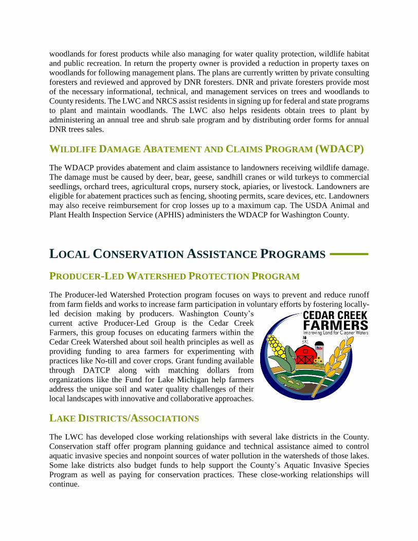
PRODUCER-LED WATERSHED PROTECTION PROGRAM
The Producer-led Watershed Protection program focuses on ways to prevent and reduce runoff
from farm fields and works to increase farm participation in voluntary efforts by fostering locally-
led decision making by producers. Washington County’s
current active Producer-Led Group is the Cedar Creek
Farmers, this group focuses on educating farmers within the
Cedar Creek Watershed about soil health principles as well as
providing funding to area farmers for experimenting with
practices like No-till and cover crops. Grant funding available
through DATCP along with matching dollars from
organizations like the Fund for Lake Michigan help farmers
address the unique soil and water quality challenges of their
local landscapes with innovative and collaborative approaches.
LAKE DISTRICTS/ASSOCIATIONS
The LWC has developed close working relationships with several lake districts in the County.
Conservation staff offer program planning guidance and technical assistance aimed to control
aquatic invasive species and nonpoint sources of water pollution in the watersheds of those lakes.
Some lake districts also budget funds to help support the County’s Aquatic Invasive Species
Program as well as paying for conservation practices. These close-working relationships will
continue.

COUNTY TREE PROGRAM AND THE STEWARDSHIP INCENTIVE
PROGRAM (SIP)
Since 1993, the LWC has sponsored an annual tree sale. The purpose of the program is to
encourage area residents to plant native trees, shrubs and prairie seed by offering an inexpensive
source of planting stock. The tree program is used as a vehicle to promote conservation by offering
such additional items as private well and lawn testing kits, no/low phosphorus fertilizer
information, bird, bat, and butterfly houses, compost bins and rain barrels. Proceeds from the
annual tree sale are available for use as cost share dollars.
The purpose of the SIP is to improve land and water resources in Washington County by offering
financial support to local landowners, units of government and non-profit organizations which will
encourage and enable them to implement soil erosion control and runoff management practices.
PRIORITIES:
The Land and Water Conservation Department (LWC) ranks individual requests for SIP
funds using the following criteria:
First priority is given to landowners within focused watershed areas, as identified
in the program guidelines approved by the Land Conservation Committee;
examples include the Cedar Creek watershed RCPP area and coldwater fishery
streams such as Quaas, Stony and Lehner.
The degree to which nonpoint pollution is impacting water resources.
The extent to which other program dollars are or are not available or adequate to
enable the landowner/manager to adopt conservation measures.
The extent to which the funds will be used for practices designated as high priority
in the LWRM Plan. These include nutrient management, residue management,
streambank protection (buffers, livestock fencing, etc.).
ELIGIBLE PARTIES:
SIP funds may be made available to Washington County residents, local units of
government and non-profit organizations who own, operate or manage:
Land where sediment and/or nutrient runoff is causing a significant water quality
problem.
Land or facilities that do not comply with state or local nonpoint performance
standards.
ELIGIBLE PRACTICES:
SIP funds may only be used towards Best Management Practices (BMPs) for which the
LCD has determined that:
The proposed BMP is the most cost-effective means for achieving resource
protection objectives.

The proposed BMP will achieve compliance with state or local nonpoint
performance standards whichever is stricter.
OTHER CONDITIONS:
The recipient of SIP funds must, at a minimum, agree to the following:
Have LCD staff conduct a runoff pollution assessment on the entire property. The
assessment would be to determine and document compliance or noncompliance
with state and or local minimum performance standards.
Implement the BMP according to technical standards adopted by Washington
County.
Maintain the BMP for as long as specified in the contract.
LAND AND WATER CONSERVATION REGULATIONS
The following ordinances are more relevant to this Land and Water Resource Management Plan
and are administered by the Land and Water Conservation. County ordinances will be revised in
order to keep current with technical standards and new state laws. Below is a description of current
regulations involving the LWC.
ANIMAL WASTE STORAGE FACILITIES (CHAPTER 135)
This County ordinance became effective on January 1, 1991. It is designed to prevent water
pollution by requiring all new or substantially altered manure storage facilities to be designed and
built to technical standards and specification. A producer is required to obtain a permit for
construction and allow LWC inspection. A 2006 revision of this County ordinance required
permits for the proper abandonment of manure storage facilities that are no longer intended to be
utilized.
EROSION CONTROL & STORMWATER MANAGEMENT (CHAPTER 238)
This code became effective January 1, 1998. It requires development activities to meet stormwater
management and erosion control standards. Chapter 238 replaced similar provisions that existed
in the County Land Division Ordinance since 1978. By meeting the requirements of Chapter 238
the non-agricultural performance standards would also be met.
Washington County amended its ordinance in 2008 which included higher infiltration requirement.
The ordinance again in 2016 to stay consistent with state requirements and changes to NR151
Administrative Code and to comply with the Uniform Statewide Standards under s. 281.33, Stats,
thus removing the increased infiltration rate language. Local municipalities were requested to
amend their ordinance to match the counties model for consistent code language throughout the
County.

MINING, NON-METALLIC (CHAPTER 265)
The Non-metallic Mining Reclamation Ordinance was adopted by the Washington County Board of
Supervisors in June of 2001. Washington County amended its ordinance in 2007 to include removal of
“startup” language, changes to the annual reporting/fee collection, and a few definition
additions/modifications. The LWC is the permitting agent for the County. The ordinance requires that all
nonmetallic mining operations have a permit. The permit requires submittal and approval of a reclamation
plan, and also requires a financial assurance be placed for the reclamation in the event of closure.
COUNTY AND LOCAL REGULATIONS
One way the Washington County Board and local units of government establish policies is by
adopting ordinances and planning documents. Ordinances are local laws prescribing rules of
conduct and are enforced by County and local officials. Ordinances become a permanent part of
the governmental code and may be amended from time to time. Planning documents are adopted
to give guidance to County and local officials and should be referenced in deliberations on
planning and zoning issues. Once policy has been approved by the County Board or local officials
it is the responsibility of staff to implement those policies.
COMPREHENSIVE PLANNING AND ZONING
The comprehensive plan and zoning ordinance33 represents one of the most important and
significant tools available to local units of government in directing the proper use of lands. Local
zoning regulations include general, or comprehensive, zoning regulations and special-purpose
regulations governing floodplain and shoreland areas. General zoning regulations may be adopted
as a single ordinance or as separate ordinances; they may or may not be contained within a single
document. Any analysis of locally proposed land use must take into consideration the provision of
both general and special-purpose zoning. In Washington County, general zoning is administered
at the municipal level. County zoning oversight is limited to shoreland, wetland and floodplain
districts. The ordinances that are administered by the local units of government in Washington
County are summarized in Table 22, and described further below.
GENERAL ZONING
In Washington County, general zoning is in effect in the unincorporated areas of the County, which
includes all of the Towns in the County. County zoning authority in these Towns is limited to
shoreland-wetland overlay zoning, floodplain overlay zoning, and subdivision review.
Comprehensive zoning exists in all the Cities and Villages within the County.
33 Ordinance information are found at http://www.co.washington.wi.us

FLOODPLAIN ZONING
Section 87.30 of the Wisconsin Statutes requires that cities, villages, and counties, with respect to
their unincorporated areas, adopt floodplain zoning to preserve the floodwater conveyance and
storage capacity of the floodplain areas and to prevent the location of new flood damage-prone
development in flood hazard areas.
The required regulations govern filling and development within the 100 floodway and flood fringe.
The floodway is that portion of the floodplain required to convey the 100-year recurrence peak
flood flow, whereas the flood fringe is that portion of the floodplain located outside of the
floodway that would be covered by floodwater during the 100-year recurrence flood.
The County Shoreland and Floodplain Zoning Ordinance applies in all of the unincorporated areas
of the Towns in Washington County. The incorporated Cities and Villages have all adopted
floodplain zoning ordinances.
SHORELAND AND SHORELAND-WETLAND ZONING
Under Section 59.971 of the Wisconsin Statutes, counties in Wisconsin are required to adopt
zoning regulations within shoreland areas (lands that are within 1,000 feet of a navigable lake,
pond, or flowage, or 300 feet of a navigable stream) within their unincorporated areas. Counties
must also place all wetlands five acres or larger and within the statutory shoreland zoning
jurisdiction area into a wetland conservancy zoning district to ensure their preservation after
completion of appropriate wetland inventories by the Wisconsin Department of Natural Resources.
In 1982, the State Legislature extended shoreland-wetland zoning requirements to cities and
villages in Wisconsin. County shoreland-wetland zoning ordinances are in effect in all
unincorporated areas of Washington County. For the most part, the incorporated Villages and
Cities, have adopted their own shoreland-wetland zoning ordinances.
SUBDIVISION REGULATIONS
Chapter 236 of the Wisconsin Statutes requires the preparation of a subdivision plat whenever five
or more lots of 1.5 acres or less in area are created either at one time or by successive divisions
within a period of five years. The Statutes set forth requirements for surveying lots and streets, for
plat review and approval by State and local agencies, and for recording approved plats. Each of
the incorporated communities in Washington County has adopted its own subdivision control
ordinance.

Table 22
Ordinance Administration in Washington County related to Natural Resource Issues
Community
Type of Ordinance
Zoning/
Ordinance
Floodplain
Zoning
Shoreland or
Shoreland/
Wetland
Zoning
Subdivision
Control
Construction
Site
Erosion
Control and
Stormwater
Nonmetallic
Mining
Reclamation
Cities
Hartford (portion) Own Own None Own Own County
West Bend Own Own Own Own Own County
Villages
Germantown Own Own Own Own Own County
Jackson Own Own Own Own Own County
Kewaskum Own Own Own Own Own County
Newburg (portion) Own Own Own Own Own County
Richfield Own Own Own Own Own County
Slinger Own Own Own Own Own County
Township
Addison Own County County County Own 1 County
Barton Own County County County County Own 1
Erin Own County County County County County
Farmington Own County County County Own 1 County
Germantown Own County County County County Own
Hartford Own County County County County Own 1
Jackson Own County County County Own Own
Kewaskum Own County County County Own Own 1
Polk Own County County County Own 1 County
Trenton Own County County County Own 1 County
Wayne Own County County County Own Own
West Bend Own County County County Own 1 County
Washington County None County County County County County
1 Washington County administers ordinance for the Community
Source: SEWRPC and Washington County