incinerator number one haer no. hi-64 no 1 habs.pdf · incinerator number one haer no. hi-64 ... by...
TRANSCRIPT

Incinerator Number One HAER No. HI-64 (Old Kewalo Incinerator) 121 ‘Ähui Street Kaka‘akoHonolulu County Hawaii
PHOTOGRAPHS
WRITTEN HISTORICAL AND DESCRIPTIVE DATA
HISTORIC AMERICAN BUILDINGS SURVEY Pacific Great Basin System Support Office
National Park Service Oakland, California 94607

HISTORIC AMERICAN ENGINEERING RECORD
INDEX TO PHOTOGRAPHS
Incinerator Number One HAER No. HI-64 (Old Kewalo Incinerator) 121 ‘Ähui Street Kaka‘akoHonolulu County Hawaii
David Franzen, Photographer July 2002
HI-64-1 MAUKA (NORTH) ELEVATION.
HI-64-2 ‘EWA (WEST) ELEVATION.
HI-64-3 ‘EWA (WEST) ELEVATION, OBLIQUE VIEW.
HI-64-4 MAUKA (NORTH) ELEVATION, OBLIQUE VIEW TO DIAMOND HEAD AND WAIKIKI.
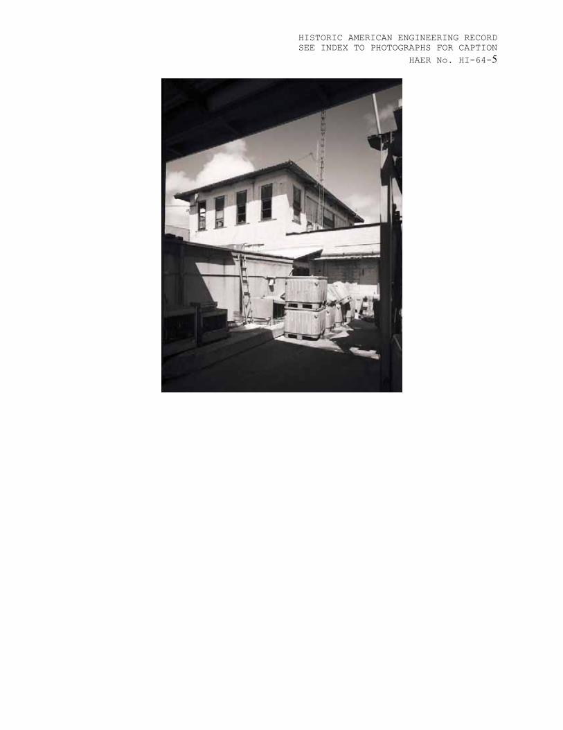
HI-64-5 WAIKIKI (EAST) ELEVATION, OBLIQUE VIEW.
HI-64-6 INTERIOR ELEVATION, VIEW TO ‘EWA (WEST).
HI-64-7 INTERIOR ELEVATION, VIEW TO WAIKIKI (EAST).

HISTORIC AMERICAN ENGINEERING RECORD SEE INDEX TO PHOTOGRAPHS FOR CAPTION
1HAER No. HI-64-1

HISTORIC AMERICAN ENGINEERING RECORD SEE INDEX TO PHOTOGRAPHS FOR CAPTION
2HAER No. HI-64-

HISTORIC AMERICAN ENGINEERING RECORD SEE INDEX TO PHOTOGRAPHS FOR CAPTION
3HAER No. HI-64-

HISTORIC AMERICAN ENGINEERING RECORD SEE INDEX TO PHOTOGRAPHS FOR CAPTION
4HAER No. HI-64-
HISTORIC AMERICAN ENGINEERING RECORD SEE INDEX TO PHOTOGRAPHS FOR CAPTION
5HAER No. HI-64-

HISTORIC AMERICAN ENGINEERING RECORD SEE INDEX TO PHOTOGRAPHS FOR CAPTION
6HAER No. HI-64-

HISTORIC AMERICAN ENGINEERING RECORD SEE INDEX TO PHOTOGRAPHS FOR CAPTION
7HAER No. HI-64-

HISTORIC AMERICAN ENGINEERING RECORD
Incinerator Number One (Old Kewalo Incinerator)
HAER No. HI-64
Location: Intersection of ‘Ähui Street and Olomehani Street, Kaka’ako, Honolulu County, O‘ahu, Hawai‘i. U.S.G.S. Honolulu Quadrangle, Hawaii, 7.5 Minute Series (Topographic) (Scale – 1:24,000) Universal Transverse Mercator Coordinates: 04-617860 E / 04-2355370 N
Date of Construction: 1930
Architect/Engineer: Unknown; City and County of Honolulu, Bureau of Plans.
Present Owner: The Hawaii Community Development Authority.
Significance: Incinerator Number One achieves state and local significance in the areas of maritime and social history, as well as engineering and architecture under criteria A and C. Incinerator Number One is one of two facilities constructed by the City and County of Honolulu to dispose of waste from the nearby Ala Moana dump. The ash from the incinerator facilities was used to fill the seawall constructed over the shallow reef at Ka‘äkaukukui in the late 1940s. By 1956, twenty-nine acres of new land was added to the shoreline, dramatically altering Honolulu’s coastal landscape.
The building was used as a kamaboko (Japanese fishcake) factory in the 1950’s, and today serves as a storehouse for the United Fishing Agency, which oversees the early morning auctions for the fishing industry.
The design of the Italianate-style building, a style popular on the United States mainland in the early twentieth-century, reflects Hawaii’s striving for legitimacy as an American territory (Penkuinas, 1990). The improved physical environment was intended to persuade urban dwellers, many of them recent immigrants from Asia, to become imbued with civic patriotism and better disposed toward community needs.

HISTORIC AMERICAN ENGINEERING RECORD SEE INDEX TO PHOTOGRAPHS FOR CAPTION
2HAER No. HI-64-
Report prepared by: Barbara Shideler, AIA,Mason Architects, Inc. 119 Merchant Street, Suite 501 Honolulu, Hawaii 96813
Date: October 2002

HISTORIC AMERICAN ENGINEERING RECORD SEE INDEX TO PHOTOGRAPHS FOR CAPTION
3HAER No. HI-64-PART I. HISTORICAL INFORMATION
A. PHYSICAL HISTORY
1. Date of Erection: 1930
2. Architect/Engineer: Unknown; City and County of Honolulu, Bureau of Plans.
3. Original and subsequent owners: City and County of Honolulu.The Hawaii Community Development Authority has been responsible for the redevelopment of the site, as well as the greater Kaka‘ako area, since 1989.
4. Builder, contractor, suppliers: Unknown
5. Original plans and construction: No original plans or drawings were found.
6. Alterations and Additions: Incinerator Number One was removed from service after the new incinerator on ‘Ohe Street was constructed in 1945. In 1947, the site was identified on tax records as a Marine Service Station belonging to the Territory of Hawaii. That year, Manual R. Cabral obtained a twenty-five year lease on the building and 60,079 sq. ft. of land. In 1952, the lease was transferred to John P. Nichols. No mention is made of the type of business operated from the property.
In 1955, Matsujiro Otani, Ltd., founder of the United Fishing Agency, obtained a lease on the parcel adjacent to the Incinerator for the purpose of “unloading, storage and processing of fish, including cold storage and furnishing ice to fishing boats, and other waterfront activities.” Two years later, the M. Otani Company constructed a “butler-type” warehouse for the Smoked Fish Co. (now housing the United Fishing Agency). The warehouse was built by South Pacific Construction (Building Permit #139472). The original smokestack at the south-west corner of the Incinerator was most likely removed at this time.
In the mid-1950s, the lower floor of the Incinerator was converted for use by the Mitsuwa Kamaboko Factory. The 4,846 sq. ft. CMU (concrete masonry unit) shed additions under the ramp and the lunchroom along the ‘Ähui Street elevation were built in 1961 (Building Permit #175035). The second floor was used as a “Compressor Room” for the factory. The opening in the second floor was covered with a concrete slab, and several large concrete equipment mounting platforms were

HISTORIC AMERICAN ENGINEERING RECORD SEE INDEX TO PHOTOGRAPHS FOR CAPTION
4HAER No. HI-64-installed. Wood-framed glass jalousies were installed in the original window openings. The large door opening was in-filled with a CMU and vertical tongue-and-groove board wall with a pair of access doors and a single pedestrian door.
Since 1978, the Incinerator building has been used for auxiliary storage by the United Fishing Agency, a use which requires no additions or alterations.
B. HISTORICAL CONTEXT
The Kewalo Shoreline
Incinerator Number One is built along the shoreline in the ‘ili (a land division) of Ka‘äkaukukui (also called ‘Äkaukukui) that includes the reclaimed lands of Kewalo Basin, Kaka‘ako Waterfront Park, Fort Armstrong, and Honolulu Harbor. Historically, the protected, coral-reefed basin at the mouth of Nu‘uanu Stream provided a sheltered refuge for early trading ships. This area, from Ala Moana to the Sand Island industrial district, is typically dominated by intensive harbor and waterfront enterprises, including Kewalo Basin's fishing and excursion vessel facilities; Honolulu Harbor's cargo and passenger terminals, bunkering facilities, marine repair docks, vessel moorings and lay berths; the Aloha Tower Marketplace; and the Kaka‘ako, Iwilei, Kapälama and Sand Island industrial complexes.
Although pre-1900 information on the site is limited, marshland, reef, salt pans and traditional fish ponds are known to have existed in this area. The entire shoreline was a coral wasteland bordered by mudflats. According to an 1885 survey map, the ‘ili of Ka‘äkaukukui was awarded by land court to Victoria Kamämalu. Princess Bernice Pauahi Bishop inherited the land, which later became part of the Kamehameha Schools (formerly the Bishop Estate). The Territory of Hawai‘i acquired the land in 1919 (Bureau of Conveyances, Liber 529, p. 216).
In 1898, the U.S. Army filled a submerged coral reef on the ‘ewa (western) side of Ka‘äkaukukui for a gun emplacement at Fort Armstrong to protect the mouth of Honolulu Harbor. At the beginning of the twentieth-century, the stretch of coast between Fort Armstrong and Waikïkï was the site of the Honolulu garbage dump, which burned almost continually (Young, 1994). During the 1920s, the channel on the Waikïkï (eastern) side of Fort Armstrong was dredged as a small boat harbor, called Kewalo Basin, of approximately 55 acres

HISTORIC AMERICAN ENGINEERING RECORD SEE INDEX TO PHOTOGRAPHS FOR CAPTION
5HAER No. HI-64-including ocean acreage, to relieve overcrowding at Honoulu Harbor by the sampan (tuna fishing) fleet. Hawaiian Dredging Company completed Kewalo Basin’s wharf and channel in 1925, and by 1930 the fishing fleet was relocated to their new home. In 1931, the City and County of Honolulu dedicated the land on the Waikïkï -side of Kewalo Basin as Moana Park. The name was later changed to Ala Moana (“the path to the sea”).
During this period of development, a settlement grew up around Kewalo Basin. On the east side of Kewalo Channel there was a small camp called “Blue Pond,” after a large deep pool near the shoreline that remained full of seawater even in low tide. A much larger settlement on the ‘ewa side of Kewalo at Ka‘äkaukukui, near the present location of Incinerator Number One, was referred to as “Squattersville” because the residents lived without authorization on land belonging to the Territory of Hawaii. The dwellings that lined the shoreline, where the present Olomehani Street now runs, were protected from the ocean by a low seawall about three feet high. The community of about 700 Hawaiians and part-Hawaiians was evicted in May 1926 and their homes were razed. Despite its use as a refuse dump, the Ka‘äkaukukuiarea continued to be heavily utilized as a fishing and swimming area.
The City and County of Honolulu constructed two incinerators and an ash dump at Kewalo. Incinerator Number One (the Old Kewalo Incinerator), built in 1930, still stands on ‘ÄhuiStreet next to the United Fishing Agency. Matsujiro Otani founded the United Fishing Agency (UFA) in 1952 in an attempt to revive the fishing industry and, over a period of time, consolidated several fish auctions into one facility. Today, the fish auction is acknowledged as the backbone of the commercial fishing industry. The UFA first operated out of a marketplace at Aala Park and moved to its current Kewalo space in the early 1980s. In addition to the fish auction, the UFA performs an invaluable function of handling the paperwork, taxes and accounting for the fishing boat owners.
A second, larger, incinerator was built on ‘Ohe Street in 1946-48 (the building was adapted for use as the Children’s Discovery Center in 1990). In August 1948, the City and County of Honolulu began work on the dump for the non-combustible material from the new incinerator. A huge seawall was constructed 500 feet seaward of the old shoreline. The wall was 10 feet high, 10 feet wide on top and 30 feet wide at the base. From its outer extremity, along the edge of the Kewalo Channel, the wall continued

HISTORIC AMERICAN ENGINEERING RECORD SEE INDEX TO PHOTOGRAPHS FOR CAPTION
6HAER No. HI-64-parallel to the coast toward Fort Armstrong. The large boulders laid in the wall lining Kewalo Channel and around the point came from Punchbowl Crater during the initial development of the National Memorial Cemetery of the Pacific by James W. Glover, Ltd. With the completion of the seawall in 1949, filling operations began and by the mid-1950’s the shallow reef of Ka‘äkaukukui was completely covered over. By 1956, twenty-nine acres of new land was added to the old shoreline. Since that time, the marine facilities at Kewalo Basin have been continuously upgraded and improved.
Refuse Collection and Disposal
"One of the most vexing problems confronting the City and County of Honolulu is without question the disposal of its garbage." This still-relevant quotation came from the June 1931 edition of the Star-Bulletin. However the problems of refuse collection and disposal predate 1931. When the Territorial Legislature established the county governments in 1905, the Territory turned over a "garbage crematorium" to Oahu County (now the City and County of Honolulu). The type of solid waste handled by this crematorium was most likely Honolulu’s putrescent waste, while more combustible waste went to open dumps.
In 1905, garbage removal was one of six items listed in the Oahu County's monthly operating expenses, along with the police and fire departments, the electric light plant, city parks, and the Royal Hawaiian Band. At this time, the only direct income for Oahu County was its refuse collection fees.
A 1925 report described refuse disposal in this way: "The present method of refuse disposal is by dumping same on waste land within the city. This method has been pursued in Honolulu for many years until now the available land for such purpose is nearly covered. At the very longest, from the present outlook, it is but a matter of a year or two until either a different method must be provided or additional lands allotted for the disposal of refuse" (Department of Public Works Annual Report, 1925).
The report suggested conducting trials of dumping ten scow loads of refuse at sea to prove the practicality of ocean dumping. But until the tests could be carried out, the report recommended the disposal of refuse by dumping on the shore side of Ala Moana Boulevard. By 1927, the Department of Public Works Annual Report showed that the refuse activity operated at an annual cost of $70,000, had an income of almost $25,000 and collected about 150,000 cubic

HISTORIC AMERICAN ENGINEERING RECORD SEE INDEX TO PHOTOGRAPHS FOR CAPTION
7HAER No. HI-64-yards of refuse. The report further mentions a tour of Mainland cities by a Public Works engineer to study incineration and other means of refuse disposal. A 1928 report on refuse disposal described the operation of the Ala Moana dump. The dump was divided into two sections -- one part for burning animals and fish waste and the other part for burning combustible rubbish. The report recommended spending $3,000 to reconstruct the incinerator at Keawe Street so that the disposal of small animals and fish waste could be removed from the Ala Moana dump.
Mr. Balch of the Bureau of Plans toured the Mainland to study incinerators. A tentative recommendation to construct an incinerator was made, subject to a decision as to whether food wastes would be incinerated. Food wastes were not collected by City crews but by pig farmers, and the possible inclusion of such wastes would make a difference in the incinerator's design. The suggested site for this incinerator was the present location of the Honolulu District refuse collection office, near the intersection of Ilalo and Kö‘ula Streets. When this incinerator was actually constructed, it was built a few hundred feet south of the initially recommended site on Mohala Street (now ‘Ähui Street).
Incinerator Number One was completed in 1930. The facility cost $140,000 and had a capacity of 80 tons per day (Young, 1993). The facility operated for two shifts a day because there was not enough money to operate a third shift. Excess collected refuse went to a dump in Kalihi. The incinerator, though modern for its time, operated mostly by muscle power. Rubbish was dumped on the second floor and pushed by hand into a trap door above the furnace. The residue was later hauled out of the lower floor with wheelbarrows. The original purpose of burning refuse was to reduce its overall volume. A secondary purpose was for sanitation.
Incinerator Number One features Italianate-style detailing, including overhanging eaves, pilasters and an ornamental tiled roof. The building is a significant civic statement reflecting Honolulu’s aspirations as a beautiful and urbane city; the structure retains its historic feeling due to its ornamental detailing and obvious age. The design of the building reflects the popular neo-classical architectural style of the early twentieth-century. The design of public improvements in the mode popular on the United States mainland reflects Hawaii’s striving for legitimacy as an American territory (Penkuinas, 1990). The World’s Columbian Exposition in Chicago in 1893 served as the inspiration for the City Beautiful movement and the ensuing neo-classical

HISTORIC AMERICAN ENGINEERING RECORD SEE INDEX TO PHOTOGRAPHS FOR CAPTION
8HAER No. HI-64-revival in the United States. The City Beautiful movement reached its height on the U.S. mainland between 1900-1910, but affected Hawai’i somewhat later. This movement is characterized by an attempt to create beautiful and functional cities. Aesthetic principles such as beauty, order, system, and harmony found physical realization in urban design. Architecture and public works projects, such as road and sewer systems, became civic statements that strengthened the identification of Hawai’i to the U.S. mainland. The improved physical environment was intended to persuade urban dwellers, many of them recent immigrants to Hawai’i from Asia, to become imbued with civic patriotism and better disposed toward community needs.
Before the 1930 incinerator was constructed, opponents stated that the Kapälama area was the natural location for canneries, oil stations, gas works and incinerators of garbage. After the 1930 incinerator was constructed on ‘Ähui Street, the Star-Bulletin named it "Swillauea" (an implicit comparison with the long burning fires of Kïlauea volcano on Hawai‘i Island) and lamented, ". . .Oh Swillauea-by-the-Sea . . . a monument to despair, foolishness and ugliness . . . all the king's horses and all the king's men couldn't find another place to burn the City's rubbish except in the City's front yard . . ." It must have been a disappointment to opponents of the ‘ÄhuiStreet site that an even larger incinerator was constructed one block away on ‘Ohe Street after World War II.
In 1931, Ordinance 547 made extensive rules and regulations for the collection of refuse. The ordinance specified that containers were to be filled only to within four inches of the top of the container and that there were to be separate containers for non-combustible and combustible refuse. The separate container requirement was enacted because it was thought that incineration would be more efficient without non-combustibles in the refuse. 40 years later, the requirement for separate containers was deleted because few householders complied and all refuse went into the same truck body, anyway. There was also the thought that non-combustibles in the refuse aided incineration by making the fuel bed more porous and created more residue (fill) after burning.
The residue from burned rubbish was used to reclaim swamps.This residue provided a fill that was perceived as quite inert and solid. Thus, a rubbish dump was considered a cost-free method for a landowner to reclaim swampy land. Many property owners offered their lowlands to the City government for reclamation via open dump burning. The City

HISTORIC AMERICAN ENGINEERING RECORD SEE INDEX TO PHOTOGRAPHS FOR CAPTION
9HAER No. HI-64-declined the offers when operating problems in filling the sites were foreseen, such as the potential to flood wide stream beds. The City made no payment for the use of these dump sites. On one occasion, a landowner asked the City for a share of the fees that the City charged to businesses that used the dumps. The City replied that revenue sharing was not justified because the increase in the value of the land reclaimed was sufficient payment.
In 1933, Executive Order 577 set aside 3.005 acres for the disposal of ash from the incinerator. This ash disposal site was a stone's throw from the recently completed facility and also included a portion of the site for the next Kewalo incinerator. The separate sites for the two Kewalo incinerators were covered by Executive Order 1049 in 1944. Also in 1944, Executive Order 1051 set aside 11.31 acres of tidelands adjoining the second Kewalo incinerator site for additional ash disposal space. The mauka (“toward the mountains”) boundary of this site was a 1,200 foot long seawall adjoining Fort Armstrong.
In 1942, the Federal Works Administration approved $313,000 for the construction of a new incinerator in Kapälama. The money was approved as part of the war effort because of the great wartime influx of population into Honolulu, which caused a corresponding increase in the amount of refuse. Money for a second incinerator was also appropriated to serve the eastern part of the city, but the site selection was controversial. The daily newspapers had more than 50 articles during that 1942-1943 period relating to the siting of this incinerator. Newspaper articles indicate that the proposed incinerator site moved from community to community, starting in the east and continuing westward, until it finally ended up only two miles from the Kapälama incinerator. The two incinerators, called the Kapälama and the Kewalo incinerators, were finished just after World War II. The 200-ton twin incinerators differed only in the curvature of their approach ramps.
In 1950, the City of Honolulu and the Territory of Hawaii cooperated in building yet another seawall to enclose another 30 acres of space for more incinerator ash and other non-combustibles. There was no executive order for this site. The filling of the enclosed space behind the wall proceeded rapidly, and in 1956, the City asked the Territory whether it would pay for the construction of still another seawall farther out into the ocean, but still on the reef. The Territory's reply stated that because its funds were depleted, it couldn't make any financial commitment.

HISTORIC AMERICAN ENGINEERING RECORD SEE INDEX TO PHOTOGRAPHS FOR CAPTION
10HAER No. HI-64-In 1959, City and State (statehood was achieved that year) officials met to discuss the completion of the fill behind the seawall. The State Land Commissioner said that the area could be filled another six feet above the top of the seawall. With this permission, the City continued filling.As the height increased, the State expressed concern over the mountain of ash that was growing so rapidly. In the early 1960s both incinerators were renovated. Automatic stokers and water scrubbers were installed. During the renovation, refuse was diverted to a new landfill at the Koko Head Firing Range, located in Kahauloa Crater near the Hälona Blow Hole. A feature of this landfill was the use of water pumped from the ocean to aid in compaction of the refuse. Refuse was also diverted to the Navy landfill at Pearl City.
In 1971, the State requested that the City to stop placing ash at Kewalo. A large hopper was constructed at the Kewalo incinerator to load transfer trailers so that excess refuse could be sent to rural disposal facilities. The Kewalo and Kapälama incinerators were shut down in 1977 because they could not meet the increasingly stringent air pollution standards. Refuse trucks, which had been unloading at the Kewalo and Kapälama incinerators, were directed to the new Ke‘ehi Transfer Station, which in turn sent its refuse to the Waipahu Incinerator. Parts of the Kewalo ash pile were then 25 feet above the top of the seawall. Some people wondered what could be done with a mountain of ash at the shoreline. In 1992, the State constructed a waterfront park on the ash pile, and the large incinerator on ‘Ohe Street was renovated for use as the Children’s Discovery Center. The most distinctive and enjoyable parts of the park are the steep hills of grass covered incinerator ash, where the young and the young-at-heart slide down on cardboard sleds.
HISTORIC AMERICAN ENGINEERING RECORD SEE INDEX TO PHOTOGRAPHS FOR CAPTION
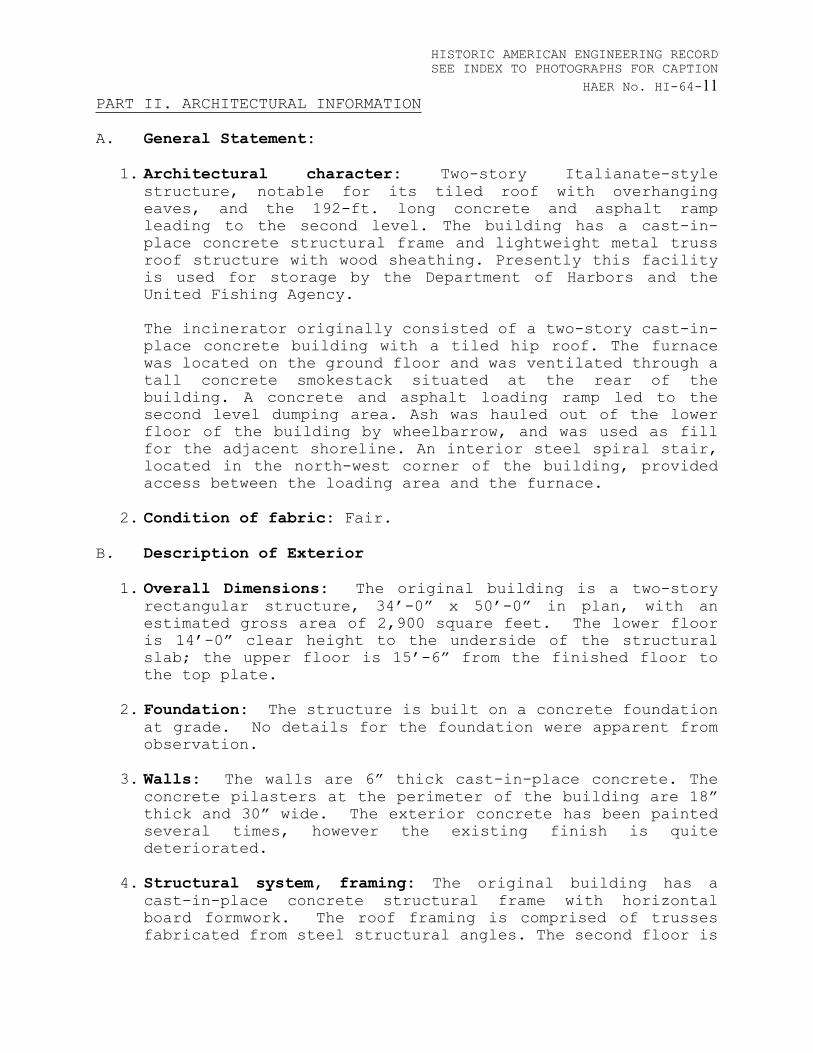
11HAER No. HI-64-PART II. ARCHITECTURAL INFORMATION
A. General Statement:
1. Architectural character: Two-story Italianate-style structure, notable for its tiled roof with overhanging eaves, and the 192-ft. long concrete and asphalt ramp leading to the second level. The building has a cast-in-place concrete structural frame and lightweight metal truss roof structure with wood sheathing. Presently this facility is used for storage by the Department of Harbors and the United Fishing Agency.
The incinerator originally consisted of a two-story cast-in-place concrete building with a tiled hip roof. The furnace was located on the ground floor and was ventilated through a tall concrete smokestack situated at the rear of the building. A concrete and asphalt loading ramp led to the second level dumping area. Ash was hauled out of the lower floor of the building by wheelbarrow, and was used as fill for the adjacent shoreline. An interior steel spiral stair, located in the north-west corner of the building, provided access between the loading area and the furnace.
2. Condition of fabric: Fair.
B. Description of Exterior
1. Overall Dimensions: The original building is a two-story rectangular structure, 34’-0” x 50’-0” in plan, with an estimated gross area of 2,900 square feet. The lower floor is 14’-0” clear height to the underside of the structural slab; the upper floor is 15’-6” from the finished floor to the top plate.
2. Foundation: The structure is built on a concrete foundation at grade. No details for the foundation were apparent from observation.
3. Walls: The walls are 6” thick cast-in-place concrete. The concrete pilasters at the perimeter of the building are 18” thick and 30” wide. The exterior concrete has been painted several times, however the existing finish is quite deteriorated.
4. Structural system, framing: The original building has a cast-in-place concrete structural frame with horizontal board formwork. The roof framing is comprised of trusses fabricated from steel structural angles. The second floor is

HISTORIC AMERICAN ENGINEERING RECORD SEE INDEX TO PHOTOGRAPHS FOR CAPTION
12HAER No. HI-64-framed with a 10-inch thick concrete structural slab supported by interior concrete columns.
a. Doorways and doors: The original building had a large opening, 30’-0” wide x 13’-0” high, located at the top of the ramp. The remnants of rusted anchor bolts at the head of the opening indicate the presence of a previous overhead door. Two large door openings located on the ‘ewa (west) wall at the ground level provided access to the ash furnace. Photographs dating from 1948 indicate the presence of roll-up metal overhead doors on these openings.
b. Windows and shutters: The building was originally constructed with 15 openings arranged symmetrically around the second floor. Rusted anchor bolts holes line both sides of the jambs; these may have held tracks for roll-up metal window coverings. All of the openings have been in-filled with CMU and wood-framed glazed sashes. The altered windows on the Waikïkï (east) side of the building are 1/1 single hung sashes; the remainder of the windows are glass jalousie.
6. Roof:
a. Shape, covering: The original structure has a hip roof with ornamental metal tile on a light-weight steel framing system. The roof is sheathed with 1 x 6 flush-joint tongue-and-groove boards.
b. Cornice, eaves: There is a 3’-6” overhang at all sides with exposed, steel rafters at the eaves, and a wood fascia concealing the rafter ends at the rake.
C. Description of Interior
1. Floor Plans: The building has a basic rectangular floor plan with no interior walls or partitions at the second level. The lower floor contains concrete structural columns supporting the second floor, and has been heavily altered. Four cast-in-place concrete equipment mounts are located at the center of the second floor. Tax records indicate that they held compressors for the kamaboko (Japanese fishcake) factory.
2. Stairways: A steel spiral stair is located in the north-west corner of the interior of the building. It provided worker access from the second level dumping platform for the furnace room below. The base of the stair was blocked off

HISTORIC AMERICAN ENGINEERING RECORD SEE INDEX TO PHOTOGRAPHS FOR CAPTION
13HAER No. HI-64-with CMU walls (date uncertain) to isolate the storage area at the lower floor.
3. Flooring: Cast-in-place concrete structural slab (10-inches thick). A secondary cast-in-place concrete slab (7-inches thick) was cast over the original ash dump opening to provide a base for concrete equipment mounts.
4. Wall and ceiling finish: The walls, like the floors, are cast-in-place concrete. They have a deteriorated painted finish. A steel I-beam runs the length of the structure from the east to the west wall. It is positioned over the compressor platforms, and was most likely used as a hoist for equipment maintenance.
5. Hardware: The hardware associated with the original door and window openings has been removed and/or altered.
6. Mechanical and Electrical Equipment:
a. Mechanical Equipment: There does not appear to be any plumbing or mechanical systems in the building.
b. Lighting and Electrical Equipment: Six round industrial-style incandescent lights are suspended from the roof framing. The wiring for the lights runs in exposed metal conduit. A plywood board with evidence of removed electrical equipment is attached to the interior west wall.
c. Miscellaneous Equipment: All of the original incinerator equipment (furnaces, ash chutes and chimneys) has been removed from the building. The compressors and equipment associated with the kamaboko (Japanese fishcake) factory have also been removed.
D. Site:
The structure is built along the flat, rocky shoreline of Kewalo Basin facing the NNE direction. It is surrounded by marine enterprises, including Kewalo Shipyard, the United Fishing Agency, the University of Hawaii’s Look Laboratory and John Dominis Restaurant. The neighborhood context has changed dramatically due to the landfill activities associated with the construction of the Incinerator Number One and its successor, the Kewalo Incinerator.

HISTORIC AMERICAN ENGINEERING RECORD SEE INDEX TO PHOTOGRAPHS FOR CAPTION
14HAER No. HI-64-PART III. SOURCES:
A. Original Architectural Drawings: No original drawings for the incinerator were located. In 1960, M. Otani obtained a building permit (#175035) for the construction of the Mitsuwa kamaboko factory and luncheonette. These drawings are on file at the City and County of Honolulu, Department of Planning and Permitting.
B. Early Views: Photographs of the Incinerator Number One, dating from the time of the construction of the nearby Kewalo Incinerator (1946-48), can be found in the City and County of Honolulu, Municipal Reference Library. Additional views of the Kaka‘ako Shoreline are available at the Hawai‘i State Archives and the U.S. Army Corps of Engineers.
C. Bibliography:
1986. Sea Grant Extension, University of Hawaii. Kaka‘ako Waterfront Park Development Plan and Environmental Assessment. Prepared for State of Hawai‘i, Department of Land and Natural Resources. Division of State Parks.
1990.Penkiunas, Daina. American Regional Architecture in Hawaii: Honolulu, 1915-1935. (Doctoral dissertation, University of Virginia).
1991. Johnson, Donald. History of the City and County of Honolulu. Honolulu:University of Hawaii Press.
1993. Young, Robert. Garbage in Paradise: A History of Honolulu’s Refuse Division. Honolulu: Division of Refuse Collection and Disposal. Unpublished monograph available on the internet at <www.opala.org/history.html>.
Other sources include government reports, such as City and County of Honolulu, Department of Public Works AnnualReports, Land and Tax Division files and newspaper articles.

HISTORIC AMERICAN ENGINEERING RECORD SEE INDEX TO PHOTOGRAPHS FOR CAPTION
15HAER No. HI-64-PART IV. PROJECT INFORMATION
The Hawaii Community Development Authority is generating proposals for the Incinerator site as part of the greater Kaka’ako redevelopment plan. This documentation was required by the State Historic Preservation Division to mitigate for the loss of the building.
This documentation project was undertaken between January and July 2002 by Mason Architects, Inc. of Honolulu, Hawai’i. The historic architect for the project was Barbara Shideler, AIA who undertook the field investigations, 35 mm photography, research, and report writing. David Franzen of Franzen Photography produced the large-format photographs in accordance with HABS/HAER standards.

HISTORIC AMERICAN ENGINEERING RECORD SEE INDEX TO PHOTOGRAPHS FOR CAPTION
16HAER No. HI-64-Figure 1: Location Map
Incinerator No. 1

HISTORIC AMERICAN ENGINEERING RECORD SEE INDEX TO PHOTOGRAPHS FOR CAPTION
17HAER No. HI-64-Figure 2: Kaka’akoShoreline, circa 1930 (Hawai’s State Archives)
Incinerator No. 1
Kaka’ako Shoreline (ca. 1930)

HISTORIC AMERICAN ENGINEERING RECORD SEE INDEX TO PHOTOGRAPHS FOR CAPTION
18HAER No. HI-64-Figure 3: Incinerator Number One, 1948
(City and County of Honolulu,Municipal Reference and Records Center)

HISTORIC AMERICAN ENGINEERING RECORD SEE INDEX TO PHOTOGRAPHS FOR CAPTION
19HAER No. HI-64-
Figure 4: Incinerator Number One, 1946 (City and County of Honolulu,Municipal Reference and Records Center)
Incinerator No. 1

HISTORIC AMERICAN ENGINEERING RECORD SEE INDEX TO PHOTOGRAPHS FOR CAPTION
20HAER No. HI-64-
Figure 5: Kaka’ako Incinerator Landfill with seawall, circa 1956 (U.S. Army Corps of Engineers)
Incinerator No. 1
“New” Kewalo Incinerator

HISTORIC AMERICAN ENGINEERING RECORD SEE INDEX TO PHOTOGRAPHS FOR CAPTION
21HAER No. HI-64-
Figure 6: Kaka’ako Incinerator Landfill, circa 1960 (U.S. Army Corps of Engineers)
Incinerator No. 1
“New” Kewalo Incinerator