indonesian-german technical cooperation: land subsidence in
TRANSCRIPT
Mitigation of GeorisksGood Local Governance
Indonesian-German Technical Cooperation
Land Subsidence in Semarang Municipality
Landsub Photo
BackgroundThe City of Semarang faces land subsidence since more than 100 years.Theimpact for the cities approx. 1.3 Mio. inhabitants is severe: not only does landsubsidence affect their living environment, buildings and infrastructure, it alsobadly influences health and sanitation conditions and may thus diminish theindividual chances for development. Counter measures to avoid flooding andgroundwater salinationposea financial burden for the city administration.
ObjectiveThe Georisk-Project aims at providing precise spatial data about the extend ofland subsidence and coast line change in Semarang based on remote sensingdata. The socio-economic impact of land subsidence shall be estimated.Findings are discussed with government authoritues to identify risk mitigationstrategies that are to be implemented by means of spatial planning. In general,awareness shall be generated among stakeholders regarding the impact ofnatural hazards on the development potential for themunicipality and about theneed to recognize thesehazards in the spatial planningprocesses.
CooperationThe initiative is based on the cooperation of the Georisk-Project (BadanGeologi, BGR and GTZ) with Bappeda Kota Semarang. Data aquisition andanalysis is done by the Center of Environmental Geology and the Center ofVolcanology andGeological HazardMitigation of BadanGeologi with the aid ofDinas Pertambangan dan Sumber Daya Mineral of Kota Semarang (Distam-ben). Round Table Discusssions are headed and organised by Bappeda KotaSemarangandBappedaofCentral JavaProvince.Pleasecontact
Dr. Ir. A. Djumarma Wirakusumah, Dipl. Seis.Project Coordinator Badan GeologiTel: +62 22 7274705, [email protected]. Arne Hoffmann-Rothe, Dipl. Geol.German Team LeaderTel: +62 22 7273198, [email protected] of Energy and Mineral ResourcesBadan Geologi, Pusat Lingkungan GeologiJl. Diponegoro No 57, Bandung 40122, Indonesia
0 10050 Km
JAVA
Kota Semarang
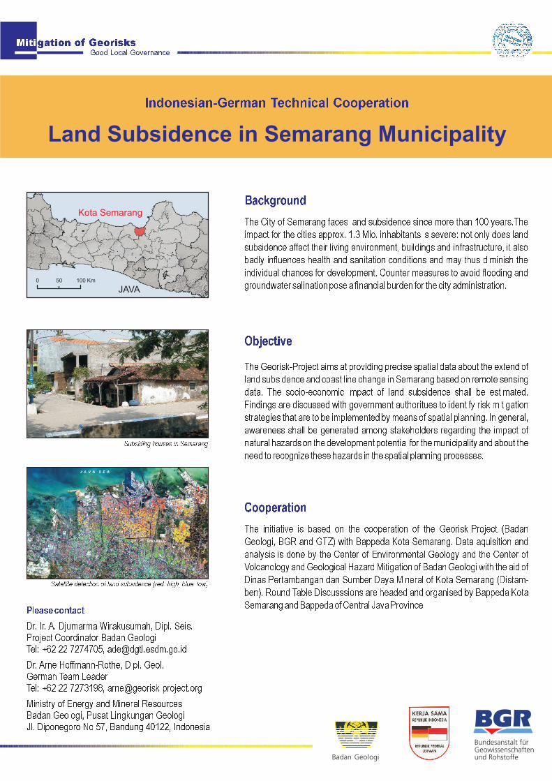
Subsiding houses in Semarang
Satellite detection of land subsidence (red: high, blue: low)

Georisk - ProjectSummaryThe Georisk-Project (Mitigation of Georisks) is a technical cooperation of theGeological Agency of Indonesia (Ba-dan Geologi) and the German FederalInstitute for Geo-sciences and Natural Resources (BGR). Its objective is todevelop and test practical georisk assessment methodologies and to support theimplementation of findings in national, provincial and local risk mitigationstrategies, . The project is commissioned by
part of theGoodLocalGovernanceproject ofGTZ.
geoboth for short term and in the long run
the German Federal Ministry for Economic Cooperation and Development andimplementedas
Products:<<<<
Semarang Land subsidence map, 1:25.000Semarang Coastal change map, 1:25.000Map of economic damage potential due to land subsidenceSummary and Results of land subsidence workshop, 63 pages, 9 maps and1 CD- ROM
< Facilitation of Round Table Discussions with relevant stakeholders
Mitigation of GeorisksGood Local Governance
Last modified: 10/2008