introduction to georeferencing - sanbi
TRANSCRIPT
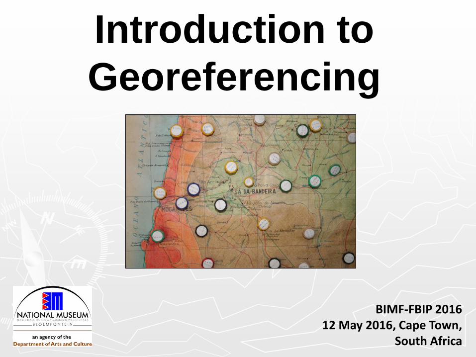
Introduction to
Georeferencing
BIMF-FBIP 2016 12 May 2016, Cape Town,
South Africa
Purpose?
►Spatial data analysis, e.g. distribution
mapping
►Linking of (specimen) data with the type
of geographical data that defines a
record in space.
►In biodiversity collections, this
geographical data usually starts off as a
locality text string.
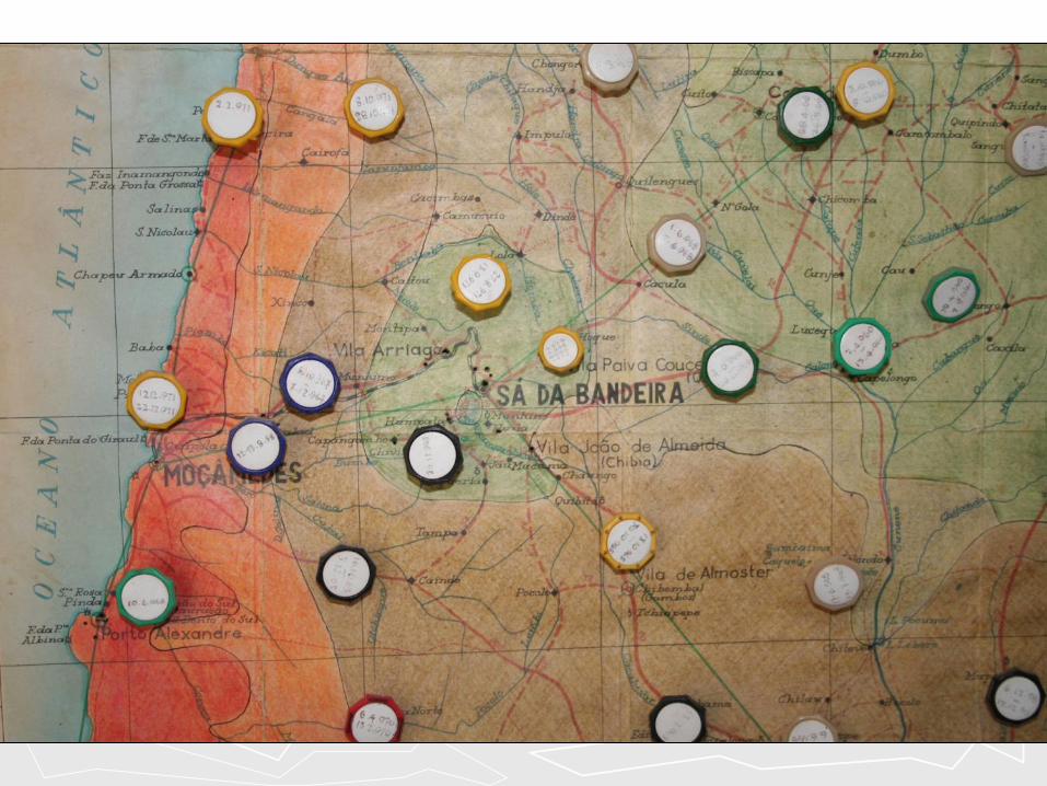
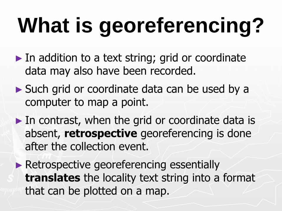
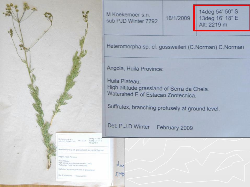
What is georeferencing?
► In addition to a text string; grid or coordinate data may also have been recorded.
► Such grid or coordinate data can be used by a computer to map a point.
► In contrast, when the grid or coordinate data is absent, retrospective georeferencing is done after the collection event.
►Retrospective georeferencing essentially translates the locality text string into a format that can be plotted on a map.


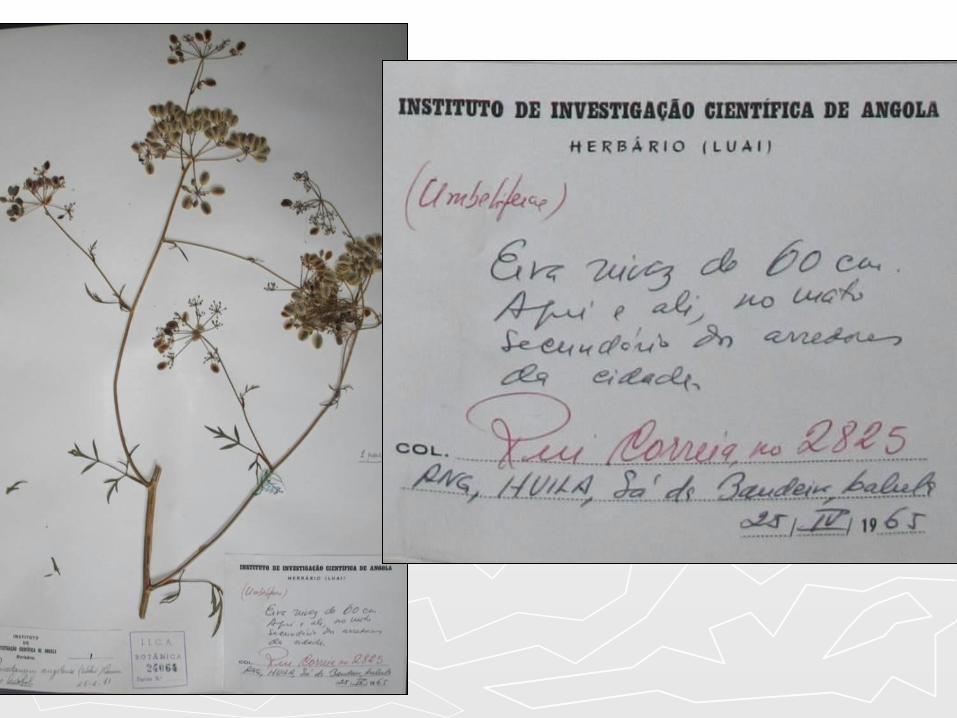
BOTSWANA:
Goodhope.
21-28.ii.1990
J.M. Mashonja
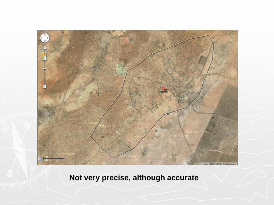
Not very precise, although accurate
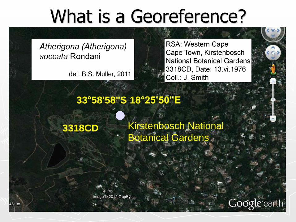
What is a Georeference?
33°58'58"S 18°25’50”E
3318CD Kirstenbosch National
Botanical Gardens
An ideal georeference?
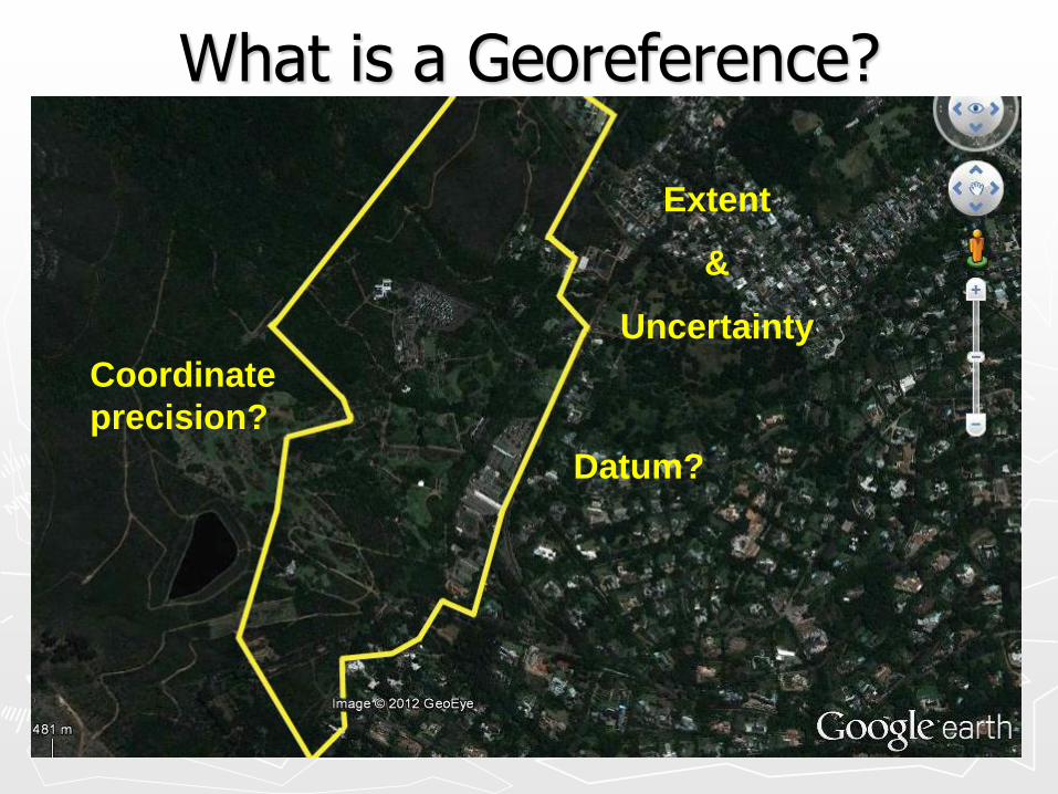
What is a Georeference?
Datum?
Coordinate
precision?
Extent
&
Uncertainty
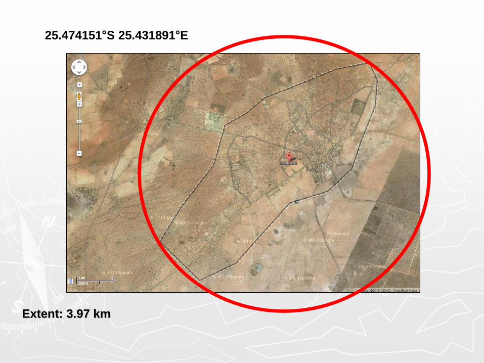
25.474151°S 25.431891°E
Extent: 3.97 km
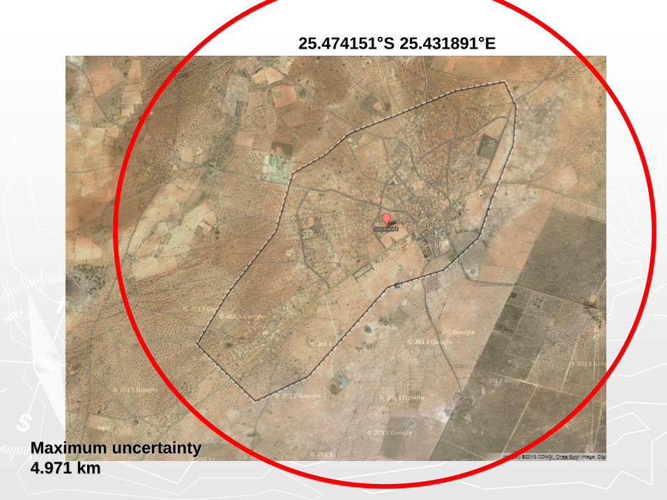
25.474151°S 25.431891°E
Maximum uncertainty
4.971 km

Why georeferencing? Occurrence data are potentially the most widely or
frequently applied data from biological collections, because:
► digitized specimen data are put in a geographical context.
► they facilitate finding populations in the field.
► they facilitate visualization of species ranges.
► they facilitate the application of many useful tools, from species dot maps to full GIS analyses.
(John Elia, Trainer, Tanzania 2010)

Why georeferencing? Once we can apply data in this way, we can
use the derived information for a host of research and decision support purposes:
►Conservation Planning.
►Environmental management.
►Vegetation analysis.
►Presentation of taxonomic research output.
►Biodiversity monitoring.

How do we georeference
specimen data?