italian village east redevelopment plan, 2000
DESCRIPTION
A plan for the neighborhood east of N. 4th St.TRANSCRIPT
CITY OF COLUMBUS, DEPARTMENT OF TRADE AND DEVELOPMENT, PLANNING OFFICE
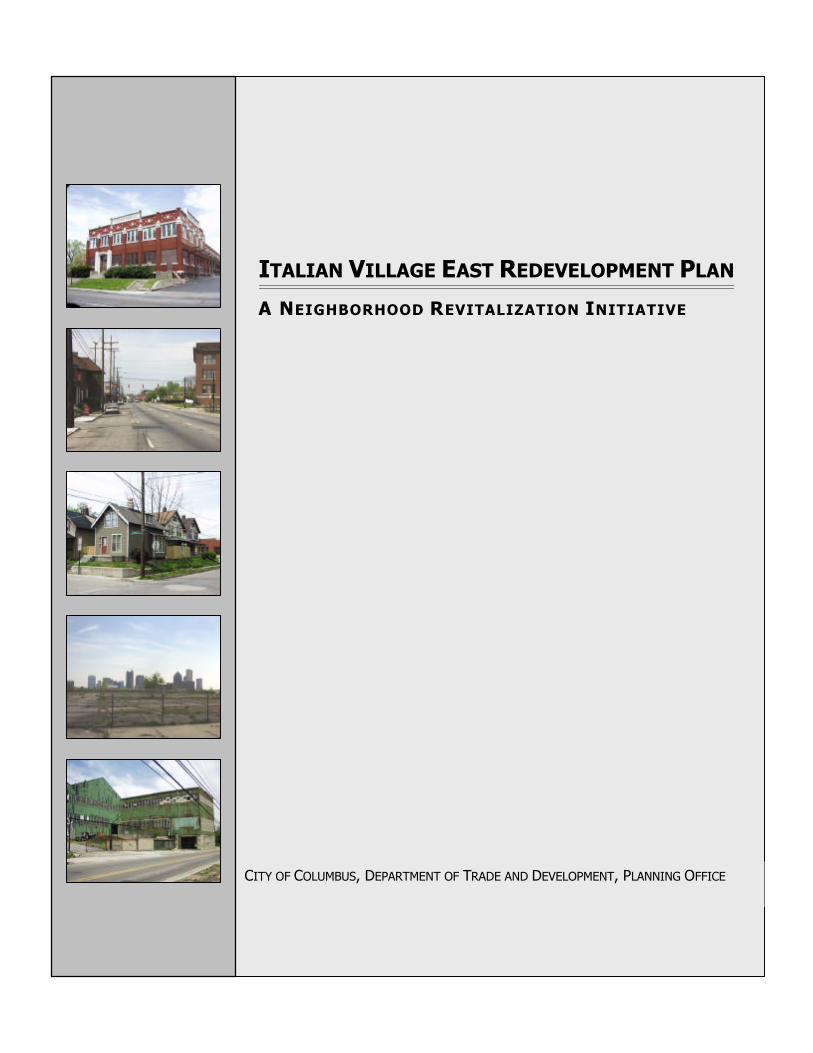
ITALIAN VILLAGE EAST REDEVELOPMENT PLAN
A NEIGHBORHOOD REVITALIZATION INITIATIVE
COLUMBUS CITY COUNCIL
Matthew D. Habash, PresidentKevin L. BoyceJennette B. BradleyMichael C. MentelMaryellen O’ShaughnessyRichard W. SensenbrennerCharleta B. Tavares
DEVELOPMENT COMMISSION
Michael J. Fitzpatrick, ChairKaren J. McCoy, Vice ChairPaul CianelliThomas E. DeVoeDan D. FryeJim Simpson
ITALIAN VILLAGE EAST REDEVELOPMENT PLAN
November, 2000
Michael B. Coleman, MayorCity of Columbus, Ohio
Mark Barbash, DirectorDepartment of Trade and DevelopmentStephen R. McClary, AdministratorPlanning OfficeDick Ritchie, ManagerNeighborhood Planning
Prepared by:Craig Noreen, Senior PlannerSuzanne Wingenfield, Senior Planner
Graphics by:Larry Lewis, Graphic Designer
The Italian Village East Redevelopment Plan was adopted by City Council on November 20, 2000 as the officialguide for the Italian Village East Planning Area. The plan provides recommendations and establishes guidelinesto direct future decisions about the Italian Village neighborhood east of N. Fourth Street. Please direct allquestions regarding the content of this plan to the Planning Office, City of Columbus, 109 N. Front Street,Columbus, Ohio 43215.
LETTER FROM THE DIRECTOR
On November 20, 2000 Columbus City Council adopted the Ita lian Village EastRedeve lopment Plan as the city’s official guide for revitalization and future developmentwithin the Italian Village East Planning Area. As part of the Italian Village neighborhood,this planning area is located within a locally designated historic district.
Neighborhood leaders, residents, developers, and business interests assisted the city’sPlanning Office with the preparation of this plan. Their participation was critical to ensurethat the plan would reflect the needs and aspirations of the Italian Village neighborhood.
On behalf of the Department of Trade and Development, I would like to congratulate theplanning committee for their excellent work and look forward to continuing our partnershipwith the Italian Village neighborhood on future initiatives.
Mark Barbash, DirectorDepartment of Trade and Development
ACKNOWLEDGMENTS
The city of Columbus wishes to thank the following individuals for serving on the planningcommittee. This plan would not have been possible without their assistance. Thecommittee’s participation and dedication throughout the process reflects their commitmentto the future of Italian Village.
Joe ArmeniNew Victorians
Mark BeckClark Grave Vault Company
Kevin BerryBerry Brothers Bolt Works
Dave BetzItalian Village Master PlanCoordinating Committee
Michael ChanDurable Slate Company
Cheryl DowneyDurable Slate Company
Ruth GlessItalian Village Commission
Matthew KeenerPlanning Area Resident
Andy Klein Italian Village Society
Fr. William MetzgerSt. John the BaptistItalian Catholic Church
Sean O’ReillyPreferred Real EstateInvestments
Dave SchroederRoss Products Division -Abbott Laboratories
P. Susan SharrockShort North BusinessAssociation
David StrauseStrause-Lakota
The Italian Village Neighborhood
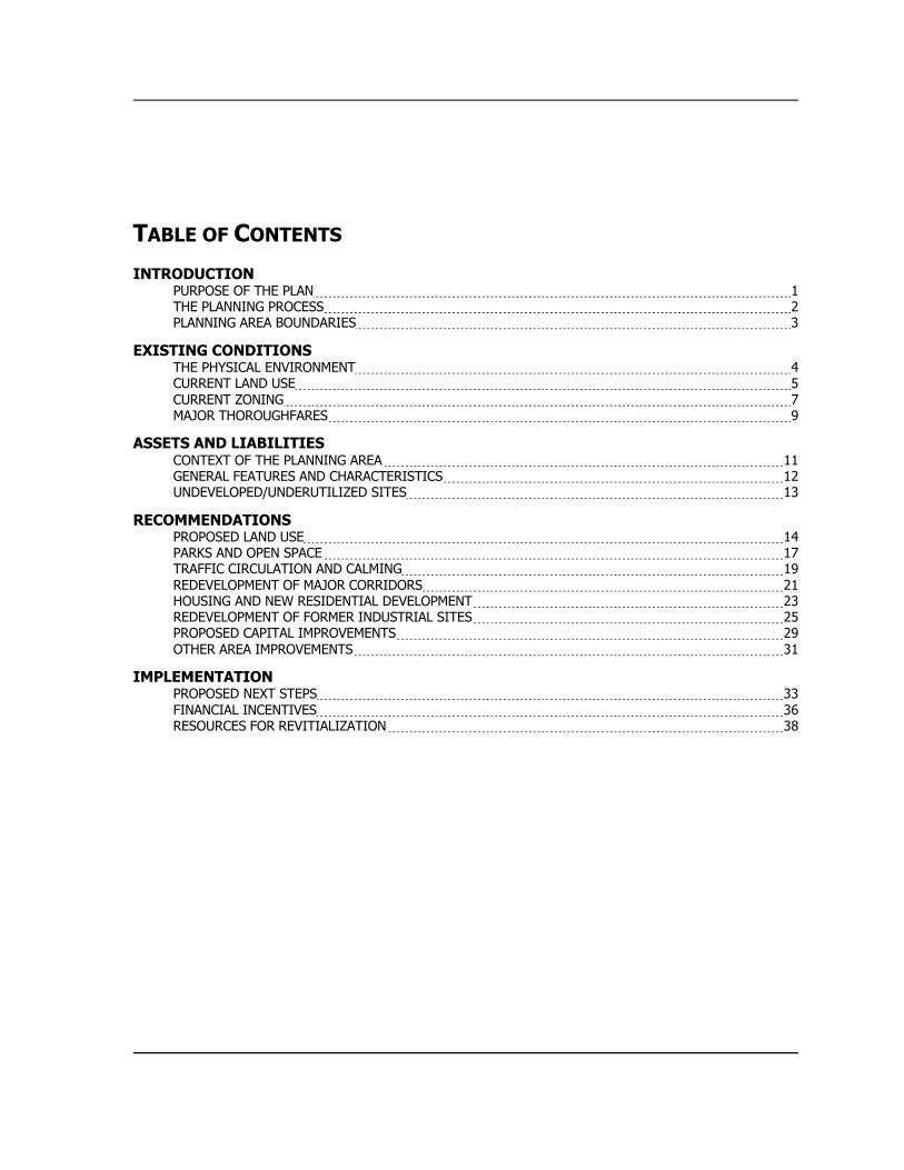
TABLE OF CONTENTS
INTRODUCTIONPURPOSE OF THE PLAN 1THE PLANNING PROCESS 2PLANNING AREA BOUNDARIES 3
EXISTING CONDITIONSTHE PHYSICAL ENVIRONMENT 4CURRENT LAND USE 5CURRENT ZONING 7MAJOR THOROUGHFARES 9
ASSETS AND LIABILITIESCONTEXT OF THE PLANNING AREA 11GENERAL FEATURES AND CHARACTERISTICS 12UNDEVELOPED/UNDERUTILIZED SITES 13
RECOMMENDATIONSPROPOSED LAND USE 14PARKS AND OPEN SPACE 17TRAFFIC CIRCULATION AND CALMING 19REDEVELOPMENT OF MAJOR CORRIDORS 21HOUSING AND NEW RESIDENTIAL DEVELOPMENT 23REDEVELOPMENT OF FORMER INDUSTRIAL SITES 25PROPOSED CAPITAL IMPROVEMENTS 29OTHER AREA IMPROVEMENTS 31
IMPLEMENTATIONPROPOSED NEXT STEPS 33FINANCIAL INCENTIVES 36RESOURCES FOR REVITIALIZATION 38
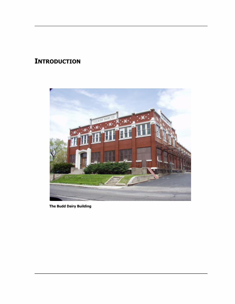
INTRODUCTION
The Budd Dairy Building
Page 1
PURPOSE OF THE PLAN
The Italian Village East RedevelopmentPlan was prepared to help stimulate andguide redevelopment within the easternhalf of Italian Village, a neighborhooddesignated as a historic district. Thisportion of the Village, beginning with theN. Fourth Street corridor and extendingeastward to the Conrail railroad tracts,was identified as an area needing focusedplanning assistance.
The city’s Planning Office began a planninginitiative for this area in the Fall of 1999.Neighborhood representatives andcommunity groups were consulted to helpestablish planning goals. The followingwere identified as key objectives for theredevelopment plan:
ÿ Stimulate private investment withinthe planning area .
_____
ÿ Promote redeve lopment that issensitive to ne ighborhood goals andobjectives.
_____
ÿ Provide land use recommendations forlarge undeve loped sites within theplanning area .
_____
ÿ Deve lop a plan that is compatible withthe rest of the ne ighborhood.
_____
ÿ Protect historic and architectura llysignificant buildings.
_____
ÿ Maintain and/or rehabilitate existinghousing stock.
_____
ÿ Provide action steps for implementingredeve lopment.
Page 2
THE PLANNING PROCESS
The Italian Village East RedevelopmentPlan is the product of a 12-month publicplanning process. Groundwork for thisplanning initiative began with thepreparation of a work program outliningthe plan’s purpose, scope, and timeline.Next, the Planning Office solicitedneighborhood stakeholders to serve on aplanning committee. This group wasassembled to ensure that the plan wouldreflect the needs and aspiration of theneighborhood.
The planning committee convened monthlyduring the initial phase of the planningprocess. Committee members assisted citystaff with defining the planning area,identifying issues, and preparing draftrecommendations. Research on theplanning area was also conducted duringthis period.
The next phase of the process dealt withthe preparation of the plan document.City staff wrote the plan, incorporating theprevious work of the planning committee.The draft plan was then distributed torelevant city departments and committeemembers for comment.Recommendations were incorporated intoa revised draft.*
The final phase of the planning processinvolved public review and adoption.First, an open house was held in theneighborhood to receive public commenton the plan. Next, city staff presented thedraft to the Development Commission toobtain their endorsement. Lastly, thedraft plan was submitted to City Councilfor adoption.
* Reviewed/endorsed by the Italian VillageCommission and the Italian Village Society
Page 3
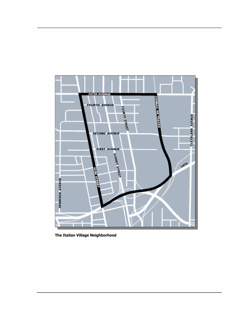
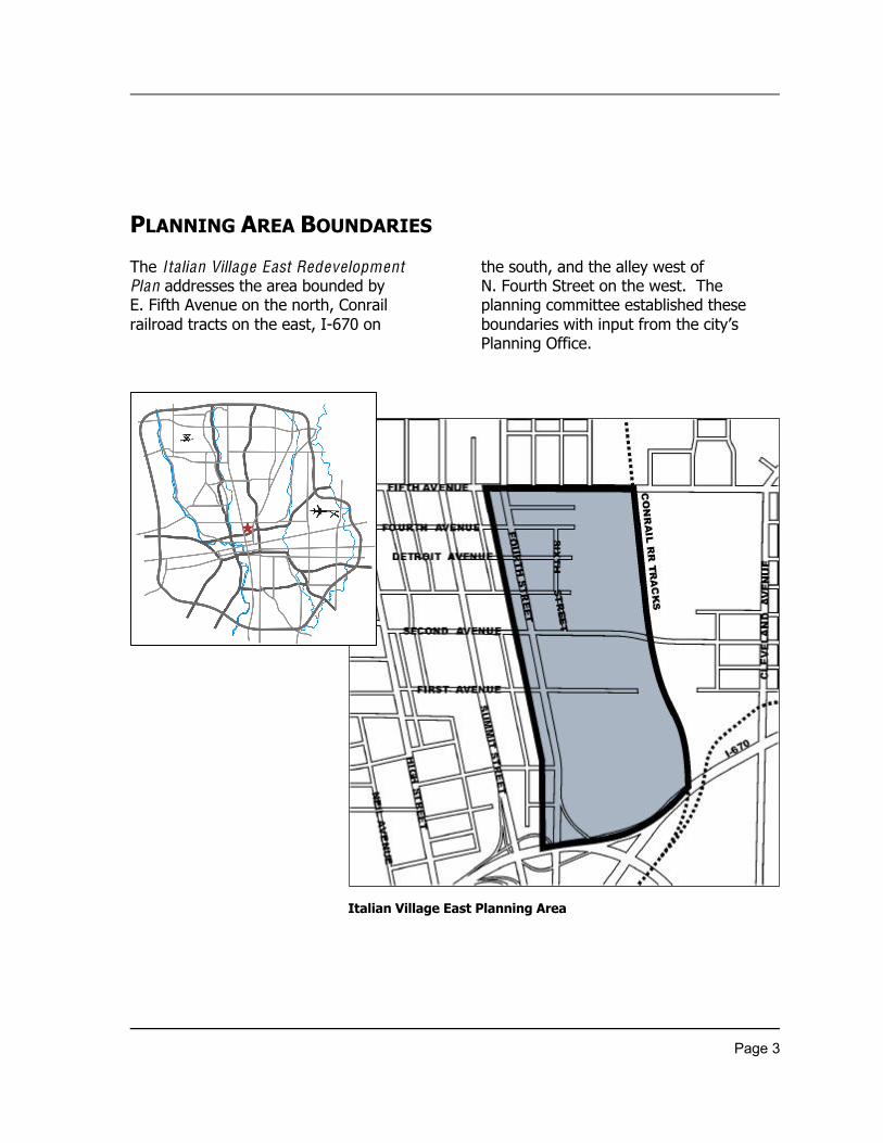
PLANNING AREA BOUNDARIES
The Italian Village East RedevelopmentPlan addresses the area bounded byE. Fifth Avenue on the north, Conrailrailroad tracts on the east, I-670 on
the south, and the alley west ofN. Fourth Street on the west. Theplanning committee established theseboundaries with input from the city’sPlanning Office.
Italian Village East Planning Area
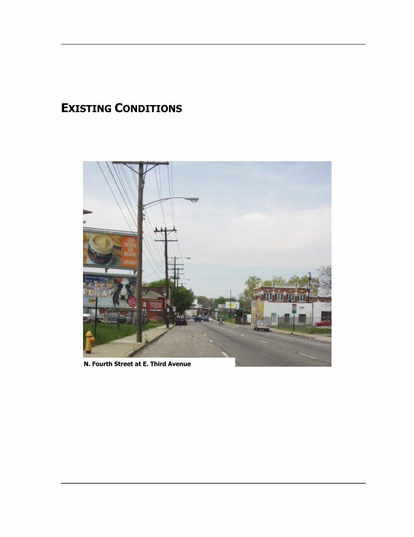
EXISTING CONDITIONS
N. Fourth Street at E. Third Avenue
Page 4
THE PHYSICAL ENVIRONMENT
In general, this section of the ItalianVillage neighborhood is in poor condition.A number of key factors contribute to itscurrent state. First, the planning areacontains a significant amount of vacantland, much of which is inadequatelymaintained. This includes both smallresidential and commercial lots as well aslarge parcels formerly used formanufacturing. The largest tracts of landinclude vacant buildings and deterioratedparking lots, which detract from the area’svisual appeal.
Second, major corridors within the planningarea are cluttered with overhead wires andbillboards. BothN. Fourth Street and E. Fifth Avenue containneglected/vacant buildings and undefinedoff-street parking along the street edge.These conditions, along with a lack ofstreetscape improvements, make thesethoroughfares unattractive.
Third, much of the housing stock in theplanning area is vacant or in disrepair.Many of the occupied structures needgeneral maintenance. Several of thesingle-family units that have beenconverted to multi-family are severelyrundown and need significant repairs.
Finally, much of the planning area’sinfrastructure is in poor condition.The E. Second Avenue Bridge needs tobe rebuilt, while the E. Fifth AvenueUnderpass requires major rehabilitation.Several streets and alleys need significantimprovements. A few of the remainingbrick streets require restoration.Numerous curbs and gutters are crumblingand in need of repair. Sidewalkreplacement is necessary in areas whereconcrete has heaved up or deteriorated.

Page 5
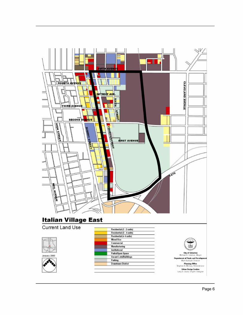
CURRENT LAND USE
As the current land use map indicates,vacant land and vacant buildings accountfor more than one-half of the planningarea. While large parcels of vacant landexist south of E. Second Avenue, vacantland/buildings are located throughout thisportion of Italian Village.
Manufacturing uses also occupy asignificant part of the planning area. Mostof these uses are concentrated east of N.Sixth Street and north of E. SecondAvenue. Other manufacturing uses arefound along N. Fourth Street and E. FifthAvenue.
The planning area also contains residentialuses. While most are low density (1–2units), the area includes some mediumdensity (3–4 units) and high density (>4units) as well as mixed use(residential/commercial). Most residentialuses are located in the northwest quadrantof the planning area. There are alsoresidential uses along the area’s majorcorridors.
Commercial and office uses represent asmaller portion of the planning area.These uses are concentrated along N.Fourth Street and E. Fifth Avenue.
Page 6
Page 7
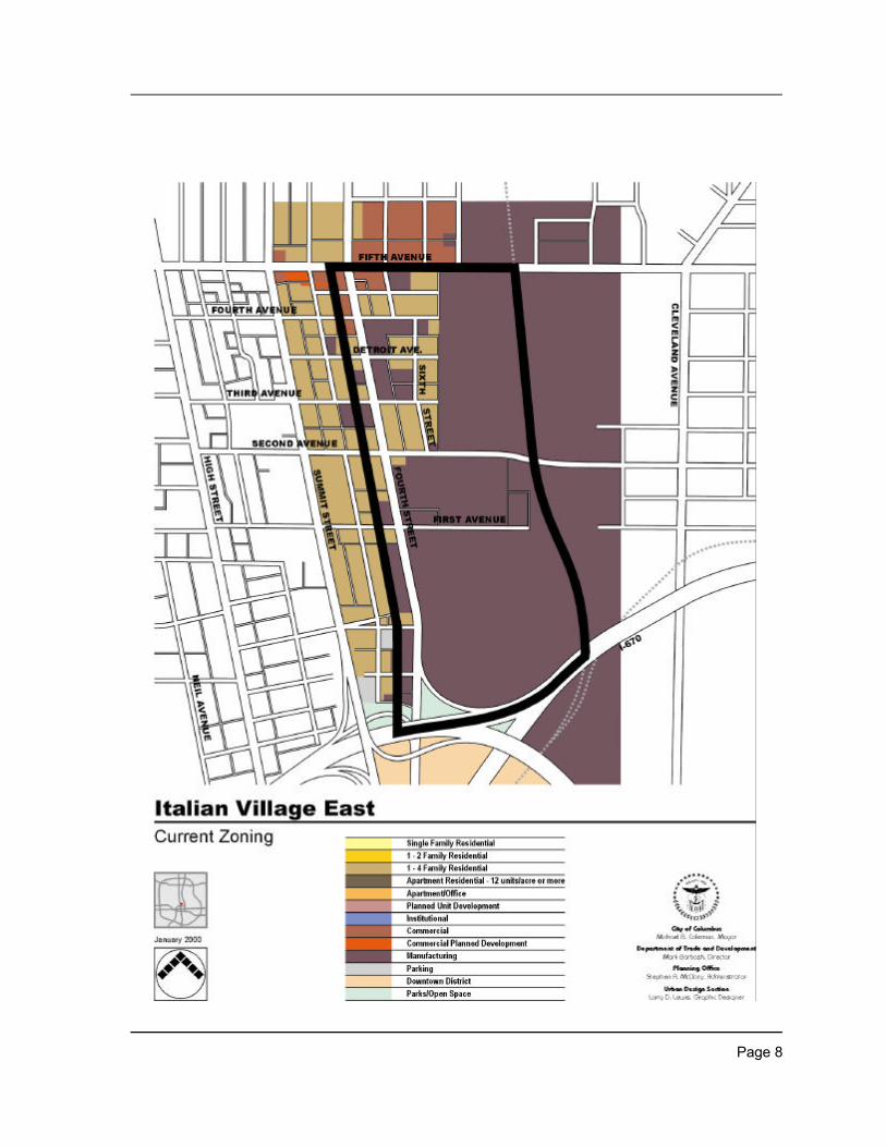
CURRENT ZONING
As the current zoning map indicates, morethan two-thirds of the planning area iszoned for manufacturing. Most of theland zoned Manufacturing is located eastof N. Fourth Street between I-670 and E.Second Avenue and east of N. Sixth Streetbetween E. Second Avenue and E. FifthAvenue. A number of parcels along N.Fourth Street are also zoned formanufacturing. When comparing existingland use with existing zoning, it is evidentthat there is a greater percentage of landzoned Manufacturing than is currentlybeing used for manufacturing.
Approximately one-quarter of the planningarea is zoned for residential (1-4 family).Most of the land zoned Residential isconcentrated in the northwest quadrant ofthe planning area.
A small fraction of the planning area iszoned for commercial. Most of the landzoned Commercial is located along E. FifthAvenue. When comparing existing landuse with existing zoning, it is evident thatthere is a greater percentage of landoccupied by commercial uses than iszoned Commercial.
Page 8
Page 9
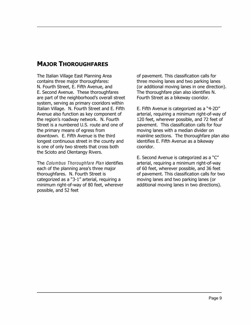
MAJOR THOROUGHFARES
The Italian Village East Planning Areacontains three major thoroughfares:N. Fourth Street, E. Fifth Avenue, andE. Second Avenue. These thoroughfaresare part of the neighborhood’s overall streetsystem, serving as primary cooridors withinItalian Village. N. Fourth Street and E. FifthAvenue also function as key component ofthe region’s roadway network. N. FourthStreet is a numbered U.S. route and one ofthe primary means of egress fromdowntown. E. Fifth Avenue is the thirdlongest continuous street in the county andis one of only two streets that cross boththe Scioto and Olentangy Rivers.
The Columbus Thoroughfare Plan identifieseach of the planning area’s three majorthoroughfares. N. Fourth Street iscategorized as a “3-1” arterial, requiring aminimum right-of-way of 80 feet, whereverpossible, and 52 feet
of pavement. This classification calls forthree moving lanes and two parking lanes(or additional moving lanes in one direction).The thoroughfare plan also identifies N.Fourth Street as a bikeway cooridor.
E. Fifth Avenue is categorized as a “4-2D”arterial, requiring a minimum right-of-way of120 feet, wherever possible, and 72 feet ofpavement. This classification calls for fourmoving lanes with a median divider onmainline sections. The thoroughfare plan alsoidentifies E. Fifth Avenue as a bikewaycooridor.
E. Second Avenue is categorized as a “C”arterial, requiring a minimum right-of-wayof 60 feet, wherever possible, and 36 feetof pavement. This classification calls for twomoving lanes and two parking lanes (oradditional moving lanes in two directions).
Page 10
ASSETS AND LIABILITIES
Jeffrey Mining Site From E. First Avenue
Page 11
CONTEXT OF THE PLANNING AREA
The Italian Village East Planning Areais located directly north of the City’sDowntown District. Its setting places theplanning area in close proximity to majoremployers, cultural and learninginstitutions, and entertainment venues. Itscentral location and adjacency toI-670 and I-71 also makes the planningarea easily accessible from locationsoutside the downtown area.
This section of Italian Village is borderedby Weinland Park and Unityneighborhoods on the north and the Milo–Grogan neighborhood on the East. It isanticipated that these communities willalso benefit from redevelopment of theplanning area.
Located west of the planning areais the remainder of the Italian Villageneighborhood. This portion of the Villagehas experienced significant revitalizationduring the past decade. Much of itshousing stock and many commercialbuildings have been rehabilitated.Improvements to streetscapes in thissection of the neighborhood havesignificantly impacted its visual appeal. Ingeneral, streets and alleys are wellmaintained. The provision of sidewalksthroughout this portion of the Village addsto a pedestrian-friendly environment forits residents. In addition, people living inthis part of the neighborhood have accessto Italian Village Park.
Page 12
GENERAL FEATURES/CHARACTERISTICS
A defining characteristic of the ItalianVillage neighborhood is its mixed land usepattern. This pattern extends into theplanning area along major corridors. N.Fourth Street, E. Second Avenue, and E.Fifth Avenue all have a diverse mix of landuses, including single-family, multi-family,commercial, institutional, office, and/ormanufacturing.
Another key feature of Italian Village is itsgrid street configuration. With theexception of its large tracts of landcurrently/formerly used formanufacturing, this grid pattern iscontinued within the planning area. Somestreets and alleys in this section of theVillage have been vacated, compromisingthe neighborhood’s street system.
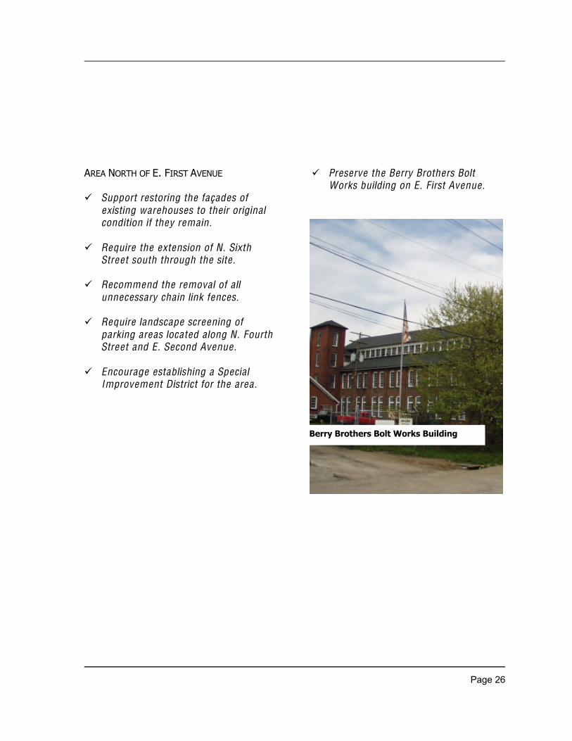
A third element that distinguishes the Villageis its designation as a historic district. As partof this district, the planning area holds specialsignificance because of its building types andarchitecture. Its largest and most importantbuildings reflect the strong presence ofmanufacturing during the late19th and early20th century. One of these structures, theBerry Brothers Bolt Works building, is listedon the National Register of Historic Places.Other significant structures include the JeffreyMining Administrative Office building and theBudd Dairy building. The planning area alsocontains housing from the late 19th century,most of which are single-family framebuildings. A few multi-family row houses alsoremain. While many of the commercialbuildings in the planning area are lesshistoric, several early 20th century structuresstill exist.
UNDEVELOPED/UNDERUTILIZED SITES
Nearly one-half of the planningarea is vacant, undeveloped land.Approximately three-quarters of this landis a single site located betweenI-670 and E. First Avenue. Futuredevelopment of this tract of land, which iszoned Manufacturing, will greatly impactthe neighborhood.
Another large undeveloped site is locatedbetween E. First Avenue andE. Second Avenue. Unlike the vacantland to its south, this site is occupiedby a group of vacant structures. Currently,these buildings are being redeveloped, withsignificant tenants already programmed.Tax abatement was provided for thisredevelopment project. Revitalization of this
Page 13
site will have a significant influence on thesurrounding area. Immediately north of thissite are a number of vacant residentialbuildings that are well suited forrehabilitation.
Another area that contains manyunderutilized sites is the N. Fourth Streetcorridor. Much of the corridor consists ofvacant buildings or inappropriate/marginalland uses. Redevelopment of the N. FourthStreet corridor holds the potential to impactthe Village positively by providing mixed usedevelopment that serves the neighborhoodwhile strengthening its existingdevelopment pattern.
The remaining land currently vacant/undeveloped within the planning areaconsists of multiple parcels that are scatteredthroughout the planning area. These tractsof land are zoned either Residential orManufacturing. Vacant lots east of N. FourthStreet between E. Second Avenue and E.Fifth Avenue provide opportunities forresidential infill development. Many of thevacant lots along N. Fourth Street are wellsuited for commercial infill development.
RECOMMENDATIONS
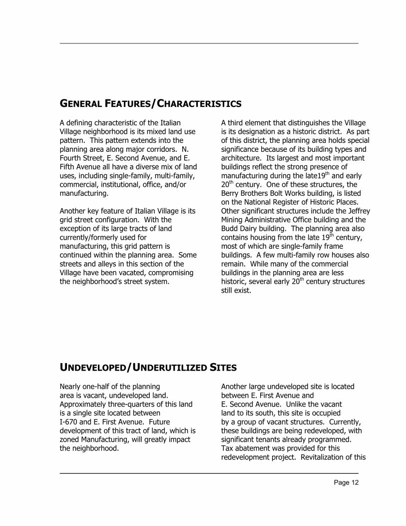
N. Fourth Street between Second & Third Avenues
Page 14
PROPOSED LAND USE
The Italian Village East Planning Areashould reflect the diverse mix of land usesthat characterize the Village. Single andmulti-family residential, retail, office,apartment residential, and variousinstitutional uses are found throughout theneighborhood.
Similarly, the pattern of land uses inthe planning area should be compatible withthe rest of Italian Village. This pattern,characterized by diverse uses that aredensely integrated, forms a successfulneighborhood fabric.Any large, single use within the planningarea would be inconsistent with the Village’sprevailing land use pattern.
The planning committee carefullyconsidered appropriate land uses,providing directives for distinctsubsections and major corridors within theplanning area.
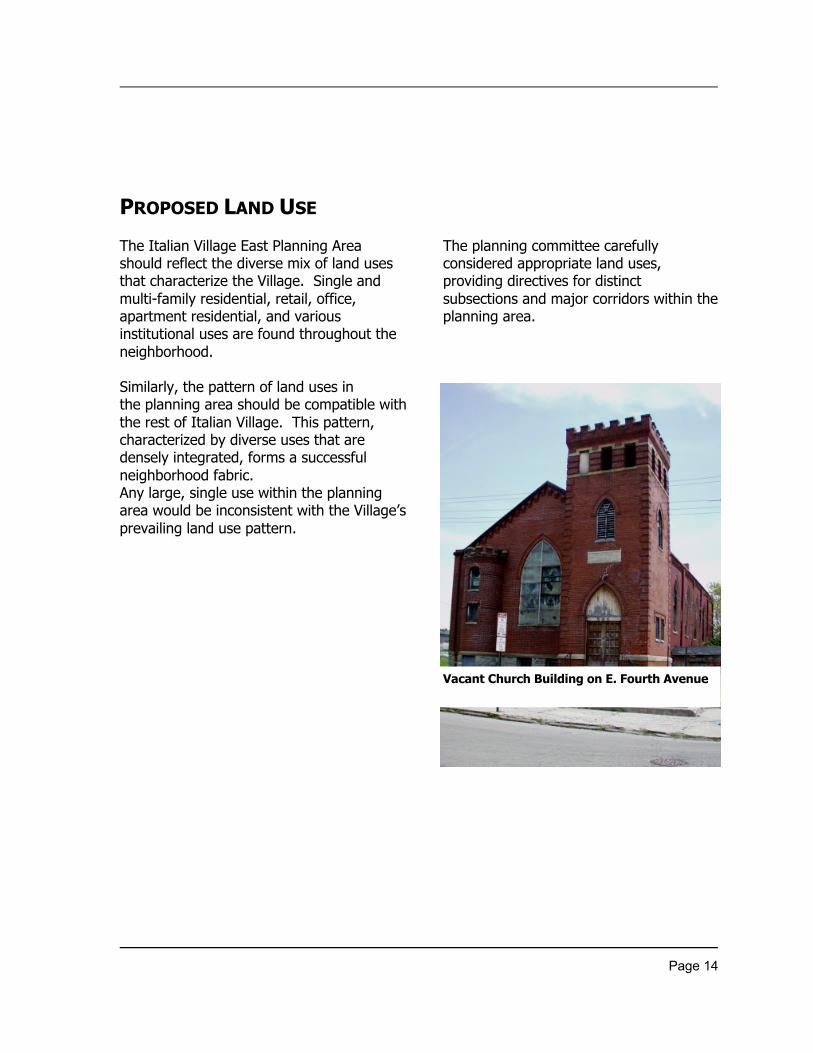
Vacant Church Building on E. Fourth Avenue
Page 15
PROPOSED LAND USE (continued)
¸ The portion of the planning area southof E. Second Avenue should have amixed land use pattern, including twoor more of the following uses: office ,reta il, residentia l, institutiona l, park/recreationa l, light assembly,office/warehouse .
¸ The portion of the planning area northof E. Second Avenue , consisting of E.Third Avenue , E. Fourth Avenue , DetroitAvenue , and N. Sixth Street, shouldinclude only residentia l land uses. Anynew manufacturing uses would not beconducive to maintaining the
existing fabric of single family homesand, therefore , should be discouraged.
¸ The N. Fourth Street corridor shouldhave a mix of commercia l, residentia l,and office land uses. All existingresidentia l buildings a long the corridorshould rema in as residentia l. Any newmanufacturing uses a long N. FourthStreet would be inappropriate and,therefore , should be discouraged.
¸ The E. Fifth Avenue corridor shouldhave a mix of commercia l, residentia l,and office land uses.

Page 16
Page 17
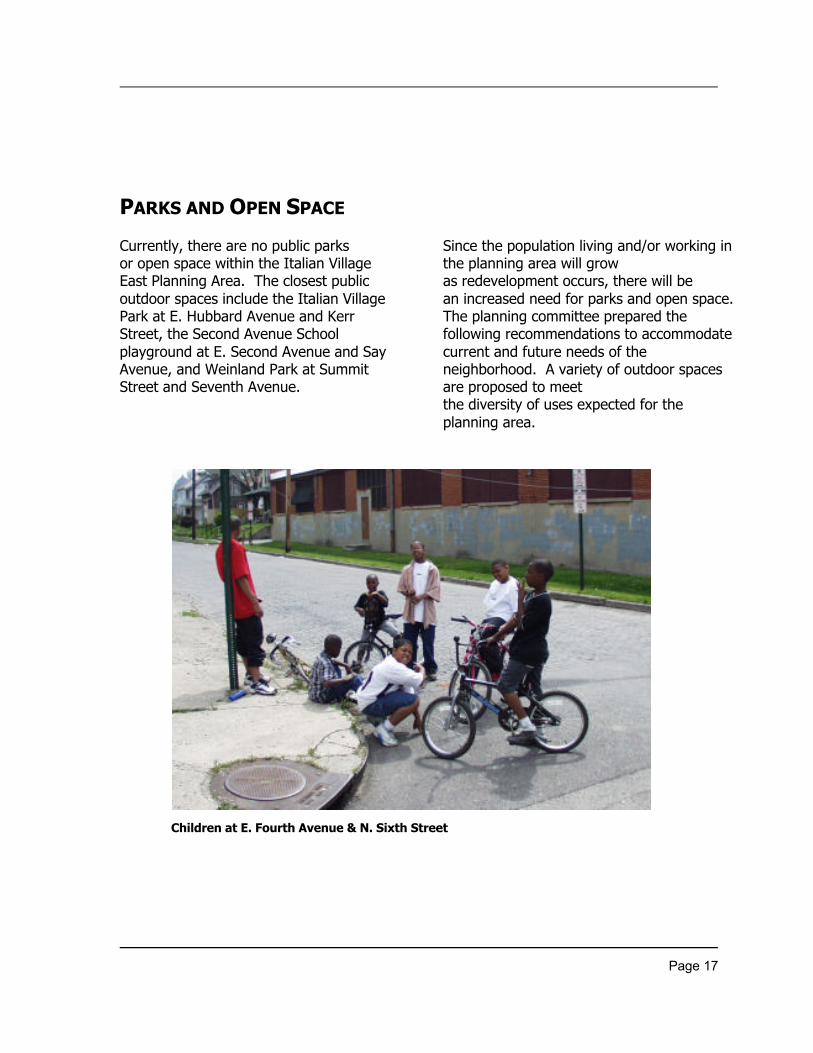
PARKS AND OPEN SPACE
Currently, there are no public parksor open space within the Italian VillageEast Planning Area. The closest publicoutdoor spaces include the Italian VillagePark at E. Hubbard Avenue and KerrStreet, the Second Avenue Schoolplayground at E. Second Avenue and SayAvenue, and Weinland Park at SummitStreet and Seventh Avenue.
Since the population living and/or working inthe planning area will growas redevelopment occurs, there will bean increased need for parks and open space.The planning committee prepared thefollowing recommendations to accommodatecurrent and future needs of theneighborhood. A variety of outdoor spacesare proposed to meetthe diversity of uses expected for theplanning area.
Children at E. Fourth Avenue & N. Sixth Street
Page 18
¸ Encourage park development thatserves the entire Ita lian Villageneighborhood and, specifically, peoplewho live and/or work near the park( � to � mile radius).
¸ Encourage the placement of apark/open space away from majorroadways to serve as a respite fromcongestion.
¸ Encourage the deve lopment of passiveopen space to include items such asponds (aerated), bike paths, benches,public art, and accommodations fordogs.
¸ Encourage deve lopment of a linearpark (with bike path connections)where appropriate .
¸ Endorse public open space that ismaintained by the city, the MarthaWa lker Garden Club, and/or otherentities.
¸ Require the dedication of parklandwhen rezoning land within theplanning area . Encourage thedonation of vacant land for park(s)and open space when rezoning is notrequired.
Page 19
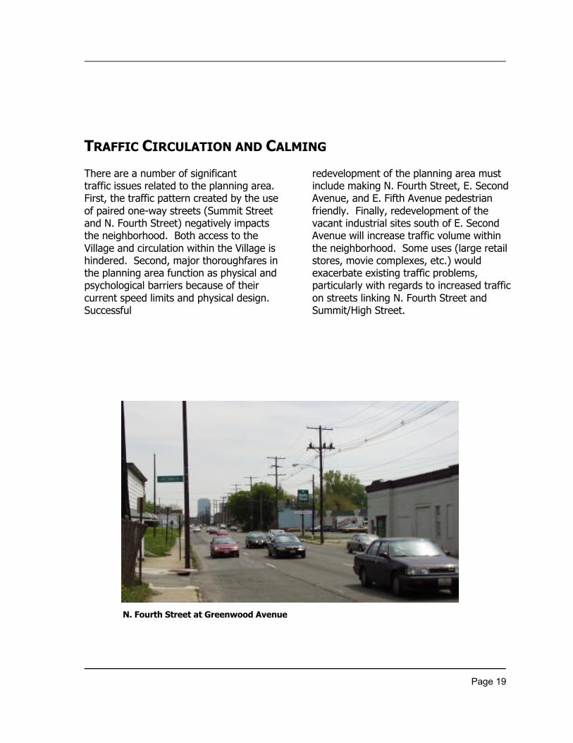
TRAFFIC CIRCULATION AND CALMING
There are a number of significanttraffic issues related to the planning area.First, the traffic pattern created by the useof paired one-way streets (Summit Streetand N. Fourth Street) negatively impactsthe neighborhood. Both access to theVillage and circulation within the Village ishindered. Second, major thoroughfares inthe planning area function as physical andpsychological barriers because of theircurrent speed limits and physical design.Successful
redevelopment of the planning area mustinclude making N. Fourth Street, E. SecondAvenue, and E. Fifth Avenue pedestrianfriendly. Finally, redevelopment of thevacant industrial sites south of E. SecondAvenue will increase traffic volume withinthe neighborhood. Some uses (large retailstores, movie complexes, etc.) wouldexacerbate existing traffic problems,particularly with regards to increased trafficon streets linking N. Fourth Street andSummit/High Street.
N. Fourth Street at Greenwood Avenue
Page 20
¸ Consider two-way operations onSummit and N. Fourth Streets whenmajor a lterations in trave l modes,patterns and/or volumes within theregion occur.
¸ Encourage slower trafficthroughout the planning areaby providing consistent trafficenforcement, increasing on-streetparking/ lifting parking restrictions, andinsta lling traffic ca lming devices.These strategies will improve thequa lity of life for residents and he lpretail stores along major thoroughfaresvia increased pedestrian traffic.
¸ Increase the number of freewaydirectiona l and truck traffic routingsigns throughout the planning area .
¸ Insta ll “Reduce Speed Zone” signs andflashers on N. Fourth Street inadvance of Second Avenue .
¸ Insta ll a traffic signa l, if warranted andapproved, at the new proposed on-rampto I-670 from N. Fourth Street. Trafficexiting I-670 via the reconfigured off-ramp recommended in this plan woulda lso be controlled by this signa l.
¸ Insta ll a traffic signa l, if warranted andapproved, at the intersection of N.Fourth and Warren Streets if the I-670off-ramp is reconfigured asrecommended in this plan.
¸ Respect the ne ighborhood’s existinggrid street system in futuredeve lopment south ofE. Second Avenue .
Page 21
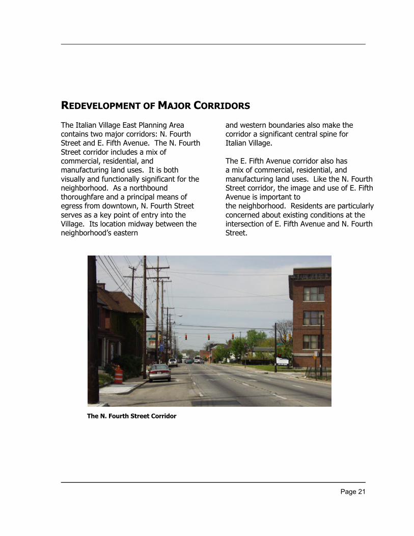
REDEVELOPMENT OF MAJOR CORRIDORS
The Italian Village East Planning Areacontains two major corridors: N. FourthStreet and E. Fifth Avenue. The N. FourthStreet corridor includes a mix ofcommercial, residential, andmanufacturing land uses. It is bothvisually and functionally significant for theneighborhood. As a northboundthoroughfare and a principal means ofegress from downtown, N. Fourth Streetserves as a key point of entry into theVillage. Its location midway between theneighborhood’s eastern
and western boundaries also make thecorridor a significant central spine forItalian Village.
The E. Fifth Avenue corridor also hasa mix of commercial, residential, andmanufacturing land uses. Like the N. FourthStreet corridor, the image and use of E. FifthAvenue is important tothe neighborhood. Residents are particularlyconcerned about existing conditions at theintersection of E. Fifth Avenue and N. FourthStreet.
The N. Fourth Street Corridor
Page 22
N. FOURTH STREET CORRIDOR
¸ Deve lop a commercia l corridorthat serves Italian Village andsurrounding ne ighborhoods.
¸ Consider rezoning parce ls currently zoningManufacturing to Commercial.
¸ Consider establishing a SpecialImprovement District for the corridor.
¸ Support reta il and office uses on the firstfloor of new and existing non-residentia lbuildings, with mixed uses (commercia land/or residential) on the second andthird floors.
¸ Discourage new manufacturing uses 1)between E. Second and E. Fifth Avenueswest of the a lley east of N. Sixth Streetand 2) between I-670 and E. Fifth Avenuewest of N. Fourth Street. In areascurrently zoned manufacturing, newdeve lopment should not pose a negativeenvironmental impact on the area .
¸ Ma inta in residentia l use of existingsingle and multi-family housingstructures located a long the corridor.
¸ Apply the Urban Commercia l Overlay toboth sides of N. Fourth Street.
E. Fifth Avenue Corridor
¸ Support reta il and office uses on thefirst floor of new and existing buildingslocated on the south side of E. FifthAvenue , with mixed uses (commercia land/or residential) on the second andthird floors.
¸ Support redeve lopment of parce ls/buildings at the intersection of E. FifthAvenue and N. Fourth Street.
¸ Apply the Urban Commercia l Overlay tothe south side of E. Fifth Avenue(excluding the area around theunderpass).
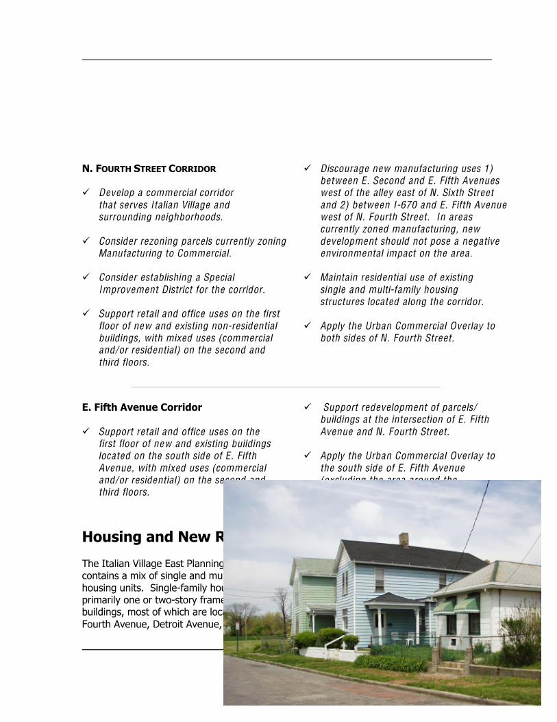
Housing and New Residential Development
The Italian Village East Planning Areacontains a mix of single and multi-familyhousing units. Single-family houses areprimarily one or two-story framebuildings, most of which are located on E.Fourth Avenue, Detroit Avenue, and N.
Sixth Street. Multi-family units consistmainly of brick row houses along N.Fourth Street.
Page 23
Within the planning area, much ofthe land zoned for residential use iscurrently vacant. These lots areappropriate for new housing development.Similarly, there are a number of former
warehouse and manufacturing buildingsthat arewell suited for redevelopment asresidential lofts.
¸ Encourage an increase in owner-occupied housing within theIta lian Village East planning area .
¸ Encourage a mix of owner-occupiedsingle-family, two-family and rowhouse units.
¸ Support the continuation of theexisting fabric of single-family homesbetween E. Second Avenue and E.Fifth Avenue .
¸ Require that infill development becompatible with surroundingresidentia l buildings in he ight, setbackand fenestration.
¸ Support loft-style units in existing andnew buildings east of N. Fourth Street.
¸ Require appropriate buffering a longindustria l uses. If space is limited,vertical landscaping should be planted.
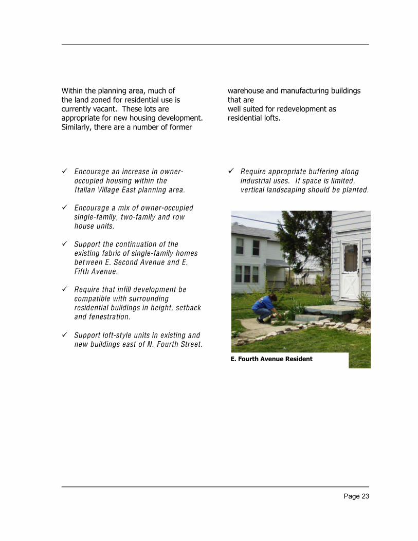
E. Fourth Avenue Resident

Page 24
Page 25
REDEVELOPMENT OF FORMER INDUSTRIAL SITES
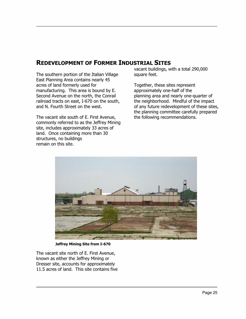
The southern portion of the Italian VillageEast Planning Area contains nearly 45acres of land formerly used formanufacturing. This area is bound by E.Second Avenue on the north, the Conrailrailroad tracts on east, I-670 on the south,and N. Fourth Street on the west.
The vacant site south of E. First Avenue,commonly referred to as the Jeffrey Miningsite, includes approximately 33 acres ofland. Once containing more than 30structures, no buildingsremain on this site.
The vacant site north of E. First Avenue,known as either the Jeffrey Mining orDresser site, accounts for approximately11.5 acres of land. This site contains five
vacant buildings, with a total 290,000square feet.
Together, these sites representapproximately one-half of theplanning area and nearly one-quarter ofthe neighborhood. Mindful of the impactof any future redevelopment of these sites,the planning committee carefully preparedthe following recommendations.
Jeffrey Mining Site from I-670
Page 26
AREA NORTH OF E. FIRST AVENUE
¸ Support restoring the façades ofexisting warehouses to the ir originalcondition if they rema in.
¸ Require the extension of N. SixthStreet south through the site .
¸ Recommend the remova l of a llunnecessary chain link fences.
¸ Require landscape screening ofparking areas located a long N. FourthStreet and E. Second Avenue .
¸ Encourage establishing a SpecialImprovement District for the area .
¸ Preserve the Berry Brothers BoltWorks building on E. First Avenue .
Berry Brothers Bolt Works Building
Page 27
REDEVELOPMENT SITES (continued)
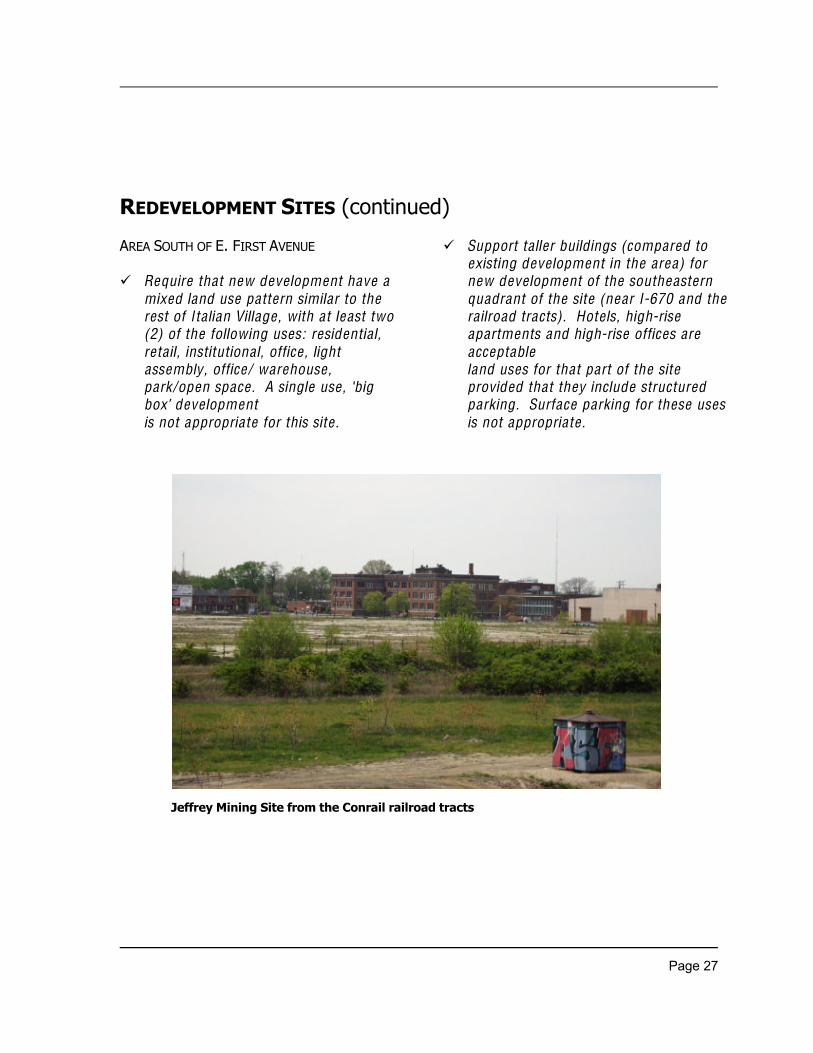
AREA SOUTH OF E. FIRST AVENUE
¸ Require that new development have amixed land use pattern similar to therest of Ita lian Village , with at least two(2) of the following uses: residentia l,retail, institutional, office , lightassembly, office/ warehouse ,park/open space . A single use , ‘bigbox’ deve lopmentis not appropriate for this site .
¸ Support taller buildings (compared toexisting deve lopment in the area) fornew deve lopment of the southeasternquadrant of the site (near I-670 and thera ilroad tracts). Hote ls, high-riseapartments and high-rise offices areacceptableland uses for that part of the siteprovided that they include structuredparking. Surface parking for these usesis not appropriate .
Jeffrey Mining Site from the Conrail railroad tracts
Page 28
¸ Require new development to blendwith the character of existingarchitecture . Architecture that exhibitsexce llence in design and materialsshould be permitted so long as itcomplies with existing historicpreservation codes for the city andestablished guide lines for Ita lianVillage .
¸ Require that new deve lopment alongN. Fourth Street, E. First Avenue , andE. Second Avenue coordinate withexisting buildings in terms of setback,massing, sca le and fenestration.
¸ Require streetscape e lements,including streetlights, trees, benches,etc. a long N. Fourth Street, E. FirstAvenue , and E. Second Avenue .
¸ Encourage pedestrian and vehicularconnections, including the extensionof N. Sixth and Warren Streets intothe site .
¸ Encourage development that does notadverse ly affect residentia lne ighborhoods west of N. FourthStreet, specifica lly in regards to crossstreet traffic.
¸ Encourage the future deve loper(s) toset aside area for public open space .
Page 29
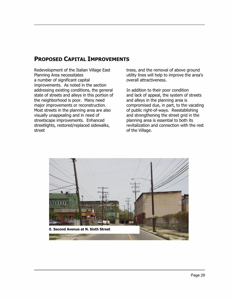
PROPOSED CAPITAL IMPROVEMENTS
Redevelopment of the Italian Village EastPlanning Area necessitatesa number of significant capitalimprovements. As noted in the sectionaddressing existing conditions, the generalstate of streets and alleys in this portion ofthe neighborhood is poor. Many needmajor improvements or reconstruction.Most streets in the planning area are alsovisually unappealing and in need ofstreetscape improvements. Enhancedstreetlights, restored/replaced sidewalks,street
trees, and the removal of above groundutility lines will help to improve the area’soverall attractiveness.
In addition to their poor conditionand lack of appeal, the system of streetsand alleys in the planning area iscompromised due, in part, to the vacatingof public right-of-ways. Reestablishingand strengthening the street grid in theplanning area is essential to both itsrevitalization and connection with the restof the Village.
E. Second Avenue at N. Sixth Street
Page 30
¸ Encourage upgrades to the roadwaysystem infrastructure – streets, a lleys,curbs, gutters, etc.
¸ Resurface N. Fourth Street, insta llbulb-outs at key intersections, andprovide a curb lane for bike traffic.
¸ Replace curbs on E. Fifth Avenue eastof N. Fourth Street.
¸ Require the maintenance/restoration ofexisting brick streets.
¸ Encourage the improvement ofexisting a lleys and restoration ofabandoned a lleys.
¸ Mitigate storm water problems.Determine the adequacy of stormsewers and increase the ir capacity asrequired.
¸ Encourage the buria l of utility linesthroughout the area .
¸ Require streetlights, sidewa lks, streettrees, benches, and otherimprovements throughout the area toimprove the qua lity of life forpedestrians.
¸ Conduct sidewalk replacement on N.Fourth Street, E. Fifth Avenue , andother locations as needed.
¸ Establish park(s) and open space inthe planning area .
Page 31
Other AreaImprovements
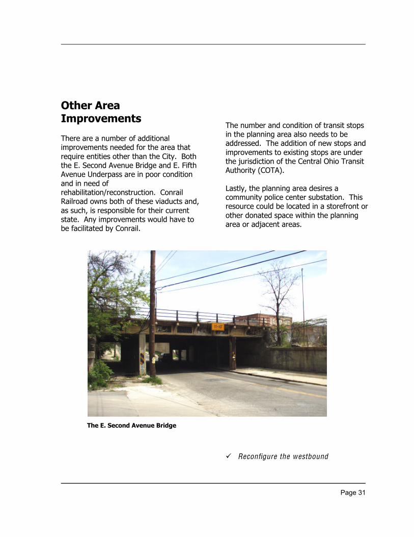
There are a number of additionalimprovements needed for the area thatrequire entities other than the City. Boththe E. Second Avenue Bridge and E. FifthAvenue Underpass are in poor conditionand in need ofrehabilitation/reconstruction. ConrailRailroad owns both of these viaducts and,as such, is responsible for their currentstate. Any improvements would have tobe facilitated by Conrail.
The number and condition of transit stopsin the planning area also needs to beaddressed. The addition of new stops andimprovements to existing stops are underthe jurisdiction of the Central Ohio TransitAuthority (COTA).
Lastly, the planning area desires acommunity police center substation. Thisresource could be located in a storefront orother donated space within the planningarea or adjacent areas.
¸ Reconfigure the westbound
The E. Second Avenue Bridge
Page 32
off-ramp from I-670 so that itterminates at N. Fourth Street, a lieningwith the new westbound on-rampproposed as part of the Spring-Sandusky Interchange .
¸ Rebuild the N. Fourth Street underpass,proposed as part of theSpring/Sandusky Interchange , so that itis pedestrian friendly and visua llyappealing.
¸ Increase the he ight of the E. SecondAvenue Bridge to 13’ 6” and rebuildthe reta ining wa lls so that they arestructurally sound and aestheticallypleasing.
¸ Rehabilitate the E. Fifth Avenueunderpass, making it pedestrian friendlyand visually appealing.
¸ Establish a ra il station on E. FifthAvenue and/or the Jeffrey Mining site ifit is determined that ra il transportationis feasible for the metropolitan area .
¸ Improve existing transit stops withinthe area , including the addition ofshe lters and stopping pads, andencourage the addition of new stops.
¸ Encourage development of acommunity police substation within/orin close proximity to the planningarea .
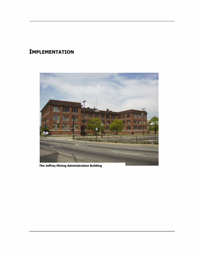
IMPLEMENTATION
The Jeffrey Mining Administration Building
Page 33
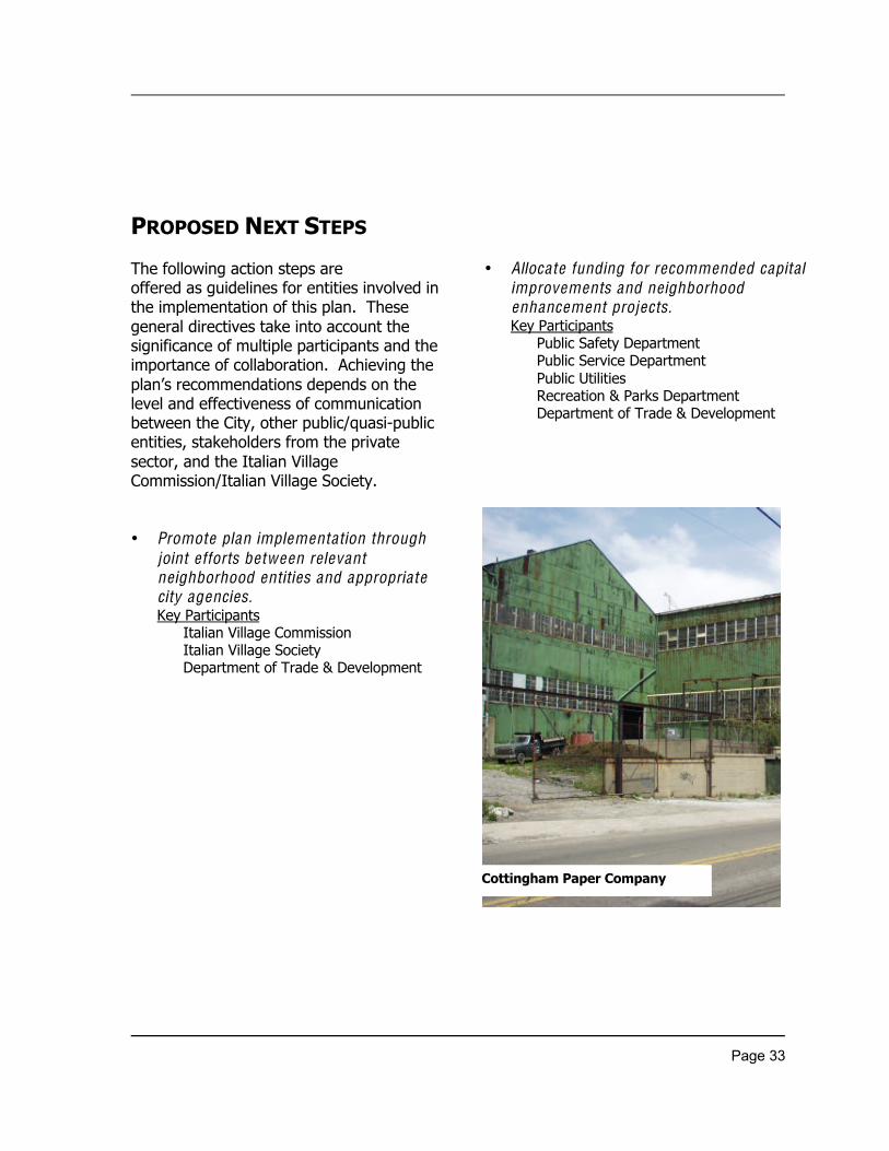
PROPOSED NEXT STEPS
The following action steps areoffered as guidelines for entities involved inthe implementation of this plan. Thesegeneral directives take into account thesignificance of multiple participants and theimportance of collaboration. Achieving theplan’s recommendations depends on thelevel and effectiveness of communicationbetween the City, other public/quasi-publicentities, stakeholders from the privatesector, and the Italian VillageCommission/Italian Village Society.
• Promote plan implementation throughjoint efforts between re levantneighborhood entities and appropriatecity agencies.Key Participants
Italian Village CommissionItalian Village SocietyDepartment of Trade & Development
• Allocate funding for recommended capitalimprovements and neighborhoodenhancement projects.Key Participants
Public Safety DepartmentPublic Service DepartmentPublic UtilitiesRecreation & Parks DepartmentDepartment of Trade & Development
Cottingham Paper Company
Page 34
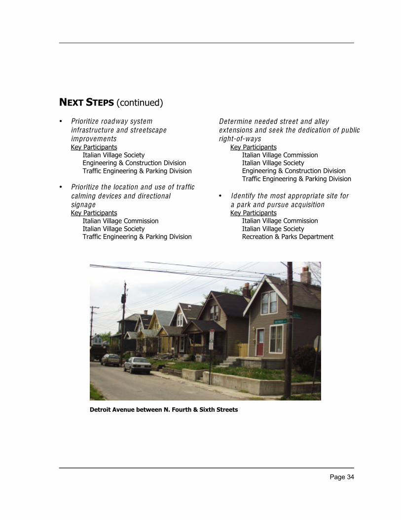
NEXT STEPS (continued)
• Prioritize roadway systeminfrastructure and streetscapeimprovementsKey Participants
Italian Village SocietyEngineering & Construction DivisionTraffic Engineering & Parking Division
• Prioritize the location and use of trafficcalming devices and directionalsignageKey Participants
Italian Village CommissionItalian Village SocietyTraffic Engineering & Parking Division
Determine needed street and a lleyextensions and seek the dedication of publicright-of-ways
Key ParticipantsItalian Village CommissionItalian Village SocietyEngineering & Construction DivisionTraffic Engineering & Parking Division
• Identify the most appropriate site fora park and pursue acquisitionKey Participants
Italian Village CommissionItalian Village SocietyRecreation & Parks Department
Detroit Avenue between N. Fourth & Sixth Streets
Page 35
• Establish/maintain dialogue regardingdeve lopment of the vacant site southof E. First AvenueKey Participants
Italian Village CommissionItalian Village Society
Developer(s) & AssociatesDepartment of Trade & Development
• Continue dialogue regardingredeve lopment of the vacant sitenorth of E. First AvenueKey Participants
Italian Village CommissionItalian Village SocietyDeveloper(s) & AssociatesDepartment of Trade & Development
• Establish the N. Fourth Street corridor asa Special Improvement District (SID)Key Participants
Italian Village NeighborhoodDepartment of Trade & Development
• Create an Urban Commercial OverlayDistrict for Italian Village , including theeast and west sides of N. Fourth Streetand south side of E. Fifth Avenue .Key Participants
Italian Village CommissionItalian Village SocietyDepartment of Trade & Development
• Address needed improvements to theE. Second Avenue bridge and E. FifthAvenue underpassKey Participants
Italian Village CommissionItalian Village SocietyConrail RailroadEngineering & Construction Division
Page 36
Financial Incentives
Several programs have been set up by thecity of Columbus and other agencies to offerassistance with redevelopment costs forqualified projects. The following list is toserve as a resource to potential developers.This list is not exhaustive and all programslisted may not apply to every site. Forfurther information, contact the BusinessDevelopment Office at 645-6427.
ÿ Tax Increment FinancingLocal legislative authority may redirectreal property taxes on improvements tofinance public infrastructureimprovements connected to the project.
ÿ Enterprise ZonesProvides real property and personalproperty tax exemptions for businessesthat expand in or relocate to designatedenterprise zones.
ÿ Columbus Job Creation Tax CreditThis program is similar to andpiggybacks on the Ohio Job Creation
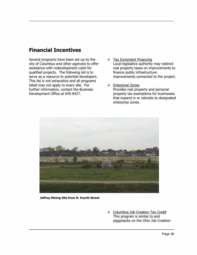
Jeffrey Mining Site from N. Fourth Street
Page 37
Tax Credit program. Columbus utilizesa combined application process tostreamline the process. Applicantmust make a best effort to achieve 10percent hiring of new employees whoare disadvantaged persons.
ÿ Columbus Growth FundPrimarily to finance working capital,owner occupied real estate acquisitionor rehabilitation, and equipment.
ÿ Columbus Business Development FundFinances fixed-asset purchases forsmall business located in the city ofColumbus.
ÿ Columbus Working Capital LoanProgramFor small businesses located in thecity of Columbus.
ÿ SBA Section 7(a) Bank Guaranty LoanAvailable to for profit small businessowners.
ÿ SBA Low Documentation LoanSmall business with annual sales of$5,000,000 or less, and 200 or feweremployees.
ÿ SBA 504 LoanSmall or medium business, net worthbelow $6 million, profits below$2million.
Page 38
Resources for Revitalization
A number of programs and toolshave been established by the city ofColumbus to promote the revitalization ofolder, central city neighborhoods. Thefollowing list, highlighting major resources,is intended to serve as a guide forcommunity leaders, residents, and areastakeholders.
ÿ Capital ImprovementsEach year the city of Columbus adoptsa Capital Improvements Budget (CIB)and a Capital
Improvements Program (CIP). TheCIB includes projects for one fiscalyear and the CIP is a six-yearprogram. To qualify to be on the CIBand the CIP the improvements mustbe city-owned, cost $5,000 or more,and last 5 years or more. Eachdepartment of the city puts together alist of projects to be on the CIP. Tosee if a project in your area is on theCIP contact the appropriatedepartment. The following are thedepartments to
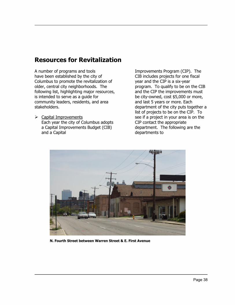
N. Fourth Street between Warren Street & E. First Avenue
Page 39
contact: Public Utilities, Public Service,Recreation and Parks, Public Safety, andTrade and Development. To obtain acopy of the current CIP, contact theFinance Department at 645-8200.
ÿ Physical ImprovementsThe Urban Infrastructure RecoveryFund (UIRF) was created in 1992 toreverse the trend of urban declineand share the decision-making aboutpublic investment with area residents.UIRF resources are used forinfrastructure repairs and for specialfeatures that will enhance aneighborhood. For more information,call Housing and Community Servicesat 645-6679.
ÿ Tools for Commercial CorridorThe Urban Commercial Overlay wasadopted in 1999 to help improve
older, central city commercial corridors.The purpose of the overlay is to protectand/or re- establish the uniquecharacter of central city commercialcorridors and to encourage investmentwithin compatibly designeddevelopment. Designation of corridorsis established by City Council. Formore information, call the PlanningOffice at 645-7565.
ÿ Housing-Related ProgramsThe city of Columbus offers assistanceto homeowners/buyers through itsHousing and Community Servicessection. Programs may offer assistanceon down payments, emergency repairs,and referrals to other agencies. Formore information, call the Housing andCommunity Services at 645-8526.
