jaipur, evolution of an indian city _ archinomy.pdf
TRANSCRIPT

2/25/2015 Jaipur, Evolution of an Indian City | Archinomy
http://www.archinomy.com/casestudies/1906/jaipurevolutionofanindiancity 1/20
HOME CASE STUDIES & MORE IMAGE GALLERY FORUM POLL CONTACT REGISTER LOG IN
USER LOGIN
Username or email: *
Password: *
Create new accountForgot your password?
Random image
NEW FORUM TOPICSWhat you should know beforeyou renovateNeed Guidance: In theprocess of searching for athesis topicThesis:The redevelopment ofa Market!Hospital Case StudiesAll about roof warrantiesThesis JuvenileRehabilitation Centre casestudy ?Launch of design ideascompetition for Lung TsunStone Bridge Remnantspreservation corridorOld age home thesis topicB.ArchHow to prepare for B.ArchAIEEE/JEEE main paper 2
more
PollDoes an architect losecredibility if he can’t sketch?:
One who can't draw sketchesisn't good enough to be anarchitect.
Sketching is just a skill, what'simportant is the "concept".
I think if one can think of goodconcepts, then he can draw too..
This question is absurd.
TAGSgolden gate bridge factsjagamohan jahangiri mahaljawahar kala kendra jawaharkala kendra interior jawahar kalakendra plan jian wai soho khalifatower khas mahal kingpandukabhaya konark suntemple konark temple konark
Jaipur, Evolution of an Indian City
Jaipur lies at a distance of about 200 miles from Delhi, 150 miles from Agra and 84 miles from Ajmer. Capital city of Rajasthan is
located amidst the Aravali hill ranges at an altitude of about 430 m above sea level.
Latitude – 26 55’
Longitude – 75 50’
Log in
Vote
.COM Domain Names @ Rs 79Only Few Domains Left. Hurry! Register Your Domain Now.
2/25/2015 Jaipur, Evolution of an Indian City | Archinomy
http://www.archinomy.com/casestudies/1906/jaipurevolutionofanindiancity 2/20
temple history macchi bhawanmanikarnika ghat maya devimandir
more tags
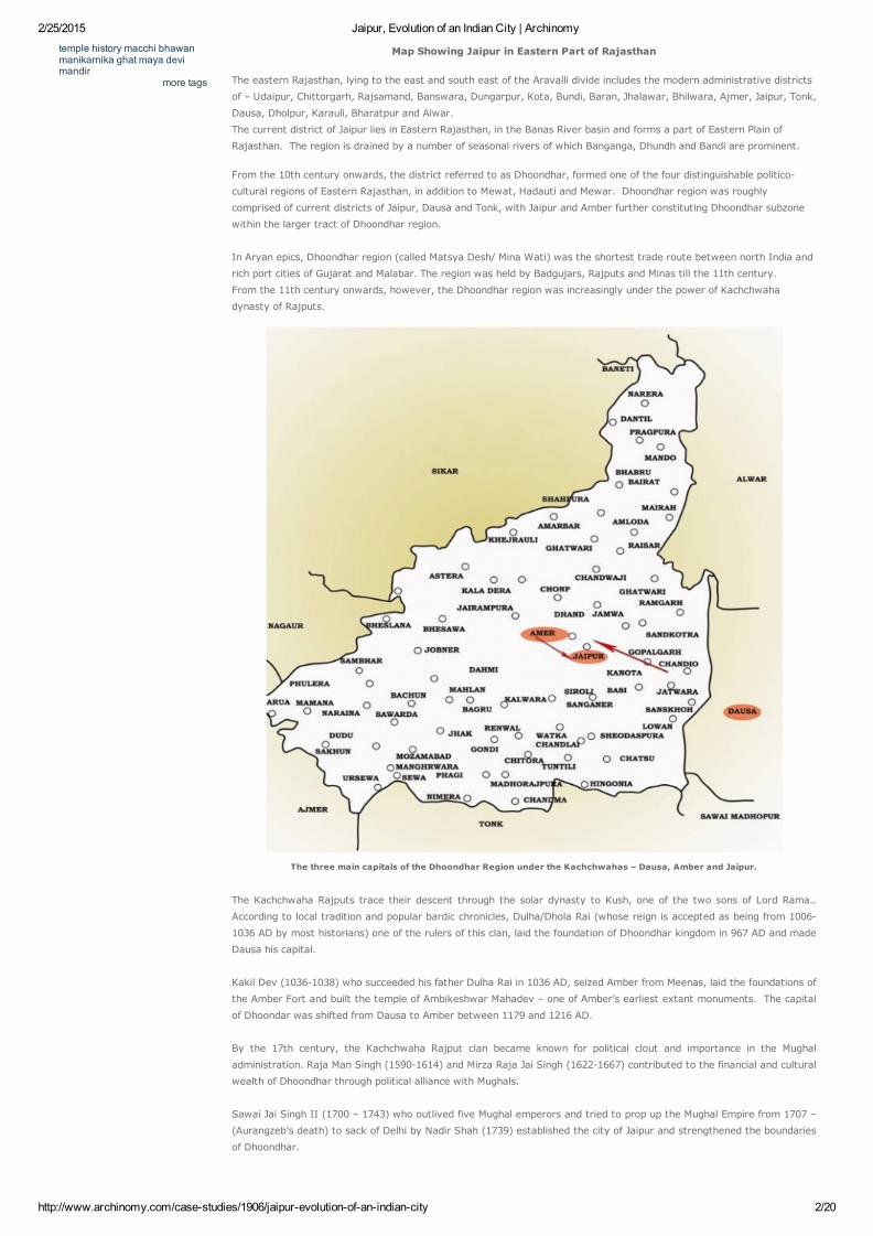
Map Showing Jaipur in Eastern Part of Rajasthan
The eastern Rajasthan, lying to the east and south east of the Aravalli divide includes the modern administrative districts
of – Udaipur, Chittorgarh, Rajsamand, Banswara, Dungarpur, Kota, Bundi, Baran, Jhalawar, Bhilwara, Ajmer, Jaipur, Tonk,
Dausa, Dholpur, Karauli, Bharatpur and Alwar.
The current district of Jaipur lies in Eastern Rajasthan, in the Banas River basin and forms a part of Eastern Plain of
Rajasthan. The region is drained by a number of seasonal rivers of which Banganga, Dhundh and Bandi are prominent.
From the 10th century onwards, the district referred to as Dhoondhar, formed one of the four distinguishable politico
cultural regions of Eastern Rajasthan, in addition to Mewat, Hadauti and Mewar. Dhoondhar region was roughly
comprised of current districts of Jaipur, Dausa and Tonk, with Jaipur and Amber further constituting Dhoondhar subzone
within the larger tract of Dhoondhar region.
In Aryan epics, Dhoondhar region (called Matsya Desh/ Mina Wati) was the shortest trade route between north India and
rich port cities of Gujarat and Malabar. The region was held by Badgujars, Rajputs and Minas till the 11th century.
From the 11th century onwards, however, the Dhoondhar region was increasingly under the power of Kachchwaha
dynasty of Rajputs.
The three main capitals of the Dhoondhar Region under the Kachchwahas – Dausa, Amber and Jaipur.
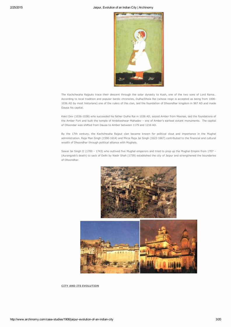
The Kachchwaha Rajputs trace their descent through the solar dynasty to Kush, one of the two sons of Lord Rama..
According to local tradition and popular bardic chronicles, Dulha/Dhola Rai (whose reign is accepted as being from 1006
1036 AD by most historians) one of the rulers of this clan, laid the foundation of Dhoondhar kingdom in 967 AD and made
Dausa his capital.
Kakil Dev (10361038) who succeeded his father Dulha Rai in 1036 AD, seized Amber from Meenas, laid the foundations of
the Amber Fort and built the temple of Ambikeshwar Mahadev – one of Amber’s earliest extant monuments. The capital
of Dhoondar was shifted from Dausa to Amber between 1179 and 1216 AD.
By the 17th century, the Kachchwaha Rajput clan became known for political clout and importance in the Mughal
administration. Raja Man Singh (15901614) and Mirza Raja Jai Singh (16221667) contributed to the financial and cultural
wealth of Dhoondhar through political alliance with Mughals.
Sawai Jai Singh II (1700 – 1743) who outlived five Mughal emperors and tried to prop up the Mughal Empire from 1707 –
(Aurangzeb’s death) to sack of Delhi by Nadir Shah (1739) established the city of Jaipur and strengthened the boundaries
of Dhoondhar.
2/25/2015 Jaipur, Evolution of an Indian City | Archinomy
http://www.archinomy.com/casestudies/1906/jaipurevolutionofanindiancity 3/20
The Kachchwaha Rajputs trace their descent through the solar dynasty to Kush, one of the two sons of Lord Rama..
According to local tradition and popular bardic chronicles, Dulha/Dhola Rai (whose reign is accepted as being from 1006
1036 AD by most historians) one of the rulers of this clan, laid the foundation of Dhoondhar kingdom in 967 AD and made
Dausa his capital.
Kakil Dev (10361038) who succeeded his father Dulha Rai in 1036 AD, seized Amber from Meenas, laid the foundations of
the Amber Fort and built the temple of Ambikeshwar Mahadev – one of Amber’s earliest extant monuments. The capital
of Dhoondar was shifted from Dausa to Amber between 1179 and 1216 AD.
By the 17th century, the Kachchwaha Rajput clan became known for political clout and importance in the Mughal
administration. Raja Man Singh (15901614) and Mirza Raja Jai Singh (16221667) contributed to the financial and cultural
wealth of Dhoondhar through political alliance with Mughals.
Sawai Jai Singh II (1700 – 1743) who outlived five Mughal emperors and tried to prop up the Mughal Empire from 1707 –
(Aurangzeb’s death) to sack of Delhi by Nadir Shah (1739) established the city of Jaipur and strengthened the boundaries
of Dhoondhar.
CITY AND ITS EVOLUTION

2/25/2015 Jaipur, Evolution of an Indian City | Archinomy
http://www.archinomy.com/casestudies/1906/jaipurevolutionofanindiancity 4/20
Site selection
Reasons for Maharaja Sawai Jai Singh to change his capital from Amber to Jaipur:
Military ReasonsDefence was an important consideration. A site at the South of Amber ensured greater distance from Delhi and also
prevented the expansion of the city in that direction. It was clear that the out skirting hill ranges (Nahargarh hills) shaped
as a horseshoe would allow the new city to expand only in the South. So this flat site with a basin like shape was chosen.
It was an open plain bounded on the northwest and east by hills.
Earlier rajput capitals were established in the hills, and so moving capital to the plains was an ex of Sawan Jai Singh's
boldness.
2/25/2015 Jaipur, Evolution of an Indian City | Archinomy
http://www.archinomy.com/casestudies/1906/jaipurevolutionofanindiancity 5/20
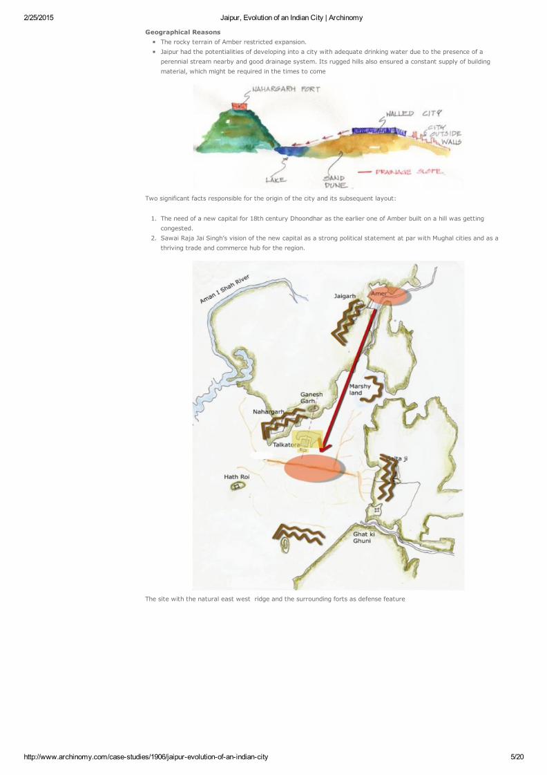
Geographical ReasonsThe rocky terrain of Amber restricted expansion.Jaipur had the potentialities of developing into a city with adequate drinking water due to the presence of aperennial stream nearby and good drainage system. Its rugged hills also ensured a constant supply of buildingmaterial, which might be required in the times to come
Two significant facts responsible for the origin of the city and its subsequent layout:
1. The need of a new capital for 18th century Dhoondhar as the earlier one of Amber built on a hill was gettingcongested.
2. Sawai Raja Jai Singh’s vision of the new capital as a strong political statement at par with Mughal cities and as athriving trade and commerce hub for the region.
The site with the natural east west ridge and the surrounding forts as defense feature
2/25/2015 Jaipur, Evolution of an Indian City | Archinomy
http://www.archinomy.com/casestudies/1906/jaipurevolutionofanindiancity 6/20
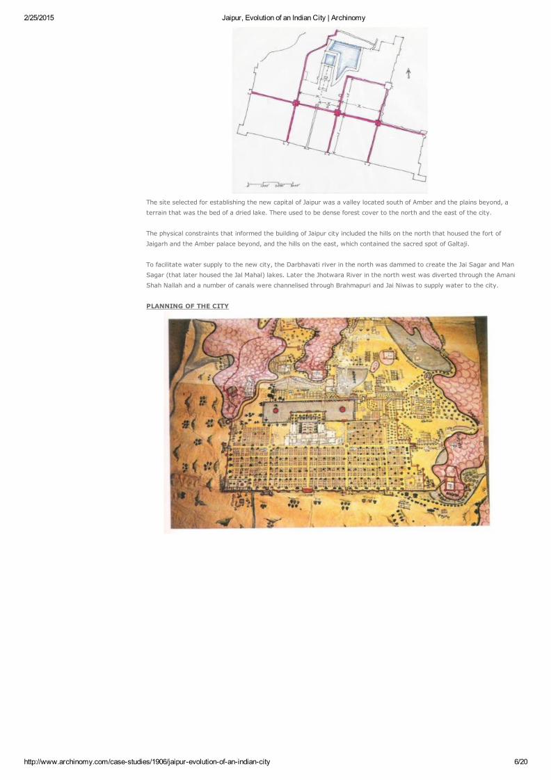
The site selected for establishing the new capital of Jaipur was a valley located south of Amber and the plains beyond, a
terrain that was the bed of a dried lake. There used to be dense forest cover to the north and the east of the city.
The physical constraints that informed the building of Jaipur city included the hills on the north that housed the fort of
Jaigarh and the Amber palace beyond, and the hills on the east, which contained the sacred spot of Galtaji.
To facilitate water supply to the new city, the Darbhavati river in the north was dammed to create the Jai Sagar and Man
Sagar (that later housed the Jal Mahal) lakes. Later the Jhotwara River in the north west was diverted through the Amani
Shah Nallah and a number of canals were channelised through Brahmapuri and Jai Niwas to supply water to the city.
PLANNING OF THE CITY

2/25/2015 Jaipur, Evolution of an Indian City | Archinomy
http://www.archinomy.com/casestudies/1906/jaipurevolutionofanindiancity 7/20
The generic plan of a medieval Rajasthani hill town as in Dausa and Amber (TOP)
The hill town of Dausa with an organic layout guided by the topography (BELOW)
Amber Town with the Fort on top of the hill and the walled town down the slopes
2/25/2015 Jaipur, Evolution of an Indian City | Archinomy
http://www.archinomy.com/casestudies/1906/jaipurevolutionofanindiancity 8/20
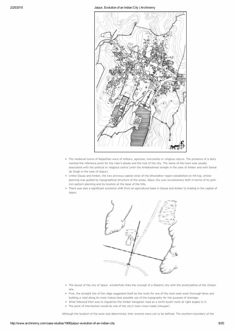
The medieval towns of Rajasthan were of military, agrarian, mercantile or religious nature. The presence of a deitymarked the reference point for the ruler’s abode and the rest of the city. The name of the town was usuallyassociated with the political or religious centre (with the Ambikeshwar temple in the case of Amber and with SawaiJai Singh in the case of Jaipur). Unlike Dausa and Amber, the two previous capital cities of the Dhoondhar region established on hilltop, whoseplanning was guided by topographical structure of the areas, Jaipur city was revolutionary both in terms of its gridiron pattern planning and its location at the base of the hills.There was also a significant economic shift from an agricultural base in Dausa and Amber to trading in the capital ofJaipur.
The layout of the city of Jaipur wonderfully links the concept of a Shastric city with the practicalities of the chosensite.First, the straight line of the ridge suggested itself as the route for one of the main eastwest thorough fares andbuilding a road along its crest makes best possible use of the topography for the purpose of drainage.What followed then was to regularize the AmberSanganer road as a northsouth route at right angles to it.The point of intersection would be one of the city’s main crossroads (chaupar)
Although the location of the axes was determined, their extents were yet to be defined. The southern boundary of the
2/25/2015 Jaipur, Evolution of an Indian City | Archinomy
http://www.archinomy.com/casestudies/1906/jaipurevolutionofanindiancity 9/20
city had to lie within the line of the AgraAjmer road. So by extending the NS road as far as possible southwards gives
the first fixed dimension, the length of a side of a square and so establishes the size of the unit or module of the city.
A hunting lodge known as Jai Niwas. It was the king’s wish that this establishment come within the city.
A road cutting the plain from N to S linking Amber,the capital to Sanganer, the principal trading town. This road had to
be preserved and controlled and therefore had to fall within the city’s boundaries
A second road ran E to W between the Mughal cities of Agra and Ajmer and placing the new city on this
already established communication line would help secure its economic success. However since this was an imperial road
that could not be encroached on, thus the city had to be contained to the north of this line.
Also, a natural ridge runs across the plain, N of the road and parallel to it, in a roughly EW alignment (with a slight
deviation of15 deg. from the cardinal axes). The area to its S is flat while that to its N slopes down gently. In Shastric
terms, this is an ideal arrangement as declivity towards the northeast Is considered the best site. In practical terms,
the ridge too had to be accommodated.
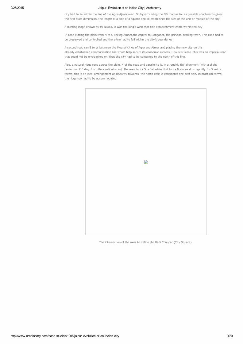
The intersection of the axes to define the Badi Chaupar (City Square).
2/25/2015 Jaipur, Evolution of an Indian City | Archinomy
http://www.archinomy.com/casestudies/1906/jaipurevolutionofanindiancity 10/20
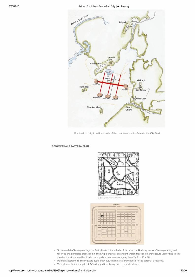
Division in to eight portions, ends of the roads marked by Gates in the City Wall
CONCEPTUAL PRASTARA PLAN
It is a model of town planning the first planned city in India. It is based on Hindu systems of town planning andfollowed the principles prescribed in the Shilpashastra, an ancient Indian treatise on architecture .according to thisshastra the site should be divided into grids or mandalas rangung from 2x 2 to 10 x 10.Planned according to the Prastara type of layout, which gives prominence to the cardinal directions.Thus plan of jaipur is a grid of 3x3 with gridlines being the city’s main streets.
2/25/2015 Jaipur, Evolution of an Indian City | Archinomy
http://www.archinomy.com/casestudies/1906/jaipurevolutionofanindiancity 11/20
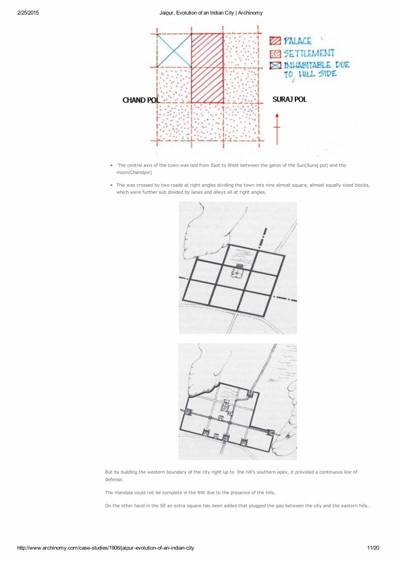
The central axis of the town was laid from East to West between the gates of the Sun(Suraj pol) and themoon(Chandpol)
This was crossed by two roads at right angles dividing the town into nine almost square, almost equally sized blocks,which were further sub divided by lanes and alleys all at right angles.
But by building the western boundary of the city right up to the hill’s southern apex, it provided a continuous line of
defense.
The mandala could not be complete in the NW due to the presence of the hills.
On the other hand in the SE an extra square has been added that plugged the gap between the city and the eastern hills.
2/25/2015 Jaipur, Evolution of an Indian City | Archinomy
http://www.archinomy.com/casestudies/1906/jaipurevolutionofanindiancity 12/20
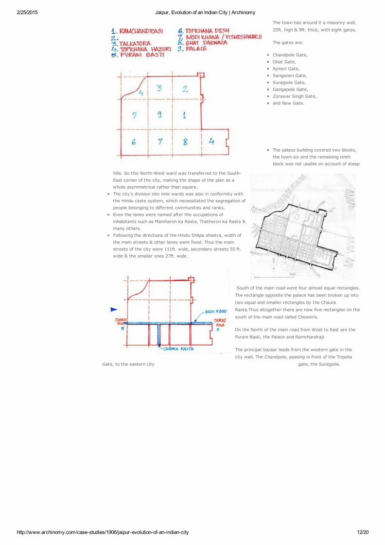
The town has around it a masonry wall,
25ft. high & 9ft. thick, with eight gates.
The gates are:
Chandpole Gate, Ghat Gate,Ajmeri Gate, Sanganeri Gate,Surajpole Gate,Gangapole Gate,Zorawar Singh Gate,and New Gate.
The palace building covered two blocks,the town six and the remaining ninthblock was not usable on account of steep
hills. So this NorthWest ward was transferred to the SouthEast corner of the city, making the shape of the plan as awhole asymmetrical rather than square. The city’s division into nine wards was also in conformity withthe Hindu caste system, which necessitated the segregation ofpeople belonging to different communities and ranks.Even the lanes were named after the occupations ofinhabitants such as Maniharon ka Rasta, Thatheron ka Rasta &many others.Following the directions of the Hindu Shilpa shastra, width ofthe main streets & other lanes were fixed. Thus the mainstreets of the city were 111ft. wide, secondary streets 55 ft.wide & the smaller ones 27ft. wide.
South of the main road were four almost equal rectangles.
The rectangle opposite the palace has been broken up into
two equal and smaller rectangles by the Chaura
Rasta.Thus altogether there are now five rectangles on the
south of the main road called Chowkris.
On the North of the main road from West to East are the
Purani Basti, the Palace and Ramchandraji.
The principal bazaar leads from the western gate in the
city wall, The Chandpole, passing in front of the Tripolia
Gate, to the eastern city gate, the Surajpole.

2/25/2015 Jaipur, Evolution of an Indian City | Archinomy
http://www.archinomy.com/casestudies/1906/jaipurevolutionofanindiancity 13/20
To the NW of this lay the Jai Niwas. Given that its royal association meant that it had to be within the palacecompound, the site of the palace was established. Indeed, given the wish to locate the palace centrally, the positionof the brahmasthana was also established. A wall surrounds the palace buildings. The serving class occupied the peripheral areas.Another constraint was the position of the lake, which formed a part of the pleasure garden around which the citywas built. This lake lay close to the hillside. In the original design it fell outside the main block of the city; but due toJai Singh’s wish to include the old garden in the city, the lake was made the tank of palace garden.
PICTURE IN BRIEF
2/25/2015 Jaipur, Evolution of an Indian City | Archinomy
http://www.archinomy.com/casestudies/1906/jaipurevolutionofanindiancity 14/20
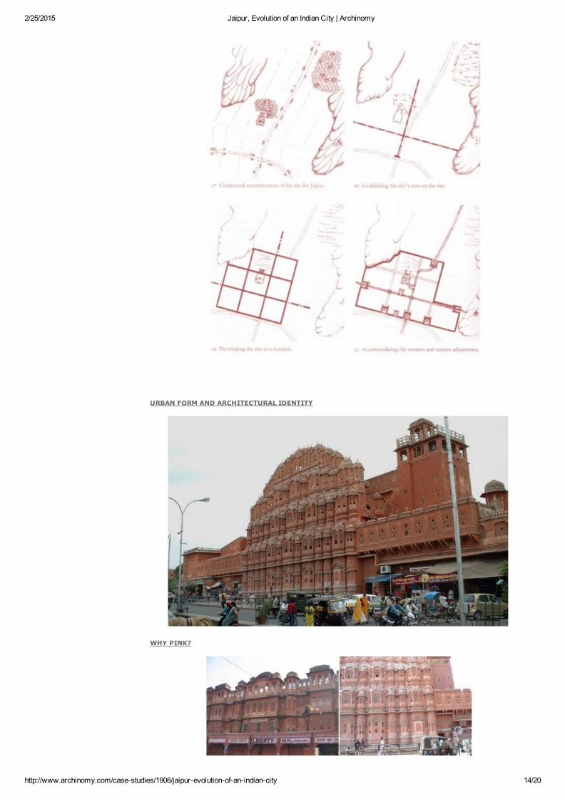
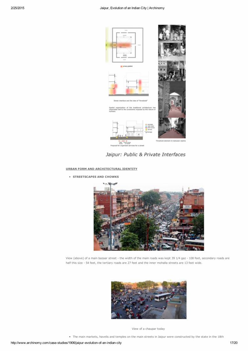
URBAN FORM AND ARCHITECTURAL IDENTITY
WHY PINK?
2/25/2015 Jaipur, Evolution of an Indian City | Archinomy
http://www.archinomy.com/casestudies/1906/jaipurevolutionofanindiancity 15/20
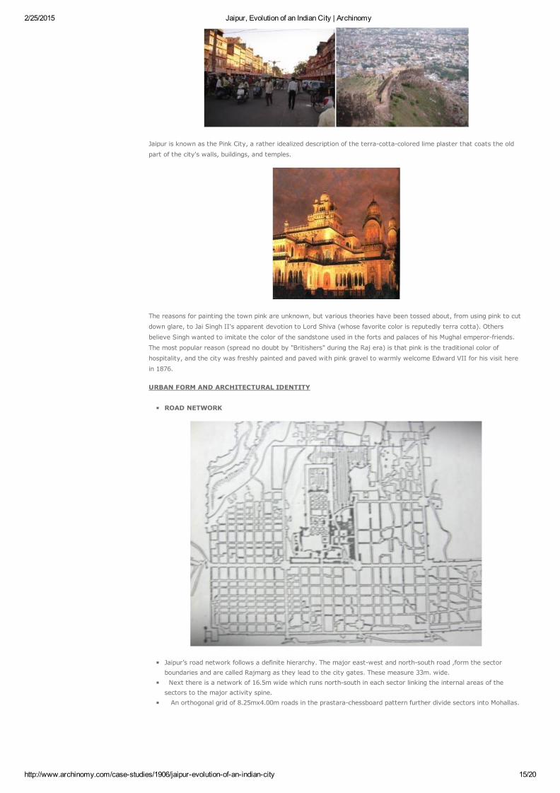
Jaipur is known as the Pink City, a rather idealized description of the terracottacolored lime plaster that coats the old
part of the city's walls, buildings, and temples.
The reasons for painting the town pink are unknown, but various theories have been tossed about, from using pink to cut
down glare, to Jai Singh II's apparent devotion to Lord Shiva (whose favorite color is reputedly terra cotta). Others
believe Singh wanted to imitate the color of the sandstone used in the forts and palaces of his Mughal emperorfriends.
The most popular reason (spread no doubt by "Britishers" during the Raj era) is that pink is the traditional color of
hospitality, and the city was freshly painted and paved with pink gravel to warmly welcome Edward VII for his visit here
in 1876.
URBAN FORM AND ARCHITECTURAL IDENTITY
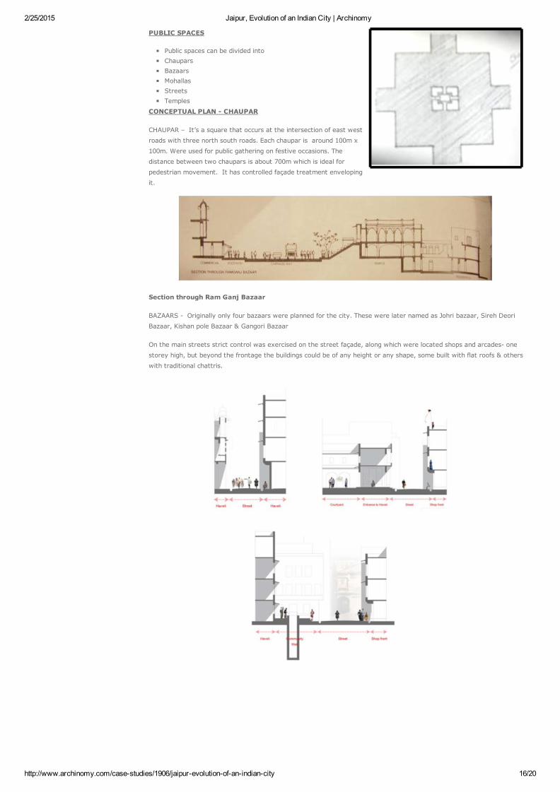
ROAD NETWORK
Jaipur’s road network follows a definite hierarchy. The major eastwest and northsouth road ,form the sectorboundaries and are called Rajmarg as they lead to the city gates. These measure 33m. wide. Next there is a network of 16.5m wide which runs northsouth in each sector linking the internal areas of thesectors to the major activity spine. An orthogonal grid of 8.25mx4.00m roads in the prastarachessboard pattern further divide sectors into Mohallas.
2/25/2015 Jaipur, Evolution of an Indian City | Archinomy
http://www.archinomy.com/casestudies/1906/jaipurevolutionofanindiancity 16/20
PUBLIC SPACES
Public spaces can be divided into Chaupars BazaarsMohallasStreetsTemples
CONCEPTUAL PLAN CHAUPAR
CHAUPAR – It’s a square that occurs at the intersection of east west
roads with three north south roads. Each chaupar is around 100m x
100m. Were used for public gathering on festive occasions. The
distance between two chaupars is about 700m which is ideal for
pedestrian movement. It has controlled façade treatment enveloping
it.
Section through Ram Ganj Bazaar
BAZAARS Originally only four bazaars were planned for the city. These were later named as Johri bazaar, Sireh Deori
Bazaar, Kishan pole Bazaar & Gangori Bazaar
On the main streets strict control was exercised on the street façade, along which were located shops and arcades one
storey high, but beyond the frontage the buildings could be of any height or any shape, some built with flat roofs & others
with traditional chattris.
2/25/2015 Jaipur, Evolution of an Indian City | Archinomy
http://www.archinomy.com/casestudies/1906/jaipurevolutionofanindiancity 17/20
URBAN FORM AND ARCHITECTURAL IDENTITY
STREETSCAPES AND CHOWKS
View (above) of a main bazaar street the width of the main roads was kept 39 1/4 gaz 108 feet, secondary roads are
half this size 54 feet, the tertiary roads are 27 feet and the inner mohalla streets are 13 feet wide.
View of a chaupar today
The main markets, havelis and temples on the main streets in Jaipur were constructed by the state in the 18th
2/25/2015 Jaipur, Evolution of an Indian City | Archinomy
http://www.archinomy.com/casestudies/1906/jaipurevolutionofanindiancity 18/20
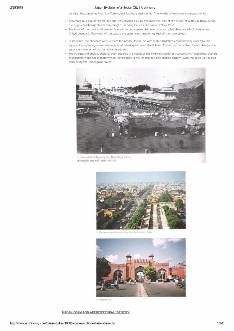
century, thus ensuring that a uniform street facade is maintained. The widths of roads were predetermined.
According to a popular belief, the city was painted pink to celebrate the visit of the Prince of Wales in 1876, duringthe reign of Maharaja Sawai Ram Singh II, lending the city the name of ‘Pink City’. Junctions of the main axial streets formed the two square civic open spaces called chaupars (Badi chaupar andChhoti chaupar). The width of the square chaupars was three times that of the main street.
Historically, the chaupars were outlets for intense social use with water structures connected by undergroundaqueducts, supplying numerous sources of drinking water at street level. Presently, the centre of each chaupar hassquare enclosures with ornamental fountains.The streets and chowks (central open squares in a town) of the internal chowkries (sectors) with numerous clustersor mohallas were not predetermined; hence show a mix of grid iron and organic pattern, with the basic unit of builtform being the rectangular haveli.
URBAN FORM AND ARCHITECTURAL IDENTITY

2/25/2015 Jaipur, Evolution of an Indian City | Archinomy
http://www.archinomy.com/casestudies/1906/jaipurevolutionofanindiancity 19/20
BAZAARS
1. Original markets in the city include Kishanpole bazaar, Gangauri bazaar, Johari bazaar, Sireh Deorhi bazaar, alongthe main northsouth and eastwest axes that intersect at Chhoti and Badi Chaupars.
2. Typical architectural features of the bazaar streets are use of chhajjas (sunshades) resulting in strong horizontallines, projecting vertical blocks on brackets, a modular system of arches filled with delicate latticed screens to cutdirect sun and glare of reflected sun in the street.
Bazaar streets have temples above shops with wide staircase starting from pavement to the temple level. Space above
shops at first floor level originally functioned as galleries for watching royal processions, religious festivals and public
celebrations
Uniform planned shop fronts on bazaar streets with upper floors in interesting juxtaposition.
Defined street façade at a chaupar with sunshades and latticed colonnades at upper floors and shop fronts on the ground
floor.

2/25/2015 Jaipur, Evolution of an Indian City | Archinomy
http://www.archinomy.com/casestudies/1906/jaipurevolutionofanindiancity 20/20
Submitted by tanuj.1405.tj on Wed, 16/11/2011 9:52am. #1
Member since:12 November 2011
Login or register to post comments
Submitted by Philippe Norbert on Tue, 18/02/2014 9:00pm. #2
Member since:18 February 2014
Login or register to post comments
Tags: City Architecture
Login or register to post comments
Comments
IT WILL BE REALLY HELP IF I CAN REALLY GET THE AUTO CAD MAP OR VECTOR MAP OF THE
CITY SPLZ ONLY THE WALLED CITY......
I M DOING A THESIS STUDY ON THIS PART OF JAIPUR AND I M IN NEED OF THE PLAN... plz can
send me the plan or tell me where can i get it from plz
i ausre u of the safety and security abt it...
tanuj jain
5th yr B ARCH
MUMBAI
Not too long ago, I had an opportunity to see the Great Bombay Circus in Jaipur. I was supriced
how the city had evolved.. while retaining it's beautiful and deeply profound traditional flavour.
Thank you for the great insight and fantastic pictures!
Jaipur is très mignon, Philippe Norbert.
quick links
Architects & Their WorksArchitecture BooksArchitecture NewsArts in ArchitectureBuilding Materials & ServicesBuilding & Their StructureCity Architecture
Earthquake Proof ConstructionHistory of ArchitectureHospital ArchitectureHotel ArchitectureHousing ArchitectureInterior DesignLandscape ArchitectureLighting
Megastructure ArchitectureOld City Settlement StudiesOther Case StudiesPublic Spaces & SquaresReligious ArchitectureSustainable ArchitectureVernacular Architecture
Archinomy is currently open to take architectural projects. Please contact using the contact form. Copyright © 20082014 Archinomy. All Rights Reserved.
Study in GermanyGet Admission in Top Univ/Colleges. Easy admissions & visa.No IELTS.