jim o'malley: forward franklin edc 1-30-12
DESCRIPTION
Materials for presentation by developer Jim O'Malley regarding environmental regulations in FranklinTRANSCRIPT
Forward Franklin EDC January 30, 2012
Discussion on Franklin's NRPP Requirements
City of Brookfield - Mike Theis 262-796-6695 1. No tree preservation requirement except in the first 25 feet in the front for only quality trees at
6" or larger. 2. No Wetland buffers except for normal zoning setbacks that maybe 10' or 25' because all
wetlands are required to become outlots. The follow what ever DNR setback requirements are if more then their setbacks.
3. No steep slopes restrictions.
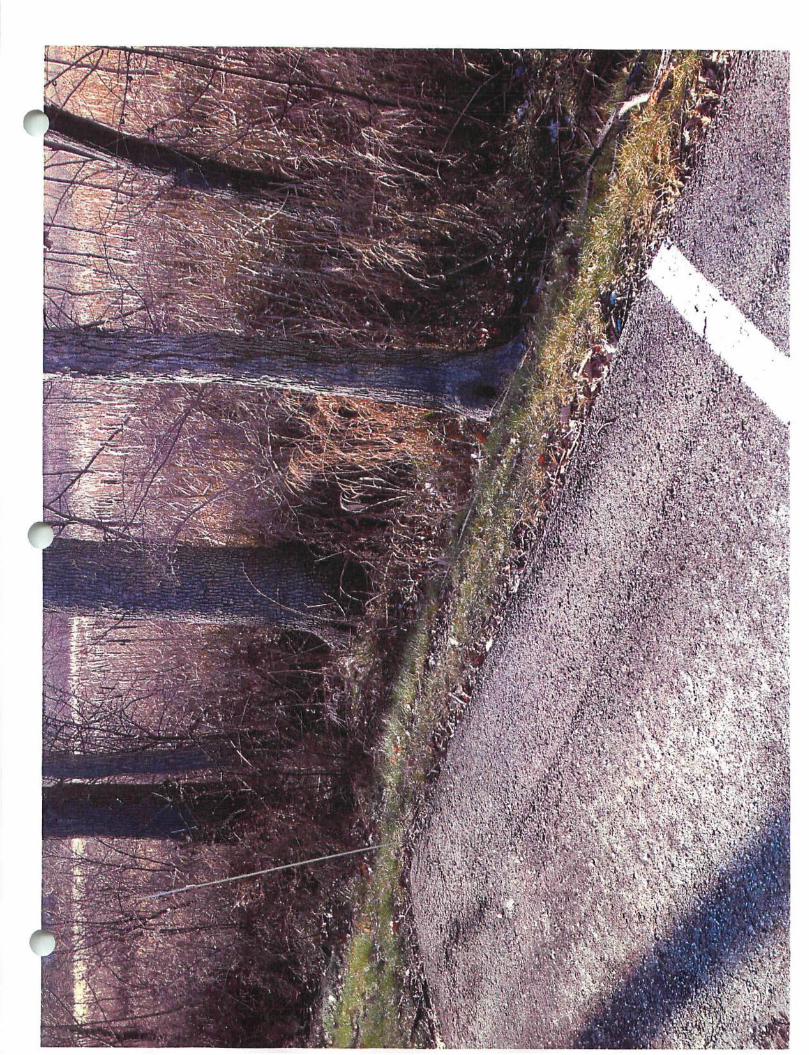
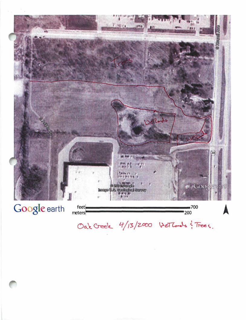
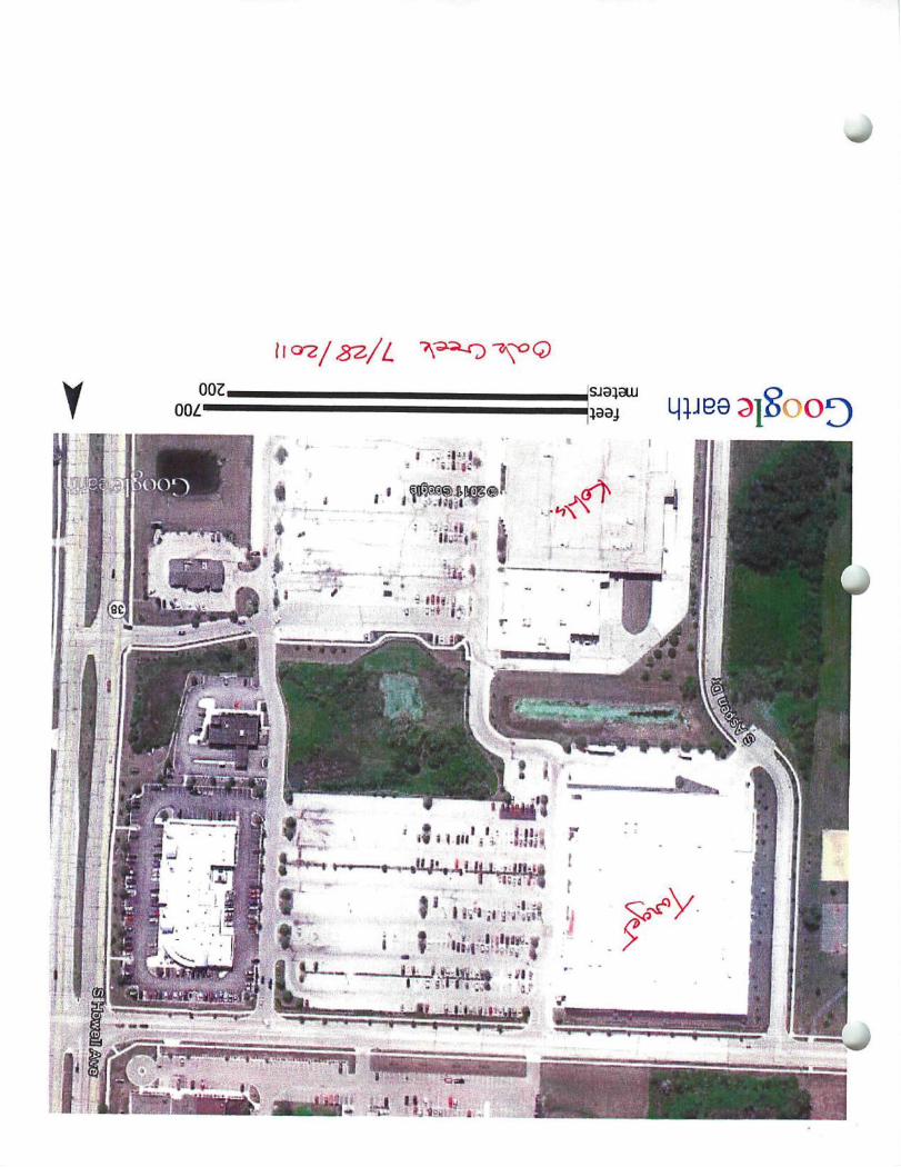
Oak Creek-Jeff Fortin 414-768-6528 1. No tree preservation requirements 2. No wetland setback requirements except that with in 50' hard surfaces need to drain to storm
water detention pond. 3. No steep slope restrictions.
Greenfield - Chuck Erickson 414-329-5342 1. City forester looks at trees and identifies only the specimen trees (Hardwoods only) as trees to
be identified then work with developer to keep 50%, no natural protection easement required. 2. No wetland buffers for storm water detention ponds but there is a 25 foot building setback,
parking lots can be as close as 5' as long as they pitch away from the wetland. 3. No steep slope restrictions.
NOTE: Franklin is the only community to require a "Natural Resource Protection Plan (NRPP)
Jim Omalley
^ rom: Lesley Brotkowski [[email protected]]
jent: Monday, January 16, 2012 4:43 PM To: Jim Omalley Subject: RE: O'Malley NRPP
Hi Jim,
Unfortunately, I do not have a comprehensive list of communities in the Milwaukee Metro area that have tree ordinances and/or require natural resource investigations beyond the state/federally required wetland assessments. It's really a patchwork of different regulations! It's always a good idea to check in with the local municipality before diving too far into a project!
Good luck! Lesley
From: Jim Omalley [mailto:[email protected]] Sent: Monday, January 16, 2012 11:27 AM To: Lesley Brotkowski Subject: RE: O'Malley NRPP
Lesley,
^ i
Thanks for your email below, but can you tell me how Franklin's natural protection policies compare to other ommunities. Do we have the most restrictive and most comprehensive natural protection policies of any other nunicipality in the Milwaukee metropolitan area?
Also, can you list what communities do or do not have a tree preservation ordinance. For example, I know that Oak Creek and the City of Brookfield's Planning Departments do not require a developer or a landowner to submit a report to protect or preserve any percentage of the trees in a development.
Thanks for your help, Jim O'Malley
From: Lesley Brotkowski [mailto:LBrotkowski@cedarburgscience,com] Sent: Monday, January 16, 2012 10:55 AM To: Jim Omalley Subject: RE: O'Malley NRPP
Hi Jim,
The term "Natural Resource Protection Plan (NRPP)" is specific to Franklin.
Other cities have ordinances that cover various aspects of natural resource protection. For example, Mequon and Delafield have tree preservation ordinances and Mequon requires Stewardship Plans and natural area protection in conservation subdivisions. Wetlands are protected by WDNR and US Army Corps regulations state-wide. Shoreland zoning applies to townships outside Cities/Villages. Each county has its own regulations, protections, and setbacks from resources (e.g. bluffs, wetlands, etc.).
Take care. i
PART 4: NATURAL RESOURCE PROTECTION
DIVISION 15-4.0100 NATURAL RESOURCES
SECTION 15-4.0101 NATURAL RESOURCE PROTECTION STANDARDS
All development in the City of Franklin shall comply with the natural resource protection standards set forth in Table 15-4.0100. All the natural resources required to be protected under this Division shall remain undisturbed and in a natural state except those natural resources where mitigation is permitted and where that mitigation is in strict accord with those requirements set forth in this Division of this Ordinance. Any person or entity violating any provision of this Part 4 and any property owner upon whose property there exists or occurs a violation of this Part 4, shall be subject to the penalty and remedy provisions of Division 15-9.0500 of this Ordinance. In addition, the provisions of this Part 4 may be enforced by the City by way of all other legal and equitable remedies and the undertaking by the City to cure any violations or complete any plans, work or measures in furtherance thereof, with the costs of such undertaking to be assessed against the property owner and entered upon the tax roll pursuant to the procedures for a special charge under 66.0627, Stats. Any violation of this Part 4 is hereby declared to be a public nuisance.
SECTION 15-4.0102 NATURAL RESOURCE FEATURES DETERMINATION
A. Steep Slopes. Steep slopes are defined in Division 15-11.0100 of this Ordinance. Steep slopes shall be measured and graphically indicated on a topographic drawing and on the "Natural Resource Protection Plan." Such steep slope drawing shall graphically indicate those steep slope areas, by slope type, of the property pursuant to the "steep slope" definition set forth in Division 15-11.0100 of this Ordinance. Steep slopes are to be determined through the use of the following sources and/or methods in the order indicated below. If the first source is considered inaccurate or inappropriate, as determined by the Zoning Administrator, the second source shall be used:
1. Topographic survey prepared by and certified by a Wisconsin registered land surveyor at a contour interval of not less than two (2) feet.
2. Large scale 1 "=100' City of Franklin topographic maps.
City of Franklin Unified Development Ordinance Part 4: Natural Resource Protection Page 4-1
Table 15-4.0100
NATURAL RESOURCE PROTECTION STANDARDS
NATURAL RESOURCE FEATURE
Steep Slopes: 10-19% 20-30% +30%
Woodlands & Forests: Mature Young
Lakes & Ponds
Streams
Shore Buffers
Floodplains/ Floodways/ Floodlands
Wetlands & Shoreland Wetlands
Wetland Buffers
ZONING DISTRICT TYPE
Agricultural
Protection Standard
0% 65% (d) 90% (d)
70%(dXe) 50%(dXe)
100% (d)
100% (c)(d)
100% (c)(d)
100% (c)(d)
100% (cKd) 100% (c)(d)
Mitigation Permitted
N/A No No
No No
No
No
No
No
No
No
Residential (a)
Protection Standard
60% (d) 75% (d) 85% (d)
70%(d)(e) 50% (e)
100%
100% (c)(d)
100% (c)(d)
100% (c)(d)
100% (cm 100% (c)(d)
Mitigation Permitted
No No No
No Yes
Yes
No
No(f)
No
No
No
Nonresidential (b)
Protection Standard
40% (d) 70% (d) 80% (d)
70% (e) 50% (e)
100%
100% (cXd)
100% (c)(d)
100% (c)
100%(c)
100% (c)
Mitigation Permitted
No No No
Yes Yes
Yes
No
No(0
Yes
Yes
Yes
N/A = Not Applicable (a) Including residential "Planned Development Districts" (or residential portions thereof). Where mitigation is permitted, said mitigation
shall meet the intent of Section 15-4.0103 of this Unified Development Ordinance unless specified otherwise in this footnote. Said natural resource protection standards shall not be applicable to essential services and their associated easements (as defined in Section 15-11.0103 of this Ordinance); however, areas of disturbance of natural resource features to provide for said essential services shall be restored to the restoration standards of Section 15-4.01021. of this Ordinance immediately following the construction of the essential services). Private roads, public rights-of-way for arterial streets, highways, collector streets, and minor streets within the boundaries of a residential development site are considered residential development for the purposes of Part 4 of this Ordinance. See 15-3.0607 for permitted and special uses allowed in the SW Shoreland Wetland Overlay District Also see 15-9.0110 and 15-10.0208 of this Ordinance for Special Exceptions to the shore buffer, navigable water-related, wetland, wetland buffer and wetland setback requirements of this Ordinance and for improvements or enhancements to natural resource features.
(b) Including non-residential "Planned Development Districts" (or non-residential portions thereof). Where mitigation is permitted, said mitigation shall meet the intent of Section 15-4.0103 of this Unified Development Ordinance unless specified otherwise in this footnote. Said natural resource protection standards shall not be applicable to essential services and their associated easements (as defined in Section 15-11.0103 of this Ordinance); however, areas of disturbance of natural resource features to provide for said essential services shall be restored to the restoration standards of Section 15-4.01021. of this Ordinance immediately following the construction of the essential services). Private roads, public rights-of-way for arterial streets, highways, collector streets, and minor streets within the boundaries of a residential development site are considered residential development for the purposes of Part 4 of this Ordinance. See 15-3.0607 for permitted and special uses allowed in the SW Shoreland Wetland Overlay District. Also see 15-9.0110 and 15-10.0208 of this Ordinance for Special Exceptions to the shore buffer, navigable water-related, wetland, wetland buffer and wetland setback requirements of this Ordinance and for improvements or enhancements to natural resource features.
(c) Except as may otherwise be allowed under this Ordinance, including, but not limited to, its provisions for special exceptions, variances and permitted and special uses. Structural supports) consisting of piers and/or abutments for bridges shall be allowed to be placed within shore buffers, wetland buffers, and wetland setbacks provided that areas of disturbance of natural resource features to provide for said structural supports shall be restored to the restoration standards of Section 15-4.01021. of this Ordinance immediately following construction. The Permitted and Special Uses set forth within the SW Shoreland Wetland Overlay Zoning District regulations at 15-3.0607 of this Ordinance shall and may be allowed as permitted and special uses within in this natural resource feature, subject to footnote (0, below; provided, however, that areas of disturbance of the natural resource feature to construct such
City of Franklin Unified Development Ordinance Part 4: Natural Resource Protection Page 4-2
r-
ENVIRONMENTAL
December 20, 2011
Mr, Jim O'Malley O'Malley Investments II FLP 5200 West Loom is Road Greendale, Wl 53129
RE: Natural Resource Protection Plan (NRPP) O'Malley Investments II FLP, 7521 West Ryan Road, Franklin, Wl
Dear Mr. O'Malley:
BHE Environmental (BHE) / Cedarburg Science has prepared this Natural Resource Protection Plan (NRPP) for the O'Malley Investments II FLP property (26.68-acres) located at 7521 West Ryan Road, City of Franklin, Milwaukee County, Wisconsin. The purpose of the NRPP is to identify and map natural resource features that are defined and protected by the City of Franklin's Unified Development Ordinance (UDO), and provide mitigation measures where necessary.
The property is located in the NW 1/4 of the NW 1/4 of Section 27, Township 5 North, Range 21 East, in the City of Franklin, Milwaukee County, Wisconsin. The property is located in the zoning district R-8 and A-1.
Lesley Brotkowski of BHE / Cedarburg Science conducted the field assessment on November 28th, 2011 to determine whether natural resources as defined by the City of Franklin's Unified Development Ordinance (UDO) were present on the property. As defined by the UDO, natural resource features include steep slopes, mature woodlands, young woodlands, lakes, ponds, streams, floodplains, wetlands, and wetland buffers. Each feature is defined in the UDO, along with their respective protection standards.
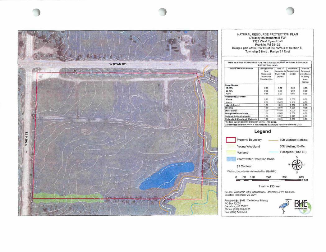
Based on the field assessment, it was determined that one young woodland, wetland, wetland buffer, wetland setback, and stormwater detention basin are associated with the project site (Refer to NRPP Sheet in Appendix A).
December 20, 2011 Page 2
A map from the wetland delineation report conducted by the Southeastern Wisconsin Regional Planning Commission (SEWRPC) shows that wetlands are located on and adjacent to the property. This information was used to calculate wetland buffers and wetland setbacks. The wetland delineation map associated with this property is included in Appendix B.
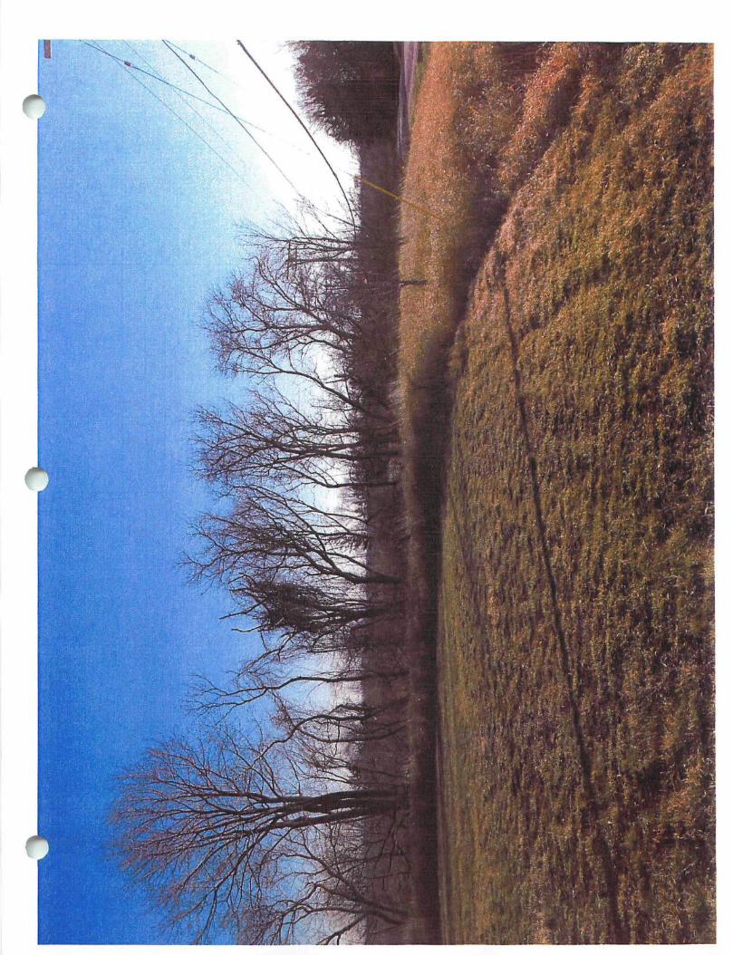
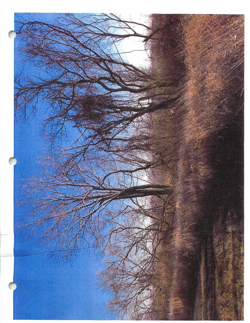
Table 15-3.0503 from the UDO (Appendix C) was used to calculate the total acres of land in each natural resource feature and the acres of land required to be preserved based on the UDO's protection standards. Also included in Appendix C are the Site Intensity Calculations (Tables 15-3.0502 & 15-3.0504, Appendix C) for the property, and the NRPP Checklist. Site photographs are included in Appendix D for additional reference.
Existing Natural Resources
The 26.68-acre (1,162,180.80 square feet) parcel currently contains a gravel driveway, areas of mowed lawn, one young woodland bordering the property, a stormwater detention basin, a wetland, a 30 foot wetland buffer, and a 50 foot wetland setback.
Steep Slopes
There are no steep slopes, as defined by the UDO, located on the property.
Lakes and Ponds There are no natural lakes or ponds located on the property. A stormwater detention basin (1.003 acres, 43,699.30 square feet) is located in the southeastern portion of the property.
The UDO defines a pond as "All bodies of water less than two (2) acres in area as measured by the shoreline at its maximum condition rather than the permanent pool condition, if there is any difference." As such, a stormwater detention basin meets the definition of a pond under the UDO. The stormwater detention basin, however, is an artificial waterbody operated and maintained only for sediment detention and flood storage purposes, and is therefore not protected as a natural feature in the UDO. The stormwater detention basin
BHE Environmental. Inc. / Odarburg $<Mfn« PO Box 72020 Cedarburg. Wisconsin. 5)0 12 262.370.0735 / Fax 262.376.075'!
December 20. 2011 Page 3
is included within base site area calculations, which impacts site intensity and capacity uses (Table 15-3.0504).
Streams/Shore Buffers
There are no streams or shore buffers located on the property.
Shore buffers are defined as the undisturbed land area (including undisturbed natural vegetation) within 75 feet landward of the ordinary high water mark (OHWM) of all navigable waters (lakes, ponds, and streams). The stormwater detention basin, while meeting the definition of a "pond", is not a natural feature regulated under the UDO and therefore the shore buffer does not apply.
Floodplains /Floodways /Floodlands
There is no 100 year floodplain located on the property; however, there is one adjacent to the southeastern portion of the property.
Woodlands
One young woodland occurs on the property. This approximately 0.420-acre (18,221.48 square feet) young woodland is a part of the 0.750-acre (32,452.20 square feet) young woodland that extends south of the property. The young woodland was delineated on November 28th, 2011. The boundary was delineated by flagging the lateral extent of foliage (drip line) of the roughly continuous tree canopy (see NRPP Sheet in Appendix A and photos in Appendix D). The UDO defines a young woodlaml as "any stand of trees whose total combined canopy covers an area of one-half (0.50) acre or more and at least f ifty (50) percent of which is composed of canopies of trees having a diameter at breast height (DBH) of at least three (3) inches.
The young woodland associated with this property consists of box elder {Acer negundo), green ash {Fraxinus pennsylvanica), silver maple {Acer saccharinum), black willow (Sa//x nigra), and black cherry {Prunus serotina) in the canopy with exotic honeysuckle {Lonicera spp.) in the understory.
BHE Enviromnental . Inc. / Cedarburg Science I'O f i (« 72020 Cedar t i«c , Wi.-.ct.riMo !>J012 262.376.0735 / Fax 21.2. 376.075-)
December 20, 2011 Page 4
There are no mature woodlands present on site. The UDO defines mature woodlands as "an area of stand of trees whose total combined canopy covers an area of one (1) acre or more and at least fifty percent of which is composed of canopies of trees having a dbh of at least ten inches; or any grove consisting of eight (8) or more individual trees having a dbh of at least twelve inches whose combined canopies cover at least fifty percent of the area encompassed by the grove."
Wetlands and Shoreland Wetlands
A partial site wetland delineation was completed by the Southeastern Wisconsin Regional Planning Commission (SEWRPC) in 2010 - 2011 for the purpose of the Ryan Creek Interceptor Project (Wetland Delineation Map, Appendix B). SEWRPC delineated one wetland on the property that continues off-site to the southeast. Approximately 0.366-acres (16,295.67 square feet) of wetland habitat are located on this property. Additional wetlands were also delineated on the parcel directly east of this property by SEWRPC and are depicted on Appendix A. The SEWRPC wetland map shows an unnumbered wetland area in the northern portion of the O'Malley Property; evidence of this wetland was not observed during the site visit. A review of the property on November 28, 2011 revealed no additional wetland areas on the property. Onsite and adjacent wetlands consists of wet meadow, cattail marsh, and shrub-carr habitats.
Approximately 0.96 acres of wetland were filled on this property in 2004. An after the fact permit for discharge of f i l l into waters of the United States was granted by the U.S. Army Corps of Engineers. A mitigation site was provided as compensation for f i l l , located at 7133 Ryan Road, directly east of the subject property (see ACOE letter dated May 29, 2009, Appendix B).
Wetland Buffers (30 feet)
There is one wetland located that exists on the property (that extends offsite), and another wetland that is adjacent to the O'Malley property. The total 30 foot buffer (of the onsite wetland and the adjacent wetland) located within the O'Malley property is approximately 0.441-acre (19,209.96 square feet) (see NRPP Sheet in Appendix A). Wetland buffers are
BHE Environmental. Inc. / Cedarburg Science PO Box 72020 Cedarburg Wisconsin, 53012 262.376.0735 / Fax 262.376 0754

December 20, 2011 Page5
defined as the undisturbed land area (including undisturbed natural vegetation) within 30 feet landward of the delineated wetland boundary parallel to that boundary.
Wetland Setbacks (50 feet)
The total 50 foot setback (of the onsite wetland and the adjacent wetland) located within the O'Malley property is approximately 0.386-acre (16,814.16 square feet) (Refer to NRPP Sheet in Appendix A). Wetland setbacks are defined as all of that landward land area defined by the minimum required hoiizontal setback distance of 50 feet from a delineated wetland boundary.
i
Proposed Natural Resources Impacts and Protection
As stated above, that one young woodland, wetland, wetland buffer, wetland setback, and stormwater detention basin are located on the property.
According to the City of Franklin's UDO, young woodlands carry a 50% protection standard,
and mitigation is permitted for parcels zoned as Residential.
Wetlands and wetland buffers carry a 100% protection standard. Wetland setbacks may contain storm water management facilities, native vegetation, and rip-rap or non-vegetative materials to prevent erosion are allowed within the setback but not the buffer-. If disturbances occur in the setback then permanent vegetation must be established/reestablished and maintained throughout the remaining area.
Artificial wetlands, such as stormwater detention basins, are exempt from the wetland provisions of Part 4 of Franklin's UDO (Section 15-4.0102 J1). Stormwater detention basins, however, are not exempt from the ponds protection standard provisions set forth in Tables 15-3.0503 and 15-4.0100 for site intensity and capacity calculations.
The total natural resource protection land is 1.403-acres (see Table 15-3.0503 in Appendix C). The stormwater basin is listed as a pond, however; it is not protected as a natural resource under the UDO.
BHE Environmental . Inc. / Cedarburg Science PO Box 72020 Cedarburg Wisconsin. 53012 262.376.0735 / Fox 262. 376.07 54
December 20, 2011 Page 6
There are no proposed site plans or impacts to natural resources at this time, thus mitigation is not required.
The natural resources as defined by this NRPP (young woodland, wetland, wetland buffer and setback) wil l be protected in perpetuity under a permanent natural resource Conservation Easement.
CLOSING
We appreciate the opportunity to work with you on this project. If you have any questions or comments concerning this report, please call Lesley Brotkowski at (262) 358-0735.
Sincerely, BHE Environmental, Inc.
Lesley Brotkowski Cindy Burtley Principal Ecologist Project Ecologist
BHE Environmenlal . Inc. / Cedarbuia Science PO Box 72020 Cedarburg. Wi lcomm. 53012 262.376.0735 / Fax 262. 376 0754
W RYAN RD
*
NATURAL RESOURCE PROTECTIOM PLAN O'Malley Investments II FLP
7521 West Ryan Road Franklin. Wl 53132
Being a part of the NW114 of the N W1M of Section 5. Township 5 North. Range 21 East
Tahl- 15J.0M3 WORKSHEET FON THE CALCULATIOM OF tMTUHAL RESOURCE PROTECTION LAND
Natural Resource Feature
Steap Siop&K
20-30% • 30%
WootflanrtsS For»s»: Mstare Young
Lokos i PoralJ-Otreares Shoifl Buffer FIootfpioIns/FIoodlatMls WsOandEultar^Sellacks VVpHandsSShoreiand WfltiandB
Zwiing District Type;
Residenlial Protection
Slandwd (%)
0 60 0.75 0 85
0 70 0,50 1 00 1 00 1 00 1.00 •00 1.00
Area of Resource tn Study Area
(acres)
0 00 0 00 000
o.ooo 0 420 t.003 O.OOO 0 000
oooo CS27 0355
Protecticfl Requirement
(acres)
000 0.00 0 00
0.000 0.210 C 000 0.000 0.000 0 ceo C 227 0.366
Area of Proposed
Disturbance in Study
Area
0.00 000 0,00
0.00
o,co 0.00 000 0.00 000 0 00
Trie total natural resource protection land is t.dos-acres. 'A atormwater detention oasin is not protected as a natural tesourca within the UOO.
Legend Property Boundary
Young Woodland
Wetland*
Stormwater Detention Basin
2ft Contour
•Wetland boindanes delineated b/ SEWRPC
0 60 120 240
50ft Wetland Setback
30ft Wetland Buffer
Floodplain (100 YR)
N
W ^
360 480 I Feet
1 inch = 133 feet
Source: Wisconsin View Consortium - University of Wl-Madison Created; December 20. 2011
Prepared By: BHE / Cedarburg Science PO Box 72020 Cedarburg Wl 53012 Phone: (262) 376-0735 Fax. |2S2) 376-0754
BHE DnmHWRBL
^I^&ssse
sasscs m* "•fe'^fw^^: "vv "^
'-^ ab^ :
Sfc
^ • ^
:. - ~ -̂ - •
A.
© , • # ; ;

CERTIFIED SURVEY MAP NO. BEING A PART OF THE NW 1/4 OF THE NW 1/4 OF SECTION 27, TOWNSHIP 5 NORTH. RANGE 21 EAST. IN THE CITY OF FRANKLIN. MILWAUKEE COUNTY. WISCONSIN.
NW CORNER OF NW 1/4 OF SEC 27-5-21 N = 324,391.76 E = 2,531,399.52
NE CORNER OF NW 1/4 OF SEC 27-5-21 N = 324,456.21 E = 2,536,021.18
RYAN ROAD )333.aC 1228_.80' OF NW 1/4 SEC 27-5-21 N88'35 30 E
OttO ARCEL 1
Aft PARCEL 2JK AC
481.30 448.1 1251.62' SS8-35'50"W
PARCEL 4 17.00 AC.
SERVATION 4V' YOUNG WOODLANDS
NSERYATtON tASEUENT 50' CONSERVA EUENT
NBB'SSSO E 52.03 60.01 T 1312.10' lAJiJ>£
588'35'30 UN£Jr^IJ££
RYAN ROA0 9500 S NRPP PREPARED BY BHE ENVIRONMENTAL REPORT DATED DEC. 20fh, 2011 JEFFREY D.
BARCZAK 5-1999
Annandale NJ
*<Z. SURlV : /" = 2000' 1
gaed's
SURVEYOR: JEFFREY D. BARCZAK 7 OAKRIDGE RD. ANNANDALE NJ. 08801 PH (414) 429-4865 FAX (414) 529-9787
GRAPHIC SCALE
1 inch = 200 ft. OSLand Pro jec ts a0ll9\76th RYAN CSH\dw9\76TH RYAN CSKctog 1/3/2018 11<»3< AM EST
NOTE: o DENOTES 1"x24" IRON PIPE 1.13 LBS
PER LINEAL FEET SET AT ALL LOT CORNERS UNLESS OTHERWISE NOTED BEARINGS ARE REFERENCED TO THE WISCONSIN STATE PLANE CO-ORDINATE SYSTEM SOUTH ZONE.
SHEET 1 OF 3
I •
Gdpgle earth ©2011 GOOQl
Google earth feet meters
ilOOO '500 A
fCeeS
lUdtudopadQ
, & ;-i -w> 's/-- t'i
T" K L- -i^fci ^ V
f ' * ij
y^F |h^; f?^ 5, '
t ** if, 'S v --
at* • * v a
smmm: • ^
7«?
• ayvrea ,> vsafW -̂ -,«.,» r—,„,", ;B: ••. 3>» sum
' 3*71 ')u&UKtot»Aoa
• .
wmsm
C»EEN»t»C FAllOW A . r t l r r ^ - n T F
RAWSON AVENUE
S. LOCATION MAP
PROJECT INFORMATION STEAMEA
S T O n F DATA
maam i
I^T*!L-5 KML
cwnar-j
U.000 sr 31.000 57 ITJCO W l*,»0 £f uog CF
WOO !?
% "'.', .•••-• ^ C^UffTfjuKiKfAny
fmKCiawx)
7, zpfjtpjn nt^ssifirzji new P a g w n
• ';•,._": W/Ol/OJ Mffiw. » n £ « £
10/IVal tEMMD «T«L » « « t«OM,
PINETREE RETAIL CENTER FRANKLIN. Wl (SWO) Laomis Rosa i ftaw.0r Avenue
r i
FOfl REVIEW PURPOSES ONLY
Preliminary^ Development Plan
4̂
|)aWllWiE)SP Google ear
Goog le earth feeti [
meters'
•600 '200 A
Jim Omalley
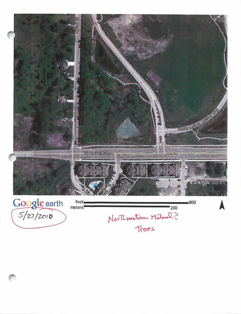
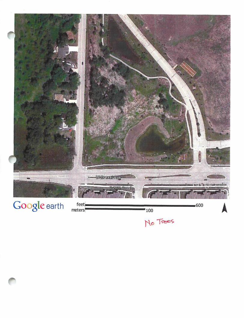
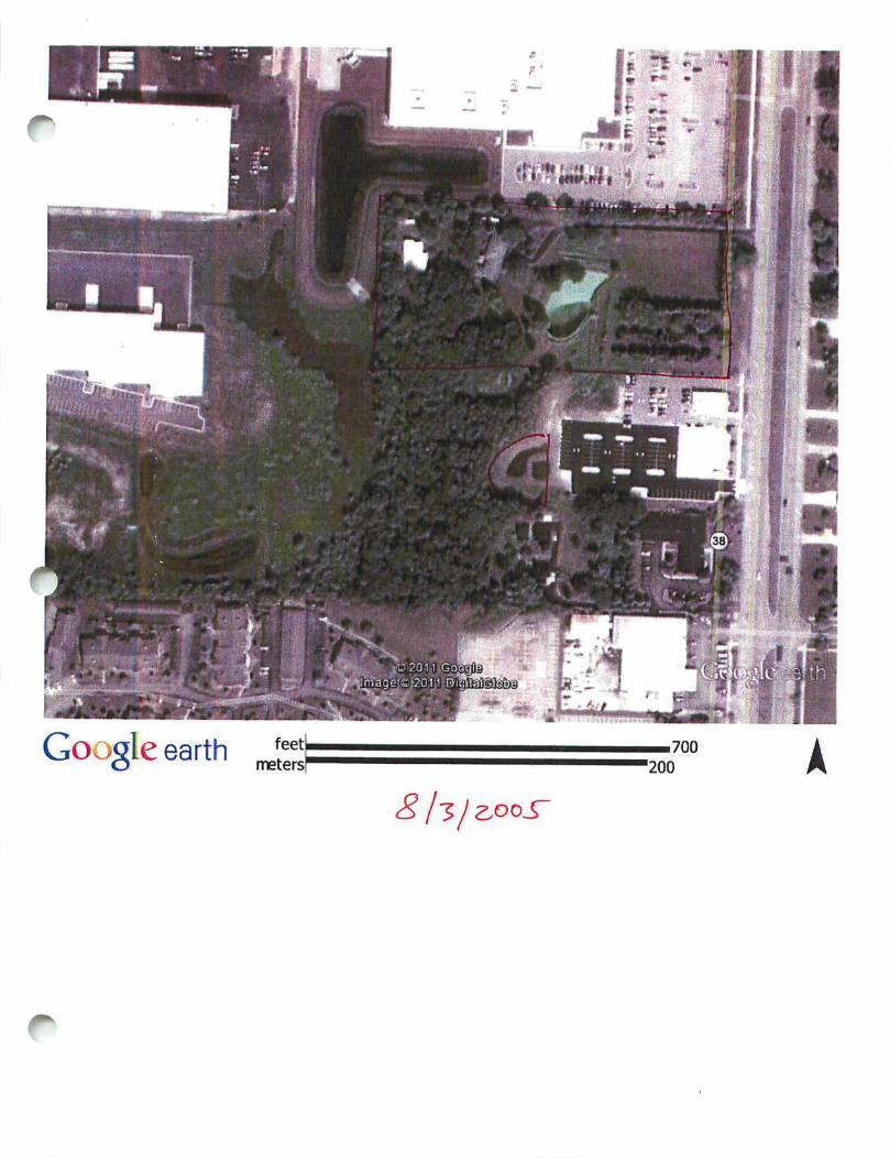
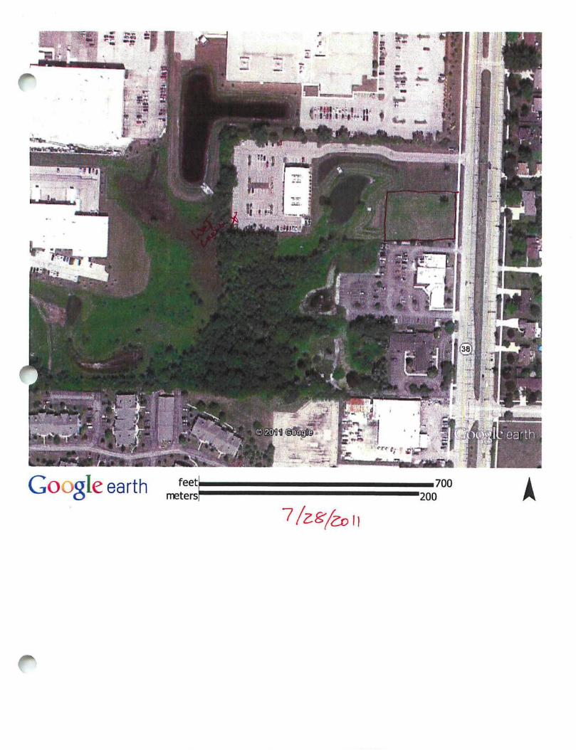
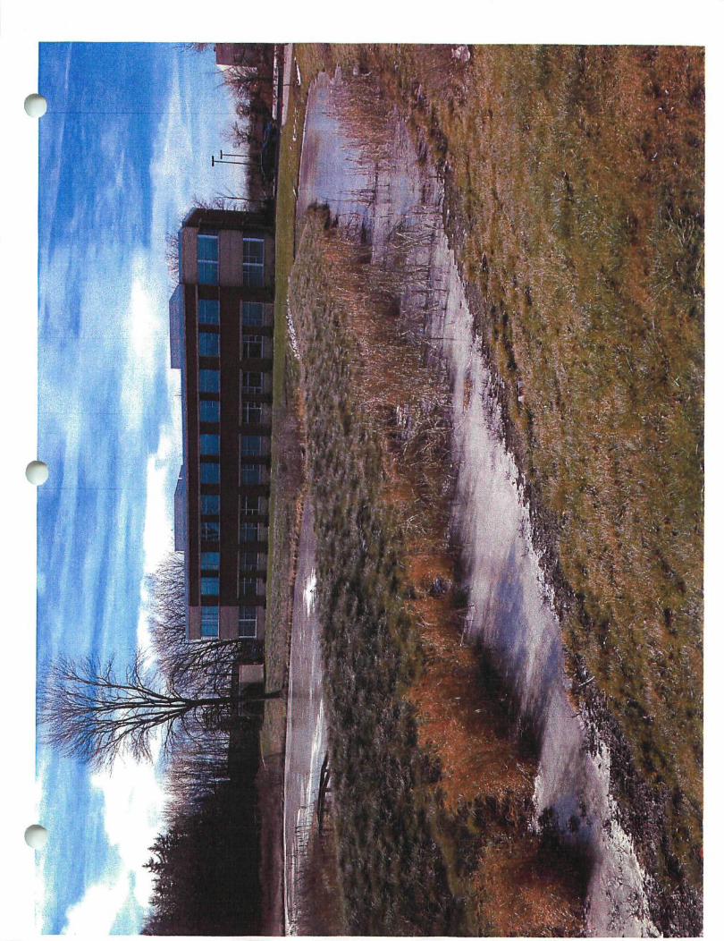
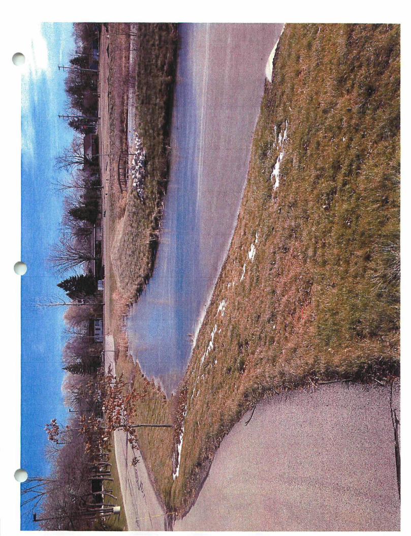
f* rom: Orrin Sumwalt [[email protected]] ;ent: Wednesday, January 25, 2012 4:07 PM
To: 'Jim Omalley' Subject: RE: NML NRPP Attachments: Woodlands Preservation Areas CE.pdf
^
Mr. O'Malley,
Thank you for clarifying your request, and for the helpful photograph. I'm afraid you are mistaken if you are claiming I told you NML had to do an NRPP to remove trees from their property. I do recall us discussing the NML project and more specifically me explaining to you how the removal of trees from their property differed from the Zoning Enforcement proceedings on Parcel 756 9993 012, owned by Brunn Farm, LLC. However, I never told you NML was required to provide an NRPP for the recent removal of trees from their property.
The trees which were removed from the NML property were removed as part of a larger ecological restoration of their site. The objectives of the ecological restoration were enhancing ecosystem functions and values as well as enhancing the natural aesthetics of the campus grounds. The goals of the project were to improve rainwater infiltration, encourage soil stabilization, preserve existing areas of high quality plant communities, enhance wildlife habitat, and improve the aesthetic value of the campus. Attached, please find a copy of the Conservation Easement document for the Woodland Preservation Areas of the NML site. I have highlighted the applicable language from this document which allows NML to remove dead, diseased, or dying vegetation, and noxious weeds (invasive species) from Woodland Preservation Areas. There was no NRPP required for this work, which by the way, was all overseen by a professional Restoration Ecologist. Because NML is such a responsible corporate citizen, they contacted the City to make Staff aware of their plans prior to he removal of any trees from their property. NML's communication with the City allowed Staff to confirm all of the ork being planned was allowable pursuant to the City's codes and NML's previous City approvals.
Does this email help satisfy your curiosity with the recent removal of trees at NML's property? Please let me know if you have any further questions regarding this matter, or if there is anything I can help clarify for you.
Regards,
orrin sumwalt | planner II | city of franklin | 414 425.4024
From: Jim Omalley rmailto:omallevl967(j3)sbcqlobal.net1 Sent: Wednesday, January 25, 2012 2:54 PM To: Orrin Sumwalt Subject: RE: NML NRPP
Orrin,
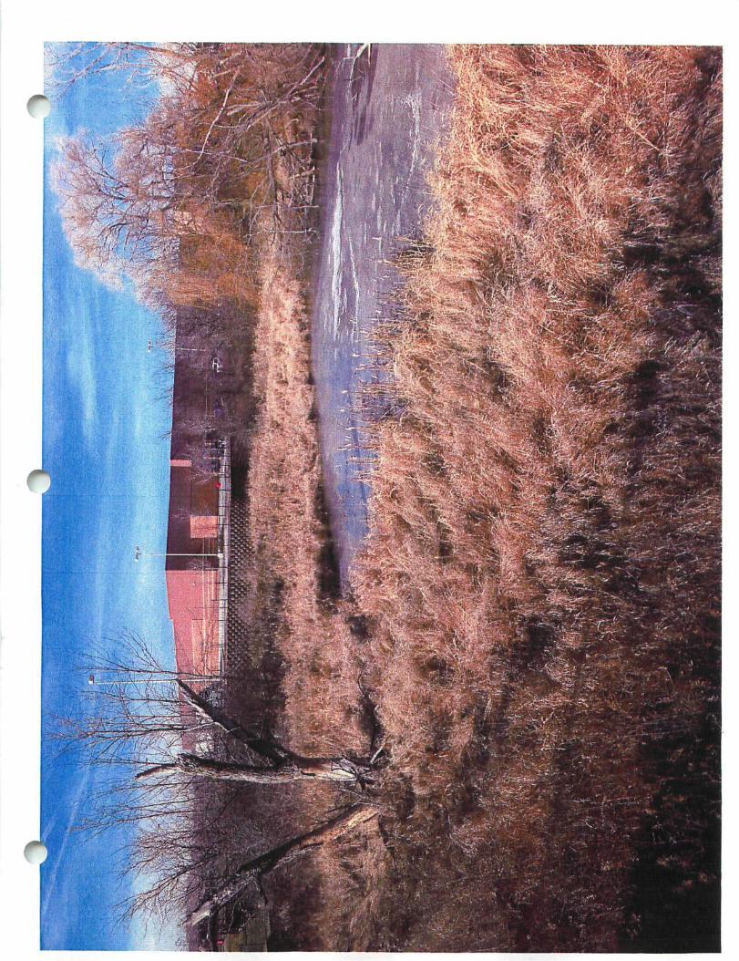
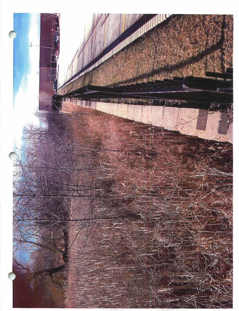
I'm referring to the trees that were taken down last summer on the Southwest corner of the property, see attached photos. You had told me that they had to do an NRPP to take down those trees, that is the report I'm looking for.
Take care,
Jim O'Malley
. rom: Orrin Sumwalt rmailtoiOSumwalWranklinwi.qovl Sent: Wednesday, January 25, 2012 2:31 PM
i
Document No.
CONSERVANCY AREA EASEMENT (Woodlands Preservation Area)
Nonliwesleni Muluat/Ftanldfn Campus Project
Document Title
This Conservancy Area Basement is made by and between the City of Franklin, a municipal corpocalion, hereinafter referred to as the "City," and The Northwestern Mutual Life Insurance Company, a Wisconsin corporation, as owner (including its successors and assigns, however designated), hereinafter the "Grantor."
W I T N E S S E T H
D O C . «=
REGlSTp'S OFFICE t SS S aiiwaufcee County, SJI | **" RECORDED AT 1:14 PK
JQHE LA FAVE EEGISTEE OP DSBZ>S
AKOUKT 17.m
CO
CO
Recording Area
Name and Return Address
City of Franklin 9229 West Loomis Road Franldin, Wl 53132-2114
Ort*,: CpcU
vo - J
Parcel Identification No.
WEIEREAS, Grantor is the owner of record of certain real estate located in the City of Franklin ("the Property"), more particularly K described as Parcel 1 of Certified Survey Map No. $$0% • recorded on March J ^ . 2004, as Bwumont No. 5 ' ^ i J V ^ 9 ((he "CSM");
and
WHEREAS, Grantor and the City desire to protect all of the natural resources required to be protected under Pan IV of the Ciiy's UnifiedDcvcfopmcnt Ordinance, Division \ 15-4.0100, ££ J££. (the "Development Ordinance") and that such natural resources shall remain undisturbed and in a natural state except as provided therein or herein; and
WHEREAS, in order to accompl ish the foregoing, the Grantor has submitted to the City a Natural Resource Protection Plan (the "Protection Plan") which has been approved on behalf of the City.
NOW, THEREFORE, pursuant to the Protection Plan and the Development Ordinance, the Grantor declares that the following restrictions shall apply in the respective woodlands protection areas (the "Woodland Areas") identified as Conservation Areas A through H on the CSM:
Gradine Prohibited. Grading and filling in the Woodland Areas shall be prohibited unless authorized by the City or otherwise permitted herein.
TOP Soil Removal Prohibited. The unnecessary removal of top soil or other earthen materials in the Woodland Areas shall be prohibited.
Vegetation Cover Removal Prohibited. The unnecessary removal ordestmctioj: of any vegetation cover, i.e., trees, sihrubs, grasses, etc., shall be prohibited in the Woodland Areas with the exception of compliance with the City's noxious weed control ordiuance. the removal of dead, diseased, or dying vegetation at the discretion of die owner and silvicultural thinning upon the recommendation of a forester, naturalist or the City. Grazing by domesticated animals shall be prohibited.
Exception. Grading, filling, top soil removal and the removal of vegetation cover which is necessitated by the construction of any building, accessory building, structure or other improvement shall be permitted provided all requisite City building permits for such structure or improvement are obtained.
T\^.sy v»*» *>r\r\A •n^—iirioon-aoi
c Non-iiidiBenous Plant Material Prohibited. The introduction of non-indigenous plant material to the Woodland Areas shall be
prohibited tnless the written consent of the City Engineer of the CHy is obtained.
Bennhted Ponds. Ponds may be permitted in the Woodland Areas subject to the approval of the City.
Constmction Restricdons. Construction of buildings or structures within the Woodland Areas is prohibited, except as may be provided for on die Certified Survey Map or any replacement or modification thereof en- as otherwise authorized by the City. Any alterations co a pre-approved building envelope silzall require separate approval of the City.
Inscectional Rights of City. The City shall have the right m perpetuity to access the Woodland Areas upon reasonable notice and in die company of a representative of Grantor for purposes of inspecting die Woodland Areas. In the event die City detennines that the Woodland Areas are sot being maimained according to this Conservancy Area Easement, the City may enforce its rights under the Development Ordinance.
Modification or Amendment. This Conservancy Area Easement may not be modified or amended except by a writing executed and delivered by the City and the Graator or their respective successors and assigns however designated and duly recorded thereafter N.
Notice. If notice is required to the City or the Grantor it may be given by certified or registered mail addressed as follows* 'S
If to the City: City Engineer Ciiy of Franklin Franklin City Hall 9229 West Loomis Road ^ Franklin, Wisconsin S3132 ^
With a copy to: Attention; City Attorney of the City of Franklin I If to the Grantor: Vice President for Facilities Tfee Northwestern Mutual ^ 720 East Wisconsin Avenue ^ Milwaukee, Wisconsin 53202 ^
stm^ Willi a copy to: Attention: General Counsel Ott
The persons to whom notice should be sent may be changed in writing from time to time by sending notice to the other party as provided ^ herein. N
An l̂icabte Law. This WoocEands Conservancy Easement shall be construed and enforced in accordance with the laws of the State of Wisconsin.
IN WITNESS WHEREOF, die Grantor and the City have hereunto set their respective hand and seal this ll-*"- day of March, 2004.
THE NORTHWESTERN MUTUAL LIFE INSURANCE COMPANY, a Wisconsin corporation
By: ^ V S X ^ A O A ^ ^UJU^ Name: Thomas E. Dver N^ Title: Vice President
ATTEST:
By: Name: C a t h e n n Tide: Assistant
/^PN
onn/ i r\«^4iAoortooT
« ^ ^ -
wmmmmz
a
Googleearth feeU r
meters'
.800 '200 A
'
-:—•'.;$}{»
mm P^F 'Sr tfiiwii'i i ,areio*rs«s»-i6<«
B G o o g l e earth feetf
metersf .600
• 1 0 0 A cfee^S
5,^y^_2^c)o!!.
® 0 ©
# •
$
^
O
U lOffi i l l !
If 5 |
j iu tmi» HIPI!! ^
f i l l ? ! »*S ;
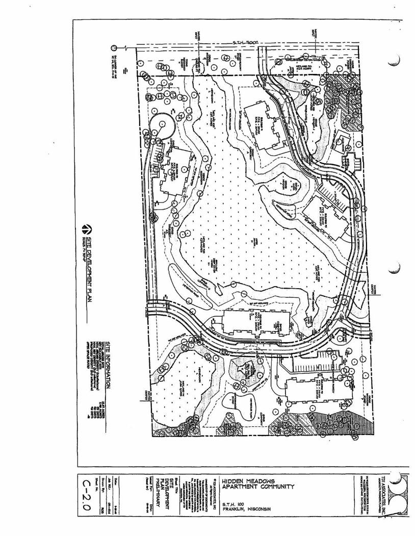
HIDDEN MEADOWS APARTMENT COMMUNITY
S.T.H. 100 FRANKLIN, WISCONSIN
6|i S S 2
P
8
- L I E ' i ' J i ; : • • • , •
^ ^ 51 - 1! -f I - ' fc r * s ^.Uf:
UOOglc earth
G o o g l e earth feet meters
• 1000 •300 A
*m
I ^
^.epIeuMwlL^
Cookie earth
Goog le earth feetL meters'
-1000 '300 A
K011 Google
Google earth feetL meters^
.1000 '500 A
'-v^
Google earth feetL metersi"
.400 '100
Cooglc(taT 0;-
A
g
3
Google earth feet meters
.800 "200 A
y ooz, OOZ"
M^JBO r>|Socvf)
H
mtmfmmid '• ^-^M.«
'?/' .

100) M W W V 9 U
C.oo§ c eart| y&mv -asewB
, — „ . -
Go.g le earth feet meters
.600 '200 A
'^m{m.
m
ytayyy.'saasus.
A G o o g l e earth
fD20,1i;Googi=;
Go gle earth feet meters
Google oaf if
.600 "200 A
©9
GOOQIC earth ©2011 Google
Goog le earth feeti meters1
.400 '100 A
T ^
••#
^
^ F^mpA'i©
Google earth feeti. metersf
.500 '100 A
Tree^
r

"^W^mm
Goog le earth feetL metersf
nooi
GCXWICO.TU
.400 '100 A
Google earth feeti metersf
•'13 tt
I jfenvaaj'? | .oo^lc s
.700 '200 A
H o free5>
©20i1 Google
Go ugle earth feet, meters'
fn
.700 '200 A
«5^eS 7av^«i \j^O(9c^>~^><- .
! mWJJFtfmrt B M M a m M - . -
,
4-1 l/l
m n
^mm
Google earth feetL meters1
.2000 "600 A
7/^z*i\
Wtfaws/mgim
ioo^lcoij^r
Google earth feet, metersf '200
?/ iyZ,oo£ ^ c c s
.900 A
-J
b
©MSB
BSHnMi
sKEsa
1
txaxl 00<fZ J^]/ fr ^p«^-^<9
y 00b, OOOT'
jSJa^sai 499J L|^98 2\% O^
lis leoiDCjoao s n aBe •U.'W®
• h .: \ \pi
-isS'-1/ /
•• •'•'••,
F
Mt<*rT
^ i «
©2011 Google
Goog le earth feetL metersf
,1000 '400 A
{t/^s/zjDor
#>W ,^V '•f-'iPti ^
. wiSV-
immMmlf
©2011 Google
G o o g l e earth feett meters'
,1000 '400 A
10/l^/ZJOO^
ismmzMM&r
Google earth
™
i
.a,§!>i)D;^a!]lls, ImaQeiUJ'S^^Geolo
feetL metersf
.800 '200 A
0 <^Xrc^ ^ / / S / ^ O O U^^TZo^U ^ 7rc<=5
'f
mmmM&r
• © 2011 .GoodiF (klUQli: mage D S :Geological Survey
A Go^de earth ffeet
O meters
r
'<
Google earth feetL metersf
$:K 4 ^
" ®aj)11D ©aiglJs
'100
HMIZJOO^
\K I
G(X)^lc
.400 A
•
r
zr /' •/
«
^
^
i
•OJ)
1 " " ' ^ •
G o o g l e earth feetL metersf
.700 '200 A
CVVXrock y/ll/zooo 7rce5
tr 1
Google earl tf rnxm
G o o g l e earth feetL metersf
i/z^/zoi:
.700 "200 A
MMli
Mi
J
A Google earth
O^CI^AL. ^//Zjzooo
o §1
CD CD
o
mm* S y ^ * * - *
A Google earth feet meters
^/il/zDco r^^ itt&uJ*
^9\mv*#n.<*
Google earth feet meters
.700 "200
S ll/z.ooS' A

Google earth feetL metersf
.700 '200 A
\0I^/Zx>ol
, IlM:H
Wm i
j ^ ^ ^ r n © ^
Google earth feet meters
.700
l/ze/i '200
Zo
•HftRL'. -.

• o
o v
^ . ̂ •.••! . , • ^ .'. ft:
Wmm
• - •:-• ^ o
^ ^ % (
• - ' • .
U ^
Mm
W^u-m-:--
m
AirSas&S
r'-'l
iffi
^ V : . 0 ^ m§
• TJ.' V;'' • • • m -
tV»i,^iy '•V't
.^; fe^.; ;l •|v-(: V̂'
m •ir;..,-?it
t
« r n nil iMpiiMUMimMipi
MHMMM
Google earth feet meters
.700 '200
C W C r a ^ H/\l>J2.oco ^ c T l ^ k il?be^. A
w^/zz/L A^^O^Q
L|1J98 3 | 8 O O ^ ) y sjs^aiu 1394
, I iflHIWl
i a i9i« J
J" Hv^ jV l ^ I
- '-^.SS.. •
i ^ l v
¥S
nwf r>. ^ ^ . u w ^
%
i
\
1 V /
et^-A' •O -
•; *,. •• •-£ •p-.Z.^
:&
. _ •jM
- 5 ^
^ ^ .
» ^ l M £ &
fm&m ' IS ift'if: i ti • ^i- i ' • 'MMr. t §i;iS <*"*
^ g §®iiJi]8aB[iDM)®'. i ! O i _
•
'fiirfe'lffgy'Sff
Go. gle earth ' .:•; ; ; \ . -^ • / ' . > » - £
onnn
Km i A ^ / / 3 / 2 L O © O ^ a J c 3 w - J t -
-MiF&O m-. '•fvmma
X Sentenniiairrar .r--•--• --. M
.1^1
Google earth feet, kmf
.3000 " " 1 A
-Holty-b,,,
" M M
w
'^' j-t . . x'̂
v- ' 4
%^*?^r »̂_ k . ' i a . .
^ . ^ . Fe^nwood-L-n 201l:Google
^
< S^ -^AS / G3T Hls-f-^oU
^Boller-^h -HollKvA
^e//a-Br—
^"ooa^.
*™
HTo'
imnmi
% (J
rnwood»[-n
Goog le earth feetb km'
^ r e e l t S ^ , ^ T 7/z^ /so i i
•4000 A
o Hillsdale
G o o g l e earth feet meters
.800 '200
?/£/ z.oog
o Hillsdale
Google earth feet meters
,800 200 A
I
m&m ^ | . • • f . i
f3 2012GoO(j l fe
Go gle earth feetL meters'
• 1000 '300 A
^i&O U . LO^UX^AJ^.
mL i2p.12 Google
Go..gle earth feet meters
.900 '200 A
ftvj^ (0® f ^KAJTtiv- /K^_
h
•
>QIC eartf
G o o g l e earth feetL metersr
.600 '100 A
•
Google earth
i 1 ps i ^ k
M rb 9 ' « )
«
•= ^ ^
S U 2 v5
feet meters
.600 '100 A
F
ft .. -„ 'J'
$msit&®
OlC-Morgan,cn,ii ....
Go^Qle earth m N o km"
•«*-%
• ^
»
A
a e r i a l m a p
Holdines Acres
I I
I •;
.. »
^
s o u t h m o r g a n t o n - 1 5 / 5 0 1 CM ft Commercial • 1 5 5 west new york ave • southern pines, nc t 910.695.1909 • f 910.695.7236 • [email protected]
m a s t e r p l a n
k5r^
s o u t h m o r g a n t o n - 1 5 / 5 0 1 Clif t Commercial • 155 west new york ave • southern pines, nc t 910.695.1909 • f 910.695.7236 • [email protected]
r e t a i l ma p
. O v '•'. %
m
Fill MOON HEATReS claire's
iMtHtt
ushroom
tymcDH
• •f<;
s o u t h m o r g a n t o n - 1 5 / 5 0 1 Clift Commercial • 1 55 west new york ave • southern pines, nc t 910.695.1909 • f 910.695.7236 • [email protected]
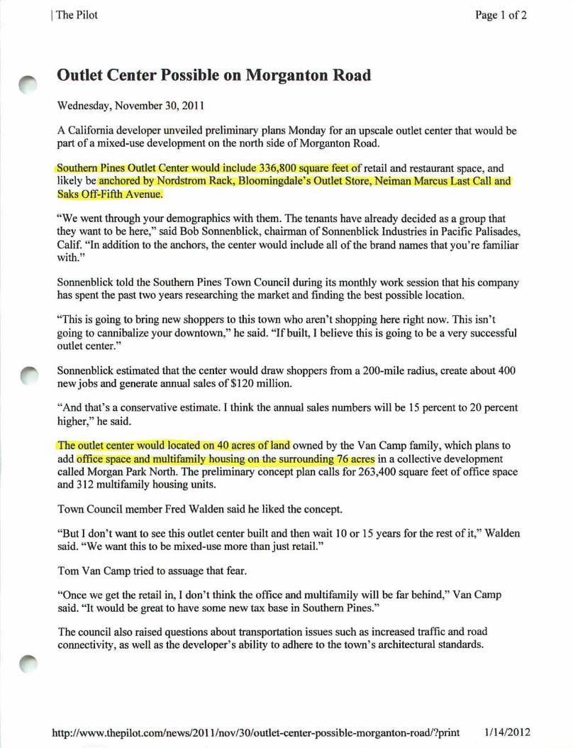
I The Pilot Page 1 of2
Outlet Center Possible on Morganton Road Wednesday, November 30, 2011
A California developer unveiled preliminary plans Monday for an upscale outlet center that would be part of a mixed-use development on the north side of Morganton Road.
Southern Pines Outlet Center would include 336,800 square feet of retail and restaurant space, and likely be anchored by Nordstrom Rack, Bloomingdale's Outlet Store, Neiman Marcus Last Call and Saks Off-Fifth Avenue.
"We went through your demographics with them. The tenants have already decided as a group that they want to be here," said Bob Sonnenblick, chairman of Sonnenblick Industries in Pacific Palisades, Calif. "In addition to the anchors, the center would include all of the brand names that you're familiar with."
Sonnenblick told the Southern Pines Town Council during its monthly work session that his company has spent the past two years researching the market and finding the best possible location.
"This is going to bring new shoppers to this town who aren't shopping here right now. This isn't going to cannibalize your downtown," he said. "If built, I believe this is going to be a very successful outlet center."
Sonnenblick estimated that the center would draw shoppers from a 200-mile radius, create about 400 new jobs and generate annual sales of $120 million.
"And that's a conservative estimate. I think the annual sales numbers will be 15 percent to 20 percent higher," he said.
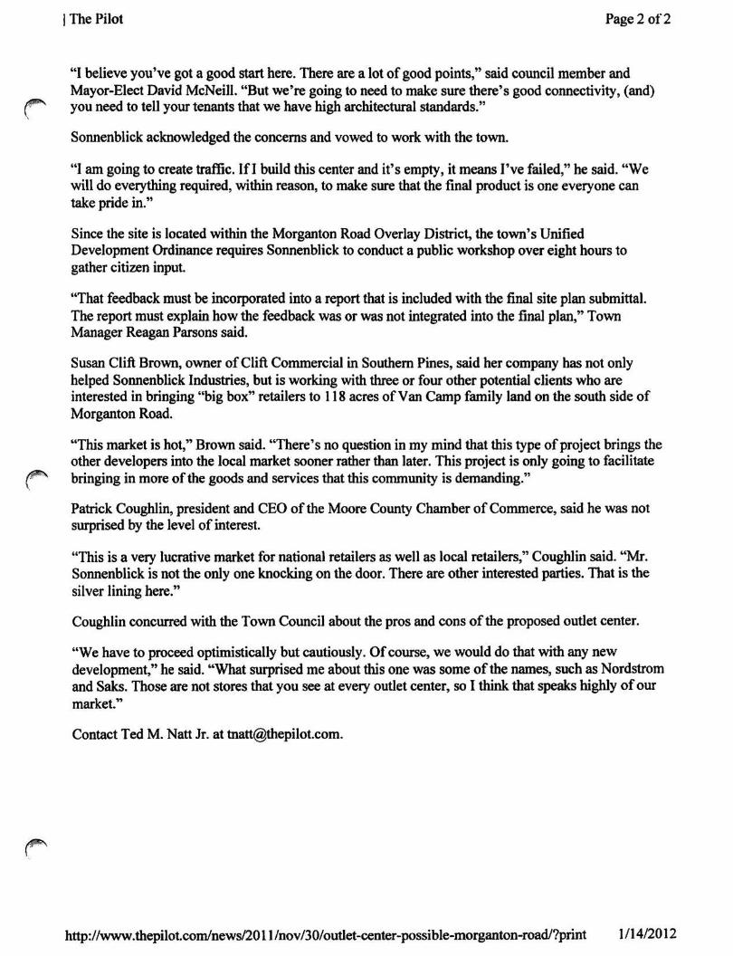
The outlet center would located on 40 acres of land owned by the Van Camp family, which plans to add office space and multifamily housing on the surrounding 76 acres in a collective development called Morgan Park North. The preliminary concept plan calls for 263,400 square feet of office space and 312 multifamily housing units.
Town Council member Fred Walden said he liked the concept.
"But I don't want to see this outlet center built and then wait 10 or 15 years for the rest of it," Walden said. "We want this to be mixed-use more than just retail."
Tom Van Camp tried to assuage that fear.
"Once we get the retail in, I don't think the office and multifamily will be far behind," Van Camp said. "It would be great to have some new tax base in Southern Pines."
The council also raised questions about transportation issues such as increased traffic and road connectivity, as well as the developer's ability to adhere to the town's architectural standards.
http://www.thepilot.com/news/2011 /nov/30/outlet-center-possible-morganton-road/?print 1 /14/2012
I The Pilot Page 2 of2
"I believe you've got a good start here. There are a lot of good points," said council member and Mayor-Elect David McNeill. "But we're going to need to make sure there's good connectivity, (and) you need to tell your tenants that we have high architectural standards."
Sonnenblick acknowledged the concerns and vowed to work with the town.
"I am going to create traffic. If I build this center and it's empty, it means I've failed," he said. "We will do everything required, within reason, to make sure that the final product is one everyone can take pride in."
Since the site is located within the Morganton Road Overlay District, the town's Unified Development Ordinance requires Sonnenblick to conduct a public workshop over eight hours to gather citizen input.
"That feedback must be incorporated into a report that is included with the final site plan submittal. The report must explain how the feedback was or was not integrated into the final plan," Town Manager Reagan Parsons said.
Susan Clift Brown, owner of Clift Commercial in Southern Pines, said her company has not only helped Sonnenblick Industries, but is working with three or four other potential clients who are interested in bringing "big box" retailers to 118 acres of Van Camp family land on the south side of Morganton Road.
"This market is hot," Brown said. "There's no question in my mind that this type of project brings the other developers into the local market sooner rather than later. This project is only going to facilitate bringing in more of the goods and services that this community is demanding."
Patrick Coughlin, president and CEO of the Moore County Chamber of Commerce, said he was not surprised by the level of interest.
"This is a very lucrative market for national retailers as well as local retailers," Coughlin said. "Mr. Sonnenblick is not the only one knocking on the door. There are other interested parties. That is the silver lining here."
Coughlin concurred with the Town Council about the pros and cons of the proposed outlet center.
"We have to proceed optimistically but cautiously. Of course, we would do that with any new development," he said. "What surprised me about this one was some of the names, such as Nordstrom and Saks. Those are not stores that you see at every outlet center, so I think that speaks highly of our market."
Contact Ted M. Natt Jr. at [email protected].
http://www.thepilot.com/news/2011 /nov/30/outlet-center-possible-morganton-road/?print 1/14/2012
m o r g a n p a r k n o r t h f u t u r e d e v e l o p m e n t m a s t e r p l a n
l O
•fa *— •o "D
i> o ^ § z m O a 2^ z 73 i I z n
131
r illf ?:^^rM^^
:x^5m^mN m^^ s o u t h m o r g a n t o n - 1 5 / 5 0 1 Clift Commercial • 155 west new york ave • southern pines, nc
t 910.695.1909 • f 910.695.7236 • [email protected]
^
Google earth feet^ meters!1
-1000 '300 A
^A^V../v
<£ ^
le^^'tH
Google earth feett metersf
.1000 '300 A
(
I
« f e ^
m m
Google earth rcna r-ecnnoioQies
20i2Gooal3
Google earth feke^ •3000 A
>
COUN AIRPO
SANDHILLS COMMUNITY
COLLEGE w.
WARRIOR WOODS
SUBDIVISION
Qi^n SANDHILLS COMMUNITY
COLLEGE
' MASfl '•< PI AN
N R I H C A R 0 I
I The Pilot Page 1 of 3
^ SP Gears Up for Major UDO Revision Sunday, December 4,2011
BY TED M. NATT JR.
Staff Writer
Southern Pines has created a Stakeholder Steering Committee as it gears up to revise the Unified Development Ordinance (UDO) for the first time since its inception in 1989.
The UDO controls all design and land-use regulations for the town. The revision will streamline and update the existing code in addition to ensuring its compliance with, and ability to implement the goals of, the Comprehensive Long-Range Plan (CLRP) adopted by the town last year.
"The UDO has served the town very well, but there certainly have been instances in the past five to 10 years where conflicts, shortcomings and interpretation issues have come to light," Town Manager Reagan Parsons said. "This is an opportunity to take a look at those issues, shore up the code, and bring the UDO in line with the policies and goals of the CLRP."
The town has hired Planning Works, a Leawood, Kan.-based consulting company, to facilitate the yearlong process. Planning Works was awarded the $149,180 contract in October after a five-member committee that included Parsons reviewed proposals from five firms.
"Southern Pines striking at this point is the best time to do it," said Bruce Peshoff, a partner at Planning Works. "You don't have growth pressures influencing decisions, so you've got breathing room to review, consider and understand alternatives that give you the time to make informed choices.
"The UDO needs to protect existing investments and encourage new investment."
Four Phases
Peshoff said the "community-driven" process will be broken down into the following four phases:
n Diagnose the strengths and weaknesses of the town's existing regulations.
n Select regulatory strategies that build on existing strengths and resolve existing weaknesses.
n Build the Land Use and Development Code through the process of choosing regulatory strategies that will work best for the town.
n Finalize UDO adoption and implementation.
"The Planning Works team cannot choose which options are best for the town, but we can help (local stakeholders) understand the implications of alternative regulatory strategies and reach concensus for the options that are best for Southern Pines," Peshoff said. "This is your UDO. Our main job is to listen and help you achieve your goals."
http://www.thepilot.com/news/2011 /dec/04/sp-gears-up-for-major-udo-revision/?print 1 /14/2012
I The Pilot Page 2 of3
Planning Works will hold 10 sets of meetings and conduct four three-day forums because town ^ officials want the process to be inclusive and transparent as well as challenging and rewarding. The
first forum was originally set to begin Monday but has been rescheduled for Jan. 17-19.
"Hopefully, getting past the holidays will provide greater levels of participation and some additional time to advertise and generate interest," Parsons said. "There will be a number of opportunities for interested parties to participate in the process."
The contract also calls for Planning Works to study West Southern Pines and downtown Southern Pines, and perhaps draft regulating plans for those neighborhoods.
"There will be specific study given to those areas while updating the UDO," Parsons said, "but there WN may or may not be individual documents for each area once the process is complete."
He added that the town envisions the Stakeholder Steering Committee as being UDO "ambassadors" -not only offering policy guidance but also serving as conduits of information.
"Obviously, this process is very important," Parsons said.
Revision Needed
Town Council member Chris Smithson, who will represent the council on the 18-member committee, noted that the UDO has been amended more than 100 times in the past two decades.
"These things have a life-span, and it needs to be redone," Smithson said. "Our UDO is not as broken rfiWN as some people make it out to be. We're not at a standstill because it's unworkable. What we're going
to get is a modem document that is easier to use and easier to enforce."
While Smithson doesn't foresee any "drastic changes" to the UDO's core, he does envision new methods "toward reaching certain goals."
For example, developers may be rewarded "for going above and beyond what's called for in the UDO, whether that be creating more open space, imposing more restrictions or lowering the density," he says. "The UDO should encourage best practices."
Smithson said he looks forward to the process because he believes it will be similar to the CLRP.
f** "I like this kind of stuff," he said. "I find it interesting."
'Be Inclusive'
Peshoff said the forums "will be a very intensive three days," with concurrent sessions in the morning
r and afternoon.
"The second and third forums will probably be in March and April, which is by design so everything will be fresh in everyone's mind," he said. "We're probably looking at late summer or early fall for the final forum, at which time we will present the new UDO for review."
f^ In between. Planning Works intends to conduct other public meetings, provide a monthly progress and status report, conduct regular teleconferences with town staff, and maintain a project website that will include community surveys, among other things.
http://www.thepilot.com/news/2011/dec/04/sp-gears-up-for-major-udo-revision/7print 1/14/2012
I The Pilot Page 3 of3
Peshoff said the website - www.southempinesUDO. org - is "almost ready to go live."
"It will include an opportunity to sign up and receive email notices of meetings, work product, etc., and will include a reference library of articles that cover a wide range of viewpoints," Peshoff said. "The goal is to facilitate upstream/downstream information sharing."
Parsons said the town's "biggest role" will be scheduling and advertising the forums as well as setting up for Planning Works "stakeholder interviews" with individuals and focus groups.
"We want the UDO process to be inclusive, transparent, challenging and rewarding," he said.
Peshoff agreed.
"Creating a UDO is a dynamic process that works best when participants understand and visualize alternative outcomes," he said. "Working with the community, we will draft a UDO that turns its vision into reality. We're looking forward to getting started."
Contact Ted M. Natt Jr. at [email protected].
http://www.thepilot.com/news/2011/dec/04/sp-gears-up-for-major-udo-revision/7print 1/14/2012