karsten vennemann, seattle free and easy web mapping
TRANSCRIPT
Karsten Vennemann, Seattle
Free and Easy Web Mapping

Free and Easy Web Mapping slide 2 of 21
Talk overview
Goals
Explore selected Web Mapping Options focus on free and easy to set-up
overview & functionality live example map for each service
(point locations shape of GIS projects)
Highlights of Services

Free and Easy Web Mapping slide 3 of 21
Goals Introduce to free and easy Web mapping
options i.e. free of charge & least technically challenging
Present a selection of the most prominent offerings of free and easy Web mapping providers
Comparison of functionality and restrictions to support informed decisions for choosing services

Free and Easy Web Mapping slide 4 of 21
For Web Mapping an organisation typicallyhas their own server(s) hardware + software
setup
Free and Easy Web Mapping slide 5 of 21
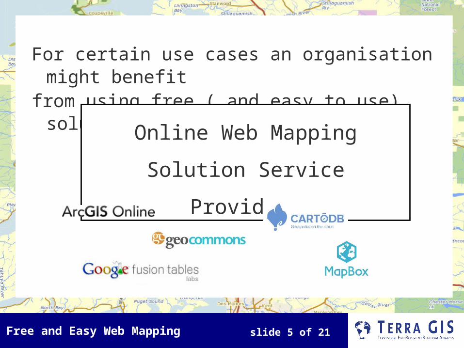
For certain use cases an organisation might benefit
from using free ( and easy to use) solutions of Online Web Mapping Solution
Service Providers

Free and Easy Web Mapping slide 6 of 21
Free and easy Web mapping
options(a selection)
Google Maps + Fusion tables
ArcGIS online
GeoCommons
MapBox
Carto DB

Free and Easy Web Mapping slide 7 of 21
Overview of free mapping services Provide free services, with optional paid
upgrade plan
Limitations on use (who), access and/or data storage flexibility architecture & functionality (paid or other) data storage size and formats map projection (all services in sperical mercator)
Similarities map projection (all services in spherical mercator) geographic search functions (all)
Services often provide APIs for programming (beyond easy)

Free and Easy Web Mapping slide 8 of 21
Google Fusion Tables + Maps one option using Google maps via storage on
google drive (others options are KML or using API)
functionality includes some google base map styling private data in drive, publish for mapping styling of makers ID box html to embed in web site
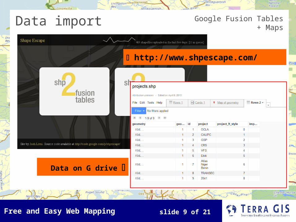
data formats upload kml, shape files (via shape escape), csv, MS Excel file
limitations - any user, storage 5GB max (G. Drive) mapping featues < 100,000, > 500 features will show as dots, max five layers from Fusion Tables limited flexibility without API (e.g. Base layers Google
only)
Free and Easy Web Mapping slide 9 of 21
Google Fusion Tables + Maps
http://www.shpescape.com/
Data on G drive
Data import

Free and Easy Web Mapping slide 10 of 21
Data import
http://fusion-tables-api-samples.googlecode.com/svn/trunk/FusionTablesLayerWizard/src/index.html
Google Fusion Tables + Maps
Creates HTML for web page
http://osgis.terragis.net/google_no_roads_projects.html

Free and Easy Web Mapping slide 11 of 21

Free and Easy Web Mapping slide 12 of 21
ArcGIS online functionality
create, store, manage and share maps, apps, and data
tools: ID, measure, bookmarks, print, driving directions
style layer & ID tool via GUI, legend, base layers ESRI + OSM
access to large shared content ArcGIS REST API
limitations private individuals, non profit & educational
organizations free account data always public (groups for paid
accounts) storage 2GB max
data upload shape file (zip), csv file, GPS data file (gpx) ,
1000 feat. max, (250 geocoding addresses).

Free and Easy Web Mapping slide 13 of 21
Free and Easy Web Mapping slide 14 of 21
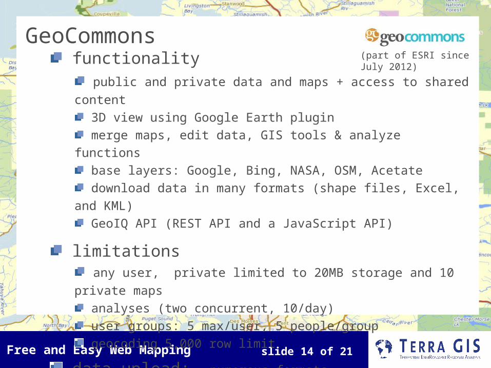
GeoCommons functionality
public and private data and maps + access to shared content
3D view using Google Earth plugin merge maps, edit data, GIS tools & analyze functions base layers: Google, Bing, NASA, OSM, Acetate download data in many formats (shape files, Excel, and KML) GeoIQ API (REST API and a JavaScript API)
limitations any user, private limited to 20MB storage and 10 private
maps analyses (two concurrent, 10/day) user groups: 5 max/user, 5 people/group geocoding 5,000 row limit
data upload: numerous formats
(part of ESRI since July 2012)

Free and Easy Web Mapping slide 15 of 21
Free and Easy Web Mapping slide 16 of 21
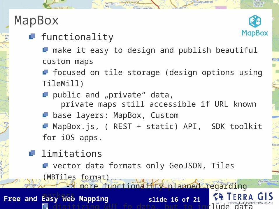
MapBox functionality
make it easy to design and publish beautiful custom maps
focused on tile storage (design options using TileMill) public and „private“ data,
private maps still accessible if URL known base layers: MapBox, Custom MapBox.js, ( REST + static) API, SDK toolkit for iOS
apps.
limitations vector data formats only GeoJSON, Tiles (MBTiles format)
-> more functionality planned regarding markers digitizing GUI fo data, but to include data files
need to use JS + HTML any user 3,000 map views/month + 50 MB storage

Free and Easy Web Mapping slide 17 of 21
GUI Tools
Free and Easy Web Mapping slide 18 of 21
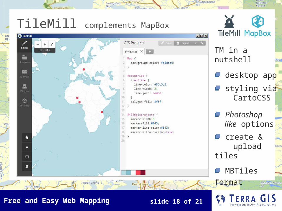
TileMill complements MapBox
TM in a nutshell
desktop app
styling via CartoCSS
Photoshop like options
create & upload tiles
MBTiles format

Free and Easy Web Mapping slide 19 of 21
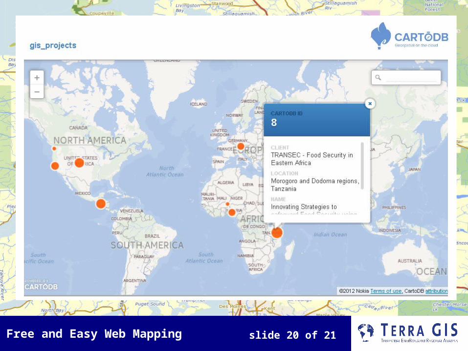
CartoDB functionality
store data, raster + vector work with data (filter, edit
and merge datasets via GUI) styling via CartoCSS
visualization wizard GUI (simple, choropleth, bubble)
base layers: Google, Nokia, MapBox, Custom cartodb.js, SQL API, examples: layer with Google maps
or Leaflet
limitations any user, no private data 5 MB storage and 5 tables data upload: many formats
Free and Easy Web Mapping slide 20 of 21

Free and Easy Web Mapping slide 21 of 21
Highlights (small selection)
Google Maps + Fusion tables …map your data via google drive
ArcGIS online ...host your data and combine with large selection of shared data
GeoCommons …feature rich services + private data + analysis + large sel. shared data
MapBox …host your own base map (& create via TileMill)
Carto DB …store your own data, filter and manage via SQL, style via GUI