lancashire classic (pendle hill) - - introduction
TRANSCRIPT
Lan
cashire WalksPendle Hill
Lancashire Classic: Pendle Hill from Barley (Archive)
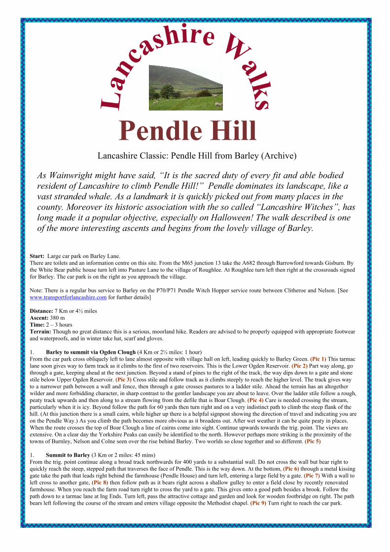
As Wainwright might have said, “It is the sacred duty of every fit and able bodiedresident of Lancashire to climb Pendle Hill!” Pendle dominates its landscape, like avast stranded whale. As a landmark it is quickly picked out from many places in thecounty. Moreover its historic association with the so called “Lancashire Witches”, haslong made it a popular objective, especially on Halloween! The walk described is oneof the more interesting ascents and begins from the lovely village of Barley.
Start: Large car park on Barley Lane.There are toilets and an information centre on this site. From the M65 junction 13 take the A682 through Barrowford towards Gisburn. Bythe White Bear public house turn left into Pasture Lane to the village of Roughlee. At Roughlee turn left then right at the crossroads signedfor Barley. The car park is on the right as you approach the village.
Note: There is a regular bus service to Barley on the P70/P71 Pendle Witch Hopper service route between Clitheroe and Nelson. [Seewww.transportforlancashire.com for further details]
Distance: 7 Km or 4½ milesAscent: 380 mTime: 2 – 3 hoursTerrain: Though no great distance this is a serious, moorland hike. Readers are advised to be properly equipped with appropriate footwearand waterproofs, and in winter take hat, scarf and gloves.
1. Barley to summit via Ogden Clough (4 Km or 2½ miles: 1 hour)From the car park cross obliquely left to lane almost opposite with village hall on left, leading quickly to Barley Green. (Pic 1) This tarmaclane soon gives way to farm track as it climbs to the first of two reservoirs. This is the Lower Ogden Reservoir. (Pic 2) Part way along, gothrough a gate, keeping ahead at the next junction. Beyond a stand of pines to the right of the track, the way dips down to a gate and stonestile below Upper Ogden Reservoir. (Pic 3) Cross stile and follow track as it climbs steeply to reach the higher level. The track gives wayto a narrower path between a wall and fence, then through a gate crosses pastures to a ladder stile. Ahead the terrain has an altogetherwilder and more forbidding character, in sharp contrast to the gentler landscape you are about to leave. Over the ladder stile follow a rough,peaty track upwards and then along to a stream flowing from the defile that is Boar Clough. (Pic 4) Care is needed crossing the stream,particularly when it is icy. Beyond follow the path for 60 yards then turn right and on a very indistinct path to climb the steep flank of thehill. (At this junction there is a small cairn, while higher up there is a helpful signpost showing the direction of travel and indicating you areon the Pendle Way.) As you climb the path becomes more obvious as it broadens out. After wet weather it can be quite peaty in places.When the route crosses the top of Boar Clough a line of cairns come into sight. Continue upwards towards the trig. point. The views areextensive. On a clear day the Yorkshire Peaks can easily be identified to the north. However perhaps more striking is the proximity of thetowns of Burnley, Nelson and Colne seen over the rise behind Barley. Two worlds so close together and so different. (Pic 5)
1. Summit to Barley (3 Km or 2 miles: 45 mins)From the trig. point continue along a broad track northwards for 400 yards to a substantial wall. Do not cross the wall but bear right toquickly reach the steep, stepped path that traverses the face of Pendle. This is the way down. At the bottom, (Pic 6) through a metal kissinggate take the path that leads right behind the farmhouse (Pendle House) and turn left, entering a large field by a gate. (Pic 7) With a wall toleft cross to another gate, (Pic 8) then follow path as it bears right across a shallow gulley to enter a field close by recently renovatedfarmhouse. When you reach the farm road turn right to cross the yard to a gate. This gives onto a good path besides a brook. Follow thepath down to a tarmac lane at Ing Ends. Turn left, pass the attractive cottage and garden and look for wooden footbridge on right. The pathbears left following the course of the stream and enters village opposite the Methodist chapel. (Pic 9) Turn right to reach the car park.

Pic 1 Pic 2 Pic 3 Pic 4
Pic 5 Pic 6 Pic 7 Pic 8
Pic 9 Pendle from Black Moss
Copyright www.LancashireWalks.com
Map by Chris Wyatt at The Blackpool Gazette
12
34
5
6
78
9