lecture 2 climatic zones
TRANSCRIPT

CLIMATIC ELEMENTS AND CLIMATIC ZONES
Objectives
1. Explain the different climatic zones with their defining elements.
2. Understand the effect of climate on human comfort and hence on design.
Climate Macroclimate Microclimate Room Climate
Precipitation Temperature Humidity Wind

Weather is the state of the atmosphere, or the sequence of the states of
the atmosphere at any given time.
Climate the weather conditions prevailing in an area in general or over a
long period
Macroclimate the overall climate of a region usually a large geographic
area —distinguished from microclimate.
Microclimate the climate of a very small or restricted area, especially
when this differs from the climate of the surrounding area.
Wind is simple air movement

In the same way as the earth has a climate, the insides of a buildings also have
climate, room climate, with measurable values for air pressure,
humidity, temperature, velocity of air circulation and ‘internal
sunshine’ in the form of radiated heat.
Efficient control of these factors leads to optimum room comfort and
contributes to man’s overall health and ability to perform whatever tasks
he is engaged in.

Factors in weather
Weather is an collection of all meteorological variables. At any given moment the
elements appear in combination, and it is difficult to determine their relative
importance in the thermal interplay.
The architectural solutions to individual climatic elements should be similarly
blended in a climate balanced structure. To achieve this the importance and
relationships of climatic elements as temperature, radiation and wind effects, which
affect comfort should be established and adapted to the needs of building
practice.
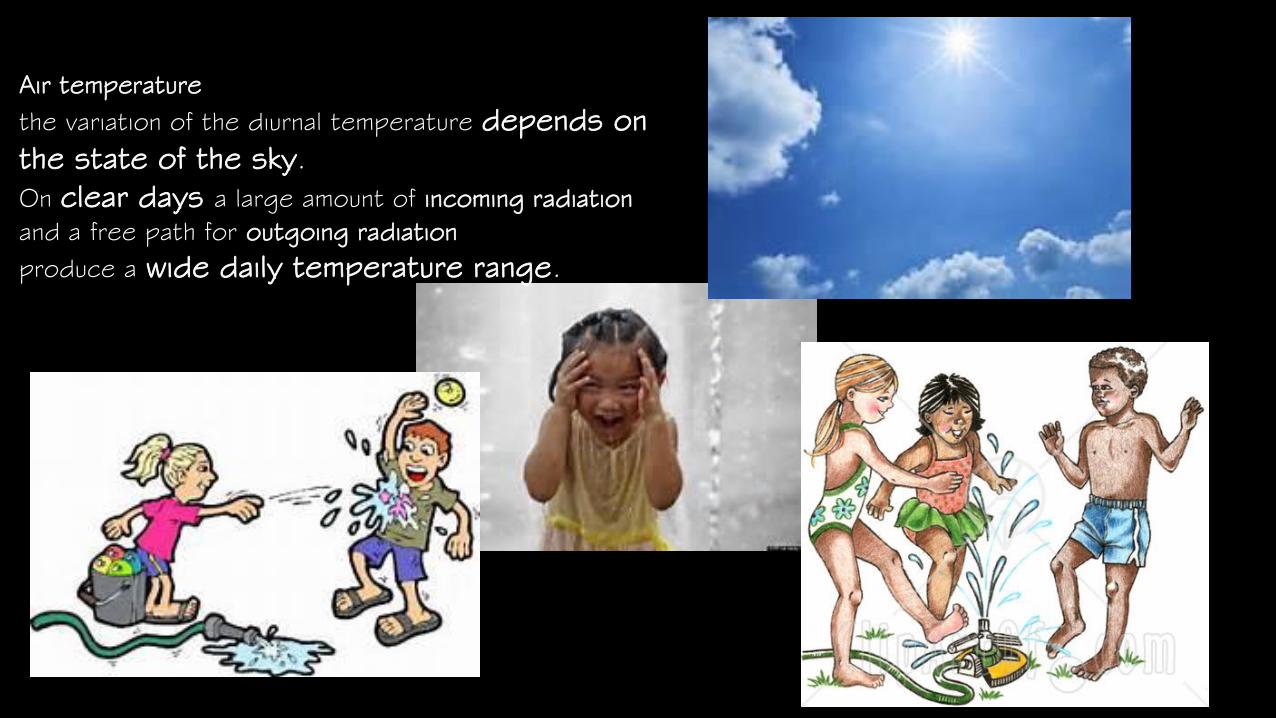
Air temperature
the variation of the diurnal temperature depends on
the state of the sky.
On clear days a large amount of incoming radiation
and a free path for outgoing radiation
produce a wide daily temperature range.

on overcast days the variation is less.
On a seasonal basis the same holds true: clear days in summer are
warmer because more solar energy is received; but a clear day in
winter is usually cooler than a cloudy one, because in the longer
period of nocturnal outgoing radiation heat escapes more easily
through clear atmosphere.

Radiation effects—part of the radiation received at ground level is reflected by
the earth’s surface, but most of the energy is absorbed; it changes to heat and
raises the temperature of the air, the ground and the surrounding objects.

Wind—the effects of wind on housing have to be considered both on the outside and
within the dwelling itself. For comfort balance, air movements have to be evaluated both
as negative and positive. They should be blocked from penetrating structures during
under heated periods but should be admitted and utilized at overheated times.

Climate elements’ basic principles
There are four basic climatic elements. These are:
1. Precipitation includes rain, snow, sleet, hail, drizzle, fog and mist.

2. Temperature is the most important element since it influences other
elements, It depends on geographical factor such as distance from the
equator (latitude) the closer the location to the equator, the warmer the
temperature.
The curve of the earth’s surface affects the angle of the sun’s rays and
how much heat is received. The higher the land (altitude), the colder the
temperature. The temperature increases at 6.5°C every 1,000m above
sea. Air is less dense as it rises and loses heat. The nearer the location
the land is from the sea, the cooler (than average) the temperature is in
summer and warmer in winter, Land heats up and cools down more quickly
than the sea, places inland are warmer in summer and colder in winter,
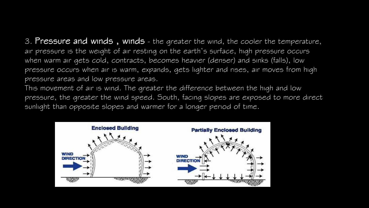
3. Pressure and winds , winds - the greater the wind, the cooler the temperature,
air pressure is the weight of air resting on the earth’s surface, high pressure occurs
when warm air gets cold, contracts, becomes heavier (denser) and sinks (falls), low
pressure occurs when air is warm, expands, gets lighter and rises, air moves from high
pressure areas and low pressure areas.
This movement of air is wind. The greater the difference between the high and low
pressure, the greater the wind speed. South, facing slopes are exposed to more direct
sunlight than opposite slopes and warmer for a longer period of time.

4. Humidity – the amount of water vapor in the atmosphere. Air can only
hold a certain amount of water before condensation and precipitation
occurs.
Climatic Zones and Building Forms
Architectural buildings must be viewed not only as products in their own right,
but as integral part of the larger environment. That is to say such buildings are
not deemed to be single units, but their functional relationship with man-made
environment, with the natural environment, the surrounding, is solved in a unified
fashion.
Nature adapts from to climate and so do traditions in buildings. The adaptation
stems from the fact that a building heat loss or gain must increase with the area
of surface it exposes to the air outside and there is a thermal argument for
keeping this to a minimum for the volume enclosed. This means a hemispherical
building theoretically, when the environment is to be kept at bay, but practically
for difficulty of other considerations something approaching a cube is an ideal
solution.

For example, in the cold latitudes, the conifer with its short spines is
compact, ’introverted’ sort of tree, closing itself away from the air around it.,
just as the log cabin is compact. In temperate climates, vegetation can merge
more freely with its surroundings, and so can buildings there. Freer planning
still involves some thermal penalty, especially in winter, but it is less severe
and, hence, acceptable if other planning advantages result.
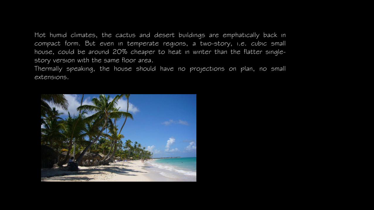
Hot humid climates, the cactus and desert buildings are emphatically back in
compact form. But even in temperate regions, a two-story, i.e. cubic small
house, could be around 20% cheaper to heat in winter than the flatter single-
story version with the same floor area.
Thermally speaking, the house should have no projections on plan, no small
extensions.

Flora Building Form Recommended Layout
Polar zone—igloo
Cold—compact closed
Temperate—can be
more expansive
Hot dry– compact
closed
Hot humid—
expansive, shaded,
ventilated

Microclimate
At ground level multi fold minute climates exists side by side varying sharply with the
elevation of a few feet and within a distance of a mile. Nature demonstrate this in
late winter with melting snow cover patterns, and in early spring when north sides of
hills ,ay be frozen and brown while southerly slopes turn green with awakening
vegetation. Plants are sensitive indicators of favorable circumstances. This effect is
well known to farmers,

Topography and Microclimate
Temperature and the atmosphere decreases with altitude, temperature drop in the
mountains can be approximated as 1°F for each 330’ rising summer and for each 400’ rise
in winter. This effect is important in tropical lands where temperature become more
favorable at high altitude.
As mountains affect the microclimate, small differences in terrain can create remarkably large
modifications in the microclimate. Cool air is heavier than warm, and at night the outgoing
radiation causes a cold air layer to form near the ground surface. The cold air behaves
somewhat like water, flowing towards the lowest points. This “flood of cold air” causes “cold
islands” or “cold puddles”.
Accordingly, elevations that impede the flow of air affect the distribution of the nightly
temperature by dam action; and concave terrain formations become cold-air lakes at night.

Cool air pool
Warm slope zoneRadiating surface and air movement

Natural and Built up Surrounding
Water, having a higher specific heat the land is normally warmer in winter and cooler in
summer, and usually cooler during the day and warmer at night, than the terrain.
Accordingly, the proximity of bodies of water moderates extreme temperature variations,
and in winter raises the minimums, and summer lowers the heat peak. The natural cover
of the terrain tends to moderate extreme temperatures and stabilize conditions through
the reflective qualities of various surfaces. Conversely, cities and man made surfaces tend
to elevate temperatures, as the materials used are usually of absorptive character.

Effects of climate on man
Warm slope zone Radiating surface and air movement Cool air pool Man’s energy and
health depend in large measure on the direct effects of his environment.
It is a common experience to find that on some days the atmospheric conditions stimulate
and invigorate our activities, while the other at times they depress the physical and mental
effort. It is also well known that in certain climatic areas, where excessive heat or cold
prevails energy is diminished by biological strain of adaptation to the extreme conditions

Room Climate
In the same way as earth has a climate, the insides of buildings also have a climate, with
measurable values for air pressure, humidity, temperature, velocity of air circulation and
‘internal sunshine’ in the form of radiated heat. Efficient control of these factors lead to
optimum room comfort and contributes to man’s overall health and ability to perform
whatever tasks he is engaged in.
Climatic Zones in Ethiopia
Ethiopia is a country of varied geographical features; physically the land ranges from sea
level up to 4,500mts above the sea. The altitude has a moderating effect on the climate.
The traditional climatic zones are reflections of the relationship between altitude and
temperature. The traditional climatic zoning does not consider the effct of humidity,
rainfall, and vegetation on comfort.


CLIMATIC ZONES
Zone I– Hot Dry
Lowland
Zone II– Dry Plateau
Zone III– Humid Plateau
Zone IV– Upland
Zone V– Wet Lowland

Location The Hot Dry Zone occupies the northern
Eastern, the extreme north –
Topography It is a vast area flat land within the altitude of
approximately 200-100mt. The depressed area (100mts
below the sea level) is found in this region
Vegetation It is a mixture of desert and semi desert. .In
the lower parts nothing grows. On the higher grounds
some vegetation, like thorn bush, touch isolated grass
clumps with bare patches are found.
Temperature The average daily temperature is 38°C and at night it drops into 21°C . The comfort zone lies
between 23°C and 27°C
Humidity The Humidity is rather low. The average humidity for the dry and wet seasons is 20% and 50%
respectively.
Rainfall The rainfall appears for shorter time, usually two times. During the rainy season, the average rainfall in a
month slightly exceeds 130mm
Radiation The impact of solar radiation is quite high, due to little or no cloud coverage
Towns of the Zone Agordat,, Diredawa,, Kebri, Dar and Awash
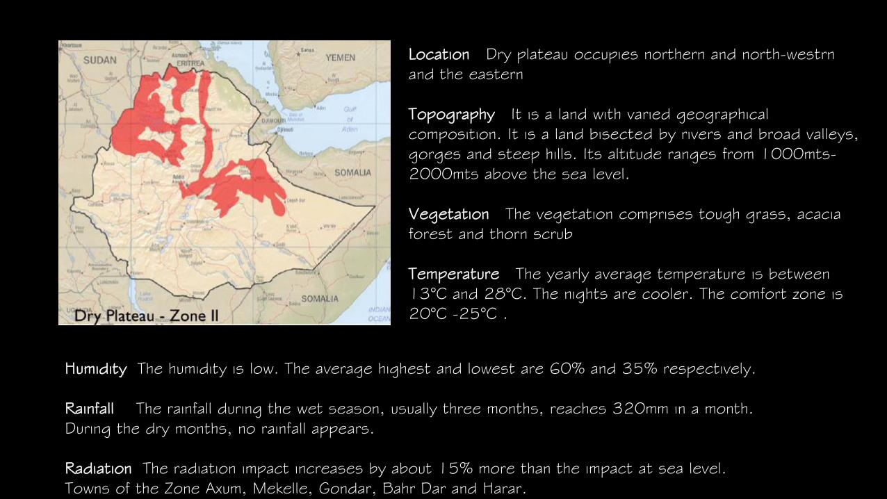
Location Dry plateau occupies northern and north-westrn
and the eastern
Topography It is a land with varied geographical
composition. It is a land bisected by rivers and broad valleys,
gorges and steep hills. Its altitude ranges from 1000mts-
2000mts above the sea level.
Vegetation The vegetation comprises tough grass, acacia
forest and thorn scrub
Temperature The yearly average temperature is between
13°C and 28°C. The nights are cooler. The comfort zone is
20°C -25°C .
Humidity The humidity is low. The average highest and lowest are 60% and 35% respectively.
Rainfall The rainfall during the wet season, usually three months, reaches 320mm in a month.
During the dry months, no rainfall appears.
Radiation The radiation impact increases by about 15% more than the impact at sea level.
Towns of the Zone Axum, Mekelle, Gondar, Bahr Dar and Harar.

Location The Humid plateau lies in the western, south and south
western part
Topography The land has varied geographical features and rich
cultivation soil. It has beautiful contrasting scenery. This zone within
the altitude of 1000mts– 2300mts above sea level.
Vegetation It has subtropical, and at lower altitudes, a tropical
vegetation is experienced. Further south, Savanna grassland can be
found with acacia forest
Temperature The average annual temperature is 26°C -13°C . The
comfort zone is between 25°C and 20°C .
Humidity The average annual humidity for the wet and dry season is 80% and
50% respectively.
Rainfall The rainfall is distributed throughout the year, but during the wet season the
monthly average is 310mm. There is at least 25mm of rainfall monthly during the dry
season.
Radiation Due to the altitude, the radiation increases by 15% more than the impacts at sea
level. Towns of the Zone Jimma, Neghelli and Bacco

Location The upland starts from the central part of Ethiopia and
run all along to the north. It forms a pool of high mountains of over
4000meters, at the western, north western, and eastern parts of
the country
Topography This part of the country is called the core of the high
lands. Extensive high plateaus, from which higher mountain groups
stand out, are dissected by small big rivers. It lies above
2300mts from the sea
Vegetation It can support high mountain vegetation, including
coarse grass and giant coniferous forests
Temperature The average annual temperature is 24°C –9°C. the
nights and the earl hours of the day is generally cool. The comfort
in this region lies between 19°C and 24°C
Humidity During the wet season the average is over 80%. But in dry periods it drops to 50%
Rainfall The rainfall is distributed over the year. The average monthly rainfall
Radiation There is an average increase of 20% more in this area than at the sea level
Towns of the Zone Addis ababa, Dessie and DebreMarkos
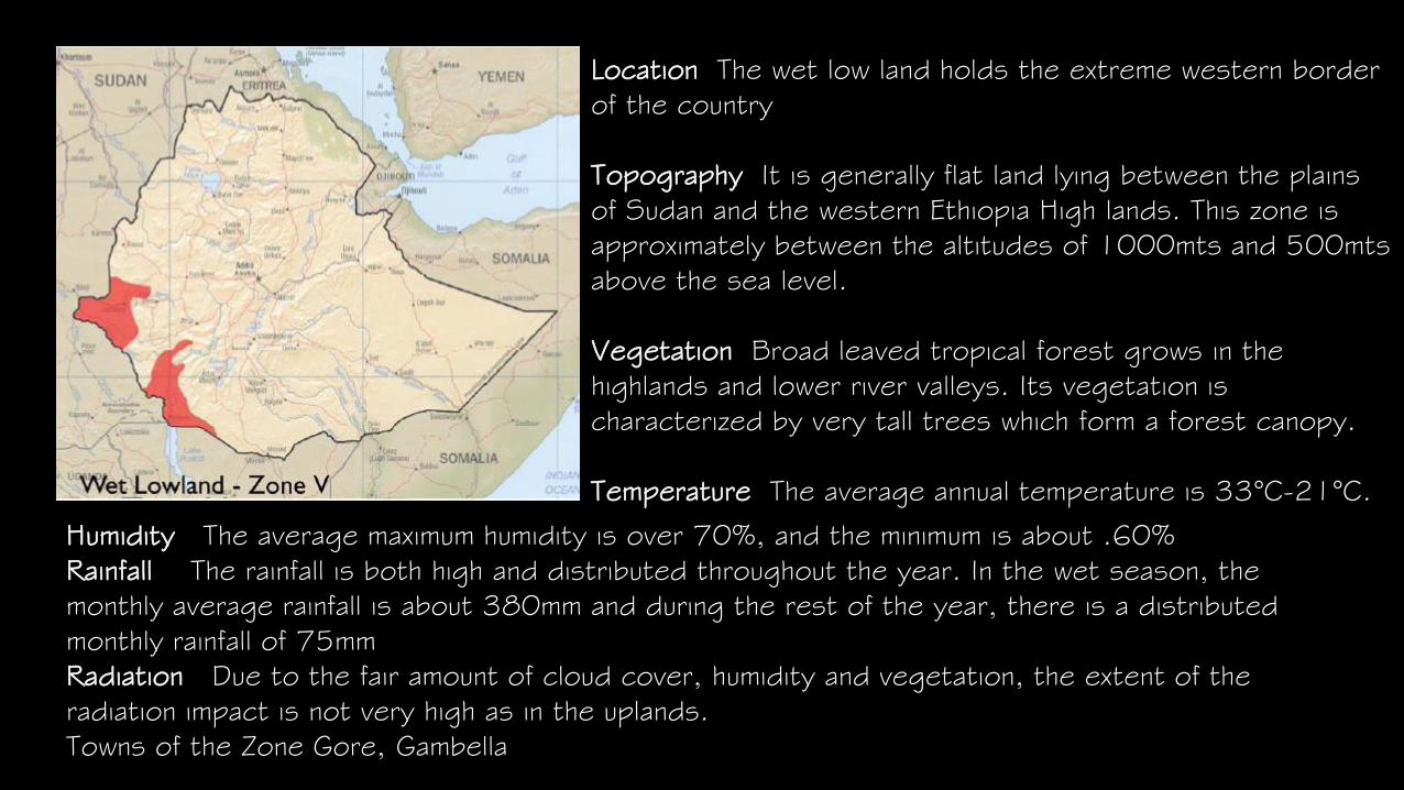
Location The wet low land holds the extreme western border
of the country
Topography It is generally flat land lying between the plains
of Sudan and the western Ethiopia High lands. This zone is
approximately between the altitudes of 1000mts and 500mts
above the sea level.
Vegetation Broad leaved tropical forest grows in the
highlands and lower river valleys. Its vegetation is
characterized by very tall trees which form a forest canopy.
Temperature The average annual temperature is 33°C-21°C.
Humidity The average maximum humidity is over 70%, and the minimum is about .60%
Rainfall The rainfall is both high and distributed throughout the year. In the wet season, the
monthly average rainfall is about 380mm and during the rest of the year, there is a distributed
monthly rainfall of 75mm
Radiation Due to the fair amount of cloud cover, humidity and vegetation, the extent of the
radiation impact is not very high as in the uplands.
Towns of the Zone Gore, Gambella

Assignment
Choose one of the zones and study the impact of climate on the
• On the design considerations that there are and that need to be made
• Available materials and how they influence building environments
• What are the key characters of that specific zone that make it unique
Submission and presentation will be on the 17th
may 8:30pm