leveraging geospatial big data james crawford: with...
TRANSCRIPT

CASE STUDY www.digitalglobe.com/geobigdata
Leveraging Geospatial Big Data
with Artificial IntelligenceJames Crawford: THE VISIONARY BEHIND ORBITAL INSIGHT
CASE STUDY

LEVERAGING GEOSPATIAL BIG DATA WITH ARTIFICIAL INTELLIGENCE www.digitalglobe.com/geobigdata
The Visionary behind Orbital InsightJames Crawford, a former NASA robotics and
artificial intelligence expert who provided the agency
with broad AI support for spacecraft as well as Earth
observation satellites, has left his mark in outer
space and cyberspace as an AI visionary and savant.
Now he’s focused on planet Earth and how machine
learning can extract intelligence from Geospatial Big
Data (GBD). His new company is aptly called Orbital
Insight. Read on to learn how DigitalGlobe’s GBDX
platform is helping Crawford’s team deliver ground-
breaking insight into life on our planet.

LEVERAGING GEOSPATIAL BIG DATA WITH ARTIFICIAL INTELLIGENCE www.digitalglobe.com/geobigdata
Machine learning meets geospatial data
“I’ve been interested in space for a long time,” says
James Crawford, Founder and CEO of Orbital Insight.
“For years, space was largely a government operation.
It’s only in the last decade, that commercial space
has come into its own.”
As satellite technology became more and more advanced, Crawford recognized a unique opportunity: There were plenty of companies working on the
hardware to put cameras on satellites in space,
but few were developing the software to derive
meaning and insight from all the images that were
being collected. He founded Orbital Insight to bridge
that gap.
THE MAJOR TRENDS WE ARE BUILDING
OUR BUSINESS ON ARE THE INCREASING
AVAILABILITY OF EARTH IMAGERY AND THE
INCREASING POWER AND INTELLIGENCE
OF MACHINE VISION.
Today, Orbital Insight is leveraging the GBDX platform
from DigitalGlobe to understand our planet as never
before, using machine learning to turn high-resolution
satellite imagery into actionable intelligence.

LEVERAGING GEOSPATIAL BIG DATA WITH ARTIFICIAL INTELLIGENCE www.digitalglobe.com/geobigdata
Count the trees See the forest
Crawford often describes what Orbital Insight is
building as a macroscope: “The macroscope is a device
for seeing large-scale things—countries, continents,
the entire Earth—while still seeing the detail. Our
algorithms can calculate the number of chlorophyll
atoms in each corn plant, but still see the entire
corn-belt. They can count the number of cars in each
Target parking lot and still see the United States.”
Seeing the forest and the trees at the same time lets
Orbital Insight track trends in extreme detail and at
scale. It means gaining a better grasp of global issues
like migration and deforestation and an objective way
to characterize socio-economic trends. It also means
working with a million images at a time. “If you have
images of China every month for the last five years,
you should be able to understand which cities are
growing,” says Crawford. “Deep learning and AI
actually make it possible to do that because we
automate the process.” But, as Crawford points out,
they need a pipeline that lets them access and analyze
geospatial big data. Orbital Insight’s choice:
the cloud-based GBDX platform.

LEVERAGING GEOSPATIAL BIG DATA WITH ARTIFICIAL INTELLIGENCE www.digitalglobe.com/geobigdata
GBDX: the pipeline to insight
“So we go from a million satellite images to a million
numbers,” Crawford says, “but that big array does not
tell you Walmart is going to have a great quarter. It
takes a very smart data scientist who can take a
million numbers and do the statistical analysis that
boils those numbers down to plain English.” Crawford
cites Black Friday projections as an example. While
retailers will wait until February for official analyses,
reporters who had toured a handful of malls on Black
Friday declared sales to be disappointing. Orbital
Insight disagrees. “We were able to process all the
(parking lot) imagery from DigitalGlobe from Thursday,
Friday, Saturday and Sunday,” counters Crawford.
“We had it fully processed Monday night. We think that
Black Friday was actually up from 2014.”
“The GBDX platform lets us take a million images in
the cloud and get them into our buckets on Amazon
Web Services,” Crawford notes. “Then it takes
scalable cloud computing where we can make very
heavy use of graphical processing units, because
much of our processing is done using convolutional
neural networks.”
This isn’t the first time Crawford has leveraged cloud
computing in innovative ways. As Engineering
Director of Google Book Search, he used AI techniques
in the cloud to scale up to the exabyte level for
processing millions of pages of digitized books. With
GBDX, Crawford brings the same approach to
geospatial data, exploring how Orbital Insight can
automate and compute at an unprecedented scale.

LEVERAGING GEOSPATIAL BIG DATA WITH ARTIFICIAL INTELLIGENCE www.digitalglobe.com/geobigdata
Overcoming challenges Measuring things—most of which have never been
measured before—carries with it some challenges.
According to Crawford: “In almost every application we
do, we always want more imagery.” With GBDX, Orbital
Insight has on-demand access to DigitalGlobe’s
archive of more than 80 petabytes of imagery, which
grows by over 3,000,000 sq km of new imagery every
day. For retail chain studies, they pull every available
image from the library—both current and historical.
Orbital Insight can rent the data, avoiding the high
costs that purchasing imagery would require.
Quantity matters, but so does quality. As Crawford
told Earth Imaging Journal, “The resolution of imagery
today varies. If you use DigitalGlobe’s WorldView-3
images, you have 30-centimeter resolution and really
nice optics.” The WorldView-3 satellite was launched
in August 2014 and made 30-centimeter resolution
commercially available for the first time. “With a
WorldView-3 image” Crawford noted, “you really could
tell the difference between a car, a van and a truck.”
Satellite imagery is the foundation for Orbital Insight’s
process but they frequently pull in a variety of other
data sets. “We have an application where we are
forecasting corn yield in the United States,” says
Crawford. “For that application, we unify the satellite
point of view with what we call the normalized
vegetative index—NDVI. This is a ratio of the near-
infrared and the red [spectral bands] which gives us a
satellite-based metric of how healthy the corn is.”
To complete the predictive model, they include
temperature, humidity, and rainfall data collected
by ground stations. For agricultural applications such
as corn yield, Crawford and his team leverage open
sourced 15-meter Landsat data provided by the US
government, which is easily available within the
GBDX platform.
But whether Orbital Insight counts corn or cars,
working at this unprecedented scale makes it difficult
to validate their results. Reflecting on the retail
parking lot project, Crawford explains: “We have five
years of satellite imagery from the archive so we can
look at car counts. We can compare those to sales, but
none of the retailers actually report the number of
cars in their parking lots.” He adds that shoppers
rarely spend the same amount of money every time
they shop and that few retailers track foot traffic. “Our
biggest challenges have always been that we want
more images,” Crawford says, “and when we get them,
we need to accurately assess how good the numbers
are [and] convince our customers how accurate they
are.” It requires the right combination of machine
vision scientists, data scientists, and market experts
to accurately measure objects, understand the
correlation to economic indicators, and turn that into a
product the market needs. Crawford prides himself on
having built a team with the right talent to maximize
their macroscope.
LEVERAGING GEOSPATIAL BIG DATA WITH ARTIFICIAL INTELLIGENCE www.digitalglobe.com/geobigdata
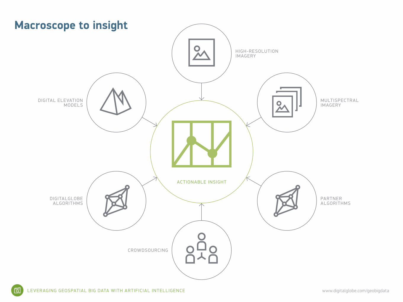
HIGH-RESOLUTION IMAGERY
MULTISPECTRAL IMAGERY
DIGITAL ELEVATION MODELS
PARTNER ALGORITHMS
DIGITALGLOBE ALGORITHMS
CROWDSOURCING
ACTIONABLE INSIGHT
Macroscope to insight
LEVERAGING GEOSPATIAL BIG DATA WITH ARTIFICIAL INTELLIGENCE www.digitalglobe.com/geobigdata
Rethinking possible
Orbital Insight is tackling some of the world’s most
pressing problems, both humanitarian and commercial.
Customers include government agencies, nonprofits,
hedge funds, and Fortune 500 companies. In November
2015, Crawford addressed corporate and government
decision-makers at McKinsey & Company’s Global
Infrastructure Initiative. He urged them to think of
satellites as a different kind of infrastructure and
described how geospatial big data could help them
understand the world at scale.
Crawford cited Orbital Insight’s collaboration with the
World Bank to map global poverty. In the poorest
countries, data on where poverty exists is inevitably
out-of-date. It’s also difficult to collect by sending out
people with clipboards. To address this challenge,
Orbital Insight is using four satellite-based metrics
that correlate with poverty: agricultural productivity,
car density, building density, and building height.
Their goal is to leverage these metrics to identify and
quantify poverty at a country-wide scale.
Crawford also talked about bringing transparency to
the chaotic oil market. He noted that no one knows
how much crude oil is stored in more than 18,000 tanks
all over the world. When demand goes down in China
and the world economy slows, it takes weeks for the
International Energy Agency to issue a report.
Crawford intends to provide real-time insight with
satellite imagery where the quantity of oil in floating
oil tanks is visible and can be calculated. By
monitoring a statistically significant number of tanks
worldwide, Orbital Insight can track oil supplies and
help stabilize the market.
LEVERAGING GEOSPATIAL BIG DATA WITH ARTIFICIAL INTELLIGENCE www.digitalglobe.com/geobigdata
Inspired by what’s ahead
Crawford speaks with passion about his young
company’s future: “There are three things I find
inspirational. The number of different ways we can use
this macroscope concept productively. The number of
conversations we can have. And the number of
visionary projects we can do in a variety of industries. I
think it inspires everybody in the company every day.”
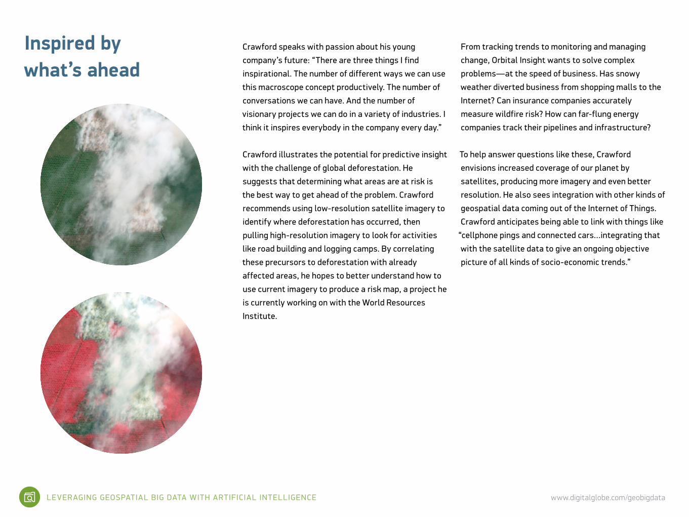
Crawford illustrates the potential for predictive insight
with the challenge of global deforestation. He
suggests that determining what areas are at risk is
the best way to get ahead of the problem. Crawford
recommends using low-resolution satellite imagery to
identify where deforestation has occurred, then
pulling high-resolution imagery to look for activities
like road building and logging camps. By correlating
these precursors to deforestation with already
affected areas, he hopes to better understand how to
use current imagery to produce a risk map, a project he
is currently working on with the World Resources
Institute.
From tracking trends to monitoring and managing
change, Orbital Insight wants to solve complex
problems—at the speed of business. Has snowy
weather diverted business from shopping malls to the
Internet? Can insurance companies accurately
measure wildfire risk? How can far-flung energy
companies track their pipelines and infrastructure?
To help answer questions like these, Crawford
envisions increased coverage of our planet by
satellites, producing more imagery and even better
resolution. He also sees integration with other kinds of
geospatial data coming out of the Internet of Things.
Crawford anticipates being able to link with things like
“cellphone pings and connected cars…integrating that
with the satellite data to give an ongoing objective
picture of all kinds of socio-economic trends.”
LEVERAGING GEOSPATIAL BIG DATA WITH ARTIFICIAL INTELLIGENCE www.digitalglobe.com/geobigdata
How can you leverage GBDX?GBDX is revolutionizing how developers and data
scientists think about Geospatial Big Data. The work
done by Orbital Insight is leading the way in discover-
ing applications in a broad range of industries, gov-
ernments and non-profits.
Imagine what you could do with DigitalGlobe’s massive
library of more than 15 years of satellite imagery that
grows more than 3,000,000 sq km every day.
The GBDX platform gives you on-demand, cloud-based
access to as much data as you need to run advanced
algorithms that can extract meaning and insight. A
platform where you can import your own algorithms or
use one of ours. A platform with API integration and
easy geo-computation through Amazon Web Services.
A platform that is available with support from the
DigitalGlobe team of scientists and experts, if you
need it.
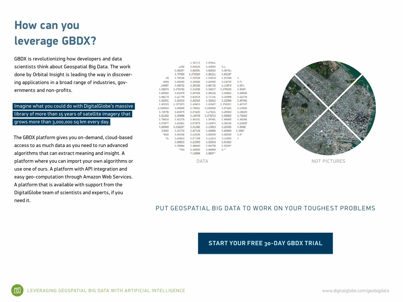
DATA NOT PICTURES
P U T G EO S PAT I A L B IG DATA T O W O R K O N YO U R T O U G H E S T P R O B L E M S

LEVERAGING GEOSPATIAL BIG DATA WITH ARTIFICIAL INTELLIGENCE www.digitalglobe.com/geobigdata
ACC E S S T H E MOS T COM P R E H EN SI V E L IBR A RY OF E A R T H IM AGE RY.DigitalGlobe owns and operates the most agile and
sophisticated constellation of commercial Earth
imaging satellites in the world, amassing more than
3,000,000 sq km of Earth imagery daily. In fact,
DigitalGlobe has collected 80 percent of all the Earth
imagery collected since 2010. Our massive library is
yours to explore for current and historical imagery.
L E V E R AGE A L IBR A RY OF A L GORI T H M S —W I T H MOR E BEING BUILT E V E RY DAY.GBDX is a robust environment for building, accessing,
and running advanced algorithms designed for
information extraction from imagery datasets at scale.
Accessible through our APIs, current algorithms
include car counting, orthorectifying, land use, land
cover, and atmospheric compensation. These
algorithms are being built by both DigitalGlobe and
third-party developers.
E A SILY DE V EL OP A P P L IC AT ION S W I T H A P I IN T EGR AT ION.REST APIs access and control the various elements
of the GBDX environment, including data discovery,
staging of working sets, and workflow orchestration.
Actions are performed by exchanging representations
in JSON format. The platform’s API uses the standard
HTTP request methods: GET, POST, and DELETE.
» Catalog API lets you search and discover data via a set of 39 different attributes associated with each image. This includes standard image characteristics such as geographic location, cloud cover percentage, sensor type, sun angle, and many others.
» Workflow API provides tools for managing imagery data and executing tasks against sets of data. Once you find data by using the Catalog API, the Workflow API lets you assign the selected dataset to a working set and then launch individual tasks/algorithms.
Unprecedented power at a reasonable costThe GBDX platform provides the ideal ecosystem for
you to create new customer solutions without the
cost of owning and operating costly data and IT
infrastructure. You can build new applications, or
extend existing ones, by leveraging the GBDX
capabilities and embedding them in customer-
acing interfaces. You get: » Access to algorithms, image data, and compute
infrastructure coupled with new business models that allow for broad scale geo-analysis
» Developer-friendly pricing to enable the creation of new products and services
» Short-term rental of image data that enables project execution at a low cost
» Access to a broad selection of industry tools that advance your product and project goals and provide opportunities for new passive revenue streams