linear referencing and dynamic segmentation/media/files/pdfs/... · linear referencing and dynamic...
TRANSCRIPT
Linear Referencing and Dynamic Segmentation
for Mining Borehole Management and Analysis
Lucas Donny Setijadji
Department of GeologyGadjah Mada University
Indonesia

Workflow of GIS solution for mining data management and analysis
Flat files
• Personal geodatabase (MS Access)• Enterprise Geodatabase (Oracle, DB2, SQL Server)
GeodatabaseGeodatabase
ArcGISArcGISOther modeling Other modeling packagepackage
ArcGIS ArcGIS extensionsextensions
• Solid 3D modeling• Resource estimation
• Geostatistical Analyst• 3DAnalyst• Spatial Analyst
Using ArcGIS, mining data files
such as bore holes can now
be managed using a single
and integrated DBMS.
Intelligent data model within
ESRI geodatabase will allow data input
once for many times of usages for many types of applications
Personal geodatabase direct access
Enterprise geodatabase through ArcSDE
ArcSDEArcSDE

Understanding Linear Referencing
, MD
Borehole data sets are modeled as 3D lines
(X,Y,Z) with a measure value (M).
This allows physical objects, such as tests, core logging, and rock assays to be modeled
as events that occur somewhere along the
boreholes.
?
?
?
?
?
?
?
top_depth
base_depthx
a, y
a, z
a, MD
a
xTD
, yTD
, zTD
, MDTD
xn, y
n, z
n, MD
n
xb, y
b, z
b b
?
?
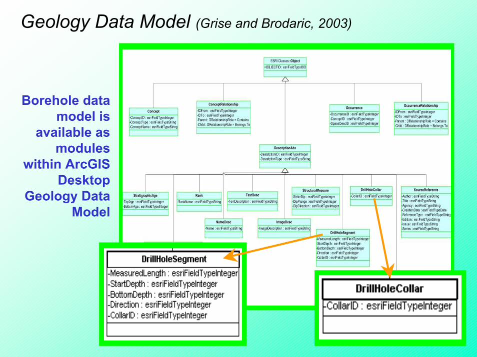
Geology Data Model (Grise and Brodaric, 2003)
Borehole data model is
available as modules
within ArcGIS Desktop
Geology Data Model

System requirements:• ArcGIS of ArcEditor or ArcInfo licence• Full implementation of linear referencing
system (LRS) is by ArcGIS 8.3 release• Route events geoprocessing is only
available at ArcInfo licence• Geology Data Model as template
Case study:• Evaluation drilling campaign for porphyry-
related skarn Cu-Au deposit• Done by an intern research in Redlands, CA• Data courtesy: Freeport Indonesia
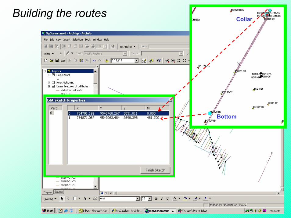
Collar
Bottom
Building the routes
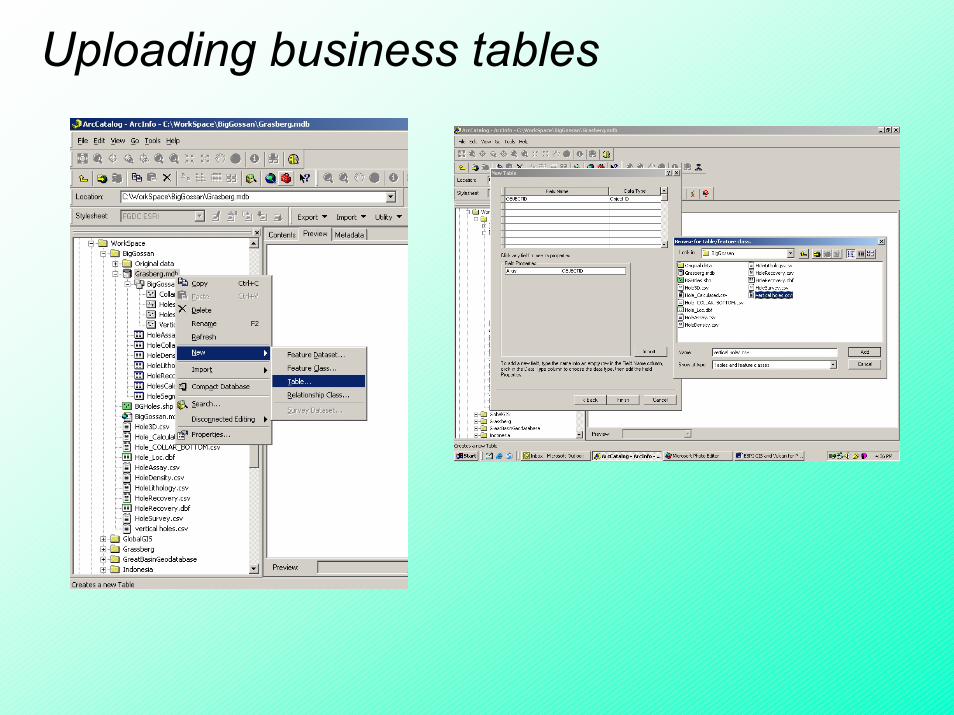
Uploading business tables
Geodatabase
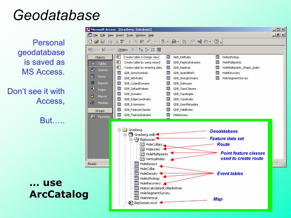
Personal geodatabase
is saved as MS Access.
Don’t see it with Access,
But…..
… use ArcCatalog

What can we do with routes?1. Create route events
Locations of HoleAssay
e.g., HoleAssay along the boreholes

2. Find a route segment
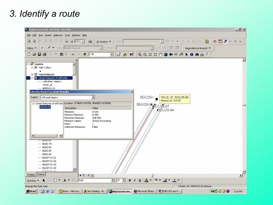
3. Identify a route

4. Classify a route event
e.g.,Cu assay values

5. Route events queries

6. Route events geoprocessing
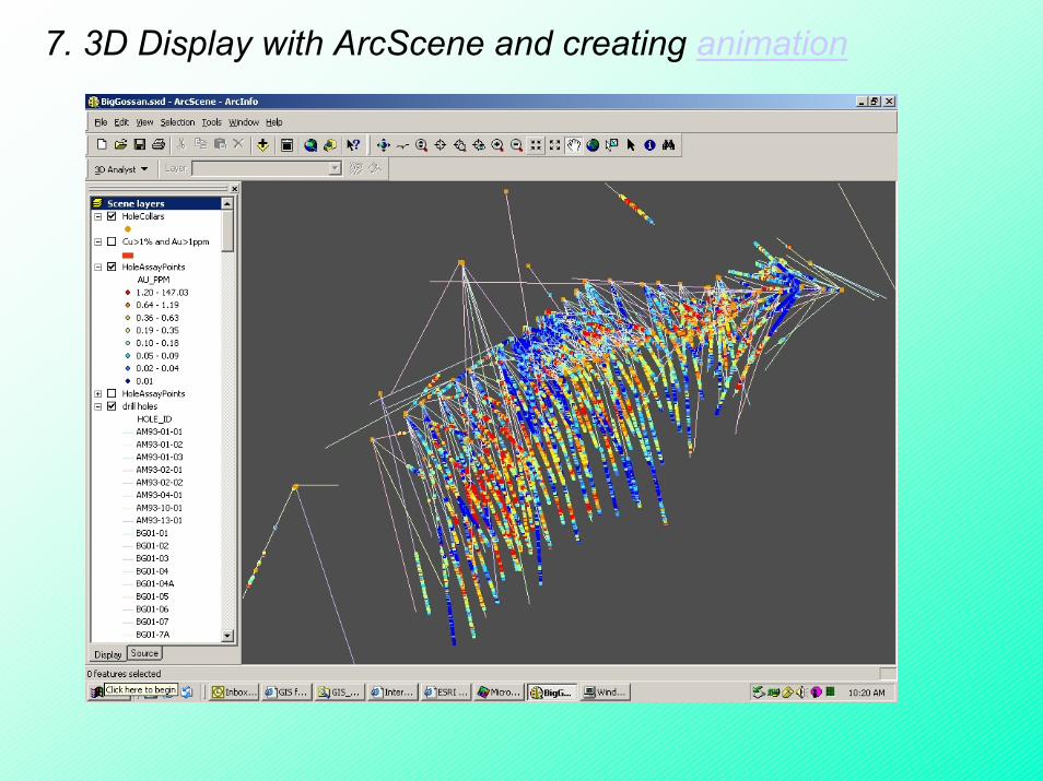
7. 3D Display with ArcScene and creating animation
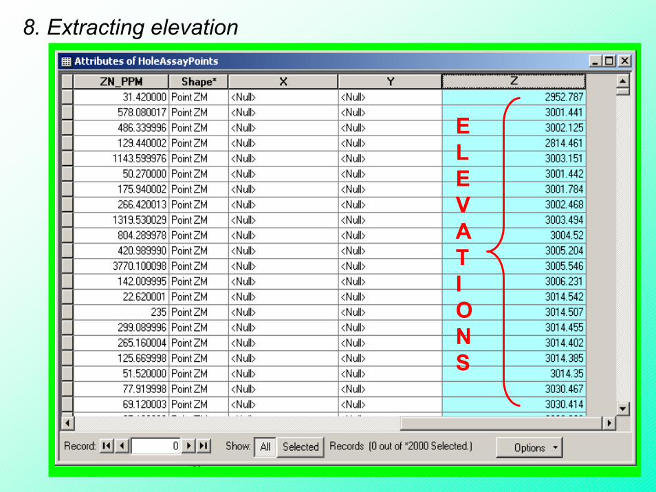
8. Extracting elevation
NO Z VALUES YET…..
Populate z values using Calculate Values tool
ELEVATIONS

9. Building surfaces with Geostatistical Analyst
Data exploration
Building the surface
Fitting semivariogram model
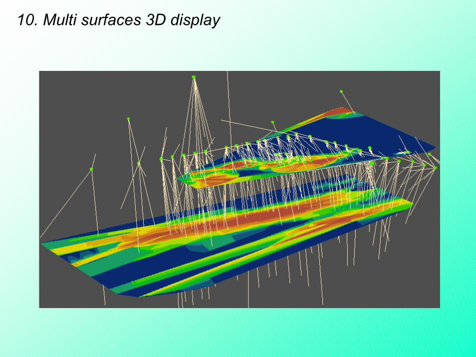
10. Multi surfaces 3D display

11. Support for solid 3D modeling through extension
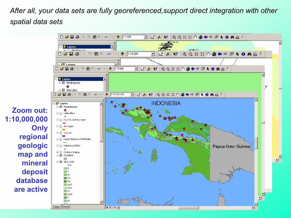
After all, your data sets are fully georeferenced,support direct integration with other spatial data sets
Large Scale:1:1,500
Only assays and
surfaces are active
Zoom out:1:15,000
Boreholes and route
events are active
Zoom out:1:75,000
Only hole collars
appear, but now
geologic map and
mineral deposit
database are
activated
Zoom out:1:10,000,000
Only regional geologic map and
mineral deposit
database are active