local list of historic parks and gardens · local list of historic parks and gardens december 2008...
TRANSCRIPT

Local List of Historic Parks and Gardens December 2008
SELSDON PARK HOTEL (SELSDON WARD) ( includes Selsdon Park Golf Club) Addington Road/Old Farleigh Road, Selsdon, CR2 8YA Local Authority Designations Metropolitan Green Belt Archaeological Priority Zone Building -Locally Listed Reason for inclusion on the List: a significant proportion of the layout survives to reflect the original nineteenth century design
escriptionD
elsdon was within the parish of Croydon from med old boundaries little altered even now, and was part of land owned by the Archbishops of Canterbury. From at least the sixteenth century Selsdon was largely divided between two farms, Selsdon Farm in the north, now the site of Selsdon Park Hotel, and Allards Farm in the south. Henry Ownstead, whose brother John owned Sanderstead Manor, held Selsdon Farm in 1584, and it remained in his family until 1660. It was next tenanted by Henry Bowyer whose successors held the farm into the eighteenth century. It seems likely that Selsdon Farm was gentrified into Selsdon Park by William Coles who purchased it 1809. However, Coles was bankrupt soon after this and George Smith, banker and a director of the East India Company, purchased the property1810. Smith completed the transformation of the house into a mansion by 1815 and made many changes to the estate, building a home farm complex, two lodges, a new farm and various cottages. He also landscaped the park and re-routed the Farleigh road to the east. The estate at that time included Selsdon Woods and it remained in the Smith family until 1890 when Mabel Greville, George Smith's great-granddaughter, finally sold the estate. The mansion and land south of Addington Road, comprising 679 acres, was purchased by printer William Stevens, and the land to the north by Charles Goschen incorporated into the Heathfield Estate,(see entry on Heathfield). When Stevens died in 1900 Selsdon Park was purchased by brewer Wickham Noakes who lived here until his death in 1923. He was renowned for the annual shoot he held in Selsdon Woods in celebration of his birthday. Noakes left no successors and the sale of the estate, and also that of Heathfield due to the owner's bankruptcy, led to Selsdon being developed for housing, hitherto still isolated and rural.
1924 Selsdon Park was purchased by Allan Doble Sanderson, a London usinessman and racing driver, who converted the mansion into a twenty ree bedroom hotel, enlarged by architect Hugh Macintosh in neo-Jacobean
tyle. Selsdon Park Hotel opened on 1 July 1926, and guests were offered nnis, croquet, billiards, dancing and the wireless among the amenities. The
otel was enlarged further in ensuing years and today has two hundred oms.
S ieval times, its
Inbthstehro
99
Local List of Historic Parks and Gardens December 2008
In 1929 Sanderson had a golf course laid out by J H Taylor on the 200 acres f parkland, which has altered little since then. Taylor, who had won the
ns golf ed in 1986 at which time the course
verted to sole use by hotel guests. The Golf Club was renovated in 2007 ip.
ational attention in 1970 when the hotel was the venue for icy
iscussion. The Sanderson family owned the hotel until 1997, when it was
ed. here are many fine trees surviving from the nineteenth century such as those
site boundary. The garden area to the south-east of the hotel tains the bones of the original landscape design, shown on the map dated
rt of what
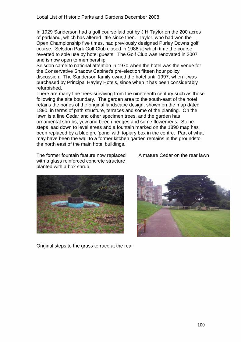
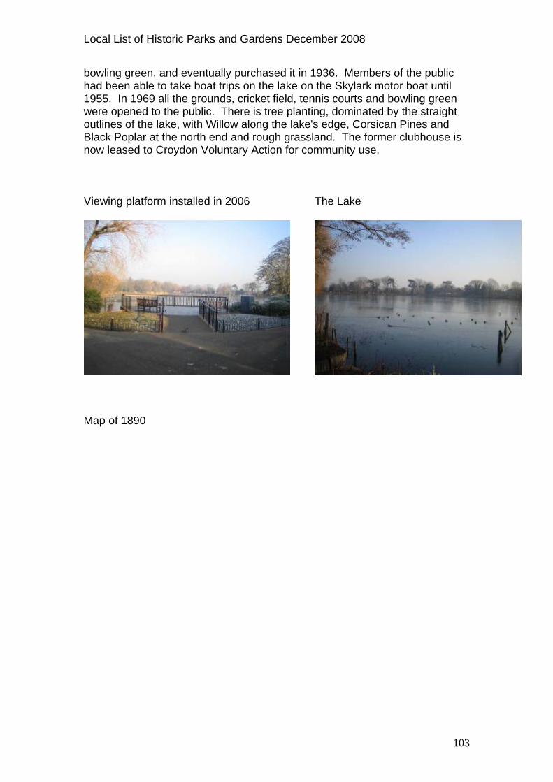
oOpen Championship five times, had previously designed Purley Dowcourse. Selsdon Park Golf Club closreand is now open to membershSelsdon came to nthe Conservative Shadow Cabinet's pre-election fifteen hour poldpurchased by Principal Hayley Hotels, since when it has been considerably refurbishTfollowing the re1890, in terms of path structure, terraces and some of the planting. On the lawn is a fine Cedar and other specimen trees, and the garden has ornamental shrubs, yew and beech hedges and some flowerbeds. Stone steps lead down to level areas and a fountain marked on the 1890 map has been replaced by a blue grc 'pond' with topiary box in the centre. Pamay have been the wall to a former kitchen garden remains in the groundsto the north east of the main hotel buildings. The former fountain feature now replaced with a glass reinforced concrete structure planted with a box shrub.
A mature Cedar on the rear la
wn
Original steps to the grass terrace at the rear
100

Local List of Historic Parks and Gardens December 2008
Map of 1890
Current Map
101

Local List of Historic Parks and Gardens December 2008
SOUTH NORWOOD LAKE AND GROUNDS (SOUTH NORWOOD WARD)
oodvale Avenue/Auckland Road/Sylvan Road, South Norwood, SE25
ocal Authority Designations
W L Metropolitan Open Land Part of the site is a Site of Nature Conservation Importance- Borough Importance II Reason for inclusion on List: sufficient layout and features evident to reflect design and important in local context as one of Croydon’s two reservoirs for the Croydon Canal. Description The site is a relic of an industrial landscape adapted to amenity use, and was once part of Norwood Common. The land to the north was owned byArchbishops of Canterbury. The man-made lake, formerly larger, was constructed as one of two reservoirs to supply the London to Croydon Candesigned by engineer John Rennie, which opened in October 1809. An earlier scheme by engineer Ralph Dodd was not adopted. The Canal Company owned barges, horses and crews and gained its income from tolls and from fishing licences and sale of
the
al,
osiers. By 1836 the canal was ,
d
rts. its facilities included bowls, cricket and
b and
In Corporation leased thirty seven acres including the golf course and
no longer viable and was purchased by the London and Croydon Railway Co.which drained the canal and used it for railway track bed. The reservoir was left derelict but was restored in 1881 by the Norwood Sports Club and used for fishing, swimming and skating. The club was formed by Alfred Steer, Lord of the Manor, who leased sixteen acres of lanincluding the lake and cricket field and, in 1888 leased a further thirty seven acres from the Ecclesiastical Commissioners who then owned the land. The Club became the largest tennis club in the world with fifty four grass couWhen the club was sold in 1911 tennis, in addition to the lake. Messrs Middleton and Bersey then ran the cluas White Lodge Limited. A golf course on the site was used for gun sites balloons in World War I but was badly damaged. At one time the Club had over fifty acres of land; it was taken over gradually by Croydon Corporation. In 1931 Croydon Corporation had purchased sixteen acres although the Club continued to lease the facilities, while the lake was opened to the public.1933 the
102
Local List of Historic Parks and Gardens December 2008
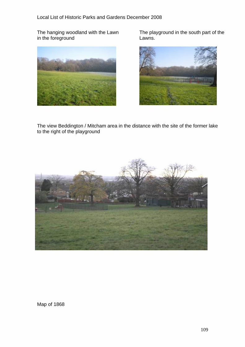
bowling green, and eventually purchased it in 1936. Members of the public had been able to take boat trips on the lake on the Skylark motor boat unt1955. In 1969 all the grounds, cricket field, tennis courts and bowling green were opened to the public. There is tree planting, dominated by the straigoutlines of the lake, with Willow along the lake's edge, Corsican Pines and Black Poplar at the north end and
il
ht
rough grassland. The former clubhouse is
m installed in 2006
now leased to Croydon Voluntary Action for community use. Viewing platfor The Lake
Map of 1890
103

Local List of Historic Parks and Gardens December 2008
104
Current Map

Local List of Historic Parks and Gardens December 2008
105
SOUTH NORWOOD RECREATION GROUND (SOUTH NORWOOD WARD) Tennison Road/Cargreen Road/Selhurst Road, South Norwood, SE2

Local List of Historic Parks and Gardens December 2008
Local Authority Designations Local Open Land Green Corridor Reason for inclusion on the List: sufficient layout and features evident to reflect the original design of 1890’s. Description
uth Norwood Recreation Ground is a traditional Victorian park, the site e cost to la
orough Road Surveyor, Mr. W. Powell, as £1,326 19s 6d, and facilities included cricket, football and hockey pitches, two grass netball pitches and a pavilion with changing rooms. A children's playground and paddling pool were donated by Mrs A C Hall in memory of her husband, a journalist. A refreshment kiosk and Victorian drinking fountain were located near the children's playground. Annual village fairs were held here, attracting large numbers of people. In 1932 Croydon Council purchased 1.5 acres next to the recreation ground, some of which was used for allotments until 1949. Allotment gardens in the south and west were incorporated into the park after World War II following complaints about overcrowding on the ground in 1849/50. The Recreation Ground has ornamental gates at the Selhurst Road entrance. The gate piers were rebuilt in the late 1980s. The Ground formerly had a bandstand.
ld boundary trees remain with two mature plane trees at the entrance and to est and east some remnants of original trees including two Willows. The orth/south and east/west paths are lined with trees from the original layout,
o longer flower displays and the layout is greatly simplified. A hildren's playground is in the south-west corner, with yew and four pine
trees. A line of trees shows the old west boundary and along the south boundary lies the railway. Original tree line showing old west boundary to former allotment gardens.
Sopurchased by Croydon in 1889. Th y it out was estimated by the B
Ownbut there are nc
The entrance from Selhurst Road
Map of 1980 Current Map
106

Local List of Historic Parks and Gardens December 2008
THE LAWNS (UPPER NORWOOD WARD) Beulah Hill/Spa Hill/The Lawns, Upper Norwood, SE19
107

Local List of Historic Parks and Gardens December 2008
Local Authority Designations Local Open Land Partly Site of Nature Conservation Importance -Borough Importance II Listed Building, Grade 2- Tivoli Lodge Reason for inclusion on the List: site which reflects a particular social period when spas were popular, a significant proportion of the layout of the historic designed landscape is evident and it has association with the architect, Decimus Burton. Description Beulah Spa developed in the early part of the nineteenth century from a spa where people came to take the waters for the benefit of their health. On 1st August 1831 the thirty acre site was opened by Lady Essex as a place of entertainment. It was owned by Mr J D Smith, and the gardens were laid out by Decimus Burton, who also designed the Spa House and The Lodge, (Tivoli Lodge). The visiting public were offered numerous entertainments, including concerts, theatre and fetes, and there were fine views from the grounds in which a number of 'rustic edifices' had been constructed. Other amenities included a circus ring, a rose garden, an upper and lower lake with water fowl, a maze or wilderness and an 'orchestra'. There was also a camera obscura with a telescope powerful enough to see Windsor Castle. Visitors were encouraged to bring picnics, which they could eat on certain of the lawns or in tents and marquees. The spring was within a circular rockwork structure under a thatched wigwam-shaped roof. The water, which rose up some 4.2metres,(14 feet), was drawn up in a glass urn-shaped pail. It was bottled as Beulah Saline Water and sold at two shillings a gallon. It was also sent frozen in bottles by Masters Freezing Apparatus and in blocks.
eulah Spa’s popularity began to decline when the Crystal Palace moved om Hyde Park to nearby Sydenham where it reopened in 1854. Beulah Spa losed in 1856 and in May 1858 the Beulah Spa estate was sold by auction nd a large mansion called The Lawns was subsequently built. 1939 The Lawns estate was conveyed to Croydon Corporation, the ational Trust and the Metropolitan Public Gardens Association by All Saints issionary Union Incorporated and in 1940 a Deed of Covenant was made etween the 'Mayor Alderman and Burgesses of the Borough of Croydon of e first part, The Metropolitan Public Gardens Association of the second part, nd The National Trust for Places of Historic Interest or Natural Beauty, of the ird part'. This Covenant ensured that the area would remain as open space nder the Open Spaces Act 1906 and that it would not be built upon, ensuring would remain public open space in perpetuity. ecimus Burton’s Lodge survives as Tivoli Lodge, a private house on Beulah ill. The lake was filled in after 1954. The Lawns mansion was demolished fter a fire in the mid-1960s. The existing lawn, marks the site of the rnamental gardens, now with a playground and the hanging woodland main, the latter predominantly Oak, Beech with Holly understorey through
BfrcaInNMbthathuitDHaorewhich ornamental walks were laid out, now with one main footpath through.
108
Local List of Historic Parks and Gardens December 2008
The hanging woodland with the Lawn The playground in the south part of the Lawns.
in the foreground
The view Beddington / Mitcham area in the distance with the site of the formto the right of the playground
er lake
ap of 1868 M
109

Local List of Historic Parks and Gardens December 2008
OMAS MORE SCHOOL- Y WARD) -
Current Map
THFRONTAGE (PURLE
110

Local List of Historic Parks and Gardens December 2008
Russell Hill Road, Purley, CR8 2XP
signations Local Authority De
isted Building, Grade 2- Main School Building
Archaeological Priority Zone Educational Open Space LLocal list- School lodge Reason for inclusion on List: setting for historic buildings, and associationanother school of
with local historic interest (Royal Russell School) and the
arehousemen, Clerks and Drapers Livery Company. W Description Thomas More Catholic School was originally the Warehousemen and ClerSchools whose origins date back to December 1853 when a group of clerks from wholesale warehouses in the City of London met to discuss how the widow and
ks
family of a deceased colleague might be helped. This led to the
so the school. From 1855-
and in
,
entre with a
d on the Ballards Estate,
nd air
the Roman Catholic Schools Commission in 1962 for Thomas More School
decision to set up a charity to clothe, support and educate the orphaned children of colleagues in warehousing and manufacturing trades. Within ayear sufficient subscriptions had been raised to establish a school under the auspices of the Warehousemen and Clerks livery companies. Former Prime Minister Lord John Russell agreed to become its President and remaineduntil his death in 1878, hence the name later given to58 the committee leased Hatcham House, a building in New Cross, which took six girls and fifteen boys. By 1859 larger premises were needed 1862 a twenty acre site was purchased for £2,352 at Caterham Junction, as Purley was then known. This site was known as Beggars Bush but was renamed Russell Hill in honour of Lord Russell. The foundation stone was laid in June 1863 by the Prince of Wales, later Edward VII, and the schoolsone for one hundred and forty boys and another for sixty girls, were openedon 18 June 1866, again by the Prince of Wales. The red-brick school buildings were designed by John G Bland and had a long symmetrical frontage in Venetian Gothic style, with a raised cspike, steep roofs, gables and dormers. In 1887 it became the Warehousemen, Clerks and Drapers' Schools when a similar scheme run by the Drapers' Company was amalgamated with the school. The school grounds were laid out with various sports facilities such as cricket lawn and fields. After World War I the demand for places, particularly due to the number of orphans of those in the textile trades who had died, led the School Board to seek a larger property. Lord Hollingsworth, of the West End retailer Bourne and Hollingsworth, donated land he had purchasewhere the new school was built, now the Royal Russell School (see entry). As a result ninety six senior boys moved to Ballards, with younger boys and girls remaining at Russell Hill. The school was extended in 1931 and during World War II an undergrouraid shelter was built at the back of the school. Finally it was decided to amalgamate both school sites into one at Ballards, and Russell Hill was sold to
111

Local List of Historic Parks and Gardens December 2008
and Margaret Roper Primary School, the latter named after Thomas More's daughter. Much of the school grounds behind the main buildings have been built over, including sixteen houses of Russell Court in the 1980’s but a later application to build nine houses was denied. The landscaping at the front of the school remains with mature trees, steps and terraces as indicated on the map of 1868. One of the terraces at the front of the School
Two sets of original steps leading to terraced lawns.
Map of 1868
Current Map
112

Local List of Historic Parks and Gardens December 2008
113

Local List of Historic Parks and Gardens December 2008
THORNTON HEATH RECREATION GROUND (BENSHAM MANOR WARD) elfort Avenue/Bridport Road, Thornton Heath, CR7 J M
Local Authority Designations Local Open Land Green Corridor Part of the grounds is at risk of flooding every fifty years Reason for inclusion on the List: sufficient layout and features evident to reflect the design of 1880’s to 1990’s and is important in local context asof Croydon’s early recreation grounds.
one
Description Thornton Heath is one of Croydon's earliest recreation grounds. The first partof the ground was acquired by Croydon Corporation in 1884; at that time the surrounding land was largely undeveloped. In 1889 the Chairman of the Committee, Councillor Taylor, together with the Borough Road Surveyor, selected trees for the park from nurseries, paying £10 per hundred, and thwere to be planted by skilled men. The keeper was presented with a cap sothat he could be distinguished; urinals were approved and a galvanised iron shed was found and moved for the cricketers. It was also decided not to allowreligious services in the park on Sundays and dogs were to be kept on leads.In 1891 further improvements were made costing £60, which included new entrance gates at Beulah Road and planting of shrubs. By this time one ofthe clubs using the ground had complained that it was 'miserably small' for cricket. As a result a diagonal path was shortened in 1891 and the Corporation also agreed that on Saturdays, for safety reasons, half the gaplayed should be forbidden. In 1894 an additional 5.5 acres were purchaseto enlarge the recreation ground and laid out, the footpath running between Melfort Avenue and Bridport Road marking the boundary between the two parcels of land continues to be a public right of wa
ese
mes d
y that remains open at all
f the current
south
y; a line of trees and a perimeter path are also marked, with trees
d,
centre of the ground and there were toilets at
tent
times. The public path today is lined with a 600mm,(2ft), stone and clinker wall. By 1890 there was a bandstand just south of the path, on the site oplayground, which had popular summer band concerts. Other early features shown on the map dated 1890 map include a drinking fountain near theentrance by Carew Road, and a urinal in the north-west area by the park boundarflanking the east/west path. The bowling green was not laid out until some time after 1911, but was certainly in existence by 1938, by which time facilities included six hard and three grass tennis courts, two cricket pitches and a junior football pitch, as well as a pavilion with full dressing room, fully-equipped children's playgrouna nurse attendant and a refreshment kiosk. The drinking fountain was in thethe Winterbourne and Carew Road entrances. The park was so well used that in 1948 it was reported that 'the ground has been used to such an exthat it is now bare of grass and in order to reinstate it to its former condition it must be closed for at least nine months'. Along the western boundary of the
114

Local List of Historic Parks and Gardens December 2008
park the Norbury Brook runs in a deep concrete channel. In July 1987 the Mayor of Croydon opened a new ornamental garden, during the construction
e
eats and benches.
mixture of pollarded planes and black poplar marking the winding across the centre of the park
of which a number of underground tunnels were discovered dating from WorldWar II and built as air raid shelters. The park has a mixture of pollarded planes, black poplar and yew trees on thboundary, which are from the original planting, as is the winding avenue across the centre of the park. The park has a number of commemorative s A The bowling green
Map of 1890
115

Local List of Historic Parks and Gardens December 2008
Current map
116

Local List of Historic Parks and Gardens December 2008
UPPER NORWOOD RECREATION GROUND (UPPER NORWOOD WARD) Chevening Road/Eversley Road, Upper Norwood Local Authority Designations Local Open Land Conservation Area- Harold Road
e Site of Nature Conservaton Importance- Local Importanc Reason for inclusion on the List: sufficient layout and features evident to reflect design important in local context as one of Croydon’s early recreation grounds, (1890). Description The site was acquired from the Ecclesiastical Commissioners for £6,100 by Croydon Corporation and opened in 1890, laid out by the Borough Road Surveyor, W. Powell. It included construction of two new roads Eversley aChevening, costing an additional £787. The land was drained and plantedwith 1600 trees and shrubs, the turf stripped and re-laid, and the land 'fenced' with suitable entrances at a cost of £913, making a total of £7800. During landscaping works they encountered a problem with mould on the summit of the hill and it was gently sloped using soil that was there. The new park had serpentine walks, bandstand, drinking fountain and a
nd
l
ttended
m'.
recording it was 'presented by 'T Tufnell, Southgate 1891' and
urts, s,
ning Road entrance. At one time there were -
ral springs rise to the west of
t
shelter (although the latter not provided until after the park had opened); tennis courts and changing rooms, and the ground was well used for footbaland cricket. It was opened on 14 May 1890 by the Mayor of Croydon on thesame day that Wandle Park (see entry), was opened, and the well-aopening ceremony had musical entertainment, children's games, tea and fireworks provided by C T Brock & Co. It was described in the local press as being three minutes' walk from the 'bourgeoisie, snobocracy and upper middle class of Upper Norwood villadoIn 1891 a drinking fountain was erected in the north-east of the park, and hasa plaqueCouncillor Foss presented a small rustic shelter in April 1891, which was placed opposite the cricket ground. The park was also intended to serve nearby Lambeth, which had little open space at the time. Crystal Palace was nearby and could be seen from the new park. In 1938 the facilities included two hard and two grass tennis coone cricket pitch and two football pitches, with a pavilion and dressing roomwith lavatories near the Cheveelms, limes and poplars. Within the recreation ground is one of the headwaters of the Effra River, which used to be visible but now runs culverted underground north west. In 1935 new drains were constructed following flooding caused by the inadequacy of the old brick-lined drains. SeveChurch Road and flow under Chevening Road to join with another course that flows under Orleans Road, Hancock Road and Hermitage Road to its lowespoint and through the grounds of the Virgo Fidelis School (see entry). Queen Elizabeth I purportedly came up the river in her barge to where Hermitage Road now stands.
117

Local List of Historic Parks and Gardens December 2008
The west part, poorly drained, was used as allotments in the mid twentieth century. In 1973 the bandstand and pond were still in place, the latter connected to the upper head waters of the Effra. The gales of 1987 destroyed many of the big trees. The original layout is now much simplified
ak a modern pavilion is located towards the western end of
e Ground.
The shrubbery on Harold Road
and the bandstand and shelter are gone, but new shrubbery planting has been created along the Harold Road boundary at the south-east and the fountain remains. It is tree-lined to north-east and south-west with Lime, Oand Black Poplar andth The 1891 drinking fountain
boundary
A line of trees marking the boundary of the park to the former allotments.
118

Local List of Historic Parks and Gardens December 2008
Map of 1933
Current Map
119

Local List of Historic Parks and Gardens December 2008
VIRGO FIDELIS SCHOOL including ST. JOSEPH’S RC INFANT AND UNIOR SCHOOL (UPPER NORWOOD WARD)
od, SE19 1RS J147 Central Hill, Upper Norwo Local Authority Designations Site of Nature Conservaton Importance- Local Nature Reserve
ior Schools onservation Area- Norwood Grove which St Joseph’s RC and Infant and
l lie within
Educational Open Space Local List- Original Part of the buildings of Virgo Fidelis and St Josph’s RC and Infant and JunCJunior Schoo Reason for inclusion on the List: significant proportion of the layout and features of the historic landscape survive and association with local sociahistory and the Great North Wood. Description
l
Virgo Fidelis School is on a sloping site that is part of a historic eighteenth century landscape, which was adapted in the mid nineteenth century when a
state comprised fifty two acres of me
family day centre and convent.
t
till r
pe. Several hundred shrubs and mature trees
que
Roman Catholic boarding school and attached convent were built. Prior to the building of a convent here the 1678 map of Norwood shows ahouse to the south of Gravelly Hill coppice in the Great North Wood, and this was the forerunner of Park House where Alexander Nesbitt, of an Irish banking family, lived from 1765 onwards. Building works took place at the house between 1806 and 1810, and by 1811 Park House was one of the leading establishments in Norwood, the ecopyhold and leasehold land. Among the visitors was George III. For soyears after it was run as a hotel and in 1848 the property was sold and became a convent and orphanage. There are remains of the original designed landscape and the nineteenthcentury landscape, including an orchard, cemetery and walled garden. The site now contains two schools, a Attached farmland to the east was built over for housing after World War II. Within the site is mature natural woodland that is a remnant of the old GreaNorth Wood, which retains its boundaries and character as shown on early maps, once in the ownership of the Archbishops of Canterbury. The bones of the original convent of 1850’s and orphanage landscape can sbe seen and apart from the abandoned kitchen garden it has been used fochildren's recreation for a hundred and fifty years, overlaying the earlier eighteenth century landscawere planted around the estate in the 1850’s. The convent cemetery, which had suffered from theft of lead and flooding, was renovated in 1980. The cemetery is mown with iron crosses to the outside for ease of maintenance. Other schools now on the property include St Joseph’s Roman Catholicschools, the junior and infants arose out of the school which Father Ves
120
Local List of Historic Parks and Gardens December 2008
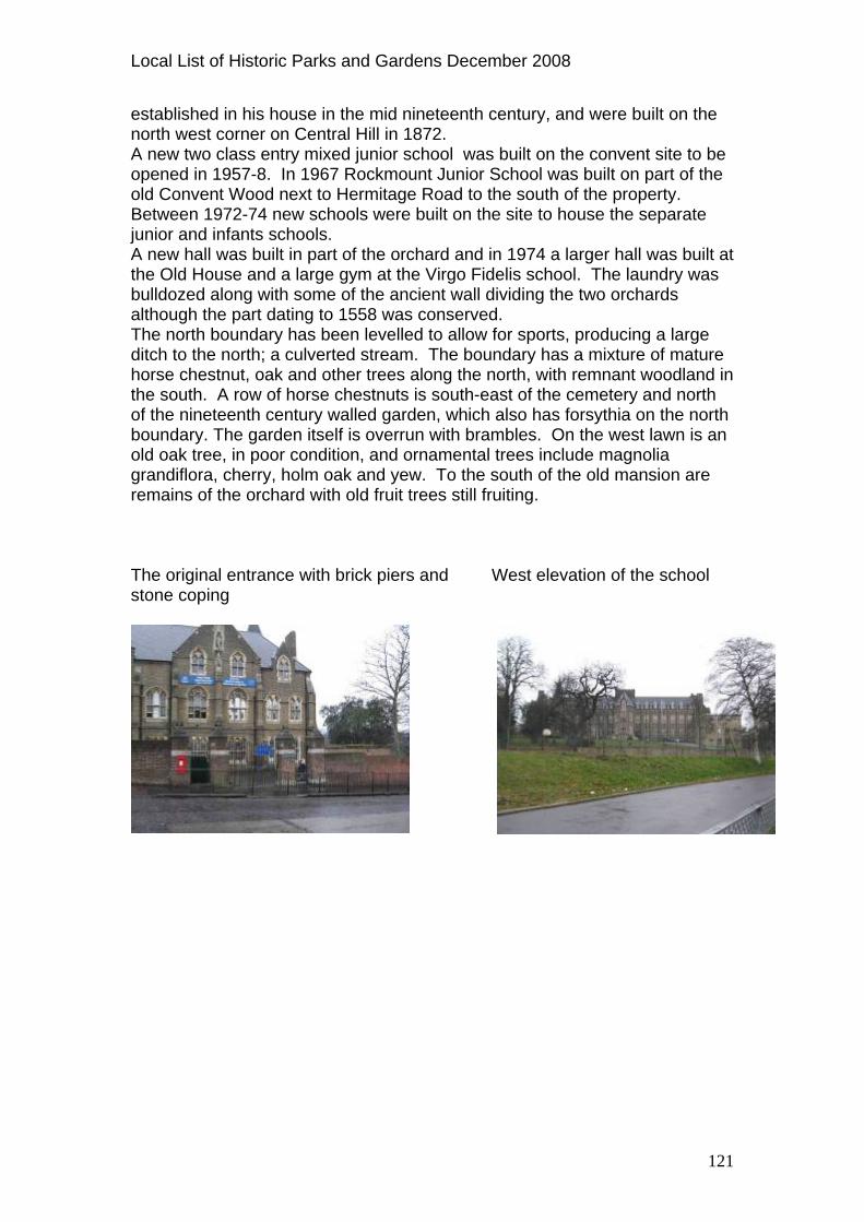
established in his house in the mid nineteenth century, and were built on thenorth west corner on Central Hill in 1872. A new two class entry mixed junior school was built on the convent sopened in 1957-8. In 1967 Rockmount Junior School was built on part of theold Convent Wood next to Hermitage Road to the south of the property. Between 1972-74 new schools were built on the site to house the separatjunior and infants schools. A new hall was built in part of the orchard and in 1974 a larger hall was built at the Old Hous
ite to be
e
e and a large gym at the Virgo Fidelis school. The laundry was ulldozed along with some of the ancient wall dividing the two orchards lthough the part dating to 1558 was conserved.
ditch to the north; a culverted stream. The boundary has a mixture of mature horse chestnut, oak and other trees along the north, with remnant woodland in the south. A row of horse chestnuts is south-east of the cemetery and north of the nineteenth century walled garden, which also has forsythia on the north boundary. The garden itself is overrun with brambles. On the west lawn is an old oak tree, in poor condition, and ornamental trees include magnolia grandiflora, cherry, holm oak and yew. To the south of the old mansion are remains of the orchard with old fruit trees still fruiting. The original entrance with brick piers and stone coping
baThe north boundary has been levelled to allow for sports, producing a large
West elevation of the school
121

Local List of Historic Parks and Gardens December 2008
Map of 1910
Current Map
122

Local List of Historic Parks and Gardens December 2008
WADDON PONDS (WADDON WARD) Waddon Court Road/Mill Lane/The Ridgeway, Waddon, CR0 Local Authority Designations Local Open Land
ite of Nature Conservaton Importance-Local Importance f flooding every 100 years
e List
SPart of the site – area at risk o Reason for inclusion on th : sufficient layout and features evident to reflect the design of 1920’s and the former mill pond, and important in local context. Description This is a relic industrial and ornamental landscape and now the only placwhere the River Wandle is visible in Croydon. Waddon Ponds was formerlypart of an old estate of some 2000 a
e
cres. The ponds were formerly mill ponds nd a manorial corn mill is mentioned in the Domesday book; the river had
d at the northern end to form a lake but the river was later iverted to the north and east in the late nineteenth century, creating an area
s
ose
n
ign by Mr Pescott Row, author of books
on t Road,
d
abeen dammedused for watercress beds, later drained for allotments and finally used for industrial purposes. The map of 1868 shows the Mill, with Waddon Court Farm at the bottom left. The mill closed in 1928 after which there waindustrial and residential development on most of the open land. In the eighteenth century Waddon Court Farm was owned by John Dewey Parker among whose visitors were Gros the antiquary, Arthur Young wh'Travels' was a classic of the time, and agriculturalist John Marshall; Lord Nelson may have stayed at the mansion and fished in the lakes. The public park was formed in 1928 by the purchase by Croydon Corporatioof parts of two estates upon the deaths of their respective owners, Mr Crowleyof Waddon Court and Miss Mary Waterall of Waddon Lodge. This was achieved through a vigorous campaabout the beauties of England. A sundial in the park commemorates him, donated by local author H M Tomlinson. The remainder of the two Waddestates were sold for housing development, resulting in Waddon CourLodge Avenue, Limes Avenue and Wandle Side. Two cottages outside the gates of the ponds had been used by Mr Crowley's employees and a cottageinside had been used by Miss Waterall's gardener, next to which were stables, cow sheds and a coach house. The park has Plane trees along the lakeside walk, floral displays and lawns to the south and a few nineteenth century trees including two good Beeches ansome Alders, Willows and Poplars.
123

Local List of Historic Parks and Gardens December 2008
Waddon Pond looking south.
View north to Mill Lane
Map of 1868
124

Local List of Historic Parks and Gardens December 2008
Current Map
125

Local List of Historic Parks and Gardens December 2008
WANDLE PARK (BROAD GREEN WARD) Cornwall Road, Croydon, CR0 3RD Local Authority Designations Local Open Land Site of Nature Conservaton Importance- Local Importance
reen Corridor Subject to flooding every 100 years G Reason for inclusion on the List: sufficient layout and features evident to reflect the design of 1890’s and important in local context as one of the oldest ublic spaces in Croydon. p
Description Wandle Park is one of the oldest public open spaces in Croydon. In 1888 Croydon Corporation purchased Frog Mead, a 7-acre field once part of the Waddon Estate from the Briton Medical & General Life Association Ltd. Themeadow is mentioned as early as 1543 and its name probably arose frowetness of the area and the frogs found there. A year later, in December 1889, the Corporation purchased another meadow from the Ecclesiastical Commissioners called Stubbs Mead that was probably once part of WaddoCourt Park, and comprised thirteen acres. The deed of conveyance stathat 'the land shall be forever dedicated and used as an ornament
m the
n ted
al pleasure n
y
g
n the
rder of a slaughterhouse until the site
intention being to divert the Wandle River to run through the lake and keep it full, but while excavating it was found that there was sufficient water to maintain a fair depth and the Wandle was taken through the park by a separate conduit. Parts of the park were tipped with rubbish to raise the ground level. The park was opened in May 1890 by the Mayor of Croydon at a huge event attended by some 30,000 people. Its chief attraction was the River Wandle running east to west through it, and the boating lake formed in the south half of the park, which was very popular. There was originally one central island
ground and place of recreation for the inhabitants of the Borough of Croydoand for no other purpose whatsoever and shall forever with the said intendedpathway be maintained in good and neat order and condition ...The pathwareferred to was to be from the north west corner of the park runninnorthwards beside the railway to a crossing place to enable people to enter the Park.' The original fields had been reshaped in the mid nineteenth century wherailway was cut through them. The present fabric of the park is a pale shadow of its former self, but in its time Wandle Park was one of Croydon's great beauty spots. The Wandle River served as a water supply and sewer and was blamed for the outbreaks of disease and high death rate in nineteenth century Croydon.In the early nineteenth century the local Board of Health had tried to provide proper drainage and the first sewage works were built on the eastern boof what is now Wandle Park, later the site was built over for housing in the 1980s. The park was laid out on the site of the two meadows in 1890, and a lake was constructed at that time, the original
126

Local List of Historic Parks and Gardens December 2008
planted with trees but by the early twentieth century the lake was extended to reated, reached by two small rustic bridges or
by hiring a small boat. A second boathouse was built on the promontory to the south of the lake and boats were repaired in a larger shed near the wall of the abattoir. The boathouses disappeared although the lake itself changed little during the 1920’s and 30’s. The park had a bandstand, tennis courts and pavilion and a bowling green where the first bowls match to be played on a Sunday was held in 1936. The Borough's Summer Show was held in the park during the 1930’s and in the summer there was fishing and in the winter ice-skating when the lake froze. However, during this time the natural supply of water to the lake became increasingly erratic. Several schemes were prepared to return the
ke to its former glory but the main problem was the water supply and taining the water. The water table had dropped since the lake was originally
evelopment of Croydon altered the rate at which water flowed d into the river, so although the amount of water was the same
entered the river rapidly and then the level quickly dropp d. In 1967 the river was culverted, its original course is marked by Willows and one side of the children’s playground is formed by a low flint faced wall, part of the wall on the north side of the river. The lake was backfilled in the 1960’s. With the loss of lake, river and bandstand, the park's character is now dominated by playing fields, relieved by a few mature trees, notably a group of Horse Chestnuts and London Plane, and scattered Horse Chestnut and Planes along the original peripheral path. There are also some Limes and Sycamore. There is a modern rose garden with shelter laid out in the 1970’s. St Edmund's Church and Mission Hall are located `lodge-north-east entrance; within the park is a drinking fountain of polished granite, presented by the Mayor, John Hubert Schmitz, on the park's opening on 14 May 1890. Shrub planting was carried out along the north boundary of the park in the 1990’s, and additional boundary planting was laid out in 2001-2 with the introduction of Tramlink on the former railway line. A skate boarding area was opened on the site of one of the former tennis courts in 2001 and the bowling club closed in that year. A Friends of Wandle Park Group formed in 2007. The drinking fountain.
the east with a second island c
laredug and the dff the land ano
it e
like` beside the
One of the willows that marks the route of the former river.
127

Local List of Historic Parks and Gardens December 2008
Map of 1910
Current Map
128

Local List of Historic Parks and Gardens December 2008
WETTERN TREE GARDEN (SANDERSTEAD WARD) 2 ON Purley Oaks Road, Sanderstead, CR
Local Authority Designations Local Open Land Part of Garden by Beeches Avenue is in an Archaelogical Priority Zone
sion on the List Reason for inclu : significant proportion of the layout and
atures of the historic designed landscape of 1919 to 1950’s survive and feassociation with local history and notable family- the Wettern family. Description Wettern Tree Garden is a plantsman's garden and arboretum, and was laid
onwards by Eric Frank Wettern, who later conveyed it to the
to
iliated to
l Society and the Summer Show the previous year was held in his
e Society should be able to hold its annual
nd belonging to
has been added to the Delphinium
erected in the gardens in 2000 to celebrate
out from 1919Croydon Corporation in 1965 by way of a Gift to Trustees for the benefit of public. The name of the garden was changed from Roselands to Wettern Tree Garden when it was transferred to Croydon Corporation. As one of the Trustees Mr Wettern was able to maintain a keen interest in the gardens. The Wettern family were ship brokers, later builders merchants, and had movedSanderstead in the 1900’s where the two brothers built houses, later purchasing land in Purley Oaks Road to create gardens. In his garden at Roselands Eric Wettern planted many rare trees grown fromseeds that he collected during business trips abroad; he created a series of themed gardens, built a summerhouse and collected specimen trees on his travels. His brother Herbert created a rose garden. Eric Wettern was a life long member of the Royal Horticultural Society and a member of the Sanderstead Horticultural Society, which was formed in 1941 and affthe RHS in 1942. In 1954 Wettern was President of the Sanderstead Horticulturagarden at Roselands. When he presented his garden to Croydon Corporation he stipulated that thshow there if it so wished. Wettern was among the group of supporters who purchased laPurley Farm to add to Purley Beeches and save it from development in the 1930s. Wettern Tree Garden now comprises a series of different enclosed gardens, terraced lawns, and a collection of many fine specimen trees, chieflyconifers, some of which are rare and unusual. The original design of the garden is evident with the Delphinium Border, paths and stone steps and terraces. A boundary of lavender shrubs Border and the Rose Trellis Garden was built in 1967. A footpath leads from Wettern Tree Garden to Purley Beeches, which contains many large Beech trees. Replacement trees have been planted following losses in the storms ofOctober 1987. An ornamental concrete seat made by Mono Concrete Company that was once in the gardens has since been moved to Coombe Wood (see entry). A Gazebo was the Millennium along with new planting of the rose garden.
129

Local List of Historic Parks and Gardens December 2008
Trees by the lower circular lawn.
The Millennium Gazebo and ros
e garden.
Map of 1933
130

Local List of Historic Parks and Gardens December 2008
Current Map
131

Local List of Historic Parks and Gardens December 2008
WHITEHORSE ROAD RECREATION GROUND (SELHURST WARD)
ocal Authority Designations
Whitehorse Road/ Boulogne Road, Selhurst, CR7 8SD L Local Open Land Reason for inclusion on the List: sufficient layout and features evident to
flect the design of 1880’s and important in local context as one of Croydon’s reearly recreation grounds. Description The site of Whitehorse Road Recreation Ground was acquired by Croydon
orporation in 1888 as an informal play area for local children, in a densely
an
omplete the first operation
lter for
e
t
Cpopulated district where large numbers of poor children were daily seen playing in the streets. Although the area was not large enough for any organised games it was well used for informal games by the children who lived in the otherwise congested neighbourhood. The cost was £1360, andeight foot gravel path was made around the site, two hundred and fifty trees were planted and land was levelled and cleaned, and grass sown. An additional £800 was spent on surface water drains. A clump of trees, seat and drinking fountain were moved and by 1891 £170 was needed to cit. The original estimate for laying out the grounds lists as 'Raising level of ground....£400' and adds as a footnote from the Borough Road Surveyor, Mr. W. Powell: 'I propose to raise it as much as possible within a reasonable time by carting the dust and ashes, as well as the road scrapings, on to it, commencing at the southern end of the ground, and pushing forward to the north as fast as materials come to hand.' In 1936 a side garden was constructed with a shelter for elderly people, since removed. Berwick-Sayers, described this garden in 1938: 'It has a sheold folk, where they can sit in pleasant surroundings and play cribbage and other games. A fire is provided for them in the winter months.' During the World War II the main part of the field was used for A.R.P. Shelters. Opposite Whitehorse Recreation Ground is Boulogne Road Playground, which in 1880 was the site of a large fish pond behind private houses in Whitehorse Road. The site was purchased by Croydon Borough Council in October 1930. The pond was either drained or dried out naturally and was filled in by the Council before the playground was built. Behind the playground there used to be a bus station for horse-drawn buses where thhorses were stabled in a building above the machines they drew. A row of pollarded plane trees on the south and west, and along the east side are probably all of the original planting that remains along witht the original layouof paths.
132

Local List of Historic Parks and Gardens December 2008
T
Sohe raised rose beds in grass
me of the original boundary tree planting, (in the background).
Map of 1910 Current map
133

Local List of Historic Parks and Gardens December 2008
WHITGIFT ALMSHOUSES (FAIRFIELD WARD) North End/George Street, Croydon, CR9 1SS Local Authority Designations Listed Building, Grade 1- the Almshouses Central Croydon Conservation Area Reason for inclusion on the List: sufficient layout and features evident to reflect the original design and association with notable individual- the Archbishop of Canterbury, John Whitgift. Description The Whitgift Almshouses were founded in 1596 by the then Archbishop of Canterbury, John Whitgift (c1530 - 1604) and have a central courtyard garden. They continue to be used as homes for elderly with virtually unchanged qualifications for admission: to be of retirement age, resident in Croydon or Canterbury and communicant members of the C of E; Archbishop of Canterbury's retired servants are also eligible. It is also the headquarters of the Whitgift Foundation (which encompasses Whitgift School, Trinity School and Old Palace School of John Whitgift and Whitgift House). Archbishop Whitgift had sought Queen Elizabeth I's permission to build a hospital and a boys school in Croydon; a plaque recording the foundation is on the exterior wall in George Street. His almshouses were founded 'for the maintenance of a warden, schoolmaster, and twenty eight men and women, or as many more under forty as the revenues would admit'; building began on 17 January 1596 and completed on 29 September 1599 at a cost of £2,716 11s 1d, the work carried out under the supervision of Revd Samuel Finch,
h Church. uring the digging of the foundations, workmen discovered the bones of a umber of bodies which may have been there since 1264 when Henry III's oops had a skirmish here following a battle at Lewes. The main buildings onsisted of a two-storey quadrangle of red brick with stone dressings, high led roofs and 'quaint gables' (Walford) surrounding a central garden, with two rchways of three storeys and in the north-east corner a small Chapel with ell. In 1599 residents had one room each with a walk-in cupboard and a replace for heat/cooking; 'to each poor brother and sister, whose respective ges must not be under sixty, the sum £5 per annum; besides wood, corn, nd other provisions'. The warden had a salary of £11 per annum and the choolmaster who was also chaplain had a salary of £20 per annum, among is duties were to read prayers morning and evening in the chapel and 'to be roficient in Greek and Latin, and also a good versifier of these languages.' he number of women residents was not to exceed half of the men, excluding e warden and schoolmaster. rchbishop Whitgift reserved two chambers over the inner gatehouse and the hamber over the hall for his own use and entertained here many of his noble nd ecclesiastical contemporaries. The chapel was refurbished in 1991; its ain window has an inscription recording that 'a man of Yorkshire gave this indow in 1597'. Other rooms include the Common Room, originally used by ohn Whitgift when he dined here, with large stone fireplace, probably original
vicar of Croydon ParisDntrctiabfiaashpTthAcamwJ
134

Local List of Historic Parks and Gardens December 2008
with Sanctus Bell of 1753. The Audience Chamber contains two main 's
ions to the lmshouses were carried out in 1830’s and 1840’s to provide rooms for new
hen refurbished as sixteen self-contained flats. archway was rebuilt in 1993 following damage by a
elivery van. d
quillity'; she and Prince Phillip also visited in ebruary 1996 on the occasion of the Quartercentenary. On right hand wall
archway still visible is a faded painting of a hand with pointing gure and the words 'He who giveth to the poor lendeth to the Lord', and the
f hing
as
documents of the Foundation, Elizabeth I's permission and John WhitgiftDeed of Covenant, and has a portrait of Whitgift. ExtensAresidents, and again in 1983 wThe George Street dThe visit by Elizabeth II in 1983 is commemorated by a plaque on left-hanwall of North End archway - she called the almshouses and courtyard garden 'an oasis of peace and tranFof North End fioutline where the alms-box once was. The central garden in the 1880’s is described as 'laid down in turf with beds oflowers, and the rooms for the poor inmates surround it' (Walford), an etcof the same date shows cruciform paths across the quadrangle and a perimeter flagged path, with seating against the walls. At one time there wa well in the quadrangle prior to the coming of piped water. Today the garden layout is not substantially changed, with a lawn divided by one central path between the two archways, island rose beds and flower borders, and surrounded by paving stones with benches set against the walls. A modern sundial is set into the central path. View from North End entrance
The courtyard looking south e
ast
135

Local List of Historic Parks and Gardens December 2008
Map of 1868
Current Map
136

Local List of Historic Parks and Gardens December 2008
WOODCOTE VILLAGE GREEN (PURLEY WARD) Upper Woodcote Village, Purley CR8 Local Authority Designations Conservation Area: Upper Woodcote Village Conservation Area Local Open Land Reason for inclusion on List: sufficient layout and historical features evideindicate original design of 1903 and significant as designed by William
nt to Webb.
escriptionD lage Green is a designed village green that was laid out in 1903,
e focal point for the Upper Woodcote Model Village within the Webb Estate,
: 'The ut
e houses of the
ainly half-timbered houses, intended by
ted to Thorn and Birch on rough grass, but
Woodcote Viltha residential development. The estate was laid out and partly designed from1888 onwards until 1920-21 by William Webb (1862-1930), a Deal businessman and horticulturist who called it the 'Garden First' systemname Garden First means that the garden shall not only have prominence bthat partial garden construction shall be carried out before any buildings are erected ...the house is but the complement of the garden in a general survey of the estate' (William Webb, Garden First in Land Development, 1919). TheGreen and surroundings were first to be laid out, after which thestate were gradually built from 1901 onwards when the landscape had begun to mature, generally with a specific planting scheme incorporated. Street trees planted along the new roads were reflected by the names, such as Silver Lane, which had planting of silver birch. ( Refer to the Webb Estate and Upper Woodcote Village Conservation Areas Appriasal and Management Plan for a fuller history on the estate). The Green is overlooked by nine mWebb for occupation by workmen but few of his employees moved in and according to a report in the local paper: 'the houses rejected by workmen at10s. 0d. per week are now being clamoured for by bank managers, stockbrokers, and others at from £30 to £35 per annum.' The Green was laid out with a whipping post, stocks and see-saw. A flock of geese was installed on a pond in the south-west corner opposite the smithy and the Lord Robert, a Temperance Inn and General Stores that opened in1907. The smithy, pond and geese are no longer there but there was an estate blacksmith from 1904-1914 who fashioned much of the metalwork on the estate, including the gates for Rose Walk, Silver Lane and South Border as well as window sashes and strap hinges. A twenty five year old chestnut tree was also transported onto the Green to shade the door of the forge. It is no longer there and the forge forms part of a private residence called the Smithy. Planting on the green was restricthere are specimen trees in private gardens around the green, which dominate the skyline, notably Cedars and Sequoiadendron. A War memorial of unpolished granite is located near the Lord Robert and the village stocks remain. Street lighting encircling the Green is in the form of pendant lanternssupported by stained wooden posts. Over the years as posts have rotted etc these have been replaced with posts as similar as possible to the originals.
137

Local List of Historic Parks and Gardens December 2008
The village stocks
The Green looking south
Map of 1910
138

Local List of Historic Parks and Gardens December 2008
Current Map
139

Local List of Historic Parks and Gardens December 2008
WOODSIDE GREEN (WOODSIDE WARD) Woodside Green/Birchanger Road/Howard Road, Woodside, SE25 Local Authority Designations Local Open Land Reason for inclusion on the List: sufficient layout and features evident to
flect design and important in local context as an original village green of pre-
escription
re1750. D
een is a traditional village green, with horse trough, post and rail
east part
'.
ary trees include mature lime and more cent Tilia cordata 'Green Spire' planted in 1990’s. Low white post and rail
le
, a few older
ths and the war memorial.
Woodside Grfencing, and a public footpath running across it and retains its historic character. Woodside Green is an old hamlet, referred to in an Indenture of 1662 and the Croydon Inclosure Map of 1800 shows the Green. In 1870 the northof the site was proposed as a site for a new church by the Ecclesiastical Commissioners, but local pressure opposed this, one resident engaging workmen to fill in the ground as fast as it was dug for foundations, as a resultof which in 1871 the land was granted by copyhold by the Commissioners to Croydon Local Board of Health on condition it was 'forever kept as an open space and used as, and for, a place of recreation for the use of inhabitants of the parish of Croydon and of the neighbourhood and for no other purposeLater in the same year the freehold was conveyed to the Local Board 'freedfrom all incidents whatsoever of copyhold or customary tenure to be held andused for the purpose of public walks, recreation or pleasure grounds only'. In 1888 the adjacent Poplar Farm was acquired by Croydon and its land was eventually added to the Green. Boundresurrounds the green, which is divided into three parts by roads. In the midda stone drinking trough that was set up for cattle and horses remains as a feature. A War Memorial is at the apex of the Green with shrub planting carried out in 2001. Although largely surrounded by Victorian and later housinghouses remain, such as the weatherboarded houses at no.169 and no. 2, andno. 88. St Luke's Church, built 1885 is to the north in Woodside Road. The layout of the Green has altered from the map of 1868 to accommodate the road wid The cattle trough
The War Memorial
140

Local List of Historic Parks and Gardens December 2008
ap of 1868
M
Current Map
141