located just inside the venice inlet - s/v bobalou guide.pdf · located just inside the venice...
TRANSCRIPT


Located just inside the Venice Inlet on deep water, the Crow's Nest Marina is a convenient stop for boaters. Whether it's dockage for lunch or dinner, overnight or longer periods, our professional staff will take great care of you. We monitor VHF Channel 16.
Crow's NestHome Page
Web Cam View of
Venice Inlet
Fuel: Gas & Diesel High Volume pumps open 7 days a week. After hours by prior arrangement. Discounts available for large purchases. Ships Store Marine charts, boater's supplies, beer, wine, ice, snacks, Crow's Nest souvenirs.
Overnight Facilities Recently renovated docks with 30 and 50 amp power, cable TV, potable water, Laundromat, showers, and courtesy bicycles make the Crow's Nest a popular destination for traveling boaters. Venice beach is only 200 yards away!
[Map & Directions]
The Crow's Nest
Marina Restaurant & Tavern
1968 Tarpon Center Drive
Venice, Florida 34285
Restaurant: 941-484-9551 Marina: 941-484-7661
Fax: 941-485-9154
American Express, Discover,
MasterCard and Visa are honored here at the Crow's Nest.
[Crow's Nest Story] [Overview of Venice] [Photo Tour] [Newsletter][Limerick Contest] [Calendar of Events] [Hours] [Captain's Log]
[Home] [Restaurant] [Marina] [Priority Seating]

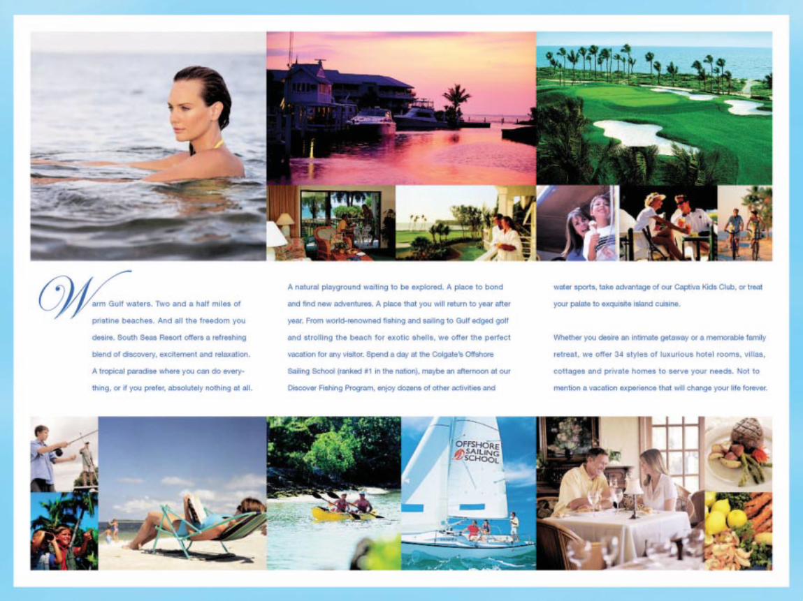
South Seas Resort& Yacht Harbour
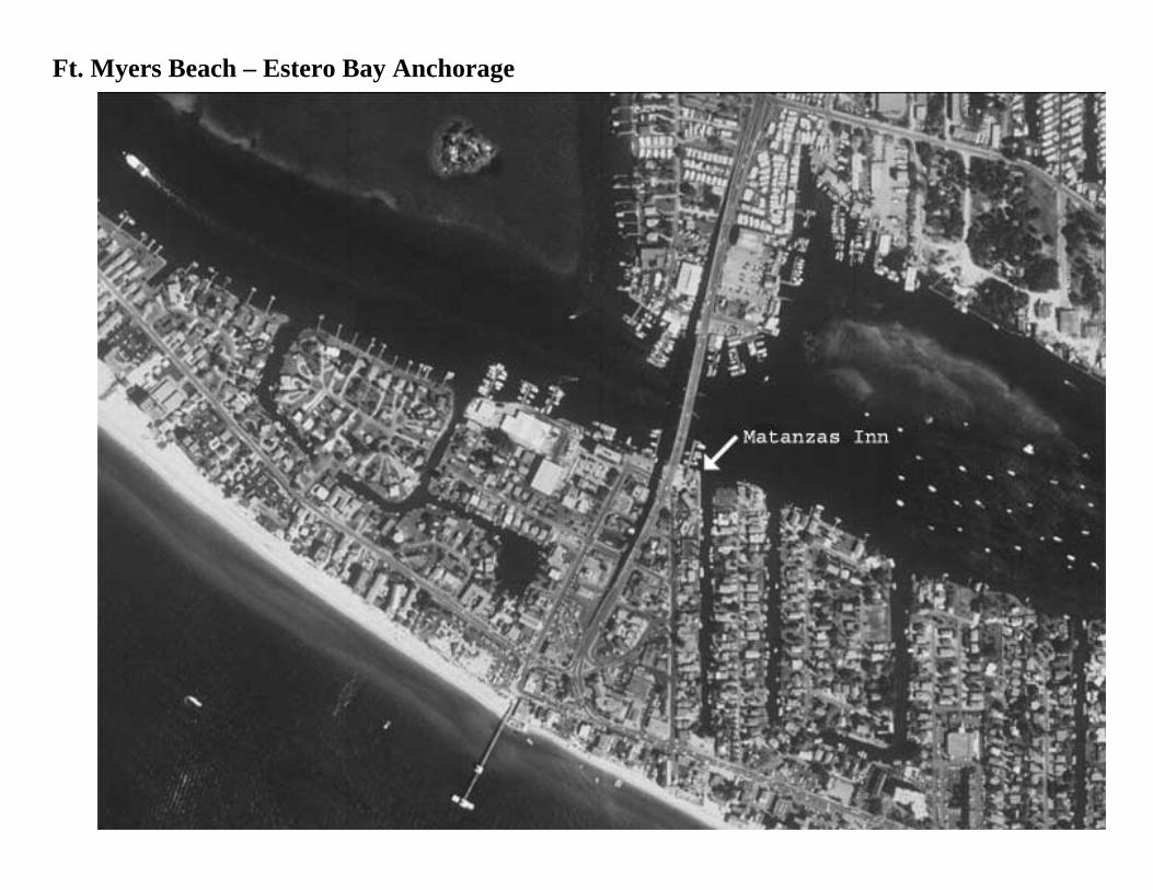
Ft. Myers Beach – Estero Bay Anchorage

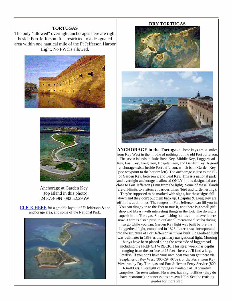
TORTUGAS The only "allowed" overnight anchorages here are right
beside Fort Jefferson. It is restricted to a designated area within one nautical mile of the Ft Jefferson Harbor
Light. No PWC's allowed.
Anchorage at Garden Key (top island in this photo)
24 37.469N 082 52.295W
CLICK HERE for a graphic layout of Ft Jefferson & the anchorage area, and some of the National Park.
DRY TORTUGAS
ANCHORAGE in the Tortugas: These keys are 70 miles from Key West in the middle of nothing but the old Fort Jefferson.
The seven islands include Bush Key, Middle Key, Loggerhead Key, East Key, Long Key, Hospital Key, and Garden Key. A good
anchorage exists beside Fort Jefferson, which is on Garden Key (see waypoint to the bottom left). The anchorage is just to the SE of Garden Key, between it and Bird Key. This is a national park
and overnight anchorage is allowed ONLY in this designated area close to Fort Jefferson (1 nm from the light). Some of these Islands are off-limits to visitors at various times (bird and turtle nesting).
They're supposed to be marked with signs, but these signs fall down and they don't put them back up. Hospital & Long Key are
off limits at all times. The rangers in Fort Jefferson can fill you in. You can dinghy in to the Fort to tour it, and there is a small gift shop and library with interesting things in the fort. The diving is superb in the Tortugas. So was fishing but it's all outlawed there now. There is also a push to outlaw all recreational scuba diving,
so go while you can. Garden Key light was built before the Loggerhead light, completed in 1825. Later it was incorporated
into the structure of Fort Jefferson as it was built. Loggerhead light was built later in 1858 as the primary navigational light. Mooring
buoys have been placed along the west side of loggerhead, including the FRENCH WRECK. This steel wreck has depths
ranging from the surface to 25 feet - here you'll find a large Jewfish. If you don't have your own boat you can get there via Seaplanes of Key West (305-294-0709), or the Ferry from Key
West run by Dry Tortugas and Fort Jefferson Ferry Service (800-634-0939). Overnight camping is available at 10 primitive
campsites. No reservations. No water, bathing facilities (they do have restrooms) or concessions are available. See the cruising
guides for more info.
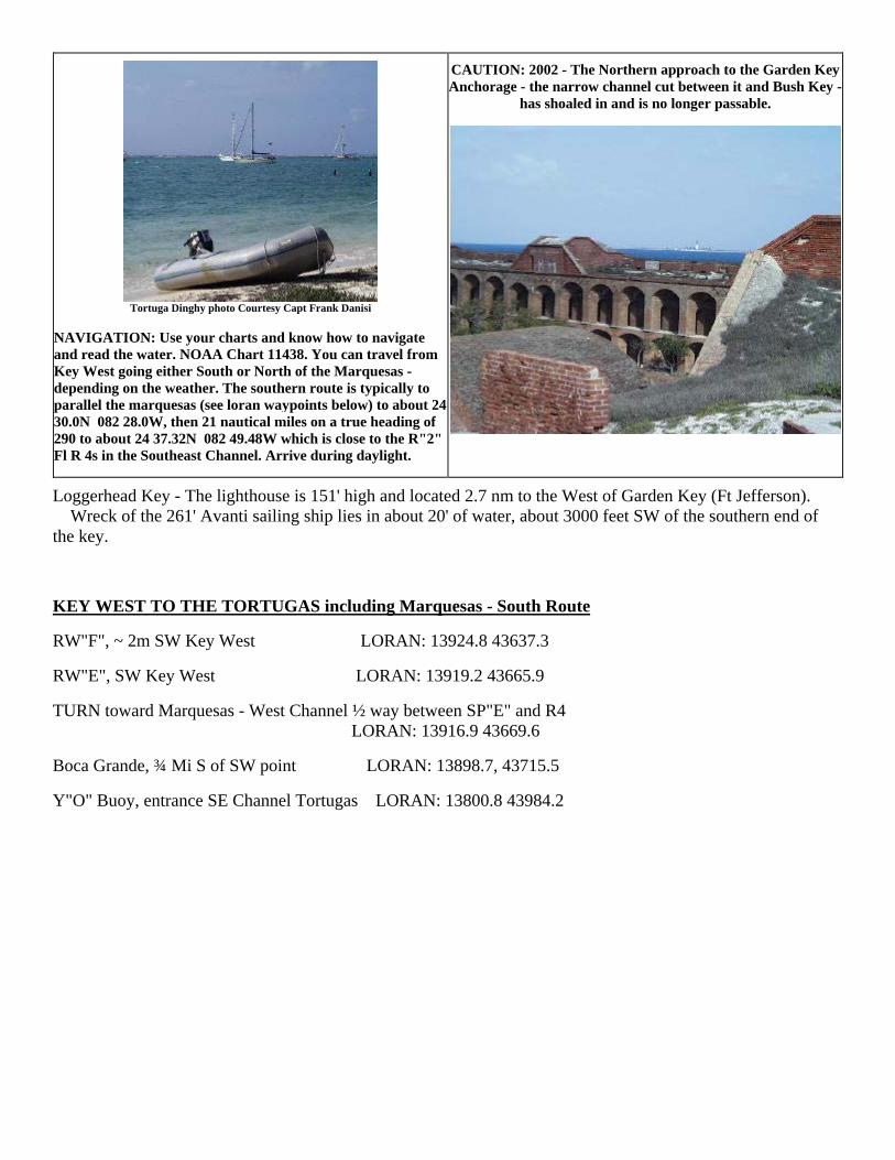
Tortuga Dinghy photo Courtesy Capt Frank Danisi
NAVIGATION: Use your charts and know how to navigate and read the water. NOAA Chart 11438. You can travel from Key West going either South or North of the Marquesas - depending on the weather. The southern route is typically to parallel the marquesas (see loran waypoints below) to about 24 30.0N 082 28.0W, then 21 nautical miles on a true heading of 290 to about 24 37.32N 082 49.48W which is close to the R"2" Fl R 4s in the Southeast Channel. Arrive during daylight.
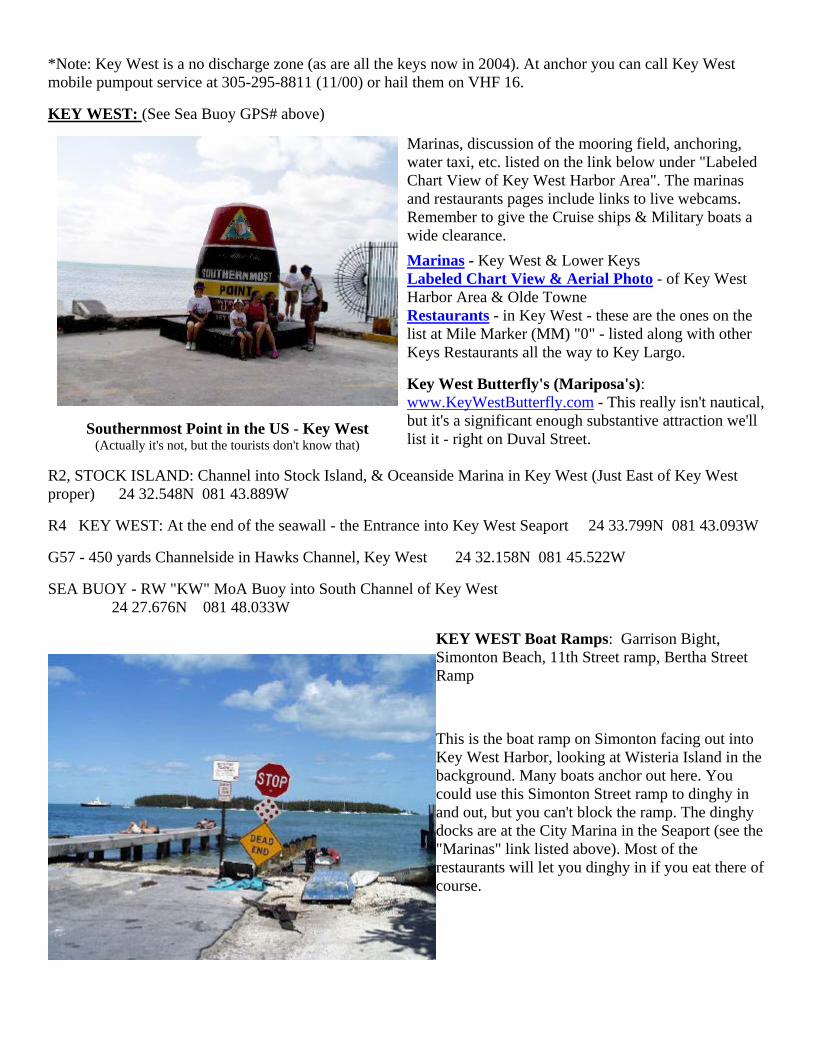
CAUTION: 2002 - The Northern approach to the Garden Key Anchorage - the narrow channel cut between it and Bush Key -
has shoaled in and is no longer passable.
Loggerhead Key - The lighthouse is 151' high and located 2.7 nm to the West of Garden Key (Ft Jefferson). Wreck of the 261' Avanti sailing ship lies in about 20' of water, about 3000 feet SW of the southern end of the key.
KEY WEST TO THE TORTUGAS including Marquesas - South Route
RW"F", ~ 2m SW Key West LORAN: 13924.8 43637.3
RW"E", SW Key West LORAN: 13919.2 43665.9
TURN toward Marquesas - West Channel ½ way between SP"E" and R4 LORAN: 13916.9 43669.6
Boca Grande, ¾ Mi S of SW point LORAN: 13898.7, 43715.5
Y"O" Buoy, entrance SE Channel Tortugas LORAN: 13800.8 43984.2

TORTUGAS TO KEY WEST, including Marquesas - North Route
The Marquesas are 22 miles west of Key West. It's very shoal all around the islands - a cluster of white sandy beaches separated by lagoons. The treasure ships "Santa Margarita" and "Atocha" were found here. About the only place to even try to enter from the surrounding shoal waters is at the SW end (lower left) of the Cays - shown here with the two channels proceeding in - the channel on the right "might" be passable. Also the large channel on the SE is a possibility. The group measures about 4 nm by 2.5 nm. Click HERE to see aerial & satellite views of that area. Click HERE for a Chart view of the Marquesas.
Marquesa Keys - Aerial view looking to the West.
"New Ground" 19 ft light, 1 ½ mi S of light (N. of Halfmoon Shoal) LORAN: 13854.8 43865.2
Ellis Rock Light, ½ mi North of light (Marquesas) LORAN: 1389.7 43779.5
Boca Grande - Reasonable Anchorage and nice day stop with beach. Anchorage at approximately 24 32.290N 082 00.460W on NNE side of island.
G1, N approach to NW Channel Range - into Key West LORAN: 13926.1 43685.4
KEY WEST NATIONAL WILDLIFE REFUGE - This is an area of Islands from Boca Grande which is about 11nm West, to just off Key West.
CLICK HERE FOR SATELLITE & AERIAL PHOTOS & CHART OF THIS AREA JUST WEST OF KEY WEST
KEY WEST TO CUBA
SEA BUOY - RW "KW" MoA Buoy into South Channel of Key West (You can go directly from here to the Approach to Hemingway in Cuba) 24 27.676N 081 48.033W
CUBA: Mariel Hemingway Marina - approach. DeBarlovento Light (RW) about 825 yards out from buoy 23 05.358N 082 30.522W
Havana Harbor Approach - about 1/4 mile off harbor entrance. Please note that this is a restricted Harbor. Do not enter without prior Cuban authorization. 23 09.072N 082 21.714W
CLICK HERE FOR PICTURES & INFO ON HEMINGWAY MARINA, AND BOAT CLEARING PROCEDURES FOR ENTERING CUBA
*Note: Key West is a no discharge zone (as are all the keys now in 2004). At anchor you can call Key West mobile pumpout service at 305-295-8811 (11/00) or hail them on VHF 16.
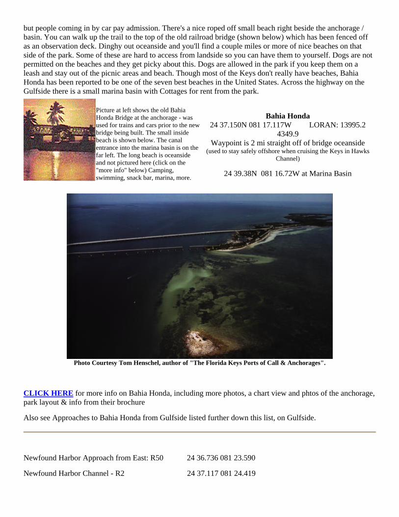
KEY WEST: (See Sea Buoy GPS# above)
Southernmost Point in the US - Key West (Actually it's not, but the tourists don't know that)
Marinas, discussion of the mooring field, anchoring, water taxi, etc. listed on the link below under "Labeled Chart View of Key West Harbor Area". The marinas and restaurants pages include links to live webcams. Remember to give the Cruise ships & Military boats a wide clearance. Marinas - Key West & Lower Keys Labeled Chart View & Aerial Photo - of Key West Harbor Area & Olde Towne Restaurants - in Key West - these are the ones on the list at Mile Marker (MM) "0" - listed along with other Keys Restaurants all the way to Key Largo.
Key West Butterfly's (Mariposa's): www.KeyWestButterfly.com - This really isn't nautical, but it's a significant enough substantive attraction we'll list it - right on Duval Street.
R2, STOCK ISLAND: Channel into Stock Island, & Oceanside Marina in Key West (Just East of Key West proper) 24 32.548N 081 43.889W
R4 KEY WEST: At the end of the seawall - the Entrance into Key West Seaport 24 33.799N 081 43.093W
G57 - 450 yards Channelside in Hawks Channel, Key West 24 32.158N 081 45.522W
SEA BUOY - RW "KW" MoA Buoy into South Channel of Key West 24 27.676N 081 48.033W
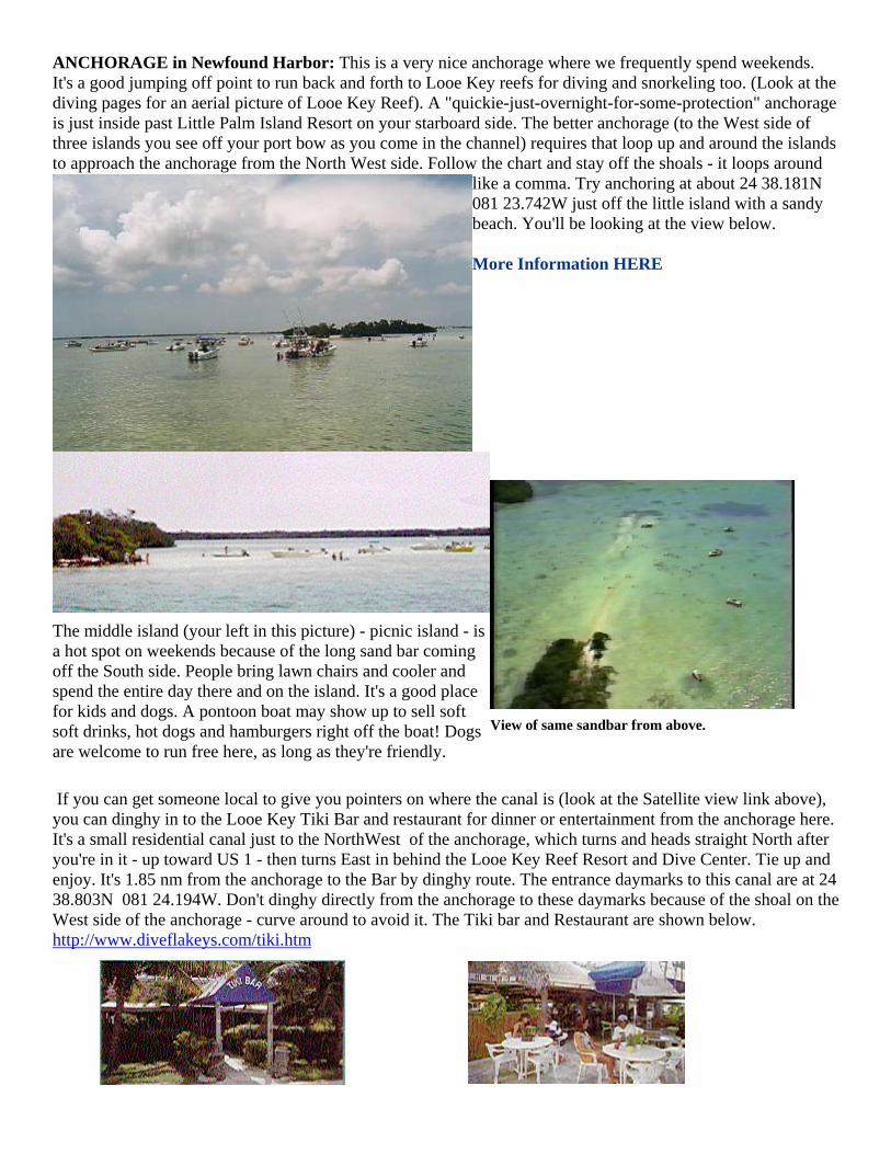
KEY WEST Boat Ramps: Garrison Bight, Simonton Beach, 11th Street ramp, Bertha Street Ramp
This is the boat ramp on Simonton facing out into Key West Harbor, looking at Wisteria Island in the background. Many boats anchor out here. You could use this Simonton Street ramp to dinghy in and out, but you can't block the ramp. The dinghy docks are at the City Marina in the Seaport (see the "Marinas" link listed above). Most of the restaurants will let you dinghy in if you eat there of course.

KEYS GULFSIDE: Lower Florida Keys (going from Key West to 7 mi bridge (Marathon)
This is called the "Backcountry" of the Florida Keys. It's so shoal that the Coast Guard even hates to cruise here. Fisherman love it though, but you have to know the waters very well. Most of it is exposed at low water, and tides are usually only a foot or foot and a half ordinarily anyway. If you're not familiar with this area you should go slowly and carefully. Even a 3-4 foot draft will have problems in many places. There are some nice spots to snorkel and lobster along the reef edge on the North side of this area, but you're anchored in open exposed water. I've included a couple places where you might be able to get in and anchor with some protection, but these shoals are subject to continuous shifting so you must be able to read the water and decide for yourself whether you can get in here or not. Use Charts 11452_2 Sugarloar Key to Key West 11448 Big Spanish Channel to Johnston Key
CLICK HERE for some chart views and satellite photos of the Keys "BackCountry" Includes Jewfish Basin, Airplane Wreck, Johnston Key, Tarpon Belly, Marvin Keys, Snipe Point, Content Keys.
FAT ALBERT - A familiar site to lower Keys Residents. This is a tethered "weather balloon" (so they say) that can be flown as high as 14000 Ft (Pilots watch your aviation charts!). It's used for both weather information and sophisticated surveillance of Cuba and our Southern Border to the Caribbean. It's located on Cudjoe Key just West of Big Pine in the backcountry, and makesa great landmark. They have 2 or 3 to keep one in the air most of the time. If you come up Kemp Channel you can get a great view of them and the base on the shore of Cudjoe Key.
KEYS OCEANSIDE: Lower Florida Keys (going from 7mi bridge (Marathon) toward Key West)
Boat Ramps in the Lower Keys (aside from Key West)
Bahia Honda State Park (2 boat ramps) MM37
Spanish Harbor Channel, MM 34 GulfsideWest Summerland Key (just east of Big Pine)
Big Pine Key, MM 30.8 Bittersweet Ave
Big Pine Key, MM 30.8, Koehn Ave, Dolphin Marina, around MM 28.5 Little Torch Key Cudjoe Key, MM 21.2, Blimp Road
Shark Key, MM 10 Big Coppitt Key, MM 9.3, Barcelona Dr Key Haven, MM 6
ANCHORAGE in Bahia Honda: (pronounced Bay-uhh Honda). The anchorage is nestled between the old bridge (S. or Ocean side) and the new bridge (N. or Gulf side). Clearance under the new bridge is about 19' if you're coming in from the Gulf Side. On the Ocean side part of the old bridge has been cut out on the East end to allow unrestricted passage. Anchor close to the roped off beach between the two bridges. The current gets pretty steep here between tides so anchor well and/or use a Bahamian Moor with two anchors. Don't get up close to the new bridge (N. side) to anchor on this side. We're told there's a lot of junk on the bottom to foul an anchor, but have not confirmed this. You can also anchor outside the bridges on the NW side. There is significantly less current here than between the bridges, but the holding has been reported poor too. Bahia Honda State Park has a small marina basin which contains a nice gift and snack shop. You can dinghy or boat in and tie up at no charge for the day, or dock overnight at a modest charge (don't tie up in front of the shop because the tour boats go out of here). There's also no charge for coming in to the park when you do it this way,
but people coming in by car pay admission. There's a nice roped off small beach right beside the anchorage / basin. You can walk up the trail to the top of the old railroad bridge (shown below) which has been fenced off as an observation deck. Dinghy out oceanside and you'll find a couple miles or more of nice beaches on that side of the park. Some of these are hard to access from landside so you can have them to yourself. Dogs are not permitted on the beaches and they get picky about this. Dogs are allowed in the park if you keep them on a leash and stay out of the picnic areas and beach. Though most of the Keys don't really have beaches, Bahia Honda has been reported to be one of the seven best beaches in the United States. Across the highway on the Gulfside there is a small marina basin with Cottages for rent from the park.
Picture at left shows the old Bahia Honda Bridge at the anchorage - was used for trains and cars prior to the new bridge being built. The small inside beach is shown below. The canal entrance into the marina basin is on the far left. The long beach is oceanside and not pictured here (click on the "more info" below) Camping, swimming, snack bar, marina, more.
Bahia Honda 24 37.150N 081 17.117W LORAN: 13995.2
4349.9 Waypoint is 2 mi straight off of bridge oceanside
(used to stay safely offshore when cruising the Keys in Hawks Channel)
24 39.38N 081 16.72W at Marina Basin
Photo Courtesy Tom Henschel, author of "The Florida Keys Ports of Call & Anchorages".
CLICK HERE for more info on Bahia Honda, including more photos, a chart view and phtos of the anchorage, park layout & info from their brochure
Also see Approaches to Bahia Honda from Gulfside listed further down this list, on Gulfside.
Newfound Harbor Approach from East: R50 24 36.736 081 23.590
Newfound Harbor Channel - R2 24 37.117 081 24.419
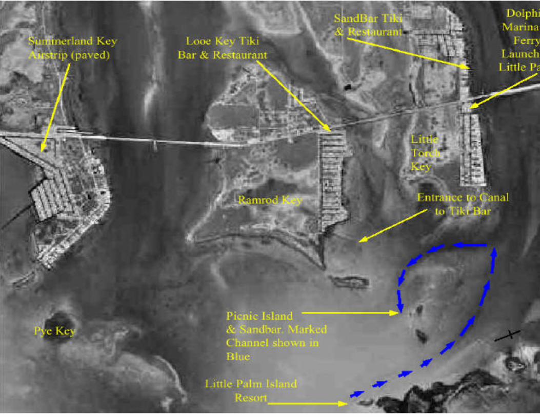
ANCHORAGE in Newfound Harbor: This is a very nice anchorage where we frequently spend weekends. It's a good jumping off point to run back and forth to Looe Key reefs for diving and snorkeling too. (Look at the diving pages for an aerial picture of Looe Key Reef). A "quickie-just-overnight-for-some-protection" anchorage is just inside past Little Palm Island Resort on your starboard side. The better anchorage (to the West side of three islands you see off your port bow as you come in the channel) requires that loop up and around the islands to approach the anchorage from the North West side. Follow the chart and stay off the shoals - it loops around
like a comma. Try anchoring at about 24 38.181N 081 23.742W just off the little island with a sandy beach. You'll be looking at the view below. More Information HERE
The middle island (your left in this picture) - picnic island - is a hot spot on weekends because of the long sand bar coming off the South side. People bring lawn chairs and cooler and spend the entire day there and on the island. It's a good place for kids and dogs. A pontoon boat may show up to sell soft soft drinks, hot dogs and hamburgers right off the boat! Dogs are welcome to run free here, as long as they're friendly.
View of same sandbar from above.
If you can get someone local to give you pointers on where the canal is (look at the Satellite view link above), you can dinghy in to the Looe Key Tiki Bar and restaurant for dinner or entertainment from the anchorage here. It's a small residential canal just to the NorthWest of the anchorage, which turns and heads straight North after you're in it - up toward US 1 - then turns East in behind the Looe Key Reef Resort and Dive Center. Tie up and enjoy. It's 1.85 nm from the anchorage to the Bar by dinghy route. The entrance daymarks to this canal are at 24 38.803N 081 24.194W. Don't dinghy directly from the anchorage to these daymarks because of the shoal on the West side of the anchorage - curve around to avoid it. The Tiki bar and Restaurant are shown below. http://www.diveflakeys.com/tiki.htm

Marinas (lower keys)
. docks at 24 37.444N 081 24.115W
From this Newfound Harbor anchorage above you can also dinghy in to Little Palm Island Resort - just at the entrance to the Harbor. This is an
exclusive resort (no kids under 16 or pets allowed). Dockage is expensive but worth it to spend the night, have dinner, and enjoy the resort facilities. - - But
no phones or TV at this South Seas Style Tropical Resort. It's one of those "Rich and Famous" type places. 14 Luxury Suites with thatched roofs, fresh water & lagoon style pool, white sandy beach, dockage & marina, French
gourmet cuisine, Mobile 4 Star rating. CLICK for pictures from their brochure
www.littlepalmisland.com
Tel: 305-872-2551 or 2524 Ferry from Little Torch Key
*Divers - for waypoints and information on Looe Key Reef (about 6.7nm SW of Big Pine Key & 4.5nm S of Little Palm Island) go to our DIVE SITES pages
Key Lois - 50A Red Daymark, 100 yds channelside of the daymark 24 35.794N 081 27.284W
Between Ninefoot Shoal Light & G51, In Hawk’s Channel 24 34.239N 081 33.402W
W Washerwoman Shoal - G55 450 yds channelside of the daymark - in Hawk's Channel - Saddlebunch Keys, 24 33.454N 081 37.291W

Looking in between the new (right) and old (left) bridges around Big Pine Key.
Sunshine Key RV Resort & Marina - Bayside
This cut is between Bahia Honda and Sunshine Key, just below the 7 mile bridge. Photo looking North.
Photo Courtesy Tom Henschel, author of "The Florida Keys Ports of Call & Anchorages". This illustrated guide is available for sale at www.cruisingbook.com

Lower Keys Marinas - from 7 mile bridge South to Key West (Note that waypoints are to give indication of area of their docks - not to be used for navigation)
KEY WEST - these are right in the heart of old town district and within easy walking distance of shops & restaurants: CLICK for a chart view of the Key West Harbor area with marina's labeled, and discussion of anchoring & mooring. CLICK for restaurants around Key West Harbor - and the rest of the Keys Florida Keys & Key West Tourism Council Website
WEBCAMS: Key West Harbor & Sunset Shipwreck Historeum Key West Aquarium Mallory Square & Cruise Ships Key West Golf Club More Webcams on Restaurants page
(more webcams around the world) Key West Seaport in Key West Bight
This is the entrance light (red
daymark #4) as you
round the seawall and enter Key
West Seaport.
24 33.799N 081
43.093W Key West Seaport Entrance
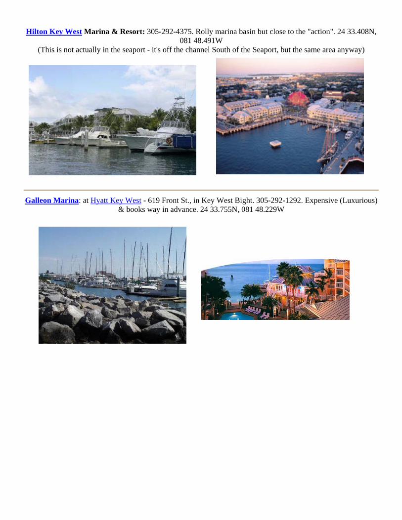
Hilton Key West Marina & Resort: 305-292-4375. Rolly marina basin but close to the "action". 24 33.408N, 081 48.491W
(This is not actually in the seaport - it's off the channel South of the Seaport, but the same area anyway)
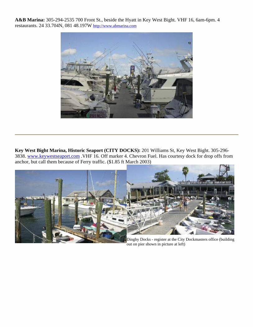
Galleon Marina: at Hyatt Key West - 619 Front St., in Key West Bight. 305-292-1292. Expensive (Luxurious)
& books way in advance. 24 33.755N, 081 48.229W

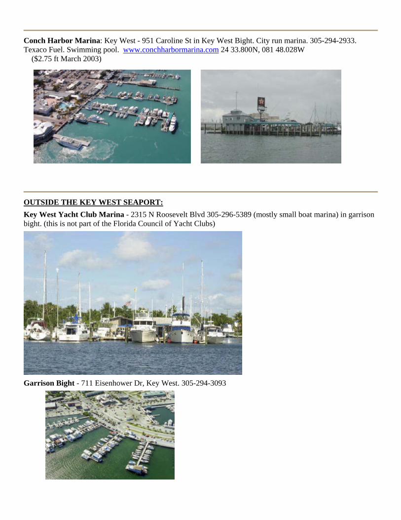
A&B Marina: 305-294-2535 700 Front St., beside the Hyatt in Key West Bight. VHF 16, 6am-6pm. 4 restaurants. 24 33.704N, 081 48.197W http://www.abmarina.com
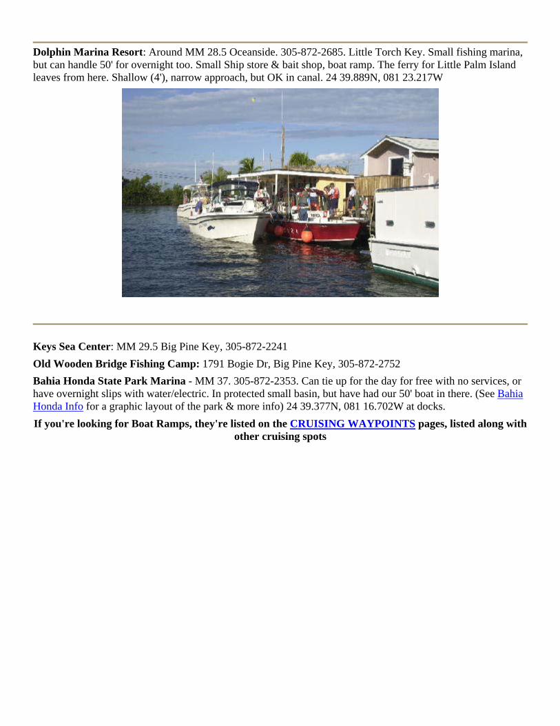
Key West Bight Marina, Historic Seaport (CITY DOCKS): 201 Williams St, Key West Bight. 305-296-3838. www.keywestseaport.com .VHF 16. Off marker 4. Chevron Fuel. Has courtesy dock for drop offs from anchor, but call them because of Ferry traffic. ($1.85 ft March 2003)
Dinghy Docks - register at the City Dockmasters office (building out on pier shown in picture at left)
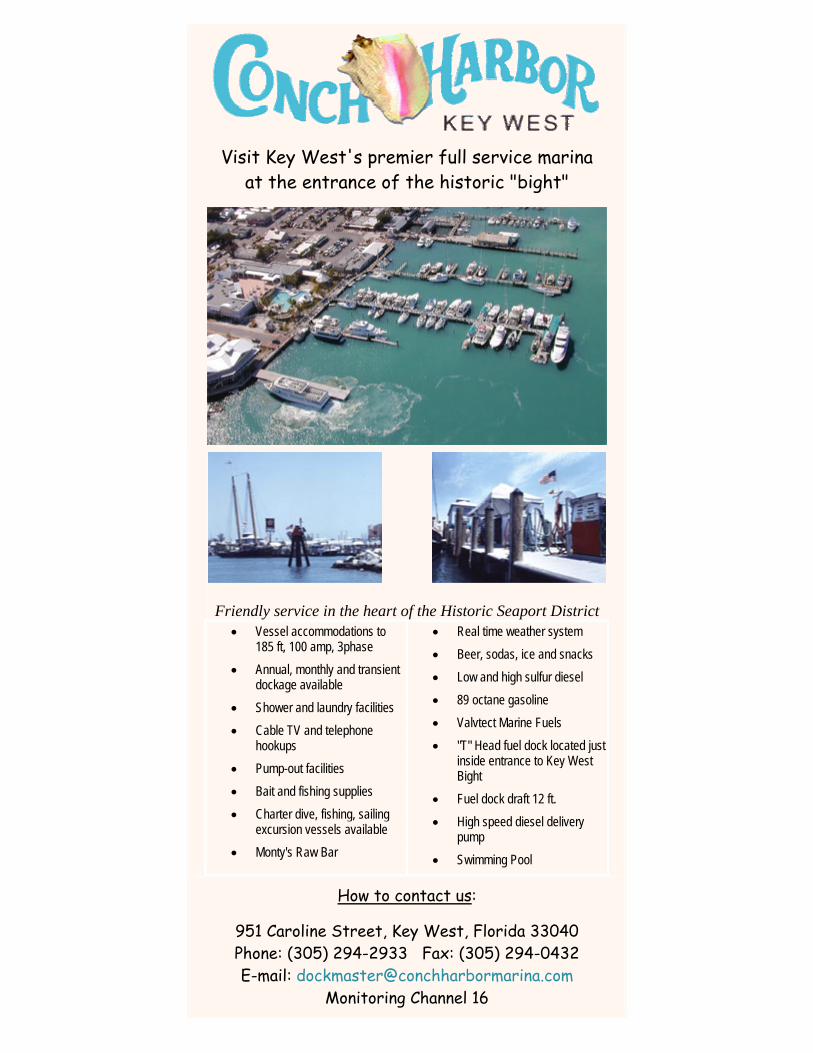
Conch Harbor Marina: Key West - 951 Caroline St in Key West Bight. City run marina. 305-294-2933. Texaco Fuel. Swimming pool. www.conchharbormarina.com 24 33.800N, 081 48.028W ($2.75 ft March 2003)
OUTSIDE THE KEY WEST SEAPORT:Key West Yacht Club Marina - 2315 N Roosevelt Blvd 305-296-5389 (mostly small boat marina) in garrison bight. (this is not part of the Florida Council of Yacht Clubs)
Garrison Bight - 711 Eisenhower Dr, Key West. 305-294-3093

KEY WEST - up on Stock Island - a taxi ride from old town Key West Oceanside Marina: 5950 Peninsula Ave Stock Island Key West, Oceanside. Fuel, Slips. 305-294-4676. Cheaper than downtown Key West marinas but a taxi ride into town. 24 33.783N, 081 43.828W
Sunset Marina: 305-296-7101 - 5555 College Rd, Gulfside Stock Island Key West. Adjacent to golf course, slips, showers, laundry, VHF 16, Amoco diesel. 24 34.786N, 081 45.104W www.sunsetmarina-keywest.com This marina sells slips & condos. 24 34.786N, 081 45.104W
Murray Marine Sales & Service: 5710 US1, 305-296-9555 Robbie's Marina: Shrimp Road, 305-294-1124 Safe Harbor Marina: 6810 Front St, 305-294-9797 Sea Horse Marina: 5001 5th Ave, 305-292-9111 Geiger Key Marina - 5 Geiger Rd, MM 10.5 305-296-3553 Sugarloaf Marina: MM17 Sugarloaf Key, 305-745-3135 http://www.sugarloaflodge.com
RAMROD KEY (MM 26) and upward to 7 mile bridge Cudjoe Gardens Marina: around MM 26? on Cudjoe Key Oceanside. 477 Drost Drive, 305-745-2357 Little Palms Island Resort & Marina: Around MM 28.5 Oceanside, in Newfound Harbor (see Cruising Waypoints Page for boating info, or CLICK HERE for pictures from their brochure) Little Torch Key Plush tropical resort. 305-872-2551. www.littlepalmisland.com 24 37.440N, 081 24.101W
Dolphin Marina Resort: Around MM 28.5 Oceanside. 305-872-2685. Little Torch Key. Small fishing marina, but can handle 50' for overnight too. Small Ship store & bait shop, boat ramp. The ferry for Little Palm Island leaves from here. Shallow (4'), narrow approach, but OK in canal. 24 39.889N, 081 23.217W
Keys Sea Center: MM 29.5 Big Pine Key, 305-872-2241 Old Wooden Bridge Fishing Camp: 1791 Bogie Dr, Big Pine Key, 305-872-2752 Bahia Honda State Park Marina - MM 37. 305-872-2353. Can tie up for the day for free with no services, or have overnight slips with water/electric. In protected small basin, but have had our 50' boat in there. (See Bahia Honda Info for a graphic layout of the park & more info) 24 39.377N, 081 16.702W at docks. If you're looking for Boat Ramps, they're listed on the CRUISING WAYPOINTS pages, listed along with
other cruising spots
Key West Bight
Key West Bight is located at:
24-33.743 N 081-48.065W
Dockmaster (305) 296-3838 Fax 293-8308
Key West Bight Marina is nestled in the middle of the City of Key West's Seaport properties located in the historic district. The Key West Bight is a twenty acre facility that has become a major destination for those wishing to experience the ways of the old waterfront of Key West. A visitor to the "Bight" can enjoy a blend of the old with the new. You can go sailing on a historic schooner one day and go diving, fishing, parasailing or take a catamaran trip to the reef the next.
Key West Bight Marina has quickly become the most sought after marina facility in the City of Key West. Those who live-aboard enjoy its affordable rates and nearby location to old town. This also is a great benefit to our marina’s commercial tenants. The Harborwalk is lined with fine restaurants and other food orientated businesses which attract tourists and locals to the Bight area where it is easy to browse near the commercial, water oriented activities that are available here.
Our marina has thirty-three deep- water transient slips available that can accommodate vessels up to 140 feet, year round. The majority of our transient dockage is repeat business. When asked why they keep coming back the uniform response is, our pleasing atmosphere, friendly staff, and affordable rates. Showers, laundry and pump-out facilities are on the premises.
The Key West Bight Ferry Terminal will begin operation January 1st, 2002 with daily service to Ft Meyers and Naples. And you will experience no parking problems as there is plenty of parking in the Historic District, both locals and tourists have the choice of using three large parking lots on our property.
When you add it all together you can see why everybody says Key West Bight is a place you have to experience when you visit Key West.
Contact InformationKey West Bight Management District Board Rates - Transient Daily Docking Rates: $2.00 / ft - Transient Monthly Docking Rates $29.70 / ft - Recreational Lease $16.50 / ft monthly - Commercial Lease $17.60 / ft monthly - Dinghy Dock $4 day $20 week - $60 month Amenities - 24 Hour security - Power (30, 50, & 100 amp) - Cable TV - Phone - Water - Pump-out - Bath/shower/laundry facilities - Trash removal - Ice Vessel Requirements - Maximum length 140 feet - Maximum draft 12 feet - Holding tank (pump-out compatible) - Single-phase power requirements (for marina power) - Dockage is payable in advance

Directions to marina by road:
Key West Bight Marina is located on the northwest end of the Island where it is only a short walk from the marina to Duval St., the famous Sloppy Joes, Mallory Square, and all the other fine establishments that make up “Old Town”. When approaching Key West on US 1, stay to the right; turn on to South Roosevelt Boulevard. This route will take you along the very edge of the island and offers a breathtaking view of the Back Country with its extensive flats and mangrove islands. Turn right at Palm Avenue, the third light on South Roosevelt Boulevard. Drive over the scenic Palm Ave. Bridge, which turns into Eaton St. and turn right on Margaret St. Once you arrive at the base of Margaret St. you have your choice of parking at the Park & Ride or the Caroline St. parking lot.
Directions by water – Gulf of Mexico:
Enter Key West waters at Buoy #1 North West Passage. At Buoy #19 North West Passage, turn eastward to the Key West Main Ship Channel, follow the marker system to red marker #4 turn to starboard and pull up to our Chevron fuel dock.
Directions by water – Atlantic:
Proceed westward down Hawk Channel to Key West Main Ship Channel Buoy #12 then northward to red marker #4 turn to starboard and pull up to our Chevron fuel dock.
Visit Key West's premier full service marina at the entrance of the historic "bight"
Friendly service in the heart of the Historic Seaport District • Vessel accommodations to
185 ft, 100 amp, 3phase • Annual, monthly and transient
dockage available • Shower and laundry facilities • Cable TV and telephone
hookups • Pump-out facilities • Bait and fishing supplies • Charter dive, fishing, sailing
excursion vessels available • Monty's Raw Bar
• Real time weather system • Beer, sodas, ice and snacks • Low and high sulfur diesel • 89 octane gasoline • Valvtect Marine Fuels • "T" Head fuel dock located just
inside entrance to Key West Bight
• Fuel dock draft 12 ft. • High speed diesel delivery
pump • Swimming Pool
How to contact us:
951 Caroline Street, Key West, Florida 33040 Phone: (305) 294-2933 Fax: (305) 294-0432 E-mail: [email protected]
Monitoring Channel 16

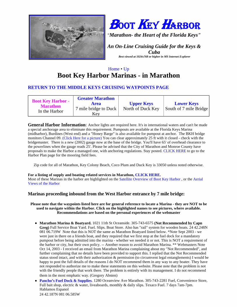
BOOT KEY HARBOR
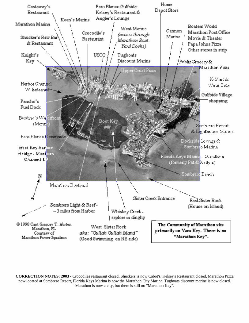
CORRECTION NOTES: 2003 - Crocodiles restaurant closed, Shuckers is now Cabot's. Kelsey's Restaurant closed, Marathon Pizza now located at Sombrero Resort, Florida Keys Marina is now the Marathon City Marina. Tugboats discount marine is now closed.
Marathon is now a city, but there is still no "Marathon Key".

KEYS OCEANSIDE
Middle Keys - going from 7 Mile Bridge (Marathon) East to Upper Keys
Money Keys - 24 41.00N 081 12.9W - Oceanside off 7 mile bridge. Nice day spot to explore and wade. Shoal all around, must proceed in toward the 7 mile bridge, then parallel it by the electric poles (look at your chart), then head back south to the island.
1M Satellite Photo. North is up.
Photo Courtesy Capt Frank Danisi
Molasses Keys - 24 41.00N 081 11.45W - Oceanside off 7 mile bridge. Nice day spot to swim, explore & wade. The rock just to the SW of the main island has an old bomb hole on its NW side. This goes from about 5 foot depths at the rim to 15 or 16 feet in the hole. Good swimming. The middle island is the main one & you can beach your dinghy & explore. The water in the flats between this Island and the mangrove one to the east is very shallow and VERY HOT in the summer - it must be 105-110 degrees. We sometimes anchor in the channel just to the NW of the island and stay the weekend there. Fast currents. There is a ledge about 100 yards off the island. You dinghy or small boat in to the ledge (go to the East end of the island), then walk the rest of the way in. Watch the tide because if you're boat is up on the ledge it can go high and dry very quickly on an outgoing tide!
2M Satellite Photo below (North up), shows the middle Island where you dingy in and explore.
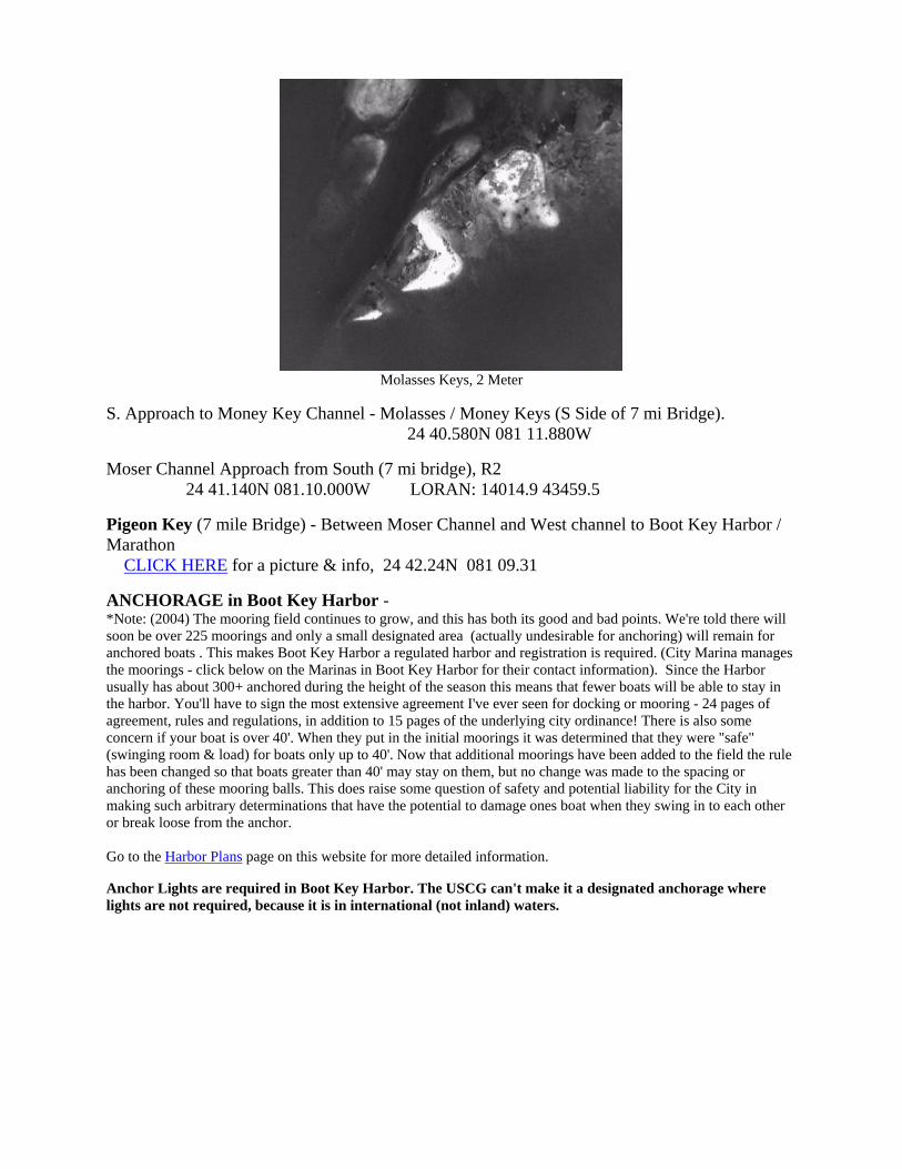
Molasses Keys, 2 Meter
S. Approach to Money Key Channel - Molasses / Money Keys (S Side of 7 mi Bridge). 24 40.580N 081 11.880W
Moser Channel Approach from South (7 mi bridge), R2 24 41.140N 081.10.000W LORAN: 14014.9 43459.5
Pigeon Key (7 mile Bridge) - Between Moser Channel and West channel to Boot Key Harbor / Marathon CLICK HERE for a picture & info, 24 42.24N 081 09.31
ANCHORAGE in Boot Key Harbor - *Note: (2004) The mooring field continues to grow, and this has both its good and bad points. We're told there will soon be over 225 moorings and only a small designated area (actually undesirable for anchoring) will remain for anchored boats . This makes Boot Key Harbor a regulated harbor and registration is required. (City Marina manages the moorings - click below on the Marinas in Boot Key Harbor for their contact information). Since the Harbor usually has about 300+ anchored during the height of the season this means that fewer boats will be able to stay in the harbor. You'll have to sign the most extensive agreement I've ever seen for docking or mooring - 24 pages of agreement, rules and regulations, in addition to 15 pages of the underlying city ordinance! There is also some concern if your boat is over 40'. When they put in the initial moorings it was determined that they were "safe" (swinging room & load) for boats only up to 40'. Now that additional moorings have been added to the field the rule has been changed so that boats greater than 40' may stay on them, but no change was made to the spacing or anchoring of these mooring balls. This does raise some question of safety and potential liability for the City in making such arbitrary determinations that have the potential to damage ones boat when they swing in to each other or break loose from the anchor. Go to the Harbor Plans page on this website for more detailed information.
Anchor Lights are required in Boot Key Harbor. The USCG can't make it a designated anchorage where lights are not required, because it is in international (not inland) waters.

MARATHON FLORIDA, on Vaca Key (There is no Marathon Key)
Home of Boot Key Harbor and the Heart of the Florida Keys.
You're looking from West to East (The Keys run east and west once you're this far down - not North and South). Knights Key is in the foreground, Boot Key Harbor and Oceanside off to your right, and Gulfside off to your left. The Marathon Airport is at the top (back) of the photo. This commercial airport really is underused. You can book flights up into mainland Florida. Check it out. It's much more convenient than flying into Miami, and a lot less busy than Key West. Click the links in the table below for TONS of information, photos, menus, marinas and area business.
Marathon Chamber of Commerce (tourist info) City of Marathon website
Boot Key Harbor is the best protected anchorage in all of the Keys, plus plenty of Marina's, Restaurants and Business to
reprovision. This is the best place to wait out the weather for crossing to Cuba.
Click on MARATHON SERVICES for a listing of business'
of interest to cruisers, such as restaurants, bars, repairs, supplies, car rentals, etc..
CLICK HERE FOR A LISTING OF MARINAS IN
BOOT KEY HARBOR & HARBOR INFORMATION
A "Ghost Ship" from Hurricane Georges in 1998 swept up
into the mangroves of Boot Key Harbor.
Boot Key Harbor
Looking SE at the Harbor, from Gulfside looking
Oceanside.
CLICK HERE FOR LABELED AERIAL PHOTOGRAPHS OF THE HARBOR
CLICK HERE to see the Satellite overview map of the Harbor with labels
CLICK HERE for photos of the harbor, boats and people
Home • Up
BOOT KEY HARBOR "Marathon- the Heart of the Florida Keys"
An On-Line Cruising Guide for the Keys & Cuba
Best viewed at 1024x768 or higher in MS Internet Explorer
Boot Key Harbor Marinas - in Marathon
RETURN TO THE MIDDLE KEYS CRUISING WAYPOINTS PAGE
General Harbor Information: Anchor lights are required here. It's in international waters and can't be made a special anchorage area to eliminate this requirement. Pumpouts are available at the Florida Keys Marina (midharbor), Burdines (West end) and a "Honey Barge" is also available for pumpout at anchor. The BKH bridge monitors Channel 09. (Click Here for a picture) You can clear approximately 25 ft with it closed - check with the bridgemaster. There is a new (2002) gauge now at the base of the bridge. You'll have 65' of overhead clearance to the powerlines when the gauge reads 25'. Please be advised that the City of Marathon and Monroe County have proposals to make the Harbor a managed one, with anchoring regulations. Stay posted. CLICK HERE to go to the Harbor Plan page for the mooring field fees.
Zip code for all of Marathon, Key Colony Beach, Coco Plum and Duck Key is 33050 unless noted otherwise.
For a listing of supply and boating related services in Marathon, CLICK HERE. Most of these Marinas in the harbor are highlighted on the Satellite Overview of Boot Key Harbor , or the Aerial Views of the Harbor
Marinas proceeding inbound from the West Harbor entrance by 7 mile bridge:
Please note that the waypoints listed here are for general reference to locate a Marina - they are NOT to be used to navigate within the Harbor. Click on the highlighted names to see pictures, where available.
Recommendations are based on the personal experiences of the webmaster
Marathon Marina & Boatyard. 1021 11th St Oceanside. 305-743-6575 (Not Recommended by Capn Greg) Full Service Boat Yard. Fuel. Slips. Boat Store. Also has "rail" system for wooden boats. 24 42.248N 081 06.719W Note that this is NOT the same as Marathon Boatyard listed below. *Note Sept 2003 - we were just in there on a friends boat, and they required that we first stop at the fuel dock for a mandatory pumpout before being admitted into the marina - whether we needed it or not. This is NOT a requirement of the harbor or city, but their own policy. -- Another reason to avoid Marathon Marina. ** Webmasters Note Oct 14, 2003 - I received an email from Marathon Marina complaining about my "Not Recommended", and further complaining that no details have been provided to support this. I replied that the Not Recommended status stood intact, and with their authorization & permission (to circumvent legal entanglements) I would be happy to post the full details of the reasons I do NOT recommend them in any way to any boater. They have not responded to authorize me to make these statements on this website. Please note that the problem is not with the friendly people that work there. The problem is entirely with its management. I do not recommend them in the most emphatic way. (Gregory Absten) Pancho’s Fuel Dock & Supplies. 1280 Oceanview Ave Marathon. 305-743-2281 Fuel, Convenience Store, Full bait shop, electric & water, liveaboards, monthly & daily slips. Texaco Fuel. 7 days 7am-7pm. Hablamos Espanol 24 42.187N 081 06.585W
Boot Key Harbor - Marathon
In the Harbor
Greater Marathon Area
7 mile bridge to Duck Key
Upper Keys North of Duck Key
Lower Keys South of 7 mile Bridge

Burdine’s Waterfront (Marina). 1200 Oceanview Ave. (off 15th Street) 305-743-5317 (Previous Pinnellas) Free Coffee & donuts from 7-10am. 50 cent hot dogs. cable & phone ready. 30&50a elec. Between Pancho’s and Faro Blanco Oceanside. Fuel, supplies, airfills, bait, groceries, pumpout. Nice boaters' "hang-out", fuel & provisioning spot. ChikiTiki bar & grille on the balcony deck level. Good food. Live entertainment many nights. Chiki Tiki Bar & Grille open Sun-Weds 11am-9pm, Thurs-Sat 11am-10pm. (Recommended by Capt Greg) 24 42.196N 081 06.528W .
Faro Blanco Oceanside. (& Gulfside too - with the famous lighthouse - gulfside has swimming pool, but not oceanside) 1996 Overseas Hwy. 305-743-9018. 24 42.203N 081 06.468W http://www.spottswood.com/faroblanco/index.htm
Marathon Boatyard. 2059 Overseas Hwy, Oceanside. 305-743-6641 (Also the Location of Dinghy Dock for West Marine, off to Starboard as you enter basin at end of entrance canal). A Full Service Boat Yard. No slips. 24 42.286N 081 06.243W www.marathonboatyard.com (Note that this is NOT the same as Marathon Marina & Boatyard listed above).
Marathon City Marina - Marathon (Not recommended due to overbearing rules and regulations). 800 35th
St Oceanside. 305-743-2331or 305-289-7788 Pumpout available. They also manage the moorings. Dinghy docks, showers, restrooms and laundry. 24 42.531N 081 05.462W (Formerly Florida Keys marina, then Pat & Kelly’s) http://www.ci.marathon.fl.us/marina.htm
Dockside Lounge & Sombrero Marina. 35 Sombrero Blvd. 305-743-7000. One of the most popular local spots. Few Tourists. Unpretentious and laid back. Live entertainment most nights. Breakfast, lunch & dinner. Sunday Jam sessions. They have dinghy docks with showers, restrooms and laundry. (Recommended by Capt Greg) 24 42.541N 081 04.899W http://www.keysy.com/dockside/
Sombrero Resort & Lighthouse Marina. 19 Sombrero Blvd. 305-743-2250. www.sombreroresort.comUpscale resort marina at far East end of Harbor. Has Marathon Pizza & Italian food located there. One of the more expensive marinas (that and Faro Blanco Gulfside). Swimming pool (only marina in harbor with a pool), tennis courts. $1.75-$2/ft daily, $15.75-$19.75/ft monthly 2002. 24 42.679N 081 04.899W
Cannon Marine & Boat Ramp. 305-289-0505 (small boat marina by back of HOME DEPOT, East end ofHarbor) Have current (Feb02) plans to install 30+ slip "Harbor Point" Marina there. 24 42.733N 081 04.930W
There are also many other marinas in the Marathon area that are outside of Boot Key Harbor itself - SEE THE GREATER MARATHON AREA LISTED ABOVE
If you're looking for Boat Ramps, they're listed on the CRUISING WAYPOINTS pages, listed along with other cruising spots
The pumpout boat is based at Marathon City Marina (305-743-2331 and covers all of the Harbor, plus all of the Marinas around Marathon -both in the Harbor, Oceanside and on the Bayside of Marathon. Please use them and don't pump poop in our water (go more than 3 miles out and pump out offshore - that's what we usually do).
Boot Key Harbor website created and maintained by Capt. Gregory T. Absten, Marathon. - A Boater's Guide to the Florida Keys & Cuba Copyright 2000-2004 Gregory T. Absten

Boat Ramps in/around Marathon:
Cannon Marine, about MM 48.8 Oceanside - just N (E) of Home Depot. Launches into the Harbor. Pvt (Fee)
Marathon Marina, about MM 47 Oceanside - down 11th St. Launches into the Harbor. Pvt (Fee - and watch your wallets!)
Sombrero Resort - Oceanside -Sombrero Blvd - behind the Publix Grocery at about MM 49, at the Kayak rental signs & tennis courts. Launches into Harbor. Pvt (fee)
Dodge Lake, - Gulfside - about MM 50.9 behind (North) of the airport. Take Aviation Blvd at West end of airport around to Dodge Lake on NW side of airport. Look for signs. Public
33rd St Public Ramp, Gulfside. About MM 48.3 at traffic light. All the way to end by Yacht Club. Don't park in Yacht club's marked parking area. Public.
Marie's Yacht Harbor. Pvt (fee) Coco Plum MM 54 Coco Plum Drive
Little Duck Key, MM 40 Boot Key Harbor Channel West, between G1&R2: 24 41.942N 081 07.226W LORAN 14021.4 43445.8
Approach to Sister Creek - (1/2 way between channel and E Washerwoman) ( To Boot Key Harbor) 24 40.826N 081 04.615W
Sister Creek, R2 24 41.206 081 05.220 LORAN: 14023.6 43436.7
House on East Sister Rock - you'll pass it as you head toward Sister's creek entrance from the East. It sits just off the point of land East of Sister Creek. (I'm told you can rent this house for $15,000 per week!)
West Sister Rock - a.k.a. "GULLAH GULLAH ISLAND" - Boat Raftup
This is on your port side as you enter Sister's Creek and is across from Sombrero Beach. It's a big party spot on weekends for boats to anchor (6' and down), swim, drink beer, float, and explore Gullah Gullah Island on foot (the rocks are VERY sharp so wear your water shoes) Anchor approximately 24 41.172N, 081 05.477W . You can approach this anchorage directly from the #2 Daymark into Sister Creek. Watch for the flats to the North (your starboard as you head to the island from the daymark). Do not approach this Island from the West. You could
approach it from the South (Oceanside) but there are no sand bars out on that side, the rocks are sharp and you are exposed to the waves.

Key Colony Beach / CoCo Plum Beach - CLICK HERE for a labeled aerial photo of the entrance channel http://www.keycolonybeach.net/ (city website). shown below
Bonefish Yacht Basin R2a Daymark entrance to Channel to Key Colony Beach & Bonefish Yacht Basin 24 43.352N 081 00.649W
Marie's Yacht Basin - CoCo Plum G1 Daymark entrance to channel going back into CoCo Plum and Marie's Yacht Basin: Approx: 24 43.473N 080 59.393W
R48 off Key Colony Beach: (on N. Side of Daymark) 24 41.570 081 01.500 LORAN: 14030.6 43419.11
CURRY HAMMOCK STATE PARK: 24 44.444N 080 58.882W . Just east of Marathon. Has picnic shelters & tables, barbeque pits, playground for kids, small boat access & ramp, small sandy beach. Approach channel is marked. Please note that the waypoint listed here is for the park itself ON SHORE, not that of the approach channel. Good day-trip for a picnic. http://www.dep.state.fl.us/parks/district5/curryhammock/index.asp
R45 E Turtle Shoal: 24 43.739 080 56.000
Duck Key Approach from Hawks Channel - 1 1/3 mi SW of Duck Key Channel 24 44.643 080 55.317
Duck Key Channel, R2: 24 45.801 080 54.661 LORAN: 14049.5 43385.7
Marina - Hawk's Cay Resort & Marina, on DUCK KEY- Follow the Duck Key channel in from R2 around to the right and all the way to the back - Marina is nestled up close to highway in a basin. One of the nicest Marina's in the Keys because of the friendly marina employees. Great views from Marina. Good ship & convenience store. Access to all the resorts facilities including multiple pools, jacuzzi's, exercise facilities, 4 restaurants, 2 bars. They monitor VHF 16 and work on 10. Tell them Greg Absten sent you. 03/00 Tel: 305-743-7000. The Marina and people there are very nice. The main resort however has become very overdeveloped, restricting scenic views and bringing restaurants and facilities there to overcapacity. www.HawksCay.com

Hawk's Cay Resort on Duck Key - looking NWW, resort is on lower right of island
Marina Basin at Hawk's Cay - the webmaster's boat is on the far left.
Looking SWW directly into their lagoon and the resort
Salt Water Lagoon at Hawk's Cay Resort. Plus they have 2-3 pools and Jacuzzi's, Dolphin pool, and more.

Hawk's Cay Resort & Marina Follow the Duck Key channel in from R2 around to the right and all the way to the back - Marina is nestled up close to highway in a basin. One of the nicest Marina's in the Keys because of the friendly marina employees. Great views from Marina. Good ship & convenience store. Access to all the resorts facilities including multiple pools, jacuzzi's, exercise facilities, 4 restaurants, 2 bars. They monitor VHF 16 and work on 10. Tell them Greg Absten sent you. 03/00 Tel: 305-743-7000. The Marina and people there are very nice. The main resort however has become very overdeveloped, restricting scenic views and bringing restaurants and facilities there to overcapacity. Duck Key Approach from Hawks Channel - 1 1/3 mi SW of Duck Key Channel 24 44.643N 080 55.317W Duck Key Channel, R2: 24 45.801N 080 54.661W LORAN: 14049.5 43385.7
Hawk's Cay Resort on Duck Key - looking NWW, resort is on lower right of island
Marina Basin at Hawk's Cay - the webmaster's boat is on the far left.
Looking SWW directly into their lagoon and the resort
Salt Water Lagoon at Hawk's Cay Resort. Plus they have 2-3 pools and Jacuzzi's, Dolphin pool, and more.

Long Key Bridge - note the arches from the old bridge.
Tennessee Reef Light 24 44.700 080 46.900
R44 Channel 5, Oceanside (buoy no longer there May 99, but waypoint still good) Long Key 24 47.400 080 46.942 (S. Entrance to Channel) Channel 5 - Directly under bridge in channel 24 50.245N 080 46.269W Caloosa Cove is at the East end of the bridge, shown here on the right and below. (The bridge runs over Channels 2 & 5). Channel 5 is below

Register And Visit your My Account Section for this Month's Newsletter and Trivia Question
Did you know? Hawk's Cay was once called the Indies Inn?
Surround your soul with an 85-slipof the comforts of home. The mainwith 30 amp and 50 amp shore poremaining 32 slips are for small bopower. Along with all the activities60-acre resort, marina guests enjowater hook-ups, cable television, tgasoline fuel, showers, and laundrystocked Dockside Store is open dairanging from groceries, bait and taclothing, and more. Slip into Hawka little closer to paradise.
61 Hawk's Cay Boulevard, Duck Key, Florida 33050, Reservations 888-443-6393 (U.S. & Canad
Resort Telephone 305/743-7000, Resort Fax 305/743-5215, [email protected]
| Home Page | Resort & Spa | Accommodations | Activities | Meetings | Contact Us | Internet Sp
| Vacation Planner | Resort Video | Resort Map | Marina | Dining | Weddings | Family Reunions | Tes
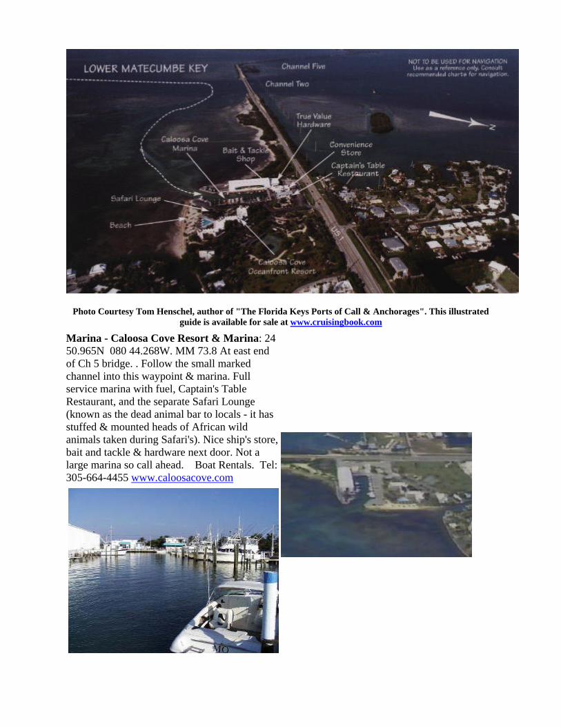
Photo Courtesy Tom Henschel, author of "The Florida Keys Ports of Call & Anchorages". This illustrated
guide is available for sale at www.cruisingbook.com Marina - Caloosa Cove Resort & Marina: 24 50.965N 080 44.268W. MM 73.8 At east end of Ch 5 bridge. . Follow the small marked channel into this waypoint & marina. Full service marina with fuel, Captain's Table Restaurant, and the separate Safari Lounge (known as the dead animal bar to locals - it has stuffed & mounted heads of African wild animals taken during Safari's). Nice ship's store, bait and tackle & hardware next door. Not a large marina so call ahead. Boat Rentals. Tel: 305-664-4455 www.caloosacove.com

INDIAN KEY AND INDIAN KEY ANCHORAGE Indian Key Anchorage: 24 52.681N, 80 40.807W. Approximate. Protected some in E or NW winds. Exposed to others. 5’ at approx MM 78.2 on US 1. About 25-30 SM N of Marathon (E). Have 3-5 mooring buoys from State Park - check for security if used. Dock still out as of 3/00 but can pull dinghy ashore or wade ashore for self guided tour of Island. We used the East side of the Island to dinghy in, wade the last few yards, and tie up to a bench or tree.

Photo Courtesy Tom Henschel, author of "The Florida Keys Ports of Call & Anchorages". This illustrated guide is available
for sale at www.cruisingbook.com
Indian Key Anchorage / Moorings: 24 52.681N 080 40.807W Reasonable protection from East and from NW, exposed when winds/waves Southeast to Southwest. Mooring buoys available. About MM 78.2 at lower Matecumbe Key. Dock unusable 3/00 but can take dinghy around to East side to wade in & tie to trees. Whole small city used to be here. Contains Ruins & self guided tour with plaques. 03/00
Restaurant/Bars near Indian Key & Lignum Vitae
Papa Joe’s Lounge & Restaurant. MM 79.7 at Tea Table Relief, Gulfside. Dockage. (about 2+nm from Indian Key) Robbie’s Restaurant - right at highway by Indian Key Anchorage - no bar. Dockage (famous feed the Tarpon place.) Good breakfasts, & serve lunch & dinner. Islamorada Fish Company - at Worldwide sportsman. MM 81.4. Restaurant & small bar. Anchor out & dinghy in. Very shallow bay there. Can anchor at the Lorelei anchorage and dinghy in from there with a powered dinghy. Caloosa Cove Marina, Bar & Rest: approx MM 73.8, 24 50.965N 080 44.268. Tel: 305-664-8057 Marina there - have to check with dockmaster for availability of dockage. No anchorage around there - it’s at channel for Channel 5 bridge. Have Ray Lynn’s Restaurant (previously JP’s) and Safari Lounge (locally known as dead animal bar). Also ship’s store & hardware next door.
CHART: 11449 1 ICW Matecumbe to Grassy Key

INDIAN KEY STATE HISTORICAL SITE
Photo Courtesy Tom Henschel, author of "The Florida Keys Ports of Call & Anchorages".
• An observation tower, boat dock, shelter and trails are provided; however, there are no restrooms or picnic facilities.
• Most facilities are not handicapped accessible.
• Guided tours will probably resume when the docks have been repaired (as of 03/00)
• Call 305-664-4815 for more info.
(Info courtesy of Florida Dept of Environmental Protection, Division of Recreation and Parks)
Indian Key is located about3/4 of a mile in a southeasterly direction from the north shore of Lower Matecumbe Key. Only slightly more than 10 acres in size and separated from the Overseas Highway by open water, it hardly looks like a place of historic significance. Yet Indian Key has had a colorful past which is very much a part of early Florida History. It dates from the time of prehistoric Indians to the 1830's, when this small key was the seat of newly created Dade County. The foundations of buildings and cisterns on the island date back to this prosperous time. Through archaeological excavations, it is known that Indians lived in the Keys for several thousand years before the arrival of the Spanish explorers. When Ponce de Leon discovered Florida in 1513,he found a quick way for Spanish vessels to return home with their cargo of treasure taken from the Maya, Inca and Aztec empires: the Straits of Florida and the Gulf Stream. It was a dangerous route for the cumbersome Spanish sailing vessels because of the coral reefs lining the south Florida coast and the constant threat of Hurricanes. At the time, hostile Calusa Indians lived in the Keys. They became the first to profit from vessels wrecked on the offshore reefs.
By the time of the brief English occupation of Florida starting in 1763, however, the Calusas had disappeared from the Keys. Bahamian fisherman and turtlers took their place, making salvage a way of life. "Wrecking" proved to be a profitable business; so lucrative, in fact, that it attracted pirates who soon became a threat to merchant vessels. American occupation of Florida in 1821 stopped the pirate's activities. In addition, American wreckers drove the Bahamians out of business in the Keys and monopolized it themselves. Key West was the main wrecking station in south Florida and became a wealthy community from the profits of salvage. The monopoly of Key West was challenged by a man named Jacob Houseman. Having arrived from Staten Island in one of his father's ships which he "borrowed", he found wrecking to his taste. After disagreements with the Key West establishment, which accused him of various shady business maneuvers, he thought it best to own his own wrecking station. The strategic location of Indian Key, nearby fresh water on Matecumbe and proximity to the most dangerous reefs, made it ideal for Houseman's plans. He bought the island in 1831 and began to build his own small empire. This included a thriving store, hotel and dwellings with cisterns, as well as warehouses and wharves. Housman turned Indian Key into a busy port with 40-50 permanent inhabitants. He even brought soil to the rocky island and landscaped it with tropical plants. Housman's profits from his business venturs and wrecking were substantial. Eventually, there were more disputes with the Key Westers, who again accused him of illegal conduct as a wrecker. In an effort to make his island independent of Key West, he had the Legislative Council establish Dade County in 1836, with Indian Key as the county seat. In spite of his success Housman's fortunes began to decline. He lost numerous court battles and eventually his wrecker's license. At the outbreak of the Second Seminole War in 1835, he also lost his Indian trade. In the end, he had to mortgage the island. In 1838, Dr. Henry Perrine, a physician with a consuming interest in tropical botany, moved to Indian Key to await the end of the war. He wanted to use a government grant to cultivate useful tropical plants on the mainland. Perrine's special interest lay in cultivating agave for the manufacture of hemp, but he also included many others, such as tea, coffee, bananas and mangos, in his plans. While waiting for the war's end, he started a nursery on Matecumbe. As the war continued, Houseman's island became an endangered outpost because of the well-stocked store and warehouses. He asked for government protection. Eventually, military forces were stationed at nearby Tea Table Key. They proved of little value, however, in the events that followed. In the early morning of August 7, 1840, a band of more than 100 Indians attacked the island. Most of the inhabitants, including Housman and his wife, managed to escape. However, some were killed in the attack and subsequent looting and burning of the buildings. Dr. Perrine hid his family in a turtle kraal below the house, where they survived the attack. He was not so fortunate. After a futile attempt to talk to the Indians, he was killed and the house set on fire. Except for one building and the stone foundations, all the structures on Indian Key were destroyed during the attack. As the survivors learned too late, the garrisons at Tea Table Key had been reduced to five able men a few days before. Although some of the inhabitants returned to the island after the incident, Housman did not. Instead, he sold Indian Key and returned to Key West, where he served as a crew member on a wrecking vessel. In 1841, during salvage operations in rough seas, he was accidentally crushed between two ships. Indian Key has remained uninhabited since the early part of last century. Gradually, Dr. Perrine's plants have grown over the ruins.

Indian Key Channel - South, from Oceanside approach 24 52.584 080 40.215 (see photo below)
Anchorage at Indian Key AND Lignum Vitae - 24 52.681N 080 40.807W. This is just to the west of Indian Key in about 5' of water off lower Matecumbe Key about mile marker 78.2 on US1. Provides access to historical Indian Key on oceanside, and Lignum Vitae on gulfside. Very exposed for oceanside wind/waves from SE through SW. Mooring buoys have been placed here by the park service. (Also see Lignum Vitae anchorage under Gulfside upper Keys - it's just across the bridge from here)
Indian Key: http://www.dep.state.fl.us/parks/district5/indiankey/index.asp ,
Lignum Vitae: http://thefloridakeys.com/parks/lignum.htm
CLICK HERE for an info sheet about this destination, regarding bridge clearances, distances, nearby restaurants-bars, things do, etc.. Includes Pictures of Lignum Vitae. CLICK HERE for a chart view of the anchorage on the Indian Key side, and a labeled aerial photo.
Indian Key (foreground), Lignum Vitae (top right) Looking North from Oceanside to Bayside
Robbies Marina & Tarpon Feeding, & The Hungry Tarpon Restaurant (photo below) 24 52.970N 080 41.442W (At the West end of the bridge between Lignum Vitae and Indian Key. CLICK HERE for a chart view showing its location)

www.robbies.com
Alligator Light 24 51.100 080 37.100
Outback Restaurant at Hampton Inn - 24 53.979N 080 39.325 W (street side) - 305-664-0073. Small boat dock. Restaurant, Tiki Bar. Also "It's-a-Dive" dive shop on site.
Cheeca Lodge & Spa: 24 54.998N 080 38.019W (street side) . Upscale Resort & Restaurant. www.cheeca.com 305-664-4651. MM 82 Islamorada Cheeca Lodge Webcam: http://www.fla-keys.com/webcams/cheeca/index.htm
GULFSIDE: Middle Keys
(also see the "Backcountry" pages listed above for more locations Gulfside)
Cudjoe Channel approach - out in approx. 20’ water 24 46.483N 081 33.598W
Between R30/G29, N of Bahia Honda Bridge (gulfside) ICW 24 41.953N 081 16.469W
Bahia Honda Channel (gulfside) - First (Southernmost) approach into channel ( 1st waypoint from ICW) 24 44.140N 081 14.630W Final approach into channel ( 2nd waypoint from ICW) 24 45.980N 081 16.040W
Moser Channel Approach from North (7 mi bridge), 1/4 mi North of bridge 24 42.305N 081 10.064W LORAN:14016.5 43460.2
R22 - ICW, N of 7 mi Bridge 24 43.066N 081 09.189W
Between R22/G21 - ICW, N of 7 mi Bridge 24 43.064N 081 09.187
R24 - ICW, N of 7 mi Bridge 24 42.635N 081 11.167W
R26 - ICW, N of 7 mi Bridge 24 42.189N 081 13.310W

Knight’s Key Channel, South Side- between pillars 7-8 on 7 mi bridge (outside of fishing from bridge sign) 24 42.409N 081 07.630W
Knight’s Key Channel, North Side - between pillars 7-8 on 7 mi bridge 24 42.476N 081 07.585W
Knight’s Key Channel - just E of Shoal Mark, used when heading N/S 24 42.978N 081 07.427W
Knight’s Key Shoal - 1/8 mi N of Shoal Mark, used when heading E/W 24 42.998N 081 07.603W
Faro Blanco Oceanside, approach from West 24 42.881N 081 06.386W
R12, ¾ mi West of Red Bay Bank 24 45.299N 081 10.464W
Between R18-G17, Bethel Bank 24 44.339N 081 06.325W
G17, Bullard Bank 24 48.960N 081 09.245W
Rachel Key - ¼ mi North of Key 24 43.867N 081 04.750W
Bowlegs Cut @ Peterson Key Bank (Lower Matecumbe), middle set of daymarks LORAN: N 24:54:31 W 80:44:14
Gulfside: Middle Keys - to Upper Keys
Anchorage at Lignum Vitae: 24 52.681N 080 40.807W just off lower Matecumbe Key at mile marker 78.2 on US1. Directly across bridge from Indian Key on oceanside. Anchor on NW of island. Mooring buoys have been placed here by the park service. The State conducts guided tours twice daily at 10am and 2pm. The March 2000 cost is only $1 if you come to the dock on the E side by your own boat. You can only dock there at the time of these tours. Nice hardwood hammock and historical island. Lots of mosquitoes reported! - take repellant. CLICK HERE for an info sheet about this destination, regarding bridge clearances, distances, nearby restaurants-bars, things do, etc..
R90 - ICW - West End of Steamboat Channel 24 56.388N 080 40.042W R86 - ICW - East End of Steamboat Channel 24 56.648N 080 39.547W
Anchorage at Shell Key: 24 55.480N 080 40.215W gulfside, between Lignum Vitae (above) and the Lorelei Restaurant (below). This is a state owned Bird Sanctuary. You are not allowed on the island, but can bird watch from you boat or dinghy. Several mooring buoys have been placed here by the park service. Very exposed from the North. CLICK HERE for an info sheet about this destination, regarding bridge clearances, distances, nearby restaurants-bars, things do, etc..
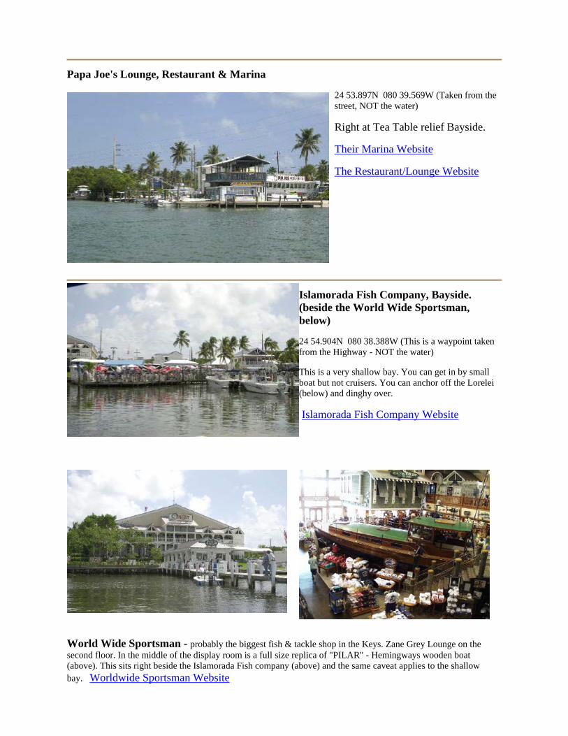
Papa Joe's Lounge, Restaurant & Marina
24 53.897N 080 39.569W (Taken from the street, NOT the water)
Right at Tea Table relief Bayside.
Their Marina Website
The Restaurant/Lounge Website
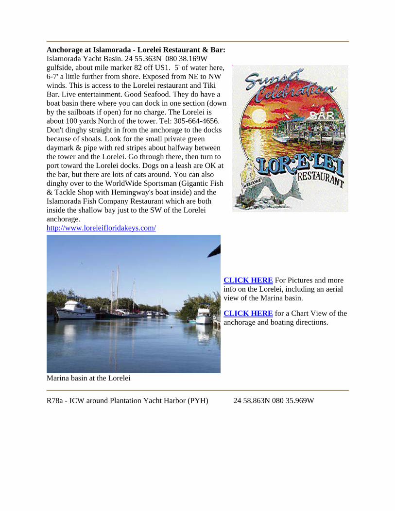
Islamorada Fish Company, Bayside. (beside the World Wide Sportsman, below)
24 54.904N 080 38.388W (This is a waypoint taken from the Highway - NOT the water)
This is a very shallow bay. You can get in by small boat but not cruisers. You can anchor off the Lorelei (below) and dinghy over.
Islamorada Fish Company Website
World Wide Sportsman - probably the biggest fish & tackle shop in the Keys. Zane Grey Lounge on the second floor. In the middle of the display room is a full size replica of "PILAR" - Hemingways wooden boat (above). This sits right beside the Islamorada Fish company (above) and the same caveat applies to the shallow bay. Worldwide Sportsman Website
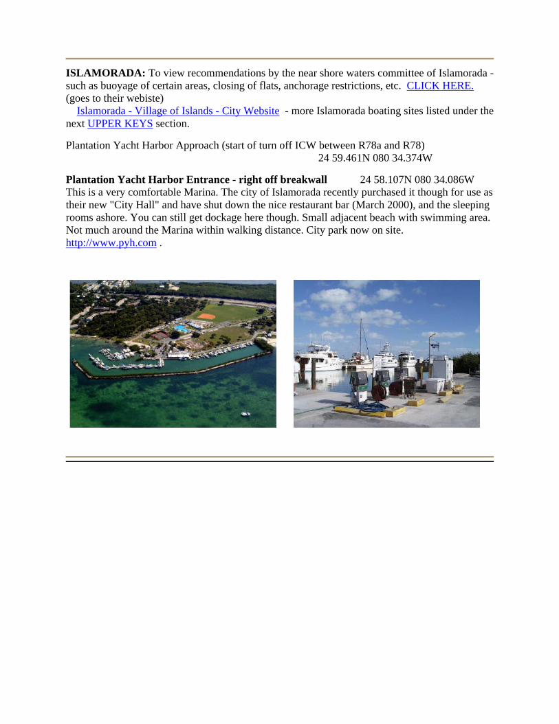
Anchorage at Islamorada - Lorelei Restaurant & Bar: Islamorada Yacht Basin. 24 55.363N 080 38.169W gulfside, about mile marker 82 off US1. 5' of water here, 6-7' a little further from shore. Exposed from NE to NW winds. This is access to the Lorelei restaurant and Tiki Bar. Live entertainment. Good Seafood. They do have a boat basin there where you can dock in one section (down by the sailboats if open) for no charge. The Lorelei is about 100 yards North of the tower. Tel: 305-664-4656. Don't dinghy straight in from the anchorage to the docks because of shoals. Look for the small private green daymark & pipe with red stripes about halfway between the tower and the Lorelei. Go through there, then turn to port toward the Lorelei docks. Dogs on a leash are OK at the bar, but there are lots of cats around. You can also dinghy over to the WorldWide Sportsman (Gigantic Fish & Tackle Shop with Hemingway's boat inside) and the Islamorada Fish Company Restaurant which are both inside the shallow bay just to the SW of the Lorelei anchorage. http://www.loreleifloridakeys.com/
Marina basin at the Lorelei
CLICK HERE For Pictures and more info on the Lorelei, including an aerial view of the Marina basin.
CLICK HERE for a Chart View of the anchorage and boating directions.
R78a - ICW around Plantation Yacht Harbor (PYH) 24 58.863N 080 35.969W
ISLAMORADA: To view recommendations by the near shore waters committee of Islamorada - such as buoyage of certain areas, closing of flats, anchorage restrictions, etc. CLICK HERE. (goes to their webiste) Islamorada - Village of Islands - City Website - more Islamorada boating sites listed under the next UPPER KEYS section.
Plantation Yacht Harbor Approach (start of turn off ICW between R78a and R78) 24 59.461N 080 34.374W
Plantation Yacht Harbor Entrance - right off breakwall 24 58.107N 080 34.086W This is a very comfortable Marina. The city of Islamorada recently purchased it though for use as their new "City Hall" and have shut down the nice restaurant bar (March 2000), and the sleeping rooms ashore. You can still get dockage here though. Small adjacent beach with swimming area. Not much around the Marina within walking distance. City park now on site. http://www.pyh.com .

KEYS – Upper Keys from Islamorada to Key Biscayne
Whale Harbor Restaurant: 24 56.246N 080 36.738W - This has an All-You-Can-Eat Seafood Buffet that is well know through the Keys. Also there is the Dockside Restaurant upstairs on the same property. A charter marina is there adjoining the Channel, but call ahead to see if there is anyplace to tie up to come in to dinner. http://www.keysdirectory.com/whaleharbor/
ISLAMORADA: To view recommendations by the near shore waters committee of Islamorada - such as buoyage of certain areas, closing of flats, anchorage restrictions, etc. CLICK HERE. (goes to their webiste) Islamorada - Village of Islands - City Website - more Islamorada boating sites listed under the previous MIDDLE KEYS section.
Whale Harbor Anchorage: ~ 24 56.586N 080 36.534W On the North (Bay) side of the bridge - about 5' of water, view is looking North.
Looking North at Whale Harbor Sandbar, Oceanside of Whale Harbor
SANDBAR - Approximate: 24 56.067N 080 35.954W (used mark channel to start in, then divert to sandbar)
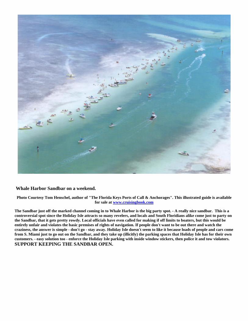
Whale Harbor Sandbar on a weekend.
Photo Courtesy Tom Henschel, author of "The Florida Keys Ports of Call & Anchorages". This illustrated guide is available for sale at www.cruisingbook.com
The Sandbar just off the marked channel coming in to Whale Harbor is the big party spot. - A really nice sandbar. This is a controversial spot since the Holiday Isle attracts so many revelers, and locals and South Floridians alike come just to party on the Sandbar, that it gets pretty rowdy. Local officials have even called for making if off limits to boaters, but this would be entirely unfair and violates the basic premises of rights of navigation. If people don't want to be out there and watch the craziness, the answer is simple - don't go - stay away. Holiday Isle doesn't seem to like it because loads of people and cars come from S. Miami just to go out on the Sandbar, and they take up (illicitly) the parking spaces that Holiday Isle has for their own customers. - easy solution too - enforce the Holiday Isle parking with inside window stickers, then police it and tow violators. SUPPORT KEEPING THE SANDBAR OPEN.

Holiday Isle Beach Resorts & Marina: 24 56.510N 080 36.379W (street side) - MM 84.5 This is a major party place. Includes several hotels. Big time tourist & college kid spot. Party area. Theater of the Sea next door. www.holidayisle.com
Photo Courtesy Tom Henschel, author of "The Florida Keys Ports of Call & Anchorages". This illustrated guide is available for sale at www.cruisingbook.com
Theater of the Sea (attraction): 24 56.558N 080 36.362W (street side). MM 84.5 Islamorada. Marine Park & Tropical Gardens. Swim with Dolphins. Rays, turtles & lots more on display. Family oriented place. Can access through Holiday Isle Resorts docks if they'll allow it.
Pelican Cove Resort: 24 56.628N 080 36.294W (street side). Upscale Resort with small boat dock, ramp, restaurant. www.pcove.com view their LIVE WEBCAM
Smuggler's Cove Motel & Marina: 24 57.149N 080 35.326. Restaurant & Marina at Snake Creek, Bayside. MM 85.5 Islamorada. Full service marina, Tiki Bar, fuel, dive boat. www.florida-keys.fl.us/smugglerscove.htm
Snake Creek Drawbridge 24 57.130N 080 35.263 at Center of Bridge Vertical Clearance Charted at 27'
Plantation Yacht Harbor: 24 57.965N 080 34.085W (at entrance to basin). Bayside Marina with about 80 slips. No restaurant, lounge or store. Part of Islamorada Founders park with pool, tennis courts, baseball field. Small adjacent beach with swimming area.
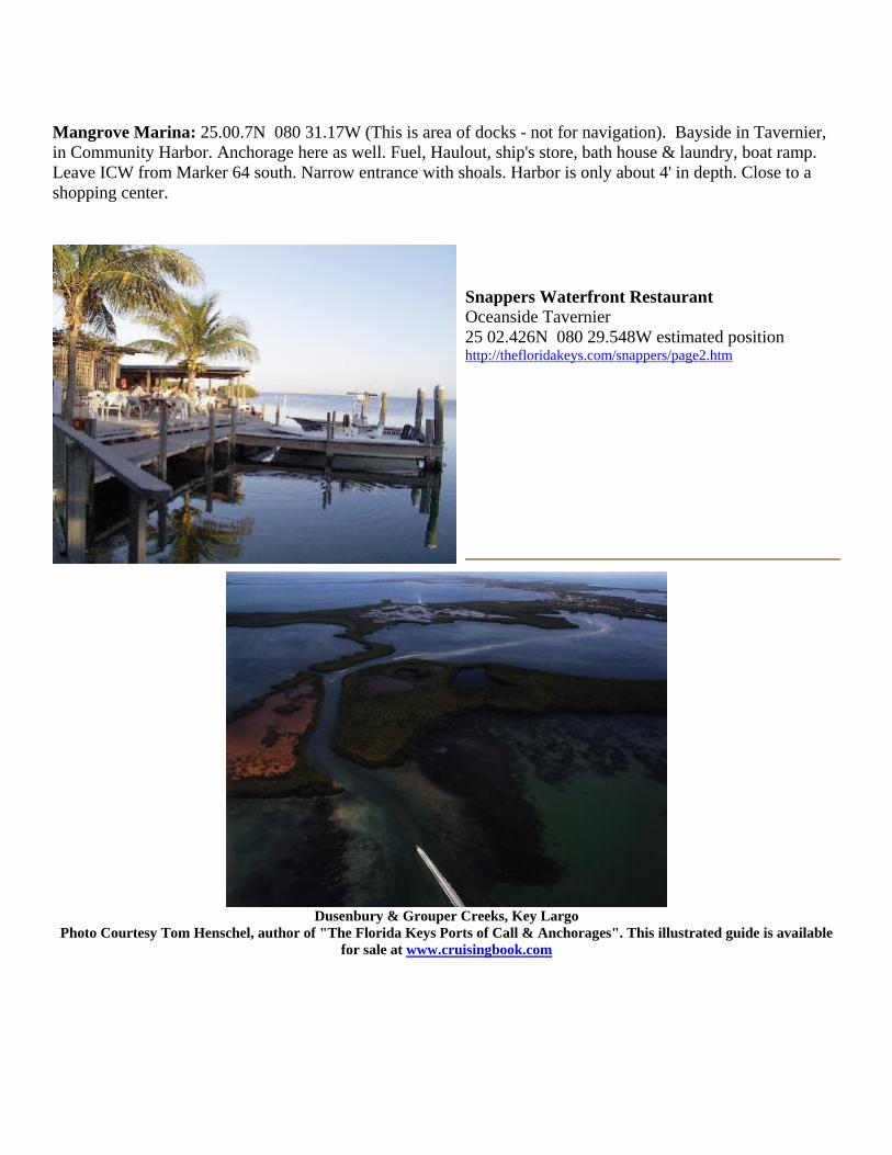
Mangrove Marina: 25.00.7N 080 31.17W (This is area of docks - not for navigation). Bayside in Tavernier, in Community Harbor. Anchorage here as well. Fuel, Haulout, ship's store, bath house & laundry, boat ramp. Leave ICW from Marker 64 south. Narrow entrance with shoals. Harbor is only about 4' in depth. Close to a shopping center.
Snappers Waterfront Restaurant Oceanside Tavernier 25 02.426N 080 29.548W estimated position http://thefloridakeys.com/snappers/page2.htm
Dusenbury & Grouper Creeks, Key Largo
Photo Courtesy Tom Henschel, author of "The Florida Keys Ports of Call & Anchorages". This illustrated guide is available for sale at www.cruisingbook.com

Grouper Creek, Key Largo Area Bayside Photo courtesy Capt Frank Danisi Grouper Creek - S. Entrance - ICW 25 07.277N 080 26.774W
Dusenbury Creek - North Side - ICW 25 08.642N 080 25.430W
MARINA - Gilbert's Resort - 25 10.998N 080 23.331W . 305-451-1133. www.gilbertsresort.com . Right at the entrance to the Florida Keys from the 18 mile stretch to Florida City, at the US 1 drawbridge at Jewfish Creek. Private beach, marina, dockage, waterfront Tiki Bar, live entertainment, swimming pool, restaurant, small trail and caged birds for the kids to look at. Nice Cuban restaurant on the other side of the channel (Latin American Bar/Grille). Tel 305-451-1133, 800-274-6701.
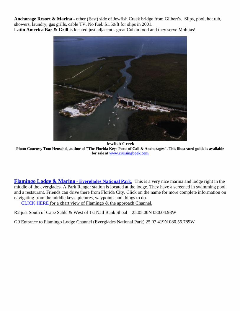
Anchorage Resort & Marina - other (East) side of Jewfish Creek bridge from Gilbert's. Slips, pool, hot tub, showers, laundry, gas grills, cable TV. No fuel. $1.50/ft for slips in 2001. Latin America Bar & Grill is located just adjacent - great Cuban food and they serve Mohitas!
Jewfish Creek
Photo Courtesy Tom Henschel, author of "The Florida Keys Ports of Call & Anchorages". This illustrated guide is available for sale at www.cruisingbook.com
Flamingo Lodge & Marina - Everglades National Park. This is a very nice marina and lodge right in the middle of the everglades. A Park Ranger station is located at the lodge. They have a screened in swimming pool and a restaurant. Friends can drive there from Florida City. Click on the name for more complete information on navigating from the middle keys, pictures, waypoints and things to do. CLICK HERE for a chart view of Flamingo & the approach Channel.
R2 just South of Cape Sable & West of 1st Natl Bank Shoal 25.05.00N 080.04.98W
G9 Entrance to Flamingo Lodge Channel (Everglades National Park) 25.07.419N 080.55.789W
KEYS OCEANSIDE: Upper Keys (Also look up the Dive Sites for places in the upper Keys)
Boat Ramps in the Upper Keys: Barnes Sound, MM 111 Bayside 18 mile stretch. (Everglades National Park - No PWC)
Atlantic Blvd, MM 106.5 John Pennekamp State Park, MM 102.5 Oceanside
Sunset Point Park, MM 95.2 Sunset Point, MM 95.2 Bayside Harry Harris County Park, MM 92.5 Oceanside
Pelican Cove Resort, MM 84.5 Oceanside, Islamorada Indian Key Fill, MM 78.8 Bayside Mangrove Marina, Bayside
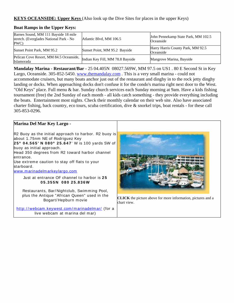
Mandalay Marina - Restaurant/Bar - 25 04.405N 08027.569W, MM 97.5 on US1 . 80 E Second St in Key Largo, Oceanside. 305-852-5450. www.themandalay.com . This is a very small marina - could not accommodate cruisers, but many boats anchor just out of the restaurant and dinghy in to the rock jetty dinghy landing or docks. When approaching docks don't confuse it for the condo's marina right next door to the West. "Old Keys" place. Full menu & bar. Sunday church services each Sunday morning at 9am. Have a kids fishing tournament (free) the 2nd Sunday of each month - all kids catch something - they provide everything including the boats. Entertainment most nights. Check their monthly calendar on their web site. Also have associated charter fishing, back country, eco tours, scuba certification, dive & snorkel trips, boat rentals - for these call 305-853-0296. Marina Del Mar Key Largo - R2 Buoy as the initial approach to harbor. R2 buoy is about 1.75nm NE of Rodriguez Key 25º 04.565' N 080º 25.647' W is 100 yards SW of buoy as initial approach. Head 350 degrees from R2 toward harbor channel entrance. Use extreme caution to stay off flats to your starboard. www.marinadelmarkeylargo.com
Just at entrance OF channel to harbor is 25 05.355N 080 25.836W
Restaurants, Bar/Nightclub, Swimming Pool, plus the Antique "African Queen" used in the
Bogart/Hepburn movie
http://webcam.keywest.com/marinadelmar/ (for a live webcam at marina del mar)
CLICK the picture above for more information, pictures and a chart view.

Key Largo & Largo Sound
Photo Courtesy Tom Henschel, author of "The Florida Keys Ports of Call & Anchorages". This illustrated guide is available for sale at www.cruisingbook.com
John Pennekamp Coral Reef State Park - www.pennekamppark.com - based at MM 102.5 in Key Largo, this is America's first undersea park, extending about 3 miles out to sea to the reef, and 25 miles long. The visitor information center and marina in Key Largo offers glass bottom boat rides, snorkel and scuba trips, on-site camping, a boat ramp, kayak and canoe trails and rentals and a couple small beaches in the sound. Mooring buoys are placed in Key Largo Sound and managed by the park. Fees are about $15/night in 2002. Limited dockage is available as well with 2002 rates at $25 and $50/night. The park headquarters, marina basin and moorings in Largo Sound are entered via South Sound Creek. At Green Daymark G19 in the creek, it splits left and right. The left branch goes up into the marina basin and park office. The right branch goes out into Largo Sound to the mooring buoys. The R2 Daymark entrance to Sound Creek is at 25 05.775N; 80 23.837W. CLICK HERE for a graphic diagram of the Park's facilities and more information. Go to the DIVING SITES pages to see graphics of the mooring buoy layouts on the reef dive/snorkel spots,
han the few we've listed here in cruising.
and MANY MORE dive/snorkel spots t
Key - Key Largo
d for anchoring when it's in the Lee. There are
Rodriguez
The North side (right shown here) is gooa couple submerged wrecks (seen in this photo) so watch the charts. 25 03.335N 080 27.384W (approximate - anchor on the North side of the Island).
Photo Courtesy Tom Henschel, author of "The Florida Keys Ports of Call & Anchorages". This illustrated guide is available for sale at www.cruisingbook.com
Dry Rocks Reef (Christ of the Abyss) - Pennekamp Park 25 07.361N 080 17.843W
R6, Elbow Reef - Pennekamp Park 25 08.700N 080 1.500W
Carysfort Light & Reef 25 13.300N 080 12.700W
Turtle Reef - Pennekamp Park 25 16.54N 080 12.493W
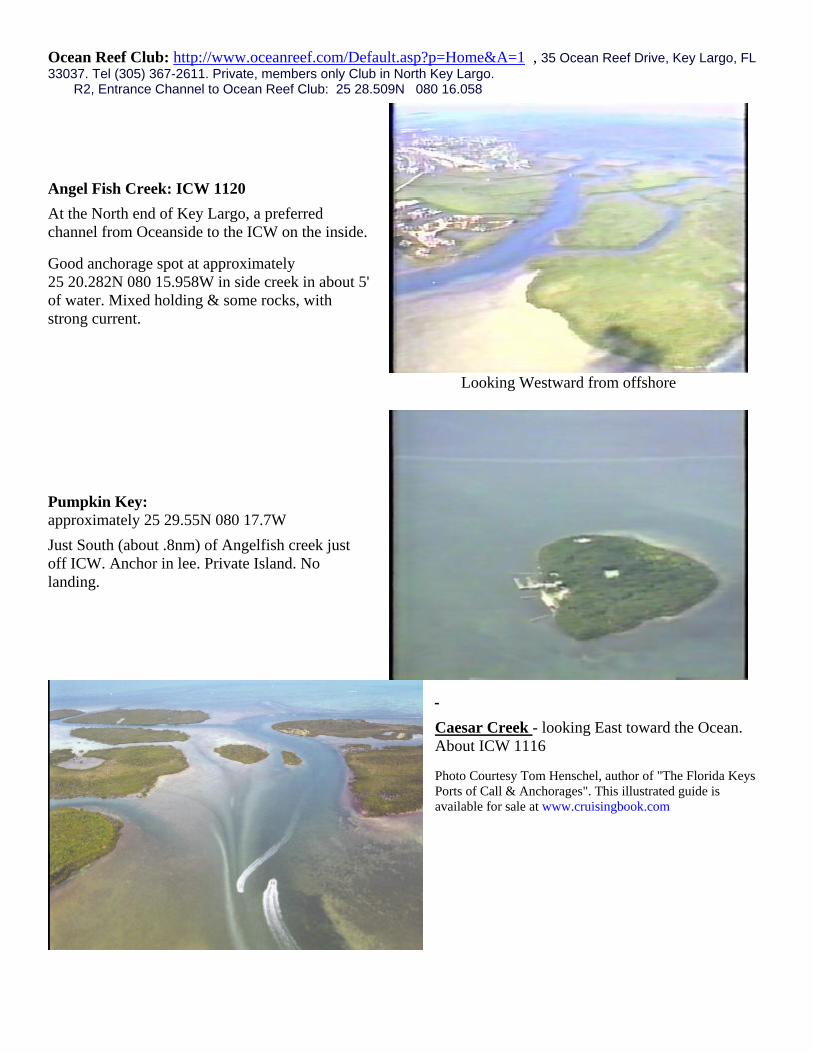
Ocean Reef Club: http://www.oceanreef.com/Default.asp?p=Home&A=1 , 35 Ocean Reef Drive, Key Largo, FL 33037. Tel (305) 367-2611. Private, members only Club in North Key Largo. R2, Entrance Channel to Ocean Reef Club: 25 28.509N 080 16.058
Angel Fish Creek: ICW 1120 At the North end of Key Largo, a preferred channel from Oceanside to the ICW on the inside.
Good anchorage spot at approximately 25 20.282N 080 15.958W in side creek in about 5' of water. Mixed holding & some rocks, with strong current.
Looking Westward from offshore
Pumpkin Key: approximately 25 29.55N 080 17.7W Just South (about .8nm) of Angelfish creek just off ICW. Anchor in lee. Private Island. No landing.
Caesar Creek - looking East toward the Ocean. About ICW 1116
Photo Courtesy Tom Henschel, author of "The Florida Keys Ports of Call & Anchorages". This illustrated guide is available for sale at www.cruisingbook.com
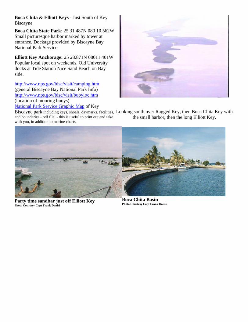
Boca Chita & Elliott Keys - Just South of Key Biscayne Boca Chita State Park: 25 31.487N 080 10.562WSmall picturesque harbor marked by tower at entrance. Dockage provided by Biscayne Bay National Park Service
Elliott Key Anchorage: 25 28.871N 08011.401WPopular local spot on weekends. Old University docks at Tide Station Nice Sand Beach on Bay side.
http://www.nps.gov/bisc/visit/camping.htm (general Biscayne Bay National Park Info) http://www.nps.gov/bisc/visit/buoyloc.htm (location of mooring buoys) National Park Service Graphic Map of Key Biscayne park including keys, shoals, daymarks, facilities, and boundaries - pdf file. - this is useful to print out and take with you, in addition to marine charts.
Looking south over Ragged Key, then Boca Chita Key with the small harbor, then the long Elliott Key.
Party time sandbar just off Elliott Key Photo Courtesy Capt Frank Danisi
Boca Chita Basin Photo Courtesy Capt Frank Danisi

Key Biscayne: Bill Baggs Cape Florida State Recreation area. 25 39.990N 080 09.463W (This GPS is ON SHORE at the park) Lighthouse shown at right. 305-361-5811. Pavilions for picnicking, 1 1/4 mi Atlantic sandy beach, Lighthouse Cafe, Boaters cafe, lighthouse tours, rentals, showers, laundry, bait & tackle. http://www.dep.state.fl.us/parks/district5/billbaggscape/index.aspNo Name Harbor: 25 40.613N 080 09.792W (This GPS is INSIDE the harbor). Managed by the Florida State Parks, and related to the Bill Baggs park listed above. Recommended by the Key Biscayne Yacht Club.
Hurricane Harbor: 25 41.223N 080 10.414W (This GPS is INSIDE the harbor). Recommended by the Key Biscayne Yacht Club.
Key Biscayne Anchorage: 25 41.668N 080 10.520W Just South of the Key Biscayne Yacht Club and recommended by them.
Key Biscayne Yacht Club: 25 41.960N 080 10.145W. 305-361-9171. Private Club - reciprocity with other Florida Council Yacht Clubs and some others - call ahead. .6/ft/day. plus elec. (2000) Pool. VHF 16/68/14. 9am-12am. Rest/Bar. Jackets dining room Nov. 15 to Easter. Long walk to 3 shopping centers. Sonesta Bch Hotel nearby. several anchorages nearby.
South Florida - West Coast - heading South
Cape Romano - 9 miles West of Cape, to avoid near shore shoals 25 52.600N 081 52.000W
San Carlos Light 26 25.100N 081 57.500W
Cape Sable - 2 miles West of R4 25 12.780N 081 13.820W
Shark River Approach - ¾ mi West of River (little shark river) 25 19.110N 081 10.200W Shark River G1 (little shark river) & Tarpon Bay 25 19.327N 081 09.222W ANCHORAGES IN EVERGLADES NATIONAL PARK Good overnight anchorage just inside the channel (see cruising guides) - Great anchorage about 10 miles up the river in Tarpon Bay & Harney River. Make sure you have the charts all the way up the river into Tarpon Bay - otherwise there's a good chance you'll get lost trying to come back out. You can carry 6' at high tide up the river. Watch out for mosquitoes and alligators! CLICK HERE for an info sheet about this destination, regarding, distances, waypoints. Includes pages of charts for the area, and satellite photos. South Florida - East Coast
Miami - MOA, approach from offshore to inlet 25 46.157N 080 05.051W
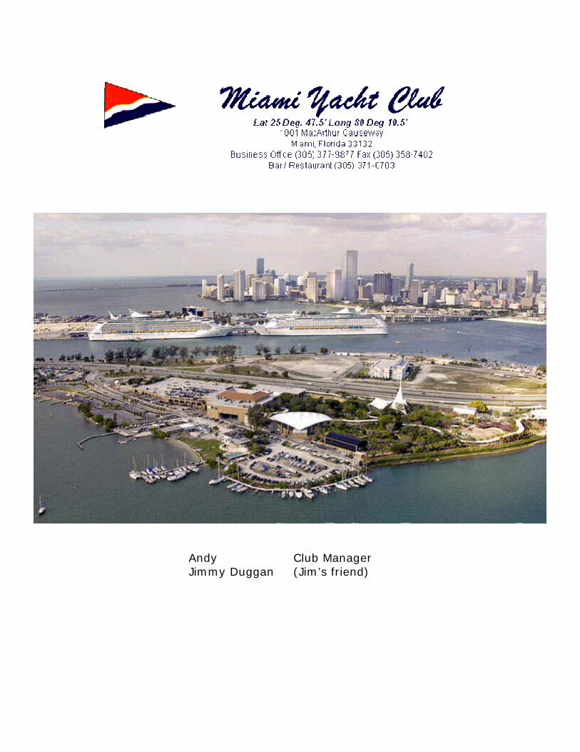
Andy Club Manager Jimmy Duggan (Jim’s friend)

Bahamas Introduction and Links
For a listing of lots of Bahamian Marinas and Dive Facilities,
go to the BOATING LINKS page on this website, of Cruising Locations, Marinas etc.,
and scroll down to the Bahamas listings.
For a listing of Bahamas Marine Weather Broadcasts, CLICK HERESSB, VHF and AM frequencies & times
Also see www.bahamas.com (800-327-7678) for Private Pilot Video
& CD-ROM Diving Guide
Aug 2003: Roger Treco of the Bahamas Tourist Bureau does not support the fee
increases for boats traveling to the Bahamas. He'd like to hear from all with an opinion. E-Mail [email protected]
Crossing The Gulf Stream
Bahamas Paperwork & Rules
Books and Charts US Customs Decal Application
Cay Sal Bank
This section is not meant to be exhaustive on Cruising the Bahamas. It's a start on getting you there. Bahamas cruising is great, but I'd like to share my bias with you. If you buy the Cruising Guides to the Bahamas you'll get listings of primarily Marinas and places to go shopping and spend money. If that's what you want, then great. That's NOT what I like about the Bahamas -- its the endless, open tropical seas with isolated beaches and remote anchorages, friendly people in the out islands, abundant marine life and mesmerizingly clear water - like your boat is floating on a glass tabletop poised well over the fish and bottom. You won't find these discussed much in the Cruising Guides. In fact the Cruising Guides don't discuss the Cay Sal Bank AT ALL! - Maybe because there are no facilities there, anyplace to spend money, and therefore no advertising sponsors for the cruising guides. An exception is the Exumas Cruising guide by Steve Pavlidis - it has LOTS of information on great out-of-the-way places. Of course, pick your own style of cruising. I just want you to know that you won't get much information on what I consider is the best cruising, because there's no money in it. We like to anchor out for days or a week or two at a time, then spend a couple days in a nice port to re-supply, refuel and splurge on a dinner or two out - then back out to remote anchorages
Bahamas Air-Sea Rescue Association (BASRA): no website - BASRA, PO Box SS6247, Nassau, Bahamas. Send $30 donation to help them maintain our safety net.

Gulf Stream Crossing:
At its narrowest, its only about 50 miles from Florida to the Bahamas crossing the Gulf Stream. Preparation of the boat is imperative though. Ensure that everything is working properly and you have plenty of spare parts (you'll need these in the Bahamas anyway). These include your bilge pumps, electronics (especially communications & navigation) and safety equipment. The single most important factor though is weather. I've crossed the Gulf Stream a couple times when it was like glass - though I must say this is an exception and perhaps a gift from my guardian angels for having endured "less than optimum" seas in the past. On the other side it can get frighteningly nasty! This happens when a strong wind pushes directly against the strong current of the stream. This heaps up the seas making them very high and very steep - 15-20 foot seas would not be uncommon with 30+ knot winds coming from the North (the Gulf Stream flows about North/South if crossing from S. Florida to Bahamas, or about SWW/NEE if crossing from Key West to Cuba.) The key to a safe and reasonable comfortable crossing is in watching and waiting for a weather window. If crossing from the Ft Lauderdale/Miami area directly east, you'll want the winds to be out of the South, preferably at 10 knots or less (at least no more than 15 knots). To get this watch the weather for wind shifts. This also depends on how fast your boat is (the faster the better for crossing). The wind should be clocking around from the East through South. This gives you a little lead time to ensure its blowing from the South, to coincide with the current, when you're in the middle and the current is strongest. The Gulf Stream is not a static flow. It is a dynamic moving river whose boundaries change every day. You can watch the water temperature to see it go up a couple degrees when you're in to it. You can also watch the difference between your compass heading and course over ground on your GPS. It is VERY important to maintain awareness of this difference, which is the compensation for the strong 3+ knot current (probably 2.5 average) of the Gulf Stream. This will of course be a slight deviation to the South. In my slow boat this is about 15 degrees south of course. Electronics WILL fail at some point, its only a question of when. At the very least you should be able to dead reckon across the stream using this heading information to make an approximate landfall on either side. If you don't know how to do this, check into a U.S. Power Squadron course. Your compass is a critical piece of equipment and it should be a good one. Keep an eye on your speed made good and know when the approximate halfway point is (time wise) for safety on both sides. If something were to happen that you really had to head to port for you should be aware of whether its quicker to turn back or to forge ahead.
The time of year makes a significant difference. Summer is when the visibility is best and water the most calm. In the winter the seas kick up higher and more frequently. In the summer a forecast of of calm to light and variable winds will give you a great crossing. Leave first thing in the morning to minimize land-mass breezes and to sandbag some for making landfall by dark in case things go wrong and you get hung up. Unless you want to feel like you and your boat have been put through a blender, never cross when there is any northerly component to the wind (at least from S Florida to the Bahamas). The most common spots for jump off points from Florida are Stuart, Palm Beach, Fort Lauderdale and Miami.
There are several Bahamian ports of first approach from South Florida. Since many of the Islands are well inside the Bahamas bank, only the first portion of your crossing is actually in the Gulf Stream and the remainder is in the calmer waters of the Bahamas Bank. Bimini and S. Bimini is the closest being only 48 nm east of Miami. Cat Cay is 8 miles South of S. Bimini and is a smaller island with its own private club and customs check in. Walkers Cay is about 97 nm off Palm Beach and is the most Northern Island in the Bahamas. Here the Gulf Stream is the first 50 some miles and the remainder is in the Bahamas Bank (average 12-20 feet).
Assess your safety equipment. Lifejackets, flares, fire extinguishers, etc. are standard equipment most boaters have anyway (and require). Even though your VHF is supposed to work only about 25 miles offshore, the antennas from the Coast Guard in S. Florida are VERY high and your chances of contacting them or Bahamas is very good all the way across the Gulf Stream. A Single Side Band or Ham radio is even better, plus useful while cruising the Bahamas, but is not absolutely necessary. Likewise a Satellite Telephone is an excellent safety device, and convenient for cruising use, but not necessary. A GPS, and even a handheld backup GPS is very convenient and almost everyone uses them. However I want to caution you again on being able to Navigate on
your own if they bite the dust. You don't have to be pinpoint precise at dead reckoning but it's got to be workable to get you safely across if your GPS fails. A 406 MHz EPIRB is definitely worth considering. I frequently go across without one, but only because I don't have one, not because I wouldn't like it. Boat US has a rental program for its members if you don't want to spend the $1000 on an EPIRB. If you buy one ensure that its registered. At least a coastal life raft is another worthwhile consideration, but the practice of most people, including me, is to use your inflatable dinghy as the life raft for the crossing. We do make sure we put extra flares and supplies in the dinghy too. Quality flares are essential. Get at least the 25mm aerial flares - forget about relying on the 12ga flares. We carry the more expensive SOLAS flares including the parachute flares. If I'm sitting in an inflatable dinghy with my family in the middle of the night and see a freighter in the distance, I don't want to be thinking about the $80 I saved on flares by buying the cheap ones!
Bahamas Paperwork & Rules:
• Need Passport, or Certified Copy of Birth Certificate & Picture ID (for US Citizens), for everyone on board
• Hoist Yellow Quarantine Flag upon entering Bahamian waters. Everyone except Captain stays on board until paperwork completed, or until cleared to do so by Customs/Immigration. At that time Yellow Q flag can be replaced with the Bahamian courtesy flag.
• FEES - 2003 The fee for boaters for boats up to 35 feet is $150.00 and the fee for boats over 35 feet is $300. These fees are inclusive of a cruising permit, fishing permit and departure tax for up to four persons with no overtime charges for Customs or Immigration. Each additional person above four will be charged additional departure tax.
• Pets - allowed but you must have permit in advance and have it onboard. For application call 242-325-7413, Fax 242-325-3960, or write Director Dept of Agriculture, PO Box N-3704, Nassau Bahamas. $10 fee. Suggested 30 day lead time but we've done it with overnight mail in a week or so - call them first for a physical delivery address for FedEx.
• Returning to U.S. - Call US Customs at 800-432-1216 and fly Yellow Quarantine Flag. Take down the officers name and/or badge # and clearance number if they give it to you and log this in your ship's log with time and date. In case they mess up on their end, and try to hold you accountable later for "sneaking" in, this is your legal proof that you met your obligations. You also now have to physically check in with I.N.S - see below.
• US Customs Sticker - required for boats over 30 feet - the application form and contact information is available at the bottom of this page
US Re-entry Rules:
These have become really onerous since 9/11. You now have to come back in and physically drive to an INS office to check in with them, besides the customary phone check in with customs. (Webmasters note: this is ridiculous. I recently sponsored a training program in Ohio where we had to get special permission from a US embassy for an engineer from Jordan (Middle East) to attend the program. When they arrived in the US and called us, but then did not show up for the program, we called the INS because our name was associated with the Visa and they weren't where they were supposed to be. Our response from them was "it’s not our job" and "it would be too much trouble to track them down" -- and THIS is what we do to legal American Citizens coming back from the Bahamas - but ignore middle east males that ignore the terms of their Visas???? This is the system of the Bush administration - vote him out! (and I usually vote republican).)
US Customs Annual User Fee Decal Request: Click on it to open the .PDF file. Whether it's the Bahamas or Cuba, you need a Customs decal to re-enter the U.S. if you're over about 30 ft. Cost is $25 as of Jan 2002, and the application is current as of 2000. Inquiries can be directed to Customs for Decals at 317-298-1200 ext 1245 M-F 8-5 EST, or email to [email protected] . Directions are included on this 2 page form. Clicking on the title above will give you the Adobe. PDF file to read or print. See the notes above with US Customs regulations about the Adobe software. Click on the Adobe Icon if you don't have it.
Books and Charts: (Try looking at Blue Water Books and Charts to buy these)
• The Exuma Guide: by Stephen Pavlidis - Highly Recommended. Brief on Marinas and Money places. Long on Cruising and great Anchorages
• On and Off the Beaten Path - The Central and Southern Bahamas Guide: by Stephen Pavlidis - From Southern FL to the Turks and Caicos. Written like his other one on the Exumas. Highly Recommended.
• Bahamas GPS & Loran Handbook - On-site GPS readings (prior to SA being turned off) from BBA Chart Kit - 800-242-7854. Nice because, besides having actual GPS readings, it has good full-color aerial photos of the areas covered, with chartlets. Covers various sites in: 1. Grand Bahama and Abacos, 2. Eleuthera 3. New Providence, Berry's, Cat Cay & Bimini 4. Exumas. - Recommended (but pricey)
• Yachtsman's guide to the Bahamas: Lots of info, but mostly about Marinas and places to spend money. But it also has the rules listed and lots of very useful information on navigation in Bahamian waters, anchoring, pets, and procedures for Bahamian and US Customs that make it worthwhile to carry. About $40. Annual update
• Cruising Guide to the Abacos: by Steve Dodge. Includes chartlets and aerial photography. About $20. Annual update
• GPS-Loran Waypoint Guide - laminated one page guide to 100 of Bahamas and S Florida waypoints
• Maptech Chartkit Region #9, 5th Edition: All of the Bahamas to Turks and Caicos
• Waterproof Chart #120F: detailed navigation & fishing chart for Northern Bahamas
• The Dive Sites of the Bahamas - Comprehensive coverage of Diving and Snorkeling, McGraw-Hill.
CAY SAL BANK BAHAMAS (Midway between the Florida Keys, Cuba, and Bahamas)
Check back later - we'd like to go there to take pictures, gunkhole, get waypoints and make sketch charts. It's just 30 miles North of Cuba, and about 60 miles South of the Keys. This is the most remote area of the Bahamas. You won't even find it listed in any Bahamas Boating Guides - plus chart11461 of the area is very large 1:300,000! (no detail - but try chart # 27087 for a larger scale chart). Though patrolled by the USCG (drug & Cuban smuggling), the Bahamians have no facilities or patrols here at all. The Cay Sal Bank has one of the highest concentrations of blue holes in the world and spectacular vertical walls for diving. It offers great snorkeling and diving. It is a popular fishing spot for US Fisherman making day trips to the banks from the Keys. The bank is about 37x53 nautical miles across the entire bank, and about 142 nm in circumference. It is comprised of 8 named Island groups and several unnamed ones. If you get there before we do, please send back some photos and specific notes on anchoring, cruising & fishing & we'll post them here.