macgibbon before after - village of walton, new...
TRANSCRIPT

EWP Streambank Protection at MacGibbon Hollow Project Sites Before and After Photos
H:\Working Data\Floods, Major\EWP Program\2012 EWP Program\Walton\2 MacGibbon 4 sites\Photos\MacGibbon Before_After.docx
Site A
Photo 1: Looking upstream from right streambank at Site A and eroding streambank.
Photo 2: Looking upstream from MacGibbon Hollow Road after construction of rip rap along the streambank and floodplain on the left streambank.

EWP Streambank Protection at MacGibbon Hollow Project Sites Before and After Photos
H:\Working Data\Floods, Major\EWP Program\2012 EWP Program\Walton\2 MacGibbon 4 sites\Photos\MacGibbon Before_After.docx
Photo 3: Looking downstream from right streambank at the streambank erosion along MacGibbon Hollow Road.
Photo 4: Looking downstream from right streambank after construction of rock rip rap along the streambank.

EWP Streambank Protection at MacGibbon Hollow Project Sites Before and After Photos
H:\Working Data\Floods, Major\EWP Program\2012 EWP Program\Walton\2 MacGibbon 4 sites\Photos\MacGibbon Before_After.docx
Site B
Photo 5: Looking at culvert along MacGibbon Hollow Road with headwalls that are failing.
Photo 6: Looking at culvert after construction of stacked stone headwalls.
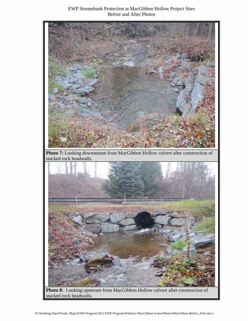
EWP Streambank Protection at MacGibbon Hollow Project Sites Before and After Photos
H:\Working Data\Floods, Major\EWP Program\2012 EWP Program\Walton\2 MacGibbon 4 sites\Photos\MacGibbon Before_After.docx
Photo 7: Looking downstream from MacGibbon Hollow culvert after construction of stacked rock headwalls.
Photo 8: Looking upstream from MacGibbon Hollow culvert after construction of stacked rock headwalls.
EWP Streambank Protection at MacGibbon Hollow Project Sites Before and After Photos
H:\Working Data\Floods, Major\EWP Program\2012 EWP Program\Walton\2 MacGibbon 4 sites\Photos\MacGibbon Before_After.docx
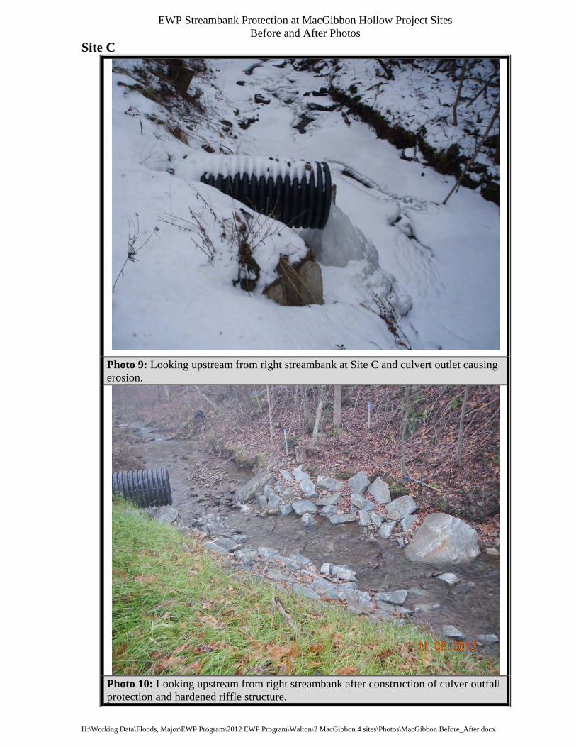
Site C
Photo 9: Looking upstream from right streambank at Site C and culvert outlet causing erosion.
Photo 10: Looking upstream from right streambank after construction of culver outfall protection and hardened riffle structure.

EWP Streambank Protection at MacGibbon Hollow Project Sites Before and After Photos
H:\Working Data\Floods, Major\EWP Program\2012 EWP Program\Walton\2 MacGibbon 4 sites\Photos\MacGibbon Before_After.docx
Photo 11: Looking downstream from right streambank at Site C and culvert outlet causing erosion.
Photo 12: Looking downstream from right streambank after construction of culvert outfall protection and hardened riffle structure.

EWP Streambank Protection at MacGibbon Hollow Project Sites Before and After Photos
H:\Working Data\Floods, Major\EWP Program\2012 EWP Program\Walton\2 MacGibbon 4 sites\Photos\MacGibbon Before_After.docx
Site D
Photo 13: Looking upstream from right streambank at Site D and erosion along town highway.
Photo 14: Looking upstream from right streambank after construction of rock rip rap.

EWP Streambank Protection at MacGibbon Hollow Project Sites Before and After Photos
H:\Working Data\Floods, Major\EWP Program\2012 EWP Program\Walton\2 MacGibbon 4 sites\Photos\MacGibbon Before_After.docx
Photo 15: Looking upstream from left streambank after construction of rock rip rap and hardened riffle structure.
Photo 16: Looking downstream from right streambank after construction of rock rip rap.