map reading skills lower sec
TRANSCRIPT


• Basic elements of a topographical map• Grid References (4 figure grid reference, 6
figure grid reference)• Compass Direction• Measuring Distance (Straight, curved
distance)• Measuring Compass Bearings• Contours


AQUEDUCTS & BRIDGES
POST OFFICE & PARKING
ROADS
BEACONS & LIGHTHOUSES
Lighthouse
Beacon
Parking
Post Office


The minimum you should know is the eight point compass although it would be better to know the 16 point compass shown here.

You can do this using two different methods.
1. Use your string to follow the curved distance and add up the centimetres, then calculate using the scale line.
2. Use a piece of paper to make marks on it as you twist it.
REMEMBER WHICH EVER WAY YOU USE YOU MUST USE THE SCALE TO WORK OUT THE DISTANCE IN KILOMETRES (FOR A 1:50,000 MEASURE IN CM AND THEN DIVIDE BY 2 AS 1 KM IS EQUAL TO 2CM)

• Find the compass bearing of hospital from factory
X
X

• Find the compass bearing of hospital from factory
1.Draw a straight line connecting both places X
X

• Find the compass bearing of hospital from factory
1.Draw a straight line connecting both places
2.Draw a North arrow from your current location
X
X

1. Draw a straight line connecting both places
2. Draw a North arrow from your current location
3. Measure clockwise starting from the north arrow.
X
X
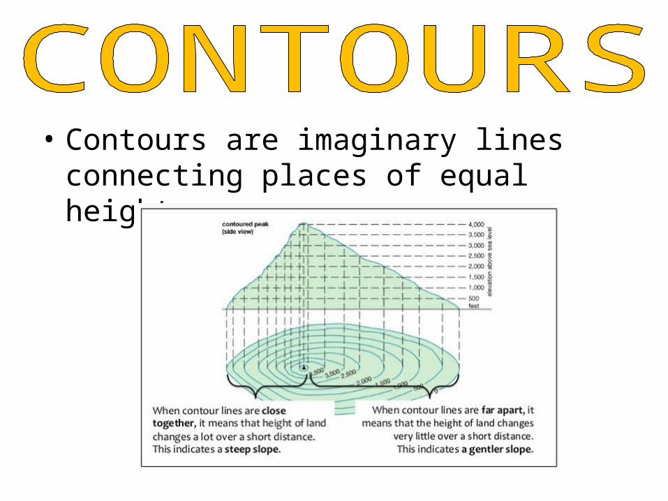
• Contours are imaginary lines connecting places of equal height.

• Contour interval or vertical interval is the distance between each contour line.
CI = 20m