mapping and assessment of ecosystem services at national ... · pdf filecopernicus commercial...
TRANSCRIPT
Mapping and Assessment of Ecosystem Services at
national level in Italy
M. Soraci, M. Munafò, F. Assennato and A. Strollo
Workshop on science-policy aspects on soil-related ecosystem services mapping and assessment –
Ghent, Belgium, 2-3 June 2016
Who is ISPRA?
Acronym of
Italian National Institute for Environmental Protection and Research
(http://www.isprambiente.gov.it/it)
Role of ISPRA • National public body, subject to the vigilance of the Ministry for Environment, Land and Sea.
• Competent government authority for all tasks and technical scientific activities of national interest for the protection and control of the environment, such as: safeguarding of water resources; soil and land protection; nature conservation; evaluation and updating of environmental pressures inventories; management and development of the National Environmental Information System.
• Supports regulatory activities of the Ministry of Environment, Land and Sea at National, European and International level, including regular reporting on the state of environment and on sustainable development indicators.
• Coordinates the National System of Environment Protection Agencies of Regions and autonomous provinces (SNPA), through which it ensures the exchange of information and expertise for the improving environmental monitoring and inspections, as well as the knowledge on the state of the environment throughout the territory.

Role of ISPRA • Responsible for the development and operation of the Environmental Information and Monitoring System (SINAnet) and represents the National Focal Point and the National Reference Centres for the EEA.
• Performs the function of National Authority for nuclear safety and radiation protection and of National Geological Service.
• Fields of activities include, among others: monitoring and control of air and water quality, protection of inland and marine waters, soil and coastal protection, technical and scientific activities concerning climate change and adaptation, development and application of geophysics, geology and applied geology methods and tools to monitor national remediation measures and to handle national environmental databases, production of environmental data, statistics, information, reports, environmental communication and training.
• Active in several EC projects (e.g. LIFE +, Horizon2020, etc.) and International Programmes (e.g. COPERNICUS, INSPIRE, UN, Multilateral and Regional Conventions, GEO, etc.).

COPERNICUS The Copernicus programme previously known as
GMES (Global Monitoring for Environment and
Security), is the European Programme for the
establishment of a European capacity for Earth
Observation, coordinated and managed by the
European Commission.
The development of the observation infrastructure is
carried out under the aegis of the European Space
Agency (ESA) for the space component and the
European Environmental Agency (EEA) and the
Member States for the in situ component.
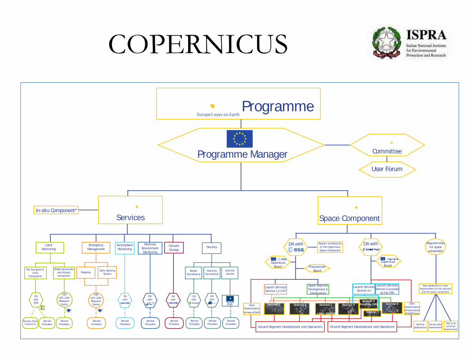
COPERNICUS
Commercial contracts
Grants
*Implementation mode still to be defin
e
d: Mode of Implementation (direct/indirect): Coordination by EEA
Indirect Management
Direct ManagementService Providers
Copernicus component DA - Delegation agreement
CSD - Cross Sub-delegation
ESA - European Space Agency
EUMETSAT - European Organisation f or the Exploitation of
Meteorological Satellites
EEA - European Environment Agency
FRONTEX - The European Agency f or the Managment of Operational
Cooperation at the External Borders of the Member States of the European
Union
ECMWF - The European Centre f or Medium-Range Weather ForecastsEUSC - European Union Satellite Center
Programme
Programme Manager Committee
User Forum
Space ComponentIn-situ Component*
Land
Monitoring
Emergency
Management
Atmosphere
Monitoring
Maritime
Environment
Monitoring
Climate
ChangeSecurity
Pan European &
Local
Components
Global Systematic
and hotspot
component
MappingEarly Warning
SystemBorder
Surveillance
Maritime
Surveillance
External
Actions
DA
with
EEA
CSD
with Joint
Research
Centre
CSD
with Joint
Research
Centre
DA
with
DA
withDA
with
DA
with
DA
with
(tbd)
Member State
institutions
Service
Providers
Service
Providers
Service
Providers
Service
Providers
Service
Providers
Service
Providers
Service
Providers
Service
ProvidersService
Providers
Legend:
Services
DA with DA with Requirements
for space
component
System architecture
of the Copernicus
Space Component
Copernicus
Board Procurement
Board
Launch ServicesSentinel 1,2,3,5P
Space Segment
Development &
Construction
Launch ServicesSentinel 4,5
Launch ServicesSentinel 6 provided
by the USA
Copernicus
Board
Next generation of user
requirements for the services
and the space component
Services
applications
Data
Dissemination
Infrastructure
Sentinel 1 Sentinel 2 Sentinel 3
LAND MARINE
Sentinel 4
Sentinel 5
Precursor (5P)
Sentinel 5
Sentinel 6 Data
Dissemination
Infrastructure
(EUMETCast)
Ground Segment Development and Operations
--
Ground Segment Development and OperationsHigh level
technical
requirements
Service data
requirements

COPERNICUS
Italian participation:
• Copernicus Committe: Italian Ministry of Education, University and Research; Italian Space Agency and ISPRA (President, Professor Bernardo de Bernardinis)
• Copernicus User Forum: ISPRA (President, Professor Bernardo de Bernardinis) and the Italian Space Agency
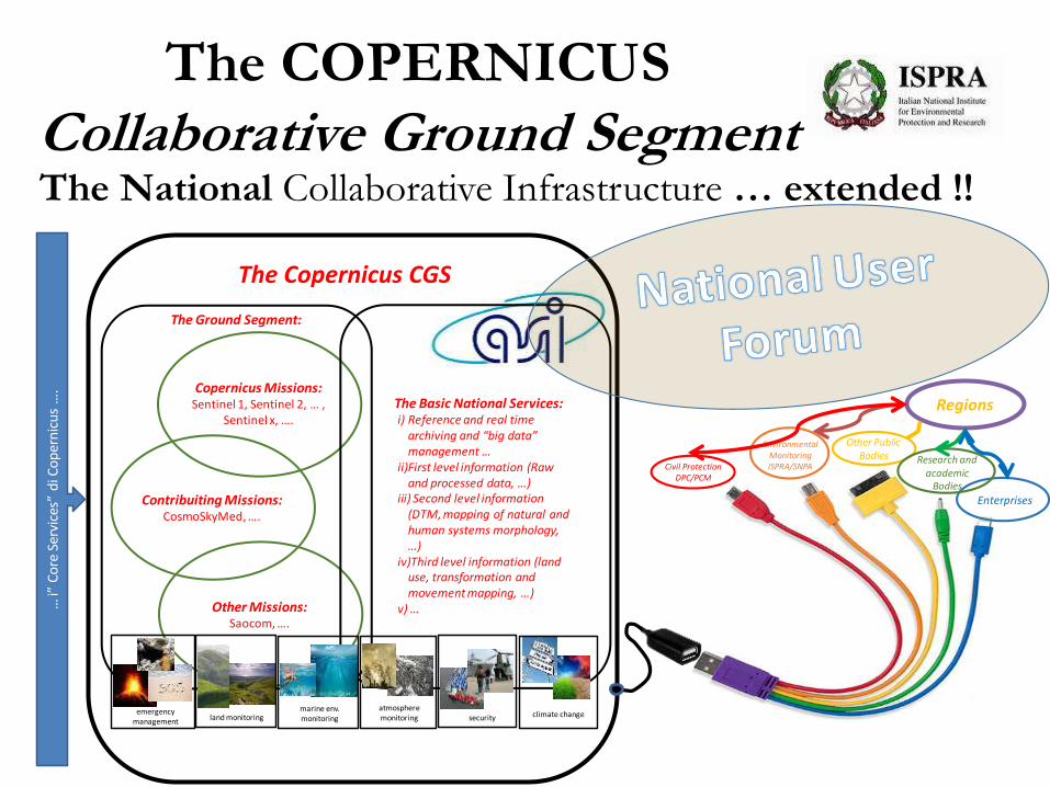
The COPERNICUS Collaborative Ground Segment The National Collaborative Infrastructure … extended !!
Copernicus Missions: Sentinel 1, Sentinel 2, … ,
Sentinel x, ….
Contribuiting Missions: CosmoSkyMed, ….
Other Missions: Saocom, ….
The Ground Segment:
The Basic National Services:i) Reference and real time
archiving and “big data” management …
ii)First level information (Raw and processed data, …)
iii) Second level information (DTM, mapping of natural and human systems morphology, …)
iv)Third level information (land use, transformation and movement mapping, …)
v) …
EnvironmentalMonitoringISPRA/SNPA
Other Public Bodies Research and
academic Bodies
EnterprisesAgriculture
CREA /MIPAAF
Civil ProtectionDPC/PCM
… i”
Co
reSe
rvic
es”
di C
op
ern
icu
s…
.
emergencymanagement land monitoring
marine env. monitoring
atmospheremonitoring security climate change
Regions
The Copernicus CGS

ISPRA and COPERNICUS
ISPRA thanks to Copernicus Programme realized
National Land Monitoring
Integrating High Resolution Layers
with CORINE Land Cover and downstreaming
Very High Resolution Layers
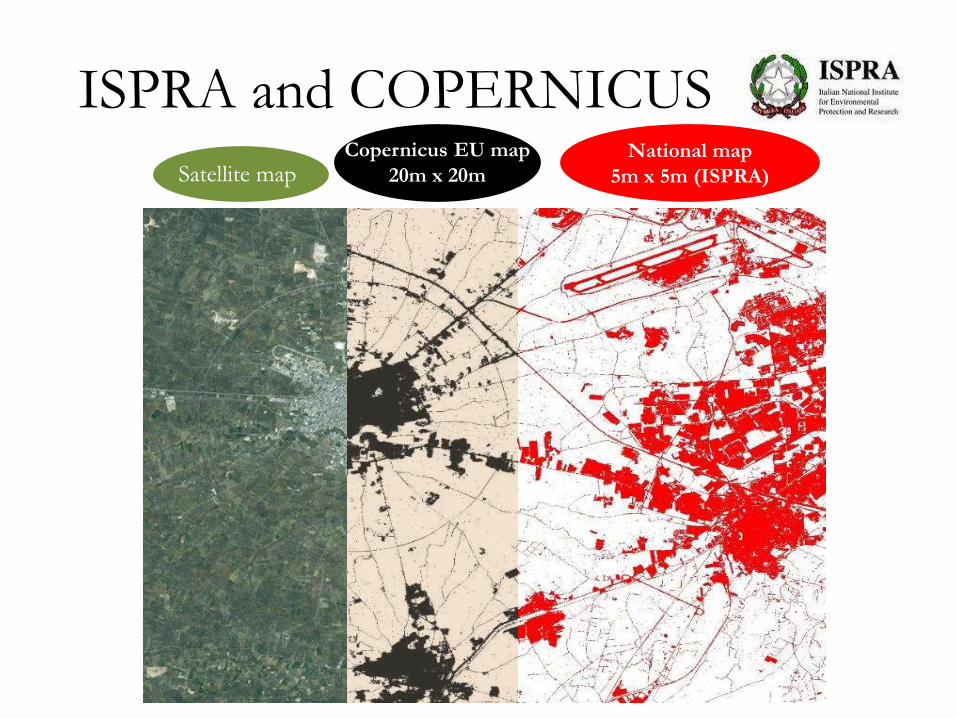
ISPRA and COPERNICUS National map
5m x 5m (ISPRA) Satellite map Copernicus EU map
20m x 20m
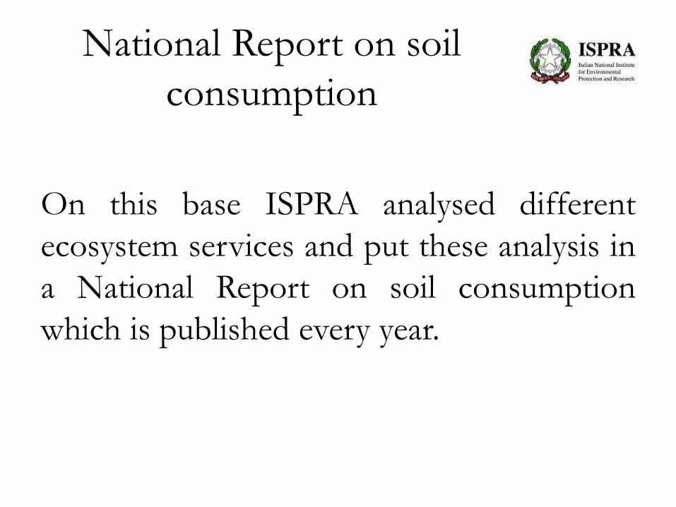
National Report on soil
consumption
On this base ISPRA analysed different
ecosystem services and put these analysis in
a National Report on soil consumption
which is published every year.
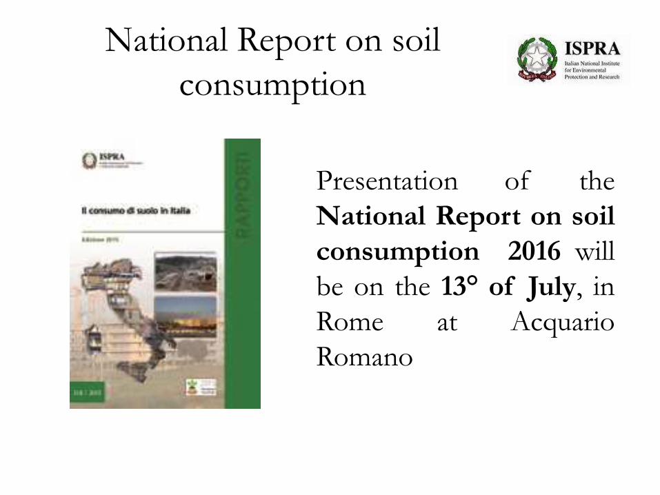
National Report on soil
consumption
Presentation of the
National Report on soil
consumption 2016 will
be on the 13° of July, in
Rome at Acquario
Romano
National Report on soil
consumption
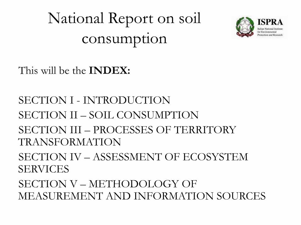
This will be the INDEX:
SECTION I - INTRODUCTION
SECTION II – SOIL CONSUMPTION
SECTION III – PROCESSES OF TERRITORY TRANSFORMATION
SECTION IV – ASSESSMENT OF ECOSYSTEM SERVICES
SECTION V – METHODOLOGY OF MEASUREMENT AND INFORMATION SOURCES

National Report on soil
consumption There will be a NEW SECTION, the IV – ASSESSMENT OF ECOSYSTEM SERVICES:
• Storage and Carbon Sequestration;
• Crop Production;
• Timber Production;
• Habitat Quality;
• Water Purification;
• Sediment Retention;
• Pollination;
• Microclimate regulation;
• Water regulation;
• Air Quality;
• Coasts;
• Urban planning and new standard;
• Impact of land use in Italy.

National Report on soil
consumption
An example:
Map with
resolution at
20 meters for
biophysical
calculations

National Report on soil
consumption
Pollination ecosystem service
Economic value of insect pollination (EVIP) in Italy (Leonhardt, et al., 2013):
• 18.016 €/Km2 (med)
• 20.602 €/Km2 (max)
• 15.430 €/Km2 (min)
Value of pollination ecosystem service
[crop production (ha) * EVIP (€/ha)]
National Report on soil
consumption
Work in progress for
the other ecosystem
services till 13° of
July, after this date
all data will be
published on ISPRA’s
web-site
(http://www.isprambiente.gov.it/it)
Thank you for your attention!
Contacts:
Mariangela Soraci ([email protected]);
Michele Munafò ([email protected]);
Francesca Assennato ([email protected]);
Andrea Strollo ([email protected])