maps! curriculum plan
DESCRIPTION
December, 2010TRANSCRIPT

“Maps!”Hannah Clemmons
Social Studies Curriculum PlanAccelerated 2nd Grade
December, 2010
I. OverviewII. The Curriculum Plan A. Summary i. Weekly Schedule ii. Activities iii. Cross-Curricular Connections B. Formal Lesson Plans i. The Key to Maps ii. Sharing and Revising “How I Get to School” Maps iii. Exploring Paper for “Community Map” C. Assessment Plan D. Literature Resources i. Read Alouds / Book Shares ii. Literature Guide E. Summary StatementF. Bibliography
I. Overview
In this unit, students will explore the process of reading and making maps and how maps
are used in everyday life. The students will have opportunities to work with maps of familiar
places and construct their knowledge using a concrete base. Students will work in a cycle of
working with maps and then creating their own maps. This process will help them construct their
knowledge and then work with this knowledge to revise and refine it.
Students will spend much of the time in this unit working with maps. In addition,
literature will be used to compliment the social studies curricula and be used as a base point from
which to launch the unit. Students will examine the art of mapmaking and become mapmakers
themselves.
Rationale
After reading Crow Boy, a book about a boy with a long commute to school, the students
in the accelerated second grade classroom this unit is designed for began to talk about the
different ways they get to school. Since it is a public, neighborhood school, many of the students
walk or bike to school. Curiosity was peaked even more when students learned that the student
teacher bikes to school some days.
Reading maps is one of the most fundamental skills students will learn in the early
primary grades. Maps are used in many different ways over many different curricula. In maps,
information is made visible, which is paramount in this age of increasing print. As they are
learning to read, students should be learning to also interpret other types of graphic information,

as well as practicing working with this information. In this unit, students will have the
opportunity to both read, work with and write these types of graphic representations.
Objectives
In this study, students will experience, discuss and think critically about the way maps are
used and also created. They will work with many different types of everyday maps in a variety of
ways. The students will also have the opportunity to construct their own knowledge through a
series of studying maps and then creating their own maps. This cycle will help them construct,
deconstruct and reconstruct their knowledge of maps and mapmaking. In the two weeks, students
will:
- Document their beginning knowledge of maps- Create two different personal maps- Assess various types of maps- Think critically about the purposes and creation of maps- Create a final culminating project map
Standards
These activities will be rich and engaging, and will cover many different learning
standards in social studies as well as in other domains. However, the standard that will be
highlighted throughout the unit will by Illinois State Goal 17:
Understand world geography and the effects of geography on society, with an emphasis on the United States.
This goal will be addressed in with each social studies activity, ensuring that students will have
rich exposures to ideas during the unit to help them achieve the benchmarks of this standard for
their developmental level.

II. The Curriculum PlanA. Summaryi. Weekly Schedule
Week 1 Monday Tuesday Wednesday Thursday FridaySocial Studies
Morning Meeting
Read Aloud
Writer’s Workshop
Sharing Simple City Maps
Creating Individual Maps
The Keys to Maps
Brainstorm for “How I Get to School” maps
Creating “How I Get to School” Maps
Introduce new books in classroom about maps. Share My Maps Book (Sara Fanelli) to introduce unit.
Discuss how everyone gets to school...
Invite students to bring in maps Monday to share with the class. Discuss what kinds of maps are available and where they can be found.
Explorers and Mapmakers (In Search of the Past) (P. Ryan) pt. 1
Explorers and Mapmakers, pt. 2
Ruby’s School Walk (Kathryn White)
My Neighborhood: Places and Faces (Lisa Bullard)
Brainstorm: Descriptive writing about ‘my commute to school...’
Write Share/Critique Revise Publish to accompany “How I Get to School” maps
Week 2 Monday Tuesday Wednesday Thursday FridaySocial Studies
Morning Meeting
Read Aloud
Writer’s Workshop
Sharing Student-Gathered Maps
Sharing and Revising “How I Get to School” Maps
Brainstorming for “Community Map”
Exploring Paper Collaging for “Community Map”
Creating Our “Community Map”
Introduce new books in classroom about maps. Share Science Kids: Maps and Mapping (Deborah Chancellor)
Discuss important places in the community (from/related to Writer’s Workshop) to to introduce idea of Community Map.
Continue to discuss important places in the community...
Brainstorm how we can share our map with the community...
Treasure Map (Stuart Murphy)
Where Do I Live? (Neil Chesanow)
Me on the Map (Joan Sweeney)
Brainstorm: Informative writing about ‘a place that is important to me in my community...’
Write Share/Critique Revise Publish to accompany “Community Map”

ii. Activities
Sharing Simple City MapsGoal: Students will explore maps from the city of Chicago and their neighborhood and try to interpret their purposes. Students will write down what they notice about the maps and their initial understandings of maps.Purpose: Activity will spark prior knowledge of maps and help students begin to construct their understanding of maps.Format: Whole group and small groupsDescription: Teacher will introduce the simple city maps (about 5; zoo maps, tourist iconic maps, maps of the neighborhood (Andersonville)) to the whole class. Next, the class will break into small groups with each group receiving one map. The group will then work together to discuss the maps and eventually create a list of their collective map knowledge. Assessment: Students’ writings about their initial understandings of maps will be used against a checklist of map knowledge as pre-assessment for the unit.Standard(s): 17.A.1a: Identify the characteristics and purposes of geographic representations including maps, globes, graphs, photographs, software, digital images and be able to locate specific places using each.
Creating Individual MapsGoal: Students will construct a map of their community, their home, their school, or etc. from available materials. Students will discuss what their map demonstrates about the place it represents.Purpose: This activity will give students an opportunity to create their first (in-class) map in an open-ended environment. This map will serve as a pre-assessment tool.Format: Whole group and individualDescription: The teacher will distribute materials with which students will construct their own maps of any place they would like that they know well (the classroom, their bedroom, the school, a familiar park, etc). When students are finished creating their map, they will write a short description of how the map demonstrates their understandings of their maps. As a whole group, each student will share his or her map as well as what it demonstrates about the place they have represented.Assessment: Students maps along with their written explanations will be assessed against a rubric used as a pre-assessment of map understandings for the unit .Standard(s): 17.A.1b: Identify the characteristics and purposes of geographic representations including maps, globes, graphs, photographs, software, digital images and be able to locate specific places using each.
The Keys to MapsGoal: Students will use simple city maps to hypothesize what the symbols represent. Groups will share their hypotheses, and then as a whole class discuss

the true meanings of keys. As individuals, students will create a map key for the symbols and the use of their individual maps.Purpose: This activity will help students begin to understand the purpose of map keys and how they help readers understand maps.Format: Small groups, whole group and individualDescription: The teacher will introduce the idea of a map key, pointing it out on an example map. In the same groups as the “Sharing Simple City Maps” activity, students will write down hypotheses about what the symbols on their map represent. Then, the teacher will lead a discussion with the whole group to decide what each symbol on the example map represents. Finally, each student will create a map key for their map created in “Creating Individual Maps”.Assessment: The hypotheses of each small group about the purposes of maps as well as the group list of purposes will be graded from rubrics and used as formative assessment.Standard(s): 17.A.1b: Identify the characteristics and purposes of geographic representations including maps, globes, graphs, photographs, software, digital images and be able to locate specific places using each.
Brainstorming for “How I Get to School” MapsGoal: Students will brainstorm how they want to construct their “How I Get to School” maps. They will create a list of at least three specific things to include in their individual maps.Purpose: This activity will help students understand the importance of landmarks along their commute to school and their purpose in maps and help them focus their ideas for their “How I Get to School” map.Format: Whole group and small groupsDescription: In a whole group, the teacher will introduce the idea of the “How I Get to School Map”. Students will be required to create a map of their commute to school which includes at least three specific landmarks along their path. Individually, students will brainstorm what they will map and what landmarks they will include, creating a list or graphic organizer as a plan. Students will share these lists in their small groups to get feedback from other students.Assessment: The lists students make of the things to include in their maps will be assessed according to a checklist as formative assessment.Standard(s): 17.A.1a: Identify physical characteristics of places, both local and global (e.g., locations, roads, regions, bodies or water). 17.A.1b: Identify the characteristics and purposes of geographic representations including maps, globes, graphs, photographs, software, digital images and be able to locate specific places using each.
Creating “How I Get to School” MapsGoal: Students will create their “How I Get to School” maps using their lists created in the brainstorming session.
Purpose: This activity will give students an opportunity create a map and apply the principles of maps that they have been learning. These maps will serve as a formative assessment for the rest of the unit.Format: IndividualDescription: The teacher will remind students of the requirements for the “How I Get to School” map. Then, materials will be distributed (students may bring in materials as well) and students will create their maps. When finished, students will write a short description of what and how their map represents the place it is of. At the end of the lesson, students will share their maps and descriptions. Children will be allowed to finish their maps at a later time if they do not finish by the end of the day.Assessment: Students’ maps along with their writing about how the map demonstrates will by graded with a rubric and be used as both formative- and post- (for the week) assessment.Standard(s): 17.A.1a: Identify physical characteristics of places, both local and global (e.g., locations, roads, regions, bodies or water). 17.A.1b: Identify the characteristics and purposes of geographic representations including maps, globes, graphs, photographs, software, digital images and be able to locate specific places using each.
Sharing Student-Gathered MapsGoal: Students will discuss student-gathered maps in small groups. Each group will share what they like and dislike about their map and how it makes the map more readable. Students will compare and contrast the gathered maps as a group.Purpose: This activity will allow students to put into practice the things they have been learning about maps using maps students have collected and brought into class. Students will begin to identify differences and similarities in maps.Format: Small groups and whole groupDescription: The teacher will introduce the maps that have been brought into the classroom by students. In their small groups, students will discuss one of the maps as they did with the city maps in ‘Sharing Simple City Maps”. Each group will record a list of the their likes and dislikes of the map and its readability to share with the whole group. Then, the whole group will discuss what was similar about all of the maps and what was different about the maps. Finally, the group will hypothesize what the purpose of each map might be. First, connect to purpose of making “How I Get to School” maps, then ask what students think the purposes of these different types of maps might be. (Teacher should keep some iconic maps on hand in case students do not bring in maps or the maps they bring are not developmentally appropriate. Maps may include amusement or theme park maps, maps of large shopping areas, maps of the subway system, etc. These maps should be at a slightly higher level than those shared at the beginning of the unit.)Assessment: Each small group’s list as well as the whole group list of comparisons/ contrasts/

purposes of maps will be graded with a rubric and used for formative assessment.Standard(s): 17.A.1b: Identify the characteristics and purposes of geographic representations including maps, globes, graphs, photographs, software, digital images and be able to locate specific places using each.
Sharing and Revising “How I Get to School” MapsGoal: Students will share the maps they have created with a partner. The partner will then critique the work of the other student, making suggestions for how to make the map more readable. Finally, students will revise their “How I Get to School” Maps to incorporate the ideas from the critique.Purpose: Students will begin to understand maps as a tool to relay information to another person. Students will then revise their work, taking this better understanding into account.Format: Small group, individualDescription: Students will begin by exchanging maps with a partner. The two partners will not be allowed to talk about their maps. The other person will have only the map from which to glean information. Each partner will write down what they think the map shows, and then they will share what they wrote with each other. Then, each student will make at least two suggestions for how their partner could improve the readability of the map. Finally, each student will make revisions to their map in order to make it more readable. (Students will use a worksheet to help them remember what they are to write about their partner’s map: What do I think this map is about? Why? After, How do I think my partner could improve this map to help others understand it? List at least two ways.)Assessment: Students will use a worksheet to help them remember what they are to write about their partner’s map: What do I think this map is about? Why? After, How do I think my partner could improve this map to help others understand it? List at least two ways. Students’ revisions will also be evaluated against a rubric for their readability and how they considered suggestions.Standard(s): 17.A.1a: Identify physical characteristics of places, both local and global (e.g., locations, roads, regions, bodies or water). 17.A.1b: Identify the characteristics and purposes of geographic representations including maps, globes, graphs, photographs, software, digital images and be able to locate specific places using each.
Brainstorming for “Community Map”Goal: Students will brainstorm ideas for their culminating “Community Map” project. Each student will select a “place” to include on the map. As a whole group, students will create a list of what will be included and of how all things will be completed in the next three days.Purpose: This activity will help students identify important places for their maps as well as create an action plan for creating the “Community Map”. Students will begin to work together to create a final project which demonstrates their overall learning.

Format: Individual and whole groupDescription: The teacher will present the idea of a “Community Map” the culminating project. Individually, students will think of a place to make for the map and then sketch this place. Then, the teacher will lead the group in a discussion of things that should be included in the map as well as an action plan for how to complete the project by the end of the week. This list and action plan will be posted in the room and followed for the remainder of the unit.Assessment: The list of individual places, things needed, and the action plan created by the class for the culminating project will be assessed with a checklist and used as formative assessment.Standard(s): 17.A.1a: Identify physical characteristics of places, both local and global (e.g., locations, roads, regions, bodies or water).
Exploring Paper Collaging for “Community Map”Goal: Students will explore the medium of collaging paper in order to prepare for creating “places” for the “Community Map”. Each students will create a found paper collage piece for the map key.Purpose: This activity will give students an opportunity to explore the medium of paper collage before having to use it to create their places for the culminating project.Format: IndividualDescription: Teacher will explain the basics of paper collage to the class, encouraging students to share any experience they may have with the medium. Then, the teacher will distribute the materials, giving open-ended prompts to help the students explore constructively. After ample time for exploration is given, the teacher will have the students stop and sketch a map key. Then, the students will create the map key they sketched using paper collage and pens (for labeling). Students will present their maps keys to the class.Assessment: The paper collage map key pieces created will be assessed with a rubric and used as formative assessment for the final project.Standard(s): 17.A.1a: Identify physical characteristics of places, both local and global (e.g., locations, roads, regions, bodies or water).
Creating Our “Community Map”Goal: Students will use paper collage to create their individual “places” for the “Community Map”. In small groups, students will find where to put their “places” on the map according to their addresses.Purpose: This activity will give students the opportunity to create a collective culminating map to demonstrate the learning which has occurred throughout the unit. This project and students’ responses to it will serve as post-assessment for the unit.Format: Individual and small groupsDescription: Over an afternoon, students will create the final “Community Map”. First, the teacher will have the students re-consult their action plan creating in the brainstorming activity. Then, the students will individually put together their

paper collage places for the map. Next, the students will be divided into small groups. Each group will perform various tasks to help finish the project, rotating turns to place their paper collage in its proper place on the map. When the map is finished, each person will present their paper collage place on the map. Finally, students will write a short description of the things they have learned about maps throughout the unit.Assessment: The individual paper collage pieces, the placement of these pieces, and the final written pieces detailing what each student has learned throughout the unit will be assessed with rubrics and used as the post-assessment.Standard(s): 17.A.1a: Identify physical characteristics of places, both local and global (e.g., locations, roads, regions, bodies or water). 17.A.1b: Identify the characteristics and purposes of geographic representations including maps, globes, graphs, photographs, software, digital images and be able to locate specific places using each.

iii. Cross-Curricular Connections
Other curricular activities will be used to help support this Social Studies unit in a variety
of ways:
Important books and ideas will be introduced to the group during some Morning
Meetings throughout the two weeks. (See chart)
Books about maps and cartography will be read during at least three of the weekly Read
Alouds each week. (See chart)
Finally, the Writer’s Workshop topics for the two weeks will relate to the culminating
events of each week: During the first week, students will work on a descriptive writing about
their commute to school. During the second week, they will write an informative piece about a
“place” in their community that is important to them that will eventually be their addition to the
“Community Map”. (See chart)
In addition, more books and supplies about and for mapmaking will be provided in
different sections of the classroom. If available, other maps and mapmaking artifacts will be
displayed in the room throughout the unit.

B. Formal Lesson Plans
i. The Key to Maps ii. Sharing and Revising “How I Get to School” Maps iii. Exploring Paper for “Community Map”

Name: Hannah Clemmons Date: December, 2010 Grade: Accelerated 2nd
Unit Title: Maps!Lesson Title: The Key to MapsUnit Title: Maps!Lesson Title: The Key to MapsUnit Title: Maps!Lesson Title: The Key to MapsSubject Area(s): Social Studies Materials or Technology Needed:
-Larger example map with key -Example city maps, one for each group -Elmo to show city maps -Materials to create map keys (paper and markers/pencils/crayons)Activity/Material Preparation Needed: -Collect simple city maps to use during activity (maps from “Simple City Maps” activity)
Materials or Technology Needed: -Larger example map with key -Example city maps, one for each group -Elmo to show city maps -Materials to create map keys (paper and markers/pencils/crayons)Activity/Material Preparation Needed: -Collect simple city maps to use during activity (maps from “Simple City Maps” activity)
Time required: 45 minutes
Materials or Technology Needed: -Larger example map with key -Example city maps, one for each group -Elmo to show city maps -Materials to create map keys (paper and markers/pencils/crayons)Activity/Material Preparation Needed: -Collect simple city maps to use during activity (maps from “Simple City Maps” activity)
Materials or Technology Needed: -Larger example map with key -Example city maps, one for each group -Elmo to show city maps -Materials to create map keys (paper and markers/pencils/crayons)Activity/Material Preparation Needed: -Collect simple city maps to use during activity (maps from “Simple City Maps” activity)
Format/Grouping: Small groups, whole group and individual
Materials or Technology Needed: -Larger example map with key -Example city maps, one for each group -Elmo to show city maps -Materials to create map keys (paper and markers/pencils/crayons)Activity/Material Preparation Needed: -Collect simple city maps to use during activity (maps from “Simple City Maps” activity)
Materials or Technology Needed: -Larger example map with key -Example city maps, one for each group -Elmo to show city maps -Materials to create map keys (paper and markers/pencils/crayons)Activity/Material Preparation Needed: -Collect simple city maps to use during activity (maps from “Simple City Maps” activity)
Purpose: Students will learn about and discuss the purpose of maps keys and how they help map readers understand maps.
Objectives: Students will identify different aspects of a map key and hypothesize about their meaning and purpose. Students will create an appropriate map key for their “Individual Map”.
Standard(s): 17.A.1b: Identify the characteristics and purposes of geographic representations including maps, gloves, graphs, photographs, software, digital images and be able to locate specific places using each.
Key Vocabulary: map key map scale compass rose symbol
Objectives: Students will identify different aspects of a map key and hypothesize about their meaning and purpose. Students will create an appropriate map key for their “Individual Map”.
Standard(s): 17.A.1b: Identify the characteristics and purposes of geographic representations including maps, gloves, graphs, photographs, software, digital images and be able to locate specific places using each.
Anticipatory Set/Connection to Prior Knowledge: -Show example map, highlighting Map Key -“What do you think this is for?”
Anticipatory Set/Connection to Prior Knowledge: -Show example map, highlighting Map Key -“What do you think this is for?”
Anticipatory Set/Connection to Prior Knowledge: -Show example map, highlighting Map Key -“What do you think this is for?”
Activity: -Divide students into small groups from previous activity (“Sharing Simple City Maps”) and distribute maps to groups (the same maps they received for the previous activity). -Instruct students to discuss and hypothesize about the map keys on their maps. Circulate to answer questions as needed. -Have each group record a list of their predictions about their map’s key. -Recollect whole group and lead a discussion to decide what each part on the map key of the example map represents. Record list on sheet paper/white board. -Inform children they will be creating map keys for their “Individual Maps”. Have children collect maps from drying rack. -Ask “What do you think you would put on a map key for your “Individual Map?”. Record students’ ideas on the front board. Encourage them to build off of each other. -Distribute materials and let children begin. Again, circulate as needed.
Differentiation/Extensions: -Put ELLs with students that speak their native language, if possible. -Allow children who have not started their “Individual Maps” to plan their map (but not actually make it) before creating their map key. -Occasionally check on student with central processing disorder to keep her on track. Check in while students are working in small groups and briefly during whole group periods.
Differentiation/Extensions: -Put ELLs with students that speak their native language, if possible. -Allow children who have not started their “Individual Maps” to plan their map (but not actually make it) before creating their map key. -Occasionally check on student with central processing disorder to keep her on track. Check in while students are working in small groups and briefly during whole group periods.
Closure: -Students will each briefly share the map key they created with the whole group. -Discuss what our map keys have in common and how they are different.
Closure: -Students will each briefly share the map key they created with the whole group. -Discuss what our map keys have in common and how they are different.
Closure: -Students will each briefly share the map key they created with the whole group. -Discuss what our map keys have in common and how they are different.Assessment: Student created hypotheses about map keys will be assessed with a checklist to determine if students have identified and hypothesized about maps keys. Student-created map keys will be checked for appropriateness to individual maps.
Assessment: Student created hypotheses about map keys will be assessed with a checklist to determine if students have identified and hypothesized about maps keys. Student-created map keys will be checked for appropriateness to individual maps.
Assessment: Student created hypotheses about map keys will be assessed with a checklist to determine if students have identified and hypothesized about maps keys. Student-created map keys will be checked for appropriateness to individual maps.

Name: Hannah Clemmons Date: December, 2010 Grade: Accelerated 2nd
Unit Title: Maps!Lesson Title: Sharing and Revising “How I Get to School” MapsUnit Title: Maps!Lesson Title: Sharing and Revising “How I Get to School” MapsUnit Title: Maps!Lesson Title: Sharing and Revising “How I Get to School” MapsSubject Area(s): Social Studies Materials or Technology Needed:
- Work guide for each student- Students’ “How I Get to School” maps- Materials to create/recreate maps
Activity/Material Preparation Needed:- Create and print work guide for each student- Create partnerships
Materials or Technology Needed:- Work guide for each student- Students’ “How I Get to School” maps- Materials to create/recreate maps
Activity/Material Preparation Needed:- Create and print work guide for each student- Create partnerships
Time required: 45 minutes
Materials or Technology Needed:- Work guide for each student- Students’ “How I Get to School” maps- Materials to create/recreate maps
Activity/Material Preparation Needed:- Create and print work guide for each student- Create partnerships
Materials or Technology Needed:- Work guide for each student- Students’ “How I Get to School” maps- Materials to create/recreate maps
Activity/Material Preparation Needed:- Create and print work guide for each student- Create partnerships
Format/Grouping: Partners, whole group
Materials or Technology Needed:- Work guide for each student- Students’ “How I Get to School” maps- Materials to create/recreate maps
Activity/Material Preparation Needed:- Create and print work guide for each student- Create partnerships
Materials or Technology Needed:- Work guide for each student- Students’ “How I Get to School” maps- Materials to create/recreate maps
Activity/Material Preparation Needed:- Create and print work guide for each student- Create partnerships
Purpose: Students will begin to understand maps as a tool to relay information to another person. Students will then revise their work, taking this better understanding into account.
Objectives: Students will critique their partner’s map and give them reasons why it is or is not readable. Students will revise their maps in order to make them more readable.
Standard(s): 17.A.1b: Identify the characteristics and purposes of geographic representations including maps, gloves, graphs, photographs, software, digital images and be able to locate specific places using each.
Key Vocabulary: - revision, readability
Objectives: Students will critique their partner’s map and give them reasons why it is or is not readable. Students will revise their maps in order to make them more readable.
Standard(s): 17.A.1b: Identify the characteristics and purposes of geographic representations including maps, gloves, graphs, photographs, software, digital images and be able to locate specific places using each.
Anticipatory Set/Connection to Prior Knowledge:- Have a few student volunteers display their maps.- Then, see if anyone in the class can guess where in the neighborhood the student lives or recognize any landmarks.
Anticipatory Set/Connection to Prior Knowledge:- Have a few student volunteers display their maps.- Then, see if anyone in the class can guess where in the neighborhood the student lives or recognize any landmarks.
Anticipatory Set/Connection to Prior Knowledge:- Have a few student volunteers display their maps.- Then, see if anyone in the class can guess where in the neighborhood the student lives or recognize any landmarks.Activity:- Assign the students partners and instruct them to
exchange maps, but tell them to make sure they do not tell their partner anything about the maps. Explain that this activity will be about seeing how readable the maps are.
- Distribute work guides to students. Give students time to work with their partners on the work guides. Alert the students when it is about time for them to stop looking at the maps and conference with their partners.
- After partners have finished conferencing, have the students return to the desks and brainstorm about what they can change about their map to make it more readable. Have them write down these ideas on a piece of scratch paper (web form?).
- Finally, have students make at least one of these revisions to their maps. Allow students that want to completely redo their maps.
Differentiation/Extensions: -Put ELLs with students that speak their native language, if possible, so they can discuss any difficult topics in their native language.. -Occasionally check on students with central processing disorder to keep her on track. -Chose partners thoughtfully, considering which students will compliment each other nicely. - Allow students to complete their work guides in whatever way they wish, as long as it is meaningful to them and they can convey the information to their partner and to the teacher.
Differentiation/Extensions: -Put ELLs with students that speak their native language, if possible, so they can discuss any difficult topics in their native language.. -Occasionally check on students with central processing disorder to keep her on track. -Chose partners thoughtfully, considering which students will compliment each other nicely. - Allow students to complete their work guides in whatever way they wish, as long as it is meaningful to them and they can convey the information to their partner and to the teacher.
Closure:- Have a few student volunteers share their revised maps and explain how they changed their maps based on their
partners’ suggestions.- Discuss why is it important that maps be “readable”.
Closure:- Have a few student volunteers share their revised maps and explain how they changed their maps based on their
partners’ suggestions.- Discuss why is it important that maps be “readable”.
Closure:- Have a few student volunteers share their revised maps and explain how they changed their maps based on their
partners’ suggestions.- Discuss why is it important that maps be “readable”.Assessment:- Each student will complete the work guide which will be used to assess both their thought process as well as the
maps or their partners.- Each student will be assessed on how they revise their map based on their partner’s suggestions.
Assessment:- Each student will complete the work guide which will be used to assess both their thought process as well as the
maps or their partners.- Each student will be assessed on how they revise their map based on their partner’s suggestions.
Assessment:- Each student will complete the work guide which will be used to assess both their thought process as well as the
maps or their partners.- Each student will be assessed on how they revise their map based on their partner’s suggestions.
Work Guide for Sharing and Revising “How I Get to School” Maps
Name__________________ Partner______________________________
When I first looked at the map, I thought......
When I looked closer, I realized........
How I felt about reading the map........
I feel like I..... (circle one)
... understood the map well.
... kind of understood the map.
... didn’t really understand the map.
To make the map more readable, I would suggest............
I would also suggest...........
One thing I wouldn’t change would be..............
Name: Hannah Clemmons Date: December, 2010 Grade: Accelerated 2nd
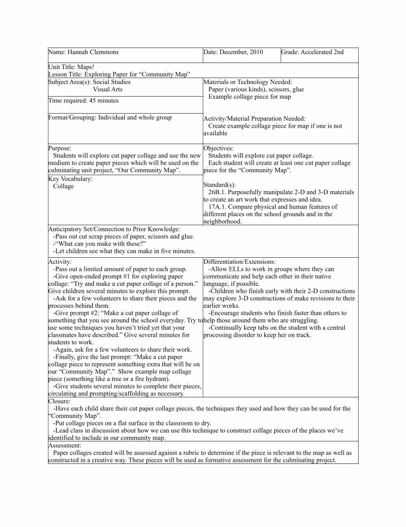
Unit Title: Maps!Lesson Title: Exploring Paper for “Community Map”Unit Title: Maps!Lesson Title: Exploring Paper for “Community Map”Unit Title: Maps!Lesson Title: Exploring Paper for “Community Map”Subject Area(s): Social Studies Visual Arts
Materials or Technology Needed: Paper (various kinds), scissors, glue Example collage piece for map
Activity/Material Preparation Needed: Create example collage piece for map if one is not available
Materials or Technology Needed: Paper (various kinds), scissors, glue Example collage piece for map
Activity/Material Preparation Needed: Create example collage piece for map if one is not available
Time required: 45 minutes
Materials or Technology Needed: Paper (various kinds), scissors, glue Example collage piece for map
Activity/Material Preparation Needed: Create example collage piece for map if one is not available
Materials or Technology Needed: Paper (various kinds), scissors, glue Example collage piece for map
Activity/Material Preparation Needed: Create example collage piece for map if one is not available
Format/Grouping: Individual and whole group
Materials or Technology Needed: Paper (various kinds), scissors, glue Example collage piece for map
Activity/Material Preparation Needed: Create example collage piece for map if one is not available
Materials or Technology Needed: Paper (various kinds), scissors, glue Example collage piece for map
Activity/Material Preparation Needed: Create example collage piece for map if one is not available
Purpose: Students will explore cut paper collage and use the new medium to create paper pieces which will be used on the culminating unit project, “Our Community Map”.
Objectives: Students will explore cut paper collage. Each student will create at least one cut paper collage piece for the “Community Map”.
Standard(s): 26B.1. Purposefully manipulate 2-D and 3-D materials to create an art work that expresses and idea. 17A.1. Compare physical and human features of different places on the school grounds and in the neighborhood.
Key Vocabulary: Collage
Objectives: Students will explore cut paper collage. Each student will create at least one cut paper collage piece for the “Community Map”.
Standard(s): 26B.1. Purposefully manipulate 2-D and 3-D materials to create an art work that expresses and idea. 17A.1. Compare physical and human features of different places on the school grounds and in the neighborhood.
Anticipatory Set/Connection to Prior Knowledge: -Pass out cut scrap pieces of paper, scissors and glue. -“What can you make with these?” -Let children see what they can make in five minutes.
Anticipatory Set/Connection to Prior Knowledge: -Pass out cut scrap pieces of paper, scissors and glue. -“What can you make with these?” -Let children see what they can make in five minutes.
Anticipatory Set/Connection to Prior Knowledge: -Pass out cut scrap pieces of paper, scissors and glue. -“What can you make with these?” -Let children see what they can make in five minutes.Activity: -Pass out a limited amount of paper to each group. -Give open-ended prompt #1 for exploring paper collage: “Try and make a cut paper collage of a person.” Give children several minutes to explore this prompt. -Ask for a few volunteers to share their pieces and the processes behind them. -Give prompt #2: “Make a cut paper collage of something that you see around the school everyday. Try to use some techniques you haven’t tried yet that your classmates have described.” Give several minutes for students to work. -Again, ask for a few volunteers to share their work. -Finally, give the last prompt: “Make a cut paper collage piece to represent something extra that will be on our “Community Map”.” Show example map collage piece (something like a tree or a fire hydrant). -Give students several minutes to complete their pieces, circulating and prompting/scaffolding as necessary.
Differentiation/Extensions: -Allow ELLs to work in groups where they can communicate and help each other in their native language, if possible. -Children who finish early with their 2-D constructions may explore 3-D constructions of make revisions to their earlier works. -Encourage students who finish faster than others to help those around them who are struggling. -Continually keep tabs on the student with a central processing disorder to keep her on track.
Differentiation/Extensions: -Allow ELLs to work in groups where they can communicate and help each other in their native language, if possible. -Children who finish early with their 2-D constructions may explore 3-D constructions of make revisions to their earlier works. -Encourage students who finish faster than others to help those around them who are struggling. -Continually keep tabs on the student with a central processing disorder to keep her on track.
Closure: -Have each child share their cut paper collage pieces, the techniques they used and how they can be used for the “Community Map”. -Put collage pieces on a flat surface in the classroom to dry. -Lead class in discussion about how we can use this technique to construct collage pieces of the places we’ve identified to include in our community map.
Closure: -Have each child share their cut paper collage pieces, the techniques they used and how they can be used for the “Community Map”. -Put collage pieces on a flat surface in the classroom to dry. -Lead class in discussion about how we can use this technique to construct collage pieces of the places we’ve identified to include in our community map.
Closure: -Have each child share their cut paper collage pieces, the techniques they used and how they can be used for the “Community Map”. -Put collage pieces on a flat surface in the classroom to dry. -Lead class in discussion about how we can use this technique to construct collage pieces of the places we’ve identified to include in our community map.Assessment: Paper collages created will be assessed against a rubric to determine if the piece is relevant to the map as well as constructed in a creative way. These pieces will be used as formative assessment for the culminating project.
Assessment: Paper collages created will be assessed against a rubric to determine if the piece is relevant to the map as well as constructed in a creative way. These pieces will be used as formative assessment for the culminating project.
Assessment: Paper collages created will be assessed against a rubric to determine if the piece is relevant to the map as well as constructed in a creative way. These pieces will be used as formative assessment for the culminating project.

C. Assessment Plan
Documentation of learning will be collected throughout this unit. Each activity has at
least one built in assessment opportunity. All of these pieces will be collected and saved by the
teacher until they are collected in a final documentation of the study. The pieces collected will be
available for students to consult both during and after the study.
The pre-assessment for the unit will be parts of the “Sharing Simple City Maps” and
“Creating Individual Maps” activities. Works created and collected during these two activities
will show the range of understanding (or lack there of) the students in the class have of maps.
From this work, the teacher will be able to better adapt the unit to the students.
Formative assessment will be conducted throughout the unit, allowing the teacher to
assess the progress of the students and the effectiveness of his or her teaching. All activities
incorporate dialogue between all parties of the classroom, allowing for co-construction of
knowledge and opportunities for teacher-to-student and student-to-student scaffolding.
Post-assessment will be collected in two different activities during the unit. The “How I
Get to School” map and the “Community Map” cumulative project will be used as post-
assessment. The “How I Get to School” map will be used to assess the learning of the first half of
the unit and the “Community Map” will be used to assess learning across the entire unit. The
“How I Get to School” map and written pieces will be used to assess learning at an individual
level, while the process and product of the final project will be used to assess the group as a
whole in both cooperation and social studies content knowledge and skills.
Variation within assessment methods includes verbal/linguistic, auditory ,visual , and
inter- and intrapersonal processes. However, many of the activities are open-ended and

collaborative, lending themselves to many entry points of learning as well as the opportunity for
students to approach the subject in way they feel comfortable. Differentiation will happen at the
individual activity level, accounting for the unique needs of the students in the classroom the unit
is being implemented in. Checklists and rubrics allow for more specific feedback for both
students and teachers, allowing the teacher to better tailor the activities to his or her individual
students.
Week 1 Monday Tuesday Wednesday Thursday FridayActivity
Product
Assessment ToolPurpose
Sharing City Maps
Creating Individual Maps
The Keys to Maps
Brainstorm for “How I Get to School” maps
Creating “How I Get to School” Maps
Lists of students’ individual understandings of maps
Student-created maps with written description of how it demonstrates understanding
Small group hypotheses of purposes of map keys; Whole group created list of purposes
Lists of things to include in “How I Get to School” maps
“How I Get to School” maps; Students’ writing on how it demonstrates the new things they have learned about maps
Checklist Rubric Checklist Checklist Rubric
pre-assessment pre-assessment formative-assessment
formative-assessment
post- and formative-assessment
Week 2 Monday Tuesday Wednesday Thursday FridayActivity
Product
Assessment ToolPurpose
Sharing Student-Gathered Maps
Sharing and Revising “How I Get to School” Maps
Brainstorming for “Community Map”
Exploring Paper Collaging for “Community Map”
Creating Our “Community Map”
Lists of likes/dislikes about each map; Lists of comparisons/contrasts between maps; Hypotheses about what the purposes of each map might be
Peer evaluations of maps worksheet; Revisions done to each individual map and write-ups explaining these revisions
List of individual places; List of things needed in map; Action plan for creating map
Paper collage map key pieces
Paper collage places; “Community Map”; Places placement on map (according to addresses); Final what I’ve learned about maps written piece
Rubric Worksheet, Rubric
Checklist Rubric Rubric
formative-assessment
formative-assessment
formative-assessment
formative-assessment
post-assessment

D. Literature Resourcesi. Read Alouds / Book Shares
Title: Explorers and Mapmakers (In Search of the Past) Author: P. RyanIllustrator: N/AGenre: NonfictionCopyright: 2000Rationale: This book gives an account of mapmaking from its first days to the current state of cartography and its new frontiers (space). This book will help introduce the class to how maps help us, how maps have evolved, and how mapmakers create maps.Discussion Questions: Have you ever made a map before? Why did you make it? Why have maps been important to people throughout history? How are they important today?
Title: Ruby’s School WalkAuthor: Katherine WhiteIllustrator: Miriam LatimerGenre: FictionCopyright: 2010Rationale: This book will introduce the idea of students’ commutes to school. After reading this book, the students will (hopefully) begin to consider their commutes to school and anything along the way that is unique or interesting.Discussion Questions: Ruby points out a lot of landmarks along her walk. (What are landmarks?) What are some landmarks you see along your walk/ commute to school? Why are these important? How do you feel when you see them?Activity: Brainstorming for “How I Get to School” Maps (see Activities)
Title: My Neighborhood: Places and FacesAuthor: Lisa BullardIllustrator: Brandon ReibelingGenre: FictionCopyright: 2002Rationale: This book is about a girl who gives a description of her neighborhood to a new next door neighbor. This book will help students begin to think about the important things in their community they would highlight for a new neighbor.Discussion Questions: If you were welcoming a new neighbor, what things in your neighborhood would you tell them about?

Why are these things important for a community member to know about?Activity: Brainstorming for our “Community Map” (see Activities)
Title: My Map BookAuthor: Sara FanelliIllustrator: Sara FanelliGenre: Fiction, graphical referenceCopyright: 1995Rationale: This book contains many different maps of many different things. It presents the idea of maps as a graphic organizer of information, not just of geographical places. It includes maps of a heart, tummy, dog, etc. This book will help students think about maps of concrete things they know well, and accept these types of representations as maps.Discussion Questions: What was your favorite map? Why was it your favorite? Have you ever created a non-traditional map like this? What did you use/make it for?Activity: Creating Individual Maps (see Activities)
Title: Science Kids: Maps and MappingAuthor: Deborah ChancellorIllustrator: N/AGenre: NonfictionCopyright: 2007Rationale: This book gives a good introduction to reading and creating maps. It presents mapmaking principles in a very visual way. This book will help many visual students identify and begin to create fundamentally sound maps.Discussion Questions: What did you learn about maps and mapmaking by reading/ looking at the pictures of this book? How can you use this book to help you make maps?
Title: Treasure MapAuthor: Stuart MurphyIllustrator: Tricia TusaGenre: FictionCopyright: 2004Rationale: This book ties maps and math through an engaging story about following a treasure map. It will help connect the social studies content with math content as well as provide yet another exciting example of how maps can be used.

Discussion Questions: How did map reading skills help the characters in this book find the treasure? What would you include in a treasure map to insure that only the person(s) you intended to find the treasure would find it?Activity: (Math extension) Follow (or create) a treasure map leading to a treasure somewhere in the school building. Along the way, the reader will have to use map reading skills and math skills to find the final resting spot of the treasure.
Title: Where Do I Live?Author: Neil ChesanowIllustrator: Ann IosaGenre: Fiction Copyright: 19995Rationale: Beginning close to home, this book describes the different categorizations of places in which we live: our homes, cities, states, countries, worlds, galaxies. This book will introduce children to these types of classifications in maps and visual representations.Discussion Questions: Let’s write out our extended address here at the school (Chicago, IL, US, Earth, Milky Way, etc). Why don’t we write this long address on everything we address?
Title: Me on the MapAuthor: Joan SweeneyIllustrator: Annette CableGenre: FictionCopyright: 1998Rationale: As did Where Do I Live?, this book looks at maps in different contexts. It will serve as another source to look at when thinking about the different systems in which we live and how we map these systems.Discussion Questions: (Show a map of the world or solar system) Would this map be beneficial for explaining to a teacher or a friend where you live? How are all these different maps helpful?

ii. Literature Guide
Title: The Little Man In the Map: With Clues To Remember All 50 StatesAuthor: E. Andrew MartonyiIllustrator: Ed OlsonGenre: NonfictionCopyright: 2007Rationale: This book helps children take a eclectic view of the (political) map of the United States. It will help children learn to identify things on maps in an interesting way.Discussion Questions: How could we incorporate this idea of “The Little Man In the Map” to reading other maps we come across?
Title: The Kids’ World Atlas: A Young Person’s Guide to the Globe (Picture Window Books World Atlases)Author: Karen FosterIllustrator: N/AGenre: NonfictionCopyright: 2010Rationale: This book is a kid-friendly world atlas that will introduce children to the bigger idea of world maps, maps of different places and from different cultures, and a wider view of maps than what we will be discussing in the classroom.Discussion Questions: What did you learn (or see) in the book that you didn’t know (or see) before? Why do you think it’s important to look at maps of different places and different cultures? How do these maps benefit us?
Title: How Maps Are MadeAuthor: Martyn BramwellIllustrator: George FryerGenre: NonfictionCopyright: 1998Rationale: This book introduces the profession of cartography in a kid- friendly manner. With this book, the children can explore how modern-day mapmakers are making visual sense of our world.Discussion Questions: Do you think you could be a cartography when you grow up? Would you enjoy it? What kinds of things do you think modern day cartographers map?

E. Summary
Throughout this unit, students are constantly using familiar places to explore the idea of
maps; they move from concrete to abstract. In order to construct knowledge about maps, an
abstract concept, children need to be able to connect that knowledge to something they already
are familiar with, something concrete. In this unit, students will deconstruct maps of familiar
places to look at the components that make up maps and to begin to understand why these things
are included. This beginning of understanding from concrete exploration will help the students
construct a meaningful base from which to work with maps in the future.
Social Studies is a staple in the developmentally and culturally appropriate classroom.
Even though it can be very abstract, it can also be very concrete because it is how we interact in
our lives everyday. In this day and time, maps have becoming paramount to many professions.
Understanding maps, how the make information visible, and the things that they can tell us are
skills that help students construct knowledge in many different areas of social studies. Map
reading is a skill that students will be able to use to inform many different things they will do in
school.
As an early childhood teacher, it is important to help children build the foundations from
which they will construct deeper meaning. In Social Studies, this foundation is very broad. It has
to span many different forms of critical thinking in many different paradigms. As teachers, we
have to provide children with opportunities to construct this base, recognizing that children learn
in many different ways and that we will have to work diligently to reach all of the children we
are serving. Teachers must present situations with many entry points and many different types of
representations so that the material becomes accessible to all students. This unit strives to make

the abstract ideas of maps accessible to many different types of students in a variety of authentic
and meaningful ways.

F. Bibliography
Amazon.com: maps kids books. (2010). Retrieved from http://www.amazon.com/s?ie=UTF8&keywords=Maps&rh=n%3A4%2Ck%3AMaps&page=1#/ref=sr_pg_7?rh=n%3A283155%2Cn%3A%211000%2Cn%3A4%2Ck%3AMaps&page=7&keywords=Maps&ie=UTF8&qid=1290536020
Amazon.com: online shopping for electronics, apparel, computers, books, dvds & more. (2010). Retrieved from http://www.amazon.com/
Bramwell, M., & George, F. (1998). How maps are made (maps & mapmaking). Chicago, IL: Lerner Publishing Group.
Bullard, L., & Reibeling, B. (2002). My neighborhood: places and faces (all about me). New York, NY: Picture Window Books.
Chancellor, D. (2007). Science kids: maps and mapping. New York, NY: Kingfisher.
Chesanow, N. (1995). Where do i live?. New York, NY: Barron's Educational Series.
Fanelli, S. (1995). My map book. New York, NY: HarperFestival.
Foster, K. (2010). The kids world atlas: a young person's guide to the globe (picture window books world atlases. Mankato, MN: Picture Window Books.
Martonyi, E.A., & Olson, E. (2007). The little man in the map: with clues to remember all 50 states. Granada Hills, CA: Schoolside Press.
Murphy, S.J., & Tricia, T. (2004). Treasure map. Chicago, IL: HarperCollins.
Ryan, P. (2000). Explorers and mapmakers (in search of the past). London: Evans Brothers.
Sweeney, J., & Cable, A. (1998). Me on the map. Albuquerque, NM: Dragonfly Books.
White, K., & Latimer, M. (2010). Ruby's school walk. Cambridge, MA: Barefoot Books.