matthew stone, mph gis/informatics specialist information technology support services
DESCRIPTION
Matthew Stone, MPH GIS/Informatics Specialist Information Technology Support Services Center for Chronic Disease and Health Promotion http://www.gis.cdph.ca.gov/cnn. Promoting a Data Delivery Framework for Healthy Communities in California Featuring: Collaboration and GIS Technology. - PowerPoint PPT PresentationTRANSCRIPT
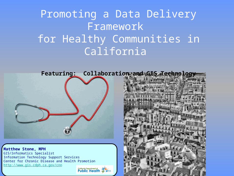
Matthew Stone, MPH GIS/Informatics Specialist Information Technology Support ServicesCenter for Chronic Disease and Health Promotionhttp://www.gis.cdph.ca.gov/cnn
Promoting a Data Delivery Framework for Healthy Communities in California
Featuring: Collaboration and GIS Technology

2006Proposition 84: The Safe Drinking Water, Water Quality and Supply, Flood Control, River and Coastal Protection Bond Act of 2006 authorizes $5.388 billion
AB 32: California Global Warming Solutions Act
2008SB 375: Focus on transportation planning: travel demand models: sustainable communities strategy: environmental review
SB 732: Establishes Strategic Growth Council to take certain actions with regard to coordinating programs of member state agencies to improve air and water quality, improve natural resource protection, increase the availability of affordable housing, improve transportation, meet the goals of the California Global Warming Solutions Act of 2006, encourage sustainable land use planning, and revitalize urban and community centers in a sustainable manner.
California LegislationInfluences Healthy Communities
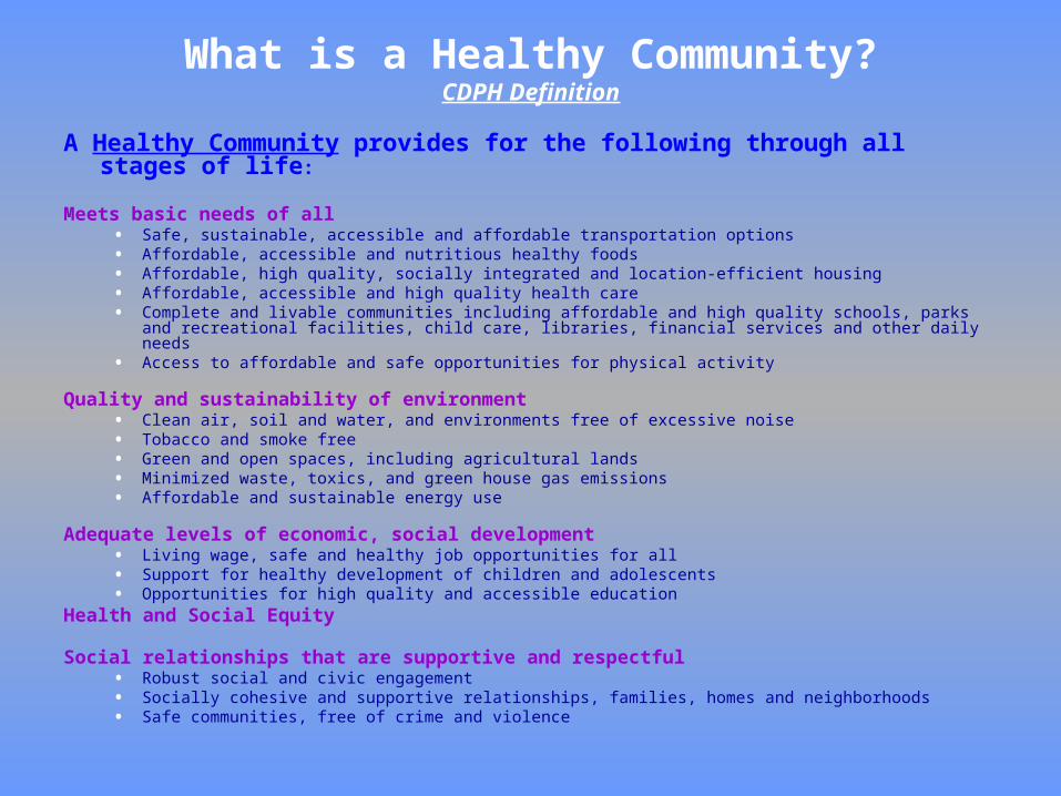
A Healthy Community provides for the following through all stages of life:
Meets basic needs of all• Safe, sustainable, accessible and affordable transportation options• Affordable, accessible and nutritious healthy foods• Affordable, high quality, socially integrated and location-efficient housing• Affordable, accessible and high quality health care• Complete and livable communities including affordable and high quality schools, parks and recreational
facilities, child care, libraries, financial services and other daily needs• Access to affordable and safe opportunities for physical activity
Quality and sustainability of environment• Clean air, soil and water, and environments free of excessive noise• Tobacco and smoke free• Green and open spaces, including agricultural lands• Minimized waste, toxics, and green house gas emissions• Affordable and sustainable energy use
Adequate levels of economic, social development• Living wage, safe and healthy job opportunities for all• Support for healthy development of children and adolescents• Opportunities for high quality and accessible education
Health and Social Equity
Social relationships that are supportive and respectful• Robust social and civic engagement• Socially cohesive and supportive relationships, families, homes and neighborhoods• Safe communities, free of crime and violence
What is a Healthy Community?CDPH Definition

Strategic Growth Council Promotes Healthy Communities
…to take certain actions with regard to coordinating programs of member state agencies to improve air and water quality,
improve natural resource protection, increase the availability of affordable
housing, improve transportation, meet the goals of the California Global Warming
Solutions Act of 2006, encourage sustainable land use planning, and
revitalize urban and community centers in a sustainable manner

Governor’s Executive Order S-04-10, Feb. 23,2010
The Strategic Growth Council (SGC) shall establish a Health in All Policies (HiAP) Task Force to identify priority programs, policies, and strategies to improve the health of Californians while advancing the SGC’s goals
Health in All Policies (HiAP) is a strategy to explicitly expand the consideration of health outcomes in the policy decision-making processes of these non-health agencies. The development of multi-agency strategies to improve health outcomes is especially relevant to address obesity and chronic illness, given the complexity of policy-making related to transportation, the built environment, and food systems.
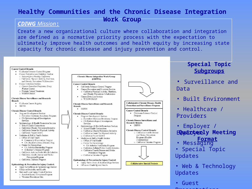
CDIWG Mission:Create a new organizational culture where collaboration and integration are defined as a normative priority process with the expectation to ultimately improve health outcomes and health equity by increasing state capacity for chronic disease and injury prevention and control.
Healthy Communities and the Chronic Disease Integration Work Group
Special Topic Subgroups
• Surveillance and Data
• Built Environment
• Healthcare / Providers
• Employer / Employee
• Messaging
Quarterly Meeting Format
• Special Topic Updates
• Web & Technology Updates
• Guest Presentations

California Healthy Communities• Long term goal
Strengthen state and local capacity to reduce chronic disease and eliminate health disparities by addressing social and environmental determinants of health, as measured by achievement of Healthy People 2020 goals for at least three of five chronic diseases (arthritis, cardiovascular disease, diabetes, asthma, and cancer).
• Objective By March 30, 2014, 50% of the counties in California will achieve the Healthy People 2020 goal to eliminate
health disparities for at least 3 of 5 chronic diseases (arthritis, cardiovascular disease, diabetes, asthma, and cancer).
Progress to date
• Convene internal work group to develop recommendation on 10-20 chronic disease indicators that all communities should measure
• Obtain consensus on chronic disease indicators
• Develop repository of chronic disease and indicator data; build web interfaces integrate existing data and enable remote access by local health departments.
• Train local health departments on spatial attributes to more effectively implement programs in specific neighborhoods based on identifiable social, economic, and health indicators.

We need to use data and information to help communities go from this

To This

It’s about DATA too:Provide, fund, and distribute data and information to localgovernments and regional agencies that will assist in developing andplanning sustainable communities.
Data Work Group of SGC WWW.Data.CA.GOV portal initiative
Purpose of Strategic Growth Council with respect to Dept. of Public Health
Remember this?

HOW?

Balance of Technology and Knowing your Users

….Should be EASY, RIGHT???? since…..
is just …
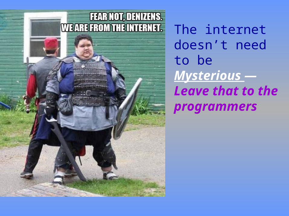
The internet doesn’t need to be Mysterious —Leave that to the programmers
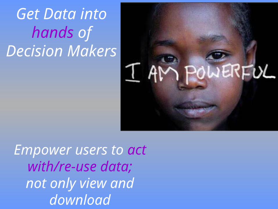
Empower users to act with/re-use data;not only view and
download
Get Data into hands of Decision Makers
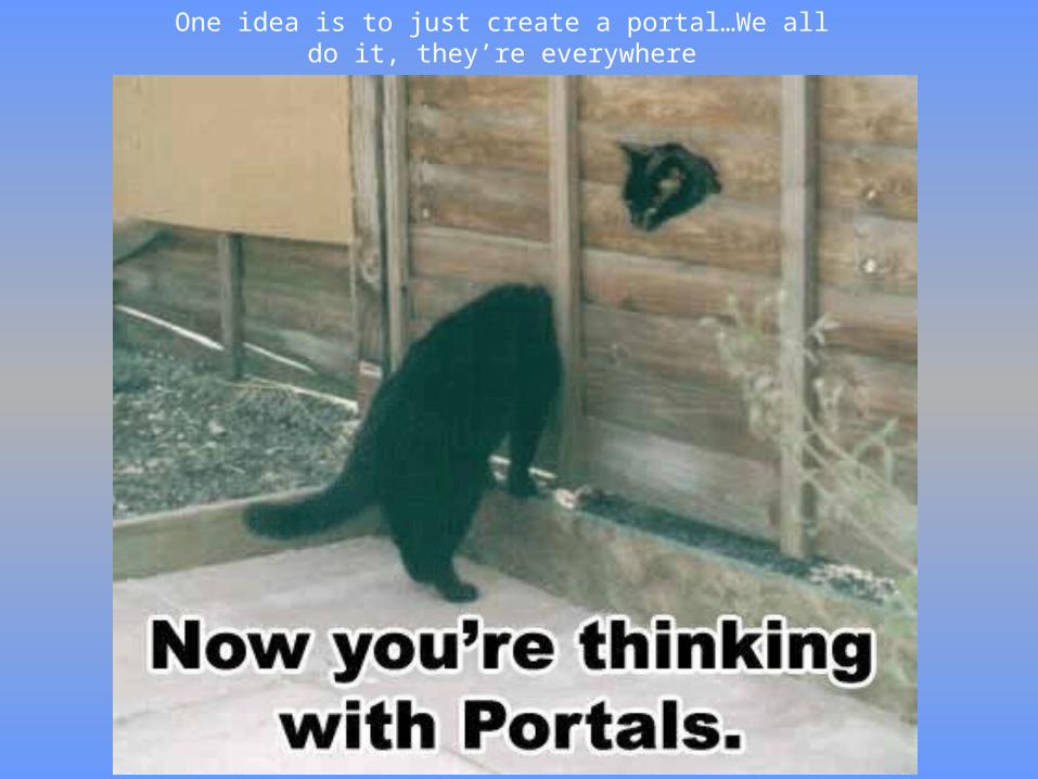
One idea is to just create a portal…We all do it, they’re everywhere

Most items are redirecting to static files, some can be linked via the URL
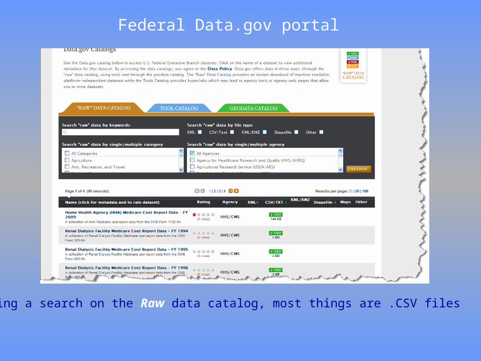
Federal Data.gov portal
Doing a search on the Raw data catalog, most things are .CSV files
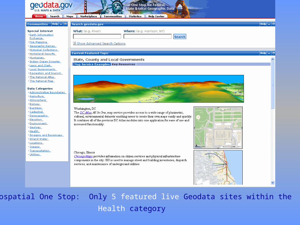
Feds Geospatial One Stop: Only 5 featured live Geodata sites within the
Health category
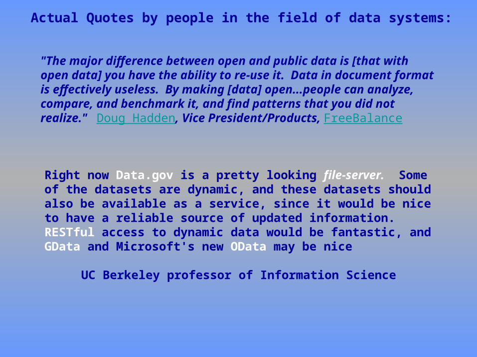
"The major difference between open and public data is [that with open data] you have the ability to re-use it. Data in document format is effectively useless. By making [data] open...people can analyze, compare, and benchmark it, and find patterns that you did not realize." Doug Hadden, Vice President/Products, FreeBalance
Right now Data.gov is a pretty looking file-server. Some of the datasets are dynamic, and these datasets should also be available as a service, since it would be nice to have a reliable source of updated information. RESTful access to dynamic data would be fantastic, and GData and Microsoft's new OData may be nice
UC Berkeley professor of Information Science
Actual Quotes by people in the field of data systems:
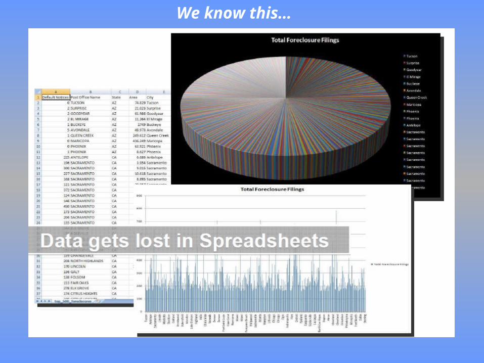
We know this…
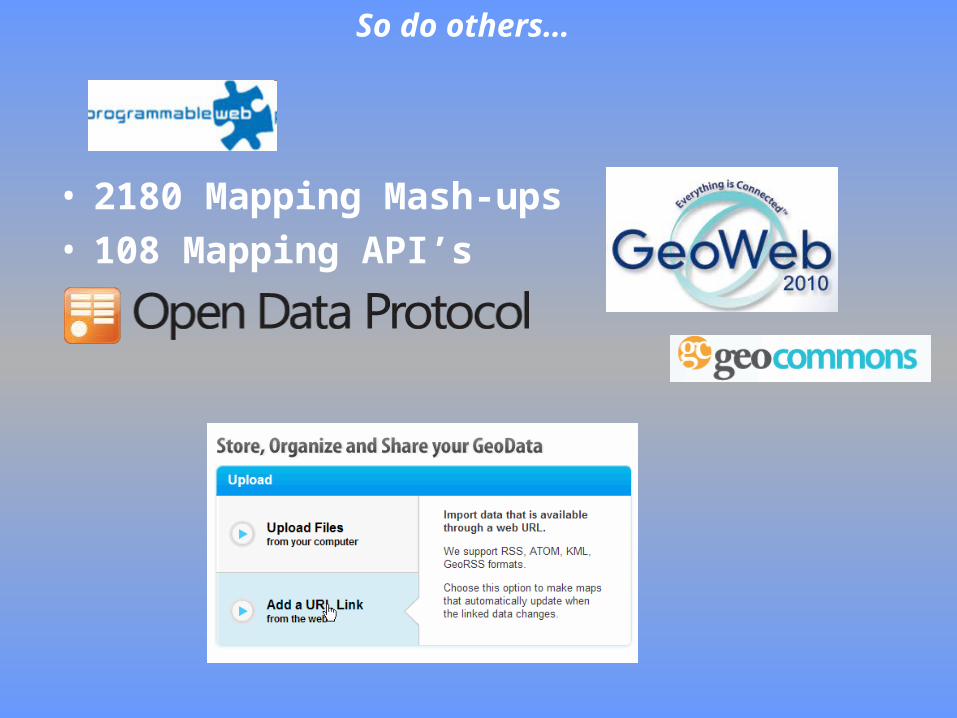
• 2180 Mapping Mash-ups• 108 Mapping API’s
So do others…

How can we apply Geographic Information Systems to the way we prevent chronic disease in a state, county, community, or neighborhood?

What is GIS (Geographic Information Systems)?
•Formal Definition:Organized collection of computer hardware, software, personnel, geographic data, used to systematically capture, store, display, analyze and retrieve all forms of geo-referenced information….
•In Business Terms:A useful system in which to organize geographic knowledge into useful business logic and successful collaboration and sharing of data….
•In State Health Department Terms:Enterprise data (like much of what we have within state health departments) can benefit from being dynamically geo-enabled.
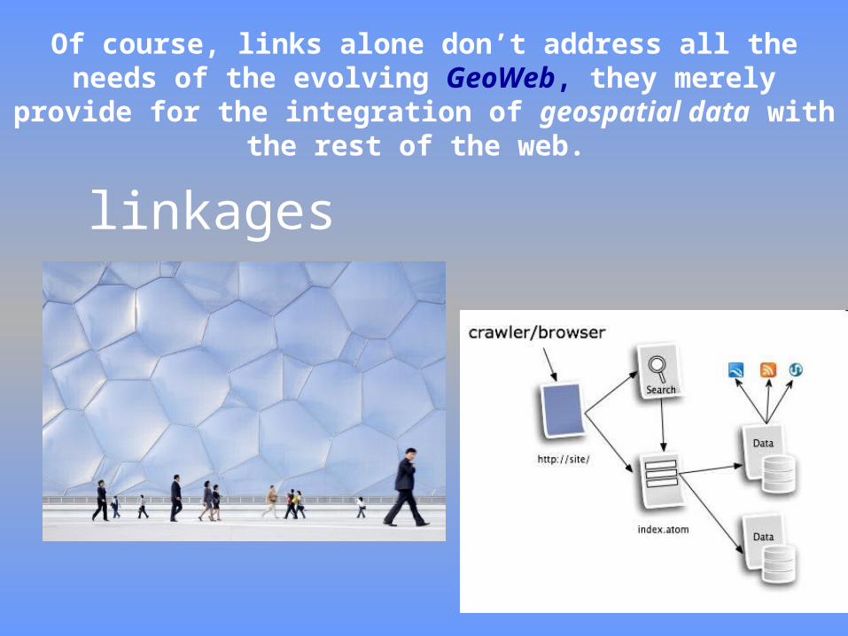
Of course, links alone don’t address all the needs of the evolving GeoWeb, they merely provide for the integration of
geospatial data with the rest of the web.
linkages

Using GIS to spatially display data, maps can be produced that:
And assist in answering questions like:
• How could a Diabetes Program allocate training funds appropriately to reach the majority of its target population?
• How can Chronic Disease programs begin using GIS for modeling disease rates and demonstrating health effects of land use policies?
• How can the Center for Chronic Disease provide a gateway for Local Health Departments for accessing important social determinants of health relative to chronic disease?
•Inform health program delivery
• Communicate a message
• Support policy, environmental, and systems change

Adaptation--Use technology for what it can provide

OK….now I’m getting excited…..

It’s pretty simple to mix things up
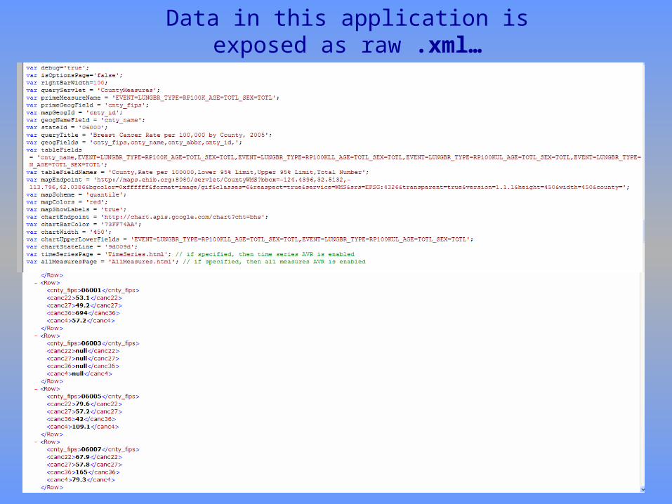
Data in this application is exposed as raw .xml…
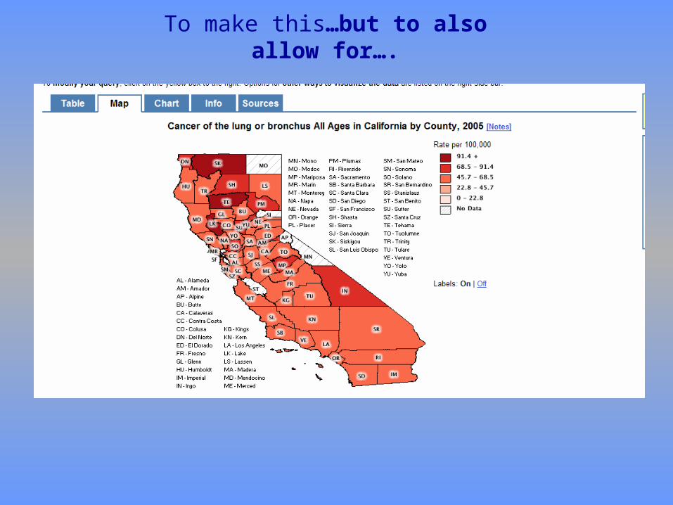
To make this…but to also allow for….
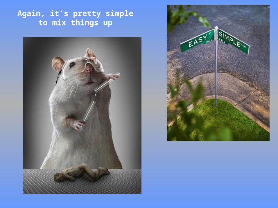
Again, it’s pretty simple to mix things up

or…something like this pretty easily
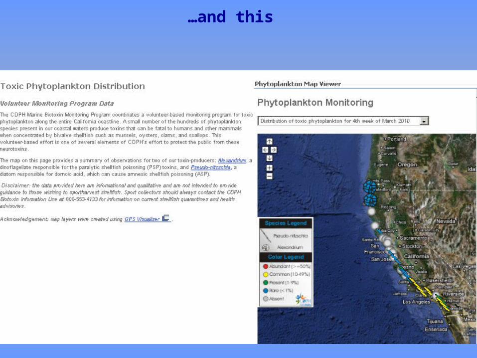
…and this
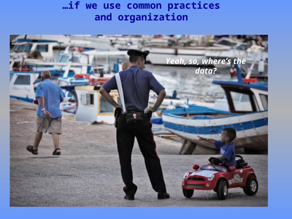
Yeah, so, where’s the data?
…if we use common practices and organization
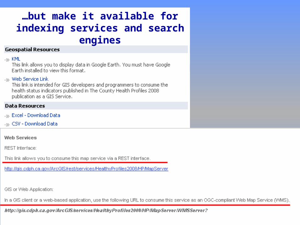
…but make it available for indexing services and search
engines

Wouldn’t it be easier to just link to your output?


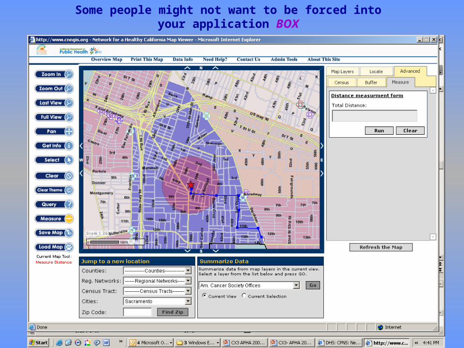
Some people might not want to be forced into your application BOX
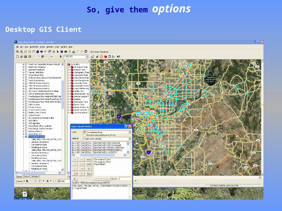
So, give them options
Desktop GIS Client

Put the simple pieces together first
• Organize the data in a useable, consumable fashion
• Spread the word about the possibilities of more open data sharing
• Follow accepted standards/formats that lend to usability
– GeoRSS, Atom/RSS, etc.

RSS feeds become quite powerful with a location component (GeoRSS)

Other Ideas? Endless Possibilities….
Where do you wish to establish your Data/Web Presence
• Network for a Healthy California http://gis.cdph.ca.gov/cnn specifically utilizes GIS for project requirements
• California Arthritis Partnership Program (CAPP) uses GIS to view their program assets in relationship to their targeted population for appropriate program reach
• Your own program events as an RSS feed on a map (GeoRSS)
THIS IS JUST A START….
We all know, it’s about the Community….
• At the policy level, maps can communicate a message
• Where are our funded programs in a community and where AREN”T they
• What could you do with a combination of local data and statewide data (Example: a statewide Retail Food Environment-type index over-laid by local program data)?