mayfield west secondary plan phase 2 - caledon · pdf filemayfield west secondary plan. phase...
TRANSCRIPT

MAYFIELD WEST SECONDARY PLANPHASE 2
Council Information Workshop February 16, 2010
TOWN OF CALEDONPLANNING & DEVELOPMENT DEPARTMENT
Draft Preferred Land Use PlanDraft Preferred Land Use Plan

TOWN OF CALEDON
MAYFIELD WEST SECONDARY PLAN (PHASE 2) | Council Information Workshop
Workshop Agenda
1. Welcome and Introductions.
2. Review of Key Directions.
3. Project Background.
4. Draft Preferred Land Use Plan.
5. Next Steps.

TOWN OF CALEDON
The Growth Plan for the Greater Golden Horseshoe, 2006
Section 2.2.8. prescribes provincial policy direction applicable
to settlement area boundary expansions:
“A settlement area boundary expansion may only occur as part of a municipal comprehensive review where it has been demonstrated that:
a) sufficient opportunities to accommodate forecasted growth contained in Schedule 3, through intensification and in designated greenfield areas, using the intensification target and density targets, are not available.”
MAYFIELD WEST SECONDARY PLAN (PHASE 2) | Council Information Workshop
Provincial Policy
TOWN OF CALEDON
The Growth Plan for the Greater Golden Horseshoe, 2006
Section 2.2.7.(2) prescribes provincial policy direction applicable to Designated Greenfield Areas:
“The designated greenfield
area of each upper-
or single-tier municipality will be planned to achieve a minimum density target that is not less than 50 residents and jobs combined per hectare.”
MAYFIELD WEST SECONDARY PLAN (PHASE 2) | Council Information Workshop
Provincial Policy

TOWN OF CALEDON
Region of Peel Official Plan Amendment Number 17
“Section 5.4.3.2.9 The boundary shown on Schedule “D”
and designated in the legend “Study Area Boundary”
is the area within which additional growth for Mayfield West beyond the 2021 population target is anticipated to occur. If additional growth
to meet future population targets is allocated to the Mayfield West
study area Council will direct it west of Highway 10 within the study area boundary.
Studies to confirm the exact land requirements and to confirm compliance with requirements at that time including such things as the Provincial Policy Statement, the Places to Grow Plan and the provisions of Section 7.9.2.8 of this plan, will be completed prior to adoption of any Official Plan Amendment to designate said lands in the Rural Service Centre of Mayfield West.”
Regional Policy
MAYFIELD WEST SECONDARY PLAN (PHASE 2) | Council Information Workshop

TOWN OF CALEDON
9 Guiding Principles
MAYFIELD WEST SECONDARY PLAN (PHASE 2) | Council Information Workshop
1.
Achieve
net ecological gain, when practical, possible and advisable.
2.
Adopt an integrated design process. 3.
Foster a local identity rooted in the spirit of the Town of Caledon.
4.
Establish the structure for a close knit small town that fosters self sufficiency.
5.
Achieve a range and mix of housing.6.
Promote walking, cycling and transit opportunities. 7.
Maximize conservation and innovation (water, waste, energy).8.
Ensure community connectivity and integration at all scales.9.
Support adaptive change.

TOWN OF CALEDON
Project Background
Study area existing conditions and characterization determined by the Town’s technical consultant team in 2008/2009.
3 land use scenarios were prepared by Urban Strategies; scenarios responded to planning considerations, policy direction, guiding principles and preliminary feedback and direction provided by Council in May and June 2009.
Review, comment and evaluation of scenarios:●
Council Information Workshops (May 26 & June 22, 2009). ●
Public Open House (June 25, 2009).●
Stakeholder Advisory Group (July 23, 2009).●
28 submissions (agencies, stakeholders, landowners etc.).●
Town Departments.●
Town’s Technical Consultant Team.
MAYFIELD WEST SECONDARY PLAN (PHASE 2) | Council Information Workshop
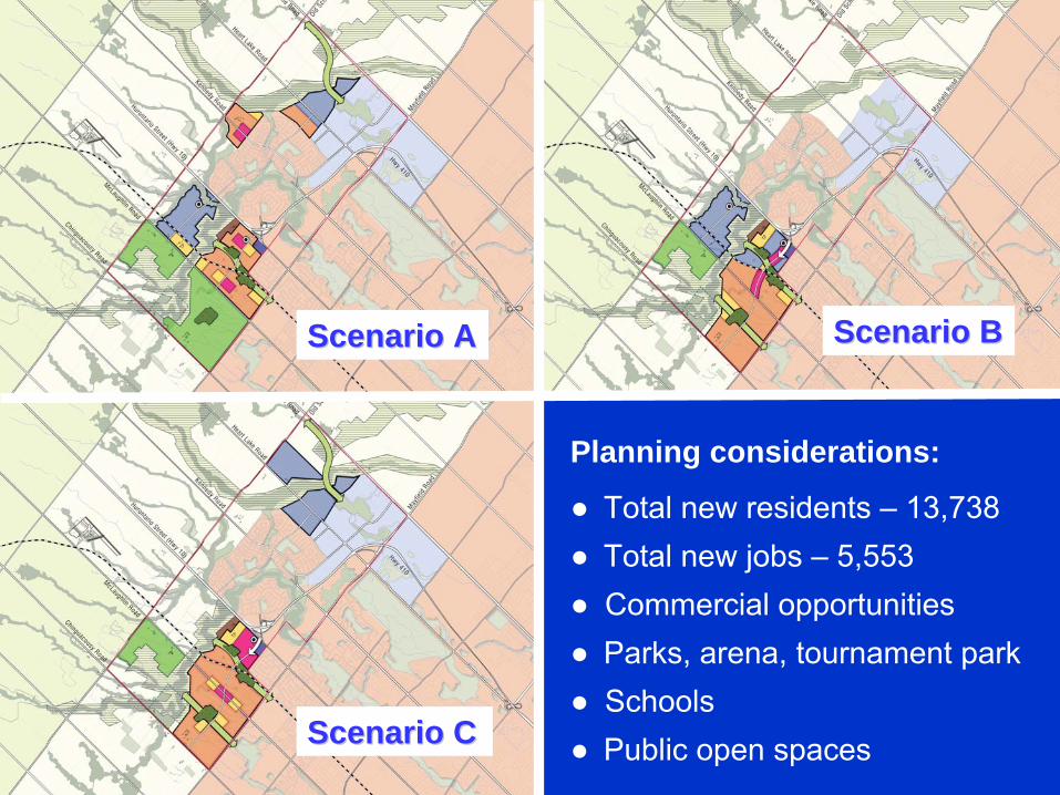
Scenario AScenario A
Scenario CScenario C
Scenario BScenario B
Planning considerations:
●
Total new residents –
13,738●
Total new jobs –
5,553●
Commercial opportunities●
Parks, arena, tournament park●
Schools●
Public open spaces
TOWN OF CALEDON
Council Feedback
Preliminary feedback provided by Council:●
ROPA 17 directs future growth to the west side of Highway 10 –
all population growth allocated to MW2 should be located west of Highway 10.
●
An east-west road should be planned for west of Highway 10 and north of the Etobicoke
Creek to providea transportation connection between MW1 and MW2.
●
Must give due consideration to the planned role and function of Mayfield Road; need to limit the number of new access points on to Mayfield Road in order to maintain its arterial road function.
●
Locate compatible land uses adjacent to the rail line; where possible, limit the need for large setbacks.
MAYFIELD WEST SECONDARY PLAN (PHASE 2) | Council Information Workshop

TOWN OF CALEDON
●
With respect to the location of new employment lands:
▪
As a first priority, maximize the opportunities north of and adjacent to the MW1 employment lands.
▪
Consider the lands west of Highway 10, north of Etobicoke
Creek.
●
Provide a range and mix of employment types; higherdensity jobs.
●
Provide convenient and safe access to community facilities in Valleywood e.g. library and fire hall.
●
Give due consideration to the existing and potential future operations of Brampton Flying Club.
MAYFIELD WEST SECONDARY PLAN (PHASE 2) | Council Information Workshop
Council Feedback

TOWN OF CALEDON
Technical Evaluation
MAYFIELD WEST SECONDARY PLAN (PHASE 2) | Council Information Workshop
The Town’s team of technical consultants worked in partnership with the Community Design & Sustainability consultant to evaluate the 3 land use scenarios and identify key directions for the draft preferred land use plan.
●
Environment.
●
Water and wastewater servicing.
●
Transportation.
●
Commercial / retail needs.
●
Agricultural impact.
●
Noise and vibration.

TOWN OF CALEDON
Draft Preferred Land Use Plan ●
Series of slides which take Council through an incremental ‘build-out’
of the Plan.
●
Identify key directions and findings of the technicalevaluation.
●
Some initial thoughts on location, scale and design for specific land uses e.g. employment lands, commerciallands and residential development.
●
Early thoughts on ways to implement the 9 guiding principles.
●
Highlight some of the challenges to implementing the Plan.
MAYFIELD WEST SECONDARY PLAN (PHASE 2) | Council Information Workshop
Main Presentation
TOWN OF CALEDON
A Good Plan for Caledon
The draft preferred land use plan:
●
A comprehensive plan, incorporating all planning considerations in a compact, transit supportive form.
●
Addresses provincial and Regional policy in a responsibleand appropriate manner.
●
Provides an excellent foundation for the successful implementation of the 9 guiding principles.
●
Responds in a balanced manner to the findings and recommendations of the technical evaluation as well asstakeholder input.
●
Allows for some flexibility at the community design phase.
MAYFIELD WEST SECONDARY PLAN (PHASE 2) | Council Information Workshop

Existing ConditionsExisting Conditions

Employment LandsEmployment Lands

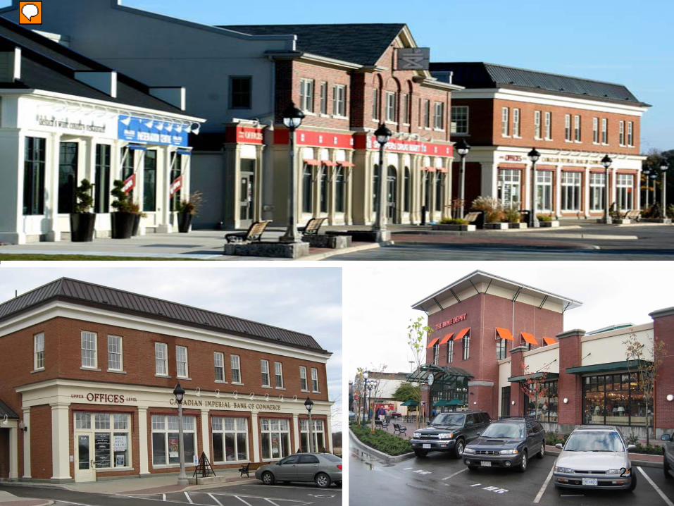
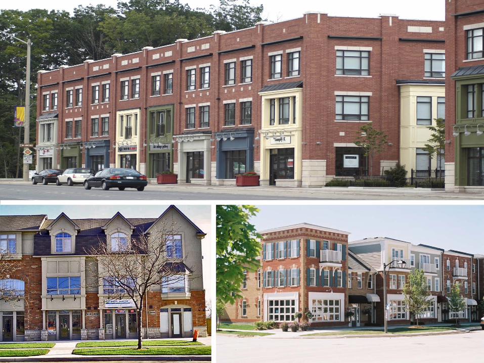
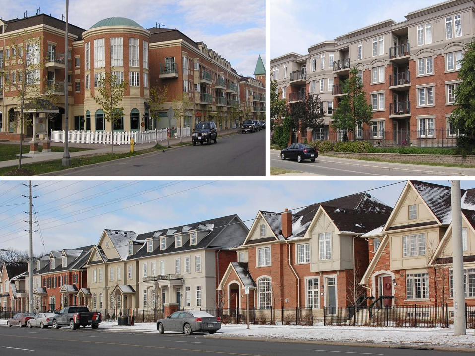
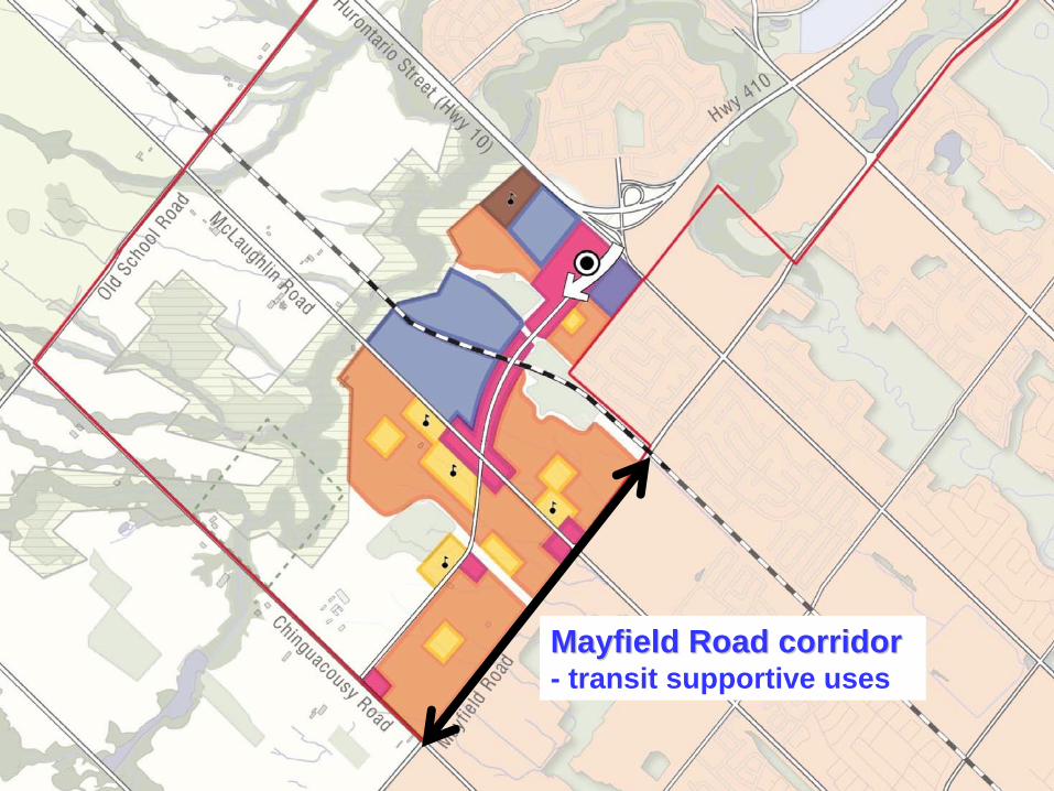
Commercial / Retail Needs
●
Potential market demand exists for approx. 935,000 sq. ft. of new commercial and retail development in Mayfield West, including regional scale large big box anchor retailers.
●
Conventional forms of power centre development, suchas Trinity Commons in Brampton, have peaked.
●
Mixed use nodes and commercial corridor formats are gaining market share momentum.
●
Design is paramount to achieving a close knit small town.
●
Transit initiatives contribute significantly to the viability ofmixed use nodes; commercial and employment centres.
MAYFIELD WEST SECONDARY PLAN (PHASE 2) | Council Information Workshop
TOWN OF CALEDON
Significant Commercial & Retail Opportunities

©2010 MapQuest Portions ©2010 NAVTEQ, i-cubed
Trinity Commons, BramptonTrinity Commons, Brampton900,000 sq. ft. commercial / retail spaceApprox. 85 acresBig-box anchors (Zellers, Canadian Tire, Home Depot)
Highw
ay 410
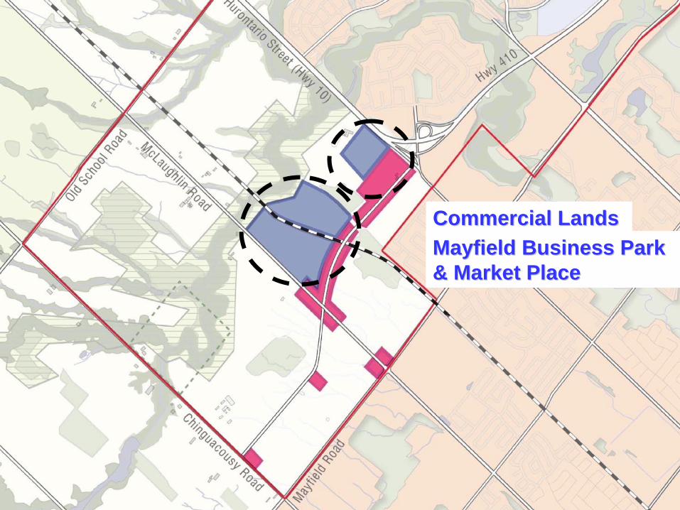
Commercial LandsCommercial LandsMayfield Business Park Mayfield Business Park & Market Place& Market Place

Purdue Purdue PharmaPharmaPickering, ON.Pickering, ON.20,000 sq. ft.150 employees37 employees / ha.
Ontario Ontario AgriCentreAgriCentreGuelph, ON.Guelph, ON.22,000 sq. ft.94 employees62 employees / ha.
Watson & Associates 2010

Commercial / office, Ajax, ON.Commercial / office, Ajax, ON.34,000 sq. ft.74 employees55 employees / ha.
BiovailBiovail Corp., Mississauga, ON.Corp., Mississauga, ON.21,000 sq. ft.200 employees71 employees / ha.
Watson & Associates 2010
21

Water and Wastewater Servicing
●
No significant constraints on water servicing.
●
The natural heritage system and topography make wastewater servicing challenging in certain areas e.g. north of the Etobicoke
Creek and Humber River valleys.
●
Keeping new growth south of the Etobicoke
Creek and Humber River valleys optimizes the use of existing and planned wastewater infrastructure to support growth in acompact and efficient form without the need for creek crossings and pumping stations.
●
MW2 servicing plan needs to consider future phases.
MAYFIELD WEST SECONDARY PLAN (PHASE 2) | Council Information Workshop
Optimizing Existing & Planned InfrastructureTOWN OF CALEDON

Noise and Vibration
●
The preferred land use plan eliminates the placement ofresidential land uses directly adjacent to the rail corridorand in areas affected by the existing and potential futureoperations of the Brampton Flying Club.
●
Recognizing that guiding principle #4 speaks to a “mix of land uses in close proximity and well integrated” location,scale and design strategies will be employed at the community design phase to manage noise and vibration issues.
MAYFIELD WEST SECONDARY PLAN (PHASE 2) | Council Information Workshop
TOWN OF CALEDON
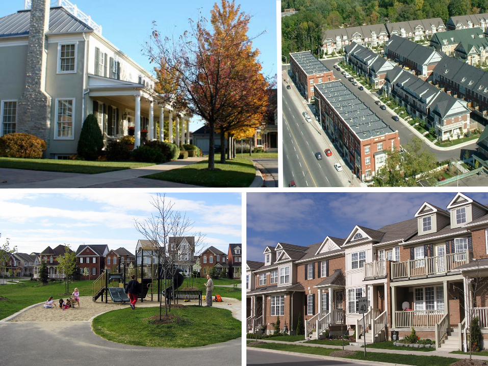
Land Use Compatibility

Residential Residential NeighbourhoodsNeighbourhoods- with schools and parks
MW Phase 2:MW Phase 2:11,500 new residents(3,900 new residents pre-2021)
MW Phase 1:MW Phase 1:2,238 new residents post-2021
WalkableWalkable NeighbourhoodsNeighbourhoods
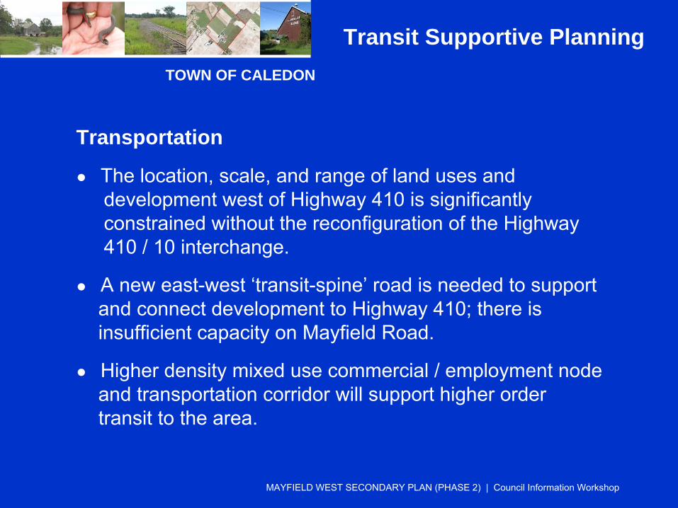
Transportation
●
The location, scale, and range of land uses and development west of Highway 410 is significantly constrained without the reconfiguration of the Highway410 / 10 interchange.
●
A new east-west ‘transit-spine’
road is needed to supportand connect development to Highway 410; there is insufficient capacity on Mayfield Road.
●
Higher density mixed use commercial / employment node and transportation corridor will support higher ordertransit to the area.
MAYFIELD WEST SECONDARY PLAN (PHASE 2) | Council Information Workshop
Transit Supportive PlanningTOWN OF CALEDON

Highway 410/10 is Highway 410/10 is a critical gatewaya critical gateway

Existing Configuration
Possible Configuration

NORTH
COLLINGWOOD AVE.
VALLEYWOOD
PEEL POLICE LANDS

Mixed use transit corridor Mixed use transit corridor - anchored by a transit hub
Mayfield Road corridor Mayfield Road corridor - transit supportive uses
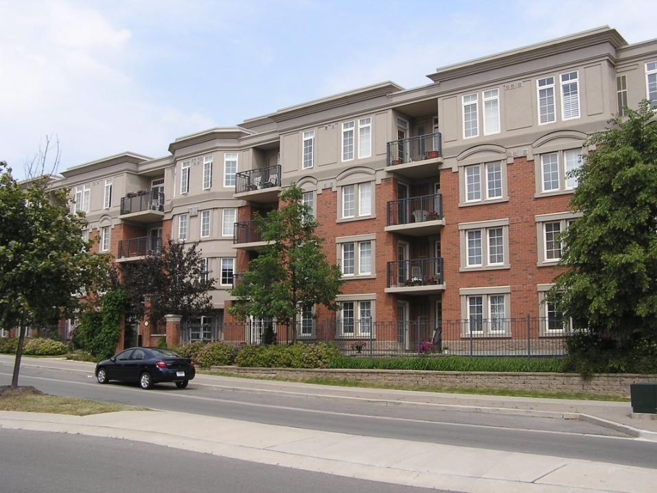
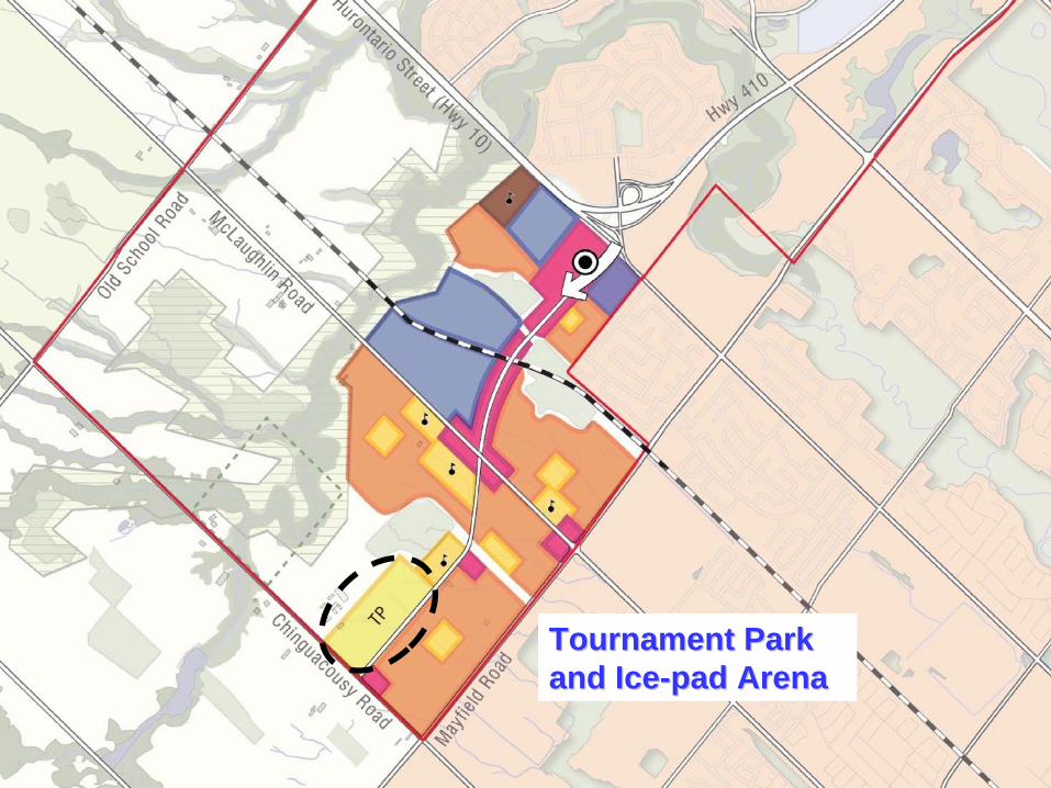
Tournament Park Tournament Park and Iceand Ice--pad Arenapad Arena
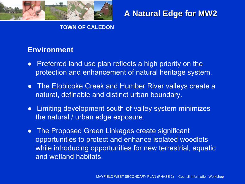
Environment
●
Preferred land use plan reflects a high priority on theprotection and enhancement of natural heritage system.
●
The Etobicoke
Creek and Humber River valleys create anatural, definable and distinct urban boundary.
●
Limiting development south of valley system minimizesthe natural / urban edge exposure.
●
The Proposed Green Linkages create significant opportunities to protect and enhance isolated woodlots while introducing opportunities for new terrestrial, aquaticand wetland habitats.
MAYFIELD WEST SECONDARY PLAN (PHASE 2) | Council Information Workshop
TOWN OF CALEDON
A Natural Edge for MW2A Natural Edge for MW2
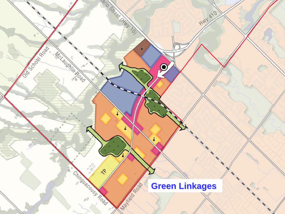
Green LinkagesGreen Linkages

Agricultural Impact
●
Regarding soil capability, there is no significant differencebetween the 3 land use scenarios.
●
The Etobicoke
Creek and Humber River valleys create anatural, definable and effective buffer between remaining agricultural operations and future urban growth.
●
The length of the rural / urban interface is minimized, thusreducing ‘edge’
conflicts.
●
There are no reasonable alternatives that avoid prime agricultural areas.
MAYFIELD WEST SECONDARY PLAN (PHASE 2) | Council Information Workshop
TOWN OF CALEDON
No Reasonable Alternatives

Draft Preferred Draft Preferred Land Use PlanLand Use Plan
TOWN OF CALEDON
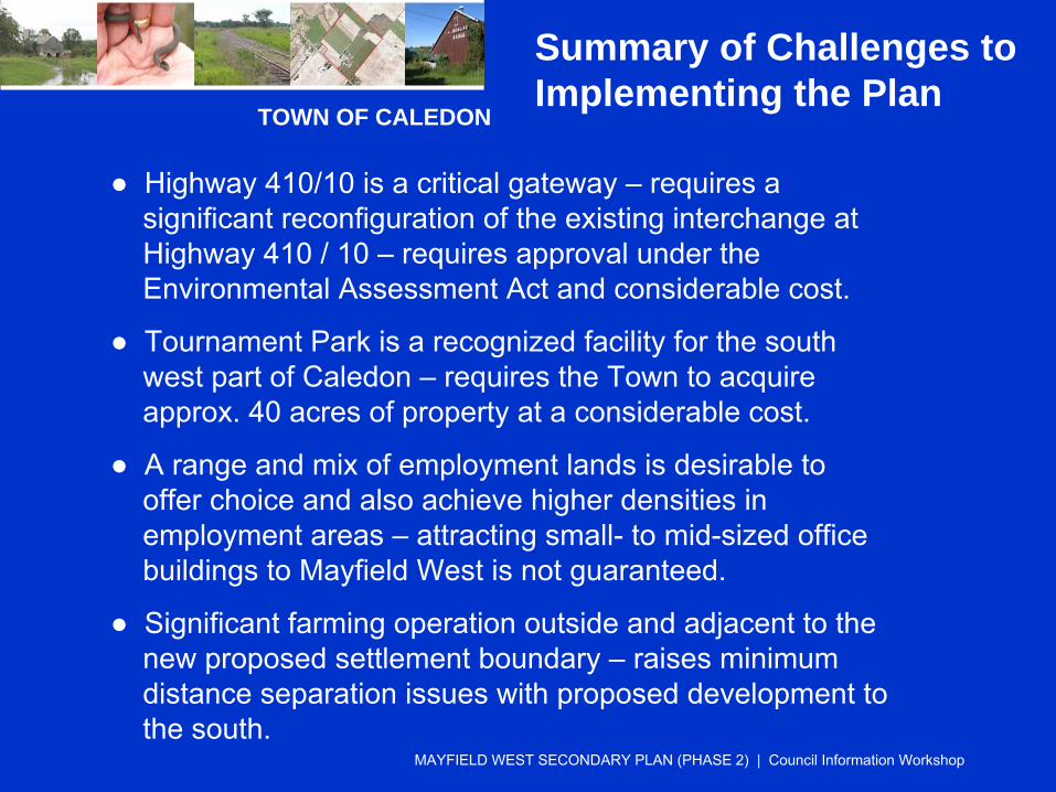
●
Highway 410/10 is a critical gateway –
requires a significant reconfiguration of the existing interchange at Highway 410 / 10 –
requires approval under the Environmental Assessment Act and considerable cost.
●
Tournament Park is a recognized facility for the south west part of Caledon –
requires the Town to acquire approx. 40 acres of property at a considerable cost.
●
A range and mix of employment lands is desirable to offer choice and also achieve higher densities in employment areas –
attracting small-
to mid-sized office buildings to Mayfield West is not guaranteed.
●
Significant farming operation outside and adjacent to thenew proposed settlement boundary –
raises minimum distance separation issues with proposed development tothe south.
MAYFIELD WEST SECONDARY PLAN (PHASE 2) | Council Information Workshop
Summary of Challenges to Implementing the Plan

MAYFIELD WEST SECONDARY PLAN (PHASE 2) | Council Information Workshop
Working Land Budget
Illustrated Land Budget 50 new residents + jobs per hectare
Community AmenitiesParks, Arena, Tournament Park
28 ha
InstitutionalSchools, Peel Police Station
26 ha
Commercial935,000 sq. ft. @ 25%-50% coverage 35 ha
Employment@ average of 55 employees / ha 89 ha
Residential@ 67 new residents / ha 172 haIncludes green linkages
Total Land Need 350 ha
Full Ask 50 new residents + jobs per hectare
Community AmenitiesParks, Arena, Tournament Park
30 ha
InstitutionalSchools, Peel Police Station 31 ha
Commercial935,000 sq. ft. @ 25% coverage
45 ha
Employment@ 24 employees / ha
117 ha
Residential@ 89 new residents / ha 130 haIncludes green linkages
Total Land Need 353 ha
TOWN OF CALEDON

Residential Density:Residential Density:Existing ConditionsExisting Conditions
MW Phase 1: 9,000 residents = 41 residents / ha.
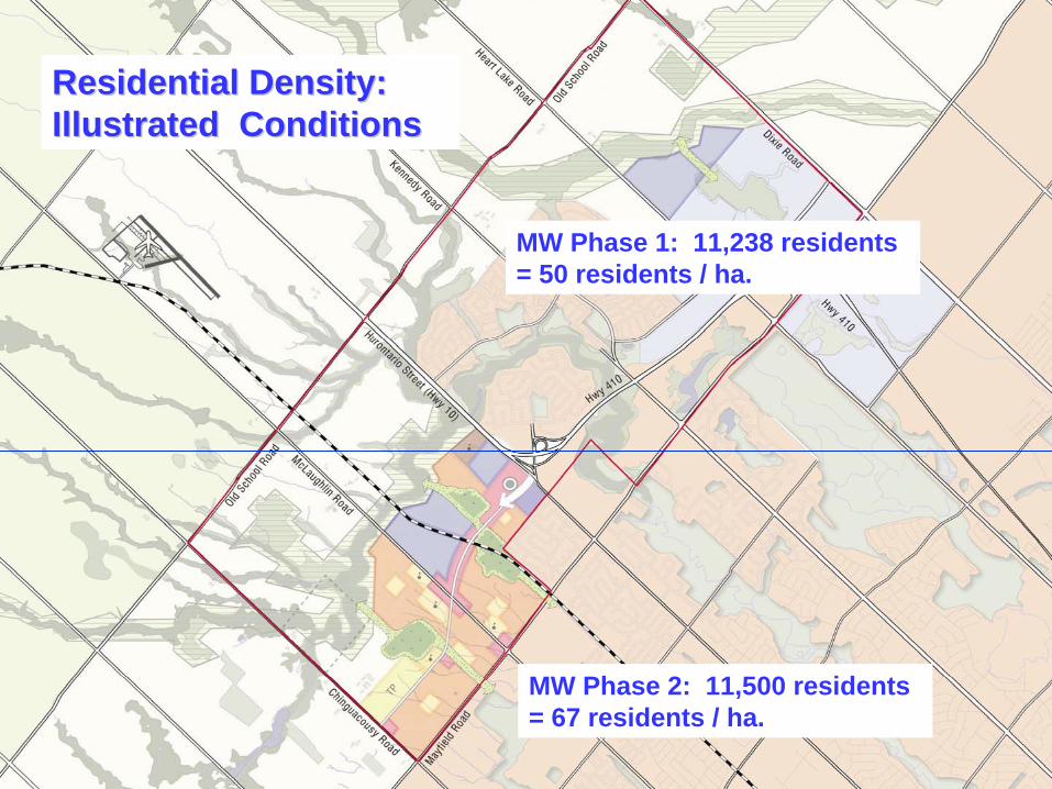
Residential Density:Residential Density:Illustrated ConditionsIllustrated Conditions
MW Phase 1: 11,238 residents = 50 residents / ha.
MW Phase 2: 11,500 residents = 67 residents / ha.

Residential Density:Residential Density:Alternate ConditionsAlternate Conditions
MW Phase 1: 9,000 residents = 41 residents / ha.
MW Phase 2: 13,738 residents = 68 residents / ha.
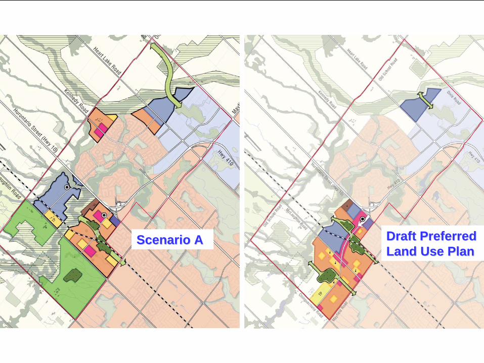
Draft Preferred Draft Preferred Land Use PlanLand Use Plan
Scenario AScenario A

Scenario BScenario B Draft Preferred Draft Preferred Land Use PlanLand Use Plan

Scenario CScenario C Draft Preferred Draft Preferred Land Use PlanLand Use Plan

TOWN OF CALEDON
Next Steps
Review and comment period.●
Council Information Workshop (February 16, 2010) ●
Public Open House (February 25, 2010)●
Town Departments ● Town’s Consultant Team
A recommended land use plan will be considered by Council for endorsement at a future Council Meeting.
MAYFIELD WEST SECONDARY PLAN (PHASE 2) | Council Information Workshop