methodology of system development
TRANSCRIPT
Methodology of System Development
REGIONAL DIVISIONSThe wetland forest habitat type classification system uses the same geographical regions as established for the upland system (Kotar, Kovach, Burger, 2002). While no objective ecologically defined geographical boundaries can be established, the system uses 11 Regions (five for northern Wisconsin that are characterized by differences in geology, soils, climate and floristic gradients (see page 8-2, “Glacial Deposits” map). A regional approach also makes it easier to develop more specific floristic identification keys and habitat type descriptions. For convenience, the region boundaries simply adopt the most approximate political boundaries.
Section 9: Methodology of System Development • 8-1
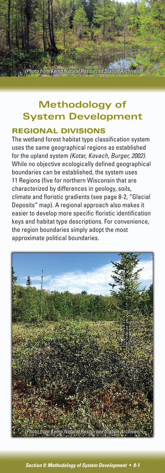
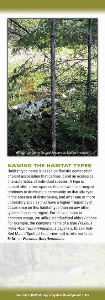
(Photo from Kemp Natural Resources Station Archives)
(Photo from Kemp Natural Resources Station Archives)
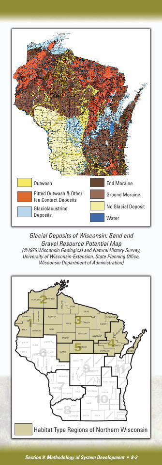
Section 9: Methodology of System Development • 8-2
Habitat Type Regions of Northern Wisconsin
Glacial Deposits of Wisconsin: Sand and Gravel Resource Potential Map
(©1976 Wisconsin Geological and Natural History Survey, University of Wisconsin-Extension, State Planning Office,
Wisconsin Department of Administration)
Outwash End Moraine
Ground Moraine
No Glacial Deposit
Water
Pitted Outwash & Other Ice Contact Deposits
Glaciolacustrine Deposits
Section 9: Methodology of System Development • 8-3
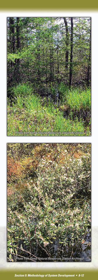
FIELD PROCEDURESThe classification is based on systematic vegetation and soil sampling of “wetland forests.” In an attempt to capture the broadest possible range of wetland forests, we established a broad definition of the type of site and forest community to sample. We included all forested sites where a permanent or seasonal high water table was clearly evident. For reconnaissance planning, we utilized maps produced by the Natural Resources Conservation Service (NRCS) showing distribution of wet and poorly drained soils. Tree species composition of stands is usually, but not always, an indication of wetland conditions. In observing potential areas for sampling, we keyed on dominance or strong presence of any of the following species: black ash, red maple, (formerly) American elm, eastern hemlock, tamarack, balsam fir, black spruce and northern white cedar. If soil properties suggested wet conditions, we also considered stands dominated by any other species, most often aspen, white birch, yellow birch, white pine and jack pine.
A stand meeting above criteria was sampled in the following manner. A 300 (21 m x 14 m) square meter macro plot was laid out. The macro plot was subdivided into six 7 m x 7 m subplots. Within each of the subplots, all plant species, with the exception of some grasses, sedges and mosses, were identified and their abundance estimated according to six coverage classes. Plants were also stratified in the following categories: trees (large trees, poles, saplings, seedlings), shrubs and herbs. Species coverage values for the six subplots were later averaged to obtain one value for the macro plot. Soils were sampled with a bucket auger for the following properties: texture at one foot intervals, presence of mottling (indication of fluctuating saturation periods), and depth of current soil saturation. In cases of organic substrate, the organic matter was classified in degrees of decomposition as fibric, hemic and sapric in one foot intervals.
Section 9: Methodology of System Development • 8-4
DELINEATION OF ECOLOGICAL CLASSES OR HABITAT TYPESAs in the case of upland forest habitat type classification system, the ecological groups, or categories, (habitat types) are defined by similarities and differences in overall floristic composition. To reveal such floristic groupings, the plant data for each of the five regions were analyzed with a Two Way Indicator Species Analysis (TWINSPAN) computer program. Depending on the region, this procedure yielded four to eight floristic groupings.
The ecological relationships among delineated floristic groups were examined through the Synecological Coordinates ordination or syncords (Bakuzis 1959, Bakuzis and Kurmis 1978, Gutierrez-Espeleta 1996). On the basis of extensive studies in Minnesota, Bakuzis assigned each forest species (trees, shrubs, ground flora) a value of one to five to indicate the species’ requirements for optimal growth and survival under competitive conditions for four site factors: moisture, nutrients, light and heat. For example, a species with a moisture index of five primarily occurs in a very wet environment while a species with an index of one occurs on droughty sites. These values were termed “synecological coordinates.”
Using the list of synecological coordinates developed by Bakuzis, an estimate of environmental conditions of a given site is obtained by calculating a mean index from the individual indices of all the species present on that site. For this guide, moisture and nutrient indices were used to calculate and plot the means for all sample plots in the data set. The plots representing floristic groups delineated in a given region formed clusters with varying degree or overlap among the most similar groups. The circular/oval fields in the moisture/nutrient graphs (syncords) were drawn to include at least 90 percent of the plots representing each floristic group or habitat type. Descriptive terms (e.g., dry, dry-mesic, mesic, and poor, medium, rich) were arbitrarily assigned to segments of the moisture and nutrient axes to provide more visual and practical interpretation of the physical environment of various habitat types.
Section 9: Methodology of System Development • 8-5
NAMING THE HABITAT TYPESHabitat type name is based on floristic composition of plant association that defines it and on ecological characteristics of individual species. A type is named after a tree species that shows the strongest tendency to dominate a community on that site type in the absence of disturbance, and after one or more understory species that have a higher frequency of occurrence on this habitat type than on any other types in the same region. For convenience in common usage, we utilize standardized abbreviations. For example, the complete name of a type Fraxinus nigra-Acer rubrum/Impatiens capensis, (Black Ash-Red Maple/Spotted Touch-me-not) is referred to as FnArI, or Fraxinus-Acer/Impatiens.
(Photo from Kemp Natural Resources Station Archives)
References
Bakuzis, E. V. and Kurmis, V. 1978. Provisional List of Synecological Coordinates and Selected Ecographs of Forest and Other Plant Species in Minnesota. University of Minnesota, St. Paul. Staff Series Paper. No. 5.: 31 pp.
Billington, Cecil. 1952. Ferns of Michigan. Cranbrook Institute of Science, Bloomfield Hills, MI. 240 pp.
Burns, Russell M. and Barbara H. Honkala, tech coords. 1990. Silvics of North America: 1. Conifers; 2. Hardwoods. Agric. Handbook 654. U.S. Department of Agriculture, USDA Forest Service, Washington, DC. Vol. 2: 877 p.
Epstein, E. J., E. J. Judziewicz, and E. A. Spencer. 2002. Wisconsin Natural Community Abstracts. Department of Natural Resources, Bureau of Endangered Resources, Madison, WI. Available online at dnr.wi.gov/org/land/er/communities/.
Erdmann, G. G., T. R. Crow, R. M. Peterson, Jr., and C. D. Wilson. 1987. Managing Black Ash in the Lake States. USDA Forest Service, North Central Forest Experiment Station. Technical Report NC-115.
Fasset, Norman C. 1976. Spring Flora of Wisconsin. 3rd edition with revisions by Margaret S. Bergseng. University of Wisconsin Press. 189 pp.
Gutiérrez-Espeleta, E. E. 1996. “Some Thoughts on Ordination Techniques, Ecological Study Units, and the Method of Synecological Coordinates.” Journal of Theoretical Biology. 179 (1): 13-23 pp.
Heinselman, M. L. 1963. “Forest Sites, Bog Processes, and Peatland Types in the Glacial Lake Region, Minnesota.” Ecological Monographs. 33 (4): 327-374.
Jeglum, J. K. 1975. “Vegetation-habitat Changes Caused by Damming a Peatland Drainageway in Northern Ontario.” Canadian Field-Naturalist. 89 (4): 400-412.
Kotar, J., Kovach, J. A. and Burger T. L. 2002. A Guide to Forest Communities and Habitat Types of Northern Wisconsin. Department of Forest Ecology and Management, University of Wisconsin-Madison.
Section 9: Methodology of System Development • 8-6
Section 9: Methodology of System Development • 8-7
Kotar, J. and T. L. Burger. 1996. A Guide to Forest Communities and Habitat Types of Central and Southern Wisconsin. Department of Forest Ecology and Management, University of Wisconsin-Madison.
Minnesota Department of Natural Resources (MNDNR). 2003. Field Guide to the Native Plant Communities of Minnesota: The Laurentian Mixed Forest Province. Ecological Land Classification Program, Minnesota County Biological Survey, and Natural Heritage and Nongame Research Program. MNDNR, St. Paul, MN.
Newcomb, Lawrence. 1977. Newcomb’s Wildflower Guide. Little, Brown and Co. Boston, MA. 468 pp.
Slesak, R. A., Lenhart, C. F., Brooks, K. N., D’Amato, A. W. and Palik, B. J. 2014. “Water Table Response to Harvesting and Simulated Emerald Ash Borer Mortality in Black Ash Wetlands in Minnesota, USA.” Canadian Journal of Forest Research. 44 (8): 961-968 pp.
Smith, Helen V. 1996. Michigan Wildflowers. Cranbrook Institute of Science; Bloomfield, MI. 468 pp.
Trettin, Carl. 1997. Northern Forested Wetlands – Ecology and Management. CRC Press, Inc. Boca Raton, FL.
Tyron, R. 1980. Ferns of Minnesota. University of Minnesota Press, Minneapolis, MN.
Verry, Elon S. 1986. “Forest Harvesting and Water: The Lake States Experience.” Water Resources Bulletin.
Weber, C. R, J. G. Cohen, and M. A. Kost. 2007. Natural Community Abstract for Northern Hardwood Swamp. Michigan Natural Features Inventory, Lansing, MI. 8 pp.
Welsch, David J.; Smart, David L.; Boyer, James N.; Minken, Paul; Smith, Howard C.; McCandless, Tamara L. 1995. Forested Wetlands – Functions, Benefits and the Use of Best Management Practices. U.S. Department of Agriculture, U.S. Forest Service, Northern Area State & Private Forestry. Radnor, PA. NA-PR-01-95.
Wisconsin Department of Natural Resources. 2005 Silviculture Trials. dnr.wi.gov/topic/forestmanagement/silvicultureTrials.html.
Wisconsin Department of Natural Resources. 2010. Wisconsin Forestry Best Management Practices for Water Quality Field Manual.
Wisconsin Department of Natural Resources. 2015. Ecological Landscapes of Wisconsin Handbook. Wisconsin Department of Natural Resources. Madison, WI. Publ. No. 1805.1.
Wisconsin Department of Natural Resources. 2016. Silviculture Handbook. Publ. No. 2431.5.
Section 9: Methodology of System Development • 8-8
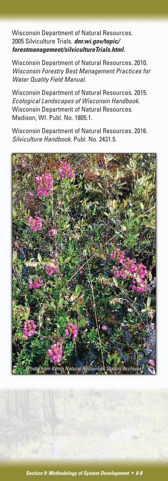
(Photo from Kemp Natural Resources Station Archives)
Historical Overview of the Project Development
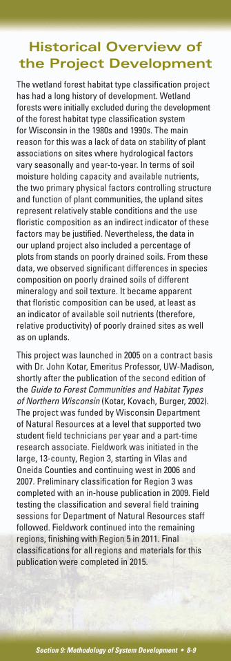
The wetland forest habitat type classification project has had a long history of development. Wetland forests were initially excluded during the development of the forest habitat type classification system for Wisconsin in the 1980s and 1990s. The main reason for this was a lack of data on stability of plant associations on sites where hydrological factors vary seasonally and year-to-year. In terms of soil moisture holding capacity and available nutrients, the two primary physical factors controlling structure and function of plant communities, the upland sites represent relatively stable conditions and the use floristic composition as an indirect indicator of these factors may be justified. Nevertheless, the data in our upland project also included a percentage of plots from stands on poorly drained soils. From these data, we observed significant differences in species composition on poorly drained soils of different mineralogy and soil texture. It became apparent that floristic composition can be used, at least as an indicator of available soil nutrients (therefore, relative productivity) of poorly drained sites as well as on uplands.
This project was launched in 2005 on a contract basis with Dr. John Kotar, Emeritus Professor, UW-Madison, shortly after the publication of the second edition of the Guide to Forest Communities and Habitat Types of Northern Wisconsin (Kotar, Kovach, Burger, 2002). The project was funded by Wisconsin Department of Natural Resources at a level that supported two student field technicians per year and a part-time research associate. Fieldwork was initiated in the large, 13-county, Region 3, starting in Vilas and Oneida Counties and continuing west in 2006 and 2007. Preliminary classification for Region 3 was completed with an in-house publication in 2009. Field testing the classification and several field training sessions for Department of Natural Resources staff followed. Fieldwork continued into the remaining regions, finishing with Region 5 in 2011. Final classifications for all regions and materials for this publication were completed in 2015.
Section 9: Methodology of System Development • 8-9
Section 9: Methodology of System Development • 8-10
Authors and Acknowledgments
John Kotar is Emeritus Professor, Department of Forest and Wildlife Ecology, University of Wisconsin-Madison, and owner of Terra Silva Ecology and Management Consulting.
Timothy L. Burger is former Associate Researcher, Department of Forest and Wildlife Ecology, UW-Madison and contractor with Terra Silva.
Colleen Matula is Wisconsin Department of Natural Resources Forest Ecologist/Silviculturist.
Greg Edge is Wisconsin Department of Natural Resources Forest Ecologist/Silviculturist.
Brad Hutnik is Wisconsin Department of Natural Resources Forest Ecologist/Silviculturist.
Special acknowledgment is extended to the late Joseph Kovach, Forest Ecologist/Silviculturist, Wisconsin Department of Natural Resources - Forestry Division, who was the main engine within the Department of Natural Resources, keeping the interest and funding for this project afloat, contributing significantly with field testing the system, assisting with field training workshops, and for being a valuable professional partner and personal friend for more than 20 years.
I also wish to thank the following Wisconsin Department of Natural Resources staff who continue to promote the development and use of the forest habitat type classification system including: Brad Hutnik, Greg Edge, Colleen Matula and Scott Mueller.
I also wish to acknowledge the assistance and collaboration of many Natural Resources Conservation Service soil scientists, especially Jesse Turk, David Hvizdak and Tim Miland who trained our field crews in methods of soil sampling and assisted us on efficient location of potential study sites.
I also wish to acknowledge our field technicians who endured the most challenging aspects of this project — heat, humidity and bugs. They include:
2005................Aaron Wunnicke and Ryan Wilson 2006................Dane M. Larsen and Cassie Miller 2007................Jeremiah R. Heise, Karl A. Peterson
and Joseph LeBouton 2008................Christy Lowney and Elsa Jensen 2009................Eric North and Albert Meulendyke 2010................Eric North and Jameson Loesch 2011................Alexis Kovach and Scott R. Custer
Thank you to those who provided review and feedback for this manual, including:
• Rob Slesak, Minnesota Forest Hydrologist
• U.S. Forest Service
• Natural Resources Conservation Service
• Wisconsin Department of Natural Resources staff
And finally, many thanks to Sarah Herrick, Colleen Matula, Brad Hutnik, and Greg Edge for skillfully bringing this material online.
Section 9: Methodology of System Development • 8-11
(Photo from Kemp Natural Resources Station Archives)
Section 9: Methodology of System Development • 8-12
(Photo from Kemp Natural Resources Station Archives)
(Photo from Kemp Natural Resources Station Archives)