metropolises study montreal
TRANSCRIPT

Metropolises A metropolis is a major urban centre where power and services are concentrated, and where issues abound. People in the surrounding region and even in the national territory as a whole are drawn to it. Today metropolises are increasingly powerful, which has repercussions for the entire planet. Québec Education Program, Secondary School Education, Cycle One, p. 276 Study Territory:
Montréal Note: This is an archived study file and is no longer updated.
Portrait of the territory A French-speaking metropolis in North America About half of the population of the province of Québec is concentrated in the urban agglomeration of Montréal (also known as the Greater Montréal area), Québec’s largest metropolis, which has a population of 3.6. million people. The new demerged city of Montréal accounts for 1.6 million of these people, almost the entire population of the Island of Montréal. Montréal is the second largest metropolis in Canada, after Toronto, which has a metropolitan area with a population of over 5 million. In Canada, only Vancouver, Ottawa-Gatineau, Calgary and Edmonton also have metropolitan areas of over 1 million people. Updated source: Stats Canada Population profile The suburbs farthest from the centre of Montréal are experiencing the fastest population growth. In fact, for the last 10 years, the population of the city of Montréal itself has only increased slightly, with immigration compensating for the low birth rate of 1.1 children per family. Montréal is consequently a very multicultural city, with immigrants making up 28% of its population. (This percentage drops to 18% for the entire urban agglomeration). The most frequent countries of origin for immigrants on the Island of Montréal are Italy, Haiti, France and China. Most Montrealers are francophones; which means French is their mother tongue. Anglophones make up 17% of the population, while nearly 30% of Montrealers are allophones—their mother tongue is neither French nor English. However, in daily life, 23% of Montrealers speak English.

The Montréal economy The manufacturing industries, retail and health sectors, and professional, scientific and technical services employ the most people in Montréal. Montrealers have an average personal income of about $29,000, which is slightly above the Québec average. The unemployment rate in Montréal is about 10%. One island, one city… Montréal owes its birth and growth to its advantageous geographical location. With a surface area of 500 km², the Island of Montréal is located at the confluence of the St. Lawrence and Ottawa rivers, between two watersheds draining the immense territory of the Great Lakes and the Ottawa River. To the north and south of the island, turbulent rapids have long acted as natural barriers to navigation, forcing travellers to stop on the Island of Montréal. The construction of the Lachine Canal in the 19th century and the opening of the St. Lawrence Seaway in the late 1950s made it possible to avoid these obstacles. The river system of the Montréal region is impressive: in addition to the St. Lawrence River, this region includes three lakes and at least five major rivers. The Island of Montréal is also in the middle of a large fertile plain—formerly the Champlain Sea—above which rise the Monteregian Hills. Overlooking the city, Mount Royal is part of this mountain chain formed by an intrusion of igneous rock. Otherwise, the subsoil of the island, like that of the St. Lawrence Plain, is made up of sedimentary rock, particularly limestone. Montréal has a humid continental climate, with four distinct seasons, an annual average of 162 days of precipitation (rain or snow) and an average temperature of 10.9°C. The mayor of Montréal was elected by 1.8 million voters, whereas the Premier of Québec was elected by the 45,000 people who live in his riding… Sources: www.statcan.ca/ www2.ville.montreal.qc.ca/ About Montréal Montréal (Wikipedia) Montréal (Encarta)

Blank outline maps Blank outline map of the world (Word format) Blank outline map of Québec Blank outline map of Canada
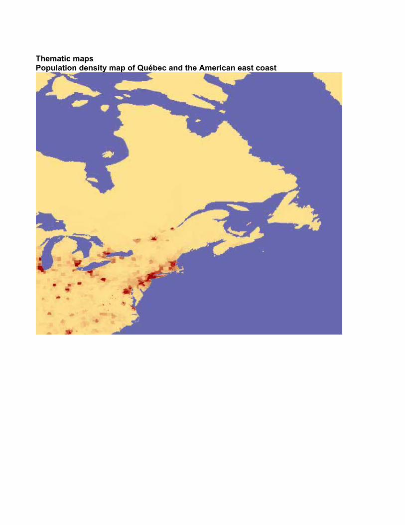
Thematic maps Population density map of Québec and the American east coast

Population density maps of Montréal
French only 1996 Nighttime 2001 Daytime 2001 Infocité versions Sources: Ville de Montréal (from Stats Canada) & Stats Canada source page for current population census & Infocité Services
Government, Education and Health (French only 2001)
Persons working in public administration in 2001
Persons working in health care and social assistance and educational services in 2001
Persons working in services to businesses and consumer services
Sources: Ville de Montréal (from Stats Canada) & Infocité See also: Montréal en stastitiques and Maps of Montreal on the Ville de Montréal site.

Multiethnicity: Montréal's immigrant population
Immigrants of the 1990's* as a percentage of total population by 2001 Census Tract Source: Stats Canada source page for current population census Map of Montréal’ boroughs
Original source and additional borough information at: Ville de Montréal Portal, Section "Territory" Montréal statistics Montréal statistics Statistics for the city of Montréal (Statistics Canada) Statistics for the Montréal metropolitan area (Statistics Canada) Population of metropolitan areas in Canada (Statistics Canada)

Images of Montréal Click on the images to enlarge them Downtown Montréal
Montréal Jazz Festival
Downtown Montréal, Jacques-Cartier Bridge and Mount-Royal

Olympic Stadium
Source: Le Québec en images!

Other online image experiences of Montréal: • Candau.com QTVR galleries • Tour Montréal from space • Ville de Montréal, Section Discovering Montréal Gallery • Flickr search for "Montreal"
• 360 Cities search for Montreal

Getting around in a metropolis The residents of a metropolis may use a variety of means of transportation to get around their city: by foot, bicycle, moped, car, taxi, public transit or even animal power. Theoretically, the concentration of activities and services in a metropolis decreases the distances to be travelled. However, various factors affect travel time within a large city including the efficiency of the public transit system, the quality of the road network and traffic congestion at various times of the day. Moreover, all residents do not have the same access to transportation. Not everyone has a car; in addition, many people may not live near major public transit routes. Finally, commercial trucks make heavy use of the road network, contributing to traffic congestion during peak hours and to the degradation of road surfaces. However, most people who live in metropolises must travel daily for work, school or leisure. The efficiency of their travels has an impact on the economic vigour of their city and the quality of life of its inhabitants. Specific features of Montréal While insularity was practical when the population needed to defend against invaders, today Montréal’s island location complicates the lives of the residents of its metropolitan area. For example, crossing the bridges to get into the city is a major transportation issues. Urban sprawl, suburban development and car traffic weigh increasingly heavily on the city’s road network. The construction of new bridges feeds the debate between those in favour of automobiles and advocates of public transit. The recent debates about the modernization of Notre-Dame Street, in the south-east of the island, and the proposal to extend the metro line to the north into Laval are both examples of the transportation issues faced by Montréal’s periurban population. Cars occupy a central place in the spatial organization of metropolises. In addition to the road network, parking lots and gas stations take up valuable space. This same gas, once combusted, has a negative effect on the quality of the city’s air, contributing to smog formation and, on a planetary level, to global warming.

Thematic maps Means of transportation used by people travelling to work
Source: Ville de Montréal See more recent documentation on transportation in the Moyens de déplacement domicile - travaile PDF located on the updated Demographic and socio-economic atlas of Montréal site.

Montréal’s metro system
Source: STM & their customer information map pages
Calculate your travel time by public transit! Enter your trip at http://www.stm.info/en
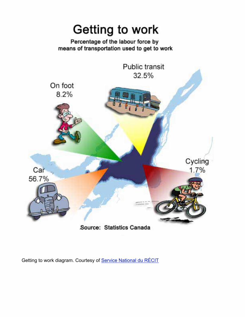
Getting to work diagram. Courtesy of Service National du RÉCIT

Transportation information for Montréal Proportion of workers taking public transit by city Public transit. (Various tables of stats) Montréal transportation statistics (in French only) Images of Montreal Traffic (Highway 25)
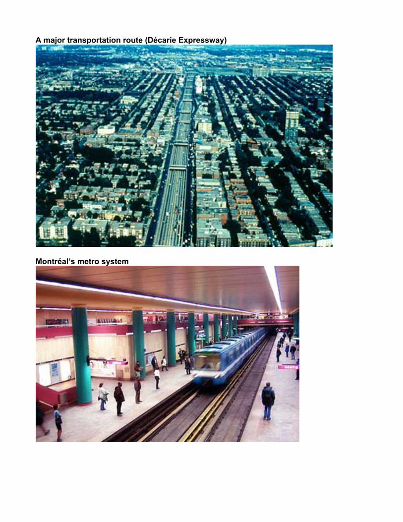
A major transportation route (Décarie Expressway)
Montréal’s metro system
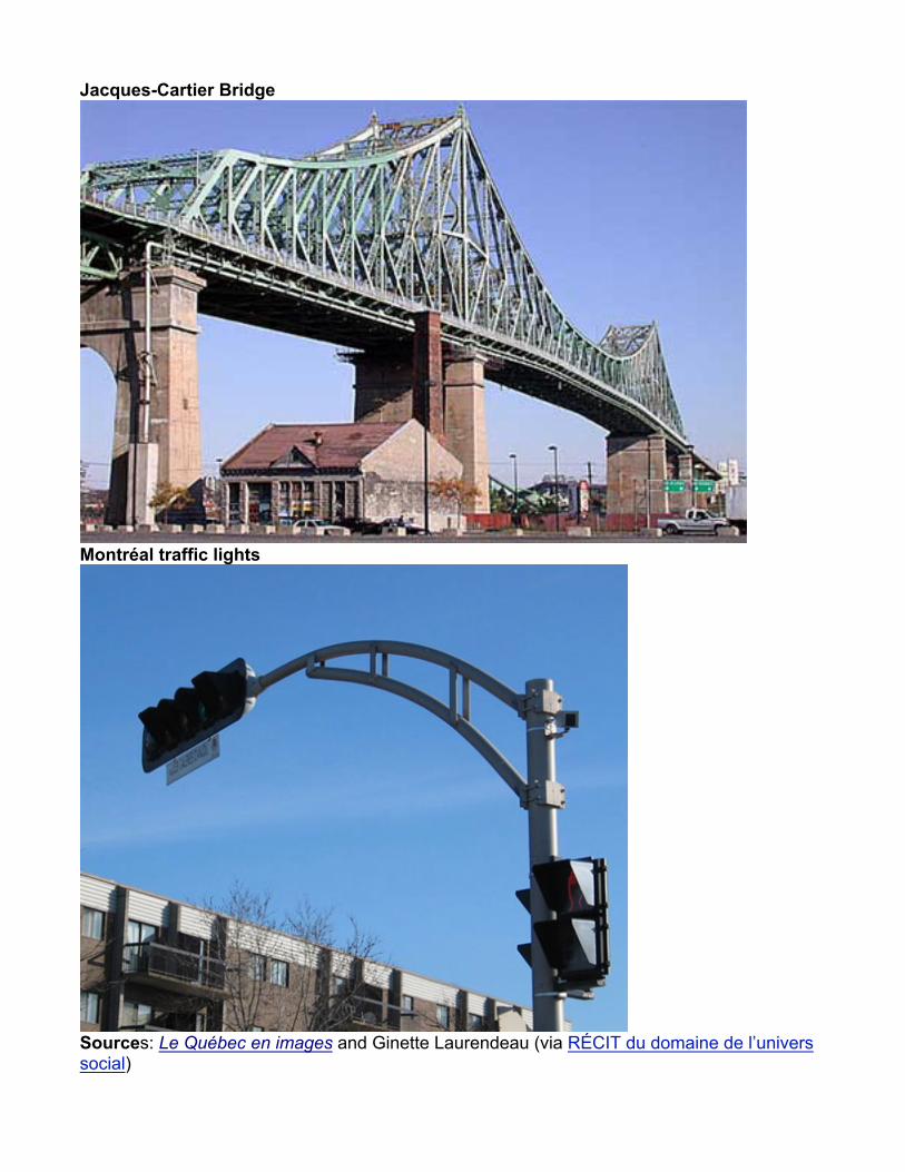
Jacques-Cartier Bridge
Montréal traffic lights
Sources: Le Québec en images and Ginette Laurendeau (via RÉCIT du domaine de l’univers social)

Transportation issues in Montréal Greater Montréal Area Transportation Management Plan The Montréal metro: A source of pride (PDF format) Montréal’s metro Going underground: Toronto’s subway and Montréal’s metro (CBC Archives) Taming the automobile in Montréal’s core (Globe and Mail) Transport 2000 (in French only) Agence métropolitaine de transport

Finding housing
Until recently, finding housing in Montréal was relatively easy and rents were affordable. The high vacancy rate favoured tenants. In the last few years, however, this trend has reversed: vacant apartments are increasingly rare and rents are rising, particularly in the central areas. The housing crisis in Montréal was precipitated by such factors as the conversion of rental units into condominiums, fewer rental units being built and an increase in migration from outlying regions. Gentrification may also be part of the problem, but the impact of this phenomenon is hard to measure. Could it lead to a more desirable social mix?
Montréal’u u u u u u s average population density is 5590 inhabitants per km²(Stats Canada 2001), although in certain areas it is much higher: up to 60,000 inhabitants per km², among the highest in North America. Montréal is unusual in that 38% of households are made up of a person living alone. Housing and poverty
Nearly two thirds of Montrealers are tenants. Of these, 37% spend over 30% of their income on rent, which means they are considered to be living below the poverty line. Lack of apartments and increasingly high rents have led people to request help from the government in the form of low-cost housing. Community organizations such as FRAPRU pressure the government to promise to support such measures.

Thematic maps Average value of dwellings in 1996