microsoft word - summary environment plan - southern ... · web viewenvironment plan – southern...
TRANSCRIPT
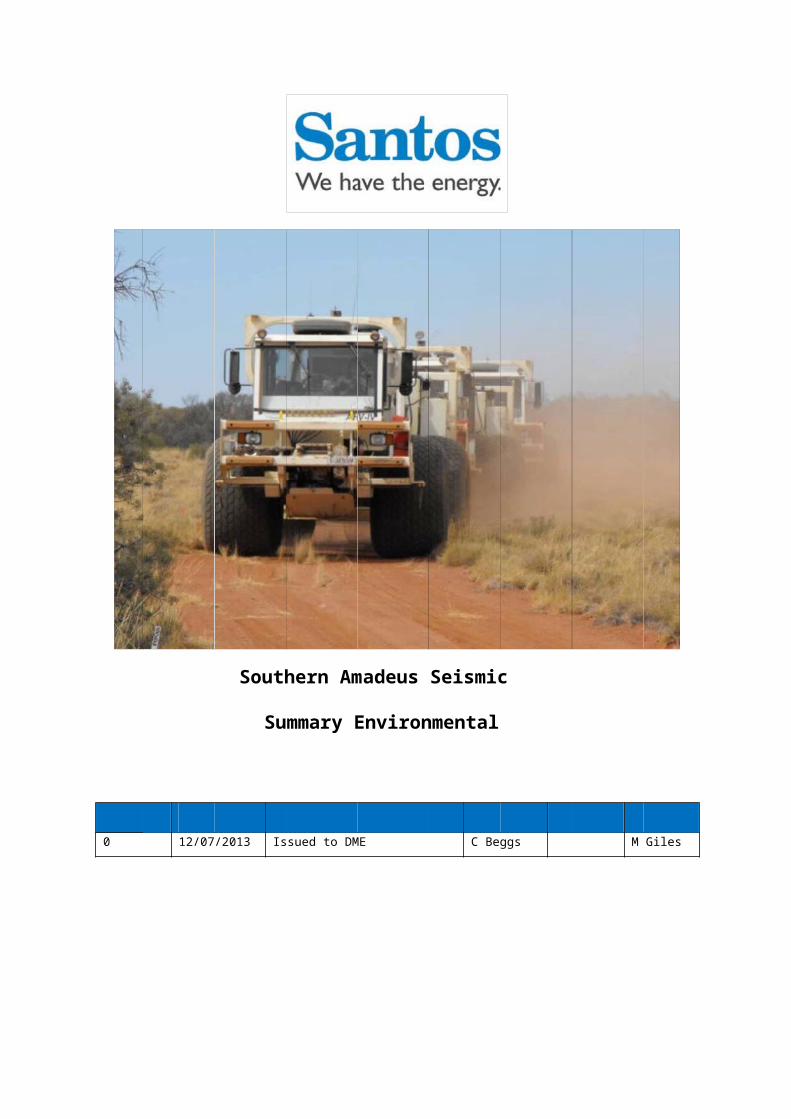
Southern Amadeus Seismic Survey
Summary Environmental Plan
Re Date Reaso for issue Author C hecked Approved
0 12/07/2013 Issued to DME C Beggs M Giles

Environment Plan – Southern Amadeus Seismic Survey
1 Introduction
Santos Limited (Santos), as an operator, has obligations for all geophysical operations conductedpursuant to the Petroleum Act 2011 within all petroleum tenements in the Northern Territory. Geophysical operations carry inherently low environmental risks. An environmental risk assessment has been conducted for the various activities to establish the level of risk and consequence of these activities. These risks together with the corresponding risk minimisation strategies are detailed for the various activities that occur during geophysical operations. These strategies are designed to be employed from the planning phase, right through to the eventual post-operational rehabilitation ofthe areas impacted by these activities.The information contained in this document has been compiled from numerous datasets, experience of prior operations in the region, and ongoing environmental monitoring of these earlier operations. Also included are references to scientific studies undertaken on the specific aspects of the effects of geophysical operations on flora and fauna.
1.1 Proponent
Santos is an Australian Securities Exchange listed company, with operations and interests in everymajor Australian petroleum province and in Indonesia, Vietnam, Papua New Guinea, Bangladesh, India and Central Asia.As at March 2011, Santos had a total market capitalisation of approximately $13 billion, making it one of Australia’s Top 30 companies. Santos has over 2,800 employees across Australia and Asia. Santos is Australia’s largest onshore gas producer.This EP document pertains to the management of Santos geophysical operations in the NorthernTerritory (NT).
1.2 Scope
This EP applies to activities relating to geophysical operations within Exploration Permits 82, 105,106, 107, 112, and 125 collectively known as the Project Area (See Figure 1). Activities associated with the geophysical operations are as follows:
Line and access track preparation (starts after cultural heritage clearance has beencompleted);Line surveying (starts just after line preparation); Seismic recording;Campsites and associated supplies;Uphole drilling and logging (during or after recording phase, as and when required); Monitoring and auditing of selected locations (pre and post line preparation and post restoration); andLine access track and campsite restoration where required (after completion of recording and uphole drilling/logging).
The coordinates for the Project Area are:Easting
297863.51386448.20407410.98527101.74561927.02559898.36497010.00
Northing7312980.747328533.767358287.377331914.857238258.607216619.617197009.28
Easting350270.48350946.70284677.24191697.14194063.90230579.73
Northing7197685.507173341.637146292.907140545.047268012.217278831.71
AB C D E F G
HI J K L M
Rev 0 Uncontrolled when printed 2

Environment Plan – Southern Amadeus Seismic Survey
Figure 1: Project Area and Proposed Lines
2 Project Activity Description
2.1 Project Location
The Project’s proposed seismic activities will be carried out over Exploration Permits 82, 105, 106,107, 112, and 125 which are located east, south and south west of Alice Springs (See Figure 1). These Exploration Permits cover a combined area of approximately 59,230 km2 of the Amadeus Basin. The survey will cover approximately 2,084 line kms (or covering less than 0.02% of the combined Exploration Permit Area). The Exploration Permits are located on Aboriginal, Leasehold and Freehold land.
2.2 The Seismic Method
Seismic acquisition allows the explorer to ‘image’ below the surface and identify areas where oil andgas may have accumulated. The seismic method uses energy sources such as vibrator trucks or buried explosive charges. The energy source produces sound waves, which travel into the earth and are then reflected from subsurface geological structures (refer to Figure 2). The returning reflections are recorded in a digital format and sent to a seismic data processing centre to produce a ‘cross-section’ of the layers of the earth’s crust. The following sections explain the field procedures for recording seismic data.A 2D survey records data along a single line of traverse, giving a cross-sectional ‘picture’ of the subsurface. 2D seismic lines are normally 10km to 50km long, or longer for regional exploration surveys and spaced 500m to 5000m apart.
Rev 0 Uncontrolled when printed 3

Environment Plan – Sou thern Amadeus Seismic Survey
Figure 2: Schematic of 2D seismic acquisition processSeismic lines potentially impact a width of 4 to 5m. The seismic lines are laid out so as to avoid sensitive environmental sites, as well as cultural features such as buildings, dams, water wells and known Aboriginal heritage sites.Once the line positions for an entire project have been cleared by the CLC, the line preparationcrew can commence work. This team operates from a central campsite. This site will most likely be moved weekly. The camp, on average, accommodates 13 personnel (including surveyors). The camp units are trailer mounted for easy mobility. Campsites are set up, where possible, on sites previously used, or in areas naturally devoid of vegetation and always adjacent to any existingtracks to minimise impact on the terrain between the camp and tracks.The line preparation crew usually operate simultaneously on different lines, characteristically using two D6 or equivalent bulldozers. Daily production of prepared line is approximately 30km (i.e. 15km per dozer) though this varies with terrain. The dozers will simply ‘ alk’ with the blade up in easily traversable terrain, with the marks of the tracks being sufficient for the surveyors and recording crew to follow. The line position, plus tolerances for weaving the line around vegetation etc. are pre- programmed into GPS units housed in the dozers. These GPS units are kinematic dual frequency units that allow the dozer operators to get real time position fixes. These are plotted on a pilot display that also indicates the weaving tolerances for the dozer operators. The dozers weavearound vegetation stands and on open ground the machines weave every 75-100m to reduce visual impact.Blade work is kept to a minimum and generally restricted to sand dunes and flood plain crabhole country. Grader work is likewise kept to a minimum – graders are mainly used in flood plain crabhole country to smooth the tracks and knock down windrows in sand country.
Rev 0 Uncontrolled when printed 4
Environment Plan – Southern Amadeus Seismic Survey
Figure 3: Vibrators & recorder truckThe “live” section of spread is generally about 12km in length. This is the only part of the spread where signal is recorded for any given source position. The live spread is moved (controlled by the recording truck operator) as the vibrators move up. As spread becomes redundant behind the vibrators (back end of line) it is picked up and transported to the front end of the line. This cycle continues until the line is completed. The recording truck may move once or twice during the day to keep pace with the spread.
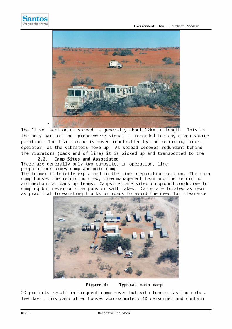
2.2.1 Camp Sites and Associated SuppliesThere are generally only two campsites in operation, line preparation/survey camp and main camp.The former is briefly explained in the line preparation section. The main camp houses the recording crew, crew management team and the recording and mechanical back up teams. Campsites are sited on ground conducive to camping but never on clay pans or salt lakes. Camps are located as near as practical to existing tracks or roads to avoid the need for clearance of native vegetation and subsequent disturbance to animal habitats. The campsite is located on a previously disturbed areawherever possible.
Figure 4: Typical main camp2D projects result in frequent camp moves but with tenure lasting only a few days. This camp often houses approximately 40 personnel and contain more than 20 trailers and about 36 vehicles. As
Rev 0 Uncontrolled when printed 5
Environment Plan – Southern Amadeus Seismic Survey
the majority of these vehicles transit from camp to adjacent road and back at least once per day,and some several times, the routes from camp are clearly defined to restrict wheel track impact. Wastewater from laundry, showers and kitchen is piped to an evaporation sump about 50m outside the camp. Wastepaper, cardboard and food scraps are disposed of into sealed bins set up adjacent to the camp area. The sealed bins are transported regularly for disposal of waste to a licensed landfill. Recyclable materials are segregated on camp and regularly transported to a designated licensed waste depot in Alice Springs.Sewage management practices at all camps consist of the use of port-a-loos and grey water capture and disposal to ground with the aim to minimise any risks to human health or the environment.Once the campsite has been vacated, rehabilitation is undertaken including removal of rubbish and any man made items. When necessary, and terrain permitting, the area is tyne ripped to remove compaction and wheel tracks. Shoulders of adjacent formed tracks are reinstated.
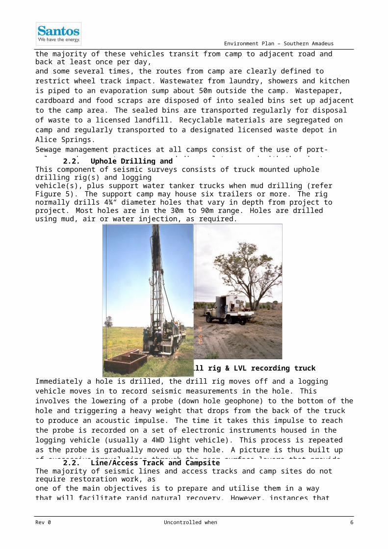
2.2.2 Uphole Drilling and LoggingThis component of seismic surveys consists of truck mounted uphole drilling rig(s) and loggingvehicle(s), plus support water tanker trucks when mud drilling (refer Figure 5). The support camp may house six trailers or more. The rig normally drills 4¾“ diameter holes that vary in depth from project to project. Most holes are in the 30m to 90m range. Holes are drilled using mud, air or water injection, as required.Distance between upholes can vary considerably depending on Santos requirements, but are normally at 1km to 5km spacing’s along lines.
Figure 5: Uphole drill rig & LVL recording truckImmediately a hole is drilled, the drill rig moves off and a logging vehicle moves in to record seismic measurements in the hole. This involves the lowering of a probe (down hole geophone) to the bottom of the hole and triggering a heavy weight that drops from the back of the truck to produce an acoustic impulse. The time it takes this impulse to reach the probe is recorded on a set of electronic instruments housed in the logging vehicle (usually a 4WD light vehicle). This process is repeated as the probe is gradually moved up the hole. A picture is thus built up of successive travel times through the near surface layers that provide information on the thickness and velocity – vital information for correcting the vibroseis seismic data.On completion of logging, the drill cuttings are returned to the hole and the hole is capped. Surplus cuttings are managed to minimise visual impact.
2.2.3 Line/Access Track and Campsite RestorationThe majority of seismic lines and access tracks and camp sites do not require restoration work, asone of the main objectives is to prepare and utilise them in a way that will facilitate rapid natural recovery. However, instances that can require restoration are: Wheel ruts caused after wet periods;
Rev 0 Uncontrolled when printed 6

Environment Plan – Southern Amadeus Seismic Survey
Windrows not fully removed by grader;Windrows that have been created at intersection of lines and public tracks; Compaction of top soil at camp sites;Compaction of shoulders on public access tracks;Heavily trafficked routes between camp sites and nearest public track; Access tracks that have turned to bulldust due to extensive seismic traffic.
Normally a single dozer or grader or one of each is all that is required to carry out the restorationwork. Methods used for rehabilitation include:
Ripping of compacted areas with bulldozer rear tynes;Windrow material pushed onto line and smoothed; Public road shoulders reinstated;Wheel rut material used to infill affected areas; and/orAffected water course channels and creek banks reinstated.
2.2.4 Post survey Monitoring and AuditingThe following briefly describes the method utilised successfully by Santos during the last ten years.Prior to the commencement of any survey, a number of environmental monitoring point’s (EMP’s) are selected to give a balanced representation of the various landform and vegetation type encountered. The locations of the EMPs are positioned nearby roads or tracks to minimise any future access impact upon the environment. They are also located subject to ground conditions such as flooded or restricted wetlands and salt lakes that cannot be accessed.These points are coordinated and marked with star droppers prior to the start of line preparation.Photographs are taken at these locations along the proposed line direction to give a view of the terrain prior to line-preparation. All photographs are optimally taken with a 50mm lens or equivalent digital setting, for consistent comparison. The process is repeated after line preparation and again after recording. These EMPs are then photo monitored over the ensuing four-year period (minimum) to give a visual representation of the recovery process. The revisit intervals are generally one year, two years and four years (eight years if further visits are deemed necessary) although the return period is determined by weather/road conditions and current activity in the region.
Figure 6: Dune cut immediately after recording & four years after recording
2.3 Timeframe
Based on current seismic crew availability, Santos would expect to commence line preparation forthe project July 2013, with the seismic recording commencing approximately 3 weeks later. Recording for this project is expected to take approximately 20 weeks to complete.
Rev 0 Uncontrolled when printed 7

Environment Plan – Southern Amadeus Seismic Survey
3 Environment Description
3.1 Physical Environment
3.1.1 ClimateThe Southern Amadeus seismic survey is located within the arid zone of Central Australia thatexperiences low and variable rainfall and high diurnal and seasonal temperature fluctuations.The mean annual rainfalls for Alice Springs and Mereenie are 285 mm and 300 mm respectively, with the majority of rainfall in summer. Temperatures vary from very hot in summer to below freezing in winter, and frosts occur regularly during the winter months.Average evaporation exceeds average rainfall for each month of the year and by some 1000% over an average year. The mean annual evaporation rate at Alice Springs is 3066 mm. The dominant wind directions are southeast to northeast with little seasonal variation.
3.1.2 GeologyThe Southern Amadeus seismic survey is located within ted in the eastern, central and southernAmadeus Basin, an east-west trending structural depression extending across the southern part of the Northern Territory and into Western Australia. This basin covers an area of approximately207,000 km² and contains up to 9100 m of late Proterozoic and Palaeozoic sediments. It is bound in the north by the Arunta complex and in the south by the Musgrave-Mann complex, both containing granite, gneiss and schists, with amphibolite and quartzite.Geologically, rocks consist of sandstones that form resistant strike ridges and less resistant siltstones, commonly covered by superficial soils. Hydrocarbons occur in sandstones at depthsranging between 1200 and 1500 m.
3.1.3 SoilsThe Project Area soils are dominated by tenosols soils, kandosols and rudosols asscoated withrugged rock terrain (DLRM 2013a). Smaller pockets of Calcarosols and Sodosols Soils are present in the Project Area and will be avoided by the proposed activities.
3.1.4 HydrologyAll catchments within the Amadeus Basin region drain internally towards Lake Eyre (within SouthAustralia). All surface water including rivers, streams and drainage lines are ephemeral and subject to short flow duration and high turbidity.The dominant basin is associated with the Finke River system and its associated tributaries and feeder rivers.
3.1.1 Salt LakesThe salt lakes of Central Australia are also maintained by groundwater and support specialised floraand fauna. Salt lakes are a significant landform in the southern part of the Northern Territory, covering an area of some 2800 square kilometres. Within the Project Area all salt lakes will be avoided by the proposed activities.
3.2 Biological Environment
3.2.1 Bioregions, Flora and FaunaThe Arid Lands region covers 49% of the land area of the Northern Territory (658,000 sq km). Itincludes all of the MacDonnell Ranges and Burt Plain bioregions, the Territory sections of the Great Sandy Desert, Simpson Strzelecki Dunefields, Finke, Central Ranges, Channel Country and Stony Plains bioregions, most of the Territory section of the Tanami bioregion and parts of Sturt Plateau, Mitchell Grass Downs and Davenport Murchison Ranges bioregions.About 55% of the Arid Lands subregion is Aboriginal freehold and about 36% pastoral leases, on which cattle are grazed. Though accounting for a small total area, horticulture is an important land use in the Arid Lands subregion. Current and proposed protected areas make up 36% of the region; the vast majority of this is as proposed Indigenous Protected Areas.
Rev 0 Uncontrolled when printed 8

Environment Plan – Southern Amadeus Seismic Survey
The Project Area is covered by the bioregions of the Simpson Strzelecki Dunefields Bioregion in theeast and Finke Bioregion in the west.
3.2.1.1 Simpson Strzelecki Dunefields BioregionThe Simpson-Strzelecki Dunefields Bioregion covers an area of 297,227 km2, and extends from the southeast of the NT, through the northeast of SA, with small areas in both Qld and NSW. Thebioregion is part of the Australian continental dunefields, which consist of a huge anti-clockwise whorl of linear dunes in central Australia and thus dominated by high linear dunes of red sand. Woodland communities are dominated by Acacia ligulata, mulga, needlewood (Hakea leucoptera), whitewood (Atalaya hemiglauca) and beefwood (Grevillea striata) with an understorey shrublandconsisting of species of Cassia, Eremophila and Dodonaea. Mitchell Grass occurs on the duneswhile temporary canegrass (Glyceria ramigera) - lignum (Muehlenbeckia cunninghamia) swamp communities occurring between them.The sand dunes and sandplains communities support sandhill wattle (Acacia ligulata), turpentine (Eremophila sturtii), scattered mulga (Acacia anuera), rosewood (Heterodendrum oleifolium), whitewood (Atalaya hemiglauca), canegrass (Eragrostis australasica), the occasional white pine (Callitris glaucophylla) and various cassia and eremophila species.Lignum (Muehlenbeckia cunninghamia), black box (Eucalyptus largiflorens) and river red gum(Eucalyptus camaldulensis) grow along the creeks and on the margins of freshwater claypans.Many of the same species are found in the more saline clays of the Cobham land system along with prickly wattle (Acacia victoriae) and chenopods. Bladder saltbush (Atriplex vesicaria), black bluebush (Maireana pyramidata), Mitchell grass (Astrebla sp.) and scattered mulga (Acacia anuera) are found on the tablelands and stony downs. Bimble box (Eucalyptus populnea), western bloodwood (Eucalyptus terminalis) and ironwood (Acacia excelsa) are present with denser mulga on the sands.
3.2.1.2 Finke BioregionThe Finke Bioregion covers an area 73,800 km2. The main land types are arid sand plains with dissected uplands and valleys, including some major rivers (Finke, Hugh and Palmer rivers). The bioregion is dominated mulga taking different forms on different soil types. The mulga is made up of various Senna, Eremophila and Acacia species (S. nemophila, S. desolate, E. freeelingii, E. gilesii, A. kempeana, A. tetregonphylla). The bioregion includes eucalypt low woodland with tussock and hummock grass understorey, acacia woodland, hummock grassland, and chenopod shrubland,associated with salt plains and floodouts on sand plains. The dominant chenopods are bluebush(Maireana astroricha) and bladder saltbush (Atriplex vesicaria).Despite the lack of free-water the bioregions provide important habitat for a range of wildlife including a variety of small mammals, reptiles and birds.Due to the mobility of animals in the arid region and the extensive habitat of the region together with the minimal impact on the habitat from the proposed activities the likely potential impact on fauna is low.
3.2.2 Socio-economic EnvironmentThe Amadeus Basin has broad indigenous cultural and European historical significance. There is arange of current land uses throughout the area including conservation, tourism, oil and gas production and pastoral activities. While the regional population has decreased with time, tourist numbers are consistent. The region remains generally undeveloped in terms of infrastructure and roads.Tourism centres such as Alice Springs and Yulara continue to be the main destinations.The Amadeus Basin supplies gas within the Northern Territory and oil to South Australia. Additional discoveries are necessary to maintain supply in the future. Natural gas is the least carbon dioxide polluting fossil fuel, and therefore, its continued use in preference to coal and oil reduces greenhouse impacts.
3.3 Environmental and Cultural Sensitivities
3.3.1 Sacred Site Protection
Rev 0 Uncontrolled when printed 9

Environment Plan – Southern Amadeus Seismic Survey
Binding agreements are in place to manage the key values and sensitive aspects relating to theprotection of Sacred and Cultural Heritage Sites.Implementation of the Sacred Site Protection Procedure obligations, set out in the Deed for Exploration EP No. 93, Indigenous Land Use Agreement EP No. 97 and Indigenous Land Use Agreement EP No.s 82, 112, 118 and 125, contribute to minimising the risk of damage to Sacred Sites through seismic line preparation and recording activities.These procedures require Santos to obtain a CLC issued Sacred Site Clearance Certificate (SSCC) prior to the commencement of line preparation. The CLC SSCC procedure serves to prevent damage to, and interference with, Aboriginal Sacred Sites and may involve a field survey by a Site Clearance Team. The SSCC procedure, including consultation with relevant Aboriginal stakeholders, is administered by the CLC in close consultation with Santos throughout.The issue of the SSCC will provide approval to proceed subject to compliance with any conditions specified by the Site Clearance Team and endorsed by the CLC.There are no areas within the Project Area that will be impact upon by the proposed activities that is listed on the National Heritage Register (National Heritage List (DSEWPaC 2013a) or NT Heritage Register (DLPE 2013).
3.3.2 Protected or Conservation AreasThere are protected or conservation areas within in Project Area. A list of sites within the PermitAreas includes:
Chamber’s Pillar Historical ReserveMac Clark (Acacia peuce) Conservation Reserve Henbury Meteorites Conservation Reserve Rainbow Valley Conservation ReserveIllamurta Springs Conservation ReserveEwaninga Rock Carvings Conservation ReserveOwen Spings Reserve
These areas will all be avoided by the proposed activities.
3.3.3 Threatened Flora and FaunaWithin the Arid Lands Region of the NT, there are 76 threatened species, 41 of which are listed asthreatened nationally and 70 that are listed as threatened in the Territory. Bednall's Land Snail, listed as Critically Endangered in the NT, is the most severely threatened species that is still thought to occur in the region. The region has 47 species listed as migratory under international agreements.A search of the Environment Protection and Biodiversity Conservation Act 1999 (EPBC Act) Protected Matters database (DSEWPaC 2013b) identified 5 birds, 1 insect, 6 mammals, 3 reptiles, 8 plants and 8 listed migratory species (all birds) and 8 listed marine species that may or are likely to occur within the Project Area.Due to the small nature and scale of the disturbance footprint associated with seismic activities no Matters of National Environmental Significance (MNES) relating to threatened flora or fauna will be significantly impacted by the proposed activities.
3.3.4 Significant HabitatThe EPBC Act matters search identified one nationally important wetland being the Karinga CreekPalaeodrainage System. This system is good example of a series of groundwater discharge lakes, of varied hydrological character, in a desert environment, which also function as episodic lakes. The lakes system will be avoided by the proposed activities.No other significant habitat has been identified within the Project Area (DLRM 2013a). The habitat of the Project Area is consistent with and widespread within each Bioregion.
3.3.5 Fire RegimeAboriginal people have traditionally used fire as a tool during hunting and gathering. These fireshave shaped vegetation and faunal patterns across central Australia. The advent of pastoralism
Rev 0 Uncontrolled when printed 10

Environment Plan – Southern Amadeus Seismic Survey
brought new approaches regarding fire use resulting in fewer but larger fires initiated during thewarmer seasons.
3.3.6 Pest Plant and Animal ControlPest plant and animal control is considered to be a significant land management issue in theNorthern Territory. The Amadeus Basin has three Weeds of National Significance (WoNS), which are also declared weeds in the Territory, and an additional 28 Territory declared weeds (DLRM2013b). Thirteen introduced feral animal species are a problem in the region.While the Amadeus Basin region is considered to be relatively free of pest plant species, Santos has the potential to introduce weed species into the region as a result of movement of vehicles and equipment.Therefore, it is essential that:
Where relevant, weed management strategies are developed by Santos to ensure thatvehicles and equipment are washed down if moving from areas of known weed infestations; Santos consults with relevant authorities; andWeed control measures are implemented as required.
Pest animals identified in the region include rabbits, feral cats, pigs, donkey and camels.
4 Environmental Risks and Impacts, Description and Assessment
Environmental risk assessment refers to a process where hazards associated with an activity areassessed for their impact on the environment (physical, biological, and socio-economic) at a defined location and specified period of time. The Petroleum Act 2011 (NT), Schedule of OnshorePetroleum Exploration and Production Requirements, 2012 and Environmental Plan (EP) Requirements Guideline require that the environmental impacts and risks must be included in an EP and evaluated. This section describes the process by which Santos conducts such an assessment and its application in this Summary EP.
4.1 Santos Management of Hazard Identification and Risk Assessment
Santos EHS Management Standard 09 Hazard Identification, Risk Assessment and Controldescribes the Santos standard and process with respect to risk assessment for all Santos activities. The methodology described in EHSMS09 is based upon the risk management process described in AS/NZ ISO 31000, and is depicted in Figure 7.This approach aligns with the EP process as required by the Environmental Plan (EP)Requirements Guideline.
Rev 0 Uncontrolled when printed 11

Environment Plan – Southern Amadeus Seismic Survey
Figure 7: Risk Assessment ProcessALARP DemonstrationThe iterative process is continued until such time that any further reduction in the residual risk ranking is not reasonably practicable to implement. At this point the risk is said to have been reduced to as low as reasonably practicable (ALARP). The ALARP principle states that it must be possible to demonstrate that the cost involved in reducing the risk further would be grosslydisproportionate to the benefit gained. The ALARP principle arises from the fact that infinite time,effort and money could be spent attempting to reduce a risk to zero.The risk treatments that were considered to be reasonably practicable have or will be implemented during the course of the seismic survey.
5 Environmental Hazards, Consequences and Assessment
Table 1 outlines the environmental risk assessment for the 2D seismic survey proposed to beundertaken in the Project Area. The consequence and likelihood of a specific hazard are combined to produce a level of risk for any given hazard. The environmental risk assessment is a combination of likelihood and consequences of environmental risks that may occur during the seismic survey, while the severity of consequence is dependent on the receiving environment. However, in most cases this does not alter the risk matrix outcome.
Table 1: Summary of residual risk levels for seismic operations
Rev 0 Uncontrolled when printed 12
Activity Hazard Potential Consequence Severity Likelihood ResidualRisk
Line & access trackpreparation
Earthworks Loss of native vegetation and habitat Negligible Possible 1

Environment Plan – Southern Amadeus Seismic Survey
Rev 0 Uncontrolled when printed 13
Activity Hazard Potential Consequence Severity Likelihood ResidualRisk
Soil erosion and disturbance to natural drainage patterns
Minor Unlikely 1
Noise generation, airborne dust Negligible Possible 1
Disturbance to native fauna Minor Unlikely 1
Disturbance to stock Minor Unlikely 1
Introduction and spread of weeds Moderate Unlikely 2
Visual Impact Minor Possible 2
Damage to landholder infrastructure Minor Unlikely 1
Damage to petroleum infrastructure Minor Remote 1
Impact &/or damage to significantAboriginal sites
Major Possible 3
Third party access resulting in third parties getting lost
Minor Unlikely 1
Vehicle movements
Introduction and spread of weeds Moderate Unlikely 2
Damage to landholder infrastructure Minor Unlikely 1
Disturbance to stock Minor Unlikely 1
Damage to petroleum infrastructure Minor Remote 1
Airborne dust Negligible Likely 1
Spills and leaks
Contamination of soil, groundwater, water courses
Minor Unlikely 1
Line Surveying Vehicle movements
Introduction and spread of weeds etc. Moderate Unlikely 2
Damage to landholder infrastructure Minor Unlikely 1
Damage to petroleum infrastructure Minor Unlikely 1
Impact &/or damage to significantAboriginal sites
Major Possible 3
Fire destruction of vegetation and habitat
Minor Unlikely 1
Airborne dust Negligible Likely 1
Recording Vehicle movements
Introduction and spread of weeds Moderate Unlikely 2
Damage to landholder infrastructure Minor Unlikely 1
Damage to petroleum infrastructure Minor Remote 1
Wheel tracks, wheel ruts, bulldust generation, airborne dust
Minor Likely 1
Visual impact Minor Possible 2
Impact &/or damage to significantAboriginal sites
Major Unlikely 2
VibratorOperations
Soil compaction, wheel tracks, wheel ruts, noise generation, airborne dust
Minor Likely 3

Environment Plan – Southern Amadeus Seismic Survey
Rev 0 Uncontrolled when printed 14
Activity Hazard Potential Consequence Severity Likelihood ResidualRisk
Disturbance to native fauna Minor Likely 3
Disturbance to stock Negligible Unlikely 1
Introduction & spread of weeds etc Moderate Unlikely 2
Damage to landholder infrastructure Minor Unlikely 1
Damage to petroleum infrastructure Minor Remote 1
Impact &/or damage to significantAboriginal sites
Major Unlikely 2
Spills and leaks
Contamination of soil, groundwater, water courses
Minor Unlikely 1
Loss of organic beef certification Major Remote 1
Campsites & associated supply logistics
Vehicle movements
Wheel tracks, wheel ruts, bulldust generation, soil compaction, noise generation, airborne dust, visual impact
Minor Likely 1
Impact upon vegetation & habitat
Loss of vegetation, damage to tree root structures
Minor Unlikely 1
Fire damage to vegetation and habitat Minor Unlikely 1
Spills and leaks
Contamination of soil, groundwater, water courses
Minor Unlikely 1
Loss of organic beef certification Major Remote 1
Disposal of domestic and chemicalwaste
Contamination of soil, groundwater, water courses
Minor Unlikely 1
Loss of organic beef certification Major Remote 1
Impact &/or damage to significantAboriginal sites
Major Unlikely 2
Up hole drilling& logging
Disposal of chemicalwaste
Contamination of soil, groundwater, water courses
Minor Unlikely 1
Loss of organic beef certification Major Remote 1
Spills and leaks
Contamination of soil, groundwater, water courses
Minor Unlikely 1
Loss of organic beef certification Major Unlikely 2
Up HoleDrilling activity
Contamination of soil, groundwater, water courses
Minor Unlikely 1
Uncontrolled discharge of artesian aquifer
Moderate Unlikely 2
Injury to/loss of native fauna Minor Unlikely 1
Injury to/loss of stock Negligible Unlikely 1

Environment Plan – Southern Amadeus Seismic Survey
6 Performance Objectives
6.1 Environmental Objectives
Santos’ environmental objectives for geophysical operations are to: Minimise the visual impact of operations.
Rev 0 Uncontrolled when printed 15
Activity Hazard Potential Consequence Severity Likelihood ResidualRisk
Visual impact, noise generation, airborne dust
Negligible Likely 1
Impact &/or damage to significantAboriginal sites
Major Unlikely 2
Vehicle movements
Introduction and spread of weeds Moderate Unlikely 2
Damage to landholder infrastructure Minor Unlikely 1
Damage to petroleum infrastructure Minor Unlikely 1
Wheel tracks, wheel ruts, bulldust generation, airborne dust
Minor Likely 3
Impact &/or damage to significantAboriginal sites
Major Unlikely 2
Line & Access track restoration
Earthworks Noise generation Negligible Possible 1
Disturbance to native fauna Minor Unlikely 1
Disturbance to stock Negligible Unlikely 1
Introduction and spread of weeds Moderate Unlikely 2
Damage to landholder infrastructure Minor Unlikely 1
Damage to petroleum infrastructure Minor Remote 1
Impact &/or damage to significantAboriginal sites
Major Possible 3
Vehicle movements
Introduction and spread of weeds Moderate Possible 3
Damage to landholder infrastructure Minor Unlikely 1
Damage to petroleum infrastructure Minor Remote 1
Impact &/or damage to significantAboriginal sites
Major Possible 3
Airborne dust Negligible Likely 1
Spills and leaks
Contamination of soil, groundwater, water courses
Minor Unlikely 1
Loss of organic beef certification Major Unlikely 2
Monitoring/ Auditing
Vehicle movements
Damage to landholder infrastructure Minor Unlikely 1
Damage to petroleum infrastructure Minor Unlikely 1
Impact &/or damage to significantAboriginal sites
Major Unlikely 2
Environment Plan – Southern Amadeus Seismic Survey
Minimise disturbance to soil resources.Minimise disturbance to native vegetation and native fauna. Avoid disturbance to sites of cultural and heritage significance.Minimise disturbance to livestock, pastoral infrastructure and landholders.Avoid the introduction or spread of exotic species and implement control measures as necessary.Minimise disturbance to drainage patterns and avoid contamination of surface waters and shallow groundwater resources.Optimise (in order of most to least preferable) waste avoidance, reduction, reuse, recycling, treatment and disposal.Rehabilitate operational areas as necessary. To generate no fires.
7 Implementation Strategy
7.1 Project Management Systems
Management systems will be a key tool in the management of Santos’ environmentalresponsibilities, issues and risks in the NT. Management systems provide a framework for the co- ordinated and consistent management of environmental issues by ensuring the:
Establishment of an environmental policy;Identification of environmental risks and legal and other requirements relevant to geophysical operations;Setting of appropriate environmental objectives and targets;Establishment of a structure and program to implement the Environmental Policy and achieve objectives and targets including the development of procedures and guidelines for specific activities and education and induction programs; andFacilitation of planning, control monitoring, corrective action, auditing and review of activities to ensure that the requirements and aspirations of the Environmental Policy are achieved.
The Santos Environment, Health and Safety Management System (EHSMS) apply to all Santosoperations within Australia. The framework has been developed to ensure compliance with Australian Standard 4801:2001 Occupational Health and Safety Management Systems - Specification with guidance for use, and AS/NZS ISO 14001:2004 Environmental Management Systems - Specification with guidance for use.Santos’ geophysical operating standards should follow or lead accepted best practice and industry- accepted standards. Ongoing audits of systems should be regularly conducted using a risk-based approach to ensure that systems are maintained and operations are undertaken in accordance with industry-accepted practices.
7.2 Current standard operating procedures used to minimise impacts
In order to mitigate the risks and potential impacts of geophysical operations identified in Section 5and to achieve the environmental objectives (Section 6), procedures are recommended to be performed.
7.2.1 Terrain7.2.1.1 Wheel tracks
Where possible, existing tracks, roads or seismic lines are used for access.Off line driving for the main crew is banned – no bush bashing or short cuts are permitted. Campsites are positioned close to existing roads where possible.
7.2.1.2 Wheel ruts Operations are shut down during wet weather or flooding and only restarted once potential for
extensive damage has passed. Unavoidable damage is reported and reinstated on completion of work.
Rev 0 Uncontrolled when printed 16

Environment Plan – Southern Amadeus Seismic Survey
No vehicles are allowed on salt lakes other than specialised low-pressure wide profile tyrevehicles.
7.2.1.3 Compaction
Following in previous off-line wheel tracks is banned.Unavoidable compaction is reported and, in other than gibber areas, ripped on completion of work.As few campsites as possible are used –the aim is to share existing sites if possible. Camp site areas are ripped, if necessary, on completion of work.
7.2.1.4 Erosion
Blade work is banned on gibber, tablelands, claypans or flat easy terrain.Minimal blade work is permitted elsewhere e.g. sand dunes and crabhole floodplains. All windrows are removed either during or on completion of work.Dune side cuts are minimised.Removed sand is ramped to the side of dune cuts as opposed to the base of the dune. Creek bank vegetation is left intact and detours sought if too dense to pass through. Where circumstances arise during restoration appropriate erosion and sediment control measures including berms or diversion banks will be utilised to stabilise soils and steep slopes.The erosion and sediment controls shall consider site specific conditions such as soil type, slope, vegetation cover, proximity to sensitive environments (i.e. watercourses, significant vegetation).Vehicle movement will be restricted until vegetation is re-established.
7.2.1.5 Bulldust Susceptible tracks are avoided. If not possible then track is reinstated after rain.7.2.1.6 Visual Amenity
Lines are prepared to a single blade width only (approximately 4m to 5m).Lines are smoothly weaved at least every 75m to 100m about the general line of traverse and stands of vegetation.Lines are doglegged at road and track crossings preferably around vegetation. Dozers are walked with blade up wherever possible.Cuts are minimised at dune crests and base of dunes. Dune side cuts are minimised.No cutting is done on dunes adjacent to public roads.
7.2.1.7 Natural Drainage
Salt lakes will be avoided.Creek bank vegetation is left intact and detours sought if too dense to pass through. Creek crossings are boxed and filled to original bed level when hard fill required.Any windrows or other disturbance to drainage patterns are removed from creek bed crossings and swales.Camps should not be established near major watercourses, creeks or surface water bodies. No campsite shall be located within one kilometre of any stock watering place.All windrows are removed either during or on completion of work. No blading in gibber.
7.2.2 Native vegetationOff line driving is banned – no bush bashing or short cuts are permitted.Vegetation is removed only when absolutely necessary - avoided by weaving lines through vegetated areas.Root stock, topsoil and seeds are left on line during line preparation. Creek bank vegetation is left intact and detours located if dense.All vehicles are thoroughly cleaned to prevent the introduction of weeds into the survey area.
7.2.3 Native Fauna / HabitatUpholes are capped and backfilled to prevent injury or death to wildlife.No heavy line preparation machinery is used in wetlands areas. Natural drainage channels are left clear at line crossings.
Rev 0 Uncontrolled when printed 17

Environment Plan – Southern Amadeus Seismic Survey
Creek bank vegetation is left intact and detours located if dense.All vehicles are thoroughly cleaned to prevent the introduction of weeds into the survey area.
7.2.4 Pollution
Fuel and oil spills are reported, chemically treated or bio-remediated and the ground ripped.Camp wastewater is disposed of by drainage channels and seepage pits. Rubbish is burnt or otherwise transported to recognised dumps.Mobile chemical toilets (port-a-loos) are used on all camps.There is a zero tolerance rule with regard to markers and litter left in work area after completion.Drill cuttings are returned to hole or removed for dump disposal. Vehicles travel at slow speed in the vicinity of homesteads.
7.2.5 Landholder InfrastructureLines are planned in the office or deviated in the field to avoid homesteads, associatedbuildings, stockyards, airstrips, dams, bores and tanks. Gates are left as found.Fences are not laid down unless specific permission has been given by landholder. Water is drawn only from authorised sources.No camp is set up within 1km of a stock watering point.Work is scheduled to fit in with stock locations and the mustering schedule. Waste management policies are enforced.
7.2.6 Petroleum InfrastructureBelow ground pipelines are only crossed at existing or authorised crossing points.Above ground pipelines are detoured rather than ramped.No seismic energy source is used within 30m of pipelines or wellheads. Lines are deviated to miss wellheads by 30m.Other production plant is avoided and proposed activities discussed with plant operator.
7.2.7 Third Party AccessNo line preparation is carried out on dunes adjacent to public roads.Lines are doglegged at road and track crossings preferably around vegetation. Windrows/shoulders on public tracks are reinstated on completion of work.Lines adjacent to public roads may also be blocked with timber as an access deterrent.
7.2.8 Sacred Site ProtectionLines are cleared by CLC prior to commencement of line preparation.All Sacred Sites must be avoided completely.All line preparation personnel and crew supervisors receive cultural heritage training prior to work.All recommendations associated with the Sacred Site Protection Procedure must be adhered toAny Sacred Sites identified during any phase of the project must be reported to the SantosCultural Heritage Team.
7.3 Chain of Command
The Santos Operations Geophysics Manager is responsible for implementation of this EP. Theresponsibilities, shared through those direct reports, include:
Conformance with the Santos EHSMS.Ensuring required permits and approvals are in place and complied with. Management of non-compliances and non-conformances.Inductions of new staff. Monitoring and reporting.Incident management and reporting. Internal and external audits. Ensuring contractor competencies.
Rev 0 Uncontrolled when printed 18

Environment Plan – Southern Amadeus Seismic Survey
7.4 Induction and Training
In accordance with EHSMS 06 - Training and Competency, all Santos personnel, contractors andvisitors are required to undertake appropriate environmental training and induction programs. Personnel undergo the following levels of training:
Level 1 – Santos generic induction.Level 2 – Site induction.Level 3 – Activity specific induction (where applicable).
Training can be booked through The Well. Records of all training are maintained in ‘Traccess’ aswell as on the Human Resources Oracle database.
7.5 Monitoring
The Santos Management Standard EHSMS 14: Monitoring, Measurement and Reporting requiresthat environmental monitoring, measuring and reporting be considered and where appropriate implemented. Ongoing monitoring and auditing of geophysical operations is necessary to determine whether significant environmental risks are being managed, minimised and where reasonably possible, eliminated.Monitoring programs are designed to assess:
Compliance with regulatory requirements;Visual impact of the operations;Impact upon flora and fauna and general biodiversity; Site contamination;Site revegetation following program completion and any restoration activity potential future problems; andSpot checks, daily meetings, regular inspections
Monitoring records maintained through the Project will include:
Induction records;Waste Records;Records of emissions and discharges (i.e. sewage); Hazardous goods storage, handling and disposal records; Non-compliances and corrective actions records;Internal audit Reports; Inspection records; and Equipment maintenance records.
7.6 Audits
The EHSMS is comprised of a number of Management Standards and Hazard Standards. Theauditing and assessment requirements are detailed in EHSMS 16 - Management System Audit and Assessment Auditor Guide. Each EHSMS standard contains an auditor guide used to determine the level of implementation of and compliance with the standard.Assessments of Seismic operations against requirements of the EHSMS are performed regularly. Results of these assessments form the basis for targeted improvement initiatives.Corrective actions from audits and inspections are entered into the Audit and Inspection Manager(AIM) electronic database for action assignment and tracking of action progress to closure.
7.7 Management of Non-conformance
The Santos Management Standard EHSMS 15 - Incident and Non-Conformance Investigation,Corrective and Preventative Action requires that all incidents, hazards, near misses, property damage, significant process incidents, non-conformance events and third party complaints, including those related to environmental issues, are managed using the Santos Incident Management System (IMS).
Rev 0 Uncontrolled when printed 19

Environment Plan – Southern Amadeus Seismic Survey
The IMS is used to record, track and close out incidents and non-conformances. The system alsoprovides a mechanism to analyse the collated data and identify areas requiring improvement. For each recorded incident, IMS records the date, location, volume, substance, root cause, event descriptions, reporting to regulatory bodies, and any remedial action taken.Incident and non-conformance data are summarised weekly with management review against performance Objectives and Targets. Incidents and investigation findings are reviewed at regular site EHS communication meetings.
7.8 Emergency Response Plan
In the course of normal operations, there is the potential for environmental incidents and accidentsto occur. It is therefore important that Santos has developed emergency response plans to guide actions to be taken to minimise the impacts of accidents and incidents. Emergency response drills should be undertaken at least annually to ensure that personnel are familiar with the plans and the types of emergencies to which it applies and that there will be a rapid and effective response in the event of a real emergency occurring. Emergency response plans must be reviewed and updated on a regular basis to incorporate new information arising from any incidents, near misses and hazards and emergency response simulation training sessions. These plans would also include the facilitation of Fire Danger Season restrictions and requirements.
8 Reporting
Santos will implement internal and external reporting procedures to ensure that environmentalissues and/or incidents are appropriately responded to, reported and actions tracked and closed out. Reporting will include:
Works in progress;Site and task force meetings; Monthly summaries of incidents;Number, severity and close out status of incidents; Progress against key performance indicators;Audit schedule and findings; andExternal meetings and / or liaison with key stakeholders.
Incident and non-conformance data are summarised weekly with management review againstperformance Objectives and Targets. Incidents and investigation findings are reviewed at regular site EHS communication meetings.All incidents must be reported in accordance with the requirements of the NT Petroleum Act 2011,the Schedule for Onshore Petroleum Requirements 2012 or via the NT Pollution Hotline 1800 064567 under the requirements of the Waste Management and Pollution Act 2003 and Regulations.
9 Consultation
The Santos Management Standard EHSMS 07: Consultation and Communication details therequirements for appropriate communication and consultation mechanisms. The standard includes requirements to establish and maintain communication links with employees, contractors and external stakeholders, including local communities, government agencies and other organisations. Regular EHS workgroup meetings are held to communicate and discuss EHS issues. Regular communications are also held with external stakeholders (including DME and CLC). To facilitate this, a Contact Directory has been established and maintained for the Seismic operations. This directory is available on The Well under ‘Emergency Key Contacts’.Reporting and notification of EHS incidents to the appropriate government agency occurs as required.Santos is committed to upholding its reputation as a trusted energy company. Santos seeks to establish and maintain enduring and mutually beneficial relationships with the communities of which
Rev 0 Uncontrolled when printed 20

Environment Plan – Southern Amadeus Seismic Survey
it is a part; ensuring that Santos’ activities generate positive economic and social benefits for and inpartnership with these communities.Processes for ongoing consultation with relevant stakeholders throughout the life of the project. The following checklist is a list of the various parties who have been consulted for the consent to conduct the operations for any given survey within the Northern Territory.
State Government Departments (DME and DENR).Representatives of Native Title Claimants.Landholders whose property will be entered during the course of the survey.Pipeline Authorities whose pipelines will be crossed during the course of the survey.Other petroleum, geothermal and/or mining tenement holders if the tenements are proposed to be crossed during the course of the survey.
10 Further Details
For further information about the proposed Project please contact:Louise SwannTeam Leader Regulator Engagement & EnvironmentSantos LimitedPhone: (08) 8116 5410Email: Louise.Swann@santos . c om
Rev 0 Uncontrolled when printed 21