mineral investigations in the koyukuk mining district
TRANSCRIPT

U.S. Department of Interior BLM-Alaska Technical Report 50Bureau of Land Management BLM/AK/ST-02/023+3090+932
July, 2002
Alaska State Office222 W Seventh Avenue, #13Anchorage, AK 99513
Mineral Investigations in the Koyukuk MiningDistrict, Northern Alaska
Volume II - Summaries of mines, prospects, and mineral occurrencesin the Melozitna, Survey Pass, Tanana, and Wiseman quadrangles
Joseph M. Kurtak, Robert F. Klieforth, John M. Clark, and Elizabeth A. Maclean

Mission Statement
The Bureau of Land Management sustains the health, diversity, and productivity of the public lands for the useand enjoyment of present and future generations.
Authors
Joseph M. Kurtak and Robert F. Klieforth are geologists with the Bureau of Land Management’s Alaska StateOffice, Division of Lands, Minerals and Resources.
John M. Clark and Elizabeth A. Maclean are currently graduate students in geology at the University of Alaska,Fairbanks and part-time employees with the BLM.
Cover
BLM geologist Elizabeth Maclean examines Devonian schistose rocks near Michigan Creek, in the EndicottMountains.
Technical Reports
Technical Reports issued by the Bureau of Land Management-Alaska present the results of research, studies,investigations, literature searches, testing or similar endeavors on a variety of scientific and technical subjects.The results presented are final, or are a summation and analysis of data at an intermediate point in a long-termresearch project, and have received objective review by peers in the author’s field.
The reports are available while supplies last from BLM External Affairs, 222 West 7th Avenue #13, Anchorage,Alaska 99513 and from the Juneau Minerals Information Center, 100 Savikko Road, Mayflower Island, Douglas,AK 99824, (907) 364-1553. Copies are also available for inspection at the Alaska Resource Library andInformation Service (Anchorage), the USDI Resources Library in Washington, D.C., various libraries of theUniversity of Alaska, the BLM National Business Center Library (Denver), and other selected locations.
A complete bibliography of all BLM-Alaska scientific reports can be found on the Internet at:http://www.ak.blm.gov/affairs/sci_rpts.html. Related publications are also listed at http://juneau.ak.blm.gov

Mineral Investigations in the Koyukuk Mining District,Northern Alaska
byJoseph M. KurtakRobert F. Klieforth
John M. ClarkElizabeth A. Maclean
BLM-Alaska Technical Report 50July, 2002
U.S. Department of InteriorBureau of Land Management


i
TABLE OF CONTENTS
VOLUME I
Abbreviations . . . . . . . . . . . . . . . . . . . . . . . . . . . . . . . . . . . . . . . . . . . . . . . . . . . . . . . . . . . . . . . . . . . . . . . iv
Abstract . . . . . . . . . . . . . . . . . . . . . . . . . . . . . . . . . . . . . . . . . . . . . . . . . . . . . . . . . . . . . . . . . . . . . . . . . . . 1
Introduction . . . . . . . . . . . . . . . . . . . . . . . . . . . . . . . . . . . . . . . . . . . . . . . . . . . . . . . . . . . . . . . . . . . . . . . . 2Acknowledgments . . . . . . . . . . . . . . . . . . . . . . . . . . . . . . . . . . . . . . . . . . . . . . . . . . . . . . . . . . . . . 2Geography and climate . . . . . . . . . . . . . . . . . . . . . . . . . . . . . . . . . . . . . . . . . . . . . . . . . . . . . . . . . 3Land status . . . . . . . . . . . . . . . . . . . . . . . . . . . . . . . . . . . . . . . . . . . . . . . . . . . . . . . . . . . . . . . . . . 4Previous studies and exploration . . . . . . . . . . . . . . . . . . . . . . . . . . . . . . . . . . . . . . . . . . . . . . . . . 8Mining history and production . . . . . . . . . . . . . . . . . . . . . . . . . . . . . . . . . . . . . . . . . . . . . . . . . . 10
Bureau investigations . . . . . . . . . . . . . . . . . . . . . . . . . . . . . . . . . . . . . . . . . . . . . . . . . . . . . . . . . . . . . . . . 14Sampling methods . . . . . . . . . . . . . . . . . . . . . . . . . . . . . . . . . . . . . . . . . . . . . . . . . . . . . . . . . . . . 14
Regional geology . . . . . . . . . . . . . . . . . . . . . . . . . . . . . . . . . . . . . . . . . . . . . . . . . . . . . . . . . . . . . . . . . . . 17
Mineral deposit types . . . . . . . . . . . . . . . . . . . . . . . . . . . . . . . . . . . . . . . . . . . . . . . . . . . . . . . . . . . . . . . . 21Placer gold . . . . . . . . . . . . . . . . . . . . . . . . . . . . . . . . . . . . . . . . . . . . . . . . . . . . . . . . . . . . . . . . . 21Placer tin . . . . . . . . . . . . . . . . . . . . . . . . . . . . . . . . . . . . . . . . . . . . . . . . . . . . . . . . . . . . . . . . . . . 23Vein deposits . . . . . . . . . . . . . . . . . . . . . . . . . . . . . . . . . . . . . . . . . . . . . . . . . . . . . . . . . . . . . . . 23Pluton-related gold . . . . . . . . . . . . . . . . . . . . . . . . . . . . . . . . . . . . . . . . . . . . . . . . . . . . . . . . . . . 26Epithermal deposits . . . . . . . . . . . . . . . . . . . . . . . . . . . . . . . . . . . . . . . . . . . . . . . . . . . . . . . . . . . 26Skarns . . . . . . . . . . . . . . . . . . . . . . . . . . . . . . . . . . . . . . . . . . . . . . . . . . . . . . . . . . . . . . . . . . . . . 26Massive sulfides . . . . . . . . . . . . . . . . . . . . . . . . . . . . . . . . . . . . . . . . . . . . . . . . . . . . . . . . . . . . . 29Porphyry deposits . . . . . . . . . . . . . . . . . . . . . . . . . . . . . . . . . . . . . . . . . . . . . . . . . . . . . . . . . . . . 29Tin granites . . . . . . . . . . . . . . . . . . . . . . . . . . . . . . . . . . . . . . . . . . . . . . . . . . . . . . . . . . . . . . . . . 30Podiform chromite . . . . . . . . . . . . . . . . . . . . . . . . . . . . . . . . . . . . . . . . . . . . . . . . . . . . . . . . . . . 31Coal . . . . . . . . . . . . . . . . . . . . . . . . . . . . . . . . . . . . . . . . . . . . . . . . . . . . . . . . . . . . . . . . . . . . . . . 32
Production and resources . . . . . . . . . . . . . . . . . . . . . . . . . . . . . . . . . . . . . . . . . . . . . . . . . . . . . . . . . . . . . 33
Mineral development potential . . . . . . . . . . . . . . . . . . . . . . . . . . . . . . . . . . . . . . . . . . . . . . . . . . . . . . . . 35
Summary . . . . . . . . . . . . . . . . . . . . . . . . . . . . . . . . . . . . . . . . . . . . . . . . . . . . . . . . . . . . . . . . . . . . . . . . . 39
Bibliography . . . . . . . . . . . . . . . . . . . . . . . . . . . . . . . . . . . . . . . . . . . . . . . . . . . . . . . . . . . . . . . . . . . . . . 41
Appendix A - Analytical procedures . . . . . . . . . . . . . . . . . . . . . . . . . . . . . . . . . . . . . . . . . . . . . . . . . . . A-1
Appendix B - Summaries of mines, prospects, and mineral occurrences in the Bettles quadrangle, listedby map number . . . . . . . . . . . . . . . . . . . . . . . . . . . . . . . . . . . . . . . . . . . . . . . . . . . . . . . . . . . . . B-1
Appendix C - Summaries of mines, prospects, and mineral occurrences in the Chandalar quadrangle,listed by map number . . . . . . . . . . . . . . . . . . . . . . . . . . . . . . . . . . . . . . . . . . . . . . . . . . . . . . . . C-1

ii
TABLE OF CONTENTS - continued
Appendix D - Summaries of mines, prospects, and mineral occurrences in the Chandler Lake quadrangle,listed by map number . . . . . . . . . . . . . . . . . . . . . . . . . . . . . . . . . . . . . . . . . . . . . . . . . . . . . . . . D-1
Appendix E - Summaries of mines, prospects, and mineral occurrences in the Hughes quadrangle, listedby map number . . . . . . . . . . . . . . . . . . . . . . . . . . . . . . . . . . . . . . . . . . . . . . . . . . . . . . . . . . . . . E-1
VOLUME II
Appendix F - Summaries of mines, prospects, and mineral occurrences in the Melozitna quadrangle,listed by map number . . . . . . . . . . . . . . . . . . . . . . . . . . . . . . . . . . . . . . . . . . . . . . . . . . . . . . . . . F-1
Appendix G - Summaries of mines, prospects, and mineral occurrences in the Survey Pass quadrangle,listed by map number . . . . . . . . . . . . . . . . . . . . . . . . . . . . . . . . . . . . . . . . . . . . . . . . . . . . . . . . G-1
Appendix H - Summaries of mines, prospects, and mineral occurrences in the Tanana quadrangle, listedby map number . . . . . . . . . . . . . . . . . . . . . . . . . . . . . . . . . . . . . . . . . . . . . . . . . . . . . . . . . . . . . H-1
Appendix I - Summaries of mines, prospects, and mineral occurrences in the Wiseman quadrangle, listedby map number . . . . . . . . . . . . . . . . . . . . . . . . . . . . . . . . . . . . . . . . . . . . . . . . . . . . . . . . . . . . . . I-1
Appendix J - Index of mines, prospects, and mineral occurrences in the Koyukuk Mining District (listedby map number) . . . . . . . . . . . . . . . . . . . . . . . . . . . . . . . . . . . . . . . . . . . . . . . . . . . . . . . . . . . . . J-1
Appendix K - Alphabetical listing of mines, prospects, and mineral occurrences in the Koyukuk MiningDistrict . . . . . . . . . . . . . . . . . . . . . . . . . . . . . . . . . . . . . . . . . . . . . . . . . . . . . . . . . . . . . . . . . . . K-1
PLATES
1. Koyukuk Mining District, Alaska mineral occurrence location map . . . . . . . . . . . . . . . . . . . . in pocket
FIGURES
1. Location and land status map of the Koyukuk Mining District, Alaska . . . . . . . . . . . . . . . . . . . . . . . . 52. Looking north across the Koyukuk River lowlands towards the Endicott Mountains . . . . . . . . . . . . . 73. Looking southeast at Sukakpak Mountain, near the Dalton Highway . . . . . . . . . . . . . . . . . . . . . . . . . 74. Placer mining on Myrtle Creek in 1899; the site of the first major gold discovery in the district . . . 115. Placer operation on Nolan Creek by Silverado Gold Mines Ltd. . . . . . . . . . . . . . . . . . . . . . . . . . . . . 116. Production history of the Koyukuk Mining District 1900-2001 . . . . . . . . . . . . . . . . . . . . . . . . . . . . . 127. Ground magnetic and VLF survey, near the Ginger prospect, Big Spruce Creek . . . . . . . . . . . . . . . 158. Sampling sulfide-bearing muscovite schist on Willow Creek . . . . . . . . . . . . . . . . . . . . . . . . . . . . . . 159. Middle Devonian granitic meta-intrusive rocks in the Arrigetch Peaks area . . . . . . . . . . . . . . . . . . . 1810. Geologic map of the Koyukuk Mining District and vicinity . . . . . . . . . . . . . . . . . . . . . . . . . . . . . . 1911. Gold-bearing bench gravels on the upper Hammond River, above Vermont Creek . . . . . . . . . . . . 2212. Quartz veins exposed along a faulted contact on the south side of Sukakpak Mountain . . . . . . . . . 2513. Fractures in phyllite containing gold-bearing quartz veins veinlets near Friday 13th Pup . . . . . . . 2514. Quartz carbonate vein exposed along Michigan Creek near the Silver King prospect . . . . . . . . . . 25

iii
TABLE OF CONTENTS - continued
15. Magnetite-rich skarn (dark outcrop) near the Arrigetch Peaks. . . . . . . . . . . . . . . . . . . . . . . . . . . . . 2716. Malachite-stained skarn outcrop near Robert Creek . . . . . . . . . . . . . . . . . . . . . . . . . . . . . . . . . . . . . 2817. Looking northeast along a sulfide bearing schist horizon at the Luna prospect . . . . . . . . . . . . . . . . 2818. Sulfide-bearing granodiorite porphyry at the Venus prospect on Big Spruce Creek . . . . . . . . . . . . 3019. Podiform chromite bands hosted in dunite of the lower Kanuti ultramafic complex . . . . . . . . . . . . 3120. A 4-foot–thick bituminous coal seam interbedded with Late Cretaceous sandstone . . . . . . . . . . . . 3221. Areas in the Koyukuk Ming District containing significant mineral occurrences and favorable host
rocks for lode mineral deposits . . . . . . . . . . . . . . . . . . . . . . . . . . . . . . . . . . . . . . . . . . . . . . . . . . 37C-1. Geology and mineral occurrence location map of the Chandalar copper belt . . . . . . . . . . . . . . C-23C-2. Geology and sample location map of the Venus prospect . . . . . . . . . . . . . . . . . . . . . . . . . . . . . C-33C-3. Geology and sample location map of the Evelyn Lee prospect . . . . . . . . . . . . . . . . . . . . . . . . . C-39C-4. Geology and sample location map of the Luna prospect . . . . . . . . . . . . . . . . . . . . . . . . . . . . . . C-59C-5. Sample locations at the upper Willow Creek lode occurrence . . . . . . . . . . . . . . . . . . . . . . . . . . C-74C-6. Geology and sample location map of the Sukakpak Mountain prospect . . . . . . . . . . . . . . . . . C-115C-7. Geology of the Linda Creek underground placer mine . . . . . . . . . . . . . . . . . . . . . . . . . . . . . . . C-127E-1. Map of the Indian Mountain area . . . . . . . . . . . . . . . . . . . . . . . . . . . . . . . . . . . . . . . . . . . . . . . . E-16E-2. Geology and sample location map of Black Creek . . . . . . . . . . . . . . . . . . . . . . . . . . . . . . . . . . . E-21G-1. Geology and sample location map of the Arrigetch Peaks . . . . . . . . . . . . . . . . . . . . . . . . . . . . . . G-9I-1. Geology and sample location map of the Buzz and Ann prospects . . . . . . . . . . . . . . . . . . . . . . . . I-15I-2. Geology and sample location map of the Frog prospect . . . . . . . . . . . . . . . . . . . . . . . . . . . . . . . . I-19I-3. Geology and sample location map of the Abo prospect . . . . . . . . . . . . . . . . . . . . . . . . . . . . . . . . . I-27I-4. Geology and sample location map of the Tana prospect . . . . . . . . . . . . . . . . . . . . . . . . . . . . . . . . I-34I-5. Geology and sample location map of the Silver King prospect . . . . . . . . . . . . . . . . . . . . . . . . . . . I-99I-6. Geology and sample location map of Michigan Creek gorge . . . . . . . . . . . . . . . . . . . . . . . . . . . I-101I-7. Geology and sample location map of Mascot Creek . . . . . . . . . . . . . . . . . . . . . . . . . . . . . . . . . . I-159I-8. MAS sites of the Nolan Creek area . . . . . . . . . . . . . . . . . . . . . . . . . . . . . . . . . . . . . . . . . . . . . . . I-219I-9. Geologic map of the Nolan Creek area, southern Brooks Range, Alaska . . . . . . . . . . . . . . . . . . I-221I-10. Geology and sample location map of lower Smith Creek . . . . . . . . . . . . . . . . . . . . . . . . . . . . . I-231
TABLES
1. Climate summary for weather stations in the Koyukuk Mining District . . . . . . . . . . . . . . . . . . . . . . . 4A-1. Standard fire assay analysis for gold, platinum, and palladium . . . . . . . . . . . . . . . . . . . . . . . . . . A-2A-2. Minimum detections for ICP-atomic emission analysis (standard run) . . . . . . . . . . . . . . . . . . . . A-2A-3. Methods and minimum detection limits for ore grade runs . . . . . . . . . . . . . . . . . . . . . . . . . . . . . A-2A-4. Analytical methods and detection limits by element for 1994 samples . . . . . . . . . . . . . . . . . . . . A-3B-1. Selected results from samples collected in the Bettles quadrangle . . . . . . . . . . . . . . . . . . . . . . B-76C-1. Selected results from samples collected in the Chandalar quadrangle . . . . . . . . . . . . . . . . . . . C-211D-1. Selected results from samples collected in the Chandler Lake quadrangle . . . . . . . . . . . . . . . . . D-3E-1. Selected results from samples collected in the Hughes quadrangle . . . . . . . . . . . . . . . . . . . . . . E-38F-1. Selected results from samples collected in the Melozitna quadrangle . . . . . . . . . . . . . . . . . . . . . . F-7G-1. Selected results from samples collected in the Survey Pass quadrangle . . . . . . . . . . . . . . . . . . G-13H-1. Selected results from samples collected in the Tanana quadrangle . . . . . . . . . . . . . . . . . . . . . . H-10I-1. Selected results from samples collected in the Wiseman quadrangle . . . . . . . . . . . . . . . . . . . . . I-348

iv
ABBREVIATIONS
% percentBtu/lb British thermal unit per poundcy cubic yard(s)°F degrees Fahrenheitlb(s) pound(s)lb(s)/cy pound(s) per cubic yardoz ounce(s)oz/cy ounce(s) per cubic yardoz/ton ounce(s) per tonppb parts per billionppm parts per millionppt parts per thousandtons short tons

PROPERTY SUMMARY DEFINITIONS
Name: Historical or most commonly used name listed first, followed by associated claim names.
Map No: The properties are listed by map number. The number is prefaced by a letter designatingthe 1:250,000 quadrangle in which the site occurs. For example, Bettles (B), Chandalar(C), Chandler Lake (CL), Hughes (H), Melozitna (M), Survey Pass (SP), Tanana (T), andWiseman (W). Refer to Plate 1 (in pocket).
MAS No: U.S. Bureau of Mines Minerals Availability System sequence number.
Kardex No: Alaska Mineral Property Reference File.
ARDF No: U.S. Geological Survey Alaska Resource Data Files.
ADL No: Alaska Division of Land reference number.
Deposit Type: As defined by the U.S. Geological Survey (Nokleberg and others, 1987; Cox and Singer,1992).
Location: Coordinates, public land survey grid, and geographic descriptions are stated for each site.Land status is mentioned only if it directly effects mineral entry.
Coordinates: Coordinates are in degree-minute format, and use the North American datum 1927.
Quadrangle: Refers to U.S. Geological Survey 1:63,360 quadrangle.
Production: This information was gathered from a variety of sources, including U.S. Bureau of MinesPermanent Individual Mine Records (PIMRs), U.S. Mint records, U.S. GeologicalSurvey Bulletins, unpublished company reports, and personal communications.
Bureau Investigation: The following placer gold size definitions are used throughout the text:>2.0 mm - very coarse1.0 - 2.0 mm - coarse0.5 - 1.0 mm - fine<0.5 mm - very fine
Resource Estimate: See definitions p. 33.
Mineral Development Potential: See definitions p. 35.


Appendix F
Summaries of mines, prospects, and mineraloccurrences in the Melozitna quadrangle
(listed by map number)


F-1
Property Summary
Name(s): Utopia Creek Map No: M1MAS No: 0020470011
Deposit Type: Placer Commodities: Au, Ag, Pb, Zn, Ba
Location:Quadrangle: Melozitna D-2 SE¼ sec. 25, T. 7 N., R. 24 E.Meridian: Kateel River Elevation: 1,450 feetLatitude: 65° 59.183' N. Longitude: 153° 47.040' W. Geographic: A 5-mile-long western tributary of the Indian River, 5 miles south of Indian
Mountain. Access is via 14-mile winter trail from Hughes. The airstrip at the nearbyU.S. Air Force Indian Mountain Long Range Radar Site is not open to the public.
History:
1915 - Minor placer gold production at Utopia Creek (Brooks, 1916).
1936 - L. McGee and crew of 12 men begin prospecting on Utopia. Plans were to use a dragline scraperand drilling equipment (Smith, 1938).
1937 - McGee operation active. About 20 men employed. Overburden stripped and bedrock drain dug (Smith, 1939).
1938 - McGee operation active. Mining with dragline and bulldozers (Smith, 1939).
1939 - McGee’s placer operation enlisted approximately 30 men. The company used a 1.5 yard dragline at the lower camp, near the mouth of Utopia Creek. At the upper camp, 4 miles upstream, theyused hydraulic methods. At the time, Utopia was largest gold producer in the district (Smith,1941).
1940 - McGee operation active (Smith, 1942).
1952 - Large scale placer operations ceased (Cobb, 1973).
Production: (oz Au)
1939 - 1,4571941 - 2,3141950 - 5,083Total: 8,854 (Records incomplete.) Production may be more than 10,000 oz (Cobb and Miller, 1981).
Gold fineness: 849 (Metz and Hawkins, 1981).
Workings and Facilities:
The lower 3 miles of Utopia Creek have been mined with a dragline and large portable wash plant. The

F-2
remains of the wash plant lie in a heavily vegetated area along the lower creek at (65° 59.066' N., 153° 43.424' W.). The plant consisted of a large hopper and attached sluice box, which is about 40 feetlong. The hopper was fed by a 1.5-yard dragline shovel which was later moved up to the Indian River. The upper portion of the creek was mined by hydraulic methods (Smith, 1942).
Geologic Setting:
Utopia Creek drains the south side of the Indian Mountains (figure E-1). The geology of the area is bestdescribed by Miller and Ferrians (1968):
The country rock is slightly metamorphosed andesite of Late Jurassic and Early Cretaceousage cut locally by fine-grained, felsic intrusives. The Indian Mountain granodiorite pluton isabout two miles away, and Utopia Creek does not drain the granodiorite-andesite contact asdo the other streams in the region that contain gold-bearing gravel deposits. The lack ofgranitic rocks in the tailings, together with the abundance and size of the barite boulders,suggests that the boulders were derived from tetrahedrite-sphalerite-galena-bearing veins inthe andesite volcanic rocks. Veins of this sort may also have been the source of the placerfound here. These may occur along a fault that underlies the creek bed. Also, the location ofthe tailings suggest that the pay streak did not lie in the main part of the valley in this areabut instead continued up the south slope of the valley toward the area drained by the tributarystream containing sediments rich in lead and zinc.
Little is written about the setting of the placer deposits other than that the ground worked was said to beas much as 25 feet deep (Smith, 1941). Configuration of the tailings piles would indicate that miningconcentrated on placers in the modern stream channel. Production records show that over the life of thedragline operation, yardage increased and grade dropped. The average grade, which started at 0.032oz/cy, was down to 0.003 oz/cy by the last year of production (U.S. Bureau of Mines PIMRs).
Bureau Investigation:
Boulders of barite, as described by Miller and Ferrians (1968), were found at the upper end of the placertailings on Utopia Creek. Pyrite, dolomite(?), and trace tetrahedrite(?) were found associated with thebarite. Select samples (10608-10609, table F-1) contain up to 53.7% barium, 5,565 ppb gold, 4,846 ppmlead, 1,108 ppm zinc, 344 ppm arsenic, 342 ppm silver, and 173 ppm antimony. A float sample (10612)found nearby of gossaneous fault breccia(?) contains 1.95% lead, 599 ppm zinc, 160 ppm copper, and100 ppb gold.
A pan concentrate sample collected in a southern tributary above the end of the mine workings (10611)contains >2,000 ppm barium, 194 ppm zinc, 143 ppm lead, and 33 ppb gold. A pan concentrate from themain drainage just beyond the upper end of the tailings (12262) contains 900 ppm barium, 720 ppm zinc,and 276 ppm lead. Bedrock was not exposed at either of these sample sites.
The creek headwaters were prospected in an effort to locate bedrock sources for the mineralized floatfound in the mine tailings. Rocks on the ridgetop above the site of sample (10611) include andesite,volcanic breccia, and vesicular basalt. Epidote-bearing quartz veinlets locally cut the andesite. Tracemalachite and tetrahedrite(?) are associated with the veinlets and nearby fractures. A sample (10613)contains 529 ppm barium and 194 ppm copper.

F-3
Resource Estimate: None.
Mineral Development Potential:
Low development potential for placer and lode gold. Extensive tailings piles on Utopia Creek wouldindicate that the placers have been mostly worked out. Samples from the creek headwaters areanomalous in barium, lead, zinc, copper, gold, and silver, but no veins containing massive barite similarto that found in the placer tailings below, were located. Utopia Creek may follow a fault that containsthe veins, which are covered by fluvial material. If so, then barite boulders turned up during placermining have been produced by weathering of the underlying veins.
Recommendations:
Drill to test the ground under the portion of Utopia Creek where barite boulders are located.
References:
Bright, M.J., 1988, A review of the geology and mineral potential in the vicinity of Indian Mountain, nearHughes, Alaska: unpublished report 88-06 for Doyon Ltd., 29 p. [available from Doyon Ltd.,Fairbanks, Alaska]
Brooks, A.H., 1916, Mineral resources of Alaska, report on progress of investigations in 1915: U.S.Geological Survey Bulletin 642, p. 64-65.
Cobb, E.H., 1973, Placer deposits of Alaska: U.S. Geological Survey Bulletin 1374, p. 144-145.
____1975, Summary of references to mineral occurrences (other than mineral fuels and construction materials) in five quadrangles in west-central Alaska (Hughes, Kotzebue, Melozitna, Selawik, Shungnak) Open-file Report 75-627, p. 28.
Cobb, E.H. and Miller, T.P., 1981, Summaries of data on and lists of references to metallic and selectednonmetallic mineral occurrences in the Hughes, Kotzebue, Melozitna, Selawik, and ShungnakQuadrangles, west-central Alaska, supplement to Open-file Report 75-627, U.S. GeologicalSurvey Open-file Report 81-847A, p. A9.
Miller, T.P., and Ferrians, O.J., Jr., 1968, Suggested areas for prospecting in the central Koyukuk Riverregion, Alaska: U.S. Geological Survey Circular 570, 12 p.
Smith, P.S., 1939a, Mineral resources of Alaska in 1937: U.S. Geological Survey Bulletin 910A, p. 56.
____1939b, Mineral resources of Alaska in 1938: U.S. Geological Survey Bulletin 917A, p. 55.
____1941, Mineral resources of Alaska in 1939: U.S. Geological Survey Bulletin 926A, p. 52.
____1942, Mineral resources of Alaska in 1940: U.S. Geological Survey Bulletin, 933A, p. 47.

F-4
Property Summary
Name(s): Indian River Trend Map No: M2MAS No: 0020470020
Deposit Type: Epithermal lode Commodities: Au, Pb, Ag
Location:Quadrangle: Melozitna D-2 secs. 4-8, T. 6 N., R. 24 E.Meridian: Kateel River Elevation: 1,100 feetLatitude: 65° 56.977' N. Longitude: 153° 48.973' W.Geographic: A 7.5-mile-long linear trend south-southwest of Utopia Creek containing exposures
of felsic intrusive rocks. The central portion of the trend is on Doyon Ltd. lands. Anearby airstrip at Utopia Creek is part of a U.S. Air Force installation and closed to thepublic. The site is 14 miles southeast of the village of Hughes on the Koyukuk River.
History:
1966 - Patton and Miller (1966) mapped the geology in the Hughes and northern Melozitna quadrangles.
1967 - Miller and Ferrians (1968) collected samples along the Indian River Trend south of Utopia Creek.
1989-90 - Central Alaska Exploration Corporation (1991) excavated three trenches, and did geologicmapping and grid soil and rock sampling along the Indian River Trend.
2000 - North Star Exploration Inc. drilled two core holes totaling 1,091 feet near Macaroni Creek at theeast end of the Indian River Trend (Szumigala and others, 2001).
Production: None.
Workings and Facilities:
Central Alaska Gold excavated 3 trenches along the Indian River Trend which were subsequentlybackfilled.
Geologic Setting:
Reddish-orange exposures of pyritiferous, silicified, fine-grained intrusive rocks occur along a well-marked east-northeast-trending normal(?) fault south of Utopia Creek. The conspicuous gossaneouscolors are the result of oxidation of the disseminated pyrite in the intrusives. About 10 such coloranomalies occur within a 6-mile-long section of the fault. Locally intense argillic, sericitic (illite), silicic,and pyritic hydrothermal alterations are associated with the color anomalies. The age of the intrusions isunknown, but may be as young as early Tertiary. Wallrocks bordering the fault consist of EarlyCretaceous andesitic volcanics (figure E-1) (Miller and Ferrians, 1968).
The zones of alteration commonly occur at fault intersections and have alteration styles associated withepithermal and fossil hot springs deposits. Typical intrusive rocks from these gossans reportedly to
F-5
contain small but anomalous amounts of lead, copper, silver, and gold. Two core holes, totaling 1,091feet, were drilled by North Star Exploration Inc. at the Macaroni Creek soil grid site just west of thecreek. Chalcopyrite and pyrite were found throughout much of the core, and associated alterationminerals may have included gypsum. The assay results from the holes were not available (Patton andMiller, 1966; Miller and Ferrians, 1968; Central Alaska Gold, 1991; Szumigala and others, 2001). As of2002, North Star has done no more drilling along the Indian River Trend.
Bureau Investigation:
Two sites along the Indian River Trend were sampled: the “My”soil grid site was established over a coloranomaly by Central Alaska Exploration and is 0.2 mile west of Macaroni Creek. A sample (10616, tableF-1) taken from brick-red soil, was anomalous in gold (91 ppb), lead (166 ppm), and barium (517 ppm). A rock sample (10615) contained 36 ppb gold. Samples from the Utopia Creek (map no. M1) and Hill1342 (map no. H14) occurrences also have high barium contents.
The Macaroni color anomaly was sampled by Central Alaska Exploration and drilled by North StarExploration Inc. A backfilled trench is located on a hill near the north end of the 150 by 350 foot coloranomaly. A total of 15 soil and 2 rock samples were collected by the BLM at 100-foot intervals along asoil line, beginning near the trench and running northwest. None of the samples contained anomalousmetal values. The Hill 1342 occurrence is similar, but is north of the Indian River Trend
Resource Estimate: None.
Mineral Development Potential:
Low mineral development potential exists along the Indian River Trend, due to low gold values in rocksamples. However surface leaching has been extensive.
Recommendations:
Examine drill data from North Star drilling. The data is available from Doyon Ltd.
References:
Bright, M.J., 1988, A review of the geology and mineral potential in the vicinity of Indian Mountain, nearHughes, Alaska: unpublished report 88-06, 29 p.
Central Alaska Gold Company, 1990, 1989 Annual report to Doyon Limited, Alaska field operations, v.I: unpublished report 90-06A for Doyon Ltd. [available from Doyon Ltd., Fairbanks, Alaska]
____1991, 1990 Annual report, Alaska field operations- Doyon option, v. I: unpublished report 91-08Afor Doyon Ltd., p. 46-95. [available from Doyon Ltd., Fairbanks, Alaska]
Miller, T.P., and Ferrians, O.J., Jr., 1968, Suggested areas for prospecting in the central Koyukuk Riverregion, Alaska: U.S. Geological Survey Circular 570, p. 5-6.
Patton, W.W., Jr., and Miller, T.P., 1966, Regional geologic map of the Hughes quadrangle, Alaska: U.S.Geological Survey Miscellaneous Geologic Investigation Map I-459, 1 sheet, scale 1:250,000.

F-6
Szumigala, D.J., Swainbank, R.C., Henning, M.W., and Pillifant, F.M., 2001, Alaska's mineral industry2000: Alaska Division of Geological and Geophysical Surveys Special Report 55, p. 7-8.

Table F-1. Selected results from samples collected in the Melozitna quadrangle.Explanation
core drill core cont continuous chip abu abundant mal malachite Ag silver drum 55 gallon drum grab grab sample alt altered, alteration mar marcasite Al aluminum dump mine dump pan pan concentrate amph amphibole mdst mudstone As arsenicflt float plac placer concentrate ank ankerite meta metamorphic Au gold otc outcrop rand random chip apy arsenopyrite MnO manganese oxide Ba bariumrub rubblecrop rep representative chip az azurite mod moderate Bi bismuthtail mine tailings sed sediment sample ba barite monz monzonite Ca calciumtrn trench sel select bio biotite musc muscovite Cd cadmium
slu sluice concentrate blk black oz/cyd ounces per cubic yard Co cobaltsoil soil sample bn bornite oz/t ounces per ton Cr chromiumspac spaced chip box boxwork texture pct percent Cu copper
brn brown po pyrrhotite Fe ironca calcite porph porphyry Ga galliumcalc calcareous ppb parts per billion Hg mercurycarb carbonate ppm parts per million K potassium
Placer gold: size classification cc chalcocite psuedo psuedomorph La lanthanum cgl conglomerate py pyrite Li lithium
v. fine < 0.5 mm ch chlorite qtz quartzite Mg magnesiumfine 0.5 - 1.0 mm chm chromite qz quartz Mn manganesecoarse 1 -2 mm comp composite sch scheelite Mo molybdenum v. coarse > 2 mm cpy chalcopyrite sco scorodite Na sodium
cst cassiterite ser sericite Nb niobiumcv covellite serp serpentinized Ni nickel
Abbreviations: diss disseminated sid siderite Pb lead ep epidote silic siliceous Pd palladium
Ck creek feld feldspar sl sphalerite Pt platinum confl confluence ft foot (12 inches) slts siltstone Sb antimonyMtn mountain fuch fuchsite ss sandstone Sc scandiumR river gar garnet stb stibnite Sn tin
gd granodiorite tet tetrahedrite Sr strontiumgn galena tm tourmaline Ta tantalumgwy graywacke tr trace Te telluriumhbl hornblende v very Th thoriumhem hematite val valentinite Ti titaniumhfls hornfels vis visible U uraniumhydro hydrothermal vlets veinlets V vanadiumin inch volc volcanic W tungstenintr intrusive w/ with Y yttrium
Footnotes: lim limonite xcut crosscutting Zn zinc Bold numbers indicate multiple erratic results, which were averaged. ls limestone xln crystalline Zr zirconiumResults for Au are reported in ppb unless other units are stated. mag magnetite xls crystals
ElementsSample site Sample type Sample description Sample description
F-7

Table F-1. Selected results from samples collected in the Melozitna quadrangle.
Field Location Sample Description Au Pt Pd Ag Cu Pb Zn As Sb Fe Ba Sn Wno. Site Type ppb ppb ppb ppm ppm ppm ppm ppm ppm pct ppm ppm ppm
M 1 10504 Utopia Ck flt sel andesite w/ ep, qz vlets <5 <0.2 12 9 10 6 <5 1.84 9 <20 <20M 1 10535 Utopia Ck flt sel hfls w/ 1% py, lim <5 <0.2 36 10 57 8 <5 2.98 93 <20 <20M 1 10536 Utopia Ck flt sel fine grained andesite w/ 5% po <5 <0.2 21 16 199 12 <5 4.49 171 <20 <20M 1 10537 Utopia Ck flt sel andesite w/ po, ep, lim <5 <0.2 90 4 61 7 <5 4.66 66 <20 <20M 1 10608 Utopia Ck tail rand barite/ dolomite w/ <5% py 1141 2.4 486 40 10 58 <5 6.02 37.09% <20 <20M 1 10609 Utopia Ck tail sel barite w/ 2% py, tet(?) 5565 342 750 4846 1108 344 173 3.15 53.71% <20 <20M 1 10610 Utopia Ck sed 14 0.6 26 55 118 12 <5 3.37 839 <20 <20M 1 10611 Utopia Ck pan 33 <0.2 31 143 194 20 <5 7.18 >2000 <20 <20M 1 10612 Utopia Ck flt sel gossaneous, fault breccia w/ lim 100 4.4 160 1.95% 599 529 <5 >10.00 179 <20 <20M 1 10613 Utopia Ck otc rand andesitic breccia w/ tet, mal, ep 9 <0.2 194 43 16 12 <5 2.67 529 <20 <20M 1 12236 Utopia Ck flt sel silic rock w/ ep, gar 9 <0.2 6 17 11 5 <5 2.06 32 <20 <20M 1 12237 Utopia Ck flt sel silic rock w/ ep, gar, ba(?) 18 0.3 79 10 15 6 <5 2.82 56 <20 <20M 1 12261 Utopia Ck sed 13 <0.2 44 34 259 14 <5 8.00 148 <20 <20M 1 12262 Utopia Ck pan 10 <5 <1 0.3 70 276 720 37 <5 7.71 900 <20 <20M 2 10614 "My" and "A" Grids rub rand hydro alt rhyolite w/ py pits <5 <0.2 4 28 4 13 <5 0.46 519 <20 <20M 2 10615 "My" and "A" Grids trn sel hydro alt rhyolite w/ 5% py 36 0.3 32 13 12 14 <5 6.61 7 <20 <20M 2 10616 "My" and "A" Grids soil 91 1.8 52 166 14 291 7 7.10 517 <20 <20M 2 12238 Macaroni Soil Line soil <5 <0.2 11 <2 13 <5 <5 4.17 273 <20 <20M 2 12239 Macaroni Soil Line soil <5 <0.2 2 <2 8 <5 <5 8.72 689 <20 <20M 2 12240 Macaroni Soil Line soil <5 <0.2 3 3 9 6 <5 3.87 52 <20 <20M 2 12241 Macaroni Soil Line soil 6 <0.2 15 5 11 <5 <5 4.01 203 <20 <20M 2 12242 Macaroni Soil Line soil <5 <0.2 4 4 6 <5 <5 5.60 328 <20 <20M 2 12243 Macaroni Soil Line soil 10 <0.2 10 27 6 <5 <5 2.36 518 <20 <20M 2 12244 Macaroni Soil Line soil 15 1.5 16 29 11 5 <5 3.19 140 <20 <20M 2 12245 Macaroni Soil Line soil 8 0.4 10 24 15 8 <5 4.35 188 <20 <20M 2 12246 Macaroni Soil Line soil <5 <0.2 11 23 18 6 <5 3.91 122 <20 <20M 2 12247 Macaroni Soil Line soil 8 <0.2 44 10 36 7 <5 5.18 506 <20 <20M 2 12248 Macaroni Soil Line soil 24 <0.2 8 14 9 7 <5 8.82 169 <20 <20M 2 12249 Macaroni Soil Line soil 8 <0.2 5 8 8 <5 <5 3.34 305 <20 <20M 2 12250 Macaroni Soil Line soil <5 <0.2 23 4 10 11 <5 5.72 289 <20 <20M 2 12252 Macaroni Soil Line soil <5 <0.2 13 11 16 <5 <5 2.09 200 <20 <20M 2 12253 Macaroni Soil Line soil <5 <0.2 6 8 11 <5 <5 1.96 248 <20 <20M 2 12254 Macaroni Prospect flt sel silic intr w/ 3% py, abu lim <5 <0.2 23 5 4 <5 <5 2.72 191 <20 <20M 2 12255 Macaroni Prospect flt sel silic intr w/ 2-3% py, abu lim <5 <0.2 31 3 5 6 <5 2.41 102 <20 <20
Mapno.
Sample
F-8

Appendix G
Summaries of mines, prospects, and mineraloccurrences in the Survey Pass quadrangle
(listed by map number)


G-1
Property Summary
Name(s): Pingaluk River Map No: SP1MAS No: 0020290009 Alaska Kardex 029-008
Deposit Type: Placer Commodities: Au
Location:Quadrangle: Survey Pass C-2 NW¼ sec. 7, T. 25 N., R. 24 E. Meridian: Kateel River Elevation: 1,360 feetLatitude: 67° 34.516' N. Longitude: 153° 33.906' W. Geographic: Just below a fork in the Pingaluk River, 10 miles upstream from the Alatna River.
History:
1931 - Two prospectors reported working on the Pingaluk River (Smith, 1934).
Production: Unknown.
Workings and Facilities: None observed.
Geologic Setting:
Bedrock in the area consists of Middle Devonian(?) phyllite and semischist thrust over slate and phylliteof the Upper Devonian Hunt Fork Shale (Nelson and Grybeck, 1980).
Bureau Investigation:
A site was investigated where the stream flows on bedrock just below a major fork. Bedrock iscomposed of phyllite that contains quartz lenses and pods parallel to schistosity. Test pans contained novisible gold. A pan concentrate sample (11429, table G-1) was not anomalous in gold, but did contain606 ppm copper. Another pan concentrate (11430) contained 151 ppm zinc. Minor pyrite occurs in thequartz. A sample of pyrite-bearing quartz (11431) was not anomalous in any metals.
Resource Estimate: Unknown.
Mineral Development Potential: Low due to a lack of gold in gravel on bedrock in the river.
Recommendations: None.
References:
Smith, P.S., 1934, Mineral industry of Alaska in 1931, in Smith, P.S. and others, 1934, Mineral resourcesof Alaska, report of progress of investigations in 1931: U.S. Geological Survey Bulletin 844, p. 39.

G-2
WGM Inc., 1978, Mineral studies of the western Brooks Range, Alaska: U.S. Bureau of Mines Open-FileReport 103-78, p. 158.

G-3
Property Summary
Name(s): Lucky Six Creek Lode Map No: SP2 Whelan’s Mining and Exploration MAS No: 0020290002 Copper King Alaska Kardex 029-003
Copper Queen Silver King Gray Eagle Ground Hog Iowa Mammoth
Deposit Type: Polymetallic veins Commodities: Au
Location:Quadrangle: Survey Pass C-4 NW¼ sec. 22, T. 26 N., R. 18 E. Meridian: Kateel River Elevation: 4,770 feetLatitude: 67° 35.500' N. Longitude: 154° 52.000' W. Geographic: Upper Lucky Six Creek, a northern tributary of the Noatak River.
History:
1898 - Placer gold discovered on lower Lucky Six Creek (Schrader, 1904; Smith, 1913).
1902-03 - Pyritiferous gold-bearing ore reported on the divide between the Alatna and Noatak Rivers(Schrader, 1904).
1903 - Prospecting continued in area. Specimens given to U.S. Geological Survey (USGS) for testing. The results were not encouraging (Schrader, 1904).
Production: None.
Workings and Facilities: None.
Geologic Setting:
Upper Lucky Six Creek cuts Upper Devonian Skajit Limestone that has been overthrust by UpperPaleozoic Calcareous phyllite. The Skajit locally contains lenses of chlorite schist, and the phyllitelocally contains limestone lenses. Mineralized rocks reportedly consist of six or more veins, which vary from 10 to 75 feet in width. Some of the veins have been traced for distances ranging from severalthousand feet to 2.0 miles. The veins are nearly parallel and reportedly lie within a 6- to 7-mile-wide northeast-trending belt. Vein specimens given to USGS geologists consisted of pyrite, quartz, andchalcopyrite associated with a little bornite and a trace of malachite. Other minerals which have beenfound include stibnite and epidote. Prospectors reported samples that contained from 1.94 oz/ton to 4.35oz/ton gold. Assays of the samples given to the USGS averaged 0.075 oz/ton gold. The veins were neverlocated by USGS geologists (Schrader, 1904).

G-4
Bureau Investigation:
BLM geologists made two brief examinations of the upper part of Lucky Six Creek. In the stream bottomat a point 1.7 miles north of Gull Pass, minor quartz-carbonate float was found which containedtetrahedrite(?), malachite, and azurite. A sample (8012, table G-1) contained 43 ppm silver, 672 ppmarsenic, and 3,580 ppm antimony. On the same stream, 1.0 mile north of Gull Pass, trace quartz floatwith graphitic partings contained malachite stain. No sulfides were observed in the quartz. A panconcentrate sample (11428) collected downstream on the same drainage was slightly anomalous incopper and zinc.
Resource Estimate: None.
Mineral Development Potential:
Low development potential due to low gold content of samples and lack of a bedrock source. Also thearea lies within Gates of the Arctic National Park and is closed to mineral entry.
Recommendations: None.
References:
Anderson, E., 1947, Mineral occurrences other than gold deposits in northwestern Alaska: AlaskaDepartment of Mines Pamphlet, 5-R, 48 p.
Berg, H.C., and Cobb, E.H., 1967, Metalliferous lode deposits of Alaska: U.S. Geological SurveyBulletin 1246, p.105.
Cobb, E.H., 1972, Metallic mineral resources map of the Survey Pass quadrangle, Alaska: U.S.Geological Survey Miscellaneous Field Studies Map MF-382, 1 sheet, scale 1:250,000.
Grybeck, D., and Nelson, S.W., 1981, Mineral deposit map of the Survey Pass quadrangle, BrooksRange, Alaska: U.S. Geological Survey Miscellaneous Field Studies Map MF-1176F, 1 sheet,scale 1:250,000.
Nelson, S.W., and Grybeck, D., 1980, Geologic map of the Survey Pass quadrangle, Brooks Range,Alaska: U.S. Geological Survey Miscellaneous Field Studies Map MF-1176-A, 2 sheets, scale1:250,000.
Schrader, F.C., 1904, A reconnaissance in northern Alaska across the Rocky Mountains, along theKoyukuk, John, Anaktuvuk, and Colville Rivers and the Arctic coast to Cape Lisburne, in 1901:U.S. Geological Survey Professional Paper 20, p. 102-104.
Smith, P.S., 1913, The Noatak-Kobuk region, Alaska: U.S. Geological Survey Bulletin 536, p. 140-141.
Smith, P.S., and Mertie, J.B., Jr., 1930, Geology and mineral resources of northwestern Alaska: U.S.Geological Survey Bulletin 815, p. 337-338.

G-5
WGM Inc., 1978, Mineral Studies of the western Brooks Range, Alaska: U.S. Bureau of Mines Open-File Report 103-78, 550 p.

G-6
Property Summary
Name(s): Lucky Six Creek Map No: SP3 Whelan’s Mining and Exploration MAS No: 0020290003 Copper King Alaska Kardex 029-003
Copper Queen Silver King Gray Eagle Ground Hog Iowa Mammoth
Deposit Type: Placer Commodities: Au
Location:Quadrangle: Survey Pass C-4 NW¼ sec. 25, T. 25 N., R. 17 E. Meridian: Kateel River Elevation: 2,300 feetLatitude: 67° 32.483' N. Longitude: 154° 56.000' W. Geographic: On lower Lucky Six Creek, a 9-mile-long northern tributary of the Noatak River, 6
miles southwest of Gull Pass. The property is within the Gates of the Arctic NationalPark and closed to mineral entry.
History:
1898 - Placer gold discovered on lower Lucky Six Creek and some mining done in subsequent years. The area is very difficult to access and above timberline. Planks for sluice boxes werewhipsawed from trees on the Reed River, about 30 miles away, and hauled to the site by dogsand men (Schrader, 1904).
1903-1981 - Claim staking activity (Schrader, 1904; Smith, 1913; Kardex)
Production: Unknown.
Workings and Facilities:
Remains of old campsites, ditches, hydraulic pipe, sluice boxes and stacked boulders are located about0.7 mile upstream from the Noatak River.
Geologic Setting:
Bedrock on Lucky Six Creek consists of Mississippian and Devonian phyllite that is in thrust faultcontact with Devonian and Silurian Skajit Limestone. The Skajit locally contains lenses of chloriteschist, and the phyllite locally contains limestone lenses. Polymetallic veins, containing significant goldvalues reportedly occur upstream from the placer site (map no. SP2) (Nelson and Grybeck, 1980).

G-7
Bureau Investigation:
The site was examined by U.S. Bureau of Mines personnel in 1994 as part of a mine hazards survey, butlittle evaluation was made of the mineral resources. Materials found at the site indicate that placermining took place at some point. It appears that gravel was mined off shallow bedrock and sluiced backfrom the present stream bank for a distance of about 50 feet. A total of five test pans were taken.Sulfides were observed, but no visible gold (Fechner, 1995).
Resource Estimate: None.
Mineral Development Potential: Unknown.
Recommendations: None.
References:
Anderson, E., 1947, Mineral occurrences other than gold deposits in northwestern Alaska: AlaskaDepartment of Mines Pamphlet, 5-R, 48 p.
Berg, H.C., and Cobb, E.H., 1967, Metalliferous lode deposits of Alaska: U.S. Geological SurveyBulletin 1246, p. 105.
Cobb, E.H., 1972, Metallic mineral resources map of the Survey Pass quadrangle, Alaska: U.S.Geological Survey Miscellaneous Field Studies Map MF-382, 1 sheet, scale 1:250,000.
Fechner, S.A., 1995, Mine hazards report - inactive mines, Lucky Six Creek, Alaska: U.S. Bureau ofMines unpublished report, 11 p. [available from BLM Anchorage, Alaska]
Grybeck, D., and Nelson, S.W., 1981, Mineral deposit map of the Survey Pass quadrangle, BrooksRange, Alaska: U.S. Geological Survey Miscellaneous Field Studies Map MF-1176F, 1 sheet,scale 1:250,000.
Nelson, S.W., and Grybeck, D., 1980, Geologic map of the Survey Pass quadrangle, Brooks Range,Alaska: U.S. Geological Survey Miscellaneous Field Studies Map MF-1176-A, 2 sheets, scale1:250,000.
Schrader, F.C., 1904, A reconnaissance in northern Alaska across the Rocky Mountains, along theKoyukuk, John, Anaktuvuk, and Colville Rivers and the Arctic coast to Cape Lisburne, in 1901:U.S. Geological Survey Professional Paper 20, p. 102-104.
Smith, P.S., 1913, The Noatak-Kobuk region, Alaska: U.S. Geological Survey Bulletin 536, p. 140-141.
Smith, P.S., and Mertie, J.B., Jr., 1930, Geology and mineral resources of northwestern Alaska: U.S.Geological Survey Bulletin 815, p. 337-338.
WGM Inc., 1978, Mineral Studies of the western Brooks Range, Alaska: U.S. Bureau of Mines Open-File Report 103-78, 550 p.

G-8
Property Summary
Name(s): Arrigetch Peaks Map No: SP4MAS No: 0020290024
Deposit Type: Skarn Commodities: Cu, Zn, Sn
Location:Quadrangle: Survey Pass B-2, B-3 sec. 31, T. 24 N., R. 22 E. Meridian: Kateel River Elevation: 3,800 feetLatitude: 67° 26.166' N. Longitude: 153° 58.283' W. Geographic: Headwaters of streams draining the north side of the Arrigetch pluton.
History:
late 1970s - Prospecting in the area by General Crude Oil Co. and Union Carbide Corp. (WGM Inc. 1978).
Production: None.
Workings and Facilities: None.
Geologic Setting:
The Arrigetch Peaks massif is made up of a granite orthogneiss pluton. Crystallization of the plutonoccurred during Middle Devonian time. Regional metamorphism affected the area in the mid-Mesozoicwith uplift and cooling in the Late Cretaceous. The orthogneiss is in contact with Silurian-Devonianmarble of the Skajit Limestone and Proterozoic(?)-Lower Paleozoic schist (Adams, 1983).
The contact between the pluton and the surrounding country rock is defined by hornfels, skarn, and dikesand sills of aplitic and pegmatitic rocks. The skarns and associated veins are locally anomalous incopper, zinc, tin, tungsten, and silver (Adams, 1983)
Bureau Investigation:
The skarns occur as small discontinuous pods and lenses associated with carbonate rocks on the marginsof the orthogneiss. The orthogneiss-metasediment contact was examined at three sites with reportedmineralization on the northeast side of the Arrigetch Peaks. At area 1 (figure G-1) the skarn is composedof calc-silicate rock interlayered with magnetite-rich zones that give the rock a banded or “ribbon rock”appearance. A sample of the magnetite-rich skarn with minor pyrite (10863, table G-1) contained 4,052ppm tin, 1,142 ppm copper and 7,782 ppm zinc. This skarn occurred as rubblecrop over a 3- by 50-footarea. A 0.5- by 1.5-foot quartz lense on the margin of the skarn contained pyrite, pyrrhotite,chalcopyrite, and arsenopyrite. A select sample (10864) contained 4,492 ppm copper, 880 ppm tin, and859 ppm bismuth.
At area 2, four small skarn bodies at the orthogneiss-carbonate contact on the western wall of the canyonwere sampled. The skarns contained abundant magnetite along with pyrite, chalcopyrite, and minormalachite. The skarns contained quartz veins 1 to 6 inches thick. A select sample of skarn float (10829)

4162
3000
3500
4000
4500
5000
5500
6000
6638
350
0
3000
2000
2500
4500 5185
400
0
4000
4500
350
0
3480
3500
5420
3000 2500
3000
4500
5500
4000
6353
6320
6565
5000
3500
3500
4000 4500 5000
Arrigetch
Creek
22 23 24 19 20 21 22
27 26 25 30 29 28 27
34 35 36 31 32 33 34
3 2 1 6 5 4 3
7 8 9 10
18 17 16 15
10 11 12
15 14 13
T24NT23N
R21
ER
22E
0 100005000
Dhf Dhf
DhfDhf
PZsgn
PZsgn
PZsgn
Dgr
Dgr
Dgr
DSsk
DSsk10863-4
10864
10862
107801086110830 10827-9
10832
10833
1083410835
NPZsgn
Dhf
Dgr
DSsk
Base map adapted from USGS 1:63,360 scale Survey Pass B2 & B3 quadranglesGeology after Nelson and Grybeck, 1980
Upper Devonian Hunt Fork Shale
Middle Devonian granite orthogneiss
Devonian Silurian Skajit Limestone
Paleozoic schist & paragneiss
Contact
Thrust fault (teeth on upper plate)
Fault
Sample site
EXPLANATION
Figure G-1. Geology and sample location map of the Arrigetch Peaks.
G-9
A R R I G E T C H
P E A K S
DSsk
Area 1
Area 2
Area 3
Area 4
Scale, feetContour interval 100 feet
154°10' 154°00'
67°25'
D D D D N N N . /

G-10
contained 3,042 ppm copper, 269 ppm cobalt, and 638 ppm tin.
Area 3 is at the headwaters of an unnamed tributary of the Alatna River. A select sample of sulfide-bearing float (10835) contained 3,874 ppm copper.
At area 4, the banded skarn consists of magnetic-rich bands up to 5 feet wide interlayered with redgarnet-bearing calc-silicate rocks and minor aplite. The magnetite is locally coarse grained and containstrace malachite stain. One pod-like mass of skarn measured 90 by 100 feet. A 4.5-foot-wide chip sampleacross one of the magnetite-rich zones (10780) contained 1,080 ppm tin, and 233 ppm copper.
Resource Estimate: Unknown.
Mineral Development Potential:
Low development potential for skarn-type deposits and associated polymetallic veins. Skarn exposuresare small, and there appears to be little potential for undiscovered resources. The veins do not containsignificant precious metal values.
Recommendations: None.
References:
Adams, D.D., 1983a, Geology of the northern contact area of Arrigetch Peaks Pluton, Brooks Range,Alaska: University of Alaska, Fairbanks, Masters thesis, 86 p.
____1983b, Geologic map of the northern contact of the Arrigetch Peaks pluton, Brooks Range, Alaska:
Alaska Division of Geological and Geophysical Surveys Professional Report 83, 1 sheet, scale1:18,000.
Dillon, J.T., Pessel, G.H., Chen, J.H., and Veach, N.C., 1980, Middle Paleozoic magmatism andorogenesis in the Brooks Range, Alaska: Geology, v. 8, p. 338-343.
Grybeck, D., 1977a, Known mineral deposits of the Brooks Range, Alaska: U.S. Geological SurveyOpen-File Report 77-166C, 45 p.
Grybeck, D., and Nelson, S.W., 1981, Mineral deposit map of the Survey Pass quadrangle, BrooksRange, Alaska: U.S. Geological Survey Miscellaneous Field Studies Map MF-1176F, 1 sheet,scale 1:250,000.
Nelson, S.W., and Grybeck, D., 1980, Geologic map of the Survey Pass quadrangle, Brooks Range,Alaska: U.S. Geological Survey Miscellaneous Field Studies Map MF-1176-A, 2 sheets, scale1:250,000.
Newberry, R.J., Dillon, J.T., and Adams, D.D., 1986, Regionally metamorphosed, calc-silicate-hostdeposits of the Brooks Range, northern Alaska: Economic Geology, v. 81, p. 1728-1752.
WGM Inc., 1978, Mineral studies of the western Brooks Range, Alaska: U.S. Bureau of Mines Open-FileReport 103-78, p. 454-463.

G-11
Property Summary
Name(s): Alatna River Map No: SP5 MAS No: 0020290005 Alaska Kardex 029-006
Deposit Type: Placer Commodities: Au
Location:Quadrangle: Survey Pass A-1 sec: 35, T. 20 N, R. 25 E. Meridian: Kateel River Elevation: 710 feetLatitude: 67° 05.498' N. Longitude: 153° 19.581' W. Geographic: On the Alatna River, 4.5 miles upstream of the Malumute Fork.
History:
1898 - Rush by prospectors into the Alatna River area, following rumors of gold on the Koyukuk River. Small amounts of gold were found, but no economic deposits (Mendenhall, 1902).
1901 - Only a few prospectors in the area (Mendenhall, 1902).1924 - No miners living in the area (Smith and Mertie, 1930).1928 - Activity reported in area (Smith, 1930).1937 - Activity reported in area (Smith, 1939).1938 - Activity reported in area Smith, 1939).1939 - Activity reported in area (Smith, 1941).
Production: Unknown.
Workings and Facilities: None reported.
Geologic Setting:
Bedrock in the area consists of Devonian(?) mica schist, quartz-mica schist, and phyllite (Brosge andReiser, 1971). Bedrock at the site consists of pyritic black schist containing quartz stringers parallel toschistosity (Nelson and Grybeck, 1980).
Bureau Investigation:
A test pan taken off bedrock contained 1 very fine gold flake plus unidentified sulfides (11497, table G-1). Sample results were not anomalous in gold. The sample was slightly anomalous in zinc, as was asample of pyrrhotite-bearing schist collected nearby (11499).
Resource Estimate: Unknown.
Mineral Development Potential:
Low development potential due to low gold content of gravels on bedrock.

G-12
Recommendations: None.
References:
Cobb, E.H., 1972, Metallic Mineral Resources Map of the Survey Pass Quadrangle, Alaska: U.S.Geological Survey Miscellaneous Field Studies Map MF-382, 1 sheet, scale 1:250,000.
Mendenhall, W.C., 1902, Reconnaissance from Fort Hamlin to Kotzebue Sound, Alaska by way of Dall,Kanuti, Allen and Kowak Rivers: U.S. Geological Survey Professional Paper no. 10, p.50.
Nelson, S.W., and Grybeck, D., 1980, Geologic map of the Survey Pass quadrangle, Brooks Range,Alaska: U.S. Geological Survey Miscellaneous Field Studies Map MF-1176-A, 2 sheets, scale1:250,000.
Smith, P.S., 1913, The Noatak-Kobuk region, Alaska: U.S. Geological Survey Bulletin 536, p. 143.
____1930, Mineral industry of Alaska in 1928, in Smith, P.S. and others, 1930, Mineral resources ofAlaska, report on progress of investigations in 1928: U.S. Geological Survey Bulletin 813, p. 45.
____1939, Mineral resources of Alaska in 1937: U.S. Geological Survey Bulletin 910A, p. 56.
____1941, Mineral resources of Alaska in 1939: U.S. Geological Survey Bulletin 926A, p. 52.
Smith, P.S., and Mertie, J.B., Jr., 1930, Geology and mineral resources of northwestern Alaska: U.S.Geological Survey Bulletin 815, p. 334-335.
U.S. Bureau of Mines, 1979, Mineral deposits of the Alatna, John, Killik, Kobuk and the North Fork ofthe Koyukuk River areas, Alaska: Preliminary Comment: U.S. Bureau of Mines Open-FileReport 36-79, p. 14-15.
WGM Inc., 1978, Mineral studies of the western Brooks Range, Alaska: U.S. Bureau of Mines Open-FileReport 103-78, p. 158.

Table G-1. Selected results from samples collected in the Survey Pass quadrangle.
Explanation
core drill core cont continuous chip abu abundant mal malachite Ag silver drum 55 gallon drum grab grab sample alt altered, alteration mar marcasite Al aluminum dump mine dump pan pan concentrate amph amphibole mdst mudstone As arsenicflt float plac placer concentrate ank ankerite meta metamorphic Au gold otc outcrop rand random chip apy arsenopyrite MnO manganese oxide Ba bariumrub rubblecrop rep representative chip az azurite mod moderate Bi bismuthtail mine tailings sed sediment sample ba barite monz monzonite Ca calciumtrn trench sel select bio biotite musc muscovite Cd cadmium
slu sluice concentrate blk black oz/cyd ounces per cubic yard Co cobaltsoil soil sample bn bornite oz/t ounces per ton Cr chromiumspac spaced chip box boxwork texture pct percent Cu copper
brn brown po pyrrhotite Fe ironca calcite porph porphyry Ga galliumcalc calcareous ppb parts per billion Hg mercurycarb carbonate ppm parts per million K potassium
Placer gold: size classification cc chalcocite psuedo psuedomorph La lanthanum cgl conglomerate py pyrite Li lithium
v. fine < 0.5 mm ch chlorite qtz quartzite Mg magnesiumfine 0.5 - 1.0 mm chm chromite qz quartz Mn manganesecoarse 1 -2 mm comp composite sch scheelite Mo molybdenum v. coarse > 2 mm cpy chalcopyrite sco scorodite Na sodium
cst cassiterite ser sericite Nb niobiumcv covellite serp serpentinized Ni nickel
Abbreviations: diss disseminated sid siderite Pb lead ep epidote silic siliceous Pd palladium
Ck creek feld feldspar sl sphalerite Pt platinum confl confluence ft foot (12 inches) slts siltstone Sb antimonyMtn mountain fuch fuchsite ss sandstone Sc scandiumR river gar garnet stb stibnite Sn tin
gd granodiorite tet tetrahedrite Sr strontiumgn galena tm tourmaline Ta tantalumgwy graywacke tr trace Te telluriumhbl hornblende v very Th thoriumhem hematite val valentinite Ti titaniumhfls hornfels vis visible U uraniumhydro hydrothermal vlets veinlets V vanadiumin inch volc volcanic W tungstenintr intrusive w/ with Y yttrium
Footnotes: lim limonite xcut crosscutting Zn zinc Bold numbers indicate multiple erratic results, which were averaged. ls limestone xln crystalline Zr zirconiumResults for Au are reported in ppb unless other units are stated. mag magnetite xls crystals
ElementsSample site Sample type Sample description Sample description
G-13

Table G-1. Selected results from samples collected in the Survey Pass quadrangle.
Field Location Sample Description Au Ag Cu Pb Zn Bi As Sb Fe Ba Sn W Al U Thno. Site Type ppb ppm ppm ppm ppm ppm ppm ppm pct ppm ppm ppm pct ppm ppm
SP 1 11429 Pingaluk Ck pan minor py, no mag, no vis Au <0.2 606 22 120 <5 14 <5 4.98 267 <20 <20 6.13SP 1 11430 Pingaluk Ck pan minor py, no mag, no vis Au 20 <0.2 71 11 151 <5 8 <5 5.56 225 <20 <20 5.69SP 1 11431 Pingaluk Ck otc sel 0.5-ft-wide qz vein w/ iron-carb <5 <0.2 18 84 48 <5 <5 <5 2.50 15 <20 <20 0.51SP 2 8012 Lucky Six Ck flt grab qz-carb vein w/ tet, mal, az <75 43 <1100 672 3580.0 <0.8 <720 <3300 <9 <3.6 <5.8SP 2 8013 Lucky Six Ck flt grab vein qz w/ graphitic partings, mal 6 8 <200 3 3.3 2.8 140 <200 <2 1.4 4.2SP 2 11426 Lucky Six Ck flt sel qtz w/ 1-2% diss py, lim <5 <0.2 2 17 6 <5 <5 <5 1.56 2 <20 <20 0.77SP 2 11427 Lucky Six Ck pan <0.2 45 18 91 <5 10 <5 5.77 263 <20 <20 6.68SP 2 11428 Lucky Six Ck pan mod mag 12 <0.2 135 16 111 <5 7 <5 6.02 211 <20 <20 5.69SP 4 10780 Arrigetch Peaks otc cont skarn w/ massive mag, tr mal <5 <0.2 3 15 233 11 15 <5 >10.00 16 1080 30 0.65SP 4 10827 Arrigetch Peaks flt sel skarn w/ abu mag, tr mal <5 0.3 904 8 1674 <5 7 <5 >10.00 76 7269 102 3.71SP 4 10828 Arrigetch Peaks flt sel skarn w/ py and cpy, ep, hbl <5 <0.2 174 3 229 <5 10 <5 2.33 12 56 <4 0.60SP 4 10829 Arrigetch Peaks flt sel skarn w/ massive py, cpy, po 44 <0.2 3042 19 75 <5 8 <5 >10.00 2 638 5 0.53SP 4 10830 Arrigetch Peaks otc sel skarn w/ abu mag, mod mal <5 <0.2 66 33 280 36 12 <5 >10.00 21 2132 <4 1.92SP 4 10832 Arrigetch Peaks flt sel skarn w/ massive sulfides <5 <0.2 163 36 32 <5 <5 <5 >10.00 3 13 <4 0.06SP 4 10833 Arrigetch Peaks flt sel skarn w/ massive sulfides 8 <0.2 195 2 43 <5 <5 <5 >10.00 23 54 <4 2.26SP 4 10834 Arrigetch Peaks flt sel banded schist w/ py, tm(?) <5 <0.2 30 5 38 <5 <5 <5 2.85 36 <4 <4 1.43SP 4 10835 Arrigetch Peaks flt sel skarn w/ cpy py, lim 8 0.6 3874 15 59 <5 17 <5 >10.00 3 <4 <4 0.07SP 4 10861 Arrigetch Peaks otc cont skarn w/ massive mag, mal 10 <0.2 29 7 219 88 25 <5 >10.00 27 830 116 1.07SP 4 10862 Arrigetch Peaks rub ran gar ep skarn w/ 5% mag 30 <0.2 13 6 183 34 16 <5 >10.00 17 811 76 1.65SP 4 10863 Arrigetch Peaks rub ran mag-rich skarn w/ minor py 14 0.9 1142 17 7782 79 238 <5 >10.00 8 4052 18 0.37SP 4 10864 Arrigetch Peaks otc sel qz vein w/ py, cpy, apy, po 60 2.4 4492 74 262 859 >10000 29 >10.00 2 880 <4 0.92SP 5 11497 Alatna R sed <5 <0.2 21 8 67 <5 8 <5 3.13 34 <20 <20 0.91SP 5 11498 Alatna R pan 1 v fine Au(?), sulfides 10 <0.2 38 16 102 <5 13 <5 5.61 169 <20 <20 2.42SP 5 11499 Alatna R flt sel mica schist w/ 1-2% diss po, lim 13 <0.2 46 3 119 <5 37 <5 5.56 27 <20 <20 2.16
Mapno.
Sample
G-14

Appendix H
Summaries of mines, prospects, and mineraloccurrences in the Tanana quadrangle
(listed by map number)


H-1
Property Summary
Name(s): Kanuti Kilolitna River Lode Map No: T1MAS No: 0020480133
Deposit Type: Podiform chromite Commodities: Cr, Ni
Location:Quadrangle: Tanana D-4 SW¼ sec. 7, T. 13 N., R. 20 W.Meridian: Fairbanks Elevation: 1,230 feetLatitude: 65° 57.855' N. Longitude: 151° 52.718' W. Geographic: On both sides of the Kanuti Kilolitna River, just upstream from where the drainage
exits mountainous country onto the Kanuti Flats. About 18 miles southwest ofSithylemenkat Lake (map no. B27).
History:
1901 - U.S. Geological Survey noted serpentinites along the Kanuti River (Mendenhall, 1902). 1968-69 - U.S. Geological Survey sampled ultramafic rocks while geologic mapping in the Kanuti River
region (Patton and Miller, 1970).1979 - U.S. Bureau of Mines began investigations in area as part of assessment of lands adjacent to the
Trans-Alaska Pipeline corridor (Foley and McDermott, 1983).
Production: None.
Workings and Facilities: None.
Geologic Setting: (modified from Patton and Miller, 1970; Foley and McDermott, 1983; Patton, 1989;Foley, 1992)
The Caribou Mountain-Melozitna ultramafic belt, also known as the Kanuti ultramafic belt, trendsnortheast for 62 miles in the Kokrine-Hodzana Highlands. This belt is included in a mafic sequence thatfollows the contact between the upper Paleozoic-Mesozoic Angayucham terrane on the north and theProterozoic(?) and Paleozoic miogeoclinal rocks of the Ruby Geanticline to the south. A portion of theRuby Geanticline underlies the mafic-ultramafic belt and consists of pelitic schist, quartzite, and phyllitewith subordinate marble, metamorphosed graywacke, and slate.
The metamorphosed sedimentary rocks are overlain by a sequence of Permian through Jurassic maficvolcanic and intrusive rocks that include pillow basalt, diabase, and gabbro. Subordinate basaltic andandesitic volcaniclastic rocks, chert, and cherty mudstone also occur in the sequence. The mafic rocksappear to comprise erosional remnants of allochthonous sheets of ophiolite and allied oceanic crustalrocks that were thrust over the metasedimentary sequence in the late Mesozoic. The mafic rocks arecommonly metamorphosed to greenstone.
It is with these mafic rocks that the ultramafic rocks of the Caribou Mountain-Melozitna belt areassociated. The belt comprises 6 Permian(?) through Jurassic(?) ultramafic bodies that represent adismembered ophiolite assembledge consisting of serpentinized dunite and pyroxene- peridotite,

H-2
pyroxenite, gabbro, diabase altered pillow basalt and associated chert. Dunite exposures weather to acharacteristic red-brown and have sparse vegetative cover. The ultramafic rocks outcrop as layeredmasses and grade upward into gabbroic and basaltic rocks. Bordering the ultramafic belt on the north areCretaceous sedimentary and volcanic rocks of the upper Koyukuk basin.
The Kilolitna ultramafic body is a 20-mile-long mass of serpentinized peridotite with exposed widths ofup to 2.5 miles. The river cuts a 0.5 mile-wide portion of the ultramafics. The body is composed almostentirely of serpentinized peridotite, mainly harzburgite, and serpentinized dunite. The peridotites arecharacterized by rough “hobnail” surfaces due to the weathering of the large pyroxene pseudomorphs. The dunites are generally smooth, except where they contain streaks of chromite, which stand out inrelief. Both rock types are cut by veinlets and irregular masses of chalcedony and drusy quartz. Theentire ultramafic body is reported to be at least 2,500 feet thick. The lower contact is faulted and theupper contact is poorly exposed. Where seen, it appears gradational from the ultramafics through a zoneof interlayered mafic and ultramafic intrusives into the overlying assemblage of mafic volcanics andintrusives. Numerous small occurrences of disseminated and massive high-chrome chromite are reportedin dunite bedrock and rubblecrop (Foley, 1992). Samples from Kilolitna have a chrome-to-iron ratio of1.7:1, and concentrates contained 46.7 % chromite.
Bureau Investigation:
Chromite-bearing dunites were located on both the east and west sides of the river, adjacent to thenarrows. The dunites contain a few small pods, but mostly wispy layers of disseminated chromite. Onesample taken from a 3.0- by 8.5-foot pod of massive chromite (11472, table H-1) contained 28.80%chromium. A sample of dunite containing bands of disseminated chromite up to 0.5 foot wide (11473)contained 11.94% chromium and 1,525 ppm nickel. The average trend of the banded chromites is N. 70° E., with dips averaging 80° N. A 1-mile-long traverse was made across the northeasterly trend ofthe Kilolitna ultramafic body northwest of VABM Dummy. The entire sequence consisted ofinterlayered peridotite and dunite locally containing disseminated chromite grains. All samplescontained <400 ppm chromium and averaged 2,190 ppm nickel. The average abundance of nickel inultramafic rocks is 2,000 ppm (Levinson, 1974). No sulfides were observed in any of the ultramaficrocks in the area.
A pan concentrate (12048) collected off bedrock in the narrows on the east side of the creek contained710 ppb gold. Parts of a floating suction dredge were located nearby on the river bank. The source ofthis gold is probably granitic intrusive rocks upstream on the Kanuti Kilolitna River (map no. T3).
Resource Estimate: Unknown.
Mineral Development Potential:
Low mineral development potential due to the small size and discontinuous nature of the chromite. There may be larger, higher grade podiform chromite mineralization in the subsurface.
Recommendations:
A low-cost subsurface exploration program and/or airborne geophysical survey of the area would betterestablish the extent of the chromite mineralization. Using an auger or small scale trenching would be ofuse in determining if drilling is necessary. Taking pan concentrates in the drainages would also be

H-3
beneficial in determining extent of mineralization. This may be difficult as many of the smallerdrainages do not contain running water.
References:
Clautice, K.H., 1978, Mineral deposits of the Kanuti River area: A summary report: U.S. Bureau ofMines Open-File Report 66-78, 63 p.
Dahlin, D.C., Brown, L.L. , and Kinney, J.J., 1983, Podiform chromite occurrences in the CaribouMountain and lower Kanuti River areas, central Alaska, part II, beneficiation: U.S. Bureau ofMines Information Circular 8916, 15 p.
Foley, J.Y., 1992, Ophiolitic and other mafic-ultramafic metallogenic provinces in Alaska (west of the141st Meridian): U.S. Geological Survey Open-File Report 92-20B, p. 15.
Foley, J.Y., Barker, J.C., and Brown, L.L., 1985, Critical and strategic minerals investigations in Alaska:chromium: U.S. Bureau of Mines Open-File Report 97-85, p. 16, 1 sheet.
Foley, J.Y., and McDermott, M.M., 1983, Podiform chromite occurrences in the Caribou Mountain andlower Kanuti River areas, central Alaska, Part 1: U.S. Bureau of Mines Information Circular8915, 27 p.
Herreid, G., 1969, Geology and geochemistry Sithylemenkat Lake area, Bettles quadrangle, Alaska:Division of Mines and Geology, Geologic Report 35, 22 p.
Levinson, A.A., 1974, Introduction to exploration geochemistry: Applied Publishing Ltd., Wilmette,Illinois, U.S.A., p. 43-44.
Loney, R.A., and Himmelberg, G.R., 1983, Distribution and character of the peridotite-layered gabbrocomplex of the southeastern Yukon-Koyukuk ophiolite belt, in Bartsch-Winkler, S., and Reed,K.M., eds., 1985, The United States Geological Survey in Alaska: accomplishments during 1983:U.S. Geological Survey Circular 945, p. 46-48.
Mendenhall, W.C., 1902, Reconnaissance from Fort Hamlin to Kotzebue Sound, Alaska by way of Dall,Kanuti, Allen and Kowak Rivers: U.S. Geological Survey Professional Paper 10, 68 p.
Patton, W.W., Jr., 1989, Framework geology: Yukon River to Brooks Range, in Mull, C.G., and Adams,K.E., eds., Dalton Highway, Yukon River to Prudhoe Bay, Alaska, Bedrock geology of easternKoyukuk basin, central Brooks Range, and eastcentral Arctic Slope: Alaska Division ofGeological and Geophysical Surveys Guidebook 7, v. 1, p. 27-30.
Patton, W.W., Jr., and Miller, T.P., 1970, Preliminary geologic investigations in the Kanuti River region,Alaska: U.S. Geological Survey Bulletin 1312-J, p. J5-J8.
____1973a, Analyses of stream-sediment samples from the Bettles and the southern part of the Wisemanquadrangles, Alaska: U.S. Geological Survey Open-File Report 73-219, p. 7, 1 sheet, scale1:250,000.

H-4
____1973b, Bedrock geologic map of the Bettles and southern part of the Wiseman quadrangles, Alaska:U.S. Geological Survey Miscellaneous Field Studies Map MF-492, 1 sheet, scale 1:250,000.

H-5
Property Summary
Name(s): Holanada Creek Map No: T2MAS No: 0020480134
Deposit Type: Podiform chromite Commodities: Cr, Ni
Location:Quadrangle: Tanana D-5 NE¼ sec. 9, T. 12 N., R. 23 W.Meridian: Fairbanks Elevation: 2,420 feetLatitude: 65° 52.905' N. Longitude: 152° 20.948' W. Geographic: Near ridgetop, 0.5 mile northeast of hill 2570. Just west of the west fork of
Holanada Creek.
History:
1901 - U.S. Geological Survey noted serpentinites along the Kanuti River (Mendenhall, 1902). 1968-69 - U.S. Geological Survey sampled ultramafic rocks while geologic mapping in the Kanuti River
region (Patton and Miller, 1970).1979 - U.S. Bureau of Mines began investigations in area as part of assessment of lands adjacent to the
Trans-Alaska Pipeline corridor (Foley and McDermott, 1983).
Production: None.
Workings and Facilities: None.
Geologic Setting: (modified from Patton and Miller, 1970; Foley and McDermott, 1983; Patton, 1989;Foley, 1992)
The Caribou Mountain-Melozitna ultramafic belt, also known as the Kanuti ultramafic belt, trendsnortheast for 62 miles in the Kokrine-Hodzana Highlands. This belt is included in a mafic sequence thatfollows the contact between the upper Paleozoic-Mesozoic Angayucham terrane on the north and theProterozoic(?) and Paleozoic miogeoclinal rocks of the Ruby Geanticline to the south. A portion of theRuby Geanticline underlies the mafic-ultramafic belt and consists of pelitic schist, quartzite, and phyllitewith subordinate marble, metamorphosed graywacke, and slate.
The metasedimentary rocks are overlain by a sequence of Permian through Jurassic mafic volcanic andintrusive rocks that include pillow basalt, diabase and gabbro with subordinate basaltic and andesiticvolcaniclastic rocks, chert, and cherty mudstone. The mafic rocks appear to comprise erosional remnantsof allochthonous sheets of ophiolite and allied oceanic crustal rocks that were thrust over themetasedimentary sequence in the late Mesozoic. The mafic rocks are commonly metamorphosed togreenstone.
It is with these mafic rocks that the ultramafic rocks of the Caribou Mountain-Melozitna belt areassociated. The belt comprises 6 Permian(?) through Jurassic(?) ultramafic bodies that represent adismembered ophiolite assembledge consisting of serpentinized dunite and pyroxene- peridotite,pyroxenite, gabbro, diabase altered pillow basalt and associated chert. Dunite exposures weather to a

H-6
characteristic red-brown and have sparse vegetative cover. The ultramafic rocks outcrop as layeredmasses and grade upward into gabbroic and basaltic rocks. Bordering the ultramafic belt on the north areCretaceous sedimentary and volcanic rocks of the upper Koyukuk basin.
The Holanada ultramafic body is 10 miles long and up to 2 miles wide and is located at the extremesouthwest end of the Caribou Mountain-Melozitna ultramafic belt. As with the other 5 ultramafic bodiesin the belt, it is composed almost entirely of serpentinized peridotites, mainly harzburgite, andserpentinized dunite. The peridotites are characterized by rough “hobnail” surfaces due to theweathering of the large pyroxene pseudomorphs. The dunites are generally smooth, except where theycontain streaks of chromite, which stand out in relief. Both rock types are cut by veinlets and irregularmasses of chalcedony and drusy quartz. The entire ultramafic body is reported to be at least 2,500 feetthick. The lower contact is faulted and the upper contact is poorly exposed. Where seen, it appearsgradational from the ultramafics through a zone of interlayered mafic and ultramafic intrusives into theoverlying assemblage of mafic volcanics and intrusives. Numerous small occurrences of disseminatedand massive high-chrome chromite are reported in dunite bedrock and rubblecrop. A 400-foot-long by 5-to 15-foot-wide zone contains over 20% high-chromium chromite (Foley, 1992).
Bureau Investigation:
The ophiolite complex in the area trends approximately N. 70° E. The north side of the complex isprimarily dunite which becomes interlayered with coarser grained peridotites as one moves toward thesouth side of the complex. Zones of banded chromite appear concentrated mostly in the southern onethird and stratigraphically lowest portion of the body. The chromite-bearing zones range from 1.5 feet to50 feet wide and contain individual chromite bands up to 1 inch thick. In addition, finely disseminatedchromite grains can be found throughout the dunite and to a lesser extent in the peridotites.
Several traverses were made across the strike of the Holanada ultrmafic body and a total of 17 samplescollected (table H-1). Rock sample 11474 contained 28.36% chromium and 753 ppm nickel. Thissample was collected in a zone of banded and disseminated chromite in dunite. The zone, up to 25 feetwide, strikes N. 80° E., dips steeply to the north, and is traceable for at least 150 feet along strike. Asample collected from similar rocks, 0.3 mile to the southwest (11444) contained 5.74% chromium. Thissite may be the extension of the zone previously described. Two additional samples of disseminatedchromite bands in dunite (11424, 11445) averaged 2.42% chromium. These samples, collected south ofhill 2358, may represent a farther southwestern extension of the zone described above. If these samplesites all lie within the same zone, then it is possible that it may extend for nearly 2 miles. The samplescollected along this trend averaged 9.74% chromium.
Resource Estimate:
Inferred resource: 14,500 to 28,000 tons chromic oxide (Cr2O3) in a 400-foot-long by 5- to 15-foot-widezone that contains over 20% high-chromium chromite. Four other low-grade occurrences containinferred resources of <1,000 tons each (Foley and others, 1985; Foley, 1992).
Mineral Development Potential:
Low mineral development potential for chromite due to low grades and small size of occurrences.

H-7
Recommendations:
A low-cost subsurface exploration to show depth extent and/or airborne geophysical survey of the area tobetter establish the extent of the banded chromite zone within the Holanada ultramafic complex. Usingan auger or small scale trenching would be of use in determining if drilling is necessary.
References:
Chapman, R.M., Yeend, W., Brosge, W.P., and Reiser, H.N., 1982, Reconnaissance geologic map of theTanana quadrangle, Alaska: U.S. Geological Survey Open-File Report 82-734, 1 sheet, scale1:250,000.
Dahlin, D.C., Brown, L.L. , and Kinney, J.J., 1983, Podiform chromite occurrences in the CaribouMountain and lower Kanuti River areas, central Alaska, part II, beneficiation: U.S. Bureau ofMines Information Circular 8916, 15 p.
Foley, J.Y., 1992, Ophiolitic and other mafic-ultramafic metallogenic provinces in Alaska (west of the141st Meridian): U.S. Geological Survey Open-File Report 92-20B, p. 16.
Foley, J.Y., Barker, J.C., and Brown, L.L., 1985, Critical and strategic minerals investigations in Alaska:chromium: U.S. Bureau of Mines Open-File Report 97-85, 54 p., 1 sheet.
Foley, J.Y., and McDermott, M.M., 1983, Podiform chromite occurrences in the Caribou Mountain andlower Kanuti River areas, central Alaska, Part 1: U.S. Bureau of Mines Information Circular8915, 27 p.
Levinson, A.A., 1974, Introduction to exploration geochemistry: Applied Publishing Ltd., Wilmette,Illinois, U.S.A., p. 43-44.
Loney, R.A., and Himmelberg, G.R., 1983, Distribution and character of the peridotite-layered gabbrocomplex of the southeastern Yukon-Koyukuk ophiolite belt, in Bartsch-Winkler, S., and Reed,K.M., eds., 1985, The United States Geological Survey in Alaska: accomplishments during 1983:U.S. Geological Survey Circular 945, p. 46-48.
Mendenhall, W.C., 1902, Reconnaissance from Fort Hamlin to Kotzebue Sound, Alaska by way of Dall,Kanuti, Allen and Kowak Rivers: U.S. Geological Survey Professional Paper 10, 68 p.
Patton, W.W., Jr., 1989, Framework geology: Yukon River to Brooks Range, in Mull, C.G., and Adams,K.E., eds., Dalton Highway, Yukon River to Prudhoe Bay, Alaska, Bedrock geology of easternKoyukuk basin, central Brooks Range, and eastcentral Arctic Slope: Alaska Division ofGeological and Geophysical Surveys Guidebook 7, v. 1, p. 27-30.
Patton, W.W., Jr., and Miller, T.P., 1970, Preliminary geologic investigations in the Kanuti River region,Alaska: U.S. Geological Survey Bulletin 1312-J, p. J1-J10.
____1973, Bedrock geologic map of the Bettles and southern part of the Wiseman quadrangles, Alaska:U.S. Geological Survey Miscellaneous Field Studies Map MF-492, 1 sheet, scale 1:250,000.

H-8
Property Summary
Name(s): Kanuti Kilolitna River Map No: T3MAS No: 0020480105 Alaska Kardex 048-145
Deposit Type: Placer Commodities: Sn, W, Au
Location:Quadrangle: Tanana D-3 S½ sec. 24, T. 12 N., R. 18 W.Meridian: Fairbanks Elevation: 1,360 feetLatitude: 65° 51.244' N. Longitude: 151° 12.411' W. Geographic: Near the headwaters of the south fork of the Kanuti Kilolitna River, 3 miles
downstream from Kilo Hot Springs.
History:
1959 - Claims staked by W.M. Thomas (Kardex).1960 - Claims staked by A. Totin, T. Anderson, and C. Ward (Kardex).1978-80 - U.S. Bureau of Mines evaluated the placer tin potential of the area (Barker and Foley, 1986).
Production: Unknown.
Workings and Facilities: None.
Geologic Setting:
The south fork of the Kanuti Kilolitna River headwaters cuts through the Ray Mountains Batholith, aCretaceous-aged, coarsely porphyritic biotite quartz monzonite. A contact aureole consisting of hornfelsand gneiss occurs marginal to the quartz monzonite. This is most likely the result of contactmetamorphism associated with intrusion of the batholith (Chapman and others, 1982).
Placer and pan concentrate samples collected in the Kanuti Kilolitna drainage are anomalous in tin,tungsten, and gold. Placer samples collected downstream from Kilo Hot Springs by the U.S. Bureau ofMines contained up to 0.25 lb/cy tin. The source of the metals could be the Ray Mountains Batholith asthe Kanuti Kilolitna River drains a major portion of that body. The upper Kanuti Kilolitna River basinhas the potential to contain placer tin deposits (Barker and Foley, 1986).
Bureau Investigation:
An initial investigation was made at the reported location of the placer claims. Very fine flood gold waspanned from a point bar near that site. A pan concentrate sample (11479, table H-1) from the barcontained 6,976 ppb gold, 506 ppm tungsten, and 90 ppm tin. Spot checks were made of gravel barsfarther upstream in an effort to follow up the source of the gold. A pan concentrate sample collected0.25 mile upstream (12044) contained 504 ppm tin. A pan concentrate collected farther upstream (and1.2 miles downstream from Kilo Hot Springs) (11681) contained 88 ppb gold. Another pan concentrate(11682) at the same site contained 3,289 ppm tin and 310 ppm tungsten. These are all anomalous metal

H-9
values and probably have a source from within the granite or the surrounding contact aureole.
Portions of the contact were examined on the north and south side of the river. Chlorite-quartz schist andbiotite gneiss were found along the contact, but no indications of the hornfels as described by Chapmanand others (1982). Rock samples were not anomalous in gold, tin, or tungsten. A pan concentratecollected from a south tributary near the headwaters of the Kanuti Kilolitna River (12038) contained 86ppm tungsten. A float sample of quartz and magnetite-rich vein material (12041) collected at thetributary headwaters contained 555 ppm tin and 94 ppm tungsten.
Resource Estimate:
Inferred resource 4 miles north of this site: 3.5 million cy containing 0.67 lb/cy tin (map no. B28) (PatinoInc., 1982).
Mineral Development Potential:
Low development potential for tin-tungsten greisen deposits, placer tin, and lode gold. None of the rocksamples collected contained significant contents of these metals.
Recommendations:
Further investigation of the Ray Mountains Pluton and the surrounding contact aureole is needed todetermine possible sources for the tin, tungsten, and gold.
References:
Barker, J.C., and Foley, J.Y., 1986, Tin reconnaissance of the Kanuti and Hodzana Rivers uplands,central Alaska: U.S. Bureau of Mines Information Circular 9104, 27 p.
Chapman, R.M., Yeend, W., Brosge, W.P., and Reiser, H.N., 1982, Reconnaissance geologic map of theTanana quadrangle, Alaska: U.S. Geological Survey Open-File Report 82-734, 1 sheet, scale1:250,000.
Cobb, E.H., 1978, Summary of references to mineral occurrences (other than mineral fuels andconstruction materials) in the Beaver, Bettles, and Medfra quadrangles, Alaska: U.S. GeologicalSurvey Open-File Report 78-94, 55 p.
Patton, W.W., Jr., and Miller, T.P., 1970, Preliminary geologic investigations in the Kanuti River region,Alaska: U.S. Geological Survey Bulletin 1312-J, p. J1
WGM Inc., 1980a, 1979 Annual progress report, Block 4- Allakaket placer tin potential: unpublishedreport 80-01 for Doyon Ltd., 26 p. [available from Doyon Ltd., Fairbanks, Alaska]
____1980b, 1979 Geochemistry of the Sithylemenkat Pluton, Block 4: unpublished report 80-07, forDoyon Ltd., 33 p. [available from Doyon Ltd., Fairbanks, Alaska]

Table H-1. Selected results from samples collected in the Tanana quadrangle.
Explanation
core drill core cont continuous chip abu abundant mal malachite Ag silver drum 55 gallon drum grab grab sample alt altered, alteration mar marcasite Al aluminum dump mine dump pan pan concentrate amph amphibole mdst mudstone As arsenicflt float plac placer concentrate ank ankerite meta metamorphic Au gold otc outcrop rand random chip apy arsenopyrite MnO manganese oxide Ba bariumrub rubblecrop rep representative chip az azurite mod moderate Bi bismuthtail mine tailings sed sediment sample ba barite monz monzonite Ca calciumtrn trench sel select bio biotite musc muscovite Cd cadmium
slu sluice concentrate blk black oz/cyd ounces per cubic yard Co cobaltsoil soil sample bn bornite oz/t ounces per ton Cr chromiumspac spaced chip box boxwork texture pct percent Cu copper
brn brown po pyrrhotite Fe ironca calcite porph porphyry Ga galliumcalc calcareous ppb parts per billion Hg mercurycarb carbonate ppm parts per million K potassium
Placer gold: size classification cc chalcocite psuedo psuedomorph La lanthanum cgl conglomerate py pyrite Li lithium
v. fine < 0.5 mm ch chlorite qtz quartzite Mg magnesiumfine 0.5 - 1.0 mm chm chromite qz quartz Mn manganesecoarse 1 -2 mm comp composite sch scheelite Mo molybdenum v. coarse > 2 mm cpy chalcopyrite sco scorodite Na sodium
cst cassiterite ser sericite Nb niobiumcv covellite serp serpentinized Ni nickel
Abbreviations: diss disseminated sid siderite Pb lead ep epidote silic siliceous Pd palladium
Ck creek feld feldspar sl sphalerite Pt platinum confl confluence ft foot (12 inches) slts siltstone Sb antimonyMtn mountain fuch fuchsite ss sandstone Sc scandiumR river gar garnet stb stibnite Sn tin
gd granodiorite tet tetrahedrite Sr strontiumgn galena tm tourmaline Ta tantalumgwy graywacke tr trace Te telluriumhbl hornblende v very Th thoriumhem hematite val valentinite Ti titaniumhfls hornfels vis visible U uraniumhydro hydrothermal vlets veinlets V vanadiumin inch volc volcanic W tungstenintr intrusive w/ with Y yttrium
Footnotes: lim limonite xcut crosscutting Zn zinc Bold numbers indicate multiple erratic results, which were averaged. ls limestone xln crystalline Zr zirconiumResults for Au are reported in ppb unless other units are stated. mag magnetite xls crystals
ElementsSample site Sample type Sample description Sample description
H-10

Table H-1. Selected results from samples collected in the Tanana quadrangle.
Field Location Sample Description Au Pt Pd Ag Cu Pb Zn Ni Co Cd Bi As Ba Cr Sn W Alno. Site Type ppb ppb ppb ppm ppm ppm ppm ppm ppm ppm ppm ppm ppm ppm ppm ppm pct
T 1 11472 Peak 1458 otc sel dunite w/ massive chm, serp <5 <5 4 <0.2 2 <2 7 59 4 <0.2 <5 <5 3 28.80% <20 <20 0.09T 1 11473 Peak 1458 rub sel dunite w/ 0.5-ft-wide chm, serp <5 <5 3 <0.2 7 <2 12 1525 34 0.3 <5 <5 4 11.94% <20 <20 0.01T 1 11680 Kilolitna R sed <5 <0.2 6 15 58 8 7 0.4 <5 8 102 8 <20 24 1.16T 1 11681 Kilolitna R pan 88 <5 10 <0.2 7 11 28 8 4 <0.2 <5 7 51 372 <20 34 0.83T 1 11682 Kilolitna R pan 12 <5 11 <0.2 11 15 29 15 <3 <0.2 10 13 50 370 3289 310 0.83T 1 12070 Peak 1458 otc cont dunite, peridotite, serpentine <5 5 <1 <0.2 1 <2 31 465 67 <0.2 <5 <5 4 532 <20 <20 0.12T 1 12100 Peak 1458 otc spac dunite, peridotite, serpentine <5 5 1 <0.2 2 <2 52 1100 114 <0.2 <5 <5 2 129 <20 <20 0.03T 1 12101 Peak 1458 flt sel chm-bearing float 6 <0.2 5 <2 22 1840 68 <0.2 <5 <5 <1 5.66% <20 <20 0.01T 2 11424 Holanada rub sel dunite w/ banded chm <5 <5 6 <0.2 4 7 25 1390 85 0.3 <5 <5 2 2.06% <20 <20 <0.01T 2 11425 Holanada otc sel dunite w/ banded chm <5 <5 7 <0.2 8 7 25 1908 76 0.3 <5 <5 2 0.99% <20 <20 <0.01T 2 11444 Holanada otc spac dunite w/ banded chm <5 <5 5 <0.2 5 2 18 1281 65 0.3 <5 <5 5 5.74% <20 <20 <0.01T 2 11445 Holanada, Peak 2358 flt sel dunite w/ banded chm <5 10 6 <0.2 3 <2 25 1762 69 0.2 <5 <5 3 2.78% <20 <20 <0.01T 2 11474 Holanada rub sel dunite w/ abu chm, serp <5 <5 5 <0.2 4 <2 7 753 12 <0.2 <5 <5 9 28.36% <20 <20 0.07T 2 12256 Holanada flt sel qtz w/ 1% fine diss py, lim 10 <5 3 0.5 95 7 230 288 56 0.2 <5 <5 140 116 <20 <20 2.76T 2 12257 Holanada, Peak 2770 flt sel andesite w/ 2-3% fine mag, lim <5 11 7 <0.2 97 <2 25 29 11 <0.2 <5 <5 71 73 <20 <20 2.23T 2 12258 Holanada flt sel granite w/ gar 6 <0.2 3 18 21 4 <1 <0.2 <5 <5 39 100 <20 <20 0.55T 2 12267 Holanada otc rand dunite w/ serp fracture surfaces 7 6 5 <0.2 11 <2 33 2159 96 <0.2 <5 <5 2 180 <20 <20 0.07T 2 12268 Holanada otc rand dunite w/ minor peridotite <5 8 7 <0.2 8 <2 33 2052 94 <0.2 <5 <5 2 177 <20 <20 0.06T 2 12269 Holanada rub sel dunite w/ chm stringers <5 <5 2 <0.2 13 <2 29 2143 100 0.3 <5 <5 2 484 <20 <20 0.09T 2 12270 Holanada rub sel banded chm <5 <5 <1 <0.2 8 <2 14 2198 45 <0.2 <5 <5 5 896 <20 <20 0.04T 2 12271 Holanada, Peak 2570 otc cont dunite & peridotite w/ chm <5 5 <1 <0.2 3 <2 29 945 91 <0.2 <5 <5 1 87 <20 <20 0.01T 2 12272 Holanada, Peak 2570 rub sel chm layers in dunite <5 <5 1 <0.2 4 <2 7 1199 14 0.2 <5 <5 2 1098 <20 <20 0.03T 2 12273 Holanada, Peak 2570 otc rand peridotite w/ interlayered dunite <5 5 <1 <0.2 1 <2 16 463 55 <0.2 <5 <5 4 190 <20 <20 0.06T 2 12274 Holanada pan tr mag <5 <5 <1 <0.2 18 12 55 31 12 0.3 <5 6 135 431 <20 <20 1.43T 2 12275 Holanada sed <5 <0.2 20 8 102 54 19 0.2 <5 <5 217 30 <20 <20 1.74T 3 11450 Kanuti Kilolitna R trib sed <5 <0.2 20 15 75 24 10 0.4 <5 11 179 30 <20 <20 1.62T 3 11451 Kanuti Kilolitna R trib pan mag, 4 silver-colored flakes <5 <5 <1 <0.2 16 23 53 19 9 0.3 <5 19 108 373 <20 81 2.48T 3 11478 Kanuti Kilolitna R sed <5 <0.2 13 15 66 14 9 0.4 <5 13 112 15 256 <20 1.17T 3 11479 Kanuti Kilolitna R pan 5 v fine, flat Au 6976 <5 <1 <0.2 29 46 57 18 7 0.3 <5 33 99 356 90 506 2.11T 3 11480 Kanuti Kilolitna R trib sed <5 <0.2 9 12 52 12 8 <0.2 <5 7 120 16 13 <20 1.11T 3 11481 Kanuti Kilolitna R trib pan 6 <5 <1 <0.2 10 13 35 10 7 0.3 <5 20 82 278 <20 175 1.55T 3 12017 Peak 2955 rub sel qz mica sch w/ cpy(?), lim <5 0.3 17 66 109 7 1 <0.2 <5 10 435 276 <4 <20 0.36T 3 12018 Kanuti Kilolitna R sed <5 <0.2 6 10 68 8 6 0.3 <5 7 90 10 6 <20 1.07T 3 12019 Kanuti Kilolitna R pan minor mag, no vis Au 10 7 4 <0.2 8 9 27 14 5 0.8 <5 5 41 472 149 22 0.65T 3 12023 Kanuti Kilolitna R pan 6 <5 2 <0.2 9 16 70 9 8 0.6 <5 <5 41 251 7 <20 1.07T 3 12024 Kanuti Kilolitna R rub grab porphyrtic granite <5 <0.2 4 6 29 3 3 <0.2 <5 <5 14 127 28 <20 0.78T 3 12032 Peak 2360 otc sel serp dunite 6 <0.2 21 <2 34 1858 85 <0.2 <5 <5 5 785 <20 <20 0.47
H-11
Mapno.
Sample

Table H-1. Selected results from samples collected in the Tanana quadrangle.
Field Location Sample Description Au Pt Pd Ag Cu Pb Zn Ni Co Cd Bi As Ba Cr Sn W Alno. Site Type ppb ppb ppb ppm ppm ppm ppm ppm ppm ppm ppm ppm ppm ppm ppm ppm pct
T 3 12033 Peak 2360 otc cont vein in dunite 6 <0.2 4 <2 17 645 35 <0.2 <5 <5 6 489 <20 <20 0.12T 3 12034 Peak 2360 rub grab meta igneous(?) w/ fine qz <5 0.4 41 <2 37 22 27 <0.2 <5 <5 856 30 <20 <20 6.64T 3 12035 Peak 3170 rub rand meta intr gneiss w/ K-feld <5 <0.2 14 12 31 4 6 <0.2 <5 <5 84 126 <4 <20 1.35T 3 12036 Peak 3170 flt rand meta intr w/ secondary K-feld <5 <0.2 84 28 24 4 6 <0.2 13 13 84 128 <4 <20 1.25T 3 12037 Kanuti Kilolitna R flt sel diopside(?), hfls <5 <0.2 4 8 51 4 7 0.3 <5 <5 52 111 8 <20 1.32T 3 12038 Kanuti Kilolitna R pan <5 <5 3 <0.2 6 5 12 13 4 <0.2 <5 <5 23 568 20 86 0.50T 3 12039 Kanuti Kilolitna R rub rand equigranular granite, med grained <5 <0.2 9 11 33 2 2 <0.2 7 <5 16 131 15 <20 0.76T 3 12040 Kanuti Kilolitna R rub rand qz-rich intr w/ unknown mineral <5 <0.2 9 13 12 5 <1 <0.2 <5 <5 13 237 5 <20 0.72T 3 12041 Kanuti Kilolitna R flt sel qz-mag-rich vein material <5 0.2 102 <2 72 3 4 <0.2 24 <5 25 117 555 94 0.89T 3 12042 Kanuti Kilolitna R flt sel fine-grained granite w/ tm vlets <5 <0.2 4 10 12 5 1 <0.2 223 <5 13 165 14 <20 0.63T 3 12043 Kanuti Kilolitna R sed <5 <0.2 21 21 110 24 12 0.6 <5 20 141 21 6 26 1.72T 3 12044 Kanuti Kilolitna R pan tr mag, no vis Au <5 <5 2 <0.2 13 16 62 21 8 0.3 <5 16 60 419 504 67 1.06T 3 12045 Kanuti Kilolitna R flt sel vein qz w/ 1% apy, lim 44 0.3 39 12 44 19 9 1.2 <5 186 84 263 12 <20 1.67T 3 12046 Kanuti Kilolitna R otc rand musc-ch-qz-sch w/ lim <5 <0.2 26 23 96 22 5 <0.2 <5 12 94 173 <20 <20 1.59T 3 12047 Kanuti Kilolitna R otc rand fine-grained dunite w/ chm <5 <0.2 5 <2 14 1371 29 <0.2 <5 <5 2 16.45% <20 <20 0.04T 3 12048 Kanuti Kilolitna R pan 710 11 3 <0.2 10 5 34 394 21 0.2 <5 9 50 562 <20 59 0.72T 3 12049 Kanuti Kilolitna R trib otc rand pyroxenite-peridotite w/ mag <5 12 8 <0.2 20 <2 36 1819 82 <0.2 <5 <5 6 372 <20 <20 0.18T 3 12066 Kanuti Kilolitna R trib rub rand qz(?) & peridoitte <5 <5 1 1.1 25 <2 39 7 9 <0.2 <5 <5 57 14 <20 <20 1.73T 3 12067 Kanuti Kilolitna R trib rub rand dunite w/ <1% chm <5 <5 <1 <0.2 4 <2 45 2307 105 <0.2 <5 <5 9 92 20 <20 0.05T 3 12068 Kanuti Kilolitna R trib otc cont interbedded dunite & peridotite <5 6 7 <0.2 20 <2 33 2053 88 <0.2 <5 <5 3 367 <20 <20 0.21T 3 12069 Kanuti Kilolitna R trib rub sel dunite w/ <1% chm <5 12 3 <0.2 4 <2 42 2210 102 <0.2 <5 <5 2 216 <20 <20 0.10
H-12
no.Map Sample

Appendix I
Summaries of mines, prospects, and mineraloccurrences in the Wiseman quadrangle
(listed by map number)


I-1
Property Summary
Name(s): Union Creek Map No: W1MAS No: 0020300148
Deposit Type: Placer Commodities: Au
Location:Quadrangle: Wiseman D-1 SW¼ sec. 27, T. 37 N., R. 11 W.Meridian: Fairbanks Elevation: 3,200 feetLatitude: 67° 59.850' N. Longitude: 150° 03.167' W. Geographic: Union Creek appears unnamed on U.S. Geological Survey topographic maps. Its
headwaters are 4 miles northeast of Alhamblar Mountain along the Continental Divide ofthe Brooks Range, within Gates of the Arctic National Park.
History: Unknown.
Production: None.
Workings and Facilities: None.
Geologic Setting:
The bedrock at Union Creek (and Alhamblar Mountain) is Devonian Hunt Fork Shale. The Hunt ForkShale is composed of a lower and upper member. The lower member can be as thick as 2,300 feet andcontains thin, graded siltstone beds that increase in abundance upward. It is thought to have been depositedin low-energy and probably deep-marine settings. The overlying wacke member is composed of shale andshaly siltstone interbedded with fine- to medium-grained sandstone that contains abundant brachiopodfossils. This member is thought to have been deposited in marine-slope, outer shelf, and channel-mouth-bar environments (Moore and others, 1989, p. 222). The unit is described as a black slate and phyllite,minor fossiliferous limestone, lithic wacke in upper part, and basal quartz-chert-conglomerate andsandstone (Dillon and others, 1986).
Bureau Investigation:
Three samples were collected at Union Creek. The pan concentrate sample (11465, table I-1) was takenfrom gravel overlying interbedded (Hunt Fork) black shale and sandstone. No gold or black sands werenoted in the pan concentrate. A select piece of vein quartz with 1% disseminated pyrite (11488) was alsocollected. None of the sample results are anomalous.
Resource Estimate: Unknown.
Mineral Development Potential:
There is no evidence of mining or prospecting, and the analytical results indicate that there is lowpotential for mineral development.

I-2
Recommendations: None.
References:
Dillon, J.T., Brosge, W.P., and Dutro, J.T., Jr., 1986, Generalized geologic map of the Wisemanquadrangle, Alaska: U.S. Geological Survey Open-File Report 86-219, 1 sheet, scale 1:250,000.
Moore, T.E., Nilsen, T.H., and Brosge, W.P., 1989, Sedimentology of the Kanyut conglomerate, in Mull,C.G., and Adams, K.E., eds., Dalton Highway, Yukon River to Prudhoe Bay, Alaska, Bedrockgeology of eastern Koyukuk basin, central Brooks Range, and eastcentral Arctic Slope: AlaskaDivision of Geological and Geophysical Surveys Guidebook 7, v. 2, p. 219-252.

I-3
Property Summary
Name(s): Lucky Boy claims Map No: W2 Amawk Creek MAS No: 0020300062 St. Patrick’s Creek Alaska Kardex 030-087 Kinnorutin Creek
Deposit Type: Unknown lode Commodities: Cu, Au, Ag, PGE
Location:Quadrangle: Wiseman D-1 NE¼ sec. 34, T. 36 N., R. 13 W. Meridian: Fairbanks Elevation: 5,000 feetLatitude: 67° 54.433' N. Longitude: 150° 27.226' W.Geographic: Located half a mile north of peak 5580, near the divide between St. Patrick’s and
Amawk Creeks. The site is within the Gates of the Arctic National Park.
History:
1963 - G. Herbert staked lode claims (Kardex).1978 - General Crude Oil (Alvenco) reported high copper geochemical values from St. Patrick’s Creek.
Two mining claims were reportedly staked for gold and platinum near the headwaters ofKinnorutin Creek (WGM Inc., 1978).
Production: None.
Workings and Facilities: None.
Geologic Setting:
Rocks near peak 5580 have been described as a Cambrian to Ordovician(?) volcanic sequence consistingof andesitic to basaltic volcanoclastics with tuffaceous phyllite, gabbro, diabase, and black phylliteoccurring locally. To the south, this sequence is in contact with Cambrian to Silurian siltstone andmetaphyllite. Both sequences make up the lower plate rocks exposed in the Doonerak fenster (Dillon andothers 1986). Geochemical samples anomalous in copper have been reported on lower St. Patrick’sCreek.
Bureau Investigation:
The reported Lucky Boy site is located on a steep, rocky ridge. Investigations were limited to talus andoutcrops on the lower portion of the ridge between peak 5580 and a small unnamed lake. In this areamafic volcanic rocks, “greenstones,” appear to be intercalated with phyllite and mudstone. On theridgetop west of the lake, bedrock is slatey phyllite that contains numerous quartz-carbonate veins. Theveins appear to be filling tension fractures concentrated near fold noses in the phyllite. The veinsappeared to contain galena and chalcopyrite, but samples only contain up to 62 ppm lead and 32 ppmcopper (11501-11502, table I-1).
Farther to the south, on the eastern side of the ridgetop, iron-oxide-stained mudstone is in faulted(?)

I-4
contact with overlying andesitic volcanics. The contact trends N. 75° W. and dips 35° S. The stainedexposure continues intermittently along strike for approximately 60 feet. The mudstone locally containsmalachite and azurite on fracture surfaces, disseminated and stringer pyrite, and pyrite-filled fractureswith boxworks. A select outcrop sample of mudstone with disseminated pyrite (11504) contains 219ppm copper and 139 ppm zinc. A select float sample from rubblecrop of mudstone with disseminatedand stringer pyrite (11505) contains 216 ppm copper. At the base of the mountain, below the stainedoutcrop, a select float sample of andesite greenstone with malachite, azurite, and chalcopyrite (11503)contains 824 ppm copper and 130 ppm zinc.
Stream sediment and pan concentrate samples were taken from the creek approximately 0.1 mile abovethe lake inlet. The stream sediment sample (11506) contains 422 ppm zinc, 115 ppm copper, and 107ppm nickel. The pan concentrate sample (11507) contains 244 ppm zinc and 107 ppm nickel. Preciousand platinum group elements (PGE) are reported to occur at the site (WGM Inc., 1978). The BLMsamples were not anomalous in precious metals and were not analyzed for PGE.
Resource Estimate: None.
Mineral Development Potential: Low mineral development potential due to low metal values.
Recommendations: Check headwaters of Kinnorutin Creek where claims were staked.
References:
Dillon, J.T., Brosge, W.P., and Dutro, J.T., Jr., 1986, Generalized geologic map of the Wisemanquadrangle, Alaska: U.S. Geological Survey Open-File Report 86-219, 1 sheet, scale 1:250,000.
Tuttle, S.D., 1990, Gates of the Arctic National Park and Preserve in Harris, A.G. and Tuttle, E., Geology of National Parks (4th edition), p. 289-297.
U.S. Bureau of Mines, 1978, Mineral appraisal of the proposed Gates of the Arctic Wilderness NationalPark, Alaska: Preliminary Comment: U.S. Bureau of Mines Staff Report, 29 p.
WGM Inc., 1978, Mineral studies of the western Brooks Range, Alaska: U.S. Bureau of Mines Open-FileReport 103-78, p. 140.

I-5
Property Summary
Name(s): VABM Kukluk Map No: W3 Allen River Head MAS No: 0020300061
Alaska Kardex 030-040
Deposit Type: Unknown lode Commodities: Au
Location:Quadrangle: Wiseman D-5 SE¼ sec. 26, T. 35 N., R. 20 W. Meridian: Fairbanks Elevation: 2,700 feetLatitude: 67° 49.383' N. Longitude: 152° 00.167' W.Geographic: Located 3 miles northeast of VABM Kukluk, near the headwaters of Allen River
and Publituk Creek. The site is within the Gates of the Arctic National Park.
History:
1957 - A. Rowe and R. Davis staked two lode claims in area (Kardex).
Production: None.
Workings and Facilities: None observed.
Geologic Setting:
Bedrock in the area is mainly Devonian Hunt Fork Shale, which includes black slate, phyllite, and minorfossiliferous limestone. The Hunt Fork Shale is composed of a lower and upper member. The lowercontains thin, graded siltstone beds that increase in abundance upward. The upper, overlying wacke iscomposed of shale and shaly siltstone interbedded with fine- to medium-grained sandstone that containsabundant brachiopod fossils. Approximately 2 miles north of the occurrence, the shale contactsDevonian(?) metabasite units with basic intrusive and extrusive rocks (Dillon and others, 1986; Mooreand others, 1989).
Bureau Investigation:
The occurrence is reportedly located near the headwaters of Allen River, where outcrop exposure isminimal. Approximately 1.5 miles upstream, the headwaters cut bedrock which is composed of blackphyllite, with quartz veins that run parallel to and across the schistosity. The unit strikes N. 40° E. anddips south at a variable angle. Quartz, conglomerate, and fine-grained mafic intrusive rocks wereobserved in float. No sulfides were observed in any of the rocks. Three pan concentrate samples(10809-10811, table I-1) were collected off bedrock below prominent forks at the headwaters. No goldwas observed in the pans and the results are not anomalous. Test pans (not submitted for analysis) werealso collected above the forks, but no gold was observed.
Resource Estimate: None.

I-6
Mineral Development Potential:
Low mineral development potential for lode gold due to lack of gold in samples.
Recommendations: None.
References:
Dillon, J.T., Brosge, W.P., and Dutro, J.T., Jr., 1986, Generalized geologic map of the Wisemanquadrangle, Alaska: U.S. Geological Survey Open-File Report 86-219, 1 sheet, scale 1:250,000.
Moore, T.E., Nilsen, T.H., and Brosge, W.P., 1989, Sedimentology of the Kanyut conglomerate, in Mull,C.G., and Adams, K.E., eds., Dalton Highway, Yukon River to Prudhoe Bay, Alaska, Bedrockgeology of eastern Koyukuk basin, central Brooks Range, and eastcentral Arctic Slope: AlaskaDivision of Geological and Geophysical Surveys Guidebook 7, v. 2, p. 219-252.

I-7
Property Summary
Name(s): Hunt Fork Lode Map No: W4MAS No: 0020300002
Deposit Type: Unknown lode Commodities: Pb(?)
Location:Quadrangle: Wiseman D-6 W½ sec. 20, T. 35 N., R. 22 W. Meridian: Fairbanks Elevation: 1,312 feetLatitude: 67° 50.500' N. Longitude: 152° 36.000' W. Geographic: Located on the Hunt Fork, near Walkaround Creek, 8 miles upstream from the John
River. Site is within Gates of the Arctic National Park.
History: Unknown.
Production: None.
Workings and Facilities: None.
Geologic Setting:
Bedrock in the area is mainly Upper Devonian Hunt Fork Shale, consisting of shale, slate, and phylliteinterbedded with sandstone, quartzite, and lenses of limestone. Several fault-bounded blocks of MiddleDevonian Skajit Limestone occur in the area. Galena is reported to occur in quartz veins on the east sideof the Hunt Fork near Walkaround Creek (Brosge amd Reiser, 1960).
Bureau Investigation:
Exposures in the vicinity of the reported occurrence were examined, on the east and west sides of theHunt Fork. These exposures consist mainly of phyllite containing quartz lenses parallel to foliation. Ankerite(?) is associated with the quartz, which appeared to contain trace amounts of galena andchalcopyrite. However, a sample (10779, table I-1) does not contain anomalous amounts of those metals. On the east side of the river, reddish-stained exposures of Skajit Limestone were examined. The stainingwas concentrated in calcite-filled fractures that contain no sulfides.
Resource Estimate: Unknown.
Mineral Development Potential:
Low development potential due to lack of mineralized rocks.
Recommendations:
Investigate creek bed at the mouth of Walkaround Creek..
I-8
References:
Berg, H.C., and Cobb, E.H., 1967, Metalliferous lode deposits of Alaska: U.S. Geological SurveyBulletin 1246, p. 232-234.
Brosge, W.P., and Reiser, H.N., 1960, Progress map of the geology of the Wiseman quadrangle, Alaska:U.S. Geological Survey Open-File Report 60-19, 2 sheets, scale 1:250,000.
____1971, Preliminary geologic map, Wiseman, and eastern Survey Pass quadrangles, Alaska: U.S.Geological Survey Open-File Report 71-56, 1 sheet, scale 1:250,000.

I-9
Property Summary
Name(s): John River Lode Map No: W5MAS No: 0020300003
Deposit Type: Unknown lode Commodities: Sb
Location:Quadrangle: Wiseman D-5 SW¼ sec. 20, T. 34 N., R. 21 W. Meridian: Fairbanks Elevation: 1,492 feetLatitude: 67° 45.667' N. Longitude: 152° 22.500' W. Geographic: Reported to occur on an unnamed eastern tributary of John River, south of the Hunt
Fork. Site is within Gates of the Arctic National Park.
History:
1942 - Lode stibnite occurrence reported by Shorty Herbert (Joesting, 1942).
Production: None.
Workings and Facilities: None.
Geologic Setting:
Bedrock is predominated by the Upper Devonian Hunt Fork Shale and includes: black shale, slate, andphyllite; interbedded sandstone and quartzite; and lenses of brown muddy limestone. Fault-bounded blocks of Middle Devonian Skajit Limestone were found on the Hunt Fork. South of the Hunt Fork,Middle Devonian graywackes have been thrust over the Hunt Fork rocks (Brosge and Reiser, 1971).
Bureau Investigation:
Few outcrops exist on the John River in the vicinity of the Hunt Fork. An eastern tributary to the JohnRiver 1.5 miles upstream from the Hunt Fork was examined as it contained outcrops. Bluffs along thecreek are composed of slate and phyllite that locally contain barren quartz segregations. A few cobblesof chloritic quartz-calcite float were thought to contain trace galena and chalcopyrite, but analysis did notshow significant contents of either metal (10778, table I-1). A pan concentrate from the creek (10777)contains 184 ppm zinc. No stibnite-bearing rocks were found.
Resource Estimate: Unknown.
Mineral Development Potential:
Low development potential due to the scarcity of metal-bearing veins in the area.
Recommendations:
The area on the John River below the Hunt Fork should be investigated. Any outcrops in the vicinity

I-10
should be examined, and gravel bars searched for mineralized stream float.
References:
Berg, H.C., and Cobb, E.H., 1967, Metalliferous lode deposits of Alaska: U.S. Geological SurveyBulletin 1246, p. 232-234.
Grybeck, D., 1977, Known mineral deposits of the Brooks Range, Alaska: U.S. Geological Survey Open-File Report 77-166C, 45 p.
Heiner, L.E., and Wolff, E.N., 1968, Final report, mineral resources of northern Alaska: Mineral IndustryResearch Laboratory, University of Alaska, Report 16, p. 134.
Joesting, H.R., 1942, Strategic mineral occurrences in interior Alaska: Alaska Department of MinesPamphlet no. 1, p. 14.

I-11
Property Summary
Name(s): Kevuk Creek Lode Map No: W6 Unnamed occurrence MAS No: 0020300001
Deposit Type: Unknown lode Commodities: Cu
Location:Quadrangle: Wiseman C-6 SW¼ sec. 23, T. 33 N., R. 24 W. Meridian: Fairbanks Elevation: 4,550 feetLatitude: 67° 40.500' N. Longitude: 152° 54.000' W. Geographic: Located on a ridge between Kevuk and Shukokluk Creeks, about 9 miles southwest
of Sillyasheen Mountain. Site is within Gates of the Arctic National Park.
History:
1960 - Brosge and Reiser (1960) reported copper sulfides and malachite stains at the site.1967 - Berg and Cobb (1967) reported a copper anomaly in the area.
Production: None.
Workings and Facilities: None.
Geologic Setting:
Bedrock at the site consists of interbedded calcareous, limonitic quartz sandstone and conglomerate, limestone, and phyllite. The unit is classified as Middle and Late Devonian Beaucoup Formation (Dillon and others, 1986).
Bureau Investigation:
Several square miles surrounding the site were examined; however, no copper staining was observed. Asample of mica schist with 2% pyrite and limonite staining found in float (11441, table I-1) contains 228ppm copper and 226 ppm zinc. These results are considered slightly anomalous.
Resource Estimate: None.
Mineral Development Potential:
Low mineral development potential exists at the site: the copper anomaly is minimal, and there is nodefinable extent of mineralization.
Recommendations: None.

I-12
References:
Berg, H.C., and Cobb, E.H., 1967, Metalliferous lode deposits of Alaska: U.S. Geological SurveyBulletin 1246, p. 232-234.
Brosge, W.P., and Reiser, H.N., 1960, Progress map of the geology of the Wiseman quadrangle, Alaska:U.S. Geological Survey Open-File Report 60-19, 2 sheets, scale 1:250,000.
Cobb, E.H., 1972, Metallic mineral resources map of the Wiseman quadrangle, Alaska: U.S. GeologicalSurvey Miscellaneous Field Studies Map MF-469, 1 sheet, scale 1:250,000.
Dillon, J.T., Brosge, W.P., and Dutro, J.T., Jr., 1986, Generalized geologic map of the Wisemanquadrangle, Alaska: U.S. Geological Survey Open-File Report 86-219, 1 sheet, scale 1:250,000.

I-13
Property Summary
Name(s): Buzz Prospect Map No: W7 MAS No: 0020300095
Alaska Kardex 030-130
Deposit Type: Metamorphosed sulfide Commodities: Zn, Pb, Ag
Location:Quadrangle: Wiseman B-6 NW¼ sec. 23, T. 30 N., R. 24 W. Meridian: Fairbanks Elevation: 4,050 feetLatitude: 67° 24.815' N. Longitude: 152° 51.705' W.Geographic: Near the head of a north-south tributary of Pass Creek which drains into
Mettenpherg Creek. Located 1.2 miles north of the Ann occurrence (map no. W8).
History:
1974 - Pursuing sediment anomalies, British Petroleum Alaska Exploration (BPAE), in a joint venturewith General Crude, discovered zinc-lead sulfides (BP Alaska Exploration Inc., 1978).
1975 - Additional claims staked to link property with Ann Group claims (BP Alaska Exploration Inc., 1978).
1976-77 - Geophysics, soil sampling, geologic mapping, and trenching done. The property was found tohave no economic value and subsequently abandoned (BP Alaska Exploration Inc., 1978).
Production: None.
Workings and Facilities: Trenching.
Geologic Setting:
The Buzz Prospect lies near the unconformable contact between Devonian Skajit Limestone andoverlying upper Devonian Hunt Fork Shale (figure I-1). Isolated pods of massive sulfides up to 10 feetlong occur within schist and Skajit Limestone. Some of the sulfides appear to be stratabound. Anelectromagnetic survey over the exposed sulfides did not get a response, but a weak magnetic anomalywas noted nearby. Scattered sulfides occur intermittently over a distance of 7,000 feet between the Buzzand adjacent Ann properties. Cretaceous granitic rocks occur half a mile from the prospect and surroundthe area on three sides (Brosge and Reiser, 1971; WGM Inc., 1977; BP Alaska Exploration Inc., 1978).
Bureau Investigation:
Two small pods of massive sulfides consisting of sphalerite, galena, arsenopyrite, minor chalcopyrite,and pyrite gangue were located. A sample from a 4- by 4-foot pod (11043, table I-1) contains 22.69%zinc, 7.23% lead, 5.72 oz/ton silver, and 2.34 ppm gold. The pod is hosted within marble with apparentvertical bedding. An 8- by 9-foot pod, 100 feet to the northwest, occurs in chlorite schist adjacent to acontact with marble. A sample from this pod (11044) contains lower base-metal values and 2.44 ppmgold.

I-14
It would appear that these occurrences are replacement type. Fluids could have picked up metals whenmigrating through neighboring schistose and volcanic rocks. Sulfides were precipitated when thesefluids came into contact with carbonates of the Skajit Limestone. The driving mechanism for the fluidscould have been structural deformation associated with the Late Mesozoic Brooks Range orogeny.
Resource Estimate: None.
Mineral Development Potential:
Low potential due to small size and lack of continuity of massive sulfide occurrences. Geophysics andsoil geochemistry delineated no drill targets.
Recommendations: None.
References:
BP Alaska Exploration Inc., 1978, Annual progress report, 1978, BP General Crude Joint Venture, Buzz-Ann-Dome Property: unpublished report, 4 p. [available from BLM Anchorage, Alaska]
Brosge, W.P., and Reiser, H.N., 1971, Preliminary geologic map, Wiseman, and eastern Survey Passquadrangles, Alaska: U.S. Geological Survey Open-File Report 71-56, 1 sheet, scale 1:250,000.
Grybeck, D., 1977, Known mineral deposits of the Brooks Range, Alaska: U.S. Geological Survey Open-File Report 77-166C, 45 p.
WGM Inc., 1977, Annual progress report, 1976, Buzz-Ann-Dome property, WAK-2 project: unpublishedreport, 21 p. [available from BLM Anchorage, Alaska]
____1978, 1977 Annual progress report, Wiseman area, WAK-1 project: unpublished report, 35 p.[available from BLM Anchorage, Alaska]

3300
330
0
3900
3900
2600
4600
3300
3900
4600
0 600040002000
N
Figure I-1. Geology and sample location map of the Buzz and Ann Dome prospects.
50
20
Cretaceous granitic rocks
Upper Devonian Hunt Fork Shale
Middle to Late Devoniansiltstone and phyllite
Middle Devonian Skajit Limestone
Contact, dashed where approximate
Shear zone
Strike and dip of foliation
Sample site
Prospect
Mineral occurrence
Kg
Kg
Kg
Kg
Dhf
Dfc
Dfc
Dsk
Dsk
Dsk
Dsk
Dsk
Dfc
Dhf
Kg
50
Buzz Prospect
Ann Occurrence
EXPLANATION
I-15
Base map adapted from USGS 1:63,360 scale Wiseman B6 quadrangleGeology after BP Alaska Exploration Inc., 1978
Scale, feetContour interval approximate 700 feet
11043-4
11020,11028
11043
D D D D --
X

I-16
Property Summary
Name(s): Ann Prospect Map No: W8MAS No: 0020300106
Alaska Kardex 030-142
Deposit Type: Metamorphosed sulfide Commodities: Pb, Zn
Location:Quadrangle: Wiseman B-6 E½ sec. 26, T. 30 N., R. 24 W. Meridian: Fairbanks Elevation: 1,800 feetLatitude: 67° 23.783' N. Longitude: 152° 51.500' W.Geographic: On an unnamed tributary to Pass Creek, near Colorado Creek.
History:
1975 - Ann nos. 1-2 claims staked for British Petroleum by WGM Inc. based on mineralization in placeand a soil anomaly (BP Alaska Exploration Inc., 1978).
1976 - Claims staked to link property with Buzz claims (map no. W7). Combined areas named Buzz-Ann-Dome prospect with 67 state claims. Geologic mapping, soil sampling, and trenching done(BP Alaska Exploration Inc., 1978).
1977 - Further work on property showed no economic potential for sulfide occurrences. Discovery of abedded quartz-barite outcrop suggested the possibility of volcanogenic-type mineralization (BPAlaska Exploration Inc., 1978).
1978 - Additional geophysics and soil sampling did not locate significant mineralization. Geochemicalresults were generally inconclusive and discouraging. No further work done (BP AlaskaExploration Inc., 1978).
Production: None.
Workings and Facilities: Trenching.
Geologic Setting:
The Ann occurrence is near the unconformable contact between Devonian Skajit Limestone andoverlying Upper Devonian Hunt Fork Shale (figure I-1). Schist, phyllite, and siltstone are also mappedlocally. Isolated pods of massive sulfides up to 10 feet long occur within schist and Skajit Limestone. Some of the sulfides appear to be stratabound. An electromagnetic survey over the exposed sulfides didnot get a response, but a weak magnetic anomaly was noted nearby. Scattered sulfides occurintermittently over a distance of 7,000 feet between Ann property and the adjacent Buzz property. Cretaceous granitic rocks also occur nearby (Brosge and Reiser, 1971; WGM Inc., 1977; BP AlaskaExploration, 1978).

I-17
Bureau Investigation:
Sulfides were observed in several small pods within schistose rocks. A limonite-stained pod of massiveand disseminated pyrite, arsenopyrite, sphalerite, galena, and trace chalcopyrite outcrops on the west sideof the creek at the contact between graphitic and sericite schist. A 6-foot-long continuous chip sample(11020, table I-1) contains 3.3% lead, 4.3% zinc, 5.7 oz/ton silver, and 2.5 ppm gold. A select samplefrom a similar pod nearby (11028), contains 11.2% lead, 6.1% zinc, and 1.4 ppm gold. Exposures ofgranitic rock lie east and west of the sulfide pod. The pod-like nature of these occurrences may be theresult of remobilization of replacement-type mineralization during metamorphism.
Resource Estimate: Unknown.
Mineral Development Potential:
Low due to the discontinuous nature of the mineralization and lack of drill targets in covered areas.
Recommendations: None.
References:
BP Alaska Exploration Inc., 1978, Annual progress report, 1978, BP General Crude Joint Venture, Buzz-Ann-Dome Property: unpublished report, 4 p. [available from BLM Anchorage, Alaska]
Brosge, W.P., and Pessel, G.N. 1971, Preliminary geologic map, Wiseman, and eastern Survey Passquadrangles, Alaska: U.S. Geological Survey Open-File Report 71-56, 1 sheet, scale 1:250,000.
Grybeck, D., 1977, Known mineral deposits of the Brooks Range, Alaska: U.S. Geological Survey Open-file report 77-166C, 45 p.
WGM Inc., 1977, Annual progress report, 1976, Buzz-Ann-Dome property, WAK-2 project: unpublishedreport, 21 p. [available from BLM Anchorage, Alaska]
____1978, 1977 Annual progress report, Wiseman area, WAK-1 project: unpublished report, 35 p.[available from BLM Anchorage, Alaska]

I-18
Property Summary
Name(s): Frog Prospect Map No: W9 Niakuk River MAS No: 0020300147
Deposit Type: Carbonate-hosted(?) Commodities: Zn, Cu, Pb
Location:Quadrangle: Wiseman B-6 NE¼ sec. 28, T. 29 N., R. 24 W. Meridian: Fairbanks Elevation: 3,500 feet Latitude: 67° 19.028' N. Longitude: 152° 54.823' W. Geographic: Just north of divide at headwaters of Cummings Creek, 5.2 miles southeast of Ernie
Lake.
History:
1975 - Zinc-lead mineralization discovered by WGM Inc. (1978). 1976 - Frog claims staked (WGM Inc., 1978).1977 - Geologic mapping along with rock, soil, and silt sampling (WGM Inc. 1978). 1978 - A total of seven core holes drilled for a total of 2,061 feet. Electromagnetic (EM) and induced
polarization (IP) surveys done (WGM Inc. 1979).1979 - Claims dropped due to erratic results from drilling program (WGM Inc. 1979).
Production: None.
Workings and Facilities: Trenches and drill pads.
Geologic Setting:
The Frog Prospect is underlain by Devonian limestone and schist (figure I-2). The carbonates - consistingof limestone, calcarenite, and dolomite - are contained within the Middle Devonian Skajit Limestone. These rocks are thick-bedded, though internally deformed, and locally contain algal mounds or“bioherms.” This carbonate sequence is separated from overlying chlorite schist by a thrust fault thatstrikes approximately east-west and dipping to the south. Zinc-lead mineralization is concentrated incalcarenites of the Middle Devonian Skajit Limestone on Bull and Frog Hills. Significant mineralizationis of two types: carbonate-hosted pyrite, sphalerite, and galena along with pyrite, sphalerite and galenaveins in calcarenite. It appears to be stratabound. The “main mineralized horizon” varies from 10 to 30feet thick, occuring 400 feet stratigraphically beneath a siliceous horizon. It can be traced for up to 400feet along strike (Brosge and Reiser, 1971; WGM Inc. 1978, p. 19-27; 1979, p. 11-46).
Beds of massive pyrite, sphalerite, and galena from ¼ to 4 feet thick are intercalated within thecalcarenite. A 25-foot cumulative thickness consisting of several beds and stringers of pyrite, sphalerite,and galena is exposed for about 100 feet along strike. A chip sample collected across an 8.9-foot intervalof this zone contains 8.7% zinc, 1.68% lead, and 0.38 oz/ton silver. The results of the chip samplingindicate that high-grade, sulfide-bearing beds exist, but the aggregate grade across mineable widths islow and grades do not persist for more than a few feet along strike. Up to several hundred feet of barrenmarble can occur between mineralized beds. Sulfides weather recessively, and there is no iron-oxide

5182
4094
4900
3000
4000
4000
0 300020001000
N
Frog Creek
Bu
ll
Bro
ok
BullHill
Dccm
Dcq
Dsk
Dfc
Dcc
Dccm
DcqDcq
Dcq
Dsk
Dsk
Dsk
Dsk
Dsk
Dsk
Dfc
Dcc
Dcc
Dcc
Base map adapted from USGS 1:63,360 scale Wiseman B6 quadrangleGeology after WGM Inc., 1978
FrogHill
Campsite
45
45
1570
35
35
40
Middle Upper Devonian chloriticquartzite & conglomerate
Middle Devonian siltstone & phyllite
Middle Devonian chloritic &carbonate rocks
Middle Devonian chloritic schist
Middle Devonian SkajitLimestone-gray marble
Fold axis (anticline)
Contact, approximate
Thrust fault (teeth on upper plate)
Strike and dip of bedding
Mineralized talus
Mineralized outcrop
Drill hole
Sample site
35
EXPLANATION
Figure I-2. Geology and sample location map of the Frog Prospect.
Possible trace ofmineralized horizonI-19
Scale, feetContour interval 200 feet
11532
11532
13032-3
D D D D D ~ ---~-
X
0
I-20
staining associated with them. Gossan and mineralized boulders, some containing over 50% sulfides,occur at several locations in the area. It has been proposed that the regional setting of the Frogmineralization is a carbonate shelf or platform between an active volcanic island arc and a clastic basin(WGM Inc. 1978).
A total of seven core holes were drilled by WGM Inc. on the east side of Frog Hill to test the thicknessand continuity of the sulfide zones. Two of the holes intersected significant mineralization. The bestwas found in hole number 2, which intersected an 11.7-foot-thick zone that averages 0.72% lead and5.68% zinc. Drilling results indicate that though high-grade zinc-lead is present, grades across mineablewidths seldom exceed 2-3% combined zinc-lead. The mineralization is erratic along strike and has littlecontinuity down dip (WGM Inc., 1978; Brosge and Reiser, 1971).
Bureau Investigation:
A 2- to 3-foot-thick zone of strataform(?) sulfides, trending N. 10° E. and dipping 45° S., was tracedalong the east side of Frog Hill. Rubblecrop and float of quartz-carbonate rock contains massivesphalerite, galena, and chalcopyrite. Samples (13032-13033, table I-1) contain up to 34.7% zinc, 17.1%copper, 4.4% lead, 368 ppb gold, and 32.8 ppm silver. Sulfide-bearing rocks can be distinguished by acoating of white hydrozincite. Rubblecrop and float could be traced for 50 feet along strike. A core drillpad was located nearby.
A 4- by 15-foot pod of pyritic siliceous rock enclosed within marble and schist was located 0.1 mile westof Frog Hill. This lies along the western projection of the Frog mineralized zone. A random chip sample(11532) contained 641 ppm lead, 556 ppm arsenic, 22.3 ppm silver, and 179 ppb gold.
Resource Estimate:
A preliminary grade estimate for the 10-foot-thick mineralized beds is 10% combined lead-zinc and 0.5oz/ton silver. No tonnage estimate was made because sulfide-bearing beds appear to lack the continuityneeded for a large orebody (WGM Inc., 1978, p. 26).
Mineral Development Potential: Low potential as an economic zinc-lead deposit.
References:
Brosge, W.P., and Reiser, H.N.,1971, Preliminary geologic map, Wiseman, and eastern Survey Passquadrangles, Alaska: U.S. Geological Survey Open-File Report 71-56, 1 sheet, scale 1:250,000.
WGM Inc., 1978, 1977 Annual progress report, Wiseman area, WAK-1 project: unpublished report, 35 p.[available from BLM Anchorage, Alaska]
____1979, 1978 Annual progress report, western Alaska project, Wiseman (WAR-1) and Alaskan Range(WAR-7): unpublished report, 53 p. [available from BLM Anchorage, Alaska]

I-21
Property Summary
Name(s): Mettenpherg West Map No: W10MAS No: 20300165
Deposit Type: Metamorphosed sulfide(?) Commodities: Pb, Zn, Ag
Location:Quadrangle: Wiseman B-6 SE¼ sec. 34, T. 29 N., R. 24 W.Meridian: Fairbanks Elevation: 3,300 feetLatitude: 67° 17.492' N. Longitude: 152° 52.299' W.Geographic: At the headwaters of western tributary to Mettenpherg Creek and 1 mile southeast
of peak 1532 (meters). Located 2.2 miles southeast of the Frog Prospect (map no. W9).
History:
1974-75 - WGM Inc. found mineralized rocks during a regional geochemical survey follow-up (WGMInc., 1976).
Production: None.
Workings and Facilities: None.
Geologic Setting:
Mettenpherg West occurs in a geologic environment similar to that of the Abo prospect (map no. W13).Bedrock is part of the Middle Devonian Skajit Limestone and includes massive marble, dolomite,quartzite-sandstone, and greenstone. Bedding attitudes are variable and shear zones within the carbonatesequence have a northeastern trend. The carbonate section contains strataform(?) and disseminatedmineralization. Magnetite and associated sulfides are conformable and locally gradational withsurrounding wallrocks, which include dolomite-marble, calcareous schist, and sandstone. Sulfides occurin bands up to 4 feet thick and have been traced for 100 to 150 feet along strike. Pyrite is the principalsulfide along with minor amounts of chalcopyrite, galena, and sphalerite. Pyrite is disseminated tomassive, while the other sulfides occur as disseminated grains or stringers (WGM Inc., 1976).
Bureau Investigation:
The area of reported mineralization was investigated. Sulfide-bearing float was located on the south sideof a broad, northeast-trending gully. One sample of dark siliceous rock (greenstone?) contains 2.0 %lead, 3,467 ppm zinc, and 80.7 ppm silver (13005, table I-1). The slope above the float location wasinvestigated, but a bedrock source for the sulfides was not located.
Resource Estimate: None.
Mineral Development Potential:
Low development potential for lead and zinc due to limited extent of the mineralization.

I-22
Recommendations: Soil sampling and geophysics recommended by WGM Inc.
References:
Dillon, J.T., Brosge, W.P., and Dutro, J.T., Jr., 1986, Generalized geologic map of the Wisemanquadrangle, Alaska: U.S. Geological Survey Open-File Report 86-219, 1 sheet, scale 1:250,000.
WGM Inc., 1976, 1975 Annual progress report, western Alaska project, Part III Wiseman quadrangle,Part IV Healy-Fairbanks area: unpublished report, p. 60-62 [available from Doyon Ltd.,Fairbanks, Alaska]

I-23
Property Summary
Name(s): Colorado Creek Map No: W11 Mettenpherg Creek MAS No: 0020300060
Deposit Type: Placer Commodities: Au
Location:Quadrangle: Wiseman B-6 NE¼ sec. 32, T. 30 N., R. 23 W. Meridian: Fairbanks Elevation: 1,500 feetLatitude: 67° 22.905' N. Longitude: 152° 43.837' W.Geographic: Southeast tributary to Mettenpherg Creek, 6.5 miles east of Ernie Lake.
History:
1913 - Mining reported on Mecklenberg? (Mettenpherg) Creek, into which Colorado Creek drains(Smith, 1913).
1937 - Ernest Johnson and Axel Johnson booming and shoveling in from a small cut on Colorado Creek(Reed, 1938).
1939 - Ernest Johnson mining on Colorado Creek (U.S. Bureau of Mines PIMR, 1939). Production: (oz Au)
1937 - 11939 - 7 Total: 8 (Production records incomplete.)
Workings and Facilities:
Lower Colorado Creek has been extensively mined mainly by hand methods and some suction dredging. This is evidenced by hand-stacked rocks which occur intermittently for 0.3 mile upstream from the creek mouth. Most of the piles are concentrated in the stream narrows where it cuts a 50-foot-wide gorgethrough a 900-foot-long exposure of schist and marble. A suction dredge is stored in a cache near thecreek mouth and more dredge parts are located on the south side of the stream near the upper end of thegorge. Old pole riffle sluice boxes are stacked on the north side 1,150 feet above the creek mouth. Fromthe air, BLM geologists observed the remains of an old cabin farther upstream.
Geologic Setting:
Bedrock consists of Middle Devonian Skajit Limestone, quartz-mica schist, chloritic quartzite andphyllite This resistant rock has formed a large natural riffle in the Colorado Creek gorge, which probablyconcentrates the placer gold. Cretaceous granitic rocks occur just west of Colorado Creek (Brosge andReiser, 1971).
Bureau Investigation:
A series of test pans were taken from material under boulders and in bedrock fractures. A partial pan offbedrock with 12 coarse and 12 very fine colors (11553, table I-1) contains 377.5 ppm gold. In addition

I-24
the sample contains 210 ppm lead, 117 ppm zinc, 250 ppm arsenic, and 749 ppm barium. Two samplesof pyrite-bearing bedrock (11554, 11555) are not anomalous in any metals. A pan concentrate sample(12285) collected near the upper end of the mined area contains 1.2 ppm gold and is anomalous in lead,zinc, arsenic, and tungsten. A pan concentrate sample (12098) taken on Mettenpherg Creek, 0.7 milebelow the mouth of Colorado Creek, is slightly anomalous in copper and zinc. A pan concentrate sample(11556) taken on Mettenpherg Creek just above Colorado Creek is anomalous in arsenic.
Resource Estimate:
It would appear that the shallow, gold-bearing gravels on Colorado Creek have been extensively minedwith little resource remaining.
Mineral Development Potential:
Low mineral development potential for placer gold. Potential exists for placer gold on bedrockunderlying an unknown thickness of gravel.
Recommendations:
Dig test pits in and above the gorge area to test gravels on and near bedrock. Use of mechanizedequipment above the gorge area may allow for the mining of gravels near bedrock not reached by handmethods. Anomalous amounts of base metals in pan concentrates indicate the potential for lode depositsin the Colorado Creek drainage basin.
References:
Bliss, J.D., Brosge, W.P., Dillon, J.T., Cathrall, J.B., and Dutro, J.T., Jr., 1988, Maps and descriptions oflode deposits, prospects, and occurrences in the Wiseman 1o by 3o quadrangle, Alaska: U. S.Geological Survey Open-File Report 88-293, p. 3.
Brosge, W.P., and Reiser, H.N., 1971, Preliminary geologic map, Wiseman, and eastern Survey Passquadrangles, Alaska: U.S. Geological Survey Open-File Report 71-56, 1 sheet, scale 1:250,000.
Reed, I.M., 1938, Upper Koyukuk region, Alaska: Alaska Territorial Department of Mines MiscellaneousReport 194-7, p. 143.
Smith, P.S., 1913, The Noatak-Kobuk region, Alaska: U.S. Geological Survey Bulletin 536, p. 143-144.
U.S. Bureau of Mines, 1939, Permanent Individual Mine Records (PIMR) for placer mines inAlaska: U.S. Bureau of Mines unpublished reports.

I-25
Property Summary
Name(s): Zirc Map No: W12MAS No: 0020300104 Alaska Kardex 030-139
Deposit Type: Unknown lode Commodities: Unknown
Location:Quadrangle: Wiseman B-6 NE¼ sec. 28, T. 30 N., R. 23 W. Meridian: Fairbanks Elevation: 4,000 feetLatitude: 67° 23.667' N. Longitude: 152° 41.333' W.Geographic: On an unnamed tributary to Pass Creek, 2 miles north of Colorado Creek.
History:
1975 - B. Purdy of BP Alaska Exploration staked 106 lode claims in area (Kardex).
Production: None.
Workings and Facilities: None observed.
Geologic Setting:
Bedrock in the area consists of Proterozoic(?) granite gneiss, Proterozoic(?) banded schist, and DevonianSkajit Limestone. The banded schist is composed of interlayered coarse quartz-mica schist, quartzite,calcareous schist, marble, graphitic phyillite, and metabasite (Dillon and others, 1986).
Bureau Investigation:
A contact between the overlying Skajit Limestone and underlying quartz-sericite schist was investigatednear the Zirc site. Blocks of limonite-stained schist contained up to 2% fluorite and 10% disseminatedand stringer pyrite. The sulfides are found in a 50- by 100-foot area, hosted in the quartz-sericite schist. A select sample of the schist (11560, table I-1) contains 67 ppb gold and 131 ppm arsenic.
Resource Estimate: None.
Mineral Development Potential: Low mineral development potential due to lack of metals in samples.
Recommendations: None.
References:
Dillon, J.T., Brosge, W.P., and Dutro, J.T., Jr., 1986, Generalized geologic map of the Wisemanquadrangle, Alaska: U.S. Geological Survey Open-File Report 86-219, 1 sheet, scale 1:250,000.

I-26
Property Summary
Name(s): Abo Prospect Map No: W13MAS No: 0020300094 Alaska Kardex 030-131
Deposit Type: Carbonate-hosted(?) Commodities: Zn, Pb
Location:Quadrangle: Wiseman B-6 SW¼ sec. 4, T. 30 N., R. 23 W. Meridian: Fairbanks Elevation: 4,100 feetLatitude: 67° 27.119' N. Longitude: 152° 42.843' W.Geographic: Prospect is on a southern tributary to upper Sixtymile Creek.
History:
1974 - Zinc-lead mineralization discovered at site of the Abo prospect (WGM Inc., 1977).
1976 - Mapping, geophysics, trenching, and sampling done. A total of 2,004 feet of core drilling in sixholes (WGM Inc., 1977).
1977 - No work accomplished and claims allowed to lapse (WGM Inc., 1978).
Production: None.
Workings and Facilities: Trenching and drill hole collars.
Geologic Setting:
The Abo prospect is adjacent to a faulted contact between Middle Devonian Skajit Limestone andoverlying Upper Devonian Hunt Fork Shale (figure I-3). The Skajit consisits mainly of massive dolomiteand marble with minor greenstone(?)-greenschist(?) and sheared schist concentrated in the upper portionof the formation. The Hunt Fork is composed of phyllite and fine-grained schist that are often pyritic. The regional trend of the rocks is east-west to northwest with dips to the north. This trend is complicatedby strong folding and faulting, including thrusts. Cretaceous granitic rocks occur 2.0 miles to thesouthwest (Brosge and Reiser, 1971; WGM Inc., 1977)
Sulfide-bearing rocks are concentrated mostly in the upper part of the Skajit in a carbonate unit known asthe “Abo limestone.” Thin stratabound beds of sphalerite and galena occur intermittently in float andoutcrop along a northwest-trending zone that is at least 5,000 feet long. These are up to 2.5 feet thick andhave exposure lengths of up to 175 feet. Chip samples contain up to 16.4% zinc, 12.4% lead, and 2.4oz/ton silver. Sphalerite and galena also occur as disseminations, pods, and stringers insiliceous/dolomitic beds in massive marble just beneath the Abo limestone contact. Siliceous pods up to150 feet in length have been located. Chip samples contain up to 3.15% lead, 13.2% zinc, and 0.35oz/ton silver (WGM Inc., 1977).

4000
4000
400
0
300
0
3000
3000
D
D
U
U
D
U
0 2000
Scale, feetContour interval 500 feet
N
Dhf
Dska
Dsk
Figure I-3. Geology and sample location map of the Abo Prospect.
DskDsk
Dsk
Dsk
Dhf
Dhf
Dhf
Dhf
Dhf
Dska
Dska
Dska
Dska
DDH 2,3,4
DDH 5,6
Front slope mineralization
DDH 1
Back- slope mineralization
Mineralizationfound in 1976
Valleymineralization
Anomalous soilvalues belowdolomitic breccia
Leached mineralizationin trench
1976Camp
Testpit
Base map adapted from USGS 1:63,360 scale Wiseman B6 quadrangleGeology after WGM Inc., 1977
Hunt Fork Shale
ABO Limestone
Marble
Contact, dashed where inferred
Fault
Thrust fault, teeth on upper plate
Drill hole
Sample site
EXPLANATION
Skajit Limestone
1000
I-27
11045
11029
11045
/ / ,..
/ I
I I
I
, 1/ /
I I
I
D D D
• 0
•
\
}
I I I \ \ \ \

I-28
Four of the six holes drilled on the property intersected zinc-lead mineralization. The best results werefrom DDH-5 which intercepted 15.5 feet of 0.96% lead and 9.47% zinc. This hole tested the down-dipextension of sulfides exposed in a trench. Sulfides were intersected from 9 to 24.5 feet below the surface(WGM Inc., 1977).
On a regional scale, there seems to be an association between copper geochemical anomalies and theuppermost part of the Skajit Limestone. Two possible explanations are that (1) the top of the Skajit is anold erosion surface where karstification took place and solution cavities were later mineralized or (2) the relatively impermeable overlying Hunt Fork Shale acted as a cap to trap mineralizing fluids (WGM Inc.,1977). Abo appears to be a metamorphosed stratiform/replacement occurrence that has beenmetamorphosed. This resulted in remobilization of sulfides into fracture fillings and drag fold noses(Jones, 1977, p. 18-19).
Bureau Investigation:
Mineralized showings and drill hole sites were examined. A 1.2-foot-wide continuous chip sample(11029, table I-1) was collected from quartz-veinlet-bearing dolomite that contains massive anddisseminated sulfides in a trench at the southeast end of the property. The sample contains 12.92% zincand 0.34% lead. This was the exposure tested by DDH-5. This is one of two vein-like bodies that occurin the area. A sample of mineralized dolomite float 2,800 feet to the northwest (11045) contains 22.41%zinc, 1.80% lead, and 77 ppb gold. After the examination of drill hole data, geochemistry, andgeophysics (WGM Inc., 1977), investigators found little evidence that indicates large sulfide bodiesoccur in the area.
Resource Estimate: None.
Mineral Development Potential:
Low mineral development potential for carbonate-hosted zinc and lead due to lack of continuity between mineralized beds and pods. Remoteness of site would require an extremely large and rich orebody inorder to be economic.
Recommendations:
“Any drill programs carried out on the Abo property should test out the potential for mineralized podsplunging down the brecciated crestal zones of drag folds. If such pods exist, they could represent aconsiderable tonnage of ore” (Jones, 1977, p. 45).
References:
Brosge, W.P., and Reiser, H.N., 1971, Preliminary geologic map, Wiseman, and eastern Survey Passquadrangles, Alaska: U.S. Geological Survey Open-File Report 71-56, 1 sheet, scale 1:250,000.
Grybeck, D., 1977, Known mineral deposits of the Brooks Range, Alaska: U.S. Geological Survey Open-File Report 77-166C, 45 p.
Jones, D., 1977, The Abo lead-zinc property, Brooks Range, Alaska: WGM Inc. unpublished report, 49 p.[available from BLM Anchorage, Alaska]

I-29
WGM Inc., 1977, Annual progress report, 1976, Abo and Frog properties, Alaska, WAK-1 project:unpublished report, 25 p. [available from BLM Anchorage, Alaska]
____1978, 1977 Annual progress report, Wiseman area, WAK-1 project: unpublished report, 51 p.[available from BLM Anchorage, Alaska]

I-30
Property Summary
Name(s): Sixtymile Creek Lode Map No: W14 Ace 1-22 MAS No: 0020300071 Pillar Mountain Lode Alaska Kardex 030-100 Sixtymile claims
Deposit Type: Unknown lode Commodities: Au, PGE(?)
Location:Quadrangle: Wiseman B-6 SE¼ sec. 8, T. 30 N., R. 22 W. Meridian: Fairbanks Elevation: 1,500 feetLatitude: 67° 26.667' N. Longitude: 152° 30.250' W.Geographic: Located on the north side of Sixtymile Creek, approximately 3 miles upstream of its
confluence with Organ Creek.
History:
1969 - King Resource Company staked 22 lode claims in area (Kardex).
Production: None.
Workings and Facilities: None.
Geologic Setting:
Bedrock primarily consists of Devonian Skajit Limestone and Hunt Fork Shale. An unnamed tributary ofSixtymile Creek flows along a north-south-trending fault. To the east of the fault, Proterozoic(?) biotitegranitic orthogneiss and metabasite intrude the Skajit Limestone (Dillon and others, 1986).
Bureau Investigation:
Due to the vague location of the historic claims, the site was briefly investigated. An area of limonite-stained soil was observed 1 mile south-southeast of peak 1138 (meters). Steep terrane made the areainaccessible. The tributary draining the stained area was investigated near the creek mouth. A panconcentrate sample collected from the upstream portion of a gravel bar (11535, table I-1) contains 114ppb platinum and 127 ppb palladium. These results are extremely anomalous: they are the highestplatinum and palladium results in any pan sample collected in the Koyukuk Mining District. Noultramafic rocks were observed in float nearby. A pan concentrate sample collected from a gravel bar aquarter of a mile downstream on Sixtymile River (11538) contains 28 ppb palladium and no detectableplatinum.
Resource Estimate: None.
Mineral Development Potential: Unknown.

I-31
Recommendations:
Investigate Sixtymile Creek tributary for lode or placer occurrence of platinum group elements (PGE).
References:
Dillon, J.T., Brosge, W.P., and Dutro, J.T., Jr., 1986, Generalized geologic map of the Wisemanquadrangle, Alaska: U.S. Geological Survey Open-File Report 86-219, 1 sheet, scale 1:250,000.

I-32
Property Summary
Name(s): Tana Prospect Map No: W15 MAS No: 0020300142
Deposit Type: Carbonate-hosted Commodities: Zn, Pb, Ag, Au
Location:Quadrangle: Wiseman B-6 SE¼ sec. 17, T. 29 N., R. 22 W. Meridian: Fairbanks Elevation: 3,200 feet Latitude: 67° 20.000' N. Longitude: 152° 30.333' W. Geographic: Tributary to Malamute Fork of the John River.
History:
1977 - Mineralization was discovered during follow-up of geochemical anomaly. Claims staked (WGMInc., 1979).
1978 - Soil sampling, trenching, and geologic mapping done. Work not completed due to early demobilization of project. No further work done on property (WGM Inc., 1979).
Production: None.
Workings and Facilities: Trenching.
Geologic Setting:
The geology of the prospect appears similar to that of the Frog prospect , which is located 10.5 miles tothe west (map no. W9). Mineralization occurs within a thrust-faulted slice(?) of Middle Devonian SkajitLimestone (figure I-4). The limestone is recrystallized and contained within beds of schist and phyllite. Rocks generally dip to the northeast. A few algal mounds occur within the upper part of the carbonateunit. The depositional environment is that of a carbonate shelf (WGM Inc., 1979).
A north-northwest-trending reverse fault displaces the schist-marble contact on the southern edge of theproperty. A distinctive gray, tan, and pink blotchy-weathering massive limestone unit interbedded withthe other carbonates is commonly associated with the mineralization (WGM Inc., 1979). The most extensive mineralization occurs in two northwest-trending horizons of gossan and sulfide-bearing talus. The gossan and talus form a linear trend parallel to the strike of underlying rocks, whichsuggests that it may be stratabound. Additionally some of the mineralization can be traced along thereverse fault, indicating possible structural control. This would also indicate that at least some of themineralization comes from remobilization of originally stratabound sulfides. Mineralization occurs asmassive to semi-massive sulfides and sulfides as matrix in dolomitic breccia. The most common sulfideis sphalerite, followed by equal amounts of galena and pyrite, along with minor chalcopyrite. Thesulfides show a crude banding and are sometimes segregated into pyritic and nonpyritic layers. Gossanand talus float can be traced for 1,300 feet along one of the horizons. Grab samples of float collected byWGM Inc. contain up to 20% combined zinc-lead and over 10 oz/ton silver. Trenching through the floatzones did not reveal any mineralized bedrock. Thus no grade or width has been determined for the

I-33
mineralization. Soil sampling produced anomalies coincident with the mineralized horizons (WGM Inc.,1979).
According to WGM Inc. (1979, p. 53). The work done was insufficient to recommend the property fordrilling. Grades, strike length, and down-dip continuity were encouraging. However, the largestmineralized talus block found is only 18 inches thick.
Bureau Investigation: Unevaluated.
Resource Estimate: None.
Mineral Development Potential:
The Tana Prospect has low potential, but the ground is untested by drilling. However, drilling at Frog(map no. W9) and Abo (map no. W13) prospects, which have similar geology, showed mineralizedhorizons to lack continuity.
Recommendations: Visit property and sample mineralized zones.
References:
Brosge, W.P., and Reiser, H.N., 1971, Preliminary geologic map, Wiseman, and eastern Survey Passquadrangles, Alaska: U.S. Geological Survey Open-File Report 71-56, 1 sheet, scale 1:250,000.
WGM Inc., 1978, 1977 Annual progress report, Wiseman area, WAK-1 project: unpublished report, 35 p.[available from BLM Anchorage, Alaska]
____1979, 1978 Annual progress report, western Alaska project, Wiseman (WAR-1) and Alaskan Range(WAR-7): unpublished report, 53 p. [available from BLM Anchorage, Alaska]

67°20'3000
3000
3500
?
987
161718
212019
282930
152°30'
67°20'
152°30'
Middle Devonian phyllite and schist
Middle Devonian Skajit Limestonegray thin to thick bedded marble
Approximate contact
Thrust fault (teeth on upper plate)
Fault showing direction of movement
Strike and dip of bedding
Sulfide-bearing talus
Dsk
Dsk
Dsk
Dsk
Dsk
Dsk
Dcc
Dcc
Dcc
EXPLANATION
60
45
40
??
?
? ? ? ?
?
45
60
?
0 500 1000 1500
Scale, feetContour interval 100 feet
Figure I-4. Geology and sample location map of the Tana prospect.
Mal a m
u t e
Fo r k
T r i b u t a r y
N
Base map adapted from USGS 1:63,360 scale Wiseman B5 & B6 quadranglesGeology adapted from WGM Inc, 1978
I-34
D D
\

I-35
Property Summary
Name(s): Midas Creek Map No: W16 HCT Association MAS No: 0020300024 Alaska Kardex 030-035
Alaska Kardex 030-049Alaska Kardex 030-220
Deposit Type: Placer Commodities: Au
Location:Quadrangle: Wiseman B-5 NW¼ sec. 34, T. 29 N., R. 21 W. Meridian: Fairbanks Elevation: 1,500 feetLatitude: 67° 18.177' N. Longitude: 152° 14.025' W.Geographic: Midas Creek is a north-flowing tributary of Sixtymile Creek, 5 miles upstream from
the confluence with the John River. Access is via a winter trail from the John River.
History:
1905 - Placer gold was reportedly found by prospectors; however, discovery did not lead to furtherdevelopment (Maddren, 1910).
1959 - Three placer claims owned by the HCT Association (Kardex).
1979-83 - Placer claim near mouth of Midas Creek owned by J. Brossia (Kardex).
Production: No recorded production.
Workings and Facilities:
Cabin remnants are located at the left limit tributaries 3 miles and 4.5 miles above the creek mouth. Oldplacer mining equipment is cached at the first site. About 5 miles above the mouth, on the left limit,there is an old airstrip with remains of wooden pallets.
Geologic Setting:
The bedrock at Midas Creek is predominantly Devonian Skajit Limestone, marble, and dolomiteinterbedded with chloritic phyllite and calcareous schist. Devonian metavolcanic rocks and metabasitealso outcrop locally and are correlative with the Ambler sequence to the west. All units contact oneanother along a northeast trend. A northeast-trending thrust fault cuts through the middle of the MidasCreek drainage (Dillon and others 1986).
Bureau Investigation:
Several miles of the Midas Creek drainage were investigated. Fine gold was panned from an old placermining site about 3 miles above the mouth of Midas Creek. There is a thin (less than 1 foot) veneer ofgravel overlying biotite-chlorite schist bedrock. Very small amounts of fine gold, abundant magnetite,and trace pyrite were observed in pan concentrate samples collected the site (11438, 12085, table I-1).

I-36
The two samples average 776 ppb gold. Other pan concentrate samples were collected at the creekmouth (12071), 2 miles upstream of the mouth (11439), and a tributary 4.5 miles upstream of the mouth(12088). These samples are not anomalous in gold.
A meta-intrusive dyke with 10% magnetite and 1% pyrite (12086) was sampled near the mapped thrustfault, but is not anomalous in any precious metals. The dyke exposure was approximately 40 feet by 30feet, crosscutting the creek.
Resource Estimate: None.
Mineral Development Potential:
Low mineral development potential due to very limited amounts of fine gold found in the presentchannel.
Recommendations: None.
References:
Brooks, A.H., and others, 1905, Mineral resources of Alaska, report on progress of investigations in1904: U.S. Geological Survey Bulletin 259, p. 31.
Cobb, E.H., 1972, Metallic mineral resources map of the Wiseman quadrangle, Alaska: U.S. GeologicalSurvey Miscellaneous Field Studies Map MF-469, 1 sheet, scale 1:250,000.
____1973, Placer deposits of Alaska: U.S. Geological Survey Bulletin 1374, 213 p. 156.
____1976, Summary of references to mineral occurrences (other than mineral fuels and constructionmaterials) in the Chandalar and Wiseman quadrangles, Alaska: U.S. Geological Survey Open-File Report 76-340, p. 137.
Dillon, J.T., Brosge, W.P., and Dutro, J.T., Jr., 1986, Generalized geologic map of the Wisemanquadrangle, Alaska: U.S. Geological Survey Open-File Report 86-219, 1 sheet, scale 1:250,000.
Heiner, L.E., and Wolff, E.N., 1968, Final report, mineral resources of northern Alaska: Mineral IndustryResearch Laboratory, University of Alaska, Report 16, p. 135.
Maddren, A.G., 1910, The Koyukuk-Chandalar gold region in Brooks, A.E., Mineral resources ofAlaska, report on progress of investigations in 1909: U.S. Geological Survey Bulletin 442, p.284-315.
____1913, The Koyukuk-Chandalar region, Alaska: U.S. Geological Survey Bulletin 532, p. 110.
Marshall, R., 1934, Reconnaissance of the northern Koyukuk valley, in Smith, P. and others, Mineralresources of Alaska: report on progress of investigation in 1931, Alaska: U.S. Geological SurveyBulletin 844E, p. 39.

I-37
Schrader, F.C., 1904, A reconnaissance in northern Alaska across the Rocky Mountains, along theKoyukuk, John, Anaktuvuk, and Colville Rivers and the Arctic coast to Cape Lisburne, in 1901:U.S. Geological Survey Professional Paper 20, p. 104.
Smith, P.S., 1933, Mineral industry of Alaska in 1930, in Smith, P.S. and others, Mineral resources ofAlaska, report on progress of investigations in 1930: U.S. Geological Survey Bulletin 836, p. 39-40.
Smith, P.S., and Mertie, J.B., Jr., 1930, Geology and mineral resources of northwestern Alaska: U.S.Geological Survey Bulletin 815, p. 334.

I-38
Property Summary
Name(s): Sixtymile Creek Map No: W17 Fool Creek MAS No: 0020300097
Alaska Kardex 030-020 Alaska Kardex 030-049 Alaska Kardex 030-050
Deposit Type: Placer Commodities: Au
Location:Quadrangle: Wiseman B-5 SW¼ sec. 9, T. 29 N., R. 21 W. Meridian: Fairbanks Elevation: 1,100 feetLatitude: 67° 20.833' N. Longitude: 152° 16.000' W.Geographic: Sixtymile Creek is a major east-flowing tributary of the John River. The reference
point is on Sixtymile Creek, about 1 mile west of the confluence with Midas Creek.
History:
1922 - B. Sirr reported coarse gold on a bench of Sixtymile Creek (Wimmler, 1922).1960s - Claims staked in area (Kardex).
Production: (oz Au) (U.S. Bureau of Mines PIMRs, 1920-1922)
1920 - 371922 - 371923 - 10Total: 84 (Data does not specify exact location of gold production on Sixtymile Creek.)
Workings and Facilities: None observed.
Geologic Setting:
Sixtymile Creek does not cut bedrock near the stated placer location. The bedrock on the bluffs isprimarily composed of Devonian Skajit Limestone with lessor amounts of Proterozoic(?) granite gneissand banded schist. The schistose units include quartz-mica schist, quartzite, and calcareous schist(Dillon and others, 1986).
Bureau Investigation:
BLM geologists sampled two south-flowing tributaries near the Sixtymile Creek placer occurrence. Thefirst site was 1 mile upstream of the confluence of Midas Creek. A stream sediment and a panconcentrate sample (10878-10879, table I-1) were collected below the contact between muscovite schistand limestone. The second site is approximately a quarter of a mile upstream. The bedrock appears to bea highly metamorphosed intrusive. A stream sediment and a pan concentrate sample (10901-10902) werecollected. No visible gold was observed in the pans. None of the sample results are consideredanomalous.

I-39
Resource Estimate: None.
Mineral Development Potential:
The location of the placer occurrence at Sixtymile Creek is extremely vague; the reported benchcontaining coarse gold was not located. The creek has low mineral development potential due to lack ofgold in samples.
Recommendations: None.
References:
Brooks, A.H., and Capps, S.R., 1924, The Alaska mining industry in 1922. Chapter in Mineral Resourcesof Alaska, Report on Progress of Investigations in 1922: U.S. Geological Survey Bulletin 755, p.45-46.
Dillon, J.T., Brosge, W.P., and Dutro, J.T., Jr., 1986, Generalized geologic map of the Wisemanquadrangle, Alaska: U.S. Geological Survey Open-File Report 86-219, 1 sheet, scale 1:250,000.
Heiner, L.E., and Wolff, E.N., 1968, Final report, Mineral resources of northern Alaska: University ofAlaska Mineral Industry Research Lab, Report 16, 299 p.
Maddren, A.G., 1913, The Koyukuk-Chandalar region, Alaska: U.S. Geological Survey Bulletin 532, p. 110.
Smith, P.S., 1913, The Noatak-Kobuk region, Alaska: U.S. Geological Survey Bulletin 536, p. 144.
Smith, P.S., and Mertie, J.B., Jr., 1930, Geology and mineral resources of northwestern Alaska: U.S.Geological Survey Bulletin 815, p. 332.
Wimmler, N.L., 1922, Placer mining in Alaska in 1922: Alaska Territorial Department of MinesMiscellaneous Report MR-195-6, p. 38.

I-40
Property Summary
Name(s): Rock Creek - Sixtymile tributary Map No: W18MAS No: 0020300096 Alaska Kardex 030-018 Alaska Kardex 030-043
Deposit Type: Placer Commodities: Au
Location:Quadrangle: Wiseman B-5 NW¼ sec. 12, T. 29 N., R. 21 W. Meridian: Fairbanks Elevation: 2,020 feetLatitude: 67° 22.479' N. Longitude: 152° 12.181' W.Geographic: Rock Creek is a southeast-flowing tributary of Sixtymile Creek, located 3 miles
west of the Crevice Creek airstrip.
History:
1957 - R. Tecter, P. Bates, and R. Geffrey staked placer claims (Kardex).
Production: None.
Workings and Facilities: None.
Geologic Setting:
Bedrock in the Rock Creek basin is composed of Devonian chloritic phyllite, calcareous meta-sandstone,marble, and Skajit Limestone. A northwest-trending thrust fault is mapped on the ridge between RockCreek and McKinley Creek (map no. W19) (Dillon and others, 1986).
Bureau Investigation:
The limestone includes a basal conglomerate, which outcrops at several locations within the drainage. The bedrock is shallow and contains numerous plunge pools filled with gravel. Four samples (10841-10844, table I-1) were collected along the creek. The stream sediment sample (10841) and panconcentrate samples (10842-10843) do not contain anomalous results. Also, a select sample ofgreenschist/greenstone float with abundant euhedral magnetite (10843) contains no anomalous results.
Resource Estimate: None.
Mineral Development Potential:
There is low mineral development potential for placer gold.
Recommendations: Suction dredge bedrock pools at low water.

I-41
References:
Dillon, J.T., Brosge, W.P., and Dutro, J.T., Jr., 1986, Generalized geologic map of the Wisemanquadrangle, Alaska: U.S. Geological Survey Open-File Report 86-219, 1 sheet, scale 1:250,000.

I-42
Property Summary
Name(s): McKinley Creek Map No: W19 Bryan Creek MAS No: 0020300093
Alaska Kardex 030-034 ADL 408636
Deposit Type: Placer Commodities: Au, Ag(?), Pb(?)
Location:Quadrangle: Wiseman B-5 NE¼ sec. 10, T. 30 N., R. 21 W. Meridian: Fairbanks Elevation: 1,400 feetLatitude: 67° 26.516' N. Longitude: 152° 12.916' W.Geographic: An east-flowing tributary of the John River. The occurrence is midway between
head and mouth of McKinley Creek, near a tributary locally named Bryan Creek.
History:
1900 - Schrader (1900) reported that “approximately 50 men are working a considerable pay streak.” The location may be inaccurate. The report may refer to Midas or Crevice Creeks (Cobb, 1976).
1970s - A. Forte said to have mined on McKinley Creek, although no claims were staked (W. Fickus,personal communication, 2000).
1982-87 - D. Wilson staked placer claim near the mouth of McKinley Creek (Kardex).
Production: None recorded.
Workings and Facilities: None observed.
Geologic Setting:
The bedrock at McKinley Creek is predominantly Devonian Skajit Limestone. Also, a Proterozoic(?)banded schist and metabasite outcrops about halfway between the mouth and the headwaters. Severaleast-west-trending thrust faults are mapped in the drainage (Dillon and others, 1986; Henning, 1982).
Bureau Investigation:
Two coarse gold flakes were observed in a pan concentrate sample collected off bedrock (10837, table I-1); however, the results were only 625 ppb gold. Another pan sample (10839) collected a quarter of amile upstream from a 100-foot-long exposure of chlorite schist outcrop did not contain visible gold. Thetwo samples are both slightly anomalous in silver, lead, and arsenic, averaging 0.95 ppm, 291 ppm, and108.5 ppm respectively.
Resource Estimate: None.

I-43
Mineral Development Potential:
The presence of coarse gold at one sample location and anomalous values of silver and arsenic, which areindicators of lode gold potential, suggest more exploration is required. However, current data suggestlow mineral development potential for placer gold.
Recommendations: More panning or suction dredging of fractured bedrock at low water.
References:
Cobb, E.H., 1976, Summary of references to mineral occurrences (other than mineral fuels andconstruction materials) in the Chandalar and Wiseman quadrangles, Alaska: U.S. GeologicalSurvey Open-File Report 76-340, 205 p.
Dillon, J.T., Brosge, W.P., and Dutro, J.T., Jr., 1986, Generalized geologic map of the Wisemanquadrangle, Alaska: U.S. Geological Survey Open-File Report 86-219, 1 sheet, scale 1:250,000.
Heiner, L.E., and Wolff, E.N., 1968, Final report, mineral resources of northern Alaska: Mineral IndustryResearch Laboratory, University of Alaska, Report 16, 299 p.
Henning, M.W., 1982, Reconnaissance geology and stratigraphy of the Skajit Formation, Wiseman B-5quadrangle: Alaska Division of Geological and Geophysical Surveys Open-File Report 147, 1sheet, scale 1:63,360.
Schrader, F.C., 1900, Preliminary report on a reconnaissance along the Chandalar and Koyukuk Rivers,Alaska in 1899: Twenty-first annual report of the U.S. Geological Survey Part 2, p. 584.

I-44
Property Summary
Name(s): VABM Pink Map No. W20MAS No: 0020300004
Deposit Type: Polymetallic vein Commodities: Pb, Sb, Cu
Location:Quadrangle: Wiseman C-5 NW¼ sec.17, T. 31 N., R. 21 W. Meridian: Fairbanks Elevation: 4,000 feetLatitude: 67° 30.854' N. Longitude: 152° 18.042' W. Geographic: On the west side of the John River, 0.3 mile northeast of VABM Pink.
History:
Mid-1970s - At least four companies performed reconnaissance geochemical sampling and prospecting in the area, including Bear Creek Mining Company, General Crude Oil Company, New JerseyZinc Company, Alrenco Inc., and BP Alaska (WGM Inc., 1976, 1978).
Production: None.
Workings and Facilities:
Litter remains at the site from an old exploration camp located in the saddle northeast of the occurrence.
Geologic Setting:
The predominant rock type in the area is marble of the Middle Devonian Skajit Limestone. This unit isin faulted contact with calcareous schist and mudstone of the Upper Devonian Hunt Fork Shale. Theschist and mudstone contain quartz lenses and veinlets, which contain mostly pyrite and minor amountsof galena, malachite, tetrahedrite(?), and stibnite(?). The mudstone is locally reddish-stained, which isprobably due to the presence of finely disseminated pyrite. This occurrence lies at the south end of anortheast-trending series of similar occurrences associated with the Skajit Limestone (map nos. W21-W22) (WGM Inc., 1976, 1978; Dillon and others, 1986; Bliss and others, 1988).
These small occurrences may be the result of remobilization of mineralized fluids from larger, concealedconcentrations of metals. The metal-bearing fluids could have moved along the thrust fault contacts andprecipitated copper and other metals in the adjacent rocks when chemical conditions were right. Carbonate rocks such as the Skajit Limestone may have provided the host rock environment that isfavorable for the precipitation of sulfides.
An analysis of thrust-fault-related copper occurrences in the area may lead to targets for concealedsediment-hosted stratiform deposits. These may have formed in sedimentary basins that were deformedby thrust faulting. Some of the fluid remobilization could be related to an orogenic event such as theJurassic through Cretaceous Brooks Range orogeny. The area has been explored for base metals byseveral companies without success. This includes stream sediment sampling, which did not provideencouraging results (WGM Inc., 1976, 1978).

I-45
Bureau Investigation:
BLM geologists followed the faulted contact between the Skajit Limestone and calcareous schist. Thecalcareous schist contains pyritic quartz veinlets. Pieces of quartz float contain minor amounts oftetrahedrite(?) with malachite rims and galena. A sample of quartz float (10883, table I-1) contains 1,744ppm lead, 921 ppm antimony, and 585 ppm copper. No other evidence of mineralization was located.
Resource Estimate: Unknown.
Mineral Development Potential:
Because only trace amounts of mineralization were found, VABM Pink has low mineral developmentpotential. There is, however, the possibility that these occurrences may be the result of remobilization ofmetals from large, concealed stratiform-type sulfide deposits.
Recommendations:
The faulted contact has been previously prospected by several companies. A new approach would be toreconstruct the pre-orogenic geologic environment and drill any dismembered basins that may beoutlined.
References:
Berg, H.C., and Cobb, E.H., 1967, Metalliferous lode deposits of Alaska: U.S. Geological SurveyBulletin 1246, p. 234.
Bliss, J.D., Brosge, W.P., Dillon, J.T., Cathrall, J.B., and Dutro, J.T., Jr., 1988, Maps and descriptions oflode deposits, prospects, and occurrences in the Wiseman 1o by 3o Quadrangle, Alaska: U. S.Geological Survey Open-file Report 88-293, 52 p. plus two plates.
Dillon, J.T., Brosge, W.P., and Dutro, J.T., Jr., 1986, Generalized geologic map of the Wisemanquadrangle, Alaska: U.S. Geological Survey Open-File Report 86-219, 1 sheet, scale 1:250,000.
Grybeck, D., 1977, Known mineral deposits of the Brooks Range, Alaska: U.S. Geological Survey Open-file Report 77-166C, p. 26-27.
WGM Inc., 1976, 1975 Annual progress report, western Alaska project, Part III Wiseman quadrangle,Part IV Healy-Fairbanks area: unpublished report, p. 68-69. [available from Doyon Ltd.,Fairbanks, Alaska]
____1978, Mineral studies of the western Brooks Range, Alaska: U.S. Bureau of Mines Open-FileReport 103-78, p. 470-477.

I-46
Property Summary
Name(s): VABM Allen Map No: W21MAS No: 0020300005
Deposit Type: Polymetallic vein Commodities: Cu, As
Location:Quadrangle: Wiseman C-5 NE¼ sec. 5, T. 31 N., R. 20 W. Meridian: Fairbanks Elevation: 4,400 feetLatitude: 67° 32.901' N. Longitude: 152° 03.795' W. Geographic: East side of the John River on ridge between Sheep and Tangleblue Creeks, and 0.8
mile northeast of peak 4736 (VABM Allen). Adjacent to Gates of the Arctic NationalPark.
History:
Mid-1970s - At least four companies performed reconnaissance geochemical sampling and prospecting in the area, including Bear Creek Mining Company, General Crude Oil Company, New JerseyZinc Company, Alrenco Inc., and BP Alaska (WGM Inc., 1976, 1978).
Production: None.
Workings and Facilities: None.
Geologic Setting:
Near the headwaters of Sheep Creek, Middle Devonian Skajit Limestone has been thrust over shale,phyllite, and chloritic schist of the Upper Devonian Hunt Fork shale. Underlying the Hunt Fork is lowerUpper Devonian phyllite, siltstone, minor conglomerate, shaley limestone, and chlorite schist (Dillon andothers, 1986; Bliss and others, 1988).
The Skajit Limestone often forms cliffs along the ridge tops, while schistose rocks are mostly exposed astalus at the base of the cliffs. Copper mineralization is associated with metamorphic quartz in chloriteschist at the thrust fault contact. Similar copper occurrences are spread along a 5-mile length of thenortheast-trending thrust fault contact (see map nos. 20, 22) (Brosge and Reiser, 1960; WGM Inc., 1978).
These small occurrences may be the result of remobilization of mineralized fluids from larger, concealedconcentrations of metals. The metal-bearing fluids could have moved along the thrust fault contacts andprecipitated copper and other metals in the adjacent rocks when chemical conditions were right. Carbonate rocks such as the Skajit Limestone may have provided the host rock environment favorable forthe precipitation of sulfides.
Bureau Investigation:
Trace amounts of chalcopyrite and black copper sulfides (tetrahedrite-tennanite) along with associatedmalachite-azurite stain were found between quartz partings in chlorite quartz schist. A select sample

I-47
from a 1- by 4-foot exposure of schist with black metallic specks (chalcocite?) (10884, table I-1) contains1,664 ppm copper and 286 ppm arsenic. Nearby quartz lenses in the schist contain trace amounts ofpyrite and siderite, but no copper minerals.
Resource Estimate: Unknown.
Mineral Development Potential:
Low development potential due to the low grades and discontinuous nature of the mineralization.
Recommendations:
An analysis of thrust-fault-related copper occurrences in the area may lead to targets for concealedsediment-hosted stratiform deposits. These may have formed in sedimentary basins that were deformedby thrust faulting. Some of the fluid remobilization could be related to an orogenic event such as theJurassic through Cretaceous Brooks Range orogeny. The area has been explored for base metals byseveral companies without success. This includes stream sediment sampling, which did not provideencouraging results (WGM Inc., 1976, 1978).
A new approach would be to reconstruct the pre-orogenic geologic environment and drill anydismembered basins that may be outlined.
References:
Berg, H.C., and Cobb, E.H., 1967, Metalliferous lode deposits of Alaska: U.S. Geological SurveyBulletin 1246, p. 232-234.
Brosge, W.P., and Reiser, H.N., 1960, Progress map of the geology of the Wiseman quadrangle, Alaska:U.S. Geological Survey Open-File Report 60-19, 2 sheets, scale 1:250,000.
Bliss, J.D., Brosge, W.P., Dillon, J.T., Cathrall, J.B., and Dutro, J.T., Jr., 1988, Maps and descriptions oflode deposits, prospects, and occurrences in the Wiseman 1o by 3o Quadrangle, Alaska: U. S.Geological Survey Open-file Report 88-293, 52 p. plus two plates.
Dillon, J.T., Brosge, W.P., and Dutro, J.T., Jr., 1986, Generalized geologic map of the Wisemanquadrangle, Alaska: U.S. Geological Survey Open-File Report 86-219, 1 sheet, scale 1:250,000.
Grybeck, D., 1977, Known mineral deposits of the Brooks Range, Alaska: U.S. Geological Survey Open-file Report 77-166C, p. 26-27.
WGM Inc., 1976, 1975 Annual progress report, western Alaska project, Part III Wiseman quadrangle,Part IV Healy-Fairbanks area: unpublished report, p. 68-69. [available from Doyon Ltd.,Fairbanks, Alaska]
____1978, Mineral studies of the western Brooks Range, Alaska: U.S. Bureau of Mines Open-FileReport 103-78, p. 470-477.

I-48
Property Summary
Name(s): Sheep Creek Lode Map No: W22MAS No: 0020300006
Deposit Type: Polymetallic vein Commodities: Cu, Ag
Location:Quadrangle: Wiseman C-4 NW¼ sec. 24, T. 32 N., R. 20 W. Meridian: Fairbanks Elevation: 3,900 feetLatitude: 67° 35.049' N. Longitude: 151° 55.604' W. Geographic: About 2 miles northeast of the headwaters of Sheep Creek and 2.5 miles south of
Pet Lake, at the headwaters of an unnamed eastern tributary to the John River. Site iswithin Gates of the Arctic National Park.
History:
Mid-1970s - At least four companies performed reconnaissance geochemical sampling and prospecting in the area, including Bear Creek Mining Company, General Crude Oil Company, New JerseyZinc Company, Alrenco Inc., and BP Alaska (WGM Inc., 1976, 1978).
.Production: None.
Workings and Facilities: None.
Geologic Setting:
Near the headwaters of Sheep Creek, Middle Devonian Skajit Limestone has been thrust over shale,phyllite, and chloritic schist of the Upper Devonian Hunt Fork shale. Underlying the Hunt Fork is lowerUpper Devonian phyllite, siltstone, minor conglomerate, shaley limestone, and chlorite schist (Brosgeand Reiser, 1971).
The Skajit Limestone is a cliff former, making up the ridge tops, while shistose rocks are mostly exposedas talus at the base of the cliffs. Copper mineralization is genetically and/or spatially related to the thrustfault contact. Sulfides were observed intermittently along a 1.1-mile length of the this contact. Chalcopyrite and bornite(?) occur as fracture fillings and stringers in the limestone, schist, and quartzlenses. Sulfides both follow and cut across limestone strata in bands up to 0.5 inche wide. Up to 2- by 4-foot patches of malachite-azurite stain were observed on some limestone cliffs. Mineralized pods up to 5feet in diameter also occur in the limestone. Disseminated copper mineralization occurs along the planesof schistosity (WGM Inc., 1978).
The sulfide concentrations are poddy in nature with exposures being up to 20 feet long and only a fewfeet thick. Similar copper occurrences are spread along a 5-mile length of the northeast-trending thrustfault contact (map nos. 20-21) (Brosge and Reiser, 1971; WGM Inc., 1978).
These small occurrences may be the result of remobilization of mineralized fluids from larger, concealedconcentrations of metals. The metal-bearing fluids could have moved along the thrust fault contacts and

I-49
precipitated copper and other metals in the adjacent rocks when chemical conditions were right. Carbonate rocks such as the Skajit Limestone may have provided the host rock environment favorable forthe precipitation of sulfides.
Bureau Investigation:
Bedrock exposures of mineralized rock were located 0.75 mile southwest of peak 4816 at the base of thecliffs on the east side of the ridge. A select sample from a 3- by 15-inch, sulfide-bearing quartz lense inschist adjacent to the thrust fault contact (10805, table I-1) contains 16.5% copper and 78.6 ppm silver. At a point 0.2 mile to the southwest along the contact, a sample of sulfide-bearing quartz float (10784)contains 13.4% copper, 6.6 ppm silver, and is anomalous in arsenic. This indicates that one of thecopper-bearing sulfosalts such as enargite or tennantite may be present. A float sample of micaceousschist (10806), collected 0.15 mile northeast of peak 4816 and adjacent to the thrust fault, contains11.0% copper and 68.9 ppm silver.
Resource Estimate:
The grade of the observed mineralization is up to 5,700 ppm copper, and no more than a few tons areindicated (WGM Inc., 1978)
Mineral Development Potential:
Low development potential due to the poddy nature of the mineralization.
Recommendations:
An analysis of thrust-fault-related copper occurrences in the area may lead to targets for concealedsediment-hosted stratiform deposits. These may have formed in sedimentary basins that were deformedby thrust faulting. Some of the fluid remobilization could be related to an orogenic event such as theJurassic through Cretaceous Brooks Range orogeny. The area has been explored for base metals byseveral companies without success. This includes stream sediment sampling, which did not provideencouraging results (WGM Inc., 1976, 1978).
A different approach would be to reconstruct the pre-orogenic geologic environment and drill anydismembered basins that may be outlined.
References:
Bliss, J.D., Brosge, W.P., Dillon, J.T., Cathrall, J.B., and Dutro, J.T., Jr., 1988, Maps and descriptions oflode deposits, prospects, and occurrences in the Wiseman 1o by 3o Quadrangle, Alaska: U. S.Geological Survey Open-file Report 88-293, 52 p. plus two plates.
Brosge, W.P., and Reiser, H.N., 1971, Preliminary geologic map, Wiseman, and eastern Survey Passquadrangles, Alaska: U.S. Geological Survey Open-File Report 71-56, 1 sheet, scale 1:250,000.
Dillon, J.T., Brosge, W.P., and Dutro, J.T., Jr., 1986, Generalized geologic map of the Wisemanquadrangle, Alaska: U.S. Geological Survey Open-File Report 86-219, 1 sheet, scale 1:250,000.

I-50
Grybeck, D., 1977, Known mineral deposits of the Brooks Range, Alaska: U.S. Geological Survey Open-file Report 77-166C, p. 26-27.
WGM Inc., 1976, 1975 Annual progress report, western Alaska project, Part III Wiseman quadrangle,Part IV Healy-Fairbanks area: unpublished report, p. 68-69. [available from Doyon Ltd.,Fairbanks, Alaska]
____1978, Mineral studies of the western Brooks Range, Alaska: U.S. Bureau of Mines Open-FileReport 103-78, p. 470-477.

I-51
Property Summary
Name(s): Tobin Creek Map No: W23 Chuck Creek MAS No: 0020300063
Alaska Kardex 030-009
Deposit Type: Placer Commodities: Au
Location:Quadrangle: Wiseman C-4 N½ sec. 23, T. 32 N., R. 18 W. Meridian: Fairbanks Elevation: 1,500 feetLatitude: 67° 35.400' N. Longitude: 151° 30.747' W. Geographic: A northern tributary of Wild Lake. Chuck Creek may be a tributary or a pseudonym
for Tobin Creek.
History:
1954 - A placer claim is staked near the mouth of Tobin Creek (Kardex).
Production: No recorded production.
Workings and Facilities:
Approximately 4 miles upstream from the mouth, on the west side of the creek, there is a cache with apump, hoses, and a sluice box. The cache appears to be relatively recent–within the last 3 years. Thereis also a 10- by 3-foot area of stacked rocks.
Geologic Setting:
The bedrock in the Tobin Creek basin is Cambrian to Silurian phyllite and meta-siltstone, with minorquartzite, graywacke, limestone, and dolomite. Paleozoic meta-wacke and calcareous meta-tuff are alsomapped at the headwaters (Dillon and others, 1986).
Bureau Investigation:
Tobin Creek meanders through a broad glacial valley filled with Quaternary glacial deposits. Minorbedrock exposures of pyritiferous phyllite occur about 4 miles upstream. Stream sediment and panconcentrate samples were collected at two sites along the creek. A pan concentrate (12059) taken fromthe first site, a gravel bar about 1 mile upstream from the mouth creek, contains 685 ppb gold. Thesecond location is a placer mining site with about 150 square feet of exposed phyllite bedrock. Two panconcentrate samples (12061-12062) were collected from the site. Although 1 fine piece of gold wasthough to have been observed in one of the pans (12061), neither of the samples is anomalous in gold.
Resource Estimate: None.

I-52
Mineral Development Potential:
The anomalous results and recent placer mining activity indicate more investigation is warranted. However, current data suggest low mineral development potential for placer gold.
Recommendations: None.
References:
Dillon, J.T., Brosge, W.P., and Dutro, J.T., Jr., 1986, Generalized geologic map of the Wisemanquadrangle, Alaska: U.S. Geological Survey Open-File Report 86-219, 1 sheet, scale 1:250,000.

I-53
Property Summary
Name(s): Sirr Mountain Map No: W24MAS No: 002300158
Deposit Type: Quartz veins Commodities: Cu, Pb
Location:Quadrangle: Wiseman C-4 NW¼ sec. 04, T. 31 N., R. 18 W.Meridian: Fairbanks Elevation: 3,500 feet Latitude: 67° 32.700 N. Longitude: 151° 35.083' W. Geographic: On ridge top due west of Wild Lake and 2.7 miles southeast of the summit of Sirr
Mountain.
History:
1972 - Alaska State Geological Survey reported mineralized quartz veins in area (Chipp, 1972).
Production: None.
Workings and Facilities: None observed.
Geologic Setting:
The south side of Sirr Mountain is underlain by Middle to lower Upper Devonian albite schist, sericiteschist, chlorite schist, calcareous schist, and phyllite. These rocks contain large quartz lenses parallel toschistosity and smaller quartz veins that cut across schistosity. The quartz locally contains carbonate andtrace amounts of metallic minerals (Chipp, 1972; Dillon and others, 1986).
Samples of sulfide-bearing altered calcareous schist that were taken 3.5 miles southeast of the summit ofSirr Mountain are reported to contain up to 1.0% copper, 1.0% antimony, 0.24% lead, and 31.0 ppmsilver (Chipp, 1972; Bliss and others, 1988). Stream sediment samples collected on the north side of SirrMountain are reported to be weakly anomalous in copper and zinc, but no base-metal mineralization hasbeen located. The high copper and zinc values may be associated with black shale (WGM Inc., 1976).
Bureau Investigation:
The ridge on the east side of Sirr Creek contains numerous quartz lenses and veins in chlorite and sericiteschist. Most are barren, but some contain carbonate (ankerite?) and rarely trace amounts oftetrahedrite(?) and chalcopyrite. Most of the veins trend between N. 60° to 70° W. and the schistosityvaries from N. 70° to 80° E. At one site, a 200- by 300-foot zone of quartz float contains trace amountsof tetrahedrite(?) rimmed by malachite. Grains measure up to 3 to 4 mm. The quartz is intenselyfractured and locally contains carbonate. A select float sample of the quartz (10642, table I-1) contains401 ppm copper and 220 ppm lead. The copper-bearing calcareous schist described by Bliss (1988) wasnot located. The anomalies on the north side of Sirr Mountain that were reported by WGM Inc. were notinvestigated.

I-54
Resource Estimate: None.
Mineral Development Potential:
Low development potential due to spotty occurrence of metals in the quartz lenses.
Recommendations: None.
References:
Bliss, J.D., Brosge, W.P., Dillon, J.T., Cathrall, J.B., and Dutro, J.T., Jr., 1988, Maps and descriptions oflode deposits, prospects, and occurrences in the Wiseman 1o by 3o quadrangle, Alaska: U. S.Geological Survey Open-File Report 88-293, p. 48.
Chipp, E.R., 1972, Analyses of rock and stream sediment samples, Wild Lake area, Wiseman quadrangle,Arctic Alaska: Alaska Division of Geological and Geophysical Surveys Geochemical Report 25,2 sheets, scale 1:48,000.
Dillon, J.T., Brosge, W.P., and Dutro, J.T., Jr., 1986, Generalized geologic map of the Wisemanquadrangle, Alaska: U.S. Geological Survey Open-File Report 86-219, 1 sheet, scale 1:250,000.
Dillon, J.T., Moorman, M.A., and Lueck, L.L., 1981, Geochemical reconnaissance of the southwestWiseman quadrangle: summary of data on rock samples: Alaska Division of Geological andGeophysical Surveys Open-File Report 133B, 164 p
WGM Inc., 1976, 1975 Annual progress report, western Alaska project, Part III Wiseman quadrangle,Part IV Healy-Fairbanks area: unpublished report, p. 69. [available from Doyon Ltd., Fairbanks,Alaska]

I-55
Property Summary
Name(s): Sirr Creek Map No: W25MAS No: 0020300027 Alaska Kardex 030-171
Deposit Type: Placer Commodities: Au
Location:Quadrangle: Wiseman C-4 NE¼ sec. 18, T. 31 N., R. 18 W. Meridian: Fairbanks Elevation: 1,400 feetLatitude: 67° 30.773' N. Longitude: 151° 38.571' W.Geographic: A northern tributary of Seward Creek, 1 mile west of Wild Lake.
History:
1930s - Sirr Creek prospected extensively. Ben Sirr mined until his death (Reed, 1938).1969 - E.R. Chipp (1972) mapped geology and collected geochemical samples in the Wild Lake area.1977 - G. Rivers and E. Armstrong staked 19 placer claims along Sirr Creek (Kardex).
Production: None recorded.
Workings and Facilities: None observed.
Geologic Setting:
The bedrock at Sirr Creek is predominantly Devonian schist and phyllite. Chipp (1972) described thebedrock as light gray, brown, or green quartz-chlorite-sericite schist to quartz-carbonate-muscovite-albiteschist. Phyllite beds are dark gray or gray-green with quartz, chlorite, sericite, and magnetite locally. Minor areas of dolomitic and pyritic calcareous schist are also found in the Sirr Creek basin.
Bureau Investigation:
Sirr Creek cuts bedrock intermittently. A pan concentrate sample (10772, table I-1) was collected fromschistose bedrock. No gold was observed in the pan sample or test pans collected nearby.
Resource Estimate: None.
Mineral Development Potential: Low mineral development potential due to lack of gold in samples.
Recommendations: None.
References:
Bliss, J.D., Brosge, W.P., Dillon, J.T., Cathrall, J.B., and Dutro, J.T., Jr., 1988, Maps and descriptions oflode deposits, prospects, and occurrences in the Wiseman 1o by 3o quadrangle, Alaska: U. S.Geological Survey Open-File Report 88-293, p. 4-5.

I-56
Chipp, E.R., 1972, Analyses of rock and stream sediment samples, Wild Lake area, Wiseman quadrangle,Arctic Alaska: Alaska Division of Geological and Geophysical Surveys Geochemical Report 25,2 sheets, scale 1:48,000.
Cobb, E.H., 1972, Metallic mineral resources map of the Wiseman quadrangle, Alaska: U.S. GeologicalSurvey Miscellaneous Field Studies Map MF-469, 1 sheet, scale 1:250,000.
____1976, Summary of references to mineral occurrences (other than mineral fuels and constructionmaterials) in the Chandalar and Wiseman quadrangles, Alaska: U.S. Geological Survey Open-File Report 76-340, p. 152.
Dillon, J.T., Brosge, W.P., and Dutro, J.T., Jr., 1986, Generalized geologic map of the Wisemanquadrangle, Alaska: U.S. Geological Survey Open-File Report 86-219, 1 sheet, scale 1:250,000.
Reed, I.M., 1938, Upper Koyukuk region, Alaska: Alaska Territorial Department of Mines MiscellaneousReport 194-7, p. 122.

I-57
Property Summary
Name(s): Seward Creek Map No: W26MAS No: 0020300153 Alaska Kardex 030-177
Deposit Type: Placer Commodities: Au
Location:Quadrangle: Wiseman C-4 SW¼ sec. 18, T. 31 N., R. 18 W. Meridian: Fairbanks Elevation: 1,450 feetLatitude: 67° 30.451' N. Longitude: 151° 38.802' W.Geographic: Seward Creek is a western tributary of Wild Lake, south of Sirr Mountain.
History:
1930s - Both Sirr and Seward Creeks were prospected extensively. Some shafts were sunk about 3 milesupstream from Wild Lake. It is reported that the findings were encouraging, but no records areavailable (Reed, 1938).
1977 - G. Rivers and E. Armstrong staked 19 placer claims (Kardex).
Production: None recorded.
Workings and Facilities:
A dilapidated cabin is located approximately one quarter of a mile upstream from the confluence withSirr Creek, on the south side of the creek. Stacked rocks were also observed nearby.
Geologic Setting:
The bedrock at Seward Creek is predominantly Devonian chlorite schist and phyllite. Chipp (1972)describes the bedrock as light gray, brown, or green quartz-chlorite-sericite schist to quartz-carbonate-muscovite-albite schist. Phyllite beds are dark gray or gray-green with quartz, chlorite, sericite, andmagnetite locally. Minor areas of dolomitic and pyritic calcareous schist are also found in the Sirr Creekbasin. Bureau Investigation:
Seward Creek does not cut bedrock near the confluence with Sirr Creek. A stream sediment and a panconcentrate sample (10769-10770, table I-1) were collected from a gravel bar. Trace magnetite wasobserved in the pan, but no gold. The stream sediment sample contains 54 ppb gold; however, the panconcentrate sample is not anomalous.
Resource Estimate: None.

I-58
Mineral Development Potential:
Low mineral development potential due to lack of visible gold in samples.
Recommendations: None.
References:
Chipp, E.R., 1972, Analyses of rock and stream sediment samples, Wild Lake area, Wiseman quadrangle,Arctic Alaska: Alaska Division of Geological and Geophysical Surveys Geochemical Report 25,2 sheets, scale 1:48,000.
Dillon, J.T., Brosge, W.P., and Dutro, J.T., Jr., 1986, Generalized geologic map of the Wisemanquadrangle, Alaska: U.S. Geological Survey Open-File Report 86-219, 1 sheet, scale 1:250,000.
Reed, I.M., 1938, Upper Koyukuk region, Alaska: Alaska Territorial Department of Mines MiscellaneousReport 194-7, p. 122-123.

I-59
Property Summary
Name(s): Luke Creek Lode Map No: W27 Mary’s Creek (tributary) MAS No: 0020300157
Deposit Type: Unknown lode Commodities: Cu
Location:Quadrangle: Wiseman B-4 E½ sec. 25, T. 31 N., R. 19 W. Meridian: Fairbanks Elevation: 3,900 feetLatitude: 67° 29.000' N. Longitude: 151° 41.000' W.Geographic: Located on a ridge, east of Wild Lake and Trout Lake.
History:
1930s - Reed (1938) reported “good prospects were found” on Luke Creek and Mary’s Creek, but neithercreek has been mined.
1972 - Alaska State Geological Survey reported mineralized quartz veins in area (Chipp, 1972).
Production: None.
Workings and Facilities: None.
Geologic Setting:
The contact between the overlying Devonian Skajit Limestone formation and the underlying Devonianquartz-chlorite-muscovite-albite schist lies at 4,100 feet elevation. A select grab sample of vein quartzwith sulfides and malachite collected nearby contains 2,100 ppm copper (Chipp, 1972).
Bureau Investigation:
A north-trending contact of micaceous schist underlying limestone was investigated. The upper 150 feetof schist has sporadically spaced, iron-stained pods with 3-5% pyrite and trace pyrrhotite. Two samplesof pyritiferous green chlorite schist (10915-10916, table I-1) were collected, but neither sample containsanomalous results. The copper mineralization reported by Chipp (1972) was not located.
Resource Estimate: None.
Mineral Development Potential: Low mineral development potential due to lack of anomalous results.
Recommendations: None.
References:
Chipp, E.R., 1972, Analyses of rock and stream sediment samples, Wild Lake area, Wiseman quadrangle,Arctic Alaska: Alaska Division of Geological and Geophysical Surveys Geochemical Report 25,2 sheets, scale 1:48,000.

I-60
Dillon, J.T., Brosge, W.P., and Dutro, J.T., Jr., 1986, Generalized geologic map of the Wisemanquadrangle, Alaska: U.S. Geological Survey Open-File Report 86-219, 1 sheet, scale 1:250,000.
Reed, I.M., 1938, Upper Koyukuk region, Alaska: Alaska Territorial Department of Mines MiscellaneousReport 194-7, p. 126.
I-61
Property Summary
Name(s): Trout Lake Discovery Map No: W28 Thunder Gulch MAS No: 0020300087
Alaska Kardex 030-122
Deposit Type: Placer Commodities: Au
Location:Quadrangle: Wiseman B-4 S½ sec. 5, T. 30 N., R. 18 W. Meridian: Fairbanks Elevation: 2,000 feetLatitude: 67° 27.025' N. Longitude: 151° 38.288' W.Geographic: A 2-mile-long, east-flowing tributary of Trout Lake.
History:
1930s - Reed (1938) reported that no prospects have been found on this creek.1974 - F. Hall staked two placer claims (Kardex).
Production: None reported.
Workings and Facilities: None observed.
Geologic Setting:
Thunder Gulch is a steep, narrow canyon. Chipp (1972) identified a thrust fault parallel (and adjacent) tothe gulch. Devonian Skajit Limestone underlies the creek bottom and is thrust over a Devonian quartz-chlorite-muscovite-albite schist, which lies to the north. Also, a narrow patch of Mesozoic or Paleozoicgreenstone (metabasite) outcrops south of the gulch.
Bureau Investigation:
Two pan concentrate samples (10912-10913, table I-1) were collected off marble bedrock. Arepresentative chip sample of greenstone (10914) was also collected. No anomalies were noted in any ofthe samples.
Resource Estimate: None.
Mineral Development Potential:
Low mineral development potential due to lack of anomalous sample results.
Recommendations: None.

I-62
References:
Chipp, E.R., 1972, Analyses of rock and stream sediment samples, Wild Lake area, Wiseman quadrangle,Arctic Alaska: Alaska Division of Geological and Geophysical Surveys Geochemical Report 25,2 sheets, scale 1:48,000.
Dillon, J.T., Brosge, W.P., and Dutro, J.T., Jr., 1986, Generalized geologic map of the Wisemanquadrangle, Alaska: U.S. Geological Survey Open-File Report 86-219, 1 sheet, scale 1:250,000.
Reed, I.M., 1938, Upper Koyukuk region, Alaska: Alaska Territorial Department of Mines MiscellaneousReport 194-7, p. 126-127.

I-63
Property Summary
Name(s): Seward Creek Lode Map No: W29 Unnamed Occurrence MAS No: 0020300011
Deposit Type: Unknown lode Commodities: Cu
Location:Quadrangle: Wiseman C-4 NE¼ sec. 15, T. 31 N., R. 19 W. Meridian: Fairbanks Elevation: 3,000 feetLatitude: 67° 30.879' N. Longitude: 151° 46.490' W.Geographic: Near the headwaters of Seward Creek, between Wild Lake and the Allen River.
History:
1960 - Brosge and Reiser (1960) reported copper sulfides and malachite staining on Devonian phylliteand siltstone bedrock.
Production: None.
Workings and Facilities: None.
Geologic Setting:
The bedrock in Seward Creek is predominantly Devonian schist and phyllite. The schist is light gray,brown, or green quartz-chlorite-sericite schist to quartz-carbonate-muscovite-albite schist. Phyllite bedsare dark gray or gray-green containing quartz, chlorite, and sericite with local magnetite. Minor areas ofdolomitic and pyritic calcareous schist are also found in the Seward Creek basin (Chipp, 1972).
Brosge and Reiser (1960) report copper sulfide minerals and malachite staining on Devonian phyllite andsiltstone.
Bureau Investigation:
A 2-mile length of a schist-limestone-dolomite contact was investigated, but the reported coppermineralization was not observed. An outcrop sample of dolomite with 1% pyrite (11442, table I-1) wassampled, but contains no anomalies.
There are several reported occurrences of copper in the Wild Lake area (Brosge and Reiser, 1960; Chipp,1972). In most cases, minor amounts of copper minerals (chalcopyrite, tetrahedrite, and/or malachite) arefound either: (1) in discontinuous quartz veins crosscutting the schist host or (2) within schist underlyingmarble or limestone. The copper mineralization is usually less than 10 feet along strike of the fault orvein.
Resource Estimate: None.

I-64
Mineral Development Potential:
Low mineral development potential for copper because no copper mineralization was observed.
Recommendations: None.
References:
Berg, H.C., and Cobb, E.H., 1967, Metalliferous lode deposits of Alaska: U.S. Geological SurveyBulletin 1246, p. 232-234.
Bliss, J.D., Brosge, W.P., Dillon, J.T., Cathrall, J.B., and Dutro, J.T., Jr., 1988, Maps and descriptions oflode deposits, prospects, and occurrences in the Wiseman 1o by 3o quadrangle, Alaska: U. S.Geological Survey Open-File Report 88-293, p. 47.
Brosge, W.P., and Reiser, H.N., 1960, Progress map of the geology of the Wiseman quadrangle, Alaska:U.S. Geological Survey Open-File Report 60-19, 2 sheets, scale 1:250,000.
Chipp, E.R., 1972, Analyses of rock and stream sediment samples, Wild Lake area, Wiseman quadrangle,Arctic Alaska: Alaska Division of Geological and Geophysical Surveys Geochemical Report 25,2 sheets, scale 1:48,000.
Cobb, E.H., 1972, Metallic mineral resources map of the Wiseman quadrangle, Alaska: U.S. GeologicalSurvey Miscellaneous Field Studies Map MF-469, location 12, 1 sheet, scale 1:250,000.
____1976, Summary of references to mineral occurrences (other than mineral fuels and constructionmaterials) in the Chandalar and Wiseman quadrangles, Alaska: U.S. Geological Survey Open-File Report 76-340, p. 179.
Dillon, J.T., Brosge, W.P., and Dutro, J.T., Jr., 1986, Generalized geologic map of the Wisemanquadrangle, Alaska: U.S. Geological Survey Open-File Report 86-219, 1 sheet, scale 1:250,000.

I-65
Property Summary
Name(s): Allen River Lode North Map No: W30MAS No: 0020300010
Deposit Type: Unknown lode Commodities: Cu
Location:Quadrangle: Wiseman C-4 SE¼ sec. 13, T. 31 N., R. 20 W. Meridian: Fairbanks Elevation: 2,800 feetLatitude: 67° 30.450' N. Longitude: 151° 54.350' W.Geographic: On an eastern tributary of Allen River, near Sheep Creek Lode (map no. W22).
History:
1960 - Brosge and Reiser (1960) reported copper staining in area.
Production: None.
Workings and Facilities: None observed.
Geologic Setting:
Bedrock in the area is prominently Devonian Skajit Limestone, which is composed of marble, dolomite,carbonate conglomerate, and minor quartzite and graphitic calcareous schist. The Skajit Formation is inthrust fault contact with Devonian phyllite, siltsone, and chlorite schist. Copper staining reportedlyoccurs along the northwest-trending thrust fault (Brosge and Reiser, 1960; Dillon and others, 1986). Bureau Investigation:
BLM geologists examined approximately 1.5 miles of the site. A schist-quartzite contacts marble along avariable strike. A 7-foot-wide, east-west-trending shear zone contains abundant iron-oxide staining;however, no copper staining was observed. Two rubblecrop samples of limestone with 5% to 10%pyrite (8015, 11546, table I-1) were collected. Neither sample contains anomalous metals results.
Resource Estimate: None.
Mineral Development Potential:
Low mineral development potential for copper lode due to low metal values.
Recommendations: None.
References:

I-66
Berg, H.C., and Cobb, E.H., 1967, Metalliferous lode deposits of Alaska: U.S. Geological SurveyBulletin 1246, p. 232-234.
Brosge, W.P., and Reiser, H.N., 1960, Progress map of the geology of the Wiseman quadrangle, Alaska:U.S. Geological Survey Open-File Report 60-19, 2 sheets, scale 1:250,000.
Cobb, E.H., 1972, Metallic mineral resources map of the Wiseman quadrangle, Alaska: U.S. GeologicalSurvey Miscellaneous Field Studies Map MF-469, 1 sheet, scale 1:250,000.
Dillon, J.T., Brosge, W.P., and Dutro, J.T., Jr., 1986, Generalized geologic map of the Wisemanquadrangle, Alaska: U.S. Geological Survey Open-File Report 86-219, 1 sheet, scale 1:250,000.

I-67
Property Summary
Name(s): Allen River Lode South Map No: W31 Matt No. 1 MAS No: 0020300088 Matt 2 & 3 Alaska Kardex 030-096 Allen River nos. 5 & 6
Deposit Type: Unknown lode Commodities: Au
Location:Quadrangle: Wiseman B-4 SE¼ sec. 2, T. 30 N., R. 20 W. Meridian: Fairbanks Elevation: 3,600 feetLatitude: 67° 26.900' N. Longitude: 151° 57.500' W.Geographic: Located on a ridge 3 miles southeast of Gunsight mountain.
History:
1969-77 - Lode claims staked in area by T. Tomsich (Kardex).
Production: No recorded production.
Workings and Facilities: None observed.
Geologic Setting:
Bedrock in the area is Devonian Skajit Limestone, which is composed of marble, dolomite, carbonateconglomerate, and minor quartzite and graphitic calcareous schist. To the south, the Skajit Limestonecontacts an overturned syncline unit of Devonian Hunt Fork Shale along an east-west-trending fault(Dillon and others, 1986).
Bureau Investigation:
BLM geologists examined approximately 2 miles of the site. Skajit Limestone and an adjacent zone ofcalcareous sericite schist were observed in outcrop. A select rubblecrop sample of a quartz vein withchalcopyrite (8016, table I-1), collected approximately one quarter of a mile southwest of the referencedlocation, contains 117 ppm antimony. A select float sample of marble with very fine pyrite stringers(11544) and a select rubblecrop sample of marble with pyrrhotite aggregates and euhedral pyrite (11545)average 111 ppm arsenic. None of the samples are anomalous in gold.
Resource Estimate: None.
Mineral Development Potential: Low mineral development potential for lode gold.
Recommendations: None.

I-68
References:
Berg, H.C., and Cobb, E.H., 1967, Metalliferous lode deposits of Alaska: U.S. Geological SurveyBulletin 1246, p. 232-234.
Brosge, W.P., and Reiser, H.N., 1971, Preliminary geologic map, Wiseman, and eastern Survey Passquadrangles, Alaska: U.S. Geological Survey Open-File Report 71-56, 1 sheet, scale 1:250,000.
Dillon, J.T., Brosge, W.P., and Dutro, J.T., Jr., 1986, Generalized geologic map of the Wisemanquadrangle, Alaska: U.S. Geological Survey Open-File Report 86-219, 1 sheet, scale 1:250,000.

I-69
Property Summary
Name(s): Allen River Map No: W32MAS No: 0020300098 Alaska Kardex 030-044Alaska Kardex 030-049
Deposit Type: Placer Commodities: Au
Location:Quadrangle: Wiseman B-4 NW¼ sec. 24, T. 30 N., R. 20 W. Meridian: Fairbanks Elevation: 1,050 feetLatitude: 67° 24.411' N. Longitude: 151° 56.339' W. Geographic: Approximately 3 miles upstream of the confluence of John River and Allen River.
History:
1957 - Placer claims staked at mouth of Allen River by E. Guffey (Kardex).
Production: None.
Workings and Facilities: None observed.
Geologic Setting:
Bedrock in the Allen River basin is predominantly Devonian Skajit Limestone and Hunt Fork Schist. These units consist of marble, dolomite, calcareous conglomerate, mica schist, quartz-mica schist, andphyllite (Dillon and others, 1986).
Bureau Investigation:
The Allen River flows through a canyon with exposed bedrock about 3 miles upstream from the creekmouth. A pan concentrate sample collected from quartz-mica schist bedrock (11542, table I-1) is notanomalous in gold. Test pans collected nearby did not contain visible gold. A sample of greenstone float(11543) collected near the same location is not anomalous in metals.
Resource Estimate: None.
Mineral Development Potential: Low mineral development potential for placer gold.
Recommendations: None.
References:
Dillon, J.T., Brosge, W.P., and Dutro, J.T., Jr., 1986, Generalized geologic map of the Wisemanquadrangle, Alaska: U.S. Geological Survey Open-File Report 86-219, 1 sheet, scale 1:250,000.

I-70
Property Summary
Name(s): Moose Trail Map No: W33 Birch 1-6 MAS No: 0020300107
Alaska Kardex 030-143
Deposit Type: Unknown lode Commodities: Au, Cu
Location:Quadrangle: Wiseman B-5 NW¼ sec. 27, T. 30 N., R. 20 W. Meridian: Fairbanks Elevation: 1,400 feetLatitude: 67° 23.725' N. Longitude: 152° 00.412' W. Geographic: Located about 2 miles northeast of the confluence of Allen and John Rivers.
History:
1960 - Brosge and Reiser (1960) reported copper anomaly in area.1970 - C. Kowall staked 6 lode claims (Birch 1-6) in area (Kardex).1975-77 - BP Exploration Inc. staked 28 lode claims in area, and conducted brief drilling program.
Production: None recorded.
Workings and Facilities:
Trenching was conducted along the mountain just north of the confluence of John and Allen Rivers (BillFickus, personal communication, 2001).
Geologic Setting:
The bedrock in the area consists primarily of Devonian chloritic and carbonate rocks, including phyllite,dolomite, chloritic calcareous metasandstone, marble, and carbonate-clast conglomerate. DevonianSkajit Limestone overlies the units (Dillon and others, 1986).
Bureau Investigation:
Remnants of the core samples are stored in a cabin near the airstrip at lower Crevice Creek. The samplesdid not exhibit copper mineralization (Bill Fickus, personal communication, 2001). The claims weredropped after the drilling program. Samples of pyritiferous schist and marble collected in the area(11539-11540, table I-1) are not anomalous in precious metals.
Resource Estimate: None.
Mineral Development Potential:
Low mineral development potential due to lack of anomalous results in past drilling and samplingprograms.

I-71
Recommendations: None.
References:
Berg, H.C., and Cobb, E.H., 1967, Metalliferous lode deposits of Alaska: U.S. Geological SurveyBulletin 1246, p. 232-234.
Cobb, E.H., 1972, Metallic mineral resources map of the Wiseman quadrangle, Alaska: U.S. GeologicalSurvey Miscellaneous Field Studies Map MF-469, 1 sheet, scale 1:250,000.
Dillon, J.T., Brosge, W.P., and Dutro, J.T., Jr., 1986, Generalized geologic map of the Wisemanquadrangle, Alaska: U.S. Geological Survey Open-File Report 86-219, 1 sheet, scale 1:250,000.

I-72
Property Summary
Name(s): McCamant Creek Map No: W34 McCamant 1-14 MAS No: 0020300089 McCamant Ck. Assoc. 1-6 Alaska Kardex 030-042 ADL 328947-951 ADL 328953-961
Deposit Type: Placer Commodities: Au
Location:Quadrangle: Wiseman B-4 NW¼ sec. 31, T. 30 N., R. 19 W. Meridian: Fairbanks Elevation: 1,450 feetLatitude: 67° 23.173' N. Longitude: 151° 53.371' W. Geographic: A 10-mile-long tributary of Allen River, near its confluence with the John River.
History:
1957 - Jerry Fording staked claims on McCamant Creek Kardex).
Production: Unknown.
Workings and Facilities:
Test pits, campsites, cabin remains, and a rough airstrip are located along the creek. Most of these areconcentrated above the narrows, in the upper 5 miles of the drainage. The remains of suction dredgingequipment, a winter airstrip, a tent frame, and a shaft dump were located 5.5 miles upstream from theAllen River.
Geologic Setting:
The majority of the bedrock in McCamanat Creek is composed of Upper Devonian Hunt Fork Shale,which includes two parts: the upper is composed of slate, phyllite, and minor limestone and the basalcontains conglomerate and sandstone (Dillon and others, 1986).
Bureau Investigation:
McCamant Creek contains a conspicuous bedrock narrows about 1.2 miles above its mouth. Threesections of McCamant Creek were investigated: a 0.5-mile length just below the narrows, a 1.0-milelength just above the narrows, and a 0.5-mile length 3.3 miles above the narrows.
The lower section contained evidence of test pits, but test pans from the pits contained no visible gold. Pans taken on quartz-chlorite schist bedrock contained no visible gold. A pan concentrate (10846, tableI-1) collected at the site contains no gold, but does contain 131 ppm zinc. A sample of pyrrhotite-bearingquartz veinlets (10847) is not anomalous in any metals.
Above the narrows, test pans taken of fines from fractures in quartz-muscovite schist bedrock contained

I-73
very fine gold. A pan concentrate (11562) contains 2,603 ppb gold and 103 ppm zinc.
At the site farthest upstream, test pans (12106) did not contain gold.
Resource Estimate: Unknown.
Mineral Development Potential:
Low development potential for placer gold. Test pits excavated by mechanized equipment must not havebeen encouraging because there is little evidence of mechanized mining on the creek.
Recommendations: None.
References:
Dillon, J.T., Brosge, W.P., and Dutro, J.T., Jr., 1986, Generalized geologic map of the Wisemanquadrangle, Alaska: U.S. Geological Survey Open-File Report 86-219, 1 sheet, scale 1:250,000.

I-74
Property Summary
Name(s): Crevice Creek Map No: W35 Crevice Creek Assoc. 1-15 MAS No: 0020300025
Alaska Kardex 030-002 Alaska Kardex 030-049
Deposit Type: Placer Commodities: Au
Location:Quadrangle: Wiseman B-4 S½ sec. 1, T. 29 N., R. 20 W. Meridian: Fairbanks Elevation: 1,225 feetLatitude: 67° 21.648' N. Longitude: 151° 54.660' W. Geographic: A 10-mile-long, eastern tributary of the John River. The workings are accessible via
a private airstrip near the mouth of Crevice Creek.
History:
1904 - Placer mining reported on Crevice Creek (Maddren, 1913).1908-10 - Drifting and opencut mining done by M.P. Galvin (U.S. Bureau of Mines, 1910).1912 - Small scale mining done by M.P. Galvin (U.S. Bureau of Mines, 1912).1914 - Bench gravels mined by M.P. Galvin (U.S. Bureau of Mines, 1914).1951-53 - Mining by Andy Swasdahl (A and S Mining Co.) (Fairbanks Daily News-Miner, 1954).1959 - Placer mining begun by Bill Fickus (Bill Fickus, personal communication, 1997).1994 - Last year large wash plant and dozer used on creek (Bill Fickus, personal communication, 1997).1998 - Minor suction dredging on lower creek (Bill Fickus, personal communication, 1997).
Production: (oz Au)
1904 - 871908 - 101909 - 21912 - 41914 - 341948 - 1051980-98 - 2,200 2000 - 14 Total: 2,456 Records incomplete. Mining is known to have taken place from about 1959 through 1994.Gold fineness: 865 (Metz and Hawkins, 1981)
Workings and Facilities:
A section of Crevice Creek nearly 3.5 miles long has been worked for placer gold. A trommel-typewashing plant is located about halfway up the creek.

I-75
Geologic Setting:
Bedrock in Crevice Creek consists mainly of Devonian Skajit Limestone, which is composed of marbleand dolomite with minor quartzite and graphitic and calcareous schist. The Skajit has been folded and faulted into a series of north-vergant thrust sheets. Schistose rocks locally contain pyrite. Metabasite and phyllite occur near the creek headwaters (Dillon and others, 1986).
Differential weathering related to bedrock schistosity results in the formation of excellent natural riffleswith gravel-filled cracks between - thus the name Crevice Creek. Gold concentrates in these cracks todepths of several feet. Abundant magnetite associated with the placers often packed sluice boxes andmade gold recovery difficult. Native silver nuggets are reported to occasionally occur with the gold, andstibnite is reported to occur with the placer concentrates. The largest recorded nugget found weighed 4.0 oz (Bill Fickus, personal communication, 1997).
Bureau Investigation:
Mining on Crevice Creek has been extensive, beginning about 2.0 miles upstream from the John Riverand extending upstream for about 1.5 miles. Above that point, mining has been mostly confined toworking potholes and crevices with suction dredges. Portions of the creek were prospected andnumerous test pans taken. A 3-pan composite sample (10547, table I-1) contained abundant magnetitecrystals and a very coarse gold flake. Test pans taken from cracks and crevices were most apt to containgold. Pan concentrate samples were collected at the major fork in Crevice Creek, 5.5 miles upstreamfrom the John River. The north fork is not anomalous; a sample collected from the south fork (12093)contains 1,006 ppb gold.
Resource Estimate:
The creek has been mined extensively and little resource remains.
Mineral Development Potential:
Low potential for large deposits of gold-bearing gravels. Numerous gravel-filled cracks, crevices, andplunge pools have potential to contain placer gold.
Recommendations:
Searching bedrock fractures with a metal detector may locate nuggets missed by conventional placermining techniques. Use of a suction dredge in pools and gravel-filled fractures may result in thediscovery of nuggets. The south fork of Crevice Creek should be prospected for placer gold.
References:
Bliss, J.D., Brosge, W.P., Dillon, J.T., Cathrall, J.B., and Dutro, J.T., Jr., 1988, Maps and descriptions oflode deposits, prospects, and occurrences in the Wiseman 1o by 3o quadrangle, Alaska: U. S.Geological Survey Open-file Report 88-293, p.3.
Dillon, J.T., Brosge, W.P., and Dutro, J.T., Jr., 1986, Generalized geologic map of the Wisemanquadrangle, Alaska: U.S. Geological Survey Open-File Report 86-219, 1 sheet, scale 1:250,000.

I-76
Fairbanks Daily News-Miner newspaper, Fairbanks, Alaska, March 13, 1954.
Maddren, A.G., 1910, The Koyukuk-Chandalar gold region in Brooks, A.E., Mineral resources ofAlaska, report on progress of investigations in 1909: U.S. Geological Survey Bulletin 442, p.314.
____1913, The Koyukuk-Chandalar region, Alaska: U.S. Geological Survey Bulletin 532, p. 110.
Reed, J.C., 1938, Upper Koyukuk region, Alaska: Alaska Territorial Department of Mines MiscellaneousReport 194-7, p. 143.
U.S. Bureau of Mines, 1908-1945, Permanent Individual Mine Records (PIMR) for placer mines inAlaska: U.S. Bureau of Mines unpublished reports. [available from BLM Anchorage, Alaska]

I-77
Property Summary
Name(s): Crevice Creek Lode Map No: W36MAS No: 0020300009
Deposit Type: Greenstone copper Commodities: Cu, Pb
Location:Quadrangle: Wiseman B-4 NE¼ sec. 13, T. 29 N., R. 20 W. Meridian: Fairbanks Elevation: 2,840 feetLatitude: 67° 20.585' N. Longitude: 151° 55.109' W.Geographic: Ridge on the south side of Crevice Creek, 0.7 mile southeast of peak 3365.
History: Unknown.
Production: None.
Workings and Facilities: None.
Geologic Setting:
Bedrock on the south side of Crevice Creek is predominantly marble and dolomite of the Middle toUpper Devonian Skajit Limestone. The base of the Skajit locally contains lenses of greenschist(greenstone) of volcanic(?) origin. The carbonate rocks are in thrust fault(?) contact with an underlyingunit of Middle to Upper Devonian muscovite schist and phyllite. Galena and copper sulfides reportedly occur in the Skajit marble (Brosge and Reiser,1960, 1971; Dillon and others, 1986).
Bureau Investigation:
BLM geologists walked a 0.3-mile length of the marble-schist contact in an easterly direction, starting atthe ridgetop. Downslope from the contact, minor greenschist float was found containing tracechalcopyrite and malachite stain. A sample (12089, table I-1) contains 353 ppm copper. Euhedralmagnetite crystals were also noted in the greenschist. Sulfide-bearing rocks were not found in place, butmay be exposed in cliff faces above the contact.
Resource Estimate: Unknown.
Mineral Development Potential:
Low development potential due to restricted nature of sulfides and low copper grades.
Recommendations: Continue to prospect marble-schist contact.
References:
Berg, H.C., and E.H. Cobb, E.H., 1967, Metalliferous lode deposits of Alaska: U.S. Geological SurveyBulletin 1246, p. 231-234.

I-78
Brosge, W.P., and Reiser, H.N., 1960, Progress map of the geology of the Wiseman quadrangle, Alaska:U.S. Geological Survey Open-File Report 60-19, 2 sheets, scale 1:250,000.
____1971, Preliminary geologic map, Wiseman, and eastern Survey Pass quadrangles, Alaska: U.S.Geological Survey Open-File Report 71-56, 1 sheet, scale 1:250,000.
Dillon, J.T., Brosge, W.P., and Dutro, J.T., Jr., 1986, Generalized geologic map of the Wisemanquadrangle, Alaska: U.S. Geological Survey Open-File Report 86-219, 1 sheet, scale 1:250,000.
Grybeck, D., 1977, Known mineral deposits of the Brooks Range, Alaska: U.S. Geological Survey Open-File Report 77-166C, p. 28.
Henning, M.W., 1982, Reconnaissance geology and stratigraphy of the Skajit Formation, Wiseman B-5quadrangle: Alaska Division of Geological and Geophysical Surveys Open-File Report 147, 1sheet, scale 1:63,360.

I-79
Property Summary
Name(s): Bullrun Creek Placer Map No: W37MAS No: 0020300090 Alaska Kardex 030-041 Alaska Kardex 030-112 Alaska Kardex 030-141
Deposit Type: Placer Commodities: Au
Location:Quadrangle: Wiseman B-5 E¼ sec. 24, T. 29 N., R. 20 W. Meridian: Fairbanks Elevation: 1,380 feetLatitude: 67° 19.700' N. Longitude: 151° 54.433' W.Geographic: A 5.5 mile-long eastern tributary of the John River, south of Crevice Creek.
History:
1957 - Placer claims staked by C. Fligel and W. Fickus (Kardex).1972 - Placer claim staked by W. Mattas (Kardex).1975 - D. Schmite staked a lode claim (Kardex).
Production: Unknown.
Workings and Facilities:
A cabin and cache were observed near where Bullrun Creek exits mountainous terrain. No signs ofmining activity were noted at this site.
Geologic Setting:
The majority of the bedrock underlying Bullrun Creek is composed of Middle Devonian(?) phyllite,calcareous metasandstone, marble and conglomerate. These rocks are overlain by a south-dippingsequence of Middle or Upper Devonian(?) Beaucoup Formation(?). A north-south-trending fault crossesBull Run Creek where the drainage takes an abrupt turn to the south (Dillon and others, 1986).
Bureau Investigation:
A pan concentrate sample taken from the first southern tributary upstream from the mouth of BullrunCreek (10904, table I-1) contains 131 ppb gold. A pan concentrate sample off of the second northerntributary upstream from the mouth (10906) contains >10,000 ppb gold, which is highly anomalous. Atotal of 9 more pan concentrate and stream sediment samples were collected on Bullrun Creek (10903-05,11406-11412). None are anomalous in gold.
Resource Estimate: None.

I-80
Mineral Development Potential:
Low development potential for placers because no visible gold was observed.
Recommendations:
Prospecting recommended on anomalous northern tributary of Bullrun Creek that drains a small lake.
References:
Brosge, W.P., and Reiser, H.N., 1960, Progress map of the geology of the Wiseman quadrangle, Alaska:U.S. Geological Survey Open-File Report 60-19, 2 sheets, scale 1:250,000.
____1971, Preliminary geologic map, Wiseman, and eastern Survey Pass quadrangles, Alaska: U.S.Geological Survey Open-File Report 71-56, 1 sheet, scale 1:250,000.
Dillon, J.T., Brosge, W.P., and Dutro, J.T., Jr., 1986, Generalized geologic map of the Wisemanquadrangle, Alaska: U.S. Geological Survey Open-File Report 86-219, 1 sheet, scale 1:250,000.

I-81
Property Summary
Name(s): Bullrun Creek Prospect Map No: W38 Bullrun Creek no. 1 MAS No: 0020300091 D&L no. 1 Alaska Kardex 030-113 Black Bear
Deposit Type: Metamorphic quartz Commodities: Crystalline quartz
Location:Quadrangle: Wiseman B-4 NW¼ sec. 25, T. 29 N., R. 20 W. Meridian: Fairbanks Elevation: 2,000 feetLatitude: 67° 19.029' N. Longitude: 151° 55.958' W.Geographic: On a ridgetop south of Bullrun Creek and 1.8 miles northwest of peak 3838.
History:
1972 - Lode claim staked by W. Mattas (Kardex).
Production: Unknown.
Workings and Facilities: A 30-foot-long trench with wheelbarrow nearby.
Geologic Setting:
The majority of the bedrock underlying Bullrun Creek is composed of Middle Devonian(?) chloriteschist, phyllite, calcareous metasandstone, marble and conglomerate. These rocks are overlain by asouth-dipping sequence of Middle or Upper Devonian(?) Beaucoup Formation(?). A north-south-trending fault has been mapped just west of the occurrence (Dillon and others, 1986). The schist locallycontains pods of metamorphic quartz. Most of the quartz is opaque, but some is clear and contains rutileneedles.
Bureau Investigation:
Clear, rutilated quartz has been reported in the area. A trench on the ridge top was reportedly dug toexpose quartz crystals that occur in a pod or vug in the schist. Some of the quartz was of gem quality(W. Fickus, personal communication, 2000). Investigation of the site yielded only a few pieces ofrutilated quartz. No sulfides were noted and sample 12105 (table I-1) is not anomalous in preciousmetals. The clear quartz appears to have been mined out. No bedrock was exposed in the area of theprospect.
Resource Estimate: None.
Mineral Development Potential:
Low mineral development potential for gem quality quartz because the resource is exhausted.

I-82
Recommendations: Prospect the surrounding area for similar vugs.
References:
Brosge, W.P., and Reiser, H.N., 1960, Progress map of the geology of the Wiseman quadrangle, Alaska:U.S. Geological Survey Open-File Report 60-19, 2 sheets, scale 1:250,000.
____1971, Preliminary geologic map, Wiseman, and eastern Survey Pass quadrangles, Alaska: U.S.Geological Survey Open-File Report 71-56, 1 sheet, scale 1:250,000.
Dillon, J.T., Brosge, W.P., and Dutro, J.T., Jr., 1986, Generalized geologic map of the Wisemanquadrangle, Alaska: U.S. Geological Survey Open-File Report 86-219, 1 sheet, scale 1:250,000.

I-83
Property Summary
Name(s): Suckik Creek Map No: W39 Sickik Creek MAS No: 0020300026 Big Charlie Alaska Kardex 030-146
ADL 312454-312461ADL 325164-325168
Deposit Type: Placer Commodities: Au
Location:Quadrangle: Wiseman A-4 SE¼ sec. 27, T. 27 N., R. 19 W. Meridian: Fairbanks Elevation: 1,120 feetLatitude: 67° 13.259' N. Longitude: 151° 42.221' W.Geographic: Suckik Creek is a 8.5-mile-long, southwest-flowing tributary of Timber Creek. The
creek is named after a long-time resident of the area, Charles Suckik. The name is mis-printed on the U.S. Geological Survey 1:63,360 topographic map, as “Sickik” Creek.
History:
1917 - Small strike reportedly made on Timber Creek (Fairbanks Daily News-Miner, 1917).1948 - F. Bishop and F. Theisen prospected Suckik Creek (Alaska Department of Mines, 1949).1979-86 - S. Alleman staked placer claims approximately 3.5 miles upstream from the creek mouth
(Kardex, ADL).
Production: Unknown.
Workings and Facilities:
Evidence of suction dredge mining (circa 1980s?) was found about 3.5 miles upstream from the mouth. A cabin and an old airstrip are located at the confluence of Suckik and Timber Creeks.
Geologic Setting:
The bedrock in the Suckik Creek drainage is predominantly Proterozoic or Lower Paleozoic coarse micaschist and paragneiss with lesser amounts of calcareous schist and marble. At the confluence of theupper forks, Devonian mafic and felsic metavolcanic rocks outcrop locally. Two east-northeast trendingthrust faults are also mapped in the drainage (Dillon and others, 1986).
Bureau Investigation:
Suckik Creek was investigated at forks 2.5 miles and 5 miles upstream of the creek mouth. The creekand its tributaries cut bedrock in numerous locations. The east-flowing tributary 5 miles upstream drainsTwoday Mountain and contains abundant (surficial) iron-oxide staining. Pan samples collected from theupper forks (11433-11435, table I-1) average 37.5 ppb gold, which is slightly anomalous. Pan samplescollected 2.5 miles upstream, near the mining claims (12076-12077, 12079), do not contain gold. Nogold was observed in any pans collected in the Suckik Creek drainage.

I-84
The suspected metavolcanic rocks are mafic and aphantic and do not contain sulfides. A float sample ofblack marble with 2-3% disseminated pyrrhotite (11436) contains >2,000 ppm strontium. This result isconsidered anomalous.
Resource Estimate: None.
Mineral Development Potential:
Low mineral development potential exists at Suckik Creek due to lack of visible gold in samples.
Recommendations: None.
References:
Alaska Department of Mines, 1949, Report of the Commissioner of Mines, biennium ended Dec. 31,1948: Alaska Department of Mines, p. 37.
Cobb, E.H., 1972, Metallic mineral resources map of the Wiseman quadrangle, Alaska: U.S. GeologicalSurvey Miscellaneous Field Studies Map MF-469, 1 sheet, scale 1:250,000.
Dillon, J.T., Brosge, W.P., and Dutro, J.T., Jr., 1986, Generalized geologic map of the Wisemanquadrangle, Alaska: U.S. Geological Survey Open-File Report 86-219, 1 sheet, scale 1:250,000.
Fairbanks Daily News-Miner newspaper, Fairbanks, Alaska, April 27, 1917.

I-85
Property Summary
Name(s): Chicken Creek Map No: W40MAS No: 0020300166
Deposit Type: Placer Commodities: Au
Location:Quadrangle: Wiseman A-3 NE¼ sec. 10, T. 27 N., R. 17 W. Meridian: Fairbanks Elevation: 1,380 feetLatitude: 67° 11.267' N. Longitude: 151° 15.643' W. Geographic: A 13-mile-long tributary of Wild River, flowing south then west into Wild River.
History: Unknown.
Production: Unknown.
Workings and Facilities:
A large blue tarp was seen near the creek mouth. There was no indiction the site was used for mining.
Geologic Setting:
A majority of the Chicken Creek basin is composed of Proterozoic to lower Paleozoic coarse mica schistand paragneiss with minor calcareous schist. An east-west-trending thrust fault bisects Chicken Creekapproximately 6 miles above the mouth. Devonian felsic metavolcanic rocks and metamorphosedbimodal igneous rocks are also mapped in the basin (Dillon and others, 1986).
Bureau Investigation:
Chicken Creek was briefly investigated 1 mile southeast of VABM Wild. The creek does not run overbedrock in the immediate area; however, it may farther upstream. Pan concentrate samples collectedfrom gravel bars (12009-12010, table I-1) contained a total of 1 coarse, 2 fine, and 1 very fine goldpieces. The samples average 11.67 ppm gold. A stream sediment sample (12008) contains 188 ppmzinc, which is anomalous.
The western ridge, near VABM Wild, was also briefly investigated. A sample of mica schist with tracepyrite (12015) was collected; however, it contains no anomalous results.
Resource Estimate: None.
Mineral Development Potential:
Moderate mineral development potential due to presence of small amounts of placer gold in creek.

I-86
Recommendations:
Recommend more reconnaissance pan concentrate sampling, specifically at the bedrock exposures nearthe headwaters of Chicken Creek.
References:
Dillon, J.T., Brosge, W.P., and Dutro, J.T., Jr., 1986, Generalized geologic map of the Wisemanquadrangle, Alaska: U.S. Geological Survey Open-File Report 86-219, 1 sheet, scale 1:250,000.

I-87
Property Summary
Name(s): Bourbon Creek Map No: W41MAS No: 0020300036
Deposit Type: Placer Commodities: Au
Location:Quadrangle: Wiseman B-3 SW¼ sec. 6, T. 28 N., R. 16 W. Meridian: Fairbanks Elevation: 1,550 feetLatitude: 67° 16.458' N. Longitude: 151° 09.864' W. Geographic: Local name for a north-flowing tributary of Fall Creek. Bourbon Creek has two
main tributaries - an east and west fork.
History:
Mined extensively in the early days (circa 1900); mined out by 1937 (Reed, 1938).
Production: Unknown.
Workings and Facilities:
A cabin and placer workings are located on the western fork of Bourbon Creek, on the right limit, about 1mile upstream of the mouth. There are stacked rocks, a small trench, and remnants of a dam within 150feet of cabin ruins.
Geologic Setting:
Bedrock on lower Bourbon Creek is a calcareous mica schist in contact with a limestone (marble) unit. Disseminated chalcopyrite, pyrite, and pyrrhotite were observed in the schist near the contact.
Bureau Investigation:
Stream sediment and pan concentrate samples were collected near the mouth (10917-10918, table I-1)and at the old placer mining site (12129-12130). What was thought to be visible gold was observed in apan concentrate sample collected near the creek mouth (10918). Analysis showed the sample to containonly 62 ppb gold. No gold was observed in the test pans or the one pan concentrate sample (12130)collected at the mining site.
An exposure of gossanous schist breccia was also sampled near the headwaters of the east fork. Thegossan is exposed intermittently along 1,650 feet, with the best exposure being the farthest upstream. Two samples of the gossan were collected (12126, 12145) as well as two samples of meta-intrusive float(12128, 12144). However, no anomalies were found in any of the rock samples.
Resource Estimate: None.

I-88
Mineral Development Potential:
Low mineral development potential for placer gold because only trace amounts of placer gold were foundat the site.
Recommendations: None.
References:
Bliss, J.D., Brosge, W.P., Dillon, J.T., Cathrall, J.B., and Dutro, J.T., Jr., 1988, Maps and descriptions oflode deposits, prospects, and occurrences in the Wiseman 1o by 3o quadrangle, Alaska: U. S.Geological Survey Open-File Report 88-293, p. 11.
Cobb, E.H., 1972, Metallic mineral resources map of the Wiseman quadrangle, Alaska: U.S. GeologicalSurvey Miscellaneous Field Studies Map MF-469, 1 sheet, scale 1:250,000.
Dillon, J.T., Brosge, W.P., and Dutro, J.T., Jr., 1986, Generalized geologic map of the Wisemanquadrangle, Alaska: U.S. Geological Survey Open-File Report 86-219, 1 sheet, scale 1:250,000.
Fechner, S.A., 1995, Mine hazards report-inactive mines, Bourbon Creek, Alaska: U.S. Bureau of Minesunpublished report, 11 p. [available from BLM Anchorage, Alaska]
Grybeck, D., 1977, Known mineral deposits of the Brooks Range, Alaska: U.S. Geological Survey Open-File Report 77-166C, 45 p.
Reed, I.M., 1938, Upper Koyukuk region, Alaska: Alaska Territorial Department of Mines MiscellaneousReport 194-7, p. 141.

I-89
Property Summary
Name(s): Fall Creek Map No: W42MAS No: 0020300117 Alaska Kardex 030-161
Deposit Type: Placer Commodities: Au
Location:Quadrangle: Wiseman B-3 SE¼ sec. 33, T. 29 N., R. 16 W. Meridian: Fairbanks Elevation: 1,700 feetLatitude: 67° 17.367' N. Longitude: 151° 7.000' W.Geographic: On Fall Creek, 3 miles upstream of its confluence with Michigan Creek.
History:
Early 1900s - Very good prospects were reported in the “early days” (Reed, 1938).1976-82 - Maple Leaf Gold Company staked claims in the area (Kardex).
Production: Unknown.
Workings and Facilities: None observed.
Geologic Setting:
Bedrock in the Fall Creek vicinity is composed of Proterozoic or Lower Paleozoic calcareous schistinterbedded with quartz-mica schist and marble. Small outcrops of Devonian felsic metavolcanic rockshave been mapped along the north-facing slopes of Fall Creek, but these were not located (Dillon andothers, 1986).
Bureau Investigation:
Hornfels (10920, 10943, table I-1) and vein quartz (10944) float with pyrrhotite and pyrite were samplednear the confluence with Bourbon Creek. A steam sediment and pan concentrate were also collected(10969-10970); however, no anomalies were noted in any of the samples.
Resource Estimate: None.
Mineral Development Potential: Low mineral development potential due to lack of gold in samples.
Recommendations: None.
References:
Dillon, J.T., Brosge, W.P., and Dutro, J.T., Jr., 1986, Generalized geologic map of the Wisemanquadrangle, Alaska: U.S. Geological Survey Open-File Report 86-219, 1 sheet, scale 1:250,000.

I-90
Reed, I.M., 1938, Upper Koyukuk region, Alaska: Alaska Territorial Department of Mines MiscellaneousReport 194-7, p. 141.

I-91
Property Summary
Name(s): Michigan Creek Lode Map No: W43MAS No: 20300167
Deposit Type: Polymetallic vein Commodities: Cu, Au
Location:Quadrangle: Wiseman B-3 SE¼ sec. 25, T. 29 N., R. 17 W.Meridian: Fairbanks Elevation: 1,250 feetLatitude: 67° 18.244' N. Longitude: 151° 13.994' W. Geographic: At the upper end of the Michigan Creek gorge, 0.1 mile upstream from Falls Creek.
History:
1981- Samples collected by Alaska Division of Geological and Geophysical Surveys are anomalous incopper, and arsenic (Dillon and others, 1981).
Production: None.
Workings and Facilities: None.
Geologic Setting:
Sulfides are reported to occur in Middle Devonian actinolite-biotite felsite with interlayers of marble andgarnet-quartz-muscovite schist. Samples are reported to contain up to 1,365 ppm copper and 6,500 ppmarsenic (Dillon and others, 1981, site no. 467; Bliss and others, 1988, site nos. 50-51). The contactsbetween rock units trend N. 10° E. and dip 45° E.
Felsic flows associated with the Ambler schist belt reportedly occur in the area (Dillon and others, 1986).
Bureau Investigation:
The site described by Dillon and others (1981) was investigated. A limonite-stained outcrop of felsite,averaging 7-8 feet thick, was located in a bluff on the west side of the Michigan Creek gorge. Wallrocksconsist of calcareous schist. The felsite contains 2-5% pyrite, chalcopyrite(?), and arsenopyrite(?) inlenses and stringers. An outcrop sample (13025, table I-1) contains 111 ppm copper and 296 ppb gold. These values are considerably less than those reported by Dillon (1981) for samples collected in the samearea. Similar exposures were noted downstream on the same side of the creek, but these were notinvestigated. At the time, it could not be determined whether the felsic rocks were flows, dikes, or sills.
Resource Estimate: None.
Mineral Development Potential:
Low potential for polymetallic vein deposits due to low gold metal values.

I-92
Recommendations: Prospect similar exposures downstream and on the same side of Michigan Creek.
References:
Bliss, J.D., Brosge, W.P., Dillon, J.T., Cathrall, J.B., and Dutro, J.T., Jr., 1988, Maps and descriptions oflode deposits, prospects, and occurrences in the Wiseman 1o by 3o quadrangle, Alaska: U. S.Geological Survey Open-File Report 88-293, p. 45.
Dillon, J.T., Brosge, W.P., and Dutro, J.T., Jr., 1986, Generalized geologic map of the Wisemanquadrangle, Alaska: U.S. Geological Survey Open-File Report 86-219, 1 sheet, scale 1:250,000.
Dillon, J.T., Moorman, M.A., and Lueck, L.L., 1981, Geochemical reconnaissance of the southwestWiseman quadrangle: summary of data on rock samples: Alaska Division of Geological andGeophysical Surveys Open-File Report 133B, p. 43-44, 98.

I-93
Property Summary
Name(s): Michigan Creek Placer Map No: W44 Michigan Creek, 1-5 Below MAS No: 0020300116 VIC Creek 1-16 Above Alaska Kardex 030-175
Deposit Type: Placer Commodities: Au
Location:Quadrangle: Wiseman B-3 SE¼ sec. 35, T. 29 N., R. 17 W. Meridian: Fairbanks Elevation: 1,150 feetLatitude: 67° 17.350' N. Longitude: 151° 16.083' W. Geographic: A 19-mile-long northeastern tributary of Wild River, 13 miles south of Wild Lake.
History:
1977 - Placer claims staked in area by Guy Rivers (Kardex).
Production: No history of production.
Workings and Facilities: None located.
Geologic Setting:
Bedrock on lower Michigan Creek consists of Middle Devonian calcareous schist interbedded withquartz-mica schist and marble. The schist composition ranges from a calcareous schist to a chlorite-quartzschist. Stratigraphically overlying this unit are metabasites and mafic and felsic volcanic rocks of theAmbler Metavolcanic sequence (Dillon and others, 1986). The schists are locally deformed into broad,open folds and locally contain galena-bearing quartz veins at the Silver King prospect (map no. W45). Bureau Investigation:
Pan concentrate samples were collected at two sites on bedrock near the upper end of the Michigan Creekgorge (figure I-6). One sample (11635, table I-1) contained one visible fine gold flake. Analysis showedthe sample contains 10.90 ppm gold and 402 ppm arsenic. The sample consisted of material taken fromcracks in chlorite-quartz schist bedrock.
Resource Estimate: None.
Mineral Development Potential:
Moderate development potential for placer gold due to high gold values in samples and no indications ofprevious mining.

I-94
Recommendations:
The presence of visible gold in test pans is encouraging. More test panning would be required, followedby test pits, to determine whether an economic resource exists. The fact that there are no signs ofprevious mining is not encouraging. Also the gorge area would be subject to periodic flooding, whichwould seriously affect any placer operation. Suction dredging of fractured bedrock at low water mayprove profitable.
References: Cobb, E.H., 1976, Summary of references to mineral occurrences (other than mineral fuels and
construction materials) in the Chandalar and Wiseman quadrangles, Alaska: U.S. GeologicalSurvey Open-File Report 76-340, p. 136.
Dillon, J.T., Brosge, W.P., and Dutro, J.T., Jr., 1986, Generalized geologic map of the Wisemanquadrangle, Alaska: U.S. Geological Survey Open-File Report 86-219, 1 sheet, scale 1:250,000.
Reed, I.M., 1938, Upper Koyukuk region, Alaska: Alaska Territorial Department of Mines MiscellaneousReport 194-7, p. 139-141.

I-95
Property Summary
Name(s): Silver King Prospect Map No: W45 Big Reed 1-10 MAS No: 0020300014 Alaska Kardex 030-056
Alaska Kardex 030-091Alaska Kardex 030-093
Deposit Type: Quartz veins Commodities: Ag, Pb
Location:Quadrangle: Wiseman B-3 SW¼ sec. 34, T. 29 N., R. 17 W. Meridian: Fairbanks Elevation: 1,220 feetLatitude: 67° 17.083' N. Longitude: 151° 19.414' W. Geographic: The prospect is on the north side of Michigan Creek, 2.2 miles upstream from the
Wild River.
History:
Pre-1904 - Galena and chalcopyrite are found associated with felsic schist and crosscutting pyrite veins(Schrader, 1904).
1904 - Schrader (1904) reported, but did not examine, a galena occurrence on the Wild River.1912 - Silver King property owned by Tony Nordale and associate (Fairbanks Daily News-Miner,
January 7, 1943).1915 - F. Smith made an assessment of the Silver King property (Fairbanks Daily News-Miner, October
23, 1915).1937 - Silver King prospect on lower Michigan Creek examined by Reed (1938).
Production: No known production.
Workings and Facilities:
Reed (1938) reported a 75-foot-long adit and a trench located on the north side, 1.5 miles above themouth of Michigan Creek. The remains of a log tent frame are located near the stream bank 80 feetsoutheast of the adit. Geologic Setting:
Bedrock on lower Michigan Creek consists of Middle Devonian calcareous schist interbedded withquartz-mica schist and marble. The schist composition ranges from a calcareous schist to a chlorite-quartz schist. Stratigraphically overlying this unit are metabasites and mafic and felsic volcanic rocks of the Ambler metavolcanic sequence (Dillon and others, 1986). The schists are locally deformed intobroad, open folds. The schist is crosscut by numerous quartz and quartz-carbonate veins that range in width from 0.5 to 7.0feet and can be traced for up to 80 feet along strike. The veins contain isolated clots and stringers ofgalena with minor amounts of pyrrhotite and chalcopyrite. Vein trends range from northwest tonortheast.

I-96
Bureau Investigation:
The north side of Michigan Creek in the vicinity of the Silver King prospect is densely vegetated withfew bedrock exposures. The adit reported by Reed (1938) is now caved (figure I-5). Reed reported thatthe adit did not intersect any quartz veins, and no quartz was found on the adit dump during this study. A20-foot-long trench was located 100 feet north of the adit. The north end of the trench exposes a 5-foot-wide mass of vein quartz, which may not be in place. A select sample of galena-bearing quartz float inthe trench (11413, table I-1) contains 121.9 ppm silver and 5.78% lead. Several debris slides northeast ofthe trench expose quartz float as well as quartz-carbonate veins. Intermittent exposures indicate steeplydipping vein(s) with a general N. 25° E. trend along a strike distance of nearly 400 feet. A selectoutcrop sample from a 7-foot-wide vein that is exposed for 80 feet along strike (11415) contains 64.5ppm silver, 5.34% lead, and 2,000 ppm antimony.
The quartz-carbonate ratio in the veins is quite variable, ranging from nearly solid quartz to mostlycarbonate with quartz stringers. The galena is spotty and appears to concentrate within the carbonateadjacent to the quartz. Wallrocks consist of chlorite schist and calcareous schist. It is not clear whetherthe limited observed exposures represent one continuous vein or a series of subparallel veins. Numerous limonite-stained quartz boulders in Michigan Creek are the result of weathering of these veins.Locally the boulders contain up to fist-sized clots of coarsely crystalline galena with minor pyrrhotite andtrace chalcopyrite. A select float sample (11416) contains 583 ppm silver and 168 ppb gold.
Upstream from the Silver King prospect, Michigan Creek runs through a 0.5-mile-long gorge with steepwalls mostly composed of calcareous schist. At least five quartz veins, ranging from 0.5 to 10 feet wide,are exposed on the canyon walls in the lower part of the gorge (figure I-6). Vein strikes average about N. 10° W. and cut across schistosity. A continuous chip sample taken across a 0.5-foot-wide vein(11632) contains 650 ppm silver. A sample of pyrite-bearing selvage on the margins of a 10-foot-widevein (11629) contains no precious metals. Several more quartz veins are exposed on the canyon walls,but were inaccessible due to the steep terrain.
A single piece of mafic volcanic (greenstone) float containing pyrrhotite and chalcopyrite was found inthe stream bottom near the upper end of the gorge (11633). Analysis showed it contains 1,158 ppmcopper, 828 ppm lead, and 3,189 ppm arsenic. The source of this float was not located.
Resource Estimate:
The limited exposure and spotty mineralization of the veins does not allow for a resource estimate.
Mineral Development Potential:
There is low development potential for the galena-bearing veins. They are too small and lack the silvergrades needed to be economic.
Recommendations:
No further exploration on the galena-bearing veins is recommended. They have only spotty silver valuesand are discontinuous. Follow-up is recommended to locate the source of the base-metal bearinggreenstone found in the Michigan Creek narrows. Search upstream for more float and examine mafic

I-97
volcanic rocks mapped in the area. Some of these have been correlated with the Ambler volcanic belt tothe west, which contains volcanogenic massive sulfide deposits (Dillon and others, 1986). A Kuroko-type deposit reportedly occurs on the ridge west of Michigan Creek (Nokleberg and others, 1987, p. 14). The float may be related to it. Additional traverses along the ridges that surround Michigan Creek arerecommended.
References:
Berg, H.C., and Cobb, E.H., 1967, Metalliferous lode deposits of Alaska: U.S. Geological SurveyBulletin 1246, p. 231-34.
Brooks, A.H., and others, 1923, Mineral resources of Alaska, report on progress of investigations in1921: U.S. Geological Survey Bulletin 739, p. 41-42.
Brosge, W.P., and Reiser, H.N., 1960, Progress map of the geology of the Wiseman quadrangle, Alaska:U.S. Geological Survey Open-File Report 60-19, 2 sheets, scale 1:250,000.
Cobb, E.H., 1972, Metallic mineral resources map of the Wiseman quadrangle, Alaska: U.S. GeologicalSurvey Miscellaneous Field Studies Map MF-469, 1 sheet, scale 1:250,000.
____1976, Summary of references to mineral occurrences (other than mineral fuels and constructionmaterials) in the Chandalar and Wiseman quadrangles, Alaska: U.S. Geological Survey Open-File Report 76-340, p 136.
Dillon, J.T., Brosge, W.P., and Dutro, J.T., Jr., 1986, Generalized geologic map of the Wisemanquadrangle, Alaska: U.S. Geological Survey Open-File Report 86-219, 1 sheet, scale 1:250,000.
Fairbanks Daily News-Miner newspaper, Fairbanks, Alaska, 1916-1966.
Grybeck, D., 1977a, Known mineral deposits of the Brooks Range, Alaska: U.S. Geological SurveyOpen-File Report 77-166C, p. 28.
____1977b, Map showing geochemical anomalies in the Brooks Range, Alaska: U.S. Geological SurveyOpen-File Report 77-166D, 1 sheet, scale 1:1,000,000.
Heiner, L.E., and Wolff, E.N., 1968, Final report, mineral resources of northern Alaska: Mineral IndustryResearch Laboratory, University of Alaska, Report 16, p. 135.
Nokleberg, W.J., Bundtzen, T.K., Berg, H.C., Brew, D.A., Grybeck, D., Robinson, M.S., Smith, T.E., andYeend, W., 1987, Significant metalliferous lode deposits and placer districts in Alaska: U.S.Geological Survey Bulletin 1786, p. 14.
Reed, I.M., 1938, Upper Koyukuk region, Alaska: Alaska Territorial Department of Mines MiscellaneousReport 194-7, p. 139-141.
Schrader, F.C, 1904, A reconnaissance in northern Alaska across the Rocky Mountains, along theKoyukuk, John, Anaktuvuk, and Colville Rivers and the Arctic coast to Cape Lisburne, in 1901:U.S. Geological Survey Professional Paper 20, p. 105.

I-98
Smith, P.S., and Mertie, J.B., Jr., 1930, Geology and mineral resources of northwestern Alaska: U.S.Geological Survey Bulletin 815, p. 343.

1000
1020
1040
1060 1080
1100
Michigan Creek
0 604020
N
Figure I-5. Geology and sample location map of the Silver King Prospect.
Scale, feetContour interval 20 feetLocations approximate
Debris slide
Debris slide
11416
Log tent base
Caved adit
Trench8009, 11413
8008
EXPLANATION
11416
Heavily vegetated
Heavily vegetated
Heavily vegetated
Heavily vegetated
Dcsh
Dcsh
Dcsh
Dcsh
11414
11415
I-99
Calcareous schist (Middle Devonian)
Quartz float
Vertical dip
Quartz vein
Quartz-carbonate vein
Sample site•

I-100

1400
1300
1300
1370
1200 1300
1100
0 200 400 600
N
Figure I-6. Geology and sample location map of the Michigan Creek Gorge.
See insetfig. I-5
Base map adapted from USGS 1:63,360 scale Wiseman B3 quadrangles
Csh
Csh
Csh
Csh
40
20
1575
55
20
35
40
50
75
?
?
Csh
55
M i c h i g a n C r e ek
EXPLANATION
Calcareous schist(Proterozoic or Paleozoic)
Quartz float
Strike and dip of foliation
Quartz vein, showing dip,vertical right
Strike and dip of joint
Antiform
Sample site
I-101
Scale, feetContour interval 100 feet
11467,11636
11590
1163511634
1163311632
11630-1
11629
11635
X
D
• 0

I-102
Property Summary
Name(s): Galena Creek Map No: W46MAS No: 0020300035
Deposit Type: Quartz veins Commodities: Ag
Location:Quadrangle: Wiseman B-3 SW¼ sec. 29, T. 29 N., R. 17 W. Meridian: Fairbanks Elevation: 1,100 feetLatitude: 67° 18.282' N. Longitude: 151° 22.418' W. Geographic: A local name for an eastern tributary of Wild River, one mile north of Michigan Creek.
History:
1938 - Reed (1938) defined the area as favorable for lode prospecting.
Production: None.
Workings and Facilities: None observed.
Geologic Setting:
Bedrock on Galena Creek consists of northeast-trending Middle Devonian calcareous schist interbeddedwith quartz-mica schist and marble. The schist composition ranges from a calcareous schist to a chlorite-quartz schist. Quartz monzonite gneiss of the Wild River pluton occurs on the ridge north of the creek(Dillon and others, 1986).
Reed (1938) states that the creek has a very steep gradient which gives it the appearance of not beingvery favorable for prospecting. He further mentions that Galena Creek was named for a large piece ofgalena found there by prospectors.
Bureau Investigation:
Float in the stream bed of lower Galena Creek includes chlorite schist with numerous quartz veinlets,granitic gneiss, rusty quartz, and minor greenstone. One piece of quartz float with clots of galena,chalcopyrite, pyrrhotite, and minor arsenopyrite (10936, table I-1) contains 10.4 ppm silver, 1 ppb gold, and 1,545 ppm lead. A pan concentrate with abundant garnet collected nearby (10938) contains 11 ppbgold. A stream sediment sample (10937) contains 165 ppm zinc. BLM geologists traversed a portion of the ridge north of Galena Creek. Lenses of metamorphic quartz were observed, but none containedsulfides. A contact between granite gneiss and quartz-chlorite-muscovite schist was followed, but nosulfide-bearing rocks were found. Resource Estimate: Unknown.
Mineral Development Potential: Lode potential unknown.
I-103
Recommendations: Prospect the ridge on the south side of Galena Creek for quartz veins.
References:
Dillon, J.T., Brosge, W.P., and Dutro, J.T., Jr., 1986, Generalized geologic map of the Wisemanquadrangle, Alaska: U.S. Geological Survey Open-File Report 86-219, 1 sheet, scale 1:250,000.
Reed, I.M., 1938, Upper Koyukuk region, Alaska: Alaska Territorial Department of Mines MiscellaneousReport 194-7, p. 138-139.

I-104
Property Summary
Name(s): Scofield Creek Map No: W47 EPI 1-6 MAS No: 0020300102
Alaska Kardex 030-137
Deposit Type: Unknown lode Commodities: Unknown
Location:Quadrangle: Wiseman B-3 NE¼ sec. 21, T. 29 N., R. 17 W. Meridian: Fairbanks Elevation: 4,100 feetLatitude: 67° 19.250' N. Longitude: 151° 20.333' W. Geographic: On Scofield Creek, an eastern tributary to Wild River.
History:
1975 - EPI 1-6 lode claims staked by Canevex Inc (Kardex).
Production: None.
Workings and Facilities: None observed.
Geologic Setting:
The main rock type underlying Scofield Creek consists of Middle Devonian calcareous schistinterbedded with quartz-mica schist and marble. This unit grades downward into underlying chloriteschist, greenschist, and chloritic quartzite with thin beds of marble and dolomite. The chloritic schistsare in turn underlain by Skajit Limestone. The Skajit is thrust over a basalt, andesite, and greenstone unit.The calcareous schist is in contact with gneissic granite. All contacts strike northeast (Brosge andReiser, 1971).
According to Bliss and others (1988), replacement layers or veins of sphalerite and pyrite up to 8 cmthick are hosted in orange, coarse-grained dolomite layers within gray marble.
Bureau Investigation:
The reported site of the claim block was investigated by walking the ridge on the south side of Scofieldcreek. Lenses of metamorphic quartz were located, but they contain no sulfides. A contact betweengranite gneiss and quartz-chlorite-muscovite schist was followed, but no sulfide-bearing rocks werefound. The mineral showings reported by Bliss and others (1988) were not located. Stream sedimentand pan concentrate samples were collected near outcrops of muscovite schist where Scofield Creek exitsmountainous terrain and flows into the Wild River valley. The pan concentrate (10789, table I-1)contains abundant magnetite, 127 ppm lead, and 12 ppb gold.
About one mile northeast of the EPI 1-6 claims site, Dillon and others (1981, p. 43, 89) report a gossanzone that is anomalous in lead, zinc, and arsenic. A sample of limonite-stained muscovite schist floatcollected in the vicinity by the BLM contains 129 ppm lead and 391 ppm arsenic (11466). A sample of

I-105
quartz-muscovite schist with quartz veinlets, taken 0.5 mile south of the previous site (11625), contains544 ppm zinc. Several samples were collected from the stream valley draining the east side of the ridgecontaining the sites mentioned above. A stream sediment sample (11618) contains 155 ppm zinc and afloat sample of quartz-muscovite schist (11622) contains 707 ppm copper. Resource Estimate: None.
Mineral Development Potential: Unknown.
Recommendations:
Explore slopes on south side of Scofield Creek to find the reported sulfides in marble. Walk length ofdrainage on east side of ridge where float samples are anomalous in copper.
References:
Bliss, J.D., Brosge, W.P., Dillon, J.T., Cathrall, J.B., and Dutro, J.T., Jr., 1988, Maps and descriptions oflode deposits, prospects, and occurrences in the Wiseman 1o by 3o quadrangle, Alaska: U. S.Geological Survey Open-file Report 88-293, p. 46.
Brosge, W.P., and Reiser, H.N., 1971, Preliminary geologic map, Wiseman, and eastern Survey Passquadrangles, Alaska: U.S. Geological Survey Open-File Report 71-56, 1 sheet, scale 1:250,000.
Dillon, J.T., Moorman, M.A., and Lueck, L.L., 1981, Geochemical reconnaissance of the southwestWiseman quadrangle: summary of data on rock samples: Alaska Division of Geological andGeophysical Surveys Open-File Report 133B, 164 p.
Nokleberg, W.J., Bundtzen, T.K., Berg, H.C., Brew, D.A., Grybeck, D., Robinson, M.S., Smith, T.E., andYeend, W., 1987, Significant metalliferous lode deposits and placer districts in Alaska: U.S.Geological Survey Bulletin 1786, p. 44, 99.

I-106
Property Summary
Name(s): Pat Creek Map No: W48 Pat Creek Discovery MAS No: 0020300152 Pat Creek 1-7 Above Alaska Kardex 030-176
Deposit Type: Placer Commodities: Au
Location:Quadrangle: Wiseman B-3 sec. 30, T. 29 N., R. 16 W. Meridian: Fairbanks Elevation: 1,400 feetLatitude: 67° 18.987' N. Longitude: 151° 13.670' W. Geographic: An eastern tributary to Michigan Creek, one mile above Fall Creek.
History:
1977 - G. Rivers staked claims (Kardex).
Production: None.
Workings and Facilities: None.
Geologic Setting:
Bedrock in Pat Creek mainly consists of calcareous schist interbedded with quartz-mica schist andmarble (Brosge and Reiser, 1971). Float in lower Pat Creek consists of chlorite schist and marble.
Bureau Investigation:
A pan concentrate (11418) collected on lower Pat Creek contains abundant euhedral magnetite, but wasnot anomalous in gold (table I-1). No bedrock was located in the stream bottom.
Resource Estimate: None.
Mineral Development Potential:
Low potential for placer gold as samples were not anomalous in gold.
Recommendations: Find bedrock in the creek bed and sample by test panning.
References:
Brosge, W.P., and Reiser, H.N., 1971, Preliminary geologic map, Wiseman, and eastern Survey Passquadrangles, Alaska: U.S. Geological Survey Open-File Report 71-56, 1 sheet, scale 1:250,000.
Dillon, J.T., Brosge, W.P., and Dutro, J.T., Jr., 1986, Generalized geologic map of the Wisemanquadrangle, Alaska: U.S. Geological Survey Open-File Report 86-219, 1 sheet, scale 1:250,000.

I-107
Property Summary
Name(s): East Creek Map No: W49 East Creek 1-16 Above MAS No: 0020300163 East Creek 1-7 Below Alaska Kardex 30-160 Maple Leaf Gold Claims
Deposit Type: Placer Commodities: Au
Location:Quadrangle: Wiseman B-3 NE¼ sec. 9, T. 29 N., R. 16 W. Meridian: Fairbanks Elevation: 1,550 feetLatitude: 67° 22.436' N. Longitude: 151° 11.102' W. Geographic: On East Creek, which drains Ipnek Mountain east of Michigan Creek.
History:
1938 - Reed (1938) described creeks in the area as promising for placer gold.
Production: Unknown.
Workings and Facilities: None found.
Geologic Setting:
The lower portion of East Creek lies just south and parallel to a contact between two units: Devonian(?)mica schist, quartz-mica schist, and quartzite to the south and Mesozoic or Paleozoic mafic greenschist tothe north. The greenschist is in contact with Devonian Skajit Limestone near the creek mouth and hasbeen correlated with rocks of the Ambler volcanic belt (Brosge and Reiser, 1971; Dillon and others,1986).
Additional metavolcanic rocks in the drainage include Devonian Ambler metavolcanics, felsicmetavolcanics, and metabasite. The mouth of East Creek also contains Devonian Skajit Limestone.
Bureau Investigation:
Test pans contained abundant euhedral magnetite, but no gold. A pan concentrate sample (10940, table I-1) was not anomalous in precious metals. Hornfels and calc-silicate rocks were found in the floaton lower East Creek, which indicates that contact metamorphism has occurred in the area. This may berelated to intrusion of metadiorites(?) also found in float. The hornfels contains disseminated pyriteand/or pyrrhotite. A select float sample (10942) is not anomalous in any metals.
Resource Estimate: Unknown.
Mineral Development Potential:
Low potential for placer gold and contact metamorphic deposits due to discouraging sample results.

I-108
Recommendations: Prospect East and Bourbon Creeks to find source of hornfelsed rocks.
References:
Brosge, W.P., and Reiser, H.N., 1971, Preliminary geologic map, Wiseman, and eastern Survey Passquadrangles, Alaska: U.S. Geological Survey Open-File Report 71-56, 1 sheet, scale 1:250,000.
Dillon, J.T., Brosge, W.P., and Dutro, J.T., Jr., 1986, Generalized geologic map of the Wisemanquadrangle, Alaska: U.S. Geological Survey Open-File Report 86-219, 1 sheet, scale 1:250,000.
Reed, I.M., 1938, Upper Koyukuk region, Alaska: Alaska Territorial Department of Mines MiscellaneousReport 194-7, p. 141.
I-109
Property Summary
Name(s): Kay Creek Map No: W50MAS No: 0020300034
Deposit Type: Placer Commodities: Au
Location:Quadrangle: Wiseman B-3 S½ sec. 17, T. 30 N., R. 16 W. Meridian: Fairbanks Elevation: 1,600 feetLatitude: 67° 23.146' N. Longitude: 151° 11.249' W. Geographic: Western tributary, 12 miles above mouth of Michigan Creek. The site is within
Gates of the Arctic National Park.
History:
Early 1900s - Kay Creek was extensively prospected and some mining done (Reed, 1938).
Production: Unknown.
Workings and Facilities:
Remnants of a cabin are visible on the north side of creek, at an elevation of 1,850 feet. Test pits alongthe nearby stream are overgrown.
Geologic Setting:
Bedrock in Kay Creek is Middle or Upper Devonian(?) phyllite, dolomite, chloritic and calcareousmetasandstone, and marble with carbonate-clast conglomerate (Dillon and others, 1986). Bedrock in theimmediate area of the occurrence consists of chlorite schist.
Bureau Investigation:
Though Reed (1938) reported mining activity in the area, he did not actually visit Kay Creek. BLMgeologists observed cabin remains from the air and then investigated the immediate area along the creekon foot. Upstream from the cabin site, the creek runs across chlorite schist bedrock. Stream floatconsists of chlorite schist with quartz segregations along with minor massive quartz and meta-intrusiverocks. A pan concentrate collected from natural bedrock riffles (12112, table I-1) contained 1 coarsegold flake and pyrite cubes.
Resource Estimate: None.
Mineral Development Potential:
Low to moderate potential for placer gold due to visible gold in test pans.
Recommendations: Prospect bedrock in the creek with a suction dredge.

I-110
References:
Bliss, J.D., Brosge, W.P., Dillon, J.T., Cathrall, J.B., and Dutro, J.T., Jr., 1988, Maps and descriptions oflode deposits, prospects, and occurrences in the Wiseman 1o by 3o quadrangle, Alaska: U. S.Geological Survey Open-file Report 88-293, 52 p.
Dillon, J.T., Brosge, W.P., and Dutro, J.T., Jr., 1986, Generalized geologic map of the Wisemanquadrangle, Alaska: U.S. Geological Survey Open-File Report 86-219, 1 sheet, scale 1:250,000.
Reed, I.M., 1938, Upper Koyukuk region, Alaska: Alaska Territorial Department of Mines MiscellaneousReport 194-7, p. 136-137.

I-111
Property Summary
Name(s): Rye Creek Map No: W51 Jay Creek MAS No: 0020300033 Lucky Creek Kirkman Construction Inc. Castle Creek Mines
Deposit Type: Placer Commodities: Au, Cu, Pb, W, Re, Th, Ag
Location:Quadrangle: Wiseman B-3 SW½ sec. 21, T. 30 N., R. 17 W. Meridian: Fairbanks Elevation: 1,600 feetLatitude: 67° 24.247' N. Longitude: 151° 20.259' W. Geographic: An eastern tributary, 2.4 miles upstream from the mouth of Flat Creek. At 2.1 miles
up Rye Creek is Jay Creek, a northern tributary. Upstream from Jay Creek, Rye Creekhas been given the local name of Lucky Creek (Reed, 1938).
History:
1904 - Gold discovered on Jay Creek by Louis Rue (Reed, 1938).1912 - Joe Matthews started mining and prospecting on Jay Creek (Reed, 1938).1915 - Placer prospects found on Rye Creek (Reed, 1938).1916 - Some new placers opened on Rye Creek, but value still undetermined (Reed, 1938).1933-35 - Ben Sirr drift mined in deep channel on right limit, 1,200 feet below the mouth of Jay Creek;
production was roughly 59 oz (Reed, 1938).1935 - H. Leichman boomed out an opencut on claim no. 4 above discovery (Reed, 1938).1936 - H. Leichman continued drift mining in deep channel (Reed, 1938). 1937 - Production to date from Rye Creek was roughly 1,976 oz (Reed, 1938).Late 1960s - Fred Hall and Mick Manns placer mined (M. Manns, personal communication, 1998).1980 - Northern Lights Mining acquired claims (B. Batty, personal communication, 1998).1983-99 - Northern Lights Mining was active on Rye and Jay Creeks (B. Batty, personal communication, 1998). 1998 - Heavy spring runoff damaged access roads to workings (B. Batty, personal communication, 1998). 2000 - Little activity reported on creek (B. Batty, personal communication, 1998). Production: (oz Au)
1938 - 171939 - 84Total: 101 (Records incomplete.) Actual production could be as much as 3,537 oz. Median gold fineness is 977 (Bliss and others, 1988).
Workings and Facilities:
There is an active camp and airstrip near the mouth of Rye Creek. In the early days, the present channelof Rye Creek was worked sporadically from where the creek forms a large alluvial fan upon entering theFlat Creek valley up to the mouth of Jay Creek. Drifting was reportedly done in the lower part of thecreek and onto the alluvial fan (Reed, 1938). More recently, this area was mined extensively with

I-112
mechanized equipment. There are the remains of several shafts and cabins in the Flat Creek valley,upstream from Rye Creek. The shafts are probably the result of attempts to reach bedrock in that area. The remains of a cabin and sluice boxes are situated 1.7 miles up Jay Creek, and the remains of anothercabin and boom dam(?) are located on Rye Creek, 2.0 miles upstream from Jay Creek.
In 1998-1999 an excavator-sluice operation was working the present channel about three quarters of amile up Jay Creek. At this point, the stream is only about 30 feet wide, which leaves little room to pilewaste. The excavator was used to strip off 1 to 5 feet of overburden. Miners then used a metal detectorto check the exposed bedrock for large nuggets prior to running the material through a wash plant. Nuggets weighing up to 2.7 oz have been found with this method. A dozer trail has been extended for atleast another 1.7 miles up Jay Creek. Numerous test pits have been dug with an excavator along thissection. Gold was reportedly not been found in paying quantities on Rye Creek, above the mouth of JayCreek (Reed, 1938).
The average gradient from the mouth of Rye Creek to the mouth of Jay Creek is about 3.5%. Thedischarge of Rye creek at its mouth averages 1.2 miners inches (120 cubic feet/minute) (Reed, 1938).
Geologic Setting:
The lower portion of Rye Creek follows a faulted contact between Middle Devonian Skajit Limestone(marble) and Upper Devonian Hunt Fork Shale. What appears to be an erosional window cut by theupper portion of the creek exposes Middle Devonian chlorite, mica, and calcareous schist along withgreenschist, and chloritic quartzite containing thin beds of marble (Brosge and Reiser, 1971).
Rye Creek has three levels of placer concentration, consisting of high, present, and deep. A 300-foot-length of the modern channel below the mouth of Jay Creek produced about 1,209 oz in the early days,making the value of the ground roughly 0.16 oz/ bedrock foot (Reed, 1938).
A high channel on the north side of the lower stream valley, at an elevation of 1,835 feet, has beenexplored by shafts and in the late 1990s by dozer cuts. The results were reported to be satisfactory. Theoverburden on the benches reportedly ranges from 12 to 20 feet. On the same side of the stream, at anelevation of 1,610 feet, a shaft was sunk 85 feet to bedrock in the deep channel. It is said thatapproximately 4.5 oz gold was taken from the bottom of this shaft (Reed, 1938).
A section of the deep channel was drift mined a short distance above where Rye Creek opens out into thevalley of Flat Creek. A shaft sunk to 180 feet in the Flat Creek valley, upstream from Rye Creek, did nothit gravel or bedrock. A 50-foot portion of the shaft was reported to be in pure ice. A 350-foot drill holesunk nearby encountered only frozen muck and ice (Reed, 1938).
Rye Creek gravel is very coarse and angular. Boulders are numerous, but not large. Miners indicate thatthe gold occurs mostly in small pockets, as opposed to continuous paystreaks (B. Batty, personalcommunication, 1998). These may be natural traps or “potholes” formed by undulations in the bedrock. It would seem that past hand mining concentrated on these shallow, high-grade pockets, and recentmechanized operations are working the areas with thicker overburden.
The gold seems to occur in three size distributions with average diameters of 4 cm, 1 cm, and 3 mm. A7.5-oz nugget was reportedly recovered from lower Jay creek (B. Batty and M. Manns, personalcommunication, 1998). Miners showed BLM geologists a stibnite nugget reported to have come from

I-113
Jay Creek. Placer concentrates reportedly contain monazite, pyrite, chalcopyrite, galena, and scheelite(White, 1952).
Bureau Investigation:
Rye Creek and lower Jay Creek have been extensively mined. A sample of sluice concentrates (10782,table I-1) from the Jay Creek mining operation was not anomalous in thorium or tungsten as were theconcentrates collected by White (1952). Test pans taken off bedrock in a trench in the high channel onthe north side of Rye Creek, 0.75 mile below the junction with Jay Creek, contained no visible gold. Apan concentrate sample (10889) collected on Jay Creek, just above this junction and a short distancebelow an active mining operation, contains 182 ppb gold. Fine placer gold was panned off bedrock at asite on the creek, 0.7 mile upstream from Rye Creek. Test pans taken above this point did not containgold and pan concentrate samples are not anomalous in gold.
Samples of greenschist (10850) and greenstone (10857) were collected in the Jay Creek drainage, but nosignificant anomalies were noted. A representative chip sample of a quartz vein with pyrite andchalcopyrite (10851) contains 21 ppb gold and 82 ppm arsenic. Pan concentrates collected near theheadwaters of Jay Creek do not contain significant gold (10853-10854).
Fine gold was noted in a pan concentrate taken on upper Rye creek (local name Lucky Creek) just abovethe junction with Jay Creek (10887). This prompted an aerial reconnaissance of the upper part of thecreek, which revealed the remains of at least one cabin on the northwest side of the stream about 2.0miles above Jay Creek. The remains of what may have been a boom dam were located nearby. Test pansfrom the creek in this area did not contain gold. Neither did pan concentrates collected from southerntributaries between the cabin and Jay Creek.
Two pan concentrates collected from broken, slabby bedrock, 0.7 mile upstream from Jay Creek (12119,12154) average 5,021 ppb gold. One of the samples contained a 0.02 oz piece of gold. BLM geologistsinvestigated and took test pans from Rye Creek between this site and the mouth of Jay Creek. No moregold was noted, but pans contained abundant euhedral magnetite. The bedrock on much of this length ofRye Creek contains several large potholes. Float samples of calc-silicate rock and calcareous schist werecollected along the creek. One sample (12527) contains 113 ppm copper. A sample of reddish-stainedquartz float collected from the creek (12122) contains 54 ppm arsenic. None of the samples containsignificant precious metal values.
BLM geologists also examined the ridges on the east and west sides of upper Rye Creek. A sample ofgreenschist (12116) contains 360 ppm copper and 308 ppm nickel. None of the other samples areanomalous.
Resource Estimate:
Resources of unknown size may exist on the benches and in the deep bedrock channels of lower RyeCreek. Unknown portions of this deep channel have been previously mined by drifting. Jay Creekappears to be mostly mined out in the spots where the creek is wide enough to allow the use ofmechanized equipment. Gravel resources of unknown dimensions exist in bedrock potholes on upperRye Creek.

I-114
Mineral Development Potential:
Moderate potential for placer gold on benches on the north side of Rye Creek and in the deep buriedchannel underlying it. There is also moderate potential for placer gold in potholes and bedrock fracturesin the canyon of upper Rye Creek. Jay Creek has low potential for placer gold because the upper portionis very narrow and the potential resource would be small. A small-scale operation may still be able torecover small concentrations of gold in low spots in the bedrock. The results of minimal sampling by theBLM did not indicate potential for lode precious metal deposits in the Rye and Jay Creek basins.
Recommendations:
Test bedrock potholes on upper Rye Creek with a suction dredge. Perform seismic and/or groundpenetrating radar surveys of the deep channel on Rye Creek to determine overburden thickness andchannel configuration.
References:
Bliss, J.D., Brosge, W.P., Dillion, J.T., Cathrall, J.B., and Dutro, J.T., Jr., 1988, Maps and descriptions oflode and placer deposits, prospects, and occurrences in the Wiseman 1o by 3o Quadrangle,Alaska: U. S. Geological Survey Open-file Report 88-293, p. 11.
Brooks, A.H., and others, 1916, Mineral resources of Alaska, report on progress of investigations in1916: U.S. Geological Survey Bulletin 662, p. 59.
Brosge, W.P., and Reiser, H.N., 1971, Preliminary geologic map, Wiseman, and eastern Survey Passquadrangles, Alaska: U.S. Geological Survey Open-File Report 71-56, 1 sheet, scale 1:250,000.
Overstreet, W.C., 1967, The geologic occurrence monazite: U.S. Geological Survey Professional Paper530, p. 110.
Reed, J.C., 1938, Upper Koyukuk region, Alaska: Alaska Territorial Department of Mines MiscellaneousReport 194-7, p. 132-134.
White, M.G., 1952, Radioactivity of selected rocks and placer concentrates from northeastern Alaska:U.S. Geological Survey Circulation 195, p. 8.

I-115
Property Summary
Name(s): Birch Creek Map No: W52MAS No: 0020300084 Alaska Kardex 030-054 Alaska Kardex 030-173
Deposit Type: Placer Commodities: Au, Ag
Location:Quadrangle: Wiseman B-3 SE¼ sec. 4, T. 30 N., R. 17 W. Meridian: Fairbanks Elevation: 1,375 feetLatitude: 67° 26.797' N. Longitude: 151° 19.676' W. Geographic: An eastern tributary, 7 miles above the mouth of Flat Creek.
History:
1904 - Louis Rue discovered gold in Birch Creek and mined about $1,800 (98 oz) from the creek in 1905(Reed, 1938).
1905-06 - About $10,000 (544 oz) of gold were mined from Birch Creek (Maddren, 1913).1912 - Birch Creek abandoned when Joe Mathews and others begin prospecting and mining on Rye
Creek (Reed, 1938).1929-33 - Ben Sirr drift mined and sluiced on Birch Creek (Reed, 1938).1987-present - Mining done by Mick Manns who holds about 160 placer and lode claims in the area. His
most recent activity consists of an operation that caters to recreational miners (M. Manns,personal communication, 1998).
Production: (oz Au)
1905-06 - 6421915 - 301916 - 981925 - 4941926 - 1401932 - 36Total: 1,440 (Records incomplete.)
Gold fineness: 889 (Metz and Hawkins, 1981)
Workings and Facilities:
A camp and airstrip are located on the alluvial fan near the mouth of Birch Creek. Mining methods haveincluded shaft, drift, and sluice operations. Evidence of this activity has been mostly obscured by more recent operations. Tailings piles on the pronounced alluvial fan indicate that shafts were sunk (tounknown depths) and drift mining was attempted. Nothing is known about the results (Reed, 1938).
Mechanized mining took place on the lower 1.5 miles of Birch creek. Above that point only hand mininghas been done. Recent activity has concentrated near Rue Creek, a northern tributary 1.3 miles above the

I-116
mouth of Birch Creek. The overburden was stripped, and the lower few feet of gravel plus up to twofeet of bedrock were mined. Boulders up to six feet in diameter litter the stream valley. A 15-foot-highwaterfall is located at about 1.8 miles upstream. Here the canyon narrows to about 30 feet and is mostlybedrock.
Recreational mining efforts are concentrated on Birch in the vicinity of Rue Creek. A dozer strips theoverlying gravel, and paying customers, using mostly metal detectors, search the bedrock surface fornuggets.
Geologic Setting:
The valley of Birch Creek closely parallels a faulted contact between Upper Devonian Hunt Fork Shaleand Middle Devonian chlorite schist, gray mica schist, and chloritic quartzite with thin beds of marbleand dolomite (Brosge and Reiser, 1971). Bedrock in the lower two miles of the creek consists of darkgray chlorite schist with quartz veinlets that both parallel and crosscut schistosity. Depth to bedrock isreportedly from 0-20 feet. Active stream and bench placers have been mined, and nuggets weighing upto 10.8 oz have been recovered (M. Manns, personal communication, 1998). The gold is concentratedmostly on bedrock, though it occasionally occurs in gravel lenses above. At about 1.8 miles upstreamfrom the mouth of Birch Creek, the stream valley narrows to about 30 feet, is cut in bedrock, and has asteep gradient. Bedrock in the creek bottom is a gray chlorite schist with some small crosscutting quartzveinlets. Magnetite-bearing greenschist occurs on the ridge south of Birch Creek.
Bureau Investigation:
Very fine gold colors were panned from bedrock 1.5 miles upstream from the mouth of Birch Creek. Apan concentrate (10860, table I-1) contains 262.98 ppm gold, and included two coarse flakes. Traverseswere made of the ridges north and south of Birch Creek. A sample of limonite-stained quartz-mica schistfrom the north ridge (10909) contains 1,767 ppm arsenic, 294 ppm lead, and 35 ppb gold. Magnetite-bearing greenschist on the south ridge (10907) was sampled, but it is not anomalous in base or preciousmetals.
Resource Estimate:
The best placer gold values on Birch Creek seem to be concentrated in the area of Rue Creek wherebedrock is from 4 to 12 feet deep. Much of this resource appears to have been mined out.
Mineral Development Potential:
Moderate potential for placer gold in the vicinity of Birch and Rue Creeks. Low potential for lodedeposits in the Birch Creek basin.
Recommendations:
Conduct seismic and/or ground penetrating radar surveys, which could be used to determine overburdenthickness and deep channel configuration.

I-117
References:
Bliss, J.D., Brosge, W.P., Dillon, J.T., Cathrall, J.B., and Dutro, J.T., Jr., 1988, Maps and descriptions oflode deposits, prospects, and occurrences in the Wiseman 1o by 3o Quadrangle, Alaska: U. S.Geological Survey Open-file Report 88-293, p. 9-10, plus two plates.
Brooks, A.H., and others, 1916, Mineral resources of Alaska, report on progress of investigations in1916: U.S. Geological Survey Bulletin 662, p. 59.
Brosge, W.P., and Reiser, H.N., 1971, Preliminary geologic map, Wiseman, and eastern Survey Passquadrangles, Alaska: U.S. Geological Survey Open-File Report 71-56, 1 sheet, scale 1:250,000.
Brooks, A.H., and G.C. Martin, 1921, The Alaska mining industry in 1919, in Mineral resources ofAlaska, report on progress of investigations in 1919: U.S. Geological Survey Bulletin 714, p. 90.
Maddren, A.G., 1910, The Koyukuk-Chandalar gold region in Brooks, A.E., Mineral resources ofAlaska, report on progress of investigations in 1909: U.S. Geological Survey Bulletin 442, p.292-293.
____1913, The Koyukuk-Chandalar region, Alaska: U.S. Geological Survey Bulletin 532, p. 109.
Metz, P.A., and Hawkins, D.B., 1981, A summary of gold fineness values from Alaska placer deposits:Mineral Industry Research Laboratory, University of Alaska, Report 45, p. 36-37.
Reed, I.M., 1938, Upper Koyukuk region, Alaska: Alaska Territorial Department of Mines MiscellaneousReport 194-7, p. 131-132.

I-118
Property Summary
Name(s): Agnes Creek Map No: W53MAS No: 0020300138 Alaska Kardex 030-174
Deposit Type: Placer Commodities: Au
Location:Quadrangle: Wiseman B-3 NW¼ sec. 26, T. 31 N., R. 17 W. Meridian: Fairbanks Elevation: 1,800 feetLatitude: 67° 29.300' N. Longitude: 151° 16.870' W.Geographic: An eastern tributary of Flat Creek, 3 miles north of Birch Creek.
History:
1900s - Reed (1938) reported that prospecting and mining was conducted in the early days.1970s-present - Claims owned intermittently by Paradise Valley Inc. (M. Manns, personal
communication, 1998).
Production: Unknown.
Workings and Facilities:
A cabin is located on the north side of the creek, about 1.5 miles above the confluence with Flat Creek. No tailings piles or mining equipment were observed.
Geologic Setting:
Bedrock at Agnes Creek is primarily composed of Devonian slate, phyllite, and limestone of the HuntFork Shale Formation. Several north-northeast-trending thrust faults are mapped in the area (Dillon andothers, 1986).
Bureau Investigation:
Much of Agnes Creek flows over graphitic schist bedrock with euhedral pyrite crystals (up to 0.5 cm).Reconnaissance stream sediment and pan concentrate samples were collected on Agnes Creek (10922-10923, table I-1) and a principal tributary (10925-10926). The pan samples contained abundant pyrite,but no visible gold. A representative chip sample of the graphitic schist (10924) was also collected. Noanomalies were noted in any of the samples.
Resource Estimate: None.
Mineral Development Potential:
Low development potential due to lack of anomalous sample results.

I-119
Recommendations: None.
References:
Bliss, J.D., Brosge, W.P., Dillon, J.T., Cathrall, J.B., and Dutro, J.T., Jr., 1988, Maps and descriptions oflode deposits, prospects, and occurrences in the Wiseman 1o by 3o Quadrangle, Alaska: U. S.Geological Survey Open-file Report 88-293, p. 8-9, plus two plates.
Cobb, E.H., 1976, Summary of references to mineral occurrences (other than mineral fuels andconstruction materials) in the Chandalar and Wiseman quadrangles, Alaska: U.S. GeologicalSurvey Open-File Report 76-340, p. 84.
Dillon, J.T., Brosge, W.P., and Dutro, J.T., Jr., 1986, Generalized geologic map of the Wisemanquadrangle, Alaska: U.S. Geological Survey Open-File Report 86-219, 1 sheet, scale 1:250,000.
Reed, I.M., 1938, Upper Koyukuk region, Alaska: Alaska Territorial Department of Mines MiscellaneousReport 194-7, p. 130.

I-120
Property Summary
Name(s): Oregon Creek Map No: W54MAS No: 0020300031
Deposit Type: Placer Commodities: Au
Location:Quadrangle: Wiseman B-3 SE¼ sec. 30, T. 31 N., R. 17 W. Meridian: Fairbanks Elevation: 1,900 feet Latitude: 67° 28.964' N. Longitude: 151° 25.542' W. Geographic: Local name for a 2.5-mile-long, southeast-flowing tributary of Flat Creek. Its mouth
is about 1.5 miles north of the confluence of Birch and Flat Creeks.
History:
1900s - Reed (1938) reported good prospects on Oregon Creek, but no mining has occurred.1970s-present - Claims owned intermittently by Paradise Valley Inc. (M. Manns, personal
communication, 1998)
Production: None.
Workings and Facilities: None observed.
Geologic Setting:
The bedrock in upper Oregon Creek is Middle(?) Devonian siliceous clastic rocks, which include partlycalcareous, chloritic siliceous metasiltstone, sandstone, grit and conglomerate, and felsic volcaniclasticrocks. A southeast-trending thrust(?) fault is mapped in the lower creek. Upper Devonian Hunt ForkShale mapped downstream of the fault (Dillon and others, 1986).
Bureau Investigation:
The upper 1.5 miles of Oregon Creek were investigated. In this area, the creek flows over quartz-micaschist bedrock. Stream sediment and pan concentrate samples were collected at Oregon Creek (10929-10930, table I-1) and a tributary (10927-10928). The pan samples were collected from bedrock, but didnot contain visible gold. The samples from Oregon Creek proper are slightly anomalous in gold: thesediment sample contains 160 ppb and the pan sample contains 134 ppb.
Resource Estimate: None.
Mineral Development Potential:
Low mineral development potential due to lack of visible gold in pans.
Recommendations: None.

I-121
References:
Cobb, E.H., 1972, Metallic mineral resources map of the Wiseman quadrangle, Alaska: U.S. GeologicalSurvey Miscellaneous Field Studies Map MF-469, 1 sheet, scale 1:250,000.
____1976, Summary of references to mineral occurrences (other than mineral fuels and constructionmaterials) in the Chandalar and Wiseman quadrangles, Alaska: U.S. Geological Survey Open-File Report 76-340, p. 144.
Dillon, J.T., Brosge, W.P., and Dutro, J.T., Jr., 1986, Generalized geologic map of the Wisemanquadrangle, Alaska: U.S. Geological Survey Open-File Report 86-219, 1 sheet, scale 1:250,000.
Reed, I.M., 1938, Upper Koyukuk region, Alaska: Alaska Territorial Department of Mines MiscellaneousReport 194-7, p. 131.

I-122
Property Summary
Name(s): Mathews Dome Map No: W55MAS No: 0020300156
Deposit Type: Polymetallic vein Commodities: Cu
Location:Quadrangle: Wiseman B-3 NW¼ sec. 36, T. 31 N., R. 18 W. Meridian: Fairbanks Elevation: 4,100 feetLatitude: 67° 28.286' N. Longitude: 151° 28.845' W.Geographic: Located east of Wild Lake and along the northern ridge of Mathews Dome.
History:
1969 - Copper mineralization was noted in quartz vein and schist samples at Matthews Dome (Chipp, 1972).
Production: None.
Workings and Facilities: None.
Geologic Setting:
The bedrock on Matthews Dome is predominantly Devonian quartz-chlorite-muscovite-albite schist, withlesser amounts of calcareous schist and lenticular limestone and dolomite. A northwest-trending faultwas mapped on the northern ridge. In the same area, select samples of vein quartz and schist contain upto 2.1% copper (Chipp, 1972).
Bureau Investigation:
A 3-foot-long continuous chip sample of calcareous schist, collected immediately north of MatthewsDome along a schistose razorback ridge (11017, table I-1), contains 8,631 ppm copper. A 6-inch-wide,crosscutting quartz vein at the same location (11016) contains 4,003 ppm copper. The quartz vein strikesN. 85° W. with a vertical dip. Both the quartz vein and calcareous schist are overlain by a green chloriteschist (greenschist) that has sparse tetrahedrite, bornite(?), and malachite. The copper mineralizationalong the ridge has extremely limited, discontinuous exposure (approximately a quarter of a mile or less).
There are several reported occurrences of copper in the Wild Lake area (Brosge and Reiser, 1960; Chipp,1972). In most cases, minor amounts of copper minerals (chalcopyrite, tetrahedrite, and/or malachite) arefound in (1) discontinuous quartz veins crosscutting the schist host or (2) within schist underlying marbleor limestone. The copper mineralization is usually less than 10 feet along strike of the fault or vein.
Resource Estimate: None.
Mineral Development Potential:
Low mineral development potential for polymetallic veins due to lack of precious metals.

I-123
Recommendations: None.
References:
Chipp, E.R., 1972, Analyses of rock and stream sediment samples, Wild Lake area, Wiseman quadrangle,Arctic Alaska: Alaska Division of Geological and Geophysical Surveys Geochemical Report 25,2 sheets, scale 1:48,000.
Dillon, J.T., Brosge, W.P., and Dutro, J.T., Jr., 1986, Generalized geologic map of the Wisemanquadrangle, Alaska: U.S. Geological Survey Open-File Report 86-219, 1 sheet, scale 1:250,000.

I-124
Property Summary
Name(s): Sentinel Rock Map No: W56MAS No: 0020300168
Deposit Type: Metavolcanic(?) Commodities: Au
Location:Quadrangle: Wiseman B-4 NE¼ sec. 4, T. 30 N., R. 18 W. Meridian: Fairbanks Elevation: 1,250 feetLatitude: 67° 27.367' N. Longitude: 151° 34.560' W. Geographic: Sentinel Rock is at the southeastern end of Wild Lake.
History:
1969 - E.R. Chipp (1972) mapped geology and collected geochemical samples in Wild Lake area.
Production: None.
Workings and Facilities: None.
Geologic Setting:
Sentinel Rock is a prominent east-west-trending thrust fault. Mesozoic or Paleozoic greenschist sills anddikes underlie Devonian Skajit Limestone. The greenschist is dark green with chlorite, albite, calcite,and biotite and locally abundant magnetite. The unit may represent a metatuff or metavolcanic (Chipp,1972).
Bureau Investigation:
The suspected metavolcanic greenschist at Sentinel Rock was specifically targeted for investigation. Two samples of chlorite schist (11614, 12084, table I-1) and one of Skajit Limestone (11615) werecollected. Two of the samples (11614-11615) contained fine-grained disseminated magnetite; however,the assay results are not anomalous in precious metals.
Samples were collected on creeks that drain the north (10910-10911, 12082-12083) and south sides(12063-12065) of Sentinel Rock. Two out of three pan concentrate samples collected from the northerncreek (10911, 12082) are very anomalous in gold, averaging 6.14 ppm gold. No gold was seen in any ofthe pans collected at the site. The creek is ephemeral and does not cut bedrock.
Resource Estimate: None.
Mineral Development Potential:
Low mineral development potential for lode gold. No gold was detected in rocks collected at the site. Although assay results from pan concentrate samples on the northern creek contained gold, the creekdoes not contain water throughout the summer and does not cut bedrock. The placer gold potential for

I-125
the creek is also low.
Recommendations:
The gold anomalies in pan samples remain unexplained: more pan concentrate samples from the creekand more rock samples of the greenschist are needed.
References:
Chipp, E.R., 1972, Analyses of rock and stream sediment samples, Wild Lake area, Wiseman quadrangle,Arctic Alaska: Alaska Division of Geological and Geophysical Surveys Geochemical Report 25,2 sheets, scale 1:48,000.
Dillon, J.T., Brosge, W.P., and Dutro, J.T., Jr., 1986, Generalized geologic map of the Wisemanquadrangle, Alaska: U.S. Geological Survey Open-File Report 86-219, 1 sheet, scale 1:250,000.

I-126
Property Summary
Name(s): Lake Creek - Wild Lake Map No: W57 Eureka claim MAS No: 20300086 Bonnie nos. 1-11 claims Alaska Kardex 030-003 Wally’s one claim Alaska Kardex 030-037
Alaska Kardex 030-094 Alaska Kardex 030-095 Alaska Kardex 030-172 Alaska Kardex 030-184ADL 302619-302622
Deposit Type: Placer Commodities: Au, Ag Minor W, Bi, Cu, Sb, As
Location:Quadrangle: Wiseman B-4 NE¼ sec. 33, T. 31 N., R. 18 W. Meridian: Fairbanks Elevation: 1,800 feetLatitude: 67° 28.550' N. Longitude: 151° 34.017' W. Geographic: A 3-mile-long eastern tributary, 0.7 mile north of the Wild Lake outlet.
History:
1903-04 - Gold was discovered on Lake Creek by Emil Holmgren. About $2,000 (105 oz) mined fromclaim on headwater gulch. Gold was course with some nuggets that range from $90 (4.4 oz) to$150 (7.3 oz) (Reed, 1938).
1905-08 - Holmgren produced about $14,000 (677 oz) gold.
1913 - Lars and Jensen drift mined about one mile from the mouth of the creek. Depth to bedrock is 60feet. About $1,000 (48 oz) were produced (Reed, 1938).
1916 - John Butrovich, Fred Merrill, Jim Chepot, and a man named White, produced about $900 (44 oz)from the lower discovery claim (Reed, 1938).
1917-18 - Jim O’Brien, Joe Healy, and Charles Dennison boomed out a 15- by 250-foot opencut. Said tohave taken out about $7,000 (339 oz) (Reed, 1938).
1919-20 - Fred Swift and Frank Smith drift mined in a small area on creek, producing about 25 oz (Reed,1938).
1925 - Swift and Smith continued drift mining same area. Including this year, produced about $511 (25oz) (Reed, 1938).
1932 - Flooding in mid season swept away sluice boxes and other equipment (Reed, 1938).
1933 - Frank Smith attempted to put a shaft down, but was drowned out (Reed, 1938).

I-127
1936-37 - James Murphy sank a 9-foot shaft 10,160 feet from the lake and 30 feet north of the creek.Good prospects reportedly found (Reed, 1938).
1938 - Mining reported on Lake Creek (Reed, 1938).
1980-82 - Wallace Gordon (Brexco) began mining on Lake creek. Sank shafts along north channel ofcreek (W. Gordon, personal communication, 1994).
1994 - Gordon mined in narrows at upper end of alluvial fan. Reportedly found gold in old channel covered by colluvium (W. Gordon, personal communication, 1994).
1995 - A 22-oz nugget found by Gordon (W. Gordon, personal communication, 1994).
1996 - Gordon leaves and Brexco partners took over mining operation. A 24.25-oz nugget was found (H. Shoenke, personal communication, 1999)
1997-98 - No mining activity reported.
1999-2001 - Mining done by DCE/Geosearch Inc. of Anchorage, Alaska (D. Cloyd and R. Blakestad,personal communications, 2001).
Production: (oz Au)
1903-04 - 1051905 - 6771913 - 481916 - 441917-18 - 339 1925 - 25 1931 - 571932 - 741934 - 68 1948 - 611955 - 1,126
1994 - ?1995 - 221996 - 2781999 - 3492000 - 652001 - 600Total: 3,938 oz (Records incomplete).
Extensive workings indicate that total could bemuch higher. Average fineness: 920 (Metz andHawkins, 1981).
Workings and Facilities:
Indications of placer mining, including boom dams, cabin remains, and stacked rocks, are concentrated intwo areas along Lake Creek: the alluvial fan and adjacent central basin extending from the lake shore 0.6miles up to the canyon narrows and a 0.5-mile-length on the north fork running upstream above the2,000-foot level. The upper canyon was mined mostly with hand methods. The old workings are about12 feet wide. The lower portion was mined by ground sluicing and drifting and most recently withmechanized equipment. Gravel underlying the alluvial fan is locally thawed. The average streamgradient is about 11.3 % (Reed, 1938).
Beginning in 1999, a large track-mounted wash plant, along with a dozer and excavator, were used formining in the south channel near the upper end of the alluvial fan. The plant could process 70-80 cy ofgravel per hour. A modern camp and short airstrip are located near the lake.

I-128
Geologic Setting:
Bedrock exposures are poor along the canyon of Lake Creek due to extensive tundra cover. However,bedrock is exposed periodically along the creek bottom. According to Chipp (1972), the upper portion ofthe Lake Creek drainage is underlain by early Upper Devonian(?) quartz-chlorite-muscovite-albite schistand rare calcareous schist; phyllite contains sericite-quartz-chlorite to sericite-chlorite-calcite-quartz. The portion below the forks consists of quartz-chlorite-sericite schist. Phyllite beds included in this unitcontain quartz, chlorite, sericite, and local magnetite. Minor areas of dolomitic and pyritic calcareousschist and quartz-chloritoid-muscovite-chlorite schist occur. The ridge north of the creek contains a unitcomposed of carbonaceous-quartz-muscovite-chlorite-calcite schist to phyllite with elongate nodules oflimestone and schist that measure up to five inches. A northeast-trending fault roughly parallels the northfork of the creek. Lenticular beds of thickly bedded limestone and dolomite occur just west of MathewsDome.
Reed (1938) reported the north fork is underlain by quartz-stringer-bearing reddish schist, micaceousschist, and graphitic schist. He mentioned a 300-foot-wide greenstone schist dike that crosses the creekabout 200 feet above the old placer workings, 2 miles upstream from the lake.
The lower 0.3 mile of Lake Creek runs across an alluvial fan which appears to lie on a bedrock shelf extending into Wild Lake. The fan is crossed by two stream channels: a natural southern and anartificial, northern channel created by ground sluicing. Near the head of the alluvial fan, the twochannels are separated by a bedrock knob. Above this point they coalesce into one channel. The northchannel was apparently created to uncover a buried, pre-glacial channel. When exposed this channel wasreported to be filled with blue glacial clay containing bright unoxidized pyrite cubes (Blakestad, 2000). Values in this channel were found to be about $1.86(0.10 oz)/bedrock foot (Reed, 1938). A shaft sunkthrough the alluvial fan near the mouth of the north channel, hit bedrock at 39 feet. The total length,including drifting, was 92 feet. Gold is reported to have been found in it at this point (Gordon, 1984). Aseries of shafts were sunk at the head of the fan, reaching bedrock at depths from 60 to 95 feet.
Above the alluvial fan, the creek runs through a 0.24-mile-long intermontane basin up to 150 feet wide. Depth to bedrock along this stretch is reportedly about 15 feet and recent mining activity hasconcentrated here (Blakestad, 2000). At the upper end of the basin, an old stream channel was foundburied under slide material on the right limit. This channel was uncovered and reportedly mined withsuccess (W. Gordon, personal communication, 1994). For 0.3 mile above the basin, the stream isconfined to a narrow canyon 10 to 20 feet wide with intermittent bedrock exposures. The creek forks atone mile above the lake. The north fork has been extensively mined, mostly by hand methods, includingbooming. Gold-bearing gravel on this fork, at a point 1.8 miles above the lake, was reported to pay$2.50(0.13 oz)/bedrock foot. The gravel is coarse and waterworn with many large boulders. The goldwas also reported to be coarse and waterworn with a second run of very fine flour gold (Reed, 1938).Blakestad (2000) stated that gold nuggets weighing up to 24.25 oz have been recovered from the creek.
Three depositional environments on Lake Creek are reported to have potential to contain economicconcentrations of placer gold: (1) modern stream deposits in the narrow canyon portions of the creek, (2)alluvial sediments in a central basin below the canyon, but above the alluvial fan, and (3) the alluvial fanwhich makes up a thick wedge of coarse sediments between the central basin and the lake. Blakestad(2000) indicated that the highest gold values are contained within a 14- to 25-foot-thick drab grayconglomerate unit, especially in the lowest section near the underlying bedrock. Bench gravelsreportedly occur on the north and south sides of the central basin. A third, or bench, channel with 12 to

I-129
15 feet of cover is thought to exist on the south side of the creek, near the head of the alluvial fan(Blakestad, 2000).
DCE Inc. excavated a series of pits to test the various placer environments at Lake Creek for placer gold. The testing resulted in the discovery of a subsurface ridge that separates the north and south channels. This ridge may be an easterly extension of the bedrock knob exposed near the head of the fan. Thebottom of the north channel was not reached. The south channel is better defined and appears to beassociated with ore-grade concentrations of placer gold. Recent mining has focused on the south channelbetween the canyon narrows and the alluvial fan. Mining in 2000 resulted in an overall grade of 0.006 ozraw gold per bedrock foot. In 2001 mining again focused on the south channel, which was followedupstream. Depth to bedrock ranges from 16 to 24 feet (Blakestad, 2000).
Smith and Mertie (1930) reported that concentrates from Lake Creek showed a considerable amount ofscheelite. They believed that the gold in the quartz veins had been derived from the nearby schist, butthat the origin of the veins was unknown because no granitic igneous rocks have been recognized in thearea. Joesting (1943) reported that the placer concentrates from Lake Creek contained pieces of stibnite,native bismuth, native copper, and scheelite.
Bureau Investigation:
BLM geologists examined both the north and south (Murphy’s) fork of Lake Creek and the ridges on theeast and north sides of the drainage basin. As with Spring Creek (map no. W59) to the north, it appearsthat placer gold is concentrated in low spots along the undulating bedrock surface in the creek bed. Panconcentrate samples collected along 1.3 miles of the north fork are anomalous: the highest contains 3,043ppb gold (10514, table I-1). However, no gold was observed in any of the pans. Very fine gold wasnoted in test pans taken off bedrock where the creek narrows above the central basin (12080). A panconcentrate sample (10524) from the south fork of Lake Creek is weakly anomalous in gold. Two rocksamples (12103, 12104) were collected from what Reed describes as a greenstone schist dike. Theresults are not considered significant. Exposures of greenschist on Mathews Dome were also examined(map no. W55).
Numerous quartz lenses and veinlets that cut the schist on Lake Creek, appear to be of three types: (1)lenses of metamorphic quartz that lie parallel to cleavage, (2) narrow quartz veinlets that run parallel toschistosity, (3) quartz-carbonate veinlets that crosscut the other two types. Samples from quartz veins inthe Lake Creek basin contain up to 8,631 ppm copper (11017) and 62 ppb gold (11016). A black,metallic mineral associated malachite stain in the quartz may be tetrahedrite. The first type are lenticular, discontinuous, and probably metamorphic in origin. Blakestad (2000) reported that disseminated galenaoccurs in at least one quartz vein exposed in a placer cut below the canyon.
Samples of placer concentrates from mining on the lower creek (8055, 10762, 11627-11628) contain upto 976 ppm tungsten, 4,400 ppm bismuth, 1,750 ppm arsenic, and 249 ppm antimony. In addition, minersshowed BLM geologists bismuthinite nuggets reported to have come from Lake Creek placerconcentrates. A placer concentrate sample submitted by H. Shoenke (10781) contains 5.9 ppm platinum.Sluice concentrates collected by the BLM at the mine site are not anomalous in platinum.
Resource Estimate:
Indicated resource in the central basin portion of the creek: 10,087 cy at 0.084 oz/cy (Blakestad, 2000).

I-130
Mineral Development Potential:
Moderate potential for placer gold in the central basin portion of Lake Creek between the alluvial fan andthe canyon narrows. The north channel has not been fully evaluated. Previous drift mining indicates thatbedrock in the north channel is up to 90 feet deep. The thawed nature of the gravel in the fan andchannel may make mining difficult. The bench deposits to the south of the central basin have yet to beevaluated. The upper portions of Lake Creek appear to have been mostly mined out. Some resourcesmay still exist on bedrock rims covered by colluvium.
The Lake Creek basin has yet to be fully evaluated as a potential source of lode gold. The abundance offine gold on the north fork of Lake Creek, the presence of bismuthinite and scheelite in placerconcentrates, and igneous rocks in the area all indicate the possibility of a plutonic source for the gold.Blakestad (2000) suggests that a northeast-trending structure on the north flank of the Lake Creek basinmay host the roots of a quartz vein system that is a possible source of the gold in the placers downstream.
Recommendations:
Blakestad (2000) recommends a reverse-circulation drilling program on the benches south of the alluvialfan and in the lower canyon area at the head of the alluvial fan in Lake Creek. Lode sources should befurther investigated with a detailed geochemical sampling program in the Lake Creek, Spring Creek, andSurprise Creek basins. This includes pan concentrates and soil samples as stream silt samples alone donot indicate the presence of gold. Old stream meanders covered by colluvium in the canyon narrowsshould be investigated. However, excessive overburden thickness may make mining uneconomic.
References:
Blakestad, J.D., 2000, Lake Creek gold placer operations, unpublished report prepared for DCE Inc., 26 p.
Bliss, J.D., Brosge, W.P., Dillion, J.T., Cathrall, J.B., and Dutro, J.T., Jr., 1988, Maps and descriptions oflode deposits, prospects, and occurrences in the Wiseman 1o by 3o Quadrangle, Alaska: U. S.Geological Survey Open-file Report 88-293, p. 7-8.
Chipp, E.R., 1972, Analyses of rock and stream sediment samples, Wild Lake area, Wiseman quadrangle,Arctic Alaska: Alaska Division of Geological and Geophysical Surveys Geochemical Report 25,2 sheets, scale 1:48,000.
Cobb, E.H., 1981, Summary of data on and lists of references to metallic and selected nonmetallicmineral occurrences in the Wiseman quadrangle, Alaska, supplement to Open-File Report 76-340: U.S. Geological Survey Open-File Report 81-732B, p. B9.
Gordon, Wallace, 1984, Drift mining in Alaska: Alaskan Prospectors and Miner’s News, Spring Edition,p. 8.
Joesting, H.R., 1942, Strategic mineral occurrences in interior Alaska: Alaska Department of MinesPamphlet no. 1, p. 39.
____1943, Supplement to Pamphlet No. 1-Strategic mineral occurrences in interior Alaska: AlaskaDepartment of Mines Pamphlet no. 2, p. 17, 20.

I-131
Maddren, A.G., 1910, The Koyukuk-Chandalar gold region in Brooks, A.E., Mineral resources ofAlaska, report on progress of investigations in 1909: U.S. Geological Survey Bulletin 442, p.292, 314.
____1913, The Koyukuk-Chandalar region, Alaska: U.S. Geological Survey Bulletin 532, p. 70, 109.
Metz, P.A., and Hawkins, D.B., 1981, A summary of gold fineness values from Alaska placer deposits:Mineral Industry Research Laboratory, University of Alaska, Report 45, p. 18, 36.
Reed, I.M., 1938, Upper Koyukuk region, Alaska: Alaska Territorial Department of Mines MiscellaneousReport 194-7, p. 123-126.
Smith, P.S., 1934, Mineral resources of Alaska, report on progress of investigations in 1932: U.S.Geological Survey Bulletin 857A, p. 36
____1936, Mineral industry of Alaska in 1934, in Mineral resources of Alaska, report on progress ofinvestigations in 1934: U.S. Geological Survey Bulletin 868A, p. 42.
____1939, Mineral resources of Alaska, report on progress of investigations in 1938: U.S. GeologicalSurvey Bulletin 917A, p. 55
Thorne, R.L., Muir, N.M., Erickson, A.W., Thomas, B.I., Heide, H.E., and Wright, W.S., 1948, Tungstendeposits in Alaska: U.S. Bureau of Mines Report of Investigation 4174, p. 28.

I-132
Property Summary
Name(s): Wild Lake Map No: W58MAS No: 0020300012
Deposit Type: Polymetallic veins Commodities: Cu
Location:Quadrangle: Wiseman B-4 SE¼ sec. 22, T. 31 N., R. 18 W. Meridian: Fairbanks Elevation: 3,100 feetLatitude: 67° 29.274' N. Longitude: 151° 32.382' W.Geographic: Located east of Wild Lake, on a ridge between Spring and Lake Creeks.
History:
1960 - Brosge and Reiser (1960) reported copper anomaly between Spring and Lake Creeks.
1969 - E.R. Chipp (1972) mapped geology and collected geochemical samples in Wild Lake area.
Production: None.
Workings and Facilities: There are placer gold workings on Spring and Lake Creeks.
Geologic Setting:
In the eastern Wild Lake area rock exposures are poor due to extensive tundra cover. Solifluctionmovement on canyon walls is common. Bedrock is exposed periodically in creek bottoms. Reed (1938)reported that the pass between Lake Creek (map no. W57) and Spring Creek (map no. W59) is underlainby quartz-stringer-bearing reddish schist. Reed also noted graphitic schist, greenschist, and a dike ofschistose altered diorite in both creeks.
The ridge between Spring and Lake Creeks is carbonaceous quartz-muscovite-chlorite-calcite schist tophyllite with elongate nodules of limestone and schist measure up to 5 inches. A northeast-trending faultroughly parallels the north fork of Lake Creek. Vein quartz with tetrahedrite and limonite is reported tooccur in the pass between the two creeks. A sample collected by Chipp (1972) contained 2,400 ppm.
Bureau Investigation:
The ridge between Spring and Lake Creeks was briefly investigated. No copper mineralization wasobserved. Samples of quartz vein float with limonite staining (10659, 10660, table I-1) do not containanomalous copper values. Limonite staining was also observed in calcareous schist float (11616) andsoil (11617) along the ridge.
On upper Lake Creek, at 2,500 feet elevation, a select piece of vein quartz with trace chalcopyrite andtetrahedrite (10516) contains 247 ppm copper. However, the only copper mineralization found in placewithin the Lake Creek drainage basin was near Mathews Dome (map no. W55).

I-133
There are several reported occurrences of copper in the Wild Lake area (Brosge and Reiser, 1960; Chipp,1972). In most cases, minor amounts of copper minerals (chalcopyrite, tetrahedrite, and/or malachite) arefound in (1) discontinuous quartz veins crosscutting the schist host or (2) within schist underlying marbleor limestone. The copper mineralization is usually less than 10 feet along strike of the fault or vein.
Resource Estimate: None.
Mineral Development Potential: Low mineral development potential for polymetallic veins.
Recommendations: None.
References:
Brosge, W.P., and Reiser, H.N., 1960, Progress map of the geology of the Wiseman quadrangle, Alaska:U.S. Geological Survey Open-File Report 60-19, 2 sheets, scale 1:250,000.
Berg, H.C., and Cobb, E.H., 1967, Metalliferous lode deposits of Alaska: U.S. Geological SurveyBulletin 1246, p. 232-234.
Chipp, E.R., 1972, Analyses of rock and stream sediment samples, Wild Lake area, Wiseman quadrangle,Arctic Alaska: Alaska Division of Geological and Geophysical Surveys Geochemical Report 25,2 sheets, scale 1:48,000.
Cobb, E.H., 1972, Metallic mineral resources map of the Wiseman quadrangle, Alaska: U.S. GeologicalSurvey Miscellaneous Field Studies Map MF-469, 1 sheet, scale 1:250,000, location 13.

I-134
Property Summary
Name(s): Spring Creek Map No: W59 Forks claim MAS No: 0020300029 Homebrew Association Alaska Kardex 030-038 Larimore claim Alaska Kardex 030-095 My Lou U.S. Association
Deposit Type: Placer Commodities: Au, Ag
Location:Quadrangle: Wiseman C-4 N½ sec. 15, T. 31 N., R. 18 W. Meridian: Fairbanks Elevation: 1,300 feetLatitude: 67° 30.737' N. Longitude: 151° 31.968' W. Geographic: A west-flowing tributary of Wild Lake, approximately 3.5 miles long.
History:
1903 - Gold discovered in fall of year by Joe Mathews and Joe Perry (Reed, 1938). 1904 - Claims first worked. Ed Marsand and Joe Penny took out $6,000 in gold (Reed, 1938).1904-12 - Joe Mathews mined out $22,500 in gold (Reed, 1938).1907 - A claim located about one mile from Wild Lake made a good yield (Maddren, 1913).1908 - Not enough water available for advantageous work (Maddren, 1913).1926 - Frank Smith began booming out a cut, about 3,650 feet upstream of the mouth (Reed, 1938).1927-32 - Ben Sirr mined $7,000 in gold (Reed, 1938).1936-37 - Joe Smith sank shaft 25 feet to bedrock, at the forks of Spring Creek (Reed, 1938).1937 - Joe Smith was owner of the Forks claim. Sammy Hope was owner of Larimore claim (Reed, 1938).1938 - Mining reported on Spring Creek (Smith, 1939). 1960 - Brosge and Reiser (1960) reported recent placer mining.1969-73 - Placer claim owned by E. Meader and W. Wigen (Kardex).
Production: (oz Au)
1904 - 2901907 - 242 1908 - 48 1909 - 48 1921 - 91922 - 91926 - 851927 - 571928 - 1881929 - 731930 - 1571931 - 1191932 - 107
1933 - 571934 - 481935 - 531936 - 301937 - 581938 - 41939 - 341941 - 201948 - 186Total: 1,922 Average Fineness: 961 (Metz and Hawkins,1981), 934 (Mosier and Lewis, 1986), 920(Reed, 1938)

I-135
Workings and Facilities:
Both opencut and drift mining have been done on the creek. Much of the work has concentrated aroundthe “forks” area about 1.7 miles east of Wild Lake. Shafts up to 50 feet deep were sunk and drifts up to50 feet long made. Opencuts up to 50 feet wide and 1,200 feet long were excavated using automaticdams (Reed, 1938). Cabin remains lie about a quarter of a mile upstream of the creek mouth on the northside of the creek. Stacked rocks up to 15 feet high line the creek banks for almost 1.5 miles.
Geologic Setting:
In the Spring Creek area, rock exposures are poor due to extensive tundra cover. Evidence of solifluctionmovement on valley slopes is common. The bedrock in Spring Creek consists of graphitic schist, redquartzite schist, and greenstone schist. A dike of schistose-altered diorite reportedly occurs below the“forks” area. The stream gradient is between 6% and 8% (Reed, 1938).
Mining has occurred on the present channel and deep channel of Spring Creek. The depth to bedrock inthe opencuts ranges from 5 to 10 feet. Many conglomerate glacial erratics and schist boulders arereported. The gold lies in the lower 3 feet of gravel and the top 1 foot of bedrock. Gold values inopencuts ranged from 18 to 70 cents per bedrock foot. The shafts were 25 to 50 feet deep. The deepchannel is frozen; thawing was done with wood fires. From the bottom of one shaft, a 6- to 10-foot-widedrift was extended 50 feet east (upstream). The value of this ground was 90 cents per bedrock foot. Thegold is reported to be very coarse and not water worn (Reed, 1938).
According to Chipp (1972) Spring Creek is predominantly underlain by Middle Devonian(?) micaceousschist and phyllite. The schist consists of quartz-chlorite-sericite schist to quartz-carbonate-muscovite-albite schist. Phyllite beds included in this unit contain quartz, chlorite, sercite, and local magnetite. Minor areas of dolomitic and pyritic calcareous schist and quartz chloritoid muscovite chlorite schist alsooccur. Outcrops of carbonaceous quartz-muscovite-chlorite-calcite schist to phyllite are mapped at theheadwaters. Two northeast-trending faults cross the upper part of the stream valley.
Bureau Investigation:
Spring Creek was investigated up to the forks at elevation 2,000 feet, and the southeastern fork wasinvestigated up to an elevation of 3,200 feet. Evidence of placer workings were noted from the lakeshore to near the forks. Coarse, angular gold was found approximately ¾ mile upstream from the mouth,where the creek banks are pinched to 10 feet across. A pan concentrate sample collected off red chlorite-quartz schist (12052, table I-1) measures 223.97 ppm gold and a specimen pan sample (12053) contained1 very coarse, 1 coarse, and 6 very fine gold pieces. Visible gold was not found at any other locations;however, the other 7 pan samples from the creek are all anomalous, ranging from 592 ppb to 105 ppmgold.
Green chlorite schist was found in outcrop at several locations; however, the reported dike of schistose-altered diorite was not located. An outcrop sample of reddish-tan mica schist with trace pyrite collectedhalf a mile from the creek mouth (10696) contains 309 ppm arsenic, and 23 ppb gold. This result isslightly anomalous.
Resource Estimate: None.
I-136
Mineral Development Potential:
Low potential for placer gold due to extensive past mining activity and lack of gravel resources. However, coarse gold can be panned in limited amounts. Also, the consistently anomalous gold values inSpring Creek indicate the presence of very fine grained gold which could possibly come from a bedrocksource in the area.
Recommendations: Prospect the limited bedrock exposures.
References:
Bliss, J.D., Brosge, W.P., Dillion, J.T., Cathrall, J.B., and Dutro, J.T., Jr., 1988, Maps and descriptions oflode deposits, prospects, and occurrences in the Wiseman 1o by 3o Quadrangle, Alaska: U. S.Geological Survey Open-file Report 88-293, p.7-8.
Chipp, E.R., 1972, Analyses of rock and stream sediment samples, Wild Lake area, Wiseman quadrangle,Arctic Alaska: Alaska Division of Geological and Geophysical Surveys Geochemical Report 25,2 sheets, scale 1:48,000.
Cobb, E.H., 1981, Summary of data on and lists of references to metallic and selected nonmetallicmineral occurrences in the Wiseman quadrangle, Alaska, supplement to Open-File Report 76-340: U.S. Geological Survey Open-File Report 81-732B.
Heiner, L.E., and Wolff, E.N., 1968, Final report, mineral resources of northern Alaska: Mineral IndustryResearch Laboratory, University of Alaska, Report 16, 299 p.
Maddren, A.G., 1910, The Koyukuk-Chandalar gold region in Brooks, A.E., Mineral resources ofAlaska, report on progress of investigations in 1909: U.S. Geological Survey Bulletin 442, p.292, 314.
Metz, P.A., and Hawkins, D.B., 1981, A summary of gold fineness values from Alaska placer deposits:Mineral Industry Research Laboratory, University of Alaska, Report 45, p. 36-37.
Mosier, E.L., and Lewis, J.S., 1986, Analytical results, geochemical signatures, and sample locality mapof load gold, placer gold, and heavy-mineral concentrates from the Koyukuk-Chandalar miningdistrict, Alaska: U. S. Geological Survey Open-file Report 86-345, p. 94.
Reed, I.M.,1938, Upper Koyukuk region, Alaska: Alaska Territorial Department of Mines MiscellaneousReport 194-7, p. 119-121.

I-137
Property Summary
Name(s): Surprise Creek Map No: W60 Summit Creek MAS No: 0020300028
Alaska Kardex 030-051 Alaska Kardex 030-053 Alaska Kardex 030-132
Deposit Type: Placer Commodities: Au, Ag
Location:Quadrangle: Wiseman C-3 NE¼ sec. 15, T. 31 N., R. 18 W. Meridian: Fairbanks Elevation: 1,300 feet Latitude: 67° 31.114' N. Longitude: 151° 31.475' W.Geographic: An eastern tributary 3.5 miles north of the south end of Wild Lake.
History:
1904 - Discovered by Jack Lamont, made $6 (0.32 oz) a day by shoveling in (Reed, 1938). 1904-37 - Small-scale, intermittent mining reported (Reed, 1938).1927 - R.H. Creecy staked entire creek (Reed, 1938).1929 - Small boulder of float quartz found with visible gold (Reed, 1938).1933 - R.H. Creecy sold out to Volney B. Wakefield (Reed, 1938).1938 - Placer claims staked by Joe Tauber (Kardex).1972 - Visited and sampled by Chipp (1972).
Production: (oz Au)
1931 - 51932 - 71933 - 131937 - 16Total: 41 (Records incomplete)Average fineness: 920
Workings and Facilities:
The “booming” method of mining was used often on Surprise Creek. This consisted of building a smalldam across the drainage and letting water back up behind it. When released, the rush of water wouldwash off the fine material in the creek bed, leaving behind any large rocks. These would then be stackedon the creek bank. The washes would be repeated until the lower 3 feet of pay gravel, lying on bedrock,was exposed. This material was then washed through a sluice box and any gold recovered. A dam couldproduce about 3 splashes per hour when sufficient water was available. As a boomed cut progressedupstream, pay gravel was protected by a carefully laid pavement of schist slabs. After sufficient gravelwas uncovered for a seasons work, the slabs were pulled up and the gravel washed (Reed, 1938). Theremains of these dams plus stacked rocks, and cabin remains are located along the lower 2 miles of thecreek.

I-138
Geologic Setting:
According to Chipp (1972), the bedrock on Surprise creek is composed of schist and phyllite. The schistranges from light-gray, brown or green quartz-chlorite-sericite schist to quartz-carbonate-muscovite-albite schist. Quartz veinlets locally cut the schist. The phyllite is dark gray or green-gray with quartz,chlorite, sericite, and local magnetite. There are minor areas of dolomitic and pyrite calc-schist, andquartz-chloritoid-muscovite-chlorite schist.
According to Reed (1938) the bedrock first seen about 0.5 mile from the mouth is a reddish yellowquartzite schist. Three hundred feet further up the stream, the schist is replaced by a greenstone schiststrip about 100 feet wide. The greenstone schist contains numerous quartz lodes and stringers. Successive layers of black graphitic schist and green-schist continue up the creek for several hundredfeet. Overlaying the graphitic schist is a micaceous schist.
Surprise Creek contains several narrow V-shaped sections alternating broader basin-like stretches. In thenarrow stretches, the width of the valley ranges from 10 to 30 feet. It is thought that the true width of thechannel from rim to rim is 75 to 100 feet, much of which is covered by colluvium. The depth to bedrockranges from 12 to 14 feet. Enormous slabs of schist and erratic boulders of conglomerate and black chertlie on the gravel and slide down from the hillside on the right limit. The deposit is all thawed. The goldis both coarse and nuggety mixed with very fine flour gold. The gold lies in the lower 3 feet of graveland on top of bedrock. The bedrock foot value of the pay on Surprise Creek is unknown (Reed, 1938).
In 1929 a small boulder of quartz float, “liberally spangled with gold”, was found on Surprise Creek(Smith, 1930, p. 38).
Bureau Investigation:
Numerous pan concentrates collected off bedrock contained no visible gold. However, laboratoryanalysis showed several samples are anomalous in gold (table I-1). The highest value obtained is 3,889ppb gold from fine gravel on bedrock, 0.6 mile upstream from Wild Lake (10788). A sample oflimonite-stained quartz-carbonate float from the stream bed (11042) contains 163 ppb gold. Also, a pieceof malachite-stained chlorite-quartz schist from an unnamed eastern tributary, 1.5 miles upstream fromWild Lake (11036), contains 861 ppm copper and 1.4 ppm silver.
Resource Estimate:
It appears that the gold on Spring Creek was confined to short sections of bedrock and has been mostlymined out.
Mineral Development Potential:
Low potential for placer gold due to extensive past mining on the creek and lack of visible gold in pans. Geochemical gold values in several pan concentrates and a rock sample may be indicative of a lodesource somewhere in the Spring Creek basin.

I-139
Recommendations:
The anomalous gold values in some samples warrant further investigation for lode gold in Surprise Creekand in the surrounding area.
References:
Bliss, J.D., Brosge, W.P., Dillion, J.T., Cathrall, J.B., and Dutro, J.T., Jr., 1988, Maps and descriptions oflode deposits, prospects, and occurrences in the Wiseman 1o by 3o Quadrangle, Alaska: U. S.Geological Survey Open-file Report 88-293, 52 p.
Chipp, E.R., 1972, Analyses of rock and stream sediment samples, Wild Lake area, Wiseman quadrangle,Arctic Alaska: Alaska Division of Geological and Geophysical Surveys Geochemical Report 25,2 sheets, scale 1:48,000.
Cobb, E.H., 1972, Metallic mineral resources map of the Wiseman quadrangle, Alaska: U.S. GeologicalSurvey Miscellaneous Field Studies Map MF-469, 1 sheet, scale 1:250,000.
Reed, I.M., 1938, Upper Koyukuk region, Alaska: Alaska Territorial Department of Mines MiscellaneousReport 194-7, p. 116-118.
Smith, P.S., 1932, Mineral resources of Alaska, report on progress of investigations in 1929: U.S.Geological Survey Bulletin 824A, p. 38-40.
____1933, Mineral industry of Alaska in 1930, in Smith, P.S. and others, Mineral resources of Alaska,report on progress of investigations in 1930: U.S. Geological Survey Bulletin 836, p. 39-40.

I-140
Property Summary
Name(s): Spring Creek Lode Map No: W61 Skytop MAS No: 0020300065 Fortune Cookie 1-6 Alaska Kardex 030-090
Alaska Kardex 030-135
Deposit Type: Polymetallic veins(?) Commodities: Au
Location:Quadrangle: Wiseman C-3 SW¼ sec. 7, T. 31 N., R. 17 W. Meridian: Fairbanks Elevation: 3,400 feetLatitude: 67° 31.217' N. Longitude: 151° 26.750' W.Geographic: Located near peak 3410, between Spring and Surprise Creeks.
History:
1929 - A small boulder of quartz “liberally spangled with gold” was reported in float along SurpriseCreek (Smith, 1930).
1966-78 - Several lode claims staked in area (Kardex).
Production:
There has been no lode production; however, placer gold was recovered from Spring and SurpriseCreeks.
Workings and Facilities: None.
Geologic Setting:
In the Spring Creek area, rock exposures are poor due to extensive tundra cover. Evidence of solifluctionmovement on valley slopes is common. According to Reed (1938), the bedrock in Spring Creek consistsof graphitic schist, red quartzite schist, and greenstone schist. A dike of schistose-altered diorite occursbelow the “forks” area. However, many of the exposures in mining cuts observed by Reed have beensubsequently covered by alluvium.
According to Chipp (1972) the ridge is underlain by Middle Devonian(?) carbonaceous quartz-muscovite-chlorite-calcite schist to phyllite with elongate nodules of limestone and schist that measureup to 5 inches. Two northeast-trending faults cross the area immediately east of the occurrence.
Bureau Investigation:
The lode potential is difficult to define, due to poor outcrop exposure along the ridges. No meta-intrusive rocks or sulfide-bearing quartz veins were observed on a brief traverse of the ridge. However,samples of float found in Spring and Surprise Creeks are slightly anomalous in gold. One sample ofpyrite-bearing quartz-mica schist bedrock collected on Spring Creek (10696, table I-1) contains 309 ppm

I-141
arsenic, but only 23 ppb gold. A piece of limonite-stained quartz carbonate float from Surprise Creek(11042) contains 163 ppb gold. Schist float in Surprise Creek (map no. W60) is anomalous in copper andsilver. Resource Estimate: None.
Mineral Development Potential:
Low potential for lode gold due to low gold values in samples. The presence of placer gold in nearbySpring and Surprise Creeks and anomalous gold in a float sample have not been traced to a lode source.
Recommendations:
Prospect Surprise and Spring Creeks for sulfide-bearing quartz float and trace to potential lode sources.
References:
Chipp, E.R., 1972, Analyses of rock and stream sediment samples, Wild Lake area, Wiseman quadrangle,Arctic Alaska: Alaska Division of Geological and Geophysical Surveys Geochemical Report 25,2 sheets, scale 1:48,000.
Reed, I.M.,1938, Upper Koyukuk region, Alaska: Alaska Territorial Department of Mines MiscellaneousReport 194-7, p. 119-121.
Smith, P.S., 1930, Mineral resources of Alaska, report on progress of investigations in 1929: U.S.Geological Survey Bulletin 824A, p. 38-39.

I-142
Property Summary
Name(s): Surprise Creek Lode Map No: W62 Summit Creek MAS No: 0020300013
Deposit Type: Polymetallic vein Commodities: Cu
Location:Quadrangle: Wiseman C-3 NW¼ sec. 1, T. 31 N., R. 18 W. Meridian: Fairbanks Elevation: 3,750 feetLatitude: 67° 32.417' N. Longitude: 151° 27.333' W.Geographic: At the headwaters of Surprise Creek, which drains to Wild Lake.
History:
1969 - E.R. Chipp (1972) mapped geology and collected geochemical samples in Wild Lake area.
Production: None.
Workings and Facilities: None.
Geology:
The bedrock in the Surprise Creek basin is composed of Devonian schist and phyllite. The schist rangesfrom quartz-chlorite-sericite schist to quartz-carbonate-muscovite-albite schist. The phyllite is dark grayor green-gray with quartz chlorite sericite and local magnetite. There are minor areas of dolomitic andpyritic calcareous schist and quartz-chloritoid-muscovite-chlorite schist (Chipp, 1972).
Copper sulfides and malachite staining have been observed in the schist and vein quartz. A sample ofvein quartz with bornite contained 2,700 ppm copper, 0.14 ppm gold, and 3.1 ppm silver (Brosge andReiser, 1960; Chip, 1972).
Bureau Investigation:
Minor amounts of covellite(?), tetrahedrite(?), and malachite were observed on Surprise Creek. Twosamples (10786, 11036, table I-1) average 514 ppm copper.
There are several reported occurrences of copper in the Wild Lake area (Brosge and Reiser, 1960; Chipp,1972). In most cases, minor amounts of copper minerals (chalcopyrite, tetrahedrite, and/or malachite) arefound (1) in discontinuous quartz veins crosscutting the schist host or (2) within schist that underliesmarble or limestone. The copper mineralization is usually less than 10 feet along strike of the fault orvein.
Resource Estimate: None.
Mineral Development Potential: Low mineral development potential polymetallic veins.

I-143
Recommendations: None.
References:
Bliss, J.D., Brosge, W.P., Dillion, J.T., Cathrall, J.B., and Dutro, J.T., Jr., 1988, Maps and descriptions oflode deposits, prospects, and occurrences in the Wiseman 1o by 3o Quadrangle, Alaska: U. S.Geological Survey Open-file Report 88-293, p. 48, plus two plates.
Chipp, E.R., 1972, Analyses of rock and stream sediment samples, Wild Lake area, Wiseman quadrangle,Arctic Alaska: Alaska Division of Geological and Geophysical Surveys Geochemical Report 25,2 sheets, scale 1:48,000, samples 116 and 117.
Cobb, E.H., 1972, Metallic mineral resources map of the Wiseman quadrangle, Alaska: U.S. GeologicalSurvey Miscellaneous Field Studies Map MF-469, 1 sheet, scale 1:250,000.
____1976, Summary of references to mineral occurrences (other than mineral fuels and constructionmaterials) in the Chandalar and Wiseman quadrangles, Alaska: U.S. Geological Survey Open-File Report 76-340, p. 182-183.
Reed, I.M., 1938, Upper Koyukuk region, Alaska: Alaska Territorial Department of Mines MiscellaneousReport 194-7, p. 116-119.

I-144
Property Summary
Name(s): Pass Creek Map No: W63 White Moss 1&2 MAS No: 0020300066
Alaska Kardex 030-125Alaska Kardex 030-127
Deposit Type: Placer Commodities: Au
Location:Quadrangle: Wiseman C-3 SE¼ sec. 16, T. 32 N., R. 16 W. Meridian: Fairbanks Elevation: 1,275 feetLatitude: 67° 38.894' N. Longitude: 151° 07.519' W.Geographic: A tributary of Tinayguk River, immediately west of Eroded Mountain, within Gates
of the Arctic National Park.
History:
1974-77 - Placer claims staked by D. Rodey and D. Reiner (Kardex).
Production: None recorded.
Workings and Facilities: None observed.
Geologic Setting:
Pass Creek has very little bedrock exposure. Near the headwaters, the bedrock is Cambrian to Siluriansiltstone and phyllite that has been thrust over Devonian(?) siliceous clastic rocks (Dillon and others,1986).
Bureau Investigation:
No gold was observed in test pans taken along Pass Creek. A stream sediment and a pan concentratesample (10865-10866, table I-1) were collected near the headwaters. The sediment sample is slightlyanomalous in zinc (146 ppm); however, this anomaly may reflect background levels of local bedrock.
Resource Estimate: None.
Mineral Development Potential: Low mineral development potential for placer gold.
Recommendations: None.
References:
Dillon, J.T., Brosge, W.P., and Dutro, J.T., Jr., 1986, Generalized geologic map of the Wisemanquadrangle, Alaska: U.S. Geological Survey Open-File Report 86-219, 1 sheet, scale 1:250,000.

I-145
Property Summary
Name(s): Tinayguk River Map No: W64 Gary MAS No: 0020300154 Poplar Island Alaska Kardex 030-128
Alaska Kardex 030-180
Deposit Type: Placer Commodities: Au
Location:Quadrangle: Wiseman C-3 SW¼ sec. 23, T. 32 N., R. 16 W. Meridian: Fairbanks Elevation: 1,110 feetLatitude: 67° 34.809' N. Longitude: 151° 04.609' W. Geographic: Tinayguk River is a tributary of the North Fork Koyukuk River. The placer site is
south of Eroded Mountain, within the Gates of the Arctic National Park.
History:
1974, 1977 - D. Reiner staked placer claims on Tinayguk River (Kardex).
Production: None.
Workings and Facilities: None observed.
Geologic Setting:
The Tinayguk River runs for approximately 35 miles in the Wiseman quadrangle. The Tinayguk Riverhas very little bedrock exposure. It is flanked by reworked Quaternary surficial deposits, includingglacial, alluvial, and colluvial materials. The bedrock near Eroded Mountain is Upper Devonian slateand phyllite and Middle Devonian(?) siliceous clastic rocks (Dillon and others, 1986).
Bureau Investigation:
Gravel bars near the staked placer claims on the Tinayguk River were briefly investigated. No gold wasobserved in test pans. A stream sediment and a pan concentrate sample (10821-10822, table I-1) werecollected off a gravel bar. The sediment sample is slightly anomalous in zinc (124 ppm); however, thisanomaly may reflect background levels of local bedrock.
Resource Estimate: None.
Mineral Development Potential:
Low mineral development potential for placer gold due to lack of gold in samples.
Recommendations: None.

I-146
References:
Dillon, J.T., Brosge, W.P., and Dutro, J.T., Jr., 1986, Generalized geologic map of the Wisemanquadrangle, Alaska: U.S. Geological Survey Open-File Report 86-219, 1 sheet, scale 1:250,000.

I-147
Property Summary
Name(s): Bonanza Creek Map No: W65MAS No: 0020300111 Alaska Kardex 030-159Alaska Kardex 030-209
Deposit Type: Placer Commodities: Au
Location:Quadrangle: Wiseman C-2 SW¼ sec. 10, T. 31 N., R. 15 W. Meridian: Fairbanks Elevation: 1,400 feetLatitude: 67° 31.143' N. Longitude: 150° 52.816' W. Geographic: Bonanza Creek is a northeastern tributary to the North Fork Koyukuk River.
Occurrence is located within the Gates of the Arctic National Park.
History:
1976-85 - Maple Leaf Gold Company staked claims on Bonanza, Conglomerate, and Washington Creeks. They may have only done testing at Bonanza Creek.
Production: None recorded.
Workings and Facilities: Cut trees were observed near samples 10800-10801.
Geologic Setting:
Bedrock consists of Cambrian to Silurian black phyllite and meta-siltstone, minor quartzite graywacke,chert, siliceous metatuff, and thin dolomite and limestone beds. Abundant unmapped mafic sills are alsoassociated with the unit. Near the mouth, this unit contacts the Devonian Skajit Limestone (Dillon andothers, 1986).
Bureau Investigation:
Several test pans collected on Bonanza Creek contained trace magnetite and no visible gold. A streamsediment and a pan concentrate sample (10800-10801, table I-1) were collected below the confluence oftwo major forks of Bonanza Creek. Neither sample contains anomalous results.
Resource Estimate: None.
Mineral Development Potential: Low mineral development potential due lack of anomalous results.
Recommendations: None.

I-148
References:
Dillon, J.T., Brosge, W.P., and Dutro, J.T., Jr., 1986, Generalized geologic map of the Wisemanquadrangle, Alaska: U.S. Geological Survey Open-File Report 86-219, 1 sheet, scale 1:250,000.

I-149
Property Summary
Name(s): Bonanza Creek Lode Map No: W66 Unnamed Occurrence MAS No: 0020300015
Deposit Type: Quartz veins Commodities: Pb
Location:Quadrangle: Wiseman C-2 NW¼ sec. 36, T. 32 N., R. 15 W. Meridian: Fairbanks Elevation: 2,840 feetLatitude: 67° 33.522' N. Longitude: 150° 48.765' W.Geographic: Occurrence is located along an unnamed eastern drainage of Bonanza Creek, within
the Gates of the Arctic National Park.
History:
1960 - Brosge and Reiser (1960) reported a lead anomaly in the area.
Production: None.
Workings and Facilities: None observed.
Geologic Setting:
The bedrock in upper Bonanza Creek is mapped as Devonian calcareous, chloritic wacke (Dillon andothers, 1986).
Bureau Investigation:
A resistant ridge of intensely fractured dolomite(?) with numerous quartz veinlets and occasional veinsoutcrops along a west-facing ridge overlooking Bonanza Creek. The rust-colored exposure isapproximately 150 feet by 35 feet. The quartz veinlets occur at several orientations, but the dominant setappears to strike N. 40° W. No sulfides were found in outcrop, but minor galena and sphalerite wasfound in float. One select sample of quartz veinlets within dolomite (10881) contains 3,438 ppm lead,3,510 ppm zinc, and 3,772 ppm arsenic. One quartz vein is 1.9 feet wide and is exposed for 30 feet alonga N. 80° W. strike. A chip sample (10880, table I-1) of the vein does not contain anomalous results. Thisoutcrop is probably a portion of a northwest-trending shear zone of unknown extent.
Resource Estimate: None.
Mineral Development Potential:
Low development potential due to low metal values in samples.
Recommendations: None.

I-150
References:
Berg, H.C., and Cobb, E.H., 1967, Metalliferous lode deposits of Alaska: U.S. Geological SurveyBulletin 1246, 254 p. 232-234.
Brosge, W.P., and Reiser, H.N., 1960, Progress map of the geology of the Wiseman quadrangle, Alaska:U.S. Geological Survey Open-File Report 60-19, 2 sheets, scale 1:250,000.
Cobb, E.H., 1972, Metallic mineral resources map of the Wiseman quadrangle, Alaska: U.S. GeologicalSurvey Miscellaneous Field Studies Map MF-469, 1 sheet, scale 1:250,000.
Dillon, J.T., Brosge, W.P., and Dutro, J.T., Jr., 1986, Generalized geologic map of the Wisemanquadrangle, Alaska: U.S. Geological Survey Open-File Report 86-219, 1 sheet, scale 1:250,000.

I-151
Property Summary
Name(s): Swede Creek Lode Map No: W67MAS No: 20300169
Deposit Type: Massive sulfides Commodities: Zn
Location:Quadrangle: Wiseman C-2 W½ sec. 17, T. 32 N., R. 14 W.Meridian: Fairbanks Elevation: 2,060 feetLatitude: 67° 35.992' N. Longitude: 150° 30.757' W.Geographic: Northern tributary to Swede Creek, 4.5 miles upstream from the Glacier River.
History:
1975 - Stream sediment sample collected on Swede Creek tributary found to be anomalous in zinc(WGM Inc., 1978).
1977 - Zinc-bearing float sample found during follow-up (WGM Inc., 1978).
Production: None.
Workings and Facilities: None.
Geologic Setting:
Bedrock consists of black slate, phyllite, and limestone of the Devonian or older(?) BeaucoupFormation(?) These rocks lie on the south limb of a large northeast-southwest-trending syncline. Thelower part of the creek is cut by several thrust faults that parallel the synclinal axis. A float samplepicked up on the tributary contained 1.4% zinc (Dillon and others, 1986; WGM Inc., 1978).
Bureau Investigation:
The lower portion of the tributary was prospected. A sample of calcareous greenstone(?) float with 1%pyrrhotite and/or pyrite (12451, table I-1) is not anomalous in zinc. A stream sediment sample (12449)collected at the same site, contains 259 ppm zinc. A pan concentrate sample (12445) taken from schistbedrock on Swede Creek, 3.2 miles upstream from this tributary, contains 194 ppb gold. Numerousbarren quartz-carbonate veins, parallel to schistosity, cut across the creek in this area. No other samplestaken on the creek are anomalous in gold.
Resource Estimate: None.
Mineral Development Potential:
Low potential for massive sulfide deposits. The reported zinc-bearing float and associated geochemicalanomaly may be indicative of concealed massive sulfide deposits.

I-152
Recommendations:
Investigate the headwaters of both Swede Creek and the tributary for placer and lode gold.
References:
Dillon, J.T., Brosge, W.P., and Dutro, J.T., Jr., 1986, Generalized geologic map of the Wisemanquadrangle, Alaska: U.S. Geological Survey Open-File Report 86-219, 1 sheet, scale 1:250,000.
WGM Inc., 1978, 1977 Annual progress report, Doyon Ltd. project, v. III, west Wiseman Block 5:unpublished report 78-06 for Doyon Ltd., 13 p. [available from Doyon Ltd., Fairbanks, Alaska]

I-153
Property Summary
Name(s): Zinc Float Creek Lode Map No: W68MAS No: 20300170
Deposit Type: Unknown lode Commodities: Zn
Location:Quadrangle: Wiseman C-1 E½ sec.10, T. 32 N., R. 13 W.Meridian: Fairbanks Elevation: 2,000 feetLatitude: 67° 36.442' N. Longitude: 150° 25.097' W.Geographic: Western tributary to the Glacier River 3.0 miles north of Swede Creek. Unofficially
named “zinc float creek”.
History:
1975 - Stream sediment sample collected from “zinc float creek” found to be anomalous in zinc (WGMInc., 1978).
1976 - Float rock sample collected on creek is anomalous in zinc (WGM Inc., 1978).
Production: None.
Workings and Facilities: None.
Geologic Setting:
Bedrock in “zinc float creek” consists of black slate, phyllite, and limestone of the Devonian or older(?)Beaucoup Formation(?). These rocks lie on the south limb of a large, northeast-southwest-trendingsyncline. The lower part of the creek is cut by several thrust faults that parallel the synclinal axis. A sphalerite-bearing cobble found on the creek contained 16.9% zinc (Dillon and others, 1986; WGMInc., 1978). Bureau Investigation:
Fluvial material on the lower portion of the creek is coated with conspicuous iron-oxide staining. Thered-stained rocks were followed upstream to an elevation of about 2,000 feet, just downstream of east-west-trending bed of siliceous mudstone. The mudstone is about 45 feet thick, contains 2-5%pyrite/marcasite(?), and dips about 45° to the north. It would appear that there are two possible sourcesfor the staining: (1) sulfides in the mudstone are weathering or (2) the mudstone is providing a resistantlayer over which iron-rich groundwater is migrating to the surface. A sample of the mudstone (11901,table I-1) is not anomalous in any metals. A stream sediment sample (11902) collected 300 feetdownstream from the mudstone contains 615 ppm zinc.
Resource Estimate: None.

I-154
Mineral Development Potential:
Low development potential for zinc as no zinc-bearing metals were found. However, stream sedimentsamples from the creek are anomalous in zinc, which indicates a potential lode source in the area.
Recommendations: Prospect the creek to locate source of the zinc float.
References:
Dillon, J.T., Brosge, W.P., and Dutro, J.T., Jr., 1986, Generalized geologic map of the Wisemanquadrangle, Alaska: U.S. Geological Survey Open-File Report 86-219, 1 sheet, scale 1:250,000.
WGM Inc., 1978, 1977 Annual progress report, Doyon Ltd. project, v. III, west Wiseman Block 5:unpublished report 78-06 for Doyon Ltd., 13 p. [available from Doyon Ltd., Fairbanks, Alaska]

I-155
Property Summary
Name(s): Little Swede Creek Map No: W69MAS No: 20300171
Deposit Type: Placer Commodities: Au
Location:Quadrangle: Wiseman C-1 N½ sec. 10, T. 31 N., R. 13 W.Meridian: Fairbanks Elevation: 1,540 feetLatitude: 67° 31.849' N. Longitude: 150° 25.391' W.Geographic: Swede Creek is a 2-mile-long western tributary of the Glacier River. The site is on
Doyon Ltd. lands.
History: Unknown.
Production: None.
Workings and Facilities: None.
Geologic Setting:
Bedrock in Little Swede Creek consists of sandstone, conglomerate, limestone, and phyllite of theMiddle to Upper Devonian(?) Beaucoup Formation. These rocks make up the south limb of an anticline(Dillon and others, 1986).
Bureau Investigation:
The lower half a mile of Little Swede Creek was walked without locating bedrock in the creek bottom. One of two test pans taken from behind rocks in the creek contained a very fine flattened gold flake(12462, table I-1). The sample contained a moderate amount of pyrite and no magnetite.
Resource Estimate: Unknown.
Mineral Development Potential:
The area has low to moderate potential for placer gold due to visible gold observed in a pan. No signs ofmining were noted.
Recommendations:
Prospect upper portions of creek for placer and lode gold deposits.
References:
Dillon, J.T., Brosge, W.P., and Dutro, J.T., Jr., 1986, Generalized geologic map of the Wisemanquadrangle, Alaska: U.S. Geological Survey Open-File Report 86-219, 1 sheet, scale 1:250,000.

I-156
Property Summary
Name(s): Mascot Creek Map No: W70MAS No: 0020300037 Alaska Kardex 030-014Alaska Kardex 030-084
Deposit Type: Placer Commodities: Au
Location:Quadrangle: Wiseman B-2 SE¼ sec. 19, T. 31 N., R. 13 W. Meridian: Fairbanks Elevation: 1,500 feetLatitude: 67° 29.481' N. Longitude: 150° 32.001' W.Geographic: An 8.5-mile-long northern tributary of the Glacier River. Doyon Ltd. owns the land
along the creek, which is directly adjacent to Gates of the Arctic National Park. Accessis via a 10-mile-long winter trail from Nolan that crosses National Park lands.
History: (Maddren,1913; Reed, 1938; Schrader, 1904; E. Armstrong, personal communication, 2001)
1902 - Gold discovered on Mascot Creek (Schrader, 1904). 1903 - Nearly $100,000 in gold produced (Maddren, 1913). 1910 - Mining began in bench gravels (Maddren, 1913).1934 - V. Knorr staked 17 lode claims (Reed, 1938).1937 - V. Knorr, N. Ikovich, and A. Duffy mined on creek (Reed, 1938).1954 - A. and S. Mining Company worked on creek (Kardex).1958 - A. Schwaesdall staked 12 placer claims (Kardex).1976 - Maple Leaf Gold Inc. initiated mechanized operation (Western Mining News, 1977). 1977 - Last year of Maple Leaf operation (Western Mining News, 1977).1984 - Cinco Mining active on creek (Kardex).1984 - Mining on creek ceased due to Mining in the Parks Act (Keill and Teseneer, 1996).1997 - Land title transferred to Doyon Ltd.2000 - M. Raible and T. Barton suction dredging on creek.
Production: (oz Au)
1903 - 5,082 1937 - 41904 - 1,270 1938 - 361905 - 1,016 1940 - 151910 - 95 1941 - 41912 - 86 1954 - 1311918 - 86 1955 - 2191921 - 137 1976 - 2111934 - 1 1977 - 3001936 - 5 1984 - 2,500
Total: 11,198 (Records incomplete.)
Average gold fineness: 960 (Bliss and others, 1988, p. 13)

I-157
Workings and Facilities:
Mascot Creek proved to be one of the most profitable placer streams in the Koyukuk. The gold lays onbedrock with only a thin cover of overburden, which ranges from a few inches to 3 feet thick. Inaddition, the placers contain few large boulders and little black sand. These factors made gold recoveryrelatively easy, and as a result the creek has been extensively mined (Maddren, 1913; Reed, 1938). Activity has concentrated along a 3.0-mile-length, below a major fork, 6.0 miles above the mouth (figureI-7). Extensive tailings, abandoned mining equipment, and cabin remains are scattered throughout thisstretch of creek. The only cabins left standing on the creek are located just downstream from an easterntributary (Knorr Creek). Mascot Creek was last mined on a large scale in the early 1980s. In recentyears shoveling in and suction dredging methods have been used to mine remnants of pay gravel left byearlier operations. The creek flows through a long, steep-walled valley and is subject to periodicflooding during times of heavy rain. A rough airstrip has been dozed along the Glacier River near the mouth of Mascot Creek, and a winter-only airstrip has been constructed on the ridgetop just north of the creek.
Geologic Setting:
Bedrock underlying Mascot Creek is reported to be included within the Middle and Upper DevonianBeaucoup Formation (figure I-7). The upper part consists of calcareous wacke, and the lower part iscomposed of interbedded calcareous sandstone, conglomerate, limestone, and phyllite. In bothstratigraphic and faulted contact with these units are Cambrian to Silurian siltstone and phyllite. Faultedand stratigraphic contacts trend in an east-west direction, paralleling an anticlinal axis that cuts acrossMascot Creek (Dillon and others, 1986). Bedrock observed by the BLM includes quartz-mica schist,graphitic schist, phyllite, siliceous mudstone, schistose quartzite, and metamorphic vein quartz. Thesame rock units have been mapped as underlying Nolan Creek, 10 miles to the east (map no. W96)(Dillon and others, 1986). However, bedrock there is cut by stibnite-gold veins.
Boulders of greenstone agglomerate(?) and granitic rock were observed by the BLM in the stream bed. No igneous rocks other than quartz veins were noted in Mascot Creek, which indicates that the boulderswere probably brought in by glacial ice. This ice may have been an offshoot of the ice that filled thevalleys connecting Wiseman Creek and the Glacier River during the late Pleistocene. The boulders werefound as high as the 2,000-foot level, which indicates that the ice lobe advanced at least 5.0 miles up thedrainage. Similar glacial events probably affected the Nolan Creek drainage.
The majority of the gold recovered on Mascot Creek comes from the modern stream and to a limitedextent the bench gravels. Samples from the length of creek between the Ikovich cabin site to O’NeilCreek contain values ranging from $3.70 (0.10 oz) to $6.94 (0.21 oz) per bedrock foot. The depth tobedrock is about 3 feet, with a strip from 15 to 50 feet wide mined out by shoveling in. The gold wasfairly coarse, well worn, and lying on bedrock. Downstream from No. 4 Pup pay average 0.04 oz perbedrock foot and depth to bedrock was from 0.5 to 3.0 feet. The gold is typically 90% coarse and 10%fine. The gravel is mostly fine with few large boulders (Reed, 1938, p. 82-87; Keill and Teseneer 1996).
The remnants of gold-producing high channels are concentrated on the west side of Mascot Creek. A 10-by 100-foot remnant of high channel just below No. 4 Pup average $1.80 (0.05 oz) per bedrock foot. Opposite Discovery Pup, a remnant high channel was reported to occur 30 feet above the modern stream. Both of these benches have apparently been mined out. Just below Preacher Creek, Mascot Creek flows

I-158
around a small knob. The saddle just east of this knob may be a remnant high channel. This channel is atleast 100 feet above the modern steam and has not been sampled with mechanized equipment (Reed,1938, p. 82-87). Small, high-grade pockets of pay gravel occur on benches from 10 to 15 feet above themodern stream channel.
A deep channel has never been substantiated on Mascot Creek. However, in the area of No. 4 Pup, adeep hole 150 feet long was encountered in the bedrock. The channel was at least 10-15 feet wide andreported to carry good pay (Reed, 1938, p. 86). It is not known if this channel has been mined out, but amechanized operation in the 1980s encountered rich ground in this same area. Overall, the placerscontain few large boulders, and there is little associated black sand.
Bureau Investigation:
In 1996, the BLM conducted a validity exam on 21 abandoned and void mining claims on Mascot Creek. The purpose of the examination was to determine the final property ownership of the lands onceencompassed by the claims (Keill and Teseneer, 1996). The examination was not related to the presentstudy. A total of 44 placer samples were collected from bedrock and overlying gravel. The samplesaveraged 0.008 oz/cy gold with individual samples containing up to 0.09 oz/cy gold. It was determinedthat the gold values in the gravels could not support a mining operation. Title to the land wassubsequently transferred to Doyon Ltd.
Examinations related to the present study indicate that there are still a few small, though high-grade,pockets of pay gravel left along the creek. These pockets occur on the outside rims of bench gravelsfrom 5 to 10 feet above the modern stream channel. The channels are mostly buried under colluviumresulting from the numerous slumps that have occurred along the steep unstable canyon walls. In 1997, arecent hand-dug trench on the west side of the creek between Discovery and No. 1 Pups was examined. Miners had exposed muscovite schist bedrock through 5- to 6 feet of colluvium. A placer sample (10668,table I-1) taken from a 6-inch-thick layer of clay-rich colluvium and underlying tan-weathering muscoviteschist in the bottom of the cut contains 1.08 oz/cy gold. The gold is both rounded and angular and somepieces had limonite or manganese oxide coatings. The site contained only a few yards of this richmaterial. On a return visit in 1998, BLM geologists found the trench had sloughed in and covered thebedrock.
Considerable prospecting with hand tools for similar occurrences has taken place along both sides ofMascot Creek. Most of this prospecting is concentrated along the half-mile stretch between Knorr andO’Neil Creeks. These sites do not contain enough pay to interest a large operator, but could be profitablefor mining on a small scale using mostly hand methods. In most cases, a minimum of 5 to10 feet ofoverburden has to be removed to get to the pay zone. In recent years, some miners reportedly recovered40 oz of gold during a single mining season, using hand methods (Keill and Teseneer, 1996).
About half a mile downstream from Knorr Creek, the main creek flows through a narrow 0.25-mile-longcanyon, only 20 feet wide in places that contains numerous bedrock exposures. The upper 100 feet of thecanyon has been suction dredged (Raible, personal communication, 2000). Very fine gold flakes werefound in test pans taken from bedrock in the lower portion of the canyon. In 2000 miners were suctiondredging potholes in bedrock near the top of the canyon. Nuggets weighing up to 0.7 oz were recovered. A sample of the sluice concentrates from that operation (12458) contains 4,895 ppm lead and 26 ppmbismuth. The high lead values may be from contamination.

4069
3000
30003500
2500
2000
3000
3500
2000
2031
1500
1500
1500 15
00
1500
1500
2000
3180
3000
2500
3180
2500
2500
3000
3340
3000
2500
2500
3456
3110
2500
2000
2000
R 1
4 W
R 1
3 W
4561
98712
16171813
21201924
28293025
33323136
Cabins
Knorr Cabin
WINTER
TR
AIL
IkovichCabin site
Nolan 10 miles ->
LandingStrip
(winter use only)
150°30'
67°30'
Base adapted from USGS 1:63,360 scale Wiseman B1, B2, C1, and C2 quadranglesGeology from Dillon and others, 1986
Figure I-7. Geology and sam
ple location map of the M
ascot Creek area.
I-159
Glacier
River
Mascot
Cre
ek
SwedeLittle
Creek
Discovery
Pup
Knorr CreekO'N
eil
Creek
No. 1 Pup
Canyon Creek
No. 4 Pup
Prea
cher
Cre
ek
20
Discovery Claim
50
10721
1071410673
10668
10710
11306
11286
12458
0 6000 Feet
0 2000 Meters1000
3000
ScaleContour interval 100 feet
Surficial deposits
Chloritic and carbonate rocks (Middle or Upper Devonian?)
Black slate, phyllite and limestone (Middle or Upper Devonian Beaucoup Formation?)
Calcareous chloritic wacke (Middle or Upper Devonian Beaucoup Formation?)
Black siltstone and phyllite (Cambrian to Silurian)
Qs
Dc
Dbs
Dbcw
Seb?
Qs
Qs
Dbs
Dc
Dc
Dc
DbcwDbcw
Dbcw
DbcwDbcw
Seb?Seb?
Seb?
Seb?
Seb?
Anticline
Thrust fault, teeth on upper plate
Contact
Strike and dip of bedding
Sample site12458
20
EXPLANATION
D ~--D ~ D N D ----..J_____
D .
A ~

I-160

I-161
BLM geologists walked the lower 6.5 miles of the Mascot Creek and collected pan concentrate andstream sediment samples from major side tributaries. The highest pan concentrate value (425 ppm gold)was obtained from No. 1 Pup (10714). Sample 10710, obtained from a western tributary near thestream’s headwaters, contains 7,364 ppb gold. A pan sample from Knorr Creek (11286) contains 3,831ppb gold.
Geologists observed minor galena in a medium-grained granitic stream cobble 0.2 mile downstream fromDiscovery Pup. A select sample (10721) contains 2,315 ppm lead. Minor galena was also found inquartz fillings in brecciated mudstone float at the mouth of Discovery Pup. A select sample (10673)contains 363 ppm lead and 1.3 ppm silver. Near Knorr Creek, iron-oxide-stained, micaceous quartzitefloat contains thin bands of pyrite and arsenopyrite up to 4 mm thick. Select samples contain up to 3,130ppm arsenic and 32 ppb gold (11306). A bedrock source for these samples could not be located. It ishighly probable that the float was transported into the drainage by glacial ice. None of the samplescollected from veins or float contain significant precious metal values.
Resource Estimate:
Indicated resource of 12,102 cy averaging 0.026 oz/cy gold (Keill and others, 1996)
Mineral Development Potential:
Low development potential exists for a large mechanized mining operation. However, there is moderatepotential for small mechanized and/or suction dredge operations on the bench rims and in bedrockpotholes in the canyon of Mascot Creek.
Recommendations: Prospect rims on outside edge of benches where covered by colluvium
References:
Bliss, J.D., Brosge, W.P., Dillon, J.T., Cathrall, J.B., and Dutro, J.T., Jr., 1988, Maps and descriptions oflode deposits, prospects, and occurrences in the Wiseman 1N by 3N quadrangle, Alaska: U.S.Geological Survey Open-File Report 88-293, 52 p. plus two plates.
Dillon, J.T., Brosge, W.P., and Dutro, J.T., Jr., 1986, Generalized geologic map of the Wisemanquadrangle, Alaska: U.S. Geological Survey Open-File Report 86-219, 1 sheet, scale 1:250,000.
Heiner, L.E., and Wolff, E.N., 1968, Final report, mineral resources of northern Alaska: Mineral IndustryResearch Laboratory, University of Alaska, Report 16, p. 134-135.
Keill, D., and Teseneer, R., 1996, Validity examination of twenty-one abandoned and void placer miningclaims on Mascot Creek, Gates of the Arctic National Park and Preserve: U.S. Bureau of LandManagement, Fairbanks, Alaska, 31 p.
Maddren, A.G., 1910, The Koyukuk-Chandalar gold region in Brooks, A.E., Mineral resources ofAlaska, report on progress of investigations in 1909: U.S. Geological Survey Bulletin 442, p.290-292.
____1913, The Koyukuk-Chandalar region, Alaska: U.S. Geological Survey Bulletin 532, p. 108-109.

I-162
Reed, I.M., 1938, Upper Koyukuk region, Alaska: Alaska Territorial Department of Mines MiscellaneousReport 194-7, p. 82-87.
Schrader, F.C., 1904, A reconnaissance in northern Alaska across the Rocky Mountains, along theKoyukuk, John, Anaktuvuk, and Colville Rivers and the Arctic coast to Cape Lisburne, in 1901:U.S. Geological Survey Professional Paper 20, p. 100.
Smith, P.S., 1933, Mineral industry of Alaska in 1930, in Smith, P.S. and others, Mineral resources ofAlaska, report on progress of investigations in 1930: U.S. Geological Survey Bulletin 836, p. 39.
____1936, Mineral industry of Alaska in 1934, in Mineral resources of Alaska, report on progress ofinvestigations in 1934: U.S. Geological Survey Bulletin 868A, p. 42-43.
Western Mining News, 1977, Maple Leaf Gold resumes operations on two Alaska placer mines:Spokane, Washington, vol. 9, no. 32, p. 1.

I-163
Property Summary
Name(s): Glacier River Map No: W71 Seattle River MAS No: 0020300118 Rose 1-2 claims Alaska Kardex 030-167 Springwell 1-5 claims Alaska Kardex 030-168 Alice 1-7 claims Alaska Kardex 030-169 Golden Lady 1-2 claims Alaska Kardex 030-182 Tracie Lynn 1-9 claims Alaska Kardex 030-183 Aras 1-3 claims
Deposit Type: Placer Commodities: Au
Location:Quadrangle: Wiseman B-1 NW¼ sec. 33, T. 31 N., R. 13 W. Meridian: Fairbanks Elevation: 1,420 feetLatitude: 67° 28.432' N. Longitude: 150° 28.299' W.Geographic: The Glacier River (old name Seattle River) is a 35-mile-long eastern tributary to the
North Fork Koyukuk River. The site is between Mascot and Yankee Creeks. TheGlacier River flows through Gates of the Arctic National Park and land owned by DoyonLtd. Access is via a 7-mile-long winter trail that runs west from Nolan Creek.
History:
1938 - Shafts reportedly sunk in the "early days" (Reed, 1938).1977-85 - L. Aras, R. Delaney, B. Easton, R. Kocurek, and H. Rickets held placer claims on the Glacier
River (Kardex).
Production: Unknown.
Workings and Facilities:
At least three shafts and associated cabin remains are located along the Glacier River, between Mascotand Yankee Creeks.
Geologic Setting:
Bedrock between Mascot and Yankee Creeks consists predominantly of phyllite, pellitic schist, slate,metasiltstone, and quartzite of the Middle to Upper Devonian Beaucoup Formation (Dillon and others,1986). According to Reed (1938), bedrock on dumps is reported to be mostly graphitic schist
The Glacier River is reported to contain three phases of stream concentration: modern, deep, and highchannels. No values were found in the modern stream channel. At a point half a mile downstream fromMascot Creek, a shaft was sunk to 250 feet, but records do not indicate if it hot bedrock. At the mouth ofMascot Creek, a shaft was sunk to 250 feet, but it is not known if bedrock was hit. At a point 2.5 milesupstream from Mascot Creek, a shaft sunk into the deep channel hit bedrock at 168 feet. This is the onlyshaft on the Glacier River that reportedly showed enough gold values to warrant further prospecting. Thevalues obtained were too low to be profitable. At a point 3.2 miles upstream from Mascot Creek, shafts

I-164
hit bedrock in the deep channel at 258 feet. There are three high channels reported on the left limit of theGlacier River and 2-3 traceable on the right limit. None of these channels were reportedly gold-bearing. It is possible that these channels are actually lateral moraines (Reed, 1938).
Bureau Investigation:
Test pans taken from shaft dumps along the bottom of Glacier River did not contain any visible gold. Test pans from a shaft dump in the high channel, on the east side of the river 3.2 miles upstream fromMascot Creek, did not contain gold. A sample from a malachite-stained large boulder of quartz-chloriteschist in the Glacier River bottom, near the shaft, contained 3,215 ppm copper and 117 ppm zinc (12465,table I-1).
Resource Estimate: None.
Mineral Development Potential:
Low development potential for placer gold due to poor results from shaft sinking.
Recommendations: Prospect for the source of the copper-bearing schist.
References:
Dillon, J.T., Brosge, W.P., and Dutro, J.T., Jr., 1986, Generalized geologic map of the Wisemanquadrangle, Alaska: U.S. Geological Survey Open-File Report 86-219, 1 sheet, scale 1:250,000.
Reed, I.M.,1938, Upper Koyukuk region, Alaska: Alaska Territorial Department of Mines MiscellaneousReport 194-7, p. 79-81.

I-165
Property Summary
Name(s): Ipnek Creek Map No: W72 Ice Worm 1-3 MAS No: 0020300080
Alaska Kardex 030-121
Deposit Type: Placer Commodities: Au
Location:Quadrangle: Wiseman B-2 NW¼ sec. 28, T. 30 N., R. 15 W. Meridian: Fairbanks Elevation: 1,500 feetLatitude: 67° 23.975’N. Longitude: 150° 55.366’ W.Geographic: A northeast-flowing tributary of the North Fork Koyukuk River, within the Gates of
the Arctic National Park.
History:
1974-82 - Maple Leaf Gold Company staked 87 placer claims along Ipnek Creek (Kardex).
Production: None.
Workings and Facilities: None observed.
Geologic Setting:
Bedrock mostly consists of Devonian chloritic and carbonate rocks, which includes phyllite, dolomite,chloritic to calcareous metasandstone and marble, and carbonate clast conglomerate. Devonian toJurassic(?) metabasite is mapped near the headwaters, above 2,800 feet elevation (Dillon and others, 1986).
Bureau Investigation:
Reconnaissance stream sediment and pan concentrate samples were collected from a bluff exposure offrozen gravels at Ipnek Creek (10796-10797, table I-1). No gold was observed, but there was abundantmagnetite in the samples. The analytical results are not anomalous.
Resource Estimate: None.
Mineral Development Potential:
Low mineral development potential due to lack of anomalous sample results.
Recommendations: None.
References:
Dillon, J.T., Brosge, W.P., and Dutro, J.T., Jr., 1986, Generalized geologic map of the Wisemanquadrangle, Alaska: U.S. Geological Survey Open-File Report 86-219, 1 sheet, scale 1:250,000.

I-166
Property Summary
Name(s): Ruby Creek Map No: W73 Ruby claims MAS No: 0020300137
Alaska Kardex 030-155
Deposit Type: Unknown lode Commodities: Cu
Location:Quadrangle: Wiseman B-2 NW¼ sec. 2, T. 29 N., R. 15 W. Meridian: Fairbanks Elevation: 2,500 feetLatitude: 67° 22.367' N. Longitude: 150° 50.667' W. Geographic: A western tributary of the North Fork Koyukuk River, 3 miles north of the Glacier
River, within the Gates of the Arctic National Park.
History:
1976 - Resource Associates staked 37 claims on Ruby Creek (WGM Inc., 1976). 1978 - Activity on Ruby claims ceased (Kardex).
Production: None.
Workings and Facilities: None.
Geologic Setting:
The bedrock underlying Ruby Creek is composed of Devonian(?) mica schist, quartz-mica schist, andphyllite. On the north side of the creek, a narrow east-west-trending band is composed primarily of lowerUpper Devonian slate, phyllite, and siltstone. Mafic greenschist occurs on the ridge that divides RubyCreek from Ipnek Creek (map no. W72) (Brosge and Reiser, 1971).
WGM Inc (1976) briefly investigated the area. A stream sediment sample collected midway up RubyCreek contained 200 ppm copper. A stream sediment sample from the headwaters of Ipnek Creekcontained 405 ppm copper. No source for the anomalies was located. On lower Ruby Creek quartzitefloat contains up to 3% chalcopyrite.
Bureau Investigation:
The BLM investigated the stream gravels near the mouth of Ruby Creek. Bedrock was not located alongthe modern channel, but a pan concentrate sample from beneath a boulder (10799, table I-1) contains 42ppb gold which is slightly anomalous. The chalcopyrite-bearing float previously reported was notlocated. The area where claims were staked on the ridge north of the creek, was not investigated.
Resource Estimate: None.

I-167
Mineral Development Potential:
Low development potential due to weak geochemical values and lack of mineralization in bedrock.
Recommendations: None.
References:
Brosge, W.P., and Reiser, H.N., 1971, Preliminary geologic map, Wiseman, and eastern Survey Passquadrangles, Alaska: U.S. Geological Survey Open-File Report 71-56, 1 sheet, scale 1:250,000.
WGM Inc., 1976, 1975 Annual progress report, western Alaska project, Part III Wiseman quadrangle,Part IV Healy-Fairbanks area: unpublished report, p. 74-75. [available from Doyon Ltd.,Fairbanks, Alaska]

I-168
Property Summary
Name(s): Lode and Behold Map No: W74 Glacier River MAS No: 0020300119
Alaska Kardex 030-186
Deposit Type: Placer Commodities: Au
Location:Quadrangle: Wiseman B-2 SE¼ sec. 22, T. 30 N., R. 14 W. Meridian: Fairbanks Elevation: 2,000 feetLatitude: 67° 24.633' N. Longitude: 150° 39.583' W.Geographic: Located at midpoint of Glacier River, between the North Fork Koyukuk River and
Mascot Creek, within the Gates of the Arctic National Park.
History:
1977 - R. Kocurek staked one claim on Glacier River (Kardex).
Production: None.
Workings and Facilities: None observed.
Geologic Setting:
There is no exposed bedrock along Glacier River near the reported occurrence. The gravels are(re)worked Quaternary surficial deposits–glacial, alluvial, and colluvial material. The bedrock on theadjacent ridges consists of Devonian black slate, phyllite, and limestone with lesser amounts of Devonianto Jurassic(?) metabasite outcropping to the west of the occurrence (Dillon and others, 1986).
Bureau Investigation:
A stream sediment and a pan concentrate sample (10812-10813, table I-1) were collected off a gravel baron the left limit of Glacier River. A piece of phyllite with disseminated pyrite and limonite (10814) wasalso collected. No anomalous results were noted in any of the samples.
Resource Estimate: None.
Mineral Development Potential: Low mineral development potential due to lack of anomalous results.
Recommendations: None.
References:
Dillon, J.T., Brosge, W.P., and Dutro, J.T., Jr., 1986, Generalized geologic map of the Wisemanquadrangle, Alaska: U.S. Geological Survey Open-File Report 86-219, 1 sheet, scale 1:250,000.

I-169
Property Summary
Name(s): La Salle Creek Map No: W75 Meyer 1-3 claims MAS No: 0020300134 Hansen 1-3 claims Alaska Kardex 030-165
Alaska Kardex 030-166
Deposit Type: Placer Commodities: Au
Location:Quadrangle: Wiseman B-2 Center sec. 35, T. 30 N., R. 14 W. Meridian: Fairbanks Elevation: 1,260 feetLatitude: 67° 23.017' N. Longitude: 150° 36.501' W. Geographic: An eastern tributary of the Glacier River, 4.0 miles upstream from the North Fork
Koyukuk River, within the Gates of the Arctic National Park.
History:
1977, 1985 - Meyers 1-3 and Hansen 1-3 claims staked.
Production: None.
Workings and Facilities: None.
Geologic Setting:
An east-west-trending thrust fault runs parallel to lower La Salle Creek. The upper plate on the southside of the creek is made up of Devonian(?) quartz-mica schist and quartzite. Lower plate rocks on thesouth side of the creek are composed of Devonian(?) mica schist and phyllite (Brosge and Reiser, 1971).
Bureau Investigation:
Test pans were taken of gravels adjacent to phyllite bedrock as well as from clay-lined bedrock fractures. No gold was found, but the pans contained abundant magnetite, some of which was euhedral (10792,table I-1). Some rust-weathering, garnet-bearing micaceous quartzite with disseminated pyrite was foundas float in the creek bottom. A select sample (10793) contains 157 ppm copper. On the northeast portionof La Salle Creek basin, Bluecloud Mountain (map no. W80) has been investigated for base metal lodepotential.
Resource Estimate: None.
Mineral Development Potential: Low potential due to lack of placer gold in test pans.
Recommendations: None.

I-170
References:
Brosge, W.P., and Reiser, H.N., 1971, Preliminary geologic map, Wiseman, and eastern Survey Passquadrangles, Alaska: U.S. Geological Survey Open-File Report 71-56, 1 sheet, scale 1:250,000.

I-171
Property Summary
Name(s): Horse Creek Map No: W76 Carol Ann no. 1 MAS No:0020300136
Alaska Kardex 030-187
Deposit Type: Placer Commodities: Au
Location:Quadrangle: Wiseman B-2 NW¼ sec. 21, T. 29 N., R. 14 W. Meridian: Fairbanks Elevation: 1,000 feetLatitude: 67° 19.817' N. Longitude: 150° 41.000' W.Geographic: An eastern tributary of the Glacier River, just upstream from the North Fork
Koyukuk River, within the Gates of the Arctic National Park.
History:
1977 - Carol Ann no.1 claim staked by W. Moss (Kardex). 1977-80 - Claim active (Kardex).
Production: Unknown.
Workings and Facilities: None.
Geologic Setting:
The bedrock in the Horse Creek area is composed of Devonian(?) mica schist, quartz-mica schist,phyllite, and quartzite. A band of middle(?) Devonian calcareous schist, quartz-mica schist, and marblelies parallel to a thrust fault contact that runs up the creek (Brosge and Reiser, 1971).
Bureau Investigation:
An aerial search, made in the vicinity of the reported location, revealed no sites where the creek flows onbedrock. Test pans taken from a point bar, 1.3 miles upstream from the Glacier River, contained no goldand only minor magnetite (10795, table I-1). A stream sediment sample from the same site (10794)contains 141 ppm zinc.
Resource Estimate: Unknown.
Mineral Development Potential:
Low development potential due to lack of bedrock and gold on the lower creek.
Recommendations: None.

I-172
References:
Brosge, W.P., and Reiser, H.N., 1971, Preliminary geologic map, Wiseman, and eastern Survey Passquadrangles, Alaska: U.S. Geological Survey Open-File Report 71-56, 1 sheet, scale 1:250,000.

I-173
Property Summary
Name(s): Larowe Creek Map No: W77MAS No: 0020300150 Alaska Kardex 030-212 Alaska Kardex 030-213
Deposit Type: Placer Commodities: Au
Location:Quadrangle: Wiseman B-2 SW¼ sec. 20, T. 29 N., R. 14 W. Meridian: Fairbanks Elevation: 1,000 feetLatitude: 67° 19.417' N. Longitude: 150° 43.833' W.Geographic: A western tributary of the North Fork Koyukuk River, unnamed on USGS maps.
Located within the Gates of the Arctic National Park.
History:
1978-80 - A total of eight placer claims staked by L. Mead, J. Rowe, and W Hasleiet (Kardex).
Production: None.
Workings and Facilities: None observed.
Geologic Setting:
The bedrock at Larowe Creek is Proterozoic or Lower Paleozoic coarse mica schist, paragneiss with graphiticschist and muscovite quartzite, and calcareous schist. The present creek follows an east-west thrust fault. Another major thrust fault along the ridge to the north divides the largely Devonian metasedimentary rocks ofthe north from the older metasedimentary units to the south (Dillon and others, 1986).
Bureau Investigation:
A stream sediment and two pan concentrate samples were collected (10823-10825, table I-1) from graveloverlying mica-quartz schist bedrock. The bedrock contains crosscutting quartz veinlets with tracepyrrhotite and hematite(?) (10826). No anomalous results are noted in any of the samples.
Resource Estimate: None.
Mineral Development Potential: Low mineral development potential due to lack of gold in samples.
Recommendations: None.
References:
Dillon, J.T., Brosge, W.P., and Dutro, J.T., Jr., 1986, Generalized geologic map of the Wisemanquadrangle, Alaska: U.S. Geological Survey Open-File Report 86-219, 1 sheet, scale 1:250,000.

I-174
Property Summary
Name(s): Rock Creek - North Fork tributary Map No: W78 Garvins Gold MAS No: 0020300135 Hard Rokuk Alaska Kardex 030-170
Alaska Kardex 030-181
Deposit Type: Placer Commodities: Au
Location:Quadrangle: Wiseman B-2 SE¼ sec. 19, T. 29 N., R. 13 W. Meridian: Fairbanks Elevation: 2,500 feetLatitude: 67° 19.606' N. Longitude: 150° 30.975' W.Geographic: Occurrence is a southwestern-flowing tributary to the North Fork Koyukuk River,
within the Gates of the Arctic National Park.
History:
1977 - Placer claims staked by M. Garvin and R. Mathews (Kardex).
Production: None.
Workings and Facilities: None observed.
Geologic Setting:
Bedrock at Rock Creek is Proterozoic or Lower Paleozoic coarse mica schist, paragneiss with graphiticschist and muscovite quartzite, and calcareous schist. The present creek follows a northeast-trendingthrust fault. Another parallel thrust fault along the ridge to the north divides the largely Devonianmetasedimentary rocks of the north from the older metasedimentary units to the south (Dillon and others,1986).
Bureau Investigation:
A stream sediment and a pan concentrate sample (11489-11490, table I-1) were collected off quartz-micaschist bedrock. Two rock samples were also collected: a quartz-mica schist with 3% disseminated andstringer pyrrhotite (11491) and a greenstone (11492). No anomalies are noted in the samples.
Resource Estimate: None.
Mineral Development Potential:
Low mineral development potential for placers due to lack of gold in samples.
Recommendations: None.

I-175
References:
Dillon, J.T., Brosge, W.P., and Dutro, J.T., Jr., 1986, Generalized geologic map of the Wisemanquadrangle, Alaska: U.S. Geological Survey Open-File Report 86-219, 1 sheet, scale 1:250,000.

I-176
Property Summary
Name(s): Emma Dome Map No: W79MAS No: 0020300016
Deposit Type: Unknown Lode Commodities: Au, Ag, Cu
Location:Quadrangle: Wiseman B-1 NE¼ sec. 22, T. 29 N., R. 13 W. Meridian: Fairbanks Elevation: 4,250 feetLatitude: 67° 19.501' N. Longitude: 150° 24.568' W. Geographic: Near peak 4465 at the headwaters of Emma Creek, 5.5 miles northwest of Coldfoot.
This site is within Gates of the Arctic National Park.
History:
1950s - Anomalous copper sample collected by the USGS (Brosge and Reiser, 1960).1970s - USGS reported tourmalinized rocks on the west flank of Emma Dome (Brosge and Reiser, 1972).
Production: None
Workings and Facilities: There is no record of any claims staked in the area.
Geologic Setting:
Rocks at the headwaters of Rock Creek consist of two units (bottom to top): Lower Paleozoic(?) toProterozoic calcareous schist with marble interbeds and coarse, mica schist with lenses of graphitic schist. The older rocks are exposed within the eroded crest of the southwest-plunging Emma Dome antiform(Dillon and others, 1986). Heavily tourmalinized vein quartz is reported to occur on the west flank ofEmma Dome and silicated limestone is reported to occur at the base of the east flank of Emma Dome(Brosge and Reiser, 1972, p. 8).
Bureau Investigation:
BLM geologists investigated the area. A sample of vein quartz float with hematite, siderite, and,tourmaline(?) (10882, table I-1) is not anomalous in titanium or any other metal. The reported site of thetourmalinized rocks is approximately 3 miles to the north, but was not visited at the time (Brosge andReiser, 1972, p. 8).
Resource Estimate: None.
Mineral Development Potential: Unknown.
Recommendations: None.

I-177
References:
Brosge, W.P., and Reiser, H.N., 1972, Geochemical reconnaissance in the Wiseman and Chandalardistricts and adjacent region, southern Brooks Range, Alaska: U.S. Geological SurveyProfessional Paper 709, p. 8.
Brosge, W.P., and Reiser, H.N., 1960, Progress map of the geology of the Wiseman quadrangle, Alaska:U.S. Geological Survey Open-File Report 60-19, 2 sheets, scale 1:250,000.
Dillon, J.T., Brosge, W.P., and Dutro, J.T., Jr., 1986, Generalized geologic map of the Wisemanquadrangle, Alaska: U.S. Geological Survey Open-File Report 86-219, 1 sheet, scale 1:250,000.

I-178
Property Summary
Name(s): Bluecloud Mountain Map No: W80 Poorman 1-4 MAS No: 0020300077
Alaska Kardex 030-111
Deposit Type: Metamorphosed sulfide Commodities: Au, Cu, Pb, Zn
Location:Quadrangle: Wiseman B-1 NW¼ sec. 27, T. 30 N., R. 13 W. Meridian: Fairbanks Elevation: 4,500 feetLatitude: 67° 23.933' N. Longitude: 150° 25.943' W.Geographic: Located along the southern flank of Bluecloud Mountain, about 10 miles due west
of Wiseman, Alaska. Doyon Ltd. owns most of the land near Bluecloud Mountain,which is directly adjacent to Gates of the Arctic National Park.
History:
1971 - Geotechnical Exploration Assoc. staked four lode claims on western side of Bluecloud Mountain(WGM Inc., 1976).
1975 - WGM Inc. (1976) noted copper, lead, and zinc anomalies during regional geochemical samplingprogram.
1976 - Follow-up work by WGM Inc. included mapping and sampling (WGM Inc., 1978).1977 - WGM Inc. (1978) geophysics investigation included electromagnetic (EM) and magnetic surveys.1978 - WGM Inc. (1979) drilled an area with a strong EM anomaly.1983 - Site was re-visited by WGM Inc. (Nicol, 1983).1992 - ASA Inc. (1992) reviewed data and collected samples, concluding no further work was needed.
Production: None.
Workings and Facilities: None observed.
Geologic Setting:
Bluecloud Mountain is bisected by the Wiseman thrust fault, a regional fault system that trends roughlyeast-northeast. It juxtaposes Proterozoic(?) or Paleozoic(?) interbanded quartzite and graphitic schistover Devonian metasediment units, which include pelitic schist, calcareous schist, phyllite, chloriticsandstone, and conglomerate. The pelitic schist contains quartz, white mica, chlorite, albite, and garnet. It also locally contains biotite, which weathers to a rusty red color. The pelitic schists are correlative tothe Devonian Hunt Fork Shale units to the north (WGM Inc., 1978, 1979; Dillon and Reifenstuhl, 1990).
WGM Inc. (1976, 1978) reported copper, lead, and zinc anomalies in stream sediment samples collectedat Bluecloud Mountain. Further investigation indicated that the lead anomalies were associated withfault controlled, weakly disseminated galena on the north side of the mountain. Also, a strong EMconductor was estimated to be approximately 50 to 75 feet deep along the south-facing slope ofBluecloud Mountain. The site was core drilled by WGM Inc. to a depth of 150 feet. Graphitic schist anddisseminated pryrrhotite and pyrite occurring along shear zones were noted in the drill core. WGM Inc.
I-179
(1979) concluded that the schist and disseminated sulfides were accountable for the EM anomaly.
ASA Inc. (1992) continued the investigation of gold anomalies in stream sediment samples collected byWGM Inc. at Bluecloud Mountain. They concluded that the gold and polymetallic anomalies found instream sediment samples were likely the results of high background metal content in the schist units, andnot reflective of economically significant gold mineralization.
Bureau Investigation:
BLM geologists investigated the south side of Bluecloud Mountain. Calcareous schist and hornfels(?)were found to contain disseminated pyrite and pyrrhotite(?). Three rock samples (11888, 11889, 11892,table I-1) were collected; however, the assay results are not considered anomalous. A pan concentratesample collected from bedrock on upper La Salle Creek (11891) contains only 6 ppb gold, although avery fine gold piece was thought to have been observed in the pan. La Salle Creek has also beeninvestigated for placer gold potential (map no. W75).
Resource Estimate: None.
Mineral Development Potential:
Low mineral development potential for lode metal deposits due to low metal values in samples and drillcore collected from the area.
Recommendations: None.
References:
ASA, Inc., 1992, 1992 Annual report, reconnaissance program Doyon Ltd. option lands, v. I: unpublishedreport 92-168A for Doyon Ltd., p. 95-110. [available from Doyon Ltd., Fairbanks, Alaska]
Dillon, J.T., and Reifenstuhl, R.R., 1990, Geologic map of the Wiseman B-1 quadrangle southcentralBrooks Range, Alaska: Alaska Division of Geological and Geophysical Surveys, ProfessionalReport 101, 1 sheet, scale 1:63,360.
Nicol, D L., 1983, Evaluation of the mineral potential of Doyon Ltd.'s Blocks 5 and 22: unpublishedreport 83-04, 78 p. [available from Doyon Ltd., Fairbanks, Alaska]
WGM Inc., 1976, 1975 Annual progress report, Doyon Ltd. project, v. I: unpublished report 76-05 forDoyon Ltd., p. 39-59. [available from Doyon Ltd., Fairbanks, Alaska]
____1978, 1977 Annual progress report, Doyon Ltd. project, v. III, west Wiseman Block 5: unpublishedreport 78-06 for Doyon Ltd., 13 p. [available from Doyon Ltd., Fairbanks, Alaska]
____1979, 1978 Doyon Ltd. annual progress report, Block 5 general, southern Block 5, and Bluecloudbase-metal anomalies: unpublished report 79-17 for Doyon Ltd., 5 p. [available from Doyon Ltd.,Fairbanks, Alaska]

I-180
Property Summary
Name(s): Pasco Creek Map No: W81MAS No: 0020300072 Alaska Kardex 030-080
Deposit Type: Placer Commodities: Au
Location:Quadrangle: Wiseman B-1 SE¼ sec. 31, T. 31 N., R. 12 W. Meridian: Fairbanks Elevation: 1,680 feetLatitude: 67° 27.783' N. Longitude: 150° 18.083' W.Geographic: Located on an east-flowing tributary of Wiseman Creek, 1 mile west of Nolan Creek
Lake, within the Gates of the Arctic National Park.
History:
1899 - Schrader (1900) reported that gold is being prospected near Pasco Creek. Claims were staked inthe area.
Production: None recorded.
Workings and Facilities: None observed.
Geologic Setting:
The bedrock at Pasco Creek is predominantly Cambrian or Silurian(?) slate, phyllite, and siltstone. In thenorthern portion of the drainage, Devonian chloritic and carbonate rocks (schist, phyllite, and marble)contact the Silurian unit along an east-west-trending thrust(?) fault (Brosge and Reiser, 1972; Dillon andothers, 1986).
Bureau Investigation:
Stream sediment and pan concentrate samples (11770-11773, table I-1) were collected on WisemanCreek, above and below the confluence with Pasco Creek. Very fine gold was observed in a panconcentrate sample collected above the confluence (11771), although the analytical results are only 9 ppbgold. No other anomalies are noted in the samples collected near Pasco Creek.
An antimony anomaly was reported on Pasco Creek (Brosge and Reiser, 1972, p. 12). Sampling by theBLM did not substantiate the anomaly.
Resource Estimate: None.
Mineral Development Potential: Unevaluated.
Recommendations: None.

I-181
References:
Brosge, W.P., and Reiser, H.N. 1972, Geochemical reconnaissance in the Wiseman and Chandalardistricts and adjacent region, southern Brooks Range, Alaska: U.S. Geological SurveyProfessional Paper 709, p. 12.
Cobb, E.H., 1976, Summary of references to mineral occurrences (other than mineral fuels andconstruction materials) in the Chandalar and Wiseman quadrangles, Alaska: U.S. GeologicalSurvey Open-File Report 76-340, p. 145.
Dillon, J.T., Brosge, W.P., and Dutro, J.T., Jr., 1986, Generalized geologic map of the Wisemanquadrangle, Alaska: U.S. Geological Survey Open-File Report 86-219, 1 sheet, scale 1:250,000.
Dillon, J.T., and Reifenstuhl, R.R., 1990, Geologic map of the Wiseman B-1 quadrangle southcentralBrooks Range, Alaska: Alaska Division of Geological and Geophysical Surveys, ProfessionalReport 101, 1 sheet, scale 1:63,360.
Heiner, L.E., and Wolff, E.N., 1968, Final report, mineral resources of northern Alaska: Mineral IndustryResearch Laboratory, University of Alaska, Report 16, p. 135.
Schrader, F.C., 1900, Preliminary report on a reconnaissance along the Chandalar and Koyukuk Rivers,Alaska in 1899: Twenty-first annual report of the U.S. Geological Survey Part 2, p. 485.

I-182
Property Summary
Name(s): Pasco Pass Map No: W82 Pasco no. 1 claim MAS No: 0020300076
Alaska Kardex 30-105
Deposit Type: Unknown lode Commodities: Au
Location:Quadrangle: Wiseman B-1 NW¼ sec. 36, T. 31 N., R. 13 W. Meridian: Fairbanks Elevation: 2,400 feetLatitude: 67° 28.133' N. Longitude: 150° 21.500' W. Geographic: A northwestern tributary of Wiseman Creek, 2.6 miles northwest of Nolan Creek
Lake. The site is on Doyon Ltd. lands.
History:
1900 - Gold reported to occur on Pasco Creek (Schrader, 1900).1970, 1982 - Lode claims staked by J. Morang and S. Jensen (Kardex).
Production: None.
Workings and Facilities: Collapsed cabin near site.
Geologic Setting:
Pasco Pass is underlain by an east-west-trending fault that separates Middle or Upper Devonian phyllitewith minor metasandstone and carbonate rocks on the north from Cambrian to Silurian siltstone andphyllite on the south (Dillon and others, 1986).
Bureau Investigation:
An aerial and ground search was made of the pass area and the outcrops to the north. The only indicationof work was the discovery of a collapsed cabin in a stand of trees about 500 feet north of the pass. Nomining tools were found at the cabin site. There are no outcrops and no indication of excavations nearby. The cabin, which is the only proof of work in the area, may have been constructed for use by woodcuttersand travelers going between Nolan Creek and the Glacier River.
Resource Estimate: None.
Mineral Development Potential: Unknown.
Recommendations:
Search outcrops on the north side of the pass for signs of lode prospecting.

I-183
References:
Dillon, J.T., Brosge, W.P., and Dutro, J.T., Jr., 1986, Generalized geologic map of the Wisemanquadrangle, Alaska: U.S. Geological Survey Open-File Report 86-219, 1 sheet, scale 1:250,000.
Schrader, F.C., 1900, Preliminary report on a reconnaissance along the Chandalar and Koyukuk Rivers,Alaska in 1899: Twenty-first annual report of the U.S. Geological Survey Part 2, p. 485.

I-184
Property Summary
Name(s): Snowshoe Creek Map No: W83 Snowshoe 1-5 claims MAS No: 0020300113
Alaska Kardex 030-204
Deposit Type: Placer Commodities: Au
Location:Quadrangle: Wiseman B-1 S½ sec. 3, T. 31 N., R. 12 W. Meridian: Fairbanks Elevation: 1,840 feetLatitude: 67° 28.919' N. Longitude: 150° 18.862' W. Geographic: Northern tributary to Wiseman Creek, approximately 1.5 miles northwest of Nolan
Creek Lake.
History:
1978 - Five placer claims staked by L. Cobb (Kardex).
Production: None.
Workings and Facilities:
Test pits are visible along the creek, and the remains of a small boom dam lie on a northern tributary.There is an old trail leading up the creek, which was probably used for wood gathering.
Geologic Setting:
Snowshoe Creek basin is underlain by Cambrian to Silurian siltstone and phyllite. The phyllite is locallycalcareous. The foliation is northeast-trending. This unit has been overthrust on the west side of thebasin by Middle or Upper Devonian(?) phyllite and dolomite (Dillon and others, 1986).
Bureau Investigation:
BLM geologists investigated the upper portion of the Snowshoe Creek basin and sampled side tributaries. Hand-dug test pits and a small boom dam were observed, indicating that the creek has been prospected. Stream sediment and pan concentrate samples were collected at the various steam tributaries. One panconcentrate sample (11761, table I-1) collected from a northern tributary 0.8 mile upstream fromWiseman Creek, contains 9 ppb gold, which is slightly anomalous. This was the only sample taken offbedrock on the creek. What appeared to be very fine gold flakes were observed in a pan concentrate(11763) taken near the remains of a boom dam on a northern tributary of Snowshoe Creek, 1.5 milesupstream from Wiseman Creek. The analytical results showed the sample contains 9 ppb gold, which isonly slightly above the detection limit.
Resource Estimate: None.

I-185
Mineral Development Potential:
Low mineral development potential due to low gold values in creek and lack of previous mining. Itappears that Snowshoe Creek is not underlain by enough shallow bedrock to concentrate placer gold insignificant quantities.
Recommendations: None.
References:
Dillon, J.T., Brosge, W.P., and Dutro, J.T., Jr., 1986, Generalized geologic map of the Wisemanquadrangle, Alaska: U.S. Geological Survey Open-File Report 86-219, 1 sheet, scale 1:250,000.

I-186
Property Summary
Name(s): Vermont Dome Map No: W84 Ivy claims nos. 1- 2 MAS No: 0020300023 Malarin claims nos. 1-2
Deposit Type: Quartz veins Commodities: Cu, Crystalline quartz
Location:Quadrangle: Wiseman C-1 SE¼ sec. 9, T. 31 N., R. 12 W. Meridian: Fairbanks Elevation: 3,370 feetLatitude: 67° 31.083' N. Longitude: 150° 13. 750' W. Geographic: At the headwaters of Vermont Creek, 0.5 mile south of Vermont Dome.
History:
1960 - U.S. Geological Survey reported copper minerals in area (Brosge and Reiser, 1960).1997-present - J and G. Taylor own active claims on the site.
Production: An unknown amount of crystalline quartz has been mined.
Workings and Facilities: Several small prospect pits.
Geologic Setting:
Bedrock consists of phyllite and muscovite schist of the Upper Devonian Beaucoup Formation. Locallygemstone quality quartz occurs as float in a broad gully at the headwaters of Vermont Creek on the east side of the ridge that runs south from Vermont Dome. The crystals are apparently weathering out ofquartz-rich vugs in the schist, which are not exposed at the surface. Much of the quartz is quite clear, andsome crystals contain inclusions of black needle-like crystals of rutile. Other crystals are milky and/oriron stained. The site lies along the projection of an east-west-trending fault that follows the VermontCreek valley (Eden, 2000).
Most of the crystals average 1.0 inch in diameter, but fragments up to 6.0 inches in diameter were found.No quartz crystals were found in place, nor were sulfides associated with the quartz. The soil in the areaof the vugs has a high clay content. This may be a weathering product resulting from a highconcentration of mica in the schist. Some long trenches have been excavated along a N. 70° E. trend tolocate quartz crystals buried in the clayey soil. This work has been limited to a 50- by 300-foot area.
Bliss and others (1988) report finding copper and zinc staining on quartz vein float, some vein quartzwith sparse iron sulfide, and fragments of large quartz crystals in schist talus.
Bureau Investigation:
Ten rock samples were collected in the area. Samples of quartz float contain up to 262 ppm copper(11346, table I-1) and 355 ppm lead (11344). A sample of pyrite-bearing chloritic phyllite (11176)contains 107 ppm zinc. No copper minerals were identified and none of the samples are anomalous in

I-187
precious metals.
Resource Estimate:
Faceted quartz from this site is being sold for $30/carat in Fairbanks. The crystals on the surface havebeen mostly picked up, but trenching and probing will no doubt locate more.
Mineral Development Potential:
Moderate potential for crystalline quartz. Low potential for precious metals.
Recommendations:
Trenching and probing of soil cover in area of vugs. (The site is currently covered by active mining claims.)
References:
Bliss, J.D., Brosge, W.P., Dillon, J.T., Cathrall, J.B., and Dutro, J.T., Jr., 1988, Maps and descriptions oflode deposits, prospects, and occurrences in the Wiseman 1N by 3N quadrangle, Alaska: U.S.Geological Survey Open-File Report 88-293, 52 p. plus two plates.
Brosge, W.P., and Reiser, H.N., 1960, Progress map of the geology of the Wiseman quadrangle, Alaska:U.S. Geological Survey Open-File Report 60-19, 2 sheets, scale 1:250,000.
Cobb, E.H., 1976, Summary of references to mineral occurrences (other than mineral fuels andconstruction materials) in the Chandalar and Wiseman quadrangles, Alaska: U.S. GeologicalSurvey Open-File Report 76-340, p. 167.
Eden, K., 2000, Geology and gold mineralization of the Nolan area in the Brooks Range, Alaska: U.S.Bureau of Land Management Open-File Report 78, 140 p.

I-188
Property Summary
Name(s): Washington Creek Map No: W85MAS No: 0020300038 Alaska Kardex 030-063Alaska Kardex 030-118
Deposit Type: Placer Commodities: Au
Location:Quadrangle: Wiseman C-1 NW¼ sec. 7, T. 31 N., R. 12 W. Meridian: Fairbanks Elevation: 1,700 feetLatitude: 67° 31.812' N. Longitude: 150° 18.935' W.Geographic: Located at the prominent forks of Washington Creek, a 7-mile-long, west-flowing
tributary of Glacier River. The site is within the Gates of the Arctic National Park.
History:
1902 - Placer gold discovered in August. It was the first discovery in North Fork Koyukuk River area(Schrader, 1904).
1900s - A man named Candle prospected high benches (Reed, 1938).1980s - Washington Creek prospected by Maple Leaf Gold Company (Kardex).
Production: (oz Au) (Maddren, 1910)
1903 - 971904 - 971905 - 48Total: 242. Estimate is suspected to be high. Both Maddren (1910, 1912) and Reed (1938) reported thatalthough gold was found in the creek, recovery was insufficient for “serious” mining.
Workings and Facilities:
Small-scale mining was reported in the present channel near the prominent forks. Prospecting was alsoreportedly conducted on a high bench along the right limit, below the confluence of the forks (Reed, 1938). BLM found a dilapidated cabin and various supplies, but no direct evidence of mining or prospecting.
Geologic Setting:
The bedrock in upper Washington Creek (and Vermont Dome) is Devonian calcareous chloritic wacke. Below approximately 1900 feet elevation, the bedrock is Cambrian to Silurian black siltstone and phyllite(Dillon and others, 1986). The average stream gradient is 3.4% (Bliss and others, 1988).
Reed (1938) reported both the present channel and high channel were prospected. An open cut 1 mileabove the forks was boomed, but the returns were said to be unsatisfactory. More prospecting occurred 2miles downstream, but the results were not known. A high bench is reported along the right limit (northside), extending 3 miles downstream from the confluence of the main forks. A high bench on the leftlimit (south side) extends for approximately 1 mile downstream. The right limit benches were

I-189
prospected, but the results are unknown.
Bureau Investigation:
A total of eight samples were collected on Washington Creek and its tributaries; however, none of thesamples were anomalous in gold (table I-1). Additional test pans collected from the confluence of theforks did not contain visible gold.
Resource Estimate: None.
Mineral Development Potential:
Low mineral development potential for placers due to lack of gold in samples.
Recommendations: None.
References:
Bliss, J.D., Brosge, W.P., Dillon, J.T., Cathrall, J.B., and Dutro, J.T., Jr., 1988, Maps and descriptions oflode deposits, prospects, and occurrences in the Wiseman 1o by 3o Quadrangle, Alaska: U. S.Geological Survey Open-file Report 88-293, p. 14-15, plus two plates.
Brosge, W.P., and Reiser, H.N. 1972, Geochemical reconnaissance in the Wiseman and Chandalardistricts and adjacent region, southern Brooks Range, Alaska: U.S. Geological SurveyProfessional Paper 709, p. 12.
Cobb, E.H., 1976, Summary of references to mineral occurrences (other than mineral fuels andconstruction materials) in the Chandalar and Wiseman quadrangles, Alaska: U.S. GeologicalSurvey Open-File Report 76-340, p. 169.
Dillon, J.T., Brosge, W.P., and Dutro, J.T., Jr., 1986, Generalized geologic map of the Wisemanquadrangle, Alaska: U.S. Geological Survey Open-File Report 86-219, 1 sheet, scale 1:250,000.
Heiner, L.E., and Wolff, E.N., 1968, Final report, mineral resources of northern Alaska: Mineral IndustryResearch Laboratory, University of Alaska, Report 16, p. 137.
Maddren, A.G., 1910, The Koyukuk-Chandalar gold region in Brooks, A.E., Mineral resources ofAlaska, report on progress of investigations in 1909: U.S. Geological Survey Bulletin 442, p.292-313.
____1913, The Koyukuk-Chandalar region, Alaska: U.S. Geological Survey Bulletin 532, p. 70, 108.
Reed, I.M., 1938, Upper Koyukuk region, Alaska: Alaska Territorial Department of Mines MiscellaneousReport 194-7, p. 81-82.
Schrader, F.C., 1904, A reconnaissance in northern Alaska across the Rocky Mountains, along theKoyukuk, John, Anaktuvuk, and Colville Rivers and the Arctic coast to Cape Lisburne, in 1901:U.S. Geological Survey Professional Paper 20, p. 100.

I-190
Property Summary
Name(s): Grotto Mountain Map No: W86 Grotto Mountain claims nos. 1-6 MAS No: 0020300070
Alaska Kardex 030-104
Deposit Type: Bedded vanadium Commodities: V
Location:Quadrangle: Wiseman C-1 NW¼ sec. 24, T. 32 N., R. 12 W. Meridian: Fairbanks Elevation: 5,000 feetLatitude: 67° 35.400' N. Longitude: 150° 08.250' W.Geographic: On south flank of Grotto Mountain near headwaters of a western tributary of Grotto
Creek. The site is within Gates of the Arctic National Park.
History:
1970 - H. Ross and J. Morang stake six lode claims (Kardex).
Production: None.
Workings and Facilities: None.
Geologic Setting:
The summit area of Grotto Mountain (5,161 feet) is composed of (Devonian or older?) BeaucoupFormation consisting of black slate, phyllite, and limestone. This unit has been thrust over Middle toUpper Devonian Beaucoup Formation consisting of calcareous chloritic wacke overlying interbeddedcalcareous, limonitic quartz sandstone and conglomerate, limestone, and gray and red phyllite (Dillonand others, 1986).
Bureau Investigation:
BLM geologists searched the north and south sides for black slate reported to occur in the BeaucoupFormation (Dillon and others, 1986). Considering the area’s geology, this rock type would be the mostlikely host for bedded-type vanadium deposits. No slate was located on the north side, but a sample wascollected from a 100-foot-wide zone of chlorite schist with metamorphic quartz (8021, table I-1). Asample was also collected from carbonaceous slate at 4,000 feet elevation on the south side of themountain (8022). Unfortunately neither sample was analyzed for vanadium, and the sample pulps havesince been lost.
Anomalous vanadium results for the region have been defined as approximately >200 ppm for streamsediment samples and >700 ppm for rock samples (Marsh and others, 1978; Dillon and others, 1981). Using this criteria, none of the samples collected during the Koyukuk Mining District study qualify asanomalous in vanadium. Resource Estimate: None.

I-191
Mineral Development Potential: Unevaluated.
Recommendations: Search for and resample black slates on the south side of Grotto Mountain.
References:
Dillon, J.T., Brosge, W.P., and Dutro, J.T., Jr., 1986, Generalized geologic map of the Wisemanquadrangle, Alaska: U.S. Geological Survey Open-File Report 86-219, 1 sheet, scale 1:250,000.
Dillon, J.T., Moorman, M.A., and Lueck, L.L., 1981, Geochemical reconnaissance of the southwestWiseman quadrangle: summary of data on rock samples: Alaska Division of Geological andGeophysical Surveys Open-File Report 133B, 164 p.
Fechner, S.A., Burleigh, R.E., Foley, J.F., and Lear, K.G., 1993, Results of the 1991-92 site specificmineral investigations project in Alaska: U.S. Bureau of Mines Open-File Report 100-93, 127 p.
Marsh, S.P., Petra, D.E., and Smith, S.C., 1978, Geochemical and generalized geologic map showingdistribution and abundance of barium, arsenic, boron, and vanadium in stream sediments in theChandalar quadrangle, Alaska: U.S. Geological Survey Miscellaneous Field Studies Map MF-878G, 1 sheet, scale 1:250,000.

I-192
Property Summary
Name(s): Canyon Creek Map No: W87 Denver No. 1 MAS No: 0020300099
Alaska Kardex 030-066
Deposit Type: Placer Commodities: Au
Location:Quadrangle: Wiseman C-1 SE¼ sec. 1, T. 31 N., R. 12 W. Meridian: Fairbanks Elevation: 1,500 feetLatitude: 67° 31.881' N. Longitude: 150° 06.937' W.Geographic: Canyon Creek is an 8-mile-long western tributary to the Hammond River. Most of
the creek is within the Gates of the Arctic National Park.
History:
1975-81 - One placer claim staked near the confluence of Canyon Creek and Hammond River (Kardex).
Production: None.
Workings and Facilities: None observed.
Geologic Setting:
Canyon Creek is a southeast-flowing river draining the southwest flanks of Grotto Mountain. The lowerportion of the creek has cut a narrow canyon, with walls up to 120 feet high. Bedrock in the lower creekis Cambrian to Silurian siltstone and phyllite with thin dolomite and marble interbeds. An east-westtrending thrust fault is located above the canyon. The bedrock in the upper portion of the creek includesDevonian calcareous chloritic wacke, interbedded limonitic quartz sandstone and conglomerate,limestone, and phyllite (Dillon and others, 1986).
Mulligan (1974) reported that traces of gold were found in lower Canyon Creek, and that the upper valleyalso appears favorable for gold.
Bureau Investigation:
A stream sediment and a pan concentrate sample (12300-12301, table I-1) were collected in the lowerpart of the canyon, off phyllite bedrock with nearly horizontal schistosity. The samples contain noanomalous results.
Resource Estimate: None.
Mineral Development Potential:
Low mineral development potential for placers due to lack of gold in samples.

I-193
Recommendations: None.
References:
Dillon, J.T., Brosge, W.P., and Dutro, J.T., Jr., 1986, Generalized geologic map of the Wisemanquadrangle, Alaska: U.S. Geological Survey Open-File Report 86-219, 1 sheet, scale 1:250,000.
Cobb, E.H., 1976, Summary of references to mineral occurrences (other than mineral fuels andconstruction materials) in the Chandalar and Wiseman quadrangles, Alaska: U.S. GeologicalSurvey Open-File Report 76-340, p. 92.
Mulligan, J.J., 1974, Mineral resources of the Trans-Alaska Pipeline corridor: U.S. Bureau of MinesInformation Circular 8626, p. 7.

I-194
Property Summary
Name(s): Upper Hammond River Map No: W88 MAS No: 20300109
Deposit Type: Placer Commodities: Au
Location:Quadrangle: Wiseman C-1 SW¼ sec. 7, T. 31 N., R. 12 W.Meridian: Fairbanks Elevation: 1,800 feetLatitude: 67° 31.427' N. Longitude: 150° 05.911' W. Geographic: Benches on the east side of the Hammond River, 0.8 mile upstream from Vermont
Creek.
History: Unknown.
Production: Unknown.
Workings and Facilities: Signs of ground sluicing ditches on east side of benches.
Geologic Setting:
Bedrock underlying the benches is composed of phyllite and pelitic mica schist of the Upper DevonianBeaucoup Formation (Eden, 2000). During the late Pliestocene, ice damming of the Hammond Rivernear Jennie Creek Lake created an outwash plain downstream to just below Vermont Creek. Gold-bearing gravels were deposited on bedrock terraces cut by the ancestral Hammond River as it meanderedacross the plain. Ice retreat and subsequent downcutting by the Hammond River left these terracesperched 400 feet above the modern river level (Hamilton, 1979).
Bureau Investigation:
Bench gravels were investigated on the east and west sides of the Hammond River between Vermont andCanyon Creeks. The best exposures of gravel and underlying bedrock were found in a short gulch on theeast side of the river, 0.7 mile upstream from Vermont Creek. Here bench gravels up to 150 feet thickrest on a sloping phyllite bedrock. Lack of a nearby water source made evaluation of the bench gravelsdifficult. Where access allowed, gravel was flown by helicopter down to the Hammond River forprocessing through a sluice. A 0.01 cy composite placer sample taken at regular intervals across a 150-foot thickness of gravel overlying bedrock contains 0.0008 oz/cy gold (11277, table I-1). A 0.1 cy placersample (11279) taken on bedrock underlying the bench gravels contains 0.006 oz/cy gold. The benchsampled had dimensions of approximately 300 by 1,600 feet. Larger benches occur to the north, but thesewere not investigated. Lack of helicopter access precluded evaluation of large samples from the bencheson the west side of the river. A pan concentrate taken from the next gulch south of Canyon Creekcontains (12265) 18 ppb gold.
Resource Estimate:
There are potentially large, low-grade resources on benches on both sides of the Hammond River.

I-195
Inferred resources of 360,000 cubic yards at 0.007 oz/cy.
Mineral Development Potential:
Low potential for placer gold due to low gold values in bench gravels. Lack of proximity to a watersource for sluicing could make mining operations difficult.
Recommendations: Bulk sampling and drilling of bench deposits.
References:
Eden, K., 2000, Geology and gold mineralization of the Nolan area in the Brooks Range, Alaska: U.S.Bureau of Land Management Open-File Report 78, 140 p.
Hamilton, T.D., 1979, Surficial geologic map of the Wiseman quadrangle, Alaska: U.S. GeologicalSurvey Miscellaneous Field Studies Map MF-1122, 1 sheet, scale 1:250,000.

I-196
Property Summary
Name(s): Vermont Creek Map No: W89 Brandon claim MAS No: 0020300039 Mucho Oro claim Alaska Kardex 030-001 Nugget Bowl claim Alaska Kardex 030-004
Deposit Type: Placer Commodities: Au, Ag
Location:Quadrangle: Wiseman C-1 N½ sec. 13, T. 31 N., R. 12 W. Meridian: Fairbanks Elevation: 1,475 feetLatitude: 67° 30.857' N. Longitude: 150° 07.560' W. Geographic: A 3.5-mile-long western tributary of the Hammond River, 5 miles upstream from the
Middle Fork Koyukuk River.
History:
1901 - Placer gold discovered on Vermont Creek on August 25th (Maddren, 1913).1909 - F.A. Swift mining on creek (Maddren, 1913).1937 - No mining on creek (Reed, 1938). 1950s - Earling Nessland mined on creek (D. Stacey, personal communication, 2001). 1981-83 - Alminco prospected and mined on creek (D. Stacey, personal communication, 2001).
Production: (oz Au)
1901 - 242 1914 - 94 1929 - 21 1956 - 321902 - 1,451 1916 - 328 1930 - 13 1957 - 181903 - 1,209 1917 - 177 1935 - 3 1958 - 251904 - 1,064 1918 - 98 1949 - 118 1959 - 441905 - 968 1919 - 43 1950 - 151 1960 - 761906 - 968 1921 - 16 1951 - 36 1961 - 1421907 - 968 1922 - 40 1952 - 150 1965 - 181908 - 484 1923 - 21 1953 - 48 1982 - 5001909 - 968 1924 - 86 1954 - 26 1983 - 5001913 - 16 1925 - 24 1955 - 44
Total: 11,230Median gold fineness: 928 (Bliss and others, 1988, p. 15)
Workings and Facilities:
Early hand mining concentrated on shallow bedrock 0.75 mile downstream and 0.5 mile upstream of theforks in Vermont Creek. Hydraulic methods were used to remove overburden. This was followed bydrift mining along a deep channel about 0.4 mile upstream from the Hammond River. Recent miningefforts have concentrated in the same area and used a 30-foot Hector-type box to recover gold. A moderncamp is located near the mouth of the creek, and a rough airstrip has been dozed on the Hammond Riverdownstream from Vermont Creek.

I-197
Geologic Setting:
Bedrock underlying Vermont Creek is composed of carbonaceous phyllite, mica schist, slate, andquartzite of the Upper Devonian Beaucoup Formation. Some of the mica schist is carbonaceous andcontains up to 5% euhedral pyrite. The pyrite is reportedly a possible of placer gold in the area(Maddren, 1913, p. 82). A right-lateral strike slip fault has been inferred to underlie the lower creekbottom. On the Right (east fork) Fork of Vermont Creek the phyllite is cut by a series of northwest-trending gold-bearing quartz veinlets (map no. W90) (Eden, 2000).
On Vermont Creek, placer gold was concentrated in shallow modern stream and deep channel placers. Shallow deposits extended for 0.75 mile below and 0.5 mile up the Right (east) Fork. The gold-bearinggravel resource on the Right Fork is small because the stream gully is very narrow. Attempts to prospectthis fork with mechanized equipment were hampered by frozen ground. Little gold has been found on thewest fork. Below the forks, the gravel width increases to about 400 feet. Gravel thickness range fromabout 3 feet near the forks to 90 feet near the mouth of the creek. Much of the shallow gold-bearinggravel had been worked out by 1909. These placers were reported to average 0.003 oz/bedrock foot(Maddren, 1913, p. 97-98; Reed, 1938, p. 55).
The lower half a mile of the creek runs on gravel that is probably related to the bench deposits that occuralong the sides of the Hammond River. A shaft put down in this area cut through a false bedrock claylayer up to 20 feet thick. This clay may represent a lacustrine deposit that formed when ice damming caused a lake to form in the Hammond River valley. The shaft hit bedrock at 90 feet, and drifts were run200 upstream in the direction of the present stream channel as well as 100 feet across the channel. Values reportedly ran as high as 0.02 oz/bedrock foot. It is possible that the second drift may have beenfollowing an old meander of the Hammond River which flowed through what is now a low saddle on thenorth side of Vermont Creek about half a mile upstream from the present Hammond. It is unknownwhether the gold-bearing channel extends under the saddle. Surface mining in the saddle area wouldprobably not be economic due to thick overburden. Some evidence of old shafts has been found in thearea of the saddle. Modern attempts to locate the deep channel under modern Vermont Creek withmechanized equipment have failed (Maddren, 1910, p. 306; Maddren, 1913, p. 97-98; D. Stacey, personalcommunication, 2001).
Modern miners on the lower creek found pay concentrated in the lower 8 feet of frozen gravel. Theytook up to 2 feet of the underlying bedrock. Grades averaged 0.025 oz/cy gold, with the best pay foundon the left limit of the creek. A 3-oz nugget was found during this mining effort. A 13-oz nugget isreported to have come from the creek. The gold was about 50% plus-10-mesh. Many ¾- to 1-oz nuggetswere recovered, some of which contained impressions of crystalline quartz and ankerite (D. Staceypersonal communication, 2001). The source of most of the gold is probably the numerous gold-bearingquartz veinlets exposed in the upper part of the creek. Bureau Investigation:
Placer sampling was not done on Vermont Creek because the area has been extensively mined. There issome evidence that pyrite-bearing carbonaceous phyllite and schist is the chief source of placer gold inthe Koyukuk district (Maddren, 1913). Similar rocks containing up to 5% euhedral and stringer pyritewere sampled in outcrop along Vermont Creek. The highest value obtained is 73 ppb gold (11175, tableI-1), which is anomalous. The sample was collected on bedrock exposed by placer mining, and thepossibility of contamination by placer gold exists.

I-198
Resource Estimate: Unknown.
Mineral Development Potential:
Low potential for shallow placers in modern stream valley. Moderate potential for gold-bearing gravel indeep channel associated with ancestral Hammond River.
Recommendations:
Drill a string of east-west trending holes to test for a buried gold-bearing channel that potentiallyunderlies a saddle on the north side of Vermont creek about half a mile upstream from the HammondRiver. The extent of drift mining into this channel is unknown.
References:
Brooks, A.H., and others, 1908, Mineral resources of Alaska, report on progress of investigations in1907: U.S. Geological Survey Bulletin 345, p. 45.
____1915, Mineral resources of Alaska, report on progress of investigations in 1914: U.S. GeologicalSurvey Bulletin 622, p. 59.
____1916, Mineral resources of Alaska, report on progress of investigations in 1916: U.S. GeologicalSurvey Bulletin 662, p. 59.
Maddren, A.G., 1910, The Koyukuk-Chandalar gold region in Brooks, A.E., Mineral resources ofAlaska, report on progress of investigations in 1909: U.S. Geological Survey Bulletin 442, p.305-306.
____1913, The Koyukuk-Chandalar region, Alaska: U.S. Geological Survey Bulletin 532, p. 83, 97-98.
Reed, I.M., 1938, Upper Koyukuk region, Alaska: Alaska Territorial Department of Mines MiscellaneousReport 194-7, p. 55-56.
Schrader, F.C., 1904, A reconnaissance in northern Alaska across the Rocky Mountains, along theKoyukuk, John, Anaktuvuk, and Colville Rivers and the Arctic coast to Cape Lisburne, in 1901:U.S. Geological Survey Professional Paper 20, p. 100.
Smith, P.S., 1930, Mineral industry of Alaska in 1927, in Smith, P.S. and others, Mineral resources ofAlaska, report on progress of investigations in 1927: U.S. Geological Survey Bulletin 810, p. 27.
____1932, Mineral resources of Alaska, report on progress of investigations in 1929: U.S. GeologicalSurvey Bulletin 824A, p. 38
____1933, Mineral industry of Alaska in 1930, in Smith, P.S. and others, Mineral resources of Alaska,report on progress of investigations in 1930: U.S. Geological Survey Bulletin 836, p. 39.
____1937, Mineral resources of Alaska, report on progress of investigations in 1935: U.S. GeologicalSurvey Bulletin 880A, p. 45-46.

I-199
____1938, Mineral resources of Alaska, report on progress of investigations in 1936: U.S. GeologicalSurvey Bulletin 897A, p. 54.

I-200
Property Summary
Name(s): Right Fork Vermont Creek Map No: W90 V.L. claims MAS No: 0020300172
Deposit Type: Sheeted quartz veinlets Commodities: Au
Location:Quadrangle: Wiseman C-1 SE¼ sec. 14, T. 31 N., R. 12 W.Meridian: Fairbanks Elevation: 1,880 feetLatitude: 67° 30.454' N. Longitude: 150° 08.967' W.Geographic: A concentration of sheeted quartz veinlets on the southwest side of Friday the 13th
Pup (local name); a western tributary half a mile above the mouth of the Right Fork ofVermont Creek.
History:
1909 - Visible gold observed in quartz veinlets by U.S. Geological Survey on Vermont Creek(Maddren,1913, p. 97).
Production: None
Workings and Facilities:
The faint outline of a ground-sluicing ditch exists near the top of Friday the 13th Pup.
Geologic Setting:
Bedrock on the Right Fork of Vermont Creek consists of interbedded phyllite and mica schist of theUpper Devonian Beaucoup Formation. Schistosity strikes northwest with dips about 20° E. These rockslie on the south flank of a broad, northeast-trending anticline (Dillon, 1989). Regional dips indicate thata broad anticlinal structure may underlie the area with limbs dipping 15-30° and plunging at a low angleto the northeast. A northeast-trending fault has been projected down the bed of the Right Fork (Eden,2000). The schistosity is cut by a series of parallel (sheeted) quartz veinlets with a general orientation ofN. 60° W. and an average dip of 75° SW. The veinlets probably fill tension fractures that formed duringthe folding event which created the anticline to the north. The veinlets are locally gold bearing.
The hydrothermal activity that formed the quartz veinlets may be the result of heat generated duringregional metamorphism or associated with an unexposed underlying intrusive body. Mafic intrusiverocks occur near Lofty Gulch, 2 miles to the southeast (map no. W103).
Bureau Investigation:
BLM geologists investigated the veinlets both the west and east sides of the Right Fork. Gangueminerals consist of calcite, ankerite, dolomite, and white, coarse quartz. The veinlets average 0.5 inch in width and are best exposed along a 100-foot-wide cliff face just southwest of Friday the 13th Pup. A 100-foot-wide exposure of phyllite contained 18 quartz veinlets with an average spacing of about 6 feet.

I-201
Samples contain up to 63.6 ppm gold (10730, table I-1), and visible gold was observed in one veinlet(11266). A composite sample from three adjacent veinlets (10727) contains 1.8 ppm gold. In addition,the veinlets contain 1-2% pyrite, which is concentrated mostly on veinlet margins. Trace amounts ofchalcopyrite, arsenopyrite, and stibnite were also observed (Eden, 2000, p. 22-24). A pan concentratefrom nearby Friday the 13th Pup (11268) contains 1,750 ppb gold. A pan concentrate sample from thewest fork of Vermont Creek (10736) contains 398 ppb gold. A pan concentrate sample from upper NolanCreek (11088), above Montana Gulch, contains 14.9 ppm gold. All these samples are highly anomalousand were taken from streams that surround hill 3008 on three sides. The rocks underlying this hill maycontain a concentration of gold-bearing veinlets.
The phyllite on both sides of the Right Fork, from Friday the 13th Pup down to the forks, is cut by similarquartz veinlets. Samples were collected from outcrops along both walls of the stream valley. Thesecontain up to 815 ppb gold (12487), 1,137 ppm copper, and 1,065 ppm arsenic (12501) (Klieforth andothers, 2001, p. 22).
Resource Estimate: None.
Mineral Development Potential:
Low development potential for gold-bearing, low-sulfide quartz veins. The veinlets are quite narrow(averaging 0.5 inches), and the spacing is wide (averaging 5.5 feet). Due to these factors, the depositwould have to be bulk mined. This would results in large amounts of wallrock being mined along withthe quartz. The resulting dilution would be excessive, probably making the operation uneconomic.
Recommendations:
Conduct a soil geochemical survey followed by drilling in the hill 3008 area to determine whether a highconcentration of gold-bearing quartz veinlets exists.
References:
Dillon, J.T., Brosge, W.P., and Dutro, J.T., Jr., 1986, Generalized geologic map of the Wisemanquadrangle, Alaska: U.S. Geological Survey Open-File Report 86-219, 1 sheet, scale 1:250,000.
____1989, Structure and Stratigraphy of the southern Brooks Range and Northern Koyukuk basin nearthe Dalton Highway in Mull, C.G., and Adams, K.E., eds., Dalton Highway, Yukon River toPrudhoe Bay, Alaska, Bedrock geology of eastern Koyukuk basin, central Brooks Range, andeastcentral Arctic Slope: Alaska Division of Geological and Geophysical Surveys Guidebook 7,v. 2, p. 157-187.
Eden, K., 2000, Geology and gold mineralization of the Nolan area in the Brooks Range, Alaska: U.S.Bureau of Land Management Open-File Report 78, p. 22-24.
Maddren, A.. G., 1913, The Koyukuk-Chandalar region, Alaska: U.S. Geological Survey Bulletin 532, p. 97

I-202
Property Summary
Name(s): Webster Gulch Map No: W91 Webster Gulch Discovery claim MAS No: 0020300074
Alaska Kardex 030-021 Alaska Kardex 030-047
Deposit Type: Placer Commodities: Au
Location:Quadrangle: Wiseman B-1 NE¼ sec. 22, T. 31 N., R. 12 W. Meridian: Fairbanks Elevation: 2,040 feetLatitude: 67° 29.946' N. Longitude: 150° 11.658' W.Geographic: A short eastern tributary of Nolan Creek, 0.7 mile upstream from Fay Creek.
History:
1937 - No mining or prospecting on gulch (Reed, 1938). 1942 - Hydraulic mining in gulch (U.S. Bureau of Mines PIMR, 1942). 1979 - Claim staked by Gold Rim Assoc. (Kardex).
Production:
1942 - 4 oz Au
Workings and Facilities:
The gulch is probably named after Daniel Webster, commissioner and postmaster at Nolan Creek. Thereare remains of a shaft collar near the mouth of the gulch and evidence of placer cuts above. Coal lyingnear the shaft was probably used by prospectors to fire a boiler for permafrost thawing.
Geologic Setting:
Bedrock underlying Webster Gulch consists of interlayered phyllite, mica schist, metasiltstone, andquartzite of the Upper Devonian Beaucoup Formation. Bedding strikes northwest and dips to thenortheast (Eden, 2000). Old reports mention that the gulch carried a little gold (Reed, 1938).
Bureau Investigation:
No gold was observed in test pans taken on the gulch. A pan concentrate taken near the mouth of thegulch (11121, table I-1) contains 26 ppb gold, which is slightly anomalous.
Resource Estimate: None
Mineral Development Potential:
Low potential for placer gold due to steep gradient of stream, lack of gold in test pans, and potentiallysmall gravel resource. Historic production is minimal.

I-203
Recommendations: None.
References:
Eden, K., 2000, Geology and gold mineralization of the Nolan area in the Brooks Range, Alaska: U.S.Bureau of Land Management Open-File Report 78, 140 p.
Reed, I.M., 1938, Upper Koyukuk region, Alaska: Alaska Territorial Department of Mines MiscellaneousReport 194-7, p. 78.
U.S. Bureau of Mines, 1942, Permanent Individual Mine Records (PIMR) for placer mines inAlaska: U.S. Bureau of Mines unpublished reports. [available from BLM Anchorage, Alaska]

I-204
Property Summary
Name(s): Thompson Pup Map No: W92 Silverado Mines Inc. MAS No: 0020300073
Alaska Kardex 030-145
Deposit Type: Placer Commodities: Au
Location:Quadrangle: Wiseman B-1 NE¼ sec. 27, T. 31 N., R. 12 W. Meridian: Fairbanks Elevation: 2,250 feetLatitude: 67° 29.500' N. Longitude: 150° 11.000' W.Geographic: A northern tributary of Fay Creek, 1 mile northwest of Smith Creek Dome.
History:
1929 - About 1,000 feet upstream from and 275 feet in elevation above the mouth of Fay Creek, R.McIntyre opened up a section of a high channel that could have been in Thompson Pup (Reed,1938).
1930s-60s - O. Chappell mined on Thompson Pup, producing $40,000 in gold (Saunders, 1954).
1970s-80s - P. Pasqualli mined on Thompson Pup (Kardex).
1993-94 - Silverado Mines Inc. carried out extensive drilling program followed by mining of ThompsonPup gravels (E. Armstrong, personal communication, 2001).
Production: (oz Au)
1938 - 371939 - 591940 - 761941 - 1201943 - 351993 - 2851994 - 14Total: 626 (Records incomplete.) Production could be as high as 1,300 oz (Saunders, 1954).Average median gold fineness: 867 (Bliss and others, 1988)
Workings and Facilities:
A road, now washed out, accessed Thompson Pup via Nolan and Fay Creeks. A miner’s cabin is on abench on the south side of the creek at 2,200 feet elevation. Old hydraulic cuts remain along the nearbycreek. That portion of the creek above the cabin contains reclaimed tailings from the Silverado MinesInc. operation.

I-205
Geologic Setting:
Bedrock in Thompson Pup consists of interlayered phyllite, pelitic schist, slate, chlorite and micaceousschist, metasiltstone, and phyllite with thin beds of pyrite. Schistosity strikes northwest and dips to thenorth (Eden, 2000). Samples from a thin quartz vein located by USGS geologists near the head ofThompson Pup average 3.4 ppm gold (Brosge and Reiser, 1972). The lower 500 feet of the gulch has asteep gradient with occasional waterfalls. Above the cabin the gradient lessens. At the elevation of thecabin and above, bedrock is reportedly 35 to 40 feet deep (Reed, 1938).
Bureau Investigation:
Test pans off bedrock on the lower gulch contained visible gold. Bedrock has been well exposed byrecent placer mining in upper Thompson Pup. The BLM investigation focused on the quartz veinletscutting the phyllite and schist host rocks.
A series of eight samples from outcropping quartz veins average 56 ppb gold with individual samples(10647, table I-1) containing up to 182 ppb gold. The average vein orientation is N. 70° W. The veins, ranging in widths of less than 0.5 inches to 2 feet, contain trace amounts of chalcopyrite, arsenopyrite,and stibnite.
A sample of pyrite-bearing chlorite schist from Thompson Pup (11214) contains 65 ppb gold, which isslightly anomalous. Sluice concentrates from Thompson Pup contain a high concentration of large (up to1 cm) arsenopyrite crystals. A sample of the crystals (10676), after cleaning, contains 1,964 ppb gold,which is highly anomalous. The gold could be occurring within the crystalline structure of thearsenopyrite. It is also possible that this high value is due to contamination by placer gold. The sourceof the large crystals was not located, although some of the vein samples are slightly anomalous inarsenic.
Resource Estimate:
Measured reserve of 1,000 oz gold in upper portion of Thompson Pup (E. Armstrong, personalcommunication, 2001).
Mineral Development Potential:
Low development potential for lode gold due to low gold values in both wallrocks and quartz veins. Moderate development potential for placer gold in upper portion of pup because reserves have beendrilled out there. Moderate development potential for placer gold in plunge pools and on the rims of thelower pup. However, the resource is small.
Recommendations: Suction dredging in plunge pools on lower gulch.
References:
Bliss, J.D., Brosge, W.P., Dillon, J.T., Cathrall, J.B., and Dutro, J.T., Jr., 1988, Maps and descriptions oflode deposits, prospects, and occurrences in the Wiseman 1o by 3o Quadrangle, Alaska: U. S.Geological Survey Open-file Report 88-293, p. 20.

I-206
Brosge, W.P., and Reiser, H.N., 1972, Geochemical reconnaissance in the Wiseman and Chandalardistricts and adjacent region, southern Brooks Range, Alaska: U.S. Geological SurveyProfessional Paper 709, p.8.
Reed, I.M., 1938, Upper Koyukuk region, Alaska: Alaska Territorial Department of Mines MiscellaneousReport 194-7, p. 77.
Saunders, R.H., 1954, Koyukuk district operations (Wiseman, Chandalar): Alaska Territorial Department of Mines Miscellaneous Report MR-194-16, p. 5.

I-207
Property Summary
Name(s): Fay Creek Map No: W93 Silverado Mines Inc. MAS No: 20300173
Deposit Type: Placer Commodities: Au
Location:Quadrangle: Wiseman B-1 NE¼ sec. 27, T. 31 N., R. 12 W.Meridian: Fairbanks Elevation: 1,900 feetLatitude: 67° 29.364' N. Longitude: 150° 11.643' W. Geographic: Eastern tributary to Nolan Creek, 2.4 miles upstream from Wiseman Creek.
History:
1901 - Gold discovered on Fay Creek. The modern channel was mined out in the early days (Maddren,1913).
1903 - First year gold produced (Maddren, 1913).1909 - N. Cashman and P. Dow mining (U.S. Bureau of Mines PIMR, 1909).1910 - E. Peverall mining (U.S. Bureau of Mines PIMR, 1910).1911 - Dow and McIntyre mining (U.S. Bureau of Mines PIMR, 1911).1923 - R. McIntyre mining (U.S. Bureau of Mines PIMR, 1923).1987 - Eclipse Mining worked present channel from the mouth of Fay to above Thompson Pup (E.
Armstrong, personal communication).
Production: (oz Au)
1903 - 172 1912 - 631904 - 1,149 1916 - 391906 - 172 1917 - 521908 - 9 1918 - 181909 - 122 1919 - 201910 - 184 1920 - 421911 - 136 1923 - 16
1987 - 1,101 Total: 3,295
Median fineness: 842
Workings and Facilities:
The mouth of Fay Creek is the site of the first gold discovery in the Nolan drainage. It was the first creekto be mined and has been reworked many times since. Mining took place in both the modern and deepchannels, and the remains of tailings lie along much of the creek length. In the early days, a ditch wasconstructed to take water from upper Fay for mining in Thompson Pup. A road, much of which is nowwashed out, goes up the bottom of Fay Creek and into upper Thompson Pup (map no. W92) (Maddren,1913).

I-208
Geologic Setting:
Bedrock in Fay Creek consists mostly of chlorite and quartz-mica schist, metasiltstone, and phyllite ofthe Upper Devonian Beaucoup Formation. Two northeast-trending faults cross the creek. Bedding in themetasiltstone frequently exhibits drag folding (Eden, 2000).
The bedrock contains numerous quartz veinlets and veins that crosscut schistosity. Fay Creek containedgold in both the modern and deep channel. Bedrock in the deep channel is about 20 feet below thesurface. Both resources were mostly mined out in the early days. Reed (1938) mentions mining of ahigh channel on the north side of Fay Creek and 275 feet in elevation above it. Nuggets have been foundusing metal detectors in the roadcuts along that portion of Fay Creek (E. Armstrong, personalcommunication, 2001).
Bureau Investigation:
Gold-bearing gravels in Fay Creek are mostly mined out. Bedrock exposed by mining on the lowerportion of the creek is cut by quartz veins. The veins were mostly northwest trending and locally containpyrite, pyrrhotite, and arsenopyrite, chalcopyrite, and stibnite(?). Sulfides are mostly concentrated onvein margins. Samples contain up to 167 ppb gold (11371, table I-1). The veins locally contain needle-like crystals of a metallic gray mineral that could be either boulangerite or jamesonite. Anomalousamounts of lead in some samples (11211) supports this conclusion.
Resource Estimate: None.
Mineral Development Potential:
Low potential for placer gold in the main stream proper due to extensive mining of the modern streamand deep channel gravels. Moderate potential for suction dredging of bedrock potholes where gold maybe renewed during annual runoffs. However, the resource is small. The ridge on the north side of FayPup below Thompson Pup may contain concentrations of placer gold in small gullies and rivulets. Lowpotential for lode gold in the area due to low gold values in veins.
Recommendations: Suction dredge bedrock potholes in creek.
References:
Brooks, A.H., 1908, Mineral resources of Alaska, report on progress of investigations in 1907: U.S.Geological Survey Bulletin 345, p. 45.
Brosge, W.P., and Reiser, H.N. 1972, Geochemical reconnaissance in the Wiseman and Chandalardistricts and adjacent region, southern Brooks Range, Alaska: U.S. Geological SurveyProfessional Paper 709, p. 8.
Eden, K., 2000, Geology and gold mineralization of the Nolan area in the Brooks Range, Alaska: U.S.Bureau of Land Management Open-File Report 78, 140 p.

I-209
Maddren, A.G., 1910, The Koyukuk-Chandalar gold region in Brooks, A.E., Mineral resources ofAlaska, report on progress of investigations in 1909: U.S. Geological Survey Bulletin 442, p.301-303.
____1913, The Koyukuk-Chandalar region, Alaska: U.S. Geological Survey Bulletin 532, p. 92-94.
Reed, I.M., 1938, Upper Koyukuk region, Alaska: Alaska Territorial Department of Mines MiscellaneousReport 194-7, p. 77.
U.S. Bureau of Mines, 1909-1923, Permanent Individual Mine Records (PIMR) for placer mines inAlaska: U.S. Bureau of Mines unpublished reports. [available from BLM Anchorage, Alaska]

I-210
Property Summary
Name(s): Archibald Creek Map No: W94 Silverado Mines Inc. MAS No: 0020300174
Deposit Type: Placer Commodities: Au
Location:Quadrangle: Wiseman B-1 S½ sec. 27, T. 31 N., R. 12 W. Meridian: Fairbanks Elevation: 1,850 feetLatitude: 67° 28.949' N. Longitude: 150° 12.913' W.Geographic: An eastern tributary to Nolan Creek, 1.7 miles upstream from Wiseman Creek.
History:
1903 - First mining on Archibald Creek1908 - G. Marry opencut mined on creek. 1917 - P. Dow drift mined on creek (U.S. Bureau of Mines PIMR, 1917).1922 - A. Miller drift mined on creek (U.S. Bureau of Mines PIMR, 1922). 1925 - Alaska Gold Nugget Mining Co. worked on creek (U.S. Bureau of Mines PIMR, 1925).1927 - Koyukuk Gold Mining Co. worked creek (U.S. Bureau of Mines PIMR, 1927).1932-35 - P. Dow drift mined on creek (U.S. Bureau of Mines PIMR, 1932-1935). 1937-39 - P. Dow, O. Chappelle, and D. O’Keefe drift and opencut mined on creek (U.S. Bureau of
Mines PIMR, 1937-1939). 1998 - Silverado Mines Inc. processed 6,600 cy of gravel from modern steam channel on lower creek (E.
Armstrong, personal communication, 2001).
Production: (oz Au)
1904 - 1071905 - 1071908 - 441917 - 701918 - 2621919 - 2551920 - 6111922 - 361925 - 691926 - 1981927 - 1,4621932 - 2021933 - 2381934 - 2081935 - 2841937 - 97
1938 - 1381939 - 1361941 - 591957 - 181958 - 251961 - 111979 - 141980 - 31981 - 6941984 - 2891987 - 7531998 - 187__________Total: 6,577Median fineness: 903 (Bliss and others, 1988)

I-211
Workings and Facilities:
The creek has been mined extensively both by opencut and drifting, and tailings piles of various agesabound. Early mining took place near the mouth of the creek. Shaft collars were reported up to anelevation of 1,920 feet (Reed, 1938).
Geologic Setting:
Bedrock underlying Archibald Creek consists of pyrite-bearing schist and phyllite of the Upper DevonianBeaucoup Formation. A northeast-trending fault crosses the head of the creek. A stibnite deposit(vein?) is reported to have been discovered in the creek by drift miners. Another vein is reported to havebeen found on the spur between Archibald and Smith Creeks to the south (Ebbly and Wright, 1948).
Archibald Creek is a steep, 0.7-mile-long stream with modern and deep channel placer deposits that havebeen mostly mined out. Bedrock midway up the stream is from 8 to 15 feet deep. In the upper portion ofthe creek, the depth to bedrock is about 25 feet. Gravel is coarse and subangular with many boulders. Where opened, the deep channel ranged from 5 to 14 feet wide. In the modern stream, the gold occurredall through the gravel and averaged $0.44 (0.014 oz) per bedrock foot. In the deep channel, the groundran about $2.11 (0.077 oz) per bedrock foot. There are two runs of gold in both types of placers: flat andworn smooth, and coarse, rough, and porous. In 1938 chances for further drift mining in the upperportion of the creek were considered doubtful (Reed, 1938).
Bureau Investigation:
Little was done with the placers because the creek has been mostly mined out. Traverses were madealong bedrock and samples of quartz veins taken, but the highest value obtained was only 27 ppb gold(11168, table I-1). No indications of the reported stibnite-bearing quartz veins were found, and a panconcentrate sample was not anomalous in antimony (11069).
Accounts by miners indicate that gold can be panned from soils on the slopes of Smith Creek Dome. Tosubstantiate this, a 0.025 cy sample of soil (11247) mixed with weathering bedrock was collected at the3,000-foot level, near the headwaters of Archibald Creek on the west flank of Smith Creek Dome. Novisible gold or black sands were observed in the concentrate, but analysis showed the sample contains 2.3ppm gold, which is highly anomalous for soil. Whether the source of the gold is from weathering quartzveins, pyrite-bearing schist and phyllite, or extremely high level bench placers is still unresolved.
Resource Estimate: Unknown.
Mineral Development Potential:
Low potential for gold in the modern and deep channels due to extensive mining. Moderate potential forgold in the high channel placer deposits on canyon walls.
Recommendations:
Test high channels by drilling and trenching. Resample soils near the head of Archibald Creek tosubstantiate previous results.

I-212
References:
Bliss, J.D., Brosge, W.P., Dillon, J.T., Cathrall, J.B., and Dutro, J.T., Jr., 1988, Maps and descriptions oflode deposits, prospects, and occurrences in the Wiseman 1o by 3o Quadrangle, Alaska: U. S.Geological Survey Open-file Report 88-293, p. 16-17.
____1976, Summary of references to mineral occurrences (other than mineral fuels and constructionmaterials) in the Chandalar and Wiseman quadrangles, Alaska: U.S. Geological Survey Open-File Report 76-340, p.86-87.
Ebbley, N., Jr., and Wright, W.S., 1948, Antimony deposits in Alaska: U.S. Bureau of Mines Report ofInvestigation 4173, p. 38.
Eden, K., 2000, Geology and gold mineralization of the Nolan area in the Brooks Range, Alaska: U.S.Bureau of Land Management Open-File Report 78, 140 p.
Maddren, A.G., 1910, The Koyukuk-Chandalar gold region in Brooks, A.E., Mineral resources ofAlaska, report on progress of investigations in 1909: U.S. Geological Survey Bulletin 442, p.301-302.
____1913, The Koyukuk-Chandalar region, Alaska: U.S. Geological Survey Bulletin 532, p. 92-93.
Reed, I.M., 1938, Upper Koyukuk region, Alaska: Alaska Territorial Department of Mines MiscellaneousReport 194-7, p. 75-77.
Smith, P.S., 1930, Mineral industry of Alaska in 1927, in Smith, P.S. and others, Mineral resources ofAlaska, report on progress of investigations in 1927: U.S. Geological Survey Bulletin 810, p. 27.
____1934, Mineral industry of Alaska in 1933, in Mineral resources of Alaska, report on progress ofinvestigations in 1933: U.S. Geological Survey Bulletin 864A, p. 40-41.
____1936, Mineral industry of Alaska in 1934, in Mineral resources of Alaska, report on progress ofinvestigations in 1934: U.S. Geological Survey Bulletin 868A, p. 42.
____1938, Mineral resources of Alaska, report on progress of investigations in 1936: U.S. GeologicalSurvey Bulletin 897A, p. 54
____1939a, Mineral resources of Alaska, report on progress of investigations in 1937: U.S. GeologicalSurvey Bulletin 910A, p. 56.
____1939b, Mineral resources of Alaska, report on progress of investigations in 1938: U.S. GeologicalSurvey Bulletin 917A, p. 55.
____1941, Mineral resources of Alaska, report on progress of investigations in 1939: U.S. GeologicalSurvey Bulletin 926A, p. 52.
U.S. Bureau of Mines, 1917-1939, Permanent Individual Mine Records (PIMR) for placer mines inAlaska: U.S. Bureau of Mines unpublished reports. [available from BLM Anchorage, Alaska]

I-213
Property Summary
Name(s): Acme Creek Map No: W95 Merry Association MAS No: 0020300115 Lucky claims Alaska Kardex 030-216
Deposit Type: Placer Commodities: Au
Location:Quadrangle: Wiseman B-1 SE¼ sec. 28, T. 31 N., R. 12 W. Meridian: Fairbanks Elevation: 1,700 feetLatitude: 67° 28.833' N. Longitude: 150° 13.583' W.Geographic: At the confluence of Acme and Nolan Creeks.
History: The history of mining on Acme Creek is tied closely to that of Nolan Creek (map no. W96)
1906 - Boilers and thawing equipment brought in and first successful prospect shaft sunk 135 feet to bedrock, near the mouth of Acme Creek. Discovery made by the "Three Lucky Swedes": J. andL. Olson, and J. Anderson, along with G. Sederly (Fairbanks Daily Times, July 30, 1908).
1930s - Reed (1938) reported “a little money” was recovered from a deep channel beneath the junction ofAcme and Nolan Creeks. The channel did not extend for more than a few hundred feet from theconfluence.
1979 - Placer claims staked near the mouth of Acme Creek (Kardex).1989-90 - Attempt to mine deep channel with decline from mouth of Acme Creek (E. Armstrong,
personal communication, 2001). 1990s - F. Lance staked claims near confluence of Acme and Nolan Creeks.
Production: None recorded for Acme Creek specifically.
Workings and Facilities:
The importing of boilers and other steam thawing equipment to Nolan led to the discovery of rich, deepfrozen placers on bedrock about 130 feet beneath the modern stream bed. The initial discovery was madeon Nolan Creek just downstream from Acme Creek. The deep frozen placers proved to be the richest inthe drainage as well as the entire Koyukuk district. Drift mining under the main channel of Nolan Creekcontinued into the 1940s. In the 1980s a decline was begun near the mouth of Acme Creek to access thedeep channel. It is reported that it did not reach the bottom of the deep channel (E. Armstrong, personalcommunication, 2001).
Geologic Setting:
Bedrock underlying Acme and Nolan Creeks, in order of abundance, consists of phyllite, pellitic schist,and black slate, metasiltstone, and quartzite of the Middle to Upper Devonian Beaucoup Formation. These units occur within the Hammond and Coldfoot subterranes of the Arctic Alaska terrane. Duringthe late Jurassic to Early Cretaceous Brooks Range orogeny, rocks of the Coldfoot terrane were thrustnorthward onto the Hammond terrane, which resulted in regional metamorphism. Thrusting also causednorth-vergent folding of the rocks. A second tectonic event consisting of post-Early Cretaceous strike-

I-214
slip faulting displaced the thrust faults (Eden, 2000).
Lower Acme Creek contains deep channel gravels. The south side of the Brooks Range has beenaffected by four stages of glaciation, that range in age from Tertiary(?) through Quaternary. Prior to orduring inter-glacial periods, tectonic uplift of the Brooks Range resulted in the downcutting of ancestralthe nearby creeks to depths of nearly 200 feet beneath the modern stream channel. Gold weathering fromnumerous quartz-stibnite-gold veins in the valley formed rich placer deposits on the channel bottom. Subsequent glacial advance down the Koyukuk River filled the Wiseman Creek valley, as well as thelower portion of Nolan Creek, with ice related to the mid-Pliestocene Sagavanirktok River Glaciation(Hamilton, 1989). Drift deposits related to the ice advance and lacustrine deposits related to icedamming of the Wiseman Creek valley buried the deep channel deposits.
The deep channel makes up the largest and most productive of the placer deposits. Efforts to mine thedeep channel have been focused on the confluence of Acme and Nolan Creeks. Depth to bedrock isabout 150 feet. Pay zone widths vary from 20 to 100 feet. The bedrock in the deep channel containedseveral dropoffs, probably representing ancient waterfalls. The gold in the deep channel was coarse,rounded, and water worn, but contained no large nuggets. The gold lay directly on bedrock, with valuesranging from 0.04 to as high as 0.5 oz/bedrock foot. The fineness of the gold is about 850. In 1938 thedeep channel was considered to be mined out. However, drilling by Silverado Gold Mines Ltd. indicatesthat significant gold values occur on the margins of the mined areas as well as buried high channels andin pillars left by earlier operations (Maddren, 1913; Reed, 1938; E. Armstrong, personal communication,1997).
Bureau Investigation:
A stream sediment and a pan concentrate sample (11090, 11091, table I-1) were collected approximatelythree quarters of a mile upstream of the mouth of Acme Creek. Also an outcrop sample of metamorphicquartz (11378) was sampled about 1 mile farther upstream. None of the samples results were consideredanomalous.
Due to extensive work by the private sector, the BLM did not make an attempt to evaluate the potentialplacer resources of the Nolan area. However, the need for a good geologic map of the area was evident.Through an agreement with Silverado Gold Mines Ltd., support was given to a graduate student whomapped the geology of a 42-square-mile area between Nolan Creek and the Hammond River at a scale of1:21,000. The student also evaluated the potential lode sources of the Nolan placers (Eden, 2000).
Resource Estimate: None.
Mineral Development Potential:
There is low potential for gold in deep channel placers at Acme Creek. High mining costs related todevelopment of the deep channel deposits could make an operation uneconomic.
Recommendations: None.

I-215
References:
Eden, K., 2000, Geology and gold mineralization of the Nolan area in the Brooks Range, Alaska: U.S.Bureau of Land Management Open-File Report 78, 140 p.
Maddren, A.G., 1910, The Koyukuk-Chandalar gold region in Brooks, A.E., Mineral resources ofAlaska, report on progress of investigations in 1909: U.S. Geological Survey Bulletin 442, p.301-303.
____1913, The Koyukuk-Chandalar region, Alaska: U.S. Geological Survey Bulletin 532, p. 69, 92-94.
Reed, I.M., 1938, Upper Koyukuk region, Alaska: Alaska Territorial Department of Mines MiscellaneousReport 194-7, p. 72-75.

I-216
Property Summary
Name(s): Nolan Creek Map No: W96 Silverado Gold Mines Ltd MAS No: 0020300040 Discovery Alaska Kardex 030-022 1-7 Below Discovery Alaska Kardex 030-031 Bench claims Alaska Kardex 030-039
Alaska Kardex 030-045 Alaska Kardex 030-048 Alaska Kardex 030-068 Alaska Kardex 030-069Alaska Kardex 030-145Alaska Kardex 030-153
Deposit Type: Placer Commodities: Au, Ag
Location:Quadrangle: Wiseman B-1 SE¼ sec. 28, T. 30 N., R. 12 W. Meridian: Fairbanks Elevation: 1,800 feetLatitude: 67° 28.667' N. Longitude: 150° 13.657' W. Geographic: A 5.5-mile-long northern tributary of Wiseman Creek.
History:
1901 - Placer gold discovered on Nolan Creek by John Nolan, just below confluence with Fay Creek. Active mining begun by shoveling in on modern channel (Fairbanks Daily Times, August 1,1908; Reed, 1938).
1904 - First recorded production from creek (Maddren, 1913). 1905-06 - Deep frozen gravels demonstrated to be rich in gold (Maddren, 1913). 1906 - Boilers and thawing equipment brought in and first successful prospect shaft sunk 135 feet to
bedrock, near the mouth of Acme Creek. Discovery made by the "Three Lucky Swedes": J. andL. Olson, and J. Anderson, along with G. Sederly (Fairbanks Daily Times, July 30, 1908).
1908 - Major production increase due to development of extremely rich, buried channels. About 100men reportedly working on the creek and $100,000 in gold was produced (Fairbanks DailyTimes, July 30, 1908).
1916 - Wooll high channel opened by J. Wooll (Reed, 1938). 1926 - Detroit Gold Mining Company brings in equipment for large scale mining on Nolan Creek and
Hammond River. Drilling done on Nolan Creek. First outside capital to arrive in districtFairbanks Daily News-Miner, May 15, 1926).
1928 - Captain Rowden takes over interests of the Detroit Gold Mining Company and opens a big cut inthe Williams high channel on Nolan Creek Fairbanks Daily News-Miner, September, 13, 1929).
1928-29 - P. Dow sank a shaft 1,400 feet above the mouth of Fay Creek (Reed, 1938).1929 - Williams high channel mined by E. Rowden (Reed, 1938). 1931 - S. Stanich and J. Ulen mined Williams high channel (Reed, 1938) .1934 - Placer claims staked by Jones, White, O'Leary, and Chappell (Kardex). 1936 - H. Pingel, R. Jones, and J. Wooll began mining Jones high channel (Reed, 1938). 1936-37 - Drift mining by J. Wooll and W. Welch at the mouth of Archibald Creek (Reed, 1938). 1938 - Placer claims staked by E. Pingel and M. Guthrie (Kardex).

I-217
1938 - Deep channel on Nolan Creek considered to be mined out (Reed, 1938). 1948 - One lode claim staked by H. Wortman and 103 placer claims staked by P. Dow (Kardex). 1949 - Placer claims staked by S. Wanamaker (Kardex). 1980 - Silverado Gold Mines Ltd. did some drift mining on Archibald Creek (E. Armstrong, personal
communication, 1997). 1989-90 - Attempt to mine deep channel with decline from mouth of Acme Creek (E. Armstrong,
personal communication, 1997).1991-92 - Underground drifting on Nolan Bench by Inside Out Mining (E. Armstrong, personal
communication, 1997). 1993 - Silverado purchased bench claims from P. Dionne and began mining bench gravels on Nolan
Creek and upper Thompson Pup (E. Armstrong, personal communication, 1997).1994 - Peak of Silverado production; 4th largest gold mine in Alaska (Swainbank and others, 1995).1996 - Nolan intermediate deep channel mined using decline by Silverado Gold Mines Ltd (Swainbank
and others, 1998).1998-99 - Silverado drift mined Swede channel on Mary's bench and mined on Archibald Creek (E.
Armstrong, personal communication, 1997).1999-2000 - Silverado mined on Archibald Creek and Workman bench (E. Armstrong, personal
communication, 1997).2001 - No mining reported on Nolan creek (E. Armstrong, personal communication, 1997).
Production: (oz Au)
1904 - 731 1921 - 1,706 1938 - 172 1962 - 171905 - 2,088 1922 - 2,099 1939 - 93 1963 - 571906 - 4,697 1923 - 282 1940 - 160 1981 - 7281907 - 6,524 1924 - 120 1941 - 105 1984 - 3141908 - 52,414 1925 - 48 1942 - 101 1988 - 131909 - 41,209 1926 - 116 1948 - 36 1989 - 201910 - 1,309 1927 - 190 1949 - 53 1990 - 1121911 - 1,822 1928 - 9 1951 - 7 1991 - 2251912 - 17 1929 - 67 1953 - 18 1992 - 4201914 - 2,799 1930 - 1,467 1954 - 42 1994 - 8,4301915 - 628 1931 - 240 1955 - 12 1995 - 4,7201916 - 2,857 1932 - 329 1957 - 30 1996 - 3471917 - 723 1933 - 431 1958 - 32 1998 - 3441918 - 1,142 1934 - 218 1959 - 17 1999 - 7011919 - 978 1935 - 647 1960 - 28 2000 - 1901920 - 1,239 1937 - 317 1961 - 38
Total: 147,045 (Records incomplete)
Average gold fineness: 927 (Bliss and others, 1988)
Workings and Facilities:
Nolan Creek has proven to be the richest drainage in the Koyukuk district, having been mined almostcontinuously since the discovery of gold in 1903. The discovery of placer gold on Fay Creek, an easterntributary to Nolan Creek, led to the investigation of the latter stream and the discovery of gold just

I-218
downstream from Fay Creek (figure I-8). Initial mining, consisting of shoveling in, focused on themodern the stream placers. Using wood fires and other crude means, miners were able to thaw and minefrozen gravels 15 to 25 deep (Maddren, 1913).
The importing of boilers and other steam thawing equipment into Nolan Creek led to the discovery ofrich, deep, frozen placers on bedrock about 130 feet beneath the modern stream bed, just downstreamfrom Acme Creek (map no. W95) (Maddren, 1913). The deep frozen placers proved to be the richest inthe drainage as well as the entire Koyukuk district. This discovery renewed interest in Nolan Creek, andresulted in about 100 men working at drift mining in the area. In 1908 over $1,000,000 worth of goldwas produced. Mining efforts also brought about an increased demand for timber to crib shafts and fuelsteam boilers. Thus by 1908 the Nolan valley had been nearly striped of trees (Maddren, 1913). Driftmining under the main channel of Nolan Creek was continued into the 1940s (U.S. Bureau of MinesPIMRs). In the 1980s some mining was done in the deep channel near the mouth of Acme Creek. Driftmining was most recently done on the Swede channel on Mary’s bench in 1998-1999 (E. Armstrong,personal communication, 1997).
Bench placers occurring from 50 to 200 feet above the modern stream channel have been mined byhydraulic means to wash away overburden. Ditches tapping water in the upper reaches of side streamsprovided the hydraulic head needed to run monitors. This water source has at times proven inadequate,making mining of these deposits difficult. Only the lower 1.5 miles of Nolan Creek have yielded gold inpaying quantities. The remoteness of the area and high mining costs did not attract large mining interestsin the early years; though some development of this type has been done. The Detroit Gold MiningCompany did some drilling and mined in the Williams high channel in 1929 (Reed, 1938). Beginning in1993 Silverado Gold Mines Ltd. evaluated the bench placers on Nolan Creek and neighboring HammondRiver with over 600 rotary drill holes. Mining followed on upper Thompson Pup (map no. W92) and onMary's and Workman Benches. Due to low gold prices and lack of capital, Silverado did no mining in2001 (E. Armstrong, personal communication, 1997). .
The camp of Nolan, boasting a commissioner and post office, sprang out of the tundra as a result of themining efforts. The village of Wiseman grew up on the banks of the Middle Fork Koyukuk River 6 milesaway as a supply base for both the Nolan and Hammond River mines. The lower portion of the creek isaccessible via a 6-mile-long privately maintained road from Wiseman. Silverado Gold Mines Ltd.maintains a 14-person camp and shop facilities on the property. Other cabins and mining equipment arescattered about the area. A 1,700-foot airstrip has been built near the mouth of the canyon. At presentNolan has one permanent resident (Maddren, 1913; Reed, 1938; Silverado Gold Mines Ltd., 2002;Fairbanks Daily Times, 1906-1916; Fairbanks Daily News Miner, 1916-1966).
Geologic Setting:
Bedrock underlying Nolan Creek, in order of abundance, consists of phyllite, pellitic schist, and blackslate, metasiltstone, and quartzite of the Middle to Upper Devonian Beaucoup Formation (figure I-9). These units occur within the Hammond and Coldfoot subterranes of the Arctic Alaska terrane. Duringthe late Jurassic to Early Cretaceous Brooks Range orogeny, rocks of the Coldfoot terrane were thrustnorthward onto the Hammond terrane, which resulted in regional metamorphism. Thrusting also causednorth-vergent folding of the rocks. A second tectonic event consisting of post-Early Cretaceous strike-slip faulting displaced the thrust faults. Northeast-trending quartz-stibnite-gold veins, from 1 to 3.5inches wide, occur in tension fractures that crosscut the foliation (map no. W97). The fractures may besecond order features related to the strike slip faulting (Eden, 2000).

%
13th Pup
1000
2000
3000
2000
3000
1000
1000
1000
2000
3000
1000
2000
2000
2000
2000
1000
1000
1000
2000
2000
2000
1000
1000
2000
3000
Canyon Creek (W87)
Upper Hammond River (W88)
Vermont Creek (W89)
Webster Gulch (W91) Buckeye Gulch (W101)Jennie Creek (W105)
Thompson Pup (W92)
Fay Creek (W93) Lofty Gulch
(W103)Archibald Creek (W94)
Gold Bottom Gulch (W104)Snowshoe
Creek (W83)
Acme Creek (W95)
Swift Creek (W102)
Smith Creek (W98)Pasco Creek (W81)
Confederate Gulch (W107)
Nolan Creek (W96)
Union Gulch (W108)
Minnie Creek (W110)
Wiseman Creek (W109)
Lower Hammond River (W106)
Right Fork (W90)
Vermont Dome (W84)
Smith Creek Lode (W97)
Midnight Dome Prospect (W99)
Smith Creek Dome Prospect (W100)
Tran
s-Al
aska
Pip e
li ne
Dalto
nHi
ghwa
y
Wiseman Creek
Friday the
Koyu
kuk
River
Slisco bench
Wiseman0 1 2 3 4 5 Kilometers
0 1 2 3 Miles
See fig. I-10
Current or historic placer gold productionIdentified anomalous placer gold
Lode occurrencesQuartz veinsStibnite-gold veinsGold-quartz veins
Bench gravelsIdentified gold-bearing Potentially gold-bearing
Soil sample line
Thompson Pup (W92)
EXPLANATION
Base map adapted from USGS 1:63,360 scale Wiseman B1 & C1 quadrangles
ScaleContour interval 200 feet
Contours derived from USGS Digital Elevation Model (DEM)
I-219Figure I-8. Mines, prospects, and occurrences in the Nolan-Hammond River area.
Gates of the Arctic National Park and Perserve
Property Name
Map No. (W- Wiseman Quadrangle)
67°25'
67°30'
150°00'150°10'
150°20'
67°25'
67°30'
Gates of the Arctic National Park and Perserve boundary
Placers
N ,
, , ,. , , ~~ I'
,' '\ ,.' , "
• --+-

I-220

VermontDomeVermontDome
3000
3000
30083008
32703270
4635463527382738
38543854
25002500
250025002
50
02
50
0
30003000
34153415
38603860
35853585
30003000
1500
1500
25002500
25002500
40054005
20002000
20002000
20002000
25002500
20002000
1500
1500
20002000
25002500
Montana MountainMontana Mountain
Smith CreekDomeSmith CreekDome
Butte MountainButte Mountain
Mid
night
Dom
e
Mid
night
Dom
e
28462846
Vermont Creek
Vermont Creek
Right
For
k
Right
For
kBuckeye Gulch
Buckeye Gulch
Swift
Cre
ek
Swift
Cre
ek
Lofty
Gulch
Lofty
Gulch
Go
ld B
otto
m G
ulc
h
Go
ld B
otto
m G
ulc
h
Ste
ep
Gulc
h
Ste
ep
Gulc
h
Slisco BenchSlisco Bench
Ha
mm
ond
Rive
r
Ha
mm
ond
Rive
r
Wiseman Creek
Wiseman Creek
Koyu
kuk Rive
r
Koyu
kuk Rive
rConfederate Gulch
Confederate Gulch
Union Gulch
Union Gulch
Drin
king C
up G
ulch
Drin
king C
up G
ulch
Smith Creek
Smith Creek
Nol
an C
reek
Nol
an C
reek
Acm
e C
reek
Acm
e C
reek
Archibald Creek
Archibald CreekSwede Swede
Montana Gulch
Montana Gulch
Fay CreekFay Creek
Thom
pson Pu
p
Thom
pson Pu
p
Dalto
n Hw
y
Dalto
n Hw
y
Pipelin
e
Pipelin
e
NolanNolan
UU
DD
UU
DD
UU
DD
UU
DD
2929
2020
3737
1515
1515
1010
1010 1010
1212
2020
1616
1111
3030
2525
2020
2020
0 1 2 3 MILES
0 1 2 3 KILOMETERS
150°05’150°15’
67°27’
67°30’
N
3737
ALLUVIAL DEPOSITS, UNDIFFERENTIATED
GLACIAL DEPOSITS, UNDIFFERENTIATED
QUATERNARY DEPOSITS GEOLOGIC MAP SYMBOLS
LODE VEINS
BROWN-GRAY PHYLLITE AND PELITIC MICA SCHIST;BEAUCOUP FORMATION; UPPER DEVONIAN
BLACK SLATE AND BLACK METASILTSTONE; BEAUCOUP FORMATION?; MIDDLE TO UPPER DEVONIAN
GEOLOGIC CONTACT - SOLID WHERE LOCATED,DASHED WHERE APPROXIMATELY LOCATED
CONCEALED FAULT; U = UPTHROWN SIDE,D = DOWNTHROWN SIDE
STRIKE-SLIP FAULT - SOLID WHERE LOCATED, DASHED WHERE APPROXIMATELY LOCATED
NORMAL FAULT - SOLID WHERE LOCATED, DASHED WHERE APPROXIMATELY LOCATED
REVERSE FAULT - SAWTEETH ON UPPER PLATE; SOLID WHERE LOCATED, DASHED WHERE APPROXIMATELY LOCATED
THRUST FAULT - SAWTEETH ON UPPER PLATE; SOLID WHERE LOCATED, DASHED WHERE APPROXIMATELY LOCATED
OVERTURNED ANTICLINE - SHOWING DIRECTION OF DIP OF LIMBS AND PLUNGE OF AXIS
OVERTURNED ANTICLINE - SHOWING DIRECTION OF DIP OF LIMBS
AXIS OF ANTIFORM
STRIKE AND DIP OF BEDDINGAu-Sb-Qtz VEIN SYSTEM, STRIKING NE
Au-Qtz VEIN SYSTEM, STRIKING NW
CHLORITIC SANDSTONE AND CONGLOMERATE; MIDDLE DEVONIAN
CHLORITIC AND CARBONATE METASEDIMENTARY ROCKS;MIDDLE DEVONIAN
TWICE METAMORPHOSED DEVONIAN SEDIMENTARY ROCKS
UNDIFFERENTIATED, CHLORITIC QUARTZITE AND COARSE GRAINED QUARTZ-MICA SCHIST, WITH INTERLAYERS OF PHYLLITE, SCHIST, AND CHLORITIC METASILTSTONE; BEAUCOUP FORMATION; UPPER DEVONIAN
BANDED QUARTZITE, WITH INTERLAYERS OF CHLORITIC QUARTZITE AND QUARTZ MICA SCHIST; SMITH CREEK DOME SUBUNIT,BEAUCOUP FORMATION; UPPER DEVONIAN
CHLORITIC QUARTZITE, WITH INTERLAYERS OF QUARTZ-MICA SCHISTAND PHYLLITE; MIDNIGHT DOME SUBUNIT, BEAUCOUP FORMATION; UPPER DEVONIAN
GRAY-BROWN QUARTZ-MICA SCHIST; SWIFT CREEK SUBUNIT,BEAUCOUP FORMATION; UPPER DEVONIAN
BANDED QUARTZ-MICA SCHIST, WITH INTERLAYERS OF QUARTZITEAND PHYLLITE; NOLAN-HAMMOND SUBUNIT, BEAUCOUP FORMATION; UPPER DEVONIAN
CHLORITIC QUARTZITE AND CHLORITE SCHIST; VERMONT DOME SUBUNIT, BEAUCOUP FORMATION; UPPER DEVONIAN
PHYLLITE, PELITIC SCHIST AND BLACK SLATE, UNDIFFERENTIATED; BEAUCOUP FORMATION; UPPER DEVONIAN
BLACK METASILTSTONE WITH INTERLAYERS OF PHYLLITEAND FINE GRAINED BLACK QUARTZITE; BEAUCOUP FORMATION?; MIDDLE TO UPPER DEVONIAN
UU
DDQg
Dbcs
Qa
Dbcs 5
Dbcs 4
Dbcs 3
Dbcs 2
Dbcs 1
Dbps
Dbs
Butte
Dbss
Dcss
Dcc
Qa
Qa
Qg Qg
Qa
Qg
Qg
Qa
Qa
Qg
Qa
Qa
DbpsDbps
Dbps
Dbcs 1
Dbs
Dbs
Dbs
Dbs
Dbs
Dbcs 5
Dbcs 3
Dbcs 3
Dbcs 2
Dbcs 2
Dbcs 2
DbsDbss
Dbss
Dbss
Dbss
QaQg
Qg
Dbcs 4
Dbcs 4
Dbcs 4
Dbcs 4
Dbcs
Dbcs
Dbcs
DbcsQg
Dcss
Dcc
Dcc
Dbss
Dcc
Dbss
Dbps
Dbss
Dbss
Dcss Dcss
Qa
Qg
Qg
Dbs
Fig
ure I-9
. Geo
log
ic map
of th
e No
lan area, so
uth
ern B
roo
ks R
ang
e, Alask
a ( Karsten
Ed
en, 1
99
9).
I-22
1
I I
·: #
~
D D D ---
D ----lo.. ~
D D D
..L-
..t:....t:.
D ~ .........
I Dbcs 41
D D ~
"it---+-
D § - ..-<
D ~ -

I-222

I-223
Exposures of phyllite and schist on upper Nolan Creek are locally coated with a white powderyencrustation. X-ray diffraction analysis indicates the coating is either rozenite or starkeyite, which arehydrated iron and magnesium sulfates respectively (R. Wendlan, written communication, 1999).
Nolan Creek contains deep channel gravels, bench gravels, and modern stream gravels, typical of manygold placers in the area. The south side of the Brooks Range has been affected by four stages ofglaciation, that range in age from Tertiary(?) through Quaternary (Hamilton, 1989). Prior to or duringinter-glacial periods, tectonic uplift of the Brooks Range resulted in the downcutting of ancestral NolanCreek to depths of nearly 200 feet beneath the modern stream channel. Gold weathering from numerousquartz-stibnite-gold veins in the Nolan valley formed rich placer deposits on the channel bottom. Subsequent glacial advance down the Koyukuk River filled the Wiseman Creek valley, as well as thelower portion of Nolan Creek, with ice related to the mid-Pliestocene Sagavanirktok River Glaciation. Drift deposits related to the ice advance and lacustrine deposits related to ice damming of the WisemanCreek valley buried the deep channel deposits.
The deep channel makes up the largest and most productive of the placer deposits. Efforts to mine thischannel have focused on the portion of Nolan Creek that extends from Fay Creek downstream to aboutthree quarters of a mile below Smith Creek. Depth to bedrock ranges from about 25 feet on the upperend to 210 feet on the lower. Pay zone widths vary from 20 to 100 feet. The bedrock in the deep channelcontained several dropoffs, probably representing ancient waterfalls. The gold in the deep channel wascoarse, rounded, and water worn. Nuggets weighing up to 40 oz have been recovered. The gold laydirectly on bedrock with values ranging from 0.04 to as high as 0.5 oz/bedrock foot. The fineness of thegold is about 850. The gold recovered below Smith Creek at that depth was not enough to make theoperation economic. It is possible that the deep channel placers downstream from Smith Creek may havebeen dispersed by glacial activity in the Wiseman Creek valley. In 1938 the deep channel wasconsidered to be mined out. However, drilling by Silverado Gold Mines Ltd. indicates that significantgold values occur on the margins of the mined areas as well as buried, high channels and in pillars left byearlier operations (Maddren, 1913; Reed, 1938; Armstrong, personal communication, 1997).
The bench (high channel) deposits were probably formed by ice margin streams or meanders thatdeveloped due to elevated base levels resulting from ice filling the Wiseman and lower Nolan Creekvalleys. These streams cut bedrock channels on the margins of the Nolan valley and deposited placergold in the process. Ice retreat resulted in rapid downcutting, which left these deposits perched at levelsup to 200 feet above the modern stream valley. Gold placers in the modern stream probably have theirsource in part from reworking of these deposits. Many of the bench deposits contain resistant greenstoneboulders, which historically have been used as indicators of gold-bearing gravel. Greenstone does notoccur in place in the Nolan valley, which indicates that the boulders were probably transported into thearea by glacial ice. Greenstone boulders were encountered in shafts sunk to bedrock on Nolan Creek, 0.3mile upstream from Fay Creek, indicating that glacial ice advanced at least that far upstream. Theboulders were probably concentrated along the ice margins by the same streams that concentrated theplacer gold (Maddren, 1913; Reed, 1938).
The bench deposits that proved to be economic lie on 1.5 miles of the east side of Nolan Creek, from justnorth of Archibald Creek to 0.5 mile south of Smith Creek. Heights range from 20 to 200 feet above themodern stream channel. Widths vary from 50 to 200 feet and lengths from 300 to 1,000 feet. They aretypically covered by 40 to 100 feet of frozen overburden (figure I-8). The names of the channels aretaken from the miners who first worked them. From north to south they are: Wooll Bench, Swedechannel, Mary’s bench, Pingel bench, and Workman bench (E. Armstrong, personal communication,

I-224
1997). The fineness of the gold in the high channels averages 927. Some gold with vein quartz attachedand nuggets containing the impressions of quartz crystals have been recovered from these placers (Eden,2000, p. 62, 81).
Early mining on Workman bench returned values of up to 0.21 oz/bedrock foot. Recent opencut miningby Silverado Gold Mines Ltd. averaged 0.025 oz/cy. Silverado conducted two underground driftoperations along the Swede channel and surface mining on Mary’s bench. A 42-oz nugget (tenth largestin Alaska at the time) was recovered during the Mary’s Bench operation, and a 14-oz nugget from theunderground drifting. The Swede channel is reported to have been mined for about one-third its totallength (Maddren, 1913; Reed, 1938; E. Armstrong, personal communication, 1997).
The modern stream placers are confined to the narrow, steep-sided portions of the active stream bed, justdownstream from Fay Creek. Most of the gold is coming from that drainage. Stream widths range from20 to 75 feet. The edges are covered by overburden that has sloughed off the neighboring hillsides due tosolifluction. Gold does occur upstream from Fay Creek, but not in payable quantities. The deposits weresmall and mined out within a short time (Reed, 1938; E. Armstrong, personal communication, 1997).
Bureau Investigation:
Due to extensive work by the private sector, the BLM did not make an attempt to evaluate the potentialplacer resources of the Nolan area. However, the need for a good geologic map of the area was evident.Through an agreement with Silverado Gold Mines Ltd., support was given to a graduate student whomapped the geology of a 42-square-mile area between Nolan Creek and the Hammond River at a scale of1:21,000. The student also evaluated the potential lode sources of the Nolan placers (Eden, 2000).
A sample of sluice concentrates from Workman bench (12510, table I-1) contains 2,924 ppm lead, 2,828ppm arsenic, 326 ppm antimony, 143 ppm copper, and 131 ppm zinc. The high lead value is probablydue to contamination by mining. The high antimony and arsenic values are probably indicative of thenumerous quartz-stibnite-gold veins in the Nolan basin, which also contain arsenopyrite.
Personal accounts by miners indicate that gold can be panned from soils on the hillside between NolanCreek and Smith Creek Dome (W. Fickus, personal communication, 1998). Several bulk samples of soiland weathered bedrock were collected from this area and processed through a sluice box. Theconcentrates are anomalous in gold (map no. W94).
The quartz-stibnite-gold veins mapped on lower Smith Creek (map no. W97) are thought by some tooccur within tension fractures related to a north-south-trending shear zone that may underlie the tundrabetween Nolan Creek and Smith Dome (E. Armstrong, personal communication, 1997; Eden, 2000). Two soil lines were run across the projected extension of the zone: a 2,700-foot line just south ofArchibald Creek and a 3,100-foot line north of Smith Creek (figure I-8). Samples were collected every100 feet with fill-in samples in anomalous areas taken at 50-foot intervals. Analysis of samples from thesouthern line revealed a 300-foot-wide gold-arsenic-antimony anomaly. Samples from the northern linecontain gold values up to 20 ppb gold (11933), but overall, these were more irregular than samples alongthe southern line. Samples from the northern line also contain up to 173 ppb arsenic (12466) and 66ppm antimony (12474). The high arsenic and antimony values do not coincide with high gold values.
A ground penetrating radar survey was conducted on the Workman bench to determine bedrock profilesand overburden thickness. For survey results refer to (Kurtak and others, 1999, p. 134-139).

I-225
Resource Estimate: (Silverado Gold Mines Ltd., 2001)
Bench placers: Measured resources of 2,500 oz.
Deep channel placers: inferred/indicated resource of 114,760 oz.
Mineral Development Potential:
Moderate potential for gold in bench and deep channel placers. The deep channels will require miningmethods that can develop them in an economic manner.
Recommendations: Evaluation of existing drill data on placers.
References:
Bliss, J.D., Brosge, W.P., Dillon, J.T., Cathrall, J.B., and Dutro, J.T., Jr., 1988, Maps and descriptions oflode deposits, prospects, and occurrences in the Wiseman 1o by 3o Quadrangle, Alaska: U. S.Geological Survey Open-file Report 88-293, p. 16, plus two plates.
Brooks, A.H., and others, 1908, Mineral resources of Alaska, report on progress of investigations in1907: U.S. Geological Survey Bulletin 345, p. 45.
____1909, Mineral resources of Alaska, report on progress of investigations in 1908: U.S. GeologicalSurvey Bulletin 379, p. 57.
____1911, Mineral resources of Alaska, report on progress of investigations in 1910: U.S. GeologicalSurvey Bulletin 480, p. 39.
____1912, Mineral resources of Alaska, report on progress of investigations in 1911: U.S. GeologicalSurvey Bulletin 520, p. 38.
____1913, Mineral resources of Alaska, report on progress of investigations in 1912: U.S. GeologicalSurvey Bulletin 542, p. 45.
____1915, Mineral resources of Alaska, report on progress of investigations in 1914: U.S. GeologicalSurvey Bulletin 622, p. 59-60.
____1916a, Mineral resources of Alaska, report on progress of investigations in 1915: U.S. GeologicalSurvey Bulletin 642, p. 64.
____1916b, Mineral resources of Alaska, report on progress of investigations in 1916: U.S. GeologicalSurvey Bulletin 662, p. 59.
____1922, Mineral resources of Alaska, report on progress of investigations in 1920: U.S. GeologicalSurvey Bulletin 722, p. 59.
____1923, Mineral resources of Alaska, report on progress of investigations in 1921: U.S. GeologicalSurvey Bulletin 739, p. 42.

I-226
Brooks, A.H., and Capps, S.R., 1924, The Alaska mining industry in 1922. Chapter in Mineral Resourcesof Alaska, Report on Progress of Investigations in 1922: U.S. Geological Survey Bulletin 755, p.46.
Brooks, A.H., and G.C. Martin, 1921, The Alaska mining industry in 1919, in Mineral resources ofAlaska, report on progress of investigations in 1919: U.S. Geological Survey Bulletin 714, p. 90.
Brosge, W.P., and Reiser, H.N., 1971, Preliminary geologic map, Wiseman, and eastern Survey Passquadrangles, Alaska: U.S. Geological Survey Open-File Report 71-56, 1 sheet, scale 1:250,000.
____1972, Geochemical reconnaissance in the Wiseman and Chandalar districts and adjacent region,southern Brooks Range, Alaska: U.S. Geological Survey Professional Paper 709, 21 p.
Brown, W.E., 1988, Gaunt beauty...tenuous life: U.S. National Park Service Historic Resources Study forGates of the Arctic National Park and Preserve, 354 p.
Bundzten, T.K., Swainbank, R.E., Clough, A.H., Henning, M.W., and Hansen, E.W., 1994, Alaska'smineral industry 1993: Alaska Division of Geological and Geophysical Surveys Special Report48, p. 15, 22, 23.
Bundzten, T.K., Swainbank, R.E., Clough, A.H., Henning, M.W., and Charlie, K.M., 1996, Alaska's mineral industry 1995: Alaska Division of Geological and Geophysical Surveys Special Report50, p. 7, 23, 27.
Carnes, R.D., 1976, Active Alaskan placer operations, 1975: U.S. Bureau of Mines Open-File Report 98-76, p. 90-91.
Cobb, E.H., 1973, Placer deposits of Alaska: U.S. Geological Survey Bulletin 1374, p. 158-159.
____1981, Summary of data on and lists of references to metallic and selected nonmetallic mineraloccurrences in the Wiseman quadrangle, Alaska, supplement to Open-File Report 76-340: U.S.Geological Survey Open-File Report 81-732B, p. B12-B13.
Dillon, J.T., 1982, Source of lode and placer gold deposits of the Chandalar and upper Koyukuk districts,Alaska: Alaska Division of Geological and Geophysical Surveys Open-File Report 158, 22 p.
Dillon, J.T., and Reifenstuhl, R.R., 1990, Geologic map of the Wiseman B-1 quadrangle southcentralBrooks Range, Alaska: Alaska Division of Geological and Geophysical Surveys, ProfessionalReport 101, 1 sheet, scale 1:63,360.
Eden, K., 2000, Geology and gold mineralization of the Nolan area in the Brooks Range, Alaska: U.S.Bureau of Land Management Open-File Report 78, 140 p.
Fairbanks Daily News-Miner newspaper, Fairbanks, Alaska, 1916-1966.
Fairbanks Daily Times Newspaper, Fairbanks, Alaska, 1906-1916.

I-227
Hamilton, T.D., 1979, Surficial geologic map of the Wiseman quadrangle, Alaska: U.S. GeologicalSurvey Miscellaneous Field Studies Map MF-1122, 1 sheet, scale 1:250,000.
____1989, Glacial Geology of the Brooks Range, in Dalton Highway, Yukon River to Prudhoe Bay,Alaska, Bedrock geology of the eastern Koyukuk basin, central Brooks Range, and eastcentralArctic Slope: Alaska Division of Geological and Geophysical Surveys Guidebook 7, v. 1, p. 23-26.
Hill G.M., 1909, The Koyukuk: One of the richest districts in the far north: Alaska-Yukon Magazine, v.8,p. 210-213.
Kurtak, J.M., Klieforth, R.F., Clark, J.M., and Williams, E.M., 1999, Mineral investigations of theKoyukuk Mining District, northern Alaska, a progress report: U.S. Bureau of Land ManagementOpen-File Report 74, p. 135-140.
Maddren, A.G., 1910, The Koyukuk-Chandalar gold region in Brooks, A.E., Mineral resources ofAlaska, report on progress of investigations in 1909: U.S. Geological Survey Bulletin 442, p.290, 292, 301-304.
____1913, The Koyukuk-Chandalar region, Alaska: U.S. Geological Survey Bulletin 532, p. 92-94.
Marshall, R., 1933, Arctic village: The Literary Guild, New York, p. 29-44.
Mulligan, J.J., 1974, Mineral resources of the Trans-Alaska Pipeline corridor: U.S. Bureau of MinesInformation Circular 8626, p. 8.
Pringel, H., 1921, A short history of mining on the Koyukuk: The Pathfinder, v. 2, no. 5, p. 14-15.
Reed, I.M., 1938, Upper Koyukuk region, Alaska: Alaska Territorial Department of Mines MiscellaneousReport 194-7, p. 62-72.
Schrader, F.C., 1904, A reconnaissance in northern Alaska across the Rocky Mountains, along theKoyukuk, John, Anaktuvuk, and Colville Rivers and the Arctic coast to Cape Lisburne, in 1901:U.S. Geological Survey Professional Paper 20, p. 100.
Silverado Gold Mines Ltd., 2001, Property information and news releases: internet webpage http://www.silverado.com/s/Home.asp
Smith, P.S., 1929, Mineral industry of Alaska in 1926, in Smith, P.S. and others, Mineral resources ofAlaska, report on progress of investigations in 1926: U.S. Geological Survey Bulletin 797, p. 21.
____1930a, Mineral industry of Alaska in 1927, in Smith, P.S. and others, Mineral resources of Alaska,report on progress of investigations in 1927: U.S. Geological Survey Bulletin 810, p. 27-28.
____1930b, Mineral industry of Alaska in 1928, in Smith, P.S. and others, Mineral resources of Alaska,report on progress of investigations in 1928: U.S. Geological Survey Bulletin 813, p. 33.

I-228
____1932, Mineral resources of Alaska, report on progress of investigations in 1929: U.S. GeologicalSurvey Bulletin 824A, p. 38.
____1933, Mineral industry of Alaska in 1930, in Smith, P.S. and others, Mineral resources of Alaska,report on progress of investigations in 1930: U.S. Geological Survey Bulletin 836, p. 39.
____1934, Mineral resources of Alaska, report on progress of investigations in 1932: U.S. GeologicalSurvey Bulletin 857A, p. 36.
____1934, Mineral industry of Alaska in 1933, in Mineral resources of Alaska, report on progress ofinvestigations in 1933: U.S. Geological Survey Bulletin 864A, p. 40-41.
____1936, Mineral industry of Alaska in 1934, in Mineral resources of Alaska, report on progress ofinvestigations in 1934: U.S. Geological Survey Bulletin 868A, p. 42-43.
____1937, Mineral resources of Alaska, report on progress of investigations in 1935: U.S. GeologicalSurvey Bulletin 880A, p. 45.

I-229
Property Summary
Name(s): Smith Creek Lode Map No: W97 Silverado Gold Mines Ltd. MAS No: 0020300020 Smith Creek 1-4 Alaska Kardex 030-069 Neversweat Alaska Kardex 030-070 Callion Fraction Alaska Kardex 030-088 Jones and Boyle Alaska Kardex 030-097 Wanamaker and Wortman Alaska Kardex 030-106 Bear paw 1-5 claims Hillside
Deposit Type: Quartz-stibnite veins Commodities: Sb, Au
Location:Quadrangle: Wiseman B-1 NE¼ sec. 33, T. 31 N., R. 12 W. Meridian: Fairbanks Elevation: 1,930 feetLatitude: 67° 28.458' N. Longitude: 150° 13.260' W. Geographic: An eastern tributary of Nolan Creek, 1 mile upstream from Wiseman Creek.
History:
1942 - Antimony ore hand-cobbed from hydraulic cut on Smith Creek by Almanco Inc (Joesting, 1943;Saunders, 1954).
1948 - Shoreline Investment and Development Co. staked claims (Kardex).1965 - Black bear claims staked (Kardex).1969 - Hillside claims staked (Kardex).1970 - Smith Creek 1-4 claims staked (Kardex). 1980s - Hand-cobbed ore stockpiled on site (E. Armstrong, personal communication, 1997). 1994- Drilling of veins by Silverado Gold Mines Ltd. (E. Armstrong, personal communication, 1997).
Production:
1942 - Five tons mined, averaging slightly less than 50% antimony. The ore was hauled to the Wisemanairstrip, but never shipped due to a sharp decline in the price of antimony (Joesting, 1943;Saunders, 1954, p. 6).
1980s - About 35 drums of ore were hand-cobbed and stored on site. It is rumored that the ore wasshipped to Texas, but this has not been substantiated (E. Armstrong, personal communication,1999). About five drums remain on site.
Workings and Facilities:
The veins and veinlets are exposed in old hydraulic cuts on the north and south sides of Smith Creek, justupstream from the creek mouth. Five drums of hand-sorted ore are located on the north side of SmithCreek in an old hydraulic cut. Silverado Gold Mines Ltd. drilled four rotary holes into the exposed veinson the south side of the creek (figure I-8).

I-230
Geologic Setting:
Bedrock underlying lower Smith Creek consists of metasiltstone with interlayers of phyllite and quartziteof the Middle to Upper Devonian Beaucoup Formation. The rocks have undergone intense deformationas a result of the Jurassic through Cretaceous Brooks Range orogeny. Bedding has been mostlyobliterated by a pervasive cleavage, the orientation of which varies considerably over the area (Eden,2000).
A set of hydrothermal quartz-stibnite veins and veinlets with an average trend of N. 45° E. crosscuts thecleavage. These range in width from less than 1.0 inch to 3.5 inches, with near-vertical dips, and can betraced for up to 300 feet along strike. Veins up to 6 inches wide have been reported (Berg and Cobb,1967, p. 234). The veins contain a core of quartz mixed with stibnite and minor amounts of ankerite,calcite, dolomite, and arsenopyrite, concentrated mostly on the vein margins. Kermesite, a red antimonyoxide, will occasionally be found coating the stibnite. Gold is rarely visible, but occurs mostly in thequartz. The veins do not have alteration envelopes. They are locally cut by thin, barren quartz-carbonateveinlets (Eden, 2000, p. 25).
When broken out of the phyllite wallrock, the vein margins exhibit a curious hackly surface. This isprobably an impression resulting from quartz infilling between closely-spaced cleavage planes in themetasediment wallrocks during vein emplacement. The veinlets are exposed in old placer cuts andgullies on both sides of Smith Creek, with most exposed on the north. This is probably due to the factthat a large amount of bedrock has been exposed there by placer mining.
The veins are concentrated within a 300 by 1,600 foot area, the long direction of which parallels strike.There is a high probability that more veins exist under the vegetative cover. Four rotary angle holes weredrilled into a zone of veins exposed in a placer cut (Workman bench) on the south side of Smith Creek;the longest hole was 300 feet. Three of the holes intercepted what appears to be a series of subparallelveins of unknown thickness. Samples for assay were collected at 5-foot intervals. The best intercept wasin hole (94-WKM-3) where a 5-foot interval contained 0.086 oz/ton gold. The intercept is approximately135 feet beneath the surface along the downdip projection of the mineralized zone. Another 5-footinterval in the same hole contained 11.2% antimony (E. Armstrong, personal communication, 1998).
Bureau Investigation:
A geologic map was made of the area showing the location of documented veins and veinlets (figure I-10). A total of 18 samples were collected from the veins. These average 3.2 ppm gold. The highest value is15.3 ppm (11705, table I-1). The samples average 33% antimony, but individual samples contain up to61.7 % antimony (11705). The vein system is intermittently exposed for approximately 1,600 feet alongstrike. A 3,100-foot-long soil sample line was run up the ridge to the north of Smith Creek in an area ofno outcrop and across the northerly strike extension of the vein zone. Soil samples were collected at 100-foot intervals along the line. Sample analysis revealed a 300-foot-long gold-arsenic-antimony anomaly onthis line. Samples contain values of up to 18 ppb gold (11801), 175 ppm antimony, and 212 ppm arsenic. The anomaly lies 1,400 feet to the northeast and roughly coincides with the northerly strike extension ofthe vein system.
To confirm the anomaly, fill-in samples at 50-foot intervals were taken within the anomalous zone andthe line was extended another 1,000 feet to the northeast. The results of these samples were on theaverage 3 to 4 times greater in magnitude than the previous results, which makes comparisons difficult.

Figure I-10. Geology and sample location map of lower Smith Creek.
EXPLANATION
1800
1850
1900
1950
A
A'
0 100
Scale, feet
NContour interval 50 feet
0 400200100
Scale, feet
Cabin
Mine Camp
See inset A-A'
DbsDbs
Dbs
Dbs
Dbs
Dbs
Barrels of stibnite
Dbs
A'A
Longitudinal projection, looking NE showing projection of vein intercepts (dashedlines) between drill holes.(Data from Silerado Gold Mines Ltd.)
DH1
DH2
DH3
DH4
Trench
11705
11692
25
20
15
35
35
I-231
Dbs
Dbs
DH1
DH2
DH3 DH4
Upper Devonian Beaucoup Formation phyllite, schist, and slate
Quartz vein, vertical dip right, dotted where concealed
Strike and dip of cleavage
Stibnite float
Rotary drill hole
Rock sample site
Stream sediment / pan concentrate sample site
DH1
S m i t h C r e e kUSGS
1170111702
11703
11690-2
11704
11806
11809
10725
10726
11808
11280
1180710748
11705
12457
1191312509
10747, 11372, 11766 D •• ----+-
xx
•
CD
I \ I
I I I

I-232

I-233
The highest value in the second set is 125 ppb gold (12358). This sample site does fall within theanomalous zone previously described. The same company was used to perform both sets of analyses. Smith Creek has also been investigated for placer deposits (map no. W98).
Resource Estimate:
Drilling by Silverado Gold Mines Ltd. indicates that mineralization is spread across a zone up to 40 feetwide that contains quartz-stibnite veins. Individual vein thicknesses cannot be determined, but it appearsthat the drill holes intersected a series of at least three subparallel veins across a 40-foot-wide zone,rather than one large single vein. Only one vein is exposed at the surface. Samples were collected at 5-foot intervals. No drill logs are available, so individual vein thicknesses could not be determined. Forthis reason and the fact that the known veins are all less than 6-inches thick, a reserve/resource size couldnot be determined. According to Silverado Gold Mines Ltd. (2001) an inferred resource ranging from0.3 to 1.0 million oz of gold exists.
Mineral Development Potential:
Low development potential as a source of gold with byproduct antimony. The veins are too narrow andwidely spaced to allow for profitable surface or underground mining. No mineralization occurs in thewallrocks between veins, which makes large scale open pit mining uneconomic.
Recommendations:
Core drill the area on the north side of Smith Creek where the highest concentration of exposed veins arelocated. This may reveal concentrations of veins that could prove to be economic.
References:
Berg, H.C., and Cobb, E.H., 1967, Metalliferous lode deposits of Alaska: U.S. Geological SurveyBulletin 1246, p. 234.
Brosge, W.P., and Reiser, H.N., 1972, Geochemical reconnaissance in the Wiseman and Chandalardistricts and adjacent region, southern Brooks Range, Alaska: U.S. Geological SurveyProfessional Paper 709, p. 8-13.
Ebbley, N., Jr., and Wright, W.S., 1948, Antimony deposits in Alaska: U.S. Bureau of Mines Report ofInvestigation 4173, p. 37-38.
Eden, K., 2000, Geology and gold mineralization of the Nolan area in the Brooks Range, Alaska: U.S.Bureau of Land Management Open-File Report 78, 140 p.
Joesting, H.R., 1943, Supplement to Pamphlet No. 1-Strategic mineral occurrences in interior Alaska:Alaska Department of Mines Pamphlet no. 2, p. 16-17.
Killeen, P.L., 1942, Antimony deposits near Wiseman, Alaska: U.S. Geological Survey unpublishedreport 3 p.

I-234
Mulligan, J.J., 1974, Mineral resources of the Trans-Alaska Pipeline corridor: U.S. Bureau of MinesInformation Circular 8626, p. 19-20.
Saunders, R.H., 1954, Koyukuk district operations (Wiseman, Chandalar): Alaska Territorial Department of Mines Miscellaneous Report MR-194-16, p. 6.
Silverado Gold Mines Ltd., 2001, Property information and news releases: internet webpage http://www.silverado.com/s/Home.asp

I-235
Property Summary
Name(s): Smith Creek Map No: W98 Silverado Gold Mines Ltd. MAS No: 0020300032 Smith Creek 1-4 claims Alaska Kardex 030-005 Neversweat Alaska Kardex 030-033 Callion Fraction
Deposit Type: Placer Commodities: Au
Location:Quadrangle: Wiseman B-1 SW¼ sec: 35, T. 31 N., R. 12 W. Meridian: Fairbanks Elevation: 1,800-2,600 feetLatitude: 67° 28.386' N. Longitude: 150° 13.639' W. Geographic: A 2.3-mile-long eastern tributary of Nolan Creek, 0.9 mile upstream from Wiseman
Creek.History:
1903 - First mining reported on Smith Creek (Maddren, 1913).1907 - Deep channel placers discovered (Maddren, 1913).1915 - P. Haslem and partners reportedly reached good pay while drifting on creek (Fairbanks Daily
Times, December 21, 1915).1917 - A 40-oz nugget found on lower creek (Fairbanks Daily News-Miner, July 31, 1917). 1918 - H. Boyle began mining high channel on the north side of the creek (Reed, 1938). 1924 - Miller and Rafferty uncovered ground on lower creek that ran 0.05 oz/cy (Reed, 1938). 1929 - H. Wanamaker and J. Hurley began mining shallow gravels on upper creek (E. Armstrong,
personal communication, 2001). Antimony ore mined (Joesting, 1943).1979 - J. Lytle mined on creek. 1984-87 - P. Pasqualli mined on upper creek (E. Armstrong, personal communication, 2001).1985 - R. Phillpott began mining El Dorado Bench on north side creek (E. Armstrong, personal
communication, 2001). 1994 - Silverado Gold Mines Ltd. purchased claims on Smith Creek and subsequently did drilling, bulk
sampling, magnetic and ground penetrating radar (GPR) surveys (E. Armstrong, personalcommunication, 2001).
Production: (oz Au)
1903 - 1,2631904 - 1,5151905 - 2,5251906 - 5051907 - 2,8811908 - 4811909 - 6781911 - 5521912 - 1,548
1913 - 1221914 - 2201915 - 2531916 - 1791917 - 4371918 - 9551919 - 1501920 - 5911921 - 68
1922 - 2981923 - 1221924 - 2931925 - 4681926 - 5351927 - 1101929 - 511930 - 11931 - 45
1932 - 711933 - 1151935 - 1511936 - 1191937 - 1041938 - 2241941 - 1531948 - 28__________
Total: 17,811

I-236
Records do not include production after 1948. Average median fineness: 958 (Bliss and others, 1988).
In 1942 approximately 5 tons of stibnite float containing slightly less than 50% antimony was recoveredduring sluicing operations on lower Smith Creek (Joesting, 1943).
Workings and Facilities:
Smith Creek is a major gold-producing tributary of Nolan Creek and has been extensively mined overthe years. Most efforts, consisting of hydraulicking, drifting, and sluicing were concentrated in the lower2 miles of the creek. A small, abandoned boiler at an elevation of 2,300 feet indicates that attempts mayhave been made at drifting along that section of creek.
The lower portion of the drainage is easily accessed from Nolan Creek. The middle portion consists of asteep narrow gulch where the creek runs mostly on bedrock. Workings on the upper portion are accessedby a 4-wheel-drive road that runs up the north side of the creek. At an elevation of 2,400 feet, a dozerand sluicing equipment, which had been used to mine a 400-foot-long section of creek, still remain. Acabin is nearby, on a knob on the south side of the creek. Evidence of hand mining can be found up to anelevation of 2,600 feet.
Geologic Setting:
A faulted contact between Upper Devonian Beaucoup Formation phyllite, slate, schist, metasiltstone, andquartzite runs up the bottom of Smith Creek. Postmetamorphic deformation includes faulting, folding,and several stages of Quaternary glaciation. A northeast-trending set of hydrothermal stibnite and gold-bearing quartz veinlets locally crosscut the phyllite (Eden, 2000).
Smith Creek placers are a miniature version of the Nolan Creek occurrences. Gold occurs in the shallowmodern channel, deep channel, and in high benches. The gold from the upper part of the creek wasreported to be rough and angular and appeared to be near its bedrock source. Depths to bedrock rangefrom 6 to 20 feet. Farther downstream, the gold was found in more rounded, heavier pieces. Also thegold near the head of the gulch had a white coating, reported as possibly lime (Maddren, 1913). Reed(1938) reported two runs of gold in the upper portion of the creek: one is coarse, rough, and pitted;another is coarse, but smooth and rounded. He postulated that these runs could be from two differentbedrock sources. The value of the ground was reportedly about 0.015 oz/bedrock foot.
At the mouth of Smith Creek, depth to bedrock is about 135 feet. In 1938 the deep channel in that areawas considered to have been mined out by the methods available at the time. From the creek mouth, thedeep channel gradually rises to coincide with the modern channel in the upper portion of the creek. Thehigh channel appears to be concentrated on the north side of the creek. At a point approximately midwayup the valley, the high channel has been mined with hydraulic methods at levels of 150 to 200 feet abovethe stream bed. Water for hydraulicking was brought in via a 0.5-mile-long ditch from upper SmithCreek. The bench gravels are poorly sorted, contain no large boulders, and are greater than 50 feet thick. Gold reportedly lies all through the gravel, but is concentrated mostly in the lower few feet. Valuesranged from 0.091-0.014 oz/bedrock foot (Reed, 1938). The most recent mining in Smith Creek wasdone on El Dorado bench, 0.2 mile upstream and on the north side of the canyon mouth. The benchgravels average 7 feet thick, and the bedrock surface is reported to be very irregular (R. Philpott, personalcommunication, 1997).

I-237
The source of the placer deposits is believed to be quartz-stibnite-gold veins, which occur in the area(map no. W97) (Eden, 2000).
Bureau Investigation:
The length of Smith Creek was walked and areas of past extensive mining activity observed. Panconcentrate samples taken off bedrock contain up to 11.8 ppm gold (11708, table I-1). This section of thecreek is very narrow and mostly bedrock. A composite sample from three northeast-trending 0.5-inch-wide quartz veinlets that cross the creek bottom contains 1,563 ppb gold (11706). A sample of anotherveinlet contains 1,958 ppb gold (11166). Stibnite-bearing quartz veins reportedly exposed in placer cutson the north side and 0.7 mile up Smith Creek were not located (E. Armstrong, personal communication,1997). Resource Estimate:
Inferred/indicated resource: 7,571 oz (Silverado Gold Mines Ltd., 2001)
Mineral Development Potential:
Low potential for economic deposits of placer gold due to extensive surface and drift mining. Moderatepotential for areas of gold-bearing gravel in bedrock narrows portion of creek. However, the resource issmall.
Recommendations: Suction dredging of bedrock potholes.
References:
Brooks, A.H., and others, 1913, Mineral resources of Alaska, report on progress of investigations in1912: U.S. Geological Survey Bulletin 542, p. 45.
____1915, Mineral resources of Alaska, report on progress of investigations in 1914: U.S. GeologicalSurvey Bulletin 622, p. 59.
____1916, Mineral resources of Alaska, report on progress of investigations in 1915: U.S. GeologicalSurvey Bulletin 642, p. 65.
____1922, Mineral resources of Alaska, report on progress of investigations in 1920: U.S. GeologicalSurvey Bulletin 722, p. 59.
Joesting, H.R., 1943, Supplement to Pamphlet No. 1-Strategic mineral occurrences in interior Alaska:Alaska Department of Mines Pamphlet no. 2, p. 16-17.
Maddren, A.G., 1910, The Koyukuk-Chandalar gold region in Brooks, A.E., Mineral resources ofAlaska, report on progress of investigations in 1909: U.S. Geological Survey Bulletin 442, p.301-303.
____1913, The Koyukuk-Chandalar region, Alaska: U.S. Geological Survey Bulletin 532, p. 69, 92-94.

I-238
Mulligan, J.J., 1974, Mineral resources of the Trans-Alaska Pipeline corridor: U.S. Bureau of MinesInformation Circular 8626, p. 8.
Reed, I.M., 1938, Upper Koyukuk region, Alaska: Alaska Territorial Department of Mines MiscellaneousReport 194-7, p. 72-75.
Silverado Gold Mines Ltd., 2001, Property information and news releases: internet webpage http://www.silverado.com/s/Home.asp
Smith, P.S., 1930a, Mineral industry of Alaska in 1927, in Smith, P.S. and others, Mineral resources ofAlaska, report on progress of investigations in 1927: U.S. Geological Survey Bulletin 810, p. 27.
____1930b, Mineral industry of Alaska in 1928, in Smith, P.S. and others, Mineral resources of Alaska,report on progress of investigations in 1928: U.S. Geological Survey Bulletin 813, p. 33.
____1932, Mineral resources of Alaska, report on progress of investigations in 1929: U.S. GeologicalSurvey Bulletin 824A, p. 38.
____1933, Mineral industry of Alaska in 1930, in Smith, P.S. and others, Mineral resources of Alaska,report on progress of investigations in 1930: U.S. Geological Survey Bulletin 836, p. 39.
____1936, Mineral industry of Alaska in 1934, in Mineral resources of Alaska, report on progress ofinvestigations in 1934: U.S. Geological Survey Bulletin 868A, p. 42-43.
____1937, Mineral resources of Alaska, report on progress of investigations in 1935: U.S. GeologicalSurvey Bulletin 880A, p. 45-46.
____1938, Mineral resources of Alaska, report on progress of investigations in 1936: U.S. GeologicalSurvey Bulletin 897A, p. 54.
Smith, P.S., and Mertie, J.B., Jr., 1930, Geology and mineral resources of northwestern Alaska: U.S.Geological Survey Bulletin 815, p. 333.

I-239
Property Summary
Name(s): Midnight Dome Prospect Map No: W99 Ferguson Prospect MAS No: 0020300019 Tasker Midnight Alaska Kardex 030-075
Alaska Kardex 030-110
Deposit Type: Stibnite-quartz vein Commodities: Sb, Au
Location:Quadrangle: Wiseman B-1 SE¼ sec. 35, T. 31 N., R. 12 W. Meridian: Fairbanks Elevation: 3,500 feetLatitude: 67° 27.665' N. Longitude: 150° 09.113' W. Geographic: Located at the pass between Smith Creek and Union Gulch.
History:
1938-51 - Alamco, Inc. mined antimony from placer workings and veins near Smith Creek.1971 - E. Tasker staked four lode claims immediately north of Midnight Dome (Kardex).1972 - Brosge and Reiser (1972) reported that quartz-stibnite veins sampled from Midnight Dome
contain detectable gold.
Production: None.
Workings and Facilities:
A pair of trenches were excavated on the pass between Smith Creek and Union Gulch. The two trenchesnorth of Midnight Dome are approximately 12 feet long, 3.5 feet wide, and 4 feet deep. They wereexcavated along a northeasterly trend and are about 30 feet apart.
Geologic Setting:
The bedrock at Midnight Dome consists mostly of Middle to Upper Devonian chloritic siltstone, bandedquartz siltstone, and phyllite with chlorite along foliation planes. Chloritic quartzite, sandstone,conglomerate, and limestone-marble interlayers also outcrop locally. The units are all described as twicemetamorphosed middle to upper greenschist facies (Dillon and Reifenstuhl, 1990).
Several high-angle, normal faults cut through Midnight Dome along a southeast trend. The paralleltrends of Wiseman Creek, Union Gulch, and Confederate Gulch are possibly caused by these normalfaults, which resulted from late-stage extensional uplift. Also, numerous parallel thrust faults are locatedon the ridge immediately south of Midnight Dome. These faults are reported to be a part of the Wisemanthrust fault system that trends east-northeast and juxtaposes Proterozoic(?) and lower Paleozoic(?)calcareous schist over Devonian metasediments (Dillon and Reifenstuhl, 1990; Eden, 2000, p. 36).
The trenches contain stibnite in quartz veins, with abundant yellow antimony oxide (stibiconite) alsopresent. Ebbley and Wright (1948) reported one of the trenches exposed a 6-inch stibnite vein outcropthat strikes north and dips 30° to the east. Three quartz-stibnite vein samples collected near the siteassayed between 30 to 40 ppb gold and >1% antimony. A sample of the bedrock contained 50 ppb gold

I-240
and 0.03% antimony (Brosge and Reiser, 1972).
Bureau Investigation:
Several square miles surrounding Midnight Dome were investigated. A select sample of stibnite fromone of the trenches (10703, table I-1) assayed at 14 ppb gold and 33.13% antimony.
A quarter of a mile southwest of the trenches, quartz veins are hosted in pyrite-bearing chlorite schist. The quartz veins are parallel to and crosscutting the schist. A sample of vein quartz float (10708)contains 179 ppb gold, 1,469 ppm copper, and 230 ppm antimony. A sample of quartz vein outcropcollected nearby (11358) contains 532 ppb gold and only 29 ppm antimony.
About a quarter of a mile south of the trenches, two quartz vein samples (11173, 12302) were collected. They average 321 ppb gold, 373 ppm lead, 365 ppm arsenic, and 317 ppm antimony. The veins werehosted in a chlorite schist with an averaged strike of N. 7° E. and dip of 69° W.
Resource Estimate: None.
Mineral Development Potential:
Low mineral development potential exists for lode gold. The quartz veins contain gold and accessaryarsenic and antimony; however, they are limited in extent.
Recommendations: None.
References:
Berg, H.C., and Cobb, E.H., 1967, Metalliferous lode deposits of Alaska: U.S. Geological SurveyBulletin 1246, p. 232-234.
Bliss, J.D., Brosge, W.P., Dillon, J.T., Cathrall, J.B., and Dutro, J.T., Jr., 1988, Maps and descriptions oflode deposits, prospects, and occurrences in the Wiseman 1o by 3o quadrangle, Alaska: U. S.Geological Survey Open-File Report 88-293, p. 50-51, plus two plates.
Brosge, W.P., and Reiser, H.N. 1972, Geochemical reconnaissance in the Wiseman and Chandalardistricts and adjacent region, southern Brooks Range, Alaska: U.S. Geological SurveyProfessional Paper 709, p. 9-12.
Cobb, E.H., 1972, Metallic mineral resources map of the Wiseman quadrangle, Alaska: U.S. GeologicalSurvey Miscellaneous Field Studies Map MF-469, 1 sheet, scale 1:250,000.
____1976, Summary of references to mineral occurrences (other than mineral fuels and constructionmaterials) in the Chandalar and Wiseman quadrangles, Alaska: U.S. Geological Survey Open-File Report 76-340, p. 107.
Dillon, J.T., Brosge, W.P., and Dutro, J.T., Jr., 1986, Generalized geologic map of the Wisemanquadrangle, Alaska: U.S. Geological Survey Open-File Report 86-219, 1 sheet, scale 1:250,000.

I-241
Dillon, J.T., and Reifenstuhl, R.R., 1990, Geologic map of the Wiseman B-1 quadrangle southcentralBrooks Range, Alaska: Alaska Division of Geological and Geophysical Surveys, ProfessionalReport 101, 1 sheet, scale 1:63,360.
Ebbley, N., Jr., and Wright, W.S., 1948, Antimony deposits in Alaska: U.S. Bureau of Mines Report ofInvestigation 4173, p. 37-38.
Eden, K., 2000, Geology and gold mineralization of the Nolan area in the Brooks Range, Alaska: U.S.Bureau of Land Management Open-File Report 78, 140 p.
Grybeck, D., 1977, Known mineral deposits of the Brooks Range, Alaska: U.S. Geological Survey Open-File Report 77-166C, p. 29.
Mulligan, J.J., 1974, Mineral resources of the Trans-Alaska Pipeline corridor: U.S. Bureau of MinesInformation Circular 8626, p. 8.
Saunders, R.H., 1954, Koyukuk district operations (Wiseman, Chandalar): Alaska Territorial Departmentof Mines Miscellaneous Report MR-194-16, p. 6.

I-242
Property Summary
Name(s): Smith Creek Dome Prospect Map No: W100MAS No: 0020300021
Deposit Type: Quartz-stibnite veins Commodities: Ag, Au, Sb
Location:Quadrangle: Wiseman B-1 NW¼ sec. 35, T. 31 N., R. 12 W. Meridian: Fairbanks Elevation: 3,700 feetLatitude: 67° 28.501' N. Longitude: 150° 10.149' W. Geographic: Located approximately 1.5 miles due east of Nolan Creek camp.
History:
1942 - The U.S. Geological Survey (USGS) “re-opened a caved prospect” in the saddle at the head of FayGulch (Ebbley and Wright, 1948).
1972 - Brosge and Reiser (1972) documented gold-antimony-arsenic anomalies in rock samples collectednorth of Smith Creek Dome.
Production: None.
Workings and Facilities:
Two trenches were excavated half a mile north Smith Creek Dome. There are two elliptically shapedtrenches striking N. 40° E. The largest trench is 6 feet long, 3 feet wide, and 3.5 feet deep. The smallertrench is located 3 feet southwest of the first and is about half the size.
Geologic Setting:
The bedrock on top of Smith Creek Dome consists mostly of Upper Devonian banded quartziteinterbedded with chloritic quartzite and quartz-mica schist. This unit is in thrust fault contact withunderlying micaceous schist, phyllite, and quartz-mica schist. The thrust fault is nearly flat lying andfollows the 3,000-foot elevation contour. Also several northeast-trending normal faults are mappedadjacent to the dome near Fay Creek and Midnight Dome (Eden, 2000).
The USGS reported a 6-inch-wide quartz-stibnite vein striking N. 5° E. and dipping 50° E. at a “cavedprospect” at the head of Fay Gulch, north of Smith Dome (Ebbley and Wright, 1948). Brosge and Reiser(1972) collected three rock samples in the same area. A wallrock sample did not contain detectable gold;however, it did contain 1,200 ppm arsenic and 5,000 ppm antimony. The two quartz-stibnite veinsamples were anomalous: assaying up to 9.2 ppm gold, 5,000 ppm arsenic, and >10,000 ppm antimony.
Bureau Investigation:
Eight outcrop samples of quartz veinlets and wallrock were collected immediately south of the SmithCreek Dome summit. Seven of the eight rock samples contain detectable gold: resaults range from 9 ppbto 5,095 ppb (table I-1). Two of the samples (10720, 12478) were exceptionally anomalous. The quartz

I-243
veinlets average c inch to 1 inch wide with an average strike of N. 55° W. and a dip of 83° S. The veinsare exposed for a maximum of 10 feet along strike. The assay results average 3,665 ppb gold, 5.1 ppmsilver, 2,931 ppm lead, 103 ppm arsenic, and 126 ppm antimony.
The two trenches north of the summit were also investigated. A select piece of quartz-stibnite vein(10666) contains 436 ppb gold, 297 ppm arsenic, and 28.1% antimony. It was not possible to obtain theorientation of the veins. No signs of an adit were observed.
Resource Estimate: None.
Mineral Development Potential:
Moderate mineral development potential exists at Smith Creek Dome. The quartz-antimony veinletscontain gold anomalies; however, the spatial extent of the veinlets is limited.
Recommendations:
A soil sampling grid or ground penetrating radar (GPR) survey between the anomalous quartz veinletsand upper Smith Creek might provide information on bench placer prospects.
References:
Berg, H.C., and Cobb, E.H., 1967, Metalliferous lode deposits of Alaska: U.S. Geological SurveyBulletin 1246, p. 232-234.
Brosge, W.P., and Reiser, H.N. 1972, Geochemical reconnaissance in the Wiseman and Chandalardistricts and adjacent region, southern Brooks Range, Alaska: U.S. Geological SurveyProfessional Paper 709, p. 9-12.
Dillon, J.T., Brosge, W.P., and Dutro, J.T., Jr., 1986, Generalized geologic map of the Wisemanquadrangle, Alaska: U.S. Geological Survey Open-File Report 86-219, 1 sheet, scale 1:250,000.
Dillon, J.T., and Reifenstuhl, R.R., 1990, Geologic map of the Wiseman B-1 quadrangle southcentralBrooks Range, Alaska: Alaska Division of Geological and Geophysical Surveys, ProfessionalReport 101, 1 sheet, scale 1:63,360.
Ebbley, N., Jr., and Wright, W.S., 1948, Antimony deposits in Alaska: U.S. Bureau of Mines Report ofInvestigation 4173, p. 37.
Eden, K., 2000, Geology and gold mineralization of the Nolan area in the Brooks Range, Alaska: U.S.Bureau of Land Management Open-File Report 78, 140 p.

I-244
Property Summary
Name(s): Buckeye Gulch Map No: W101 Eldorado Assoc. no. 16 claims MAS No: 20300175 Sourdough Assoc. no. 17 claims
Deposit Type: Placer Commodities: Au
Location:Quadrangle: Wiseman B-1 NE¼ sec. 24, T. 31 N., R. 12 W.Meridian: Fairbanks Elevation: 1,420 feetLatitude: 67° 29.890' N. Longitude: 150° 06.533' W. Geographic: A 1-mile-long western tributary of the Hammond River, 4 miles upstream from the
Middle Fork Koyukuk River.
History:
1904 - First recorded production from creek (Maddren, 1913). 1907 - Craig and Sutherland drift mined on creek (U.S. Bureau of Mines PIMR, 1907). 1913 - Gold had been mined from near the creek mouth (Maddren, 1913). 1935 - M. Angelich sluiced bench gravels from an opencut on the creek (U.S. Bureau of Mines PIMR, 1935).
Production: (oz Au)
1904 - 541905 - 111907 - 6121935 - 8Total: 685 No record of gold fineness.
Workings and Facilities:
There are stacked rocks along the stream bank, half a mile upstream from the Hammond River.
Geologic Setting:
Bedrock underlying Buckeye Gulch consists of chloritic quartzite with interlayers of quartz-mica schistand phyllite of the Upper Devonian Beaucoup Formation. The lower part of the creek has a steepgradient that flattens out about half a mile above the mouth. Occasional mining near the mouth of thecreek produced from 0.32 to 0.54 oz per day to the man (Maddren, 1913). Where the gradient flattens,some gravel has accumulated on what may be a high bench. Reed (1938) reported that a high channel ofthe Hammond River was being explored on Buckeye Creek. The stacked rocks along the creek may bethe result of this effort. The bench may be a southern extension of the Slisco (Eldorado) bench.
Bureau Investigation:
Test pans were taken from bedrock near the mouth of Buckeye Gulch, but no gold was observed. A panconcentrate contains 28 ppb gold (11309, table I-1). A sample of marcasite concretions leftover from

I-245
mining on lower Buckeye Gulch contains 259 ppb gold and 207 ppm arsenic (10765). The high goldvalue could come from gold occurring within the crystalline structure of the marcasite. Alternatively itcould be due to contamination arising from contact with placer gold during the concentrating process.
Resource Estimate: Unknown.
Mineral Development Potential:
Low potential for placer gold. The gold on the lower part of the creek has probably been mined out. Recommendations:
The bench gravels on the upper part of the creek warrant investigation. These may be a southernextension of the Slisco Bench gravels that are known to contain gold. The bedrock may be too deeplyburied to evaluate without drilling.
References:
Eden, K., 2000, Geology and gold mineralization of the Nolan area in the Brooks Range, Alaska: U.S.Bureau of Land Management Open-File Report 78, 140 p.
Maddren, A.G., 1913, The Koyukuk-Chandalar region, Alaska: U.S. Geological Survey Bulletin 532, p.97.
Proffett, J.M., 1982, Preliminary report on the geology of the Hammond River - Vermont Creek goldplacer area, Wiseman district, Alaska: unpublished report to Alaska Mining Company, p. 13[available from BLM Anchorage, Alaska]
Reed, I.M., 1938, Upper Koyukuk region, Alaska: Alaska Territorial Department of Mines MiscellaneousReport 194-7, p. 56.
U.S. Bureau of Mines, 1907-1935, Permanent Individual Mine Records (PIMR) for placer mines inAlaska: U.S. Bureau of Mines unpublished reports. [available from BLM Anchorage, Alaska]

I-246
Property Summary
Name(s): Swift Creek Map No: W102 Sourdough Association nos. 11-16 claims MAS No: 0020300114 BJ nos. 1-6 claims Alaska Kardex 030-215
Gold Rim nos. 1-2 claims
Deposit Type: Placer Commodities: Au
Location:Quadrangle: Wiseman B-1 SW¼ sec. 19, T. 31 N., R. 11 W. Meridian: Fairbanks Elevation: 1,400 feetLatitude: 67° 29.506' N. Longitude: 150° 06.286' W.Geographic: A 2-mile-long southwest tributary of the Hammond River.
History:
1901 - Swift Creek reported to be producing gold (Schrader, 1904).1936 - M. Angelich mined high channel near creek mouth (U.S. Bureau of Mines PIMR, 1936).1979 - Gold Rim claims staked by D. Solaki and A. Cook (Kardex).1980 - Sourdough claims staked by S. and O. Cook (Kardex). 1996 - BJ claims staked by R. Johnston (R. Johnson, written communication, 1996).
Production: (oz Au)
1902 - 1591903 - 106 1904 - 531907 - 201908 - 51909 - 681910 - 581911 - 691912 - 711913 - 51914 - 401916 - 212
1917 - 711922 - 1981923 - 1061926 - 161935 - 311936 - 501938 - 71941 - 51_________Total: 1,396 (Records incomplete)Average fineness: 913 (Bliss and others, 1988)
Workings and Facilities:
Initial mining on modern stream was followed by drifting in the buried channel and hydraulicking of thehigh channel (Reed, 1938).
Geologic Setting:
Bedrock in Swift Creek is underlain by Upper Devonian Beaucoup Formation consisting of chlorite andquartz-mica schist, and phyllite. These units strike northwest and dip to the northeast (Eden, 2000). On lower Swift Creek, placers are associated with the modern stream, a deep channel, a high channel that

I-247
formerly coalesced with an eroded high channel of the Hammond River. Some of the gold from thisgulch was reportedly coated with white mineral(?) matter similar to that found in Smith Creek, whichheads to the west and opposite Swift Creek (Maddren, 1913; Reed, 1938).
Bureau Investigation:
A traverse was made of the the length of Swift Creek and a series of samples were collected along theway. A pan concentrate (11054, table I-1) collected off bedrock 0.7 mile upstream from the HammondRiver contains 25 ppb gold, which is slightly anomalous. A sample of a sulfide-bearing quartz vein (11170) from the same site contains 300 ppm lead, but no gold. A sample from a sulfide-bearing quartzvein (11057) 0.47 mile upstream from the Hammond River contains 874 ppm arsenic and 29 ppb gold. A test pan (11058) collected on bedrock, 0.2 mile upstream from the Hammond River, contained 1 very finegold flake and 5,896 ppb gold.
Resource Estimate: Unknown.
Mineral Development Potential:
Low development potential due to extensive underground drift and surface mining.
Recommendations: None.
References:
Bliss, J.D., Brosge, W.P., Dillon, J.T., Cathrall, J.B., and Dutro, J.T., Jr., 1988, Maps and descriptions oflode deposits, prospects, and occurrences in the Wiseman 1o by 3o Quadrangle, Alaska: U. S.Geological Survey Open-file Report 88-293, p. 19-20.
Eden, K., 2000, Geology and gold mineralization of the Nolan area in the Brooks Range, Alaska: U.S.Bureau of Land Management Open-File Report 78, 140 p.
Maddren, A.G. 1913, The Koyukuk-Chandalar region, Alaska: U.S. Geological Survey Bulletin 532, p.69, 97.
Reed, I.M., 1938, Upper Koyukuk region, Alaska: Alaska Territorial Department of Mines MiscellaneousReport 194-7, p. 56-57.
Schrader, F.C., 1904, A reconnaissance in northern Alaska across the Rocky Mountains, along theKoyukuk, John, Anaktuvuk, and Colville Rivers and the Arctic coast to Cape Lisburne, in 1901:U.S. Geological Survey Professional Paper 20, p. 100.
U.S. Bureau of Mines, 1908-1945, Permanent Individual Mine Records (PIMR) for placer mines inAlaska: U.S. Bureau of Mines unpublished reports. [available from BLM Anchorage, Alaska]

I-248
Property Summary
Name(s): Lofty Gulch Map No: W103 Sourdough nos. 6-8 claims MAS No: 0020300022
Deposit Type: Placer Commodities: Au
Location:Quadrangle: Wiseman B-1 W½ sec. 30, T. 31 N., R. 11 W. Meridian: Fairbanks Elevation: 1,390 feetLatitude: 67° 29.126' N. Longitude: 150° 05.314' W.Geographic: A steep, 1-mile-long gulch that is a southwestern tributary to the Hammond River.
History:
1938 - Creek reported as being mined out in the early days (Reed, 1938).1980 - S. and O. Cook staked Sourdough Association nos. 6-8 (S. Cook, written communication, 1980).
Production: Unknown.
Workings and Facilities: None.
Geologic Setting:
Lofty Gulch is underlain by two Upper Devonian units: (1) quartz-mica schist interlayered with chloriteschist and phyllite and (2) chloritic quartzite interlayered with banded quartzite, siltstone, and phyllite. These rocks are included within a northeast-trending antiformal structure, overturned to the east (Eden,2000, Plate I).
Bureau Investigation:
Three samples were collected from Lofty Gulch. A pan concentrate (11330, table I-1) was taken from a15-foot-high gravel cutbank on the east side of the creek, 150 feet upstream from the Hammond River. Visible gold was observed in the sample, and analysis showed it contains 13.33 ppm gold and 176 ppmarsenic. A sample of greenstone float (10351) was collected from Lofty Gulch. The greenstone containspyrrhotite stringers, but is not anomalous in any metals (11351). Test pans from Lofty Gulch containabundant euhedral magnetite, which may be weathering out of the greenstone.
A small exposure of greenstone-type rocks occurs on the south side of the Hammond River aboutmidway between Lofty and Gold Bottom Gulches. An approximate 150- by 300-foot area of rubblecropand talus runs up the hillside from river level. The rock ranges in composition from porphyriticgreenstone to greenschist and contains minor disseminated pyrite. It appears to be a dike-like body thatintrudes schist and phyllite wallrocks. A sample of the greenstone (11352) contains 79 ppm copper. Theschist wallrock locally contains malachite stain, but none was observed in the greenstone. A float sampleof the stained rock (12280) contains 7,440 ppm copper. This may be the source of the greenstone floatoccurring in Lofty Gulch. An Upper Devonian to Jurassic(?) greenstone dike has been mapped near themouth of Steep Gulch. The two exposures are probably genetically related and belong to the same dike

I-249
system (Eden, 2000).
Resource Estimate: Unknown.
Mineral Development Potential:
Low potential for gold-bearing placer. The resource appears to be small and the stream gradient steep.
Recommendations:
Further sampling of the gold-bearing gravel cutbanks on the lower creek.
References:
Dillon, J.T., Brosge, W.P., and Dutro, J.T., Jr., 1986, Generalized geologic map of the Wisemanquadrangle, Alaska: U.S. Geological Survey Open-File Report 86-219, 1 sheet, scale 1:250,000.
Eden, K., 2000, Geology and gold mineralization of the Nolan area in the Brooks Range, Alaska: U.S.Bureau of Land Management Open-File Report 78, p. 19-20.
Reed, I.M., 1938, Upper Koyukuk region, Alaska: Alaska Territorial Department of Mines MiscellaneousReport 194-7, p. 57.

I-250
Property Summary
Name(s): Gold Bottom Gulch Map No: W104 Sourdough Association claims MAS No: 0020300082
Deposit Type: Placer Commodities: Au
Location:Quadrangle: Wiseman B-1 E½ sec. 30, T. 31 N., R. 11 W.Meridian: Fairbanks Elevation: 1,420 feetLatitude: 67° 29.144' N. Longitude: 150° 04.917' W. Geographic: A steep, 1-mile-long gulch that is a southern tributary to the Hammond River.
History:
1902 - First recorded production (Maddren, 1913).1904 - 21.2 oz nugget recovered (Maddren, 1913). 1937 - A. Ness and E. Marsand mining on creek (Reed, 1938). 1978-present - J. Jiles prospecting and mining on creek (J. Jiles, personal communication, 2000).
Production: (oz Au)
1902 - 3181903 - 1061904 - 106Total: 530 (Records incomplete) Gold fineness: 912
Workings and Facilities:
Extensive placer workings along the lower 600 feet of creek. The present operation is using a bulldozer-excavator combination to load a washing plant and a loader to remove tailings. This operation hasconcentrated on the deep channel and bench gravels on the right limit near the mouth of the creek. Operators reported uncovering old drift workings in the deep channel (Jiles, personal communication,1999).
Geologic Setting:
Gold Bottom Gulch follows the contact between two Upper Devonian units: (1) quartz-mica schistinterlayered with chlorite schist and phyllite and (2) chloritic quartzite interlayered with bandedquartzite, siltstone, and phyllite. These rocks are included within a northeast-trending antiformalstructure, overturned to the east (figure I-9) (Eden, 2000, Plate I).
The lower portion of the creek contains modern, deep, and high channels. The modern channel wasmined by ground sluicing and shoveling in, and the deep channel was mined by drifting in the early days. In 1937 the high channel was about 50 feet above a cut in the modern channel. The gold, which wasscattered through about 9 feet of gravel, was of two types: very fine flaky gold and coarse, rounded goldthat resembled the finer gold in the Hammond River deep channel (Maddren, 1913; Reed, 1938). A 10-

I-251
oz nugget has been recovered from the creek (Jiles, personal communication, 1998)
Bureau Investigation:
A series of test pans were taken in a recent cut on the left limit about 600 feet upstream from theHammond River. Three pans taken from gravel on bedrock produced 4 coarse, 3 fine, and 10 very finegold flakes. The largest flake was flat and 3.5 mm across. A pan concentrate sample (11354, table I-1)contains 408 ppm gold. Test pans taken from gravel on the right limit contained no gold. The bedrockhas been cut into about 6 feet with a excavator. A test pan of broken bedrock contained no gold. Aselect sample from a quartz veinlet crosscutting micaceous quartzite (11382) contains 61 ppb gold, 506ppm copper, and 338 ppm antimony.
Resource Estimate: Unknown.
Mineral Development Potential:
Moderate potential for placer gold in high channel gravel on both sides of lower Gold Bottom Creek. The resource appears to be small.
Recommendations: Continue testing of high channel gravel for gold.
References:
Eden, K., 2000, Geology and gold mineralization of the Nolan area in the Brooks Range, Alaska: U.S.Bureau of Land Management Open-File Report 78, 140 p.
Maddren, A.G., 1910, The Koyukuk-Chandalar gold region in Brooks, A.E., Mineral resources ofAlaska, report on progress of investigations in 1909: U.S. Geological Survey Bulletin 442, p.284-315.
____1913, The Koyukuk-Chandalar region, Alaska: U.S. Geological Survey Bulletin 532, p. 69, 97.
Reed, I.M., 1938, Upper Koyukuk region, Alaska: Alaska Territorial Department of Mines MiscellaneousReport 194-7, p. 57-58.

I-252
Property Summary
Name(s): Jennie Creek Map No: W105 Arctic Gate nos. 1-2 claims MAS No: 0020300140 North Star nos. 1-3 claims Alaska Kardex 030-179 South Slope nos. 1-2 claims Alaska Kardex 030-214
Deposit Type: Placer Commodities: Au
Location:Quadrangle: Wiseman B-1 NW¼ sec. 28, T. 31 N., R. 11 W. Meridian: Fairbanks Elevation: 1,650 feetLatitude: 67° 29.879' N. Longitude: 150° 01.331' W. Geographic: A 3-mile-long northern tributary of the Hammond River.
History:
Early 1900s - Some drilling done at the mouth of the creek by James Kelly, but no pay was found (Reed,1938).
2000 - J. Jackson was planning to drift mine on lower creek (J. Jackson, personal communication, 2000).2001 - No activity on creek.
Production: Unknown.
Workings and Facilities:
Numerous test pits, evidence of booming, and ruins of several small cabins are scattered along the creek,though most are concentrated along the lower section below the canyon. A small placer cut andassociated tailings piles lie on the south side of the creek, 250 feet upstream from the Hammond River. Cabin ruins and the remains of a shaft are located on a colluvial slope about 3,500 feet northeast of themouth of Jennie Creek. A steam-powered placer drill is located in the trees about 500 feet downstreamfrom the mouth of Jennie Creek and about 200 feet back from the east bank of the Hammond River. Agasoline-powered placer drill is located another 2,000(?) feet downstream on the same side of the river. The drills were probably used to evaluate potential placer ground that underlies the alluvial fan createdby the Hammond River.
Geologic Setting:
Bedrock in the creek headwaters is predominantly Middle Devonian siltstone and phyllite. The lowerpart of the creek is underlain by lower Upper Devonian slate, phyllite, and chloritic laminated siltstone. Locally the phyllite contains metamorphic quartz veinlets that run parallel to schistosity (Eden, 2000). The lower 0.5 mile of the creek runs across an alluvial fan. At 0.8 mile above the mouth, the creek entersinto a steep-walled canyon, running on bedrock in some locations. Above the canyon the creek opensinto a large basin.
Bureau Investigation:
Nearly the entire creek was walked and numerous test pans taken. No gold was observed. A pan

I-253
concentrate collected near the mouth of the creek (12282, table I-1) contains 45 ppb gold, which isslightly anomalous. Sample 11743, taken off bedrock, contains 112 ppm zinc, which is slightlyanomalous.
Resource Estimate: Unknown.
Mineral Development Potential:
Low potential for placer deposits due to low gold values in stream and little sign of work beyond theprospecting stage.
Recommendations: None.
References:
Brosge, W.P., and Reiser, H.N., 1971, Preliminary geologic map, Wiseman, and eastern Survey Passquadrangles, Alaska: U.S. Geological Survey Open-File Report 71-56, 1 sheet, scale 1:250,000.
Dillon, J.T., Brosge, W.P., and Dutro, J.T., Jr., 1986, Generalized geologic map of the Wisemanquadrangle, Alaska: U.S. Geological Survey Open-File Report 86-219, 1 sheet, scale 1:250,000.
Reed, I.M., 1938, Upper Koyukuk region, Alaska: Alaska Territorial Department of Mines MiscellaneousReport 194-7, p. 58.

I-254
Property Summary
Name(s): Lower Hammond River Map No: W106 Governor’s Gound claim MAS No: 0020300110 Potato Patch 1-3 claims Alaska Kardex 030-214 Slisco (Eldorado) Bench Assoc. claims Alaska Kardex 030-004 Thor’s Hammer Sourdough 1-30 claims Swift 1-4 claims BJ 1-6 cl
The Griffth 2x Bench Nos. 1-2 below discovery
Deposit Type: Placer Commodities: Au, Ag
Location:Quadrangle: Wiseman B-1 NE¼ sec. 29, T. 31 N., R. 11 W. Meridian: Fairbanks Elevation: 1,350 feetLatitude: 67° 29.166' N. Longitude: 150° 02.598' W. Geographic: A 3.5-mile section of the Hammond River between Vermont and Jennie Creeks.
History:
1900 - P. Dow and others discovered coarse nugget gold on the Hammond River (Maddren, 1913;Fairbanks, Daily News-Miner, September 11, 1926).
1901 - Mining reported on Hammond River (Schrader, 1904).1911 - Profitable mining of deep channel began (Maddren, 1913). 1914 - A 138.8-oz nugget found in mud-filled crack near Gold Bottom Gulch (Engineering and Mining
Journal, June 12, 1915).1926 - Detroit Mining Company, reportedly with British backing, began evaluating Nolan Creek and
Hammond River with placer drills. W. Rowden was in charge. Subsequent work focused on Hammond River (Fairbanks Daily News-Miner, January 12, 1926).
1928 - Minor production from Nolan and Hammond by Detroit Mining Company. Drilling unable toreach bedrock due to high water pressure.
1929 - Shaft sunk by E.G. (Captain) Rowden on discovery claim after taking over interests of DetroitMining Company.
1931 - J. Kelly and P. Davey began prospecting on claim no. 6 above the discovery (Reed, 1938). 1936 - K. Harvey, W. Stanton, and D. Stanton mining in the deep channel (Reed, 1938).1937 - M. Angelich mined high channel of Hammond River near Swift Creek. Angelich and M. Slisco
prospected Slisco bench (Reed, 1938).1980 - D. Stacey and P. Jackson mined on Hammond River near mouth of Vermont Creek (D. Stacey,
personal communication, 1998).1985-87 - Mascot Mining Co. mined shallow ground below Swift Creek (D. Stacey, personal
communication, 1998). 1983 - Mining on Slisco bench on the west side of the river and south of Vermont Creek by D. Stacey.1992-94 - Mining on Slisco bench by R. Hamm (D. Stacey, personal communication, 1998).

I-255
1992-95 - T. Bryant drilled and attempted to the mine the deep channel between Vermont and Swift Creeks (D. Stacey, personal communication, 1998).
1995 - Silverado Gold Mines Ltd. drilled 65 holes to evaluate Slisco bench placer (E. Armstrong,personal communication, 1998).
1997-98 - D. Wiggers mined on Lower Hammond just upstream from Jennie Creek.1998 - Suction dredging on river below mouth of Gold Bottom Gulch by S. Barnett. 2000 - L Weiz prospected on lower Hammond River, just upstream from Jennie Creek.2001 - Mining by L. Weiz and Ralph Hamm on lower Hammond River.
Production: (oz Au)
1900 - 1071901 - 1071902 - 5361903 - 1071904 - 1071905 - 1071913 - 5,3641914 - 4,5591915 - 2,7661916 - 2,696
1918 - 291922 - 2571923 - 381924 - 2681925 - 1231926 - 481930 - 551931 - 3571932 - 294
1933 - 2921935 - 241936 - 561937 - 21938 - 1051940 - 71941 - 2471942 - 4431943 - 87___________
Total: 19,128
Production records are incomplete. Production including side streams has been reported at 31,746 oz,but could be as much as 47,620 oz (Bliss and others, 1988).
Average gold fineness: 902 (Bliss and others, 1988)
Workings and Facilities:
Historically the Hammond River is one of the largest gold producers in the Koyukuk district. Gold wasdiscovered on the Hammond River, just above the lower canyon mouth, about 2 miles upstream from theKoyukuk River. In the early years, attempts were made to mine the modern stream gravels betweenSwift and Vermont Creeks. A wing dam was built to divert the water for mining, but numerous cobblesand small boulders made the venture unprofitable. Later, shafts sunk 66 feet to bedrock at the discoverysite were reported to show the presence of gold in paying quantities. The majority of the gold production on the Hammond came out of the deep channel. Placer workings, campsites, and mining equipment arescattered along a 3-mile-length of the Hammond River, from Vermont Creek to Jennie Creek. By 1937the deep channel had been mostly worked out. Attempts to mine gravels on Slisco used water ditchedfrom Buckeye Gulch. Beginning in 1992, an attempt was made to mine the deep channel between Swiftand Vermont Creeks. The results are unknown (Maddren, 1913, p. 95-96; Reed, 1938, p. 49-55; D.Stacey, personal communication, 2001). The Hammond River is nearly 40 miles long and subject toflooding during periods of high rainfall.
A steam-powered placer drill is located in the spruce forest about 500 feet downstream from the mouth ofJennie Creek and about 200 feet back from the east bank of the Hammond River. A gasoline-poweredplacer drill is another 2,000(?) feet downstream on the same side of the river. Records indicate that the

I-256
steam drill was used as early as 1912 to evaluate potential placers in the deep channel on the HammondRiver as well as Jennie Creek. Two 60-horsepower boilers presently setting along the Hammond Riverroad near Jennie Creek were used by E.G. Rowden in 1929 to run a hoist for a shaft sunk to prospect theground on the discovery claim nearby (Fairbanks Weekly Times, 1912; Wimmler, 1929, p. 229).
In recent years, mining and prospecting activity has concentrated on the lower Hammond River betweenGold Bottom Gulch and Jennie Creek (figure I-8). An 8-inch suction dredge operated 0.1 miledownstream from Gold Bottom Gulch. Bench gravels on the Potato Patch claims, 0.2 mile upstream fromJennie Creek and on the Governor’s Ground claims opposite Jennie Creek were mined. Attempts havebeen made to mine the high channels on the west side of the Hammond River downstream of VermontCreek. Getting water to these sites has proven difficult (D. Stacey, personal communication, 1998).
Geologic Setting:
Bedrock underlying the Hammond River canyon consists of Upper Devonian quartzite, quartz-micaschist and phyllite. These rocks are included within one of a series of panels, bounded by east-westoriented and north-vergent thrust faults. As a result, these units have undergone regional metamorphismand some folding. Pods and lenses of metamorphic quartz lying parallel to schistosity occur locallywithin the rock units. These quartz bodies are generally barren. Two other sets of quartz veins that cutacross schistosity are anomalous in gold and antimony. These veins are probably the source of most ofthe placer gold in the Hammond River (Eden, 2000).
As with many streams on the Koyukuk, the formation of placers on the Hammond River has beeninfluenced by glacial activity. The Hammond, as well as the Middle Fork Koyukuk River, has beenaffected by two stages of Late Pliestocene glacial advance. During the last stage of advance (Itkillik II) lobes of ice moving in from the Middle Fork dammed the upper Hammond River above Canyon Creek,and covered the Hammond River below Jennie Creek. That section of the Hammond River between thecreeks was ice free. This allowed for rich placer deposits to form along that stretch of river, free from thedispersing action of glacial ice (Hamilton, 1979).
The Hammond River contains deep channel, bench, and modern stream placers. The deep channel hasproduced the majority of the gold taken from the creek. This channel may have formed by rapiddowncutting by the ancestral Hammond River during a pre- or inter-glacial period. Subsequent glacialadvances resulted in a filling in of the deep channel as the river raised its base level. The latest advancedammed the upper canyon, creating flood plain deposits in the lower canyon. These continued to fill inthe deep channel and created the bench placers on the valley margins. The latest ice retreat resulted rapiddowncutting of the Hammond River to its present level, leaving bench placers perched up to 400 feetabove the modern stream channel (J. Hamilton, personal communication, 1998). The source of the goldin the deep channel may be gold-bearing quartz veinlets in upper Vermont Creek (map no. 90).
The deep channel has been extensively explored for nearly 3 miles, from just below Vermont Creek toJennie Creek. The channel is said to have gotten progressively richer downstream to Jennie Creek. At a point 0.4 miles upstream from Jennie Creek, the depth to bedrock was reported to be 115 feet with paygravel making up the bottom 8-10 feet. The gravel consisted of small boulders and large cobbles with asmall amount of fine sand in between. The gold was very coarse, water-worn, and rounded with valuesaveraging 0.04 oz/bedrock foot. At the same site, bedrock benches, ranging from 40 to 60 feet above thebottom of the deep channel, were reported to occur on the right limit. At the south end of the discoveryclaim about 0.2 mile above Jennie Creek, the deep channel is reported to be about 114 feet beneath the

I-257
surface. Below that the channel was reported to be too deep and wet to work. The channel shallowsupstream, being 35 feet deep above Swift Creek. A deep pothole is reported to occur in the bedrock atthe mouth of Buckeye Gulch (Maddren, 1913; Reed, 1938; D. Stacey, personal communication, 1998).
Above Buckeye Gulch (map no. W101) no pay was found in the deep channel. An attempt was made tomine the deep channel between Swift and Vermont Creeks in the early 1990s. The river channel wasdiverted to the east side of the river and a dragline and dump trucks were used to uncover the deepchannel. Before the deep channel was reached, major flooding in 1994 filled the workings with silt,ending the attempt. The width of the deep channel averages about 30 feet (Maddren, 1913; Reed, 1938).
Early mining on the Hammond River concentrated on shallow gravels of the modern channel. Thesedeposits formed where river meanders stream cut into bedrock in the discovery claim area, 0.4 mileupstream from Jennie Creek and along the side of Butte Mountain as far upstream as Buckeye Gulch(Maddren, 1913; Reed, 1938).
Gold-bearing bench gravels occur on the west side of the Hammond River, downstream of VermontCreek. These have seen little development as the benches are up to 400 feet above the modern streamchannel and distant from reliable water sources. Drilling on Slisco (Eldorado) bench by Silverado GoldMines Ltd. has encountered values of up to 0.3 oz/cy in a bedrock channel that is covered by up to 80feet of overburden. This may extend as far south as Buckeye Gulch (E. Armstrong, personalcommunication, 1998).
Much of the Hammond River gold is of the coarse nugget variety. Several nuggets weighing from 45 to59 oz were found in the early days. In 1914 a 138.8 oz nugget (third largest in Alaska) was found in amud-filled crack on bedrock near Gold Bottom Gulch (Engineering and Mining Journal, 1915, p. 1021;T. Bundzten, personal communication, 1999).
Bureau Investigation:
The Hammond River was walked and the various active mining operations visited. A sample from a 1.5-inch-wide quartz veinlet (11376, table I-1) exposed in outcrop on the west bank of the river betweenSwift Creek and Lofty Gulch contained 2,127 arsenic and 23 ppb gold. A placer concentrate (10763)collected from an active operation 0.2 mile upstream from Jennie Creek, contained 597 ppm arsenic, 47ppm tungsten, and 7 ppm bismuth.
Claim owner Dan Wiggers (now deceased) believed that he had found indications of diamonds in sluiceconcentrates from his operation near Jennie Creek. A split of the concentrate was submitted toKennecott Canada’s laboratory in Vancouver, British Columbia. Kennecott Canada has been involved inthe recent diamond discoveries in the Northwest Territories of Canada and has considerable expertise indiamond identification. No indications of diamonds were found by Kennecott personnel in theconcentrate (Ian Graham, personal communication, 1997).
The Bureau conducted a ground penetrating radar (GPR) survey across Slisco bench, but overburdenthickness was too great to obtain a bedrock profile (Kurtak and others, 1999).
Investigations were made of bench gravels occurring on the east side of the Hammond River, 0.8 milesupstream from Vermont Creek (map no. W88).

I-258
Resource Estimate: (Silverado Gold Mines Ltd, 2002; Bundzten and others, 1996, p. 7).
Slisco bench
Measured resource: 31,099 oz. with grades of up to 0.3 oz/cy. Inferred resource: 50,000 to 150,000 oz
Mineral Development Potential:
Moderate potential for placer gold on Slisco bench. Overburden thickness and distance from watersources could make operations difficult. Moderate development potential for placer in high rims andbottom of the deep channel. That stretch of the Hammond River between Swift and Vermont Creeks wasreportedly not thoroughly mined due to flooding as the pay was being reached. Below Jennie Creekexcessive water kept drift miners out (D. Stacey, personal communication, 1998).
Recommendations: Drilling of the deep channel below Jennie Creek.
References:
Bliss, J.D., Brosge, W.P., Dillon, J.T., Cathrall, J.B., and Dutro, J.T., Jr., 1988, Maps and descriptions oflode deposits, prospects, and occurrences in the Wiseman 1o by 3o Quadrangle, Alaska: U. S.Geological Survey Open-file Report 88-293, 52 p. plus two plates.
Brooks, A.H., and others, 1912, Mineral resources of Alaska, report on progress of investigations in1911: U.S. Geological Survey Bulletin 520, p. 38.
____1913, Mineral resources of Alaska, report on progress of investigations in 1912: U.S. GeologicalSurvey Bulletin 542, p. 45.
____1914, Mineral resources of Alaska, report on progress of investigations in 1913: U.S. GeologicalSurvey Bulletin 592, p. 69.
____1915, Mineral resources of Alaska, report on progress of investigations in 1914: U.S. GeologicalSurvey Bulletin 622, p. 58-60.
____1916a, Mineral resources of Alaska, report on progress of investigations in 1915: U.S. GeologicalSurvey Bulletin 642, p. 64.
Brooks, A.H., and Capps, S.R., 1924, The Alaska mining industry in 1922, in Mineral Resources ofAlaska, Report on Progress of Investigations in 1922: U.S. Geological Survey Bulletin 755, p.46.
Brosge, W. P., and Reiser, H.N., 1971, Preliminary geologic map, Wiseman, and eastern Survey Passquadrangles, Alaska: U.S. Geological Survey Open-File Report 71-56, 1 sheet, scale 1:250,000.
____1972, Geochemical reconnaissance in the Wiseman and Chandalar districts and adjacent region,southern Brooks Range, Alaska: U.S. Geological Survey Professional Paper 709, 21 p.

I-259
Bundzten, T.K., Swainbank, R.E., Clough, A.H., Henning, M.W., and Charlie, K.M., 1996, Alaska's mineral industry 1995: Alaska Division of Geological and Geophysical Surveys Special Report50, p. 7.
Cobb, E.H., 1976, Summary of references to mineral occurrences (other than mineral fuels andconstruction materials) in the Chandalar and Wiseman quadrangles, Alaska: U.S. GeologicalSurvey Open-File Report 76-340, p. 114-115.
Dillon, J.T., Brosge, W.P., and Dutro, J.T., Jr., 1986, Generalized geologic map of the Wisemanquadrangle, Alaska: U.S. Geological Survey Open-File Report 86-219, 1 sheet, scale 1:250,000.
Eden, K., 2000, Geology and gold mineralization of the Nolan area in the Brooks Range, Alaska: U.S.Bureau of Land Management Open-File Report 78, 140 p.
Engineering and Mining Journal, June 12, 1915, v. 99, no. 24, p. 1021-1022.
Fairbanks Daily Times newspaper, Fairbanks, Alaska, November 25, 1912
Hamilton, T.D., 1979, Surficial geologic map of the Wiseman quadrangle, Alaska: U.S. GeologicalSurvey Miscellaneous Field Studies Map MF-1122, 1 sheet, scale 1:250,000.
Maddren, A.G., 1910, The Koyukuk-Chandalar gold region in Brooks, A.E., Mineral resources ofAlaska, report on progress of investigations in 1909: U.S. Geological Survey Bulletin 442, p.292, 304-305.
____1913, The Koyukuk-Chandalar region, Alaska: U.S. Geological Survey Bulletin 532, p. 69, 95-97.
Moffit, F.H., and others, 1927, Mineral resources of Alaska, report on progress of investigations in 1925:U.S. Geological Survey Bulletin 792, p. 14.
Proffett, J.M., 1982, Preliminary report on the geology of the Hammond River - Vermont Creek goldplacer area, Wiseman district, Alaska: unpublished report to Alaska Mining Company, 15 p.[available from BLM Anchorage, Alaska]
Reed, I.M., 1938, Upper Koyukuk region, Alaska: Alaska Territorial Department of Mines MiscellaneousReport 194-7, p. 49-58.
Schrader, F.C., 1904, A reconnaissance in northern Alaska across the Rocky Mountains, along theKoyukuk, John, Anaktuvuk, and Colville Rivers and the Arctic coast to Cape Lisburne, in 1901:U.S. Geological Survey Professional Paper 20, p. 100-102.
Silverado Gold Mines Ltd., 2002, Property information and news releases: internet webpage http://www.silverado.com/s/Home.asp
Smith, P.S., 1929, Mineral industry of Alaska in 1926, in Smith, P.S. and others, Mineral resources ofAlaska, report on progress of investigations in 1926: U.S. Geological Survey Bulletin 797, p. 21-22.

I-260
____1930a, Mineral industry of Alaska in 1927, in Smith, P.S. and others, Mineral resources of Alaska,report on progress of investigations in 1927: U.S. Geological Survey Bulletin 810, p. 27-28.
____1930b, Mineral industry of Alaska in 1928, in Smith, P.S. and others, Mineral resources of Alaska,report on progress of investigations in 1928: U.S. Geological Survey Bulletin 813, p. 33.
____1934a, Mineral industry of Alaska in 1931, in Smith, P.S. and others, Mineral resources ofAlaska, report of progress of investigations in 1931: U.S. Geological Survey Bulletin 844, p. 39.
____1934b, Mineral resources of Alaska, report on progress of investigations in 1932: U.S. GeologicalSurvey Bulletin 857A, p. 36.
____1934c, Mineral industry of Alaska in 1933, in Mineral resources of Alaska, report on progress ofinvestigations in 1933: U.S. Geological Survey Bulletin 864A, p. 40-41.
____1936, Mineral industry of Alaska in 1934, in Mineral resources of Alaska, report on progress ofinvestigations in 1934: U.S. Geological Survey Bulletin 868A, p. 42-43.
____1937, Mineral resources of Alaska, report on progress of investigations in 1935: U.S. GeologicalSurvey Bulletin 880A, p. 45-46.
____1938, Mineral resources of Alaska, report on progress of investigations in 1936: U.S. GeologicalSurvey Bulletin 897A, p. 54.
____1941, Mineral resources of Alaska, report on progress of investigations in 1939: U.S. GeologicalSurvey Bulletin 926A, p. 52.
____1942a, Mineral resources of Alaska, report on progress of investigations in 1940: U.S. GeologicalSurvey Bulletin, 933A, p. 47.
Wimmler, N.L., 1929, Placer mining in Alaska in 1925: Alaska Territorial Department of MinesMiscellaneous Report MR-195-1, p. 229.

I-261
Property Summary
Name(s): Confederate Gulch Map No: W107 Stars and Bars MAS No: 0020300043
Alaska Kardex 030-004Alaska Kardex 030-077
Deposit Type: Placer Commodities: Au
Location:Quadrangle: Wiseman B-1 NE¼ sec. 31, T. 31 N., R. 11 W. Meridian: Fairbanks Elevation: 1,500 feetLatitude: 67° 27.800' N. Longitude: 150° 5.333' W.Geographic: An eastward-flowing tributary of Middle Fork Koyukuk River, north of Wiseman.
History:
1900s - Prospecting was reported, but returns did not warrant placer mining activity (Maddren, 1913).1937 - No pay reported (Reed, 1938).1980-90s - Claims owned in area by several parties (Kardex).
Production: None recorded.
Workings and Facilities: None observed.
Geologic Setting:
The bedrock in the Confederate Gulch drainage consists mostly of Middle to Upper Devonian chloriticsiltstone, banded quartz siltstone, and phyllite with chlorite along foliation planes. Chloritic quartzite,sandstone, conglomerate, and limestone-marble interlayers also outcrop locally. The units are alldescribed as twice metamorphosed middle to upper greenschist facies (Dillon and Reifenstuhl, 1990).
Also, there are numerous high-angle, normal faults near Midnight Dome. The parallel, northwest-southeast trends of Wiseman Creek, Union Gulch, and Confederate Gulch (figure I-9) are possiblycaused by these normal faults, which formed during late-stage extensional uplift (Eden, 2000, p. 36).
Bureau Investigation:
Approximately three quarters of a mile of Confederate Gulch were investigated. Test pans and a panconcentrate sample (11829, table I-1) collected on the creek did not contain visible gold. Samples ofquartz veinlets collected in the creek bed (11383-11386) average 56 ppm arsenic and 12 ppb gold. Theseresults are considered slightly anomalous. Quartz veinlets (less than 1 inch wide) were also sampled onthe ridge between Confederate and Union Gulches (11387-11391). Two samples with pyrite andlimonite staining (11387, 11389) are anomalous in arsenic, averaging 346 ppm.
Resource Estimate: None.
I-262
Mineral Development Potential:
Low mineral development potential for placers due to lack of visible gold in samples.
Recommendations: None.
References:
Cobb, E.H., 1972, Metallic mineral resources map of the Wiseman quadrangle, Alaska: U.S. GeologicalSurvey Miscellaneous Field Studies Map MF-469, 1 sheet, scale 1:250,000.
____1976, Summary of references to mineral occurrences (other than mineral fuels and constructionmaterials) in the Chandalar and Wiseman quadrangles, Alaska: U.S. Geological Survey Open-File Report 76-340, p. 96.
Eden, K., 2000, Geology and gold mineralization of the Nolan area in the Brooks Range, Alaska: U.S.Bureau of Land Management Open-File Report 78, 140 p.
Heiner, L.E., and Wolff, E.N., 1968, Final report, mineral resources of northern Alaska: Mineral IndustryResearch Laboratory, University of Alaska, Report 16, 299 p.
Maddren, A.G., 1913, The Koyukuk-Chandalar region, Alaska: U.S. Geological Survey Bulletin 532, p. 95.
Mulligan, J.J., 1974, Mineral resources of the Trans-Alaska Pipeline corridor: U.S. Bureau of MinesInformation Circular 8626, 24 p.
Reed, I.M., 1938, Upper Koyukuk region, Alaska: Alaska Territorial Department of Mines Miscellaneous Report 194-7, p. 58-59.

I-263
Property Summary
Name(s): Union Gulch Map No: W108 Union Creek MAS No: 0020300042
Alaska Kardex 030-010
Deposit Type: Placer Commodities: Au
Location:Quadrangle: Wiseman B-1 NW¼ sec. 6, T. 30 N., R. 11 W. Meridian: Fairbanks Elevation: 1,500 feetLatitude: 67° 27.217' N. Longitude: 150° 06.167' W.Geographic: Located about 3 miles north of Wiseman. It is a 3-mile-long, southeast-flowing
tributary of the Middle Fork Koyukuk River.
History:
1901 - Gold was discovered on Union Gulch. Production included a nugget valued at $660 (35 oz),which was the largest nugget in the district for the year (Schrader, 1904).
1908 - Pay was located, but lack of water prevents production (Fairbanks Daily Times, 1908).
1925 - M. Christensen operated on Union Gulch (Fairbanks Daily News-Miner, 1925).
1930s - V. Watts mined by booming and shoveling methods (Smith, 1936; Reed, 1938).
1980s - H. Leonard conducted placer mining operations.
1990s-present - J. Lounsbury placer mining bench gravels at lower Union Gulch.
Production: (oz Au)
1901 - 731902 - 1,4511909 - 971922 - 91935 - 3Total: 1,633 (Records incomplete.)Gold fineness: 906.7 (Mosier and Lewis, 1986)
Workings and Facilities:
Mining by booming, shoveling, and sluicing has been conducted intermittently since 1901. The tailingsand current placer operation cover about 1 acre on lower Union Gulch. Equipment includes a 6-foot-longtrommel, 28-foot-long sluice box, and a suction dredge.

I-264
Geologic Setting:
The bedrock in the Union Gulch drainage consists mostly of Middle to Upper Devonian chloriticsiltstone, banded quartz siltstone, and phyllite with chlorite along foliation planes. Chloritic quartzite,sandstone, conglomerate, and limestone-marble interlayers also outcrop locally. The units are alldescribed as twice metamorphosed middle to upper greenschist facies (Dillon and Reifenstuhl, 1990).
Several parallel thrust faults are located on the ridge southwest of Union Gulch. These faults arereported to be a part of the Wiseman thrust fault system that trends east-northeast and juxtaposesProterozoic(?) and lower Paleozoic(?) calcareous schist over Devonian metasediments (Dillon andReifenstuhl, 1990).
Also, there are numerous high-angle, normal faults near Midnight Dome. The parallel, northwest-southeast trends of Wiseman Creek, Union Gulch, and Confederate Gulch are possibly caused by thesenormal faults, which formed during late-stage extensional uplift (Eden, 2000, p. 36).
Union Gulch has been mined in the present channel only; however, bench placers near the mouth havebeen prospected. The average gradient from 1,800 feet to 2,500 feet elevation is 10%. The placer gold isreported to be coarse and shallow (Reed, 1938; Heiner and Wolff, 1968; Bliss and others, 1988; J.Lounsbury, personal communication, 1999).
A stibnite-gold-quartz vein prospect is located at the headwaters of Union Gulch, at Midnight Dome(map no. W99).
Bureau Investigation:
Numerous samples were collected from the Union Creek drainage (table I-1). Three pan concentratesamples (11139-11141) were collected from gravel bars and bedrock above the placer tailings. Thesamples average 6.76 ppm gold and 136 ppm arsenic. No antimony was detected in the pan samples. The present channel exposes phyllite and schistose bedrock at numerous locations. The depth to bedrockis less than 3 feet for much of the creek length (J. Lounsbury, personal communication, 1999). A groundpenetrating radar (GPR) survey was conducted by the BLM near the bench placer workings on lowerUnion Gulch. Results from the investigation were inconclusive.
Quartz samples collected in the Union Gulch drainage have elevated concentrations of both arsenic andantimony. A float sample of quartz vein (11137) found on the creek bottom contains 1,023 ppm arsenic. Also, two quartz vein samples collected from outcrops on the ridge between Union and Drinking CupGulches (11173, 12302) average 321 ppb gold, 373 ppm lead, 365 ppm arsenic, and 317 ppm antimony. The veins are hosted in a chlorite schist with an average strike of N. 7° E. and dip of 69° W.
Resource Estimate: Unknown.
Mineral Development Potential:
Low to moderate mineral potential exists due to anomalous sample results above the current placeroperations at Union Gulch.
Recommendations: None.

I-265
References:
Bliss, J.D., Brosge, W.P., Dillon, J.T., Cathrall, J.B., and Dutro, J.T., Jr., 1988, Maps and descriptions oflode deposits, prospects, and occurrences in the Wiseman 1o by 3o quadrangle, Alaska: U. S.Geological Survey Open-File Report 88-293, p. 21-22, 50-51, plus two plates.
Brosge, W.P., and Reiser, H.N. 1972, Geochemical reconnaissance in the Wiseman and Chandalardistricts and adjacent region, southern Brooks Range, Alaska: U.S. Geological SurveyProfessional Paper 709, p. 9-12.
Bundzten, T.K., Swainbank, R.E., Clough, A.H., Henning, M.W., and Hansen, E.W., 1994, Alaska'smineral industry 1993: Alaska Division of Geological and Geophysical Surveys Special Report48, p. 5.
Cobb, E.H., 1972, Metallic mineral resources map of the Wiseman quadrangle, Alaska: U.S. GeologicalSurvey Miscellaneous Field Studies Map MF-469, 1 sheet, scale 1:250,000.
Dillon, J.T., and Reifenstuhl, R.R., 1990, Geologic map of the Wiseman B-1 quadrangle southcentralBrooks Range, Alaska: Alaska Division of Geological and Geophysical Surveys, ProfessionalReport 101, 1 sheet, scale 1:63,360.
Eden, K., 2000, Geology and gold mineralization of the Nolan area in the Brooks Range, Alaska: U.S.Bureau of Land Management Open-File Report 78, 140 p.
Ebbley, N., Jr., and Wright, W.S., 1948, Antimony deposits in Alaska: U.S. Bureau of Mines Report ofInvestigation 4173, 41 p.
Fairbanks Daily News-Miner newspaper, Fairbanks, Alaska, January 25, 1925.
Fairbanks Daily Times newspaper, Fairbanks, Alaska, October 8, 1908.
Heiner, L.E., and Wolff, E.N., 1968, Final report, Mineral resources of northern Alaska: University ofAlaska Mineral Industry Research Lab, Report 16, p. 137.
Maddren, A.G., 1910, The Koyukuk-Chandalar gold region in Brooks, A.E., Mineral resources ofAlaska, report on progress of investigations in 1909: U.S. Geological Survey Bulletin 442, p.292, 304.
____1913, The Koyukuk-Chandalar region, Alaska: U.S. Geological Survey Bulletin 532, p. 69, 95.
Mosier, E.L., and Lewis, J.S., 1986, Analytical results, geochemical signatures, and sample locality mapof load gold, placer gold, and heavy-mineral concentrates from the Koyukuk-Chandalar miningdistrict, Alaska: U. S. Geological Survey Open-File Report 86-345, p. 85.
Reed, I.M., 1938, Upper Koyukuk region, Alaska: Alaska Territorial Department of Mines MiscellaneousReport 194-7, p. 59.

I-266
Schrader, F.C., 1904, A reconnaissance in northern Alaska across the Rocky Mountains, along theKoyukuk, John, Anaktuvuk, and Colville Rivers and the Arctic coast to Cape Lisburne, in 1901:U.S. Geological Survey Professional Paper 20, p. 99-102.
Smith, P.S., 1936, Mineral industry of Alaska in 1934, in Mineral resources of Alaska, report on progressof investigations in 1934: U.S. Geological Survey Bulletin 868A, p. 42-43.
Swainbank, R.C., Clautice, K.H., and Nauman, J.L., 1998, Alaska’s mineral industry 1997: AlaskaDivision of Geological and Geophysical Surveys Special Report 52, p. 17.
Szumigala, D.J., and Swainbank, R.C., 1999, Alaska's mineral industry 1998, Division of Geological andGeophysical Surveys Special Report 53, p. 22-23.

I-267
Property Summary
Name(s): Wiseman Creek Map No: W109 P&S 1-18 MAS No: 0020300041
Alaska Kardex 030-067Alaska Kardex 030-150
Deposit Type: Placer Commodities: Au
Location:Quadrangle: Wiseman B-1 SW¼ sec. 19, T. 30 N., R. 11 W. Meridian: Fairbanks Elevation: 1,150 feetLatitude: 67° 24.517' N. Longitude: 150° 06.167' W.Geographic: Wiseman Creek is a 14-mile-long, west-side tributary of the Middle Fork Koyukuk
River. Access is provided by an unpaved road to Nolan along the north side of the valley.
History:
1900 - Schrader (1900) reported gold discovered on Wiseman Creek.
1908 - A shaft was sunk 260 feet. Some colors were found in gravels from 220 to 250 feet below groundsurface (Maddren, 1910).
1909- Another shaft was sunk: a depth of 335 feet was attained, and a pipe driven 30 feet farther withoutreaching bedrock (Maddren, 1910).
1924-29 - American Koyukuk Gold Mining owned 28 claims, named P&S 1-18. They cut two ditchesWiseman Creek, but the pay was minimal (Reed, 1938).
1976 - Sally McWhirter staked one placer claim (Kardex).
Production:
One of American Koyukuk Gold Mining Company’s ditches ran 6 to 10 cents per yard. Mostly flourgold was recovered; the largest “nugget” was worth 10 cents (Reed, 1938).
Workings and Facilities:
American Koyukuk Gold Mining Company cut two ditches along the north side of the creek valley, about1.5 miles from Wiseman (figure I-8). One ditch was 800 feet long, 40 feet wide, and 6 feet deep. Theother cut was 400 feet by 30 feet by 10 feet. At least two shafts were also sunk below the confluence ofNolan and Wiseman Creeks (Reed, 1938).
Geologic Setting:
Upper Wiseman Creek flows north. The bedrock consists of Devonian and older(?) silstone, slate, andphylite units thrust over one another in a roughly east-west orientation. About 1 mile north of theconfluence with Pasco Creek, Wiseman Creek enters a broad, U-shaped valley with at least 350 feet of

I-268
Quaternary lacustrine, glacial, and alluvial sediments. These sediments are the result of Tertiary(?)through Quaternary glacial advances that moved down the Koyukuk River valley and dammed theWiseman Creek valley (Hamilton, 1989; Dillon and Reifenstuhl, 1990).
There have been several attempts to mine deep channels beneath the glacial and alluvial sediments. Thedeepest was located 2 miles below the confluence with Nolan Creek, and totaled 365 feet withoutreaching bedrock. Another shaft located 1 mile below the confluence was 260 feet deep. Fine gold wasreported in 30 feet of stream-washed gravels overlying slatey bedrock. The returns did not warrant driftmining from the shaft. Also, the American Koyukuk Gold Mining cut two ditches along the north side ofthe creek valley, about 1.5 miles from Wiseman. It is reported that only fine flour gold was found in theditches, and the values ran from 6 to 10 cents per cubic yard (Maddren, 1910; Reed, 1938).
Bureau Investigation:
The present stream channel of Wiseman Creek was investigated in several locations. Two pan samples(11893-11894, table I-1) were collected near the headwaters. A stream sediment and 3 pan samples(11770-11773) were collected below the confluence with Pasco Creek. Finally, a stream sediment andpan concentrate sample (10735-10736) were also collected in the Wiseman Canyon. None of the sampleresults were anomalous.
Resource Estimate: None.
Mineral Development Potential:
Low mineral development potential. It appears unlikely that placer gold would be transported throughthe long, flat, meandering Wiseman Creek valley. Also, attempts to reach a deep channel were notsuccessful.
Recommendations: None.
References:
Brooks, A.H., and others, 1905, Mineral resources of Alaska, report on progress of investigations in1904: U.S. Geological Survey Bulletin 259, p. 30-31.
Dillon, J.T., and Reifenstuhl, R.R., 1990, Geologic map of the Wiseman B-1 quadrangle southcentralBrooks Range, Alaska: Alaska Division of Geological and Geophysical Surveys, ProfessionalReport 101, 1 sheet, scale 1:63,360.
Heiner, L.E., and Wolff, E.N., 1968, Final report, mineral resources of northern Alaska: Mineral IndustryResearch Laboratory, University of Alaska, Report 16, p. 137.
Maddren, A.G., 1913, The Koyukuk-Chandalar region, Alaska: U.S. Geological Survey Bulletin 532, p.91-92.
Reed, I.M., 1938, Upper Koyukuk region, Alaska: Alaska Territorial Department of Mines MiscellaneousReport 194-7, p. 60-62.

I-269
Schrader, F.C., 1900, Preliminary report on a reconnaissance along the Chandalar and Koyukuk Rivers,Alaska in 1899: Twenty-first annual report of the U.S. Geological Survey Part 2, p. 485.
Smith, P.S., 1932, Mineral resources of Alaska, report on progress of investigations in 1929: U.S.Geological Survey Bulletin 824A, p. 38.
____1933, Mineral industry of Alaska in 1930, in Smith, P.S. and others, Mineral resources of Alaska,report on progress of investigations in 1930: U.S. Geological Survey Bulletin 836, p. 39.
____1939, Mineral resources of Alaska, report on progress of investigations in 1938: U.S. GeologicalSurvey Bulletin 917A, p. 55.
____1941, Mineral resources of Alaska, report on progress of investigations in 1939: U.S. GeologicalSurvey Bulletin 926A, p. 52.

I-270
Property Summary
Name(s): Minnie Creek Map No: W110 Big Minnie MAS No: 0020300044
Alaska Kardex 030-060 Alaska Kardex 030-078 Alaska Kardex 030-098 Alaska Kardex 030-102Alaska Kardex 031-093Alaska Kardex 031-128Alaska Kardex 031-153ARDF CH033
Deposit Type: Placer Commodities: Au, Ag
Location:Quadrangle: Wiseman B-1 NE¼ sec. 20, T. 30 N., R. 11 W. Meridian: Fairbanks Elevation: 1,370 feetLatitude: 67° 24.964' N. Longitude: 150° 02.655' W.Geographic: A 9-mile-long, west-flowing tributary of Middle Fork Koyukuk River; the creek
mouth is located 1 mile north of Wiseman.
History:
1904 - First shaft to bedrock produced $500 (24 oz) of heavy shot gold (Maddren, 1913).1905 - Minor prospecting conducted.1906 - Approximately $400 (19 oz) of gold mined by two prospectors (Maddren, 1913).1907 - C. Benzick reported to have drift mined (U.S. Bureau of Mines PIMR, 1916).1912 - Reported active (Brooks and others, 1913).1916 - Youngberg, Stromdahl, and Gladium drift mined (U.S. Bureau of Mines PIMR, 1916).1930s - Several miners attempted to recover gold from the deep channel (Reed, 1938).1970s - H. Ross, R Cole, and A. Zucchini staked 11 placer claims near mouth of Minnie Creek (Kardex).1977 - J. Dattoli and P. Heppe staked 13 placer claims between the confluence of Howard Creek and the
Minnie Creek Lake outlet (Kardex).1978 - R. and K. Morgan staked 4 placer claims upstream of the Minnie Creek Lake outlet (Kardex).1979-81 - V. Severns staked a placer claim about 4 miles upstream of the Minnie Creek Lake outlet (Kardex).1985 - Dillon (1987) reported active claims along several miles of Minnie Creek.1990s - R. Fox staked claims near confluence of Minnie and Howard Creeks.
Production: (oz Au) (Maddren, 1913; U.S. Bureau of Mines PIMRs, 1907, 1913)
1904 - 241906 - 191907 - 241916 - 65Total: 132 (Records incomplete. Recorded production is from drift mining only.) Bliss and others (1988) reported total production as high as 1,500 oz gold.

I-271
Workings and Facilities:
Remnants of old cabins, boom dams, and ditches are located near the mouth of Minnie Creek on thesouth side of the creek.
Geologic Setting:
The Wiseman thrust fault runs roughly parallel to Minnie Creek, from the creek mouth to Minnie CreekLake where it breaks off to the northeast. North of the fault, the bedrock is predominantly a Devonianmetasediments (chloritic siltstone) associated with the Beaucoup Formation. South of the fault, thebedrock is lower Paleozoic or Proterozoic interbanded quartzite, graphitic quartz schist with minorgneissic interlayers, and calcareous schist with marble interlayers (Dillon and others, 1986; Dillon andReifenstuhl, 1990, 1995).
There have been attempts to mine the deep channel; however, the location of the channel is not stated inany references. In 1904, 24 oz of heavy “shot” gold was taken from a short drift that reached bedrock,but then flooded. Several other attempts to reach the deep channel by drift mining and by sinking shaftshave resulted in only limited success due to flooding. Some gold has been taken out at higher levels,above the deep channel. The upper end of the deep channel may be high enough that groundsluicingcould be used to remove the overburden. The present channel and high channels of Minnie Creek wereprospected, but no mining was attempted (Maddren, 1913; Reed, 1938).
Minnie Creek has an average gradient of 2.3% between elevation 1,200 feet and 1,400 feet above sealevel (Bliss and others, 1988).
Bureau Investigation:
Several miles of Minnie Creek were traversed. Visible gold was panned from three locations: near theconfluence of Larson Creek (11838, table I-1), three quarters of a mile upstream (11952-11953), andapproximately 10 miles upstream (11292). The four pan concentrate samples average 24.36 ppm goldand 1.6 ppm silver. Depth to bedrock at most locations is shallow, less than 3 feet.
Two pan concentrate samples (11954-11955) were also collected from the bottom of the bluff betweenthe Dalton Highway and the confluence with the Middle Fork Koyukuk River. The samples are notanomalous in precious metals.
Resource Estimate: None.
Mineral Development Potential:
Moderate mineral development potential for placer gold due to the presence of fine gold in severalsamples.
Recommendations: Test ground further by collecting large volume gravel samples on bedrock.

I-272
References:
Bliss, J.D., Brosge, W.P., Dillon, J.T., Cathrall, J.B., and Dutro, J.T., Jr., 1988, Maps and descriptions oflode deposits, prospects, and occurrences in the Wiseman 1o by 3o quadrangle, Alaska: U. S.Geological Survey Open-File Report 88-293, p. 22.
Brooks, A.H., and others, 1913, Mineral resources of Alaska, report on progress of investigations in1912: U.S. Geological Survey Bulletin 542, p. 45.
____1916, Mineral resources of Alaska, report on progress of investigations in 1916: U.S. GeologicalSurvey Bulletin 662, p. 59.
Dillon, J.T., 1987, Upper Koyukuk district land and mining claim status current to 1985: Alaska Divisionof Geological and Geophysical Surveys Public Data File 87-11, 25 p., 1 sheet, scale 1:125,000.
Dillon, J.T., Brosge, W.P., and Dutro, J.T., Jr., 1986, Generalized geologic map of the Wisemanquadrangle, Alaska: U.S. Geological Survey Open-File Report 86-219, 1 sheet, scale 1:250,000.
Dillon, J.T., and Reifenstuhl, R.R., 1990, Geologic map of the Wiseman B-1 quadrangle southcentralBrooks Range, Alaska: Alaska Division of Geological and Geophysical Surveys, ProfessionalReport 101, 1 sheet, scale 1:63,360.
____1995, Geologic map of the Chandalar B-6 quadrangle southeastern Brooks Range, Alaska: AlaskaDivision of Geological and Geophysical Surveys Professional Report 103, 1 sheet, scale1:63,360.
Heiner, L.E., and Wolff, E.N., 1968, Final report, mineral resources of northern Alaska: Mineral IndustryResearch Laboratory, University of Alaska, Report 16, p. 135.
Maddren, A.G., 1910, The Koyukuk-Chandalar gold region in Brooks, A.E., Mineral resources of Alaska,report on progress of investigations in 1909: U.S. Geological Survey Bulletin 442, p. 292.
____1913, The Koyukuk-Chandalar region, Alaska: U.S. Geological Survey Bulletin 532, p. 69, 94-95.
Reed, I.M., 1938, Upper Koyukuk region, Alaska: Alaska Territorial Department of Mines MiscellaneousReport 194-7, p. 59-60.
Smith, P.S., 1933, Mineral industry of Alaska in 1930, in Smith, P.S. and others, Mineral resources ofAlaska, report on progress of investigations in 1930: U.S. Geological Survey Bulletin 836, p. 39.

I-273
Property Summary
Name(s): Cow Creek Lode Map No: W111MAS No: 0020300017
Deposit Type: Unknown lode Commodities: Cu
Location:Quadrangle: Wiseman B-1 NW¼ sec. 26, T. 30 N., R. 12 W. Meridian: Fairbanks Elevation: 1,400 feetLatitude: 67° 23.500' N. Longitude: 150° 09.167' W. Geographic: A western tributary of the Middle Fork Koyukuk River, 2 miles south of Wiseman.
History:
1937 - No mining or prospecting activity on Cow Creek (Reed, 1938).1960 - Brosge and Reiser (1960) reported copper sulfides and malachite stains on quartz veins cutting
Devonian(?) schist and marble bedrock.
Production: None.
Workings and Facilities: None observed.
Geologic Setting:
The bedrock in the Cow Creek area consists of Lower Paleozoic or Proterozoic calcareous schist withinterlayers of quartz-mica schist, graphitic schist, and/or marble. A southwest to northeast-trendingthrust fault is roughly parallel with the 3,700-foot elevation contour line. On the ridgetop, east of thefault, there is a large outcrop of Devonian metabasite with lesser amounts of felsic metavolcanic rocks onthe outcrop margin (Dillon and others, 1986; Dillon and Reifenstuhl, 1990).
Bureau Investigation:
BLM geologists walked approximately 1 mile of the creek. A stream sediment and a pan concentratesample (11818-11819, table I-1) collected on Cow Creek do not contain anomalous results for copper orany other elements. Although rusty sulfides were abundant in the schistose rocks at Cow Creek, nocopper mineralization was observed.
Resource Estimate: None.
Mineral Development Potential:
Low mineral development potential because no copper sulfides were found.
Recommendations: None.
I-274
References:
Berg, H.C., and Cobb, E.H., 1967, Metalliferous lode deposits of Alaska: U.S. Geological SurveyBulletin 1246, 254 p.
Bliss, J.D., Brosge, W.P., Dillon, J.T., Cathrall, J.B., and Dutro, J.T., Jr., 1988, Maps and descriptions oflode deposits, prospects, and occurrences in the Wiseman 1o by 3o Quadrangle, Alaska: U. S.Geological Survey Open-file Report 88-293, p. 51, plus two plates.
Cobb, E.H., 1972, Metallic mineral resources map of the Wiseman quadrangle, Alaska: U.S. GeologicalSurvey Miscellaneous Field Studies Map MF-469, 1 sheet, scale 1:250,000.
____1976, Summary of references to mineral occurrences (other than mineral fuels and constructionmaterials) in the Chandalar and Wiseman quadrangles, Alaska: U.S. Geological Survey Open-File Report 76-340, p. 98.
Dillon, J.T., Brosge, W.P., and Dutro, J.T., Jr., 1986, Generalized geologic map of the Wisemanquadrangle, Alaska: U.S. Geological Survey Open-File Report 86-219, 1 sheet, scale 1:250,000.
Dillon, J.T., and Reifenstuhl, R.R., 1990, Geologic map of the Wiseman B-1 quadrangle southcentralBrooks Range, Alaska: Alaska Division of Geological and Geophysical Surveys, ProfessionalReport 101, 1 sheet, scale 1:63,360.
Grybeck, D., 1977, Known mineral deposits of the Brooks Range, Alaska: U.S. Geological Survey Open-file Report 77-166C, p. 29.
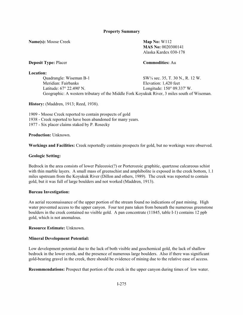
I-275
Property Summary
Name(s): Moose Creek Map No: W112MAS No: 0020300141 Alaska Kardex 030-178
Deposit Type: Placer Commodities: Au
Location:Quadrangle: Wiseman B-1 SW¼ sec. 35, T. 30 N., R. 12 W. Meridian: Fairbanks Elevation: 1,420 feetLatitude: 67° 22.490' N. Longitude: 150° 09.337' W.Geographic: A western tributary of the Middle Fork Koyukuk River, 3 miles south of Wiseman.
History: (Maddren, 1913; Reed, 1938).
1909 - Moose Creek reported to contain prospects of gold1938 - Creek reported to have been abandoned for many years. 1977 - Six placer claims staked by P. Rosecky
Production: Unknown.
Workings and Facilities: Creek reportedly contains prospects for gold, but no workings were observed.
Geologic Setting:
Bedrock in the area consists of lower Paleozoic(?) or Porterozoic graphitic, quartzose calcareous schistwith thin marble layers. A small mass of greenschist and amphibolite is exposed in the creek bottom, 1.1miles upstream from the Koyukuk River (Dillon and others, 1989). The creek was reported to containgold, but it was full of large boulders and not worked (Maddren, 1913).
Bureau Investigation:
An aerial reconnaissance of the upper portion of the stream found no indications of past mining. Highwater prevented access to the upper canyon. Four test pans taken from beneath the numerous greenstoneboulders in the creek contained no visible gold. A pan concentrate (11845, table I-1) contains 12 ppbgold, which is not anomalous.
Resource Estimate: Unknown.
Mineral Development Potential:
Low development potential due to the lack of both visible and geochemical gold, the lack of shallowbedrock in the lower creek, and the presence of numerous large boulders. Also if there was significantgold-bearing gravel in the creek, there should be evidence of mining due to the relative ease of access.
Recommendations: Prospect that portion of the creek in the upper canyon during times of low water.

I-276
References:
Heiner, L.E., and Wolff, E.N., 1968, Final report, mineral resources of northern Alaska: Mineral IndustryResearch Laboratory, University of Alaska, Report 16, p. 135.
Maddren, A.G., 1913, The Koyukuk-Chandalar region, Alaska: U.S. Geological Survey Bulletin 532, p. 91.
Dillon, J.T., Solie, D.N., Decker, J.E., Murphy, J.M., Bakke, A.A., and Huber, J.A., 1989, Road log fromSouth Fork Koyukuk River (mile 156.2) to Chandalar Shelf (mile 237.1) in Mull, C.G., andAdams, K.E., eds., Dalton Highway, Yukon River to Prudhoe Bay, Alaska, Bedrock geology ofeastern Koyukuk basin, central Brooks Range, and eastcentral Arctic Slope: Alaska Division ofGeological and Geophysical Surveys Guidebook 7, v. 1, p. 83.
Reed, I.M., 1938, Upper Koyukuk region, Alaska: Alaska Territorial Department of Mines MiscellaneousReport 194-7, p. 88.

I-277
Property Summary
Name(s): Sawyer Creek Map No: W113MAS No: 0020300045 Alaska Kardex 030-073
Deposit Type: Placer Commodities: Au
Location:Quadrangle: Wiseman B-1 SW¼ sec. 11, T. 29 N., R. 12 W. Meridian: Fairbanks Elevation: 1,550 feetLatitude: 67° 20.933' N. Longitude: 150° 12.117' W.Geographic: A 3.5-mile-long, western tributary to the Middle Fork Koyukuk River, 5 miles south
of Wiseman.
History:
1909 - Sawyer Creek reported to contain prospects for gold (Maddren, 1913). 1936 - Prospected by A. Wilcox and F. Miller (Reed, 1938).1981-83 - Mined by M. Mead and P. Schimmel (M. Mead, personal communication, 2000).1995 - J. Hunt prospected with backhoe (M. Mead, personal communication, 2000).
Production:
Mining in the 1980s produced approximately 25 oz of gold. Largest nugget: 1.5 oz (Marie Mead.personal communication, 2000). Median gold fineness: 897 (Bliss and others, 1988, p. 23).
Workings and Facilities:
Stacked rocks, suction dredge holes, and numerous backhoe test pits in the creek narrows. The test pitsare intermittent along a quarter mile of the creek. A rough dozer trail follows the creek for about 1.2miles upstream from the Koyukuk River. A small cabin is beside the trail near the river.
Geologic Setting:
The lower portion of the Sawyer Creek cuts through a narrow belt of muscovite-biotite graniteorthogneiss. This unit outcrops as a series of north-south-trending resistant ridges and knobs that aresurrounded by vegetative cover. The orthogneiss is exposed in the creek about 0.6 mile upstream from theriver. A north-south-trending, 25° east-dipping unit of Lower Paleozoic(?) to Proterozoic marble andcalcareous schist crosses the creek about 1.1 miles upstream from the river. It has an apparent width ofabout 150 feet and is resistant, creating a narrows where it crosses the stream. The schist forms a naturalriffle in the creek that concentrates placer gold as indicated by the placer workings nearby. This unit isseparated by a north-south trending high angle fault from a Lower Paleozoic(?) or Proterozoic graphitic,quartzose, calcareous schist with thin marble interbeds (Dillon and others, 1989, p. 83). The placer gold isreported to be mostly coarse nuggets with little fine gold (Marie Mead, personal communication, 2000). The creek has a steep gradient (7.5%) and contains numerous large boulders. A test run by J. Hunt of 500cubic yards of gravel from test pits along a quarter mile of the creek, above and below the bedrock riffleproduced 0.25 oz of gold (0.0005 oz/cy) (Marie Mead, personal communication, 2000).

I-278
Bureau Investigation:
A dozen test pans were taken along the creek, mostly upstream from the narrows. No visible gold wasfound in any of the pans. However, a pan concentrate sample (10738, table I-1) yielded 1,632 ppb goldwhich is highly anomalous. A float sample of pyrite-bearing chlorite-quartz schist from the creek bed(10739) contained 123 ppm copper.
Resource Estimate: Unknown.
Mineral Development Potential:
Low mineral development potential. Both past mining and recent sampling indicate that the shallowplacer gold in Sawyer Creek is concentrated on a natural bedrock riffle in the canyon narrows. Thisresource appears to have been mostly mined out. Backhoe sampling of gravel above and below the rifflewas not encouraging.
Recommendations: None.
References:
Bliss, J.D., Brosge, W.P., Dillon, J.T., Cathrall, J.B., and Dutro, J.T., Jr., 1988, Maps and descriptions oflode deposits, prospects, and occurrences in the Wiseman 1o by 3o Quadrangle, Alaska: U. S.Geological Survey Open-file Report 88-293, p. 22-23.
Dillon, J.T., Solie, D.N., Decker, J.E., Murphy, J.M., Bakke, A.A., and Huber, J.A., 1989, Road log fromSouth Fork Koyukuk River (mile 156.2) to Chandalar Shelf (mile 237.1) in Mull, C.G., andAdams, K.E., eds., Dalton Highway, Yukon River to Prudhoe Bay, Alaska, Bedrock geology ofeastern Koyukuk basin, central Brooks Range, and eastcentral Arctic Slope: Alaska Division ofGeological and Geophysical Surveys Guidebook 7, v. 1, p. 83.
Maddren, A.G., 1913, The Koyukuk-Chandalar region, Alaska: U.S. Geological Survey Bulletin 532, p. 91.
Reed, I. M., 1938, Upper Koyukuk region, Alaska: Alaska Territorial Department of MinesMiscellaneous Report 194-7, p. 88.

I-279
Property Summary
Name(s): Emma Creek Map No: W114 Canyon claim MAS No:0020300046 Eldorado claim Alaska Kardex 030-007 Kokomo Alaska Kardex 030-123 Lucky claim Monogram claim Oro Grande claim
Deposit Type: Placer Commodities: Au, Ag
Location:Quadrangle: Wiseman B-1 SW¼ sec. 22, T. 29 N., R. 12 W. Meridian: Fairbanks Elevation: 1,320 feetLatitude: 67° 19.320' N. Longitude: 150° 13.428' W. Geographic: A 6-mile-long western tributary of the Middle Fork Koyukuk River, 6.5 miles north
of Coldfoot. Frisbie Creek is a southern tributary to Emma Creek, 1.5 miles upstreamfrom the Koyukuk River.
History:
1900 - First record of mining on Emma Creek (Maddren, 1913).1900-09 - Production reported to be $14,000 (7,484 oz) (Maddren, 1913). 1929-30 - High channel mined by J. Wilson. 1929 - J. Laane prospected the creek (Reed, 1938).1938 - R. Jones staked two placer claims (Kardex). 1957-62 - Uotila, Rivers, and McIntosh did extensive mechanized mining on the creek U.S. Bureau of
Mines PIMRs, 1957-1962). 1964-present - W. Nordeen mining on creek (W. Nordeen, personal communication, 2000).
Production: (oz Au)
1900 - 1,443 1908 - 2671901 - 2,138 1909 - 2671902 - 695 1911 - 1181903 - 802 1912 - 301904 - 535 1913 - 141905 - 802 1915 - 871906 - 267 1921 - 881907 - 267 1923 - 23
1928 - 18 Total: 7,861 (Records incomplete: doesn’t include production after 1928.)
Production could be as high as 9,000 oz (Cobb, 1976).Nuggets weighing up to 8 oz have been found on the creek (W. Nordeen, personal communication, 2000). Median gold fineness: 905 (Bliss and others, 1988).

I-280
Workings and Facilities:
The modern channel of Emma Creek has been mined for 0.3 mile, starting at a point 0.6 mile upstreamfrom the Koyukuk River. Most of this work has concentrated on the canyon portion of the creek wherebedrock is shallow. The stream was first worked by hand methods followed by dozer/sluice plate,underground drift, and suction dredging methods. Numerous large boulders made pick and shovel workdifficult. In recent years, a 7.5-inch hydrostatic dredge was used for suction dredging, eliminating theneed for a pump. Bedrock potholes up to 24 feet deep were cleaned out with a suction dredge (W.Nordeen, personal communication, 2000).
Drift mining was done in the alluvial fan below the canyon and in high channels within the canyon itself. Water for washing gravel on the high channel was brought in via a 0.5-mile ditch from Emma Creek, nearthe mouth of Frisbie Creek (Reed, 1938). In recent years, drifting has been done in the high channels ofthe canyon on both sides of the creek. A camp and airstrip are located on the south side of Emma Creek,0.2 mile upstream from the Koyukuk River. The average stream gradient in the mined area is 5%(Maddren, 1913, p. 90-91; W. Nordeen, personal communication, 2000).
Geologic Setting:
Emma Creek has been described as a dissected hanging valley (Reed, 1938). The upper end of the creekhas many tributaries running in narrow V-shaped valleys. A north-south striking unit of LowerPaleozoic(?) to Proterozoic marble underlies the narrow, steep-walled canyon of Emma Creek. Themarble is in faulted contact with calcareous schist of similar age. Emma Creek breaches the south flankof and runs parallel to the axis of the southwest-plunging Emma Dome antiform. Due to faulting, themarble is exposed again in the upper canyon of Emma Creek (Dillon and others, 1989).
The southern end of a resistant belt of Devonian muscovite-biotite granite orthogneiss terminates 0.5mile north of Emma Creek. Tremolite skarn and hornfels are associated with this belt. Galena-bearingquartz veins are reported to occur where the stream divides into three forks, 2.5 miles upstream from theKoyukuk River (Dillon and others, 1989; W. Nordeen, personal communication, 2000).
The marble and calcareous schist unit that makes up the Emma Creek canyon acts as a large naturalriffle, collecting gold on the shallow bedrock. Thus most of the placer gold from Emma Creek has beentaken from the canyon as well as from gravels immediately above and below it. The same rock unit andprocess goes on in Sawyer Creek, the next canyon to the north. The richest ground was reportedly at themouth of the canyon, where the creek exits onto an alluvial plain. Placer deposits consist of modern andhigh channel deposits. The best recovery was from faults and fractures in the bedrock (W. Nordeen,personal communication, 2000).
A high channel (Discovery Bench) on the south side of the creek, below Frisbie Creek, about 30 feetabove the modern stream and 150 feet wide was worked by drifting and booming in the late 1920s. Another attempt was made at drifting in the 1990s at the 50-foot level above the creek, but progress wasslowed due to large boulders. Depth to bedrock in the high channel varies from 5 to 90 feet. Therecovered gold was coarse, consisting mostly of 0.01- to 0.05-oz nuggets. This high channel is said tohave produced 640 oz of gold by 1928 (Reed, 1938). Recent prospecting and mining indicate that thereare at least four separate benches on the right limit (W. Nordeen, personal communication, 2000). Ahigh channel on the north side of the creek and 50 feet above the modern stream was being prospected bya 30-foot adit in 2000. Above the left limit high channel, the canyon narrows to 20 to 30 feet in places.

I-281
Four different forms of gold have been found: (1) rounded and well-worn slugs, (2) ragged with mainlycalcite and some quartz attached, (3) sheet gold, and (4) crystalline gold in rectangular shapes (W.Nordeen, personal communication, 2000). The gold recovered from the benches has a higher finenessthan that from the modern stream. Placer concentrates contain abundant amounts of galena and stibnite.
Bureau Investigation:
A sample of sluice concentrates from the high channel on the north side of Emma Creek (12484, table I-1) contains >10,000 ppm lead, >200 ppm silver, 169 ppm arsenic, 1,397 ppm antimony, and 400 ppmtungsten. A sample of sluice concentrates from the modern stream channel(12485) contains >10,000ppm lead, >200 ppm silver, 828 ppm arsenic, 111 ppm bismuth, and 361 ppm tungsten. The high leadand antimony contents are either from mining contamination or are indicative of the galena and stibnite-bearing quartz veins reported in the upper canyon of Emma Creek.
A search for reported galena-bearing quartz veins was made in the forks area of Emma Creek. Whatlooked like a large quartz vein on the north fork from the air, turned out to be barren, calcite-richsedimentary beds. Iron-stained brecciated marble in fault(?) zones was sampled with negative results(12541). Some barren quartz veinlets were observed cutting marble bedrock in the canyon bottom. Evidence of recent hand mining was found at the mouth of the north fork, and very fine gold flakes werefound in test pans taken from bedrock fractures just below the forks. A pan concentrate sample (12543)contained pyrite, 120 ppm copper, and 11 ppb gold. Resource Estimate: None.
Mineral Development Potential:
Moderate potential for placer gold in high bench gravels. Large boulders could prove a difficulty inmining these deposits underground.
The modern stream channel has moderate potential for suction dredging from Frisbie Creek upstream tothe major forks. Moderate potential also exists for large-scale shovel/wash plant operations on the lowermile of the creek (Nordeen, written communication, 2002).
Low potential for silver-bearing quartz veins in the upper canyon.
Recommendations:
Drill bench gravels and/or conduct seismic or ground penetrating radar surveys to determine gold contentand channel configuration. These techniques could prove helpful in pinpointing gold-bearing channels.
References:
Brooks, A.H., and others, 1908, Mineral resources of Alaska, report on progress of investigations in1907: U.S. Geological Survey Bulletin 345, p. 45.
____1913, Mineral resources of Alaska, report on progress of investigations in 1912: U.S. GeologicalSurvey Bulletin 542, p. 45.

I-282
____1915, Mineral resources of Alaska, report on progress of investigations in 1914: U.S. GeologicalSurvey Bulletin 622, p. 59.
____1916, Mineral resources of Alaska, report on progress of investigations in 1916: U.S. GeologicalSurvey Bulletin 662, p. 59.
Cobb, E.H., 1976, Summary of references to mineral occurrences (other than mineral fuels andconstruction materials) in the Chandalar and Wiseman quadrangles, Alaska: U.S. GeologicalSurvey Open-File Report 76-340, p. 103.
Dillon, J.T., Solie, D.N., Decker, J.E., Murphy, J.M., Bakke, A.A., and Huber, J.A., 1989, Road log fromSouth Fork Koyukuk River (mile 156.2) to Chandalar Shelf (mile 237.1) in Mull, C.G., andAdams, K.E., eds., Dalton Highway, Yukon River to Prudhoe Bay, Alaska, Bedrock geology ofeastern Koyukuk basin, central Brooks Range, and eastcentral Arctic Slope: Alaska Division ofGeological and Geophysical Surveys Guidebook 7, v. 1, p. 81.
Maddren, A..G., 1913, The Koyukuk-Chandalar region, Alaska: U.S. Geological Survey Bulletin 532, p. 292, 300.
Mulligan, J.J., 1974, Mineral resources of the Trans-Alaska Pipeline corridor: U.S. Bureau of MinesInformation Circular 8626, p. 9.
Reed, I.M., 1938, Upper Koyukuk region, Alaska: Alaska Territorial Department of Mines MiscellaneousReport 194-7, p. 88-90.
Schrader, F.C., 1900, Preliminary report on a reconnaissance along the Chandalar and Koyukuk Rivers,Alaska in 1899: Twenty-first annual report of the U.S. Geological Survey Part 2, p. 486.
____1904, A reconnaissance in northern Alaska across the Rocky Mountains, along the Koyukuk, John,Anaktuvuk, and Colville Rivers and the Arctic coast to Cape Lisburne, in 1901: U.S. GeologicalSurvey Professional Paper 20, p. 99, 102.

I-283
Property Summary
Name(s): Marion Creek Map No: W115 Marion Discovery MAS No: 0020300079 Sunset claims Alaska Kardex 030-058
Alaska Kardex 030-098Alaska Kardex 030-198Alaska Kardex 030-210Alaska Kardex 030-211Alaska Kardex 030-221Alaska Kardex 031-058Alaska Kardex 031-140 ARDF CH035
Deposit Type: Placer Commodities: Au
Location:Quadrangle: Wiseman B-1 SE¼ sec. 20, T. 29 N., R. 11 W. Meridian: Fairbanks Elevation: 1,450 feetLatitude: 67° 19.394' N. Longitude: 150° 2.903' W.Geographic: The 16-mile-long, west-flowing tributary of the Middle Fork Koyukuk River flows
through the Wiseman and Chandalar quadrangles. The creek mouth is directly oppositeEmma Creek. The headwaters, above the forks, are within Doyon Ltd. lands.
History:
1900-01 - Winter attempt to sink a shaft to bedrock proved unsuccessful (Maddren, 1913).1908-09 - Another shaft was attempted, 6 to 7 miles upstream of the mouth (Maddren, 1913). 1938 - B. Baecker staked six placer claims (Kardex).1970s - Nearly 100 claims staked by several different parties (Kardex).1990s - Central Alaska Gold Company (1992) conducted geochemical sampling in the area.1993 - R. Kirby sold his Sunset claims, which cover most of Marion Creek, to J. Nesbit and R. Hamm.
Production: 1900-09 - 48 oz Au (Maddren 1910)
Workings and Facilities:
Near a prominent tributary, 2.5 miles upstream from the Middle Fork Koyukuk River, Marion Creek cutsacross a 0.25-mile-stretch of bedrock with numerous plunge pools. Some diving equipment was foundnearby, indicating that suction dredge mining probably took place here. Approximately 4.5 milesupstream from the mouth, below a small gorge, there was flagging that seemed to indicate recent survey/prospecting.
Geologic Setting:
Marion Creek lies within the schist belt of the Arctic Alaska terrane. Bedrock on the creek consists oflower Paleozoic to Proterozoic banded quartzite and graphitic albite-chlorite-muscovite-quartz schist. The bands probably represent metamorphically differentiated relicts of quartzose and pelitic sediments.

I-284
Greenschist of similar age also outcrops south of Marion Creek in a few locations (Dillon andReifenstuhl, 1995).
Maddren (1913) reported the present channel gravels contain “colors” of gold; however, depth to bedrockprohibited mining by hand methods. A shaft was sunk about 6.5 miles upstream from the creek mouth. Good pay was reportedly found.
Central Alaska Gold Company (1992) reported three anomalous stream sediment samples in the area,measuring up to 65 ppb gold and 1.4 ppm silver. The follow-up investigation included soil, rock, andstream sediment sampling. Company personnel speculated that low-level gold and silver anomalies weredue to scattered mineralization in brittle faults and quartz veins. They concluded that Marion Creek didnot contain significant gold mineralization.
Bureau Investigation:
Several miles of Marion Creek and its tributaries were investigated. Visible gold was found in 7 of 10pans submitted for analysis (table I-1). The gold was most often found on schistose bedrock with lessthan 1 foot of gravel overburden. The most consistent gold was panned just downstream of the gorge,which is located 4.5 miles upstream from the creek mouth. Two pan concentrate samples (12323-12324)collected from this location average 213.9 ppm gold and 9.9 ppm silver. Three pan samples (12320-21322) were also collected within 1 mile upstream of the gorge and average 68.3 ppm gold and 6.3 ppmsilver.
A left limit (southern) tributary about 2.5 miles upstream from the mouth was also investigated. Thetributary has conspicuous iron-stained water up to elevation 2,700 feet. Cobbles of gossanous schistbreccia were observed on the tributary; however, the unit does not outcrop on the surface. A selectsample of gossanous rock (12329) contains 85 ppb gold and 1421 ppm antimony. A pan sample (12328)collected off bedrock contains 1,087 ppb gold.
Mica-quartz schist bedrock is exposed on Marion Creek below the tributary for a quarter of a mile. Thebedrock contains many plunge pools, which have most likely been suction dredged. The bedrock is muchless friable than the bedrock upstream. Five test pans collected from the surface did not contain visiblegold; one pan concentrate sample (12325) collected at the same site contained 28 ppb gold and nodetectable silver.
Samples were collected on Marion Creek and a northern tributary approximately 9 miles upstream of themouth. Visible gold was found in pan concentrate samples (11336, 11339) on both Marion Creek andthe northern tributary; these measure 3,739 ppb and 81.80 ppm respectively. A placer sample (11340)was collected on the tributary and contains 0.006 oz/cy gold, 4.1 ppm silver, and 601 ppm arsenic.
Resource Estimate: None.
Mineral Development Potential:
Moderate mineral potential exists at Marion Creek. There is placer gold at several locations on thecreek; however, water levels must be relatively low in order to expose the bedrock. Also, access formechanized equipment could prove difficult due to the narrowness of the lower canyon.

I-285
Recommendations:
The gorge location on Marion Creek contains a friable schistose bedrock that is an amenable trap forsmall amounts of fine gold. Also recommend suction dredging of the bedrock pools on lower MarionCreek at times of low water.
References:
Central Alaska Gold Company, 1992, 1991 Annual report, Alaska field operations- Doyon Ltd. option, v.I: unpublished report 92-70 for Doyon Ltd, 39 p. [available from Doyon Ltd., Fairbanks, Alaska]
Cobb, E.H., 1972, Metallic mineral resources map of the Chandalar quadrangle, Alaska: U.S. GeologicalSurvey Miscellaneous Field Studies Map MF-457, 1sheet, scale 1:250,000.
____1976, Summary of references to mineral occurrences (other than mineral fuels and constructionmaterials) in the Chandalar and Wiseman quadrangles, Alaska: U.S. Geological Survey Open-File Report 76-340, p. 46.
DeYoung, 1978, Mineral resources of the Chandalar quadrangle, Alaska: U.S. Geological SurveyMiscellaneous Field Investigation Map MF-878B, 2 sheets, scale 1:250,000.
Dillon, J.T., Brosge, W.P., and Dutro, J.T., Jr., 1986, Generalized geologic map of the Wisemanquadrangle, Alaska: U.S. Geological Survey Open-File Report 86-219, 1 sheet, scale 1:250,000.
Dillon, J.T., and Reifenstuhl, R.R., 1990, Geologic map of the Wiseman B-1 quadrangle southcentralBrooks Range, Alaska: Alaska Division of Geological and Geophysical Surveys, ProfessionalReport 101, 1 sheet, scale 1:63,360.
____1995, Geologic map of the Chandalar B-6 quadrangle southeastern Brooks Range, Alaska: AlaskaDivision of Geological and Geophysical Surveys Professional Report 103, 1 sheet, scale1:63,360.
Heiner, L.E., and Wolff, E.N., 1968, Final report, mineral resources of northern Alaska: Mineral IndustryResearch Laboratory, University of Alaska, Report 16, p. 49, 135.
Maddren, A.G., 1910, The Koyukuk-Chandalar gold region in Brooks, A.E., Mineral resources ofAlaska, report on progress of investigations in 1909: U.S. Geological Survey Bulletin 442, p.292.
____1913, The Koyukuk-Chandalar region, Alaska: U.S. Geological Survey Bulletin 532, p. 69, 90.
Reed, I.M., 1938, Upper Koyukuk region, Alaska: Alaska Territorial Department of Mines MiscellaneousReport 194-7, p. 90.
Schrader, F.C., 1900, Preliminary Report on a Reconnaissance along the Chandalar and Koyukuk Rivers,Alaska in 1899: Twenty-first annual report of the U.S. Geological Survey part 2, p. 485.

I-286
Property Summary
Name(s): Kelly Gulch Map No: W116 Kelly’s Mistake MAS No: 0020300047 April 1-3 Alaska Kardex 030-012
Deposit Type: Placer Commodities: Au
Location:Quadrangle: Wiseman B-1 NW¼ sec: 34, T. 29 N., R. 12 W. Meridian: Fairbanks Elevation: 1,150 feetLatitude: 67° 17.813' N. Longitude: 150° 11.912' W.Geographic: A steep western tributary of the Middle Fork Koyukuk River, 2 miles south of
Emma Creek.
History:
1901 - About $500 worth of gold was mined in the fall of 1901 (Maddren, 1910).1937 - R.H. Creecy started an opencut, but results of the effort are not known (Reed, 1938).
Production:
1901 - 24 oz Au (Records incomplete.)
Workings and Facilities:
Stacked rocks located near the creek mouth extend for several hundred feet.
Geologic Setting:
Dillon and Reifenstuhl (1990) classify the bedrock at Kelley Creek as Lower Paleozoic(?) orProterozoic(?) interbanded quartzite and graphitic schist, marble, and calcareous schist. Also, thin unitsof greenschist and metamorphosed gabbro and diabase (of the same age) outcrop near the headwaters.
The creek is steep and narrow, with heavy vegetation along the banks. The average gradient is 13%(Bliss and others, 1988).
Bureau Investigation:
Stream sediment and pan concentrate samples (11319-11320, table I-1) were collected from a gravel barbelow the stacked rocks, near the mouth of the creek. Analysis detected gold in each sample (27 and 73ppb, respectively); however, no visible gold was observed. The sample results are slightly anomalous.
Resource Estimate: None.
Mineral Development Potential: Low mineral development potential due to lack of visible gold in pans.

I-287
Recommendations: None.
References:
Bliss, J.D., Brosge, W.P., Dillon, J.T., Cathrall, J.B., and Dutro, J.T., Jr., 1988, Maps and descriptions oflode deposits, prospects, and occurrences in the Wiseman 1o by 3o Quadrangle, Alaska: U. S.Geological Survey Open-file Report 88-293, p. 24-25, plus two plates.
Dillon, J.T., and Reifenstuhl, R.R., 1990, Geologic map of the Wiseman B-1 quadrangle southcentralBrooks Range, Alaska: Alaska Division of Geological and Geophysical Surveys, ProfessionalReport 101, 1 sheet, scale 1:63,360.
Heiner, L.E., and Wolff, E.N., 1968, Final report, mineral resources of northern Alaska: Mineral IndustryResearch Laboratory, University of Alaska, Report 16, 299 p.
Maddren, A.G., 1910, The Koyukuk-Chandalar gold region in Brooks, A.E., Mineral resources ofAlaska, report on progress of investigations in 1909: U.S. Geological Survey Bulletin 442, p.292.
____1913, The Koyukuk-Chandalar region, Alaska: U.S. Geological Survey Bulletin 532, p. 69, 89.
Reed, I.M., 1938, Upper Koyukuk region, Alaska: Alaska Territorial Department of Mines MiscellaneousReport 194-7, 169 p.

I-288
Property Summary
Name(s): Clara Creek Map No: W117 Star Light claims MAS No: 0020300048
Alaska Kardex 030-025Alaska Kardex 030-098
Deposit Type: Placer Commodities: Au, Ag
Location:Quadrangle: Wiseman B-1 SW¼ sec. 1, T. 28 N., R. 12 W. Meridian: Fairbanks Elevation: 1,400 feetLatitude: 67° 16.743' N. Longitude: 150° 06.579' W.Geographic: A 5-mile-long, west-flowing tributary of the Middle Fork Koyukuk River, 1 mile
north of Coldfoot. Access is via an unpaved road off the Dalton Highway.
History:
1900-01 - Discovery led to $3,000 (155 oz) worth of production by six men during the summers of 1900and 1901. Production included an 18-oz nugget, valued at $350 (Maddren, 1910, 1913; Schrader,1900, 1904).
1934 - K. Harvey mined an opencut; however, the results are not known (Smith, 1936).1953 - S. and O. Stanich purchased placer claims and began prospecting, sinking shafts, and mining.1959 - Winter shafts and summer prospecting continued. New mining lease established between A.
Miscovich and the Stanich brothers.1960s - Prospecting, trenching, and shaft work continued.1968 - A. and V. Miscovich purchased the placer claims from the Stanich brothers.1970s - Prospecting, trenching, and shaft work continued.1984-92 - R. Kirby conducted placer operations on the Star Light claims of Clara Creek.1993 - J. Nesbit and R. Hamm purchased some of the Star Light claims.1999 - Nesbit and Hamm sold the Star Light claims to D. and D. Korte, who conducted suction dredge
mining near the lower tributary.
Production: (oz Au) (Maddren, 1910)
1900 - 481901 - 97Total: 155 (Recent production is unknown.) Mosier and Lewis (1986) reported the average fineness ofplus 35-mesh gold is 919.9 and minus 35-mesh gold is 870.7.
Workings and Facilities:
Stacked rocks (up to 10 feet high) are intermittent along 1 mile of Clara Creek, beginning at 1,400 feetelevation. An abandoned shaft and tailings are located at 1,550 feet elevation, east of the main left limit(southern) tributary. Tailings for another possible shaft are located along the northeastern fork at 2,000feet elevation.

I-289
Geologic Setting:
The bedrock at Clara Creek is mapped as Lower Paleozoic(?) or Proterozoic(?) interbanded quartzite andgraphitic schist. About 0.2 mile north of Clara Creek, at 1,600 feet elevation, there is a conspicuousexposure of eclogite with reddish, almandine-rich garnets and green clinopyroxene (Dillon andReifenstuhl, 1990; Gottschalk, 1987). The average gradient between 2,000 feet and 1,200 feet elevationis 6.8% (Bliss and others, 1988).
Bureau Investigation:
Clara Creek has significant amounts of bedrock exposure above 1,300 feet elevation. These exposuresform plunge pools approximately 6 to 10 feet wide. A stream sediment and pan concentrate sample(11317-11318) were collected at the prominent left limit tributary, where the orientation of the schistosebedrock forms natural riffles. The pan concentrate contained one coarse gold flake, measuring 199 ppmgold and 13.5 ppm silver. Another stream sediment and pan concentrate (12333-12334) were collectedoff bedrock on the main creek. No visible gold was found, but the sample assayed at 1,633 ppb gold.
The eclogite outcrop to the north of Clara Creek was also investigated. Two samples were collected: aselect sample with <1% chalcopyrite and trace malachite (12330) and a random chip sample (12331). The samples average 407 ppm copper and 35.5 ppm antimony.
Resource Estimate: None.
Mineral Development Potential:
Low to moderate mineral development potential for placer gold, as gold was found in pans from theClara Creek and a tributary.
Recommendations: None.
References:
Bliss, J.D., Brosge, W.P., Dillon, J.T., Cathrall, J.B., and Dutro, J.T., Jr., 1988, Maps and descriptions oflode deposits, prospects, and occurrences in the Wiseman 1o by 3o Quadrangle, Alaska: U. S.Geological Survey Open-file Report 88-293, p. 34, plus two plates.
Dillon, J.T., and Reifenstuhl, R.R., 1990, Geologic map of the Wiseman B-1 quadrangle southcentralBrooks Range, Alaska: Alaska Division of Geological and Geophysical Surveys, ProfessionalReport 101, 1 sheet, scale 1:63,360.
Gottschalk, R.R., Jr., 1987, Structural and petrologic evolution of the southern Brooks Range nearWiseman, Alaska: Rice University, Houston, Texas Ph.D. dissertation, 263 p.
Heiner, L.E., and Wolff, E.N., 1968, Final report, mineral resources of northern Alaska: Mineral IndustryResearch Laboratory, University of Alaska, Report 16, 299 p.

I-290
Maddren, A.G., 1910, The Koyukuk-Chandalar gold region in Brooks, A.E., Mineral resources ofAlaska, report on progress of investigations in 1909: U.S. Geological Survey Bulletin 442, p.292.
____1913, The Koyukuk-Chandalar region, Alaska: U.S. Geological Survey Bulletin 532, p. 69, 89.
Mosier, E.L., and Lewis, J.S., 1986, Analytical results, geochemical signatures, and sample locality mapof load gold, placer gold, and heavy-mineral concentrates from the Koyukuk-Chandalar miningdistrict, Alaska: U. S. Geological Survey Open-file Report 86-345, p. 98-99.
Reed, I.M., 1938, Upper Koyukuk region, Alaska: Alaska Territorial Department of Mines MiscellaneousReport 194-7, p. 91.
Schrader, F.C., 1900, Preliminary report on a reconnaissance along the Chandalar and Koyukuk Rivers,Alaska in 1899: Twenty-first annual report of the U.S. Geological Survey Part 2, 584 p.
____1904, A reconnaissance in northern Alaska across the Rocky Mountains, along the Koyukuk, John,Anaktuvuk, and Colville Rivers and the Arctic coast to Cape Lisburne, in 1901: U.S. GeologicalSurvey Professional Paper 20, p. 99-101.
Smith, P.S., 1936, Mineral industry of Alaska in 1934, in Mineral resources of Alaska, report on progressof investigations in 1934: U.S. Geological Survey Bulletin 868A, p. 43.

I-291
Property Summary
Name(s): Porcupine Creek Map No: W118 MAS No: 0020300050
Deposit Type: Placer Commodities: Au, Ag
Location:Quadrangle: Wiseman A-1, B-1 SE¼ sec. 13, T. 28 N., R. 13 W. Meridian: Fairbanks Elevation: 1220 feetLatitude: 67° 14.353' N. Longitude: 150° 17.673' W.Geographic: Porcupine Creek is a 5.5-mile-long western tributary to the Middle Fork Koyukuk
River, 3 miles south of Coldfoot. Quartz Creek is a northwest tributary to Porcupine,joining 1.5 miles upstream from the creek mouth.
History: (Maddren, 1913; Reed, 1938)
1900 - First recorded production. Mining continued consistently for the next 30+ years (Maddren, 1913).1901 - Four men working on creek. Production reported to average 1.7 oz/day (Maddren, 1913). 1916 - O. Stannich and S. Stannich began working present stream channel (Reed, 1938).1922 - The Stannich brothers started a drain to tap water in the deep channel (Reed, 1938).1923-24 - Stannich brothers started drift mining in deep channel (Reed, 1938). 1927 - Mining activity reported (Smith, 1930).1930 - Mining activity reported (Smith, 1933).1934 - V. Neck staked 51 placer claims on creek and opencut mined. Drift mining by Stannich brothers
(Kardex, U.S. Bureau of Mines PIMR, 1934).1935 - Mining activity reported (Smith, 1937). 1936-37 - D. O’Keefe groundsluiced and shoveled in (Reed, 1938).1937 - N. Pendleton groundsluiced and shoveled in 3 miles upstream from junction with Quartz Creek
(Reed, 1938). 1947 - Total production from Quartz Creek: 7 oz (U.S. Bureau of Mines PIMR, 1934).1960-80 - A. Miscovich mined on creek (A. Miscovich, personal communication, 2000).1997-2000 - R. Hamm (Slisco Inc.) mined on creek (R. Hamm, personal communication, 1999). 2001 - No activity.
Production: (oz Au)
1900 - 271901 - 541908 - 2041909 - 1,6161910 - 3,1871911 - 1,7711921 - 1791926 - 43
1927 - 161928 - 701929 - 431930 - 431931 - 451932 - 391933 - 211934 - 18
1938 - 361939 - 111940 - 141941 - 131942 - 181943 - 291951 - 441952 - 29
1954 - 261955 - 181956 - 261957 - 171958 - 261959 - 521963 - 39__________
Total: 7,774

I-292
Reported total: 8,670 (Records incomplete)Median fineness: 894Quartz Creek production: 80 oz
Workings and Facilities:
Early mining methods included drifting, shoveling in, and hydraulicking (Reed, 1938). Recent operatorsused a D9G Caterpillar® dozer to strip overburden. A Hitachi® 1.5 cy backhoe excavated the paygravel, which was then transported via dump truck to the sluice box wash plant. A Derocker® grizzlyseparated the numerous large boulders from the pay gravel before it was run through the plant. A smalljig was used to test the sluice tails for gold. Approximately 8-10% of the gold recovered was in the >¼-inch fraction. The wash plant could process up to 70 cy/hour. An Atco-type trailer camp and landingstrip are located downstream from the mining area. There has been extensive mining of both deep channel and modern stream gravels along 4,500 feet of thecreek downstream from Quartz Creek. The pay gravel is unfrozen and considerable groundwater runs ontop of bedrock in the deep channel. In the early mining days, a 1,350 foot-long drainage ditch wasexcavated to deal with this water (Reed, 1938). In 2000, a 6-inch pump running 24 hours a day wasrequired to keep cuts in the deep channel from flooding. The lower portion of the creek has been minedto a 300-foot width with cuts up to 70 feet deep in an attempt to intersect the bottom of the deep channel. Recent mining efforts have been hampered by thickening overburden and excessive water as operationsmoved downstream. By the end of the 2000 mining season, the operators felt that these factors weremaking the operation uneconomic. This operation uncovered boulders with drill holes, which indicatedthat at one time the ground had been tested with a placer(?) drill (R. Hamm, personal communication,2000).
Geologic Setting:
The bedrock underlying Porcupine and Quartz Creeks consists of Proterozoic or Lower Paleozoic quartz-mica schist and paragneiss with lenses and bands of black graphitic schist. In addition there ismuscovite quartzite and quartzo-feldspathic schist and a few layers of marble and calcareous schist. Schistosity trends generally east-west. An east-west-trending fault crosses the creek near its headwaters(Dillon and others, 1986). A band of pyrite-bearing schist crosses Porcupine Creek just above QuartzCreek. The schist locally contains narrow bands (up to 0.5 feet) that contain up to 10% euhedral pyrite.The oxidation of the pyrite has resulted in abundant limonite stain on the rocks downstream.
Both modern stream and deep channel placers have been mined on Porcupine Creek. About 600 feetdownstream from the confluence of Quartz Creek with Porcupine, the depth to bedrock under the creek isabout 6 feet and increases to 30 feet towards the bench on the left limit. The gravel was composed of flatpieces of schist, mixed with coarse sand. Numerous large boulders (up to 6 feet) occur in the gravel. Most of the gold was concentrated in the lower 3-6 feet of gravel, with very little occurring on top of thebedrock. This deposit was permanently frozen. The value of the ground was reportedly $0.59 (0.02 oz)per bedrock foot. The gold was reported to be mostly fine with an occasional nugget.
In the early years, a minimum 450-foot-long section of the deep channel was mined by drifting. Thechannel was 20 to 25 feet wide and about 30 feet below the surface. The upper 15 feet of gravel wasfrozen (Reed, 1938). Bedrock drops off rapidly as Porcupine Creek exits mountainous terrain andintersects the main valley of the Koyukuk River. At the downstream end of the mining operation,

I-293
bedrock depths reach 80 feet. In the early days, miners prospected for gold-bearing, high channelswithout success. Recent mining efforts have focused on the deep channel. Pay is concentrated in thelower 20 feet of gravel and as much bedrock as can be removed with a backhoe. In 1999 pay gravel wasaveraging 0.05 oz/cy (R. Hamm, personal communication, 2000).
Quartz Creek runs through a narrow valley, starting at about 0.3 mile upstream from Porcupine Creek. Bedrock is reported to be about 3 feet deep. Shoveling in on the creek was reported to produce about 80oz of gold (Reed, 1938, p. 104). After 1937, no ground rich enough to mine was found on the creek(Saunders, 1954).
Bureau Investigation:
A pan concentrate collected from bedrock on Porcupine Creek just upstream of Quartz Creek (11324,table I-1) contained 26.82 ppm gold. At the same site, a select outcrop sample of quartz-mica schist with10% euhedral pyrite contained 33 ppb gold (11322). A sample of placer concentrates from PorcupineCreek (11321) contained abundant magnetite, pyrite cubes, 7,896 ppm lead, 427 ppm zinc, 418 ppmtungsten, 170 ppm nickel, 16 ppb platinum, and 14 ppm bismuth. The high lead and zinc values may bedue to contamination related to mining. A sample of the pyrite cubes (11907) contained 603 ppb gold. Itis not definite whether the gold is actually intergrown with the pyrite or very fine placer gold particlesthat have attached to the cube surfaces.
A pan concentrate from a gravel bar below the canyon of Quartz Creek (11326) contained 135 ppb gold,which is anomalous. A stream sediment sample from the same site (11325) contained 132 ppm zinc,which is slightly anomalous. No evidence of mining was observed on the creek. This anomalous valuemay be due to contamination by placer gold. A pan concentrate off bedrock at the same site (11324)contained 26.8 ppm gold, which is highly anomalous.
Resource Estimate: None.
Mineral Development Potential:
Low mineral development potential. The section of stream below Quartz Creek has been extrensivelymined and economic gold-bearing gravels have been mostly removed. Though previously mined by handmethods, the section upstream from Quartz Creek has been tested with backhoe and found to beuneconomic for a mechanized operation (Ralph Hamm, personal communication, 1998). There could begold-bearing gravels in the deep channel downstream from the area mined during 2000. However,overburden in the area is at least 80 feet thick, which may preclude mining with surface methods. Sincethe gravel is mostly thawed, any mining attempts will have to deal with excessive water.
Recommendations: None
References:
Brooks, A.H., and others, 1916, Mineral resources of Alaska, report on progress of investigations in1916: U.S. Geological Survey Bulletin 662, p. 59.

I-294
Bliss, J.D., Brosge, W.P., Dillon, J.T., Cathrall, J.B., and Dutro, J.T., Jr., 1988, Maps and descriptions oflode deposits, prospects, and occurrences in the Wiseman 1o by 3o quadrangle, Alaska: U. S.Geological Survey Open-file Report 88-293, 52, p. 26-27.
Carnes, R.D., 1976, Active Alaskan placer operations, 1975: U.S. Bureau of Mines Open-File Report 98-76, 86 p.
Cobb, E.H., 1981, Summary of data on and lists of references to metallic and selected nonmetallicmineral occurrences in the Wiseman quadrangle, Alaska, supplement to Open-File Report 76-340: U.S. Geological Survey Open-File Report 81-732B, 21 p.
Maddren, A.G., 1910, The Koyukuk-Chandalar gold region in Brooks, A.E., Mineral resources ofAlaska, report on progress of investigations in 1909: U.S. Geological Survey Bulletin 442, p.292.
____1913, The Koyukuk-Chandalar region, Alaska: U.S. Geological Survey Bulletin 532, p. 69, 86.
Mosier, E.L., and Lewis, J.S., 1986, Analytical results, geochemical signatures, and sample locality mapof lode gold, placer gold, and heavy-mineral concentrates from the Koyukuk-Chandalar miningdistrict, Alaska: U. S. Geological Survey Open-file Report 86-345, p. 115-118.
Mulligan, J.J., 1974, Mineral resources of the Trans-Alaska Pipeline corridor: U.S. Bureau of MinesInformation Circular 8626, 24 p.
Orris, G.J., and Bliss, J.D., 1985, Geologic and grade-volume data on 330 gold placer deposits: U.S.Geological Survey Open-File Report 85-213, p. 45-46.
Reed, I.M., 1938, Upper Koyukuk region, Alaska: Alaska Territorial Department of Mines MiscellaneousReport 194-7, p. 101-104.
Saunders, R.H., 1954, Koyukuk district operations (Wiseman, Chandalar): Alaska Territorial Department of Mines Miscellaneous Report MR-194-16, p. 4-5.
Schrader, F.C., 1900, Preliminary report on a reconnaissance along the Chandalar and Koyukuk Rivers,Alaska in 1899: Twenty-first annual report of the U.S. Geological Survey Part 2, p. 485.
____1904, A reconnaissance in northern Alaska across the Rocky Mountains, along the Koyukuk, John,Anaktuvuk, and Colville Rivers and the Arctic coast to Cape Lisburne, in 1901: U.S. GeologicalSurvey Professional Paper 20, p.102.
Smith, P.S., 1930, Mineral industry of Alaska in 1927, in Smith, P.S. and others, Mineral resources ofAlaska, report on progress of investigations in 1927: U.S. Geological Survey Bulletin 810, p. 28.
____1932, Mineral resources of Alaska, report on progress of investigations in 1929: U.S. GeologicalSurvey Bulletin 824A, p. 38-40.
____1933, Mineral industry of Alaska in 1930, in Smith, P.S. and others, Mineral resources of Alaska,report on progress of investigations in 1930: U.S. Geological Survey Bulletin 836, p. 39-40.

I-295
____1936, Mineral industry of Alaska in 1934, in Mineral resources of Alaska, report on progress ofinvestigations in 1934: U.S. Geological Survey Bulletin 868A, p. 43.
____1937, Mineral resources of Alaska, report on progress of investigations in 1935: U.S. GeologicalSurvey Bulletin 880A, p. 46.
____1938, Mineral resources of Alaska, report on progress of investigations in 1936: U.S. GeologicalSurvey Bulletin 897A, p. 1-107.

I-296
Property Summary
Name(s): Rosie Creek Map No: W119 Rose Creek MAS No: 0020300051 Lake Creek Alaska Kardex 030-071 Bam’s Bonanza Alaska Kardex 030-195 J & J Jackpot
Deposit Type: Placer Commodities: Au, Ag
Location:Quadrangle: Wiseman A-1 SW¼ sec. 4, T. 27 N., R. 12 W. Meridian: Fairbanks Elevation: 1,200 feetLatitude: 67° 11.717' N. Longitude: 150° 11.333' W.Geographic: A west-flowing tributary of the Middle Fork Koyukuk River, draining Cathedral
Mountain. The principal south-flowing tributary is (informally) named Lake Creek. Access is via a winter trail from Coldfoot.
History: (Maddren, 1913; Reed, 1938)
~1906 - Discovery claim was 2 miles above the mouth of Rosie Creek.1906-38 - Six shafts were sunk between the discovery claim and the head of Lake Creek.1977 - J. Henry and J. Mitchell staked 3 placer claims on Rosie Creek, near the confluence with Lake Creek.
Production: Unknown.
Workings and Facilities:
Six shafts were sunk prior to 1938. Most of the shafts were sunk near the confluence of Rosie Creek andits northern tributary, Lake Creek (Maddren, 1913; Reed, 1938).
Geologic Setting:
Rosie Creek lies within the east-trending Angayucham thrust fault system. North of the fault lies theArctic Alaska terrane, which is composed of Devonian metasediments. South of the fault lies the oceanicAngayucham terrane. Several gold-producing creeks lie within this fault system, including BoulderCreek (map no. C68), Slate Creek (map no. C69), Myrtle Creek (map no. C70), and the South ForkKoyukuk River (map nos. W128-W133).
To the south of the Rosie Creek basin, the bedrock is predominantly Upper Paleozoic to Mesozoic pillowbasalt with intrusions of diabasic greenstone and interlayers of limestone and chert. Near the confluenceof Rosie and Lake Creeks, the bedrock is Upper Paleozoic to Mesozoic graywacke, siltsone, and phyllitewith minor mafic dykes. To the north, at the headwaters of Lake Creek, the bedrock is Devonian slate,phyllite, calcareous schist with minor metabasite (metamorphosed dykes of diabase, gabbro, and diorite)(Dillon and others, 1989).

I-297
Fine gold was reported on the present channel at the discovery claim; however, bedrock was said to be130 feet deep. Six shafts were sunk near the confluence of Rosie and Lake Creeks. They averaged 110feet to bedrock. One shaft, below the larger lake on Lake Creek, was 275 feet deep. The gravel from theshafts was reported to be mostly slatey, shingle-sized gravel with about 20 feet of blue clay, overlying athin layer of gravel that rested on bedrock. Fine flour gold was recovered from the lower, thin layer ofgravel (Maddren, 1913; Reed, 1938).
Bureau Investigation:
Rosie Creek has an extremely gentle gradient and does not cut bedrock. A pan concentrate collectedfrom a gravel bar near the discovery claim (11315, table I-1) contains 1 fine, angular flake of gold. Analysis shows the sample to contain 2,668 ppb gold. However, no visible gold was observed in threetest pans collected nearby.
Lake Creek was also investigated. The remains of a cabin and a shaft are located 1 mile upstream fromthe creek mouth. A second shaft site is 2 miles upstream of the mouth, at the southern end of theheadwaters lakes. The creek does not have gravel channels. A stream sediment sample (12479)collected from Lake Creek was not anomalous in metals.
Resource Estimate: None.
Mineral Development Potential:
Low mineral development potential for placers due to lack of visible gold in samples.
Recommendations: None.
References:
Cobb, E.H., 1972, Metallic mineral resources map of the Wiseman quadrangle, Alaska: U.S. GeologicalSurvey Miscellaneous Field Studies Map MF-469, 1 sheet, scale 1:250,000.
Dillon, J.T., Brosge, W.P., and Dutro, J.T., Jr., 1986, Generalized geologic map of the Wisemanquadrangle, Alaska: U.S. Geological Survey Open-File Report 86-219, 1 sheet, scale 1:250,000.
Dillon, J.T., Reifenstuhl, R.R., Bakke, A.A., and Adams, D.D., 1989, Geologic map of the Wiseman A-1quadrangle, southcentral Brooks Range, Alaska: Alaska Division of Geological and GeophysicalSurveys Professional Report 98, 2 sheets, scale 1:63,360.
Heiner, L.E., and Wolff, E.N., 1968, Final report, mineral resources of northern Alaska: Mineral IndustryResearch Laboratory, University of Alaska, Report 16, 299 p.
Maddren, A.G., 1913, The Koyukuk-Chandalar region, Alaska: U.S. Geological Survey Bulletin 532, p. 104
Reed, I.M., 1938, Upper Koyukuk region, Alaska: Alaska Territorial Department of Mines MiscellaneousReport 194-7, p. 104.

I-298
Property Summary
Name(s): Twelvemile Creek Map No: W120 Coldfoot Mining Co. MAS No: 0020300052 Dodie’s Dream Association. Alaska Kardex 030-013 Elmer’s Tune Alaska Kardex 030-023 through 25 Gold Fork Association Alaska Kardex 030-027 Good Hope Association Alaska Kardex 030-028 Sandra Lee Alaska Kardex 030-085 Twelvemile Creek, south fork Alaska Kardex 030-245
Deposit Type: Placer Commodities: Au, Ag
Location:Quadrangles: Wiseman A-1, A-2 SE¼ sec. 5, T. 27 N., R. 13 W. Meridian: Fairbanks Elevation: 1,200 feetLatitude: 67° 11.240' N. Longitude: 150° 26.806' W. Geographic: A western tributary to the Middle Fork Koyukuk River, 3.2 miles northeast of
Twelvemile Mountain. The discovery claim is near the junction of the South Fork withthe main Twelvemile Creek, 3 miles upstream from the Koyukuk River.
History:
1899 - Gold reported on Twelvemile Creek (Schrader, 1900).1900 - First year of production (Maddren, 1913).1909 - Twelvemile Creek worked only occasionally and with little reward (Maddren, 1913). 1934 - Extensive tracks on creek to be examined by a competent mining engineer. Forty holes drilled and gold distribution found to be so irregular that further drilling was given up (Reed, 1938). 1937 - Hydraulicking on upper end of claim no.1 below discovery by Issac Spinks and Mrs. E.R. Marsan
(Reed, 1938).1938 - A total of 162 oz gold and 14 oz silver were reportedly produced as of this year. Mcintosh and
Weldon staked 34 placer claims. Claims also staked by Stannish, Sam, and O’Brien (Kardex). 1940 - Koyukuk Gold Placers, Inc. (Jim Priest) developed a hydraulic and bulldozer operation on
Twelvemile Creek (Fairbanks Daily News-Miner, July 26, 1940).1953 - Claims staked by A. Schwaesdall. Two placer claims staked by Stullenberg, Tauber, and Lurloe.1958 - Ten placer claims staked by A. Schwaesdall (Kardex). 1980 - Eleven placer claims staked by Walter and Dorris Kopp (Kardex). 1983 - Andy and Verda Miscovich (Coldfoot Mining Co.) mined on creek (A Miscovich, personal
communication, 2000).1997 - Dodie’s Dream (four claims) held by Walter and Dorris Kopp.
Production: (oz Au)
1900 - 48 1927 - 171901 - 73 1936 - 301922 - 45 1940 - 41925 - 61 1942 - 3
Total: 281 (Records incomplete.)

I-299
Reported total ranges from 1,002-7,500 oz, but could be as much as 11,500 oz (Orris and Bliss, 1985). Gold fineness: 914.
Workings and Facilities:
Twelvemile Creek is over 9 miles long and drains a large, broad basin, rimmed by mountainous terrain.The creek has both a lower and an upper canyon, which are separated by a section where the floodplainwidens. Hand and mechanized mining efforts have been concentrated along this middle section, startingat a point 2.2 miles above the Koyukuk River and running upstream approximately 0.8 mile to a smallfalls just below the mouth of the upper canyon. This is evidenced by the remains of wash plants, sluiceboxes, trailers, and other mining equipment lying along the creek. Mining has also taken placeapproximately 1.1 miles up the Lower Fork, a northern tributary, 1.8 miles upstream from the KoyukukRiver. What appears to be a water ditch can be traced along the hillside on the north side of the SouthFork of Twelvemile Creek. In 2000 there were no signs of recent mining activity.
Geologic Setting:
The main rock types underlying upper Twelvemile Creek consist of Paleozoic and Precambrian(?) schistand subordinate quartzite. This unit contains bands of Triassic(?), Jurassic(?), and Permian pillow basalt,diabase, and gabbro. The mafic rocks are largely altered to “greenstone” and locally foliated. The lowerportion of the creek is underlain by upper Paleozoic or Devonian phyllite with abundant white quartzveins and graywacke. Twelvemile Mountain, immediately south of the creek, is composed of Jurassicvolcanic rocks (pyroxene andesite, basalt, diorite, and diabase) as well as argillites and chert (Patton andMiller, 1973). The few exposures in the stream bed are composed of graphitic schist, graywacke, andphyllite, which locally contains numerous quartz veinlets parallel to schistosity. The schistosity trendsnortheast, cutting across the stream channel and forming excellent natural riffles to trap placer gold.
Twelvemile Creek valley is reported to contain three levels of placer concentration: the modern streamchannel, at least two high channels, and a deep channel. Mining has concentrated on the modern streamand high channels. The modern channel has been mined extensively from roughly between the SouthFork and the mouth of the upper canyon. There the floodplain is about 400 feet wide and depth tobedrock is reportedly about 5 feet. Hand mining was hampered by water in the gravels (Reed, 1938).
A secondary high channel is about 20 feet above the creek bed and about 60 feet wide. The main highchannel is about 125 feet higher than the secondary channel and is about 600 feet wide. Values in themain high channel are said to have been 0.02 oz/cy, and the secondary high channel produced 0.01oz/bedrock foot. Several shafts that were sunk into the main high channel reportedly reached bedrock at30 feet. The deep channel has been explored on the main Twelvemile drainage. A shaft that was sunkjust downstream from the Lower Fork hit bedrock 60 feet below the present stream channel, butencountered no gold. At the upper end of the discovery claim, several shafts were sunk to bedrock, in adeep channel about 2 feet lower than the modern channel. In 1934 drill holes were put into the modernstream channel and the main high channel. Gold was found in the drill holes, but the distribution was soirregular that further drilling was given up (Reed, 1938).
Along the lower 2.5 miles of the main fork of the creek, the gravel is relatively fine, but in the uppercanyon, the stream narrows to 25 feet, has steep walls, and contains many large boulders. This section ofcreek contains placer gold, but mining has been minimal. This is probably due to the confined nature ofthe stream channel, numerous boulders, and the possibility of flooding during times of high water.

I-300
Bureau Investigation:
A series of test pans were taken just above the upstream limit of mining on the Lower Fork, 1.1 milesupstream from the main fork of Twelvemile Creek. One pan sample (11513, table I-1) contained 1 fineand 1 very fine flat gold flakes and a moderate amount of pyrite cubes. The sample was collected frombeneath a boulder as bedrock was not exposed. A sample of pyrite-bearing iron-stained quartz float(11514) contains 125 ppm zinc.
Numerous test pans taken from soft phyllite bedrock between the South Fork and the upper canyoncontained gold. At this site, a creek forms a small falls as it runs over bedrock. Four test pans of brokenbedrock at this site produced 7 coarse, 12 fine, and 20 very fine flat, worn gold flakes. A placer sample(11493) taken off bedrock in this same area contained 0.007 oz/cy gold. A pan taken off bedrock on theSouth Fork, just upstream from the main fork (11978) contained 1 coarse, 1 fine, and 6 very fine goldflakes. Above this point, the South Fork is a low-gradient, meandering stream. No bedrock exposureswere observed and no indications of mining were visible from the air.
On the Middle Fork above the falls, the creek enters a steep-walled canyon. The number of boulders inthe creek increases dramatically above this point. A total of five test pans taken off bedrock about 800feet upstream from the falls (12495) produced 4 coarse, 10 fine, and 20 very fine gold flakes. This siteis about 300 feet upstream from the remains of an old cabin on the north side of the creek. At the time ofthe BLM’s visit to this site, the stream was running high and bedrock was difficult to access.
The Middle Fork was examined at a point 5.0 miles upstream from the South Fork. A pan taken frombehind boulders in the creek (12496) contained no visible gold, but analysis showed the sample contains370 ppb gold.
Resource Estimate: Unknown.
Mineral Development Potential:
Low development potential for placer gold. Mining has been extensive in areas of shallow bedrock in themodern stream and on benches. Where tested, the deep channel did not contain gold. The gravels of theupper canyon have moderate potential for placer gold. However, mining could prove difficult due to theconfined nature of the stream channel, numerous boulders, and the possibility of flooding during times ofhigh water.
Recommendations: Mining with suction dredge in the upper canyon during times of low water.
References:
Bliss, J.D., Brosge, W.P., Dillon, J.T., Cathrall, J.B., and Dutro, J.T., Jr., 1988, Maps and descriptions oflode deposits, prospects, and occurrences in the Wiseman 1o by 3o quadrangle, Alaska: U. S.Geological Survey Open-file Report 88-293, p. 26-27.
Maddren, A.G., 1910, The Koyukuk-Chandalar gold region in Brooks, A.E., Mineral resources ofAlaska, report on progress of investigations in 1909: U.S. Geological Survey Bulletin 442, p.292.

I-301
____1913, The Koyukuk-Chandalar region, Alaska: U.S. Geological Survey Bulletin 532, p. 69, 85.
Mosier, E.L., and Lewis, J.S., 1986, Analytical results, geochemical signatures, and sample locality mapof lode gold, placer gold, and heavy-mineral concentrates from the Koyukuk-Chandalar miningdistrict, Alaska: U. S. Geological Survey Open-file Report 86-345, p. 115-118.
Orris, G.J., and Bliss, J.D., 1985, Geologic and grade-volume data on 330 gold placer deposits: U.S.Geological Survey Open-File Report 85-213, p. 45-46.
Patton, W.W., Jr., and Miller, T.P., 1973, Bedrock geologic map of the Bettles and southern part of theWiseman quadrangles, Alaska: U.S. Geological Survey Miscellaneous Field Studies Map MF-492, 1 sheet, scale 1:250,000.
Reed, I.M., 1938, Upper Koyukuk region, Alaska: Alaska Territorial Department of Mines MiscellaneousReport 194-7, p. 105-110.
Schrader, F.C., 1900, Preliminary report on a reconnaissance along the Chandalar and Koyukuk Rivers,Alaska in 1899: Twenty-first annual report of the U.S. Geological Survey Part 2, p. 485.
____1904, A reconnaissance in northern Alaska across the Rocky Mountains, along the Koyukuk, John,Anaktuvuk, and Colville Rivers and the Arctic coast to Cape Lisburne, in 1901: U.S. GeologicalSurvey Professional Paper 20, p. 102.
Smith,P.S., 1936, Mineral industry of Alaska in 1934, in Mineral resources of Alaska, report on progressof investigations in 1934: U.S. Geological Survey Bulletin 868A, p. 43.
____1937, Mineral resources of Alaska, report on progress of investigations in 1935: U.S. GeologicalSurvey Bulletin 880A, p. 46.

I-302
Property Summary
Name(s): Alder Creek Map No: W121MAS No: 0020300083 Alaska Kardex 030-116
Deposit Type: Placer Commodities: Au
Location:Quadrangle: Wiseman A-2 NE¼ sec. 3, T. 27 N., R. 14 W. Meridian: Fairbanks Elevation: 1,600 feetLatitude 67° 11.759' N. Longitude: 150° 35.967' W.Geographic: Alder Creek is an eastern tributary to the North Fork Koyukuk River. The site is on
the creek, 1.0 mile northeast of peak 2945.
History:
1937 - Jim Rogers was reported prospecting on Alder Creek, but he had found nothing rich enough towarrant mining (Reed, 1938).
1972 - Two placer claims staked (Kardex).1985 - Assessment work completed (Kardex).1994 - Mine Hazards Evaluation done by U.S. Bureau of Mines (Fechner, 1995).
Production: Unknown.
Workings and Facilities:
A 6-foot by 4-foot test pit is located adjacent to the creek, and remains of a small cabin and cache areapproximately 300 feet to the west.
Geologic Setting:
The main rock types underlying upper Alder Creek consist of Paleozoic and Precambrian(?) schist andsubordinate quartzite. This unit contains bands of Triassic(?), Jurassic(?), and Permian pillow basalt,diabase, and gabbro. The mafic rocks are largely altered to “greenstone” and locally foliated. The lowerportion of the creek is underlain by upper Paleozoic or Devonian phyllite with abundant white quartzveins and graywacke (Patton and Miller, 1973).
Bureau Investigation:
The area near the cabin and test pit was examined. Schist bedrock exposed on the east side of the creekcould not be accessed due to high water. A series of test pans were taken from behind numerous largeboulders on a gravel bar near the test pit, but no gold or magnetite were found. Stream sediment and panconcentrate samples are not anomalous in gold, but are slightly anomalous in zinc (11510-10511, table I-1). In 1994 the U.S. Bureau of Mines examined that site for mine hazards and found none (Fechner, 1995).
Resource Estimate: Unknown.

I-303
Mineral Development Potential:
Low development potential as no gold was found in the creek. Apparently previous efforts did not gobeyond the prospecting stage, which indicates that nothing was found that warranted mining.
Recommendations: None.
References:
Brosge, W.P., and Reiser, H.N. 1971, Preliminary geologic map, Wiseman, and eastern Survey Passquadrangles, Alaska: U.S. Geological Survey Open-File Report 71-56, 1 sheet, scale 1:250,000.
Fechner, S.A., 1995, Mine hazards report-inactive mines, Alder Creek, Alaska, U.S. Bureau of Minesunpublished report, 11 p. [available from BLM Anchorage, Alaska]
Patton, W.W., Jr., and Miller, T.P., 1973, Bedrock geologic map of the Bettles and southern part of theWiseman quadrangles, Alaska: U.S. Geological Survey Miscellaneous Field Studies Map MF-492, 1 sheet, scale 1:250,000.
Reed, I.M.,1938, Upper Koyukuk region, Alaska: Alaska Territorial Department of Mines MiscellaneousReport 194-7, p. 111.

I-304
Property Summary
Name(s): Tramway Bar Coal Map No: W122MAS No: 0020300068
Deposit Type: Lode Commodities: Bituminous Coal
Location:Quadrangle: Wiseman A-1 SE¼ sec. 32, T. 27 N., R. 13 W. Meridian: Fairbanks Elevation: 890 feetLatitude: 67° 06.933' N. Longitude: 150° 27.183' W. Geographic: Two exposures are located on the Middle Fork Koyukuk River, 1.7 miles and 2.4
miles upstream from Tramway Bar.
History:
1899 - Schrader (1899) reported coal exposure near Tramway Bar. Local gold miners periodically usedthe coal.
Production: Unknown
Workings and Facilities: None observed.
Geologic Setting:
Upper Cretaceous sediments in the upper portion of the Koyukuk basin contain beds of bituminous coal. These are exposed at a few sites in bluffs along the Middle Fork Koyukuk River. The coal washistorically used on a limited basis by local miners for blacksmithing purposes. Analysis of a samplefrom a 13-foot-thick bed showed the coal contains 6.38% moisture, 35.79% ash, 24.29% volatiles,42.72% fixed carbon, 0.14% sulfur, and 7263 Btu/lb (Schrader, 1900; Collier, 1903; Rao, 1980; by Raoand Wolff, 1981).
Bureau Investigation:
Two exposures in the bluffs on the west bank of the Middle Fork Koyukuk River were examined. At a site 1.7 miles above Tramway Bar, two vertical coal-bearing beds 6.0 and 10.8 feet thick, separated by3.5 feet of clay, were sampled (10549-10550). The average “as received” analysis* of the two samplesis: 10.0% moisture content, 27.99% ash, 27.57% volatiles, 34.45% fixed carbon, 0.23% sulfur, and 7,823Btu/lb.
At a site 2.3 miles upstream from Tramway Bar, an 11.2-foot-thick coal-bearing section is interbeddedwith sandstone. It is exposed for about 500 feet along the river bluff and dips 30° west. The lower 7 feetof the section is lignitic coal. The upper 4 feet is bituminous, but contains clay partings up to 0.3 feetthick. The bituminous portion of the bed was sampled (10640) and analyzed. The “as received” analysisgave a 7.11% moisture content, 26.86% ash, 30.02% volatiles, 36.01% fixed carbon, 0.21% sulfur, and8,460 Btu/lb.

I-305
When averaged, the analytical results from the two sites indicate an “apparent” ranking of 11,570. According to the American Society for Testing and Materials specification (ASTM-D-388-66), theTramway Bar coal is bituminous in quality. The low sulfur content is typical of Alaskan coals, but thehigh ash content (27.43%) places it in the unclean category (G. Stricker, personal communication, 1999).
*Analysis by Commercial Testing and Engineering Co., Lombard, Illinois.
Resource Estimate: Inferred resource of 18,000 tons coal.
Mineral Development Potential:
Low development potential as the site is remote and the ash content high.
Recommendations:
The upper Koyukuk basin should be evaluated as a potential resource of coal bed methane.
References:
Barnes, F.F., 1967, Coal resources of Alaska: U.S. Geological Survey Bulletin 1242-B.
Collier, A.J., 1903, The coal resources of the Yukon, Alaska: U.S. Geological Survey Bulletin 218, 71 p.
Dillon, J.T., Moorman, M.A., and Lueck, L.L., 1981, Geochemical reconnaissance of the southwestWiseman quadrangle: summary of data on rock samples: Alaska Division of Geological andGeophysical Surveys Open-File Report 133B, 164 p.
Eakins, G.R., Bundtzen, T.K., Lueck, L.L., Green, C.B., Gallagher, J.L., and Robinson, M.S., 1985,Alaska's mineral industry 1984: Alaska Division of Geological and Geophysical Surveys SpecialReport 38, 57 p.
Fieldner, A.C., Selvig, W.A., and Paul, J.W., 1922, Analyses of mine and car samples of coal collected inthe fiscal years of 1916-19: U.S. Bureau of Mines Bulletin 193, 391 p.
Goff, K.M., 1985, Report on coal resources on or proximal to Doyon Ltd. and village selected lands:unpublished report, 58 p. [available from Doyon Ltd., Fairbanks, Alaska]
Holzheimer, F.W., 1926, Coal on the Yukon River, Alaska: Alaska Territorial Department of MinesMiscellaneous Report MR-194-1, 10 p.
Marker, D.F., Jr., 1983, Alaska coal mined land inventory: Plangraphics, Inc., Frankfort, KY,unpublished report prepared for Alaska Department of Natural Resources Division of Mineralsand Energy Management, p. 76-7.
Merritt, R.D., 1985, Alaska's coal data base: explanation guide to accompany maps of Alaska's coalresources: Alaska Division of Geological and Geophysical Surveys Public Data File 85-22, p. 5.
Meyer, M.P., 1990, Selected coal deposits in Alaska: U.S. Bureau of Mines Open-File Report 33-90, p. 90.

I-306
Payne, T. G., and others, 1952, Geology of the Arctic Slope of Alaska: USGS Oil and Gas InvestigationMap 126, 3 sheets.
Rao, P.D., and Wolff, E.N., 1980, Characterization and evaluation of washability of Alaskan coals:Mineral Industry Research Laboratory, University of Alaska, Report 42, p. 10.
____1981, Petrographic, mineralogical, and chemical characterization of certain Alaskan coals andwashability products: Mineral Industry Research Laboratory, University of Alaska, Report 50, p.196, 199, 220, 222, 225-7.
Schrader, F.C., 1900, Preliminary report on a reconnaissance along the Chandalar and Koyukuk Rivers,Alaska in 1899: Twenty-first annual report of the U.S. Geological Survey Part 2, p. 485.
Selvig, W.A., and Fieldner, A.C., 1922, Fusibility of ash from coals of the United States: U.S. Bureau ofMines Bulletin 209, 119 p.
Smith, P.S., and Mertie, J.B., Jr., 1930, Geology and mineral resources of northwestern Alaska: U.S.Geological Survey Bulletin 815, p. 316.
Triplehorn, J.H., 1982, Alaska coal-a bibliography: Mineral Industry Research Laboratory, University ofAlaska, Report 51, 298 p.
U.S. Bureau of Mines, 1946, Analyses of Alaskan coals: Technical Progress Report 682, p. 2.

I-307
Property Summary
Name(s): Mailbox Creek Map No: W123 Mailbox 1-12 claims MAS No: 0020300053 V&S 18-19 claims Alaska Kardex 030-074
Deposit Type: Placer Commodities: Au
Location:Quadrangle: Wiseman A-1 SE¼ sec. 6, T. 26 N., R. 13 W. Meridian: Fairbanks Elevation: 900 feetLatitude: 67° 06.397' N. Longitude: 150° 28.971' W. Geographic: Northern tributary to the Middle Fork Koyukuk River, 2.7 miles upstream from
Tramway Bar.
History:
1930s - Ottawa Mining and Minerals reportedly staked lode claims in the area (Kardex).1935 - Activity reported on Mailbox Creek (Smith, 1937). 1937 - Thomas Kovich and George Stores opened a cut by groundsluicing and shoveling in (Reed, 1938).1938 - Twelve placer claims staked by T. Kovich (Kardex).
Production: Unknown.
Average gold fineness: 898 (Reed, 1938).
Workings and Facilities:
Remains of a boom dam and dozer cuts are visible on the creek, but it appears that only a small amountof mining has been done. That took place in a cut about 2,000 feet upstream from the Koyukuk River. At this point, the canyon bottom is about 400 feet wide. The creek reportedly runs about 80 minersinches of water (Reed, 1938). In recent years there has been some prospecting done by dozer.
Geologic Setting:
Bedrock underlying Mailbox Creek is composed of Upper Cretaceous quartz-pebble conglomerate. Well-rounded clasts in the conglomerate consist of white quartz, graywacke, chert, schist, and maficvolcanic and intrusive rocks. The unit dips to the north and contains abundant plant fossils of LateCretaceous age (Patton and Miller, 1973). At the site of previous mining, the bedrock was reported toconsist of a fire clay with coal occurring in it, interbedded with fine-grained conglomerate. The streamgravel is rather fine, derived mostly from the conglomerate, and contains many erratic boulders. Thegold in the creek is of two types: a flakey type that occurs throughout the gravel and a rough and thicktype that occurs in a reddish gravel layer near bedrock. The ground was reported to run 0.02 oz/bedrockfoot (Reed, 1938).

I-308
Bureau Investigation:
The lower 0.6 mile of the creek was examined. Two pans taken at a narrows formed by conglomeratebedrock produced 1 very fine gold flake (11665, table I-1). A pan concentrate sample (11666) collectedon bedrock in a bulldozer cut on the west side 0.6 mile above the mouth of the creek contained 1 verycoarse and 3 fine gold flakes. Five additional pans in the same area produced 2 very coarse and 11 fineflakey gold pieces. At this site bedrock appears to be weathered conglomerate bedrock. A sample ofpyrrhotite-bearing altered mafic intrusive rock (diorite?) float (11667) is not anomalous in any metals.
Resource Estimate: Unknown.
Mineral Development Potential:
There is moderate mineral development potential for placer gold on Mailbox Creek. Test pans ofweathered conglomerate bedrock are encouraging and access is moderately good. Low water flow and alow stream gradient may make mining difficult.
Recommendations:
Bulk test sample conglomerate bedrock exposed in dozer cuts near stream. The use of a pump to obtainwater is recommended. Prospecting is recommended in areas of conglomerate bedrock, upstream fromthe bulldozer cuts.
References:
Bliss, J.D., Brosge, W.P., Dillon, J.T., Cathrall, J.B., and Dutro, J.T., Jr., 1988, Maps and descriptions oflode deposits, prospects, and occurrences in the Wiseman 1o by 3o quadrangle, Alaska: U. S.Geological Survey Open-file Report 88-293, 52 p., plus two plates.
Cobb, E.H., 1981, Summary of data on and lists of references to metallic and selected nonmetallicmineral occurrences in the Wiseman quadrangle, Alaska, supplement to Open-File Report 76-340: U.S. Geological Survey Open-File Report 81-732B, 21 p.
Patton, W.W., Jr., and Miller, T.P., 1973, Bedrock geologic map of the Bettles and southern part of theWiseman quadrangles, Alaska: U.S. Geological Survey Miscellaneous Field Studies Map MF-492, 1 sheet, scale 1:250,000.
Reed, I.M., 1938, Upper Koyukuk region, Alaska: Alaska Territorial Department of Mines MiscellaneousReport 194-7, p. 148-149.
Smith, P.S., 1937, Mineral resources of Alaska, report on progress of investigations in 1935: U.S.Geological Survey Bulletin 880A, p. 45.

I-309
Property Summary
Name(s): Chapman Creek Map No: W124 Chapman Creek Assoc. MAS No: 0020300054 V&S 6-13 Alaska Kardex 030-061
Deposit Type: Placer Commodities: Au
Location:Quadrangle: Wiseman A-1 W½ sec. 8, T. 26 N., R. 13 W. Meridian: Fairbanks Elevation: 920 feetLatitude: 67° 05.707' N. Longitude: 150° 28.413' W. Geographic: Tributary to the Middle Fork Koyukuk River, 0.5 mile upstream from Tramway Bar
and 14 miles southwest of Coldfoot. A rough road connects the site with the DaltonHighway, 3.7 miles to the east.
History:
1908-09 - Prospectors sink 13 or 14 holes from 9 to 14 feet deep a quarter of a mile above mouth ofChapman Creek (Reed, 1938).
1938- Claims staked by Issac Spikes (Kardex).1984 - Chapman Creek Assoc. claims 1-8 staked (Kardex). 1984-89 - G. Bouton prospected and mined on creek (Kardex). 1991 - Road built to connect site with Dalton Highway and prospecting done by unknown Canadian
company. Holes drilled 40-55 feet deep and test pits dug (D. Keill, personal communication,2000).
2000 - V&S 6-13 claims on Chapman Creek owned by G. Bouton (Western Gold) (K. Woodworth,personal communication, 2000).
Production: Unknown. Possibly combined with Tramway Bar.
Workings and Facilities:
The area has been heavily mined, evidenced by abundant tailings. Mining equipment consisting of dumptrucks, shovels, and washing plants along with Atco-type trailers are still on the property.
Geologic Setting:
The bedrock underlying Chapman Creek is composed of Cretaceous conglomerate that has beensubdivided into two units. The upper unit is a quartz-pebble conglomerate containing clasts of quartz,schist, sandstone, coal, and other fossiliferous plant material. The lower unit is an igneous-pebble-cobbleconglomerate consisting of poorly-sorted clasts of mafic volcanic and intrusive rocks, chert, andgraywacke. The conglomerate is well exposed along the narrows of Chapman Creek, 0.5 mile upstreamfrom the Koyukuk River (Patton and Miller, 1973).
The conglomerate is believed to be an ancestral flood plain, deposited by streams flowing off the southside of the Brooks Range at a higher level than the modern Koyukuk River. It lies near the eastern edgeof the Koyukuk Basin which is filled with Cretaceous continentally derived sediments. The Chapman

I-310
Creek and nearby Tramway Bar placers were apparently formed when gold-bearing gravel was depositedin channels cut into this conglomerate outwash deposit by ancestral streams. These channels were latereroded by the modern Koyukuk River, exposing the underlying conglomerate and redistributing the gold. The Chapman deposits may also lie on benches cut laterally by meandering of the ancestral KoyukukRiver.
The shafts dug ¼ to 1 mile upstream from the mouth of Chapman Creek passed through a layer of barrensand and reddish gravel into a gold-bearing bed of blueschist gravel resting on clay. Pans from theschist-clay layer averaged 0.001 oz/cy. About 2 miles upstream, some bench deposits from 20-30 feetabove the stream average 0.004 oz/cy gold. It is claimed that the mouth of the creek is thawed and thatbedrock is deep. Chapman Creek may be the source of the gold deposited downstream at the TramwayBar placer (map no. W125) (Maddren, 1913; Reed, 1938).
The main channel of the Middle Fork has been prospected with shafts from 12 to 22 feet deep. Gravel onbedrock reportedly contains 0.01 oz/cy. Pans on bedrock average 0.001 oz/cy (Maddren, 1913)
Bureau Investigation:
Three test pans taken from gravel at the base of a falls on bedrock contained a total of 6 fine and 9 veryfine gold flakes. Three other pans taken above the falls, produced a total of 1 fine gold flake. A panconcentrate from the same site (11669, table I-1) contained 11.38 ppm gold. A four-foot-long continuouschip sample of the conglomerate (11669) was not anomalous in gold. A sample of greenstone (11671)contained 119 ppm copper.
Resource Estimate: Unknown.
Mineral Development Potential:
Low mineral development potential due to previous mining and reported low gold values (average 0.003oz/cy). Also getting water up to gold-bearing benches could be difficult.
Recommendations:
Suction dredging of plunge pools along that portion of the creek, which cuts into bedrock could producegold that was missed by previous operations.
References:
Maddren, A.G., 1913, The Koyukuk-Chandalar region, Alaska: U.S. Geological Survey Bulletin 532, p.84-85.
Patton, W.W., and Miller, T.P., 1973, Bedrock geologic map of the Bettles and southern part of theWiseman quadrangles, Alaska: U.S. Geological Survey Miscellaneous Field Studies Map MF-492, 1 sheet, scale 1:250,000.
Reed, I.M., 1938, Upper Koyukuk region, Alaska: Alaska Territorial Department of Mines MiscellaneousReport 194-7, p. 145-151.

I-311
Property Summary
Name(s): Tramway Bar Map No: W125V&S 1-6 claims MAS No: 0020300055 Monument Assn Alaska Kardex 030-059Boulder Assn Alaska Kardex 030-086Easy Money Bench Alaska Kardex 030-109Rabbit Patch Alaska Kardex 030-117River EndLittle Boulder
Deposit Type: Placer Commodities: Au
Location:Quadrangle: Wiseman A-1, A-2 S½ sec: 7, T. 26 N., R. 13 W. Meridian: Fairbanks Elevation: 850 feetLatitude: 67° 5.170' N. Longitude: 150° 29.956' W. Geographic: On the west side of the Middle Fork Koyukuk River, 14 miles southwest of
Coldfoot. A rough 5-mile-long road from the Dalton highway ends on the opposite sideof the river.
History:
1885-90 - Gold discovered at Tramway Bar. Mining done with rockers (Maddren, 1913).1899 - Sluice box mining method introduced (Maddren, 1913).1908 - Water brought to Tramway Bar by ditch from Mailbox Creek (Maddren, 1913).1909 - Mining reported to have not yielded satisfactory returns (Maddren, 1913).1925 - Nine claims staked by C. Suckik (Kardex).1935 - C. Suckik began ground sluicing and shoveling in upstream from previous workings (Reed, 1938).1937 - Ground-sluicing and shoveling in by Charles Suckik (Reed, 1938).1939 - Mining activity (Smith, 1941).1940 - Mining activity (Smith, 1942).1959 - Placer claims staked by E. Nesland (Kardex).1970 - 129 claims staked by G. Bouton (Kardex).1972-82 - Mining by G. Bouton (D. Keill, personal communication, 2001).2001 - Claims owned by G. Bouton, Bouton Enterprises (K. Woodworth, personal communication, 2001).
Production: (oz Au) (Maddren,1913; Reed, 1938)
1900 - 2741908 - 161909 - 438Total: 728 (Records incomplete.) Combined production with Chapman Creek is reported to be 2,315 oz(Bliss and others, 1988).Average gold fineness: 883 (Reed, 1938)Largest reported nugget: 2.3 oz (Reed, 1938)

I-312
Workings and Facilities:
Tramway Bar is one of the earliest known sites for placer gold mining on the Koyukuk River (Schrader,1900). Mining has concentrated on a 0.5-mile-long bench on the west side of the river. The bench hasbeen mined up to 600 feet back from the river bluffs. Remains of old mining equipment, cabins, and anairstrip occupy the site. It would appear that mining efforts beginning in the 1970s may have mined outthe entire width of the bench deposits.
Geologic Setting:
The bedrock at Tramway Bar is composed of Cretaceous conglomerate, which has been subdivided intotwo units. The upper unit is a quartz-pebble conglomerate containing clasts of quartz, schist, sandstone,coal, and other fossiliferous plant material. The lower unit is an igneous-pebble-cobble conglomerateconsisting of poorly sorted clasts of mafic volcanic and intrusive rocks, chert, and graywacke. Bedding iswell exposed in bluffs along the west side of the Koyukuk River. Bedding strikes northeast with dipsranging from north to south (Patton and Miller, 1973).
The conglomerate is believed to be an ancestral flood plain, deposited by streams flowing off the southside of the Brooks Range at a higher level than the modern Koyukuk River. It lies near the eastern edgeof the Koyukuk Basin, which is filled with Cretaceous continentally derived sediments. The TramwayBar and nearby Chapman Creek placers were apparently formed when gold-bearing gravel was depositedin channels cut into this outwash deposit by ancestral streams. These channels were later downcut by themodern Koyukuk River, exposing the underlying conglomerate. This left the gold-bearing gravelsexposed as bench deposits, resting on river bluffs composed of conglomerate. These benches are 80-100feet above the modern river level. The bench deposits vary in composition from coarse gravel to layersof fine sand and silt and contain numerous boulders (Maddren, 1913; Reed, 1938). Glacial erraticsreportedly occur in the gold-bearing gravel (Brosge and Reiser, 1972).
It appears that the gold is concentrated mostly within the gravel layers. The gold is possibly derived fromsome nearby gold-bearing stream such as Chapman Creek, which flows into the Koyukuk just upstreamfrom Tramway Bar. In the early workings, depth to bedrock varied from 4 to 7 feet, and the bencheswere mined for about 50 feet back from the river. Gold values in one cut were reported to average0.01oz/bedrock foot (Maddren, 1913; Reed, 1938).
According to Reed (1938) there are two runs of gold at Tramway Bar: coarse gold concentrated in thecoarse gravel of the bench deposits and fine gold derived from erosion of the conglomerate bedrock. Thefine fraction was concentrated on top of the decomposed conglomerate. Maddren (1913) did not believethat any of the gold was derived from the underlying conglomerate.
Bureau Investigation:
Due to the extent of mechanized mining at the site, no testing was done on the bench gravels. A sluiceconcentrate sample (11589, table I-1) contains 1,241 ppb platinum, which is highly anomalous. Inaddition the concentrate contains 23 ppm uranium and 50 ppm thorium. The platinum may have a sourcein a belt of mafic volanic and intrusive rocks that outcrop to the north in the Twelvemile Mountain area.
An effort was made to determine whether the conglomerate might be the source of some of the gold atTramway Bar as proposed by Reed. One random and five continuous chip samples were collected from

I-313
conglomerate exposed in the bluffs along the river (11587-11588, 11660-11663). Sample lengths wereup to 7.5 feet long and cut across bedding. None of the samples were anomalous in gold.
At a site 1.6 miles upriver from Tramway Bar, about 8 pounds of the conglomerate was crushed andpanned down to a 0.7-oz concentrate (10551). Analysis showed the sample contains 2,494 ppb gold,which is anomalous. This is the only conglomerate sample from the area that was anomalous in gold. Itis difficult to determine whether the gold is actually interstitial in the conglomerate or just fine flood golddeposited on the rock surface by the present Koyukuk River.
Resource Estimate: Unknown.
Mineral Development Potential:
It appears that shallow gold-bearing gravel has been extensively mined and little resource remains. Alsorecorded gold values were low.
Recommendations: None.
References:
Bliss, J.D., Brosge, W.P., Dillon, J.T., Cathrall, J.B., and Dutro, J.T., Jr., 1988, Maps and descriptions oflode deposits, prospects, and occurrences in the Wiseman 1o by 3o quadrangle, Alaska: U. S.Geological Survey Open-file Report 88-293, p. 29-30.
Brosge, W.P., Reiser, H.N., 1972, Geochemical reconnaissance in the Wiseman and Chandalar districtsand adjacent region, southern Brooks Range, Alaska: U.S. Geological Survey Professional Paper709, p. 3.
Maddren, A.G., 1910, The Koyukuk-Chandalar gold region in Brooks, A.E., Mineral resources ofAlaska, report on progress of investigations in 1909: U.S. Geological Survey Bulletin 442, p.291-292.
____1913, The Koyukuk-Chandalar region, Alaska: U.S. Geological Survey Bulletin 532, p. 84-85.
Reed, I.M., 1938, Upper Koyukuk region, Alaska: Alaska Territorial Department of Mines MiscellaneousReport 194-7, p. 145-148.
Schrader, F.C., 1900, Preliminary report on a reconnaissance along the Chandalar and Koyukuk Rivers,Alaska in 1899: Twenty-first annual report of the U.S. Geological Survey Part 2, p. 478-479,483.
____1904, A reconnaissance in northern Alaska across the Rocky Mountains, along the Koyukuk, John,Anaktuvuk, and Colville Rivers and the Arctic coast to Cape Lisburne, in 1901: U.S. GeologicalSurvey Professional Paper 20, p. 100.
Smith, P.S., 1941, Mineral resources of Alaska, report on progress of investigations in 1939: U.S.Geological Survey Bulletin 926A, p.52.

I-314
____1942, Mineral resources of Alaska, report on progress of investigations in 1940: U.S. GeologicalSurvey Bulletin, 933A, p. 47.

I-315
Property Summary
Name(s): Eagle Cliff Map No: W126 American Eagle Association MAS No: 0020300059
Alaska Kardex 030-072
Deposit Type: High Bench Placer Commodities: Au
Location:Quadrangle: Wiseman A-1 SE¼ sec. 30, T. 26 N., R. 11 W. Meridian: Fairbanks Elevation: 1,200 feetLatitude: 67° 02.784' N. Longitude: 150° 02.501' W. Geographic: On the South Fork Koyukuk River, 1.5 miles east-northeast of Hidden Creek.
History:
1900s - Prospected and mined (Maddren, 1910).1938 - W. Glenn planned to work this claim in summer (Reed, 1938).1980s - Claims staked by S. Greene (Kardex).
Production: (oz Au) (Maddren, 1910, 1913)
1900 - 241902-09 - 24Total: 48 (Records incomplete.) Total production is reported as high as 120 oz (Bliss and others, 1988).
Workings and Facilities: None observed.
Geologic Setting:
The bluffs at Eagle Cliff are composed of upper Paleozoic to Mesozoic(?) pillow basalt that isunconformably overlain by Cretaceous quartz-pebble conglomerate and sandstone. The site lies alongthe South Fork fault, which trends east-northeast. The fault is one of several Late Cretaceous to earlyTertiary east-west-trending, high-angle fault zones that have many miles of lateral offset. It ischaracterized by gouge that separates equivalent portions of the Angayucham terrane and marks thenorthern limit of Cretaceous granites in Alaska (Dillon and others, 1989).
Reed (1938) reported that a high bench exists approximately 120 feet above the present South ForkKoyukuk River between Mosquito Fork and the mouth of Jim River. At Eagle cliff the high bench is onthe south side of the river.
Small amounts of fine flood gold are frequently found on gravel bars of the South Fork Koyukuk Riverbetween Eagle Cliff (W126) and Gold Bench (map no. B5). These 28 miles of the South Fork KoyukukRiver include 12 placer sites (map nos W126-W133, B2-B5). The origin of the gold is unknown. Somebelieve that it could have been washed in from Tramway Bar through an ancestral channel that crossedbetween the two forks of the Koyukuk River. Others believe that the source lies in the hills between the

I-316
South Fork Koyukuk River and the Jim River (Maddren, 1913). It is also possible that the gold isreworked from glacial deposits (Cobb, 1973).
Bureau Investigation:
Three pan concentrate samples (11602-11604, table I-1) collected from gravel bars below Eagle Cliff allcontained very fine to fine visible gold. The samples range from 403 ppb to 10.37 ppm gold.
Fine flood gold was panned at numerous locations along the South Fork Koyukuk River between EagleCliff and Gold Bench. Fifteen pan concentrate samples collected from gravel bars and bluffs average6,532 ppb gold.
Resource Estimate: None.
Mineral Development Potential:
Low mineral development potential for placer gold in the present channel due to low gold values. Muchof the gold is extremely fine, and recovery could be difficult. The high benches remain unevaluated.
Recommendations: None.
References:
Bliss, J.D., Brosge, W.P., Dillon, J.T., Cathrall, J.B., and Dutro, J.T., Jr., 1988, Maps and descriptions oflode deposits, prospects, and occurrences in the Wiseman 1o by 3o quadrangle, Alaska: U. S.Geological Survey Open-file Report 88-293, p. 31-32, plus two plates.
Cobb, E.H., 1972, Metallic mineral resources map of the Wiseman quadrangle, Alaska: U.S. GeologicalSurvey Miscellaneous Field Studies Map MF-469, 1 sheet, scale 1:250,000.
_____1973, Placer deposits of Alaska: U.S. Geological Survey Bulletin 1374, p.159.
Dillon, J.T., Reifenstuhl, R.R., Bakke, A.A., and Adams, D.D., 1989, Geologic map of the Wiseman A-1quadrangle, southcentral Brooks Range, Alaska: Alaska Division of Geological and GeophysicalSurveys Professional Report 98, 2 sheets, scale 1:63,360.
Dillon, J.T., Solie, D.N., Murphy, J.T. J. M., Bakke, A.A., and Huber, J.A., 1989, Road Log from SouthFork Koyukuk River (mile 156.2) to Chandalar Shelf (mile 237.1). In Mull, C.G., and K.E.Adams, eds., Dalton Highway, Yukon River to Prudhoe Bay, Alaska: Geology of easternKoyukuk Basin, Central Brooks Range, and East-central Arctic Slope: Alaska Division ofGeological and Geophysical Surveys Guidebook 7, v. 1, p. 74-100.
Heiner, L.E., and Wolff, E.N., 1968, Final report, mineral resources of northern Alaska: Mineral IndustryResearch Laboratory, University of Alaska, Report 16, 299 p.
Maddren, A.G., 1910, The Koyukuk-Chandalar gold region in Brooks, A.E., Mineral resources ofAlaska, report on progress of investigations in 1909: U.S. Geological Survey Bulletin 442, p. 292, 312.

I-317
____1913, The Koyukuk-Chandalar region, Alaska: U.S. Geological Survey Bulletin 532, p. 70, 107.
Reed, I.M., 1938, Upper Koyukuk region, Alaska: Alaska Territorial Department of Mines MiscellaneousReport 194-7, p. 156-157.
Schrader, F.C., 1904, A reconnaissance in northern Alaska across the Rocky Mountains, along theKoyukuk, John, Anaktuvuk, and Colville Rivers and the Arctic coast to Cape Lisburne, in 1901:U.S. Geological Survey Professional Paper 20, p. 102.

I-318
Property Summary
Name(s): Hidden Creek Map No: W127 Daniella MAS No: 0020300112 Second slough no.1 Alaska Kardex 030-206 Bryans no.1 Alaska Kardex 030-207 Robbys no.1 Alaska Kardex 030-200 June bug no.2 Alaska Kardex 030-219
Deposit Type: Placer Commodities: Au
Location:Quadrangle: Wiseman A-1 N½ sec. 1, T. 25 N., R. 12 W. Meridian: Fairbanks Elevation: 1,600 feetLatitude: 67° 01.296' N. Longitude: 150 05.434' W.Geographic: A 5.3-mile-long southern tributary of the South Fork Koyukuk River, 0.5 mile west
of Eagle Cliff.
History:
1978-82 - Placer claims staked by several parties (Kardex).
Production: Unknown.
Workings and Facilities:
A bulldozer trail follows the creek upstream for 2 miles. Signs of test pits observed near the end of thetrail.
Geologic Setting:
The upper part of Hidden Creek cuts the contact between quartz monzonite of the Cretaceous Jim Riverpluton to the south and Triassic to Jurassic greenstone on the north (Dillon and others, 1986).
Bureau Investigation:
Four test pans collected around boulders produced 1 fine and 1 very fine gold flake. Very fine grainedfeather-like flakes of an undetermined mineral were also noted a pan concentrate sample (11910, table I-1) that contains 28.2 ppm gold. Float in the creek consists of numerous granitic and greenstone boulders. Some of the greenstone is hornfelsed and contains garnet, epidote, and fine-grained sulfides. A sample(11908) is not anomalous in any metals. The Jim River drains off the south side of the Jim River Pluton. A pan concentrate sample collected on this drainage, 5.7 miles south of Hidden Creek, is anomalous ingold (map no. B11).
Resource Estimate: None.
Mineral Development Potential: Low mineral development potential due to lack of bedrock.

I-319
Recommendations:
Prospect bedrock on the creek, upstream from this site. Prospect the Jim River pluton for lode gold.
References:
Blum, J.D., Dillon, J.T., and Blum, A.E., 1989, Regional significance of the Jim River and Hodzanaplutons in Mull, C.G., and Adams, K.E., eds., Dalton Highway, Yukon River to Prudhoe Bay,Alaska, Bedrock geology of eastern Koyukuk basin, central Brooks Range, and eastcentral ArcticSlope: Alaska Division of Geological and Geophysical Surveys Guidebook 7, v. 2, p. 189-190.
Dillon, J.T., Brosge, W.P., and Dutro, J.T., Jr., 1986, Generalized geologic map of the Wisemanquadrangle, Alaska: U.S. Geological Survey Open-File Report 86-219, 1 sheet, scale 1:250,000.

I-320
Property Summary
Name(s): South Fork Koyukuk River Map No: W128MAS No: 0020300145 Alaska Kardex 030-152
Deposit Type: Placer Commodities: Au
Location:Quadrangle: Wiseman A-1 Center sec. 19, T. 26 N., R. 11 W. Meridian: Fairbanks Elevation: 1,150 feetLatitude: 67° 03.746' N. Longitude: 150° 03.504' W.Geographic: Located 0.5 mile northwest of Eagle Cliff (map no. W126), on the South Fork
Koyukuk River.
History:
1900s - Gold discovered on the South Fork Koyukuk River (Maddren, 1913).1930s - Activity reported (Smith, 1937, 1938).1976, 79 - W. Worrall, J. Sheets, and P. Sheets staked one claim (Kardex).
Production: (oz Au) (U.S. Bureau of Mines PIMRs, 1910-1941)
1910 - 34 1935 - 571911 - 15 1936 - 451915 - 63 1937 - 1141921 - 10 1938 - 111922 - 7 1939 - 131923 - 10 1940 - 331932 - 24 1941 - 21933 - 20 Total: 458 (Records incomplete. Locations are vague.)
Gold fineness: 914 (Metz and Hawkins, 1981)
Workings and Facilities: None observed.
Geologic Setting:
Bedrock near the South Fork Koyukuk River site is mapped as Quaternary drift deposits, Tertiary(?)gravel deposits, and nonmarine Cretaceous quartz-pebble conglomerate. About 1 mile south of WilsonCreek (map no. W129) lies the South Fork fault, which trends east-northeast. The fault is one of severalLate Cretaceous to early Tertiary east-west-trending, high-angle fault zones that have many miles of rightslip. It is characterized by gouge that separates equivalent portions of the Angayucham terrane andmarks the northern limit of Cretaceous granites in Alaska (Dillon and others, 1989).
Small amounts of fine flood gold are frequently found on gravel bars of the South Fork Koyukuk Riverbetween Eagle Cliff (W126) and Gold Bench (map no. B5). These 28 miles of the South Fork Koyukuk

I-321
River include 12 placer sites (map nos W126-W133, B2-B5). The origin of the gold is unknown. Somebelieve that it could have been washed in from Tramway Bar through an ancestral channel that crossedbetween the two forks of the Koyukuk River. Others believe that the source lies in the hills between theSouth Fork Koyukuk River and the Jim River (Maddren, 1913). It is also possible that the gold isreworked from glacial deposits (Cobb, 1973).
Bureau Investigation:
Pan concentrate samples were collected from the northern tributary (11599, table I-1) and a gravel bar onthe right limit of the South Fork Koyukuk River (11600). The sample off the gravel bar contained twovery fine gold pieces and abundant magnetite, measuring 869 ppb gold. Fine flood gold was panned atnumerous locations along the South Fork Koyukuk River between Eagle Cliff and Gold Bench. Fifteenpan concentrate samples collected from gravel bars and bluffs average 6,532 ppb gold.
Resource Estimate: None.
Mineral Development Potential:
Low mineral development potential due to low gold values. Much of the gold is extremely fine andrecovery could be difficult.
Recommendations: None.
References:
Cobb, E.H., 1973, Placer deposits of Alaska: U.S. Geological Survey Bulletin 1374, p.159.
____1981, Summary of data on and lists of references to metallic and selected nonmetallic mineraloccurrences in the Wiseman quadrangle, Alaska, supplement to Open-File Report 76-340: U.S.Geological Survey Open-File Report 81-732B, 21 p.
Dillon, J.T., Reifenstuhl, R.R., Bakke, A.A., and Adams, D.D., 1989, Geologic map of the Wiseman A-1quadrangle, southcentral Brooks Range, Alaska: Alaska Division of Geological and GeophysicalSurveys Professional Report 98, 2 sheets, scale 1:63,360.
Dillon, J.T., Solie, D.N., Decker, J.E., Murphy, J.M., Bakke, A.A., and Huber, J.A., 1989, Road log fromSouth Fork Koyukuk River (mile 156.2) to Chandalar Shelf (mile 237.1) in Mull, C.G., andAdams, K.E., eds., Dalton Highway, Yukon River to Prudhoe Bay, Alaska, Bedrock geology ofeastern Koyukuk basin, central Brooks Range, and eastcentral Arctic Slope: Alaska Division ofGeological and Geophysical Surveys Guidebook 7, v. 1, p. 74-100.
Maddren, A.G., 1913, The Koyukuk-Chandalar region, Alaska: U.S. Geological Survey Bulletin 532, p.107.
Metz, P.A., and Hawkins, D.B., 1981, A summary of gold fineness values from Alaska placer deposits:Mineral Industry Research Laboratory, University of Alaska, Report 45, p. 18, 36.

I-322
Smith, P.S., 1933, Mineral industry of Alaska in 1930, in Smith, P.S. and others, Mineral resources ofAlaska, report on progress of investigations in 1930: U.S. Geological Survey Bulletin 836, p. 39-40.
____1937, Mineral resources of Alaska, report on progress of investigations in 1935: U.S. GeologicalSurvey Bulletin 880A, p. 46.
____1938, Mineral resources of Alaska, report on progress of investigations in 1936: U.S. GeologicalSurvey Bulletin 897A, p. 54.
U.S. Bureau of Mines, 1910-1941, Permanent Individual Mine Records (PIMR) for placer mines inAlaska: U.S. Bureau of Mines unpublished reports.

I-323
Property Summary
Name(s): Wilson Creek Map No: W129MAS No: 0020300081 Alaska Kardex 030-203Alaska Kardex 030-199 Alaska Kardex 030-208Alaska Kardex 030-222
Deposit Type: Placer Commodities: Au
Location:Quadrangle: Wiseman A-1 NE¼ sec. 22, T. 26 N., R. 12 W. Meridian: Fairbanks Elevation: 1,100 feetLatitude: 67° 03.936' N. Longitude: 150° 10.595' W.Geographic: A tributary of South Fork Koyukuk River, 6 miles south of Cathedral Mountain.
History:
1900s - Prospecting occurred along South Fork Koyukuk, including Wilson Creek (Maddren, 1910).1978 - Numerous placer claims owned on the South Fork Koyukuk River and Wilson Creek (Kardex).
Production: None.
Workings and Facilities: Minor plywood materials seen in area. No direct evidence of mining.
Geologic Setting:
The bedrock in the Wilson Creek area is mapped as Tertiary(?) gravel deposits. A Tertiary orCretaceous(?) conglomerate bedrock is also present. About 1 mile south of Wilson Creek (map no.W129) lies the South Fork fault, which trends east-northeast. The fault is one of several Late Cretaceousto early Tertiary east-west-trending, high-angle fault zones that have many miles of right slip. It ischaracterized by gouge that separates equivalent portions of the Angayucham terrane and marks thenorthern limit of Cretaceous granites in Alaska (Dillon and others, 1989).
Bureau Investigation:
A pan concentrate sample (11597, table I-1) and a random chip sample of conglomerate bedrock (11598)were collected near the mouth of Wilson Creek. Neither sample contains anomalous results.
Resource Estimate: None.
Mineral Development Potential: Low mineral development potential due to lack of gold in samples.
Recommendations: None.

I-324
References:
Dillon, J.T., Reifenstuhl, R.R., Bakke, A.A., and Adams, D.D., 1989, Geologic map of the Wiseman A-1quadrangle, southcentral Brooks Range, Alaska: Alaska Division of Geological and GeophysicalSurveys Professional Report 98, 2 sheets, scale 1:63,360.
Dillon, J.T., Solie, D.N., Decker, J.E., Murphy, J.M., Bakke, A.A., and Huber, J.A., 1989, Road log fromSouth Fork Koyukuk River (mile 156.2) to Chandalar Shelf (mile 237.1) in Mull, C.G., andAdams, K.E., eds., Dalton Highway, Yukon River to Prudhoe Bay, Alaska, Bedrock geology ofeastern Koyukuk basin, central Brooks Range, and eastcentral Arctic Slope: Alaska Division ofGeological and Geophysical Surveys Guidebook 7, v. 1, p. 74-100.
Heiner, L.E., and Wolff, E.N., 1968, Final report, mineral resources of northern Alaska: Mineral IndustryResearch Laboratory, University of Alaska, Report 16, p. 137.
Maddren, A.G., 1913, The Koyukuk-Chandalar region, Alaska: U.S. Geological Survey Bulletin 532, p.106.
Reed, I.M., 1938, Upper Koyukuk region, Alaska: Alaska Territorial Department of Mines MiscellaneousReport 194-7, p. 162.

I-325
Property Summary
Name(s): Minie Map No: W130MAS No: 0020300164 Alaska Kardex 030-191Alaska Kardex 030-192
Deposit Type: Placer Commodities: Au
Location:Quadrangle: Wiseman A-1 NE¼ sec. 29, T. 26 N., R. 12 W. Meridian: Fairbanks Elevation: 1,070 feetLatitude: 67° 03.442' N. Longitude: 150° 13.225' W.Geographic: Located on the South Fork Koyukuk River, about 1.5 miles downstream of Wilson
Creek (map no. W129).
History:
1980s-90s - Placer claims staked in area by numerous miners (Kardex).
Production: Unknown.
Workings and Facilities: None observed.
Geologic Setting:
The Minie site is just north of the South Fork fault, which trends east-northeast. The fault is one ofseveral Late Cretaceous to early Tertiary east-west-trending, high-angle fault zones that have many milesof right slip. It is characterized by gouge that separates equivalent portions of the Angayucham terraneand marks the northern limit of Cretaceous granites in Alaska (Dillon and others, 1989).
Small amounts of fine flood gold are frequently found on gravel bars of the South Fork Koyukuk Riverbetween Eagle Cliff (W126) and Gold Bench (map no. B5). These 28 miles of the South Fork KoyukukRiver include 12 placer sites (map nos W126-W133, B2-B5). The origin of the gold is unknown. Somebelieve that it could have been washed in from Tramway Bar through an ancestral channel that crossedbetween the two forks of the Koyukuk River. Others believe that the source lies in the hills between theSouth Fork Koyukuk River and the Jim River (Maddren, 1913). It is also possible that the gold isreworked from glacial deposits (Cobb, 1973).
Bureau Investigation:
A pan concentrate sample (11596, table I-1) was collected off the Minie gravel bar. The samplecontained one very fine gold flake, assaying at 311 ppm. Fine flood gold was panned at numerouslocations along the South Fork Koyukuk River between Eagle Cliff and Gold Bench. Fifteen panconcentrate samples collected from gravel bars and bluffs average 6,532 ppb gold.
Resource Estimate: None.

I-326
Mineral Development Potential:
Low mineral development potential due to low gold values. Much of the gold is extremely fine, andrecovery could be difficult.
Recommendations: None.
References:
Cobb, E.H., 1973, Placer deposits of Alaska: U.S. Geological Survey Bulletin 1374, p.159.
Dillon, J.T., Reifenstuhl, R.R., Bakke, A.A., and Adams, D.D., 1989, Geologic map of the Wiseman A-1quadrangle, southcentral Brooks Range, Alaska: Alaska Division of Geological and GeophysicalSurveys Professional Report 98, 2 sheets, scale 1:63,360.
Dillon, J.T., Solie, D.N., Decker, J.E., Murphy, J.M., Bakke, A.A., and Huber, J.A., 1989, Road log fromSouth Fork Koyukuk River (mile 156.2) to Chandalar Shelf (mile 237.1) in Mull, C.G., andAdams, K.E., eds., Dalton Highway, Yukon River to Prudhoe Bay, Alaska, Bedrock geology ofeastern Koyukuk basin, central Brooks Range, and eastcentral Arctic Slope: Alaska Division ofGeological and Geophysical Surveys Guidebook 7, v. 1, p. 74-100.
Maddren, A.G., 1913, The Koyukuk-Chandalar region, Alaska: U.S. Geological Survey Bulletin 532, p.107.

I-327
Property Summary
Name(s): Grubstake Bar Map No: W131 Frisbee Creek MAS No: 0020300058
Deposit Type: Bench placer Commodities: Au
Location:Quadrangle: Wiseman A-1 W½ sec. 9, T. 25 N., R. 13 W.Meridian: Fairbanks Elevation: 1000 feetLatitude: 67° 00.501' N. Longitude: 150° 24.153' W.Geographic: Located on the right limit of the South Fork Koyukuk River, near Frisbee Creek.
History:
1900-01 - Two men mined a low bench at Grubstake Bar with sluice boxes (Maddren, 1913).1930s - William Glenn had placer claims at Grubstake Bar and Eagle Cliff (Kardex).mid 1990s - Claims owned by several owners (APMA).1999-2000 - Claims owned by Joe and Cindy Coup (APMA).
Production: (oz Au)
1900-01 - 97 1902-10 - 97 Total: 194 (Records are incomplete: production data for 1990s is unavailable.)Reed (1938) reported that fineness at nearby Hanshaw Bar was 907.
Workings and Facilities:
A trailer is located at the confluence of Frisbee Creek (unofficial name) and the South Fork KoyukukRiver. Mechanized placer mining occurred on the gravel bars to the east, covering an area ofapproximately 300 by 1,300 feet. Tailings piles are up to 20 feet high.
Geologic Setting:
Grubstake Bar is on the South Fork fault, which trends east-northeast. The fault is one of several LateCretaceous to early Tertiary east-west-trending, high-angle fault zones that have many miles of right slip. It is characterized by gouge that separates equivalent portions of the Angayucham terrane and marks thenorthern limit of Cretaceous granites in Alaska (Dillon and others, 1989).
The bedrock north of the South Fork Koyukuk River is Cretaceous igneous pebble-cobble conglomerate.South of the river, bedrock consists of Upper Paleozoic to Mesozoic Angayucham terrane units, whichinclude (from bottom to top) (1) Paleozoic pelitic schists with subordinate quartzite; (2) Jurassic maficvolcanic and intrusive rocks including pillow basalt, diabase, and gabbro with subordinate volcaniclasticrocks and cherty units; (3) coeval ultramafic rocks (serpentized peridotite and dunite); and (4) Cretaceousquartz-pebble conglomerates (Patton and Miller, 1973).

I-328
Grubstake Bar is on a high-water bar in the river channel of the South Fork Koyukuk River. The gold isin fine to very fine flakes. It can deposit on layers of clay that act as false bedrock. It is also subject tore-deposition during high-water events (Reed, 1938).
Small amounts of fine flood gold are frequently found on gravel bars of the South Fork Koyukuk Riverbetween Eagle Cliff (W126) and Gold Bench (map no. B5). These 28 miles of the South Fork KoyukukRiver include 12 placer sites (map nos W126-W133, B2-B5). The origin of the gold is unknown. Somebelieve that it could have been washed in from Tramway Bar through an ancestral channel that crossedbetween the two forks of the Koyukuk River. Others believe that the source lies in the hills between theSouth Fork Koyukuk River and the Jim River (Maddren, 1913). It is also possible that the gold isreworked from glacial deposits (Cobb, 1973).
Bureau Investigation:
Fine gold was found at several locations within the Grubstake Bar site. Several test pan concentratesfrom the tailings east of Frisbee Creek held fine gold. A pan concentrate sample from the tailings(11975, table I-1) contains 8.86 ppm gold. Another pan sample (11976) collected from unmined gravelimmediately east of the tailings contains 27.27 ppm gold.
Fine flood gold was panned at numerous locations along the South Fork Koyukuk River between EagleCliff and Gold Bench. Fifteen pan concentrate samples collected from gravel bars and bluffs average6,532 ppb gold.
Resource Estimate: None.
Mineral Development Potential:
Low mineral development potential exists at Grubstake Bar. The unworked gravel resources are limited.
Recommendations: None.
References:
Bliss, J.D., Brosge, W.P., Dillon, J.T., Cathrall, J.B., and Dutro, J.T., Jr., 1988, Maps and descriptions oflode deposits, prospects, and occurrences in the Wiseman 1o by 3o quadrangle, Alaska: U. S.Geological Survey Open-file Report 88-293, p. 31, plus two plates.
Cobb, E.H., 1972, Metallic mineral resources map of the Wiseman quadrangle, Alaska: U.S. GeologicalSurvey Miscellaneous Field Studies Map MF-469, 1 sheet, scale 1:250,000.
____1973, Placer deposits of Alaska: U.S. Geological Survey Bulletin 1374, p.159.
____1976, Summary of references to mineral occurrences (other than mineral fuels and constructionmaterials) in the Chandalar and Wiseman quadrangles, Alaska: U.S. Geological Survey Open-File Report 76-340, 205 p.
Dillon, J.T., Brosge, W.P., and Dutro, J.T., Jr., 1986, Generalized geologic map of the Wisemanquadrangle, Alaska: U.S. Geological Survey Open-File Report 86-219, 1 sheet, scale 1:250,000.

I-329
Heiner, L.E., and Wolff, E.N., 1968, Final report, mineral resources of northern Alaska: Mineral IndustryResearch Laboratory, University of Alaska, Report 16, p. 133.
Maddren, A.G., 1910, The Koyukuk-Chandalar gold region in Brooks, A.E., Mineral resources ofAlaska, report on progress of investigations in 1909: U.S. Geological Survey Bulletin 442, p.292, 312.
____1913, The Koyukuk-Chandalar region, Alaska: U.S. Geological Survey Bulletin 532, p. 70, 107
Reed, I.M., 1938, Upper Koyukuk region, Alaska: Alaska Territorial Department of Mines MiscellaneousReport 194-7, p. 155.

I-330
Property Summary
Name(s): Bear Creek Map No: W132MAS No: 0020300139 Alaska Kardex 030-188
Deposit Type: Placer Commodities: Au, Pt(?)
Location:Quadrangle: Wiseman A-1 SW¼ sec. 9, T. 25 N., R. 13 W. Meridian: Fairbanks Elevation: 1,000 feet Latitude: 67° 00.238' N. Longitude: 150° 25.828' W. Geographic: A 2.5-mile-long southern tributary to the South Fork Koyukuk River about four
miles west of the Dalton Highway bridge crossing.
History:
1970s-80s - Up to 33 placer claims by seven owners (Kardex).1988 - R Kakovich prospected Bear and Eagle Creeks for 18 days (Green and others, 1989).
Production: Unknown.
Workings and Facilities:
Parts to an old bulldozer, mining equipment, and stacked rocks are located along the left limit of BearCreek approximately 0.5 mile from the mouth. Mine tailings are piled along both banks of the creekdirectly upstream of the stacked rocks.
Geologic Setting:
Bear Creek is on the South Fork fault, which trends east-northeast. The fault is one of several LateCretaceous to early Tertiary east-west-trending, high-angle fault zones that have many miles of right slip. It is characterized by gouge that separates equivalent portions of the Angayucham terrane and marks thenorthern limit of Cretaceous granites in Alaska (Dillon and others, 1989).
The bedrock north of the South Fork Koyukuk River is Cretaceous igneous pebble-cobble conglomerate.South of the river, bedrock consists of Upper Paleozoic to Mesozoic Angayucham terrane units, whichinclude (from bottom to top) (1) Paleozoic pelitic schists with subordinate quartzite; (2) Jurassic maficvolcanic and intrusive rocks including pillow basalt, diabase, and gabbro with subordinate volcaniclasticrocks and cherty units; (3) coeval ultramafic rocks (serpentized peridotite and dunite); and (4) Cretaceousquartz-pebble conglomerates (Patton and Miller, 1973).
Small amounts of fine flood gold are frequently found on gravel bars of the South Fork Koyukuk Riverbetween Eagle Cliff (W126) and Gold Bench (map no. B5). These 28 miles of the South Fork KoyukukRiver include 12 placer sites (map nos W126-W133, B2-B5). The origin of the gold is unknown. Somebelieve that it could have been washed in from Tramway Bar through an ancestral channel that crossedbetween the two forks of the Koyukuk River. Others believe that the source lies in the hills between theSouth Fork Koyukuk River and the Jim River (Maddren, 1913). It is also possible that the gold is

I-331
reworked from glacial deposits (Cobb, 1973).
Bureau Investigation:
Nine samples were collected on Bear Creek (table I-1). Three pan concentrate samples (11611, 11971,11973) average 52.16 ppm gold. Sample 11973 was collected about 1.25 miles upstream of theconfluence. A placer sample (11613) contains 0.026 oz/cy gold and 1,414 ppb platinum. The platinumanomaly was not seen in any of the pan concentrate samples; however, similar platinum values werenoted in sluice concentrates from Tramway Bar (map no. W125). Bear Creek drains a belt of rocksincluding perdotite and dunite which could be the source of platinum.
A pan concentrate sample from the Bear Creek gravel bar, on the South Fork Koyukuk River, (11612)contains 4,576 ppb gold. Fine flood gold was panned at numerous locations along the South ForkKoyukuk River between Eagle Cliff and Gold Bench. Fifteen pan concentrate samples collected fromgravel bars and bluffs average 6,532 ppb gold.
One mile south, Davis Creek (map no. W132) also contains placer gold. The two creeks may cut anancestral meander of the Koyukuk River that is the source of gold in the present channel.
Resource Estimate: Unknown.
Mineral Development Potential:
There is moderate development potential for this creek. Although there are limited gravel reserves, asmall-scale operation could potentially recover gold cost effectively.
Recommendations: Collect placer and rock samples and analyze for platinum group elements (PGE).
References:
Cobb, E.H., 1973, Placer deposits of Alaska: U.S. Geological Survey Bulletin 1374, p.159.
Dillon, J.T., Solie, D.N., Decker, J.E., Murphy, J.M., Bakke, A.A., and Huber, J.A., 1989, Road log fromSouth Fork Koyukuk River (mile 156.2) to Chandalar Shelf (mile 237.1) in Mull, C.G., andAdams, K.E., eds., Dalton Highway, Yukon River to Prudhoe Bay, Alaska: Geology of easternKoyukuk basin, central Brooks Range, and east-central Arctic Slope: Alaska Division ofGeological and Geophysical Surveys Guidebook 7, v. 1, p. 74-100.
Green, C.B., Bundtzen, T.K., Peterson, R.J., Seward, A.F., Deagen, J.R., and Burton, J.E., 1989, Alaska'smineral industry 1988: Alaska Division of Geological and Geophysical Surveys Special Report43, p. 5.
Maddren, A.G., 1913, The Koyukuk-Chandalar region, Alaska: U.S. Geological Survey Bulletin 532, p.107.
Patton, W.W., Jr., and Miller, T.P., 1973, Bedrock geologic map of the Bettles and southern part of theWiseman quadrangles, Alaska: U.S. Geological Survey Miscellaneous Field Studies Map MF-492, 1 sheet, scale 1:250,000.

I-332
Property Summary
Name(s): Hanshaw Bar Map No: W133MAS No: 0020300057
Deposit Type: Placer Commodities: Au
Location:Quadrangle: Wiseman A-1 Center sec. 8, T. 25 N., R. 13 W. Meridian: Fairbanks Elevation: 1,000 feetLatitude: 67° 00.274' N. Longitude: 150° 27.663' W.Geographic: On the south side of the South Fork Koyukuk River, approximately 1 mile
downstream of Bear Creek (map no. W132).
History:
1937 - W. Glenn and F. Clark processed gravel from this bar through a sluice, using a gasoline pump forwater supply (Reed, 1938).
1970s-80s - Grubstake and/or Hanshaw reported to be active (Bliss and others, 1988).
Production: Unknown.
Workings and Facilities: None.
Geologic Setting:
Hanshaw Bar is on the South Fork fault, which trends east-northeast. The fault is one of several LateCretaceous to early Tertiary east-west-trending, high-angle fault zones that have many miles of right slip. It is characterized by gouge that separates equivalent portions of the Angayucham terrane and marks thenorthern limit of Cretaceous granites in Alaska (Dillon and others, 1989).
The bedrock north of the South Fork Koyukuk River is Cretaceous igneous pebble-cobble conglomerate.South of the river, bedrock consists of Upper Paleozoic to Mesozoic Angayucham terrane units, whichinclude (from bottom to top) (1) Paleozoic pelitic schists with subordinate quartzite; (2) Jurassic maficvolcanic and intrusive rocks including pillow basalt, diabase, and gabbro with subordinate volcaniclasticrocks and cherty units; (3) coeval ultramafic rocks (serpentized peridotite and dunite); and (4) Cretaceousquartz-pebble conglomerates (Patton and Miller, 1973).
The placer gold is on a high-water bar in the present river channel of the South Fork Koyukuk River. Itis a superficial deposit lying on a false bedrock of clayey sand. The gold is in fine, flat flakes and isdistributed throughout the gravel. The ground averaged $0.23 (0.007 oz) per bedrock foot and thefineness averaged 907 (Reed, 1938).
Small amounts of fine flood gold are frequently found on gravel bars of the South Fork Koyukuk Riverbetween Eagle Cliff (W126) and Gold Bench (map no. B5). These 28 miles of the South Fork KoyukukRiver include 12 placer sites (map nos W126-W133, B2-B5). The origin of the gold is unknown. Some

I-333
believe that it could have been washed in from Tramway Bar through an ancestral channel that crossedbetween the two forks of the Koyukuk River. Others believe that the source lies in the hills between theSouth Fork Koyukuk River and the Jim River (Maddren, 1913). It is also possible that the gold isreworked from glacial deposits (Cobb, 1973).
Bureau Investigation:
Two out of three test pans collected at Hanshaw Bar held fine gold. A pan concentrate sample (12006,table I-1) submitted for analysis contained 5 very fine gold pieces, measuring 5,986 ppb gold. Thesample does not contain anomalous amounts of other metals. Fine flood gold was panned at numerouslocations along the South Fork Koyukuk River between Eagle Cliff and Gold Bench. Fifteen panconcentrate samples collected from gravel bars and bluffs average 6,532 ppb gold.
Resource Estimate: None.
Mineral Development Potential:
Low mineral development potential due to low gold values. Much of the gold is extremely fine, andrecovery could be difficult.
Recommendations: None.
References:
Bliss, J.D., Brosge, W.P., Dillon, J.T., Cathrall, J.B., and Dutro, J.T., Jr., 1988, Maps and descriptions oflode deposits, prospects, and occurrences in the Wiseman 1o by 3o quadrangle, Alaska: U. S.Geological Survey Open-file Report 88-293, p. 31, plus two plates.
Cobb, E.H., 1972, Metallic mineral resources map of the Wiseman quadrangle, Alaska: U.S. GeologicalSurvey Miscellaneous Field Studies Map MF-469, 1 sheet, scale 1:250,000.
____1973, Placer deposits of Alaska: U.S. Geological Survey Bulletin 1374, p.159.
____1976, Summary of references to mineral occurrences (other than mineral fuels and constructionmaterials) in the Chandalar and Wiseman quadrangles, Alaska: U.S. Geological Survey Open-File Report 76-340, p. 117.
____1981, Summary of data on and lists of references to metallic and selected nonmetallic mineraloccurrences in the Wiseman quadrangle, Alaska, supplement to Open-File Report 76-340: U.S.Geological Survey Open-File Report 81-732B, 21 p.
Dillon, J.T., Solie, D.N., Decker, J.E., Murphy, J.M., Bakke, A.A., and Huber, J.A., 1989, Road log fromSouth Fork Koyukuk River (mile 156.2) to Chandalar Shelf (mile 237.1) in Mull, C.G., andAdams, K.E., eds., Dalton Highway, Yukon River to Prudhoe Bay, Alaska, Bedrock geology ofeastern Koyukuk basin, central Brooks Range, and eastcentral Arctic Slope: Alaska Division ofGeological and Geophysical Surveys Guidebook 7, v. 1, p. 74-100.

I-334
Maddren, A.G., 1913, The Koyukuk-Chandalar region, Alaska: U.S. Geological Survey Bulletin 532, p.107.
Reed, I.M., 1938, Upper Koyukuk region, Alaska: Alaska Territorial Department of Mines MiscellaneousReport 194-7, p. 155.

I-335
Property Summary
Name(s): Smalley Creek Map No: W134 Smally Creek MAS No: 0020300056 Canary Creek Alaska Kardex 030-082
Deposit Type: Placer Commodities: Au, Ag
Location:Quadrangle: Wiseman A-2 SE¼ sec. 36, T. 26 N., R. 14 W. Meridian: Fairbanks Elevation: 1,450 feetLatitude: 67° 01.791' N. Longitude: 150° 30.684' W. Geographic: Smalley Creek is a west-flowing tributary of John R Creek, about 5 miles northeast
of Gold Bench. Reed (1938) reported that “Smalley Creek” was the tributary immediatelynorth of the creek currently named “Smally Creek” on U.S. Geological Survey maps. This unnamed creek to the north has a rich mining history, and is referred to as SmalleyCreek in this report.
History:
1900s - Prospects discovered by a man named Smalley (Reed, 1938).1930s - E. Hansen and E. Erickson mined above the confluence of the forks (Reed, 1938).1956 - E. Nesland staked four placer claims (Kardex).1980s - C. Dunlap owns placer claims (Bliss and others, 1988).1998-2001 - D. and S. Kirkvold hold placer claims and conduct suction dredging operation.
Production: (oz Au) (U.S. Bureau of Mines PIMRs, 1908-1945)
1936 - 151938 - 441941 - 16Total: 75 (Records incomplete. There may have been production in the early 1900s.)
Mosier and Lewis (1986) reported a median fineness of 895. Reed (1938) reported a fineness of 907 andan average value of $0.59 (0.019 oz) per bedrock foot.
Workings and Facilities:
Several cabins and trailers are near the confluence of the “east” and “south” forks. Tailings extend abouta quarter of a mile up the south fork from the confluence.
Geologic Setting:
The bedrock at Smalley Creek is composed of Cretaceous igneous-pebble-cobble conglomerateconsisting of poorly-sorted clasts of mafic volcanic and intrusive rocks, chert, and graywacke (Patton andMiller, 1973). The conglomerate is believed to be an ancestral flood plain, deposited by streams flowingoff the south side of the Brooks Range at a higher level than the modern Koyukuk River. It lies near the

I-336
eastern edge of the Koyukuk Basin which is filled with Cretaceous continentally derived sediments. Itwas thought that the conglomerate was a fossil placer deposit that was re-concentrated in the presentstream channel. Reed (1938) reported that an occasional pan concentrate shoveled from the top of thedecomposed bedrock contains a few colors. The origin of the gold is unknown. Some believe that itcould have been washed in from Tramway Bar through an ancestral channel that crossed between the twoforks of the Koyukuk River. Others believe that the source lies in the hills between the South ForkKoyukuk River and the Jim River (Maddren, 1913). It is also possible that the gold is reworked fromglacial deposits (Cobb, 1973).
The depth to bedrock is about 17 feet. The grade near the confluence of the two forks is 4.5% and thesouthern fork discharges about 80 miners inches of water (Reed, 1938).
Bureau Investigation:
A stream sediment and a pan concentrate sample (11567-11568) were collected from a gravel bar, abovethe tailings on the south fork. The pan sample did not contain visible gold, but the assay was 1,309 ppbgold. This is considered an anomalous result.
A select sample of pebble conglomerate float (11569) collected from Smalley Creek was not anomalousin gold. The unit is reportedly a potential source for placer gold in the area (Reed, 1938). One randomand five continuous chip samples were collected from conglomerate exposed in the bluffs about 2 milesnorth at Tramway Bar (map no. W125). None of the samples are anomalous in gold. At a site 1.6 milesupriver from Tramway Bar, approximately 8 pounds of the conglomerate was crushed and panned downto a 0.7-oz concentrate (10551). The sample contains 2,494 ppb gold, which is anomalous. This is theonly conglomerate sample from the area that is anomalous in gold. It is difficult to determine whetherthe gold is actually interstitial in the conglomerate or just fine flood gold deposited on the bedrocksurface by the present Koyukuk River.
Resource Estimate: None.
Mineral Development Potential: Low to moderate mineral development potential for fine placer gold.
Recommendations: None.
References:
Bliss, J.D., Brosge, W.P., Dillon, J.T., Cathrall, J.B., and Dutro, J.T., Jr., 1988, Maps and descriptions oflode deposits, prospects, and occurrences in the Wiseman 1o by 3o quadrangle, Alaska: U. S.Geological Survey Open-File Report 88-293, p. 30-31, plus two plates.
Cobb, E.H., 1972, Metallic mineral resources map of the Wiseman quadrangle, Alaska: U.S. GeologicalSurvey Miscellaneous Field Studies Map MF-469, 1 sheet, scale 1:250,000.
____1973, Placer deposits of Alaska: U.S. Geological Survey Bulletin 1374, p.159.
____1976, Summary of references to mineral occurrences (other than mineral fuels and constructionmaterials) in the Chandalar and Wiseman quadrangles, Alaska: U.S. Geological Survey Open-File Report 76-340, p. 154.

I-337
____1981, Summary of data on and lists of references to metallic and selected nonmetallic mineraloccurrences in the Wiseman quadrangle, Alaska, supplement to Open-File Report 76-340: U.S.Geological Survey Open-File Report 81-732B, p. B14.
Maddren, A.G., 1913, The Koyukuk-Chandalar region, Alaska: U.S. Geological Survey Bulletin 532, p.107.
Mosier, E.L., and Lewis, J.S., 1986, Analytical results, geochemical signatures, and sample locality mapof load gold, placer gold, and heavy-mineral concentrates from the Koyukuk-Chandalar miningdistrict, Alaska: U. S. Geological Survey Open-File Report 86-345, p. 120.
Patton, W.W., Jr., and Miller, T.P., 1973, Bedrock geologic map of the Bettles and southern part of theWiseman quadrangles, Alaska: U.S. Geological Survey Miscellaneous Field Studies Map MF-492, 1 sheet, scale 1:250,000.
Reed, I.M., 1938, Upper Koyukuk region, Alaska: Alaska Territorial Department of Mines MiscellaneousReport 194-7, p. 147, 158-160.
U.S. Bureau of Mines, 1908-1945, Permanent Individual Mine Records (PIMR) for placer mines inAlaska: U.S. Bureau of Mines unpublished reports.

I-338
Property Summary
Name(s): Wild River Map No: W135 Wild Creek MAS No: 0020300085
Alaska Kardex 030-052
Deposit Type: Placer Commodities: Au
Location:Quadrangle: Wiseman B-4 SE¼ sec. 33, T. 31 N., R. 18 W. Meridian: Fairbanks Elevation: 1,150 feetLatitude: 67° 00.299' N. Longitude: 151° 29.885' W.Geographic: Wild River is a 40-mile-long, south-flowing tributary of the Koyukuk River.
History:
1920-30s - Claims owned by several men in the vicinity of Wild River (Kardex; Wimmler, 1922).
Production: None recorded for Wild River specifically.
Workings and Facilities: None observed.
Geologic Setting:
Wild River bisects the Malemute fault system. The fault system separates the continentally derivedArctic Alaska terrane in the north from the oceanic Angayucham terrane to the south. The Arctic Alaskaterrane in the Wild River basin consists of primarily of Preoterozoic schist underlying Devonian marble,schist, and phyllite. The Angayucham terrane is exposed in the lower 15 miles of Wild River and hasminor outcrops of Cretaceous conglomerate, volcanic graywacke, and mudstone.
Bureau Investigation:
Virtually all of the referenced material describes Wild Lake as a transportation corridor to gold-producing tributaries. However, one bedrock riffle on Wild River, about 6 miles above the mouth, wasinvestigated. All three pan concentrates collected off the volcanic graywacke bedrock contain smallamounts of fine gold. The pan concentrate submitted for analysis (12056, table I-1) contained 1 coarse,50 fine, and 50 very fine gold pieces, measuring 492 ppm. The bedrock was exposed across two-thirds ofthe stream channel. It contains numerous vertical fractures normal to the flow direction, which formexcellent natural riffles.
A placer sample (12057) consisting of 0.1 cy of unconsolidated gravel and broken volcanic conglomeratebedrock was collected about 400 feet upstream of the pan sample. The sample contains 0.016 oz/cy gold.
The fine gold is found primarily in the bedrock fractures, not in the overlying unconsolidated gravel. Thebedrock is exposed only at relatively low water stages.
Resource Estimate: None.

I-339
Mineral Development Potential:
Moderate mineral development potential for small, shallow pockets of gravel overlying fracturedbedrock.
Recommendations: Prospect shallow bedrock with suction dredge.
References:
Brooks, A.H., and others, 1911, Mineral resources of Alaska, report on progress of investigations in1904: U.S. Geological Survey Bulletin 259, p. 30-31.
____1915, Mineral resources of Alaska, report on progress of investigations in 1914: U.S. GeologicalSurvey Bulletin 622, p. 59.
Reed, I.M., 1938, Upper Koyukuk region, Alaska: Alaska Territorial Department of Mines MiscellaneousReport 194-7, p. 111-116.
Smith, P.S., 1932, Mineral resources of Alaska, report on progress of investigations in 1929: U.S.Geological Survey Bulletin 824A, p. 38.
____1933, Mineral industry of Alaska in 1930, in Smith, P.S. and others, Mineral resources of Alaska,report on progress of investigations in 1930: U.S. Geological Survey Bulletin 836, p. 39-40.
____1934a, Mineral resources of Alaska, report on progress of investigations in 1932: U.S. GeologicalSurvey Bulletin 857A, p. 36.
____1934b, Mineral industry of Alaska in 1933, in Mineral resources of Alaska, report on progress ofinvestigations in 1933: U.S. Geological Survey Bulletin 864A, p. 41.
____1937, Mineral resources of Alaska, report on progress of investigations in 1935: U.S. GeologicalSurvey Bulletin 880A, p. 46.
____1938, Mineral resources of Alaska, report on progress of investigations in 1936: U.S. GeologicalSurvey Bulletin 897A, p. 54.
____1941, Mineral resources of Alaska, report on progress of investigations in 1939: U.S. GeologicalSurvey Bulletin 926A, p. 52.
____1942, Mineral resources of Alaska, report on progress of investigations in 1940: U.S. GeologicalSurvey Bulletin, 933A, p. 47.
Wimmler, N.L., 1922, Placer mining in Alaska in 1922: Alaska Territorial Department of MinesMiscellaneous Report MR-195-6, p. 38.

I-340
Property Summary
Name(s): Jones Creek Map No: W136 Fish 1-4 claims MAS No: 0020300143 Bog claims Alaska Kardex 030-138
Alaska Kardex 030-147
Deposit Type: Placer Commodities: Au
Location:Quadrangle: Wiseman A-6 SW¼ sec. 26, T. 27 N., R. 23 W. Meridian: Fairbanks Elevation: 980 feetLatitude: 67° 08.075' N. Longitude: 152° 33.351' W. Geographic: Approximately 4.5 miles north of Deadman Mountain.
History:
1976 - Placer claims staked on Jones Creek (Kardex).
Production: Unknown.
Workings and Facilities: None.
Geologic Setting:
Bedrock in the area consists of Devonian(?) quartz-mica schist, phyllite, quartzite, calcareous schist, andmarble (Brosge and Reiser, 1971). Marble and schist bedrock were observed on the creek. Additionallystream float contained greenstone and minor coarse-grained granitic rock.
Bureau Investigation:
The lower part of Jones Creek was examined at two sites, 1.5 and 2.6 miles upstream from the MalemuteFork of the Alatna River. Test pans taken from bedrock and beneath boulders at the upper site containedup to 1 coarse, 1 fine, and 4 very fine flat gold flakes (11500, table I-1). The creek contains numerouslarge boulders. A select sample of the schist bedrock with 1-2% disseminated pyrite (11526) contains101 ppm zinc.
Test pans taken from the upstream end of a point bar at the lower site contained up to 2 very fine goldflakes. In addition pans contained abundant magnetite and red garnet (11516). A select sample ofmagnetite-bearing greenstone float is not anomalous in base metals (11517).
Resource Estimate: Unknown.
Mineral Development Potential:
Moderate potential as gold can be panned off bedrock. Abundant large boulders in creek would makemining difficult.

I-341
Recommendations: Test pits on bedrock.
References:
Brosge, W.P. and Reiser, H.N., 1971, Preliminary geologic map, Wiseman, and eastern Survey Passquadrangles, Alaska: U.S. Geological Survey Open-File Report 71-56, 1 sheet, scale 1:250,000.

I-342
Property Summary
Name(s): Jones Creek Lode Map No: W137 JO 91 claims MAS No: 0020300146 PJ? Alaska Kardex 030-156
ADL 79201-216
Deposit Type: Kuroko massive sulfide(?) Commodities: Unknown
Location:Quadrangle: Wiseman A-6 NE¼ sec. 22, T. 27 N., R. 23 W. Meridian: Fairbanks Elevation: 1,200 feetLatitude: 67° 09.233' N. Longitude: 152° 35.500' W. Geographic: Approximately 3.5 miles north of Deadman Mountain.
History:
1977 - A minimum of two holes drilled in the area by Resource Assoc. of Alaska (Marrs, 1979).
Production: None.
Workings and Facilities: A single unmarked claim post.
Geologic Setting:
Bedrock in the area consists of Middle(?) Devonian calcareous schist interbedded with quartz-mica schistand marble (Brosge and Reiser, 1971). Interest in the area was probably focused on acarbonate/calcareous schist terrain, thought to be an eastern extension of the massive-sulfide-bearingAmbler schist belt. In 1975 the Anaconda Company had staked claims over a soil lead geochemicalanomaly in the same type of rocks on Roosevelt Creek, 8 miles to the west (map no. W139). Subsequentdrilling intercepted only thin horizons of sulfides (Marrs, 1978, p. 8, 1979).
Bureau Investigation:
A traverse was made of the reported site. Outcrops of quartz-muscovite schist, marble, and greenstonewere observed during a traverse of the area. An unmarked claim post was found 1,300 feet east of hill3440. No signs of mineralization were located and no samples collected.
Resource Estimate: Unknown.
Mineral Development Potential:
The fact that activity by RAA stopped after the drilling suggests low potential for massive sulfides. Drilling of what appears to be the same schist horizon at Roosevelt Creek, intercepted only thin sulfidezones.
Recommendations: None.

I-343
References:
Brosge, W.P., and Reiser, H.N., 1971, Preliminary geologic map, Wiseman, and eastern Survey Passquadrangles, Alaska: U.S. Geological Survey Open-File Report 71-56, 1 sheet, scale 1:250,000.
Marrs, C.D., 1978, Exploration program, RO-SKROO claim group, Wiseman quadrangle, central BrooksRange: Anaconda Company unpublished report, 31 p. [available from BLM Anchorage, Alaska]
____1979, RO Project, progress report: Anaconda Company unpublished report, 11 p. [available fromBLM Anchorage, Alaska]

I-344
Property Summary
Name(s): Red Map No: W138 Red 1-8 claims MAS No: 0020300101
Alaska Kardex 030-136 Alaska Kardex 030-154
Deposit Type: Kuroko massive sulfide Commodities: Cu, Pb, Zn
Location:Quadrangle: Wiseman A-6 Center sec. 10, T. 27 N., R. 24 W. Meridian: Fairbanks Elevation: 3,800 feetLatitude: 67° 10.846' N. Longitude: 152° 47.991' W. Geographic: On the ridgetop between Roosevelt and Mettenpherg Creeks, near peak 4080.
History:
1975 - Canavex Inc. (Falconbridge Copper) staked Red 1-8 claims. BP Exploration staked the J-Bugclaim group nearby (Marrs, 1978, 1979).
1979 - Anaconda Minerals prospects area (Marrs, 1978, 1979). 1980 - Claims abandoned?
Production: None.
Workings and Facilities: None.
Geologic Setting:
Bedrock in the area is composed primarily of Middle(?) Devonian calcareous schist interbedded withquartz-mica schist and marble (Brosge and Reiser, 1971). A significant package of rhyolite, felsic schist,and associated calcareous schist and metacarbonate occurs in the peak 4080 area. There is over 1,600feet of exposed felsic section, which includes several horizons of porphyritic rhyolite. Midway throughthe sections are reported to be several minor, thin-bedded gossans and associated siliceous exhalite units. No extensive areas of mineralization were discovered (Marrs, 1979). BP Minerals apparently ran a soilgeochemistry grid and geophysics over this area with unknown results (Marrs, 1979). This package ofrocks is similar to that which contains weak massive sulfide mineralization at Roosevelt Creek, 3.8 milesto the southwest (map no. W139)
Bureau Investigation:
No color anomalies or other indicators of mineralization were observed from the air. A sample of pyriticbiotite-muscovite schist (11531, table I-1) collected on the ridge 1.0 mile southeast of peak 4080 contains376 ppm barium. During a short traverse of the area around peak 4080, muscovite schist was found tocontain pyritic bands up to 3 inches thick. A sample (13024) is not anomalous in copper, lead, or zinc.
Resource Estimate: Unknown.

I-345
Mineral Development Potential:
Low potential for Kuroko-type massive sulfide deposits as samples were not anomalous in any basemetals.
Recommendations: None.
References:
Brosge, W.P., and Reiser, H.N., 1971, Preliminary geologic map, Wiseman, and eastern Survey Passquadrangles, Alaska: U.S. Geological Survey Open-File Report 71-56, 1 sheet, scale 1:250,000.
Marrs, C.D., 1978, Exploration program, RO-SKROO claim group, Wiseman quadrangle, central BrooksRange: Anaconda Company unpublished report, 31 p. [available from BLM Anchorage, Alaska]
____1979, RO Project, progress report: Anaconda Company unpublished report, 11 p. [available fromBLM Anchorage, Alaska]

I-346
Property Summary
Name(s): Roosevelt Creek Lode Map No: W139 RO claims MAS No: 0020300100 SKROO claims Alaska Kardex 030-134 War-Jo claims Alaska Kardex 030-148
BOG/J-Bug claims Alaska Kardex 030-185
Deposit Type: Kuroko massive sulfide Commodities: Cu, Zn, Pb, Ag, Au
Location:Quadrangle: Wiseman A-6 NE¼ sec. 29, T. 27 N., R. 24 W. Meridian: Fairbanks Elevation: 860 feetLatitude: 67° 08.391' N. Longitude: 152° 53.540' W. Geographic: In gorge on Roosevelt Creek, 1.4 miles upstream from the Malamute Fork of the
Alatna River.
History:
1975 - RO and SKROO claims staked by the Anaconda Company over site of soil sample anomalous inlead (Marrs, 1978, 1979).
1976 - Airborne electromagnetic anomalies detected (Marrs, 1978, 1979). 1977 - Ground electromagnetic anomalies detected (Marrs, 1978, 1979). 1978 - One of two core holes drilled on property intersects massive sulfide mineralization. Geophysical,
and soil surveys done (Marrs, 1978, 1979). 1979 - A total of four core holes intersected zones of massive or semi-massive sulfides (Marrs, 1978, 1979).
Production: None.
Workings and Facilities: No signs of human activity in area.
Geologic Setting:
The canyon of lower Roosevelt Creek is underlain by a Devonian(?) low-grade greenschist faciesmetamorphic terrain grossly similar to massive sulfide-bearing rocks of the Ambler district, 100 miles tothe west. The sequence contains two belts of metarhyolite and associated felsic schists. The belts areparallel, with the dominate trend N. 85° W. and dip 40-60° SW. The sequence contains numerous tightisoclinal folds. The volcanic sequence appears to interfinger with quartz-chlorite-muscovite schist westof the canyon, and little or no rhyolite is exposed (Marrs, 1979, p. 9-17; Brosge and Reiser, 1971).
The southerly belt has been traced for 3.0 miles along strike and contains a 150-foot-thick section of thefelsic rocks named the RO felsic package. This package hosts semi-massive to massive sulfidemineralization. Massive sulfide mineralization cuts through an interlayered sequence of muscoviteschist, graphitic schist, and metarhyolite. The sequence trends roughly east-west and dips approximately55° S. Narrow zones of massive and semi-massive sulfides consisting of pyrite, sphalerite, galena, andchalcopyrite are associated with both the schist and rhyolite. No gossan or surface exposures of sulfideshave been recognized in the canyon itself. The Anaconda Company drilled six core holes (RO-1-6) in the

I-347
lower Roosevelt Creek canyon area. Hole RO-1 intersected a 12.5-foot-thick massive sulfide zonecontaining 0.76% copper, 2.87% lead, 7.29% zinc, 2.96 oz/ton silver, and 0.016 oz/ton gold. Hole RO-6intercepted numerous thin beds (0.5-1.0 feet) of semi-massive sulfides over an 11-foot section of core.Four other holes intercepted higher grades of mineralization, but the thicknesses were much less (Marrs,1978, 1979). This occurrence appears to lie in the same felsic package as the Red site (map no. W138).
Bureau Investigation:
The Roosevelt Creek gorge provides the best bedrock exposures in the area. Pyrite-bearing muscoviteschist was located in the creek bottom, but no base metal sulfides were observed. Two grab samples ofthe schist (11529-11530, table I-1) did not contain significant base metal values. A stream sedimentsample collected on the creek downstream from where drill holes intercepted mineralization contain 106ppm zinc (11527). No base-metal sulfides were found exposed at the surface. Review of the Anacondadata shows the sulfide-bearing horizons are thin and lack continuity between drill holes.
Resource Estimate: Unknown.
Mineral Development Potential:
Low potential for base-metal sulfides due to narrow sulfide intercepts in drill holes.
Recommendations:
Anaconda geologists recommended the drilling of two core holes to test the east and west extensions ofthe mineralized horizon intercepted in hole RO-6 (Marrs, 1979).
References:
Brosge, W.P. and Reiser, H.N., 1971, Preliminary geologic map, Wiseman, and eastern Survey Passquadrangles, Alaska: U.S. Geological Survey Open-File Report 71-56, 1 sheet, scale 1:250,000.
Marrs, C.D., 1978, Exploration program, RO-SKROO claim group, Wiseman quadrangle, central BrooksRange: Anaconda Company unpublished report, 31 p. [available from BLM Anchorage, Alaska]
____1979, RO Project, progress report: Anaconda Company unpublished report, 11 p. [available fromBLM Anchorage, Alaska]
Nokleberg, W.J., Bundtzen, T.K., Berg, H.C., Brew, D.A., Grybeck, D., Robinson, M.S., Smith, T.E., andYeend, W., 1987, Significant metalliferous lode deposits and placer districts in Alaska: U.S.Geological Survey Bulletin 1786, 104 p.

Table I-1. Selected results from samples collected at Wiseman sites.Explanation
core drill core cont continuous chip abu abundant mal malachite Ag silver drum 55 gallon drum grab grab sample alt altered, alteration mar marcasite Al aluminum dump mine dump pan pan concentrate amph amphibole mdst mudstone As arsenicflt float plac placer concentrate ank ankerite meta metamorphic Au gold otc outcrop rand random chip apy arsenopyrite MnO manganese oxide Ba bariumrub rubblecrop rep representative chip az azurite mod moderate Bi bismuthtail mine tailings sed sediment sample ba barite monz monzonite Ca calciumtrn trench sel select bio biotite musc muscovite Cd cadmium
slu sluice concentrate blk black oz/cyd ounces per cubic yard Co cobaltsoil soil sample bn bornite oz/t ounces per ton Cr chromiumspac spaced chip box boxwork texture pct percent Cu copper
brn brown po pyrrhotite Fe ironca calcite porph porphyry Ga galliumcalc calcareous ppb parts per billion Hg mercurycarb carbonate ppm parts per million K potassium
Placer gold: size classification cc chalcocite psuedo psuedomorph La lanthanum cgl conglomerate py pyrite Li lithium
v. fine < 0.5 mm ch chlorite qtz quartzite Mg magnesiumfine 0.5 - 1.0 mm chm chromite qz quartz Mn manganesecoarse 1 -2 mm comp composite sch scheelite Mo molybdenum v. coarse > 2 mm cpy chalcopyrite sco scorodite Na sodium
cst cassiterite ser sericite Nb niobiumcv covellite serp serpentinized Ni nickel
Abbreviations: diss disseminated sid siderite Pb lead ep epidote silic siliceous Pd palladium
Ck creek feld feldspar sl sphalerite Pt platinum confl confluence ft foot (12 inches) slts siltstone Sb antimonyMtn mountain fuch fuchsite ss sandstone Sc scandiumR river gar garnet stb stibnite Sn tin
gd granodiorite tet tetrahedrite Sr strontiumgn galena tm tourmaline Ta tantalumgwy graywacke tr trace Te telluriumhbl hornblende v very Th thoriumhem hematite val valentinite Ti titaniumhfls hornfels vis visible U uraniumhydro hydrothermal vlets veinlets V vanadiumin inch volc volcanic W tungstenintr intrusive w/ with Y yttrium
Footnotes: lim limonite xcut crosscutting Zn zinc Bold numbers indicate multiple erratic results, which were averaged. ls limestone xln crystalline Zr zirconiumResults for Au are reported in ppb unless other units are stated. mag magnetite xls crystals
ElementsSample site Sample type Sample description Sample description
I-348

Table I-1. Selected results from samples collected in the Wiseman quadrangle.
Field Location Sample Description Au Pt Pd Ag Cu Pb Zn As Sb Sn Wno. Site Type ppb ppb ppb ppm ppm ppm ppm ppm ppm ppm ppm
W 1 11464 Union Ck sed <5 <0.2 47 16 100 8 <5 <20 <20W 1 11465 Union Ck pan no mag, no vis Au <5 <5 2 <0.2 50 18 105 7 <5 <20 <20W 1 11488 Union Ck flt sel vein qz w/ <1% diss py, ca, lim <5 <0.2 17 54 167 8 <5 <20 <20W 2 11501 Amawk Ck otc sel 1-ft-wide qz-carb vein w/ gn, ank <5 <0.2 7 55 15 <5 <5 <20 <20W 2 11502 Amawk Ck flt sel qz w/ tr gn, cpy(?), ank <5 <0.2 32 62 26 <5 <5 <20 <20W 2 11503 Amawk Ck flt sel greenstone(?) w/ cpy, mal, az <5 0.4 824 9 130 17 <5 <20 <20W 2 11504 Amawk Ck otc sel bedded mdst w/ py stringers, lim <5 0.3 219 6 139 10 <5 <20 <20W 2 11505 Amawk Ck flt sel bedded mdst w/ py stringers 8 0.3 216 8 75 11 <5 <20 <20W 2 11506 Amawk Ck sed <5 0.2 115 40 422 31 9 <20 <20W 2 11507 Amawk Ck pan no mag <5 <5 <1 <0.2 65 17 244 12 <5 <20 <20W 3 10808 Allen R headwaters sed <5 <0.2 47 29 130 7 <5 <20 <20W 3 10809 Allen R headwaters pan no mag 18 <5 <1 <0.2 65 48 137 9 <5 <20 <20W 3 10810 Allen R headwaters pan 24 <5 <1 <0.2 120 49 127 8 <5 <20 <20W 3 10811 Allen R headwaters pan 18 <5 <1 <0.2 70 28 132 7 <5 <20 <20W 4 10779 Hunt Fork R flt sel phyllite w/ tr cpy <5 <0.2 26 16 26 <5 <5 <20 <20W 5 10776 John R trib sed 8 <0.2 52 16 143 7 <5 <20 <20W 5 10777 John R trib pan tr py, no mag, no vis Au 18 <5 <1 <0.2 85 44 184 9 <5 <20 <20W 5 10778 John R trib flt sel massive qz w/ tr gn and cpy <5 <0.2 19 59 34 <5 <5 <20 <20W 6 11440 Kevuk Ck lode flt sel qz-schist breccia w/ 1-2% py <5 <0.2 50 10 110 57 <5 <20 <20W 6 11441 Kevuk Ck lode flt sel mica shist w/ 2% py, lim <5 <0.2 228 10 226 79 <5 <20 <20W 7 11043 Buzz Prospect otc cont marble w/ massive sulfide knot 2337 5.73 oz/t 1509 7.23% 22.69% 6480 531 <20 <20W 7 11044 Buzz Prospect trn rep massive sulfide w/ 25% gn & sl 2435 2.20 oz/t 1451 3.93% 4.70% >10000 >2000 <20 <20W 8 11020 Ann otc cont gn and sl lense at schist contact 2478 2.64 oz/t 250 3.34% 4.31% >10000 1238 <20 <20W 8 11028 Ann otc sel pelitic schist w/ gn, sl, py, cpy 1438 8.23 oz/t 773 11.24% 6.11% >10000 >2000 <20 <20W 9 11532 Frog Prospect otc rand silic rock w/ ~20% diss py 179 22.3 18 641 159 556 35 <20 <20W 9 13032 Frog Prospect flt sel qz-carb rock w/ massive sl, minor gn 18 32.8 150 4.44% 34.65% 92 46 17 642W 9 13033 Frog Prospect flt sel qz vein w/ massive cpy, az, mal 368 14.6 17.11% 86 786 6 15 21 21W 10 13004 Mettenpherg West flt sel greenstone w/ 10% mag <5 <0.2 <1 <2 173 <5 8 <4 <4W 10 13005 Mettenpherg West flt sel blk silic rock w/ py, cpy, gn, sl(?) 40 80.7 11 2.02% 3467 <5 39 <4 <4W 11 11533 Mettenpherg Ck sed <5 0.3 9 12 44 21 <5 <20 <20W 11 11551 Mettenpherg Ck pan abu mag, no vis Au 9 <5 8 <0.2 13 11 49 14 <5 <20 <20W 11 11552 Mettenpherg Ck flt sel mica qtz w/ 10% diss & xln py 7 <0.2 12 2 10 15 <5 <20 <20W 11 11553 Colorado Ck pan 12 v fine, 2 coarse Au 376.51 ppm <5 10 15.6 34 210 117 251 <5 <20 83W 11 11554 Colorado Ck flt sel qz-graphite schist w/ 2-5% py 8 <0.2 54 84 79 <5 <5 <20 <20W 11 11555 Colorado Ck flt sel mica qtz w/ 2-5% banded py <5 0.7 12 70 5 <5 <5 <20 <20W 11 11556 Mettenpherg Ck, N trib sed <5 0.7 12 12 33 26 <5 <20 <20W 11 11557 Mettenpherg Ck, N trib pan mod coarse mag 13 <5 9 <0.2 19 17 35 17 6 <20 <20
I-349
no.SampleMap

Table I-1. Selected results from samples collected in the Wiseman quadrangle.
Field Location Sample Description Au Pt Pd Ag Cu Pb Zn As Sb Sn Wno. Site Type ppb ppb ppb ppm ppm ppm ppm ppm ppm ppm ppm
W 11 11558 Colorado Ck sed <5 <0.2 23 22 75 144 <5 <20 <20W 11 11559 Mettenpherg Ck, N trib flt sel greenstone-schist w/ 1-2% py, po <5 <0.2 152 <2 349 10 <5 <20 <20W 11 12098 Mettenpherg Ck, N trib pan mod mag, tr py 14 <5 <1 0.9 66 55 94 156 <5 <20 <20W 11 12099 Mettenpherg Ck, N trib sed <5 0.7 18 10 46 53 <5 <20 <20W 11 12108 Mettenpherg Ck, N trib flt sel qz-rich augen gneiss w/ 2-5% py 18 <0.2 76 99 88 152 45 <20 <20W 11 12284 Colorado Ck sed 13 <0.2 32 31 90 181 7 <20 <20W 11 12285 Colorado Ck pan tr mag, unidentified blk mineral 1176 <5 4 0.2 46 113 139 881 <5 <20 146W 12 11560 Zirc flt sel qz ser schist w/ 10% py, 2% fl 67 0.5 11 25 32 131 19 <20 <20W 13 11029 Abo Prospect otc cont silic rock w/ abu sl 19 2.7 39 0.34% 12.92% 128 47 <20 <20W 13 11045 Abo Prospect flt sel dolomitized ls w/ sl, tr py, gn 77 0.34 oz/t 56 1.80% 22.41% 123 84 <20 <20W 14 11534 Sixtymile Ck trib sed <5 <0.2 33 10 82 11 <5 <20 <20W 14 11535 Sixtymile Ck trib pan no mag, no vis Au 10 114 127 0.5 80 63 111 11 17 <20 <20W 14 11536 Sixtymile Ck trib flt sel qz mica schist w/ euhedral py 8 <0.2 36 43 64 7 <5 <20 <20W 14 11537 Sixtymile Ck sed <5 <0.2 33 12 84 14 <5 <20 <20W 14 11538 Sixtymile Ck pan no mag, no vis Au 10 <5 28 <0.2 50 14 112 11 <5 <20 <20W 16 11437 Midas Ck sed <5 <0.2 26 10 65 8 <5 <20 <20W 16 11438 Midas Ck pan abu fine to coarse mag, tr sulfides 1439 <5 2 <0.2 29 10 53 <5 <5 <20 <20W 16 11439 Midas Ck pan mod mag, no vis Au 8 <5 5 <0.2 35 9 64 7 <5 <20 <20W 16 11518 Peak 4557, Midas Ck flt sel mica qz schist w/ 5% diss mag 7 <0.2 6 <2 119 <5 <5 <20 <20W 16 12071 Midas Ck mouth pan abu fine and coarse mag, tr py <5 <5 <1 <0.2 27 9 80 8 <5 <20 <20W 16 12085 Midas Ck pan 1 fine Au, v abu mag 112 <5 <1 <0.2 30 4 92 9 <5 <20 <20W 16 12086 Midas Ck rub grab meta igneous w/ 10% mag, tr py 6 <0.2 87 8 166 <5 <5 <20 <20W 16 12087 Midas Ck trib sed <5 <0.2 33 11 76 19 <5 <20 <20W 16 12088 Midas Ck trib pan v abu mag 6 <5 <1 <0.2 55 4 92 11 <5 <20 <20W 17 10878 Sixtymile Ck trib sed 4 0.2 16 13 49 33 <5 <20 <20W 17 10879 Sixtymile Ck trib pan tr mag 44 <5 <1 0.9 8 12 39 13 <5 <20 <20W 17 10901 Sixtymile Ck trib sed 5 0.2 14 12 58 16 <5 <20 <20W 17 10902 Sixtymile Ck trib pan mod mag, no vis Au 12 <5 <1 0.5 9 8 34 9 <5 <20 <20W 17 11537 Sixtymile Ck sed <5 <0.2 33 12 84 14 <5 <20 <20W 17 11538 Sixtymile Ck pan no mag, no vis Au 10 <5 28 <0.2 50 14 112 11 <5 <20 <20W 18 10841 Rock Ck sed 6 <0.2 7 4 20 9 <5 <20 <20W 18 10842 Rock Ck pan abu mag (fine and coarse) 54 <5 <1 <0.2 15 8 44 14 <5 <20 <20W 18 10843 Rock Ck flt sel greenschist w/ abu mag 7 <0.2 71 <2 130 <5 <5 <20 <20W 18 10844 Rock Ck pan <5 <1 <0.2 13 9 24 15 <5 <20 <20W 19 10836 McKinley Ck sed <5 <0.2 13 10 39 15 <5 <20 <20W 19 10837 McKinley Ck pan 2 coarse Au, abu mag & py 625 <5 <1 1 37 296 70 77 9 <20 <20W 19 10838 McKinley Ck trib pan mod mag & sulfides 6 <5 <1 <0.2 20 9 28 26 <5 <20 <20
I-350
no.Map Sample

Table I-1. Selected results from samples collected in the Wiseman quadrangle.
Field Location Sample Description Au Pt Pd Ag Cu Pb Zn As Sb Sn Wno. Site Type ppb ppb ppb ppm ppm ppm ppm ppm ppm ppm ppm
W 19 10839 McKinley Ck pan 2 pan comp, minor mag <5 <1 0.9 158 286 102 140 11 <20 <20W 19 10840 McKinley Ck otc rep ch schist w/ rusty sulfides <5 <0.2 14 20 24 <5 <5 <20 <20W 20 10883 VABM Pink flt sel brecciated ls w/ <1% cc, mal 6 0.2 585 1744 17 46 921 <20 <20W 21 10884 VABM Allen otc sel ch-qz schist w/ cc, mal, az 23 4.8 1664 19 40 286 67 <20 <20W 22 10783 Sheep Ck, upper flt sel ls w/ 10% cpy, tr mal 14 1.5 9.00% 28 145 11 <5 <20 <20W 22 10784 Sheep Ck, upper flt sel qz w/ 20% cpy, mal, tr az 46 6.6 13.40% 52 212 362 87 <20 <20W 22 10785 Sheep Ck, upper flt sel qz-ch schist w/ mal, fuch <5 0.3 872 27 21 <5 <5 <20 <20W 22 10802 Sheep Ck, upper flt sel vein qz w/ minor mal and az <5 0.4 1551 <2 73 348 415 <20 <20W 22 10803 Sheep Ck, upper flt sel vein qz w/ mal & bn(?) 23 3.8 3597 4 45 <5 <5 <20 <20W 22 10804 Sheep Ck, upper otc sel qz vein w/ 5% cpy & po, mal 15 5.9 4.70% 21 190 <5 <5 <20 <20W 22 10805 Peak 4816 otc sel qz vein w/ bn, cpy, po, mal, az 26 78.6 16.53% 150 212 151 6 <20 <20W 22 10806 Peak 4816 flt sel micaceous schist w/ bn, mal 17 68.9 11.00% 37 146 <5 <5 <20 <20W 22 10831 Peak 4816 flt sel qz-ch schist w/ 5% bn, mal 6 2.7 3527 8 51 <5 <5 <20 <20W 23 12058 Tobin Ck sed <5 <0.2 40 5 145 11 <5 <20 <20W 23 12059 Tobin Ck pan no mag, no vis Au 685 <5 2 <0.2 38 7 139 8 <5 <20 <20W 23 12060 Tobin Ck sed <5 <0.2 60 7 178 14 <5 <20 <20W 23 12061 Tobin Ck pan 1 fine Au, abu coarse & fine py 39 <5 <1 <0.2 51 9 157 30 <5 <20 <20W 23 12062 Tobin Ck pan abu coarse & fine py 9 <5 1 0.3 56 11 175 17 <5 <20 <20W 24 10641 Sirr Mtn otc rand ch schist w/ qz-carb lenses <5 <0.2 84 6 125 <5 <5 <20 <20W 24 10642 Sirr Mtn flt sel vein qz w/ tet, cpy, mal <5 2.1 401 220 1 <5 <5 <20 <20W 24 10643 Sirr Mtn flt rand qz lenses in schist w/ lim <5 <0.2 14 27 38 17 <5 <20 <20W 24 10644 Sirr Mtn otc rand dark gray phyllite <5 <0.2 52 3 81 <5 <5 <20 <20W 24 10645 Sirr Mtn flt sel vein qz w/ tr py, gn, lim <5 0.3 10 60 25 6 <5 <20 <20W 25 10771 Sirr Ck sed <5 <0.2 28 6 68 9 <5 <20 <20W 25 10772 Sirr Ck pan tr mag, no vis Au <5 <5 <1 <0.2 40 13 88 14 <5 <20 <20W 26 10769 Seward Ck sed 54 <0.2 20 5 58 6 <5 <20 <20W 26 10770 Seward Ck pan tr mag, no vis Au 6 <5 <1 <0.2 26 15 99 9 <5 <20 <20W 27 10915 Luke Ck rub sel green ch schist w/ cpy, po <1 <0.2 64 <2 91 <5 <5 <20 <20W 27 10916 Luke Ck rub sel green ch schist w/ 3% py 2 <0.2 47 10 35 33 <5 <20 <20W 28 10912 Trout Lake area pan mod mag 17 <5 <1 0.2 18 5 62 8 <5 <20 <20W 28 10913 Trout Lake area pan abu mag, no vis Au 7 <5 <1 0.5 14 9 53 11 <5 <20 <20W 28 10914 Trout Lake area flt rep greenstone w/ 1% py <1 <0.2 47 <2 86 <5 <5 <20 <20W 29 11442 Seward Ck lode otc sel dolomite w/ qz vlets, 1% py <5 <0.2 70 7 65 28 <5 <20 <20W 30 8015 Bar Ck rub sel ls w/ 5-10% py, rusty qz <5 <5 <200 2 1.0 <200 <2W 30 11546 Unnamed Occurrence rub sel marble w/ 5-10% py, lim <5 0.6 3 5 64 <5 <5 <20 <20W 31 8016 Allen R lode rub sel qz vein w/ <1% cpy <5 <5 <200 73 117.0 <200 <2W 31 11544 Allen R lode flt sel marble w/ 5-7% fine py, lim 8 <0.2 5 15 151 115 7 <20 <20
I-351
Map Sampleno.

Table I-1. Selected results from samples collected in the Wiseman quadrangle.
Field Location Sample Description Au Pt Pd Ag Cu Pb Zn As Sb Sn Wno. Site Type ppb ppb ppb ppm ppm ppm ppm ppm ppm ppm ppm
W 31 11545 Allen R lode rub sel marble w/ <5% po, 2% py 9 <0.2 7 14 148 107 6 <20 <20W 32 11541 Allen R sed <5 <0.2 37 11 79 8 <5 <20 <20W 32 11542 Allen R pan no mag, no vis Au 8 <5 8 <0.2 28 21 76 9 <5 <20 <20W 32 11543 Allen R flt sel greenstone w/ euhedral mag <5 <0.2 80 <2 116 <5 <5 <20 <20W 33 11539 Moose Trail flt sel mica schist w/ 3% euhdral py 7 <0.2 33 15 107 8 <5 <20 <20W 33 11540 Moose Trail flt sel marble w/ euhedral py (~5mm) <5 1.7 7 13 13 94 <5 <20 <20W 34 10845 McCamant Ck sed 2 <0.2 30 9 59 10 <5 <20 <20W 34 10846 McCamant Ck pan 3 <5 <1 <0.2 64 20 131 9 <5 <20 <20W 34 10847 McCamant Ck otc sel qz vlets w/ minor po, tr cpy 3 <0.2 92 8 78 6 <5 <20 <20W 34 11561 McCamant Ck sed <5 <0.2 45 12 75 15 <5 <20 <20W 34 11562 McCamant Ck pan 3 v fine Au 2603 <5 10 <0.2 42 15 103 17 <5 <20 <20W 34 12106 McCamant Ck pan mod ag <5 <5 <1 <0.2 39 15 129 24 <5 <20 <20W 34 12107 McCamant Ck sed <5 <0.2 29 7 70 18 <5 <20 <20W 35 8014 Crevice Ck slu <5 <1 <5 <200 15 3.4 <200 2W 35 10547 Crevice Ck pan 3 pan comp w/ 2 coarse Au 282.31 ppm 11.6 40 56 64 44 10 <20 <20W 35 10548 Crevice Ck pan abu mag xls 27.12 ppm 1.3 47 61 69 15 <5 <20 <20W 35 10646 Crevice Ck flt sel heavy iron-rich cobble 44 0.3 203 23 21 14 14 <20 35W 35 12090 Crevice Ck pan 1 fine, 1 v fine Au; abu xln mag 39.61 ppm <5 <1 4.7 44 23 82 10 <5 <20 <20W 35 12091 Crevice Ck sed <5 <0.2 34 10 74 13 <5 <20 <20W 35 12092 Crevice Ck, East trib sed <5 <0.2 22 10 66 7 <5 <20 <20W 35 12093 Crevice Ck, East trib pan no vis Au, abu mag 1006 <5 <1 0.3 43 24 93 14 <5 <20 <20W 35 12094 Crevice Ck, North trib sed <5 <0.2 34 8 65 8 <5 <20 <20W 35 12095 Crevice Ck, North trib pan 1 v fine Au, mod mag 9 <5 <1 <0.2 68 12 88 <5 <5 <20 <20W 35 12096 Crevice Ck otc sel meta qz w/ ca, rutile(?) 7 <0.2 8 29 13 <5 <5 <20 <20W 35 12097 Crevice Ck flt sel bio sch w/ qz & 2% po 7 <0.2 51 10 67 <5 <5 <20 <20W 36 12089 Crevice Ck, ridge flt sel ch sch 7 0.2 353 7 57 <5 <5 <20 <20W 37 10903 Bullrun Ck trib sed 4 <0.2 19 8 56 7 <5 <20 <20W 37 10904 Bullrun Ck trib pan 131 <5 <1 <0.2 22 9 56 7 <5 <20 <20W 37 10905 Bullrun Ck trib sed 3 <0.2 37 17 88 12 <5 <20 <20W 37 10906 Bullrun Ck trib pan tr mag, no vis Au >10000 5 2 <0.2 19 10 76 9 <5 <20 <20W 37 11406 Bullrun Ck trib sed <5 <0.2 52 10 79 17 <5 <20 <20W 37 11407 Bullrun Ck trib pan no mag, no vis Au 58 <5 <1 <0.2 39 9 82 11 <5 <20 <20W 37 11408 Bullrun Ck sed <5 <0.2 34 6 50 7 <5 <20 <20W 37 11409 Bullrun Ck pan abu fine mag, 1 gar, tr sulfides 22 <5 2 <0.2 56 8 62 13 <5 <20 <20W 37 11410 Bullrun Ck trib sed <5 <0.2 35 10 60 16 <5 <20 <20W 37 11411 Bullrun Ck trib pan tr fine mag 8 <5 <1 <0.2 49 14 84 47 <5 <20 <20W 37 11412 Bullrun Ck flt sel phyllite w/ 2% qz-sulfide stringers 14 0.3 14 8 18 27 <5 <20 <20
I-352
Map Sampleno.

Table I-1. Selected results from samples collected in the Wiseman quadrangle.
Field Location Sample Description Au Pt Pd Ag Cu Pb Zn As Sb Sn Wno. Site Type ppb ppb ppb ppm ppm ppm ppm ppm ppm ppm ppm
W 38 12105 Bullrun Ck rutile site trn sel milky to clear qz w/ tr rutlile(?) <5 <0.2 4 4 6 <5 <5 <20 <20W 39 11432 Suckik Ck sed <5 <0.2 54 17 158 19 <5 <20 <20W 39 11433 Suckik Ck pan tr mag, no vis Au 33 <5 3 <0.2 114 21 114 22 <5 <20 <20W 39 11434 Suckik Ck sed <5 <0.2 43 10 110 9 <5 <20 <20W 39 11435 Suckik Ck pan 42 <5 2 <0.2 111 14 105 19 <5 <20 <20W 39 11436 Suckik Ck flt sel blk marble w/ 2-3% diss po, qz <5 <0.2 4 28 93 <5 <5 <20 <20W 39 12076 Suckik Ck pan <5 <5 <1 <0.2 51 14 136 13 <5 <20 <20W 39 12077 Suckik Ck pan <5 <5 1 <0.2 81 20 160 28 <5 <20 <20W 39 12078 Suckik Ck sed <5 <0.2 45 12 134 15 <5 <20 <20W 39 12079 Suckik Ck pan tr mag <5 <5 <1 <0.2 38 13 140 8 <5 <20 <20W 39 12125 Suckik Ck flt sel qz mica sch w/ 3% py in qz 6 <0.2 12 13 63 <5 <5 <20 <20W 40 12008 Chicken Ck sed <5 <0.2 50 18 188 14 <5 <20 <20W 40 12009 Chicken Ck pan 2 fine Au, tr rusty py 8304 <5 2 0.4 42 16 148 11 <5 <20 <20W 40 12010 Chicken Ck pan 1 coarse, 1 v fine Au; tr py 15.03 ppm <5 3 <0.2 41 13 142 10 <5 <20 <20W 40 12015 Chicken Ck rub sel mica sch w/ qz lenses, 1% py <5 <0.2 26 14 75 6 <5 <20 <20W 41 10917 Bourbon Ck sed 12 <0.2 53 14 107 15 <5 <20 <20W 41 10918 Bourbon Ck pan tr v fine Au, no mag 62 <5 <1 0.3 42 8 70 7 <5 <20 <20W 41 10919 Bourbon Ck otc rep calc-mica schist w/ po, py, cpy <1 0.3 48 5 80 17 <5 <20 <20W 41 12126 Bourbon Ck otc cont gossanous sch breccia 6 <0.2 52 12 85 <5 <5 <20 <20W 41 12127 Bourbon Ck pan 9 <5 1 <0.2 51 10 126 9 <5 <20 <20W 41 12128 Bourbon Ck flt sel greenschist w/ 2% box, abu lim 7 <0.2 97 2 64 12 <5 <20 <20W 41 12129 Bourbon Ck sed <5 <0.2 48 11 112 22 <5 <20 <20W 41 12130 Bourbon Ck pan <5 <5 <1 0.3 42 90 141 13 <5 <20 <20W 41 12144 Bourbon Ck flt sel ch-rich meta intr w/ 2% gar, tr py <5 <0.2 137 <2 78 9 <5 <20 <20W 41 12145 Bourbon Ck otc cont gossanous sch breccia 8 <0.2 65 <2 44 <5 <5 <20 <20W 42 10920 Fall Ck flt sel hfls(?) w/ po bands 3 0.8 84 13 87 <5 <5 <20 <20W 42 10943 Fall Ck flt sel hfls w/ 2% po <1 0.4 40 2 33 <5 <5 <20 <20W 42 10944 Fall Ck flt sel rusty qz vein w/ apy(?) 11 <0.2 9 21 19 <5 <5 <20 <20W 42 10969 Fall Ck sed 5 <0.2 38 11 78 10 <5 <20 <20W 42 10970 Fall Ck pan no mag, no vis Au 3 <5 <1 0.4 33 7 81 13 <5 <20 <20W 43 13025 Michigan Ck otc felsic meta-volc w/ py, apy, tr cpy 296 0.4 111 10 16 30 29 <4 7W 44 11467 Michigan Ck pan 6 <5 <1 <0.2 21 6 69 9 <5 <20 <20W 44 11618 Michigan Ck trib sed <5 <0.2 37 25 155 22 <5 <20 <20W 44 11619 Michigan Ck trib pan minor mag, gar, tr sulfides 49 <5 27 <0.2 23 13 100 16 <5 <20 <20W 44 11635 Michigan Ck pan 1 fine Au, mod mag 10.90 ppm <5 9 <0.2 29 7 79 402 <5 <20 <20W 44 11636 Michigan Ck sed <5 <0.2 23 7 72 12 <5 <20 <20W 45 8008 Michigan Ck flt sel vein qz w/ gn, ank, sid(?), lim 9 0.84 oz/t 2.13% <200 20 42.7 <200 <2
I-353
no.Map Sample

Table I-1. Selected results from samples collected in the Wiseman quadrangle.
Field Location Sample Description Au Pt Pd Ag Cu Pb Zn As Sb Sn Wno. Site Type ppb ppb ppb ppm ppm ppm ppm ppm ppm ppm ppm
W 45 8009 Michigan Ck flt sel vein qz w/ gn, ank, sid(?) <5 2.63 oz/t 4.35% <200 35 118.0 <200 <2W 45 11413 Michigan Ck trn sel vein qz w/ gn stringers (0.5" x 3") 12 121.9 8 5.78% 5 82 138 <20 <20W 45 11414 Michigan Ck flt sel vein qz exposed in landslide 6 25.9 12 1.42% 50 7 31 <20 <20W 45 11415 Michigan Ck otc sel massive ca w/ qz, gn, po, tr cpy 94 64.5 536 5.34% 87 39 0.38% <20 <20W 45 11416 Michigan Ck flt sel qz, ca rock w/ gn, minor po 168 583.0 126 36.22% 435 131 710 <20 <20W 45 11590 Michigan Ck flt sel volc(?) greenstone w/ 3% sulfides 283 0.3 617 6 12 6 <5 <20 <20W 45 11620 Michigan Ck trib flt sel meta bio granite w/ cpy, py(?) <5 0.6 2 105 135 <5 <5 <20 <20W 45 11621 Michigan Ck trib flt sel greenstone w/ 10% mag <5 <0.2 2 <2 55 <5 <5 <20 <20W 45 11622 Michigan Ck trib flt sel qz mica schist w/ 2% cpy & py 29 0.9 707 2 103 <5 <5 <20 <20W 45 11623 Michigan Ck trib flt sel calc-silicate w/ ~15% cpy & py 19 0.2 119 <2 17 17 <5 <20 <20W 45 11629 Michigan Ck otc rand qz vein w/ minor sulfides <5 <0.2 22 13 14 66 <5 <20 <20W 45 11630 Michigan Ck rub rand 0.5-ft-wide qz vein w/ gn, py 392 <0.2 52 28 13 592 <5 <20 <20W 45 11631 Michigan Ck flt sel vein qz w/ 10% gn, tr cpy, py 40 320 23 23.67% 4 <5 478 <20 <20W 45 11632 Michigan Ck otc cont 0.5-ft-wide qz vein w/ <10% gn 18 650.3 41 32.94% 13 23 771 <20 <20W 45 11634 Michigan Ck otc cont 0.5-ft-wide qz vein w/ mod gn 39 10.8 5 4.62% 6 173 13 <20 <20W 45 11637 Michigan Ck flt sel vein qz w/ tr gn, Sb(?), 2% py 225 1.3 4 214 <1 90 18 <20 <20W 45 11638 Michigan Ck flt sel greenstone w/ py, po, cpy(?) 129 <0.2 54 15 1 <5 <5 <20 <20W 45 11659 Michigan Ck flt sel massive po w/ <1% cpy 75 0.4 34 16 7 9 <5 <20 <20W 46 10936 Galena Ck flt sel vein qz w/ gn, cpy, po, apy 1 10.4 140 1545 670 68 23 <20 <20W 46 10937 Galena Ck sed 8 <0.2 48 24 165 28 <5 <20 <20W 46 10938 Galena Ck pan no mag, mod gar (<3 mm) 11 <5 <1 <0.2 32 14 122 25 <5 <20 <20W 47 10789 Scofield Ck sed <5 <0.2 41 19 77 9 <5 <20 <20W 47 10790 Scofield Ck pan abu euhedral mag 12 <5 <1 <0.2 57 127 61 26 <5 <20 <20W 47 11466 Peak 3145 flt sel musc-qz schist w/ 1% py/apy 26 1.5 17 129 30 391 <5 <20 <20W 47 11624 Peak 4310 otc sel meta qz vein w/ diss sulfides <5 0.3 6 4 7 318 <5 <20 <20W 47 11625 Peak 3145 otc cont qz mica schist w/ hem psuedo <5 0.4 12 3 544 12 <5 <20 <20W 48 11417 Pat Ck sed 9 <0.2 54 13 89 20 <5 <20 <20W 48 11418 Pat Ck pan abu xln mag 16 <5 1 <0.2 62 10 87 35 <5 <20 <20W 49 10939 East Ck flt sel qz-rich rock w/ 1% sulfides <1 1.2 21 22 40 5 <5 <20 <20W 49 10940 East Ck pan abu mag 7 <5 5 <0.2 32 4 50 5 <5 <20 <20W 49 10941 East Ck sed 3 <0.2 31 6 55 9 <5 <20 <20W 49 10942 East Ck flt sel fine grained hfls w/ 1% diss po <1 <0.2 12 3 20 11 <5 <20 <20W 49 12131 East Ck, Peak 5150 otc sel metabasite w/ 2% py, po, mag <5 <0.2 471 <2 69 <5 <5 <20 <20W 49 12132 East Ck, Peak 5150 otc sel metabasite w/ 5-7% py, cpy, mag 45 0.4 867 4 83 30 <5 <20 <20W 49 12133 East Ck, Peak 5150 otc sel metabasite w/ 10% mag 8 <0.2 73 <2 68 <5 <5 <20 <20W 50 10766 Kay Ck sed <5 <0.2 21 7 47 8 <5 <20 <20W 50 10767 Kay Ck pan abu mag, no vis Au 12 <5 <1 <0.2 48 13 53 19 <5 <20 <20
I-354
Map Sampleno.

Table I-1. Selected results from samples collected in the Wiseman quadrangle.
Field Location Sample Description Au Pt Pd Ag Cu Pb Zn As Sb Sn Wno. Site Type ppb ppb ppb ppm ppm ppm ppm ppm ppm ppm ppm
W 50 10768 Kay Ck flt sel qz-mica schist w/ 10% po <5 <0.2 4 <2 61 <5 <5 <20 <20W 50 12109 Kay Ck pan minor py, tr po (?) <5 <5 <1 <0.2 41 10 120 12 <5 <20 <20W 50 12110 Kay Ck sed <5 <0.2 36 7 93 15 <5 <20 <20W 50 12111 Kay Ck flt sel marble w/ 2% py, tr po 13 0.4 15 44 57 <5 <5 <20 <20W 50 12112 Kay Ck pan 1 coarse, nuggety Au, mod py 222.52 ppm <5 <1 2.7 16 6 56 7 <5 <20 <20W 51 10782 Jay Ck slu abu mag <70 <70 0.5 31 299 51 <5 <5 <20 <20W 51 10848 Jay Ck otc rep qz vein w/ tr sulfides <1 <0.2 13 29 12 <5 <5 <20 <20W 51 10849 Jay Ck flt sel qtz w/ red stain (glassy texture) <1 <0.2 8 18 30 <5 <5 <20 <20W 51 10850 Jay Ck otc sel greenschist w/ 3 % py, cpy(?) <1 <0.2 41 6 75 <5 <5 <20 <20W 51 10851 Jay Ck otc rep qz vein w/ py, cpy 21 <0.2 32 4 18 82 <5 <20 <20W 51 10852 Jay Ck sed 15 <0.2 55 16 144 11 <5 <20 <20W 51 10853 Jay Ck pan mod mag 9 <5 3 0.4 158 50 110 45 <5 <20 <20W 51 10854 Jay Ck pan 6 7 1 <0.2 38 18 99 16 <5 <20 <20W 51 10855 Jay Ck pan mod mag, 1 py cube (1 mm) 2 <5 <1 <0.2 30 10 108 7 <5 <20 <20W 51 10856 Jay Ck pan mod mag, no vis Au 1 8 <1 <0.2 54 20 106 7 <5 <20 <20W 51 10857 Jay Ck flt sel greenstone w/ 3% py 3 <0.2 125 <2 43 6 <5 <20 <20W 51 10886 Rye Ck sed 2 <0.2 17 10 47 6 <5 <20 <20W 51 10887 Rye Ck pan 1fine Au, abu mag, minor py >10000 <5 <1 0.4 35 64 52 15 <5 <20 <20W 51 10888 Jay Ck sed 3 <0.2 36 12 56 <5 <5 <20 <20W 51 10889 Jay Ck pan 182 <5 <1 <0.2 42 15 73 6 <5 <20 <20W 51 10890 Eagle Gulch sed 4 <0.2 30 14 86 8 <5 <20 <20W 51 10891 Eagle Gulch pan no mag 19 <5 <1 <0.2 36 13 116 10 <5 <20 <20W 51 10892 Jay Ck sed 2 <0.2 34 12 50 6 <5 <20 <20W 51 10893 Jay Ck flt sel marble w/ 1% py 1 1.0 2 9 11 <5 <5 <20 <20W 51 10907 Birch Ck, Peak 4130 rub sel greenschist w/ cpy, diss mag <1 <0.2 6 <2 41 <5 <5 <20 <20W 51 10908 Birch Ck, Peak 4130 otc sel qz-ch schist w/ py cubes, lim 1 <0.2 3 <2 108 <5 <5 <20 <20W 51 10921 Birch Ck, Peak 4130 otc spac greenschist w/ 5% mag <1 <0.2 27 <2 80 6 <5 <20 <20W 51 12102 Rye Ck slu 1 coarse, 6 fine, 12 v fine Au <5 2 3.3 41 2033 101 298 <5 274 <20W 51 12113 Michigan Ck, Peak 3810 rub sel metabasite w/ 1-2% po, cpy, lim <5 <0.2 202 3 45 <5 <5 <20 <20W 51 12114 Michigan Ck, Peak 3810 rub rand metabasite w/ tr po <5 <0.2 160 <2 37 <5 <5 <20 <20W 51 12115 Michigan Ck, Peak 3795 otc sel marble xcut by qz w/ tr cpy, mal 11 0.3 129 66 51 <5 33 <20 <20W 51 12116 Michigan Ck, Peak 3795 otc rand greenschist w/ ch, qz <5 <0.2 360 5 88 <5 <5 <20 <20W 51 12117 Jay Ck flt sel friable sandstone w/ fine apy(?) <5 <0.2 16 11 4 <5 <5 <20 <20W 51 12118 Jay Ck sed <5 <0.2 22 9 56 10 <5 <20 <20W 51 12119 Jay Ck pan mod mag, tr py 3469 6 <1 0.4 25 7 67 7 <5 <20 <20W 51 12120 Jay Ck pan mod mag, py 38 <5 <1 0.3 23 13 83 8 <5 <20 <20W 51 12121 Jay Ck sed <5 <0.2 22 7 49 9 <5 <20 <20
I-355
Map Sampleno.

Table I-1. Selected results from samples collected in the Wiseman quadrangle.
Field Location Sample Description Au Pt Pd Ag Cu Pb Zn As Sb Sn Wno. Site Type ppb ppb ppb ppm ppm ppm ppm ppm ppm ppm ppm
W 51 12122 Jay Ck flt sel rusty qz w/ po, py, lim <5 <0.2 46 4 4 54 9 <20 <20W 51 12153 Rye Ck otc rand calc ch sch w/ <1% py <5 <0.2 6 15 19 <5 <5 <20 <20W 51 12154 Rye Ck pan 1 v fine Au, mod mag 6572 <5 <1 <0.2 20 8 59 <5 <5 <20 <20W 51 12155 Rye Ck flt sel greenstone w/ <1% py <5 <0.2 103 <2 71 5 <5 <20 <20W 51 12503 Rye Ck trib sed <5 <0.2 5 5 28 <5 <5 <20 <20W 51 12504 Rye Ck trib pan no vis Au, abu fine & coarse mag <5 <5 <1 0.5 25 21 56 9 <5 <20 <20W 51 12505 Rye Ck trib sed <5 0.4 21 9 45 11 <5 <20 <20W 51 12506 Rye Ck trib pan no vis Au, abu mag, tr py <5 <5 <1 0.7 12 7 50 <5 <5 <20 <20W 51 12507 Rye Ck pan no vis Au, abu mag, tr py <5 <5 <1 <0.2 27 8 97 6 <5 <20 <20W 51 12508 Rye Ck trib pan no vis Au, mod mag, tr py <5 <5 <1 0.5 16 11 59 5 <5 <20 <20W 51 12526 Rye Ck flt sel calc-silicate w/ il(?), ca, ep, qz <5 <0.2 2 2 62 <5 <5 <20 <20W 51 12527 Rye Ck flt sel calc-silicate w/ py, mag, cpy 10 <0.2 113 6 94 5 <5 <20 <20W 52 10858 Rue Ck sed 2 <0.2 23 9 81 7 <5 <20 <20W 52 10859 Rue Ck pan taken from cutbank <1 <5 <1 <0.2 42 14 114 16 <5 <20 <20W 52 10860 Birch Ck pan 2 coarse Au 262.98 ppm <5 <1 7.3 53 10 155 27 <5 <20 <20W 52 10894 Birch Ck flt sel rusty qz vlets 4 1.3 26 163 32 96 <5 <20 <20W 52 10895 Birch Ck flt sel rusty qz vlets w/ 1% py 6 <0.2 80 45 107 13 <5 <20 <20W 52 10896 Birch Ck sed 4 <0.2 39 14 103 14 <5 <20 <20W 52 10897 Birch Ck slu <70 <70 4.4 105 847 102 581 <5 <20 <20W 52 10909 Peak 3995 rub sel qz-mica schist w/ py, cpy(?) 35 2.6 88 294 125 1767 <5 <20 <20W 53 10922 Agnes Ck sed 3 <0.2 24 11 92 10 <5 <20 <20W 53 10923 Agnes Ck pan mod sulfides, no vis Au 15 <5 <1 0.6 63 15 118 20 <5 <20 <20W 53 10924 Agnes Ck otc rep graphitic schist w/ py, cpy(?) <1 <0.2 20 31 47 <5 <5 <20 <20W 53 10925 Agnes Ck sed 3 <0.2 40 10 88 10 <5 <20 <20W 53 10926 Agnes Ck pan abu py, no vis Au, no mag 28 <5 <1 <0.2 38 22 115 44 <5 <20 <20W 54 10927 Oregon Ck trib sed 5 <0.2 13 5 58 5 <5 <20 <20W 54 10928 Oregon Ck trib pan tr mag, no vis Au 7 5 <1 <0.2 29 3 90 <5 <5 <20 <20W 54 10929 Oregon Ck sed 160 <0.2 15 5 57 6 <5 <20 <20W 54 10930 Oregon Ck pan tr mag, no vis Au 134 <5 <1 <0.2 67 4 98 6 <5 <20 <20W 55 10552 Mathews Dome flt sel ch schist w/ py cubes and lim <5 <0.2 127 <2 75 16 <5 <20 <20W 55 10553 Mathews Dome flt sel ch schist w/ qz, small py cubes <5 <0.2 50 24 65 12 <5 <20 <20W 55 10658 Mathews Dome otc sel qz veins w/ tet, mal 9 4.1 5188 5 43 <5 <5 <20 <20W 55 11016 Mathews Dome otc sel qz vein w/ tet, mal, bn (?) 62 5.1 4003 16 29 <5 <5 <20 <20W 55 11017 Mathews Dome otc chip calc schist w/ tet, mal 14 8.1 8631 31 39 <5 <5 <20 <20W 55 11018 Mathews Dome rub sel qz-calc schist w/ 0.5 cm py 18 <0.2 36 17 121 46 <5 <20 <20W 55 11070 Mathews Dome rub sel ch schist w/ qz, py, lim <1 <0.2 25 19 74 6 <5 <20 <20W 56 11614 Sentinel Rock otc sel ch greenschist w/ 4% diss mag <5 <0.2 27 <2 35 <5 <5 <20 <20
I-356
no.Map Sample

Table I-1. Selected results from samples collected in the Wiseman quadrangle.
Field Location Sample Description Au Pt Pd Ag Cu Pb Zn As Sb Sn Wno. Site Type ppb ppb ppb ppm ppm ppm ppm ppm ppm ppm ppm
W 56 11615 Sentinel Rock flt sel marble w/ xcut qz, minor mag 14 0.5 8 8 29 <5 <5 <20 <20W 56 12084 Sentinel Rock otc grab ch sch 9 <0.2 75 <2 36 <5 <5 <20 <20W 56 10910 Sentinel Rock north trib sed 2 <0.2 34 8 72 18 <5 <20 <20W 56 10911 Sentinel Rock north trib pan no vis Au 4267 <5 <1 <0.2 15 3 82 9 <5 <20 <20W 56 12082 Sentinel Rock north trib pan mod fine mag 8.01 ppm <5 <1 <0.2 25 4 86 11 <5 <20 <20W 56 12083 Sentinel Rock north trib pan mod fine mag 17 <5 <1 <0.2 17 3 91 10 <5 <20 <20W 56 12063 Sentinel Rock south trib sed <5 <0.2 32 11 85 22 <5 <20 <20W 56 12064 Sentinel Rock south trib pan mod mag, minor sulfides, no vis Au <5 <5 <1 <0.2 36 10 88 14 <5 <20 <20W 56 12065 Sentinel Rock south trib flt sel marble w/ 10% py 7 <0.2 127 23 80 14 <5 <20 <20W 57 8010 Lake Ck slu concentrate w/ nonmag fraction <5 <1 86 <200 6 16.0 <200 19W 57 8011 Lake Ck flt grab vein qz w/ tet, mal, sid <5 <5 <200 2 2.0 <200 <2W 57 8055 Lake Ck slu >300 <2300 1930 67.1 <18000 976W 57 8056 Lake Ck slu Au fineness: 953.7 W 57 10512 Lake Ck otc rand calc-musc schist w/ qz lenses <5 <0.2 21 5 37 14 <5 <20 <20W 57 10513 Lake Ck sed 72 <0.2 11 6 51 <5 <5 <20 <20W 57 10514 Lake Ck pan tr mag 3043 <5 12 <0.2 23 34 62 16 <5 <20 <20W 57 10515 Lake Ck trn sel massive qz w/ tr cpy, mal <5 <0.2 67 20 10 <5 <5 <20 <20W 57 10516 Lake Ck flt sel vein qz w/ tr cpy & tet 15 0.3 247 20 103 49 102 <20 <20W 57 10517 Lake Ck pan 401 <5 18 <0.2 19 75 76 12 <5 <20 <20W 57 10518 Lake Ck sed 18 <0.2 21 4 65 7 <5 <20 <20W 57 10519 Lake Ck otc rand ch schist w/ qz lenses <5 <0.2 13 3 83 <5 <5 <20 <20W 57 10520 Lake Ck otc rand qz calcite pebble meta cgl <5 <0.2 16 8 25 <5 <5 <20 <20W 57 10521 Lake Ck pan 372 <5 11 <0.2 34 11 90 15 <5 <20 <20W 57 10522 Lake Ck sed 10 <0.2 23 5 61 6 <5 <20 <20W 57 10523 Lake Ck otc rand ch schist w/ qz lenses <5 <0.2 9 4 72 <5 <5 <20 <20W 57 10524 Lake Ck pan 142 <5 8 <0.2 19 11 92 7 <5 <20 <20W 57 10525 Lake Ck sed <5 <0.2 25 6 70 <5 <5 <20 <20W 57 10526 Lake Ck slu <5 2 116.8 572 3.31% 52 914 28 <20 242W 57 10762 Lake Ck slu 1835.5 2366 41.11% 441 1750 249 512 719W 57 10781 Lake Ck slu 5930 <70 137.0 540 >10000 101 720 51 64 150W 57 11019 Lake Ck trib pan 6 <5 <1 <0.2 16 8 87 11 <5 <20 <20W 57 11071 Lake Ck trib sed 1 <0.2 19 4 59 9 <5 <20 <20W 57 11072 Lake Ck trib pan minor blk sands (not mag) 1 <5 <1 <0.2 15 <2 84 11 <5 <20 <20W 57 11626 Lake Ck slu blk sands from concentrate <5 5 <0.2 230 244 51 68 <5 <20 74W 57 11627 Lake Ck slu -10 mesh sluice concentrate <5 3 <0.2 41 62 121 30 <5 <20 <20W 57 11628 Lake Ck slu +10 mesh sluice concentrate <5 4 17.3 696 8477 250 243 72 <20 131W 57 12080 Lake Ck pan 2 fine, 1 v fine Au 1726 <5 2 <0.2 40 11 101 72 10 <20 <20
I-357
Map Sampleno.

Table I-1. Selected results from samples collected in the Wiseman quadrangle.
Field Location Sample Description Au Pt Pd Ag Cu Pb Zn As Sb Sn Wno. Site Type ppb ppb ppb ppm ppm ppm ppm ppm ppm ppm ppm
W 57 12081 Lake Ck flt sel fine-grained meta intr w/ 1% py 6 0.3 31 4 79 8 6 <20 <20W 57 12103 Lake Ck otc rand ch-musc-qz-sch w/ qz-carb veins <5 <0.2 29 9 62 13 <5 <20 <20W 57 12104 Lake Ck otc rand qz-ch-sch <5 <0.2 6 7 88 <5 <5 <20 <20W 58 10516 Lake Ck flt sel vein qz w/ tr cpy & tet 15 0.3 247 20 103 49 102 <20 <20W 58 10659 Lake Ck ridge flt sel vein qz w/ unknown mineral <5 <0.2 12 3 8 <5 <5 <20 <20W 58 10660 Lake Ck ridge flt sel vein qz w/ lim in schist <5 <0.2 9 43 6 16 <5 <20 <20W 58 11616 Spring Ck ridge flt sel calc-schist w/ xcut qz, abu lim 6 0.6 17 10 56 37 20 <20 <20W 58 11617 Spring Ck ridge soil lim-stained soil 8 <0.2 36 4 67 27 7 <20 <20W 59 10684 Spring Ck trib pan minor mag 1689 <0.2 47 6 65 61 8 <20 <20W 59 10685 Spring Ck trib sed 30 <0.2 26 5 65 13 <5 <20 <20W 59 10686 Spring Ck trib otc rep qz-mica schist <5 <0.2 23 4 43 6 9 <20 <20W 59 10687 Spring Ck trib pan 1697 <0.2 28 6 88 24 6 <20 <20W 59 10688 Spring Ck trib sed 14 <0.2 22 5 73 11 <5 <20 <20W 59 10689 Spring Ck pan 1704 <0.2 16 9 120 11 <5 <20 <20W 59 10690 Spring Ck sed 48 <0.2 30 10 107 22 <5 <20 <20W 59 10691 Spring Ck pan 592 <0.2 25 24 104 22 14 <20 <20W 59 10692 Spring Ck sed 20 <0.2 18 6 77 7 <5 <20 <20W 59 10693 Spring Ck trn sel vein qz w/ lim, ank(?) 6 <0.2 9 22 19 33 <5 <20 <20W 59 10694 Spring Ck pan 617 <0.2 32 11 96 58 11 <20 <20W 59 10695 Spring Ck sed 56 <0.2 33 7 80 55 7 <20 <20W 58 10696 Spring Ck otc sel qz-mica schist w/ tr py 23 <0.2 24 <2 55 309 14 <20 <20W 59 12050 Spring Ck pan tr mag, no vis Au 105.33 ppm <5 4 2.3 24 6 61 22 <5 <20 <20W 59 12051 Spring Ck pan no vis Au 513 <5 2 6.9 76 188 60 42 21 <20 <20W 59 12052 Spring Ck pan 2 coarse, 3 fine Au; tr mag 223.97 ppm <5 2 <0.2 32 6 52 197 6 <20 <20W 60 10786 Surprise Ck flt sel musc-qz schist w/ mal, fuch(?) <5 <0.2 167 3 24 6 <5 <20 <20W 60 10787 Surprise Ck sed 6 <0.2 31 10 83 12 <5 <20 <20W 60 10788 Surprise Ck pan no mag, no vis Au 3889 <5 <1 <0.2 46 14 105 21 <5 <20 <20W 60 11034 Surprise Ck sed 4 <0.2 18 6 66 6 <5 <20 <20W 60 11035 Surprise Ck pan no mag <1 <5 <1 <0.2 24 7 83 13 <5 <20 <20W 60 11036 Surprise Ck flt sel ch-qz schist w/ cv or tet(?), mal 12 1.4 861 8 28 <5 <5 <20 <20W 60 11037 Surprise Ck sed 3 <0.2 20 6 56 13 <5 <20 <20W 60 11038 Surprise Ck pan no mag, no vis Au 64 82 <1 <0.2 153 5 89 16 <5 <20 <20W 60 11039 Surprise Ck sed 2 <0.2 20 5 59 9 <5 <20 <20W 60 11040 Surprise Ck pan no mag 3 <5 <1 <0.2 19 4 93 13 <5 <20 <20W 60 11041 Surprise Ck flt sel cgl w/ sulfides(?) 3 <0.2 15 8 26 <5 <5 <20 <20W 61 11042 Surprise Ck flt sel qz cobble w/ 1% euhedral py 163 0.8 8 10 77 16 <5 <20 <20
I-358
Map Sampleno.

Table I-1. Selected results from samples collected in the Wiseman quadrangle.
Field Location Sample Description Au Pt Pd Ag Cu Pb Zn As Sb Sn Wno. Site Type ppb ppb ppb ppm ppm ppm ppm ppm ppm ppm ppm
W 62 10931 Peak 3915 otc ran qz vein w/ apy, tr py, lim 63 0.5 10 7 35 162 6 <20 <20W 62 10932 Peak 3915 flt sel calc schist w/ qz, py, lim, fuch(?) <1 0.5 12 7 32 14 <5 <20 <20W 62 10933 Raven Mtn rub sel qz vein w/ ch partings 2 0.6 19 53 11 <5 <5 <20 <20W 62 10955 Raven Mtn otc ran qz-musc-calc schist w/ mal, fuch 3 0.5 20 4 33 <5 7 <20 <20W 62 10956 Raven Mtn flt sel qz vlets w/ cal, ank(?) <1 0.4 4 5 34 15 6 <20 <20W 63 10865 Pass Ck sed 6 0.2 36 13 146 11 <5 <20 <20W 63 10866 Pass Ck pan no mag, no vis Au 11 <5 <1 <0.2 31 6 96 8 <5 <20 <20W 64 10821 Tinayguk Ck sed <5 <0.2 29 12 124 8 <5 <20 <20W 64 10822 Tinayguk Ck pan no mag, no vis Au 8 <5 <1 <0.2 14 8 66 <5 <5 <20 <20W 65 10800 Bonanza Ck sed <5 <0.2 26 13 87 8 <5 <20 <20W 65 10801 Bonanza Ck pan tr mag 24 <5 <1 <0.2 41 15 100 12 <5 <20 <20W 66 10880 Bonanza Ck ridge otc cont qz vein w/ sid(?) <5 <0.2 10 <2 104 20 <5 <20 <20W 66 10881 Bonanza Ck ridge flt sel qz vlets w/ tr gn, sl, sid, ank 10 9.7 284 3438 3510 3772 <5 <20 <20W 67 12443 Swede Ck sed <5 0.8 38 9 106 17 <5 <20 <20W 67 12444 Swede Ck pan no vis Au, abu fine py, no mag 9 <5 2 0.6 66 26 156 33 5 <20 <20W 67 12445 Swede Ck pan 194 <5 2 0.9 58 20 143 23 <5 <20 <20W 67 12449 Swede Ck trib sed 7 0.9 53 8 259 50 6 <20 <20W 67 12450 Swede Ck trib pan no vis Au, abu fine sulfides 8 <5 2 0.9 65 18 219 73 8 <20 <20W 67 12451 Swede Ck trib flt sel volc(?) greenstone w/ tr py, po <5 <0.2 73 9 78 <5 9 <20 <20W 67 12452 Swede Ck trib sed <5 0.7 47 8 156 13 <5 <20 <20W 67 12453 Swede Ck trib pan no vis Au, minor sulfides 24 <5 1 0.8 32 8 105 11 <5 <20 <20W 67 12460 Swede Ck sed <5 1.0 44 10 107 15 <5 <20 <20W 68 11901 Zinc Float Ck otc rand silic meta-mdst w/ py, mar(?) <5 0.5 16 23 28 27 17 <20 <20W 68 11902 Zinc Float Ck sed <5 <0.2 82 12 615 31 <5 <20 <20W 68 11903 Zinc Float Ck pan minor py, 1 mar nodule 17 <5 6 0.5 55 27 319 29 <5 <20 <20W 69 12461 Little Swede Ck sed <5 <0.2 24 6 72 6 <5 <20 <20W 69 12462 Little Swede Ck pan 1 v fine Au, mod py, no mag 2035 <5 <1 <0.2 26 9 115 6 <5 <20 <20W 70 8017 Mascot Ck flt grab qz-carb vein w/ cpy, py, ba, ank <5 <5 <200 3 2.9 <200 <2W 70 8018 Mascot Ck flt grab vein qtz w/ py/po, apy bands 32 <5 <200 3130 4.1 <450 <2W 70 8019 Mascot Ck pan cupola buttons, Hg(?), blk sands >10000 >300 <2200 <39 314.0 <59W 70 10655 Mascot Ck sed <5 0.4 33 16 92 33 <5 <20 <20W 70 10656 Mascot Ck otc rand meta mdst w/ 1-2 % diss py <5 0.3 121 28 11 24 20 <20 <20W 70 10657 Mascot Ck otc rand schistose qtz w/ <1 % diss py 6 <0.2 95 21 15 30 17 <20 <20W 70 10667 Mascot Ck otc sel silic mdst w/ 3-5 % py <5 <0.2 43 28 18 24 10 <20 <20W 70 10668 Mascot Ck plac abu coarse Au, abu sulfides 1.08 oz/cyd 1.7 166 52 89 306 6 <20 24W 70 10669 Discovery Pup pan 10 <0.2 44 33 109 21 <5 <20 <20W 70 10670 Discovery Pup sed <5 0.2 39 13 83 19 <5 <20 <20
I-359
no.Map Sample

Table I-1. Selected results from samples collected in the Wiseman quadrangle.
Field Location Sample Description Au Pt Pd Ag Cu Pb Zn As Sb Sn Wno. Site Type ppb ppb ppb ppm ppm ppm ppm ppm ppm ppm ppm
W 70 10672 Discovery Pup flt sel massive qz w/ <1 % py, po, tr gn <5 1.4 31 256 8 6 96 <20 <20W 70 10673 Discovery Pup flt sel brecciated mdst w/ qz, py, gn <5 1.3 1 363 28 10 7 <20 <20W 70 10677 Mascot Ck pan 1 fine Au (?), 1 fine Ag (?) 10 0.3 93 42 125 54 <5 <20 <20W 70 10678 Mascot Ck sed <5 0.2 38 16 93 21 <5 <20 <20W 70 10679 Mascot Ck flt sel qz vlets xcut schist w/ gn(?) <5 1.2 <1 39 19 221 7 <20 <20W 70 10680 Mascot Ck pan minor blk sand, nonmagnetic 36 0.2 25 16 119 <5 <5 <20 <20W 70 10681 Mascot Ck sed <5 0.2 28 14 103 <5 <5 <20 <20W 70 10682 Mascot Ck otc rand mdst w/ <1 % py, lim <5 <0.2 47 45 8 315 7 <20 <20W 70 10683 Mascot Ck pan 3 mm py cubes, no mag 253 <0.2 66 14 87 31 <5 <20 <20W 70 10710 Mascot Ck pan no mag 7364 1.2 65 55 96 36 <5 <20 21W 70 10711 Mascot Ck sed <5 0.2 48 17 89 9 <5 <20 <20W 70 10712 Mascot Ck otc sel phyllite w/ py concretions 7 0.4 89 38 61 14 8 <20 <20W 70 10713 Mascot Ck otc sel graphitic schist w/ py cubes <5 <0.2 48 15 109 22 6 <20 <20W 70 10714 No. 1 Pup pan no mag, 1 py cube (3mm) 424.57 ppm 50.6 40 105 122 51 <5 <20 <20W 70 10715 No. 1 Pup sed <5 0.2 29 14 103 11 <5 <20 <20W 70 10716 Mascot Ck pan 1145 0.7 110 65 93 54 <5 <20 <20W 70 10717 Mascot Ck sed <5 0.3 40 14 79 19 <5 <20 <20W 70 10721 Mascot Ck flt sel granitic, intr rock w/ gn, py <5 4.2 4 2315 138 <5 7 <20 <20W 70 10722 O'Neil Ck pan no mag 312 <0.2 36 12 75 12 <5 <20 <20W 70 10723 O'Neil Ck sed <5 <0.2 29 10 53 8 <5 <20 <20W 70 10724 Mascot Ck flt sel porphyritic andesite w/ <1% po <5 0.3 68 21 56 <5 <5 <20 <20W 70 11285 Knorr Ck sed <5 <0.2 30 10 61 10 <5 <20 <20W 70 11286 Knorr Ck pan 1 v fine nuggety Au 3831 7 8 0.9 57 7 88 11 <5 <20 <20W 70 11301 Knorr Ck flt sel blk phyllite w/ 5% py stringers 11 0.8 48 18 15 75 <5 <20 <20W 70 11302 Knorr Ck flt sel green tuff w/ sulfides, amph, feld <5 0.2 67 <2 50 <5 <5 <20 <20W 70 11303 Mascot Ck otc sel mica-qz schist w/ 1% py <5 0.3 33 19 31 6 <5 <20 <20W 70 11304 Mascot Ck otc sel graphitic schist w/ 2% py 23 0.9 34 44 32 21 <5 <20 <20W 70 11305 Mascot Ck slu py crystals from concentrate 0.27 ppm <70 <70 <0.2 45 24 28 15 <5 <20 <20W 70 11306 Mascot Ck flt sel qtz cobbles w/ 1% apy, 4% py 10 <0.2 7 4 3 2527 <5 <20 <20W 70 11870 Discovery Pup flt sel vein qz w/ 2% py, lim 22 <0.2 24 41 20 37 41 <20 <20W 70 11871 Discovery Pup flt sel vein qz w/ <1% po, tr cpy, py <5 <0.2 45 8 95 <5 25 <20 <20W 70 11872 Discovery Pup sed <5 <0.2 36 9 70 7 <5 <20 <20W 70 11873 Discovery Pup pan no mag, no vis Au 15 <5 4 <0.2 55 58 123 9 <5 <20 <20W 70 11874 Discovery Pup trib sed <5 <0.2 19 8 59 6 <5 <20 <20W 70 11875 Discovery Pup trib pan no mag, no vis Au 73 8 6 <0.2 44 25 105 7 <5 <20 <20W 70 12458 Mascot Ck slu abu coarse py, tr mag <5 3 17.3 152 4895 98 25 7 <20 <20W 70 12459 Mascot Ck otc sel phyllite xcut by qz vlet w/ 1% py 8 <0.2 32 4 20 13 28 <20 <20
I-360
Map Sampleno.

Table I-1. Selected results from samples collected in the Wiseman quadrangle.
Field Location Sample Description Au Pt Pd Ag Cu Pb Zn As Sb Sn Wno. Site Type ppb ppb ppb ppm ppm ppm ppm ppm ppm ppm ppm
W 70 12464 Preacher Ck pan no vis Au, minor mag & sulfides 49 5 <1 <0.2 30 10 90 9 <5 <20 <20W 71 12465 Glacier R flt sel qz ch sch w/ cc(?), tr po, mal 32 2.1 3215 4 117 5 <5 <20 <20W 72 10796 Ipnek Ck sed <5 <0.2 28 14 69 7 <5 <20 <20W 72 10797 Ipnek Ck pan 9 <5 <1 <0.2 37 31 75 10 <5 <20 <20W 73 10798 Ruby Ck sed 6 <0.2 46 6 65 11 <5 <20 <20W 73 10799 Ruby Ck pan 42 <5 <1 <0.2 44 11 66 19 <5 <20 <20W 74 10812 Glacier R sed <5 <0.2 28 9 70 9 <5 <20 <20W 74 10813 Glacier R pan no mag, no vis Au 18 <5 <1 <0.2 28 9 77 8 <5 <20 <20W 74 10814 Glacier R flt sel phyllite w/ diss py, lim 12 0.6 294 11 22 59 11 <20 <20W 75 10791 LaSalle Ck sed 10 <0.2 62 13 141 20 <5 <20 <20W 75 10792 LaSalle Ck pan abu mag, minor py and cpy 18 <5 <1 <0.2 47 20 90 36 <5 <20 <20W 75 10793 LaSalle Ck flt sel micaceous qtz w/ 5% py, gar <5 <0.2 157 3 33 15 <5 <20 <20W 76 10794 Horse Ck sed <5 <0.2 44 10 141 22 <5 <20 <20W 76 10795 Horse Ck pan minor mag, no vis Au 12 <5 <1 <0.2 48 44 108 31 <5 <20 <20W 77 10823 LaRowe Ck sed <5 <0.2 32 9 77 8 <5 <20 <20W 77 10824 LaRowe Ck pan no mag, no vis Au <5 <5 <1 <0.2 28 9 74 15 <5 <20 <20W 77 10825 LaRowe Ck pan no mag, no vis Au <5 <5 <1 <0.2 23 5 81 6 <5 <20 <20W 77 10826 LaRowe Ck otc sel qz-mica schist w/ 2% po, hem 5 0.3 160 37 47 <5 <5 <20 <20W 78 11489 Rock Ck sed <5 <0.2 67 12 114 14 <5 <20 <20W 78 11490 Rock Ck pan tr blk sands (not mag) <5 <5 1 <0.2 49 9 96 11 <5 <20 <20W 78 11491 Rock Ck flt sel qz mica schist w/ 3% po <5 0.2 105 2 138 <5 <5 <20 <20W 78 11492 Rock Ck flt sel greenstone <5 <0.2 35 <2 49 <5 <5 <20 <20W 79 10882 Emma Dome rub sel vein qz w/ tm, hem, sid <5 <0.2 11 4 13 17 <5 <20 <20W 80 11888 Bluecloud Mtn rub grab 1% finely diss sulfides <5 <0.2 42 3 53 7 12 <20 <20W 80 11889 Bluecloud Mtn flt rand qz-bio schist <5 <0.2 44 9 79 <5 <5 <20 <20W 80 11890 Bluecloud Mtn sed <5 <0.2 53 11 141 14 <5 <20 <20W 80 11891 Bluecloud Mtn pan 1 v fine Au, no mag 6 <5 5 <0.2 37 9 132 14 <5 <20 <20W 80 11892 Bluecloud Mtn flt sel calc-hfls w/ 1-2% diss sulfides <5 0.5 32 4 44 <5 5 <20 <20W 81 11770 Wiseman Ck sed <5 <0.2 35 10 91 13 <5 <20 <20W 81 11771 Wiseman Ck pan 1 v fine Au(?) 9 <5 5 <0.2 38 10 100 15 <5 <20 <20W 81 11772 Wiseman Ck pan no mag, no vis Au 4 <5 5 <0.2 34 8 111 11 <5 <20 <20W 81 11773 Wiseman Ck pan mod mag, no vis Au 4 5 4 <0.2 35 11 90 14 <5 <20 <20W 83 11758 Snowshoe Ck sed <5 <0.2 35 11 50 9 <5 <20 <20W 83 11759 Snowshoe Ck pan minor mag 5 <5 4 <0.2 41 13 84 8 <5 <20 <20W 83 11760 Snowshoe Ck, E trib sed <5 <0.2 30 9 53 10 <5 <20 <20W 83 11761 Snowshoe Ck, E trib pan 9 <5 5 <0.2 64 20 89 25 <5 <20 <20W 83 11762 Snowshoe Ck, N trib sed <5 <0.2 29 17 62 7 <5 <20 <20
I-361
Map Sampleno.

Table I-1. Selected results from samples collected in the Wiseman quadrangle.
Field Location Sample Description Au Pt Pd Ag Cu Pb Zn As Sb Sn Wno. Site Type ppb ppb ppb ppm ppm ppm ppm ppm ppm ppm ppm
W 83 11764 Snowshoe Ck, W trib sed <5 <0.2 27 7 47 6 <5 <20 <20W 83 11765 Snowshoe Ck, W trib pan 6 <5 5 <0.2 35 7 82 7 <5 <20 <20W 84 11176 Vermont Dome otc sel ch phyllite w/ py 6 <0.2 33 16 107 <5 <5 <20 <20W 84 11177 Vermont Dome otc sel meta qz <5 0.7 5 15 9 <5 <5 <20 <20W 84 11178 Vermont Dome otc sel meta qz w/ py-hem psuedo <5 0.2 19 62 19 <5 <5 <20 <20W 84 11179 Vermont Dome otc sel qz vein w/ sid <5 0.4 20 52 9 <5 6 <20 <20W 84 11344 Vermont Dome flt sel qz float <5 0.9 25 355 11 <5 <5 <20 <20W 84 11345 Vermont Dome flt rand vein qz <5 <0.2 41 16 4 <5 <5 <20 <20W 84 11346 Vermont Dome flt rand vein qz <5 0.4 262 116 24 <5 <5 <20 <20W 84 11347 Vermont Dome flt rand vein qz <5 <0.2 15 <2 6 <5 <5 <20 <20W 85 10867 Washington Ck sed <5 <0.2 31 10 76 11 <5 <20 <20W 85 10868 Washington Ck pan tr py, no vis Au <5 <5 <1 <0.2 37 6 93 12 <5 <20 <20W 85 10869 Washington Ck sed <5 <0.2 28 10 85 6 <5 <20 <20W 85 10870 Washington Ck pan no vis Au 12 <5 <1 <0.2 34 8 90 8 <5 <20 <20W 85 10871 Washington Ck sed <5 <0.2 34 7 77 6 <5 <20 <20W 85 10872 Washington Ck pan tr mag, no vis Au 12 <5 <1 <0.2 34 7 102 6 <5 <20 <20W 85 10873 Washington Ck sed <5 <0.2 32 10 88 17 <5 <20 <20W 85 10874 Washington Ck pan tr py, no vis Au <5 <5 <1 <0.2 36 8 91 16 <5 <20 <20W 86 8021 Grotto Mtn flt grab vein qz w/ schist breccia, ank <5 <5 <200 4 13.0 <200 <2W 86 8022 Grotto Mtn otc grab carbonaceous slate <5 <5 <200 21 30.7 <200 <2W 87 12300 Canyon Ck sed 8 <0.2 39 9 83 9 <5 <20 <20W 87 12301 Canyon Ck pan no mag, no vis Au <5 <5 1 <0.2 36 10 103 7 <5 <20 <20W 88 11275 Hammond R bench sed 7 <0.2 30 7 55 81 <5 <20 <20W 88 11276 Hammond R bench pan 1 fine, 2 v fine Au 95.28 ppm <70 <70 4.5 23 9 83 633 <5 <20 <20W 88 11277 Hammond R bench plac 3 fine, 5 v fine Au 0.0008 oz/cyd <70 <70 <0.2 31 12 82 17 <5 <20 <20W 88 11278 Hammond R bench plac 2 v fine Au, tr mag 0.07 ppm <70 <70 <0.2 40 12 73 13 <5 <20 <20W 88 11279 Hammond R bench plac 3 coarse, 4 fine, 6 v fine Au 0.006 oz/cyd <70 <70 1.9 38 16 78 678 <5 <20 <20W 89 10653 Vermont Ck otc rand phyllite w/ silic nodules, lim <5 <0.2 13 14 83 15 18 <20 <20W 89 10654 Vermont Ck flt sel massive qz w/ lim <5 <0.2 14 31 14 8 36 <20 <20W 89 10735 Vermont Ck sed <5 0.2 35 12 66 10 <5 <20 <20W 89 10736 Vermont Ck pan 398 <0.2 56 11 79 23 <5 <20 <20W 89 10734 Vermont Ck, Right Fork otc rand phyllite w/ py 29 <0.2 77 8 84 51 14 <20 <20W 89 11175 Vermont Ck, Right Fork otc sel micaceous schist w/ euhedral py 73 <0.2 87 5 86 799 8 <20 <20W 89 11307 Vermont Ck otc sel mica-qz schist w/ <5% py <5 <0.2 81 11 11 31 <5 <20 <20W 89 11396 Vermont Ck otc sel qz vein w/ carbonate, lim 17 <0.2 4 3 27 103 11 <20 <20W 89 11397 Vermont Ck otc rand qz vlets w/ sid, hem(?), py 78 0.3 10 13 41 55 9 <20 <20W 89 12397 Vermont Ck sed <5 <0.2 33 7 80 9 <5 <20 <20
I-362
no.Map Sample

Table I-1. Selected results from samples collected in the Wiseman quadrangle.
Field Location Sample Description Au Pt Pd Ag Cu Pb Zn As Sb Sn Wno. Site Type ppb ppb ppb ppm ppm ppm ppm ppm ppm ppm ppm
W 89 12398 Vermont Ck pan no vis Au, no mag <5 <5 <1 <0.2 26 12 102 7 <5 <20 <20W 89 12399 Vermont Ck sed <5 <0.2 38 8 92 9 <5 <20 <20W 89 12400 Vermont Ck pan no vis Au, no mag 858 <5 <1 <0.2 30 6 91 5 <5 <20 <20W 89 12411 Vermont Ck trib pan no vis Au, no blk sands 20 <5 <1 <0.2 18 10 83 14 <5 <20 <20W 89 12412 Vermont Ck flt sel 4-mm-wide vein qz w/ py 9 <0.2 66 15 63 50 100 <20 <20W 89 12441 Vermont Ck sed <5 <0.2 35 7 71 7 <5 <20 <20W 89 12442 Vermont Ck pan no vis Au, minor fine sulfides 9 <5 <1 <0.2 31 19 96 8 <5 <20 <20W 89 12448 Vermont Dome flt sel vein qz w/ tr cpy, py, po, ep, gar <5 0.3 439 38 35 <5 13 <20 <20W 90 10727 Friday the 13th Pup otc grab qz vlets w/ py, po, lim 1790 0.2 22 29 32 412 748 <20 <20W 90 10728 Friday the 13th Pup otc grab qz vlet w/ py, po(?), apy(?) 521 <0.2 11 22 77 368 46 <20 <20W 90 10729 Friday the 13th Pup otc sel qz lense in phyllite w/ stb 6 1.3 <1 1657 269 15 61 <20 <20W 90 10730 Friday the 13th Pup otc grab qz vlet 63.56 ppm 3.9 6 114 23 183 62 <20 <20W 90 10731 Friday the 13th Pup flt grab phyllite w/ py 38 0.3 33 18 63 149 20 <20 <20W 90 10732 Right Fork pan 5993 0.3 81 23 84 369 11 <20 <20W 90 10733 Right Fork sed 14 <0.2 36 13 66 54 <5 <20 <20W 90 11259 Right Fork sed <5 <0.2 18 10 53 24 <5 <20 <20W 90 11260 Right Fork pan abu euhedral mag 40 6 7 <0.2 50 13 78 51 <5 <20 <20W 90 11261 Right Fork sed <5 <0.2 37 14 82 16 <5 <20 <20W 90 11262 Right Fork pan tr mag, tr py 43 6 7 <0.2 40 13 155 24 <5 <20 <20W 90 11263 Right Fork otc sel qz vlet w/ minor hem and py 9 <0.2 59 23 52 54 10 <20 <20W 90 11264 Right Fork otc ran qz vlet 2948 0.9 56 34 29 181 20 <20 <20W 90 11265 Right Fork otc ran qz vlet w/ 5% py 415 <0.2 12 112 14 3802 33 <20 <20W 90 11266 Right Fork otc ran qz vlet w/ 1% py, vis Au 17.82 ppm 4.4 16 24 32 289 7 <20 <20W 90 11267 Friday the 13th Pup sed <5 <0.2 25 9 52 24 <5 <20 <20W 90 11268 Friday the 13th Pup pan minor py and mag 1750 9 7 <0.2 63 20 88 199 <5 <20 <20W 90 11281 Right Fork otc sel qz vlets w/ 50% ca 6 0.5 28 44 43 17 161 <20 <20W 90 11282 Right Fork flt sel phyllite w/ 2% euhedral py 10 0.3 38 8 65 47 16 <20 <20W 90 11283 Friday the 13th Pup flt sel phyllite w/ 2% euhedral py 13 <0.2 29 4 75 70 7 <20 <20W 90 11284 Friday the 13th Pup otc ran qz vlet 26.07 ppm <0.2 7 154 31 126 80 <20 <20W 90 12486 Friday the 13th Pup otc sel 0.75-inch-wide qz vlet w/ py 13.06 ppm 0.3 6 241 37 136 76 <20 <20W 90 12487 Friday the 13th Pup otc sel 7-mm-wide qz vlet w/ tr py 815 0.4 47 53 72 39 12 <20 <20W 90 12488 Right Fork otc sel 4 qz vlets w/ tr po <5 <0.2 12 3 12 13 <5 <20 <20W 90 12489 Right Fork otc sel 3 qz vlets up to 1-inch-thick 110 <0.2 49 33 50 280 15 <20 <20W 90 12501 Right Fork otc sel 5-mm-wide qz vlets w/ cpy, apy 726 0.6 1137 202 846 1065 98 <20 <20W 90 12502 Right Fork otc sel 2-13-mm-wide qz vlets w/ ank 18 <0.2 15 10 20 89 8 <20 <20W 91 11121 Webster Gulch pan no mag 26 <5 <1 <0.2 30 <2 106 42 <5 <20 <20W 91 11122 Webster Gulch sed 4 <0.2 27 7 72 59 <5 <20 <20
I-363
Map Sampleno.

Table I-1. Selected results from samples collected in the Wiseman quadrangle.
Field Location Sample Description Au Pt Pd Ag Cu Pb Zn As Sb Sn Wno. Site Type ppb ppb ppb ppm ppm ppm ppm ppm ppm ppm ppm
W 91 12454 Webster Gulch pan 1 fine Au (?) 887 <5 <1 <0.2 22 29 115 42 <5 <20 <20W 91 12455 Webster Gulch pan 417 <5 <1 <0.2 14 6 79 27 <5 <20 <20W 92 10647 Thompson Pup otc rand qz vlets in phyllite w/ lim 186 0.4 55 13 22 73 0.35% <20 <20W 92 10648 Thompson Pup otc rand qz vlet in phyllite w/ lim 122 <0.2 78 20 142 294 204 <20 <20W 92 10649 Thompson Pup flt sel massive qz w/ py, po <5 <0.2 6 <2 10 23 372 <20 <20W 92 10676 Thompson Pup slu apy xls from concentrate 1964 99.9 35 >10000 4 >10000 830 <20 <20W 92 11060 Thompson Pup flt sel multiple phase alt qz w/ lim 4 0.4 2 31 50 7 <5 <20 <20W 92 11061 Thompson Pup flt sel qtz cobble w/ 3% py, cpy, lim 25 <0.2 3059 20 88 46 <5 <20 <20W 92 11062 Thompson Pup sed 82 <0.2 33 7 45 65 <5 <20 <20W 92 11063 Thompson Pup pan 4 v fine Au, minor mag 15.80 ppm 7 3 3.2 108 25 262 374 104 <20 <20W 92 11064 Thompson Pup otc rep multiple phase qz vein 9 0.7 3 <2 37 94 <5 <20 <20W 92 11065 Thompson Pup pan apy concentrate 0.3 42 17 141 >10000 777 <20 <20W 92 11207 Thompson Pup otc cont qz vlet w/ apy 152 <0.2 23 <2 49 434 5 <20 <20W 92 11208 Thompson Pup flt sel vein qz (?) w/ tr cpy (?) 12 <0.2 3062 11 79 191 <5 <20 <20W 92 11213 Thompson Pup flt sel silic schist w/ py, po, sid 11 <0.2 4768 8 108 28 <5 <20 <20W 92 11214 Thompson Pup flt sel ch schist w/ 5% py, po 65 <0.2 60 31 44 683 19 <20 <20W 92 11215 Thompson Pup otc sel 4.0-ft-wide qz vein w/ py, po, ch 30 0.4 116 12 76 765 16 <20 <20W 92 11360 Thompson Pup otc sel qz vein <5 <0.2 17 26 21 61 20 <20 <20W 92 11361 Thompson Pup otc sel qz vein w/ py, lim <5 <0.2 13 <2 12 <5 <5 <20 <20W 92 11362 Thompson Pup otc sel qz vein 6 <0.2 10 <2 11 52 5 <20 <20W 92 11363 Thompson Pup otc rand qz vein <5 <0.2 13 8 26 36 5 <20 <20W 92 11364 Thompson Pup otc sel qz vein 13 <0.2 12 <2 35 113 8 <20 <20W 92 11365 Thompson Pup otc rand qz vein w/ py, apy 17 <0.2 11 4 20 51 9 <20 <20W 92 11366 Thompson Pup otc rand qz vein w/ py, lim 8 <0.2 20 12 26 36 14 <20 <20W 92 11367 Thompson Pup otc rand qz vein 83 <0.2 24 45 74 41 56 <20 <20W 92 11368 Thompson Pup otc sel meta qz 38 <0.2 14 <2 <1 18 <5 <20 <20W 92 11395 Thompson Pup flt sel vein qz w/ sid, py 9 <0.2 7 7 21 16 <5 <20 <20W 92 12318 Thompson Pup pan no blk sands 7 <5 2 <0.2 65 9 104 18 <5 <20 <20W 93 11066 Fay Ck sed 4 <0.2 29 7 43 30 8 <20 <20W 93 11067 Fay Ck pan 1 fine Au, from bedrock 1120 <5 3 <0.2 49 5 130 100 35 <20 <20W 93 11132 Fay Ck sed 8 <0.2 20 6 40 29 10 <20 <20W 93 11133 Fay Ck pan minor mag 28 <5 2 <0.2 113 13 219 84 23 <20 <20W 93 11155 Fay Ck otc sel phyllite w/ euhedral py 4 <0.2 43 8 50 15 <5 <20 <20W 93 11156 Fay Ck otc sel folded qtz w/ abu py 7 <0.2 83 22 52 32 <5 <20 <20W 93 11157 Fay Ck otc sel meta qz w/ sulfides 40 0.2 18 16 23 90 <5 <20 <20W 93 11209 Fay Ck otc ran qz vlet w/ 10% sid, tr cpy, sl, stb 7 <0.2 43 213 49 19 95 <20 <20W 93 11210 Fay Ck otc sel 1.1-ft-wide qz vein w/ stb, gn, py 16 0.3 117 59 25 25 <5 <20 <20
I-364
Map Sampleno.

Table I-1. Selected results from samples collected in the Wiseman quadrangle.
Field Location Sample Description Au Pt Pd Ag Cu Pb Zn As Sb Sn Wno. Site Type ppb ppb ppb ppm ppm ppm ppm ppm ppm ppm ppm
W 93 11211 Fay Ck otc sel qz vein w/ py, po, tr stb, cpy 60 1 170 1033 23 163 589 <20 <20W 93 11212 Fay Ck otc sel phyllite w/ 5% po 26 0.2 102 60 53 35 <5 <20 <20W 93 11369 Fay Ck otc sel qz vein w/ py, lim 44 <0.2 18 45 64 35 23 <20 <20W 93 11370 Fay Ck otc sel qz vein <5 <0.2 14 31 69 59 21 <20 <20W 93 11371 Fay Ck otc sel qz vein w/ lim 167 <0.2 45 29 39 21 15 <20 <20W 94 10764 Smith Ck Dome bench soil probable contamination 387.62 ppm 83.7 161 >10000 73 737 199 38 37W 94 11068 Archibald Ck sed 5 <0.2 32 7 53 21 18 <20 <20W 94 11069 Archibald Ck pan tr mag, no vis Au 14 <5 3 <0.2 107 7 223 34 45 <20 <20W 94 11144 Swede Channel pan 1 coarse, 1 fine Au; mod py 217.63 ppm <5 3 6.1 58 10 161 58 25 <20 <20W 94 11168 Archibald Ck otc sel qz vlet within blk py schist 27 0.3 14 5 15 37 150 <20 <20W 94 11247 Smith Ck Dome bench soil 0.025 cubic yards, schistose soil 2.33 ppm <70 <70 <0.2 41 14 92 111 96 <20 <20W 94 11924 Archibald Ck soil survey soil 15 0.3 43 17 85 24 17 <20 <20W 94 11925 Archibald Ck soil survey soil 8 <0.2 50 13 83 37 13 <20 <20W 94 11926 Archibald Ck soil survey soil <5 <0.2 14 10 52 21 <5 <20 <20W 94 11927 Archibald Ck soil survey soil <5 <0.2 28 10 55 37 8 <20 <20W 94 11928 Archibald Ck soil survey soil <5 <0.2 38 11 62 32 11 <20 <20W 94 11929 Archibald Ck soil survey soil <5 <0.2 47 4 75 23 <5 <20 <20W 94 11930 Archibald Ck soil survey soil <5 <0.2 17 10 55 27 7 <20 <20W 94 11931 Archibald Ck soil survey soil <5 <0.2 35 13 65 18 38 <20 <20W 94 11932 Archibald Ck soil survey soil 6 <0.2 24 18 57 30 58 <20 <20W 94 11933 Archibald Ck soil survey soil 20 <0.2 18 23 46 46 20 <20 <20W 94 11934 Archibald Ck soil survey soil <5 <0.2 50 11 54 21 <5 <20 <20W 94 11935 Archibald Ck soil survey soil <5 <0.2 56 10 70 20 <5 <20 <20W 94 11936 Archibald Ck soil survey soil 13 0.3 101 18 67 47 19 <20 <20W 94 11937 Archibald Ck soil survey soil <5 <0.2 23 12 51 29 10 <20 <20W 94 11938 Archibald Ck soil survey soil <5 <0.2 34 12 61 25 12 <20 <20W 94 11939 Archibald Ck soil survey soil <5 <0.2 28 13 69 33 18 <20 <20W 94 11940 Archibald Ck soil survey soil <5 <0.2 28 11 76 52 28 <20 <20W 94 12466 Archibald Ck soil survey soil 10 <0.2 45 10 89 173 28 <20 <20W 94 12467 Archibald Ck soil survey soil 13 <0.2 43 13 94 84 24 <20 <20W 94 12468 Archibald Ck soil survey soil 9 <0.2 23 10 87 104 19 <20 <20W 94 12469 Archibald Ck soil survey soil 11 <0.2 39 12 95 82 29 <20 <20W 94 12470 Archibald Ck soil survey soil 13 <0.2 23 11 84 57 64 <20 <20W 94 12471 Archibald Ck soil survey soil 12 <0.2 35 12 81 84 50 <20 <20W 94 12472 Archibald Ck soil survey soil <5 <0.2 10 8 78 25 25 <20 <20W 94 12473 Archibald Ck soil survey soil 9 <0.2 27 10 83 78 40 <20 <20W 94 12474 Archibald Ck soil survey soil 8 <0.2 31 12 84 71 66 <20 <20
I-365
no.Map Sample

Table I-1. Selected results from samples collected in the Wiseman quadrangle.
Field Location Sample Description Au Pt Pd Ag Cu Pb Zn As Sb Sn Wno. Site Type ppb ppb ppb ppm ppm ppm ppm ppm ppm ppm ppm
W 94 12475 Archibald Ck soil survey soil 10 <0.2 41 12 85 81 78 <20 <20W 94 12490 Archibald Ck soil survey soil 8 <0.2 30 12 88 94 55 <20 <20W 94 12491 Archibald Ck soil survey soil <5 <0.2 17 11 82 50 40 <20 <20W 95 11090 Acme Ck sed 4 <0.2 30 10 57 7 <5 <20 <20W 95 11091 Acme Ck pan tr mag, no vis Au 25 <5 3 <0.2 47 <2 139 9 <5 <20 <20W 95 11378 Acme Ck otc sel meta qz 6 0.4 25 85 17 <5 62 <20 <20W 96 11704 Smith Ck lode otc sel 3.5-in-wide qz vein w/ <50% stb 5230 0.7 33 3 22 564 30.47% <20 <20W 96 11705 Smith Ck lode flt sel massive stb 15.34 ppm 0.7 29 24 6 399 61.71% <20 29W 96 11707 Smith Ck otc sel 0.5-in-wide qz-carb vlet w/ tr stb 87 <0.2 25 106 7 180 >2000 <20 <20W 96 11766 Smith Ck otc rand stb-qz vein w/ <50% stb 1985 0.6 340 174 340 95 48.88% <20 36W 96 11806 Smith Ck lode rub sel stb-qz vein w/ ~30% stb 908 0.3 36 12 22 347 30.22% <20 28W 96 11807 Smith Ck lode rub sel qz-stb vein w/ <10% stb 634 <0.2 24 11 32 617 8.50% <20 <20W 96 11808 Smith Ck lode flt sel stb-qz vein w/ ~30% stb 407 0.3 25 13 18 76 28.44% <20 22W 96 11809 Smith Ck lode rub sel stb-qz vein w/ >30% stb 89 1.1 25 <2 12 12 49.97% <20 37W 96 11780 Mary Soil Survey soil <5 <0.2 46 14 82 15 <5 <20 <20W 96 11781 Mary Soil Survey soil <5 <0.2 45 12 85 15 <5 <20 <20W 96 11782 Mary Soil Survey soil <5 <0.2 42 11 72 29 13 <20 <20W 96 11783 Mary Soil Survey soil <5 <0.2 43 12 74 32 14 <20 <20W 96 11784 Mary Soil Survey soil <5 <0.2 42 13 75 29 13 <20 <20W 96 11785 Mary Soil Survey soil <5 <0.2 34 13 71 39 14 <20 <20W 96 11786 Mary Soil Survey soil <5 <0.2 45 13 81 41 19 <20 <20W 96 11787 Mary Soil Survey soil <5 <0.2 34 13 69 33 17 <20 <20W 96 11788 Mary Soil Survey soil <5 <0.2 41 13 78 37 19 <20 <20W 96 11789 Mary Soil Survey soil <5 <0.2 39 12 76 35 23 <20 <20W 96 11790 Mary Soil Survey soil <5 <0.2 39 12 70 37 20 <20 <20W 96 11791 Mary Soil Survey soil 7 <0.2 38 13 64 33 20 <20 <20W 96 11792 Mary Soil Survey soil 12 0.3 87 12 58 37 25 <20 <20W 96 11793 Mary Soil Survey soil <5 <0.2 43 13 70 36 28 <20 <20W 96 11794 Mary Soil Survey soil 6 <0.2 37 10 64 39 34 <20 <20W 96 11795 Mary Soil Survey soil 8 <0.2 39 11 61 50 48 <20 <20W 96 11796 Mary Soil Survey soil 7 <0.2 41 12 64 44 45 <20 <20W 96 11797 Mary Soil Survey soil 7 <0.2 35 10 60 41 36 <20 <20W 96 11798 Mary Soil Survey soil 10 <0.2 32 15 60 69 74 <20 <20W 96 11799 Mary Soil Survey soil 13 <0.2 41 16 66 120 123 <20 <20W 96 11800 Mary Soil Survey soil 16 <0.2 33 16 58 150 161 <20 <20W 96 11801 Mary Soil Survey soil 18 <0.2 45 17 61 212 175 <20 <20W 96 12351 Mary Soil Survey soil 52 <0.2 36 9 69 33 21 <20 <20
I-366
Map Sampleno.

Table I-1. Selected results from samples collected in the Wiseman quadrangle.
Field Location Sample Description Au Pt Pd Ag Cu Pb Zn As Sb Sn Wno. Site Type ppb ppb ppb ppm ppm ppm ppm ppm ppm ppm ppm
W 96 12352 Mary Soil Survey soil 39 <0.2 30 9 67 39 28 <20 <20W 96 12353 Mary Soil Survey soil 35 <0.2 29 7 71 34 28 <20 <20W 96 12354 Mary Soil Survey soil 29 <0.2 31 8 66 42 35 <20 <20W 96 12355 Mary Soil Survey soil 40 <0.2 34 9 62 54 54 <20 <20W 96 12356 Mary Soil Survey soil 49 <0.2 55 7 64 29 23 <20 <20W 96 12357 Mary Soil Survey soil 74 0.3 33 18 63 68 58 <20 <20W 96 12358 Mary Soil Survey soil 125 <0.2 30 12 60 75 74 <20 <20W 96 12359 Mary Soil Survey soil 34 <0.2 17 12 51 155 110 <20 <20W 96 12360 Mary Soil Survey soil 46 <0.2 15 9 47 65 74 <20 <20W 96 12361 Mary Soil Survey soil 32 <0.2 28 11 68 164 107 <20 <20W 96 12362 Mary Soil Survey soil 51 <0.2 24 9 66 138 110 <20 <20W 96 12363 Mary Soil Survey soil 39 <0.2 37 12 67 125 122 <20 <20W 96 12364 Mary Soil Survey soil 33 <0.2 35 13 67 125 146 <20 <20W 96 12365 Mary Soil Survey soil 116 <0.2 41 7 51 28 42 <20 <20W 96 12366 Mary Soil Survey soil 73 <0.2 34 13 64 117 113 <20 <20W 96 12367 Mary Soil Survey soil 74 <0.2 36 8 102 88 111 <20 <20W 96 12368 Mary Soil Survey soil 87 <0.2 20 9 82 87 110 <20 <20W 96 12369 Mary Soil Survey soil 59 <0.2 25 10 82 92 45 <20 <20W 96 12370 Mary Soil Survey soil 85 <0.2 22 10 78 78 34 <20 <20W 97 10744 Smith Ck pan minor mag, no vis Au 22 <0.2 45 14 63 57 15 <20 <20W 97 10745 Smith Ck sed <5 <0.2 23 11 57 15 10 <20 <20W 97 11163 Smith Ck otc sel blk schist w/ euhedral py 13 <0.2 72 22 58 23 9 <20 <20W 97 11164 Smith Ck otc sel qz vein 463 <0.2 6 3 67 1028 >2000 <20 <20W 97 11165 Smith Ck otc ran qz veins w/ sulfides, Sb 1532 <0.2 30 43 41 5772 >2000 <20 <20W 97 11166 Smith Ck otc ran qz veins w/ sulfides, Sb 1958 <0.2 23 29 25 3933 >2000 <20 <20W 97 11167 Smith Ck otc sel meta qtz w/ euhedral py 14 1.3 22 359 4004 54 48 <20 <20W 97 11690 Smith Ck sed 15 <0.2 26 6 52 73 66 <20 <20W 97 11691 Smith Ck pan abu mag, coarse py 112 <5 2 <0.2 79 128 88 119 >2000 <20 <20W 97 11692 Smith Ck pan 6 v fine Au, abu mag, minor py 2812 <5 3 0.3 70 54 83 101 >2000 <20 <20W 97 11706 Smith Ck otc sel qz-stb vein w/ <10% stb 1563 <0.2 58 53 38 6923 >2000 <20 <20W 97 11708 Smith Ck pan 1 fine, 3 v fine Au, abu mag 11.8 ppm <5 3 0.4 78 20 79 64 21 <20 <20W 98 11372 Smith Ck otc sel qz vein w/ stb 1804 <0.2 16 <2 34 1365 2000 <20 <20W 98 11402 Smith Ck otc sel qz-carb vein w/ stb 1716 <0.2 4 3 21 1207 >2000 <20 <20W 98 11403 Smith Ck otc rand qz-carb vlets w/ stb 393 0.3 7 7 35 441 169 <20 <20W 98 11404 Smith Ck otc sel qz-carb vein w/ stb 501 0.4 10 <2 30 51 >2000 <20 32W 98 8035 Nolan Ck slu 31 <390 100 196.0 <2000 445W 98 10674 Nolan Ck slu 0.2 38 59 5 99 19 <20 <20
I-367
Map Sampleno.

Table I-1. Selected results from samples collected in the Wiseman quadrangle.
Field Location Sample Description Au Pt Pd Ag Cu Pb Zn As Sb Sn Wno. Site Type ppb ppb ppb ppm ppm ppm ppm ppm ppm ppm ppm
W 98 10675 Nolan Ck slu py concretions from concentrate 79 5.0 137 136 23 294 91 <20 <20W 98 10725 Smith Ck pit sel 1.5-in-wide stb vein w/ val 1115 <0.2 40 <2 44 16 41.28% <20 28W 98 10726 Smith Ck otc sel qz vlet w/ ank margins 151 0.6 26 8 32 702 483 <20 <20W 98 10747 Smith Ck trn sel stb vein in schist 12.20 ppm <0.2 22 <2 33 295 15.83% <20 <20W 98 10748 Smith Ck drum sel massive stb w/ yellow alt mineral 577 0.6 13 <2 3 15 66.41% 40 56W 98 10749 Smith Ck otc rep qz-musc schist w/ tr py, lim 8 <0.2 64 15 75 40 30 <20 <20W 98 11087 Nolan Ck sed 3 <0.2 29 3 59 8 <5 <20 <20W 98 11088 Nolan Ck pan 14.99 ppm <5 2 0.8 39 15 112 13 <5 <20 <20W 98 11116 Nolan Ck otc ran qz vlets xcut phyllite 4 0.2 93 36 51 26 6 <20 <20W 98 11117 Nolan Ck pan 1 fine and 12 v fine Au, no mag 11740 <5 1 5.1 43 32 115 38 11 <20 <20W 98 11118 Nolan Ck sed 2 <0.2 25 4 55 15 <5 <20 <20W 98 11119 Nolan Ck flt grab diorite w/ tr po 3 0.2 89 <2 39 <5 <5 <20 <20W 98 11120 Nolan Ck flt grab diorite w/ <1% fine py, lim 2 <0.2 126 <2 58 <5 <5 <20 <20W 98 11159 Nolan Ck otc ran folded meta qz <5 <0.2 13 34 10 <5 <5 <20 <20W 98 11160 Nolan Ck otc ran meta qz <5 0.3 11 19 21 <5 <5 <20 <20W 98 11280 Smith Ck otc sel qz vlets w/ 50% Sb, 10% sid 9836 <0.2 69 <2 51 924 42.42% <20 <20W 98 11379 Nolan Ck otc rand qz vlets in graphitic schist 37 0.3 17 10 13 14 27 <20 <20W 98 11913 Workman Bench flt sel vein qz-stb w/ kermisite 1073 0.4 17 <2 7 229 39.26% <20 39W 98 12457 Workman Bench otc sel 6-mm-wide qz vlet 450 <0.2 39 11 69 1011 87 <20 <20W 98 12509 Workman Bench otc sel 0.5-inch-wide qz vlet w/ ank 1256 <0.2 16 <2 73 2613 96 <20 <20W 98 12510 Workman Bench slu 2 coarse, 2 fine, subangular Au <5 7 6.6 143 2924 131 2828 326 <20 <20W 99 10702 Midnight Dome otc sel qtz lense w/ tr py 11 0.6 152 29 76 25 7 <20 <20W 99 10703 Midnight Dome trn sel massive stb w/ stibiconite 14 <0.2 25 <2 24 <5 33.13% <20 29W 99 10704 Midnight Dome rub sel qz vlet w/ <1% py, lim 37 <0.2 50 61 53 46 25 <20 <20W 99 10705 Midnight Dome flt sel vein qz w/ unknown metallic, lim <5 <0.2 62 6 25 23 7 <20 <20W 99 10706 Midnight Dome otc sel qz-mica schist w/ 5% py <5 <0.2 67 36 66 15 <5 <20 <20W 99 10707 Midnight Dome otc rand carb-qz lense w/in schist <5 0.3 17 13 23 8 <5 <20 <20W 99 10708 Midnight Dome flt sel vein qz w/ py, mal, lim 179 0.6 1469 35 34 16 230 <20 <20W 99 10709 Midnight Dome rub sel schistose qtz w/ py, lim <5 <0.2 27 82 15 15 31 <20 <20W 99 11059 Midnight Dome otc sel qz vein w/ euhedral py, lim 62 <0.2 19 4 51 70 8 <20 <20W 99 11161 Midnight Dome otc ran meta qz w/ sulfides <5 <0.2 16 <2 20 6 <5 <20 <20W 99 11171 Midnight Dome otc sel 3-in-wide qz vein 11 <0.2 3 <2 4 9 21 <20 <20W 99 11172 Midnight Dome otc sel qz vlets w/ py-hem psuedo 37 <0.2 4 6 30 26 6 <20 <20W 99 11173 Midnight Dome otc sel qz vein w/ py voids 291 <0.2 8 87 21 317 30 <20 <20W 99 11174 Midnight Dome flt grab vein qz w/ sid, py 18 0.2 30 64 14 15 45 <20 <20W 99 11349 Midnight Dome otc sel qz vein <5 <0.2 7 <2 37 19 8 <20 <20W 99 11350 Midnight Dome flt rand vein qz <5 0.3 34 99 4 <5 <5 <20 <20
I-368
no.Map Sample

Table I-1. Selected results from samples collected in the Wiseman quadrangle.
Field Location Sample Description Au Pt Pd Ag Cu Pb Zn As Sb Sn Wno. Site Type ppb ppb ppb ppm ppm ppm ppm ppm ppm ppm ppm
W 99 11358 Midnight Dome otc rand qz vein w/ py, lim 532 <0.2 67 7 33 44 29 <20 <20W 99 11359 Midnight Dome otc sel qz vein w/ py, lim 6 <0.2 12 <2 50 50 19 <20 <20W 99 11373 Peak 3415 flt rand vein qz w/ sid <5 <0.2 4 <2 19 <5 158 <20 <20W 99 11374 Peak 3415 otc sel meta qz <5 <0.2 13 <2 2 <5 28 <20 <20W 99 11375 Peak 3415 otc sel qz vein w/ py, sid, hem, lim 19 <0.2 12 <2 16 88 1101 <20 <20W 99 12302 Midnight Dome otc sel qz vein w/ box, ank, mod lim 350 1.5 30 658 13 413 603 <20 <20W 99 12303 Midnight Dome flt sel mica sch w/ 5% py, box, lim 7 <0.2 139 62 87 143 62 <20 <20W 100 10665 Smith Ck Dome - north flt sel vein qz w/ apy, lim 93 <0.2 12 <2 4 226 23 <20 <20W 100 10666 Smith Ck Dome - north trn sel vein qz w/ stb, yellow alt mineral 436 <0.2 36 <2 13 297 28.09% <20 26W 100 10701 Smith Ck Dome - north otc sel qz vlets in qz-mica schist w/ lim 11 <0.2 175 18 468 37 7 <20 <20W 100 10719 Smith Ck Dome - north flt sel qz-musc schist w/ qz vein 70 <0.2 27 7 34 56 13 <20 <20W 100 11400 Smith Ck Dome - north otc sel qz vlet w/ lim <5 <0.2 6 11 11 <5 25 <20 <20W 100 11401 Smith Ck Dome - north otc sel qz vlet w/ lim 8 <0.2 63 <2 35 20 24 <20 <20W 100 10718 Smith Ck Dome - south otc sel schistose qtz w/ tr py, lim <5 <0.2 27 178 65 81 9 <20 <20W 100 10720 Smith Ck Dome - south otc sel qz vlets in qz-musc schist w/ py, lim 2234 7.2 171 3500 95 123 156 <20 <20W 100 10741 Smith Ck Dome - south otc sel qz vein cutting qz-mica schist 46 <0.2 47 23 39 47 31 <20 <20W 100 10742 Smith Ck Dome - south otc sel schistose qtz w/ py, mal(?) 9 <0.2 62 17 17 153 46 <20 <20W 100 11158 Smith Ck Dome - south otc sel meta qz w/ py 11 <0.2 10 <2 33 12 <5 <20 <20W 100 12476 Smith Ck Dome - south otc cont qz vein w/ lim 41 <0.2 34 4 37 18 13 <20 <20W 100 12477 Smith Ck Dome - south otc rand qz vein w/ sid, ank 47 <0.2 94 7 44 27 39 <20 <20W 100 12478 Smith Ck Dome - south otc rand qz vlet w/ hem psuedos, tr py 5095 3.0 187 2361 80 82 95 <20 <20W 100 10743 Smith Ck otc rep qz vein xcut qz-mica schist <5 0.4 34 6 65 89 42 <20 <20W 100 10746 Smith Ck otc rep qz-musc schist w/ lim 7 <0.2 54 21 60 64 22 <20 <20W 101 10765 Buckeye Gulch slu py concretions from concentrate 259 1.0 303 21 20 207 10 <20 <20W 101 11308 Buckeye Gulch sed <5 <0.2 52 11 65 27 9 <20 <20W 101 11309 Buckeye Gulch pan 28 10 8 <0.2 72 7 93 25 7 <20 <20W 101 11393 Buckeye Gulch otc sel qz vein <5 <0.2 35 55 20 7 <5 <20 <20W 101 11394 Buckeye Gulch otc sel meta qz <5 <0.2 13 6 15 <5 <5 <20 <20W 102 11050 Swift Ck otc sel schist w/ blk nodules 10 <0.2 165 140 40 14 <5 <20 <20W 102 11051 Swift Ck sed 5 <0.2 33 8 51 28 <5 <20 <20W 102 11052 Swift Ck pan no mag, no vis Au 5 <5 1 <0.2 54 8 92 73 143 <20 <20W 102 11053 Swift Ck sed 4 <0.2 23 6 44 27 <5 <20 <20W 102 11054 Swift Ck pan tr mag, from bedrock 25 11 3 <0.2 72 5 139 344 168 <20 <20W 102 11055 Swift Ck otc rand blk qz-mica schist w/ py(?) 3 0.2 24 4 99 31 <5 <20 <20W 102 11056 Swift Ck flt sel qtz cobble w/ 1% diss py, cpy(?) 5 <0.2 76 123 24 10 <5 <20 <20W 102 11057 Swift Ck otc rep blk qz-mica schist w/ py 29 0.3 51 19 53 874 11 <20 <20W 102 11058 Swift Ck pan 1 v fine Au 5869 5 2 <0.2 75 6 159 520 55 <20 <20
I-369
Map Sampleno.

Table I-1. Selected results from samples collected in the Wiseman quadrangle.
Field Location Sample Description Au Pt Pd Ag Cu Pb Zn As Sb Sn Wno. Site Type ppb ppb ppb ppm ppm ppm ppm ppm ppm ppm ppm
W 102 11169 Swift Ck otc sel qz vein w/ lim 18 <0.2 28 131 20 99 66 <20 <20W 102 11170 Swift Ck otc sel qz vein <5 <0.2 11 301 39 18 148 <20 <20W 103 11329 Lofty Gulch sed <5 <0.2 28 11 57 38 <5 <20 <20W 103 11330 Lofty Gulch pan 1 v fine Au, abu mag 13.33 ppm 16 14 0.8 62 12 74 176 <5 <20 <20W 103 11351 Lofty Gulch flt sel greenstone w/ fine, euhedral py <5 <0.2 44 19 58 45 <5 <20 <20W 104 11162 Gold Bottom Gulch otc sel qz vein w/ py-hem psuedo 810 <0.2 55 6 24 28 22 <20 <20W 104 11352 Hammond R rub rand greenstone-schist w/ py, po <5 <0.2 79 <2 44 23 <5 <20 <20W 104 11353 Gold Bottom Gulch sed <5 <0.2 35 12 58 35 <5 <20 <20W 104 11354 Gold Bottom Gulch pan 2 coarse, 3 fine, 3 v fine Au 407.59 ppm 9 14 27.0 53 11 66 154 <5 <20 <20W 104 11380 Gold Bottom Gulch otc sel qtz schist w/ py <5 <0.2 48 3 57 <5 <5 <20 <20W 104 11381 Gold Bottom Gulch otc sel banded graphitic schist w/ qz 33 <0.2 91 4 44 37 52 <20 <20W 104 11382 Gold Bottom Gulch otc sel qz vlet 61 0.6 506 9 101 19 338 <20 <20W 104 11980 Hammond R rub rand greenstone w/ 1-2% py <5 <0.2 57 <2 43 44 <5 <20 <20W 104 12280 Hammond R flt sel musc qz sch w/ mal, azur 8 0.8 7440 16 27 5 5 <20 <20W 105 11741 Jennie Ck sed <5 <0.2 34 9 87 14 <5 <20 <20W 105 11742 Jennie Ck pan mod coarse mag, no vis Au 5 <5 1 <0.2 50 10 101 28 <5 <20 <20W 105 11743 Jennie Ck pan tr mag, no vis Au 5 <5 <1 <0.2 39 112 86 65 <5 <20 <20W 105 12281 Jennie Ck sed 13 <0.2 39 9 71 13 <5 <20 <20W 105 12282 Jennie Ck pan no mag, no vis Au 45 6 2 <0.2 41 9 84 22 <5 <20 <20W 106 10652 Slisco Bench flt sel meta qz cobbles w/ lim <5 0.5 4 7 8 6 27 <20 <20W 106 10763 Hammond R slu 27.7 70 473 165 597 <5 <20 47W 106 11348 Hammond R otc sel qz vein w/ py & other sulfides 93 <0.2 155 96 45 161 24 <20 <20W 106 11357 Hammond R flt sel phyllite w/ mag properties(?) <5 <0.2 4 3 2 <5 <5 <20 <20W 106 11376 Hammond R otc sel qz vein 23 <0.2 5 18 1 2127 18 <20 <20W 106 12263 Unnamed Ck sed 6 <0.2 37 9 70 11 <5 <20 <20W 106 12264 Unnamed Ck pan no mag, no vis Au 6 <5 44 <0.2 35 8 90 11 <5 <20 <20W 106 12265 Unnamed Ck pan no mag, no vis Au 18 5 8 <0.2 44 7 96 10 <5 <20 <20W 106 12276 Hammond R pan minor py, no mag, no vis Au 18 <5 2 <0.2 40 7 104 14 <5 <20 <20W 106 12277 Hammond R otc rand qz vlet w/minor py, tr mal(?) 11 <0.2 55 11 22 6 131 <20 <20W 106 12278 Hammond R pan minor py, no mag, no vis Au 6 5 2 <0.2 61 19 68 30 <5 <20 <20W 106 12279 Hammond R sed 6 <0.2 51 9 73 21 <5 <20 <20W 106 12413 Spots Pup pan no vis Au, no mag <5 <5 <1 <0.2 17 8 68 7 <5 <20 <20W 106 12539 Governer's Claim slu abu py cubes, abu mag <5 <1 33.3 233 7685 61 8954 22 <20 40W 106 12540 Governer's Claim slu mar nuggets <5 4 3.2 223 113 37 553 78 <20 <20W 107 11383 Confederate Gulch otc rand qz vlets 27 0.5 6 37 43 88 7 <20 <20W 107 11384 Confederate Gulch otc sel qz vein w/ sid, lim 11 0.2 21 3 37 49 6 <20 <20W 107 11385 Confederate Gulch flt sel vein qz w/ lim <5 0.3 25 5 53 55 13 <20 <20
I-370
Map Sampleno.

Table I-1. Selected results from samples collected in the Wiseman quadrangle.
Field Location Sample Description Au Pt Pd Ag Cu Pb Zn As Sb Sn Wno. Site Type ppb ppb ppb ppm ppm ppm ppm ppm ppm ppm ppm
W 107 11386 Confederate Gulch otc sel qz vein 11 <0.2 11 7 48 30 6 <20 <20W 107 11387 Confederate-Union ridge otc sel qz w/ lim after py 9 <0.2 6 <2 24 591 <5 <20 <20W 107 11388 Confederate-Union ridge otc sel meta qz 33 <0.2 8 9 21 5 <5 <20 <20W 107 11389 Confederate-Union ridge otc sel qz vein 13 <0.2 48 13 29 101 28 <20 <20W 107 11390 Confederate-Union ridge otc rand qz vein w/ sid, lim after py <5 <0.2 37 <2 29 47 6 <20 <20W 107 11391 Confederate-Union ridge otc rand qz vein w/ sid <5 0.9 <1 9 13 19 <5 <20 <20W 107 11828 Confederate Gulch sed <5 <0.2 21 9 51 10 <5 <20 <20W 107 11829 Confederate Gulch pan minor coarse mag, no vis Au <0.2 34 8 77 24 <5 <20 <20W 108 11137 Union Gulch flt sel vein qz w/ tr py, lim 13 <0.2 20 5 13 1023 12 <20 <20W 108 11138 Union Gulch sed 6 <0.2 23 7 54 36 5 <20 <20W 108 11139 Union Gulch pan 1 v fine Au, 1 py cube, abu mag 1471 <5 3 <0.2 98 8 188 72 <5 <20 <20W 108 11140 Union Gulch pan abu mag 17.24 ppm <5 2 0.7 84 8 159 209 <5 <20 <20W 108 11141 Union Gulch pan mod sulfides, abu mag 1559 9 5 <0.2 79 11 346 128 <5 <20 <20W 108 11142 Union Gulch sed 2 <0.2 24 6 57 43 <5 <20 <20W 108 11143 Union Gulch otc grab blk mica schist w/ 3 % py 5 <0.2 31 7 89 10 <5 <20 <20W 109 11735 Wiseman Ck sed <5 <0.2 27 8 67 18 <5 <20 <20W 109 11736 Wiseman Ck pan tr mag, no vis Au 2 <5 <1 <0.2 30 14 69 23 <5 <20 <20W 109 11770 Wiseman Ck sed <5 <0.2 35 10 91 13 <5 <20 <20W 109 11771 Wiseman Ck pan 1 v fine Au(?) 9 <5 5 <0.2 38 10 100 15 <5 <20 <20W 109 11772 Wiseman Ck pan no mag, no vis Au 4 <5 5 <0.2 34 8 111 11 <5 <20 <20W 109 11773 Wiseman Ck pan mod mag, no vis Au 4 5 4 <0.2 35 11 90 14 <5 <20 <20W 110 11291 Minnie Ck sed 7 <0.2 66 13 125 25 <5 <20 <20W 110 11292 Minnie Ck pan 1 v fine Au, minor sulfides 6899 9 6 0.6 65 12 138 27 <5 <20 <20W 110 11296 Minnie Ck trib sed 60 <0.2 37 10 103 31 <5 <20 <20W 110 11297 Minnie Ck trib pan no vis Au 36 7 6 <0.2 17 9 71 11 <5 <20 <20W 110 11298 Minnie Ck trib sed <5 <0.2 62 11 135 15 <5 <20 <20W 110 11299 Minnie Ck trib pan minor v fine py and po 19 7 7 <0.2 43 9 140 30 <5 <20 <20W 110 11300 Minnie Ck trib flt sel marble xcut by qz w/ py, po(?) <5 1.1 3 9 15 <5 <5 <20 <20W 110 11331 Minnie Ck trib otc ran qz-mica schist w/ 1% py <5 0.2 24 9 40 10 <5 <20 <20W 110 11332 Minnie Ck trib sed 18 <0.2 108 16 161 13 <5 <20 <20W 110 11333 Minnie Ck trib pan minor sulfides 44 8 5 <0.2 61 12 125 10 <5 <20 <20W 110 11334 Minnie Ck trib flt sel blk mica schist w/ 1% py <5 <0.2 66 3 120 15 <5 <20 <20W 110 11343 Minnie Ck flt sel orthogneiss, meta granite w/ po <5 <0.2 20 4 92 7 <5 <20 <20W 110 11837 Minnie Ck sed <5 <0.2 36 11 79 11 <5 <20 <20W 110 11838 Minnie Ck pan 4 v fine, 1 fine Au, minor mag 14.03 ppm 8 5 0.5 29 11 109 14 <5 <20 <20W 110 11952 Minnie Ck pan 1 coarse, 3 fine Au; no mag 51.99 ppm <5 <1 3.8 31 11 126 12 <5 <20 <20W 110 11953 Minnie Ck pan 4 fine Au, no mag, 1 gar 24.53 ppm <5 <1 1.5 36 1314 118 19 <5 <20 <20
I-371
no.Map Sample

Table I-1. Selected results from samples collected in the Wiseman quadrangle.
Field Location Sample Description Au Pt Pd Ag Cu Pb Zn As Sb Sn Wno. Site Type ppb ppb ppb ppm ppm ppm ppm ppm ppm ppm ppm
W 110 11955 Minnie Ck Bluff pan no mag, no vis Au 25 <5 1 <0.2 25 10 48 10 <5 <20 <20W 111 11818 Cow Ck sed <5 <0.2 75 11 119 12 <5 <20 <20W 111 11819 Cow Ck pan minor sulfides, no mag, no vis Au <0.2 49 7 110 12 <5 <20 <20W 112 11845 Moose Ck sed <5 <0.2 40 11 65 7 <5 <20 <20W 112 11846 Moose Ck pan tr mag, no vis Au 12 <5 6 <0.2 44 20 96 14 <5 <20 <20W 113 10737 Sawyer Ck sed <5 0.2 36 29 100 29 <5 <20 <20W 113 10738 Sawyer Ck pan no mag 1632 0.5 64 36 114 51 <5 <20 <20W 113 10739 Sawyer Ck flt sel ch-qz schist w/ py, lim <5 <0.2 123 5 60 <5 10 <20 <20W 114 12484 Emma Ck slu vis Au, gn, Sb <5 4 623.5 87 >10000 89 169 1397 <20 400W 114 12485 Emma Ck slu vis Au, gn, sl, Sb <5 5 2756.0 227 >10000 145 828 0.25% 70 361W 114 12541 Emma Ck, north fork flt sel marble breccia w/ hem, py(?) 8 <0.2 25 <2 12 23 <5 <4 <4W 114 12542 Emma Ck, north fork sed <5 <0.2 33 11 66 16 <5 <20 <20W 114 12543 Emma Ck, north fork pan mod py 11 <5 17 0.3 120 32 119 32 6 <20 <20W 114 12554 Emma Ck, south fork otc rand marble w/ ca vlets, 1% py <5 <0.2 14 3 17 6 <5 <4 5W 114 12555 Emma Ck, south fork pan tr fine py 8 <5 4 0.2 59 18 108 25 <5 <20 <20W 115 11335 Marion Ck sed <5 <0.2 44 13 109 14 <5 <20 <20W 115 11336 Marion Ck pan 1 fine Au 3739 10 7 <0.2 44 11 103 15 <5 <20 <20W 115 11337 Marion Ck flt sel dark gray qtz w/ 1% po <5 <0.2 8 5 72 12 <5 <20 <20W 115 11338 Marion Ck trib sed <5 <0.2 35 12 107 24 <5 <20 <20W 115 11339 Marion Ck trib pan 1 coarse, 6 fine, 2 v fine Au 81.80 ppm 9 7 7.2 65 17 147 60 <5 <20 <20W 115 11340 Marion Ck trib plac 4 fine, 24 v fine Au 0.006 oz/cyd <70 <70 4.1 69 90 137 601 <5 <20 49W 115 12311 Marion Ck ridge rub sel ch sch w/ gar(?) <5 <0.2 47 <2 48 5 29 <20 <20W 115 12320 Marion Ck pan 1 coarse, 6 fine, 2 v fine Au 85.35 ppm <5 2 10.8 29 8 79 19 <5 <20 <20W 115 12321 Marion Ck pan 2 coarse, 2 fine, 4 v fine Au 119.65 ppm 6 8 8.1 41 14 99 30 <5 <20 <20W 115 12322 Marion Ck pan 1 fine Au 21 <5 4 <0.2 39 9 129 19 <5 <20 <20W 115 12323 Marion Ck pan 1 fine, 14 v fine Au 83.52 ppm <5 3 7.0 35 10 111 28 <5 <20 <20W 115 12324 Marion Ck pan 1 coarse, 12 fine, 16 v fine Au 344.34 ppm <5 <1 12.7 26 6 85 19 <5 <20 <20W 115 12325 Marion Ck pan tr rusty py, no vis Au 28 <5 4 <0.2 39 10 131 33 <5 <20 <20W 115 12326 Marion Ck flt sel gossanous sch breccia 10 <0.2 124 <2 88 191 392 <20 <20W 115 12327 Marion Ck trib pan no mag, no vis Au, tr gar(?) 7 <5 5 <0.2 47 9 93 16 <5 <20 <20W 115 12328 Marion Ck trib pan no vis Au, minor rusty py 1087 <5 6 <0.2 64 8 101 27 <5 <20 <20W 115 12329 Marion Ck trib flt sel gossanous rock 85 0.4 385 8 371 15 1421 <20 <20W 116 11319 Kelly Gulch sed 27 <0.2 28 13 64 11 <5 <20 <20W 116 11320 Kelly Gulch pan no mag, from gravel bar 73 6 6 0.2 51 22 103 19 <5 <20 <20W 117 11317 Clara Ck trib sed 21 <0.2 63 17 88 12 <5 <20 <20W 117 11318 Clara Ck trib pan 1 coarse, subround Au 198.93 ppm 8 7 13.5 50 15 146 9 <5 <20 <20W 117 12330 Clara Ck otc sel eclogite w/ 1% cpy, tr mal 31 1.0 673 <2 40 <5 45 <20 <20
I-372
Map Sampleno.

Table I-1. Selected results from samples collected in the Wiseman quadrangle.
Field Location Sample Description Au Pt Pd Ag Cu Pb Zn As Sb Sn Wno. Site Type ppb ppb ppb ppm ppm ppm ppm ppm ppm ppm ppm
W 117 12331 Clara Ck otc rand eclogite <5 0.3 141 <2 36 12 26 <20 <20W 117 12332 Clara Ck flt sel sch breccia (?) w/ minor FeO <5 <0.2 21 <2 114 <5 75 <20 <20W 117 12333 Clara Ck sed 11 <0.2 62 14 182 14 <5 <20 <20W 117 12334 Clara Ck pan no vis Au 1633 <5 4 <0.2 48 10 135 11 <5 <20 <20W 118 11321 Porcupine Ck slu from 3,000 cubic yards of gravel 16 5 15.2 168 7896 427 69 13 <20 418W 118 11322 Porcupine Ck otc sel qz-mica schist w/ <10% py 33 0.5 97 30 98 97 <5 <20 <20W 118 11323 Porcupine Ck sed <5 <0.2 52 13 88 13 <5 <20 <20W 118 11324 Porcupine Ck pan from bedrock 26.82 ppm <5 5 5.2 86 27 152 18 <5 <20 <20W 118 11325 Quartz Ck sed <5 <0.2 56 14 132 13 <5 <20 <20W 118 11326 Quartz Ck pan from gravel bar 135 6 5 <0.2 48 11 109 10 <5 <20 <20W 118 11907 Porcupine Ck slu py from concentrate 603 10 2 2.2 141 406 3049 242 <5 <20 <20W 119 11314 Rosie Ck sed <5 <0.2 35 12 114 10 <5 <20 <20W 119 11315 Rosie Ck pan 1 fine, angular Au 2668 7 8 <0.2 38 9 103 10 <5 <20 <20W 119 11316 Rosie Ck flt sel meta qtz w/ 2% euhedral py 30 <0.2 45 12 65 12 <5 <20 <20W 119 12479 Rosie Ck trib sed <5 <0.2 28 14 101 6 <5 <20 <20W 120 11327 Twelvemile Ck sed <5 <0.2 14 9 74 6 <5 <20 <20W 120 11328 Twelvemile Ck pan 6 fine, flat Au 170.61 ppm 5 6 11.0 33 9 110 8 <5 <20 <20W 120 11493 Twelvemile Ck plac 1 v coarse, 2 coarse, 6 v fine Au 0.007 oz/cyd <5 3 <0.2 127 51 254 28 <5 <20 <20W 120 11512 Lower Fork sed 6 <0.2 37 14 99 9 <5 <20 <20W 120 11513 Lower Fork pan 1 fine, 1 v fine Au; mod py 22.1 ppm <5 1 1.8 48 19 125 31 <5 <20 <20W 120 11514 Lower Fork flt sel qtz w/ 1% py, ch partings, lim <5 <0.2 44 18 47 <5 <5 <20 <20W 120 11977 Twelvemile Ck trib sed <5 <0.2 14 6 73 6 <5 <20 <20W 120 11978 Twelvemile Ck trib pan 1 coarse, 1 fine, 6 v fine Au 156.69 ppm <5 <1 10.9 30 16 113 30 <5 <20 <20W 120 11979 Twelvemile Ck trib otc rand ch schist w/ qz vlets, 1% py <5 <0.2 30 93 142 99 10 <20 <20W 120 12495 Twelvemile Ck pan 6 v fine Au, minor mag 8659 <5 <1 2.1 34 12 114 11 <5 <20 <20W 120 12496 Twelvemile Ck pan no vis Au, tr mag 370 <5 2 <0.2 44 11 126 11 <5 <20 <20W 120 12497 Twelvemile Mtn otc rand basaltic greenstone w/chert layers <5 <0.2 225 <2 104 <5 <5 <20 <20W 121 11510 Alder Ck sed <5 <0.2 34 10 101 9 <5 <20 <20W 121 11511 Alder Ck pan no mag <5 <5 2 <0.2 44 12 119 19 <5 <20 <20W 123 11664 Mailbox Ck sed <5 <0.2 16 5 67 5 <5 <20 <20W 123 11665 Mailbox Ck pan 1 v fine Au 23 <5 6 <0.2 20 11 64 14 <5 <20 <20W 123 11666 Mailbox Ck pan 3 fine, 1 v coarse Au >10000 <5 9 10.8 17 6 46 <5 <5 <20 <20W 123 11667 Mailbox Ck flt sel alt mafic intr, diorite w/ 3% po <5 <0.2 36 <2 3 <5 <5 <20 <20W 124 11668 Chapman Ck sed <5 <0.2 17 8 66 10 <5 <20 <20W 124 11669 Chapman Ck pan 6 v fine, 1 fine Au; mod mag 11.83 ppm <5 12 1.3 27 7 63 6 <5 <20 <20W 124 11670 Chapman Ck otc cont 4-ft-wide qz-pebble cgl <5 <0.2 49 9 60 <5 <5 <20 <20W 124 11671 Chapman Ck flt sel greenstone w/ minor po <5 0.3 119 18 46 <5 <5 <20 <20
I-373
Map Sampleno.

Table I-1. Selected results from samples collected in the Wiseman quadrangle.
Field Location Sample Description Au Pt Pd Ag Cu Pb Zn As Sb Sn Wno. Site Type ppb ppb ppb ppm ppm ppm ppm ppm ppm ppm ppm
W 125 11587 Tramway Bar otc ran igneous pebble cgl <5 <0.2 87 2 94 5 <5 <20 <20W 125 11588 Tramway Bar otc ran igneous pebble cgl <5 <0.2 49 6 92 <5 <5 <20 <20W 125 11589 Tramway Bar slu 1 fine Au, Hg beads, abu mag 1241 11 7.8 126 1554 59 10 <5 <20 222W 125 11660 Tramway Bar otc cont 2.4-ft-wide cgl <5 <0.2 4 <2 7 <5 <5 <20 <20W 125 11661 Tramway Bar otc cont 3.0-ft-wide cgl <5 <0.2 4 <2 7 <5 <5 <20 <20W 125 11662 Tramway Bar otc cont 3.0-ft-wide qz cgl <5 <0.2 4 <2 5 <5 <5 <20 <20W 125 11663 Tramway Bar otc cont 7.5-ft-wide qz pebble cgl <5 <0.2 3 <2 5 <5 <5 <20 <20W 126 11602 Eagle Cliff pan 2 v fine Au, mod fine mag 403 <5 26 <0.2 22 9 55 8 <5 <20 <20W 126 11603 Eagle Cliff pan 4 v fine Au, abu fine mag 969 <5 11 <0.2 26 11 60 8 <5 <20 <20W 126 11604 Eagle Cliff pan 6 v fine, 3 fine Au; mod mag 10.97 ppm 6 10 <0.2 27 8 59 12 <5 <20 <20W 127 11908 Hidden Ck flt sel greenstone w/ amph, tr cpy <5 <0.2 83 <2 34 11 28 <20 <20W 127 11909 Hidden Ck sed 7 <0.2 87 4 72 <5 <5 <20 <20W 127 11910 Hidden Ck pan 1 fine Au, mod mag 12.18 ppm <5 2 <0.2 76 5 61 <5 <5 <20 <20W 128 11592 South Fork Koyukuk R pan mod v fine mag 6 <5 13 <0.2 30 7 55 8 <5 <20 <20W 128 11593 South Fork Koyukuk R pan mod mag, no vis Au 177 <5 12 <0.2 28 10 56 9 <5 <20 <20W 128 11594 South Fork Koyukuk R otc ran volc pebble cgl 6 <0.2 29 8 93 <5 <5 <20 <20W 128 11595 South Fork Koyukuk R pan 1 v fine Au, mod fine mag 297 <5 11 <0.2 30 6 54 8 <5 <20 <20W 128 11599 South Fork Koyukuk R pan no mag, no vis Au 162 <5 11 <0.2 33 6 57 9 <5 <20 <20W 128 11600 South Fork Koyukuk R pan 2 v fine Au, abu fine mag 869 <5 10 <0.2 31 7 58 9 <5 <20 <20W 128 11601 South Fork Koyukuk R flt sel ultramafic rock, greenstone(?) <5 <0.2 103 <2 90 <5 <5 <20 <20W 128 12002 South Fork Koyukuk R flt sel ch sch w/ lim, qz lenses <5 <0.2 31 5 55 7 <5 <20 <20W 128 12003 South Fork Koyukuk R otc rand meta mafic igneous rock 16 <0.2 289 <2 100 5 <5 <20 <20W 128 12005 South Fork Koyukuk R pan 2 fine, 3 v fine Au; abu mag 7969 <5 3 <0.2 24 6 44 8 <5 <20 <20W 128 12020 South Fork Koyukuk R rub grab meta qz w/ ch partings, lim 9 <0.2 9 5 18 <5 <5 <20 <20W 129 11597 Wilson Ck pan minor fine mag, no vis Au <5 <5 11 <0.2 41 5 81 9 <5 <20 <20W 129 11598 Wilson Ck otc ran alluvial cgl <5 <0.2 91 <2 98 <5 <5 <20 <20W 130 11596 South Fork Koyukuk R pan 1 v fine Au, abu fine mag 311 <5 12 <0.2 32 7 56 8 <5 <20 <20W 131 11633 Grubstake Bar flt sel greenstone w/ 15% po, 1-2% cpy 98 2.5 1158 828 78 3189 6 <20 <20W 131 11975 Grubstake Bar pan 2 fine Au, mod mag 8.86 ppm 12 5 <0.2 35 7 50 10 <5 <20 <20W 131 11976 Grubstake Bar pan 1 coarse, 6 v fine Au, mod mag 27.27 ppm 7 6 2.4 50 7 53 9 <5 <20 <20W 132 11610 Bear Ck sed <5 <0.2 18 6 62 8 <5 <20 <20W 132 11611 Bear Ck pan 1 coarse, 5 fine Au; minor mag 77.81 ppm 7 34 5.7 26 7 57 7 <5 <20 82W 132 11612 Bear Ck, mouth pan 1 very fine Au, abu fine mag 4576 6 10 <0.2 23 7 56 7 <5 <20 <20W 132 11613 Bear Ck plac 4 coarse, abu v fine Au; sch 0.026 oz/cyd 1414 12 0.5 24 6 54 9 <5 <20 320W 132 11969 Bear Ck rub rand serp peridotite w/ 5% fine mag 8 <0.2 18 <2 79 <5 <5 <20 <20W 132 11970 Bear Ck sed 8 <0.2 17 5 76 8 <5 <20 <20W 132 11971 Bear Ck pan 2 fine, 6 v fine, no mag 15.17 ppm <5 3 6.9 16 4 40 8 <5 <20 165
I-374
no.Map Sample

Table I-1. Selected results from samples collected in the Wiseman quadrangle.
Field Location Sample Description Au Pt Pd Ag Cu Pb Zn As Sb Sn Wno. Site Type ppb ppb ppb ppm ppm ppm ppm ppm ppm ppm ppm
W 132 11973 Bear Ck pan 1 coarse, 3 fine, 5 v fine Au 63.5 ppm <5 4 2.2 24 6 51 9 <5 <20 39W 132 11974 Bear Ck otc grab serp peridotite w/ 5% fine mag <5 <0.2 10 <2 74 <5 <5 <20 <20W 133 12006 Hanshaw Bar pan 5 v fine Au, mod mag 5986 7 5 0.7 32 6 53 10 <5 <20 <20W 134 11567 Smalley Ck sed <5 <0.2 18 12 80 <5 <5 <20 <20W 134 11568 Smalley Ck pan 1309 <5 11 1.9 37 5 54 5 <5 <20 <20W 134 11569 Smalley Ck flt sel pebble cgl <5 <0.2 53 8 107 9 <5 <20 <20W 134 11570 "Smally Ck" sed <5 <0.2 19 10 79 6 <5 <20 <20W 135 12056 Wild R, lower pan 1 coarse, 50 fine, 50 v fine Au 492 ppm <5 <1 28.6 28 7 83 14 <5 <20 <20W 135 12057 Wild R, lower plac 1 coarse, 10 fine, 75 v fine Au 0.016 oz/cyd <5 3 <0.2 21 9 74 10 <5 <20 <20W 136 11515 Jones Ck sed <5 <0.2 19 8 61 9 <5 <20 <20W 136 11516 Jones Ck pan abu mag, mod gar, 2 v fine Au 971 <5 9 <0.2 22 9 75 9 <5 <20 <20W 136 11517 Jones Ck flt sel greenstone w/ 3-5% mag 7 <0.2 52 <2 88 <5 <5 <20 <20W 136 11500 Jones Ck sed 69 <0.2 35 8 99 12 <5 <20 <20W 136 11524 Jones Ck pan 2 v fine, 1 coarse Au; mag, gar 13.3 ppm <5 10 0.2 37 10 78 18 <5 <20 <20W 137 11525 Jones Ck flt sel ser schist w/ banded po (<3mm) 6 <0.2 54 11 6 <5 6 <20 <20W 137 11526 Jones Ck flt sel blk bio mica schist w/ 1-2% py <5 <0.2 56 14 101 6 <5 <20 <20W 138 11531 Red rub sel bio-qz-musc schist w/ 1-2% py 9 <0.2 7 20 9 91 <5 <20 <20W 138 13024 Red otc sel meta-volc w/ 1-3% py, sl(?) <5 0.2 84 5 64 24 <5 <4 <4W 139 11527 Roosevelt Ck sed <5 <0.2 44 11 106 10 <5 <20 <20W 139 11528 Roosevelt Ck pan abu mag, mod gar 55 <5 10 <0.2 46 59 81 11 <5 <20 <20W 139 11529 Roosevelt Ck flt sel felsic-ser schist w/ 2-5% py 6 <0.2 8 128 71 14 <5 <20 <20W 139 11530 Roosevelt Ck flt sel felsic schist w/ 2-5% py <5 <0.2 4 6 4 111 <5 <20 <20
I-375
Map Sampleno.


Appendix J
Index of mines, prospects, and mineraloccurrences in the Koyukuk Mining District
(listed by map number)


Appendix J - Index of Mines, Prospects, and Mineral Occurrences in the Koyukuk Mining District (listed by map number, see plate 1)
Map MAS Name Page Deposit Type Commodity Recorded Resource Estimate MineralNo. No. Production Development
(oz gold) Potential
B1 Blahuta Creek B-1 Placer Au LowB2 Davis Creek B-3 Placer Au, W, Bi 242 Inferred: 23,000 cy at 0.016 oz/cy Au ModerateB3 Rock Creek - South Fork Tributary B-7 Placer Au 39 LowB4 Ironside Bench B-9 Placer Au 243 Inferred: 50,000 cy at 0.107 oz/cy Au HighB5 Gold Bench B-12 Placer Au, Ag, W, Pb, U, Bi 8,788 Inferred: 160,000 cy at 0.005 oz/cy Au LowB6 Eldorado Creek B-17 Placer Au LowB7 Bettles Bars B-19 Placer Au Inferred: 25 cy of 0.02 oz/cy Au LowB8 Ranger B-22 Placer Au LowB9 Jim River Canyon B-24 Placer Au Moderate
B10 Jim River Confluence B-26 Placer Au LowB11 Upper Jim River B-28 Placer Au LowB12 Douglas Creek B-31 Placer Au LowB13 Prospect Creek B-33 Placer Au ModerateB14 Prospect Creek Lode B-36 Felsic dikes Zn, Pb, Cu, Au LowB15 North Fork Bonanza Creek B-38 Placer Au LowB16 South Fork Bonanza Creek B-40 Placer Au LowB17 Bonanza Prospect B-42 Skarn W, Zn, Mo LowB18 Old Man Creek Lode B-45 Epithermal veins Pb, Zn, Ag, Cu LowB19 Old Man Creek B-47 Placer Au LowB20 Caribou Mountain B-49 Podiform chromite Cr, Co, Ni, PGE Inferred: 2,000 - 2,400 tons chromite LowB21 Upper Kanuti River Lode B-52 Podiform chromite Cr, Ni LowB22 Hot Springs Pluton Placer B-55 Placer Sn LowB23 Hot Springs Pluton Lode B-57 Pluton-related veins U, Th LowB24 Lower Kanuti River Lode B-59 Podiform chromite Cr, Co, PGE Inferred: 700 - 800 tons chromite LowB25 Dome Creek B-62 Placer Au LowB26 East Fork Kanuti River B-64 Placer Au, Ag LowB27 Sithylemenkat Lake B-67 Podiform chromite Cr, Co, Cu LowB28 East Fork Kanuti Kilolitna River B-70 Placer Sn Indicated: 3.5 million cy of 0.67 lb/cy Sn LowB29 Sithylemenkat Pluton Prospect B-73 Greisen Sn, Zn, Pb, Ag, Cu, U, Th Low
C1 Kuyuktuvuk Creek C-1 Placer Au LowC2 Trembley Creek C-3 Placer Au LowC3 Nutirwik Creek C-5 Placer Au Low
J-1

Appendix J - Index of Mines, Prospects, and Mineral Occurrences in the Koyukuk Mining District (listed by map number, see plate 1)
Map MAS Name Page Deposit Type Commodity Recorded Resource Estimate MineralNo. No. Production Development
(oz gold) Potential
C4 Big Jim Creek Lode C-7 Polymetallic veins Cu, Pb LowC5 Snowden Creek Lode C-9 Polymetallic veins Cu, Li(?) LowC6 Mathews River C-12 Placer Au LowC7 Kalhabuk Creek C-14 Placer Au LowC8 Vi Creek Lode C-15 Polymetallic veins Cu LowC9 Brockman Creek C-17 Placer Au Low
C10 Mathews River Lode C-19 Polymetallic veins Pb LowC11 Eva C-21 Skarn Cu LowC12 Victor C-26 Skarn Cu, Ag, Au Eva+Victor: 50,000 tons of 2% Cu ModerateC13 Venus Prospect C-30 Porphyry Cu, Mo Inferred: 300,000 tons of 0.3% Cu LowC14 Evelyn Lee Prospect C-36 Skarn Cu, Au Inferred: 1.1 million tons of 5% Cu ModerateC15 Sheep Creek - Robert Tributary C-42 Placer Au LowC16 Horace Mountain C-44 Meta-intrusive Au, Cu, Ag, Pb, Zn ModerateC17 Ginger C-47 Skarn Au, Cu LowC18 Deimos C-50 Skarn Au, Cu, Ag LowC19 Huricane-Diane C-53 Skarn Au, Cu ModerateC20 Luna Prospect C-56 Skarn, volcanogenic(?) Zn, Cu, Pb, Au <1.8 million tons of variable Cu, Zn, Ag ModerateC21 Mike C-62 Skarn Cu LowC22 Pilgrim C-64 Skarn Cu, Ag LowC23 Cindy C-66 Skarn Au, Ag, Cu, Pb, Zn ModerateC24 Arsine C-68 Porphyry Cu, Mo, As LowC25 Geroe Creek Lode C-70 Porphyry Cu, Mo LowC26 Upper Willow Creek Lode C-73 Contact metasomatic Zn LowC27 Lower Willow Creek Lode C-76 Metamorphosed sulfide Zn, Cu LowC28 Willow Creek C-78 Placer Au ModerateC29 Big Jim (Suklak) Creek C-80 Placer Cu, Au LowC30 Phoebe Creek C-82 Placer Au LowC31 Robert Creek C-85 Placer Au LowC32 Big Spruce Creek C-88 Placer Au LowC33 Shady Creek C-91 Placer Au, Ag, Sb LowC34 Mule Creek C-93 Placer Au 50 LowC35 Limestone Creek Lode C-96 Carbonate-hosted Cu, Zn LowC36 Limestone Creek C-98 Placer Au Low
J-2

Appendix J - Index of Mines, Prospects, and Mineral Occurrences in the Koyukuk Mining District (listed by map number, see plate 1)
Map MAS Name Page Deposit Type Commodity Recorded Resource Estimate MineralNo. No. Production Development
(oz gold) Potential
C37 Eightmile Creek C-100 Placer Au, Hg(?) 68 LowC38 Garnet Creek C-103 Placer Au 118 LowC39 Bettles River C-106 Placer Au LowC40 Ready Bullion Creek C-109 Placer Au LowC41 Emery Creek C-111 Placer Au 524 LowC42 Sukakpak Mountain Prospect C-113 Stibnite-quartz veins Au, Sb Inferred: 31,000 tons of 1.22 oz/ton Au ModerateC43 Discovery Creek - Sukapak Mtn C-119 Placer Au LowC44 Vi Creek C-121 Placer Au LowC45 Linda Creek C-123 Placer Au, Ag 2,069 Inferred: 2.4 million cy ModerateC46 Sheep Creek - Middle Fork Tributary C-130 Placer Au 780 ModerateC47 Wolf Pup C-134 Placer Au LowC48 Nugget Creek C-136 Placer Au ModerateC49 Magnet Creek C-138 Placer Au ModerateC50 Gold Creek C-140 Placer Au, Sb 14,349 ModerateC51 Canyon Creek C-145 Placer Au LowC52 Last Chance Creek C-147 Placer Au LowC53 Glacier Creek Tributary C-149 Placer Au LowC54 Bore Creek C-151 Placer Au LowC55 California Creek C-154 Placer Au 102 LowC56 Jim Pup Creek C-158 Placer Au 735 ModerateC57 Wakeup Creek C-161 Placer Au 1,795 LowC58 Lake Creek - Bob Johnson Lake C-164 Placer Au 807 ModerateC59 Billy Glen Creek C-168 Placer Au LowC60 Holy Moses Creek C-170 Placer Au LowC61 Shamrock Creek C-172 Placer Au LowC62 Wolf Creek C-174 Placer Au LowC63 Horse Creek Lode C-176 Unknown lode Cu LowC64 Sawlog Creek C-178 Placer Au LowC65 Wizard C-180 Quartz veins Au, quartz crystal LowC66 Denny's Gulch C-183 Placer Au LowC67 Howard Creek C-186 Polymetallic veins Cu, Ni LowC68 Boulder Creek C-188 Placer Au ModerateC69 Slate Creek C-190 Placer Au 480 Moderate
J-3

Appendix J - Index of Mines, Prospects, and Mineral Occurrences in the Koyukuk Mining District (listed by map number, see plate 1)
Map MAS Name Page Deposit Type Commodity Recorded Resource Estimate MineralNo. No. Production Development
(oz gold) Potential
C70 Myrtle Creek C-195 Placer Au 16,952 LowC71 South Fork Koyukuk Tributary Lode C-201 Meta-intrusive Cu LowC72 Hill 3816 C-203 Unknown lode Cu, Ni LowC73 Siwash Creek Lode C-205 Quartz veins(?) Cu LowC74 Mosquito Fork C-207 Placer Au LowC75 Granite Creek C-209 Placer Au Low
CL1 Grizzly Creek Lode D-1 Quartz veins Pb, Zn, Cu, Ag Low
H1 Helpmejack Hills E-1 Unknown lode Mn UnknownH2 Helpmejack Creek E-3 Placer Au LowH3 Lost Pipe E-5 Placer Au LowH4 Rockybottom Creek E-7 Placer Au LowH5 Discovery Creek - Niltitkoktalog Mtn E-9 Placer Au LowH6 Red Mountain E-10 Hypabyssal porphyry Au LowH7 Red Mountain Placer E-12 Placer Au LowH8 Black Creek E-14 Placer Au, W 1,352 Inferred: 445 cy at 0.38 oz/cy Au HighH9 Black Creek Lode E-19 Pluton-related gold Au, Cu Moderate
H10 Upper Indian River Lode E-25 Porphyry Mo, W LowH11 Indian River E-27 Placer Au, Ag 26,353 LowH12 Pocahontas Creek E-31 Placer Au LowH13 Lower Indian River Lode E-33 Epithermal vein Au ModerateH14 Hill 1342 E-35 Epithermal vein Au, Ag, Cu ModerateH15 Gen Creek E-37 Placer Au Low
M1 Utopia Creek F-1 Placer Au 8,854 LowM2 Indian River Trend F-4 Epithermal vein Au Low
SP1 Pingaluk River G-1 Placer Au LowSP2 Lucky Six Creek Lode G-3 Polymetallic veins Au LowSP3 Lucky Six Creek G-6 Placer Au UnknownSP4 Arrigetch Peaks G-8 Skarn Cu, Zn, Sn LowSP5 Alatna River G-11 Placer Au Low
J-4

Appendix J - Index of Mines, Prospects, and Mineral Occurrences in the Koyukuk Mining District (listed by map number, see plate 1)
Map MAS Name Page Deposit Type Commodity Recorded Resource Estimate MineralNo. No. Production Development
(oz gold) Potential
T1 Kanuti Kilolitna River Lode H-1 Podiform chromite Cr, Ni LowT2 Holanada Creek Lode H-5 Podiform chromite Cr, Ni Inferred: 14,500-28,000 tons chromite LowT3 Kanuti Kilolitna River H-8 Placer Au, Sn, W Low
W1 Union Creek I-1 Placer Au LowW2 Lucky Boy I-3 Unknown lode Cu, Au, Ag, PGE LowW3 VABM Kukluk I-5 Unknown lode Au LowW4 Hunt Fork Lode I-7 Unknown lode Pb LowW5 John River Lode I-9 Unknown lode Sb LowW6 Kevuk Creek Lode I-11 Unknown lode Cu LowW7 Buzz Prospect I-13 Metamorphosed sulfide Pb, Zn, Ag LowW8 Ann Prospect I-16 Metamorphosed sulfide Pb, Zn LowW9 Frog Prospect I-18 Carbonate-hosted(?) Pb, Zn, Ag, Cu Low
W10 Mettenpherg West I-21 Metamorphosed sulfide(?) Pb, Zn, Ag LowW11 Colorado Creek I-23 Placer Au 8 LowW12 Zirc I-25 Unknown lode Unknown LowW13 Abo Prospect I-26 Carbonate-hosted(?) Pb, Zn LowW14 Sixtymile Creek Lode I-30 Unknown lode Au, PGE(?) UnknownW15 Tana Prospect I-32 Carbonate-hosted Zn, Pb, Ag, Au LowW16 Midas Creek I-35 Placer Au LowW17 Sixtymile Creek I-38 Placer Au 84 LowW18 Rock Creek - Sixtymile Tributary I-40 Placer Au LowW19 McKinley Creek I-42 Placer Au, Ag(?), Pb(?) LowW20 VABM Pink I-44 Polymetallic vein Pb, Sb, Cu LowW21 VABM Allen I-46 Polymetallic vein Cu, As LowW22 Sheep Creek Lode I-48 Polymetallic vein Cu, Ag LowW23 Tobin Creek I-51 Placer Au LowW24 Sirr Mountain I-53 Quartz veins Cu, Pb LowW25 Sirr Creek I-55 Placer Au LowW26 Seward Creek I-57 Placer Au LowW27 Luke Creek I-59 Unknown lode Cu LowW28 Trout Lake Discovery I-61 Placer Au LowW29 Seward Creek Lode I-63 Unknown lode Cu Low
J-5

Appendix J - Index of Mines, Prospects, and Mineral Occurrences in the Koyukuk Mining District (listed by map number, see plate 1)
Map MAS Name Page Deposit Type Commodity Recorded Resource Estimate MineralNo. No. Production Development
(oz gold) Potential
W30 Allen River Lode North I-65 Unknown lode Cu LowW31 Allen River Lode South I-67 Unknown lode Au LowW32 Allen River I-69 Placer Au LowW33 Moose Trail I-70 Unknown lode Cu, Au LowW34 McCamant Creek I-72 Placer Au LowW35 Crevice Creek I-74 Placer Au 2,456 LowW36 Crevice Creek Lode I-77 Greenstone copper Cu, Pb LowW37 Bullrun Creek I-79 Placer Au LowW38 Bullrun Creek Lode I-81 Metamorphic quartz Crystalline quartz LowW39 Suckik Creek I-83 Placer Au LowW40 Chicken Creek I-85 Placer Au ModerateW41 Bourbon Creek I-87 Placer Au LowW42 Fall Creek I-89 Placer Au LowW43 Michigan Creek Lode I-91 Polymetallic vein Au, Cu LowW44 Michigan Creek I-93 Placer Au ModerateW45 Silver King Prospect I-95 Quartz veins Ag, Pb LowW46 Galena Creek I-102 Quartz veins Ag UnknownW47 Scofield Creek I-104 Unknown lode Unknown UnknownW48 Pat Creek I-106 Placer Au LowW49 East Creek I-107 Placer Au LowW50 Kay Creek I-109 Placer Au ModerateW51 Rye Creek I-111 Placer Au, Cu, Pb, W, Th, Ag, Re 101 ModerateW52 Birch Creek I-115 Placer Au, Ag 1,440 ModerateW53 Agnes Creek I-118 Placer Au LowW54 Oregon Creek I-120 Placer Au LowW55 Matthews Dome I-122 Polymetallic vein Cu LowW56 Sentinel Rock I-124 Metavolcanic(?) Au LowW57 Lake Creek - Wild Lake I-126 Placer Au, W, Sb, Bi, Cu, Ag, As 3,938 Indicated: 10,087 cy at 0.084 oz/cy Au ModerateW58 Wild Lake I-132 Polymetallic vein Cu LowW59 Spring Creek I-134 Placer Au, Ag 1,922 LowW60 Surprise Creek I-137 Placer Au, Ag 41 LowW61 Spring Creek Lode I-140 Polymetallic vein Au LowW62 Surprise Creek Lode I-142 Polymetallic vein Cu Low
J-6

Appendix J - Index of Mines, Prospects, and Mineral Occurrences in the Koyukuk Mining District (listed by map number, see plate 1)
Map MAS Name Page Deposit Type Commodity Recorded Resource Estimate MineralNo. No. Production Development
(oz gold) Potential
W63 Pass Creek I-144 Placer Au LowW64 Tinayguk River I-145 Placer Au LowW65 Bonanza Creek I-147 Placer Au LowW66 Bonanza Creek Lode I-149 Quartz veins Pb LowW67 Swede Creek Lode I-151 Massive sulfide Zn LowW68 Zinc Float Creek Lode I-153 Unknown lode Zn LowW69 Little Swede Creek I-155 Placer Au ModerateW70 Mascot Creek I-156 Placer Au 11,198 Indicated: 12,102 cy of 0.026 oz/cy Au ModerateW71 Glacier River I-163 Placer Au LowW72 Ipnek Creek I-165 Placer Au LowW73 Ruby Creek I-166 Unknown lode Cu LowW74 Lode and Behold I-168 Placer Au LowW75 Lasalle Creek I-169 Placer Au LowW76 Horse Creek I-171 Placer Au LowW77 Larowe Creek I-173 Placer Au LowW78 Rock Creek - North Fork Tributary I-174 Placer Au LowW79 Emma Dome I-176 Unknown lode Au, Ag, Cu UnknownW80 Bluecloud Mountain I-178 Metamorphosed sulfide Au, Zn, Pb, Cu LowW81 Pasco Creek I-180 Placer Au UnevaluatedW82 Pasco Pass I-182 Unknown lode Au UnknownW83 Snowshoe Creek I-184 Placer Au LowW84 Vermont Dome I-186 Quartz veins Cu, Crystaline quartz ModerateW85 Washington Creek I-188 Placer Au 242 LowW86 Grotto Mountain I-190 Bedded vanadium V UnknownW87 Canyon Creek I-192 Placer Au LowW88 Upper Hammond River I-194 Placer Au Inferred: 360,000 cy at 0.007 oz/cy Au LowW89 Vermont Creek I-196 Placer Au, Ag 11,230 ModerateW90 Right Fork Vermont Creek Lode I-200 Sheeted quartz veins Au LowW91 Webster Gulch I-202 Placer Au 4 LowW92 Thompson Pup I-204 Placer Au 626 Measured: 1000 oz Au ModerateW93 Fay Creek I-207 Placer Au 3,295 ModerateW94 Archibald Creek I-210 Placer Au 6,577 LowW95 Acme Creek I-213 Placer Au Low
J-7

Appendix J - Index of Mines, Prospects, and Mineral Occurrences in the Koyukuk Mining District (listed by map number, see plate 1)
Map MAS Name Page Deposit Type Commodity Recorded Resource Estimate MineralNo. No. Production Development
(oz gold) Potential
W96 Nolan Creek I-216 Placer Au, Ag 147,045 Measured: 2,500 oz Au ModerateW97 Smith Creek Lode I-229 Stibnite-quartz vein Sb, Au Inferred: 0.3 to 1.0 million oz Au LowW98 Smith Creek I-235 Placer Au 17,811 Inferred/Indicated: 7,571 oz Au ModerateW99 Midnight Dome Prospect I-239 Stibnite-quartz vein Sb, Au Low
W100 Smith Creek Dome Prospect I-242 Stibnite-quartz vein Ag, Au, Sb ModerateW101 Buckeye Gulch I-244 Placer Au 685 LowW102 Swift Creek I-246 Placer Au 1,396 LowW103 Lofty Gulch I-248 Placer Au LowW104 Gold Bottom Gulch I-250 Placer Au 530 ModerateW105 Jennie Creek I-252 Placer Au LowW106 Lower Hammond River I-254 Placer Au 19,128 Measured: 31,099 oz Au (Slisco bench) ModerateW107 Confederate Gulch I-261 Placer Au LowW108 Union Gulch I-263 Placer Au 1,633 ModerateW109 Wiseman Creek I-267 Placer Au LowW110 Minnie Creek I-270 Placer Au, Ag 132 ModerateW111 Cow Creek I-273 Unknown lode Cu LowW112 Moose Creek I-275 Placer Au LowW113 Sawyer Creek I-277 Placer Au 25 LowW114 Emma Creek I-279 Placer Au, Ag 7,861 ModerateW115 Marion Creek I-283 Placer Au 48 ModerateW116 Kelly Gulch I-286 Placer Au 24 LowW117 Clara Creek I-288 Placer Au, Ag 155 ModerateW118 Porcupine Creek I-291 Placer Au, Ag 7,774 LowW119 Rosie Creek I-296 Placer Au, Ag LowW120 Twelvemile Creek I-298 Placer Au, Ag 281 ModerateW121 Alder Creek I-302 Placer Au LowW122 Tramway Bar Coal I-304 Lode Coal, Bituminous Inferred: 18,000 tons bituminous coal LowW123 Mailbox Creek I-307 Placer Au ModerateW124 Chapman Creek I-309 Placer Au LowW125 Tramway Bar I-311 Placer Au 728 LowW126 Eagle Cliff I-315 Placer Au 48 LowW127 Hidden Creek I-318 Placer Au LowW128 South Fork Koyukuk River I-320 Placer Au 458 Low
J-8

Appendix J - Index of Mines, Prospects, and Mineral Occurrences in the Koyukuk Mining District (listed by map number, see plate 1)
Map MAS Name Page Deposit Type Commodity Recorded Resource Estimate MineralNo. No. Production Development
(oz gold) Potential
W129 Wilson Creek I-323 Placer Au LowW130 Minie I-325 Placer Au LowW131 Grubstake Bar I-327 Placer Au 194 LowW132 Bear Creek I-330 Placer Au ModerateW133 Hanshaw Bar I-332 Placer Au LowW134 Smalley Creek I-335 Placer Au, Ag 75 ModerateW135 Wild River I-338 Placer Au ModerateW136 Jones Creek I-340 Placer Au ModerateW137 Jones Creek Lode I-342 Kuroko massive sulfide(?) Unknown LowW138 Red I-344 Kuroko massive sulfide Cu, Pb, Zn LowW139 Roosevelt Creek Lode I-346 Kuroko massive sulfide Cu, Zn, Pb, Ag, Au Low
Total: 333,893
J-9


Appendix K
Alphabetical listing of mines, prospects, and mineraloccurrences in the Koyukuk Mining District


Appendix K - Alphabetical Listing of Mines, Prospects, and Mineral Occurrences in the Koyukuk
MAS Name Map Page Deposit TypeNo. No.
Abo Prospect W13 I-26 Carbonate-hosted(?)Acme Creek W95 I-213 PlacerAgnes Creek W53 I-118 PlacerAlatna River SP5 G-11 PlacerAlder Creek W121 I-302 PlacerAllen River W32 I-69 PlacerAllen River Lode North W30 I-65 Unknown lodeAllen River Lode South W31 I-67 Unknown lodeAnn Prospect W8 I-16 Metamorphosed sulfideArchibald Creek W94 I-210 PlacerArrigetch Peaks SP4 G-8 SkarnArsine C24 C-68 PorphyryBear Creek W132 I-330 PlacerBettles Bars B7 B-19 PlacerBettles River C39 C-106 PlacerBig Jim (Suklak) Creek C29 C-80 PlacerBig Jim Creek Lode C4 C-7 Polymetallic veinsBig Spruce Creek C32 C-88 PlacerBilly Glen Creek C59 C-168 PlacerBirch Creek W52 I-115 PlacerBlack Creek H8 E-14 PlacerBlack Creek Lode H9 E-19 Pluton-related goldBlahuta Creek B1 B-1 PlacerBluecloud Mountain W80 I-178 Metamorphosed sulfideBonanza Creek W65 I-147 PlacerBonanza Creek, North Fork B15 B-38 PlacerBonanza Creek, South Fork B16 B-40 PlacerBonanza Creek Lode W66 I-149 Quartz veinsBonanza Prospect B17 B-42 SkarnBore Creek C54 C-151 PlacerBoulder Creek C68 C-188 PlacerBourbon Creek W41 I-87 PlacerBrockman Creek C9 C-17 PlacerBuckeye Gulch W101 I-244 PlacerBullrun Creek W37 I-79 PlacerBullrun Creek Lode W38 I-81 Metamorphic quartzBuzz Prospect W7 I-13 Metamorphosed sulfideCalifornia Creek C55 C-154 PlacerCanyon Creek C51 C-145 PlacerCanyon Creek W87 I-192 PlacerCaribou Mountain B20 B-49 Podiform chromiteChapman Creek W124 I-309 PlacerChicken Creek W40 I-85 PlacerCindy C23 C-66 SkarnClara Creek W117 I-288 PlacerColorado Creek W11 I-23 PlacerConfederate Gulch W107 I-261 PlacerCow Creek W111 I-273 Unknown lode
K-1

Appendix K - Alphabetical Listing of Mines, Prospects, and Mineral Occurrences in the Koyukuk
MAS Name Map Page Deposit TypeNo. No.
Crevice Creek W35 I-74 PlacerCrevice Creek Lode W36 I-77 Greenstone copperDavis Creek B2 B-3 PlacerDeimos C18 C-50 SkarnDenny's Gulch C66 C-183 PlacerDiscovery Creek - Niltitkoktalog Mtn H5 E-9 PlacerDiscovery Creek - Sukapak Mtn C43 C-119 PlacerDome Creek B25 B-62 PlacerDouglas Creek B12 B-31 PlacerEagle Cliff W126 I-315 PlacerEast Creek W49 I-107 PlacerEightmile Creek C37 C-100 PlacerEldorado Creek B6 B-17 PlacerEmery Creek C41 C-111 PlacerEmma Creek W114 I-279 PlacerEmma Dome W79 I-176 Unknown lodeEva C11 C-21 SkarnEvelyn Lee Prospect C14 C-36 SkarnFall Creek W42 I-89 PlacerFay Creek W93 I-207 PlacerFrog Prospect W9 I-18 Carbonate-hosted(?)Galena Creek W46 I-102 Quartz veinsGarnet Creek C38 C-103 PlacerGen Creek H15 E-37 PlacerGeroe Creek Lode C25 C-70 PorphyryGinger C17 C-47 SkarnGlacier Creek Tributary C53 C-149 PlacerGlacier River W71 I-163 PlacerGold Bench B5 B-12 PlacerGold Bottom Gulch W104 I-250 PlacerGold Creek C50 C-140 PlacerGranite Creek C75 C-209 PlacerGrizzly Creek Lode CL1 D-1 Quartz veinsGrotto Mountain W86 I-190 Bedded vanadiumGrubstake Bar W131 I-327 PlacerHammond River, Lower W106 I-254 PlacerHammond River, Upper W88 I-194 PlacerHanshaw Bar W133 I-332 PlacerHelpmejack Creek H2 E-3 PlacerHelpmejack Hills H1 E-1 Unknown lodeHidden Creek W127 I-318 PlacerHill 1342 H14 E-35 Epithermal veinHill 3816 C72 C-203 Unknown lodeHolanada Creek Lode T2 H-5 Podiform chromiteHoly Moses Creek C60 C-170 PlacerHorace Mountain C16 C-44 Meta-intrusiveHorse Creek W76 I-171 PlacerHorse Creek Lode C63 C-176 Unknown lode
K-2

Appendix K - Alphabetical Listing of Mines, Prospects, and Mineral Occurrences in the Koyukuk
MAS Name Map Page Deposit TypeNo. No.
Hot Springs Pluton Lode B23 B-57 Pluton-related veinsHot Springs Pluton Placer B22 B-55 PlacerHoward Creek C67 C-186 Polymetallic veinsHunt Fork Lode W4 I-7 Unknown lodeHuricane-Diane C19 C-53 SkarnIndian River H11 E-27 PlacerIndian River Lode, Lower H13 E-33 Epithermal veinIndian River Lode, Upper H10 E-25 PorphyryIndian River Trend M2 F-4 Epithermal veinIpnek Creek W72 I-165 PlacerIronside Bench B4 B-9 PlacerJennie Creek W105 I-252 PlacerJim Pup Creek C56 C-158 PlacerJim River Canyon B9 B-24 PlacerJim River Confluence B10 B-26 PlacerJim River, Upper B11 B-28 PlacerJohn River Lode W5 I-9 Unknown lodeJones Creek W136 I-340 PlacerJones Creek Lode W137 I-342 Kuroko massive sulfide(?)Kalhabuk Creek C7 C-14 PlacerKanuti Kilolitna River T3 H-8 PlacerKanuti Kilolitna River Lode T1 H-1 Podiform chromiteKanuti Kilolitna River, East Fork B28 B-70 PlacerKanuti River, East Fork B26 B-64 PlacerKanuti River Lode, Lower B24 B-59 Podiform chromiteKanuti River Lode, Upper B21 B-52 Podiform chromiteKay Creek W50 I-109 PlacerKelly Gulch W116 I-286 PlacerKevuk Creek Lode W6 I-11 Unknown lodeKoyukuk River, South Fork W128 I-320 PlacerKoyukuk Tributary Lode, South Fork C71 C-201 Meta-intrusiveKuyuktuvuk Creek C1 C-1 PlacerLake Creek - Bob Johnson Lake C58 C-164 PlacerLake Creek - Wild Lake W57 I-126 PlacerLarowe Creek W77 I-173 PlacerLasalle Creek W75 I-169 PlacerLast Chance Creek C52 C-147 PlacerLimestone Creek C36 C-98 PlacerLimestone Creek Lode C35 C-96 Carbonate-hostedLinda Creek C45 C-123 PlacerLittle Swede Creek W69 I-155 PlacerLode and Behold W74 I-168 PlacerLofty Gulch W103 I-248 PlacerLost Pipe H3 E-5 PlacerLucky Boy W2 I-3 Unknown lodeLucky Six Creek SP3 G-6 PlacerLucky Six Creek Lode SP2 G-3 Polymetallic veinsLuke Creek W27 I-59 Unknown lode
K-3

Appendix K - Alphabetical Listing of Mines, Prospects, and Mineral Occurrences in the Koyukuk
MAS Name Map Page Deposit TypeNo. No.
Luna Prospect C20 C-56 Skarn, volcanogenic(?)Magnet Creek C49 C-138 PlacerMailbox Creek W123 I-307 PlacerMarion Creek W115 I-283 PlacerMascot Creek W70 I-156 PlacerMathews River C6 C-12 PlacerMathews River Lode C10 C-19 Polymetallic veinsMatthews Dome W55 I-122 Polymetallic veinMcCamant Creek W34 I-72 PlacerMcKinley Creek W19 I-42 PlacerMettenpherg West W10 I-21 Metamorphosed sulfide(?)Michigan Creek W44 I-93 PlacerMichigan Creek Lode W43 I-91 Polymetallic veinMidas Creek W16 I-35 PlacerMidnight Dome Prospect W99 I-239 Stibnite-quartz veinMike C21 C-62 SkarnMinie W130 I-325 PlacerMinnie Creek W110 I-270 PlacerMoose Creek W112 I-275 PlacerMoose Trail W33 I-70 Unknown lodeMosquito Fork C74 C-207 PlacerMule Creek C34 C-93 PlacerMyrtle Creek C70 C-195 PlacerNolan Creek W96 I-216 PlacerNugget Creek C48 C-136 PlacerNutirwik Creek C3 C-5 PlacerOld Man Creek B19 B-47 PlacerOld Man Creek Lode B18 B-45 Epithermal veinsOregon Creek W54 I-120 PlacerPasco Creek W81 I-180 PlacerPasco Pass W82 I-182 Unknown lodePass Creek W63 I-144 PlacerPat Creek W48 I-106 PlacerPhoebe Creek C30 C-82 PlacerPilgrim C22 C-64 SkarnPingaluk River SP1 G-1 PlacerPocahontas Creek H12 E-31 PlacerPorcupine Creek W118 I-291 PlacerProspect Creek B13 B-33 PlacerProspect Creek Lode B14 B-36 Felsic dikesRanger B8 B-22 PlacerReady Bullion Creek C40 C-109 PlacerRed W138 I-344 Kuroko massive sulfideRed Mountain H6 E-10 Hypabyssal porphyryRed Mountain Placer H7 E-12 PlacerRobert Creek C31 C-85 PlacerRock Creek - North Fork Tributary W78 I-174 PlacerRock Creek - Sixtymile Tributary W18 I-40 Placer
K-4

Appendix K - Alphabetical Listing of Mines, Prospects, and Mineral Occurrences in the Koyukuk
MAS Name Map Page Deposit TypeNo. No.
Rock Creek - South Fork Tributary B3 B-7 PlacerRockybottom Creek H4 E-7 PlacerRoosevelt Creek Lode W139 I-346 Kuroko massive sulfideRosie Creek W119 I-296 PlacerRuby Creek W73 I-166 Unknown lodeRye Creek W51 I-111 PlacerSawlog Creek C64 C-178 PlacerSawyer Creek W113 I-277 PlacerScofield Creek W47 I-104 Unknown lodeSentinel Rock W56 I-124 Metavolcanic(?)Seward Creek W26 I-57 PlacerSeward Creek Lode W29 I-63 Unknown lodeShady Creek C33 C-91 PlacerShamrock Creek C61 C-172 PlacerSheep Creek - Middle Fork Tributary C46 C-130 PlacerSheep Creek - Robert Tributary C15 C-42 PlacerSheep Creek Lode W22 I-48 Polymetallic veinSilver King Prospect W45 I-95 Quartz veinsSirr Creek W25 I-55 PlacerSirr Mountain W24 I-53 Quartz veinsSithylemenkat Lake B27 B-67 Podiform chromiteSithylemenkat Pluton Prospect B29 B-73 Greisen Siwash Creek Lode C73 C-205 Quartz veins(?)Sixtymile Creek W17 I-38 PlacerSixtymile Creek Lode W14 I-30 Unknown lodeSlate Creek C69 C-190 PlacerSmalley Creek W134 I-335 PlacerSmith Creek W98 I-235 PlacerSmith Creek Dome Prospect W100 I-242 Stibnite-quartz veinSmith Creek Lode W97 I-229 Stibnite-quartz veinSnowden Creek Lode C5 C-9 Polymetallic veinsSnowshoe Creek W83 I-184 PlacerSpring Creek W59 I-134 PlacerSpring Creek Lode W61 I-140 Polymetallic veinSuckik Creek W39 I-83 PlacerSukakpak Mountain Prospect C42 C-113 Stibnite-quartz veinsSurprise Creek W60 I-137 PlacerSurprise Creek Lode W62 I-142 Polymetallic veinSwede Creek Lode W67 I-151 Massive sulfideSwift Creek W102 I-246 PlacerTana Prospect W15 I-32 Carbonate-hostedThompson Pup W92 I-204 PlacerTinayguk River W64 I-145 PlacerTobin Creek W23 I-51 PlacerTramway Bar W125 I-311 PlacerTramway Bar Coal W122 I-304 LodeTrembley Creek C2 C-3 PlacerTrout Lake Discovery W28 I-61 Placer
K-5

Appendix K - Alphabetical Listing of Mines, Prospects, and Mineral Occurrences in the Koyukuk
MAS Name Map Page Deposit TypeNo. No.
Twelvemile Creek W120 I-298 PlacerUnion Creek W1 I-1 PlacerUnion Gulch W108 I-263 PlacerUtopia Creek M1 F-1 PlacerVABM Allen W21 I-46 Polymetallic veinVABM Kukluk W3 I-5 Unknown lodeVABM Pink W20 I-44 Polymetallic veinVenus Prospect C13 C-30 Porphyry Vermont Creek W89 I-196 PlacerVermont Creek (Right Fork) Lode W90 I-200 Sheeted quartz veinsVermont Dome W84 I-186 Quartz veinsVi Creek C44 C-121 PlacerVi Creek Lode C8 C-15 Polymetallic veinsVictor C12 C-26 SkarnWakeup Creek C57 C-161 PlacerWashington Creek W85 I-188 PlacerWebster Gulch W91 I-202 PlacerWild Lake W58 I-132 Polymetallic veinWild River W135 I-338 PlacerWillow Creek C28 C-78 PlacerWillow Creek Lode, Lower C27 C-76 Metamorphosed sulfideWillow Creek Lode, Upper C26 C-73 Contact metasomaticWilson Creek W129 I-323 PlacerWiseman Creek W109 I-267 PlacerWizard C65 C-180 Quartz veinsWolf Creek C62 C-174 PlacerWolf Pup C47 C-134 PlacerZinc Float Creek Lode W68 I-153 Unknown lodeZirc W12 I-25 Unknown lode
K-6

Photos (clockwise, from upper left corner):
1) The Nolan Creek mining camp in 1909. The Nolan drainage has produced at least 147,000 oz ofplacer gold (map no. W96). U.S. Geological Survey photo.
2) The results of placer mining by Silverado Gold Mines Ltd. at Nolan Creek in 1994. The largestnugget weighs 7 oz.
3) BLM volunteer Mark Johnson collecting a placer sample at Black Creek (map no. H8).
4) BLM field crew with Nolan Creek miners and their dog during the 2000 field season.
5) Gold nugget weighing 41.35 oz (unofficially the 10th largest in Alaska) recovered by Silverado GoldMines Ltd. at Nolan Creek.
6) BLM geologist Robert Klieforth examines mafic volcanic rocks with Heart Mountain as a backdrop.
7) BLM volunteer Dan Kurtak on Twelvemile Mountain along the Middle Fork Koyukuk River.
