modernizing weather, climate and hydrological services
TRANSCRIPT

1
Modernizing Weather, Climate and Hydrological Services:A Road Map for Armenia
S E P T E M B E R 2 0 1 8
Prepared in collaboration between the Government of Armenia and the World Bank Group
Pub
lic D
iscl
osur
e A
utho
rized
Pub
lic D
iscl
osur
e A
utho
rized
Pub
lic D
iscl
osur
e A
utho
rized
Pub
lic D
iscl
osur
e A
utho
rized

©2018 The World Bank Group1818 H Street NWWashington D.C. 20433, USAInternet: www.worldbank.org
Disclaimer: This report is a product of staff of the World Bank Group with external contributions. The findings, interpretations, and conclusions expressed in this work do not necessarily reflect the views of the World Bank, its Board of Executive Directors, or the governments they represent.
The World Bank does not guarantee the accuracy of the data included in this work. The boundaries, colors, denominations, and other information shown on any map in this work do not imply any judgment on the part of the World Bank concerning the legal status of any territory or the endorsement or acceptance of such boundaries.

3
TABLE OF CONTENTS
Acknowledgments ______________________________________________________________________________________________7Abbreviations __________________________________________________________________________________________________8Executive Summary _____________________________________________________________________________________________9
1. Introduction to Geographical Features and Weather, Climate and Hydrological Hazards _____________ 152. Weather and Climate Risks _______________________________________________________________________ 163. Socioeconomic Damage Estimates ________________________________________________________________ 204. Institutional and Organizational Analysis __________________________________________________________ 22
4.1 Brief History of the Armenian Service for Hydrometeorology ______________________________________________ 224.2 International Relations and Cooperation _________________________________________________________________ 25
5. Armenian Hydrometeorological Service Infrastructure _____________________________________________ 265.1 Observation System ____________________________________________________________________________________ 265.1.1 Surface Meteorological Observations Network _________________________________________________________ 265.1.2 Surface Hydrological Observations Network ___________________________________________________________ 265.1.3 Remote Sensing Network _____________________________________________________________________________ 295.1.4 Telecommunication System: Data Collection System; Data Exchange and Distribution System; Data Management, Archiving, Transmission and Quality System ___________________________ 30
6. Modelling and Forecasting Systems, Including Verification _________________________________________ 326.1 Short-Range Weather Forecasts _________________________________________________________________________ 326.2 Long-Range Forecasts __________________________________________________________________________________ 326.3 Agrometeorological Forecasts ___________________________________________________________________________ 336.4 Hydrological Forecasts __________________________________________________________________________________ 34
7. Dissemination System for Forecasts and Warning Products ________________________________________ 368. Operation and Maintenance ______________________________________________________________________ 379. Services Delivery System _________________________________________________________________________ 38
9.1 Public Weather Services ________________________________________________________________________________ 389.2 Hydrological Services ___________________________________________________________________________________ 389.3 Agricultural Meteorological Services _____________________________________________________________________ 399.4 Climate Services _______________________________________________________________________________________ 41
10. Assessment of User Needs for Weather, Water and Climate Services _____________________ 4210.1 Ministry of Emergency Situations Rescue Service________________________________________________________ 4210.2 Ministry of Agriculture _________________________________________________________________________________ 4310.3 State Committee of Water Economy____________________________________________________________________ 4310.4 Yerevan Municipality __________________________________________________________________________________ 4410.5 Ministry of Nature Protection __________________________________________________________________________ 4410.6 National Statistical Service _____________________________________________________________________________ 4410.7 Ministry of Territorial Administration and Development __________________________________________________ 4410.8 UNDP Climate Change Program _______________________________________________________________________ 4510.9 Summary of User Needs _______________________________________________________________________________ 45

4
11. Modernization of Meteorological and Hydrological Services in Middle Income Countries __________ 4612. Proposed Road Map to Modernize the Armenian Hydrometeorological Service ____________________ 52
12.1 Institutional Strengthening and Capacity Building _______________________________________________________ 52
12.1.1 Institutional Strengthening __________________________________________________________________________ 5212.2 Modernization of Observation Infrastructure, Data Management Systems and Forecasting _________________________________________________________________ 5412.2.1 Meteorological Observation Infrastructure ___________________________________________________________ 5412.2.2 Modernization of AHS Data Management, Communications and ICT System ___________________________ 5412.2.3 Meteorological Forecasting __________________________________________________________________________ 5412.2.4 Hydrological Observation Infrastructure ______________________________________________________________ 5512.2.5 Hydrological Forecasting ____________________________________________________________________________ 5612.3 Delivery of Services ___________________________________________________________________________________ 5712.3.1 Strengthening Public Weather Services _______________________________________________________________ 5812.3.2 Developing a Comprehensive Nationwide Drought Monitoring Program ________________________________ 5912.3.3 Further Development of a National Framework for Climate Services ___________________________________ 59
13. Road Map Scenarios ____________________________________________________________________________ 6013.1 Scenario 1: Low-Cost, High-Priority Activities ___________________________________________________________ 6113.2 Scenario 2: Intermediate Modernization ________________________________________________________________ 6313.3 Scenario 3: Investment to attain Middle Income Countries’ Capabilities ___________________________________ 6413.3.1 Institutional Strengthening and Capacity Building ______________________________________________________ 6413.3.2 Modernization of Observation Infrastructure, Data Management Systems and Forecasting _________________________________________________________________ 6413.3.3 Enhancement of the AHS Service Delivery Process ____________________________________________________ 65
14. Economic Benefits of Improved Hydrometeorological Services ___________________________________ 6614.1 Previous Assessment __________________________________________________________________________________ 6614.2 Approach _____________________________________________________________________________________________ 6714.3 Benefits from Reduced Disaster Losses _________________________________________________________________ 6714.4 Benefits from Increased Production ____________________________________________________________________ 6914.5 Cost–Benefit Analysis _________________________________________________________________________________ 7014.6 Sensitivity Analysis ____________________________________________________________________________________ 7214.7 Conclusions __________________________________________________________________________________________ 72
15. Conclusions and Way Forward _________________________________________________________________________ 73List of References _____________________________________________________________________________________________ 75Annex 1. National Meteorological and Hydrological Services categories __________________________________________ 77Annex 2. Required Training Areas ______________________________________________________________________________ 82Annex 3. Scenario 2: Intermediate Modernization, Proposed Activities and Cost Estimates ________________________ 83Annex 4. Scenario 3: Full Modernization, Proposed Activities and Cost Estimates _________________________________ 85
TABLE OF CONTENTS (CONT)

5
Figure 1. Elevation map of Armenia ____________________________________________________________________________ 14Figure 2. Monthly temperature, series 1901–2015 _____________________________________________________________ 16Figure 3. Monthly precipitation averages, series 1901 to 2015 __________________________________________________ 16Figure 4. Administrative division of Armenia into marzes ________________________________________________________ 18Figure 5. Percentage change in monthly precipitation derived from a comparison of monthly means 1991–2015 with the long-term averages 1901–2015 (in °C) __________________________________ 18Figure 6. Deviation of annual average precipitation from normal (series 1961–1990) between 1935 and 2015 in Armenia (in mm/year) ______________________________________________________________ 19Figure 7. Deviation from normal of annual average air temperature (series 1961–1990) between 1935 and 2015 in Armenia (in °C) 11 ______________________________________________ 19Figure 8. Hydrometeorological hazards in Armenia by regions ___________________________________________________ 20Figure 9. Structure of Armenia Service for Hydrometeorology ___________________________________________________ 24Figure 10. AHS hydrological network __________________________________________________________________________ 29Figure 11. Agricultural value added ____________________________________________________________________________ 39Figure 12. Water consumption by sectors ______________________________________________________________________ 40Figure 13. Irrigation water consumption and agricultural productivity by province, 2010 __________________________ 40Figure 14. Schematic presentation of the global observing, telecommunication, data processing and forecasting, and dissemination system ______________________________________________________ 47Figure 15. Hydromet production value chain ___________________________________________________________________ 48Figure 16. Schematic of modernization of NMHSs ______________________________________________________________ 50Figure 17. Data flow in hydromet services _____________________________________________________________________ 51Figure 18. A System of Systems for a modern NMHS ___________________________________________________________ 53
LIST OF FIGURES
LIST OF TABLES
Table 1. Rating of potential losses from different hazards ________________________________________________________ 17Table 2. Weather-related cropland damage and financial losses in agriculture, 1995–2013 ________________________ 21Table 3. AHS cost-recovery income, 2013–2016 _______________________________________________________________ 22Table 4. AHS budget, 2014–2017 _____________________________________________________________________________ 23Table 5. Technical assistance provided to AHS, 2011–2016 _____________________________________________________ 25Table 6. Scenario 1: Low-cost, high-priority activities ____________________________________________________________ 61Table 7. Total estimated annual benefits due to improved hydrometeorological service ____________________________ 68Table 8. Total estimated annual benefits due to improved hydrometeorological services, with 2008 benchmarking and loss data ____________________________________________ 69Table 9. Assessment of Three AHS Modernization Options ______________________________________________________ 70Table 10. Technical Assistance Economic Metrics ($350,000) ____________________________________________________ 71Table 11. Partial Modernization Economic Metrics ($6,000,000) _________________________________________________ 71Table 12. Full Modernization Economic Metrics ($19,000,000) __________________________________________________ 71

6
LIST OF PHOTOS
Photo 1. Winter road conditions at Lake Sevan _________________________________________________________________ 17Photo 2. Stevenson Screen at an observing station _____________________________________________________________ 26Photo 3. Automatic weather station system at Zvartnots Airport _________________________________________________ 26Photo 4. Manual recording of observations at Zvartnots Airport _________________________________________________ 27Photo 5. Upper air station, Yerevan ____________________________________________________________________________ 27Photo 6. Evaporation tank at an observing station, Lake Sevan Station ___________________________________________ 28Photo 7. Observation at Razdan Hydrological Station ___________________________________________________________ 28Photo 8. Monitor of conventional meteorological radar at Zvartnots Airport ______________________________________ 30Photo 9. Forecast Office at Yerevan ____________________________________________________________________________ 32Photo 10. Agrometeorological station __________________________________________________________________________ 33Photo 11. Agrometeorological observations ____________________________________________________________________ 34Photo 12. Soil moisture measurement equipment at the agrometeorological station ______________________________ 34Photo 13. Propeller of a current meter with significant wear and tear ____________________________________________ 37Photo 14. Forecast Office, Hong Kong Observatory_____________________________________________________________ 46Photo 15. Modern forecaster workstation in Cambodia _________________________________________________________ 46
Photo 16. Modern public weather service delivery in Indonesia __________________________________________________ 59
Box 1. Weather, climate and hydrological services progress model _______________________________________________ 49
LIST OF BOXES

7
This report is prepared as part of the World Bank’s Armenia National Disaster Risk Management Program. It presents a potential Road Map scenario to strengthen the country’s hydrological and meteorological (hydromet) services based on the needs of the user community. The report is based on a technical evaluation and detailed assessment of needs and capacities of the Armenian Service for Hydrometeorology (AHS) and Active Impacts on Hydro-meteorological Phenomena within the Ministry of Emergency Situations (MoES). The document identifies the gaps and challenges in producing and delivering weather, climate and hydrological information and services. It recommends how to improve the capability of the AHS to save lives and livelihoods and to support social and economic development. The report was produced following consultations with the AHS, MoES and many other governmental agencies and stakeholders. It is the result of a collaboration between the Government of Armenia and the World Bank Group.
The authors wish to extend their appreciation and acknowledge the national agencies, ministries and organizations for their support and assistance in granting access to information, providing support to the report and for their availability for discussions during the assessment. These include the Ministry of Emergency Situations; the Ministry of Agriculture; the State Committee of Water Economy; the Ministry of Energy Infrastructures and Natural Resources; the Ministry of Nature Protection; the National Statistical Service; the Ministry of Territorial Administration and Development; Yerevan Municipality; and UNDP: Climate Change Program.
This Road Map was authored by Haleh Kootval (Senior Technical Specialist, Meteorology and Service Delivery), Andreas Schumann (Senior Technical Specialist, Hydrology), Vladimir Tsirkunov (Lead Specialist), Daniel Kull (Senior Disaster Risk Management Specialist), Nora Mirzoyan (Operations Consultant) and Tafadzwa Irvine Dube (Disaster Risk Management Specialist and Task Team Leader of the Armenia National Disaster Risk Management Program).
The team is grateful for the financial support received from the Japan—World Bank Program on Mainstreaming Disaster Risk Management in Developing Countries of the Global Facility for Disaster Reduction and Recovery (GFDRR), which enabled this project.
Darcy Gallucio edited the report and it was designed by Johanna Mora.
All photographs are at the courtesy of Vladimir Tsirkunov, Andreas Schumann and Haleh Kootval.
ACKNOWLEDGEMENTS

8
ABBREVIATIONS
ACAS Agriculture and Climate Advisory ServiceAHS Armenian Service for HydrometeorologyAWS Automatic Weather StationCAP Common Alerting ProtocolCOF Climate Outlook ForumCONOPS Concept of Operations DRM Disaster Risk ManagementECMWF European Center for Medium Range Weather ForecastingEU European UnionEUMETSAT European Organization for the Exploitation of Meteorological SatellitesEWS Early Warning SystemFAO Food and Agriculture Organization (United Nations)GCM Global Climate ModelGCOS Global Climate Observing SystemGDP Gross domestic productGDPFS Global Data Processing and Forecasting SystemGFDRR Global Facility for Disaster Reduction and RecoveryGIS Geographic Information SystemGOS Global Observing SystemGTS Global Telecommunication SystemICT Information and Communication TechnologyJMA Japan Meteorological AgencyKM KilometersLRF Long-Range ForecastLAN Local Area NetworkMoES Ministry of Emergency SituationsMoTAD Ministry of Territorial Administration and DevelopmentNHS National Hydrological ServicesNMHSs National Meteorological and Hydrological ServicesNMS National Meteorological ServiceNWP Numerical Weather PredictionNWS National Weather Service (United States)O&M Operating and Maintenance (costs)PWS Public Weather ServicesQMS Quality Management SystemRCD Regional Climate DownscalingRSMC Regional Specialized Meteorological CenterSOP Standard Operating ProcedureUNDP United Nations Development ProgramWBG World Bank GroupWIS WMO Information SystemWMO World Meteorological Organization
Currency (as of January 2018) AMD 1 = US$0.0021
€1 = US$1.23

9
EXECUTIVE SUMMARY
PURPOSE OF REPORTThis analytical work assesses the Armenian Service for Hydrometeorology (AHS) based on the user community needs. The analysis identifies gaps and challenges in producing and delivering weather, climate and hydrological information and services, and it lays out a technical strategic framework for policy- and decision-makers in the Ministry of Emergency Situations and the larger Armenian government. Specifically, the Road Map posits three scenarios for modernizing the AHS based on the potential cost and benefits of each while aiming for a greater national and regional public good.
The proposed scenarios target the AHS capacity: (i) to produce, manage, translate and communicate hydrometeorological (hydromet) information to the user community; (ii) to assist the community in accessing, interpreting and using the information; (iii) to better disseminate and respond to warnings for public safety and economic security; and (iv) to inform planning and decision-making for cost-effective investments in climate-resilient development. Strengthening these four pillars can help solidify Armenia’s resilience to natural hazards and climate change. And help enhance the economic performance of such weather-dependent sectors as agriculture, energy, transport and water resources management.
In the end, the purpose of this analysis is to support the government of Armenia in saving lives and livelihoods and in protecting gains in social and economic development through a robust but discerning hydromet system.
GEOGRAPHICAL FEATURES AND NATURAL HAZARDSArmenia, with a total area of 29,743 square kilometers, is a landlocked country in the South Caucasus region bordered in the north by Georgia, in the east by Azerbaijan, in the southeast by the Islamic Republic of Iran and in the southwest and west by Turkey. The country is divided into 10 marzes (provinces) plus Yerevan, the capital city.
A mountainous country, 77 percent of Armenia’s territory is 1,000–2,500 meters above sea level, with an average altitude of 1,830 meters. A complex combination of depressions, plateaus, river valleys, uplands and limited land, forests and water is met with unfavorable geological engineering conditions in most areas (i.e. high seismicity and abundant geodynamic processes).
The hydrometeorological hazards threatening Armenia include cold and heat waves, drought, earthquakes, fog, hail, heavy rains leading to floods and flash floods, and extreme pollution episodes (related to long anticyclone periods, topography and low-level inversion). These phenomena can adversely impact the security and safety of the population and vulnerable economic sectors, especially agriculture, hydropower production and water resources management.
ROLE OF HYDROMETEOROLOGICAL SERVICES IN ARMENIAThe Law of the Republic of Armenia on Hydrometeorological Activities of 2001 establishes to provide hydrometeorological warnings and services. The ASH is a division of the Ministry of Emergency Situations. Supporting public agencies, contributing to public safety and servicing key economic sectors are its main goals. The AHS observes the weather, climate, hydrology and the geophysics of the Armenian territory and issues warnings for the respective hazards; its also complies with international hydrometeorological obligations. In 2016, the Department of Active Impacts on Meteorological Phenomena was folded into the AHS, and the department was renamed the Service for Hydro-meteorology and Active Impacts on Hydro-meteorological Phenomena.

10
SOCIAL AND ECONOMIC REQUIREMENTS FOR WEATHER, CLIMATE AND HYDROLOGICAL SERVICESIn 2016, the World Bank and the AHS, with inputs from ministries and agencies, jointly assessed Armenia’s requirements for weather, climate and hydrological services. The assessment covered 19 events from 1994 to 2013; the damages and losses totaled about US$1.5 billion or an annual average of US$76.5 million (at 2015 values). Current annual socioeconomic losses from hydrometeorological hazards are estimated to exceed 0.7 percent of GDP. The leading sector of the Armenian economy—agriculture—is also the most hydro-meteorologically vulnerable. Other at-risk sectors include communications, construction, energy, transport and water resources management. More reliable weather, climate and hydrological information and services can improve the daily operations and planning in these sectors and can protect lives while enhancing livelihoods.
STATUS OF HYDROMETEOROLOGICAL SERVICESThe AHS has four main centers: Hydrology, Meteorology, Sevan, and Scientific Center of Hydro-Meteorology and Ecology. The four centers are supported by a Technical (Assistance) Center and by the Administrative, Database, Hydrometeorological Database, Maintenance and Telecommunication Units.
The AHS operates a significant observation network that monitors: (i) meteorological and climate parameters at 47 manual stations, performing basic synoptic observations and assessing agrometeorological parameters (at more than 40 stations), including 20 stations that provide data for international exchange; several automatic weather stations and seven automatic agrometeorological stations; one operational upper-air station; three (outdated) meteorological radars; several stations for observing solar radiation and other parameters; and (ii) hydrological parameters at 95 hydrological posts, including 15 recording posts (four with data transmission) and 79 manual posts (stage and discharge measurements and water temperature). Although in disrepair, a calibration facility services the observation equipment.
Information and communication technology enables the transmission, processing and management of data produced by the observation network. This includes: (i) a local area network comprising 120 computers and several servers that communicate with all stations and facilities; (ii) a meteorological database (CliWare); (iii) Excel sheets in place of a management system to store hydrological data; and (iv) a limited website hosted by the Ministry of Emergency Services.
The main AHS products include basic weather forecasts for the public and other users on an uninterrupted basis (24 hours, seven days a week) for administrative units and the main Armenian cities with a lead time of up to five days; warnings for severe weather events; agrometeorological forecasts and information; flood forecasts at 72 points of the river network; a water balance estimation of Lake Sevan; and an assessment of water resources. The AHS does not use the main forecasting tool widely used by National Meteorological and Hydrological Services, numerical weather prediction. It has no technical means to run forecasts with less than six hours lead time (nowcasting), which is particularly important for flash floods, strong winds and hail. The AHS does not run hydrological or hydraulic models, critical to operating reservoirs and irrigation schemes and mitigating floods. The AHS does not run any climate models and its ability to produce seasonal outlooks and climate projection is very restricted.
In the last three decades, the AHS workforce was downsized nearly 50 percent, with one-quarter of those reductions occurring since 2004. It currently has 529 staff engaged in hydrometeorological activities. The well-educated staff includes 10 Doctors of Philosophy, 197 university degree specialists, 138 secondary education specialists (technicians), and 184 secondary school graduates. Over 320 staff manually observe and transmit data. The AHS, however, suffers a shortage of qualified forecasters and ICT specialists. Beyond the AHS, the Active Impact Center has 100 staff engaged in hail-suppression activities.
The AHS annual budget in 2017 was about US$2.4 million, including about US$0.6 million for the Active Impacts Center. Cost–recovery activities generated about 3 percent of the AHS budget (without allocations for the Center). Staff costs absorbed more than 90 percent of the budget, leaving inadequate resources for operations and maintenance expenditures. Overall, there has been no significant or systematic investments to modernize the AHS in the past 30 years.

11
ASSESSMENT OF USER NEEDS In June 2017, the World Bank team held extensive discussions with the Ministries of Emergency Situations, Agriculture, Nature Protection, and Territorial Administration and Development; National Statistical Service; State Committee of Water Economy; Yerevan Municipality; and UNDP Climate Change Program. In-depth hydrometeorological information was agreed to be critical for all agencies, and thus the need to modernize the AHS. The most frequently mentioned requirements were: (i) more accurate forecasts on all time scales, (ii) better seasonal weather forecasts and (iii) more precise estimates of water balance and spring water flows.
PROPOSED MODERNIZATION OF THE AHSA substantial modernization program for any National Meteorology and Hydrology Service should include three components , namely: (i) institutional strengthening and capacity building; (ii) modernization of observation, ICT and forecasting infrastructure; and (iii) enhancement of service delivery system. The activities proposed in the Road Map are in line with this principle. They aim to strengthen the AHS’s institutional basis: to enhance a legal and regulatory framework and to develop the capacity of staff; to technically modernize the observation, ICT, data management and hydromet forecasting infrastructure and facilities; and, most importantly, to improve the delivery of hydromet and early warning services to the Armenian people and weather-dependent sectors.
The Road Map lays out three scenarios for modernization. Each contributes to a system capable of producing and delivering (i) timely warnings of extreme and hazardous weather events and (ii) forecasts for operations and planning in vulnerable economic sectors, particularly agriculture and water resources management. A brief overview of the major requirements for each component is presented below.
Institutional Strengthening:
• Improving the AHS internal management system, including the introduction of a Quality Management System (QMS) and internal workforce planning and management;
• Increasing communication and coordination between the AHS’s Meteorological & Hydrological Centers;
• Establishing a hydromet user group to specify user needs and priorities and gather feedback;
• Building the capacity of staff in technical and management aspects of AHS, including modern observing networks; use of modern tools for weather and hydrological forecasting; application of downscaling methods for long-range forecasting and climate prediction.
Improving the observing network, ICT infrastructure and forecasting:
• Enhancing network design; rehabilitating the meteorological and hydrological observation networks; and operationalizing a maintenance program;
• Strengthening the ICT infrastructure;
• Introducing modern forecasting tools and methodologies for weather and hydrological forecasting to improve accuracy, lead time and spatial resolution of forecasts;
• Introducing downscaling techniques for long-range forecasts and climate prediction;
• Introducing impact-based forecasting;
• Establishing a national flood database.
Enhancing service delivery:
• Developing a national framework for climate services;
• Developing an agriculture advisory service, including drought monitoring;
• Improving the visibility, utility and credibility of the AHS by facilitating access through modern communication technologies; and developing stronger relationships with users, including feedback mechanisms.

12
Three scenarios of AHS modernization have been presented in this Road Map as follows:
Based on Scenario 1, four areas for immediate high-impact priority activities have been identified and agreed to be implemented in 2017–2018 with support provided by the Bank/GFDRR grant of an estimated amount of US$0.35 million. These activities include priority training packages and technical assistance to procure low-cost ICT equipment and software such as:
• Improvement of short-range weather forecasting through the introduction of an open source meteorological workstation application (e.g. the ECMWF Metview) and training staff on the maintenance, use and manipulation of the application and on the use and interpretation of NWP products;
• Improvement of (monthly and seasonal) long-range weather forecasting through the application of the Regional Climate Downscaling (RCD) methods to provide detailed and accurate representation of localized extreme climate events, and training of staff in downscaling of climate models techniques;
• Improvement of hydrological forecasting through training of staff on hydrological data management, the use of hydrological statistical packages, hydrological modelling and analysis, and visualization of geospatial datasets;
• Low-cost, high-priority communication and computer equipment and software.
These priority activities are expected to result in: (i) better weather and hydrological forecasting capability of the AHS; (ii) improved access to forecasts by public and government stakeholders; and (iii) better support to the early warning system in Armenia.
Through Scenarios 2 and 3, medium- and long-term activities have been identified and included in the Road Map.
Scenario 1
Provision of technical assistance for a set of low-cost, high-priority activities focused on improvement of basic public services based on strengthening AHS capacity and introducing basic affordable new technologies.
Scenario 2
Investment to achieve a modest improvement in capabilities to provide hydrological, weather and climate services to meet the three most important user needs (the public, the vulnerable economic sectors and public agencies).
Scenario 3
Full modernization with investment to bring the AHS up to the level of advanced middle-income countries’ capabilities for collecting and interpreting data and for providing impact-based forecasting and warning services to target areas and populations.

13
Scenario 2. Intermediate modernization activities implemented in a medium -term perspective will focus on strengthening infrastructure of hydromet observation, data analysis and forecasting as follows:
• Rehabilitation of high priority meteorological observing stations;
• Introduction of Ensemble Prediction System for forecasting, including probabilistic forecasting;
• Installation of new automated water-level recorders following a reorganization of the hydrological network;
• Further optimization of the hydrological network for water management and installation of new gauges to meet new operational needs;
• Replacement of water-level recording systems at selected gauges and implementation of data transmissions.
This is an intermediate investment scenario and is estimated to cost about US$6 million.
Scenario 3. Full modernization implemented over longer period (hopefully before 2025) will focus on providing data, forecasts and services in support of safety of life and property and of economic development. These activities will require substantial investment and will include institutional strengthening and capacity building; modernization of technical infrastructure for meteorological and hydrological observations, improving data management and ICT, modernizing meteorological and hydrological forecasting techniques; and service delivery, including introduction of impact-based forecast and warning services, strengthening early warning systems (EWS), improving advisory services for agriculture and enhancing a national framework for climate services. Implementation of this scenario with estimated cost of about US$19 million will allow the AHS to provide services at the level of advanced middle-income countries.
ECONOMIC BENEFITS OF IMPROVED HYDRO-METEOROLOGICAL SERVICES The following conclusions can be drawn from the economic analysis of the proposed modernization:
• All three proposed project options are cost effective and present value for money, exhibiting the following potential benefit–cost ratios: technical assistance providing over $1.5 in benefits for each $1 in cost, intermediate modernization providing at least $3, and full modernization also providing at least $3, respectively.
• Similarly, these project options will likely deliver net present values of US$0.27 million, US$19.4 million and US$60.4 million, respectively.
• Projected climate change, demographic and development impacts indicate increased negative impacts of weather and climate in the future. Investments like this project are needed to manage these risks.

14

15
INTRODUCTION TO GEOGRAPHICAL FEATURES AND WEATHER, CLIMATE AND HYDROLOGICAL HAZARDS
1.
Armenia is a landlocked country in the Caucasus region. Its 29,743 total square kilometers are bordered in the north by Georgia, in the east by Azerbaijan, in the southeast by the Islamic Republic of Iran and in the southwest and west by Turkey. The country is divided into 10 marzes (provinces) and Yerevan Municipality (the capital city).
A mountainous country, 77 percent of Armenia’s territory is 1,000–2,500 meters (m) above sea level, with an average altitude of 1,830 m. The highest point is 4,095 m (Mount Aragats). A complex combination of depressions, plateaus, river valleys, uplands and limited land, water and forests is met in most areas with unfavorable geological engineering conditions (i.e. high seismicity and abundant geodynamic processes).
The landform in the center and north consists of rocky, high mountain ranges separating narrow, fertile valleys (Figure 1). Toward the south are the broad, flat and fertile Ararat Valleys along the left bank of the Araks River, which forms the border with Turkey. To the west and north of Mount Aragats and around Lake Sevan in the east, the landform is generally rolling with rocky outcrops. In the southeast, high mountain ranges surround small, irregular-shaped valleys. Pastures dominate at higher altitudes. The low-lying areas, such as the Ararat Plains, have rich, deep soils. At higher elevations and on steep slopes, the soils tend to be shallow.
Multiple hydrometeorological hazards face Armenia, including cold and heat waves, drought, earthquakes, fog, hail and heavy rain leading to floods and flash floods. These phenomena can adversely impact the security and safety of the population and economic sectors, especially agriculture, hydropower production and water resources management.
FIGURE 1. ELEVATION MAP OF ARMENIA

16
WEATHER AND CLIMATE RISKS2.Armenia has a highland continental climate: hot summers and cold winters (Figure 2). The country’s geographical location and its complex mountainous relief produce diverse natural conditions. There are six climate zones ranging from dry subtropical to rigorous high mountainous. The average annual temperature is 5.5 degrees Celsius (°C). Summer in Armenia is moderate, with an average temperature in July of around 16–17 °C but ranging from 24 to 26 °C in the Ararat Valley. Winters are cold; the average winter temperature in Armenia is almost –7 °C.
25
0
-10 Month
121 6
Average Monthly Temperatures
FIGURE 2. MONTHLY TEMPERATURE, SERIES 1901–2015
Total annual precipitation is 592 millimeters (mm). The Ararat Valley and the Meghri region are the driest areas, where the annual precipitation is 200–250 mm. The high mountain ranges are the wettest areas, where the annual precipitation is more than 1,000 mm. The multiyear average for annual evaporation in Armenia is 10–11 billion cubic meters, equal to about 350 mm over the entire country (Figure 3).
FIGURE 3. MONTHLY PRECIPITATION AVERAGES, SERIES 1901 TO 2015
0
90
30
1
Month2 3 4 5 6 7 8 9 10 11 12
Precipitation in MM/Month

17
The country is divided into two major river basins, the Araks Basin in the southwest and the Kura Basin in the northeast. The Araks Basin covers about 76 percent of the total territory and the Kura Basin covers about 24 percent. About 9,500 rivers and streams flow 23,000 total km. Of this, 379 rivers are around 10–100 km long and seven (Aghstev, Akhuryan, Arpa, Debet, Hrazdan, Metsamor-Kasakh, Vorotan) are longer than 100 km. Armenian rivers typically originate in the mountains with sharp seasonal variations, spring freshets and low water flow in summer (Photo 1).In a 2005 World Bank report, Armenia is listed among the 60 most vulnerable countries to multiple natural hazard risks. And in a 2009 GFDRR report, the 10 marzes (Figure 4) and Yerevan Municipality are classified for hazard risk in a matrix based on data from the Armenian Rescue Service and the State Academy of Crisis Management (Table 1). The matrix shows that every marz is exposed to significant risk of earthquakes, floods and hailstorms. According to the Natural Hazards Assessment Network, 100 percent of Armenia is prone to earthquakes; 98 percent is at risk of drought; and 31 percent flooding.
PHOTO 1. WINTER ROAD CONDITIONS AT LAKE SEVAN
TABLE 1. RATING OF POTENTIAL LOSSES FROM DIFFERENT HAZARDS
Marzes Earth-quake Hail Flood Land-
slideChem. Waste Snow Flash
Flood Cold Swamp Wind Drought
Yerevan 1 0.35 0.7 0.7 0.35 0.35 0.35 0 0.35 0 0Shirak 1 0.7 0.7 0.35 0.7 1 0.7 1 0.7 0.7 0
Kotaik 0.7 0.35 1 0.7 0.35 0 0.7 0.7 1 1 0Vayots Dzor 0.7 0.7 0.7 1 1 0.35 0.7 0 0 0.7 0
Armavir 0.35 0.7 0.35 0.35 0.7 1 0.7 0.7 0.7 0 0
Ararat 0.7 0.35 0.35 0.7 0.7 0.7 0.35 0.35 0.35 0 0.35
Lori 0.7 1 0.7 0.7 0.35 0.35 0.7 0 0 0 0Syunik 0.35 0.7 0.35 0.35 0.35 0.7 0.35 0 0 0 0.7
Aragatsotn 0.35 0.35 0.35 0 0 1 0.35 0.35 0 0 0.7Gegharkunik 0.35 0.7 0.35 0.35 0.7 0 0 0.35 0 0.35 0.35
Tavush 0.35 0.7 0.35 0.35 0.35 0 0.35 0 0 0 0

18
Snow melt in the spring accounts for 55–70 percent of annual discharge and represents the primary risk factor for flooding. The water volume in river basins can increase tenfold and trigger seasonal flooding that severely damages property and infrastructure, particularly in the Araks, Hrazdan and Aghstev River Basins.
Flooding occurs mainly in the northward-forested slopes of Armenia's mountain ranges. In other areas, such as the river basin of Meghri and Vedi and near Goris, flooding occurs once every two to three years. Flash flooding and mud flows occur in almost every region. Snowmelt accompanied by rainfall is a risk factor for flooding and mudflows.
Historically, April to June has been the most dangerous period for floods. But flooding appears to have increased over the last several decades because of deforestation and urbanization. The seasonal distribution of precipitation seems to be shifting.
The amount of precipitation in March and April from 1991 to 2015 was significantly higher than in the climatic period of 1901–2015. Regarding the increase of temperature in winter, this shift of precipitation peak increases the risk of freshets but also affects snow accumulation in wintertime (Figure 5).
FIGURE 4. ADMINISTRATIVE DIVISION OF ARMENIA INTO MARZES
FIGURE 5. PERCENTAGE CHANGE IN MONTHLY PRECIPITATION DERIVED FROM A COMPARISON OF MONTHLY MEANS 1991–2015 WITH THE LONG-TERM AVERAGES 1901–2015 (IN °C)
12
Month
1
-6
0
2
3
4
5
6
7
8
9 10
11
12
% Change

19
Drought risk in Armenia is increasing and destabilizing food production. The deficit in annual precipitation around the millennium is noteworthy (Figure 6). A closer look at the deviations from normal shows some increase in precipitation persistency and requires further detailed analysis.
FIGURE 6. DEVIATION OF ANNUAL AVERAGE PRECIPITATION FROM NORMAL (SERIES 1961–1990) BETWEEN 1935 AND 2015 IN ARMENIA (IN MM/YEAR)
Over the past 30 years, Armenia has seen an increase in mean temperature and hot winds (especially in Ararat Valley, Vayk and Syunik) and a decrease in precipitation and humidity (Figure 7). About 15 percent of arable land is prone to drought. In the Ararat Valley, hot winds blow for 120–160 days per year. These combined climatic changes have resulted in longer droughts, especially in the Ararat lowland and foothill zones.
Desertification has increased due to climate change and increased human activity. Lack of forest management and the 1991 energy crisis created a spike in illegal woodcutting that stripped local forests. During 1990–2005, Armenia lost close to 20 percent of its forest cover—some 63,000 hectares. Desertification now threatens some 80 percent of Armenia and severe desertification is a threat for the 50 percent of the country. Half of the country suffers from erosion, according to the Armenian Rescue Service.
FIGURE 7. DEVIATION FROM NORMAL OF ANNUAL AVERAGE AIR TEMPERATURE (SERIES 1961–1990) BETWEEN 1935 AND 2015 IN ARMENIA (IN °C)
19651969
19431947
19611965
19691968
19671971
19751979
19631967
19611965
19692003
20072011
2015-2.0
0.0
3.0
-2.0
0.0
3.0
19651969
19431947
19611965
19691968
19671971
19751979
19631967
19611965
19692003
20072011
2015

20
SOCIOECONOMIC DAMAGE ESTIMATES3.It is not possible to draw a precise picture of the Armenia’s historical hazard profile, because a comprehensive data set of disaster occurrences is not available. Case studies and partial records suggest the risks from hydrometeorological events include floods, droughts, hail and landslides (Figure 8). The damage and loss estimates for 19 such events were calculated for 1994–2013. Total assessed damages and losses were about US$1.5 billion or an annual average of US$76.5
million (at 2015 values).
Flooding poses a considerable threat to Armenia. A United Nations Development Program (UNDP) report noted that the population density in watershed areas exposed to flooding is about 80 inhabitants per square kilometer. This creates a relative vulnerability that is, five or six deaths per million people exposed. However, this rating fails to capture damage to crops and farmland.
During the 2004–2007 period, rain damaged about 200 community areas and 600 sections of main roads. The average annual damage caused by rain during this period was estimated at US$2.9 million.
Although damage varies across regions, the total damage caused by floods from 1994 to 2007 was about US$41 million (nearly AMD 13 billion). For example, floods in 2004 caused an estimated US$10 million in damages, while the floods of 2005 caused an estimated US$5 million in damages.
Droughts are frequent and cause significant damage. About 15 percent of Armenia’s agricultural territory is estimated to be drought prone. The most severe recent event was a 2000 drought that affected 297,000 people (45 percent of the population in drought-affected areas), caused an estimated US$110 million in damages, reduced the drinking water supply by 35–40 percent, triggered a seed shortage the year after and
FIGURE 8. HYDROMETEOROLOGICAL HAZARDS IN ARMENIA BY REGIONS

21
TABLE 2. WEATHER-RELATED CROPLAND DAMAGE AND FINANCIAL LOSSES IN AGRICULTURE, 1995–2013
Year Damaged Land Area Losses Official
Exchange Rate Losses
1,000 ha AMD million AMD per US$, Period Average
US$ thousands, Current Values
1995 86.96 17.00 405.91 41,8811996 36.65 12.59 414.04 30,4081997 129.82 26.53 490.85 54,0491998 63.41 14.95 504.92 29,6091999 430.03 11.33 535.06 21,1752000 Not available 59.78 539.53 110,801
2001 83.5 23.94 555.08 43,1292002 74.55 15.14 533.45 28,3812003 48.67 82.63 578.76 142,7702009 35.37 11.89 363.28 32,7292010 17.47 35.5 373.66 95,0062011 4.06 0.91 372.50 2,4432012 2.22 0.49 401.76 1,2202013 11.1 23.92 409.63 58,395Total 336.60 691,996
An estimated 15–17 percent of Armenia’s agricultural area suffers from hail damage, and 368 villages are in hailstorm-hazardous areas. The average annual losses from hail are reported to be US$30–40 million.
Armenia is also prone to landslides and mudflows; they can be the secondary effects of earthquakes or heavy precipitation. Landslide sites cover about 122,000 hectares or 4.1 percent of the total territory of Armenia; about 35 percent of settlements are in the risk-prone areas. Landslides are active in more than 100 communities and have affected hundreds of residential buildings, communications infrastructure and vital facilities. This includes 1,744 hectares or 5.2 percent of total residential space; 240 kilometers of roads/highways (3.2 percent of the total); and 4.8 kilometers of railways (0.5 percent of the total coverage). A World Bank study indicates that landslide and mudflow damage accounts for about US$17.2–US$20 million.
caused a further US$43 million in agricultural production losses. At the time, agriculture accounted for 42 percent of employment and one-third of gross domestic product (GDP). A localized drought in 2006 decreased cereal crop production by more than 35 percent from the previous year and forced Armenia to import cereals to meet its requirement of 597,000 tons. Over half of the country is threatened by severe desertification. In recent decades, extreme weather events (i.e. drought, hot dry winds, hail, spring frosts) have been more frequent, lasted longer and inflicted great damage on agriculture (Table 2).

22
INSTITUTIONAL AND ORGANIZATIONAL ANALYSIS
4.
4.1 BRIEF HISTORY OF THE ARMENIAN SERVICE FOR HYDROMETEOROLOGYThe Armenian Service for Hydrometeorology (AHS) has been under the Ministry of Emergency Situations (MoES) since 2008. It is a non-commercial organization, whereby 100 percent of the budget is provided by
the government. No commercial service provision is allowed beyond nominal cost recovery for the provision of requested data and information (Table 3).
The AHS was reorganized in 2011, and the Hydrology Center was established. Currently, the AHS consists of four main centers: Hydrology, Meteorology, Sevan and Scientific Center of Hydro-Meteorology and Ecology. There are several support divisions, such as: Technical Assistance, Telecommunications, Database Management, Maintenance and Administration (Figure 9). In 2016, the Department of Active Impacts on Meteorological Phenomena was included in the AHS; it was renamed the Service for Hydrometeorology and Active Impacts on Meteorological Phenomena.
The Law of the Republic of Armenia on Hydrometeorological Activities was adopted on February 7, 2001 and signed by the president on March 9, 2001. This Law, which has been amended several times, regulates the hydrological and meteorological (hydromet) activities of the Republic of Armenia, determines the legal basis for hydromet activities and defines the AHS’s roles and responsibilities, relations with stakeholders, international relations and private sector relations. The Law identifies the AHS as the state organization responsible for warnings and the provision of hydromet services. The authority for issuing warnings rests with the AHS, although it is not explicitly mentioned in the Law. So far, a private entity has not issued warnings.
The AHS makes weather, climate, hydrological and geophysical observations for the entire territory. It provides warnings on hydromet hazards, including droughts, extreme temperatures, floods and flash floods, frost, hail, heavy rain and strong winds.
The AHS has a staff of 529 people engaged in hydromet activities and more than 100 staff in the Active Impacts Center involved mostly in hail-suppression activities. The AHS has a highly motivated staff, including 10 Ph.D. holders, 197 specialists with university degrees, 138 with secondary specialized education (technicians) and 184 with secondary school education. The graduate staff are mainly from the Geography faculty of the Yerevan State University as well as from the Yerevan State University of Architecture and Construction. The staff with secondary/professional education are mainly from the Agriculture College. The team was informed that in early 2018, the 53 staff currently providing aeronautical services as a separate entity to Zvartnots Avia Meteorological Center will be reorganized as the Aeronautical Meteorology Center of the AHS. Recruiting young qualified graduates, however, is problematic because of the low pay scale.Training at home or abroad is offered to the staff from time to time. But it does not fully meet the requirements to develop human capacities and improve services. An important obstacle in taking advantage of international training
TABLE 3. AHS COST-RECOVERY INCOME, 2013–2016
Year Total Income Tax (20%) Net IncomeAMD (thousands)
2013 32,659.8 6,531.9 26,127.92014 30,779.5 6,155.9 24,623.62015 29,160.7 5,832.1 23,328.6
2016 29,266.9 5,853.4 23,413.5

23
courses and programs is a lack of English proficiency among the staff; this needs to be addressed. In the current situation, the most efficient form of training would be to engage international experts in trainings at the AHS. A three-year cycle is used to plan and propose new projects or to request new funding, based on an annual review rollover. The annual budget for the AHS in 2017 was US$2.4 million, including about US$0.6 million allocated to the Active Impacts Center. Cost-recovery activities generated about US$60,000, which is 3 percent of the AHS budget without allocations for Active Impacts Center (see Table 3). Table 4 contains a distribution of the total AHS budget for 2014–2017 according to salary and non-salary expenses. In 2016, the total nominal budget increased by 56 percent in comparison with 2014. Most of this increase, AMD 220 million (US$462,000), went to the operational and maintenance costs for the Sevan Center. In 2017, the planned AHS budget decreased slightly (by 2 percent) in nominal terms. Throughout this period, staff remuneration constituted about or more than 90 percent of the AHS budget, leaving inadequate resources for operations and maintenance expenditures.
In late 2016, the AHS was provided new premises in the Ministry of Emergency Situations’ new complex. Most of the administrative sections and part of the operational facilities have moved to the new premises. But operational forecasting and related services are conducted at the old headquarters (a 65-year-old building). Due to lack of funds since early 1990s, there has been no systematic effort to modernize AHS instrumentation and technologies. Accumulated underfunding has led to the degradation of traditional observation networks, the prevalence of outdated and inefficient technologies and a lack of modern instruments and information and communications technology (ICT). As a result, the AHS does not use, on an operational basis, numerical weather prediction (NWP), the main forecasting tool widely used by National Meteorological and Hydrological Services (NMHSs). It has no technical means to run forecasts, which are important for severe hazards such as hail, flash floods and strong winds, with less than six hours lead time (nowcasting). It does not run any hydrological or hydraulic models necessary for better operation of reservoirs, irrigation schemes and flood mitigation. And the AHS’s ability to produce seasonal outlooks and climate projection is very limited.
Sporadic and limited investments in AHS infrastructure by donors and the World Meteorological Organization (WMO) have allowed the continued operation of basic manual instruments which require high human intervention at great cost. As a result, the AHS business model, based on manual observations and outdated technologies, has become unsustainable. The bulk of the existing budget has to support traditional manual operations. At the same time, there are too few forecasters to provide operational, uninterrupted forecasting services (24 hours, seven days a week), to test and introduce new forecast models or to develop new products. Currently, the AHS does not have funds to acquire and learn how to apply modern technologies and software, such as visualization for weather forecasting, or to procure new automatic weather and hydrological stations which would reduce staff costs.
TABLE 4. AHS BUDGET, 2014–2017
Budget of Hydromet Service of MES of RoA for the period of 2014-2017 (excluding capital expenditures)
2014 2015 2016 2017
Total budget (AMD ,000) 762,633 914,600 1,189,333.8 1,161,252.3
Salaries (% of total budget) 92.4% 93.7% 89.9% 90.3%
Non-salary expenses (% of total budget) 7.6% 6.3% 10.1% 9.7%

24
FIGURE 9. STRUCTURE OF ARMENIA SERVICE FOR HYDROMETEOROLOGY
DIRECTOR
Scientific-Technical Council Experts Committees
Deputy Director
Main Database
Data Entry
Division
Data Management
& Recover Division
Aragatsotn Marz: 4m/s; 2 ha m/s
Shirak Marz: 4m/s; 1 agro ob/p
Gegharkunik Marz: 1 Sevan meteo obs. point (4 l/
obs/p); 6 m/s; 1ha m/s
Kotayk Marz: 4m/s
Tavush Marz: 3 m/sLori Marz: 4 m/s; 1 ha m/s
Vayots Dzor Marz: 2 m/s; 1 ha m/s; 1 agro ob/p
Armavir Hail Protection Station
Ararat Hail Protection Station
m/s - meteo station; ha – hard-to-access; hyd. m/s – hydromet station; hyd/obs.
point – hydro observation point; l. obs. point –lake observation point; agro / obs. – agrometeo observation point
Hydrometeo Data Fund
Deputy Director/ Head of SEVAN CENTER
Deputy Director
Meterology Center• Meteorology
Division• Meteo Forecast
Division• Agrometeorology
Division• Agrometeorology
Forecasts• Helio-geophysics
and Upper Atmospheric Layers Survey Division
• Radiology Division
Hydrology Center• Hydrology
Forecasts Division
• State Water Cadastre and Registry Division
• Water Resources Division
• Hydrography and Hydrometry Division (7 hyd/ob. points)
Scientific Center of Hydro-Meteorology
and Ecology• Climate Survey
Division• Applied Climatology
Division• Hydrometeorology
Model Development and Testing Division
• Division for Assessment of Efficiency of Control of Atmospheric Phenomena
SEVAN Center• Hail Protection
Technical Equip. Coordination Division
• Control Oversight and Analysis
• Technical Safety Division
• 4. NCCM Representative Unit
Syunik Marz: 5 m/s
Armavir MeteoArabkir Meteo Aerology Agrometeo
Ararat Marz: 3 m/s; 1 ha m/s
Eastern Hail Protection Team
Lori Radiolocation Hail Protection Station
Aragatsotn Radiolocation Hail Protection Station
Aghstev River Basin Hyd/ S: 8 h/obs. points
Arpa River Basin Hyd/ S: 10 h/obs. points
Debed River Basin Hyd/ S: 13 h/obs. points
Sevan-Hrazdan River Basin Hyd/S: 20 h/obs. points
Kasakh-Sevjur River Basin Hyd/S: 9 h/obs. points
Akhuryan River Basin Hyd/S: 13 h/obs. points
Aparan water reservoir HM/S: 13 h/obs. points
Vorotan River Basin Hyd/ S: 11 h/obs. points
Secretariat
Centralized Personnel Management
& Cooperation
Planning- Economic & Projects
Measurement Equipment &
Comp Hardware Support Division
Standardization Metrology & Calibration
Division
Equipment
Hydromet Datasharing
Division
Telecom Sys
Support Division
Telecommunications Services
Photo-Offset Printing Unit Vehicle Fleet
Hydrometeo Info Provision & Marketing Division
Division for Operation of Buildings
and Structures
Radio Connecti on Team
Logistics Service
Security Unit
Material Resources Division

25
4.2 INTERNATIONAL RELATIONS AND COOPERATIONThe AHS works on strengthening existing international collaboration and partnerships and on establishing new partnerships in climate, meteorology and hydrology. Within the WMO, the AHS is involved in the World Climate Program, including Climate Information and Prediction Services; World Climate Research Program; Global Climate Observing System; disaster risk reduction, hydrology and water resources; technical cooperation; education and training; and several other programs. In the framework of the World Climate Program, the AHS contributes to publications and bulletins, providing an overview of the climate conditions over the Armenian region in the past year and observed extreme weather and climate events.
Since 2009, the AHS has been integrated into the Climate Monitoring Node of the WMO Regional Association VI Regional Climate Centers Network. The Network comprises: climate data, climate monitoring and climate forecasts. The AHS provides monthly, seasonal and annual monitoring products in the form of maps (i.e. temperature, precipitation anomalies) and text descriptions for the South Caucasus region.
A number of meteorological stations are included in the regional and global networks. They regularly provide observed data to the Global Climate Observing System (GCOS), GCOS Surface Network, Global Upper Air Network and Global Atmosphere Watch. The AHS also contributes to the implementation of the World Climate Research Program Global Precipitation Climatology Project and the European Climate Assessment and Dataset Project.
The AHS participates in joint research activities on long-range forecasting, climate variability and climate change with the North EurAsian Climate Center, within the framework of the Commonwealth of Independent States Interstate Council for Hydrometeorology.
The AHS has participated in several climate-related projects initiated by United Nations Development Program (UNDP). Other ongoing projects and programs were initiated and funded by the European Union (EU), U.S. Agency for International Development (USAID), United Nations Food and Agricultural Organization (FAO) and the World Bank (Table 5). The AHS is also engaged in regional projects and programs in hydrology, including: EU Environmental Protection of International River Basins Project and EU Transboundary Management of Kura River Basin Project, Third Phase; USAID Clean Energy and Water; and UNDP/Global Environmental Finance Reduction of Degradation in the Kura–Araks Transboundary River Basins Project. These activities, while useful, are small scale, directed to separate elements of the AHS system and cannot possibly lead to integrated modernization of the AHS or to major improvement to its services.
TABLE 5. TECHNICAL ASSISTANCE PROVIDED TO AHS, 2011–2016
Year Project
2011
EC FAO-funded projectBudget: EUR 63,520 (US$77,628)3 agrometeorological automated stations7 agrosystems to measure the humidity of soil3 IMETOS weather and 7 soil moisture and temperature automatic stations
2012WMO and Global Climate Observations SecretariatBudget: AMD 32 million (US$66,395)METEOMODEM SR10 System (500 M10 radiosonde and balloons)
2014UNDP Yerevan OfficeHydroStatCalc software package (installation and training). The software was developed by Russian Federation State Hydrological Institute.
2015
UN-funded Mitigating Climate Change Risks in Rural Areas through Improved Planning of Local DevelopmentBudget: EUR 17,129 (US$20,933)2 “NESA” automated meteorological stationsThe stations have been installed in Tavush (Ptxavan Village) and Vayots Dzor (Aghavnadzir Village).
2016
EU Environmental Protection of International River Basins ProjectBudget: EUR 15,000 (US$18,331)Hydrological bridge was built and Seba, plus 15 (German) radar units to measure water levels were installed in Akhurik Observatory Point.Cabling of Akhuryan-Paghakn Hydrological Observatory Point was replaced.

26
ARMENIAN HYDROMETEOROLOGICAL SERVICE INFRASTRUCTURE
5.
5.1 OBSERVATION SYSTEMMeteorological and hydrological observations constitute the first step in producing high-quality weather and flood forecasts with proper lead times and in providing baseline data for water resources management
and drought forecasting (Photo 2). Depending on their purpose, stations record temperature, precipitation, pressure, humidity, evaporation, wind speed, solar radiation, soil moisture, snow cover depth and density and hydrological regime parameters (i.e. water level, discharge and reservoir storage).
5.1.1 SURFACE METEOROLOGICAL OBSERVATIONS NETWORKThe Surface Meteorological Observations Network consists of 47 stations, collecting meteorological and climate parameters. Ten stations are automatic; three are specialized; and 20 provide data for international exchange. The network includes six high-mountain and hard-to-access (remote) stations. One of the six, Aragats at 3,229 meters above sea level and established in 1929, is the only station in the Caucasus region located at such a high altitude with a long time series of temperature and precipitation, among others. It plays an important role in the investigations of regional climate variability and change. In 2008, Aragats Station was included in the GCOS Surface Network and since then, has been providing historical data and monthly updates to the network (Photo 3 and Photo 4).
Most of vertical zones are well represented by stations and the number of stations is proportional to the area of each zone. However, there is a gap in the vertical distribution of stations. The zone 2,500–3,000 meters above sea level, which represents about 13 percent of the entire territory, is where the accumulated snow cover determines the fullness of reservoirs in the spring. It is not represented by any station. Filling this gap by re-opening stations that earlier operated at these altitudes is extremely important.
Until 1935, measurements were taken twice per day. From 1936 to 1965, the frequency increased to four times. And starting from 1966, meteorological observations at all stations have been conducted eight times per day.
In addition, 40 stations monitor the growth of about 30 cultivated plant species and agrometeorological conditions over meadows and pastures. They also
PHOTO 2. STEVENSON SCREEN AT AN OBSERVING STATION
PHOTO 3. AUTOMATIC WEATHER STATION SYSTEM AT ZVARTNOTS AIRPORT

27
PHOTO 5: UPPER AIR STATION, YEREVAN
provide agrometeorological parameters, including soil moisture. It is unclear whether this information is regularly used by farmers. The research and academic bodies of the Ministry of Agriculture use the information mostly to monitor the growing conditions of crops. Basic evapotranspiration measurements are made at five stations.
The Yerevan Upper Air Station, established in 1973, is 1,134 meters above the sea-level. The station performs the aerological, meteorological and radiation observations. It is the only operating upper air station in the Caucasus region. The station is part of the Regional Basic Synoptic Network and the Global Climate Observing System (GCOS). Ozone is monitored at two stations: Amberd Meteorological Station, which is hard to access, and Yerevan Arabkir Meteorological Station. The observation results obtained from Amberd Meteorological Station are processed
and transmitted to the WMO World Ozone and Ultraviolet Radiation Center. These measurements have regional importance since they represent the only ozone measurements over the South Caucasus region. Thus, despite overall underfunding, the AHS provides information critical for the entire region.
The observations are converted from coded format into text and are provided free of charge to the Ministry of Agriculture once every 10 days and to the National Statistical Service on a quarterly basis. Four meteorological stations have been functioning over 100 years and have long time series.
Due to a shortage of funds since the early 1990s, no systematic efforts have been made to modernize AHS instrumentation and technologies. Accumulated underfunding has led to a degradation of traditional observation networks, prevalence of outdated and inefficient technologies, and lack of modern instruments and ICT (Photo 6). For example, the anemometers installed some 40 years ago are operational in all 47 stations. The observation quality (direction and velocity) is questionable. At least 40 anemometers need to be replaced. Electronic thermometers and barometers with data loggers are in the plans, as mercury thermometers will not be available after 2018 due to a global ban of the use of mercury instruments. One such set of thermometers and barometers is needed at each station.
A plan is under discussion for the Scientific Center of Hydro-Meteorology and Ecology to assess the observation stations. The assessment would help determine if some stations could be closed and others could be opened. Guidance and advice for this assessment is needed.
PHOTO 4: MANUAL RECORDING OF OBSERVATIONS AT ZVARTNOTS AIRPORT

28
PHOTO 6. EVAPORATION TANK AT AN OBSERVING STATION, LAKE SEVAN STATION
5.1 .2 SURFACE HYDROLOGICAL OBSERVATIONS NETWORKAHS hydrological activities comprise monitoring water flows in and out of Lake Sevan, water inflow into large reservoirs, 95 observation posts (including four lakes and five reservoirs) on the river basin network and twice daily monitoring of water levels, water temperatures and freezing conditions. Discharge measurements at all gauges with current meters ensure a regular updating of the stage-discharge rating curves used to estimate daily discharges from water levels. About 60 posts report data daily, while the others (nonoperative posts) send monthly summaries to the AHS. Only 18 gauges are equipped with automated chart recorders for water level . Out of these, only three (Akuryan-Akhurik , Atarbekyan HPP Water Channel-Geghamavan, Arpa-Sevan-Tsovinar
Tunnel ) are serviceable. Al l other chart recorders need to be repaired or replaced.
At most observation points, water levels are measured manually at staff gauges (Photo 7). Because of the mountainous nature of Armenian rivers, a change of profiles at observation points requires frequent control of the rating curves. To estimate the discharges by the area–velocity method, 86 flowmeters are in use. Of these, 75 current meters (Soviet types GR-21M and GR-55) are older than 35 years . With the intensive use of these f lowmeters and the problems cal ibrat ing them, the f lowmeters need to be replaced.
Thirty-four observation points are equipped with rope winches and 25 with gauging footbridges. Most of the rope winches and gauging footbridges were bui lt in the 1960s and 1970s and are in disrepair. Several are now in peri lous condit ion and need to be overhauled or replaced. In the last decade, only two were ful ly renovated/replaced and this occurred through the EU European Research Infrastructure Consortium Project.
At all observation points, the water and air temperatures are measured twice per day (Figure 10). At present, there are 70 mercury ТМ-10 type thermometers and 52 mercury ТМ-8 type thermometers in use. They were not intended to measure water temperature and are not equipped with a cup and metallic frame. As a result, the accuracy of water temperature data measured at observation points is questionable. The monitoring network needs new water and air alcohol thermometers.
PHOTO 7. OBSERVATION AT RAZDAN HYDROLOGICAL STATION

29
The Lake Sevan Station, established in 1955, is 1,917 meters above sea level. The Station is part of the Regional Basic Climate Network and the Regional Basic Synoptic Network. In addition to hydrologic observations, the station performs agrometeorological, meteorological and radiation observations. A boat with an anemometer and four sets of gauges was purchased about 10 years ago by the AHS to monitor Lake Sevan, and it remains in operation today.
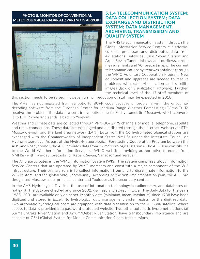
5.1.3 REMOTE SENSING NETWORK Armenia has three (outdated) meteorological radars that provide images to the AHS: one for aviation and two for hail suppression. Radar is a vital component of modern agriculture, transport and water management sectors. The AHS has proposed and the user community has advocated for a new weather radar (e.g. as part of a potential World Bank Group Project). But this is not a priority of the government. Under the existing fiscal constraints, the cost, operation and maintenance of a radar pose serious challenges (Photo 8). Currently, satellite imagery is obtained from two sources: (i) the European Organization for the Exploitation of Meteorological Satellites (EUMETSAT) through its data distribution system (EUMETCast stations) and the Data Access for Western Balkan Eastern European and Caucasian Countries (DABEE) stations and (ii) the Scientific Research Center of Space Hydrometeorology (PLANETA). But training is needed to better use the images.
FIGURE 10. AHS HYDROLOGICAL NETWORK
30
PHOTO 8. MONITOR OF CONVENTIONAL METEOROLOGICAL RADAR AT ZVARTNOTS AIRPORT
5.1.4 TELECOMMUNICATION SYSTEM: DATA COLLECTION SYSTEM; DATA EXCHANGE AND DISTRIBUTION SYSTEM; DATA MANAGEMENT, ARCHIVING, TRANSMISSION AND QUALITY SYSTEMThe AHS telecommunication system, through the Global Information Service Centers’ e-platforms, collects, processes and distributes data from 47 stations, satellites, Lake Sevan Station and Arpa–Sevan Tunnel inflows and outflows, ozone measurements and 90 forecast maps. The current telecommunications system was obtained through the WMO Voluntary Cooperation Program. New equipment and upgrades are needed to resolve problems with data visualization and satellite images (lack of visualization software). Further, the technical level of the 17 staff members of
this section needs to be raised. However, a small reduction of staff may be expected in 2018.
The AHS has not migrated from synoptic to BUFR code because of problems with the encoding/decoding software from the European Center for Medium Range Weather Forecasting (ECMWF). To resolve the problem, the data are sent in synoptic code to Roshydromet (in Moscow), which converts it to BUFR code and sends it back to Yerevan.
Weather and climate data are collected through VPN-3G/GPRS channels of mobile, telephone, satellite and radio connections. These data are exchanged and distributed through the Internet, web server RTH Moscow, e-mail and the land area network (LAN). Data from the 16 hydrometeorological stations are exchanged with the Commonwealth of Independent States NMHSs under the Interstate Council on Hydrometeorology. As part of the Hydro-Meteorological Forecasting Cooperation Program between the AHS and Roshydromet, the AHS provides data from 32 meteorological stations. The AHS also contributes to the World Weather Information Service (a WMO website providing authoritative forecasts from NMHSs) with five-day forecasts for Kapan, Sevan, Vanadzor and Yerevan.
The AHS participates in the WMO Information System (WIS). The system comprises Global Information Service Centers that are operated by WMO members and constitute a major component of the WIS infrastructure. Their primary role is to collect information from and to disseminate information to the WIS centers, and the global WMO community. According to the WIS implementation plan, the AHS has designated Moscow as its principal center and Toulouse as its secondary center.
In the AHS Hydrological Division, the use of information technology is rudimentary, and databases do not exist. The data are checked and since 2002, digitized and stored in Excel. The daily data for the years 1938–2001 are available only on paper. Monthly data (minimum, mean, maximum) since 1938 have been digitized and stored in Excel. No hydrological data management system exists for the digitized data. Two automatic hydrological posts are equipped with data transmission to the AHS via satellite, where access to data is provided at a password protected website. Two other automatic hydromet stations (at Surmalu/Araks River Station and Ayrum/Debet River Station) have transboundary importance and are capable of GSM (Global System for Mobile Communications) data transmissions.

31
Meteorological data are exchanged through the Global Telecommunications System as follows:
• SYNOP data from three stations: Amasia, Sevan and Yerevan;
• Climate data from four stations: Amasia, Aragatz, Sevan and Yerevan Arabkir;
• Aerological data from one station: Yerevan;
• Radiation data from one station: Yerevan Arabkir;
• Ozone data from one station: Amberd.
Approximately 35 percent of the stations have sets of observations that are 70 years or older; 10 percent of 80 years or older; and four stations have data more than 100 years old. Until 1992, the collected data were given to the Russian Federation for quality checks and conservation. In 1997, with the support of the WMO and Météo-France, the meteorological database was returned to the Republic of Armenia and CLICOM software was provided.
The existing data sets in paper form comprise 45 percent meteorological, 26 percent hydrological, 7 percent agrometeorological, 4 percent aerological and 17 percent other. Although 80 percent of the data has been digitized, 35 percent of these data need to be checked. The process of data digitalization continues. About 30 percent of data have more than 60 years of time series, 10 percent more than 80 years and four stations have times series longer than 100 years.
In 2009, a new software (CliWare) was adopted, which has advantages. It operates in an online mode, uses open source codes, manages metadata (history of stations), collects and archives real-time data from stations, performs data quality control, computes climatic indices and archives unlimited amounts of data. However, CliWare is not user friendly and robust, and the AHS believes it is susceptible to software corruption and errors. Synoptic and daily data from all meteorological stations are stored in the database. Data quality control is not done in real time but manually after transmitting the data from the database; therefore, it still contains considerable amount of erroneous data, (due to poor quality control system in CLICOM). The meteorological database includes metadata, synoptic, daily, sunshine duration and snow data as well as data on dangerous hydrometeorological phenomena.
The Data Management Center needs more up-to-date and robust software (e.g. the French CLISYS software, which costs about €280,000/US$343,355.6) and newer computers. Most of the computers are second hand and with low capacity.
Work has been ongoing at the AHS on the creation of an automated system for meteorological data collection from all stations, quality control and transmission to users (e.g. WIS centers, forecasters, climatologists and hydrologists). It hopefully should be concluded by the end of 2018. As part of capacity building in this area, guidance is required on the software creation.

32
MODELLING AND FORECASTING SYSTEMS, INCLUDING VERIFICATION
6.
6.1 SHORT-RANGE WEATHER FORECASTS Short-range weather forecasts are issued for five days ahead, but the shortest time scale for which forecasts are produced is 24 hours. These are issued once per day, but updates are
re-issued if required. Global models from the European Center for Medium-Range Weather Forecasting (ECMWF), Met Office (United Kingdom), Météo-France (France), AccuWeather (Germany), Global Forecast System (United States) and Roshydromet (the Russian Federation) are obtained via the Internet and are used for forecasting. The German weather service model (COSMO) has been provided to the AHS, but it requires a server and the ASH does not have a server. The AHS is also experimenting with a three-kilometer Weather Research and Forecasting model in research mode; the database in Excel format is accessible to all forecasters.
The AHS has had a WMO account at ECMWF since 2007 to access ECMWF products for WMO members and Ensemble Prediction System (EPS) grams for 10 stations. Currently, EPS grams are used for only five stations but there are plans to add five more stations. Daily discussions are held among forecasters, and decisions are made on the quality of the EPS for the day.
No charts are produced at the AHS for the territory of Armenia. The only way the data from the country are used is through their injection into the global models. The data are neither plotted nor analyzed. Upper air charts (850, 700, 500 and 300 millibar) are received from Roshydromet twice per day; one chart per day also reflects the upper air data from Armenia. The lack of visualization software means forecasters must manually and visually compare the maps.
Hydrometeorological vulnerability is being estimated based on observed wind, extreme precipitation and extreme temperatures (Photo 9). Vulnerability maps exist.
6.2 LONG-RANGE FORECASTS
Long-range forecasts (LRF) are monthly and seasonal forecasts that are required for planning purposes in sectors. LRFs are available on several websites. The ECMWF website (using the Armenian account) includes EUROSIP products, which are multimodel seasonal forecasts from the ECMWF, Met Office, Météo-France, U.S. National Oceanic and Atmospheric Agency National Centers for Environmental Prediction, and Japan Meteorological Agency (JMA). The WMO Lead Center for Long-Range Forecast Multi-Model Ensemble (https://www.wmolc.org/) provides access to the 12 Global Information Service Centers for long-range forecasts.
Seasonal outlooks are used to develop predictions for winter and summer. The AHS provides seasonal outlooks to users based on predictions from the Global Information Service Centers and from its own statistical analyses. Being part of the Climate Outlook Forum (COF) in Southeast Europe (SEECOF), the Mediterranean
PHOTO 9. FORECAST OFFICE AT YEREVAN

33
(MedCOF) and North EurAsia (NEACOF), the AHS attends these fora and contributes to the development of the regional consensus-based seasonal outlooks.
But the technologies for long-range and season forecasts are evolving. A global climate model (GCM) can provide reliable prediction information on scales of around 1,000 square kilometers. The model can cover vastly differing landscapes (e.g. from very mountainous to flat coastal plains) with varying potential for droughts, floods or other extreme events. GCMs can provide projections of how the earth’s climate may change in the future; and these projections largely inform the international community’s decisions on climate change mitigation.
Climate change impacts and adaptation strategies require regional and national scale. Dynamic and statistical regional climate downscaling (RCD) techniques increasingly are providing higher-resolution climate information than contemporary GCMs. The RCD techniques available, their applications and the international community using them are broad and varied; and the field is growing. Regional Climate Models and Empirical Statistical Downscaling, applied over a limited area and driven by GCMs, can provide information on much smaller scales.
The ASH, however, lacks skilled experts on long-range and seasonal forecast, and its technical capacities in applying downscaling techniques are limited. AHS staff participated in a 2014 WMO training course in Busan, Republic of Korea. The training was part of the APCC Sub-Seasonal to Seasonal Prediction Project for coping with high-impact weather in developing countries. This course did not significantly contribute to the improvement of the staff’s seasonal prediction skills. In-house training of staff on RCD, involving external expertise, is essential to assist with this issue.
The AHS also needs to improve its computing system (i.e. software and server) for generating climate products and conducting research. Users of climate information in general comprise the agriculture, energy, health and transport sectors as well as the Ministry of Emergency Situations. The 2015 National Climate Outlook Forum in Armenia, sponsored by the Swiss Global Framework for Climate Services, made clear the inadequacy of the current AHS computing system (Photo 10).
6.3 AGROMETEOROLOGICAL FORECASTS
Agrometeorological forecasts are made for the major cash crops (i.e. apricots, peaches and grapes) and crop–yield forecasting is made for autumn and spring wheat, potatoes and vegetables as well as grass, by applying the FAO methods for producing crop–yield forecasts. In Armenia, the frequent long droughts are connected with anomalies of the atmospheric circulation. Dry spells are reported almost every year, particularly in the summer season. Severe droughts coupled with limited water resources cause significant damage to Armenia’s economy, particularly to agriculture.
A significant percentage of Armenia’s land is irrigated and the rest is rain-fed. The negative impact of drought on irrigated areas is not significant, whereas rain-fed areas incur considerable losses. The country’s increasingly warmer and drier climate over the last decades has led to more severe and frequent droughts (Photo 11). This is especially the case in the main agricultural production regions: the Ararat Valley, Syunik and Vayk.
PHOTO 10. AGROMETEOROLOGICAL STATION

34
Monitoring and evaluating dry conditions are priority issues handled by the Scientific Center of Hydro-Meteorology and Ecology. Various drought evaluation methodologies have been applied to assess droughts (Photo 12).
A working group composed of the AHS, the Ministry of Agriculture and the National Statistical Service was formed to implement an FAO project (2010–2013) to study long-term yields and other data. The goal was to apply FAO methods for producing crop–yield forecasts and improving service delivery. Bulletins were produced—but not verified —and used by the Ministry of Agriculture. Under the project, staff were trained and three automated agromet stations were developed. The stations now comprise part of the AHS network.
6.4 HYDROLOGICAL FORECASTS
Hydrological forecasts are based on statistical methods that are insufficient for considering possible hydrological changes. For this purpose, and using the least possible baseline data, deterministic hydrological models have to be applied. To set up mathematical models, additional data types are necessary. For snow modelling, in particular, the water equivalent has to be estimated at different sites. Existing data must be processed digitally. To provide data to modellers, a data management system for historic observations must be set up. This is essential as, for instance, no digitized hourly flood data exist now, even if such data were recorded in the past. Several attempts to set up hydrological models were not successful. Since 2013, the AHS has been experimenting with the Black Sea and Middle East Flash Flood Guidance system products for flash flood forecasting, but this has not yet transitioned to operational work. Good cooperation existed 10 years ago, with the Norwegian Water Resources and Energy Directorate for training in modelling. The Norwegian Senorge snow model was used to simulate snow depth and snow water equivalent for five Armenian sites with existing time series of precipitation and temperature. Measurements of snow depth exist for several years, which were used for validation. When manipulating the parameters of the model, a reasonable fit to observed values of snow depth was obtained for all observation sites. However, the results were affected by uncertainties in the meteorological measurements and measurements of snow depth. Also, there are uncertainties in the estimation of precipitation as snow, both in terms of uncertainty of the measurement of the total precipitation and uncertainty in the separation of rain and snow precipitation, given that, in general, only the total precipitation is available. This example demonstrates that the availability and the quality of these data are limiting factors for improvement of hydrological services. An improvement of the snow cover observation system through introduction of modern technologies is needed. The application of modern remote techniques for
PHOTO 11. AGROMETEOROLOGICAL OBSERVATIONS
PHOTO 12. SOIL MOISTURE MEASUREMENT EQUIPMENT AT THE AGROMETEOROLOGICAL STATION

35
accurate monitoring of the snow cover in main river basins and timely processing of the observation data to assess snow depth, snowmelt and water equivalent in snowpack is required. A number of additional sites for snow data monitoring is required to ensure the ground truth for calibration of remote sensing algorithms.
Other problems (e.g. limited computer resources) also exist which are limiting the applicability of modern hydrological models. The access of the AHS Hygrology Center to a modern geographic information system (GIS) like ArcGIS is very limited. This significantly reduces the options to handle spatial distributed data, for example, to apply geostatistical methods in regionalization.
The AHS provides flood forecasts for spring floods at 82 points within the river network. These forecasts of the expected flood volume for the flood season April to June are based on multifactorial linear regressions. The regression models combine the observed discharge volumes from January to March, the amount of precipitation from September to March, the forecasts of the total amount of precipitation from April to June, monthly temperatures in January, February and March, and the water temperature of April. The flood peaks are also forecasted by multiple regressions, considering discharges over the last 5 days and 10 days of previous precipitation. The verification of the results is based on a comparison of the mean error, which should stay within the 0.33-Sigma range of observed data as proposed by Befani and Kalinin.

36
DISSEMINATION SYSTEM FOR FORECASTS AND WARNING PRODUCTS
7.Warnings for floods, fog, hail, precipitation and wind are issued and disseminated via mass media, telephone, the Ministry of Emergency Situations' website, as well as by e-mail to the Crisis Management Center in MoES and through press conferences depending on the type and lead time
of the warning. The main channel to disseminate warnings is the AHS webpage, which is hosted on the MoES website (see also Section 7, Public Weather Services). Warnings are displayed in red text as part of the forecasts on this site. A list of dangerous phenomena for the whole territory has been approved by the government. Warnings are disseminated in a “blanket fashion” to large geographical areas; they do not target those directly affected by hazards.
The sources of forecasts on television, radio and social media are note clearly identified. The AHS provides a private television channel forecasts; the other television channels either present forecasts from unknown sources or produce recorded broadcasts using MoES website forecasts. Keeping television forecasts current and updating recordings present challenges. Radio broadcasts are done once per day and are repeated throughout the day if necessary. The source of information is not clear, random mobile apps are a real possibility. No services are provided for mobile and smart phone platforms. The AHS does not have social media presence (e.g. Facebook, Twitter and Instagram), although some AHS staff use their own private social media accounts to discuss the weather. SMS messages are rarely used; there is a very limited distribution list.
The bulletins and information for users as well as the specific information for specialized users are prepared based on the AHS forecasts. This work is done by the Hydrometeorological Information Services and Marketing Division, which also coordinates and manages agreements with different users. Agreements for the provision of information are in place with about 20 organizations, including rail and energy services. The payments for information on a cost-recovery basis range between AMD 6,000 and AMD 90,000 (approximately US$12.5 and US$186) per request, depending on the volume of the information. This only covers the costs incurred for processing, preparing, printing and delivering the information, but not for the value of the information or staff time. The information is free of charge for government bodies and budgetary facilities. The total income from cost-recovery is about 3 percent of the AHS budget, of which there is no allocation to the Active Impacts Center.
Hydrological information is disseminated based on daily and monthly hydrological bulletins and an annual publication of hydrological data. Hydrological products provided to customers on a commercial basis include:
• Hydrological information;
• Hydrological bulletins and forecasts (daily, ten-day, monthly and annual);
• Average, maximum, minimum water discharge, level and flow;
• Forecast of spring flood flow, maximum discharges and the average discharges forecasts during the vegetation period;
• Temporal forecast of flood peaks;
• Forecast of level change of Lake Sevan, which has a strategic and economic importance for the Republic of Armenia;
• Water balance of Lake Sevan.
The AHS is not responsible for decision-making in issuing warnings. All 86 hydrological observation stations on the rivers have established thresholds which, when reached, transmit information to the Crisis Management Center in the MoES. The MoES then issues the warning.

37
OPERATION AND MAINTENANCE
8.The Operation and Maintenance (O&M) budget is about 7 percent of the total AHS budget. In addition to the O&M budget, a modest amount (US$10,000 per year) of the extra-budgetary resource from cost-recovery activities is used to purchase and repair equipment
and computers and to establish the land area network.
The hydrometric network is based on technical equipment that date to the Soviet Union era. According to the technical guidelines, the flowmeters are used extensively for discharge measurements with the area–velocity method 26 to 36 times per year. Replacing the spare parts of these old instruments requires a new calibration (specific relationships between water velocities and revolutions of the propeller), which cannot be ensured. Of the 86 flowmeters, 75 are older than 35 years, are worn out and should be replaced (Photo 13). Further, the number of recording instruments at gauges is too low for fast-responding watersheds. Flood peaks are often not recorded due to the absence of chart recorders (self-recorders). This results in vacuums of reliable and quality-controlled information for planning and early warning.
Similarly, the meteorological equipment is maintained in a workshop at the AHS. The workshop uses old or homemade spare parts and backups from old equipment. There are about 80 computers at the headquarters and over 40 in the field that also are serviced.
PHOTO 13. PROPELLER OF A CURRENT METER WITH SIGNIFICANT WEAR AND TEAR

38
SERVICES DELIVERY SYSTEM9.9.1 PUBLIC WEATHER SERVICESThe provision of public weather services (PWS) by the AHS is modest. The most widely used source of PWS information is the AHS webpage, which is hosted on the Ministry of Emergency Situation’s website. In the future, the AHS plans to have its own website (designed
and developed internally) to give the public and other users wider access to a range of products and information. The current AHS webpages need to be expanded and improved to contain real-time operational information. Warnings are disseminated to large geographical areas (regions/marzes) and do not target those directly affected by hazards.
No outreach or public education is conducted by the AHS. No attempt is made to translate forecasts into a user-friendly form. And no information is produced on the possible impacts of hazards. PWS assistance and guidance is urgently needed, including training in dissemination and communication, user consultation and user feedback.
9.2 HYDROLOGICAL SERVICESArmenia developed its Water Code in 1992. A totally updated version, adopted in 2002 and amended later, regulates many aspects of national water policy, including development of water basin management plans. Article 5 covers the basic principles of management, use and protection of water resources and water systems; while Article 19 defines the actions needed to establish an effective Water Resources Monitoring and Information System with the aim, among others, of forecasting floods and mudflows.
The Law of the Republic of Armenia on National Water Policy, adopted in 2006, follows the guidelines evolving from Article 15 for: (i) sustainable water resources management; (ii) water resources use and protection priorities; (iii) accounting and assessment of water resources; (iv) formation of water resources demand; and (v) relations pertaining to water basin management. Within this framework, the main AHS activities consist of providing hydrometric services and processing related data. Other services include estimating and forecasting the water balance of Lake Sevan.
On request, the AHS delivers hydrologic data and analyses. The number of these requests changes from year to year. In the past, data were provided for the planning of small hydropower plants. Strong cooperation exists with the State Committee of Water Economy under the Ministry of Energy, Infrastructure, and Natural Resources; the Ministry of Nature Protection; and the Ministry of Agriculture.
Reservoirs are very important to increase water availability, taking into account seasonal variability. To address temporal variations in river runoff, 87 dams have a total capacity of 1.4 billion cubic meters. Most are single purpose, mainly for irrigation. Thirty-five reservoirs have capacities greater than 1 million cubic meters and three have capacities greater than 100 million cubic meters. There are nine incomplete dams, 28 dams at the design stage and a further 67 dams for which feasibility studies were planned or prepared during the Soviet Union era. According to the Armenian Water Design Institute, there are 157 potential reservoirs at various stages of construction, design or planning. Most of the designs were completed before 1991. The overall storage capacity of these reservoirs is 1.72 billion cubic meters.
To move forward, a strategic plan for the development of priority reservoirs in Armenia is needed. The plan needs to address economic, environmental, financial and social dimensions. Many of the earlier master plans were also developed before 1991 and require updating and revisiting, especially with respect to their current technical and economic viability. The feasibility studies of priority dams need to consider three key issues relating to climate change and transboundary impacts. First, as the climate and hydrology have experienced changes since the investments were designed, it is important that the updated feasibility studies include these considerations.

39
Second, as most of the rivers in Armenia are shared with neighboring countries downstream, transboundary impacts would need to be analyzed. Third, these large investments should also be considered and analyzed within the context of overall river basin planning. Per capita storage capacity in Armenia is much lower than the capacity of its neighbors, except for the Islamic Republic of Iran.
Lake Sevan is the backbone of water management in Armenia. It has high environmental, economic and social significance and is an important multipurpose water reservoir for irrigation, hydropower and recreational uses. Located in the central part of Armenia, Lake Sevan is the largest lake in the country (almost 37 billion cubic meters) and one of the largest high-altitude lakes in the world. Thirty rivers and streams feed into the lake, which feeds the Hrazdan River. The lake outflow has been regulated for irrigation and the Sevan–Hrazdan Hydropower Cascade since the 1930s. Excessive use from 1930 to the 1980s caused a precipitous water level decline. This led to serious environmental and ecological problems, including a deterioration of water quality, destruction of natural habitats and loss of biodiversity. Starting in the 1980s, programs to stabilize and raise the water level were initiated, including the construction of the Arpa–Sevan Tunnel to transfer up to 250 million cubic meters of water per year from the Arpa River. The government adopted two laws in 2001 that recognized the importance of Lake Sevan and aimed to raise its water level by six meters by 2030.
An optimization of operating rules is recommended to address the high variability of annual hydrological conditions. This would consider the temporal and spatial variations of water supply and demand conditions.
9.3 AGRICULTURAL METEOROLOGICAL SERVICESAlthough the agriculture sector in the past decades has added more value in absolute terms to the economy, the overall share of agriculture in gross domestic product (GDP) has steadily decreased (around 20 percent in 2013) (Figure 11). Yet, Armenia is still an agrarian society with the agriculture sector providing around 40 percent of total employment. Moreover, with important links to the growing food-processing industry, agriculture will continue to play an important role in the Armenian economy.
FIGURE 11. AGRICULTURAL VALUE ADDED
4500
2000
Billion AMD
0
35
Share of Total GDP (%)
02001
2500 20
2002 2003 2004 2005 2006 2007 2008 2009 2010 2011 2012 2013
Gross agricultural output (%)Gross domestic product (current billion AMD)Gross agricultural output (current billion AMD)
Source: National Statistical Service of Armenia.

40
Agriculture in Armenia is heavily dependent on irrigation. More than 80 percent of the gross crop output is produced on irrigated lands. Wheat, potatoes and vegetables claim two-thirds of the total irrigated arable land. The consumption of irrigation water has fluctuated significantly over time, mainly due to fluctuations in overall water availability. It reached almost 2 billion cubic meters in 2012 (Figure 12).
The total irrigable area in Armenia is around 208,000 hectares. In 2005, the net income per hectare for wheat was 65,000 Armenian drams (US$156), twice as much as on rain-fed lands in the mountainous areas. Due to agroclimatic conditions, the most fertile regions are also the greatest consumers of irrigation water. They have the lowest water productivity: while absorbing 80 percent of the country’s irrigation water, the most fertile regions generate 53 percent of the Armenian gross crop output (Figure 13).
FIGURE 12. WATER CONSUMPTION BY SECTORS
MCM
01995
2,500
1,500
1996 1997 1998 1999 2000 2001 2002 2003 2004 2005 2006 2007 2008 2009 2010 2011 2012
Irrigation, fish farmingIndustrialDrinking (household)
Source: National Statistical Service of Armenia.
Note: MCM=million cubic meters.
FIGURE 13. IRRIGATION WATER CONSUMPTION AND AGRICULTURAL PRODUCTIVITY BY PROVINCE, 2010
Armenia, average
0 $15,000$7,500
Gegharkunik
Lori
Shirak
Syunik
Tavush
Vayots Dzor
Kotayk
Aragatsotn
Yerevan City
Ararat
Armavir
US$/ha or m3/ha
0.9
9.4
2.3
2.4
1.7
1.8
0.7
0.4
0.7
0.5
0.9
0.4
GAO crops, US$/haIrrigation water, m3/haRevenue per unit volume of water US$/m3
Source: Based on World Bank 2013a.Note: GAO=gross agricultural output..

41
The impact of natural hazards on agricultural production is significant. The World Food Program (the lead United Nations agency for emergency food relief) lists earthquakes, deforestation, desertification, erosion, frosts, floods and droughts as the top risks to food security in Armenia.
Agricultural production is inextricably tied to climate, making agriculture the most climate-sensitive of all economic sectors. The risks of climate change for the agricultural sector in Armenia are immediate and important, because most of the rural population depends directly or indirectly on agriculture for their livelihoods. Seasonal changes in climate have clear implications for crop production in both irrigated and rain-fed agricultural territories in Armenia. Climate impacts could therefore undermine progress in poverty reduction and adversely impact food security and economic growth in vulnerable rural areas.
The regulation of surface runoff is also of strategic importance for the sustainable development of the irrigated areas. This is particularly the case in the semiarid regions, where rapidly growing populations are facing depletion of groundwater resources.
Farmers currently use weather forecasts made available through the television. Stakeholder consultations have shown that these forecasts are aimed at too broad a geographic area and do not provide information specific for agriculture (e.g. information that would allow farmers to know when to apply pesticides, irrigate or plant). Today, many farmers still plant when the snow is at a certain level on Mount Ararat. Farmers have indicated a need for better local hydrometeorological information and services, particularly for short-term temperature and precipitation forecasts.
The economic analysis of the costs and benefits of a relatively modest hydrometeorological investment, which includes training and annual operating costs, suggests benefits are very likely to exceed costs. Agriculturally relevant weather forecasts will yield immediate benefits and facilitate the adaptation of farming practices to the local context.
9.4 CLIMATE SERVICES
Armenia’s natural topography produces very large spatial variations in temperature and precipitation. The lowland is situated up to 1,400 meters above sea level, with semi-desert and arid desert landscapes. Middle altitude is 1,400–2,800 meters above sea level, with mountainous steppe landscapes. And the highland is over 2,800 meters above sea level, with Alpine meadows and tundra landscape. Climate information is required for planning purposes in many sectors and for assessing climate variations and change. Developing and improving such climate services is long overdue, and feasible.
Assessing the modern climate of Armenia in the context of global climate change research and adjustment of the economy to changing climate conditions should become an important area of AHS activity. This is yet another argument in favor of modernizing the hydrometeorological database by implementing modern technologies of data storage and retrieval. In addition, there is a need to create in the AHS a team of specialists capable of assessing past and current climatic conditions and of projecting climate change effects. Currently, there is a lack of such skilled experts and poor technical capacities at the AHS in applying downscaling techniques to study the impact of global forces on the climate patterns over Armenia.

42
ASSESSMENT OF USER NEEDS FOR WEATHER, WATER AND CLIMATE SERVICES
10.
In July 2017, the World Bank team had extensive discussions with high level officials of the Ministries of Emergency Situations, Agriculture, Nature Protection, Territorial Administration and Development; State Committee of Water Economy; National Statistical Service;
Yerevan Municipality; and UNDP Climate Change Program. All officials expressed strong desire to get more and better hydrometerological information (critical for their own functions) and supported the need to modernize the Armenian Hydrometeorological Service (AHS). The most frequently mentioned requirements were: (i) more accurate forecasts on all time scales, (ii) better seasonal weather forecasts, and (iii) more accurate estimates of water balance and spring water flow.
10.1 MINISTRY OF EMERGENCY SITUATIONS RESCUE SERVICEThe Ministry of Emergency Situations (MoES) and the Armenian Hydrometeorological Services cooperate well. At present, the AHS is unable to fulfill the MoES’ primary needs: real-time information for severe weather and historical information for planning and budgeting purposes. Early warning and long-term planning based on accurate weather, climate and hydrological information and services can sharply mitigate seasonal, hazardous impacts.
Three forms of information and services could help fulfill MoES’ primary needs:
• Fast-developing (rapid onset) hazardous condition information for nowcasting services.
• Very short-range and localized information for near-real time services.
• Longer lead time and more accurate forecasts for planning services.
Spring flooding, landslides and mudflows. Better capabilities are needed to estimate flood risk at ungauged sites under different hydrological loads to zone for flood-prone areas. Yet these areas, which are estimated to represent 30 percent of the territory, have not been defined or mapped through analysis by the National Academy of Sciences Institute of Geological Science. The current flood hazard mapping is not compliant with the detail required by, for example, the EU Flood Directive and has no direct relation to return periods (i.e. the probability of recurrence), which is one of the Directive’s main points. Spring flooding averages 80–120 days (150 days maximum, 60 days minimum). Flash-floods, landslides and mudflows are triggered by these events. Annual socioeconomic damages are up to AMD 2 billion (US$4,149,722). Nowcasting, near-real time and planning services are vital to fast-responding, early warning and long-term planning.
Summer wildfires. Forests cover 10 percent of the Armenian territory. The role of hydrometeorological information, and especially the provision of temperature and precipitation forecasts on various time scales, is critical to combating wildfires from the planning stages to operational activities.
Winter hail and snow. The sudden and slow onset of snow and hail make roads and mountain passes impenetrable. Here again, near-real time information can respond to inquiries about road conditions.

43
10.2 MINISTRY OF AGRICULTUREGood working relationships exist between the AHS and the Ministry of Agriculture (MoA), which is relatively satisfied with the services and information received. Agrometeorological observation in Armenia, unlike most former Soviet countries, occurs at almost all meteorological stations. In the next two years, the whole country will be zoned for different agricultural products; robust weather and climate and hydrological information and services will play a major role in crop cultivation.
The Ministry of Agriculture needs more localized and finer resolution information. Lead times longer than the current five days would permit better response to high-impact weather and more reliable seasonal forecasts. At present, the AHS provides five-day forecasts, water flow and availability for irrigation; weekly information about conditions in different zones; and 10-day forecasts during the vegetation period. Yet, it is unclear how well the information packages are distributed to the farmers and how well the farmers understand the information’s value.
The AHS sends the information packages to the regions where they are personally distributed to farmers in remote areas. This dissemination methodology is outdated; weather information during the blossoming season, in early spring and for late autumn frosts is critical. A more modern means, such as SMS messaging, is needed as is education outreach and training for farmers.
The support of a modernized hydrometeorological service for agriculture is essential for food security, which will become more acute with population growth.
10.3 STATE COMMITTEE OF WATER ECONOMYThe State Committee of Water Economy is a primary user of AHS hydrometeorological data, information and services. It would like a more frequent, complete and accurate hydrological menu to better model, plan and manage hydrological operations and hazards, including robust data at ungauged sites. Better seasonal forecasts are needed to manage Lake Sevan and other water bodies.
The State Committee of Water Economy is acutely aware of a growing water supply–demand mismatch, with demand outstripping supply. As the agency responsible for potable water and irrigation, the Committee knows reservoirs are at 80 percent capacity and some have not reached full capacity for the past seven years. In the last year, AHS data helped the Committee avert a water shortage for more than 130,000.
A modernization of AHS technical capacity is highly relevant and important to Committee operations. Manual operations affect, among others: (i) snow monitoring to forecast water flows into lakes and reservoirs; (ii) evaporation data to calculate water balances; and (iii) deterministic flood and snow models to project potential hazards.
• Reservoir and flood management strategies. A cutback of observations for lack of funding would have a debilitating effect on strategies to construct future reservoirs and to manage flood, landslide and mudslide risk.
• Irrigation planning. AHS data is the foundation of irrigation planning, which represents half of all cultivated arable land. The planning takes place just before spring flooding (February–March).
The Committee firmly believes this is not the space for budgetary cost savings.

44
10.4 YEREVAN MUNICIPALITYThe Yerevan Municipality and AHS have good working relations. Currently, AHS emails five-day forecasts to the municipality. The municipality, however, also needs the full range of forecast services from very short-range and localized forecasts to longer lead times.
More accurate forecasts allow for more efficient preparation and response by the municipality. The public weather service needs improved rainfall and snow forecasts to allocate resources to critical locations in advance of such events. For instance, snow events can paralyze the city without adequate preparations. Similarly, before rain events, the leaves must be cleared and tree branches removed to prevent clogging of drainage systems. On construction sites, for example, strong wind forecasts are sent to the mayor for preventative measures. Timely and accurate hydrometeorological services have immediate impact on saving lives and economic advances in dense urban settings.
10.5 MINISTRY OF NATURE PROTECTIONAs the former parent ministry, the Ministry of Nature Protection collaborates closely with AHS. The ministry would like longer forecast leads as well as medium-range and seasonal forecasts for water management and planning purposes. It is fully supportive of modernization initiatives to improve AHS services.
The two agencies communicate daily, with the AHS sending: (i) expanded observations on the water level in Lake Sevan and other reservoirs; (ii) air pollution data, which is increasing because of the more extensive drying of cultivated land; and (iii) river discharge data. The latter helps inform construction of hydropower plants by avoiding adverse environmental impacts such as exceeding the minimum water flow required to sustain the environmental integrity of aquatic ecosystems on rivers.
10.6 NATIONAL STATISTICAL SERVICEThe National Statistical Service has a long history of collaboration with the AHS and is a main user of the hydrometeorological information. A Memorandum of Understanding articulates the type of information required and supplied. Assessments of the water balances for the main river basins are required to improve the state of information on natural resources. The National Statistical Service publishes Armenia’s annual socioeconomic snapshot; it is based on information compiled from the ministries, including hydrometeorological statistics on severe events. The Ministry of Emergency Situations estimates the damages and losses. The Ministry of Finance estimates the monetary costs. All disaster compensation payments are based on this calculation.
10.7 MINISTRY OF TERRITORIAL ADMINISTRATION AND DEVELOPMENTThe Ministry of Territorial Administration and Development strongly supports AHS activities and acknowledges the importance of hydrometeorological information for the country, its administrative units and communities. The ministry recognizes the issues related to protecting the meteorological and hydrological stations from vandalism. It recommends developing a regulation that would make municipalities and communities responsible for the safety of hydrometeorological stations. This support will be necessary to protect future automatic stations. (Observers protect manual stations.) In case of a temporary closure of stations, the land titles will continue to be assigned to AHS. Thus, such closures will not compromise the consistency of long-term series when observations resume.

45
10.8. UNDP CLIMATE CHANGE PROGRAM The United Nations Development Program (UNDP) Climate Change coordinator recognizes the importance of the AHS and while supporting the optimization of hydrometeorological observations, has concerns over a reduction of such observations. UNDP has applied for Green Climate Fund support, with a component for capacity building. This could, in principle, support hydrological monitoring as well as modelling, data digitization and training of staff. AHS staff could work on climate issues under a contract for the Climate Change Program. The coordinator expressed general concerns about climate change in Armenia.
10.9 SUMMARY OF USER NEEDSThe strategic steps needed to modernize hydrometeorological products and services in Armenia are primarily driven by the needs of the user community. At present, the provision of meteorological and hydrological information does not fully meet their needs. Indeed, a significant increase in services and products is needed to improve productivity and to reduce vulnerability to the increase of extreme climate events. None of the stakeholders believe a reduced number of observation stations or AHS hydrometeorological services is a viable option.
Strong interest was expressed for weather forecasts on different scales, from very short range to seasonal time scales, and for more location-specific information. Forecasts and warnings also should be more accurate and reach the users in a timely manner. Similarly, there is a growing need for additional hydrological information derived from the existing long series of surface water discharge and from new operational gauges located at water management hotspots.
The hydrological needs can be summarized as follows:
• Water balances for the main river basins as a base for river basin management planning;
• Revised reservoir planning that considers all existing time series;
• Design floods for reservoirs at ungauged sites;
• Drought risk assessments and forecasts;
• Flood risk assessments and zoning of flood-prone areas.

46
MODERNIZATION OF METEOROLOGICAL AND HYDROLOGICAL SERVICES IN MIDDLE INCOME COUNTRIES
11.
Stakeholder requests for improved AHS forecast and warning services clearly reflect the need to modernize the entire agency’s infrastructure beyond just the observation and data-gathering systems. Fit-for-purpose services are the priority of all users (Photo 14, Photo 15 and Photo 16). A modern National Meteorological and Hydrological Service (NMHS) should play a key role in early warning systems (EWS). Producing and disseminating warnings that are targeted to the impacted areas and populations are the main mandate of any NMHS. The introduction of impact-based forecasting and warning services is the way of future NMHS operations. The public will need to be educated and the emergency management authorities will need to be trained on the potential impacts of severe hydrometeorological events to take protective actions. Given all the arguments in its favor, modernizing a NMHS has proved to
be a complex, time-consuming and expensive task in many countries, including developed economies. The modernization of the U.S. National Weather Service took over 10 years and cost US$4.5 billion. A detailed account of the modernization of the Japan Meteorological Agency (JMA) provides a wealth of experience and guidance for countries intending to embark on such a modernization. To this end, before proposing modernization activities for the AHS, it would be reasonable to present a brief description of the main elements of well-functioning NMHSs in middle income countries.
The operation of a NMHS in any country is based on observations and data collection; data processing; telecommunications; preparation of forecasts, warnings and climatological advisories; and dissemination of forecasts and other specialized information through the media and other channels to users (Figure 14). No country is alone in undertaking these tasks; the combination of many networks, centers and hubs on global, regional and national scales form the intricately inter-connected world of global hydrometeorology. The three components of observations, telecommunications and data processing and forecasting together comprise the WMO World Weather Watch Program.
PHOTO 14. FORECAST OFFICE, HONG KONG OBSERVATORY
PHOTO 15. MODERN FORECASTER WORKSTATION IN CAMBODIA

47
The Global Observing System, extremely complex, is perhaps one of the most ambitious and successful instances of international collaboration in the last 100 years. The System consists of a multitude of individual observing systems owned and operated by many national and international agencies. The Global Telecommunication System (GTS) is the communications and data management component that allows the World Weather Watch to collect and distribute information critical to its processes. The GTS is implemented and operated by the NMHSs of WMO members and by international organizations, such as the European Center for Medium-Range Weather Forecasts (ECMWF) and the EUMETSAT. The GTS also supports other programs, facilitating the flow of data and processed products to meet member requirements in a timely, reliable and cost-effective way. It ensures that all members have full access to meteorological and related data, forecasts and alerts. The Global Observing System evolved into the WMO Integrated Global Observing System and the GTS expanded into the WMO Information System (WIS).
The Global Data Processing and Forecasting System encompasses all systems operated by WMO members. It enables members to make use of the advances in Numerical Weather Prediction by providing a framework for sharing data related to operational climatology, hydrology, meteorology and oceanography. The main support for the exchange and delivery of these data is the WIS.
FIGURE 14. SCHEMATIC PRESENTATION OF THE GLOBAL OBSERVING, TELECOMMUNICATION, DATA PROCESSING AND FORECASTING, AND DISSEMINATION SYSTEM

48
The value of the products and services of NMHSs is manifested in the way they are used by the recipients. The generation of meteorological and hydrological value can be depicted in a “value chain” linking the production and delivery of services to user decisions and the outcomes and values resulting from those decisions (Figure 15). Potential value is added at each link of the chain (moving from left to right in Figure 15) as services are received by users and incorporated into or considered in decisions. Value-adding processes involve tailoring services to more specialized applications and decisions (i.e. making the information more relevant and trustworthy) or expanding the reach of an information product to ever-greater audiences (e.g. people, decision-makers and clients). In a modernized, well-functioning NMHS, every link in this chain is strong, helping to deliver value to the society at the end of the chain. In contrast, in a less developed NMHS, the chain often stops at observation, or at forecasting without a robust modelling capability.
FIGURE 15. HYDROMET PRODUCTION VALUE CHAIN
HYDROMET SERVICES PRODUCTION AND VALUE CHAINS
Processing & Data Management
Weather Climate Water
Observations Modelling Forecasting Service Delivery
Research & Development
Weather Climate Water
Communication Processes
Processing & Data Management
Weather Climate Water
Observations Modelling Forecasting Service Delivery
Research & Development
Service Production
Value-Adding Processes
Basic & Specialized Services
NMHS & Commercial Providers
User Decision
& ActionsOutcomes
Value Benefits & Costs
Source: WMO, WBG, GFDRR, & USAID (2015). Valuing Weather and Climate: Economic Assessment of Meteorlogical and Hydrologicl Services. WMO-No. 1153. Geneva, Switzerland.

49
Modernizing NMHSs cannot be piecemeal. The process should be transformative, ensuring NMHSs can deliver the services stakeholders expect. Box 1 presents a weather, climate and hydrological services progress model. It considers “The WMO Strategy for Service Delivery and its Implementation Plan,” “The WMO Global Framework for Climate Services Implementation Plan,” the strategy for improving the use of high-resolution NWP and implementing limited-area NWP systems as part of the overall forecasting process, and “The WMO Guidelines on the Role, Operation and Management of National Hydrological Services. The model categorizes NMHSs in five areas: (i) observing and telecommunication systems; (ii) weather forecasting systems; (iii) weather service delivery; (iv) climate services; and (v) hydrological services. An explanation of each category is provided in Annex 1.
BOX 1. WEATHER, CLIMATE AND HYDROLOGICAL SERVICES PROGRESS MODEL
The following composite criteria are adapted from “The WMO Strategy for Service Delivery and Its Implementation Plan” (2014), ”The WMO Global Framework for Climate Services” (2014a), the WMO strategy for improving use of high-resolution national weather prediction (NWP) and implementing limited-area NWP systems as part of the overall forecasting process (2016), ”The WMO Guidelines on the Role, Operation and Management of National Hydrological Services” (2006) as well as expert opinion, which includes the capacity of the National Meteorological or Hydrological Service to maintain an observing network and provide weather, climate and hydrological forecasts and to deliver weather, climate and hydrological services to users.
1. OBSERVING AND TELECOMMUNICATION SYSTEMSCategory 0: Less than Basic Observations
and TelecommunicationsCategory 1: Basic Observations and TelecommunicationsCategory 2: Essential Observations and
TelecommunicationsCategory 3: Full Observations and TelecommunicationsCategory 4: Advanced Observations and
Telecommunications
2. WEATHER FORECASTING SYSTEMSCategory 0: Less than Basic Weather ForecastingCategory 1: Basic Weather ForecastingCategory 2: Essential Weather ForecastingCategory 3: Full Weather Forecasting
Category 4: Advanced Weather Forecasting
3. WEATHER SERVICE DELIVERYCategory 0: No Service DeliveryCategory 1: Basic Service DeliveryCategory 2: Essential Service DeliveryCategory 3: Full Service Delivery
Category 4: Advanced Service Delivery
4. CLIMATE SERVICESCategory 0: Less than Basic Climate ServicesCategory 1: Basic Climate ServicesCategory 2: Essential Climate ServicesCategory 3: Full Climate Services
Category 4: Advanced Climate Services
5. HYDROLOGICAL SERVICES Category 0: Less than Basic
Hydrological ServicesCategory 1: Basic Hydrological ServicesCategory 2: Essential Hydrological ServicesCategory 3: Full Hydrological ServicesCategory 4: Advanced Hydrological Services

50
Based on consultations with AHS staff and stakeholders, the AHS has attained a category between 1 and 2 in observing and communication systems; category 1 in weather forecasting systems; a category between 1 and 2 in weather service delivery; category 1 in climate services; and category 1 in hydrological services.
As part of upgrading those categories, significant improvement of inter-related elements of meteorological and hydrological monitoring networks is necessary. This includes new technologies for data sensing and recording, data validation and archiving, and modern scientific-based tools for modelling (Figure 16).
Such improvement requires the integration of five essential elements in the monitoring program of an NMHS, as follows: quality management system (QMS), network design, technology, training and data management. Network design has to be an ongoing process based on user needs, with new stations being established and existing stations being discontinued as program priorities and funding evolve. Selecting the best technology for data sensing at a given location is a very complex task. There are many technologies available and for each combination of these technologies, there are numerous vendors and products available. Network operators must consider additional factors such as reliability, reporting accuracy, costs and site specifications. Data management ensures the proper storing, validating, analyzing and reporting of vast amounts of data, and establishes the validity of the data by providing evidence of compliance with the QMS. Finally, no investment in technology can compensate deficits in human capacities which would, for example, result in poor choices in data collection and data handling. Errors by procedural blunders are the most difficult to detect and correct in data post-processing. Continuous training is therefore very important. Figure 17 gives an overview of the flow of data and information in modern hydrometeorological services.
FIGURE 16. SCHEMATIC OF MODERNIZATION OF NMHSS
Modernisation NMHS
Information Utilization and Decision Making
Data Synthesis and Analysis (incl.
modelling, forecasting)
Data Sensing and
Recording
Information Dissemination
Data Validation and
Archiving
Monitoring Networking Design Based on User
Requirements

51
FIGURE 17. DATA FLOW IN HYDROMET SERVICES
User Community
Data for Operational Purposes
Natural Meteorological and Hydrological Characteristics
Objectives
Technologies, depending on
• Reliability• Accuracy• Control and Maintenance• Specific Local Site Factors• Costs of Ownerships
Network Design• Program Priorities• New Stations• Closure of Stations
Data Collection
Quality Management System
Data Management System
Meteorological and Hydrological Information e.g., forecasts, statistics, real-time data
Dissemination of Information
Training starts in Scenario 1Training starts in Scenario 2
The socioeconomic benefits of modernization will be manifested in managing risk and aiding decision-making in weather-related disasters. This is especially the case for floods, which have the biggest impact on the poor and vulnerable populations. Improving the forecasting and early warning of hydrometeorological hazards will contribute to building resilience for communities and sectors at risk.
A substantial modernization program for any NMHS should typically include three components, namely: (i) institutional strengthening and capacity building; (ii) modernization of observation, ICT and forecasting infrastructure; and (iii) enhancement of service delivery system. The activities proposed in Section 12 are in line with this principle. They aim to strengthen the AHS’s institutional basis: to enhance a legal and regulatory framework and to develop the capacity of staff; to technically modernize the observation, ICT, data management and hydrometeorological forecasting infrastructure and facilities; and, most importantly, to improve the delivery of hydrometeorological and early warnings services to the Armenian people and weather-dependent sectors.

52
PROPOSED ROAD MAP TO MODERNIZE THE ARMENIAN HYDROMETEOROLOGICAL SERVICE
12.
A modernization program for any NMHS should include the three interrelated groups of activities or components: (i) institutional strengthening and capacity building, (ii) modernization of observation, ICT and forecasting infrastructure; and (iii) enhancement of service delivery system. These components are described in some detail in the case of the AHS.
12.1 INSTITUTIONAL STRENGTHENING AND CAPACITY BUILDING
12.1.1 Institutional StrengtheningThe main objectives of NMHSs are: to provide information on weather, climate and hydrological conditions for safety in the air, on land and at sea; to mitigate natural disasters; to provide services to weather-sensitive economic sectors; and to support national development. A modern NMHS performs these functions by acquiring:
• Comprehensive, high-quality and robust observational networks;
• Efficient data collection and management, and rapid information exchange;
• State-of-the-art ICT and computing facilities;
• Sophisticated data analytics schemes and powerful simulation and forecasting models;
• Improved understanding of meteorological and hydrological phenomena through ongoing scientific research;
• Effective tailoring of services to user needs;
• Effective dissemination systems using multiple channels to assure the widest dissemination of warnings, forecasts and advisory information;
• Efficient public and private service delivery arrangements;
• Effective communication of the science, including its limitations, uncertainties and applicability;
• Capacity building across the entire NMHS and for the users and stakeholders;
• Improved methodologies and algorithms for use of meteorological, hydrological and related information in decision-making.
Modern NMHSs focus on understanding the user value chain to better understand users, the decisions they must make and how information related to weather, climate and hydrology is applied to minimize risk and to benefit the society as a whole (see Section 11, Value Chain). As a result of improved service delivery, users will gain confidence in the capability of the NMHS. This will lead to improved relations and increased demand for services. In addition, better services to government agencies and departments will result in greater recognition of NMHSs as providers of vital services supporting the economy and society. This will enable the NMHS to build a more convincing case for investment to sustain and further improve the range and quality of services.

53
A powerful tool for a modern NMHS to maximize the return on investment by ensuring optimum use of resources is a Concept of Operations (CONOPS). The CONOPS provides a conceptual overview of the system and subsystems in an NMHS to achieve the capabilities listed above. The CONOPS is intended to support the evolution of a fully integrated, modernized and functional NMHS, which provides the level of services required by its users and stakeholders. Figure 18 illustrates the “System of Systems” of an NMHS supported by CONOPS.
FIGURE 18. A SYSTEM OF SYSTEMS FOR A MODERN NMHS
Note: Blue: Production Systems; Green: Delivery Systems; Red: Enabling Systems; Purple: capacity building (internal and external); Broken lines: Either external or mix of internal and external systems; Solid lines: Internal NMHS systems), external or mix of internal and external systems; Solid lines: Internal NMHS systems; G2G= Government to Government; G2B= Government to Business.
At the moment, AHS activities mainly focus on observation and data collection. As a result of the limited resources, the AHS has even fallen behind in collecting critical data, producing forecasts and delivering services and in making the technological and scientific progress needed to use best practices and standards in delivering services to a set of users based on their diverse demands. This is especially the case for hydrological assessments, forecasting and planning. The step from data collection to information production demands a strengthening of the rest of the “system of systems” as shown in Figure 18 (i.e. modelling, forecasting and service delivery systems supported by the ICT, QMS, capacity building and technology infusion systems). The institutional strengthening component of the Road Map will aim to invest in the improvement of institutional arrangements at the AHS for enhancing its performance in line with international best practices.
Global data system
Surface obs systems
Upper air system
Radar system
Data management and archiving
systems
External data systems
Institutional management systems
Operational management systems
Communication systems
Cloud computing systems
Quality management
systems
Computing hardware and software systems
Data comms systems
ICT systems
Monitoring and observing systems
Global NWP systems
Modeling systems
Regional NWP systems
Limited Area Model system
Nowcasting Model system
Hydro Modeling system
Internal research and development systems
Transition Research to Operations systems
External Research and Development systems
Technology infusion systems
Severe hazard forecasting systems
Objective and impact forecasting and
warning systems
Nowcasting systems
Very short range forecasting system
Short range forecasting system
Medium range forecasting system
Long range forecasting system
Public weather services system
Service delivery systems
G2G Disaster management
service system
G2G Agriculture serivce system
G2G Water & power management system
G2G and G2B Aviation Services
System
Public-Private cooperative
services systems to key businesses
Service systems for public
Actions, service monitoring and
feedback systems
Service systems for national and
provincial governments
Service Systems for Businesses
Capacity Building
Met/Hydro institutional education and training
Stakeholder institutions training
End user training and outreach

54
12.2 Modernization of Observation Infrastructure, Data Management Systems and ForecastingThis component aims to upgrade and expand the meteorological, agrometeorological and hydrological observations networks and ensure that these networks are well functioning and are interoperable; modernize data management, communications and ICT systems; improve weather and hydrological forecasting processes and numerical prediction systems; and refurbish AHS offices and facilities.
12.2.1 Meteorological Observation InfrastructureThe increasing risks of floods and droughts because of climate change will require more operational meteorological data. This data should be delivered in real time for better performance of high resolution models resulting in improved forecasts in vulnerable locations. While it is understood that very large expenditure on an extensive Doppler radar network or considerable numbers of automatic weather stations (AWS) may not be possible in the current budgetary situation, no reduction of the current network should take place since this will further weaken an already fragile observing system. Modernization will focus on rehabilitation of the existing synoptic network and the upper air observing station; it also will introduce automation of observations to reduce the existing manual operation system. However, a careful assessment of the future needs for data may result in the consideration of a reorganization of the network, which should consider the requirements of the users. The current network consists of technical equipment dating to the Soviet Union Era. They have deteriorated from low maintenance and minimal operation budgets or become obsolete and should be replaced. A revision of operational procedures should be undertaken to consider the different needs for data at different locations. Regular preventative maintenance procedures to be carried out by trained personnel should be established once the existing equipment has been rehabilitated or replaced.
12.2.2 Modernization of AHS Data Management, Communications and ICT System A readily accessible, historical, digital database of hydrological and meteorological parameters is urgently needed to develop a range of warning and forecast services related to extreme weather and flood events that impact all sectors of Armenia’s economy. The modernization and expansion of the AHS’s observation network and improvement in forecasting and service delivery will require significant improvements in its ICT capacity. Communications equipment and computers, harmonized database management systems for weather, climate and hydrological data, including servers, software, web access and social media; AHS remote sensing and GIS, including the satellite downlink system, will be needed to establish a modern software/hardware environment. Such an environment will provide efficient and timely collection of data from the observational network and will speed up reception and processing of information products from leading international meteorological centers enabling higher resolution products and more information to be available to AHS forecasters.
12.2.3 Meteorological Forecasting
Forecasting at the AHS is based on deterministic model outputs available on the internet with coarse spatial resolutions from various global forecasting centers such as NOAA National Weather Service, ECMWF and RosHydromet. No objective verification is performed and there is no quality control of observations, which could be used inter alia for model verification. There is no visualization tool for blending the in-situ, remote-sensing and model data to produce forecasts of various time scales, from nowcasts (forecasts of 0–6 hours lead time) to long-range forecasts. To address these gaps in the immediate future, one possible solution might be to acquire an open source meteorological workstation application software designed to be a complete working environment for the operational forecaster. The longer-term plans should aim to achieve a forecasting process as is practiced in a modern national forecast center. Such a modernization process will allow access to NWP digital data and products (short-,

55
medium-, extended- and long-range forecasts) from a global center (e.g. ECMWF); the required software for data handling (license); and uninterrupted broadband internet. Other tools for the modernization of forecasting will include forecast workstation software products, implementation of real-time forecast process monitoring and verification, quality control of observations, nowcasting and impact-based forecasting techniques. Training is required both in the use and interpretation of these products and tool, as well as in the overall forecasting process.
In addition to the short-range forecasts, there is an urgent need to develop (monthly and seasonal) long-range forecasts (LRF). Currently, there is a lack of skilled experts on LRF and poor technical capacities at the AHS in applying downscaling techniques. The AHS should be able to access LRFs, for example on the ECMWF website. This includes the ECMWF, UKMO, Météo-France, NCEP and JMA multi-model seasonal forecasts products, and on the WMO Lead Center for Long-Range Forecast Multi-Model Ensemble (at https://www.wmolc.org/) which provides access to LRFs from the 12 Global Producing Centers. The AHS should develop expertise also in Regional Climate Downscaling (RCD) techniques, which will allow it to provide high resolution climate information on a more regional and national scale and with much greater detail and more accurate representation of localized extreme events.
As part of the longer-term forecasting, it is necessary to establish a comprehensive process for operational weather forecasting. This includes the interpretation and communication of products and forecast verification and the introduction of Ensemble Prediction Systems (EPS) and probabilistic forecasting at the AHS. While access to the ECMWF Global Model digital data (9 km resolution) will represent a great step forward for the AHS, it should be noted that the required license costs €42,000 (US$51,400) per year. Training in handling (use and manipulation) of the digital data from ECMWF will also be essential for sequential implementation of real-time forecasting. This process consists of collecting observations, quality control of observations, model verification and calibration, nowcasting and NWP post-processing, production of regional and site-specific forecasts, impact-based forecasting techniques, and NWP dynamic downscaling (including data assimilation).
12.2.4 Hydrological Observation InfrastructureThe existing number of water body gauges in Armenia is reasonable. Any reduction of the network requires a careful assessment of the loss of information in relation to the reduction of expenditures. Indeed, more real-time hydrological data are needed for water management activities and forecasting of floods and droughts. Thus, any reorganization of the network should be based on dialog with users. While the number of gauges is relatively high, the number of data recording gauges is low. This real-time information is critical for the fast-responding watersheds (with areas less than 200 square kilometers) and for flash flood forecasting. The hydrometric network equipment, especially current meters, cable ways and self-recording gauges, dates to the former Soviet Union era and needs to be replaced with float-operated shaft encoders, data loggers and date transmissions with GSM to ensure that the early warning systems can function properly. A revision of the standard operating procedures is necessary to consider the needs at different locations. The need for operational data at the existing stream gauge sites and for data loggers should be assessed.Modernization of the hydrological observing network will allow the rehabilitation and technical re-equipping of the hydrological and sediment network, including the field communication network, and the provision of special equipment for hydrological measurements (e.g. acoustic Doppler current profilers, boats, current meters, laboratory equipment and stream gauges equipped with data transmission). Regular preventative and operational maintenance programs for all equipment need to be in place after modernizing the network.

56
Strengthening the status of data logging and transmission will allow the provision of reliable end-to-end data communication, the delivery of forecast and warning services to users and the implementation of operational deterministic flood models. Besides new technical equipment, WMO has recommended guidelines on establishing operating and maintenance (O&M) programs of the NMHS. All new stream gauge installations should also include recording rain gauges in the contributing watersheds. Real-time access to this rainfall data should be established and telemetry added to ensure that the data are automatic and operational at all times to trigger flash flood warnings.
12.2.5 Hydrological ForecastingIt will be necessary to evaluate hydrological simulation models for usability in the Armenian context and to select and acquire adequate models. For increasing the quality and accuracy of hydrological forecasts, it is crucial to improve the existing methodologies for forecasting and to introduce new models. The AHS needs to increase its capacities in hydrological modelling as a precondition of developing water management strategies; establishing flood and drought risk management; extending water management systems and optimizing their operation. The existing statistical tools for forecasts will continue to be in use in the near future, but these tools have weaknesses in relation to future temperature and precipitation changes. Deterministic snow models can be used as an alternative to statistical models with the help of high resolution satellite data (e.g. snow cover, snow depth, water equivalent in snow). By introducing new hydrological models and software packages for short- and longer-term flow forecasting (which have been tested in other mountainous countries) and by enhancing technical capacities for modelling, a higher level of quality of forecasts can be ensured. Where practicable, it would be desirable to test several hydrological models. Other simulation models for water resources systems should be tested for setting up water balances and planning for water resources allocations, river basin water management and prognoses of future conditions. An important task will be evaluating the effects of climate change in rainfall and streamflow by deterministic models driven with plausible climate change scenarios. Selection of a modelling system should include the availability of training, documentation, technical support and calibration. Use of the existing flood forecasting system should be evaluated and alternate approaches for enhanced early warning capabilities should be identified. Deterministic real-time hydrological models for the flood-prone river basins can produce a flood hydrograph that provides users with much more information than the statistical relationships used now. In addition, with the increasing accuracy and reliability of meteorological models and quantitative precipitation forecasts (QPF), a 24-hour, seven-days-a-week flood watch alerting advisory could be added. A Doppler radar would be essential to specify the location of storm cells, to estimate the spatial differences in rainfall intensities and to provide input data for flash flood alert systems.
In summary, the modernization of hydrological forecasting should provide new hydrological tools and information as follows:
• Seasonal forecasts, based on remote sensing data and snow modelling, including technical facilities such as servers, software licenses, training, quality management, dissemination of products;
• Flash flood warning and alert systems, including technical facilities such as new sensors (e.g. water level recording based on radar precipitation stations with data automatic transfer), weather radar data, data transmission systems, visualization interfaces with servers and hydrological models, software licenses, training, quality management and dissemination of results);
• Operational water balances for the main river basins, including data from the main water users and water management facilities.

57
12.3 Delivery of ServicesThe objective is to enhance the AHS service delivery system by enhancing public weather and hydrological services; strengthening end-to-end early warning systems, including impact-based forecast and warning services; developing agriculture and climate advisory services; and creating a National Framework for Climate Services. This provides for the implementation of a systematic upgrade of the weather, climate and hydrological-related end-to-end services provided to all agencies, communities and individuals. Several areas in the delivery of services could benefit from partnerships with the private sector (e.g. the dissemination and delivery of forecasts and warning). The WMO Strategy for Service Delivery and its Implementation Plan provide in-depth and step-by-step guidance to enhance and develop service delivery. The AHS needs to evolve from a data provider to a demand- and customer-driven, knowledge-based organization that emphasizes service provision across many socioeconomic sectors.
Such a shift to user-based products and service delivery requires a mechanism to facilitate communication and understanding between the AHS and the user sectors. Developing a marketing strategy for the current and potential clients and establishing a hydrometeorological user group are useful tools. The user group needs to develop and implement a strategy for service delivery with engagement of stakeholders and users. The strategy should outline user needs; priorities for needed products and services; design and generation of those products and services; dissemination of products and delivery of services; evaluation of the impact of the new products and services on the country; and improvement of products and services. Since user needs change periodically, existing and potential new key users should be surveyed on a regular basis. This activity will serve to communicate the needs of users to the provider. Furthermore, the user community should be educated in understating the products and services offered by the AHS and their application in the sectors.
It is widely accepted that it is no longer sufficient for NMHSs to employ good science and provide accurate forecasts; they also need to educate and inform the public and more specialized users in how to make the best use of scientific endeavors. It is essential that a client database be maintained and updated. The products and services required by the clients should become part of AHS strategic planning. Aspects of a marketing strategy would be:
• Identify the most suitable mode of delivery of the product or service to the client, for example, use of the Internet to provide access to real-time data;
• Specify the types of staff involved in delivering the product or service;
• Describe the processes for product or service delivery according to the needs of the clients;
• Promote such services to attract potential clients;
• Determine a pricing policy for different products and services and for different clients to ensure a certain level of recovery of costs.
Existing cooperation with the State Committee for Water Economy or the Rescue Service (MoES) is an excellent starting point and may be the appropriate mechanisms to address the need for a user/provider definition of needed products and services. A separate user group would need to be established. The establishment of a pricing policy is essential, particularly in the case of clients such as the aviation sector where cost recovery by designated meteorological service providers has become the norm in most countries.

58
Based on user requirements, the Hydrological Center might provide the following services:
• Water-related data and observations obtained from an observing network: Hydrological database management systems provide basic statistics such as daily, monthly, seasonal and annual means or maxima, which are useful to clients;
• Water-related information such as a comprehensive assessment of national water resources, the statistics of flood events or maps of spatial/temporal trends;
• A monitoring service designed to provide very specific data or information at a particular location for a particular client (e.g. to indicate when the remaining discharge, influenced by water abstractions, falls below a specified minimum value);
• Knowledge and understanding of water-related phenomena and water resources;
• Advice on decision-making, where information is developed into recommendations for response to certain conditions (e.g. on how to respond to an evolving drought).
• Setting up a model- and database-driven methodology to estimate water balances since reliable estimates of water balance are a service required by many users and should be developed through joint interdisciplinary efforts of experts in geo-informatics, hydrology, meteorology and water management. This requires an exchange of information between sectors and capacity building of staff.
Similarly, the Meteorological Center might provide services, including:
• Weather-related data and observations from an observing network that provides specific data at a particular location on agreed atmospheric elements based on established practices by WMO;
• Weather forecasts at various time-scales (nowcasting, very short-, short-, medium- and long-range) based on user needs and severe weather condition warnings;
• Advice on the impact of the weather conditions (both severe and routine conditions) on different stakeholders and decision-making guidance for users.
12.3.1 Strengthening Public Weather Services
The Public Weather Service (PWS) is the main channel for liaising with the public, the media and the sectors impacted by weather and climate. It is the principal interface between the technical provider of products (AHS) and the users. It interprets and translates technical meteorological forecasts into socially and economically relevant and understandable information, then provides this information to actors. Under a PWS program, standard operating procedures should be developed and implemented by the AHS in partnership with key stakeholders. This is especially important in the case of warnings to ensure that such information is consistent among partners and stakeholders, permitting clear decision-making and timely action. Implementing PWS effectively at the AHS would ensure that all users receive timely information available on all time scales.
The wide dissemination of hydrometeorological data, forecasts and warnings to all users is a key element of a modern PWS. An essential tool is an improved AHS website. The existing website is inadequate for access to important meteorological and hydrological information needed by the user community; the website needs to be completely restructured as a priority. It should be managed on an operational basis and kept up to date. Consideration should be given to developing color-coded information and pictograms, which are often the most effective way of communicating warnings.

59
12.3.2 Developing a Comprehensive Nationwide Drought Monitoring Program
A more comprehensive agriculture and climate advisory services, including drought monitoring program needs to be developed. This includes coordination of information and knowledge between meteorology and hydrology and establishes the drought magnitude and impact information required by most users in Armenia. The drought monitoring program while initiated by the hydrometeorological provider (the AHS) should include all the major user sectors in the country, such as agriculture and water resource management. Their requirements are essential in defining drought forecasts and information linked with decision-making.
12.3.3 Further Development of a National Framework for Climate Services
Most countries have created a national framework for climate services in support of the provision of essential climate information and services to most social and economic sectors. In Armenia, the major activity would include support to disaster risk management (DRM), weather risk management (WRM), agriculture, energy, public health and tourism.
PHOTO 16. MODERN PUBLIC WEATHER SERVICE DELIVERY IN INDONESIA

60
ROAD MAP SCENARIOS13.The steps outlined in this Road Map to modernize the AHS are based on extensive discussions with the technical staff of AHS and stakeholders. These discussions reveal gaps in the requirements of the user community and the capabilities of the AHS to respond to those needs. These steps are meant to guide the transformation of the AHS to a fit-for-purpose organization whose standards of provision of products and services and
the delivery of those services will be raised, to the extent possible within budgetary constraints, to respond to user requirements. Clearly, the AHS strives to provide products of quality, diversity and coverage to its users and the Armenian population. However, in doing so, it faces many challenges in securing adequate and sustained funding while delivering high quality and useful products and services, in having sufficiently trained technical staff, in having access to appropriate technical assistance and guidance, and even more importantly, in ensuring that its capacity could keep pace with and meet the ever-growing demand for its services.
The AHS is in urgent need of clearly demonstrating to the government funding authorities the importance of the underpinning observation and data processing infrastructure which are essential for providing forecast and warning services, and advisory guidance to the Armenian population. Furthermore, the AHS should in a more rigorous and better-understood fashion demonstrate the social and economic benefits of the services it provides.
To compete for and optimally use scarce public resources, the AHS is increasingly required to justify its continuing operation and the investment of public funds to support its basic infrastructure and suite of services, and to demonstrate how its products and services are benefiting the country in the face of natural disasters and economic difficulties. However, to demonstrate the benefits to users, the AHS must be able to provide fit-for-purpose services to the satisfaction of those users, which it cannot do less a substantial upgrading of its infrastructure and services. This is a cycle whereby the gap in available resources and ability to serve its mandate keeps widening for the AHS.
A major guidance of this Road Map and the scenarios it presents is for the AHS to have a more systematic basis to set strategic and forward-looking priorities that are based on available (and potential future) funding to improve AHS service delivery. Future challenges may include the impacts of climate change with resulting increases in floods and droughts as well as the emergence of new technologies and economic evolution in the country.
The consultations with stakeholders have clearly indicated requirements for more accurate, timely, location-specific and useable information. This has been the basis of the different scenarios proposed in this Road Map. Certain steps can be taken quickly and with considerably limited investments and effort to enhance the utility of weather-, climate- and hydrology-related information for users. Examples include training of AHS technical staff to access, understand and use readily available products and guidance from various centers for improved forecast and warning services; modifying the formats of products, using simpler language and avoiding jargon or changing the time of the broadcasts based on feedback from user surveys. In the case of hydrology, for example, actions can be taken to make current data available to users to complement related data (e.g. precipitation, AWS and stream-gauge data). Other changes may require a series of actions over medium or long timescales and require more substantial investments. One example is increasing the capacities for hydrometeorological modelling.
As described in Section 12 of this Road Map, the modernization of AHS is being guided by three main components: (i) institutional strengthening and capacity building; (ii) modernization of observation

61
infrastructure, data management systems and forecasting; and (iii) enhancement of service delivery.
Taking the above into consideration, three scenarios of modernization of AHS are presented below. The first scenario represents provision of technical assistance for a set of low-cost, high-priority activities option. It focuses on improving basic public services based on strengthening the AHS capacity and introducing basic affordable new technologies. The third scenario presents a full modernization option of investment to bring AHS up to the level of advanced middle income countries’ capabilities for providing data, forecasts and warning services to meet user needs. A second option, intermediate modernization, is proposed which falls in between the two. That is, investment to achieve a modest improvement in capabilities to provide weather, climate and hydrological services to meet the three most important user needs. Naturally, the level of complexity and required resources is increased with each scenario.
The development of a Concept of Operations (CONOPS) will be essential to guide and support the transformation of the AHS.
13.1 SCENARIO 1: LOW-COST, HIGH-PRIORITY ACTIVITIES
Low-cost, high-priority activities needed to achieve critical minimal capabilities to provide weather, climate and hydrological services (focused on improving basic public services based on strengthening AHS capacity and introducing basic affordable new technologies). Most activities focus on: training; accessing NWP data and products; procuring basic computing and communication equipment; developing a CONOPS; improving the design, content and access to the AHS website; revising seasonal river forecast methods; and establishing a user group (Table 6).
TABLE 6. SCENARIO 1: LOW-COST, HIGH-PRIORITY ACTIVITIES
NN Components & Activities
Option 1. Low cost - high priority.
Implementation - 12 months (2018)
A AHS capacity building and improvement of services 205
A.1 Develop a concept of operations (CONOPS) for AHS 10
A.2Priority on the job training of AHS technical personnel (i) short and long-term weather forecasting; (ii) hydrological statistics, forecasting and data management; (iii) impact-based forecasting and (iv) improvement of service delivery.
170
A.3 Creation of Hydromet Users Committee (DRM, WRM, agriculture, public health, energy, tourist) and users' awareness campaign including workshops 10
A.4 Develop (in consultation with Hydromet User Committee) new information formats and products 15
B Improvement of ICT system and forecasting 145
B.1 Access to NWP data and products (short-, medium-, extended- and long-range forecasts) from a global center (e.g. ECMWF, etc.) and required software for data handling 15
B.2 Revision of seasonal river forecast methods, based on a back-casting of the last years 20
B.3Procurement of critical communication and computer equipment for acquisition, storage, processing and visualization for weather, climate and hydrological data (servers and workstations) including uninterrupted broadband internet
100
B.4 Improve design, content and access to AHS site 10
TOTAL: 350

62
Improvement of short-range weather forecasting through:
1. An initial round of training (two weeks) (completed in October 2017);
2. Organize training (one week) on concept and initiation of impact-based forecasting;
3. Purchase the license (US$4,200) at the end of the free trial in 2018 (Q1);
4. Organize second round of training (two weeks) in 2018 (Q2);
5. Upgrade to the full license of ECMWF (US$50K) in Q3, if feasible;
6. Organize a third round of training (two weeks) on the use and manipulation of digital data set
7. Introduce impact-based forecasting, (one week) using probabilistic forecasts and test as a pilot;
8. Develop proposals for optimization of the meteorological/climate networks, design and configuration of automated meteorological monitoring systems (e.g. choice of technologies considering local conditions, costs of ownerships and O&M costs).
Improvement of long-range weather forecasting through:
1. An initial round of two week training (completed in November 2017);
2. Organize a second round of training (two weeks) in 2018 (depending on the outcome of the initial training);
3. Purchase of a server for the Climate Division for climate modelling and downscaling.
Improvements in other areas of AHS activities:
1. Train staff on the operation and maintenance of the new short-, medium- and long-range forecast systems including the use of any new software, models and techniques taught during the training;
2. Revise and modify the design and contents of the AHS website to enable operational use of this website and access by users to a full suite of forecasts and warnings;
3. Purchase five new computers for data management (the current computers are old and were second hand at the time of purchase).
Improvements of the hydrological service:
1. Improve hydrological data analyses by applied statistics: An initial round of training promotes the application of the widely used R-packages (shareware) for time series analyses and statistical regionalization to provide hydrological information at ungauged sites (completed in October 2017). It is planned to continue this training in 2018 with applications of statistical tools for trend analyses in data series and statistics of extremes;
2. Synthesize hydrological information from observations by application of a geodatabases and remote sensing: An initial round of training completed in October 2017 promoted the application of MODIS—snow cover data with the software MODSNOW, the use of QGIS- software (freeware) and global geodata. It demonstrates estimations of seasonal water availability forecast (e.g. vegetation period) by multiple regression methods. The second round of training for flood forecasting is planned in 2018, which includes a backcasting of spring floods of the past is planned;

63
3. Basics of hydrological data management: Introduction to hydrological data management systems and how data quality and long-term access to observations can be assured. (Initial round completed in October–November 2017). It has to be continued by setting up the data management system MHS of WMO at the AHS in 2018 and to introduce it operationally;
4. Apply GIS, using QGIS software (freeware) or an ArcGIS (requires a license);
5. Flood forecasting and flood risk management: Improvement of hydrological flood forecasts (purchasing of one server and two workstations is essential) by: development of an interface between the existing and updated (item 2) flood forecasting methods with the operational database (item 3), validation of the forecasts by backcasting of extremes in the past (item 2) and characterization of uncertainties, improved setup of a web-based interface for users to get the forecasts on demand.
13.2 SCENARIO 2: INTERMEDIATE MODERNIZATION
This scenario aims to achieve a modest improvement in capabilities to provide weather, climate and hydrological services to meet the three most important user needs (focused on strengthening hydrometeorological observation, data analysis and forecasting). This is an intermediate investment scenario between Scenario 1 and 3 and its scope is estimated to be about US$6 million.
In addition to low-cost, high-priority activities described in Scenario 1, the following will be undertaken:
1. Rehabilitate high priority meteorological observation stations;
2. Optimize hydrological network in line with major requirements of water management and installation of new automated water level recorders;
3. Replace water level recording systems at selected gauges and implementation of data transmissions;
4. Intermediate modernization of AHS data management, communication and ICT system;
5. Introduce Ensemble Prediction System, including probabilistic forecasting;
6. Introduce impact-based forecasting;
7. Improve hydrological forecasting including flood modelling;
8. Enhance a national framework for climate services.
The estimated cost of the AHS’s new equipment, tools, vehicles, instrumentation and software under this option exceeds US$3.5 million. The rule of thumb to properly operate and maintain this infrastructure is that annual O&M costs should be at least 10 percent of the total value of this modernized infrastructure. This should lead to the increase of an annual AHS O&M budget by US$350,000. This budget should be used for, among others, spare parts, consumables, fuel, increased communication, power and other operating costs, quality control and quality assurance procedures. The AHS has to recruit, if feasible, and/or retrain additional staff, including forecasters, hydrologists, modelers, ICT specialists, engineers, communication specialists. While it is difficult to project the exact number and composition of the work force required in the future, it is evident that this will be another significant budget item. As this intermediate modernization option will include conversion of priority observation sites from manual to automatic operation, many AHS observers will retire or gradually become redundant, if alternative employment opportunities within the AHS cannot be found. This potentially will be a cost-saving item, partially or fully compensating the recruitment of an additional AHS work force.

64
13.3 SCENARIO 3: INVESTMENT TO ATTAIN MIDDLE INCOME COUNTRIES’ CAPABILITIES
The investment needed to bring the AHS to the level of advanced middle income countries’ capabilities for providing data, forecasts and warning services to meet user needs (focused on improving hydromet and climate services). This scenario covers the three components of modernization.
13.3.1 Institutional Strengthening and Capacity Building
Institutional Strengthening and Capacity Building will aim to improve the performance of the AHS in line with international best practices. Such investment includes: development of a national strategy for weather, water, climate and early warning services; establishment of a new concept of operations (CONOPS) aligned with this scenario; improvement of a legal and regulatory framework for AHS operations, including development of standard operating procedures; improvement of the AHS internal management system, including workforce planning and management as well as strengthening and completion of the quality management system; evaluation of AHS opportunities to introduce new sustainable business models, fee-based service provision and public–private partnerships; introduction of AHS technical personnel training and retraining (e.g. on-the-job training, training at WMO regional training centers and other institutions—fellowships, master degrees and study tours); stakeholders training; public education and outreach; further improvement of AHS website, publication of AHS bulletins and annual reports, work with schools; and cooperation with universities and research institutes.
One example of institutional strengthening through the regulatory framework would be establishing a mandate for providing hydrological planning tools. The operation of the hydrological network and the description of the current hydrological conditions and their development in the short or longer term (seasonal forecasts) are the main AHS activities. To transform the hydrological data into information, new hydrological planning tools are needed. For this purpose, AHS responsibilities for country-wide assessments of hydrological conditions in the form of water balances, hydrological data for flood risk management, drought forecasts and warnings, and other derived information have to be specified as a priority.
13.3.2 Modernization of Observation Infrastructure, Data Management Systems and Forecasting
Modernization of the Observation Infrastructure, Data Management Systems and Forecasting will include: expanding and upgrading surface meteorological network (e.g. AWSs, climate reference network, lightning detection system and snow measurements) and supporting equipment; meteorological equipment to improve air transportation safety in two international airports; creation of meteorological radar network (2 C-Band) and infrastructure support; rehabilitation and technical reequipment of the upper air station in Yerevan; rehabilitating and technical reequipping of the hydrological and sediment network; special equipment for hydrological measurements (e.g. acoustic Doppler current profilers, boats, current meters, laboratory equipment and stream gauges equipped with data transmission); establishment of an AHS calibration facility; modernization of agrometeorological network; technical vehicles and tools to support AHS field operations and maintenance; communication and computer equipment for acquisition,

65
storage, archiving, processing and visualization for weather, climate and hydrological data (e.g. servers and workstations); data management systems for weather, climate and hydrological data (e.g. servers, software, web access and social media) to form common databases/platforms; AHS remote sensing and GIS, including satellite downlink system; access to NWP digital data and products from a global center, required software for data handling (i.e. license) and uninterrupted broadband internet; equipment for weather forecasting, including forecast workstation software products and implementation of real-time forecast process monitoring, quality control of observations and nowcasting; seasonal forecasts based on remote sensing data and snow modelling, including servers, licenses for software, training, quality management and dissemination of products; flash flood warning and alert systems, including technical facilities collecting data from new sensors; operational water balances for the main river basins; and refurbishment of AHS facilities and offices.
13.3.3 Enhancement of the AHS Service Delivery Process
Enhancement of the AHS service delivery process will focus on the establishment/improvement of public weather, climate, hydrological and agrometeorological services. It will include: development of new and improvement of an existing set of basic and specialized user-tailored products, including evaluation of forecast utility and user satisfaction; development of Common Alerting Protocol capability at the AHS and disaster risk management; improvement of dissemination mechanisms to communities; development of impact-based forecast and warning services; strengthening end-to-end EWS, including regular post-event review process; introduction, pilot testing and operationalizing impact-based forecast and warnings services in selected vulnerable districts/cities; development of an Agriculture and Climate Advisory Service (ACAS) portal, including provision of hardware and software; further development of National Framework for Climate Services; and development of a digital library of climate-relevant information. A more detailed composition of the proposed activities for this scenario presented in Annex 4.
The estimated cost of the AHS’s new equipment, tools, vehicles, instrumentation, software and facilities under this option exceeds US$13 million. As mentioned above, O&M costs to run this infrastructure sustainably should be at least 10 percent of the total value of this infrastructure. This should lead to the increase of an annual AHS O&M budget by US$1.3 million, which constitutes over 70 percent increase of the current total AHS budget (without the Center of Active Impacts on Meteorological Phenomena). As in the intermediate modernization option, this increased O&M budget should be used for a proper life-cycle management of observation infrastructure and facilities. This includes the supply of spare parts, consumables and fuel; covering the increased communication, power and other operating costs; and quality control and quality assurance procedures. Considering that AHS operations under this option will be based on the broad use of more sophisticated instruments (e.g. Doppler radar), modern technologies and research, the AHS work force should be further strengthened by hiring more qualified staff. Overall, it is estimated that the AHS budget should be increased at least twice in comparison to the current one to provide services that would match user needs and minimize the negative impact of hydrometeorological hazards.

66
ECONOMIC BENEFITS OF IMPROVED HYDROMETEOROLOGICAL SERVICES
14.
The AHS strives to maintain and improve the quality, diversity and coverage of its services, it must secure adequate and sustained funding. To optimize the use of investment resources, a cost–benefit analysis is here applied. It demonstrates that the benefits of AHS services
are significantly larger than the capital and operational costs needed to modernize, produce and deliver them. As a public service, the AHS is expected to deliver socioeconomic benefits to the welfare of Armenian society. By comparing the costs and benefits of project options over time an understanding of the relative value of the planned investments can be generated. While cost–benefit analysis provides a useful process and resultant metrics to help steer investment decision-making, it should not be the only factor considered.
Hydrometeorological (hydromet) services do not generate economic and social value unless users benefit from decisions informed by the information provided, even if the services are of the highest quality. Decision-making at all levels needs robust and understandable information. The more the information produced by the AHS is available and accessible, the more socioeconomic value it can deliver. Further, the more skilled decision-makers are in utilizing AHS services and information, the more value it can deliver. To optimize investment benefits, the AHS modernization must therefore focus on service delivery and ensuring that AHS users can productively use its services.
14.1 PREVIOUS ASSESSMENT
In 2008, as part of a regional study on the status and potential socioeconomic benefits (SEB) of improved hydrometeorological services in Europe and Central Asia, the World Bank assessed the benefits and costs of modernizing weather, climate and hydrological services in Armenia. This study is considered a watershed publication for deepening the understanding of the economics of hydrometeorological services, both inside and outside the World Bank.
In Armenia, two SEB assessment methodologies were applied:
• Sector-specific. Economic benefits that would accrue in weather-dependent sectors from the modernization of hydrometeorological services were estimated using available country data and surveyed national experts, evaluating current sectoral losses from weather events and determining the potential reduction in losses through modernization.
• Benchmarking. Like the sector-specific approach, the benchmarking method provided a way to address limited national data and expertise. It sourced more detailed available data from other countries and adjusted it to the Armenian context through a comparison of key economic and hydrometeorological metrics such as GDP and disaster loss histories.
The assessment estimated that average annual losses due to hydrometeorological extremes range from US$32.2 million to US$50.1 million and that improved hydrometeorological services could reduce these losses by US$1.6–9.2 million (2000 values). Using an estimated cost of US$5.3 million to improve hydrometeorological services, the benefit–cost ratio of such an investment over a seven-year period would range from 2.1 to 10.7, indicating significant economic efficiency.

67
14.2 APPROACH
The current assessment applies different methodologies as described in the authoritative guidance document Valuing Weather and Climate: Economic Assessment of Meteorological and Hydrological Services. This includes further-refined, sector-specific and benchmarking approaches.
Cost–benefit analysis for disaster and climate risk management in a developing country context is generally challenged by lack of data and information. Further, complexities and uncertainties are inherent in quantifying disaster risk management and are further compounded by climate change. Cost–benefit analysis is also challenged in handling intangibles and discounting of future impacts, which is particularly important for extreme events.
To build confidence and robustness of a cost–benefit analysis of disaster risk management, a transparent and conservative approach is warranted. All assumptions and their supporting analysis are here reported. Further, where a range of potential analysis inputs is generated, the most “conservative” values are taken, meaning that for a range of potential benefits, the lowest value is used. This results in the analyzed net present value and benefit–cost ratio representing the lowest threshold of expected economic effectiveness; most likely, the truly realized economic efficiency will be greater than what is here reported.
From the outset two key conservative assumptions must thus be noted:
• Only reductions in the short-term direct impacts of weather and climate-related disasters are considered; long-term indirect impacts (e.g. health) are not included.
• Disaster risk is based on past loss experience and therefore not adjusted for potential climate change impacts.
These assumptions all contribute to a conservative estimate of the investment’s economic effectiveness.
14.3 BENEFITS FROM REDUCED DISASTER LOSSES
Considering the stochastic nature of disasters, standard practice for cost–benefit analysis of disaster risk management-related investments uses the average annual losses to consolidated risk across event magnitudes and frequencies. This represents the averaging of all potential losses over time to quantify the expected economic burden per year.
The following annualized losses are used in the risk-based analysis:
Floods: World Bank/Global Fund for Disaster Reduction and Recovery (GFDRR) estimates the annual average economic losses due to floods in Armenia at US$100 million (2015 values).
Mudflows and Landslides: World Bank/GFDRR reports that the annual average economic losses due to mudflows and landslides in Armenia to range from US$17.2 million to US$20.1 million (2008 values).
Hail: World Bank/GFDRR reports that the annual average economic losses due to hailstorms in Armenia to range from US$30 million to US$40 million (2005 values).
Droughts: While specific annualized data on drought losses are limited, information on extreme weather (drought, heat waves, hail and frost) impacts on agriculture in economic terms are available for the period 1995–2013. This indicates average annual losses of approximately US$36.5 million (2017 values).

68
Considering that the hail loss assessment is considerably out of date and that the agricultural loss information described for droughts includes hail losses (most of which are agricultural), the assessment uses the latter to represent all losses from hail, droughts and extreme temperatures (heat waves and frost). This avoids double counting hail losses and again pursues a conservative approach to the analysis. Losses are also converted into 2017 values based on both inflation and changes in GDP, the latter used to account for increased value at risk resulting from economic growth.
Subbiah et al. (2009) provides some insight into the levels of damage reduction for different sectors through early warning. Global experience indicates a conservative overall range of 5–8 percent, compared to, for example, 8.5 percent in Russia and 10 percent in Southeastern Europe for floods. In line with the conservative approach set out for this analysis, the lower end of the range of global experience (5 percent) is applied.
Table 7 summarizes the total estimated annual benefits due to improved hydrometeorological services. Out of total annual damages of US$165.6 million, improved forecasting and early warning can potentially eliminate some US$8.3 million.
TABLE 7. TOTAL ESTIMATED ANNUAL BENEFITS DUE TO IMPROVED HYDROMETEOROLOGICAL SERVICES
Annual Losses (2017) Avoided Annual Losses (2017)
(US$) (US$)
Floods105.4 million 5.3 million
Mudflows and Landslides23.8 million 1.2 million
Drought, Hail and Extreme Temperatures 36.4 million 1.8 million
Total 165.6 million 8.3 million
Considering the limited data availability forcing the adoption of a host of assumptions to quantify the benefits from reduced disaster damages, the benchmarking methodology used in 2008 is here again employed to verify the results. In addition, a further assessment was performed using loss data for all types of hydrometeorological hazards during 1994–2013 as reported by EM-DAT, which is notoriously incomplete (Table 8). The results are shown below.

69
TABLE 8. TOTAL ESTIMATED ANNUAL BENEFITS DUE TO IMPROVED HYDROMETEOROLOGICAL SERVICES, WITH 2008 BENCHMARKING AND LOSS DATA
Approach Annual Losses (2017) Avoided Annual Losses (2017)(US$) (US$)
Risk-based Assessment 165.6 million 8.3 millionBenchmarking 135.7 million 6.7 million
Past Loss Data Assessment 80.6 million 4.0 million
The benchmarking results indicate that the risk-based assessment is within a reasonable order of magnitude. The risk-based assessment produces considerably higher annual losses and resultant avoided annual losses than the past loss data assessment. This is to be expected, considering that the not all possible magnitudes of losses will have been experienced during the EM-DAT reporting period, as well as the previously mentioned quality issues of EM-DAT.
For the cost–benefit assessment, all three results are used: the risk-based assessment is considered as the “optimistic” scenario (most reduced losses); the benchmarking as the “expected” (most reasonable) scenario; and the past loss data assessment as the “worst case” scenario (least reduced losses).
14.4 BENEFITS FROM INCREASED PRODUCTION
In addition to diminishing disaster losses, modernized hydrometeorological services can significantly enhance economic productivity. Due to a lack of information, a benchmarking approach is herein used to estimate the potential benefits to economic productivity from modernized hydrometeorological services in Armenia.
In a recent study, Hallegatte finds that about 25 percent of world GDP is generated in weather-sensitive sectors, (i.e. agriculture, construction, energy and mining, transport and water resources). Modernized hydrometeorological and warning systems can benefit these sectors in many ways – from immediate warnings, to seasonal advisories, to infrastructure design and spatial planning. A conservative global benchmark is that modern forecasts add value of 0.1 percent to 1 percent in weather-sensitive sectors, which would translate into gains of approximately 0.025 percent and 0.25 percent of global GDP.
In Armenia, agriculture contributes about 18 percent of GDP , but data on other weather-sensitive sectors is not available. The 25 percent global estimate found by Hallegatte is therefore used, which is considered a conservative estimate of the total Armenian GDP that is weather-sensitive. Applying Hallegatte’s 0.1 –1 percent estimate for increased production results in annual benefits in production of US$2.7–US$27.1 million per year. Consistent with a conservative approach, the lower figure of US$2.7 million per year is used in the cost–benefit analysis.

70
14.5 COST–BENEFIT ANALYSIS
Three project options are assessed, summarized in Table 9:
TABLE 9. ASSESSMENT OF THREE AHS MODERNIZATION OPTIONS
Projection Option Total Cost Duration Period of Impact Loss Reduction(US$) (Years) (Years) (%)
Technical Assistance 350,000 <2 years 5 years 0.1%Intermediate
Modernization6,000,000 5 years 15 years 1.6%
Full Modernization 19,000,000 5 years 15 years 5.0%
It is assumed that only full modernization will deliver the previously reviewed 5 percent loss reduction possible with early warning. It must again be noted that this is already a conservative estimate. The smaller project investments are assumed to deliver less of the potential benefits based on the investment proportion of full modernization, resulting in 1.6 percent loss reduction for partial modernization and 0.1 percent for technical assistance. Benefits in terms of reduced disaster damages and increased production are assumed to increase linearly after the first project year, reaching full benefits the year after project completion.
The period of impact indicates for how many years into the future the assessment is performed. Disbursement is spread evenly over the project duration, while operations and maintenance (O&M) costs are assumed at 10 percent of project capital costs (i.e. equipment, instruments and facilities). Like benefits, O&M costs increase linearly during implementation as cumulative project investments are made, reaching a constant 10 percent of total capital costs the year after completion.
Cost–benefit analysis uses a discount rate to represent societal preference for consuming in the present as opposed to saving and consuming in the future. A discount rate of 0 percent indicates no preference between now and in the future, while a discount rate of 10 percent represents a higher preference for spending now. In this analysis, a discount rate of 5 percent is applied, representing an understanding that future costs and benefits are relatively important in comparison to the current situation—concurrent with concerns regarding climate change. However, 0 percent, 10 percent and 15 percent discount rates are also applied for sensitivity analysis. The resulting cost–benefit metrics are summarized in Table 10, Table 11, and Table 12 for the three benefit scenarios and the two potential investments:
• Net present value: present benefits minus present costs (if the net present value is greater than 0 then the investment is considered economically effective); and
• Benefit–cost ratio: present benefits divided by present costs (if the benefit–cost ratio is greater than 1.0 then the investment is considered economically effective)

71
TABLE 10. TECHNICAL ASSISTANCE ECONOMIC METRICS ($350,000)
Metric Discount Rate
0% 5% 10% 15%“Worst Case” Benefit Scenario
Net Present Value (US$) 151,000 105,000 67,000 37,000
Benefit–Cost Ratio 1.4 1.3 1.2 1.1
“Expected” Benefit Scenario
Net Present Value (US$) 330,000 266,000 213,000 170,000
Benefit–Cost Ratio 1.9 1.7 1.6 1.5
“Optimistic” Benefit Scenario
Net Present Value (US$) 489,000 405,000 337,000 281,000
Benefit–Cost Ratio 2.3 2.1 1.9 1.8
TABLE 11. PARTIAL MODERNIZATION ECONOMIC METRICS ($6,000,000)
MetricDiscount Rate
0% 5% 10% 15%
“Worst Case” Benefit Scenario
Net Present Value (US$) 27.5 million 15.9 million 9.4 million 5.5 millionBenefit–Cost Ratio 3.5 2.8 2.3 1.9
“Expected” Benefit ScenarioNet Present Value (US$) 32.2 million 19.4 million 12.1 million 7.7 million
Benefit–Cost Ratio 3.9 3.2 2.6 2.2“Optimistic” Benefit Scenario
Net Present Value (US$) 51.9 million 31.5 million 19.9 million 13.0 millionBenefit–Cost Ratio 5.6 4.6 3.7 3.0
TABLE 12. FULL MODERNIZATION ECONOMIC METRICS ($19,000,000)
MetricDiscount Rate
0% 5% 10% 15%“Worst Case” Benefit Scenario
Net Present Value (US$) 85.4 million 49.2 million 28.9 million 16.9 millionBenefit–Cost Ratio 3.3 2.7 2.2 1.8
“Expected” Benefit Scenario
Net Present Value (US$) 100.3 million 60.4 million 37.5 million 23.7 million
Benefit–Cost Ratio 3.7 3.1 2.6 2.1“Optimistic” Benefit Scenario
Net Present Value (US$) 162.7 million 98.7 million 62.3 million 40.6 millionBenefit–Cost Ratio 5.4 4.4 3.6 3.0

72
All project options are economically efficient and would produce significant benefits for the Armenian economy.
14.6 SENSITIVITY ANALYSISTo further test the sensitivity and robustness of the assessment and assumptions, the scenarios are analyzed without consideration of benefits due to optimized sectoral productivity. In all but one case across discount rates and investments options, net present value remains significantly above zero and benefit–cost ratios above 1.0. (The scenario with the least robust economic performance metrics, namely the “worst case” benefit scenario for technical assistance at all discount rates, indicates benefit–cost ratios of 0.7–0.8 when optimized productivity are omitted.) This sensitivity analysis further supports the conclusion that all project options are economically efficient.
As weather and climate impacts increase, the net present values and benefit–cost ratios are expected to increase. This is because early warning provides benefits that are not limited by thresholds; whether a flood is a 25-year or 50-year event, early warning reduces impacts similarly (as opposed, for example, to levees whose design thresholds are at some point exceeded).
At the same time as the Armenian economic productivity grows, early warning will continue to provide benefits. New developments will also benefit from improved forecasting and early warning, as opposed to again the example of structural flood control, where new levees may need to be built to protect new developments. The omission of these factors (climate change and optimization of longer-term planning and development) from the analysis again points to an under-estimation of the actual project benefits.
14.7 CONCLUSIONSThe following broad conclusions can be drawn from the economic analysis:
• Floods appear to have the highest economic impacts on Armenia, such that investments in early warning for disaster reduction should first and foremost concentrate on floods.
• All three proposed project options are cost-effective, exhibiting the following potential benefit–cost ratios: technical assistance over 1.5, partial modernization at least 3.0 and full modernization also at least 3.0.
• Similarly, these project options will likely deliver net present values of US$266,000, US$19.4 million and $60.4 million, respectively.
• Partial and full modernization are therefore more economically efficient than only technical assistance, and full modernization delivers significantly more present value than partial modernization.
• Projected climate change, demographic and development impacts indicate increased negative impacts of weather and climate in the future. Investments like this project are needed to manage these risks.

73
CONCLUSIONS AND WAY FORWARD15.The strategic steps needed to modernize hydrometeorological products and services in Armenia are primarily driven by the needs of the user community. Extensive discussions with AHS management and technical staff and key stakeholders dealing with the most pressing issues in the country, such as food and water security; and emergency management and response, have revealed that the provision of meteorological and hydrological information
at present does not fully meet those needs. At present, the activities of AHS are mainly focused on observation and data collection. The existing situation in Armenia shows that due to lack of resources since 1990’s, the AHS has fallen behind even in this task as well as production of forecasts and delivery of services and making the technological and scientific progress needed to use best practices and standards in delivering services.
The Law of the Republic of Armenia on Hydrometeorological Activities authorizes the AHS as the state organization for issuing warnings and provision of hydrometeorological services. The AHS’s main products include basic weather forecasts for the public and other users; warnings of severe weather events; agrometeorological forecasts and information; flood forecasts; water balance estimation of the Lake Sevan; and assessment of the water resources of the country. The AHS does not use, on an operational basis, numerical weather prediction (NWP); it has no technical means to produce nowcasts needed for warnings; it does not run any hydrological or hydraulic models necessary for flood forecasting; it does not run any climate models and its ability to produce seasonal outlooks and climate projection is very restricted.
Many requests by stakeholders in the AHS clearly reflect the need for modernization of the entire infrastructure of the AHS, to produce fit-for-purpose services. To achieve this, the AHS needs to reach the level of a modern middle income country NMHS. This implies building a meteorological and hydrological observing system of adequate spatial coverage and technical diversity; a robust data management system; a forecasting system with increased accuracy, lead time and time scales from very short- to short-, to long-range and seasonal forecasts; an ICT system capable of archiving, storing and transmitting data; and an effective service delivery system.
As a public service, the AHS is expected to deliver socioeconomic benefits to the welfare of Armenian society. A cost–benefit analysis has been undertaken to demonstrate that the benefits of AHS services are significantly larger than the capital and operational costs needed to modernize, produce and deliver them. Options proposed in this Road Map for modernization of the AHS exhibit cost-effectiveness, even under assumptions leading to conservative estimate of the investment’s economic effectiveness. The potential benefit–cost ratios of different options range from 1.5 to about 3 depending on the level of investment.
Three scenarios to modernize the AHS have been presented, progressively from provision of technical assistance for a set of low-cost, high-priority activities option focused on improvement of basic public services based on strengthening AHS capacity and introducing basic affordable new technologies, to full modernization option of investment to bring the AHS up to the level of advanced middle income countries’ capabilities for providing data, forecasts and warning services. A second option, is proposed which falls in between the two, with investment to achieve a modest improvement in capabilities to provide hydrological, weather and climate services to meet three most important user needs. Naturally, the level of complexity and required resources increases with each scenario.

74
Scenario 1: Low-cost, high-priority activities needed to achieve critical minimal capabilities to provide weather, climate and hydrological services (focused on improvement of basic public services based on strengthening AHS capacity and introducing basic affordable new technologies). Most activities in this scenario are focused on training; access to NWP data and products; procurement of some basic computing and communication equipment, developing for transitional period CONOPS, improvement of design, content and access to the AHS website; revision of seasonal river forecast methods; and establishing a user group.
The following areas for immediate high-impact priority activities have been identified and agreed to for the improvement of the capability of the AHS relating to the following:
• Improvement of short-range weather forecasting through building capacity of staff in the use and interpretation of NWP products and forecasting techniques;
• Improvement of long-range (monthly and seasonal) weather forecasting through building capacity in climate downscaling methods; and low-cost computing equipment;
• Improvement of hydrological forecasting through training of staff on hydrological data analysis and management; and low-cost, high-priority computing equipment;
• Revision and modification of the design and contents of the AHS website to enable operational use.
Scenario 2: Intermediate modernization includes investment needed to achieve a modest improvement in capabilities to provide hydrological, weather and climate services to meet the three most important user needs (i.e. focused on strengthening hydrometeorological observation, data analysis and forecasting). This scenario, which falls between technical assistance in Scenario 1 and comprehensive modernization of Scenario 3, is tentatively estimated to cost US$6 million and its scope and composition will be finalized based on discussions with the AHS.
Scenario 3: Full modernization includes investment needed to bring the AHS to the level of advanced middle income countries’ capabilities for providing data, forecasts and warning services to meet user needs (i.e. focused on improving hydrometeorological and climate services). This scenario, which is much more comprehensive and ambitious modernization option, will raise the level of capability of the AHS, at the successful conclusion of a US$19 million investment, to that of an advanced middle income country. This option will be guided by three main modernization components: (i) institutional strengthening and capacity building; (ii) modernization of observation infrastructure, data management systems and forecasting; and (iii) enhancement of service delivery.

75
LIST OF REFERENCES
Ahouissoussi, N., et al. 2014. “Reducing the Vulnerability of Armenia's Agricultural Systems to Climate Change: Impact Assessment and Adaption Options.” World Bank Study. Washington, DC: World Bank. http://hdl.handle.net/10986/18151
Armenian Hydrometeorogical and Monitoring Center (SNCO). 2013. “Current Status and Perspectives for Development of Climate Services in Armenia.” Yerevan Armenia: Ministry of Emergency Situations of the Republic of Armenia.
Armenian Red Cross Society (2007).
Befani, N., and G. Kalinin. 1983. “Exercises and Methodical Blueprints on Hydrological Forecasts.” Leningrad, Russia: Gidrometeoizdat.
Dilley, M. et al. 2005. “Natural Disaster Hotspots: A Global Risk Analysis.” Washington DC: World Bank. http://hdl.handle.net/10986/7376
FAO Aquastat Armenia (accessed October 2017), http://www.fao.org/nr/water/aquastat/countries_regions/ARM/
FAO Aquastat Armenia (accessed January 2018), http://www.fao.org/nr/water/aquastat/countries_regions/ARM/
Global Facility for Disaster Reduction and Recovery. 2009. “Disaster Risk Reduction and Emergency Management in Armenia.” Washington DC: World Bank. http://hdl.handle.net/10986/28144
Hamilon, S. 2012. “The 5 Essential Elements of a Hydrological Monitoring Programme,” Vol 61 (1). https://public.wmo.int/en/bulletin/5-essential-elements-hydrological-monitoring-programme
Hallegatte, S. 2012. “A Cost Effective Solution to Reduce Disaster Losses in Developing Countries: Hydro-Meteorological Services, Early Warning and Evacuation.” World Bank Policy Research Paper No. 6058. World Bank, Washington DC. http://hdl.handle.net/10986/9359
IPCC. 2012. “Managing the Risks of Extreme Events and Disasters to Advance Climate Change Adaptation.” Special Report of Working Groups I and II of the Intergovernmental Panel on Climate Change. Cambridge University Press, Cambridge, UK, and New York, NY, USA.
Kull, D., R. Mechler, and S. Hochrainer-Stigler. 2013. “Probabilistic Cost–Benefit Analysis of Disaster Risk Management in a Development Context.” Disasters, 37: 374–400. doi:10.1111/disa.12002.
National Statistical Service. 2016. “Environment and Natural Resources in the Republic of Armenia for 2015.” http://www.armstat.am/en/?nid=82&id=1824 (accessed January 2018)
National Statistical Service. 2017. “Regional Statistics.” Yerevan, Armenia: Government of Armenia. http://www.armstat.am/en/?nid=111
Rogers, D., and V. Tsirkunov. 2013. “Weather and Climate Resilience-Effective Preparedness through National Meteorological and Hydrological Services.” Directions in Development--Environment and Sustainable Development. Washington DC: World Bank. http://hdl.handle.net/10986/15932
Rogers, D., et al. “Guidance on Modernizing National Meteorological and Hydrological Services.” Washington DC: GFDRR/World Bank, mimeo.
Skaugen, T. 2010. “Application of the Senorge 1D model to Armenian Snow Data.” Norges vassdrags-og energidirektorat Oppdragsrapport A nr 7-2010.
Subbiah, A., L. Bildan and R. Narasimhan. 2009. “Background Paper on Assessment of the Economics of Early Warning Systems for Disaster Risk Reduction.” World Bank-UN Project on the Economics of Disaster Risk Reduction. Washington DC: World Bank and Global Facility for Disaster Reduction and Recovery.
UNDP. 2004. “Reducing Disaster Risk: A Challenge for Development.” New York: United Nations Development Programme.
UNDP/GEF. 2006. Diagnostic Analysis of Floods in the Kura-Araks River Basin. http://kura-aras.iwlearn.org/project-reports/undp-gef-component/

76
UNISDR/World Bank. 2008. “Strengthening the Hydrometeorological Services in Southeastern Europe. Southeastern Europe Disaster Risk Mitigation and Adaptation Programme.” Geneva, Switzerland: United Nations Office for Disaster Risk Reduction.
UNISDR Central Asia and Caucasus Disaster Risk Management Initiative (CAC DRMI), (accessed August 2017), https://www.unisdr.org/we/inform/publications/11641
WMO. 2006. “Guidelines on the Role, Operation and Management of National Hydrological Services.” WMO No. 1003. Geneva, Switzerland: World Meteorological Organization.
2009. “Guide to Hydrological Practices, Volumes I and II.” WMO No. 168. Geneva, Switzerland: World Meteorological Organization.
2014. “WMO Strategy for Service Delivery and Its Implementation Plan,” WMO No. 1129. Geneva, Switzerland: World Meteorological Organization.
2014(a). “Global Framework for Climate Services Implementation Plan,” WMO No. 1129. Geneva, Switzerland: World Meteorological Organization.
2015. “Valuing Weather and Climate: Economic Assessment of Meteorological and Hydrological Services,” WMO No. 1153. Geneva, Switzerland: World Meteorological Organization.
2016. “Executive Council Sixty-eighth Session, Abridged Final Report with Resolutions and Decisions. (Decision 57). WMO No. 1168. Geneva, Switzerland: World Meteorological Organization. https://library.wmo.int/opac/doc_num.php?explnum_id=3166
World Bank. 2005. “Russian Federation - National Hydromet Modernization Project.” Project Appraisal Document. Washington DC. http://documents.worldbank.org/curated/en/273311468776414524/Russian-Federation-National-Hydromet-Modernization-Project
2008. “Weather and Climate Services in Europe and Central Asia: A Regional Review.” World Bank Working Paper No. 151. Washington DC: World Bank. http://hdl.handle.net/10986/6464
2009. “Disaster Risk Reduction and Emergency Management in Armenia.” Washington DC. http://hdl.handle.net/10986/28144
Aide Memoire: Armenia National Disaster Risk Management Program. World Bank Technical Support and Review Mission, February 13–17, 2017. Washington DC.
2017(a). “Modernization of Japan’s Hydromet Services: A Report on Lessons Learned for Disaster Risk Management.” World Bank, Washington, DC. http://hdl.handle.net/10986/26706
World Bank Group. 2016. “Europe and Central Asia: Country Risk Profiles for Floods and Earthquakes.” Washington DC. http://hdl.handle.net/10986/25858
www.worldbank.org/data (accessed December 2017).
World Bank Climate Change Knowledge Portal (accessed December 2017), http://sdwebx.worldbank.org/climateportal/index.cfm?page=country_historical_climate&ThisCCode=ARM
Yu, W., R. Cestti and J.Young Lee. 2015. “Toward Integrated Water Resources Management in Armenia.” Directions in Development. Washington DC: World Bank. http://hdl.handle.net/10986/20459

77
ANNEX 1. NATIONAL METEOROLOGICAL AND HYDROLOGICAL SERVICES CATEGORIES
OBSERVING AND TELECOMMUNICATION SYSTEMS
Category 0: Less than Basic Observations and TelecommunicationsThe National Meteorological Service (NMS) has very few manual synoptic stations, does not share these data on the Global Telecommunication System (GTS). Category 1: Basic Observations and TelecommunicationsIn this category, it is expected that an NMS has the capacity to support a synoptic meteorological network, shares these data on the GTS. The NMS has sufficient staff to maintain an observing network.Category 2: Essential Observations and TelecommunicationsIn this category, it is expected that in addition to capabilities in Category 1, the NMS would also routinely measure the structure of the atmosphere using radiosondes. Automation of observing network with quality control is routine. The NMS should also have access to satellite data with e.g. the capacity to derive precipitation estimates. The observing network is sustainable with sufficient budget for operations and maintenance.Category 3: Full Observations and TelecommunicationsBuilding on Categories 1 and 2, in this category, observations extend to smaller scales and include ground-based remote sensing techniques, such as radar. The NMS may be able to take and integrate observations from other parties.Category 4: Advanced Observations and TelecommunicationsIn addition to the foregoing capabilities, the NMS has an extensive research program and introduces new observational technologies and techniques as needed. The NMS has the capacity to support the requirements of other NMSs. The observing network is comprehensive, can meet the main user needs, and incorporates external observations from other suppliers (e.g. an agrometeorological network operated by a Ministry of Agriculture or a hydrological network operated by a Ministry of Energy or Water Resources). A high degree of cooperation between government departments and between the government and civil society is evident.
WEATHER FORECASTING SYSTEMSCategory 0: Less than Basic Weather ForecastingThe Category 0 NMS provides a minimum weather forecasting capability consisting of up to two-day deterministic forecast based on graphical forecast products retrieved from different web sources. There is no verification of forecasts. The NMS does not operate forecasting on a 24-hour, seven-days-a-week basis; and warnings are not issued.
Category 1: Basic Weather ForecastingIn this category, it is expected that an NMS can provide a weather forecasting capability consisting of at least three-day deterministic forecasts based on access to global and regional numerical weather prediction data and products available on the GTS and/or graphical products available on WMO Regional Specialized Meteorological Centers (RSMCs) password-

78
protected websites. The NMS monitors the current weather and how the weather system evolves (extrapolates) over the next few hours based on climatology and experience. The NMS has a basic data-processing and archiving system; and little or no backup/offsite storage of data and products. The NMS carries out subjective forecast verification. There is no research and development, and the quality management system is rudimentary. The NMS may not operate forecasting on a 24-hour, seven-days-a-week basis. Warnings are limited. Some staff are trained to WMO Basic Instruction Package (BIP).
Category 2: Essential Weather ForecastingIn this category, it is expected that in addition to capabilities in Category 1, the forecasting system should extend from 0 to 5 days based mostly on access to global and regional deterministic numerical weather prediction and ensemble prediction system data and products available on the GTS, data and products from Global Production Centers (via file transfer protocol) and graphical products available on the RSMCs’ password-protected websites. Where necessary the licensing of digital products from GPCs is required. The NMSs issue nowcasts from 0 to 2 hours and very short-range forecast up to 12 hours based on techniques that combine extrapolation with numerical weather prediction through blending remote-sensing observations. The NMS has well-established protocols for emergencies, backup of data and products and offsite storage facilities. The NMS carries out subjective and objective forecast verification, and post-processing techniques such as model output statistics are implemented to improve the handling of error in and calibrate numerical weather predictions. There is a small research and development unit and a well-established quality management system. The NMS operates forecasting on a 24-hour, seven-days-a-week basis. If the NMS is responsible for aviation meteorology, it should meet the standards established by WMO and the International Civil Aviation Organization. Reliable warnings are routinely issued. All staff are trained to BIP standards.
Category 3: Full Weather ForecastingBuilding on Categories 1 and 2, in this category, limited area modelling systems (i.e. dynamic downscaling of global and/or regional deterministic numerical weather prediction) are available. Using local data assimilation and numerical models, high-resolution spatially differentiated short-time scale forecasts are produced with emphasis on 0–6 hours for extreme events. The forecasting system should extend from 0 to at least 7 days based on the combined use of global, regional and national deterministic numerical weather prediction and ensemble prediction system data and products. The NMS has the capacity to manipulate digital data and to tailor forecasts to specific users. A multihazard warning system exists. The NMS has a research and development unit and a well-educated/trained staff.
Category 4: Advanced Weather ForecastingIn addition to the foregoing capabilities, the NMS has an extensive research program and introduces new forecasting technologies and techniques as needed. The NMS has the capacity to support requirements of other NMSs. The NMS is able to run global, regional and national numerical weather reduction and ensemble prediction systems. Forecasts of weather impacts on specific sectors are routine and generally developed with users of these forecasts. The NMS has a well-developed education and training unit.

79
WEATHER SERVICE DELIVERY
Category 0: No Service DeliveryThe NMS has no knowledge of the users or their requirements for products or services. No concept of service delivery, just data or simple products are issued. No measures of performance for either accuracy or service delivery are in place. No concept or communication of service delivery principles.
Category 1: Basic Service DeliveryUsers are known, but no process for user engagement exists. User requirements for service delivery are not well defined. Services do not respond to changing user needs and new technology. Products are documented with limited descriptive information. Some developing measures are in place to evaluate and monitor performance and outcomes. The verification of accuracy and/or service delivery takes place, but no systematic process exists to use this information to improve the service. The concept of service delivery has been introduced, and an assessment of the current status has been undertaken. No formal service delivery training is in place, though informal communication of service delivery principles exists.
Category 2: Essential Service DeliveryUsers can contact NMSs, and their feedback is recorded. There are no formal processes for using the feedback received in development of services. User requirements are defined with limited documentation. Measures of verification and service delivery are in place but are not informed by user requirements. An Action Plan has been created to improve the level of current service delivery and resources have been identified to implement it. A Service Delivery Champion has been identified but does not have appropriate support from all levels of the NMS to implement improvements to Service Delivery.
Category 3: Full Service DeliveryNMSs seek input on an ad hoc basis from users to inform development of services. Requirements are defined in documents agreed upon with the customer but are not routinely updated. User feedback is used to inform changes and developments to services. Products and services are consistently documented. Service-Level Agreements are defined. User requirements inform the measures of performance. Findings are used to identify areas for improvement. Subsequent actions are undertaken in an ad hoc manner. An Action Plan is being implemented to improve service delivery, and the outcomes are being monitored. All members of staff are fully aware of the Action Plan and their roles and responsibilities. Formal training is provided. There is an ad hoc process for staff to provide ideas for improvements to service delivery.
Category 4: Advanced Service DeliveryA consistent on-going dialogue is maintained with users in respect of their needs and the services they receive. Requirements are defined in documents agreed upon with the customer and routinely updated using feedback from users. Users are consulted to inform development of products and services. The service defined in the Service-Level Agreement is agreed upon with the customer based on user consultation. Measures of performance are based on user need, are reported regularly and are consistently used to inform decisions on improvements. The status of service delivery is reviewed on a regular basis. The Action Plan evolves in response to the outcome of the reviews. There is a culture of providing best possible service delivery. Innovative ideas form a routine input to the Continual Service Improvement process.

80
CLIMATE SERVICES
Category 0: Less than Basic Climate ServicesCategory 0 NMSs operate and maintain a limited national climate observing system; collect the data in paper form; retrieve climate data from different sources to generate national climate products; participate in regional climate outlooks; and have very limited or no interaction with users. Typically, NMSs in this category do not have staff dedicated to carry out climate services.
Category 1: Basic Climate ServicesFunctions of NMSs in this category include design, operation and maintenance of national climate observing systems; data management, including quality assurance and quality control; development and maintenance of data archives; climate monitoring; oversight on climate standards; climate diagnostics and climate analysis; climate assessment; dissemination via a variety of media of climate products based on data; participation in regional climate outlooks; and some interaction with users, to meet requests and gather feedback. All NMSs will therefore perform the functions of national climate centers performing the basic climate services. Optimally, staff in Category 1 NMSs should be proficient in climate statistics, homogeneity testing techniques and quality assurance techniques.
Category 2: Essential Climate ServicesIn addition to performing all the functions as a national climate center providing basic climate services of Category 1, NMSs should have the capacity to develop and/or provide monthly and longer climate predictions, including seasonal climate outlooks, both statistical and model-based; should be able to conduct or participate in regional and national climate outlook forums; should interact with users in various sectors to identify their requirements for and provide advice on climate information and products; and should get feedback on the usefulness and effectiveness of the information and services provided. Category 2 NMSs would add value from national perspectives on the products received from regional climate centers and in some cases global producing centers for long-range forecasts, conducting climate watch programs, and disseminating early warnings. Staff in Category 2 should be proficient in development and interpretation of climate prediction products and in assisting users in uptake of these products.
Category 3: Full Climate ServicesIn addition to functions discharged by Category 2 NMSs, the Category 3 NMSs would have the capacity to generate sub-seasonal to seasonal forecast products, develop and/or provide specialized climate products to meet the needs of major sectors and should be able to downscale long-term climate projections as well as interpret annual to decadal climate prediction (as and when available). These NMSs would meet the requirements for climate information and products to cover all the elements of climate risk management, from risk identification, risk assessment, planning and prevention, services for response and recovery from hazards, information relevant to climate variability and change, and information and advice related to adaptation. They would serve to build societal awareness to climate change issues and provide information relevant to policy development and a national action plan. Staff in Category 3 NMSs will require special knowledge in climate modelling and methods for downscaling/calibration, risk and risk management and may have knowledge of financial tools for risk transfer.
Category 4: Advanced Climate ServicesIn addition to the functions discharged by Category 2 and Category 3 NMSs, the Category 4 NMSs have certain in-house research capacities and would be able to run global and regional climate models (subseasonal to decadal and longer). They would be able to work with sector-based research teams, to develop application models (e.g. to combine climate and agriculture information and produce food security products) and to develop software and products suites for customized climate products. Staff in Category 4 NMSs will have modelling and statistical expertise in a multidisciplinary context and will be able to downscale/calibrate global scale information to regional and national levels. They would also be required to receive and respond to user requirements for new products.

81
HYDROLOGICAL SERVICES
Category 0: Less than Basic Hydrological ServicesCategory 0 NMSs operate and maintain a very small hydrological observation network; collect data in paper format; and have very limited or no interaction with users. Typically, National Hydrological Service (NHS) staff in this category are not trained in hydrology.
Category 1: Basic Hydrological ServicesFunctions of NHSs in this category include operation and maintenance of a small hydrological observation network; hydrological data management, with basic hydrological data-processing, archiving and communication system; little or no backup/offsite storage; and some interaction with users of hydrology data and products. There is no research and development, and there is rudimentary quality management system. There are no relationships with partner agencies.
Category 2: Essential Hydrological ServicesIn this category, NHSs can operate and maintain a hydrological observational network to monitor major rivers and can take and integrate hydrological observations from other parties. NHSs operate an interoperable hydrological data management system; and have well-established protocols for emergencies, backup of hydrological data and minimum offsite facilities. NHSs carry out water-level and -flow monitoring; they can generate short-term flow forecasts (low flows), flood forecasting and hydrological data products to design and operate water-supply structures. There is a small research and development unit and a quality management system. There are some relationships with partner agencies.
Category 3: Full Hydrological ServicesBuilding on Category 2, NHSs in this category can generate seasonal stream flow outlooks and specialized hydrology products. There is a research and development unit; and a well-established quality management system. There are well-established relationships with partner agencies.
Category 4: Advanced Hydrological ServicesIn addition to the foregoing capabilities, NHSs have an extensive research and development program; and strong relationships with partner agencies, taking a leading role in the advice and decision support. NHSs can generate customized hydrology products and develop hydrology application tools.

82
ANNEX 2. REQUIRED TRAINING AREAS
• Project management
• Management training
• Technical skills to support meteorological and hydrological observing networks
• Instruments and detectors maintenance
• Enhanced skills in weather forecasting using numerical models on all time scales from nowcasting to long-range forecasting
• Enhanced skills in weather forecasting based on remote-sensing
• Enhanced skills in flood forecasting using numerical models
• Enhanced skills in deterministic seasonal forecasting using snow models
• Understanding of the end-to-end early warning production and delivery
• Impact-based forecasting and warning services
• Mesoscale meteorology
• Verification and statistics methods for model evaluation
• Data base management
• IT management skills
• Skills in Public Weather Services and service delivery, including user/ stakeholder consultation, communication, negotiation and feedback gathering
• Enhanced skill in climate prediction using numerical methods
• Public education and outreach

83
Components and Activities (Four-year Implementation)
Option 2. Intermediate
modernization US$ (‘000)
A Institutional Strengthening and Capacity Building 700А.1 Institutional strengthening and enhancing a legal and regulatory framework 150
A.1.1 Develop a national strategy for weather, water, climate and early warning services and establish a concept of operations (CONOPS) for this intermediate option 50
A.1.2Improve the legal and regulatory framework for AHS operations, including development of standard operating procedures (SOPs); improve the AHS internal management system, strengthening and completion of QMS, asset register
100
A.2 Capacity building and training of AHS and main stakeholders, outreach and public education. 550
A.2.1Develop and implement an AHS capacity-building and training program: (i) AHS technical personnel training and retraining (on-the-job training, training at WMO Regional Training Centers and other institutions) and (ii) stakeholder training
450
A.2.3 Cooperate with universities and research institutes; improve the AHS website, magazine, and bulletin/annual reports 100
B Modernization of the Observation Infrastructure, Data Management Systems and Forecasting 3,300
B.1 Technical modernization of the observation networks 1,600
B.1.1Expand and upgrade surface meteorological network (e.g. AWSs, climate reference network, snow measurements) and supporting equipment (e.g. power supply, field communications)
650
B.1.2 Rehabilitate and reequip hydrological and sediment network, including field communications network 550
B.1.3Develop special equipment for hydrological measurements (e.g. acoustic Doppler current profilers, boats, current meters, laboratory equipment and stream gauges equipped with data transmission)
150
B.1.4 Modernize agrometeorological network 100
B.1.5 Purchase technical vehicles and tools to support AHS field operations and maintenance 150
B.2 Modernization of AHS data management, communication and IT system 500
B.2.1 Purchase communications and computer equipment for acquisition, storage, processing and visualization for weather, climate and hydrological data 150
B.2.2Develop data management systems for weather, climate and hydrological data (e.g. servers, software, web access, social media) that is integrated with the main users (e.g. common databases, platforms)
200
B.2.3 Improve capability for remote sensing and GIS 150
ANNEX 3. SCENARIO 2: INTERMEDIATE MODERNIZATION, PROPOSED ACTIVITIES AND COST ESTIMATES

84
Components and Activities (Four-year Implementation)
Option 2. Intermediate
modernization US$ (‘000)
B.3 Improvement of the weather forecasting process, including introduction of numerical weather prediction system 350
B.3.1 Have access to NWP digital data and products from global centers, required software for data handling (license) and uninterrupted broadband internet 150
B.3.2 Purchase goods for weather forecasting, including forecast workstation software products, and implement real-time forecast process monitoring, observation quality control, and nowcasting 200
B.4 Improvement of hydrological forecasting including flood modelling 650B.4.1 Conduct seasonal forecasts based on remote-sensing data and snow modelling 200
B.4.2Flash flood warning and alert systems, data transmission systems, visualization, interfaces with servers and hydrological models, software licenses, training, quality management, dissemination of results
350
B.4.3 Operational water balances for the main river basins including data from main water users and water management facilities 100
B.5 Refurbishment of AHS facilities and offices 200
С Enhancement of the AHS Service Delivery Process 850
С.1 Strengthening Public Weather and Hydrological Services (e.g. DRM, WRM, agriculture, civil aviation, energy, health, media, transport) 250
C.1.1 Develop new and improve existing set of basic and specialized user-tailored products, including evaluation of forecast utility 100
C.1.2Develop Common Alerting Protocol (CAP) capability at AHS and DRM Improve dissemination mechanisms to selected communities, including mobile and other applications (for warnings) through partnerships with mobile service providers
150
C.2 Introduction of impact-based forecast and warning services in support of operations of DRM and other stakeholders 250
C.2.1
Develop impact-based forecasting by developing a graphical display system for warnings; identify events and hazards; assess vulnerabilities, develop impact and risk matrices, develop advisory matrices, develop SOPs; pilot test and operationalize impact-based forecasting in selected vulnerable districts
100
C.2.2 Introduce, pilot test and operationalize impact-based forecast and warnings services in selected vulnerable districts/cities, including partnerships with mobile service providers 150
C.3 Improvement of user-focused agriculture information products 150
C.3.1 Improve user-focused agriculture information products (for all time scales) and disseminations, including cooperation with private telecommunication services 150
С.4 Enhancement of the National Framework of Climate Services 200
C.4.1Develop climate-relevant information from including digitization of originals; quality control of historical data; centralized and standardized database, including metadata. Further develop the National Framework for Climate Services
200
D Implementation Support and Monitoring Results 1,150
D.1Technical advisors support the development of new systems design, preparation of bid documents, help to set up modernized system, introduce and operationalize new technologies and evaluate the impact of the improvements
550
D.2 Project Implementation Unit 600
TOTAL 6,000

85
ANNEX 4. SCENARIO 3: FULL MODERNIZATION, PROPOSED ACTIVITIES AND COST ESTIMATES
Components and Activities(Five-year Implementation)
Option 3. Full modernization
US$ (‘000)
A Institutional Strengthening and Capacity Building 1,325А.1 Institutional strengthening and enhancing a legal and regulatory framework 300
A.1.1 Develop a national strategy for weather, water, climate and early warning services and establish a concept of operations (CONOPS) for the full modernization option 50
A.1.2
Improve the legal and regulatory framework for AHS operations, including development of SOPs; Improve AHS internal management system, including workforce planning and management, strengthening and completion of QMS, asset register and modern accounting. Evaluate AHS opportunities to introduce new sustainable business models, fee-based service provision and public private partnerships.
250
A.2 Capacity building and training of AHS and main stakeholders, outreach and public education. 1,025
A.2.1
Develop and implement AHS capacity-building and training program: (i) AHS technical personnel training and retraining (e.g. on-the-job training, training at WMO regional training centers and other institutions–fellowships, attachments, master degrees, study tours) and (ii) stakeholder training
750
A.2.2 Prepare promotional materials, documentaries, and brochures Improve the AHS website, magazine, and bulletin/annual reports and work with schools, etc. 75
A.2.3 Cooperate with universities and research institutes. 200
B Modernization of the Observation Infrastructure, Data Management Systems and Forecasting. 13,100
B.1 Technical modernization of the observation networks 8,500
B.1.1Expand and upgrade surface meteorological network (e.g. AWSs, climate reference network, lightning detection system and snow measurements) and support equipment (e.g. power supply and field communications)
1,500
B.1.2 Purchase meteorological equipment to improve air transportation safety in two international airports 450
B.1.3 Create meteorological radar network (2 C-Band) and support infrastructure (e.g. towers, generators, Uninterrupted Power Supply, and access roads) 3,600
B.1.4 Rehabilitate and reequip the upper air station in Yerevan 100
B.1.5 Rehabilitate and reequip the hydrological and sediment network, including the field communications network 1,500
B.1.6Develop special equipment for hydrological measurements (e.g. acoustic Doppler current profilers, boats, current meters, laboratory equipment and stream gauges equipped with data transmission)
500
B.1.7 Establish AHS calibration facility 300

86
Components and Activities(Five-year Implementation)
Option 3. Full modernization
US$ (‘000)
B.1.8 Modernize the agrometeorological network 350B.1.9 Purchase technical vehicles and tools to support AHS field operations and maintenance 200B.2 Modernization of AHS data management, communication and IT system 1,050
B.2.1Purchase communications and computer equipment for acquisition, storage (i.e. real time and archiving), processing and visualization for weather, climate and hydrological data (i.e. servers and workstations)
350
B.2.2Develop data management systems for weather, climate and hydrological data (e.g. servers, software, web access, social media, etc.) that are integrated with main users (e.g. common databases, platforms)
400
B.2.3 AHS remote sensing and GIS, including satellite downlink system for Geostationary Operational Environmental Satellite and polar orbiting imagery acquisition 300
B.3 Improvement of the weather forecasting process, including introduction of numerical weather prediction system 600
B.3.1Have access to NWP digital data and products (i.e. short-, medium-, extended- and long-range forecasts) from a Global Center (e.g. ECMWF), required software for data handling (license) and uninterrupted broadband internet
250
B.3.2Purchase goods for weather forecasting, including forecast workstation software products, and implement real-time forecast process monitoring, quality control of observations and nowcasting
350
B.4 Improvement of hydrological forecasting including flood modelling 2,300
B.4.1Conduct seasonal forecasts based on remote sensing data and snow modelling, including technical facilities as servers, licenses for software, training, quality management, dissemination of products
800
B.4.2
Flash flood warning and alert systems, including technical facilities collecting data from new sensors (e.g. water level based on radar, precipitation stations, weather radar data), data transmission systems, visualization, interfaces with servers and hydrological models, licenses for software, training, quality management, dissemination of results
1,200
B.4.3 Operationalize water balances for the main river basins, including data from the main water users and water management facilities 300
B.5 Refurbishment of AHS facilities and offices 650B.5.1 Establish AHS multihazard forecasting and warning center 350B.5.2 Refurbish AHS facilities and offices 300
C Enhancement of the AHS Service Delivery Process 2,250
С.1 Strengthening Public Weather and Hydrological Services (e.g. DRM, WRM, agriculture, civil aviation, energy, health, media and transport) 400
C.1.1 Develop new and improvement of existing set of basic and specialized user-tailored products, including evaluation of forecast utility and user satisfaction 100
C.1.2
Develop Common Alerting Protocol (CAP) capability at AHS and DRMImprove dissemination mechanisms to all communities, including introduction of mobile applications (for warnings), FM radios, SMS and web-based services through partnerships with mobile service providers
300
C.2 Introduction of impact-based forecast and warning services in support of operations of DRM and other stakeholders 950

87
Components and Activities(Five-year Implementation)
Option 3. Full modernization
US$ (‘000)
C.2.1
Develop impact-based forecast and warning services through implementing various steps: develop a graphical display system for warnings; identify events and hazards; assess vulnerabilities; develop impact and risk matrices; develop advisory matrices; and develop partnerships and SOPs
300
C.2.2 Strengthen end-to-end EWS, including regular post-event review process 300
C.2.3 Introduce pilot testing and operationalize impact-based forecast and warnings services in selected vulnerable districts/cities, including partnerships with mobile service providers 350
C.3 Development of Agriculture and Climate Advisory Service (ACAS) including drought monitoring 500
C.3.1 Develop ACAS Portal including provision of hardware and software 300
C.3.2Improve user-focused agriculture information products (for all time-scales) and dissemination, including, where feasible, cooperation with private telecommunication services
200
С.4 Enhancement of the National Framework of Climate Services 400
C.4.1 Further develop the National Framework for Climate Services and support sectoral work groups (e.g. DRM, WRM, agriculture, energy, health and tourism) 200
C.4.2Develop a digital library of climate-relevant information from all sectors, including digitization of originals (data rescue); quality control of historical data; centralized and standardized database, including metadata
200
D Implementation Support and Monitoring Results 2,300
D.1Technical advisors support development of new systems design, prepare bid documents, help set up modernized system, introduce and operationalize new technologies and evaluate the impact of the improvements
1,500
D.2 Project Implementation Unit 800
TOTAL 18,975
