monmouthshire & brecon canal - welcome to torfaen county borough
TRANSCRIPT
Monmouthshire& Brecon Canal
Conservation Area Appraisal &
Management Proposals
Report for Gareth Jones Team Leader: Cwmbran & Strategic Projects Regeneration Service Torfaen County Borough Council
Our reference 08.08/TCBC/M&BC/DD/4.2.11 Report prepared by Nathan Blanchard MRTPI IHBC Director Heritage Initiatives Limited
This designation draft report has been produced by Heritage Initiatives Limited for Torfaen County Borough Council solely for the purpose of potential designation of the Monmouthshire & Brecon Canal as a Conservation Area. It may not be used for any other purpose, reproduced in whole or part, nor passed to any organisation or person without the specific permission in writing of Heritage Initiatives Limited. Torfaen County Borough Council and their partners have a licence to produce and use the document to support their ongoing work in relation to the Monmouthshire & Brecon Canal. Any liability arising out of use by a third party of this document for purposes not wholly connected with the above shall be the responsibility of that party, who shall indemnify Heritage Initiatives Limited against all claims, costs, damages and losses arising out of such use.
© Copyright Heritage Initiatives Limited 2011
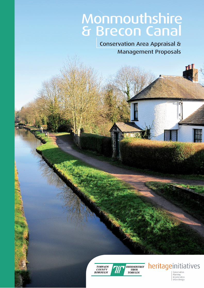
Front cover photograph: The Listed Junction House at Pontymoile Basin, looking northwards along the canal.
Torfaen County Borough Council Monmouthshire & Brecon Canal: Conservation Area Appraisal & Management Proposals Designation Draft Report
Heritage Initiatives Limited February 2011 1
Monmouthshire & Brecon Canal: Designation Draft Report
Conservation Area Appraisal & Management Proposals
PART 1 – CONSERVATION AREA APPRAISAL
Page
1.0 Introduction
1.1 Background to the appraisal 4
1.2 Purpose of the appraisal 5
1.3 The statutory context for designation 5
2.0 Summary of Special Interest
2.1 Significance 6
2.2 Summary of special interest 7
2.3 Recognising the Canal’s significance & special interest 8
3.0 Planning Policy Context
3.1 Conservation Areas and the Planning System 10
3.2 National policy guidance 12
3.3 Local planning policy 14
3.4 Implications of Conservation Area designation 15
4.0 Location and setting
4.1 Location and context 21
4.2 Landscape setting 21
4.3 Topography and relationship to surroundings 23
5.0 Historic development
5.1 Origins and summary of history 25
5.2 Historic development and significance 27
Torfaen County Borough Council Monmouthshire & Brecon Canal: Conservation Area Appraisal & Management Proposals Designation Draft Report
Heritage Initiatives Limited February 2011 2
6.0 Spatial analysis
6.1 The character of spaces within the area 32
6.2 Key views and vistas 33
7.0 Definition of the Conservation Area’s special interest
7.1 Activities, uses and access 34
7.2 Architectural and historic character 35
7.3 Building materials and local details 37
7.4 Key structures 39
7.5 Public realm 40
7.6 Green spaces, trees, wildlife and other natural elements 41
7.7 Character areas: key characteristics, negative factors and potential pressures 42
8.0 Key Issues & Recommendation
8.1 Key issues to be addressed through future management 70
PART 2 – MANAGEMENT PROPOSALS & ACTIONS
9.0 Background to ongoing Management Proposals & Actions
9.1 Purpose of the management proposals 71
9.2 Legislative issues 71
9.3 Statutory controls 72
10.0 Planning Controls, Management Proposals & Actions
10.1 Adoption of a coordinated approach to the management of the Canal 74
10.2 Review boundaries of Canal Conservation Areas to maintain special interest 75
10.3 Resurvey of statutory list along Canal corridors 75
10.4 Listed Buildings 76
10.5 Buildings of positive contribution 76
10.6 Erosion of character and additional planning control 77
10.7 Trees & Hedgerows 78
10.8 Canal setting, views and open spaces 79
10.9 New development, alterations and extensions 80
Torfaen County Borough Council Monmouthshire & Brecon Canal: Conservation Area Appraisal & Management Proposals Designation Draft Report
Heritage Initiatives Limited February 2011 3
10.10 Boundary treatments 80
10.11 Intrusion/incursion of domestic garden areas onto the Canal sides 81
10.12 The creation of moorings 81
10.13 Screening of modern development by trees and hedgerows 82
10.14 Intrusive Canal-side development and finishes 82
10.15 The public realm and enhancement 83
10.16 Buildings and structures condition survey 83
10.17 The continued use of traditional materials 84
10.18 Specific Supplementary Actions 85
11.0 Consultation & Review
11.1 Public Consultation 87
11.2 Monitoring & Ongoing Review 87
Bibliography 89
Useful contacts 91
Appendices 95
A Canal Corridor Tile & Appraisal Maps
B 2nd edition OS Historic Mapping
C 1792 Thomas Dadford Plan of the Canal from Newport to Pontnewynydd
D Listed Buildings within the Canal corridor
E Public Consultation Responses
Torfaen County Borough Council Monmouthshire & Brecon Canal: Conservation Area Appraisal & Management Proposals Designation Draft Report
Heritage Initiatives Limited February 2011 4
PART 1 – CONSERVATION AREA APPRAISAL
1.0 Introduction
1.1 Background to the Conservation Area Appraisal
1.1.1 The role and value of Canals in economic, social and cultural regeneration is now well
documented and proven. The Monmouthshire & Brecon Canal remains as one of a number of
significant waterways yet to properly fulfil this role to its full potential and in so doing
contribute to the regeneration of Cwmbran and Torfaen County Borough. Once considered a
liability rather than a valuable asset, the Canal is visually poor in a number of key locations
through Cwmbran, as past development has turned its back on the waterway making it a
neglected area of little apparent value. However, this is balanced by the clear historic and
visual value of areas north and south of the town.
1.1.2 Numerous Council and other documents make reference to the Canal and how its
restoration to navigation would bring economic benefits to the County Borough, as well as
the role it could play a part in the development of the Canal corridor by becoming a ‘necklace
of opportunity’ where the water space is the focus for new development. These are the
‘pearls’ on the necklace and could include new waterfront housing, mooring basins, cafes,
restaurants and retail mixed with office accommodation. Thus a new exciting opportunity is
unfolding, offering a different living, retail and leisure experience to residents and visitors in a
unique environment.
1.1.3 These potential benefits need to be placed in the context of the historic interest of the
Canal. By securing the Canal through designation as a Conservation Area the very
infrastructure that creates the opportunity for quality change will be secured for future
generations. It should be also noted that designation does not mean preserve from all change
but rather that change is managed positively having had special regard to the area’s special
interest. This appraisal provides justification for the consideration of such designation by the
Council in realising the potential benefits.

Torfaen County Borough Council Monmouthshire & Brecon Canal: Conservation Area Appraisal & Management Proposals Designation Draft Report
Heritage Initiatives Limited February 2011 5
1.2 Purpose of the appraisal
1.2.1 This appraisal records and analyses the various features along the Monmouthshire &
Brecon Canal corridor, the extent of which is detailed at paragraph 2.1.3, as the basis for
Conservation Area designation. The report includes an assessment of the Canal’s structures,
buildings and spaces, that are noted and marked on a series of appraisal maps along with listed
buildings, buildings of positive contribution to character and appearance, significant trees and
spaces, and important views into and out of the Canal corridor. In assessing whether the
Canal should be designated a Conservation Area this appraisal utilises national policy, as set
out in Welsh Office Circular 61/96: Planning and the Historic Environment, other relevant
guidance and local planning policy.
1.3 The statutory context for designation
1.3.1 Conservation Areas are designated under the provisions of Section 69 of the Planning
(Listed Buildings and Conservation Areas) Act 1990. A Conservation Area is defined as “an
area of special architectural or historic interest the character or appearance of which it is desirable to
preserve or enhance”. It is the quality and interest of an area, rather than that of individual
buildings, being the prime consideration in identifying a Conservation Area. This appraisal sets
out the reasoning and considerations for the designation. Should a Conservation Area be
designated Section 72 of the same Act specifies that, in making a decision on an application for
development in a Conservation Area, special attention shall be paid to the desirability of
preserving or enhancing the character or appearance of that area. This report should be read
in conjunction with national planning policy guidance, particularly Welsh Office Circular 61/96:
Planning and the Historic Environment (1996). The layout and content of this document
follows guidance produced by English Heritage, as no equivalent has been produced by Cadw
for Wales.
Torfaen County Borough Council Monmouthshire & Brecon Canal: Conservation Area Appraisal & Management Proposals Designation Draft Report
Heritage Initiatives Limited February 2011 6
2.0 Summary of Special Interest
2.1 Significance
2.1.1 The first linear Conservation Areas to be designated, following the 1968 Civic
Amenities Act, were in the early 1970’s and related to the ‘pioneering’ Canals of the north of
England. As knowledge and the appreciation of Canals has grown designating these linear
structures and their associated features is in growing recognition of their significance
architecturally, historically and socially. British Waterways estimates 16 full length Canals are
now designated as Conservation Areas across the UK, with a further 276 Conservation Areas
containing sections of Canal. However, with over 9,000 Conservation Areas across the UK,
the designation of a Canal as a Conservation Area is still something of a rarity.
2.1.2 The ‘modern’ Monmouthshire & Brecon Canal only came into being in 1865 and
stretched from Newport in the south to Brecon in the north, a continuous length of
approximately 45.5 miles (73 km’s). The Monmouthshire & Brecon Canal actually consists of
two former Canals, the Monmouthshire Canal and the Brecon & Abergavenny Canal.
2.1.3 The section of the Monmouthshire & Brecon Canal within the local planning authority
area of Torfaen County Borough accounts for approximately 6.3 miles (10.1 kms) of the
overall length and consists of both sections of the former Canals, with their junction at
Pontymoile. The Conservation Area only covers the sections of the Canal from bridge
number 55 ‘Jockey Bridge’ to south of bridge number 32 ‘Wheatsheaf Bridge’, within the local
planning authority area of Torfaen County Borough. For the purposes of ease of reference
and common usage this document will refer to the whole length within the County Borough
as the Monmouthshire & Brecon Canal or the ‘Mon & Brec Canal’, as it is often affectionately
known by many users and stakeholders.
2.1.4 In January 1998, the neighbouring authority to the south, Newport City Council,
designated as a Conservation Area that part of the Monmouthshire & Brecon Canal within its
administrative boundary. However, at this time that section of the Monmouthshire & Brecon
Branch north of Torfaen is unfortunately not under active consideration for designation by the
Torfaen County Borough Council Monmouthshire & Brecon Canal: Conservation Area Appraisal & Management Proposals Designation Draft Report
Heritage Initiatives Limited February 2011 7
Brecon Beacons National Park, Monmouthshire County Council nor the section within
Caerphilly County Borough Council, including the Crumlin Arm of the Canal.
2.1.5 In the context of South Wales, the Monmouthshire & Brecon Canal is of considerable
architectural, historic and scenic interest and has been considered to be one of the most
scenic Canals in the UK. The influence of Canals was quite phenomenal, completely
revolutionising industrial transportation and thus having a profound effect on industrial
growth. The impact of the Canal on the South Wales area was no less spectacular to the local
area, with industries along the Canal experiencing unprecedented growth being able to more
readily ship raw materials and finished products to market.
2.1.6 The Monmouthshire & Brecon Canal’s significance can be seen in this context and the
growth of South Wales as a result of this pioneering legacy of industrial growth and of the
engineering challenge, its impact upon the landscape and its new role as a recreational
resource, which are explored further in the history section.
2.2 Special interest
2.2.1 The special interest that justifies designation of the Monmouthshire & Brecon Canal as
a Conservation Area derives from the following features:
1 Its significance as a surviving part of the initial elements of the late 18th century and
19th century ‘Canal mania’, experienced in south Wales through the development of a
Canal network;
2 Having been surveyed and designed as a contour Canal by the renowned engineer,
Thomas Dadford (Junior), a leading Canal engineer in England & Wales.
3 Its importance as a historic record of the most prevalent pre-railway method of
freight transport and facilitator of the industrial revolution;
4 Its valuable contribution to the industrial transformation of the this part of south
Wales from an agricultural to industrial powerhouse;
5 Its present-day use as a popular leisure resource for pleasure boats, walkers, cyclists
and anglers;
Torfaen County Borough Council Monmouthshire & Brecon Canal: Conservation Area Appraisal & Management Proposals Designation Draft Report
Heritage Initiatives Limited February 2011 8
6 The special architectural and historic interest of the area’s structures, 18 are grade II
listed buildings;
7 The special interest of the Canal’s lock flights, stone bridges, including the various
aqueducts, milestones and other Canal related features;
8 Views to and across the Monmouthshire Hills to the west and the Usk basin to the
east;
9 The changing setting of the Canal as it progresses from urban, suburban to rural
fringe;
10 Canal-side trees and hedgerows;
11 Its role as a wildlife corridor into the urban centre of Cwmbran;
12 Local details that collectively and individually give the Conservation Area a
distinctive identity.
2.3 Recognising the Canal’s Significance & Special Interest
2.3.1 Long held aspirations to formally recognise the significance of the Canal as whole,
rather than just its constituent parts, and its special architectural and historic interest are
realised through Conservation Area designation. The possibilities of the future restoration and
development of the Canal corridor in Torfaen creates a unique opportunity to conserve and
utilise a heritage asset of considerable significance and special interest. Returning the Canal
back into a new role in the economic regeneration of the area is timely and appropriate but
must be viewed not only as a long term goal. Actions could be agreed in the shorter term that
create the correct framework of protection for the Canal. Regeneration projects of this scale
are not achieved easily and in the short term, especially in the current economic climate.
2.3.2 The Monmouthshire & Brecon Canal’s special interest, as defined by the appraisal, will
be best secured in preparation for the envisaged level of future change to its surroundings as a
result of its designation as a Conservation Area. Designation ensures proper consideration is
given to the nature, scale and form of change and how this impacts upon the special interest
of the Canal. It will assist the Council in positively addressing the impact of existing and
planned development adjoining the Canal and ensure proper consideration is given to the
significance and special interest of the Canal in future decision making. Designation assists in
avoiding piecemeal uncoordinated management and treatment of the Canal and encourages a
Torfaen County Borough Council Monmouthshire & Brecon Canal: Conservation Area Appraisal & Management Proposals Designation Draft Report
Heritage Initiatives Limited February 2011 9
holistic approach to be adopted. Through the designation of the Canal as a Conservation Area
the Council is clearly indicating to all stakeholders the priority it places on acting as custodian
of this special resource and in accepting its responsibility to secure its sustainable future as an
important element of the County Borough’s heritage.
Torfaen County Borough Council Monmouthshire & Brecon Canal: Conservation Area Appraisal & Management Proposals Designation Draft Report
Heritage Initiatives Limited February 2011 10
3.0 Planning Policy Context
3.1 Conservation Areas and the Planning System
3.1.1 Introduced by the Civic Amenities Act in 1967 and consolidated by subsequent
legislation leading to the Planning (Listed Buildings and Conservation Areas) Act in 1990, there
are now over 500 Conservation Areas across Wales. Local authorities have the power
to designate as Conservation Areas any area of 'special architectural or historic interest'
whose character or appearance is worth protecting or enhancing. This 'specialness' is judged
against local criteria commonly laid down in the local development plan. Conservation Area
designation is the primary means by which local authorities can safeguard for future
generations areas of valued distinctive places, helping to define the individual cultural identity
of communities.
3.1.2 Conservation Areas in Wales vary greatly in their nature and character. They range
from the centres of our historic towns and cities, through to fishing and mining villages, 18th
and 19th century suburbs, model housing estates, and country houses set in their historic
parks, to historic transport links and their environs, such as stretches of the Canal.
3.1.3 The special character of these areas does not come from the quality of their buildings
alone. The historic layout of roads, paths and boundaries; characteristic building and paving
materials; a particular mix of building uses; public and private spaces, such as gardens, parks
and greens; and trees and street furniture, contributing to particular views - all these and
more make up the familiar and cherished local scene. Conservation Areas give broader
protection than listing individual buildings: all the features, listed or otherwise, within the area,
are recognised as part of its character.
3.1.4 The streets and buildings of the County Borough’s towns and villages are part of the
unique historic character of the area. Each townscape tells the story of its own development,
and gives those who live and work there a sense of place, continuity and cultural identity.
Where these places are of special architectural or historic interest and deserve to receive
careful protection, they can be designated as Conservation Areas. However, this does not
mean that they have to remain frozen in time. Change is often necessary to accommodate the
Torfaen County Borough Council Monmouthshire & Brecon Canal: Conservation Area Appraisal & Management Proposals Designation Draft Report
Heritage Initiatives Limited February 2011 11
demands of modern living. As our historic areas are always likely to attract new development,
the challenge is how to embrace change and at the same time enhance, rather than detract
from, their special, local character.
3.1.5 The designation of a Conservation Area is not an end in itself. Local authorities need
to develop criteria that clearly identify those features of the area should be preserved or
enhanced, and set out how this can be done. Clear assessment and definition of an area's
interest and the action needed to protect it, help to generate awareness and encourage local
property owners to take the right sort of action for themselves. Character appraisals will also
identify areas where enhancement through development may be desirable.
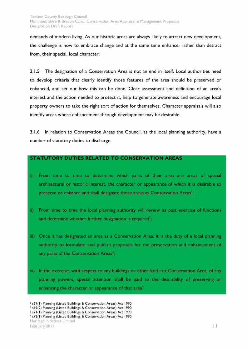
3.1.6 In relation to Conservation Areas the Council, as the local planning authority, have a
number of statutory duties to discharge:
STATUTORY DUTIES RELATED TO CONSERVATION AREAS
i) From time to time to determine which parts of their area are areas of special
architectural or historic interest, the character or appearance of which it is desirable to
preserve or enhance and shall designate those areas as Conservation Areas1;
ii) From time to time the local planning authority will review its past exercise of functions
and determine whether further designation is required2;
iii) Once it has designated an area as a Conservation Area, it is the duty of a local planning
authority to formulate and publish proposals for the preservation and enhancement of
any parts of the Conservation Areas3;
iv) In the exercise, with respect to any buildings or other land in a Conservation Area, of any
planning powers, special attention shall be paid to the desirability of preserving or
enhancing the character or appearance of that area4.
1 s69(1) Planning (Listed Buildings & Conservation Areas) Act 1990; 2 s69(2) Planning (Listed Buildings & Conservation Areas) Act 1990; 3 s71(1) Planning (Listed Buildings & Conservation Areas) Act 1990; 4 s72(1) Planning (Listed Buildings & Conservation Areas) Act 1990.
Torfaen County Borough Council Monmouthshire & Brecon Canal: Conservation Area Appraisal & Management Proposals Designation Draft Report
Heritage Initiatives Limited February 2011 12
3.1.7 These statutory duties related to the historic environment are further expanded upon
and explained in both case law and in publications, such as:
Welsh Assembly Government Circular 61/96 – Planning and the Historic Environment: Historic
Buildings and Conservation Areas (1996)
Planning Policy Wales (2010)
The Wales Spatial Plan (2004)
The Wales Spatial Plan Update (2008)
3.2 National Planning Policy Guidance
3.2.1 Circular 61/96 Planning and the Historic Environment supplements Planning Policy Wales
by setting out advice on legislation and procedures that relate to Conservation Areas. It
recommends that:
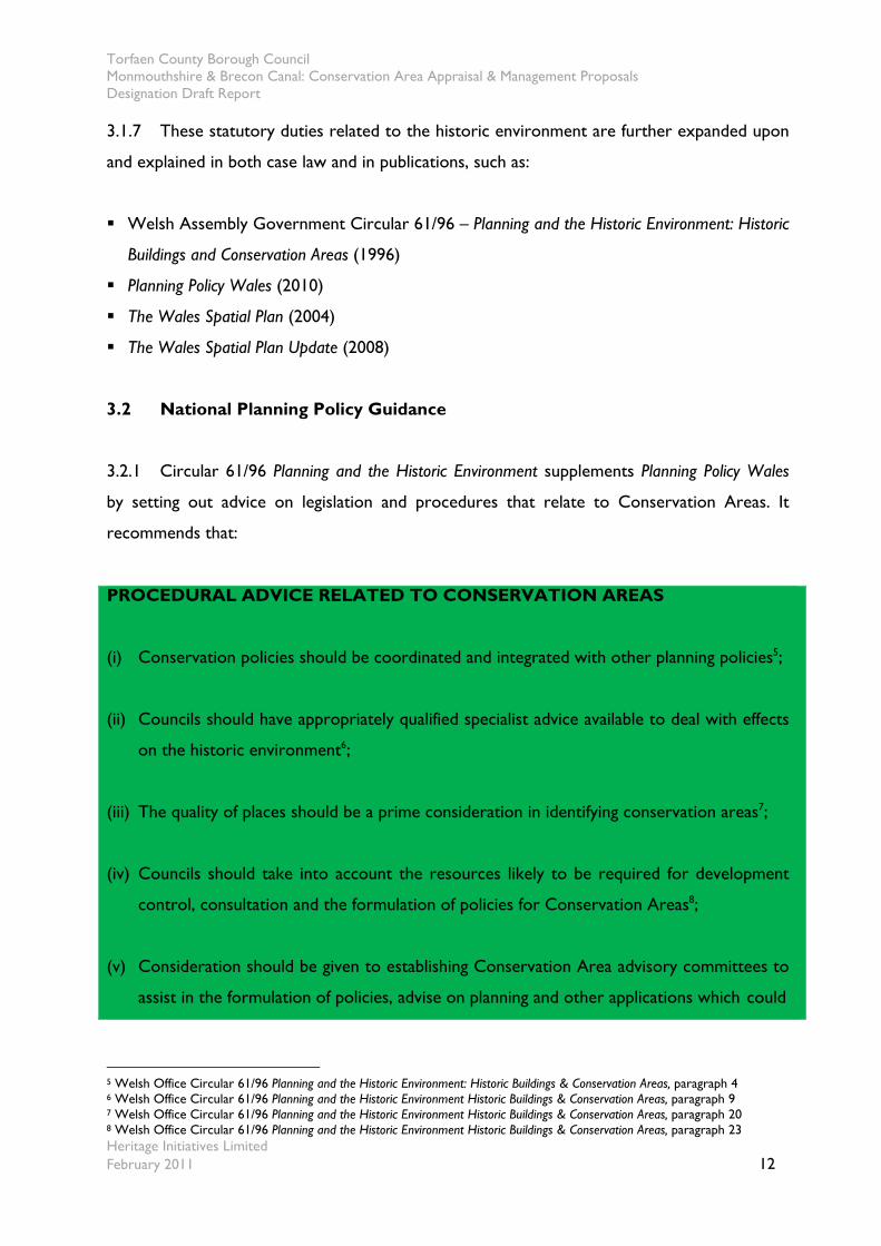
PROCEDURAL ADVICE RELATED TO CONSERVATION AREAS
(i) Conservation policies should be coordinated and integrated with other planning policies5;
(ii) Councils should have appropriately qualified specialist advice available to deal with effects
on the historic environment6;
(iii) The quality of places should be a prime consideration in identifying conservation areas7;
(iv) Councils should take into account the resources likely to be required for development
control, consultation and the formulation of policies for Conservation Areas8;
(v) Consideration should be given to establishing Conservation Area advisory committees to
assist in the formulation of policies, advise on planning and other applications which could
5 Welsh Office Circular 61/96 Planning and the Historic Environment: Historic Buildings & Conservation Areas, paragraph 4 6 Welsh Office Circular 61/96 Planning and the Historic Environment Historic Buildings & Conservation Areas, paragraph 9 7 Welsh Office Circular 61/96 Planning and the Historic Environment Historic Buildings & Conservation Areas, paragraph 20 8 Welsh Office Circular 61/96 Planning and the Historic Environment Historic Buildings & Conservation Areas, paragraph 23
Torfaen County Borough Council Monmouthshire & Brecon Canal: Conservation Area Appraisal & Management Proposals Designation Draft Report
Heritage Initiatives Limited February 2011 13
affect the character of an area and determine whether there is scope for communities to
become involved in practical voluntary enhancement work9.
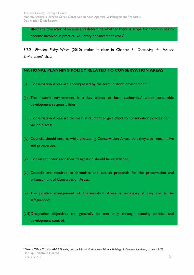
3.2.2 Planning Policy Wales (2010) makes it clear in Chapter 6, ‘Conserving the Historic
Environment’, that:
NATIONAL PLANNING POLICY RELATED TO CONSERVATION AREAS
(i) Conservation Areas are encompassed by the term ‘historic environment’;
(ii) The historic environment is a key aspect of local authorities’ wider sustainable
development responsibilities;
(iii) Conservation Areas are the main instrument to give effect to conservation policies for
valued places;
(iv) Councils should ensure, while protecting Conservation Areas, that they also remain alive
and prosperous;
(v) Consistent criteria for their designation should be established;
(vi) Councils are required to formulate and publish proposals for the preservation and
enhancement of Conservation Areas;
(vii) The positive management of Conservation Areas is necessary if they are to be
safeguarded;
(viii) Designation objectives can generally be met only through planning policies and
development control.
9 Welsh Office Circular 61/96 Planning and the Historic Environment Historic Buildings & Conservation Areas, paragraph 28
Torfaen County Borough Council Monmouthshire & Brecon Canal: Conservation Area Appraisal & Management Proposals Designation Draft Report
Heritage Initiatives Limited February 2011 14
3.2.3 Further Welsh Assembly Government guidance on the role and value of the
historic environment, encompassing Conservation Areas, can also be found in the Wales
Spatial Plan (November 2004) & The Wales Spatial Plan Update (2008);
SPATIAL PLAN GUIDANCE RELATED TO CONSERVATION AREAS
(i) The Historic Environment has an intrinsic value as well as its contribution to the economy
and quality of life;
(ii) It recognises distinctiveness and pride of place as elements of successful communities;
(iii) Such places have a role in promoting Wales as well as their role in future economic
competitiveness and social and environmental well being;
(iv) There is a need to maintain and support the distinctive character of the Welsh historic
environment;
(v) The Plan recognises the failures of standard building types and the need for new
development to reflect better traditional building types and materials.
3.3 Local planning policy
3.3.1 Local Plan policies have been developed by Torfaen County Borough Council in their
Adopted Local Plan of July 2000. In addition, along with policies from the Gwent Structure
Plan of 1996 form the current adopted development plan, until a replacement Local
Development Plan, which is currently under development should be adopted in 2011.
3.3.2 Relevant policies in relation to the section of the Canal within County Borough’s
adopted local plan for potential designation include:
HI Development affecting Conservation Areas;
H2 Demolition within Conservation Areas;
H3 Demolition of listed buildings;

Torfaen County Borough Council Monmouthshire & Brecon Canal: Conservation Area Appraisal & Management Proposals Designation Draft Report
Heritage Initiatives Limited February 2011 15
H4 The alteration, extension of listed buildings;
3.3.3 Other relevant policies include:
G1-4 General policies for development;
L5 Proposals for the improvement and restoration of the Canal;
L7 Concerning cycle paths, which utilise much of the southern half of the Canal towpath for
their route;
E1 Environmental policies concerning land south of Cwmbran;
E2&3 Special landscape areas and areas of restraint embracing and adjoining the Canal in the
north.
3.3.4 It should also be noted Brecon Beacons National Park adjoins the Canal to its off-side
to the west from where it enters the County Borough, north of bridge number 60 ‘Govera
Bridge’ to bridge number 55 ‘Jockey Bridge’. The National Park is the Local Planning Authority
for this area and separate policies apply in its adopted Unitary Development Plan of March
2007. This can be viewed on-line at;
http://www.breconbeacons.org/the-authority/planning/strategy-and-policy/udp
3.3.5 With the introduction of new procedures for local planning authorities in Wales,
Torfaen County Borough Council is preparing a Local Development Plan (LDP), setting out
the range of appropriate policies for the County Borough. Character appraisals, such as this,
are considered to be integral to the spatial planning approach of the Council. While they are
seen as background documents, they support, affirm and in some instances amplify the
principal planning policies within the forthcoming LDP.
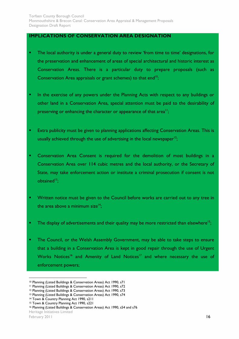
3.4 Implications of Conservation Area designation
3.4.1 Designation as a Conservation Area brings a number of specific statutory provisions
aimed at assisting the preservation and enhancement of the area. These are as follows:
Torfaen County Borough Council Monmouthshire & Brecon Canal: Conservation Area Appraisal & Management Proposals Designation Draft Report
Heritage Initiatives Limited February 2011 16
IMPLICATIONS OF CONSERVATION AREA DESIGNATION
The local authority is under a general duty to review ‘from time to time’ designations, for
the preservation and enhancement of areas of special architectural and historic interest as
Conservation Areas. There is a particular duty to prepare proposals (such as
Conservation Area appraisals or grant schemes) to that end10;
In the exercise of any powers under the Planning Acts with respect to any buildings or
other land in a Conservation Area, special attention must be paid to the desirability of
preserving or enhancing the character or appearance of that area11;
Extra publicity must be given to planning applications affecting Conservation Areas. This is
usually achieved through the use of advertising in the local newspaper12;
Conservation Area Consent is required for the demolition of most buildings in a
Conservation Area over 114 cubic metres and the local authority, or the Secretary of
State, may take enforcement action or institute a criminal prosecution if consent is not
obtained13;
Written notice must be given to the Council before works are carried out to any tree in
the area above a minimum size14;
The display of advertisements and their quality may be more restricted than elsewhere15;
The Council, or the Welsh Assembly Government, may be able to take steps to ensure
that a building in a Conservation Area is kept in good repair through the use of Urgent
Works Notices16 and Amenity of Land Notices17 and where necessary the use of
enforcement powers;
10 Planning (Listed Buildings & Conservation Areas) Act 1990, s71 11 Planning (Listed Buildings & Conservation Areas) Act 1990, s72 12 Planning (Listed Buildings & Conservation Areas) Act 1990, s73 13 Planning (Listed Buildings & Conservation Areas) Act 1990, s74 14 Town & Country Planning Act 1990, s211 15 Town & Country Planning Act 1990, s221 16 Planning (Listed Buildings & Conservation Areas) Act 1990, s54 and s76
Torfaen County Borough Council Monmouthshire & Brecon Canal: Conservation Area Appraisal & Management Proposals Designation Draft Report
Heritage Initiatives Limited February 2011 17
Development outside of the Conservation Area boundary that would affect its setting, or
views into or out of the area, should also preserve or enhance its character or
appearance,18
Powers exist for the Council, Cadw or the Heritage Lottery Fund to provide financial
grant schemes, including loans, to assist with the upkeep of buildings in Conservation
Areas19, usually in practice targeted to areas of economic deprivation or other
government priority.
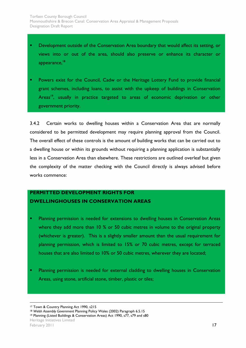
3.4.2 Certain works to dwelling houses within a Conservation Area that are normally
considered to be permitted development may require planning approval from the Council.
The overall effect of these controls is the amount of building works that can be carried out to
a dwelling house or within its grounds without requiring a planning application is substantially
less in a Conservation Area than elsewhere. These restrictions are outlined overleaf but given
the complexity of the matter checking with the Council directly is always advised before
works commence:
PERMITTED DEVELOPMENT RIGHTS FOR
DWELLINGHOUSES IN CONSERVATION AREAS
Planning permission is needed for extensions to dwelling houses in Conservation Areas
where they add more than 10 % or 50 cubic metres in volume to the original property
(whichever is greater). This is a slightly smaller amount than the usual requirement for
planning permission, which is limited to 15% or 70 cubic metres, except for terraced
houses that are also limited to 10% or 50 cubic metres, wherever they are located;
Planning permission is needed for external cladding to dwelling houses in Conservation
Areas, using stone, artificial stone, timber, plastic or tiles;
17 Town & Country Planning Act 1990, s215 18 Welsh Assembly Government Planning Policy Wales (2002) Paragraph 6.5.15 19 Planning (Listed Buildings & Conservation Areas) Act 1990, s77, s79 and s80
Torfaen County Borough Council Monmouthshire & Brecon Canal: Conservation Area Appraisal & Management Proposals Designation Draft Report
Heritage Initiatives Limited February 2011 18
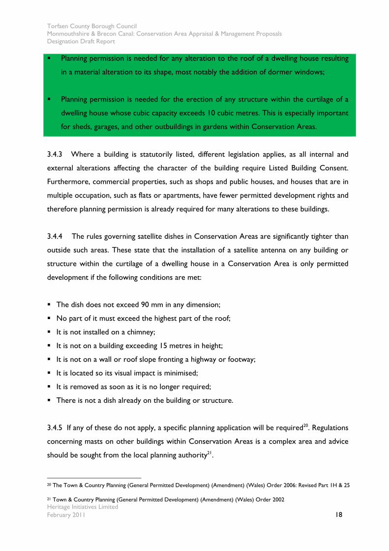
Planning permission is needed for any alteration to the roof of a dwelling house resulting
in a material alteration to its shape, most notably the addition of dormer windows;
Planning permission is needed for the erection of any structure within the curtilage of a
dwelling house whose cubic capacity exceeds 10 cubic metres. This is especially important
for sheds, garages, and other outbuildings in gardens within Conservation Areas.
3.4.3 Where a building is statutorily listed, different legislation applies, as all internal and
external alterations affecting the character of the building require Listed Building Consent.
Furthermore, commercial properties, such as shops and public houses, and houses that are in
multiple occupation, such as flats or apartments, have fewer permitted development rights and
therefore planning permission is already required for many alterations to these buildings.
3.4.4 The rules governing satellite dishes in Conservation Areas are significantly tighter than
outside such areas. These state that the installation of a satellite antenna on any building or
structure within the curtilage of a dwelling house in a Conservation Area is only permitted
development if the following conditions are met:
The dish does not exceed 90 mm in any dimension;
No part of it must exceed the highest part of the roof;
It is not installed on a chimney;
It is not on a building exceeding 15 metres in height;
It is not on a wall or roof slope fronting a highway or footway;
It is located so its visual impact is minimised;
It is removed as soon as it is no longer required;
There is not a dish already on the building or structure.
3.4.5 If any of these do not apply, a specific planning application will be required20. Regulations
concerning masts on other buildings within Conservation Areas is a complex area and advice
should be sought from the local planning authority21.
20 The Town & Country Planning (General Permitted Development) (Amendment) (Wales) Order 2006: Revised Part 1H & 25
21 Town & Country Planning (General Permitted Development) (Amendment) (Wales) Order 2002
Torfaen County Borough Council Monmouthshire & Brecon Canal: Conservation Area Appraisal & Management Proposals Designation Draft Report
Heritage Initiatives Limited February 2011 19
3.4.6 The law governing the erection of masts and antennae is complex and whilst some
companies have licences that allow some structures to be put up in Conservation Areas
without planning permission, the legislation does allow for consultation with the local
authority concerned, giving a period of notification, before the work is put in hand. Issues
concerning siting and areas of urban quality can be found in the second edition of TAN 1922.
3.4.7 Within Conservation Areas, anyone intending to lop, top or fell a tree greater than 75
mm diameter at 1.5 metres above the ground must give the Council six weeks written notice
before starting the work. This provides the Council with the opportunity to assess whether
the tree makes a positive contribution to the character or appearance of the Conservation
Area. If it does, a Tree Preservation Order may be served. This protects the tree from felling
or inappropriate lopping. Fruit trees are not exempt, although slightly different constraints
occur where the tree forms part of a managed orchard.
3.4.8 The designation and review of Conservation Areas are statutory duties placed on the
Council. In support of these statutory duties, the Council is expected to commit adequate
resources by ensuring it has access to the necessary skills and it adopts appropriate policies23.
The Council should also ensure that communities are sufficiently informed about the
implications of designation so that they too can play their part24.
3.4.9 Although the administration of Conservation Areas is largely a planning function, there
are many other local authority actions that can impact on character and appearance, for
instance highways, the maintenance of trees within the public realm or the management of
public buildings. It is important, therefore, that conservation aims are coordinated across all
relevant local authority services25. Highway or building control standards designed for modern
environments should not be applied unthinkingly to areas and buildings that have stood the
test of time. The Council is, therefore, encouraged to be sensitive to the special architectural
and historic interest of Conservation Areas and listed buildings in exercising, for instance,
22 Welsh Assembly Government Technical Advice Note 19 - Telecommunications August 2002, paragraph 56 23 Welsh Office Circular 61/96 Planning and the Historic Environment: Historic Buildings and Conservation Areas, December 1996, paragraphs 9 & 23 24 Welsh Office Circular 61/96 Planning and the Historic Environment: Historic Buildings and Conservation Areas, December 1996, paragraph 27 25 Welsh Office Circular 61/96 Planning and the Historic Environment: Historic Buildings and Conservation Areas, December 1996, paragraph 26
Torfaen County Borough Council Monmouthshire & Brecon Canal: Conservation Area Appraisal & Management Proposals Designation Draft Report
Heritage Initiatives Limited February 2011 20
building control, fire regulations and highways standards. Cadw guidance lays down a number
of helpful principles for the management of the public realm in historic areas26.
3.4.10 The efficient delivery of a conservation service requires regular monitoring of
change and the agents of change. The Council is also encouraged to undertake periodic
reviews of the effectiveness with which local authority services address pressures for change.
3.4.11 Those who live and work in a Conservation Area are encouraged to recognise the
collective benefits they enjoy. For this, they must understand the need to take a contextual
view of any proposals, rather than acting in isolation. Well informed proposals will benefit the
Conservation Area as well as the applicant27. Some degree of change is inevitable in
Conservation Areas and the issue is often not so much whether change should happen, but
how it is undertaken. Owners and residents can minimise the effects of change by employing
skilled advice when preparing development proposals and by avoiding unrealistic aspirations.
3.4.12 It is important that communities are well-informed about the qualities of their
Conservation Areas and of the opportunities for enhancing them. While the Council is a
useful source of advice, there is also a significant role other stakeholders, such as community
councils, civic, historical, user, resident and amenity societies to explain what matters, what is
possible, what is expected and what has been achieved elsewhere. There exists an
opportunity to create a Conservation Area Advisory Committee for the Conservation Area
or areas across the County Borough, in providing a vital interface between communities and
the Council28. They can focus local knowledge and local responses to policy initiatives and
development proposals.
26 Cadw Traffic Management in Historic Areas 2003, paragraph 6 27 Welsh Office Circular 61/96 Planning and the Historic Environment: Historic Buildings and Conservation Areas, December 1996, paragraph 6 28 Welsh Office Circular 61/96 Planning and the Historic Environment: Historic Buildings and Conservation Areas, December 1996, paragraph 28
Torfaen County Borough Council Monmouthshire & Brecon Canal: Conservation Area Appraisal & Management Proposals Designation Draft Report
Heritage Initiatives Limited February 2011 21
4.0 Location and setting
4.1 Location and context
4.1.1 The Torfaen County Borough section of the Monmouthshire & Brecon Canal accounts
for approximately 6.3 miles (10.1 kms) of the overall length and consists of both sections of
the former Canals, with their junction at Pontymoile. The Torfaen section (within the local
planning authority area) of the Canal commences from number 55 ‘Jockey Bridge’ at the
administrative boundary with Brecon Beacons National Park and concludes to the south of
bridge number 32 ‘Wheatsheaf Bridge’ with the administrative boundary of Newport City
Council, as illustrated in the first plan to Appendix A.
4.1.2 The purpose of the Monmouthshire & Brecon Canal was primarily promoted to
further the expansion and extraction of minerals for transport onwards to their markets, such
as a coal, iron and limestone situated in the vicinity of its proposed route and the resultant
manufactured goods. Unlike many Canals of the day it did not serve a wider role for through
traffic as it did not connect into the wider Canal network. It allowed the transfer of important
agricultural lime northwards to the fertile areas around Brecon and the extraction of
important minerals southwards to Newport, where once transferred to sea going vessels
serving markets around the globe.
4.2 Landscape setting
4.2.1 Unlike many other Canals, that can have a distinct feeling of separateness from the
landscape through which they pass, the Monmouthshire & Brecon Canal although cutting
through an existing landscape feels very well integrated with adjacent uses. Many of the
bridges provide towpath access to adjacent settlements and places of interest both within and
alongside the Canal corridor. This probably stems from the fact that much of the length of the
Canal was actively used by adjacent enterprises, rather than being merely a means to get
between other places, and was developed to serve surrounding land uses such as coal mining,
the quarrying of limestone and iron production that defined the origins, development and
usage of the Canal.
Torfaen County Borough Council Monmouthshire & Brecon Canal: Conservation Area Appraisal & Management Proposals Designation Draft Report
Heritage Initiatives Limited February 2011 22
4.2.2 Close to the settlements of Sebastopol and Cwmbran the Canal is enclosed by
remnants of increasingly fragmentary mid to late 19th century residential and commercial
developments. The architectural and historic character of Canal-side development outside the
Canal corridor varies enormously. In the absence of any systematic townscape analysis of the
County Borough having been undertaken, and the fact that no Conservation Areas lay
alongside the Canal corridor, this should not necessarily lead to the conclusion that much of
the adjoining townscape has little or no special historic or architectural interest. However,
local building materials have played a positive role in the Canal’s assimilation into the broader
landscape. The use of the local pennant stone for accommodation bridges and Canal edgings
adds to the sense of integration and this is explored more thoroughly at section 6.3.
4.2.3 In the urban areas along the Canal, remains of industrial, agricultural and residential
buildings can be found. Although buildings predating the Canal tend not to face towards it,
those from the 19th century often do, as they frequently relate to its usage by surrounding
industries, that can still be seen in the long abandoned wharfs along its length. The height of
adjoining buildings is remarkably low and ensures the Canal is not unduly dominated by
adjoining properties. The majority of buildings are either two or three storey and these often
sit at a comfortable distance from the Canal ensuring sufficient setting to the Canal is
maintained. Only in the vicinity of the County Hospital have more traditional buildings
exceeded this height and their visual relationship with the Canal is successfully achieved
through being set back from the Canal at a sufficient distance.
4.2.4 Much of the later adjacent development from the early and mid 20th century fails to
acknowledge the presence of the Canal, in effect ‘turning its back’ to the water’s edge.
However, since the growth in use of the Canal as a recreational resource and the popularity
of waterside locations, some later 20th century mainly residential development has again
begun to realise the benefits and create active frontages onto the Canal. This has not been
altogether a positive development as poor maintenance and the ephemeral nature of some of
the activities has not always added to the special character of the Canal corridor.
4.2.5 As one proceeds along the length of the Canal, even when moving from a rural
landscape into urban townscape, for the majority of its length there are substantial areas of

Torfaen County Borough Council Monmouthshire & Brecon Canal: Conservation Area Appraisal & Management Proposals Designation Draft Report
Heritage Initiatives Limited February 2011 23
open space on either side, mainly fields and pastureland but also playing fields and mature
gardens. In addition, much of the Canal is bordered by a hawthorn hedge interspersed with
trees, defining the boundary as it passes through the landscape areas. Since the Canal’s
construction much of the adjoining land, especially in the vicinity of Cwmbran, has been
developed and in places it now forms an important role as a distinctive boundary between
areas. Further proposals adjoining the Canal are anticipated and careful consideration will have
to be given to the interaction of such proposals, especially in rural areas where the Canal is
positioned within an environment of tree and hedge lines, forming an essential characteristic
of such sections, that should be maintained and enhanced.
4.2.6 The Countryside Council for Wales operates a LANDMAP system. This provides
useful general information, on the character, physical influences, cultural influences, buildings
and settlements, land cover, the changing countryside and proposals for shaping the future for
each of these areas. The section for Torfaen is currently being considered for review by the
Countryside Council for Wales following further development of the landscape methodology.
4.3 Topography and relationship to surroundings
4.3.1 The stretch of Canal within the County Borough has been built to follow a level
course within an undulating landscape requiring both embankments and cuttings along its
length. Sections to the north and south of Cwmbran tends to follow the natural contours
where possible, thereby minimising the number of locks but increasing its overall length.
4.3.2 Locks lift the Canal 447ft (136m) in total from Newport to Pontnewydd, the Canal is
on a level for a further 23 miles (37 km’s) until the outskirts of Brecon where a further flight
of locks takes the Canal 68ft (21m) higher, making the Monmouthshire & Brecon Canal,
amongst the highest in the UK. Of this only four levels exist along the length of this section of
the Canal, that are connected by three sections of grouped locks, at Pontnewydd, Cwmbran
and Ty Coch. Grouping locks allows for minimal loss of water and concentrates effort in small
sections, making for more economical passage.
4.3.3 The resultant number of bridges, aqueducts and embankments are key features of this
Canal. As explained previously this gives the expansive views from the Canal both to the west
Torfaen County Borough Council Monmouthshire & Brecon Canal: Conservation Area Appraisal & Management Proposals Designation Draft Report
Heritage Initiatives Limited February 2011 24
over the Usk basin and eastwards to the Monmouthshire Hills. A number of key hills in the
Canal’s vicinity including the Trellech Ridge and Pontypool Park.
Torfaen County Borough Council Monmouthshire & Brecon Canal: Conservation Area Appraisal & Management Proposals Designation Draft Report
Heritage Initiatives Limited February 2011 25
5.0 Historic development
5.1 Origins and summary of history
5.1.1 Over two hundred years ago, the entrepreneurs of the industrial revolution saw the
potential of inland waterways for transporting goods cheaply and efficiently throughout
Britain. They developed an inland waterway network linking mines and quarries with factories,
mills, markets, and ports. This growth or ‘Canal mania’ reached Wales in the late 18th century
and led to major investment by the industrialists of the day in overcoming the difficulties
presented by the terrain of south Wales. The first amongst these was the Glamorganshire
Canal, begun in 1792, linking Merthyr and Aberdare with Cardiff. The construction of the
Monmouthshire Canal also begun in 1792 and was completed in 1799.
5.1.2 Such growth should be placed in the wider context of the impact of the French
Revolution and the subsequent Napoleonic Wars. This was a time of great uncertainty as a
result of social and economic upheaval. The continuing rivalry between France and the United
Kingdom led to shortages and the loss of markets just as the UK emerged as Europe’s leading
industrial nation. The superiority of the Royal Navy prevented an invasion but led to an
economic blockade that effectively cut all exports to Europe and most importantly to the UK,
the import of food stuffs from the continent. The Canal system became an ever increasing
part of the both the industrial capacity of the nation to overcome the threat but also in the
shipment of lime across the country to support the agricultural need to grow more produce.
5.1.3 The iron and other industrial centres in South Wales were poorly placed for the
transportation of their goods to the ports. Initially, pig iron was carried to the coast by
packhorses bearing panniers. Roads were eventually built but, while a wagon drawn by four
horses could convey only two tons of goods, a Canal barge drawn by one horse could convey
twenty-five tons.
5.1.4 The Monmouthshire and Brecon Canal started life as two separate Canals: the Brecon
& Abergavenny Canal, and the Monmouthshire Canal. In the 1790s, the Monmouthshire Canal
Company received its Act of Parliament at the same time that the Brecon & Abergavenny was
Torfaen County Borough Council Monmouthshire & Brecon Canal: Conservation Area Appraisal & Management Proposals Designation Draft Report
Heritage Initiatives Limited February 2011 26
being planned. The Brecon & Abergavenny was constructed in three parts, with the northern
most section being built between 1796 and 1800 by the renown Canal engineer Thomas
Dadford Junior. The second section between Gilwern and Llanfoist was built between 1802
and 1805 and overseen by Thomas Cartwright, with the third and last section being built from
Llanfoist to Llanfihangel Pontymoile between 1809 an 1812. Growth in the Canal’s usage at
this time can be seen in the level of coal traffic being hauled from 3,500 tons in 1796 to
150,000 tons by 1812, undoubtedly fed by the many feeder tram-roads in the vicinity.
5.1.5 Following discussions, it was decided to link the two at Pontymoile by 1812. By this
time the section of the Monmouthshire from Pontymoile north-westwards to Pontnewynydd
was already looking short-lived and by the 1850s it had already been supplanted by a railway.
After the closure of the lower section of the Monmouthshire, the rest of the Monmouth &
Brecon Canal was maintained principally as a water feeder for Newport docks.
5.1.6 Both Canals, supported by horse-drawn tram-roads, were used primarily to haul coal,
limestone and iron ore from the surrounding hillsides and most famously from Blaenavon.
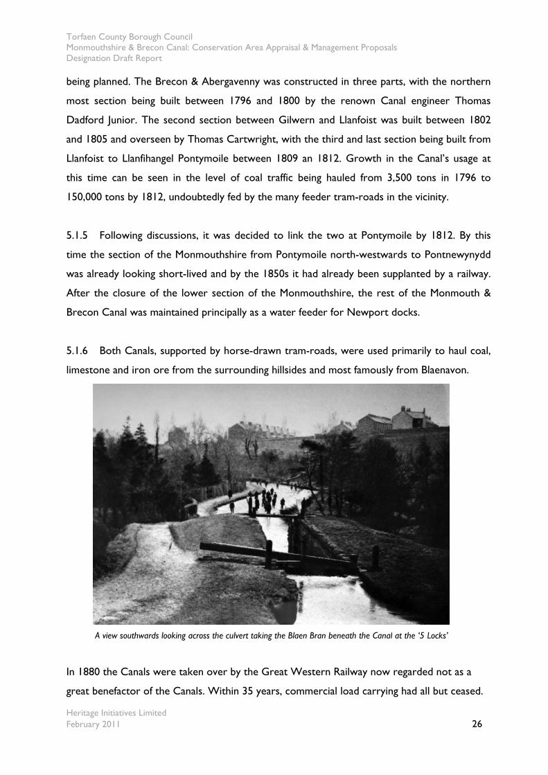
A view southwards looking across the culvert taking the Blaen Bran beneath the Canal at the ‘5 Locks’
In 1880 the Canals were taken over by the Great Western Railway now regarded not as a
great benefactor of the Canals. Within 35 years, commercial load carrying had all but ceased.
Torfaen County Borough Council Monmouthshire & Brecon Canal: Conservation Area Appraisal & Management Proposals Designation Draft Report
Heritage Initiatives Limited February 2011 27
5.2 Historic development and significance
5.2.1 The Monmouthshire and Brecon Canal is an amalgamation of the Monmouthshire
Canal, authorised by Act of Parliament in 1792, and the Brecon and Abergavenny Canal, more
accurately referred to as the Brecknock & Abergavenny Canal, first proposed the same year,
to link Brecon to the tidal head of the Usk below Caerleon but was redesigned following
discussion with the Monmouthshire proprietors to create a junction with the Monmouthshire
at Pontymoile near Pontypool and to share the navigation from there to Newport. The
Brecknock & Abergavenny Canal Act of Parliament was obtained in 1793. Both Canals were
abandoned in 1962, but the Brecon and Abergavenny route and a small section of the
Monmouthshire route have been reopened since 1970.
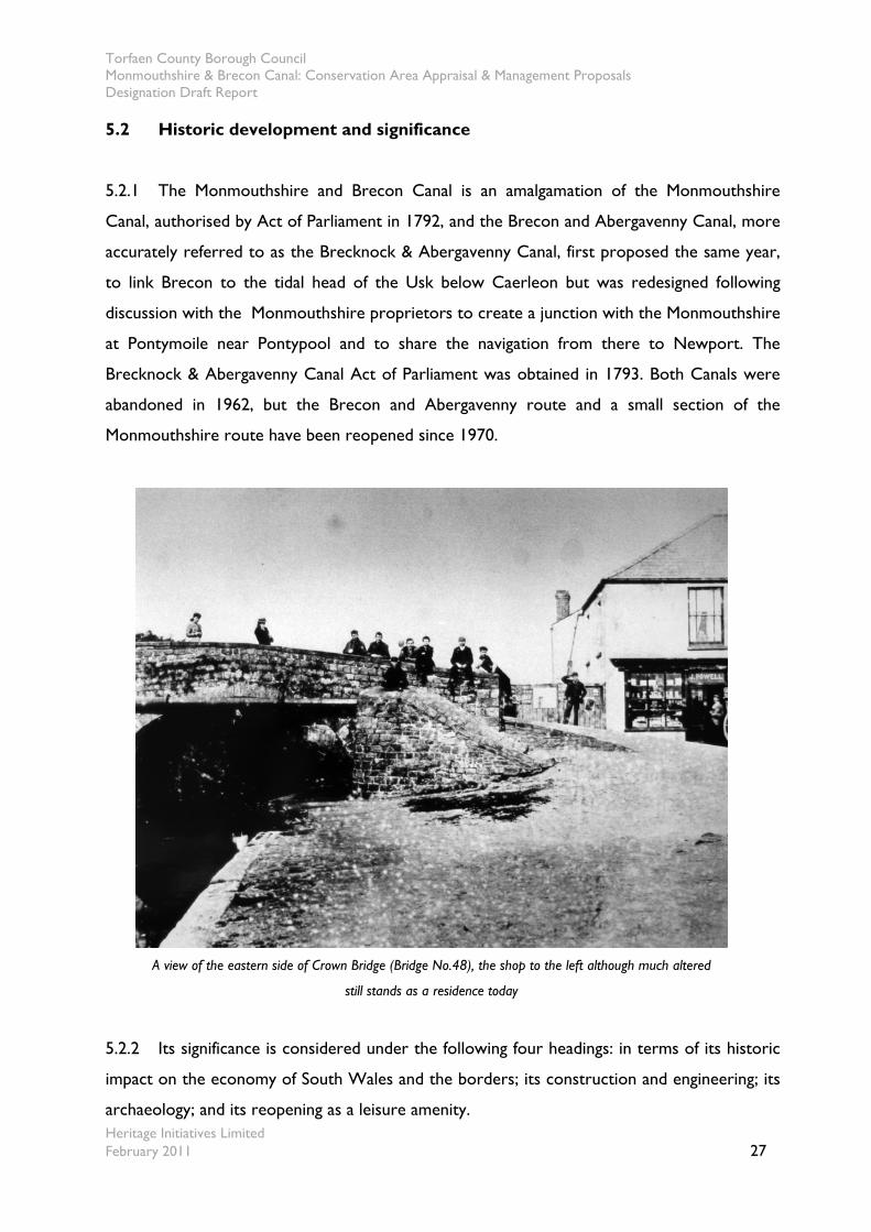
A view of the eastern side of Crown Bridge (Bridge No.48), the shop to the left although much altered
still stands as a residence today
5.2.2 Its significance is considered under the following four headings: in terms of its historic
impact on the economy of South Wales and the borders; its construction and engineering; its
archaeology; and its reopening as a leisure amenity.
Torfaen County Borough Council Monmouthshire & Brecon Canal: Conservation Area Appraisal & Management Proposals Designation Draft Report
Heritage Initiatives Limited February 2011 28
Economic Impact
5.2.3 In terms of its historic impact on the economy of South Wales and the borders, the
Monmouthshire and Brecon Canal is of national importance in a Welsh context as part of the
growing network of industrial transport routes put in place at the end of the eighteenth
century and the beginning of the nineteenth.
5.2.4 Its construction enabled the phenomenal growth of the iron and coal industries and
also assisted the process of agricultural improvement in the areas to its east. Its construction
reflects the limitations to tidal navigation within a growing commercial economy. It was
preceded by Sir Humphrey Mackworth’s Canal at Neath built pre-1700, by Kymer’s Canal to
Kidwelly, Chauncey Townsend’s waterway from Llwynhendy to Dafen Pill constructed c.
1769, and by several other small Canals in South-west Wales. It is contemporary with the
Glamorganshire Canal (Act 1790, open 1794, 25 miles / 40km’s), the Neath Canal (Act 1791,
13½ miles / 21 km’s) and the Swansea Canal (Act 1794, opened 1798, 16 miles / 26km’s). The
total length of the Monmouthshire Canal was 12½ miles (20 km’s) and of the Brecon and
Abergavenny Canal’s 33 miles (53km’s). They served, either directly or by means of its railway
extensions to the ironworks, limestone quarries and collieries of Tredegar, Sirhowy, Ebbw
Vale, Beaufort, Nant y Glo, Blaenavon, and Abersychan, and the agricultural lands of
Monmouthshire, Breconshire and Herefordshire. As such, they enabled the development of
industrial undertakings that within a generation had assumed world-wide significance. Their
hinterland extended over an area that extended from Brecon to Kington, Hereford, Caerleon,
Caerphilly and Tredegar.
Construction & Engineering
5.2.5 In terms of its construction and engineering, the Monmouthshire and Brecon Canal
reflects the growing experience and skills of an increasingly professionalised class of engineer
and as such is of national significance in a Welsh context.
5.2.6 Construction of the Monmouthshire Canal and of the Brecon and Abergavenny Canal
was supervised by Thomas Dadford Junior (c. 1761-1801) who had worked with his father
Thomas Dadford (1730-1809) on the construction of the Stourbridge Canal and on a survey
Torfaen County Borough Council Monmouthshire & Brecon Canal: Conservation Area Appraisal & Management Proposals Designation Draft Report
Heritage Initiatives Limited February 2011 29
of the River Trent, and with his father and Thomas Sheasby as engineer-contractors on the
Glamorganshire Canal. Assisted by his father and brother John, he also surveyed the route of
the proposed Neath Canal, of which he was appointed engineer (‘general surveyor’) in 1791.
In the same year he became engineer of the Leominster Canal. From 1792 he was engineer of
the Monmouthshire Canal, and surveyed for the Brecon and Abergavenny Canal the high-level
route, later adopted, ensuring that the Canal would be lock-free for much of its length. He
was appointed engineer of the Brecon and Abergavenny in 1796, a position he held until his
death in 1801. He ceased to be engineer of the Monmouthshire in 1798. Among his major
works on the present Monmouthshire and Brecon Canal are the flight of fourteen locks on
the Monmouthshire Canal at Rogerstone, the embankment carrying the Brecon and
Abergavenny over the River Clydach at Gilwern and the four-arched masonry aqueduct over
the River Usk at Brynich. However, it is likely that he was partly responsible for the collapse
of the Ashford Tunnel on the Brecon and Abergavenny. His work on the Monmouthshire and
Brecon Canal, as well as on the other South Wales Canals with which he was involved,
reflects a highly competent engineering achievement though it is not on the scale of the great
Canal works of this period, such as the Lancaster Canal (Rennie), the Grand Junction (Jessop
and Barnes), the Rochdale (Jessop and William Crossley), the Ellesmere (Jessop and Telford),
the Kennet and Avon (Rennie), the Huddersfield (Benjamin Outram), the Union (Hugh Baird)
and the Birmingham and Liverpool Junction Canals(Telford and William Cubitt).
5.2.7 Another well-known engineer associated with the system was Benjamin Outram
(1764-1805), who was called in to inspect the work and to advise on substituting a railway
between Gilwern and Pont-y-Moel. Outram recommended several improvements, in
particular the partial rebuilding of the Ashford Tunnel. He was also critical of the existing
railways, and advocated the replacement of the edge-rail systems with plateways. Outram had
been assistant engineer to William Jessop on the Cromford Canal, and succeeded Jessop as
engineer of the Nottingham Canal. He also designed the Derby Canal and was engineer to the
Huddersfield Narrow Canal. He is also known for the rail systems connecting to the Ashby-
de-la-Zouche Canal and for his association with the Butterley Ironworks.
5.2.8 The Monmouthshire Canal and the Brecon and Abergavenny also acted, directly and
indirectly, as the sponsors of an extensive network of branch railways serving water-borne
transport. The first of these were constructed from the 1790s, and rail systems connecting to
Torfaen County Borough Council Monmouthshire & Brecon Canal: Conservation Area Appraisal & Management Proposals Designation Draft Report
Heritage Initiatives Limited February 2011 30
the Canal continued to be built and to be upgraded until the arrival of the main-line national
rail network in the 1850s. The Monmouthshire Canal tram-road system eventually totalled
104 miles (167km’s). The Blaenavon railroad, intended to link the ironworks with the Canal at
Pontnewynydd, was actually completed three years before the Canal, in 1793. The linked Hay
and Kington railways, that ran from a wharf on the Brecon and Abergavenny Canal at Brecon
to Kington and Dolyhir, 36 miles (58 km’s) in length, was the longest railway in Britain when it
was completed in 1820 until the opening of the grand Junction Railway in 1837. The design of
these rail systems reflects a United Kingdom-wide readiness on the part of engineers and
promoters to consider transport links in terms of their suitability for different types of terrain,
whether a Canal or a railway or a stone road, and to embrace the concept of planned inter-
modal transport. The design of the feeder railways to the Monmouthshire Canal and the
Brecon and Abergavenny also reflects discussion, debate and evolving practice amongst
engineers as to the relative merits of iron edge railways (with the flanges on the wheel) or of
plate-ways (with flanged rails), and of horse and locomotive traction. Though the Merthyr to
Abercynon Canal saw the first use of a steam railway locomotive in Wales and probably in the
world, in 1804, the Monmouthshire tramroads were making experimental use of steam
traction probably from 1816 and regular use of locomotives from 1829.
Archaeology
5.2.9 In terms of its landscape archaeology and of archaeological features associated with the
Canal network, a number of features of potential national significance, in a Welsh context,
survive. Outside Torfaen, these include numerous aqueducts, bridges and dwellings, limekilns,
a possible depot and office facilities at Talybont (SN 1168 2240, 1150 2250, 1175 2235, 1138
2241), warehouses at Gilwern (SO 2425 1465) and Govilon (SO 2697 1369) Llanfoist (SO
2546 1304).
5.2.10 Within Torfaen, sites include a gauging or toll house (SO 2922 0016) dating from
1810-12 at the junction of Monmouthshire Canal and Brecon and Abergavenny Canal, bridges
at Griffithstown ST29159984 and Pontymoile (SO29200016), and aqueduct at Pontymoile
(SO 2937 0028), locks at Llantarnam (ST 2915 9358-2921 9316) and Pontnewydd (ST 2879
9668) and a tunnel at Cwmbran (ST2874 9736).
Torfaen County Borough Council Monmouthshire & Brecon Canal: Conservation Area Appraisal & Management Proposals Designation Draft Report
Heritage Initiatives Limited February 2011 31
5.2.11 Indirectly associated with the Canal, in that it was connected to it by rail systems both
extending over the Blorenge to Llanfoist and down the valley of the Afon Llwyd to Pontypool,
is the Blaenavon Industrial Landscape in the northern part of Torfaen County Borough, a large
area of historic landscape, buildings and monuments having evolved around the historic
Blaenavon Ironworks. The site as a whole is considered to be one of the best examples in the
world of a landscape created by coal mining and iron-making in the late eighteenth and early
nineteenth centuries. It was designated a World Heritage Site by UNESCO in 2000.
Leisure & Recreation
5.2.12 In terms of its reopening as a leisure amenity, the Monmouthshire and Brecon Canal is
of national significance, in a Welsh context, in that it reflects a growing awareness of the
potential of industrial-era transport links for recreation that has been apparent since 1945.
This reflects the work of individual enthusiasts and industrial archaeologists, of whom Lionel
Thomas Caswall (Tom) Rolt (1910-1974) was the most significant. Rolt was a founder-
member and first Honorary Secretary of the Inland Waterways Association, the first Vice
Chairman was Charles Hadfield (1909-1996), a prolific author of Canal histories including
studies of the Monmouthshire Canal and the Brecon and Abergavenny Canal and their feeder
rail systems. As a result of pressure from the Inland Waterways Association, local authorities
began to perceive the value of the Canal network. The restoration of the Monmouthshire and
Brecon Canal by Torfaen County Borough Council and the other responsible local authorities
therefore typifies a broader change in perception of the industrial past as well as a move away
from an industrial society to a society based increasingly around services and leisure that is
apparent throughout the developed world. The Neath Canal has also been the focus of
restoration initiatives. By comparison, only limited traces remain of the Glamorganshire Canal,
and only 5 miles (8 km’s) remain in water of the Swansea Canal.
Torfaen County Borough Council Monmouthshire & Brecon Canal: Conservation Area Appraisal & Management Proposals Designation Draft Report
Heritage Initiatives Limited February 2011 32
6.0 Spatial analysis
6.1 The character of spaces within the area
6.1.1 The Canal corridor takes the form of a long, relatively straight Canal, on a north to
south route, including elements of its setting, cutting a narrow route through both rural
landscape, suburban and urban townscapes. The character of space along the Canal is
determined by the height, mass and bulk of Canal-side development or the height and density
(according to season) of Canal-side trees and greenery - and their proximity to the edge of the
Canal – and open views beyond. It is often as a result of built development or greenery outside
the confines of the Canal corridor that has a considerable impact on the character and
appearance within it. The screening effect of greenery obviously changes with the seasons.
6.1.2. Generally the Canal has an enclosed feel whilst it flows through urban areas and a more
spacious atmosphere at it moves out into the open countryside as it leaves the suburbs of the
settlements along its length. Although, where adjoining hedging has been allowed to overgrow a
far more enclosed feel is experienced and only glimpses rather than expansive views enjoyed to
surrounding open countryside. Similarly, overhanging trees, especially in the vicinity of
woodland plantations, can form an overarching canopy of tree cover to the Canal considerably
reinforcing both the integration of the Canal within the landscape. Often the Canal sits on a
hillside, that is overlooked from the west, while views out over the land and townscape can be
enjoyed to the east.
6.1.3 The Canal itself has a generally uniform width of 9ft 2in (2.79m), which was determined
by its engineer as the most suitable, although narrowing at locks and certain bridges, increasing
at a number of winding or turning holes, that can be seen along the length of the Canal.
6.1.4 Older buildings in the vicinity of the Canal often face towards the water, adding to the
sense of enclosure. Sometimes this relationship can be less comfortable due to the Canals
unerring lack of flexibility other than to carve through settlements and the landscape. This is
often a more complex relationship in urban areas where once the Canal passed through a
largely rural or past industrial landscape. Where once there were adjoining open fields these
Torfaen County Borough Council Monmouthshire & Brecon Canal: Conservation Area Appraisal & Management Proposals Designation Draft Report
Heritage Initiatives Limited February 2011 33
have been subsequently developed and the Canal is now hemmed in at a number of locations,
with structures and uses sitting uncomfortably alongside. In rural areas where the Canal cut
through the rural landscape this somewhat unsettled relationship has been softened as the
landscape has reclaimed the edge and boundaries to the Canal and the pleasing decay, or patina,
caused by the passage of time, which has smoothed the edges of its impact. Without the
Canal’s interest and use adding to character and appearance of the landscape much vitality
would be lost to otherwise indistinct pasture.
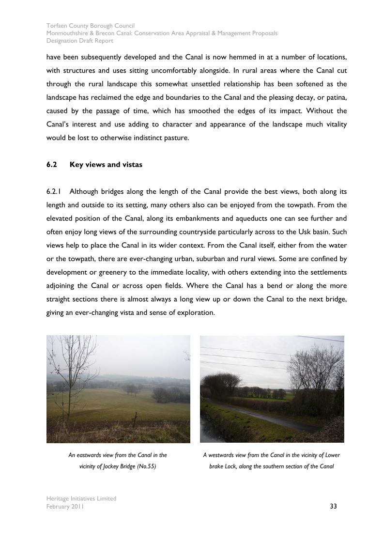
6.2 Key views and vistas
6.2.1 Although bridges along the length of the Canal provide the best views, both along its
length and outside to its setting, many others also can be enjoyed from the towpath. From the
elevated position of the Canal, along its embankments and aqueducts one can see further and
often enjoy long views of the surrounding countryside particularly across to the Usk basin. Such
views help to place the Canal in its wider context. From the Canal itself, either from the water
or the towpath, there are ever-changing urban, suburban and rural views. Some are confined by
development or greenery to the immediate locality, with others extending into the settlements
adjoining the Canal or across open fields. Where the Canal has a bend or along the more
straight sections there is almost always a long view up or down the Canal to the next bridge,
giving an ever-changing vista and sense of exploration.
An eastwards view from the Canal in the
vicinity of Jockey Bridge (No.55)
A westwards view from the Canal in the vicinity of Lower
brake Lock, along the southern section of the Canal

Torfaen County Borough Council Monmouthshire & Brecon Canal: Conservation Area Appraisal & Management Proposals Designation Draft Report
Heritage Initiatives Limited February 2011 34
7.0 Definition of the Conservation Area’s special interest
7.1 Activities, uses and access
7.1.1 The ownership and responsibility for maintenance of the Torfaen section of this inland
waterway is split between the Council and British Waterways. The Council has responsibility
for the greater length of the Canal from Bridge Number 47 ‘Solomon’s Bridge’ southwards to
the administrative border with Newport. From Solomon’s Bridge northwards British
Waterways has responsibility.
7.1.2 The present tranquillity of the Canal corridor belies the nature of this important
element of historic infrastructure. Though no longer a working freight transport route, the
Canal has found a new life as a recreational resource for pleasure craft and the towpath is
popular for cycling, walking, horse riding and angling. Elements of the southern section also
form part of the long distance cycle routes from Newport to Cwmbran and other routes to
Sebastopol. The continued use as a cycle route has to be considered against other users, as
groups of cyclist can dominate the narrow towpath.
7.1.3 A number of moorings exist along the length of the Canal and these provide a focus for
activities. Often these are associated with Canal repair facilities such as the Pontymoile Basin.
7.1.4 Further away from the Canal the remains of the former industrial landscape of the rural
sections can be barely perceived nowadays. However, earlier agricultural dwellings and
associated buildings are still in evidence and often provide a visual focus in otherwise open
pastureland and give a sense of scale to many of the open views.
7.1.5 A section of the former GWR Monmouthshire Eastern Valleys Line south of Pontymoile
crossed the Canal and necessitated the construction of a 52ft (15.85m) ironbridge to pass over
the Canal and today this former rail bridge illustrates the historic interaction between
transport types at bridge number 51 at Coed y Gric. Today this route is used by walkers and as
a bridleway.
Torfaen County Borough Council Monmouthshire & Brecon Canal: Conservation Area Appraisal & Management Proposals Designation Draft Report
Heritage Initiatives Limited February 2011 35
7.1.6 The Canal serves as an important ‘public footpath’ and also helps link other public rights
of way into a linear walking route that traverses the whole both from the north to the south.
Further details as to rights of way can be accessed via the Countryside section of the Council’s
website at http://www.torfaen.gov.uk/EnvironmentAndPlanning/Countryside/Home.aspx.
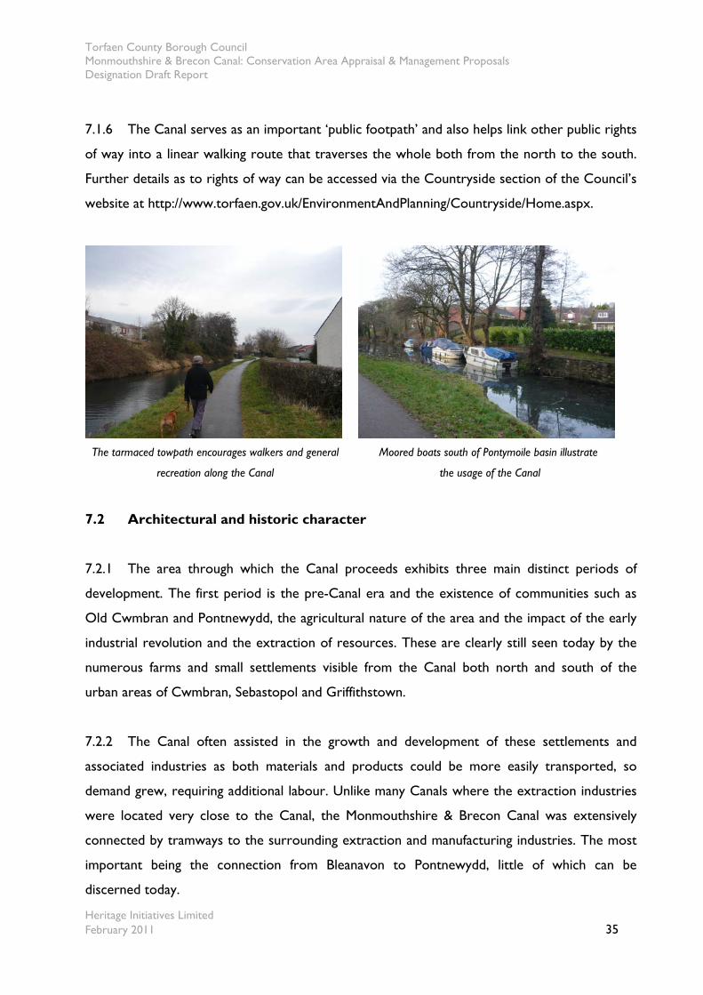
The tarmaced towpath encourages walkers and general
recreation along the Canal
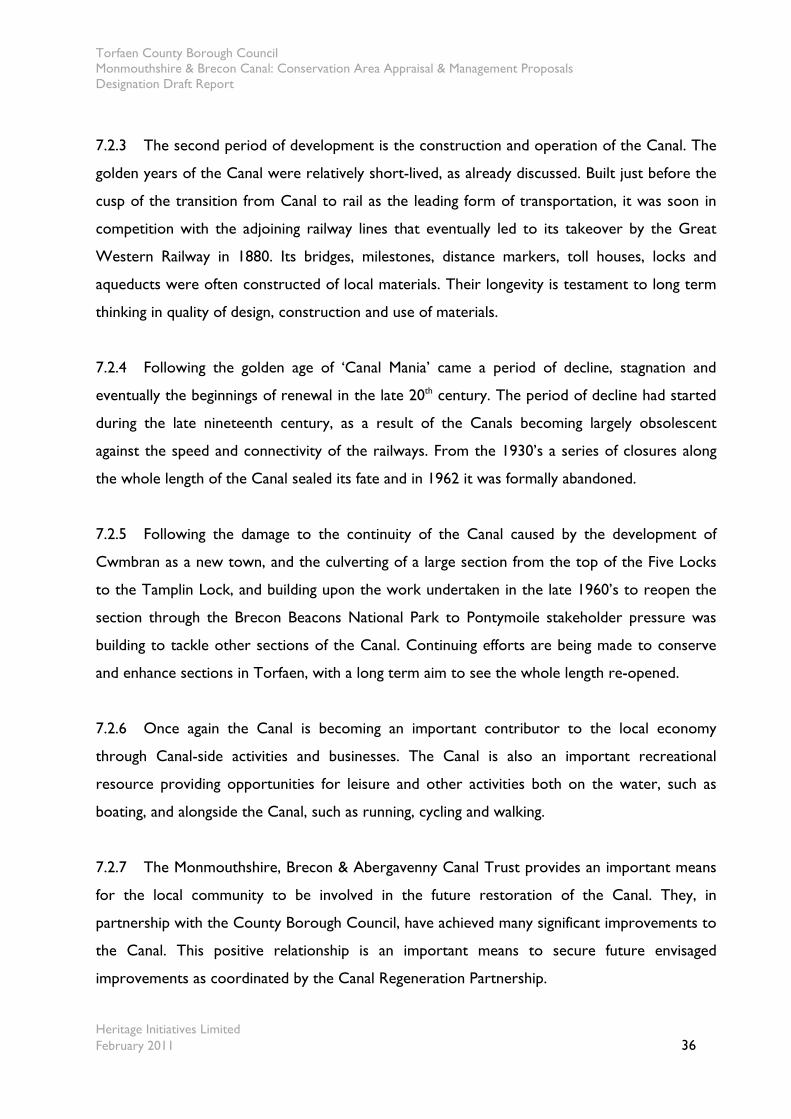
Moored boats south of Pontymoile basin illustrate
the usage of the Canal
7.2 Architectural and historic character
7.2.1 The area through which the Canal proceeds exhibits three main distinct periods of
development. The first period is the pre-Canal era and the existence of communities such as
Old Cwmbran and Pontnewydd, the agricultural nature of the area and the impact of the early
industrial revolution and the extraction of resources. These are clearly still seen today by the
numerous farms and small settlements visible from the Canal both north and south of the
urban areas of Cwmbran, Sebastopol and Griffithstown.
7.2.2 The Canal often assisted in the growth and development of these settlements and
associated industries as both materials and products could be more easily transported, so
demand grew, requiring additional labour. Unlike many Canals where the extraction industries
were located very close to the Canal, the Monmouthshire & Brecon Canal was extensively
connected by tramways to the surrounding extraction and manufacturing industries. The most
important being the connection from Bleanavon to Pontnewydd, little of which can be
discerned today.
Torfaen County Borough Council Monmouthshire & Brecon Canal: Conservation Area Appraisal & Management Proposals Designation Draft Report
Heritage Initiatives Limited February 2011 36
7.2.3 The second period of development is the construction and operation of the Canal. The
golden years of the Canal were relatively short-lived, as already discussed. Built just before the
cusp of the transition from Canal to rail as the leading form of transportation, it was soon in
competition with the adjoining railway lines that eventually led to its takeover by the Great
Western Railway in 1880. Its bridges, milestones, distance markers, toll houses, locks and
aqueducts were often constructed of local materials. Their longevity is testament to long term
thinking in quality of design, construction and use of materials.
7.2.4 Following the golden age of ‘Canal Mania’ came a period of decline, stagnation and
eventually the beginnings of renewal in the late 20th century. The period of decline had started
during the late nineteenth century, as a result of the Canals becoming largely obsolescent
against the speed and connectivity of the railways. From the 1930’s a series of closures along
the whole length of the Canal sealed its fate and in 1962 it was formally abandoned.
7.2.5 Following the damage to the continuity of the Canal caused by the development of
Cwmbran as a new town, and the culverting of a large section from the top of the Five Locks
to the Tamplin Lock, and building upon the work undertaken in the late 1960’s to reopen the
section through the Brecon Beacons National Park to Pontymoile stakeholder pressure was
building to tackle other sections of the Canal. Continuing efforts are being made to conserve
and enhance sections in Torfaen, with a long term aim to see the whole length re-opened.
7.2.6 Once again the Canal is becoming an important contributor to the local economy
through Canal-side activities and businesses. The Canal is also an important recreational
resource providing opportunities for leisure and other activities both on the water, such as
boating, and alongside the Canal, such as running, cycling and walking.
7.2.7 The Monmouthshire, Brecon & Abergavenny Canal Trust provides an important means
for the local community to be involved in the future restoration of the Canal. They, in
partnership with the County Borough Council, have achieved many significant improvements to
the Canal. This positive relationship is an important means to secure future envisaged
improvements as coordinated by the Canal Regeneration Partnership.
Torfaen County Borough Council Monmouthshire & Brecon Canal: Conservation Area Appraisal & Management Proposals Designation Draft Report
Heritage Initiatives Limited February 2011 37
7.3 Building materials and local details
7.3.1 Through utilising the locally quarried sandstone, either old red or pennant stone for the
construction of the Canal infrastructure the quality and sense of antiquity of the Canal is greatly
enhanced. What was a highly industrialised area, in the vicinity of the Canal in the late
eighteenth and nineteenth centuries, can be barely appreciated today was not for the
interaction with railway lines. The number of surviving bridges and remnants of others serve as
a testament to those earlier days of commerce and industry as the origins of the Canal. The
bridges are constructed of quality sandstone, laid in coursed but rough finished masonry and
bedded in lime that has stood the passage of time and use reasonably well and adds to the
sense of the Canal structure emerging from the landscape rather than being planted within.
Unfortunately, some structures have been repaired with later brickwork and this has affected
their appearance. The colour of the sand stone changes from a recognisably red to purplish
colour. The quality of the Canal’s structures contrast with adjoining field boundaries and
farmsteads, just outside the Canal corridor and are generally have been rendered and painted
white. Surprisingly, there are few tell-tale signs of rope marks on the sides of the arches of the
bridges to indicate their level of former usage, usually associated with Canal structures. The
Canal banks at bridge locations are reinforced with large stone edgings to protect the bank.
Some include cut grooves in the sides of the stone edgings to accommodate stop planks in an
emergency, to prevent the Canal draining itself in the event of a breach, such as the example at
Coed y Gric bridge (number 51). Underneath some bridges large stone setts can be found,
protecting the narrowed towpath from deterioration as a result of intense usage.
7.3.2 In a few circumstances the bridges are only stone sided abutments with metal profile
sheeting, metal barriers or later concrete, sections to take the paths across the Canal. These
are particularly prevalent in urban areas, where considerable pressure to upgrade the road
surface has led to such change. In other circumstances later repairs or reinforcement of the
bridges has taken place in brickwork.
7.3.3 Accommodation bridges, built by the Canal company, along the Torfaen section of the
Canal can be divided into two categories, plain accommodation bridges and modern later
replacements. Many display a common design approach in their general appearance, it only
Torfaen County Borough Council Monmouthshire & Brecon Canal: Conservation Area Appraisal & Management Proposals Designation Draft Report
Heritage Initiatives Limited February 2011 38
becomes clear on closer inspection that many are built to respond to their particular location,
depending on the availability of the building material, their proposed use and the adjoining land
height.
7.3.4 Most sections of the Canal appear to have no discernable edging bar the grass in the
fields, that gently roll into the water’s edge. However, it is likely the towpath side of the Canal
would be reinforced with stone edgings but this is only discernable in a very few areas.
7.3.5 Bricks are another common material used for the construction of buildings in the
vicinity of the Canal, whether in whole or to add architectural detailing such as string courses,
window and door surrounds and walling. This is partly due to the likely cost and difficulty of
working some of the local stones, largely laid in rubble courses. Many brickworks adjoined the
Canal and their impact can be seen across the vicinity of the area in the many brick terraced
properties that overlook the Canal. This followed the discovery of clay as part of coal
extraction at the Porthmawr Colliery near Cwmbran in the mid nineteenth century. With the
growth of housing needs to feed local industrial growth and the demand for workers, the clay
provided two useful products, fire clay to line furnaces and for brick production for housing
construction. Former brickworks in the vicinity of the Canal included the Parfitt Brickworks,
Hanson Fireclay Works at ‘2 Locks’, the GKN works, the Cwmban Brick Company and
Whitehead Hill Brickworks in the vicinity of Ty Coch.
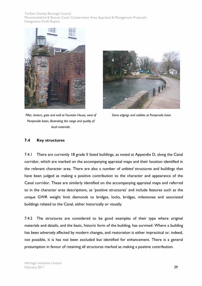
Torfaen County Borough Council Monmouthshire & Brecon Canal: Conservation Area Appraisal & Management Proposals Designation Draft Report
Heritage Initiatives Limited February 2011 39
Pillar, lantern, gate and wall at Fountain House, west of
Pontymoile basin, illustrating the range and quality of
local materials.
Stone edgings and cobbles at Pontymoile basin
7.4 Key structures
7.4.1 There are currently 18 grade II listed buildings, as noted at Appendix D, along the Canal
corridor, which are marked on the accompanying appraisal maps and their location identified in
the relevant character area. There are also a number of unlisted structures and buildings that
have been judged as making a positive contribution to the character and appearance of the
Canal corridor. These are similarly identified on the accompanying appraisal maps and referred
to in the character area descriptions, as ‘positive structures’ and include features such as the
unique GWR weight limit diamonds to bridges, locks, bridges, milestones and associated
buildings related to the Canal, either historically or visually.
7.4.2 The structures are considered to be good examples of their type where original
materials and details, and the basic, historic form of the building, has survived. Where a building
has been adversely affected by modern changes, and restoration is either impractical or, indeed,
not possible, it is has not been excluded but identified for enhancement. There is a general
presumption in favour of retaining all structures marked as making a positive contribution.
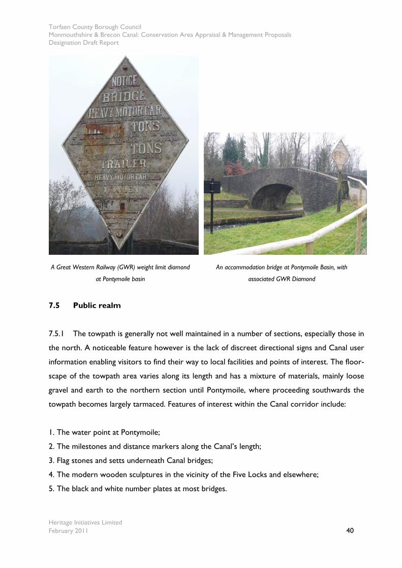
Torfaen County Borough Council Monmouthshire & Brecon Canal: Conservation Area Appraisal & Management Proposals Designation Draft Report
Heritage Initiatives Limited February 2011 40
A Great Western Railway (GWR) weight limit diamond
at Pontymoile basin
An accommodation bridge at Pontymoile Basin, with
associated GWR Diamond
7.5 Public realm
7.5.1 The towpath is generally not well maintained in a number of sections, especially those in
the north. A noticeable feature however is the lack of discreet directional signs and Canal user
information enabling visitors to find their way to local facilities and points of interest. The floor-
scape of the towpath area varies along its length and has a mixture of materials, mainly loose
gravel and earth to the northern section until Pontymoile, where proceeding southwards the
towpath becomes largely tarmaced. Features of interest within the Canal corridor include:
1. The water point at Pontymoile;
2. The milestones and distance markers along the Canal’s length;
3. Flag stones and setts underneath Canal bridges;
4. The modern wooden sculptures in the vicinity of the Five Locks and elsewhere;
5. The black and white number plates at most bridges.
Torfaen County Borough Council Monmouthshire & Brecon Canal: Conservation Area Appraisal & Management Proposals Designation Draft Report
Heritage Initiatives Limited February 2011 41
7.6 Green spaces, trees, wildlife and other natural elements
7.6.1 There are a number of green spaces within the Canal corridor, with many being
indistinct from one another in appearance. In rural areas the Canal is dominated by surrounding
pastureland, enhancing the Canal’s setting. Rushes line the banks along certain stretches of the
Canal, further enriching otherwise featureless open water, although in some cases due to
culverting and lack of use the rushes have grown across the width and long lengths of the
Canal, creating an air of abandonment.
7.6.2 Trees, hedgerows and other natural and intentional Canal-side planting are a vital
characteristic of the Canal corridor. They provide a haven for wildlife, enhance the setting of
the Canal and perform an important role in screening visually intrusive, usually modern,
developments. A number of differing species of tree were noted during the survey of the Canal
corridor. All those sections of woodland and individual trees along the Canal or providing a
backdrop to it, as marked on the appraisal maps, are not protected and would clearly benefit
from inclusion within any designated Conservation Area.
7.6.3 The boundary to the Canal towpath is characterised by a hedgerow in various states of
maintenance and condition. Despite its restricted depth it can normally perform as an effective
visual rather than auditory barrier to adjoining areas that would otherwise adversely affect the
special interest of the Canal. The planting on the opposite, inaccessible side of the Canal is
often less consistent. These hedges, and other significant trees or tree groups, are also marked
on the appraisal maps. However, the lack of a specific reference does not imply that a hedge,
tree or group of either is not of value. As a result it is advisable to contact the relevant Council
service to discuss the matter further, prior to undertaking any work.
7.6.4 The Canal is a haven for wildlife in all seasons, notably herons, ducks and moorhens but
also many hedgerow birds. It is lined on one side or the other with some form of hedgerow or
trees and thereby forms a formal green corridor through both the urban and rural areas it
traverses. The importance of the Canal as a strategic wildlife corridor and in particular as
habitat for many protected species should not be underestimated. The interim ecological
report for the Canal reporting findings up to 31st March 2008 undertaken by the Council
Torfaen County Borough Council Monmouthshire & Brecon Canal: Conservation Area Appraisal & Management Proposals Designation Draft Report
Heritage Initiatives Limited February 2011 42
identified 8 bat species throughout the study area, with otters and white clawed crayfish along
the Torfaen section, and badgers in the vicinity of Llantarman.
7.7 Character areas
7.7.1 The Monmouthshire & Brecon Canal corridor can be divided into nine separate
character areas that reflect the changes in appearance of the Canal and its immediate
surroundings along its 6.3 mile (10.1 km) course through the County Borough. The nine
character areas are divided into 27 maps, illustrated at Appendix A. These character areas are:
1. Jockey Bridge to Pontypool Road Bridge (Map No.’s 1-2);
2. Pontypool Road Bridge to Coed y Gric Bridge (Map No.’s 2-4);
3. Coed y Gric Bridge to Griffithstown Junior School (Map No.’s 4-7);
4. Griffithstown Junior School to Soloman’s Bridge (Map No.’s 7-9);
5. Soloman’s Bridge to the Mooring Basin at 5 Locks (Map No.’s 9-11);
6. Mooring Basin at 5 Locks to Pontnewydd Gardens (Map No.’s 12-13);
7. Pontnewydd Gardens to Witt Bridge Girder (Map No.’s 13-18);
8. Witt Bridge Girder to Ty Coch Lane Bridge (Map No.’s 19-22);
9. Ty Coch Lane Bridge to the Newport Council boundary (Map No.’s 22-27).
Character Area No. 1 Jockey Bridge to Pontypool Road Bridge (Map No.’s 1-2)
7.7.3 Character Area No.1 forms the beginning of the Canal where it passes from the rural
to the urban fringe, and demonstrates the age, style and materials characteristic of the Canal
corridor. Many Canal associated structures such as mileposts and other detailed below relate
positive to the character and appearance of the Canal corridor. The Canal is bounded by a
hedgerow initially to the towpath side and intermittent tree cover to the offside bank before
entering into a deep cutting where trees provide an overhanging canopy. This green coverage
provides an important feature of the Canal’s character and appearance. Views are more open
to the towpath side across pasture initially to the east before passing into a deep cutting, while
to the offside suburban housing provides the backdrop to the Canal.
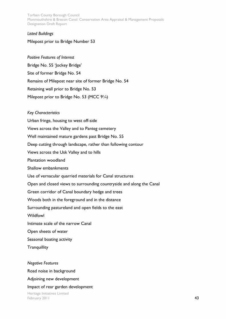
Torfaen County Borough Council Monmouthshire & Brecon Canal: Conservation Area Appraisal & Management Proposals Designation Draft Report
Heritage Initiatives Limited February 2011 43
Listed Buildings
Milepost prior to Bridge Number 53
Positive Features of Interest
Bridge No. 55 ‘Jockey Bridge’
Site of former Bridge No. 54
Remains of Milepost near site of former Bridge No. 54
Retaining wall prior to Bridge No. 53
Milepost prior to Bridge No. 53 (MCC 9¼)
Key Characteristics
Urban fringe, housing to west off-side
Views across the Valley and to Panteg cemetery
Well maintained mature gardens past Bridge No. 55
Deep cutting through landscape, rather than following contour
Views across the Usk Valley and to hills
Plantation woodland
Shallow embankments
Use of vernacular quarried materials for Canal structures
Open and closed views to surrounding countryside and along the Canal
Green corridor of Canal boundary hedge and trees
Woods both in the foreground and in the distance
Surrounding pastureland and open fields to the east
Wildfowl
Intimate scale of the narrow Canal
Open sheets of water
Seasonal boating activity
Tranquillity
Negative Features
Road noise in background
Adjoining new development
Impact of rear garden development
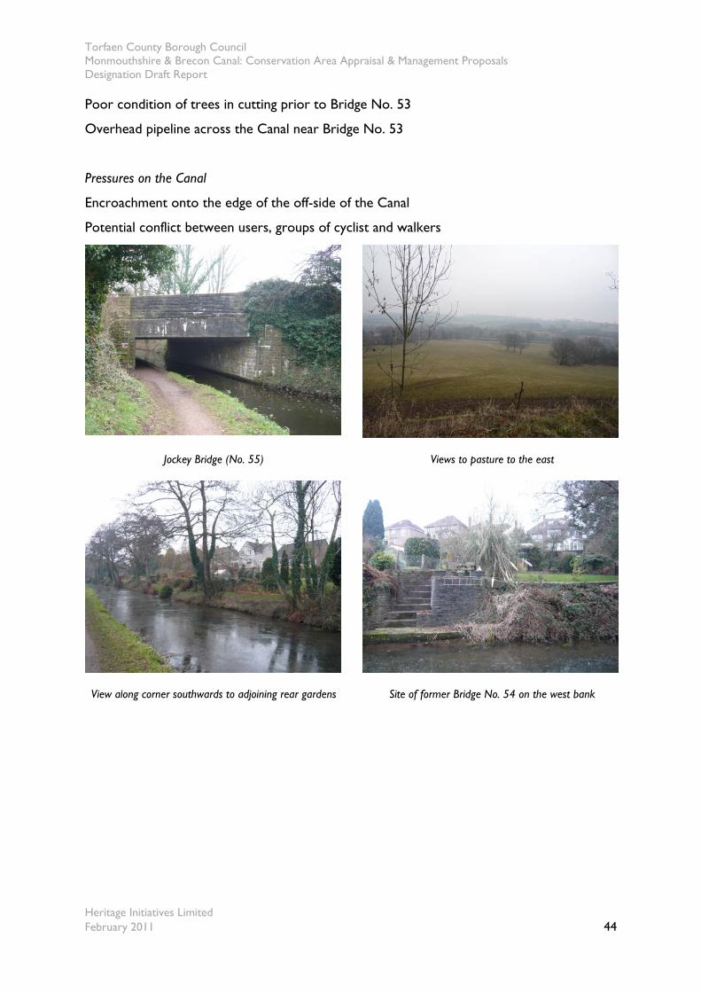
Torfaen County Borough Council Monmouthshire & Brecon Canal: Conservation Area Appraisal & Management Proposals Designation Draft Report
Heritage Initiatives Limited February 2011 44
Poor condition of trees in cutting prior to Bridge No. 53
Overhead pipeline across the Canal near Bridge No. 53
Pressures on the Canal
Encroachment onto the edge of the off-side of the Canal
Potential conflict between users, groups of cyclist and walkers
Jockey Bridge (No. 55) Views to pasture to the east
View along corner southwards to adjoining rear gardens Site of former Bridge No. 54 on the west bank
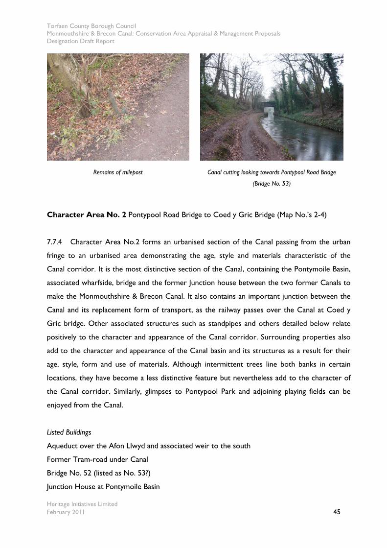
Torfaen County Borough Council Monmouthshire & Brecon Canal: Conservation Area Appraisal & Management Proposals Designation Draft Report
Heritage Initiatives Limited February 2011 45
Remains of milepost Canal cutting looking towards Pontypool Road Bridge
(Bridge No. 53)
Character Area No. 2 Pontypool Road Bridge to Coed y Gric Bridge (Map No.’s 2-4)
7.7.4 Character Area No.2 forms an urbanised section of the Canal passing from the urban
fringe to an urbanised area demonstrating the age, style and materials characteristic of the
Canal corridor. It is the most distinctive section of the Canal, containing the Pontymoile Basin,
associated wharfside, bridge and the former Junction house between the two former Canals to
make the Monmouthshire & Brecon Canal. It also contains an important junction between the
Canal and its replacement form of transport, as the railway passes over the Canal at Coed y
Gric bridge. Other associated structures such as standpipes and others detailed below relate
positively to the character and appearance of the Canal corridor. Surrounding properties also
add to the character and appearance of the Canal basin and its structures as a result for their
age, style, form and use of materials. Although intermittent trees line both banks in certain
locations, they have become a less distinctive feature but nevertheless add to the character of
the Canal corridor. Similarly, glimpses to Pontypool Park and adjoining playing fields can be
enjoyed from the Canal.
Listed Buildings
Aqueduct over the Afon Llwyd and associated weir to the south
Former Tram-road under Canal
Bridge No. 52 (listed as No. 53?)
Junction House at Pontymoile Basin
Torfaen County Borough Council Monmouthshire & Brecon Canal: Conservation Area Appraisal & Management Proposals Designation Draft Report
Heritage Initiatives Limited February 2011 46
Former Railway Viaduct at Coed y Gric
Bridge No. 51 at Coed y Gric
Positive Features of Interest
Pontypool road bridge No. 53
BW Standpipe at Pontymoile Basin
Stop Planks at Pontymoile Basin
Stone edgings at Pontymoile Basin
Fountain House north west of Pontymoile Basin
Former warehouse building at Pontymoile Basin
Key Characteristics
Groups of trees atop embankments screen views of adjoining modern housing
The activities and boats moored at Pontymoile Basin
Tarmaced towpath commences southwards at the Junction House
Two / three storey residential buildings, many of brick construction
Modern industrial developments often of a large scale and poor quality detailing
Tree cover and canopy creates an enclosed feel
Deep cutting through landscape, rather than following contour
Views across to Pontypool Hill
Adjoining woodland
Shallow embankments
Use of vernacular quarried materials for Canal structures
Open and closed views to surrounding land and along the Canal
Green corridor of Canal boundary hedge and trees
Woods both in the foreground
Wildfowl
Intimate scale of the narrow Canal
Open sheets of water
Seasonal boating activity
Negative Features
Road noise

Torfaen County Borough Council Monmouthshire & Brecon Canal: Conservation Area Appraisal & Management Proposals Designation Draft Report
Heritage Initiatives Limited February 2011 47
Wooden fence to Junction House
Overhead pipeline north of Coed y Gric Bridge
Pressures on the Canal
Quality and style of adjoining development
The listed Aqueduct and Weir over the Afon Llwyd Looking south along the Canal towards Pontymoile Basin
Bridge No. 52 at Pontymoile Basin including GWR
diamond
Listed Junction House on towpath side of the Canal
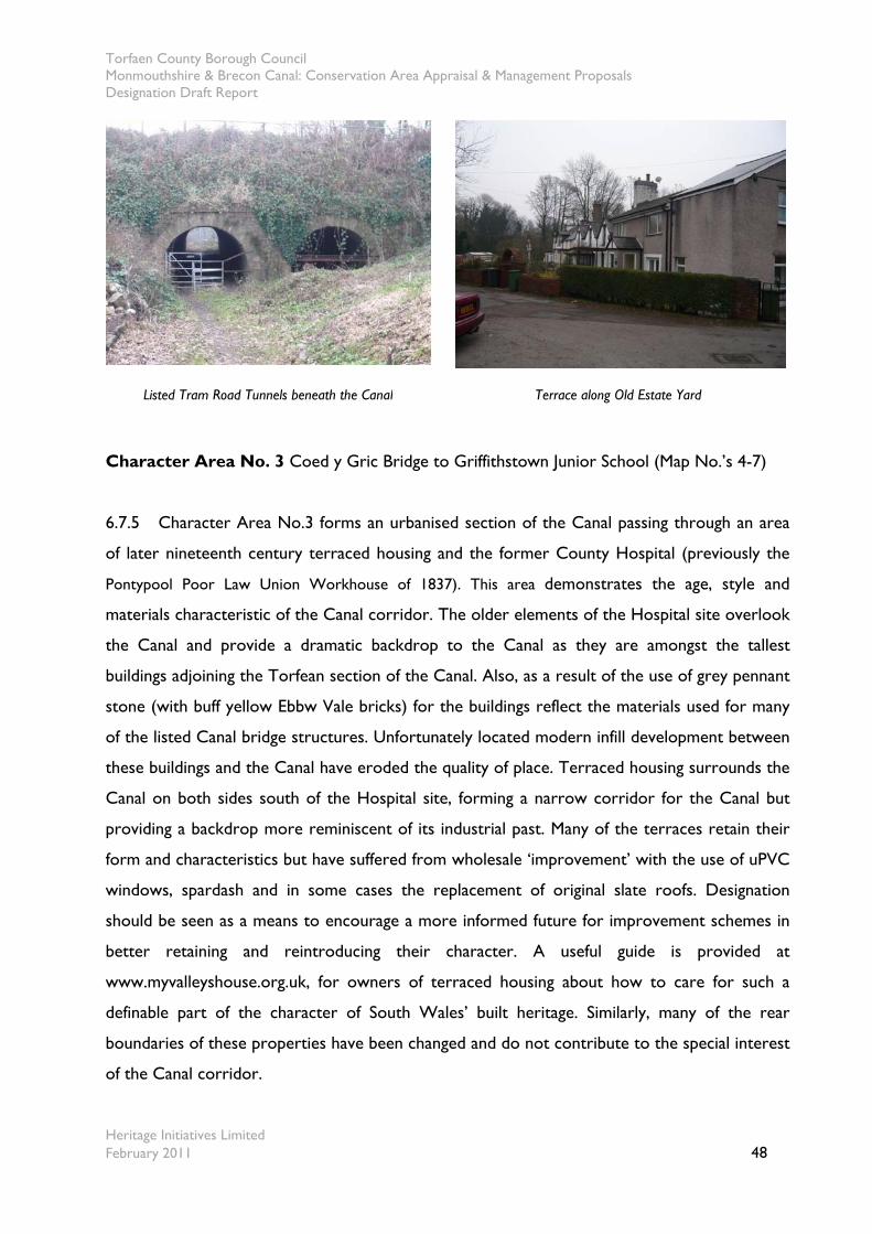
Torfaen County Borough Council Monmouthshire & Brecon Canal: Conservation Area Appraisal & Management Proposals Designation Draft Report
Heritage Initiatives Limited February 2011 48
Listed Tram Road Tunnels beneath the Canal Terrace along Old Estate Yard
Character Area No. 3 Coed y Gric Bridge to Griffithstown Junior School (Map No.’s 4-7)
6.7.5 Character Area No.3 forms an urbanised section of the Canal passing through an area
of later nineteenth century terraced housing and the former County Hospital (previously the
Pontypool Poor Law Union Workhouse of 1837). This area demonstrates the age, style and
materials characteristic of the Canal corridor. The older elements of the Hospital site overlook
the Canal and provide a dramatic backdrop to the Canal as they are amongst the tallest
buildings adjoining the Torfean section of the Canal. Also, as a result of the use of grey pennant
stone (with buff yellow Ebbw Vale bricks) for the buildings reflect the materials used for many
of the listed Canal bridge structures. Unfortunately located modern infill development between
these buildings and the Canal have eroded the quality of place. Terraced housing surrounds the
Canal on both sides south of the Hospital site, forming a narrow corridor for the Canal but
providing a backdrop more reminiscent of its industrial past. Many of the terraces retain their
form and characteristics but have suffered from wholesale ‘improvement’ with the use of uPVC
windows, spardash and in some cases the replacement of original slate roofs. Designation
should be seen as a means to encourage a more informed future for improvement schemes in
better retaining and reintroducing their character. A useful guide is provided at
www.myvalleyshouse.org.uk, for owners of terraced housing about how to care for such a
definable part of the character of South Wales’ built heritage. Similarly, many of the rear
boundaries of these properties have been changed and do not contribute to the special interest
of the Canal corridor.
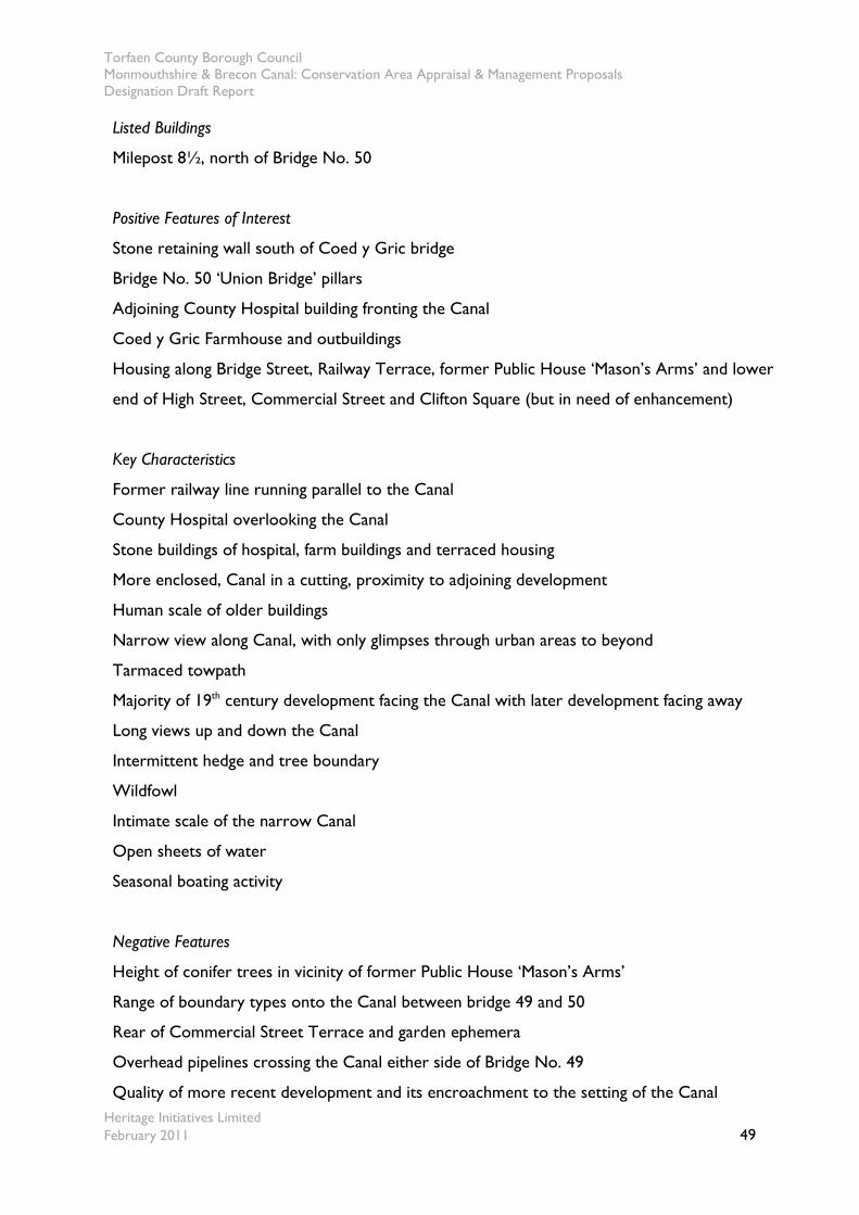
Torfaen County Borough Council Monmouthshire & Brecon Canal: Conservation Area Appraisal & Management Proposals Designation Draft Report
Heritage Initiatives Limited February 2011 49
Listed Buildings
Milepost 8½, north of Bridge No. 50
Positive Features of Interest
Stone retaining wall south of Coed y Gric bridge
Bridge No. 50 ‘Union Bridge’ pillars
Adjoining County Hospital building fronting the Canal
Coed y Gric Farmhouse and outbuildings
Housing along Bridge Street, Railway Terrace, former Public House ‘Mason’s Arms’ and lower
end of High Street, Commercial Street and Clifton Square (but in need of enhancement)
Key Characteristics
Former railway line running parallel to the Canal
County Hospital overlooking the Canal
Stone buildings of hospital, farm buildings and terraced housing
More enclosed, Canal in a cutting, proximity to adjoining development
Human scale of older buildings
Narrow view along Canal, with only glimpses through urban areas to beyond
Tarmaced towpath
Majority of 19th century development facing the Canal with later development facing away
Long views up and down the Canal
Intermittent hedge and tree boundary
Wildfowl
Intimate scale of the narrow Canal
Open sheets of water
Seasonal boating activity
Negative Features
Height of conifer trees in vicinity of former Public House ‘Mason’s Arms’
Range of boundary types onto the Canal between bridge 49 and 50
Rear of Commercial Street Terrace and garden ephemera
Overhead pipelines crossing the Canal either side of Bridge No. 49
Quality of more recent development and its encroachment to the setting of the Canal
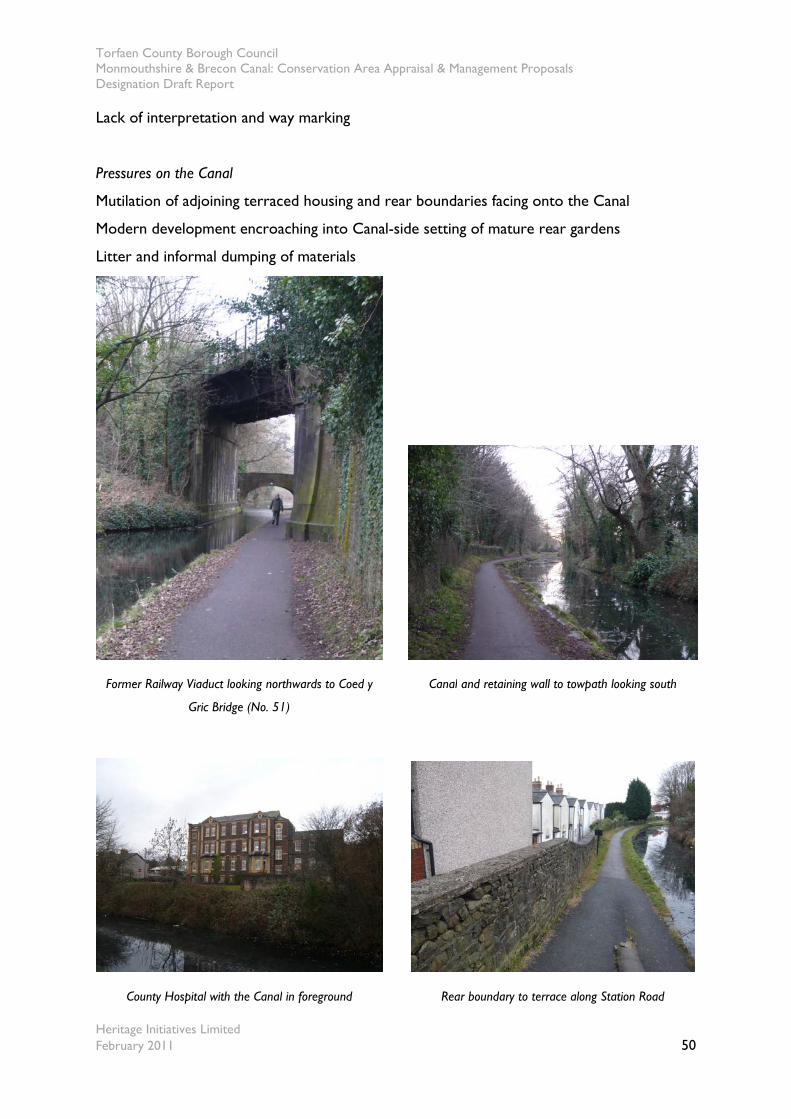
Torfaen County Borough Council Monmouthshire & Brecon Canal: Conservation Area Appraisal & Management Proposals Designation Draft Report
Heritage Initiatives Limited February 2011 50
Lack of interpretation and way marking
Pressures on the Canal
Mutilation of adjoining terraced housing and rear boundaries facing onto the Canal
Modern development encroaching into Canal-side setting of mature rear gardens
Litter and informal dumping of materials
Former Railway Viaduct looking northwards to Coed y
Gric Bridge (No. 51)
Canal and retaining wall to towpath looking south
County Hospital with the Canal in foreground Rear boundary to terrace along Station Road

Torfaen County Borough Council Monmouthshire & Brecon Canal: Conservation Area Appraisal & Management Proposals Designation Draft Report
Heritage Initiatives Limited February 2011 51
Terraced housing along Bridge Street Poor maintenance of trees leads to visual
domination of the Canal
Character Area No. 4 Griffithstown Junior School to Solomon’s Bridge (Map No.’s 7-9)
7.7.6 Character Area No.4 forms a section of the Canal passing from the suburban to the
urban fringe, and demonstrates the age, style and materials characteristic of the Canal corridor.
Many Canal associated structures such as mileposts and other detailed below relate positively
to the character and appearance of the Canal corridor. The Canal is bounded by a hedgerow to
the towpath side and intermittent tree cover to the offside bank in certain locations before
entering into an area opposite the Open Hearth public house, where trees provide an
overhanging tree canopy. This green coverage provides an important feature of the Canal’s
character and appearance. A number of playing fields form the boundary to the off side of the
Canal, contributing positively to its character. The quality and range of adjoining development is
demonstrated by further terraced housing, public houses and churches alongside the Canal’s
route adding interest and definition to the Canal.
Listed Buildings
Milepost ‘8 miles from Porter Street Lock’
Bridge No. 47 ‘Solomon’s Bridge’
Positive Features of Interest
Chestnut Cottages
Open Hearth Public House
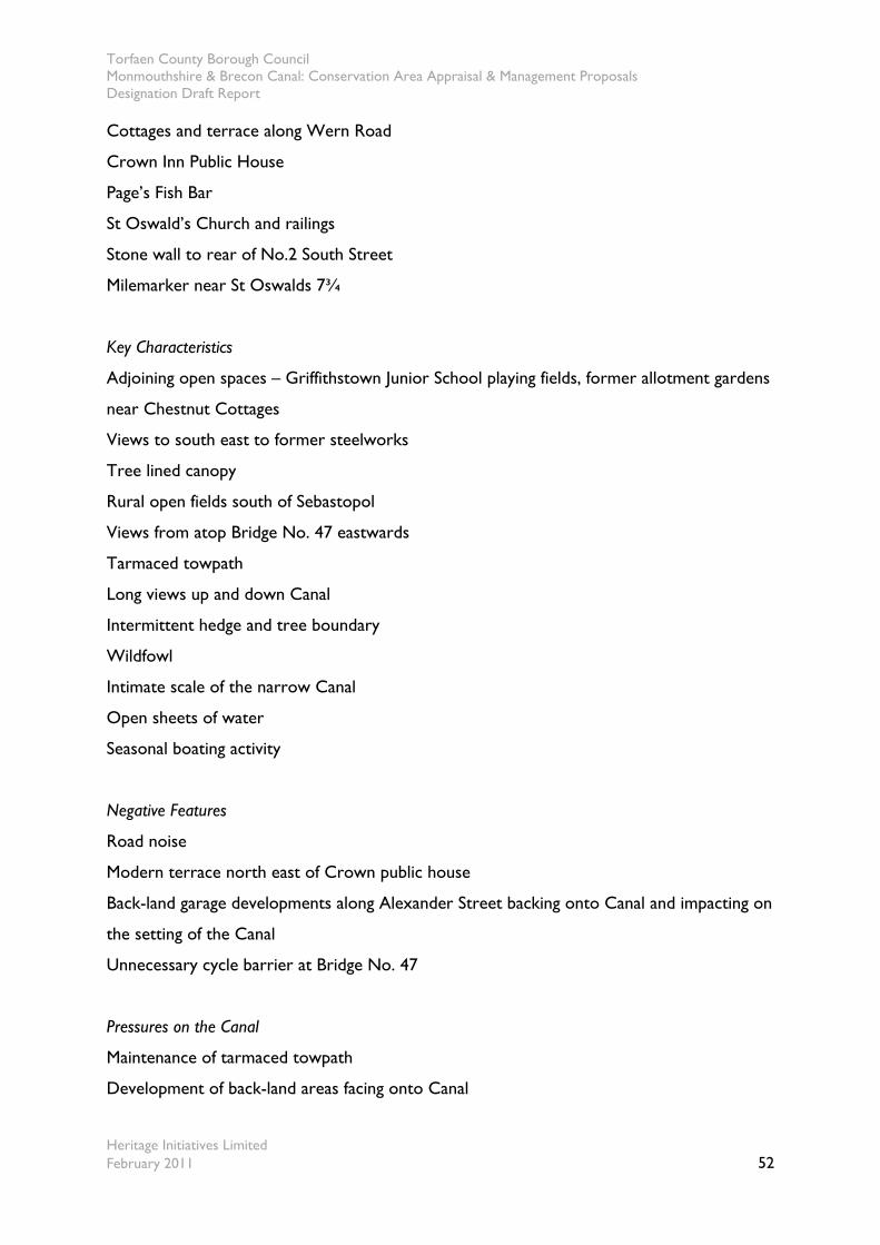
Torfaen County Borough Council Monmouthshire & Brecon Canal: Conservation Area Appraisal & Management Proposals Designation Draft Report
Heritage Initiatives Limited February 2011 52
Cottages and terrace along Wern Road
Crown Inn Public House
Page’s Fish Bar
St Oswald’s Church and railings
Stone wall to rear of No.2 South Street
Milemarker near St Oswalds 7¾
Key Characteristics
Adjoining open spaces – Griffithstown Junior School playing fields, former allotment gardens
near Chestnut Cottages
Views to south east to former steelworks
Tree lined canopy
Rural open fields south of Sebastopol
Views from atop Bridge No. 47 eastwards
Tarmaced towpath
Long views up and down Canal
Intermittent hedge and tree boundary
Wildfowl
Intimate scale of the narrow Canal
Open sheets of water
Seasonal boating activity
Negative Features
Road noise
Modern terrace north east of Crown public house
Back-land garage developments along Alexander Street backing onto Canal and impacting on
the setting of the Canal
Unnecessary cycle barrier at Bridge No. 47
Pressures on the Canal
Maintenance of tarmaced towpath
Development of back-land areas facing onto Canal

Torfaen County Borough Council Monmouthshire & Brecon Canal: Conservation Area Appraisal & Management Proposals Designation Draft Report
Heritage Initiatives Limited February 2011 53
Milepost near the Open Hearth Public House Properties adjoining the Canal along Wern Road
7¾ mile marker adjacent to St Oswald’s Church St Oswald’s Church and railings adjoin the Canal
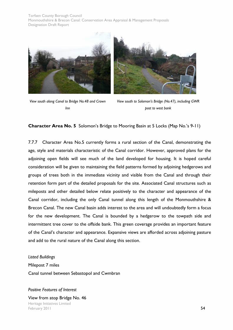
Torfaen County Borough Council Monmouthshire & Brecon Canal: Conservation Area Appraisal & Management Proposals Designation Draft Report
Heritage Initiatives Limited February 2011 54
View south along Canal to Bridge No.48 and Crown
Inn
View south to Solomon’s Bridge (No.47), including GWR
post to west bank
Character Area No. 5 Solomon’s Bridge to Mooring Basin at 5 Locks (Map No.’s 9-11)
7.7.7 Character Area No.5 currently forms a rural section of the Canal, demonstrating the
age, style and materials characteristic of the Canal corridor. However, approved plans for the
adjoining open fields will see much of the land developed for housing. It is hoped careful
consideration will be given to maintaining the field patterns formed by adjoining hedgerows and
groups of trees both in the immediate vicinity and visible from the Canal and through their
retention form part of the detailed proposals for the site. Associated Canal structures such as
mileposts and other detailed below relate positively to the character and appearance of the
Canal corridor, including the only Canal tunnel along this length of the Monmouthshire &
Brecon Canal. The new Canal basin adds interest to the area and will undoubtedly form a focus
for the new development. The Canal is bounded by a hedgerow to the towpath side and
intermittent tree cover to the offside bank. This green coverage provides an important feature
of the Canal’s character and appearance. Expansive views are afforded across adjoining pasture
and add to the rural nature of the Canal along this section.
Listed Buildings
Milepost 7 miles
Canal tunnel between Sebastopol and Cwmbran
Positive Features of Interest
View from atop Bridge No. 46
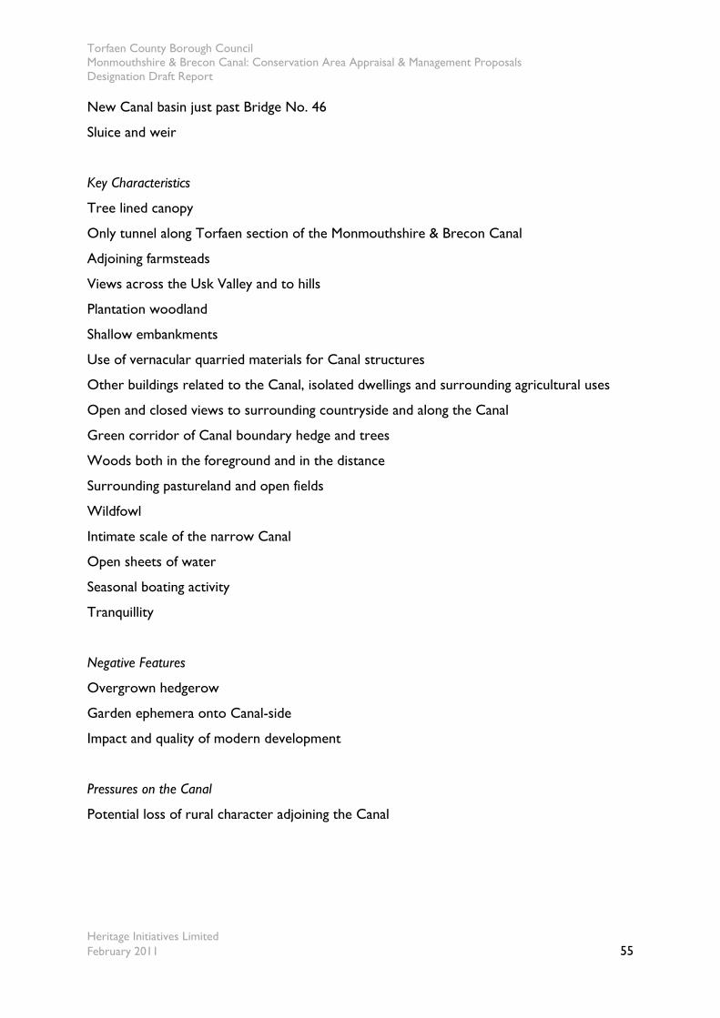
Torfaen County Borough Council Monmouthshire & Brecon Canal: Conservation Area Appraisal & Management Proposals Designation Draft Report
Heritage Initiatives Limited February 2011 55
New Canal basin just past Bridge No. 46
Sluice and weir
Key Characteristics
Tree lined canopy
Only tunnel along Torfaen section of the Monmouthshire & Brecon Canal
Adjoining farmsteads
Views across the Usk Valley and to hills
Plantation woodland
Shallow embankments
Use of vernacular quarried materials for Canal structures
Other buildings related to the Canal, isolated dwellings and surrounding agricultural uses
Open and closed views to surrounding countryside and along the Canal
Green corridor of Canal boundary hedge and trees
Woods both in the foreground and in the distance
Surrounding pastureland and open fields
Wildfowl
Intimate scale of the narrow Canal
Open sheets of water
Seasonal boating activity
Tranquillity
Negative Features
Overgrown hedgerow
Garden ephemera onto Canal-side
Impact and quality of modern development
Pressures on the Canal
Potential loss of rural character adjoining the Canal
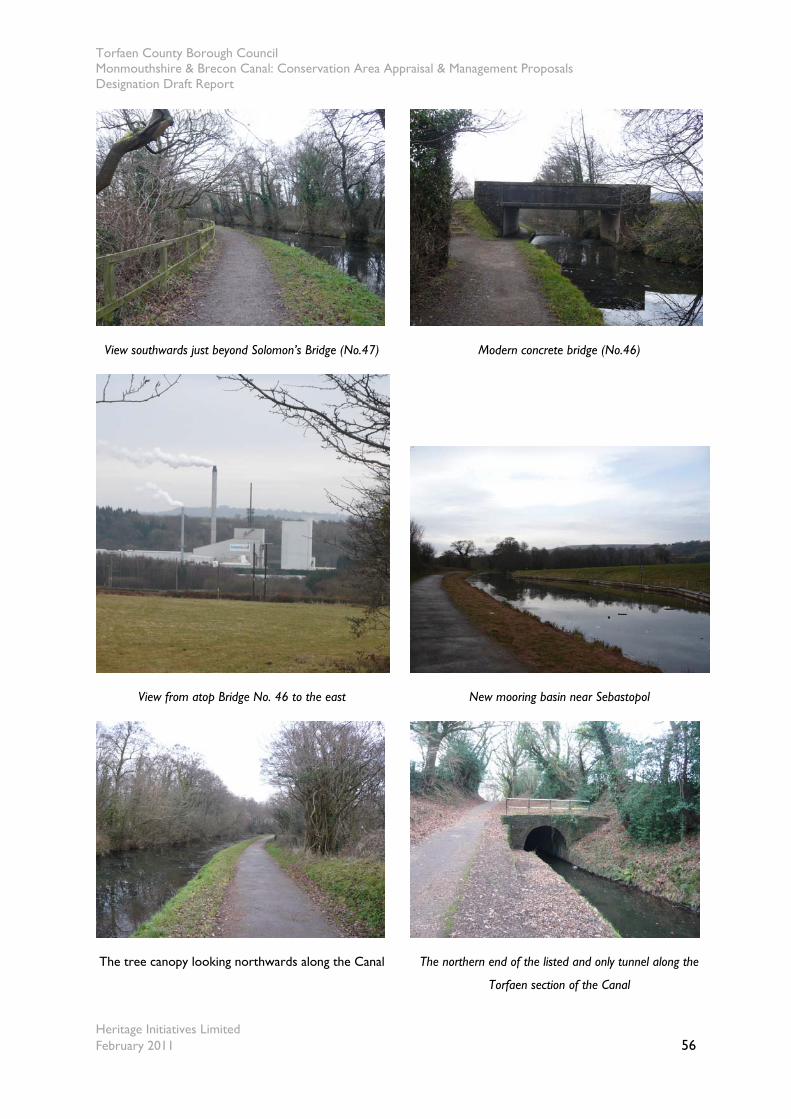
Torfaen County Borough Council Monmouthshire & Brecon Canal: Conservation Area Appraisal & Management Proposals Designation Draft Report
Heritage Initiatives Limited February 2011 56
View southwards just beyond Solomon’s Bridge (No.47) Modern concrete bridge (No.46)
View from atop Bridge No. 46 to the east New mooring basin near Sebastopol
The tree canopy looking northwards along the Canal The northern end of the listed and only tunnel along the
Torfaen section of the Canal

Torfaen County Borough Council Monmouthshire & Brecon Canal: Conservation Area Appraisal & Management Proposals Designation Draft Report
Heritage Initiatives Limited February 2011 57
Character Area No. 6 Mooring Basin at 5 Locks to Pontnewydd Gardens (Map No.’s 12-13)
7.7.8 Character Area No.6 forms an urbanised section of the Canal passing through
Cwmbran, containing the ‘5 Locks’ flight and their associated side ponds. The Canal basin
marks the current navigable end of the Canal before it becomes culverted in a number of
locations along its passage through Cwmbran. The route of the Canal is still discernable
although the Five Locks Road, that now slices the Canal apart from the section of locks. A
number of side ponds exist although these are largely dewatered and increasingly being eroded
by dumped material, small scale encroachment of sheds and other informal structures. Beyond
the descent of the locks and the passage of the Canal over the Blaen Bran aqueduct, the Canal
opens into an area dominated by the hillside to the south and the playing fields at the base of
the embankment shielded by tree growth to the east. The tree growth in this area becomes
increasingly deep forming a canopy over the Canal before opening up again in the vicinity of the
Pontnewydd recreation ground and the site of the former Pontnewydd Gardens Hotel.
Listed Buildings
Culvert taking Blaen Bran beneath the Canal
Positive Features of Interest
New Canal basin prior to ‘Five Locks’
Former Lock Keeper’s cottage
Stone edgings to Canal and mooring basin
Modern timber boat sculpture
Railings adjoin top lock
Flight of locks with associated weirs, sluices and side-ponds
Historic former location of the Cross Keys Inn
Key Characteristics
Change in level
Sinuous route
Views to hillside and properties along Mount Pleasant Road
Views across playing fields and recreational ground
Tree canopy
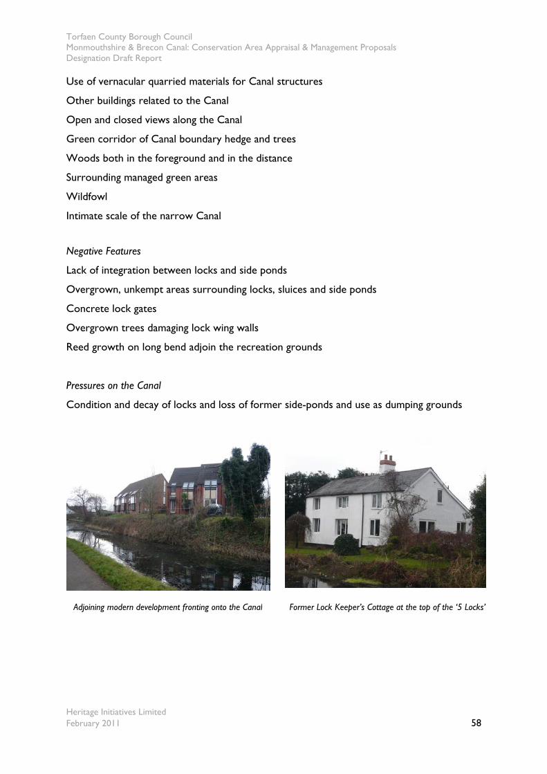
Torfaen County Borough Council Monmouthshire & Brecon Canal: Conservation Area Appraisal & Management Proposals Designation Draft Report
Heritage Initiatives Limited February 2011 58
Use of vernacular quarried materials for Canal structures
Other buildings related to the Canal
Open and closed views along the Canal
Green corridor of Canal boundary hedge and trees
Woods both in the foreground and in the distance
Surrounding managed green areas
Wildfowl
Intimate scale of the narrow Canal
Negative Features
Lack of integration between locks and side ponds
Overgrown, unkempt areas surrounding locks, sluices and side ponds
Concrete lock gates
Overgrown trees damaging lock wing walls
Reed growth on long bend adjoin the recreation grounds
Pressures on the Canal
Condition and decay of locks and loss of former side-ponds and use as dumping grounds
Adjoining modern development fronting onto the Canal Former Lock Keeper’s Cottage at the top of the ‘5 Locks’
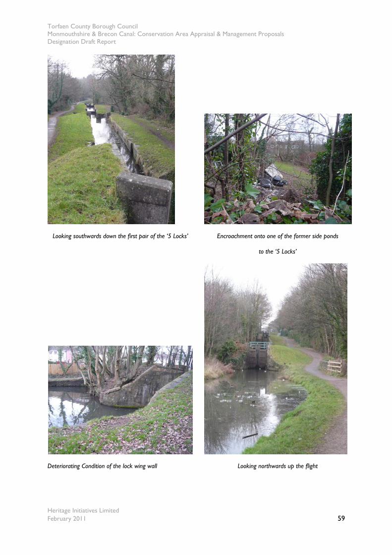
Torfaen County Borough Council Monmouthshire & Brecon Canal: Conservation Area Appraisal & Management Proposals Designation Draft Report
Heritage Initiatives Limited February 2011 59
Looking southwards down the first pair of the ‘5 Locks’ Encroachment onto one of the former side ponds
to the ‘5 Locks’
Deteriorating Condition of the lock wing wall Looking northwards up the flight
Torfaen County Borough Council Monmouthshire & Brecon Canal: Conservation Area Appraisal & Management Proposals Designation Draft Report
Heritage Initiatives Limited February 2011 60
Character Area No. 7 Pontnewydd Gardens to Witt Bridge Girder (Map No.’s 13-18)
7.7.9 This is an urbanised section of the Canal and contains the area most in need of
thorough environmental enhancement. It contains the former lock area in the vicinity of the
Old Bridgend End Inn. The properties in this location were built both prior to and as a result of
the arrival of the Canal. Although many have altered exteriors they retain their historic form,
where sufficient interest remains to consider opportunities to reintroduce lost architectural
details. The Canal once again becomes culverted before descending through three further locks
before becoming culverted but re-emerging prior to disappearing just past Clomendy Bridge
(No.42). The route of the Canal is as important along this section, even though it has been
reduced to effectively serving as a water feature rather than a Canal. In certain sections the
townscape immediately surrounding its route is fragmented and is neither integrated with
adjacent land. Other buildings adjoining the Canal do relate to its passage and use but these
have often been unsympathetically altered and decision makers have not had full regard to this
impact. Newer development adjoining the Canal has visually impinged as a result of its location
in relation to the Canal, as a result of its scale and form and use of materials. Consideration will
need to carefully given as to how this can be avoided in the future if the Canal is to play the
positive role the Council aims to achieve.
Listed Buildings
None
Positive Features of Interest
3 Northern most locks with weirs and side-ponds
Sites of former ponds
Lock house on Greenhill Road
Stone edgings to locks
Stone retaining wall to retail park
Buildings in the vicinity of the Old Bridgend Inn
Site of former clay pit and brickworks
Properties along Commercial Street
Timber Anvil and other sculptures
Way marker for cycle route No. 46
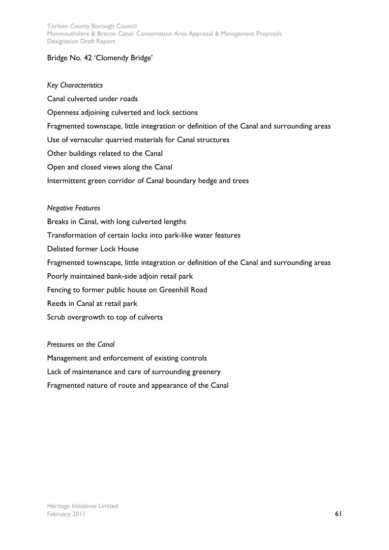
Torfaen County Borough Council Monmouthshire & Brecon Canal: Conservation Area Appraisal & Management Proposals Designation Draft Report
Heritage Initiatives Limited February 2011 61
Bridge No. 42 ‘Clomendy Bridge’
Key Characteristics
Canal culverted under roads
Openness adjoining culverted and lock sections
Fragmented townscape, little integration or definition of the Canal and surrounding areas
Use of vernacular quarried materials for Canal structures
Other buildings related to the Canal
Open and closed views along the Canal
Intermittent green corridor of Canal boundary hedge and trees
Negative Features
Breaks in Canal, with long culverted lengths
Transformation of certain locks into park-like water features
Delisted former Lock House
Fragmented townscape, little integration or definition of the Canal and surrounding areas
Poorly maintained bank-side adjoin retail park
Fencing to former public house on Greenhill Road
Reeds in Canal at retail park
Scrub overgrowth to top of culverts
Pressures on the Canal
Management and enforcement of existing controls
Lack of maintenance and care of surrounding greenery
Fragmented nature of route and appearance of the Canal
Torfaen County Borough Council Monmouthshire & Brecon Canal: Conservation Area Appraisal & Management Proposals Designation Draft Report
Heritage Initiatives Limited February 2011 62
Site of redesigned lock and pond adjacent to Pontnewydd
Recreational Ground
The Old Bridgend Inn and adjoining properties
One of the ‘Three Locks’ with adjacent housing The former Lock Keepers Cottage, delisted due to
inappropriate alterations
Modern positive Canal side sculptures The Canal looking northwards as it passes between the
retail park.
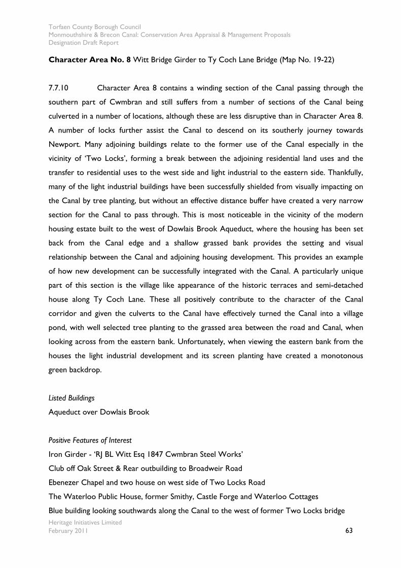
Torfaen County Borough Council Monmouthshire & Brecon Canal: Conservation Area Appraisal & Management Proposals Designation Draft Report
Heritage Initiatives Limited February 2011 63
Character Area No. 8 Witt Bridge Girder to Ty Coch Lane Bridge (Map No. 19-22)
7.7.10 Character Area 8 contains a winding section of the Canal passing through the
southern part of Cwmbran and still suffers from a number of sections of the Canal being
culverted in a number of locations, although these are less disruptive than in Character Area 8.
A number of locks further assist the Canal to descend on its southerly journey towards
Newport. Many adjoining buildings relate to the former use of the Canal especially in the
vicinity of ‘Two Locks’, forming a break between the adjoining residential land uses and the
transfer to residential uses to the west side and light industrial to the eastern side. Thankfully,
many of the light industrial buildings have been successfully shielded from visually impacting on
the Canal by tree planting, but without an effective distance buffer have created a very narrow
section for the Canal to pass through. This is most noticeable in the vicinity of the modern
housing estate built to the west of Dowlais Brook Aqueduct, where the housing has been set
back from the Canal edge and a shallow grassed bank provides the setting and visual
relationship between the Canal and adjoining housing development. This provides an example
of how new development can be successfully integrated with the Canal. A particularly unique
part of this section is the village like appearance of the historic terraces and semi-detached
house along Ty Coch Lane. These all positively contribute to the character of the Canal
corridor and given the culverts to the Canal have effectively turned the Canal into a village
pond, with well selected tree planting to the grassed area between the road and Canal, when
looking across from the eastern bank. Unfortunately, when viewing the eastern bank from the
houses the light industrial development and its screen planting have created a monotonous
green backdrop.
Listed Buildings
Aqueduct over Dowlais Brook
Positive Features of Interest
Iron Girder - ‘RJ BL Witt Esq 1847 Cwmbran Steel Works’
Club off Oak Street & Rear outbuilding to Broadweir Road
Ebenezer Chapel and two house on west side of Two Locks Road
The Waterloo Public House, former Smithy, Castle Forge and Waterloo Cottages
Blue building looking southwards along the Canal to the west of former Two Locks bridge
Torfaen County Borough Council Monmouthshire & Brecon Canal: Conservation Area Appraisal & Management Proposals Designation Draft Report
Heritage Initiatives Limited February 2011 64
Timber ‘Fish’ sculpture adjacent Ty Coch Lane bridge.
Houses along Ty Coch Lane
Key Characteristics
Canal on flat level to both sides
Roads bisect the Canal at numerous points turning the Canal into a seemingly stagnant water
feature
Much adjoining development turns back onto the Canal
Modern development on Gifford Close is well set back and has a successful relationship with
the Canal
Houses along Ty Coch Lane create a ‘village’ like character
Towpath to both sides for long lengths
Top Lock has been restored
Open expanses with few overhanging trees
Adjoining industrial buildings largely screened from the Canal by tree and scrub
Shallow embankments
Use of vernacular quarried materials for Canal structures
Other buildings related to the Canal
Open and closed views to surrounding countryside and along the Canal, especially in the south
Intermittent green corridor of Canal boundary hedge and trees
Woods both in the foreground and in the distance
Surrounding pastureland and open fields
Wildfowl
Intimate scale of the narrow Canal
Open sheets of water
Increasing tranquillity, especially the southern section
Negative Features
Road noise in relation to road bridges passing over the Canal
Angler’s positions between culverted sections
The low quality and poor integration of development along Star Street
Low quality of rear walling and fencing of terraces that back onto the Canal
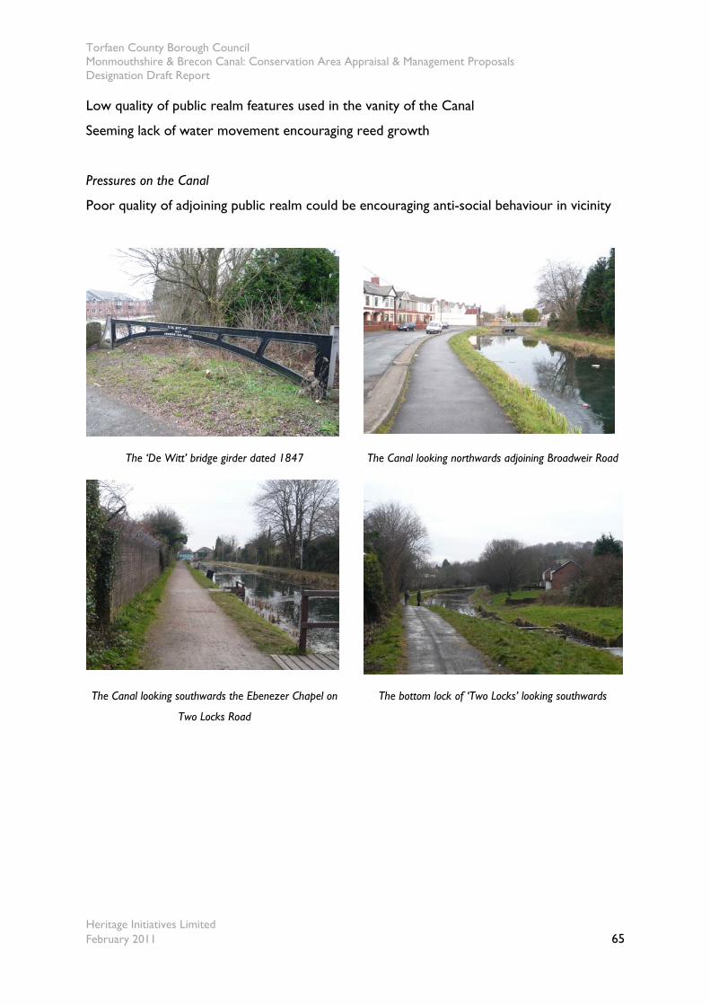
Torfaen County Borough Council Monmouthshire & Brecon Canal: Conservation Area Appraisal & Management Proposals Designation Draft Report
Heritage Initiatives Limited February 2011 65
Low quality of public realm features used in the vanity of the Canal
Seeming lack of water movement encouraging reed growth
Pressures on the Canal
Poor quality of adjoining public realm could be encouraging anti-social behaviour in vicinity
The ‘De Witt’ bridge girder dated 1847 The Canal looking northwards adjoining Broadweir Road
The Canal looking southwards the Ebenezer Chapel on
Two Locks Road
The bottom lock of ‘Two Locks’ looking southwards

Torfaen County Borough Council Monmouthshire & Brecon Canal: Conservation Area Appraisal & Management Proposals Designation Draft Report
Heritage Initiatives Limited February 2011 66
New housing development set back, as the Canal passes
over Dowlais Brook Aqueduct
Properties along Ty Coch Road
Character Area No. 9 Ty Coch Lane Bridge to the Newport boundary (Map No. 22-27)
7.7.11 Character Area No.9 forms a rural the section of the Canal prior to reaching its
southern boundary of the Canal, where it passes to the administrative boundary of Newport
City Council. It is a rural section of the Canal, demonstrating the age, style and materials
characteristic of the Canal corridor. Many of the larger structures such as the bridges are listed
buildings and other associated structures such as mileposts and others detailed below relate
positively to the character and appearance of the Canal corridor. Many of the bridges, atop or
associated lock structures, relate directly to the operational use of the Canal. The Canal is
bounded by a hedgerow to the towpath side and intermittent tree cover to the offside bank. In
many places the hedgerow has become completely overgrown and forms a green barrier to
views across the surrounding pasture. Similarly, a number of tree plantations and woods are
sited along the Canal these provide an important feature of the Canal’s character and
appearance. Expansive views and at other times only glimpses are afforded across adjoining
pasture that adds to the rural setting of the Canal along this section. A few buildings adjoining
the Canal provide definition to the surrounding pasture, many of which were built at a similar
time to the Canal’s arrival.
Listed Buildings
Bridge at Top Lock
Bridge at Rachel’s Lock
Torfaen County Borough Council Monmouthshire & Brecon Canal: Conservation Area Appraisal & Management Proposals Designation Draft Report
Heritage Initiatives Limited February 2011 67
Bridge at Shop Lock
Bridge at Tredegar Lock, including GWR diamond
Bridge at Draper’s Lock
Bridge south of Tamplin Lock
Positive Features of Interest
The various accommodation bridge integrated with locks, their associated over-flow weirs and
side ponds
The lock between Top and Rachel’s Lock & the lock between Rachel’s and Shop Lock
Cider Mill and outbuildings
Key Characteristics
Potentially operational lock gates after final culvert
Listed Canal structures and the accompanying GWR diamonds
Adjoining farmsteads
Views across the Usk Valley and to hills
Plantation woodland
Shallow embankments to west
Turning or winding hole near administrative boundary with Newport City Council
Use of vernacular quarried materials for Canal structures
Other buildings related to the Canal, isolated dwellings, small terraces and surrounding
agricultural uses
Open and closed views to surrounding countryside and along the Canal
Green corridor of Canal boundary hedge and trees
Woods both in the foreground and in the distance
Surrounding pastureland and open fields
Wildfowl
Intimate scale of the narrow Canal
Open sheets of water
Tranquillity
Negative Features
Road noise
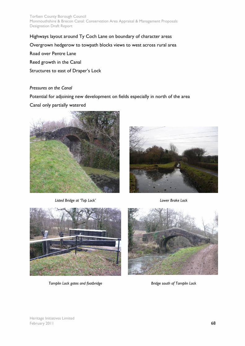
Torfaen County Borough Council Monmouthshire & Brecon Canal: Conservation Area Appraisal & Management Proposals Designation Draft Report
Heritage Initiatives Limited February 2011 68
Highways layout around Ty Coch Lane on boundary of character areas
Overgrown hedgerow to towpath blocks views to west across rural area
Road over Pentre Lane
Reed growth in the Canal
Structures to east of Draper’s Lock
Pressures on the Canal
Potential for adjoining new development on fields especially in north of the area
Canal only partially watered
Listed Bridge at ‘Top Lock’ Lower Brake Lock
Tamplin Lock gates and footbridge Bridge south of Tamplin Lock
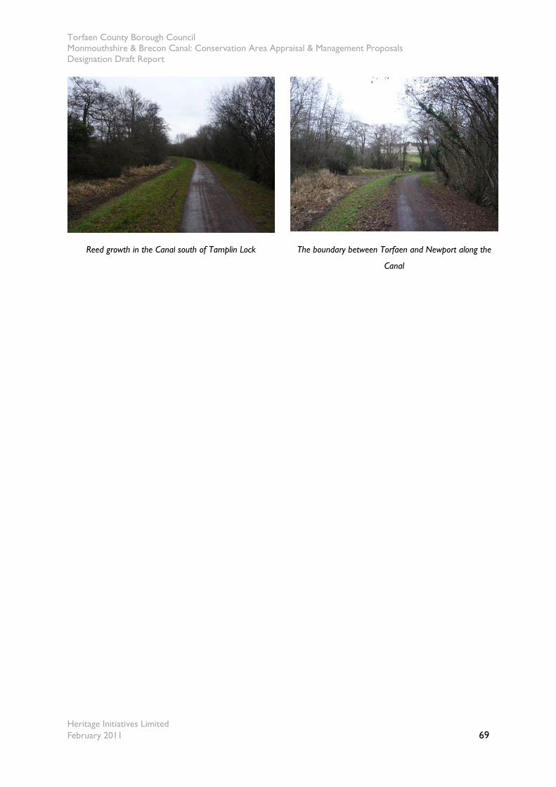
Torfaen County Borough Council Monmouthshire & Brecon Canal: Conservation Area Appraisal & Management Proposals Designation Draft Report
Heritage Initiatives Limited February 2011 69
Reed growth in the Canal south of Tamplin Lock The boundary between Torfaen and Newport along the
Canal
Torfaen County Borough Council Monmouthshire & Brecon Canal: Conservation Area Appraisal & Management Proposals Designation Draft Report
Heritage Initiatives Limited February 2011 70
8.0 Key Issues
8.1 Key issues to be addressed through future management
8.1.1 In the light of the above appraisal and the identification of the negative factors in each
character area, the following issues have been identified as being most relevant to the
continuing preservation of the special historic character and appearance of the Monmouthshire
& Brecon Canal and should be addressed in response to its designation as a Conservation Area.
The issues listed here are discussed, and action recommended, in the following section of the
document:
Lack of a coordinated approach to the management of the Canal corridor;
Review of the boundary to Monmouthshire & Brecon Canal corridor to ensure
special interest is maintained;
Inconsistent approach to the inclusion of Canal related features on the statutory list;
Decision making relating to adjoining development quality, scale, form and massing;
Loss of original architectural details of some historic buildings and structures;
Tree and hedge management;
Screening of modern development by trees and hedgerows;
Preservation of the Canal’s setting and views;
Building maintenance and repair;
Intrusion/incursion of domestic garden and moorings areas onto Canal side;
Creation of moorings;
Intrusive Canal side development and finishes;
The continued use of traditional materials.
Torfaen County Borough Council Monmouthshire & Brecon Canal: Conservation Area Appraisal & Management Proposals Designation Draft Report
Heritage Initiatives Limited February 2011 71
PART 2 – MANAGEMENT PROPOSALS & ACTIONS
9.0 Background to Management Proposals & Actions
9.1 Purpose of the management proposals and actions
9.1.1 The purpose of this section is to present potential proposals and actions to achieve the
preservation and enhancement of the Monmouthshire & Brecon Canal corridor as a
Conservation Area, having regard to its special historic character and appearance, and to
consult the local community about these proposals. The special qualities of the potential
Conservation Area have been identified in the first part of this document. The following
management proposals draw upon the themes identified in the ‘Issues’ section. The proposals
are written in the awareness that, in managing the County Borough’s Conservation Area,
resources are limited and therefore need to be prioritised. Financial constraints on the Council
mean that proposals for which they are responsible may take longer than is desirable to
implement. However, the Council will continue to encourage improvements to the
Conservation Area in cooperation with property owners, groups and local businesses. The
structure and scope of this document is based on the suggested framework published by
English Heritage in ‘Guidance on the management of Conservation Areas’ (August 2005). Both
the Conservation Area appraisal and feasibility study and these management proposals will be
subject to monitoring and reviews on a regular basis.
9.2 Legislative issues
9.2.1 The designation and appraisal of any Conservation Area is not an end in itself. The
purpose of this document is to present proposals to achieve the preservation and enhancement
of the Conservation Area’s special character, informed by the appraisal and feasibility study, and
to consult the local community about these proposals. The document satisfies the statutory
requirement of section 71(1) of the Planning (Listed Buildings & Conservation Areas) Act 1990,
namely:
Torfaen County Borough Council Monmouthshire & Brecon Canal: Conservation Area Appraisal & Management Proposals Designation Draft Report
Heritage Initiatives Limited February 2011 72
“It shall be the duty of the local planning authority from time to time to formulate and publish
proposals for the preservation and enhancement of any parts of their area which are Conservation
Areas.”
Section 69(2) of the 1990 Act also states:
“It shall be the duty of the local planning authority from time to time to review the past exercise of
functions….and determine whether any further parts of their area should be designated as
Conservation Areas”
9.2.2 This document reflects Government guidance set out in Circular 61/96 ‘Planning and the
Historic Environment: Listed Buildings & Conservation Areas’ (December 1996). English Heritage
guidance titled ‘Guidance on the management of Conservation Areas’ (August 2005), as best
practice guidelines, policies within the ‘Torfaen Local Plan 2000’ (Torfaen LP 2000) and the
‘Gwent Structure Plan 1996 – 2006 (Gwent SP 1996) with any policies that supersede this in the
forthcoming Local Development Plan.
9.2.3 It is important that the development control process ensures the preservation of special
character and suitable opportunities are taken to identify and implement enhancements if the
Canal corridor is to meet both its optimum potential, balancing the value of the Canal’s
undoubted special architectural and historic interest into the future.
9.3 Statutory controls
9.3.1 Designation as a Conservation Area brings a number of specific statutory provisions
aimed at assisting the ‘preservation and enhancement’ of the area, as required by Section 72 of
the Planning (Listed Buildings & Conservation Areas) Act 1990. These controls include
requiring Conservation Area Consent for the demolition of any unlisted building, fewer
permitted development rights for alterations and extensions, added interest in the quality of
the design of advertisements and requiring notice for proposed tree works. Similarly,
development outside of the Conservation Area but affecting its character and appearance will
be determined in accordance with the relevant policies.
Torfaen County Borough Council Monmouthshire & Brecon Canal: Conservation Area Appraisal & Management Proposals Designation Draft Report
Heritage Initiatives Limited February 2011 73
ACTION: The Council will determine Planning applications for development proposals
(including applications for demolition through Conservation Area Consent) in or
affecting the setting of the Canal Conservation Area in accordance with legislative
provisions, national policy as laid down in Circular 61/96 and Planning Policy Wales
2002, the Torfaen LP 2000 & Gwent SP 1996, together with any relevant Supplementary
Planning Guidance including this appraisal, in preserving and enhancing its character or
appearance.
Torfaen County Borough Council Monmouthshire & Brecon Canal: Conservation Area Appraisal & Management Proposals Designation Draft Report
Heritage Initiatives Limited February 2011 74
10.0 Planning Controls, Management Proposals & Actions
10.1 Adoption of a coordinated approach to the management of the
Canal Conservation Area
10.1.1 Through discussions with key stakeholders such as British Waterways and the Canal
Trust it is intended to develop a partnership approach to the strategic management of the
Canal Conservation Area. The April 2008 Heritage Protection Reform Bill proposed the
introduction of Heritage Partnership Agreements as a means to manage grouped assets under a
single ownership. Although the Bill has been withdrawn from the legislative timetable it is
envisaged this will eventually be reintroduced at a convenient time. It also clear that currently
protection for the Canal in the County Borough is piecemeal and has stemmed from particular
pressures, rather than a comprehensive review of its significance. It is suggested, as the Council
has not yet established a formal Conservation Area Advisory Committee (CAAC) for the full
length of the Conservation Area within the Borough, that this be considered. Furthermore, if
other sections of the Canal under other administrative control were similarly designated this
could form the nucleus of any such joint body. Such a committee is recommended for
establishment in paragraph 28 of government guidance set out in Circular 61/96. It would
comprise a cross section of local people, including representatives of business interests,
amenity associations and other stakeholders. Nominations from relevant national bodies could
also be sought. The Council would consult the CAAC on applications affecting the character
and appearance of the Conservation Area. The purpose of the Committee would be to ensure
the protection of the Canal’s features, identify the priorities for action in enhancing the Canal
and promote its sustainable use by all stakeholders. The Committee would also play an
important role in the general care and monitoring of the Conservation Area and where
necessary initiate proposals for its improvement.
ACTION: The Council will seek to establish a strategic partnership with key Canal
stakeholders to ensure a joint approach to the management of the Canal Conservation
Area. It will work with stakeholders to consider whether Heritage Partnership
Agreements are a suitable vehicle for future management of the Canal. The Council will
also seek to establish and support a CAAC for the Monmouthshire & Brecon Canal
Torfaen County Borough Council Monmouthshire & Brecon Canal: Conservation Area Appraisal & Management Proposals Designation Draft Report
Heritage Initiatives Limited February 2011 75
Conservation Area consisting of interested stakeholders. Its purpose will be to advise on
applications and relevant policies within the area and work together on monitoring and
identifying where appropriate enhancement opportunities.
10.2 Review boundaries of Canal Conservation Area to maintain special interest
10.2.1 The appraisal identifies that the boundary reflects the area of special character. In the
future, as knowledge increases and approaches to the designation of Conservation Areas
changes, further areas considered worthy of inclusion may be identified along the length of the
Canal at various points. The purpose of any future proposed extensions would be to
acknowledge the merits the areas and their link to the Canal, and afford them the additional
protection against demolition and unsympathetic alteration. Often pastureland forms the
setting of the Conservation Area and this can be better protected through existing planning
policies and management regimes. Accordingly, the Council will only seek to alter and extend
the designated area, based on review, consultation and whether further details become
available supporting any such change.
ACTION: The Council will only seek to alter or extend the designated area as
recommended in any future review of the appraisal document and thereafter continue
to review the boundary of the Conservation Areas in accordance with best practice and
guidance on management of the historic environment.
10.3 Resurvey of statutory list along Canal corridors
10.3.1 During the survey it has become apparent that there appears to be an inconsistent
approach taken in the inclusion of structures on the statutory list along the Canal’s length, that
a number of features are described incorrectly and that others no longer exist. It is especially
curious that along the southern section of the Canal many bridge features are listed but not the
associated stone chambered locks beneath.
Torfaen County Borough Council Monmouthshire & Brecon Canal: Conservation Area Appraisal & Management Proposals Designation Draft Report
Heritage Initiatives Limited February 2011 76
ACTION: The Council will discuss with Cadw the possibility of reconsidering the existing
statutory list as it relates to the Canal corridor and where appropriate amend the list
and where necessary preparing draft list entries for consideration.
10.4 Listed Buildings
10.4.1 Listed buildings are protected by law as set out in the Planning (Listed Buildings and
Conservation Areas) Act 1990. The listing covers both the interior and exterior of the building,
and any structure or building within its curtilage, which was built before July 1948. ‘Listed
Building Consent’ is required from the Council for demolition, or for works affecting the
character of the special architectural or historic interest of the building. There are a number of
listed buildings across the Conservation Area and these are marked on the appraisal maps.
Further advice as to the extent of the controls, to adjoining buildings and those in the vicinity,
should be sought from the Council. Extensions and alterations to listed buildings should
conform with planning polices set out in section 2.0, and should generally:
Take into account the prevailing forms of development;
Complement the form and character of the original building;
Be secondary in bulk and form to the principal building;
Use high quality traditional materials and detailing;
Pay particular attention to roof lines, roof shape, eaves details, verge details and chimneys.
ACTION: The Council will seek to ensure that all works to listed buildings seek to
preserve the building together with its setting and any features of architectural or
historic interest which it may possess in accordance with the Torfaen LP 2000 & Gwent
SP 1996 policies and other guidance.
10.5 Buildings of positive contribution
10.5.1 There are many individual buildings and associated features that are of positive
contribution to the special interest of the area, and these are marked on the accompanying
appraisals maps. There are presently a number of such positive unlisted buildings and structures
within the Conservation Area. The Council will encourage all applications for extensions,
Torfaen County Borough Council Monmouthshire & Brecon Canal: Conservation Area Appraisal & Management Proposals Designation Draft Report
Heritage Initiatives Limited February 2011 77
alterations and change of use to these buildings to be particularly carefully considered. There is
a presumption that buildings identified as of a positive contribution will be retained, as set out
in national policy guidance. Policies within the Torfaen LP 2000 provide the criteria against
which all such proposals for alterations will be assessed.
ACTION: The Council will seek to ensure that all unlisted buildings and structures of a
positive contribution to the Conservation Areas are protected from inappropriate forms
of alteration, extension or unjustified demolition.
10.6 Erosion of character and additional planning control
10.6.1 The appraisal identified that the following alterations pose a threat to the special
character of the area:
removal and condition of boundary treatments;
replacement of principal features in non-traditional materials;
the use and condition of existing buildings;
the intrusion of small scale development in rear gardens and areas facing onto the
Canal;
the scale, form, massing, density and quality of adjoining replacement and new infill
development;
10.6.2 Certain minor works and alterations to unlisted buildings, in use as single family
dwellings, can normally be carried out without planning permission from the Council.
Development of this kind is called ‘Permitted Development’ and falls into various classes that
are listed in the Town and Country Planning (General Permitted Development) Order 1995. It
is apparent that many historic buildings within the Conservation Area retain their original form
and general character but much detailing, namely doors and windows have been replaced in
non-traditional materials, thereby eroding their specialness to an extent. These minor
alterations can cumulatively have an adverse effect on the character and appearance of a
Conservation Area. Powers exist for the Council, known as Article 4 Directions, to withdraw
some of these permitted development rights in the interests of preserving and enhancing the
character and appearance of the Conservation Area. Those buildings not used as a
Torfaen County Borough Council Monmouthshire & Brecon Canal: Conservation Area Appraisal & Management Proposals Designation Draft Report
Heritage Initiatives Limited February 2011 78
dwellinghouse do not enjoy such rights and planning permission will normally be required for
such works. As the Canal forms a waterway it can be treated as a relevant frontage, where
such a direction can be utilised. Furthermore, throughout the Conservation Area much existing
residential development backs onto the Canal and this is defined by boundary walls, wooden
fencing or more rarely railings. These serve to enrich the Canal scene in many circumstances
and are a key element of local distinctiveness. Every effort should be made to appropriately
repair traditional boundary walling and secure their accurate reinstatement. The Council can
encourage owners to undertake these works by the provision of guidance regarding traditional
materials and suppliers, together with grant or the offer of loan assistance towards the cost,
which are subject to the availability of resources. However, in a number of cases it is clear
there exists a disregard for the Canal and its special interest and many boundaries that back
onto the Canal are treated with little attention. Policies within the Torfaen LP 2000 are of
relevance to these issues.
ACTION: The Council will in the future seek to consider the need for an Article 4
direction on a case-by-case basis to ensure that the special qualities of the Canal, its
setting and its boundaries of positive contribution are protected.
10.7 Trees & Hedgerows
10.7.1 Within Conservation Areas, anyone intending to lop or fell a tree greater than 100 mm.
diameter at 1.5 metres above the ground must give the Council six weeks written notice
before starting the work. This provides the Council with an opportunity of assessing the tree
to see if it makes a positive contribution to the character or appearance of the Conservation
Area, in which case a Tree Preservation Order (TPO) may be served. The management of
trees and hedgerows adjoining the Canal is key to securing their continued contribution to the
character and appearance of the area. Unfortunately, many hedgerows have become
overgrown and prevent expansive views over surrounding rural areas and measures to secure
their maintenance should be pursued. Identified are a number of significant trees and
hedgerows throughout the Conservation Area and these are marked on the appraisal maps.
ACTION: The Council will seek to consider native tree planting and hedgerow laying in
Torfaen County Borough Council Monmouthshire & Brecon Canal: Conservation Area Appraisal & Management Proposals Designation Draft Report
Heritage Initiatives Limited February 2011 79
suitable locations as part of wider public realm improvements and enhancement
schemes, in building upon the positive impact of existing notable trees and hedgerows
within and adjoining the Canal Conservation Area. The Council will also seek to work
with stakeholders to secure the continued contribution of trees and hedgerows, as a
defining characteristic of the Canal, through encouraging proper ongoing maintenance
regimes.
10.8 Canal setting, views and open spaces
10.8.1 The setting of the Conservation Area is very important and development impacting in a
detrimental way upon the immediate setting and longer views into and from the Conservation
Area will be resisted. Important views are identified on the appraisal maps but these are in no
way exhaustive and consideration must be given to short views and glimpses that characterise
the views both to and from the Conservation Area. The Council will seek to ensure that all
development both within and adjoining the Conservation Area serves to respect the setting
and important views. In particular, the green open spaces within and pasture adjoining the
Canal should be preserved. Many vistas are identified along the Canals as a result of changes of
height or direction, such as where they adjoin locks. Regard should also be given to any
proposals for future change. In some cases the proximity of development can be of a
detrimental nature and careful consideration will need to be given to the interrelationship
between proposals outside but adjoining the Conservation Area in order to preserve its
setting. Relevant policies within the Torfaen LP 2000 and Gwent SP 1996 should be accorded
with.
ACTION: The Council will seek to ensure that all development respects the setting,
important views within, into and from open spaces and pasture to the Conservation
Area, as identified but not exclusively in the appraisal. The Council will seek to ensure
that these remain protected from inappropriate forms and scale of development and
that due regard is paid to the setting, these views and open spaces in the formulation of
redevelopment or enhancement schemes in accordance with policies laid down in the
Torfaen LP 2000 and Gwent SP 1996.
Torfaen County Borough Council Monmouthshire & Brecon Canal: Conservation Area Appraisal & Management Proposals Designation Draft Report
Heritage Initiatives Limited February 2011 80
10.9 New development, alterations and extensions
10.9.1 Careful consideration will need to be given to the materials, treatment, height, scale,
massing, form, quality and proximity of future development and alterations and extensions
adjoining and within the Canal Conservation Area. Unfortunately, much later development has
little regard to the Canal and does not integrate visually or in design. A number of potential
sites adjoin and lie within the Conservation Area, that may well form the basis of future
development proposals. Careful consideration will have to be given to avoiding the creation of
unduly dominant development in such places, where otherwise local distinctiveness and
character could be eroded. In particular the height of adjoining development should be usually
restricted to no more than the three storeys in close proximity to the Canal, in line with
existing development. Proposals higher than three storeys should only be considered where
sufficient setting is preserved between the Canal and the proposals or within the vicinity of the
Cwmbran town centre canalside area. Only appropriate proposals that address the issues
positively through adjoining high quality development will be approved. Within and adjoining
the Conservation Area, where the quality of the general environment is already acknowledged
by designation, the Council will only encourage the highest quality schemes that respond
positively to their historic setting and in accordance with Torfaen LP 2000 and Gwent SP 1996.
ACTION: The Council will seek to determine applications with regard to the Council’s
adopted Design Guidance, best practice guidance and the Torfaen LP 2000 and Gwent
SP 1996 policies and any which supersede this in the forthcoming LDP, to avoid the
dominance of new development over existing features and structures of positive
contribution and the Conservation Area’s character and appearance.
10.10 Boundary treatments
10.10.1 Most boundaries in the Canal Conservation Area are defined by hedging, trees
or sections of stone walling. These boundary features are very important, providing a strong
link to the historic layout of the Conservation Area and the development of the Canal.
Unfortunately, later development has added less appropriate boundaries between the Canal
corridors and adjoining property, with concrete walls, chicken wire fencing, clapperboard
fences and overgrown poorly maintained trees and hedging, which encourage litter and anti-
Torfaen County Borough Council Monmouthshire & Brecon Canal: Conservation Area Appraisal & Management Proposals Designation Draft Report
Heritage Initiatives Limited February 2011 81
social behaviour in some cases. It is important that materials and detailing found in the locality
are used to help fit new development into its context and provide exemplars for new boundary
treatments elsewhere. Policies and advice within Torfaen LP 2000 and Gwent SP 1996 give
clear guidance for the protection of these significant features.
ACTION: The Council will seek to retain existing features such as stone walls, hedges or
trees and resist proposals to remove traditional boundaries or promote new boundary
treatments which fail to respect the form and materials of traditional boundary
treatments in the Canal Conservation Area.
10.11 Intrusion/incursion of domestic garden areas onto the Canal sides
10.11.1 In places, particularly alongside later 19th and 20th century terracing and suburban
estate development, householders have removed boundary treatments and landscaped to both
sides of the Canal in a suburban domestic style with patios, ornaments, exotic planting and
other domestic paraphernalia. In addition, such areas have been used to erect unduly
prominent structures such as garages, that have impacted upon the Canal’s setting and in many
cases created blank elevations to the Canal. Design guidance is needed for householders to be
advised on good practice for such development in gardens facing the Canal, planting, hedge
laying, boundary treatments, landscaping its continued maintenance.
ACTION: In consultation with British Waterways, the Council will seek to produce
design guidance on household Canal-side works and will seek to ensure that all
development affecting the interface between domestic gardens and the Canals accords
with the advice given therein with the aim of creating active frontages that positively
address the Canal. Consideration will also be given to bringing planning control to such
minor development through an Article 4(2) Direction.
10.12 The creation of moorings
10.12.1 There are a small number of moorings created on the flank of private gardens
and businesses along the Canal. These can create barren hard-standings with fences, poor
landscaping and ad-hoc features that harm the green vista along the Canal corridor.
Torfaen County Borough Council Monmouthshire & Brecon Canal: Conservation Area Appraisal & Management Proposals Designation Draft Report
Heritage Initiatives Limited February 2011 82
Unfortunately, in other cases large and unsightly structures have sprung up on sites adjoining
the Canal, detracting from its setting.
ACTION: The Council will seek to liaise with British Waterways to ensure that private
moorings and associated facilities are in keeping with the character and appearance of
the Canal and its setting.
10.13 Screening of modern development by trees and hedgerows
10.13.1 Canal-side trees and other greenery often serves to preserve the setting of the
Canal, where it is threatened by development of an unsympathetic scale sometimes in very
close proximity to the Canal banks. In certain stretches, boundary screening is essential to
maintain the ‘otherness’ that defines the Canal and its dislocation from the surrounding land
uses. The appraisal maps can be utilised to identify where additional planting would be beneficial
to the Canal’s setting. Such recommendations need to mindful of the need to strike a balance
between screening inappropriate development and blocking long views. Diffuse informal groups
of planting, as opposed to hedges, are sometimes more appropriate.
ACTION: The Council will seek to encourage additional locally appropriate planting of
native trees in order to improve the visual and environmental quality of the Canal and
its setting.
10.14 Intrusive Canal-side development and finishes
10.1.41 A large number of modern industrial structures have been erected alongside the
Canal both within and to the setting of the Conservation Area. These are sometimes tall and
frequently have blank elevations clad in profiled steel sheeting and inappropriate hard
landscaping. Where unduly assertive colours have been used, these buildings are intrusive.
Guidance on the choice of future finishes to both the buildings and their curtilages would be
useful to prevent unnecessary harm. It would also be useful if such significantly scaled buildings
could be sited in future with adequate space around them to enable the creation of a buffer
strip of planting within their curtilage, as opposed to relying on the creation of dense but
shallow screen planting along the flanks of the Canals corridors.
Torfaen County Borough Council Monmouthshire & Brecon Canal: Conservation Area Appraisal & Management Proposals Designation Draft Report
Heritage Initiatives Limited February 2011 83
ACTION: The Council will seek to ensure that Canal-side developments both within and
adjacent to the Conservation Area are accompanied by detailed landscaping plans that
soften the proposed and existing building’s impact on the Canal. The use of over-garish
coloured finishes will be discouraged.
10.15 The public realm and enhancement
10.15.1 The appraisal has identified a number of small public realm features of interest
within the Conservation Area, directly related to the Canal. These include cobbled pathways,
mooring pins, milestones, quarter milestones, sculptures, sluices and the various skew and
accommodation bridges, amongst others. However, further opportunities exist to enhance
towpaths to the Conservation Area, including interpretation panels, signage, seating, bound
surfaces and other measures in a manner consistent with the character of the area. ‘Off-the-
peg’ heritage solutions for such features should be avoided. Existing or photographic evidence
should be utilised to inform designs for new insertions, which would be distinctive and better
reflect the character of the Canals. Such opportunities could be realised through appropriate
measures, such as contributions through s106 agreements from adjoining developments to the
Canal.
ACTION: The Council will seek to work with partners to ensure the retention of existing
or the reinsertion of historic features and that any new Canal-side and towpath related
works and other related features bring a positive improvement to the Canal
Conservation Area. It will also work to with partners of adjoining developments through
s106 agreements to contribute funding to such enhancement.
10.16 Buildings and structures condition survey
10.16.1 Generally, the buildings and structures in the Canal Conservation Area are
reasonably well maintained at present, although there are some emerging signs of a lack of
maintenance, requiring attention as soon as practicably possible. Given the number of
structures, it is suggested the Council in partnership with British Waterways should regularly
monitor the condition of existing buildings and structures, in order to raise potential problems
Torfaen County Borough Council Monmouthshire & Brecon Canal: Conservation Area Appraisal & Management Proposals Designation Draft Report
Heritage Initiatives Limited February 2011 84
at an early stage, which is consistent with the Council’s approach to managing the historic
environment through its Buildings at Risk register. The Council will monitor the condition of
listed buildings and those other buildings and structures making a positive contribution to the
Conservation Area and, where a building or structure is threatened by a lack of maintenance or
repair, the Council will use the available statutory powers to encourage action to prevent
deterioration. The Council also have powers to secure the preservation of unlisted buildings in
the Conservation Area by using Urgent Works Notices in a similar way to listed buildings,
although in this case, the Welsh Assembly Government’s permission is required. Another
available power is s215 of the Planning and Compensation Act 1990, sometime referred to as
an ‘Amenity of Land’ notice. Both are of particularly relevance where a building or structure is
important for maintaining the character and appearance of the area. The Council may carry out
such works as are necessary and recover the costs incurred.
ACTION: The Council in partnership with British Waterways will seek to monitor the
condition of listed and unlisted buildings, report findings and advise on action, as
necessary and as resources permit. Where the condition of buildings or structures, within
the Canal Conservation Areas, give cause for concern, appropriate steps will be taken to
secure the future of the building or structure.
10.17 The continued use of traditional materials
10.17.1 In order for the appropriate maintenance and for new development to preserve
or enhance the Conservation Area it is important that appropriate materials are utilised in
construction and repair, usually drawn from a pallet of traditional materials found in the
locality. The use of either brick, stone or render finishes in an inappropriate colour, texture,
finish or the use of artificial slates, uPVC windows, doors, fascias and rainwater goods all
detract from the Canal’s character and appearance or its setting. The appropriate use of
materials also extends to both hard and soft landscaping and boundary treatments. Materials
for proposed new development and for repairs of existing structures, including lime repointing,
will be expected to draw on the traditions of the area, including the use of pennant stone,
yellow Ebbw Vale bricks, natural welsh slates for roofing, timber windows and doors, cast iron
rainwater goods and plain render finishes.
Torfaen County Borough Council Monmouthshire & Brecon Canal: Conservation Area Appraisal & Management Proposals Designation Draft Report
Heritage Initiatives Limited February 2011 85
ACTION: The Council will resist schemes for new development within, adjacent to, or
within the Canal’s Conservation Area’s setting. The inappropriate maintenance and
repair of existing structures which do not specify appropriate, traditional, local
materials will also be resisted. In exceptional cases where very high quality
contemporary solutions utilising non-traditional materials are proposed these will
considered on an individual basis.
10.18 Specific Supplementary Actions
10.18.1 This section provides specific actions applicable individually to the Canal
Conservation Area, in seeking to manage its special architectural and historic interest, which
supplements the management proposals and actions previously suggested. As many are not
directly related to the operation of the town and county planning system much could still be
achieved in relation to the Conservation Area, to improve this important feature of the County
Borough. It is hoped users and stakeholders with an interest in the Canal will inform and
provide new details as to the Canal’s ongoing needs, providing a sound basis for further specific
supplementary actions.
Seek to reopen and regenerate the full length of the Canal in the longer term;
Encourage high quality Canal facing redevelopment of adjacent sites;
Ensure sufficient regard is given to avoiding the undue proximity and impact of proposed
developments on the Canal;
Support the reuse and restoration of dilapidated buildings within the Conservation Area;
Preserve and enhance key views between major buildings, sites and landmarks with the
Canal;
Upgrade access, way marking and parking to the Canal side;
Seek to ensure Canal-side building alterations preserve the character of the site;
Support the maintenance and removal of invasive tree, scrub and hedge growth, where it
obscures features of interest, views and understanding of the area;
Introduce clear interpretation panels to reflect the special interest of the Canal, in
particular the context and history of the previous adjoining industry and the former
tramway and train operations.
Torfaen County Borough Council Monmouthshire & Brecon Canal: Conservation Area Appraisal & Management Proposals Designation Draft Report
Heritage Initiatives Limited February 2011 86
Improve maintenance and treatment of the towpath to encourage usage, including the
continued laying of bound material to Canal side towpaths;
Tackle vandalism, dumping and fly tipping along the affected lengths of the Canal;
Replace vandalised and weathered interpretation panels and improve way marking to and
from the Canal to adjoining points of interest;
Encourage adjoining landowners to take responsibility for boundary treatments and ensure
proper maintenance;
Provide published walks and other recreational uses for the Canal that promote health
and fitness.
10.18.2 Many of these supplementary actions have been identified in previous studies
related to the Canal and these should be referred to for further details and include;
Monmouthshire & Brecon Canal: Archaeological Review & Risk Assessment May 2007
Forge Locks Canal Quarter, Cwmbran Masterplan (Powell Dobson Urbanists)
Ecological appraisal of Monmouthshire & Breconshire Canal Interim Report 2008
Landscape Action Plan extract from Living Landmarks submission
Landscape Analysis report extract from Living Landmarks submission
Torfaen County Borough Council Monmouthshire & Brecon Canal: Conservation Area Appraisal & Management Proposals Designation Draft Report
Heritage Initiatives Limited February 2011 87
11.0 Consultation, Monitoring and Review
11.1 Public consultation
11.1.1 A stakeholder and community consultation exercise was undertaken on the draft
appraisal of the Canal corridor, as a potential Conservation Area. The Council sought to
engage relevant stakeholders and interested parties within the local community, including local
members and various external consultees, as detailed in a report of 9th September 2009 to
approve the consultations proposals. A public consultation was advertised in the local media
and available on-line via the Council’s web-site between Monday 15th February and Friday 26th
March 2010. This exercise was complemented by a series of public exhibitions at venues along
the canal. An additional four drop-in consultation days were held on;
Friday 19th February 15.00 – 1900 at Mount Pleasant Community Hall, Pontnewydd.
Tuesday 23rd February between 15.00 – 19.00 at Panteg Community Hall
Wednesday 3rd March between 15.00 – 19.00 at Cwmbran Community Council
Tuesday 9th March 11.00-18.00 at Panteg House, Griffithstown
A number of helpful responses were received and these are illustrated, with the Council’s
response, at Appendix E.
11.2 Ongoing Monitoring & Review
11.2.1 To ensure that this appraisal and the management proposals are accepted and acted
upon by the local community it is recommended, in line with best practice, this document
should be reviewed every five years in the light of the emerging Local Development Plan and
government policy. This five year review should include the following:
A resurvey of the Conservation Area and its boundaries;
An assessment of whether the management proposals detailed in this document have been
acted upon, including proposed enhancements;
A Buildings At Risk survey;
Torfaen County Borough Council Monmouthshire & Brecon Canal: Conservation Area Appraisal & Management Proposals Designation Draft Report
Heritage Initiatives Limited February 2011 88
The production of a short report detailing the findings of the survey and proposed actions
and amendments;
Public consultation on the review findings, any proposed changes and input into the
updated Management Proposals.
Torfaen County Borough Council Monmouthshire & Brecon Canal: Conservation Area Appraisal & Management Proposals Designation Draft Report
Heritage Initiatives Limited February 2011 89
Bibliography
Hadfield C: The Canals of South Wales and the Borders (Cardiff: University of Wales Press, 1960)
ICOMOS (International Committee on Monuments and Sites), TICCIH (the International
Committee for the Conservation of the Industrial Heritage): The International Canal Monuments
(Occasional paper for World Heritage Convention, 1996)
Laun J van: Early Limestone Railways (London: Newcomen Society, 2001)
Rattenbury G: Tramroads of the Brecon and Abergavenny Canal (Railway and Canal Historical
Society, 1980)
R Cook: The Hay and Kington Railways (Railway and Canal Historical Society, 1996)
Skempton AW: Bibliographical Dictionary of Civil Engineers in Great Britain and Irelands Volume 1
1500 to 1830 (London: Institution of Civil Engineers, 2002)
Wakelin P: Blaenavon Ironworks and World Heritage Landscape (Cadw, Welsh Assembly
Government, World Heritage, 2006)
Also Railway and Canal Historical Society, tramroad group, unpublished occasional papers.
‘Coflein’, Royal Commission on the Ancient and Historic Monuments of Wales,
http://www.cbhc.gov.uk/, accessed 13 February 2009.
Cwmbran brickworks http://www.cwmbran.info/brick_manufacturers.htm, accessed 5 May
2009
John Newman: The Buildings of Wales, Gwent / Monmouthshire (Yale University Press, 2002)
Nigel Crowe: Canals, (English Heritage, 1994)
Torfaen County Borough Council Monmouthshire & Brecon Canal: Conservation Area Appraisal & Management Proposals Designation Draft Report
Heritage Initiatives Limited February 2011 90
Guidance on Conservation Area appraisals (English Heritage, February 2006)
Guidance on the management of Conservation Areas (English Heritage, February 2006)
Circular 91/96: Planning and the Historic Environment, Listed Buildings & Conservation Areas, (Welsh
Office, December 1996)
Torfaen County Borough Council Monmouthshire & Brecon Canal: Conservation Area Appraisal & Management Proposals Designation Draft Report
Heritage Initiatives Limited February 2011 91
Useful contacts
For information on listed buildings and Conservation Areas in Torfaen Borough:
Senior Building Conservation Officer
Regeneration Service
Torfaen County Borough Council
County Hall
CWMBRAN
NP44 2WN
Tel: 01633 648288
www.torfaen.gov.uk
For further information relating to listed buildings and Conservation Areas:
Cadw
Welsh Assembly Government
Plas Carew
Unit 5/7 Cefn Coed
Parc Nantgarw
Cardiff
CF15 7QQ
T el: 01443 33 6000
www.cadw.wales.gov.uk
For further advice:
Ancient Monuments Society
St Ann's Vestry Hall
2 Church Entry
London
EC4V 5HB
Torfaen County Borough Council Monmouthshire & Brecon Canal: Conservation Area Appraisal & Management Proposals Designation Draft Report
Heritage Initiatives Limited February 2011 92
Tel: 020 7236 3934
www.ancientmonumentssociety.org.uk
The Society for the Protection of Ancient Buildings (SPAB)
37 Spital Square
London
E1 6DY
Tel: 020 7377 1644
www.spab.org.uk
The Georgian Group
6 Fitzroy Square
London
W1T 5DX
Tel: 020 75298920
www.georgiangroup.org.uk
The Victorian Society
1 Priory Gardens
Bedford Park
London
W4 1TT
Tel: 020 8994 1019
www.victorian-society.org.uk
The Twentieth Century Society
70 Cowcross Street
London
EC1M 6EJ
Tel: 020 7250 3857
www.c20society.org.uk
Torfaen County Borough Council Monmouthshire & Brecon Canal: Conservation Area Appraisal & Management Proposals Designation Draft Report
Heritage Initiatives Limited February 2011 93
The Garden History Society
70 Cowcross Street
London
EC1M 6EJ
Tel: 020 7608 2409
www.gardenhistorysociety.org
Civic Trust for Wales
Suite 1 West Wing
Windsor House
Windsor Lane
Cardiff
CF10 3DE
Tel 02
www.civictrustwales.org
British Waterways
Navigation Road
Northwich
Cheshire
CW8 1BM
Tel: 01606 723800
www.britishwaterways.co.uk
Inland Waterways Association (National)
PO Box 114
Rickmansworth
WD3 1ZY
Tel: 01923 711114
www.waterways.org.uk

Torfaen County Borough Council Monmouthshire & Brecon Canal: Conservation Area Appraisal & Management Proposals Designation Draft Report
Heritage Initiatives Limited February 2011 94
Monmouthshire, Brecon & Abergavenny Canal Trust Ltd
Laurel House
95 The Highway
New Inn
Pontypool
NP4 0PN
Tel. 01633 892167
www.mon-brec-Canal-trust.org.uk

Torfaen County Borough Council Monmouthshire & Brecon Canal: Conservation Area Appraisal & Management Proposals Designation Draft Report
Heritage Initiatives Limited February 2011 95
Appendices
Torfaen County Borough Council Monmouthshire & Brecon Canal: Conservation Area Appraisal & Management Proposals Designation Draft Report
Heritage Initiatives Limited February 2011 96
Appendix A:
Canal Corridor Tile & Appraisal Maps
Torfaen County Borough Council Monmouthshire & Brecon Canal: Conservation Area Appraisal & Management Proposals Designation Draft Report
Heritage Initiatives Limited February 2011 97
Appendix B:
2nd edition OS Historic Mapping
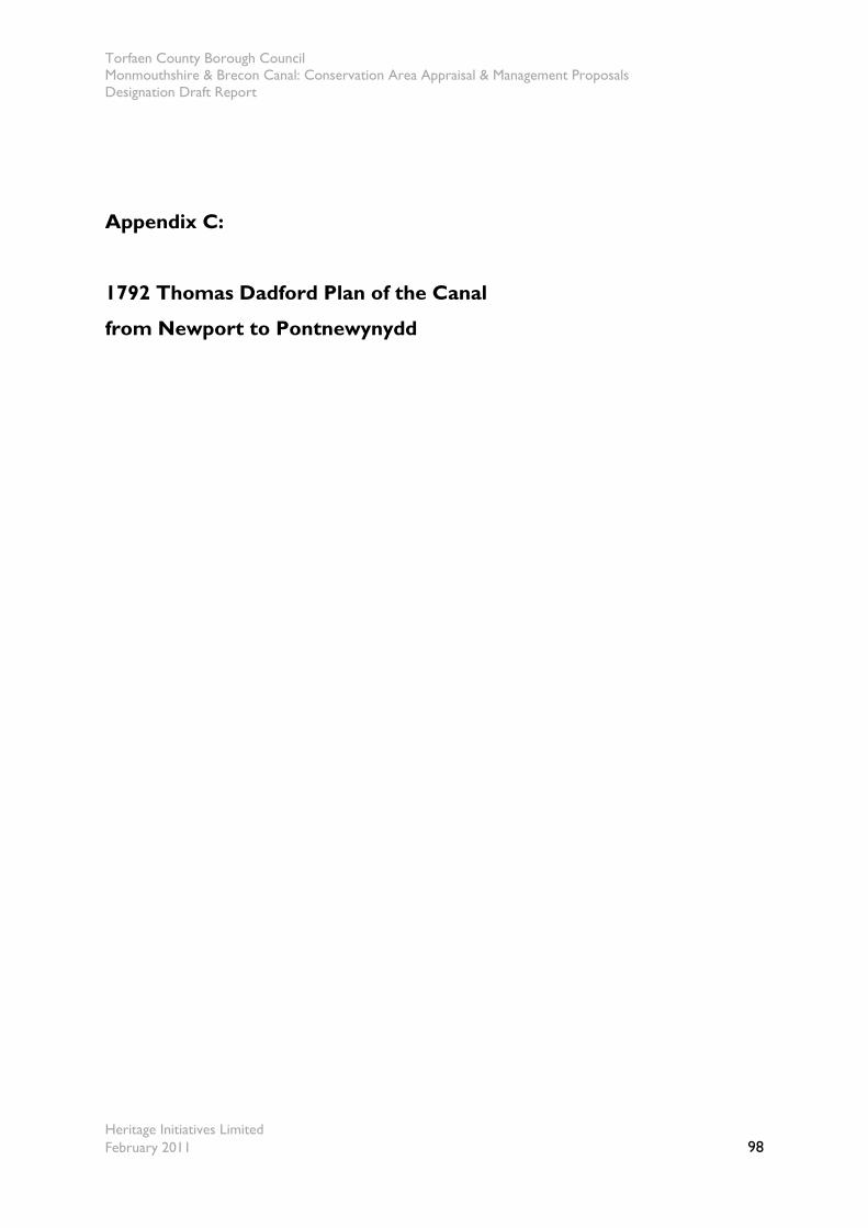
Torfaen County Borough Council Monmouthshire & Brecon Canal: Conservation Area Appraisal & Management Proposals Designation Draft Report
Heritage Initiatives Limited February 2011 98
Appendix C:
1792 Thomas Dadford Plan of the Canal
from Newport to Pontnewynydd
Torfaen County Borough Council Monmouthshire & Brecon Canal: Conservation Area Appraisal & Management Proposals Designation Draft Report
Heritage Initiatives Limited February 2011 99
Appendix D:
Listed Buildings within the Canal corridor (all are Grade II)
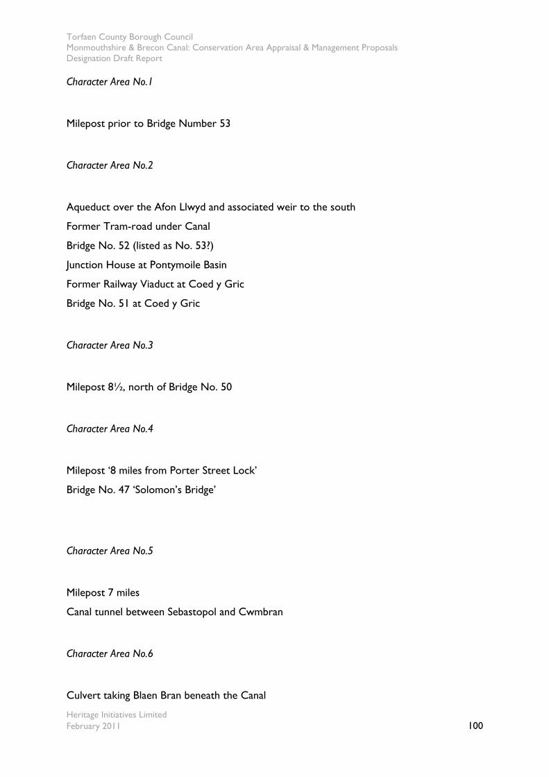
Torfaen County Borough Council Monmouthshire & Brecon Canal: Conservation Area Appraisal & Management Proposals Designation Draft Report
Heritage Initiatives Limited February 2011 100
Character Area No.1
Milepost prior to Bridge Number 53
Character Area No.2
Aqueduct over the Afon Llwyd and associated weir to the south
Former Tram-road under Canal
Bridge No. 52 (listed as No. 53?)
Junction House at Pontymoile Basin
Former Railway Viaduct at Coed y Gric
Bridge No. 51 at Coed y Gric
Character Area No.3
Milepost 8½, north of Bridge No. 50
Character Area No.4
Milepost ‘8 miles from Porter Street Lock’
Bridge No. 47 ‘Solomon’s Bridge’
Character Area No.5
Milepost 7 miles
Canal tunnel between Sebastopol and Cwmbran
Character Area No.6
Culvert taking Blaen Bran beneath the Canal
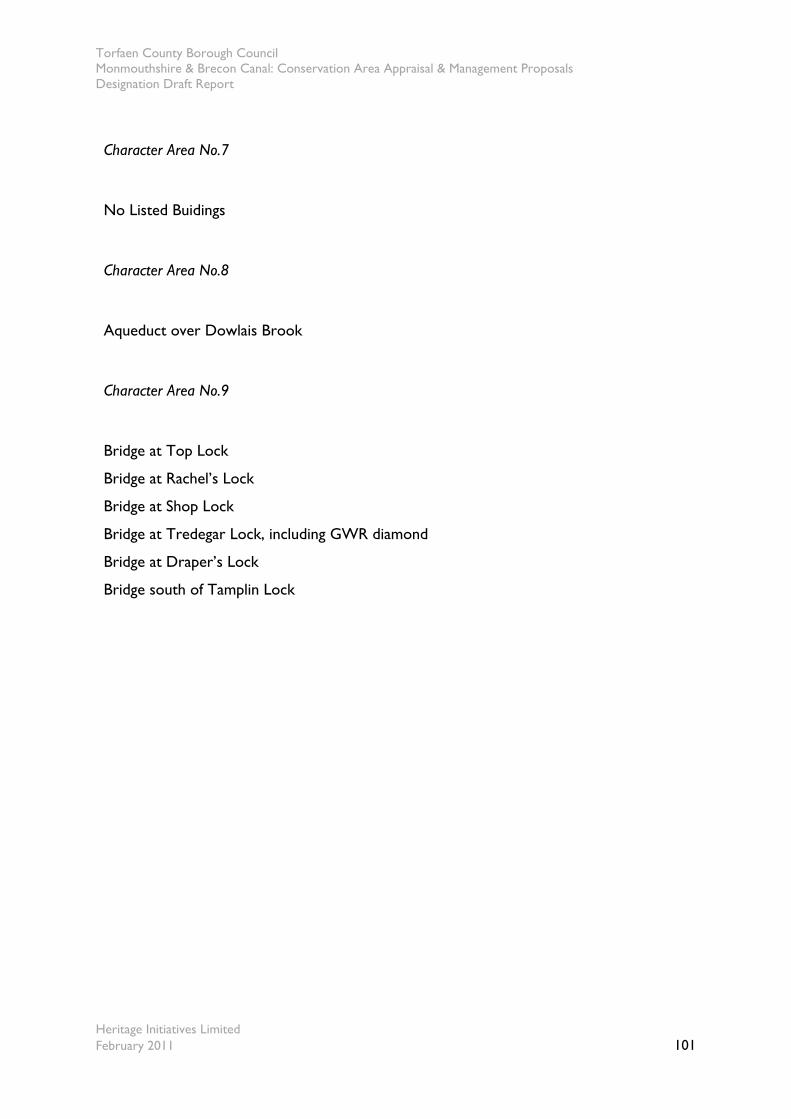
Torfaen County Borough Council Monmouthshire & Brecon Canal: Conservation Area Appraisal & Management Proposals Designation Draft Report
Heritage Initiatives Limited February 2011 101
Character Area No.7
No Listed Buidings
Character Area No.8
Aqueduct over Dowlais Brook
Character Area No.9
Bridge at Top Lock
Bridge at Rachel’s Lock
Bridge at Shop Lock
Bridge at Tredegar Lock, including GWR diamond
Bridge at Draper’s Lock
Bridge south of Tamplin Lock
Torfaen County Borough Council Monmouthshire & Brecon Canal: Conservation Area Appraisal & Management Proposals Designation Draft Report
Heritage Initiatives Limited February 2011 102
Appendix E:
Public Consultation Responses