municipal service review for colusa county reclamation ... · municipal service review for colusa...
TRANSCRIPT

MUNICIPAL SERVICE REVIEW
FOR
COLUSA COUNTY RECLAMATION, DRAINAGE,
FLOOD CONTROL AND LEVEE DISTRICTS
COLUSA LAFCO
Reclamation District 108 Reclamation District 479
Reclamation District 1004 Reclamation District 2047
Sacramento River Westside Levee District Cortina Creek Flood Control and Floodwater
Conservation District Knights Landing Ridge Drainage District
Colusa County Flood Control and Water Conservation District
Adopted: September 2, 2010 LAFCo Resolution 2010-0008
i Adopted Municipal Service Review Reclamation and Levee Districts Colusa LAFCO Sept 2, 2010 Resolution 2010-0008
TABLE OF CONTENTS Page 1 INTRODUCTION . . . . . . . . . . . . . . . . . . . . . . . . . . . . . . . . . . . . . . . . . . . . . . . . . . . . 1 2 SACRAMENTO RIVER AND FLOOD CONTROL REGULATIONS . . . . . . . . . 4 3 SETTING . . . . . . . . . . . . . . . . . . . . . . . . . . . . . . . . . . . . . . . . . . . . . . . . . . . . . . . . . . . 16 4 RECLAMATION DISTRICT 108 . . . . . . . . . . . . . . . . . . . . . . . . . . . . . . . . . . . . . . . 22
5 RECLAMATION DISTRICT 479 . . . . . . . . . . . . . . . . . . . . . . . . . . . . . . . . . . . . . . 32
6 RECLAMATION DISTRICT 1004 . . . . . . . . . . . . . . . . . . . . . . . . . . . . . . . . . . . 38
7 RECLAMATION DISTRICT 2047 . . . . . . . . . . . . . . . . . . . . . . . . . . . . . . . . . . . . . 47
8 SACRAMENTO RIVER WESTSIDE LEVEE DISTRICT . . . . . . . . . . . . . . . . . 53
9 CORTINA CREEK FLOOD CONTROL AND FLOODWATER CONSERVATION DISTRICT . . . . . . . . . . . . . . . . . . . . . . . . . . . . . . . . . . . 57
10 KNIGHTS LANDING RIDGE DRAINAGE DISTRICT . . . . . . . . . . . . . . . . . . . . 61 11 COLUSA COUNTY FLOOD CONTROL AND WATER CONSERVATION DISTRICT . . . . . . . . . . . . . . . . . . . . . . . . . . . . . . . . . . . 65 APPENDIX A - COLUSA COUNTY POPULATION GROWTH PROJECTIONS . . . . . . . . . . . . . . . . . . . . . . . . . . . . . . . . . . . . . . . . . . . . . . . . . . . . . 68 APPENDIX B - FINANCIAL COMPARISON OF RECLAMATION DISTRICTS . . . . 69 APPENDIX C - ACREAGE FOR EACH DISTRICT . . . . . . . . . . . . . . . . . . . . . . . . . . . . 70 APPENDIX D - LOCAL GOVERNMENT ISSUES . . . . . . . . . . . . . . . . . . . . . . . . . . . . . . 71 APPENDIX E COMPARISON OF DISTRICTS . . . . . . . . . . . . . . . . . . . . . . . . . . . . . . . . . 75 APPENDIX F - COMPARISON TABLE OF FEES, ASSESSMENTS AND TAXES 77 ABBREVIATIONS . . . . . . . . . . . . . . . . . . . . . . . . . . . . . . . . . . . . . . . . . . . . . . . . . . . . . . . . . 79 DEFINITIONS . . . . . . . . . . . . . . . . . . . . . . . . . . . . . . . . . . . . . . . . . . . . . . . . . . . . . . . . . . . . . 81 REFERENCES . . . . . . . . . . . . . . . . . . . . . . . . . . . . . . . . . . . . . . . . . . . . . . . . . . . . . . . . . . . . . 85 PREPARERS . . . . . . . . . . . . . . . . . . . . . . . . . . . . . . . . . . . . . . . . . . . . . . . . . . . . . . . . . . . . . . 89 MAP OF RECLAMATION AND LEVEE DISTRICTS . . . . . . . . . . . . . . . . . . . . . . . . . 90

1 Adopted Municipal Service Review Reclamation and Levee Districts Colusa LAFCO Sept 2, 2010 Resolution 2010-0008
1 INTRODUCTION 1.1 LAFCO's Responsibilities This Municipal Service Review (MSR) has been prepared for the Colusa Local Agency Formation Commission (Colusa LAFCO). Local Agency Formation Commissions are quasi-legislative local agencies created in 1963 to assist the State in encouraging the orderly development and formation of local agencies. This MSR consists of a review of reclamation, drainage, and flood control service as provided by the following Districts:
1. Reclamation District 108 2. Reclamation District 479 3. Reclamation District 1004 4. Reclamation District 2047 5. Sacramento River Westside Levee District 6. Cortina Creek Flood Control and Floodwater Conservation District 7. Knights Landing Ridge Drainage District 8. Colusa County Flood Control and Water Conservation District
The Colusa Basin Drainage District is discussed in this report but no specific determinations are made since its boundaries are not regulated by LAFCO. The Cortese-Knox-Hertzberg Local Government Reorganization Act of 2000 (Government Code §56000 et seq.) is the statutory authority for the preparation of an MSR, and periodic updates of the Sphere of Influence of each local agency. The Governor’s Office of Planning and Research has issued Guidelines for the preparation of an MSR. This MSR adheres to the procedures set forth in the MSR Guidelines. A Sphere of Influence is a plan for the probable physical boundaries and service area of a local agency, as determined by the affected Local Agency Formation Commission (Government Code §56076). Government Code §56425(f) requires that each Sphere of Influence be updated not less than every five years, and §56430 provides that a Municipal Service Review shall be conducted in advance of the Sphere of Influence update. 1.2 Municipal Service Review Requirements The Cortese-Knox-Hertzberg Local Government Reorganization Act of 2000 as amended by AB 1744 and regulations call for a review of the municipal services provided in the county or other appropriate area designated by the LAFCO.
The LAFCO is required, as part of the MSR, to prepare a written statement of findings of its determinations with respect to each of the following: 1. Growth and Population 2. Capacity and Infrastructure 3. Financial Ability 4. Shared Facilities

2 Adopted Municipal Service Review Reclamation and Levee Districts Colusa LAFCO Sept 2, 2010 Resolution 2010-0008
5. Government Structure and Accountability A service review is a comprehensive study designed to better inform LAFCO, local agencies, and the community about the provision of municipal services. Service reviews attempt to capture and analyze information about the governance structures and efficiencies of service providers, and to identify opportunities for greater coordination and cooperation between providers. The service review is a prerequisite to a sphere of influence determination and may also lead a LAFCO to take other actions under its authority. 1.3 LAFCO Policies and Procedures Related to Municipal Services The Colusa LAFCO adopted policies and procedures related to municipal services on February 5, 2004. 1.4 Description of Public Participation Process Colusa LAFCO proceedings are subject to the provisions California’s open meeting law, the Ralph M. Brown Act (Government Code Sections 54950 et seq.) The Brown Act requires advance posting of meeting agendas and contains various other provisions designed to ensure that the public has adequate access to information regarding the proceedings of public boards and commissions. Colusa LAFCO complies with the requirements of the Brown Act. The MSR Guidelines provide that all LAFCOs should encourage and provide multiple public participation opportunities in the municipal service review process. MSR policies have been adopted by the Colusa LAFCO. Colusa LAFCO has discussed and considered the MSR process in open session, and has adopted a schedule for completing the various municipal service reviews and sphere of influence updates for Colusa County. Each municipal service review will be prepared as a draft, and will be subject to public and agency comment prior to final consideration by the Colusa LAFCO. 1.5 California Environmental Quality Act (CEQA) The Municipal Service Review is a planning study that will be considered by Colusa LAFCO in connection with subsequent proceedings regarding the reclamation and levee districts. The Sphere of Influence review or update that would follow has not been approved, or adopted or funded by LAFCO. This MSR is funded in Colusa LAFCO’s 2009-2010 Budget. This MSR includes an analysis, to the extent required by section 15262 of the CEQA Guidelines, of the environmental factors that may be affected by the Municipal Service Review process; but will not include the preparation of an environmental review document. 1.6 Preparation of the MSR Research for this Municipal Service Review (MSR) was conducted over several months from the fall of 2008 and into 2010. Modifications have been made reflecting dynamic circumstances. This MSR is intended to support preparation and update of Spheres of Influence, in accordance

3 Adopted Municipal Service Review Reclamation and Levee Districts Colusa LAFCO Sept 2, 2010 Resolution 2010-0008
with the provisions of the Cortese-Knox-Hertzberg Act. The objective of this Municipal Service Review (MSR) is to develop recommendations that will promote more efficient and higher quality service patterns; identify areas for service improvement; and assess the adequacy of service provision as it relates to determination of appropriate sphere boundaries. While Colusa LAFCO prepared the MSR document, Colusa LAFCO did not engage the services of experts in agriculture, engineering, biology, ecology, hydrology, accounting or other specialists in related fields, but relied upon published reports and district staffs for information. The State Law (Cortese-Knox-Hertzberg Act) requires the districts to provide this information as stated in the following code section: Section 56425(i) When adopting, amending or updating a sphere of influence for a special district, the
commission shall do all of the following:
(1) Require existing districts to file written statements with the commission specifying the functions or classes of services provided by those districts.
(2) Establish the nature, location, and extent of any functions or classes of services
provided by existing districts. Therefore, this MSR reflects LAFCO’s recommendations, based on available information during the research period and provided by districts and county staff, to assist in its determinations related to the following:
1) Promoting more efficient and higher quality service patterns 2) Identifying areas for service improvement 3) Assessing the adequacy of service provision for the districts
4 Adopted Municipal Service Review Reclamation and Levee Districts Colusa LAFCO Sept 2, 2010 Resolution 2010-0008
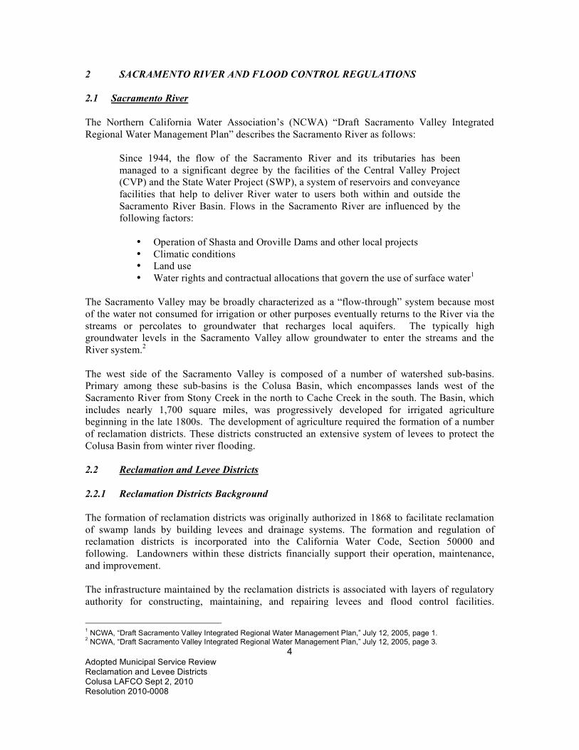
2 SACRAMENTO RIVER AND FLOOD CONTROL REGULATIONS 2.1 Sacramento River The Northern California Water Association’s (NCWA) “Draft Sacramento Valley Integrated Regional Water Management Plan” describes the Sacramento River as follows:
Since 1944, the flow of the Sacramento River and its tributaries has been managed to a significant degree by the facilities of the Central Valley Project (CVP) and the State Water Project (SWP), a system of reservoirs and conveyance facilities that help to deliver River water to users both within and outside the Sacramento River Basin. Flows in the Sacramento River are influenced by the following factors:
• Operation of Shasta and Oroville Dams and other local projects • Climatic conditions • Land use • Water rights and contractual allocations that govern the use of surface water1
The Sacramento Valley may be broadly characterized as a “flow-through” system because most of the water not consumed for irrigation or other purposes eventually returns to the River via the streams or percolates to groundwater that recharges local aquifers. The typically high groundwater levels in the Sacramento Valley allow groundwater to enter the streams and the River system.2 The west side of the Sacramento Valley is composed of a number of watershed sub-basins. Primary among these sub-basins is the Colusa Basin, which encompasses lands west of the Sacramento River from Stony Creek in the north to Cache Creek in the south. The Basin, which includes nearly 1,700 square miles, was progressively developed for irrigated agriculture beginning in the late 1800s. The development of agriculture required the formation of a number of reclamation districts. These districts constructed an extensive system of levees to protect the Colusa Basin from winter river flooding. 2.2 Reclamation and Levee Districts 2.2.1 Reclamation Districts Background The formation of reclamation districts was originally authorized in 1868 to facilitate reclamation of swamp lands by building levees and drainage systems. The formation and regulation of reclamation districts is incorporated into the California Water Code, Section 50000 and following. Landowners within these districts financially support their operation, maintenance, and improvement. The infrastructure maintained by the reclamation districts is associated with layers of regulatory authority for constructing, maintaining, and repairing levees and flood control facilities.
1 NCWA, “Draft Sacramento Valley Integrated Regional Water Management Plan,” July 12, 2005, page 1. 2 NCWA, “Draft Sacramento Valley Integrated Regional Water Management Plan,” July 12, 2005, page 3.

5 Adopted Municipal Service Review Reclamation and Levee Districts Colusa LAFCO Sept 2, 2010 Resolution 2010-0008
Although the primary purpose of reclamation districts has not changed since the enabling legislation was passed, land uses, laws, regulations, and agencies with oversight authority have changed significantly. The levee maintenance process has evolved into a complicated and costly process of regulatory agency approvals and mitigation. Despite the layers of regulatory oversight, maintenance is primarily the responsibility of local reclamation districts and the individual landowners within the district. Improvement and maintenance of non-project levees is very difficult for reclamation districts due to the unknown or poor quality foundations and regulations to protect levee wildlife habitat. While some local districts responsible for maintaining these levees are reimbursed for a portion of the costs under the Delta Levees Subvention Program established in 1973 and the Delta Flood Protection Act of 1988, both added a major environmental mandate to ensure no net long-term loss of habitat. This requirement adds costs which further reduces money available for maintenance.3 The reconstruction of failed levees is a complicated and costly process, which involves the cooperation and coordination of the following agencies:
• US Army Corps of Engineers • Federal Emergency Management Agency • Central Valley Flood Protection Board (Formerly State Reclamation Board) • Local reclamation districts
According to Keith Swanson, Chief of the Flood Maintenance Branch for DWR, costs for levee repairs have now reached $5,000 a lineal foot.4 Of the 6,000 miles of levee in the Sacramento-San Joaquin system, only about 1,700 miles are designated as priority flood control projects which are eligible for State and Federal assistance. The remainder of the Sacramento-San Joaquin levee system (approximately 4,300 miles) must be maintained and repaired when necessary by local reclamation districts and private parties.5 2.2.2 Levee Maintenance Issues Beyond budgetary constraints on the local, State and Federal levels, the conflict inherent between natural resource protection (endangered species and wetlands, in particular) and the need to maintain levees has also created problems and delayed both appropriations and repairs. Added to the mix is the issue of allowing the public to use the levees for recreational fishing. While the right to fish in public waters is guaranteed by the State Constitution, the landowners within reclamation districts are concerned about increased liability and damage to the levees.6
3 Yolo County Local Agency Formation Commission, 625 Court Street, Room 202, Woodland, CA 95695 Municipal Service Review and Sphere of Influence Study Yolo County Public Water and Reclamation Districts Prepared by: Dudek and Associates, Inc., 605 Third Street, Encinitas, CA 92024, March 2005, Page 23. 4 Yolo County Local Agency Formation Commission, 625 Court Street, Room 202, Woodland, CA 95695 Municipal Service Review and Sphere of Influence Study Yolo County Public Water and Reclamation Districts Prepared by: Dudek and Associates, Inc., 605 Third Street, Encinitas, CA 92024, March 2005, Page 23. 5 Yolo County Local Agency Formation Commission, 625 Court Street, Room 202, Woodland, CA 95695 Municipal Service Review and Sphere of Influence Study Yolo County Public Water and Reclamation Districts Prepared by: Dudek and Associates, Inc., 605 Third Street, Encinitas, CA 92024, March 2005, Page 23 6Yolo County Local Agency Formation Commission, 625 Court Street, Room 202, Woodland, CA 95695

6 Adopted Municipal Service Review Reclamation and Levee Districts Colusa LAFCO Sept 2, 2010 Resolution 2010-0008
The infrastructure challenges facing reclamation districts are substantial. The cost of vegetation removal and compliance with CEQA add significantly to the costs and reduce the amount of money each reclamation district has available for maintenance. Reclamation districts have had to adjust their maintenance programs and bear the cost of complying with the Endangered Species Act and the Clean Water Act, legislation that did not exist when most of them were formed. They are essentially required to mitigate for environmental damage that has happened over decades throughout the region.7 Despite the number of agencies regulating reclamation districts, funding is typically not associated with their oversight. Funding programs also frequently require a higher maintenance standard which adds to costs or the payment of the grants presupposes an unusual amount of working capital. As a result, the cost of maintenance primarily becomes the responsibility of individual landowners within each reclamation district even though the service provided by reclamation districts is of benefit to the region and ultimately to the large portion of California dependent on the Delta for water supply.8 Irrigation, levee, and reclamation district activities along the Sacramento River can relate to riparian habitat management in several ways. Unlined irrigation and drainage ditches and canals may provide sufficient water for the growth of riparian habitat in areas that might not otherwise support it. Ditch and levee maintenance practices may also affect riparian habitat. In some areas levee maintenance is carried out in a way that allows strips of riparian habitat to remain on levee berms; in other areas this is not the case. The siting of larger diversion structures along the Sacramento River may also have important implications for riparian habitat; structures requiring bank protection may inhibit the physical river processes which maintain riparian forest succession.9 2.2.3 Reclamation District Financing The State Law (California Water Code Section 50000 et seq.) allows a Reclamation District to use the following financing tools to raise money needed to pay for facilities and services:
1) Special assessments based on the specific benefit each parcel receives from the improvements
2) Fees or charges, including minimum and standby charges, for services provided 3) User fees for the irrigation services provided to property owners
The Reclamation District may also issue bonds to finance improvements.10
Municipal Service Review and Sphere of Influence Study Yolo County Public Water and Reclamation Districts Prepared by: Dudek and Associates, Inc., 605 Third Street, Encinitas, CA 92024, March 2005, Page 24. 7 Yolo County Local Agency Formation Commission, 625 Court Street, Room 202, Woodland, CA 95695 Municipal Service Review and Sphere of Influence Study Yolo County Public Water and Reclamation Districts Prepared by: Dudek and Associates, Inc., 605 Third Street, Encinitas, CA 92024, March 2005, Page 9. 8 Yolo County Local Agency Formation Commission, 625 Court Street, Room 202, Woodland, CA 95695 Municipal Service Review and Sphere of Influence Study Yolo County Public Water and Reclamation Districts Prepared by: Dudek and Associates, Inc., 605 Third Street, Encinitas, CA 92024, March 2005, Page 9. 9 Sacramento River Watershed Program, “Sacramento River Conservation Area Handbook”, January 2000, P. 8-16. 10 California Tax Data, 100 Pacifica, Suite 470, Irvine, CA 92618, Phone: 949-789-0660, Fax: 949-788-0280, www.californiataxdata.com.

7 Adopted Municipal Service Review Reclamation and Levee Districts Colusa LAFCO Sept 2, 2010 Resolution 2010-0008
2.3 Regulatory Agencies Several Federal and State agencies have flood control and related responsibilities. For the most part, these responsibilities relate to levees that are part of the joint Federal-State Sacramento River Flood Control Project (SRFCP). Levees within the SRFCP system are called “project levees.” 2.3.1 US Army Corps of Engineers The U.S. Army Corps of Engineers (ACOE) designed and constructed the Sacramento River Flood Control Project, and establishes standards for maintaining project levees. It establishes construction standards and flood control guidelines. The ACOE is responsible for conducting certification of project levees. 2.3.2 Federal Emergency Management Agency The Federal Emergency Management Agency (FEMA) defines which geographic areas are within floodplains and flood hazard areas, and which are required to purchase flood insurance. FEMA is also responsible for financing flood disaster recovery efforts. FEMA is organized as part of the federal Department of Homeland Security. FEMA administers the National Flood Insurance Program, which enables property owners to purchase flood insurance. FEMA identifies flood hazard areas by producing maps showing flood, flood hazard, and floodway boundaries. Several areas of flood hazards are commonly identified on these maps. FEMA designates floodways where encroachment is prohibited to ensure that flood waters drain effectively. The special flood hazard area or high-risk area is defined as any land that would be inundated by a flood having a one percent chance of occurring in any given year (also referred to as the 100-year flood or base flood). For the most part, the official Digital Flood Insurance Rate Maps (DFIRMs) covering Colusa County were developed by FEMA in 2003. FEMA has approved dozens of Letters of Map Revision (LOMRs) as levee and drainage improvements have been made and evaluated, effectively changing the FIRMs. FEMA prepared the 2003 DFIRM under the assumption that levees provide 100-year flood protection, but now requires that levees be certified.11 2.3.3 California Department of Water Resources California Department of Water Resources (DWR) maintains 1,600 miles of project levees in California and directly maintains 152 levee miles, with local reclamation districts maintaining the remainder. The Flood Maintenance Office is responsible for the operation and maintenance of the federally constructed flood control features in the Sacramento Valley as authorized by the Water Code Sections 8361 and 12878 and cooperates with the U.S. Army Corps of Engineers in repairing
11 Current rules for mapping areas protected by levees were codified in Federal Regulation (44 CFR 65.10) in 1986.

8 Adopted Municipal Service Review Reclamation and Levee Districts Colusa LAFCO Sept 2, 2010 Resolution 2010-0008
flood damaged federal flood control projects maintained under the authority of the Central Valley Flood Protection Board. Maintenance includes planning, environmental permitting and coordination, and design through the Maintenance Support Branch, and field operations through the Sutter Maintenance Yard and the Sacramento Maintenance Yard.12 The Sutter Maintenance Yard (and the 31 employees there)13 is responsible for the State-maintained portion of the Sacramento River Flood Control Project from Knights Landing on the Sacramento River northward to Red Bluff. The Sutter Yard ensures that the channels, levees, and structures of flood control projects in this region are maintained in accordance with federal regulations and the State water code.14 According to the Colusa County Budget, Maintenance District 12 contributed $311,009 to the State Water Resources Board for flood control in 2008-2009.15 The budget for flood control is determined by the State and then each landowner is assessed by the County according to the location, number of acres, and land use. These assessments are collected in addition to the ad valorem taxes collected by the County.16 State Budgets for Maintenance Areas 1 and 12 are shown below. A map showing the location of Maintenance Districts 1 and 12 is shown at the end of this section.
STATE of CALIFORNIA Natural Resources Agency
PROPOSED DISTRIBUTION OF WORK IN STATE MAINTENANCE AREAS 2009-2010 Fiscal Year Budget MAINTENANCE AREA 1
WEST LEVEE SACRAMENTO RIVER NEAR COLUSA17
JOB CATEGORY 2007-2008 ACTUAL COST
2008-2009 PROJECTED COST
2009-2010 PROPOSED BUDGET
Vegetation Control $37,900 $24,000 $26,000 Burning $34,400 $27,000 $30,000 Rodent Control $22,796 $18,000 $ 22,500 Patrolling $4,010 $2,600 $50,000 Mowing $5,538 $6,200 $7,500 Inspection $6,470 $ 2,500 $5,500 Encroachment Removal $5,599 $4,500 $5,000 Restoration $33,895 $16,000 $20,000 Crown Roadways $13,703 $9,600 $20,000 Minor Structures $9,571 $2,600 $4,500 Dragging $8,675 $ 10,500 $15,000 MEO Equipment Costs $ 22,032 $22,850 $24,000 Maintenance Yard Overhead $20,000 $15,000 $ 12,500
12 State of California, Department of Water Resources, http://www.water.ca.gov/floodmgmt/fmo/, October 7, 2009. 13 State of California, Department of Water Resources, Sutter Maintenance Yard, Joel Farias, Phone 530-755-0071 X 223, October 9, 2009. 14 State of California, Department of Water Resources, http://www.water.ca.gov/floodmgmt/fmo/sumy/, 10/7/ 2009. 15 Colusa County, Final Budget 2008-2009, Page 440. 16 Colusa County Auditor’s Office, Janet Dawley, Phone: 530-458-0400, October 14, 2009. 17 State of California, Department of Water Resources, Swanson, Keith, [email protected], November 25, 2009.

9 Adopted Municipal Service Review Reclamation and Levee Districts Colusa LAFCO Sept 2, 2010 Resolution 2010-0008
Telemetry Maintenance $ - $ - $ - TOTAL BUDGET $ 224,589 $ 161,350 $ 242,500 Notes: Increase in mowing and vegetation control costs in 07/08 needed to meet Corps
compliance standards. Increase in encroachment removal costs in 07/08 needed to meet Corps compliance
standards. Projected costs in 08/09 are lower due to mild winter conditions.
STATE of CALIFORNIA Natural Resources Agency
PROPOSED DISTRIBUTION OF WORK IN STATE MAINTENANCE AREAS 2009-2010 Fiscal Year Budget MAINTENANCE AREA 12 COLUSA DRAIN LEVEE18
JOB CATEGORY 2007-2008 ACTUAL COST
2008-2009 PROJECTED COST
2009-2010 PROPOSED BUDGET
Vegetation Control $18,540 $9,500 $9,500 Burning $9,627 $8,500 $9,500 Rodent Control $5,962 $5,900 $6,000 Patrolling $ 833 $2,600 $5,000 Mowing $4,134 $4,500 $5,000 Inspection $4,891 $1,800 $2,000 Encroachment Removal $7,998 $2,000 $2,000 Restoration - $3,200 - Crown Roadways $29,927 $12,000 $26,000 Minor Structures $6,161 $5,000 $5,500 Dragging $6,529 $7,500 $8,000 MEO Equipment Costs $8,186 $8,400 $8,500 Maintenance Yard Overhead $7,500 $7,140 $5,000 Telemetry Maintenance - - - TOTAL BUDGET $110,288 $78,040 $92,000 Notes: Increase in mowing and vegetation control costs in 07/08 needed to meet Corps
compliance standards. Increase in encroachment removal costs in 07/08 needed to meet Corps compliance
standards. Projected costs in 08/09 are lower due to mild winter conditions. 18 State of California, Department of Water Resources, Swanson, Keith, [email protected], November 25, 2009.

10 Adopted Municipal Service Review Reclamation and Levee Districts Colusa LAFCO Sept 2, 2010 Resolution 2010-0008
2.3.4 Central Valley Flood Protection Board The Central Valley Flood Protection Board (CVFPB) was formerly known as the State Reclamation Board. The Central Valley Flood Protection Board's mission is to control flooding along the Sacramento and San Joaquin Rivers and their tributaries in cooperation with the United States Army Corps of Engineers to provide public safety through flood protection in the Central Valley. The Board cooperates with various agencies of the federal, State, and local governments in establishing, planning, constructing, operating, and maintaining flood control works. The Board also maintains the integrity of the existing flood control system and designated floodways through its regulatory authority by issuing permits for encroachments that comply with Board standards.19 The Board must approve any activity that may affect “project works,” to ensure that the activity maintains the integrity and safety of flood control project levees and floodways, and is consistent with the flood control plans adopted by the Board and the California Legislature. Project works include levees, bank protection projects, weirs, pumping plants, floodways, and any other related flood control works or rights-of-way that have been constructed using State or Federal funds. The Board has police powers relating to encroachment on levees, and issues permits for levee construction and use. DWR is responsible for levee inspection and rates the reclamation districts’ maintenance activities. If maintenance is inadequate, DWR may form a maintenance area, conduct the maintenance directly and charge property owners for associated costs. This is the case in the part of Colusa County known as Maintenance Area 12. Levee maintenance standards have become more rigorous with new ratings implemented in 2007. The vegetation clearance criterion is open visibility and access; the State and the ACOE reported they are working on an effective strategy in 2008 regarding levee vegetation.
The Sacramento-San Joaquin Drainage District was created by the California Legislature in 1913 to allow the State Engineer at the time, to procure data, and perform surveys and examinations of the San Joaquin and Sacramento rivers and their tributaries for the purpose of preparing a report to the Reclamation Board (now the Central Valley Flood Protection Board- CVFPB) to further the Board's plans for controlling the floodwaters of the rivers, improve and preserve navigation, and the reclamation and protection of the lands that are susceptible to overflow from those rivers and their tributaries. According to the Statute, the Drainage District can acquire, own, hold, use, and enjoy any and all properties necessary for the purposes of the district; its management and control are vested in the Central Valley Flood Protection Board (CVFPB); and comprises more than 1.9 million acres of area in the Central Valley along the general course of the Sacramento and San Joaquin Rivers including portions of Colusa County along the Sacramento River.
In October 2007, AB 162 was chaptered. This bill requires that each city and county located within the boundaries of the Sacramento-San Joaquin Drainage District submit the draft element, or draft amendment to the safety element of its general plan to the Central Valley Flood Protection Board for review and comment.
19 State of California, http://www.ebudget.ca.gov/StateAgencyBudgets/3000/3860/program_description_35.html, October 28, 2009.

11 Adopted Municipal Service Review Reclamation and Levee Districts Colusa LAFCO Sept 2, 2010 Resolution 2010-0008
Beginning January 1, 2009, these general plans are to be submitted to the CVFPB for review at least 90 days prior to the adoption of, or amendment to, the safety element, and allows the Board 60 days to review the general plans and provide comments back to the cities and counties that have submitted plans.
The City of Colusa and the unincorporated portion of Colusa County along the Sacramento River falls within the jurisdiction of the Sacramento-San Joaquin Drainage District and, therefore, the City of Colusa and County of Colusa will need submit draft safety elements to the CVFPB. The City of Colusa adopted its General Plan prior to January 1, 2009. The County of Colusa is currently in the process of updating its general plan and will need to comply with AB 162 in the immediate future.
2.3.5 California Department of Fish and Game The California Department of Fish and Game (DFG) regulates diversions, obstructions, or changes to the natural flow or bed, channel, or bank of any river, stream, or lake in California that supports wildlife resources. For example, certain vegetation clearance activities of the reclamation districts must be approved by DFG. 2.4 Runoff To reduce pollution in watersheds, the Clean Water Act directed the states to establish Total Maximum Daily Loads of pollutants. The TMDLs require monitoring of pollutant levels and remedial actions that will prevent contaminants from exceeding maximum allowable levels. TMDLs present numerical targets for water quality pollutant levels in impaired water bodies. Central Valley RWQCB is responsible for water quality control plans (basin plans), water quality objectives, and regulating stormwater runoff pollution. Cities and industries known to contribute to storm water runoff pollution are regulated by National Pollutant Discharge Elimination System (NPDES) permits and waste discharge requirements issued by RWQCB. Stormwater NPDES permits are issued to protect water quality from nonpoint source discharges, such as roadways or construction sites. RWQCB issues individual NPDES permits to cities and counties with population of 100,000 or more, and has issued a general permit to smaller jurisdictions that meet either of the following requirements:
a) Meet the EPA definition of urbanized areas b) Are designated as regulated areas by RWQCB in light of high population growth,
population density, growth potential, and/or discharge levels 2.5 Other Agencies 2.5.1 Power and Water Resources Pooling Authority The Power and Water Resources Pooling Authority (PWRPA) is a Joint Powers Authority comprised of 15 public water purveyors that organized in 2004 under California State law to collectively manage individual power assets and loads. As indicated in the following map, the

12 Adopted Municipal Service Review Reclamation and Levee Districts Colusa LAFCO Sept 2, 2010 Resolution 2010-0008
aerial scope of PWRPA spans a significant portion of the Sacramento-San Joaquin Valleys and coastal counties of California. The Authority’s power load ranges from 20 to 120 MW from winter to summer consuming 400 to 450 GWH of energy annually to convey, treat, and recycle water for their growers and consumers. Participants’ individual loads range from 2 to 35 MW. Although principally formed to coordinate power supplies, these districts and agencies recognize the interchangeability of water management and power requirements. Accordingly, as the name reflects, the PWRPA participants envision alternative water-management options and potential exchanges as a potentially significant role for the Authority.20 District participants in Colusa County include the Glenn-Colusa Irrigation District, RD 108 and the Provident Irrigation District. 2.5.2 Colusa Basin Drainage District In 1985 a Multi-County Drainage Task Force was created in response to local requests for help regarding drainage and flooding in Glenn, Colusa, and Yolo Counties. This task force provided a forum whereby the diverse interests in the Basin could discuss problems and solutions to drainage and flooding problems. The tremendous expansion of irrigated acreage in the Basin brought about by more intense cultivation of lands, groundwater pumping, and the development of the Tehama-Colusa Canal service area, since the construction done by the Reclamation District 2047 in the 1920’s, obviated the need for a reassessment of the drainage needs of the Basin. Most remedial measures would not have the desired result unless they could be applied uniformly over the drainage area.21 The California State Legislature formed the Colusa Basin Drainage District in 1987 to address flooding and winter drainage, irrigation drainage and subsidence problems in the Colusa Basin Watershed. In September 2000, Congress enacted the “Colusa Basin Watershed Integrated Resources Management Act” (PL 106-566, Title VI) authorizing federal participation in development of a flood control and environmental restoration program for the watershed. The Colusa Basin Drainage District was created to deal with flooding that occurs within the Colusa Basin Watershed. It does not manage the Colusa Basin Drain. The boundaries do not include foothill lands. The Legislation that created the CBDD, by request and design purposefully left the foothills within the Colusa Basin Watershed out of the district boundaries of the CBDD. The Colusa Basin Drainage District encompasses an area from south of Orland (Glenn County) to Knights Landing (Yolo County) and from the west bank of the Sacramento River to the western boundary of the Tehama-Colusa Canal service area. Its nine-member Board of Directors consists of representation from each county, landowners, and districts within its boundaries.22 Contact Information for the Colusa Basin Drainage District is as follows:23 Gene Massa, General Manager Colusa Basin Drainage District, PO Box 390 Willows, CA, 95988 Phone: (530) 517-0260 Email: [email protected]
20 Power and Water Resources Pooling Authority (PWRPA) http://www.pwrpa.org/pwrpa%5Forg/index.CFM?q_webaction=ABOUTUS 21 Reclamation District No. 2047, “Brief History and Responsibilities,” May 31, 1996, page 3. 22 Reclamation District No. 2047, “Brief History and Responsibilities,” May 31, 1996, page 3. 23 www.yolocounty.org/Modules/ShowDocument.aspx?documentid=7200, June 15, 2010.
13 Adopted Municipal Service Review Reclamation and Levee Districts Colusa LAFCO Sept 2, 2010 Resolution 2010-0008
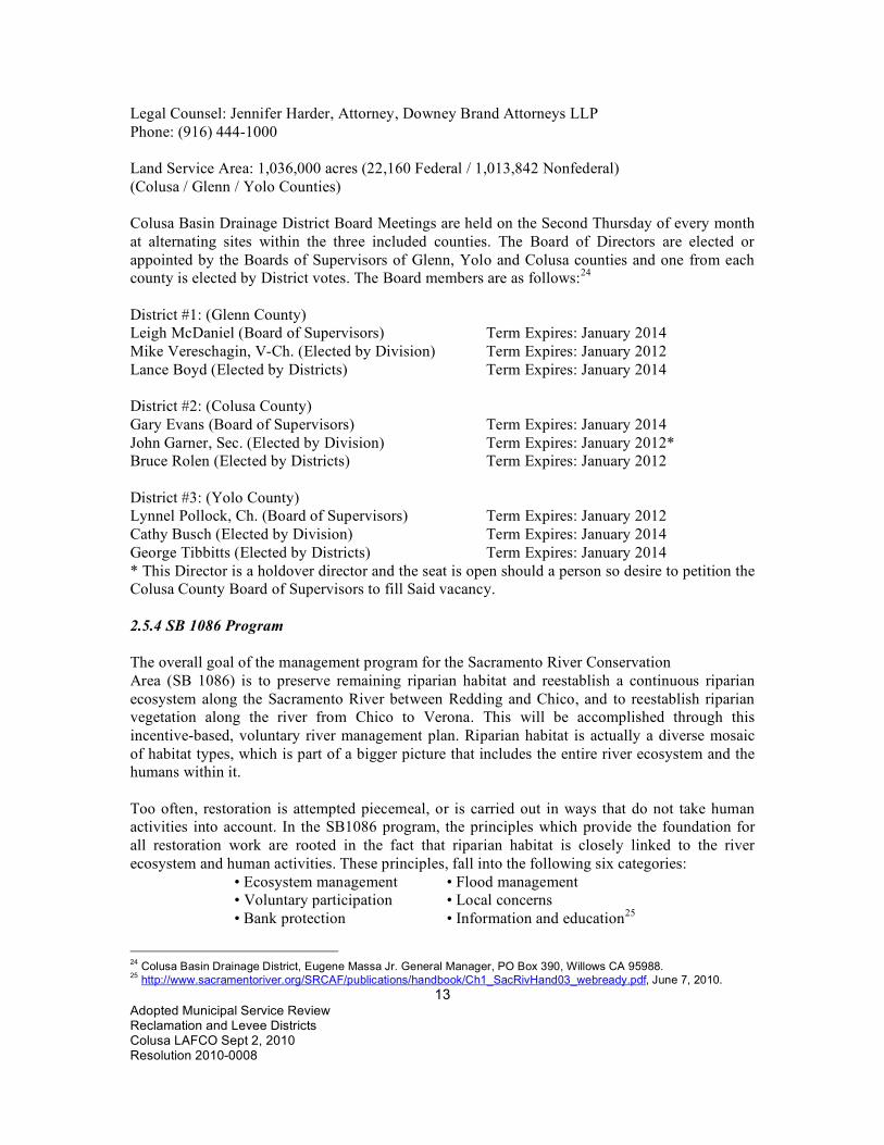
Legal Counsel: Jennifer Harder, Attorney, Downey Brand Attorneys LLP Phone: (916) 444-1000 Land Service Area: 1,036,000 acres (22,160 Federal / 1,013,842 Nonfederal) (Colusa / Glenn / Yolo Counties) Colusa Basin Drainage District Board Meetings are held on the Second Thursday of every month at alternating sites within the three included counties. The Board of Directors are elected or appointed by the Boards of Supervisors of Glenn, Yolo and Colusa counties and one from each county is elected by District votes. The Board members are as follows:24 District #1: (Glenn County) Leigh McDaniel (Board of Supervisors) Term Expires: January 2014 Mike Vereschagin, V-Ch. (Elected by Division) Term Expires: January 2012 Lance Boyd (Elected by Districts) Term Expires: January 2014 District #2: (Colusa County) Gary Evans (Board of Supervisors) Term Expires: January 2014 John Garner, Sec. (Elected by Division) Term Expires: January 2012* Bruce Rolen (Elected by Districts) Term Expires: January 2012 District #3: (Yolo County) Lynnel Pollock, Ch. (Board of Supervisors) Term Expires: January 2012 Cathy Busch (Elected by Division) Term Expires: January 2014 George Tibbitts (Elected by Districts) Term Expires: January 2014 * This Director is a holdover director and the seat is open should a person so desire to petition the Colusa County Board of Supervisors to fill Said vacancy. 2.5.4 SB 1086 Program The overall goal of the management program for the Sacramento River Conservation Area (SB 1086) is to preserve remaining riparian habitat and reestablish a continuous riparian ecosystem along the Sacramento River between Redding and Chico, and to reestablish riparian vegetation along the river from Chico to Verona. This will be accomplished through this incentive-based, voluntary river management plan. Riparian habitat is actually a diverse mosaic of habitat types, which is part of a bigger picture that includes the entire river ecosystem and the humans within it. Too often, restoration is attempted piecemeal, or is carried out in ways that do not take human activities into account. In the SB1086 program, the principles which provide the foundation for all restoration work are rooted in the fact that riparian habitat is closely linked to the river ecosystem and human activities. These principles, fall into the following six categories:
• Ecosystem management • Flood management • Voluntary participation • Local concerns • Bank protection • Information and education25
24 Colusa Basin Drainage District, Eugene Massa Jr. General Manager, PO Box 390, Willows CA 95988. 25 http://www.sacramentoriver.org/SRCAF/publications/handbook/Ch1_SacRivHand03_webready.pdf, June 7, 2010.

14 Adopted Municipal Service Review Reclamation and Levee Districts Colusa LAFCO Sept 2, 2010 Resolution 2010-0008
Maintenance Area No. 12 http://www.water.ca.gov/floodmgmt/docs/map_fld_ctrl_prjagns.pdf

15 Adopted Municipal Service Review Reclamation and Levee Districts Colusa LAFCO Sept 2, 2010 Resolution 2010-0008
DWR Maintenance Areas (Maintenance Area 1 is north of Colusa, Maintenance Area 12 is south of Colusa)

16 Adopted Municipal Service Review Reclamation and Levee Districts Colusa LAFCO Sept 2, 2010 Resolution 2010-0008
3 SETTING The Reclamation and Levee Districts examined in this report include land within Glenn and Yolo counties as well as land within Colusa County so all three counties will be briefly described below. 3.1 Colusa County 3.1.1 Colusa County Background A. Colusa County History Colusa County is one of the original counties of California, created in 1850 at the time of statehood. Parts of the County's territory were given to Tehama County in 1856 and to Glenn County in 1891. According to the U.S. Census Bureau, the County has a total area of 1,156 square miles including 6 square miles of water. A large number of streams drain the county including Elk Creek and Salt Creek. The County's eastern boundary is formed, in part, by the Sacramento River. There are two incorporated cities in Colusa County: Colusa and Williams. There is one census-designated place: Arbuckle. B. Colusa County Climate The northern Central Valley has a Mediterranean climate with pronounced, but mild, wet winters and hot, dry summers. Rainfall of the region is confined mainly to winter months and varies between 15 to 20 inches per year. Winters can be very cold for short periods while summers are hot and dry, with practically no rain from May to September.26 C. Colusa County Agriculture According to the University of California Cooperative Extension, the major crops of Colusa County include rice, processing tomatoes, almonds, wheat, vegetable seeds, walnuts and prunes. The total value of agricultural crops produced in Colusa County in 2008 was $662,644,000 up from $484,525,000, in 2007 and $422,729,000 in 2006. In 2009 the value declined slightly to $602,571,000.27 The value of rice, the County’s largest crop was $188,027,000 in 200728 and increased substantially to $337,499,000 in 200829 but declined to $243,459,000 in 2009. Processing tomatoes, walnuts and vegetable seeds increased in value in 2009. D. Colusa County Employment In Colusa County 24% of the 2007 workforce was classified as agricultural. The employment/unemployment patterns directly reflect that condition. The number of jobs in all industries had a decrease of 5.3% (-410 jobs) in 2007. Without considering the agriculture 26 Colusa County General Plan, 1994 27 Colusa County Department of Agriculture, Harry A. Krug, Agricultural Commissioner, 100 Sunrise Blvd. Suite F, Colusa CA 95932, Phone: 530-458-0580, “2009 Colusa County Crop Report.” 28 Colusa County Department of Agriculture, Harry A. Krug, Agricultural Commissioner, 100 Sunrise Blvd. Suite F, Colusa CA 95932, Phone: 530-458-0580, “2007 Colusa County Crop Report.” 29 Colusa County Department of Agriculture, Harry A. Krug, Agricultural Commissioner, 100 Sunrise Blvd. Suite F, Colusa CA 95932, Phone: 530-458-0580, “2008 Colusa County Crop Report.”

17 Adopted Municipal Service Review Reclamation and Levee Districts Colusa LAFCO Sept 2, 2010 Resolution 2010-0008
employment for Colusa County, the seasonal variation remains because of the impact agriculture has on the rest of the employment sectors. Nonfarm employment growth in Colusa County grew in 2007 with a 3.1% (+170 jobs) increase. The annual Unemployment Rate for Colusa County in 2007 increased by half a percentage point to 13.1%, up from the 12.6% Rate in 2006.30 The April 2009 unemployment rate for Colusa County was 19.1% compared to 10.9% for California and 8.6% for the US.31 E. Colusa County Population Growth Colusa County population has grown steadily since 2000 as shown in the following table: COLUSA COUNTY POPULATION 2000 TO 200932 Year City of Colusa
Population City of Williams Population
Unincorporated Area of Colusa County Population
Colusa County Total Population
2000 5,402 3,670 9,732 18,804 2001 5,452 3,768 9,839 19,059 2002 5,535 3,879 9,997 19,411 2003 5,608 4,050 10,151 19,809 2004 5,685 4,279 10,377 20,341 2005 5,586 4,797 10,509 20,892 2006 5,642 5,033 10,615 21,290 2007 5,688 5,175 10,753 21,616 2008 5,705 5,285 10,821 21,811 2009 5,900 5,287 10,810 21,997 F. Colusa County Population Data As of the US Census of 2000, there were 18,804 people residing in Colusa County. In 2007 there were 7,448 housing units in Colusa County. The Colusa County Homeownership Rate in 2000 was 63.2% (compared to 56.9% for California). The median value of owner-occupied housing units in 2000 was $107,500 (compared to $211,500 for California).The percentage of housing units in multi-family structures in Colusa County was 11.6% in 2000 (compared to 31.4% for California).33 In 2008 Colusa County had 8.7% of the population under five years old, 28.8% under 18 years old, and 11.6% aged 65 and older.34 Educational levels in Colusa County were lower than those for California as a whole, with 64.0% of Colusa County residents aged 25 and older holding a High School Diploma and 10.6% holding
30 http://www.csus.edu/indiv/j/jensena/sfp/sa11/yol2/col/colusa.htm 31 State of California, Employment Development Department, Labor Market Information Division, Phone 916-202-2162, May 22, 2009. 32 State of California, Department of Finance, E-4 Population Estimates for Cities, Counties and the State, 2001–2009, with 2000 Benchmark, Sacramento, California, May 2009. 33 US Census Bureau, http://quickfacts.census.gov/qfd/states/06/06011.html, September 22, 2009. 34 US Census Bureau, http://quickfacts.census.gov/qfd/states/06/06011.html, September 22, 2009

18 Adopted Municipal Service Review Reclamation and Levee Districts Colusa LAFCO Sept 2, 2010 Resolution 2010-0008
a Bachelor’s degree or higher. In California 76.8% of residents aged 25 and older are High School Graduates and 26.6% have a Bachelor’s degree or higher.35 G. Colusa County Income Levels The 2007 median income for a household in Colusa County was $43,882 (compared to $59,928 for the State of California).36 The 1999 per capita income for Colusa County was $14,730. In 2007, 12.7% of the County population was below the poverty line.37 The following table shows the 2009 income levels for a family of four in Colusa County: State of California Department of Housing and Community Development Colusa County Income Limits 200938 Four Persons in Household Income Category Annual Income Level Extremely Low $16,750 Very Low $27,900 Lower Income $44,650 Median Income $55,800 Moderate Income $66,950 3.1.2 Colusa County General Plan The Colusa County General plan recognizes there are sensitive lands along the Sacramento River that contain rare species. The Plan also recognizes that much of the Sacramento River’s riparian vegetation has been destroyed as a result of agriculture, flood control and channelization. County policy recommends habitat resource conservation and protection of water quality and quantity. The Resource Conservation Element of the Colusa County General Plan encourages conservation of fish and wildlife habitat throughout the County. Preservation of natural qualities of rivers and streams is also encouraged. Zoning, planning and taxation policies should preserve watershed areas, as well as agricultural lands and hillside areas. Development in the Sacramento River floodway and ecologically sensitive areas is discouraged. The Open Space and Recreation Element supports the conservation of the natural beauty of rivers and streams.39 The County is in the process of re-writing its general plan. Compliance with the requirements of AB- 162 include containing known information with respect to flood hazards and sending the safety element to the Central Valley Flood Protection Board (CVFPB). 3.1.3 City of Colusa General Plan The City of Colusa is surrounded by Zones A and AE (Within the 100 year Flood Zone). According to the General Plan localized flooding occurs within the City Limits, primarily on its 35 US Census Bureau, http://quickfacts.census.gov/qfd/states/06/06011.html, September 22, 2009. 36 US Census Bureau, http://quickfacts.census.gov/qfd/states/06/06011.html, September 22, 2009. 37 US Census Bureau, http://quickfacts.census.gov/qfd/states/06/06011.html, September 22, 2009. 38 State of California, Department of Housing and Community Development, Memorandum Official State Income Limits for 2009, April 2, 2009. 39 Colusa County, Colusa County General Plan Final, January 13, 1989.

19 Adopted Municipal Service Review Reclamation and Levee Districts Colusa LAFCO Sept 2, 2010 Resolution 2010-0008
east side. The plan calls for new development to mitigate the effects of storm water drainage especially in those areas east of Bridge Street and Highway 20. The City has policies to cooperate with all agencies seeking to maintain the existing levee system and to avoid encroachment that would damage structural integrity of the levee system. The City of Colusa General Plan adopted in 2007 designates a Riverfront District as a special planning area. A Riverfront Plan is called for as an implementation measure. This plan will be prepared by the City and incorporated into the City’s zoning ordinance prior to or concurrent with large development approvals.40 3.2 Glenn County 3.2.1 Glenn County Background Glenn County is located in north of Colusa County. Glenn County was formed in 1891 from parts of Colusa County. It was named for Dr. Hugh J. Glenn, who was the largest wheat farmer in the State during his lifetime and a man of great prominence in political and commercial life in California. According to the US Census Bureau, Glenn County has a total area of 1,327 square miles. As of 2000, Glenn County had a population of 26,453 and 6,732 families. There were 9,982 housing units.41 In 2008, the population of Glenn County was 28,237. The County had 7.9% of the population aged under 5 years old, 27.5% under 18 years old, and 12.3% were 65 or more years old. The female population of Glenn County was 49.5%.42 The median household income in 2007 was $38,521 per year (compared to $59,928 per year for the State of California).43 3.2.2 Glenn County General Plan The Glenn County General Plan identifies goals and policies that address conservation issues along the Sacramento River. While the County has created a map overlay that outlines groundwater and streamside areas recommended for protection, County Ordinances have not yet been amended to include development standards that protect watershed areas. Map overlays for restorable wetlands and areas of biological importance have also been created. Watershed protection standards recommend that all new developments proposed adjacent to streams include grading, excavation and erosion control plans to minimize degredation to soil and water quality. The Glenn County General Plan recognizes the Sacramento River corridor as an area of significant biological importance. Development along the Sacramento River should avoid environmentally sensitive areas and eliminate or minimize any adverse impacts from all proposed
40 City of Colusa, General Plan, October 2007, page 2-22. 41 US Census Bureau, http://quickfacts.census.gov/qfd/states/06/06021.html, September 30, 2009. 42 US Census Bureau, http://quickfacts.census.gov/qfd/states/06/06021.html, September 30, 2009 43 US Census Bureau, http://quickfacts.census.gov/qfd/states/06/06021.html, September 30, 2009.

20 Adopted Municipal Service Review Reclamation and Levee Districts Colusa LAFCO Sept 2, 2010 Resolution 2010-0008
projects. County policy encourages preservation of natural riparian habitat along the Sacramento River as well as other watersheds, including Butte and Stony Creeks. Existing riparian vegetation should be protected and revegetation programs undertaken. Mitigation measures should result in no net loss of habitat productivity. The County works with DFG and USFWS, as well as conservation and preservation groups, to identify areas for restoration and enhancement. The Glenn County General Plan suggests amending County Zoning Codes to include a Streamside Protection Zone, but the County has not addressed this recommendation. The County has recently applied for a Federal grant to fund preliminary watershed protection studies. Mining and mineral resources are also addressed in the Glenn County General Plan. Mineral extraction is permitted, but is required to be compatible with surrounding land use and should not affect the environment. The use permit process decides when and where these activities can occur. The Extractive-Industrial zoning designation has been removed from areas containing natural riparian habitat and changed to agricultural or light industrial status; this is meant to provide greater protection to habitat areas previously subject to mining activities.44 3.3 Yolo County 3.3.1 Yolo County Background As of the 2000 census, Yolo County had a population of 168,660. Excluding the conurbation of the University of California, Davis and the areas surrounding the City of Davis and the neighboring City of Sacramento; Yolo County remains a relatively rural agricultural region. This is evidenced by the multi-billion dollar California tomato industry, in and around Yolo County, dominating 90% of the tomato market in the United States. Yolo County is part of the Sacramento-Arden-Arcade-Roseville Metropolitan Statistical Area. As of the census of 2000, there were 168,660 people, 59,375 households, and 37,465 families residing in Yolo County. In 2008, the population increased to 197,658.45 Yolo County had 6.5% of the population aged under 5 years old, 22.8% under 18 years old, and 9.7% were 65 or more years old. The female population was 50.9%.46 3.3.2 Yolo County General Plan The Yolo County General Plan recommends maintaining waterways and riverbank corridors as part of its open space preservation program because of high scenic values. The Plan includes maps which highlight these areas as significant. Other recommendations include protection and creation of wildlife habitat areas and the adoption of lists and maps of the distribution of natural features and other significant characteristics of the County’s physical environment. The County’s goal is to plan, encourage, and regulate natural resources in order to ensure long-term ecological benefits, and to prevent unnecessary disruptions to terrain, vegetation, and other resources.
44 Glenn County General Plan, 1993. 45 US Census Bureau, http://quickfacts.census.gov/qfd/states/06/06113.html, September 30, 2009 46 US Census Bureau, http://quickfacts.census.gov/qfd/states/06/06113.html, September 30, 2009

21 Adopted Municipal Service Review Reclamation and Levee Districts Colusa LAFCO Sept 2, 2010 Resolution 2010-0008
All watershed areas are designated on County overlay maps for conservation purposes. Watershed areas are limited to the following activities: grazing; wild hay production; soil, water and wildlife conservation; and non-intensive recreation. The County requires conditional use permits to ensure conservation of natural vegetation. The Yolo County General Plan does not permit sand and gravel mining operations in areas along the Sacramento River or its tributaries.47
47 Yolo County General Plan 1983.
22 Adopted Municipal Service Review Reclamation and Levee Districts Colusa LAFCO Sept 2, 2010 Resolution 2010-0008
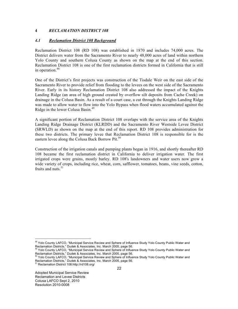
4 RECLAMATION DISTRICT 108 4.1 Reclamation District 108 Background Reclamation District 108 (RD 108) was established in 1870 and includes 74,000 acres. The District delivers water from the Sacramento River to nearly 48,000 acres of land within northern Yolo County and southern Colusa County as shown on the map at the end of this section. Reclamation District 108 is one of the first reclamation districts formed in California that is still in operation.48 One of the District’s first projects was construction of the Tisdale Weir on the east side of the Sacramento River to provide relief from flooding to the levees on the west side of the Sacramento River. Early in its history Reclamation District 108 also addressed the impact of the Knights Landing Ridge (an area of high ground created by overflow silt deposits from Cache Creek) on drainage in the Colusa Basin. As a result of a court case, a cut through the Knights Landing Ridge was made to allow water to flow into the Yolo Bypass when flood waters accumulated against the Ridge in the lower Colusa Basin.49 A significant portion of Reclamation District 108 overlaps with the service area of the Knights Landing Ridge Drainage District (KLRDD) and the Sacramento River Westside Levee District (SRWLD) as shown on the map at the end of this report. RD 108 provides administration for these two districts. The primary levee that Reclamation District 108 is responsible for is the eastern levee along the Colusa Back Borrow Pit.50 Construction of the irrigation canals and pumping plants began in 1916, and shortly thereafter RD 108 became the first reclamation district in California to deliver irrigation water. The first irrigated crops were grains, mostly barley. RD 108's landowners and water users now grow a wide variety of crops, including rice, wheat, corn, safflower, tomatoes, beans, vine seeds, cotton, fruits and nuts.51
48 Yolo County LAFCO, “Municipal Service Review and Sphere of Influence Study Yolo County Public Water and Reclamation Districts,” Dudek & Associates, Inc. March 2005, page 56. 49 Yolo County LAFCO, “Municipal Service Review and Sphere of Influence Study Yolo County Public Water and Reclamation Districts,” Dudek & Associates, Inc. March 2005, page 56. 50 Yolo County LAFCO, “Municipal Service Review and Sphere of Influence Study Yolo County Public Water and Reclamation Districts,” Dudek & Associates, Inc. March 2005, page 56. 51 Reclamation District 108:http://rd108.org/
23 Adopted Municipal Service Review Reclamation and Levee Districts Colusa LAFCO Sept 2, 2010 Resolution 2010-0008
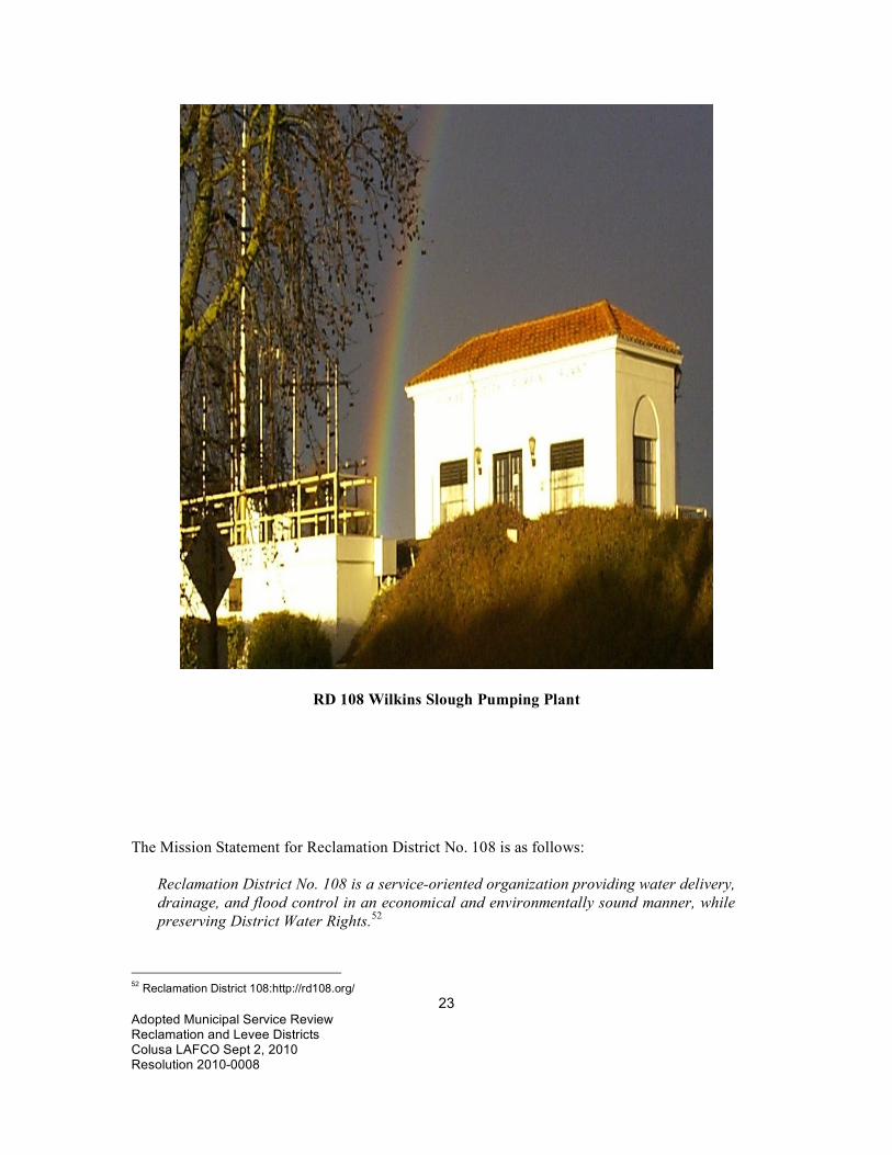
RD 108 Wilkins Slough Pumping Plant The Mission Statement for Reclamation District No. 108 is as follows:
Reclamation District No. 108 is a service-oriented organization providing water delivery, drainage, and flood control in an economical and environmentally sound manner, while preserving District Water Rights.52
52 Reclamation District 108:http://rd108.org/

24 Adopted Municipal Service Review Reclamation and Levee Districts Colusa LAFCO Sept 2, 2010 Resolution 2010-0008
4.2 RD 108 Government 4.2.1 RD 108 Board of Directors There are five members on the Board of Reclamation District 108 as follows: Director Term Expires Arnold Andreotti 12/02/2011 PO Box 298 Colusa CA 95932 Mike Miller 12/04/13 366 State Highway 45 Knights Landing, CA 95645 Marty Stripling 12/02/2011 41758 Co. Road 113 Knights Landing, CA 95645 Frederick J. “Fritz” Durst 12/04/13 1769 Woodside Drive Woodland CA 95695 Jim Erdman 12/02/2011 8661 Ceres Avenue Knights Landing, CA 9545 Board meetings are held every 3rd Thursday of each month at 8:30 a.m. at the District Headquarters: 975 Wilson Bend Road, Grimes, California.53 There is an annual Landowner and Water User Meeting held in February.54 4.2.2 RD 108 Contact Information The contact information for Reclamation District 108 is as follows: Lewis Bair, General Manager, Reclamation District 108 975 Wilson Bend Road, P.O. Box 50, Grimes, CA 95950 (530) 437-2221, (530) 437-2248 (FAX) Website: www.rd108.org Email: [email protected] or mailto:[email protected]
53 Reclamation District 108, Email from Cathy Busch, Secretary, October 17, 2008. 54 Reclamation District 108, Minutes January 17, 2008.

25 Adopted Municipal Service Review Reclamation and Levee Districts Colusa LAFCO Sept 2, 2010 Resolution 2010-0008
4.2.3 RD 108 Personnel There are 23 employees including the following:55 Lewis Bair, General Manager Kathryn Chandler, Assistant Manager Chad Navarrot, Superintendent Cathy Busch, Executive Secretary Beverly Walls, Bookkeeper Kevin O’Brien, Attorney Luis Andrade, System A Waterman, (530) 870-1100 Rafael Villa, System B Waterman, (530) 870-1101 Mike Ludovina, System C Waterman, (530) 870-1102 John Hetherington, System A & D Relief Waterman, (530) 870-1100 or (530) 870-1103 4.3 RD 108 Facilities Water transfer operations are provided by the following facilities:
• Wilkins Slough Pumping Plant • Rough & Ready Pumping Plant • Emery Poundstone Pumping Plant • North and South Steiner Pumping Plants • El Dorado Pumping Plant
In 2009 Reclamation District 108 participated in the Drought Water Bank and made approximately 1,500 acre-feet of water available by pumping groundwater instead of diverting water from the Sacramento River. The District participates in water transfers on a year-by-year basis. RD 108 has over the past 20 years worked diligently in developing water conservation and efficient water management programs in order to make beneficial use of its surface and groundwater supplies and maintain production of its agricultural lands. These conservation efforts have allowed RD 108 to participate in water use transfer programs. There is an expanding interest by the water community in water transfer programs which would alleviate water shortages to agricultural, urban and environmental agencies and water users. It is RD 108 policy to consider the transfer of water that is not required to supply the needs of its landowners and water users when such water is available. First priority will be given to agricultural, environmental and urban water users north of the Delta. Fish Screen Projects: 1) Wilkins Slough Positive Barrier Fish Screen
55 Reclamation District 108, Minutes January 17, 2008.

26 Adopted Municipal Service Review Reclamation and Levee Districts Colusa LAFCO Sept 2, 2010 Resolution 2010-0008
The Wilkins Slough Fish Screen Sediment Removal Project was completed March 1999. The project is the result of nearly 8 years of planning, design, testing and construction. The objectives of the project was to minimize the impact of water diversions on winter-run Chinook salmon and meet current resource agency criteria for fish protection facilities. The fish screen project was the result of a cooperative effort involving the District and Federal and State resource agencies. 2) Emery Poundstone Combined Pumping Plant and Fish Screen Project The District combined three of its river diversion pumping plants, Boyers Bend Pumping Plant, Howells Landing Pumping Plant and Tyndall Mound Pumping Plant into a single facility in order to minimize its impact on native fish species. The Poundstone Pumping Plantis a five-bay structure with fish screens made of stainless steel 1.75 mm slot openings. The project was completed in 2008. 4.4 RD 108 Shared Facilities RD 108 is located within both the Knights Landing Ridge Drainage District and the Sacramento River Westside Levee District except for small parts of RD 108 which may overlap with only one of the other two districts. RD 108 shares administrative facilities and staff with the Sacramento River Westside Levee District and the Knights Landing Ridge Drainage District which is located in Yolo County.56 The two districts reimburse RD 108 for the services provided. 4.5 RD 108 Budget The 2009 Budget for Reclamation District 108 as presented by the District is shown below in three sections:
56 Yolo County LAFCO, “Municipal Service Review and Sphere of Influence Study Yolo County Public Water and Reclamation Districts,” Dudek & Associates, Inc. March 2005, page 45.

27 Adopted Municipal Service Review Reclamation and Levee Districts Colusa LAFCO Sept 2, 2010 Resolution 2010-0008
RECLAMATION DISTRICT NO.108 2009 MAINTENANCE FUND BUDGET OPERATING INCOME 402 SYSTEM FACILITIES RENTAL 1,157,625 404 SRWLD/SERVICES 128,000 406 KLRDD/SERVICES 40,000 410 TRACT 6 LEASES 1,598,386 432 MAINT. SERVICE-LANDOWNER 12,000 439 OUTSIDE DRAINAGE CHARGE 5,964 440 WATER TRANSFERS 1,512,000 448 VEHICLE & EQUIPMENT SALES 18,000 450 MISCELLANEOUS OPERATING 3,000 NON-OPERATING INCOME 492 MINERAL LEASES 400 493 EARNED INTEREST 27,660 494 OUTSIDE SALES (MATERIALS) 0 495 RESIDENCE USE FEES 3,590 496 MISCELLANEOUS NON-OPERATING 2,498 496A TRANSFERS FROM RESERVE ACCOUNT 200,000 PROJECT INCOME 486A LONG CRESTED WEIR 116,000 486B CO-OP WATER MEASUREMENT 0 486C SOLAR 3,450,000 486D WATER RECYCLE MGMT - SCADA 50,000 486E WATER RECYCLE EFFICIENCY PROJECT 0 487 COMBINE PUMP PLANT 200,000 TOTAL INCOME: $8,525,123

28 Adopted Municipal Service Review Reclamation and Levee Districts Colusa LAFCO Sept 2, 2010 Resolution 2010-0008
RECLAMATION DISTRICT NO.108 2009 MAINTENANCE FUND BUDGET EXPENSES Part 1 of 2 WATER SUPPLY 221,200 2.7% 506 CONTRACT RENEWAL 200,000 601 PHASE 8 - BAY DELTA 21,200 WAGES & BENEFITS 1,398,300 17.0% 510 WAGES 966,000 512 PAYROLL TAXES & BENEFITS 366,000 513 WORKERS' COMPENSATION INSURANCE 58,000 514 TRUSTEES FEES & EXPENSES 8,300 CONSULTING SERVICES 139,200 1.7% 520 LEGAL - GENERAL 45,000 522 ENGINEERING - GENERAL 69,000 524 ACCOUNTING 9,800 526 FINANCIAL 2,400 528 PUBLIC RELATIONS 3,000 525 WDC CONSULTANT 10,000 ADMINISTRATION & SUPPLIES 331,353 4.0% 530 DISTRICT INSURANCE 57,586 531 MISCELLANEOUS FEES 46,900 532 MEMBERSHIPS 115,967 534 OFFICE SUPPLIES & EXPENSES 27,000 536 MEETINGS & CONFERENCES 15,000 538 COMMUNICATION SERVICES 17,700 540 HEADQUARTERS MAINTENANCE 36,000 542 DISTRICT RESIDENCES 14,200 543 DOMESTIC WELLS MAINTENANCE 1,000

29 Adopted Municipal Service Review Reclamation and Levee Districts Colusa LAFCO Sept 2, 2010 Resolution 2010-0008
RECLAMATION DISTRICT NO.108 2009 MAINTENANCE FUND BUDGET EXPENSES Part 2 of 2 MAINTENANCE 1,204,000 14.6% 550 CONTRACT MAINTENANCE SERVICES 96,000 551 TELEMETRY/SCADA 7,000 552 POWER & ENERGY 181,500 553 DEEP WELLS MAINTENANCE 0 554 FUEL & LUBRICANTS 139,000 555 EQUIPMENT LEASES 0 556 SHOP TOOL & SUPPLIES 35,500 557 EQUIPMENT/VEHICLE-MAINT/REPAIR 93,000 560 PUMPING PLANT MAINTENANCE 294,000 562 IRRIGATION SYSTEM MAINTENANCE 180,000 563 DRAINAGE SYSTEM MAINTENANCE 150,000 564 BACK LEVEE MAINTENANCE 28,000 570 TRACT 6 FARMS 188,000 2.3% 580 CAPITAL OUTLAY 115,000 1.4% 581 WATER TRANSFER 37,000 0.4% 582 MISCELLANEOUS OPERATING 38,000 0.5% 594 MISCELLANEOUS NON-OPERATING 10,500 0.1% 599 FISH BARRIER PROJECT-DISTRICT 15,000 0.2% PROJECT EXPENSES 586A LONG CRESTED WEIR 175,000 2.1% 586B CO-OP WATER MEASUREMENT 0 0.0% 586C SOLAR 3,450,000 41.9% 586D WATER RECYCLE MGMT - SCADA 65,000 0.8% 586E WATER RECYCLE EFFICIENCY PROJECT 4,000 0.0% 586F BOYER PIPELINE 675,000 597 COMBINE PUMP PLANT - CONSULTANT 101,000 1.2% 598 COMBINE PUMP PLANT - CONTRACTORS 68,450 0.8% TOTAL EXPENSES $8,236,003 91.8%

30 Adopted Municipal Service Review Reclamation and Levee Districts Colusa LAFCO Sept 2, 2010 Resolution 2010-0008
4.6 MSR for Reclamation District 108 4.6.1 Growth and Population Projection MSR Determinations for the RD 108 Area 1-1) Population growth is not expected within RD 108 because the area is used for farming
and is zoned for agriculture. 4.6.2 Capacity and Infrastructure MSR Determinations for Reclamation District 108 2-1) The District has adequate infrastructure and works to maintain the facilities. 4.6.3 Financial Ability MSR Determinations for Reclamation District 108 3-1) The District should work to provide financial information such as the Budget and Audit
Reports on the District’s website. 4.6.4 Opportunities for Shared Facilities MSR Determinations for Reclamation District 108 4-1) The District shares administration with the Sacramento River Westside Levee District
and the Knights Landing Ridge Drainage District. 4-2) The District participates in water transfers on a year by year basis with priority
given to water supply needs with the Colusa Basin. 4-3) The District belongs to the Power and Water Resources Pooling Authority (PWRPA). 4.6.5 Government Structure and Accountability MSR Determinations for Reclamation
District 108 5-1) The District has an excellent website to communicate with tax-payers, residents, and the
public; however the website needs to be kept up to date. 5-2) The District should study the most efficient manner to provide administrative services. 5-3) The District adopts budgets and rate changes at hearings where the public is notified and
invited. Information is placed in the local newspaper, when required.

31 Adopted Municipal Service Review Reclamation and Levee Districts Colusa LAFCO Sept 2, 2010 Resolution 2010-0008

32 Adopted Municipal Service Review Reclamation and Levee Districts Colusa LAFCO Sept 2, 2010 Resolution 2010-0008
5 RECLAMATION DISTRICT 479 5.1 Reclamation District 479 Background 5.1.1 Reclamation District 479 History Reclamation District 479 is located south of Colusa and north of RD 108. The 5,951.97 acre District is almost completely within the Sacramento River West Side Levee District. Reclamation District 479 was formed in 1885.57 Reclamation District 479 covers the southern part of the Mormon Basin, a part of the much larger Colusa Basin. The chief characteristic of these basins is that their edges or rims have been built up by alluvial deposits during flood periods so that the edges are higher than the central portion of the area.58 A history of Reclamation District 479 is provided by the Colusa County Auditor’s Office as follows:59
1872-1909: The District did no reclamation work. The District depended on individual landowners to protect their lands. 1909: A plan was adopted to construct a levee along Sycamore Slough and Dry Slough to provide flood protection for all land in the District. 1915: A plan was adopted for the repair of breaks in the original levee system and its extension along Sycamore Slough. A plan was also adopted for a drainage system for the reclamation of District lands to remove rain and seepage water. 1935-1938: A substantial portion of the District was inundated with rain and seepage water which created a considerable expense to dewater the District. 1940-1942: A plan for drainage was prepared and adopted in 1942. Due to World War II rationing, only three small pumps could be installed. These pumps had only half the capacity called for by the plan and were adequate only for summer drainage. 1942-1943: The District constructed six miles of drainage ditches and a small pumping plant. The ditch system consists of a Main Canal extending about 8,000 feet east of Sycamore Slough and located immediately north of the Grimes-Arbuckle Highway. From the east end of the Main Canal, Lateral A extends north for two miles. About one mile below the end of Lateral A, it is joined by Lateral B which extends west about 6,600 feet to cross the Sycamore Slough
57 Colusa LAFCO, Reclamation District 479 Sphere of Influence Study, 1984. 58 Colusa County Auditor, Annual Audit for Calendar year Ended December 31, 2008, Reclamation District 479, April 7, 2009. 59 Colusa County Auditor, Annual Audit for Calendar year Ended December 31, 2008, Reclamation District 479, April 7, 2009.

33 Adopted Municipal Service Review Reclamation and Levee Districts Colusa LAFCO Sept 2, 2010 Resolution 2010-0008
Road. From the east end of the Main Canal, Lateral C extends southerly for about 4,000 feet. Necessary culverts were installed in each ditch. Only a small length of ditch has been added since the original construction was done. The pumping plant is located just east of the old Sycamore Slough Levee and just north of the Grimes-Arbuckle Highway. It consists of a concrete sump, with provision for four vertical, propeller-type pumps. 1958: The US Army Corps of Engineers rebuilt the Sycamore Slough Levee along the east edge of the 2047 Main Drain, which eliminated a portion of the heavy seepage from the 2047 Main Drain. 1993: A Groundwater Management Plan was adopted in 1993 to develop a groundwater management program for the groundwater resources within the District to benefit the landowners within the District.
Reclamation District 479 is primarily concerned with drain water and makes sure that all of the drain water enters the RD 2047 Canal. A map of RD 479 is shown at the end of this section. 5.1.2 Reclamation District 479 Board of Directors There are three members of the RD 479 board of directors as follows:60 Director Term Expires Charles Marsh 12/06/2013 PO Box 725, Arbuckle, CA 95912 Jim Wallace (appointed) 12/02/2011 Thomas Ingraham 12/02/2011 The Board meets two times per year in the spring and in September, and as often as needed at other times. The meetings are held at the Strain Ranch Office on West Hahn Road near Arbuckle at 10 am.61 5.1.3 Reclamation District 479 Contact Information The contact information for Reclamation District 479 is as follows: Shelley Miller, Secretary Reclamation District 479 730 Harris Street, Colusa, CA 95932 (530) 458-4849 (Wednesdays) Email: [email protected]
60 Colusa County Clerk, 530-458-0500, August 10, 2010. 61 Reclamation District 479, Shelley Miller, Secretary, [email protected], September 28, 2009.

34 Adopted Municipal Service Review Reclamation and Levee Districts Colusa LAFCO Sept 2, 2010 Resolution 2010-0008
5.1.4 RD 479 Finances
The Draft Budget for Reclamation District 479 and the cash balance history (as presented by the District) are shown on the following pages. The District has never had a budget prior to 2009 and the budget process has not yet been completed. The District will approve a Budget on November 10, 2008.62 RECLAMATION DISTRICT 479 2010 BUDGET OPTIONS 2010 2010 2010 Average 2009 2008 2007 Proposal A Proposal
B Proposal C
10/7/ 09
Income: Assessments 101,240.00 90,800.00 85,840.00 91,219.96 51,769.98 28,689.04 6,900.00 22,300.63 Interest 120.00 120.00 120.00 16.77 59.85 184.10 Finance Charges
100.00 100.00 100.00
Uncategorized 1,635.00 Total Income 101,460.00 91,020.00 86,060.00 92,871.73 58,729.83 51,173.77 Expenses: Accounting 2,500.00 2,500.00 2,500.00 2,025.00 2,925.00 1,525.00 1,800.00 Advertising 47.19 44.41 Bank Charge 20.00 30.00 Dues & Fees 1,800.00 1,800.00 1,800.00 2,391.00 1,724.00 1,634.00 1,301.00 1,143.00 Fuel 30,000.00 30,000.00 30,000.00 22,064.10 3,404.31 30,968.53 5,805.73 Legal 500.00 500.00 500.00 900.00 1,054.00 Maint. & Repair
Ditch 2,000.00 2,000.00 2,000.00 2,930.00 Pumps 3,000.00 3,000.00 3,000.00 15,205.75 Office Supplies
100.00 100.00 100.00 104.46 232.63 67.33 80.55
Postage 150.00 150.00 150.00 70.67 148.00 83.00 41.00 Rent ~ office space
1,200.00 1,200.00 1,200.00 600.00 600.00
Utilities 27,000.00 27,000.00 27,000.00 16,010.15 18,631.67 23,655.90 14,847.26 Total Expenses
68,250.00 68,250.00 68,250.00 48,272.52 27,665.61 59,017.76 25,062.95
Net Profit or Loss
33,210.00 22,770.00 17,810.00 10,558.48 65,206.12 (287.93) 26,110.82
Drainage Charges:
Flat Rate Assessment
14.00 14.00 12.00
62 Reclamation District 479, Shelley Miller, Secretary, [email protected], September 28, 2009.

35 Adopted Municipal Service Review Reclamation and Levee Districts Colusa LAFCO Sept 2, 2010 Resolution 2010-0008
Rice 6.00 4.00 6.00 Rice 18.00 15.00 13.00 Row Crop 5.00 3.00 3.00 Row Crop 15.00 12.00 10.00 Wheat or 2 Irrigations
3.00 1.00 - Wheat/Bare 12.00 9.00 7.00
Decomp & Duck
6.00 4.00 4.00 Winter/Flood 16.00 11.00 11.00
Number of Acres:
Assessment 5,220.00 5,220.00 5,220.00 Rice 3,100.00 3,100.00 3,100.00 2,971.87 3,401.09 2,394.74 3,182.46 Row Crop 1,000.00 1,000.00 1,000.00 936.35 1,227.70 603.24 634.65 Wheat or 2 Irrigations
720.00 720.00 720.00 721.26 612.87 1,051.07 501.27
Duck & Decomp (Winter Flood)
400.00 400.00 400.00 265.14 264.40 540.67 123.38
Total Acres 5,220.00 5,220.00 5,220.00 4,894.61 5,506.06 4,589.72 4,441.76 5,951.97 acres in RD479
RECLAMATION DISTRICT 479 CASH BALANCE 2009 2008 2007 2006 2005 2004 15-Sep 12-Dec 14-Dec 14-Dec 14-Dec 14-Dec CURRENT ASSETS:
Wells Fargo Checking
$16,022.83 $1,342.45 $824.51 $1,980.01 $3,296.33 $1,081.55
Wells Fargo Money Market Account
$56,587.69 $37,935.92 $39,150.09 $11,808.63 $20,884.42 $17,802.90
Accounts Receivable
$0.80
TOTAL CURRENT ASSETS:
$72,611.32 $39,278.37 $39,974.60 $13,788.64 $24,180.75 $18,884.45
CURRENT LIABILITIES:
Accounts Payable $1,134.24 TOTAL CURRENT LIABILITIES:
$1,134.24 $0.00 $0.00 $0.00 $0.00 $0.00
NET CURRENT POSITION:
$71,477.08 $39,278.37 $39,974.60 $13,788.64 $24,180.75 $18,884.45

36 Adopted Municipal Service Review Reclamation and Levee Districts Colusa LAFCO Sept 2, 2010 Resolution 2010-0008
5.2 MSR for Reclamation District 479 5.2.1 Growth and Population Projection MSR Determinations for the Reclamation District
479 Area 1-1) Land within the RD 497 area is zoned for agriculture and little or no population growth is
expected. 5.2.2 Capacity and Infrastructure MSR Determinations for Reclamation District 479 2-1) The District has minimal infrastructure and relies on the RD 2047 drain to convey
drainage water to the Sacramento River. 5.2.3 Financial Ability MSR Determinations for Reclamation District 479 3-1) The District appears to have adequate finances but the financial accounting process needs
to be improved. 5.2.4 Opportunities for Shared Facilities MSR Determinations for Reclamation District 479
4-1) The District should explore opportunities to share administration with a similar district.
5.2.5 Government Structure and Accountability MSR Determinations for Reclamation
District 479 5-1) The District should establish a website to provide information to the landowners and the
public.

37 Adopted Municipal Service Review Reclamation and Levee Districts Colusa LAFCO Sept 2, 2010 Resolution 2010-0008

38 Adopted Municipal Service Review Reclamation and Levee Districts Colusa LAFCO Sept 2, 2010 Resolution 2010-0008
6 RECLAMATION DISTRICT 1004 6.1 Reclamation District 1004 Background 6.1.1 RD 1004 Description Reclamation District 1004 operates irrigation conveyances within its 23,000-acre jurisdiction primarily in Colusa County, with some land Glenn County. The District, formed in 1912,63 is located east of the Sacramento River with its eastern boundary formed by Butte Creek along the Colusa-Sutter County Line. A map of the District is shown at the end of this section. Land in the District is farmed, primarily in rice.64 The District provides growers with water that is drawn from the Sacramento River at the Princeton pumping plant to the northwest of the District. Once irrigation water is used, it drains from fields within the District generally moving to the south and/or east towards Butte Creek. Water is blocked from draining into Butte Creek by weirs and risers and is recirculated through the District for reuse. Butte Creek flows into the Sacramento River at the southern border of the District approximately 5.5 miles downstream from the City of Colusa. In addition to agricultural water delivery, the District provides water for habitat maintenance to the National Audubon Society (NAS) and numerous other landowners that have established habitat as part of Natural Resources Conservation Service (NRCS) cost-share programs. Ducks Unlimited (DU) and the California Waterfowl Association (CWA) have and continue to fund several District facilities, including habitat areas consisting of permanent ponds, seasonal wetlands, millet fields, and uplands that provide wintering habitat and resting areas for ducks, geese and shorebirds. The wetlands produce waterfowl food and the upland areas provide habitat for geese, upland birds, and other wildlife species. Habitat land area and water requirements vary from year to year.65 Typical values are shown below:
Summary of Established Habitat Land and Water Requirements Reclamation District 1004
Name Size (Acres)
Water Requirement (Acre Feet)
Private Land Owners 2,880 8,000 National Audubon Society 480 1,335 TOTAL 3,360 9,335
63 Colusa LAFCO, RD 1004 Sphere of Influence Study, 1984. 64 Reclamation District 1004, “Use of Copper and Acrolein to Control Aquatic Weeds in Water Conveyances, CEQA Mitigated Negative Declaration,” August 11, 2004, Prepared by Blankinship & Associates, Inc., 2940 Spafford St. Ste 110, Davis Ca 95616, Phone: 530.757.0941, Fax: 530.757.0940, www.envtox.com. 65 Reclamation District 1004, “Use of Copper and Acrolein to Control Aquatic Weeds in Water Conveyances, CEQA Mitigated Negative Declaration,” August 11, 2004, Prepared by Blankinship & Associates, Inc., 2940 Spafford St. Ste 110, Davis Ca 95616, Phone: 530.757.0941, Fax: 530.757.0940, www.envtox.com.

39 Adopted Municipal Service Review Reclamation and Levee Districts Colusa LAFCO Sept 2, 2010 Resolution 2010-0008
The District employs a staff of water operators who release water from District conveyances into growers’ fields through gates and valves. The water operators ensure that enough water is flowing in the laterals to meet demand. Gates and valves in the delivery system are owned, operated and maintained by the landowners. Each field within the District and service area has a metered floodgate to determine water usage.66 6.1.2 RD 1004 Drumheller Slough Project The mouth of Drumheller Slough debouches to Butte Creek approximately 1 mile south of Five Points, at the end of Putnam Road, in Colusa County. The objective of the Drumheller Slough Project is to improve adult salmonid migration into Butte Creek. The Drumheller Slough outfall structure was constructed by RD 1004 to provide a barrier for preventing migratory adult fish from straying into Drumheller Slough. The structure consists of a dam across the mouth of Drumheller Slough just upstream of the confluence with Butte Creek.67 The original structure consisted of an earthen concrete-reinforced weir, through which was inserted an 84 inch culvert with an upstream adjustable flashboard riser. Adult fall-, late-fall, and spring-run salmon and steelhead are drawn into Drumheller Slough under various flow conditions. Fish entering Drumheller Slough generally are not able to exit, or are delayed in finding their way back into Butte Creek. The barrier was previously installed by Reclamation District 1004; however, high flows diminished the capacity of the barrier to exclude salmon and steelhead. The structure will be rebuilt with increased capacity to withstand higher flows and allow a wider range of adjustment. Tracy Mitigation funding ($30,000) for design and permitting has been approved and RD 1004 has indicated that it will build the structure. Upgrading the structure was planned to eliminate diversion and stranding of Butte Creek adult fall-, late-fall-, and spring-run salmon and steelhead under controlled flow conditions. The structure was initially constructed as an earthen berm with sacked concrete headwalls on the upstream and downstream faces. A 72-inch corrugated metal pipe with a stoplog riser on the upstream end was used to pass flow and create the differential required to act as a fish barrier. High flows in the winter of 1997-1998 washed out the western half of the facility.68 The Drumheller Slough Project involved replacing the existing facility with a more stable concrete overflow structure. The new structure has openings configured to the channel shape and a low overflow weir to minimize obstruction to winter drainage flows. To allow for closure of the openings to create the required barrier, the openings are fitted with stoplog slots. Stoplogs or bulkheads are manually installed and removed as required.
66 Reclamation District 1004, “Use of Copper and Acrolein to Control Aquatic Weeds in Water Conveyances, CEQA Mitigated Negative Declaration,” August 11, 2004, Prepared by Blankinship & Associates, Inc., 2940 Spafford St. Ste 110, Davis Ca 95616, Phone: 530.757.0941, Fax: 530.757.0940, www.envtox.com. 67 RD 1004, Draft Mitigated Negative Declaration/Finding of No Significant Impact, Drumheller Slough and White Mallard Outfall Project, State Lead Agency: Reclamation District No. 1004, June 26, 2000, page 2-1. 68 RD 1004, Draft Mitigated Negative Declaration/Finding of No Significant Impact, Drumheller Slough and White Mallard Outfall Project, State Lead Agency: Reclamation District No. 1004, June 26, 2000, page 2-1.
40 Adopted Municipal Service Review Reclamation and Levee Districts Colusa LAFCO Sept 2, 2010 Resolution 2010-0008
The channel in the area of the facility is protected from erosion using riprap revetment. Riprap extends approximately 10 feet upstream and 20 feet downstream of the structure.69 6.1.3 Reclamation District 1004 Contact Information The contact information for RD 1004 is as follows: Reclamation District 1004 134 5th Street, Colusa, CA 95932 Manager: Cameron “Kelly” Boyd (530) 458-7459, (530) 458-4267 (FAX), or 682-0050 Email: [email protected] 6.1.4 Reclamation District 1004 Board of Directors There are five members of the District board of directors as follows:70 Director Term Expires Jack Baber 12/06/2013 736 11th Street, Colusa, CA 95932 (530) 458-4227 Frank Rogers 12/02/2011 2214 State Highway 20, Colusa, CA 95932 (530) 458-5488/458-8616 Roger Borell 12/02/2011 2032 Blevins Road, Yuba City, Ca 95993 Jeff Moresco 12/06/2013 42 Walnut Tree Court, Colusa CA 95932 Ed Hulbert 12/06/2013 2200 Wescott Road, Colusa CA 95932 (530) 458-4358 The Board of Directors meets the 2nd Wednesday of each month at 1:30 p.m. at the District Office, 134 5th Street, Colusa, CA 95932. The District has four paid employees.71 6.1.5 RD 1004 Contract with USBR Reclamation District 1004 has a contract with The United States to divert water from the Sacramento River.72
69 RD 1004, Draft Mitigated Negative Declaration/Finding of No Significant Impact Drumheller Slough and White Mallard Outfall Project, State Lead Agency: Reclamation District No. 1004, June 26, 2000, page 2-4. 70 Colusa County Clerk, 530-458-0500, August 10, 2010. 71 Reclamation District 1004, [email protected], September 29, 2009.

41 Adopted Municipal Service Review Reclamation and Levee Districts Colusa LAFCO Sept 2, 2010 Resolution 2010-0008
Total CVP Water Purchased: 10,772 acre feet Total Amount Paid to the Bureau of Reclamation: $32,27473 The District reports the following fees paid to the US Bureau of Reclamation:74 Administration and Benefit: $5.17 per acre foot (billed in January of each year). Operations fee: $10.36 per acre foot (billed in January of each year). Water fee: $9.97 per acre foot. 6.1.6 RD 1004 Budget The 2009 Budget for RD 1004 with income and expenses is shown below and on the following page. The income is from water sales. The expenses are for maintenance of the office, the shop on the Colusa-Gridley Highway near Colusa, the canals, levees, and pumps.75 6.1.7 RD 1004 Maintenance Projects The three year capital improvement plan is shown on the three pages following the Budget.76 The District has to maintain the facilities to provide for drainage and irrigation water within the District. Reclamation District 1004
2009 Proposed Budget
2008 Year End Actual Projection
2008 Adopted Budget
INCOME Custom Work $2,538 Water Sales - Summer $757,774 $757,989 $710,600 Water Sales - Winter $339,004 $279,601 $317,900 Admin/Operations Chg. $286,119 $227,988 $222,835 Material Purchased - Landowners $1,037 Gas Lease $11,536 Land Lease Income $150,000 $150,000 $150,000 Interest Income $39,992 $30,856 $40,000 Misc. Income $1,839 R.C./B.C.F. River Rest. Fees $35,127 $35,158 $35,158 Gain/Loss on sale of Assets Fines $1,500 TOTAL INCOME RD 1004 $1,608,016 $1,500,043 $1,476,493
72 US Bureau of Reclamation, http://www.usbr.gov/mp/cvpia/3404c/srsc/exhibits/reclamation/exh01_rec_spec_rd-1004_03-11-03_dft.pdf, September 5, 2009. 73http://archive.ewg.org/reports/Watersubsidies/subsidies_wd.php?wd=RECLAMATION+DISTRICT, September 5, 2009. 74 Reclamation District 1004, [email protected], September 29, 2009. 75 Reclamation District 1004, [email protected], September 29, 2009 76 Reclamation District 1004, [email protected], September 29, 2009

42 Adopted Municipal Service Review Reclamation and Levee Districts Colusa LAFCO Sept 2, 2010 Resolution 2010-0008
Reclamation District 1004 2009 PROPOSED BUDGET
2008 YEAR END ACTUAL PROJECTION
2008 ADOPTED BUDGET
OPERATING EXPENSES Water Purchases $
244,875 $ 274,662 $
245,350 Restoration Fund 102,713 86,482 100,125 Wages- Irrigation 146,076 136,393 134,100 Wages - Administrative 42,312 44,939 40,884 O.T. Wages - Irrigation 1,600 1,226 2,700 Payroll Tax Expense 18,000 14,680 14,000 Interest Expense - - - Retirement Benefits 7,428 5,338 5,400 Health/Dental Insurance 57,600 57,416 57,168 Liability/Property Ins. 13,500 11,285 11,644 State Compensation Ins. 6,100 6,878 5,000 Computer/Technical Service 1,800 820 700 Legal Fees 48,000 23,192 42,000 Engineering Fees 10,080 5,117 10,080 Other Prof. Fees 8,700 8,990 8,700 Janitorial 2,400 2,400 2,400 Office Supply/Expense 3,975 3,922 3,975 Postage 1,083 1,039 1,068 Utilities - Office 3,625 3,013 3,625 Utilities - Shop 5,640 5,795 4,050 Communications 6,000 5,136 6,600 Office Phone/Fax Expense 5,400 5,212 5,400 Office Rent Expense 9,120 9,120 9,120 Directors Fees 8,500 7,400 6,500 Administrative Expense 2,400 2,033 2,400 Safety & Hazard 4,825 4,659 4,825 Dues & Subscriptions 30,440 27,686 29,620 Taxes & Licenses 22,900 23,327 21,400 Travel & Mileage 600 - 600 Pumping - P.G.&E. 300,000 290,841 275,000 Pump Repair 7,500 20,308 5,000 Pump Maintenance 10,500 7,458 8,400 Pump Electrical Repair 6,000 - 6,000 Pumping Costs - - - Meter Repair & Maint. 14,000 13,442 14,000 Princeton Pump Facility Repair/Maint.
60,000 7,510 60,000
Canal Maintenance & Excavation 35,000 27,766 23,000 Aquatic Weed Control 55,000 57,724 50,000 Building and Grounds Repair - 1,221 - Equipment Rental 6,000 176 6,000 Vehicle Repair/Maintenance 4,000 3,923 4,800

43 Adopted Municipal Service Review Reclamation and Levee Districts Colusa LAFCO Sept 2, 2010 Resolution 2010-0008
Equipment Repair/Maint. 8,000 7,052 7,200 Fuel & Oil 25,000 28,061 25,000 Shop Supplies/Materials 15,000 7,067 6,000 Depreciation Expense 252,000 252,000 180,684 Butte Creek Bifurcation Op. & Maint.
1,000 10 3,000
Materials Purchased - Landowner - - - Miscellaneous Expense 2,400 - 1,800 Operating Lease - - - Levee Maintenance 31,000 9,509 12,500 White Mallard Maintenance 9,924 7,507 7,000 TOTAL OPERATING EXPENSES
$1,658,016
$1,519,736
$1,474,818
OTHER INCOME (EXPENSES) Net Cash Transfer from Operating Funds
50,000
Gain (Loss) on Sale of Equip. - - - TOTAL OTHER INCOME (EXPENSES)
$ 50,000.00 - -
NET INCOME - FUND ONE - $ (19,693) $ 1,675 RECLAMATION DISTRICT 1004, 2009-2011 MAINTENANCE PLAN ITEM AREA ACTION TAKEN ESTIMATED
COST 2009 CANAL MAINTENANCE EAST LEVEE DRAIN CLEAN 1 MILE $10,000 DISTRICT DRAIN/N. CALIF. LEVEE
CLEAN 1 MILE 15,000
WEST BORROW PIT CLEAN 1 MILE 10,000 TOTAL CANAL MAINT. 2009 $35,000 2009 PUMP REPAIR PUMP # 7 AT POLE LINE SOFT START/AUTO DRIP $15,000 TOTAL PUMP REPAIR 2009 $15,000 2009 CAPITAL IMPROVEMENTS PUMP #21 PUMPING STRUCTURE $ 5,500 VARIOUS LOCATIONS CONCRETE RISERS 3,500 DRUMHELLER/COUNTY LINE RD NEW PIPE 8,500 SOUTH DISTRICT DRAIN WEIR/DRAIN PIPE 4,500 PUMP # 7 AND #13 TWO MACE METERS 7,000 DISTRICT PROP. SEPTIC TANK SHOP LEACH LINE 6,000 TOTAL CAPITAL IMPROVES 2009 $35,000 2009 LEVEE MAINTENANCE MORGAN LEVEE GRAVEL/ROAD BASE $ 12,500 CALIF. LEVEE SPOT GRAVEL 2,500 VARIOUS LOCATIONS ROCK - EROSION CONTROL 3,500 ALL LEVEES GRADER WORK 8,000 ALL LEVEES TRASH/VINE REMOVAL 4,500

44 Adopted Municipal Service Review Reclamation and Levee Districts Colusa LAFCO Sept 2, 2010 Resolution 2010-0008
RECLAMATION DISTRICT 1004 TOTAL COMBINED COST 2009 $116,000 2010 CANAL MAINTENANCE Y DITCH CLEAN 1 MILE $10,000 BOAT CANAL CLEAN 1 MILE 12,500 TOTAL CANAL MAINT. 2010 $22,500 2010 PUMP REPAIR PUMP # 13 SOFT START/AUTO DRIP $15,000 TOTAL PUMP REPAIR 2010 $15,000 2010 CAPITAL IMPROVEMENTS VARIOUS LOCATIONS CONCRETE RISERS $ 3,500 SOUTH MAIN CANAL NEW PIPE UNDER HWY 25,000 AVIS CANAL SECONDARY WALL CONSTRUCTION 38,000 PUMP #14 AND #21 TWO MACE METERS 7,000 TOTAL CAPITAL IMPROVES 2010 $73,500 2010 LEVEE MAINTENANCE MORGAN LEVEE GRAVEL/ROAD BASE $ 12,500 CALIFORNIA LEVEE SPOT GRAVEL 2,500 VARIOUS LEVEE BANKS TREE/BERRY REMOVAL 4,500 TOTAL LEVEE MAINT. 2010 19,500 RECLAMATION DISTRICT 1004 TOTAL COMBINED COST 2010 $130,500 2011 CANAL MAINTENANCE AVIS CHANNEL CLEAN ONE MILE $ 18,000 DRUMHELLER CLEAN ONE MILE $ 18,000 TOTAL CANAL MAINT. 2011 $ 36,000 2011 PUMP REPAIR BEHRING PUMPS REDESIGN DISCHARGE PIPES $ 20,000 TOTAL PUMP REPAIR 2011 $ 20,000 2011 CAPITAL IMPROVEMENTS BROOKS WALKER NEW SUMP INSTALLATION $ 42,000 (PUMPS #10,11,12), PUMP #22 TWO MACE METERS 11,000 TOTAL CAPITAL IMPROVES 2011 $ 53,000 2011 LEVEE MAINTENANCE MORGAN LEVEE GRAVEL ROAD BASE $ 12,500 CAPITAL LEVEE SPOT GRAVEL 2,500 VARIOUS LEVEES GRADER WORK 8,000 TOTAL LEVEE MAINTENANCE
2011 $ 23,000
RECLAMATION DISTRICT 1004 Combined Total 2011 $132,000 RECLAMATION DISTRICT 1004 2009-2011 FACILITIES PLAN SUMMARY SHEET 2009 2010 2011 CANAL MAINTENANCE $ 35,000.00 $ 22,500.00 $ 36,000.00 PUMP REPAIR 15,000.00 15,000.00 20,000.00 CAPITAL IMPROVEMENT 35,000.00 73,500.00 53,000.00

45 Adopted Municipal Service Review Reclamation and Levee Districts Colusa LAFCO Sept 2, 2010 Resolution 2010-0008
LEVEE MAINTENANCE 31,000.00 19,500.00 23,000.00 TOTAL $116,000.00 $130,500.00 $132,000.00 6.2 MSR for Reclamation District 1004 6.2.1 Growth and Population Projection MSR Determinations for the RD 1004 Area 1-1) Population growth will be minimal within the Reclamation District 1004. 1-2) Land within Reclamation District 1004 is zoned for agriculture. 6.2.2 Capacity and Infrastructure MSR Determinations for Reclamation District 1004 2-1) Infrastructure for Reclamation District 1004 has been improved with the Drumheller
Slough project. 2-2) The District has a three-year plan to maintain and improve the infrastructure. 6.2.3 Financial Ability MSR Determinations for Reclamation District 1004 3-1) Reclamation District 1004 maintains accurate financial records and budgets. 6.2.4 Opportunities for Shared Facilities MSR Determinations for Reclamation District 1004 4-1) The District maintains a relationship with the Bureau of Reclamation. 4-2) The District maintains a relationship with the National Audubon Society and Ducks
Unlimited. 4-3) The District could explore sharing of equipment, facilities, and administrative functions
with other Reclamation Districts in the area. 6.2.5 Government Structure and Accountability MSR Determinations for Reclamation
District 1004 5-1) The District has regular Board meetings with printed agendas. 5-2) The District should maintain a website to keep the landowners in the District and
members of the public informed about the District.

46 Adopted Municipal Service Review Reclamation and Levee Districts Colusa LAFCO Sept 2, 2010 Resolution 2010-0008
47 Adopted Municipal Service Review Reclamation and Levee Districts Colusa LAFCO Sept 2, 2010 Resolution 2010-0008
7 RECLAMATION DISTRICT 2047 7.1 Reclamation District 2047 Background 7.1.1 Reclamation District 2047 Overview Reclamation District 2047 was formed in 1919. This District constructed the Colusa Basin Drain to deal with local flooding in the Colusa Basin. The Drain was originally conceived to operate as a bypass similar to the Sutter and Yolo Bypasses, but now the Colusa Basin Drain conveys both summer agricultural drainage water (primarily from rice fields) and winter flows to the Knights Landing outfall gates on the Sacramento River in Yolo County.77 The District is approximately 30 miles in length, with an average width of 11.5 miles and covers an area of nearly 230,000 acres.78 A map of the District is shown at the end of this section. 7.1.2 Reclamation District 2047 History Reclamation District 2047 prepared a history of the District which is summarized below in four sections: 1. Early History of RD 2047 As of 1905, no well-defined channel existed in the Colusa Basin. The District’s plan, designed by District Engineer Charles de St. Maurice, was to construct a channel of varying width along existing natural drains or newly constructed channels from the northern limit of the District to a point at the northern end of Reclamation District 108’s back levee borrow pit, north of College City. Reclamation District 2047 was officially formed on December 16, 1919 for the purpose of developing adequate drainage facilities to alleviate flooding due to overflow of irrigation waters in the Upper Colusa Basin. In 1920 200,000 acres were under irrigation, and approximately 100,000 acres were planted to rice. 2. Construction of RD 2047 Drains The Reclamation District 108 borrow pit was improved so it could serve as the main drain, taking water south approximately twenty miles to the pit’s southern end. The drain would then empty into Reclamation District 787’s borrow pit for a distance of five miles, terminating at the Sacramento River near the town of Knights Landing. A drainage easement was acquired along the north borrow pit of Reclamation District 787’s levee to conduct drainage water to a proposed pumping plant at El Dorado Bend.
77 “Draft Sacramento Valley Integrated Regional Water Management Plan,” July 12, 2005, page 27. 78 Reclamation District 2047, “Brief History and Responsibilities,” May 31, 1996, page 1.

48 Adopted Municipal Service Review Reclamation and Levee Districts Colusa LAFCO Sept 2, 2010 Resolution 2010-0008
Various laterals were also constructed to drain lands along the main channel unable to drain directly into it. These extended west from the main drain, in some cases nearly as far as the Glenn-Colusa Irrigation District Main Canal. However, as conceived, the District was not allowed to pass water down the Knights Landing Ridge Cut into the Yolo Bypass, since no drainage flow rights were acquired. The purpose of the drainage system was to provide gravity drainage, the outlet of which was into the Sacramento River near Knights Landing. During periods when gravity flow into the River was not possible due to high water levels, the gravity system was to be supplemented by pumping from the El Dorado Bend and the Rough and Ready Bend pumping plants. Right-of-way for the construction of the main channel and laterals in the District was obtained from the various landowners by purchase. The right-of-way agreements between the District and the landowners contained no reference to water use or responsibility for flood damage from waters associated with the District. Some of the agreements contained requirements that the District construct wooden bridges across the channel for the farmer’s access to his property. Many of these structures have since been removed. Even though no specific mention of water use was included in the right-of-way agreements, the consensus within the District was that the landowners had the right to use any water crossing their property but that no obstruction could be allowed in the channel. In order to accomplish the drainage plan described above, it was necessary that the District obtain the rights to use certain improvements and works of various districts located between the southern end of Reclamation District 2047 and Knights Landing. 3. RD 2047 Hydraulic Capacity As mentioned previously, the Colusa Basin Drain was designed to relieve flooding due to excessive irrigation drainage waters. On the assumption that 100,000 acres of rice land would be the maximum amount served by the District, the channel was designed for a maximum flow of 1,450 cubic feet per second (cfs). The water surface at the flow was taken as being one foot below adjacent lands to give some margin of safety during peak runoffs and also to preclude complaints from landowners not able to drain their lands. It was also assumed that one-half of the seasonal runoff from this rice acreage would occur within a period of 30 days beginning around September 15th and terminating on October 15th. The Colusa Basin Drain was sized in proportion to the amount of land drained in various locations. The channel as it exists today at the State Highway 20 Bridge west of Colusa has a capacity of 2,100 cfs. It is obvious that the channel was never designed to provide for winter flood waters. It was recognized early that a flood control project would be too massive and expensive an undertaking. 4. RD 2047 Five-Party Agreement In 1953, Reclamation District 2047 entered into an agreement called the “Five Party Agreement” with the Glenn-Colusa Irrigation District, Compton-Delevan Irrigation District, Provident Irrigation district, Princeton-Codora-Glenn Irrigation District, and Jacinto Irrigation district. Maxwell Irrigation District was added the following year. This agreement provided for consent

49 Adopted Municipal Service Review Reclamation and Levee Districts Colusa LAFCO Sept 2, 2010 Resolution 2010-0008
from Reclamation district 2047 for the recovery of drain water return flows from the District’s drains in exchange for the irrigation districts’ acceptance of the maintenance obligation of these drains within their boundaries. Compton-Delevan Irrigation District and Jacinto Irrigation District were subsequently consolidated into the Glenn-Colusa Irrigation District. The assumption of the obligation for drainage maintenance by the irrigation districts relieved Reclamation District 2047 of what would have been a duplicate effort to provide maintenance. The parties to the agreement continue to be obligated to maintain all drainage channels owned by the Reclamation District that lie within their respective boundaries. The agreement was important for the irrigation districts in the settlement of water rights contracts with the US Bureau of Reclamation who at that time was asserting claim to the return flows from each contractor. The Bureau’s recognition of the “Five Party Agreement” assisted in resolving this potential obstacle to settlement. Reclamation District 2047 benefited from transferring responsibility for drainage maintenance to the irrigation districts that were better able to provide funds for this purpose. Reclamation District 2047 plans to extend the “Five Party Agreement” to include Willow Creek Mutual Water Company and the Colusa Drain Mutual Water Company, which would provide full coverage of the area within Reclamation District 2047 boundaries.79 7.1.3 Reclamation District 2047 Board of Directors The Board of Trustees consists of seven elected members. The Board selects a Secretary to maintain the records and provide for the business of the District to be conducted. They also engage an attorney for legal advice. The Trustees have responsibility for the extensive tributary drainage channels in addition to the Main Drain. Meetings are held quarterly where reports are made of the maintenance by the parties to the “Five Party Agreement”; items dealing with rights-of-way are reviewed; policy issues are discussed and resolved; and other business as appropriate is taken up. All meetings are open to the public.80 The seven Trustees for Reclamation District 2047 are as follows: Trustee Term Expires 1. Arnold Andreotti, PO Box 298, Colusa, CA 95932 12/04/2013 2. Donald Cecil, President, PO Box 81, Willows, CA 95988 12/02/2011 3. Rick Simson, 7554 County Road 35, Glenn, CA 95943 12/02/2011 4. Manuel Barrett, PO Box 22, Princeton, CA 95970 12/02/2011 5. John Garner, PO Box 121, Princeton, CA 95970 12/02/2013 6. Gary Alves, (530) 934-2764 12/04/2013 7. Dennis Clark, 7817 County Rd. 66, Princeton, CA 95970 12/04/2013 7.1.4 Reclamation District 2047 Contact Information The contact information for Reclamation District 2047 is as follows:
79Reclamation District No. 2047, “Brief History and Responsibilities,” May 31, 1996 80 Reclamation District No. 2047, “Brief History and Responsibilities,” May 31, 1996

50 Adopted Municipal Service Review Reclamation and Levee Districts Colusa LAFCO Sept 2, 2010 Resolution 2010-0008
Reclamation District 2047 c/o William Baber 30 Fairview Circle, Chico, CA 95928 (530) 899-8573 E-Mail: [email protected] 7.1.5 Reclamation District 2047 Budget The Budget for Reclamation District 2047 is shown below. The District maintains funds with Colusa County and the Budget is published with the Colusa County Budget.
COLUSA COUNTY RECLAMATION DISTRICT 2047 FUND #03320 2007-2008 2008-2009 Account Title Actual Proposed 10100 CASH IN TREASURY 249,080.69 REVENUE 410100 PROP TAX-CURR SEC 30,513.27 29,742 410101 PROP TAX-CURR SEC--Other 19,394.00 15,000 410150 PROP TAX-CUR SUPP SEC 1,914.30 814 410151 PROP TAX-CUR SUPP SEC--Other 1,257.29 1,000 410200 PROP TAX-CUR UNSEC 2,730.59 2,987 410201 PROP TAX-CUR UNSEC--Other 770.93 700 410250 PROP TAX-CUR SUPP UNSEC 29.49 24 410300 PROP TAX-PY SECURED (34.02) (27) 410301 PROP TAX-PY SECURED--OTHER CO (112.53) (100) 410320 PROP TAX-PY SUPP SEC 141.44 170 410321 PROP TAX-PY SUPP SEC--Other 261.22 250 410400 PROP TAX-PY UNSEC (1.34) 410401 PROP TAX-PY UNSEC 7.89 410450 PROP TAX-PY SUPP UNSEC 0.13 410920 CO IN-LIEU TAXES 12.01 12 441900 INTEREST 9,263.23 9,000 441901 INTEREST--Other 182.38 150 454510 HOMEOWNERS PROP TAX 341.26 321 454511 HOMEOWNERS PROP TAX--Other 303.56 300 455800 WILDLIFE-FED IN LIEU 1,081.00 1,090 455801 WILDLIFE-FED IN LIEU--OTHER CO 512.78 500 479360 MISC REV--REFUND Total Revenue 68,568.88 61,933 EXPENDITURES 51010 SALARIES AND WAGES 7,255.00 10,000 53100 INSURANCE 2,183.00 2,200 53150 MEMBERSHIPS 2,267.12 3,000 53170 OFFICE EXPENSE 1,552.00 2,000 53180 PROF/SPECIALIZED SERV-AUDIT 305.00 650 53180 PROF/SPECIALIZED SERV-BRENDA 200.40 53190 PUBLICAT & LEGAL NOTICES - 53230 SPECIAL DEPT EXPENSES 300 53250 TRANSPORTATION/TRAVEL 988.98 1,200

51 Adopted Municipal Service Review Reclamation and Levee Districts Colusa LAFCO Sept 2, 2010 Resolution 2010-0008
53251 EDUCATION/TRAINING 200 Total Expenditures 14,751.50 19,550
Net Income/(Loss) 53,817.38 42,383 7.2 MSR for Reclamation District 2047 7.2.1 Growth and Population Projection MSR Determinations for the Reclamation District
2047 Area 2-1) Population projections for adjacent towns and cities are found in the appropriate county
or city general plans. Population growth within the district boundaries will be minimal. 2-2) The District should maintain an active relationship with county and city planning
departments in the area to make sure that the District goals are considered when land use changes and land use regulations are made.
7.2.2 Capacity and Infrastructure MSR Determinations for Reclamation District 2047 2-1) Infrastructure for the District is maintained by the Glenn-Colusa Irrigation District. 7.2.3 Financial Ability MSR Determinations for Reclamation District 2047 3-1) District expenditures are generally less than the income and the District has a reasonable
reserve. 3-2) The Colusa County Auditor maintains the financial records and budget for the District. 7.2.4 Opportunities for Shared Facilities MSR Determinations for Reclamation District
2047 4-1) The District shares the facilities with the Glenn-Colusa Irrigation District. 4-2) The District uses the Colusa County Auditor to maintain financial records and budgets. 4-3) Reclamation District 479 uses the Colusa Basin Drain. 7.2.5 Government Structure and Accountability MSR Determinations for Reclamation
District 2047 5-1) The District should have a website to communicate landowners and with the public.

52 Adopted Municipal Service Review Reclamation and Levee Districts Colusa LAFCO Sept 2, 2010 Resolution 2010-0008

53 Adopted Municipal Service Review Reclamation and Levee Districts Colusa LAFCO Sept 2, 2010 Resolution 2010-0008
8 SACRAMENTO RIVER WESTSIDE LEVEE DISTRICT 8.1 Sacramento River Westside Levee District Background 8.1.1 Sacramento River Westside Levee District Description The Sacramento River Westside Levee District is responsible for maintenance of the west side of the levee along the Sacramento River form Colusa to Knights Landing. Except in the northern part of the Sacramento River Westside Levee District, the District overlaps with RD 479, RD 108, and the Knights Landing Ridge Drainage District. This is shown on a map at the end of this report. The District also includes RD 787 which is entirely within Yolo County. The Sacramento River Westside Levee District was formed in 1915 by a special act of the State Legislature and contains 107,000 acres.81 A map of the District is shown at the end of this section. 8.1.2 Sacramento River Westside Levee Board of Directors The Sacramento River Westside Levee District Board of Directors is as follows:82 Director Term Expires Marty Stripling 12/04/2013 Frederick J. Durst 12/01/2011 Michael Steidlmayer 12/04/2011 appointed Dan Tibbitts 12/01/2013 Tom Ellis 12/01/2011 8.1.3 Sacramento River Westside Levee Contact Information
The Sacramento River Westside Levee District Contact Information is as follows:
Lewis Bair, General Manager Sacramento River Westside Levee District PO Box 50, Grimes, CA 95950 (530) 437-2221 Email: [email protected]
81 Colusa LAFCO, Sacramento River Westside Levee District Sphere of Influence Study, 1984. 82 Colusa County Recorder, Phone 458-0513, October 30, 2009.

54 Adopted Municipal Service Review Reclamation and Levee Districts Colusa LAFCO Sept 2, 2010 Resolution 2010-0008
8.1.4 Sacramento River Westside Levee Budget The Sacramento River Westside Levee District Budget is shown below. The District contracts with Reclamation District 108 to manage the District and to prepare and manage the Budget. Although the Budget shows expenses greater than income, there is a $158,246 beginning balance according to the District.83 SACRAMENTO RIVER WEST SIDE LEVEE DISTRICT BUDGET 2009 INCOME EARNED INTEREST 2,250 ASSESSMENTS - YOLO/COLUSA COUNTIES 238,824 IN LIEU ASESSMENTS-RD108 27,425 MISCELLANEOUS NON-OPERATING TOTAL INCOME: $268,499 EXPENSES ADMINISTRATION: 43,594 COMMISSIONERS FEES AND EXPENSES 950 OFFICE MANAGEMENT AND STAFF 22,200 DISTRICT INSURANCE 2,653 OFFICE RENT AND SUPPLIES 811 MEMBERSHIPS & FEES 15,980 PUBLIC RELATIONS 1,000 PROFESSIONAL SERVICES: 20,600 LEGAL 6,000 ENGINEERING 12,000 ACCOUNTING 2,600 LEVEE MAINTENANCE: 114,000 WEED SPRAYING 16,000 RODENT CONTROL 19,000 LEVEE ROADS 5,000 LEVEE PATROL 12,000 VEGETATION MANAGEMENT 62,000 MISC. OPERATING 0 MISC. NON-OPERATING 0 UPPER SAC. PHASE V PROJECT/WARRANTS 148,057 TOTAL EXPENSES $326,251
83 Sacramento River Westside Levee District, Bev Walls, Phone: 530-437-2221, Email: [email protected], 10-28-09.
55 Adopted Municipal Service Review Reclamation and Levee Districts Colusa LAFCO Sept 2, 2010 Resolution 2010-0008
8.2 MSR for Sacramento River Westside Levee District 8.2.1 Growth and Population Projection MSR Determinations for the Sacramento River
Westside Levee District Area 1-1) Population growth in the Sacramento River Westside Levee District will be minimal. 1-2) Land within the District is zoned for agriculture. 8.2.2 Capacity and Infrastructure MSR Determinations for the Sacramento River Westside
Levee District 2-1) The Levee is maintained by staff from RD 108 on a contract basis. 8.2.3 Financial Ability MSR Determinations for Sacramento River Westside Levee District 3-1) Administration for the District is provided by the staff of RD 108 on a contract basis. 3-2) Expenses are greater than the income for 2009 according to the Budget because of
payment of warrant issued for District cost share of Phase V Levee Improvement Project.84
8.2.4 Opportunities for Shared Facilities MSR Determinations for Sacramento River
Westside Levee District 4-1) The District shares staff and administration with RD 108. 8.2.5 Government Structure and Accountability MSR Determinations for Sacramento River
Westside Levee District 5-1) The District is working on a web page to provide information for the landowners, tax
payers and the public.
84 Sacramento River Westside Levee District, August 9, 2010.

56 Adopted Municipal Service Review Reclamation and Levee Districts Colusa LAFCO Sept 2, 2010 Resolution 2010-0008

57 Adopted Municipal Service Review Reclamation and Levee Districts Colusa LAFCO Sept 2, 2010 Resolution 2010-0008
9 CORTINA CREEK FLOOD CONTROL AND FLOODWATER CONSERVATION DISTRICT
9.1 Cortina Creek Flood Control and Floodwater Conservation District Background 9.1.1 Cortina Creek Flood Control and Floodwater Conservation District History The Cortina Creek Flood Control and Floodwater Conservation District was formed in 1965 according to the Floodwater Conservation Law of 1931. The District contains 12,626 acres85 and was inactive for about forty years but has recently become active again. The banks of Cortina Creek have been maintained by the individual landowners along the Creek and there is a need for certain improvements and repairs.86 9.1.2 Cortina Creek Flood Control and Floodwater Conservation District Contact
Information Contact Information for Cortina Creek Flood Control and Floodwater Conservation District is as follows: Christy Scofield, Director Cortina Creek Flood Control and Floodwater Conservation District PO Box 375, Arbuckle, California 95912 (530) 476-2323 9.1.3 Cortina Creek Flood Control and Floodwater Conservation District Board Members Cortina Creek Board members were appointed in 2008 by Board of Supervisors Resolution No. 08-086. All terms are effective from date of appointment. The Directors are as follows: Peter D. Peterson - 4 yr term Cortina School Road, Williams, CA 95989 (530) 473-2015 Braly G. Zumwalt - 2 yr term 71 Sanborn Drive, Colusa, CA 95932 (530) 458-8334 Sherry Langrock - 4 yr term 1913 Cortina School Road, Williams, CA 95989 (530) 473-3571 Christy Scofield - 4 yr term
85 Colusa LAFCO, Cortina Creek Flood Control and Floodwater Conservation District Formation, July 20, 1965. 86 Cortina Creek Flood Control and Floodwater Conservation District, Christy Scofield, Director, Phone: 5430-476-2323, September 10, 2009.

58 Adopted Municipal Service Review Reclamation and Levee Districts Colusa LAFCO Sept 2, 2010 Resolution 2010-0008
Po Box 375, Arbuckle, CA 95912 (530) 476-2323 William B. Vann- 2 yr term87 The Board of Directors meets as needed. When meetings are necessary they are held at the Westside Water District Office located on State Highway 20, west of Williams. The District rents the space from the Westside Water District for $100 per year. If legal counsel is needed the District will consult with the County Counsel.88 9.1.4 Cortina Creek Flood Control and Floodwater Conservation District Budget The Cortina Creek Flood Control and Floodwater Conservation District tries to keep expenses to a minimum unless funds are spent on a flood control project. Since the District has no employees, the project work is contracted and is shown in the Budget as Services. CORTINA CREEK FLOOD CONTROL AND FLOODWATER CONSERVATION DISTRICT89
2006-2007 Actual
2007-2008 Actual
2008-2009 Budget
Revenue Taxes $12,864 $13,626 $14,898
Interest $17,298 $19,047 $18,000
Other $141 $135 $142
Total $30,303 $32,805 $33,040
Expense Services $195 $50,916 $195
Total $195 $50,916 $195 The Cortina Creek Flood Control and Water Conservation District has an unreserved fund balance of $388,615 on June 30, 2008.90
87 Colusa County, Board of Supervisors Office, Yolanda Tirado, Email: [email protected], April 22, 2009. 88 Cortina Creek Flood Control and Floodwater Conservation District, Christy Scofield, Director, Phone: 530-476-2323, September 10, 2009. 89 Colusa County Final Budget for the year ending June 30, 2009. 90 Colusa County Final Budget for the year ending June 30, 2009.

59 Adopted Municipal Service Review Reclamation and Levee Districts Colusa LAFCO Sept 2, 2010 Resolution 2010-0008
9.2 MSR for Cortina Creek Flood Control and Floodwater Conservation District 9.2.1 Growth and Population Projection MSR Determinations for the Cortina Creek Flood
Control and Floodwater Conservation District Area 1-1) Population growth within the Cortina Creek Flood Control and Water Conservation
District will be minimal. 1-2) Land within the District is planned and zoned for agriculture. 1-3) At the time of District formation, it was estimated that the District had a population of 25
with 19 registered voters.91 9.2.2 Capacity and Infrastructure MSR Determinations for the Cortina Creek Flood Control
and Floodwater Conservation District 2-1) The District does not spend funds on infrastructure on a regular basis according to the
Budget. 9.2.3 Financial Ability MSR Determinations for the Cortina Creek Flood Control and
Floodwater Conservation District 3-1) District funds are maintained with Colusa County. 3-2) The District has adequate financial reserves. 9.2.4 Opportunities for Shared Facilities MSR Determinations for the Cortina Creek Flood
Control and Floodwater Conservation District 4-1) The District uses the Colusa County Auditor to maintain financial records. 9.2.5 Government Structure and Accountability MSR Determinations for the Cortina Creek
Flood Control and Floodwater Conservation District 5-1) The District should maintain a website to provide information on the District to
landowners, the public and taxpayers.
91 Colusa LAFCO, Cortina Creek Flood Control and Floodwater Conservation District Formation, July 20, 1965.

60 Adopted Municipal Service Review Reclamation and Levee Districts Colusa LAFCO Sept 2, 2010 Resolution 2010-0008

61 Adopted Municipal Service Review Reclamation and Levee Districts Colusa LAFCO Sept 2, 2010 Resolution 2010-0008
10 KNIGHTS LANDING RIDGE DRAINAGE DISTRICT 10.1 Knights Landing Ridge Drainage District Background 10.1.1 Knights Landing Ridge Drainage District Description The Knights Landing Ridge Drainage District was formed in 191392 and has 72,000 acres with no population.93 The District shares administration with Reclamation District 108 and Sacramento River Westside Levee District. The District overlaps RD 108 and also overlaps the Sacramento River Westside Levee District except that in the very southern part of the Knights Landing Ridge Drainage District there is no overlap. The majority of the land is within Yolo County so the Yolo LAFCO has jurisdiction. This information is included for the sake of completeness. 10.1.2 Knights Landing Ridge Drainage District Contact Information The contact information for the Knights Landing Ridge Drainage District is as follows: Knights Landing Ridge Drainage District, Lewis Bair, General Manager PO Box 50, Grimes, CA 95950 (530) 437-2221 or 437-2248 email: [email protected] 10.1.3 Knights Landing Ridge Drainage District Board of Directors The Board of Directors for the Knights Landing Ridge Drainage District is as follows:94
Jim Heidrick, Pres. 2013 Herb Pollock 2013 Frederick Durst 2011 Marty Stripling 2011 Dan Tibbitts 2011
10.1.4 Knights Landing Ridge Drainage District Inspection Reports The State of California, Department of Water Resources, Division of Flood Management, Flood Project Integrity and Inspection Branch inspects the Levees quarterly. The inspection reports are available on the internet at: http://cdec.water.ca.gov/cgi-progs/products/NA0008_SP2009.pdf
92 Yolo County Local Agency Formation Commission, Knights Landing Ridge Drainage District, Sphere of Influence Study, January 14, 1985. 93 Yolo County Local Agency Formation Commission, 625 Court Street, Room 202, Woodland, California 95695, Municipal Service Review and Sphere of Influence Study Yolo County Public Water and Reclamation Districts, Prepared by: Dudek and Associates, Inc., 605 Third Street, Encinitas, California 92024, March 2005, p.2. 94 Knights Landing Ridge Drainage District, Phone 530-437-2221, September 30, 2009,8/9/10.

62 Adopted Municipal Service Review Reclamation and Levee Districts Colusa LAFCO Sept 2, 2010 Resolution 2010-0008
The inspection report for spring 2009 rated most places as “M” (Minimally Acceptable) because of erosion sites mapped by DWR.95 The District contracts with Reclamation District 108 to maintain the Levee on a contract basis. The District has an Assurance Agreement with the Central Valley Flood Protection Board for maintenance of the south levee of Sycamore Slough from the junction of Knights Landing Ridge Cut to the Knights Landing outfall gates.96 10.1.5 Knights Landing Ridge Drainage District Finances The Budget for the Knights Landing Ridge Drainage District is shown below. Although the Expenses shown are greater than the Income, the District reports a beginning balance $725,707.97 KNIGHTS LANDING RIDGE DRAINAGE DISTRICT 2009 BUDGET INCOME Dividends & Interest 7,100 Castel Levee Maintenance 9,616 Assessments - Yolo/Colusa 72,078 Assessments - RD 108 In Lieu 11,277 Miscellaneous Non-Operating 0 TOTAL INCOME: $100,071 EXPENSES ADMINISTRATION: 19,439 Commissioners Fees 500 Office Management and Staff 10,726 District Insurance 2,665 Office Rent and Supplies 600 Membership & Fees 4,948 PROFESSIONAL SERVICES: 10,200 Legal 3,600 Engineering 4,000 Accounting 2,600 LEVEE MAINTENANCE: 38,836 Weed Spraying 5,500 Vegetation Management 8,000 Rodent Control 4,000 Levee Roads 10,000 Levee Patrol 2,000 Castel Levee Maintenance 9,336 Miscellaneous Operating 0 Mid-Valley Project-Phase III 34,000 TOTAL EXPENSES $102,475
95 State of California, Department of Water Resources, Division of Flood Management, Flood Project Integrity & Inspection Branch, http://cdec.water.ca.gov/cgi-progs/products/NA0008_SP2009.pdf, September 5, 2009. 96 Central Valley Flood Protection Board, The Resources Agency – State of California, 3310 El Camino Avenue, Room LL40, Sacramento, California 95821, Phone (916) 574-0609. Fax (916) 574-0682 http://www.RecBd.ca.gov http://www.recbd.ca.gov/meetings/2008/3-21-2008Agenda.pdf, September 5, 2009. 97 Knights Landing Ridge Drainage District, Bev Walls, Phone: 530-437-2221, E-Mail: [email protected], 10-28-09.

63 Adopted Municipal Service Review Reclamation and Levee Districts Colusa LAFCO Sept 2, 2010 Resolution 2010-0008
10.2 MSR for Knights Landing Ridge Drainage District 10.2.1 Growth and Population Projection MSR Determinations for the Knights Landing
Ridge Area 1-1) Land within the Knights Landing Ridge Drainage District is zoned for agriculture and is
not likely to experience population growth. 10.2.2 Capacity and Infrastructure MSR Determinations for the Knights Landing Ridge
Drainage District 2-1) The Knights Landing Ridge Drainage District has adequate capacity to maintain drainage
for the area. 10.2.3 Financial Ability MSR Determinations for Knights Landing Ridge Drainage District
3-1) The Knights Landing Ridge Drainage District has adequate financial capacity and the
financial records are well maintained. 3-2) The Budget for 2009 shows expenses greater than income. The additional income is in
reserve for the District cost share of the Phase III Levee Improvement Project.98 10.2.4 Opportunities for Shared Facilities MSR Determinations for Knights Landing Ridge
Drainage District 4-1) Knights Landing Ridge Drainage District shares administration with Reclamation
District 108. 10.2.5 Government Structure and Accountability MSR Determinations for Knights Landing
Ridge Drainage District 5-1) The District is in the process of building a web page to provide information about the
District for landowners and the public.
98 Knights Landing Ridge Drainage District, 8-9-10.

64 Adopted Municipal Service Review Reclamation and Levee Districts Colusa LAFCO Sept 2, 2010 Resolution 2010-0008

65 Adopted Municipal Service Review Reclamation and Levee Districts Colusa LAFCO Sept 2, 2010 Resolution 2010-0008
11 COLUSA COUNTY FLOOD CONTROL AND WATER CONSERVATION DISTRICT 11.1 Colusa County Flood Control and Water Conservation District Background The Colusa County Flood Control and Water Conservation District was formed by an act of the California State Legislature on September 20, 1983. The District includes most of the County of Colusa. The area of the County on the East side of the Sacramento River (42,499 acres) was detached in 1987 by Colusa LAFCO Resolution 87-04. The Colusa County Board of Supervisors is the Board of Directors for the District. The District started to establish two Zones of Benefit, one north of the City of Colusa along the west side of the Sacramento River and one including part of the City of Colusa and additional land to the south. However, no tax assessment was ever enacted and the zones of benefit were never recorded with the State Board of Equalization.99 Since no tax assessment was established for this District, the Board of Supervisors must fund any activities with General Fund money. The Board of Supervisors did construct a levee west of Colusa, The Powell Slough Levee constructed in 2000. The County did have severe flooding problems in 1998 but has not had the financial resources to deal with these issues.100 11.2 MSR for Colusa County Flood Control and Water Conservation District 11.2.1 Growth and Population Projection MSR Determinations for the Colusa County Flood
Control and Water Conservation District 1-1) Problems related to flood control and drainage will restrict population growth in certain
parts of the County. 11.2.2 Capacity and Infrastructure MSR Determinations for the Colusa County Flood
Control and Water Conservation District 2-1) The Colusa County Flood Control and Water Conservation District has minimal
infrastructure and no capacity due to lack of funds. 11.2.3 Financial Ability MSR Determinations for Colusa County Flood Control and Water
Conservation District 3-1) The financial ability of the Colusa County Flood Control and Water Conservation
District is limited by Proposition 218 which requires a vote prior to implementing any new taxes.
11.2.4 Opportunities for Shared Facilities MSR Determinations for Colusa County Flood
Control and Water Conservation District 4-1) The Colusa County Flood Control and Water Conservation District should work with the
other flood control, reclamation, and levee districts within the County.
99 Colusa LAFCO, Correspondence from Jan Mariano to Gary Plunkett, February 27, 1985. 100 Colusa County Public Works Department, Jon Wrysinski, Phone: 530-458-0470, October 5, 2009.

66 Adopted Municipal Service Review Reclamation and Levee Districts Colusa LAFCO Sept 2, 2010 Resolution 2010-0008
11.2.5 Government Structure and Accountability MSR Determinations for Colusa County Flood Control and Water Conservation District
5-1) The Board of Supervisors follows the Brown Act and legal notice requirements.
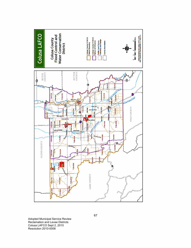
67 Adopted Municipal Service Review Reclamation and Levee Districts Colusa LAFCO Sept 2, 2010 Resolution 2010-0008

68 Adopted Municipal Service Review Reclamation and Levee Districts Colusa LAFCO Sept 2, 2010 Resolution 2010-0008
APPENDIX A - COLUSA COUNTY POPULATION GROWTH PROJECTIONS The Colusa County population is expected to increase as follows: Colusa County Population Projections Projected Percentage Year Population Increase 2000 18,923 2010 22,697 20% 2020 26,337 16% 2030 29,353 11% 2040 32,499 11% 2050 35,544 9% (California State Department of Finance and the Great Valley Center)

69 Adopted Municipal Service Review Reclamation and Levee Districts Colusa LAFCO Sept 2, 2010 Resolution 2010-0008
APPENDIX B - FINANCIAL COMPARISON OF RECLAMATION DISTRICTS
Independent Special District Name
Activity
2005-2006 Enterprise Operating Revenues
Enterprise Non-Operating Revenues
Non-Enterprise General Purpose Revenues
Total Inter- Governmental Revenues
Reclamation District 1004
Water Enterprise
$1,262,140 $183,225 0 Reclamation District 108
Land Reclamation and Levee Maintenance $4,380,283 $1,443,108
Reclamation District 108
Water Enterprise $2,059,726 $18,917 0
Reclamation District 2047
Land Reclamation and Levee Maintenance $49,820 $1,710
Reclamation District 479
Drainage and Drainage Maintenance $55,117 0
Sacramento River Westside Levee District (Colusa)
Land Reclamation and Levee Maintenance $213,421 0
http://www.sco.ca.gov/ard/local/locrep/districts/lafco/lafcofy0506.xls

70 Adopted Municipal Service Review Reclamation and Levee Districts Colusa LAFCO Sept 2, 2010 Resolution 2010-0008
APPENDIX C - ACREAGE FOR EACH DISTRICT District Acres County Reclamation District 108 34,313.48 Colusa Reclamation District 108 24,506.16 Yolo Reclamation District 108 Total 58,819.64 Reclamation District 479 6,132.54 Colusa Reclamation District 1004 22,717.22 Colusa Reclamation District 1004 472.83 Glenn Reclamation District 1004 Total 23,190.05 Reclamation District 2047 135,058.07 Colusa Reclamation District 2047 97,766.06 Glenn Reclamation District 2047 Total 232,824.13 Sacramento Westside Levee District 74,568.44 Colusa Sacramento Westside Levee District 30,738.93 Yolo Sacramento Westside Levee District Total 105,307.37 Cortina Creek Flood Control and WC District 12,923.38 Colusa Knights Landing Ridge Drainage District 43,399.23 Yolo Knights Landing Ridge Drainage District 29,919.60 Colusa Knights Landing Ridge Drainage District Total 73,318.83

71 Adopted Municipal Service Review Reclamation and Levee Districts Colusa LAFCO Sept 2, 2010 Resolution 2010-0008
APPENDIX D - LOCAL GOVERNMENT ISSUES 1 Municipal Financial Constraints Municipal service providers are constrained in their capacity to finance services by the inability to increase property taxes, requirements for voter approval for new or increased taxes, and requirements of voter approval for parcel taxes and assessments used to finance services. Municipalities must obtain majority voter approval to increase or impose new general taxes and two-thirds voter approval for special taxes. Limitations on property tax rates and increases in taxable property values are financing constraints. Property tax revenues are subject to a formulaic allocation and are vulnerable to State budget needs. Agencies formed since the adoption of Proposition 13 in 1978 often lack adequate financing. 1.1 California Local Government Finance Background The financial ability of special districts to provide services is affected by financial constraints. Special district service providers rely on a variety of revenue sources to fund operating costs as follows:
• Property Taxes • Benefit Assessments • Special Taxes • Proposition 172 Funds • Other contributions from district general funds
As a funding source, property taxes are constrained by State initiatives that have been passed by voters over the years and special legislation. Seven of these measures are explained below: A. Proposition 13 Proposition 13 (which California voters approved in 1978) has the following three impacts:
• Limits the ad valorem property tax rate • Limits growth of the assessed value of property • Requires voter approval of certain local taxes
Generally, this measure fixes the ad valorem tax at one percent of value, except for taxes to repay certain voter approved bonded indebtedness. In response to the adoption of Proposition 13, the Legislature enacted Assembly Bill 8 (AB 8) in 1979 to establish property tax allocation formulas. B. AB 8 Generally, AB 8 allocates property tax revenue to the local agencies within each tax rate area based on the proportion each agency received during the three fiscal years preceding adoption of Proposition 13. This allocation formula benefits local agencies that had relatively high tax rates at the time Proposition 13 was enacted. C. Proposition 98 Proposition 98, which California voters approved in 1988, requires the State to maintain a minimum level of school funding. In 1992 and 1993, the Legislature began shifting billions of local property taxes to schools in response to State budget deficits. Local property taxes were diverted from local governments into the Educational Revenue Augmentation Fund (ERAF) and

72 Adopted Municipal Service Review Reclamation and Levee Districts Colusa LAFCO Sept 2, 2010 Resolution 2010-0008
transferred to school districts and community college districts to reduce the amount paid by the State general fund. Local agencies throughout the State lost significant property tax revenue due to this shift. Proposition 172 was enacted to help offset property tax revenue losses of cities and counties that were shifted to the ERAF for schools in 1992. D. Proposition 172 Proposition 172, enacted in 1993, provides the revenue of a half-cent sales tax to counties and cities for public safety purposes, including police, fire, district attorneys, corrections and lifeguards. Proposition 172 also requires cities and counties to continue providing public safety funding at or above the amount provided in FY 92-93. E. Proposition 218 Proposition 218, which California voters approved in 1996, requires voter- or property owner-approval of increased local taxes, assessments, and property-related fees. A two-thirds affirmative vote is required to impose a Special Tax (for example, a tax for a specific purpose such as a fire protection district). However, majority voter approval is required for imposing or increasing general taxes such as business license or utility taxes, which can be used for any governmental purpose. These requirements do not apply to user fees, development impact fees, and Mello-Roos districts. F. Mello-Roos Community Facilities Act The Mello-Roos Community Facilities Act of 1982 allows any county, city, special district, school district, or joint powers authority to establish a Mello-Roos Community Facilities District (CFD) which allows for financing of public improvements and services. The services and improvements that Mello-Roos CFDs can finance include streets, sewer systems and other basic infrastructure, police protection, fire protection, ambulance services, schools, parks, libraries, museums, and other cultural facilities. By law, the CFD is also entitled to recover expenses needed to form the CFD and administer the annual special taxes and bonded debt. A CFD is created by a sponsoring local government agency. The proposed district will include all properties that will benefit from the improvements to be constructed or the services to be provided. A CFD cannot be formed without a two-thirds majority vote of residents living within the proposed boundaries. Or, if there are fewer than 12 residents, the vote is instead conducted of current landowners. In many cases, that may be a single owner or developer. Once approved, a Special Tax Lien is placed against each property in the CFD. Property owners then pay a Special Tax each year. If the project cost is high, municipal bonds will be sold by the CFD to provide the large amount of money initially needed to build the improvements or fund the services. The Special Tax cannot be directly based on the value of the property. Special Taxes instead are based on mathematical formulas that take into account property characteristics such as use of the property, square footage of the structure, and lot size. The formula is defined at the time of formation, and will include a maximum special tax amount and a percentage maximum annual increase. If bonds were issued by the CFD, special taxes will be charged annually until the bonds are paid off in full. Often, after bonds are paid off, a CFD will continue to charge a reduced fee to maintain the improvements. G. Development Impact Fees

73 Adopted Municipal Service Review Reclamation and Levee Districts Colusa LAFCO Sept 2, 2010 Resolution 2010-0008
Counties, cities, special districts, school districts, and private utilities may impose development impact fees on new construction for purposes of defraying the cost of putting in place public infrastructure and services to support new development. To impose development impact fees, a jurisdiction must justify the fees as an offset to the impact of future development on facilities. This usually requires a special financial study. The fees must be committed within five years to the projects for which they were collected, and the district, city or county must keep separate funds for each development impact fee. 1.2 Financing Opportunities that Require Voter Approval Financing opportunities that require voter approval include the following:
Special taxes such as parcel taxes Increases in general taxes such as utility taxes Sales and use taxes Business license taxes Transient occupancy taxes
Communities may elect to form business improvement districts to finance supplemental services, or Mello-Roos districts to finance development-related infrastructure extension. Agencies may finance facilities with voter-approved (general obligation) bonded indebtedness. 1.3 Financing Opportunities that Do Not Require Voter Approval Financing opportunities that do not require voter approval include imposition of or increases in fees to more fully recover the costs of providing services, including user fees and Development Impact Fees to recover the actual cost of services provided and infrastructure. Development Impact Fees and user fees must be based on reasonable costs, and may be imposed and increased without voter approval. Development Impact Fees may not be used to subsidize operating costs. Agencies may also finance many types of facility improvements through bond instruments that do not require voter approval. Water rates and rate structures are not subject to regulation by other agencies. Utility providers may increase rates annually, and often do so. Generally, there is no voter approval requirement for rate increases, although notification of utility users is required. Water providers must maintain an enterprise fund for the respective utility separate from other funds, and may not use revenues to finance unrelated governmental activities. 2 Public Management Standards While public sector management standards do vary depending on the size and scope of an organization, there are minimum standards. Well-managed organizations do the following eight activities:
1. Evaluate employees annually. 2. Prepare a budget before the beginning of the fiscal year. 3. Conduct periodic financial audits to safeguard the public trust. 4. Maintain current financial records. 5. Periodically evaluate rates and fees.

74 Adopted Municipal Service Review Reclamation and Levee Districts Colusa LAFCO Sept 2, 2010 Resolution 2010-0008
6. Plan and budget for capital replacement needs. 7. Conduct advance planning for future growth. 8. Make best efforts to meet regulatory requirements.
Most of the professionally managed and staffed agencies implement many of these best management practices. LAFCO encourages all local agencies to conduct timely financial record-keeping for each function and make financial information available to the public. 3 Public Participation in Government The Brown Act (California Government Code Section 54950 et seq.) is intended to insure that public boards shall take their actions openly and that deliberations shall be conducted openly. The Brown Act establishes requirements for the following:
• Open meetings • Agendas that describe the business to be conducted at the meeting • Notice for meetings • Meaningful opportunity for the public to comment • Few exceptions for meeting in closed sessions and reports of items discussed in
closed sessions According to California Government Section 54959
Each member of a legislative body who attends a meeting of that legislative body where action is taken in violation of any provision of this chapter, and where the member intends to deprive the public of information to which the member knows or has reason to know the public is entitled under this chapter, is guilty of a misdemeanor.
Section 54960 states the following: (a) The district attorney or any interested person may commence an action by mandamus, injunction or declaratory relief for the purpose of stopping or preventing violations or threatened violations of this chapter by members of the legislative body of a local agency or to determine the applicability of this chapter to actions or threatened future action of the legislative body

75 Adopted Municipal Service Review Reclamation and Levee Districts Colusa LAFCO Sept 2, 2010 Resolution 2010-0008
APPENDIX E COMPARISON OF DISTRICTS District Function RD 108 The District delivers water from the Sacramento River to nearly 48,000 acres
of land within northern Yolo County and southern Colusa County. RD 479 Reclamation District 479 is primarily concerned with drain water and makes
sure that all of the drain water enters the RD 2047 Canal. RD 1004 Reclamation District 1004 operates irrigation conveyances within its 23,000-
acre jurisdiction located east of the Sacramento River with its eastern boundary formed by Butte Creek along the Colusa-Sutter County Line.
RD 2047 Reclamation District 2047 constructed the Colusa Basin which conveys both summer agricultural drainage water (primarily from rice fields) and winter flows to the Knights Landing outfall gates on the Sacramento River in Yolo County.
Knights Landing Ridge Drainage District
The Knights Landing Ridge Drainage District maintains certain levees along the Sacramento River and facilitates drainage through contracts with RD 108.
Cortina Creek Flood Control and WC District
The Cortina Creek Flood Control and WC District maintains the banks of Cortina Creek on a contract basis as needed.
Sacramento River Westside Levee District
The Sacramento River Westside Levee District maintains levees along the Sacramento River by contracting with RD 108.
Colusa County Flood Control and Water Conservation District
The Colusa County Flood Control and Water Conservation District could by law perform any measures necessary to promote flood control and drainage including levee maintenance; however, the District has no funds and so does not perform any function at this time.

76 Adopted Municipal Service Review Reclamation and Levee Districts Colusa LAFCO Sept 2, 2010 Resolution 2010-0008
Colusa Basin Drainage District
The CA State Legislature formed the Colusa Basin Drainage District in 1987 to address flooding and winter drainage, irrigation drainage and subsidence problems in the Colusa Basin Watershed.
SB 1086 The overall goal of the management program for the Sacramento River Conservation Area (SB 1086) is to preserve remaining riparian habitat and reestablish a continuous riparian ecosystem along the Sacramento River between Redding and Chico, and to reestablish riparian vegetation along the river from Chico to Verona. This will be accomplished through this incentive-based, voluntary river management plan.
DWR DWR is responsible for levee inspection and rates the reclamation districts’ maintenance activities. If maintenance is inadequate, DWR may form a maintenance area, conduct the maintenance directly and charge property owners for associated costs. This is the case in the part of Colusa County known as Maintenance Area 12.
Central Valley Flood Protection Board (CVFPB
The Central Valley Flood Protection Board (CVFPB) was formerly known as the State Reclamation Board. The Central Valley Flood Protection Board's mission is to control flooding along the Sacramento and San Joaquin Rivers and their tributaries in cooperation with the United States Army Corps of Engineers to provide public safety through flood protection in the Central Valley. The Board cooperates with various agencies of the federal, State, and local governments in establishing, planning, constructing, operating, and maintaining flood control works. The Board also maintains the integrity of the existing flood control system and designated floodways through its regulatory authority by issuing permits for encroachments that comply with Board standards.101
101 State of California, http://www.ebudget.ca.gov/StateAgencyBudgets/3000/3860/program_description_35.html, October 28, 2009.

77 Adopted Municipal Service Review Reclamation and Levee Districts Colusa LAFCO Sept 2, 2010 Resolution 2010-0008
APPENDIX F COMPARISON TABLE OF FEES, ASSESSMENTS AND TAXES Colusa County Reclamation, Drainage, Flood Control and Levee Districts
Fees/Assessments/Taxes District Fees/Assessments/Taxes Reclamation District 108102 Landowners purchase water for irrigation.
Rice irrigation water is $62.00/acre/year. Other crops are $15.00/acre for first irrigation, $8.75/acre for each subsequent irrigation.
Reclamation District 479103 The District charges a per acre benefit assessment for drainage levied to the landowners within the District as follows: Rice drainage $18.00 per acre Row crops, all other crops $15.00 per acre Bare land, wheat $12.00 per acre Winter Flooding $16.00 per acre
Reclamation District 1004 The District charges $5.37/acre administration fee and $10.22/acre operations fee which is collected in January. The farmers pay $9.65/acre-foot for water which is also collected in January. (Water is metered and refunds are made if less water is used.)104
Reclamation District 2047105 The District receives 0.000931% of Secured Taxes generated by the Countywide rate. Revenue for fiscal year ended 6-30-08 was $30,513.
Sacramento River Westside Levee District106
$270,000 in special assessments is collected by Colusa and Yolo Counties along with property taxes. A District Valuation was prepared by the Engineer for the District in 1980. Landowners are assessed 0.422 per $100 of the District Valuation with a minimum payment of $25.00.
Cortina Creek Flood Control and Floodwater Conservation
The District receives 0.0581% of Secured Taxes generated by the Countywide rate. Revenue for fiscal year ended 6-30-09 was
102 Reclamation District 108, Cathy Busch, Secretary, Phone 530-437-2221, September 7, 2010 103 Colusa County Auditor-Controller, Reclamation District 479, Annual Audit for Calendar Year Ended December 31, 2009, April 22, 2010. 104 Reclamation District 1004, Manager Cameron “Kelly” Boyd, Phone: 530-458-7459, Cell Phone: 530-682-0050, September 9, 2010. 105 Glenn County Department of Finance, Phone: 530-934-6476, September 9, 2010. 106 Sacramento River Westside Levee District, Cathy Busch, Secretary, Phone 530-437-2221, September 7, 2010

78 Adopted Municipal Service Review Reclamation and Levee Districts Colusa LAFCO Sept 2, 2010 Resolution 2010-0008
District107 $29,535. Knights Landing Ridge Drainage District108
$72,400 in special assessments is collected by Colusa and Yolo Counties along with property taxes. A District Valuation was prepared by the Engineer for the District in 1979. Landowners are assessed 0.174 per $100 of the District Valuation with a minimum payment of $25.00.
Colusa County Flood Control and Water Conservation District
This district is considered “Inactive” and has no activity.109
State Maintenance Districts 1 and 12 (assessment areas)
The State Maintenance areas are charged assessment fees based on the money spent by the State in the previous year. When the State sends the County the bill, the cost is divided up between the parcels according to the size and benefit received and added to the property tax bills.110
107 Colusa County Auditor-Controller, Annual Audit for the period ended June 30, 2009, February 8, 2010. 108 Knights Landing Ridge Drainage District, Cathy Busch, Secretary, Phone 530-437-2221, September 7, 2010 109 Colusa County Auditor-Controller, Janet S. Dawley, Property Tax Manager/Special District Auditor, E-Mail: [email protected], September 8, 2010. 110 Colusa County Auditor-Controller, Janet S. Dawley, Property Tax Manager/Special District Auditor, Phone, 530-458-0400, September 7, 2010.

79 Adopted Municipal Service Review Reclamation and Levee Districts Colusa LAFCO Sept 2, 2010 Resolution 2010-0008
ABBREVIATIONS AB Assembly Bill ACOE US Army Corps of Engineers BOR Bureau of Reclamation CEQA California Environmental Quality Act CFD Community Facilities District cfs cubic feet per second CKH Act Cortese-Knox-Hertzberg Local Government Reorganization Act of 2000 CVFPB Central Valley Flood Protection Board (State of California) CVP Central Valley Project CWA California Waterfowl Association DFG Department of Fish and Game (California) DU Ducks Unlimited DWR Department of Water Resources (California) EPA Environmental Protection Agency (US) ERAF Educational Revenue Augmentation Fund ESA Endangered Species Act FEMA Federal Emergency Management Agency FIRM Flood Insurance Rate Map FY Fiscal Year GWH Giga-watt hours (power) KLRDD Knights Landing Ridge Drainage District LAFCO Local Agency Formation Commission LOMR Letter of Map Revision (FEMA)

80 Adopted Municipal Service Review Reclamation and Levee Districts Colusa LAFCO Sept 2, 2010 Resolution 2010-0008
MSR Municipal Service Review (LAFCO) MW Mega-watts (power) MWD Metropolitan Water District NAS National Audubon Society NCWA Northern California Water Association NEPA National Environmental Protection Act NOAA National Oceanic and Atmospheric Administration NPDES National Pollution Discharge Elimination System NRCS Natural Resources Conservation Service PWRPA Power and Water Resources Pooling Authority RD Reclamation District RWQCB Regional Water Quality Control Board SB Senate Bill SDCWA San Diego County Water Agency SOI Sphere of Influence (LAFCO) SRFCP Sacramento River Flood Control Project SRWLD Sacramento River Westside Levee District SWRCB State Water Resources Control Board SWP State Water Project TMDL Total Maximum Daily Load (of pollutants) US United States USBR United States Bureau of Reclamation USDA United States Department of Agriculture USFWS United States Fish and Wildlife Service

81 Adopted Municipal Service Review Reclamation and Levee Districts Colusa LAFCO Sept 2, 2010 Resolution 2010-0008
DEFINITIONS Accretion: Sediments carried by a stream and deposited along banks or surrounding areas.111 Acre-foot (acre-ft): The volume of water required to cover 1 acre of land (43,560 square feet) to a depth of 1 foot. One acre-foot of water is equal to 325,851 gallons or 1,233 cubic meters of water.112 Agriculture: Use of land for the production of food and/or fiber, including the growing of crops and/or the grazing of animals on natural prime or improved pasture land. Aquifer: An underground, water-bearing layer of earth (porous rock, sand, or gravel) through which water can seep or be held in natural storage. Aquifers generally hold sufficient water to be used as a water supply. Bank Protection: A method of erosion control in which materials (usually rock revetment) are placed along the banks of a river in order to prevent encroachment on adjacent land.113 Bank Stabilization: The prevention of channel migration through bank protection. Bond: An interest-bearing promise to pay a stipulated sum of money, with the principal amount due on a specific date. Funds raised through the sale of bonds can be used for various public purposes. Bureau of Reclamation (USBR, Reclamation, BOR): The mission of the Bureau of Reclamation is to manage, develop, and protect water and related resources in an environmentally and economically sound manner in the interest of the American public.114 California Environmental Quality Act (CEQA): A State Law requiring State and local agencies to regulate activities with consideration for environmental protection. If a proposed activity has the potential for a significant adverse environmental impact, an environmental impact report (EIR) must be prepared and certified as to its adequacy before taking action on the proposed project. Central Valley Project (CVP): Agricultural water supply system that is operated and maintained by the Federal Bureau of Reclamation; water from the Sacramento River is captured and conveyed from Lake Shasta to the San Joaquin Valley. Initial features of the project were built primarily to protect the Central Valley from crippling water shortages and menacing floods, but the CVP also improves Sacramento River navigation, supplies domestic and industrial water, generates electric power, conserves fish and wildlife, creates opportunities for recreation, and enhances water quality.115
111http://www.sacramentoriver.org/glossary.php?glossary_id=11&Strangecode=4707eeb981ba8b00c86e8a38e96423a9 October 28, 2009. 112 http://ga.water.usgs.gov/edu/dictionary.html 113 http://www.sacramentoriver.org/glossary.php?glossary_id=16, October 28, 2009. 114 http://www.usbr.gov/library/glossary/#hmr 115 http://www.usbr.gov/dataweb/html/cvp.html

82 Adopted Municipal Service Review Reclamation and Levee Districts Colusa LAFCO Sept 2, 2010 Resolution 2010-0008
Community Facilities District: Under the Mello-Roos Community Facilities Act of 1982 (Section 53311 et seq.), a legislative body may create within its jurisdiction a special tax district that can finance tax-exempt bonds for the planning, design, acquisition, construction, and/or operation of public facilities, as well as public services for district residents. Special taxes levied solely within the district are used to repay the bonds. Community Services District (CSD): A geographic sub-area of a county used for planning and delivery of parks, recreation, and other human services based on an assessment of the service needs of the population in that sub-area. A CSD is a taxation district with independent administration. Domestic water use: Water used for household purposes such as drinking, food preparation, bathing, washing clothes, dishes, and dogs, flushing toilets, and watering lawns and gardens. About 85% of domestic water is delivered to homes by a public-supply facility, such as a county water department. About 15% of the nation's population supplies their own water, mainly from wells.116 Endangered Species: An endangered species is a species with so few surviving individuals that it is in danger of becoming extinct. Flood, 100-year: A 100-year flood does not refer to a flood that occurs once every 100 years, but to a flood level with a 1% chance of being equaled or exceeded in any given year.117 Floodplain: The relatively flat area along the sides of a river which is naturally subject to flooding. Floodway: The river zone that could theoretically (based on surveying data and hydraulic calculations) convey the 100-year flood with only a one-foot rise of water level above the height of the unconstricted flood; construction is generally prohibited in these areas. Formation: A laterally continuous rock unit with a distinctive set of characteristics that make it possible to recognize and map from one outcrop or well to another. A formation is the basic rock unit of stratigraphy. 118 Gravity flow: Flow of water in a pipe on a descending path. Groundwater: Water under the earth’s surface, often confined to aquifers capable of supplying wells and springs. Groundwater Basin: A ground water reservoir, defined by an overlying land surface and the underlying aquifers that contain water stored in the reservoir. In some cases, the boundaries of successively deeper aquifers may differ and make it difficult to define the limits of the basin.119 Habitat: The environment of a plant or animal species. 116 http://ga.water.usgs.gov/edu/dictionary.html 117 http://ga.water.usgs.gov/edu/dictionary.html 118 http://geology.com/dictionary/glossary-f.shtml 119 http://rubicon.water.ca.gov/v1cwp/glssry.html

83 Adopted Municipal Service Review Reclamation and Levee Districts Colusa LAFCO Sept 2, 2010 Resolution 2010-0008
Hydrology: The science concerned with the properties, distributions and characteristics of the water in relation to the earth. Impact Fee: A fee, also called a development fee, levied on the developer of a project by a county, or other public agency as compensation for otherwise-unmitigated impacts the project will produce. California Government Code Section 66000 et seq. specifies that development fees shall not exceed the estimated reasonable cost of providing the service for which the fee is charged. To lawfully impose a development fee, the public agency must verify its method of calculation and document proper restrictions on use of the fund. Infrastructure: Public services and facilities such as sewage-disposal systems, water supply systems, and other utility systems, schools, and roads. Land Use Classification: A system for classifying and designating the appropriate use of properties. Leapfrog Development: New development separated from existing development by substantial vacant land. Levee: An embankment designed to prevent the flooding of a river; may be natural or human made. Levee Toe: A Levee Toe is the outer edge of the levee base where it meets the levee grade. Local Agency Formation Commission (LAFCO): A five-or seven-member commission within each county that reviews and evaluates all proposals for formation of special districts, incorporation of cities, annexation to special districts or cities, consolidation of districts, and merger of districts with cities. Each county’s LAFCO is empowered to approve, disapprove, or conditionally approve such proposals. The LAFCO members generally include two county supervisors, two city council members, and one member representing the general public. Some LAFCOs include two representatives of special districts. Mitigation: An action designed to avoid, minimize, reduce or compensate for a significant impact to the environment. Natural Levee: Naturally occurring deposits along the sides of a river that constrain frequent floods. One-Hundred-Year Floodplain: The relatively flat portion of the river channel that has a one percent chance of being inundated by flood waters in any given year. Project Works: Project works include levees, bank protection projects, weirs, pumping plants, floodways, and any other related flood control works or rights-of-way that have been constructed using State or Federal funds. Riparian Habitat: An area composed of native riparian vegetation that provides habitat for wildlife.

84 Adopted Municipal Service Review Reclamation and Levee Districts Colusa LAFCO Sept 2, 2010 Resolution 2010-0008
Sacramento River Conservation Area (SRCA): The 222 miles of the Sacramento River and the adjacent 77,155 acres of land extending from Keswick Dam in Shasta County south to the town of Verona in Sutter County. Senate Bill 1086 (SB 1086): Legislation authored by Senator Jim Nielsen that authorized the formation of the SB 1086 Advisory Council to oversee issues related to the Sacramento River. Service Area: A service area is a geographical land area served by a distribution system of a water or other agency.120 Set-Back Levee: Levees that are constructed at a distance from the river channel in order to allow the river to occupy a portion of its floodplain; these levees are usually smaller in size than levees placed immediately adjacent to the river channel. Slough: A naturally occurring side or overflow channel that holds water. Sphere of Influence (SOI): The probable physical boundaries and service area of a local agency, as determined by the Local Agency Formation Commission (LAFCO) of the county. State Water Project (SWP): The water storage and conveyance system that is operated and maintained by the California Department of Water Resources. Water year: Period of time beginning October 1 of one year and ending September 30 of the following year and designated by the calendar year in which it ends. A calendar year used for water calculations. The US Bureau of Reclamation water year is March 1st to February 28th and October 1st to September 30th is the water account year. Watershed: The total area above a given point on a watercourse that contributes water to its flow; the entire area from which a river receives its water supply. The watershed may also be referred to as the catchment area or catchment basin. Weir: A notch or depression in a dam or other water barrier through which the flow of water is either measured or regulated. Wetland: Lands that are transitional between terrestrial and aquatic systems, “covered all or part of the year with salt water or fresh water, excluding streams, lakes, and the open ocean.”121
120 http://rubicon.water.ca.gov/v1cwp/glssry.html 121 Miller, G. Tyler Jr., “Living in the Environment, An Introduction to Environmental Science,” Wadsworth Publishing Company, 7th Edition, 1992 (Glossary).

85 Adopted Municipal Service Review Reclamation and Levee Districts Colusa LAFCO Sept 2, 2010 Resolution 2010-0008
REFERENCES California Tax Data, 100 Pacifica, Suite 470, Irvine, California 92618, Phone: 949-789-0660,
Fax: 949-788-0280, www.californiataxdata.com. City of Colusa, General Plan, October 2007. Colusa County Auditor, Annual Audit for Calendar year Ended December 31, 2008, Reclamation
District 479, April 7, 2009. Colusa County Auditor’s Office, Janet Dawley, Phone: 530-458-0400, October 14, 2009. Colusa County, Board of Supervisors Office, Yolanda Tirado, Email:
[email protected], April 22, 2009. Colusa County, Colusa County General Plan Final, January 13, 1989. Colusa County Department of Agriculture, Harry A. Krug, Agricultural Commissioner, 100
Sunrise Blvd., Suite F, Colusa CA 95932, Phone: 530-458-0580, “2007 Colusa County Crop Report.”
Colusa County Department of Agriculture, Harry A. Krug, Agricultural Commissioner, 100
Sunrise Blvd. Suite F, Colusa CA 95932, Phone: 530-458-0580, “2008 Colusa County Crop Report.”
Colusa County Final Budget for the Year Ending June 30, 2009. Colusa County Public Works Department, Jon Wrysinski, Phone: 530-458-0470, October 5,
2009. Colusa LAFCO, Correspondence from Jan Mariano to Gary Plunkett, February 27, 1985. Colusa LAFCO, Cortina Creek Flood Control and Floodwater Conservation District Formation,
July 20, 1965. Colusa LAFCO, Reclamation District 479 Sphere of Influence Study, 1984. Colusa LAFCO, RD 1004 Sphere of Influence Study, 1984. Colusa LAFCO, Sacramento River Westside Levee District Sphere of Influence Study, 1984. Cortina Creek Flood Control and Floodwater Conservation District, Christy Scofield, Director,
Phone: 530-476-2323, September 10, 2009. “Draft Sacramento Valley Integrated Regional Water Management Plan,” July 12, 2005, page 27. Glenn County, General Plan, 1993.

86 Adopted Municipal Service Review Reclamation and Levee Districts Colusa LAFCO Sept 2, 2010 Resolution 2010-0008
http://ga.water.usgs.gov/edu/dictionary.html http://geology.com/dictionary/glossary-f.shtml http://rubicon.water.ca.gov/v1cwp/glssry.html http://www.sacramentoriver.org/glossary.php?glossary_id=16, October 28, 2009. http://www.sacramentoriver.org/glossary.php?glossary_id=11&Strangecode=4707eeb981ba8b00
c86e8a38e96423a9 October 28, 2009. Knights Landing Ridge Drainage District, Phone 530-437-2221, September 30, 2009. Miller, G. Tyler Jr., “Living in the Environment, An Introduction to Environmental Science,”
Wadsworth Publishing Company, 7th Edition, 1992 (Glossary). Northern California Water Association (NCWA), “Draft Sacramento Valley Integrated Regional
Water Management Plan,” July 12, 2005, Page 1. Power and Water Resources Pooling Authority (PWRPA)
http://www.pwrpa.org/pwrpa%5Forg/index.CFM?q_webaction=ABOUTUS Reclamation District 479, Shelley Miller, Secretary, Email: [email protected],
September 28, 2009. Reclamation District 108, Email from Cathy Busch, Secretary, [email protected], October 17,
2008. Reclamation District 108: http://rd108.org, 2009. Reclamation District 108, Minutes of the Regular Meeting of the Board of Trustees, January 17,
2008. RD 1004, Draft Mitigated Negative Declaration/Finding of No Significant Impact, Drumheller
Slough and White Mallard Outfall Project, State Lead Agency: Reclamation District 1004, June 26, 2000.
Reclamation District 1004, “Use of Copper and Acrolein to Control Aquatic Weeds in Water
Conveyances, CEQA Mitigated Negative Declaration,” August 11, 2004, Prepared by Blankinship & Associates, Inc., 2940 Spafford St., Ste. 110, Davis, Ca 95616, Phone: 530.757.0941, Fax: 530.757.0940, www.envtox.com.
Reclamation District 2047, “Brief History and Responsibilities,” May 31, 1996 Sacramento River Watershed Program, “Sacramento River Conservation Area Handbook,”
January 2000, Pages 8-16.

87 Adopted Municipal Service Review Reclamation and Levee Districts Colusa LAFCO Sept 2, 2010 Resolution 2010-0008
State of California, Department of Housing and Community Development, Memorandum Official State Income Limits for 2009, April 2, 2009.
State of California, Employment Development Department, Labor Market Information Division,
Phone 916-202-2162, May 22, 2009. State of California, Department of Finance, E-4 Population Estimates for Cities, Counties and the
State, 2001–2009, with 2000 Benchmark, Sacramento, California, May 2009. State of California, Department of Water Resources, Division of Flood Management, Flood
Project Integrity and Inspection Branch, http://cdec.water.ca.gov/cgi-progs/products/NA0008_SP2009.pdf, September 5, 2009.
State of California, Department of Water Resources, http://www.water.ca.gov/floodmgmt/fmo/, October 7, 2009. State of California, Department of Water Resources,
http://www.water.ca.gov/floodmgmt/fmo/sumy/, October 7, 2009. State of California, Department of Water Resources, Swanson, Keith, [email protected],
November 25, 2009. State of California, Department of Water Resources, Sutter Maintenance Yard, Joel Farias, Phone
530-755-0071, Ext. 223, October 9, 2009. State of California, The Resources Agency, Central Valley Flood Protection Board, 3310 El
Camino Avenue, Room LL40, Sacramento, California 95821, Phone (916) 574-0609; Fax (916) 574-0682 http://www.RecBd.ca.gov http://www.recbd.ca.gov/meetings/2008/3-21-2008Agenda.pdf, September 5, 2009.
US Bureau of Reclamation,
http://www.usbr.gov/mp/cvpia/3404c/srsc/exhibits/reclamation/exh01_rec_spec_rd-1004_03-11-03_dft.pdf, September 5, 2009.
US Bureau of Reclamation, http://www.usbr.gov/projects US Census Bureau, http://quickfacts.census.gov/qfd/states/06/06021.html September 30, 2009. US Census Bureau, http://quickfacts.census.gov/qfd/states/06/06113.html, September 30, 2009 Yolo County, General Plan, 1983. Yolo County Local Agency Formation Commission, Knights Landing Ridge Drainage District,
Sphere of Influence Study, January 14, 1985. Yolo County Local Agency Formation Commission, 625 Court Street, Room 202, Woodland, CA
95695, Municipal Service Review And Sphere of Influence Study Yolo County Public

88 Adopted Municipal Service Review Reclamation and Levee Districts Colusa LAFCO Sept 2, 2010 Resolution 2010-0008
Water and Reclamation Districts, Prepared by: Dudek and Associates, Inc., 605 Third Street, Encinitas, CA 92024, March 2005.

89 Adopted Municipal Service Review Reclamation and Levee Districts Colusa LAFCO Sept 2, 2010 Resolution 2010-0008
Data Sources for Maps Name
Acres
Source
Reclamation District 108 58,819.64 Downloaded from http://casil.ucdavis.edu/casil/ (the GIS data source for CA) Federal water district boundaries from US Bureau of Reclamation 2009
Reclamation District 479 6,132.54 Digitized from paper map and fax provided by Reclamation District 479.
Reclamation District 1004
23,190.05 Digitized from U.S. Bureau of Reclamation 2004 pdf map found online at www.usbr.gov/mp/
Reclamation District 2047 232,824.13 Digitized from paper map, Colusa County LAFCO 1985, verified by Glenn-Colusa Irrigation District, Ben Pennock, District Engineer, 11-02-09.
Cortina Creek Flood Control and Floodwater Control District
12,923.38 Digitized from paper map, Colusa LAFCO 1985.
Knights Landing Ridge Drainage District
73,318.83 Digitized from paper map, Colusa LAFCO 1985.
Sacramento Westside Levee District
105,307.37 Digitized from paper map, Colusa LAFCO 1985.
PREPARERS Colusa LAFCO, John Benoit, Executive Officer PO Box 2694, Granite Bay CA 95746 Phone: 916-797-6003 [email protected] Christy Leighton, Planning Consultant 555 East Willow Street, Willows CA 95988 Phone: 530-934-4597 [email protected] ChicoMapWorks 333 Main Street, Suite 200 Chico CA 95928 Phone: 530-345-0755 [email protected]

90 Adopted Municipal Service Review Reclamation and Levee Districts Colusa LAFCO Sept 2, 2010 Resolution 2010-0008