national cooperative soil survey southern ......agenda 1978 southern regional technical...
TRANSCRIPT

NATIONAL COOPERATIVE SOIL SURVEY
Southern Regional Conference Proceedings
Jekyll Island, GeorgiaMarch 14-l 7, 1978
Contents...
..................................... . ............................................................ 111
Introduction.. ........................................................................................... v
Agenda.. ................................................................................................. vii
Minutes .................................................................................................. 1
Participants.. ........................................................................................... 5
The Significance of Agriculture to Georgia’s Economy.. ................................ 9
Management and Production is Only Half the Story.. .................................... 17
Resource Data for Coastal Zone Management. . ........................................... 27
Cooperative Research in Soil Survey with the Southern States.. .................... 2 9
Soil Survey Investigations.. ....................................................................... 31
Status of National Wetlands Inventory.. ...................................................... 4 9
Progress Report on Remote Sensing and its Relationship to Soil Survey .......... 53
Recent Developments in the National Cooperative Soil Survey ...................... 59
Summary of State Agency Soil Mapping Program Support.. .......................... 61
Committee Reports .................................................................................. 63
Committee 1 - Updating Soil Surveys.. ....................................................... 6 3
Committee 2 W a s t e Disposal on Land ....................................................... 7 3
Committee 3 - Soil Potential Ratings .......................................................... 8 7
Committee 4 - Kinds of Soil Maps ............................................................. .I01
Committee 5 - Soil Yield Potentials ........................................................... .I15
Committee 6 - Remote Sensing ................................................................ .I21
Purpose, Policies and Procedures.. ............................................................ ,137

PROCEEDINGSOF SOUTHERN REGIONAL TECHNICALWORK - PLANNING CONFERENCEOF THECOOPERATIVE SOIL SURVEYJEKYLL ISLAND, GEORGIAMARCH 14-17, 1978
LJ. S. DEPARTMENT OF AGRICULTURECOMPILED BY
SOIL CONSERVATION SERVICEAND
STATE AGRICULTURAL EXPERIMENT STATIONS

UNITED STATES DEPARTMENT OF AGRICULTURESolL CONSERVATION SERVICE
P.O. BOX 832, Athens, Georgia 30603Telephone: 404-546-2278 (FTS 250-2278)
SIIR,,I(‘I: 1978 Southern Regional Technical Work Planning [IAlE April 3, 1978Conference of the National Cooperative Soilsurvey
TO * Recipients of Proceedings
The conference convened at 8:30 a.m., Tuesday, March 14, 1978, at theHoliday Inn, Jekyll Island, Georgia.
The Program Committee extends their special thanks and appreciation toguest speakers who addressed.the sessions. A copy of their talk is apart of the proceedings.
The committee chairmen and members are commended for the sincere workduring the conference and the resulting reports which are a part of theproceedings.
Oklahoma was chosen as the host state for 1980. Mr. Bobbie Birdwell,State Soil Scientist, SCS, is the chairman for the conference andDr. Fenton Gray, Oklahoma State University will serve as vice-chairman.
The conference adjourned at 11:30 a.m., March 17, 1978.
H. F. PerkinsChairman

Table of Contents
Introduction
Agenda
Minutes
Conference Participants
”
vii
1
5
Conference Presentations:
The Significance of Agriculture to Georgia's Economy,Henry W. Garren
Management and Production is only Half the Story,Dwight M. Treadway
Resource Data for Coastal Zone Management,Robert L. Wilkes
Cooperative Research in Soil Survey with theSoutheastern States, Warren C. Lynn
Status of National Wetlands Inventory, Blake Parker
Progress Report on Remote Sensing and its Relationshipto Soil Survey, George Murrell
Recent Developments in Cooperative Soil Survey,Victor G. Link
Summary of State Agency Soil Mapping Program Support inSouthern Region, H. H. Bailey
Committee Reports:
I. Updating Soil SurveysII. Waste Disposal on Land
III. Soil Potential RatingsIV. Kinds of Soil MapsV. Improving Soil Survey Field Procedures
VI. Soil Yield PotentialVII. Remote Sensing
.Appendix
Bylaws
Procedure for Amendments to the National SoilClassification System (excerpts from the NationalSoils Handbook)
iii
9
17
27
29
49
53
59
61
637387
101105115121
135
137
143

INTRODUCTION
The purpose of the Southern Regional Soil Survey Technical Work-
Planning Conference is to provide a forum for Southern States repre-
sentatives of the National Cooperative Soil Survey and participants
for discussion of technical and scientific developments. Through
the actions of committees and conference discussions, experience is
summarized and clarified for the benefit of all; new areas are
explored: procedures are proposed; and ideas are exchanged and dis-
seminated. The Conference also functions as a clearing house for
recommendations and proposals received from individual members and
State conferences for transmittal to the National Cooperative Soil
Survey Technical Work-Planning Conference. The proceedings indicate
trends of work; therefore, they do not represent official views
per se. Certain information developed by technical committees and
recommendations of the general session may be adopted; thus, form
the basis for revising the National soil survey procedures.

AGENDA
1978 SOUTHERN REGIONAL TECHNICAL WORK-PLANNING CONFERENCEOF THE NATIONAL COOPERATIVE SOIL SURVEY
Holiday InnJekyll Is land, Ga.
March 13-17, 1978
Monday PM, March I3
4:oo - 7:oo
Tuesday AM, March 14
8:00 - 8:30
8:30 - 8:4o
8:40 - 8~55
8:55 - 9:l5
g:15 - 9:35
9:35 - 9:50
9:50 - IO:10
Regis t ra t ion
Regis t ra t ion
Introductory Remarks
We 1 come
Mrs. Lynn CheekExecutive DirectorJekyl l Is land Promotional Assn.Jekyll Is land, Georgia
The Signif icance of Agriculture to Georgia’sEconomy
Henry W. GarrenDean and CoordinatorThe University of GeorgiaAgricultural Experiment StationsAthens, Georgia
Management and Production is Only Half the Story
Dwight M. TreadwayState ConservationistUSDA-Soil Conservation ServiceAthens, Georgia
Break
Report from South Technical Service Center
A s s t . D i r e c t o rSouth Technical Service CenterFort Worth, Texas
vii

Wednesday AM, March
8:OO - 9:20
9:20 - 10:4D
IO:40 - 10:55
IO:55 - 12:15
12:15 - I:30
Wednesday PM, March
I:30 - 3:oo
3:oo - 3:15
3:15 - 5300
7:oo - 8:oo
8:00
lhursday, March 16
8:oo - 5:oo
Friday AM, March 17
8:oo - lo:20
IO:20 - 10:35
IO:35 - IO:45
IO:45 - 10:55
IO:55 - 11:05
II:05 - II::30
II:30
15DiscussionGroup 1
6
3
Break
7
Lunch
15
4
Break
DiscussionGroup 2
7
4
DiscussionGroup 3
I
5
2
6
DiscussionGroup 4
2
6
Special Conmittee Meetings (lo be Announced)
Social Hour (Cash Ear)
Banquet
All Day
Field Trip to University of Georgia Sapelo IslandMarine Institute
Committee Reports (Nos. l-7)
Break
Report of Committee on Soil Taxonomy
Comments from Directors Representative
D. M. GossettDean of AgricultureUniversity of TennesseeKnoxville, Tennessee
Comments from STSC
Joe NicholsPrincipal Soil Cot-relatorUSDA - Soil Conservation ServiceFort Worth, Texas
Business Session
AdJourn
ix

IO:10 - 10:30
IO:30 - IO:50
10:50 - 11:lO
II:10 - II:35
II:35 - 12:oo
Tuesday PM, March 14
12:oo - I:15
I:15 - 2:35
2:35 - 2:50
2:50 - 4:10
4:lO - 5:30
Resource Data for Coastal Zone Management
Robert W. OertelAsst. State ConservationistUSDA-Soil Conservation ServiceAthens, Georgia
Cooperative Research in Soil Survey with theSouthern States
Warren LynnNational Soil Survey LaboratoryUSDA-Soil Conservation ServiceLincoln, Nebraska
Status of National Wet Lands Inventory
Blake ParkerSoil ScientistDepartment of Interior (IPA)St. Petersburg, Florida
Progress Report on Remote Sensing and itsRelationship to Soil Survey
George MurrellStaff Leader, Remote SensingUSDA-Soil Conservation ServiceReston, Virginia
Recent Developments in Cooperative Soil Survey
Victor G. Link, DirectorSoil Survey Operations DivisionUSDA-Soil Conservation ServiceWashington, D.C.
Lunch
Discussion DiscussionGroup 1 Group 2
, B 2
Break
5 6
2 3
Discussion DiscussionGroup 3 Group 4
3 4
7
4
*-Refers to committeeviii

MINUTES
The conference convened at 8:30 a.m., March 14, 1978, at the HolidayInn, Jekyll Island, Georgia, with Chairman Perkins presiding.Ms. Lynn Cheek, Executive Director, Jekyll Island Promotional Asso-ciation, welcomed the group.
The following persons addressed the group:
Dr. H. W. GarrenMr. Dwight M. TreadwayMr. Robert L. WilkesDr. Warren LynnMr. Blake ParkerMr. George MurrellMr. Victor G. Link
A copy of their presentations is enclosed as a part of the proceed-ings.
Beginning at 1:00 p.m. on March 14, the conferees formed four dis-cussion groups for the purpose of reviewing and discussing the workof each technical committee. The chairman and/or vice-chairman foreach of the seven technical committees reviewed the drafts of thereports. Constructive inputs from the discussion groups became apart of the final reports. Discussions proceeded through Wednesday.
Conferees participated in a field trip to Sapelo Island Marine Insti-tute on Thursday. The coordination of the trip was under the abledirection of Ms. Ann Pearson, Georgia Department of Natural Resources.Dr. Jim Henry, Marine Institute, University of Georgia gave a slidepresentation on the formation and transformation of parts of thecoastal islands. The principles are applicable to many shorelinesand coastal environments. This was followed by a guided tour of theMarine Institute laboratory. Conferees had a" opportunity to exper-ience the dynamics of the coastal dunes adjacent to the beaches,previously discussed by Dr. Henry. In addition, Mr. Robert Wilkes,District Conservationist, Hinesville, Georgia led a discussion of themarshland soils and associated vegetation.
Drafts of the final reports were presented by the chairmen of thetechnical committees on Friday morning. The conferees accepted thereports. Chairman Perkins called for a final copy of the reports,ready for the proceedings, by April 3, 1978.
At the general session, four members were added to the work group foramendments to Soil Taxonomy. Two were selected from the ExperimentStation representatives and two from participating Federal Agencies.Since the conference meets once each two years, members were addedthat start their three-year term in 1978 and 1979. Morris Shaffer,SCS, and Gray Aydelott, USFS, were elected to serve terms beginningin 1978 and 1979, respectively. Drs. Larry Wilding and David Pettry,
1

of the Experiment Station representatives, were elected to serveterms beginning in 1978 and 1979, respectively. Thus far, membersthat have served and those elected are listed for the record.
1975
Experiment Station FederalRepresentatives Representatives
S. W. BuolMax SpringerBen Hajek
H. J. ByrdD. F. slusherW. W. Fuchs (Bobby Birdwell
filled vacancy)
1/-
Max SpringerBen HajckFenton Gray
Ben HajekFenton GrayC. M. Rutlege
Fenton GrayE. M. RutlegcLarry Wilding
E. M. RutlegeLarry WildingDavid Pettry
Larry WildingDavid Pettryvacancy
1976
1977
D. F. Slusher (Arville Touchetfilled vacancy)
Bobby BirdwellR. W. Johnson
Bobby BirdwellR. W. JohnsonRichard Guthrie
1978
R. W. JohnsonRichard GuthrieMorris Shaffer
1979
Richard GuthrieMorris ShafferGray Aydelott
1980-1'
Morris ShafferGray Aydclottvacancy
Two mcmbcrs from the Experiment Station representatives and twofrom Federal Agencies are to be elected at the next conference.One memhfr from each group will begin a term in 1980 and theother in 1981.
2

Dr. D. M . Gossett, Experiment Station Director's Representative,called and expressed regrets that he could not attend. He commendedthe participants on their activities and the cooperative exchange ofinformation among a varied group.
Dr. H. H. Bailey, University of Kentucky, representing the SouthernRegion, gave a report of State Agency soil mapping program supportin the Southern Region. A copy is attached.
Dr. Fenton Gray extended an invitation for the conference to meet inOklahoma in the spring of 1980. The conference accepted the invita-tion. The exact time and location is to be announced; however, theconference indicated a preference of Tulsa over a university campus.The chairman for the 1980 conference is B. T. Birdwell, SCS, andDr. Fenton Gray, Oklahoma State University, the vice-chairman.
Much time was devoted to a thorough discussion of the need and meansof promoting greater participation in committee work. All too often,the chairman and vice-chairman find themselves doing the greaterpart of the work. In addition, when responses do come, they are toolate to be most beneficial. Most committee chairmen expressed thissentiment.
Another point that was discussed was the method of determining theappropriateness of the technical. committees and the charges andwhether or not committee members could adequately respond to thecharges.
Still another point of discussion was the assignment of people to thecommittees. The consensus was that once the committees are identi..fied, members of the work planning conference should have an oppor-tunity to indicate their preference of committees on which to serve.
It was the consensus that committees and charges be drafted as soonas practicable, in order that committees could be determined andwork planned. In an effort to implement the recommendations and addimportance, Dr. Pettry moved that the steering committee appoint acommittee by July 1978 to advise on technical committees and chargeson which to begin work for 1979 and 1980. The motion carried.
HEcommended changes to Soil Taxonomy generated a significant dis-cussion. A procedure to alert committee members of proposed changesis rest important. The general agreement is that the Principal Corrc-later will notify members of the proposed changes, in order thatamendments can be adequately evaluated. The procedure for makingamendments to Soil Taxonomy is not universally understood. Proceduresshould be made readily available to members.
Many new committee members have joined the Southern Region in thelast few years. A need is apparent for a good look at the conferenceby-laws. A better understanding of who constitutes the legitimatemembership and their responsibilities is needed. It was agreed thata copy of the by-laws be made a part of the proceedings.
3
A most important aspec!t of the committee proceedings is what is thebest procedure to see that conference recommendations are carefullyconsidered and, where appropriate, implemented into the NationalCooperative Soil Survey. Clear cut procedures did not emerge.
Chairman Perkins strongly urged full support to the new chairman andvice-chairman and expressed appreciation for the excellent coopera-tion during the last two years.
The conference adjourned at 11:30 a.m., March 17, 1978.
Respectfully submitted,
M. $. Shaffer,+(/Conference Recorder
4

Mr. Fred ArmsAssistant State Soil ScientistSoil Conservation Service333 k'aller AvenueLexington, Kentucky 40504
Mr. D. Gray AydelottSoil ScientistU.S. Forest Service1720 Peachtree Road, NW.Atlanta, Georgia 30309
Mr. H. H. Bailey, ProfessorAgronomy DepartmentUniversity of KentuckyLexington, Kentucky 40506
Mr. Gary BillKoute 2, Box 93-3AHinesville, Georgia 31313
Mr. E. R. Bl,akleyField Specialist-SoilsSoil Conservation ServiceRoom 4241205 Texas AvenueLubbock, Texas 79401
Mr. James BrownAssistant State Soil ScientistSoil Conservation ServiceP.O. Box 311Auburn, Alabama 36830
Mr. G. J. BuntleyDepartment of Plant and Soil ScienceUniversity of TennesseeBox 1071Knoxville, Tennessee 37901
Mr. H. J. ByrdState Soil ScientistSoil Conservation ServiceBox 27307Raleigh, North Carolina 27611
Mr. R. E. CaldwellProfessor of Soil and
Soil Chemistry2169 McCarty HallUniversity of FloridaGainesville. Florida 32601
Mr. v. w. CarlisleProfessor of Soil Science2169 McCarty HallUniversity of FloridaGainesville, Florida 32611~
Mr. Gordon DeckerAssistant Principal Soil CorrelatorSoil Conservation Service, STSCP.O. Box 6567Fort Worth, Texas 76115
Mr. J. A. DeMentAssistant Principal Soil CorrelatorSoil Conservation Service, STSCP.O. Box 6567Fort Worth, Texas 76115
Mr. Henry W. GarrenDean and CoordinatorAgriculture Experiment StationThe University of GeorgiaAthens, Georgia 30602
Mr. Talbert R. GeraldAssistant Principal Soil CorrelatorSoil conservation Service, STSCP.O. Box 6567Fort Worth, Texas 76115
Mr. Fenton GrayProfessor of Soil SCiHlCfDepartment of AgronomyOklahoma State UniversityStillwater, Okl~ahoma 74074
Mr. R. H. Griffin, IINASA-ERL1010 Gause BoulevardSlidell, Louisiana 70458
Mr. Richard L. Guthriestate Soil ScientistSoil Conservation ServiceP.O. Box 311Auburn, Alabama 36830
Mr. D. C. HallbickState Soil ScientistSoil Conservation Service240 Stoneridge DriveColumbia, South Carolina 29210

Mr. Thomas HallmarkAssistant ProfessorUniversity of Florida2169 McCarty HallGainesville, Florida 32611
Mr. Billy 1.. HarrisSoil and Wat~er Use SpecialistTexas Agricultural
Fxtcnsion ServiceTexas A6M UniversityCollege station, Texas 77843
Mr. B. F. HajekAssociate ProfessorAgronmy and Soils DepartnrrntAuburn University212 Funchess HallAuburn, Alabama 36830
Mr. I:rnest N. HayhurstAssistant State Soil ScientistSoil Conservation ServiceFifth FloorFedcral~ Office Building310 New Elrrn AvenueBox 27307Kaleigtr, North Carolina 27611
Mr. H. 1:. tluckleSoil CorrelatorSoil Conservation ServiceP.O. Box 1208Gainesville, Florida 32601
Mr. Adnni Hyde622 F streetKrooksville, Florida 33512
Mr. K. W. .lohns"nState Soil ScientistSoil Conservation ServiceBox 1208Gainesville, Florida 32601
Mr. Gl~fnn E. KcllfyState Soil ScientistSoil Conservation Service333 Wnl~lcr AvenueLexington, Kentucky 40504
Mr. Joe KleissDepartment of Soil ScienceNorth Carolina Slate UniversityP.O. Box 5907Raleigh, North Carolina 27607
Mr. W. M. KoosState Soil ScientistSoil Conservation Scrvic~eBox 61~0Jackson, Mississippi 39205
Mr. Kal~ph A. LeonardRescarcb Soil ScientistAgricultural Rcsrarcb ServiceSouthern Piedmont
Conservation CenterP.O. Box 555Watkfnsville, Georgia 30677
Mr. D. E. Lewis, Jr.Assistant State Soil ScientistSoil Conservation Service561 U.S. CourttlouseNashville, Tennessee 37203
Mr. Victor C. LinkUSDA - Soil Conservation ServiceP.O. Box 3890Washington, D.C. 20013
Mr. Peter I.. Lorio, Jr.Southern Forest Experiment Station2500 Shreveport HighwayKusville, Louisiana 71360
Mr. Wnrmn LynnSoil ScientistNational Soils Survey
Laboratory, NTSCRoom 345Federal BuildingU.S. CourthouseLincoln, Nebraska 68508
Mr. R. A. McCreeryDepartment of AgronomyUniversity of GeorgiaPlant Sciences BuildingAthens, Georgia 30602
6

Mr. Charles Il. McElroyCivil EngineerSoil Conservation Service, STSCP. 0. BOX 6567Fort Worth, Texas 76115
Mr. C. A. M&revstate Soil ScientistSoil Conservation ServiceRoom 5401Federal Office BuildingLittle Rock, Arkansas 72201
Mr. John C. MeetzeAssistant State Soil ScientistSoil conservation service240 Stoneridge DriveColumbia, South Carolina 29210
Mr. B. J. MillerAgronomy DepartmentLouisiana State UniversityBaton Rouge, Louisiana 70803
Mr. George R. Morrell123 Evergreen StreetSterling, Virginia 22170
Mr. A. L. NewmanAssistant State Soil ScientistSoil, Conservation ServiceP.O. Box 648Temple, Texas 76501
Mr. .I. D. Nichols, HeadSoil Correlation Unitso-l1 conservation serviceP. 0. Box 6567Fort Worth, Texas 76115
Mr. Blake ParkerSuite 217, Dade Bldg.9620 Executive DriveSt. Petersburg, Florida 33702
Mr. tierschel~ L. Paul~kFederal Building,North Main StreetP.O. Box 130Statesboro, Georgia 30458
Mr. H. F. PerkinsProfessor of AgronomyAgronomy Departmentuniversity of GzorgiaAthens, Georgia 30602
Dr. D. E. PettryDepartment of Agronomy and SoilsMississippi State UniversityP.O. Box 5248State College, Mississippi 39762
Mr. 0. D. Philewsenior Soil scientistDepartment of Natural Resources
and Community DevelopmentRaleigh, North Carolina 27611
Mr. Richard RehnerAssistant State Soil ScientistSoil Conservation ServiceP.O. Box 832Athens, Georgia 30603
Mr. Allen Rigdon109 Hebard AvenueWaycross, Georgia 31501
Mr. E. M. RutledgeAgronomy DepartmentUniversity of ArkansasFayetteville, Arkansas 72701
Mr. Morris E. Shafferstate Soil ScientistSoil Conservation ServiceP.O. Box 832Athens, Georgia 30603
Mr. R. P. Simsstate Soil Scientistsoil Conservation service561 U.S. CourthouseNashville, Tennessee 37203
Mr. B. R. SmithAgronomy and Soils DepartmentClemson UniversityClemson, South Carolina 29632
7
Mr. Dale E. SnyderState Soil ScientistSoil Conservation Scr675 U.S. Courthousetiashville, Tennessee
wicc
37203
Mr. John M. SoileauLand Use SpecialistSoils and Fertilizer BranchTennessee Valley AuthorityMuscle Shoals, Alabama 35660
Mr. M. E. SpringerDepartment of Plant and Soil ScienceUniversity of TennesseeP.O. Box 1071Knoxville, Tennessee 37901
Mr. C. A. SteersCartographic UnitSoil Conservation Service, STSCP.O. Box 6567Fort Worth, Texas 76115
Mr. K. H. TanAgronomy DepartmentUniversity of GeorgiaPlant Sciences BuildingAthens, Georgia 30602
Mr. Elack Thomas, Jr.P.O. Box 615Hinesville, Georgia 31313
Mr. C. M. ThompsonState Soil ScientistSoil Conservation ServiceP.O. Box 648Temple, Texas 76501
Mr. Allan TiarksSouthern Forest Experiment Station2500 Shreveport HighwayRusvillc, Louisiana 71360
Mr. B. A. TouchctState Soil ScientistSoil Conservation ServiceP.O. Box 1630Alexandria, Louisiana 71301
Mr. Dwight M. TreadwayState ConservationistUSDA - Soil Conservation ServiceP.O. Box 832Athens, Georgia 30603
Mr. Larry WildingProfessorAgronomy DepartmentTexas A6M UniversityCollege Station, Texas 77843
Mr. Robert 1.. WilkesP.O. Box 615Hinesville, Georgia 31313
8
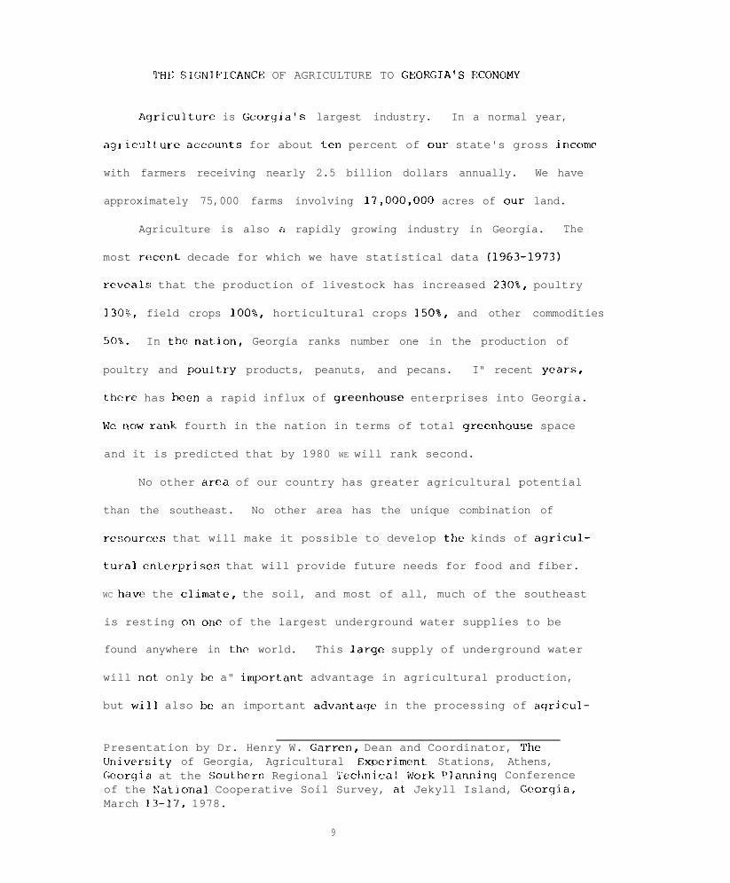
THt: SIGNIPICANCE OF AGRICULTURE TO GEOKGIA'S FCONOMY
Agriculture is ticorgia's largest industry. In a normal year,
aqr-iculture accour~t~~ for about ix" percent of our state's gross income
with farmers receiving nearly 2.5 billion dollars annually. We have
approximately 75,000 farms involving 17,000,OOO acres of our land.
Agriculture is also a rapidly growing industry in Georgia. The
most recent decade for which we have statistical data (1963-1973)
reveals that the production of livestock has increased 230%, poultry
1308, field crops loo%, horticultural crops 150%, and other commodities
50%. In the nat.ion, Georgia ranks number one in the production of
poultry and poultr-y products, peanuts, and pecans. I" recent years,
thcro has been a rapid influx of qreenhousf enterprises into Georgia.
Wc "ow rarrk fourth in the nation in terms of total grcalhousc space
and it is predicted that by 1980 WE will rank second.
No other area of our country has greater agricultural potential
than the southeast. No other area has the unique combination of
rfsource~ that will make it possible to develop the kinds of agricul~-
tural fnterpriscs that will provide future needs for food and fiber.
WC have the climat~e, the soil, and most of all, much of the southeast
is resting o" one of the largest underground water supplies to be
found anywhere in the world. This large supply of underground water
will rrot only be a" iml'ortant advantage in agricultural production,
but wi~11 also be an important advartagf in the processing of aqricu-
Presentation by Dr. Henry W. Garren, Dean and Coordinator, TheUniver:;ity of Georgia, Agricultural Expcrimont Stations, Athens,Georgia at the Southern Regional Teclinical iwrk ?lan"inq Conferenceof the Natiorlal Cooperative Soil Survey, ate Jekyll Island, Georgia,March 13-17, 1978.
9

tur~al products. Grorgia is lerticularly hlessfd with a large undcr-
qrourrd ~at.t)r supply. Eiqhty ~:'rrccnt of the underground wat<,r found
jn the Coastal Plains Region of the southeast is under South Georgia.
Hy the 2lst ccrrt~ury, which is only one gcnerat~ion away, food
and fibcr product,iorr in t~his count.ry wil,l have to double. MXly
states of our natiorr with the available agricultural technology arc,
much closer to reaching their maximum potential in agricultural 11t-w
duction than WE hrrro in thr south. If production must doublr: by tl~,
21st century, than it may perhaps triple or more in the sout~h. In
1976, over 20 farmers in Georgia produced more than 200 bushels of
corn per acre. Our state's largest cooperative is rcportcd to baw
moved t:wice as much grain that year than in the previous ycal-. c~;col-<]
and other southern statues are definitely becoming a grain producinq
area.
Georgia and other southern states also have great potential as
an exporter of agricultural products. There is a need to improw our
port facilities suclr as ours in Savannah, Georgia. At the present
time, we have at t~hat location grain storage facilities for only
about GOO.000 bushels. If .some of the grain-carrying ships rcquirc
1.6 million bushels for a complete load, these large ships, of course
usually will not come to a port whcrc they cannot obtain capacity
load.
Another advantaqc the southeast, and particularly Georgia, has
in agricultural F,roduction and processing is location. It is csti-
mated tkat,when WC reach the ycnr 2,000, some 60% of our people are
expectr~d to he conccnt~ratcd on about 7% of the land mass and will bc
founii in three larqc metropolitan arcas. One of these will be
10

ill Crllifor-nia. the other in Florida, and the third in a triangle
fwmcd by Chicago, Roston, and Washington, D.C. The southeastern
far~mcr will 1~ in arr ideal position to provide much of the food and
fjbrr utilized by the> growing population to the north and to the
south in Florida.
If some weather experts arc correct in their predicitons, still
another advantage may br in the making for southern agriculture.
Although I hope that they are wrong, some of these experts are pre-
dictinq t:hat thr farmbelt may be entering the early stages of a very
lonq dry pcx-iod. AlSO, some believe that the northern temperate
%oncs arc coolinq and that, as a result, the growing season there may
bccomc shorter
Hccent~ly, Russian climatologists reported that the temperatures
in the Russian Arctic have dropped three degrees centigrade in the
,ilSL~ 50 years. The growing period Ian some parts of Kussia has dropped
from 17 tc, 1~8 weeks down to 13 weeks. Even now, Russia only has one
good aqriculture year out of three. In all of Russia, there is really
no good combination of soil, moisture, and climate. A one degree
<ci,rrtiqrado drop in tcmperaturc for either Russia or Canada would
result Ian a 3O'L dccl-ease in their capacity to produce food.
I,, 1976, thr awraqc increase in farmland prices for the nation
was U,' 17%. In Sc”“on statc!s, none of which was in the southeast, the
avcraqc incrcasf in price I-anqed from 20 to over 409. When one con-
sidc,r-s our agI-icultural potential during the next dccadc, it can
rx~ly ix cxr~rlwlcd that ours southern farmland is selling at bargain
bawmc rrt pr i cc:::. As more folks bcqin to rcalizf this, the demand for

southern land will increase sharply. During the last 12 to 18 months,
there has been exte&ive land purchases in Georgia by foreiqn in-
vestors. I expect this is also occurring in other states throughout
the southeast.
One of the main concerns WE should all have about the future of
American agriculture
widely recognized as
is energy. While our form of aqrirulturc is
the most successful means for producing food and
fiber, it requires extensive inputs of fossil energy. At the farm
level, the energy input is quite small in terms of the percentage of
the total energy consumed in this country. Only 4% is required to
produce the food and fiber at the farm level. However, when one adds
to this 48 the energy required for processing, distribution and
utilization of farm and forestry products, the input approaches 23%.
If we were to try to feed and clothe the world with our form of agri-
culture, it has been estimated that the known fossil fuel supply
would be exhausted within 30 years.
Because ours is an energy oriented agriculture, some folks predict
that we will start moving toward smaller farms and more labor intensive
farms. Some even suggest that there may be a return to thP xze of
more draft animals and the use of organic fertilizers in our farming
operations. I do not share this view to any great extent. We may have
some, but not much of this in the foreseeable future. Because of the
tremendous financial investments required, we may, on the contrary,
see more corporate fanning.
In the April 1976 edition of Chemical and Engineering News, there
appeared an article containing this paragraph:
12

"To turn back to farming with no commercial chemicals or fertil-
izers and to use draft animals instead of tractors in this country,
would take about 61 million horses and mules to produce the same
amount of food we turned out in 1974. It would take about 31 million
workers on farms working at hard labor for long hours at low pay. It
would take 180 million acres of prime cropland just to feed those
extra horses and mules. That's nearly twice the amount of United
States land that is growing food and fiber for export sales and food
assistance to starving people in foreign lands."
There're not many of us who would be willing to produce our food
without fossil energy or who would be willing to pay the costs that
would be incurred if others produced it for us without fossil energy.
But that's not the solution to the problem anyway.
The solution rests with energy conservation, coupled with
research to find more efficient ways to utilize energy in agricultural
production practices and in all other energy requiring operations.
And, of course, everyone realizes we need to find alternative sources
of energy.
We're running out of agricultural technology. Food supplies are
qrowinq at a rate of 2.6% a year, a bit lower than in the early 1970's.
If we are to close the gap between supply and demand for food between
now and 1986, the food supplies must grow at a rate of at least
4.25%. In 1940, our federal government was spending 40% of its research
and development funds for agricultural research. Today, only 2.2% of
the federal funds for research development is going to agricultural
research. This means that less than five hundred million dollars is
13

spent per year on federally sponsored agricultural research. This is
indeed a small amount when one considers that this country produces
over two hundred billion dollars worth of food and fiber per year
and exports various agricultural commodities at a value exceeding
twenty-two billion dollars annually.
We need an increased agricultural research and Extension effort
more today than ever before in the history of our nation. Had it not
been for prior agricultural research and Extension program*, we
would have two-thirds less food today than we have.
As mentioned earlier, we need research in energy conservation.
were we are not concerned just with conservation of energy used to
operate the equipment, but the development of agricultural technology
which will require less energy input. No-till cultivation is one
example in this area. The development of plants that are more efficient
in the utilization of sunlight would be still another example. Plants
other than the legumes with the capacity to fix nitrogen would save
substantial amounts of energy. Tremendous amounts of fossil energy
are used in producing nitrogen. Dr. Glenn Burton at the Coastal Plain
Experiment Station is working on a Bahiagrass that possesses the
capacity to fix nitrogen. Similar research is taking place at other
institutions (e.g., North Carolina State University). It is hoped by
Dr. Burton and other plant scientists that ways will be found to
cause other plants, such as corn, wheat, etc., to fix nitrogen.
We need drought rcsistent plants. Research in this area is
already underway, but needs to be expanded.
We need plants, particularly here in the :;outh, that are more
14

adaptable to acid soils. Some research is already underway in this
area, but this too needs to be expanded.
WE need earlier maturing plants. These would be useful not only
in areas where the growing season seems to be getting shorter, but
would also be very useful in multiple cropping programs presentl~y
being explored in the south, particularly Georgia.
We need irrigation research to find ways of using water inore
effectively and efficiently in crop production. At our Coastal Plain
Experiment Station in Tifton, it has been shown that, by use of
trickle irrigation, the production of some crops can be increased
three to four hundred percent.
There is need to investigate the possibility of recycling more
of the agricultural by-products generated both on the farm and in
the processing operations. Some of our animal scientists have shown
that cattle feed consisting of 75% grain and 25% poultry litter
produced beef of essentially the same quality where 100% grain was
fed.
Pest control is becoming a serious problem. The problem is
also being compounded by new federal regulations regarding the use of
various chemicals in pest control. We need research to find more
acceptable methods to control pests (e.g., biological means).
Simple stomached animals, such as the chicken and pig, compete
with humans for food. Diets consumed by these animals are essential~ly
the same as that consumed by humans. Research is needed perhaps
through fermentation or other means to find different sc~urces of
nutrients for these animals.
15

Presently, 50% of beef consumed in this country is produced on
forages. It has been estimated that,within the next two decades, this
will increase to 90%. Expanded research thus is needed to find more
palatable forages for our cattle.
In closing, I want to cane back to energy. Agricultural problems
today may seem insignificant with those that may confront our country
by the 21st century. If alternative sources of energy are not found,
there will be drastic: changes in the dietary habits of the people of
this nation. In addj~tion, hundreds of thousands and perhaps even
millions of people Cl1 face starvation during the next century.
16

MANAGEML:NT AND PRODUCTION IS ONLY HALF THE STORY
Conservation programs today are probably in the greatest transi-
tion in our history.
Throughout our large cities these days, there is a new fascina-
tion about what is happening in rural America. Our communication media
rcflrcts this fascination, but they are not quite sure what it means
and do not know exactly how to handle it.
?'he metropolitan newspapers, national news magazines, and the
television networks all share a sort of dilemma. In large measure,
they continue to write about America as if most of it was in New York,
Washinqton, or Los Angeles; but they are vaguely aware that something
i.s happening out beyond the suburbs and are starting to write about it.
Georgia has been a shining example of how local people can take
the lead - how our own leaders can show the way when something needs
to be done.
It is happeninq in Georgia and it is happening all over America.
Our people are rediscovering the countryside.
For more years than most of us care to remember, it has been tradi-
itional for young people to grow up on the farm in rural areas, or in
small towns and to l~eave for the cities to seek their fortunes. In
the first half of the 1970's that trend was turned around. Whether it
is a temporary thing or a new thing we cannot say. No one can say with
certaint~y.
-- ~--Presentation by Dwight M. Treadway, State Conservationist, Soil Conser-vation Service, Georgia at the Southern Regional Technical Work PlanningConference of the National Cooperative Soil Survey, at Jekyll Island,Georyia, March 13-17, 1978.
17

Rut in the last five years, nearly two million more people moved
into nonmetropolitan areas than the other way around. There is
evidence in many places across the nation that rural counties are
gaining population through migration.
The enrollment in agricultural colleges is increasing. The number
of young people in high school vocational agricultural programs is at
an all-time high. mice as many college graduates are going back to
the farms as a decade ago. Farm population in 1976 was 600,000 fewer
than in 1975. warm population is 15 percent below 1970. The south has
lost more farm residents than any other area in the United States - one-
fourth since 1970.
Last year a gallop poll showed that 58 percent of all Americans
would prefer to live in small towns or rural areas as opposed to big
cities. Per capita income is growing faster in rural areas than in
cities or suburbs. That's factural evidence. Numbers prove the case.
Rut there is other evidence and that is the impression one gets in visit-
ing rural towns throughout this country. There is a new spirit of
pride and community spirit in towns throughout rural America.
Industry is finding more and more advantages in the countryside.
Their employees find it more relaxing and more satisfying.
Better transportation, improved communications, and other modern-
day conveniences are as common in rural areas as they once were in the
cities. The differences are narrowing and main-street stores are being
fixed up and not boarded up. Farmers are remodeling their homes and
18

building new ones. Communities are building new water and sewer systems
or upgrading the ones they have had. All of this is happening and all
of us are part of the picture. Every town and every community that has
a success story is a town that wanted to succeed.
so far, I have not mentioned the federal role. It is an important
part of the picture, but it can work only when local people lead the
way. The success of a federal program cannot be measured in dollars.
I" fact, in many cases, it is the other way around. The s"ccess of a
federal program has a direct relationship to the involvement of local
people and this is particularly true over the years of the programs of
the U. S. Dfpartment of Agriculture. Conservation is a good example.
There would be no hope at all for a successful soil and water conscrva-
tion program if it was directed from the top down. The local co"ser"d-
tion district supervisors and landowners themselves are what make these
programs work.
The success of the basic commodity farm programs is due in large
measure to the local administration of county-elected committeemen and
so it goes.
Another great thing has happened in rural America in the last four
or five years. For many years, we have heard military power. Now we
hear food lower. Not only are we feeding America, but also a large
segment of the world.
We are tempting to balance payments with food.
But this is causing major amounts of land to be brought back into
cultivation setting up a greater need for help in installing conserva-
tion programs. How do we deal with it?
19

Soil conservation districts and SCS's forty-plus year history has
Iwen to dcal with soil rrosion primarily to protect the land's ability
to product food and fiber. Wc have prided ourselves with soil conser-
vat~ion dist~ricts 011 the SUCCESSCS.
I think we cur all be proud of this effort because the record
HIIOWH that landowners in Georgia treated more than twice the cropland
;~creagc with conscr~vation practices in 1977 than in 1976 despite the
facL that they had drought followed by armyworms. Your state may have
a similar story.
Our four basic programs have been very successful. For example,
the conservation operations program is the basic program where SCS and
the district provide technical assistance for planning and application
to landowrrc~-s. Our other basic program, the soil survey program is to
furnish resource information for land-use decisions. Presently in
Georgia, about 30 mil~lion of our 37 million acres have been mapped and
classified into a specific unit. We all know the story of the water-
shed program and the resource conservation and development program in
that these two have been successful although at times controversial.
An WC look down the road into the future of how our staffiny changes
and program direction should bc, we see some major conflicts. we see
competition dcvelopinq for prime agricultural land in terms of need for
m,aintaininqj this land Tao produce food and fiber. While at the same time,
this land is being used by urban development because that is the cheapest
and casj~cst ~'lacc to build new roads, homes, shopping centers, airports,
20

1 don't intend to bc a profit of doom because there are ways we
can deal with it. Wt, have some techniques, some expcrtisr, and the
skills; hut WC? must create public awareness before WE will bc very
effrctivr in getting thp job done. Developing new consc,rvation trchni-
qurs surh as no-till farming and getting state arld local governments
to furnish manpowr~r in applying conservation progralr.s are only t~wo
examples of things we arc workinq toward.
Use of soils information is one of the key elements in making land-
use decisions. "Consider the Soil first" should be our theme song.
You are very knowledgeable of the history of NCSS Program. YOU
are aware that Public Law 46 (1935) and (P.1,. 89-5603 Soil Survey Act
of 1966 is th? basis: for NCSS. The Soil Conservation Service furnishes
soil scientists who prepare the soil surveys. Others are heqinninq to
do the sami,.
As WE define the words in the title of my suhjcct "managcmnnt and
product i on, ” we mean the actual production of the surwy. The SCS has
been "urrd6.r the gun" since its inception to accelerate surveys and we've
made strides of progress.
It has long been the goal of the SCS and our cooperators in NCSS
to provide a soil survey of the Nation that is complete and current.
In order to get the job done, we have to improve productivity while
at the same time maintaining and improving quality. There are large
differences in productivity among survey areas in individual states and
among states. We believe if all soil surveys were managed like the best
25% of our current soil surveys, national production could be increased
21

by 50 percent. Although soil survey enjoys continuing strong support
by the Administration and Zr~gress, it is not likely that funding will
increase greatly in the future. Hence, we will have to do with what
WC have and manage better.
Increased productivity is not achieved by putting pressure on soil
scientists to work harder, but by helping them to work more efficiently.
We have made much progress in the designing of soil surveys for the
need of individual areas.
Too often in the past, and we still do, spend our time hitting the
soil scientist over the head while preaching "map more acres -- lower
the unit cost." Have you e"er heard that before?
I congratulate you however because the record shows that NCSS has
made as much progress or more than any program SCS has. One and four
tenths billion of the 2.4 billion acres in this nation are now mapped
and one-third of the surveys are published.
The new demands for soil surveys go back to the national concern
for the preservation of our natural resources. At the Federal level,
SCS needs soil surveys not only for an increased emphasis on conserva-
tion planning, but also for implementing the Soil and Water Resources
Conservation Act of 1977, certain provisions of the Surface Mining Act,
and the Hural Clean Water Act. Our sister agency, the Forest Service,
is engaged in the second phase of the Resowces Planning Act. The Fish
and Wildlife Service is conducting a wetland inventory and the Bureau
of Iand Management is under obligation to develop environmentally sound
management practices for many millions of acres of public land. At the
22

state and local levels, many agencies such as the Agricultural Experi-
ment Stations have programs that supplement the federal efforts and
require soil surveys.
Our record of production is only half the story. The other half
is "accelerating the use of the survey" -- put emphasis on interpret~a-
tions.
My first point is there is a lack of availability of our soils
mapping to the user. We're pretty typical in Georgia, but outs of 37
million acres, 30 million are mapped. Only 13 million or less than
50 percent is published.
We must accelerate publication, but not just the same efforts wc'w
made during the past few years to reduce the backlog. We must be selec-
tive in our field mapping, thus permitting survey areas to be completed.
This will mean concentrating our staff. This will mean more transfcrrinq
of personnel than we have been use to in the past, and it may not bc
easy.
Soil survey priority areas must be in complete harmony with USDA
priorities as well as state and local agencies. Who would have believed
a few years ago that we would have today's emphasis such as 208, Surface
Mining Act, Rural Clean Water Act, prime farm land policy, Rfsources
Planning Act, Resources Conservation Act, and on it goes.
The SCS state conservationist has an important role of coordination
with other aqcncies. I hope we're not asking our state soil scientist
to do this alone.
23

My third point is, we must stress interpretations.
a. Making the survey is only a part of the total job.
b. This is not to take away from the significance of quality
control in the basic mapping.
c. It is the availability, usability, applicability of data that
determines the fulfillment of the intended purpose.
d. Soil taxonomy and the National Cooperative Soil Survey provide
the basis for collecting the needed data.
e. The number of valid interpretations that can be made from a
soil survey is almost unlimited. Compare the interpretations
that were significant a few years ago with the number that is
possible now. The SOILS-5 is only limited suggestions.
Fourth, we must have our data in a display system. We are using
MIADS in Georgia. You may be using something similar.
a. Coastal zone Management.
b. Work with State Soil and Water Conservation Committee.
c. Important Farmlarlds Maps by MIADS. Once encoded, the ease of
additional interpretatiorls.
d. Storing according to UTM Coordinates - retrieval important.
e. Central storage in the future - terminals in states.
f. State profited by others mistakes - 4 hectare - 10 acre cells.
In Georgia, we're ten years from being once over. Although it's
a worthy objective to complete once over, it may be more important to
concentrate on using what we already have.
My four points this morrling --
1. Accelerate publications by selective mapping.
24

2. Keep the publication priorities in tune with agency priorities
(not just SCS).
3. Stress interpretations.
4. Get the information into a display system.
I congratulate you on your record, but we're depending on you for
our future.
Thank you.
25


RESOURCE DATA FOR COASTAL ZONE MANAGEMENT
1. Need - Two facts that accelerated the need for resource data.
a. Public became environmental conscious in late 1960's, resulting
in actions involving resources.
(1) National Coastal Zone Management Act of 1972.
(2) National Environmental Policy Act
(3) Georgia Coastal Zone Management Act
(4) Georgia Erosion and Sediment Control Act
(5) Increased land use planning from standpoint of environment.
(6) Georgia Marshlands Protection Act
b. Georgia coast has unique features that generated interest by
environmental conscious people.
(1) The most undeveloped part of the Atlantic Seaboard.
(2) A large percentage of the area is environmentally unique.
(a) Estuary 500,000 acres in size.
(b) Over 90 miles of coastal beach.
(c) High percentage of wildlife wetland (25-35%).
(d) High desirability for recreational use.
(e) Humid climate and long growing season promote very
high tree growth rates.
2. Resources that need to be inventoried.
a. Soil resource - The National Cooperative Soil Survey.
b. Land use - Geological Survey Bulletin 671.
Presentation by Robert L. Wilkes, District Conservationist, SoilConservation Service, Hinesville, Georgia at the Southern RegionalTechnical Work Planning Conference of the National Cooperative Soilsurvey, at Jekyll Island, Georgia, March 13-17, 1978.
27

c. Wildlife wetland - Fish and Wildlife Circular 39.
3. MIADS (Map Information Assembly and Display System) selected to
process inventory data.
a.. Cell size can be varied to suit need. Four hectare cell
selected.
b. Multi-layered data can be interrelated.
c. Encoding did not require skilled personnel
4. Soil, land use and wildlife wetland inventories were made and
recorded on controlled base maps, published soil survey where
available.
5. Resource data generated by MIADS system will produce important
resource data for SCS and other interested agencies. The map data,
with simultaneously produced tabular data, will be of two general
types:
a. Cartoqraphically produced display maps.
b. Raw computer printouts that when used with a transparent
base map, can be used as rough work maps.
6. Questions land use planners are asking that can be answered are:
a. Is there undeveloped land that can be developed, and where is
it?
b. Where are the areas that have environmental restraints on
use?
28

COOPERATIVE RESEARCH IN SOIL SURVEY WITH THE SOUTHERN STATES
Two southern regional work groups are meeting this spring that
have interests related to the Cooperative Soil survey.
- South Region Soil Water Work Group will meet April 12-14, 1978
in Fayetteville, Arkansas. The group is composed principally of soil
physicists in Land Grant Colleges. Soil Survey personnel should
follow the activities of the Soil Physics Work Group
representatives to that group are aware of needs and
Soil Survey.
and make sure
interests of the
- South Region Soil Mineralogy Work Group will meet May 1-4 at
Mississippi State University. The group has completed a coordinated
mineralogical analysis of several regional soils. At their last
meeting the group considered the preparation of a regional soil
mineralogy map. As a first step, they decided to inventory present
soil mineralogy data in the region. Forms have been prepared and
distributed for encoding information so that it will be compatible
with the pedon data system.
South Region Soil Survey Investigations List of Projects (attached).
The list is intended to he for the Cooperative Soil Survey, and is
largely a revision of a list of projects presented to the 1976 Southern
Regional Soil Survey Work Planning Conference. The present list was
categorized by Gordon Decker and Warren Lynn. Placement of projects
in active, completed, or inactive is based on our own awareness of
Presentation by Dr. Warren C. Lynn, Research Soil Scientist, NationalSoil Survey Laboratory, Soil Conservation Service, Lincoln, Nebraska,at the Southern Regional Technical Work Planning Conference of theNational Cooperative Soil Survey, at Jekyll Island, Georgia, March 13-17,1978.
29

activity or completeness. We welcome additions or comments. we
hope the list is viewed as cooperative property that anyone can
participate in and learn from. An update every two years seems a
reasonable goal.
A status report is attached for Project 2 - River Terraces,
North Texas.
30
SOUTH REGION
Soil Survey Investigations
List of Projects
Active Projects 1-18Completed Projects 19-24Inactive Projects 25-42
Draft March, 1978(Revised from Draft March 19, 1976)
31

SoIt- SURVEY //WESTlGffTlONS - - /~),q@c,q 1970
SOUTH TECHNICAL SERVICE CENTER AREAU. S. DEPARTMENT OF AGRICULTURE
SOIL CONSERVATION SERVICE---_
5.1(-35.989

----

1. TX-OK, Red Bed Soils
Soils of interest are developed on Triassic, Permian, and upperPennsylvanian parent materials. The area is located in west central Texasand north and western Oklahoma. Physiographically the area abuts the highplains on the west and on the east merges into other Pennsylvanianmaterials. A meeting was held in January 1978, involving personnel fromthe STSC and the states of Texas and Oklahoma to assess current data and tolook at possibilities for future action. It was considered that a studytransect from west to east in northwestern Texas would be useful. Oneaspect we are interested in is the clay mineralogy, another is theerodibility of red bed soil materials.
2.
3.
4.
5.
6.
TX, River Terraces
This is a study of terraces along the major rivers in northern Texas; i.e.,the Brazes, Trinity, Colorado and Red Rivers. Principal studies have takenplace on the Brazes and Trinity Rivers. The main purpose is to identifysoils , soil development, and soil mineralogy on the respective terracelevels. A sunmary of present data is available.
TX, Sand Sheet Study
The area of interest is south Texas along the coast of the Gulf of Mexico.Characterization samples were collected in May 1977, and in December 1977.Cooperating on the project are scientists from Texas A&M, Texas A&I, LamarTech and the SCS. There have been grid transect studies and drill studiesin conjunction with characterization sampling.
TX, Plinthite
East Texas has a considerable area of plinthite soils that range from ahumid into a subhumid climatic regime. There is tentatively scheduled asampling trip in fiscal year 1978 in Angelina County to examine some of theplinthite soils.
LA, Macon and the Bastrop Ridges
The sampling is scheduled April 1978 to examine and characterize soils onthe Bastrop Ridge and on parts of the Macon Ridge. Both NSSL and LSU havebeen interested in soils on the Macon Ridge and have done considerablesmall project sampling. The present study extends the study eastward ontcthe Bastrop Ridge.
AL, River Terraces and Citronelle Formation
ACTIVE PROJECTS
The main thrust of the project is to examine soils on the CitronelleFormation and their relationship to soils on the higher river terracesalong the Alabama River. Geomorphic groundwork has been laid by scientistsin the state of Alabama along the Alabama River. Sampling is tentativelyscheduled for July 1978 to examine field relationships and to sample some
34

of the soil~s involved. Likely the project will continue for a number ofyears with periodic assessment of the needs.
1
7. GA-SC-NC, Pamlico and River Terraces
The main thrust is to examine soil series on the Pamlico in relationto soil series mapped on river terraces upstream from the Pamlico Terrace.Of interest is to follow the kinds of parent materials and soil mineralogyon a given river system to see if they are comparable on the coastaldeposition and in the river terrace depositions. Talbert, Gerald of theSTSC is coordinating the project,
8. NC-VA-SC-GA, Micaceous Soils
The Bt and C horizons of several sites have been sampled in North Carolinaand some in Virginia as indicators of the problems likely to occur onmicaceous soils. The principal questions are how much mica is necessary toinfluence soil properties and what effect does the size of mica have uponsoil properties. Work is c,urrently underway on characterization anclmineralogical analyses.
9. FL-SC, Spodic Horizons
Florida has gathered information on morphology and a field assessment ofwater permeability in spodic soils. Ortstein families have been identifiedand appear related to permeability. NSSL has been involved in thereference sampling in Georgetown County, South Carolina. One of thegeneral questions is an assessment of soil taxonomy criteria for spodichorizons. For example, are the chemical criteria developed to identifyspodic materials in the northern states also adequate for defining spodichorizons in the deep sands along the south Atlantic Coast? Also, can somespodic horizons in the southeast be identified by field morphology alone?
10. Southeast, Regional Soil Mineralogy Map
This is a project undertaken by the Southern Region Soil Mineralogy WorkGroup, The first step, possibly leading to a soil mineralogy map, ismaking an inventory of soil mineralogy data in the Southeast. A form hasbeen developed for computer input that is compatible with the pedon datarecord and we are currently involved in gathering data.
11. GA-SC-NC, Pamlico Terrace
Pamlico Terrace has mixed sand mineralogy in some areas and siliceous sandmineralogy in other areas. The thrust of this project is to collectinformation up and down the seaboard of the Atlantic Coast on the Pamlicosurface to assess the mineralogical trends. The project fits closely withproject number 7 above, but has slightly different thrust. Results ofanalyses on several small projects are available.
35

12. GA-SC-NC, Cecil Soil Survey Interpretations for Buildings
The present soil survey interpretations for buildings indicate a moderatelimitation on Cecil and similar soils. Experience with the soils indicateslittle if any problems associated with foundations or buildings and it isfelt that interpretations limitations should be listed as slight. Thisproject is to gather background information, particularly COLE, on Ceciland similar soils in several states where the soils occur. Gerald Latshawof the STSC is coordinating the project.
13. AL-MS, Montmorillonitic Hapludults
It recently came to the attention of the Correlation Staff, STSC, thatmontmorillonitic Hapludults occur on Coastal Plains soils in Alabama andlikely in Mississippi. Several reference samples were collected to assessthe extent of such soils. Dr. Ben Hajek of Auburn University has noted theoccurrence of such soils for some time and has gathered a considerable bodyof information on them. Our intent is to coordinate with his findings andassess the extent of such soils.
14. KY, Characterization of Strip Mines Soils
With the mining interests and the upturn of land areas associated withmining efforts, there is interest in revegetation and utilization of stripmined areas. We are cooperating with the University of Kentucky incharacterizing two soi.1.s on strip mine lands.
15. MS-Others, Stream Channel Stability (Tractive Force)
This study is undertaken principally by the ABS Sedimentation Laboratory inOxford, Mississippi. We have cooperated in their studies by providing somecharacterization data, particularly COLE and moisture properties, onsamples that they have collected. We anticipate some activity in thefuture in this area.
16. AH-LA-OK-TX, Mound Studies
Mounds on the soil landscape have created interest in the eyes of soilscientists for some time. There are currently active field investigationsin Jasper and Newton Counties, Texas, to assess composition and soilcharacteristics of some mounds in that area.
17. AL-GA-Others, Oxidic Mineralogy
There has been considerable interest in reevaluating the definitions ofoxidic mineralogy in Soil Taxonomy. Oxidic mineralogy is principally acharacteristic of tropm soils and could not be tested very thoroughly onUnited States soils at the time Soil Taxonomy was written. There have beenrecent conferences and studies ioropic regions resulting in proposals ofKandiudults. We need to assess these proposed criteria and study how theyimpinge upon the classification of soils in the southeast region.
36

18. KY-TN, Aspect. Influence, Forested Soils
This study area centers in the eastern mountainous region of Kentucky andTennessee. There has been an indication that aspect of the soil on thelandscape influences the soil properties. An alternative has beensuggested that a cove vs. nose landscape position may have more influenceon soil properties than aspect. There have been field investigations bystate and regional staffs to look at the problems.
37

CORPLETED PROJECTS
19. TX, Bailey County
Characterization analyses on soils sampled in Bailey County in 1975 areessentially complete. The active SCS personnel have retired or moved outof the area and it is doubtful that the project will be extended as onceproposed.
20. TN, Low Terraces
Characterization analyses on soils sampled in IfcNairy County are nearlycomplete. Plans to extend the study to other areas in western Tennesseehave been delayed for now.
21. KY, New Albany Shales
The University of Kentucky has completed a sampling project on shales incentral Kentucky. A study trip is scheduled in May 1978 on similar shalesin southern Indiana. The information gathered on the Kentucky projectshould be of use.
22. AL-GA-FL, Plinthite Study
A field study of plinthite soils was held in March 1976 in southwesternGeorgia, southeastern Alabama, and northern Florida. There were nospecific characterization projects that were developed out of that study.
.23. SC, Sand Hills
Characterization sampling was completed in Aiken and Kershaw Counties,South Carolina in 1975. The bulk of the analyses were done by ClemsonUniversity with some additional information provided by NSSL. Thecharacterization studies are nearly complete.
24. NC, Outer Bank
Studies of soils on the outer bank in North Carolina were undertakenprincipally by North Carolina State University. The project is essentiallycomplete.
38
INACTIVE PROJECTS
25. TX-OK, Natric Subgroups
Soil Taxonomy does not provide for natric subgroups, yet there are soilsthat logically fit as intergrades to natric great groups. An assessment isneeded of the acreage involved, and if sufficient, criteria for natricsubgroups should be developed and tested. An assessment is also needed onhow natric soils and the proposed natric subgroups affect the K factor inthe soil loss equation.
26. TX-OK, COLE on Loamy Soils
Considerable data for clayey soils substantiates a good correlation of COLEand management, but similar relations for fine-loamy and fine-silty soilshave not been examined. Available data should be collected and evaluatedto determine what relationship exists and what further study is needed.
27. OK, Chickasha Soil Moisture
Existing data on precipitation soil moisture by neutron probe and soildescriptions for a small watershed need to be analyzed with respect to theudic-ustic criteria and the results with similar data at other sites. Aprocedure for analyzing the data needs to be developed. Ron Paetzold, JoeNichols, and Frank Newhall visited the ARS station at Chickasha recently.John Newhall may have a computer program utilizing weather station datathat can be incorporated to calculate soil moisture regimes. Thispossibility needs tb be followed up.
28. OK, Oxygenated Water
The problems aligned with this project include soils that appear gray or tohave reduced soil colors, but without evidence of soil water table on onehand, and, on the other hand, soils that appear to have oxidized colors butare known to have water table conditions. This may not be one study as suchbut the two kinds of situations need to be looked into. Part of the problemimpinges on classification of wetlands that is not a part of the SoilTaxonomy system.
29. TX, Coastal Plains
Soils of the Coastal Plains in east Texas appear to have the samemorphology as soils of the North Carolina and South Carolina CoastalPlains. Soil behavior is considerably different in the two regions.Differences presently are considered climatic. The data are needed to seeif there are morphological differences that can be determined in the fieldor laboratory.
30. t&Others, Loess in the Lower Mississippi River
An effort is needed to pull together data and studies presently availableon loess in the southern Mississippi River to get a better picture of loessstratigraphy across state boundaries and along the river system. A number
39
of studies have been undertaken in scattered areas, however, in other areasperhaps additional studies are needed to fill in gaps.
31. LA-FL, Marsh Soils
There is a need for additional information on coastal marsh soils forcoastal zone planning, management, and development. Work is needed todetermine landscape relationships and morphological, physical, andchemical properties of the soils, and the extent and distribution ofHistosols, Hydraquents, and firm mineral soils. The sal inity , thepotential for sulphide induced acidity, and the hydraulic conductivityneed to be assessed. The work needs to be coordinated with the studies byCoultas in Florida.
32. AR-LA-TN, Clayey Terrace Soils
The principal area of study is along the Red River in the vicinity ofTexas, Arkansas, and Louisiana boundaries. The study is intended to assesstaxonomic mineralogy placements on the terrace soils of the Red River (andsimilarly along the Arkansas River). Similar assessment is needed on thesand mineralogy. It is principally a matter of coordinating assessment ofsoil mineralogy across state boundaries.
33. MS, High Sodium Soils
The project is centered on the Rosella series in Lownes C o u n t y ,Mississippi. Dr. Vie Nash of Mississippi State University has some studiesunderway or planned, including characterization and field water studies.
34. MS-OK-Others, Erosion of Dam Sites
This is principally a problem of dispersion or piping or jugging associatedwith earthen dams such as those constructed by the Soil ConservationService. George Holmgren of NSSL has been working in conjunction with theSoil Mechanics Laboratory in Lincoln for several years in trying to assessthe problem and ways of determining materials that will be susceptible todispersion.
35. TN, Cumberland Mountains
Kentucky, Tennessee, and West Virginia show some differences in mineralogyof soils in the boundary region among the three states, for instance,Anderson and Hamilton Counties, Tennessee. It is principally a study ofthe weatherable mineral content of the soils and the consequent placementof soil mineralogy groups in Soil Taxonomy.
36. AL, Pre-Miocene
There is a strong correlation between soils and characteristics ofoutcropping Miocene and older sedimentary formations in the AlabamaCoastal Plain. In some areas, there is little relation of soil-geomorphicsurface because there is an overriding control of parent material. Inother areas, soils can be related to specific landscape positions. These
40

relations within the county need to be firmly established during the earlypart of the soil survey. Once the soil scientists are trained tounderstand and gain confidence in their ability to recognize the soil-geomorphic relations, the concepts can be quickly applied to adjacentareas, modified as needed.
37. FL, Thick Reddish Bl Horizons
Some Arenic and Grossarenic Paleudults in Florida (Lake County) have thickreddish Bl horizons in the position where A2 horizons commonly occur.Bl horizons are identified because of their high chroma. A genesis problemarises concerning the formation and persistence of the reddish Bl horizons.As far as utilization is concerned, it is questioned whether the Blhorizons have an effect upon the water holding and transmission properties.Some of these Florida soils are considered high phosphate soils. TheAmericus series in Georgia has similar properties, but is not so thick.
38. GA-AL, Middle Coastal Plain
Some deposits in the Hiddle Coastal Plain exhibit tiered arrangements.Soils such as Troup, Lucy, and even fairly uniform looking soils develop inmore than one tier. Laboratory data could help in understanding the soilforming processes.
39. Southeast, Halic Horizons
Some soils along the coast of the Gulf of Hexico have properties that showthe impingement of the, sea on the soil. Proposed halic horizons and halicsubgroups of certain taxonomic units have been proposed in a publication byBartelli, et al. @SAP 39:703-706, 1975) . Persons dealing with soilcorrelation and field investigations have been urged to assess thepossibilities in usefulness of delineating halic soils on landscape and ofutilizing hedic criteria in the Soil Taxonomy. At present there is nostudy dedicated to the collection of data on halic soils.
40. Southeast, Fragipans
Much confusion still exists in the field mapping of fragipans. Studies areneeded to (1) develop better criteria for field identification of soilshaving fragipans, (2) determine if a chronological sequence of fragipandevelopments and degradation can be recognized and used in describingsoils, (3) relate differences in fragic properties to differences inmaterials in which the soils are developed, and (4) study water regimes andwater movement in soils with fragipans.
41. FL, Quartzipsamments
Uncoasted classes of Quartzipsamments are defined in Soil Taxonomy ashaving a moisture equivalent less than two percent. Moisture retained at0.5 bar may be substituted for moisture equivalent. If moisture retentiondata are not available, the silt plus clay is utilized and an amount lessthan five percent indicates uncoated Quartzipsamments. Data are needed torelate the above properties to visual observations of coatings on grains inQuartzipsamments as assessed by miscroscopic identification.
41

42. Southeast Data By I&4
We need to look into the possibilities of storing and retrieving data byland resource areas. This can be accomplished most readily once the pedondata record system is operating.
L
42

Soil Survey InvestigationsProject 2 Texas, River Terraces
sumary: ?larch 1978
?urpose: To study soil mineralogy in relation to soil development,terrace level (geomorphic position), and sediment source.
Soils for which sand mineralogy data are available are listed subse-quently for studies on the Brazes, Trinity, Colorado, Leon, and Red?.iver Systems. The most extensive work has been on the Brazes andTrinity Rivers.
Information includes series name, soil number, the height of the site(surface) above the adjacent river, landscape position or terrace level,miwralogy family and percent of resistant minerals in the very finesand fraction.
Soils on the Upper Brazes are in a mixed mineralogy family. Soils on theLower Brazes,, the Trinity, Colorado, and Leon Rivers are in a siliceousnineralogy family. One soil on the Red River is borderline between mixedand siliceous. The Upper Brazes may have a higher contribution fromPermian and Eigh Plains sources, whereas the Lower Brazes and Trinitymay have a higher contribution from crecaceous sources.
One can pick out SOIU~ indications of more resistant minerals in thehigher terrace lc~els, but the absolute differences are not large.
43


Brazes River
Young
Palo Pinto
Parker
Hill
Falls
BraZOria
Trinity River
Dallas
Height Above L'Soil (Soil No.) River (meters)
Miles (s~~Tx-275-i) Highest QuatEnterprise (S76TX-275-2) 12 (FP)
Enterprise (S~~TX-503-l) 3 (FP)
~incoin (S~~TX-363-7) 3 (FP)
Lincoln (S~~TX-363-10) 4.5 (FP)
Yahola (s~~Tx-363-6) 4.5 (FP)Yahola (S74TX-363-11) 11 (FP)
sm (S74~x-363-3) 9 (Tl)stm (s74~x-363-5) 11 (Tl)Bastrop (S~~TX-363-4) 15 (T2)Decordova (s~~Tx-363-2) 18 (T2-T3)Minwells (s~~Tx-363-l) 37 (T3)
~indn (s~~Tx-367-3) 4.5 (FP)
Bastrop (S74~x-367-2) 11 (T2)
Aquilla (S73TX-109-2) 9-12Bastsil (S73TX-109-1) 12-15Kopperl (S73TX-109-3) 46-49
Desan (S74TX-145-1) 38Silawa (S74TX-145-2) 39
Brazoria (S76TX-039-1) FPSurfside (S76TX-039-2) FPVelasco (S76TX-039-3) FP
Aquilla (S75TX-113-l) 9 (FP)Energy (S75TX-113-U) 9 (FP)
Silstid (S75TX-113-2)Bastsil (S74TX-113-l)Dutek (S74TX-113-4)Silstid (S75TX-113-9)Bastsil (S75TX-113-3)Bastsil (~75~~-113-8)Silawa (S75TX-113-4)Silawa (S75TX-113-5)
9 (Tl)4 (Tl)3 (Tl)11 (Tl)11 (Tl)17 (Tl)12 (Tl)9 (Tl)
Mineralogy 2/Familymixed (RE84)mixed (RE78)
mixed (RE78)
mixed (RE81)mixed (RR82)
mixed (RE77)mixed (RE74)mixed (RE88)mixed (RE84)mixed (RE90)
siliceous (RE92)siliceous (RE96)siliceous (R!d96)
siliceous (RE91)siliceous (RR92)
siliceous (RE95)4/mixed (RE80)41mixed (RE80)4/
siliceous (RE97)siliceous (RE96)
siliceous (RE91)siliceous (RR95)siliceous (RE97)siliceous (RE94)siliceous (RE96)siliceous (RE97)siliceous (RE94)siliceous (RE96)
45

Trinity River (cont'd)
county Soil (Soil No.)- -silawa (S~~TX-113-6)Silawa (S75TX-113-7)Bastsil (S74TX-113-Z)Silawa (S74TX-113-2)
Bastsil (S75TX-113-10)
Kaufman styx (s~~Tx-257-l)
HfIldeI-sOn Dtltek (s~~Tx-213-i)silawa (S~~TX-213-2)Rufaula (s~~Tx-213-4)
styx (S76~x-213-3)
Colorado River
Mills Desan (S74TX-333-1)Wharton Kenny (S73TX-241-1
Leon River
Bell Kopperl (S73TX-241-1)
Ked River
Lamar K0aawa
Height Above LfRiver (meters)18 (T2)15 (T2)18 (T2)14 (T2)
32 (T4)
11 (Tl)
6 (Tl)15 (Tl)12 (Tl)
24 (T2)
21
high
high
Mineralogy 2/Familysiliceous (RE98)siliceous (RE97)siliceous (RE99)siliceous (RE95)
siliceous (W97)
siliceous (RE95)
siliceous (RE94)siliceous (RE96)siliceous (RE94)
siliceous (RE95)
siliceous (RE92)
borderline
Landscape position or terrace designation in parentheses.Percentage of resistant minerals (RE) in the very fine sand fractionlisted in parentheses)Sands contain carbonates. On a carbonate-free base the family mineralogyis siliceous. Fine sands contain more resistant minerals than the veryfine sands, making the mineralogy siliceous on a carbonate-free base.Soils are clayey. Sand mineralogy based on small components.Coarser sands contain enough resistant minerals to make a siliceous family.
46

AquillaBastrapBastsilBraZOriaDecordovaDt?s.snDutekEnergyEufaulaKenneyKonawaKopperlLiIWOlllMinwellsSilawaSilstidSurfsideVelascoYaholaSND
Project 2. Texas-River TerracesClassificarion of Soils
Classification(Soils are in thermic families unless indicated otherwise)
sandy, siliceous, Psammentic Paleustalfsfine-loamy, mixed, Udic Paleustalfsfine-loamy, siliceous, Udic Paleustalfsvery fine, mixed, Typic Chromudertscoarse-loamy, mixed, Udic Paleustalfsloamy, siliceous, Grossarenic Paleustal~fsloamy. siliceous, Arenic Haplustalfsfine-loamy, mixed (calcareous), Typic Ustifluventssandy, siliceous, Psammentic Paleustalfsloamy, siliceous, Grossarenic Paleudalfsfine-loamy, mixed, Udic Paleustalfsloamy-skeletal, siliceous, Udic Haplustalfssandy, mixed, Typic Ustifluventsfine, mixed, Udic Paleustalffine-loamy, siliceous, Ultic Haplustalfsloamy, siliceous, Arenic Paleustalfsvery fine, mixed, hyperthermic, Vertic Haplaquollsvery fine. mixed (calcareous), hyperthermic, Cumulic Haplaquollscoarse-loamy, mixed, Typic Ustifluventscoarse-silty, mixed, Udic Ustochrepts
47


STATUS OF NATION= WETLANDS INVENTORY
I appreicate the opportunity to be a part of this biannual
conference, and especially the opportunity to inform the group of the
activities of the National Wetlands Inventory Project.
First, let me give you a little background of the project.
The National Wetlands Inventory is a part of the Office of
Biological Services of the U. S. Fish and Wildlife Service, Department
of the Interior.
The National Office is located in St. Petersburg, Florida.
I am constantly being asked, "why is the National Office located
in St. Petersburg?"
John Montanari, the Project Leader, gives several reasons:
1. To be near an area with several different types of
2. To be located where field trips can be made easily
wetlands during training.
3. To be easily accessible to travelers:
to name just a few reasons.
wetlands.
to these
The National Wetlands Inventory Project has six employees in the
St. Petersburg office and seven regional wetland coordinators in
seven regions throughout the United States.
The NW1 is responsible for inventorying the wetlands throughout
the entire country. Three other agencies are cooperating in the
project and have representatives located at the St. Petersburg office
Presentation by Blake Parker, soil Scientist, Soil ConservationService on IPA Assignment to the Department of Interior, St. Petersburg,Florida at the Southern Regional Technical Work Planning Conference ofthe National Cooperative Soil Survey, at Jekyll Island, Georgia, -~March 13-17, 1978.
49

of the NWI. These agencies are: The Corps of Engineers; the U.S.
Geological Survey; and the Soils Conservation Service.
I am a liaison between Fish and Wildlife Service and the Soil
Conservation Service to help provide SCS expertise for the inventory.
Activities the SCS will be actively included in:
1. Quality Control.
a. Review of maps and material at draft stage by SCS
state staffs.
b. Assistance in developing a statistical sampling
procedure.
c. E‘ield checking, ground truthing, testing wetland maps
for accuracy.
2. Field testing of new wetland classification system.
3. Developing a list of "Hydric Soils" to be published as
an appendix to the wetland classification system.
a. Hydric Soils are soils that are saturated with water- - -
at or near the surface long enough during the growing season to result
in soil characteristics associated with wetness within 10 inches of
the soil surface.
Wetland: Land where the water table is at, near, or
above the land surface long enough to promote the formation of Hydric
Soils or to support the growth of Hydrophytes.
Hydrophyte: Any plant growing in a soil that is at
least periodically deficient in oxygen as a result of excessive water
content (plants typically found in very wet habitats).
lfow wetland Maps are Made:
(1) Photo interpretation of existing aerial
50

photography. Color 1R by 6X stereoscope.
(2) Wetlands transferred to 1:24,000 U.S.G.S.
quads by zoom transfer scope. Minimum field checking.
(3) Published at l:lOO,OOO maps.
(4) Collateral data - existing wetland maps,
soil surveys, et".
b. Eight states were selected for extensive soils
and vegetation studies to help develop a list of Hydric Soils:
(1) Arizona
(2) Florida
(3) Louisiana
(4) Maine
(5) Michigan
(6) North Dakota
(7) Oregon
(8) south Carolina
and additional studies in Alaska.
follows:
c. The reasons for utilizing these states are as
(11 States with work on NW1 project.
(2) One state in each USFWS and SCS region.
(3) States with considerable wetland.
(4) Present pressing problems:
(a) Prime Farmland vs. Wetland.
SCS making prime farmland maps and NW1
making wetland maps on same area. Is this possible?
51

(b) Farmed wetland. '
1) Permanently drained - not wetland.
2) Partially drained - pumped, etc.
3) Rice - soybean - rotation. Is this
wetland?
Slide presentation followed.
52

PROGRESS REPORT ON REMOTE SENSING AND ITS
RELATIONSHIP TO SOIL SURVEY
We should start by defining remote sensing as the science of
making observations and measurements of objects from a distance with-
out coming into contact with them. In the past, remote sensing has
been used as a tool to help soil scientists delineate soil boundaries.
In recent years, several new remote sensing techniques have been tried
with various degrees of success; therefore, it is increasingly im-
portant that we understand these techniques and know when to apply
them.
Lets look at some recent events that indicate the importance
that the Soil Conservation Service has placed on remote sensing
technol6gy.
1. Three years ago, a remote sensing specialist was assigned to
the Washington Office to help coordinate SCS remote sensing activities.
2. Shortly thereafter, a multi-disciplined team was placed in
Reston to look at developing remote sensing applications in their
fields. The original team consisted of a" agronomist, and engineer
(myself), and the soil scientist team leader.
3. SCS is almost ready to release a memorandum that assigns
responsibility at the State, TSC, and Washington Office level for
coordinating remote sensing activities.
4. SCS has recently assigned, for the second time, a soil sci-
entist with the Laboratory for Application of Remote Sensing (LARS)
%esentatio" by George Murrell, Engineer, Soil Conservation Service,Remote Sensing Team, Reston, Virginia at the Southern RegionalTechnical Work Planning Conference of the National Cooperative SoilSurvey, at Jekyll Island, Georgia, March 13-17, 1978.
53

Put-due University.
There have been several studies completed in recent years that
some of you, I'm sure, arc familiar with. Here are some of the studies
that wc think are worth mentioning.
-The SCS in Missouri entered into an agreement with Purdue
and LARS to look at Landsat satellite digital data as an aid in
mapping soils. 1~11 Persinger was the principle investigator for SCS.
They classified by computer techniques one frame of Landsat multi-
spectral scanner data in this pilot study. The output was a 1:24,000
scale line printer map. Fourteen classes of soil reflectance were
separated, using the four wave length bands available. This procedure,
although not adequate for detailed surveys, does show promise for more
general studies. The improvement of the resolution on future satellites
may make the procedure even more effective.
-Horace Huckle (SCS) and Thomas Hammond (NASA) were the prin-
ciple investigators of a study in F'lorida to compare color infrared
(CIR), black and white, Landsat and aircraft multispectral scanner,
and skylab imagery on two different study areas. Analysis equipment,
such as the Image 100 and Digicol, were tested in addition to visual
image interpretation. Twelve transects were used to test the accuracy
of the various delineations. It was concluded that Landsat could not
bc used for detailed soils maps, hut could be used to mark potential
soil delineations for subsequent field examination. Landsat would
become nwre useful for more generalized maps. The authors believed
that CIR photography provided the best delineations using visual
comparisons, although they pointed out that other authors had preferred
54

true color. We suspect that atmospheric conditions at the time of
the overflight would affect these judgements. Also, soils in some
areas may show more contrast with infrared wave lengths, while in other
areas, soils delineate easier in the visable spectrum. Certainly the
ability of infrared wave length energy to penetrate haze would indi-
cate its superiority on hazy days. The authors also concluded that
transparencies were of more value than prints. Finally, they stated
that skylab CIR imagery could be used as a cost effective base map for
soil survey publication.
-Louis Cullipher, SCS soil scientist in Virginia, led a study
in the Barrier Islands using CIR photography. This study was unique
in the fact that reflectance of naturally occurring vegetation was
the key to determining the soil mapping units.
-Bird, Daniels, and Birdwell of SCS and Buol of North Carolina
State completed a study in Dare Co., North Carolina evaluating the
use of CIR and black and white infrared photographs for soil survey.
In this study, the CIR photographs were excellent for separation of
vegetative types; however, the larger scale photographs were a little
too bulky for field use. In this study, the researchers also noted
that changes in vegetation corresponded to changes in the soil. In
some areas, the photographs alone were not sufficient to allow the
team to separate contrasting soils. With some ground truth, they were
able to make the distinctions necessary for third order surveys.
-Larry Humphrey, with the Bureau of Land Management, has been
using spectral reflectance maps as another tool in soil surveys.
Among the advantages he listed for using this tool is the increased
55

speed of mapping. Among the disadvantages is the possible confusion
from the mass of data available to the inexperienced user.
-lx. Peck, with the National Weather Service has done some
soil moisture studies using gamma radiation. Dr. Peck has shown that
the naturally emitted gamma radiation from the upper portion of the
soil profile can be measured and that the moisture content of the
surface is directly proportional to the attenuation of these gamma rays.
This method is restricted to low level aircraft and therefore is
suited to relatively small areas.
-Dr. Peck's work and other remote sensing studies in recent
years have indicated a strong desire to improve our methods for
measuring soil moisture. Some studies have been undertaken to relate
soil temperature to soil moisture. The soil temperature is measured
using naturally emitted thermal infrared radiation. Another remote
sensing tool being tested is the measurement of microwave radiation.
One project using this scheme is the microwave experiment being planned
by AP.S, SCS, and NASA. This experiment is one of several low altitude
experiments in preparation for microwave use in deep space; for
example, the space shuttle. Six different microwave and radar
sensors are to be flown over Chickasha, Oklahoma area at three differ-
ent times, Within an hour of the overflight, intense ground sampling
will be done in the target areas. It is hoped that one or a combination
of these sensors will provide soil moisture information. I must point
out that the soil moisture being determined is only the surface soil
moisture because microwave radiation only penetrates the upper few
centimeters of the soil profile. Although this soil moisture deter-
56

minant may not be useful to some soil scientists because of its
depth, it will certainly be significant to persons working with soil
erosion and rainfall runoff.
What does the future hold for remote sensing in soils?
1. First, we should expect better quality and more recent
imagery. We should expect to use more color and CIR imagery. We
should also expect the use of remote sensing for soil moisture dcter-
mination.
2. I think the future looks bright for the use of satellite
imagery. Just last week, Landsat 3 was launched. Landsat D,
scheduled for launch in 1981, will have 30 meter resolution rather
than the 80 meter of Landsat, 1, 2, and 3. It will have six bands;
four visable, one middle infrared, and one thermal. Each band will
be abl~e to distinguish between 256 levels of intensity or levels of
grey. So you can see the possiblities that will exist to develop
reflectance signatures for earth surface features such as soil.
3. It is hoped that, in the future, soil scientists will be able
to relate the physical and chemical properties to their multispectral
signatures. SCS is cooperating with LARS at Purdue and NASA to look
at 255 benchmark soils to (a) determine the wave length bands highly
correlated with soil properties important to soil mapping, and (b) to
correlate the soil properties with spectral response in different
climatic regions.
4. In the future, we might be able to infer soil properties by
methods such as variation of soil moisture with time.
5. We expect in SCS to emphasize training and better coordination
57

coordination of remote sensing activities in the future. The
training effort has already begun by introducing slide/tape mini-
courses on the fundamentals of remote sensing.
In summary, remote sensing has been used by soil scientists for
years; however, we feel that the science is in its infancy. As the
new techniques are improved, we must keep abreast of the state of the
art. As we are called upon to do more work, we must realize that
although remote sensing probably will never replace the person in the
field, it will, when used as a tool, increase our efficiency.
58

RECENT DEVELOPMENTS IN THE NATIONALCOOPERATIVE SOIL SURVEY
The National Cooperative Soil Survey has always been a dynamicprogram and the past two years since your last conference havenot been different. Adjustments have been made to acceleratethe making and publishing of soil surveys to meet the expandingneed for so i l s in format ion . The progress made has been the resultof excellent cooperation by participants in the National CooperativeSoil Survey. New adjustments and a continued cooperative effort willbe needed to meet current and future challenges.
Last week we held a workshop in Chicago for State soil scientists andrepresentatives of principal cooperating agencies. This was the firsttime all State soil scientists and representatives of cooperating agencieshad assembled to discuss soil survey subjects and problems of mutual con-cern. The objective of the workshop was to review the job remaining tocomplete the soil survey nationwide and evaluate key program elementsaffecting the completion. Discussions centered primarily on two broadsubjects, planning needed to complete the soil survey and how to meetnew and varied demands for related soils information. Reflecting onthe discussions, many new ideas were presented that will lead to recom-mendations to increase the eff iciency and effectiveness of the NationalCooperative Soil Survey.
At present, soil mapping is completed for about 63 percent of the Nation.Puerto Rico, the District of Columbia, and the States of Maryland, Delaware,Hawaii, and Rhode Island are completed. An exploratory soil survey ofAlaska has also been finished. Of the approximately 3,100 recognized soilsurvey areas, soil mapping has been completed for about 1,400 and more than1,000 have been published. The rate of soil mapping has increased from about43 million acres in 1970 to 57.5 million acres in 1977. During the sameperiod, publications increased from 32 to 97. Increased participation andcontributions by State and local agencies have been significant in achievingthis acce lerat ion .
The task is far from completed. There stil l remains about 850 million acresto be surveyed, and about 1.5 bil l ion acres to be published. The Soil Con-servation Service made some organizational adjustments to improve the effi-ciency of handling the increased workload due to overall acceleration. TheStates have rece ived increased respons ib i l i t ies for so i l survey act iv i t ies .The Technical Service Center staffs have received additional quality controlr e s p o n s i b i l i t i e s . For similar reasons, the Cartographic functions forNational Cooperative Soil Survey work were also decentralized to the TechnicalService Centers. The Spartansburg unit was closed in September 1977. Theseadjustments were made to be more responsive to workload needs and to increasemanagement ef f ic~iency
59

We have generally considered the useful l i fe of a soil survey to be about25 years. As States “ear completion of soil mapping, priorities willchange, Some of the earlier surveys will need to be evaluated for possibleupdating and remapping. Nationwide, the priorities for these needs must bebalanced against those for completing once-over mapping. As prioritieschange, staffing patterns and funding level adjustments will also be required.To maintain expertise and efficiency, these changes will need to be plannedand carried out in an orderly manner.
More interest and greater concerns about our natural resources and environ-mental quality are increasing the demands for soil surveys. New legislation,such as the Soil and Water Resources Conservation Act of 1977, the SurfaceMining Act, and the Rural Clean Water Act are expanding the applications ofso i l surveys . Other Federal and State agencies have similar responsibilitiesand needs for soil survey information. A large volume of soil data has beencollected while making soil surveys. Unfortunately, much of this data arenot well organized and readily available for extension to areas other thanthat where it was obtained or for developing new kinds of interpretations.Information about soil performance when used for waste disposal or responseto practices for overcoming soil l imitations for various uses are someexamples of the need for better use of existing data or the need for addi-tional data.
We not only must develop a soil data system to organize our soil surveyinformation to strengthen soil interpretations but we must also evaluatehow the information can best be presented to those who use it. We st i l lhave the need to furnish soil information about specific sites for theland manager and this is expected to continue. There is a” expanding useof soil survey information for evaluating areas for best use and thosehaving potential for use improvement. To best meet these later needs, achange in publication format or supplemental publication may be desirable.
The National Cooperative Soil Survey is a viable program. It has success -fully met many tests in the past through unselfish efforts of all cooperators.The opportunities for a successful future are equally good.
60
Southern Regional Technical Work Planning Conferenceo f the National Cooper(Ltf”e SOi1 Survey
Jekyll Island, GeorgiaMarch 13-17. 1978
The fol lowing report was presented, by invitation, to the National State Soil ScientistWorkehop. Chicago, Illinois. March 6-8, 1970. It should be of interest to this Conference.
Summary of State Agency Soil U.,ppi”g Program Support in Southern Region*
The follovlng smmsry ia for 12 states in the Southern Region. exclusive of Virginiaand Puerto Rico, as of 1 March 1978 .
No state reported aetusl sai l mappers am e x p e r i m e n t mlltion employees, but two s t a t e s(FL, NC) reported state funding for the cost of SCS mawpets. Florida reported some $360,000funded end North Carolina reported funds (amount unspecified) for six SCS mappers on winterassignment.
SLX etatea (KY, LA, NC, OK, SC. l-N) reported that other atate agencies employ sailmappers. The agencies can be generally described aa related to cmservstio” and naturalresoutce type organizations. Fo r ty - seven . p lus , FfE’s vet‘= so reported plus at least oneITS in a supervisory posit ion (KY).
All but one atate reported cooperative work with their highway departments in providinglaboratory support in processing engineering aamp1cs. Thin eatiutes to B total o f a b o u tfour FfE’. for the reporting states.
I” summary. the several Southern Region Agricultural Erperiment Statfans tend to putmare emphasis o” providing correlat ion and laboratory support rather than t.” actual soilmapping operations. However. a aignifimnt “u&era of aoil uppers are provided by otherstate agenc i e s in over half of the staten. State highway depart.mt laborstories are activein processing engineering samples provided by the cooperative aoil survey. I” total. byconservative estimate, over 85 PTE’s are provided from “on-SCS sourcea in support of theNational Coo~emti”c Soil Survey pragram in the Southern Region. exclusive of the dollerfundings in Florida .“d North Carolina. This equates to over .eve” FIX’s average, for eachof the 12 reporting Iltetes.
R. H. Bailey, University of KentuckyReprcacnting the Southern Region
lfata verified at 1970 Sbllthm Rcgiorul TcchMcml Work-Phnniag Conference of the Nat ionalCOopcratfve Soil SuWey, J e k y l l Ialand, CaOtgf.. March 13-17, 1 9 7 8 .
61


Southern Regional Soil Survey Work Planning ConferenceMarch 13-17, 1978
Committee 1 - Updating Soil Surveys
Chairman - Richard 1.. GuthrieVice-Chairman - M. E. Springer
Charges to Committee:
1. Develop simple and easy to comprehend descriptions, tabular andgraphic illustrations, including photographs, diagrams, charts.tables and maps to clarify published surveys for layman usage.’
2. Categorize soil surveys according to validity of information ona regional basis and determine necessary inputs (general) to makethe summary more usable.
3. Explore economical and practicable means of updating soil maps.
a. New photo basis using old lint works.
b. MIADS using small cell size (4 hectares or smaller).
C . How can soil maps be updated to reflect urban growth withoutcxtcnsive map compilation and finishing?
d. Can AJIS be used effectively to update all maps?
63

Committee Report
charge 1
Methods to improve the usability of published soil surveys.
1. Modify the present method of listing tables in the soil survey.Place the table number after the subject head in the “Contents,”i . e . *Climate (Table 1). A footnote would read: *See the summaryof tables for the location and content of the tables referred toin this section. The “Summary of Tables,” which follows the “Indexto Soil Map Units” in the p.resent format, would list the tables innumerical order rather than by subject matter. This method wouldmake it easy for the user to locate the narrative and the tables.
There was a suggestion to have the tables with the text, as doneprior to the revised format. Most comments indicated they preferall the tables together at the end of the text.
2. It was suggested to show the brief soil description for the mappingunit in an abbreviated block form rather than in the narrative.Most reviewers suggest keeping the narrative description. Severalsuggested that the “brief soil description” in many cases has becometoo long and detailed. One reviewer suggested making more combina-tions in describing the typical soil rather than describing so manyindividual horizons with specific details about each. An exampleof the abbreviated format would be:
“Typically, the surface layer is brown loamy sand 8 inchesthick. The subsoil from 8 to 52 inches is mottled brown,gray, and red sandy clay loam. The substratum from 52 to65 inches is mottled gray and brown sandy loam.”
This brief description would provide adequate information about thetypical soi l . The more detailed discussion of the individualhorizons can be self-defeating if the lay reader cannot or will notmake the effort to read and comprehend the significance of all thesoil characteristics and qualities. There was a suggestion toinclude diagrams (attachment) of each soil profile to accompany thebrief description. Profile diagrams are usually more illustrativethan photos and may help users to understand soil morphology.
Another advantage of the briefer description is that it could beculled from the report for use in special resource inventory reports,conservation plans, etc. Many descriptions are being rewritten ina briefer format for these uses. More detailed information aboutthe typical profile is available with series descriptions in thesection “Soil Series and Morphology.”
64

Charge 1 (cant ‘d)
Summary
Additional suggestions for charge 1 from the committee members and fromthe conference were not extensive. This is an indicator that the membersof the conference are not too dissatisfied with the overall format ofthe soil survey and the degree of flexibility available to the author inpreparing the manuscript. Although this seems to indicate satisfactoryprogress in improving the publication, there is a continuing need toexplore the needs of the user and improve the content and usability ofthe soil survey. Most of the discussion at the conference centeredaround the “brief soil description” and the ~importance of conscientiouslysurveying users needs. A plea was made for making soil maps easier touse by compiling those cultural features which are familiar to localpeople.
Recommendat ions
1. The “brief soil description” should be simplified as much as possiblewhile retaining a definite reference to the representative profiledescribed in detail in the soil classification section.
2. Properly referenced profile diagrams should be considered as a meansof i,llustrating “brief soil descriptions.”
65

F~gtiro 10. Proillc of Pond Creek.
Natrusloll
Figure 11. Prol~lo of Kingiishor.
66
Charge 2
Categorize soil surveys according to validity of information on a regionalbasis and determine inputs (general) to make the summary more usable.
Tentative classification of soil surveys according to kind and date
Recent (Correlated since 1 Jan 1965)D detailedD-R detailed-reconnaissanceR reconnai~ssance
Photobase maps - 1957 to recent
Line maps - 1957 to recent
1941 to 19561935 to 1940Before 1935
When status is displayed on maps, more than one map will be necessaryin those states where new surveys overlie older ones. Depending uponthe kinds of surveys available each state can regroup or simplify thelegend to fit its condition. Perhaps some states will describe eachof these classes in terms of the interpretations that can bc made orin terms of what interpretations should be updated.
There is no easy way to handle those counties which have two surveyse.g. Henry County, Tennessee which has a li,ne map published in 1958and an older survey dated 1925. Perhaps preparation of one historicalmap would take care of the past. Then further effort could bc devotedto updating modern status maps each year. The modern status mapcould delete the older surveys and handle them with a footnote orreference to the historical map.
Recommendation
No action was recommended for this charge. The concensus of the conferenceis that there is no need for a regional summary based on validity ofinformation. The committee offers the above classification for the USCof states as they see fit.
67

Charge 3
Explore economical and practicable means of updating soil maps.
Transferring old line maps to new photo bases
The soil survey of Limestone County, Alabama is currently being updatedby transferring the published survey to a photobase. Fieldwork,for thissurvey was completed in 1941. but it was not published until 1953.Although the soils were mapped on aerial photos (1:15,&X40), photos werenot used as the map base for publication. Instead, the base map forpublication is a line map which was constructed from USGS 7%’ quadrangles.The publication scale is 1:24,0.00.
Limestone County is a small county where the production of cotton andcash grain crops is very extensive. A small percentage of the land isused for woodland and urban development. An evaluation of the existingsurvey revealed that it is adequate for planning the use of most ofthe land in the county, although the lack of a photographic backgroundlimits the usefulness of the soil maps.
The procedure for updating the soil maps consists of transferring thepublished line map data to soil survey photobase atlas sheets (attachment)on a light table, preparing a symbols overlay, and making litho copiesfrom the completed photobase and symbols overlay. High altitude photo-graphy, acquired in 1976, was used by the Fort Worth Cartographic Unitto prepare atlas sheets for the county at 1:24.000 scale.
As soon as the first atlas sheet was completed, it was sent to a soilscientist for field checking. The evaluation of the transfer workindicated that this kind of update is satisfactory. The transfer workis being done by a technician who is experienced in soil map compilation.
In addition to updating the soil maps, the soil survey interpretations(attachment) were also updated. Forms SCS-6 were completed for each soilmapping unit in the list of mapping units. For those soil series nameswhich are not currently recognized, .the file code number for a verysimilar currently recognized soil series was used. Critical phases werealtered from the ranges given in the published name, if necessary, inorder to enable the computer to generate interpretations for everymapping unit. The computer generated tables were revised as necessaryby typewritten entries, then reduced to page size for duplication.
68
Charge 3 (cant ‘d)
The costs incurred in this update are:
$200.00 per atlas sheet for map transfer(46 sheets x $200.00 = $9,600.00)
per 100 copies of each atlas sheet for local USC(46 sheets x $19.00 = $874.00)
$2,500.00 for acquisition of aerial photography$80.00 for computer generated interpretive tables$80.00 for 100 copies of interpreti~ve tables$2,000.00 for preparation of map compilation materials
Total cost = $15,134.00
Soil surveys for three watersheds in Louisiana have rcccntly been updatedby transferri,ng older surveys from one photobase to newer photography.A total of 144,000 acres was manually transferred from 1:15,840 photosto 1:20,000 photos, then field checked. Each atlas sheet (8,000 acres)required about 2 hours to transfer. Field checking required 2 days to1 week for each atlas sheet. The entire job required about one year tocomplete. About tlwce years would have been required to rerna~~ the arca.
Louisiana reports that all watershed arcas arc being updated in the samemanner. Transferring lines to atlas sheets and field checking is 2 to 4times less expensive than remapping, depending on the quality of theoriginal survey.
Most states indicat,ed that updating surveys to newer photography usuallyis limited to small tracts and generally consists of remapping.
MIADS maps using small cell sizes (less than 4 hectares)__~_
Most states rcportcd some USC or interest in using MIADS maps, but mosthave not used small ccl1 sizes. SCS in South Carolina has digitizedone county using 16 hectare cells, but have no plans to do othercountics. The South Carolina Land Resources Commission plans to com-puterize soil maps by topographic quadrangle, but only one quadranglehas been completed. No maps have been updated using this proccdurc.
Soil surveys for several counties in the 7-state Tenncssce ValleyAuthority service arca arc hcing digitized in 2% acre cells in acooperative program with TVA. SCS in Kentucky is digitizing new soilsurveys using 2G acre cells. The main purpose of these activities isto acquire a data base for interpretive maps. So far, soil maps havenot been updated using these procedures.
69

Charge 3 (cont’d)
How can soil maps be updated to reflect urban growth without extensivescornpilation a - f i n i s h i n g ?
-
Most states did not respond to this item. Others indicated that updatingsurveys in urban areas has not been needed.
Can AMS be used effectively to update all maps?
The answer to this question appears to be yes, maybe. The hardwareappears to have this potential but the software has not yet beendeveloped. Capabilities of the’ AMS system are still largely unknown.Perhaps AMS will be ready when pressures for updating maps become great.
Summary
Very little interest in updating soil maps is apparent among states inthe South. In some states it is felt that so little is gained by trans-fcrring lines from one base ‘to another that more is accomplished byupdating interpretations for the old mapping units and producing singlepurpose maps. As so little has been done, it is probably not realisticto compare costs, advantages, disadvantages, etc. of updating versusremapping, although the methods discussed do appear to be less expcn-sive than remapping. Map transfer and field checking certainly areless costly than remapping and may be all that is needed to update manysoil maps. MIADS and AMS do not presently offer the capability to updatemaps, but mainly have potential for preparing interpretive maps.
Recommendation
Updating soil maps should be assigned a lower priority than updatinginterpretations. Unless a survey is re-published, original soil namesand symbols should be retained so as not to make the published surveyobsolete. If maps are updated, the transfer of old lines to a newphotobase produces a new map of reasonable quality at a very low cost.
70
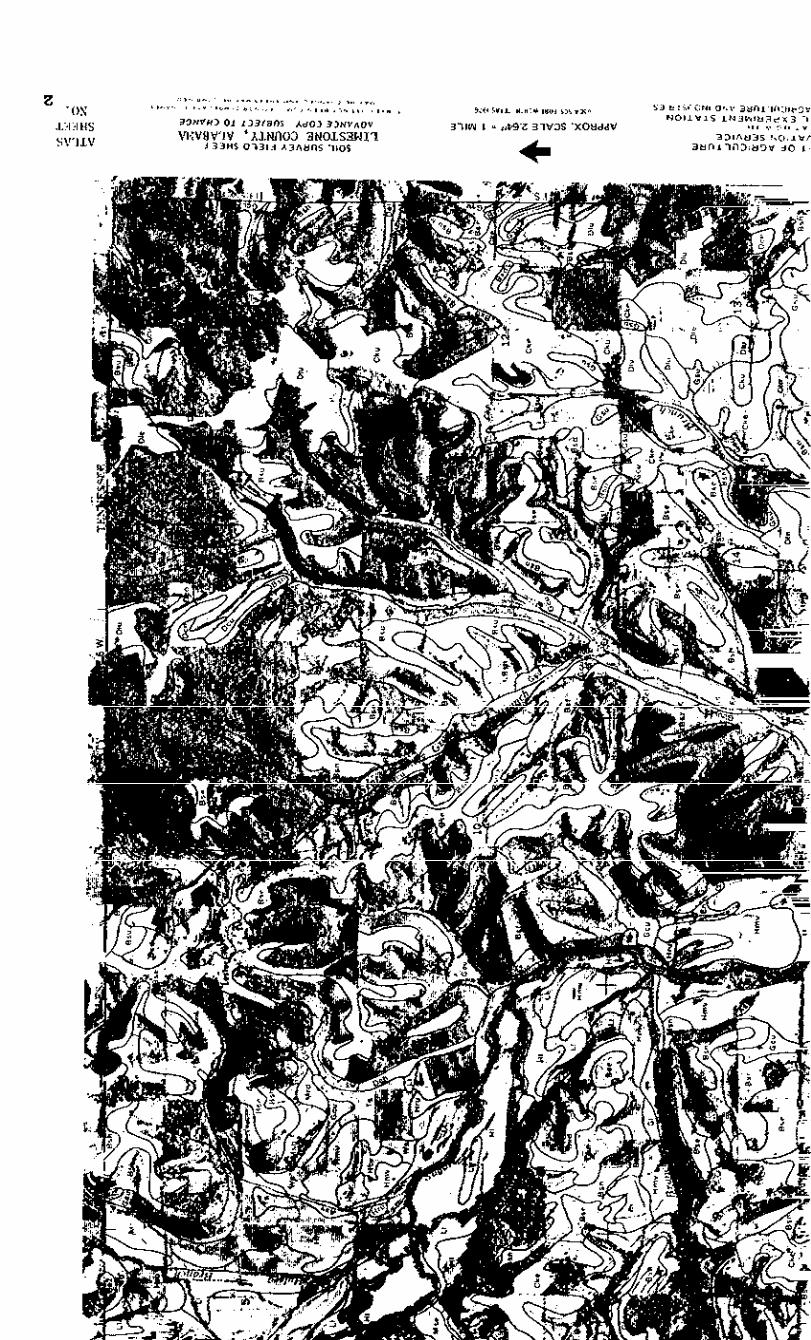

,e, ,,,, ,.,...__.._.____.~
,b.r..*L, I
1,“__________________.____i,.*t.t I
,,~_l_.‘._._____..-____.,
I.,t.E I,;:;;;;_________-“______,
I),I_ ____ _ ____._ ___________,
l.ZC.C I
IE,,_..-_-..__.-_______-_-_,
CY.b.cL.nP I
._----__.
SO,lm,.S
“--ET--.I5
___
-2%
.__
-aa
___
_30
___
_:a
-__
Al
--_
___
--_
30
1.
38
w
10
30
35
72
Southern Regional Technical Soil SurveyWork Planning Conference
March 13-17, 1978Jekyll Island, Georgia
REPORT OFCOMMITTEE II - WASTE DISPOSAL ON LAND
A. Charges to the Committee
1.
2.
3.
4.
5.
Identify parameters that must be met for safe waste disposal,comparing state guidelines with EPA guidelines. Explorecategories of waste that can be considered together for landdisposal and list.
Prepare a list of differentneed for the development ofwastes.
Summarize available data ondisposal on or in the soil.
kinds of waste and determine theguidelines for disposal of these
morphological effects of waste
Determine the experimental work now under way in the regionand prepare a summary for the conference.
Determine, and list by priority, current research needsrelative to fitting waste disposal to specific soil conditions.
B. A Summary of Recommendations to the Charges
1. The charges for the most part were to gather information,thus do not lend themselves to specific recommendations bythe committee. We did find areas that need implementationor further exploration. They are as follows:
a.
b.
We recommend that a team of interdisciplinary personnelbe administratively assigned the task of developingguidelines for rating soils for disposal of the variouskinds of wastes by the various processes developed forwaste disposal on land. (See Charge 1, item 5)
We recommend that in conjunction with or upon completionof the development of a complete set of guidelines forwaste disposal on land a computer storage program bedeveloped for rating soils for waste disposal. (SeeCharge 1, item 6)
73

C. We recommend studies as to means for establishinglong-term monitoring programs to record changesto soil morphology as various wastes are appliedto that soil. Analyses should consider in situ- -behavior of the soil as well as currently developedcharacterization procedures. We also recommend thatthe soil in question be classified jy the criteriaused in Soil Taxonomy so that information obtainedcan be projected to similar classes of soils. (SeeCharge 3, item 2)
d. We recommend that Committee II be discontinued infavor of the recommendation given in Bla, above.If the steering committee overrides our recommendationto drop the committee, we suggest that future chargesbe narrowed to specific topics that are within thecapabilities of a committee of this kind.
Discussion of Charges
C. Charge I - Identify parameters that must be met for safe wastedisposal, comparing state guidelines with EPA guidelines. Explorecategories of waste disposal that can be considered together forland disposal of waste and list.
1.
2.
3.
4.
Washington Advisory SOILS-14, issued May 8, 1973, (referredto hereafter as Advisory 14) lists interim guides for ratinglimitations of soil for disposal of waste. Tables 1 and 2from that advisory are included in this report as Appendix 1.The parameters listed have been tested and recommendationsfor improvement are given in the various 1976 RegionalTechnical Work Planning Conferences and in the 1977 NationalWork Planning Conferences.
The Environmental Protection Agency has distributed a manualentitled "Process Design >Ianual for Land Treatment of MunicipalWastewater, EPA 625/l-77-008" (hereafter referred to as EPAManual). The parameters used there meet EPA standards andconform to those listed in Advisory 14.
The parameters given in the SCS manual "Agricultural WasteManagement Field Manual" dated August 1975 also conform tothose listed in Advisory 14.
Categories or processes of waste disposal that can be groupedtogether for land disposal of wastes are as follows:
74

Solid
5.
6.
Slow rate Surface applicationRapid infiltration LandfillsOverland flow Conposting
The categories for liquid disposal are described and dis-cussed in Chapter 2 of the EPA Manual. Those for soliddisposal are self explanatory and are discussed in manytexts on solid waste disposal on land.
Although the documents listed in items Cl, 2 and 3 aboveare adequate for disposal of certain kinds of wastes bycertain processes, they do not provide adequate guidelinesto rate soil limitations for all combinations of thesefactors. For example, Table 1 in Appendix 1 is not designedfor disposal of liquids by overland flow, a process whichis favored by slow impermeability and which would notpenalize slowly permeable and/or poorly drained soils.The EPA manual deals only with municipal wastewater and theAgricultural Waste Management Manual deals only with agri-cultural wastes.
In view of the complexities involved, we feel that it isnot within the capability of committee assignments tomeet charges of the kind assigned to this committee.Regional and national committees have explored thesetopics for several years without arriving at a finalsolution for disposal of the various kinds of wastes byall of the processes available for waste disposal. Wefeel that a team of experts from the disciplines concernedwith waste disposal should be assigned the tasks previouslyassigned to committees and that they be charged with pro-viding guidelines for rating soils for safe waste disposal,including various kinds of wastes by the various processesused for disposal.
.During discussions of the committee report there was aproposal to provide space on the SCS-SOILS-5 for wastedisposal ratings. It was pointed out that considerablespace would be required to rate a particular soil forvarious categories of waste by each of the processes thatcould be used to dispose of the waste on the land. Also,waste disposal is an "area" proposition which calls forconsideration of the size of a map unit, its location,and other considerations in addition to the soil per se.There were also questions as to how often the informationwould be needed within a given area. Finally, it waspointed out that present guidelines are not adequate todevelop an ADP storage and rating program.
75

D.
There was general agreement, however, that computerstorage of coordinated ratings of soils for waste dis-posal would be highly desirable, regardless of whetherprinted on the form 5 or used to print special tablesupon request. The committee feels that such a programshould be developed in conjunction with or on completionof the development of satisfactory guidelines.
7. Recommendations to Charge 1 are given in item B of thisreport.
Charge 2 - List different kinds of waste and determine the need forthe development of guidelines for disposal of these wastes.
1. Niost references to "kinds" of waste are listed in terms oforigin of wastes, such as animal wastes, cannery wastes,sewage sludge, etc., and the committee interprets thecharge to mean listing these with suggestions for the needto develop guidelines for the disposal of each. But thecomposition of each kind of waste is variable, dependingupon source of input, pretreatment efficiency, managementchanges and other considerations. For example, how canone characterize cannery wastes which today involvetomato soup, tomorrow beef soup and the next day alkaliesto clean the system?
A more logical approach would be to characterize waste byorigin and, under each type, indicate the following com-ponents:
a. Hydraulic loadb. Oxygen demandc. Salt concentration and compositiond. Heavy metals and potentially toxic inorganic ionse. Toxic organic compoundsf. Pathogens
These components are defined in most standard referencesto waste disposal. In the opinion of the committee, theguides in Advisory 14 and in the EPA Manual are designedto predict the interaction of these waste components withsoil parameters, except that Advisory 14 considers onlynon-toxic wastes. Thus we did not list "kinds" of wasteper=.
76

E. Charge 3 - Summarize available data on morphological effects ofwaste disposal on or in the soil.
1. The committee found very little published work on thissubject which suggests a possible area of research needs.Many publications document the successes, failures andlimitations of using soil as a waste disposal medium.But most reports or releases document what leaves thesoil, either through the soil, over the soil surface, orwhat is removed by crops. Apparently little has beenreported on soil monitoring per se to determine if physical,chemical and/or mineralogical changes take place over aperiod of time as soil is subjected to waste disposal.
Of the physical aspects, changes in permeability wouldbe highly significant because of its role in the designof disposal systems. Chemical changes could affect theion transport ability of the soil which is significantfrom the standpoint of application rates, rest periods,plant removal and rainwater dilution. There is a possi-bility that changes in clay mineralogy could change ionbalances through the addition of wastes over a periodof time.
2. For the reasons given above, the committee recommendsstudies as to means for establishing long-term moni-toring programs to record changes to soil morphologyand associated properties as various wastes are applied.We also recommend that the soils used for study beclassified according to the criteria in Soil Taxonomyso that the information obtained could be projected tosimilar classes of soils.
It is also noted that research is needed to determinethe effectiveness of the morphology as in situ bodies- -to serve as filtering media. What, for example, is theeffective surface area and adsorption characteristics ofa soil for waste disposal as related to morphology thatexists in the field? In situ behavior might differ con-- -siderably from that of samples modified during preparationfor laboratory analyses.
F. Charge 4 - Determine the experimental work now under way in theregion and prepare a summary for the conference.
1. A summary, under the headings wastewater, sludge disposal,landfills and animal waste disposal, is attached asAppendix 2. The summary is given by states in the southernregion and shows the title of the project and the projectofficer.
77

G. Charge 5 - Determine, and list by priority, current research needsrelative to fitting waste disposal to specific soil conditions.
1. A list is attached as Appendix 2. To this list thecommittee would add the need for monitoring soils sub-jected to waste disposal over a period of time. Seediscussion under the report on Charge 3 of this report.We realize that a list of this nature reflects the biasof the members concerned.
H. Addendum to the Report - During our studies it was noted that theSouthern Regional Plzect S-82 has a committee working on Fertilizersand Organic Wastes Applied to Soils in Relation to EnvironmentalQuality. This project has been in effect for some time and, nodoubt, will be of interest to those in the field of waste disposalmanagement. The part on fertilizers was edited by Dr. Grant Thomasand is now available through the Public Information Section, TexasA6M, College Station. The part on organic wastes is scheduled forpublication during the spring of 1978. Drs. Fred Boswell, B. L.Carlile and Zane Lund, participants in this work planning conference,can be contacted for details.
Counnittee Members:
Fred Arms*Fred Boswell 1'B. L. Carlile IIV.C. Carlisle*Gordon Decker 11"J. A. DeMent 2/*
D. C. Erinakes 11C. L. GirdnerRalph Leonard*Zane Lund LlB. R. Smith ?I*W. I. Smith
L'Subcoonnittee chairmen-/Chairman3fVice chairman* Attended conference at Jekyll Island
78

Appendix 1Page 1
Table 1
soil LlJlitrticna for Accepting Nontaxic Blo&gradablsLlquid-lkata for Nutrient Pamovalby Planta i/
Itam Affecting Usehgrsa or soil Limitatioa
slight I nodsrats I
mrsa&hillty or th4 matmstrlctingl~r between
kkMar;ye4 rapid and Rapid md mo&rat.slyslow 2/
60 inches uldthe Ap or 0.6-6.0 in.Au. 6-20 &d 0.2-0.6similar aurfacs horizon
Very r&d, rapid, ~&rat84 slowmderataly rapid, 0.2-0.6 in./hr.mdmcdsrata.> 0.6 in.&.
Well &a&ad and Sormwbat excnssivelymodarete4 vail &Pined and scrmwhatdrained poor4 drained
EulolY y Nom, “erg slcv, nwJiu!dandslcw
NOM
5 7.8 inches 3-7.0 inchesInsta.Llntlon
severeVsrg rapid, slow,and vey ?lcwz 20 and < 0.2in./hr.
Slow and veryslow< 0.2 in./hr.
ticsssivs4&aired. poorlydraimd, and "eqpoor4 drained
Rapid and wryrapid
Soila floodsdduring grcw-lngseason
C 3 inches
< 3 Inches
79

Appendix 1Page 2
Table 2
Soil Limitations for Accepting Nontoxic BiodegradableSolids for Nutrient Rsmoval by Plants y
Item AffectFag use
pernmability of themost mstricting1-r above 60 inches
soil Drrdnag.3Olass y
Runoff y
Floodiag
AvPFlable WaterCapacityfmm0 to 60 Fnchas or toalladtkg1aysry
SlightI)egree of Soil Limitations
I Moderate I Severe
Moderately rapid andmodsrate
1IR&4/"" moderately
0.6-6.0 in./hr.Ipzd 0.2~0.6
. .
Very rapid, slow,and very slowa20 Md -z 0.2in./hr.
Wslldrainsdand Sonmvhat sxcessivsly Excessively drained,modsratalywell drained and somwhat poorly drained, anddrained poorly draiwd very poorly drained
None, very slow, l+¶diumand slow
> 7.8 inches 3-7.8 inches
Rapid and veryrapid
SoFlsfloodad
< 3 inohes
For regional intarpmtive groupings assign no Mttsr than moderate Limitationto music and frigid soils; assign sevexw limitation to c&c, pergelic, andisofrigid soils.
Assign sewm IimItation to moderately slowly peraaable soils in which qhorizon has an electrical conductivity of 8 milltios or greater.
For class definition see Soil SWWY Hanual, ~pp, 169-172.
For class dtrfinition see Soil Survw Manual, pp. l&-167 (axended to use'vNon," for IVondadtl).
A Umiti.q layer is a lithic or paralithic contact, kipan, fragipan,petrocalcic horizon, or other horizons of low psnaeability.
SO

Appendix LPage 1
CHARGE 4: Current Research on Land Application for DiSposal of Waste
wastewater
state
Oklahoma
contact
Dr. Carl G. EnfieldRSKERL, Ade, OK 74820
Kark S. ColemanOkiahoma State Department of
HealthNE 10th end StonewallOklahoma City, OK 73105
Dr. Bert E. EledsoeR5KBP.L. A&, OK 74820
Dr. William A. FranksLengston UniversityP. 0. Box 779Lagston, OK 73050
Texas Dr. Fichasd W. WeaverDepartment of Soil and Crop
ScienceTexas A & M UniversityCollege Station, TX 77843
Dr. B. P. SagikUniversity of TeasSan Antonio. Texas 78284
Dr. E. D. BlackDepartment of Soil end Crop
ScienceTexas A 6 M UniversityCollege Station, TX 77843
Louisiena Dr. W. H. PatrickCenter for Wetland Resources~Louisiana State UniversityBaton Rouge, LA 70803
Mississippi Dr. Charles 8. LeeDepartment of Arm*. Corps of
EngineersWES, Vicksburg, MS 39180
1.
2.
3.
1.
1.
1.
1.
1.
1.
1.
1.
Title of Project
Develop design ddta for infiltration.percolation.Design model for *oil systems totreat w**t+WecerOptimization of nitrogen rerwvalby denitrification for soil systemstreating municipal wastewater.
Spray-runoff treatment of municipalwastewater.
Evaluate soil treatment of wastewaters.
Reclamation of heavy-metal conteminatecsoils.
Sewage disposal on iand-chemicaland microbial implications.
Human enteric virus survival in soilfoilowing irrigation with sewageplant effluents.
Phosphorus sorption from municipalwastewater by calcareous overlandflow systems.
Studf of N and P reactions duringoverlend flow of wastewater.
Field demons:ration-overland flwaweete treatment system.
81

Appendix 2Fage 2
state contact Title cf Project
South Carolina Dr. A. Douqlas Wilson 1. South Carolina overland flow project.South Carolina Department ofHealth and EnvironmentalControl
2600 Bull streetColumbia, SC 29201
North Carolina Dr. W. R. Overcash 1. Soil assimilation of toxic anionicNorth Carolina State waste constituents.University
Raleigh, NC 27607
Florida Dr. Allen R. OvernanAgricultural Engineering
rIepartrr.entUniversity of FloridaGainesville, FL 32601
1. wastewater renovation by sprinklerirrigation at Tallassee.
Dr. Howard T. OdumAqricul+aral Engineering
3epartmentUniversity of FloridaGainesville, FL 32601
1. Effect of effluent disposal on swampyareas.
Sludge Disposal
Texas Steve zonesK. W. BrawnTexas A 6 M UniversityCollege station, TX 77843
1. Influence of rainfall on the per-sistence of metals on grasses follow-inq applications of liquid sewagesludge.
Louisiana R. P. Dick 1. The quality of surface runoff watersE. P. Duniqer from fertilized and sewage sludgeLouisiana State University treated soils.Baton P.ouge, LA 70803
Georgia
Florida
Dr. R. E. Burns 1. Heavy metal dispersion by sod pro-Georgia Agricultural Experiment duced on sevaqe sludge.
StationExperiment, Georgia 30212
Dr. F. C. BoswellAgronomy DepartmentUniversity of GeorgiaGeorgia StationExperiment, GA 30212
1. cornparson of sewage sludgeand other organic wasteswith Inorganic fertilizerfor agronomic crop use.
Dr. C. C. Hortenstine 1. Effect of heavy metals (Cd. Zn) onDepartment of Soil Science vegetation growing on sewage sludge-University of Florida treated soil. They also feed sludgeGainesville, FL 32611 and plant materials grown on sludge-
82treated soil to animals.

Appendix 2Page 3
B COntaCt-- Title of Project
FlOrida Dr. J. H. Davidson 1. Disposal of sewage sludye.Depaxtmant of Soil ScienceUniversity of FloridaGainesville, Florida 32611
Landfills
Virginia Dr. J. Nick JonesAgricultuzal Engineering
DepartmantVirginia Polytechnic
InstituteBlacksburg, "A 2406G
1. Vegetative stabilization oftlandfill sites.
2. Characterization of landfillleachates.
Animal Waste Disposal
Oklahoma Dr. Jeff PowellDepartment of AyronomyOklahoma State Universitystinwater, OK 74034
1. Pangeland watershed water budgetand grazing cattle waste nutrientcycling.
TeMS
Dr. “. L. RoweSchool of Znvironmental
ScienceOklahoma State UniversityAda, OK 74820
1. Dissemination of information ccncern-animal production effects onenvironmental quality.
Dr. Richard W. Weaver 1. Selmonellae in feedlot manure andTexas A & H University its su?xival and movement in soil.Collage Station, Texas 71843
DirectorWater Research CenterTexas Tech UniversityLubbock, TX 79409
1. Analyses of state laws and regulationsimpacting the management Of animalwastes.
Dr. 8. A. Stewart, Director 1. Utilization of feedlot manure on land.USDA-Southwestern Great Plains 2. Feedlot manure application to cal-
Research Center car‘cous soil.Bushland, TX 79012
Louisiana Dr. Jackie W. D. Robbins, Head 1. Best management practices forAWiCtit"Z.21 Engineering Dept. unconfined acimal production.Louisiana Tech UniversityBox 4535Ruston, LA 71270
83

Appendix 2Page 4
state
Mississippi
AlabZUlId
Georgia
North Carolina
Virginia
South Carolina
Florida
contact Title of Project
Mr. Harold E. CrierAlcorn A 6 H UniversityP. 0. Box 621Lorman, MS 39096
1. Overland recycling system foranimal waste tr*aBYlnt.
Hr. Ze.ne F. Lund, USDA-ARS 1.Department of Agronomy and
SoilsAuburn UniversityAuburn,, AL 36830
Residual effects of large applica-tions of dairy cattle n!anure.
S. R. Wilkinson 1.Southern Piedzmnt Research
centerWatkinsville, GA 30677
Residual effects on pollution ofrunoff and soil wat(l+ from Coastalbemudaqrass.
Dr. K. R. Reddy 1.H. R. OvercashNorth Cz~Xolina State UniversityBox 5906Raleigh, NC 27607
Evaluation Of nitrogen and phosphorustranafoxmations in the soil-manuresystem.
Mt. P. w. westerman 1.North Carolina Stats UniversityBox 5906Raleigh, NC 27607
Mechanism and control of rainfallimpact from land application sites.
Dr. R. R. Weil 1.Wyba KxcontzeVirginia Polytechnic InstituteBlacksburq, VA 24060
The alteration,of some physical'propertias of a Davidson clay loamby heavy poultry mzuwre additions.
Dr. Clyde L. Barth 1.Department of Agricultural
BnqineerinyClemson universityClemsom, SC 29631
ntilization of cattle feedlot w*stathrough land application.
V. L. QuisanberrySoils DepatrentCleneon UniversityClemson, SC 29631
1 . uAnurfs1 nitrogen movement in aNorfolk loamy soil.
Dr. Donald A. GraetzUniversity of ?lori&IFASSoil Science LepartmentGainesville, FL 32611
1. Nitrogen transformations in animalwaste disposal.
84

Appendix JPage 1
Southern Regional Soil Survey Work Flanning ConferenceJekyll Island, Georgia
t.!arch 13-17, 1978
Committee Assignmant: II - Waste Disposal on Land
Barge 5: Determine and list by priority current research needs relative tofitting waste disposal to specific soil conditions.
Current research needs for land application of waste materials relativeto this report are based on four major catagories for organic wtes: sewagesludge, animal manures, solid nnmicipal refuse, and industrial waste.
Research needs by priority are:
(1) Sewage sludge
Since all sewage sludge contains heavy metals which may influenceone’s health when introduced into the food chain, the fate of heavy metalsshould be researched further even though considerable data are being accunulated.Specific areas of stwiy should include reversion mechanisms and rates for heavymetals; nitrogen transformation rates as related to specific soils and envimn-mental conditions; chemical anA physical soil proper? changes resulting from Msewage sludge application; long term effects, includrng retention mechanisms ofelements from land application of sewage sludge; both short term and long termeffects from bacteria and viruses; use as an energy source by direct combustionand/or energy supplement; establishment of tolerance levels of certain heavyumtals in plants that are ultimately consumed by animals; econcmic aspects ofland treatment; odors and aerosol nwement from land application; and publicacceptance and sociological aspects.
(2) Anisal Franures
Since a majority of the animal manures is associated with feedlot operations, comtents are nrore applicable to the southwest. Suggested areasof research are: anmnnia loss evaluation for soil surface and subsurface appli-cations of manures; salt tolerance levels of various plant species and cultivars;managerent considerations for land application of animal wastes; and econrxnicevaluations as related to types and management practices of manures.
(3) Solid M.mici9al. Refuse
Since solid municipal refuse management usually involved dis-posal to a greater extent than utilization, the research needs extend to a widerrange of concern as compared to sewage sludge and animal manures. Sam of theresearch areas are: economic evaluations; separation techniques based on physicalproperties; energy conversion techniques; soil bulk density changes; effects ofleachate on ground waters; soil compaction studies, degradation processes, andcompatability with other waste materials for land application.
(4) Industrial Waste
i’his catagory of waste is probably the most compiex for fittingto specific soil conditions. Often these materials are very heterogencus and con-tain certain components not generally found in other waste products, i.e. syntheticorganic compounds. Specific areas of needed research incluie economic evaluations,
85

Appendix 3Page 2
degradation time and processes, pretreatment processes prior to land application,long-tern soil reactions such as sorption or imobilization, and energy conversiontechniques.
Nmzrous areas of research have applicability to all catagories listed above.These specific areas include: environmntal effects on degradation (rainfall,renperature, sunlight, nmbers and types of soil orgsnism, etc.!; soil textureand aeration influences on BOD and COD phenanenon; water table depth effects, waterinfiltration evaluations, oxidation and reduction effect studies; sorption andprecipitation reactions; soil dispersion and flocculation changes influenced byland application; economic evaluations as related to transportation and application;and effects on food chain products produced on soil utilized for land application.Many additional areas of research .my be suggested, however, priorities must beselected due to economic and personnel input limitations.
86

COMMITTEE REPORT
1978 Southern Regional Soil SurveyTechnical work Planning Conference
Jekyll Island, Ga.March 13-17. 1978
Cofmnittee III - Soil Potential Ratings
Chairman - B. J. MillerVice-Chairman - R. W. Johnsonconxllittee Members:
R. Rehner B. L. HarrisJ. F. Brasfield F. F. WheelerJ. T. Hood Ted MillerF. F. Bell H. D. ScottW. W. Frye C. McElroyEd Lewis P. L. Lorio, Jr.J. L. Richardson E. Cole
Charges
1. Review the revised policy guide potential as set forth in NationalSoils Handbook 404 and determine the applicability of this guideto the Southern region.
2. Test soil potential ratings proposed in 1976 under as wide a rangeas possible where the ratings have been developed and are in "se.
3. ldentify organizations and/or discipline specialists that should beinvolved in developing potential ratings by land uses. (Selectthose dominant in the South).
4. Propose a format for publication to include a listing of proceduralguidelines, laws, rules, regulations and contributing sources.
5. Determine ways of categorizing soils within a use potential classaccording to the ease of overcoming soil limitations or the potentialafter removal of the limitations.
Charge 1:
Review the revised policy guide potential as set forth in NationalSoils Handbook 404 and determine the applicability of this guide to theSouthern region.
Conrmittee Report
1. The guide is generally applicable to the Southern region.There is general agreement with the overall concept of the soilpotential ratings as outlined in the draft and as applied in
87

areas where the ratings have been developed. The ratings havethe advantage of providing a method for presenting the materialin a positive manner, for specifically identifying know” treat-ments for overcoming the soil limitations, and for identifyinglimitations that remain after the treatments have been made.
2. The flexibility now present in the system is essential to thedevelopment and use of soil potential ratings that will be mostuseful in a local area.
(a)
(b)
One advantage of the ratings is that a soil may have adifferent rating in different areas. For example, possiblecorrective treatments for some soils will be affected bythe landscape and surrounding soils. Drainage or watercontrol measures can vary for the same soil from one surveyarea to another, depending on access to existing structuresor canals. Extensive areas of wet soils may not be possibleto drain due to existing laws or lack of cooperation byadjacent land owners. Rural and urban economies may differappreciably resulting in different potential ratings eve”though the soils corrective treatments, and other factorsmay be essentially identical. Differences in local yieldand/or performance standards can result in wide differencesin potential ratings.
The Soil Potential Ratings within a” area can be expected tochange over periods of time. For example, any changes intechnology or changes in the costs of labor and supplies canreasonably be expected to change the cost input for correctivetreatments to differing degrees for soils requiring differentcorrective measures. Development and legal accer,tance ofcorrective measures such as above ground on-site sewagedisposal techniques can result in large changes in potentialratings for soils with restricted drainage in some areas.For these and possibly other reasons widespread coordinationof a single potential rating would be difficult and, forsome soils, inaccurate.
3. Some clarification and/or revision is needed in the Draft Guide forPreparing Soil Potential Ratings.
(a) There is some question concerning the degree of flexibilityin determining whether soil potential ratings will be pre-pared in all survey areas. Some feel that their preparationand use is optional while others feel the policy indicatesa” intent to prepare and use the ratings in all 1st and 2ndorder soil surveys.
(b) The Guide for Preparing Soil Potential Ratings should containa section discussing the relationship of soil potentialratings to the soil limitations. These two may, in somecases, appear to be inconsistent or contradictory to “sers.

Cc)
For example, differences in cost of treatment or continuinglimitation costs can result in soils with severe limitationsfor a use having a higher potential rating than other soilshaving a moderate limitation.
Discussion groups felt that potential ratings should bedeveloped and based on an objective evaluation of the factorsinvolved without regard to local rules and regulations. Thecommittee recocmnends that policy guidelines be developed onhow local regulations should enter into the development ofsoil potential ratings. Policy guidelines would enable localpersonnel to be consistent in developing ratings under suchcircumstances.
Charge 2:
Test soil potential ratings proposed in 1976 under as wide a range aspossible where the ratings have been developed and are in use.
committee Report
1. soil potential ratings have been developed for a limited number ofuses and published in soil survey reports or as supplements to reportsfor counties in Texas and Florida. Ratings for sc.me uses have beendeveloped and included in soil survey report manuscripts in Louisianaand possibly other states. The ratings should be developed for alarge number of uses and have more extensive testing in these andother areas before they can be satisfactorily evaluated.
2. One important test of the ratings is their acceptance, use, and valueto users of the soil survey. In both Texas and Florida, user responseto the ratings has been positive. They have been widely accepted andare the method generally preferred by users in evaluating soils forthe land uses rated. Soil scientists and others report that thepositive approach and added information in the ratings tables enablesthem to be more effective in working with users.
3. Some of the strengths, weaknesses, and needed changes that becameapparent during the development of ratings in these areas arediscussed in the Committee III report for Charge 1. Additionalcomments are given in the following sections.
(a) Soil potential ratings will be most useful in areas wherethe competition for different land uses is greatest and/orin areas comprised mostly of soils with severe limitations.At this time, those areas where the ratings have beendeveloped have soils with predominantly severe limitationsfor several uses. These areas may provide an adequate testof the ratings in soils with some kinds of limitations.
(b) The interdisciplinary approach is essential in developingthe ratings . Soil scientists cannot be expected to provide
89

(cl
the time and expertise required to determine treatment costsor the kind and extent of treatment needs and continuinglimitations. Continuing limitation factors are difficult orin scxne cases impossible to identify and establish. Reason-able values can be assigned maintainence, assessments, andother costs in most areas. Limitations assigned on the basisof inconvenience, aesthetics, or environmental effects aretypically rather arbitrary and difficult to defend.
There appears to be a need in some areas for a No Potentialclass. Some soils have no potential for certain uses as aresult of soil characteristics. Sharkey soils, for example,have no potential as sources of sand and gravel. The presentalternatives are to not rate the soils for these uses orplace them in the lowest use potential class. A preferredalternative might be to place them in a No Potential classand identify the reason for the placement as a continuinglimitation.
4. At this time, the limited number of areas for which soil potentialratings have been published prevents any evaluation of the following:
(a) User reaction to different ratings for identical mapping unitsin different areas.
(b) User reaction to changes in the relative ratings within anarea resulting from changes in technology or economic factors.
Charge 3:
Identify organizations and/or discipline specialists that should beinvolved in developing potential ratings by land uses. (Selectthose dominant in the South).
Coimnittee Report
1. Ihe names of many similar organizations and titles of disciplinespecialists differ from state to state and between areas within astate. These include service, research, educational, regulatory, andenforcement agencies and organizations that should be involved in somephases of developing soil potential ratings. The large number thatresults essentially prohibits a meaningful detailed listing. SOllle,such as the Environmental Protection Agency, have regional responsi-bilities and can be specifically identified. Others, such as thenumerous governmental health bodies can be adequately identified interms of their areas of interest and responsibility.
2 . Several organizations and discipline specialists should be involved indeveloping nearly all Soil Potential Ratings. They are:
90

Organizations
Locai, State, and/or Regional Planning CormnissionUSDA-Soil Conservation ServiceState Soil and Water Conservation CommitteeU.S. Environmental Protection AgencyState Agricultural Experiment StationCooperative Extension Service
Discipline Specialists
Soil Scientists in the areaEngineer with knowledge of the use being ratedEconomist with knowledge of the use being rated
These organizations and discipline specialists should, to varyingdegrees be involved in all the phases of the preparation of soilpotential ratings outlined in NSH-404.
3. The tables that follow also identify additional organization anddiscipline specialists that should be involved in developing certainsoil potential ratings. Some of the organizations listed may servemostly as a possible source of discipline specialists. In most cases,organizations and discipline specialists identified with a land useshould only be involved in developing certain of the specific ratingsthat might be developed under that general land use. For example,under the Building Site Development land use, highway departmentsand highway engineers would be involved in ratings for local roads andstreets but probably not in ratings for dwellings without basements.
91

92

-
-
-
-
-
-
-
-
-
--
-
-
-
-
--
-
-
-

Charge 4:
Propose a format for publication to include a listing of proceduralguidelines, laws, rules, regulations and contributing sources.
This charge was modified as follows to place emphasis on a generalformat for publication in soil survey reports. 'I. . . suggests thatmajor emphasis be placed on the general format for publication insoil survey reports. What should be included, how detailed should theinformation be, where should it appear in the report, and in whatorder should it be presented? IS there a need for a seperatetechnical (or popular?) publication dealing with the items listed inCharge 4. If so, to what group(s) should it be aimed, and what shouldbe the general format? Should a highly technical publication be pre-pared for 'in-house' use? If so, what should be the general formatand who should prepare it?
Committee Report
1. Should a highly technical publication be prepared for 'in-house' "seand, if so, what should be the general format and who should prepareit?
(a) A publication of this nature is not needed at this time forseveral reasons.
(1) The soil potential ratings are still in the developmentalstages. They need to be tested in more areas and over awider range of conditions to determine if such a publi-cation is needed and what should be included.
(2) The NSH-404 draft is now being revised. It, togetherwith existing guides such as NSH-403. may meet the needsat the regional level.
(3) Most of the variables that enter into soil potentialratings depend on local conditions. Any highly technicalmaterial that applies to local conditions needs to beprepared in the local area.
(4) Changes in technology and economic conditions occur at arapid rate. Some sections of a detailed publication thatdeal with these could become outdated during preparationof the publication.
2. Is there a need for a seperate technical (or popular) publicationdealing with the items listed in the charge? If so, to what group(s)should it be aimed and what should be the general format?
(a) There is no real need apparent for a seperate technicalpublication if the ratings are included in the soil surveyreport.
94

3.
(b) The format outlined for the soil survey report can also servefor presenting the ratings as a supplement or interim report.
For publication in soil survey reports, what should be included, howdetailed should the information be, where should it appear in thereport, and in what order should it be presented?
(a) The format outline that follows will permit optional inclusionof soil potential ratings in soil survey reports as an addedsection complete in itself. The section would follow the mapunit description and require essentially no changes in theformat of the remainder of the report.
SOIL USE POTENTIALS
(Introductory statement and definition of soil potential)
This section gives information about the potential of thesoils for some important land uses in the survey area. Thesoils are rated according to their potential for use inagriculture, as septic tank filter fields, ----. The soilpotential is a rating of the ability of the soil, withapplication of modern technology, to produce, yield, orsupport a given structure or activity.
(Basis of the ratings and how they were developed)
The soil potential ratings for the various uses are givenin Tables -) -I and _. The ratings are based on a systemdeveloped for this survey area that included consideration of(1) yield or performance levels, (2) the difficulty orrelative cost of treatments or practices for minimizing theeffects of any soil limitations, and (3) adverse effects orcontinuing limitations, if any, on social, economic orenvironmental values. The ratings were developed by special-ists trained in many different areas. These included soilscientists, foresters, . . . . . and engineers familiar with thesoils and conditions in the area. Persons from a number oflocal or state organizations such as . . . . ..assisted in develop-ing the ratings.
(Uses rated and their definition)
The different land uses for which soil potential ratingswere developed are defined in a different section of thisreport. Septic tank filter fields and sanitary landfill usesare defined on page _, roadfill and topsoil on page _*....., and picnic areas on page _.
95

(Definition of categories of potentials used)
The soil potential classes for the various uses aredefined as follows:
High potential,(The definitions in NSH-404 can be
Medium potential used here or they can be modifiedto fit local conditions)
Low potential
(Special conditions and considerations)
The ratings of the soils in the survey area depend, inpart, on the existing major flood control measures. Forexample, soil mapping units with levee protection have higherpotentials for most uses than mapping units comprised ofidentical soils without flood protection, _ _ _ _ _ _ . The soilpotential ratings depend on soil properties and on factorsinvolving economic and technologic factors and may change asa result of changes in either of these.
(How to use the potential ratings tables)
Each soil mapping unit is identified in Tables _,and _. The colwnn headed ‘Limitations and restrictionFisnot a potential rating but identifies the limitations andrestrictions of the soils for that use without correctivetreatments. The column headed ‘Potential and corrective treat-ment’ gives the potential rating and identifies the kind ofcorrective treatment or treatments necessary to achieve thepotential. The column headed ‘Continuing limitation’ indi-cates the nature of any use limitation that could reasonablybe expected to continue after the corrective treatments havebeen nade.
The ratings do not constitute recommendations for soiluse. They are to assist individuals, planning cowissionsand others in arriving at wise land use decisions. Treatmentmeasures are intended as a guide to planning and are not to beapplied at a specific location without onsite investigationsfor design and installation.
The soil potential ratings indicate the comparative qualityof each soil in the area for the specified uses. As comparisonsare made only among soils in this survey area, ratings of agiven soil in another area may differ.
(Tables of potential ratings)
Tables similar to Exhibit 404.8 numbers 2 and 3 in NSH-404for each use rated,
96

4. The option of including the soil potential ratings inreport should remain with the individual states.
(a) The demand from local units of government andnot be great enough to justify development ofsome areas.
(b) Some areas may prefer to provide ratings as asoil survey reports so they can be updated as
the soil survey
other users maythe ratings in
supplement tochanges occur
in the technology, economics, and other factors involved.
(c) It may be desirable to limit the distribution of soil potentialratings in some areas such as those where land use restrictionsare based on soil properties. The added terminology, differentratings for a soil in different areas, and possible changes inthe relative ratings of soils over time could result in con-fusion or misunderstanding if the ratings have widespreaddistribution in the area.
Charge 5:
Determine ways of categorizing soils within a use potential classaccording to the ease of overcoming soil limitations or the potentialafter removal of the limitations,
Conunittee Report
1.
2.
The soil potential ratings are in various stages of development inmost states in the region. So far, most efforts have been aimed atdeveloping reliable ratings to place soils in the existing usepotential classes. Except for arraying the soils in order of de-creasing potential, little has been done to develop and organizecategorie& within classes. There is general agreement that thecategories needed within a class can be developed from informationused to develop the potential ratings.
Categories and arrays of soils within a class could be developed fromseveral bases such as SPI values, kind of restriction, kind and costof corrective treatment, or kind and degree of continuing limitation.For example, categorizing or arraying the soils within a class bytreatment costs prdvides a grouping according to the economic ease ofovercoming soil limitations.
At the present stage of development of ratings in the region thereappears to be a need for two kinds of categories to provide infor-mation not included in the use potential classes.
(a) In soil survey report manuscripts or supplements, thecategories and arrays should be based on the SPI values.These values indicate the overall potential of the soil afterremoval of limitations and the potential classes should be
97

arrayed in order of decreasing potential as indicated by theSPI values. The table should have a footnote either indi-cating this array or stating that there are no appreciabledifferences between soils having the same rating. In somecases, potential classes may contain some soils with nearlyidentical SPI's and others that are appreciably different.A letter key can be used to identify those that are essenti-ally identical. An explanatory footnote might be 'Soils inthe same potential rating class are listed in order of de-creasing potential. Soils potential class names followed bya letter a, b, c,..., do not have potentials appreciablydifferent from other soils in that class followed by the sameletter.'
(b) Economic factors involved in making land use decisions may besuch that users in some areas will want to evaluate theextent to which treatment costs and continuing limitation costscontribute to the rating in soils where continuing limitationsexist after treatment. The relative contribution of thesefactors can be shown by expressing the relative costs as aratio. For example, if a rating for a given soil is
SPI = P-c+ - cl,
andP = 100ct= 20cl,= 10
then, 70 = 100 - 20 - 10
and the ratio Q/C, = 20/10 = 2
In this case, the treatment costs are twice the continuinglimitation costs.
The example table below indicates how negative values forCt or values of zero for CL or Ct can be treated.
98

Symbal and Potential andSoil Name Ct CL corrective treatment
WCL
convent silt loam -10 5 Very high:*
CL
Colmnerce silt loam 0 5 High:*
CL
Tunica si l ty c lay 20 0 Medium %JJ
Sharkey clay 20 10 Low : 2
JJNo continuing limitation would reasonably be expected aftertreatment.
*Essentially all the costs incurred under this land use aredue to continuing limitations after treatment.
The negative and zero values would.be very rare and likelywould not have to be considered in most areas. The columnsheaded Ct and CL would be omitted and the corrective treat-ments added for distribution to users.
Recommendation concerning Cotmnittee III - Soil Potential Ratings.
In view of thedeveloped and thea small commi.tteepotential ratings
limited number of areas where ratings have beenpresent status of NSH-404, it is reconrmended thatof four or five members who are working with soilbe appointed to:
1. Keep the Regional group informed on the status of the ratingsdevelopment and the experiences of those working with them.
2. Suggest needed changes with regard to guides applicable tothe ratings or with regard to other aspects of the soilpotential ratings system.
99


IV
1978 SOUTHERN REGIONAL SOIL SURVLYTECHNICAL WRK-PLANNING COWBXF,iICE
Jekyll Island. GeorSia llarch 13-17, 1978
committee Iv: Kinds of Soil Maps
E. Moye Rutledge, ChairmanTelbert R. Gerald, Vice Chairman
Charges:
1. Iaveetigate the feasibility of developing a land “se mq of theSouthern region and if feasible. develop a procedure to accomplishthe objective. Suggeet land use categories that can be mapped.
2. Deternine the feasibility and application of slope maps prepared byUSGS for improving legend design and accuracy of mapping.
3. Continue to review. evaluate, and test all proposals relative tonaming mapping unitB in the five orders of soil surveys.
Committee Report:
Charge 1: Regarding land use map of the South
The committee members do not feel it advisable to nake a land usemap of the Southern region. Two points seem to dominate the thinking.1) Maps should not be mede until were and their needs have been identi-f l ed . This has not been done in the case of a regional land use nap. 2)The production of soil surveys ia mote Important than the production ofland we maps and we, therefore, should not divert our resource8 fromthe production of soil surveys to the production of land use naps.Since the committee Is recommending that we not make a regional land usemap. we did not conelder land use catagories or a procedure for develop-ing a reglonal land.
The corE%ittee recognizes that both soil surveys and land use maps,as well as other types of maps, are major components of basic resourcelnfor&%3tion. In nutny, If not moat. ca(lee nore than one of these corn--ponents Is needed In the decision makltq process. For example. if thepotential production of a apeclfic crop Is to be evaluated In a eivenarea ooe must know the acrea of solla suited to the crop a8 well as theacres of theae aoils which are avallable for production. Thus, fordecisions of thla nature. land use lnfornatlon moat be nvallable on soilmapping units. This type information la normally obtained at a lowlevel of generalization, such a8 a county. rather than a regional levelas outlined in our charge.
101

IV - 2Charge 2: ReSardlnS use of USGS slope nape
Most committee members agree that slope maps could be useful inareas where there is substantial slope, rouSh terrain. inacceesibility.or vegetation is dense and obstructs movement and visual terrain analysis.Under these conditions, a elope map would aeve considersble time. Hwmuch, no one knows, but we feel enough time could be saved to justifythe cost involved.
Slope maps would be helpful in desi&n of mappinS units, especiallyfor order 3 surveys. But before orderine elope mtrps, test mapping ofthe landscape ahould be made to determine the natural break in slope andthe slope breaks that are needed by the user. Ne need to Set awsy frompredetermined slope breaks. especially when such slope packaging in-creases the mount of inclusions in nbapping unite.
Once mapping unite are dealSned to fit the landscape in en area, themoppine should be speeded up considerably by the we of slope mapa. Theslope map can be produced on o transparency with the came scale aa thefield sheets. By usinS the slope map to delineate the slopes, it couldpossibly be done with more accuracy and consietency.
A slope map is also helpful when usinS a stereoscope to calibrateone’e eyes to the slope breaka of nappinS units. This calibration fanthen be extended to are”8 for which there are no slope wips.
A slope cap can be produced with up to five elope groups ond thebreaks can be at any percent desired. e.g. O-2, 2-5. S-12, 12-20. 20-40.The main factors to be considered in detencinin!: the number and ronee ofslope Sroups on a slope nap are the natural slope break8 on the land-scape (mapable slope breaks) and the intended use of the competed survey(manoeement slope breeks).
Topoeraphic mops will provide most of the same iaformstion 88 aslope map, but will take more time to Interpret. We believe the timesaved. improved quality of mappine, and the determination of slopeinclusions in wppinp, unite may justify the coet in roueh and in-accessible terrai”.
We understand the cost of a slope nap is about $350.00 for fiveslope Sroups per 7.5 minute quadrangle. Color separations are availablebut more costly. The 7.5 ninute topoerephic quad sheets must be avail-able for slope maps t:o be generated.
Experience with USGS slope naps has been primarily in California.They were well pleased with them in the rough terrain area. Georgiaevaluated slope naps from about two quadrangle sheets. The “rea was inthe piedmont and had elopes up to 302, but most were under ZOZ. Georgiafound notable error In the maps, mainly in the 2 to 1% slope ranSea.Some committee members pointed out that 08 resource maps are stored incomputers, both soil naps and USGS slope mape will be stored. Thus. ifconflicts occur between slope dieienations on the two nape we should be“ware of them as early 88 possible.
302

IVCharge 3: Regarding: naning nappine units in the five orders
Some states nre having difficulty placing mopping units within thefive orders of soil survey and felt addifione: effort was needed inbringing the definitions into sharp focus. Other committee clenbersthoq:ht the use of both the terns “orders of soil surveys” nnd “soilorders” v”s unnecessnrily confusing. They suecest orders of soilsurveys be chnnP,ed to level of... or intensity of... or intensity levelof soil surveys. They supjc,est these terms would be more connotative o”well as less confusing.
The coLmittee discussed the criteria on orders of soil surveys inExhibit 301.5(h)(4) of NSti Part XI, ns outlined in Advisory Soils - 7.Some members indicated this table 1~“s not as detailed as inforrvltionpresented in previous work croup reports, but essentinlly the same.Vnrious members discussed problems with applyinS these criteria to “ep-ping units. Others pointed out that uoe of these criteria hod driftedsince it was not initinlly intended for spplicotion to moppine units.However, it was noted that it is presently being opplicd to mnppin~units. The ccmnittee nereed that replacement 02 the hecdin;: “Orders ofSoil Surveys” with “Levels of :lappin~ Unit’s” would clearify the application.
B. L. AllenJnrws Hrovnfi. J . ByrdK. E. CaldwellJot I!:ldcrTolbert GeraldJ . I:. ldewton
.I. D. :JicholsL . 1:oye RutledSer.. P. Sins!:. il. TanA. TiarksB i l l y J. I,!“S”ex
Rec~oni~aenda t ions:
Cl,ar,y 1: Refwrdinl: land USC nap of the South
I-1) 11~~ committee reco~m,cnds that a Southern reSiona1 land use mcp xotbe made at this tirw by the XCSS.
I-2) Froduction of lond use nlnps should be evnlunted with respect toresources diverted fron the production of soil surveys.
l-3) Continued evaluation should be n”de of the need for and potentinlusers of land we information that interf”ces with soil nnppineuntts (primarily order 2 & 3 units).
Charce 2: Rep.ardinC use of USGS slope mops
2-l) Information from other areas indicates slope nope CR” irlprove thequnlity of soil surveys “nd increase speed of production, especiallyi n roueh fezrain nnd d?ense, t a l l veeetation. I!e reconmend t h a tslope waps be evaluated within the southern stntes. It i s recon-mended that the south TSC cartoGra@hic staff take leadership inselcctine the study arc”(s). determining the “vailcbility of slopeclaps and coordinatinp. the study.
103

IVCharw 3: ReeardinC namine of soil mappin:: u n i t e i n t h e f i v e o r d e r s
3-l) The committee recomends that the heading “Orders of Soil Surveys”i n E x h i b i t 301,5(b)(4) of IlSH P a r t I I , a s o u t l i n e d i n A d v i s o r ySoils - 7 be changed to “Levels of !.iapping Uni ts” .
104
Cormlittee v - Improving Soil Survey Field Procedures
Chairman: B. A. Toucher
Vice Chairman: B. F. Hajek
Members: R. L. Googan 1. BrockmanP. G. Calhoun 6. 1. BrsmlettJaun Colom-Airles G. AydelottS. W. Buol W. 1. CockerhamH. H. Bailey J. W. FrieL. A. Quandt
Charges to Committee:
I. Develop specific guidelines in the Southern Region for designingbroadly defined mapping units and establish a system of trainingsoil scientists in mapping these broadly defined units.
Design according to predicted land use:
General -- - In designing broadly defined mapping units oneshould use the general soil map to establish test areas. Twoor three mapping unit designs can be developed in the samearea (about 1 square mile) for review by potential users andan interdisciplinary team from the National Cooperative SoilSurvey. These mapping units and alternatives should bedeveloped for consideration at the initial field review. Themapping unit design chosen by the potential users and NCSSteam should be documented and appear as a supplement to thenew work plan.
Transects should be used in the test area to determine thelandscape components and positions. From this data an initialmapping unit description can be written for review at theinitial review.
The number of trial plotswill depend on the complexity of thesoil survey area. If clayey, loamy, and sandy soils occurwithin the survey area, at least three mapping unit test plotsshould be established. The test plots will be set up by theparty leader with guidance from the state office.
Statistical analysis of the q appiag units during the surveywill be made by transects across delineations which the partyleader will designate as representatives. The transect methodas outlined by Steers and Hajek will be used.
105

Committee V - Improving Soil Survey Field Procedures
A. Happing units for rangeland
1.
2.
Guidelines used for development of mapping unitsshould be for refinement for range use. This willindicate the carrying capacity of animal units percertain size area. Range site conditions should beevaluated but not used as a design rule but rather~18 a guide for proper use. Realization of theecosystem and .its endurance capacity for rangeproduction without harm to the environment should beclosely analyzed in developing the mapping unit.The mapping unit delineation (natural landscapecomponent) and tbe range management delineation(manmade component) should both be taken intoconsideration in the design. In designing broadlydefined units for range the two components should bein harmony. The units should be soil associations,consociations and in some cases undifferentiatedunits, and the maps can be made at whatever scaleneeded. The cost of mapping increases as the amountof detail idcreases. User's input in the designshould have much weight. I" this case, the soilsurvey can be designed to meet the specific needs ofthe renge managers.
Training the soil scientist in mapping broadlydefined units in arid rangelands not only encom-passes soil training but also plant sciencetraining. If the soil scientist is to map soil forra"Se management, he should totally understand therange plants, their behavior and productioncapabilities. The collection of data on theecosystem -- soil, plants, terrain, slope aspect andcondition -- should be documented for decisionmaking and verification. Prediction of soil patternneeds verification. Traverse method of verificationof predictions should be used. Teaching thetransect method for evaluation of a predicted andverified unit is also very important in thetraining.
B. flapping units for forestry
1. In developing guidelines for designing broadlydefined units for forested areas, one should firstconsider the woodland user's needs. Other things toconsider are the physical limitations imposed bysoil patterns and landscape features, size of thelandscape component and the management component,and the cost of mapping. None of the above can betake" ligbtly. For example, a woodland manager may
106

Committee V -, Improving Soil Survey Field Procedures
2.
want the toe slope of a hill closely delineatedbecause this may be the area on the landscape withthe highest productivity. The woodland managermight not be interested in separating the ridgetopand sideslopes, yet, the ridgetop may be primefarmland. In designing mapping units one has tnkeep all of these things in mind. One set ofbroadly defined units for forested area, private orpublic, should suffice.
As with maximum size for narrowly defined units, oneshould hesitate to insert minimum size fordelineations because components are more importantthan size. In designing the survey if the woodlandmanager has the input and understanding of thesurvey, be will design his management components tofit the landscape components. In this casePaleudults and Hapludults can be combined andAlfisols separated and placed in a separateassociation.
Designing broadly defined surveys for woodland is areal challenge, but educating woodland managers forproper usage is a greater challenge.
Training the soil scientist in mapping broadlydefined units in forested areas requires the use ofa stereoscope in plotting just about any kind oflines. Recognizing photographic signatures on theaerial photo is a must. Knowledge of geology andgeomorphology in the fluvisl process is invaluablebecause the landforms are invisible to one sweep ofthe eye. Position and slope aspect are veryimportant. One has to look through trees. Plantidentification is a must, because the ecosystemencompasses the interactions of the system.Indicator plants are very important in identifyingsoils.
One must learn to map by prediction, verify bytrcwerse, and analyze by the transect method asoutlined by Steers and Hajek. Learning statisticsis a must.
C . Units for marshlands and svamplands in wet areas
1. In developing guidelines for designing mapping unitsin marshland and swampland, again one must firstconsider the user. Soil maps may be designed foruse in planning and developing land uses such aswildlife or range. These needs can be met with
107
Committee v - Improving Soil Survey Field Procedures
mapping units that are named as associations of soilseries. In a few survey areas, the soil maps aredesigned for detail planning for urbanization.Interpretations for the taxonomic units are the samefor both kinds of surveys. I" soil surveys designedfor wildlife or rangeland uses, the soil associa-tions should be designed 60 that the mapping "nitscan be interpreted as single interpretative units.Coastal marshland mapping unit design should con-sider fresh, brackish, and salt marshland along withmineral and organic materials. Organic soils shouldfollow the soil classification system. The systemhas much use interpretation built in. Vegetativepatterns are the best key in recognizing fresh,brackish, and salt, but is weak in mineral versusorganic or organic thickness. Designing by land-forms even in very subdued topography is a must.This is established strictly by observation. Theuse of color infrared or color enhanced Landsatimagery is a good aid keying out vegetativepatterns, but is not very auitable fordifferentiating organic from inorganic soils.Hethod of mapping should also be considered whendesigning mapping ""its for marshland. Willairboats be used? Helicopters? ATV'sP Boats? Howmuch verification will be necessary to substantiatethe predictions? How much documentation will benecessary to evaluate the verification? Coastalmarshes with limited access should be mapped usinghelicopters.
In designing soil surveys for large areas of swamp,associations of soil series are generally used. Thecost of delineating single taxa mapping unit designat the series level probably cannot be justified.We should try to design units to meet the needs foroperational planning for woodland or wildlife areas.If ever the swamps are drained sod cultivated orurbanized, it will be necessary to map the areaagain "sing more detailed survey.
2. Training the soil scientist in mapping broadlydefined units in marshland is the same as trainingfor fur trapping. There is no easy way. The fieldscientist must become a "marsh rat". one must learnthe plants, because therein lies the key to theaoil. One must learn a whale new procedure ofmapping -- from tools to transportation, fromattitude to attire. One must face adverseconditions everyday from mosquitoes to moccasins,tides to thunderstorms, and keeping the maps dry atall cost.
108

Couraittee V - Improving Soil Survey Field Procedures
Recommendation:
The committee recommends that these guidelines be used in designingbroadly defined mapping units.
II. Continue to investigate meaos for better field note taking tech-niques. (Use of different techniques and equipment).
A. Techniques
1.
2.
Good shorthand abbreviated notes on lined paper or 232'sis still one of the best alternatives if a clerk isavailable to decipher the information. Duplicates areeasily made and filed with copies sent to clerks fordecoding. Order of priority system in taking notesshould be consistent with decoding system to avoidconfusion.
Field cassettes work well but reference to primary notesis hard to come back to. It is quick but hardlysystematic. Deciphering becomes a problem. No duplicaterecords are kept at hand and whole cassettes of notes maybecome lost.
B. Equipmeot
1.
2.
3.
4.
5.
Notebook and soft pencil are hard to replace. Working inswamps and marshes and set conditions eliminates ioknotes. Conversely, note taking in high winds is nearlyimpossible. Electronic equipment is more desirable underwindy conditions.
Electronic equipment is easily destroyed when dunked orsoaked. All reference notes become lost.
Computer card should be developed.
Mark sensing system should be refined.
Woodland data form for storing and retrieving datadeserves more attention.
The Committee recommends that field scientists be encouraged to exchangeideas by publishing them in technical notes and Soil Survey Horizons.
Tbe committee also recommends that a committee be established on fieldprocedure for note taking techniques and equipment usage. Thiscommittee should solicit and circulate examples on how to gather,record, and retrieve field notes when mapping.
109

Commtttee v - Improving Soil Survey Field Procedures
III. Propose field trips on special projects of interest to more thanone atate.
A .
B.
C.
Field trip to Louisiana coastal marshes to observe mappingunit design (possible sites)
1. Soft nscstu?s
2. Firm marshes
Field trips to forested areas to observed mapping unit design(possible sites)
1. Alabama
2. Hississippi
3. Louisiana
4. Arkansas
5. East Texas
Field trips to arid areas to observe mapping unit design(possible sites)
1. Panhandle of Texas and Oklahoma
2. Desert region of Texas
3. Big Bend area of Texas
4. Surface mine reclamation
The Conunittee recommends that field trips be held in conjunction withmeetings and conferences and that a coonoittee be made to give guidanceto the people in charge of the conferences or meeting.
110

Committee V - Improving Soil Survey Field Procedures
I V . Develop better guidelines for photo interpretations -- perhapsincluding color coded IR and Landsat imagery.
A. Color IR
1. High altitude color IR gives broader views of gradualchanges not visible in low flights.
2. Color enhanced Landsat imagery with colors assigned todifferent map tone values tends to modify similarsignatures that can be in broad areas similar to colorIR. This procedure is applicable in native vegetatedareas such as marsh and desert and can only be used inthe correlation of vegetation and soil and notnecessarily the soils.
3. Color prints for map tone differences can be used to helprefine delineations on maps.
4. Black and white IR imagery can be used for the samepurpose.
Cost breakdown?
The Committee recommends that if needed color film transparency beordered from EROS Data Center, Sioux Falls, South Dakota 57198. At ascale of about 1” = 1 mile a 10” x 10” sheet cost about $7.00. Givecoordinates when placing yiur order, and the latest photographs obtainedor seasonal flights over your area if interest will be furnished to you.
111

Colmnittee v - Improving Soil Survey Field Procedures
V . Test the use conformity and economy of high altitude photographyrather than orthophotography 88 base imagery for 7C minute quad-rangle soil survey publication format.
A. There sear. to be no advantage of orrhophotography in areas oflov relief. Rectification of areas great relief gives muchbetter ground coutrol of points. The cost-benefit ratio isdebatable.
B. Most all land use planners use 1:24.000 or multiples thereof.Scale of 1:20,000 seems to fit only our program, but sincemost of our surveys are published on 1:20,000 the users haveadapted to tbe scale, therefore no format changes ,rerecommended. Areas that are using 7$ minute quads and1:24,000 scale should continue to do so since planners are useto this scale. Economica cannot justify a change to eitherIlCale.
112

. Using a coastal plain county, make a comparative study of theadequacy of a published soil survey for a) general~agriculture, andb) conmunity development; compiling from field work at a scale of1:15,840 and publishing at 1:15,840, 1:20,000, and 1:24,000.
A. Any evaluation of a specific county would apply almostentirely to the chosen county. The conittee recommendsthat a more generally applicable evaluation procedure beconsidered. Attached is a copy of a soil map evaluationmethod presented at a workshop organized by the SoilResource Inventory Study Group at Cornell University April4-7, 1977.
B. This committee reconends that a soil survey report andmap evaluation committee be appointed and charged withrecommending methods for evaluation.
The attached method or others can be used as a guide.
113


1978 SOUTHERN REGIONAL SOIL SLIRVEY
TECHNICAL WOFX-PLANNING CONFERENCE
Jekyll Island, Georgia March 13-17, 1978
Committee VI - Soil Yield Potentials. --.---- -
L. I’. Wilding, ChairmanC. A. McCrev, Vice Chairman
Char=:--~
1. Identi fy those soi l factors considered most responsible for evaluatingcrop yields with assigned relative values for respective soi l factors .
2 . To explore the uti l izat ion of a sequential test ing scheme in theSouthern Region as a means to deduce those soil factors that arerespons ib l e f o r y i e ld d i f f e rent ia l s be tween cont ras t ing so i l s .
3 . To develop a procedure for predict ing and testing yield potcntial~sfor conu~~on crops on the same or very similar soils across a widegeographic range. (Charge not addressed).
Coamittre Keprt :_~~. ~~~_ _~~_~_ _~_ _~.
+~~a~< 1: Ident i f y those so i l f a c to r s tha t a re r espons ib l e f o r c o rnyield responses.
G. J. Buntlev, ChairmanD. E. L.ewis, J r .J. M. Soilc:au
C. W. ThomasJ. Il. Steigl~er
115

B.
C.
b.c.d.
Organic matter cuntent of the surface and subsoil horizonsClay mineralogy of the surface and subsurface horizonsEffective rooting depth, as influenced by:(1) Bedrock(2) Freglpan horizons, other genetic horizons of high
bulk density, and management induced compacted zones(3) pH profile in subsurface horizons(4) Aluminum and manganese ion activity in subsurface horizons(5) Soil fertility profile in subsurface horizons(6) Soil drainaae characteristics. watertable hydrology,
2. Soil water recharge potential, ss influenced by:
a. infiltration rate, as influenced by:Soil texture of the surface horizonMacro and micro soil structure of the surface horizonOrganic matter content of thk surface horizonClsy mineralogy of surface horizonSalinity, alkalinity and carbonate status
b.
Soil(1)
1'3;(4)(5)
Soil(1)
I:;(4)(5)
percolation rate, 88 influenced by:Soil infiltration rate
(6)(7)
Soil texture profile of the subsurface horizonsi.lacro and micro soil structure profile of the subsurface horizonsKanagement induced compacted zonesFragipan horizons and other genetic horizons of highbulk densityClay mineralogy of the subsurface horizonsSalinity, alkalinity and carbonate status
C.
d.
3. Soil
Slope and landscape position
Subirrigation potential, as influenced by:
soil drainage and watertable hydrology
water discharge potential, as influenced by:
and flooding frequency.
Soil water evaportranspiration rate, as influenced by:(1) Soil texture profile of the subsurface horizons(2) Soil structure profile of the subsurface horizons(3) Management induced compaction zones(4) Fragipans and other genetic horizons of high bulk density(5) Surface soil organic matter and plant residue content(6) Salinity, alkalinity and carbonate status
Soil chemistry, fertility, and mineralogy of subsurface horizons.
These considered separately in addition to their consideration under(a) above becasue they are normally outside of fertility managementconsideration and recent evidence suggests subsurface chemistrypertinent to crop yield responses.
Soil temperature, as influenced by:
1. Moisture content of surface and subsurface horizons2. Soil texture of surface and subsurface horizons3. so11 color of surfsce4. Bulk density of surface and subsurface.
116
VIThe s u b c o m m i t t e e did not attempt to scale soil factors t” arrive at a
numerical rating for different soils where previous yield responses wereavailable. It was felt that arbitrary scaling of soil factors would be in-aPpr”Priate in view of the probable interactions and insufficient evidenceto support scaled indexes. Before soil properties can be quantif ied ast0 their respective inpact 0” yield responses, research is needed t., deter-mine proportionality coefficients and interactions. L i t t l e da ta o f th i snature is currently available in this region.
Charge 2: Explore the utilization of a sequential testing scheme tod e d u c e ioil factors responsible for yield differntialson contrast ing soi ls .
C. T. Hallmark. Chairman 0. EaglestonL. P. Wilding John Heetze
As a consequence of a presentation entitled “Sequential Testing” byMr. Frank Moorman, Internat ional Inst i tute of Tropical Agriculture atthe National Cooperative Soil Survey Work Planning Conference in Orlando,Florida, 1977, it was deemed appropriate to explore “the state of theart” of this approach and report i ts ut i l i ty as a potent ia l tool indeveloping index values for soi l potent ia ls . The fol lowing statementrepresents this subcomnittee report:
“The use of sequential testing to deduce or quantify soilfactors affect ing plant growth and yield di f ferent ialshas not been discussed in the l i terature. However, F. R.Hoorman , W. J . Veldkamp,and J. C. Ballaux of the Lnter-na t iona l In’stitute of Tropical Agriculture, Ibadan, Nigeria,have been using a sequential testing design since 1972 toevaluate the growth of rice. maize, soybeans, and cowpeason contrasting soil within a toposequence from well-drained to poorly drained condit ions. In this regard,sequential testing has been used to model soil watertable depths and yie lds as wel l as to test crop varietiesas a function of soil moisture. A sequential testing de-sign, as viewed from the work of Hoorman and co-workers.appears promising in evaluating soil yield differences.
Basically, there are three sets of factors which governcrop yield: (a) previous and present management practices,(b) cl imate, and (c) the physical , chemical and mineralogicalpropert ies of the soi ls . Sequential testing involves a smallarea~(circa 1 to 5 Ha) within which are two or more soilsrhich strongly contrast in one or more properties. Sincethe test area is smal l , management practices and climatemay be considered constant within each year leaving thesoi l propert ies as the only var iables in a soi l y ie ldstudy. I” contrast , common sampling schemes for modelingsoil yield often include areas under different managementand/or from dif ferent cl imatic inf luence. Soi l physical ,chemical, and mineralogical properties of the soils can beexamined on the transect through the contrasting soilsand their intergrades along with yield data. Data securedfrom a sequential testing design can be annlyzed bys tandard s ta t i s t i ca l crrthods with a siwlc and witiplcr e g r e s s i o n analysis being the most likely. I f a sequentialtest is repeated over time in the same field, variables inmanagement and fluctuations in climate can be observedand evaluated.
117

VI
Basically there are few requirements for the sequential de-sign. There must be strongly contrasting soils in atleast one soil property. The transit ion batween thecontrasting soils should not be too abrupt sincesamples from the intergrade area between the contrastingsoils are desired. Design of the sampling pointsshould allow sampling from one contrasting soil to theother and of al I intergrade soi ls in between; therefore,i t Is imperat ive that a detai led soi l map be avai lableand all soil propert ies of interest a long the samplingpoints be quantified.
The major disadvantage of the technique is that adjacentcontrast ing soi ls only di f fer in a l imited number ofp r o p e r t i e s , i . e . , if one were interested in the influenceof depth and degree of the argillic horizon and depthto bedrock on yield, i t would be di f f icult to f indadjacent contrast ing soi ls to give al l the desiredinteract ions”
At present sequential testing has not been tried as a method of evaluatingsoil yield in the Southern Region. It is suggested, however, that efforts bemade to test this design in the region to elucidate the potential of thetechnique in regard to soi l y ie ld predict ions.
Charge 3: Develob procedure for predict ing and test ing yield potent ia lsfor comnon field crops on same or very sin~lilar soils in widegeographic range.
C. A. HcCrew, Chairman L . R a t l i f fE. R. Blakley W. Sabbe
This charge was not addressed by this subcommittee because of Carll4cGrew’s extended i I lness. It was deemed inadvisable to assign a new sub-canmittee chairman because of the time and nature of the charge.
Recomnendations:--.--.-.-.--
1. Factors identified in this report be transmitted for considerationby disciplines or research groups engaged in crop or woodland yieldprediction activities.
2. Encourage cooperators end allied expertise conducting soil fertility,crop variety or other crop response research to utilize sequentialtesting models so soil factors responsible for yield differentialscan be further identified and quantified.
3. Committee be inactivated:
a. Activities of committee on fringe area of major responsibilitiesand interests within the group
b. Charges not likely realized under current committee structure orcommittee mechanism; and
C. This committee has been active over a number of yars with no reelprogress towards quantifying soil factors responsible for crop
118

VI
yields; andd. Work of this committee might better be accomplished by a task
force of those state and federal representatives with majorr e s p o n s i b i l i t i e s In this area.
Committee Members:
G. J . Buntley D. E. Lewis, Jr.J. H. SteiSler John MeetzeC. P. Hallmark G. W. ThomasWayne Sabbe E. EaglestonE. R. Blakley L . RstliffJ. Soileau L, P . W i l d i n g
119


Southern Regional Soil SurveyTechnical Work-Planning Conference
Jeykll Island, Georgia
March 13-17, 1978
Committee VII - Remote Sensing
Chairman - David E. Pettry
Vice-Chairman - Carter Steers
Charges to Committee
1. Inventory activities of working groups on the applications ofremote sensing to soil survey and land use in the region.
2. Investigate and evaluate multispectral radar imagery withreference to earth observation studies applicable to soilsurvey and land use maps.
3. Determine the feasibility of using topographic and multispec-tral scanner overlay to delineate soil resource areas.
Charge 1
Committee Report
Numerous groups in the South are engaged in various phases of
remote sensing activities. Many of these efforts are in the re-
search and development stage, and primarily directed to land use
inventories and planning. Such activities are underway at several
universities and colleges, planning and development agencies, high-
way departments, federal, state, and local government agencies.
However, functional efforts most related to soil surveys and inter-
pretative data appear to be conducted by NASA; SCS, U.S. Forest
Service, TVA, U.S. Fish and Wildlife Service and universities.
A summary of major efforts in the southern region most direc-
tly related to sol1 surveys are as follows.
121

St&te__--
Alabama -
SCS Art jvi t,icss in Rcxmotr SrnsinC- - - -___--
Aci.i vi tirs--_--
Coopcfatinc w i t h thc,Alabamn nrvclopmont Officr,
providing soi l and f l o o d d a t a t o ho digitixcd and
complled with landusc data from LANDSAT data an:tly-
sls. St.udics arc pnrt o f the hlabwna Ilc!sourcc Inlor-
matio” System (ARIS)
F l o r i d a - A cooperative study was made with NASA to rval~~~tc
remote sensing imagery and data processing rrlntivc
to soi l survey appl icat ion. Two s i t es in ‘rnlusin
Cowty were selected for their contrast ing soi ls and
vegetat ion. O”e site was evaluated using color III
prints and transparenclcs. conventional black-a~ltl-
white prints , mul t i spec t ra l scanner, and thrrmal
scanner. The second site was evaluated using color
IJL prints and transparencies, black-and-whi tc prints,
JANJISAT and SKYLAB imagery.
The correlation between image signature boundnrjcs
and soil boundaries was greater with color IR photo-
p,raJjhy . Generally , color IR t ransparenc ies wro of
more value than prints. However, c o l o r JR photography
was not of equal value to all Soil Scientist. Fre-
quently soils boundaries were not reflected on the
photog-aphic imagery, “or are all image signature
boundar ies indicntive of soil boundaries. The study
indicated time savings using color IR prints as hase
maps in the field may be small. However, monetary
122

suvln~s over the course of a soil sruvey m a y b e
substant.i;11. The quallty of soil surveys could
bc incrcnsed due to brttcr corrclatlon b e t w e e n
image signatures and soil boundaries via remote
sensing imagery .
Rrv~owctl IISGA bUDA pronrnm; landusc map has been
~wblishcd.
Coopcratinp. with the WorKin Department of Natural
Resources to drvelop a LANDSAT program to cover the
wholt? state under a modified level III land cover
project. Plan to use LANDSAT digital data for
water manajicment and river basin analysis.
Kentucky - Ground cover data within the Kentucky River Basin
wi l l be co l l e c ted usin:, ARTS d ig i ta l data , and wi l l
be Included in the River Dasins Comprehensive RepOrt.
The data is to be analyzed to provide 10 land use
c l a s s i f i c a t i o n s . Co lor ‘photojiruphy is being tested
as an aid to soil surveys in locating soi l boundaries
for two counties in the Daniel Boone National Forest .
The so13 scientists feel the color p h o t o g r a p h s
are super i o r t o c o l o r in f rared imnKcry for soil
boundary location.
123

Louisiana - Soil scientists used color IR photographs in the
soil survey of Morehouse Parish, which has about
one-half the area comprised of flat bottomlands.
Mapping production increased from about 31 acres
per hour to 50, with more accurate line placement
when the color IR imagery was used. Color IR photo-
graphs are being used to aid mapping or is being
ordered for Richland, East Carroll and Franklin
Parishes.
Color IR photography is proving to be a
valuable tool in mapping marshlands. Salt Narsh,
brackish Mar$h, and Fresh Water harsh areas are
readily delineated by signature on Color IR. It
was also very helpful in the Delta Prairie areas
near New Orleans in separating organic soils from
mineral soils. Definite signatures are evident for
alluvial, thin organic and thick organic soil areas.
Mississippi - Soil scientists have provided NASA cell coded soil
data to be used with NASA's land cover digital
data. Washington county was used by NASA as a
pilot county to depict cropland patterns and poten-
tials.
Color IR transparencies (9 x 9 inch) were used
to supplement conventional black and white prints
in the soil survey of tidal marshes in Hancock County.
Large areas of Bohicket soils, which were almost
imperceptible on black and white photographs, were
124

clear.ly depicted on color JR transparencies.
Napping accuracy and speed were improved via
use of the IR imagery to supplement conventional
photographs.
NorthCarolina - A land use map
RC & D Project
photographs at
has been completed for the Mideast
via photo interpretation of aerial
a scale of 1:76,000. Land use
information was digitized by center point of 40-
acre cells and stored by resource area river basin,
and sub-basin. Nine land use classifications were
coded and a 1:500,000 scale map was published.
The five-county area was thoroughly field checked.
Soil scientists are evaluating color
photographs for field boundary identification in
four counties.
Oklahoma - Plan to utilize LANDSAT data for the,location
of the erosion sites.
SouthCarolina - Limited involvement with remote sensing presently.
Tennessee - Intensely used r‘arPte sensing for watershed and
river basin planning in cooperation with Il.
Tennessee, Tullahoma Branch, and TVA. Land use was
mapped in the Obion Forked Deer area using a
densitomer and LANDSAT imagery.
Staellite imagery is used with aerial over-
125

f~lifihts for mappinl: land use; water pol lut ion of
rivers, streams or lakes; conservat i on prac t i ces and
flood plains.
Soi l sc ientists cooperated in evaluating the
the USC of color infrared photographs t o delincatc
soils in the Obion Forked D e e r R e g i o n . It was con-
cluded that soils could “ot be separated entirely by
by photo interpretation. The upland and terrace soils
could not be di f ferentiated. Color infrared photo-
graphs are being used as an additional tool for mapping,
but not as a base map for soil survey.
Texas - Cooperated with the Texas Vatural Resource Agency
in providing land use data for serveral counties . A
cooperative study with the Agricultural Research
Service evaluated various types of aerial photography
for use in soi l surveys. Three areas of contrasting
soil types were mapped using color IR and convention-
al color aerial photographs. Use for color IR and
color photographs resulted in increased mapping
rate and accuracy compared to conventional
black and white Photographs.
Coopcrated with Texas A & !.I Uni,versity to
s tudy the relationship between the exist ing soi l
survey of Drnzos County, Texas (Published 1958),
and photo interpretations made from color, color
IR. and new conventional black and white imagery
at various scales . The s tudy cmploycd operational
126

techni~ucs to dc:tr*rminr nny advantnErs ro~ult~n(:
f r o m a d v a n c e d imn~cry and i t W:LS not tIcsif:n”rl I.o
i d e n t i f y s o i l tnxonomic. uni1.s i n the lnhoratory
v i a i m a g e r y i n t e r p r e t a t i o n . St ” d y indirat<~tl
m a n y s i g n i f i c a n t s o i l areas c a n bc idcwtifir~d
i n t h e l a b o r a t o r y o n modern ima&!c?r'y. l'hc r;~,j 1
taxonomic a n d m a p p i n g u n i t s c o u l d then he
i d e n t i f i e d and describrd h y m i n i m a l f i e l d chtrking:.
A n o p e r a t i o n a l proccdurc of this nature c o u l d
s p e e d the soi 1 s u r v e y s b y 10 to 20 prrcwt h:~ced
o n the Hidnlgo C o u n t y st.udy. Texas p l a n s a s t u d y
i n B r e w s t e r C o u n t y i n w h i c h sntcllitr data wjll
b e t e s t e d f o r locating map u n i t boundsrics.
Virginia - B l a c k a n d whitn IR imagery i s used ns a n a i d i n
mapping rugged, mountainrous areas. coopcl” t C!d
w i t h a g e n c i e s i n d i g i t i z i n g s o i l surety d n t n jn
the metropoliti.an Richmond area.
C o l o r IR p h o t o g r a p h s were used to dclincnLc>
s o i l s o n t h e o u t e r barrier i s l a n d s o f the Fnstcrn
S h o r e o f V i r g i n i a . V e g e t a t i v e t y p e s were closcl)
r e l a t e d t o s o i l t y p e s a n d were r e a d i l y delineated
via IR i m a g e r y .
127

3.
Summary of u.s_L--.--_Forest Service Activities in Remote Sensing
High altitude bl~ack and white photo quadrangles are used,
orthophotos in hilly terrain and uncontrolled in flat
coastal areas. The imagery is 1:24,000 and corers the same
area as 7.5 minute USGS topo sheets. Utilized regular photo-
graphs on double weight paper, oslid prints, cronoflex
positives, half tone and continuous tone. The photographs
are good for displaying soil maps for large areas with mini-
mum sheets for coverage. The imagery does not appear to
have special advantages for interpreting soil features.
2. Imagery from multi~spectral scanner and color and B/W IR at
various scales have been used for special projects, and
appear to have limited value.
3. Standard color photography has gained wide acceptance for
use in the Forest Service for stand mapping, land use plan-
ning and soil mapping. The imagery is conducive for inter-
pretation of land form, land use and discrimination between
pine and hardwood.
Summary of U.S. Fi,sh and Wildlife Service Activities in Remote Sensing
The U.S. Fish 8; Wildlife Service, office of Biological Ser-
vices has inagurated the National Wetland Inventory Project to pro-
vide an inventory of all the Wetlands of the United States. The In-
ventory will make extensive use of remote sensing data to create a
data base, in both map and computer form, in which wetlands data
will be collected, interpreted, stored and reproduced.
128

The Inventory will be primarily accomplished via aerial
photographic techniques. Photography preference in order is
color infrared, color, black and white infrared, and black and
white film emulsion types. Wetlands are delineated via photo
interpretation directly on the photo by use of a 6 X stereoscope,
and transferred to a 1:24,000 USGS quad with a zoom transfer
scope. The final map is published at 1:100.000 on a USGS quad-
base. In areas of particular complexity, 1:24,000 scale maps
are produced. The maps are digitized and placed in a computerized
data bank to provide easy information retrieval and update capa-
bility.
Summary of Tennessee Valley Authority Activities in Remote Sensing
The Division of Forestry, Fjsheries, and Wildlife Development
of the Tennessee Valley Authority in cooperation with SCS has
inagurated a demonstration project involving the computerization of
soil survey data for the 201-county TVA power service area in por-
tions of several states. The project will be a national demonstra-
tion of development and use of computerized soil information
and the data will be applicable to the National Land Inventory and
hIonitoring Program.
Charge 2- -
The application of radar imagery to soil surveys and land
use appears to be in the research and development stage. Knowledge
is relatively limited concerning the applications and limitations
of Side-looking Airborne Radar (SLAR) to soil surveys and natural
resource classification.
129

A side-looking airborne radar system generates images that
record the reflective properties of the terrain at microwave
wavelengths of one to 30 centimeters. The images, retained on
photographic film, resemble aerial photos but have fundamental
differences. Unlike aerial photos made by the light of the sun,
the radar antenna is the terrain's source of illumination and
the resultant image depends on its reflected energy. The detail
on the radar image depends on the wavelength and polarization
of the incident signal and by the geometrical and electrical
properties of each reflecting surface on the terrain. In con-
trast to conventional circular-scan radar systems which have poorly
defined images, the side-looking radar antenna obtains finer
angular resolution and detail.
Microwave (radar) sensors have the capability to penetrate
cloud cover and possibly vegetation cover. They can function during
the day and night and active microwage radar sensors can measure
distance. Potentially, microwave imaging radar may be capable of
measuring soil moisture.
NASA has a 5 year technical plan to develop an active microwave
dual frequency, dual, polarization imaging radar for vegetation
classification and soil moisture measurement. Such developments
should complement LANDSAT data.
Change 3
Topographic and multispectral scanner data have become widely
used as a composite part of the natural resource data base. Ter-
rain analysis within the limits of order IV soil surveys are being
1 3 0
implemented in tidal marsh areas and broad geomorphic surfaces.
There appears to be a serious lack of verification of such
landscape classifications and the reliability remains untested.
Such data may be overemphasized once it is computerized. There
is an inherent fallacy of over extending data bases obtained via
remote sensing beyond their reliability.
kluch activity has centered on digitization and automatic
data processing of existing soil surveys as an integral part of
data bases for interpretative groupings and land use planning.
Efforts have extended beyond this level to classify landscapes
via remote sensing data into broad classes where soil data are
lacking. There appears to be much promise in utilizing such.
technology to obtain baseline data of remote, inaccessible areas.
The advantages of temporal coverage are pronounced for vegetative
analysis and land use. Detection and monitoring of accelerated
soil erosion may be assisted by these technologies. However,
the availability of such data and the economics have not been
established.
It is recognized there needs to be refinements of wavelengths,
improvement of resolution and quality control of such data and
applications, but it appears to offer significant benefits to
natural resource analysis.
Committee Discussions
Concern was expressed for coordination of efforts in remote
sensing and data processing to ensure maximum usability and avoid
costly duplication. Clear, definitive operational guidelines
concerning the use of remote sensing data in the cooperative soil
131

survey appear to be lacking. Individual states and agencies have
initiated separate efforts to evaluate the use of remote sensing
imagery, primarily cdlor IR, to aid in soil surveys. Much of the
testing has used imagery'not designed or acquired for soil surveys
and it lacks proper control. Lack of clear communication seems to
exist relative to the types of imagery available, format, cost and
how to acquire it, The diverse activity in all the southern states
in testing and using remote sensing imagery in some manner attests
to the increased awareness of its applicaton
surveys.
as a tool to aid soil
Numerous problems exist relative to map scales, coordinate
systems, oell size and shape, supporting ground truth and associated
software for computer processing. There appear to be problems with
data aquisition and transfer both within and~betieen states and
different agencies.
No acceptable system appears to exist to permit objective
evaluation of the reliability ofdifferent systems and in comparison
to soil surveys. Accuracy levels for landscape and feature identi-
fication have not been established. Documentation of imagery
evaluation tests often has not been written and distributed to
others.
Concern exists relative to the functional use of the national
soil survey data base by individual states and/or agencies and
compatability of integrating with other systems. Numerous agencies,
governmental units and organizations are developing natural resource
data banks and interpretating remote sensing data, including soil
surveys. Such activities demonstrate the need for coordination of
efforts and development of processing systems.
132

Recent legislation, including the U.S. Conservation Act
(1977), which requires yearly reports on the status of natural
resources may provide impetus to increased use of remote sensing
data and technology.
1.
2.
3.
4.
5.
CGNNI'ITEE RECOMMENDATIONS
Closer coordination needs to be developed in the cooperativesoil survey relative to the format, mapscales, software-data 'transformations to avoid costly duplication and ensure maximumuse.
Reliability standards and verification methods need to bedeveloped to evaluate systems of natural resource classificationconcerning soil surveys.
Standardizati~on of ground truth technology needs to be de-veloped for uniform application and acceptance. A standarddata form is suggested,
That appeals be directed to administrati~ve levels of thecooperative soil survey for strong guidance and leadershipin remote sensing at state, regional and national levels.Assignment of responsibilities should be emphasized.
The committee should be continued to keep the Conferenceappraised of developments in remote sensing relative tosoil survey with the following responsibilities:
A. Plan and sponsor a symposium of remotesensing techniques with emphasis on fieldprocedures and practical evaluations.
B. Gather data on all remote sensing activitiesrelevant to soil surveys within the regionand publish findings as a part of the SoilSurvey Work Planning Conference. The infor-mation should be directed in a practical con-text to field personnel.
C. Assimilate data on remote sensng availablein each state of the region including cost,size, format, scale, related ground truth,and procedures on obtaining data.
To expedite actions and maintain continuity, it is urged thenew committee be established immediately and include some presentmembers.
133

11. F. HuckclII. Ii: . HortonPete AversW. F . hlill~erB. T . BirdwellR. H. Griff inW. hf. KoosJoe KleissBlake ParkerJoe IloansGlenn Kell,yR. A. McCreeryC. M. Thompson
D . E . Pettry - Chal~rman
COMMITTEE WEhlBERSHIP
C. A. Steers - Vice Chairman
134

A P P E N D I X
135


SOUTHERN REGIONAL SOIL SURVEY TECHNICAL WORK-PLANNING CONFERENCE
PURPOSE. POLICIES AND PROCEDURES-
1966
I. Purpose of Conference.
The purpose of the Southern Regional Soil Survey Technical Work-PlanningConference is to bring together Southern States representatives of theNational Cooperative Soil Survey for discussion of technical and scientificdevelopments. Through the actions of committees and conference discussions,experience is summarized and clarified for the benefit of all; new areasare explored; procedures are proposed; and ideas are exchanged anddisseminated. The Conference also functions as a clearing house forrecommendations and proposals-received from individual members and Stateconferences for transmittal to the Natfonal Cooperative Soil SurveyTechnical Work-Planning Conference.
II. Membership.
A. Voting Membership.
Voting members of the Conference are the following:The state soil scientist, or his representative, of each of the13 States (Alabama, Arkansas, Florida, Georgia, Kentucky, Louisiana,Mississippi, North Carolina, Oklahoma, South Carolina, Tennessee,Texas, Virginia) and Puerto Rico.The experiment station or university soil survey leader, or hisrepresentative, of each of the 13 States and Puerto Rico.The principal soil correlator of the Southern States, or hisrepresentative.One representative of the Soil Survey Laboratory serving theregion.One reprdsentative of the Cartographic Unit, SCS. serving theregion.One representative of the Forest Service regional office.One representative of the Southern Forest Environment Research Count(Other organizations designated by the Conference),
B. Non-Voting Membership.
Special invitations may be given to a number of other individualsto participate in specific conferences. Any soil scientist orother technical specialist of any State or Federal agency orprivate enterprise whose participation would be helpful for.particular objectives or projects of the Conference may beinvited to attend. These extra participants do not vote onissues of Conference policy and procedure.". 5. Dr?*@IYEYT OI *SIIC"LI"IIF. SOIL CO*ILP"IIID* ITIYICE. roll, *all*. IOwLY...I<w**1 .0.*,. 111 ,a,,
1.
137

III. Officers.
A . Chairman and Vice-.Chairman.
A chairman and vice-chairman of the Conference are elected to servefor two-year terms. Elections are held during the biennial businessmeeting. Election of officers follows the selection of a place forthe next meeting, because officers must be from the State where thatmeeting is to be held. Officers rotate among agencies. That is, thechairman-elect must be of a different agency than the past chairman.Similarly, the vice-chairman must be of a different agency than thechairman.
Responsibilities of the chairman include the following (specifictasks may be delegated to the vice-chairman):
1.2.3.4.
5.
6.
7.8.9.
10.
Planning and management of the biennial Conference.Function as a member of the Steering Committee.Issue announcements and invitations to the Conference.Write the program and have copies prepared and distributedto the membership. Provide a recording secretary to takeand prepare minutes of the business meetings of the Conferencefor inclusion in the proceedings of the Conference.Make necessary arrangements for: food and lodging accommodationsfor Conference members; special food functions; meeting rooms(including committee rooms); and local transport on officialfunctions.Obtain official clearance for the Conference from SCS andExperiment Station officials, and other organizations asrequired.Assemble and distribute the Proceedings of the Conference.Provide for appropriate publicity for the Conference.Preside at the business meeting of the Conference.Maintain Conference mailing list, clear membership withappropriate administration, and turn it over to incomingchairman.
Responsibilities of the vice-chairman include the following:
1. Function as a member of the Steering Conrmittee.2. Act for the chairman in the chairman's absence or disability.3. Perform duties as assigned by the chairman.
B. -Steering Committee.
A steering committee assists in the planning and management ofthe biennial meetings, including the formulation of committeememberships and selection of conrmittee chairmen and vice-chairmen,organizing the program of the Conference, and selecting presidingchairmen for the various sessions. The Steering Committee consistsof the following members, or their designated representatives:
138

1.
2.
3.
4.
5.
6.
The Conference chairman (Chairman)The Conference vice-chairmanPrincipal Soil Correlator, Southern RegionThe Conference past chairman and/or vice-chairman
Regular Meetings.
At least one meeting is held at each regional work-planningconference. Additional meetings may be scheduled at othertimes or places if the need arises.
Communications.
Most of the Committee's communications will be in writing.Copies of all correspondence between members of the SteeringCommittee shall be sent to each member of the Committee.
Participants.
The Steering Committee makes reconrmendations to the Conferencefor extra and special participants in specific regionalconferences.
Committee Charges.
The Steering Committee is responsible for the formulation andtransmittal to Committee chairmen of charges to committees.
Conference Policies.
The Steering Committee is responsible for the formulation andstatements of Conference policy. Final approval of suchstatements is by vote of the Conference.
Liaison.
The Steering Committee is responsible for maintaining liaisonbetween the regional conference and (a) the Southern RegionalSoil Survey Work Group, (b) the Southern experiment stationdirectors, (c) the Southern state conservationists, (d) thenational and state offices of the Soil Conservation Service,(e) regional and national offices of the Forest Service,(f) Southe,m Forest Environment Research Council, and (g) othercooperating and participating agencies.
C. Advisors.
Advisors to the Conference are the SCS State Conservationist and‘the Experiment Station Director from the state where the Conferenceis held. In addition other advisors may be selected by the SteeringCommittee or the Conference.
139

D. Committee Chairmen and Vice-Chairmen.
Each Conference committee has a chairman and vice-chairman which areselected by the Steering Committee.
IV. Meetings.
A. Time of Meetings.
The Conference convenes every two years, in even-numbered years.Time of year to be determined by the Conference.
B. Place of Meetings.
The Conference may be held at any suitable location. During thebiennial business meeting, invitations from the various states areconsidered, discussed, and voted upon. A simple majority votedecides the location of the meeting places. Meeting sites shouldbe determined two meetings in advance (eg. 1966 Conference shouldselect place for 1968 and 1970 meetings, and then 1968 Conferenceselect place for 1972, etc.)
C. Separate State and Federal Meetings.
Time is to be provided on the Conference program for separate stateand federal meetings if requested by the Conference and scheduledby the Steering Committee.
V. Committees.
A.
B.
C.
Most of the technical work of the Conference is accomplished byduly constituted committees?.
Each committee has a chairman and vice-chairman. A secretary,or recorder, may be selected by the chairman. Committee chairmenand vice-chairmen are selected by the Steering Committee. It isthe intent, where possible, for the vice-chairmen to succeedthe chairmen at the succeeding conference.
The kinds of committees, officers of the committees, and theirmembers, are determined by the Steering Conrmittee. In selectingcommittee members, the Steering Committee considers expressionsof interest filed by the Conference members, but at the sametime provides for efficient continuity of work, and considersthe technical proficiency of the members of the conference.
140

D. Each conrmittee shall make a verbal report at the designated timeat each biennial Conference. Accepted committee reports shall bewritten and duplicated by the Committee Chairman as per instructionsfrom the Steering Committee.
Note: Chairmen of Committees are responsible for submittal ofcommittee reports promptly to the Chairman of the Conference.The Conference Chairman is responsible for distribution ofcommittee reports to Conference members snd others.
E. Much of the work of committees will, of necessity, be conducted bycorrespondence between the times of biennial conferences. Committeechairmen are charged with responsibility for initiating and carryingforward this work. They shall provide their conrmittee members withthe charges as directed by the Steering Committee, and whateveradditional instructions they deem necessary for their committeesto function properly. Chairmen should initiate committee work atthe earliest poss’ible date.
VI. Representation at the National Technical Work-Planning Conference.
At least one state and one federal voting member will represent thisconference at the National Technical Work-Planning Conference.Selections are to be made subject to approval of the appropriateadministrators. P~epresentatives will report back to this conference,as well as to their respective state or federal group.
VII. Amendments.
Any part of this statement of purposes, policy, and procedures may beamended at any time by simple majority vote of the Conference votingmembership.
Adopted by Southern Regional Soil Survey Technical Work-Planning Conferenceat Lexington, Kentucky on 9 June 1966.
/.+fM.
141


NE+, - PART II
3Ol.l(c)(S)(viii)
(d) Amendments IsE National Soil Classification Syst.e:o In Cate~orIes,Aho\eThe Series. The nationa? soil classification systen; is dynamic and as new
(2) O r i g i n of Sugb:estions for Amendments. suggestions l-or anler:daents tothe soil classification system nayTiginate from sr.y individual or group partici-pating in the National Cooperative Soil Survey or from outside the United States.Others must obtain n sponsor from within the National Cooperative Soil Survey.
(3) Sunportia Evidence for Amendments. The amount end kind of evidencerequired to accompany reronmend&Kns for amendments to ttle soil classificaiionsystem varies, depending on the nature of the proposed changes. Yor eua~~~lc, edescription of a proposed soil scyies with interpretatiorz and l&oratory data isaccept&le evidence to support a new class in the *wily category.
Definitions of some taxn may riced to be revised to provide more suitable groupingsFor these, as a minimum, the supporting evidence must describe the impact of eachproposed change on definitions of &I1 taxa that vi11 be affected.
(rriss).(4) Amendments That Originate Within the Eational Cooperative Soil Survey
(i) ReiSiona.1 fiaii Ta~oliow Committees. Four Soil Taxonomy con,c;ittees,one for each of the group of states seved by B technical service center considerproposed amendments to the soi? classification system. )h-mhers Bi-e:
- The principal soil correlator, serving as chairman.
- Six additional mfdhers, three eon state agencies and three fromfedn‘hl agencies.
- Membws fmn federal and state agencies we selected by thefederal and state members respectively of the Regional Work Planning Conference ofthe National Cooperative Soil Survey.
- Ib~bers serve three-year tenas except for the initial period,one state and one federal member retiring each year.
- Additional soil scientists, depending on the nature of therecommended changes and the expertise needed ray be asked to consult with thecommittee at the discretion of the chairman.
(ii) National Ad Hoc Work Groups. Such vork groups are appointed hy theAssistant Administrator for Soil Survey a needed. These ad hoc work groups reviewreports from regional soil taxonon~y committees and recommend additional study orimplementation of ploposed arendments. bbbership includes representatives ofstate and federal agencies , and may include international representatives. Theyare composed of:
143

NSH - PART II
301.l(d)(4)(iiiJ
sta f f ,- A chairman, usually a member of the Washington office Soil Survey
- Additional members depending upon the nature of the recommendedchanges and the expertise needed.
(iii) Procedures z Amendments--~ Categories .
(A) Soil Series. Soil series is the m06t c0mm0n taxanomicreference for “eming soil mapping units in the United States. Changes in theclessificatio” of soil series are made through the correlatian process. When about800 ha (2,000 acres) of a unique “ew kind of soil are recognized, using descriptionsobtained for at least 10 pedons, necessary laboratory data obtained, and interpre-tations developed, 8 new series can be proposed and established 88 outlined inSection 3Ol.l(C)(51.
(B) Adding New Families. P~possl6 to cl.%ssify soils i n f a m i l i e sthat previously lacked “v soil series but we listed in the soil classificationsystem, are submitted to the principal soil correletor for concurrence. When theadded series meets the requirements given in (A) above, the soil series descriptionis reviewed in the “oxma3~ manner. Proposals to add new family criteria snd newfamilies to the system of soil classification follow the procedure for changes inthe system outlined in Sections 301.l(d)(4)(iii)(Dl, 301,l(d)(4)(iv), and 301.1(d)(5).
(C) DroPT’ing Families. Families are not dropped automaticallyfram the approved list maintained by the Director, Soil SurYey Classification andCorrelation Division, because no soil series is listed in the family. Some variants,taxadJuncts, and unnamed (at the series level) soils may be classified in thesefemilies. A soil family is dropped by the Director, Soil Survey Classification andCorrelation, upon recommendation of the principal soil correlator from the list ofsoil families of the 16A only after it is determined that the family does notrepresent a sig”<ficant [less thsn 800 ha (2,000 acres)] area of soils.
(D) Imulied Subgrows & F a m i l i e s . T h e c l a s s i f i c a t i o n o f s o m esoils at the subgroup level was not provided in the soil classification systembecause of limited knowledge or small extent. These eoila can be classified ina great group, but by definition we excluded from all recognized subgroups. Forexample, some soils, such as Grossarenic Hapludults, are excluded from the typicand other subgroup definitions of the great group. They are excluded because theyhave not bee” located and studied, but are “implied” because there is reasonableassumption that they OCCUI‘. Ihe following procedure is used for soils that areoutside the range of any defined subgroup, but meet all the requirements forreco@tion a5 a new soil series:
- Determine if an existing subgroup can be modified taaccowdate the new series without changing the intent or value for reasonablegrouping af Similar soils. If this cannot be done the”:
--Define a “ev subgroup and provide documentation 89 to whyit is needed.
NSH NOTICE 19 -4/22/77

--The yroposal end sripimorting dockmentntio~i, i n c l u d i n g theseries descriptian is sent to the Director, Soil Survey Classificatiarl and Corrrla-tion Divisinn (UC&C). me DC&C reviews the pmposal, drtemiries iE additi"rx33action is necessary and eotifics the pr"p"sine individual vitlcin 10 days.
Families "tper than those listed in Soil Series of the United States. Puerto Ricoand the Vimin Is1ands vii1 be rec"&GdvileriatleastoIlcserles 111 the fax??has been *pprovedXtre correlatian process.
(A) Proposnls that originate within a state either from SCS staffor from cooperators are submitted to the state soil scicritist. The state soilscientist reviews nnd conrwnts on the pmposnl and supr~ortirie evidence md forwordsall t" t\*e principal soil correlator (FSC) within me nonth of the receipt of thepropossl.
(C) The soil ttU("rm~ cmmittce my choose t" set ug, V"I% groupsta study proposals and to submit their recowendetions to the corrurittee, to seeko&ice frm individiiak with special krmrledge of the s&Ject mntter "f the pr"psa1,or submit it to "r.e or more "f the other regional soil tex"n":ri)i comlittces foi- theilconsideration. Apcfroval of the proposal requires a favor&le vote by the n,aJorityof the canmitt& (4 af the 7 members) sex-ring the area where the original proposalwas made. Hnority sqorts rn8.v be submitted by disserking mecbers. If the proposalins disapproved, the originator of the proposal is notified "f that action. Ifapproved, the prorasal and suppmting evidence are subwitted to the other threereeioual soil taxonomy comittees through their chuimerr and to the DC&C.
(D) The reports of the remaining three committees which must beapproved by the majority of their embers , are returned to the eri&inatirigcommittee vhich prepares 8 consolidated report and forwards it to the DC&C.
(E) The DC&C evaluates the consolidated relmrt ar.d submits rec"n,-rend&ions t" the Assistant Administrator for Soil Survey.
(F) The Assistant Administrator for Soil Survey my:
- Approve the proposal, "I‘
- Refer it to Bn ad hoc camittee for additional study. TheWmrt of the ad hoc committee is returned to the four regional soil taxonomycommittees for additional c"ments. The comments from the four comittees arereturned to the DC&C who, after cansultation with the ad hoc committee, recomends
145

NSH - PART II
301.1(d)(5)
to the Assistant Administrator for Soil Survey whether the proposal should beapproved or rejected.
(G) If approved by the Assistant Admfnistrator for Soil Survey,an edited cow is prepared and submitted to the Administrator, SCS, for signature.
(H) Pmposals that originate outaide the area of responsibility ofthe state or technical service center are sent to the DC&C who, within two monthssubmits the proposal to H national ad hoc vork group or an appropriate soil taxonomycomittee for approval. If approved by the maJotity of the "ark Sroup or committee,the proposal ia forwarded to all the soil te.xonmy committees. Procedurea given inSection 3Ol.l(d)(4)(iv)(D) through (C) are subsequently followed.
(5) Amendments ~0riginat.e Outside The United States.
(i) Imlled Subgroups &Families. Procedure is the same as that foramendments that oriSinate within the National Cooperative Soil Survey. See Section301.l(d)(4)(iii)(D).
(ii) Subgroup+ and Hitier Categories +&Diagnostic Properties.
(A) All such proposals for amendments are submitted to theAssistant Administrator for Soil Survey, Soil Conservation Service, U. 6. Departmentof Agriculture, Washington, D. C. 20250, who refers the proposal to the Mrector,Soil Survey Classification and Correlation mtidn.
(B) The Director. Soil Survey Classification and CorrelationDivision (LXX), evaluates the proposals and refers them to an appropriatelyconstituted international work group and to those regional soil tamnomy committeesaffected by the recommendations for consideration. mia work group submits itsreport to the DC&C. The reSiona1 canmittees affected by the propoeals submit theircoaments tc' the DC&C.
(C) The DC&C prepares a consolidated report. If responses of e&lreviewers BE favorable, the report is submitted to the Assistant Administrator forSoil Survey.
(1)) If the consolidated report is controversial, the AssistantAdministrator for Soil Survey constitutes e.n ad hoc work group. See Section301.l(d)(h)(ii). The group m&e8 recommendations for approval or disapproval.
(6) Notification ~f~mendments.
(i) Decisions on proposed amendments will be sent by the Mrector, SoilSurvey Classification and Correlation Mvision. to the oriSinators and reviewers ofthe proposed amendments as 800" as the review procedure is completed.
(ii) Amendments are issued to the soil classification system in NationalSoils Handhook notices at least once each year.
NSH NOTICE 19 - 4122177
146

NSH - PART II
( i i i ) Awndmeats m-e filed in Pert II. Section 301.1 of the Notion8.lSoils Handbook of ths Soil Conservation Service. Amendments cm be transferred toworking copies of Soil Taxonomy by individual soil scientists.
(v) Copies of the mm~dmnts will be sent to a*l soil scientists ofthe KCSS, and to other interested soil scientists. They viU al~so be sent todomestic and some international journals of soil science, and to libraries knom tohol,d copies of Soil Taxonorr,v.
147

NATIONAL COOPERATIVE SOIL SURVEY
Southern Regional Conference Proceedings
Jackson, MississippiApril 6-8, 1976
Contents.. ............................................................................................... 1
Agenda.. ................................................................................................. 3
Participants.. ........................................................................................... 6
Welcome ................................................................................................ 11
Minutes. ................................................................................................. 13
Committee Reports .................................................................................. 15
Committee 1 - Histosols and Soils of Tidal Areas ......................................... 15
Committee 2 - Waste Disposal on Land ...................................................... 26
Committee 3 - Soil Potential Ratings. ......................................................... 29
Committee 4 - Kinds of Soil Maps .............................................................. 48
Committee 5 - Improving Soil Survey Field Procedures ................................. 59
Committee 6 - Soil Yield Potentials ............................................................ 64
Committee 7 - Major Land Resource Areas ................................................. 69

PROCEEDINGS,,
OF SOUTHERN REGIONAL TECHNICALv WORK - PLANNING CONFERENCE
OF THECOOPERATIVE SOIL SURVEY
Jackson, Mississippi
April 6-8, 1976
U.S. DEPARTMENT OF AGRICULTURESOIL CONSERVATION SERVICE

National Cooperative Soil SurveySouthern Regional Technical Work-Planning Conference
April 6-8, 1976Jackson, Mississippi
Agenda
Participants /
Minute.98
Session I
Session II
Comittee Reportjar
I.
II.
III.
IV.
V.
VI.
VII.
Bistosols and Soila of Tidal Areas
Waste Dispoeal on Lend
Soil Potential Ratin@
Kinda of Soil Maps
Improving Soil Survey Field ProcedureaI
Soil Yield Potentiale
Major Land Resource dress

UNITED STATES DEPARTMENT OF AGRICULTURESOIL CONSERVATION SERVICEP. 0. Box 610, Jackson, Misei~sippi 39205
April 20, 1976
WI 1976 Southern Regional Technical Work-Plenning Conference of theNational Cooperative Soil Survey
Toi Recipients of Proceedings
The conference convened at 9100 a.m. Tuesday, April 6, 1976,at theHoliday IM, Jaokeon, MbSi~Bippi.
The program committee extends their thanka to the epeakere who addreeeedthe opening session.
Committee chairmen and members are commended for the reports they developedand for the conduct of the workehop sessions during the conference.
Dr. Perkins of the University of Georgia waa selected for the positionof chairman for the 1978 conference. Mr. M; E. Shaffer, State SoilScientist of Ceorgia,will eerve aa oonference vioe-ohaixmau.
The conference adjourned at 12100 noon, April 8, 1976.
R. C. Carter D. E. PettryChairman Vice-ohaizman
-.

1976 Southern Regional Technical Work-Planning Conferwmof the Cooperative Soil Survey
Holiday Inn Medical Center. 2375 North State Street
Jackson, Mississippi
' *Y$&%$G, Registration
Tuesday. April 681OO-groo a.m. Registration
grOO-9110 Introductory Remarks
g:10-!+25 Welcome - Mr. Doug Shanks, city Colbiasione.rJackson, Mississippi
9:2s-9145 Soil Surveys in Mississippilb. W. L. HeardState ConservationistSoil Conservation ServiceJackson, Mississippi
Experiment Station Role in Soil SurveysDr. Walter K. Porter, Jr.Associate DirectorMiss. Agricultural & Forestry Experiment StationMississippi State University
914!G10:05
10:40-11&O
I 11100-llr30
i I
Recess
Use of Soil Surveys in the Cooperative Extension ServiceDr. K. L. Anderson, LeaderExtension Agronomy DepartmentMissiesippi State University
Interpretative Maps Prepared from MAD8 Dat8Dr. R. H. GriffinNational Aeronautics and Space AdmlnietrationBay St. Louie, Miesiesippi
Soil Surveys for Land-Use PlanningMr. Volney J. Cimma, Jr., Special Pmjecte OfficerSouthen Mississippi Planning and Development DistrictGulfport, Mississippi

11:3o-12:oo
12:oo-I:00
1:00-2:30
213o-2:50
2:5o-4120
412~.$OO
519-6130
6145
Wednesday, April 1
8rOoar40
8:4o-10100
lO:Oo-10130
10130-12100
12:00_1r00
1:00-2~30
2130-3100
3:oo-4130
4l30-5:oo
National Soil Sur-v~y PromamMr. R. I. Dideriksen. Director
Land Inventory ar:d Monitoring DivisionSoil Conservation ServiceWashin&n, D. C.
Lunch
Discussion DiscussionGroup 1 Group 2
Corn.1-
Recess
5
2
Social HourHoliday Inn
Diacua,sion DimxssionGrow 4Groyt 3
4
Banquet: Holiday InnSpeaker: Dr. Louis N. Wise
Vice President Agriculture, Forest+ andVetinary Medicine, Nimlesippi State University
.
L
DiscussionGroup 1
corn.2-
3
Recees
4
Lunch
6
Recess
7
DiscussionGroup 2
3
Ir
5
7
.
1
DiwkuesionGroup 3
4
6
1
5
2
DiscueeionGrous
1
7
2
3
5
6Committee on Soil Taxonomy Meeting will be scheduled by the Chalman
Thursday. April 88:30-10roo Committee Reports (l-6)
101~10:20 Recess
10l20-10:50 Committee Report 7 and Soil Taxonon~y
[I

.,’ _
- 3-
Thursday continued
10:50-11:20 National Soil Survey LaboratoryDr. Warren LynnNational Soil Survey Laboratory
. Lincoln, Nebraska
11:2C-11:30 Comments
k Dr. D. M. GossettDirectors' Representative - Southern Soil Research CommitteeUniversity of Tenneasee
11:30-11:40 cementsMr. Joe D. NicholsHead, Soil Correlation Unit, STSCFort Worth, Texas
11:4c-12800
12too
Business Session
Adjournment

Participanto it theSouthern Regional Technical Work-Planning
Con?erence of the National Cooperative Soil Sur:rey
April 6-8, 1976-Jackson, Mississippi
Southern Regional Soil Survey WorkGroup Iiepresc:n?,atives
Alabama :
Arkansas:
Florida:
Kentucky:
I,oili.::iana:
Mississippi:
Nort!i Carol~ina:
Oklahoma:
Puf.r~Lo Ric3:
South Cmotina:
Tennexiee:
Texas:
B. F. HajekD, E. Lewis, ur.L. Ratliff
E. M. RutledgeC. A. McGrew
R. E. CaldwellV. CarlisleH. W. Johnson
H. F. PerkirisM. E. Shaffcr
il. H. BaileyJ. Newton
B. J. MillerB. A. Touchct
D. E. PettryR. C. Carter?
S. W. Buol.H. F. Ilyrd
F. GrayB. T. Birdwc.l.1.
B. R. SmithD. Hall.txick
M. E. Spritq:elK. P. Sims
C. Thompson
Auburn UniversitySCS-USDASCS-USDA
University of ArkansasSC&USDA
University of FloridaUniversity of FloridaSCS-USDA
University of GeorgiaXX-USDA
University of KentuckySCS-USDA
Louisiana State UniversitySCS-USDA
Miss, State University-Vice ChairmnSCS-USDA - Chairman
North Carolina State UniversitySCS-USDA
0klaho.m State UniversitySCS-USIA
Clemson UniversitySCS-UF9h
University of TennesseeSCS-USDA
SCS-USDA
.
i

L
Virginia: 14. J. Edmonds Virginia Pol+xhnl.c Instituteand State ;rniversity
D. M. Gossett, University of Tennessee, Director's Representative tothe Southern Regional Research Committee
R. I. Dideriksen, USDA-S&S, Washington Office Advisor to the Conference
Joe Nichols, Principal Soil Corre:Lator, South Region, USDA-.%X !I'%,Fort Worth, Texas
D, G. Aydelott, USDA-Forest Service, Atlanta, Georgia
2. Lund, USDA-AR?, Auburn, Alabama
General Session Speakers
Pz. 11. I,. Heard, State Conservationist, USDA-X.%, Jackson, Mississippi
Mr. Doug Shanks, City Commissioner, Jackson, Mississippi
Dr. Walter K. Porter, Jr., Associate Director, Miss. Agriculturaland Forestry Experiment Station, Miss. StEte UniVW3ity, MiSSiSSippi
Ilr. K. I?. Anderson, Leader, Extotxjion Agronomy Department, Miss.State University, Mississippi
Dr. R. H. Griffin, National Aeronautics and Space Administration,Bay St. Louis, Mississippi
Mr. Volney J. Cissna, Jr., Special Pro$octs Officer, SouthernMississippi Planning and Dovolopmeut District, Gulfport, Mississippi
Mr. R. I. Dideriksen, Director, Land Inventoryand Monitoring Division,USDA-SCS, Washington, D. C.
Work - I'lanning Conference Attendees
Allen, B. L. - Department of Agronoqv, Texas Technological College,P. 0. Box l4169, Lubbock, Texas 79&09

Aydelott, G. - Soil Scientist, II. S. Forest Service, 1720 PeachtreeRoad, ?&I, Atlanta, GA 30309
Bailey, H. H. - Professor, Agronoxy Department, University of KentucQ,Lexington, KY Lo506
.
lli~~rdwcl.:L, 11. T. - State Soil Scir~ntist, Soil Conservation Service, Apri-cul,$ural Ctr. Bldg., Farm Rd. & Rruri&y Street, Stillwater, OK 7LO7L '
liramlett, G. L. - Soil Correlator, Soil Conservation Service, Box 832,Athens, GA 30601
Brasfield, J. F. - Assistant Stat? Soil Scientist, Soil ConservationService, Box 1208, Fedora1 B:tildit.;g, Gainesville, FL 32601
IlllOL, s. w. - Department of Soil Science, North Carolina StateUniversity, Box 5907, Raleig!l, NC 27607
Burt, J. - Sanitary Engineer, Soi? Conservation Service, Box 610,Jackson, m. 3920.5
Byrd, H. J. - State Soil Scientis,i;, Soil Conservation Service,Box 27307, Raleigh, NC 27611
Cnldwell., R. E. - F'rofessor of Soil and Soil Chemistry;2169 McCartyHall, University of Florida, Gainesville, FL 32601
Carlisle, V. W. - Associate Professor of Soils and Associate SoilChemist, 2169 HcCarty Hall, University of Florida, Gainesville,FL 32601
Carter, il. C. - State Soil Scientist, Soil Conservation Service,Dox 610, Jackson, M5 39205
1)3niels, R. Ii. - Department of Zo~i.1 Science, North Carolina StateUniversity, Box 5907, Raleigil, NC 27607
De14cnt, .J. A. - Soil Scientist, Soil Conservation Service, Box 6567,Fort Worth, TX 76115
Dideriks-n, R. I. - Director Latld Invenlory and Monitoring Division,USl)2-SCS, Washington, D. C. 202.50
Edmonds, W. J. - Acting Soil Survey Leader, Virginia PolytechnicInstitute and State University, Blacksburg, Virginia 2&061
Frie, J. W. - Soil Carrelator, Soil Conservation Service, AgricultureBuilding, Farm Road and Brumley Street, Stillwater, OK 7407L

.
,
Farson, ,J. R. - Division of COnscxwtiGn, Ilepartnlent of NaturalResource:; and Environmental yotection, 1121 ImisvilleRoad, E'ranlcf'ori, KY 1106Oi
Gerald, T. I{. - Assistant State St,il Scicnti::.t, Soil Conscmatiot~Scr,vice, 901 Sun&x Street, ColurXa, SC ?9?01
tio:~;sel,~t, Il. &.37416
- University of ?'elmessc e, Knoxvill~e, Tennmsee
Gray, F. - Professor of Soil Scirxe, I!cpartzxnC of Agromn~,Oklahoma State University, Si,illwater, OK 7b0'(h
Hajek, R. F. - Associate Profes;jor, A@onor;v and Soils Departmeut,kukjurn Univemi.ty, 21% Funchess H;)ll, Auturn, AL 36830
Hallbick, D. - State Soil Scienbi:&, Soil Conservation Service,901 Sumter Street, Colmbin, SC 'r9201
Johnson, I!. W. - State Soil Scierl~tist, .Soil Ccmm~vation Service,Bar 1208, Gainesville, FI, 32601
Koos, ?I. M. - Soil Correlator,Jackson, I% 39205
Soil Cot~servaticm Servfce, Box 610,
Kuhl, A. -Assistant State Soil Scientist, 333 Wailer Avenue, SoilCmservation Service, Lexl.ngion, KY bO5C&
Lewis, I~, . F;. ,I??. - Ansistant S~tate So51 Sciwtist, Soil ConservationSrrvice, Itox ?I]., Autmn, AT, 368:~
lund, %. - Aporio:q: and Soils I)spartnlellt, Auburn University, 230Fur chess IIal~l, Al:buru, AL 35830
Lytm, w . - Soil. Scientist, Natim31 Soi.ls Survey Laboratory, N'JX,Feirra'l l!u~il~di.ng, U .S . Gourt:1ouse, n00m 345, Lincoln, NR 68508
:k%1roy, c. - Civil l,;r+:ineor, Soil Conservation Service, Box 6.567,Fort lz;orth, TX 76115
Miller, FL - Agror~orriy Depa r tmen t , Louisiana State University, BatonRotge, I,rt 71X833
Miiler, ir:. F. - School of F'orestz.7, Mi:rissipl,i State University,I'. O. ~~!mwer F'II, State ColLc:e, m 39762
9

.
Newman, A. I,. - Assistant State Soil Scientist, Soil, ConservationService, Box 648, Temple, TX 76501
Newton, J. II. - Soil Correlator, Zoil Conservation Service, 333Wailer Avenx, Lexington, 1N hO5@b
Nichols, J. D, - Ilead, Soil Corxlatior: Unit, Soil Conservationservice, 110.x 6567, Fort Worth, TX 76115
Parker, I*/. 13. - Assistant State Sgil Scientist, Soil ConservationService, Hex 610, Jackson, E;i 39205
I'erkins, II. F. - l'rofessor of Agr:Jnorrii, Agronor~q Department, Universityof Georgia, Athens, CA 3060L
Pettry, D. E., - State Soil Survey Leader, Department of Agrono.%yand soils, Nississippi State Univwsity, P. O. BOX 521r8 StateCollege, K; 39762
Ratliff, I,. - Assistant State Soil Scir:ntist, SKI Conservation Selvicc,Box 31.1, Auburn, AI, 36830
Rehner,, R. - Assistant State Soil Scientist, Federal Iiuilding,355 E. Hancock Avenue, Box 832, Athens, GA 30601
Rutledge, E. M. - Agronomy Department, University of Arkansas,Fayetteville, Al? 72701
Shaffer, M. E. - State Soil. Scientist, Soil Conservation Service,Ho> 832, Athens, GA 30601
Sim?, I<. I'. - St:ute Soil Scientist, Soil Conservation Service,561 U . :;. Coilrthouse, Nashville, TN 37203
Smith, 1~'. R. - A!:r,oncxny and Soi:ts Department, Clemson Univereity,clemson, SC 29632
Soileau, J. - Ifland Use Specialist, Soils and Fertilizer Branch,Tconessee Valley Aut?iority, i4usclu Shoals, AL 35660
.
L
Springer , M. 1~:. - department of Agronoriv, University of Tennessee,Bol 1071, Knoxville, TN 37901 .
Steers, C. A . - Cartographic Unit, Soil Conservation Service, Box 6567,Fort Worth, TX 76115 &
Thompsor~, C. M. - State So'll Scientist, Soil Conservation Service,Box 648, Temple, IIx 76.501
Touch&, D. A. - Assista:& Principal Suil Correlator, Soil Conservatior,Service, Box 6567, Fort Wor*t!l, TX 76115

General SeBBiOn 1
April 6, 1976 - g:OO a.m. - 12:OO nocn
R. C. Carter, State Soil ScientiBt,weLcomed the group to Jackson and
introduced the Bpeakers for the morning session.
Douglas Shanks, City COm&BSiOner, welcomed the conference members to
Jackson.
W. L. Heard, State Conservationist, reviewed the Boi~l suryey pro~am in
Mississippi. He discussed survey progress and the increased uBe of
Boil survey information.
Dr. Walter K. Porter, Jr. illustrated the Boil resource areas of
Mississippi and pointed out the role of the Experiment Station in the
Cooperative Soil Survey. He stressed that an understanding of soils
is basic to agricultural research. He conmlented that current agronomic
research is becomiw increasingly complex and often requiresinter-
disciplinary efforts to solve pertinent problems. Dr. Porter extended
the group best WiBheB for a productive end worthwhile conference.
Dr. Kelton L. Anderson spoke of the c~Joperel;ive nature of the 8011 survey
program in Mi~~ie~ippi and the role of the Exteneion Service. He pointed
out the importance of introducing published aoil survey reports fa the
public end the need to educate local officials on the uses of Boil
reports. Dr. Anderson noted that efforts to educate the younger members

of society on soils and uses of soil information will return d~ividends
in the future.
Dr. R. A. Griffin gave a slide presentation on soil interpretative
maps. He used coded soil information that had been prepared for MUDS
maps for Washington County, Mississippi. He used this information for
computer input for a number of kinds of maps that were produoed at USA.
Mr. Volney Cissna, Jr. discussed the use of soils information by plannere.
He stressed the need to speed up the soil survey progrsm for land use
planning.
Mr. Rsy Dideriksen reviewed the soil survsy organization at the National
level. He Cave the survey produotion and progress on soil survey publi-
cations. Principal activities of each division were outlined.

General Session II
April 8, 19'16 - 8:00 a.m. - 12:&l noon
The meeting was called to order by D. E.Pettry.
Final reports of each committee were presented by the chairman of each
committee. All reports were accepted. The chairman thanked each commnittec
for their efforts. He requested 150 copies of each committee report by
May 1~0, 1976.
Mr. Joe Nicslols stated the committee on Soil Taxonomy was organized and
ready. The,{ will handle recommendati.ons by correspondence and meetings.
The followillS new members were elected by the conference:
1976 - B. A. Touchet - replaces D. F. Slusher
1977 - Hobby birdwell - replace:: W. W. Fuchs
I.978 - Hichard Guthrie
1978 - E. M. Rutledge
Ijr. Gossett commented on the activities of this conference and the work
of the committees. He serves as liaison between the directors and this
work group , It is possible to have :, regional research project as a
part of thi:: group. If we will pres;!nt a :roposal, he will help develop
the project and present to the dirr:cl.ors.
:~r. Warren :ynn reviewed the objecti:-es and facilities of the National
Soil. Survey Laboratory. He serves a:; liaison from the laboratory to the
Southern states. A list of 43 projects have been proposed for the next
5 years.

Mr. Joe Nichols discussed the accomplishments of this conference. He
listed the new personnel at the Soil Correlation Unit.
BUSINESS I!lWlS CALLED FOR:
Invitations to host the 1978 conference were recieved from Georgia and
Oklshoma. The group voted to hold the next conference in Georgia.
The preparation of an article on Southern Soils and Crop Produotion in
Crops and Soils was discussed. Dr. Stan Duo1 recommended a small group
of 2 or 3 be requested to prepare this article. The conference chairman
and vice-chairman will contact these people.
Dr. John Soileau expressed appreciation for participation in the conference.
Dr. Lund of the ASS commented on areas of research and the relation to the
soil survey program.
Dr. Ben Hajek presented a speoial award to Dr. Debnt for his sssisfance
on study of svils with pllnthite.
MEETING AINOuHNED

SOUTHERN REGIONAL SOIL SURVEY WORK PLANNING CONFERENCEJACKSON, MISSISSIPPI
April 5-R, 1976Chairman - J. F. Brasfield
Vice Chairman - D. F. Slusher
Committee 1 - Histosols and Soils of Tidal Areas
Charg es to Committee:
1. Review the report of the National Committee on Organic Soils.Identify problems in applying the recommendations to soils inthe Southern Region and prepare recommendations for solvingany problems found to exist.
2. Review the guides for soil survey interpretations as appliedto soils of tidal areas other than Histosols and xcommcndany needed changes OP additions.
COMMITTEE REPORT:The committee reviewed the report of the National Committee on
Organic Soils and offers the following comments:
1. We will restrict ow comments to organic soils and soils oftidal areas. The national comnlittee went beyond the title"Classification of Organic Soils and the Interpretations" andincluded associated mineral soils. It appears that the guideincludes all mineral soils and not just mineral soils.in tidalareas. We feel the guide for preparation of management suit-ability groupings should delete the part concerning associatedmineral soils, or it should be split into two guides, one forHistosols and one for mineral soils in tidal areas for easieruse and comparison. With our capahiljty system, there is aquestion of whether we need the "management suitability group-ings for mineral soils". If we are going to use the soilpotential concept, perhaps the minerals soils not in tidal areasshould be evaluated by the Committee on Soil Potential Ratings.
2. We feel that a positive rating system that is alluded to onPage 5, 2nd paragraph of the national committee report is muchmow desirable. A scale of 0 to 100 with 100 having the highestpotential and 0 the lowest would allow comparisons between soilsand would serve as a numerical potential ranking. See attach-ment 1 of "Soils shown according to potential for improvedpastures" as an example.

2
3. In using a positive rating system mentioned above, there needsto be flexibility in the assiE,nment of positive points. Somefactors might be of minor importance a not applicable in a suer-vey area. Rather than assign points to factors in a national OFregional guide, it might be better just to list the factors thatare considered important in arriving at a rating. The term"management suitability" is not the best; we are not rating man-agement but the soil's potential response to management inputs.A better title would be "Guide for the Preparation of Soil Poten-tial Groupings for Mechanized Agriculture for Organic Soils".
4. On page 12 of the National Committee Report, the "DevelopmentDifficulty Rating for Areas of Organic Soils" should be hased ona site investigation, since some of the physical features used todetermine the rating such as vegetative covw, surface roughness,establishment of adequate water control, and in some cases coarsefra~ents ewe not part of the criteria for seri,es or mapping unitseparations. Where appropriate, these physical features could bediscussed in the mapping unit.
5. On page G of the National Committee Report, assumption No. 1,we have these comments:
Subsidence in drained conditions is dependent on depth of drain-age. Stephens, 1955 and 1956, worked thins out for Florida andIndiana. Formulas are presented on page 295 of Ruol, Hole, andMcCracken's book. Soil Genesis and Classification. Also, ifunderlying mi~neral material j~s of suitable texture and drainageoutflow is available far that mineral surface, the mineral materialin some instances may be as good soil as the Histosols. Therefore,shallow organics should be rated not only on depth but also onwhat is underneath.
6. Page 7 of the National Committee Guide, the thickness of organicsoil materials and underlying materials should be consideredtogether. Also, in the underlying materials, sandy may be betterthan clayey materials due to the rwstricted permeability of manyclayey soil rnateri.als. Since most organic soi~ls have some mineralcontent after complete subsidence, a surface high in organic matterwould probably he left. Some sandy soils that have a surface layerhigh in organic matter are very productive. Also, whether theunderlying rock is permeable OP impermeable should be considered.Some limestone that underlies Histosols is highly permeable andcontains pores or holes that allow root penetration and will givesupport to a plant.
7. On page 7, rooting depth of some plants can he limited by aluminumtoxicity. This factor needs to be included. This factor could becombined with the reaction factor on page 9 and the reaction withdepth evaluated. The reaction gxqings indicate a penalty factor
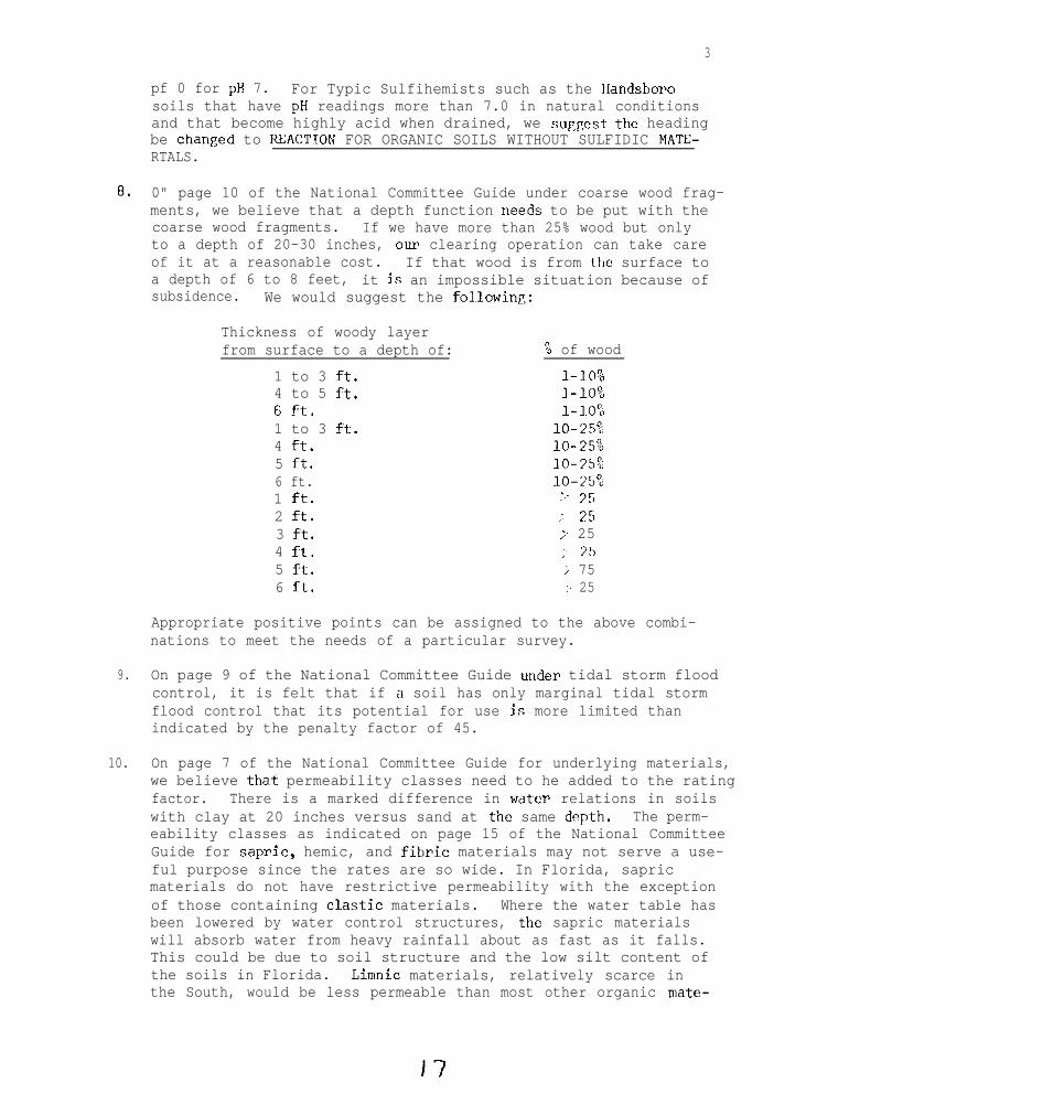
3
pf 0 for pH 7. For Typic Sulfihemists such as the Handsborosoils that have pH readings more than 7.0 in natural conditionsand that become highly acid when drained, we suggest the headingbe changed to RXACTION FOR ORGANIC SOILS WITHOUT SULFIDIC MATE-RTALS.
8. 0" page 10 of the National Committee Guide under coarse wood frag-ments, we believe that a depth function "eeds to be put with thecoarse wood fragments. If we have more than 25% wood but onlyto a depth of 20-30 inches, our clearing operation can take careof it at a reasonable cost. If that wood is from the surface toa depth of 6 to 8 feet, it js an impossible situation because ofsubsidence. We would suggest the following:
Thickness of woody layerfrom surface to a depth of: % of wood
1 to 3 ft. l-10%4 to 5 ft. I-109,6 f-t. l-l~o",1 to 3 ft. lo-25%4 ft. lo-25%5 ft. 10-15:6 ft. 10-25001 ft. :.- 2s2 ft. ; 2s3 ft. ;- 254 il. ;' 755 it. ; 756 ft. ;' 25
Appropriate positive points can be assigned to the above combi-nations to meet the needs of a particular survey.
9. On page 9 of the National Committee Guide ur~tder tidal storm floodcontrol, it is felt that if a soil has only marginal tidal stormflood control that its potential for use js more limited thanindicated by the penalty factor of 45.
10. On page 7 of the National Committee Guide for underlying materials,we believe that permeability classes need to he added to the ratingfactor. There is a marked difference in water relations in soilswith clay at 20 inches versus sand at the same dqth. The perm-eability classes as indicated on page 15 of the National CommitteeGuide for sap&c, hemic, and fibric materials may not serve a use-ful purpose since the rates are so wide. In Florida, sapricmaterials do not have restrictive permeability with the exceptionof those containing elastic materials. Where the water table hasbeen lowered by water control structures, the sapric materialswill absorb water from heavy rainfall about as fast as it falls.This could be due to soil structure and the low silt content ofthe soils in Florida. Liwnic materials, relatively scarce inthe South, would be less permeable than most other organic mate-
17

rid. Permeability rates for soils in North Carolina approximatethose in the National Committee Guide. Suggest that WC use theavailable lab data on permeability of organic soils and the esti-mated permeability as shown on the SCS-SOILS-5 for each individualseries.
11. On page 11 of the National Committee Guide regarding thickness oforganic materials, we offer this comment: Certainly if mineraltexture is okay and drainage is available, the land is not lostif it becomes a mineral soil. Until recently, burning off theorganic material was the best way to handle organics in Tidewater,North Carolina because less input of fertilizer, herbicide, andlime was needed on the mineral than on the organic soils. Thismay be the exception rather than the rule. We certainly want toretain as much of the profile of the highly productive tlistosolsin the Everglades section of Florida as possible, since most ofthese deep Histosols overlie hard limestone.
12. On page 11 of the National Committee Guide regarding rooting depth,we offer this comment: Acid conditions limit roots just as effec-tively as lithic contacts and the expense of getting lime deeplyincorporated is prohibited if not physically impossible.
13. On page 12 of the National Commi~ttee Report concerning developmentdifficulty rating for areas of organic soils, establishment ofadequate water control criteria are missing. The following issuggested. Slight = Adequate water control established. Moder-ate = Minor canals (not navigable) required OP tile drains neededwith nearby outfall. Severe = Major canals to navigable wateTrequi,red, as well as a system of pumps; or permeability of thesoils is low or very low.
14. On page 16 of the National Committee Guide under coarse fragments,we make this observation. Coarse fragments arc a less severelimitation on pastures where higher water levels can be maintainedand machine operation is not as frequent as on cultivated areas.As noted earlier, both volume and thickness need to be considered.
15. In the South, we have insufficient site data to evaluate the inter-pretive guides for forestry.
In regard to Charge 2, we offer these comments:
1. Soils of the tidal areas are flooded each day with sea water. Forall of the uses rated on the SCS-SOILS-5 form, these soils havesevere limitations from flooding with sea water except for wetlandwildlife, but most important are the value of these soils for their

,
5
environmental services when left in their natural state. Quotingfrom the book Environmental Quality by Design: South Florida byAlbert Veri and William Jenna, Jr. and Dorothy Bcrmamaschi, asummary of environmental services rendered by soils and are asfollows:
“1.
2.
3.
4.
5.
6.
7.
Storage and dispersal of flood waters.
Filtration of runoff improves near-shore water quality.
Protection of upland by buffering water surge and waveenergy.
Stabilization of shore line.
Land building by trapping of sediments and other materialsand by accumulation of mangrove roots; marl deposition occursin coastal marsh.
Habitat and food for many marine species, including sportand commercial fish.
Wildlife habitat, especially for waterfowl and wading birds."
In addition to the above, tidal marsh-estuaries have great economicvalue to highly urbanized regions in waste treatment. Gosselink,Odum, and Pope 1973 in a paper titled "The Value of the Tidal Marsh"(Work Paper No. 3. 'Gainesville: University of Florida, mban andRegional Development Center) estimated that an acre of marsh-estuaryis doing about $14,000 worth of work per year at a daily loading of19.4 lb. ROD, assuming the cost of artificial tertiary treatment isat least $2/lb. BOD. Using an income capitalization calculation, anacre of estuary that is able to handle (this) waste loading is worth$280,000. This value represents a large "overload" of work that hasserious pollution side-effects, and if continued or increased couldresult in a system breakdown. If the ROD load can he reduced, theseestuaries would function better as tertiary treatment plants and bemore valuable overall.
Whether these values are completely accurate OP not, it is readilyapparent that the tidal marsh areas have enormous value. Based onthe above, we believe that these soils should not be considered forcropland production, and that any use of these soils should leavethem in their natural state. We should continue to study these soilsso that we can better understand their properties and predict theirbehavior.

.
6
SUMMARY AND CONCLUSIONS:
The Committee in the Committee Report has responded to the charges.The National Committee on Classification of Organic Soils and Inter-pretations did a good job of putting together a lot of material anddeveloping guides. We feel the guides can be improved by concentrat-ing on organic soils only and refining them along the lines of a posi-tive potential concept. Some of the suggestions outlined in thecommittee report and further enumerated in the recommendations wouldimprove the guides for use in the Southern Region,
The soils of tidal areas have enormous environmental value to man.These soils should continue to be studied so that we can better under-stand some of their unique properties and can better point out someof the environmental degradations that can be expected from misuse.Any use of these soils should leave the soils and the vegetationessentially in its natural state.
The Chairman is appreciative of the help and contributions of indi-iridual committeethank you to all
members to the report. The committee extends athe discussion groups for their helpful suggestions.
RECOMMENDATIONS:
1.
2.
3.
4.
5.
That in the guide for preparation of management suitability group-ings, that the part concerning associated mineral soils be deleted.(See number 1 in the body of our Committee Report.)
That consideration be given to just listing the-factors consideredimportant in arriving at a rating without showing the points orallow a positive rating system with flexibility in assignment ofpositive points. It is suggested,that in developing soil poten-tials, inputs from individuals with local expertise affecting landuse be utilized.
That the "Development Difficulty Kating for Areas of Organic Soils"not be used to rate individual soil series as to their developmentdifficulty for publication in soil surveys; however, that it bedeveloped and utilized as a guide for onsite investigation. Thiswould not preclude discussing these features in the mapping unitdescription in a soil survey manuscript.
That the thickness of organic soil materials and underlying mate-rials be considered together. (See numbers 5 and 6 in the body ofour Committee Report.)
That consideration be given to the effect of aluminum toxicity onrooting depth, and that the heading "REACTION" be changed to"REACTION FOR ORGANIC SOILS WITHOUT SULFIDIC MATERIALS". (See
c

7
"tier 7 in the body of our Committee Report.)
6. That a depth and thickness function be put with coarse fragmentsin their evaluation. (See number 8 in the body of our CommitteeReport.)
7. That the factor for marginal tidal storm flood control be givenrather low points in a positj~ve rating system.
8. That permeability classes be added as part of the evaluation cri-teria for underlying materials. (See number 10 in the body of ourCommittee Report.)
9. That water control criteria for slight, moderate, and severe underdevelopment difficulty rating, for areas of organic soils he addedas suggested in number 13 in the body of our Committee Report.
10. That we not have a general guide for rating soils of tidal areasfor cropland.
11. That we show the estimated properties of soils of tidal areas onSCS-SOILS-5 and rate them according to their limitations. (Seediscussion in the body of our Committee Report in regard toCharge 2.)
12. That on Histosols we accumulate more woodland site and productiv-ity data for forestry for use in developing an interpretive guideapplicable to the Southern Region.
13. Recommend that this committee be continued to help organize andevaluate material relative to interpretations of Estosols andsoils of tidal areas.
,

Committee Members:
J. F. Brasfield, ChairmanD. F. Slusher, Vice ChairmanW. L. CockerhamE. GambleC. L. GirdnerD. HallbickR. E. HortonH. F. HuckleW. M. KoosL. RatliffLuis Rivera
Attachments: 1. Soils shown according to potential for improved pastures.
NOTE : It is suggested that anyone attcndinp, the Committee 3. discussionsbring with them a copy of the report of the "Committre on Classi-fication of Organic Soils and Interpretations National Soil SurveyConference, Orlando, Florida, <Jan. 27-31, 3975".
.

SOILS SHOWN ACCORDING TO POTENTIAL FOR IMPROVED PASTURES
MAPSYMBOL SOIL NAME
POTENTIAL(RANKING)
% OF REFERCNTY. TO
PAGEDe
hn
Df
Dh
Mb
MC
RI
R f
FJn
Ok
TC
Ik
Ib
OrB
OK
BP
BP
Bt
IO
IP
Rh
RP
Md
IS
On
Sa
Pn
PO
Wa
Delray fs
Delray mfs
Delray fs, high
Delray fs, mod. shal., high
Manatee fs
Manatee Ifs
Rutlege fs, high
Rutlege fs
Rutlege mfs
Okeechobee m
Terra Ceia m
Iberia ml
Iberia cl, overflow
Orlando fs, O-S% slopes
Orlando fs, 5-8% slopes
Brighton p
Brighton p, shal. var.
Brighton, Istokpoga, andOkeechobee soils
Brighton p, deep
Brighton p, mod. deep
Rutlege fs, high
Rutlege and Pompano soils,ponded
Manatee-Delray complex,overflow
Istokpoga p, shal. var.
Ona fs
St. Johns fs
Pompano fs
Pompano fs, mod. shal.
Wabasso fs
Very High ( 90) 1.8 83Very High ( 90) .9 85Very High ( 90) 2.9 84Very High ( 90) .9 85Very High ( 90) .5 lo4Very High ( 90) .l 105High ( 80) .2 117High ( 00) 1.7 116High ( 80) .4 118High ( 80) 1.0 107High ( 80) .4 125High ( 80) .l 89Hi.gh ( 80) 3.0 88High ( 75) .2 109High ( 75) .1 110
High ( 75) .1 7 9High ( 75) .l 80
High ( 75) 1.6 81
High ( 75) .3 9 2High ( 75) .l 9 3High ( 75) .2 117High ( 75) .6 120
High ( 75) 2.8
.l
.3
2.3
3.1
.4
.5
106
High
High
High
High
High
Medium
( 70)
( 70)
( 70)
( 70)
( 70)
( 65)
94103
121
114
115126

MAPSYMBOL SOIL NAME
POTENTIAL(RANKING)
% OF REFERCNTY TO
PAGE
Ff Felda fs Medium
Lo Leon s Medium
LfA Leon fs, O-2% slopes Medium
LfB Leon fs, 2-5% slopes Medium
Ph Plummer fs, high Medium
Pf Plummer fs Medium
Im Immokalee fs Medium
In Immokalee s Medium
BnB Blanton fs, low, O-5% slopes Medium
BnC Blanton fs, low, 5-B% slopes Medium
Ch Charlotte fs Medium
SW Swamp Medium
LaB Lakeland fs, O-5% slopes Medium
LaC Lakeland fs, 5-S% slopes Medium
BfB Blanton fs, high, O-5% slopes Low
BfC Blanton fs, high, S-8% slopes Low
PmB Pomello fs, O-5% slopes Low
LaD Lakeland fs, 8-12% slopes Low
BfD Blanton fs, high, E-12% slopes Low
Sn Sandy alluvial land Low
M B Lakewood s, O-5% slopes Very Low
SfB St. Lucie fs, O-5% slopes very Low
M C Lakewood s, 5-B% slopes Very Low
Bo Borrow pits Not rated
Ma Made land Not rated
( 65) .9
( 60) 1.4
( 60) 15.9
( 60)( 60)
( 60)
( 60)
( 60)
( 60)
( 60)
( 60)
(60)
( 55)
( 55)
( 50)
( 50)
( 50)
( 50)
( 45)
( 45)
( 35)
( 35)
( 35)
.1
2.1
.9
3.3
1.U
9.4
.2
.a
11.7
4.2
.6
6.1
1.2
4.1
0.1
.2
2.2
1.5
3.0
.l
.3
1.0
&7
102100101112111
93
91767782124
9596'j:
74115
97
75125
99122
99:e
10,
.
Very Low
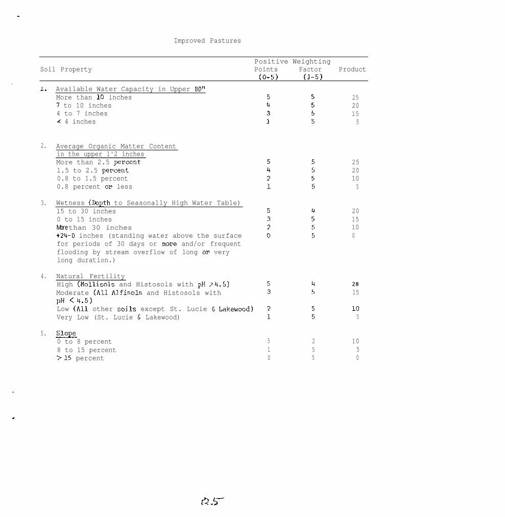
-
Improved Pastures
Positive WeightingSoil Property Points Factor Product
(O-5) (l-5).
1.
2.
3.
4.
5.
Available Water Capacity in Upper 80"More than I.0 inches7 to 10 inches4 to 7 inchesrC 4 inches
Average Organic Matter Contentin the upper 1'2 inchesMore than 2.5 w?rcent1.5 to 2.5 pet&t0.8 to 1.5 percent0.8 percent OP less
Wetness (Depth to Seasonally High Water Table)15 to 30 inches0 to 15 inchesMore than 30 inches+24-O inches (standing water above the surfacefor periods of 30 days or mope and/or frequentflooding by stream overflow of long OF verylong duration.)
Natural FertilityHigh (Mollisols and Histosols with pH 14.5)Moderate (All Alfisols and Histosols withpH c4.5)Low (All other soi~ls except St. Lucie t Lakewood)Very Low (St. Lucie & Lakewood)
Slope0 to 8 percent8 to 15 percent>15 percent
510
255
2520155
2520105
2015100
2015
105
1050

SODTDERN REGIONAL TECBNICAL SOIL SURVEY WORE-PLANNING CONFERENCE
Jackson, Mississippi, April 5-8, 1976
Chairman- H.H. Bailey; Vice-Chairman - James A. DeMent
committee: II - Waste Disposal on Land
Charges to the Committee:
1. Review Advisory Soils-14 and
a. Identify conditions where soil survey personnel can make suitablepredictions of soil behavior for waste disposal on the land versusconditions where assistance from other disciplines is required.
b. Determine the adequacy of the soil properties and attributes eval-uated in the guide for the predictions made.
In Charge 1, test Advisory Soils-14 to determine if the guides will allowsuitable predictions through the use of soil interpretations given on SCS-Soils-S. The study might include the physical, chemical, and biologicalaspects of the factors involved.
Report on Charge 1
Combining Charge 15 and a the committee and conference participants feltthat the following Items can be identified by soil survey personnel, andthat they are important in making predictions (see Tables 1 and 2 inAdvisory Soils-14) for disposal of biodegradable liquid and solid wastesthat lack toxic quantities of heavy metals:
Depth to seasonal water tableSoil drainage class (Note: some say omit this)Depth to bedrock or other impermeable layerRunoffSlopeStoniness classRockiness classSalinitySoil texture~8
Items which will require assistance from other sources:
, Permeability of most restrictive layerInfiltration rate(s)Available water capacityExchangeable cationsClay mineralogyAl, Fe, and CaCOS contents (concerns P "pick-up")Salt content
26

r
, -2-
Note: It was suggested that three tables might be required for liquiddisposal and three for solid disposal. Namely:
one for "site" propertiesone for "filtering ability and limitations", to includeexchangeable cations; clay mineralogy; Al, Fe, and CaC03contentsone for "application rate limitations" where considerationis given to rates of loading
General Comments on Charge 1
1. Values for the tables (Advisory Soils-14) should be continuallyreviewed and up-dated based on available research.
2. Tables (in Advisory Soils-14) should clearly indicate the levelsof liquid application (loading) that are to be considered whenusing the tables, i.e., (a) equate to normal irrigation princi-ples and procedures, or (b) light loading or unsaturated flow, or(c) heavy loading or saturated flow.
3. Considerations must recognize seasonal variations of rainfall,temperature, vegetative cover or bare soil, and water balance.
4. Infiltration rate varies within a given soil depending onpast use and management, vegetative cover and other variables.Runoff rates may effectively substitute for this property.
5. Evaluation of rock, etc. below approximately 2 m should bereferred to other disciplines, when needed.
2. Determine if additional waste management uses, other than those listedunder Sanitary Facilities, can be added to the SCS-Soils-5 and ifcurrent Estimated Soil Properties on the SCS-Soils-5 are adequateto accomodate current and possible additional uses.
In Charge 2 determine if the estimated soil properties given onSCS-Soils-5 are adequate to accomodate the current guides (AdvisorySoils-14) or if additional soils information such as climatic regime,mineralogy, etc. are needed. Will the guide apply equally well tosoils of arid as well as humid regions for a given waste disposalpractice? Have we overlooked mineralogy or is it implied in thepresent list of items affecting use? Are there other soil propertieswe need to consider?
Report on Charge 2
The committee and the conference participants felt that two additionaluses should be added to SCS-Soils-5. namely: (a) use of the soil fordisposal of liquid waste, and (b) solid wastes. These two items could beincluded under "Regional Interpretation" until such time Soils-5 is revised.
-47

The Estimated Soil Properties section should be revised to include anynew items accepted from Charge 1, of this report,if computer generatedinterpretations are to be utilized. Otherwise, hand processing can beused with data from various unlisted sources, such as official seriesdescriptions, benchmark soil data and research reports.
Recommend that the committee be continued.
Conference accepted the report as shown above.
Committee Members:
E.R. BlakleyJ.R. BrasfieldJohn BurtR.B. Daniel6T.R. GeraldFenton Gray
W.F. Hatfield2. LundGary Hargheim’R. RehnerK.B. TanB.A. Touchet
H.H. Bailey, ChairmanJames A. DeMent, Vice Chairman
.

. .
1976 Southern Regional Soil SurveyTechnioal Work Planning Conference
. April 5-6, 1976
committee III - Soil Potential Ratings
Chairman - Allen L. NewmanVice-Chairman - R. Miller
Charqes
A. Review the policy and procedure guide developed by the Washington SoilSurvey Interpretation Staff. Recommend charges if needed.
B. Propose a procedure for arraying soils for practical application ofratings, including:
1. How to array classes
2. Names for classes
3. Definitions of classes
C. Propose criteria for ranking soils on the basis of potential forspecific uses.
D. Identify kinds of uses and different kinds of criteria needed for thearray.
E. Propose a procedure for testing the ratings.
Committee Report
Charge A
The policy guide for potentials, National Soils Handbook-404, has beenreviewed by the states and comments sent to the Washington Office. Therewere many comments and this section will likely be rewritten. The camnitteeshould review the next draft of this section of the IGH.
Charge B
1. We propose the soil classes be arrayed according to their potentialfrom best to worst.
,
2. 'Ihe names would be the three-class system of high, medim, andlow with the local option of very high, high, mediun, low, and :very low. These names will distinguish potentials from limitation :,classes, slight, moderate, and severe; and suitability classes ofgood, fair, and poor.
’
i
,I, :
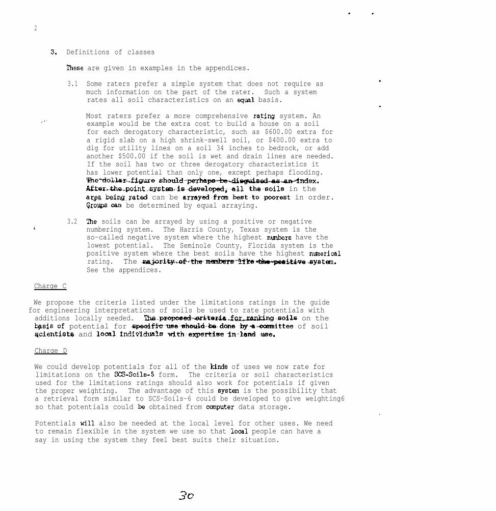
2
3.
, I’
!i
Charge C
Definitions of classes
!Ihese are given in examples in the appendices.
3.1
3.2
Some raters prefer a simple system that does not require asmuch information on the part of the rater. Such a systemrates all soil characteristics on an equal basis.
Most raters prefer a more comprehensive rating system. Anexample would be the extra cost to build a house on a soilfor each derogatory characteristic, such as $600.00 extra fora rigid slab on a high shrink-swell soil, or $400.00 extra todig for utility lines on a soil 34 inches to bedrock, or addanother $500.00 if the soil is wet and drain lines are needed.If the soil has two or three derogatory characteristics ithas lower potential than only one, except perhaps flooding.We"dolba%..figuxe should,.-perhage-)nldi~~~,~..~"~ndex.~tor.the.,point~aystem.is~developed;~all .the~soils in thear,@ being.rated can be armye&fran best.,to ,poorest in order.Groups oan be determined by equal arraying.
'Ihe soils can be arrayed by using a positive or negativenumbering system. The Harris County, Texas system is theso-called negative system where the highest nwnbers have thelowest potential. The Seminole County, Florida system is thepositive system where the best soils have the highest numericalrating. The .majori't~,,,of‘~:ths,.rnembe~~~)ra*hdar'~itd,ue,~system.See the appendices.
We propose the criteria listed under the limitations ratings in the guidefor engineering interpretations of soils be used to rate potentials withadditions locally needed. ~~p~~sed-*~~~teda.f~~~,.~~ng.soils on theb&s pf potential for .epeolfi~,,~se.shotlld,,be.done ~by~a~~~eamnittee of soilqcientists and looal indiiiiduals ~with~eqx!r+lse~in~land ,use.
Charge D
We could develop potentials for all of the kinds of uses we now rate forlimitations on the SCS-Soils-5 form. The criteria or soil characteristicsused for the limitations ratings should also work for potentials if giventhe proper weighting. The advantage of this systw is the possibility thata retrieval form similar to SCS-Soils-6 could be developed to give weighting6so that potentials could be obtained from ccxnputer data storage.
.
Potentials will also be needed at the local level for other uses. We needto remain flexible in the system we use so that looal people can have asay in using the system they feel best suits their situation.

3
Charge E
T"ne ratings can be tested by being used by those who need the information.It seems we need to stick to the soil characteristics for the phases ofsoil series that we use in mapping.
,.i!, ; , *I' I~&"We-,-need ~to+intsrpret for the taxonamic (* .:,
unit ,in tables. The plar~er could~.then..,,~e._fhesa.data~to~.develop potentialsfor the mapping unit,based on the kind, amount, and size of contrasting ,..inclusions, size and shape of delineations, and associated units as well. ,,as other variables. If we don't go this way a lo-acre delineation of Ruston :I': .Isandy loam, 2 to 5 percent slopes, might have a different potential than a50-acre delineation. This would complicate tables. We believe a two-step
i, :,./. .:,i I.
procedure of rating by taxonomic units and planning for specific tracts of "'f',., ,.::d.land has proven good in the past. :,;>,., /,..,.".
Surm~ary, Conclusions, and Recamnendationsi; 3. mI i .”
,,,., i’:‘. .I ,._y,.
This committee discussed soil potentials, possible classes and definitions.We believe that soil potential provides for a positive approach or perspectivein planning. Limitation points to the problem, whereas potential suggestssolutions. We need both limitation ratings and potential ratings. /
We believe that we must rate theteristics, at least until potentials are tested for a period of time.The spatial soil characteristics should be left to the planner for thetime being.
Potentials can probably be developed for resource areas or smaller units,but would be very difficult to develop nationally.
List of Committee Members
Chairman - Allen L. NewmanVice-Chairman - R. Miller
Members
F. G. CalhounB. L. CarlileJ. R. FarsonW. W. FuchsR. W. JohnsonJ. T. HoodR. Leonard
Charles McElroyW. F. MillerJoe NicholsW. B. ParkerJack PerkinsDavid SlusherJ. Soileau

. .
4
Cmments made atApril 5-8, 1976:
the Southern Regional Soil Survey Work Planning Conference,
A. Several of the conrments indicate a concern of state and regionalcoordination.
8. Several of the conunents indicated just as much concern over keepingpotential ratings open to the local user having expertise in land use.
C. Statistics should be considered in testing systems.
D. Sane discussion of terminology -- potential vs. suitability vs.capability.
Recommendations
A. Continue the Committee.
B. Change or add charges as follows:
1. Review National Soils Handbook-404.
2. Test the ratings in some areas where they have been developed andare in use.
3. Identify organiurtions and/or discipline specialists that shouldbe involved in developing potential ratings.
4. Propose a format for publication to include a listing of proceduralguidelines, laws, rules, regulations, and contributing sources.

Appendix 1
Seminole County, Florida
Soil Potential
Each soil is rated as to its potential for 14 selected land uses. For thepurpose of this supplement, "Soil Potential" is defined as the ability ofthe soil to produce , yield, or support a given structure or activity expressedin economic, social, or environmental units of value. The criteria used forrating soil potential includes the relative difficulty or cost of overcaningsoil limitations, the continuing limitations after practices in general use
in overcoming the limitations are installed, and the suitability of the soilrelative to other soils in Seminole County.
In Seminole County, a five-class system of soil potentials is used. Theyare defined as follows:
Very High Potential,,.,_:/ I"' ’
- Soil limitations are minor or are relatively easyto overcome; performance for the intended use is excellent. SOilSrated as very high potential are the best in the county for theparticular use.
High Potential - Some soil limitations exist, but practices necessary toovercome limitations are available at reasonable cost; performance for
Medim Potential - Soil limitations exist that can be overcome with reccm-mended practices, but limitations are mostly of a continuing naturerequiring practices that have to be maintained, or the practices aremore difficult or costly than average; performance for the intendeduse ranges from fair to good.
Low Potential - Serious soil limitations exist that are difficult to over-come and the practices necessary to overcome the limitations arerelatively costly compared to those required for soils with higherpotential; necessary practices may involve environmental values andconsiderations; performance for the intended use is poor or unreliable.
Very Low Potential - Very serious soil limitations exist that are mostdifficult to overcome; initial cost of the practices and maintenancecost are very high compared to those for soils with high potential;environmental values are usually depreciated; performance for theintended use is inadequate or below acceptable standards.

.
Appendix 2
Soils Shown According to Their Potential for Selected Land Uses
In tables 1 through 14, the soils are arrayed according to their potentialfor the specific land use. Soils are grouped and arrayed from very highto very low potential. The nunerioal rankings were determined by assigningpositive points to those soil properties that affect a particular use,multiplying each point by a weighting factor, and then sumning the products.The weighting factor is a variable n&r or device used to maneuver orweight the properties so that a soil with all favorable properties willhave a numerical ranking of 100. Properties considered favorable wereassigned a point value of 5, those less favorable a point value of 4, 3,2, or 1, and those considered most unfavorable a value of 0. For example,in local roads and streets, the following properties were used: SOilstrength, shrink-swell potential, flooding or standing water, wetness, andslope. A soil such as Lakeland fine sand, 0 to 5 percent slopes, that hasgood strength (5 positive points x weighting factor of 5 = 25 points), lowshrink-swell potential (5 positive points x weighting factor of 5 = 25points), not subject to flooding (5 positive points x weighting factor of4 = 20 points), not wet (5 positive points x weighting factor of 4 = 20points), and gentle slopes (5 positive points x weighting factor of 2 = 10points) has a numerical ranking or point value of 100, the highest potentialnumerical ranking. The highest point totals were assigned to those propertiesthat would have the most affect on the particular land use. In local roadsand streets, soil strength and shrink-swell potential were considered ofmost importance, flooding and wetness of slightly less importance, andslope of least importance. Theoretically, a soil could have a potentialas low as 0 or as high as 100, but for all the land uses considered, mostsoils in Seminole County came out with a numerical ranking of more than 0.For some land uses, there were sane soils that had a nunerical ranking of100, and for same land uses, there were not any soils that had a nunericalranking as high as 100.
~he percent of the county that each soil caprises is also shown In thetables. This will enable users to quickly calculate the extent of the soilswith the best potential for a particular use.
!rhe last colwnn in the table refers you to the page that has the propertiesand interpretations for a particular soil.

,Appendix 3
SOILS SHOWN ACCORDING TO POTENTIAL FOR SEPTIC TANK ABSORPTION FIELDS
MAP POTENTIAL % OF REFERSYMPOL SOIL NAME (FaNKIK+) CNTY. TO
PAGELdB -~Lakewood s, O-5% slopes Very High (la01 1.5 98LaB
BfB
SfB
LdC
I&!
BfC
ian
Bfil
OTB
BnR
?mB
OrC!
BnC:'h
RI1
Lo
LfA
LfB
On
Im
In
Sa
Wa
Df
Dh
ne
am.
Pf
Rf
Rm
Rn
RP
Lakeland fs, O-5% slopes Very High
Blanton fs, O-5$ slopes Very High
St. Lucie fs, O-5% slopes Very High
Lakexood s, 5-8% slopes Very High
Lakelsnd fs, 5-8% slopes Very High
Blanton fs, 5-8% slopes Very High
Lakeland fs, 8-12% slopes Very High
Blanton fs, 8-12% slopes Very High
Orlando fs, o-5", slopes High
Blanton fs, low, O-5% slopes High
Pomello fs, O-58 slopes High
Orlando f's, 5-8% slopes High
Blanton fs, low, 5-8% slopes High
Plummer fs, high Medium
Rutlege fs, high Medium
Leon s Medium
Leon fs, O-2% slopes Medium
L,eon fs, Z-5% slopes Medium
Ona fs Medium
Immokalee fs Medium
Immokalee s Medium
St. Johns fs Medium
Wabasso fs Medium
Delray fs, high LOW
Delray fs, mod. .shal., high LOW
Delray fs LOW
Delray Dfs LOW
Pl,ummcr fs LOW
Rutlege fs LOW
PUt1eF.E mfs LOW
Rutlege, Plummcr, and LOWSt. Johns soils
Rutlege and Pompano soils, Lowponded
3 5-
(100) 11 . 2
(1031 6.2
(100) 3.0
(100) 0.1
(100) 0.6
(100) 1.2
( 96) 0.1
( 96) 0.2
( 81) 0.2
( 81) 9.4
( 81) 4.1
( 81) 0.1
( 81) 0.2
( 75) 2.1
( 65) 0.2
( 66) 1.4
( 66) 15.9
( 65) 0.1
( 66) 0.3
( 66) 3.3
( 66) 1.4
( 66) 2.3
( 66) 0.5
( 50) 1.8
( 50) 0.9
( 50) 1.8
( 50) 0.9
( 50) 0.9
( 50) 1.7
( SO) 0.11
( 50) 0.8
( 50) n.6

Appendix 4
MAP POTENTIAL % OF REFERSYMBOL SOIL NAME (RATKING) CNTY. TO
PAGECh Charlotte fs LOW ( 50) 0.8 82Ff
Pn
PO
Sn
Felda fs
Pompano fs
Pompano fs, mod. shallow
Sandy alluvial land
BP
BP
ut
Brighton p
Brighton p, shallow variant
Brighton, Istokpoga, andOkeechobec soils
Istokpoga p, deep
Istokpoga p. mod. deep
Istokpoga p, shallow variant
LOW
LOW
Low
Very Low-Medium
Very Low
Very Low
Very Low
( 50)
( 50)
( 50)
( 25-70)
( 35)
( 35)
( 35)
IO
IP
IS
Ok
TC
SW
Okeechobee m
Terra Ceia m
Swamp
Very Low
Very Low
Very Low
Very Low
Very Low
Very Low
Mb
MC
Md
Manatee fs
Manatee Ifs
Manatee-D&ray complex,overflow
Iberia ml
Iberia cl, overflow
Borrow Pits
Made land
Very Low
Very Low
Very Low
( 35)
( 35)
( 35)
( 35)
( 35)
( 25-35)
( 25)
( 25)
( 25)
Ik
Ib
BO
Ma
Very Low
Very Low
Not rated
Not rated
( 25)
( 25)
0.9
3.1
0.4
2.2
0.1
0.1
1.6
0.3
0.1
0.1
1.0
0.4
11.7
0.5
0.1
2.8
0.1
3.0
0.2
1.0
7980
81
104
105106
398878
1011
.

Appendix 5
SOILS SHOWN ACCORDING TO POTENTIAL FOR SANITARY LANDFILL(TRENCH TYPE)
MAPSYMBOL SOIL NAME
POTEliTIAL % OF REFER@ANKING) CNTY. TO
PAGEBfR
LaB
Ldi!
BfC
LaC
LdC
BfD
LaD
BnB
BnC
SfB
Wa
Ph
OrB
PmB
arc
M C
Ib
Ik
Ff
Im
In
LO
LfA. LfB
On
. rul
Kb
!.ld
Pf
Blanton fs, high, O-5% slopes Very High
Lakeland fs, O-59, slopes Very High
Lakewood s, O-S% slopes Very High
Blanton fs, hii;h, 5-8% slopes High
Lakeland fs, 5-B% slopes High
Lakewood s, 508% slopes High
Blanton fs, high, R-l?% Highslopes
Lakeland fs, E-12% slopes High
Blanton fs, low, O-5% slopes High
Blanton fs, low, 5-E% slopes High
St. Luclc fs, O-S% slopes
Wabasso fs
Plummer fs, high
Orlando fs, O-5% slopes
I'omello fs, O-5% slopes
Orlando fs, 5-B% slopes
Manatee 1s
Iberia cl, overflow
Iberia ml
Felda fs
Immokalee fs
Immokalee s
Leon s
Leon fs, O-2% slopes
Lfs, 2-5X slopes
ona fs
Kutlege is, high
Manatee fs
Manatee-Dclray complex,0Ve~f'lCX.l
Plummer fs
High
Medium
Medium
Medium
Medium
LOW
LOW
LOW
LOW
Low
Low
Low
LOW
LOW
LOW
LOW
LOW
LOW
Low
LOW
37,
( 90) 6.1
( 90) 4.2
( 90) 1~. 5
( 85) 1.2
( 85) 0.6
( 85) 0.1
( 80) 0.2
( 80)
( 70)
( 65)
( 65)
( 60)
( 60)
( 45)
( 45)
( 40)
( 40)
( 40)
( 40)
( 35)
( 35)
( 35)
( 35)
( 35)
( 35)
( 35)
( 35)
( 35)
( 35)
( 35)
0.1
9.4
0.2
3.1
0.5
2.1
0.2
4.1
0.1
0.1
3.1
0.1
0.9
3.3
1.4
1.4
15.9
0.1
0.3
0.2
0.5
2.8
0.9
97‘Fio77
1i?%12G112
10911311010588
89
8790
91102
1003~03.
108
117104
105
111


Appendix 7
B. Sanitary Landfill (Trench Type)
Positive Weighting ProductSoil Property Points Factor
(O-5) (l-6)
1. Wetness (depth to water table)Below 72 inches 5 6 3030 to 72 inches 4 515 to 30 inches 2 5 E0 to 15 inches 0 5 0
2. Flooding or standing waterabove the surface for periodsof 2 weeks or more.
None or rare 5 5 2.5Cormnon 0 5 0
3. Permeability (below a depth of60 inches)Less than 2.5 inlhr or 2.5 to 5 5 255 in/hr with texture of sandyloam or finerMore than 2.5 in/hr and texture 0 5 0of loamy fine sand or coarser
4. Soil texture (surface layer orupper 10 inches)Sandy loam, sandy clay loamLoamy sands, clay loam, muckylOamMuck, peat, sands
5. SlopeO-5 percent5-8 percent8-15 percent
211
105
0
1050
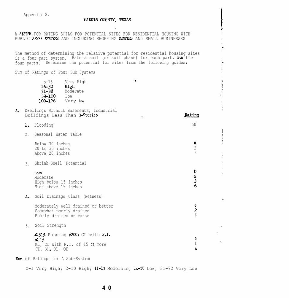
Appendix 8.HARR1scaJNrY,TExAS
.A SYSTW FOR RATING SOILS FOR POTENTIAL SITES FOR RESIDENTIAL HOUSING WITHPUBLIC SE7JER SYSTEW AND INCLUDING SHOPPING CENTFiRt3 AND SMALL BUSINESSES
The method of determining the relative potential for residential housing sitesis a four-part system. Rate a soil (or soil phase) for each part. Sum thefour parts. Determine the potential for sites from the following guides:
Sum of Ratings of Four Sub-Systems
o-15 Very High16-30 Wzh31-38 Moderate39-100 Low
loo-176 Very Low
A. Dwellings Without Basements, IndustrialBuildings Less Than 3-Stories ‘.
1.
2.
Flooding
Seasonal Water Table
3.
4. Soil Drainage Class (Wetness)
5.
sum of Ratings for A Sub-System
Below 30 inches 020 to 30 inches 2Above 20 inches 6
Shrink-Swell Potential
L O W
ModerateHigh below 15 inchesHigh above 15 inches
Moderately well drained or better 0
Somewhat poorly drained 2
Poorly drained or worse 6
Soil Strength
c51% Passing #200; CL with P-1.415ML; CL with P.I. of 15 or moreCH, WI, OL, OH
0
t
.
._ Wtins
50
O-l Very High; 2-10 High; 11-13 Moderate; 14-30 Low; 31-72 Very Low
4 0

I
Appendix 9/
!
I
B. Local Roads and Streets.
1. Flooding
2. Shrink-Swell PotentLal
LOW
ModerateHigh below 15 inchesHigh above 15 inches
Wting
50
0236
3. Soil Drainage Class
Moderately well drained or better 0Somewhat poorly drained 2Poorly drained or worse 6
Sum of Ratings for B Sub-System
.
O-1 Very High; 2-7 High; 8-10 Moderate; n-20 Low; 21-62 Very Low
C. Corrosivity of Uncoated Steel
LOW 0
ModerateHigh t
Sum of Ratings for C Sub-System
0- High; l- Moderate; 4- LO W
c. Shdlow Excavations
i. Soils Ikaixqz Class
Well drainedModerately wall drainedSomewhat poorly drairied or worse
2. Seasonal Water Table
Below 60 inches313-60 inchesAbx~ 30 inches
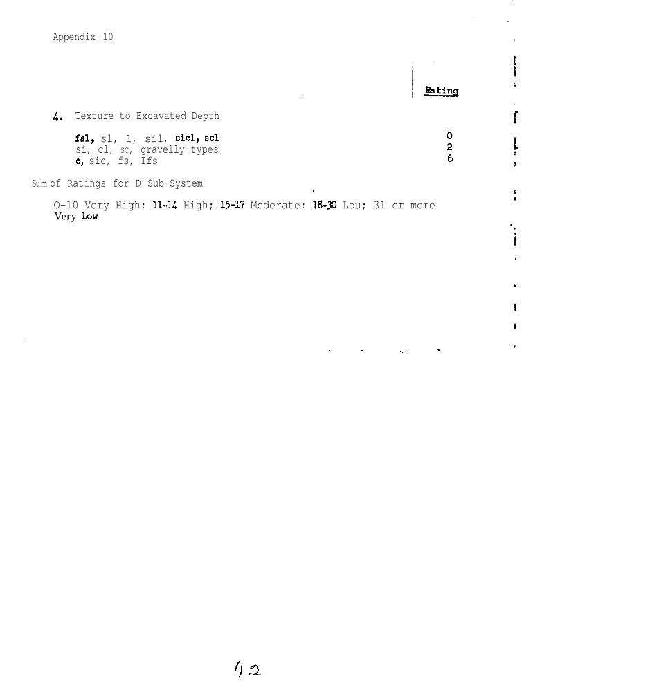
Appendix 10
4. Texture to Excavated Depth
fsl, sl, 1, sil, sicl, SC1si, cl, SC, gravelly typesc, sic, fs, Ifs
Sum of Ratings for D Sub-System .
O-10 Very High; 11-U High; 1.5-17 Moderate; 18-30 Lou; 31 or moreVery Low

z47
:;u22
.l9
:z155176Lu
::1763!
22 low63 Very Low72 ven Law
.
POTENTIAL FOR WSIDENTIAL HOUSING SITES
I.2 LYV56 V e r y LYV62 vorg Lo”50 -, vary bw* Qh
l2 Law62 VerYLov
Potential Fartiot carroding!Jncoatnl steel
:: overall si:esP0t.Xltial : : Fated Fro"! LkstFor kkcawtians :: a Site To Poorest site
12I818151618v.15
:"B3238356
1838u6
::
:
::x?

Appendix 12
Potential for Urbanization
The potential of a soil is the ability of that soil to produce, yield, orsupport a given structure,social,
or activity at a cost expressed in economic,or environmental units of value.
The soils of Grris County have been rated in Table W for their potentialfor urbanization. The elements considered are: (1) dwellings withoutbasements, but with public sewer systems, (2) streets, (3) excavations inwhich to place utilities, and (4) uncoated steel pipe. Shopping centersand small businesses were also considered in the rating potential.
The soils that have the highest potential for urbanization are those onwhich streets and structural foundations can be placed and not deterioratebecause of adverse soil factors. In general, these same soils are easy todig in, easy to grow plants in, and present a well drained, nonfloodinglandscape that is pleasing to the eye.
The factors to consider in rating a soil's potential for each element ofurbanization are: (1) flooding, (2) water table, (3) wetness, (4) shrink-swell potential, (5) soil strength, (6) soil texture, and (7) corrosivityto uncoated steel.
Soils that flood have a very low potential for urbanization because of thedifficulty and expense involved in control of flood waters. In most cases,the watershed includes an area much larger than any single land developerhas control over.
Soils that are wet or have a high water table have a mediun to low potentialfor urbanization. Drainage systems can be installed to reduce wetness andlower the water table, but because of the flat landscapes in Harris County,g&d drainage outlets are frequently several miles distant from the areabeing developed.
Soils with a high shrink-swell potential or low soil strength have a medilrmpotential for urbanization. These factors oan be partially overcome byincreasing the strength of the structures. In Harris County these soilsoften have additional factors, such as wetness, clay texture, and highcorrosivity to uncoated steel, that further lowers their potential forurbanization.
Clay soils are difficult to excavate and move or manipulate. This addsadditional cost to development and maintenance.
Soils that are highly corrosive to uncoated steel pipes generally haveother factors that lower their potential. The corrosive effect of thesoil on uncoated pipes can be partially overccme by using protective coatings,or by attaching anodes to the metal, or by using more resistant metals ormaterials such as plastics or concrete.

. ..
mEB u.--mrBNfuL top UBBANIz*TlON
.%a footnotes at md of teble.
.
:: Hedim:::: I(edirrm::: : LW::: : !4odim:::: Lo!3: :: : L-39::: : Xleh: ::: Righ: :: : Lou: ::: Low::: : very LW::: : very Low: ::: very Low: :: : very nigh: :: : Low::: : vely Low: :: : !&dim
Wetness
Wetness, shrink-swell
Wetness, shrink-swell
Shrink-swell, wetness
Shrink-swell, wetness
Shrink-swell, wetness
wetness
Wetness
Wetness
Shrink-swell, wetness
Flooding
Flooding, shrink-swell
Flooding
Non.2
Wetness, shrink-srell
Flooding, shrink-swell
Wetness

Soil mid Symbol
:: Elrncntr of Urtianiration :::: Uncoated : : Potential for Major ~robla~s in:t DwdlinKa strectm Kxxe*vati& Stee l Pipe :: U r b a n i z a t i o n to GvrrcTw
8: ::
. .
.
.~
. .
I
.

Appendix 15
In Table M, the limitation of a soil for building site developnent may bebased on the rating of a single factor. For example, a soil having a highshrink-swell potential is rated as having a severe limitation bemuse ofa single factor. In Table W, Potential for Urbanization, the rating factors
. are clanulative, that is, a wet soil that shrinks and swells greatly, andis highly corrosive to metals is rated lower than a soil that is only wet.Further, the ratings of elements of urbanization, that is, dwellings,streets, excavations, and uncoated steel pipe, are also cunulative toarrive at the overall potential of the soil for urbanization.
The potential of soils for urbanization is divided into five classes:very high, high, medium, low, and very low. Definitions are:
Very Hiuh - Soils with very few factors that are likely to cause problemsduring construction or after development. The factors oan be easilyand economically corrected.
m- Soils with a few factors that will cause problems during constructionor after developent. The factor5 can be economically overccme.
MediUm - Soils with several factors that will cause problems during oon-struction or after develoyunent. Sane factors oan be easily overcane,but one or more factors will be difficult or expensive to overcome.
Low - Soils with several factors that will cause problems, both during- construction and after development. Factors can only be overcome with
difficulty and very expensive measures.
Very Low - Soils that flood, and most have other factors as well that arevery difficult to overcome. These soils are best suited for uses otherthan urbanization.

UNITED STATES DEPARTMENT OF AGRICULTURESoil Conservation Service
1976 Southern Regional Technical WorkPlanning Conference of the Cooperative Soil Survey
Jackson, Mississippi
April 5-8, 1976
Report of Committee No. 4 - Kinds of Soil MapsChairman - F. Ted MillerVice Chairman - E. M. Rutledge
Charges to Committee:
1.
2.
3.
4.
1.
Review the report of the National Committee on kinds of soil surveys.
Determine if the kinds of mapping units for soil surveys are applicableas kinds of map units for all kinds of soil maps.
Review conventions for naming mapping units for soil surveys, and recom-mend the form of names to use for generalized soil maps and schematicsoil maps,
Recommend standards for minimum size delineations for generalized andschematic soil maps.
Committee Report
Review of the report of the National Committee on kinds of soil surveys.
Committee members are in general agreement with the report. All agreedthat ,much thought and effort has been put i,nto this subject. Most ofthe recommendations and ideas contained in the report have been accepted'and incorporated into the Revised Soil Survey Manual.
This committee is of the opinion that there is considerable confusion inthe term "kinds of soil survey and soil maps," as the term is used inthe report. The term "kinds of soil surveys" has been used to definesoil survey maps, generalized soil maps, and schematic soil maps, todistinguish the five orders of soil survey, and also to identify Detailed,Recorlnaissance, and Exploratory surveys. Although all soil survey, nomatter what the purpose or method, results in a soil map, care must beexercised in d~istinguishing between "kinds of soil survey" and "kinds ofsoil maps." Soj~l surveys should be defined as the five levels (orders)and these levels used to explain soil surveys based on the criteriaoutlined in Table 1 and the writeup entitled "Kinds of Soil Surveys."The basis of distinguishing the three "Kinds of Soil Maps" is well done

although the term Generalized Soil Map should be extended to include mapsdeveloped from more general materials, as well as those made from pre-existing soil survey maps. Many existing generalized soil maps werenot made by cabining preexisting soil survey maps. This i s espec ia l lytrue of many state maps.
Although this committee is in agreement vith the terms used to identifythe three kinds of soil maps, we would modify these terms somewhatwhen they are used to title soil maps. Soil Survey Map and SchematicSoil Map would remain as titled but Generalized Soil Map would beGeneral Soil Map. The term General Soil Map would be more readilyaccepted as it is in general usage by personnel outside the serviceas well as in service.
2. Determine if the kinds of mapping units for soil surveys are applicableas kinds of map units for all kinds of soil maps.
All committee members agree that the kinds of mapping units defined forsoil survey maps are also applicable to generalized soil maps andschematic soil maps. Consoc iat ions , so i l complexes , so i l assoc iat ions ,and undifferentiated groups have been used in the pest and should con-tinue to be used in the future.
This committee strongly supports the retention of Undifferentiated Groupsas a kind of mapping unit. This kind of mapping unit is essential i fwe are going to design soil surveys that provide interpretations forappl ied ob jec t ives wi thout creat ing deta i l that i s not use fu l . S o i lmaps are made to be used. As discussed in Committee 7’s report of theNational Work Planning Conference, combining two very steep phases oftwo otherwise dissimilar soil series may in no way affect the usefulnessof the map for the purposes of the soil survey. In des igning so i l sur -veys > our objective is to prepare the kind of map at the desired scaleand detail needed to fulf i l l the desired use. Undifferentiated Groupsas a kind of mapping unit can help us fulfi l l this objective.
3. Review conventions for naming mapping units for soil surveys, and recommendthe form of names to use for generalized soil maps and schematic soil maps.
A summary of comments from committee members responding to this chargeindicate some differences in attitudes regarding nomenclature used toidentify map units of soil survey maps, generalized soil maps, andschematic soil maps. All agree, however, that the mapping unit namecannot be completely connotative and that we expect or instruct theusers to read the mapping unit descriptions to f ind out the nature ofthe units. We must, however, strive to give the average map user agreater awareness than he has now of the complexity that does exist be-tween the different kinds of soil maps and map units. Regretably, thereis a tendency among users of maps, soil or otherwise, to consider anydelineated area on a map as uniform, espec ia l ly i f i t has a s ing le sym-bol and is identified with a single name. All too frequently the accom-panying description is not read carefully.
43

3
Since the five orders of soil surveys contained in the National Committeereport and the revised Soil Survey Manual reflect specific levels ofconfidence, it follows that the three kinds of soil maps (soil surveymap, generalized soil map, schematic soil ,msp) also reflect specificlevels of confidence. Users of soil maps must have knowledge of the con-fidence level for making interpretations. Some have suggested that thiscould be accomplished by a footnote on the map unit legend reflectingthe predictability of each soil map unit (85&, 6@, 4C$, etc.). If onthe other hand, confidence level was reflected in the name of the mapunit, the problem would not be as great. It seems, therefore, highlydesirable to have unique names for map units to identify soil surveymaps from generalized soil maps and from schematic soil maps.
The Montgomery County, Mississippi published soil survey which was issuedin December, 19'75 adequately illustrates the problem. The Smithdale-Providence association, hilly (SpE) occurs as a mapping unit on the de-tailed soil survey map, while the Smithdale-Providence association (5)is included in the general soil map. In this instance, it would be veryeasy for a'user to mistake a soil survey map from a general soil map.It is both confusing and misleading to users of our soil surveys. Thistype of problem is not unique to Montgomery County as it exists in mostall soil survey publications.
The benefit of unique names for map units on general soil maps andschematic soil maps would be two-fold. Fir&it would eliminate con-siderable misuse of soil surveys and general soil maps by users. Second-ly, it would force everyone concerned to give more attention to the kindof unit he is illustrating, describing, and correlating.
Seemingly, it would be preferable to restrict the usage of the termsconsociation, associations, and complexes to name mapping units strictlyfor the legends of soil survey maps. Although the same kinds of mapping unitsdefined for soil survey maps are also applicable to generalized soil mapsand schematic soil ,maps, they should be modified to distinguish them frommapping units of soil surveys. This can be done by adding the word "group"to the taxonomic reference terms used to identify the essential componentsof the unit. Examples are:
ConsociationsUdorthents group
Complexes and AssociationsSmithdale-Providence groupUdalfs - Udorthents group
Undifferentiated groupsSmithdale and Providence group

4
The term “areas” has also been suggested. It was used in naming soilmap units of the Soil Association Mkp of the United States contained inthe 1938 Yearbook of Agriculture. However, since all delineated bodieson e soil map consist of areas, this term is not favored.
Schematic soil map legends should also readily identify the kinds ofsoil map unit. Although this committee has no specific recommendation,,names could include such terms as community, sequent, block, zone, belt,province, domain, territory, residence, body, division, or other con-notative terms to connote a soil map unit of a schematic soil map.
4. Recommend standards for minimum size delineations for generalized andschematic soil maps.
Scale of maps and minimum size delineations is well defined. Althougha review of a number of generalized soil maps contained in publishedsoil surveys indicates larger minimum size delineations then suggestedin Table 2, the guidelines are adequate. The size of the minimum de-lineation must relate to map scale. The use to be made of the map mustdetermine the map scale.
Minimum size delineations and scale of maps used in Table 2 should alsopertain to general soil maps and schematic soil maps.
Recommendations
1.
2.
3 .
4.
5.
6.
7.
Use the term General Soil Map, notpublications and to title maps.
Redefine the definition of General
Generalized Soil Map in soil survey
Soil Maps 8s follows:
General Soil Maps are those that have been made by combining thedelineations of preexisting soil survey maps to form larger areas,or by a combination of generalizing preexisting available soilsurvey maps end the use of field investigations to support workin portions of the area where soil survey maps are limited.
Drop all references to Detailed, Reconnaissance, and Exploratory surveys.The five orders adequately define levels of soil surveys. Groupingswithin these five orders serve no useful purpose.
Retain the use of undifferentiated groups as B kind of mapping unitapplicable to all orders of soil survey and kinds of soil maps.
Recommend that National Committee search for a better term than “conso-ciation” for use in identifying simple texe units.
Use unique names for soil map units of general soil maps to distinguishthem from soil mapping units of soil survey maps.
Recommend the committee be continued. A major charge is to continue toreview, evaluate and test all proposals relative to naming of mapping units.
-s-l
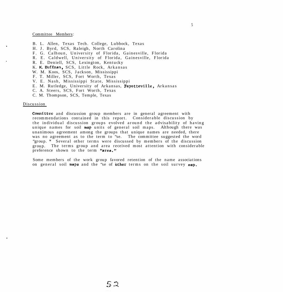
5
Committee Members:
B. L. Allen, Texas Tech. College, Lubbock, TexasH. J. Byrd, SCS, Raleigh, North CarolinaF. G. Calhoun, University of Florida, Gainesville, FloridaR. E. Caldwell, University of Florida, Gainesville, FloridaR. E. Deniell, SCS, Lexington, KentuckyK. K. Huffmen, SCS, Little Rock, ArkansasW. M. Koos, SCS, Jackson, MississippiF. T. Miller, SCS, Fort Worth, TexasV. E. Nash, Mississippi State, MississippiE. M. Rutledge, University of Arkansas, Fayetteville, ArkansasC. A. Steers, SCS, Fort Worth, TexasC. M. Thompson, SCS, Temple, Texas
Discussion
Committee and discussion group members are in general agreement withrecommendations contained in this report. Considerable discussion bythe individual discussion groups evolved around the advisability of havingunique names for soil map units of general soil maps. Although there wasunanimous agreement among the groups that unique names are needed, therewas no agreement as to the term to “se. The committee suggested the word“group. ‘I Several other terms were discussed by members of the discussiongroup. The terms group and area received most attention with considerablepreference shown to the term “area.”
Some members of the work group favored retention of the name associationson general soil maps and the “se of &her terms on the soil survey map.

Hap ScaleInches
Per YilCninimun sireDeline.tio.1
hectares
1:500
1:2.000
1:5,000
1:7.920
1:10.000
1:12,ow
1:15.840
1:2o,ow
1:24.000
1:31.680
1:62.500
1:63,3M)
1:100,000
1:125.000
1:250.000
1:3w,ooo
1:500.000
1:750.000
126.7 0.0025 0.001
31.7 0.040 0.016
12.7 0.25 0.10
8.00 0.62 0.25
6.34 1.00 0.41
5.28 1.43 0.57
4.00 2.5 1.0
3.17 4.0 1.6
2.64 5.7 2.3
2.00 10.0 4.1
1.01 39 15.8
1.00 40 16.2
0.63 100 40.5
0.51 156 63
i-1.25 623 252
0.21 a97 363
0.127 2.500 1.000
0.084 5.600 2.270
1:1.000,000 0.063 10,000 4,000
1:5.000.000 0.013 249,000 101.000
1:7.500,000 0.0084 560.000 227,000
1:15.000.000 0.0042 2.240.000 907,000
1:30.000,000 0.0021 9.000,000 3.650.000
1:88.000,000 0.0007 77,ooo.ooo 31,2W,OOO
+he "minimum sire delineation" is taken a~ a k& inch square are. (1116 6q. in.).CsrtoSrephically. this is about the smallest are. in which . symbol can be printedreadily. Smaller areas car be delineated. and the symbol lined in from outside.but such very small delineations drsstically reduce map 1eSibility.
Chapter 2

Chapter 2

GENERAL SOIL SURVEY UNIT SOIL SURVEY UNIT
* 5 . Smilhdde-Providence o*sociafion
Mainly gently sloping to hilly, well drained nnd moder-ately well drained, hwny soils; some have a fragipm;
. on uplandsThis association is on uplands that are dissected by
intermittent streams in narrow valleys and by manyshort drainageways. It has long, winding, narrowridgetops and sloping to very steep side slopes.
This association makes up about 41 percent of thecounty. Smithdale soils make up about 40 percent ofthe association, and Providence soils about 26 percent.Loring, Sweatman, and Tippah soils, which are onhills, and Collins, Gillsburg, and Iuka soils, which arein narrow valleys, make up most of the rest.
Smithdale soils are on side slopes, and they are welldrained. The surface layer is sandy loam, about 11inches thick, that is dark grayish brown in the upper4 inches and brown in the lower 7 inches. The nextlayer is yellowish-red, friable sandy clay loam to adepth of about 38 inches, yellowish-red sandy loam to adepth of 52 inches, and red sandy loam to a depth of80 inches.
Providence soils occupy mainly ridgetops and mod-erate side slopes, and they are moderately welldrained. The surface layer is dark yellowish-brown siltloam about 4 inches thick. The next layer is about 25inches thick. The upper 8 inches of this layer is yel-lowish-red, friable silty clay loam, the next 8 inches isstrong-brown, ‘friable silty clay loam, and the lower 9inches is strong-brown, friable silt loam. Below this,and extending to a depth of about 57 inches, is a firm,compact and brittle fragipan. The fragipan is darkyellowish brown and has light brownish-gray mottles.It is silt loam in the upper part and loam in the lowerpart. The underlying material, to a depth of about 65inches, is yellowish-brown sandy loam that has light-gray mottles.
About ‘70 nercent of this association is wooded. Thenarrow bottoms and less sloping areas are used forcrops and pasture. Selected sites yithin the associa-tion are suitable for the development of industrial,commercial, or residential areas, but the steep slopesin most of this association are a severe limitation tothese uses. Fishing, hiking, and horseback riding aresuitable recreational uses. This association is suited toopenland and woodland wildlife.
Smithdale-Providence awociation, hilly (SpE).-Thisassociation is on rough, hilly uplands. It consistsof well drained Smithdale soils and moderately welldrained Providence soils. The Smithdale soils aremainly on the steeper side slopes that are broken bymany short drainageways. The Providence soils aremainly on the narrow ridgetops and, in some places,are on the upper parts of the side slopes. Slopes are 8to 35 percent. The composition of this association ismore variable than that of most other mapping unitsin the county, but mapping was controlled well enoughfor the expected use of the soils.
Smithdale soils make up about 59 percent of this as-sociation, Providence soils about 18 percent, and in-cluded soils the remaining 23 percent.
One of the Smithdale soils has the profile describedas representative of the Smithdale series.
The Providence soils have a surface layer of siltloam, about 6 inches thick, that is dark grayish brcwnin the upper ‘2 inches and is brown in the lower 4inches. The next layer, reaching to a depth of 27inches, is strong-brown silty clay loam in the upperpart and strong-brown silt loam in the lower part.Below this layer is a fragipan about 25 inches thick.The fragipan is dark yellowish-brown silt loam in theupper part and dark-brown loam in the lower part. Itcontains common light brownish-gray mottlesthroughout. It is underlain by yellowish-red sandyloam that extends to a depth of about 73 inches.
Included in mapping were areas of Sweatman soils,Tippah soils, loamy soils that have a sandy surfacelayer 20 to 40 inches thick, and Iuka soils in narrowdrainageways. Also included were a few areas oferoded soils.
Runoff is rapid, and the hazard of erosion is verysevere. Available water capacity is medium in theSmithdale soils and medium to high in the Providencesoils. Permeability is moderate in the Smithdale soilsand moderately slow in the Providence soils. Reactionis strongly acid or very strongly acid in the Smithdaleand Providence soils.
Almost all of the acreage of this association iswooded. The soils are better suited to pines and hard-woods than to other plants. They are poorly suited tocrops and pasture plants because of slope and the verysevere hazard of erosion. (Capability unit VII+2;Smithdale soil in woodland group 301; Providence soilin woodland group 301)


Y

1 .
1976 Southern Regional Soil SurveyTechnical Work Planning Conference
April 5-8, 1976
Committee V - Improving Soil Survey Field Procedure8
Chairman - Richard L. GuthrieVice-Chairman - Arville B. Touchet
1. Make a survey of training needs for soil survey personnel insoil-vegetative relationships and in the relationship betweensoil, geomorphology and geology.
2. Study and identify physiographic regions that lend themeelvesto broadly defined mapping units.
3. Identify conditions under which assistance from technical andnon-technical aids would benefit soil survey work.
4. Explore techniques for improved noie-taking during the eoilsurvey.
Committee Report
Charge 1
The survey of training needs in the relationship between roil-plantand soil, geomorphology and geology indicates an apparent weaknessamong most soil scientists. University courses, the soil scienceinstitute, and soil correlation workshops were listed as sourcesof this kind of training. Less than half of the soil scientistsin the units responding to the survey have attended the soil scienceinstitute or a soil correlation workshop. Most soil scientistsdon't take college courses which teach either soil-plant or soil,geomorphology and geology relationships, unless they go beyond theB.S. degree.
All the responses indicated a need for additional training in soil-vegetative relationships and soil, geomorphology and geology relation-ships. Strengthening college curricula was the most often mentionedidea to improve training. This proposal certainly has merit, butmay not reach soil scientists who are already working. Some soilscientists should be encouraged to return to college.

Training by state program specjalists and by knowledgeable soilscientists may be to" often overlooked. Most committee memberssugge~sted that training in soil-vegetattve relationships could beprovided by plant science special~ists on the job or in workshops.
Ffost respo~es suggested that s,,jl, t:c~;,lo~l'holtrgy and geologytraining shoul~d be given by someone trained in geomorphology. SCSemployee development units have the capahil~ity and facilities forarranging this kind of training.
summarJ..~..__
A survey was made of training weds in soil-vegetative and in soil,geomorphology and geology relationships. The survey shows that mostsoil scientists have not had adequate training in these areas.Improving college curricula, training in soil-vegetative relation-ships by plant science specialjsts, nnd training in soil, geomorphologyand geology relationships by trai,ned gepmorphologj~sts were listed asmethods of providing additional tr;ijniny:.
Kecommfndati.ons
1.
2.
3.
4 .
5.
6.
Encourage potential soil scie~ntists to study cc~-~l~op,y andgeomorphology if these courses art: nvailahle.
Encourage student summer trainees that are likely to returnto take courses in ecology and geology.
Party leaders and plant special,ists should strive to give more"n-the-job training in soil-vegetative and solil~, geomorphologyand geology relationships.
SCS-EDU should continue the Basic Soil Survey and Soil Correla-tion courses for the beginning soil scientists and for theadvanced soil scientist. These courses are to he held in PortWorth where models are set up for geology, geomorphology, ecologyand soil survey training.
States should develop short cou~rs?s in cooperation with theuniversities, if necessary, to ntrcn~then the soil scientistsconcepts of geomorphology and ccolofv.
Encn~~rage high-potential soil scicnt.ir;t~ to return to collegeto do graduate work.

3
Scvcral physiogmphic areas in thr: South al~pcar to he best suited.for broadly defined uapping units. Some of the areas, listed bystate, are:
Alabama - Southern Piedmont, Soutllern Coastal PlainArkansas - Ouachita Mountains, Arkans;!s Valleys and RidgesGeorgia - Blue Ridge, Atlantic Coast ElatwoodsKentucky - Cumberland Plateaus and MountainsTennessee - Cumberland Mountains, Glue Ridge, Southern
Appalachian Ridges and Valleys
Guidelines were suggested for determining what factors should beconsi.drred in designing mapping units for broadly defined units.l'reaent and projected land use were mentioned hy all those respond-ini; to this charge. Landscapes, geology, geomorphology, topography,and complexity of soils were factors mentioned by some of theIXJsp0IIdeots. A coxien~us of the committee is that land use pro-jcctions should be the major factor in determining what kinds ofn!apping units arc needed in a particular survey.
Sum"!ary~~~. ._._..
Scvcral physiographic regions in the Sorrth IJCI'~ idcntl~fied as areasthat lend themselves to broadly defined wppin]: units. Factors tor:onside!r in dfsi~gni~ng mapping unit s were discussed and land use,hot:h present and future, was listed most frequently.
Recomnendations__..._..~._.._.____..____
1. The use of brondl~y defined mapping units should be encouragedin regions where projected land use lends itself to broadlydefined unit-c:. Areas of j~nteusive use should be mapped usingnnrrovl.y defined units.
2. More training in the desi&n of broildly defl~ncd mapping unitsand more training in the maJpin{: of broadly defined unitsshould bc provj~ded for soil srjr!ntir.ts involved in these areas.Requests for assistance from I‘SL: (il. St~atc Staff should beencouraged in these areas.
Chase 3- ~__
Some duties related to soil survey could be performed by technicalor non-technical aids. Technical aids might be required for somejobs, but most could be performed by non-technical aids. Trainingwould be necessary for both kinds of aids.

4
As SCS state offices now have the responsibil,ity for map compilationof published surveys, soil survey field time must inevitably bereduced unless other parsons can be utilized to compile maps. Insurvey areas where photobase map sheets are available early in thesurvey, aids can be utilized to transfer penciled soil boundariesfrom field sheets and ink them on overlays. This allows the soilscientist to forego inking and allows the maps to be compiled con-current with mapping if quality control through correlation proce-dures is adequate. This procedure requires close supervision by asoil scientist and demands that he accurately place soil boundarieson the field sheet.
Other jobs can be handled by aids, Esther in the field or in theo f f i c e . In the field, an aid could operate equipment, to open soilpits or install groundwater wells, for example. He could assistin running transects, taking notes, and in collecting water tableand percolation data. In the office, an aid could make colorchecks, measure map acreages, file, and prepare progress maps andtime and progress summaries.
Map compilation appears to be the acti.vity whi,ch could benefitmost.
Part time aids, district, or state aias could be used for fieldand offjce activities if available when needed.
Committee members FCXC asked to explore techniques of note-taking,including use of mark sense forms for coding mapping unit andseries. descriptions. Most soil scientists agree that more fieldnotes are needed, but techniques to improve the quantity andquality of field notes have not really been developed. Most ofthe committee members believe that mark sense forms are too formaland too complex for recording field notes.
Tape recorders have been used by some soil scientists for recordingnotes. Responses from those who have wed recorders indicate thatthey were pleased with the improvemrnt in note-taking. Recordersmay be difficul~t. to use in some situations and some soil scientistsmay not feel comfc~rtable usjng t&m, hut they offer an easy way torecord many notes. Notes can be rworded verbally in the fieldand transcri~bed j,n the office.
.
6%

5
Techniourrs for improved note-taking were explored.1 The “se ofrecorders was suggested as a new idea. The use of coding systemswas not generally accepted by this committee as a technique fornote-l:aking. Poor note-taking may be due either to a lack ofmotivation or due to uncertainty about what kinds of notes areweded.
Recommendations.~__^__._.__
1. Guidelines containing specific examples of kinds of fieldnotes, such as narratives on delineations, landscape relation-ships, sketches and simple block diagrams should be providedto fiel~d soil. scientists.
2. Continue to explore techniques in note-taking with strongemphasis on the use of tape recorders and mark sense forms.
General Recommendations-.._-_-
Continue Committee 5 and charge it with (1) developing specificguidsl,ines in the southeast for designing broadly defined mappingunits, (2) training soil scientists in mapping broadly definedw&its, (3) continuing to explore for better note-taking techniques,(4) looking some more at remote sensing, (5) exploring possibilitiesof group field trips on special projects, and (6) developing betterguidelines for photo interpretation.
Committee Members:_--_-~-~..____G. L. AramlettLester ErockmanJuan Colom-AvilesJ. W. FrieR. I.. Guthri~e (Chairman)K. K. HuffmanJ. H. NewtonL. A. QnandtR. P. SimsB. A. Towhet (Vice-Chairman)F’. F. !&eeler
63

Report to: Southern Regional Technical Soil Surve;: PlanningConference - Jackson, Mississippi, April 6-8, lg76
Comnittee VI: Soil Yield Potentials
Charges to Committee:
1. Evaluate procedures now in use for making andyield potentials for soil series which have aAlso, include the site correlation range datarating soils for wood crop production.
coordinating ratings of cropwide range of occurrence.system and the system for
2. Develop a procedure for predicting and testing the reliability of pre-dictions of yield potential for conwnon field crops such as corn for thesame kind of soil over a wide geographic range.
Committee Report
Discussion of Charge 1:
Opinions vary within the committee but generally the following concernsseem to be foreexist in present procedures. Gathering yield data from on-goingfarms leaves us behind the new developments in varieties, manaqement practicesand fertilizers. This would point to using more weight on research plots andannual reports from research stations.
Concern is expressed that Series is not the level of taxonomy which shouldbe considered for yield data. Here opinion varies from those who favor goingto Families on one hand to those who point out that soil moisture is probablythe single most important factor in yield and the need to incorporate slopeand erosion (phase) characteristics. Position on the slope is of significantimportance to this concept. Soil depth to both physical and chemical (Altoxic) restricting layers are important to soil yield potential evaluations.
The comittee had little comment on the range index, probably reflectinqexperience in this area. Weight of native vegetation from properly managedsites would probably furnish the most accessible and reliable data for derivinga prediction equation.
Woodland, site index seems fairly satisfactory but perhaps some attentioncould be given to expressions of cords, cubic volume or board feet. Also,concern is expressed about predictions for the new genetic superior trees.As to the evaluation per site, there is a qreat deal of concern about themoisture parameters as affected by such factors as aspect and slope position,i.e. , non-taxonomic criteria.
Discussion of Charge 2:
Ideas for developing a procedure for predicting and testing the reliabilityof predictions of yield potentials were rather limited. Expressions of

2
average bu/ac or similar values are desirable since they ;jrc! easily convertedto economic values by bankers, tax assessors and other investors.
Because all possible uses of the soil must be considered ,itl boi.h t11itaxonomic classification and the establishment of map units, the developmentof a technical classification using criteria of specific importance to specificcrop yield potential may have some merit. This is presently done for woodland,wildlife, septic fields and most other interpretive purposes.
Testing predictions with crops is a difficult task and because of changesin varieties, insect control and year to year weather variability, absolutecomparisons are nearly impossible.
Three suggestions are made in this regard:
1. Reduce, for comparison purposes, yields from well identified sites to anindex. For example, select a given soil and each year assign the yieldon that soil a value of 100. Arrange yields from other soils each yearas a ratio or percent of that index site yield. Thus, if the index siteyields 40 bu of soybeanslac in 1975 and site B yields 50 bu of soybeanslacin 1975, site 6 has an index of 125. Likewise, for example, with site Cyielding 30 bu soybeanslac would index as 75. If in 1976, the indexyielded 30 bu/ac; site B 40 bu and site C 20 bu, the index would reflect100 for the index site, 133 for site B and 67 for site C.
2. Since moisture during the growing season has been identified by numerousstudies to be a big variable, a probability of yield rather than an averageyield could maybe be developed. For example, this would say that 2 yearsin 10 the yield may project as 40 bu/ac; 5 years in 10 average 30 bu/ac;2 years in 10 yield equals 20 bu/ac and 1 year in 10 total failure. Thismay help convey to money lenders the real risks involved in farming.
3. Develop groupings of map units based on specific management criteria foragronomic management interpretations (see Appendix I).
Summary and Conclusions
No conclusions or recommendations are unanimous within the committee. Itappears that the majority favor paying more attention to slope and thickness ofroot zone criteria in evaluating yield potentials than is possible by using onlythe taxonomic criteria of either Series or Family. Thus, greater attention tophase criteria is needed in making yield potential ratings for crops and woodland.Rangeland discussion has not been possible by this qroup.
A couple ideas have to be advanced for discussion about using an indexmethod to test the yield potential predictions and the use of probability ofpotential yield rather than average potential yield. No testing of theseproposals has been possfble.
6 s

3
Recommendations
1, Continue reporting potential yields on absolute quantities, i.e,, bu/ac,site index, etc.
2. Use units such as cords, cubic volume or board feet, in addition to siteindex in woodland interpretations.
3. Concentrate yield data predictions on soil phases rather than taxonomicunits because of root depth, erosion, soil moisture, slope, surface texture,variations permitted within taxonomic units. Report yield data in SoilSurvey Reports by mapping units,
4. Continue this committee with at least one charge to test supgestions madewith regard to present charge No. 2.
List of Committee Members:
9. R. SmithD. E. PettryC. A. IlcGrew9. J. BirdwellL. A. DuandtD. E. LewisC. PowersW. 9. ParkerG. AydelottC. M. ThompsonFerris AllgoodII. E. Shaffer, Vice ChairmanS. II. 9~01, Chairman
Appendix I:
The following table is taken from the article, "Soil Fertility CapabilityClassification: A Technical Soil Classification for Fertility Management,"by S. W. 9~01, P. A, Sanchez, R. 9. Cate, Jr., and M, A. Granger. pp. '126-141,"Management of the Soils in Tropical America," ed. by E. Bornenisza and A.Alverado. Published on behalf of the University Consortium on Soils of theTropics by the Soil Science Department, North Carolina State University, Raleigh,North Carolina 27607.
(Although this system is developed only to aid in the interpretation of soilmanagement with respect to soil fertility and soil test, it may provide somebasis for grouping soil map units for yield predictions.)

4
Fertility-Capability Classificationv. __-_---_~.-_-.--____~..-
TYPE: Texture is average of plowed layer or 20 cm depth, *8") whatever isshallower.
S = Sandy topsoils: loamy sands and sands (USDA).L = Loamy topsoils: c 35% clay but not loamy sand or sand.C = Clayey Topsoils: < 35% clay.0 = Organic soil: > 30% 0.11. to a depth of 50 cm or more.
SUBSTRATA TYPE: Used if textural change or hard root restricting layer isencountered within 50 cm (20").
S = Sandy subsoil: texture as in type.L = Loamy subsoil: texture as in type.C = Clayey subsoil: texture as in type.R = Rock or other hard root restricting layer.
CONDITION MODIFIERS: In plowed layer or 20 cm (8"), whichever is shallowerunless otherwise specified (*).
*g = (Gley): Mottles < 2 chroma within 60 cm of surface and below allA horizons or saturated with H20 for > 60 days in mOstyears.
*d = (Dry): Ustic or xeric environment; dry > 60 consecutive daysper year within 20-60 cm depth.
e = (low CEC): < 4 meq/lOD soil by E bases + unbuffered Al.< 7 meq/lOO soil by c cations at pH 7.< 10 meq/lOO soil by I: cations + Al + H at pH 8.2.
*a = (Al toxic): > 60% Al saturation of CEC by ( bases and unbufferedAl) within 50 cm.> 67% Al saturation of CEC by ( cations at pH 7)within 50 cm.> 86% Al saturation of CEC by ( cations at pH 8.2)within 50 cm.s pH < 5.0 in 1:l H20 except in organic soils.
*h = (acid): lo-60% Al saturation of CEC by (z bases and unbufferedAl) within'50 cm.s pH in 1:l H20 between 5.0 and 6.0
i = (Fe-P Fixation): "6 free Fe 0 /% clay > 0.2 or hues redder than5 YR and &&ular structure,
I/Proposed Feb., 1974.

5
(continued)
x = (X-ray amorphous): pH > 10 in 1 N NaF or positive to field NaFtest or other indirect evidences of allophanedominance in clay fractions.
v = (Vertisol): Very sticky plastic clay > 35% clay and > 50% of 2:lexpanding clays;COLE > 0.09. Severe topsoil shrinking and swelling.
*k = (K deficient): c 10% weatherable minerals in silt and sandfraction within 50 cm or exch. K ~0.20 meq/lOOg or K < 2% of I of bases, if J: of bases < 10me'ii-/100 g.
*b = (Basic Reaction): Free CaC03 within 50 cm (fitting with HCl) orpH ' 7.3.
*s = (Salinity): > 4 mmhos/cm of saturated extract at 25°C within 1meter.
*n = (Natric): > 15% Na saturation of CEC within 50 cm.
*c = (Cat clay): pH in 1:l H20 is < 3.5 after drying, Jarosite mottleswith hub 2.5Y or yellower and chromas 6 or morewithin 60 cm.

.
SOUTHERN REGIONAL SOIL SURVEY WORK PLANNING CONFERENCEJACKSON, MISSISSIPPI
April 5-8, 1976Chairman - Bobby T. BirdwellVice Chairman - Joe A. Elder
committee VII - Major Land Resource Areas
Charges to Committee:
1. Review Soils Memorandum-49 and USDA Agriculture Handbook 296,Land Resource Regions and Major Land Resource Areas of theUnited States.
2. Test the adequacy of the concept of land resource regions andland resource areas.
3. Prepare a revised map and descriptive legend for the southernstates' portion of the "Land Resource Regions and Major LandResource Areas" map if changes are recommended.
Commtttee Report:
Charge 1. - Review of Memorandum and Handbook
Soils Memorandum SCS-49 merely transmitted the map "LandResource Regions and Major Land Resource Areas of the UnitedStates (48 Coterminous States), " 1963, and suggested how itmight be used.
USDA Agriculture Handbook 296, Land Resource Regions and MajorLand Resource Areas of the United States should be updated. Inthe text soils are referred to as great soil groups of themodified 1938 yearbook classification, and should be revised toreflect classes in soil taxonomy. The dominant physical charac-teristics of each of the major land resource areas should bedescribed under the following headings and in the order listed:
1. General Description
2. Soils
3. Climate
4. Water
5. Use

2
Two attached descriptions illustrate what we believeshould be contained under each of these headings.
Charge 2. - Test the adequacy of the concept of land resourceregions and land resource areas.
The concepts of both of these broad levels of generalizationseem adequate to the needs for which they are intended.
Charge 3. - Prepare a revised map and descriptive legend for thesouthern states' portion of the "Land Resource Regions andMajor Land Resource Areas" map if changes are recommended.
The committee believes the existing map should be revised toreflect current knowledge of the relationship between soils andlandscapes. Furthermore, the cormnittee believes a map showingthe major land resource areas of the south should have a photo-graphic base which illusttiates the spatial relationships ofsoils. We, therefore, obtained a mosaic of Band-5 ERTZ imageryfor use as a photo base. The mosaic provides a synoptic viewof the whole region which lets us observe the full extent ofeach area.
Band-5 imagery records electromagnetic energy in the 0.6-0.7micrometer region of the spectrum. The spectal energy comingfrom various earth features, including soils and vegetation,exhibits unique tonal "signatures" on the image. Similarvegetative, climatic, geologic and topographic environmentshave unique signatures and are easily identified as "photomorphic"areas on the image.
Each member of the committee delineated on an ERTZ mosaic ofBand-5 imagery the major land resource areas he believed shouldbe shown on a revised regional map. Most of the delineationscorresponded closely to the tonal signatures on the imagery.
Believing that there is a very close correlation between imagesignatures and major land resource areas, we decided to visuallyanalyze the imagery and delineate what we choose to call "photo-morphic areas" on the mosaic of Band-5 imagery. Photomorphicareas as used here simply refer to areas that, in the opinionof the image analyst, have the same tonal signatures. No othersource material was consulted nor was there an attempt to"match" an existing map of the south region. The analyst simplydelineated those areas that he could "see".

3
Recolmnendations:
1.
2.
3.
4.
5.
6.
The USDA Agriculture Handbook 296 should be updated, both textand map, to refer to soil in terms of classes of soil taxonomyand to increase the accuracy of the map by using satellite imagery.
The committee realizes that ERTZ imagery cannot by itself beused to generate a map of the major land resources of the southregion. It does believe, however, that satellite imagery canbe a very useful tool in updating such a map and that it hasimmediate practical use.
We recommended that the states objectively test the photomorphicareas that are shown.on the map using higher-resolution, largerscale imagery, existing maps and other source materials, groundtruth and personal experience and observation, and report theirfindings to the committee chairman.
If, after testing, the photomorphic areas are reasonable or canbe modified to represent major land resource areas, they must benamed or renamed as needed. We chose not to try to name theunits, preferring rather that those who test them supply thename and map symbol.
A period of not to exceed one year should be allowed for testingand finalizing the map and text before any attempt is made topublish it.
Time should be allocated tp this committee for it to meet,discuss its charges, and pursue a course of action that willhelp accomplish its task. Cormnittee action can be best achievedin committee meetings.
The committee should be continued and given the responsibilityof coordinating all ongoing activities and efforts to reviseand publish the handbook.
Committee Membership:
Glenn BramlettJ. F. BrasfieldJ. R. CooverErling GambleR. L. Googins
W. M. KoosLester LoftinC. A. NcGrewB. J. Wagner
Bobby T. Birdwell, Chairman Joe A. Elder, Vice Chairman

NASHVILLE BASINTENNESSEE
Any No. Square Miles
General Description:
The Nashville Basin is an interior lowland encircled by the HighlandRim. It consists of two segments -- the outer and inner parts. Theouter part, underlain almost entirely by phosphatic limestone, is deeplydissected and consists of steep slopes between narrow rolling ridgetopsand narrow valley floors. The inner part, underlain by clayey limestone,is smoother than the outer part and its average elevation is lower. Thesurface, except for a few isolated and narrow ridges, is undulating torolling. There are extensive smooth areas of "Glady Land" or areas thathave numerous outcrops of limestone. In numerous places through~out theBasin the land surface is deeply pitted by limestone pinks and outcropsof limestone rock can be seen nearly everywhere. The common elevationof the Basin Langes between 600 and 800 feet above sea level, butisolated hills rise to elevations of 900 to 1300 feet.
Soils:
Most of the soils in the Basin formed from limestone-phosphaticlimestone in the outer part and clayey limestone in the inner. Few ofthem are more than 6 feet deep over rock. Generally, the depth to rockis between 1 and 4 feet and some soils occur mostly as small patchesamong outcrops of limestone. Generally the soils are medium acid andstrongly acid and become less acid with depth. They are predominantlywell drained and have subsoils rich in clay. More than one-half of thesoils are high in phosphorous. The main soils on the uplands in theouter part of the Basin are Hapludalfs (Mimosa, Hampshire and Stivers-ville) and Hapludults (Dellrose). On the footslopes and terraces areHapludalfs (Armour). In the inner pait of the Basin the main soilson the uplands are Hapludalfs (Talbott, Colbert, and Bradyville),Rendolls (Gladeville) and Hapludolls (Barfield). Ther,e.,are smallisolated bodies of Paleudalfs (Lomond and Cumberland) which formed inold alluvium. Soils on the bottomlands are mainly Hapludolls ( Arrington,Lynnville, and Egam) and Haplaquolls (Godwin and Roellen).
Climate:
The average annual precipitation is about 50 inches, which normallyprovides adequate moisture for farming and enough water for other needs.Even short dry spells are rather serious in the Basin because of therather shallow soil depth and limited capacity for available water stor-age. Precipitation is greatest during the period January 1 to April 30,and about one inch of this falls as snow. Least precipitation is duringthe period August 1 to November 30 because of the greater fraquencyoofhigh pressure systems. The average annual temperature is 58 to 60 F.,and it varies little throughout the Basin. Average date of the lastfreeze in spring is April 12 and average date of first freeze in fallis October 21, giving an average growing season of 192 days. The ground
72

2
freezes to a depth of 2 to 4 inches two to five times during theaverage winter season and connnonly remains frozen for 2 to 7 days.
The moderately high rainfall generally provides adequate moisturefor crops and pasture, but occasional short summer droughts reduceyields. Irrigation of crops is rare in the Basin. Permanent streamsand lakes occupy 120 square miles. The Cumberland River has dams forflood control, power production, navigation, and recreation. Numerouslarge areas lack surface water because it flows into undergroundchannels in the cavernous limestone; here, farm ponds and deep wellsprovide water for home and livestock use. In many places water linesfrom metropolitan areas extend far into the countryside.
The densely populated Nashville Basin is mostly in small and mediumsize farms. Urban expansion, particularly around Nashville, has useda large acreage for residential development and small estate-type farms.About 15 percent is in forest consisting mostly of large rocky areascommonly called "Glady Land" which are in cedar or a mixture of cedarand deciduous brushy growth. Hay, pasture, and feed grains for beef anddairy cattle are the principal crops. Small acreages of tobacco, cotton,and soybeans are grown.
73

GRAND PRAIRIETEXAS AND OKLAHOMA
Any No. Square Miles
General Description:
The area is mostly a gently rolling to hilly dissected limestoneplateau, with the low rugged Arbuckle Mountains in the northern part.Stream valleys are shallow and narrow in the upper reaches but broaderand deeper near the eastern edge of the area. Broad areas in centralTexas are gently sloping but steep slopes border the valleys of largerstreams, along the sideslopes of flat-topped plateaus and in most ofthe Arbuckle Mountains. Relief is mainly in tens of feet, but the largevalleys are 100 feet or mea-e below the adjacent uplands. Elevation ismainly 500 to 1300 feet, but ranges from 1300 to 1500 feet on some ofthe high peaks in the southwestern parts and in the Arbuckle Mountains.
The soils are mostly alkaline, .well and moderately well drained,very shallow to deep. Some are stony or gravelly. They are moderatelyfine and fine textured soils and have montmorillonitic, mixed or carbon-atic mineralogy. Moderately deep to deep Pellusterts (San Saba, Branyonand Slide.11 series) and Chromusterts (Crawford and Sanger series) are onnearly level to gently sloping uplands, upland valleys and ancient streamterraces. Shallow to moderately deep Calciustolls (Purves, Bolar andDenton series) are on the smooth gently sloping uplands. Very shallow toshallow, mostly stony or gravelly Haplustolls (Aledo and Eckrant series),Calciustolls (Tarrant, Purves and Doss series) and Argiustolls (Speck andTarpley series) are on the gently rolling to hilly limestone ridges andplateaus. Shallow, gravelly or stony Ustochrepts (Brackett series) andCalciustolls (Real series) are on the steeper-sideslopes of the plateausDeep, well drained Haplustolls (Krum series), Argiustolls (Blanket series)and Calciustolls (Venus and Lewisville series) are on outwash in the valleysand along stream terraces. Deep, well drained Haplustolls (Frio, Basqueand Gown series) are in the flood plains. In the north part of the areadeep Argiustolls (Durant and Newtonia series) are on the smooth uplands.Shallow, stony Haplustolls (Kiti series) and Rock outcrop occupies theArbuckle Mountains in the north part of the area.
Climate:
The average annual precipitation is 28 to 40 inches and is mostabundant in spring and fall months. More than half of the precipitationfalls during the frost-free period. Summer moisture deficit (June-August)ranges from about 5 inches in the north part to about 10 inches in thesouth part of the area. Annual P-E index - 42 to 6't. Average annualtemperature - 63' to 70° F. Average freeze-free period - 200 to 260 days.

water:
The moderate but somewhat erratic rainfall supplies the moisturefor crops, pasture and range. The large rivers flow the year round
2
and there are several large lakes and flood detention reservoirs inthe area. These are potential scaurces of water for irrigation but arelittle used at the present. Deep ground water is abundant and thereare many springs and wells throughout the area.
Land Use:
Most of the area is in farms and ranches. Urban development isexpanding in the central and southern parts of the area. More than40 percent of the area is in native rangeland consisting of mid andshort grasses, bunch grasses, mesquite, scrub oak and juniper. Liveoak motts are common in the central and southern parts of the area.About 15 percent of the area is in improved pastures. Beef cattle arethe principal livestock, but dairy cattle and sheep are important inthe central and southern parts. Deer and wild turkey hunting leasesare an important income source in the southern part.
The deeper soils of gently sloping uplands and in valleys andbottomlands are in cropland. The cropland areas make up about 23percent of the area. Oats, wheat, grain sorghum, forage sorghum,cotton, corn and hay are the principal crops. Native pecan orchardsare cornnon along the flood plains.
-7 g


NATIONAL COOPERATIVE SOIL SURVEY
Southern Regional Conference Proceedings
Mobile, AlabamaMarch 1 I-15, 1974
Distribution Letter . . . . . . . . . . . . . . . . . . . . . . . . . . . . . . . . . . . . . . . . . . . . . . . . . . . . . . . . . . . . . . . . . . . . . . . . . . . . . . . . 1
Contents . . . . . . . . . . . . . . . . . . . . . . . . . . . . . . . . . . . . . . . . . . . . . . . . . . . . . . . . . . . . . . . . . . . . . . . . . . . . . . . . . . . . . . . . . . . . . 2
Agenda ............................................................................................... 3
Participants.. ....................................................................................... 5
General Session I ................................................................................. 8
General Session II - Minutes.. ............................................................... 11
Committee Reports ............................................................................. 13
Committee 1 - Wastewater Reclamation and Disposal by Land Spreading.. 13
Committee 2 - Soil Phases ................................................................... 19
Committee 3 - Automatic Data Processing.. ........................................... 25
Committee 4 - Soil Wetness.. ............................................................... 38
Committee 5 - Histosols and Hydraquents ............................................. 4 6
Committee 6 - Soil Maps and Soil Surveys.. ........................................... 5 4
Committee 7 - Soil Suitability Potentials ................................................ 61
Report of Ad-Hoc Committee - Professional Soil Classifying.. ................... 68


.I
I


197h Southern Regioxlal Technical Work Planning ConferenceO f
The Na?.i.onal Coopratim: Soil
March 11-15, 1974Admiral Sc:nnes !lotcl - Eobilc,
Survey
Alabama
. AGENDA- -
?.!ond?v IS,rch 11__._LLL. .__.. __3:X - i>:CO ~1.n. ----- REG!STRATlDN -------- Mezzanine-Admiral Semmes Hotel
%'ues&,v, 1:1&l 13
Grv-r~~l. Se;;ion - lQllroom '!A"_~. _..__-._.._~_----~_-__- ..-
9:;0 - 9:lrJ z.m. -- Wz?!~cr?w: & Introductory Remarks -- B. F. Hajek, Chairman
9:,(, - yl:2:; ;,.n,. -.--- r.‘2,: co:nn to ElobiL? ---- Representative, City of Mobile
9:25 - ?:1~0 2.12. -.~- ~-~-.- Wr!lcomc ----- W. B. Lingl~e, State ConservationistSCS, Auburn, Alabama
9:45 -?3:05 a.m. _--_- Dr. R. D. Rouse, Dean and DirectorSchool of ~:~rLcu~turo Hnd Alabama Agricultural
I:up"~j~wnt Station - J~ubxrn U?S.versity , h~tmrn, Alabama
3

Tuesday Afternoon Session (Cont'd)-- I’ - - -I_-3:oo - &:20 p.m. -- Report from Committee V through Ad Hoc. 20 minutes each.
h:20 - li:jo p.nl. -- Announcements and Procedure for Wednesday'sWork Group Sessions
&:jO p.m. _________ Adjourn
6:oo - 7: 00 p.m. -- Social Hour -- Mezzanine
7: 15 p.m. --------- i!x,quet -- Fiallroom "B"*
&i:OG - 12:CO -- lrlork Gr~oup Sessions - Committee reports I through IV willbo discussed.
12:oo - I:15 P.". -- LUNCH --
1:15 - 5:oo p.m. -- b:ork Group Sessions - Committee reports V throughAd Iloc discussed.
Thursdsy, N?rch 11!ii~CI0 -11:oo a.m. -- ComrLttees I through Ad Hoc meet to finalize committee
r-ports for submission to conference.
Those participating in field trip will meet in lobbya I; 12:I~s to board bus for tour.
I:03 - L:OO p.m. -- 1~iiold Trip
R:OO - )):3@ a.m. -- Fro:ioni?tion of Committee Ropcrts I through VI.(I.< ~!tnut~s oath)
9:30 -‘IO:00 a.m. _- :?&'EAK --
1C:OO -~1~::3'7 a.n. -- Prtw:ntal,i.on of Conmitteo Reports VII and Ad Hoc.( 1:; Il~!1lltrs c!ach)

‘c
S o u t h e r n RcRIanal Soil Survey I!orkCroup Rcprcscntativcs
-em _... ~-.-.-~_-_..~-_.-._._._ _... _~___ _..._._. ~___~___-__~____~__~--_.~-------_-Auburn I!nivcrsity-Choim.,,,s c s - USD.\ - Yicc Cbairnmn
Alabama: B. F . llajckE. A. rcrry
Flor ida :
Cccqia:
Kentucky:
. North Carolina:
Oklshoma:
Puerto Rico:
South Carolina:
E. t!. RutlcdScC. A. ,lcCrcv
F. G. CalhounR . U. Jobncon
11. F . PerkinsH. E. Shnffer
II. ,H. BaileyR . E. Dnnicll
R. Niller1,. F . Slusbcr
H . 8. VondcrfordR. C. Carter
s . w. BualII. J. Byrd
F. CrnyW. ,I. Fuchs.
R. R. SmithR. D. I\‘c,l*
C . L. CodfreyA . L. Kwmn
n. K:. I’mtryD. Ilallbick
University of Arkansass c s - USIM
University o f Flor idaSC5 - US”A
univers i ty o f CccqsaSCS - USDA
Uni~versity o f KentuckySCS - “SD.,
Louisiana state IJniversitys c s - “SD/l
Elississlppi State Universitys c s - “S”h
Oklahoma State Universitys c s - “SD*
Vnivcrsity of Puerto Ricos c s - USDA
c1cmson “nirersiLyscs - USDA
university of Tcnnessccscs - “SD*
Terns A 6 EI U n i v e r s i t ySC5 - PUS”‘,

J. E. NeClelland, U S D A - S C S , Wasl~lnSton Office advisor to tlw Confercncc
. . .
.
.
J. K. Coovcr, Princfp.rl Sail Corrclntor, South kc&n, U S D A - S C S T S C ,Fort V’orrb, Texas
D . C . Aydclott, VSDA-Forest Scrvlcc, Atlanta, GqorCin

.
.
Cockcrlmm. w. L. - soil Corrclntor. so11 cooacrvation Se;vicc, P. 0. BOX1‘30, Alcxnndri”. I,““islnno 7 1 3 0 1 . Chirm” - Committcr ”- - -
Daniclc, K . R. - “cpilrtmcnt o f S o i l Scioncc, North Carolina Sca.tr University,Y. 0. B o x 5 9 0 7 , Ilaleigh, h’orh Cnrolinn. 27GO7. Chnirmm - Comitlr” IV--.__
DcMcnl. J. A. - Soil ScientIsr, S o i l C o n s e r v a t i o n S c r v i c c , P. 0. Box 11222,r”brt Forth. Texas 76110. CI13irww~ - C”o.x,ttre I I I-__-
,. El.lrrLc, Clarrnc” E l . Cohinbia, South Cnrolina
Green. T. F. S o i l S c i e n t i s t . U . S . Forest Service, ntlnntn, Ca., C”mjttc” 1---_
Ccrold, T. p.. - S@il C”,,srrvnti”n Se~vi~ce, 901 Sumter Street, C o l u m b i a ,Soutl, Carolina 2 9 7 . 0 1 . Phbcr - Co,N!m:tt<.c V I
Cilbcrt, F. L . - S”il Conscrvall”” Service,36S30. ~k!wr - C”n:mit,rr~ 11 6 “ I
P. 0. 80x 311, Auburn, ,,labsma,..--______
Llolzl,cy, C. s. - R o o m 3 3 3 . soils Suildi’:~:. Agriculture I:escnrch antorWCPC, Gcltsvillc. Ehrylaud 2 0 7 0 5 . I!v;:,her - Cornmitt FP ”- - -
Ilorlon, x. E. - S o i l Spcclalist,Rnl~riCll, I:“rtll Curolin”
S o i l Conscrvacion Scrvicc, P. 0. Box 2 7 3 0 7 ,27“‘. _-.___~:~r,!Lcr - Camliltec “1
Iiawley, Jo,,” I ! . - SoIl~Conscrvatlon Service, Lubbock, Texas
Huck~c. Iloracc, F. S o i l Corrclntor, S C S , Gainesvil~lc, Flarida
Koos, II. E:. - S o i l Corrolator. S o i l Conscrvetlon S c r v i c c , P . 0 . Box 61C,Jackoon, Ilisr:icsi,,pi 39205. nr:rl>cr - C”rzIl~rtw I”-
Levis, U. E. - A s s i s t a n t State S o i l Scientist,Al”hQ.l 36830
scs , P . 0 . Box 311. Auburn,
7

General session I
Narch 12, 1974 - 8:OO a.m. - 12:OO noon_-
Dr. Rcn HaM____--
Dr. Hajek welconed the group to Mobile and introduced the other speakers
whose presentations are summarized in the follqwi.ng paragraphs.
William Iwle, State Conservationist--
Mr. Lingle expressed his appreciation to the soil scientists for their
contribution to the total conservation effort and noted the increasing
. popularity of the soil survey among many leaders in agricultural fields.
Ns_mL Garv Greenour--_-,---~-.v_
Mayor Greenough gave an impressive welcome to the group in speaking of
the growing importance of technology in planning. He emphasized that "all.
decisions are based on information," that information comes from many
different sources, that people with decision making responsibi.lities are
busy and haven't tine to make in depth j~nterpretations of data, and that,
therefore, a good format for the information provided is at least as impor-
tant as the information itself.
Dean R. D. Roams___~
Dean Rouse rselcomed the group to Alabama and gave a summary of the
diwrse nature of the soils, landscapes, and agricul.ture in the state.
Dr. C. S. Ilowland - "Utilizin * our Plant Rcsourcc for Food"_____..~______---_._&-.-____~_-~__
Dr. Hoveland gave n wll prrpared and pertinent slide presentation. In
it, he discussed the amounts of different kjnds of land in Alabama,
emphnsizcd the large amount of loud suitable for growing forage, discussed
warm season grasses, cool season irasscs, and pointed out the diffcrcnccs

in the two kinds of grasses as they convert to pounds of beef per acre.
Dr. Hoveland discussed the difference between “what WC know and what we
.gr0d’ Jon reference to growing forages, soybeans, nut and fruit crops,
and grain crops.
Dr. Warren McCord - “Land Use Naking DeLisions Impact of Soi~1.s 1,nformation”___~_ --~----- -__ - -
*Dr. McCord reviewed past and present legislative proposals and legislative
actions affecting land use.
Dr. John E. ~IcCl~elland - “Dev~_lopment.s ill Soils Survgz__ -_-_I.-~_._~__
.*kixeton S t a f f i n g
Dr. McCl~el.land brought the group up to date on the staffing of the Washington
soil. survey office. He pointed out there are now 1,343 sdil scientists in
SCS wl,th 94 percent of these bci~ng on the state staffs (state office and
f i e l d ) .
Fund j~nfi- - -
Dr. PIcCl,elland outl~ined non-SCS contributions to the soil survey in FY ‘74
as folloi~s:
State and Counties $2,954,600
Private 81,000
Other Federal 812,701
Non-reimbursahlc 2 798 512--_.l_._$6,646,813
scs FY ‘ 7 4 $25,026,000
&_@q_Status
As of July 1, 1973, about 47,000,OOO acres were n~npped. This is an
accwulatcd total of 1,197,605,000 acres of 52% of U. S. and Caribbean
land area. (This includes 337,516,OOO acres exploratory.)
I’ubl~icatjon Status-..~-.-_-__-~-~_~_
The stat~us of the soil survey publication as of 6/30/73 was as follows:

Publ5~shed
In the GPO(90 went in F"f 73)
675 313,000,000 acres
171 90.000.000 acres
Mapping completed 377 196,000,OOO
1ncomplct:ed soi. surveys 642,000,OOO
Dr. McClelland pointed out that 80 soil surveys were completed and 90
went to the GPO in FY '73.
The gall~ey has been reviewed. It is hoped to have it publ~ished before
the end of the year.
0t:her P u b l i c a t i o n s____~~
The soil survey manual is in the 3rd draft. i National Poli~cy Guide_- ~._ __. ____.._~_
and a National Soils Handbook is being prepared.
Dr. McClelland briefly outlined these procedures. The Principal Soil '~
Correlators will serve as chairmen, there will be three Agriculture.
Kxperj.ment Stntlon Reprcsentativcs, and three federal (SCS) representa-
lives. Review procedures will won be sent out for comments.

General Session II
.
Minutes- -
Friday NorningMarch 15, 1974
Meeting called to order by Ben Hajek.
Yinal reports of each Comnlittce were presented. by the chairman of each
Committee. All reports accepted. Ben Hajek express thanks to Conuni.ttws
for their efforts. Requested 150 copjcs of each committee report by June
1, 1974.
Break
>lceti,ug called to order by Ben Hajek.
Business i~tems called for.
(1)
(2)
(3)
(4)
(5)
(6)
(7)
Rcyort on status of Southern Rcg$on+l Soil Nap. (Stan Buol)
Notion made to reprint map by Stan Buol~-Dement second.
Motion carried.. SCS agreed to pay cost.
Moyt! Rutlcdgr: reported on progress of Soil Science Society of America
Commi~rtee on efforts to adopt a pnrticlc size scale that wou1.d bc
standard for cngjneers, soil scientists, geologists, etc.
Steve Hol.zhey (SCS) informed the group of an up-coming runoff and
infiltration study to be conducted in the near future by AKS.
Dr. Jack Perkins (Univ. of Ga.) member of Southern Soil Region
Research Comiuittee pointed out the wed for the continuation of the
collcgcs l'articipnti~on Corx!!i.ttec and thr need for a working pl~ace
in thr Southern liegional Work Planning Conference. Several confcrer1ce
riwrnbcls express ideas concfrning itrms nccdinp. attcnti~on at future
nrcctings.
Call for remarks by Forest Service - representatives not prcscnt.
Jack NcClell.and invi~ted to mnkc closinS rcmnrks.
R. C. Cortcr (Niss.) cxtendcd an Invitation to hul~d thr llcxt
wrkplnnt>i~~S confcrcnce in Jackson, Miss. Motion made, second and
cnrrivd.
(8) JJm Cower invited to make
present Taxonomy Amendment
closing remarks. Coovcr ask to renominate
Committee. Due to two vacancies two new
member-s were necdcd. E. A. Perry took chair for Ben Hajek; Hajck
appointed to Taxonomy Admendment Committee to reprcscnt Colleges.__-
WCS Fuchs appohted to represent SCS.

.
.
SOUTHERN REGIONALTECHNICAL WORK-PLANNING CONFERENCE
OF THE COOPERATIVE SOIL SURVEY
Mobile, AlabamaMarch 11-15, 1974
Chairman: Westal W. FuchsVice-chairman: Robert W. Johnson
COMMITTEE IWASTEWATm RECLAMATION AND DISPOSAL BY LAND SPREADING
CHARGES TO THE COMMITTEE
1. Develop soil suitability guides for treatment of municipal sewagewastewater by land spreading for taxonomic soil groups. l/
COMMITTEE REPORT
After this charge was developed, a national interim guide, AdvisorySoils-14, was released for rating soils for disposal of waste. TheCommittee reviewed this guide in light of the charges, and especiallyrelated to the following questions:
1. What changes or additions would improve the guide?
2. How can this guide be better related to taxonomic soil groups?
3. What short range testing can be done prior to our report, andwhat are the long range investigation needs?
4; Other recommendations related to the charge given this conunittee?
Suggested changes or additions to interim guide:
1. Waste should be defined in the first paragraph to avoid confusionwith the kind of waste put into a sanitary landfill. This can be doneby wording to exclude junk, garbage and trash.
____________________11 See letter from Homer A. Taff to B. F. Hajek and E. A. Perry
(attach 1) and the Comittee XI report to the Southern RegionalSoil Survey Work-Planning Conference, May 1972.
- _- 13

2
2. LOW application rates and high application rates were a point ofmuch discussion. Application rates where the minimum water is usedfor the maximum production is a common irrigation principle. K=~nycommittee members felt that any water application beyond this point"as a high rate system. In most disposal, the object is to reclaimthe maximum water, with or without marketable production, using thesame principles of soil and crop filtration, biological activity anduptake or immobilization of minerals. All recognized, however, thisshould not be confused with hydraulic loading or Rapid Infiltrationsystems "here the soil is used only as an entrance medium for disposalby underground recharge.
3. Further study by the committee indicates the items affecting use areessentially the same for irrigating soils and growing plants regardlessof maximizing production or maximizing water reclamation. For thesereasons, we reccmunend table 1 in Advisory Soils-14, as well as the textexplaining the table, omit reference to low rate. It should reflect its usefor reclaiming wastewater by irr,igation where the soil acts as afilter, in addition to supporting plant growth.
4. We recolronend that a separate table be developed for rating soils forreclaiming wastewater where the soil does not act as a filter, but supportsplant growth which serves as the filter. This system is connnonly calledoverland runoff or overland flow.
5. Infiltration rate, though quite important, is not presently expressedto serve at arriving at a limitation rating. The application intakerate would be most valuable, however this is not available for mostsoils of the Southern Region. We recommend infiltration rate be deletedfrom table 1.
6. Ratings soils for "flooding only during non-growing season" willrequire more than pedological~data, and may involve a design usingwinter or summer crops as appropriate. We recommend table 1 be changedto read "severe - soils subject to flooding".
7. Temporary vs permanent installation seems to relate more to designthan to soil limitation for reclaiming wastewater. We recommend bothbe deleted from table 1 and retain available water capacity as "slight>7.8 inches, moderate 3 to 7.8 inches, and severe ~3 inches".
. .
.

8. The comitteeadded to table 1.
a. Depth to
b. Depth to
C. Slope
3
recommends three additional items affecting use be
water table
bedrock
S l i g h t Moderate Sl?Vf!re>60” 30-60” <30”
>60” 40- 60” <40”
<5% 5-12% >I 2%
In addition, change flooding to “moderate-none, severe-subject to flooding.”
9. The items affecting use for irrigation with soil as a filter,tsble 1of Advisory Soils-14, are essentially the same as for solid wastes,table 2. For this reason, we suggest the tables 3e combined.
How can the guide be better related to taxonomic soil groups?
Most of the items affecting use are directly related to soilfamilies. To relate best to taxpnomy, the use of cognate groups wouldbe most helpful in developing a guide. After the significant itemsaffecting use are determined, a second or additional guide can bedeveloped related to taxonomy, as well as the lowest possible levelsuch as phases of series.
What short range testing can be done, and what are the long rangeinvestigation needs?
1. Short range testing could be done on a few benchmark soilsusing the criteria of the national guide. Judgments by those who knowthe properties of the selected soils may lead to refinements of theguide.
2. For the most part, problems encountered in disposal by landspreading do not lend themselves to short range testing. An investiga-tion of on-going systems with these national criteria, or with revisedcriter ia , would help identify the desirable soil parameters and taxonomicsoil groups most effective for waste disposal.
3. Long range investigations should be concentrated on irrigatingto maximize water reclamation through the use of both soil and plantsas a filter. This area has the greatest lack of predicted response,and because of growth pressure is receiving the most attention as adisposal method.
I5

4
4. Disposal sites on extensive soils should be monitored, anddata used to develop and refine the guide for high application rates.Groupings should be made of soils with similar behavior.
Other recommendations
1. The present guide does not consider the effectof moisturesurplus areas as compared to moisture deficient areas and therelationship with other items affecti.ng use, such as available watercapacity, permeability and runoff. We recommend new guides be preparedby major moisture regimes, such as udic, ustic, aridic.
2. Limitation ratings are not enough; we need to highlight theproblems that can be overcome by design, and show the potential aftertreatment or installation.
3. Locate by mapping procedures those soils on broad landscapeswhere waste disposal by land spreading might best be suited. Place ahigh priority on mapping these soil areas in close proximity to themunicipalities where land spreading may be needed.
4. Many states have specific laws in effect prescribing variouscriteria relating to liquid and solid waste disposal. These laws arenot similar in each state, and regardless of a uniform soil interpre-tative guide, the specific state regulations must be considered. Itmight be useful to summarize exLsti.ng laws and regulations forincorporating into a soil interpretative guide for the Southern Region.
SUMMARY AND CONCLUSIONS
Soil suitability guides for treatment of municipal sewage wasteby land spreadingwerereviewed. Several suggestions were made, includingomitting the reference to low rate systems and adding additional itemsaffecting use as criteria. Recormoendations were made to develop guidesfor overland runoff and to develop guides by major moisture regimes toreflect differences caused by moisture surplus areas vs moisturedeficient areas. Interim guide, Advisory Soils-14, is not presentlyrelated to taxonomic soil groups, but could be revised so that soilfamilies and cognate groups would serve as criteria.

5
RECOMMENDATIONS
1. Omit reference to low rate system end define in text and table formaximizing water reclamation by irrigation with the soil as a filter.
2. Develop a guide for rating soils for maximizing water reclamationby irrigating with plants as a filter.
3. Modify present table 1 by omitting infiltration, temporary andpermanent installation, and by adding depth to water table, depth tobedrock and slope.
4. Combine tables for liquids and solids.
5. Develop guides for moisture deficient areas as well es moisturesurplus areas.
6. The Connnittee be continued,
Committee Members:
R. BerdanierJ. F. BrasfieldS. W. Boo1B. L. CarlileWestal W. Fuchs (Chairman)Robert W. Johnson (Vice Chairman)Z. LundA. OvermanD. E. PettryJ. M. Soileau
Consultants:Jack AdairL. J. Bartelli

.,
UNITED STATES DEPARTMENT OF AGRICULTURESOIt CONSERVATION SCRVICE
attach 1
P. 0. Box 11222, Fort Worth, Texas 76110
October 25, 1972
\Dr. Ben F. Ha.ick
.
~Dcpartmcnt ,of.Agronomy and Soils-Auburn Univcrs,ityAuburn, Alabama 36S30
Mr. E. A. Perry 3State Soil ScientistSoil Conservation ServiceAuburn, Alabama 36830
Some of the states have been ,cxperiencing an increased interestin the use’& Soil for ‘tertiary trcatm’ent Of municipal sewage.Cities are concerned about the high cost of removing all pollutants ’through plant treatment. They are looking to land spreading for acheaper way out. The state conservationists are requesting helpin developing suitable guides to rate the soil’s suitability and loadcapacity. Through the use of multidiscipline contributions from theI~.??” Cr?nt C”?!r:U”c!T zr.:? Soi! rc::,c:.:zt:ir: .,..C-rYic.?; : !::p,y :t.r: :y_r
could prepare a regional handbook that provides guides for siteselection, efficient use of plants, water-spreading design criteria,and environmental planning.
Would you form a committee in the South Regional Cooperative SoilSurvey Work Planning Group to develop the necessary guides forthe prediction of soil behavior in this unique use? Dr. Bartelliand Jack Adair from the RTSC staff will work with you and yourcommittee.
Homer A. Taff l/u
Acting Director, South RTSC
CC:
William B. LingleL . E . EnsmingcrLindo J. BartclliJack Adair
1.
2. ’
SOUTHERN REGIONALTECHNICAL WORK-PLANNING CONFERENCE
Mobile, AlabamaMarch 11-15, 1974
Chairman - James R. ‘CowerVice-Chairman - Joe Elder
COMMITTEE II - SOIL PHASES
CHARGES TO THE COMMITTEE
Propose criteria for the phase as a subdivision of categories inthe classification system. Although the phase is not a categoryof the system, the handling of phases should be related to the
11correlation process. -
Make recommendations for ranges in phase characteristics fordifferent use interpretations. Consider ranges in texture, slope,flooding, wetness, mapping intensity, and other significantcharacteristics.
COMMITTEE REPORT
Definition of a Soil Phase
The committee reviewed the definition of a soil phase given in the3rd draft of the revision of the Soil Survey Manual. It was difficult forthe members to accept that a soil phase is a subdivision of a class ofthe taxonomic classification system, whereas attributes which are notsoil properties may be used as differentiating criteria for phases.
Lf See 1973 National Work Planning conference Report and Topics andQuestions.

2
A majority of the members recommended that the soil phase bedefined as a class, not part of the taxonomic soil classification system,used as a device for grouping and naming soils to serve the specificpurpose of individual soil surveys. It does not seem appropriate todefine a class in what is essentially a technical grouping in terms ofthe natural classification system. In addition, the majority of themembers could not accept soil phases as subdivisions of a class of thetaxonomic soil classification system and then have phases differentiatedon the basis of attributes which are not soil properties.
Differentiating Criteria for Phases
The committee members accepted the following statements fromthe 3rd draft:
“Any attribute of the soil, or any combination ofattributes, may be used as differentiating criteria forphases. Their selection is governed by the purpose theyserve. They need not be soil properties, but must beassociated with the areas of soil as mapped.
“Any limiting value or range of a phase criterion maybe used to define phases. ”
Qualified Units
The committee members were in agreement that qualified unitsare not needed. The definition of a soil phase should be broadened toinclude the concept of qualified units.
Phases for Surface Layer Texture
The following proposal is given on page 35 of the 3rd revision ofthe draft of the Soil Survey Manual:
.

.
“Textural terms used in phase names follow:”
Textural Classes
Coarse sandMedium sandFine sandVery fine sandLoamy coarse sandLoamy medium sandLoamy fine sandLoamy very fine sand,
Intermediate Textural Groue Broad Textural Groups-_--
Eloarse-textured Sands (sandy)
3
Coarse sandy loam Moderately coarse-textured Loams (loamy)
Medium sandy loamFine sandy loam
Very fine sandy loam Medium-textured’Loam
Silt loamP
____________________~~_~_~---~~~~~Silt
t
- - - - - Si lts (s i l ty)
Clay loam Moderately fine-texturedSandy clay loamSilty clay loam
I
Sandy claySilty clayClay
Fine-textured Clays (clayey)

4
The reaction to this proposal was mixed. Those who would beaffected slightly or not at all were in agreement or noncommittal.The other members were not in agreeme&. They presented severalgood arguments against the proposal. These arguments are rather wellsummarized in the statement of one of the members representing anexperiment station who commented “I question the validity of attemptingto classify soil texture into so many categories. During the past yearwe have analyzed hundreds of samples through our laboratory analysisand found that they were more frequently misclassified texturally thannot. This was especially true for sand classes where sand classeswere included in the textural classification. I’
The members do not want to require strict agreement between soiltexture classes and surface layer texture phases. There should be addi-tional phase names available such as “sand, ‘I “loamy sand, ‘I and “sandyloam” which are defined as undifferentiated with respect to whether thesand particle size is coarse, medium, fine, or very fine.
The committee members had no objections to use of the term“mucky” as a phase criterion to differentiate a soil that has a surfacelayer so rich in organic matter that its physical properties approachthose of muck though it is a mineral soil layer. They did not agree that“mucky loam ‘I be defined as a soil textural class.
Phases of Eroded Soils
A majority of the members favored some kind of phase for use inareas which are gullied to the extent that the area no longer fits intoclass 3 erosion of the Manual.~ In addition, the areas have a significantpart which is of a recognized soil series. Such areas are soil complexes,which need to be phased to differentiate them from other areas. Thephase names, “gullied, I’ and “severely gullied” were suggested by onemember for conditions fitting parts of the present classes 3 and 4.
Thickness Phases and Depth Phases
The members could not foresee any use of these phases in normaloperations. Their use, if at all, would probably be limited to very de-tailed soil surveys such as those of experimental fields.

5
Naming Eroded Soil Phases
During the conference, the committee had a full discussion onnaming eroded soils. There was general agreement that many peopleare misled by the use of eroded phase names. In most survey areas,only a few of the soils which have been truncated have the word erodedin the name. These are the soils that have been changed to the extentthat there is a significant difference in use, behavior, or management.Other soils may have been truncated even more but now have character-istics which class them in a different series. The committee was ingeneral agreement that each mapping unit should have a unique name.Preferably, the name should be used everywhere the soil occurs. Also,the name should be as short as possible. Thus, if the surface soiltextural class already sets a unit apart, the name severely eroded ismerely descriptive of the genetic process.
SUMMARY AND CONCLUSIONS
The concept and definition of a soil phase were studied. The dif-ferentiating criteria for soil phases given in the 3rd draft of the revisionof the Soil Survey Manual were reviewed, together with the concept ofqualified units. The members consider the draft to be excellent for themost part, but had questions on the concept of qualified units and thesections on phases for surface layer texture and eroded soils. Thecommittee concluded that a new concept and definition of a soil phaseis needed, that qualified units are not needed, and that the proposedsections of the Manual on textural phases and eroded soils need revision.
RECOMMENDATIONS
1. Define a soil phase as -a class or technical grouping of soilsused to serve the specific purpose of individual soil surveys. Names ofsoil phases may be made up in part of names from the taxonomic soilclassification system, but a soil phase is not a class of the system.
2. Drop the concept of qualified units. A new concept and definitionof a soil phase will include the conditions proposed to be handled asqualified units.
33

b
3. Provide a category of names for phases of surface layer texturewhich will be undifferentiated with respect to specific soil textural class.In many survey areas it is neither desirable or possible to be specificas to the exact soil texture class of the surface layer of mapping units.Those soils which behave the same should be grouped together in onesurface layer texture phase, regardless of specific soil texture classof the surface layers.
4. Provide an additional class for grouping eroded soils into phases.The class is needed for naming of soil complexes consisting of areas ofsoil series in a complex pattern with soils or non-soil areas in deep,usually steep sided, gullies. If.there is soil in the gullies, it is usuallyclassified at a categdry higher than the soil series.
5. Discontinue the use of the word “eroded” in naming mapping unitsif a unique name can be devised using a more specific term.
I 6. Recommend the committee be continued.
Committee Membersz H. BaileyG. L. BramiettJ. R. Coover (Chairman)R. E. Daniel1Joe Elder (Vice-Chairman)J. W. FrieF. L. GilbertR. L. GooginsD. E. LewisG. S. McKeeBlake ParkerH. F. Perkins

SOUTHERN REGIONAI, TECHNICAL WORK ~PLANNING CONFERENCEMobile, Alabama, March 11-15, 1974
COMMITTEE III - AUTOMATIC DATA PROCESSING
Chairman: James A. DeMentVice Chairman: E. Moye Rutledge
I. CHARGES
1. prepare summary reports on:
A. Pedon data storage (ref6rence Montana State University thesis)B. Modular writingC. Interpretation data recall (SCS-SOILS-5)D. Table preparation for interim and special reportsE. ATS system and progress of work at Ames, IowaF. MIADS
Committee recommendations appear at the end of discussions on each charge.
Charge LA - Pedon Data Storage (reference Montana State University thesis).
The Montana State University thesis has reference to a work entitled"Automatic Retrieval and Analysis of Soil Characterization Data," byGordon Decker, December 1972, at Montana State University. Certain aspectsof Dr. Decker's work will be discussed in conjunction with the pedon codingsystem developed for the National Cooperative Soil Survey because:
1. The two systems are compatible in many respects.
2. The Soil Data Storage and'Retrieva1 Unit at Hyattsville hascopies of Decker's program for conversion to the National Cooper-ative Soil Survey system.
3. The national system was released in March 1573 for nationwidetesting.
The committee tested the national pedon data system by incoding variousdata. The system appears to be operational, although questions aroseconcerning certain phases of coding (See Attachment No. 1). The questionswere submitted to the SCS Washington office for clarification.I*~L.1<1.10"1 .O.IX. 111. 10.

2
Dr. Decker, subsequent to his thesis work, has developed mark sense cardsfor encoding morphological data. These can be encoded in the field, fedinto a mark sense reading machine, and automatically punched. Mark sensingrequires a numeric entry. The committee feels that numeric coding has thedisadvantages of (1) the added step of converting alphabetized material tonumerals and (2) possibility of errors in making conversions. However, thecards are overprinted with an alpha notationto simplify field entry. Inaddition, a program is underway to simplify computer entry from a numericto an alphabetic system. In spite of possible disadvantages, the committeefeels that mark sensing has merit in that field personnel can contribute bytesting and learning the system and by spreading the work load for programentry.
The committee discussed the matter of what data is to be stored in thenational file. It is realized that a screening process must be developed.Only pedons with reasonable, complete, and accurate morphological descrip-tions should be coded. In addition, all pedons should be classified to thefamily level, with or without a designated series name. Pedon data shouldnot be excluded because of limited area1 extent. Pedons that cannot beclassified at the family level should not be entered into the system.Field-determined data should be stored only after careful review and primarilywhere laboratory data are lacking,
Recommendations to Charge lA
(1) Guidelines be developed at the national level for the kinds of pedondata that are adequate for storage.
(2) Consideration be given to the development and use of mark sense cardsfor encoding morphological data in the field.
. -
Charge 1B - Modular Writing
Modular writing stems from a prewritten, edited model, either in text orin tabular form. Authors adapt this material to their survey area bychanging key words without altering sentence structure or table format.The prewritten material lends itself to computer storage and retrieval.
Modular writing for soil survey manuscripts has been in use in the southfor about three years. Except for a pilot study discussed in Charge ID,magnetic typewriter tapes instead of computers are used for storage.Prewritten material has undergone considerable testing and is currentlybeing revised.
Studies indicate that about 60 to 70 percent of the space occupied inthe average soil survey nlanuscript lends itself to modular writing. Table1 (Attachment 2) shows a time and cost analysis for Mayes County, Oklahoma(70 percent automated) and Drew County, Arkansas (60 percent automated)
.
26

. .
against that of three average counties, nonautomated. A large part ofthe savings in costs and time are due to less review time in the State$fice and TSC office (A tc ivities II-~ and III-l, and III-2 in Table
. The lessened review time is largely due to modular writing. Evenmore time would be saved if series descriptions could be stored forrecall in manuscript form. The STSC Correlation Unit is working onthis.
Recommendations to Charge 1B
(1) Continued emphasis be given to the preparation and editing of soil'survey materials adaptable to modular writing.
(2) Develop a series description format that is adaptable to both thestandard and manuscript description format.
Charge 1C - Interpretation Data Recall (SCS SOILS-5)
To the nearest 100, the following figures reflect the status of forms-5in the computer storage for the southern states as of January 1974:
No. of series 1800Series in storage 700 (3%)
This storage figure compares favorably with the national average. Oneproblem in storing is the rigid syntax program that causes additionalreview time for minor errors in entry. A program is needed to allowmachine corrections on items of this nature.
As of January, 1974, data interpretation recall has provided interpreta-tion tables for use in manuscript preparation of the following surveyareas:
Lee County, ArkansasMonroe County, ArkansasClay County, MississippiJasper Cdunty, Mississippi
Presently interpretation data recall is in two forms:
(1) Single sheet (SCS SOILS-5) which is designed to accompany thestandard series description and includes all phases of the series.
(2) Tabular form, providing interpretations by map units within asurvey area.
The tabular form (item 2, above) for map unit interpretations is orderedfrom computer storage by using an SCS SOILS-~, developed in Washington

4
an presently undergoing tests. Attachment number 3 illustrates thenature of printouts obtained. For series interpretations in storage,the program is considered operational although improvements are needed.For example, symbol Tl under the Leeper series in Attachment 3 is forthe Tuscumbia-Leeper association and should have appeared as TL. Themachine must be programmed to print upper case under these conditions.The symbol Le under the Leeper series ins correct because it is for theLeeper series in a single-taxa unit.
Many users of the soil survey see need for a third form which wouldprint interpretations for individual map units in single sheet format.All interpretations could then be presented, in simple form, for aspecific map unit. Individual sheets would be for interim use duringthe survey. These sheets could easily be updated without requiringtabular printouts of all map units in the area. They could also beused for the preparation of interim reports, as discussed in Charge 1D.
Recommendations to Charge 1C
(1) Development of a program for recall of interpretation data for aspecific map unit in single sheet format.
(2) Develop a program that will allow the Ames computer to correctminor syntax errors.
Charge 1D - Table Preparation for Interim and Special Reports
Through the use of SCS SOILS-~, all tables for interim and special re-ports can be computer printed. With refinements, these can be providedin camera-ready form, which would lessen printing costs considerably.Pollowing are some examp:Les of refinements needed:
(1) Presently, information concerning miscellaneous land types cannotbe stored on a one-time basis for use in a specific soil survey. Con-sequently these map units are omitted from table printouts and must beentered by hand.
(2) There is lack of uniformity among states in land use entries. Forexample, some states fail to enter information for Potential NativePlant Communities; other show only woody plants, etc. In survey areasinvolving series from more than one state, there is a lack of uniformitywithin tables.
(3) Potential yields are inconsistent among states. Unrealistic valuesappear when series are arrayed on yield potential for a survey involvingseries from more than one state. These must be hand corrected, resultingin lost time and less accurate values. A program is needed to compareand properly array yield potentials.
. .

-
5
As mentioned in Charge lC, many users of the soil survey are usingsingle sheets of Form 5 printouts to compile the interpretive materialfor interim and special reports. Each sheet, however, contains inter-pretations for all phases of the series, whereas only one phase mayoccur in the area. Serious errors could occur if the wrong informationis chosen from the Form 5. For such users, a single sheet printout bymap units would be desirable.
Recommendations to Charge ID
(1) Provisions be made at the Washington level for a one-time entry inthe computer of information on miscellaneous land to facilitate camera-ready printouts.
(2) A program be initiated in the office of the Principal Correletor,STSC, to array yield values among southern soils.
e sheet printouts of interpretations as recommended in Charge
Charge 1E - ATS System and Progress of Work at Ames, Iowa
The south has worked with Ames only in the storage and retrieval ofinterpretation data and has no plans at present fo? an AdministrativeTerminal System (ATS) program at Ames.
In June, 1972, approval for a pilot study was granted the STSC forautomating parts of the soil survey manuscripts of Drew County, Arkansasand Mayes County, Oklahoma. Facilities involved an ATS system withterminals in the Soil Correlation Unit, STSC, connected to an IBM 360,Model 50 computer located at the University of Texas in Dallas. Thesystem had facilities for storing, retrieving, and text editing of soilsurvey material. Table 1 (Attachment 2) is a surmnary of an analy::is ofthis project. Respectively, Mayes County and Drew County were 70 and 60percent automated. A savings of 10 months State and TSC time in soilsurvey manuscript preparations was experienced (Activity IV, Table 1)in addition to savings of:
(1) Mayes County - $6412 State and $289 STSC.
(2) Drew County - $5863 State and $289 STSC.
The analysis further indicated:
(1) Interim reports can be furnished within 1 month after the finalcorrelation of a‘survey area.

6
(2) One terminal operator can store data and prepare automated sectionsfor about 35 manuscripts per year.
(3) Major reduction in timr below the l~evel of' State office formanuscript preparation.
(4) Improvement in quality of manuscripts.
The pilot project was favorably received and the STSC has requestedpermanent installati~on of 2 terminals. Instead of ATS, however, thesewould involve a Time Sharing Option (TSO) system or a simi~lar systemdetermined to be less costly. Capabilities are similar to those of ATSin that the system will perform text and table storage, recall, andediting functions. Tenzinal connections would be to an IHM 360, Model65 computer at the New Orleans Computer Center if TSO is used.
&ommendations to Charge IKE:
(1) Study means to fully utj~lize ~111~ capabilities of the TSO orsimilar systems, if install~ed.
Charge 1F - MIADS (Mapinformation and Display System)
This is a system whereby interpretive maps are generated from a detailedsoil survey by computer .Lran:;lation of the dominant soil Ian unit cells.The result is printed or, unlined paper for graphic djsplay. The size ofunit cells is deternlj~ned by the degree of details needed for anticipateduses of the survey.
In the south, information has been stored for more than 60 counties orareas, representing nr:arl~y 30 million acres. Over 600 interpretive mapshave been generated. Studies of the results have been presented byNichols and Bartel~li~ Jon 1972 in the proceedings of the 27th annual meet-ing, Soil Conservation Society of America, and by Nichols at the 1974American Society of Agronomy meetings at I:ss Vegas.
The committee recognizes a possible misuse of MIADS in that users mightinfer as much detail from MIADS as from detailed maps from which it wasgenerated. This could be overcome by stating on th: MIADS map thereliability of the information at the scale published.
Where detailed soil surveys are available, uniform procedures are appliedin MIADS. This committee is informed, however, that River Basin andWatershed personnel are interested in MIADS for general planning. Insome instances detailed maps are not available. A study is needed todetermine if a sampl~ing system can be devised that will provide MIADSinformation for broad resource pknning in unmapped areas.
. .
30

Recommendations to Charge 1F
(1) Investigate the feasibility of sampling techniques for MIADS wheredetailed surveys are not available.
(2) Consideration be given to indicating a level of confidence oncomputer generated maps.
II SUMMARY
A. The southern States have applied computer technology in the followingareas:
ComputerFacility Program
Washington Pedon data file series classification file.STSC (IBM 1130) MIADSAMES Storage of interpretations data; updating
interpretations; table printouts of interpretationdata.
Univer. of Texas Preparation of special reports; storage.of pre-at Dallas (ATS) written material for modular writing.
B. The committee believes that use of the above facilities, includingTSO with the New Orleans Computer Center or a comparable system, willallow expansion into the following areas:
1. Manuscript preparation of text for published soil surveys (TSO).2. Camera-ready tables for manuscript preparation (Ames).3. Soil Survey handbook preparation for survey areas, updated
periodically (TSO).4. Preparation of final correlation documents (TSO or STSC?).5. Storage, retrieval, and updating of series descriptions (TSO).6. Soil survey research, particularly on the morphology and behavior
of soils (Ames and Pedon Data file, Washington).7. Provide data at a moment's notice for technical guides and
special reports during the course of a survey (TSO and Ames).
III. It is recommended that the committee be continued. An updatedsummary of computer activities could be a part of the study but thecommittee suggests that the primary function should be a study of newapplications of computer technology to soil survey operations. ItemIIB, above, could be a starting point.
COMMITTEE MEMBERSHIP: Chairman: James A. D&lentVice-Chairman: E. Moye RutledgeMembers: F. G. Calhoun, Carl A~. McGrew
B. J. Miller, Charles M. Thompson.

De$artment Of AoIoMmy575-2355
UNIVERSITY OF ARKANSASDIVISION OF AGRICVLTURE
college Cl ADric”lt”re 04 Home EcGncmir*AQ4ric”It”r.l Experiment *totion
February 12. 1974
Dr. James A. D&lentChairman, Committee III, 1974 SRsSW/Pcont. Ar~mw7x~~USDA, SCSP.O. Box 11222Fort Worth. TX 76110
Dear Jim:
I am enclosing our ccmments (Calhoun, Miller, and Rut-ledge) on “Pedon Coding System for the National CooperativeSoil Survey”, USDA, SCS, March 1973. As I stated, ourapproach was to test the system by incoding various data andobservations. I was unsure of the correct form for writ&&up our counts so I wrote them up as if they were to betransmitted to the author for consideration in revising the*ystam.
We have discussed the matter of which data is to bestored and agree that all valid data sh‘ould be stored. (Thismatter is not related to the completeness of the data-descrip-tions or laboratory data). As you know I have been concernedthat data may be rejected because it is not considered repre-sentative of the taxonomic unit for which it was sampled torepresent. 1 think we should talk this over at Hobile beforewe make a statement on the matter.
I am looking forward to our meeting at Mobile.
Best regards.
Elmltt
CC: F. G. CalhounR. J. Eflller
.I.*.L.lo”l.o.r”, 1.1. ,,,#

Ay-!++yw/* #Comments on "Pedon Coding System for the National Cooperative SoilSurvey", USDA, SCS. March 1973.
1.
2.
3.
4.
5.
6.
7.
a.
General: The system seems to be essentially complete and ingenerally good shape. The following comments are offered forconsideration.
p. 18 & 19. Items 2-6. Do we need both PIPS codes and soil sur-vey sample numbers (SSN)? W. M. Johnson's memorandum of Jan-uary 4, 1974 directs converting from SSSN to FIPS. Therefore,it appears we may no longer need two separate items.
p. 23.Item 26. Slope. Should length of slope be included?Perhaps should consider reporting slope to l/10%. The problemis with slopes between 0 and 1%. The only present choices are0 and 1 which are quite different.
Shouldn't "none" be added as a type of microrelief? Also,perhaps "Karst" should also be added. Should there be or isthere some place in the system to indicate that the pedon hadbeen land leveled or smoothed?
p. 29 6 30. Item 15C. Parent Material or Underlying Material.Origin or Source of Accumulation or Deposits. Consider addingcherty calcite and cherty dolomite rather than just cherty lime-stone. Perhaps also a provision for high carbon shales and under-clays.
p. 31. Item 19. Water Table.water table observations?
Is there a place for long term
p. 33. Item 22. Permeabilityand measured values should beitems throughout the system.. .
class. Estimates of measurementsclearly marked here as with otherPerhaps change this heading to
"permeability class, estimated".
p. 37. Item 31. Soil Laboratory Methods. Should consider "Other"or perhaps "other, contact source laboratory" under all proce-dures. It is assumed that the moisture statements in this sec-tion refer to the moisture state of the sample at the time ofanalysis. There should be some place to report the moisturebasis on which the data were calculated or expressed (oven dry,air dry, other). It is also possible that different analysis forthe same pedon may be reported on differing moisture bases.
p. 45 6 46. Items 54 & 56. Horizon Number and Horizon Limits(and related items Nos. 105, 153, and 204). It appears we aregetting locked in on a one to one correspondence between thenumber of horizons and the number of samples. Often horizonsare subswled. For example consider a B3t which is describedbetween,48 and 72 inches, but is ampled 48-56". 56-64", and64-72". This evidently could be handled as a B31t, B32t, and

9.
10.
11.
12.
13.
14.
B33t and the description repeated three times. but it seemsthere should be a better way. The reverse problem occurs withhlghvay samples which often include more than one horizon. Touse the upper horizon as the reference horizon in this case isless than satisfactory. More flexability is needed in thismatter.
p. 45rxtem 55. Horizon Designation. It does not appear thefield is designed to accept Apl, Ap2 or Bxl, Bx2 etc. Wherethe lower case letter follows the capitol letter no field re-mains for an abric number. It Is possible “Bx” could be enteredInto the capitol letter field, but this would to present re-trival problems.
p. 47.1tem 57. Soil Co lors . Does the sum of the matrix colorsalwaysequal 100% or does the sum of the mottle plus matrixcolors equal lOO%?
When chroma goes to zero there is no hue (N). How is thisentered. Perhaps entering zero chroma will take care of this?
Is It necessary to code the hue? Could not the hues beentered directly?
p. 57, Item 61. Lamellae, Bands, or Pockets. If “eluvial ton -guing” is not thick enough to qualify for “tonguing” should itbe entered here?
p. 64.Item 66. Soil Pores. It seems this needs a more specificstatement to indicate that all the smaller pores can not(normally) be observed under field conditions. Perhaps statethat pores larger than a certain size are being considered.Also it seems that total porosity, code “TP” under”kind’: isa laboratory measurement and should not be included in thissection.
p. 65. Item 67. Cutans. The system~seems to be unduly cum-bersome for entering both moist and dry colors. This wasespecially encountered with Cutans, skeletans. Some workersfeel that the difference between moist and dry skeletan colorsgives an indication of thickness. In order to enter the colorin the second moisture state it appears that kind, abundance,distinctness, location, and structure unit would all have to berepeated.
One description was encountered which gave the color ofa coating (cutan) on Fe-Mn concretions. This apparently cannot be entered.
The statement under “structure unit” (67~) needs to beclari f ied.
p. 67 6 68. It,em 68. Nodules. Although the color of concrc-tions are often given in descriptions, no provision is madefor this entry.
3. cr

15;
16.
17.
18.
19.
20.
p. 70. Item 69. Coarse Fragments.C&hh9~
Sandstone and shale arelisted a,s possible kinds of coarse fragments, but siltstonesare omitted. Siltstones are listed under "parent material orunderlying material". Suggest siltstone be included here.
Although it is counter to standard procedure, there maybe cases where one would like to indicate that the observationwas made and no coarse fragments were present. If "00" wereentered under abundance what would be the output?'
p. 81. Item 108. HiScellaneous Particle Size. Consideringthe other fractions listed (2-.5, c.2~1, and '.08u) should notthe .2-.08v fraction be listed?
p. 82,Item 109. Quantitative Determination of Coarse Fragments.Item 109a, "Kind (Size)" is confusing. It 8eem8 to mix sizeand reporting basis.
p. 97. Item 156a. Mineralogical Data, Fraction. Suggest addi-tional silt fractions as follow: medium, .02-.005; fine, .005-.002; and medium and fine, .02-.002. This~ would be consistentwith the present handling of the clay fractions. Many mineral-ogists use*the 5~ break. Also there should be freedom to addspecific other fractions. Pedologists sometimes use the sizefractions of geologists and these data would be of value.
p. 98. Item 156b.is needed.
Mineralogical Data, Method. More flexabilityPerhaps add "unspecified". Also "Total Analysis"
needs explaining.flouresence..
I assume it means wet chemistry and not x-rayIf so, x-ray flouresence should be added to the
methods code.
p. 100-103. No. 156~. Mineralogical Data, Kind of Material. ShouldCodes INl, IN2, and IN4 use the term "montmorillonite" or "smectite"?
Pyrolusite (Code MCl) is composed of Mn02 and therefore shouldnot be listed under “Magnesium Oxide Class".
Suggest adding codes for elements, especially Ca, K, and Zr.
Frank. C. CalhounBob J. MillerE. Moye Rutledge
February 1974

Iklahoma
wI1.50/hr
-11F
~
countyItOlTatcClerkL.l5/hr
Average for rece! from Oklahoma;Professional (hrr,
(7.63/hr)
kansas
DlllP”:W1.50/hr)
Actlvlty (60%'rofessicaal(7.63/hr)b
1. Non-automated sections(nonrecurring)(Central 5011 nap, $
I (30s)
I I . Autcmted sectIons
1. Interpretations
a. 'abler and accqaning text
b. Computer Input - tabiestext
400
520
P_
170
5535
5,263
217
5633
$5.812
98
8
52
8
I
78
$989
not used)
37
e
1
62
$712
i
(not used)
24
50
582
54,417
2. nodular wrltlng 8
24
50
490
$3,739
3.
4.
5.
6.
7.
8.
Adjustments (fittlng AOP rratorlslto covnty
Reviews - stat.9 offlce
computer printout
Total hrr per activity
tort per octlvlty
. . Total tort
Savlngr from ccmpvter usa
350
1270
$1.690
110
630
$1,985
$11.
II
56.412
Professional ’ Clerk ; Professional Clerk(IO.tl/hr) (3.15/hr) I (lO.Zl/hr) (3.15/hr)
32 .I
I
IO
I2 1
' 4 4 2I 6
16 1
5449 $6 $163 $3
$455 $166
ClWk(3.15/hr)
J’
P;oferrionaI(7.63/hr)
IO
.6
I6
$163
$166
S283
i;Ill. ATSC Revlw Time
1. TechnIcal Revlcw
2. Tcchnlcal Edlt
3. Total hrs per actlvlty
4. Total Cost per actlvlty
a. Total cost
I
.$3
I -$2835. Savings fmm computer use
IV. Tire span from flnzl earrelatIonto release In Warhlnpton
--
12mnths 2 mnths 2 rsnthr


,
SOUTHERN REGIONAL TECHNICAL WORK-PIANNING CONFERENCEOF THE COOPERATIVE SOIL SURVEY
Mobile, Alabama
March 11-15, 1974
Committee IV - Soil Wetness
R. B. Daniels, ChairmanB. J. Birdwell, Vice Chairman
Charges:
1. Recommend definitions of soil wetness and relate totaxonomic groups of soils (soil moisture regimes asused in Taxonomy).
2. Coordinate wetness classes in engineering guidetables with mapping intensity and taxonomic unit.
COMMITTEE REPORT
For charge 1, the committee will confine itself to thesaturated moisture regime of soils and definitions of wetnesscl&lsses. The aquic moisture regime as now defined probablyneeds some minor changes to help remove some of the ambiguouspoints. The aquic moisture regime "implies a reducing regimethat is virtually free of dissolved oxygen because the soil issaturated by [ground] water [or by water of the capillaryfringe]". Brackets are added for emphasis only. The termground water may cause some difficulty because many hydrologistswould not consider the zone of saturation in some soils asground water.
The soil moisture in the capillary fringe is under verylow tension and there probably is no sharp break between theoxidaticuvreduction state of the water and soil in the capillaryfringe and in the zone of saturation, below the water table.However, a major problem is measuring how high the capillaryfringe may rise in a given soil. The water table can be mea-sured easily and with reasonable reproducibility by using avariety of simple tools. The capillary fringe may extend frompossibly 10 cm to a meter or more above the water table. Its

- 2 -
thickness depends upon whether the soil is wetting or dryingand it cannot be measured easily in the field. Therefore, itseems unreasonable to include the capillary fringe as part ofthe definition of a saturated zone even though it is a factorin soil development. This is also at variance with accepteddefinitions of saturated zones as used by hydrologists andground water geologists who consider the point of zero watertension as the saturated zone. Any depth limitations placedon the zonr! of saturation should refer to the water table, thepoint of zero tension, not to the top of the capillary fringe.
The Aquic moisture regime as now defined implies that asaturated zone of unknown thickness underlies the water table,and that the water is relatively free to fluctuate throughthis zone. There are conditions where the zone of free watersaturation is confined to the upper 1 or 1 114 meters and theunderlying layers are not saturated. Calhoun, Foley and Grenadasoils in Louisiana are examples of soils that are saturatedin the upper but not in the lower solum. This condition isbelieved to be fairly ccmmon in the sloping areas of the CoastalPlains and Mountains (Nutter, 1973) although the soils involvedprobably are Udic rather than Aquic.
Many soils in Louisiana occur on landscapes and underrainfall patterns that would suggest they have high water tables.The morphology of these soils, Crowley, Beautmont, Sharkey, forexample, also indicates an aquic moisture regime. But, thesesoils can have water standing on them or go through prolongedperiods (1 to 2 months) of high rainfall and low evapotransporationwithout becoming saturated by free water. The A or Ap horizonmay become somewhat liquid but the underlying B horizons willabsorb water, and water will not stand in a bore hole if theupper horizon is sealed. By following Taxonomy, these soils willnot qualify as aquic because water will not stand in a bore hole.Yet, other features such as the topography, rainfall, and soilmorphology are such that placement in the Aquic moisture regimeis appropriate.
Saturation by free water only in the upper meter or theupper few centimeters should be reflected in the engineering andother uses of these soils. But, there is now no mechanism forseparating these soils from those where the saturated zone iscontinuous for several meters and the water table is free tofluctuate. The proposed subdivisions of the aquic moisture regimeshould alleviate this problem.
Eight wetness classes based on water table levels andduration are proposed primarily for interpretations dealing withtillage trafficability and other engineering uses of soils. The

-3-
wetness classes are closely related to use of soils for plantgrowth but soil oxygen is considered to be more of a factor thanwetness per se. Three of the classes cannot be adequatelydefined because data are conflicting. The following tableillustrates how soils in these wetness classes under non-managedconditions would be rated for engineering uses according to thecurrent guide.

.
-4-
Most of the wet, soils under non-managed conditions are ratedsevere for the selected uses. Yet, changes in land use are therule and soils probably should be rated according to their potentialuse.s with water management as well as under non-managed conditions.
RECOMMENDATIONS
1. The definition of the aquic moisture regime be modified toread as follows:
"The aquic moisture regime implies a reducing regimeat the surface and one or more subjacent horizons that canbe produced by water saturation from the capillary fringe,from water under zero tension, or by limited exchange ofoxygen. Water may or may not stand in an unlined bore hole.A soil may be water saturated and still be oxidized, but thereducing regime dominates the genetic processes."
The above definition retains the sense of the originalbut it eliminates the difficulty caused by the term groundwater, and it recognizes that soils may be saturated withouthaving free water stand in a bore hole.
2. The aquic moisture regime should be subdivided into threeparts to accomodate the differences in saturated regimes.These subdivisions are:
2.1 Peneaquic (pew meaning almost). Saturation is confinedto the upper 30 cm, or water will not flow into a borehole below 30 cm unless a loamy aquifer is intersected.
2.2 Epiaquic (epi meaning upper). Saturation is confinedto the upper 1.25 m of the soil by a restricting layer.The water table is free to fluctuate above 1.25 m.The horizons below 1.25 m are not saturated, or waterwill not run into a bore hole from this depth. A watertable may be encountered below 2 m. The unsaturatedzone separates the upper saturated horizons from anyunderlying water table.
2.3 Liberaquic (liber means free). Saturation is possiblethroughout the soil. The water table is free to fluctuatethrough several meters. Temporary perching by fragipanor plinthite horizons may occur, but the zones ofsaturation eventually join.

- 5 -
3. The following wetness classes are proposed largely forengineering interpretations, not for plant response groupings.
3.1 Continuously wet. Soils receive moisture from othersources in addition to direct precipitation on the landsurface, i.e., runoff, river or sound levels, or periodictidal flooding control the water levels. Water standsabove the surface or the soil is saturated wi hin
f25 cm
of the surface for more than 10 months a year . watertable fluctuations below the surface are slight whencompared to other classes. Major reclamation projectsai-e needed to adequately drain the continuously wet areasfor use because many occur at or very near sea level.This class includes some undrained Histosols, allHydraquents and possibly some soils with Umbric epipedons.
3.2 Extremely wet. Water stands above the mineral surfacefor approximately 10 months a year (Gallup, 1955).Precipitation that falls on the land surface is thedominant source of water, very little water is addedfrom other sources. A combination of very slowlypermeable mineral soils or sediments, flat topography,long distance to drainage heads, and high rainfall,allow water to accumulate. This class includes manyHistosols that occur on interstream divides and Pocosins,and some soils with Umbric Epipedons.
3.3 very wet. Saturated within 50 cm of the surface for 6to 10 months a year. The water table fluctuates througha greater range than in soils in the continuously wetor extremely wet classes. Simple to complex drainagepractices are needed for most crops. Includes mostsoils with Umbric Epipedons and the wet end of the sandySpodsols, and some typic subgroups of Aquults, Aquepts,Aquents, Aquods, etc.
3.4 wet. Not defined - corresponds to old grouping of poorlydrained soils.
3.5 Moderately wet. Not defined - corresponds to old groupingof somewhat poorly-drained soils.
3.6 Slightly wet. Not defined - corresponds to old groupingof moderately well-drained soils.
3.7 Moist. Not saturated in the upper meter. May be saturatedbetween 1 and 2 meters for only short periods or forseveral months. Soils are Typic subgroups of Udic moistureregimes.
1. A tidal salt marsh along the Atlantic Coast may be floodedtwice a day and water table fluctuations are nil in all areas butthose next to a tidal creek (Gardner, 1973). However, somefluctuation will occur in areas that are fed by runoff or onder-ground seepage. L/d

- 6 -
3.8 Slightly Moist. Never saturated within the upper 2meters. Soils are Typic subgroups.
4. Soil interpretations for engineering uses be provided for wetsoils in a natural or nonmanaged and in a managed environment.
The following table shows the rating of some soils in selectedwetness classes for two uses in the nonmanaged and managed condi-tions when water management includes water table control:

- 7 -
Recommendations for Additional Work
Criteria other than depth and duration of water tablesprobably are needed to subdivide soils in the wet, moderatelywet, and slightly wet classes. We suggest that this committeetry to establish the range of water table fluctuation in theseclasses and to propose subdivisions based upon fluctuation.Considerable water table data ere available to help establishthe ranges.
The members of the committee recognize that water tabledata cannot be obtained for all soils, but some estimate isneeded. We recommend that the corrmittee test the validity ofplacing soils in the wet, moderately wet, and slightly wet groupby using only the high and the low stand of the water table, ‘orin the Peneaquic soils the duration of saturation, from availabledata. Dr. Fanning has suggested this as e possible means ofextending our detailed data into unknown areas. It has theadvantage of being easily and quickly obtained during normalsurvey operations, and the idea should be tested. Wetness classesbased on criteria useful for plant response should be developed.
Committee Members
L. E. Au11E. R. BlakleyR. E. Caldwell
W. M. KoosJ. H. NewtonJ. R. Moore
D. F. SlusherK. H. Tan

-a-
Literature Cited
Gallup, L. E. 1955. Some interrelationships of drainage, watertable, and soil on the Hoffman Forest in Eastern N. C.Unpublished Masters Thesis, North Carolina State University.
Gardner, L. R. 1973. The effect of hydrologic factors on thePore water chemistry of intertidal marsh sediments. South-eastern Geology. 15:17-28.
Nutter, W. L. 1973. The role of soil water in the hydrologicbehavior of upland basins. E Field Soil Water Regime,R. R. Bruce, Editor, SSSA Special Publication Series No. 5,Chapter 10:181-193.

.
r
SOUTBERN REGIONAL TECHNICAL SOIL SDRVEY WORK-PLANNING CONPEREECE
Mobile, Alabama, Karch 12-15, 1974
Chairman, Warren L. Cockerham, Vice-Chairman, Victor W. Carlisle
Committee V - Eistosols and Hydraquents
Charge to Committee:
Review the report of the Kational Task Force on Organic Soilsand make recommendations which apply to the Southern Region.The following problems should be covered.
A. Suitability grouping of Histosola and Hydraquents
B. Interpretive guides for use and management
C. Classi f ication
COMMITTEE REPORT
A. Suitability grouping of Histosols and Hydraquentsr
The committee reviewed the National Task Force on OrganicSoils’ report on suitability grouping of Bistosols. Theproposed system designed for Histosols will require majorrevision if it is to accommodate Hydraquents. The committeesuggests that the land capability classification as outlinedin Soils llemorandum SCS-22 be used for developing interpre-tations for Hydraquents. Consequently, Hydraquents should bedropped from committee charge.
The committee members all felt that some modification of thesuitability grouping system for Histosols is needed.
Introduction: (Explanation of system and assumptions).An introduction to the suitability group system that clearlydescribes the system and explains how it is used is needed.The introduction should explain clearly what the suitabilitysystem is designed to reflect. It should make clear dis-tinctions between soil potential, soil suitability and soillimitation. The relationships of suitability groups,development difficulty, and guide sheets by crops should beexplained.
Each section in the Task Force’s report including thefollowing should be explained:
1. Organic soil suitability groupings for agriculture2. Organic soil subgroups3. Development difficulty ratfng
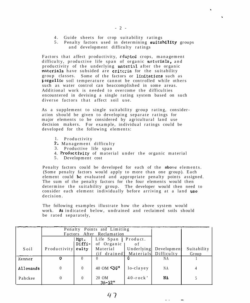
.
.
- 2 -
4. Guide sheets for crop suitability ratings5. Penalty factors used in determining suitability groups
and development difficulty ratings
Factors that affect productivity, rdapted crops, managementdifficulty, productive life span of organic rrieteriais, andproductivity of the underlying materirl after the organicmaterials have subsided are criteria for the suitabilitygroup classes. Some of the factors or liuitati.cns such asPergellic soil temperature cannot be controlled while otherssuch as water control can beaccomplished in some areas.Additional work is needed to overcome the difficultiesencountered in devising a single rating system based on suchdiverse factors that affect soil use.
As a supplement to single suitability group rating, consider-ation should be given to developing separate ratings formajor elements to be considered by agricultural land usedecision makers. For example, individual ratings could bedeveloped for the following elements:
1. Productivity2. Management difficulty3. Productive life span4. Produc,tivity of material under the organic material5. Development cost
Penalty factors could be developed for each of the above elements.(Some penalty factors would apply to more than one group). Eachelement could be evaluated and appropriate penalty points assigned.The sum of the penalty factors for the four elements would thendetermine the suitability group. The developer would then need toconsider each element individually before arriving at a land usedecision.
The following examples illustrate how the above system wouldwork. As indicated below, undrained and reclaimed soils shouldbe rated separately,
Penalty Points and LimitingFactors After Reclamation
I w. Life Span j Product.Diffi- of Organic o f
So i l Productivity culty Material Underlying Development Suitability
Z&x(if drained) Materials Difficulty Group
0 0 0 0 NA 1
Allenands 0 0 40 OM .%?.b” lo-clayey NA 4
Pahckee 0 0 20 OM 40-rock ’ Nb 536-52”

- 3 -
I Penalty Points and Limiting
I----Soil Productivit:
Kenner ,&I 55 water
-t-
control
Allemands .&/ 55 waterc0ntl.01
Pahokee 11 55 watercontrol
0
0
0
k/ Overcome by reclamaclon..
gl&Mgt.Dif f iculty
e ReclamatiLife Spanof organicMaterial(if drained
0
40 OM C36” lo-clayey
20 OM36-52”
1
Product.o f
UnderlyinlHaterials
0
40-rock
Development SuitabilityDifficulLy Group
65 extreme 4flooding
65 extreme 7flooding
10 clayeysubsoil
35 freq. 7flooding
50 rock
The assumptions as listed appear to apply to both “SuitabilityGrouping for Agriculture” and ‘Development Difficulty” ratings.Some of those listed actually apply to both but some apply onlyto suitability for agriculture.
The committee feels that separate assumptions should bedeveloped for “Suitability Groupings” and ‘DevelopmentDifficulty” ratings.
Penaltv Factors.. One committee member objects to penaltyfactor system that can result in negative values. Forexample, a soil with a 120 penalty point has a numericalrating of -20. This could be eliminated by assigning weightsto suitability factor.
Soils that are subject to flooding by tidal storms key togroups 4, 5, b or 7. All of these soils are poorly suited tomost agriculture uses in their present state. They all requireextensive reclamation (sea walls and/or diking and pumping)that is generally beyond the means of private capital. Alsothey will subside to below sea level after drainage. Themagnitude of problems of reclamation, lack of agriculturalpotential in the unclaimed state and their common coastalenvironment suggest that all of these soils should be in thesame suitability group.
Adding a penalty factor of 95 for flooding by storm tideswould place all unprotected coastal Histosols in group 7.

.
-4-
Soil acidity and aluminum toxicity is a serious problem in themanagement of some organic soils. ALSO the potentCal for acidityand aluminum toxicity must be given consideration when planningreclamation. The rooting depths of cultivated crops is limitedto the depths that sufficient Lime is incorporated fnto the soil.
Acidity and aluminum toxicity should be added to the suitabilitypenalty factors.
The committee concluded that all of the penalty factors and theirrelative weights do not apply uniformly across very broadgeographic areaa. Therefore, penalty factors should be adjustedto local land resource regions.
‘;r-----__-~_._._‘llitr;bility GrcuD Definitions-e-_. The seven suitability groups 8snow defined needs some refinements. For example, some highlyproductive soils key to groups 3, 4, or 5. Also, some of theseh,ave few limitations that restrict the present production ofcrops or the range of suitable crops. An example is the Pahokeeseries, a Lithic Medisaprist which keys to group 5. In Floridathis is a highly productive soil with few limitations that affectpresent crop production or mawgement. The limitations (penaltyfactors) , thickness of organic material and nature of the under-lying material affect the “productive life” (36 to 50 years) ofthe s o i l . In view of this, the statement, “Large scale reclama-tion is not feasible.“, should be dropped from the definitionof Group 5. Adding ” . ..very severe limitations restrict theproductive life of the soil ” to the group ,dcfinition wouldaccommodate these soils.
A majority of the conunittee members feel that the number ofsuitability groups should be reduced from 7 to about 4 or 5.
Development Difficulty. Some additional work is needed on the‘Physical Features Used to Determine Development DifficultyRating”. Development difficulty factors should be developedfor tidal storm flooding. Soils in a coastal environment thatrequire protection from storm sea tides are generally much moredifficult to develop than soils at higher elevations that requirewater control or protection from runoff. After coastal soilsare protected from storm tides, they also must have protectionfrom “excess water and flooding.”
The feature “IJn.‘erlying Materials”, presumably intended for soilsthat are to be tile drained, does not apply well to soils thatwill be drained by an open ditch system. In Lotifsiana, the mostimportant feature of the undcrlyin3 material is i.ts ability tosupport the wei~ght of the levee and i,ts suitability for leveematerial. The problems involved in building a di!cc on semifluidclay using semiflufd clay ns a construction material are tremendous.This should be reflected in the development dif f iculty rating.
49

.
- 5 -
RECOKE?ZXDATIONS
1. Use land capability system as outlined in Soils MemorandumSCS-22 for developing interpretations for Hydraquents.
2. Add an introduction to the Task Force rcpurt that explainsthe suitability system including specific objectives.
3. Revise statements on assumptions as follows:
(1) Suitability ratings for drained conditions assumescontinued subsidence rates of 314 inch to 2 inchesannually; hence for continuous use the thicker organicmaterials are the most suitable if the underlyingmaterial is unsuitable for agriculture. The systemreflects the suitability of the organic materials andthe suitability of the underlying materials that arewithin 51 inches of the surface.
(2) The organic suitability grouping is an interpretiveclassi f ication dcsigncd to assess the limitation ofindividual organic soils for production of crops.Factors that affect productivity of the organicmaterials, productivity of the underlying material,adapted crops, management difficulty and productivelife span of the organic materials are used in deter-mining the suitability groups. Development difficultyratings arc used to access the degree of difficultyof reclaiming undeveloped soils.
(3) No change.
(4) The soils within a suitability class are similar withrespect to the dcgrce of soil limitation but notnecessarily similar with respect to the kind of limita-tion. The soil suitability subgroup provides informa-tion on the kind of limitation or hazard and the groupindicates the intensity of the limitation. Organicsoils in suitability group 1 have the least severe soillimitation and group 7 have the most severe.
(5) No change.
(G) No change.
(7) No change.
4. The suitability group definitions should be modified inthe following mnnner:;k
Wo modifications are proposed for groups 1 and G.

.
Group 2 (70-90) -- Organic soils in group 2 have fewl imitat ions which restr i c ts the ir use in a minor way.The limitations may be soil temperature, coarsefragments, wood layers, s a l i n i t y , s l o p e , e t c .
Group 3 (55-65) - - Organic so i l s in th is group hawmoderate ly severe l imitat ions that restr i c t the pro -duction of crops or that require special managementpractices or moderately severe l imitations that limftthe product ive l i f e o f the organic so i l .
Group 4 (40-50) -- Organic soils in this group h a v el imitat ions which severe ly restr i c t the product ion o fcrops or that require special development and managementpract i ces or severe l imitat ions that l imit the produc-t i v e l i f e o f t h e s o i l .
Group 5 (25-35) -- Organic soils of this group havesevere l imitations that severely rest.rict the produc-tion of perennial forage and other adapted crops orv e r y severe l imitat ions that l imit the product ive lifto f t h e s o i l .
Group 7 (less than 10) - - Organic so i l s o f th is grouphave no potential for agriculture or are subject toflooding by storm tides and require massive dilcing orother large sca le engineer ing insta l lat ions .
5 . Add the following penalty factors to the physical featuresused to determine sui tabi l i ty groupings :
F a c t o r Penalty Factor
TIDAL STORM FLOOD CONTROLAdequate 0Marginal 45None 90
ACIDITY/ALUMINUM TOXICITY (potential if undrained)L o w (< 2 tons lime/at.) 0Medium (2-5 tons lime/at.) 10H i g h (> 5 tons lime/at.) 20
6. Revise physical features that are mused to determine develop-ment d i f f i cu l ty rat ings as fo l lows :

- 7 -
vegetativeC o v e r
No change
Excess Ground Water andFlood&With Runoff
Change in factor heading
SurfaceRoughness
No change
Tidal Storm k/Floodinp.
O-NonelOO-Extreme
7. The National Task Force on Organic Soils revise definitiondevelopment difficulty groups.
11. Interpretive guides for use and management:
The interpretive guides for use and management need additionaltesting to determine their applicability to the soils in thesouthern region. The use of existing guides where applicableare preferable to the introduction of new guides.
&gi_neering Interprc_tations for Organic soils. We agree withthe National Task Force recommendation that a single form(SCS-SOILS-5) be used for both organic soils and mineral soils.1,Je also agree with the suggested modifications of form SCS-SOILS-5 under "Estim~tcd Soil Properties."
!$_&llufe Interpretations. Purther study is needed. Guidelinesfor making wildlife interpretations should be developed andtested.
Woodland Interpretations. Additional studies are needed todetermine usefulness of the productivity classes and the usepotential concepts in the southern region.
1. The committee recommends that the Rational Task Force onOrganic soils continue its work on developing interpretiveguides for use and management of organic soils.
2. The committee recommends that these guides be tested todetermine their applicability to the soils in the southernregion.
11 Add.

-3-
C. Classi f ication:
The recommendation for changes in the classification werereviewed by each member of the committee.
Proposal III 10 would be strengthened by defining hemicmaterials explicitly. As it is now defined, one must firstdotermine what i,s saprfc and what is fibric.
One committee member is opposed to changing the base of thecontrol section in Histosols to 1GO cm. He points out that ifthis change is i.nitiated, current series concepts will have tobe re-evaluated and most of the mapping will be outdated.
RECOMMXNDATIONS
1. Define hemic materials as follows:
A hemic material is one that has an unrubbed fiber contentof more than l/6 and less than 2/5 by volume and a pyro-phosphate index of 4.
2. Adopt all changes in taxonomy recommended by the NationalTask Force on Organic Soils.
3. That committee be continued.
COMMITTEE MEMBERSHIP
Chairman: W. L. Cockerham, Vice Chairman: V. W. Carlisle
Mnbers : H. J. Byrd R. MillerR. C. Carter M. E. ShafferE. Gamble R. D. WellsC. S. Holzhey

. .
SOUTHERN REGIONAL TECHNICAL WORK-PLANNING CONFERENCEMobile, Alabama, March 12-15, 1974
COMMITTEE VI - SOIL MAPS AND SOIL SURVEYS
Chairman: C. A. SteersVice Chair&n: C. L.-Godfrey
CHARGES
1. Recommend guides for bas.e map selection.
2. Recommend guides for map scales ,relative to the intended useof the survey, pattern and complexity of soils and other factors.
3. Review the progress report of the National Task Force forGuidelines for Reconnaissance Soil Surveys and make recommendationsfor consideration by the Southern Region.
COMMITTEE REPORT
Base w Selecti.
There has been numerous information suggested for use as base mapof progressive soil surveys. The review draft of Soil Taxonomy hasdiscussed aerial photos, aerial mosaics, photo maps, orthophoto maps,photo base maps, reference maps, and index maps as being used for soilbase maps. Comments from committee members were confined to aerialphoto, photo base maps from high altitude photography, aerial mosaicsand orthophoto maps. Most new survey areaa have common problems inselection of suitable base maps such as limited photographic coverage,low initial financing and immediate need of survey field sheets. Insome counties such factors as extreme relief. short flying season dueto vegetation and wide variations in intensity of use add to the prob-lems in selecting good base maps.
Members reported a marked improvement in base maps within the lastfew years with the initiation of high altitude contracting for thespecific purpose of soil survey base maps along with more detailedplanning prior to initiation of the soil survey. Reports on orthophotomaps for soil survey base maps have been very good.
Guides for @ Scales-
The selection of map scale is dependent on different factors orcombinations of factors. The following factors have been rated asrelevant to map scale by this committee: Intended use of purvey,
Y‘D*-‘CI.ID"I 10"T".,&", 1.1,
s4

2
objective of survey, significant size of management unit, complexityand pattern of soils, potential uses of the survey, landscape andlandforms, and geology. Scale cannot be determined by a study of anyone factor but should be determined only after an analysis of allsuch factors. Evaluation of these factors is best made as a coopera-tive effort between potential user and cooperating agency. Considera-tion of map scale is not only important for field work and publicationbut has become of primary concern as users reproduce published maps.Enlargement limits are felt to be necessary to retain the accuracy andrelevance of the original survey.
National Task Force Guidelines for Reconnaissance Soil Survey- - -
The guidelines set forth by the national task force have helpedgreatly to clarify many of the terms and concepts in soil survey,especially those in reconnaissance soil survey. It was difficultfor some members to completely accept the new names suggested forlevels of survey. However, it was most evident that no criticismswere reported on objectives used to distinguish between differenttypes of soil survey. The task force' recommendations for fiveorders seem reasonable after a complete analysis of the four objec-tive attributes of survey, namely (1) Kinds of mapping units, (2)Kinds of taxonomic units, (3) Kinds and intensity of field proce-dures, (4) Map scale and minimum sizes of delineation. As severalcommitteemen have brought out, minimum-sired delineations is notjust a mechanical process of delineating the smallest sized soilareas due to map scale but also implies that all such areas havebeen delineated accurately and consistently. There seems to bemisunderstanding among soil scientists and much inconsistency forhandling minimum size delineations from field work to publication.
. .
SUMMARY ANB CONCLUSIONS
Base maps for soil survey were investigated with respect toaerial photography presently available for soil survey. Guidelinesfor the selection of proper map scales have been reviewed withrespect to filling the projected survey needs. The National TaskGuidelines for Reconnaissance Soil Survey have been analyzed withgreat interest and we heartily endorse the general concept outlinedin their progress report.
Base map comments were mainly restricted to order 1, 2, and 3order surveys. The committeemen reported that much improvement hasbeen made with common use of photo base maps from high altitude photo-graphs contracted for the purpose of soil survey.
It is also the general feeling that some freedom of choice begiven for the selection of base maps and kind of base maps should not

3
be rigidly controlled except for quality of publication. The committee-men feel a greater use of orthophoto prints with or without the super-imposed topographic maps would increase quality of surveys. As thecomments reveal soil survey is now getting good base maps in general andmany of the recent complaints about sub-quality base maps are not jus-t i f i ed .
Our recent soil surveys seem to be made at a significant scale andto serve their orfginal objectives very well. However, with the greatexpanded need of high intensity surveys, whether it be irrigation orspecialized crop production for agricultural use, urban sprawl, recrea-tional planning, fertilizer and species selection for timber production,we have a great problem in providing maps at a scale to satisfy the needof users. It has become an accepted fact that one soil survey or onescale for maps will not provide all users with information needed intheir planning procedures. Any soil survey till need to be supplementedand many will need to be reinvestigated to provide specific users withsoil information. This brings into focus the financial aspect and theplanning priority of each survey area. The committee feels map scaleis a decision to be made at local and state level with the counsel ofthe cartographic units. This decision can be made by states with fullknowledge of survey objectives, expected users, soil complexities andpatterns, environmental factors, and financial restraints. This com-mittee also has reservation as to unlimited scale for enlargements ofpublished soil surveys.
The Progress Report of the National Task Force for Guidelinesfor Reconnaissance Soil Surveys should certainly be considered by theSouthern States. It does much to clarify vague concepts that manypeople once had. However, minority reports stating, “I prefer tocontinue using the three types of surveys we are now using. Thesenames give the average person a meaning for each kind of survey betterthan order 1, 2, etc.“; and “It seems to me that the five orders ofsoil survey are defined too wide,” do not reflect the thinking of somevery good soil scientists. Committeemen feel the task force couldimprove their guidelines by giving specific examples of survey areasas being optimum for each order of soil survey. Also, relevant com-ments were made as to practical methods for handling two or more ordersof soil surveys within one survey area. These comments deal primarilywith scale of maps and how, when, and where the boundaries of two dif-ferent survey orders are to be made within the survev area. Thesequestions can be easily answered and shouldtask force.
RECOMMENDATIONS
1. It is recommended as a part of the survey work plan, justi-fication for base map selection be included as well as the decisionmaking criteria for scale selection of soil survey area. Freedom
be ref&ed back to the

, .
4
should be given those who select base map and proper scales for mapping,however, criteria for making these decisions should be known to thosewho assist in the soil survey program. Survey areas to be mapped usingtwo or more survey orders would differentiate precisely which surveywill be mapped in specific locations. The work plan should furtherdefine scale difference if required. Scale criteria should reflectmanagement units for the predominant users and minimum size of soildelineations that can and will be shown accurately and consistently.
2. A much greater effort be given to acquire orthophoto maps forsoil survey bases. These seem to be especially useful for extremerelief or areas of limited accessibility. Orthophoto maps seem to beof greatest value i.n orders 2 and 3 due to scale factors.
Lt is also recommended on a trial basis that color photo-graphy be acquired for a few counties along with the high altitudephotography for base maps. This color photography would be used tosupplement the base map photo information.
3. It is recommended the 1:20,000 and 15,840 scales be continuedas optimum scales for our publication program. We also recommendfield work and map compilation for publication be done at the sameSC&Z. It Seem logical that these scales be the prime scale fororder 1 and order 2 survey.
4. Some soil maps are being enlarged to scales that match com-munity planning scales. In places the enlargement is three or fourtimes as large as the mapping scale. It is recommended that enlarge-ments of soil survey maps more than two times the original be dis-couraged, in order to protect the intent of the original mapping.
5. The Southern States endorse the concept of the National TaskForce Progress Report with the following suggestions:
a. Minimum size delineation discussed on page 5 of TaskForce Progress Report be qualified by the statement,"Minimum si~ze of soil area delineated cannot be smallerthan the largest area of an inclusion for a contrastingsoil .‘I
b. Minimum sized delineation for long narrow areas be nosmaller than l/8 inch wide by 1 inch long.
c. Table 1 (attachment 1) be revised as follows for headof last column:
"Minimum size delineation due to cartographiclimitation."
5 7

5
d. The orders of soil survey should continue to include asa part of the name, the descriptive terms detailed andlFXO~llSiSSSlV2S.
Committee Members:D. G. AydelottJ. W. FrieT. R. GeraldF. L. GilbertC. L. GodfreyW. L. HatfieldR. E. HortonJ. T. MayW. F. MillerE. C. NanceB. R. SmithC. A. SteersA. TouchetH. B. Vanderford
Attachment

3s Consociatlons& associations
SOllS in each delin- ,:7,920 t” 1:31,680eati”” are i d e n t i f i e db y f i e l d e x a m i n a t i o n .
S o i l s a r e i d e n t i f i e d ,:20,000 t” 1:63,560I ” ,.ach delineation bya systematic procedureo f traverclng. or b ytt-ansecting that p r o -v i d e s a v a l i d sfatls-tica sample.
1st <?r 2 n d ordrr s o i l ,:500.“00 t” ,:1.000,000 1 0 , 0 0 0 a c r e ssurvrys ?& m a d e “nsc,<,ctrd a r e a s ( 1 5 t”L5 s q . mi.) to identi’ywlls a n d e s t a b l i s h s o i lp.,~tcr”a o” n a t u r a l Innd-scapca. Project ions arcm a d e w i t h rrl‘ancr onb r o a d l a n d s c a p e ‘“~cTP~P-ratlo” a n d v e r i f i c a t i o n o fs o i l s a t strategically locatedp o i n t s .
___-------
1.1 S o i l s u r v e y s o f a l l O r d e r s r e q u i r e mai”tai”a”cc of a soil h a n d b o o k (legend. m a p p i n g unit descriptions.taxonomic unit drsrrlptions, f i e l d notes. i n t e r p r e t a t i o n s ) and rev‘ev b y a p p r o p r i a t e c o r r e l a t i o np r o c e d u r e s o f t h e Nat‘onal Cooprrat‘ve Soil S u r v e y . Work plans for m a n y s u r v e y a r e a s list m”rCt h a n one o r d e r ; t h e parf to whit,, e a c h i s a p p l i c a b l e i s d e l i n e a t e d o ” a s m a l l s c a l e m.3.p of the E”=“CYa r e a .
21 This is the m i n i m u m size d e l i n e a t i o n imposed by Ilmitations of the m a p s c a l e . I ” p r a c t i c e t i l em i n i m u m size delincatlo” spcclfird f o r a m a p u n i t f o r 2 n d o r d e r s o i l survfys i s g e n e r a l l y lsrgerthan the m i n i m u m s,,own.

. -
TABLE 2
APPROPRIATE USES FOR DIFFERENT ORDERS OF SOIL SURVEYS
Orders Intensity of Planning fkr Land Use or M a n a g e m e n t
Intensive planning such as predicting specific usesand treatment of discrete tracts of land for mostcropland but not for s i te se lect ion for s tructures .So i l ser ies interpretat ions are va l id for areaslarger than specified minimum size.
2nd-
3rcJ
4th
5th-
Operational planning for rangeland, woodland, somecropland t r a c t s ; n o t f o r s i t e s e l e c t i o n f o r s t r u c t u r e s .Interpretat ions l imited to overa l l behavior o f so i lser ies occurr ing together in areas larger than spec i f iedminimum size.
General planning--applicable to county or multi- L/county p lanning d is tr i c ts , areas of extens ive usesuch as some rangelands. forested lands and aridlands. Interpretations valid total extent of a mapu n i t ; not des igned for interpretat ions for t racts o fmanagement size.
Broad planning--applicable to multicounty plan-11
oing 9 large RC&D and RCOG. statewide planning andlarge s tate p lanning d is tr i c ts .
Very broad planning--regional planning, statewiddjplanning.
11- 3s. 45, and 5th Order so i l surveys a id in locat ing potent ia l
areas for 1% and 2g Order so i l surveys .
60

. .
SOUTHERN REGIONAL TECHNICAL WORK-PLANNING CONFERENCEMobile, Alabama, March 12-15. 1974
COMMITTEE VII - SOIL SUITABILITY POTENTIALS
Chairman: Joe D. NicholsVice-Chairman: Fenton Gray
CHARGES
Investigate the use of a single numerical rating system for engineeringand other uses that would rate all soils. Consider the example proposedby the National Task Force on Organic Soils. (Report presented at the1973 National Work Planning Conference. )
COMMITTEE REPORT
A rating sheet, potential for corn production, was prepared andcirculated. Comments from committee members were used to revisethe rating sheet. The revised rating sheet is attached to this report asAppendix I.
The goal of the committee was to prepare a type of soil interpreta-tion using a numerical system. Most interpretations used in the programsof the National Cooperative Soil Survey have used equal weighting of soilcharacteristics related to the problem. Ideally, the kind of information touse in developing a guide is the inherent edaphic characteristics of the soil.Many of these parameters, such as the moisture supplying capacity of asoil under a given climate, are not well understood.
An improvement in precision of predictability is possible by usingan unequal weighting system of soil characteristics. This method haslimitations because a change in one factor can influence the effect ofanother factor. A sliding scale of values is needed in such cases. Thiscommittee effort used mainly the unequal rating system but applied thesliding scale system for one soil characteristic.

. .
2
SUMMARY AND CONCLUSIONS
A rating sheet for potentials for corn production was developed.This effort needs testing against more kinds of soil. It offers threesystems of rating: (1) a numerical system from 1 to 100, (2) anarraying into eight groups, ten groupings could have been used, and(3) an adjective rating for eight groups.
RECOMMENDATIONS
Work should continue within states, with coordination by thetechnical service center, on development of potential systems foragricultural and nonagricultural interpretations. The input of spec-ialists other than soil scientists will be necessary for the developmentof successful systems. Considerable time inputs will be required fora usable product.
The committee should be continued to keep conference membersaware of progress and needed inputs.
Committee Members:B. L. AllenF. BellG. J. BuntleyFenton GrayA. L. NewmanJ. D. NicholsC. PowersD. F. SlusherC. D. SopherL. H. Rivera
Attachment:

APPENDIX I
A SYSTEM FOR RATING SOILS FOR POTENTIAL CORN PRODUCTION
The method of determining the relative potential for corn production is athree-part system. Rate a soil phase for each part. Sum the three parts andsubtract the total from 100. Determine the potential for corn production fromthe guide below. The ratings from 1 to 100 or 1 to 10 may be used. For a
. ranking for yields only, use the A. SOIL CHARACTERISTIC SUBSYSTEM.
100 Minus sm ofRatings of Subsystem
91-100ii-9071-8061-7051-6041-5031-4021-3011-20O-10
A.' SOIL CHARACTERISTIC SUBSYSTEM
1. Available water capacity inupper 40 inchesMore than 5 inches4 to 5 inches2 to 4 inchesLess than 2 inches
2. Coarse fragments in theupper 10 inchesLess than 2 percent2 to 15 percent15 to 35 percentMore than 35 percent
Potential forCorn Production
123456
:9
10
Penalty WeightingPoints Factor Product
01 33 35 3
01 33 35 3
3. Depth to restrictive layer3.1. Depth to bedrock, hardpan,
apetrocalcic horizonMore than 40 inches 020 to 40 inches 1 510 to 20 inches 5 5Less than 10 inches 12 5
3.2. Depth to fragipanMore than 40 inches 030 to 40 inches 1 320 to 30 inches 2 3
63

2
WeightingFactor Product
4.
5.
6.
7.
8.
Exchange capacity of upper20 inches (per 100 grams of soil)More than 7 m.e.3 to 7 m.e.1 to 3 m.e.Less than 1 m.e.
0135
Mineral reserves as weatherableminerals in the 0.2-2 nun fractionof the control sectionMore than 20 percent10 to 20 percentLess than 10 percent
012
Organic matter content in theupper 10 inchesMore than 1 percent0.5 to 1 percentLess than 0.5 percent
012
Soil lossLess then 3 tons average per year 03 to 6 tons average per year 16 to 10 tons average per year 3
PenaltyPoints
More than 10 tons average per year 5
Soil moisture reEimel-'Udic - less than 2 inches averagegrowing season moisture deficit 0
Udic - 2 to 4 inches averagegrowing season moisture deficit 1
Udic - 4 to 6 inches averagegrowing season moisture deficit 2
Udic ustic soil moistwk regime 5Typic ustic soil moisture regime 7Aridic ustic soil moisture regime 9
111
11
22
555
10
10101010
___-_--___---_______-_-_-
L/ Not to be used if the land is irrigated.

3
10.
11.
12.
0 2 4 6
Growing s!&%%oisture deficit
Soil reaction at ZO-inch depthor 6 inches into a Bt horizonbeEinning within 20-inch depth.5.6 to 7.34.5 to 5.6Less than 4.57.3 to a.48.4 to 9.0More than 9.1
Soluble saltsLess than 2 mmhosicm conductivity2 to 4 mmhos/cm conductivity4 to 8 mmhoslcm conductivity8 to 16 nunhoslcm conductivity
Soil slopeABCDEP
_____________-__-___-----2_/ Use permeability for soils not penalized
Do not we both permeability and wetness
Penalty WeightingPoints Factor Product
028
12
01
2610
555
55555
for having a wetness factor,factors.

13. FloodinqNoneModerate hazards, yield reducedless than 10 percent
Severe, yields reduced 10 to30 percentVery severe, yields reduced 30to 50 percent
Extremely severe, yields reducedmore than 50 percent
PenaltyFactors
0
1
2
4
6
14. Wetness - Contipying problemsof excess water&'Little or no continuing limitations,yields not restricted 0Slight limitations, yieldsslightly limited 1
Moderate limitations, yieldsmoderately limited 2Severe limitations, yieldsseverely limited 4
VerY severe limitations. yieldsv&y severely limited . -
B. DEVELOPMENT DIFFICULTY SUBSYSTEM
1. 1rrip;ation1.1. Leaching soluble salts1.2. Land leveling
1.21. Minor amount1.22. Moderate amount1.23. Major amount
2. Drainaxe2.1. Surface2.2. Tile
3. Terrace System
4. Forest - Stump clearing,root plowing, and smoothing
-----------_-_-___________IJ Rate for problems before drainage
drainage for a drained phase.
4
WeightingFactor Product
10
10
10
10
10
10
10
10
for an undrained phase and after

5
WeightingFactor Product
5. stones - clearingClasses of stoniness
012
;:5
6. GulliesN0neCCllUllOll
*nY
C. MAINTENANCE suBsYsTEM
’ 1. Irrination1.1. water cost - supplemental1.2. Water cost - total
Low costMedium costHigh cost
2. Drainage2.1. Surface2.2. Tile
3. Terrace System
4. FertilizationLow amountMedium amountHigh amount
5. Lime RequirementNone requiredApplication required
PenaltyPoints
012
01
55
11
11
01

&JJTHERN REGIONAL TECHNIU\L WORK-PVNNING INFERENCEOFTHE
b3'ERAlIM SOIL SURMYbILEI AlAEM
N4Ra-c lz-l.51974
RETORT cfAu Hoc NITTEE
CJiAIwrlL\N - C, L, GODFREY, TM (AGRICULTURAL EXPERIKNTSTATION)
VICE-hMUW4 - R, W, Jawm. FLORIDA 66)

A. Southern Regional Technical Work-Planning Conference ofthe Cooperative Soil SurveyMobile, AlabamaMarch 12-15, 1974
Chairman - C. L. GodfreyVice-Chairman - R. W. Johnson
6. AD HOC Committee - Professional Soil Classifying
c. 1. Inform the conference about the establishment of theprofession of soil classifying.
2. Make recommendations pertaining t0 Uniform Certificationrequirements for the Southern Region.
D. Committee Report
In preparation for this report and for a report presented ata special meeting at the Soil Science Society of Americameetings, November 11-16, 1973. in Las Vegas, Nevada, a question-naire was mailed in June 1973 to the committee, to others inthe Southern Region and to selected individuals in other statesknown to have interest and experience relative to organizedeffort on certifying soil classifiers. The main body of acertification bill passed in North Dakota was included forevaluation (Appendix 1). This report summarizes the resultsfrom the questionnaire, from the reports and discussion atthe meeting in Las Vegas, and the information compiled sincethe Las Vegas meeting.
Results of theestionnaire
Response was prompt and candid. Much thought was obv$ouslygiven in answering the questions and to the other comments whichwe received:
- An expression of positive interest in a state and nationalorganization of professional soil classifiers and a relatedlaw came from nearly every respondent. However, some,especially from the universities, pointed out that ininterviewing their co-workers expressions of disfavorwith the idea of an organization or a law were en-countered. A movement away from traditional relationshipsamong disciplines and tradltional free-of-charge publicservice is apparently feared, along with misgivings aboutgetting involved with legal constraints in the practiceof soil science. Some also questioned whether or not theirstate is at this time professisr,ally or politically readyfor such action. But everybody seems eager to learn and toParticipate In coordinated consideration of a soil classifiersorganization and related state laws. Most thought the NorthDakota bill a reasonably good model. Virginia and Florlda
63

2
pointed out because of laws already in effect they needto use the name "soil scientists" not "soil classifiers".
- Sane action has been taken in the Southern Region towardorganizing and passage of legislation. Tennessee intro-duced a bill which was later withdrawn. South Carolina isorganizing and has a bill which passed one House. Passayeis expected. Alabama is in the process of organizing andplans to draft a bill. Louisiana and Florida are makingefforts toward organizing. Arkansas, Georgia, Kentucky,Mississippi, North Carolina, Oklahoma, Texas and Virginiahad no definite action to report when the questionnaire wasanswered.
- Among other states more definite action is under way. Maineand North Uakota have passed bills. Nebraska introduced abill but it did not clear their Agriculture and RecreationCommittee . California, Idaho, Minnesota and Wisconsin areworking toward introducing bills. Wisconsin has a functioningorganization, 'Wisconsin Society of Professional SoilScientists". (See Appendix 2).
- The study revealed that the number and affiliation of those"for" and those "against" a state organization and a re-lated law varies greatly from state to state. Soil andWater Conservation Districts, County Commissioners, CityGovernarnts, Councils of Government, Planning Commissions,State Health Uepartmsnts, State Forestry Boards, WaterResources Groups, certain legislators, Soil ConservationService, Soil Science Society of America, Soil ConservationSociety of America, were listed as likely to endorse orsupply leadership for promoting an organization or a bill.Geologists, civil engineers, agriculturists and soil scienti:,tsat universities and experiment stations, realtors and developerswere listed as groups containing individuals likely to voiceopposition to an organization, but especially likely tooppose passage of a certification law.
- The questionnaire resulted in a number of additional questionsor a repeat of questions similar to those on the questionnaire:
(1) What is the purpose of a soil classifiers 'law and arelated state and national organization?
(2) How might a state and national soil classififerorganization relate to ASA, SSSA, SCSA?
(3) HOW do you go about mustering support for an organi-zation and for a law? 'hl~.lt are the necessary steps totake? In what order?
(4) Has anybody prepared a model proposal for a stateorganization and a statement of need for a state lawrelated to citizen welfare and interests rather than
,

(5)
(6)
(7)
(8)
(9)
(10)
(11)
(12)
needs of soil scientists?3
What are the salient features of the North UdkOtaand Maine laws? Did +&e sponsors get what theywanted? What major pr.',lems had to be resolved toeffect passage?
How uniform do the state organizations and statelaws need to be in order to carry on related pro-fessional activities on an interstate basis?
Why is an exemption clause needed in a bill? Shouldthis clause be uniform among states?
Who would develop written examinations given byState Board of Examiners? Who would pay expensesof the Board? What should the filing and registrationfees be for applicants?
What are some suitable name alternatives for theorganization, the bill and the ones certified unerthe bill? Some do not like "Soil Classifiers" orcannot use it. "Soil Scientists" with something inparenthesis about "classificatfon", "mapping", and"interpretations" has been suggested.
Subsequent to certification and registration, woulda "Soil Classifier" be professionally liable for hisdecisions and recommendations?
Should other disciplines which might oppose a "SoilClassifier Act" in a state be asked if they wouldsupport a bill which would include certification oftheir group? (Maine's bill includes both soilscientists and geologists, for instance).
What specific recommendations, if any, should the AdHoc Committee make to the conference at Mobile?
Answers to the questions are covered for the most part in the followingsection of this report.(see page 3A for other questions).
HIGHLIGHTS OF SPECIAL SSSA MEETING, LAS VEGAS_~__~______ ..__..~.~_~.__.._
Diviston S-5, (Soil Genesis, Morphology and Classification) held aspecial meeting on certification of soil classifiers Wednesday evening,November 14th, from 7:30 p.m. to about lo:30 p.m. It was well attendedand few left before it was over. Discussion was lively. Dr. A. R.Bertrand, President, SSSA, Dr. Phil Low. Immediate Past President,SSSA, and Dr. Sterling Olsen, also a Past-President, SSSA, attendedthe entire session.
- John McClelland, SCS Staff. Washington, D. C., presided. Hepointed out soil scientists have a problem at times inestablishing their credentials--as an expert witness in court,for instance. Soil scientists, in SCS especially, need a
(continued on page 4)

3a
ADDENDUM
Questions rai%se Conmitteecussions at Mobile
(1).
(2).
(3).
(4).
(5).
(6).
What length of time of what experience should berequired for certification? A precedence of 4years of soil classifying has been set in the billsalready passed. Some feel this is too long; that2 years should be adequate. Each state will haveto work this out in relation to its own convictions,but having uniformity among states would be desirable.
Experience in soil classifyiny of what vintage isacceptable in certification7 A starting date shouldbe given in the law but the approving board willhave to decide on the acceptibility of the qualityof the experience.
What qualifications in soil classifying must bemet by state boards certifying soil classifiers?The board should meet qualification standards higherthan the people they certify.
Is it feasible to work toward state certificationlaws without a state organization of soil classifiers?Many think not, however, South Carolina's bill, modeledafter Idaho's bill, is being sponsored by the SouthCarolina Land Resources Conservation Conission.Sponsorship by such an already established state boardhas the advantage of providing legal advice and counselfrom the state staff at no cost. It also providesendorsement by an already accepted state organizationand does not cause a new board to be created. A newboard might on some points be competative with long-standing boards in the state.
Can a soil classifier be fully certified in two or morestates at the same time? The certifying board ineach state acts on the qualification of an applicantin relation to the laws of that state but conditionsof reciprocal certification should be stated ill the law.
How could uniform national standards of soil certificationbe established? A national organization, such as theSoil Science Society of America, could suggest these, orstate organizations of soil classifiers could form anational committee from among themselves or join togetherin a national organizatiuri

unifying organization in which they feel a strongprofessional bond with their fellow scientists. Heindicated that he felt a state organization of soilclassifiers and an associated state certification lawwould help to fulfill these needs. This would givethe 1250 soil scientists in the USDA, SCS, who classify,map and interpret soils in the field, a professionalstatus comparable to lawyers, doctors. nurses, engineersand other registered professionals. Only about 15%of these SCS men are now metiers of SSSA. And interestin metiership seems to be on the decline even thoughSCS administrators encourage membership. Some additional200-300 staff metiers from agricultural experimentstations and forest services also participate to varyingdegrees in the soil survey. Many of these people areactive metiers in SSSA.
- A. R. Bertrand, Phil Low and Sterling Olsen commented onthe interest of SSSA in maintaining close affiliationwith the soil survey group and that SSSA will make a fullstudy in 1974 on kinds of metierships to offer soil sur-veyors and related professionals, possibilities forpublishing a soil survey journal (Soil Survey Horizons,for instance) and on affiliation of state organizationsof certified soil classifiers with SSSA. Response fromthe floor indicated that some in the soil survey groupdo not want any sort of associate membership in SSSAbut instead want to maintain full membership with theefforts toward change applied to making the field soilscientist more visible in the programs of SSSA and to-ward providing a publication with articles of majorinterest to field men in soil survey. That SSSA shouldbe the national affiliate organization for soil classifierorganizations seemed agreed, however, the Soil ConservationSociety of America was also mentioned. (See Appendix 3).
- J. B. Fehrenbacher, Program Chairman, Division S-5, pointedout how general fnterest in the soil classifier organizationand related laws prompted the special meeting on the subjectat Las Vegas.
- Hollis Omodt, gave a report on how passage of a state lawon certification of soil classifiers was effected in NorthDakota. His main points follow:
(1) Regin in a state with a well prepared organizationof soil classifiers to decide on standards, exclusions,and professionals to be covered by certification andlegal registration. The organization in turn initiatesaction toward a state law.
(2) Obtain well-known public sponsors. Influential leadersfrom organizations are better than endorsement by the
73

(3)
(4)
(5)
(5)
(7)
(8)
(9)
organizations per se. In obtaining support of apowerful organization, the organization's enemiesas well as its friends are recruited.
5
Be sure the law defines both the profession and thepractices.
A state organization is needed to organize and supportthe bill. but the organization is not mentioned in thebill. The National Cooperative Soil Survey is not agood reference since 'it has no formal organization.North Dakota's bill merely states that the standardsused were "accepted principles and methods".
Carefully develop exclusion clauses. Be sure, forinstance that the law does not impringe on rights ofsoil testing civil engineers. Exclude them by a properstatement. Other groups need to be considered too, forinclusion or exclusion.
Be prepared to spend $35/hour or more in attorney'sfees to test the legality and workability of the law.Total cost can amount to around $1000 or more. Thelaw must stress needs of the public, not needs of soilscientists. Having a good model bill to follow cansave much money. Fees may amount to much less than$1000 with a model in hand.
Seek out respected sponsors in the Houses of government.
Use top professionals and citizen leaders in committeehearings.
Understand thoroughly the legislative procedure in yourstate.
- G. B. Lee discussed experiences in formin the WisconsinSociety of Professional Soil Scientists, 9See Appendix 3).
(1)
(2)
(3)
(4)
He pointed out that Wisconsin is not especially happywith "Soil Scientists" in the name since the organizationwas set up to promote professional and social conlmunicationand other interest among practical pedologists.
Self-employed and retired soil scientists benefit froma state organization and a related law.
The organization can be especially helpful to soilsprofessionals by sponsoring seminars and holding fielddays.
An organization can provide identity for the non-agricultural group interested In soil survey in-formation such as engineers, urban planners, wildlifespecialists, etc. These people rarely are members ofASA and SSSA.

6- Curtis L. Godfrey summarized the status of interest in
certification of soil classifiers in the Southern Region.(See this report: Results of the Questionnaire).
E. Sunmaryand Conclusions~.-
(1)
(2)
(3)
(4)
(5)
16)
There is interest in a state and national organizationof professional soil classifiers and in related statelaws providing for certification and registration ofsuch professionals. However, the extent of interestand feeling of need varies greatly among the states.Some individuals and organizations dealing with soilsoppose organizing or a law. Louisiana, Florida andperhaps others have polled the interest among theirsoil scientists.
Wisconsin has had a state organization since 1972 whichcan serve as a model for other states.
North Dakota and Maine have passed laws. (See Appendix1 and 4). These laws, especially the North Dakota law,are being used as models. Several other states areworking toward an organization and a state law.
Tennessee and South Carolina have had the rwst activityrelative to a state law in the Southern Region. Someother Southern States are initiating action towardstate organization.
Developing a state organization seems to be the firststep toward certification. Work toward a law muststem from this base, but the subsequent law must bepredicated on need for a service to the public.
Soil classifiers include professionals with limitedinterest in ASA. SSSA programs and publications. During1974, SSSA plans to thoroughly investigate ways and meansof better serving the group. Affiliate or other typesof membership alternatives will also be considered.
F. Reccomendations
(1) That interested leaders explain the need and funcation ofa state association of soil classifiers to soil scientistsand others in each state. (See Appendix 2, 4 p. 8, 5 & 6).
(2) That a state association be organized where need andinterest justify along the lines of the Wisconsin nlodelor others procured by state leaders.
(3) That state associations consider promotion of state laws,using as gu{dellnes corrt,ilts and suggestions in thisreport and the attached laws from North Dakota and Ma3ne.

.
(41
(51
(6)
7
That soil survey leaders and/or state associationscooperate with the Soil Science Society of Americain developing a model for affiliation of soilclassifiers with SSSA at the National level. Otheralternatives may also be considered.
That the 1974 Southern Regional Technical WorkPlanning Conference endorse the concept of organizationof soil classifiers and the passage of state certificationand registration laws for soil classifiers as means ofpromoting and encouraging the highest levels of pro-fessional competence and ethical conduct and to achievethe maximum benefits of soil classification in planningfor various uses of land. However, adopting thisrecommendation by the conference does not imply thatevery state in the Southern Region necessarily endorsesthis concept but that a majority of states do endorsethe principle and will act accordingly.
That the report of this AD HOC Committee be acceptedand that the committee, having now served its function,be dissolved. However, it is reconended that theSteering Committee set up a small committee of about4 members to serve as a source of information relativeto organizations and legal acts pertaining to sol1classifiers and further that membership of this newcommittee be selected from personnel in the SouthernRegion having the most pertinent experience dealingwith soil classifier organizations and state lawsrelated to soil classifiers.
G. List of Committee Metiers
C. L. Godfrey, ChairmanR. W. Johnson, Vice-Chairman
H. H. Bailey M. E. ShafferR. C. Carter D. F. SlusherF. Gray M. E. SpringerJ. T. Hood H. B. VanderfordD. E. Pettry R. D. Wells
H. Appendix (These items were attached only to repbit distributed atMobile)
1. North Dakota's Bill
2. Wisconsin's State Organization
3. Information from Dr. A. R. Bertrand, President SSSA
4. Maine's Bill
5. Response by Hollis Omodt to special questions raised byBob Johnson and Curtis Godfrey
6. Information sent to the state SSSA in North Carolina
.
-7+G

NATIONAL COOPERATIVE SOIL SURVEY
Southern Regional Conference Proceedings
Virginia Polytechnic institute and State UniversrtyBlacksburg, Virginia
May 2-4, 1972
Agenda .... . . . . . . . . . . . . . . . . . . . . . . . . . . . . . . . . . . . . . . . . . . . . . . . . . . . . . . . . . . . . . . . . . . . . . . . . . . . . . . . . . . . . . . . . . . . . . . . 3
Participants. .. . . . . . . . . . . . . . . . . . . . . . . . . . . . . . . . . . . . . . . . . . . . . . . . . . . . . . . . . . . . . . . . . . . . . . . . . . . . . . . . . . . . . . . . . . . . 6
Business Meeting .... . . . . . . . . . . . . . . . . . . . . . . . . . . . . . . . . . . . . . . . . . . . . . . . . . . . . . . . . . . . . . . . . . . . . . . . . . . . . . . . . . IO
Committee Reports .................................................................................. I 2
Committee 1 . Criteria for Family and Series ... . . . . . . . . . . . . . . . . . . . . . . . . . . . . . . . . . . . . . . . . . . . . 12
Committee 2 - Application of the New Classification System ........................ 3 5
Committee 3 - Soil Interpretations at the Higher Categories of the ................ 3 9New Classification System
Committee 4 - Application and Interpretation of Soil Surveys.. ...................... 5 2
Committee 5 . Handling Soil Survey Data ................................................... 6 2
Committee 6 . Soif Moisture and Temperature.. ........................................... 6 5
Committee 7 . Regional Genesis and Characterization Projects.. .................... 8 5
Committee 8 - Classification and Utilization of Fresh and Salt Water .............. 91Marshes
Committee 9 - Soil Surveys for Forestry Use .... . . . . . . . . . . . . . . . . . . . . . . . . . . . . . . . . . . . . . . . . . . .108
Committee 10 . Education Resources .... . . . . . . . . . . . . . . . . . . . . . . . . . . . . . . . . . . . . . . . . . . . . . . . . . . . . . 1 1 4
Committee 1 1 . Environmental Soil Science ................................................117
Committee 12 - Changes in the Classification System .... . . . . . . . . . . . . . . . . . . . . . . . . . . . . . . 120
Environmental Research Paper .................................................................. .124

VIRGINIA POLYTECHNIC, lN$TIT:UTE 6 !STfiTE : UNIVERSITY,

UNITED STATES DEPARTMENT OF AGRICULTURESoil Conservation Service - State Office, P. 0. Box 10026Richmond, Vi rg in ia 23240
August 7, 1972
Re : 1972 Southern Regional Soil Survey Work-Planning Conference
To: Recipients of Proceedings
The conference convened at 8~00 a.m., Tuesday, May 2, a tthe Donaldson Brown Center, V i rg in ia Polytechnic Inst i tute andState University, Blacksburg, Virginia.
The executive comnittee extends their appreciation and thanksto those speakers invited to address the conference. Wewelcomed the participation of Dr. J. E. Martin, Dean ofA g r i c u l t u r e a t VP1 & SU. Dr . W. J . Hargis , D i rector , V i rg in iaInstitute of Marine Science, discussed Wetlands Research - NewHorizons. Dr. J. Cairns, Director, Center for EnvironmentalStudies, VP1 & SU, made a fine presentation on EnvironmentalResearch. Mr. W. M. Johnson, Deputy Administrator for SoilSurvey, discussed Developments in the National Soil SurveyProgram. Mr. 0. N. Grimwood, Sta te Conservat ionis t for SCSin Virginia, was unable to be with us because of a late conflictin schedules.
The committee chairmen and members are to be commended for theirhard work in developing their committee reports.
Dr. B. F. Hajek, Department of Agronomy, Auburn University,suceeds to the position of chairman for the 1974 conference.Mr. E. A. Perry, State Soil Scientist, Soil Conservation Service,Auburn, Alabama, moves up to the position of vice-chairman.
The conference adjourned at 11~30 a.m., Thursday, May 4, 1972.
f 5,“-;7-” @. .Chairman1972 Executive Committee
I

N,ational Cooperative Soil SurveySouthern Regional Technical Work-Planning Conference
May 2-4, 1972Blacksburg, Virginia
contents
Participants
/ ! ‘,,Minutes of Business Meetings
./
Committee Reports,,, >'
Criteria for family and series
l:- 1”.
i u.
WI.
VII.
VIII.
\IX.
'2 x.
XJ.
> I XII.
Application of the new classification system
Soil interpretations at the higher categories of thenew classification system
Application and interpretation of soil surveys
Handling soil survey data
Soil mistwe and temperature
Regional genesis and characterization projects
Classification and uti?iza,tion of fresh and salt watermarshes
Soil surveys for forestry use
Education resources
Environmental soil science
thanges in the classification system
Otherc

Agenda1972 Southern Regional Technical Work-Planning Conference
of the Cooperative Soil Survey
Virginia Polytechnic Institute and State UniversityBlacksburg, Virginia
Meeting at Donaldson Brown Center for Continuing Education
Hondaqy,Ory 1- 7:oo p.m.
Tuesday, May 28:oo - 9:00 a.m.
9:oo - 9:15
Registration, Donaldson Brown Center
Registration, Donaldson Brown Center
Welcome - Dr . J . E . Mart in- -Dean of AgricultureVirg in ia Polytechnic Inst i tute andState University
9:15 - 9:30 Welcome - M r . 0. GrirnwoodState Conservationist, SCSRichmond, Virginia
g:30 - 10:15
10:15 - l l : o o
l l : o o - II:45
Wetlands Research-New HorizonsDr. W. J. Hargis, Jr. DirectorVirginia Institute of Marine Science
Environmental ResearchOr . J . Cai rns , D i rectorCenter for Environmental StudiesVirg in ia Polytechnic Inst i tute andState University
Developments in the National Soil Survey ProgramMr. William M. JohnsonDeputy Admi~nistrator for Soil Survey, SCSWashington, 0. C.
11:45 - 1 2 : o o Announcements
12:oo - 1:OO p . m .
1 :oo - 2:oo
2:oo - 3:oo
Lunch
_Report o f Comnittee ICriteria for Fam!ly and Ser iesChairman: W. W. Fuchs, Texas
Repor t o f C_omnittee II_Application of the New Classification SystemChairman: H. T. Otsuki, Oklahoma
3 : o o - 3:15 Recess
3

3:l5 - 4:15
4:15 - 5:15
WednesBd;;, Hay 3: - 9:OO a . m .
9:oo - lo:oo
lo:oo - 10:15
10:15 - 11:15
II:15 - 12:15
12:15 - 1 :I5 p.m.
I :15 - 2:15
2:15 - 3:15
3:15 - 3:30
3:30 - 4:30
6:OO - 7:oo
7:15
R e p o r t o f Comnittee IIISoil Interoretations at the Higher C a t e q o r i e sof the New’Classification SystemChairman: M. E. Springer, Tennessee
Report of Committee IVApplication and Interpretation of Soil SurveysChairman: L. E. Aull, North Carolina
Report of Committee VHandling Soil Survey DataChairman: C. R. Craddock, South Carolina
Report of Cormnittee VISoil Hoisture and TemperatureChairman: R. B. Oaniels, Nor th Caro l ina
Recess
Report of Committee VIIRegional Genesis and Characterization ProjectsChairman: B. F. Hajek, Alabama
Report of Committee VIIIClassif ication and Uti l ization of Fresh andSalt Uater MarshesChairman: D. F. Slusher, Louisiana
Lunch
Report of Committee IXSoil Survey for Forestry UsesChairman: T. W. Green, Georgia
Report of Committee XEducational ResourcesChairman: 0. D. Neher, Texas
R e c e s s
Report of Committee XIEnvironmental Soil ScienceChairman: s . w. Buol, North Carol ina
Social HourUniversity Club
Banquet: Donaldson Brown Continuing EducationCenter
Speaker : K, E. B l a s e rUniversity ProfessorVirginia Polytechnic
4State Univers i ty
of AgronomyInst i tute and

Thursday, Hay 48r00 - 9:OO a . m .
9:oo - IO:00
IO:00 - 10:15
10:15 - 12roo
12:oo - 1:OO p . m .
1 :oo - 2:oo
2:oo
Repor t o f Cormnittee XIIChanges in the Classif ication SystemChairman: L . J. Bartelli. T e x a s
Report of Ad Hoc Committee on WorkshoeChairman: H. B. Vanderford, Hississippf
Recess
Business Meeting
Lunch
Business Meeting
ADJOURNMENT
Conference Rooms A and B will be available for meetings throughoutthe Conference. Chairmen may desire to schedule cmittee meetingsprior to presentation of the reports.

SOUTHERN REGIONAL TECHNICAL SOIL SURVEY WORK.-PLANNING CONFERENCEP r o g r a m Ncrmber: 7205-,0204-0112
0
Dates s H a y z - 4 , 1 9 7 2DONALDSON BROWN CENTER FOR CONTINUING EDUCATION
Partfcfpant Lfst
Louis E, AuaaN. 6, St.ate Unlv,2108 Rfdge Rd.Rallefgh, N. C, 2 7 6 0 7
Peter E. AversIJ. s. F o r e s t Service2221 Talle Dr.Ta l lahassee, Fla. 32302
De Gray AydelottU. S. Forest Serv ice2940 Laguna Dr,Decatur, Ga, 30032
H. H. BaileyUniv. of Kentucky5Dl Rl”dge R d .Lexington, Ky. 40503
R. C. BarnesSof 1 Conservatfon Service14th t IndependenceWashIngton,. D, C, 20250
L i n d o J. BartellS o i l ConservationP. 0. Box 11222Fort Worth8 Texas
Service
76110
Fred H, BefnrothUniv, of Puerto RicoDept. of Agronomy, College of Agrfc.Hayaguer, Puerto Rico 00708
Glenn L, BramlettSof 1 Conservation Servfce161 Clyde Rd,Athens, Ga, 30601
James F, Brasfleld9230 NW 9th Ave,Gafnesvillle, Fla, 3 2 6 0 1
Dr. George 4. BuntleyUnPv. of Tennessee516 Gfla TrailKnoxvf1ler Term, 3 7 9 1 9
Stanley W, BuolN, C. S t a t e U n i v .1408 Creeck Rd.G a r n e r , N. C. 2 7 6 2 9
Herbert ByrdN. C. S t a t e U n i v .5 0 2 0 Dantree Pl.Ralejgh, N. C . 2 7 6 0 9
Dr. John G, CadyJohn Hopkins Univ. Geography Dept.3 Chancery SquareBaltfnwe, Hd. 21218
D r . R. E. CaldwellUniv . o f F lor ida4831 NW 16th Pl.Gainesville, F l a . 32601
Frank G. CalhounUniv. of F lor ida7 NW 36th St.Gefnesville, F l a . 3 2 6 0 1
D r . Victor W. C a r l i s l eUnfv, of F lor ida2169 HcCary HallGafnesville, F l a . 3 2 6 0 1
R. C,. C a r t e rSol 1 Conservation ServiceBox 61~Jackso% Hiss. 3 9 2 0 6
C. L y n n o u l t a sFlorfda btl Univ.Box 47TalOahassee F l a .
\
32307
G a r n e t R. Cr dockClemson Unfv.Clemson. S. C. 29631
R. E, DanOe11
\Sof 1 Conservation Service2443 Heather Way :,Lexington, Ky. 40503
6

-2-
Hart.zeF 1 C. DeanSofa Conse;,vat3on Service3823 Magna5 ieN o r t h Lfttfe, Roc:k, Arkansas 72Ql6
James. A, DeMent:Soa”Q C,onservation S e r v i c e4286 BfQgacde Rd.F t : . w o r t h , -rexas 76109
J o e ElderSo51 Conservatfon S e r v i c e2Q3 EQd0r; it,NashviQle, Term.
Clarence M, EQQerbeSofQ Ccnseevation S e r v i c eQ5QO Wyndham Rd,CoQumbfa, S, C, 2 9 2 0 5
.UnsnQe W, tYl”eSoi Q Conservation Service3 2 3 Nerth WannDngStf 8 l.b&er, 0k.Q dlhDnla 74074
WestaQ W, BerthsSof Q ConharvstDon Service3708 Waylaad Or.Fort Worth, Texas 76133
Curt! s L D GodfreyDept, S&U E Crop Scfence, T e x a s A&HQOOO Flareford Or,CoQQege Statrfon, T e x a s 7 7 8 4 3
Richard L, GoogfnsSoil C~nnservatfon Service2324 Haverfard CfrcQeRichmnd, Va, 2 3 2 3 5
Fenton GsayOkQahomz Sta te Univ.QOQ7 OrcRerd LaneStSQQwater B Oklahoma 74074
Ben HajekAuburri LRnl”v.IQ00 stage: Rd,A&urn, Ala, 3 6 8 3 0
George, Ho8mgrenSOS” Q Canservatlon S e r v i c e4240 NormaQL~~nczoQn, Nebraska 68506
C:. Steven HioQxheyU, S. D e p t . o f A g r i c u l t u r e88OQ 63rd Ave.CcQQege Park , Hd. 2 0 7 4 0
Robert W, JohnsonSou” I Conservation ServiceQ32Q !iW 46 Ter raceGalnesvBQle, Fla.
Wi!Qfam H. JohnsonSoiQ Conservation ServiceQQQQ Devere D r .SfQver Spr ing, Md. 2 0 9 0 3
Dwight L. KasterVPI c SW8807 Stonewall Rd.Hanassaso V a . 2 2 1 1 0
Walter= E. KeenanMissfss3ppl Agric. E x p e r . S t a t i o nP. 0. Box 23CoQQBns, H i s s . 3 9 4 2 8
Willram P. K f t c h e lVP1 6 SllR t , PSceb~ard, N. C. 2 7 8 7 6
RaQph A, LeonardSouthern Pl’edmont Research CenterP, 0, Box 555WatkSnsvS Q Qe, Ga o 30601
CarQ &GrewS&Q Conservation Service3 7 0 0 CentrePQ Rd, #402bfttle Rock, Arkansas 72202
Gor~don S, McKeeSoBU C:onservatfon S e r v i c e113 E. ZenStR Ave,%emple!!, Texas 76501
Qoseph 1:. HcKSnneySsiO Conservation Servtce2 3 2 Avoo?ldaQe baneBsBst,wU D Vet,
7

- 3 -
@
w, J. MeyerVP1 t SU L’ St:ate H e a l t h D e p t .3206 LandrYa Or.Rfthmond~ Va, 23225
w, Frank MillerH1’ssfss.i ppf Sta te Univ .Drawer POst.ate c:o1 lege, H i s s . 3 9 7 6 2
James A, MooreSofl Conservation Service3351 SE 3rd St.Orala, PLa.
DavSd 0, NeherTexas A&I Unfv.School o f Agrlc eKfngsvflle, Texas 78363
John H. NewtonSo0 1 Conservation Service333 Weller Ave.Lexington, Ky, 40504
0 Henry T. OtsukiSoPl Conservatfon Service2212 W. SherwoodStfllwatsr, Oklahoma 72074
H . F, PerkfnsUnlv, o f Georgia540 Westview Dr.Athens, Ga, 30601
Ernest A, PerrySo+1 ConservatSon S e r v i c e300 Kintrerly Dr.Auburn, Ala. 36830
D a v i d E, PettryAgronomy Oept,, VP1 6 SURt, 3, Box 154B l a c k s b u r g , Va. 24060
Norman B, PteffPerSo41 Conservatfon Servfce700 Kentwood Dr.Blacksburg, Va. 24060
a
CRsrLes H, PowersSol’1 Conservat.fon Servfce653 Albany Dr,Nashvflle, Term, 3 7 0 7 6
L&s H. ROveraSoSS Conssrvatfon Service811 Hanagua St., Las AmericasRio Piedras, Puer to Rico 00936
John 0. Rourkesof% Conservation Service382 Glen Ave .West. Chest,er, P a . 19380
E, Moye Rut:ledgeUnfv. of Arkansas1507 Rojll”ng Hills Or.Fayettevflle, Arkansas 72701
Horrfs E. ShafferSol’1 Conservation Servf ce1 7 5 Tara Pt.A t h e n s , Ga. 30601
Thomas W. SimpsonVPL 6 s uP. 0. Box 153Spotsylvania , Va. 22553
Raymond P. SimsSofl Conservation Service3514 Brookvfew Dr.Lexfngton. K y . 4 0 5 0 3
Davfd f. SPusherSo0 1 Conservation Service3915 Jennf PerAlexandria, Louisiana
Roy M, Smf t,hSofl Conservatfon Service1207 Rosecroft Rd.Rfchmond, V a . 2 3 2 2 9
M, E. Sprfmger, Univ . o f TennesseeDept a o f P l a n t & Soil ScfenceP, 0. Box 8071KnoxvfUle, Penn, 3 7 9 0 1
Carter A, SteersSofl Conservation ServicePI5 S. BrookwoodAuburnp Alabama 36830
9. Paul Sut.tonUPI t SW Ext6nsfon Specia l is tP. 0. B o x 504Leesburg, Va. 22075
8

-4-
a
Dr. 6;. w. Tan!Dept, of AgrormmfU n i v . of GeotgiaAthens , Ga, 30601
CharUes M. ThompsonSo,; F Lonservat~ion S e r v i c e1714 South St.Nacogdoches, T e x a s 75961
Dre He B. VanderfordHisGssippf S tate Univ .Box NYS t a t e cot’lsge, HISS. 39762
John> W. Van DineSoDI Conservatian Service988 Country Club Rd.Mariolo, Wa. 2 4 3 5 4
Richard S. WeberPrince William County Pub. wks. Dept.Rt. 1, Box 440S t a f f o r d , V a . 2 2 5 5 4
Donald e. WellsVa. Soil & Water Conservation Comm.6903 Dunwoody R d .R i c h m o n d , Va. 23111
Robert D. WellsSoi 1 Conservation Servfce4550 Storkland Ave.Columbia, S. C. 29206
Dr . E r ic wintersUn%vsrslty of TennesseeP. 0 . Box IO79Knorvillo, Tennessee 37901

Easiness MeetingSo~:,hcrn Regiona’ Techn:cal W o r k - P l a n n i n g C o n f e r e n c e
Virginia I’olyt,echnic institute & S t a t e U n i v e r s i t yB l a c k s b u r g , V i r g i n i a
R . C. Googins, p?es,iding
T h e c h a i r m a n opwted the b u s i n e s s m e e t i n g b y r e a d i n g a n i n v i t a t i o nfor the 1374 c o n f e r e n c e t:o b e h e l d i n A l a b a m a . A c o p y o f t h eInvitation i s i n c l u d e d a t t h e b a c k o f t h e s e p r o c e e d i n g s . I twas moved and seconded that the invitation be accepted. Themotion was approved,
A quest ion regarding the f inal form and due date of the commit teereports was raised from the fl oar. June 1, 1972, was approvedby the conference as a due date for f inal committee repor ts tobe in Richmond, Virginia, for assembling. Dr. Stan Buol agreedto the elimination of 31 pages o,f abstract material from thecommittee report of Committ,ee IX, Extra copies of the abstractscan be obtained by writ ing directly to Ur. Buol .
Dr. 0. E. Pettry introduced Dr. P. H. Massie to the conference.D r . M a s s i e e x p r e s s e d a p p r e c i a t i o n f o r t h e w o r k o f t h e c o n f e r e n c eand mentioned the soil survey program in Virginia. He alsodiscussed the recent decision of the Southern Land Grant Universitydirectors to veto the proposal for a specific workshop in Hawaii.The proposal was made at a time when money is a critical factor inevery college and university. Dr. Massie suggested that theproposal, even t:hough refused at this time, would lay the groundworkfor a fut,ure r e q u e s t .
D r . L. J. Bartelli br ie f ly d,iscussed t h e f u t u r e o p e r a t i o n o f t h enat ional coramitt.ees. Future nat,ional conferences wi 11 includesuggested work group topics rather t,han comnittee reports per se.Such topics might include such topics as interpretations, classi-f i c a t i o n , research, etc. Members of the Washington SCS staffwill act as chairmen of the work groups. Reyional conferenceswill suggest questions to the national corm;ittees from conferenceproceedings. Dr, Bartel l i pointed out that the new off icersshould consider attending ths next Charleston meeting.
Dr. Caldwell made a motion t,hat Curtis Godfrey be the conferencerepresentat ive to the National Work-Planning Conference in 1973.No other nominations being received, the motion was seconded andapproved,

2-Business Meeting
Dr. Bartelli noted that it was precedent to select the new chairman(Ben Hajek) to also attend the national conference. He alsosuggested that Dr. M. Rutledge attend the national conference ashe is the chairman of the Soil Science Society particle sizecomni t tee.
Dr. Godfrey noted the overall attendance at this conference. Aquestion was raised concerning the size of the organization andvot ing r ights . It was suggested that the by-laws be reviewedprior to the next session. Dr. Bartel l i noted that the functionof the conference is basically planning. He doubted that SCSwould approve attendance if the function were other than planning.
W. Frank Miller requested that more time for committee meetings beallowed at the conference.
Dr. Bartell i noted that the soil training school at Knoxvil le wouldbe an annual affair and that participants would be sought.
The meeting adjourned at 11:30 a.m., May 4, 1972.

1972 SOUTHERN REGIONAL TSCHNICAL WORK-PLANNING CONFERENCEOF THE COOPERATIVE SOIL SURVEY
VIRGINIA POLYTECHNIC INSTITUTE AND STATS UNIVERSITYBLACKSBURG, VIRGINIA
HAY 2, 3, U, 1972
Colanittrr I - Criteria for family and series
chairman I W. W. Fuchs
Vice Chairman: C. A. Steers
Charges to Committee:
1. Evaluate the usefulness of soil families in use in the southernregion and
(a) Recommend abolishment of unnecessary families
(b) Recommend establishment of other needed families
2. Test the usefulness and uniformity of using silt content asseries criteria. Scam aerie are recognized on the basis of(t) or (-1 30 peroent silt; others on the basis of (t) or (-11B percent s i l t . Evaluate the significance of these criteria.
Reference source for Charge #I is recommendation 2 of thecosmittee on soil family criteria, 1971 National TechnicalWork-Planning Conferenw of the Cooperative Soil Survey,Charleston, South Carolina.
Ccauaittee Report:
Both charges relate to the usefulness of interpretative criteria.In order to make racomnendations for the abolishment or establishmentof families, or suggesting series criteria, we evaluated what ourprosent system has produced, The prime source for this evaluation wasthe series interptwtation sheets developed from available data andconsiderable multiple judgment.
We selected clayey and loamy Udults, loamy Ustalfs end Ustolls, andclayey Aqualfs for our study. These cognate groups were selected toteat the significance of silt content as series criteria, and to testthe usefulness of families where concern had been expressed.
Five major areas veto evaluated as to usefulness of exietiag familiesand series.

1. Silt content as series criteria
Silt content as a means of differentiating soils within familieswas proposed as a result of a field study in November 1964.
2
[Classification of Soils in the Gulf Coastal Plain of the SouthernSouth Regional T h i 1 Service Center) N mb
&%%dv indicated a d%zizz clusterins of low zr"lt196 I
%ls Zion,the Atlantic Coastal Plain, and a definit; clustering of higher .silt soils in both loamy and clayey families of Udults in theGulf Coastal Plain. The text of the raport indicated definitelow norms and high norms for silt content; however, the classi-fication of about 70 selected series attached to the reportsuggested specific breaks of 15 percent silt for coarse-loamy,20 percant silt for fine-loamy, and 30 percent silt for clayeyfamilies. The field study of June 1965 [Classification of Soils inthe Gulf Coast Flatwoods of Southern States; South Regional Techni-cal Service Center; June 19651 indicated hfgh silt soils had 30 to50 meq CEC per 100 g. of clay, and suggested 20 percent silt asthe break in coarse-loamy and fine-loamy families, 30 percent siltfor soils in clayey families, and 15 percent silt for soils inarenic subgroups. The classification table attached to that reportsupported the text, except clayey, kaolinitic soils had a break-point of 20 percent silt rather than 30 percent as given for mixedmineralogy.
Our evaluation of using silt content as differentiae was in Paleu-dults and Hapludults. Series interpretation sheets were availablefor 107 of 131 series studied. Silt content is used in differrntiaeof 67 of the 131 series and sand ccmtent is used for 15 series.
The suggested breakpoints of 20 percent silt for loamy soils and30 percent for clayey soils appear to have served as a guide.Deviation from these breakpoints ocaur in most family groupings,and about 30 percent of the series are not specific as to silt and/orsand content. About 75 percent of the aeries which are not specificas to silt content are Hapludults snd not in the coastal plain. Siltcontent as differantia was confined primarily to thermic soils, withonly two mesic soils restricting silt content, and three masic soilsrestricting sand content.
Our evaluation of the usefulness of using silt content as differentiais that it serves primarily in keeping soils along the AtlanticCoastal Plain separate from soils alon the Gulf Coastal Plain. Wefound no significant difference in bio ogic5 or engineering behaviorbetween high silt and low silt soils. Crop yields, especially corn,tended to be higher in some low silt soils. This may be attributedto factors other than silt content, such as moisture stress daysduring critical stages of the plant. We found no significantdifference in woodland site index, Unified classification, plasticityindex, or liquid limit between high silt and low silt soils. Even
)3

available water caoacitv. which should relate well to silt content_~___.~~~_~ ~~ _ ~~~ _ _[Available Water Holding.Capacity of Alluvial Soil8 in Louisiana;reprinted frcm Soil~citnce Society of Amaraca Proceedings, Vol. 23,No, 1, Jan.-Feb. 1959, Pages l-3, Zane I'. Land] was not detectablydifferent on the interpretation sheets, Low silt soils in theCoarse-loamy and clayey families had a lower percent passing the200 sieve.
Silt content is not used as series differantia in the loamy UstollsOr GStalf8. In analyzing the behavior from the soil interpretationsheets, we could not detect any significant difference in SOih3normally of high silt content, The available water capacity ofsoils higher in silt, such as Teller, Zaneis, Venus. gippu8, Basque,and Gageby, ara very similsr to other series known to be lower inSilt,
2. Moisture and temperature
Moisture is used at the subgroup and higher levels in taxonomy,TeQp8FatI.m is US8d at the family and higher levels. HoistuFeand temperature have seldom been used for series differantia.
lSoil moisture and soil temperature are Cyclic, and at presentCannot be determined from one soil description or laboratorysample* The moisture state or soil temperature, however, arswithin the series control section, and as much a part of thecomposition (morphology) a8 those characteristics that we haveone-shot procedures for maasurament.
Studies within the pa8t year, as well as in this 8ValUatiOn.indicate a good correlation by families for most engineeringinterpretations. The "biologic" interpretation (yields andsuitabilities for CMp8, trees, range plants, and wildlife)W8X'a 1886 pk'eCiS8.
Rasearch ha8 shown that the woodland site index deCFeas88 byat least 10 feet When the warm season precipitation dropsbelow 30 inches per year. This lack Of pRdpitatiOn n88dS t0ba related to the moisture control section. and become seriesdiff8Entia When SigI¶ifiCmt. Many of our present interpretation8h88t8 Fefl8Ct different woodland site indexes for warm SeaSOnrainfall (t) or (-1 30 inches,
Our evaluation of crop yields reflect8 considerable variationwithin closely similar and parallel families, but good corrala-tion for those series having type location in the same generalarea. Some evidence indicate8 this difference may be related toperiod8 of StP88s during critical periods of the plant, such a8during bloom or dough stage, rather than overall moisture state

3.
4.
4
within the control section. Reduced yields are not common forall crops because some crops are more tolerant of stress,
Crop adaptability is related to soil temperatura and even thoughthe family sorts the major breaks, significant breaks occur withtemperature regimes. Citrus is restricted to the hyperthermicsoils, but does not grow profitably in the cooler portions.Sugar cane and winter vegetables are restricted to hyperthermicsoils and the warmer few degrees of thermic soils. Cotton growswell in hyperthermic and most thermic soils through about 62O.
Mineralogy
Some concern has been expressed that mixed mineralogy familieswere too broad and new families were needed, This problem waspoised with both the fine-loamy family high in montmorilloniteon one hand, and grading toward siliceous on the other, as wellas the clayey family grading to both montmorillonitic or tokaolinitic.
We failed to detect any clustering of interpretations to supportanother family.
Soil depth and shape
a.
b.
C.
d.
Past convention, ae well as present use, have solum thickness(t 1 meter) as series criteria, Where solumn thickness is notterminated by a contact such as a lithic or paralithic, thecorralation with usefulness is not as good as was supposed.Many series studied fail to show significant differences basedon solum thickness.
The series control section appears to be necessary to maintainuniformity in series differentia. The series control sectionis somewhat arbitrary and is not related to the effectiverooting depth or engineering behavior in many instances.
The nature of the contact (lithic, raptic-lithic, or para-lithic) in moderately deep or deep soils, has a greater effecton engineering behavior than on biological behavior.
Within the series evaluated, we did not see a need for soilshape as family criteria8 however, our review did not evaluatesloping families, There was some indication that level andsloping families in Aquic groat groups only touched on theproblems of soil shape, and the need for soil shepe was a6evident in some other great groups. The wet edge and dry edgeeffect on soil morphology also influences soil behavior. Manyseries differentiated by color, consistence, or degradation of
. .
l
l

l5
horizons are the product of the soil shape (not necessarilyslope) and behavior is similar for soils with similar shapes.
5. Use of families in mapping and interpretation
The western states have used families for naming of map units inreconnaisssnce surveys. The monograph for Southern MississippiValley Alluvium is using the common family name for naming of mapunits. The criteria used for families were chosen mainly toreflect engineering and plant rslatfons behavior as influencedwithin the control section, Since soils within subgroups havingsimilar behavior properties are grouped within families, inter-pretations of units using the common family names for reconnaissancesurveys should be as accurate, if not more accurate than con-ventional methods.
The committee feels the family and phase of family level is sufficientfor generalized soil maps used for broad based planning over wideareas, as well as for mapping for most range and forestry uses,Mapping at the series and phase level is needed where detailedinterpretations are used for more intensive use of the land.
With interpretations correlated at the family level, the commonfamily name will provide a better prediction of behavior thanusing a variant of a series. Soils thought of as variants differsignificantly in behavior from the series by which named; therefore,many will also differ in some behavior response from the family as awhole; however, most predictions of behavior will be within familylimits.
Summary and Conclusions
1. Silt content has been used extensively in the Coastal Plain toseparate Udults within loamy and clayey families. Guidelines,suggested in 1964 and 1965, have been generally followed. Nosignificant difference in behavior can be detected from presentinterpretation sheets that is dirsctly related to the silt content,but the differentiae serves to separate soils in the AtlanticCoastal Plain from unlike soils in the Gulf Coastal Plain. A sip-nificant difference in corn yields was noted by Dr. Sopher in NorthCarolina between fine-silty and fine-loamy families. These test datasuggest there should be a difference within a family also.
2. Soil moisture and soil temperature are used as differentiae withinthe higher categories, but have seldom been used for seriesdiffersntiae. Significant differences of biologic response in bothadaptation and yields are related to moisture and temperaturedifferences within families. Soil moisture and soil temepraturecannot be determined by a one-shot measurement or observation asmost characteristics chosen for series differentiae.

6
3. Mixed mineralogy families have similar behavior response, with noevidence to support another mineralogy class between eithermontmorillonitic, kaolinitic, or siliceous.
4. Behavior correlation with solum thickness is much better wherethe solum thickness coincides with a lithic or paralithic contact.The nature of the contact has a greater effect on engineeringbehavior than on biological behavior, Soil shape should be evaluatedas a possible need as family criteria in other great groups.
5. The common family nams can be used effectively for naming map unitsfor reconnaissance surveys and generalized soil maps. Namingmapping units at the family level will relate to behavior as wellor better than naming as variants of series in most instances.
Specific recommendations
1.
2.
3.
4.
5.
6.
7.
8.
We recommend no abolishment or establishment of families,
Further study and evaluation of soil shape as family criteria innon-Aquic great groups.
Silt content be used as a covarying property for series differentiaewithin families and that norms of silt content be given rather thanspecific breakpoints. Interpretation sheets be reevaluated toincorporate known response related to silt content.
Criteria used in higher categories be used as series differentiaewithin families where significant difference in response is evidencedand where the prcperty can be determined within the normal errors ofobservation. Constant or cyclic (repetitive) properties within thecontrol section may be used as series differentiae.
Guidelines be developed for series differentiae within families, butavoid hard and fast series criteria. Suggested series differentiaeguidelines include solum thickness, nature of non-soil contact,(lithic, paralithic) soil temperature and soil moisture fluctuationsduring growing season. Differentiae should evolve from normal dis-tribution patterns of soil properties in landscapes rather thanusing predetermined breakpoints.
Relate name of mapping unit to taxonomy at the level needed such ssphase of family, common family name, or series name for reconnaissancesurveys.
Name mapping units with the common family name in lieu of seriesvariants.
The committee be continued. Its charge should include implementingnumbers 2 and 5 above.
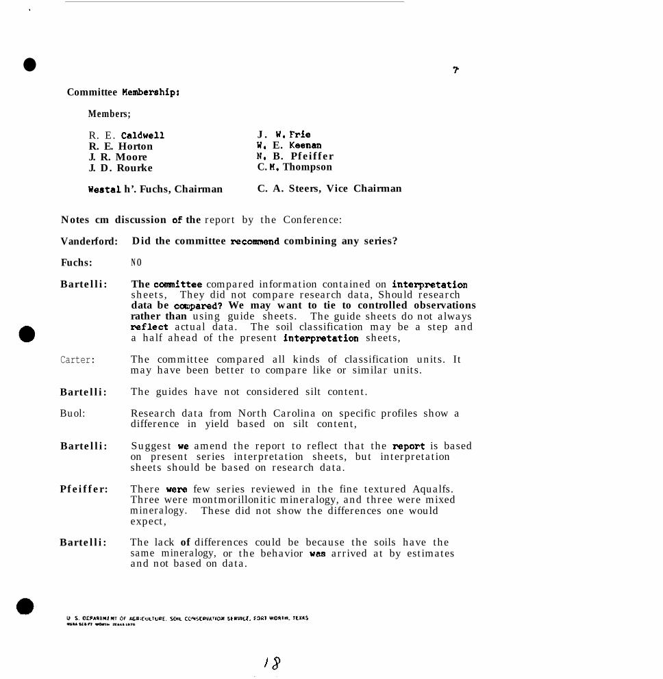
.
lCommittee Hembershipr
Members;
R. E. Caldwell J . W, FrieR. E. Horton W. E. KeenanJ. R. Moore N. B. PfeifferJ. D. Rourke C. H. Thompson
Westal h’. Fuchs, Chairman C. A. Steers, Vice Chairman
Notes cm discussion of the report by the Conference:
Vanderford:
Fuchs:
Bartelli:
Did the committee recosunend combining any series?
N O
The committee compared information contained on interpretationsheets, They did not compare research data, Should researchdata be canpared? We may want to tie to controlled observationsrather than using guide sheets. The guide sheets do not alwaysreflect actual data. The soil classification may be a step anda half ahead of the present interpsetation sheets,
Carter:
Bartelli:
Buol:
Bartelli:
Pfeiffer:
Bartelli:
The committee compared all kinds of classification units. Itmay have been better to compare like or similar units.
The guides have not considered silt content.
Research data from North Carolina on specific profiles show adifference in yield based on silt content,
Suggest xe amend the report to reflect that the report is basedon present series interpretation sheets, but interpretationsheets should be based on research data.
There were few series reviewed in the fine textured Aqualfs.Three were montmorillonitic mineralogy, and three were mixedmineralogy. These did not show the differences one wouldexpect,
The lack of differences could be because the soils have thesame mineralogy, or the behavior was arrived at by estimatesand not based on data.

(Notes 00 committee report continued) 8
Fuchs :
Gray :
Fuchs t
Carter:
DeMent:
Fuchs :
DeHent :
Bartelli :
DeHent:
Byrd :
Slusher:
Carter:
The first generation interpretation sheets are not always thebest. Some were taken from NLRA tables, As we accumulateinformation, we see where improvement is needed.
Are you proposing to name families? If so, how are they tobe named? Is the committee going to tell us how we name families?
By common family name (common series). The taxonomic family nameis too complicated.
The Southern Mississippi Valley Alluvium Soils Monograph is beingprepared using common family names.
There is a problem in making interpretations at the family level.For example, soils in the same family occur in HcCurtain County,Oklahoma, with corn yields of 35 to 40 bushels, while the soilsin North Carolina, have corn yields of 100 bushels,
Item 5 recommends we use soil temperature and soil moisture, butthey still come out in the same family, We cannot say the samething about the soils in Oklahoma and North Carolina.
Phases of families should be used where needed without a pre-determined breakpoint being defined.
Recommend where series have different behavior and the soilsare in the same family, we need some provision for phasingfamilies.
We can split at any level in taxonomy, Ph8ses can be used whenneeded.
Maybe some do not realize that phases can be used at any level.
The common family name idea would be Ruston family, but theRuston series may be absent. This may be a problem with a maphaving local application.
Where reconnaissance units are made up of only one-soil families,the family name might be OK. Why not use the series name of theseries that are there?
We are having problems with our universe. It depends on whetherwe are dealing with general soil maps for counties or multi-counties. Where we have named series in a small area, wewould use series names. Where the universe is larger, we coulduse family names.

l (Notea on committee report continwd)
steel%:
HcKeer
Googinsz
Fuchs8
Bartellir
0 Gray:
B6rtelliz
Perry:
Byrd:
If we cannot clssclify belox the family level, x6 would wethe family name.
If the soil is oUt6ide the range of the series, it would bebetter to use the family name than to u6e 6 variant.
What are your'suggestions for covarying properties?
Silt content alone.is not all important, Theta should beother properties. We should talk about a clustering ofbehavior rather than a specific breakpoint.
(Comment on naming of mapping units, item 6, page 6.)
There are area6 where we do not know the series. We wouldname the soils to the family level. Examples of this wouldbe a survey in Nevade that va6 completed, using family names.
Soil taxonomy is a tool in devising a legend. We are notdropping series. If we know and have time, we will "68 series.If not, xe may we a higher level. We are trying to keepmapping and naming within the framework of soil taxonomy.
Citedan example of naming by series that is not too acceptablerThe Houston Black is the family name for Udic PellUStertE, finemontmorillonitic, thermic family. In Oklahoma, the dominantsoil is San Saba. The family name then, doe6 not tell thestory.
This is a conwmication problem. We need a wientific name.We have one but it is too long. We need a common name for thefamily.
Hoved the committee report be accepted with the recommendedchanges,
Second.
Approved.

l
Appendix 1
The significanoe of silt cmtent as diffelantia in loamy and clayey Adults was evaluated fma series descriptions_aad available interpretation she&s. The Unified Classification, 200 sieve size, liquid limit, plaeti.city index.
and available water capacity given belcu are fmm the family control section. Corn yields and woodland suitabilityclass axw given for tbe least restrictive phase. At the end of each group, the average is shown for the raagc inthe coo& sectioa except Unified. which is shown as the dominate class.
Coarse-loamy.siliceouqhigh silt
SeriesBNakPoint
Yieldscorabu
woodsiteClam Unified 200 LL- -
Berm&& 20 85 2 nL 55-65l4cLaurin 20 80 263 sn, SC 38-45Harleatm 20 90 2 sn, SC 35-50Bloant~illa 20 90 2 nL, CL 60-75Stargh 20 80 2 !lL. CL 60-75BlawtQl 20 60 2 SU 36-45Escambia 20 100 2 HL 60-70Poarch 20 90 2 UL 60-70Latoaia 20 60 3 SM 30-40Bassfield 20 75 2 SM 30-W
Fiverage 20 81 2.1 sn, nL 46-57
BXYW%Xl 2020202020
7065
100
78
20-3520-3020-3525-4025-W15-3020-30M-30
PI-
O-65-106-108-128-10O-10O-10O-10
19-26 3-8
Coarse-loamy,silicaous.low silt
2 sn, sc 25-40 10-202 SU 18-35 lo-252 sa, SC 15-30 -
2 SW, SC 19-35 10-22
5-10o-4
3-7
AWC-
.12-.18
.12-.14
.X3-.16
.15-.18
.lO-.13
.08-.12
.lO-.14
.lO-.m
.lO-.15
.lO-.15
.Il-.15
.lO-.14
.09-.12
.lO-.14
.lO-.13
Subnrour,
Typic PaleudultsTyptc PaleudaltsAquic PaleudultsFragiaquic PaleudultsFragiaquie PaleudultsFmgiaquic PaleadultsPlinthaquic PaleudultsPlinthic PaleudultsTypic HapludultsTypic Hapludults
Typic PalaudultsAquic PalaudultsHumic HapludultsHumfc Hapludults

Basin
'Pine Flat#quatchie
AddiclouSmithdale*quimBCUfeSaucierBaxtervilleNalbisLucedaleCahabaPirVm
whitwellAverage
fo=wbwZNorfolkGOldsboroCarnegieCCRfal%SDothanRedBayDurhm
YieldsBreak CoxmPoint bu- -
(10-40)
201520202030202020202022.2
2030302015202030
75
6555
708080
100809050
74.4
ll012s7070808090
_(Cmtinued an sheet %3)=Interpretatico sheets not available.
0
WoodSiteclass Unified 200- It pr
Coarse-loamy, silicecus - undesignated
2 SM, UL 45-65 20-35 5-8
Fine-loamy, siliceous. high silt
3 SC, CL 45-65 20-352h3 SC. CL 40-55 18-40
3 SC, CL 40-5s 20-403 CL, nL 60-70 25-343 ML. CL 60-75 15-303 UL. CL 55-62 26-312 SC, CL 40-65 25-402 sn, SC 40-55 25-353 CL, UL 50-65 20-30
2.6 SC. CL 48-63 21-35
Fine-loamy, siliceous, low silt
4-20 .14-.168-10 .15-.17
12-20 .15-.208-12 .16-.1910-13 .x5-.205-9 .12-r208-15 .14-.188-10 .12-.154-10 .15-.17
7-13 .14-.18
2 SC 30-48 30-48 20-35 .12-.152 SC, CL 25-60 16-35 3-17 .x2-.152 SC 40-50 26-32 13-22 .lO-.142 su, SC 30-40 20-30 5-8 .lO-.142 sn, SC 30-40 20-30 5-8 .lO-.142 SC 25-35 25-35 8-10 .lO-.123 sn, SC 44-49 33-53 El-21 .12-.14
AWC-
.12-.20
2
Sag=P
Fragiaquic Paleudults(high)
Nhodic PaleudultsHumic Hapludults
Typic PaleudultsTypic PaleudultsAquic PaleudultsFragic PalaudultsPlinthaquic PaleudultsPlinthic PaleudultsPlinthic PaleudultsRhodic PaleudultsTypic HapludultsTypic HapludultsAqnic Hapludults
Typic PaleudultsTypic PaleudultsAquic PalaudultaFragic PaleudultsFragic PaleudultsPlinthic PaleudultsRhodic PaleudultsTypic Hapludults
l
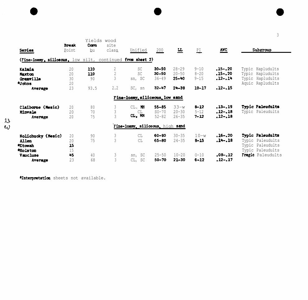
3Yields wood
Em?& cola sitePoint bu class Unified 200- - - - 44
(Fine-lcamy, silioaam. low silt, continued from sheet 2)
KahianaxtalGramvilla
‘Johnshvcx%ge
Claibww (Ircsic)Himale
Average
l0lichucky (nssic) 20 90Allen 20 75'Etcuah i5'Holstw 15vwcluse 45 40
Average 23 68
20 ll020 ll030 902023 93.5
20 8020 7020 75
2 SC 30-50 28-292 SC 30-50 20-503 sn, SC 36-49 25-40
2.2 SC, sn 3247 24-38
Finelo8my.siliwals.loUa~d
3 CL. UH 55-85 33-w3 CL SO-70 20-303 a* m? 52-82 26-35
Fine-loamy. silkecus. high sand
3 CL 60-80 30-353 CL 65-80 24-35
3 sn, SC 25-50 10-203 CL, SC 50-70 21-30
PI- AWC-
9-10 .15-.208-20 .15-.209-15 .12-.lY
10-17 .12-.15
8-12 .13-.lQ5-12 .X%.187-12 .l2-.18
10-w845
.16-.20
.tC.18
O-106-12
.08-.l.2
.l2-.17
SubKmup
Typic HapludultsTypic HapludultsTypic HapludultsAquic Rapludults
TypicPaleudulhTypic Paleudults
T&c PaleudultaTypic PaleudultsTypic PaleudultsTypic PaleudultsFragic Paleudults
*Interpretatica sheets not available.

SeriesBreakPoint
KullitArdillaTiftmHartsellsLinker~svilleHUlllph~y8
Average
Grover (ksic, Mica) 30Ward (music) 20Tate (Nesic) 30
Average 26
Edneyville (Hesic)Shc2wOOdWickhamAlta VistaStatler
Average
Yields woodcorn Sitebu Class Unified 200- - - GL
Fine-loauq. silicaous.undesimated
PI-
50 2 SC, CL 40-60 20-3075 2 sn, SC 36-45 18-2290 3 SW, SC 30-45 22-3690 4 CL 40-55 30-3550 4 CL 40-60 25-35
70 2 CL, ML, 30-65 20-3871 2.8 CL, SC 36-55 22-33
Fine-loamy-micacecls 5 mixed-low silt
5-15 .l2-.165-8 .lO-.127-20 .lO-.1510-15 .15-.1811-20 .16-.19
6-15 .lO-.167-15 .12-.16
90 3 SC*.~ 36-65 35-702 sn, CL 30-60 25-40
105 2 HL. CL 67-91 o-4197 2.3 CL, SC 44-75 30-50
Fins-loamy. mixed,undesignated
15-35 .12-.147-15 .ll-.17O-l2 .17-.197-20 .13-.16
90 2 ML, sn 35-55 8-40 7-2055 3 CL 65-85 35-50 13-2595 3 SC, CL 35-55 28-30 8-1090 2 SC, CL 28-70 20-45 5-6100 2 CL, UL 60-80 15-30 S-1286 2.5 CL, SC 44-69 21-39 7-14
.14-c.16
.18-.22
.13-.15
.l2-.14
.17*.20
.15-.17
4
SubemUD
Aquic PaleudultsFragiaquic PaleudultsPlinthic PaleudultaTypic gapludultsTypic IiapludultsTypic HapludultsHumic Haplndults
Typic IiapludultsTypic HapludultoTypic Hapludults
Typic HapludultsTypic HaplndultsTypic HapludultsAquic HapludultsHumic Hapludults
l Interpratatfon sheets not available.

5
E9. lien&ram
tflWayaeshoroAlcoa (Oxidic)
AOaFep
Annistm 35 85 3 CL, ML 80-98 30-40Georgcdlle 30 80 3 CL, Kg 75-96 45-70Hemdan 30 80 3 nIi 85-98 50-60
Average 32 82 3 a.m 80-95 42-57
BZWakpoint
202020204024
20202020
Y i e l d s woodCOlXl Site
hu Claws Unified 200-7 -
Clayey,kaolinitiq low szmd
LL
70 3 ml, CL 75-95 55-7075 3 a, 88 70-90 30-80
100 3 CL. UH 75-80 45-5595 3 a. XL 65-98 32-6085 3 CL, m 71-91 40-64
clayey kaolinitiqhigh sand
3 CL, NH 45-7085 3 CL, IM 51-7580 3 a,m 65-7582 3 CL, IM 53-73
Clayey,kaoliaitic. hi# silt
30-53 18-26 .lO-.l435-55 10-30 .14-.1650-55 20-26 .f4-.1838-54 16-27 .l2-.16
PI AWC- -
24-38 .lO-.1612-26 .lI-.15
12-20 .13-.1811-35 .12-.1415-29 .ll-.16
8-15 .15-.1720-30 .13-.1820-30 .15-.2516-25 .14-.20
subgroup
Typic PaleudultsTypic PaleudultsTypic PaleudultsRhodic PaleudultsRhcdic Paleudults
Typic PaleudultsTypic PaleadultsRhodic Paleudults
Rhodic PaleudultsTypic HapludultsTypic Hapludults
l Intemmtatim sheets not available.

EstoFzwwnville*V&+inaHulettMadisonPacoletUedaree
Average
BNakPoint
30 a5 3 CL, nL SO-70 29-37 12-M .lO-.1320 90 3 CL, ai 50-70 25-45 11-25 .14-.1830 110 2 CL, Cn 53-62 24-54 13-39 .33-.1530 90 2 CL, CH 65-90 41-60 15-30 .12-.1530 362 SC, CL 40-55 26-43 19-26 .lO-.1320 80 3 CL, SC 45-65 30-40 11-25 .12-.l.530 90 3 UH 55-75 60-74 25-28 .l2-.1430 95 3 ml. CL 55-95 40-60 16-37 .13-.1530 90 3 nH 70-90 70-80 30-37 .12-.1426 61 2.6 CL, CH 54-77 28-57 17-29 .l2-.15
Yields WoodCorn Sitebu class Unified 200- - -
Clayey, kaolinitic, low silt
Clayey. kaolinitic-lmdesignated
4s 3 CL, SC 45-65 35-50 15-35 .lO-.1585 3 CL, SC 45-60 30-45 10-25 .X2-.16
60 3 ml 70-60 45-60 20-25 .l2-.1690 3 m a 66-76 57-24 27-31 .12-.1455 3 mi so-70 SO-60 10-25 .I%.1660 3 SC, CL 40-70 55 15 .lO-.1469 3 CL, nH 53-70 42-45 16-23 .ll-.15
E AK!-
6
sUbnroJ1D
Typic PaleudultsTypic PaleudultsAquic PaleudultsAquic PaleedultsPlinthic Paleudul*Rhodic PaleudultsTypic HapludultsTIpic HapludultsTypic Hapludults
rypic PaleudultsPlinthic PaleudultsPlinthic PaleudultsTypic HapludultsTypic HapludultsTypic HaptidultsTypic Hapludults
eIInterpretation sheets not available.

shubuta*CarolineTiakSequoia (Mesic)*HowellMbertvilleCarnasawEndersKiminTom&y
*cullen*HayesvilleSeasalCFNd!lWZHelenaSaculrVinitaHolftever*Lignumr1iftcn (Ilesic)
A v e r a g e
Yields HOOdBreak corn sttePoint bu Class Unified- - - 200 g-
Clayey. mixad, undesignated
6 0 3.54
50 355 3
75 335 325 450 355 4
55 375 375 345 3
70 3
55 3.2
CL 12-20 .14-.17
CL, CHKH* CL
60-75 30-W)
90-98 40-6090-100 43-74
15-30 .14-.1820-40 .15-.18
CH 72-95 50-55 18-25 .09-.13CL, CH 70-80 40-65 15-35 .14-.18MH, CH 85-100 65-80 35-45 .17-.20C% bw 50-75 40-60 11-25 .lO-.15CL, CH 70-90 30-50 12-25 .12-.18
CLCH, MH
CHWM, cn
85-95 30-4075-08 61-7956-76 50-6980-95 60-70
90-95 40-55
75-89 44-61
10-20 .17-.2032-49 .13-.1525-40 .13-.15'20-32 .15-.20
CL, nH
CL, CH
10-20
18-30
.x-.20
.13-.17
” AiiC-
7
Subgroup
Typic PaleudultsTypic PaleudultsAquic PaleudultsTypic HapludultsTypic HapludultsTypic HapludultsTypic HaplndultsTypic HapludultsTypic HapludultsTypic HapludultsTypic HapludultsTypic HapludultsAquic EapludultsAquic HapludultsAquic HapludultsAquic HapludultsAquic HapludultsAquic HapludultsAquic HapludultsHumic Hapludults
*Interpretation sheets not available.

itT'-TT'bT'-OT'
ET'-OT'
Z-t'-60'
ST.-ET'ST.-ET'
ZT-9 TE-ATof-0 09-o
9-m. SE-ZZ
OT-0 6Z'92
ZT-OT OB-TZ
ST'_ZT EE-9T 89'SSLT'-+lT' OZ-5T OL-09
iIT'-ZT* t&-Z 0 8 1 9ST'-OT' SE-ST SE-T*
6T'-9T'02'-8T'
0E-LT0E-ST
oz'-9T' OC-ST9T'%T' OfFOE
l.S-21115-06
09-0s09-0s
E
SC-LZ 2s ‘YS 8SZ-OZ 3 s ‘us E
OS-06 3 s ‘ns E
OS-SE 3s l ns E
m-OE 2s ‘YS EOS-TE 5s E
aTTa ~T-61D‘JT-JT=W
SL-T9 13 ‘i-m E08-OL w 0
T8-69 !U ‘FM I?59-s* 1 3 ‘3s c
aT?s *T-P=F‘do6sT3
E6-SE w +I3 9’206-08 m ‘13 Z
s9
SL
0 609
9 909
SLSh
9 9SS
s s0 6
oz
OZ
OZoz
06060906OE
OEOE06OEOCOSOE
8

9Yields Hood
BNaak conl sitePoint bu ClrsS Unified 200- - - -
Arenic-loamy-undesignated
UicksbQrgRs. *aim (la silt) 204
70 3 SC. sn 35-4540 3 SC OS-5045 3 SC, CL 36-55
3 SC, CL 30-3551 3 SC, CL 36-46
AlWic-wq
70 3 CL SO-70
LL EL -AK! w
Aquic Amnic Paleudults20-35 6-16 .12-.lY Arenic Paleudultw20-30 l&l5 .lO-.I.5 Axwnic Paleudults20-W) 11-20 .lO-.lS hmnfc Paltuddults25-35 11-16 .15-.20 Armic klp1udults21-35 10-14 .X2-.16~
JO-40 10-20 .l2-.15 Annie PaloudultsArmic PlirIthiC
Paleudulta
l Inttrprctatim sheets not available.

Numbsr of Yieldsseriu Break CornEvaluated Point bu- -
1043
25
1112375
7205339
64
' 5
:
131
>20<20
L20723>22.2L 23< 26
6 24> 20> 32< 28
> 30< 30
< 20
81 2.1 sn, ML 46-57 19-26 3-8 .11-.15 CL, ail-high silt 1070 2 sn, SC 19.35 10-22 3-7 .lO-.13 CL, silt-low silt 375 2 sn, UL 45-65 20-35 5-a .12-A0 CL, silt-not designated 1
75 3 CL, HH 52-82 26-35 7-12 .l2-.18 FL, sil-low sand 268 3 CL, SC 50-70 21-30 6-12 .l2-.17 FL. sil-high sand 374.4 2.6 SC, CL 48-63 21-35 7-13 .l4-.18 FL, sil-high silt 993.5 2.2 SC, SM 32-47 24-38 10-17 .12-.15 FL, silt-la silt 1097 2.3 CL 44-75 20-50 7-20 .X3-.16 FL. mixed-low silt 371 2.8 Cl, SC 36-55 22-33 7-15 .l2-.16 F L , sil-un&si#~ated 686 2.5 a* 44-69 21-39 7-14 .15-.17 FL, mixed-undesignated 5
69 3 CL, ml 53-70 42-45 16-23 .ll-.15 C. kao., undesignated 655 3.2 CL, nlf, (91 75-69 44-61 U-30 .x%.17 C, mixed, Im&si@ated 1385 3 CL, KH 71-91 40-64 15-19 .ll-.16 C, kao.-low sand 482 3 CL, HH 53-73 Ja-54 16-27 .l2-.16 C, kao.-high sand 362 3 a. m 80-95 42-57 l6-25 .14-.20 C, kao.-high silt 361 2.6 CL. CH 54-77 28-57 17-29 .x+.15 C, kao.-low silt 9
66 2.666 3
76 351 370 3
CL, PM 85-93MS, CL 6675
SK, SC 27-45SC, CL 36-46CL 50-70
43-57 17-30 .16-.19 C, mixed-high silt55-66 18-33 .l2-.15 c, mixed-low silt
17-3121-3530-40
4-12 .ll-.14 hit-loamy-lou silt10-14 .X+.16 Arenic-loamy-uodesignatcd 510-12 .l2-.15 Amnic clayey 1
107
.
woodsiteCIASS
AVERAGES
Unified 200- LG
10No. ofAVailabLcInterp.
PI E a Sheets-
l l

CLASSIFICATION
fine-lo&y, mixed,thetic
Aquic Haplustalfa, Dslfinafine-loamy, mixed, Lozanbhypsrthermic Lyford
fine-loamy, mixed, Vashtf Not evaluated -
Areaic Haplustalfs,losmy. dxed,~thermic
Aridic Haplustalfs,fine-loamy, mixed,hyperthermic
SERIES
Menard
Rochelle
Dougherty
Stidham
BlWlnQlUuval
Udic Iiaplustalfs, 4Ciscof he-loamy,mixsd, thermic Cohb
Grandfield
nay
Ultic Haplustalfs, Kcaamafine-loemy, mixed,thermic Stephenville
*siliceous family
SILT 4 2
c30% fsl SC125-35
<30% fS1 SC128-35
( Not evaluated -Not evaluated -
(30% SC1 SC125-35
<30%
<JO%
<30%
430%
40%
430%
c300
<3os
lfS
ifs
fs1
If.9
fs1
fsl
fsl
lfs
18-35SC118-30
SC118-30
SC120-35SC120-30fsl-SC118-30SC120-35
SC118-35
AVA L.H28
to 40"
6.5
3.0-32
ADAPTED NATIVECROPS VEG.
Gr. "org., Hid-grasspeanutsGr. sorg., Mid-grasssmall g.
PEINDEX
38-48
32-46
RAINFALL(RANGE)
22-30
20-30
AIRTEMP.(EST.)
1
LL PI(IJETER B) (uppER B)
67O F, 30-40 12-22
67O F. 20-30 10-20
7.2 Cotton, gr. Mid-grass*org., winterQeg*
30-36 24-28 72O F. 30-40 15-25
4.0
4.0
Sorg., small Mid-tallgr., peanutsSmall gr., Mid-tallpecmuts
44-64
44-64
26-40 62" F. 20-35 5-15
26-40 62" F. 20-35 5-15
4.8 grain song. Mid-grass 26-36 20-26 ?p F. 20-35 7-15
7.2
4.2 to30
5.2
6.0
Tall 6 Mid-grass
Mid-& Short
Cotton, gp. Mid & tallsorg.Gr. sorg., Uid .5 tallpeanuts
38-52 28-33 64" F. 30-40 11-25
23-48 20-28 63" F. 25-36 12-20
28-44 19-28 62" F. 20-35 5-15
40-64 26-40 66O F. 30-40 15-25
4.9 Mid & tall 44-64 26-40 62O F. 20-35 5-15

2
CLASSIFICATION SEPJESARGIUSTOLLSTypic Argiustolls - mgefine-loamy. mixed.hyperthemic
Pad& _ fine-loamy, mixed,hyperthermic
fine-loamy,mixed, thermic
Udic - fine-loamy, mixed,hyperthemic
fine-loamy,mixed, thcrmic
Tela
CueroRarrsdem
Altus
Tiptm
FmmHilan
Willacy
Chickasha
XluvNacon
“xAgL-QSILT A B to 40"-__
<30% fs1 SC1 6.4
cm SC1 SC1 6.6
not updated -<30% loam SC1 6.6
C30%'? fsl SC1 5.0
130% loam cl 6.2
Not evaluatedNot evaluated
<30% fsl scl, fsl, 6.418-30
(30% loam SC1 8.0U-30
Not evaluated -Not evaluated -
Shellabarger~30% fS1 SC1 5.218-27
Teller kO% fsl SC1 5.8018-30
Zaneis 530%? fsl cl 6.020-35
ADAPTED NATIVECROPS VEG.
cotton, gr. mesquite,sopg., flax. hackbefiy,CO211 spiny cat-
clawNon-avail. scsquite,
huisache
gr. sorg. mesquite,huisache
cotton, Tall grassalfalfa, prairiegr. sorg.cotton, Mid & tallalfalfa, gmssgr. sorg.
cotton, gr. mesquite,song., citrus wh. by.
cotton, gr. Tall grasssorg.
50-64
wheat, sorg. Tall grass 37-52
gr. sorg., Tall grasscotton,peanutswheat, song., Tall grasscotton
44-64
44-64
PEINDEX
30-44
19-31
20-30
34-44
32-44
22-34
RAINFALL(.RANGE)-.
24-35
AIRTEMP.(EST.)
72O F.
19-25 72O F.
18-24 720 F.
22-28 64O F.
21-29 61° F.
20-28 72O F.
25-37 63O F.
22-32 59O F.
29-39 62O F.
26-40 62O F.
("P:kR B)
22-36
27-35
20-35
35-50
23-30
22-35
25-40
(40
24-49
(“PiiR B)
8-18
12-25
5-15
10-25
7-18 l
6-15
11-25
O-20
8-25

3
CLASSIFICATIOW SERIESCALCIUSTOUSTVD~C Calciustolls. Bolarzne-loamy, _carbonatic, themic
fine-loamy, mixed, Hidalgohypertbemic
Sarmosa
fine-loaq, mixed, CLarkthermfc &ag&
V-US
Ar?idic Calciustolls- llansicfine-loaw. mixed. uanskertheraic PortalesHAPLUSTOLLSAFidfc miustou3 - Phdur-3
fine-loaky,mixed,
ltltermic
Zita
CunulicHaplustol&- odemcoa~sa-lw,~ mixed,hyperthermic
fine-lW, mind, Sintonhyperthermic
fine-loamy, mixed, B~PP=them&
Bosqua
SILT
>30%
L30%
<30%
,30%
130%
430%
418%
L 30%
730%
>30%
X0%
A B_ _
Cl Cl
scl SC120-35
fsl SC118-30
-loam losm
18-30
Not evaluatedNot evaluatedNot evaluated
cl cl18-35
loam cl25-35
fs1 fsl10-18
loam loam20-35
cl cl20-35
loam cl22-35
loam cl
7.2
7.2
6.4
7.2
5.6
7.2
7.2
6.6
7.2
ADAPTED NATIVECROPS VEG.- -
v. sow*, Mid-grassoats, cotton
cotton. veg. Hid-grasscitrusCotton, gr. Mid-grasssorg.. flax.
small gr..cotton
gr. soFg.9cottan,wheatwheat, gr.sorg.
gr. sorg..cotton
cotton, gr.sm.
Uid-grass 44-64 28-40 660 20-40 5-18
Y-24
__
Short-grass 24-34 620 20-35 8-20
Short-grass 25-34 17-22 620 30-42 20-25
Mid-grass 31-44 23-35 72O 5-19 NP-5
AIRPE RAINFALL TEUP.INDEX (RANGE) (EST.) ("PP& B) t"%R B)
44-64 28-40 66O F. 30-45 15-30
28
28-44
26 720 -
24-34 72O 34 20
Short & mid- 34-44grass
cotton, wheat, Shot-t 6 22-36m.sorg* Ufd- grass
sorg., small Tall grass 44-64gr., pcc=s
26-33 720 30-40 18-25
16-26
28-35
620 20-40 4-20
660 30-40 lo-25
33

1
4 l
CLASSIFICATION SERIES7nnmmn- -Typic PaleustOUd - :Buktackiine-loauy.mixed, themic
Aridic Paleustoll8,fine-loamy, mixed,hppCtihCZWIiC
Caid
thcrmic Acuff
Udic Paleustolla -fine-loamy, ~mixed,thermic
SILT
<30%
L30%
L30%
<30%
A B_ _
lOam SC1
SC1 Cl 5.2 gr. SOFg. Uid 6 Short 26-36 21-26 ?2OF.27-35 @a=
loam SC125-35
lOaH! SC125-35
AVA L.8
AIRH2 ADAPTED NATIVE PE RAINFALL TEMP.
to 40" CROPS VEG. INDEX (RANGE) (EST.)
5.9 cotton, gr. Hid & Short 32-38 21-25 62OF.song., wheat grasses
6.8 cotton. gr. Short 22-34 17-21 62OF.sorg., wheat
6.0 cotton, gr. Uid & Short 32-44 21-28 66°F.SO%.
UJP;RB) ("P::R B)
30-40 15-25
25-35 10-20
30-45 15-25
30-W) 15-25
this information was evaluated fxwn series descriptims and soil interprctatim sheets for the loamy Ustalfa and Ustolls. The liquid limit andplasticity index are given for the upper part of the B horizon OP the upper part of the control sectim. Available water caDacitp iscalculated for the upper 40 inches of the soil, when soils we= at least 40 inches thick; otherwise, the figures are for the whole soil.
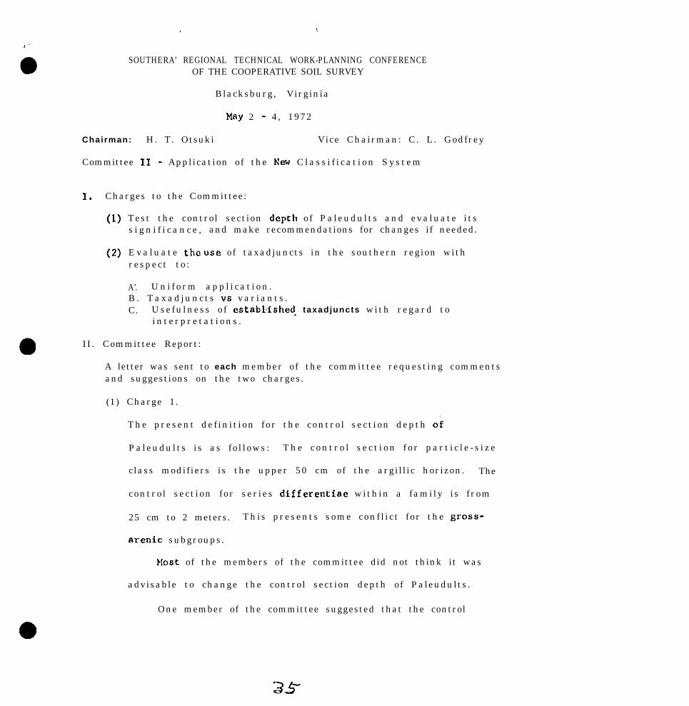
SOUTHERA’ REGIONAL TECHNICAL WORK-PLANNING CONFERENCEOF THE COOPERATIVE SOIL SURVEY
Blacksburg, Virginia
May 2 - 4, 1972
Chairman: H. T. Otsuki Vice Chairman: C. L. Godfrey
Committee 11 - Application of the New C l a s s i f i c a t i o n S y s t e m
1. Charges to the Committee:
(1)
(2)
Test the control section depth o f Paleudul ts and evaluate i t ss i g n i f i c a n c e , and make recommendations for changes if needed.
E v a l u a t e the USC of taxadjuncts in the southern region withrespect to :
A’. U n i f o r m a p p l i c a t i o n .B . T a x a d j u n c t s vs v a r i a n t s .C. Usefu lness o f estabLished_ taxadjuncts with regard to
i n t e r p r e t a t i o n s .
II. Committee Report:
A letter was sent to each member of the committee requesting commentsand suggestions on the two charges.
(1) Charge 1.
The present de f in i t ion for the contro l sec t ion depth ok
Paleudults i s as fo l lows : T h e c o n t r o l s e c t i o n f o r p a r t i c l e - s i z e
class modifiers is the upper 50 cm of the argill ic horizon. The
contro l sect ion for ser ies differentiae within a fami ly i s f rom
25 cm to 2 meters. This presents some conf l i c t for the gross-
arenic subgroups.
bbst of the members of the committee did not think it was
advisable to change the control section depth of Paleudults.
One member of the committee suggested that the control
39

2
(2)
section depth of Paleudults be changed by adding the following
statement: “In grossarenic subgroups, if the sandy epipedon
is 1.5 meters or thicker, particle-size modifiers or substitutes
are applied from the top of the argillic horizon to 2 meters.
(If the sandy epipedon is less than 1.5 meters thick, then ‘the
upper 50 cm of the argillic horizon applies.)“.
One member of the committee suggested that the cont.rol
section depth of Paleudults be changed to a 10 to 30 or 40-inch
depth.
charge 2.
A. The Committee all agreed that taxadjuncts have been used
in accordance with the instructions in Soils Memorandum - 66.
Some members indicated that in some instances the soil
series description should be revised to allow a wider range
_ in co lor , texture , reaction or thickness of horizons to
accommodate these kinds of taxadjuncts.
B. The Committee all agreed that taxadjuncts and
been used in accordance with the instructions
Memorandum - 66 and had no suggested changes.
variants have
in soils
Taxadjuncts were used for minor differences from the
taxa. They are enough like the soils of the defined series
in morphology, composition, and behavior so that little orc
3si i

, .
anothing would be gained by adding a new series. No limit
is placed on the extent of the taxadjunct.
Variants were used for major differences from the
taxa. They are enough different from the soils of the,
defined series in morphology, composition and behavior that
a new series is needed, but the extent of the variant is
less than 2000 acres.
C. All members of the committee agreed that taxadjuncts have
no significant differences in interpretations from the series
they were correlated. ._
(3) Classi f ication of Taxadjuncts.
Though not covered specifically in charges, some meinbers of
of the committee feel that in published soil survey manuscr ipts ,
the classification of the taxadjunct should be shown rather than
the classificatton of the series from which it was named. Al l
members of the committee do not feel that this is necessary.
III. Committee Recommendations
(1) Charge 1.
The Committee recommends that no changes be made in the defin-
ition of the control section depth~of Paleudults .
(2) C h a r g e 2 .
A. The Committee recommends no change in the present definition
of a taxadjunct as described in Soils Memorandum - 66.
37

. .
l4
-B. The Committee recommends that no change be made in the
present definition of a variant 86 described in Soils
Memorandum - 66.
C. The Committee recommends no change in the present use
of taxadjuncts with regard to interpretations.
(3) Classification of Taxadjuncts.
The Committee recommends no change in the present classification
o f taxsdjuncts. The Committee feels that the taxadjunct Is
enough like the series from which it is named that it would
not add anythinp, by changj~ng.the c lass i f i ca t i on .
(4) The Committee recommends it be continued.
Commit t ec Wember--.
H. T. Otsuki - Chairnan - OK
C. L. Godfrey-- Vice Chairman - TX
R. I. Barnhisel - K Y
0. R . Carter - A K
W. L. Cockerham - LA
A. L. Newman - TX
w. M.
c. L.
R. C.
J. A.
J. H.
KOOS - Mississippi
Brsmlett - Georgia
Carter - MS
Elder - TN
Newton - KY
3,2! T

On page6 207 and 208 of the 1971 Proceeding6 of the Nation61 Tech-nical Work-Planning Conference each regional colamittee wa6 adked to:
1.
2 .
3 .
r/
Continue the development and evaluation of small-scale soilrpSp6, legends, and interpretative table6.
Concentrate their effort6 on the general soil map6 included inthe published coil survey, Resource Conservation and Develop-ment plans, River Basin 6tUdi66, etc.
Ret-nd way6 of enhancing the intarprrtive potential of thegeneral coil up included in the published Soil survey, RC6Dplane, etc.
Referents rource - Conclusion6 and recolrmendationr of the South-ern Region61 Technical Work-Planning Conference, Baton Rouge,Loui cliana.
SOUTHRRN REOIONAL TECRNICAL WORK-PLANNINGCONFERBNCE OF THE COOPERATIVE SOIL SURVEY
Black6burg, VirginiaWay 2, 3, 4, 1972
Comittee I I I soil interpretation at the higher categories of the“aw clr66ific6tion clyrtem
Chairman: M.R. Springer
Vice chairman: .T .U. Yqsr
Charges:
1. lhke a concentrated effort toscale maps end legend6 at thelevela. J/
ferret out examples of smallcounty, 6tate and regional
2. Conaider the interpretative decision6 that can be m6de fromsoil map6 and legend6 of various rcele and detail. l_/
3 . Charge6 1 and 2 6hould be considered using the tecommondedactivities for the regional committee6 listed on pages 207and 208 of the National Technical Work-Planning Confarenceof the Cooperative Soil Survey, Charle6ton, South Carolina.
39

2
I.
I” February 1972 the chairman arbitrarily divided the Tagio” intonine parts - one for sach member - and asked for maps and comnentsfrom each part. Response was excellent and nearly all mambere centreports.
A sample of the mape are listed along with fragments of commte bindividual committee members.
The unpublished colored general soil map of the~southernMississippi Valley, scale 1:1,250.000, was prepared by USDA, SoilConservation Service and the Agricultural Experiment Stations ofArkansas, Louisiana, and Mississippi. “The legend is arranged inalphabetical sequence of order, suborder, great group, and theseries family name.” “The map unite are mostly associations ofsoil families.” Wlch unit name is preceded by a letter - numbersymbol, e.g. M-3. It is followed by a one sentence description ofthe soils and their position.
Some comments about the map are: “A general soil map of this typeand scale is a” excellent tool as long as it is used within itslimitations. It is a” excellent source of basic resource informe-tion for broad generalized planning; i.e. planning for county ormulti-county wide solid waste disposal systems determining the needand general location of food processing plants, planning for resourceconservation and development project measures, etc.
The main problem with a map of this type is that came people attemptto use it without fully realizing its limitations. This is not aweakness of the map per se.
I feel that the interpretative maps based on the higher categoriesof our present classification system will play a greater role asa basis for planning and development of our natural resources in thefuture ‘I.
A comment from eomeone not on the camnittee may be paraphrased ‘Novalue for individual management decisions. May be dangerous if mis-used for such purposes”.
Joe Nichole’reeponee to his difficult charge is so thorough that itis reproduced as an amendment to the report. He raises some pointswhich certainly need further attention. He canmente on a generalsoil map of the county, a general emp .of an RC&D area, computergeneralized soil ueer mape, and the Southern Regional Soil Map. Thedifference, by states. in degree of detail on the regional emp ispointed out and the possibility of removing enme detail and publieh-ing on a scale of 1:5,000,000 is mentioned.
40

Loftin(Scs le
3
sent general soil maps of the Capital RC6D project1:590;000) and AsCension Parish (Scale 1:126.720)
to”isia”a. The regional map uses two categories, the lowestof which is soil associations named for one to 3 of the mainseries in the association. The parish map has one category(soil associations named for the dominant series). In both casesthe names are followed with a brief listing of the nature anddistribution of soils in the delineation.
From Florida we received three small scale maps and legends.
“The two county general soils maps represent two approaches usedin Florida on county general soil map legends. Highlands Countyis an example using a Statewide legend. After this was tried, itwas decided that each county general soil map and legend shouldstand on its own. As a result, the format used on the lake CountyGeneral Soils Map is now being used. YOU will note that the redlines are used in Lake County to distinguish the soil boundariesfrom the black lines which are used for roads and other features.This seems to be quite effective. The general soils map of theWest Florida RC&D Project is included as an example of a regionalmap. We feel that the scale and the detail for this type of mapis about right. Consideration might be given to 8 slightly largerscale, possibly l:SOO,OOO, The interpretation tables are examplesof how we are interpreting the general soils maps. The categoriesfor which the map sre interpreted must be kept general 8s shown inthe table. I do think it would be more useful if each of theassociations was interpreted as to its use potential. For example,Association No. 1 might be rated as having low potential for gen-eral farming. Other rating categories might be ‘moderate poten-tial’ and ‘high potential ’ .
The General Soils Map of the State of Florida, which is also en-closed, has s scale of about 1:1,000,000. I feel the scale ofState General Soils Maps could be enlarged to about 1:750,000 andstill be a manageable size. we generally consider this map ashaving too much detail to be an effective planning tool. Even ata larger scale, much of the detail should be removed to be useable.”
Texas sent general soil maps of counties. Also,a General SoilMap of Texas Coastal Basins is under preparation. It is a twocategory map in which the lowest unit is soil association. Scale is1:500,000 and descriptions are brief.
Georgia sent general soil maps of counties at scales of 1:63,360and 1:126,720 and mentioned that scale should be adapted to complexityof soil and anticipated uses of the map. Their general soil map is ona scale of 1:1,000,000 but they conceded that 1:750,000 or l:SOO,OOOmight be better for potential ares6 of farming or other state orienteduses.

4
Oklahoma dent a trtate map, re8ional map, and county mapa. Thestate map on a very anal1 scale has been very popular a8 ,a”educetional tool and for reaeatch and program training. Theirre8iO,lA1 map hae t en Unit0 Of 8011 e8MEiBtiO”fI. It in used forland and water resource plannin8, regional planning and educa-tional purposes. They consider the general soil maps of thecounty soil survey an not being very u s e f u l . They *re optimisticabout the computer generalized 8~11 uBer maps as prepared byOt suki .
T.U. Ysger sent two maps from outside the region and comment6 ontheir merits in the attached quotation.
“1. ‘Land Use in the Southwestern United States from Gemini andApollo Imagery, ’ 1:1,000.000 by Norman J.W. Thrower eesistedby Robert H. Mullen8 II and Leslie W. Serger; Cartography byCarolyn Crowford and Keith J. Walton, University of California,LOB Angeles. Hap supplement No. 12, Annals of the Aseoctstionof America” Geographers, Volume 60, No. 1 March 1970, 3. Fraserllart, miter; Norman J.W. Thrower, MGS Supplement Pditor. Weonly have one copy of the map in thirr office. They are for salefrom Central Gffice of the AAC, 1146 16th Street NW, Weahington,D.C. 20036 for $3.00 each.
Ten kinds of land use are shown. Some area8 were uninterpretablebecause of cloud cover. Field investigation was made to checkpreliminery interpretations.
This kind of photo coverage is a good base msP for large areas.I believe one interpreting the.map would have to have considerableknowledge of the area or it would require a lot of field invest-i8atiO”. The interpretation of similar color texture patternsmsy vary from one section to another when considerin large areas.I suggest the committee review various meps prepared from satellitephotographs.
2. General Soil Map-Eest Centrsl Vermont RChl) Project-Vermont.A copy of this map is attached. The map scale is 1:335.000.This mntchee other kinds of maps in the report; hnwever, it innot a stnndnrd scale commonly used hy other makerR of mane.The map is limited in use to this report. The scale should haveheen either 1:500,000 or 1:250,000.
42

5
Interpretations are made for the two or three major aoila ineach association. Three classes of soil limitations are ahown forseptic tank filter fields, small buildings with basements, indus-trial buildinga-no basements, streets and parking areas, exten-sive camp and play areas, sanitary landfill, and farming. Itstates planning specific sitee is best carried out with the use ofdetailed soil surveys and land use plannirp, at the community ortown level is also an important u8e for the detailed soil survey.
The detail shown on the map appears to be about right. A fewsmall contrasting area8 (unit 1) are shown. I saw no referencein the report as to how the map waB prepared. This should bementioned and any reference to existing county or other generalsoils maps listed.
The question that should be aekcd ie, ‘What kinds of interpreta-tione are appropriate for a small-scale map of this kind?’ Tome, septic tank filter appears too limited. Farming, on theother hand, is too all inclusive.buildings, industrial buildinga,
Developments, including smelland streets and parking areas might
well be grouped under item, ‘community development.’ Permingmight be subdivided into cultivated agriculture and grassland orwoodland agriculture.
In developing small-scale soil maps or any scale soil map formaximum usage, we mu.% use a scale which matches the scale of theother maps. Other maps refer to topographic maps, geology maps.etc. The scale should be one that will be compatible within thearea of study 88 well as adjoining areas. lhts was brought out byone of the users at the Knoxville Training School in October 1971.S c a l e s o f l:l,OOO,OOO; 1:250,000; l:lOO,OOO; 1:50,000; l:lO.OOO;etc. are preferred to such scales as 1:506,880; 1:126,720; 1:31,680;1:20,000; 1:15,840; e t c . In reviewing maps printed by the USDA,SCS, the scale appears to be determined more or less by what willfit on a page.
The Committee should concentrate on getting maps on scales whichwill meet the needs of the most ueere.”

6
Sumnary end conclusions
It is now apparent that the implications in the title for this corn-mittea and the charges to the committed are separate problems whichmust be attacked in different ways. There are sane rather definiteinterpretations that may be made for Aqualfs, and even more forFragiequalf s. These are taxonomic units which if situated in pureareas would not be influenced by associated s,,ils and inclusions.This committee did not pursue such predictions.
When soil series belonging in these higher categories are delineatedon a general soil map, any predictions are diluted by the scale of themap , the minimum size of area, and the purity or probability within adelineation. The greater the contraat among the included and associ-ated soils, the greater their impact on the accuracy of predictions.This is true when the general map is based on detailed information.When a map is prepared by reconnaisance methods,further fiaccuraciesare introduced.
The committee has several suggestions; In preparing a general soilmap. careful consideration should be $iven to the type of interpreta-tions that are to be made. The objective of the map, what interpreta-tions can be made, and more important what interpretations cannot &made should be decided before the map is prepared. Furthermore thesepotentialities and limitations should be clearly spelled out for allusers.
After these objectives are set up, then one can select the scale ofmap,, minimum size of delineation, and balance between the two thatare most desirable for the objective.
Size of map should be designed to meet the objective. but in additionscale should be compatible with other maps in the area. For example,scales of 1:1,000,000; 1:250,000; l:lOO,OOO; l:lO,OOO are preferableto odd scales.
Overall ratings are haeerdous , except for general planning, but arehelped if clearly accompanied by purity or probability statements.Accuracy of prediction will be greater on a map prepared from detailedinformation than from a reconnaisance.
Ratings should differ on general and detailed maps.
Sn general maps, potentials for general faming, cosssunity develop-ment, etc. may be superior to limitationa.
~_..
44

Although the general sol1 maps inthe county surveys have somelimitations and are eomctimes misused, general soils maps forregions of B state or for an entire state are popular and sarvemany genersl purposes, especially if interpretations take intoaccount the handicaps of the scale and the variability withineach delineation.
Computer produced single purpose user maps should be pursued.Where detailed soil surveys are available, these user maps maybe far more useful thsn general soil maps. Grids should be se-lected with users in mind, and delineations on the original mapmust be smaller than the grids. Spatial arrangement should beconsidered along with grids.
A new committee should be appointed to
1. Coordinate si~ze of delineation with scale of general map.
2. Develop guideline for preparing computer generalized soil userUl.S.DS.
Members of Committee III
M.E. Springer, chairman, TennesseeT.U. Ysger, vice chairman, Fort Worth, Texas
W.E. Bright, MlesissippiV.R. Catlett, ArkansasF. Gray, OklahomsK.W. Johnson, FloridaL.L. Lofton, LouisianaM. Milford, TexasJoe Nichols, Fort WorthR.M. Smith, Virginia

UNITED STATES DEPARTMENT OF AGRICULTURE
-. SOIL CONSERVATION SERVICE 8 ~h...&piana~,~~~ sarnj_ hm--.----...~ _ . ~..a~ _..P. 0. Box ll2222, Fort Worth, Toxaa 76110
~w,,,l~c~r: 601s - Ctndt?:s@ IX, Scuth4m Recional Tachniml 1,nll Harch ?D, 1972Work-Planning Ccmfemnce of the Coqmrativm Sof.1 Survey
-, I , il. c. springerChaillMn SFmPC Comnittse I I IUniversity of Teru~eessaDepsmmrnt of Plant and Soil ScienceP. 0. Box 1071I(noxville, Tennessee 37901
Before beginning the committee assignment, let ma emphaaice some conceptsI believe we nocrd.
1. We naed to tell mr user% the level of generalizatim of gener41 so i lmaps. We can do this by using the cmcapts of the miniwm sizedecision-making ar4a. A sample statement for gene=1 aoib map is“The miniman: size soil delineatim m this gene=1 eoila map isti squar4 mi.las. The map is for us4 by planners that ~84 4 aquasmiles or mere a0 a tinimum size decision-making unit,
2. Ye also out cat wwro an idea of the purity, 01‘ probability of pre-diet-im, of general soil 41~4s. Attachment II. page 149, to theNational Committee m Soil Interpretetims is a good example. The“experts” need to cive an overall rating, but each comyment soilshou1.d also he rrtted seosmtelv. The ouritv or ~r&abilitv cmoeot
I wtLN asked to mwi~ewand the KRgimal “ap.
the n&rnti& descriptimzof each soil a-&a. ’
As 8 ia?E,-
w.wpl.es of a g4neral map from Ncrth Carolina
I. C*neral Soil !@A - Wake Cmnty,-_-~Ncwmler 1970.
North Carolina, from published soilsurvey
Ma., Sc,alo and 3titwi1 -n. %+-.3”X~X”-zEz.
The minimum size delineatim is abmtAccording to our present ideas of
minimrn size units, this map could have been published at about12750,000. A reference to mininwn six4 areas that can be shownon maps of di.fferant sca.les is on page 146 of the Proceeding8of the I.971 Nst.ional Technical Work-Planning Conference. I be-lieve more Jetai.1 should have been put m the map. I think4 j,nchea trr the mile uss the correct map scale, but theirminirmwl siw uni~t should have been about 1 square mile. TheI. square mile ndni.n:um would have made the map mozw useful forgeneral pl jlnn i.np..

2-g. E. Springer, 3/20/72
B. Grouping of Soil* iuto &lapping unita - The fint coil l esociationof Cnodmore and Ubite Store gra~pa l imilar roila. The eloperange of gently sloping to hilly io too broad. A elope phasewould have allowed better interpretative capabilities and eeem-ingly would have contributed to a more usable minisum sir,delbnsation.
Other associations have too wide a slope range for~good interpntations. We need to consider the uees of a map in Qsignof the map units.
C. Iaterpretatione - The allowabla interpntatians of the maps alebticapped by the minimum eize delinsaticnr and the derign ofthe mapping unit& (These two ~FI intorrelatod.)
The interpretations in the manuscript am ruitable for the presentmaPB. It is the map that das not amet the potential usefulners.General rating8 are made on the unite which ie good, but we aregiven no inteFpretatiaxi for each component or purity of pm-diction. This infomnntim is in the manuscript, but can ueexpect the general map uaor to ferret out the informtim? Aleo,I prefer using terms such as 9?asidenoea with on-site eeuagedisposal” instead of giving severe limitations for septic tanks.In other words, use different rating terms for general mapa thanfor detailed soila ~8~s.
II. General Soils Map of the North Central Piadnmt Resource Conservationand Development Area (Attachment II
A.
8.
C.
Ma Scala and Detail.- I am assuming that this map ie designed for-+a road lo& et thie l ix county area. It would be for very broadplanning or preliminary pIanning. General map* of &out lr250,OOOor 1:125,000 are needed for further general planning. The ecaleis about 10 mlIe6 to the inch or 1:6X3,656 scale, which seems arather odd scale. The minimum eize delineation is about 4- ors-BquWe milea. The minimum nils delineation fite the map ocale.A ecals of l:SOO,OOO wcold have boon prefexmble and the map couldhave been pUbli6bfid 00 the earn sir paper. We need to pal moreattantica fo s scalee.
- - - -
Grouping of Soil8 into Rapping Unit8 - Thie ie a diff icult job atthis scale map, and the use of the sop l houId be cmsidered indesigning the map unite, The grouping of soils and elopes seemgocd in this case. They may be very good. The legend would haveimproved readability if it had a 2- or S-level bgend.
Interpratationa - No interpretaticms are given in the RCbD projectplan. This map can be interpreted to an advantage for users whoare planning with Y square miles a8 a Painhum aiza treatment unit.
p-0 -~nis map oan be interpreted to an advantage for users whoar+ planning with Y equare miles a8 a mlnimua d.za treatment unit.

l
l
3-w. E. springer, 3RO /73
III . Ragioaal Soil Uap - The map reviewed was the Southern P@gional SoilsPI hay m66 copy, cartographic number 4-R-26,519.
A. Ma Scala and Detail -3ikm---
The first i&a ca looking at the map iseras of the map show different minimum site
delineatiaas. Florida shows about 60 square miles, Oklahomaabout 250 square v&an, and Louisiana about 600 square miles.Hwever, I may not have a final copy of the map. The scaleof the map I have is 1:2,500,000.
Ihs detail on the Florida map seems acceptable at this scale.Perhaps some of the other areas could have more detail. A mapwith different intensities on diffemnt parts of the sup thoughuould be hard to interpret. Another answer--perhaps a prefer-able one is to i’~move some of the detail from a few atates andpublish the map at 1:5,000,000.
B. Grouping of Soila into Happing Units - Again this ie ClOSelytied to tha mininum size delineation. The larger the dalinea-Ucne, the mope unlike soils must be grouped, the lower thepurity, and the lower the pradictability of pmdiotians. Graatvpe seep: to be a good mapping unit level for this scale map.
c. 1a~r;rotatior.u - Some interpretations can be made. Kinds andm at YB ammmts of crops to be grown can be given along withthe principle uw of the soil. It is difficult to make uniformnu+ogricultural interpretations. We could say that Aqualfshave Ilnitatiwe for residences and transportation facilities.Argiudolla, t,hough, could contain soils that range from moderateto RCV~M for these wes.
IV. Courter Geaenxlized Soil User Map - I am sending you two copies of asoil user (soil interpretative map) printed from a ccmtputer co a highspeed printer. The maps are qualitative visual display maps. Thesystem is called HXADS (Hap Information Assembly and Display System).The paps era uauelly printed at l/2 inch per mile. These am atl/4 inch per ti1.e for easy handling. The system uses the followingpzwednra.
A. A grid of a selected size for the unit cell is placed over the80ilR mRy, Ln this wee, the ~111 eize was 160 acma and themap was the detailed soil survey of Oklahoma County, Oklahoma.Ail;' size cell From 40 to 640 acres or mom can be used.
B. The dominant soil mapping unit fromthe detailed survey was codedon the gri.d sheet. The generalization is by dominant soil forthe grid. Happing units am not grouped.
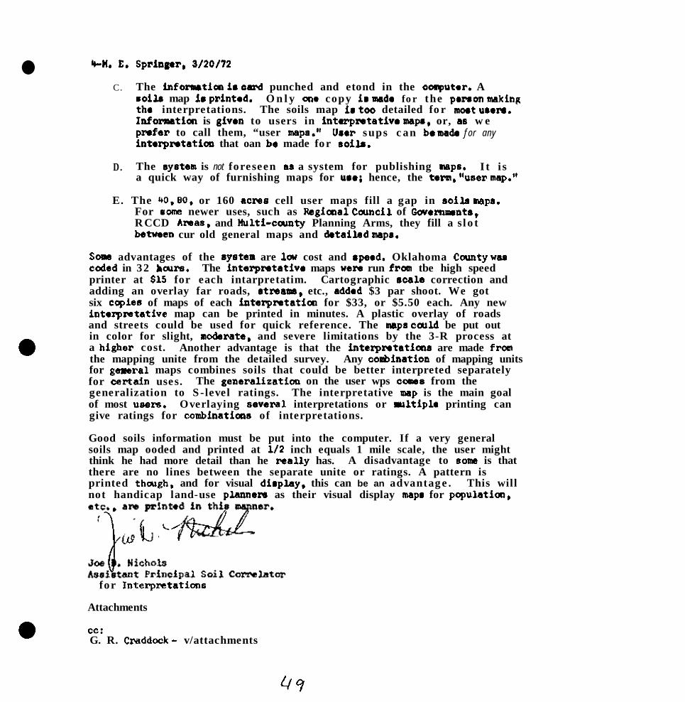
l WI. E.
C.
D.
Spriugar, 3/20/72
The infomaticm ia oard punched and etond in the oaputar. Acoils map ie printed. O n l y aw copy ir msde for the prnon wkingthe interpretations. The soils map ia tot detailed for noet umrs.Infomaticc is given to users in intwpmtativo mapa, or, ae w ep-far to call them, “user maps.” Uaar sups can bo ma& f o r a n yintorpntaticn that oan bo made for noit.
The system is not foreseen aa a system for publishing map6. I t i sa quick way of furnishing maps for uao; hence, the term, “user map.”
E. The 40, 80, or 160 acme cell user maps fill a gap in soils ups,For eom~ newer uses, such as Pagiaral Cacncil of Wernments,RCCD Amas, and Multi-ccunty Planning Arms, they fill a slotbetueen cur old general maps and dstailad wps.
Soms advantages of the 8ysten are lcu cost and apeed. Oklahoma Ccwty wascoded in 32 bcurs. The interpmtativo maps were run from tbe high speedprinter at $15 for each intarpretatim. Cartographic rcale correction andadding an overlay far roads, atreasn, etc., added $3 par shoot. We gotsix copies of maps of each intarpretatim for $33, or $5.50 each. Any newinterpretative map can be printed in minutes. A plastic overlay of roadsand streets could be used for quick reference. The maps carld be put outin color for slight, modarate. and severe limitations by the 3-R process ata higher cost. Another advantage is that the interpratatiars are made franthe mapping unite from the detailed survey. Any coabination of mapping unitsfor gersral maps combines soils that could be better interpreted separatelyfor cartain uses. The generalisaticn on the user wps 00~16 from thegeneralization to S-level ratings. The interpretative msp is the main goalof most users. Overlaying sevexwl interpretations or ultiple printing cangive ratings for combinaticns of interpretations.
Good soils information must be put into the computer. If a very generalsoils map ooded and printed at l/2 inch equals 1 mile scale, the user mightthink he had more detail than he raally has. A disadvantage to soms is thatthere are no lines between the separate unite or ratings. A pattern isprinted though, and for visual display, this can be an advantage. This willnot handicap land-use p&wars as their visual display mape for populaticc,
for Interpntations
Attachments
cc:G. R. Craddock - v/attachments

_
0KIAHoMA axJmr. oIaAHoMA


.
l
SOUTHERN REGIONAL TECHNZCAL SOIL SURVEY WORK-PLANNING CONFERENCE
Blacksburg, Virginia, May 2-4, 1972
Chairman, Louis E. Aull, Vice-Chairman, Carl A. McGrew
Committee IV - Application and Interpretation of Soil Surveys
Charges to Committee:
1. Test the criteria in use for sanitary landfill and make needed recom-mendations,
2. Evaluate the kinds of interpretations presently being made for soilsoverlying c*varnous limestone, Seek ways to improve interpretationsfor such soils.
3" Review the recommendations to the regional committees by Committee Vat the National Technical Work-Planning Conference at Charleston, SouthCarolina. The Chairman and Vice-Chairman should request action on anyor all of items E 4 a-f,
4, Review and comment on the proposed outline of Handbook for Soil Surveyinterpretations in Appendix 1 of the Committee V report to the NationalTechnical Work-Planning Conference at Charleston, South Carolina.
COMMITTEE REPORT
Charge 1. - Test the criteria in use for ssnitary landfill and make neededrecommendations.
Criteria in use for sanitary,landfills in the southern region generallyconform to Soils Memo SSC-45 (Rev. 2) issued November 1971. Complete test-ing of these criteria has not been accomplished but the current interest insolid waste disposal should enable us to evaluate the criteria adequately inthe very near future. The committee does not recommend any changes in thecriteria currently being used for area type sanitary landfills (Guide sheet8 or Table 8) or in the soil suitability classes for cover material for ar~eatype sanitary landfills (Table 9). It is recommended however, that thesecriteria be critically reviewed in each state so that revisions and modifi-cations may be recommended, if needed, at future conferences,
The criteria for trench type sanitary landfills (Table 7 of Memo SSC-45)includes those soil properties that are significant in using soils for thispurpose. There are no recommended changes,
Charge 2.
Available literature and guides were reviewed in search of informationwithin the realm of this change, with emphasis on sewage and solid wastedisposal systems.

-2-
Specific guideline statements for making soil interpretations for wastedisposal systems are in the text of the Guide for Interpreting EngineeringUses of So=, unedited revised draft, February 1971, and its edited version,published November 1971, The statements were compared with tabular itemsand degrees of limitation shown on guide sheets 3, 4, 7 and 8 of the NovemberGuide.. . .
The committee also reviewed current guides for use of soils for dwellingsand small industrial buildings, local roads and streets, and pond reservoirareas, No improvements were suggested for these guides. One correspondentsuggested that the maximum dimensions of the ponds to which the interpretationsapply need to be stated in the guidelines,
The response of the committee is the basis for the suggested revision ofguide sheets, and the committee recommendations.
Committee recommendations:
(1) The committee recommends that soil interpretation guide sheets 3,4, 7. and S of rhe Guide for Interpreting Endneerinees of Soils. November-__-._-- ---~_1971, as tentatively revised (exhibits 1, 2, 3, 4), to be tested in the SouthRegion (SCS) e
Charge 3.
The commit We concerned itself primarily,with certain engineering propertiesthat appear to present major problems in soil interpretations. These propertiesare highly significant in use of soils but interpretations have been toogeneral or too poorly defined to be of value to users of soil surveys.
1..
2,
3.
Permeability: This has been used extensively in some states as anindication of percolation rates for the benefit of sanitation personnelof the Heal,th Department. It is also used in evaluation for sewagelagoons and sanitary landfills. Permeability classes should be cor-related as closely as practical with these user interpretations. Theterm permeability should always be defined and any correlation betweenpermeability percolation rates, and hydraulic conductivity should benoted,
Corrosion: In view of limited data on corrosivity of steel and concretein different kinds of soils it is suggested that only two classes ofcorrosion potential be placed in rating tables. Research on major soilsubgroups &d families should be encou;aged so that criteria fo; cor-rosivity may be improved.
,isAllowable soil pressure (load supporting capacity): Variations in thsoil property create problems in developing quanitative estimates ofthe load supporting ~capacity of soils, Evaluation of this propertyshould include quanitative estimates of loads being imposed upon thesoil by residences and light industries. It is believed that sufficientdata is available on A and B horizons of soils to rate them accordingto their lfmitations in supporting light loads,

4. Subsidence: It is suggested that a simple narrative statement beused to express the subsidence potential of soils. This statementto include an estimate of the degree of subsidence indicated and theproperties of the soil affecting subsidence-
5, Landsl ides: Interpretations on soil susceptibility to slippage arepertinent to highway engineers and to all urban users of soils.Emphasis on obtaining data on susceptibility of soils to landslidesshould be stressed in each state and documented by soil scientists,It is not believed that sufficient data are available at this timeto interpret soils in terms of slippage potential,
Charge 4. Comments and Report on Handbook for Soil Survey interpretations
References in this report are to First Approximation - Handbook for SoilSurvey Interpretations:
Part 1 - Introduction
Chapter 1 - Philosophy and Principles Involved in Soil Survey Interpre-tations
The preference would be that some recognized persons currently engagedin survey work - someone who could give it a more valid interpretation re-lated to agronomic potential usage as well as non-agricultural uses woulddevelop this chapter,
Chapter 2 - The use of remote sensing techniques has the potential ofrevolutionizing our task of inventorying and monitoring land and waterresources, wi,th small scale maps.
Although it cannot provide all types of information needed, remotesensor imagery can be used advantageously in the detection and charac-terization of many land, water and related phenomena including:
1. Land use
2. Identification of major agricultural crops
3. Locating major soil boundaries
4- Locating sediment producing areas in:
a* Rural areas
b. Urban areas .
,5. Detecting water pollution

- L -
The technology of remote sensing is here: We in the soil surveyparticularly need to recognize its usefulness ana application to ourwork*
Part II - Farming Interpretations
Chapter 3 - Soil Survey Interpretations for Cropland
The three color systems of interpretation for intensive croppinguse by planners sounds like a very worthwhile suggestion. Continuecapability explanations and add a discussion for soil loss predictionequation:,
Chapter 4 - Soil Survey Interpretations for Pasture and
This seems to be needed and has been developed,
Chapter 5 - Soil Survey Interpretations for Woodland
The format used in woodland progress reports shouldintroduction and then use revised Soils Memo 19 and 26.
Chapter 6 - Soil Survey Interpretation for Wildlife
Range
be used as
Soils Memo 74 provides the necessary elements for this purpose.Some consideration might be given to developing a section dealingwith wetlands, channelization, and wildlife,
Part II1 - Nonfarming Interpretations
Chapter 7 - Soil Survey Interpretations for Recreation
This chapter could be a great help to Recreation and Parks studentsof college departments training professional people for this field.This chapter needs to bring to the attention of those working in thisarea very forcefully the need for having a basic knowledge of theprinciples of soil science, survey interpretations and its valuein this type of planning,
Chapter 8 - Soil Survey interpretations for Town and Country Planning
A color interpretation would be useful here,
Chapter 9 - Soil Survey Interpretations for Engineering Uses
The new revision of these interpretations need to be evaluated,
Chapter 10 - Soil Survey Interpretation6 for Tax Assessment
This chapter should discuss the present systems in use and presentmethods and suggestions for developing a system in any area where soilsurvey Snformat~ion is available.

-5-
Part IV - Coordination of Soil Survey Interpretations, Their Use inLegislation and Limitations
Chapter 11 - Coordination of Soil Survey Interpretations
The use of computers would seem to be especially useful.
Chapter 12 - Legislative Uses of Soil Survey Interpretations
Very timely .and much needed. Georgia and other states are verymuch involved in planning long range uses of the areas on our majorriver systems. Legislators need a source of accurate basic information.
Chapter 13 - Interpretive Techniques for Special Objectives
This chapter might include techniques to communicate the infor-mation to various clientele. This should be included with Chapter 8and should be written so that it is easily understood by laymen andnot limited to professionals,
Chapter 14 - Interpretive and Cartographic Limitations
There may be no limitations except cost. This chapter should dis-cuss scale and other limitations involved in interpretations.
SUMMARY AND CONCLUSIONS
Application and interpretations of soil surveys are the fruits of the soilsurvey effort. It is essential to continually review and revise interpretivesoils material so that they may reflect advancements in other phases of soilscience. With an increasing clientele in the use of soil survey interpretationsevery effort should be made to refine each specific interpretation for each soil.Concentrated efforts should be exerted toward the interpretation of those soilproperties that have the most significant effect on use of the land.
Simplification of interpretive soils information is essential if maximum useis to be obtained. It is also necessary that every effort be made to coordinatesoil survey interpretations with others that are dealing with the land. Asrapidly as possible all interpretations should be supported by irrefutable datasupporting the ratings made for each soil property. The cooperation of researchworkers, at all levels, and of soil engineers, should be actively solicited inthe development of interpretive tables for soils. The acceptance of soil surveyinterpretation depends, to a large extent, on the inputs of those dealing withsoils in every phase of land use.
It is recommended
l made in the committee
SPECIFIC RJXOMMSNDATIONS
that this committee be continued with the following changescharges:
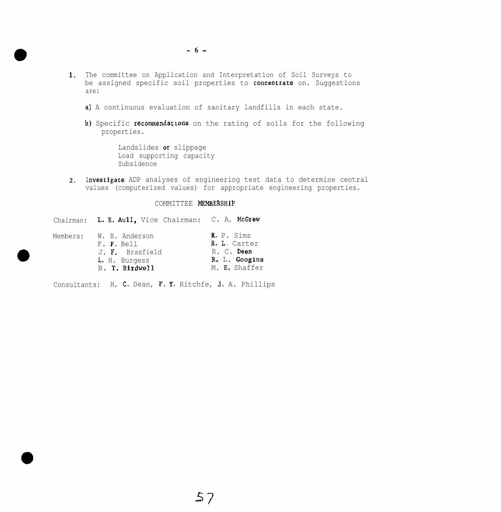
-6-
1, The committee on Application and Interpretation of Soil Surveys tobe assigned specific soil properties to concentrate on. Suggestionsare:
a) A continuous evaluation of sanitary landfills in each state.
b) Specific recommendarwns on the rating of soils for the followingproperties.
Landslides o+ slippageLoad supporting capacitySubsidence
2. investigate ADP analyses of engineering test data to determine centralvalues (computerized values) for appropriate engineering properties.
COMMITTEE MEMBERSHlP
Chairman: L. E. Aull, Vice Chairman: C. A, McGrew
Members: W. B. Anderson R. P. SimsF. F. Bell R. L. CarterJ. F. Brasfield R. C. DeenL. H. Burgess R. L. GooginsB. T. Birdwell M. E. Shaffer
Consultants: H, C, Dean, F, T- Ritchfe, J. A. Phillips
57

iDe{
Slight”
Severe
Rapia ,modera te lyr a p i d , a n dupper endof modera te
Lower end Ofmoderate
slow, andvery slow
l-0.6 in./tlr Less than0 . 6 in./hr
Slower than60 minIin.
45-60 minlin.
More than 72 in. 48 -72 in . Less than48 in.
O-8 pet 8-U wt
More than 72 in. 48 -72 in . Lee8 than48 in .
M o r e than 72 in. 4 8 - 7 2 i,$ Less then48 in .
3, 4, and 520 alId 1
0 2, 3. 4,and 5
I

soil groups (O”ifM)~’(rat.4 for use mainlyBB floor of l a g o o n )
l-
More than 40-60 d60 in.
Lees thy) 0.6in. fhr-
0.6-&O i n . /hr.-
Hoore aan 6 0 i n . 40-60 i n .
nare than 72 in. 48-72 in.
Less clan * pet 2-7 pet
Less than 20 pet 20-50 pet
Less than 3 pet 3-15 p e t
Ias* than 2 p e t 2-15 pet
I
None m”e
--_,....l___-GO, SC, CL. a n d
I
GM, HL, 34,end CH and ml
More than 2.ci”.lhr
Less than40 in.
F-fore than50 pet
More than15 pet
soils sub-,ect tof l o o d i n g
,

G u i d e S h e e r 7.--Soil limitetion r a t i n g s f o r t r e n c h - t y p e sanitary landfill&’
,tem affecting “se T
Sail drainage class
soi1 rexturel’(dominant to B
dep th o f 60 I” . )
Depth to bedrockl’
o-15 pet 15-25 pet
Sandy loam. loam Silty clay lo&silt l o a m , sandy clay loam.clay loam sandy clay,
loamy sand
More than 72 in. More than 7 2 i n .
Nore than 6 0 in. L e s s than 60 i n .
0 and 1 2
0 0
n
Leas the” 72 in.
Poorly drainedall.3 very poor lydrained
Occasion*1 OK
f requenc
M o r e than 2.0inlhr
Silty c l a y , claymuck , pea t .g r a v e l , sand
Les8 than 7 2 i n .
Less than 60 in.
3, 4, and 5
1, 2, 3, 4, and 5
B a s e d o” so i l depth (5-6 fee t ) cmonly i n v e s t i g a t e d in makIng s o i l s u r v e y s .
R e f l e c t s e a s e o f d i g g i n g and moving ( w o r k a b i l i t y ) a n d trafficability in t h einmediate area o f t h e t r e n c h “ h e r e t h e r e m a y not be amfaced roads.
1f probsbiliry is h i g h t h a t t h e s o i l is u n d e r l a i n with creviced, f r a c t u r e d , orcaver~,ous b e d r o c k in “I “ e a r t h e bottom of the prcp”sed t r e n c h a n d t h e r e is ah a z a r d o f p o l l u t i o n o f undergrow water, i n d i c a t e b y a p p r o p r i a t e f o o t n o t e ,such as “Creviced lime8rone bedrock probable within e x c a v a t e d d e p t h . ”
For c l a s s d e f i n i t i o n s see Soil S u r v e y wB”ua1, pp . 216-223.
6m

-
I l-
6/

SOUTHERN RRGIONAL SOIL SURVEY WORK-PLANNING CONFERENCE
14ay 2, 3, 4, 1972 - Blacksburg, Virginia
committee v Handling Soil Survey Data
Chairman: G. R. CraddockVice Chairman: H. H. Bailey
Members: R. L. Blevins C. S. McKeeK. Brown J. MeltonC. W. Crockett J. D. NicholsR. P. Deaver E. 14. RutledgeH. A. Fribourg
charges
1. Evaluate coding system for pedon data and suggest practical uses
of ADP in handling soil survey data.
2. Consider methods of assembling and evaluating data that will go
into ADP and,
(a) m&e specific recommendations for &ndardization of ADP in
southern region
(b) consider a change in Pedon data collection procedures so
laboratory data can be recorded where complete soil descriptions
of properly classified soils are on file.
The "Coding system for Pedon Data for the National Cooperative Soil
Survey" and attachment C -' Comments on Pedon Data Subsystem for Soil
Survey" (prepared by D. W. Swanson) were distributed in January to
committee members for study Bnd hopefully trial'use. Also, each
committeeman was asked to respond to the charges set forth by the
executive committee.
Responses from committee members indicate there has been insufficient
time to fully digest the material and insufficient time to accumulate

-2-
much experience in printouts of soil user or interpretative maps and
other kinds of information since this material became available. The
Fort Worth office has tested several soil user (soil interpretative)
maps at cell sizes of 40 and 160 acres of Oklahoma City, Oklahoma. There
is an apparent need for more pilot studies of soil user maps of the suit-
ability, limitation or potential nature.
A report of ADP activities by the Fort Worth office was presented by
Dr. L. J. Bartelli. Examples of user maps of Oklahoma City, Oklahoma
were made available. Discussion included use of ADP in correlation
activities and the need for rapid means of getting soil survey informa-
tion to users.
In order to give uniformity within the Southern Region for ADP, it is
recommended that the Coding System for Pedon Data for the Rational Co-
operative Soil Survey be modified to accomodate changes swgested in
"Comments on Pedon Data Subsystem for Soil Survey" and be used as the
standard for recording pedon data in the Southern Region. Perhaps some
consideration should be given to incorporation of routine soil test in-
formation in the future.
Some committee members reacted favorably to the proposal "that
laboratory data can be recorded in data banks provided that complete
soil descriptions are on file and soil have been properly classified."
It is recognized that in many cases complete physical and chemical
characterization data will not be available and that partial
be only available.
data may
Although it was not a part of the charge of the committee to evaluate
the use of ADP for parts of soil survey manuscripts, this procedure is
being tested in the South Region. Early indications are that engineering
63

-3-
tables and other tables can be printed out from ADP data that are avail-
able on the standard Soil serieS deSCriptiOa.
This committee also encoura&es that special care be given toward
accurately recording all information in soil descriptions especially
in the physical and chemical properties section.
It is recommended:
1. That "the Coding System for Pedon Data for the National Co-
operative Soil Survey" and modifications called for in attachment C -
Comments on P&on Data Subsystem for Soil Survey be accepted as the
standard system for recording soil data in the Southern Region.
2. That ADP programs developed for the National. Cooperative Soil
Survey be made available to cooperative agencies for data processing
in order to avoid duplication of time ard effort in developing programs
and to provide for uniformity within the regions.
3. That further study be given to kinds of user maps that can be
generated from ADP which can be used in land use planning.
4. That laboratory data be accepted for soils Pedon Data provided
that acceptable descriptions are on file aad soils have been properly
classified.
5. It is recommended that this committee be continued. Charges
should be specific, since experience with use of ADP is somewhat limited.
The report eras accepted.

SOUTHERN REGIONAL TECHNICAL WORK-PLANKING CONFERENCEBlacksburg, Virginia, May 2-4, 1972
COMMITIEE VI SOIL MOISTURE AND TEMPERATURE
Chairman, R. B. Daniel8Vice-Chairman, R. E. Daniel1
CHARGES
1. Review and evaluate the collection and generalization of2-year water table data in the southern region.
2. Update the 1965 soil temperature map and present therevised copy at the Blacksburg, Virginia meeting of t h eSouthern Regional Soil Survey Work-Planning Conference.
CORMI’lTRE REPORT
Water-Table Data
Water table measurements over a Z-year period from 23 sites inSouth Carolina are summarized in Table 1 of the appendix. Measurementshave been completed at 47 sites in North Carolina but generalieationby a computer program developed by L. A. Nelson i6 incomplete. A listof soils on which water table data are available are given in the reportof this committee dated 5/6/?0. Additional series with one or more yearswater table data are listed in appendix Table 2.
This conanittee recommends that water table data from Mississippi,Oklahoma, Alabama. South Carolina, Tennessee, North Carolina and otherareaa be published as soon as possible. The information can gather dustin the files and be of little use to anyone, but once published, it canthen be used to help others make decisions. If the story is interestingenough to warrant publication in a national journal, then this should bethe vehicle for putting the information in print. However. the limitedspace available in most journals will permit only generalizations ofdata. To be of maximum use. the pedon description should be given alongwith the raw data in the table or a graph for each site. In many are*8such as South Carolina, this would involve several pages so the mainsource for publication would be either a State Experiment Station Bulletinor Circular, or something like the Soil Survey Investigation Reports.Tossibly a regional publication would be advisable.

2
Although considerable water table information is being collectedwe feel that the job is only partly finished. This information must beinterpreted for its influence on soil genesis and land use. In an areaas large as the southeast, it would be unusual for the same interpretstionsto be applied uniformly to all soils. For example, in rmch of the Atlanticand Gulf Coastal Plain WC have a flushing or percolating type of waterregime in soils on broad flats (see A. A. Rode. 1965, Water Regimes ofSoils and Their Types. From Pothvovedenie, April, 1965, p. l-23.Translated and published in English as OTS 60-21134). In a flushing typeof saturated water regime, the rainfall in excess of that stored in thesolum or upper C horizon moves into deeper layers. Here it becomes partof the ground water. During periods when additions to the ground waterfrom rainfall moving through the soil exceeds the movement of water outof the aquifer, the water table may rise to various levels within thesolum. The water table drops .as additions of water become less thanthe loss through aquifer leakage and transpiration. The net nwvement ofa water molecule in a flushing type of saturated water regime is throughthe soil into the ground water and then down and out of the soil-sedimentsystem. The implications for movement of sewage effluent, pesticides, andother water soluble molecules should be apparent. Transit times are un-known, but from measurements in North Carolina it may take a water moleculeas long as 100 years to mOve from the soil system through the aquifer intothe stream system (Daniels, Gamble, and Holzhey, unpublished manuscript).
A modification of the flushing type of saturated moisture regimethat occ”rs in rolling country such as the Piedmont is unsaturateddownslope flow of water. Nutter. from Georgia, outlined the details insn article presented in the Field Soil Moisture Symposium given in NewYork City during the ASA meetings in August of 1971. This type ofwater movement is believed to be important in many dissected areas ofthe upper Coastal Plain and in the Piedmont and Mountains. Waterenters the soil at the top of the hill or at eny place on the slope.A discontinuity in vertical permeability occurs somewhere near the baseof the solum so horizontal downslope movement of water occurs. I” mostareas this is unsaturated flow of water, but near the base of the slopeit may become saturated flow. Nutter believes that very little watermoves below this vertical discontinLity in permeability. Therefore,water-soluble molecules can be transported by this mechanism from onepart of the landscape to another.

3
In contrast to the flushing or percolating type of saturatedwater regime is the non-flushing or non-percolating regime that mayoccur in some soils in our region. Wells set in soils in northeasternOklahoma suggest that the solum may be saturated during some wintermonths, but the lower layers may have little if any water moving intothem (Oral communication, J. Nichols). There is some evidence of thistype of water regime occuring in certain clayey soils in the Red RiverValley and some of the Glossaqualfs near Ville Platt, Louisiana (Oralcommunication, Dave Slusher). Little is known about this type ofsaturated water regime in our area, but if little or no water movesdown through some of these soils it is obvious that a soil-water tableat 10 inches does not have the same interpretation in a soil with aflushing regime as it does in a non-flushing regime.
The presence of non-flushing saturated moisture regime has notbeen verified in the southeast, but there are strong hints that it mayoccur. It is also probable that both types may be found in the samelandscape. Thus a careful look at data available from Oklahoma shouldbe made to determine whether or not a non-flushing saturated regime doese x i s t . If this type of moisture regime can be verified, then we needto know what areas it occurs in. Caution should be exercised, however,so that an intermittent flushing regime produced by low or limitedrainfall is not confused with a non-flushing regime produced by soil orsediment properties. We must also be careful that a downslope flushingsaturated regime similar to the,non-saturated flow described in Nutteris not confused with a non-flushing regime.
Soil Temperature
A map showing the soil temperature lines in the southeast regionis attached (Figure 1). The lines on the map are wide in areas such aaFlorida, Texas, Oklahoma and parts of Tennessee. North Carolina andVirginia. ‘Ihe wide line is an attempt to show areas where no sharpaltitude break occurs and the change from one temperature zone toanother i s d i f fuse. Some Florida data will i llustrate. Two loamy,siliceous, Arenic Plinthaquic Paleudults in Alachua County were locatedabout 0.3 miles apart. Pedon No. 2 was about 20 feet lower than No. 1.Over a two year period, 1970-1971, the temperature8 were 72.5’ at No. 1and 68.9O at No. 2.

4
A table showing the relationship between air temperatureand ZO-inch soil temperature at 12 ststions in Kentucky for a periodof 4 years (Table 3) is attached. It shows that the mesn di f ferenceia 1.7+ ( 0 . 9 5 % ) . From other measurements, the thermic-hyperthermicline goes through Alachua County, but apparently it is a zone, not a line.Parts of North Carolina and South Carolina have fairly sharp boundariesbetween the mesic and thermic zone. This boundary runs near the toe ofthe Blue Ridge front where abrupt changes in altitude take place.
The validity of the soil temperature boundaries variesconsiderably from area to area within the southeastern states (Table 4).The mesic-thermic boundary across Virginia and the northern part ofNorth Carolina crosses the Piedmont where there is little change inaltitude and s broad zone of change should be recognized. The boundaryin southern North Cerolina and South Carolina and Georgia closely followsthe Blue Ridge front where abrupt changes in altitude and physiographicprovince occur. Ihe boundary in Tennessee is sharp in places, theHighland Rim and Smokey Mountaina, for example, but in the Great Valleyand the northern part of the state it crosses a s ingle physiographicprovince and should be recognized as occuring over a wide transitionalzone.
Measurements of soil temperatures in northern Arksnsae endN. E. Oklahoma indicate that the Ozark Highlends are thermic, but thesoils are very similar to those in Southern Missouri in the asmephysiographic province and the temperatures are within 1 to 2 degreesof being mesic. Rather than establish several splinter series it we8decided to recognize the Ozark Highlands in Arkensss end Oklahome astaxadjuncts of the mesic series in Missouri. The line is drawn at thecontact between the Boston Mountains and the Ozark Highlands (Oralcommunication, L. J. Bsrtelli).
TABLB4
Information Used to Draw Soil-Temperature Boundaries
Isothemic-Ieohyperthemic
Puerto Rico Soil Temperature
Ibermic-Hyperthermic
Florida Soil TemperatureTexas Air Temperature

Mesic-Thermic
VirginiaNorth CarolinaSouth CarolineGeorgiaTennessee
KentuckyOklehoms
Arkansas
Texas
Air TemperatureAir TemperatureSoil TemperatureAir TemperatureSoil Temperature
and air temperatureSoil TemperaturePhysiographic bias
and air temperaturePhysiogrsphic bias ,
see textAir Temperature
The mesic-thermic boundary in northwest Texas and westernOklahoma is a broad zone that crosses the high plains. Air temperatureschange about one degree across a county so the zone may be two or threecounties wide.
Several interesting relations exist between the soil temperatureboundaries and cultivated and native vegetation. The cotton belt closelyfOllOw8 the ss?siC-thermiC boundaries in most areas with the exception ofnortheast Virginia (Fig. 2). The citrus belt in Florida also closelyparallels the boundary, but in south Texas the citrus belt is farremoved from the thermic-hyperthermic boundary. We are not implyingthat soil temperature8 are the controlling factors, but there may beconsiderable interaction with other factors.
Native vegetation of various kinds also closely parallels thesetemperature lines in some areas and not at all in other ways (Table 5appendix). The mesic-thermic boundary in North and South Carolinaillustrates these relations. Loblolly pine end sugarberry reproducein the thermic but not in the mesic zone, whereas Eastern White Pineand Pitch Pine reproduce in the mesic area. We suggest that theattached tables outlining some of the relations between nativevegetation and soil temperature be used as possible, not absoluteguides. In areas, however, the vegetation may be helpful ia decidingwhat temperature zone area should be placed. In areas such as Virginia,the understory may not live as long as the major tree species andtherefore it may be a fairly sensitive indicator of soil temperature.

SUkU4ARY AND CONCLUSIONS
Water table levels available in various states in the southeastshould be published so the information will be available to everyoneconcerned with this type of information. While more data are needed,there may be little value in collecting additional data for the sameseries in adjacent states.
We suggest the possibility of a non-flushing saturated moistureregime occurring in some soils. New work in areas where this may occurshould be designed to either verify or refute the existence of thistype of saturated water regime.
The complications of non-saturated downslope movement of waterdescribed by Nutter may have considerable bearing on soil use in largeareas of the southeast. Water regime studies conducted in the Piedmontor mountains should try to characterize and evaluate this type ofw8ter awvement.
Soil temperature boundaries between areas may be sharp ordi f fuse. Where the boundaries are sharp, then recognition of differentseries across the boundary is justified even though this boundary cutsacross a county. Where the boundary is diffuse, we reconvnend that serieschange on county lines.
A strong relation exists in areas between native vegetation andsoil temperature boundaries. Indicator plants probably can be used bysoil scientists in helping make decisions in areas where soil tempera-tures are not known. But each area probably should develop the plantsthat are the best for their conditions.
RECOMMENDATIONS
Available water table data should be published within the nexttwo or three years, either in one publication or several.
New water table studies should be designed to verify or negatethe idea that non-flushing saturated water regimes exist in the south-east. In rolling country the studies should test the ideas of Nutterthst considerable downslope movement of water occurs in the unsaturatedstate.

7
Considerable emphasis should be placed on characterizing the non-saturated water regimes of soils in the southeast. This is in therealm of soil physics and the ccmnittee should be reorganized with thisthought in mind.
We recomend that the interrelations between soil temperatureand naturally reproducing vegetation be studied in detail in the fieldby a team of soil scientists and plant ecologists.
This cmittee should be continued.
COt+lITlEE MEMBERSHIP
C. B. Breinig C. M. Ellerbe C. W. Crockett Ft. B. GrossmanD. S. Brown C. T. Haan A. B. Elam J. D. Hill
CONSULTANTS
R. Johnson, F. T. Ritchie, H. J. Byrd, G. S. McKee, H. T. OtsukiR. L. Googins, T. W. Green, Ii. C. Dean, J. R. Coover. J. D. Nichols.
7/

l
a
S o i l Serie
Charleston
Chipley
Craven
Dunbar
Ikll0Ilia
Foreston
Lenoir
Leon
Lumbee
TABLE 1
Water Table Measurements of SomeUndrained Coastal Plain Soils
in South CarolinaSept. 1969 - Sept. 1971
Number of Dzw Water Table Wi- .-...-7iVJ----- T- 30”
1st 2nd 1st 2ndYear Year ear Year
234 167 147 45
177 183 76 109
240 347 196 232
234 231 167 209
279 280 198 222
76 231 30 200
96 126 80 78
264 182 241 43
351 339 296 254
180 335 133 216
85 309 74 263
266 365 245 342
361 365 316 353
245 265 140 205
145 240 133 214
291 336 261 273
136 273 99 198
226 204 115 75
213 94 72 24
274 365 223 355
365 270 255 230
132 144 120 118353 365 256 192
7.2
0.9 Less Than20”_-__
1stYear- ~._
25
5
149
130
60
6
58
30
254
72
45
216
189
18
106
109
81
4
16
144
186
93166
2nd 1stYear Year
0 6
20 0
137 66
169 35
96 0
52 0
54 28
18 5
244 139
169 0
187 12
303 185
266 117
66 0
187 46
198 0
175 67
16 0
0 3
169 22
135 164
17 31177 13t
10”-2ndlear-
0
6
34
107
0
3
20
0
151
36
160
220
184
7
95
86
135
0
0
73
122
097

TABLE 2
Water Table Data Available in Addition to That Listedin Comittee VI Report Dated S/6/70
North Carolina:
Aquod‘@pit RaplaquodUltic Haplaquod
HumodEntic Haplohumd
AqueptTypic Rumaquept
PeamentaAquic Quartzipsament
Florida :
Aquods
Arenic HaplaquodsAetic RaplaquodsEntic Haplaquods
Alf ic HaplaquodsAlfic Arenic Haplaquods
HumodaArenic Raplohumods
PslumPentsAquic QuartzipsammentsTypic Quartzipa-ntsHaplaquodic Quartzips-nt
AquentsSpodic Psammaquents
AqualfsArenic OchraqualfsArenic Ochraqualfs
MurvilleHascattee
Rimini
Rutledge
Pactolus
Inwkalee. onaMyakkaMyakka, thin aolum
variantWabaasoOldsmar
PomFzllo
AdamsvilleTavareaTavares. brown layervariant
Basinger
FeldaPinellaa
73


TABLE 3AVERAGE SOIL AND AIR TEMPERATURE IN KENTUCKY
1968-1971
BARDSTOWN
FLEMINGSBDRG
LEXINGTON
GLASGOW
GREENVILLE
IRVINGTON
HAYFIELD
PRINCETON
kan difference - 1.7"F (0.95'C)
Ts = Average annual soil temperature at 20" below #oil surface.Ta = Average annual air temperature.
?a p Mean annual soil temperature at 20" below soil surface for 4 years.% - Mean annual air temperature for 4 years.(Lexington station record is for 5 years)

76

TABLES
PLANTS THATMAY BE HELPFUL. IN ESTABLISHING SOIL TEMPERATURE BOUNDARIES
COUNONNAMS SCIENTIFIC NAME ALA. ARX FIA GA RY LA N.C SC TENN TEX. VA. OXLA-LLLALdZL--L
TREESMesic 47-590
Table-Uountain PineEastern White PinePitch Pine
Eastern EemlockSugar MapleYellow Buckeye
Ohio BuckeyeYellow BirchSweet Birch
Ha&berry*ButternutSweet Gum*
Swamp White Oak*Chestnut OakBlack Locust
Peach leaf Willow
Pious puogensPious strobusPinus rigida
Tsuga canadensis XAcer saccharinumAesculus octsndra
Aesculus glabraBetula alleghaniensisBetula lenta X
Celtis occidentalisJuglans cinereaLiquidambar atyraciflua
Qoercus bicolorQuercus primsRobina pseudoacacia
Salix amygdalofdes
XXx x
x xX
X
XXx x
XXX
XX
XX
X
X
X XX
X
XX
X X

COPNON NAMFa
Thermic 59-72'
Ashe JuniperSouthern Redcedar*spruce Pine
Loblolly Pine*BoxelderRiver Birch
Hackberry*SugarberryGreen Ash
American Hotlysweetgum*
!\I Red Mulberry
45 Ogeechee 'tupeloEastern HophornbeamAmerican Sycamore
Eastern CottonvoodBlack CherrySouthern Red Oak*
Overcap OakBlack Jack OakChinkapin Oak
Swamp Chestnut OakWater OakWillow Oak
Shumard OakPost Oak
SCIENTIFIC NAMS
Juniperus asheiJuniperus silicicolaPiaus glabra
Pinus taedaAccer negundoBetula nigra
Celtis occidentalisCeltis laevigata
XX
XX
X
Fraxinus pennsylvanica X
Ilex opaca XLiquidambar styracifluaMorus rubrs
ALA ARK FIA GA KY LA. N C S C TENN. ‘IEX. VA. OXLA.-*L-*LA_LA----
x x
x x
Nyssa ogeche XOstrya virginiana XPlatanus occidentalis
Populus deltoidesPrunus serotinaQuercus falcata
Quercus lyrataQuercus mirilsndica@ercus rmehlenbergii
X
X
X
x x
X
x x x
Quercus michauxiipuercus nigraQuercus phellos
x x X x x xX x x x x x
X x x x
Quercus shumardiiQuercus stellata
X x xX
X
X x x X
XX
X
XX
XX

COMHON NAME SCIENTIFIC NAMS AJA ARK FIA GA KY LA NC SC lENN.lTiX.VA.OKLA.~4~~---t-~~~---e
Hyperthermic 72'
SandpineSouthern R&cedar*Loblolly Pine*
Southern Red Oak*Cabbage Palmetto
Pinus clausa XJuniperus silicola XPlnus taeda X
Quercus falcata XSabal palmetto X
PeCan Garya illinomais X X XFlowering Dogwood Corms florlda XEmeylocust Gleditsia triacanthos XBlack Walnut Juglans nigra X
Eyperthermic
* Occurs in more than one temperate zone.
Ihermic
Flowering Dogwood* Corms florida X
Trees from Powells, H.A. 1965. Silvics of forest trees of the United States, Agricultural Randbook271, U. S. Forest Service, and Little, E. L. 1971. Atlas of the United States trees. Vol. 1.Gonffers and Important Bardmods. U.S. Forest Service. His. Pub. No. 1146.

CoMMoN NAME SCIERTIFIC NAME
DNDERSTORY PLANTSMesic
Striped Maplenountain MapleElder
Jack-In-The-PulpitSweet FernPagoda Dogwood
Beaked HazelnutHay-Scented FernDwarf Bush Honeysuckle
Atlantic LeatherwoodAromatic WintergreenMountain Laurel
Acer pennsylvaaicumAcer specatumAralia
ArisaemaComptoniaCornus alterniflora
Corylus cornutaDennstaedtiaDiervilla lonicera
Dirca palustrisCaultheriaRalnda latifolia
American Fly ganeysuckle Lonicera canadensisClub Moss LycopodiumWiggers Maianthemum
Partridge Berry MitchellaWood Sorrel OxalisBrake or Bracken Pteridium
Dwarf r%inkapin Oak Quercus prinoidesRed Rasberry Rubus idaeusBlackberry R. Occidentalis*
Blackberry R. canadensis*Scarlet Elder Sambucus pubensAmerican Elder S. canadensis
ARX. FLA. CA. KY. N . C OXLA. S . C TBNN. TFX V A----L-d-L>
XX
X
XX
x x
x xXX
x xXX
XXX
XXX
XXX
XXX
X XX XX X
X XX XX X
X XX XX X
X XX X
X XX XX X
X XX XX X
XXX
XXX
XXX
XXX
XXX
XXX
X
X
XX
XX
XX
XX
XX
x x

coM?m NAEIE
Canada Yew,Ground Hemlock
Highbush BlueberryLowbush Blueberry
‘ritch iiobbie
Themic
Red BuckeyePainted Su:keyeDevils Ya:Xingstick
American Ho: TbeamCormnon Butt onbushRedbud
PepperbushSwamp Dc~m! orRoughleaf Jrgwood
Flowering ??wood
Stiffcome! TogwoodHawthornSwamp-Privet
Witch-Haze!POS.WUhWGallberry
American Ho! ivYaponRed Mulberry
a aSCIENTIFIC NAME ARX FLA GA KY N.C OI3.A S.C. TENN. TEX. VALLLL&L---L
Taxus canadensis
Vaccinium ccrymbasumV. ungustifolirmr+
Virburnum alnifolium
Aesculus paviaAesculus sylvatica XAralia spinosa* X
Asimina trFloba* XBumelia lanuginosaCallicarpa americana
Carpims caroliniana* XCephalanthus occidentalisCercis canadensis*
Clethra alnifolia*Corms drumncmdii
c. florida*
C. stictaCretaegus spp.*Forestiera acuminata
Hamamelis virginiana*Ilax decidusI. globra
X
XX
X
XX
X
XX
XX
XXX
X
I. opacaI. vmitoriaMorus rubra
XXX
X
XX
XX
X
XXX
X
X
X
X
X
XX
X
XX
X
X XX
XX X
XX XX X
X
X
XX
X
X
X
X
X
X
XX
X
X
XX
X
X
X
X
X
X
X
X
XX
XX
XXX

COMMON NAME SCIENTIFIC NAME
Waxmyrtle, southernbayberry
PlanertreeShining sumac
Smooth sumacDwarf PalmettoCoastal Plain Willow
CreenbrierSnowbellCarolina Basswood
Poison IvyArrowwoodPossumhew
Nyrica cerifera
Planers aguaticaRhus copallina*
R. glabra*sabai m inorSalix caroliniana
Smilax spp.*Styrax americanaTilia
ToxicodendronViburnum dentatumV. nudum
Rusty Bleckhaw V. rufidulum
Hyperthermic
RosemaryScrub Palmettosaw Palmetto
QlapmsnoakTurkey OakScrub Oak
Live OakSand Live Oak
Cerariola ericoidesSabal etonfaSerenoa repends
Quercus chapnmniiQ. iawisQ. myrtffolia
Q. virginianaQ. virginiana var. maritims X
ARK. FLA. GA. XY. N.C. OXLA. S C TENN TEX VA- - - -zdA-
x x X x x X
X X XX
XX
x x x x X
Xx x x x X
X
Xx x x x Xx x x x X
X
X
Handbook, 271, U. S. Forest Se& %'Understory from Fowells, A. A.
i Silvics of Forest Trees of the United States, Agricultural

COMMON NANB
GRASSESThermic
Big Blue StemSand BluestemCreeping Bluestem
Splitbeard Bluestem temarius*Oldfield Tbreeawn Aristida oliganthaSwitch cane Arundinaria tecta
Sand Lovegrass Eragrostis trichodesCarolina Jointtail Maaisuris cylindrica*Cutover Muhly Mohlenbergia expansa
Lindbeimer Muhly M. lindheimeriSeep Huhly M. reverchaiSwitchgrass Panicum virgatum
Texas Bluegrass Pea arachniferaCurtis Dropseed* Sporobolus curtiseiiBroadleaf Uniola Uniola latifolia
*Can extend slightly into hyperthensic area.
aSCIENTIFIC NAME FLA. GA. N.C. S.C. S. TEX. TBX. VA. W. OKLA.- - - -
Andropogoo gerardiA. halliiStolonifer*
WEEDSThermic
CommonArrowhead Sagittaria latifoliaJapanese brme, chess Brows japonicusField Sandbur, Burgrass Cenchrus incertus
X
X
XX
X
X
Xxx x X
XX X
xx x X
X
X
XX
xx x X
XX
X
XX
XX
X

CONKIN NAM?.
Purple Nutsedge.coca-grass
Mauseear chickweedSpatterdock
Woolly CrotonFlowering SpurgeVelvetleaf, piemarker,
butterprint
Field BindweedJimsonweedConmoo Yarrov
Giant RagweedPrickly lettuceDandelion
SCIENTIFIC NAME
Cyperus rotundus
Cerastium bulgatumNuphar luteum
hoton capitatusEuphorbia corollataAbutilon theophrasti
Convolvulus arvensisDatura stramcmiumAchilles millefolium
Ambrosia trifida*Lacruca serriolaTaraxacum officinale
FLA. GA. N.C. S.C. S. TEX. TEX VA W. 0XL.A.AA
x x x X
XX
X XXX
XXX
XX
X
Grasses from Leithead, Ii. L., Yarlett, L. L. and Shiflet, T.N. 1971.11 Southern States, USDA.
100 Native Forage Grasses inSCS, Agricultural Handbook. No. 389.
No. 366.Weeds from :Agricultural Handbook
Selected Weeds of the United States. AM. USDA.

SOUTHERN REGIONAL TECHNICAL WORK-PLANNING CONFERENCE
May 1972 - Blacksburg, Virginia
Committee VII: Kegional genesis and characterization projects
Chairman: R. F. Hajek
Vice Chairman: J. A. DeNent
Charges to Conlmi~ttee:
1. Compile a current list of benchmark soils and submit alist for approval.
2. Outline a plan of operation that, if followed, will cmpletethe task and make benchmark soil data available in a formwhich can be referenced.
3. Review regional
Committee Report:
A list of benchmark
investigation needs.
were obtained by requestsoils was obtained from each state. Theseof this committee, which suggested that pro-
cedures recommended in the proceedings of the last national and regionalwork-planning conferences be considered in series selection. An inven-tory of available data was also requested; however, response to thedata inventory request was not complete.
A total of 211 series were submitted. lbst great groups in thesouth region were represented; however, some multi-series families arerepresented by more than one series. A suggested list of benchmarksoils is given in Appendix I.
The committee members responding to charge 2 recommended thatspecific assignments of analytical and compilation tasks will be neededbefore any procedures for publication can be started. If assignmentsare made the task will be difficul~t if each series must be publishedseparately.
Recommendations:
1. We recommend that each state start and maintain a benchmarkdata file on each benchmark soil listed for the state andassist other states by supplying data they obtain on benchmarksoils. Copies of this data would be supplied on request.When available, ADP could supplement and in some cases re-place these files.

2. When sufficient data has been accumulated the cornnittecrecon~rnends publishing ns groups of benchmark soil~s.Grouping at the suborder level would significantly reducethe nrmhcr of publications needed (about 25).
3. We recomwnd that the conmittee be continued and addressitself to charges 2 and 3 and recocmendation 2.
L. nessc1.1e C. L. CirdnerV. F,. Nash J. F. MillsV. LJ. Carlisle C. I. MchH. J. Byrd H. J. I~JagnerK. C. Glcnu B. L. Allfn

APPENDIX IBENCHElAM SOILS
DecaturRed HaySumtelTrO"pHartsrllsHoust,on
Florida--.----
La,kcl~andLeonTerra CriaPampanoAstatulaPerrineLynn Haven
Georgia--.
StilsonTiftonGwinnett
Louisiana___~_~_
CalhOUllCommerceCrowleyMorelandRustonSharkey
- Rhodic Paleudults, clayey, kaoliuitic, thennic- Rhodic Paleudults, fine-loany, sjlj~ceo"s, thermir-. Rendollic Eutrocbrcpts, fine-silty, carbonatic, tbernlic- Grossarenic Pnleudults, loamy, sil~iccous, thermic- Typic Hapludults, fj~ne-loalmy, si~lliceous, thernli~c- Typic Chromuderts, very-fine, mcntmorillonitic, thermic
- Typic Ochraqualfs, fine-silty, mixed, theraic- Typic Ochraquults, fine-silty, silicw"s, thermic- Albic Glossic &alraqunlfs, finr-.silty, mixed, therrnic- Glossic Xatrudalfs, fine-silty, mj~xed, thermic- Typic Natrudalfs, fine, nl~nt:llori llo:~itir, tl1enmi.c
- Typic Quartzil,fi:l,nlnlents, thcnnic, coated- Acric Haplaquods, sandy, sil~iceous, thennic- Typic Modisaprists, euic, hypertlwrrnic- Typi.c Psammaqwnts, siliceous, hppertbermic- Typic Quartzipsanunents, siliwous, hyperthermic, uncoated- Typic Haplaquents, coarse-silty, carhonntic~, hyperthermic- Typic Haplaquods, sandy, siliceous, tbermic
- Areuic Plinthic Paleudults, loamy, siliceous, thcnnjc- Plinthic Paleudults, fine-loamy, siliceous, thermic- Typic Rhodudults, clayey, kaolinitic, thermic
- Typic Glossaqualfs, fine-silty, mixed, thermic- Aeric Fluvaquents, fine-silty, mixed, nonacid, thcrmic- Typic Albaqual~fs, fine, montmorillonitic, thermic- Vertic Hapludolls, fine, mixed, thermic- Typic paleudults, fine-loamy, siliceous, thermic- Vertic Raplaquepts, very-fine, montmorillonitic, nonacid,
thermic- Fluvaquentic Medisaprists, euic, thermic

- 2 -
*@
l
PliasissipL?__~_ -_ _..___
Budc Glossaquic Fragiudnl~fs, fine-silty, mixed, thermici'Iemphis Typic tlapludalfs, fine-sil~ty, mixed, tbermicMcLaurin - Typic Paleudults, coarse-loa~!iy, si~l.iceous, thernicSavannah - Typic Fragiudults, fine-loamy, siliceous, thermicGrcnnda Glossjc Fragiudal~fs; fine-silty, mixed, thermicMautnchie - Aeric Fl.uvaquents, fine-lorniy, siliceous, acid, tlrcrxlicProvidence - Typic Frngiudal.fs, fine-silt~y, mixed, thermicKipli,ng Veric llapludalfs, fine, r:lontn?i,~il~l~onitic, thcrmicSusquehanna - Vertic Paleudalfs, fine, mor~t~t,oril~onj.ti~c, thermi.c
North Carolina-~~-__.-__-.--_~__-
BcthanyDenni~sUouglrertyuurantEufaulaFoardNobscottParsonsReIlfi7WStephenvilleSt. PaulVZ3lIOSSYahola
Puerto Rico
BayamonCandeleroc010s0Cot0Fraternidad
Typic Pal~cudults, fine-si~lty, sil~iceous, thcrmicTypic llapludults, clsycy , kaolini.tic, therrnicAquic l!>pIudults, cl~eyey, mixed, tbermlr1~'ypi.c Hapludul.ts , fine-l.oany , mi,caceous , msj cArcuic Palcudults, loax::, siliceous, thcrmicHuw'c Hapludults, fine-loany, mixed, xesicTerrl.c Medisapris ts, I.oarcy, mixed, dysic, thcrmicVcrtic Hapludalfs, fine, uixed, thermic
Pachic Paleustolls, fine, mixed,~ thermicAquic Paleudolls, fine, nrixcd, thermicArenic Haplustalfs, loany, niixed, thermi<Vertic Argiustolls, fine, rnontmorill~onitic, thermi.cPsammentic Paleustalfs, sandy, siliceous, thermicTypic Nntrustolls, fine, montmorill~onitic, themmicArenic Pal.eustalfs, loamy, mixed, thcrmicPloll~ic Albaqualfs, fine, mixed, thennicUdertic Paleustolls, fine, mixed, thermicUltic Haplustalfs, fine-loamy, siliceous, thermicPachic Argiustolls, fine-sil~ty, mIxed, thermicUdic Argiustolls, fine-silty, mixed, thermiclypic IJstifl.uvents, coarse-loamy, mixed (calcareous),thermic
Tropeptic Eutrorthox, clayey, mixed, isohyperthermicAerlc Tropaqualfs, fine-loamy, mixed, isohyperthermicAeric Tropic Fluvaquents, fine, mixed, nonacid, isohyperthermicTropeptic Haplorthox, clayey, kaolinitic, isohyperthermicUdic Chromusterts, very-fine, montmorillonitic,isohyperthermic
l

-3-
Puerto Rico (continued)-eHumatasNipePanduraVega Alta -
Typic Tropohumults, clayey, kaolinitic, isohyperthermicTypic Acrorthox, clayey, oxidic, isohyperthermicTypic Eutropepts, loamy, mixed, isohyperthermic, shallowPlinthic Tropudults, clayey, mixed, isohyperthennic
South Carolina-
Conagree -Iredell -Lynchburg -RainsYonges
Tennessee-
BodineCumberland -Dellrose -DicksonFullerton -TalbottStaser
Typic Udifluvents, fine-loamy, mixed, nonacid, thermicTypic Hapludalfs, fine, montmorillonitic, thermicAeric Paleaquults, fine-loany, siliceous, thermicTypic Paleaquults, fine-loamy, siliceous, thermic,Typic Albaqualfs, fine-loamy, mixed, thermic
Typic Paleudults, loamy-skeletal, siliceous, thermicRhodic Paleudalfs, fine, nixed, thermicHumic Hapludults, fine-loamy, mixed, thermicGlossic Fragiudults, fine-silty, siliceous, thermicTypic Palcudults, clayey, kaolinitic, thermicTypic Hapludalfs, fine, mixed, thermicCumulic Hapludolls, fine-loamy, mixed, thermic
Texas (Revised March 1972)- -
AbileneAmarillo -Austin
BCWieBrackett -BryarlyCaste11Crockett -DentonDUvalElroseHodginsHouston Black -KirvinLake Charles -LufkinMilesMonte11MoreyNowood -
Oldon
Pachic Argiustolls, fine, mixed, thermicAridic Paleustalfs, fine-loamy, mixed, thermicTypic Haplustolls, fine-silty, carbonatic, thermic(calciustolls)Fragic Paleudults, fine-loamy, siliceous, thermic
'Typic Ustochrepts, loamy-carbonatic, thermic, shallowVertic Hapludalfs, fine, montmorillonitic, thermicUltic Paleustalfs, fine, mixed, thermicUdertic Paleustalfs, fine, montmorillonitic, thermicVertic Calciustolls, fine, mixed, thermicAridic Haplustalfs, fine-loamy, mixed, hyperthermicTypic Paleudalfs. fine-loamy, siliceous, thermicUstollic Camborthids, fine-carbonatic, thermicUdic Pellusterts, fine, montmorillonitic, thermicTypic Hapludults,~clayey, mixed, thermicTypic Pelluderts, fine, montmorillonitic, thermicVertic Albaqualfs, fine, montmorillonitic, thermicUdic Paleustalfs, fine-loamy, mixed, thermicEntic Pellusterts, fine, montmorillonitic, hyperthermicTypic Argiaquolls, fine-silty, mixed, thermicTypic Udifluvents, fine-silty, mixed, (calcareous),thermicAridic Paleustolls, fine, mixed, thermic
a
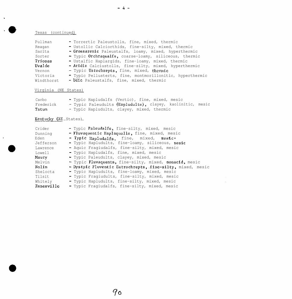
-4-
Texas (continued)-
Pullman - Torrertic Paleustolls, fine, mixed, thermicReagan - Ustollic Calciorthids, fine-silty, mixed, thermicSarita - Grossarenic Paleustalfs, loamy, mixed, hyperthermicSorter - Typic Orchraqualfs, coarse-loamy, siliceous, thermicTriomas - Ustalfic Haplargids, fine-loamy, mixed, thermicUvalde - Aridic Calciustolls, fine-silty, mixed, hyperthermicVernon - Typic Ustochrepts, fine, mixed, thenuicVictoria - Typic Pellusterts, fine, montmorillonitic, hyperthermicWindthorst - Udic Paleustalfs, fine, mixed, thermic
Virginia (NE States)
Carbo - Typic Hapludalfs (Vertic), fine, mixed, mesicFrederick - Typic Paleudults (Hapludults), clayey, kaolinitic, mesicTatum - Typic Hapludults, clayey, mixed, thermic
Kentuck- States)- - - - -
Crider - Typic Paleudalfs, fine-silty, mixed, mesicDunning - Fluvaquentic Haplaquolls, fine, mixed, mesicEden - Typi.c Hapludalfs, fine, mixed, mes%c 0Jefferson - Typic Hapludults, fine-loamy, siliceous, nlesicLawrence - Aquic Fragiudalfs, fine-silty, mixed, mesicLowell - Typic Hapludalfs, fine, mixed, mesicMaury - Typic Paleudults, clayey, mixed, mesicMelvin - Typic Fluvaquents, fine-silty, mixed, nonacid, mesicNolin - Dystpic Fluventic Eutrochrepts,.fine-silty, mixed, mesicShelocta - Typic Hapludults, fine-loamy, mixed, mesicTilsit - Typic Fragiudults, fine-silty, mixed, mesicWhitely - Typic Hapludults, fine-silty, mixed, mesicZanesville - Typic Fragiudalfs, fine-silty, mixed, mesic

Southern Regional Technical bJork-Planning Conferenceof the
Cooperative Soil SurveyBlacksburg, Virginia
Hay 24, 1972
RXPGRT OF COMIYITTEE V I I I
-Classification and Util.ization ofFi%h and Sait I~Jsl:er I.Ia~sEhes-
David F. Slu&er, Chai rc..znV i c t o r !.J. Carlisle: Vie*-.C:~air,;en
CW_RGES :
1. Investigate and evaluate current critorfa ~srrl <or ciassif!:.cn,,tion of both fresh aad salt water mar&w..
(a) Determine effectiveness of these cl.-ss-if.ic.~~.~.r.:~~;for making predictions or ixterpretation::.
2. Make recommendations concerning the optimum classificatj,onlevel for mapping marshes.
3. Nake recommendations concerning the optimum lexl of intsnr!.tyof mappicg marshes.

2
REP0P.T OF COI@IITTEE VIII
Charge one was to investigate and evaluate current criteria usedfor classification of both fresh and salt water marshes and todetermine the effectiveness of these classifications for makingpredictions or interpretations.
It WJS felt that soil taxonomic units should be the basis formapping marshcs and charge one, with considerable elaboration,was divided into three parts as follows:
1. Examj.ne criteria for classification of Eistosols,Hydraqucnts, and Sulphaquents as now given in SoilTaxonomy. Locate inconsistencies and seek to clarifyvague statements that might lead to misinterpretations.Investigate and evaluate the present criteria andprepare proposals for modification, addition or deletionof criteria needed to improve the system:
In Histosols it is very difficult to standardize observedunrubbed fiber with unrubbed material retained on a sieve.In some cases, as in Florida, part of the retainedmaterial is not recognizable when in the soj.1 mass. Inother cases, some of the fibers recognizable in theundisturbed mass are destroyed before thay can be retainedon the sieve. It might be well to state that unrubhedfiber is the fiber recognizable in undisturbed soils.Then rubbed fiber content could continue to be tiedtightly to a retained fiber technique. The one propertyis related to the undisturbed soil morphology and theother, or the two together, relate to the degree oforganic decomposition. The main problem with thisapproach is that there would be no quantitative procedurefor actually measuring the unrubbed fiber.
&%ommendatFon 1: That unrubbed fiber not be definitive forfibric, hemic, and sapric soil material but it should beestimated and recorded in soil descriptions.
Another conceptual question revolves around the organicvolume. One concept, subscribed to by many, con~idcrsthe organic volume as the volume fraction which can becalculated from the weight fraction based on rel.ativedensities of organic and mineral fractions. The otherconcept considers the organic fraction as a frameworkencompassing the whole soil. By this view, the mi.neralmaterial simply fills spaces within the organic structure.By the first concept, the fiber percent would be basedon the organic volume fraction, which would be less thanthe whole soil volume, By the second concept, the fiberpercent is based on the whole soil volume and the mineral

3
content is of no concern. ~1" the one case, the organicmatter content must be knorm and calculations are required.In the other case, the definition is treated as if thewords "organic volume!' were not even there. We need auniform convention in this area.
Kecommendation2: That fiber content of organic soil rzaterials bemeasured or estimated as the percent of the whole soilvolume rather than the organic volume.
Fiber percentages by definition exclude living fibers.Yet, wf suspect it is more common to base them on rootsplus fibers than to sort living from dead. This nay beparticularly true where there is a mat of roots in theupper tier.
NC cannot expect to change definitions at this time, but76 can suggest clarification through advisories or othervehicles, and can recommend favdred approaches.
In the opinion of one of the members, the greatest presentproblem with the classification of Histosols is the lackof standardized laboratory methodology. Field tests needto be verified by laboratory procedures designed in sucha manner that the various results are not in conflict.Culk density, sodium pyrophosphate, unrubbed and rubbedtechniques presently used are not satisfactory becauseresults are frequently conflicting.
It was suggested that investigation of two additionaltechniques for collecting data be used in the classifica-tion of Histosols. These are use of the thfrmobalance(loss of weight upon controlled heating) and applicationof ultrasonic techniques, perhaps in combination withvarious chemical treatments. LOSS of water upon heatingshould reflect the stage of decomposition. There isreason to believe that ultrasonic procedures could bedevised which vould serve as standardized tests to refereethe rubbed field tests in a similar manner as the glasselectrode pE1 determination referees the various color-metric field techniques for determining soil reaction.
A question is raised relative to the Great Group Sulfi-hemists. (a) llov much of the soil volume must contain0.75% sulphur in order to qualify; (b) How much of thetotal S must be sulfides and how much elemental 5,organic compounds, etc.; (c) What lab procedures are usedfor these determinations? Does the 11202 oxidationprocedure for estimation of sulfides (Handbook of SoilSurvey Investigations - Field Procedures) approximatethe biological oxidation that occurs in drained soilsand give the same degree of acidity? Many workers feelit does not and is not suitable for estimation ofsulphidic soil material.

I:.
There is sows question regarding "Clastic': families.There are very fen Ilistosols in the country, if any, thatfall in elastic families. Soils have been observed inthe South that secningly should fall into a elastic farr.ily,but do not rnect the definition. We would pose thefollowing questions: (a) Hhat is the basis for the 55%mineral matter? (b) Could this be lowered to Ml%? Aboutthe 60% ash level seems to be the level vhcre the fieldsoil scientist feels a clear change in mineral content.At the present time, the range for elastic material iswry narrow, i.e. 55% to lo"/, nsh if the mineral fractionis primarily cl?y; 40% ash would provide a broader slotfor elastic families. It is suggested that the followingdefinition of elastic families be investigated: "Morethan 00 percent nineral matter (total ash after ignition)as a weighted average of the organic materials within thesubsurface and bottom tiers or a layer containing 40% ormore mineral 15 cm (G') or more thick within the sub-surface tier. III some states, ash percentages between 40percent and 70 percent are associated with Fluventic andTerric subgroups and the feeling is that elastic familiesare not needed.
The application of the sodium pyrophosphate extract coloris still confusing, As we interpret the definition ofIlemic materials, the sodium pyrophosphate extract coloris only used to eliminate either sapric or fibric material,therefore written, a reader is lead to believe that hemicmaterial must have sodium pyrophosphate extract colors of5/l, Gil, G/2 or 713. As WC interpret the definition,this is not the case. We would therefore, suggest thatitem 2 of the definition of hemic material (p 4.-3) beeliminated or an addition statement be added stating:"hemic materials are not limited to extract colors of5/l, G/l, G/2 or 713.:' This statement should also beadded to Figure 24, page b-G.
Experience has shown a need for subgroups of the Hydra-quents and Ilydric Fluvaquents. Criteria and proposeddefinitions follow:
Proposed Definition of Subgroups of Hydraquents
Typic llydraquents are the Hydraquents that
a. (alternative 1) have no horizon or combination ofadjacent subhorizons 75 cm or more thick with anupper boundary between 20 cm to 1 meter of mineralsoil surface that has an n-value of less than 1.

5
a. (alternative 2) have no horizon or combination ofadjacent subhorizons 75 cm or more thick with an z-value of less than 1 with an upper boundary within 1meter of the mineral soil surface.
wc (Pluvaquentic?) Hydraquents. Hydraquents like the Typicexcept for a.
Typic llydraquents. The central concept of the Typic subgroupof Hydraquents is set on soils that are semifluid in alldominant layers within 1 meter of the mineral surface. Ifdrained, the upper horizons dry irreversibly and widecracks develop that will not close when soil is renet.The underlying horizons will remain semifluid afterdrainage. The presence or absence of a histic epipcdonor a buried Histosol is not considered particularlyimportant compared to the effects of the semifluid lowerhorizons after drainage. The Typic subgroup is extensivein the deltaic coastal areas near the mouth of theIlississippi River.
Haplic (Fluvaquentic?) Ilydraquents are like the Typic exceptthat they have thick lowr horizons with low n-values.The lower horizons have been subject to wetting and dry-ing in an earlier cycle of soil development and thus haveconsolidated reducing the maximum water content to lessthan 100 percent. Later periods of sedimentation deposit-ed semifluid material over the consolidated layers. Whendrained, the upper semifluid horizon will consolidate andthe soil vi11 have low n-values throughout. These soilsare not extensive in the U. S. They are consideredintergrades to IIaplaquents (Fluvaquents).
Proposed addition to Definition of Typic Fluvaquents
h. have no horizon 75 cm or more thick with an upperboundary within 1 metar of mineral soil surface thathas ~-value of DCXX than 0.7.
Ilydric Fluvaquents. Fluvaquents like Typic except for h.
llvdric Fluvaquents are.like the Typic except that they areunderlain with thick layers that have an n-value of morethan 0.7. These are primarily clayey soils in tidalmarshes and swamps that have been artificially drained.The soil material was deposited under water and prior todrainage, they were never air dry. When drained, theupper horizons dried irreversibly and wide cracks develop-ed that do not close when soil is rewet. The underlyinglayers contain more than 100 percent water and remainsemifluid to a depth of 1 meter or more.
4’5

G
~ecomncndation_\____L----___-as well as
3: That all the proposed revisions to Soil TaxonomyI:ecomr~endations 1 and 2 be referred to Committee
XIII (Changes in the classification system) for consideration.
2. Determine the effcctivcncss of the classification systemfor making interpretations. lhat are the significantcharacteristics to be recorded on interpretation sheets?Is a separate interpretation sheet needed for organicsoils? If so, develop a forwt. 1n many cases theclassification of the soFl,changes when the soil isdrained. In these cases, the predictLons may be for snentirely different series. How far should we go in makingpredictions about behavior for series A if drainage makesit series B? Comparisons should be made batwean inter-pretations at all levels in the classification system forHistosols, llydraquents, and Sulphaquents. Do succfsdiaglylower categories produce the same or more refined inter-pretations?
The general reaction of the Committee is that the classi-fication system & effective for making interpretations andthat the soil interpretation sheets now being used areadequate, with minor revisions.
~econmendation 4:-.__ That total subsidence potential should be notedon the interpretation sheets for Histosols. Also. the "-values for use with mineral soils should be provided whereappropriate.
It is pointed out that for the most part succeedinglylower categories of Histosols in general, do not producemore refined interpretations; however, more refined inter-pretations can be made and included on the interpretationsheets or in supplemental interpretive material.
In judging how far to go in predicting the properties oftaxonomic unit B, formed from drained unit A, it is thegeneral feeling to go as far as data will allow. Much ofthe usefulness of identifying sulfidic material is inrecognizing the degree of potential acidity, should thesoil be drained. The same is true for subsidence. Themost public interest in our information at presentprobably is in the prediction of the behavior of series B.
The Soil Survey of Portions of Jefferson, Orleans, and St.Bernard Parishes, Louisiana, illustrates a considerableeffort toward an organized presentation of vastly differentsoils. The mapping unit descriptions cover the soilconditions as they occurred at the time of mapping as wellas a paragraph on hew they would be expected to behave ifdrained.

7
1n table 5, Engineering and Other Selected Use Interpreta-tions, the soils are arrayed by groups and then byindividual soils, in order of decreasing suitability forurban developments (page 100 and 107). The reason forthis is that rating criteria did not provide importantdistinctions between soils. Ratings are also made forthe “as is” condition as well as the conditions thatwould exist if the area were drained. (Appendix A)
In that report, only total subsidence potential, firehazard, and presence of logs and stumps were significantfactors considered unique to Histosols or hydraquentsand included as additional columns in table &, EstimatedPhysical and Chemical Soil Properties (at that time therewasn’t enough confidence in E-value to use it).
Becommendation 5: That coordinated series interpretationsheets show ratings for “when drained” conditions ifdrainage changes the series classification. This woulddistinguish between interpretations for drained phases ofa series and interpretations for a different taxonomicunit that is the result of drainage.
3. geview “Criteria for rating soils for subsidence potential”,(page 145, Proceedings of National Technical iork-PlanningConference of the Cooperative soil survey 1971) and makesuggestions for improvement. Criteria for rating initialsubsidence potential should also be considered.
In general, the Committee felt that the criteria forrating soils for subsidence potential as outlined in the1971 Proceedings of the National Technical Work-Plar.ningConference was adequate; however, not a great deal offield experience or studies were available to substantiateit ’ s e f fect iveness . It was noted, however, that theinitial subsidence potential depends primarily upon howfar the water table is lowered and the degree of drainagealready accomplished at time of mapping. In addition,drained phases of thick Histosols still may have “initial”subsidence potential if the water table is lowered stillfurther by deepening the ditches. It is suggested that wereport estimated total subsidence potential upon drainage.
It was further suggested that we might want to considerdevelopment of some simple field kits for estimatingvolume change on drainage. This approach could rangefrom collection of bulk samples and weighing on a simpleinexpensive balance to the collection and draining ofcores and weighings on milk (or other) scales. The closerto the field, the better in estimating initial subsidenceof relatively undisturbed cores, and close cooperationbetween field and research personnel would be imperative.
Q7

e
There would be nerit in relating subsidence to organicmatter content of defined sections rather than just tothickness of organic materials. There should be somedifference in total subsidence potential between organiclayers with low mineral content and ones with high mineralcontent. Again, more precise classes may require manymore measurements, including field determinations closelystandardized by the laboratories. This is well withinreach using available equipment. Variations of the fieldignition technique, 19.5 of the new handbook of SoilSurvey Investigations Field Procedures, could be used ifclosely standardized and monitored by the more accuratemeasurements "sing furnaces.
It is the feeling of the Committee that initial subsidencestudies be encouraged wherever the opportunity presentsitself, with special note as to the kind of soil materialspresent. This would assist in substantiating presentestimates. Subsidence monitoring under various types ofland use and management systems should also be encouraged,rdlich will add to our over-all knowledge and interpretiveexpertise of soils with high shrinkage potential, Perhapsa work planning conference committee could undertake theassembly of all existing data on initial subsidence andcontinued subsidence in organic soils.
Charge two was to make recommendations concerning the optimumclassification level for mapping marshes.
1. The categorical level of soil classification favored isthe great group or subgroup though this decision is perhapsbest made in each survey area on its own merits.
2. Soil series are used chiefly in naming map units thr_nughphases reflecting salinity, logs, soil acidity and drainageto phase the soil "nits being mapped in Louisiana. Else-where, seemingly, soil series provide adequate separationof soil areas. Organic soils in marshes seemingly needto reflect thickness of organic horizons.
Charge three was to make recommendations concerning the optimumlevel of intensity of mapping marshes.
The optimum intensity of mapping marsh lands should be deter-mined independently for each survey area. Each survey shouldbe designed to meet the present and expected land "se planning.Detailed surveys are needed where marsh lands are beingdeveloped for urban uses, as in the New Orleans area.Reconnaissance surveys are sufficient for range and wildlife.

9
Practical consideration must be given to several factorsto determine frequency of nbservations. These includethe following:
1. Planning needs for present and expected land uses
2. Accessibility and trafficability
3. Available transportation and equipment
4. . Uniformity of area. Some marshes are extremelybroad and uniform. In fact uni.form delineationsof 5,000 acres or more are not uncommon.
5. cost of survey. The cost of each survey should beweighed against its potential utility. In somemarsh areas, one observation par 20 acres will notyield a significantly more precise or usablesurvey than one observation par 640 acres.
One survey area in each Louisiana, Alabama, South Carolinaand Florida were studied to determine the accessibility ofthe center point of each quarter section CNI sample plot inthe marshes. The distance from the nearest road to thecanter point of each plot that must be traveled by boat andby foot were determined. The average distances were asfollows:
Distance by Distance byw boat&!%U_ _~oot (ni.)
Alabama 0.G 0.1Florida 3.2 (air boat)South Carolina 1.5 0.2Louisiana 4.2 0.2
The results of this study are that the avcraee’distancathat must be traveled by boat to got within 0.1 to 0.2miles of randomly selected points ranges from about l/2milt to over 4 miles. The extreme distance traveled byboat in this study ranged from 0 to 10 miles.
As a result, serious consideration should be given to makingrandom field observations near boat trafficways rather thanstraight- l ine tr.?nccc‘r on foot across nlarshcS.
Field uapping techniques and frequency of observationpresently being used to identify and determFne compositionof r.larsh mapping units are as follows:

10
1.
2.
3.
Transportation being used includes conventional boats,air boats, swamp or marsh buggies and amphihious traclurs("Trackster").
Sampling equipment includes spades, posthole diggers,bucket augers, mud augers and specially designedsampling devices.
Observation intervals vary between states and withinstates between survey areas. They vary from oneobservation per 20 acres to one observation per 640acres depending on the intensity of the survey and theuniformity of the area. 1n some survey areas, observa-tions are made along straight-line transects traveled byfoot a"d others that are made at random adjacent toboat trafficways.
Acceptable alternatives to the previously discussed methods ofdefining mapping units are not presently available. Additionalwork is needed to improve photography and photo interpretation.Also, remote sensing has a high potential for improving marshsurveys.
Recommendation 6: That the intensity of mapping for each survey areabe determined at the time work plans are formulated by consideringthe expected land use, soil patterns, equipment limitations,imagery and costs.
Rccommendatio" 7: That the Committee be continued to wor~k on chargeone and that the name of the committee be changed to emphasizeclassification of soils in marshes.
Members of Committee VIII:
David F. Slusher. Chairman - LouisianaV. I,J. Carlisle, Vice-Chairman - Florida
B. 1.. Allen - TexasH. J. Byrd - North CarolinaJ. Colom-Aviles - Puerto RicoC. I;. Coultas - FloridaJ. h. DeMant - TexasS. C. Holzhey - Washington, D. C.K. \I. Johnson - FloridaS. A. Lytle - LouisianaE. A. Perry - AlabamaK. A. Tan - GeorgiaR. D. Wzlls - South Carolina

11
Discussion:
Daniels - What field clues are used to help draw boundarieson maps?
Slusher - The marsh does have a landscape that can be interpretedby skilled observers. Vegetation, drainage pattern. kinds anddistribution of open water bodies are also used. In places thetransect data is relied upon to a large extent.
rJartelli - 1Je need to think about potential for development ofsoils rather than just limitations for use.

12
APPEII)II: A
Sample mapping, unit description fro:,1 the Soil Su~vev of Portions__-ofJeCferson Orleans and Staz+3rcl Parishes_____,_ ..?__..__
Lafittc muck (12). -- This is a very poorly drained thick o1gani.csoil at low elevations. The surface layer is very dark brown toblack organic material 50 to 100 inches thick which is underlain bysemifluid gray clay (table 311). The vegetation is salt tolerantmarsh grasses. Included in the mapping are small areas that havethin strata of clay in the upper 51 inches.
The water level is several inches above the soil surface most of theyear (fig. 7). Permeability is rapid in the organic layers. Surfacerunoff is very slow or none. Available water capacity is high. Saltcontent is low to medium.
This soil will not readily support human foot traffic. Many nutriaand muskrat trails in the surface mat of live roots make walkingd i f f i c u l t . Layers of buried wood, stumps and logs are present in afew areas. It is poorly suited to comon uses other than wildlife.The soil is suited to wetland wi.ldlife, and is unsuited to openlandand woodland wildlife.
_IfS_~ot~.c_t_ed__~nd drained :
The soil will consolidate and shrink with a resulting loss inelevation of 2 or 3 feet within a year after drainage. The organiclayers may catch fire and burn when dry (figure 3), Continuedsubsidence at a slow rate over a long period will occur until allorganic material above the water table has been oxidized. Aciditywill increase after drainage. Salt content may inhibit certainornamental plants for a few years, but eventually the salt will beremoved by leaching from rainwater. Drainage ditches and leveesarc difficult to construct because of the semifluid nature of theorganic layers. Levees constructed from the organic materials shrinkand wide cracks form. The capacity of ditches is gradually reducedbecause of the continual subsidence of the organic layers. Floodingmay occur if pumps or levees fail. The organic materials will sub-side after drainage and the underlying semifluid layers are inade-quate Support for most foundations, therefore, piling are generallyneeded. It is suited to openland and wetland wildlife, and unsui.tedto woodland wildlife.

Excerpt from the Soil Survey of Portions of.St. BernardParishes that pxf:codos Tnblc 5.
._
For some uses soils are rated under subheadings of Protected or_-_Unprotected in table 5. Ratings given under Protected assume floodprotection and drainage, by pumps if necessary, has been or will beinstalled. The limitations and factors affecting use are those thatwill still be encountered after protection. Ratings under LlnprotecWd_arc for use of the soil vithoot drainage improvements. Soils wit!>levees and drainage at the time of the soil survey are rated only asprotected, however, no evaluation of the adequacy of the drainage isfmplied.
Soil Group and Description - Soils in the survey area are placed insix broad groups (A-F) in table 5 according to several soil charac-teristics that affect their use and management for most urbanpurposes. Factors considered in grouping soils are: (1) dominantlayers (organic or mineral), (2) texture of mineral layers, (3)consistency of mineral layers (consolidated or semifluid), (4) thick-ness of organic layers, and (5) presence or absence of buried logsand stumps. The groupings show in a general way the lcind and degreeof limitations for most urban uses. Also listed are dominant limit-ing factors or degree of limitation for most urban uses. Groups arelisted in order of increasing dcgrcc of limitations. For cxamplo,for most urban uses, soils in Group A have fewer or less scvorolimitations than soils in Group B and soils in Group B have fewer orless limitations than group C, etc. A soil with severe limitationsin Group A is generally less costly to develop and is a moredesirable site for most urban uses than a soil with severe limitationsi" Group B or Group C.
The individual soils within each group are listed in order ofincreasing degree of limitations for most urban uses.


1
_I

T


SOUTHERN REGIONAL TECHNICAL WORK PLANNING CONFERENCE
Blacksburg, VirginiaMay 2, 3. 4, 1972
Chairman: T. W. GreenVice Chairman: W. Frank Miller
Committee IX. Soil Surveys for Forestry Use
Comnli~ttee Charges:__--
1. Make recommendations regarding the optimum level of soil surveyintensity in forested areas and,
make recommendations regarding the appropriate classificationl~eve.1 for surveys.
2. Suggest a" outline for format and content of mapping unitdescriptions of soils in forested areas.
Report of Committee IXSoil Surveys for Forestry Use
Charge l-Optimum Level of Soil Survey Intensity in Forested Areas
Committee IX agreed that the principles of soil survey on forest-ed laltds are no different than for other land uses and that no singlelevel of intensj~ty could be recommended. The general feeling of thecommittee was that mapping intensity will be variable but based pri-marily on (1) complexity of landscape units and soil patterns; (2) an-ticipated level or degree of use; (3) type of use--productivitypredictions, assessment of land potential for multiple use; (4) small-est area significa"L to the resource manager. In addition to thesevariables, also to be considered is the cwcept that soil surveysshould bc considered as a" integral part of uwxxgement costs, andtherefore, the survey intensity will be somewhat dependent upon theanticipated value of the crop.
With respect to complexity of landscape uni~ts, each physiographicarea has unique landscape patterns which must be recognized and iden-tified for resource managers. For examp1.e , a flood pl.ain three chainsin width is a" important management unit .a"d should be separated fromside-slope to ridge-top "nits. The flood p1ai.n is generally a hjghquality bottomland hardwood site. The management criteri~a are differ-ent: the flood plain unit would be the mapping process, probably be
108

. .
of a medium intensity, while the side-slope or ridge-top unitscould be designated as low intensiry "nits. species composi-tion, use and management of these three areas are entirely dif-ferent.
It is also obvious that the higher the anticipated levelor degree of "se of a landscape unit, the greater should be theintensity. Recreational sites, impoundment areas, and other areasof special interest should receive the highest intensity of soilsurvey. In sumnary, the optimum level of soils survey intensitycan be determined onl,y after a study of the survey area and theneeds of the resource manager.
Charge 1-A
Appropriate Level of Categorical Detail for Surveys in ForestedAreas
The appropriate level of categorical detail of soil surveys isclosely interrelated with the survey intensity; however, the ultimatesurvey objective for forested areas, as with any other areas, is toidentify units significant for resource "se and management. Thelevel at which units become significant may be at the series level,but in practice the level is generally at associations and complexes.Ideally, there should be one level in the classification system wheremaximum predictability could be found concerning resource "se andmanagement criteria. This level should include a number of differentsoils that respond in the same way to kinds of use and types ofmanagement. In addition to the morphological aspects, external char-acteristics such as aspect, slope position, and elevation should beconsidered, primarily because the individual taxon cannot supplysufficient information concerning land use potential.
Since it is stated in a Comprehensive Classification that "thefamilies are differentiated within a sub-group primarily onthe basisof properties important to the growth of plants," phases of the soilfamily would, theoretically, be acceptable as the classification andmapping level for forested lands. However, the system std~ll hassome apparent weaknesses if this is put into practice. As an example,examination of the Humic Hapludults, fine loamy, mixed, mcsic, withinwhich are found the Porters and l'usquitee series, indicates that thetwo series arc actually very different soils from a resource and man-agement standpoint. One is "shall.ow" and generally found on convexslopes, and the other "deep" and found in cove or concave slopepositions. Species composition, productivity potential and managementalternatives for the two series are completely different. It is recog-

nized that in mapping we could phase these i~nto two units, butthe fact remains that here are two maj.or soils of different po-tential in the same family. In the Piedmont there are tendifferent series in the clayey, kaolinitic, thermic family ofthe Typic Hapludults. If there are management differences be-tween these soils should not they be identified and appropriatemap units designed to keep them separate? If, however, theuses of these soils are similar, considerable time and moneyshould be saved by mapping at the family level. Also in the Pied-mont it is becoming more and more evident that there is littledifference in the use and management of the clayey, kaolinitic,thermic family of the Rhodic Paleudults.
Based on these observations, it is questionable that thereis a single appropriate categorical level of mapping units forsurveys on forested lands if the objective of the surveys is toprovide information for planning resource use and management. Theclassification system should and will eventually give us a neededlevel for mapping forested areas.
Charge 2
Suggest an Outline for Format and Content of Mapping UnitDescriptions of Soils in Forested Areas
A concensus of opinions of the committee members reflected aneed for a format designed for a resource manager. All agreed onthe general categories that need to be covered. The sequence,however, varied.
Based on the majority opinion, Committee IX submits thefollowing format for consideration:
Unit Name and symbol____--
The title of this section could vary. Most users are familiarwith the name "Mapping Unit", The term "Landscape Unit" is gainingfavor within the Forest Servfce. The name should not restrict thesize of the unit to insignificant subdivisions.
General Description- - --_ _ _
Several titles were suggested as heading for this section."Setting" was the most popular. The word "Environment" was alsosuggested.
This section would be a combination of two subjects 1)~ a briefdescription of the setting and 2) a brief description of the domi-nant soil type or phase. In describj.ng the setting, emphasis would

be on land forms, aspect, elevation and other observable physicalfeatures affecting use and management, The soil description wouldbe very brief, but limitations such as depth to bedrock would behighlighted.
Vegetative Habitat
This section would identify dominant and/or indicator speciesin both the understory and overstory. Emphasis would be on recog-nizing those plant communities that naturally live and grow best onthe particular site.
Here the inclusions would be identified and located on thelandscape.
Classification
The majority felt that the dominant soil types should beclassified at least at the family level. There was, however, somefeeling that the classification should be omitted, and the CommitteeChairman was of this opinion.
Note any limiting site factors which might influence useage--such as erosion potential in relation to logging road layout.
No attempt was made to add management implications as a partof this format. Expansion to include interpretations poses noproblem, but if this is added, it must be remembered that forestedlands are used for other than timber production, so interpretationwould have to be developed for all potential resource uses.
In Appendix I is illustrated a system that is gaining favorwith the resource managers in the U.S. Forest Service. This isnot a recommended format, but is presented as information.
Summary and Conclusions_-
The Committee feels that mapping intensity will vary withcomplexity of l~andscape units and soil patterns, anticipated levelor degree of land "se, and the type of land "se.
The appropriate level of categorical detail for surveysof forest land is closely related to the survey intensity andtherefore, the need for categorical detail will vary under thesame conditions as the survey intensity.
A format designed to serve the needs of a resource manageris presented for consideration.
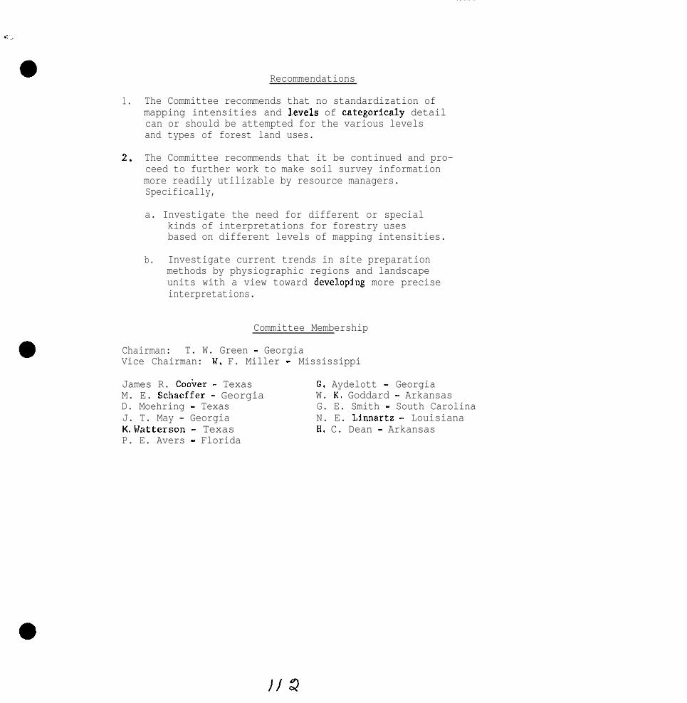
Recommendations
1.
2.
The Committee recommends that no standardization ofmapping intensities and l.evels of categoricaly detailcan or should be attempted for the various levelsand types of forest land uses.
The Committee recommends that it be continued and pro-ceed to further work to make soil survey informationmore readily utilizable by resource managers.Specifically,
a. Investigate the need for different or specialkinds of interpretations for forestry usesbased on different levels of mapping intensities.
b. Investigate current trends in site preparationmethods by physiographic regions and landscapeunits with a view toward developjog more preciseinterpretations.
Committee Membership
Chairman: T. W. Green - GeorgiaVice Chairman: ~W. F. Miller - Mississippi
James R. Cootier - TexasM. E. Schaeffer - GeorgiaD. Moehring - TexasJ. T. May - GeorgiaK. Watterson - TexasP. E. Avers - Florida
G. Aydelott - GeorgiaW. K. Goddard - ArkansasG. E. Smith - South CarolinaN. E. Linnartz - LouisianaH. C. Dean - Arkansas

GWIWNETT SAWDY LOAM, 6 TO 10 PERCENT SLOPES, -423 C-2
These soils of the broad ridges and upper slopes retain adequate moisturefor plant growth except during prolonged dry seasons. They typically haveabout 4 inches of dusky red sandy loam over three or more feet of darkred clay. Some old erosion scars remain.
Within compartment 769 this unit accounts for about 150 acres. Individualareas are longer.than wide and average about 25 acres in size.
Interpretive Soils Data
Timber : Forest Type Productivity Class
052031
53 083
-Harvesting Precaution -- Moderate - Plan road system and skiddingmethods prior to harvesting operations. .
-Regeneration Precautions -- Moderate - Rxpose no more than 60 per-cent of surface soil. No soil disturbance allowed within 50 feet o fgully heads or within 25 feet from the side.~
-Access Road -- Poor - Erosive clay. Give special attention to shapingand water bars. Cantionl Avoid operations during prolonged wetperiods due to erosion and compaction hazards,
aineering : Estimate unified - 7-36” CL below 36” broken rockand soil material. Depth to bedrock is 5 to 8 feet.
- Volume change - Medium; pH - 5.5
Wildlife: Plantings -- Good site, responds well to properfertil ization. Locate on the more level areas.
Watershed: Hydrologic cond. class. -- Fair -potential erodibility-Severe. (SCS Group-B)
Recrea t.ion : Fair- - - Avoid erosion scars. Detailed surveys arenecessary prior to action plans.
REHPJNS
Critically eroded areas are identified on the maps with a red “E”. Theyoccur as small isolated areas each less than an acre in size. Stabilizationwith grasses and/or legumes is needed.
Within this unit are areas of 2 to 6 percent slopes, which are not signi-ficant from a management standpoint.

1~972 Southern Regional Technical Work-PlanningConference of the Cooperative Soil Survey
May 2, 3, 4, 1972 - Blacksburg, Virginia
Committee X - Educational Resources
Charge to Committee: To investigate and develop procedures foracquiring inventory reproductions of visual aids not presentlyinventoried and recommend methods by which these visual aidsmight be financed.
Committee Report: Correspondence with members of the assignedcommittee brought little help on the charge. Most all agreedthat many faculty members have good teaching aids that they usebut that very few probably represent a complete unit. No oneseemed to know of a way to discover what various individualsmight have. Probably no successful method will evolve.
More recent conversation with Charlie Welch has probably broughtto light our problem. No one wants to make a detailed descrip-tive list of the kind and quality of aids that he has. I don'tblame anyone for this. It would take a lot of extra time thatno one has. Charlie Welch suggests that we decide what we wantspecific slides, transparencies, etc. on. This makes good sense.We should have thought of this two years ago. It seems logicalthat if we, or someone, will "simply" outline a unit to be illus-trated and in turn let others know what, specifically, is wantedwe might get results. You will recall that this is very muchthe way the Marbut Memorial Slide Set was put together.
Slides cost more than line illustrations on a sheet of paper. Itmight be that tables, graphs, schematic drawns, etc. might becheaply put on smooth paper in black and white. Purchasers coulduse these for purposes of making duplicate copies, transparencies,or slides or order the transparencies or slides prepared. Certainlysome things, such as pictures, would have to be on a film strip orslide.
It will take time and dedicated effort but it seems that the onlyway to go now is decide upon topics. The next step will be todecide upon the points to be illustrated, the kind of illustra-tion to be used, etc. This step would be followed with a callfor the specific picture, schematic, or whatever. A script wouldhave to be pretty well developed at about this point.

-2-
Up to this point expenditures would possibly be small but whenduplicating starts costs go up fast. A SOUPC~ of support mightbe possible. Would the SCSA be interested? Perhaps some aggres-sive student club such as an agronomy club would be interested insuch a project as a money raising program. Perhaps it would betoo big for a student group. Yet these have both been suggestedin the correspondence received. I would not rule them out.
The American Society of Agronomy is, at present, working on unitsfor educational purposes. I do not know at the moment what unitsare being developed. We certainly do not want to duplicate theirefforts.
The Soil Conservation Service has recently released a unit titled"Consider The Soil First." It has a very nice narrative guide tobe used with a slide set or film strip. A cassette recording ofthe narrative is also available. As I see it this unit is suit-able even in junior high level classes. In my opinion, this unitis very well done and could be a guide to additional new units.Perhaps there are others being developed now that we don't knowabout.
In summary we can say that:
1 0 .
11.
Needs for educational materials exist.The needs must be identified as units.Each unit needs an outline.Ideas for visual aids must be spelled out.A call for specific slides, schematics, etc. will likelylocate many.Some materials will have to be original.Materials will have to be assembled, organized and a scriptwritten.Aggressive interested leadership will be necessary.The SCSA or some aggressive, well organized Agronomy Club orsome such equivalent might be interested in one or more ofthe units as a money raising project.Suggestions as to units to prepare and how they might befinanced are invited from anyone.A source of funds will be necessary if units are to beassembled such that they will be available for sale tointerested individuals, groups or institutions.
Recommendations: A meeting of the committee during its attendenceat Blacksbury, Virginia, proposes that:
1. The committee be continued.2. That the committee present at the meeting at Mobil in 1974:
a. Information on methodology
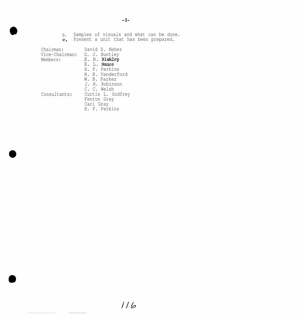
-3-
b. Samples of visuals and what can be done.c. Present a unit that has been prepared.
Chairman: David D. NeherVice-Chairman: G. J. BuntleyMembers: E. R. Blakley
E. L. NanceH. F. PerkinsH. B. VanderfordW. B. ParkerJ. H. RobinsonC. C. Welsh
Consultants: Curtis L. GodfreyFenton GrayCarl GrayH. F. Perkins

SOUTHERN REGIONAL SOIL SURVEY WORK-PLANNING CONFERENCE
MAY 2-4, 1972, BLACKSBURG, VIRGINIA
Report of.
COMMITTEE Xl: ENVIRONMENTAL SOIL SCIENCE
Chairman: s . w . Buol V ice Cha i rman: J . M. Soileau
I.
2.
0 3*
Charges to Committee
S u r v e y t h e r e s e a r c h i n v o l v i n g env,Tronmental qua l i t y a t eachi n s t i t u t i o n w i t h i n t h e r e g i o n a n d s u m m a r i z e t h o s e a c t i v i t i e st h a t a r e r e l a t e d t o Pedology.
Review and summarize studies being made byCSRS regional workgroups.
Rev iew and eva lua te so i l p roper t ies tha t in f luence so i l behav io rin organic waste breakdown. P r e l i m i n a r y g u i d e l i n e s f o r ratingsoi l behavior may be attempted.
With respect to Charge I , the Commit tee used the CRIS retr ievals y s t e m a n d o b t a i n e d a ,print-out of all p ro jec ts re la t ing to so i l s ,env i ronment and po l lu t ion in the Southern Region Agr icu l tu ra l Exper imentS t a t i o n s . F r o m t h e s e t h e Committee a b s t r a c t e d p r o j e c t s o f s p e c i f i cin te res t to the workshop and d is t r ibu ted 31 pages o f p ro jec t abs t rac tsat the conference.
The Commit tee also assembled and distr lbuted 49 references deal ingwi th was te decompos i t ion , pes t i c ide decompos i t ion and fe r t i l i ze r N andP movement as related to speci f ic soil p r o p e r t i e s .
With respect to Charge 2, the Committee secured and reproduced theAnnual Report of the S-82 Regional Work Group ent i t led “Fertilizers andOrgan ic Wastes App l ied to So i l s in Relation to Env i ronmenta l Qua l i t y ” fo rthose present at the Work-Planning Conference.
With respect to Charge 3, the Commit tee developed prel iminary guide-l i n e s f o r r a t i n g s o i l s f o r o r g a n i c w a s t e d i s p o s a l ( T a b l e I).
Summary:
Whereas there is a great deal of research or iented toward envlron-menta l so i l sc ience in the sou thern reg ion , frost o f the p ro jec ts haveo n l y r e c e n t l y b e e n i n i t i a t e d . T h u s , o n l y l i m i t e d d a t a i s a v a i l a b l e ,

.
lAlso, perhaps because of the nature of working with somewhat speci f ici terns, s e p t i c w a s t e , pou.ltry was te , DDT, e tc . , the p ro jec ts o f ten a rera ther spec i f i c in na tu re and dea l on ly in a genera l way w i th so i lp r o p e r t i e s .
T h e C o m m i t t e e ’ s a t t e m p t t o r e l a t e decompositon and f i l t ra t ionr a t e s ( T a b l e I) i s a t b e s t p r i m i t i v e . However, the Committee feelsthat we should work toward the development of guidel ines wherein wecan prov ide in te rpre ta t ions o f so i l ser ies as receptors fo r was teas we now do for many other uses.
Recommendations:
I . The Committee be cont inued with the evaluat ion of soi ls forland spreading of organic waste as a major change.
2. The Commit tee should also consider pest ic ide, herbic ide andi n s e c t i c i d e decomposihison p r o b l e m s r e l a t e d t o s o i l p r o p e r t i e s .
3 . So i l Sc ien t is ts need to contac t waste r~esearchers and work w i ththem to determine the soi l environment parameters important tot h e i r p r o b l e m s a n d p r o v i d e areal ex t rapo la t ion o f the,l-r r e s u l t s .
4 . Soi l Scient ists should attempt to raise their visability in thearea of Ecology.
Committee Members:
L . J . Bartelli George HolmgrenBobby Bi rdwe I I R. LeonardA. G. Caldwell D. E. PettryR. B. Daniels L . H. RlveraL.,H. Hileman E. M. RutledgeE. L. Hil I John Cady (v is i to r )
Notes on Discussion at Time of Presentat ion:
B a c t e r i a , f u n g i , e t c . a r e p r e s e n t i n a l l s o i l s . Populat ions andra tes o f ac t i v i t y change grea t ly when energy i s app l ied in the fo rm o fw a t e r . (Cady).
Den i t r i f i ca t ion may occur in we l l aera ted so i l s i f g rea t amountso f o rgan ic mat te r a re app l ied (God f rey ) .
Bui ld-up of heavy metals and the transfer of pathogens to foods tu f fs a re a lso cons idera t ions in was te d isposa l (Bartelli).

. . . ’
lTABLE I
PRELIMINARY GUIDELINES FOR RATING SOILS FOR ORGANIC WASTE DISPOSAL:
Soil Property
Solum thicknessShallowDeep
Soil TemperatureColdWarm
Drainage (aeration)ExcessiveWell-M. WellS. Poorly-Poorly
Family Texture (well aerated)Sandy SkeletalLoamyClayey
Family Texture ("aqu" suborder)Sandy-SkeletalLoamyClayey
O.M. Content (comparable drainage)HighLow
MineralogyHigh CECLow CECHigh IronLow Iron
Footnotes:
L' Not Applicable
As regards particulate matter
Organic Waste Disposal RateDecomposition Ffltration
N/+-I/ Lo2NA Hig&
Low NAYHigh NA
High LowHigh HighLow Low(smalI capacity)
HighLess by degrez
NANA
High LowMod. Mod.Mod. High
Vod.Mod-LowLow
HighLow
NANANANA
LowLowLow
SlowFast
High (cations)Low (cations)High (P)Low LP)
>' The more the pti valve ranges trom the neutral ra,nge, the slower the microbial-
activity.

Southern Regional Technical Work-Planning ConferenceBlacksburg, Virginia
May 2, 3,4, 1972
Chairman: Lindo J. Bartelli
Committee XII - Changes in the Classification System
Soils Memorandum-57 (Rev. 1) outlines procedures for making changesin Soil Taxonomy. Procedures are developed for adding, dropping, orredefining taxa in the four upper categories of Soil Taxonomy. Adding,dropping, or redefining soil series and families is to be done throughthe correlation process.
Four regional and one national committee are to consider proposals forchanges.
I. Composition of South Region Committee
Principal soil correlator will serve as chairman.
Members Term Expires Agency
Craddock, S. C. . 1973Godfrey, Texas 1974Springer, Term. 1974Byrd, N. C. 1973Slusher, La. 1974Otsuki, Okla. 1974
II. Composition of National Committee
A. Principal soil correlator
B. Exp. Station representative - three-year term
III. State Committee
(Exp. Sta. )(Exp. Sta. )(Exp. Sta. )(SCS)(SCS)(SCS)
No proposal for state committee is included in Soils Memorandum-57.However, states may establish some clearance procedures for proposalsoriginating within the states.

-
2
The regional committee will consider proposals for change from anysource. The regional committee does recommend that states adopt aprocedure that allows for channeling proposals either through the statesoil scientist or state soil survey leader. These people should havesome knowledge of the proposals originating in their states.
IV. Procedures of the Regional Committee
1. Proposals are submitted to the principal soil correlator whoserves as chairman.
2. Proposals must be accompanied by supporting documents.These documents should include both morphological and compositionaldata of selected pedons. Statements justifying the proposed changes areencouraged.
3. Copies of proposal and supporting documents will be circulatedto committee members. Members will either approve or disapproveproposal. A tie vote is considered as a rejection. Disapproved pro-posal may be resubmitted if additional supporting data warrants suchaction.
4. Approved proposals will be submitted to the national committeefor final action. When the national committee approves a proposal forchange, SCS will issue an announcement of the change.
5. The regional committee will meet during each Southern RegionalSoil Survey Work-Planning Conference and on a special basis when calledby the chairman, Much of the work will be done by correspondence.
V. Committee report:
The committee held its first meeting during this workshop. It re-viewed the recommendations presented by Committee VIII, Classificationand Utilization of Fresh and Salt Water Marshes, on Proposed Definitionsof Subgroups of IHydraquents. The proposed definitions are as follows:
Typic Hydraquents are the Hydraquents that
a. (alternative 1) have no horizon or combination of adjacent sub-horizons 75 cm or more thick with an upper boundary between

3
20 cm to 1 meter of mineral soil surface that has an ~-valueof less than 1: , or
a. (alternative 2) have no horizon or combination of adjacentsubhorizons 75 cm or more thick with anz-value of lessthan 1 with an upper boundary within 1 meter of the mineralsoil surface.
H y d r a q u e n t s .Haplaguentic Hydraquents like the Typic except for a.
Typic Hydraquents. The central concept of the Typic subgroup ofHydraquents is set on soils that are semifluid in all dominantlayers within 1 meter of the mineral surface. If drained, theupper horizons dry irreversibly and wide cracks develop that willnot close when soil is rewet. The underlying horizons will remainsemifluid after drainage. The presence or absence of a histic epi-pedon or a buridd Histosol is not considered particularly importantcompared to the effects of the semifluid lower horizons after drain-age. The Typic subgroup is extensive in the deltaic coastal areasnear the mouth of the Mississippi River.
Haplaquentic Hydraquents are like the Typic except that they have thicklower horizons with low n-values. The lower horizons have beensubject to wetting and drying in an earlier cycle of soil developmentand thus have consolidated reducing the maximum water content toless than 100 percent. Later periods of sedimentation depositedsemifluid material over the consolidated layers. When drained,the upper semifluid horizon will consolidate and the soil will havelow c-values throughout. These soils are not extensive in the U. 6.They are considered intergrades to Haplaquents.
Proposed Addition to Definition of Typic Fluvaquents
h. have no horizon 75 cm or more thick with an upper boundarywithin 1 meter of mineral soil surface that has an n-value ofmore than 0. 7.
Hydric Fluvaquents. Fluvaquents like Typic except for h.
Hydric Fluvaquents are like the Typic except that they are underlainwith thick layers that have an>-value of more than 0.7. These

4
are primarily clayey soils in tidal marshes and swamps thathave been artifically drained. The soil material was depositedunder water and prior to drainage, they were never air dry.When drained, the upper horizons dried irreversibly and widecracks developed that do not close when soil is rewet. Theunderlying layers contain more than 100 percent water and remainsemifluid to a depth of 1 meter or more.
The committee reacted favorably to this proposal and has moved tosubmit the proposal to the National committee pending additional datafrom Committee VIII. Committee VIII will be requested to furnish adetailed description of a pedon for an example of each new subgroup.
VI. The committee will hold its next regular meeting during the nextworkshop of the Southern Regional Technical Work-Planning Conference.Any additional work will be handled through correspondence.
VII. Members present:
H. J. Byrd, N. C.G. R. Craddock, S. C.C. L. Godfrey, TexasH. T. Otsuki, OklahomaD. F. Slusher, LouisianaM. E. Springer, TennesseeL. J. Bartelli, Texas, Chairman

ENVIRDWWEiTAL RESEARCH
RY
John Calms, Jr.*
Department of Biology
and
Center For Environmental Studies
and
Randal M. Roberteon*
Research Division
Virginia Polytechnic Institute and State University
Blacksburg, Virginia
Southern Soil Survey Conference
May 2, 1972
Many of the difficulties involving environmental research
problem solving are primarily due to the explosion of interest
the field during the past few years. All sorts of people have
and
in
decided to jump on the “envimnmental bandwagon”. Currently anyone
who is interested in or concerned with the environment even though
he or she may not have had any formal training or practical
experience feels qualified to be classified as an ecologist. This
is somewhat comparable to anyone who has traveled on an airline
calling himself a pilot or anyone who has passed a coume in first
aid calling himself a physician. Words such as ecotacticg,
ecocatastrophe, ecofreak and others abound in the literature both
popular and scientific. The proliferation of terminology is more
humorous than distressing. However, many of us who have been
* Co-authors

engaged in environmental research and problem solving for a number
of years are deeply disturbed by the hoard of opportunistic “instant
ecologists” who as consultants, reviewers of grants, teachers, and
legislative advisors dispense ecological nonsense to nondiscriminat-
ing persons. In recent years a number of ecological Paul Revere8
have ridden throughout the country spreading the alarm and stirring
public attention mightily. There is evidence all around us that
alarms needed to be sounded; however, so many of the alarms sounded
by ecofaddists were so obviously unfounded that doubts have begun
to appear concerning the validity of almost any proposition with
any ecological or environmental overtone.
a
new breed of environmentalists do not feel
provide a solution after they have sounded
Furthermore, many of the
the responsibility to
the alarm. When they do,
the solutions are often so hastily and superficially developed as
to be extremely vulnerable to any sort of meaningful analysis. If
environmental or ecological research and problem solving is to be
generally accepted it must meet the demands and needs of planners.
An example is given of the nature of this demand in a quotation
from a presentation by David A. Aggerholm, Environmental Planner
in the Institute for Water Resources, U. S. Army Corps of Engineers,
at a seminar sponsored by the Environmental Resources Center of
the Georgia Institute of Technology. “In responding to the man-
power problem, the Corps is engaged in a stepped-up recruiting
program for environmental specialists at all levels of the organi-
zation. ALSO, increased amounts of training are being contemplated.

lGrowing us6 is being made of outside consultants, but I should
mention that we have had very mixed results in this regard, especially
in the use of ecologists. We are finding in some cases that unless
an ecologist can state with certainty that something will happen,
he doesn’t want to say anything. Now the nature of planning is
that it deals with uncertainty in that we’re planning for the future.
So this attitude is totally inconsistent with planning and, no
matter how much research we do, we’ll never
certainty what is going to happen. So as I
few problems in trying to use ecologists to
a66eSSment .”
know with absolute
said, we have had a
help us on impact
However, despite the opportunism,alarnism,and other undesirable
a activities just described, there seems to be little doubt that we
are faced with some serious problems. An organization called the
Club of Rome, working through a research team from Massachusetts
Institute of Technology, has thrown a number or recent economic and
population trends into a computer and come up with the prediction
that the world may reach its limits of growth before another 100
years have passed. From then on it would be all downhill as the
impoverished multitudes try to feed and clothe themselves with
disappearing natural resources.
At the same time an environmental backlash has developed.
Recently Senator Lowe1 Weicker of Connecticut told the Sierra Club
that “common-sense Americans don’t want eero growth; don’t want
aclosed factories; don’t accept no technology; don’t buy no jobs; don’t
want brownouts... Just as they don’t want to be bombed back to the

Stone Age, they don’t want to be environmentalieed back there
either.”
Statements of this sort are unfortunate because once we recognize
a problem we should be considering alternative solutions not setting
up straw men in black hats to denounce. In order to work, a solution
must first be understood and accepted by a majority of citizens.
We cannot preserve natural areas accessible only to the middle class
and the wealthy while ignoring the environment of the urban poor.
Nor can we relocate the urban millions in rural communes even if
they were willing to go. With the world’s present population density
and distribution anyone with humanistic convictions must recognize
that we are locked into a life support system that is both ecological
and industrial. We cannot go back to an earlier life style without
first reducing population size or sacrificing millions of people.
But we can optimize our use of civilization’s life support system
and improve the quality of our lives by abandoning the old fashioned
conservationist attitude of merely responding to ecological threats
and begin to manage our ecosystem to maintain both use and quality.
Many environmentalists shun words like management because they
believe that to manage means to industrialize. But management
merely means developing practices which will enable us to achieve
certain goals - the nature of the goals is up to usl
In order to adequately manage the environment while at the same
time minimizing environmental crises,avoiding irreparable damage
to the environment, and making full use of it in many ways including
both recreational and industrial use we must develop capabilities
to the environment, and making full use of it in many ways including

in two significantareas: 1) environmental monitoring and 2) environ-
mental quality control techniques. We intend to discuss two aspects
of these needs, both as research needs and as an organizational
problem.
Research Needs
Environmental monitoring makes mandatory the rapid expansion
of information in five area* (from Cairns, 1970):
1. Prediction systems, not only to predict catastrophe butalso to predict the consequences of various types andintensities of environmental use,
2. Simulation techniques - the use of scale models toapproximate various alternative uses of the environmentso that consequences of all possible combinations andintensities of use can be estimated in the planningstates and the optimal benefical combination of usescan be made.
3. Rapid biological information systems, both “in-stream” and“in-plint’ which quill permit environmental quality controlto be maintained and Kill provide an early warning ofimpending environmental problems.
4. Aquaculture techniques that will enable biologists torestore degraded and damaged areas to a condition thatwill permit fuller beneficial use than is now possibleand will enable biologists to make fuller use of anares where non-biological considerations have decreedthat the natural environment must be altered drastically.
5. The identification of both the life support functions ofour environment and the requirements of the environmentalcomponents essential to the maintenance of these functions.All of the above should be as quantitative as possible1
However, the full benefits of this research information will not
be realized unless we also develop environmental control techniques
which optimiee the use of this information. (Cairns, in press)
This means developing capability for regional management in quality
control as is illustrated in a rather simplistic way in Figure 1.

Note that in Figure 1 there are two types of information being gene-
rated: (1) in-plant monitoring systems (represented by the squares)
which provide information about the quality of the waste materials
which will soon enter the receiving system and (2) the in-stream
monitoring systems (represented by the triangles in the rivers and
reservoirs) which provide information about the biological condition
of the receiving system. These should be linked together in a net-
work so that the information is fed back to a central control area
(which is also indicated on Fig. 1). A seventeen state network covar-
ing the Ohio River drainage basin has already been devaloped by the
Ohio River Sanitation Commission (ORSANCO) which accumulates certain
types of chemical-physical information on a computer in Cincinnati,
Ohio. Biological information is not part of this data gathering
system but could be incorporated in the future. Management systems
of this kind are absolutely essential if response to environmental
crioes is to be swift and effective. The adversary system of the
courts delays response for months and even years and since no quality
control system within an industry could be expected to work well
under these circumstances. It
system in a natural ecosystem
circumstances. Perfection of
prime research goal.
Organizational Problems
l Although this discussion
is hardly likely that a quality control
would work well either under these
methodology in this area should be a
will be directed primarily toward
organizational problems of organizing interdisciplinary programs in
colleges and universities it will apply equally well to any
/~" 9

institution which is organized primarily along disciplinary lines.
Putting together a multi-disciplinary* group to work on an inter-
disciplinary problem at a university is much more difficult than it
might appear at first sight. Universities are generally organized
by discipline. The chemists work in a Chemistry Department; the bio-
ligists in a Biology Department. The reward system - promotions,
pay raises, tenure - operates through the department head. National
recognition is also - to a first approximation at least - geared to
intra-disciplinary achievement. The difficulty of organizing a
closely knit and effective research team where each member is in
a different chain of command needs no elaboration, especially where
each participant also considers himself an independent scholar in
the strict academic tradition.
Some kind of cement is needed to hold the group together. Lack-
ing this cement, there Is a strong centrifugal force tending to thrust
each participant back into his departmental niche. Then you may have
the embarassing predicament of the university administration trying
to make a set of independent workers look to the sponsor like a
coherent multi-disciplinary team,
To get at some of these problems, or at least to raise them in
a realistic context, let us now consider the different kinds of
research efforts relating to the environment which may involve multi-
disciplinary teams at universities.
l *As a matter of definition, let us call the research problem“interdisciplinary” when its solution calls on the talents of severalacademic disciplines; and let us call the group of people workingtogether to solve the problem a “multi-disciplinary” research team.

First, there is the area of policy research OK policy analysis.
In policy analysis, an effort is msde to lay out all the facts in a
given situation and to analyze alternative approaches in such a way
that planners and decision-makers at the political OK top management
level (in the case of industry) can make better decisions. A most
important part of any such analysis, incidentally, is a careful
statement of what is not known so that decision-makers can better-
evaluate the risks of each alternative.
Policy analysis is an area where university research people can
undoubtedly make major contributions. However, it is not likely,
except in a very broad theoretical sense, to become a major campus
activity. Such studies should be focused closer to the centers of
power, for example, at the etate capitol OK at corporated head-
quarters. The possibility of establishing an Institute for Policy
Analysis at 8tate OK regional levels should be considered very
seriously. A small central staff at such an institute would be able
to bring together university scientists to participate in the kind
of analytical studies needed both by the legislature and executive
side of our state government.
Generally, what holds the multi-disciplinary team together in
policy analysis is their common interest in public service.
Let us turn now to what one may call "problem-focused" research.
Such KeSeSKCh is directed toward finding new OK improvsd solutions
to specific problems. FOK example, what will be the total impact of
a new road through e given wilderness area or of a dam in a valley
containing agricultural land? Or, how can we minimize the harmful

effects of agricultural chemical run-off into our streams? Attack-
ing such problema in depth requires the participation of scientists
from many fields working in close collaboration. Social, economic,
biological, and physical factors must be explored. Often what impedes
progress is lack of basic understanding of some factors. This means
that basic research must be intensified. Sometimes baseline data are
lacking and a regional inventory must be developed.
Problem-focused research differs from policy analysis in its
search for relevant new information about the problem, which in turn
may lead to new solutions and alternatives. You might say that its
aim is to give the policy analysts new things to say, new alter-
natives to analyze, or, best of all, to eliminate their problem
altogether.
Money talks and organization helps, but we believe that the cement
for a multi-disciplinary research team working on a stated practical
problem must be the problem itself. The sociologist and the biologist
are tied together by their mutual interest, for example, in what the
proposed dam will do to that region affected.
Much interdisciplinary research, however, is not directed toward
a particular practical problem but toward solving a scientific problem
which cannot be attacked within a single discipline. For example,
there are the biome studies of the International Biological Program,
largely financed by the National
is to understand a natural biome
aas a total system. Such a model
Science Foundation. Here the effort
such as the great plains grasslands
should enable us to predict the
effect of changing some
you need entomologists,
element in the natural system. For such work
botanists, soil scientisg meteorologists,
,39
wildlife specialists, and many others - not to mention computer
scientists.
Again, money talks and organization helps, but the real cement
is spiritual, a common interest and
workers. Enthusiasm for the common
transcends the disciplinary bondage
when in his departmental home.
goal shared by all the research
purpose - solving the problem -
under which each scientist lives
Paradoxically, much research normally considered disciplinary:
is in fact interdisciplinary. Cloud physics, for example, a sub-
discipline of meteorology, has brought physicists, physical chemists,
and meteorologists together in seeking to penetrate the mysteries
in that field. Curiosity about observed phenoma - the problem - was
the cement here in every multi-disciplinary collabroation.
The Federal government has tried many experiments in organizing
interdisciplinary research at universities. Many have failed; other8
have been moderately successful.
One of the more successful has been the ARPA-IDL program, where
the Advanced Research Projects Agency of the Department of Defense
diliberately created about a dozen Interdisciplinary Laboratories of
Material Science about fifteen years ago. Each laboratory brought
together chemists, physicists, metallurgists, and others involved
with materials needed for defense use. In each case a building was
provided (or made available) so that all participants would come
to do their research. Thus, the special cement here, in addition to
the money and organization, was the building. Everyone was placed
in physical proximity under one roof. Actually, the impact of the
physical proximity was not as great as had been hoped. Solid state

physicists continued to do their thing under the new roof, Of course,
they got acquainted with some metallurgists, whom they might not other-
wise have~met in the normal course of campus routine. and some
valuable collaborative ventures have indeed developed.
The problem - improved defense materials - did not exert a strong
enough pull. Now shifted to NSF, the program will drop what little
defense emp!uxsis it had; and, I fear, the cement will be even thinner.
I would like to mention another Federal program which is heavily
oriented toward interdisciplinary research, the RANN (Research Applied
to National Needs) program of NSF. As one of the architects of the
predecessor program, to which we gave the unprepossessing title of
“IRPOS” (Interdisciplinary Research Relevant to Problems of Society),
I can assure you that NSF recognizes the problems of organizing multi-
disciplinary teams. It is very hard to convince them that a good
administrative front means real faculty coherence. Their Division
of Environmental Systems and Resources in the Research Applications
Directorate is headed by a fine young ecologist. Phillip L. Johnson.
His Division should be a tower of strength in support of the kind of
work that interests us here today. However, they will only invest
their money where they can see real coherence among the faculty
participants. The cement has to be community of interest in the
nroblemor “national need” toward which the research is directed.
Faced with pressures to intensify interdisciplinary research as
a public service and with increased interest among students and
faculty in problem-oriented environmental research, the university
administration must seek ways to get around the difficulties inherent

-in interdisciplinary research programs. One rather drastic method
is to establish an institute outside of the normal academic structure
with some full-time staff members including a director, as well as
participating faculty assigned part time from regular departments.
In its most extreme form this arrangement approximates management
of an industrial-type laboratory by a university. More compatible
with the normal academic structure is a center which serves primarily
to stimulate and encourage collaborative programs. Such a center may
take the initiative in organizing multi-disciplinary teams and obtain-
ing research support, but must depend primarily on voluntary colla-
boration. The reward system remains departmentally structured, even,
though the center director is consulted about raises, promotions, and
a tenure. Our Center for Environmental Sciences at Virginia Tech is
a successful example of this latter form of organization.


NATIONAL COOPERATIVE SOIL SURVEY
Southern Regional Conference Proceedings
Baton Rouge, LouisianaMay 5-7, 1970
Agenda.. ............................................................................................. 1
Registration ......................................................................................... 5
Business Meeting ................................................................................. 7
Welcome to Louisiana.. ........................................................................ 1 1
New Methods in Soil Map Manuscript Compilation.. ................................ 16
Evaluation of the Transect Method of Soil Survey in Woodlands.. ............. 22
Soil Survey in the 1970’s .................................................................... 3 5
Committee Reports ............................................................................. 41
Committee 1 - Criteria for Family and Series .......................................... 41
Committee 2 Application of the New Classificational System.. ............... 4 7
Committee 3 - Soil Interpretation at the Higher Categories of the New ..... 51Classification System
Committee 4 Application and Interpretation of Soil Surveys.. ................. 6 4
Committee 5 Handling Soil Survey Data ............................................ 101
Committee 6 - Soil Moisture and Temperature.. .................................... 104
Committee 7 - Miscellaneous Land Types and Soil Material.. .................. 109
Committee 8 Realistic Estimates of Soil Survey Laboratory Workload .... 115
Committee 9 - Soil Survey Procedures.. ............................................... 1 18
Committee 10 - Soil Surveys for Forestry Uses .................................... 127
Committee 1 1 - Regional Projects Committee.. ..................................... 130
Committee 1 2 - Southern Regional Map Project.. .................................. 139

Proceedings ofSOUTHERN REGIONAL TECHNICAL WORK-PLANNING
CONFERENCE OF THE COOPERATIVE SOIL SURVEY
LOUISIANA STATE UNIVERSITYBATON ROUGE, LOUISIANA
MAY 5 - 7, 1970

1970 Southern Regional Technical Work-Planning Conferenceof the Cooperative Soil Survey
Louisiana State University, Baton Rouge, Louisiana
Meeting at Pleasant Hall, L. S. U. Campus
Monday, May 4th
4:oo to 8:OO PM Registration, Pleasant Hall Lobby
Tuesday, May 5th
8:OO to 9:OO AM Registration, Pleasant Hall Lobby
S. A. Lytle presiding. Room 148 Pleasant Hall
9:05 to 9:20 AM Welcome - Dr. Doyle Chambers, DirectorLa. Agricultural Exp. StationLouisiana State University
9:20 to 9:35 AM Welcome - Mr. J. B. EarleState ConservationistSoil Conservation ServiceAlexandria, Louisiana
9:35 to 1o:zo AM
1o:zo to 1n:35 AM RECESS
lo:35 to lo:50 AM Is Agriculture Polluting the Environment?
New Developments in tiorld Agriculture
Dr. J. Norman EffersonVice-Chancellor and DeanCollege of AgricultureLouisiana State University
Dr. W. H. Willis, HeadDepartment of AgronomyLouisiana State University

Tuesday, May 5th (Continued)
lo:50 to 11:25 AM New Methods in Soil Map ManuscriptCompilation
11:25 to 12:00 PN
12:00 to I:30 PM
1:30 to 1:40 PM Announcements
1:40 to 2:00 PM Soil Survey in the '70's
2:oo to 3:20 PM
3:00 to 3:15 PM
3:15 to 4:15 PM
4:15 to 5:15 PM
Dr. Harold L. Dean, HeadCartographic UnitSoil Conservation ServiceFort Worth, Texas
Evaluation of the Transect Method ofSoil Survey in the Woodlands
Mr. George E. SmithWoodland ConservationistSoil Conservation ServiceColumbia, South Carolina
LUNCH
Villiam 1;. JohnsonAss't. to Deputy Administratorof Soil Survey'*lashington, D. C.
Report of Committee I
Criteria for Family and Series;Chairman, W. N. Fuchs, Texas
RECESS
Report of Committee II
Application of the New Classificationsystem;Chairmen, H. T. Otsuki, Oklahoma
Report of Cormuittee III
Soil Interpretations at the HigherCategories of the New ClessificatifilSystem;Chairman, C. L. Godfrey, Texas

L -3-
,. Wednesday, May 6th........... donference Room 148, Pleasant Hall, LSU
8:00 to 8:15 AM Announcements
8:15 to 9:15 AM Report of Committee IV
Application and Interpretation ofso11 surveys;Chairman, Keith K. Young, Fort Worth,Texas
9:15 to 10:15 AM Report of Committee V
Handling Soil Survey Data;Chairman, G. R. Crsddock, S. C.
IO:15 to 10:30 AM RECESS
10:30 to 11:30 &i Report of Committee VI
Soil Moisture and Temperature;Chairman, R. B. Daniels. N. C.
11:30 to 1:00 PM LUNCH
1:00 to 2:00 PM Report of Committee VII
2:00 to 3:00 PM
3:00 to 3:15 PM
3:15 to 4:15 PM
Miscellaneous Land Types and SoilMaterials;Chairman, R. C. Carter, Mississippi
Report of Committee VIII
Realistic Estimates ofLaboratory Work Load;Chairman, B. F. Hajek,
RECESS
Report of Committee IX
Soil Survey
Alabama
Soil Survey Procedures;Chairman, M. E. Springer. Tennessee
3

Wednesday, May 6th (Continued)
4:15 to 5:15 PM Report of Committee X
Soil Surveys for Forestry Uses;Chairman, C. M. Ellerbe, S. C.
Thursday, Hay 7th...........Room 148 Pleasant Ball, LSU
8:00 to 9:00 AM Report of Committee XIRRegional Projects Committee;Chairman, D. D, Neher, Texas
9:oo to 1o:oo AM
lo:oo to 10:20 AM
10:20 to IO:45 AM
Report of Committee XII
Southern Regional Map Project;Chairman, S. W. Buol, N. C.
RECESS
Report of Committee XIII
10:45 to 12:oo PM
12:oo PM
Regional committee for reviewingchanges in the comprehensive soilclassification system;Chairman, L. J. Bartelli
Business meeting
ADJOURNMENT
Chairman, S. A. Lytle, LSU
Vice-Chairman, Lester L. LoftonSoil Conservation Service(replacing D. F. Slusher whois now on foreign assignment)

REGISTRATION - 1970 CONFERENCE
IWMB
Allen, B. L.Avers, Peter E.Aydelott, D. GrayBailey, Harry H.Bnrtelli, Linda J.
Beinroth, Friedrich H.Bremlett, Glenn L.Brasfield, James F.Breinig, Clarence B.Brupbacher. Robert H.
Buntley, George J.Buol, Stanley W.Burgess, Leland H.Byrd, Hubert J.Caldwell, A. George
Carter, Oliver R.Carter, R. C.Cockerham, Warren L.Cook, DoyleCraddock, Garnet R.
Daniels, Raymond 8.Daniell, Robert E.Dean, Hartzell C.Dean, Harold L.DeMent, James A.
Elder, Joe A.Ellerbe, Clarence M.Fuchs, Westal W.Godfrey, Curtis L.Gray, Fenton
Green, T. W.Hajek. Benjamin F.Hill, Elmer L.Jeckaon, Wesley C.Johnson, William M.
Keenan, Walter E.Koch, Charles J.Koos, W. M.Lewis, Olin C.Lofton, Lester L.
ORGANIZATION
Texas Tech.USPS - Fla.USFS - Ga.Univ. of Ky.scs - Texas
Puerto Rico Exp. Sta.scs - Ga.SCS - Fla.SCS - Tenn.L. S. U. - La.
Univ. of Tenn.N. C. State Univ.SCS - Ala.SCS - N. C.L. S. U. - La.
SCS - Ark.scs - MiGB.scs - La.Univ. of Ky.Clemson Univ. - S. C.
scs - N. C. State Univ.SCS - Ky.SCS - Ark.scs - Texasscs - Texas
SCS - Tenn.scs - s. c.scs - TexasTexas A & M Univ.Okla. State Univ.
USFS - Ga.Auburn Univ. - Ala.SCS - Okla.SCS - Term.scs - Washington, D. C.
Agri. Exp. Sta. - Miss.SCS - Va.scs - Miss.SCS - Fla.scs - La.

I
.
NAME ORGANIZATION
Lytle, S. A. L. s. u. - La.Natthews, Dayton scs - LS.McElroy, Charles H. scs - Tl?X#SMoore, James R. SCS - Fls.Nemen, Allen L. scs - Tl3X3S
Newton, John H.Nugent, A. L.Otsuki, Henry T.Psrker, W. B.Perkins, H. F.
SCS - Ky.L. s. u. - Lo.SCS - Okla.scs - Miss.Univ. of Ga.
Perry, Ernest A.Pettry, David E.Pfeiffer, Norman B.Ritchie, Frank T.Rivcra, Luis H.
scs - Ala.v. P. I. - Va.scs - Va.scs - Ga.scs - Puerto Rico
Rutledge, E. MoyeSheffer, Morris E.Smith, George E. Jr.Soileou, John A.Springer, M. II.
Univ. of Ark.scs - Ga.scs - s. c.TVA - Ala.Univ. of Tenn.
Wells, Robert D.Willis, W. H.Vanderford, Harvey B.Van Der Voet, DirkYoung, Keith K.
scs - s. c.L. s. u. - La.Miss. State Univ.scs - Washington, D. C.scs - Texas

.
Business Meeting
Southern Regional Soil Survey Work Planning ConferenceLSU Campus, Baton Rouge, M8y 7, 1970
Professor S. A. Lytle, presiding
In response to the call for suggestions for the site of the next meeting,
Dr. David Pettry invited the group to V.P.I. and moved that the Conference
meet at Blacksburg, Va. in 1972. Motion seconded and carried.
Curtis Godfrey presented a proposal prepared by Dr. Frank Miller for
Tropical Soils Tour in Costa Rica. Such a tour would include visits to
science centers and research institutes in the area. About 15 members of
group were interested in such a tour; 5 members were not in favor. cost
a
the
estimate was $700 to $800 per person. Dr. DeMent enumerated that Costa Rica
soils would differ in part from the soils visited on the Puerto Rico tour in
that the area was a high rainfall area and many soils were derived from
volcanic ash. In response to the question: Who would prepare sites and
serve as a nucleus to show the soils? Dr. Godfrey stated that probably more
emphasis on this tour would be placed on forests rather than soils. He
suggested that Dr. Vanderford be the chairman in charge of tour arrangements
if the tour materializes.
In response to the question: Is there a need for additional committees,
pnrticularly, a committee on pollution? Dr. Bartelli commented, “What are
the questions and answers on pollutants as they are related to taxonomic
units in reference to filter capacity, heat dissipation, etc.? A committee
could assemble and circulate ideas.”
The motion was made and seconded that a committee on pollution be con-
sidered by the steering committee. Some discussion ensued - the possibility
of broadening the committee to include the ecological concept was mentioned
7

-2-
I by Mr. Ritchie. Dr. Ray Daniel6 stated there was a need to draw on the
expertise of researchers in mineralogy and in the pollutant fields. Dr..
Bartelli stated that, we as a group, are not researchers on pollution; how-
ever, our job is to apply data already developed. We need to solicit the
participation of our research co-workers.
Dr. Max Springer mentioned one charge that the steering committee might
consider - to assemble and evaluate concrete examples of changes in publica-
tions or procedures which either save time or money, or make the soil survey
more e f fect ive . This was made as a formal motion. Motion carried.
Dr. Bartelli reported for Committee XIII - the Regional Committee for
reviewing changes in the comprehensive soil classification system. He
. stated that the committee consisted of: Dr. L. J. Bartelli, chairman, with
committee members C. L. Godfrey, G. R. Craddock and M. E. Springer from the
Experiment Stations and I). F. Slusher, Henry Otsuki, and H. J. Byrd from the
Soil Conservation Service. This camnittee would become active as soon as
the publication of the classification system has been completed. A state-
ment of operation procedures will be set-up at that time.
As matters of information Dr. Bartelli cosnnented that plans are under-
way for reducing the backlog of soil surveys for publication; the updating
of soil series and interpretation sheets are in good shape; S.C.S. is now
in the process of putting interpretation data into the computer; there will
be a pilot program for advanced training in soil science at Knoxville,
Tennessee with emphasis on geomorphology - this program will be under the
7 leadership of Dr. Ray Daniels with twenty-three students attending.
The chairman asked for comments on a new approach to the make-up of
committees and suggested that it might be an improvement if the committee
-3-
. reports were to be preliminary
suggested that better response
. in selecting the committees of
rather than final drafts. The chairman also
may be obtained if members are given a choice
their major interests.
Dr. Ray Daniels said that he liked the format used at this Conference
with each chairman bringing enough copies of a rough draft of his committee
report for the entire group.
Dr. Bailey said that he would like to see that each committee be given
a short period at the beginning of the Conference for individual committee
meetings.
Dr. Bartelli said that the committees are too large.
Dr. Croddock suggested that the steering committee might consider the
selection of chairman and vice-chairman and two members for each coannittee.
to serve as a core coannittee to give continuity.
Professor Lytle read the rules of the Conference with regard to the
organization of the 1972 Conference which provides that the Chairman will be
Mr. Charles J. Kock, S.C.S., and the Vice-chairman will be Dr. David E.
Pettry, Experiment Station Representative.
Dr. Bortelli suggested that all members advise the Chairman of the
Grork-Planning Conference of active workers at the Experiment Stations and
elsewhere and keep the roster up-to-date.
Dr. Pettry will represent the Southern Region at the National Soil
Survey Conference January 25-26, and at the Southern Soil Research Committee
Meeting.
1 Dr. Ray Danicls discussed the need for encouraging soil scientists to
continue educational training. He suggested that the Conference go on record
as approving a policy for urging good, qualified soil scientists to enter
into graduate school programs.

c Dr. Bertelli asked if it ware possible for the universities to design
a” educational program to fit the individual needs. It was the concensus of.
Experiment Station workers that almost every university could design programs
to fit students.
Professor Lytle asked if the Federal Government had a policy which would
make it more attractive for the soil scientists to continue their education.
Nr. Bill Johnson stated that there was a policy which allowed leave for
federal employees to take graduate work and to make it as easy as possible,
within limits. Part salary could be paid if the student worked part-time.
Dr. Max Springer suggested that possibly more education may not solve
the problem of some individuals. The value of a” education to a” individual
is the measure of rrhat a man learns.
Mr. Bill Johnson commented that the formal professional degrees now
offered by many colleges would not help advance a worker very much.
Dr. Ray Daniels made a motion that the Southern Regional Technical
Work-Planning Conference go on record to encourage and support graduate pro-
grams for soil survey studies. The motion passed.
Mr. Ernest Perry extended a” invitation to the Conference to hold the
1974 meeting in Alabama at Mobile.
The meeting adjourned at 12 o’clock noon, May 7. 1970.

WRLCOM TO LOUISIANAby
J. B. E;;rle, State Conservationist, SCS
Regional Cooperative Work Planning Conference for Soil ScientistsBaton Rouge, Louisiana
May 5, 1970
We welcome you to Louisiana and hope you enjoy your visit. YOU
msy like to hew a little background about Louisiana and our rwrk.
The State of Louisiana is located in the south Gulf Coast region
of the United States. It is one of the thirteen states carved out of
thi: famous 15 million dollar Louisiana Purchase. Our forefathers
psid about 4 cents per acre for this Purchase. Louisiana was admitted
to the Union in 1812.
The State flower is the magnolia, the cypress is the State tree,
and the pelican is the State bird.
Louisiana’s 31,054,720 acres of land and water are geographically
divided north and south. The southern portion is nearly flat and made
up of prairies, marshes and bottomlands. The northern part is mostly
rolling hill country and river bottomland. Elevation varies from 9
feet below sea level in the south, to 535 feet above sea level in the
extreme north.
Louisiana has a” interesting and colorful history. The State,
or portions of the State, has been under French, Spanish, English, and
United States government control. But “one have influenced the State’s
customs, laws, and cultures like the French. It is the only state
that uses the political sub-division of parishes rather than counties.
The French language is still spoken freely and fluently in South
Louisiana.

-2-
The settling of Louisiana started in the 16th century when French,
Spanish, and other early sattlers worked their way up the Miss-issippi
and Red Rivers and bayous that empty into the Gulf. The first land
settled was on the banks of these waterways. This land was high and
well-drained and made excellent locations for homes and farmsteads.
The climate is considered good for growing crops and raising live-
stock. The average winter temperature is 51 degrees, and summer is 83
degrees. Annual rainfall ranges from 65 Inches in the southern portion
of the State to about 46 inches in the extreme northwest. The State’s
average rainfall is 5C inches.
Louisions is blessed with an abundance of natural resources. No
other state has such a plentiful supply of fresh water. There are six
major rivers running through the State. The great Mississippi is one
of these. There are several hundred natural and man-made lakes that
help make Louisiana the envy of many water-scarce states. Louisiana
alluvial soils are among the most fertile and productive in the Nation.
Over 18 crops are grown on the five major land resource areas. Cotton,
soybeans, rice, and sugarcane are the major crops grown. Timber is
another major resource In Louisiana. The State is one of the largest
producers of pine and hardwood in the South. Louisiana is second in
livestock numbers In the South. The State ranks second in the Nation
in its value of minerals produced. Minerals are produced in 62 of the
64 parishes.
Louisiana is known as a “sportmen’s paradise.” It is one of the
major flyways for migratory waterfowl. The four million acres of
marshland and over two million acres of water areas
one of the most choice hunting and fishing spots in
/4
help make Louisians
the Nation.

-3-
Louisiana is famous for its crawfish. This freshwater miniature
lobster is a delicacy sought after not only by Louisianaians but
out-of-steters as well. And they are fun to catch as well as to
by
eat.
Louisiana is the leading fur-bearing state. Its marshes and low-
land coastal areas make ideal habitat for muskrat, nutria, mink, and
other fur bearing animals,
The population of Louisiana is about three and one-half million.
One-third of the working people earn their living from businesses that
produce, process, and sell products of the land and water. Nearly
300,000 people earn about $1,319,000.000 annually as a result of
Louisiana agriculture.
There are 31 soil and water conservation districts in Louisiana.
Since the first district was organized in 1938, a great change has
taken place in the conservation needs of the State. Up until the
middle 1950’s, the number one problem was erosion. This was brought
about by raw cropping the hill areas. gut due to cotton farming shift-
ing to river bottoms, and the planting of trees and grass, this erosion
problem is greatly reduced.
Soil and water conservation needs are now geared to management,
proper use, and development of our soil, water, plant and animal
resources for the benefit of every man, woman, and child. We are
actively concerned with conservation problems on non-farm as well as
farm land.
Our Conservation Needs Inventory land area is 28,596,268 acres.
Of this, federal land amounts to 970.247 acres, urban and built-up
areas 1,063,808 acres, and small water areas 499,986 acres.

-lb-
Inventory scres are 26,062,227. This is used as follows:
Cropland - 5,123,409 acres
Pasture and range - 2,837,642 acres
Forest - 14,925,595 acres
Other - 3,175,581 acres
A few soil survey highlights for Louisiana are as follows:
At the present, the SCS in Louisiana has a staff of 23 soil
sc ientists . The U. S. Forest Service has one employed to map their
lands in this state. The Louisiana Agricultural Experiment Station
furnishes one full time field ma” and also the help of S. A. Lytle
and George Csldwell here at the University.
6,9?7,482 acres have bee” mapped in Louisiana under the new mapping
standards. Six survey areas (parishes) have been published in recent
yGt*6. Field work has been
they are now in the process
General soil maps have
completed on four additional parishes and
of being published.
been completed on all parishes in the
state. We are DOW in the process of revising these maps and adding a
selected use interpretation table to the back of the maps. There has
been a tremendous demand for these maps.
We are now in the process of updating the soil maps and corre-
lation of the soils on five branch experiment stations in Louisiana.
We have also just started a cooperative ground water study with
the Louisiana Agricultural Experiment Station on the wet soils of the
stations. The SCS is setting the piezometers and the station personnel
sre recording the water levels. This study is for the purpose of
gaining reliable data on water tables on various wet soils so proper

-5-
classification and use interpretations can be made.
We have just completed mapping 50,000 acres in the vicinity of
New Orleans for the Regional Planning Corirmission on a cost-sharing
basis. We anticipate participating in a great deal more cost-sharing
work in the future.
We have one 4-perish RC&D project in operations. !Je have another
5-parish RC&D project approved for planning. We have two more appli-
cations submitted for RC&D projects. One of these is for ten parishes
and one is for one parish. Marion Monk, NACD Past-president, is chair-
man of the steering cormnittee for the ten-parish application.
There are over 52,000 individual landowners cooperating with the
soil and water conservation districts in Louisiana.
The soil and water conservation district law has recently been
amended to include all towns and cities in Louisiana in soil and water
conservation districts.
We are glad to have you visit us and we know we’ll benefit from
your ideas and suggestions. We hope your visit here will be enjoyable
and helpful to you.

NEW METHODS IN SOIL MAP MANUSCRIPT COMPILATION L/
Plans have been made to accelerate the publication of soil surveys andto publish the backlog of completed soil surveys within the next fiveyears.
status
As of July 1, 1969, there were 375 surveys in the backlog, and when addingthe surveys that are completed in the next five years, we find we have atotal of 700 surveys. It is necessary to have some 40 surveys as a back-log for efficient cartographic and editorial operations, which means thenthat we need to publish 660 surveys during the next five years and continueto publish approximately 65 surveys per yeas thereafter. This projectionis based on the assumption that we will get about the same funds in 1975as we are currently getting for publication purposes.
To accomplish the above objective, the following has been developed:
FY 1970 50 surveysN 1971 60 surveysN 1'372 120 surveysFY 1973 200 surveysN 1974 230 surveys
Total 660
To accomplish this schedule cartographic-wise, a substantial amount ofmanuscript compilation work must be done in the states by the soilscientists in accordance with Soils Memorandum 70. The plans are forthe states to compile 12 surveys in 1970, 100 surveys in 1971, 100surveys in 1972, and 130 in 1973.
We feel sure that with the excellent cooperation of everyone concernedthe present plans will be met within the time limits established.
It is hoped that Cartographic will gradually take over the map manuscriptcompilation through the use of advanced mapping systems which will in-clude the use of digitizing and other automatic equipment.
High Altitude Photography
To accomplish the proposed acceleration of the publication of soil surveys,a much faster, less costly procedure than the use of mosaicked photographicbases that have been used since 1956 must be developed. The CartographicDivision in Hyattsville has experimented for a number of years with theuse of aerial photographs taken at a much higher altitude than the photo-graphy previously used by the U. S. Department of Agriculture. The ob-jective of the experimentation is to obtain high quality, small scale
L/ Presented by H. L. Dean, Head, Cartographic Unit, SCS, Fort Worth,Texas, at Southern Regional Technical Work-Planning Conference, May1970, Baton Rouge, Louisiana
lb

2
photography from which photo atlas sheets may be produced directly fromthe central portion of an individual aerial photograph thus eliminatingthe need for mosaicking.
It has become practical to fly at heights that produce small scale photo-graphy of the quality needed and reproduce high quality photographic atlassheets due to the recent improvements in aircraft, cameras, lenses, andfilm. To obtain special high altitude aerial photography for soil surveysto be published at scales of 1:15,840, 1:20,000, 1:24,000, and 1:31,680,they must be flown at altitudes of 17,500 to 37,500 feet above theground level, using a precision mapping camera with a 6" lens. A milliondollar jet airplane is required to reach the higher range of altitudesand to keep cost down it is necessary to consider the size of the projects,the number of projects, the relative location of the projects to oneanother, the weather and atmospheric conditions to be expected during theflying season. The Soil Conservation Service has found that aerial photo-graphs flown when the vegetation is dormant are much more usable thanthose flown at other times of the year. Because of this the cost may besomewhat higher than the cost of photos flown at other times of the year.However, it is important that the Soil Conservation Service use photo-graphs that meet their needs rather than trying to use photographs thatwere flown primarily for other purposes.
There has been a limited number of aerial photography companies capableof doing the high altitude flying, but now more companies are becominginterested and are getting into the field of high altitude flying.
Last week a contract was let for flying of areas in Minnesota, Kansas,Iowa, and Nebraska, at a scale of 1:50,000 at a cost of $2.95 per squaremile. Previous contracts were let for $3.50 par square mile. The flyingof large blocks relatively close together along with the bidding competi-tion of several flyi~ng companies will certainly help keep the cost morereasonable.
The use of high alitutde aerial photography is currently restricted tothose areas where the difference in elevation does not exceed 300 feetwithin a radius of two miles from any point. This is necessary to keepthe distortion at a minimum due to the displacement of features alongthe four edges of the photo atlas sheets. Attached is a map of theUnited States showing in general the areas that may be suitable forhigh altitude flying for soil survey publications under present criteria.hThere half of the area falls within these limitations, it is practicalto fly the rougher areas at high altitude and prepare mosaics from thisphotography. Such mosaics would require fewer prints than are now neededfrom conventional photography and the quality would be hiaher becausethey will be produced directly from thegraphs.
aerial negatives of fewer photo-
While the original intention was to use high altitude photographs for thesoil survey publication program, we are now finding that the high altitudephotographs are of much value for other disciplines in the Service. The

3
photo atlas sheets are very useful in farm and ranch planning becauseeach atlas sheet covers a much larger area than the conventional photoused in the past. For example. to produce atlas sheets at a scale of31,680 (2" = 1~ mile) the airplane flies at 37,500 feet above the groundand the scale is about 1:75,000 or 0.84" = 1 mile. The gross areacovered by each atlas sheet exceeds 100 square miles. To produce atlassheets at a scale of 1:24,000 (2.64" = lmile) the plane flies at 27,500feet above the terrain and the aerial negative scale is 1:55,000 (or1.15" = 1 mile). The area covered here is approximately 60 square miles.
Atlas sheets produced at a scale of 1:20,000, 3.16" = 1 mile, the flyingheight is 22,500 feat and the negative scale 1:45,000 (or 1.40" = 1 mile).Each atlas sheet at this scale covers 40 square miles.
Atlas sheets produced at 1:15,840 (4" = 1 mile) - the flying altitude isabout 17,500 feet with the aerial photo negative scale at 1:35,000 (1.81"= 1 mile) and each photograph covers 22 square miles.
It is important that we use high altitude photographs to the vary maximumsince they do have a wide application in many disciplines and operations,the photographic image is of superior quality and the total cost of obtain-ing the atlas sheets is reduced considerably over the cost of usingmosaics as we have in the past.
State Conservationists' Responsibilities
The State Conservationists are now responsible for providing map manu--scripts on base maps furnished by the Cartographic Division; however,the State Conservationist and the Washington Cartographic Division willreview and evaluate the field sheets jointly and are to agree on theprocedures for making maps on an individual case basis. This is in ac-cordance with the procedure established by the Service in Soils Memoran-dum 70 dated October 20, 1969.
It appears now that approximately 70% of the counties published willhave atlas sheets made from high altitude photography and 30% will haveatlas sheets prepared from mosaics.
Normally, the Cartographic Division at Hyattsville, Maryland, orSpartanburg, South Carolina, will furnish halftone film positives ofthe photo atlas sheets at the publication scale either directly fromhigh altitude aerial surveys or from aerial photo mosaics in rougherareas. These will be furnished to the states through their field carto-graphic unit. If the survey is on the three-year proposed publicationschedule, these materials will be furnished from NCSS funds at theWashington level. If the survey is on a later schedule and the statewishes to expedite the publication of the survey maps, then the fundsfor the materials furnished must be provided by the state office.
The soil surveys fal~l into two general categories regarding cartographicwork: (1) When the field sheets are the same scale as the planned pub-lication, the soil survey can be traced and compiled directly from thefield sheets onto the photo atlas sheets by use of a light table or

4
light box, using the film positive directly over the original fieldsheets (not re~productions); (2) If the soil survey has been mapped onfield sheets at a scale different from that of the publication, ratj~oedfilm positives of the original field sheets at the approximate publica-tion scale will be prepared by the field cartographic unit servicingthe area. The ratioed film positive of the field sheets will then beused to transfer and compile the soil map manuscript on the halftonefilm positive of the atlas sheet using a light table or light box.
The cartographers in the field cartographic units will ink the followingon the halftone film positives of the atlas sheets. The neat line whichlimits the map area, the principal roads and railroads (not abandonedrailroads), the double-line drainage, large dams and reservoirs, county,state, and reservation boundaries as well as the state plane coordinateticks and values. This assistance is to help the soil scientist in thestate in orienting the field sheets to the atlas sheets. However, thestate office through the soil scientist is responsible for checking thelocation of al~l these features and will make necessary adjustments toproduce an accurate map. The state may add other cultural features notshown by the cartographer.
Each state conservationist is responsible for providing soil surveymanuscripts which are scientifically accurate, complete, and consistentand are to conform to SCS technical guidelines. It is suggested thatwhen the map manuscript compilation work is started in a state, thestate soil scientist or his assistant along with one or more surveyparty leaders should be sent to the Cartographic Unit for training.Make arrangements with the RTSC and the Cartographic Unit that servesthe state.
The soils scientist will compile the correlated soil lines and symbolsfrom the original field sheets or from the ratioed film positive ofthe original field sheets. In doing this, there will be some distortionand scale difference, which can be compensated for by shifting andregistering the photo from the field sheets to the atlas sheets. Mostsoil scientists have had some experience in making this kind of adjust-ment. The inking of soil lines and symbols is to be neat and legible.No letter or number or symbol is acceptable if it might be mistaken forsome other letter, number, or symbol. It is important that the soildesignation be properly placed within the boundary so it is clear andeasily read. Avoid placing soil symbols in dark areas if at all possible.The soil scientist will also draft on the film positives drainage, pipe-lines, power lines, road names and numbers, etc.
A color check of the soil map manuscript will be made so that the mapswill be clear and accurate. Cartographic Division will send most ofthese surveys directly to the finish drafting contractor without anyfurther check and, in some instances where the compilation is exceptional-ly neat, the maps may be published directly without going to the draftingcontractor.

5
When the compilation work of a county is completed by the soil scientisthe will send the film positives to the Cartographic Unit serving thearea, and they will prepare a lettering layout overlay that will accompanythe completed job to the Hyattsville Cartographic Unit.
The Washington Cartographic Division is now preparing a guide for soilscientists to use in compiling soil surveys on photobase sheets, and itis hoped that this guide will be completed and sent to the states bythe latter part of this month. This guide will be very valuable to thepersonnel working on the map compilation phases of the program.
Four counties in our 11 state area have been completed (Montgomery, Jones,Hardeman, and Starr Counties, Texas) and the work looks real good.Counties now being worked on are Cherokee-Gilmore-Pickens, Georgia;Marshall and Oktibbeha, Mississippi; Erath, Texas; and Pontotoc, Oklahoma.
Attached is a printed sheet marked "experimental" which shows the layoutof the sheet and material included on the borders.
Think you will also be interested in some of the completed work we havereceived so we want to pass out a few completed film positives andblueline prints for your review.
Questions

IL

EVALUATION OF THE TRANSECT METHOD OF SOIL SURVEY IN WOODLANDS L/
INTKODUCTION:
SLIDE # 1 To achieve maximum use or productivity the forester or resource
manager requires accurate information including descriptions of
soils and site conditions.
At the 1959 Forestry Symposium at Louisiana State University, Coile
(4) was highly critical of soil surveys made by the Soil Conservation
Service. He stated the range of properties allowable for the modal
soil type was too broad;
SLIDE I! 2 that the 42-inch soil anger used then was too short for making soil
surveys over much of the South. Constructive criticism has merit;
it results in progress. Concepts of soils have changed; the 42"
anger has been replaced and deeper borings are being made.
Research in soil-site classification also has its share of difficulties.
Many attempts have been made to correlate soil-site characters with
height growth. Recently Broadfoot (2) showed that equations developed
by multiple regression for Southern hardwoods did not predict site
index with sufficient precision for investment planning.
Obviously considerable improvement is needed in soil classification, in
soil survey,in interpretations and in research. Achievements within
recent years have been highly commendable; yet progress involves change
in concepts and procedures, difficult to achieve in some instances.
The current soil classification system dictated many welcomed improve-
ments. HOW can soil survey be further improved?
L/ Illustrated slide talk by George E. Smith, Jr., Woodland Conservationist,SCS, Columbia, S. C. presented at Southern Regional Technical WorkPlanning Conference of the Cooperative Soil Survey, L.S.U., BatonRouge, La., May 5-7, 1970.
1-20.2a 6-70

-2-
Listen carefully to a few brief extracts from the Soil Survey Manual (1):
Carolina-bay; Darlington report
SLIDE U 3 Soil mapping is a technical art. Some well-trained men, even men well
above the average in competence in soil classification, lack the
ability to plot soil boundaries accurately. Above all the successful
soil mapper is accurate. He maintains uniform standards of accuracy
in his work, in open country and through the bush. He realizes that
soil maps without accurate boundaries - guessed at rather than determined-
are poor soil maps, regardless of the classification. The damage from
using a poor soil map may be very serious,
Pee Dee Swamp
SLIDE B 4 Soil boundaries are located on the mappers route and are sketched ac--
curately on the base. Foot traverses need to be near enough together
for accurate plotting between locations. In detailed basic soil surveys,
even with traverses at around 800 to 1000 feet, some side traverses are
needed to locate boundaries and to identify soils. Although soil
boundaries are not actually traversed, they must be plotted from ob-
servations made throughout their course in detailed soil mapping.
Only the most experienced mappers can estimate distances accurately
beyond l/8 mile, or 660, even under the best conditions. Most mappers
need checks on estimates beyond 300 feet in detailed mapping. Variations
in land forms introduce many illusions of distance.
In reconnaissance soil mapping, the boundaries are not necessarily
observed throughout their course. They are plotted where the lines of
traverse cross them; but between these points of observation, many.-*o.ze 6-70

-3-
boundaries are sketched from the appearance of patterns on aerial
photographs and the general appearance of the landscape. Exceptional
skill is required in the interpretation of external features.
The sketching of boundaries is a continual check on soil classifi-
cation.
SLIDE # 5 Sandhills
When the pattern of soils becomes too complex for accurate mapping
and symbolization, the soil mapping legend needs to be re-examined
with the view of using soil complexes as mapping units. No boundaries
should be placed on the detailed soil map unless that can be sketched
accurately.
(End Extracts)(Explain sandhills problem-small areas intermingled -
30 pts difference in site index)
SLIDE # 5A (2nd Sandhills - close up of variation)
No issue is taken with these statements. But do they not rule out
entirely detailed soil surveys of many areas?
SLIDE # 6 Witherspoon Island vs cropland mapping
why do some resource managers disregard, or even dispute, soil surveys?
Many explanations can be enumerated. Perhaps a basic issue is that
soil surveys and soil maps sometimes do not meet quality standards.
Have soil scientists become "over-oriented" to detailed soil mapping?
Do procedures and standards permit accurate and economical detailed
soil mapping of some areas? Can reconnaissance or medium intensity
surveys provide sufficient information and interpretations to meet
the requirements of the user? Which has precedence, theoretical or
practical aspects of soil classification and mapping?A-28410 b-70

SLIDE B 7
-4-
The number of soil scientists in South Carolina is not sufficient to
prov ide deta i led so i l mapping for a l l requests rece ived . One recent
request involved 150,000 acres of woodland, a small portion of the
tota l ho ld ings o f a forest industry . Priorities and work loads per-
mitted a survey on only 3000 acres. High qual i ty deta i led so i l sur-
veys simply are not and will not be available on many areas in the- -
foreseeable future using current procedures.
Soil Survey by Transects:
Johnson (5) reported transect methods provide quick and easy ways of
estimating the composition of soil mapping units. Koos (6) considers
transect as the most practical and efficient method of surveying
wooded areas in Mississippi; mapping by transect has continued since
1964. Cockennan (3 ) indicated the transect method i s s tat is t i ca l ly
sound; that good quality soil maps result from this method.
Jasper county sheet - Woodland areas
The transect method is being used on 170,000 acres of Atlantic Coast
Flatwoods in South Carolina. The area is heavily wooded, wet and with
few roads. Slope is about l - foot per mile towards the coast-l ine.
Drainage-ways are i l l -defined or nearly non-existant. Frequently
ground-vegetat ion i s dense and areas are d i f f i cu l t to t raverse . I t
is almost impossible to maintain orientation required to make detailed
so i l surveys .
S i te prob lems are not l imited to so i l s c ient is ts . Other professionals
i n c l u d i n g f o r e s t e r s , g e o l o g i s t s , engineers and surveyors experience
these same d i f f i cu l t ies . Foresters use transects to map forest types
and cruise timber; ecologists use transects to sample vegetation

-5-
populations; engineers use transects when determining elevations to
prepare contour maps or profiles; geologists use transects to make
geo log ica l sketches ; surveyors use bearings and distances to maintain
o r i e n t a t i o n .
The va l id i ty o f t ransects then i s wel l es tabl i shed . Why not ut i l i ze
transects to or ient so i l sc ient is ts? Are so i l maps and interpretat ions ,
using the transect method, adequate? The transect soil survey study
in South Carolina is quite interesting.
Procedures:
Contrasting areas to be mapped by detailed survey and transect
S L I D E # 8 (a ) Se lec t ion o f areas : On a base map of the county, large wooded
areas were delineated for transect survey; other areas used intensively
were de l ineated for deta i led so i l surveys .
(b) L o c a t i o n s o f t r a n s e c t s : Tentative transect l ines were located
generally to cross major drainage-ways as nearly at right angles as
p r a c t i c a l . Transect l ines were located on aerial photographs using
base points or l ines readily identifiable on the ground.
(c) Intervals between transects : Spacing of transects varied
generally from one to two miles apart. In selected areas however,
intervals as small as h mile were used.
(d) Intervals between po ints a long the t ransect : sampling points
were spaced uniformally along each transect; f ixed intervals ranged
from 100 feet on some transects to 750 feet on other transects.
Generally intervals ranged from 200 to 500 feet, but were consistant
for transects within a specific area being mapped.‘--2812a s-10

- 6 -
(e ) Lengths o f t ransects : The majority of transects were one to
4 miles in length. Occasionally shorter transects were established
for verification of other transect data, or where outer boundaries
of mapping areas restricted transect lenghts.
(f) Field mapping legend: Since slope and erosion were insignificant
the field mapping legend was an open legend based on soil series and
type .
pH determinati.0”
S L I D E I/ 9 (g) Data recorded : Written records were kept for each boring. Included
were many soil descriptions, pH determinations, and pertinent f ield
notes . Field notes and records were f i led for analyses and evaluations
l a t e r .
(h) Analyses o f po int data : For each transect, s o i l s w e r e l i s t e d , i n
order o f occurrence , on an individual worksheet. Tentative apparent
s o i l associati.ons, were noted for each transect. Then comparison of
data for all transects within the area permitted final association
determinations.
Tentat ive s tat is t i ca l analyses cons is ted o f determinat ion o f so i l s
composition by transects, then by associations. Standard deviations
and standard error of mean were computed. Final s tat is t i ca l analyses
will be computed upon completion of the f ield survey.
Sample sheets are available.
(i) P r o g r e s s o f f i e l d s u r v e y : Currently more than 100,000 acres have
been mapped; 29 soil associations have been described and complete
interpretations for woodland are being prepared. During initiation
ll-2DIze 11-10

-l-
of the trial survey, considerable reservation and doubt as to suc-
cess of the transect method was expressed by the soil scientists.
This experience has changed their unfavorable attitudes.
COMPARISON OF TRANSECT AND DETAILED SOIL SURVEYS:
SLIDE % 10 A detailed soil survey and a transect soil survey were completed on
a tract owned by Kimberly Clark Cooporation. Examination of the two
surveys reveal numerous variations.
This slide shows only two of the transects with sample points and
soil names.
Table 1 (attached) compares woodland suitability for each transect
point of transect A34 as determined by both the detailed and transect
surveys. Identical suitability ratings occur in only 5 of the 21
points. Discrepancies are evident in 16 sample points or 76% of the
total.
SLIDE 8 11 This slide shows the woodland suitability group map prepared from the
detailed soil survey. It is inconceivable, to those familiar with
this tract, that the soil scientist “observed the soil boundaries
throughout their extents”, a requirement of this type of survey.
Man-days required for the detailed survey exceeded man days used for
the transect survey by 50% in spite of the necessity of retracing the
transect survey a second time to determine pH of each sample point
(this was erooneously omitted during the initial transect) and in
spite of the time used to record soil descriptions.
SLIDE # 12 This slide shows the soil associations prepared from the transect
survey. Association boundaries were located by
1-2012e IJ--709;i
extending lines from

-8-
points of intersection with transect lines. Use of stereoscope and
photo interpretations were utilized advantageously.
Another comparison (black b white)
SLIDE # 13 INTERPRETATIONS OF TRANSECT SOIL SURVEY FOR WOODLANDS:
A sample description of a soil association is attached (See Exhibit A)
Interpretations needed for woodcrop production include species suita-
bility, site index (one measure of productivity) for the important
species, management problems related to soil characteristics, species
suitable for planting, and ordination into woodland suitability groups.
SLIDE B 14 Fawn
Additional interpretations will be required for multiple-use, or
"shared" land-use, including wildlife, recreation, watershed protection
and maintenance,
SLIDE B 15 and grazing potentials. All interpretations can be related to the
individual soil series, type, and phase as required.
Therefore, with adequate narrative descriptions of the soils within
the association and appropriate interpretations, as described, the
requirements of the resource manager can be adequately and more accurate-
ly accommodated.
SLlMMARY
SLIDE B 16 The concept of detailed soil survey in extensive heavily wooded areas
frequently is impractical. Acceptable quality cannot be maintained
due primarily to inability of soil scientist to orient himself con-
tinually, and to observe the soil boundaries throughout their extent.
Transect soil surveys properly planned, adequately sampled and
a-10426 6.70

-9-
statistically analyzed can be accomplished at reduced costs, with
reduced physical hardship, and improved quality.
S L I D E # 17 Transect soil surveys document soils and vegetative information at
oriented points which is available for future reference or use as may
be required.
Additional evaluations are needed to improve techniques and procedures
to enhance the quality of transect surveys.

(3) 1970 -
(4) 1960 -
(5) 1961 -
ARS Soil Survey Manual - USM Misc. Pub. 274 Revised.
Broadfoot, V. M. - Problems in Relating Soil to SiteIndex For Southern Hardwoods.Forest Science, Vol. 15, No. 4, Dec.
Cockerman, Warren L. (Unpublished; official correspondence,File Designation: S0Il.S - Neetings and Conferences -Southern Regional Work Planning Conference, 11 March 1970)
Coile, T. S. - Sumsry of soil-site evaluations. SouthernForest Soils, 8th Annual Forestry Symposium, 1959, LouisianaState Univ. Press, Baton Rouge, La.
Johnson, IJilliam M. - Transect n&hods for determinationof the composition of soil mapping units. Soil SurveyField Letter, U. S. D. A. - Soil Conservation Service, June.
(61 1969 - Koos, U. 14. - (Unpublished; official correspondence,File Designation: SOILS - Guides for I~!aking Transects,5 December 1969).

11
EXHIBlT A
HEZET-OBEBTBB ASSOCIATION (224). This mapping unit consists of nearly
level soils on broad heavily wooded lowlands. Changes in elevation are
slight and most drainage ways are poorly defined,
The keggett soils are poorly drained, and mtlkes up about 50 percent
of the mapping unit. They normally occupy the lowest elevations in the
inmediate vicinity. The description and range of characteristice for
the Heggett series are representative for the Meggett soils in this
mapping unit.
The Okeetee soils are somewhat poorly drained and make up about 25
percent of the mapping unit, They are on low ridges adjoining the
Meggett soils. The description and range of characteristics for the
Okeetee series are representative for the Okeetee soils in this mapping
unit. Bayboro, Bladen, Coxville, Ienoir, Bunbar, and Pooler soils
make up the remaining 25 percent of the association.
Nearly all of this mapping unit is in woodland. The dominant forest
type is mixed pine wd hardwoods. The higher elevations are dominately
in pine and the lower elevations are dominately in hardwoods. To use
these soils for cultivation or pasture would require intensive drainage
systems. If drained, these soils are suited to corn, soybeans, sue11
grain, and pasture grasses.
Meggett-Capabrlity Unit IIIw-2; Woodland Group lw9
Okeetee-Capability Unit IIIw-6; Woodland Group 1wC

12
TABLE I. GOlFA!lISON OP SOIL9 OrZDICIATIOCl BY TIWlSECl’ ACID DETAILED UPPICK: P2OXDURES
TransectI’oint
CorrelatedSoil llame(Transect)
‘i’ood landSuitabilityhmup (Transect)
‘?!ood la ndSuitabilityGroup(Deteiled)
1 Wando 382 4~x22 Vando 382 4.623 Coxvil le 2wQ 1WQ4 Rutlege 2w3 3825 Wando 392 3826 Albany 3~2 3dl7 0 keetee IWO 301c Keggett 1WQ lwQ9 Wando 352 30110 Okeetee lwl) 30111 Neggett 1WQ 1WQ12 Santee 1WQ 1WQ1s Santee 1WQ 1WQ14 Okeetee lW8 2wQ15 C’zggett 1wQ 2~916 Meggett 1WQ 2wQ17 Okeetee 1WQ 2wQ1C stone 1WQ 2wQ1Q Santee 1WQ 2x820 Sentee 1~9 2wQ21 Santee 1wQ 2x8

6%%-147 3 10538-106 i 19533-108 a 15533-108 D 11538-108 E 18533-1086174 F 2755s-108 G 1553%-174 t 145BB-174 3 18
20* 34 -14 196 2 20 250 34 -34 1156 4 22 2539 34. 3 5 25 4 27 2527 34 - 7 49 4 36 2550 34 -t16 256 5 28 253a 34 - 4 16 8 30 2553 34 $19 361 4. 27 2557 34 f23 529 2 14 2533 34 - 1 1 3 17 25
Standard deviation (s)
s =y Sx2&1Sx22588
mean = z- 34.3
2 ZustisI?ci.Obs. Z
mx?re :x 7 deviation frcm
mea* - (XIn = number of
sampling units
s = sum
Standard Error (of mean)
si =7jq z $_
2stimate of standarddeviation:
s= (rh - re) /Cwhere: r=rangeC = 3,4,5,6 for
10,25,130,500 samples
s = -ii
s=-&-S= 18.2
s; = 18.2
_vF
= 6.1
s = 57/3
- 19
x =24.6
z

SOIL SURVEY IN THE 1970’S*
The objectives of the National Cooperative Soil Survey are to identify
and map the soils of the United States, to determine and explain the character-
istics of the different kinds of soils, and to interpret them for alternative
uses. This information is made available to people for use in farming, ranch-
ing, forestry, recreation, highway planning of residential, industrial, and
commercial developments; for locating areas of potential hazards from floods,
landslides, and severe erosion. All of these uses can help in protecting
soil and ;Jater resources and in improving the quality of the environment.
Cur ultimate long-range goal is to complete by AD 2000 a well-disigncd
soil survey of 2.2 million acres of land.
As of June 30, 1969, detailed soil maps that meet current stsndards for
all potential users had been prepared on about 750 million acres and recon-
naissance soil maps on about another 25 million acres. During fiscal year
1969, 43 soil surveys, covering about 19 million acres, were published.
Manuscripts for 42 others, covering 22 million acres, were sent forward for
printing. In fiscal yesr 1970, we sent 40 surveys to the Government Print-
ing Office.
Seventy years ago, even 40 years ago, the principal challenge to the
Soil Survey was to provide the kind and detail of soils information needed
for the improvement of farming. During the first several decades of its
existence, techniques were developed which made soil surveys a major source
of precise, accurate, and reliable facts about soils as a medium for plant
*;lrlttcn by William M. Johnson, Assistant Deputy Administrstor forSoil Survey, Soil Conservation Service, for presentation at the SouthernRegional Technical Work-Planning Conference of the National CooperativeSoil Survey, Baton Rouge, Louisiana, Hay 5, 1970.

-2-
grcwth. soil surveys are really the only vehicle for extending research
and experience on a given kind of soil from one place to another. Perhaps
most important of all is the means by which s soil scientist can communi-
cate to other people about soil behavior. Since the late 1920’s or 1930’s
engineers, architects, sanitarians, builders, and developers have also
learned that the soil scientist has something of importance to say to them.
The physical, chemical, mineralogical, and biological characteristics of
soils determine the stability of soils, the reate of water runoff, and the
kind and amount of sediment that will be produced. So they determine the
pollution potential of different kinds of soils and the suitability of
different kinds of soils for a variety of uses other than farming and
ranching.
In a world troubled by rapidly increasing population end deteriorat-
ing quality of environment, soil surveys will have an important role in
finding solutions to urgent problems. Although we have had trouble with
excessive crop production in this country, the time is coming when we may
need all of our productive potential in order to feed properly all Ameri-
cans. Overgrown and blighted cities are unsuitable for even larger popu-
lations and other places must be found for people to live. We have come to
realize that we need several hundred new cities in America, some close to
existing centers of population, but most in parts of the country where cities
do not now exist. Of course, one does not start new towns and cities with-
out support -- that is, employment for the people who will live in the new
c i t i e s . Also, one cannot build a new city in a vacuum. Cities depend on
the surrounding countryside for raw materials, power supplies, labor
supplies. recreation, and consumers. In turn, cities provide markets, trans-

-3-
port, cmmunications, financial institutions, educational facilities,
libraries, museums, and other cultural needs. Tow” and country are inter-
related and must be in harmony for the succoas of both. During the 1970’6,
we shall have a chance to plan and build new communities (town and country
devclopmcnts) with clean air and water, with parks and nature areas nearby,
with good schools and libraries and museuns, and with transport and parking
and space enough for everyone to have a decent life, The planning and build-
ing await only human impetus, because the methods are known.
Planning new cormnunities requires the knowledge and skills of many
discipl ines. Soil surveys rightly interpreted provide a large part of the
data needed to evaluate aLternative uses; to locate residential, commercial,
and industrial areas; to develop design criteria for roads and buildings; to
predict yields of crops; and to estimate hydrological changes that will
accompany urbanization. But the planning requires the knowledge and imagi-
nation of many specialists: soil scientists, geologists, architects,
engineers, sanitarians, economists, educators, biologists, lawyers, cultural
anthropologists, and specialists in recreation, transportation, and communi-
cation. The Soil Survey is one of the best devices around which to organize
the studies that lead to a coordinated town and country plan. One important
challenge to the Soil Survey is to anticipate the needs of regional and
community planners so as to have soil maps, descriptions, and interpretations
ready before the planning process begins. Our best skills and imagination
are needed to recognize where new and different interpretations will be
helpful.
Je would be naive to suppose that anyone is going to give us a blank
check to proceed at our own accelerated pace, urgent though the need may be.

-4-
The Soil Survey, like other state and federal organizations, will find in-
creasingly vigorous competition for public support and public dollars. The
challenge we face is to provide more and better products with fewer dollars.
In other words, we must become more efficient. In a period of inflation,
this may seem to be an impossible task, but fortunately, it is also a
period of rapidly improving technology, and we have many opportunities to
make innovative changes in our procedures.
Some of you have already worked on improved base maps that are now
appearing in many parts of the country: Orthographic maps, for example,
make field work faster, easier, and more accurate; atlas sheets of the same
siee and format as used in published soil surveys are substituting for the
traditional individual aerial photographs, thus reducing the number of map
joins and improving accuracy of the survey. Preliminary experiments are
underway in the use of computers to store data on soil behavior as related
to soil classes and then to rearrange and print out these data in clessi-
fication charts and interpretive tables ready for use in soil handbooks and
published soil surveys. We hear a lot about the potential of remote sensing,
even to the extreme view that the soil survey will be replaced by aircraft
and cameras. It seems unlikely to me that soil surveyors will become
obsolete in our lifetime. In fact, if remote sensing does become a practical
reality for identifying and mapping of soils, even in part, it will be
because of the efforts of soil surveyors on the ground. We are working close-
ly with remote sensing project leaders, and many of you are working with some
of these projects to determine just what applicability the new techniques
have to our work. Innovations in automated map making happen almost every
week. Cur Cartographic Units now have digitizers and ccmputers which con-
vert geographic detail into numerical records on magnetic tape and which3e,

-S-
can quickly calculate areas of individual delineations. Display and plot-
ting equipment driven by these magnetic tapes can be used to edit the soil
map, warp it to fit a rectified base map, and produce press-ready negatives
for printing the soil map. Some of this new equipment is already on order,
and we are merely waiting for final improvements in some additional machinery
before going to essentially completely automated map
and map finishing procedures. These procedures will
published maps at lower cost with fewer workers.
manuscript compilation
give us more accurate
During recent years, the rate of publication of completed soil surveys
has lagged behind the rate of mapping for several reasons. Among the
principal reasons is the growing and insistent demand for immediate soil
information to serve as a basis for local decisions on urban development.
On July 1, 1969, mapping had been completed on about 375 surveys that were
not yet published, and the backlog has continued to grow.. Now, though, we
have plans and support for an accelerated publication program that should
enable us to reach a balance between the rates of mapping and publication
by the end of fiscal year 1975. To do this requires extra money and extra
effort, and it will require active cooperation by everyone in the National
Cooperative Soil Survey. We have shifted more and more responsibility for
soil surveys to individual states. Recently, we have asked you people to
take responsibility for the map manuscript compilation for the next three
or four years in order to accelerate this work without adding large numbers
of workers to the personnel rolls of the Cartographic Division. We have
asked you also to review existing text manuscripts using a new checklist
for reviewers and to upgrade the scientific and technical quality
manuscripts, This will save a good deal of time and money in the
editing of manuscripts (and will result in better publications).2 CT
of those
formal
We are

-b-
experimenting with cold-type composition and offset lithography for text
publications. These procedures, along with more automation of the carto-
graphic process, will help us to accelerate the rate of publication. The
plan calls for the following schedule:
Fiscal Year 1971 - 60 publications,! ” 1972 - 120 ”II ” 1973 140 ”-It ” 1974 - 130 ”11 ” 1975 - 130 ”
In 1976 and succeeding years, we estimate a stable average of about 80
publications a year until the job is done.
The task we face in the 1970’s is formidable, but the National Cooperative
Soil Survey has always been equal to its challenges, and I have no doubt
that we shall continue to be. At the same time that we are accelerating
publication, we must meet increasing demands for soil maps and interpretations
immediately. We shall need our best talents for devising more efficient pro-
cedures. We shall need imaginative soil scientists to work with planners
and developers in designing soil surveys for new purposes and for inter-
preting and reinterpreting soil surveys for town and country planning, for
improvement of environmental quality, for control of pollution, for solid
waste disposal, and for all the other purposes that will be required of “s.
The 1970’s will be an enormously more exciting time than the 1960’s. I
am sure that you look forward to the new challenges as much as I do.

SOUTtIEHli REGIONAI~r TECHMCAI, WORK-PLANNTNGCONFERIWCE OF THE COOPERATIVE XIII, SURVEY
Haton Rrugc, T,ouisiannMaY 5-7, 1970
Xcport of the Committee on Criteria for Family and Series.
1. Charge
Evaluate the significance of the following criteria for differentiating serieswithin faxilies; color, 1: >article size distribution (amount and degree of graciia-tion , penliability, soil structure, consistence, rooting depth, sol~urn thick-)ness, wetness (including depth to water table and moisture regime), and presenceof ooncretions (Fe, Mn, CaC03).
TT. ComrrLi~ttee actions
A. Assignments were made to committee members in January ii'/O. Subcom-mittee chairmen were designated and the nine features in the charge wereassigned to four subcommittees. Members were asked to comment on thefeatures assigned to their subcommittee. A short questionnaire relatingto the significance of the specific feature to Genesis, Interpretation,and f%pping accompanied the assignment.
R. The four subcommittee chairmen consolidated the comments from membersand this report is a summary of the full committee expressed within theoutline of the questionnaire.
III. Comxittee results
A. Genesis
1. The relationship between the features and time, degree of weather-ing, change in weathering cycles, parent materials, or topography.
Soil color is an indirect measure of other more important charactcr-istics and thus a complex function of a variety of environmental andpedogenetic factors. It is possible to account for the coloi, of onespecific pedon, but a formula to predict soil color appears to bedifficult to establish.
In relating color to soil genesis, broad generalizations we usuallybest. For example, red colors are associated with unhydrated ironoxides, convex surfaces, good drainage, and aeration. Yeuow colorsare associated with higher manganese and aluminum, good to fair drain-age on smoother landscapes. Gray colors are associated with leveltopography, poor drainage and aeration, high manganese and al~wninum.There are, of course, many exceptions to these generalizations.

2
The gray colors can be a reflection of a change in the weatheringcycle where Fe is removed under gleying or reduced conditions andis not available for oxidation when better drainage is achievedunder a later weathering cycle. Red colors below the calcic horizonin some Ustalfs and Ustolls reflect a thick argil~lic horizon formedunder a pr9or climate and later engulfed with carbonate during alater weathering cycle.
The partic:le size distribution has a correlation with the degree ofweathering and the nature of the parent materials. The higher level~sof classification separate the more significant factors above theseries 1.evel~. The high silt z low silt separation within a familyrelates primarily to parent material. The horizontal distributionwithin the control section relates more to degree of weathering orchanges ir, the weathering cycle.
Permeabj~lity, soil structure, and consistence are indirectly relatedto genesis. These features were influenced most by the degree ofthe weathering cycle and the nature of the parent material.
Rooting depth results from restrictions within the solum due tofragipans, natric horizons, clay pans, and plinthite concentrations;or lack of restrictions below the solum in material that will sup-port plant roots. Most soils with rooting depth restrictions with-in the solum are relatively old soils, are moderately to stronglyweathered, and usually occur on level to sloping topography. noot-ing depth below the solum is normally confined to younger geomorphicsurfaces such as terrace deposits with little or no consolidation.
Solum thickness is usually related to the age of the geomorphicsurface and the degree of weathering. Some evidence of change inthe weathering cycle is present in soils with thick sola but isusually not present in soils with thin sole. Where bedrock suchas sandstone underlies the sola and is considered to be the parentmaterial, the soils have relatively thin sola even though the degreeof weathering in the sola may indicate old soils. Topography isrelated to soluxi thickness in that it has influenced geologic erosionand accumulations. Soils on steeper slopes usually have thinner ~01s.
Wetness is frequently associated with topography. The degree ofweathering as it influences the formation of pans and other pedo-genetic restrictions tends to cause perched water table.
The presence of concretions appears to be most related to degree ofweathering and i,n some instances reflects a change in the weatheringcycle. Some concretions, such as hard nodular caliche and ironstonereflect a combination of age (time), degree of weathering, and achange in the cycl~e of weathering.

3
2. Testing and field study are needed to determine significance togenesis.
Soil color and its relationship to genesis may be better establishedwith computer facilities to determine the significance of color to:
(a) geomorphic surfaces and/or age
(b) topography and/or moisture regime
(c) mineralogy and/or parent material
(d) dominate influences affecting hue, value, and chrome
(e) statistical distribution of' color groups in differenttaxonomic Levels of the system
Solum thickness testing and field study would be profitable in theGlossaqualfs and Faleustalfs. These Alfisols have thick sola andare presumed to be older than other Alfisols.
The Glossaqualfs are very strongly acid, have magnesium and sodiumas dominant cations in the lower part of the solum, and low ex-changeable calcium. Are these being recharged at these depths bythe cations being released through the breakdown of primary clayminerals, or through recharge from ground water? Many Alfisols areconsidered to be young soils with high base saturation due to thelow degree of leaching. These soils appear thoroughly leached.
Many of the Pdleustalfs have thick reddish argillic horizons ex-tending for several feet which appear to be recharged with calciumcarbonate. The carbonate accumulation masks out the evidence of anargillic horizon usually within a meter depth. What are the geneticinferences of these observations.
Depth to water table and moisture regimes and seasonal variationsin water tables need to be tested as to their significance to genesis.
I1 . Interpretations
1. The relationship of the feature to soil behavior and plant re-sponse.
Color is probably one of the weakest soil characteristics in termsof detailed correlation with plant growth and soil behavior. Broad

g"n"ra1 j znti ens are that gray soils are colder in the spring withslow earl~y growth. Red soi~ls are related to better drainage, morefri~able, and have greater bearing strength.
Particle-size distribution, permeability, soil structure, consistence,rooting depth, solum thickness, and wetness have a direct influenceon plant response and soil behavior. Most of these significant fea-tures are recognized at a higher level of classification and are notused norrrally to differentiate series.
The preserxe of concretions has little effect on soil behavior andplant response, unless the volume is great enough to reduce plantroots, water movement, act as a void decreasing available water cap-acity, or serve as coarse fragments to improve the engineering prop-erties of the soil.
2. Additional investigations are needed to determine significanceto interpretations.
The color of some soils with impeded internal drainage is withoutthe characteristic low chroma mottles. Puerto Rico suggests thatyellowish red horizons (5yX and 7.5YR 5/6) of this category shouldbe investigated.
The fine sand content vs seedling growth and survival appears to becorrelated in Texas. Further investigation within the Psamments andthe Arenic and Grossarenic subgroups is recommended.
The shape of sand and si,lt particles is believed to account forgreater compaction Ian certain Ustolls in Oklahoma. Further investi-gation with soils of Planosolic characteristics is recommended.
Soil wetness regimes need additional study related to soil behaviorand plant response, with particular emphasis on the timing of theseasonal water tables.
C. Mapping
1. This feature is used in field mapping in the following manner:
Color has been extensively used in field mapping. The Soil SurveyManual states that "so<,1 color is one of the most obvious and easilydetermined characteristics."
Texture has been estimated by the "feel-method" and also is one ofthe old standbys in field mapping.

5
Permeability, soil structure and consistence are normally observedduring field mapping and related to pedogenetic processes that areassumed to have occurred. These are normally accessory featuresto help place the soil in a higher category of classification.
Rooting depth and solum thickness are features commonly observed infield mapping. They are diagnostic at a higher level of classifi-cation,
Wetness is used in field mapping primarily by inference from graycolors and topographic position.
Presence of concretion has been used extensively in mapping. COtI-cretions are u~sually quite obvious and are an easily determinedcharacterj,stic.
2. Accessory features help predict where the primary feature ismost apt to occur. Accessory features are val,uable in maki~ng sepa-rations in mapping.
Color predictions are enhanced by observation of the convexity,concavity, and slope gradients provided the geomorphic situation,type of parent materials, degree of weathering, and water regimeare taken into account.
particle-size distribution can be best predicted by relating tosimilar parent materials and landscape positions.
Rooting depth and solum thickness accessory features are 3andscapeposition, geomorphic surface, and natural or native vegetation.
3. Statistical accuracy of mapping using this feature as differentia.
Investigations dealing with statistical accuracy of criteria used formapping are limited.
Field tests are needed to predict the statistical accuracy of most ofthe nine factors for representative soils in each of the major orders.
I’J. Committee recommendations
A. The features used at the higher categorical levels of the classificationsystem be evaluated for use at lower levels, especially as needed indifferentiating series.
H. Further field investigation be done to test statistical validity of fea-tures being, used and considered for use as series criteria.

6
C . Testing and field studies be considered and initiated on the needsoutlined under IliA2, H2, and C3 of this report.
D. That investigations be initiated or broadened for the use of otherfeatures as series criteria, including but not limited to the following:
1. Absorption capacity
2. Degradation of the argillic horizon
3. Nature and kinds of bisequem profiles
4 . Nature and kinds of fragipans
5. Organic matter levels and organic complexes
6. Timeliness of temporary water tables
7. Timeliness of seasonal and annual rainfall
8. Calcium deficiencies
c/:. Ratio of aluminum to basis (toxicity)
10. Nature of horizon boundaries, including piping and chimneys.
E. The conunittee recommends it be continued.
W. W. Fuchs, Chairman - Tex.C. A. Steers, Vice-Chairman - Ala.0. R. Carter - Ark.R. E. Caldwell - Fla.B. L. Allen - Tex.Fenton Gray - Okla.Frank F. Bell - Term.F. H. Beinroth - P. R.R. 1. Rarnhisel - Ky.R. J. McCracken - N.C.W. M. Koos - Miss.
46
R. C. Carter - Miss.C. J. Koch - Va.R. G. Glenn - Miss.G. I,. Bramlett - Ga.C. I. Rich - Va.M. E. Bloodworth - Tex.T. W. Green - Ga.E. L. Hill - Okla.T. C. Mathews - Fla.J. R. Runkles - Tex.Kenneth Watterston - Tex.

(2) Clarify the definition and the use of buried horizons in t:he
appli~cntion of the new clsssiticstion system.
11. Cowni,ttee Action:
A questi,onnaire was sent to each ~nc;:~tber of the committee requc:;ting
comments and suggestions on the two charp,es.
(1) Charge 1.
The present definition for the lat.eral, dlmcnsions of 8 pedon is
as fo l lows: “A pedon is 8 three-dimensional hody of soi,l. with lateral
dimensions large enough to permit the study of horizon shape arId rela-
tions. Its arca ranges from somethi.ng like 1 to 10 square meters,
depending on the nature of the variahilicy of the horizons. IJhore
h o r i z o n s arc interrnittcnt or cycl ic , and recur at linear intervals
of 2 to 7 meters, the pedon includes one-half ot the cycle. C!here
the cycle is less than two meters, or all horizons arc continuous
and of unl.form thickness, the pedon has an area of npproximntely
one squere meter. If horizons are cyclic, Tec”r at intcrvnls greater
than 7 meters, the pedon reverts to the 1 meter size, end more than
47

2
The ccaxcnts from members of the committee were quite variable,
rangi.np, f r o m n o chongc 1.11 the deti,ni.tion to speci t i c l o w e r liwi Ls o f
1 wter, 2 metc,rs, and 3 meters .
( 2 ) Charge 2 .
Tlw prcscnt d e f i n i t i o n o f il buried s o i l h o r i z o n is, “A burj~ed
,
.soi. hor izon i s &fined as a buried p,enctic hor izon or hori.zons.
Horizons of another solum may or may not. have formed in the overlying
mcterial, which wy be similar to, or d i f f e r e n t f r o m , t h e a s s u m e d
p a r e n t mnteri.al of the buried soi.1.”
I4ost of the members of the committee did not feel qualif ied to
comment: on this charge. The main problem is the confusion and conflict
in interpret ing bur ied 13 hor izons .
At the present t ime bur ied histic cpipedons are d iagnost i c at . the
subgroup level in tiaplaqueUts, Haplnqunlls, and Tropaquepts, I~f they
occur within 20 incties of the surface, and buried nrgillic hori,zons
arc d i n g n o s t i c at, the subp,roup leve l .in tlaplargids if they OCC~UL‘ w i t h i n
2 0 inches of the s u r f a c e . Other bur ied hor izons are rccogniuxi at the
s e r i e s l e v e l .

,
3
(3 ) Contro l sec t ion For So i l Ser ies .
I n addiLlon t o t.l)E. t”o ch8rF,cs, the Corcrliittee c o n s i d e r e d the
c o n t r o l s e c t i o n f o r s o i l s s e r i e s ns d e f i n e d o n Page 45 of the Merch,
1 9 6 7 Supplemeut t o S o i l C l a s s i f i c a t i o n S y s t e m (smcndcd April, 196s).
Cryic soi~ls were not considered since none occurs i.n t,hc S o u t h e r n
Region.
I I I . Comui ttee Recoinu~rndec~ions:
( 1 ) Chal:&‘,e 1 .
The Committee recoornends that no changes hc made in the definition
o f t h e latcrol di.mensions o r l o w e r l i m i t s o f a ptdon. That soil and
“not-soj~l” i s wel l descr ibed end de f ined on Page 1 o f “So i l C lass i f i -
cation, A Comprehensive System” dated August, 1960 and should be used
(IS R guide to determine the lower limits of B p e d o n .
(2 ) Charge 2 .
The Committee recommends no change in the present definition of
a bur ied so i l hor izon . That t.o avoid confusion and conflict a buried
II hor izon should only be recognized when there is a buri.ed A immedistcly
above the buried B horizon.
(3 ) Contro l Sect ion For So i l , Ser ies .
The Committee recommends that for the control section of gross~rcnic
subgroups that item (3) under “Al l o ther mineral so i l s ” on Page 45 of the
March, 1967 Supplement to Soil Clbssification System bc chrcnged to read:
“the bottom of the named diagnostic horizons and any subjacent Cca
horizon if the thickness, of both the named diagnostic horizons and the

Co:n:i t tcxz !4c:nihcr~_...~_, ~~--_ ~.~ __.,_ .~_ ~_. ._ .‘.
I I . T. Otsuki, Chniman - @kin.R . G. L?i[:hty, \‘ice-Chairwan - ala.I,. E. hull. - N. C.0 . R. c:ortc1- - Ark.J . M. Soi~lecu - AIS.E. A. Perry - Ala.L. Il. River8 - I’. R.
R. C. C a r t e r - M i s s .C. 1:. Carter - TexasJoczl Giddens ” Cn.R . I . Karnhisel - Ky.N . E. Lillnsrtz - La.E . N . Hi,l,ler, Jr. - S . C .

April 17, 1970
Southern Regional Technical Work-Planning Conferenceof the
Cooperative Soil SurveyLouisiana State University
Baton Rouge, LouisianaMay 5-7, 1970
S.A.Lytle, ChairmanD.F. Slusher, Vice-Chairman
repiacod ly L.L. Lofton
REPORT OF COMMITTEE III
-Soil Interpretation at the Higher Categoriesof the Wew Classification System-
Curtis L. Godfrey, ChairmanM.E. Shaffer, Vice-Chairman
CHARGES:
1. Refine and test some of the items (guides and criteria) setforth in the Rational Committee Report. (See report ofCommittee II)
2. Develop small-scale maps and legends of counties, states, andregions, using the new classification system with specialemphasis on good interpretive legends.
3. Review the possibility of using more than one categorical levelin preparing a legend for a state or regional small-scale map.For example, would it be advisable to use phases of associationsof families, subgroups, and great groups as components in astate legend where the complexity of the soils is quite variablein a state?

-2-
REPORT OF COMMITTEE III
-Soil Interpretations at the Higher Categoriesof the New Classification System-
The members of Committee III were asked by the Chairman to respondto charges. Highlights of the comments recieved along with allor parts of the more detailed responses follow.not have advanced review by the Committee.)
(This report did
CHARGE 1. Test of Guides and Criteria in the Counterpart WationalCommittee Report, Charleston, S.C., Jan. 27-30, 1969.
The consensus is that the scales, the naming of map units, and otherguidelines as prepared by the national committee are satisfactorybut not all agreed. Summary comments follow; others are in theattachments.
a. We should be careful about the kinds of interpretationsmade at various levels of generalization. At high levelcategorical groupings the level of generalization is sogreat that we can deal only with certain interpretations,i.e. avoid ratings for septic tanks but give ratings forresidential development.
b. Only up to date base maps should be used for general soilmaps lest the interpretative value be altered or lost.
C. "Over interpretation" of small scale maps is the problem.Interpretation tables must reflect the nature of delin-eations and why different interpretations are needed andare valid at the scale and detail employed. The smallestscale map may be used only for showing general relation-ships. Larger scale "small scale" maps may be used forcertain planning but the users must be warned of limitationsof the map since even detailed maps do not take the placeof on-site investigations.
d. Every effort on the map should be made with the user inmind and interpretations should be made so that userscan identify with the information. As many users aspractical should be served. Interpretations should notbe notes to the authors.
e. All factors used in interpretations should be definedand those merely estimated should be pointed out.
CHARGE 2. Examples of Small-scale Maps and Legends.
(See attachments 1,2,&3)

.
CHARGE 3. Possibilities for Morefor State and Regional
In general, the committee favorsto portray the soils of an area.
a. Such an approach seems
than One Category Levels in LegendsSmall-scale Maps.
using more than one level in orderHere are some of the connlents:
necessary where soils are complex.The users of the information must be considered. Infor-mation that should be shown may not be included in thedifferentia at the higher categories-such as the natureof deep underlying rock or high amounts of soluble
-3-
aluminum.
b. There is a need but having such differences onmap could be confusing to users. Perhaps areain states should be considered, in relation totat-;orrr demanded by the pubiic~
c. Emphasis and consideration should be given to
the samemaps with-interpre-
statisticallytesting class groups in higher categories by dataprocedures. 'This is 7ikeTy a job for a committee0,' a special two-year job for this one.
The Chairman recommends that Committee III be continued.
Members of Commi t:tee III :
c 1 .M.E.
L. HH . I,F.J.J.A.c.1.O.C.T.C.J.B.R.L.
ETA:L:
;:I?D.E.C.T.
Godfrey, Chariman - TexasShaf~fer, Vlce...Chainlra,n - Georgia
Burgess .' ATa.Dean -. F?. Worth01.ies - Okla.Eider I Term.Hunt -. N.C.Lewis - Fla.Mathews - Fla.Dixon - TexasBlevins - Ky.Lofton - La.Miller, Jr. - S.C.Newman - TexasParker - Miss.Milford - TexasPettry - Va.Haan - Ky.
processingin itself
Other contributors:Stan Buol - N.C.Keith Young - Ft. WorthJames DeMent - Ft. Worth

-4-Attachment #l
TO: Curtis L. Godfrey, ChairmanCommittee III, Southern RegionalTechnical Work Planning Conference
FROM: Joe A. Elder
SUBJECT: Soil Interpretations at the Higher Categories of the SoilClassification System.
I have reviewed the material which you sent to Committee III. Thesubject is a rather difficult one for me because my thinking is notquite clear on exactly what is needed in regard to small-scale mapsand how the information should be presen.ted.
In reviewing the literature on small-scale or general soil maps, Inoticed this statement which I reread a few times: "The questionis not primarily what 'we' like but what the bulk of our users findeasiest to use. He finds the symbols on the map and then from thesegoes to the legend and the interpretations." This statement, Ibelieve, is a good one and I suggest that it be kept in mind whenCommittee recommendations are made. It is easy, and even convenientat times, to lose sight of the user. My thoughts on this subjectare listed below by kinds of maps.
1. count& Yaps,a. County maps have the largest number of users among the small-scale maps. Too, they have the most interpretive value.
b. Even though the units on these maps are most commonly assoc-iations of soil series, I suggest that the name or title of eachunit be given in descriptive terms which users can understand.Titles consisting of the dominant soil series names do not conveyinformation which can easily be understood by most users. Gooddescriptive titles are, in many cases, difficult to compose, butthis would be a weak reason for not using them. We need to putas much infonnation as possible on the face of the map. Thereis much blank space on most maps.
C . A scale of 1:125,000 seems best for Tennessee. A region-wideuniform scale might be desirable.
d. Exhibit 1 is one way interpretations can be presented forcounty maps.
e. There is a real problem in rating a unit in terms of slight,moderate, or severe limitations on a general map. For example,if an area is estimated to have 55 percent slight limitations,10 percent moderate limitations, and 35 percent severe limitations,
-!i-
Attachment #l cont.
what would be the single rating for such an area? Perhaps theCommittee can come up with some ideas on this. I understandthat California rates an area severe if as much as 30 percentof it has severe limitations. Most users want one rating.Most do not seem to prefer the breakdown in percentages.
2. _ _ _ _.State Maps
a. There is a real need for small (one-page) state maps. InTennessee, many of those who request these maps are in elementaryschool or high school.
b. Although the units we delineate may be associations of sub-groups or of families, we still need a descriptive title for eachunit on the map. The family or subgroup name can follow thedescriptive title. Series names need to be placed somewherenear the subgroup name. Many people are familiar with the seriesname. Some people would be disappointed with a state map withoutseries names.
c. Interpretations should be in general terms pointing out thepotential of the area and some of the limiting soil featuresthat affect use.
d. As much information as possible should be on the front ofthe map. There is ordinarily enough space beside the map forgenerous descriptive titles.
e. Number of units on map should not exceed 10. Groupings willneed to be made to reduce the number to this figure.
f. Map should be in color.
I have made a stab at designing a legend. See Exhibit 3.
3. Pegional MaE
a. I believe that we can use the same general criteria for regionalmaps as we do for state maps. We may need to use associations ofgreat groups instead of subgroups.
b. I suspect that regional maps have a small number of users andthat few regional maps are needed.
4. NationalM a p s
a. I would assume that only one national map is needed, except forrevisions of it.
b. Phases of associations of great groups are the most logical units.To broaden the uses, descriptive titles should be used.

Exhibit #I County map of larger scale
LIMITATIONS OF SOIL AREAS FOR STATED USE
rbI Septic Tank Housing Picnic
Drainage with Areas and StreetsFields Central Sewage Campsites and Roads Agriculture
Soil Main Soil Degree % of % of % of % of % ofArea Series of Limitation Area Area Area Area Area
1. Red clay Decatur Slight 10 65 60 10 60soils onrolling Waynesboro Moderate 20 10 20 70 15
hills Lindside Severe 70 25 20 30 25
Minor series --__________________-____________________________--_--___--___________________________
are Melvin Summary Severe Slight Slight Moderate Slight
and Talbott rating
M a p sCounty To be put on face of map
1. Gravely Hills and Ridges: Soils are 10 to 15 feet deep to limestone rock; they have good drainage andpermeability except the narrow strips of first bottoms are often flooded and have high water tablesduring winter and spring; soils are yellow or red clays containing chert gravel; slopes range from 15 to35 percent. The main soil problems are steep slopes, low fertility, and drainage in the small bottomlands.Bodine-Baxter-Lobelville soil associations.
::
Exhibit #3 State MapsO n f a c e o f m a p
Cherokee Highlands: Steep, wooded ridges make up about three-fourths of the area and narrow rolling valleysbetween the ridges the rest. Soils on the ridges are loamy, stony and 10 to 25 inches deep to sandstonerock. Soils in the valley are more than 50 inches to rock, permeable, and loamy, but are poor in fertility.Land suitable for cultivation is in small fields in the valleys. Numerous streams furnish clear, cool waterto all parts of the area. Camping and picnicking sites are abundant, and good homesites are plentiful inthe valleys. Highways require deep cuts in hard sandstone. The area has potential for recreation, forestry,and limited farming.
:.Typic Hapludults - Typic Dystrochrepts (Hartsells-Muskingum)Typic Paleudults - Humic Hapudults (Jefferson-State)
Description of these units can be on
3:back of map, if they need to bedescribed.

-7-
Attachment #2
United States Department of AgricultureSoil Conservation ServiceP.O. Box 610, Jackson, Mississippi 39205
March 2, 1970
Dr. Curtis L. GodfreyDept. Soil and Crop ScienceTexas A&M UniversityCollege Station, Texas 77843
Dear Dr. Godfrey:
SUBJECT: Committee III, SRTWPC - Soil Interpretations at the HigherCategories of the New Classification System
Attached are a general soil map and interpretations from one of our RC&Dprojects for your use and consideration. We have not developed any small-scale maps at the higher categories of the new classification system forour use as such. However, I think it would be possible to use subgroupand/or great group as components in developing the map and legend for useof broad planning. Par example, in this map we could possibly make sep-arations at the order level for Entisols and Vertisols showing soils thatare subject to flooding and soils with high shrink swell potential. Wecould also possibly use subgroups and great groups in some of the associa-tions listed.
Most of our maps are for local use. Interpretations are being developedat the series or family level. I think most of the soils in our area aretoo complex and variable to make any accurate predictions at the subgroupor great group level, and we would probably have to use a combination ofphases of associations or families with subgroups and great groups todevelop a useable map.
I have not reworked the table to fit the charge outlined in your memorandum,but I hope my comments might be helpful in your summarizing this reportfor our meeting at Baton Rouge.
Sincerely,
W.B. ParkerAssistant State Soil Scientist
Attachments (2)
57


CLASSJFICATION AiNO SUITABiLITY GF SOIL ASSOCIkT!OIIS FOR CIFFEREiVT USESNORTHEAST MISSISSIPPI RESOURCE CONSERVATIO~J A,~O wELowdw PROJECT
f Soil Association andFPro~r~~ecf AreaI
/A%%:6 i/ ip;Fi ::;:;;a,
I ! I9‘ ’ SOM Savannah-Ouitman-Mashu~%-4%
c;Savannah I
2Ouitman
” Mashulaville I
E
E5 Erosion
.zSubsoil Depth 3/ Reaction $/ ’ Hazard
20-24" to fragipan Strongly acid Slight18-22" to fragipan Strongly acid Slight16-20" to fragipan Strongly acid, Slight
o-7 Loamy coastal plain Moderately well0-S Loamy coastal plain Somewhat poorlyo-2 Poorly
Resid&iCommunity
SerVlces 51-_
Good 8!'GoodFjf?
Agriculture MajorPasture Woodland Limitation
Good_Good FragipanGood Good FragipanGood Good Fragipan, high water table
I
Orainage 2/-
-1 Commercial 11
I I I IThe remaining percentage consists of inclusions cf other so,!ls~Grainage refers to conditions of dr,ainage that e??sted during the development of the soil.depth refers to the depth that roots will eas;:y penetrate to absorb water and nutrients.Reaction refers to the deg+-ee of acidity or d~ikalinity oft a soil.Community services r,efers to such i:,,._0~ as: Community water and sewage systems, streets, etc.Individual services refers ma:n?y to suitability fcr septic tank absorption fields.Commercia! refers mainly to suitability fo? shopping certer,s, parking lots and light industryUnderlined rating is the rating for the association.
-lO-
Attachment #3
GENERAL SOIL MAP - TEXAS(In press - for release in 1970)
LEGEND
Explanation: To promote public understanding of the soil resources ofTexas is the objective. Popular and scientific language are both usedto facilitate communication among a broad spectrum of users.
Main headings make a very general statement about the soils of a landresource area followed by a list of soil orders (i.e., Vertisols) pre-dominant in the area. Orders are the highest or most general categorieso!~ scientific soil classification. Land resour~ce areas are geographically-associated extensive units of land similiar in a genera! way as to soils,climate, natural vegetation and physioyraphy. Each area is designatedby a name commonly used within the state (see inset map).
Below each main heading a terse description and a list of Great Groups(i.e., Pelluderts) of soils are given for the one or more related soilassociations which .Zol:ow. The associations are the units delineated onthe map. They have hyphenated names ndde up from names of two or threesoi! se+es OF majo? extent within the deiireationi Soils very similiaras to kind, arrangement and thic,kness of natural layers or horizions areknown as a soil series, A geographic name local to their otcurence isusually used in identyfying them. (i.e., Beaumont). Soi'l series in eachassociation are in turn keyed to the appa<opriate Great Group, a categoryof scientific soil class,tf,ication more definitive and at a level lowerthan the Order. Other soil series not named in an association occur in thearea delineated and are included in the total acreage shown~
Symbols within delineations on the map relate to soil associations des-cribed and classified in the legend. Association symbols consist ofconsecutive numbers followed by a capita! letter representing theOrderof the first-named soil in the association, 1-V (Vertisols)through 73-E (Entisols). Since the symbol "A" is used for Alfisols, "D"is used for Aridisols. For the two types of Rockland, the symbol "T" isused.

.
-].I-
Attachment #3 cont.
GENERAL SOIL MAP - TEXAS
LEVEL SOILS OF THE COAST PRAIRIE AND WIRSHVERTISOLS, MOiLISOLS, ALF!SOlS, EiJrTSOLS, lNCEPTlSOLS
Somewhat poorly and moderately well drainedcracking clayey soils, and mostly poorlyd?ained soils wit;! loamy surface layers andcracking c'layey subsoils:
?&u&tr& A!baqv&@b, P xj ioq 55 UC c )
P~_U~ti?eh.&tn, &haaqua!ghe, A~~Ju~?~JP~~.
Map Symbolsfor Soil
Associations
1-v
2-V
3-v
4-M
5-M
6-M
7-A
L a k e Char?es"*-Edcab-BernWd' . . . .
Victoriad-Oreliae-C1a~e~~~~~e~ . 1 . . . .
Beaumont'-Morey'-C~~o~,~ey~' i , .
Cracking clayey soils and friable loamysoils of the Braros and Colorado Riverflood plains:
UapLudoUb”, Udi,@~c~~~ b, HapLuAMLbC
Miller'--Norwoodb- Pledger". . . . . . .
Moreland"-Pledge@-Norwoodb . _ . . . .
Soils with loamy surface layers and mottledclayey or mottled to gray loamy subsoils:
r’a&udaR_f$a. Ochxaaqual~bb
Katy"-Hockley'-Clodineb. . I . . . . . .
kpprox.Acreage
. r . 3,800,OOO
. . 1,350,000
. 1,000,000
. . . 800,000
. * . . 800,000
. . 600,000
. I . .1,450,000
61TOTAL 10,000,000
- - - - -*The classification at the G,'teoC Gtwp level of soil series in each soilassociation ,is indicated by the matching small letters.


.
-13-
CONCLUSIONS AND RECOMMENDATIONS
1. Limited response to the charges by cormtittee members likely reflectsour lack of experience, information, prepared examples of maps and legends,etc., rather than lack of interest - all of us in soil survey make anduse small scale maps to one degree or another.
2. Caution in using general soil maps for interpretation was obviouslyemphasized by those responding.
3. Meeting decision making needs of a broad spectrum of specific usersof soil maps and soil interpretations that will stand the test of timewas the goal stressed. How to do this we are not sure.
4. Information and experience is accumulating rapidly in the statesand on a regional basis. We will be much more knowledgeable within afew years.
5. It is recommended that this comnit,tee be continued with the same orsimiliar charges and that the subsequent chairman make a more concertedeffort to ferret out examples of small scale maps and legends at the county,state and regional levels.,
6. It is further recommended that the subsequent committee considerwhat interpretative decisions can be made from soil maps and legendsof various scale and detail.
7. The report was accepted by the conference.

SOUTHERN REGIONAL WORK-PLANNING CONFERENCELouisiana State University
Baton Rouge, LouisianaMay 5-7, 1970
REPORT OF COMMITTEE IV - Application and Interpretation of Soil Surveys
I Charges of the Committee:
1. Assemble and circulate instructions and rating criteria for the prepara-tion of soil survey interpretation sheets.
2. Test procedures by preparing soil survey interpretation sheets for eachseries with responsibility in the Region.
II Comittee actions on Charge 1:
In December 1968 a concensus was taken of state soil scientists in the South Region(SCS) to determine which kinds of soil survey interpretations should be made andcoordinated. Assignments were made to committee members to assemble or developguides for making these interpretations. These guides were reviewed by soil scien-tists and other specialists throughout the South Region and within the SouthernRegional Technical Service Center. A soil survey interpretation work sheet was de-veloped and printed. The guides and work sheets were assembled and sent to cormnit-tee members July 1, 1965 for review, testing, and comment.
III Committee actions on Charge 2:
A procedure was initiated in the South Region (SCS) whereby series interpretationsare developed, reviewed, and coordinated among surrounding states and adjoiningregions. The procedure is essentially the same as that used to review series de-scriptions.
Using this procedure, each of the states in the South Region (SCS) has tested thework sheets and guides by preparing soil survey interpretations for series havingtype locations in their state. Good progress has been made to date. Six stateshave completed interpretations on more than 75 percent of their series, threestates are nearly half through, and three states have less than 40 percent completed.
I$any good comments were received from cosxnittee members in each of the states.These comments were compiled in the form of a nine-page questionnaire and returnedto get committee action on all comments. The response of the committee is thebasis for revision of the interpretation work sheet, the guides, and the committeerecommendations.
IV Committee recommendations:
A. The soil survey interpretation work sheets for series have been testedfor over one year and revised several times. The committee recommends
u. s. OLIIRMFNT or *GRIC"LI"IIF. Loll CONIL*"IT,O* IERVlCE".0.~.<‘~,0., .@.,I, ,,I, I.70

that the work sheet , revised b/70 (exhibit l), be accepted for use inthe Southern Region and considered by the Washington Office as a national
2
form.
B. The committee recommends that the guides for making soil survey interpre-tations (exhibit 2) be accepted for use in the Southern Region and con-sidered by the Washington Office in developing national guides.
C. The conrnittee recommends to the Washington Office the following changesin the guides appearing in Soils Memorandums-45 and 69:
(1) Corrosivity--uncoated steel and concrete,
Change the format of the guides to tables similar to the ones inexhibit 3.
Change conductivity in corrosivity-steel, recommended by Grossmanand Orvedall, as follows: low, 0.1 to 0.3; moderate, 0.3 to 0.8;high, 0.8 to 4.0; very high, L.C+.
Change pH in corrosivity--concrete for the moderate limitation asfo?lows: sandy and organic sci:s with pH 5.5-6.5.
(2) Septic tank filter fields
Revise percolation rate classes as follows: slight, faster thanL5 min/in; moderate, L5 20 6~ min/in; severe, slower than 60 min/ir.
Revise depth to seasonal high water table as follows: slight, over6 feet; moderate, 3 to 6 feet; severe, less than 3 feet.
Revise slopes as follows: slight, 0 to 8%; moderate, 8 to 15%;severe, 154.
(3) sewage lagoons
Change one of the SW's in the severe column to GW.
(4) Camp areas, picnic areas , playgrounds, paths and trails
Allow loamy sand surface layers to be a slight limitation ifunderlain within 20 inches by finer textured materials.
Allow sand other than loose sand to be a moderate limitation forpaths and trails--similar to picnic areas and camp areas.
Revise stoniness classes in camp areas and paths and trails asfollows: slight, classes 0, 1, 2: moderate, class 3; severe,classes 4, and 5.

3
D. The cotittee recommends it be continued. Some of the activities sug-gested are:
(1)
(2)
(3)
(4)
(5)
(6)
Study and recommend criteria for making pasture interpretations.
Develop guides to estimate and coordinate crop yields.
Develop and test guides for sanitary landfill.
Application of automatic data processing procedures to soil surveymanuscripts.
Continue to develop and test the guides for classifying soils intocapability subclasses.
Develop a technical handbook for soil survey interpretations thatcontains all guides used in soil survey interpretations in theSouthern Region.
E. The committee recommends that specialists in plant science and engineeringbe invited to the membership of this committee.
. V. Conference action
The conference accepted the connnittee report.
Members:Keith K. Young, Chairman, Tex.I,. E. Aull, Vice-Chairman, N. C.D. Gray Aydelott, Ga.F. F. Bell, Term.I,. H. Rurgess, Ala.G. R. Craddock, S. C.R. E. Daniell, Ky.R. C. Deen, Ky.J. A. Elder, Tenn.L. L. Loftin, La.
C. A. MeGrew, Ark.G. S. McKee, Tex.J. R. Moore, Fla.E. C. Nance, Okla.D. D. Neher, Tex.W. B. Parker, Miss.D. E. Pettry, Va.Luis H. Rivera, P. R.M. E. Shaffer, Ga.R. M. Smith, Va.
Consultants present at conference:C. H. McElroy, Civil Engineer, SRTSC, SCS, Fort Worth, TexasRay Smith, Jr., Biologist, SCS, Alexandria, Louisiana

MHIBIT 1
Soil E&vey Interpretations Worksheet for Soil Series

EXPLANATION OF FOPMAT Ah9 CONTENT OF
SOIL SVRVEY INTZRPRWATIONS WORK SHEET
(4-N-27413, REV. 4-70)
1. Place series name in upper left-hand corner on line above heading.
2. Place MI,P,A number of the type location of the series in the upper right-hand corner.
3. Place initials of author or authors and date on which the interpretation sheets were pre-pared or revised in upper right-hand corner below the MYRA number.
4. Give narrative description of the series in a nontechnical language. This narrativeshould be about the same as the first several paragraphs on series in published soil SW-veys.
8. Give in a brief lead sentence, two or three features that help the reader identifythe series.
b. Describe the general nature of the major horizons.
c. You may want to mention the kind of material from which the soil developed.
d. Tell the shape of the soil surface, the position of the soils on the landscape andthe range of slope.
ESTIMATED PHYSICAL AND CKEKICAL PROPERTIES
5. If the physical and chemical properties are based on test data, footnote "Estimated Phy-sical and Chemical Properties" to that effect. You may want to give the number of pro-files tested in this footnote.
6. The estimated properties should be given for the major soil horizons, Give ranges inthese properties.
7. &w,y states have data available on liquid limit and plasticity index. Ranges in thesevalues should be given when available.
8. Define the flood hazard in terms of frequency, duration, and time of year.
9. Specify depth to rock and the kind of rock (hard or rippable). Hard rock is defined 8sthat which requires drilling and blasting for its economical removal.
10. Give the latest coordinated hydrologic grour letter (A, R, C, or D).
11. Define wetness in teras of depth and duration of water table and time of year if known.
12. Some states may want to add wind erosion group in this block.
SUITABILITY OF SOIL AS RJBOURCE MATERIAL
13. Rate whole SOi? for these uses.
DEGREE OF LII4ITATIONS AND WJOR SOIL USES AFFECTING SELECTED USE
?I+. Space is provided in each use so phases of series can be rated separately. Rate onlythe class determining phases for the p3.rticular use.
15. Use latest guides for making the ratings. Specify the guide used by footnote, e.g.,Soils ~~~~~~m-69, Regional Guides 1363, Soils Memorendum-45, etc.
6 a

CAPABI~LITY, SOIL-LOSS FACTORS, AND POTENTIAL YIELDS.
16. List only those phase:; which 81‘e class determining.
17. I,ist the latest coordinated K and T values on sloping soils.
18. Give the potential yields of cultivated crops, pasture, or hay crops that are comaonlygrown on the soil. Potential yields approximate those obtained by good commercial far-mers at the level of management which tends to produce the highest economic returns pelacre. Show range of yield in round numbers and in the increments as follows:
Crop Increment Range in Yield-
Corn 5 bu 30 - 110
Soybeans 5 bu 10 - 50
Wheat or Oats 5 bu 10 - go
Grain Sorghum 5 bu or 250 lbs 500 - 7,500
cotton 50 lbs lint 350 - 750
[email protected]"ts 200 lbs 500 - 3,000
Tobacco 100 lbs 1,500 - 3,000
Rice 5 bu
Pasture +AUM
Kay Crops 0.2 tons or 403 lbs
WILDLIFESUITABII.ITI
19. Rate only those phases that are class determining.
WOODLAND SUITABILITY
20. Bate only those phases that determine ordination. If all phases of a particular serieshave the same woodland suitability, write "All" in the column headed "Phases Of Series."
RANGE
21. Give site name and kinds and amounts of vegetation under potential (or climax) cover.
OTHER
22. Space is provided for making interpretations for those uses that me important within astate or between several states. Potential yields for horticultural crops or other spe-cialty crops and pastnre groups are examples.

- -
Hydrologic &zroup:

-------.
--_--_
-

MKIBIT 2
Guides for Making Soil Survey Interpretations
Committee IV, Application and Interpretation of Soil Surveys
1970 Southern Regional Technical Soil
Survey Work-Planning Conference
WY 6, 1970
7 2

DRAFT3w69
None toSlight
Moderate
DEFINITIONS OF SOIL LIMITATIONS
Soils have properties favorable for the rated use. Limita-tions are so minor that they can be easily overcome. Goodperformance and low maintenance can be expected from thesesoils.
Soils have properties moderately favorable for the rated use.Limitations can be overcome or modified with planning, design,or special maintenance.
Soils have one or more properties unfavorable for the rateduse. Limitations are difficult and costly to modify or over-come, requiring major soil reclamation, special design, orintense maintenance.
For scme uses an additional breakdown of the Severe rating may be warranted:
Very Soils have one or more properties so unfavorable for a particu-Severe lar use that overcoming the limitations is most difficult and
costly. Reclamation is extreme, requiring the soil materialbe removed, replaced, or completely modified.

4/?0
SlJI7'ARTL1~TY AS A SOURCE FOR TOPSOlL
Definition: Topsoil is the soil material used to cover or resurface an areawhere vegetation is to be established and maintained.
Properties: Properties considered are those that affect the productivity andworkability of the soil material and the amount of suitable material available.Soil texture and presence of toxic materials gives an indication of the pro-ductivity of the soil material. An indication of workability as for seedbedpreparation is given by texture and coarse fragments. For clayey soils, min-eralogy is also ctonsidered. Thickness of suitable material, amount of coarsefragments, and wetness affect the availability and ease of excavation of thesoil! material. Ease of reclamation after excavation is also a factor.
PropertiesAffecting Use
Texture
Suitability of SoilGood Fair Poor
fsl, vfsl, 1, sil, si, cl, sicl, sc; s, Is;scl, Sl c and sic where 1:l c and sic where
cl.ay is dominant 2:l clay is dominant
Soluble salts--Conductivity ofsaturation extract Less than 4(nmlhos/cm)
4 - 8 More than 8
Fxchangeablesodium (%) Less than 5 5 - 15 More than 15
Cal~cium carbon-ate equivalent ($) Less than 15 15 - 30 More than 30
Sulfur ($) Less than 1.0 not class determining More than 1.0
Th?~ckncss of suit-able material(ft.) More than 3 1 to 3 Less than 1
F'ragments coarse1than very coarse LESS than 3 3 to 10 More than 1~0
Excessive towell drained
Moderately well Poorly drained,drained and somewhat very poorlypoorly drained drained
Material below Easy to reclaim Somewhat difficult Difficult or im-excavated depth to reclaim possible to re-
claim

SUITABILITY AS PROBABLE SOURCE OF SAND AND GKAVEL
Definition: Ratings are based on the probability that soils contain depositsof sand coarser than No. 200 sieve (.074 mm) or gravel coarser than No. 4 sieve(4.76 nun). The ratings do not indicate quality of deposits except generally interm of grain size. The materials are comonly used for filters, drains,aggregate for concrete, or granular subbase, depending on quality. Roadfill(subgrade) is rated separately elsewhere.
Properties: The property considered is sieve size of soil material within thesoil and to a prcdicta'ble depth below the soil. Estimates of probability ofsand or gravel are based on studies of the upper 4 to 6 feet of soil. Re-liable predictions can be made to 80 inches on many soils and to greater depthson some soils. Amount of overburden, gradation, nature of fines, and soundnessof the aggregate are factors that influence the suitability of the sand andgravel but these features must be determined by on-site exploration and testing.Material no thicker than 2 feet is considered an improbable source.
Probable Source Improbable Source
Contains more than2 feet of materialcoarser than loamyvery fine sand
All Others
Contains more than2 feet of materialdominantly coarserthan the No. 4 sieve(about 5 mm)
All Others
75

SUITABILITY OF SOIL AS SOURCE OF ROADFILL (SUBGRADE)
Definition: Roadfill. or subgrade is the soil material on which a subbase islaid and the pavement is built. Suitability ratings are based on the perform-ance of the soil material as subgrade when excavated and compacted or compact-ed and used in place. Proper compaction and drainage of the subgrade materialare assumed.
Properties: Properties that affect suitability for roadfill are (1) those thataffect the stability and traffic supporting capacity of the subgrade and (2)those that affect the ease of excavation of the borrow material. The AASHO and1r;lified Classification, and the shrink-swell potential give an indication ofthe traffic supporting capacity. Thickness of the borrow material, wetness andstones or rocks influence the ease of excavation as a borrow material.
PropertiesAffecting Use
Traffic Supporting Capacity L/Unified Classification
AASHO Group Index
Shrink-swell potentialCOLEPVCPlasticity Index
wetness 2/
Thickness of suitablematerial
Stoniness Class 2/(Percentage of l&x s-lowsover 10" diameter on s.Jrface)
Rockiness Class g(Percentage of f?~xed rockexposed~ at surface)
Suitability of SoilGood 1 Fair I Poor
1
GW,SW,GP,GM ML,CL OL,KH,CSP,GC, SM,sC OH, Pt.2
O - 4 4 - 8 Mare than 8
Very low, low Moderate High, very highLess than .035 .035- .06 More than .06Less than 2 2 - 4 More than 4Less than 15 15 - 30 More than 30
Excessive to Moderatel~y Poorly and verywell drained well to poorly drained
somewhatpoonly drained
More than 2 - 5 feet Less than 2 fee5 feet
0,1,2 3 495
(I,ess than 3$) (3 to 15%) (More than 159)
0,l 2 3,495
(1,ess than l@;(lO - 25'7%) (More than 25%)
l/ In areas subject to frost action, CL and the silt loam part of ML are rated-severe, SM is rated moderate. If exchangeab1.e sodium percentage exceeds 15,rate severe.
g Classes defined in & SuVey Manual - USDA Ijandbook 1.8, 1951.
ti~e1.y poor or unsuitable.
76

4/70
SOIL LIMITATIONS FOR POND RBERVOIR AREAS
Definition: Pond reservoirs are areas behind a dam or embankment where wateris collected and stored for use. The floor of the reservoir area is normallyundisturbed except where soil material may be borrowed for embankment Con-struction. Construction material for embankments, however, is rated sepa-rately and is not a consideration for pond reservoir areas.
Soil Propert-ies: Properties affecting pond reservoir areas are those thataffect seepage rate; namely, soil permeability and depth to fractured OP per-meable bedrock or other permeable material.
I---- -__-~___--_---,_-.‘ __________---~- --__---_
Properbles Degree of Soil Limitation-----IAffectiq Use
t ------Y----None to sllght,_____~o;i~~~~e~___-__,_~_--_~~~~~____
Moderately slow, Moderatelymoderate l/ rapid through(,20 - 2.b)
material such as More than 6' 3 to 6’ Less than 3’bedrock or gravel_____-_____. - - -_ - - - _ - - _ _ _____---____~
I~/ Calcareous soils with moderate permeability may be severe.-
77

4/7@
SOIL LXI~TIONS FOR pO?;D EKSAIKEXTS
Definition: Pond emban!ments are raised stmctures of soil material constructed across drainageways in orderto ?~mpound water. ?kse embankments are generally less than 20 feet high, are constructed of "homgeneous"soil watcrial and compacted to medium density. Embankments having core and shell type construction are notrated in this guide. Erbankwnt foundation, reservoir area and slope are assumed to be suitable for pond con-struction.
Soil Properties: Soil properties are considered that affect the emban:kwnt and the availability of borrowmaterial. The soil engineering properties affecting pond ernbankmects are implied from median soils in the,,,?iCinri Cni, Crnnncl ~ope~+~~es"lili_iy ""A: Y'YY'I. for soils ,;r;lith border or d>La.l rJp.ified GroIJps P.>LSt, be in+*m"lat&__i_.rl__-_l. me bestsoils have good slope stability, low permeability, slight compressibility under load, and good resistance topiping and erosion. The best borrow lnaterial is free of stones or rocks and thick enough for easy excavation.
drr"perL~rb ucgicc YI 13"Ai l,~11vwak,IYIIAffecting W? Slight Moderate SevereUnified Soil Group GC,SC CL GN,SM ML CH Gw,GP SW SP NH._-_- OL~/'O~~ ptg;l;p; &bilTt;; a- go>- ~o~d--f~i~ fair fair- g&z --fai; - - - - - -poor fair poor poor - ,m-
Permeability low low med. med. low high high high low med. med. high(compacted) -low -low -low -low
Compressibility siight xed. slight med. high slight slight slight high high high high(compacted)
Resistance to good good poor poor good good fair? fair good good good poorpiping and erosion -fair -poor -poor -poor -poor
Thickness ofborrow mterial 5 feet, 2-5 feet 2 feetStoniness Class 091 2 3, 95(Percent of :oosestones on surface (&.I%) (.l-3%) (73%)over 10" in dia-meter)Rockiness Class 0 1 2,3,4,5(Percent of fixedrock exposed at (42%) (2-l%) (71%)surface)
I/ Very severe.-g Slope stability is the resistance of the embankment to failure by sliding when impounding water.

SOIL LIMITATIONS FOR MCAVATD PONDS(Aquifer Fed)
Definition: An excavated pond is a body of water created by excavating apit or dugout. Excavated ponds may be divided into two types: those fedby ground water aquifers and those fed by surface runoff. Rated here arethose fed by aquifers. Excluded are ponds fed by runoff and also embank-ment-type ponds where the depth of water impounded against the embankmentexceeds three feet. The assumption is made that the pond is properly de-signed, located, and constructed, and that water is of good quality.
Soil Properties: Properties affecting aquifer-fed ponds are the existenceof a permanent water table, permeability of the aquifer, and propertiesthat interfer with excavation--stoniness and rockiness.
Permeability of groundwater aquifer
Hydraulic conductivity(in/hr)
l-Sam
42
Very rapid,rapid, mod.rapid, andupper end ofmoderate
More than 1.0
(Less than 3%~
0, 1
(Less than 10%:
De
1
)-
gree of LimitationModerate
2 - 6
Lower end ofmoderate
0.63 to 1.0
3
(3 to 15%)
2
(10 to 25%)
Severe
Moderatelyslow, slow,very Slow
mess than 0.6
1
4, 5
(More than 15$)
3, 4, 5
(More than 25%)
I/ Classes defined in Soil Survey Manual, USDA Handbook 18, 1951.
79

SOIL LIMITATIONS FOR DWELLINGS.
Definition! Ratings are for undisturbed soils that are used to support founda-tion footings of houses or other low buildings no higher than three stories.Footings are assumed to be one foot wide at a minimum depth of one foot.
Soil Properties: The properties affecting the foundation support are those thataffect bearing capacity and settlement under load and those that affect excava-tion and construction cost. The properties affecting bearing strength and set-tlement of the natural soil are wetness, flooding, density, plasticity, texture,and shrink-swell behavior. Texture and plasticity (Atterburg limits) are in-ferred from the Unified Soil Group. Density is inferred from the moist soilconsistence. Properties influencing the ease and amount of excavation are wet-ness, slope, depth to bedrock, stoniness, and rockiness.
l/ Very severe.2/ Firm or very firm consistence may approximate medium relative densities;- friable or very friable may approximate soft relative densities.J/ Classes defined in Soil Survey Manual, USDA Handbook 18, 1951.
Properties Degree of Soil LimitationAffecting Use None to Slight Moderate Severe
Excessively and well Well & moderately well Somewhat poorlydrained soils not sub- drained soils subject to drained soils sub-ject to ponding or rare ponding or seepage. ject to ponding.
wetness seepage. Moderately Somewhat poorly drained All poorly & verywell drained soils with-soils not subject to poorly drainedout pending. Seasonal ponding. Seasonal water soils. Seasonalwater table below 4 ft. table between 2 and 4 ft.water table above
2 i-t.Flooding None None Subject to flood-
ing.Shrink-swellPotential Very low, low Moderate High, very high
COLE mess than .035 .035 - .06 More than .06PVC Less than 2 2 - 4 More than 4PlasticityIndex Less than 15 15 - 70 More than 30
Slope and 0 - 6% with bedrock 6 - 15% with bedrock O-9/, with bedrockdepth to deeper than 20" deeper than 40" within 20", or;bedrock 6- 15% with bedroc:
within 40", or;Over 15% slope
Stoninessclass 3J
0, 1, 2 3 4, 5
Rockiness 0, 1 2 3, 4, 5class &J

4170
SOIL LIMITATIONS FOR ROADS
Definition: These are trafficways exclusive of highways that consist of (1) theunderlying local soil material (either cut or fill) called the subgrade; (2) thebase material of gravel, crushed rock, or lime- or soil cement-stabilized soilcalled the subbase; and (3) the actual road surface or pavement, either flexibleor rigid. Roads usually are constructed with thicker or higher quality subbasethan streets and generally are designed with a more gradual grade. The require-ments for subgrade and excavation, however, are similar.
Soil Properties: Properties that affect design and construction of roads andstreets are (17 those that affect the traffic supporting capacity and stability ofthe subgrade, and (2) those that affect the ease of excavation and amount of cutand fill. The AASHO and Unified Classification, and the shrink-swell potentialgive an indication of the traffic supporting capacity. Wetness and flooding affectstability. Slope, dept.h of hardrock, stoniness, rockiness and wetness affect theease of excavation and the amount of cut and fill to reach an even grade.
IProperties Degree of Soil LimitatlAffecting Use None to Slight I Moderate l-
Traffic SupportingCapacity lJUnified Soil Group GW, SW, GP, GM
SP, GC, SM, SCAASHO Group Index O - 4
ML, CL
4-6
Shrink-swell Potential Very low, lowCOLE Less than .035PVC Less than 2Plasticity Index Less than 15
Depth to seasonal high Water table be-water table low 4 feet
Flood HazardILess often thanonce in 20 years
Slope and Depthto Bedrock $f
0-s with bedrockdeeper than 3’
Stoniness Class 2/(Percentage of l%se
0,192
stones on surface over10" in diameter) (Less than 3%)
Rockiness Class 2/(Percentage of f&d
091
rock exposed at surface)1 (Less than 18)
Moderate.035 to .062 to 515 to 30
Water table2 - 4 feet
once in 5 t o More often than20 years once in 5 years
6-15s with bed-rodk deeperthan61
O-65 with bedrockwithin 3’
6-15% with bedrockwithin 6’
More than 15% slope
3
(3 to 15%)
2
(10 to 25%)
ionSevere
OL, MH, CH, OH,pt 31
More Than 8
High, very highMore than .06More than 4More than 30
Water table within2 feet
495
(More than 15%)
1
3,425
(More than 25%)
J
In areas subject to frost action, SM is rated Moderate, CL and the silt andsilt loam part of ML are rated Severe.Classes defined in soil Survey Manual, USDA Handbook 18, 1951.Very severe.If bedrock is soft (ri~ppable) rate one class better.
a/
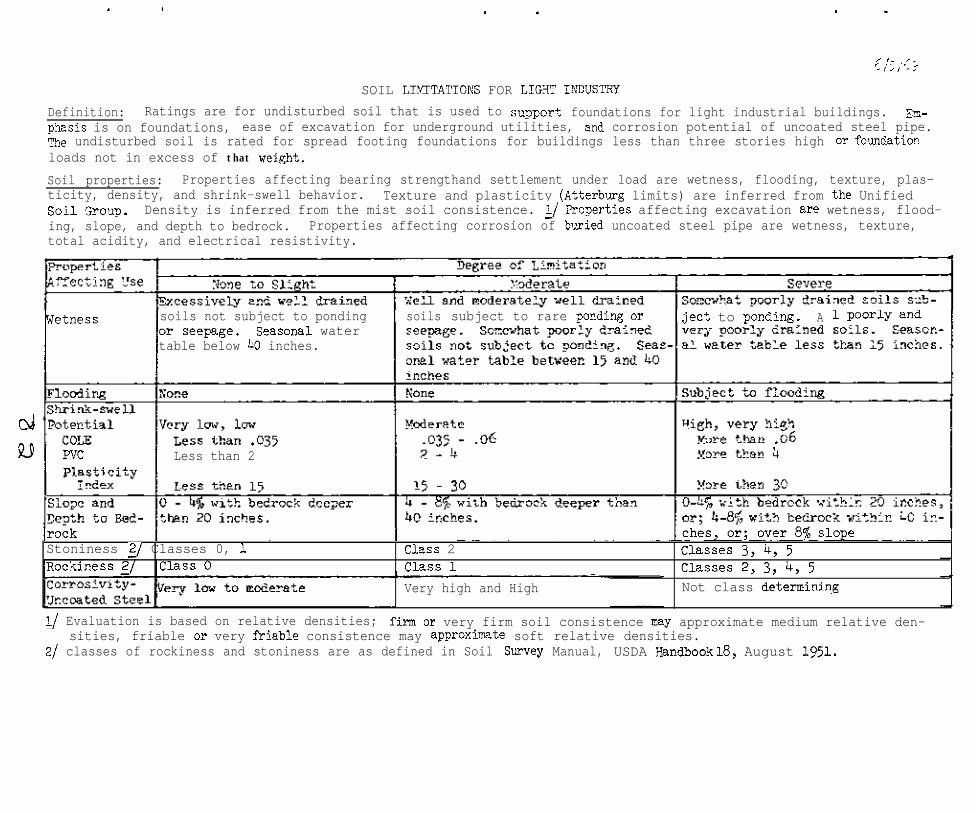
xi_ ,I_c ,’ ; ,’ ‘, ;
SOIL LIMITATIOI\S FOR LIGRT IXXJSTRY
Definition: Ratings are for undisturbed soil that is used to suppert foundations for light industrial buildings. m-phasis is on foundations, ease of excavation for underground utilities, and corrosion potential of uncoated steel pipe.The undisturbed soil is rated for spread footing foundations for buildings less than three stories high or foundation.loads not in excess of that weight.
Soil properties: Properties affecting bearing strengthand settlement under load are wetness, flooding, texture, plas-ticity, density, and shrink-swell behavior. Texture and plasticity (Atterburg limits) are inferred from the Unifiedsoil !alup. Density is inferred from the mist soil consistence. g ?roperties affecting excavation are wetness, flood-ing, slope, and depth to bedrock. Properties affecting corrosion of buried uncoated steel pipe are wetness, texture,total acidity, and electrical resistivity.
soils not subject to ponding soils subject to rare pending or ject to pondmg. Aor seqage. Seasonal watertable below 40 inches.
cd
jt9 Less than 2
Stoniness g Classes 0, 1 Class 2 Classes 3, 4, 5Class 1 Classes 2, 3, 4, 5
Very high and High Not class determinin~g
l/ Evaluation is based on relative densities; firm or very firm soil consistence my approximate medium relative den-sities, friable or very f'riable consistence may approximte soft relative densities.
2/ classes of rockiness and stoniness are as defined in Soil Survey Manual, USDA Randbook 18, August 1951.

5116169
WOODLAND SUITARILITY
This table includes some evaluations of the soil series for woodland useand management. In the first column, "Phases of Series," the slope, tex-ture, erosion, and other phases of the series should be shown if there aresignificant differences in potential productivity (site index class), man-agement problems, or species suitability.
In the second column, "Ordination," show the ordination of the series ofphase into the appropriate woodland suitability class and subclass, as ex-plained on pages 8, 11, and 12 of Soils Memorandum scs-26 (Rev. 2) datedSeptember 7, 1967. The following table should be used to determine thesuitability class.
suitability ClassIndicator Forest :
1 : 2 3 4 5Type or Species : Ran& of Site'Index
Cottonwood . . . . . . . . . . . : 106+ : 105-96 : 95-86 : 85-76 :Yellow-poplar......... : lo& : 105-96 : 95-86 : 85-76 : 1;:
Sweetgum : 96+: -66. . . . . . . . . . . .Nuttall oak . . . . . . . . . . : 9% : ;:-El:- j g:;;
i ;;:g :-66
Water oak . . . . . . . . . . . . : 96+ :;;-i:
: 85-76 : 75-66 : -66Loblolly pine (natural): 96 : - : 85-76 : 75-66 : -66Loblolly pine (planted): 7& : 75-66 : 65-56 : 55-46 : -46Slash pine (natural)...: 96+ : 95-86 : 85-76 : 75-66 : -66Slash pine (planted)...: 76+ :
Virginia pine Z:
75-66 : 65-56 j ;;Sk; : -46E. white pine . . . . . . . . . .
. . . . . . . . . .95-86 ; 6;; -66
::I;;: 65-56 :
Shortleaf pine . . . . . . . . .Longleaf pine . . . . . . . . . . K :
: 75-66 : 65-56 : 1;:
Upland oaks . . . . . . . . . . . . 86+ :85-76 ; ;;-;; i 6%;~ :
1:;
Water tupelo . . . . . . . . . . . 86t : g:;: -: 75-66 : 65-56 :Redcedar . . . . . . . . . . . . . . . 66+ : 65-56 : 55-46 : 45-36 : I:;
1n the above table, site index is the average height of dominant trees atage 30 for cottonwood, at age 25 for planted loblolly and slash pine, andat age 50 for all other species or types.
Priority in designating the subclass shall be in the following order:
x (stoniness or rockiness)w (excessive wetness)t (toxic substances)d (restricted rooting depth)c (clay in upper profile)s (sandy soils)f (fragmental or skeletal)r (relief or slope steepness)o (slight or no limitations)
83

2
In the third column, "Important Trees," list only the forest types or treespecies (usually one to three) which were used to indicate the suitabilityclass. Other adapted species may be listed in the narrative of the stand-ard series description under "Use and Vegetation."
In the fourth column, "Site Index Class," show the site index, rounded offto the nearest lo-foot interval, opposite the appropriate tree species orforest type in the previous column.
Tn the fifth and sixth columns, give the potential productivity of 4 to 6understory species for a medium canopy class (36-55s canopy). Productivityis expressed in pounds air dry vegetation per acre. Where data are notavailable and acceptable estimates cannot be msde, an alternance is to listthe species in order of their productivity and show the total average annualproduction as one figure.
In the next three columns, "Erosion Hazard," "Equipment Limitations," and"Seedling Mortality, rate the series or phase of series as slight, moderate,or severe, using guidelines attached.
In the next column, "Trees to Plant," list one or more well-adapted treespecies for which suitable planting or seeding methods have been developed.

GUIDE TOPVI%NTIAL EROSXO!i lil\zAFX~OF SOILS IN VOODLAND USE
-----: Effective :
Surface Texture : Rooting Slope &I i
---*- -_-- D e p t h 2 Percent :Rating
-
Snndy (6, Is, Ifs)
end
Clayey (c, BC, eic)
:Norethan : O - 1 5- - : Slight: 20 inches : 15 - 45 :Uodernte
- : 45+ : Severe-~--: Less than ;,_- 10 : Sl ight: 20 inches :A! - 25 :--z&rate -
: _25+ : Severe --
Coamy (81, fal, vfsl, sil, : M o r e t h a n1 , scl, sicl) : 20 inches
: Less than: 20 inches
:_ 0 - 15 : SliRht: 15 - 25 : Moderate: 25+ : Severej__!$_I.Q: Sllpht - -
- 15 : Moderate
Skeletal : 0 - 25 : SliRht: 251. : Mod~erate
l_/ Slope range8 arc approxifiate and may be adjnsted by survey ereas.
Soil-Woodland CmmitteePort Worth, Tcxes
10/3/66
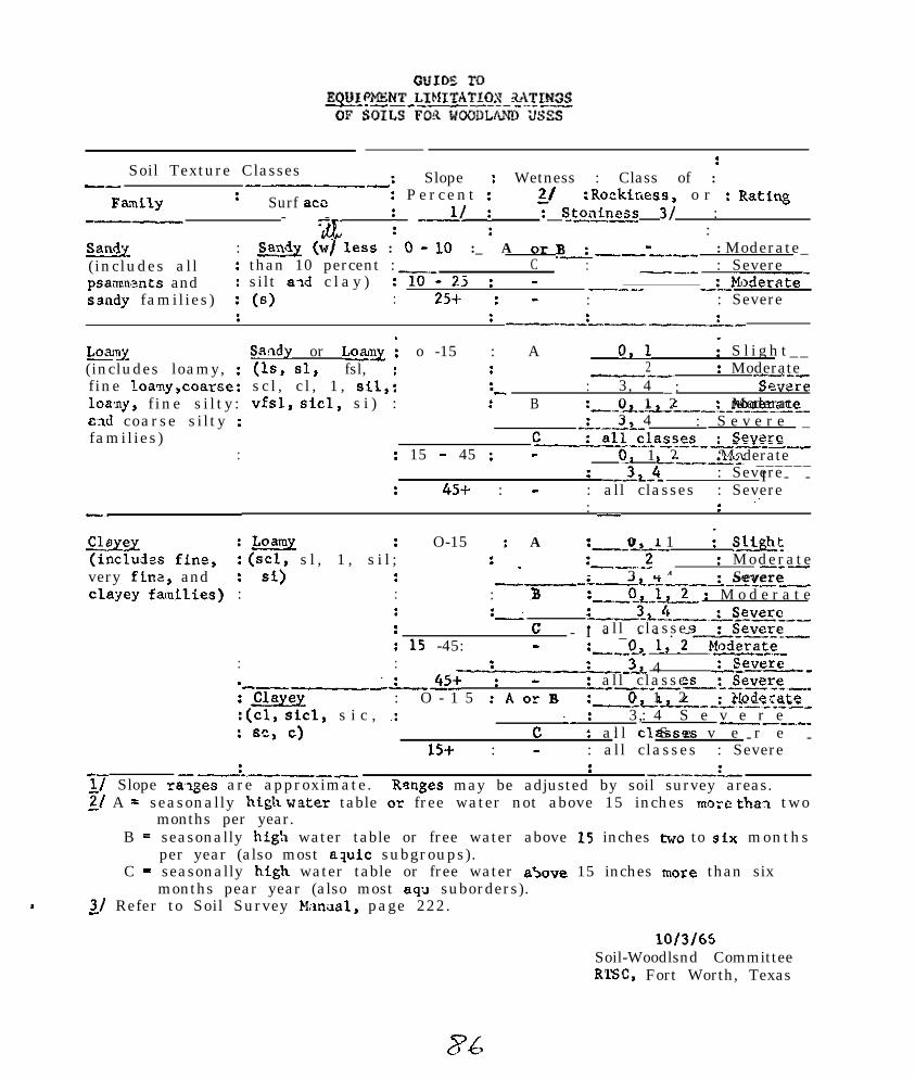
Soil Texture Classes:
-- ----: Slope : Wetness : Class of :
Fmily : Surf act : Per cent :
; _-u i21 :Rockiness, o r : Rating
__- - -;le : St~iness 3/ ::
M : m (~1 less : 0 * 10 :_ A or B> _
(includes all : than 10 percent :_I-..-_
:-Zi-C
: Moderate_: : Severe
psamnnsnts and : silt aid c l a y ) -25: ---__
ssndy families) : (6) 2% : ----_ _:_-Mf>derate-
: : : Severe: : U-----L-.--.-_:-
L0;un.J(includes loamy, :fine loany,coarse:loany, f ine s i l ty :E.ld coarse silty :families)
:
Saildy or foamy ; o -15 : A(Is, 61, fsl, :
0,l I S l i g h t _ _: 2 : Moderate
sc l , c l , 1 , sil,:m--, _...-
: 3, 4vfsl, sicl, s i ) :
:- _ : Severe: B :-_~-L-_Z-0 1 2
3 4--:_______Moderate
_L__L_C
: S e v e r e _
: 15 - 45 :-___!_all_~!_~~~S?s_~_____S%X?re- 0, 1 2 ‘ModerateL.--_L- ______
: Severe: 4% : -
: _-.x2_!!. I - -: all classes : Severe:
:- :
qx%.Y :Loamy : O-15 : A(1ncludss ffne, : (scl, s l , 1 , s i l ;
:-_-L_0 1 I sut
very flnz, and : si): . L--.-2 : Moderate-_-
:clayey fainFlies) :
_- 3 4-~&--r___~_-___Severe: : ?I :___O&l : M o d e r a t e: :--
.L___3LL.___L~~~se___: c * all classes: 15 -45: -
- I - _ - - . - _-._G%~~?_.__: 0 1,2u--r. :
: : --__x--L__3_L 4ModeraJe__severe_-_
.---..--_.x45+ : - : all classes:m : O - 1 5 :AorB
__-__ -____..:~e*rp_~~:
:(cl, sicl, s i c , .:-L--L--_:-.._-._~__0 1 2 >!odc-ate
: BC, c)‘_ : 3, 4: S e v e r e
c : a l l clawes-_-_-
15+ : -: S e v e r e- -
: all classes : Severe-:-__--__
17 Slope ranges are approximate.: _.-_-._-I__
Ranges may be adjusted by soil survey areas.2/ A = seasonally htgh w?.ter table or free water not above 15 inches mozc tha2 two
months per year.B = seasonally high water table or free water above 15 inches two to six months
per year (also most aquic subgroups).C - seasonally hfgh water table or free water above 15 inches more than six
months pear year (also most aq;l suborders).. 3/ Refer to Soil Survey Manaal, page 222.
10/3/65Soil-Woodlsnd CommitteeRTSC, Fort Worth, Texas

GUIDE TOSEEDLING MORTALITY OF SOILS FOR WOODLAND USE
Growing : Surface : Effective :SGE.Oll W e t n e s s 11 : Soil Rooting RatingRainfall : Texture 2/ : Depth
+ 30” : A Sandy 20"+ : Moderate10-20" : Moderate 31
Loamy 20”+ : S l i g h t 4110-20” : Moderate 3/-10" : Severe
Clayey 20"+ : Moderate 3110-20” : S e v e r e-10” : S e v e r e
B Sandy 20”+ : Moderate10-20” : Moderate
Loamy 20”+ : Moderate10-20” . : Moderate-10" : Severe
Clayey 20"+ : Moderate10-20" : S e v e r e-10” : Severe
C All : Severe
25-30" : A Sandy 2O'ct : Severe10-20" : Severe-10" : S e v e r e
Loamy 20"+ : Slight 4110-20" : Moderate 31-10" : S e v e r e
Clayey 20"+ : Moderate 3110-20” : Severe-10” : S e v e r e
B Sandy 20"+ : Moderate10-20" : Moderate-10" : S e v e r e
Loamy 20'+ : Moderate10-20" : Moderate-10" : S e v e r e
Clayey 20"+ : Moderate10-20" : S e v e r e-10" : Severe
C All : Severe
L/ A'= Water is above surface less than one month per year, and aoils are welldrained to somewhat poorly drained.
B = Water is above surface one to six months per year(includes most aquic_subgroups).
, or soila are poorly drained
C.= Water ia above surface more than six months per year, or soils are very poorlydrained (includes most aqu suborders),
2/ Refer to Soil Survey Manual, page 213.3J Severe on south aapecte. Soil-Woodland Cormnittee51 Moderate on south aepecte. Fort Worth, Tex.
10/3/66
27

WILDLIFE
The suitability of soils for producingbe rated by evaluating the suitabilityquired by these kinds of wildlife.
SUITABILITY
openland, woodland, and wetland wildlife canof the soils for producing the habitat re-
The ratings refer only to the suitability of the soil and do not take into accountthe present use of the soil, or the distribution of wildlife and human populations.The suitability of individual sites has to be determined by on-site inspection.
The three general kinds of wildlife are defined as follows:
Openland Wildlife. Openland wildlife is birds and mammals that normally frequentcropland, pastures, and areas overgrown with grasses, herbs, and shrubby growth.Examples of this kind of wildlife are quail, cottontail rabbits, meadowlarks, andlark sparrows.
Woodland Wildlife. Woodland wildlife is birds and mammals that normally frequentwooded areas of hardwood trees and shrubs, conniferous trees and shrubs, or a mis-ture of these plants. Examples of woodland wildlife are deer, turkey, squirrel,and grouse.
Wetland Wildlife. Wetland wildlife is birds and mammals that normally frequent wetareas such as ponds, streams, ditches, marshes, and swamps. Examples of this kindof wildlife are ducks, geese, rails, shorebirds, and snipe.
Soil properties that affect the growth of wildlife habitat are: (1) thickness ofsoil useful to crops, (2) surface texture, (3) available water capacity to a 40-inch depth, (4) wetness, (5) surface stoniness or rockiness, (6) flood hazard, and(7) slope.
MAKING THE RATING'S
Ratings are made in two steps. First, the soils are rated in terms of suitabilityfor producing habitat elements. Next, various combinations of habitat elementsare evaluated for their suitability to produce openland, woodland, and wetland wild-life.
step 1. Rate the soils for producing each of the wildlife habitat elementsgiven in tables 1 through 7.
step 2. Determine the suitability rating for each of the kinds of wildlifeby averaging the ratings of the following combinations of the habitat elements:
a. Openland wildlifeGrain and seed crops (Table 1)Grasses and legumes (Table 2)Wild herbaceous plants (Table 3)

2
b. Woodland wildlifeHardwood trees and shrubs (Table 4)
c. Wetland wj.ldlifeWetland food and cover plants (Table 6)Shallow water development (Table 7)

TABLE 1 RATING CRITERIA FOR GRAYI"\' AND SEED CROPS
Definition: Grain and Seed Crops refer to grain- or seed-producing annuals planted to produce food for wildlife. Ex-amples are corn, sorghums, millets, soybeans, wheat, oats, sunflowers, etc.
Well Suited: Soil conditions suitable for repeated annual planting, individually, in combination, or in rotation of anyor all climatically adapted species, without intervening sod crops for soil protection and maintenance.
Suited: Soil conditions suitable for the planting, individually, in combination, or in rotation, of any or all climatic-ally adapted species but requiring a rotation with sod crops up to 66% of the tine for soil protection and maintenance.
Poorly Suited: Soil conditions suitable for the planting, individually, or in combination, of any or all climaticallyzpted species but requiring B rotation with sod crops more than 6% of the time for soil protection and maintenance.
Unsuited: Under prevailing soil conditions, grain and seed crops cannot be grown or it is not feasible to plant them.
Soil Properties
Soil drainage class lJ
Well Suited I Suited
40" + 20 - 40"
clay loam - fine sandy lcam- clay - silty clay -very fine sandy loam - silt sandy clay - fineloam - sandy clay loam - sandloam - silty clay loam -sandy loam - loamy sand -loamy fine sand
4 “+ 3 - 4”
well drainedmoderately well drained
somewhat poorly drainedsomewhat excessivelydrained
none to slight ,v
none to slight ocassional
0 -5 5 - 15
Poorly Suited Unsuited
10 - 20" less than 10"
deposits
I
2 _ 3” less than 2.0" t
poorly drained very poorly drainedexcessivelydrained
stony
frequent
15 - 25
very stonyextremely stony
very frequent
25 +*
1/ In application on specific sites that have artificial drainage installed the ratings may be adjusted to the degree ofdrainage achieved.

TA3LE 2 RATING CRITERIA FOR GRASSES AND LEG'JIvBS
Grasses and Legumes refer to domestic grasses and legumes that will be established by planting and which furnish foodand cover for wildlife. The grasses include species as bahia, ryegrass, fescue, and panicgrasses. Legmes includespecies as clovers, annual lespedezas, and bush lespedezas.
Well Suited: Soil conditions suitable for planting of a wide variety of climtically adapted species; and the mainte-narice of adequate stsnds for wildlife cover for at least 10 years Without renovation, liming or fertilization.
Suited: Soil conditions suitable for planting of 8 wide variety of climatically adapted species; but the maintenance ofadequate stands for wildlife cover for at least 10 years requires renovation , liming OP fertilization and can be donewithout difficulty.
Poorly Suited: Soil conditions suitable for a very limited nmber of species , generally not more than one or two; butwhere natural vigor of stands my be high without renovation, liming or fertilization.
Unsuited: Soil conditions that have severe limitations as to suitability for a variety of species and for vigor ofgrowth; producing very sparse stands: and where renovation, liming, and fertilization are impossible or impracticableto apply.
_.
Soil Properties
Thickness of soil(useful to crops)
Well SuitedI
Suited
20" +
sandy clay loam, clay loam, clay, silty clay, sandyloamy sand, loamy fine sand, clay, fine sand
Surface texture sandy loam, fine sandy loam,very fine sandy loam, loam,silt loam, silty clay loam
Available water capacityto 40 inch depth 3 - 4" 2 - 3"
Soil Drainage Class well drained sanewhat poorly drainedmoderately well drained poorly drained
smewhat excessively drained
Surface stoniness and/orrockiness none to slight stony
-r
1 organic de- Iposits
I
Flood hazard none to slight - occasional frequent
Slope range (percent) I 0 - 15 I 15 - 25L

TABLE 3 E(ATING CRITERIA FOR WILD XERBACEOUS PLANTS
Wild Berbaceous Plants refers to perennial gmsses, forbs, and weeds that provide food and cover for wildlife. I&-amples of these are beggameed, perennial lespedezas, wild bean, and pokeberry.
Well Suited: Soil conditions suitable for the establishment and vigorous growth of a wide variety of uncultivated spe-cies.
Suited: Soil conditions which limit the variety of species that can be established but on which growth of only a fewspecies my be vigorous.
Poorly Suited: Soil conditions suitable for the establishment of very few species; and vigor of grcwth limited.
Unsuited: Soil conditions where variety of adapted species is so restricted, stands so sparse, and vigor so poor, asto be of insignificant value to wildlife.
Soil Properties Well Suited I Suited Poorly Suited
Thickness of soil(useful to crops)
1 I
10 - 20" less than 10"
Surface texture
::.‘...).
3” + 2 - 3” less than 2.0"
I well drained poorly drained very poorly drain.Soil drainage class moderately well drained somewhat excessively ed, excessively
T
coarse sands,organic de-posits
I
_ _ _ _ _ _ _ _
------Ivery wet marshareas
Ismew%t poorly drained 1 drained 1 drained
Surface stoniness and/orrockiness - none to slight - stony - very stony __c - extremely stony _
I
Flood hazardI I
none to occasional frequent very frequent continuous

4/m/69
TABLF 4 RATING CRITERIA FOR ?UNL%7VOD TREES AND SHRKK
Iiardwood Trees and Shrubs refer to non-coniferous trees, shrubs, and woody vines that produce fruits, nuts, buds, cat-kins, 01 foliage (browse) used extensively as food by wildlife. These plants commonly become established throughnatural processes, but may be planted. They include species as oak, beech, cherry, dogwood, viburnum, maple, grape,honeysuckle, greenbrier, and eleagnus.
Well Suited: Soil conditions suitable for the vigorous growth and dependable food production from a wide variety ofclimatically adapted species.
Suited: Soil conditions suitable for most climatically adapted species but dependability of food pmduct?on somewhatlimited.
poorly Suited: Soil conditions suitable to few species of importance to wildlife for food production and such produc-tion undependable.
Unsuited: Soil conditions under which very few or no species of importance to wildlife will grow and where growth isso sparse as to be of little significance to wildlife.
4 .4. Soil Froperties
Thickness of soil(useful to crops)
Well Suited Suited Poorly Suited Unsuited
20" + 10 - 20" less than 10" _--___-_
sandy loam, fine sandy lcarr, very fine sandy loam, loamy sand, loamy fine coarse sandsloam, silt loam, silty clay loam, sandy clay loam, sand, medium and fine organic de-clay loam, clay sands posits
Soil drainage classsomewhat excessively drained, well drained, moderate- excessively drained very wet marshly well drained, somewhat poorly drained, poorly areasdrained, very poorly drained
Surface stoniness and/or none to slight, stony, extremely stony - - - _ - - _ _ - - _ - - _ _ _ - -
rockiness very stonyc 1

4/?0
TARLE 5 P,ATTNG CRITERIA FOR LOW GROWING COXIFERO'JS WOODY PLANTS
Low growing coniferous woody plants are cone-bearing trees and shrubs that are used mainly as cover but may furnishfood in the f,rm of browse, seeds, or fruit-like cones. They become established thi-ox& natural processes or may beplanted. Included are pines, junipers, cedars, and ornamentals. The best soils are those that produce slow growingplants With branches low to the ground. Good pine sites would be poorly suited for low growing coniferous woodyplants.
Well Suited: Soil conditions suitable for a variety of climatically adapted species but on which growth rate is re-tsrded; canopy clos-e delayed.
Suited: Soil conditions suitable for & limited number of species; growth rate slow to moderate.
Poorly Suited: Soil conditions suitable for most or all climatically adepted species; growth rate high and canopyrapid.
Unsuited: Soil conditions suitable for few oi- no species; stands so sparse as to be insignificant to wildlife
<!
4 Soil properties Well Suited Suited Poorly Suited unsuited
Thickness of soil less than 10" 10 - 20" 20" + ______-- -(useful to crops)
excessively drained somewhat excessively well drained very dry beachSoil drainage class very poorly drained draj.ned moderately well drained areas, very wet
poorly drained somewhat poorly drained marsh areas
Surface stoniness extremely stony very stony none to slight _____--__
* stonyFlood hazard very frequent frequent none to slight continuous
occasional

TABLE 6 RATI% CRITERIA FOR W!ZI'LANE FOOD AhQ COVER PLANTS
Wetland Food and Cover Plants are annual and perennial wild herbaceous plants that grow on moist to wet sites (theydo no% include submersed or floatin& aquatics). These plants furnish food or cover mostly for wetland wildlife.Some examples are smartweed, wild millet, spikerush and other rushes, sedges, burreed, tearthumb, and aneilem.
Well Suited: Soil conditions suitable for the growth of a wide variety of climtically adapted wetland species,particularly food producing annual plants.
Suited: Soil conditions suitable for a wide variety of wetland species, particularly perennials.
Poorly Suited: Soil conditions that tend to produce dominant stands of a few vigorous perennial wetland species,generally of low food production value.
Unsuiwd: Soil conditions under which wetland plants do not grow naturally or are so sparse as to be of no signif-icance to wildlife. Plants my be introduced but will not persist.
-9@, Soil Properties Well Suited Suited Poorly Suited Unsuited
Soil texture sl, fsl, vfsl, 1, sicl, Is, Ifs, peat, muck sands _ _ _SCl, Cl, C
Soil wetness Soils mm water table Soils with water table Soils wirh water tables Soils with waterwithin 20 inches of the within 20 inches of the within 23 inches of the tables below 5surface and often above surface for extended per- surface for snorz per- feet most of thetne surface most of the iods but less than half iods. (Most moderately time.time. (Most poorly and the rime. (Most somewhat well drained soils invery poorly drained soils poorly drained soils in humid areas.)in humid areas.) humid areas.)
Surface smniness c- none to slight, stony, very stony-----_,- extremely stony-
Slope range (%) o-3 o-3 3-8q 3 - 15+ gI
l/ Slopes above 3 percent refer only to somewhat poorly and poorly drained soils; moaerazely well dramed soilsabove 3 percent would be unsuiwd.
g Extensive seeps that grow wetland plants my be found on steeper slopes but are not here considered valuable.

.
4/70
TABLE 7 RATING CRI~RIA FOR swmw WA~R DEVELO~~TTS
Shallow Water Developments are those where low dikes and water control structures are established to create habitatprincipally for waterfowl. They my be &signed whereby they cm be drained, planted, and flooded 02‘ they may beused &s permnent impomtients to grm submersed aquatics. Both freshwater and brackish water situations are in-cluded. The assumption is made that water is available for flooding the field.Well Suited: Soil conditions under which there me few 01 no limitations in the construction of shallow water areasand control or mintenance of desired water levels.Suited: Soil conditions under which there are moderate limitations in construction, choice of measures, or somedifficulties in water level control.Poorly Suited: Soil conditions that severely limit choice of measures, present serious construction problems ormajor difficulties in water level control.
.Q Unsuited: Soil conditions under which shallow water developments are impossible or not feasible.F\
Soil permeability moderately slow, moderately rapid rapid, very rapid
lf Depth to bedrock ranges are estimated for dominant conditions--on-site evaluation is necessary for specificdepth information.

.
RANGE
In the first column list only those phases of the series that cause differentrange sites. For example, show both a loamy sand phase and a sandy loam phase ifeach has a different range site. If both phases are in the same range site, donot list the phases or write "all phases."
In the second column list the range site name.
1~" the next space, list the approximate climax (potential) plants and their per-centage by weight of the total annual yield for the cormnunity. If the communitycomposition is complex, list the k-6 major species and lump the other species into"other" groups.
Show the total annual yield as air-dry weight in pounds-per-acre for the plantcommunity. Since yields fluctuate with growing conditions fkom year to year andseason to season, total yields should be given a6 8 range for dry years and formoist years.

EXHIBIT 3
Recommended Changes in Format

.
4/vSOIL LIMTTATIOI\'S FOR CORROSIVITI-JJXCOATED STEEL
Definition: Uncoated steel pipe wlhen buried in the soil will deteriorate as a result of an electrochemical process con-verting iron into its ions. Soil moisture forms solutions with the salts in the soil and becows an electrolyte. Theelectrolyte carries current fran an area of positive charge (anode area) to an area of negative charge (cathode area)and then through the metal to cmplete the circuit. The netal in the anode mea becanes corroded through the loss ofmetal ions to the electrolyte.
Properties: Any soil properties influencing the soil solution or the oxidation-reduction reactions taking place inthe soil will influence the operation of the corrosion cell. The mjor properties are fluctuating moisture content, andelectrical conductivity of the soil solution. Soil drainage and texture gives an indication of soil moistme flu&a-tions. Total acidity, resistivity at field capacity and conductivity of the saturation extract give an indication ofthe electrical conductivity of the soil solution.
I I Degree of Limitation l/1 LOW I Moderate I !il.Th I_3lightly Corrosive (Mod. Corrosive) (Severely Corrosive
Well drained, Well drained, mod. Well drained, finecoarse to med. fine textured soils; textured soils; ortextured soils; or,o=>Mod. well drain- Mod. well drained, Mod. well drained,
ed, coarse textw-coarse and med. tex- fix and mod. fineed soils; or, twed soils; or, textured soils; or
Somewhat poorly Somewhat poorly somewhat poorlydrained, coarse drained, mod. coarse drained, med. andtextured soils textured soils; or, mod. fine textured
soils; 02,
Very poorly drained Poorly drained,soils with stable coarse to mod. finhigh water table textured soils
4.0 to 8.0 8.0 to 12.0 12.0 to 16.0
5,000 to 10,oCO 2,000 to 5,000 1,000 to 2,000
0.1 to 0.3 0.3to 0.8 0.8:to4.0
Very High
coarse texturedsoils
I
Total acidity(meg./loOg soil)
Below 4.0
Resistivity atfield capacity(0brdcm)
Moore than 10,OCX
';z:jfig 250C.) Below 0.1
) (
2
,
e
-
Very Sev. Corrosive:
Somewhat poorlydrained, fine Eex-tured soils; or,
Poorly drained,fine textured soils
core thar. 16.0
Below 1,000
b.o+
A/ Based on data provided in the Publication "Underground Corrosion," table 99, p 167, Circular 579, USE, NationalBureau of Standards. When only three classes are needed, combine very luw with low, and very high with high.

-. ,
4/70
. SOIL LIMITATIONS FOR CORROSIVITY--CONCRETE
Definition: Concrete placed in soil materials may deteriorate to varying de-grees. Deterioration is caused by a chemical reaction between a base (the con-crete) and a weak acid (the soil solution). Special cements and methods ofmanufacturing may be used to reduce rate of deterioration in soils of high cor-rosivity.
Properties: The rate of deterioration depends on (1) soil texture and acidity,p) the amount of sodium or magnesium sulfate present in the soil singly or incombination, and (3) amount of sodium chloride in the soil. The presence ofNaCl is one of the factors evaluated not because of its corrosivity of cementbut because it is used to identify the presence of sea water. Sea water con-tains sulfates which is one of the principal corrosive agents.
action
Na and/or Mgsulfate (parts permillion)
[;,Ztsp e r m i l l i o n )
ILaY
Sandy and organicsoils with pH.6.5
orMed.- and fine-textured soilswith pH>6.0
Less than 1,000
Less than 2,000
:ree of LimitationModerate
Sandy and organicsoils with pF1 5.5-6.5
orMed.- and fine-textured soilswith pH 5.0 to6.0
1,000 to 7,000
2,000 to 10,000
/High
Sandy and organisoils with pH 5.or less
orMed.- and fine-textured soilswith py 5.0 orless
More than 7,000
More than 10,OCK
L/ Based on data in National Engineering Handbook, Section 16, Chapter 5,table 5.2.

. .
COMIITTEE V HANDLING SOIL SURVEY DATAAT THE SOUTHEM REGIONAL TECHNICAL WORK-PLANNING CONFERENCE
Baton Rouge, Louisiana1970
At the National Soil Survey Technical Work Planning Conference at
Charleston, South Carolina, January,27-30. 1969 the National Committee on
Handling Soil Survey Data recommended that regional conmittees bs eetab-
lished to deal with soil survey data. As a result this committee was
formulated. No specific charges were given.
A. This committee endorses the recommendations of the National
Committee that work on the codinR system be pushed forward
as vigorously as possible and that the effort to have a
uniform and complete data accumulation systen be continued.
B. Work is proceeding at the National level in developing
various programs. The Soil Classification (SC) file has
been implemented. Work is proceeding on the Pedon Data (PD)
code and Series Description (SD). In addition, planning has
gone into possible Soil Interpretation (SI) files, and Carto-
p,raphic Soil Data (CSD) file. This committee favors these
efforts and highly recommends that the Soil Interpretation
files be developed to cover all practical soil usage in-
cluding yield potential for crops and forestry engineering
aspects and recreational usage.
C. The possibility of extending Automatic Data Processing into
the relationship between soil type, soil test and fertilizer
recommendations for soecific crops presents a challenge.

-2-
Some states use ALIP for making fertilizer recommendations.
Such a system if implemented might work better as a
numerical rating system where arbitrary values are used
in place of pounds, bushels. etc. Perhaps within the
region several groups of states can mutually work to-
gether.
D. Automatic Data Processing appears to have a good
potential in making interpretative maps for various
purposes. Thie area needs to be throughly investigated
as interpretative nape for specific purposes would prove
valuable for all kinds of planning purposes.
E. It is recommended that this committee become a permanent
committee of the Conference for the purpose of:
1 . determining what kinds of ADP files are needed;
particularly, the kinds of interpretationa needed.
2. reviewing codes and programs to be used in ADP and re-
commend revisions in existing systems where appropriate,
3. studying the feasibility of ADP in making interpretative
maps.
4. Chairman of conrmittees of this Conference that deal with
data collection and ADP uses should be members of this
committee.
G. R. Craddock, ChairmanH. H. Bailey, Vice-ChairmanR. W. PearsonD. A. BrownJ. F. Brasfield.I. T. MayH. F. PerkinsH. J. ByrdW. F. MillerW. L. Cockerham
S. W. BuolE. L. HillT. H. SilkerG. J. BuntleyC. M. ThompsonC. L. GodfreyH. C. PorterJ. A. DeMentR. C. Daen

-3-
This report was accepted by the Conference. Discussion of the report
yielded these pertinent comments.
1.
2.
3.
4.
5.
Some governing groups are beginning to use ADP data for
planning purposes, for example, New Orleans and the Virgin
Islands. A need exists to communicate among members in-
formation about ADP systems in use,
The projected use of ADP seems to indicate a need for
providing current ADP information to the members of this
conference,
Experienced ADP expertise is needed in the deliberations
of thie committee. It was suggested that the composition
of this committee include such persona in the future.
The Conference emphasized that ADP language developed at
the various institutions should be compatible with the
equipment throughout tha region if free interchangeability
of information is to be realized.
Attention is called to Soil Survey Technical Notes 1970 “A
Report on the Use of Automatic Data Processing in the Soil
Survey.”

Southern Regional Technic,al Soil Survey
Work-Planning Conference
Baton Rouge, LouisianaMay 5-7, 1970
( R e v i s e d - 516170)
Report of Committee 6 -- Soil Moisture and Temperature
CommitLee Objectives:
1. To iniLiatt! water - tab le s tudies to serve as a bas is for the formulat ion
of descripti.ve c lasses in each s tate . Review and comment on descriptive
scheme proposed by the Northeast Committee.
2 . Make recommendations on the topics to include the organization of a
publi,cation on evaluation of the soil-moist.ure reg imes that would
serve a function similar to SCS-T.P. 144 - “Soil Temperature Regimes -
Their Chaxacter,istics and Predict,ability.”
3. Test and evaluate methods of soil moisture measurements; select
methods to be used to aLtai,n uniform evaluation of soil moisture
regime.
4. I n i t i a t e , where poss ib le , further observations o f so i l temperature .
T h i s coamittee u,rges each state t,o initiate a two year w a t e r - t a b l e s t u d y o n
c r i t i c a l s o i l s . Methods of install ing wells and collwting data have been sent
to each commi,ttee member. The soils used in the study should be really extensive
and emphasis should be placed on soils with periodic high water table,s. OllCe
the on-s i te data are co l lec ted , they can he generalized by a computer program
developed by Dr. Nelson at N. C. State. A list of soil,s with sane w a t e r - t a b l e
data ins a t tached . It, is proposed that a function of this committee be tx m a i n t a i n
a l i s t o f so i l s wi th water - tab le data because there i s l i t t le need for dupl i cat ing
data on the same series across adjacent state l ines.
Considerable doubt exists as to the validity of depth duration curves as a
means of describing wat,er-table regimes. The accompanying graph (Fig. 1)
i l l u s t r a t e s s o m e o f t h e d i f f i c u l t i e s . In F i g . 1, there is too much overlap of
c o n t r a s t i n g s o i l s . The graph is based on generalized bi-monthly data from 9
Udul.ts and 2 Aquults. It is possible that data generalized on a weekly basis
lo c/

. ’
2
may make a more meaningful separation, but experience in North Carolina suggests
otherwise. Apparent 1,~ , the d i f f i cu l ty i s that severa l factors o ther than water-
table height are involved. Eh-pH conditions in the soil water and abundance of
iron oxides are suspected as being the undetermined link between water table
depth and soil color (low chroma mottling) upon which taxanomic placement is
presently dependent.
Some of the topics to be included in a publication on soil-moisture regimes
should be:
(1) Relations between soil morphology, espec ia l ly co lor , and water - tab le
1eVelS.
la Ef fec t o f d i sso lved oxygen and Eh/pH r e l a t i o n s .
lb Ef fec t o f micro topography - short periods of saturation by runoff
may effect morphology more than average water level.
lc Effect of deep summer or fall water table on development of Aquults
and Aqualfs.
Id Effect of shallow winter water table on development of Ildults,
Udalfs.
(2) Relations bet,ween landscapes and water tab les .
2.1 Effect of stratigraphy - Permeable vs impermeable under ly ing
formations.
2.2 Effect of landscape dissection on water-table depth and duration.
2.3 Relations between water-table depth and soil properties.
2 .31 Physica l - clay content of B, A2 horizon thickness, B horizon
morphology.
2 .32 Chemical and mineralog ica l propert ies - Al saturation, clay
mineral kinds and amounts.
(3) Soil moisture regimes above the water table.
3.1 Yearly changes in moisture content by depth
3.11 Forest~ed Udults, Aquults, Aquods, Aqualfs and Udalfs,
and their cultivated counterparts.
(4) Soil moisture regimes from West-Texas or Oklahoma to the Atlantic
Ocean and i ts re lat ion to c l imat ic factors .
(5 ) Methods .
5 . 1 W e l l s , equipment and measuring frequency used in water-table
studies .
5.2 Equipment, its l imitations and validity of measurement for studying
soil moisture regimes above the water table. /OS

3
Objective 3 (above) probably can be dropped. Taylor , ST. (1) have
adequately discussed the theoretical basis for measuring soil water and the
experimental evaluati~on of methods for measuring soil water.
We encourage more soil temperature checks especially in areas "ear tempera-
ture family breaks. Eventual preparation of a resource map of isotemps for
southern region and also seasonal relations between soil types.
Recommendations:
1.
2.
3.
4.
This committee should be continued.
Major emphasis for the next 2 to 4 years should be placed on collection
and generalization of 2-year water-table data throughout the Southeast.
Recommend that a symposium on field-soil-moisture regimes be held by
SSSA in 1971. It is further recommended that the symposium be pub-
lished as a separate volume.
The committee should update the 1965 soil-temperature map and present
the revised copy at the next Southern Region Work-Planning Conference,
Committee Members:
R. B. Daniels, Chairman
S. W. Buol, Vice-Chairman
C. A. McGrew
J. F. Brasfield
R. E. Caldwell
G. L. Bramlett
E. V. Huffma"
P. A. Avers F. H. Beinroth
H. B. Vanderford C. M. Ellerbe
R. L. Carter C. B. Breinig
H. A. Friboorg A. L. Newman
W. R. Elder M. H. Milford
F. J. Dries N. B. Pfeiffer
Elmo Bauman R. B. Grossman
Water Table Data Available (1 year or more)
North Carolina
AquadsTypic HaplaquodAeric Haplaquod
AquultsTypic Fragiaquult
Typic Paleaquult
Aeric Paleaquult
Lynn Have"?Leo"
MashulavilleN.S.D. fine loamyRainsN.S.D. coarse loamyLynchburgN.S.D. coarse loamy
1Taylor, S. A., Evans, D. D. and Kemper, W. D. 1961. Evaluating Soil Water.
Bulletin 426, Agric. Exp. Sta. Utah State Univ. 67 p.I06

Typic Umbraquult
udultsTypic Hapludults
Aquic HapludultsTypic Paleudults
Aquic PaleudultPlinthic Paleudult
TfIllll2SS‘X
UdalfsUltic Hapludalf
UdultsAquic HapludultTypic FragiudultAqueptic Fragiudult
OchreptsAquic Fluventic Euthrocrept
South Carolina (series)Charleston YCllIg3Lf?Oll DunbarSeabrook seewe.Ridgeland ChipleyWadmalawMeggettOkeetee
Oklahoma (series)Summit DennisChateau LulaParsons Craig
Puerto Rico (series)Aguirre - Udic PellustertsGuanica - Udic Pellusterts
MississippiPlinthic FragiaquultsPlinthicaquic FragiudultsTypic FragiudultsAquic Paleudults
N.S.D. clayey
RumfordKalmiaJohnsNorfolkFacevilleGoldsboroDothanVarina
BeasonCaptina (thermic taxadjunct)Taft (?)
Linside (thermic taxadjunct)
McCall CoxvilleRembert LynchburgGoldsboro Barth
0lantaLellOirCrZIVt?IlWaheeRain?,
AtmoreBasinBiloxi?Harleston
,

Fiaure I
. tldults
20 40 60 80Water-Table Depth in Inches
100 120

Southern Reglonal Technical Work-Planning Conferenceof the
Cooperat Ive Sol 1 SurveyBaton Rouge, Louisiana
May 5-7, 1970
Comlittee VII - Hlscellaneous Land Types and Soil Material
The committee was assigned the following charges:
1. Review the report of the 1964 Southern Regional committee “Madeor Shaped Soils; Classification and Nomenclature.”
2 . Evaluate the classif ication and nomenclature used in that report.
3. Suggest changes necessary for defining and classifying altered orshaped soils and sol1 materials.
4. Suggest classes and criteria for use within the suborder Arents.
Charges 1 and 2 are combined since they are related. The com-mittee report in 1964 was one of the earlier reports concerning madeor shaped soils. Subsequent regional and national work planning con-ferences have reported in more detail on the 1964 cormnittee’s recom-mendations. We have definitions for land altered by urban development;recotmnendations for use of phases for soils altered by leveling anddeep plowing, and made roll has been defined more precisely as madeland or other units within the classif ication system.
The attached inventory of miscellaneous land types has been usedin correlations in the South Region. This l ist covers a period forpublications issued in 1965 to recent correlations.
The committee members did not present any recent data for classi-f ication of soils ciasslfled as Arents. One s ta te has scheduled atrip in 1970 to study disturbed and altered soils and wil l preparerecommendations.
We recommend adoption of the following reconrnendations made bycommittee No. 8 - “Criteria for Classif ication and Nomenclature ofMade Soils and Definition of Topsoil Used to Resurface Cuts and Fills,”at the conference at Charleston, South Carolina in 1969:
1. Def in i t ion of topsoi l .
2 . Definit ion of made land.
3. We agree to reJect the term “made soil” due to possible con-fusion in the use of the term.
4 . Adoption of the “Cut and fill land” miscellaneous land typeas defined.

2
5. Agree WI th recotmmndations for nomenclature for heterogenousso/ I m a t e r i a l s . were possible, these units should be classif iedat some level in the clesslfIcetlon system.
6. Adopt recomnendatlons for use of shaped soil phases of soiltexonomic units. We recotmmnd use of levelled or smoothed phases.Many soils occur on steeper slopes and smoothed phases are moreappropriate for these.
7. Agree with criteria and reconsaendatlons for nomenclature for theAren ts.
We need to eliminate many of the land types used in the SouthRegion and are opposed to introduction of additional miscellaneousland types since they restrict interpretations. If the soil can beused as a medium for the growth of plants or engineering behaviorpredict ions, these soils should be classif ied. More effort andstudy is needed to determine classes and criteria for the Arents.We recommend more use be made of classification units using nomen-clature in categories above the series level.
The Committee. recommends it be discontinued.
Committee Members
R. C. Carter, ChairmanN. B. Pfeiffer, Vice-ChairmanB. F. HajekJ. R. MooreF. T. Ritchle, Jr.J. H. NewtonR. 1,. BlevinsA. B. ElemA. G. CalduellH. B. VanderfordH. J. ByrdJ. A. PhillipsFenton GrayR. D. Well8G. E. SmithH. C. DeanJ. R. RunklesD. M. Moehring

. ,
February 20, 1970
Miscellaneous Land Types*South Region
ALLUVIAL LANDA l l u v i a l iand, cobbiyAl luv ia l land, wetBroken al luvial lendClayey al luvial landClayey sal ine al luvial landCobbiy alluvial landGravelly al luvial landLocal al luvial landLocal alluvial lend, moderately wetLocal al luvial land, phosphaticLoamy alluvial landMixed al luvial landMixed al luvial land, sal ineMixed al luvial land, wetSaline al iuvial landSandy alluvial landWet al luvial land
BADLAND
BORROW AREA
BLOWN-OUT LAMI
BREAKS
COASTAL BEACHES
COASTAL LAND
STONY CDLLIJVIAL LAND
DUNE LANDActive dunesCoastal dunesSand dunes, Lincoln materialCoastal dune land and beaches
ERODED CLAYEY LAND
ERODED LOAMY LAND
FILLED LAND, SANDY
FILLED LAND, SILTY
GRADED LAND, SILTY MATERIALS
li I

2
GRANITE COBBLY LAND
GRAVELLY LANDH i l l y g r a v e l l y l a n d
GULLIED LANDCullied l a n d , acidG u l l i e d l a n d , alkalineGullled l a n d , s a n d yG u l l i e d l a n d , s l l t yS e v e r e l y g u l l l e d l a n d
GYPSUM LAND
GYPSUM OUTCROP
LEVEES AND BORROW PITS
LEVELED CLAYEY L,AND
LEVELED MARLY LAND
LEVELED ROCKY LAND
LIMESTONE COBBLY LAND
MADE LANDM a d e l a n d , Gila s o i l m a t e r i a l sM a d e l a n d , s a n i t a r y f i l l
HAI(SHSdlt w a t e r m a r s h‘Tida I m a r s hT i d a l m a r s h , f i r m , m u c k a n d p e a t sT i d a l rwarsh, f r e s hT i d a l m a r s h , s a l t yT i d a l marsh, s o f t
MINE DUMPS
MI NED LAND, RECLAIMED
01 L-WASTE LAND
P I T SB o r r o w p i t sG r a v e l p i t sM i n e s a n d p i t sMine p i t s a n d d u m p sM i n e s , p i t s a n d d u m p sP i t s a n d q u a r r i e sS a n d p i t s
119

3
QUARRY
ROCK LAN0 wIgneous rock landL i m e s t o n e r o c k l a n d .Stony rock landVolcanic rock land
ROCK OUTCROPCranl te outcrop
ROUGH BROKEN LANDClayey broken landGravelly broken landRough broken and stony landRough broken land, clayeyRough broken land, gypsifekousRough broken land, loamySandy broken landStony rough land
SALINE LAND
SANDY AND CLAYEY LAND
SANDY AND GRAVELLY LAND
SETTLING BASINS
SLICKENS
SMELTER - WASTE LAND
SMOOTHED LANDSmoothed land, Memphis soil materialsSmoothed sandy landSmoothed silty land
SPOIL BANKS
STONY LANDStony steep land
STRIP MINES
SWAMPFresh water swampTidal swamp
TERRACE ESCARPMENTS

4
TIDAL FLATS
URBAN LAND

Conmlittee
Southern Regional Technical Work--PlanningConference Of The Cooperative Soil Survey
Baton Rouge, Louisiana
May 5-7, 1970
VIII - Rcslistic Estimates of Soil Survey Laboratory Workload
(1) Review plans for investigation and for laboratory work.(2) Suggest priorities for this work.
A questionnaire was sent to all members of this committee, requestinginformation relating to charges (1) and (2). Twelve members, representingseven states and Puerto Rico, responded.
This report is based on information provided by respondents.
No increase in requests for determinations from the SCS laboratorieswas indicated. The Proceedings of the 1968 conference reported a needof about 700 determinations per year. The current and proposed needappears about the same or somewhat less. Most of the data required canbe designated as routine characterization to aid placement of soils inproper classification categories.
In addition to the routine characterization data needed to facilitatethe soil survey program the following needs were sugeested for workespecially on
(1)
(2)
(3)
(0)
(5)
benchmark soils:
Laboratory investigations which will provide dataneeded to establish more central concepts andallowable ranges for soil series and higher cate-gories.
Participation in investigations designed to estsb-lish interrelationships of plant growth, product-ivity and engineering uses with taxonomic defination.
Investigate the effects of soil forming factors onsoil characteristics (soil genesis studies).
Study the relation of soil organic matter and soilmicroorgsnisms to soil genesis.
Investigation of field soil moisture regimes andrelated soil charscteri~stics.

,
(6) Determine soil characteristics needed to predictpo l lutant behavior in so i l s .
(7) Quantitative mineralogy and amorphous material ins o i l s .
The following statement about benchmark soils is proposed for reviewand comment.
Definition of benchmark soils:_____-
The kind of information needed on soils are their morphology andgenes is ; their chemical and physical properties, including engineeringpropert ies ; and the interpretat ion o f the so i l s for var ious engineer ing ,a g r i c u l t u r a l , and recreational uses. We do not have the resources tostudy each so i l in th is deta i l . Benchmark soils enable us to study arelatively small number of soils and project this information to a largenumber of similar soi.16.
Benchmark soils, therefore, are those soils on which we decideto concentrate our e f for ts in f ie ld invest igat ion , laboratory character i -zat ion , and interpretat ion , They should represent a large geographicarea and the data should be capable of applying to similar soils. Pub-lication of benchmark soil data in the form of soil monographs could bea longtime objective and probably should be authored by the State withr e s p o n s i b i l i t y f o r t h e s e r i e s .
A large amount of data is already collected on some benchmarks o i l s . These soils need to be retained as benchmark soils i f they meett h e c r i t e r i a . Any additional data that is needed should be collected.
Procedure for selecting benchmark soils:__-
Each State should select the soils they want as benchmark soilsand their list should be reviewed and approved by Regional TechnicalWork-Planning Committee.
The soil classification system should be used to select benchmarks o i l s :
1 . Taxa should be selected that represent a large geographic area.Multiseries fami l ies general ly represent large geographic areas. Thefine--loamy, mixed, thermic family of Typic Paleudults, for examplecontains soils representing one of the most extensive areas in the South.
2 . Generally only one series should be selected from each multi-ser ies fami ly . The series that is used to name multiseries families(marked with an X on the classification print out) is a l ikely candidatefor a benchmark soil.

I
I 3. Taxa should be selected from which data can be projected.Data from soils in Typic subgroups, for example, can be projected to
. more soils than data from soils in Vertic subgroups.
4. The number of benchmark soils should be kept small enough toconcentrate on the key soils, in order to get the data within a reasonabletime.
The chairman of this committee recommends that this committee be con-tinued and that benchmark soils and soil monograph activities be included.Vice-chairmen could be designated for each activity.
Committee Members
B. F. Hajek - ChairmanC. A. SteersR. W. PearsonE. M. RutledgeD. A. BrownV. W. CarlisleR. L. CarterA . G. CaldwellR. C. Glenn.I. B. WattsR. E. HortonH. H. BaileyF. H. Beinroth
J. A. DeMent - Vice-ChairmanJ. W. FrieM. E. SpringerW. W. Fuchs3. F. MillsJ:B. DixonC. R. CarterC. J. KochC. I. RichL. J. BartelliR. B. GrossmanR. B. Daniel6C. D. Sopher
Discussion:
Johnson - Regarding needs for laboratory work, the need is there butfacilities are limited thus we rust consider priorities. We encourageExperiment Station participation in soil characterization investigation.
Hajek - Response to the questionnaire showed that some states noware assuming the entire characterization work load while others do es-sentially no characterization in support of the soil survey program.
Johnson - Suggested adding item (6) to item (2).
Hajek - We considered this but decided that the soil parameters needdefination before relating to taxonomic units.
Johnson - Two items were omitted, one the role of soil microorganismsin soil genesis and second, the role of organic matter.
Hajek - These will be added,
Buol - In connection with benchmark soils. could consideration be givento setting aside areas designated as benchmark sites that will remain un-disturbed. This has been done but not in the South. (Several individualsagreed with Dr. Buol)
Godfrey - Early studies on benchmark soils should be evaluated by thiscommittee to determine if the concepts for the series are still valid.
/U

COMMITTEE IX - SOIL SURVEY PROCEDURESSOUTHERN REGIONAL TECHNICAL WORK PLANNINGCONFERENCE OF THE COOPERATIVE SOIL SURVEY
MAY, 1970
The charges to the coolmfttee were
(1) Evaluate statements on procedures of the National CommitteeXIII, January, 1969
(2) Recommend any improvements in the procedures.
The chairman mailed a questionnaire to all committee members.Nine responded before the summary was prepared.
Results are summarized directly on the attached questionnaire andquotations are listed for questions 5, 6, 17, 18 and 19.
Thorough study of the results will give some trends.

_, 2_
.@
QUESTlONS FOR COMMITTEE IX - SOIL SURVEY PROCEDURES
l Refer directly to the National report on Soil Survey Procedures (Cosxsittee 13).
1. Your name is - - -0
For other questions, circle yes or no for your answer or write cwnments.
2 . Should objective 3 be enlarged to include -
(a)
(b)one-county supplements to published surveys? Y e s 7 NoZ
supplements cover ing a Eeneral soil area (5 t,o 10 counti~es) w h i c hw o u l d give interpretations on individual soils of each county in1!,at arl.a? Y c’s 4 No
If answer is v?s, should there be a ,wpplement for -(1)(2)(3)(4)(5)
_-c a p a b i l i t y c l a s s i f i c a t i o n ?y i e l d ehti~i~ates?nana~:ement guides?engineering interpretations?o t h e r ? ( l i s t )Rae(ralrl b*\
Y e s g No IYes 6 No 1Y r s & No/Yes 7 NoYrs$ N o
+
_* 3. Do you favor additional fund input for soil survey publ i cat ions?Yes 8 NO
4 . Do you t~hink that “survey staffs in the states “should” contributeaddition inputs toward soil map construction and manuscript preparation?
Yes (b NO &
If answer is yes_, what should be sacrif iced to get these inputs?
5 . What other criteria would you add to those l isted for placing surveysin Priority A?
6. What criteria would you delete from the list for placing surveys inPriority A?
H a v e sulveys in your state bean placed in Priori:.y A and Prior i ty B?Yes2 NO c
//9

- 3 -
8.
9.
10.
I. 1 .
12.
13.
14.
IS.
16.
12.
Have you used any m altitude aerial photographs in your soil surveyprogram? Yes3 No + ri;,$dc~
*5If answer is XC%, in what kind of a survey were they used?
were they sati~sfactory? Yes N o Uw kt..wn2 I
tlave you found any field sheets with an excessive number of mappingunits? Yes L No f
Were f ield soil scientist.s asked to transfer the soil survey to newbase maps? Yes 4 No k
Were f ield soi. scientists asked to modify soil boundaries to reduceexcess ive deta i l ? Yes 4 No
Do you agree that f ield soil scientists should p r o d u c e f i e ld sheetsthat can be used direct.ly by cartographic for map compilation?
Yes6 N o /
Of the surveys now being made (with which you are familiar) what 5.can be used directly by cartographic for map compilati~on? %
f?o+*ov. L bo70- 2 307, --/ hw- IIn your state, who is editor for the soil surveys as they are forwardedto cartographic? ,S.s~c.i; $~..&L/__.~.&.~~~~_~ @/.crs3
Whw do you think should be the editor in t~he state? - - -
Of the surveys underway in your state, what % are multicounty areas?
_.... “-ll_.- 9. O-253 “7”
In your state whs,t % of effort is contributed by the Experiment Stationand University personnel?
Map compilation % +4 FM/O Y# 1 r / o % /_..-_,-._Report writing -__.-__% N**r3 s-/o* / P /O%l
Would you like to see this effort increased? YesS N o }
To expedite publication what changes do you suggest in preparation offield sheets and compilation of maps?
Se&-‘I
l.(.fi4iONS lA*l=p 17

-4-
To hasten the writing and editing of soil surveys without drasticreduction in their usefulness what changes in length do you suggestfor each section? Check one for each.
General nature of county
Climate
General soil description
Description of the soil,s
Capability groups of soil~s
Management by capabilityunits
Estimated yields
Engineering properties
Factors affectingengineering work
Uses of the soils forwoodland
Management of the soilsfor wildlife
Formation snd classifi-cation of the soils
Laboratory data on soils
i
_,__.~_ _.--_.~~.--.--
i
Reduceand transfermaterial to
Keep as anotherIlOW publ,ication
/
2.
sb
Eliminateand transfermaterialto otherpublication
/
/
s
3 i/
13I3Ij4
:4
i/
I
I/
,IA
I
19. your most urgent recommendation is -
Erc /is.r /q __I
_- -.- -_-__~

5 .
5 . Need for surveysfm cooperating and other agencies.
Low intensity surveys in woodland areas.Surveys started and completed in shorttime should take priority over the oldersurveys.
6.Status of cartographic work toward completion ofmanuscript soil maps.
17. “Publish interpretation sheets covering severalcounties and publish maps separately for eachcounty. ”
“Current procedures should expedite publications.Experience should improve this.”
“Prepared mosaics for parallel use with aerialphotos in field.”
“States could employ a draftsman to compile mapsfor publication. Require better control of mappinglegends. Use higher quality base maps.”
Two workers suggested that we speed up highaltitude photography so we can transfer andmap on the atlas sheet size.
“The st~ate should produce ‘press-ready’ film positivesso that map finishing process can beeliminated.
(1) mapper transfers lines to film positives afterfinal correlation.(‘2) the state should be held responsible for apply-ing the map symbols neatly, either by hand or bycartographic means . . . .‘I
18.
“Use draftsman capacity soil scientist, one only for thestate. This should be his primary duty.”
Tvo people like the reports now being prepared.Wo liked some of the changes in the Lake County. TennesseesUr”ey.One worker proposed county naps and a publication for the area.

6.
19. “Reduce publication to a description of the soila.States should publish interpretative data.”
“Obtain high altitude photography for all surveys nowin 3-year schedule. Also make specific arrangementsfor printing as soon as report is edited. Too muchtime in GPO before printing.”
“Adapt the publication to ADP procedurea.”
One worker suggested an ad hoc committeereport back a8 information is available.
Specialists should have responsibility for makinginterpretations for soils which can be published for amulticounty or state basis to reduce burden in countysurveys. Examples are recent releases on woodlandinterpretations and soil erosion.
I, . . ..The annotated check-lists being used by thereviewers has already had the impact of drasticallyreducing some sections of the report. We shouldproceed cautiously before we further reduce thec o n t e n t . . . . ”
“Secure more funds to speed up mapping and publication.”

*e 7.
Objective 3 of the Cosraittee 13 report was “Improve the quality ofsoil survey and special reports issued prior to the distribution of thepublished soil survey.” All nine responders agreed that the objectiveshould be enlarged to include supplements covering a general soil area(5 to 10 counties) which would give interpretations on individual soilsof each county in that area. Par one county supplements the vote was7 yes and 2 no. A majority listed capability classification, yieldestimates, management guides, engineering interpretations as topics thatshould be included in a supplement. Recreation, wildlife and woodlandwere added to the list.
Additional fund input for soil survey publications was favored by all8 &o answered. Six of eight thought that survey staffs in the states shoulddo more on map construction and manuscript preparation. Six people volun-teered with regret that slapped ecreage should be sacrificed.
A few changes in criteria for priorities of surveys are listed.Two states have placed surveys in Priority A or B. Pive have not,
Three states have used high altitude aerial photographs and twohave already decided that they are satisfactory. Two states have plans fortrying them.
Excessive detail isis being done about it.
still a problem in some counties, but something
Of seven responses,produce field sheets ready
only one did not agree that soil scientists shouldfor compilation.
Surveys that can be used directly for compilation of maps ranged from0 to 100% in different states.
In the states, the Assistant State Soil Scientist is the most commoneditor. A few argued that a specially trained soil scientist might be used.
In only three states are more than a fourth of surveys on multi-countyareas.
University personnel contribute less than 10% of amp compilation andreport writing in all but two states. Except for one of these states, every-one wants this effort increased.
Unedited suggestions for expediting publication are listed under 17.Preparation of maps more nearly ready for publication appears in severalplaces.

8.
There is strong sentiment for keeping the outline for certain sectionsof the published survey as it is now. HoweVer, on the other sections thereare many people who would like to reduce the length and put extra material inanother pub1icati.w.
Capability groups, management, estimated yellds, engineering propertiesand use of soils for woodland and wildlife are the sections most often listedfor reduction. A few people would remove all of some sections. In severalcsses university personnel were mentioned along with these interpretations.
Unedited urgent recomnendstions are listed under 19. Notice that highaltitude photographs, better maps at the state level, concise reports andmulti-county interpretations appear in a number of places.
We recommend that Committee IX be discontinued. An ad hoc committeeto evaluate any innovations listed here or others (e.g. infrared) and passthe information to conference members would be worthwhile.
Members of Committee IX
0. C. Lewis, Vice-ChsirmanE. A. PerryE. Moye RutledgeJoel GiddensR. E. Daniel1A. B. ElanR. R. Cove11W. E. KeenanH. L. Dean
Notes on Discussion
E. C. NanceT. C. PeeleE. C. SeaseH. C. DeanJ. F. Mill.8D. M. MoehringH. C. PorterL. J. Bartel l iM. E. Springer, Chairman.I. A. Phillips
Multi-county surveys were discussed in detail. They have merit Lfplanned ahead othewlse the advantages are offset by problems.-------I
Johnson in discussing soil surveys suggested that the pay-&is not insoil descriptions and maps, but in soil maps with interpretations. Puttingmaterial in another publication is no solution. It will be no cheaper andwill be less effective. Up-dated supplements can be published as needed.
Bartelli pointed out that not everyone is happy with the way capabilityunits are used in the reports.
Johnson suggested that theEuse may vary with area. Where emphasis ison specialty crops or non-farm uses, capability units may not be needed. Inother areas they definitely help.

9.
Young proposed that in some cases, information about managementcould be discussed with the mapping unit.
Johnson pointed out that high altitude photographs are not appli-cable every where, but are being used wherever possible. Delay in publi-cation is now lack of carefully written and edited manuscripts, ratherthan printing.
Since so many paople have suggested that state people should helpwith manuscript preparation, especially with yields and interpretations,Springer asked how it could be done.
The report was accepted with suggestions.

SOUTHERN REGIONAL TECHNICAL WORK-PLANNING CONFERENCE
Baton Rouge, Louisiana
May 5, 6, 7, 1970
Report of Committee XSoil Surveys For Forestry Uses
This report is the result of committee participation through correspondence.
The Committee had the following charge:
Develop and evaluate procedures for making and using soil surveys inforested areas.
Of the seven responses made to the charge, Arkansas, Mississippi, Louisiana,and South Carolina reported their satisfaction in using the transect methodof making soil surveys in forested areas. Two states have not used thismethod but have made medium intensity surveys. Tennessee has not mappedsoil associations and questioned their usefulness in planning the manage-ment of forested areas. Florida believes that medium intensity surveysshould be made of soils on moderate slopes. On steeper slopes or rockysoils, soil associations could be used.
Forest Service reported making a Soil-Site Study for a part of OsceolaNational Forest, The project involved installing approximately 248 l/OOO-acre plots on a one-mile grid. The soil characteristics were describedin detail, site index was measured and the vegetation cover was inventoried.An analysis of the plots revealed that four soil conditions were common onthe forest. A reconnaissance soil survey was then made of the area. Foursoil conditions were separated using vegetative clues as a guide,
In South Carolina the transect method is being used to map about 170,000acres of flatwoods near the mouth of Savannah River, The area is almostentirely wooded, wet and has few roads. Slope is one foot per mile towardthe ocean, Drainageways are ill defined or nearly non-existent, Vegetationis dense making the area difficult to traverse. It is almost impossible tostay oriented when making detailed surveys.
Following is a summary of the procedure being used:
(1) The transect method makes use of soil investigations along straightlines at right angles to the major drainage channels, each transectbeing one to four miles in length, transects being spaced one totwo miles apart. Some tentative delineation lines are drawn byphoto interpretation before transects are run.
(2) Borings are made at fixed intervals of 200 to 500 feet along transects,the goal being about one boring per 50 acres of soils mapped. Writtenrecords are kept of each boring, including mauy soil descriptions.

. .
2
(3) Analyses are made of the transect data; soil delineations nre madein the office after these analyses; then the delineations are checkedin the field.
(4) Soil samples by horizons are collected at e number of borings and thesamples sent to Clemson for laboratory enalyaea, including particleaiae dietrlbution analyses, pH, some mineralogical determinations,and available calcium, magnesium, phosphorous, end potassium.
(5) The transect method is used in selected ereea of the flatmode, theseareas being delineated on county maps. The remainder of the countyia being surveyed by conventional detailed soil survey methods.
(6) Mapping unite are all a011 associations (29 of them in the 100,000acrea mapped to date), A total of 64 transects have been run and1,292 observations have been made.
During March 23-25, 1970 a review of the survey was made by WilliamM. Johnson, Assistant Deputy Administrator for Soil Survey,Dr. L. J. Bartelli, Principal Soil Correlator, Olaf Olson, ForestService representative on this review, A. T. Chalk, State Conserve-tioniet, the Stste Soil Scientist and Soil Correlator.
Mr. Johnson’6 conclusions (in part) reached after the review are thefollowing:
(1) --I do agree that this kind of survey can be adequate for the inter-pretations needed in the foreseeable future.
(2) Documentation of the observations made in the field is very good. Iwould suppose that the volume of field notea might be reduced aa moreexperience is gained.
(3) Although the review party spent quite a lot of time in the field, itwas not possible to get a clear picture of the quality and adequacyof the mapping done to date, This was because:
(a) It was impossible to get into the wetter areas or even to getacroaa drainagewaya in order to examine a wider range of soils,and
(b) Because written documentation of needed interpretations werenot all available.
(4) There is a need to evaluate carefully the mapping done to date, andto aaaeaa it in terms of accuracy, detail, consistency, and thedegree to which the necessary interpretations can be derived fromi t . - -
(3) --we would urge that more use be made of airphoto interpretations,both for locating the surveyor on the field sheet and for locatingsoil boundaries.

.
3
(6) --closer attention to soil-vegetation relationships would be helpfulin designing mapping units and in locating soil boundaries in thefield.
Dr. Bartelli expressed the opinion that the transect method is suitableand desirable in heavily forested areas.
Mr. Olson was also in agreement with other members of the review party.He emphasised especially the importance of early decisions on the detailedobjectives of these surveys. He also commented forcefully on the valueof studying soil-vegetation relationships to aid in mapping and in inter-pretations, and on the usefulness of stereoscopy in mapping wooded country,
The Committee recomends that it be continued and have the same charge.
Committee Members:
C. M, Ellerbe, ChainsawS. C.T. I,!. Green, Vice-Chairman-Cs.John Soileau-T.V.A.H. C. Dean-Ark.R. G. Leighty-Fla.J. T. May-Ga.P. A. Avers-KY.Id. L. Cockerham-La.N. E. Linnartz-La.W. M. Koos-Miss.W. F. Miller-Miss.
C. L. Hunt-N, C.T. H. Silker-Okla.G. E. Smith-S* C.C. B. Breinig-Penn.G. W. Thomas-Ky,Kenneth Hatterston-Tex.D. Gray Aydelott-Ga.L. J. Bartelli-Tex.D. F. Sluscher-La.S. A. Lyttle-La.E. V. Huffman-Ky.

bournern kegional~~ecnnical no?%-Planning Conterence of the CooperativeSoil Survey. Louisiana State University, Baton Rouge. May 5, 6, and 7, 1970.
.
Report of Committee XI - Regional Projects Committee. Committeemen were:
D. D. Neher, Chairman - Texas
ii:J. Buntley, Vice-Chairman -C. Dean - Ark.
F. T. Ritchie, Jr. - Ga.H. F. Perkins - Ga.M. E. Bloodworth - TexasD. F. Slusher - La.W. E. Keenan - Miss.K. K. Young - Texas
Tenn.R. J. McCracken - N. C.V. W. Carlisle - Fls.H. T. Otsuki - Okla.Elmo Baumann - Okla.T. C. Peele - S. C.C. M. Thompson - TexasB. L. Allen - TexasJ. H. Elder - Va.F. H. Beinroth - P. R.
The charge to this committee was:
(1) Consider the feasibility of developing regional projects such as:(a) aids in teaching soil genesis, morphology, and classification.(b) aids in the interpretation of soil characteristics.
(2) Prepare examples of projects and laboratory exercises for use insoils education. Consider all education levels.
(3) Consider the feasibility of publication of educational materialson a regional basis.
Each committeeman was sent ten copies of a questionnaire which they in turnwere asked to send out with a covering letter to their friends in soils.The plan was to discover what was being used in the teaching of soils.Twenty-five (25) questionnaires were returned.
A very wide range of materials is being used. Some indicated a very smalluse of aids noting that they did not know where to find them. Others wereusing a very wide selection of materials. Many indicated the use ofpersonally prepared slides, over-lays, mimeographed handouts, etc. as wellas commercially available materials. Most all of the leading soils teachersuse field studies extensively. Many also use a variety of monoliths suchas the micromonolith, the two inch core monolith, as well as the big sixinch monolith. Dr. 0. W. Birdwell of Kansas State University AgronomyDepartment at Manhattan, Kansas, has a working exchange of monoliths goingwith some other states.
As a result of the questionnaire, it was discovered that the AmericanSociety of Agronomy has a committee, S-V, which is considering slide setsunder such proposed titles as: (1) Macromorphology, (2) Micromorphology,(3) Soil Morphology,(s) Earth Science Curriculum, (5) Soil and Suburbia,(6) Soil Maps, (7) Clay Mineralogy, (8) How a Soil Survey is Made. If youare interested in helping develop any of the above sets or would like toknow what the progress is to date, write Dr. Don Franzmeier, Department ofAgronomy, Purdue University, Lafayette, Indiana 47907 or Dr. H. D. Foth,Department of Soil Fertility and Management, Michigan State University,East Lansing, Michigan 48823. These proposed slide sets cover a widerange Of understanding starting with Junior High with something like No. 4above and going on up into advanced soils studies.

-2-
The major concern just now, it seems, is the number of teachers who areusing almost nothing in the way of aids. Maybe some do not need them butothers have indicated that they would like to know what is available andwhere they could get them.
To date this committee has found only part of the materials available. Itis desired that if any of you who read this report know of any group,person, or organization who has prepared materials for sale which would aidin teaching any level of soils would send the details to David D. Neher,School of Agriculture, Texas A&I University, Kingsville, Texas 78363it would be appreciated.
If additional work is desired on this committee, please let the chairmanof this committee know. It seems that a lot has already been done onceone finds all of the resource materials. A lot has been left out of thislisting for lack of knowledge of it. A lot is in private files waitingfor someone to organize the materials and prepare scripts. Please let usknow what you want. Any suggestions will be helpful and appreciated.
As a personal note I must admit that I learned a lot in serving as chairmanof Cormnittee XI during the past year. I am sorry I have not gotten moredone. If you would desire, I will continue to serve as your chairman foranother year if another year is desired. If a different chairman isdesired, this is also okay with me. I appreciate all of the cooperationthat all of you have given me.
The following is a part of what is being used to teach soils. It is thehope of this committee that these will be helpful to many either as aidsor as ideas for preparing aids.
Respectfully submitted byDavid D. Neher, Chairman, Committee XISchool of AgricultureTexas A&I UniversityKingsville, Texas 78363
DDN:vyd
Enclosures
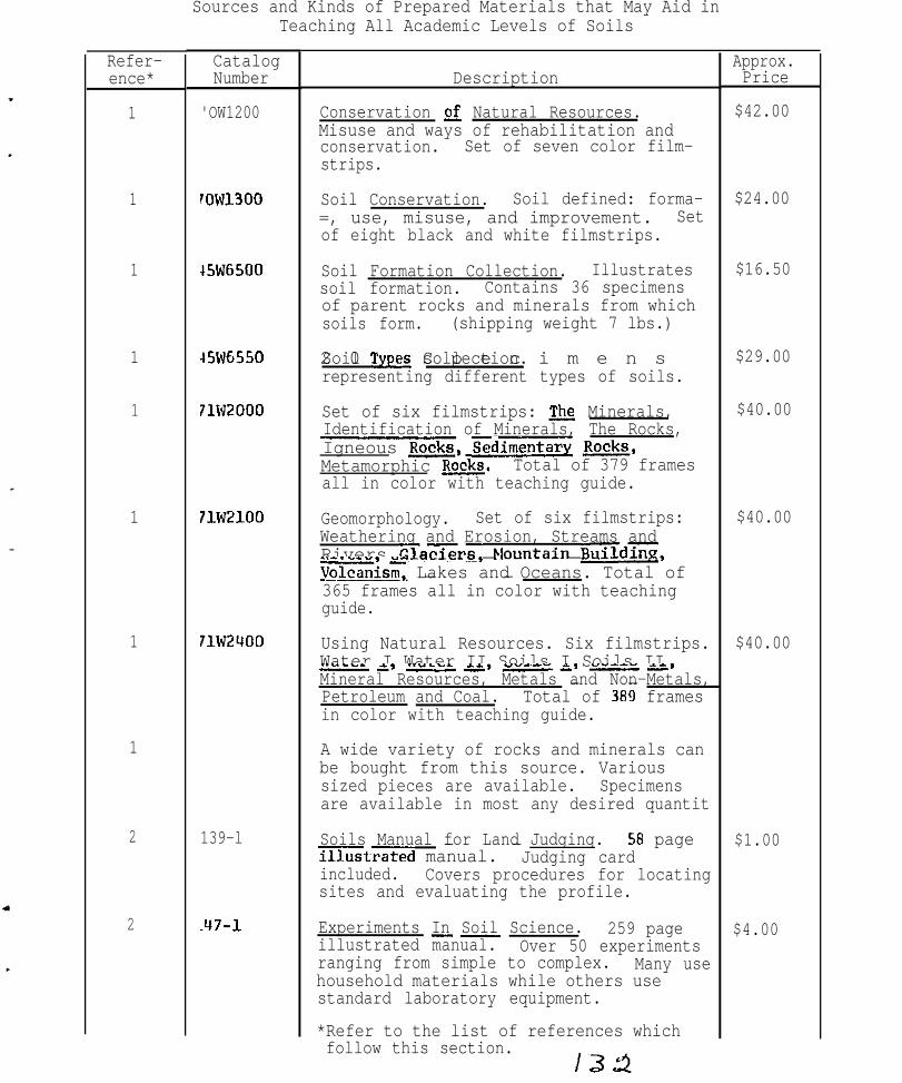
Sources and Kinds of Prepared Materials that May Aid inTeaching All Academic Levels of Soils
Refer- Catalogence* Number
1 'OW1200
1
1
1
1
1
1
1
2
2
7ow1300
+5w6500
45WG550
71W2000
71W2100 Geomorphology. Set of six filmstrips:
71W2400
139-l
.47-l
Description
Conservation of Natural Resources.Misuse and ways of rehabilitation andconservation. Set of seven color film-strips.
Soil Conservation. Soil defined: forma-=, use, misuse, and improvement. Setof eight black and white filmstrips.
Soil Formation Collection. Illustratessoil formation. Contains 36 specimensof parent rocks and minerals from whichsoils form. (shipping weight 7 lbs.)
2 0 s p e c i m e n sSoil Tw Collection.representing different types of soils.
Set of six filmstrips: The Minerals,Identification of Minerals, The Rocks,Igneous Rocks, cdimentary &&,Metamorphic &&. Total of 379 framesall in color with teaching guide.
Weathering and Erosion, Streams andRivers Glaxrs, Nountain Build-,Gism, Lakes and Oceans. Total of- -365 frames all in color with teachingguide.
Using Natural Resources. Six filmstrips.Water I Water II Soils I Soils II--I-,*-,* --*Mineral Resources, Metals and Non-Metals,- -Petroleum and Coal. Total of 389 framesin color with teaching guide.
A wide variety of rocks and minerals canbe bought from this source. Varioussized pieces are available. Specimensare available in most any desired quantit
Soils Manual for Land Judging.- -ntrated manual.
58 pageJudging card
included. Covers procedures for locatingsites and evaluating the profile.
Experiments In Soil Science._- 259 pageillustrated manual. Over 50 experimentsranging from simple to complex. Many usehousehold materials while others usestandard laboratory equipment.
*Refer to the list of references whichfollow this section.
lzlz2
Approx.Price
$42.00
$24.00
$16.50
$29.00
$40.00
$40.00
$40.00
$1.00
$4.00

Refer-ence
2
2
2
2
2
3
3
3
3
3
3
3
CatalogNumber-
47-2
Description
62-1
Overhead transparency set for 1117-labove. 17 plates plus 16 overlays.
Introduction to Irrigation. 34-framecolor filmstrz with illustrated scripShows methods of computing water needsfor irrigation. Nso shows typicalmethods of irrigation.
.90-l Land Measurement. Overhead trans-parencies. 14 plates and 6 overlaysplus a Q-page guide. Deals with the"rectangular survey" system as wellas the determination of areas ofirregularly shaped fields.
.91-l Watershed Management. S6-frame colorfilmstrip with taped narrator andscript.
Much of the material in this source isdesigned for Junior High and HighSchool comprehension. Many subjectsoutside of soils are covered.
This catalog lists a wide variety ofthe books, kits, tools and equipment,from the very simple to the complex,which is helpful in studying soilseither in the field or in the labora-tory or lecture room.
1512P
)T1716P-:GS
Aerial Photo Interpretation Guide.Especially for forestry and conserva-tion fields. Two overlays.
Rock Cycle. Overhead transparencies.Illustrates igneous, metamorphic,and sedimentary rocks and theirformation.
)T1717P-:G6
Geologic Time. Overhead transparencieFrom CambG to present. NorthAmerican.
lT232P-:5712
Soil Profile,aperture,
Colored 8" X 10"overlay transparencies.
1T232P-:s713
Soil Types. Colored RI' X 10" aperture!overlay transparencies.
iT232P- Springs. Colored 8" X,S717 overlay transparencies.
10" aperture,
Approx.Price
$1.95
$7.50
$1.95
$7.50
$2.50
$2.95
$2.95
$4.00
$4.00
$4.00

Refer- Catalogence Number
3
3
3
3
3
3
3
3
3
3
3
3
3
3
OT232P-ES718
OT232P-ES719
OT232P-ES720
OT232P-ES721
OT232P-ES722
01252P thri01258P
D207P thruD214P
376P-680
3151P
31225P-712
31219P-713
31614P-708
1787P-703
11625P-04G3
Ising the PH Meter in Testing Soils forLcidity.
- -
Description
Ground Water. Colored 8" X 10" apertureoverlay transparencies.
Artesian Water. Colored 8" X 10"aperture, overlay transparencies.
Swemp Filling. Colored 8" X 10" aperturoverlay transparencies.
Alluvial a. Colored 8" X 10" apertureoverlay transparencies.
Limestone Solution. Colored 8" X 10"aperture, overlay transparencies.
Conserving our Natural Resources. Set oseven filmstrips in color, each with 45frames: What is Conservation?, Savingp-pOur Soil, Enough Water for Evervone,- -Improv3ng OurForest Wisely. Giving OurChance,
W i l d l i f e =and Using Our Minerals Wisely.
Soil Conservation. Set of 8 black andwhite filmstrips with 60 frames perfilmstrip: P l a n tHow Long Will it LastLife and the Soil Wa?%?az theSoT---*--Animal Life and the Soil MinGls'thc----* - -~~~ Man Has Used the Soil How Man-----*--Conserves the Soil.
Irrigation - Lifeblood of the West TUSDA]- -Black and white filmstrip of 56 frames.
Yore Benefits from Manure. Black andivhite filmstrip 60 frames.
Soil Structure. Black and white film-strip of 69 frames.
Soil Texture.,f5 frames.
Black and white filmstrip
soil Color. Color filmstrip of 47 frames
Zollecting &2 Testing.
Preparing Soil SamplesScript on b= and white
:llmstrip of 34 frames.
ipprox.Price
SU.00
$4.00
$4.00
SY.00
$4.00
SY2.00
$24.00
$3.00
$1.89
$1.95
$2.30
$3.40
51.25
;1.35

Refer- Catalogence Number
3 326QSP
3
3
3
LI
4
II
5
G
6
9
9
02OOP
F299P
R8P
Description
Watershed Protection. 38 color slideswith narration included. Tells how localpeople working together can solve soiland water management problems. Producedin cooperation with USDA Soil ConservatioService.
Innoculation of Legumes. 10 color slideswith teachersf;;anual.
Soil Color Charts. Prepared in coopera-tion withU. S. Soil Conservation Service
O k l a h o m aLand Judging by Ed Roberts.A@1 University, 144 pages heavilyillustrated.
Marbut Memorial Slides. 83 color slideswith guide. Slides of soil profiles andlandscapes illustrating soil classifi-cation according to both the 1938 and theSeventh Approximation systems.
soils Laboratorv Exercise Source Book byH. S. Jacobs and Robert M. Reed. -
Glossary of Soil Science Terms._- Reprint.PP. 330-351 S.S.S.A.P. Vol. 29.
A small selection of easily understoodmovies in the area of soils and relatedsciences are listed and available on loanusually through the state land grantcollege Extension Service or InformationCenter. The U.S.D.A. Catalog tells where
Spark Plugs. A color 35 min. movie whichdeals with trace element needs of plants.
Out of the Earth. A color movie whichdeals with the mining of phosphate andpotash minerals for the fertilizer indust
Material directed toward the teaching ofsoil development and classification. Hassome study questions, outline material,definitions and laboratory exercises.Designed for students who have backgroundin soil science or related sciences.
Dr. Bidwell has indicated to me aninterest in exchanging soil monoliths.YOU must contact him for details.
Approx.Price
$19.50
$3.95
$25.00
$2.50
$28.00
?
$0.25
.
?
?

Refer-ence- -
10
12
13
13
14
15
Description
4 variety of agronomy clubs or some equivalent prepareslides, monoliths,records, overhead projections, etc.qe need to find these clubs and discover what theyoffer. Their preparations probably vary from Junior.Iigh School level materials to high quality universitylevel materials.
soils and water section of High School conservationcourse.
;oil Classification, 4 Comprehensive SVstem, 7thQproximation. August 1960. (This 265 page publica-tion is under revision and should become available inL971). Supplements to this publication make approxi-nately an additional 200 pages and are available fromthe Soil Conservation Service, U.S.D.A., Washington,I. C. 20250 at no additional cost.
soil Survev Manual, U.S.D.A. Handbook NO. 18. Asupplement replaces pages 173-188.
-_
Barbara Learns About Soil and Water----* Slides.
Resource Conservation Glossarv. 52 pages. A widevariety of terms used in the study of plant, soil,and water problems. Many authorities were ;sed inorder to arrive at a standard definition of the manyterms. January-February 1970, Vol. 25, No. 1.
)36
Approx.Price
?
3
$2.25
$3.50
?
$5.00

References
1. Ward's Natural Science Establishment,New York 111603
Inc., P. 0. Box 1712, Rochester,
2.. Vocational Educational Productions, California State PolytechnicCollege, San Luis Obispo, California 93401
3. Nasco, Fort Atkinson, Wisconsin 53538
4. American Society of Agronomy, 677 S. Segoe Road, Madison, Wisconsin53711
5. Films of the U. S. Department of Agriculture. Agriculture HandbookNo. 111, 1968. U. S. Govt. Printing Office, Washington, D. C. 20241.Price: $.40 (a revised edition may be available)
Ii. International Minerals and Chemicals Corporation, P. 0. Box 4250,Fort Worth, Texas 76106
7. Many private industries produce movies, filmstrips or slides which areavailable on loan or small fees. A list of these is needed.
8. Your County Agent. He will generally have a catalog of availablevisual aids supplied by the state land grant college or university.
9. Bidwell, 0. W. 1970. Development and Classification of Soils.Kansas State University, Department of Agronomy, Manhattan, Kansas.
10. Agronomy clubs over the U. S. Addresses, nature and quality ofmaterials vary, prices unknown. We need to discover these clubs and maketheir services known to those needing them.
11. Your State Soilmaterials. Most anyyou who to contact.
Conservation Service office will often have helpfulSoil Conservation Service man can help you or tell
12. Jack Ensminger,Drive, Natchitoches,
Coordinator of Conservation Education, 720 ParkwayLouisiana 71457.
,
13. Superintendent of Documents, U. S. Govt. Printing Office, Washington,D. C.
14. State Soil Conservation Service Office, Box 1630, Alexandria, Louisiana71301
15. Soil Conservation Society of America, 7515 Northeast Ankeny Road,Ankeny, Iowa 50021.
16. Slides Illustrating the Soil Classification System prepared byWm. M. Johnson of the S.C.S., U.S.D.A., Portland, Oregon. These are outof print now. You might borrow a set and script from a friend and getthem duplicated.

Addendum to Report of Consnittee XI
The original report of Committee XI was prepared prior to the BatonRouge Conference. The material in this addendum to the report cameout of the conference discussions of that report as additions to,rather than changes in, the original report.
In general, the reaction of the Conferewe to the committee’s reportwas favorable, resulting in the recowndation that the work of thecommittee be contJnued.
It was brought out during the discussion that many individuals haveunreproduced visuals of all kinds that sre not ~Jnventoried by asurvey of this type. If some arrangement could be made wherebyinventory reproductions of these visuals could be f J~nenced in someway other than our:-,of-the-pocket of the individual offeri,ng thevi,suals, a much larger number of visuals would end up in the handsof the regional conxnittee. The Conference recommended that theSteering Committee consider adding the charge to this cowmittee ofinvestigati~ng the feasibility of such an arrangement.
The di~scuasion of ni.ds for soils teaching evolved into discussionsof the shortage of soils majors in our Universities and the subjectof student recruitment. These discussions resulted in a conferencereconnnandation that the Steering Conrmitt.ee consider the desirabilityof establishing a new committee to examine the possibilities ofestablishing, under the sponsorship of the Conference Group, aprogram for the recruitment of soils majors in the Southeast Region.

NORTH CAROLINA STATE UNIVERSITYI
i\.‘l ~I {~:\,~I .jl!,:IC: A I
S . W,. Burl, Chai,rman
SWB: kc