nrcs/wli/2000 m. whited field indicators of hydric soils natural resources conservation service in...
TRANSCRIPT
NRCS/WLI/2000 M. Whited
Field Indicators of Hydric SoilsField Indicators of Hydric Soils
Natural Resources Conservation Servicein cooperation with the
National Technical Committee for Hydric Soils
A Training Slide Set to Accompany the Publication “Field Indicators of Hydric Soils in the U.S.”
NRCS/WLI/2000 M. Whited
AgendaAgenda
What, how, why, who Review development of field indicators Introduce new concepts and
terminology in 1998 Field Indicators Review pertinent indicators for use on
this sessions field trips
NRCS/WLI/2000 M. Whited
Introduction Introduction
Field indicators are soil morphological features used to identify hydric soils
The features result from soil genesis in the presence of “Anaerobic Conditions”
They are used for on-site verification

NRCS/WLI/2000 M. Whited
Why Indicators?Why Indicators?
NTCHS 1982, “... mottling, chroma 2 or less... no mottling, chroma 1 or less”
NTCHS 1992, “criteria not meant for onsite identification or verification”
There are soils on the hydric list that may or may not be hydric
NAS 1995, “field indicators should be used for on-site verification”
NRCS/WLI/2000 M. Whited
1996 / 98 Field Indicators1996 / 98 Field Indicators
Refinements of 1987 Indicators– Low Chroma Colors, Mottles– Gleyed Colors– “High” Organic Matter Content– Organic Streaking– Histosol, Histic epipedon– Sulfidic Material
Address problem soils
NRCS/WLI/2000 M. Whited
DevelopmentDevelopment
Continuous ProcessOngoing since mid 80’s
Inter-agency including universities, private
sector, federal, state, and local agencies
Multi-disciplinarysoil scientists, hydrologists,
botanists
NRCS/WLI/2000 M. Whited
Hydromorphic ProcessesHydromorphic Processes
Reduction, translocation, and precipitation of Iron and Manganese
Accumulation and differential translocation of Organic Matter
Reduction of Sulfur
NRCS/WLI/2000 M. Whited
New Concepts and TerminologyNew Concepts and Terminology
Regionalized
Control Sections
Depleted Matrix
Gleyed Matrix
Test Indicators
NRCS/WLI/2000 M. Whited
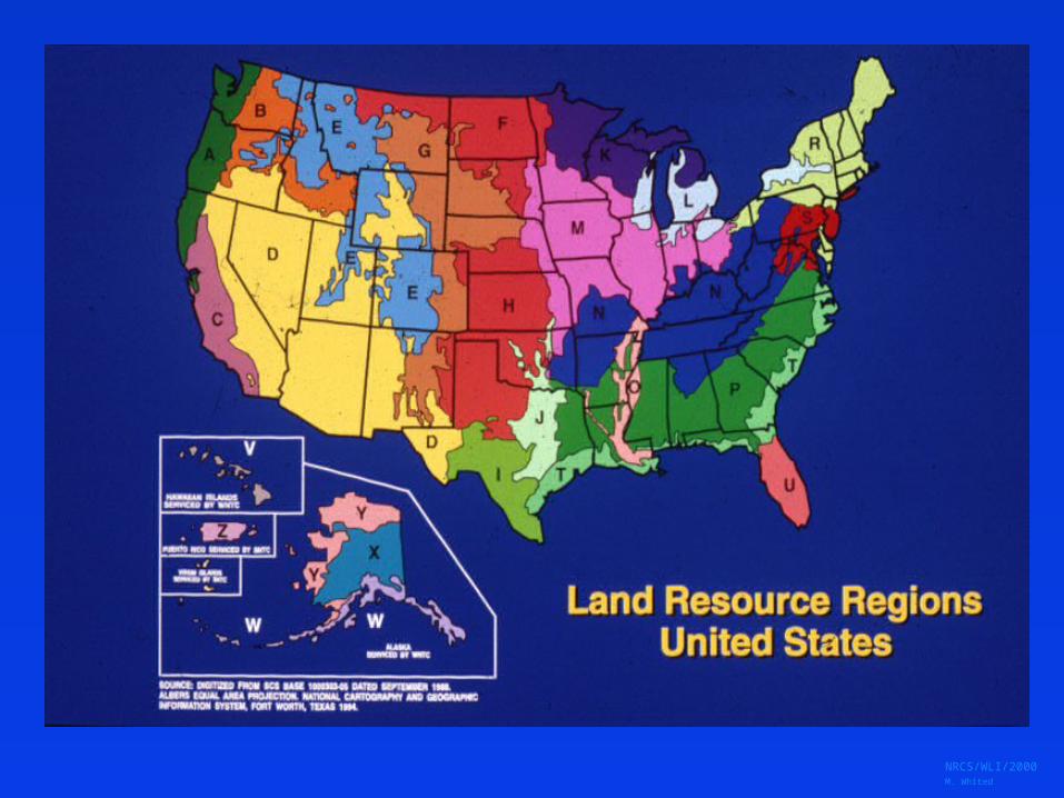
RegionalRegional
Lists by Land Resource Region Addresses “Problem” Soils
– Mollisols and Vertisols– Sandy Soils– Flooded and Ponded Soils– Red Parent Materials
NRCS/WLI/2000 M. Whited
NRCS/WLI/2000 M. Whited
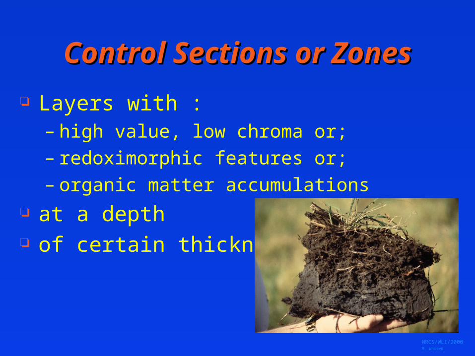
Control Sections or ZonesControl Sections or Zones
Layers with :– high value, low chroma or;– redoximorphic features or;– organic matter accumulations
at a depth of certain thickness
NRCS/WLI/2000 M. Whited
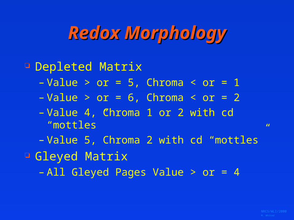
Redox MorphologyRedox Morphology
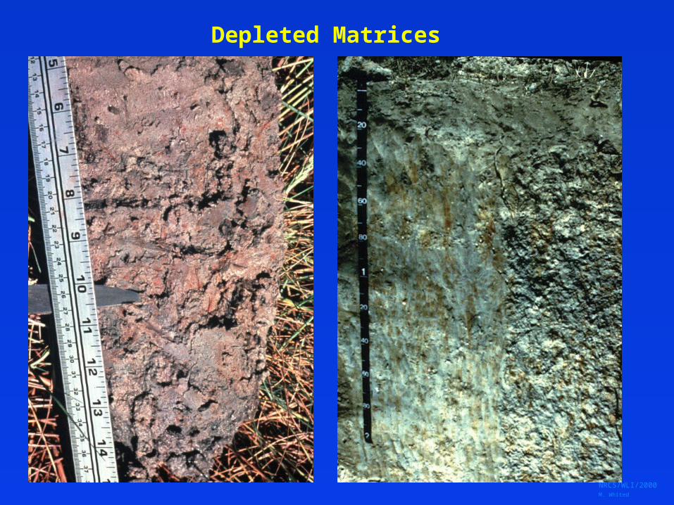
Depleted Matrix– Value > or = 5, Chroma < or = 1– Value > or = 6, Chroma < or = 2– Value 4, Chroma 1 or 2 with cd “mottles”– Value 5, Chroma 2 with cd “mottles”
Gleyed Matrix– All Gleyed Pages Value > or = 4
NRCS/WLI/2000 M. Whited
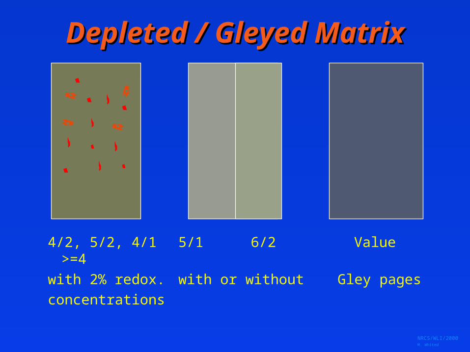
Depleted / Gleyed MatrixDepleted / Gleyed Matrix
4/2, 5/2, 4/1 5/1 6/2 Value >=4
with 2% redox. with or without Gley pages
concentrations
NRCS/WLI/2000 M. Whited
Depleted Matrices

NRCS/WLI/2000 M. Whited
Gleyed Matrix
NRCS/WLI/2000 M. Whited
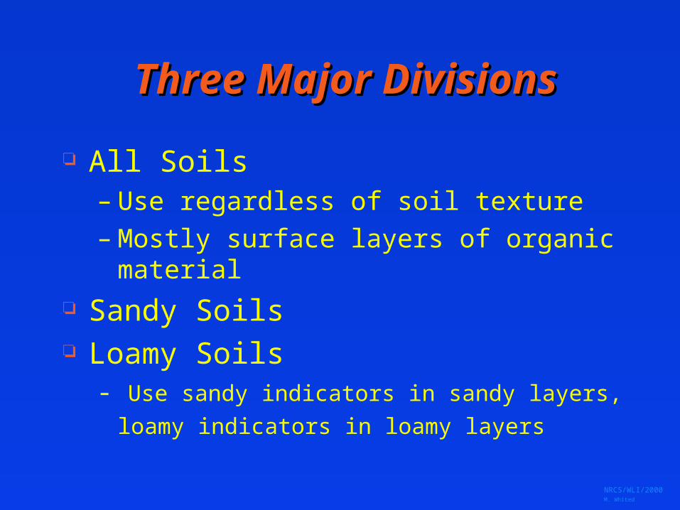
Three Major DivisionsThree Major Divisions
All Soils– Use regardless of soil texture– Mostly surface layers of organic material
Sandy Soils Loamy Soils
- Use sandy indicators in sandy layers,
loamy indicators in loamy layers
NRCS/WLI/2000 M. Whited
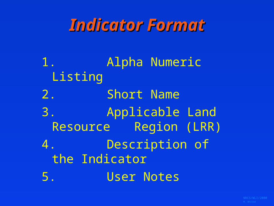
Indicator FormatIndicator Format
1. Alpha Numeric Listing
2. Short Name
3. Applicable Land Resource Region (LRR)
4. Description of the Indicator
5. User Notes
NRCS/WLI/2000 M. Whited
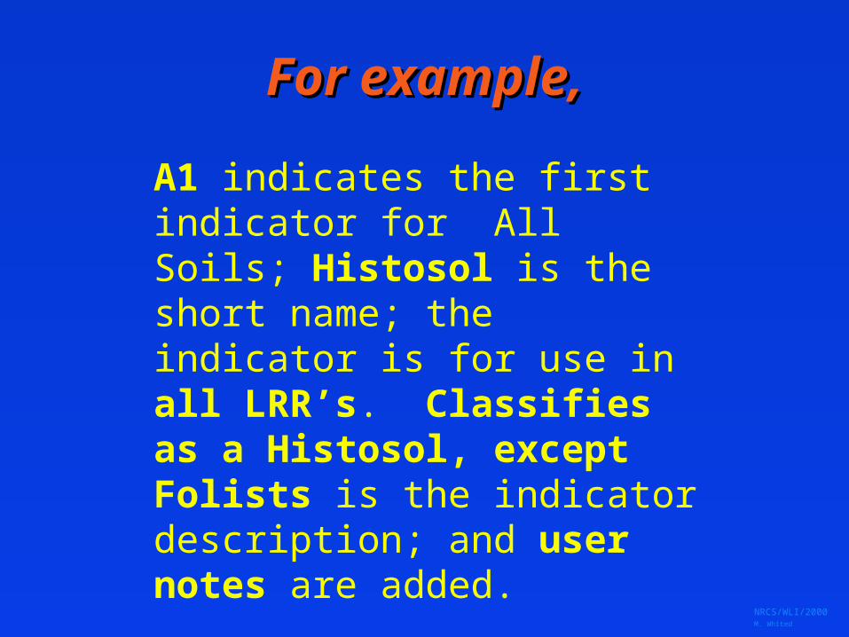
For example,For example,
A1 indicates the first indicator for All Soils; Histosol is the short name; the indicator is for use in all LRR’s. Classifies as a Histosol, except Folists is the indicator description; and user notes are added.

NRCS/WLI/2000 M. Whited

NRCS/WLI/2000 M. Whited
““All Soils”All Soils”
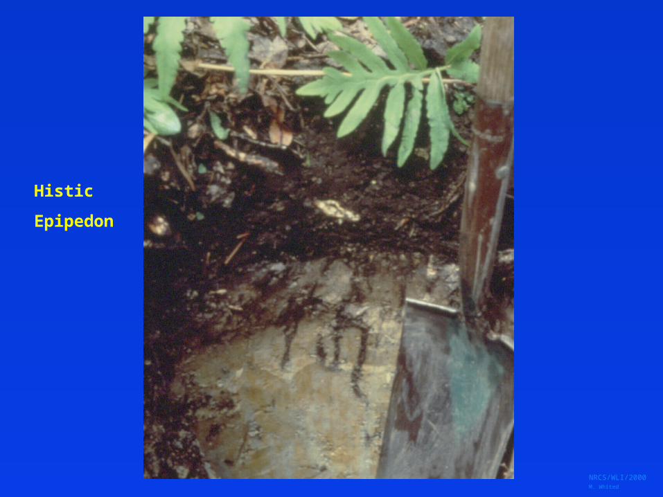
A2, Histic Epipedon A3, Black Histic
– A layer of peat, mucky peat, or muck 20 cm or more thick starting within the upper 15 cm of the soil surface having hue 10YR or yellower, value 3 or less, and chroma 1 or less
A4, Hydrogen Sulfide
NRCS/WLI/2000 M. Whited
Histic
Epipedon
NRCS/WLI/2000 M. Whited
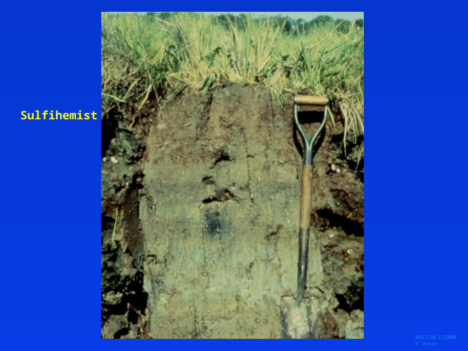
Sulfihemist
NRCS/WLI/2000 M. Whited
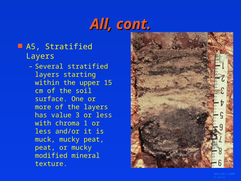
All, cont.All, cont. A5, Stratified Layers
– Several stratified layers starting within the upper 15 cm of the soil surface. One or more of the layers has value 3 or less with chroma 1 or less and/or it is muck, mucky peat, peat, or mucky modified mineral texture.
NRCS/WLI/2000 M. Whited
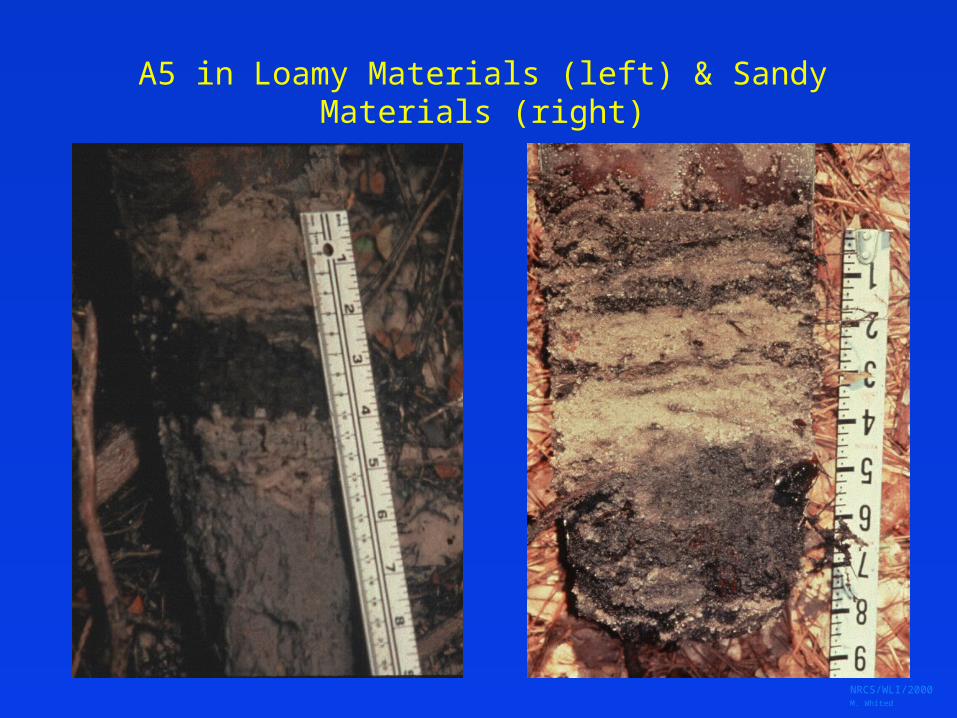
A5 in Loamy Materials (left) & Sandy Materials (right)
NRCS/WLI/2000 M. Whited
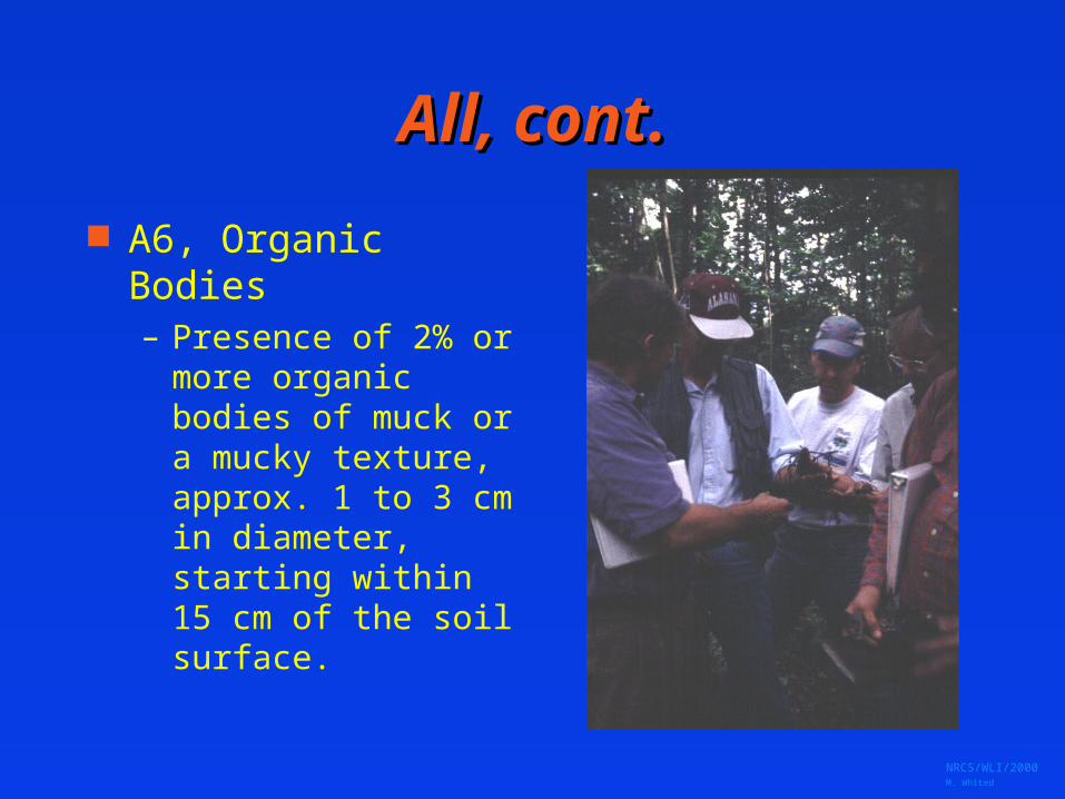
All, cont.All, cont.
A6, Organic Bodies– Presence of 2% or
more organic bodies of muck or a mucky texture, approx. 1 to 3 cm in diameter, starting within 15 cm of the soil surface.
NRCS/WLI/2000 M. Whited
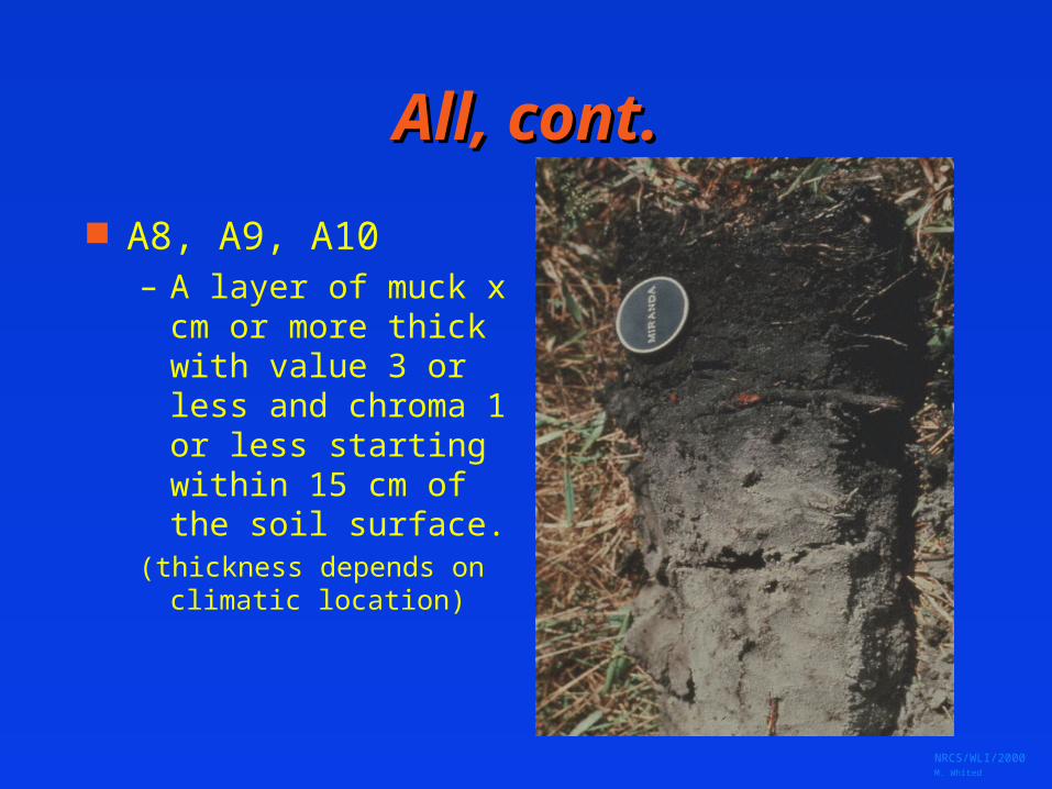
All, cont.All, cont.
A8, A9, A10– A layer of muck x cm
or more thick with value 3 or less and chroma 1 or less starting within 15 cm of the soil surface.
(thickness depends on climatic location)

NRCS/WLI/2000 M. Whited
Sandy SoilsSandy Soils
A Layer less than 25 cm depth is loamy fine sand or coarser
“Control Section” < 15 cm depth Indicators include:
organic surface layers differential translocation
streaking of OM Fe stripped matrix

NRCS/WLI/2000 M. Whited
Sandy SoilsSandy Soilswith High OM surface layerswith High OM surface layers
S1, Sandy Mucky Mineral
S2, 2.5 cm Mucky Peat or Peat
S3, 5 cm Mucky Peat or Peat
NRCS/WLI/2000 M. Whited
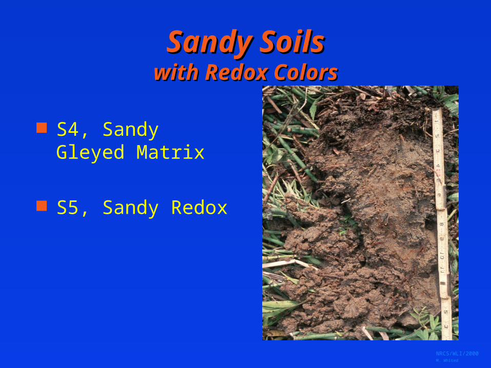
Sandy SoilsSandy Soilswith Redox Colorswith Redox Colors
S4, Sandy Gleyed Matrix
S5, Sandy Redox
NRCS/WLI/2000 M. Whited
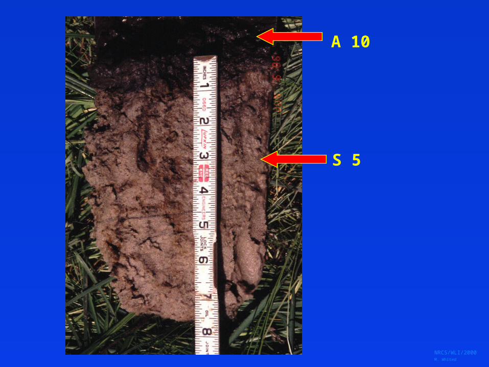
A 10
S 5

NRCS/WLI/2000 M. Whited
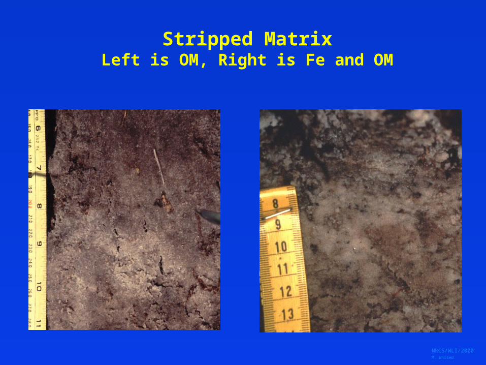
S6, Stripped MatrixS6, Stripped Matrix
A layer starting within 15 cm of the soil surface in which Fe/Mn oxides and / or organic matter have been stripped
from the matrix (in places) exposing the primary base colors of the minerals. The striped areas and translocated
oxides and / or organic matter form a diffuse splotchy pattern of 2 or more colors.
NRCS/WLI/2000 M. Whited
Stripped MatrixLeft is OM, Right is Fe and OM
NRCS/WLI/2000 M. Whited
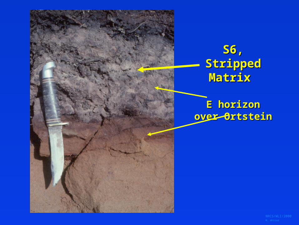
S6, Stripped S6, Stripped Matrix Matrix
E horizonE horizonover Ortsteinover Ortstein
NRCS/WLI/2000 M. Whited
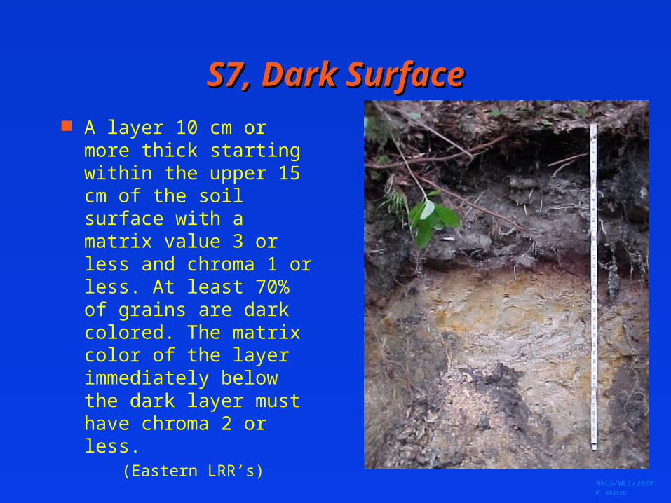
S7, Dark SurfaceS7, Dark Surface A layer 10 cm or more
thick starting within the upper 15 cm of the soil surface with a matrix value 3 or less and chroma 1 or less. At least 70% of grains are dark colored. The matrix color of the layer immediately below the dark layer must have chroma 2 or less.
(Eastern LRR’s)

NRCS/WLI/2000 M. Whited
70% black
50% black
90% black

NRCS/WLI/2000 M. Whited
S8, Polyvalue Below SurfaceS8, Polyvalue Below Surface
A layer with value 3 or less and chroma 1 or less starting (at least 70% dark particles) within 15 cm of the soil surface underlain by a layer(s) where translocated organic matter forms a diffuse splotchy pattern. The splotchy layer has a mix of value 3 and 4, and chroma 1 or less.
NRCS/WLI/2000 M. Whited
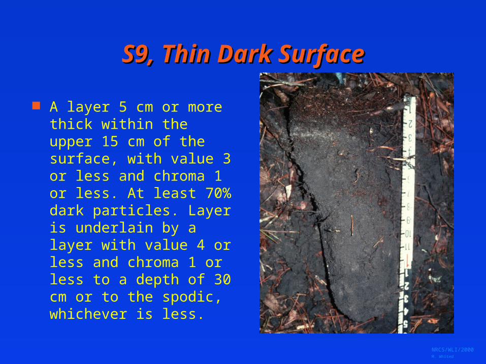
S9, Thin Dark SurfaceS9, Thin Dark Surface
A layer 5 cm or more thick within the upper 15 cm of the surface, with value 3 or less and chroma 1 or less. At least 70% dark particles. Layer is underlain by a layer with value 4 or less and chroma 1 or less to a depth of 30 cm or to the spodic, whichever is less.
NRCS/WLI/2000 M. Whited
Loamy SoilsLoamy Soils
If Any Layer in upper 25 cm is loamy very fine sand or finer
Control Section usually starts within 25 - 30 cm
Most indicators are based upon the reduction / oxidation of Fe
NRCS/WLI/2000 M. Whited
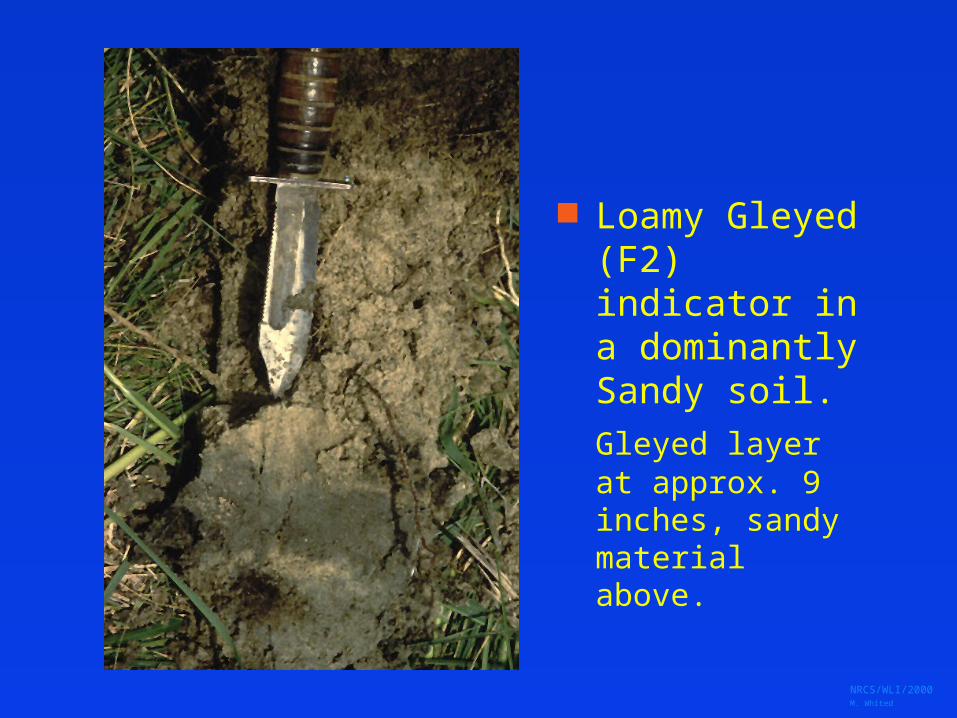
Loamy Gleyed (F2) indicator in a dominantly Sandy soil.
Gleyed layer at approx. 9 inches, sandy material above.
NRCS/WLI/2000 M. Whited
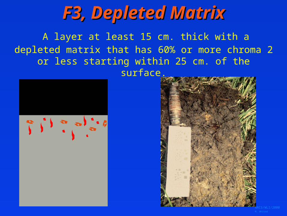
F3, Depleted MatrixF3, Depleted Matrix A layer at least 15 cm. thick with a depleted matrix
that has 60% or more chroma 2 or less starting within 25 cm. of the surface.
NRCS/WLI/2000 M. Whited

NRCS/WLI/2000 M. Whited
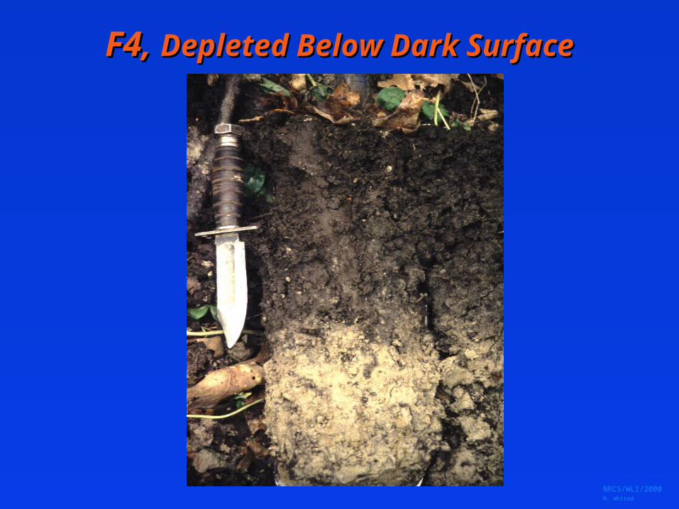
F4, Depleted Below Dark SurfaceF4, Depleted Below Dark Surface A layer at least 15cm thick with a depleted matrix that has 60% or more chroma 2 or less starting within 30cm of the surface. The layer(s) above the depleted matrix have value 3 or less, chroma 2 or less.
NRCS/WLI/2000 M. Whited
F4, F4, Depleted Below Dark SurfaceDepleted Below Dark Surface
NRCS/WLI/2000 M. Whited
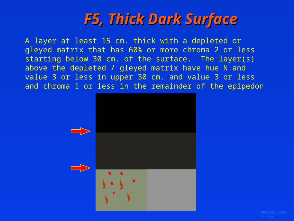
F5, Thick Dark SurfaceF5, Thick Dark Surface..A layer at least 15 cm. thick with a depleted or gleyed matrix that has 60% or more chroma 2 or less starting below 30 cm. of the surface. The layer(s) above the depleted / gleyed matrix have hue N and value 3 or less in upper 30 cm. and value 3 or less and chroma 1 or less in the remainder of the epipedon
NRCS/WLI/2000 M. Whited
F5, User NoteF5, User Note
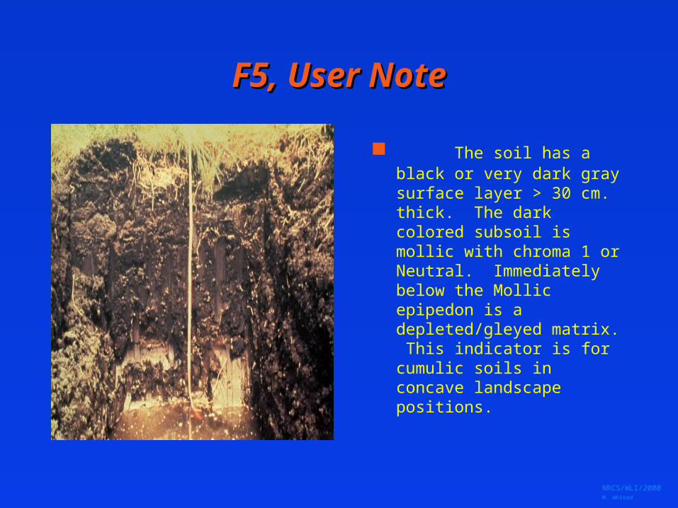
The soil has a black or very dark gray surface layer > 30 cm. thick. The dark colored subsoil is mollic with chroma 1 or Neutral. Immediately below the Mollic epipedon is a depleted/gleyed matrix. This indicator is for cumulic soils in concave landscape positions.

NRCS/WLI/2000 M. Whited
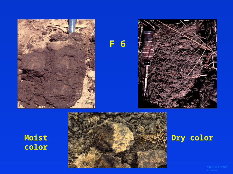
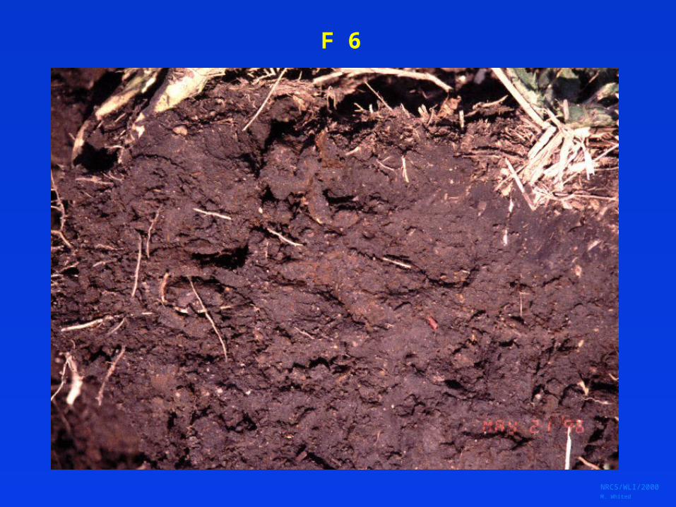
F6, Redox Dark SurfaceF6, Redox Dark SurfaceA layer at least 10 cm. thick entirely within the upper 30
cm. that has: a. matrix value 3 or less and chroma 1 or less and 2% or more distinct or prominent redox concentrations, orb. matrix value 3 or less and chroma 2 or less and 5% or more redox concentrations.
Chroma 2 with 5%
Chroma 1 with 2%
NRCS/WLI/2000 M. Whited
F 6
Moist color Dry color
NRCS/WLI/2000 M. Whited
F 6

NRCS/WLI/2000 M. Whited
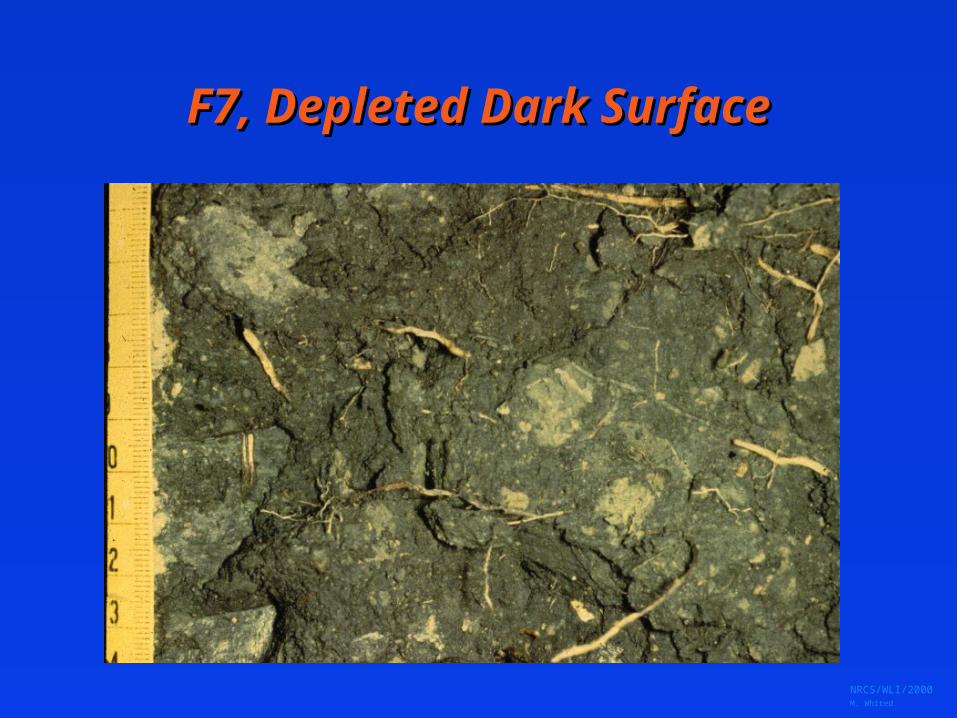
F7, Depleted Dark SurfaceF7, Depleted Dark SurfaceRedox depletions, with value 5 or more and chroma 2 or less, in a layer at least 10 cm. thick entirely within the upper 30 cm. of the mineral soil that has:a. value 3 or less and chroma 1 or less and 10% or more redox depletions, orb. value 3 or less and chroma 2 and 20% or more redox depletions.
Chroma 1
with 10%; Chroma 2
with 20%
NRCS/WLI/2000 M. Whited
F7, Depleted Dark SurfaceF7, Depleted Dark Surface
NRCS/WLI/2000 M. Whited
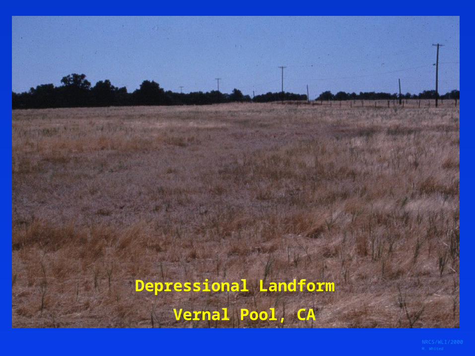
Depressional Landform
Vernal Pool, CA

NRCS/WLI/2000 M. Whited
Loamy DepressionsLoamy Depressions
F8, Redox Depressions– In CD’s subj. to
ponding, 5% or more redox conc. in a layer 2 cm or more thick entirely within upper 15 cm.
F9, Vernal Pools– In CD’s, presence of a
depleted matrix 5 cm or more thick entirely within the upper 15 cm.
NRCS/WLI/2000 M. Whited
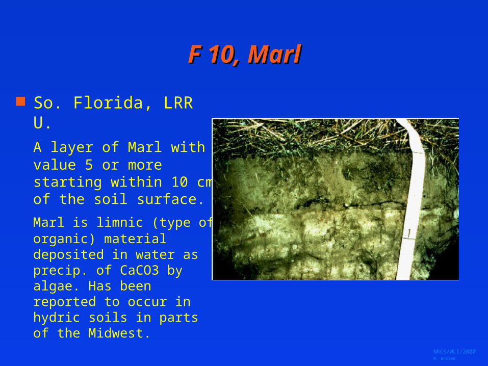
F 10, MarlF 10, Marl
So. Florida, LRR U.
A layer of Marl with value 5 or more starting within 10 cm of the soil surface.
Marl is limnic (type of organic) material deposited in water as precip. of CaCO3 by algae. Has been reported to occur in hydric soils in parts of the Midwest.
NRCS/WLI/2000 M. Whited
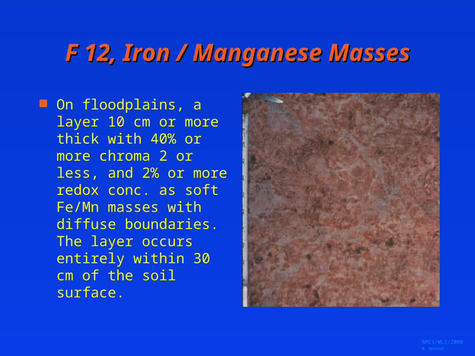
F 12, Iron / Manganese MassesF 12, Iron / Manganese Masses
On floodplains, a layer 10 cm or more thick with 40% or more chroma 2 or less, and 2% or more redox conc. as soft Fe/Mn masses with diffuse boundaries. The layer occurs entirely within 30 cm of the soil surface.
NRCS/WLI/2000 M. Whited
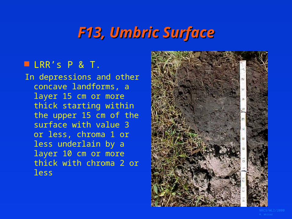
F13, Umbric SurfaceF13, Umbric Surface
LRR’s P & T.In depressions and other
concave landforms, a layer 15 cm or more thick starting within the upper 15 cm of the surface with value 3 or less, chroma 1 or less underlain by a layer 10 cm or more thick with chroma 2 or less

NRCS/WLI/2000 M. Whited
F16, High Plains DepressionsF16, High Plains DepressionsIn closed depressions subject to ponding, a layer at least 10 cm. thick within the upper 35 cm. of the soil that has chroma 1 or less and:a. 1% or more redox concentrations as nodules or concretions, orb. redox concentrations as nodules or concretions with distinct or prominent halos.

NRCS/WLI/2000 M. Whited
NRCS/WLI/2000 M. Whited
““Test” IndicatorsTest” Indicators
Proposed indicators for further study Formatted the same as others Have “suggested” LRR’s for use Any indicator on list may be evaluated
for use in other regions
NRCS/WLI/2000 M. Whited
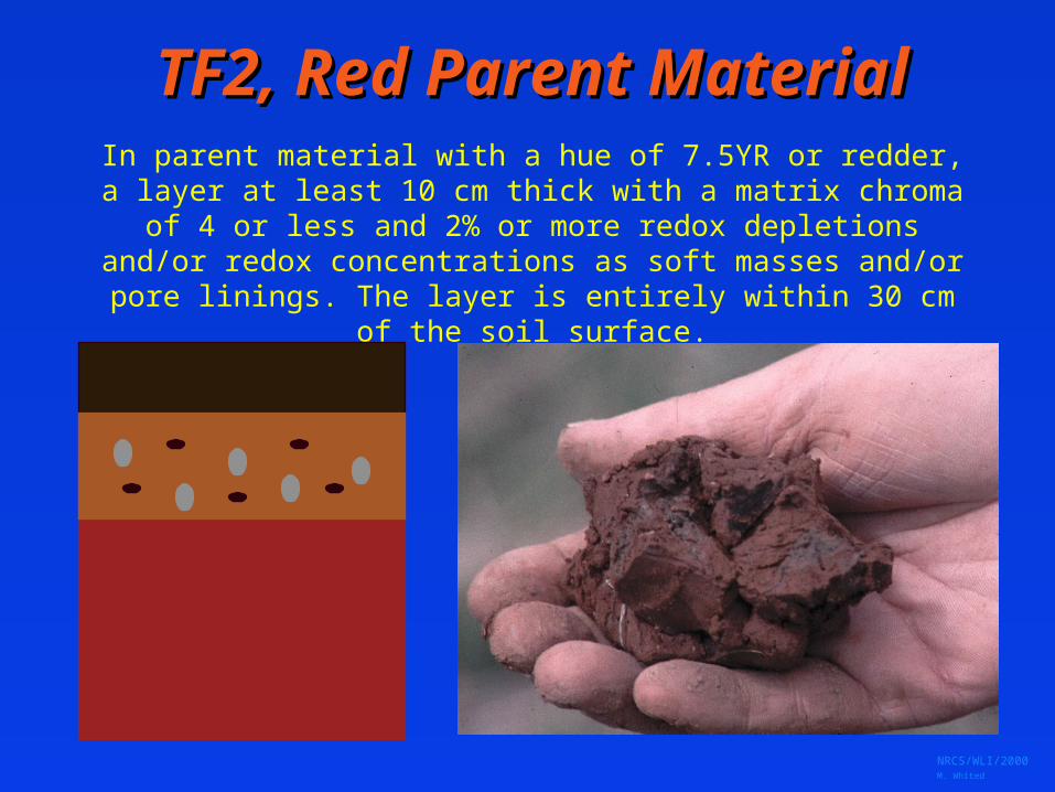
TF2, Red Parent MaterialTF2, Red Parent MaterialIn parent material with a hue of 7.5YR or redder, a layer at least 10 cm thick with a matrix chroma of 4 or less and 2% or more redox depletions and/or redox concentrations as
soft masses and/or pore linings. The layer is entirely within 30 cm of the soil surface.
NRCS/WLI/2000 M. Whited
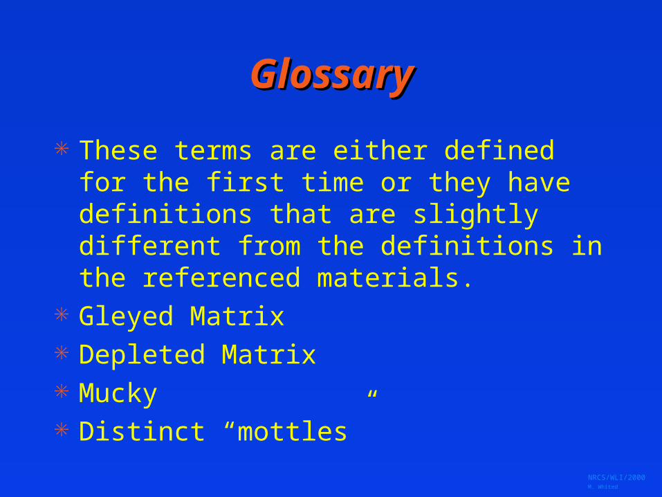
GlossaryGlossary
These terms are either defined for the first time or they have definitions that are slightly different from the definitions in the referenced materials.
Gleyed Matrix Depleted Matrix Mucky Distinct “mottles”

NRCS/WLI/2000 M. Whited
Correlation of 1987 Indicators Correlation of 1987 Indicators and 1998 Indicatorsand 1998 Indicators
5 cm . m ucky _cm . M uck _cm . M ucky P ea t o r P ea t
"H igh" O rgan ic M atte r
NRCS/WLI/2000 M. Whited
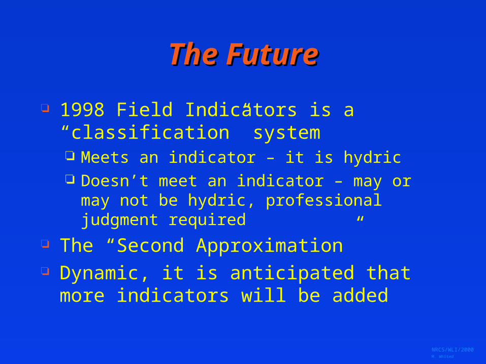
The FutureThe Future
1998 Field Indicators is a “classification” system Meets an indicator – it is hydric Doesn’t meet an indicator – may or may not be
hydric, professional judgment required
The “Second Approximation” Dynamic, it is anticipated that more indicators
will be added
NRCS/WLI/2000 M. Whited
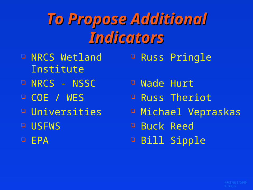
To Propose Additional To Propose Additional IndicatorsIndicators
NRCS Wetland Institute
NRCS - NSSC COE / WES Universities USFWS EPA
Russ Pringle
Wade Hurt Russ Theriot Michael Vepraskas Buck Reed Bill Sipple

NRCS/WLI/2000 M. Whited
Where to get more InformationWhere to get more Information
Inter-agency training sessions Field Indicators on INTERNET
– http://www.statlab.iastate.edu:80/soils-info/hydric
Available in hard copy from NRCS Wetland Science Institute
Russ Pringle: [email protected]
NRCS/WLI/2000 M. Whited
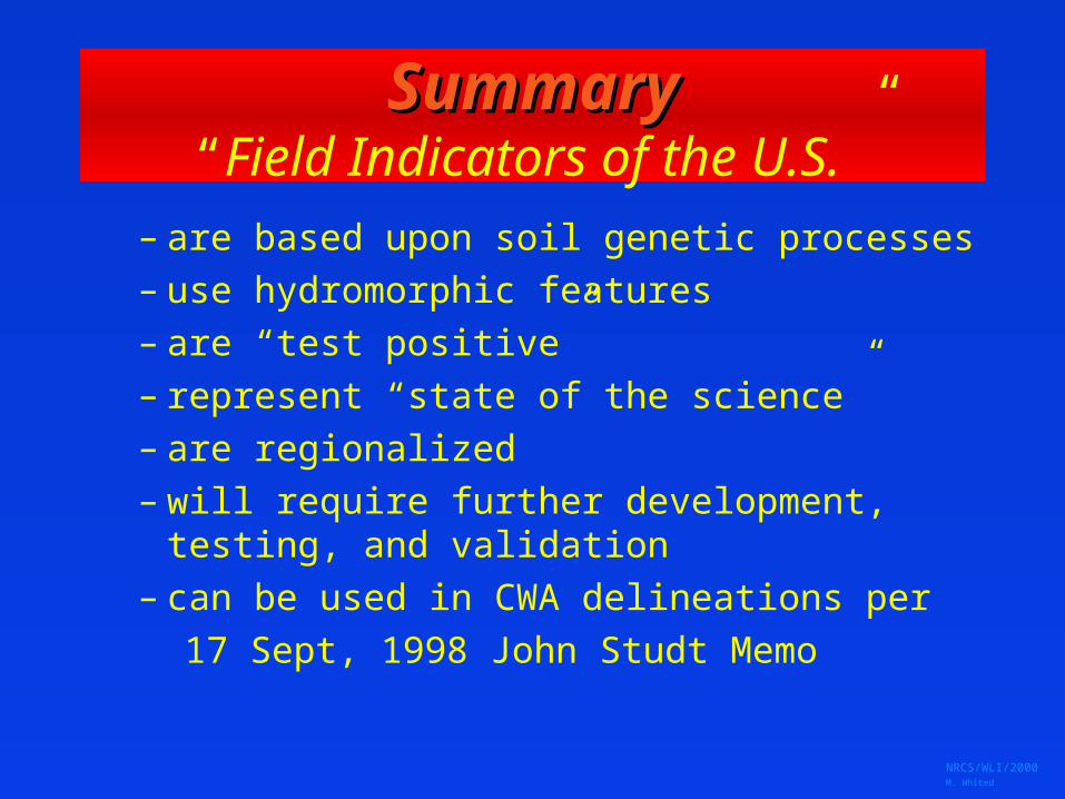
SummarySummary“Field Indicators of the U.S.”
– are based upon soil genetic processes– use hydromorphic features– are “test positive”– represent “state of the science”– are regionalized– will require further development,
testing, and validation– can be used in CWA delineations per
17 Sept, 1998 John Studt Memo