one country without borders - wordpress.com
TRANSCRIPT

One Country Without Borders
A Year in the Grasslandswith Harold Rhenisch
www.okanaganokanogan.com
Friday, 19 October, 12

Kaiserstuhl
We begin a long way away from the grasslands. These are the vineyards of the Kaiserstuhl, in Southern Germany. When early European farmers looked up to the hills and riverbanks, they saw wild grapes such as the ones in the foreground here. From them, they made a wine culture and a wine industry.
Friday, 19 October, 12
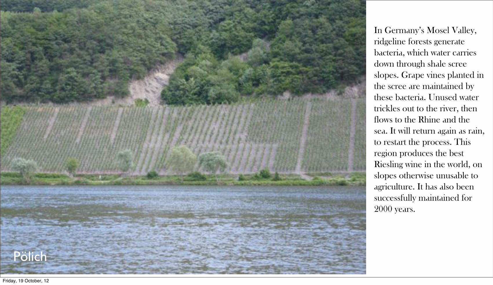
In Germany’s Mosel Valley, ridgeline forests generate bacteria, which water carries down through shale scree slopes. Grape vines planted in the scree are maintained by these bacteria. Unused water trickles out to the river, then flows to the Rhine and the sea. It will return again as rain, to restart the process. This region produces the best Riesling wine in the world, on slopes otherwise unusable to agriculture. It has also been successfully maintained for 2000 years.
Pölich
Friday, 19 October, 12

Rather than adopt native plants, settlers in the North American West imported European crops, such as these grapes growing on the Bella Vista Hills. Unlike the vineyards of the Mosel and the Rhine, they need to be maintained with water piped down from the high country.
Okanagan LandingFriday, 19 October, 12

This is the same row of vines seen in the preceding image. To maximize economic profit in a worldwide glut of grapes, this farmer is leaving them on the vine late to create ice wine. Only tiny amounts of waterless juice will be extracted from this crop, to produce an expensive luxury product for international markets. Unfortunately, birds and rot have claimed something like 90% of the grapes here. All in all, in a climate acutely short of water the thousands of litres of irrigation water removed from the valley and given to these vines is largely wasted.
Okanagan Landing
Friday, 19 October, 12

Okanagan Landing
On the border of this same vineyard native choke cherries thrive, without irrigation or care of any kind. Wild cherries have a balance of acids and sugars suitable to a cider industry. They produce unique preserves, also worthy of production. They are left for the birds.
Friday, 19 October, 12

Cawston
So, let’s go to the beginning, to the land itself. Let me show you where we are, so we know, together, where we are going. This, for instance, is the view from the grassland meadows of Kobau Mountain, over the Similkameen Valley, to Snowy Mountain. In behind are the Cascades and the Pasayten Wilderness of Washington. I began here. My bones are made of this ground. This photograph was taken in the late 1980s.
Friday, 19 October, 12
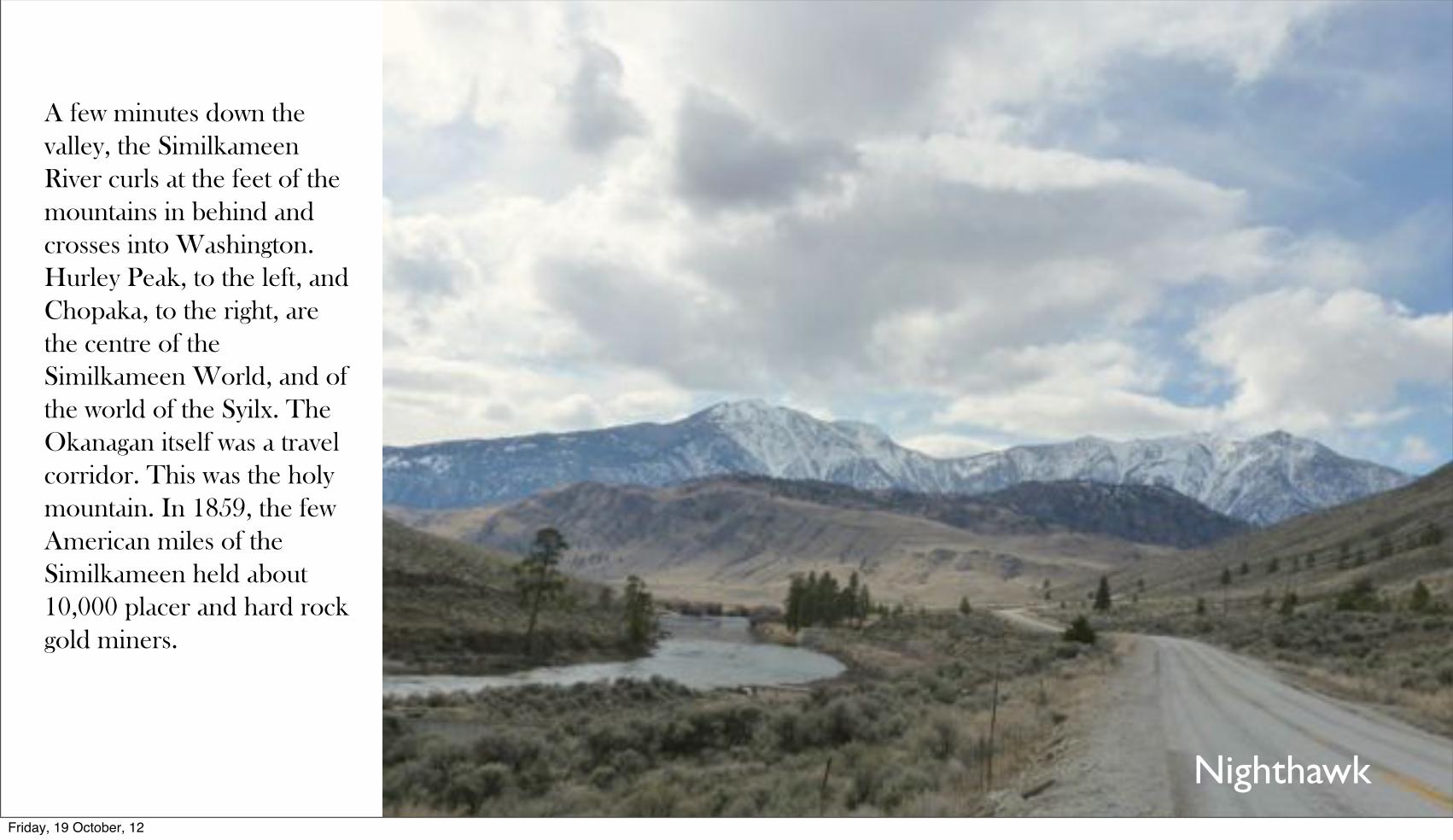
Nighthawk
A few minutes down the valley, the Similkameen River curls at the feet of the mountains in behind and crosses into Washington. Hurley Peak, to the left, and Chopaka, to the right, are the centre of the Similkameen World, and of the world of the Syilx. The Okanagan itself was a travel corridor. This was the holy mountain. In 1859, the few American miles of the Similkameen held about 10,000 placer and hard rock gold miners.
Friday, 19 October, 12

Palmer Lake
A little further to the south, on the old main highway to Loomis and Conconully, the ancient landmark of Split Rock lies on the shores of Palmer Lake. Ore from a local mine was once processed just north of here, on land that went on to hold orchards and now is going to grass.
Friday, 19 October, 12

Palmer Lake
On the northern shores of Palmer Lake, a horse checks me out from a semi-abandoned almond orchard. When I was a young man, we looked south to Palmer Lake with envy, thinking that this nut industry would revitalize agriculture in the both the Similkameen and the Okanagan. Now this horse comes up to the road to beg a few roadside weeds from whoever goes by.
Friday, 19 October, 12

Conconully
The truth is, here in Northern Washington, the US Canadian Border creates poverty. This is the far north of the USA, a place few travel to and almost at the end of the earth. North of here, most American maps are blank. Just a few miles north, in Canada, though, in the same valley, it is the deep south, full of vineyards and tourists and wealth. Once the country seat, Cononully is now populated largely by ex-military men, in a kind of campground and biker culture in a Roosevelt-era work camp between two water reservoirs.
Friday, 19 October, 12

The Pillar
Another centre of the world is at Pillar Lake, at the northern reach of the glacial bed of the Okanagan. The Syilx call this the bones of our mother. It certainly is. In another version of the same story, this is known as a remnant of the glacial and post-glacial till that once filled this valley, and which washed away to form ...
Friday, 19 October, 12

Trout Creek
... the silt on the bed of Glacial Lake Penticton. Once 150 metres deeper than the current lake in the floor of the valley, it vanished over three and a half days, when the ice dam holding in place broke at the end of the glacial age. The waters surged south, and helped to carve out the so-called scablands of Eastern Washington. The lakes that remain, Okanagan Lake, Kalamalka Lake, Wood Lake, Ellison Lake, Skaha Lake, and Vaseaux Lake, still hold this ancient glacial water. We look up here from the shore of Okanagan Lake to the base of Lake Penticton’s old bed.
Friday, 19 October, 12

Here
When I started this project, I named it Okanagan Okanogan, to stress that the border was nothing here, and that we were one nation, settler and indigenous, Canadian and American, in one valley, with one history, stretching from the mouth of the Okanagan at Brewster, Washington, to its headwaters, just north of Armstrong, British Columbia, between the two purple circles to the right. What I learned from a year of wandering in the grass, was that the land was much larger, and the only way to fully understand it was to go where the Syilx once went, not up down the river and along its lakes, but deep into the Plateau. It’s only the 1858 border that separated the Canadian Okanagan from the grasslands of Washington, Idaho and Oregon.
Friday, 19 October, 12

Here
1847-1855
1855-1859
1859-1861
1874-1880
1887-1891
The country looks a little bit more like this. The map as a whole indicates the approximate span of traditional Syilx territory, which overlapped with that of many of the other Plateau peoples, to which they were closely related. The purple circles here indicate the span of the Okanagan. The other circles, and their dates, mark missions of the Oblate father, Charles Pandosy. He began as a missionary to the Yakimas in the south, was evacuated to Colville (in the middle of the map) by the US Army during the Yakima War. He pleaded to be returned to his “beloved Yakimas”, but was sent to Kelowna in the North, in British Territory, instead — largely because the US Army saw him as an “Indian Lover” and a “Catholic”, both of which they didn’t want in their new territory. Pandosy spent little time in Kelowna. During his absences, he founded missions in Esquimalt and Fort Rupert on Vancouver Island, at St. Mary’s Mission in the Fraser Valley, and at Stuart Lake in the far north. Two years were also spent on a trip to France, to rescind his claim that the US Army had destroyed his mission at the mouth of the Yakima River, believing that he was spying against the Americans. (Actually, it was irregular hangers on of the Army who destroyed his mission, as well as his grammar of the Yakima language [the only one ever made]. A nice legal difference.) Pandosy was excellent at befriending indigenous peoples, but not at converting them. Then the professionals moved in and took over. Ironically, Pandosy is known as the father of white culture in the Okanagan, a kind of Johnny Appleseed, although he really had gone native, and ministered mostly to métis French Canadian Hudsons’ Bay Company men, who too had been driven north out of the new Washington Territory and had no desire to return east, where anti-métis politics were heating up. Washington history is Okanagan history.
Friday, 19 October, 12

Bella Vista
What does Pandosy’s country look like? Well, like this. This is a view over the eastern arm of Okanagan Lake at Okanagan Landing. The slope in the foreground burnt a few days before, in August. This valley was cultivated by the Syilx for 10,000 years by fire. This is what it usually looked like.
Friday, 19 October, 12
Grand Coulee
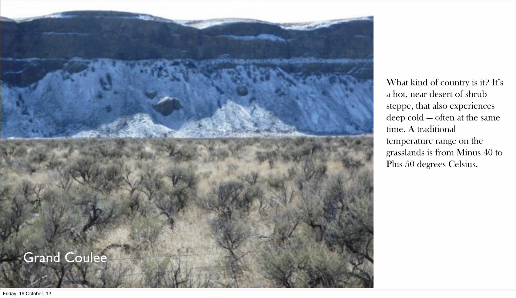
What kind of country is it? It’s a hot, near desert of shrub steppe, that also experiences deep cold — often at the same time. A traditional temperature range on the grasslands is from Minus 40 to Plus 50 degrees Celsius.
Friday, 19 October, 12
Bella Vista Hills
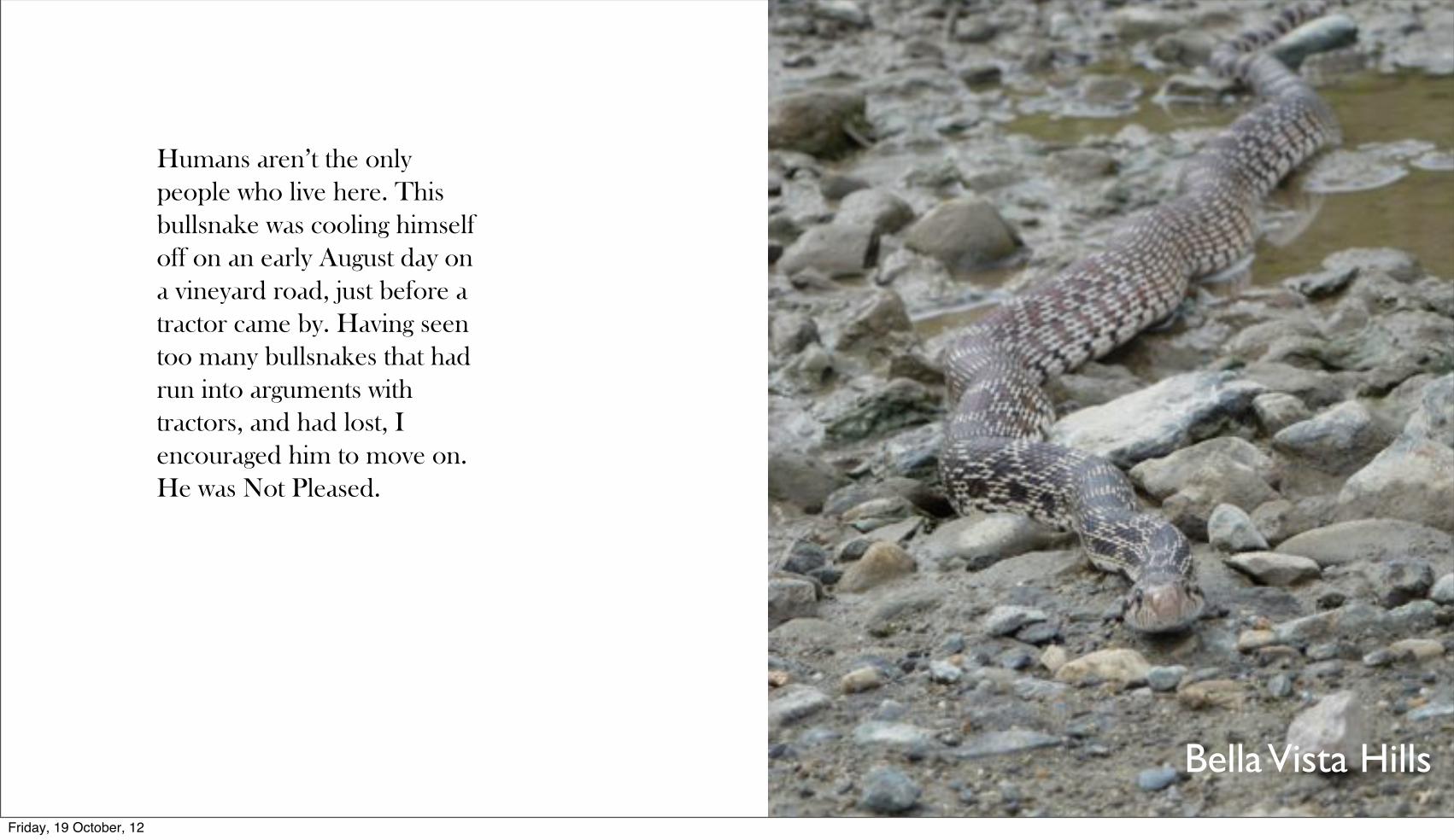
Humans aren’t the only people who live here. This bullsnake was cooling himself off on an early August day on a vineyard road, just before a tractor came by. Having seen too many bullsnakes that had run into arguments with tractors, and had lost, I encouraged him to move on. He was Not Pleased.
Friday, 19 October, 12

Okanagan Landing
Our brothers and sisters the deer people are everywhere in this country. They especially like shrubberies. The more expensive and exotic the shrubbery, the more they like it. Here they are, moving back up into the hills on a September afternoon, after a long day grazing in subdivision gardens.
Friday, 19 October, 12
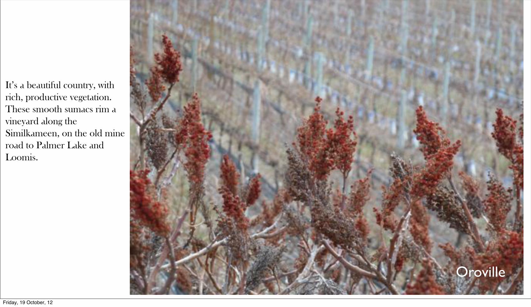
Oroville
It’s a beautiful country, with rich, productive vegetation. These smooth sumacs rim a vineyard along the Similkameen, on the old mine road to Palmer Lake and Loomis.
Friday, 19 October, 12

Orchard Hill
Some of the people who live here are really appreciative of human construction efforts. Here, a couple of black widows happily hunt in my basement. I was fine with this, until they built a huge net in front of my deep freeze, to catch me, I think. Gad.
Friday, 19 October, 12

Ellison
We have some really cool plants here, too. These glassworts are colonizing the salty margins of a salt lake in the north of Kelowna. The lake is an important stopover point for migrating swans and gulls.
Friday, 19 October, 12
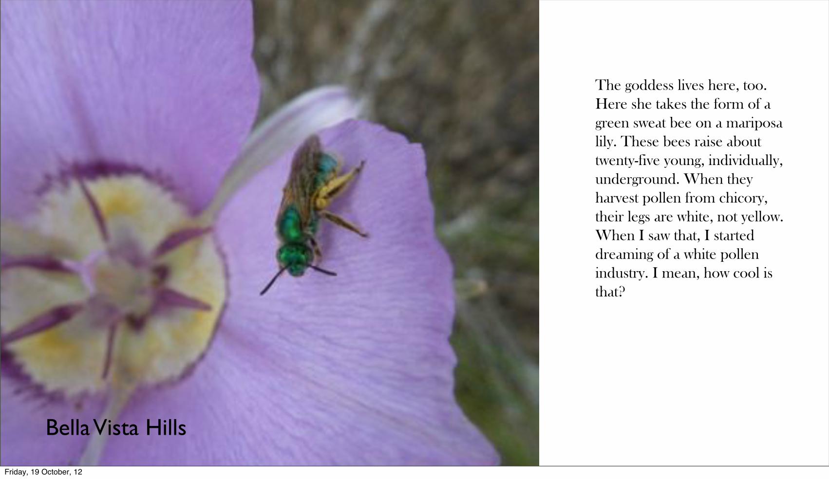
Bella Vista Hills
The goddess lives here, too. Here she takes the form of a green sweat bee on a mariposa lily. These bees raise about twenty-five young, individually, underground. When they harvest pollen from chicory, their legs are white, not yellow. When I saw that, I started dreaming of a white pollen industry. I mean, how cool is that?
Friday, 19 October, 12

Umatilla Rock
Sacred spaces abound on this land. This is Umatilla Rock in Dry Falls State Park...
Friday, 19 October, 12

Umatilla Rock
... and these are some of the people who live on the rock.
Friday, 19 October, 12

Okanagan Landing
Immigrants love it here, too, of course, such as these starlings enjoying a late afternoon.
Friday, 19 October, 12
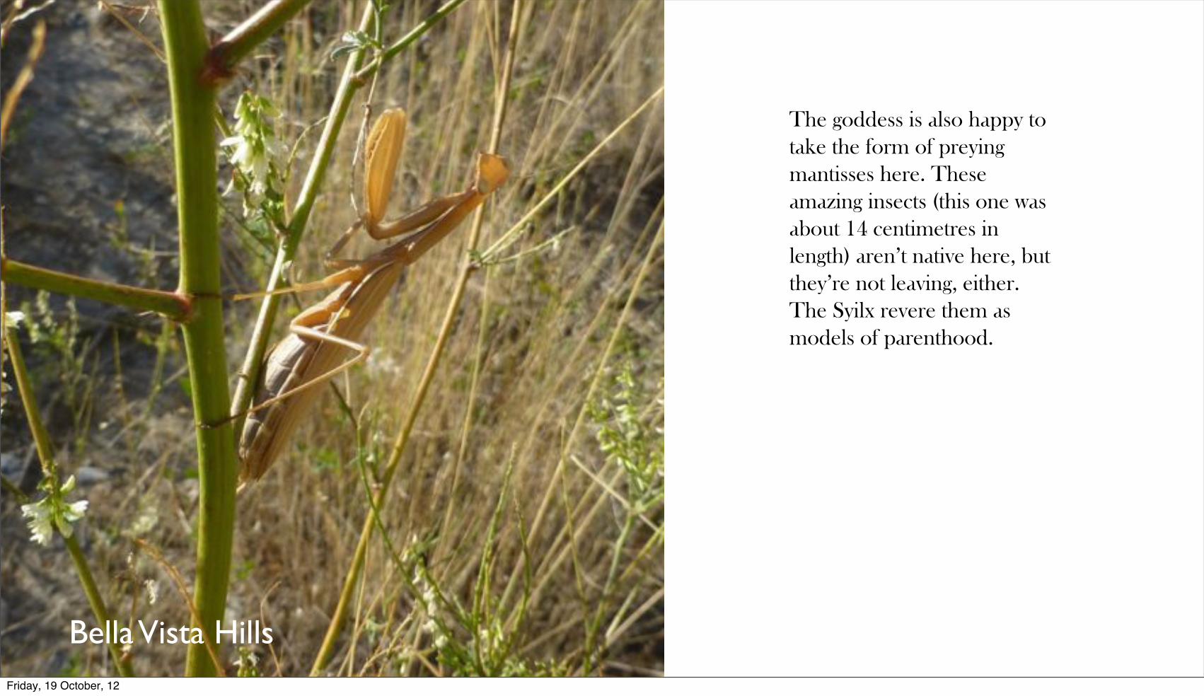
Bella Vista Hills
The goddess is also happy to take the form of preying mantisses here. These amazing insects (this one was about 14 centimetres in length) aren’t native here, but they’re not leaving, either. The Syilx revere them as models of parenthood.
Friday, 19 October, 12

Conconully Reservoir
Western Painted Turtles love the place, too. Here, one swims in the water that fills the old sacred grasslands of the Sinlahekin Valley. This water irrigates the orchards of Okanogan and Omak.
Friday, 19 October, 12

White Bluffs
In the Hanford Reach, on the old Hanford Engineering Works, the manufacturing site where the Manhattan project’s plutonium was built for the Trinity test and for the Nagasaki bomb, the white bluffs, containing the soil of half the continent, stretch like this for twenty miles along the river, facing the nuclear reactors. The sockeye salmon of Nk’mip, the last major run on the Columbia, have to swim through this beauty and this dark history to come home. So do we.
Friday, 19 October, 12

Okanagan Indian Reserve
Horses from the Okanagan Indian Band herds walk along a ridgeline on a late winter afternoon. It was the combined pressure of American settlement in the Ohio Valley, as its consequences rippled across the continent, as well as the introduction of horses to the Great Plains that pressured the Plateau peoples to set aside much of their cooperative community life and to divide strongly into individual, competitive nations, with disastrous consequences. In my project, I make a case for coming together again, rather than for allowing external forces to continue pushing us apart.
Friday, 19 October, 12

Turtle Mountain
Even the rocks are beautiful here. The Okanagan fault slipped 100 kilometres, with resulting volcanic stress. We live on the bones of an ancient story.
Friday, 19 October, 12
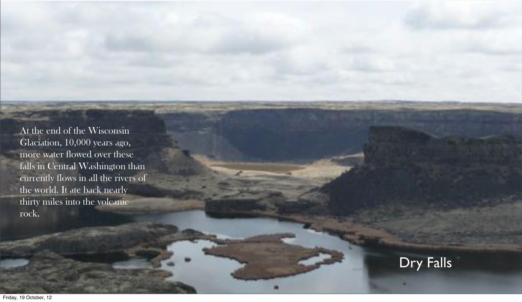
At the end of the Wisconsin Glaciation, 10,000 years ago, more water flowed over these falls in Central Washington than currently flows in all the rivers of the world. It ate back nearly thirty miles into the volcanic rock.
Dry Falls
Friday, 19 October, 12

Okanagan Lake
We are not alone. We share this land. It is, in effect, not ours. We belong to it.
Friday, 19 October, 12
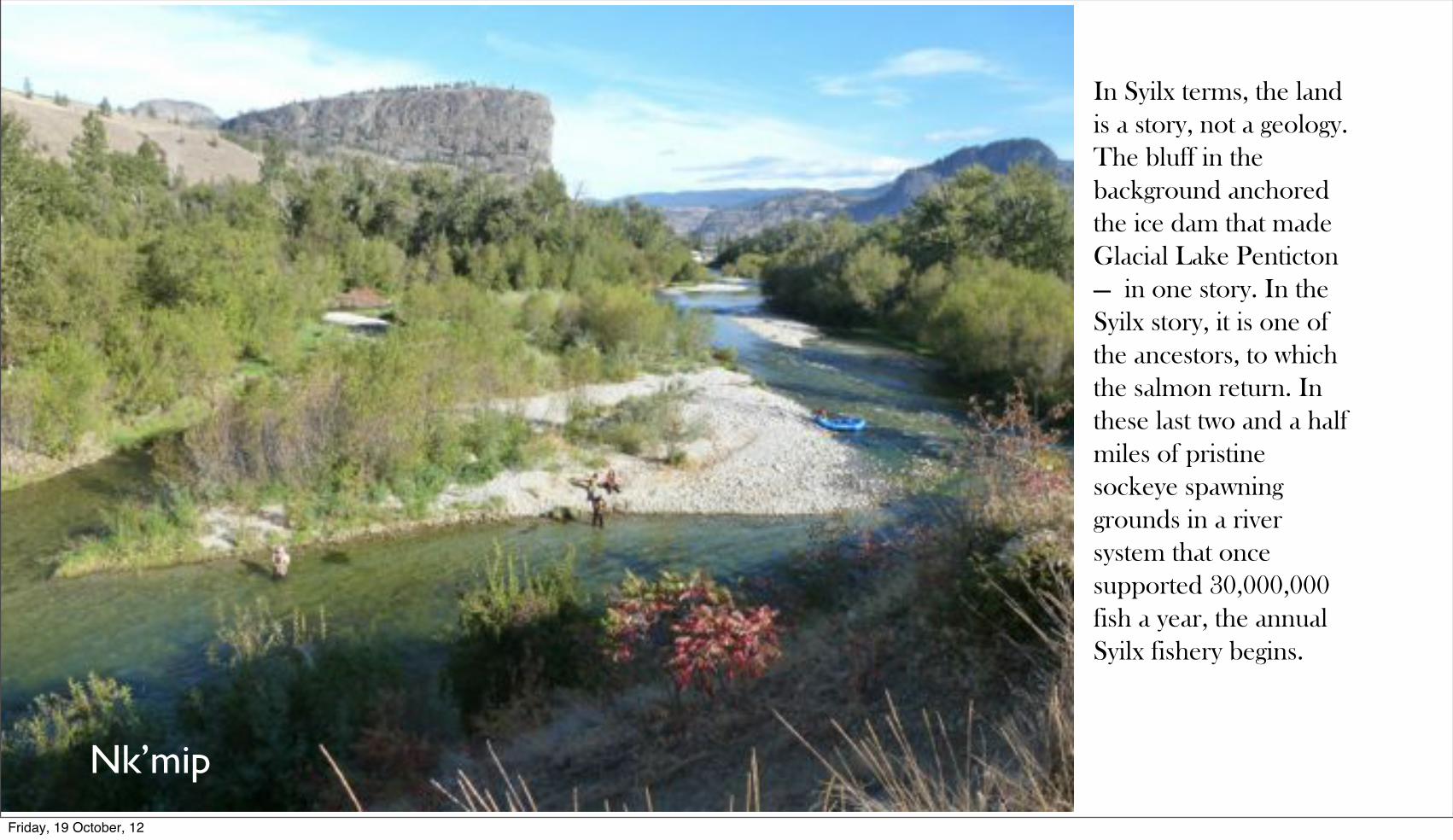
Nk’mip
In Syilx terms, the land is a story, not a geology. The bluff in the background anchored the ice dam that made Glacial Lake Penticton — in one story. In the Syilx story, it is one of the ancestors, to which the salmon return. In these last two and a half miles of pristine sockeye spawning grounds in a river system that once supported 30,000,000 fish a year, the annual Syilx fishery begins.
Friday, 19 October, 12
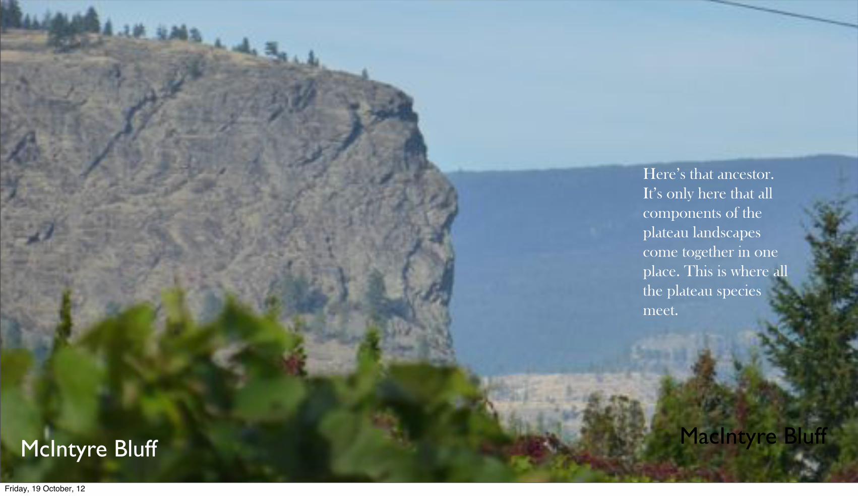
MacIntyre BluffMcIntyre Bluff
Here’s that ancestor. It’s only here that all components of the plateau landscapes come together in one place. This is where all the plateau species meet.
Friday, 19 October, 12

Turtle Mountain
In an old Syilx story, Turtle became chief of all the animals when he convinced Eagle to carry him up high and to race him back to the earth. Turtle fell like rock. Here he is, and ...
Friday, 19 October, 12

Turtle Mountain
... and here is eagle on his back, looking west towards Okanagan Lake. When Eagle concede his claim to chieftanship, Turtle gave it to all the animals, declaring them all equal. It is an ancient wisdom story, that just happens to written in the bones of the land. So it is for people who are rooted to a place and make even their own intellectual traditions out of its materials.
Friday, 19 October, 12
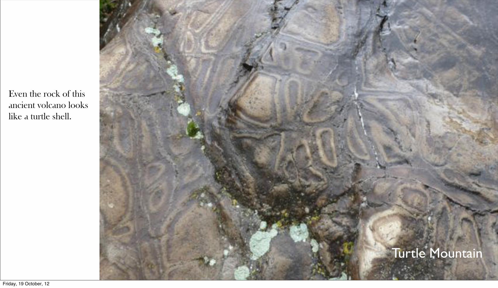
Turtle Mountain
Even the rock of this ancient volcano looks like a turtle shell.
Friday, 19 October, 12

Turtle Mountain
And across the mountain, there are turtle eggs, laid right within the rock that the turtle lies upon. The thing about this story is ...
Friday, 19 October, 12

Turtle Island
...that it appears to be universal on the Plateau. It appears that every Plateau people had a turtle at their heart. Here is Turtle Island, on the Columbia just north of Wenatchee...
Friday, 19 October, 12
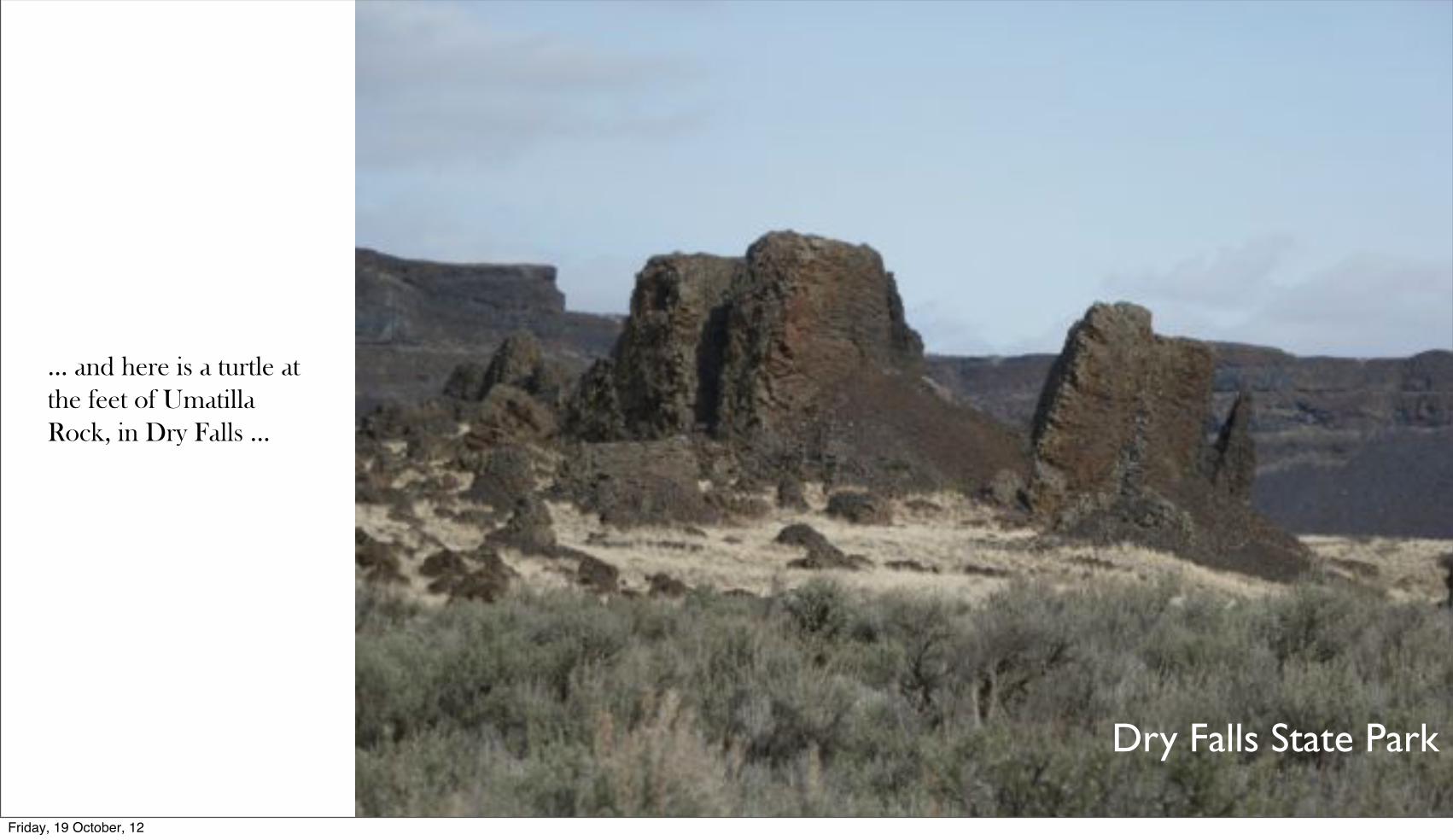
Dry Falls State Park
... and here is a turtle at the feet of Umatilla Rock, in Dry Falls ...
Friday, 19 October, 12

Peshastin Pinnacles
... and here is one looking out of one of the Peshastin Pinnacles, an ancient site above the Wenatchee River between Wenatchee and Leavenworth. The site is used now by climbers, and bears evidence of long use by indigenous climbers and gatherers. This is another centre of the world, where the centre is a place in the heart, not a place on a map.
Friday, 19 October, 12

Peshastin Pinnacles
This is the eagle that goes with the turtle at the Peshastin Pinnacles. Notice the skull that is its eye. What do these old stories mean? Are they natural or human made? No one knows. They are so ancient that only the stories of them remain. This makes them among the most valuable sites in the world.
Friday, 19 October, 12

Okanagan Falls
Here’s an ancestor at Okanagan Falls. These creatures can be best understood when one moves on foot. Their stories unfold as one moves around them and over them and the perspective of the land changes at the speed of human footsteps. They are animated like film — film you have to walk through. I’m telling these stories, because they are keys to understanding how to move through this land on its own terms, and how, and when, and where, to stand still.
Friday, 19 October, 12
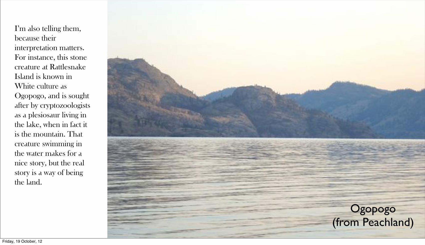
Ogopogo (from Peachland)
I’m also telling them, because their interpretation matters. For instance, this stone creature at Rattlesnake Island is known in White culture as Ogopogo, and is sought after by cryptozoologists as a plesiosaur living in the lake, when in fact it is the mountain. That creature swimming in the water makes for a nice story, but the real story is a way of being the land.
Friday, 19 October, 12

Ogopogo(from Greata)
Here it is, looking north from Greata Ranch. As you can see, there are multiple animals living on this shore, said to have an underground lair on Rattlesnake Island, which you can make out in the middle left of this image. Think of this for a moment: the water is 150 metres above this level. These creatures were underwater. Now they are in the light. The stories here are very, very old. There is a reason why stories are remembered for so long, and why they told, and retold, and remade, and told again. They are telling us something.
Friday, 19 October, 12

One Country Without Borders
The opening of Harold’s presentation to the Okanagan Institute on October 11, 2012
www.okanaganokanogan.com
Friday, 19 October, 12