overview of the environmental management system for...
TRANSCRIPT
Overview of the Environmental Management System for HVac/HVdc Transmission Line Construction
Lower Churchill Power Project October 8, 2015
1

2
Project Overview

4

Muskrat Falls HVac/HVdc Project Components
• Two 315 kilovolt High Voltage alternating current (HVac) transmission lines between Muskrat Falls & Churchill Falls (Labrador Transmission Assets)
• 1,100 km High Voltage direct current (HVdc) transmission line between Muskrat Falls & Soldiers Pond near St. John’s (Labrador-Island Transmission Link)
• Strait of Belle Isle Marine Cable Crossing (3 X 30 km long cables)
5
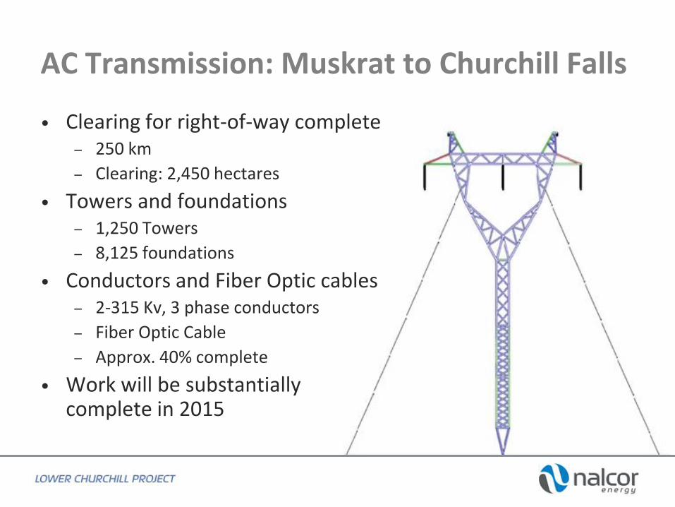
AC Transmission: Muskrat to Churchill Falls
• Clearing for right-of-way complete – 250 km
– Clearing: 2,450 hectares
• Towers and foundations – 1,250 Towers
– 8,125 foundations
• Conductors and Fiber Optic cables – 2-315 Kv, 3 phase conductors
– Fiber Optic Cable
– Approx. 40% complete
• Work will be substantially complete in 2015

7

8
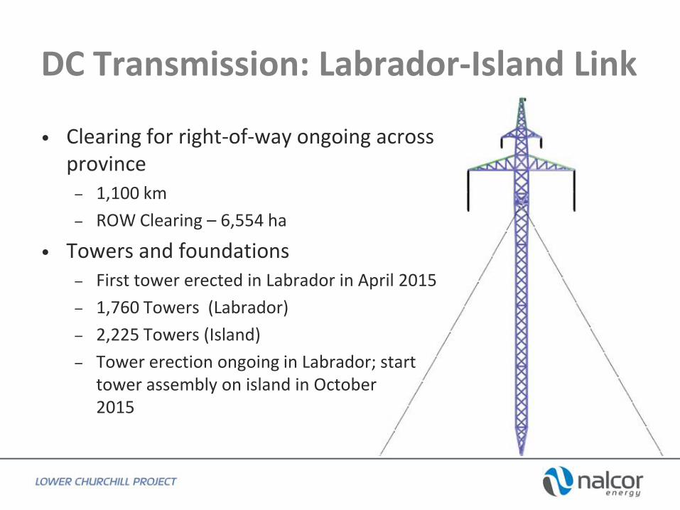
DC Transmission: Labrador-Island Link
• Clearing for right-of-way ongoing across province
– 1,100 km
– ROW Clearing – 6,554 ha
• Towers and foundations – First tower erected in Labrador in April 2015
– 1,760 Towers (Labrador)
– 2,225 Towers (Island)
– Tower erection ongoing in Labrador; start tower assembly on island in October 2015

10

11

Conductor Stringing HVac Line
12

Strait of Belle Isle Marine Cable Crossing
• First land cables installed in Shoal Cove, Sept. 2015
• Marine cable manufacturing underway in Japan; last of three cables expected in September each 30 kms. in length
• Successfully completed horizontal directional drilling (HDD) program; longest landfall application in world
• On track for marine cable installation across the Strait next year
13

14

15
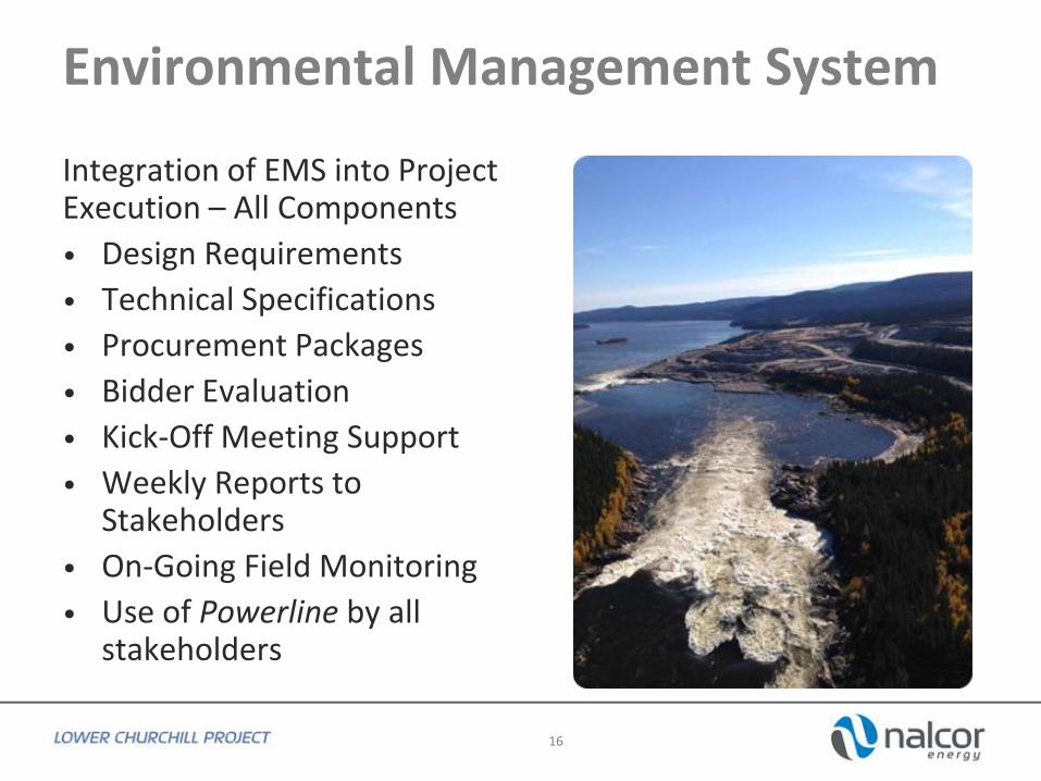
Environmental Management System
Integration of EMS into Project Execution – All Components
• Design Requirements
• Technical Specifications
• Procurement Packages
• Bidder Evaluation
• Kick-Off Meeting Support
• Weekly Reports to Stakeholders
• On-Going Field Monitoring
• Use of Powerline by all stakeholders
16

Collaborative Regulatory Framework
• Blanket Permits – Water crossings (>1900)
– Quarries (>500)
– Historic resources
– Vegetation clearing
• Proactive Reporting – Online reporting
– Powerline updated constantly
– Weekly report to all regulators
• Monitoring Tools – Electronic forms (iPad)
– Real-time field reports and constraint monitoring
17

HVac/HVdc Construction Monitoring
• Dedicated on-site environmental monitors at each work front
• Real-time access to all EMS components via satellite and internet connections
• All monitors use an interactive prontoform database and iPad that provide inspection forms and direct connection to Powerline and the project office
• Dedicated environmental permit coordinators, engineers and planners
18

Real-Time Internet Reporting
• Pre-set Prontoform templates
• GIS / GPS Mapping functions
• Real-time photograph transfers
• Immediate distribution to project office coordinators and engineers
• Field (Camp) access to Powerline database and constraint mapping
19

20
Environmental Effects Monitoring Program
• Purpose is to monitor the overall project effects and to confirm the predictions of EA and fulfill EA commitments
• LCP has implemented more than 15 comprehensive environmental effects monitoring programs
• Key programs include: – RWM caribou
– MM caribou
– Newfoundland marten
– Newfoundland caribou
– Avifauna
– HHRA

LCP Powerline (Internet Based Environmental Management )

LCP Powerline
22
Web-based Project GIS database Real-time data upload Real-time connection to:
Project documents/permits Government databases Contractor work locations Photograph library

LCP Powerline - Layers
23
GROUP SUB-GROUP DISPLAY NAME
Upper Labrador
Lower Labrador
Lower Island
Upper Island
Churchill River 2006
Public Water Supplies
Drainage Outside Protected
Stream Crossing
Salmon Rivers - 30m Buffer
Salmon Rivers - 200m Buffer
Wetlands
Archaeological Site
Archaeological Sites - 50m Buffer
Portage Trails
Nesting Site - Raptors
Nesting Sites - Raptors (Construction - 200m Buffer)
Nesting Sites - Raptors (Helicopter - 300m Buffer)
Nesting Sites - Raptors (Blasting - 500m Buffer)
Nesting Sites - Raptors (Clearing - 800m Buffer)
Bird Surveys (Edited)
Bird Surveys (Buffer Zone)
Listed Plants - Critical Habitat
Regionally Uncommon Plants - obs
Red Pine Stands
Caribou - Winter Habitat (Labrador)
Caribou - Calving Habitat (Labrador)
Caribou - Core Habitat (Island)
Marten - Core Habitat
Marten - Critical Habitat
Beaver Lodge / Dam
Parks and Nature Reserves
PPWSA - Stream Buffer
Winter Head Pond - 25m
Full Supply Level - 39m
Outfitters
AQUATIC
ENV
IRO
NM
ENT
WILDLIFE
OTHER
VEGETATION /
PLANTS
AVIFAUNA
N/A
IMA
GER
YW
ATE
R
SUP
PLI
ES
N/A
HISTORIC
RESOURCES
GROUP SUB-GROUP DISPLAY NAME
N/A Work Camps
N/A Quarries - New Applications
N/A Quarries - Permits
Centerlines
Towers
Tower Boxes
ROW
ROW Chainage (250m)
ROW Chainage (5km)
As-built Access Road (Valard)
Plan of the Day AC (Valard)
Centerline
Towers
Tower Boxes
ROW
Electrode Lines
ROW Chainage (250m) - Labrador
ROW Chainage (5km) - Labardor
ROW Chainage (250m) - Island
ROW Chainage (5km) - Island
Approved Access Trails (Valard)
As-built Access Road (Valard)
Plan of the Day DC (Valard)
LCP Transmission Corridor Access Study (iii, 2011-2012)
Forest Density
Clearing Status
Forest Density
Clearing Status
Construction Blocks
Grants
Easements
License To Occupy
Permission To Occupy
LCP - Private Lands
Municipal Boundaries
Planning Area Boundaries
NL Road Network
INFRASTRUCTURE -
DC Line
TRA
NSM
ISSI
ON
- IN
FRA
STR
UC
TUR
E
INFRASTRUCTURE -
AC Line
LAN
DS
N/A
CLE
AR
ING
DC LINE
AC LINE

LCP Powerline – Basemaps/Imagery
24

LCP Powerline – Bog & Watercourse Constraint Layers
25

Typical Watercourse Crossing and Bog Access
26
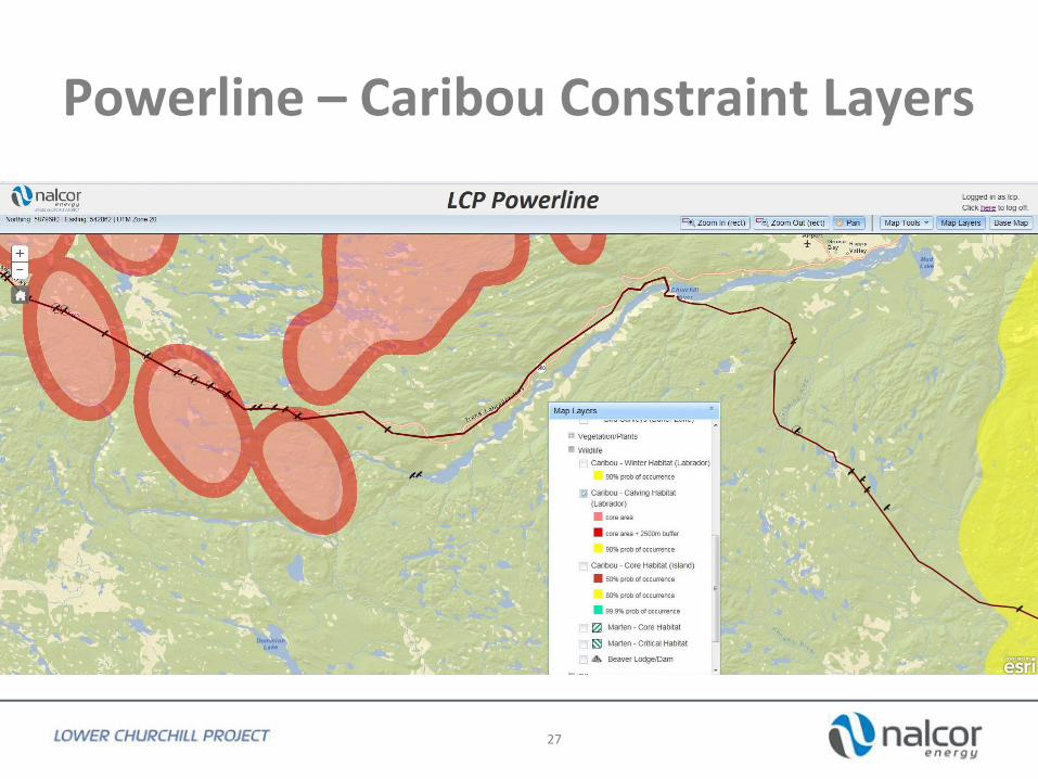
Powerline – Caribou Constraint Layers
27

Powerline – Raptor Buffer Constraint
28
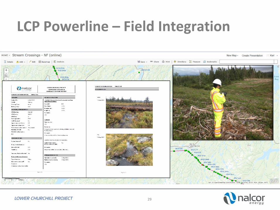
LCP Powerline – Field Integration
29
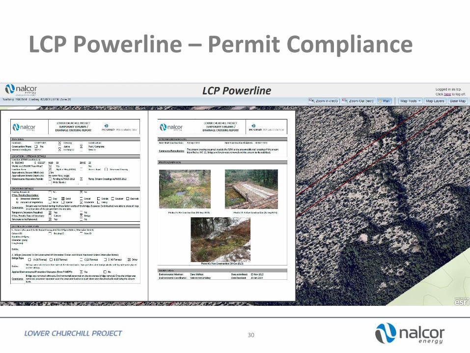
LCP Powerline – Permit Compliance
30

Thank you / Questions?
31