physical features of india
TRANSCRIPT

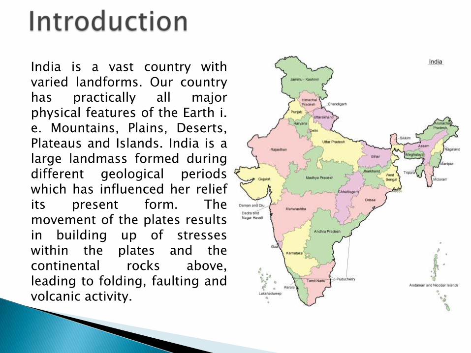
India is a vast country withvaried landforms. Our countryhas practically all majorphysical features of the Earth i.e. Mountains, Plains, Deserts,Plateaus and Islands. India is alarge landmass formed duringdifferent geological periodswhich has influenced her reliefits present form. Themovement of the plates resultsin building up of stresseswithin the plates and thecontinental rocks above,leading to folding, faulting andvolcanic activity.

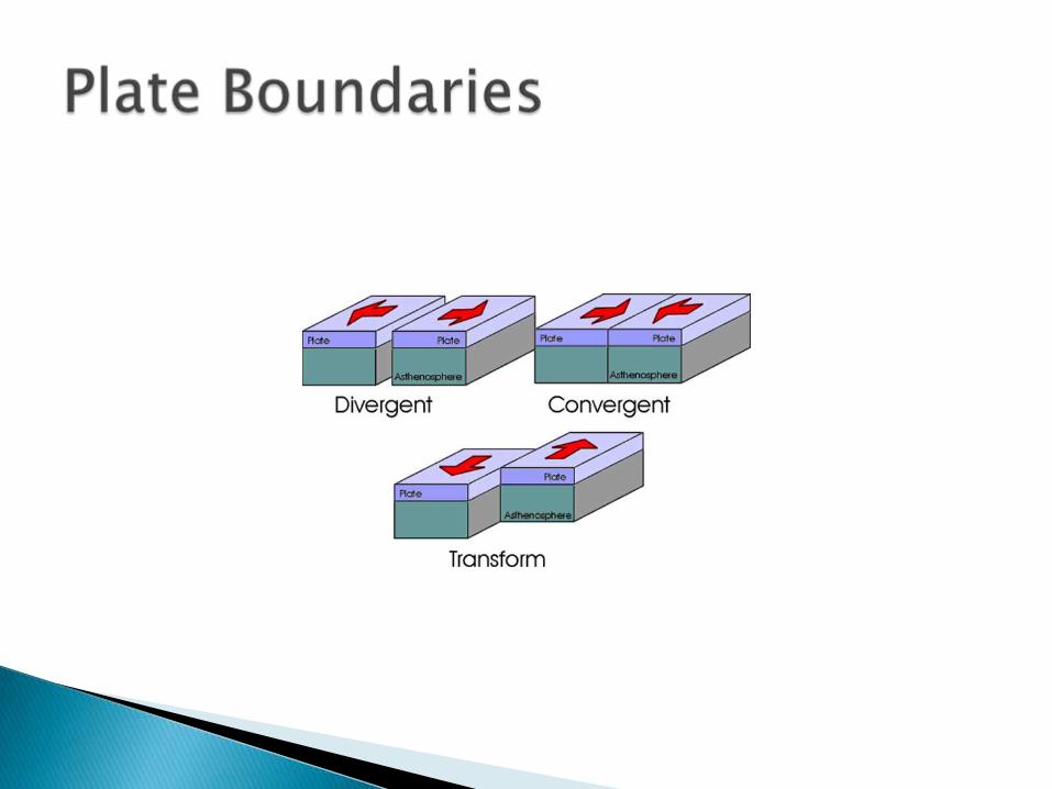
Plate movements are classified into three types.They are; Convergent Boundary While someplates come towards each other and formconvergent boundary. Divergent Boundary someplates move away from each other and formdivergent boundary. Transform Boundary In theevent of two plates coming together they mayeither collide and crumble, or one may slideunder the other. At times, they may also movehorizontally past each other and form transformboundary.

The oldest landmass, (the Peninsula part), was apart of the Gondwana land. The Gondwana landincluded India, Australia, South Africa and SouthAmerica as one single land mass. Theconvectional currents split the crust into anumber of pieces, thus leading to the drifting ofthe Indo-Australian plate after being separatedfrom the Gondwana land, towards north. Thenorthward drift resulted in the collision of theplate with the much larger Eurasian Plate. Due tothis collision, the sedimentary rocks which wereaccumulated in the geosyncline known as theTethys were folded to form the mountain systemof western Asia and Himalaya.
The Himalayan uplift out of the Tethys Sea andsubsidence of the northern flank of the peninsularplateau resulted in the formation of a large basin. Indue course of time this depression, gradually gotfilled with deposition of sediments by the riversflowing from the mountains in the north and thepeninsular plateau in the south. A flat land ofextensive alluvial deposits led to the formation of thenorthern plains of India. The land of India displaysgreat physical variation. Geologically, the PeninsularPlateau constitutes one of the ancient landmasses onthe earth’s surface. The northern plains are formed ofalluvial deposits. The Peninsulas Plateau is composedof igneous and metamorphic rocks with gently risinghills and wide valleys.
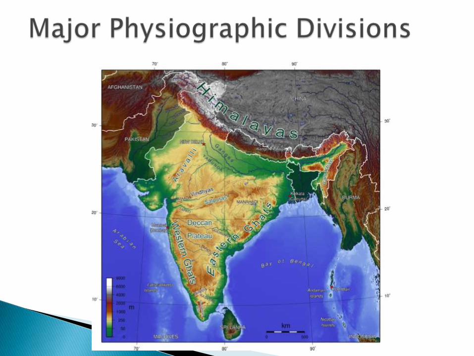
The Physical features of India can be groupedunder the following physiographic divisions
i. The Himalayan Mountains.
ii. The Northern Plains
iii. The Peninsular Plateau
iv. The Indian Desert
v. The Coastal Plains
vi. The Islands
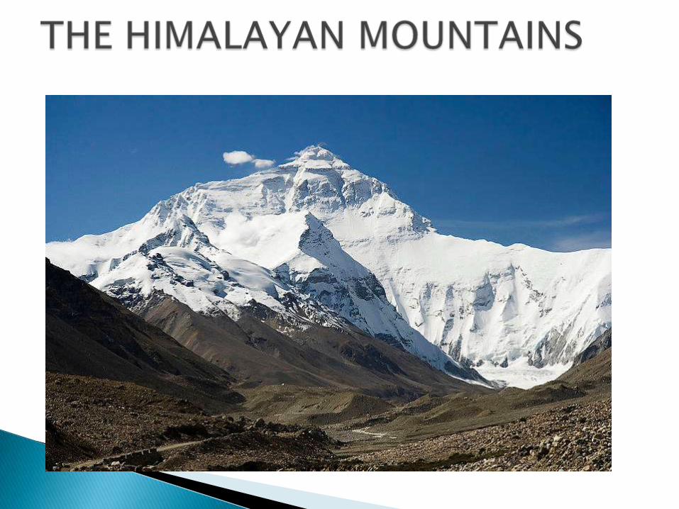
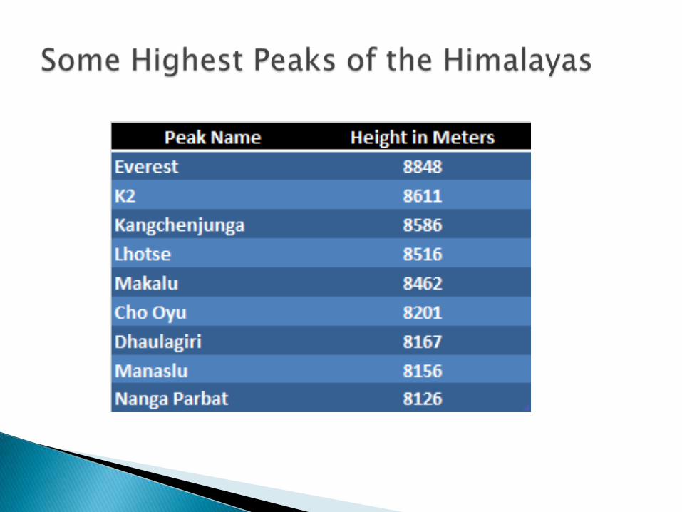
The Himalayan Mountains ranges contain severalhigh peaks. Mount Everest is the highest peak inthe world. The Himalayan Mountains stretch in along curve from Jammu and Kashmir in the westto Arunanchal Pradesh in the east. Their length isabout 2000 kilometres and width between 230and 400 kilometers. The Himalayas act as anatural barrier to the North. These mountainranges run in a west-east direction from theIndus to the Brahmaputra. The Himalaya consistsof three parallel ranges in its longitudinal extent.A number of valleys lie between these ranges.The northern most range is known as the Greateror Inner Himalayas or the ‘Himadri’.
The range lying to the south of the Himadri forms themost rugged mountain system and is known asHimachal or Lesser Himalaya. The ranges are mainlycomposed of highly compressed and altered rocks.The outermost range of the Himalayas is called theShiwaliks. They extend over a width of 10-50 km andhave an altitude varying between 900 and 1100metres. These ranges are composed ofunconsolidated sediments brought down by riversfrom the main Himalayan ranges located farthernorth. The longitudinal valley lying between lesserHimalaya and the Shiwaliks are known as Duns. TheBrahmaputra marks the eastern most boundary of theHimalayas.
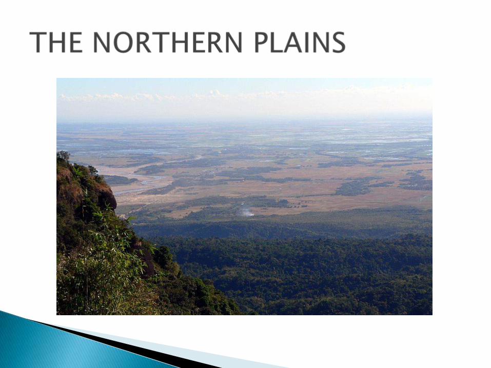

The Northern plain has been formed by theinterplay of the three major river systems,namely- the Indus, the Ganga, the Brahmaputraalong with their tributaries. This plain is formedof alluvial soil. The deposition of alluvium in avast basin lying at the foothills of the Himalayaover millions of years, formed this fertile plain. Itspreads over an area of 7 lakh sq. km. The plainbeing about 2400 km long and 240 to 320 kmbroad, is a densely populated physiographicdivision. The rivers in their lower course split intonumerous channels due to the deposition of silt.These channels are known as distributaries.

The Northern plain is broadly divided intothree. The Western part of the Northern Plainis referred to as the Punjab Plains. Formed bythe Indus and its tributaries, the larger part ofthis plain lies in Pakistan. The Ganga plainextends between Ghaggar and Teesta rivers.It is spread over the states of North India,Haryana, Delhi, U. P., Bihar, partly Jharkhandand West Bengal to its East, particularly inAssam lies the Brahmaputra plain.

The Peninsular Plateau is a tableland composed of theold crystalline, igneous and metamorphic rocks. It wasformed due to the breaking and drifting of theGondwana land and thus, making it a part of the oldestlandmass. The plateau has broad and shallow valleysand rounded hills. This plateau consists of two broaddivisions, namely, the Central Highlands and the DeccanPlateau. The Vindhyan range is bounded by the CentralHighlands on the south and the Aravalis on thenorthwest. The eastward extensions of this plateau arelocally known as the Bundelkhand and Baghelkhand.The Deccan Plateau is a triangular landmass that lies tothe south of the river Narmada.
The Western Ghats and the Eastern Ghats mark thewestern and eastern edges of the Deccan Plateaurespectively. Western Ghats lie parallel to the westerncoast. They are continuous and can be crossedthrough passes only. The Western Ghats are higherthan Eastern Ghats. The Eastern Ghats stretch fromthe Mahanadi Valley to the Nigiris in the south. Theyare discontinuous and irregular and dissected byrivers draining into the Bay of Bengal. One of thedistinct features of the peninsular plateau is the blacksoil area known as Deccan Trap. This is of volcanicorigin hence the rocks are igneous. The Aravali Hillslie on the western and north-western margins of thepeninsular plateau.
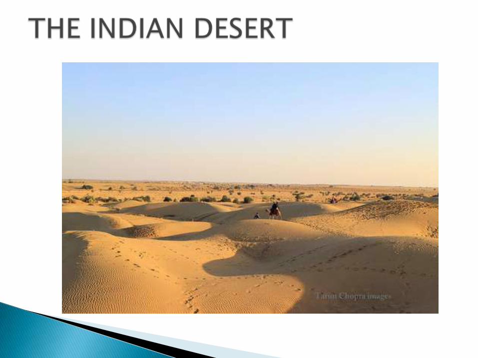
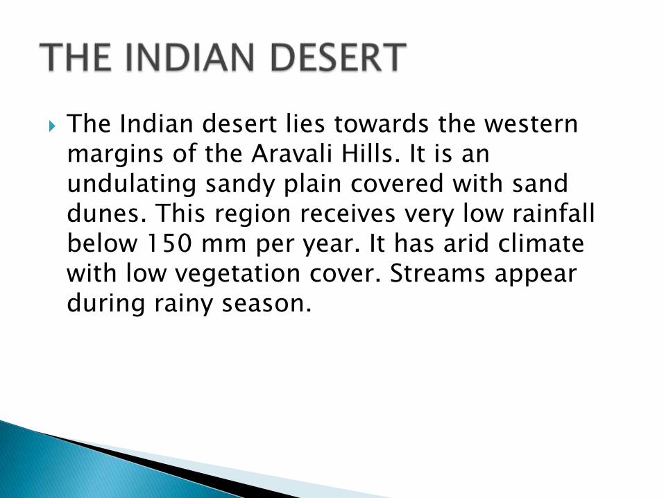
The Indian desert lies towards the western margins of the Aravali Hills. It is an undulating sandy plain covered with sand dunes. This region receives very low rainfall below 150 mm per year. It has arid climate with low vegetation cover. Streams appear during rainy season.
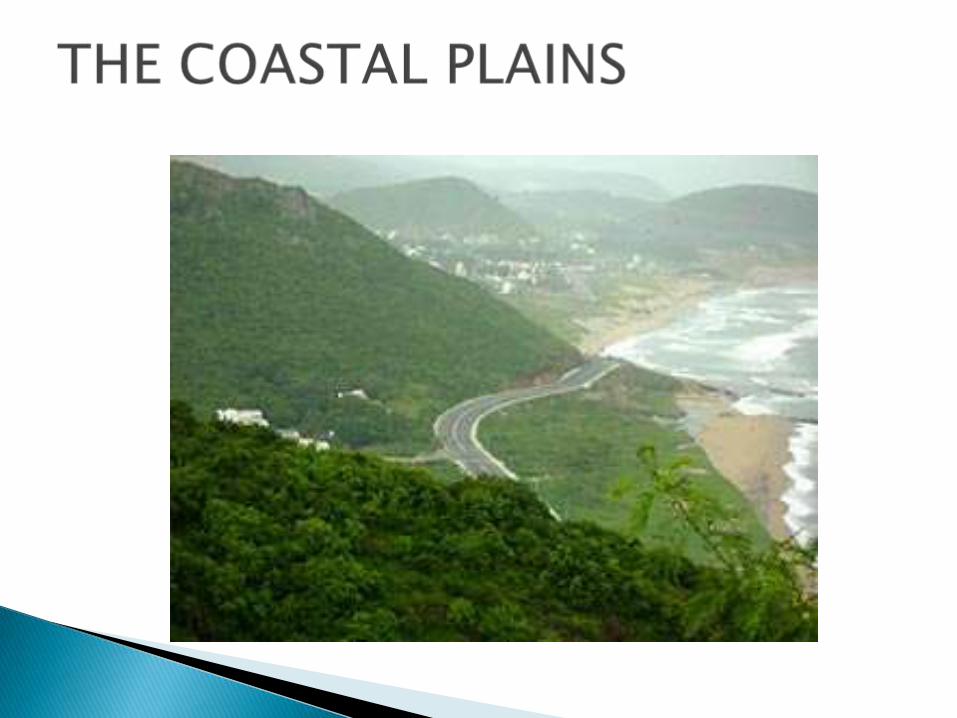
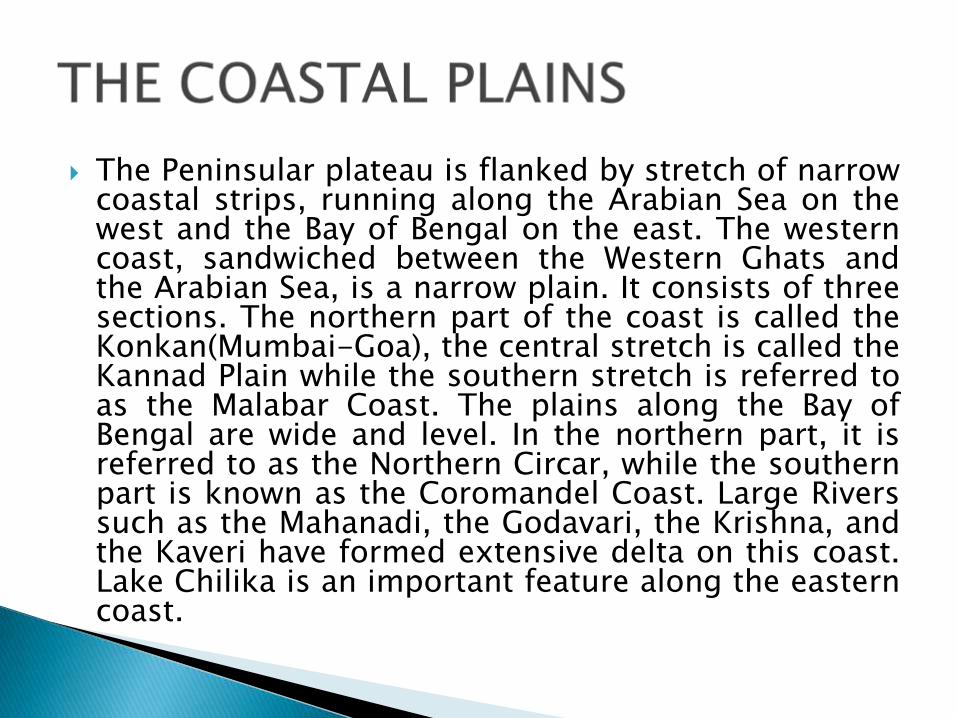
The Peninsular plateau is flanked by stretch of narrowcoastal strips, running along the Arabian Sea on thewest and the Bay of Bengal on the east. The westerncoast, sandwiched between the Western Ghats andthe Arabian Sea, is a narrow plain. It consists of threesections. The northern part of the coast is called theKonkan(Mumbai-Goa), the central stretch is called theKannad Plain while the southern stretch is referred toas the Malabar Coast. The plains along the Bay ofBengal are wide and level. In the northern part, it isreferred to as the Northern Circar, while the southernpart is known as the Coromandel Coast. Large Riverssuch as the Mahanadi, the Godavari, the Krishna, andthe Kaveri have formed extensive delta on this coast.Lake Chilika is an important feature along the easterncoast.
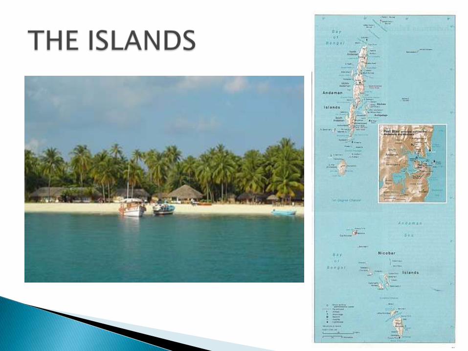
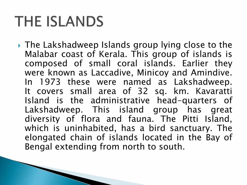
The Lakshadweep Islands group lying close to theMalabar coast of Kerala. This group of islands iscomposed of small coral islands. Earlier theywere known as Laccadive, Minicoy and Amindive.In 1973 these were named as Lakshadweep.It covers small area of 32 sq. km. KavarattiIsland is the administrative head-quarters ofLakshadweep. This island group has greatdiversity of flora and fauna. The Pitti Island,which is uninhabited, has a bird sanctuary. Theelongated chain of islands located in the Bay ofBengal extending from north to south.
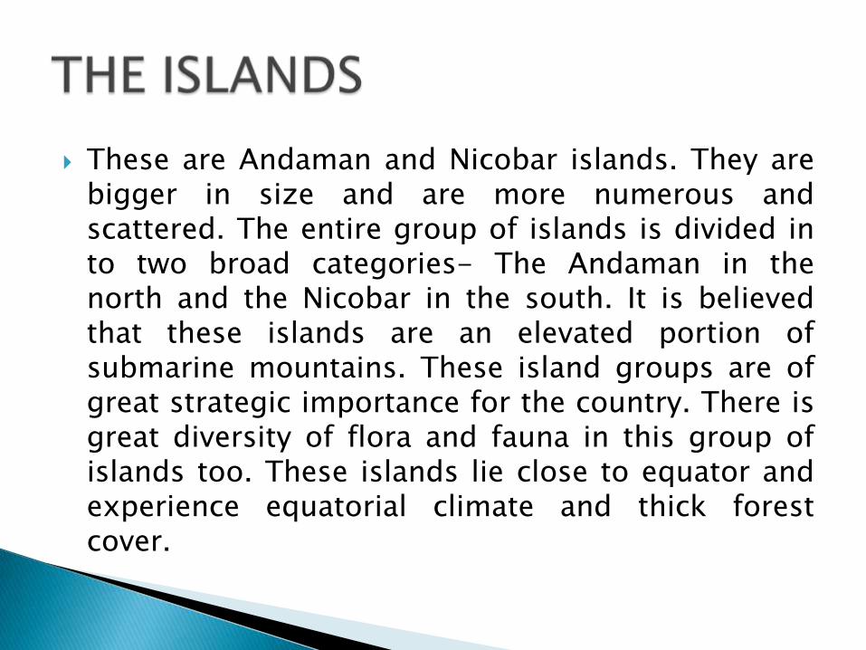
These are Andaman and Nicobar islands. They arebigger in size and are more numerous andscattered. The entire group of islands is divided into two broad categories- The Andaman in thenorth and the Nicobar in the south. It is believedthat these islands are an elevated portion ofsubmarine mountains. These island groups are ofgreat strategic importance for the country. There isgreat diversity of flora and fauna in this group ofislands too. These islands lie close to equator andexperience equatorial climate and thick forestcover.