planning and operating in the 1970s - national park service · land national seashore to the ......
TRANSCRIPT
@5
Planning and
Operating in
the 1970s
In November 1972 National Park Ser-
vice officials turned from celebrating the establishment of Cumberland Is-
land National Seashore to the reality of managing it. The legislative history
of the new unit stressed its importance in all three of the national park sys-
tem’s raisons d’être—recreation, cultural resource protection, and natural
resource preservation. From the beginning, Park Service planners at Cum-
berland faced uncertainty and conflict over how to prioritize them. Budget
limitations and conflicting laws and policies demanded decisions unpopu-
lar among some agency personnel and segments of the public. The presence
of a highly vocal and politically powerful group of island residents further
complicated management.
In addition to the ongoing program of land acquisition, seashore offi-
cials faced a daunting array of tasks. First, they needed to evaluate the nat-
ural and cultural resources, which required research on the ecology, ar-
chaeology, history, and historical architecture of the island. Assessment of
the impact of decades of vacation use by the Carnegie and Candler heirs was
also necessary. Decisions had to be made on what to preserve, what to ig-
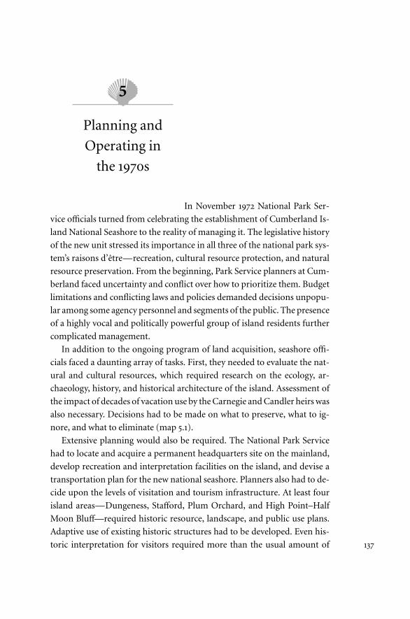
nore, and what to eliminate (map 5.1).
Extensive planning would also be required. The National Park Service
had to locate and acquire a permanent headquarters site on the mainland,
develop recreation and interpretation facilities on the island, and devise a
transportation plan for the new national seashore. Planners also had to de-
cide upon the levels of visitation and tourism infrastructure. At least four
island areas—Dungeness, Stafford, Plum Orchard, and High Point–Half
Moon Bluff—required historic resource, landscape, and public use plans.
Adaptive use of existing historic structures had to be developed. Even his-
toric interpretation for visitors required more than the usual amount of 137
Map 5.1. Cumberland Island in 1972

planning. What historic period should be emphasized: that of the Indians,
the cotton planters, or the rich man’s retreat? In addition, section 9 of the
act that established the seashore required the Park Service to report on the
suitability of any part of the island for wilderness designation.1 Given the
agency’s responsibility for tourism development on a designated recreation
area, as well as its traditional reluctance to pursue such restrictive manage-
ment zoning, this would be a particularly controversial task.
Finally, while Park Service officials grappled with these fundamental,
long-term issues, they had to open the seashore to visitors and manage the
day-to-day operations. These duties required a staff and a regular budget
plus special funds for planning, development, and resource management.
The agency had to locate and open a temporary mainland visitor contact sta-
tion, develop interim transportation to and on the island, provide a few min-
imal facilities on Cumberland for visitor use, and interpret the natural and
cultural features in a very short time. These immediate needs inevitably
led to another question. What privileges and limits did federal law and the
retained-rights contracts impose on the island’s residents, both contract
holders and fee simple owners? Long-term planning was expected to settle
most management issues, but satisfying a public anxious to visit its new recre-
ation reserve and protecting the resources demanded immediate decisions.
During the 1970s the National Park Service tackled all of these issues and
programs with varying degrees of success. Seashore officials met shocking
legal setbacks, extensive disagreement with other government agencies, and
criticism from every quarter of the public. By 1980 the Park Service realized
that it was in the middle of a management quagmire.
What Did the National Park Service Receive?
The National Park Service presence on Cumberland Island and the nearby
mainland was initially minimal. For the first year Superintendent Walter
Bruce of Fort Frederica National Monument conducted the affairs of the
new unit. Other than land acquisition, which was being handled by officials
from Washington, D.C., and Atlanta, Park Service activities consisted of
periodic visits to the island and information-gathering studies. Personnel
from the Southeast Regional Office in Atlanta undertook many of these ini-
tial inspections, while the agency’s Technical Information Center in Denver,
Colorado, or specialists outside the agency conducted the more in-depth
studies. No budget for Cumberland Island existed in fiscal year 1973, so the
Planning and Operating in the 1970s 139
regional office diverted $94,700 for operations from other parks. By April
1973 the Park Service had two employees, two boats, and two jeeps on the is-
land. Because the latter were in a constant state of disrepair, much of the in-
spection work on the island had to be done in vehicles borrowed from the
state of Georgia.2
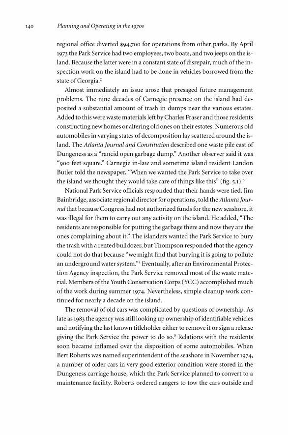
Almost immediately an issue arose that presaged future management
problems. The nine decades of Carnegie presence on the island had de-
posited a substantial amount of trash in dumps near the various estates.
Added to this were waste materials left by Charles Fraser and those residents
constructing new homes or altering old ones on their estates. Numerous old
automobiles in varying states of decomposition lay scattered around the is-
land. The Atlanta Journal and Constitution described one waste pile east of
Dungeness as a “rancid open garbage dump.” Another observer said it was
“900 feet square.” Carnegie in-law and sometime island resident Landon
Butler told the newspaper, “When we wanted the Park Service to take over
the island we thought they would take care of things like this” (fig. 5.1).3
National Park Service officials responded that their hands were tied. Jim
Bainbridge, associate regional director for operations, told the Atlanta Jour-
nal that because Congress had not authorized funds for the new seashore, it
was illegal for them to carry out any activity on the island. He added, “The
residents are responsible for putting the garbage there and now they are the
ones complaining about it.” The islanders wanted the Park Service to bury
the trash with a rented bulldozer, but Thompson responded that the agency
could not do that because “we might find that burying it is going to pollute
an underground water system.”4 Eventually, after an Environmental Protec-
tion Agency inspection, the Park Service removed most of the waste mate-
rial. Members of the Youth Conservation Corps (YCC) accomplished much
of the work during summer 1974. Nevertheless, simple cleanup work con-
tinued for nearly a decade on the island.
The removal of old cars was complicated by questions of ownership. As
late as 1983 the agency was still looking up ownership of identifiable vehicles
and notifying the last known titleholder either to remove it or sign a release
giving the Park Service the power to do so.5 Relations with the residents
soon became inflamed over the disposition of some automobiles. When
Bert Roberts was named superintendent of the seashore in November 1974,
a number of older cars in very good exterior condition were stored in the
Dungeness carriage house, which the Park Service planned to convert to a
maintenance facility. Roberts ordered rangers to tow the cars outside and
140 Planning and Operating in the 1970s

place them in a row along a nearby trail. This relocation added fuel to the
residents’ suspicion that the Park Service had no desire to preserve historic
resources. In the 1980s the cars still formed an attractive curiosity for pass-
ing visitors, but currently they are rapidly becoming an oxidized soil layer.6
Three things were notable about the incidents with the trash and aban-
doned automobiles, and they set the tone for the incessant management
conflict in later years. First, the Park Service faced the fact that it owned an
island heavily changed by centuries of human use. The agency’s desire to
make it resemble an ideal national park would become controversial and
burdensome.
Second, the retained-estate holders expected to be comanagers of the is-
land. They had very well established ideas of how the natural and historical
resources should be handled. These ideas would repeatedly clash with stan-
dard Park Service policy and the personalities of some agency officials.
Planning and Operating in the 1970s 141
Fig. 5.1. The wrecked remnants of automobiles littered the island in 1972 when the Park
Service took over.
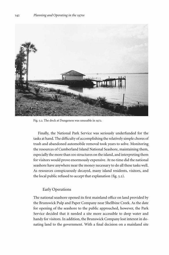
Finally, the National Park Service was seriously underfunded for the
tasks at hand. The difficulty of accomplishing the relatively simple chores of
trash and abandoned automobile removal took years to solve. Monitoring
the resources of Cumberland Island National Seashore, maintaining them,
especially the more than 100 structures on the island, and interpreting them
for visitors would prove enormously expensive. At no time did the national
seashore have anywhere near the money necessary to do all these tasks well.
As resources conspicuously decayed, many island residents, visitors, and
the local public refused to accept that explanation (fig. 5.2).
Early Operations
The national seashore opened its first mainland office on land provided by
the Brunswick Pulp and Paper Company near Shellbine Creek. As the date
for opening of the seashore to the public approached, however, the Park
Service decided that it needed a site more accessible to deep water and
handy for visitors. In addition, the Brunswick Company lost interest in do-
nating land to the government. With a final decision on a mainland site
142 Planning and Operating in the 1970s
Fig. 5.2. The dock at Dungeness was unusable in 1972.
mired in the planning process, the Park Service elected to move to St. Marys
on a temporary basis. Initially it intended to occupy a trailer in front of the
riverfront MacDonnell Building until office space in the Century Theater
Building across the road (now a submarine museum) became available. How-
ever, in May 1975 seashore officials moved into the MacDonnell Building on
a month-by-month rental basis.7
Public pressure on the National Park Service to open the seashore for vis-
itation began in November 1974. Although park rangers had received peri-
odic questions about public access, the national seashore’s second birthday
ignited criticism that the Park Service had “locked up” the island. In re-
sponse, the agency began planning to open to visitors during the summer of
1975. Public hearings and meetings with Camden County officials and busi-
nesses followed. Director Gary Everhardt and other senior Park Service offi-
cials visited to demonstrate the agency’s commitment. The national seashore
chartered a boat to conduct two round-trips per day from St. Marys to the
dock at Sea Camp. The seashore opened on June 5 with plans to run through
the end of August. Because the boat was small, reservations were required.8
On the island the Park Service, believing that a walk from Sea Camp to
Dungeness and back again was too strenuous for some visitors, decided to
provide transportation. Initially it used three trams to convey visitors (fig.
5.3). Later the General Services Administration provided a forty-passenger
bus. The bus turned out to be one of those ideas that look good on paper
but do not work well on the ground. On its maiden trip down the Main
Road, it struck a low-hanging oak branch and ripped off part of the roof.
This left only the trams, which repeatedly bogged down in the sand. Sub-
sequently the Park Service abandoned the transportation system when
seashore maintenance crews repaired the dock at Dungeness and the pas-
senger boat was able to moor at both docks on the island (fig. 5.4).9
During the first three months, the island received 3,482 visitors, prompt-
ing the Park Service to continue boat runs through the off-season on fewer
days of the week. The following full year saw 17,480 visitors. More than
3,400 stayed overnight on the island, primarily at Charles Fraser’s old camp-
ground near Sea Camp. By 1978 visitation topped 37,000 and included
nearly 13,000 overnight campers and backpackers. Most visitors to Cum-
berland walked to and through the Dungeness complex, paying special at-
tention to the ruined mansion. They then returned by foot or tram to Sea
Camp, often by way of the nearby beach. Nearly all island visitors reported
that they greatly enjoyed their time on the island.10
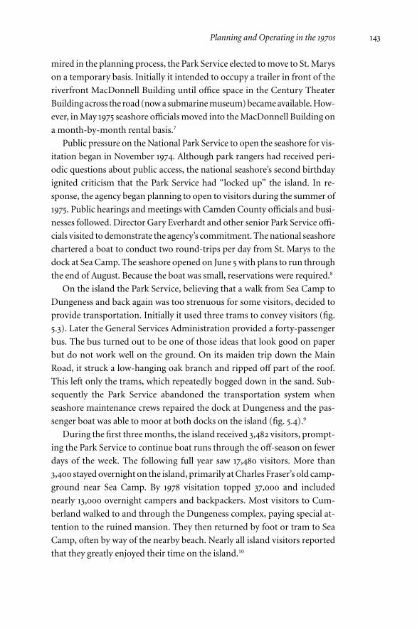
Planning and Operating in the 1970s 143

Fig. 5.3. In the 1970s the Park Service moved visitors between Dungeness and Sea Camp
by tram. Once both areas had ferry service this expensive practice was discontinued.
Fig. 5.4. Visitor access is still by two or three passenger ferries each day.

One reason for their enjoyment was the elaborate interpretive program
developed by the seashore’s rangers. They offered such activities as seining
in the ocean to study sea life, sunrise beach walks, evening history talks,
“marsh tromps,” and education about waves, currents, and the basics of
surfing with the use of “boogie boards.” Rangers also provided orientation
talks on both the mainland and the island. Interpretive signs and a park
brochure were available by 1977. The Park Service planned even more pro-
grams for the seashore’s permanent mainland base once that was in place.
In 1979 the Park Service added tours of the Plum Orchard mansion, which
proved immensely popular. Unfortunately, the constraints of transporta-
tion limited the number of visitors who could enjoy this additional fea-
ture.11
Opening the seashore to visitors blunted much of Camden County’s
criticism of the National Park Service. However, the intense demand to en-
joy the island soon raised the issue of access by private boat. Docking facil-
ities on the island were limited, and many were private. Before 1979 Sea
Camp and Plum Orchard were two potential landing sites for the public.
However, public ferries monopolized the former while the latter was very
small. During the first two months that the seashore was open, National
Park Service officials turned down several hundred requests to land private
boats on the island from “public bodies, corporations, organizations,
groups, and individuals.”12
The private landing issue drew Park Service attention to a potential
public relations nightmare. During the seashore’s first two years, the
Brunswick Pulp and Paper Company had periodically brought guests to the
island for tours. Seashore rangers facilitated these visits by providing logis-
tical support and guide services. The policy of allowing these tours devel-
oped under Sam Weems during the time when the Park Service expected to
have its headquarters and a parkway on Brunswick land. On occasion the
company used a boat provided by the Georgia Game and Fish Department
to bring vehicles in order to drive around the island. The Park Service an-
ticipated legal problems when public visitation began and planned to issue
a special-use permit to the Brunswick group. However, once the requests
for landing private boats began pouring in, agency officials quickly changed
their minds. Regional Director Thompson informed Brunswick officials
that public scrutiny would certainly call this arrangement favoritism, and
therefore it must stop. He cited the pressure coming not only from Camden
County but also from tour companies in Fernandina. Thompson suggested
Planning and Operating in the 1970s 145
that the paper company work out an arrangement with the Greyfield Inn.
However, as the Brunswick Company’s interest in hosting the seashore
headquarters waned, so did its desire for a special-use permit.13
Questions about Retained Rights
Island residents began to test the limits of their retained rights as soon as
Cumberland Island National Seashore became a reality. Questions of new
construction, extension of residents’ rights to renters and guests, employ-
ment of off-duty national seashore personnel, auto use, airport landing
rights, and docking privileges all surfaced during the first seven years. Some
were resolved, but most were not. National Park Service officials soon
found that the broad agreements negotiated by the National Park Foun-
dation, as well as by the agency itself, left a lot of room for differences of
opinion.
For example, most retained-right agreements allowed docking on estate
lands or Park Service facilities. One of the first conflicts to arise concerned
the dock at Dungeness. Although the Park Service did not use it for passen-
ger embarkation until 1979, it did unload construction materials there. The
agency turned down several requests to use the dock by those without spe-
cific rights in their retained-right agreements.
Another dock in dispute was at Old House Creek. A man named Ben
Jenkins secured a long-term lease from Gertrude Schwartz, trustee of An-
drew Carnegie III. His attempt to build a new dock 400 feet from the Park
Service’s structure resulted in a brief, furious conflict. It was settled when
seashore officials allowed him to adapt their dock for his use. At Hawkins
Creek on the north end of the island, the Candlers used Brickhill Dock,
which actually was on property formerly owned by the Carnegies and
Charles Fraser. Decades of tacit permission to use it had engendered a pro-
prietary feeling among the Candlers. When others began using the dock,
they complained and succeeded in gaining a special-use permit that ex-
cluded other residents. Questions of who had rights to do what and where
they could do it also extended to parking privileges, beach-crossing areas,
airfields, and private roads.14
Other retained-rights issues also arose. The Park Service repeatedly
turned down one resident’s request to hunt and trap all over the island at
any time ignoring state game laws. Conflict arose over some construction
projects on retained estates and the waste they caused. Residents com-
146 Planning and Operating in the 1970s

plained about trespass by both visitors and Lucy Ferguson’s cattle. The
rights to rent or sublease property had to be clarified repeatedly. Law en-
forcement jurisdiction on both federal and retained-estate lands remained
in limbo until 1982 when Georgia established concurrent authority with
the Park Service. Establishing rights of use and residency was a process of
the government and the residents feeling out each other. Debate persisted
about the letter of the law, the exact wording of the retained-rights agree-
ments, and the spirits of both.15
Driving on the island was the most serious retained-rights issue to sur-
face during these early years. Although seashore officials did not challenge
anyone’s right to drive at this time, they attempted to close the South Cut
Road that Charles Fraser had bulldozed in 1970. The road lay well within the
area the Park Service expected to be designated wilderness. It was not a his-
toric road, and the Park Service did not anticipate a negative reaction to its
announcement. However, the Perkins family and Thornton Morris held re-
tained estates adjacent to the western end of the road and used it to access
the beach. They even had renamed it “Perkins’ Beach Road.” Their reaction
and the effort they made to retain use of the road demonstrated the resi-
dents’ fierce determination to protect their right to drive all over the is-
land.16
In September 1978 Thornton Morris anticipated the problem and began
laying the groundwork for retention of his rights and those of the Perkins
family. He explained that National Park Foundation representative George
Sandberg had assured him “that the Perkins retainees would be able to use
the Perkins’ Beach Road to get to and from the beach, and that this use right
would continue until such time as the National Park Service provided an
adequate alternate means of transportation from the reserved area to the
beach.” He also reminded Park Service regional director Joseph Brown that
Coleman Perkins had not wanted to sell his land to the government. He had
done so because without his sale the Andrew Mellon Foundation would
have refused to provide money for Cumberland land acquisition.17
The National Park Service rejected Morris’s argument after securing an
opinion from the regional solicitor. Agency director William Whalen told
local congressman Bo Ginn, who inquired after receiving complaints from
Morris, that in the hearings for wilderness planning, the public had ex-
pressed an intense desire to establish the maximum amount of wilderness
and to limit areas of “potential wilderness.” The latter would include areas
of nonconforming uses like roads. As a result, park planners decided to
Planning and Operating in the 1970s 147
limit access from the Main Road to the beach to a single route, the Duck
House Road. That area had to remain open anyway because of a specific re-
tained-right agreement. Whalen stated that the Perkins family and Morris
were being given “the same right of access to the beach as others.”18
By April 1980 environmental organizations became involved in the con-
troversy. The Park Service and Congressman Ginn received letters from the
Sierra Club, the Wilderness Society, and the Georgia Conservancy urging
closure of the road in order to protect wilderness values. Congressman
Ginn defended Morris and the Perkins family explaining that while they did
not have a specific legal commitment to use South Cut Road, they did have
“sound documentation to support a route of ‘convenient access’ to the
beach.” This communication to the Wilderness Society followed a summit
meeting on the issue at Ginn’s office on April 30. Representatives of nine
congressmen and Senators Nunn and Talmadge, as well as Park Service rep-
resentatives, Thornton Morris, and the Georgia Conservancy, attended.
The conservation group saw the writing on the wall as the lawmakers sym-
pathized with Morris.
An agreement was reached whereby the Park Service would seek a “po-
tential wilderness” designation for the road, and Morris and the Perkins
group would be issued twenty-year special-use permits. The level of con-
gressional pressure that could be brought to bear by the island residents
swept away Park Service resistance. It would not be the last time that the
Carnegie and Candler heirs used their powerful contacts to influence
seashore policy. On September 22, 1980, Joe Brown sent the special-use
permits to Thornton Morris. He stated that nothing in these permits auto-
matically assured their renewal. However, he added that “based on the in-
formation now available,” he anticipated that the permit would be re-
newed.19
Into the Fray: Long-Term Planning at Cumberland
The National Park Service developed a steady management operation and
a popular program for visitors on Cumberland Island during the years 1972
to 1980. However, the agency never intended for many of those practices to
become permanent. The Park Service began trying to determine the level of
recreation development and resource management even before legislators
established the seashore. In addition, Congress awaited a report on the
wilderness suitability of the island. Two interconnected planning processes,
148 Planning and Operating in the 1970s
one for a “general management plan” and another for a “wilderness recom-
mendation,” became the most consistently controversial actions for the
agency in its early years on Cumberland.
During the congressional hearings to establish Cumberland Island Na-
tional Seashore, the National Park Service promised extensive recreation
development for visitors over much of the island. Officials explained that
the designation “national seashore” meant a high capacity for recreation
and promised up to 10,000 visitors per day for Cumberland. Indeed, the
Park Service could not have secured enough local and state backing to pur-
sue establishment of the new seashore park without such a goal. After
Cumberland Island National Seashore became a reality, agency planners
concluded that they were bound by congressional intent to move ahead
with the extensive development.20
What they experienced, however, was a backlash against large-scale de-
velopment that was sweeping through the park system across the country.
The rise of the environmental movement in the late 1960s and early 1970s
changed the rules by which park officials could manage their units. The
staffs of nearly all of the fourteen national seashores and lakeshores endured
a similar cycle of promising extensive tourist development for avowedly
recreation-oriented units only to have it thrown back in their faces during
the planning process.21 These public reactions were facilitated by passage of
the National Environmental Policy Act of 1969 (NEPA). This critical envi-
ronmental law orders federal agencies to absolutely minimize the effects of
their actions on the natural environment. In addition, NEPA requires the
federal government to conduct research on the potential effects of any ac-
tion and make the results public. Thereafter, citizens and organizations can
comment on the plans, and their ideas must be noted in the final decision.
At Cumberland Island environmentalists, residents, historic preservation-
ists, and others continually used the NEPA process to reject or modify Park
Service plans.22
The contentious struggle for an overall “general management plan” and
a “wilderness recommendation” focused on five primary issues. The first
concerned the location of a headquarters, visitor center, and ferry em-
barkation point on the mainland. A second issue was the amount of
tourism infrastructure to be developed on the island. Third, the maximum
number of visitors allowed onto Cumberland also had to be determined. A
fourth question concerned what form of transportation should be fur-
nished to visitors on the island, if any. Finally, the amount of acreage of the
Planning and Operating in the 1970s 149

young national seashore, if any, that should be placed under the protective
but highly restrictive designation of wilderness had to be decided. Each of
these issues spawned controversy.
Devising a General Management Plan
In 1971 the Park Service released a master plan that outlined its ideas for
recreation on Cumberland (map 5.2). The mainland base would be near
Cabin Bluff and connected by a new road to Harrietts Bluff Road or directly
to Interstate 95. Roughly 300 acres in size, it would accommodate 1,500 cars,
employee housing, and maintenance facilities. The plan envisioned private
hotels nearby where more parking would be available. A fleet of twelve 100-
passenger ferries would connect to the island at Brickhill Bluff (Brickkiln),
Plum Orchard, and Dungeness. Each of these sites would have interpretive
facilities, a jitney terminal for island transportation, and concession facili-
ties to rent bicycles and camping equipment. The jitney service would run
the length of the island, connecting the three docks as well as three beach ar-
eas, six campgrounds capable of accommodating a total of 400 overnight
visitors, and high-interest areas like Half Moon Bluff, High Point, Terrapin
Point (near the old Cumberland Wharf), and Stafford. The concessions
would sell picnic supplies also.23
For the visitors the Park Service planned stables for eighty horses and
many miles of new trails across the island to be divided into horse, bike, and
hiker categories. Interpretive facilities would be located at all recreation
and concession sites and adjacent to historic or archaeological resources.
The British forts and the Spanish mission would also receive interpretation
should they ever be found. Three areas of intense beach use would accom-
modate 7,000 sunbathers and swimmers at one time. Each would have
bathhouses, shelters, comfort stations, and concessions to sell beach equip-
ment and “light refreshments.”
Seashore officials planned to turn the Plum Orchard and Stafford man-
sions into environmental conference and study centers operated by a con-
cessioner. They also suggested that the Recreation House at Dungeness
could be used as an interpretive center “if restoration proves feasible.” The
planners offered no specific upper limit of visitors, but the level of develop-
ment and the capacity of the intensive-use beach zones suggested that
10,000 visitors per day could be easily accommodated.24
A year later, as Congress considered the Cumberland bill, the Park Ser-
150 Planning and Operating in the 1970s

Map 5.2. The Park Service’s 1971 master plan for the proposed Cumberland Island
National Seashore. (National Park Service, Oct. 1971, Master Plan, Proposed Cumberland
Island National Seashore, CINS Library)

vice released a draft environmental statement on the proposed plan.25 The
environmental statement supported the development concepts of the mas-
ter plan. Seashore planners projected that the majority of the negative envi-
ronmental effects would occur at the mainland headquarters site. They
called island impacts such as dredging near docks, changes to the undis-
turbed character of parts of the beach, and control of noxious insects in-
significant. The master plan and the environmental statement helped con-
vince Camden County and the state of Georgia to back the national seashore
legislation.
Any reservations about the propriety of these development levels seemed
to be answered by a series of in-depth studies conducted by the highly re-
spected Conservation Foundation, an environmental study and promotion
group based in Washington, D.C. In 1972 the foundation published a docu-
ment entitled National Parks for the Future.26 The organization’s researchers
made numerous recommendations for future national park management.
Among them were suggestions that the Park Service should involve citizens
in the planning process, a procedure already mandated by NEPA, base
its planning on natural resource impacts, also ordered by NEPA, conduct
carrying-capacity studies to determine the appropriate number of visitors,
and manage resources according to established guidelines.
In the case of the latter recommendation, a 1970 law, often called the
General Authorities Act, already provided the foundation.27 The statute dis-
continued the Park Service’s practices of categorizing units as predomi-
nantly historical, natural, or recreational and managing resources in ac-
cordingly hierarchical levels of importance. The law ordered that the agency
manage the entire park system as one complex unit and afford all resources
equal protection.28
The Conservation Foundation study had many specific recommenda-
tions, some of them fairly theoretical. Subsequently the organization ac-
quired a grant to study these proposals on the ground and selected Cum-
berland Island as its test case because it was a new unit. Foundation staff
members and Hans Neuhauser, a leader of the Georgia Conservancy, took
charge of the project to study and plan for Cumberland’s management pro-
gram. Four teams studied natural resource management, the mainland
embarkation options, priorities for interpretation, and the visitor carrying
capacity of the island.29
Albert Ike and James Richardson of the University of Georgia Institute
of Community and Area Development conducted the carrying-capacity
152 Planning and Operating in the 1970s

study. In a 1974 draft they gave figures based on recreation and ecology lit-
erature for each of the development areas of the Park Service’s master plan.
They estimated the total capacity of the island at nearly 16,000 visitors per
day.30 Eighteen months later Ike and Richardson released a revised report
that dropped the maximum carrying capacity to just under 14,400 visi-
tors.31 The Park Service argued that these figures, coming from a reputable
conservation organization, supported its master plan.
However, the foundation’s authors offered a number of conceptual and
concrete recommendations that urged caution in developing infrastructure
and setting visitor limits. First, they emphasized the need to determine the
psychological carrying capacity of each area. The figures given in their re-
port were based purely on ecological tolerance. Further studies would be
needed to determine whether visitor enjoyment would be compromised at
these visitation levels. Second, they suggested that the Park Service should
start with small areas devoted to activities like swimming, horseback riding,
and camping in order to measure their actual carrying capacities. There-
after, it might expand the development areas or activities to the plan’s pro-
posed levels as test results warranted. Ike and Richardson also recom-
mended that the Park Service make visitor education the top priority. They
prioritized the acceptability of various outdoor activities, rating nature
walks, beachcombing, and hiking highest and swimming and cycling some-
what lower. At the bottom of the list were fishing, hunting, horseback rid-
ing, and marine boating. This ranking took into account both the psycho-
logical and environmental impacts as well as the availability of those
activities on the mainland.32
Finally, the report made specific development recommendations. The
authors proposed two rather than three intensive-use beach areas. They
suggested dropping the High Point area because of its importance as a turtle-
nesting site. Ike and Richardson also recommended substantial research on
soil and biotic tolerance before any development took place. They proposed
no more than twenty sixty-passenger jitneys and forty horses for guided
tours. They endorsed camping for up to 1,300 persons in fifteen areas but
insisted that these visitors should bring their own equipment with them
rather than rent it from a concession on the island. Of greatest importance,
they recommended that the Park Service plan for 10,000 visitors per day
rather than 14,400 to allow flexibility. The general tone of the report urged
slow and cautious incremental development in order to test both carrying
capacities and visitor demand.33
Planning and Operating in the 1970s 153
With the apparent sanction of this respected conservation organization,
the National Park Service forged ahead with plans similar to those sug-
gested in the 1971 master plan. However, the levels of visitation and devel-
opment envisioned by the agency drew immediate criticism. Five months
before the final seashore legislation passed, one advocate wrote: “The NPS
still has a lot of people on its staff who are imbued with the idea that ‘parks
are for people’ and to hell with the basic beauties and wonders that attract
people in the first place. Some of them seem to forget that if the resource is
degraded, the experience of the visit is degraded.”34
A noisy portion of the criticism leveled at the Park Service came from
Lucy Ferguson and her guests at the Greyfield Inn. Consumed by fears that
the government would condemn her land, she railed against the Park Ser-
vice and virtually any action it took. After Congress established the sea-
shore, she even hired former attorney general William Ruckelshaus to man-
age a political campaign to redesignate the island as a national wildlife
refuge or as a national park with a strict emphasis on natural resource
protection.
Son-in-law Putnam McDowell repeatedly sought to tone down her vir-
ulent antagonism and save her from what he saw as a pointless and expen-
sive campaign. In May 1974 he wrote to her: “The biggest thing you are up
against is that the legislation passed by the Congress, under which about
80% of the Island was acquired, calls for a National Seashore Recreational
Area and nothing else. This classification has a certain meaning under the
law and it is hard to see how the Park Service can move very far away from
the recreational precedent set in the case of Hatteras and Cape Cod.”35 Later,
McDowell confessed to Thornton Morris: “If I recommend to her that she
stop now—which is what I think she probably should do—I think she is
going to have some fun with the idea that she’s a real fighter, but I’m a quit-
ter, and wouldn’t support her. I usually face things like this head on; but I’m
inclined in this case to let Mr. Ruckelshaus and Mrs. Ferguson drift hand-
in-hand into the sunset until money separates them.”36
McDowell sensed that many factors would contribute to a Park Service
decision to back away from its most extreme plans. He believed that Ruck-
elshaus’s influence was very limited and that other members of the Carnegie
heirs were unwilling to contribute funds for this battle. Eventually, Lucy
Ferguson shifted her campaign to encouraging the establishment of a des-
ignated wilderness over as much of the island as possible. In this she found
broader support from other island residents. In her campaign against the
154 Planning and Operating in the 1970s

Park Service, Ferguson lost no opportunity to enlist her guests’ support.
The Park Service and the secretary of the interior received a number of com-
plaints about agency plans to remove feral hogs, transport visitors to the
north end of the island, develop beach recreation, and receive 10,000 visi-
tors per day. In some cases considerable disinformation came from Grey-
field, which the Park Service had difficulty correcting.37
Lucy Ferguson’s antagonism was but a small part of the public unhappi-
ness with National Park Service plans for Cumberland Island. Under the
glare of public attention, the park planners began to reduce the level of
planned visitor development for the island. While they did not abandon the
idea of 10,000 visitors as a maximum, they stressed that this was not a goal
for every day but a limit for a few days of the year. Furthermore, they sug-
gested that this figure represented the visitation to the entire seashore unit.
Perhaps half of those visitors would only stop at the mainland center and not
take the time-consuming trip to the island. Finally, they assured congress-
men and the public that any visitor development would take place slowly
with constant monitoring to detect any adverse environmental effects.38
Environmental organizations responded angrily to the Park Service’s
apparent intransigence and brought unexpected pressure to bear. Lucy
Smethhurst of the Georgia Conservancy persuaded her cousin, Deputy
Assistant Secretary of the Interior E. U. Curtis Bohlen, to visit the island,
listen to Conservancy representative Hans Neuhauser, and then order the
Park Service to carry out additional visitor carrying capacity and ecological
studies before developing the island.39
In February 1975 the Park Service held a hearing in Woodbine, the seat of
Camden County, to receive input from the public on its proposals. Approx-
imately 200 people attended, primarily members of various environmental
organizations. The Park Service presented an array of options for each ele-
ment of a general management plan. For example, ten different locations
for a mainland visitor center were offered, including four on Brunswick Pa-
per Company land, two at the Kings Bay Army Terminal, one at Crooked
River State Park, one at St. Marys, one at Point Peter just east of that town,
and one at Fernandina Beach, Florida (map 5.3). Seashore planners also
presented a wide variety of options on the island for camping, beach use,
embarkation points, historic interpretation programs, and visitor limits. In
addition, the Park Service offered several different proposals for wilderness
areas totaling from none to 29,300 acres.
The Atlanta Journal reported that the most hotly debated issue was the
Planning and Operating in the 1970s 155

Map 5.3. Mainland embarkation points considered by the National Park System
number of visitors to be allowed on the island each day. Superintendent
Bert Roberts suggested that a realistic figure might be 5,000 to 6,000 per
day, but most speakers demanded still lower limits. The only exception was
a representative of Charles Fraser’s Sea Pines Company who insisted that its
contract with the National Park Foundation required the Park Service to
develop extensive recreation facilities and high visitation levels. Possibly
Fraser still envisioned a role as island concessioner.40
A second contentious issue was the amount of land to be nominated for
wilderness status. Congress initially passed the Wilderness Act of 1964 in re-
sponse to the U.S. Forest Service’s single-minded pursuit of logging and
other consumptive uses at the expense of recreation and environmental
preservation. However, the law ordered all federal land agencies to review
every roadless area of 5,000 acres or more for suitability as a “wilderness
area.” Within such a preserve automobiles and other mechanical devices,
buildings, and nearly all other modifications of the natural environment are
prohibited. Later judicial interpretations and congressional additions have
strengthened wilderness status to exclude bicycles and even baby carriages.
At least initially, the National Park Service opposed the legislation on the
grounds that it would constrain its dual mandate to protect park resources
but also to provide for their use by the public.
Designation of each new wilderness area requires an act of Congress. At
both this hearing and a follow-up one in East Point, Georgia, the partici-
pants predictably sought the maximum amount of wilderness designation.
Mildred Frazier of the Georgia Coastal Audubon Society proposed that the
entire island be classified as wilderness.41
After the hearings Park Service planners returned to the job of designing
draft versions of the general management plan and wilderness recommen-
dation. The vast difference between the original plans and what the public
at the hearings demanded demonstrated the gap between the Park Service’s
concept of its mandate and the opinions of environmentalists and island
residents. Somehow, the Park Service had to forget promises made during
the legislative battle and its own experience in developing mass seashore
recreation. In early September 1975 Assistant Secretary Bohlen informed
Congress that the Park Service would not have a wilderness recommenda-
tion ready by the October 23 deadline.42
As the Park Service planners toiled, another element of the original mas-
ter plan changed. Brunswick Pulp and Paper’s decision to rescind its land
donation to the seashore eliminated four of the potential visitor center sites.
Planning and Operating in the 1970s 157
At the same time, a resurgence in activity by the U.S. Army at Kings Bay re-
moved two more possibilities.43 Finally, the feasibility of embarking from
Fernandina Beach, Florida, evaporated. Bert Roberts gave the resort town
hope that it could become a secondary embarkation point during a visit in
February 1975. However, the Conservation Foundation team studying the
issue of mainland access included an official from Camden County. He con-
vinced the rest of the team to recommend that all island access originate
within the county in order to compensate it for lost tax revenue on Cum-
berland.
Over the ensuing decades Fernandina Beach promoters periodically
mounted campaigns to secure a second embarkation point with applica-
tions to the Park Service and letters to their congressional delegation. Typ-
ically, this occurred when a new superintendent arrived at the seashore. In
some ways Fernandina Beach does offer better facilities, but the Park Ser-
vice has continued to honor its commitment to Camden County.44
A New Plan Fails
In October 1976 the Park Service released an “environmental review for the
general management plan and wilderness recommendation.” In every area
the new plan sharply contrasted with the 1971 master plan. The only options
left for the mainland base were St. Marys and Point Peter. Seashore planners
recommended that the headquarters stay in St. Marys, but the visitor cen-
ter and primary ferry terminal be at Point Peter. A single owner held the his-
toric peninsula, and the agency saw no reason to doubt that it could obtain
the land.
Park Service planners had drastically reduced the level of development
on the island. The plan called for two day-use beaches at Sea Camp and at
Nightingale Avenue northeast of Dungeness. Instead of up to 7,000 persons
total, each would accommodate only 200. It also proposed five wilderness
campgrounds with a total limit of 80 campers and three improved ones
south of the wilderness with a combined maximum of 180. Concession ser-
vices were reduced to some vending machines in the developed areas. No
horseback riding or bicycling concessions were mentioned.45
The greatest change came in the daily visitation limit. The Park Service
included a breakdown of its reduced recreation facilities at maximum use.
A total of 1,060 persons could be accommodated on the island at one time.
Assuming a 50 percent turnover for the day-use activities, the planners
158 Planning and Operating in the 1970s

added another 400 for a daily total of 1,460. This was a far cry from 10,000
to 16,000 per day. The jitney service remained in the plan to operate prima-
rily between Stafford and Dungeness. Occasional jitney tours to Plum Or-
chard and the north end of the island would be scheduled on a reservations-
only basis. Seashore planners had decided to continue the jitney service
based on its success at Yosemite National Park, where the agency used it to
eliminate automobiles from part of Yosemite Valley.46
The Park Service recommended wilderness designation for slightly over
20,000 acres north of Stafford (map 5.4). Planners excluded the Main Road,
which they labeled a “historic trace,” the High Point and Half Moon Bluff
complexes, and the retained estates. In addition to the upland acreage, the
wilderness would include the marshes adjacent to both Cumberland and
Little Cumberland. In July 1977 the Park Service issued two more docu-
ments for public review, a draft general management plan–wilderness study
and a draft environmental statement. These documents reiterated the visi-
tor development plans of the 1976 review and clarified the nature of the pro-
posed wilderness. The exclusions divided the wilderness into three separate
sections amounting to a total of 8,851 acres for immediate designation and
another 11,794 acres to be established as potential wilderness. The latter
would automatically become wilderness when conflicting uses stopped.47
In September 1977 the Park Service confidently presented its wilderness
plan at hearings in St. Marys and Atlanta.48 Once again the reaction of the
audiences shocked veteran agency officials. For the second time park plan-
ners heard themselves characterized as an irresponsible agency rushing
heedlessly toward destruction of the island. Hans Neuhauser set the tone of
public response:
The Park Service’s wilderness plan indicates that the area north of this line [at
Stafford] would be wilderness, except for the road to Plum Orchard; except for
the road to Terrapin Point; except for the road to High Point; except for the
road to the beach at the north end; except for the reserved estates; except for
the north end of Cumberland from Terrapin Point to High Point; except for
the powerline corridors from the mainland to Cumberland; except for the
powerline corridors from Cumberland to Little Cumberland; except for ma-
jor tidal creeks; except for Christmas Creek; except for jeep or motorcycle pa-
trols on the beach; except for pig hunts; except for turtle management; except
for septic systems; except for drainfields and land use around them; except for
reserved rights of access; and except for the submerged lands.
There appears to be more exclusions of wilderness than there are inclu-
Planning and Operating in the 1970s 159

Map 5.4. An early National Park Service proposal for three discrete wilderness areas on
Cumberland Island. (National Park Service, June 1977, Draft Environmental Statement,
General Management Plan, [and] Wilderness Study, Denver Service Center Map 640/
20030B)
sions. In fact, the Park Service’s wilderness plan consists of just the scraps left
over from their development plan. Whatever the Park Service feels that it can-
not conveniently develop is relegated to wilderness.49
Every environmentalist challenged the idea of running jitney tours to the
north end. John Crawford of Wilderness Southeast used an analogy: “If you
can drive to the top, why climb the mountain? Why climb the mountain if
people are driving to the top?” Carol Ruckdeschel added:
In the environmental impact statement it says, more or less, that the via-
jitney visitors, even though not physically capable of a true wilderness experi-
ence, will be able to get a taste of wilderness by being driven to the edge of it.
That’s more or less a quote. In other words, a taste of wilderness when you get
off the boat and get on the wheels and look at it from your seat, I assume, and
that’s a taste of wilderness.
I think that right there we ought to stop and analyze this planning of
wilderness, because it doesn’t seem to reflect an understanding of wilderness,
of what it’s all about.50
Some environmentalists challenged other aspects of the plan. Several re-
jected the agency’s proposal to develop campgrounds near the island’s lakes.
Another opposed hunting on the island. Still another pointed out that one
of the three units of wilderness proposed by the Park Service did not meet
the 5,000-acre minimum required by the Wilderness Act.51
Presumably the National Park Service expected some antagonism to the
plan from environmentalists. However, the opposition included Georgia
mainlanders as well as island residents. In addition to Carol Ruckdeschel,
four other retained-rights holders spoke at one of the two hearings. All but
Mary Miller favored including the roads in the wilderness. Thornton Mor-
ris, representing himself, Lucy Ferguson, and other residents, explained
that the requirement to propose wilderness was an addition made by a Con-
gress that did not trust the National Park Service to protect the island envi-
ronment. He challenged the agency to “finalize the commitments which
have been made to me and the family members [Carnegies] and owners of
Cumberland Island by the national park officials for the last ten years re-
garding Cumberland Island, and to keep it as it is today, protected under the
wilderness act, so that our grandchildren and their grandchildren can enjoy
the same experience that I do.”52
A few comments did not follow the general trend. A representative of the
Peachtree Sportsmen’s Club ridiculed the idea that Cumberland Island was
Planning and Operating in the 1970s 161

a true wilderness and threatened to sue the Park Service if it did not open
the island to hunting as the establishing legislation mandated. Several Cam-
den County people agreed.
Alternatively, William Voigt Jr., former executive director of the Izaak
Walton League, explained the history of the Wilderness Act of 1964, the
Eastern Wilderness Act of 1975, and other legislation in order to support the
Park Service position. He bemoaned the existence of retained rights but
agreed that those commitments should be honored. He concluded by urg-
ing the Park Service to do everything in its power to manage the proposed
wilderness for ecological preservation and to add the excluded areas as soon
as their retained uses expired.53
The Park Service also received a number of public responses to the 1977
plans through the mail. The review by the Georgia Department of Natural
Resources (DNR) was one of the most extensive and important. The DNR
agreed with most of the other oral and written respondents in opposing
federal proposals to run a jitney to the north end of the island and to exclude
a 490-acre tract along the entire northern coast. The National Park Service
had proposed the exclusion to “provide a setting for the historic zones at
High Point and Half Moon Bluff.” State reviewers answered that wilderness
was “the primary focus of the Department’s concern.” And they rejected the
exclusions as well as a concurrent recommendation to designate the entire
island a historic zone. As an afterthought they also opposed the Park Ser-
vice’s proposal for a mainland center at Point Peter.54
The Georgia officials then made a number of recommendations. The
National Park Service should abandon the idea of jitney travel north of Staf-
ford except for visits to Plum Orchard. These could be halted when boat ser-
vice to the mansion became available and retained rights of driving the
Main Road expired. All retained estates, roads, and Little Cumberland Is-
land should be included as potential wilderness. Thus, when incompatible
uses ended, these would be immediately reclassified as wilderness. Inter-
pretation of the north end historic features could be accomplished at the
mainland visitor center or the south end of Cumberland for those unable to
hike through the wilderness. Finally, wilderness legislation for the island
should be structured so that the requirements of historic preservation leg-
islation were met.55
Once again Park Service planners regrouped to study their proposals.
However, the draft plans and environmental statement had touched off a
continuing public debate. The conflict over jitney travel to the north end of
162 Planning and Operating in the 1970s
Cumberland eventually drew Director Whalen to the island. In late fall 1978
he inspected the road and historic north end and listened to Cumberland
Island officials. He then returned to Washington, D.C., and ordered them to
drop plans for jitney travel north of Plum Orchard. One year later the
agency discontinued all motorized transportation for visitors at the south
end of the island.56
In the meantime, the exclusion of 490 acres around High Point and Half
Moon Bluff as a historic district continued to draw fire. Carol Ruckdeschel,
who was living in and redesigning one of the historic structures in the pro-
posed district, waged a letter-writing campaign to the Park Service, its Inte-
rior Department superiors, and the press. She challenged the historical im-
portance of the various structures. This time, however, island residents
resisted the environmental juggernaut that had so dramatically influenced
Park Service planning. Joe Graves of the Johnston branch of the Carnegie
heirs complimented the agency on its exclusion and decried the latest at-
tempts by environmentalists to add even more acreage to a wilderness pro-
posal that already included nearly 75 percent of the island’s uplands. He
added:
During the public hearings conducted by the National Park Service in
Georgia and since then some Island residents and those who like to backpack
and camp in wilderness areas have lobbied very effectively for the creation of
a large wilderness area.
However, the people who will constitute the great majority of Park visitors
are not organized to lobby for reasonable access and visitation in the Cum-
berland Island National Seashore. I wish to speak for those people.57
Eventually Hans Neuhauser submitted a compromise plan that called for
the Park Service to exclude 2 acres at the Settlement at Half Moon Bluff and
54 acres at High Point. This would allow 434 acres to be added to the poten-
tial wilderness area. In August 1979 acting Park Service director Ira Hutchi-
son recommended to Interior officials that Neuhauser’s plan be adopted.58
By December 1980 National Park Service planning for Cumberland Is-
land had changed dramatically. The agency sought a single wilderness zone
beginning north of Stafford and ending in the marshes west of Little Cum-
berland Island. It included the smaller island but not the state-owned
marshes west of Cumberland. The plan excluded the Main Road as far
north as Plum Orchard, the estate itself, and the two historic areas at the
north end. The new acreage totals were 8,540 acres of wilderness and 11,480
Planning and Operating in the 1970s 163

acres of potential wilderness. Seashore planners still called for a mainland
embarkation center at Point Peter but proposed that it would not be neces-
sary until the number of visitors coming through St. Marys topped 600 per
day for the four high-use months. They continued to insist on a visitor limit
of 1,460 per day but reduced their proposed island transportation to “one
or two units” that would move visitors from the Dungeness and Sea Camp
Docks to campgrounds, beaches, and the Dungeness historic complex. In
addition, the Park Service still considered a reservations-only tour to Plum
Orchard as a requisite.59
Having come so far from the original master plan, the National Park Ser-
vice felt confident that this new set of proposals would succeed. The agency
had received massive and continuous input from the public. Dominated by
environmentalists, the public had forced the agency to drop its develop-
ment of three docks and three beaches spaced along the entire island to two
much smaller sets of landing points and beaches on the south. Proposals for
visitation limits fell from 10,000 to 1,460, beach use from 7,000 to 400, and
camping from 400 to 260. The transportation operation shrank from vir-
tually the entire island to a few established roads in the southern part of the
island. Gone were horse, bicycle, and camping concessions. Also gone were
interpretive operations at every conceivable historic and archaeological site.
The only thing that increased between 1972 and 1980 was the size of the rec-
ommended wilderness. Under the 1971 master plan it would have been lu-
dicrous to suggest any wilderness remained. Now the agency proposed
more than 20,000 acres in a single block. Although more than half was ren-
dered “potential” by incompatible uses and ownership, the security of the
island’s natural resources seemed assured.
164 Planning and Operating in the 1970s