presented in: international flood initiative (ifi) meeting ... · presented in: international flood...
TRANSCRIPT

Presented in: International Flood Initiative (IFI) Meeting, Tokyo-Japan, 10 January 2017.
Potential Flood Information Indonesian Experience
Widada Sulistya, MarjukiIndonesia Agency for Meteorology Climatology and Geophysics (BMKG)

OUTLINE
• OVERVIEW OF INDONESIAN CLIMATE• FLOOD POTENTIAL IMPACT IN INDONESIA• BMKG FLOOD INFORMATION COOPERATIVE
PROGRAMS• NATIONAL COLLABORATION• J-FEWS (JCP)• CIFDP (WMO)

INDONESIA: THE FACTS
Archipelagic country ~ 17,504 islands(10,000 small islands), right at theequatorial line;Has > 250 million population mostly arefarmers and fishermen.Flanked by 2 ocean (India and Pacific)and 2 continents (Australia and Asia); ‐‐
Exposed by 3 major rain patterns, 2 monsoon drivers, 342 climaticzones ‐‐‐ climate‐sensitive sectors including agriculture
Source : Sakya, 2014
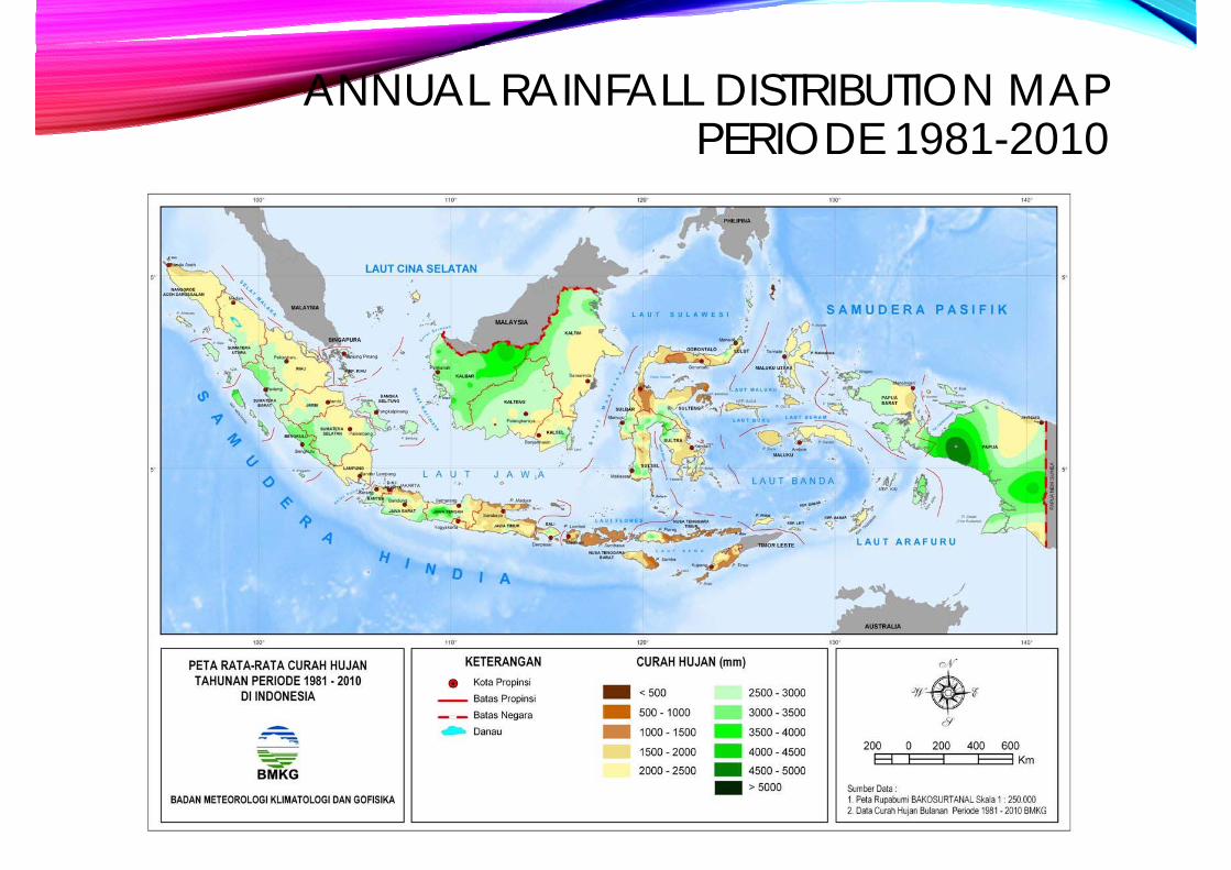
ANNUAL RAINFALL DISTRIBUTION MAP PERIODE 1981-2010

23 %
36 %
19 %
10 %
3 %
Source: BNPB
COMPARISON OF TOTAL DISASTER EVENTSIn INDONESIA on 1815-2016
1 Flood2 Landslide3 Tornado4 Drought
91% Hydrometeorology Disaster

FLOOD EVENTS IN INDONESIA SINCE THE 1915 S / D 2015 (DIBI BNPB, 2016)
The distribution of flood events in Indonesia since the 1915 s / d in 2015, showed an increasing in the number of flood events per year.
Source : BNPB

FLOOD IMPACT IN INDONESIA (1915-2016)
0
50
100
150
200
250
300
350
400
450
TOTA
L
YEAR
Victim Missing People

INDONESIAN FLOOD RISK MAP INDEX
Source : BNPB

FLOOD VULNERABILITY MAP ON INDONESIAN DISTRICT
Kabupaten Pati (Jawa Tengah)
Kota Palu(Sulawesi Tengah)

FEWS DEVELOPER (JCP-1)
•BMKG•PusAir
INDONESIA
•Deltares•KNMI
NETHERLAND

WORKFLOW FEWS

DAS CILIWUNG LAMA WATER LEVEL

PRODUCT ANALYSIS OF JAKARTA FLOOD EARLY WARNING SYSTEM (J-FEWS)
30 DECEMBER 2016FLOOD POTENTIAL
AREATHE WATER LEVEL
ABOUT
LUAS (WIDE) AREA
Kamal Muara, Pantai indah utara
0.18 m to 1.23 m
KECIL (SMALL) AREA
Bukit Duri, Kampung Melayu
Tanjung Duren Utara, Daan Mogot, Bojong Indah, Kembangan, Kedaung Kali Angke
Pejaten Timur, Pasar minggu
Duren Kalibata, Kebon Baru, Cipinang melayu
Kartini, Gunung Sahari
Kelapa Gading
0,03 m to 0,59 m
0.2 m s/d 0.44 m
0,05 m to 0.72 m
0.05 m to 0.59 m
0.04 m to 0.11 m
0.11 m to 0.63 m

COASTAL INUNDATION FORECASTING DEMONSTRATION PROJECT INDONESIA (CIFDP-I)
PILOT PROJECT
JAKARTA
SEMARANG
BOTH LOCATIONS HAVE FREQUENT FLOOD FROM COASTAL INUNDATION

JAKARTA
SEMARANG
COASTAL INUNDATION OCCURRENCE

COASTAL INUNDATION PROBLEM IN SEMARANG

WAY FORWARD….BMKG NEED TO ….
• improve Flood Information warning system.
• providing climate impact-based information and risk-basedwarning.


Potential Map of Flood Information product is a result from collaboration by BMKG, Public Work Ministry and BIG which is expected to guide sectoral planing and preparadness