rebecca robbins landscape planning + design portfolio
DESCRIPTION
ÂTRANSCRIPT
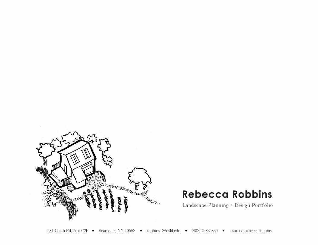
Rebecca RobbinsLandscape Planning + Design Portfolio
281 Garth Rd, Apt C2F Scarsdale, NY 10583 [email protected] (802) 498-5830 issuu.com/beccarobbins


index of sheets
settling in: a landscape design for nancy and robert ............................. open space and recreation plan update: 2013 ....................................
bringing people home: siting an ecological and agricultural housing community ...............................
p. 3-4
p. 5-6
p. 7-8
about me:
I am a young professional looking for experience in firms specializing in landscape design, architecture and ecological urban planning. I have a background in community development and experience in administration. I recently received my Masters of Sciences in Ecological Design from the Conway School in western Massachusetts where I completed projects surrounding regenerative design and environmental planning.
Visit www.issuu.com/beccarobbins to view full project plan sets.
p. 2

south shelburne, massachusetts settling in: a landscape design for nancy and robert
Nancy and Robert recently purchased property in South Shelburne and are completing renovations. The landscape is flat and primarily comprised of lawn. This six-member family has two households under the same roof, requiring two separate gathering spaces. The ultimate goal of the client was to feel tucked into their landscape, finally able to feel at home.
100 year floodplain
Core habitat for endangered species
Overhead electric lines
Thick vegetative cover,muliflora rose
legend
This 11 acre property sits at the banks of the Great Brook, a perennial stream that serves as Core Habitat for many species, both common and endangered. Buffering the stream is a dense thicket of multiflora rose, keeping people away from the banks. The stream's presence requires delineation of a 100 year floodplain, shown in blue. This intermittent sediment deposition causes the soil to have high organic matter levels. Running along the north side of the property and through the middle are sets of unsightly overhead electric lines.Map made with AutoCAD and Photoshop.
summary analysis
The northern redbelly dace (shown below), the wood turtle and the upland sandpiper are some of the endangered spacies found in the Great Brook and its parent watershed. All prefer cooler, slow-moving streams in marshy areas and like to find refuge from potential predators under brush-heavy vegetation, provided by the existing conditions of the site.
The prolific multiflora rose can produce up to a million seeds in a season causing its management to be costly and time consuming. Though labeled as invasive, the thicket made of its thorny canes is the perfect sanctuary for a chickadee or bluebird being chased by a predator. Tiny rose hips provide nourishment for small mammals during winter, nectar and pollen from the flowers in spring attract and feed local bees, and the shade it casts over the water creates valuable cool space for amphibians. The thicket also prevents trampling up and down the brook, avoiding habitat damage and erosion. The vigorous roots of this shrub hold together the stream bank.
a delicate ecosystem
- attract more wildlife- become more self-sufficient- conceal utility elements- access recreational water - site barn and pasture for horses
client goals
p. 3
South Shelburne Rd
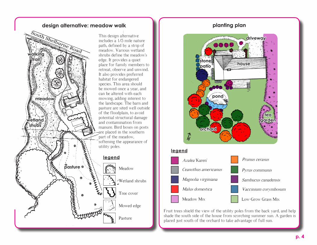
Fruit trees shield the view of the utility poles from the back yard, and help shade the south side of the house from scorching summer sun. A garden is placed just south of the orchard to take advantage of full sun.
Azalea 'Karen'
Ceanothus americanus
Magnolia virginiana
Malus domestica
legend
Prunus cerasus
Pyrus communis
Sambucus canadensis
Vaccinium corymbosum
planting plandesign alternative: meadow walk
This design alternative includes a 1/5 mile nature path, defined by a strip of meadow. Various wetland shrubs define the meadow's edge. It provides a quiet place for family members to retreat, observe and unwind. It also provides preferred habitat for endangered species. This area should be mowed once a year, and can be altered with each mowing, adding interest to the landscape. The barn and pasture are sited well outside of the floodplain, to avoid potential structural damage and contamination from manure. Bird boxes on posts are placed in the southern part of the meadow, softening the appearance of utility poles.
Meadow
Wetland shrubs
Tree cover
Mowed edge
Pasture
legend
Meadow Mix Low-Grow Grass Mix
p. 4
pond
stone patio
tea garden
orchard
house
driveway
meadow
pasture
wetland shubs
walkingtrail

Two forums were held to examine the needs and desires of the community. Fliers made in InDesign.
town of lenox, massachusetts open space and recreation plan update: 2013
The protection of open spaces is an integral part of resilient, active, and connected communities. The 2013 Open Space and Recreation Plan Update gathers the desires of the community, examines the needs of the town's natural species, and offers tangible objectives for achieving identified goals.
lenox residents’ recreational activities
This map depicts popular types of recreation, frequency of mention, and the geographical location in which they take place. Through ruthless isolation, we notice three separate areas begin to form, with less activity in the south. This map was made in Photoshop.
community meetings
Legend
existing_buildings_points
potential_buildings
hp152
eotroads_152
LANDUSE2005_POLY_BERK
<all other values>
LUCODE
1; 2; 3; 4; 5; 6; 7; 8
Rivers and Streams
Ponds, Lakes, Reservoirs
Wetlands
This build out map above (created with Community Viz) was exemplifies what is at risk if and when the town of Lenox expands. In this example, most development occurs along a main route, potentially damaging the rural character of the land. New development occurs in the forest, which may cause ecosystem fragmentation.
what’s at risk?
p. 5
Do you love Kennedy Park?Lenox has a great opportunity to expand and enhance its public parks and we want to hear your ideas! Come tell us about your favorite places in town to hike, fish, breathe, and reflect.
Please join us for a short public forum and a lively discussion on the future of our open spaces.
Lenox has the opportunity to use CPA funds for open space and recreation projects - how would
you like to see this money used?
Wednesday, January 30, 20136:30pm - 7:30pmTown Hall Auditorium 6 Walker Street, LenoxRefreshments will be served.
Event hosted by the Town of Lenox Open Space and Recreation Plan Committee. For more information call 413-637-5500 X1203 or email [email protected].

The Lenox community desires to maintain its small-town feel, pastoral views, and ecological richness. Lenox's 2013 Open Space and Recreation Plan works to create a comprehensive trail map connecting people to a variety of recreation spaces, permanently protects core habitat, and seeks to improve a community place of the heart.
LEE
PITTSFIELD
WASHINGTON
RICHMOND
STOCKBRIDGE
Legend
laurel_lake
EJ_POLY
Protected Open Space
Legend
laurel_lake
EJ_POLY
Protected Open Space
action map
Improve water quality and infrastructure at Laurel Lake
Permanently protect ecologically important habitats
Expand and improve recreational opportunities and assets
Connect neighborhoods, open spaces and recreational areas
Education is a piece of the Laurel Lake improvement strategy. This diagram (medium: flair and cardstock) shows the relationship between baneful Zebra Mussels and Blue-Green Algae.
ecological education
legend
The rare combination of limestone and marble bedrock beneath Lenox's valley floor yields what one expert described as "soil that makes botanists drool". This soil is suitable for many species and natural communities, which generates greater biodiversity. This map was made with ArcGIS and InDesign.
lenox’s marble valley
p. 6

the farm school: athol, massachusettsbringing people home: siting an ecological and agricultural housing community
The Farm School in Athol, Massachusetts teaches principles of ecological stewardship, connectivity to nature, and practicality to both youngsters and adults. This organization sought a feasibility study to determine the potential for a small housing development on a nearby parcel of land. This new community should reflect the values of the organization.
Looking east is an expansive view of open pasture land, orchard trees, and a mountain range in the distance. The Farm School loves this view, and wishes to see it preserved.
Our team held charrets and public meetings to identify the components of a successful design:
- Conserve land
- Conserve valued vistas
- Create a family friendly environment
- Create a small housing footprint
- Create both private and shared spaces
- Accessibility to farmable land
- 10,000 ft2 size (nearly a quarter acre).
- 50' of frontage on an existing road
- Two parking spaces per unit.
- 35' setbacks from the road.
- 20' setbacks from neighboring lots.
- 35% total land conservation.
Local bylaws require a minimum of:
other design guidelines:
Development prohibited - legal restrictions
Development permitted w/ significant constraints: - north-facing slopes - slopes 15%+ - prime ag soils - soil unsuitable for development
Development permitted but with constraints: - Prime forest
Development permitted w/ considerations: - soil of statewide importance
hand drafted basemap with ArcGIS overlay
The Suitability Analysis depicts the parcel's developmental constraints, considering both legal and environmental restrictions. The least suitable areas are shown in the darkest shade and the most suitable in the lightest shade.
legend
View to preserve
p. 7
suitability analysis:

The final design places new homes along the road, keeping infrastructural and environmental impacts to a minimum, tucking this new community out of the favored vista. Houses in this area have been placed along the road since the late 1700s and the final design strives to maintain historical character. This design also protects natural resources, meets the needs of the community and conforms to local bylaws. The final design also takes into consideration tensions within the community, balancing the desire for both public and private space, sharing resources and developing around and with natural features both above and below the soil.
final design: “on the road again”Two parking lots serve four residences with two spots per house. Parked cars are visually buffered from the homes with vegetation.
Small homes are spaced 70' apart from each other, conserving land. This creates both privacy and a sense of community. Homes are oriented 15 degrees east of south to maximize solar gain and frame views to the southeast.
Common agricultural fields to the south allow residents to grow produce for market or consumption. Rows follow the contours of the land to prevent soil erosion.
A vegetated swale follows the north-south contours, capturing storm runoff from the community. Storm water is filtered and slowed down before it reaches the wetland.
The community common space features a seating area and cob oven where neighbors can gather.
locations considered for development are numbered on the map above. the final design is placed at location number 5.
locations for development
12
34
5
1
2
33
4
5
1
2
334
5
1
p. 8