recovery - geoplatform
TRANSCRIPT

Recovery
Overview
The term "recovery", as defined in the National Preparedness Goal Capabilities, refers to those capabilities necessary to build, sustain, and deliver recovery core capabilities identified in the National Preparedness Goal in an integrated manner across mission areas. This section of the Homeland Security Enterprise (HSE) Geospatial Concept of Operations (GeoCONOPs) describes how the geospatial community supports the Recovery Mission. Content in this section of the GeoCONOPS complements the National Planning Frameworks and their associated Federal Interagency Operation Plans (FIOPs).
Geospatial functions play an important role in supporting the Recovery Mission. Geospatially enabled decision support facilitates shared situational understanding essential for the whole community to effectively manage and enable recovery following an incident of any size or scale. The National Disaster Recovery Framework defines how the whole community, including emergency managers, community development professionals, recovery practitioners, government agencies, private sector, nongovernmental organization (NGO) leaders, and the public, will collaborate and coordinate to more effectively use existing resources to promote resilience and support the recovery of those affected by an incident. Geospatial technology, smart practices, and operational procedures for prevention, protection, mitigation, and recovery are discussed in their respective sections of the GeoCONOPS.
Shared situational understanding – built from authoritative or best available data that can be used
holistically to characterize an incident, predict potential consequences, and support unified decision
making – transforms individual data sets into actionable information that can change outcomes, meet
the needs of survivors, support recovery operations, and build a resilient community. Analyzing hazards,
consequences, and potential courses of action in a common geospatial language such as the US National
Grid (USNG) increases the level of precision in characterizing threats and facilitates quantifying
vulnerabilities, consequences, and resources needed to develop coordinated recovery strategies and
meet the needs of affected communities.
Geospatial infrastructure, operators, and knowledge are critical components that cross all mission areas and operations. Examples of how geospatial capabilities support the mission include:
Figure 1:Geospatial functions play an important role in supporting the Protection mission, facilitating shared situational understanding built from authoritative data that can be analyzed to characterize an incident, predict potential consequences, and support decisions.

Modeling and visualization, which can transform data into actionable information.
Reconnaissance and Remote Sensing provides for collection of imagery that support
understanding of conditions on the ground before, during, and after an incident.
An ability to analyze, model, process, exploit, display, and share data and information required
to support the mission.
Trained analysts that provide the knowledge, skills, and abilities needed for effective use of
geospatial capabilities to support decision making.
These geospatial capabilities supporting the Recovery Mission are necessary to:
Rebuild infrastructure system
Provide adequate interim and long-term housing for survivors
Restore health, social and community services
Promote economic development
Restore natural and cultural services
Stakeholders A successful recovery effort is inclusive of the whole community. Unified recovery operations depend on
integration of the whole community to implement effective recovery strategies. Recovery stakeholders
can be considered in the following groups:
Individuals, Families, and Households: Individuals, families and households have a pivotal role in facilitating their recovery and the recovery of their community. Individuals and households should maintain a disaster preparedness kit and recovery plan addresses evacuation, sheltering- access and functional needs of all individuals who reside in the household, including children, pregnant women, older adults, people with disabilities, and pet owners and their animals, including household pets and service and assistance animals that reside in the household. Those who prepare will reduce their personal stress, be able to reach out to others in need of assistance, and be better positioned to actively contribute to post-disaster recovery planning efforts.
Nongovernmental Organizations (NGOs) are voluntary, faith-based, philanthropic, or community organizations that coordinate and collaborate to help individuals and communities respond to and recover from disasters. NGO support is provided by a range of organizations from small community-based nonprofits to national organizations with extensive experience in disaster response and recovery. NGOs provide targeted services to groups such as children, individuals with disabilities, people with access and functional needs, ethnically and culturally diverse communities, people with limited English proficiency, and animal owners, including household pets and service and assistance animals. Examples of NGOs, some of which have organic Geographic Information Systems (GIS)/geospatial capabilities, include:

Voluntary organizations, 501(c)(3), with disaster response/recovery missions
Faith-based organizations and ministerial alliances
Community-based organizations
Intertribal organizations
Animal control, welfare, and/or rescue organizations
Housing nonprofits
Chambers of commerce and business organizations
Environmental organizations
Cultural organizations
Professional organizations
Academia
Independent national, regional, and local advocacy, health, and social services agencies
Fraternal organizations
Regional planning commissions
Planning and development districts
National planning organizations
Independent charities
National and community-based foundations
Volunteer recruitment groups
Civic groups
Veterans organizations
Aging organizations
Cross-disability organizations
Independent national, regional, and local disability advocacy, health, support, and service agencies.
Private Sector Entities play a critical role in establishing public confidence immediately after an incident. When the business community is working, the area recovers more quickly by retaining and providing jobs, goods and services and a stable tax base. A prevailing indicator of future economic recovery efforts is when local and tribal nation leadership and the business community work together during pre-disaster periods to develop recovery plans. Working together across the whole community to develop these plans builds broad public optimism about the community’s ability to recover. Businesses have an opportunity to participate and assume leadership roles in local recovery planning before and after an incident. Partnerships with private sector partners can facilitate geospatially enabled recovery planning.
Local Governments have primacy in building an inclusive coalition of whole community partners to prepare for and manage the response and recovery of its community. Individuals, families, and businesses look to local governments to support recovery and the needs of the community. Local governments lead pre-disaster recovery and mitigation planning efforts and have a primary role in planning and managing all aspects of a community’s recovery post-disaster.
Who does Recovery? In support of local, state, and tribal recovery operations, the Federal Government works to quickly deploy resources to communities affected by large, complex, or catastrophic incidents. Various federal departments and agencies have statutory responsibilities and lead roles based on unique circumstances of an incident. The NDRF serves as a guide for how the Nation works together to recovery from all types of disasters. Descriptions of statutory authorities and organizations engage and contribute to the delivery of recovery core capabilities can be found in the NDRF and associated Federal Interagency Operations Plan (FIOP). Recovery partners to assist with the geospatial planning, information sharing, and operational coordination crucial to the recovery mission. Some of the main stakeholders who have responsibilities for recovery operations or can provide geospatial support to the recovery mission include:

State, Tribal, Territorial, and Insular Area Governments
Non-Governmental Organizations
Department of Homeland Security
Federal Emergency Management Agency
Department of Agriculture
Department of Commerce
Department of Defense
Department of Energy
Department of Health and Human Services
Department of Interior
Department of State
Department of Transportation
Department of Treasury
Environmental Protection Agency
General Services Administration
Small Business Administration
U.S. Army Corps of Engineers
Geospatial Resources
Geospatial Capabilities, including specific technical tools, models, and applications, critical components needed to support geospatially enabled recovery planning and decision making. Recovery mission partners should make every effort to become familiar with geospatial tools during normal operations to reliably access and interpret information. Employing location-enabled data and geospatial tools help explain where people and critical infrastructure are located, support projecting and visualizing consequences and needs, and give context that supports recovery efforts. Once an event occurs, those involved in disaster recovery operations are likely to use only those tools with which they are already familiar – datasets, models, and other geospatial tools are no different. The utility of geospatial tools depends on their use during normal operations and for exercises and training. Example of geospatial capabilities and tools that support the recovery mission are discussed below
1. Modeling and Visualization conveys context, relationships, and dependencies that help characterize an event as well as supports understanding consequences to the affected community, and identifying pre-or post-disaster recovery requirements. Visualizing context using geospatial capabilities transforms data into actionable information that can elevate shared understanding of a situation, including economic losses, and assist with determining where damages have occurred and where resources or technical assistance is needed. Additional information about models listed below can be found in DHS’s Model and Data Inventory.
a. HAZUS-MH models economic loss and estimates potential consequences from hurricane, earthquake, tsunami, and flood events on populations, buildings, and infrastructure. Outputs are displayed using GIS.
b. PAGER is a consequence model that provides fatality and economic loss impact estimates following significant earthquakes worldwide. The model predicts damage caused by a detected earthquake and assigns it an alert level based on impact factors and displays it on a map.
c. LIFT is a subject matter expert model that assesses macroeconomic and industry impacts due to a disaster over time.
d. RIMS II is a subject matter expert economic impact model that measures the impacts of economic activities and disruptions on regional economies.
2. Restoring Health and Social Services and associated networks to promote the resilience, independence, health (including behavioral health), and well-being of the whole community is essential to a community’s recovery. Employing geospatial capabilities and resources support unified efforts and decision making need to:
Identify affected populations, groups and key partners in short-term, intermediate, and long-term recovery.

Complete assessments of community health and social service needs, and prioritize these needs, including accessibility requirements, based on the whole community's input and participation in the recovery planning process, and develop a comprehensive recovery timeline.
Restore health care (including behavioral health), public health, and social services functions.
Restore and improve the resilience and sustainability of the health care system and social service capabilities and networks to promote the independence and well-being of community members in accordance with the specified recovery timeline.
a. EPA has developed many applications that allow users to explore and interact with geospatial data. These EPA Geospatial Applications include an array of tools such as air and water quality tools as well as waste management tools that may inform and support recovery operations.
b. The HHS GeoHealth Portal is a situational awareness viewer and interactive mapping tool used by the Department of Health and Human Services that incorporates a variety of data, including infrastructure locations, facility data, and hazard imagery.
3. Economic Recovery efforts return economic and business activities (including food and agriculture) to a healthy state and develop new business and employment opportunities that result in an economically viable community. Employing geospatial capabilities and resources support unified efforts and decision making need to:
Conduct a preliminary assessment of economic issues and identify potential inhibitors to fostering stabilization of the affected communities.
Ensure the community recovery and mitigation plan(s) incorporates economic revitalization and removes governmental inhibitors to post-disaster economic sustainability, while maintaining the civil rights of citizens.
Return affected area’s economy within the specified time frame in the recovery plan.
a. The Small Business Administration’s (SBA) SizeUp is an online support service delivering custom analysis for businesses. It allows for mapping customers and suppliers are located, which can be key during recovery.
b. FEMA’s GeoPlatform is an online web platform that provides users access to publically available geospatial data and analytics in support of emergency management and recovery.
c. HUD eGIS is a site in which users can search for and discover HUD's geospatial datasets,
application programming interfaces (APIs), web-based mapping tools, including economic recovery information such as CDBG grantee areas, public housing, fair market rents, and HUD insured multifamily properties.

4. Implement housing solutions that effectively support the needs of the whole community and contribute to its sustainability and resilience is essential to community recovery. Employing geospatial capabilities and resources support developing and implementing disaster housing solutions need to:
Assess preliminary housing impacts and needs, identify currently available options for temporary housing, and plan for permanent housing.
Ensure community housing recovery plans continue to address interim housing needs, assess options for permanent housing, and define a timeline for achieving a resilient, accessible, and sustainable housing market.
Establish a resilient and sustainable housing market that meets the needs of the community, including the need for accessible housing within the specified time frame in the recovery plan.
a. SimSuite is a web-based modeling and situational awareness platform that contains the complete suite of USACE's data and modeling resources. The tool is used to calculate resource requirements for debris removal, temporary housing, and ice/water commodities, among others. More information on SimSuite can be found at https://gis.fema.gov/Model-and-Data-Inventory/index.html#resource/275.
b. The University of South Carolina Social Vulnerability Index (SoVI) is a measure of a county's ability to withstand and recover from a disaster based on its socioeconomic characteristics. More information on the SoVI can be found at https://gis.fema.gov/Model-and-Data-Inventory/index.html - resource/293.
c. HUD Geospatial Data is HUD’s gateway to geospatial housing data that may assist in the Response Mission.
GeoData and Products are a crucial component necessary to assist the homeland areas affected by an incident of terrorism and manmade, or natural disasters. Data help to explain where people and critical infrastructure are located, supply facts on historical events, and supply information on other factors that may drive recovery efforts. There are many required data elements when supporting the Recovery Mission that the Stakeholders are providing. Below is a list of some of the major examples:
1. Data, imagery, and analysts capable of putting it all together, give spatial context to populations, the built environment, terrain, weather, available support, or other elements of information that may inform response operations. Geospatial context – bringing together location-enabled data such as those mentioned above – allows analysts, operators, and decision makers to characterize an event, project consequences, and take effective action to change outcomes for survivors and their communities.
a. A broad range of datasets can be explored through the DHS Model and Data Inventory. The inventory is cataloged using metadata tags to organize and analyze models and datasets and maximize effective use for emergency management. Metadata categories include: the dataset/model’s full name, abbreviation, model/data, owner, users, upstream inventory datasets/models, downstream inventory datasets/models, relevant hazards, Core Capabilities supported, Emergency Support Functions (ESFs) supported, Recovery Support Functions (RSFs) supported, keywords, function tags, resource type, data collection method, phase specific utility, access information, access type, processing requirements, refresh rate, last known version, programming language, output file types, technical contact information, contact during activation, website, and
a brief summary of its function and use.
2. Restoring Infrastructure Systems is a critical for stabilizing affected communities, reducing or mitigating secondary and tertiary cascading effects to other communities, and enables emergency response operations. Resources available for critical infrastructure data include:
a. The Homeland Infrastructure Foundation Level Data (HIFLD) Open and Secure sites provide critical infrastructure data for geospatial analysts to use with over 500 resources in downloadable formats available.
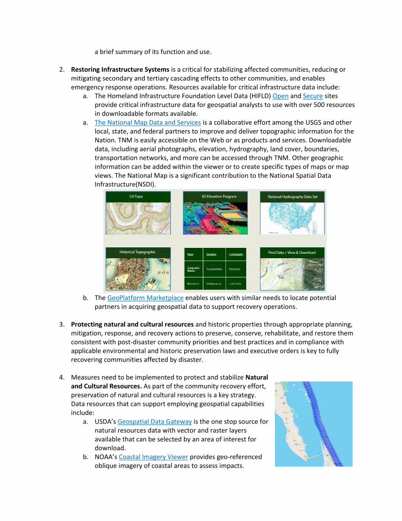
a. The National Map Data and Services is a collaborative effort among the USGS and other local, state, and federal partners to improve and deliver topographic information for the Nation. TNM is easily accessible on the Web or as products and services. Downloadable data, including aerial photographs, elevation, hydrography, land cover, boundaries, transportation networks, and more can be accessed through TNM. Other geographic information can be added within the viewer or to create specific types of maps or map views. The National Map is a significant contribution to the National Spatial Data Infrastructure(NSDI).
b. The GeoPlatform Marketplace enables users with similar needs to locate potential partners in acquiring geospatial data to support recovery operations.
3. Protecting natural and cultural resources and historic properties through appropriate planning, mitigation, response, and recovery actions to preserve, conserve, rehabilitate, and restore them consistent with post-disaster community priorities and best practices and in compliance with applicable environmental and historic preservation laws and executive orders is key to fully recovering communities affected by disaster.
4. Measures need to be implemented to protect and stabilize Natural and Cultural Resources. As part of the community recovery effort, preservation of natural and cultural resources is a key strategy. Data resources that can support employing geospatial capabilities include:
a. USDA’s Geospatial Data Gateway is the one stop source for natural resources data with vector and raster layers available that can be selected by an area of interest for download.
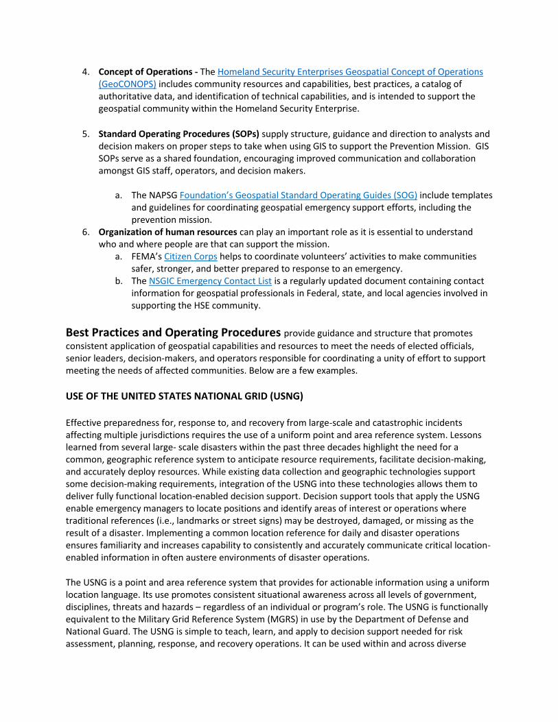
b. NOAA’s Coastal Imagery Viewer provides geo-referenced oblique imagery of coastal areas to assess impacts.

Tradecraft includes access to training, operating procedures/guides, templates, and other resources.
These resources are valuable in the Response Mission and provide guidance, use-cases that
demonstrate successes or smart practices, training, and potential grant opportunities to support
building, sustaining, and delivering geospatial capabilities. A list of Tradecraft resources available is
provided below:
A list of types of resources available for the mission are below:
1. Grants and financial assistance can supply essential funding for staffing, training, data, software and infrastructure necessary to support the Recovery Mission. There are several ways of applying for grants or other financial agreements.
a. The National Geospatial Intelligence Agency (NGA) overs several types of funding programs.
b. The Homeland Security Grant Program supports state, local, and tribal efforts to support the National Preparedness Mission by providing federal funds to obtain the resources required. Focuses in FY 2017 include state homeland security, urban area security, and border security. More documentation on FY 2017 can be found here: https://www.fema.gov/media-library/assets/documents/131992.
2. It is important to assess and understand an agency’s current geospatial abilities to determine geospatial strengths and weaknesses. The NAPSG Foundation’s CARAT Tool is designed to serve as a roadmap for understanding an agency’s readiness to support geospatial functions and can teach how GIS can be applied to public safety.
3. Training for analysts and those supporting the Prevention mission is essential in preparing for potential or imminent events. While each of these provides a range of trainings across their mission areas, geospatial offerings can increasingly be found within their course catalogs. The course range from self-paced online briefings to full instructor led courses in many cases.
a. The FEMA Emergency Management Institute (EMI) has courses to prepare planners and responders for the potential effects of all types of disaster and emergencies.
Figure 2: The CARAT and other capability assessment tools provide a framework for systematic analysis of current state and help plan for future desired levels of capability.
Figure 3: FEMA’s EMI web site provides a catalog of Independent study and instructor led courses.
4. Concept of Operations - The Homeland Security Enterprises Geospatial Concept of Operations (GeoCONOPS) includes community resources and capabilities, best practices, a catalog of authoritative data, and identification of technical capabilities, and is intended to support the geospatial community within the Homeland Security Enterprise.
5. Standard Operating Procedures (SOPs) supply structure, guidance and direction to analysts and decision makers on proper steps to take when using GIS to support the Prevention Mission. GIS SOPs serve as a shared foundation, encouraging improved communication and collaboration amongst GIS staff, operators, and decision makers.
a. The NAPSG Foundation’s Geospatial Standard Operating Guides (SOG) include templates and guidelines for coordinating geospatial emergency support efforts, including the prevention mission.
6. Organization of human resources can play an important role as it is essential to understand who and where people are that can support the mission.
a. FEMA’s Citizen Corps helps to coordinate volunteers’ activities to make communities safer, stronger, and better prepared to response to an emergency.
b. The NSGIC Emergency Contact List is a regularly updated document containing contact information for geospatial professionals in Federal, state, and local agencies involved in supporting the HSE community.
Best Practices and Operating Procedures provide guidance and structure that promotes
consistent application of geospatial capabilities and resources to meet the needs of elected officials, senior leaders, decision-makers, and operators responsible for coordinating a unity of effort to support meeting the needs of affected communities. Below are a few examples.
USE OF THE UNITED STATES NATIONAL GRID (USNG)
Effective preparedness for, response to, and recovery from large-scale and catastrophic incidents affecting multiple jurisdictions requires the use of a uniform point and area reference system. Lessons learned from several large- scale disasters within the past three decades highlight the need for a common, geographic reference system to anticipate resource requirements, facilitate decision-making, and accurately deploy resources. While existing data collection and geographic technologies support some decision-making requirements, integration of the USNG into these technologies allows them to deliver fully functional location-enabled decision support. Decision support tools that apply the USNG enable emergency managers to locate positions and identify areas of interest or operations where traditional references (i.e., landmarks or street signs) may be destroyed, damaged, or missing as the result of a disaster. Implementing a common location reference for daily and disaster operations ensures familiarity and increases capability to consistently and accurately communicate critical location-enabled information in often austere environments of disaster operations.
The USNG is a point and area reference system that provides for actionable information using a uniform location language. Its use promotes consistent situational awareness across all levels of government, disciplines, threats and hazards – regardless of an individual or program’s role. The USNG is functionally equivalent to the Military Grid Reference System (MGRS) in use by the Department of Defense and National Guard. The USNG is simple to teach, learn, and apply to decision support needed for risk assessment, planning, response, and recovery operations. It can be used within and across diverse

geographic areas and disciplines, including by private citizens, public agencies, voluntary organizations, and commercial enterprises.
As described in FEMA DIRECTIVE 092-5, by adopting and implementing the USNG as the standard land-based location language communities of practice across the five mission areas will be better able to:
Describe the location of disaster survivors and responders, and/or operational areas and requirements when GPS, existing mapping programs, or traditional landmarks are not reliable or available to responders;
Advance implementation and sustain use of a nationally consistent location language that is seamless across agencies and jurisdictional boundaries and interoperable;
Communicate location information and situational awareness to mutual aid partners that may be unfamiliar with communities and geographies they are responding to;
Ensure resources operating within the same geographic area are required and appropriate and are not redundant;
Use compatible location language across jurisdictions and mapping systems to communicate data across different platforms; and
Identify and define geographic boundaries of potential and real-world incident sites using a common grid reference system for pre-scripted mission planning and management of resources during incident operations to more accurately address requirements in affected areas and potentially reduce costs.
Use-Case Scenarios provide opportunities to explore examples and understand how the geospatial
community works to unify operations that integrate and synchronize existing geospatial capabilities to
support Response Mission activities and critical tasks.
Managing the DR-1971-AL Tornado Disaster using GIS
On April 27, 2011, a deadly tornado outbreak resulting in an accumulative damage path 1,177+ miles long and 20 miles wide struck SOMEWHERE AL. This springtime outbreak produced 62 tornadoes statewide along 70 tracks causing 247 fatalities, approximately 10 million cubic yards of debris, and costing an estimated $1.1 billion.

Individual and Public Assistance were declared for more than half the State of Alabama including:
• 67 counties declared for public assistance • Emergency Work (Debris Removal & Emergency
Protective Measures) • 43 counties declared for individual assistance
• Assistance to individuals, families, & businesses with damages whose losses are not covered by insurance
• 33 counties declared for permanent work aid • Repairing roads/ bridges, water control facilities, buildings &
equipment, utilities, parks, recreational facilities, and other facilities
Initial map requests using a stoplight color scheme to quickly visualize event specific information and establish situational awareness included products that displayed activated EOCs, reported damages, open shelters, resources requested, local states of emergency, and tornado tracks/swaths.
Staffing 12-hr shifts for 24-hr operations, Geospatial support was a coordinated effort across municipal and local GIS, private organizations, and volunteers along with state and federal partners including:
State: GSA, ADECA, ALGO/ISD, ALNG, ACJIC, AFC, and ADEM Federal: FEMA, NGA, USGS HDDS, NOAA NWS, and USACE Federal support focused on broader GIS needs while AEMA
focused on their immediate needs. Imagery was collected from various sources and posted publically by USGS HDDS.

As the focus of geospatial support pivoted from immediate lifesaving, live sustaining efforts to recovery, FEMA and the AEMA worked out of the Joint Field Office (JFO) to support extended response and recovery efforts. FEMA and AEMA GIS staff co-located at the JFO and embedded with planners to directly support a unity of effort to meet assist operators, decision-makers, senior leaders, and elected officials meet the needs of survivors recovering from this disaster.
Operation Clean Sweep
To support extensive recovery operations and zero in on the hardest hit areas, geospatial support identified areas with significant or catastrophic damage using commercial satellite imagery with a USNG overlay to perform a thorough and more precise analysis of damages. An initial analysis sweep indicated 289 grid cells with significant or catastrophic damage. Use of the USNG allowed geospatial analysts to provide coordinates for field validation which in-turn improved analyst’s ability to recognize damages from available aerial imagery. This collaborative effort identified 960 grid cells with significant or catastrophic damage. This USNG enabled remote sensing technique and the rigor of analysis provided early confidence in damage assessments allowing for a 90% federal – 10% local cost share vs. the standard 75% federal – 25% local cost share. Gridded maps were proved to counties and municipalities to aid in adjudicating resources, debris management operations, and monitoring progress of recovery operations.

Debris Modeling
Recovery efforts begin immediately following an event. Coordinating recovery and response activities allows communities to recover as quickly as possible. Debris modeling is one example of how geospatial technologies assist recovery efforts. Employing geospatial capabilities and resources to estimate debris types and volume before an event supports preplanning efforts and inform response and recovery efforts immediately following an event. Debris removal can account for 25 to 50 percent of overall recovery costs and must be effectively planned and managed to speed recovery as well as contain local, state, and federal costs.
Two related areas where geospatial technologies provide immediate support for critical tasks related to debris missions under FEMA’s Public Assistance (PA) Program include volume estimation and mission management. While there are additional tasks and geospatial activities within PA, this section is focused specifically on the debris mission.
Debris modeling can be accomplished using modeling applications such as HAZUS-MH or the U.S. Army Corps of Engineers Hurricane Debris Estimating Model. The use of models varies with the event, location, and magnitude of damages. Models are used to predict debris volumes resulting from wind events and factor in variables such as area demographics (housing, population, etc.), estimated storm intensity, and predicted areas of impact. Pre-event debris modeling provides a basis for planning response and recovery activities, but may vary in accuracy when compared to the measured amount of debris generated from a specific event. Efforts to collect debris information in the field provide validation of initial estimations and bring clarity to the debris management. Using a combination of remote sensing techniques like the one discussed in the case study above paired with field teams and sampling methodologies improved estimations can be derived to support debris management efforts. The debris management mission is location and geography dependent. Management efforts include identifying debris types, tracking debris locations, recording measured amounts of debris delivered to staging areas, and reporting overall status of the debris mission to leadership.
Geospatial support for debris removal efforts can be supported by or jointly conducted from a FEMA Joint Field Office (JFO). Staff deploy from locations around the country to collect field data, perform geospatial analysis, and produce map products as needed. Off-site support can be added as required and may consist of geospatial modeling activities and imagery interpretation. FEMA supports the geospatial requirements for the debris mission with FEMA staff, Technical Assistance Contractors (TAC), and mission assignments to the USACE. During debris removal operations, debris haulers may use geospatial programs to track progress of debris removal and may have their own programs or private contractors to assist them with this effort.
Below are several examples of the products supporting the PA debris mission:
Loss Modeling
• USACE: debris volume • HAZUS: debris volume, debris type, impacted population, estimates of FEMA applicants

Field Data Collection
• County maps depicting the PDA debris estimates • Debris site locations visited during field data collection
Management and Removal
Area maps displaying statistics on debris removal efforts (volume removed vs. estimate). Amounts are either obtained from the debris teams or from the Debris Removal Tracking System (DRTS) located within the Resource Information
Management System (RIMS)
• Products tracking debris removal efforts on roads • Private property debris removal (PPDR) progress • Tree stump tracking • Debris tracking in waterways (barges, trees, boats, cars, etc.)
Individual Assistance (IA)
The FEMA IA program provides financial and emergency housing assistance to individuals, families, and businesses that have been affected by a federally declared disaster. In support of the IA program, geospatial technologies can assist in determining spatial boundaries of damaged areas, assessing the number of displaced households along with the nature and scope of damages to housing units, and estimate the number of individuals requiring assistance. Several IA GIS initiatives are underway to integrate and optimize geospatial data and analyses to improve efficiencies and accuracy in estimating IA requirements, particularly for large-scale disasters where reliance on field housing inspections is logistically impractical or costly.
The program uses imagery and modeling in conjunction with other geospatial technologies to assess residential damage from major disasters. FEMA IA protocols have been established for gathering and analyzing imagery to support IA missions, including post-disaster housing inspections. Damage polygons are derived from aerial photography and used to delineate structures that are destroyed or substantially damaged, based on specified criteria for residential damage categories.
These processes and remote sensing/geospatially enabled tools support a mechanism for processing payments in an expedient manner for applicants in geographic areas that have sustained major or catastrophic damage. A Rapid Damage Assessment (RDA) database of historical awards based on foundations types and High Water Marks is used in conjunction with imagery analysis in the National Emergency Management Information System (NEMIS) GIS processing.
HAZUS-MH modeling is used to delineate spatial boundaries of floods, hurricanes (wind), and earthquakes (liquefaction, ground shaking, ground deformation), which can be used to identify potential areas of operations, populations at risk, characteristics of housing stock within the affected area, and estimates of residential and commercial losses. As a regional loss estimation tool, HAZUS outputs are most reliable at the county or multicounty scale.

Light Detection and Ranging (LIDAR) data is used to establish base elevations (bare earth) of structures. River gauge data (flood stage levels) is then incorporated to estimate flood depth and the extent of potential flooded areas. The derived flood depth grids can then be used by the IA program to assess and delineate residential damages following an event.
The following FEMA organizations have a role in producing and applying geospatial data and technologies to support the IA mission:
• FEMA Enterprise GIS Services provides geospatial support. • Disaster Assistance Support Center (DASC) provides policy and program guidance and
establishes priorities for data collection and analysis. • Geospatial Informatione Unit (GIU) provides geospatial technical support at the JFO, including
GIS products and analysis that supports the IA mission.
Virginia National Processing Support Center (VA-NPSC) manages geospatial processing of IA applicants in NEMIS and the Contract Management and Housing Inspection Services (CMHIS). The FEMA NEMIS system stores IA applicant information and determines eligibility for IA payment awards following a declared disaster.
Multiple FEMA contracts have been used to support geospatial analysis of housing damage, response, and recovery. In addition to support for acquisition and analysis of imagery, contract support has been provided through the FEMA Mitigation Directorate for hazard impact analysis and a range of technical studies that contributed to the IA knowledge base of housing vulnerability and the performance of structures in scenario events. Technical support from the Mitigation Directorate is often channeled through technical clearinghouses, which are established following major disasters and provide researchers, contractors, and government agency personnel with a “laboratory” or clearinghouse for event-specific research, including the production and application of geospatial data and technologies.
Below are several examples of the products supporting the IA mission:
National Response Coordination Center (NRCC)
• Demographic profiles • Population and population density • Housing units • Median household income • Median housing value • Shelter locations and status
NRCC (FEMA GIS Services and RS Coordinator)
• HAZUS runs that provide estimates of spatial boundaries of hazards (wind, flood, surge) • Damage area polygons • Photographic records of dwellings • ZIP code analysis
JFO GIU Maps and Reports
• Daily updates that display IA data and analysis • Specialized studies
VA-NPSC
• GIS processed IA applications • Housing inspection reports
Mitigation Directorate
• Damage functions (flooding, wind, ground shaking, etc.) for residential structures • High water marks and other damage data
Early Mitigation Efforts
Although mitigation efforts relate primarily to long-term projects, several mitigation activities are pursued as quickly as possible to expedite recovery of hard-hit communities. Early recovery efforts support These efforts include collection of time-sensitive, post-event geospatial data and close interaction with local governments to provide critical guidance for rebuilding. This section focuses on mitigation efforts for flood-related events.
High Water Mark Collection. Field observers and survey crews are deployed by FEMA to interview residents, find confirmation of high water levels, and capture supporting evidence of high water. These field crews collect detailed information about each High-Water Mark, including physical basis of the mark, such as a mud line inside the building, a mud line on the outside of the building, or debris. Wherever possible, crews also note the coastal flooding characteristics captured by coastal High Water Marks, including storm surge, wave run-up, and wave height. The survey crews use GPS methods to determine an accurate elevation for each high watermark. These locations have been surveyed to within accuracies of 0.25 foot vertically and 10 feet horizontally, with a 95 percent confidence level.
Storm Surge Inundation Mapping. Flood inundation levels are created for coastal communities by mapping coastal High Water Mark elevations onto digital, pre-storm, topographic contour data developed from LIDAR surveys. These inundation levels represent an estimate of the inland extent of flooding caused by storm surge. The inundation limit is then refined to remove small-scale, isolated areas of inundated and non-inundated terrain based on knowledge of overland surge propagation and engineering judgment.
Advisory Base Flood Elevations (ABFE). In larger flood events, ABFEs are developed to provide communities with initial recommended building elevations for use in the reconstruction process until more detailed data become available. ABFEs are based on a new flood frequency analysis that considers the immediate event as well as additional tide and storm data from other events that have occurred since the existing Flood Insurance Rate Maps (FIRM) were developed.
The FEMA Region and Disaster Support Branch at HQ serves as a central point of contact for coordinating disaster operations, cadre management (including GIS support), regional support, and overall mitigation program coordination. Geospatial support activities for mitigation include:

• Staffing a Mitigation GIS Coordinator liaison with FEMA JFO GIU, FEMA HQ, and local operations • Supporting acquisition of pre- and post-disaster data collection and coordinating with
appropriate mitigation programs. The Mitigation Directorate’s Program Coordination Group brings together representatives of key branches with geospatial expertise that can be applied in the recovery phase, including:
– Building Sciences Coordinator serves as the point of contact for the risk reduction and provides building science tools and guidance to support recovery
– Floodplain Management Coordinator provides geospatial data and relevant analysis to the NRCC Hazard and Mitigation (HM) Branch to support the mission
– Mapping Coordinator represents the Data and Dissemination Branch and Risk Analysis Division and provides geospatial data and analysis to support the mission.
High-resolution maps are produced to assist property owners in the repair or rebuilding of structures to newly determined advisory coastal flood elevations. Specific mitigation-based products include, but are not limited to:
• Recovery Maps • High Water Marks • Inundation levels • FEMA’s ABFEs • Repetitive loss.