richard leadbeater, esri naco 2011 healthy counties … · naco 2011 healthy counties forum....
TRANSCRIPT

Tools to Assess Local Health Needs
Richard Leadbeater, EsriNACo 2011 Healthy Counties Forum
December 1, 2011

Richard Leadbeater
currently holds the position of Industry Solutions Manager with Esri. He is
responsible for coordinating State/Provincial Government Industry marketing and
business development. Mr. Leadbeater’s focus is development of administrative tools
and solutions addressing Census and Statistical Agencies with attention on GIS
support of elections, Census and realignment processes.

GIS is An Enabling FrameworkHundreds Of Thousands of Systems - Improving How We Manage Our World
Public Housing and Social Risk
Disaster Response
Socio/Economic Analysis
Site Selection
Transparency & Accountability
Environmental ManagementAgriculture
Creating An Enormous Repository Of Geographic Data . . .
To A New Type Of Societal Infrastructure
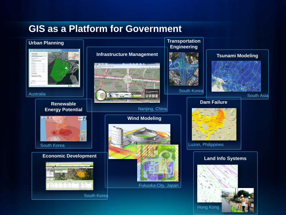
GIS as a Platform for Government Urban Planning
Australia
Renewable Energy Potential
South Korea
Land Info Systems
Hong Kong
Wind Modeling
Fukuoka City, Japan
Infrastructure Management
Nanjing, China
South Korea
Transportation Engineering
Economic Development
South Korea
Tsunami Modeling
South AsiaDam Failure
Luzon, Philippines
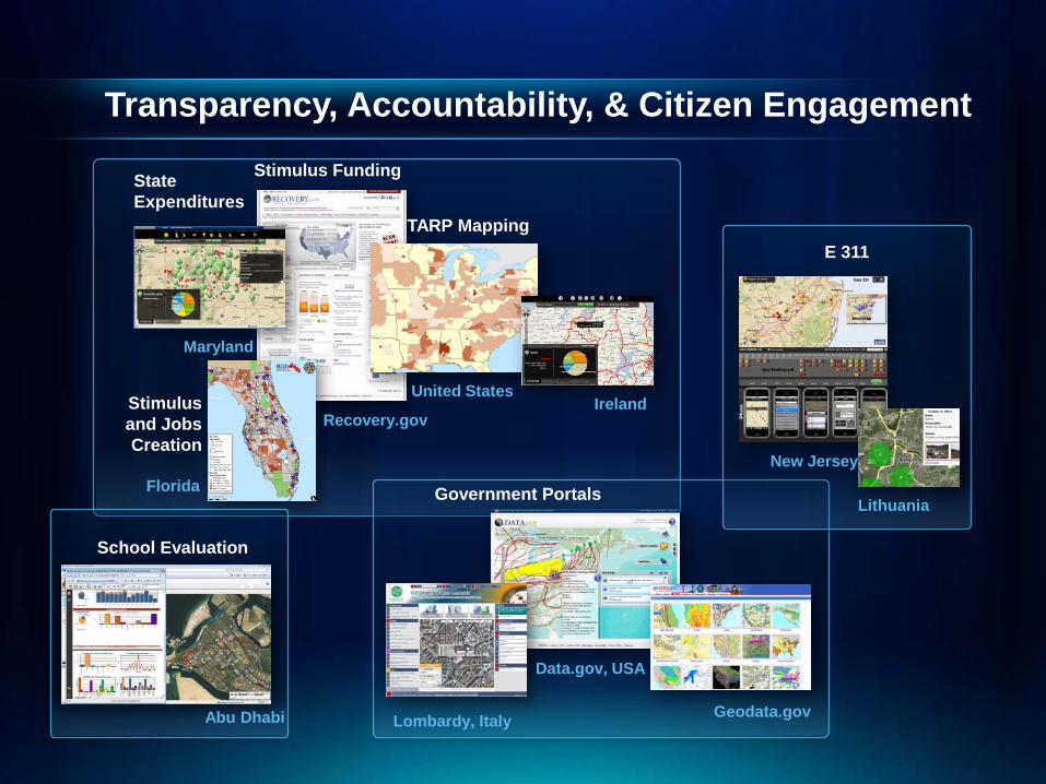
Transparency, Accountability, & Citizen Engagement
State Expenditures
Maryland
Florida
Stimulus and Jobs Creation
United States
TARP Mapping
Stimulus Funding
Recovery.govIreland
Government Portals
Lombardy, Italy
Data.gov, USA
Geodata.gov
E 311
New Jersey
Lithuania
School Evaluation
Abu Dhabi

GIS is About Integration And SharingCreating Common GIS Infrastructure To Support Multiple Activities
. . . Improving Collaboration
. . . Providing Up to Date Information
• Land Use• Zoning
• Permits• Inspections• Addresses
• Water &Sewers • Storm Drains • Streets
• Water Resources• Droughts• Pollution
• Crime Analysis• Public Safety
• Infrastructure• Public Safety• Hazardous
Materials
• Streets• Parcels• Utilities• Air Photos• Addresses• Topo • Public
Access
• License• Owner Address• Utility Meters
Security
Public Works
Environment
EmergencyMgmt.
Building
Planning
Business
Government

Everyone Is Getting More Involved:Crowd Sourcing & Social Media: Creating New Sources of Geospatial Information
Situation Awareness
Analysis
Community Awareness
Social Media
Volunteered Geographic Information (VGI)
• SMS• E-mail• Twitter• Browser
Enriching GIS Systems withDiverse Observations,Perceptions and Opinions
. . . Creating New Opportunities and Challenges
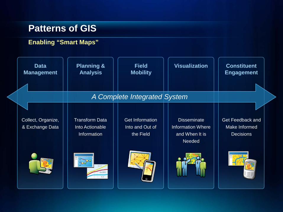
Patterns of GISEnabling “Smart Maps”
DataManagement
A Complete Integrated System
Planning & Analysis
Field Mobility
Visualization Constituent Engagement
Transform Data Into Actionable
Information
Collect, Organize, & Exchange Data
Get Information Into and Out of
the Field
Disseminate Information Where
and When It is Needed
Get Feedback and Make Informed
Decisions

ArcGIS Online – A Growing Mapping Community
Leverage content and Create communities
Maps
ToolsCommunities
Apps

GIS Helps Us to Understand Our WorldExtending Our Thoughts and Experiences
DigitalCognitive

ArcGIS Online
ArcGIS Online
Tools
RoutingGeocodingGazetteerMore coming…
Apps
Ready-to-useConfigurableCustom (APIs)
Communities
Themes OrganizationsEvents Business
Maps
Reference layersDemographicsTemplates

Chicago
Hong Kong
Amsterdam
Rio De Janeiro
Salt Lake City
World Topographic Map
Amherst College

And many, many more …
Earth Hazard Monitor
EnterInfo Snow Plow Solution
ReNew Canada's Top 100 infrastructure projects
Solar BostonCity of Boston
Recovery.gov
World BankData mapper
ArcGIS.com App Gallery
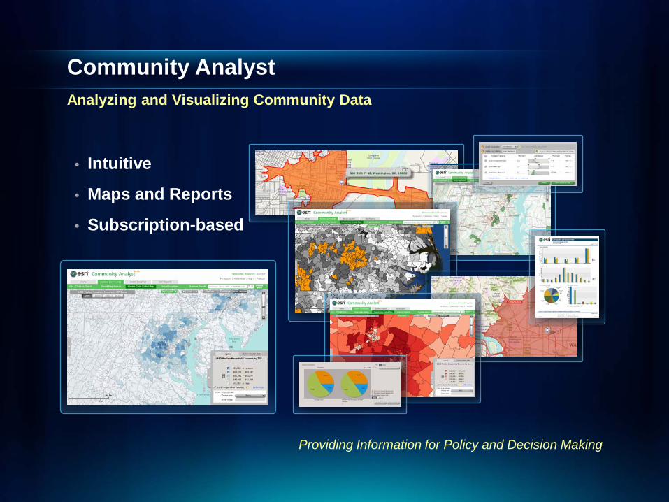
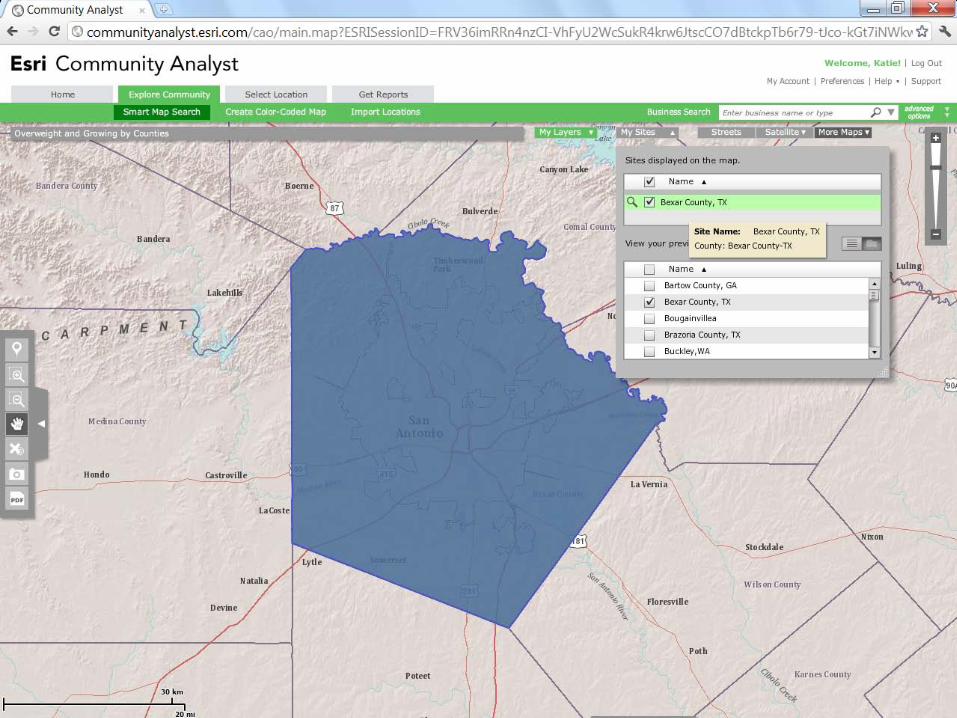
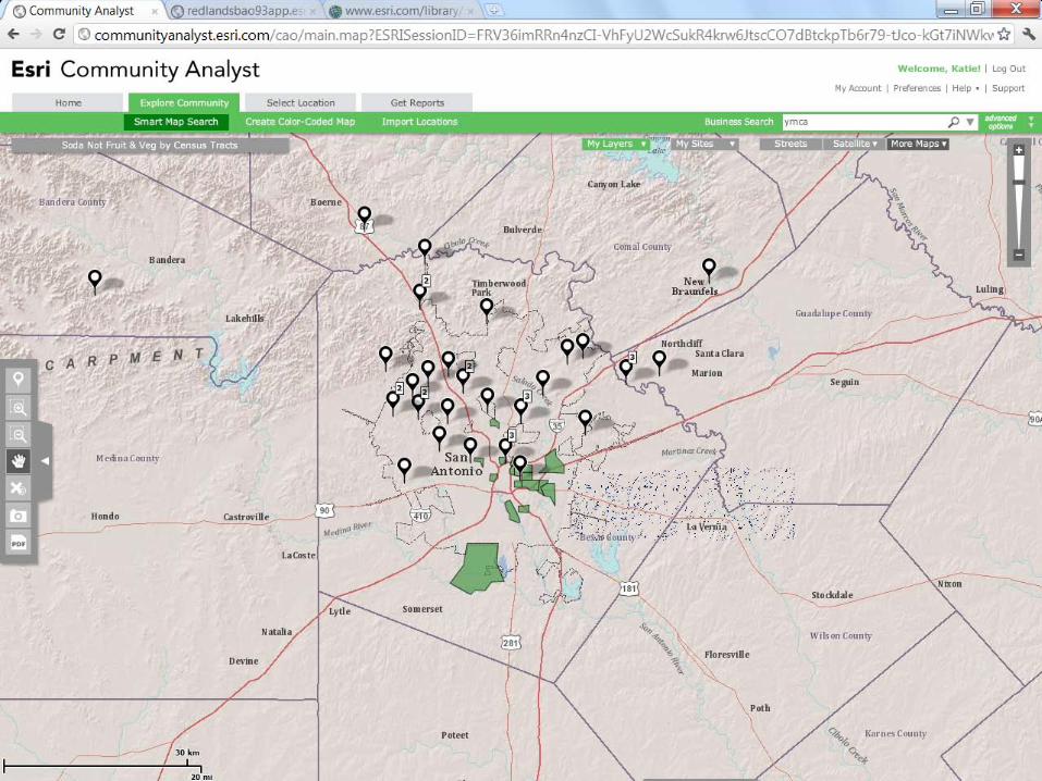
Community AnalystAnalyzing and Visualizing Community Data
• Intuitive
• Maps and Reports
• Subscription-based
Providing Information for Policy and Decision Making


GIS Goes Mobile
Search for ‘Esri’ on the iTunes App Store
ArcGIS Mobile Business Analyst Online My Place History

Within the Next Week…
2 Explore ArcGIS.com
1 Sign up for Community Analystwww.esri.com/communityanalyst
3 Download esri apps from iTunes
