rio/29 small area plan phase 1 september 15, 2016 · rio/29 small area plan phase 1 september 15,...
TRANSCRIPT

Rio/29 Small Area Plan Phase 1
September 15, 2016
Rio/29 – Past, Present, and Future

1
2
3
4
5
1 PROJECT BACKGROUND
2
PRESENT
FUTURE
2 PLANNING CONTEXT
3 PAST
PRESENTATION OVERVIEW

1 PROJECT BACKGROUND
3

Rio Rd/Route29 Small Area Plan
Where: Area around Route 29 North and Rio Road intersection.
What: Planning tool used to guide land use, zoning, transportation improvements, open space, and other capital improvements at a higher level of detail than is possible in a master plan.
Why: New Rio/29 interchange.
Plan will help incorporate interchange with future land use, transportation & capital projects in the area.
Who: Planning staff and Renaissance Planning
Public input throughout
Plan to be adopted by Board of Supervisors
When: Anticipated adoption in 2017
BACKGROUND
PROJECT BACKGROUND

PHASE 1
An overarching vision for the study area
Identification of some early actions to implement this vision
PHASE 2
A detailed Area Plan that supports implementation of the vision
BENEFITS
Certainty
Alignment of vision with market
Encourage urban development
Enable traditional neighborhood design
PROJECT PURPOSE
PROJECT BACKGROUND

2 PLANNING CONTEXT

Comprehensive
Plan
Places29
Master Plan
Rio/29
Small Area Plan
• Coverage area: County-wide
• Broad range of goals and objectives covering multiple topics.
• Last updated June 10, 2015
• Coverage area: Development Area
• Provides a more detailed future land use map, transportation, parks, community facilities.
• Adopted February 2011
• Coverage area: Neighborhood (smaller footprint than DA)
• More detailed land use, transportation plan, design
• To be completed in 2017
LONG RANGE PLANNING IN ALBEMARLE COUNTY
PLANNING CONTEXT

Rio/29 is within a county-designated UDA. The state’s UDA technical assistance program is funding Phase 1 of this project.
UDAs are places suitable for higher density development that incorporates Traditional Neighborhood Development principles:
Pedestrian-friendly road design
Street interconnection
Connected road and pedestrian networks
Natural area preservation
Mixed-use neighborhoods & housing types
Reduced building setbacks
Reduced street width/turning radii
URBAN DEVELOPMENT AREAS (UDAs)
PLANNING CONTEXT

3 RIO/29 PAST

13
• Historically significant place
• Skirmish at Rio Hill occurred
Feb. 29, 1864 near Rio Hill
Shopping Center
• Many African-American
owned properties along
Woodburn and Berkmar
following the Civil War
Source: Piedmont Environmental Council
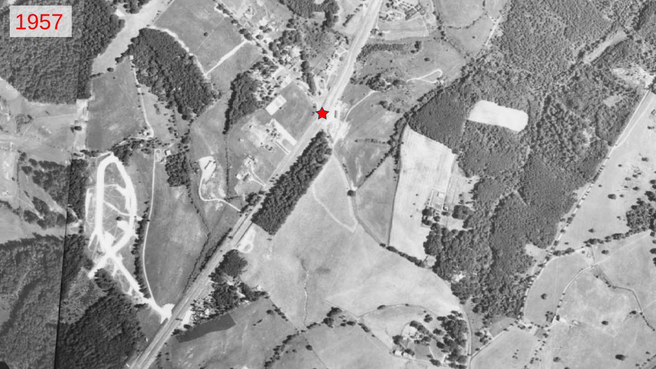
1957

15
1966

16
1974

17
1980
18
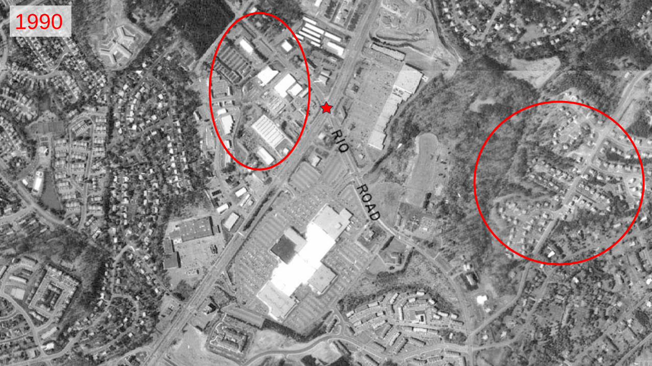
1990
19
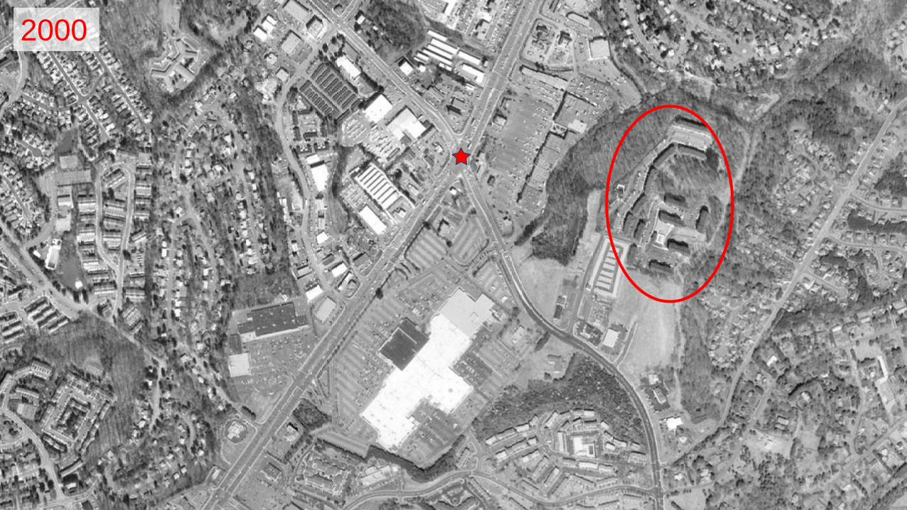
2000
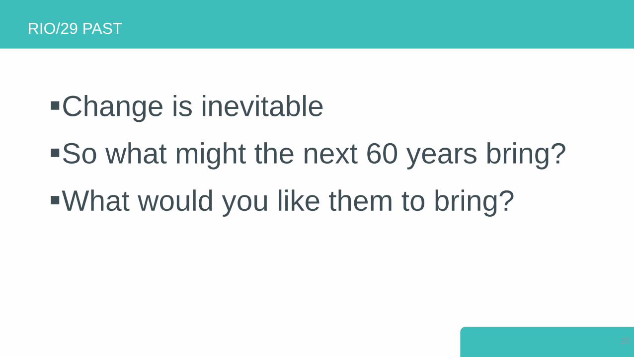
Change is inevitable
So what might the next 60 years bring?
What would you like them to bring?
RIO/29 PAST
20

4 RIO/29 PRESENT
21

22

23

24

25

26

27

28
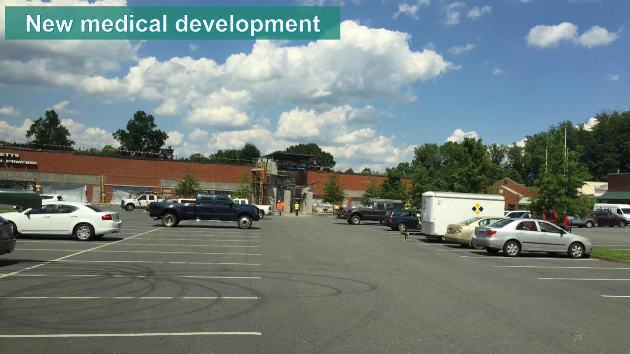
29

30

31

Looked at:
Existing conditions
Policy and code
Market
Transportation
STUDY AREA ANALYSIS
RIO/29 PRESENT
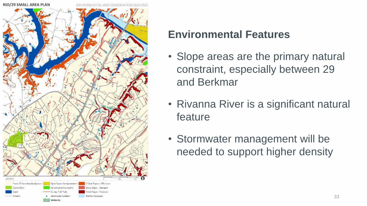
33
Environmental Features
• Slope areas are the primary natural
constraint, especially between 29
and Berkmar
• Rivanna River is a significant natural
feature
• Stormwater management will be
needed to support higher density

34
County Policy
• County plan and Places 29 calls for
• Development area
• Mixed use center
• No change to single family areas

35
County Zoning
• Reflects current uses:
• Retail
• Office
• Industrial
• High density residential on edges
• Little mixed use zoning and
development
• Is there a need to reconcile with
future land use policy?

Source: VEC QCEW 2nd Quarter 2015
Businesses in the Study Area by NAICS Industry Sectors
RIO/29 PRESENT
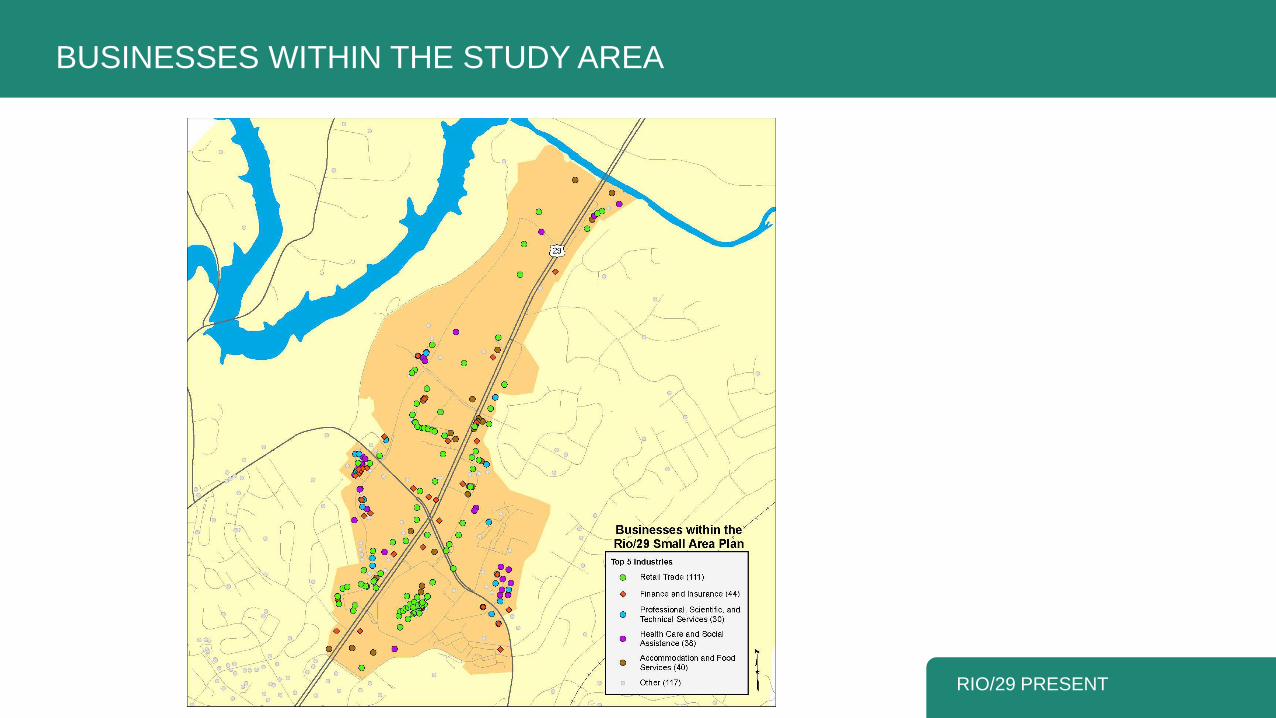
BUSINESSES WITHIN THE STUDY AREA
RIO/29 PRESENT

General Land Use Category Acres
Retail 251.5
Light Industrial 69.5
Residential multifamily 67.5
Office 59.8
Civic 31.3
Existing Major Land Uses
RIO/29 PRESENT 38Source: Albemarle County GIS dataset

Source: VEC, QCEW data 2005 -
2015, historic growth rates for
Albemarle County
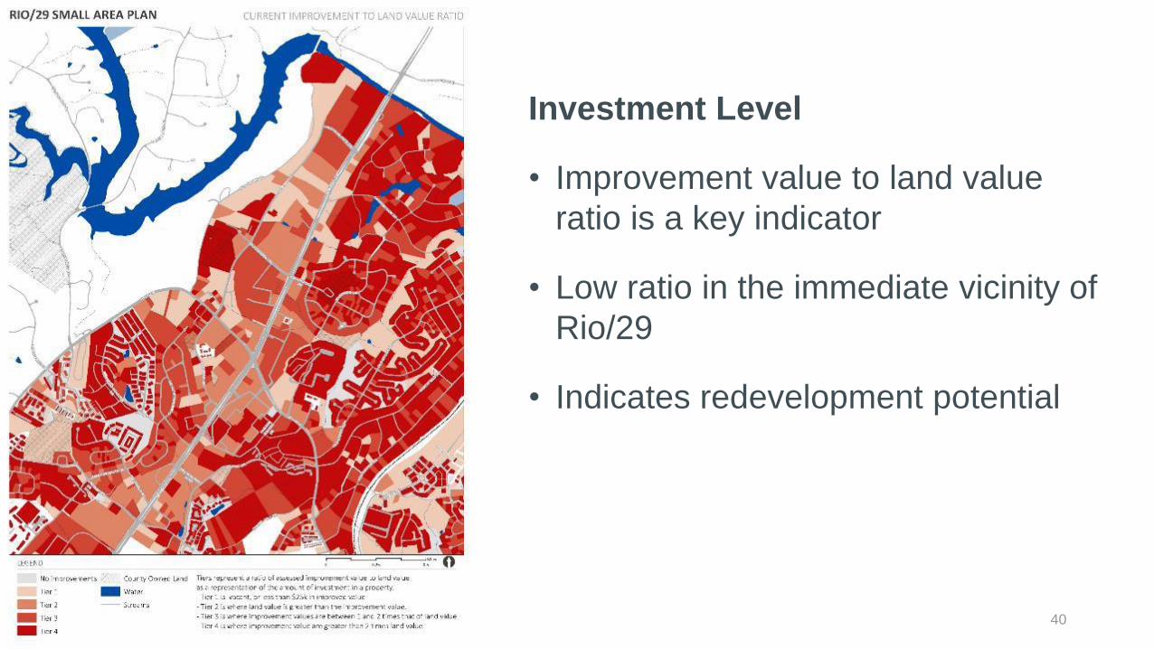
40
Investment Level
• Improvement value to land value
ratio is a key indicator
• Low ratio in the immediate vicinity of
Rio/29
• Indicates redevelopment potential

41
Vacant Property
• Small amount of vacant
property in study area
• Concentrated along 29
near the river

Small Area Plan Vacancy Rates, 10 Year
History
Retail Vacancy
Source: CoStar, September 2016
43
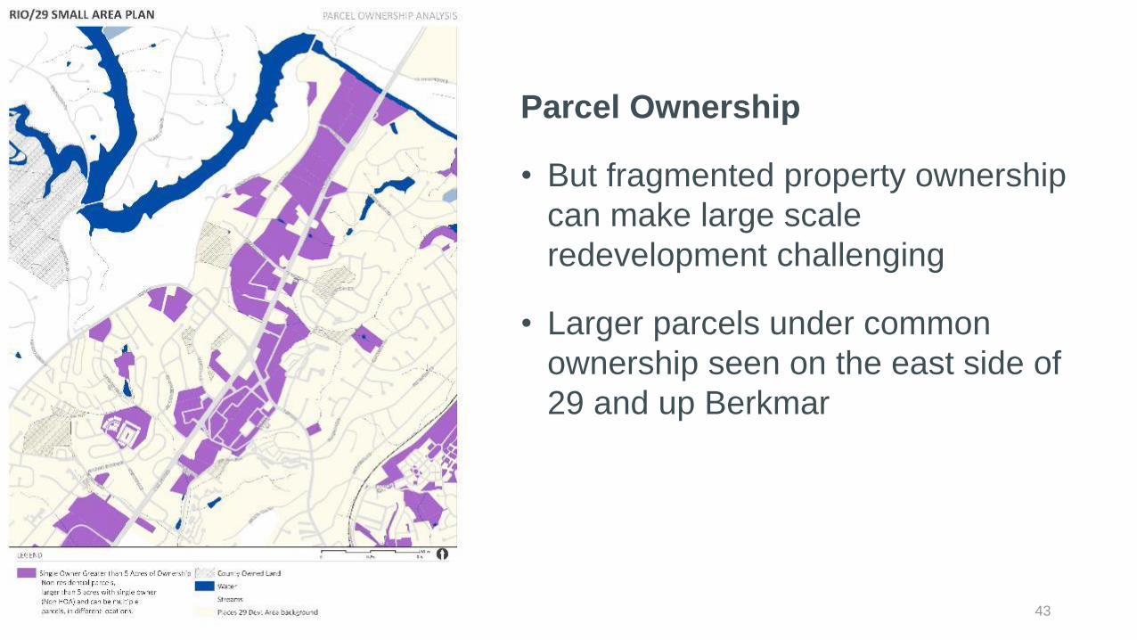
Parcel Ownership
• But fragmented property ownership
can make large scale
redevelopment challenging
• Larger parcels under common
ownership seen on the east side of
29 and up Berkmar

44
Pedestrian Comfort
• A critical ingredient for making a
great place
• Poor to fair on major roads (29, Rio,
and Berkmar)
• These roads are designed to move
vehicles
45
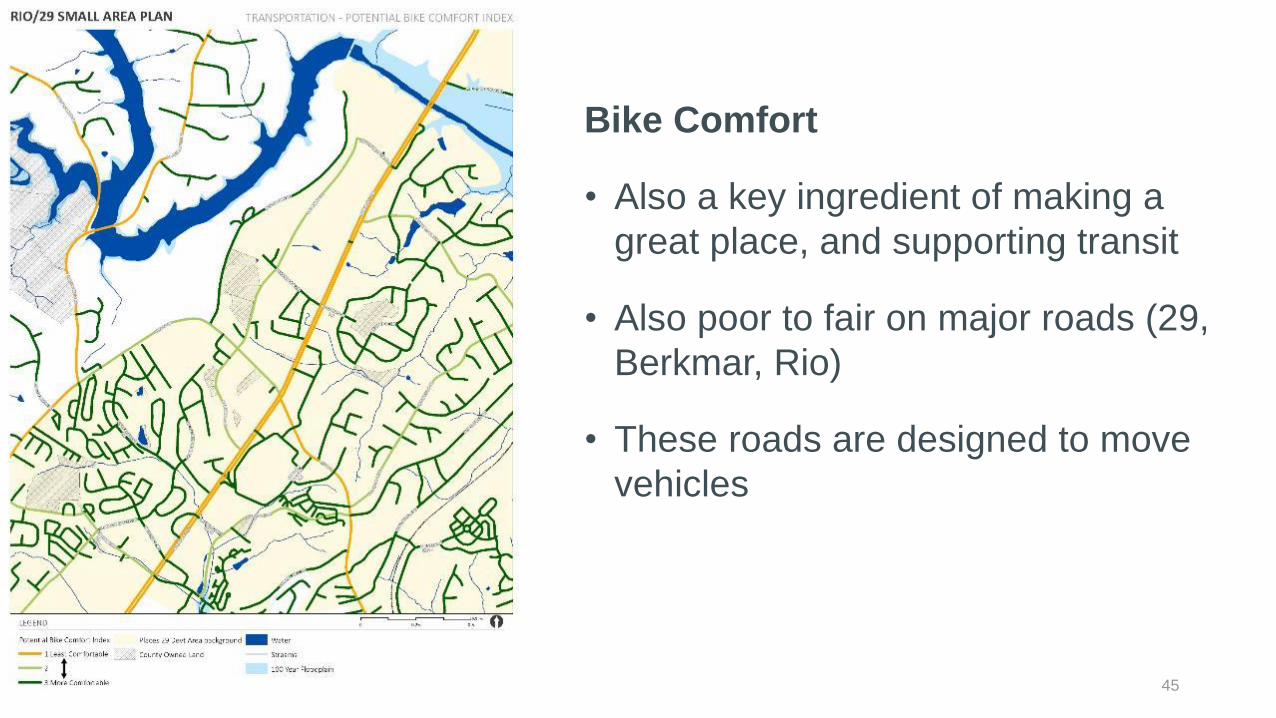
Bike Comfort
• Also a key ingredient of making a
great place, and supporting transit
• Also poor to fair on major roads (29,
Berkmar, Rio)
• These roads are designed to move
vehicles
Area was built for cars; reflected in the design of buildings and streets
Yet there is a desire for something different – A mixed use center
Consistent with the direction of the market
Retail is an important part of the mix, but may not be the driver of change
Getting to the vision requires:
Better streets
Better connectivity
Human-scale design
New uses
Partnership between county and property owners/developers
WHAT DOES IT ALL MEAN?
RIO/29 PRESENT 46

5 RIO/29 FUTURE

Variables where neighborhoods along 29 between the river and 250 have a notable difference with Albemarle + Charlottesville are in bold
Arrows indicate higher or lower than Albemarle + C’Ville
There are few dramatic differences
The larger MSA and state figures are also roughly similar
DEMOGRAPHIC PROFILE & COMPARISON
RIO/29 FUTURE
Analysis AreaAlbemarle +
Charlottesville
Charlottesville
MSAVirginia
Total Population (2016 estimate) 25,597 153,556 233,232 8,462,749
5-Year Projected Annual Pop. Growth Rate 1.52% 1.44% 1.17% 0.97%
Median Age 38.4 35.1 38.0 38.3
Population Age 20-34 22.5% 26.4% 23.1% 20.9%
Population Age 65+ 18.8% 14.8% 15.9% 14.4%
Total Households 10,992 60,612 90,688 3,219,468
Average Household Size 2.28 2.39 2.44 2.55
Median Household Income $56,832 $61,085 $58,454 $64,929
Median Home Value $297,631 $346,725 $280,822 $262,154
Median Year Housing Unit Built 1984 1982 1984 1980
Unemployment Rate 2.8% 3.4% 3.9% 4.6%
Workers Taking Public Transportation to Work 4.7% 4.0% 2.8% 4.5%
Renter Occupied Housing Units 51% 44% 36% 34%
Owner Occupied Housing Units 49% 56% 64% 66%
Households with Income Below Poverty Level 12.5% 14.6% 13.6% 11.0%
Adult Pop. With Bachelor's Degree or Higher 49.2% 53.8% 43.5% 37.5%
Minority Population 36.7% 26.7% 25.7% 37.9%
Source: ESRI Business Analyst
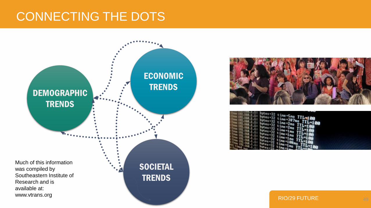
CONNECTING THE DOTS
RIO/29 FUTURE 49
DEMOGRAPHIC
TRENDS
ECONOMIC
TRENDS
SOCIETAL
TRENDS
Much of this information
was compiled by
Southeastern Institute of
Research and is
available at:
www.vtrans.org
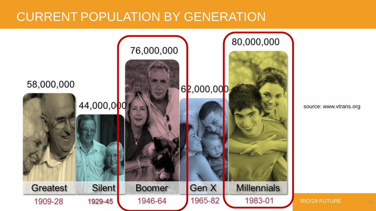
CURRENT POPULATION BY GENERATION
RIO/29 FUTURE 50
source: www.vtrans.org

THE GROWTH OF MILLENIALS
RIO/29 FUTURE 51source: www.vtrans.org

THE KEYS TO ECONOMIC DEVELOPMENT
RIO/29 FUTURE 52source: www.vtrans.org
Keys to prosperity:
BECOME A HUB FOR:
YOUNGER WORKERS
ACTIVE BOOMERS
Growing battle
for Millennial
Workers
Boomers will keep
working
(& starting new
businesses)

NEW MODEL OF ECONOMIC DEVELOPMENT
RIO/29 FUTURE 53
workforce makeup will be based on the
“relative desirability of a place”
source: www.vtrans.org
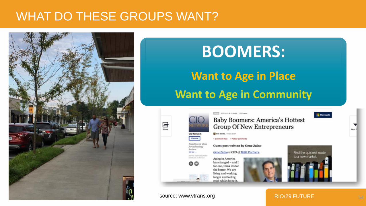
WHAT DO THESE GROUPS WANT?
RIO/29 FUTURE 54
BOOMERS:Want to Age in Place
Want to Age in Community
source: www.vtrans.org
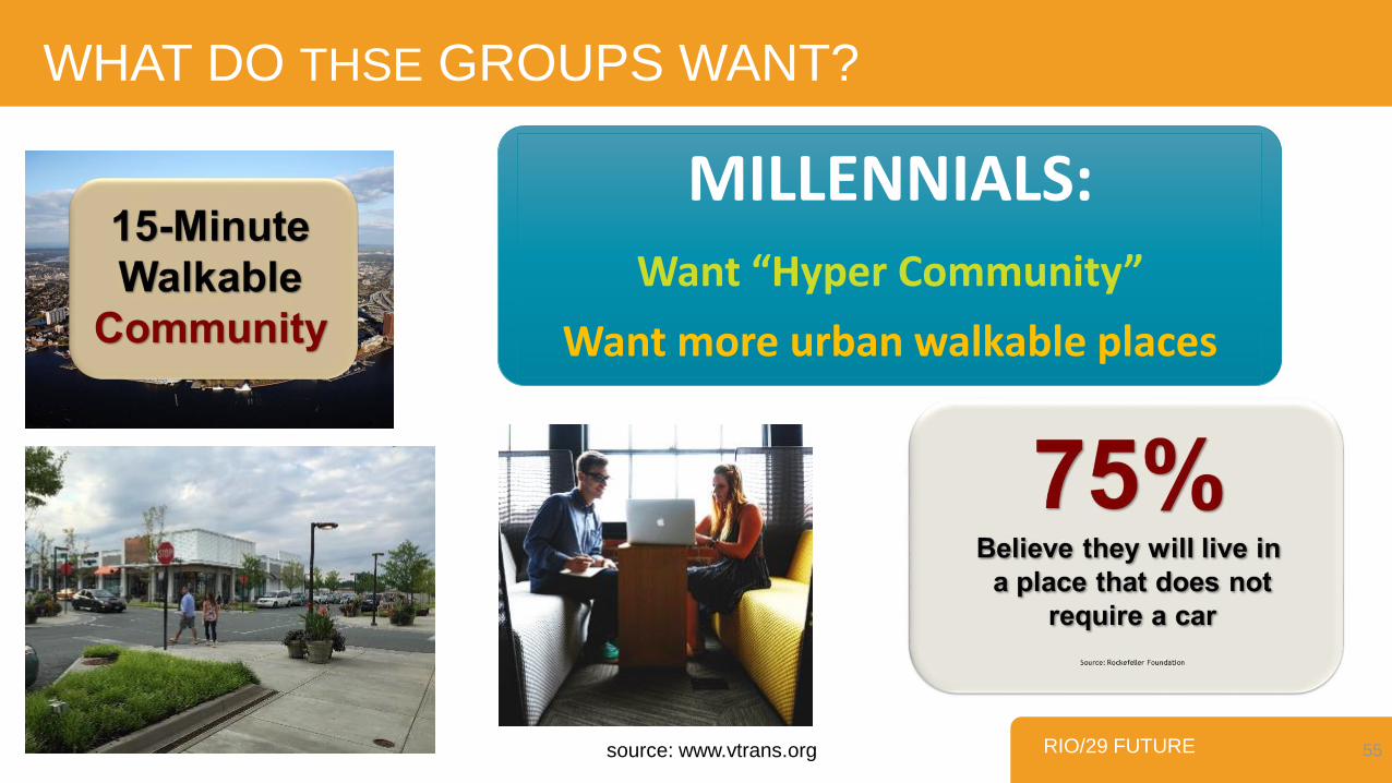
RIO/29 FUTURE 55
WHAT DO THSE GROUPS WANT?
MILLENNIALS:Want “Hyper Community”
Want more urban walkable places
source: www.vtrans.org

WHO IS LOOKING FOR A SENSE OF PLACE
RIO/29 FUTURE 56Investing in place for economic growth and competitiveness; A Research Summary; May 2014
bikers & bikers!
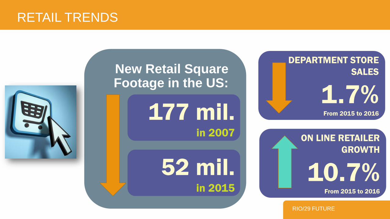
RETAIL TRENDS
RIO/29 FUTURE
ON LINE RETAILER
GROWTH
10.7%From 2015 to 2016
DEPARTMENT STORE
SALES
1.7%From 2015 to 2016177 mil.
in 2007
52 mil.in 2015
New Retail Square Footage in the US:

WHAT DOES THIS MEAN FOR THE FUTURE?
RIO/29 FUTURE 58
proactively:“Create the kind of walkable
attractive place that will attract & support the emerging population and
emerging economy”
source: www.vtrans.org
More Place!
PLACES
29
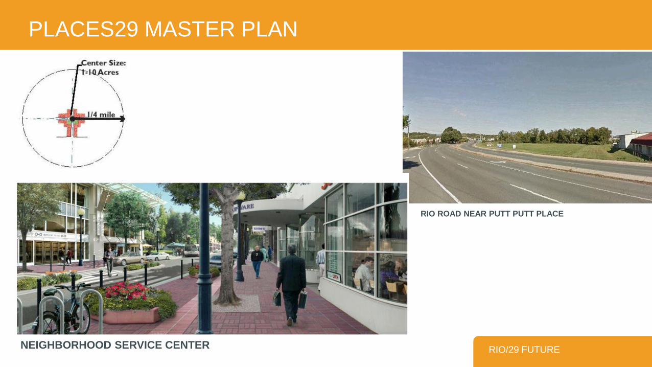
PLACES29 MASTER PLAN
RIO/29 FUTURENEIGHBORHOOD SERVICE CENTER
RIO ROAD NEAR PUTT PUTT PLACE
RIO/29 FUTURE
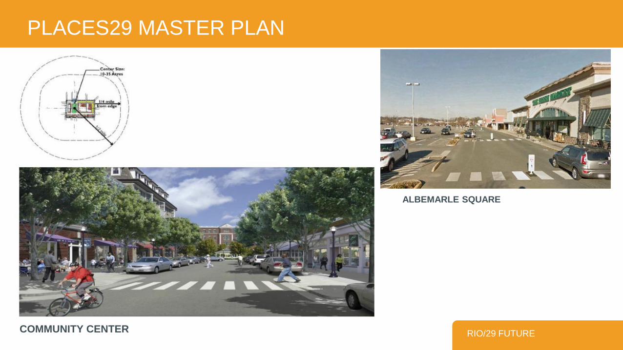
PLACES29 MASTER PLAN
COMMUNITY CENTER
ALBEMARLE SQUARE
PLACES29 MASTER PLAN
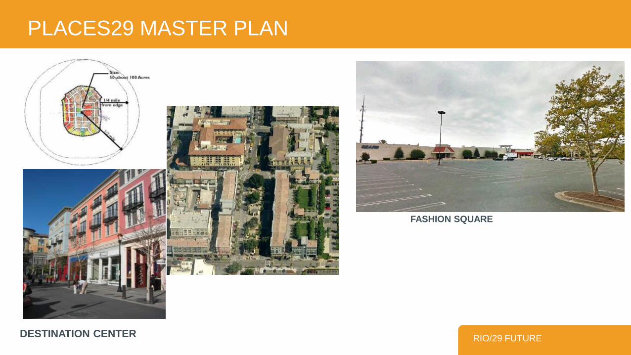
RIO/29 FUTUREDESTINATION CENTER
FASHION SQUARE

Impediments to Redevelopment
Lease agreements
Development staging
Parcel fragmentation
Height limits
Zoning
Risk
Traffic
Attitude towards growth/development
MAKING IT HAPPEN – PROPERTY OWNER & BUSINESS PERSPECTIVE
Examples of Parcel Depths

Opportunities
Supportive zoning
Multifamily housing
Offices
Vertical mixed use
Visibility
Place making
MAKING IT HAPPEN – PROPERTY OWNER & BUSINESS PERSPECTIVE
Lakewood CO Mall redevelopment

What’s Needed?
Leadership and partnerships
Streamline processes
Match future zoning with future vision
Infrastructure
Flexibility
Public transportation
Incentives
MAKING IT HAPPEN – PROPERTY OWNER & BUSINESS PERSPECTIVE

65
Proposed Study Area
• Influenced by the analysis &
Places29 Plan
• Avoid single-family and areas
unlikely to see redevelopment
• 4 quadrants of Rio/29
• Berkmar/29 corridor north of the
interchange

5 QUESTIONS
In small groups:
1. Spend a few minutes writing your ideas on the provided index cards
2. Spend 10 minutes sharing your ideas with the people at your table
3. Select 1 person to provide a brief report-out of your group’s main ideas
4. Leave your cards at the end so we can capture all ideas
DISCUSSION FORMAT
QUESTIONS q67

GREEN CARD
• What uses would you like to see in this area in the future?
For example, more or less housing, retail, office, industry, open space, etc.?
DISCUSSION QUESTION 1
QUESTIONS q68

BLUE CARD
• What do you want future development to look like?
Consider factors such as height, setbacks from the street, density, access streets, landscaping, etc.
Can you think of an example in an other community that might work well here?
DISCUSSION QUESTION 2
QUESTIONS q69

RED CARD
• What do you not want to see in this area in the future?
Consider land uses and design elements, as you did for the previous two questions.
DISCUSSION QUESTION 3
QUESTIONS q70