road 177 communication site
TRANSCRIPT
County of Riverside Public Safety Enterprise Communication ProjectAppendix A: Candidate Site Descriptions Road 177 Communication Site
Michael Brandman Associates 1H:\Client\2749\27490003\ADEIR_4-30-08\Appendices\App A Candidate Site Descriptions\Road 177.doc
Road 177 Communication Site
Overview
The site is located adjacent to an existing communication tower, approximately 400 feet west of StateRoute 177 (Highway 177 / Desert Center-Rice Road) and 15 miles north of Desert Center. Theproposed project would place a tower and an equipment shelter at the site.
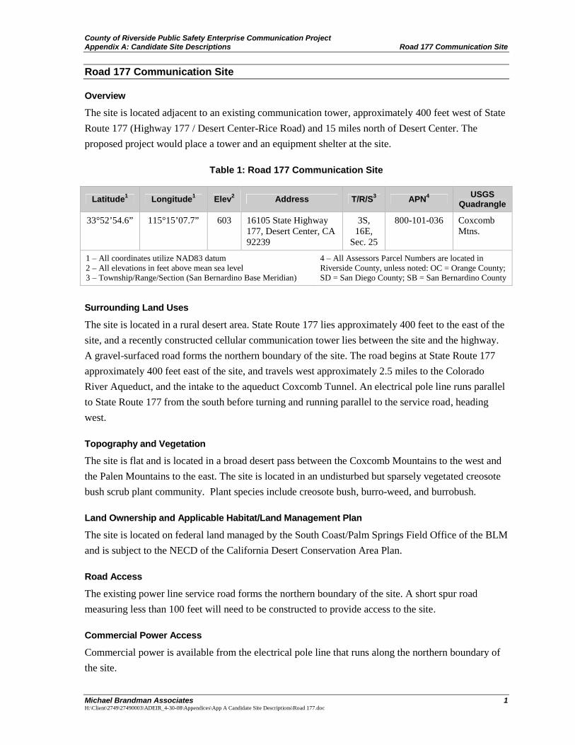
Table 1: Road 177 Communication Site
Surrounding Land Uses
The site is located in a rural desert area. State Route 177 lies approximately 400 feet to the east of thesite, and a recently constructed cellular communication tower lies between the site and the highway.A gravel-surfaced road forms the northern boundary of the site. The road begins at State Route 177approximately 400 feet east of the site, and travels west approximately 2.5 miles to the ColoradoRiver Aqueduct, and the intake to the aqueduct Coxcomb Tunnel. An electrical pole line runs parallelto State Route 177 from the south before turning and running parallel to the service road, headingwest.
Topography and Vegetation
The site is flat and is located in a broad desert pass between the Coxcomb Mountains to the west andthe Palen Mountains to the east. The site is located in an undisturbed but sparsely vegetated creosotebush scrub plant community. Plant species include creosote bush, burro-weed, and burrobush.
Land Ownership and Applicable Habitat/Land Management Plan
The site is located on federal land managed by the South Coast/Palm Springs Field Office of the BLMand is subject to the NECD of the California Desert Conservation Area Plan.
Road Access
The existing power line service road forms the northern boundary of the site. A short spur roadmeasuring less than 100 feet will need to be constructed to provide access to the site.
Commercial Power Access
Commercial power is available from the electrical pole line that runs along the northern boundary ofthe site.
Latitude1 Longitude1 Elev2 Address T/R/S3 APN4 USGSQuadrangle
33°52’54.6” 115°15’07.7” 603 16105 State Highway177, Desert Center, CA92239
3S,16E,
Sec. 25
800-101-036 CoxcombMtns.
1 – All coordinates utilize NAD83 datum2 – All elevations in feet above mean sea level3 – Township/Range/Section (San Bernardino Base Meridian)
4 – All Assessors Parcel Numbers are located inRiverside County, unless noted: OC = Orange County;SD = San Diego County; SB = San Bernardino County
27490003 • 04/2008 | road_177.mxd
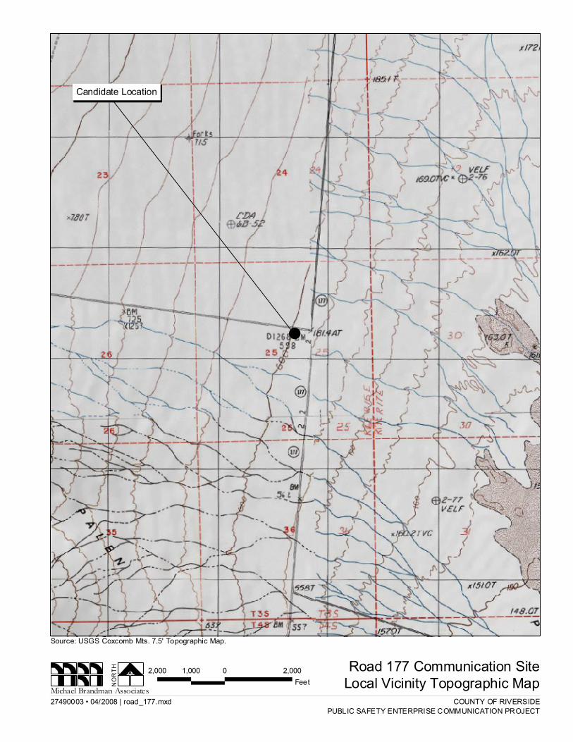
Road 177 Communication SiteLocal Vicinity Topographic MapNO
RTH
Michael Brandman Associates
Source: USGS Coxcomb Mts. 7.5' Topographic Map.
COUNTY OF RIVERSIDEPUBLIC SAFETY ENTERPRISE COMMUNICATION PROJECT
!
2,000 0 2,0001,000Feet
Candidate Location
27490003 • 04/2008 | road_177_aerial.mxd
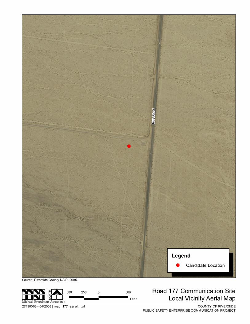
Road 177 Communication SiteLocal Vicinity Aerial MapNO
RTH
Michael Brandman Associates
Source: Riverside County NAIP, 2005.
COUNTY OF RIVERSIDEPUBLIC SAFETY ENTERPRISE COMMUNICATION PROJECT
!
Rice R
oad
500 0 500250Feet
Legend! Candidate Location
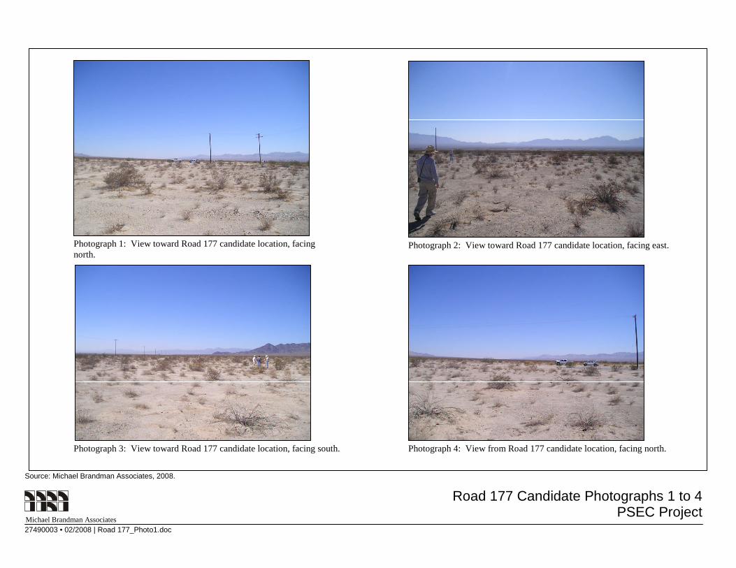
Road 177 Candidate Photographs 1 to 4PSEC Project
Source: Michael Brandman Associates, 2008.
Michael Brandman Associates27490003 • 02/2008 | Road 177_Photo1.doc
Photograph 1: View toward Road 177 candidate location, facingnorth.
Photograph 2: View toward Road 177 candidate location, facing east.
Photograph 3: View toward Road 177 candidate location, facing south. Photograph 4: View from Road 177 candidate location, facing north.
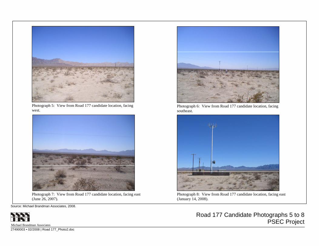
Road 177 Candidate Photographs 5 to 8PSEC Project
Source: Michael Brandman Associates, 2008.
Michael Brandman Associates27490003 • 02/2008 | Road 177_Photo2.doc
Photograph 5: View from Road 177 candidate location, facingwest.
Photograph 6: View from Road 177 candidate location, facingsoutheast.
Photograph 7: View from Road 177 candidate location, facing east(June 26, 2007).
Photograph 8: View from Road 177 candidate location, facing east(January 14, 2008).