rockfort quarry proposalrockfort quarry proposal infonite... · rockfort quarry proposalrockfort...
TRANSCRIPT

1
Rockfort Quarry Information EveningNovember 19, 2008
A short History of theA short History of theRockfort Quarry ProposalRockfort Quarry Proposal
Lorraine Symmes

2
Good evening everyone.
My name is Lorraine Symmes and I’m going to take you through an abbreviated version of the last eleven years for those of you who are new to this, or for those who need a quick refresher.
3
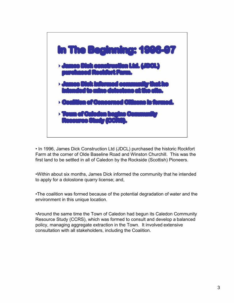
James Dick construction Ltd. (JDCL)purchased Rockfort Farm.
James Dick informed community that heintended to mine dolostone at the site.
Coalition of Concerned Citizens is formed.
Town of Caledon begins CommunityResource Study (CCRS).
In The Beginning: 1996In The Beginning: 1996--9797
• In 1996, James Dick Construction Ltd (JDCL) purchased the historic Rockfort Farm at the corner of Olde Baseline Road and Winston Churchill. This was the first land to be settled in all of Caledon by the Rockside (Scottish) Pioneers.
•Within about six months, James Dick informed the community that he intended to apply for a dolostone quarry license; and,
•The coalition was formed because of the potential degradation of water and the environment in this unique location.
•Around the same time the Town of Caledon had begun its Caledon Community Resource Study (CCRS), which was formed to consult and develop a balanced policy, managing aggregate extraction in the Town. It involved extensive consultation with all stakeholders, including the Coalition.
4
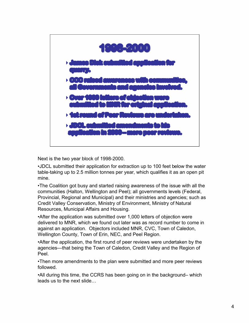
James Dick submitted application for quarry.
CCC raised awareness with communities,all Governments and agencies involved.
Over 1000 letters of objection were submitted to MNR for original application.
1st round of Peer Reviews are undertaken.
JDCL submitted amendments to his application in 2000 – more peer reviews.
19981998--20002000
Next is the two year block of 1998-2000.•JDCL submitted their application for extraction up to 100 feet below the water table-taking up to 2.5 million tonnes per year, which qualifies it as an open pit mine.•The Coalition got busy and started raising awareness of the issue with all the communities (Halton, Wellington and Peel); all governments levels (Federal, Provincial, Regional and Municipal) and their ministries and agencies; such as Credit Valley Conservation, Ministry of Environment, Ministry of Natural Resources, Municipal Affairs and Housing.•After the application was submitted over 1,000 letters of objection were delivered to MNR, which we found out later was as record number to come in against an application. Objectors included MNR, CVC, Town of Caledon, Wellington County, Town of Erin, NEC, and Peel Region.•After the application, the first round of peer reviews were undertaken by the agencies—that being the Town of Caledon, Credit Valley and the Region of Peel.•Then more amendments to the plan were submitted and more peer reviews followed.•All during this time, the CCRS has been going on in the background– which leads us to the next slide…

5
Completed CCRS morphs into Caledon OPA 161 Coalition participates in settlement talksOPA 161 settled and approved by OMBThird set of peer reviews done by
agencies
WINNING PRECEDENTWINNING PRECEDENT
The OMB ruled that JDCL’s application must comply with the new tougher aggregate policies as outlined in OPA 161.
20012001--20032003
In this block of two years:• The CCRS completes and morphs into the new aggregate policy Official Plan
Amendment (OPA 161) – a precedent setting plan for managing aggregate extraction in the Town. This was promptly appealed to the OMB by a number of parties and settlement talks began.
• The coalition was involved in these talks to encourage good land use planning.
• In 2003, OPA 161 was approved by the OMB and the Rockfort Quarryapplication, which had been appealed to the OMB, started to move forward.
• Meanwhile more amendments to the application had been filed and more peer reviews followed.
• Then something very important happened….At the end of 2003, in a precedent setting decision, the OMB ruled that JDCL’s application must comply with the new, tougher, aggregate policies as outlined in the Town’s OPA 161.This was a very important win for the Town, the Region and the Coalition.

6
James Dick, to comply with OPA 161 and must conduct a Comprehensive Broader Environmental Study (CBSES) for Resource Area 9-A ‘reserve’ lands.
Two years of negotiations occurred to determine what the agencies required to complete the CBSES.
JDCL agrees to do the outstanding studies on water and the environment.
20042004--20062006
The next two year block pertains to that precedent setting decision.
•Now, James Dick had to comply with 161, which said that applications in reserve lands – such as Rockfort – must conduct a Comprehensive Broader Scale Environmental Study (CBSES). Rockfort is nested within “Aggregate Resource Area 9A” and the study involves the broader area that could be impacted. This was meant to be the equivalent of a sub-watershed study.
•Two years of negotiations followed to work out what was required by the agencies to fulfill the CBSES; and,
•JDCL agrees to do the outstanding studies on water and the environment.
7
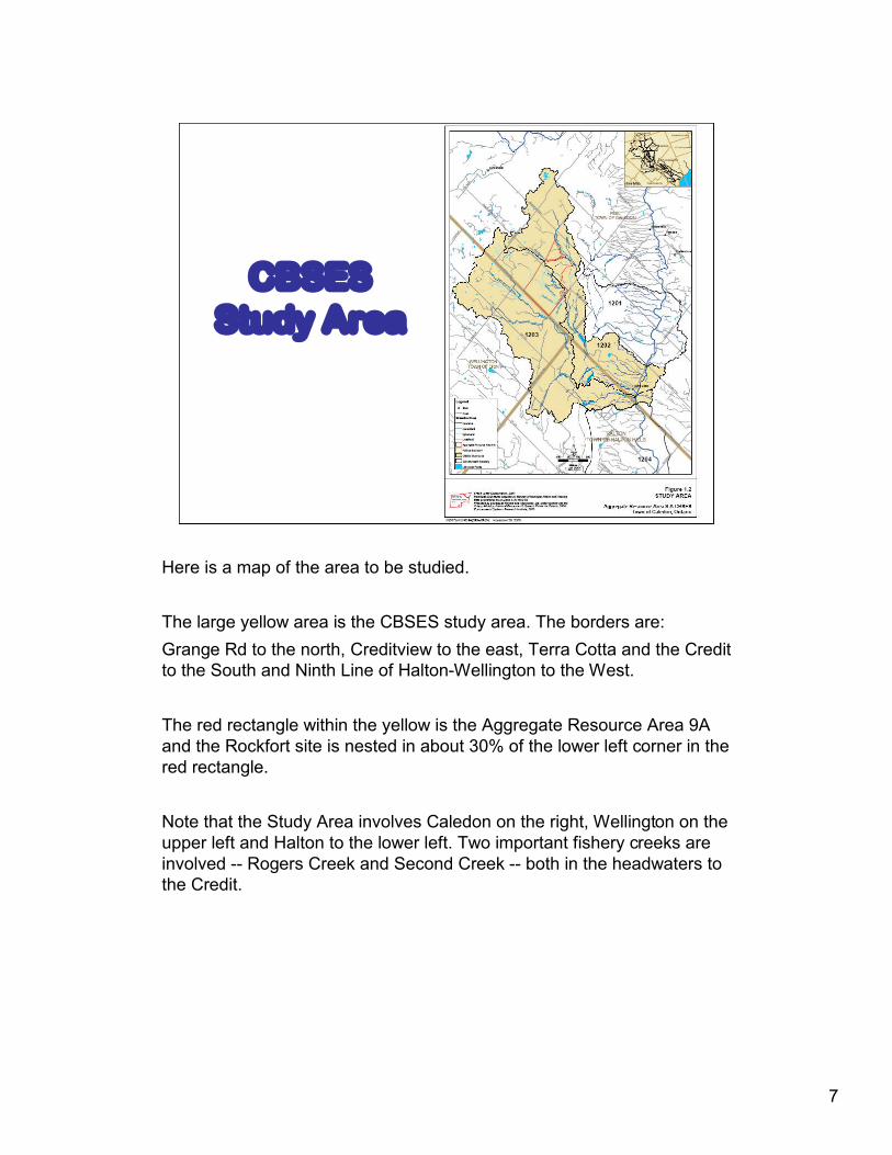
CBSESStudy Area
Here is a map of the area to be studied.
The large yellow area is the CBSES study area. The borders are:Grange Rd to the north, Creditview to the east, Terra Cotta and the Credit to the South and Ninth Line of Halton-Wellington to the West.
The red rectangle within the yellow is the Aggregate Resource Area 9A and the Rockfort site is nested in about 30% of the lower left corner in the red rectangle.
Note that the Study Area involves Caledon on the right, Wellington on the upper left and Halton to the lower left. Two important fishery creeks are involved -- Rogers Creek and Second Creek -- both in the headwaters to the Credit.

8
Two years of studies and draft reports for CBSES. Final report submitted March’08
CCC conducted water tour of the area
JDCL submitted updated site plan July’08
CCC presented over 1000 Letters of Objection to MNR for 10th Anniversary
Fourth set of peer reviews is in process
FINAL OMB HEARING: May 25th, 2009
20062006--20082008
From 2006-2008 water and environmental data were collected and studied to produce draft and then final reports for the CBSES. The final report was handed in March 2008 by JDCL.
That same Spring, the Coalition hosted an important Water Tour of the area and I’ll tell you more about that in the next slide.
Having finished the new study, JDCL took that information and updated their site plans for Rockfort Quarry and submitted it July 31, 2008.
During the summer, the Coalition realized it was the 10th anniversary of the application submission, so we delivered an additional 1,000 letters of objection to the Minister of Natural Resources – just to reiterate that many, many people are still concerned about the risks of this proposal.
With the new set of updated plans, the fourth round of peer reviews are underway by the agencies and the Coalition.
After many scheduling delays, we now have a date of May 25th for the OMB Hearing to begin.
9
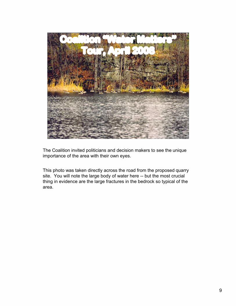
Coalition “Water Matters”Tour, April 2008
The Coalition invited politicians and decision makers to see the unique importance of the area with their own eyes.
This photo was taken directly across the road from the proposed quarry site. You will note the large body of water here -- but the most crucial thing in evidence are the large fractures in the bedrock so typical of the area.

10
Back to Basics
Fractured Bedrock
Over 20 Environmentally Sensitive Areas
Huge Volumes of Water
Interplay of Ground and Surface Water
This map shows the over 20 Environmentally Significant Areas surrounding the site and haul route.
We hired a bus for the tour and spent two hours going through this wonderful rugged landscape. The map clearly shows the extent and variety of these significant areas.
It had lightly snowed the night before, which proved to highlight all the running water, springs and wetlands that are part of what makes this area so important.
I invite you to look closer at these blow-up maps on the easels at the end of the meeting, as their details are interesting and show you what we had on display at the tour.

11
Go With The Go With The FlowFlow
Paris MoraineNiagara EscarpmentThe Credit RiverFractured Bedrock
Major Features & Functions
We wanted our decision makers to see how the area is complex, fragile and interconnected. We are blessed with three major features that comprise very High Environmental values to our area.
First--The Paris Moraine--which is equally important as the Oak Ridges Moraine that lies above the escarpment. The Paris Moraine acts like a sieve or rain barrel that allows water to penetrate deeply into the underground aquifers.
Second-The Niagara Escarpment--a UNESCO World Biosphere Reserve -- is extremely important for holding back the water like a big rock sponge that releases groundwater to the Credit all year long.
And thirdly--The Credit River that is the most diverse cold water fishery in Ontario and is very important on may levels.
The limestone bedrock of the Escarpment is known for its complexvertical and horizontal fractures which can connect water for short or long distances. Water finds its own pathways above and below this rock in very complex ways feeding water wells, springs, creeks, ponds, wetlands and the native brook trout fishery. Blasting can damage and disrupt these water pathways depending on their location.
12
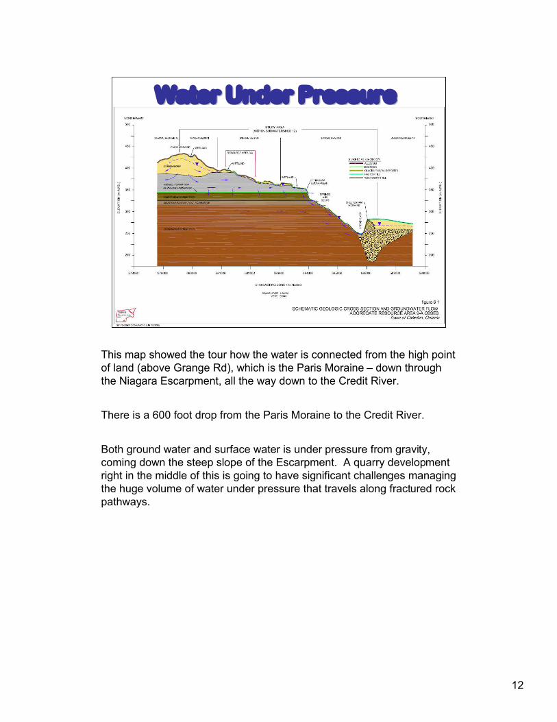
Water Under PressureWater Under Pressure
This map showed the tour how the water is connected from the high point of land (above Grange Rd), which is the Paris Moraine – down through the Niagara Escarpment, all the way down to the Credit River.
There is a 600 foot drop from the Paris Moraine to the Credit River.
Both ground water and surface water is under pressure from gravity, coming down the steep slope of the Escarpment. A quarry development right in the middle of this is going to have significant challenges managing the huge volume of water under pressure that travels along fractured rock pathways.

13
Unique Unique AreaArea--UniqueUnique RecreationRecreationGTAGTA’’ss Backyard PlaygroundBackyard Playground
Rockfort is not just a local issue.
Because of all that’s here--the World Biosphere-the high environmental values -- the high scenic values -- the high cultural values it follows there are also high recreational values to this area close to the GTA.
In short you’d be hard-pressed to find a worse place to put an large industrial development.
14
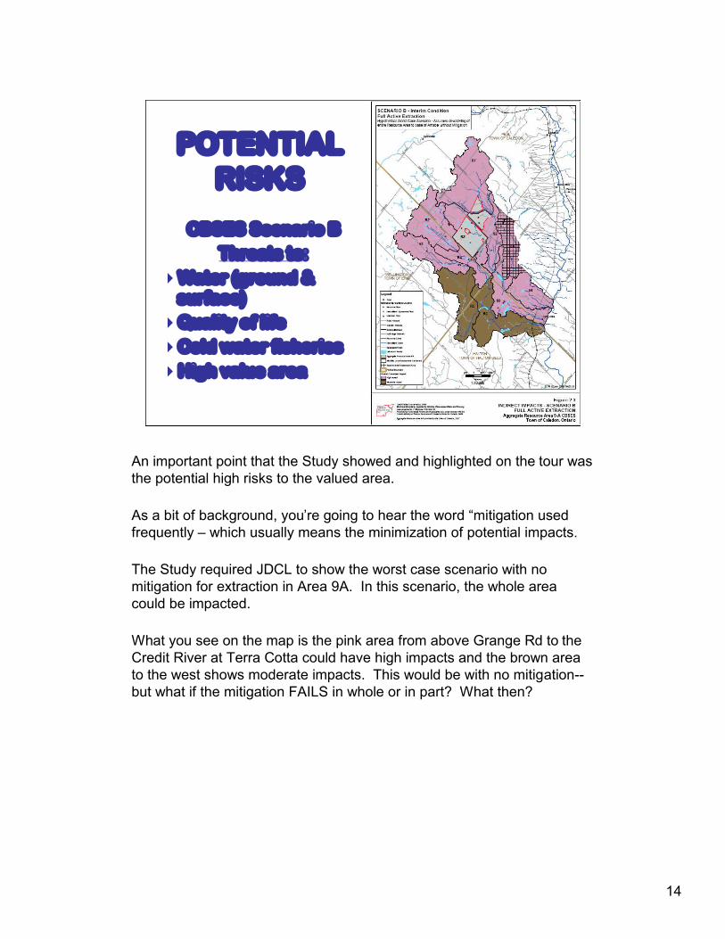
POTENTIAL RISKS
CBSES Scenario BThreats to:
Water (ground & surface)Quality of lifeCold water fisheriesHigh value area
An important point that the Study showed and highlighted on the tour was the potential high risks to the valued area.
As a bit of background, you’re going to hear the word “mitigation used frequently – which usually means the minimization of potential impacts.
The Study required JDCL to show the worst case scenario with no mitigation for extraction in Area 9A. In this scenario, the whole area could be impacted.
What you see on the map is the pink area from above Grange Rd to the Credit River at Terra Cotta could have high impacts and the brown area to the west shows moderate impacts. This would be with no mitigation--but what if the mitigation FAILS in whole or in part? What then?
15
WATER WATER Our Most Important ResourceOur Most Important Resource
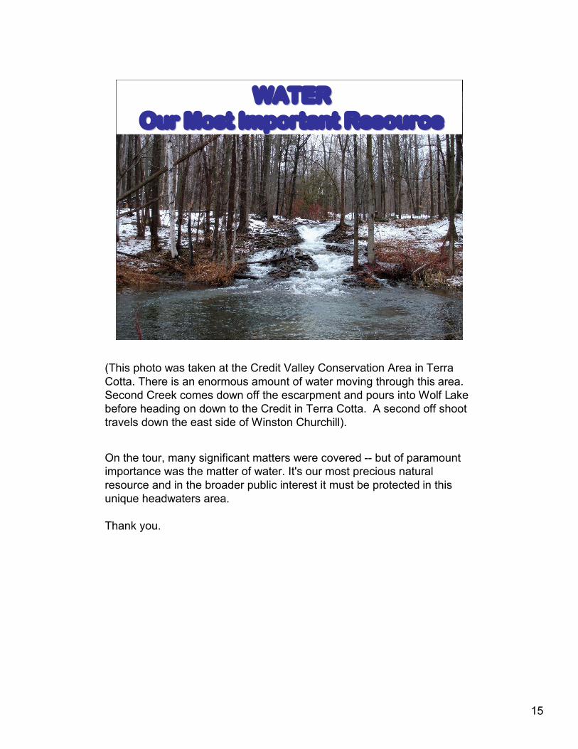
(This photo was taken at the Credit Valley Conservation Area in Terra Cotta. There is an enormous amount of water moving through this area. Second Creek comes down off the escarpment and pours into Wolf Lake before heading on down to the Credit in Terra Cotta. A second off shoot travels down the east side of Winston Churchill).
On the tour, many significant matters were covered -- but of paramount importance was the matter of water. It's our most precious natural resource and in the broader public interest it must be protected in this unique headwaters area.
Thank you.