sarscape for envi -...
TRANSCRIPT

SARscape for ENVI
A Complete SAR Analysis Solution

IDL and ENVI
A Foundation for SARscape

Visual Information Solutions
• Data Access:
IDL supports virtually every data format,
type and size so you can focus on
interpreting your data
• Data Analysis:
IDL includes a rich library of proven math,
statistics, image processing and signal
processing routines
• Data Visualization:
IDL is specifically designed for visualizing
large and complex datasets
IDL – The Data Analysis & Visualization Platform

Visual Information Solutions
• Array-oriented operations
• Built-in signal and image processing
routines
• Extensive numerical analysis and
statistics
• Wavelet analysis
• LAPACK Library
• IDL Analyst: IMSL Library
• Multi-threaded processing
• User-defined routines
Data Analysis
Visual Information Solutions
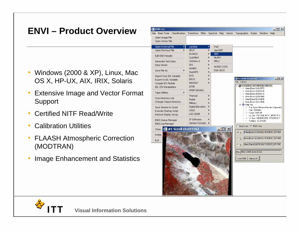
• Windows (2000 & XP), Linux, Mac
OS X, HP-UX, AIX, IRIX, Solaris
• Extensive Image and Vector Format
Support
• Certified NITF Read/Write
• Calibration Utilities
• FLAASH Atmospheric Correction
(MODTRAN)
• Image Enhancement and Statistics
ENVI – Product Overview

Visual Information Solutions
• Regions of Interest Utilities
• Image Transforms and Filtering
• Change Detection Analysis
• Automatic Image Registration and
Orthorectification
• Mosaicking
• Map Composition
ENVI – Product Overview

Visual Information Solutions
• ENVI is a complete image processing
and remote sensing software package
• Leader in multispectral and
hyperspectral analysis
• Intuitive GUI makes ENVI easy to learn
and use
• ITT’s Global Services Group are experts
at using IDL to extend and customize
ENVI
ENVI – Summary

SARscape

Visual Information Solutions
What is SARscape?
• A modular set of functions dedicated tothe generation of products derived fromspaceborne Synthetic Aperture Radar(including JERS-1, ERS-1/2, Radarsat-1, ENVISAT/ASAR andALOS/PALSAR)
• Developed by sarmap, a Swisscompany
• An ENVI plug-in written in C++
• Currently comprised of 6 modules, 2base modules and 4 extensions, withmore on the way
• Very robust variety of SAR tools thatare complimented by the power ofENVI and IDL
Interferogram
Coherence Image

Visual Information Solutions
SARscape in ENVI
• SARscape appears as a main menu item in ENVI with all of the
modules appearing as items under the main SARscape menu

Visual Information Solutions
Current SARscape Modules
Basic
• includes a set of processing steps for the generation of SAR-based products
• complemented by multi-purpose tools which include a wide range of functions -from image visualisation, to Digital Elevation Model import and interpolation, tocartographic and geodetic transforms
Focusing
• extends focusing capabilities to RADARSAT-1 (Fine Beam and Standard Beam),ENVISAT ASAR (Alternating Polarisation, Image, and Wide Swath), and ALOSPALSAR (Fine Beam, ScanSAR, Polarimetric) data
Gamma & Gaussian Filter Module
• an extension of the Basic module
• includes a whole family of SAR specific filters
• algorithms are based on Gamma/Gaussian-distributed scene models
• particularly efficient at reducing speckle, while preserving the radar reflectivity, thetextural properties and the spatial resolution, especially in strongly textured SARimages

Visual Information Solutions
Current SARscape Modules
Interferometry (InSAR/DInSAR)
• Interferometric SAR (or 2-pass interferometry, InSAR) and DifferentialInterferometric SAR (or n-pass interferometry, DInSAR) module
• dedicated to the generation of Digital Elevation Model, Coherence, and LandDisplacement maps
ScanSAR Interferometry (InSAR/DInSAR)
• developed by aresys based on an original algorithm of Politecnico di Bari(POLIBA)
• extends the Interferometry module to ScanSAR mode
• offers some brand-new low resolution products, such as Coherence,Interferogram, and Land Displacement maps
SAR Polarimetry & Polarimetric Interferometry (PolSAR &PolInSAR)
• supports the processing of polarimetric and polarimetric interferometric SARdata
Visual Information Solutions
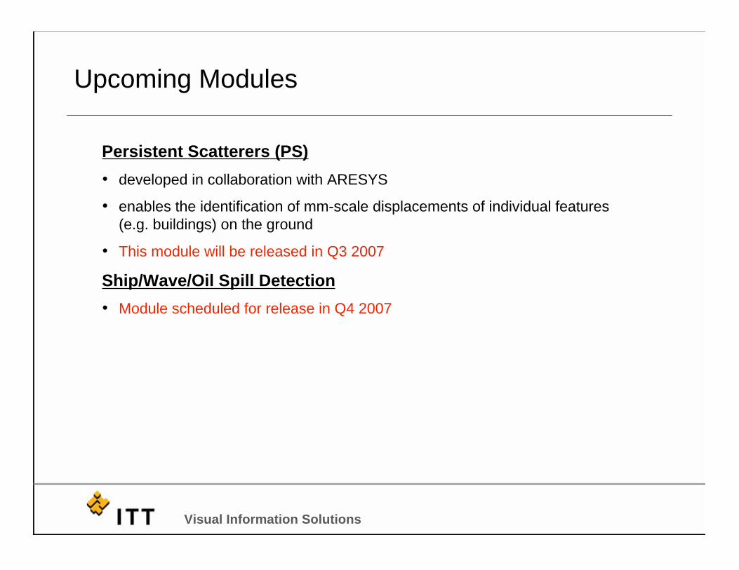
Upcoming Modules
Persistent Scatterers (PS)
• developed in collaboration with ARESYS
• enables the identification of mm-scale displacements of individual features
(e.g. buildings) on the ground
• This module will be released in Q3 2007
Ship/Wave/Oil Spill Detection
• Module scheduled for release in Q4 2007

Visual Information Solutions
SARscape Modules – What works with what

Visual Information Solutions
Supported SAR Systems
Current operational systemsCurrent operational systems
ENVISAT2002
RADARSAT-1 1996
ERS-1/2 1991
ALOS2006

Visual Information Solutions
Supported SAR Systems
Planned for launchPlanned for launch
RADARSAT-22007
RISAT2007
TerraSAR X2007
Visual Information Solutions
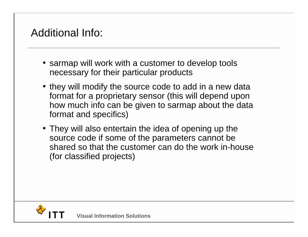
Additional Info:
• sarmap will work with a customer to develop toolsnecessary for their particular products
• they will modify the source code to add in a new dataformat for a proprietary sensor (this will depend uponhow much info can be given to sarmap about the dataformat and specifics)
• They will also entertain the idea of opening up thesource code if some of the parameters cannot beshared so that the customer can do the work in-house(for classified projects)

Basic Module Examples

Visual Information Solutions
Resource Management
The example shows a change detection
map derived from ERS-2 SAR data
acquired in 1996, 1998 and 1999 in an
area of Sri Lanka.
The map shows three classes: Stable
water bodies (blue), Shrimp farms as
observed on April 18th 1996 (red), and
their expansion as imaged on October
16th 1998 (pink).
Aquaculture MappingAquaculture Mapping

Visual Information Solutions
Rice mappingImage courtesy of IRRI
Agricultural Planning and Management
Visual Information Solutions
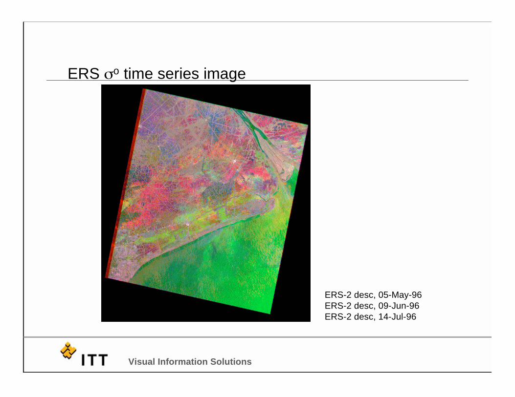
ERS o time series image
ERS-2 desc, 05-May-96
ERS-2 desc, 09-Jun-96
ERS-2 desc, 14-Jul-96
Visual Information Solutions
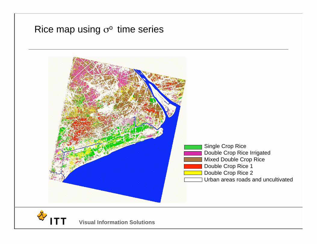
Rice map using o time series
Single Crop Rice
Double Crop Rice Irrigated
Mixed Double Crop Rice
Double Crop Rice 1
Double Crop Rice 2
Urban areas roads and uncultivated

Visual Information Solutions
Rice map overlaid with GIS data

Visual Information Solutions
Monitoring rice transplanting in the Philippines - Year 2004 Radarsat-1
& ENVISAT ASAR AP data
Mean Amplitude imageASAR HH - 13 November 2003Radarsat - 12 December 2003ASAR - HH - 18 December 2003ASAR - HH - 6 January 2004ASAR - HH - 22 January 2004ASAR - HH - 10 February 2004Radarsat - 22 February 2004ASAR - HH - 16 March 2004Rice Transplanted areas over timeLandsat 5 TM - cloud free archive image
Visual Information Solutions
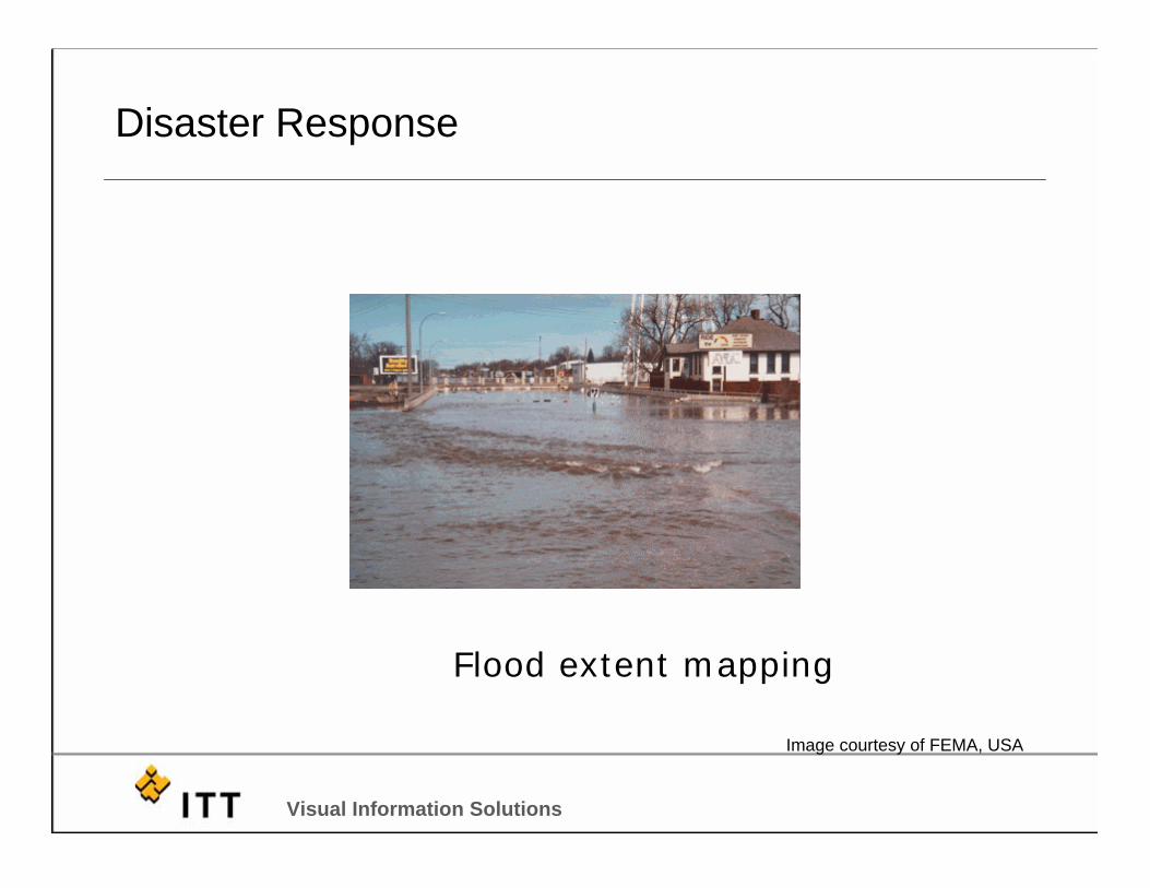
Flood extent mapping
Image courtesy of FEMA, USA
Disaster Response

Visual Information Solutions
Flood Mapping in Bangladesh, 2004
Envisat ASAR Wide Swath data Bangladesh
25 July 2004 (R,G) & 23 Mar 2003 (B)28 July 2004 (R,G) & 19 May 2004 (B)

Visual Information Solutions
Flood Mapping in Bangladesh, 2004
GIS representation of the flood extent Bangladesh

Visual Information Solutions
Oil slick imaged by ERS-1 SAR
Environmental Applications
Ship captured during aseepage action
Visual Information Solutions
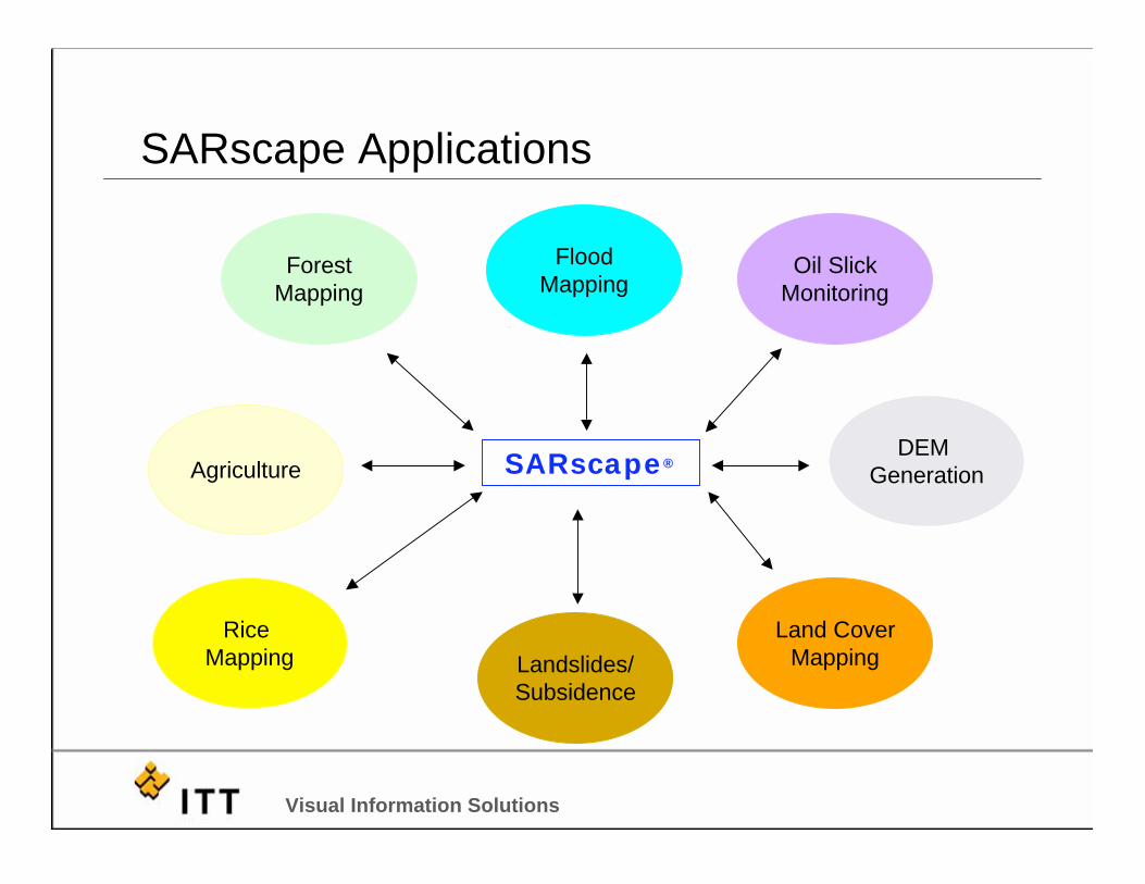
SARscape Applications
DEM
GenerationSARscape®®
Landslides/
Subsidence
Rice
Mapping
Forest
Mapping
Land Cover
Mapping
Flood
Mapping
Agriculture
Oil Slick
Monitoring

Interferometry Example

Visual Information Solutions
Interferometry Workflow
Visual Information Solutions
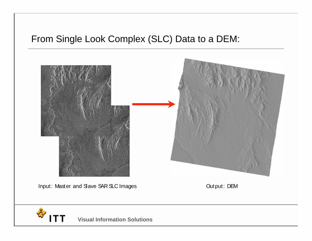
From Single Look Complex (SLC) Data to a DEM:
Input: Master and Slave SAR SLC Images Output: DEM

Visual Information Solutions
Baseline Estimation
Estimation of the image-pair baseline parameters

Visual Information Solutions
Interferogram Generation – Raw Interferogram
Interferogram_int

Visual Information Solutions
Multi-looked Master and Slave Generation
Looks: 4 azimuth / 1 range
Ground-Resolution: ~ 15 x 15 meters
Master_pwr Slave_pwr

Visual Information Solutions
Interferogram Flattening With Ellipsoid
Interferogram_dint

Visual Information Solutions
Extraction of a Reference DEM
GTOPO DEM_dem(resampled to 15 m)

Visual Information Solutions
Adaptive Filter and Coherence Estimation
Interferogram_fint
coherence_cc

Visual Information Solutions
Phase Unwrapping
Interferogram_upha

Visual Information Solutions
Phase Editing

Visual Information Solutions
Baseline Fit
In case topographic mapswere available, GCPvalues (coordinates andheights) must be enteredmanually
In this example (use of areference DEM in slantrange), values areautomatically read

Visual Information Solutions
Baseline Fit
Reflattened Interferogram_dint
Visual Information Solutions
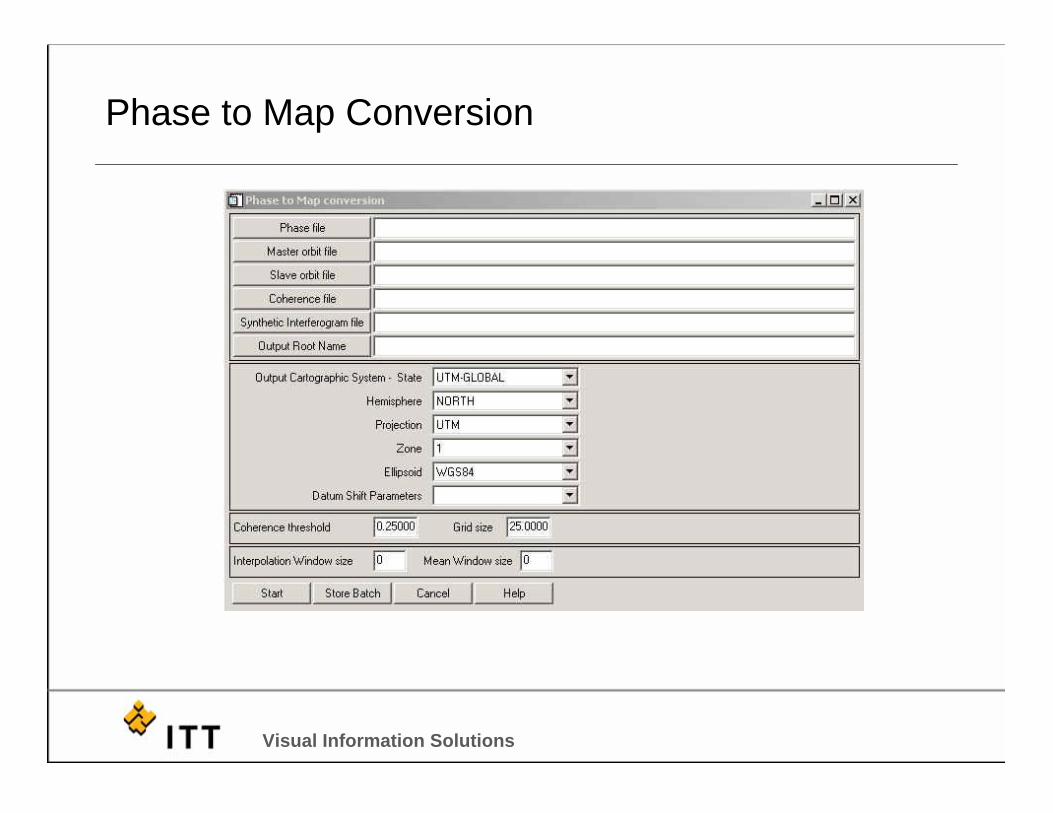
Phase to Map Conversion

Visual Information Solutions
Final DEM