science to inform policy in the adirondacks: case …
TRANSCRIPT
58 THE A DI RON DACK JOURNA L OF ENVIRONMENTAL STUDIES VOLUME 23 59
4
SCIENCE TO INFORM POLICY IN THE ADIRONDACKS: CASE STUDIES FROM THE GREAT EXPERIMENTMICHALE GLENNON,*1,3 ERIC HOLMLUND,2 DAN KELTING,2 HEIDI KRETSER,1 ZOE SMITH1,3
1. Wildlife Conservation Society, Saranac Lake, NY2. Paul Smith’s College Adirondack Watershed Institute, Paul Smith’s, NY3. Present address: Paul Smith’s College Adirondack Watershed Institute, Paul Smith’s, NY* corresponding author; [email protected]
KEYWORDS:
Adirondack Park, aquatic invasive species, black bear, conservation, exurban development, human-wildlife conflict, road salt, water quality, wildlife
ABSTRACT
The abundant natural resources of the Adirondack Park, positioned in a setting of interspersed public and private ownerships and multiple jurisdictional layers of management, make for a place in which the competing interests of human use and enjoyment of the landscape and protection of its resources can create significant challenges. It is also a place where there is a critical role for applied science in informing policy and management decisions. Here we describe four examples in which applied science, combined with education and outreach, have been used to inform management responses to critical threats impacting the Adirondack landscape. This paper describes the work of two organizations who have invested heavily in the region, using place-based and collaborative approaches to inform important policy issues. We describe each as a case study and draw conclusions across all of them that provide useful lessons for conservation in the region.
60 THE A DI RON DACK JOURNA L OF ENVIRONMENTAL STUDIES VOLUME 23 61
A RT I C L E 4 : S C I E N C E TO I N F O R M P O L I C Y I N T H E A D I RO N DAC K S :
C A S E S T U D I E S F RO M T H E G R E AT E X P E R I M E N T
INTRODUCTION
The great experiment (Porter et al. 2009) is an apt description for a park which is simultaneously the largest protected area in the contiguous United States and a home to 130,000 residents and seven to ten million annual visitors. The Adirondack Park, with its mixture of state lands—protected by some of the strongest conservation laws on the planet—and private lands—employed for all manner of human uses from residential to commercial to industrial—is a place where policy is contentious and conflict is foreseeable. In this setting, scientists from many fields have endeavored to provide information that can serve as the basis for decisions that affect all of us who call the park home. Many organizations have contributed significantly to the body of scientific knowledge upon which important policy and management decisions have been based. Here we describe the work of two organizations as a series of case studies which illustrate, in each instance, an important environmental issue facing the park, efforts undertaken to understand the issue from drivers to solutions, the ways in which findings influenced eventual policy and management decisions, and the importance of place-based focus for achieving these successes.
Established in 1897, the Wildlife Conservation Society (WCS) is one of the oldest conservation organizations in the world and saves wildlife and wild places worldwide through science, conservation action, and inspiring people to value nature. The WCS Adirondack Program was created in 1994 and until 2018 operated in Saranac Lake, working to balance the interests of humans and wildlife in the Adirondacks through an information-based, cooperative approach to research, community involvement, and outreach. The Paul Smith’s College Adirondack Watershed Institute (PSCAWI), established in 1989, is a program of Paul Smith’s College, a private nonprofit residential college that plays a key role in supporting the ecological and economic sustainability of the Adirondack region. The mission of the Paul Smith’s College Adirondack Watershed Institute is to protect clean water, conserve habitat, and support the health and well-being of people in the Adirondacks through science, collaboration, and real world experiences for students. PSCAWI accomplishes its mission through dozens of active partnerships with lake and river associations, state and federal agencies, local government, environmental non-governmental organizations, and private foundations. Both organizations have a long history in the Adirondacks and have invested heavily in science to inform policy in this landscape.
Here we aim to describe, in case study format, several projects that have incorporated research, education, and outreach to address critical issues facing the Adirondack landscape. These range from habitat fragmentation and human-wildlife conflict in the terrestrial environment to pollution and invasive species in our waterways. Two projects come from the WCS Adirondack Program and two from the Adirondack Watershed Institute.
CASE STUDY 1: MINIMIZING THE IMPACTS TO WILDLIFE FROM EXURBAN RESIDENTIAL DEVELOPMENT
Context
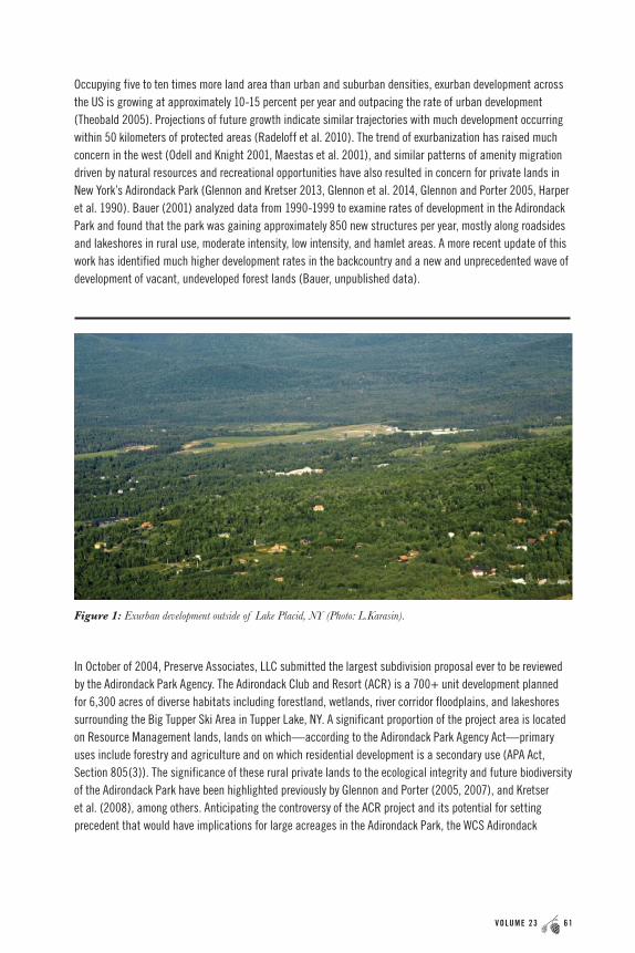
Exurban development refers to development that occurs beyond the limits of incorporated cities and towns (Knight 1999) and is characterized by large lot sizes and densities lower than suburban areas but greater than traditional resource management areas. Unlike suburbia, exurban landscapes have a matrix that remains in the original ecosystem type (Odell and Knight 2001; Figure 1), and, as such, are often perceived as minimally altered. But low-density rural residential or exurban development is transforming wild landscapes and affecting species and ecological processes within adjacent protected areas (Radeloff et al. 2010).
60 THE A DI RON DACK JOURNA L OF ENVIRONMENTAL STUDIES VOLUME 23 61
A RT I C L E 4 : S C I E N C E TO I N F O R M P O L I C Y I N T H E A D I RO N DAC K S :
C A S E S T U D I E S F RO M T H E G R E AT E X P E R I M E N T
Occupying five to ten times more land area than urban and suburban densities, exurban development across the US is growing at approximately 10-15 percent per year and outpacing the rate of urban development (Theobald 2005). Projections of future growth indicate similar trajectories with much development occurring within 50 kilometers of protected areas (Radeloff et al. 2010). The trend of exurbanization has raised much concern in the west (Odell and Knight 2001, Maestas et al. 2001), and similar patterns of amenity migration driven by natural resources and recreational opportunities have also resulted in concern for private lands in New York’s Adirondack Park (Glennon and Kretser 2013, Glennon et al. 2014, Glennon and Porter 2005, Harper et al. 1990). Bauer (2001) analyzed data from 1990-1999 to examine rates of development in the Adirondack Park and found that the park was gaining approximately 850 new structures per year, mostly along roadsides and lakeshores in rural use, moderate intensity, low intensity, and hamlet areas. A more recent update of this work has identified much higher development rates in the backcountry and a new and unprecedented wave of development of vacant, undeveloped forest lands (Bauer, unpublished data).
In October of 2004, Preserve Associates, LLC submitted the largest subdivision proposal ever to be reviewed by the Adirondack Park Agency. The Adirondack Club and Resort (ACR) is a 700+ unit development planned for 6,300 acres of diverse habitats including forestland, wetlands, river corridor floodplains, and lakeshores surrounding the Big Tupper Ski Area in Tupper Lake, NY. A significant proportion of the project area is located on Resource Management lands, lands on which—according to the Adirondack Park Agency Act—primary uses include forestry and agriculture and on which residential development is a secondary use (APA Act, Section 805(3)). The significance of these rural private lands to the ecological integrity and future biodiversity of the Adirondack Park have been highlighted previously by Glennon and Porter (2005, 2007), and Kretser et al. (2008), among others. Anticipating the controversy of the ACR project and its potential for setting precedent that would have implications for large acreages in the Adirondack Park, the WCS Adirondack
Figure 1: Exurban development outside of Lake Placid, NY (Photo: L.Karasin).

62 THE A DI RON DACK JOURNA L OF ENVIRONMENTAL STUDIES VOLUME 23 63
A RT I C L E 4 : S C I E N C E TO I N F O R M P O L I C Y I N T H E A D I RO N DAC K S :
C A S E S T U D I E S F RO M T H E G R E AT E X P E R I M E N T
Program set out to create and disseminate relevant social and ecological research that could help to inform the degree to which the exurban development pattern characterized by ACR could potentially impact wildlife and natural resources on the private and public lands of the park.
Research and Findings
In the early part of the last decade, research on exurban development and impacts to wildlife was scarce; most existing work had been undertaken in the western United States, and the degree to which findings from western systems were applicable to the northeast was unknown. We summarized available research in an attempt to provide a baseline of information to inform discussions about ACR and other projects (Glennon and Kretser 2005), but at the same time sought to undertake local research activities that could best incorporate Adirondack considerations both ecological and social. Much of our work has been described elsewhere, including a former issue of the Adirondack Journal of Environmental Studies (Glennon and Kretser 2016). A full discussion of each project is beyond the scope of this case study, but briefly, between 2005 and 2018 we examined a range of issues related to exurban development.
Ecological questions:
• The size of the ecological impact zone associated with exurban homes (Glennon and Kretser 2013) and roads (Glennon and Kretser 2012a) in the Adirondacks
• The characteristics of wildlife communities before and after residential construction (Glennon and Kretser 2012b), and the impact of exurban development on the health of individual animals (Seewagen et al. 2015)
• How geographic context regulates the impacts of exurban development on wildlife (Glennon et al. 2014)
Social questions:
• The influence of exurban development on human-wildlife interactions (Kretser et al. 2008) and how individual land ethics and land-use decisions shape human impacts on biological communities (Kretser et al. 2015)
• What guidelines and incentives exist in conservation development ordinances to promote conservation (Kretser and Reed 2012), and what the key barriers and opportunities are to adoption and implementation of conservation development ordinances (Karasin et al 2012, Kretser et al. 2019)
After more than a decade of research to understand the ways in which residential development affects wildlife and the opportunities for mitigating negative impacts, we have identified a number of key findings from both the ecological and social science perspectives. These are:
• The size of the ecological impact is larger than the physical footprint of the development – we have identified changes in bird communities to a distance of 200 meters or more (~30 acres beyond the footprint) and other researchers have observed changes in small and medium sized mammal communities at similar distances; it cannot be assumed that because most of the area remains in the original ecosystem type, impacts are minimal.
• Human disturbance (activities and behaviors) appears to be the major driver of change in exurban systems
– this may be more important than habitat and landscape alteration and includes indirect effects to ecosystems from disturbances such as sound and light.
62 THE A DI RON DACK JOURNA L OF ENVIRONMENTAL STUDIES VOLUME 23 63
A RT I C L E 4 : S C I E N C E TO I N F O R M P O L I C Y I N T H E A D I RO N DAC K S :
C A S E S T U D I E S F RO M T H E G R E AT E X P E R I M E N T
• The changes can occur very rapidly – we have identified measurable changes to wildlife communities within one year after construction.
• The changes show consistency across taxa and across ecosystems – despite contrasting ecological contexts, we observed similar impacts to wildlife communities in Essex County, NY and Madison County, Montana.
• The most prevalent pattern is one of simplification – the replacement of many rare and specialized species with one or a few cosmopolitan generalist species – “biotic homogenization” – is the almost universal result of this process.
• People generally want to benefit wildlife and want to take actions that benefit wildlife – leverage points for influencing human activities include regulations (state and local) and recommendations from HOAs/neighbors and local NGOs.
• Lack of a requirement for ecological site analysis or for expert input are among the reasons for failure of existing conservation design regulations – ecological site analysis must occur prior to site design to be effective; most regulations often require only consultation with the planning board.
• Conservation design ordinances with stronger requirements have a greater chance of succeeding in communities that have high motivation coupled with capacity (experts/technical information) – these factors lead to strong dialogue and greater chance of adoption.
• Collaboration and engagement with communities is necessary – only with collaboration and dialogue will integrating wildlife-friendly recommendations into design ordinances lead to conservation outcomes.
Policy Process and Outcomes
While we have used the principles identified from our research to influence the practice of private lands conservation through a variety of mechanisms including engagement with local municipalities and creation of draft model wildlife-friendly land-use ordinances, here we focus on four ways in which we have engaged with the Adirondack Park Agency (APA). The APA statute requires environmental impact assessment of subdivisions on large acreages of private lands and provides standards, some specific and others general, to influence the form new developments can take. Thus the APA influences the size, location, and design of residential subdivisions. Regulations and procedures influence the application process for developers (including the development of baseline data), staff review of projects, and discussion with developers on necessary changes to comply with requirements and recommendations articulated in the Act and through precedent.
To engage in the policy process, we first provided the APA staff with information from the peer reviewed literature as well as our own research to guide discussions with developers and influence the configuration of development away from areas important for wildlife and other natural resources in the design process. Second, we sought to influence the design of a large precedent-setting development through a public hearing process to address deficiencies in the environmental assessment process. Next, we engaged in an effort to amend the Adirondack Park Agency Act to improve governance of large subdivisions on private land, specifically providing recommendations to strengthen authority and environmental assessment standards for review. Last, we worked with APA staff to revise their large subdivision guidelines.
64 THE A DI RON DACK JOURNA L OF ENVIRONMENTAL STUDIES VOLUME 23 65
A RT I C L E 4 : S C I E N C E TO I N F O R M P O L I C Y I N T H E A D I RO N DAC K S :
C A S E S T U D I E S F RO M T H E G R E AT E X P E R I M E N T
As noted, we engaged early in the process of the proposed ACR development, the project that served as a catalyst for much of our research. The entirety of the application process surrounding the ACR lasted nearly eight years and culminated in an adjudicatory hearing in 2011. Early in the process we summarized existing work on the impacts of residential development in a technical paper that we subsequently distributed to the APA and the developer, among others. We worked regularly with the APA science staff and we implemented several research projects to provide guidance on minimizing the ecological footprint of development and again shared those findings with the APA and the developer. Having had minimal success improving the design of the project via that mechanism, when asked to be part of a third-party team providing testimony for the public hearing, we readily agreed. This team included engineers, landscape architects, and WCS staff. We provided both written and oral testimony, which allowed for our science to become a part of the public record associated with this controversial process (Glennon and Kretser 2011). The project was ultimately approved by the APA in January 2012 without incorporating any of the design changes to benefit wildlife.
The ramifications of ACR approval sent an unwelcome message to many working in the Adirondack Park that private lands could be developed with minimal consideration of wildlife. This prompted one environmental advocacy group, Protect the Adirondacks, to draft a bill that encompassed many of the principles described in our research. New York State Assembly Bill A5451 (Conservation Design bill) was introduced by Assemblyman Steve Englebright in 2017. Lacking a Senate sponsor, the bill did not move any further. Subsequently, A5451 became a focus of a group of organizations led by the Adirondack Common Ground Alliance (CGA), which began working together to discuss and draft an alternate version of A5451 for the Adirondack Park that would reflect a consensus from a broad range of interest groups including environmental NGOs, local landowners, local government, and the forest products industry. The role of the WCS Adirondack Program in this process has been to provide the scientific rationale and ecologically-relevant and scientifically-supported language for the proposed legislation. The draft bill proposes an amendment to the Adirondack Park Agency Act that would require that conservation subdivision practices be employed on projects meeting specific size criteria within the land use designations of Low Intensity, Rural Use, and Resource Management. As expected, such a bill is highly controversial, and these circumstances are such that the bill did not move beyond committee in the 2017-2018 legislative session. Despite the initial failure of the bill, the stakeholder group has engaged in discussions for nearly two years and remains committed to determining those elements required for a consensus bill that would be acceptable to a wide audience and ensure resource protection.
Absent legislative amendments, the APA has the authority to change its own procedures for subdivision review without a lengthy stakeholder process. Based in part on our scientific work and years of dialogue with the agency, the APA made the decision in 2018 to revise their application process for large subdivisions. The revised Large Scale Subdivision Application applies to all subdivisions involving five or more lots on Resource Management lands, ten or more lots on Rural Use, and 25 or more lots on Low Intensity Use areas. This effort was the result of a number of discussions between APA and local government officials, environmental advocacy groups, and land use professionals including major developers; it benefited from input from each of these stakeholders. In addition to clarifying project requirements and increasing the efficiency of the application process, the revised application provides updated language and consideration for open space, wildlife, and habitat and, according to the Agency,
64 THE A DI RON DACK JOURNA L OF ENVIRONMENTAL STUDIES VOLUME 23 65
A RT I C L E 4 : S C I E N C E TO I N F O R M P O L I C Y I N T H E A D I RO N DAC K S :
C A S E S T U D I E S F RO M T H E G R E AT E X P E R I M E N T
“ensures that proposed projects are designed in conformance with the APA’s review criteria…and with the objectives of conservation design” (APA Press Release April 2, 2018). WCS provided its expertise to the process and recommended specific language that helps to ensure better protection for wildlife and open space. Though these are internal procedural changes applied at the discretion of the Agency, the updated large subdivision application aligns more closely with conservation design principles and has the potential to translate to better ecological outcomes on large project areas.
Although the final verdict on a potentially influential policy is yet to be determined, in retrospect, changing the APA Act itself is a more involved, contentious, and lengthy process than changing internal APA procedures and practices or influencing development design in the review process. Nonetheless, we have engaged with the APA and the development review process at many levels, and doing so has enabled us to improve the reach of our science and is yielding positive outcomes for conservation.
CASE STUDY 2: REDUCING CONFLICT BETWEEN HUMANS AND BLACK BEARS IN THE BACKCOUNTRY
Context
The black bear (Ursus americanus) is one of the most charismatic and intriguing wildlife species in the Adirondack Park. In recent decades, black bear populations in New York State have increased dramatically in number and distribution (NYS DEC 2014), which brings them increasingly into conflict with both backcountry recreationists and rural residents. These interactions have potential negative consequences for wildlife and humans.
According to New York State Department of Environmental Conservation (NYS DEC), since the 1970’s negative interactions between black bears and humans in the Adirondack backcountry have been a common occurrence, particularly in the High Peaks Wilderness Area. Most of the incidents in this area are a result of bears searching for easily accessible human food. These incidents include bluff charges, stealing human food, and destroying camping gear. Many bears associate “bear bags” (stuff sacks hung in a tree with cord) with a reliable food source. In the summer of 2003, a black bear made physical contact with a camper in the High Peaks area, resulting in the general determination that the number and severity of bear encounters in the High Peaks had increased to an unacceptable level (NYS DEC 2004). The record high number of bear complaints in the High Peaks during this time were a result of a variety of possible factors including an increased number of users, a low level of bear awareness and food protection among users, a high level of intolerance for bears by backcountry users, an increase in the number of habituated bears stealing food and tolerating human presence, and an increase in aggression of the bears in their efforts to steal human food (NYS DEC 2004). In 2001 the NYS DEC installed food hoist cable systems (bear hangs) adapted from those used in Great Smoky Mountain National Park. Despite their record of dependability in the “Smokies” and other areas of the country, the cables had variable success in the Adirondacks, and bear problems continued to persist; the cables have since been removed. Many National Parks in other parts of the United States require the use of bear-resistant food canisters for food, garbage, and toiletries storage. In the early 2000’s canisters were not widely used in the Adirondacks.
66 THE A DI RON DACK JOURNA L OF ENVIRONMENTAL STUDIES VOLUME 23 67
A RT I C L E 4 : S C I E N C E TO I N F O R M P O L I C Y I N T H E A D I RO N DAC K S :
C A S E S T U D I E S F RO M T H E G R E AT E X P E R I M E N T
Continually high levels of bear-human conflict in the High Peaks region contributed to concern, not only over human safety and property damage to campers’ gear but to the welfare of bears themselves. Beckmann and Berger (2003a, 2003b), who worked extensively with bears living in the wildland-urban interface around the Lake Tahoe region, showed that bears that become dependent on human food sources, such as garbage, exhibit significant behavioral and ecological changes. These individuals tend to enter dens significantly later in the season and spend fewer days in dens than wildland bears (Beckmann and Berger 2003a), they are active for significantly fewer hours per day than wildland bears, and they are more likely to shift their activities to nocturnal periods (Beckmann and Berger 2003a). There are implications to reproductive success and social organization for bear populations that are unnaturally redistributed (Beckmann and Berger 2003b). Mortality levels for bears living in the urban interface are higher than those for wildland bears, due almost entirely to vehicle collisions (Beckmann and Berger 2003a).
Research and Findings
Given the ongoing conflict and rising levels of concern for both bears and humans in the High Peaks, in 2003 WCS began a comprehensive study to examine the human element of black bear-human conflict in the Adirondacks. The goal was to understand the factors contributing to the increasing number of reported human-bear conflicts and to identify solutions to reduce these to an acceptable level. The objectives of the study were to describe characteristics and past bear experiences of backcountry users, to identify where backcountry users were receiving information about bears, to determine the effectiveness of food storage systems, and to determine the number of black bear incidents in this area of the Adirondacks. Data were collected using trailhead surveys and backcountry observations. Simultaneously, WCS initiated education and outreach for backpackers to raise awareness of the risk of negative bear encounters and encourage users to properly store their food. These efforts were described extensively in Beckmann et al. (2008) and resulted in a number of major findings including:
• Thirty to forty percent of users in the High Peaks were first-time visitors to this area. Many of these visitors have not had a lot of experience with black bears and do not have clear expectation of bear activity in the Adirondacks.
• Bear hangs do not work in the High Peaks although many people relied on them at the time.
• Nearly half of the respondents had heard about bear canisters, approximately 25 percent of people had used them. Those using them reported little or no problems with bears.
• More than half of survey respondents in 2003 reported obtaining their information about bears and food storage at the trailhead (Forest Ranger, trailhead sign, or Adirondack Mountain Club personnel).
• No infrastructure was in place to support canister use during the study. Few retail shops sold them, none rented them.
• Information about bears and food storage was not being accessed early enough in the trip planning process and backcountry users therefore did not have the knowledge to safely store their food.
• There was no incentive for recreational users to store their food securely. Canisters were not required anywhere in the Adirondacks.
66 THE A DI RON DACK JOURNA L OF ENVIRONMENTAL STUDIES VOLUME 23 67
A RT I C L E 4 : S C I E N C E TO I N F O R M P O L I C Y I N T H E A D I RO N DAC K S :
C A S E S T U D I E S F RO M T H E G R E AT E X P E R I M E N T
Policy Process and Outcomes
To address these shortcomings, WCS partnered with the NYS DEC and invested thousands of dollars into purchasing bear-resistant food canisters and distributing them to retail shops across the northeastern United States, eastern Canada, and within the Adirondacks. Retail partners agreed to promote their use and rent them to backcountry users at an affordable rate, and WCS conducted trainings to retail employees and other tourism industry partners to reinforce the need for safe food storage and proper use of bear canisters. WCS also coordinated with the NYS DEC to launch a bear safety education and outreach campaign online, at the trailhead, and through direct outreach. In addition to this substantial investment in canister availability and use, WCS continued to conduct research and monitoring to gauge the use and effectiveness of canisters in the High Peaks. These efforts were significant factors in the NYS DEC’s decision to implement policy change. In 2005, a state regulation was instituted that requires the use of bear resistant food canisters in the eastern High Peaks. Subparagraph 190.13(f)(3)(xiv) of Title 6 of the New York Code, Rule and Regulation (6 NYCRR) (effected August 24, 2005) states that “during the period April 1 through November 30, no overnight camper in the Eastern High Peaks Zone shall fail to use bear-resistant canisters for the storage of all food, food containers, garbage, and toiletries.” Ongoing trailhead surveys conducted after the regulation was enacted show that 90 percent of users are complying with the bear canister regulation and bear conflicts are down significantly. In fact, within the first four years after the canister regulation went into effect, bear conflict reports decreased by 80 percent.
Despite the success of the canister regulation in reducing reported levels of human-bear conflict, challenges remain. Survey results continue to show that 30 to 40 percent of the people who arrive at the trailhead are first-time users and may have knowledge about the canister regulation but have not planned ahead to fit all their food, garbage, and toiletries into canisters each night. This leads to excess food and garbage in
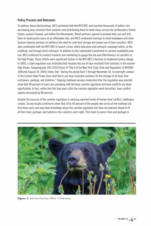
Figure 2: American black bear (Photo: T. Fuhrmann).
68 THE A DI RON DACK JOURNA L OF ENVIRONMENTAL STUDIES VOLUME 23 69
A RT I C L E 4 : S C I E N C E TO I N F O R M P O L I C Y I N T H E A D I RO N DAC K S :
C A S E S T U D I E S F RO M T H E G R E AT E X P E R I M E N T
backpacks or stored insecurely elsewhere, giving bears the opportunity to obtain food; technically these users are not in compliance with the regulation. Second, the challenge remains that people arrive at the trailhead without canisters. Many of the trailheads are remote and therefore the opportunity for people to get a canister at the last minute is limited. For example, users arriving at the Upper Works trailhead in Newcomb without a canister must drive an additional 20 miles to the nearest rental location.
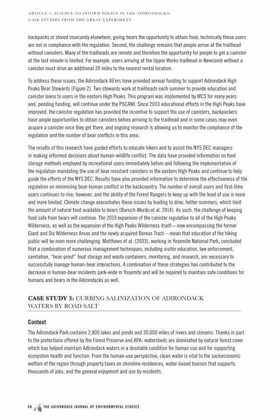
To address these issues, the Adirondack 46’ers have provided annual funding to support Adirondack High Peaks Bear Stewards (Figure 2). Two stewards work at trailheads each summer to provide education and canister loans to users in the eastern High Peaks. This program was implemented by WCS for many years and, pending funding, will continue under the PSCAWI. Since 2003 educational efforts in the High Peaks have improved, the canister regulation has provided the incentive to support the use of canisters, backpackers have ample opportunities to obtain canisters before arriving to the trailhead and in some cases may even acquire a canister once they get there, and ongoing research is allowing us to monitor the compliance of the regulation and the number of bear conflicts in this area.
The results of this research have guided efforts to educate hikers and to assist the NYS DEC managers in making informed decisions about human-wildlife conflict. The data have provided information on food storage methods employed by recreational users immediately before and following the implementation of the regulation mandating the use of bear resistant canisters in the eastern High Peaks and continue to help guide the efforts of the NYS DEC. Results have also provided information to determine the effectiveness of the regulation on minimizing bear-human conflict in the backcountry. The number of overall users and first-time users continues to rise, however, and the ability of the Forest Rangers to keep up with the level of use is more and more limited. Climate change exacerbates these issues by leading to drier, hotter summers, which limit the amount of natural food available to bears (Baruch-Mordo et al. 2014). As such, the challenge of keeping food safe from bears will continue. The 2019 expansion of the canister regulation to all of the High Peaks Wilderness, as well as the expansion of the High Peaks Wilderness itself—now encompassing the former Giant and Dix Wilderness Areas and the newly acquired Boreas Tract—mean that education of the hiking public will be even more challenging. Matthews et al. (2003), working in Yosemite National Park, concluded that a combination of numerous management techniques, including visitor education, law enforcement, sanitation, “bear-proof” food storage and waste containers, monitoring, and research, are necessary to successfully manage human-bear interactions. A combination of these strategies has contributed to the decrease in human-bear incidents park-wide in Yosemite and will be required to maintain safe conditions for humans and bears in the Adirondacks as well.
CASE STUDY 3: CURBING SALINIZATION OF ADIRONDACK WATERS BY ROAD SALT
Context
The Adirondack Park contains 2,800 lakes and ponds and 30,000 miles of rivers and streams. Thanks in part to the protections offered by the Forest Preserve and APA; watersheds are dominated by natural forest cover which has helped maintain Adirondack waters in a desirable condition for human use and for supporting ecosystem health and function. From the human-use perspective, clean water is vital to the socioeconomic welfare of the region through property taxes on shoreline residences, water-based tourism that supports thousands of jobs, and the general enjoyment and use by residents.
68 THE A DI RON DACK JOURNA L OF ENVIRONMENTAL STUDIES VOLUME 23 69
A RT I C L E 4 : S C I E N C E TO I N F O R M P O L I C Y I N T H E A D I RO N DAC K S :
C A S E S T U D I E S F RO M T H E G R E AT E X P E R I M E N T
Adirondack waters are threatened by multiple stressors, including climate change, acidification, nutrient enrichment, invasive species, and salinization (Vinebrooke et al. 2004; Jackson et al. 2016). The natural environment of the Park and our socioeconomic well-being is dependent on healthy freshwater ecosystems, but these freshwaters are threatened, with potential consequences for fisheries, recreation, and drinking water, among others (Walsh et al. 2016).
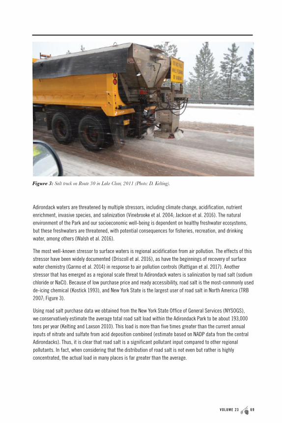
The most well-known stressor to surface waters is regional acidification from air pollution. The effects of this stressor have been widely documented (Driscoll et al. 2016), as have the beginnings of recovery of surface water chemistry (Garmo et al. 2014) in response to air pollution controls (Rattigan et al. 2017). Another stressor that has emerged as a regional scale threat to Adirondack waters is salinization by road salt (sodium chloride or NaCl). Because of low purchase price and ready accessibility, road salt is the most-commonly used de-icing chemical (Kostick 1993), and New York State is the largest user of road salt in North America (TRB 2007; Figure 3).
Using road salt purchase data we obtained from the New York State Office of General Services (NYSOGS), we conservatively estimate the average total road salt load within the Adirondack Park to be about 193,000 tons per year (Kelting and Laxson 2010). This load is more than five times greater than the current annual inputs of nitrate and sulfate from acid deposition combined (estimate based on NADP data from the central Adirondacks). Thus, it is clear that road salt is a significant pollutant input compared to other regional pollutants. In fact, when considering that the distribution of road salt is not even but rather is highly concentrated, the actual load in many places is far greater than the average.
Figure 3: Salt truck on Route 30 in Lake Clear, 2011 (Photo: D. Kelting).

70 THE A DI RON DACK JOURNA L OF ENVIRONMENTAL STUDIES VOLUME 23 71
A RT I C L E 4 : S C I E N C E TO I N F O R M P O L I C Y I N T H E A D I RO N DAC K S :
C A S E S T U D I E S F RO M T H E G R E AT E X P E R I M E N T
The Adirondack Park has an extensive network of 10,555 lane-miles of paved roads, of which 2,830 lane-miles are under the jurisdiction of the New York State Department of Transportation (NYSDOT) and 7,725 lane-miles are under the jurisdiction of local municipalities. NYSDOT applies 108,000 tons of salt annually at an application rate of 38.2 tons per lane mile, while local municipalities apply 84,700 tons of salt annually at an application rate of 11 tons per lane mile. The higher application rate used by NYSDOT reflects the fact that state roads (e.g., State Route 3) are the main arteries for vehicular traffic through the region, requiring NYSDOT to maintain them at a higher level of service. Local roads receive varying amounts of traffic and allow different speeds and, thus, are maintained at varying levels of service (e.g., plow only, plow plus sand, or plow plus salt).
Salinization begins with runoff, and the entire 193,000 tons of road salt applied each winter to Adirondack roads runs off. As a generalization, about 50 percent of this runoff infiltrates the soil where it is either retained or percolates into groundwater, and the remainder is direct runoff to surface water via overland flow downhill (Meriano et al. 2009). Regalado and Kelting (2015) developed a landscape-based model that routes road runoff based on topography (water flows downhill). Their model showed that 6,000 miles of streams and 820 lakes were downhill from paved roads and, thus, received runoff from these roads. This finding showed a direct connection between road networks and surface water, and suggested the potential for regional salinization of surface waters throughout the Adirondacks. Given that road salting began in earnest in the Adirondack region around 1980, nearly seven million tons of salt have been applied to the road network. Not only does the potential for regional salinization exist; given the amount of salt applied, the magnitude of regional salinization may also be significant.
Given the potential for significant regional salinization of Adirondack waters by road salt, we conducted a study to determine the level of threat from this important ecosystem stressor and to provide information to help inform winter road management practices and policies.
Research and Findings
We assembled a dataset with chloride concentrations for 138 lakes in the Adirondacks. Fifty-four of these lakes were from the Adirondack Long Term Monitoring Program and 84 lakes were monitored directly by PSCAWI or through the Adirondack Lake Assessment Program, a citizen science-based program jointly administered by PSCAWI and Protect the Adirondacks. The lakes were assigned into one of two groups based on the presence or absence of paved roads in their watersheds—82 lakes and 56 lakes, respectively.
The median chloride concentration in lakes without paved roads in their watersheds was 0.2 mg/L, a very low concentration explained by negligible amounts of chloride in Adirondack rocks and in deposition. In contrast, the median chloride concentration in lakes with paved roads in their watersheds was 7.2 mg/L; this concentration, 35 times higher than in lakes without paved roads in their watersheds, was a clear indication of regional salinization of lakes by road salt. Looking further, we found that 84 percent of the variation in chloride concentration was explained by state road density, while there was no relationship between chloride concentration and local road density.
70 THE A DI RON DACK JOURNA L OF ENVIRONMENTAL STUDIES VOLUME 23 71
A RT I C L E 4 : S C I E N C E TO I N F O R M P O L I C Y I N T H E A D I RO N DAC K S :
C A S E S T U D I E S F RO M T H E G R E AT E X P E R I M E N T
The strong relationship between chloride concentration and state road density reflects the high salt application rate used by NYSDOT across their entire network, versus municipalities who use a variety of practices. Thus, we concluded that regional salinization of lakes in the Adirondack Park was largely from salting of state roads. We also developed a model that allowed us to identify segments of road that contributed more to explaining the variation in lake chloride concentrations. The full study approach and findings are described in Kelting et al. (2012).
Policy Process and Outcomes
Our work on road salt began in 2009 when we were commissioned by a regional NGO, AdkAction, to conduct a literature review and write a report on the effects and costs of road salting with recommendations for winter road management in the Adirondack Park (Kelting and Laxson 2010). The findings from this report were disseminated widely by AdkAction in paper and electronic form, presented at a stakeholder forum at Paul Smith’s College, and discussed with NYSDOT officials at their agency headquarters in Albany. The report and actions produced no direct outcomes with NYSDOT, though several local municipalities have utilized the report as a resource and guide for managing their roads.
We believe that one of the reasons for the lack of impact of the report on practices used by NYSDOT was the lack of regional data supporting the argument for changing the status quo. Conducting the research described above was therefore important not only in determining if regional salinization was occurring in the Adirondacks, but also in providing the regional data needed to support arguments for change. Of even greater importance was publishing our research in a high-impact peer-reviewed journal (Kelting et al. 2012). Our analysis was simple, our results were strong, and they clearly showed regional salinization by road salt and that NYSDOT maintained roads were the principal source. These findings were then shared at another stakeholder forum at Paul Smith’s College organized by the Adirondack Council and AdkAction. Presentation of regional data helped galvanize wide support for changing practices and a Road Salt Working Group, a grassroots assemblage of stakeholders representing local government, environmental groups, scientists, and concerned citizens who took on the charge of engaging with NYSDOT and with elected representatives. As a result of our research findings and follow-up engagement, the NYSDOT agreed to reduce the speed of their salt trucks (keeps more salt on the road), to reduce their salt application rates across the board, and to establish road salt test areas to evaluate alternative practices. Though the NYSDOT policy on using road salt did not change, science and stakeholder engagement were successful in bringing about changes in practices that should produce better outcomes for Adirondack waters.
CASE STUDY 4: COMBATTING AQUATIC INVASIVE SPECIES IN ADIRONDACK WATERWAYS
Context
The Adirondack Park has 103 waterways infested with six aquatic invasive plant species and three aquatic invasive animal species. The park is surrounded by highly visited major waters including Lake Ontario, the St. Lawrence River, the Hudson River, and the Erie Canal—each with dozens of aquatic invasive species (AIS)
72 THE A DI RON DACK JOURNA L OF ENVIRONMENTAL STUDIES VOLUME 23 73
A RT I C L E 4 : S C I E N C E TO I N F O R M P O L I C Y I N T H E A D I RO N DAC K S :
C A S E S T U D I E S F RO M T H E G R E AT E X P E R I M E N T
not yet present in the region (Quirion et al. 2017) but with the potential to impact our use of Adirondack waters. In combination with terrestrial invasive species, existing AIS have an estimated $900 million impact on the Adirondack economy, including an annual loss of approximately $50 million in tourism receipts (Yellow Wood Associates 2014). Recognizing the potential threats of AIS, Adirondack communities, lake associations, municipalities, environmental organizations, and state agencies are working together to address this major stressor. The most effective means of reducing the risk of AIS spread are hand removal and high-pressure hot water boat decontamination measures taken by either paid boat stewards or boat owners to remove AIS propagules (Rothlisberger et al. 2010, Comeau et al. 2001, Morse 2009).
Recognizing the critical role of spread prevention measures in managing AIS, New York State has invested over $12 million in grants and contracts for boat steward programs in the Adirondack region, largely through its support of the PSCAWI-managed Adirondack AIS Spread Prevention Program. This significant investment in seasonal boat inspectors and decontamination equipment is intended to protect vulnerable waterbodies from AIS through direct, steward-performed propagule removal from watercraft that otherwise would be launched into lakes, ponds and rivers, and through visitor-performed AIS spread prevention measures adopted autonomously.
The Adirondack AIS Spread Prevention Program builds on Paul Smith’s College’s established history of addressing the spread of AIS. Paul Smith’s College AWI began implementing AIS spread prevention program (stewardship program) on Adirondack lakes in 2000, beginning with private funding from the St. Regis Lakes, whose leaders foresaw the need for proactive intervention in the form of watercraft inspection and decontamination. The program expanded gradually to other lakes through 2010 with funding from lake associations and foundations, the Lake Champlain Basin Program, and municipalities. In 2011, PSCAWI was awarded the first of nine federal Great Lakes Restoration Initiative grants, which included greatly expanded boat steward coverage in the Lake Ontario basin from 2011 to 2018. In 2015, PSCAWI received a contract from New York State Department of Environmental Conservation through the Environmental Protection Fund (EPF) to expand further, adding an additional 45 locations, including two dozen decontamination stations. Over nineteen years, the program has served approximately 70 different locations, inspected 426,000 boats, performed 7,500 boat decontaminations, and removed 13,816 confirmed aquatic invasive organisms.
Research and Findings
A key element of PSCAWI’s stewardship program is the collection of data from boaters including number and types of recreational users, as well as prior water bodies visited. Resulting data have provided important information about vector pathways, illustrating how lakes are connected to other lakes by overland watercraft transport and use, and suggesting the most advantageous placement of boat stewards and decontamination stations. Internal patterns of repeated visits indicate sub-networks, distinct linkage connections, AIS spread hubs, and potential spread interruption points within the Adirondack Park. External pathway analysis shows that the Adirondacks are threatened by thousands of boats originating from hundreds of water bodies, including heavily infested lakes and rivers in western New York, the Great Lakes, the Hudson River, and neighboring states.

72 THE A DI RON DACK JOURNA L OF ENVIRONMENTAL STUDIES VOLUME 23 73
A RT I C L E 4 : S C I E N C E TO I N F O R M P O L I C Y I N T H E A D I RO N DAC K S :
C A S E S T U D I E S F RO M T H E G R E AT E X P E R I M E N T
Figure 4: Pathways of AIS invasion to the Adirondacks (Map: J. Sporn).
In addition to the direct impact of boat inspectors on watercraft hygiene, the program is designed to increase visitor awareness and adoption of spread prevention practices to increase ecological protection when boat stewards are not present. Periodic surveying indicates consistently high knowledge of aquatic invasive species and self-reported adoption of spread prevention best practices conforming with the New York State regulation requiring watercraft arrive clean, drained, and dry. Survey findings from 2018 indicated that 81 percent of visitor groups reported that they had undertaken AIS spread prevention practices prior to visiting the destination water body, which is consistent with findings from previous years. Of the 98,216 boats inspected in 2018, 3.7 percent were found to be transporting AIS. Motorboats were the most frequently fouled (5.1 percent), while canoes were most infrequently found to be transporting AIS (0.1 percent), also consistent with past years. Twenty-one percent of boats reported having been to a different water body in the preceding two weeks, indicating that 79 percent of boats encountered presented no threat of introducing AIS.

74 THE A DI RON DACK JOURNA L OF ENVIRONMENTAL STUDIES VOLUME 23 75
A RT I C L E 4 : S C I E N C E TO I N F O R M P O L I C Y I N T H E A D I RO N DAC K S :
C A S E S T U D I E S F RO M T H E G R E AT E X P E R I M E N T
Key messages arising from the steward program include the fact that although AIS transport rates are fairly small (average 3 percent of boats) overall, and boats posing risk of AIS introduction are comparatively few (~20 percent of boats), AIS invasions continue to occur. This provides opportunity to focus intervention on high-risk watercraft. High pressure, hot water decontamination is feasible and increasingly welcomed by the boating public, and increasing regional coverage by boat inspectors and decontamination standards provides needed opportunities for the public to comply with New York State AIS transport regulations and best practices.
Policy Process and Outcomes
PSCAWI plays a prominent role in advancing evidence-based policy discussion regarding effective management responses to the landscape-scaled threat of AIS invasion. New York State agencies including the DEC and APA work closely with the PSCAWI to devise and deploy a logistically and jurisdictionally complex program that meets the needs of the entire park as well as its municipalities and lake communities. On a regional scale, boat steward programs were identified as essential elements of Adirondack AIS spread prevention in an influential white paper published in 2014 by a joint team including the Adirondack Park Invasive Plant Program (APIPP), the Lake George Association (LGA), the Lake Champlain Basin Program (LCBP), and the Adirondack Watershed Institute (Johnstone et al. 2014). The PSCAWI, LCBP, and LGA analyzed boat steward data to establish clear vector pathways in the Adirondack Park arising from overland transport of recreational watercraft. This paper served as the primary guidance resource for NYSDEC as it designed its EPF-financed regional spread prevention program and in turn also helped form the basis for the 2016 New York State regulation 576 banning AIS transport. The PSCAWI chairs a multi-stakeholder program advisory committee, which has built a coalition of partners including municipalities, state agencies, businesses, local government, lake associations, environmental groups and the sporting sector. These partners have fostered community awareness and support of AIS spread prevention, collaborating on communication, advocacy, funding, and strategic partnerships in support of program implementation and expansion. With a much greater reach than PSCAWI, this committee effectively communicates both the justification for and needs of AIS spread prevention initiatives across the park, including those managed by the PSCAWI and those managed by municipalities or other organizations.
CONCLUSIONS AND LESSONS LEARNED
We have described four examples of applied science aimed at serving the needs of the Adirondack region and informing the policies that protect the natural resources of this globally significant park. In all cases, this work has been long-term and high-investment, and the degree to which we have succeeded at a policy level has been variable. In two cases (black bears, invasive species), our work was directly influential in the creation or implementation of policies that translated to real results. In two others (exurban development, road salt), official policies remain unchanged but local-level practices have been improved—we hope, also, with real results. Several themes appear in common among all four case studies and provide important lessons:
74 THE A DI RON DACK JOURNA L OF ENVIRONMENTAL STUDIES VOLUME 23 75
A RT I C L E 4 : S C I E N C E TO I N F O R M P O L I C Y I N T H E A D I RO N DAC K S :
C A S E S T U D I E S F RO M T H E G R E AT E X P E R I M E N T
Place-based, published research and local presence in the community are important
Central to the influence of our science on decision-making on private lands development and conservation is the role of the relationships fostered through the existence of a place-based conservation organization. Abundant dialogue among a community of stakeholders, trusted relationships between researchers and decision-makers, and transparency contributed to the success of integrating science into on-the-ground policy and practice. Similarly, with respect to both private land development and road salt issues, the ability to provide scientific research results from the Adirondacks, published in the peer-reviewed literature, increased significantly the local-level acceptance and consideration of our work.
Collaboration and stakeholder engagement are critical
In three of four case studies, groups of engaged organizations and citizens have become integral to the process of influencing policy and management decisions. In the case of both private land development and road salt, independent and separate assemblages of stakeholders representing local government, environmental groups, scientists, and others have arisen and taken on the task of engaging with elected representatives and pushing for policy change. Similarly, with respect to aquatic invasive species, a coalition of partners including municipalities, state agencies, businesses, local government, lake associations, environmental groups, and the sporting sector are all engaged in the communal battle against aquatic invaders. It is unlikely we would succeed on any of these fronts without these broad partnerships.
Solutions to long-term, multifaceted problems require long-term multifaceted solutions
None of our case studies represents a problem that has been “solved” despite years of investment in research and engagement at the policy level. Although policy change helped alleviate human-wildlife conflict in the High Peaks region of the park, increased recreational use and the continual need to educate first-time users mean that bear-related education must occur on an annual basis. Similarly, invasive species will continue to reach Adirondack waterways, road salt continues to be applied on our roadways at extremely high levels, and no significant slowing of exurban development appears to be on the horizon in the Park or elsewhere. Climate change, in addition, has the potential to amplify the problems resulting from all of the issues discussed here. Conservation is a long game and, in all cases, potential solutions are broad and variable. A combination of approaches including outreach, education, research, monitoring, and law enforcement is more likely to succeed than any single strategy. The resources of the Adirondack Park are worth the investment.
76 THE A DI RON DACK JOURNA L OF ENVIRONMENTAL STUDIES VOLUME 23 77
A RT I C L E 4 : S C I E N C E TO I N F O R M P O L I C Y I N T H E A D I RO N DAC K S :
C A S E S T U D I E S F RO M T H E G R E AT E X P E R I M E N T
LITERATURE CITED
Baruch-Mordo, S., K.R. Wilson, D.L. Lewis, J. Broderick, J.S. Mao, and S.W. Breck. 2014. “Stochasticity in natural forage production affects use of urban areas by black bears: implications to management of human-bear conflicts.” PLoS ONE 9(1): e85122.
Bauer, P. 2001. “Growth in the Adirondack Park: analysis of rates and patterns of development.” The Residents’ Committee to Protect the Adirondacks. North Creek, N.Y.
Beckmann, J.P. and J. Berger. 2003a. “Using black bears to test ideal-free distribution models experimentally.” Journal of Mammalogy 84: 594-606.
Beckmann, J.P. and J. Berger. 2003b. “Rapid ecological and behavioural changes in carnivores: the responses of black bears (Ursus americanus) to altered food.” Journal of Zoology 261: 207-212.
Beckmann, J.P., L. Karasin, C. Costello, S. Matthews, and Z. Smith. 2008. “Coexisting with Black Bears: Perspectives from Four Case Studies Across North America.” WCS Working Paper No. 33. New York: Wildlife Conservation Society.
Comeau, S., S. Rainville, W. Baldwin, and E. Austin. 2001. “Susceptibility of quagga mussels (Dreissna rostiformis bugensis) to hot-water sprays as a means of watercraft decontamination.” Biofouling 27(3): 267-274.
Driscoll, C.T., K.M. Driscoll, H. Fakhraei, and K. Civerolo. 2016. “Long-term temporal trends and spatial patterns in the acid-base chemistry of lakes in the Adirondack region of New York in response to decreases in acidic deposition.” Atmospheric Environment 146: 5-14.
Garmo, Ø.A., B.L. Skjelkvåle, H.A. de Wit, L. Colombo, C. Curtis, J. Fölster, A. Hoffmann, J. Hruška, T. Høgåsen, D.S. Jeffries, and W.B. Keller. 2014. “Trends in surface water chemistry in acidified areas in Europe and North America from 1990 to 2008.” Water Air and Soil Pollution 225: 1880.
Glennon, M.J. and H.E. Kretser. 2005. “Impacts to wildlife from low density, exurban development: Information and considerations for the Adirondack Park.” WCS’ Adirondack Communities and Conservation Program Technical Paper No. 3.
Glennon, M.J. and H.E. Kretser. 2011. “Pre-filed testimony of Michale Glennon, Ph.D. and Heidi Kretser, Ph.D. in the Matter of the Application to Construct the Adirondack Club and Resort by Preserve Associates, LLC, Applicant.” Submitted on behalf of the Adirondack Council to the State of New York Adirondack Park Agency, APA Project No 2005-100, Group 2, Issue 1.
Glennon, M.J. and H.E. Kretser. 2012. “Impacts to wildlife from the ecological consequences of exurban development II: evaluating the ecological road effect zone.” Final Report to the Northeastern States Research Cooperative. Accessed from www.nsrcforest.org.
76 THE A DI RON DACK JOURNA L OF ENVIRONMENTAL STUDIES VOLUME 23 77
A RT I C L E 4 : S C I E N C E TO I N F O R M P O L I C Y I N T H E A D I RO N DAC K S :
C A S E S T U D I E S F RO M T H E G R E AT E X P E R I M E N T
Glennon, M.J. and H.E. Kretser. 2012. “Characteristics of faunal communities before and after residential development in the Adirondack Park.” Final Report to the Northeastern States Research Cooperative. Accessed from www.nsrcforest.org.
Glennon, M.J. and H.E. Kretser. 2013. “Size of the ecological effect zone associated with exurban development in the Adirondack Park, N.Y.” Landscape and Urban Planning 112: 10-17.
Glennon, M.J. and H.E. Kretser. 2016. “State of the birds in exurbia.” Adirondack Journal of Environmental Studies 20: 49-66.
Glennon, M.J., H.E. Kretser, and J.A. Hilty. 2014. “Identifying common patterns in diverse systems: effects of exurban development on birds of the Adirondack Park and the Greater Yellowstone Ecosystem, USA.” Environmental Management 55: 453-466.
Glennon, M.J. and W.F. Porter. 2005. “Effects of land use management on biotic integrity: an investigation of bird communities.” Biological Conservation 126: 499-511.
Glennon, M.J. and W.F. Porter. 2007. “Development in the Adirondack Park, New York: Projections and implications.” Pages 149-169 in J.M. Erickson and J.M. Gowdy, Eds, Frontiers in Ecological Economic Theory and Application. Edward Elgar Publishers.
Harper, S.C., L.L. Falk and E.W. Rankin. 1990. “The Northern Forest lands study of New England and New York.” United States Department of Agriculture Forest Service, Rutland, Vermont, USA.
Jackson, M.C., C.J.G. Loewen, R.D. Vinebrooke, and C.T. Chimimba. 2016. “Net effects of multiple stressors in freshwater ecosystems: a meta-analysis.” Global Change Biology 22(1): 180-189.
Johnstone, M., H. Smith, E. Holmlund, M. Modley, E. DeBolt, and K. Rohne. 2014. “Boat inspection and decontamination for aquatic invasive species prevention: Recommendations for the Adirondack Region.” Keene Valley, NY: Adirondack Park Invasive Plant Program.
Karasin, L.N., H.E. Kretser, and S.E. Reed. 2012. “Conservation development ordinances in the Northeast: examples and lessons learned.” In Smith et al. (eds.) 2012. Protecting wildlife connectivity through land use planning: best management practices and the role of conservation development. Wildlife Conservation Society Adirondack Program, Technical Paper #4.
Kelting, D.L. and C.L. Laxson. 2010. “Review of effects and costs of road de-icing with recommendations for winter road management in the Adirondack Park.” Paul Smith’s College Adirondack Watershed Institute Report No. PSCAWI 2010-01, 76 pp.
Kelting, D.L., C.L. Laxson, and E.C. Yerger. 2012. “Regional analysis of the effect of paved roads on sodium and chloride in lakes.” Water Research 46: 2749-2758.
Knight, R.L. 1999. “Private lands: the neglected geography.” Conservation Biology 13(2):223-224.
78 THE A DI RON DACK JOURNA L OF ENVIRONMENTAL STUDIES VOLUME 23 79
A RT I C L E 4 : S C I E N C E TO I N F O R M P O L I C Y I N T H E A D I RO N DAC K S :
C A S E S T U D I E S F RO M T H E G R E AT E X P E R I M E N T
Kostick, D.S. 1993. “The Material Flow of Salt.” U.S. Department of Interior, Bureau of Mines, Information Circular 9343. 31 pp.
Kretser, H.E., E. Dale, L. Karasin, Pechar, L, and S.E. Reed. 2019. “Factors influencing adoption and implementation of conservation development ordinances in rural United States.” Society & Natural Resources.
Kretser, H.E., M.J. Glennon, and J.A. Hilty. 2015. “Identifying common patterns in diverse systems: A socio-ecological approach to evaluating the effects of exurban development on avian communities.” Final report to the National Science Foundation, Award 1060505.
Kretser H. E. and Reed S. E. 2012. “Review of Conservation Development Ordinances in the Northeast.” In Smith et al., eds. 2012. Protecting Wildlife Connectivity Through Land Use Planning: Best Management Practices and the Role of Conservation Development. Wildlife Conservation Society, Adirondack Program Technical Paper #4.
Kretser, H.E., P.J. Sullivan, and B.A. Knuth. 2008. “Housing density as an indicator of spatial patterns of reported human-wildlife interactions in northern New York.” Landscape and Urban Planning 84: 282-292.
Maestas, J.D., R.L. Knight, and W.G. Gilgert. 2001. “Biodiversity and land use change in the American mountain west.” The Geographical Review 91(3): 509-524.
Matthews, S., S. Greenleaf, H. Leithead, J.J. Beecham, and H. Quigley. 2003. “Final report: Bear element assessment focused on human-bear conflict in Yosemite National Park, California, USA.”
Meriano, M., N. Eyles, and K.H. Howard. 2009. “Hydrogeological impacts of road salt from Canada’s busiest highway on a Lake Ontario watershed (Frenchman’s Bay) and Lagoon City of Pickering.” Journal of Contaminant Hydrology 107: 66-81.
Morse, J. 2009. “Assessing the effects of application time and temperature on the efficacy of hot-water sprays to mitigate fouling by Dreissena polymorpha (zebra mussels Pallas).” Biofouling 27(3): 267-274.
New York State Department of Environmental Conservation. 2014. “Black Bear Management Plan for New York State, 2014-2024.” Division of Fish, Wildlife and Marine Resources Bureau of Wildlife. Albany, NY, USA.
New York State Department of Environmental Conservation. 2004. “High Peaks Bear Education and Outreach Program.” Office of Public Affairs, Ray Brook, NY, USA.
Odell, E.A. and R.L. Knight. 2001. “Songbird and medium-sized mammal communities associated with exurban development in Pitkin county, Colorado.” Conservation Biology 15(4): 1143-1150.
Porter, W.F., J.D. Erickson, and R.S. Whaley, Eds. 2009. “The great experiment in conservation: voices from the Adirondack Park.” Syracuse University Press, 606 pp.
78 THE A DI RON DACK JOURNA L OF ENVIRONMENTAL STUDIES VOLUME 23 79
A RT I C L E 4 : S C I E N C E TO I N F O R M P O L I C Y I N T H E A D I RO N DAC K S :
C A S E S T U D I E S F RO M T H E G R E AT E X P E R I M E N T
Quirion, B., E. Vennie-Vollrath, and Z. Simek. 2017. “Adirondack Park Invasive Plant Program 2017 Annual Report.” Keene Valley, NY: Adirondack Chapter of the Nature Conservancy.
Radeloff, V.C., S.I. Stewart, T.J. Hawbaker, U. Gimmi, A.M. Pidgeon, C.H. Flather, R.B. Hammer, and D.P. Helmers. 2010. “Housing growth in and near United States protected areas limits their conservation value.” PNAS 107(2): 940-945.
Rattigan, O.V., K.L. Civerolo, and H.D. Felton. 2017. “Trends in wet precipitation, particulate, and gas-phase species in New York State.” Atmospheric Pollution Research.
Regalado, S.A. and D.L. Kelting. 2015. “Landscape level estimate of lands and waters impacted by road runoff in the Adirondack Park of New York State.” Environmental Monitoring and Assessment 187(8): 1-15.
Rothlisberger, J., W. Chadderton, J. McNulty, and D. Lodge. 2010. “Aquatic invasive species transport via trailered boats: What is being moved, who is moving it, and what can be done.” Fisheries 35(3): 121-132.
Seewagen, C.L., M.J. Glennon, and S.B. Smith. 2015. “Does exurban housing development impact the physiological condition of forest-breeding songbirds? A case study of ovenbirds (Seiurus aurocapillus) in the largest protected area in the continental United States.” Physiological and Biochemical Zoology 88(4): 416-424.
Theobald, D.M. 2005. “Landscape patterns of exurban growth in the USA from 1980 to 2020.” Ecology and Society 10(1): 32 [online].
TRB (Transportation Research Board). 2007. “Guidelines for Selection of Snow and Ice Control Materials to Mitigate Environmental Impacts.” NCHRP Report 577, Washington, D.C.
Vinebrooke, R.D., K.L. Cottingham, J. Norberg, M. Scheffer, S.I. Dodson, S.C. Maberly, and U. Sommer. 2004. “Impacts of multiple stressors on biodiversity and ecosystem functioning: the role of species co-tolerance.” Oikos 104(3): 451-457.
Walsh, J.R., S.R. Carpenter, and M.J. Vander Zanden. 2016. “Invasive species triggers a massive loss of ecosystem services through a trophic cascade.” Proceedings of the National Academy of Sciences 113(15): 4081-4085.
Yellow Wood Associates. 2014. “The actual and potential economic impact of invasive species on the Adirondack Park: A preliminary assessment.” Adirondack Park Invasive Plant Program. Keene Valley, NY: Adirondack Chapter of the Nature Conservancy.
“Falling Around” // Franklin Falls Pond, Bloomingdale, NY
80 THE A DI RON DACK JOURNA L OF ENVIRONMENTAL STUDIES VOLUME 23 81