scotland during the roman empire during the roman... · scotland during the roman empire...
TRANSCRIPT

Presented by Chev. Ed Ries October 21, 2010
Page 1
Scotland during the Roman Empire
Monument at site of the Roman fort of Trimontium
Scotland during the Roman Empire encompasses a period of history from the arrival of Roman
legions in c. AD 71 to their departure in 213. The history of the period is complex: the Roman
Empire influenced every part of Scotland during the period. However the occupation was neither
complete nor continuous. Interpretation is complicated by the fact that the idea of both "Scots"
and of "Scotland" as a discrete entity did not emerge until later. The period is marked by
appearance of the first historical accounts of the peoples of Scotland, as well as by extensive, yet
inconclusive archaeological evidence. During this time, several tribes occupied Scotland. The
Romans gave the name Caledonia to the land north of their province of Britannia, beyond the
empire’s frontier. Although the Roman presence was at an important time in Scottish history,
because it was when written records emerged, Roman influence on Scottish culture was not
enduring.
The Roman invasion under Quintus Petillius Cerialis began in AD 71 and culminated in the
battle of Mons Graupius at an unknown location in northern Scotland – probably in the
Grampian mountains in AD 84. Although the Caledonia Confederacy suffered a defeat, it was
not long before the legions abandoned their gains and returned to a line south of the Solway
Firth, later consolidated by the construction of Hadrian's Wall. Roman commanders subsequently
attempted to conquer territory north of this line, including building the Antonine Wall, but their
success was short-lived. Roman forces ceased to have a significant impact after 211. By the close
of the Roman occupation of southern and central Britain in the 5th century, the Picts emerged as
the dominant force in northern Scotland, with the Brythonic tribes the Romans had first
encountered occupying the southern half of the country.
In the 4th century BC, Aristotle knew of "Albinn" and "Ierne" (islands of Great Britain and
Ireland). The Greek explorer Pytheas visited Britain sometime between 322 and 285 BC and may
have circumnavigated the island, which he describes as triangular. In On the Ocean, Pytheas
refers to the northerly point as Orcas, conceivably a reference to Orkney.
The earliest record of a connection between Rome and Scotland is attendance of the "King of
Orkney" - one of eleven British kings who submitted to the Emperor Claudius at Colchester in
AD 43 following the invasion of southern Britain three months earlier. The long distances and
short time involved strongly suggest a prior connection between Rome and Orkney, although no
evidence has been found and the contrast with later Caledonian resistance is striking. Originals
Presented by Chev. Ed Ries October 21, 2010
Page 2
of On the Ocean do not survive, but copies are known to have existed in the 1st century AD, so
at least a rudimentary knowledge of the geography of north Britain would have been available to
Roman military intelligence. Pomponius Mela, a Roman geographer, recorded in De
Chorographia, written about AD 43, that there were thirty Orkney islands and seven Haemodae
(possibly Shetland). There is certainly evidence of an Orcadian connection with Rome before 60
AD from pottery found at the Broch of Gurness in the Orkneys.
By the time of Pliny the Elder, who died in AD 79, Roman knowledge of Scotland extended to
the Hebudes (Hebrides), Dumna (probably Outer Hebrides), Caledonian Forest, and Caledonii.
Ptolemy, possibly drawing on early sources and accounts from the Agricolan invasion, identified
18 tribes in Scotland in his Geography, but many names are obscure and geography was less
reliable in the north and west, suggesting early Roman knowledge was confined to observations
from the sea.
Ptolemy's tribes located north of the Forth-Clyde isthmus include Cornovii in Caithness, Caereni,
Smertae, Carnonacae, Decantae, Lugi and Creones also north of the Great Glen, Taexali in the
north-east, Epidii in Argyll, Venicones in Fife, Caledonii in the central Highlands and Vacomagi
near Strathmore. It is likely that these cultures all spoke a form of Celtic known as Pritennic.
Occupants of southern Scotland were Damnonii in the Clyde valley, Novantae in Galloway,
Selgovae on the south coast and Votadini to the east. These peoples may have spoken a form of
Brythonic. Unfortunately, radiocarbon dating for this period is problematic and chronological
sequences poorly understood. For a variety of reasons, much archaeological work in Scotland
has concentrated on islands of the west and north.
Scotland also has numerous vitrified forts, but an accurate chronology has proven evasive.
Extensive studies at Finavon Hill near Forfar in Angus suggest dates for destruction of the site in
either the last two centuries BC, or the mid-first century AD. The lack of Roman artifacts
suggests that many sites were abandoned before arrival of the legions. A traveler, Demetrius of
Tarsus, related to Plutarch the tale of an expedition to the west coast around AD 83. He stated
that it was "a gloomy journey amongst uninhabited islands", but that he had visited one that was
the retreat of holy men. He mentioned neither Druids nor the name of the island.
The cordial beginning recorded at Colchester did not last. We know nothing of the foreign policy
of senior leaders in mainland Scotland in the 1st century, but by AD 71 the Roman governor
Quintus Petillius Cerialis launched an invasion. The Votadini, who occupied the south-east of
Scotland, came under Roman sway at an early stage and Cerialis sent a division north through
their territory to the shores of the Firth of Forth. The XXth Legion took a westerly route through
Annandale in an attempt to encircle and isolate the Selgovae who occupied the central Southern
Uplands.
Early success tempted Cerialis further north and he constructed a line of forts to the
north and west of Gask Ridge, marking a frontier between Venicones to the south and Caledonii
to the north.
Presented by Chev. Ed Ries October 21, 2010
Page 3
Invasion of Caledonia
Northern Campaign Routes
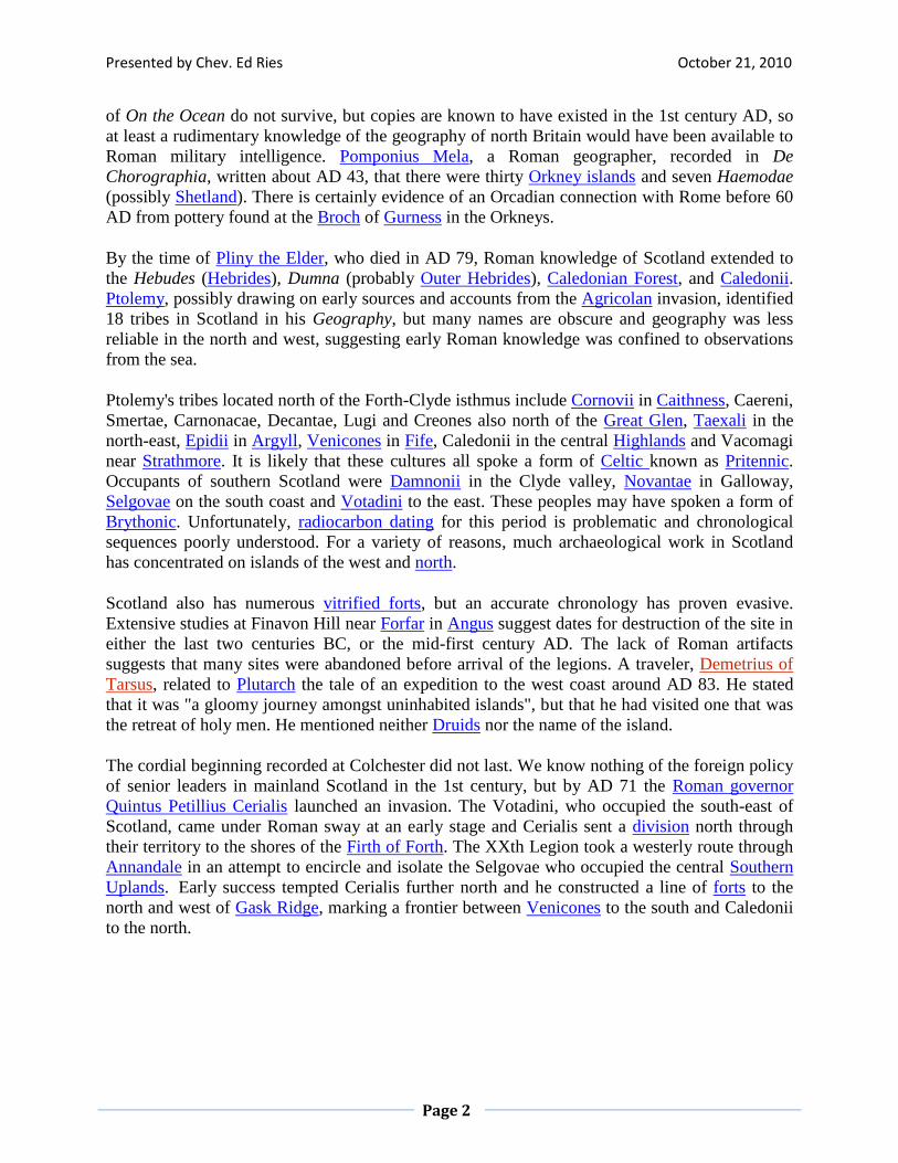
In the summer of AD 78, Gnaeus Julius Agricola arrived in Britain as the new governor. Two
years later, his legions constructed a substantial fort at Trimontium near Melrose. Excavations
produced significant finds including foundations of successive structures, Roman coins, and
pottery. Remains from the Roman army were also found, including a collection of Roman armor
(with ornate cavalry parade helmets), and horse fittings (with bronze saddleplates and studded
leather chamfrons). Agricola is said to have pushed his armies to the estuary of the "River Taus"
(usually assumed to be the River Tay) and established forts there, including a legionary fortress
at Inchtuthil.[28]
Presented by Chev. Ed Ries October 21, 2010
Page 4
Mons Graupius
In the summer of AD 84, the Romans faced the Caledonian armies at the Battle of Mons
Graupius. Agricola, whose forces included a fleet, arrived with light infantry bolstered by British
auxiliaries. It is estimated that 20,000 Romans faced 30,000 Caledonians. Agricola put
auxiliaries in the front, keeping his legions in reserve, and relied on close-quarters fighting to
make the Caledonians' unpointed slashing swords useless. Even though the Caledonians were put
to rout and lost this battle, 2/3 of their army escaped and hid in the Highlands or the "trackless
wilds" as Tacitus called them. Tacitus estimated battle casualties at 10,000 on the Caledonian
side and 360 on the Roman side. A number of authors reckoned the battle to have occurred in the
Grampian Mounth within sight of the North Sea. In particular, Roy, Surenne, Watt, Hogan and
others have advanced notions that the battle site may have been Kempstone Hill, Megray Hill, or
on other knolls near the Raedykes Roman camp. These points of high ground are near Elsick
Mounth, an ancient track used by Romans and Caledonians for military maneuvers. Other
suggestions include the hill of Bennachie in Aberdeenshire, Gask Ridge near Perth, or
Sutherland. It has also been suggested that in the absence of archaeological evidence and Tacitus'
low estimates of Roman casualties, that the battle was fictitious.
Calgacus
The first named Scot to appear in history by name was Calgacus ("Swordsman"), Caledonian
leader at Mons Graupius - referred to by Tacitus in Agricola as "most distinguished for birth and
valor among chieftains". Tacitus even invented a speech for him before the battle in which he
describes Romans as:
“ Robbers of the world, having by their universal plunder exhausted the land, they
rifle the deep. If the enemy be rich, they are rapacious; if he be poor, they lust for
dominion; neither the east nor the west has been able to satisfy them. Alone among
men they covet with equal eagerness poverty and riches. To robbery, slaughter,
plunder, they give the lying name of empire; they make a solitude and call it peace. ”
Aftermath
Calgacus' fate is unknown, but according to Tacitus, after the battle Agricola ordered the prefect
of the fleet to sail around the north of Scotland to confirm that Britain was an island and receive
the surrender of the Orcadians. It was proclaimed that Agricola had finally subdued all the tribes
of Britain. However, the Roman historian Cassius Dio reports that this circumnavigation resulted
in Titus receiving his 15th acclamation as emperor in 79 AD - five years before the battle at
Mons Graupius took place.
Marching camps may have been constructed along the southern shores of Moray Firth, although
their existence is questioned. Total size of the Roman garrison in Scotland during the Flavian
period is thought to be 25,000 troops, requiring 16–19,000 tons of grain per year. In addition,
material to construct the forts was substantial, estimated at 1 million cubic feet of timber during
Presented by Chev. Ed Ries October 21, 2010
Page 5
the 1st century. Ten tons of buried nails were discovered at the Inchtuthil site, which may have
had a garrison of 6,000 men.
Soon after his announcement of victory, Agricola was recalled to Rome by Domitian and his post
passed to Sallustius Lucullus. Agricola's successors were seemingly unable or unwilling to
further subdue the far north. Despite his apparent successes, Agricola fell out of favor and it is
possible that Domitian may have been informed of the fraudulence of Agricola’s claim to have
won a significant victory. The fortress at Inchtuthil was dismantled before its completion and
other fortifications at Gask Ridge (built to consolidate the Roman presence in Scotland after
Mons Graupius) were abandoned. It is possible that the cost of a drawn-out war outweighed any
economic or political benefit and it was wiser to leave the Caledonians alone. By AD 87,
occupation was limited to the Southern Uplands and by the end of the 1st century, the northern
limit of Roman expansion was a line between the Tyne and Solway Firth. Elginhaugh fort in
Midlothian dates to this period as may Castle Greg in West Lothian, most likely used as a
monitoring base for an east-west road running along the foot of the nearby Pentlands, from the
Forth to the Clyde Valley.
As a consequence of the Roman advance, hill forts such as Dun Mor in Perthshire, abandoned by
the natives long ago, were reoccupied. New ones may even have been constructed in the
northeast such as Hill O' Christ's Kirk in Aberdeenshire.
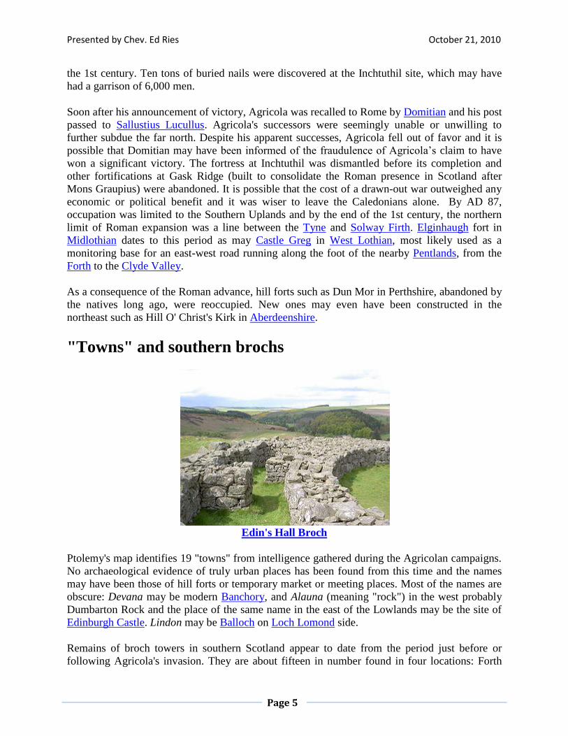
"Towns" and southern brochs
Edin's Hall Broch
Ptolemy's map identifies 19 "towns" from intelligence gathered during the Agricolan campaigns.
No archaeological evidence of truly urban places has been found from this time and the names
may have been those of hill forts or temporary market or meeting places. Most of the names are
obscure: Devana may be modern Banchory, and Alauna (meaning "rock") in the west probably
Dumbarton Rock and the place of the same name in the east of the Lowlands may be the site of
Edinburgh Castle. Lindon may be Balloch on Loch Lomond side.
Remains of broch towers in southern Scotland appear to date from the period just before or
following Agricola's invasion. They are about fifteen in number found in four locations: Forth
Presented by Chev. Ed Ries October 21, 2010
Page 6
valley near the Firth of Tay, far southwest, and eastern Borders. Their existence far from main
centers of broch-building is a mystery. The destruction of Leckie broch may have been by
Roman invaders, yet like the nearby site of Fairy Knowe at Buchlyvie, a substantial amount of
Roman and native artifacts have been found. Both structures were built in the late 1st century
AD and were evidently prestigious buildings. The inhabitants raised sheep, cattle, and pigs, and
hunted wild game including red deer and wild boar.
Edin's Hall Broch in Berwickshire is the best preserved southern broch and although the ruins are
similar to larger Orcadian broch villages, it is unlikely that the tower was ever more than one
story high. There is an absence of Roman artifacts. Various theories for existence of these
structures have been proposed, including construction by northern invaders following withdrawal
of Roman troops, or by allies of Rome encouraged to emulate the impressive northern style to
suppress native resistance, perhaps even Orcadian chiefs whose relationship with Rome may
have continued from the start of Roman-British relations. It is also possible that their
construction had little to do with Roman frontier policy and was simply the importation of a new
style by southern elites or it may have been their response to the growing threat of Rome prior to
the invasion and an attempt to ally with the free north.
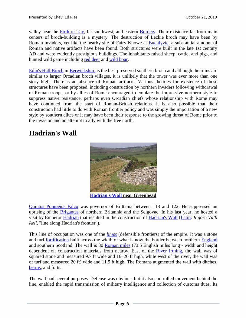
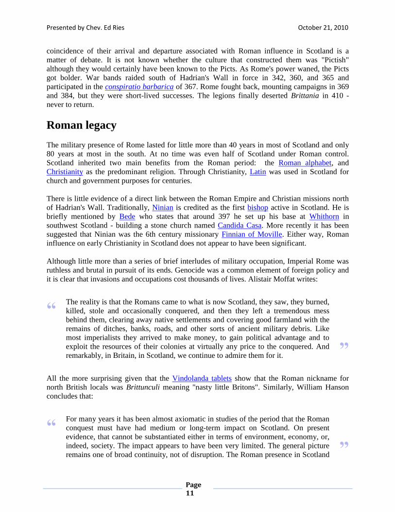
Hadrian's Wall
Hadrian's Wall near Greenhead
Quintus Pompeius Falco was governor of Brittania between 118 and 122. He suppressed an
uprising of the Brigantes of northern Britannia and the Selgovae. In his last year, he hosted a
visit by Emperor Hadrian that resulted in the construction of Hadrian's Wall (Latin: Rigore Valli
Aeli, "line along Hadrian's frontier").
This line of occupation was one of the limes (defensible frontiers) of the empire. It was a stone
and turf fortification built across the width of what is now the border between northern England
and southern Scotland. The wall is 80 Roman miles (73.5 English miles long - width and height
dependent on construction materials from nearby. East of the River Irthing, the wall was of
squared stone and measured 9.7 ft wide and 16–20 ft high, while west of the river, the wall was
of turf and measured 20 ft) wide and 11.5 ft high. The Romans augmented the wall with ditches,
berms, and forts.
The wall had several purposes. Defense was obvious, but it also controlled movement behind the
line, enabled the rapid transmission of military intelligence and collection of customs dues. Its
Presented by Chev. Ed Ries October 21, 2010
Page 7
scale demonstrated the power of Rome to her enemies, and enhanced the prestige of its builders.
Hadrian's Wall remained the frontier between Roman and Celtic worlds in Britain until 139.
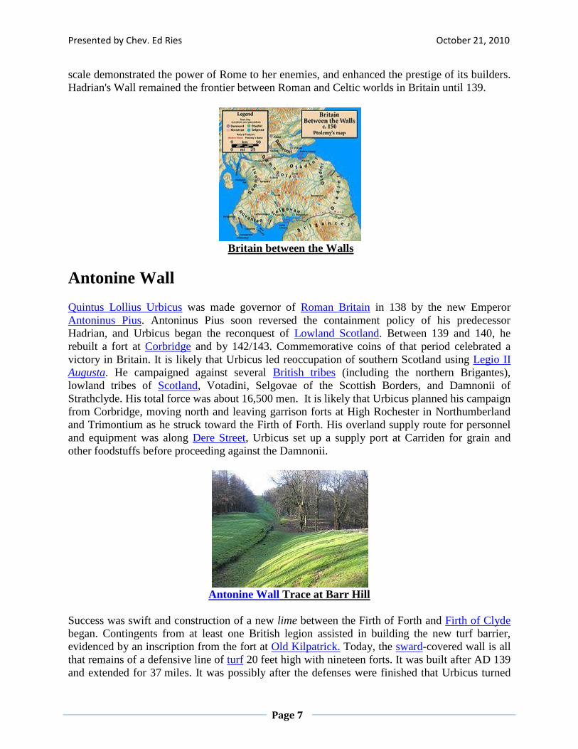
Britain between the Walls
Antonine Wall
Quintus Lollius Urbicus was made governor of Roman Britain in 138 by the new Emperor
Antoninus Pius. Antoninus Pius soon reversed the containment policy of his predecessor
Hadrian, and Urbicus began the reconquest of Lowland Scotland. Between 139 and 140, he
rebuilt a fort at Corbridge and by 142/143. Commemorative coins of that period celebrated a
victory in Britain. It is likely that Urbicus led reoccupation of southern Scotland using Legio II
Augusta. He campaigned against several British tribes (including the northern Brigantes),
lowland tribes of Scotland, Votadini, Selgovae of the Scottish Borders, and Damnonii of
Strathclyde. His total force was about 16,500 men. It is likely that Urbicus planned his campaign
from Corbridge, moving north and leaving garrison forts at High Rochester in Northumberland
and Trimontium as he struck toward the Firth of Forth. His overland supply route for personnel
and equipment was along Dere Street, Urbicus set up a supply port at Carriden for grain and
other foodstuffs before proceeding against the Damnonii.
Antonine Wall Trace at Barr Hill
Success was swift and construction of a new lime between the Firth of Forth and Firth of Clyde
began. Contingents from at least one British legion assisted in building the new turf barrier,
evidenced by an inscription from the fort at Old Kilpatrick. Today, the sward-covered wall is all
that remains of a defensive line of turf 20 feet high with nineteen forts. It was built after AD 139
and extended for 37 miles. It was possibly after the defenses were finished that Urbicus turned
Presented by Chev. Ed Ries October 21, 2010
Page 8
his attention on the Novantae who inhabited the Dumfries and Galloway peninsula. The main
lowland tribes, sandwiched between Hadrian's Wall to the south and the new wall to the north,
formed a confederation against Roman rule, known as the Maeatae.
The Antonine Wall provided a defensive line against the Caledonians. It cut off the Maeatae
from their Caledonian allies and created a buffer zone north of Hadrian's Wall. It also facilitated
troop movements between east and west, but its main purpose may not have been military. It
enabled Rome to control and tax trade and may have prevented potentially disloyal subjects of
Roman rule from communicating with independent brethren to the north for the purpose of
coordinating revolts. Urbicus achieved an impressive series of military successes, but like
Agricola's they were short-lived. Having taken twelve years to build, the wall was overrun and
abandoned soon after AD 160. The destruction of some of the southern brochs may date to the
Antonine advance - whether they had previously been symbols of Roman patronage, they had
outlived their usefulness.
Later Roman campaigns
The Roman frontier became Hadrian's Wall again, although Roman incursions into Scotland
continued. Initially, outpost forts occupied in the southwest and Trimontium remained in use but
they too were abandoned after the mid-180s.
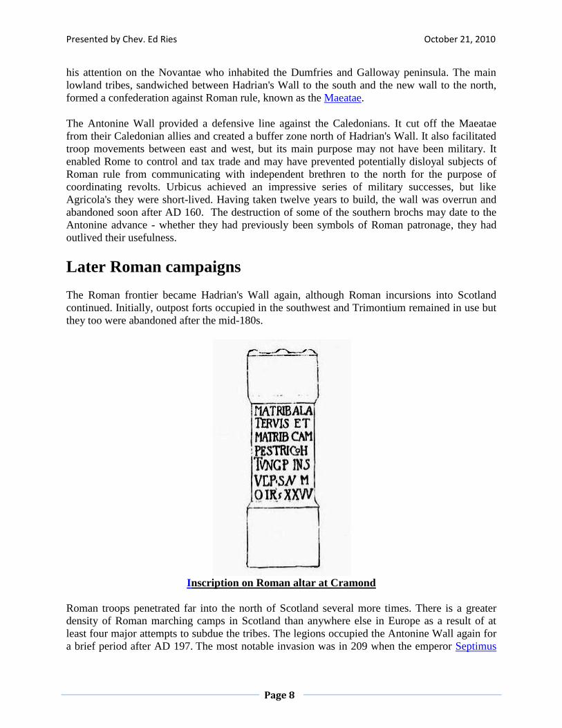
Inscription on Roman altar at Cramond
Roman troops penetrated far into the north of Scotland several more times. There is a greater
density of Roman marching camps in Scotland than anywhere else in Europe as a result of at
least four major attempts to subdue the tribes. The legions occupied the Antonine Wall again for
a brief period after AD 197. The most notable invasion was in 209 when the emperor Septimus
Presented by Chev. Ed Ries October 21, 2010
Page 9
Severus, claiming to be provoked by belligerence of the Maeatae, campaigned against the
Caledonian Confederacy.
Little is known about this alliance of tribes, augmented by fugitives from Roman rule further
south. The exact location of "Caledonia" is unknown, and the boundaries are unlikely to have
been fixed. The name itself is a Roman one used by Tacitus, Ptolemy, Pliny the Elder, and
Lucan, but the name which Caledonians called themselves is unknown. No evidence has
emerged of any specific Caledonian military or political leadership or stable confederation.
Severus used three legions of the British garrison (augmented by the recently formed Legio II
Parthica), 9,000 imperial guards with cavalry support, and numerous auxiliaries supplied by the
British fleet, Rhine fleet, and two fleets transferred from the Danube. According to Dio Cassius,
he inflicted genocide on native peoples but lost 50,000 of his own men to the attrition of guerrilla
tactics.
A string of forts was constructed in the northeast (some may date from the earlier Antonine
campaign). These include camps associated with Elsick Mounth, such as Normandykes, Ythan
Wells, Deers Den, and Glenmailen. Only two forts in Scotland - Cramond and Carpow (in the
Tay valley) are known to have been permanently occupied during this incursion before troops
were withdrawn again to Hadrian's Wall about 213. There is evidence that these campaigns
coincide with destruction and abandonment of fortifications in southern Scotland due either to
Roman military aggression or collapse of local grain markets in the wake of Roman withdrawal.
Severus repaired and reinforced Hadrian's Wall with a thoroughness that led many authors to
attribute the construction of the wall to him. It was during negotiations to purchase the truce
necessary to secure the Roman retreat to the wall that the first recorded utterance, attributable
with any reasonable confidence to a native of Scotland was made. When Septimus Severus' wife,
Julia Domna, criticized the morals of Caledonian women, the wife of Caledonian chief
Argentocoxos replied: "We fulfill the demands of nature in a much better way than do Roman
women; for we consort openly with the best men, whereas you let yourselves be debauched in
secret by the vilest".
Septimus Severus died at York in 211 while planning to renew hostilities, but his son Caracalla
abandoned these plans. Later excursions by Romans were limited to scouting expeditions in the
buffer zone that developed between the walls, trading, bribes to purchase truces, and eventually
the spread of Christianity. The Ravenna Cosmography uses a 3rd or 4th century Roman map that
identifies four meeting places and major markets in southern Scotland. Locus Maponi is possibly
modern Lochmabenstane near Gretna used as a muster point throughout Roman times. Two
others are meeting places of Damnonii and Selgovae, and the fourth, Manavi may be
Clackmannan. From the time of Caracalla onwards, Rome made no attempts to permanently
occupy territory in Scotland.
Presented by Chev. Ed Ries October 21, 2010
Page 10
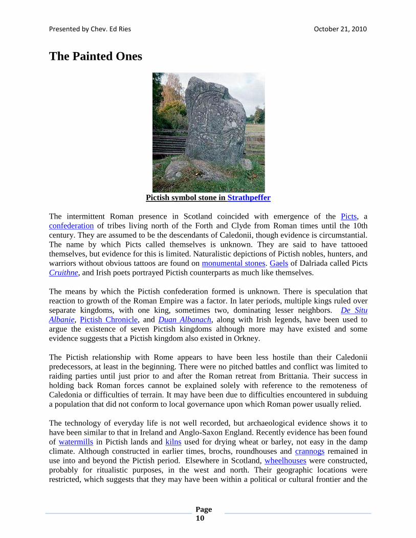
The Painted Ones
Pictish symbol stone in Strathpeffer
The intermittent Roman presence in Scotland coincided with emergence of the Picts, a
confederation of tribes living north of the Forth and Clyde from Roman times until the 10th
century. They are assumed to be the descendants of Caledonii, though evidence is circumstantial.
The name by which Picts called themselves is unknown. They are said to have tattooed
themselves, but evidence for this is limited. Naturalistic depictions of Pictish nobles, hunters, and
warriors without obvious tattoos are found on monumental stones. Gaels of Dalriada called Picts
Cruithne, and Irish poets portrayed Pictish counterparts as much like themselves.
The means by which the Pictish confederation formed is unknown. There is speculation that
reaction to growth of the Roman Empire was a factor. In later periods, multiple kings ruled over
separate kingdoms, with one king, sometimes two, dominating lesser neighbors. De Situ
Albanie, Pictish Chronicle, and Duan Albanach, along with Irish legends, have been used to
argue the existence of seven Pictish kingdoms although more may have existed and some
evidence suggests that a Pictish kingdom also existed in Orkney.
The Pictish relationship with Rome appears to have been less hostile than their Caledonii
predecessors, at least in the beginning. There were no pitched battles and conflict was limited to
raiding parties until just prior to and after the Roman retreat from Brittania. Their success in
holding back Roman forces cannot be explained solely with reference to the remoteness of
Caledonia or difficulties of terrain. It may have been due to difficulties encountered in subduing
a population that did not conform to local governance upon which Roman power usually relied.
The technology of everyday life is not well recorded, but archaeological evidence shows it to
have been similar to that in Ireland and Anglo-Saxon England. Recently evidence has been found
of watermills in Pictish lands and kilns used for drying wheat or barley, not easy in the damp
climate. Although constructed in earlier times, brochs, roundhouses and crannogs remained in
use into and beyond the Pictish period. Elsewhere in Scotland, wheelhouses were constructed,
probably for ritualistic purposes, in the west and north. Their geographic locations were
restricted, which suggests that they may have been within a political or cultural frontier and the
Presented by Chev. Ed Ries October 21, 2010
Page 11
coincidence of their arrival and departure associated with Roman influence in Scotland is a
matter of debate. It is not known whether the culture that constructed them was "Pictish"
although they would certainly have been known to the Picts. As Rome's power waned, the Picts
got bolder. War bands raided south of Hadrian's Wall in force in 342, 360, and 365 and
participated in the conspiratio barbarica of 367. Rome fought back, mounting campaigns in 369
and 384, but they were short-lived successes. The legions finally deserted Brittania in 410 -
never to return.
Roman legacy
The military presence of Rome lasted for little more than 40 years in most of Scotland and only
80 years at most in the south. At no time was even half of Scotland under Roman control.
Scotland inherited two main benefits from the Roman period: the Roman alphabet, and
Christianity as the predominant religion. Through Christianity, Latin was used in Scotland for
church and government purposes for centuries.
There is little evidence of a direct link between the Roman Empire and Christian missions north
of Hadrian's Wall. Traditionally, Ninian is credited as the first bishop active in Scotland. He is
briefly mentioned by Bede who states that around 397 he set up his base at Whithorn in
southwest Scotland - building a stone church named Candida Casa. More recently it has been
suggested that Ninian was the 6th century missionary Finnian of Moville. Either way, Roman
influence on early Christianity in Scotland does not appear to have been significant.
Although little more than a series of brief interludes of military occupation, Imperial Rome was
ruthless and brutal in pursuit of its ends. Genocide was a common element of foreign policy and
it is clear that invasions and occupations cost thousands of lives. Alistair Moffat writes:
“ The reality is that the Romans came to what is now Scotland, they saw, they burned,
killed, stole and occasionally conquered, and then they left a tremendous mess
behind them, clearing away native settlements and covering good farmland with the
remains of ditches, banks, roads, and other sorts of ancient military debris. Like
most imperialists they arrived to make money, to gain political advantage and to
exploit the resources of their colonies at virtually any price to the conquered. And
remarkably, in Britain, in Scotland, we continue to admire them for it. ”
All the more surprising given that the Vindolanda tablets show that the Roman nickname for
north British locals was Brittunculi meaning "nasty little Britons". Similarly, William Hanson
concludes that:
“ For many years it has been almost axiomatic in studies of the period that the Roman
conquest must have had medium or long-term impact on Scotland. On present
evidence, that cannot be substantiated either in terms of environment, economy, or,
indeed, society. The impact appears to have been very limited. The general picture
remains one of broad continuity, not of disruption. The Roman presence in Scotland ”
Presented by Chev. Ed Ries October 21, 2010
Page 12
was little more than a series of brief interludes within a longer continuum of
indigenous development."
The Romans' part in clearing the once-extensive Caledonian forest remains a matter of debate.
These forests were once much more extensive than they are now. The 16th century writer Hector
Boece believed that the woods in Roman times stretched north from Stirling into Atholl and
Lochaber. Modern research suggests a more complex picture. Changing post-glacial climate may
have allowed for a maximum forest cover between 4000 and 3000 BC and deforestation of the
Southern uplands was well underway by the time the legions arrived. Extensive analyses of
Black Loch in Fife suggest that arable land spread at the expense of forest from about 2000 BC
until the 1st century AD Roman advance. Thereafter, there was regrowth of birch, oak and hazel
for five centuries, suggesting invasions had a very negative impact on the native population. The
situation with Roman-held areas is harder to assess, but long-term influence of Rome may not
have been substantial.
The archaeological legacy of Rome in Scotland is sparse in the north. Almost all sites are
military and include about 400 miles of roads, such as the northern section of Dere Street that
runs along the east coast to Cramond. It is hard to find direct connections between native
architecture and settlement patterns and Roman influence. In Scotland, the Celtic way of life,
threatened but not extinguished by Rome, reasserted itself. In the north, Picts continued to be the
main power before the arrival and subsequent domination of the Scots of Dalriada. The
Damnonii eventually formed the Kingdom of Strathclyde based at Dumbarton Rock. South of the
Forth, Welsh-speaking Brythonic kingdoms of Yr Hen Ogledd (English: The Old North)
flourished during the 5th–7th centuries. In 1984, a possible Roman fort was found at Easter
Galcantray, southwest of Cawdor by aerial photography. The site was excavated by 1988 and
several features identified, but no datable artifacts were found. If confirmed, it is one of the most
northerly known Roman forts. A discovery in Easter Ross suggests that the legions may have
reached further north in Scotland. The site of a temporary camp was proposed at Portmahomack
in 1949, although this has not been conclusively confirmed. The most enduring Roman legacy
may be that of Hadrian's Wall. Its line approximates the border between Scotland and England,
and created a cultural buffer – “the Borders”, across the island that has lasted into the present.
Fiction Rivaling Facts
The 9th Spanish Legion participated in the Roman invasion of Britain, suffering losses under
Quintus Petillius Cerialis in the rebellion of Boudicia of 61, and setting up a fortress in 71 that
became part of Eburacum. Although some authors claim that the 9th Legion vanished during its
conflicts in Scotland by 117, there are later records of its activities, and it was probably
annihilated in the east of the Roman Empire by the Persians. This idea was used in the novels
The Eagle of the Ninth by Rosemary Sutcliff, Legion From the Shadows by Karl Edward
Wagner, Red Shift by Alan Garner, Engine City by Ken MacLeod, Warriors of Alavna by N. M.
Browne, Mons Graupius by Robert Wallace, and the feature film The Last Legion.
Presented by Chev. Ed Ries October 21, 2010
Page 13
References
Armit, I. (2003) Towers in the North: The Brochs of Scotland, Stroud: Tempus, ISBN 0-
7524-1932-3
Breeze, David J. (2006) The Antonine Wall. Edinburgh. John Donald. ISBN 0859766551
Broun, Dauvit, "The Seven Kingdoms in De situ Albanie: A Record of Pictish political
geography or imaginary map of ancient Alba" in E.J. Cowan & R. Andrew McDonald
(eds.), (2005) Alba: Celtic Scotland in the Medieval Era. Edinburgh. John Donald. ISBN
085976608X
Byrne, Francis John (1973) Irish Kings and High-Kings. London. Batsford. ISBN
0713458828
Forsyth, Katherine (2000) "Evidence of a lost Pictish Source in the Historia Regum
Anglorum of Symeon of Durham", with an appendix by John T. Koch. pp. 27–28 in
Simon Taylor (ed.) (2000). Kings, clerics and chronicles in Scotland, 500–1297: essays
in honour of Marjorie Ogilvie Anderson on the occasion of her ninetieth birthday.
Dublin. Four Courts Press. ISBN 1851825169
Foster, Sally M., (2004) Picts, Gaels, and Scots: Early Historic Scotland. London.
Batsford. ISBN 0713488743
Geary, Patrick J., (1988) Before France and Germany: The creation and transformation
of the Merovingian World. Oxford. Oxford University Press. ISBN 0195044576
Hanson, William S. "The Roman Presence: Brief Interludes", in Edwards, Kevin J. &
Ralston, Ian B.M. (Eds) (2003) Scotland After the Ice Age: Environment, Archaeology
and History, 8000 BC - AD 1000. Edinburgh. Edinburgh University Press.
Keay, J. & Keay, J. (1994) Collins Encyclopaedia of Scotland. London. HarperCollins.
Kirk, William "Prehistoric Scotland: The Regional Dimension" in Clapperton, Chalmers
M. (ed.) (1983) Scotland: A New Study. Newton Abbott. David & Charles.
Koch, John T. (2006) Celtic Culture: A Historical Encyclopedia. Oxford. ABC-CLIO.
ISBN 1851094407
Moffat, Alistair (2005) Before Scotland: The Story of Scotland Before History. London.
Thames & Hudson. ISBN 0500051337
Robertson, Anne S. (1960) The Antonine Wall. Glasgow Archaeological Society.
Smith, Beverley Ballin and Banks, Iain (2002) In the Shadow of the Brochs. Stroud.
Tempus. ISBN 075242517X
Smout, T.C. MacDonald, R. and Watson, Fiona (2007) A History of the Native
Woodlands of Scotland 1500-1920. Edinburgh University Press. ISBN 9780748632947
Thomson, William P. L. (2008) The New History of Orkney Edinburgh. Birlinn. ISBN
9781841586960
Woolf, Alex (2006) "Dun Nechtain, Fortriu, and the Geography of the Picts" in The
Scottish Historical Review, Volume 85, Number 2. Edinburgh. Edinburgh University
Press. ISSN 0036-9241
Kamm, Anthony (2009) The Last Frontier: The Roman Invasions of Scotland. Glasgow.
Neil Wilson Publishing. ISBN 9781906476069