seamless fusion of lidar, radar, and optical terrain … · seamless fusion of lidar, radar, and...
TRANSCRIPT

SEAMLESS FUSION OF LIDAR, RADAR, AND OPTICAL TERRAIN DATA
M. Lorraine. Tighe , Michael Wollersheim , Qiaoping Zhang ,
Marcus Schwäbisch , S. Griffiths , N. Mercer
2
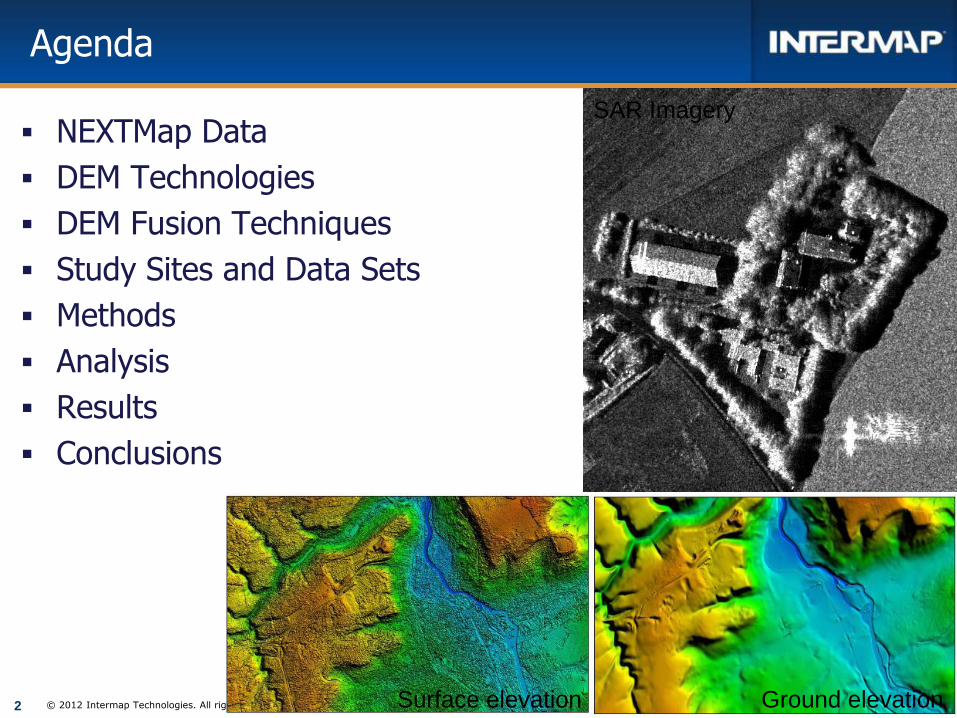
Agenda
NEXTMap Data
DEM Technologies
DEM Fusion Techniques
Study Sites and Data Sets
Methods
Analysis
Results
Conclusions
© 2012 Intermap Technologies. All rights reserved.
SAR Imagery
Surface elevation Ground elevation
3
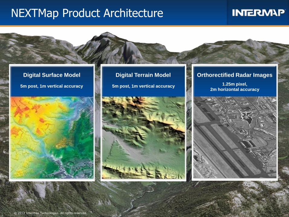
NEXTMap Product Architecture
© 2012 Intermap Technologies. All rights reserved.
Orthorectified Radar Images Digital Surface Model Digital Terrain Model
1.25m pixel,
2m horizontal accuracy 5m post, 1m vertical accuracy 5m post, 1m vertical accuracy
4
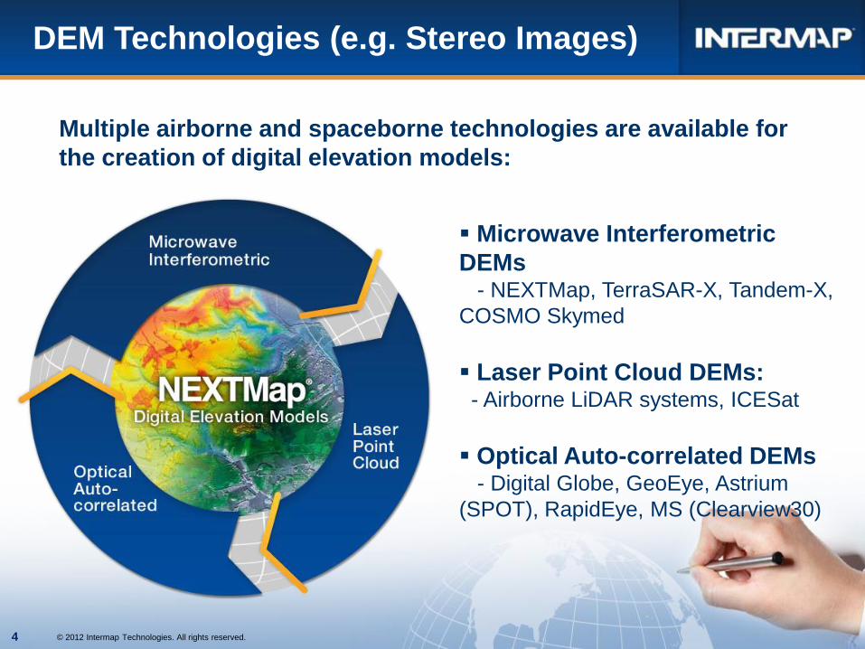
DEM Technologies (e.g. Stereo Images)
Microwave Interferometric
DEMs - NEXTMap, TerraSAR-X, Tandem-X,
COSMO Skymed
Laser Point Cloud DEMs: - Airborne LiDAR systems, ICESat
Optical Auto-correlated DEMs - Digital Globe, GeoEye, Astrium
(SPOT), RapidEye, MS (Clearview30)
Multiple airborne and spaceborne technologies are available for
the creation of digital elevation models:
© 2012 Intermap Technologies. All rights reserved.
4

5
DEM Technologies
Various airborne and spaceborne technologies are available for DEM generation.
© 2012 Intermap Technologies. All rights reserved.

6
Combines multiple Digital Elevation Models
(DEM) from varying sources at varying
accuracies and resolutions into one
homogeneous product
Alternate data can be blended or fused to
more consistent foundational elevation data
Data Fusion can improve vertical accuracy of
DEM inputs and bring multiple external data
sets to the same reference
Data Fusion Technique
Data fusion can blend disparate DEM data
into a unified mapping elevation layer.

7
DEM Fusion Process
Data Mining
Data Specification
Validation
Data Alignment
Fusion
Editing
Finishing
Data Aggregation:
Using the lowest resolution data
supplied, or using the data required by
the customer, our data engineers
aggregate, validate, align, fuse and
normalize all datasets to a consistent
common terrain dataset
Imagery is of assistance in validating
what we see in the elevation data.
© 2012 Intermap Technologies. All rights reserved.

8
Data Specification
Determination of what the
final output data specification
will be will drive the following
data fusion processing
steps:
Ground sampling
distance
Hydro-enforced edit rules
(e.g. water edits)
Seamless
Complete Coverage
LiDAR
NEXTMap
© 2012 Intermap Technologies. All rights reserved.

9
DEM Alignment Example
Reference DEM
LiDAR Data Set #2
Before Alignment
After Alignment
DEM Alignment is made to the reference DEM with better absolute accuracies (not necessarily better resolution or precision) to correct for these systematic errors.
Before Alignment
After Alignment
© 2012 Intermap Technologies. All rights reserved.
10
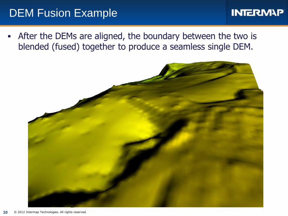
DEM Fusion Example
After the DEMs are aligned, the boundary between the two is blended (fused) together to produce a seamless single DEM.
© 2012 Intermap Technologies. All rights reserved.

11
Hydro-enforced Terrain
© 2012 Intermap Technologies. All rights reserved.
Terrain datasets may need to be hydro enforced (or monotonic - all
watercourse features flow downstream, and all standing water bodies
are flat through our editing process).
12
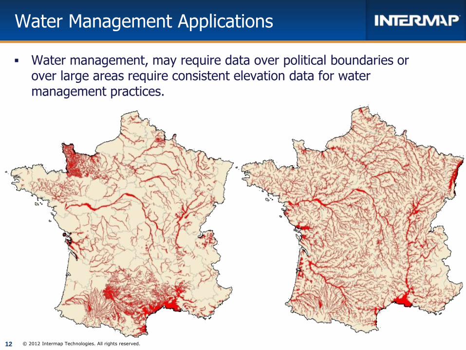
Water Management Applications
Water management, may require data over political boundaries or over large areas require consistent elevation data for water management practices.
© 2012 Intermap Technologies. All rights reserved.
13
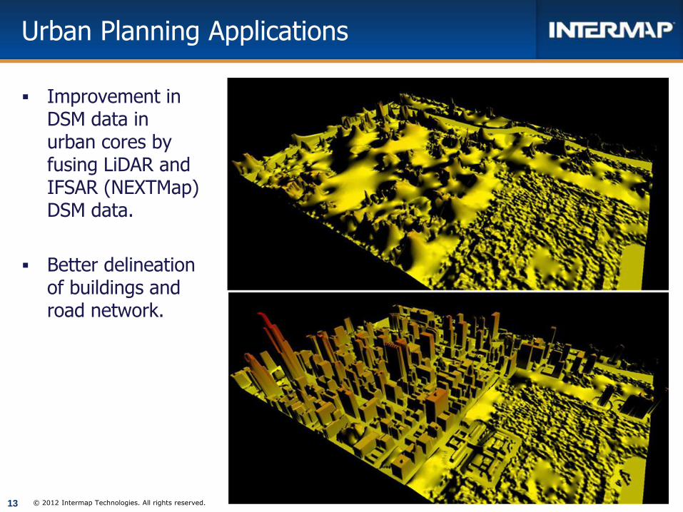
Urban Planning Applications
Improvement in DSM data in urban cores by fusing LiDAR and IFSAR (NEXTMap) DSM data.
Better delineation of buildings and road network.
© 2012 Intermap Technologies. All rights reserved.

14
3D terrain and surface elevation profiles help optimize
placement of microwave transmission and reception towers.
High resolution elevation data set in urban core (from 1m
LiDAR and 5m IFSAR) compared to a 30m IFSAR DSM
elevation data set; Coarser resolution data satisfied rural
regions.
Telecommunications Application
5m DSM Elevation Data
30m DSM Elevation Data

15
Flood Planning Applications
Flood planning over political boundaries or over large areas require consistent elevation data for flood and hazard models to work.
© 2012 Intermap Technologies. All rights reserved.
10 m DTM 5 m DTM
16
Conclusions
We reviewed how a variety of elevation data sets from different sources could be fused to create a seamless, consistent elevation foundation for use in a host of applications.
Data fusion process is critical in a world where we work with multiple data sets, comprised of different technologies, resolutions, accuracies, over areas of interest.
Thanks for you time!
QUESTIONS? © 2012 Intermap Technologies. All rights reserved.