sector la/lb area contingency plans (acp)
TRANSCRIPT

Sector LA/LB Area Contingency Plans (ACP)
Volume II: Section 9800 - Area Committee Detail for ACP4 – LA/LB North
ACP 5 – LA/LB South September 2020
Emergency Spill Notification Numbers National Response Center 1-800-424-8802
California Office of Emergency Services 1-800-852-7550

This Page Intentionally Blank

9800 Introduction, Organization Overview, and Response Prioritization……………………… 6
9800.1 Organization of Section 9800……………………………………………………………………… 6
9800.2 Response Prioritization………………………………………………………………………………. 6
9800.2.1 First 24 Hour Guidance …………………………………………………………………..... 6
9800.2.2 “Dynamic Site” Pre-response Assessment Strategy………………………….. 7
9800.2.3 Initial List of Site Protection Priorities………………………………………………. 7
9800.2.4 Prioritization – Predefined Hierarchy of Protection in Statutes………… 7
9801 Environmental Sensitive Sites……………………………………………………………………………… 7
9801.1 Geographic Response Strategies………………………………………………………………… 7
9801.2 Sensitivity Ranking…………………………………………………………………………………….. 8
9802 Cultural and Historic Resources………………………………………………………………………….. 8
9802.1 Cultural and Historic Resources Background……………………………………………… 9
9802.2 Cultural and Historic Resources Contacts…………………………………………………… 9
9803 Additional Resources at Risk……………………………………………………………………………….. 11
9803.1 Essential Fish Habitat…………………………………………………………………………………. 11
9803.2 Ground fish………………………………………………………………………………………………… 12
9803.3 Coastal Pelagic Species………………………………………………………………………………. 12
9803.4 Pacific Salmonids……………………………………………………………………………………….. 12
9803.5 Other Fisheries Issues………………………………………………………………………………… 13
9803.6 ERMA Resource Layers………………………………………………………………………………. 13
9804 Human Health and Safety and Critical Infrastructure………………………………………….. 17
9805 Economic Sensitive Sites……………………………………………………………………………………… 18
9805.1 Types of Economic Sensitive Sites………………………………………………………………. 19
9805.2 Economic Sensitive Sites Information…………………………………………………………. 19
9806 Shoreline Operational Divisions…………………………………………………………………………… 19
9807 Shoreline Access………………………………………………………………………………………………….. 19
9808 California Strategy Concepts, Systems Approach, and Nomenclature………………….. 20
9808.1 Booming Systems……………………………………………………………………………….......... 20
9808.2 Skimming Systems……………………………………………………………………………………… 20

9809 Glossary of Acronyms and Nomenclature Used in Strategies………………………………. 21
9810 ACP 4/5 LA/LB North Introduction………………………………………………………………………. 23
9811 San Luis Obispo County (GRAs 1-3)……………………………………………………………….. ……. 23
9811.1 Response Summary Tables………………………………………………………………………… 24
9811.2 Geographic Response Strategies for Environmental Sensitive Sites……………. 40
9811.2.1 GRA 1 Site Index………………………………………………………………………………… 41
9811.2.2 GRA 2 Site Index………………………………………………………………………………… 152
9811.2.3 GRA 3 Site Index………………………………………………………………………………… 176
9811.3 Economic Sensitive Sites……………………………………………………………………………. 249
9811.4 Shoreline Operational Divisions………………………………………………………………….. 255
9812 Santa Barbara County (GRAs 4-6)………………………………………………………………………… 268
9812.1 Response Summary Tables………………………………………………………………………… 269
9812.2 Geographic Response Strategies for Environmental Sensitive Sites……………. 281
9812.2.1 GRA 4 Site Index……………………………………………………………………………….. 282
9812.2.2 GRA 5 Site Index……………………………………………………………………………….. 323
9812.2.3 GRA 6 Site Index……………………………………………………………………………….. 393
9812.3 Economic Sensitive Sites……………………………………………………………………………. 441
9812.4 Shoreline Operational Divisions…………………………………………………………………. 446
9813 Ventura County (GRA 7)………………………………………………………………………………………. 473
9813.1 Response Summary Tables……………………………………………………………………….. 474
9813.2 Geographic Response Strategies for Environmental Sensitive Sites……………. 478
9813.2.1 GRA 7 Site Index……………………………………………………………………………….. 479
9813.3 Economic Sensitive Sites……………………………………………………………………………. 526
9813.4 Shoreline Operational Divisions………………………………………………………………….. 531
9814 Northern Channel Islands (GRA 8)……………………………………………………………………….. 544
9814.1 Response Summary Tables………………………………………………………………………… 549
9814.2 Geographic Response Strategies for Environmental Sensitive Sites……………. 552
9814.2.1 GRA 8 Site Index………………………………………………………………………………… 553
9814.3 Economic Sensitive Sites……………………………………………………………………………. 614
9814.4 Shoreline Operational Divisions………………………………………………………………….. 615
9815 ACP 5 LA/LB South Introduction…………………………………………………………………………… 621
9816 Los Angeles County (GRAs 1, 2 and 4)………………………………………………………………….. 622
9816.1 Response Summary Tables…………………………………………………………………………. 623
9816.2 Geographic Response Strategies for Environmental Sensitive Sites……………. 629
9816.2.1 GRA 1 Site Index……………………………………………………………………………….. 630
9816.2.2 GRA 2 Site Index……………………………………………………………………………….. 658
9816.2.3 GRA 4 Site Index……………………………………………………………………………….. 679
9816.3 Economic Sensitive Sites…………………………………………………………………………….. 701
9816.4 Shoreline Operational Divisions………………………………………………………………….. 727
9817 Orange County (GRA 3)……………………………………………………………………………………….. 737
9817.1 Response Summary Table………………………………………………………………………….. 738
9817.2 Geographic Response Strategies for Environmental Sensitive Sites……………. 741
9817.2.1 GRA 3 Site Index……………………………………………………………………………….. 742
9817.3 Economic Sensitive Sites…………………………………………………………………………….. 782
9817.4 Shoreline Operational Divisions………………………………………………………………….. 793
9800 Introduction, Organization Overview, and Response Prioritization
The focus of spill response contingency planning is the identification and protection of environmental, cultural/historic, and economic resources at risk. Section 9800 is a catalog of environmental, cultural, and economic resources identified by the Area Committees. Strategies to protect resources from oil and collateral impacts are included for some of these resources. During a spill, sites and resources that may be at risk and the measures that should reasonably be deployed to protect them are determined by a suite of factors. This includes the probable trajectory from the spill, prevailing conditions that may favor or constrain feasible deployments, the type of material released, and the threat the spilled material poses to the resources at risk. These, in combination with operational and geographic constraints that impact spill response measures, define the response need and focus response decisions.
9800.1 Organization of Section 9800
Section 9800 provides geographically organized information about environmental, cultural/historic, economic, and other significant resources that may be at risk from spills in ACP 4 – San Luis Obispo, Santa Barbara, and Ventura Counties and ACP 5 – Los Angeles and Orange Counties.
The information in this section is grouped by Geographic Response Areas (GRAs). In some instances, GRAs fall along political boundaries such as a county line, or may be delineated based on the geomorphology, and in other instances GRAs are based on local hydro-geographic areas, where contaminants such as oil are likely to circulate. Section 9800 is organized first by county or GRA and then into topical subsections for each county or GRA. Local variations accommodate the needs of each Area Committee (not all ACPs have all the topical subdivisions shown or in some cases have additional sections).
9800.2 Response Prioritization
The Environmental Unit and the Environmental Unit Leader are responsible to provide environmental information, trajectory projections, and measures necessary to mitigate impacts. Foremost among these is to provide a prioritized list of protection strategies for resources at risk based on trajectories. A Resources at Risk Technical Specialist conducts this sensitive site prioritization.
Protection prioritization in a spill response should be determined by two considerations: the driving consideration is how soon the oil will reach the sensitive site and the predefined protection priority associated with the site. This second consideration is applied only when there are insufficient response resources to protect all resources at risk before they are impacted by the oil. Responders should not assume that sensitive locales equidistant from the source of a spill are at equal risk from the oil. This means that the urgency to protect a key resource is first determined by the likelihood that it will be impacted in the near future before it can be protected by requisite response staff and equipment. If the sites are too numerous to protect with the response resources available within the projected times of impact, then triage of protection follows a prescribed order.
For the purpose of prioritization, "risk" is defined as "the probability of spilled oil reaching the vicinity of a sensitive site of concern." During an oil spill, the relative likelihood of a site coming into contact with the oil is a function of the proximity of the spill to the site and whether prevailing conditions - the wind, current, and tides at the time of the spill, will move the oil toward or away from it. It is essential that at least a simple trajectory be developed to enable this assessment.
9800.2.1 First 24 Hour Guidance
Protection strategies described in this section are primarily intended to serve as initial guidance for the first 24 hours of a spill response until further guidance based on real-time conditions, sensitivities,
LA/LB - ACPs 4/5 6 v. 2019.1 - September 2020

and constraints are identified and addressed. Additional or modified protection strategies may also need to be considered depending on spill conditions. In other words, strategies presented here in ACP 4 and 5 may need to be modified based on actual spill conditions and/or direction from the Unified Command.
9800.2.2 “Dynamic Site” Pre-response Assessment Strategy
The mouths of many of the creeks and rivers in San Luis Obispo, Santa Barbara, Ventura, Los Angeles, and Orange Counties will routinely cease to flow during extended periods of dry weather. Many of these mouths will become “closed” due to the long shore movement of beach sand under the combined influence of water currents, waves, tides, and wind. Ideally, the status of these dynamic coastal sites should be evaluated before any response equipment is ordered and dispatched.
9800.2.3 Initial List of Site Protection Priorities
Using simple trajectory methods, the list of site protection priorities may be generated quickly by initial responders (typically OSPR Resources at Risk Technical Specialists) and relayed to Operations. The sites can be prioritized using the probable time of impact and the prioritization criteria below. Strategies most appropriate can be chosen from the ACP pages and listed in a time of impact priority sequence. Responders with local knowledge may modify the priorities based on seasonal differences in plant and animal distribution and other local conditions.
9800.2.4 Prioritization – Predefined Hierarchy of Protection in Statutes
State and Federal law establish three priority levels for dedication of emergency oil spill response resources.
First Priority – Protection of human health and safety and critical infrastructure Second Priority – Protection of environmental resources Third Priority – Protection of economic resources
Examples of resources that will receive a first priority response include drinking water intakes, desalinization plants, power plant intakes, and high public use areas at risk.
Within the Second Priority – Environmental Resources – sites are ranked by sensitivity in terms of habitat and/or species present. This sensitivity may be useful in making priority decisions between two sites if both may be impacted simultaneously, but inadequate resources are available for concurrent protection.
Within the Third Priority – Economic Resources – sites are listed by county and will include human health and safety sites. This sensitivity may be useful in making priority decisions between two sites if both may be impacted simultaneously, but inadequate resources are available for concurrent protection.
9801 Environmental Sensitive Sites
9801.1 Geographic Response Strategies
Protection strategies for the identified Environmental Sensitive Sites in the Area Contingency Plans are referred to as Geographic Response Strategies (GRSs). The GRSs described in this section are grouped by Geographic Response Areas (GRAs) and include a Site Summary, Site Strategy, and Site Diagram page.
LA/LB - ACPs 4/5 7 v. 2019.1 - September 2020
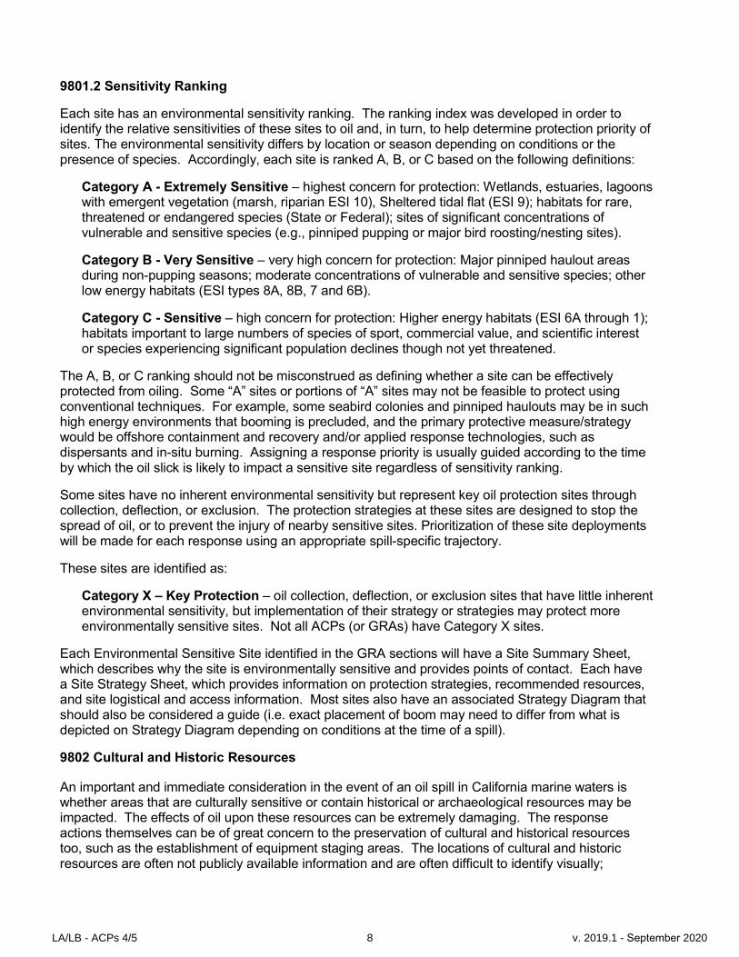
9801.2 Sensitivity Ranking
Each site has an environmental sensitivity ranking. The ranking index was developed in order to identify the relative sensitivities of these sites to oil and, in turn, to help determine protection priority of sites. The environmental sensitivity differs by location or season depending on conditions or the presence of species. Accordingly, each site is ranked A, B, or C based on the following definitions:
Category A - Extremely Sensitive – highest concern for protection: Wetlands, estuaries, lagoons with emergent vegetation (marsh, riparian ESI 10), Sheltered tidal flat (ESI 9); habitats for rare, threatened or endangered species (State or Federal); sites of significant concentrations of vulnerable and sensitive species (e.g., pinniped pupping or major bird roosting/nesting sites).
Category B - Very Sensitive – very high concern for protection: Major pinniped haulout areas during non-pupping seasons; moderate concentrations of vulnerable and sensitive species; other low energy habitats (ESI types 8A, 8B, 7 and 6B).
Category C - Sensitive – high concern for protection: Higher energy habitats (ESI 6A through 1); habitats important to large numbers of species of sport, commercial value, and scientific interest or species experiencing significant population declines though not yet threatened.
The A, B, or C ranking should not be misconstrued as defining whether a site can be effectively protected from oiling. Some “A” sites or portions of “A” sites may not be feasible to protect using conventional techniques. For example, some seabird colonies and pinniped haulouts may be in such high energy environments that booming is precluded, and the primary protective measure/strategy would be offshore containment and recovery and/or applied response technologies, such as dispersants and in-situ burning. Assigning a response priority is usually guided according to the time by which the oil slick is likely to impact a sensitive site regardless of sensitivity ranking.
Some sites have no inherent environmental sensitivity but represent key oil protection sites through collection, deflection, or exclusion. The protection strategies at these sites are designed to stop the spread of oil, or to prevent the injury of nearby sensitive sites. Prioritization of these site deployments will be made for each response using an appropriate spill-specific trajectory.
These sites are identified as:
Category X – Key Protection – oil collection, deflection, or exclusion sites that have little inherent environmental sensitivity, but implementation of their strategy or strategies may protect more environmentally sensitive sites. Not all ACPs (or GRAs) have Category X sites.
Each Environmental Sensitive Site identified in the GRA sections will have a Site Summary Sheet, which describes why the site is environmentally sensitive and provides points of contact. Each have a Site Strategy Sheet, which provides information on protection strategies, recommended resources, and site logistical and access information. Most sites also have an associated Strategy Diagram that should also be considered a guide (i.e. exact placement of boom may need to differ from what is depicted on Strategy Diagram depending on conditions at the time of a spill).
9802 Cultural and Historic Resources
An important and immediate consideration in the event of an oil spill in California marine waters is whether areas that are culturally sensitive or contain historical or archaeological resources may be impacted. The effects of oil upon these resources can be extremely damaging. The response actions themselves can be of great concern to the preservation of cultural and historical resources too, such as the establishment of equipment staging areas. The locations of cultural and historic resources are often not publicly available information and are often difficult to identify visually;
LA/LB - ACPs 4/5 8 v. 2019.1 - September 2020

therefore, pre-spill planning and coordination with the appropriate organizations becomes essential to avoid damaging these resources.
9802.1 Cultural and Historic Resources Background
California has many identified historical or archaeological sites of significance near marine waters of the State, yet this information is confidential and only available from specific sources. Many of the coastal areas of significance to Native Americans are known or have been identified too,but are often confidential information as well. Furthermore, all coastal areas for each tribe are to be considered economically significant because fishing and other traditional uses span the length of coastline for each group. A list of cultural and historic resources is not included in this ACP due to the confidential and sensitive nature of this information.
Cultural and historic resource impact mitigation is addressed in the Regional Contingency Plan. The key guidance is the Emergency Response Program Guidelines to Implement the National Programmatic Agreement on Protection of Historic Properties (Guidelines). These Guidelines provide the process for the Federal On-Scene Coordinator (FOSC) to protect and conserve cultural and historic resources during a response through the FOSC’s Historic Properties Specialist. The ACP contains contact information for local and regional historic experts who may be able to assist with the protection of these sensitive resources.
Historical resources are defined under the California Environmental Quality Act (CEQA) to include, but not limited to: "any object, building, structure, site, area, place, record, or manuscript which is historically or archaeologically significant, or is significant in the architectural, engineering, scientific, economic, agricultural, educational, social, political, military, or cultural annals of California." These sites or areas are either listed or eligible to be listed on the California Register of Historical Resources or the National Register of Historical Places and includes some California State Landmarks and Points of Historical Interest. The California Register is an authoritative guide to the state’s historical resources and to which properties are considered significant for purposes of CEQA. For more information: http://ohp.parks.ca.gov/?page_id=21238
An archeological site may be considered a historical resource if it is significant in the architectural, engineering, scientific, economic, agricultural, educational, social, political, military or cultural annals of California (PRC § 5020.1(j)) or if it meets the criteria for listing on the California Register. CEQA defines an important archaeological resource as one that: "A) is associated with an event or person of; 1) recognized significance in California or American history, or 2) recognized scientific important in prehistory; B) can provide information which is both demonstrable public interest and useful in addressing scientifically consequential and reasonable archaeological research questions; C) has a special or particular quality such as oldest, best example, largest, or last surviving example of its kind; D) is at least 100 years old and possesses substantial stratigraphic integrity; E) involves important research questions that historical research has shown can be answered only with archaeological methods."
9802.2 Cultural and Historic Resources Contacts
The California Historical Resources Information System (CHRIS) is an elaborate database maintained by the Office of Historic Preservation of the California Department of Parks and Recreation and nine local Information Centers. Access to this database is restricted to certified archaeologists, including the State Historic Preservation Officer, to keep the locations of these resources as secure as possible.
LA/LB - ACPs 4/5 9 v. 2019.1 - September 2020
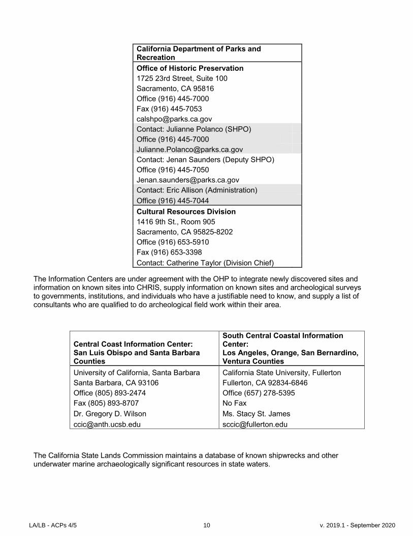
California Department of Parks and Recreation
Office of Historic Preservation
1725 23rd Street, Suite 100
Sacramento, CA 95816
Office (916) 445-7000
Fax (916) 445-7053
Contact: Julianne Polanco (SHPO)
Office (916) 445-7000
Contact: Jenan Saunders (Deputy SHPO)
Office (916) 445-7050
Contact: Eric Allison (Administration)
Office (916) 445-7044
Cultural Resources Division
1416 9th St., Room 905
Sacramento, CA 95825-8202
Office (916) 653-5910
Fax (916) 653-3398
Contact: Catherine Taylor (Division Chief)
The Information Centers are under agreement with the OHP to integrate newly discovered sites and information on known sites into CHRIS, supply information on known sites and archeological surveys to governments, institutions, and individuals who have a justifiable need to know, and supply a list of consultants who are qualified to do archeological field work within their area.
Central Coast Information Center: South Central Coastal Information Center:
San Luis Obispo and Santa Barbara Counties
Los Angeles, Orange, San Bernardino, Ventura Counties
University of California, Santa Barbara California State University, Fullerton
Santa Barbara, CA 93106 Fullerton, CA 92834-6846
Office (805) 893-2474 Office (657) 278-5395
Fax (805) 893-8707 No Fax
Dr. Gregory D. Wilson Ms. Stacy St. James
[email protected] [email protected]
The California State Lands Commission maintains a database of known shipwrecks and other underwater marine archaeologically significant resources in state waters.
LA/LB - ACPs 4/5 10 v. 2019.1 - September 2020

California State Lands Commission
100 Howe Ave., Suite 100
South Sacramento, CA 95825-8202
Office (916) 574-1900
Fax (916) 574-1810
State Parks Archeologists (if the spill is within or threatens park lands) and the Native American Heritage Commission should be notified to evaluate known cultural resources sensitivity and to determine if a Native American representative is required to be on scene of a response. Contact information for local or regional Native American representatives may be obtained from the Native American Heritage Commission.
Native American Heritage Commission
1550 Harbor Blvd., Suite 100
West Sacramento, CA 95691
Office (916) 373-3710
Contact: Katy Sanchez
Office (916) 373-3712
Contact: Debbie Pilas-Treadway
Office (916) 373-3713
Contact: Gayle Totton
Office: (916) 373-3714
9803 Additional Resources at Risk
9803.1 Essential Fish Habitat NOAA National Marine Fisheries Service (NMFS) has legislative authority for fisheries regulation in the United States, in the area between three-miles to 200 miles offshore and in the high seas (beyond 200 miles from the coast), under the Magnuson-Stevens Fishery Conservation and Management Act (MSA). In 1996, the MSA was re-authorized and amended by the Sustainable Fisheries Act of 1996 (Public Law 104-267) to emphasize the sustainability of the nation's fisheries and establish a new standard by requiring that fisheries be managed at maximum sustainable levels and that new approaches be taken in habitat conservation. This habitat is called “Essential Fish Habitat” (EFH). The Act established procedures designed to identify, conserve, and enhance EFH for those species regulated under a Federal fisheries management plan. NOAA has developed an online mapping tool for EFH, which can be found at https://www.habitat.noaa.gov/protection/efh/efhmapper/.
Although the concept of EFH is similar to that of “Critical habitat” under the Endangered Species Act (ESA), measures recommended to protect EFH by NMFS or a Council are advisory, not proscriptive. Note that consultation under the ESA is a separate consultation and not the same as a consultation for EFH. The MSA requires Federal agencies to consult with NMFS on all actions, or proposed
LA/LB - ACPs 4/5 11 v. 2019.1 - September 2020
actions, authorized, funded, or undertaken by the agency, that may adversely affect EFH (MSA §305(b)(2)). See ACP Section 4800 for consultation procedures.
The EFH mandate applies to all species managed under a federal Fishery Management Plan (FMP). For the Pacific West Coast (excluding Alaska), there are FMPs, covering groundfish, coastal pelagic species, Pacific salmon and highly migratory species (e.g., tuna, swordfish and shark). Therefore, Federal agencies must consider the impact of a proposed action on EFH for any species managed under those FMPs. A brief description of EFH identified in each FMP follows.
9803.2 Ground fish
The EFH for Pacific coast groundfish is defined as the aquatic habitat necessary to allow for groundfish production to support long-term sustainable fisheries for groundfish and for groundfish contributions to a healthy ecosystem. Descriptions of groundfish EFH for each of the 83 species and their life stages result in more than 400 EFH identifications. When these EFHs are taken together, the groundfish EFH includes all waters from the mean higher high water line, and the upriver extent of saltwater intrusion in river mouths, along the coasts of Washington, Oregon and California seaward to the boundary of the U.S. exclusive economic zone (EEZ).
9803.3 Coastal Pelagic Species
Amendment 8 to The Coastal Pelagic Species Fishery Management Plan describes the habitat requirements of five pelagic species: Northern anchovy, Pacific sardine, Pacific (chub) mackerel, jack mackerel, and market squid. These four finfish and market squid are treated as a single species complex because of similarities in their life histories and habitat requirements. EFH for coastal pelagic species is defined as: The east-west geographic boundary of EFH for CPS is defined to be all marine and estuarine waters from the shoreline along the coasts of California, Oregon, and Washington offshore to the limits of the EEZ and above the thermocline where sea surface temperatures range between 10º – 26º C. The southern boundary is the U.S.-Mexico maritime boundary. The northern boundary is more dynamic and is defined as the position of the 10º C isotherm, which varies seasonally and annually.
9803.4 Pacific Salmonids
Chinook, coho, steelhead, and Puget Sound pink salmon: EFH for the Pacific coast salmon fishery means those waters and substrate necessary for salmonid production needed to support a long-term sustainable salmonid fishery and salmonid contributions to a healthy ecosystem. To achieve that level of production, EFH includes all those streams, lakes, ponds, wetlands, and other currently viable water bodies and most of the habitat historically accessible to salmon in Washington, Oregon, Idaho, and California. They did not identify ‘‘specific areas’’ in the Pacific Ocean that contain essential features for Salmonids, but in general, salmon EFH extends from the near shore and tidal submerged environments within state territorial waters out to the full extent of the exclusive economic zone (370.4 km) offshore of Washington, Oregon, and California north of Point Conception.
Southern California Steelhead: Southern steelhead may have occupied as much as 15% of the winter steelhead range in California, but the present distribution in southern California has been reduced to perhaps 1% of the stream miles they formerly inhabited (E. Gerstung, CDFG, 1995). Juvenile steelhead rear in freshwater 1- 4 years and then spend 1-5 years (usually 2-3 in California) in the ocean. Southern steelhead usually spend less time in fresh water because of inhospitable conditions in the lower reaches of Southern California streams. Therefore they may migrate to the ocean or have greater dependency on coastal lagoons during the first year. Fish movements both upstream and downstream coincide with flow pulses from storms. These coastal streams are characterized by sand bar build up during low flow summer months at the mouth.
LA/LB - ACPs 4/5 12 v. 2019.1 - September 2020

The Evolutionary Significant Unit includes all naturally spawned populations of steelhead (and their progeny) in streams from the Santa Maria River to Malibu Creek. The Estero Bay Hydrologic Unit includes all naturally spawned populations of Southern California steelhead (and their progeny) in streams from San Carpoforo Creek to Arroyo Grande Creek in the estuarine and stream channel areas. The Santa Maria River, Santa Ynez, and South Coast Hydrologic Units include all naturally spawned populations of Southern California steelhead (within Santa Barbara county) and their progeny in estuarine and stream channel areas. The Ventura River, Santa Clara-Calleguas, and Calleguas Hydrologic Units include all naturally spawned populations of Southern California steelhead (within Ventura County) and their progeny in the estuarine and stream channel areas. Steelhead trout can be found at several Environmentally Sensitive Sites in ACPs 4 and 5.
9803.5 Other Fisheries Issues
The endangered (federally listed) tidewater goby can be found at several Environmental Sensitive Sites in San Luis Obispo, Santa Barbara, Ventura, Los Angeles and Orange Counties. All life stages of tidewater gobies are typically found at the upper end of coastal lagoons in areas of low salinity (commonly less than 10 parts per thousand). Critical habitat designation for tidewater gobies was finalized in the Federal Register January 31, 2008.
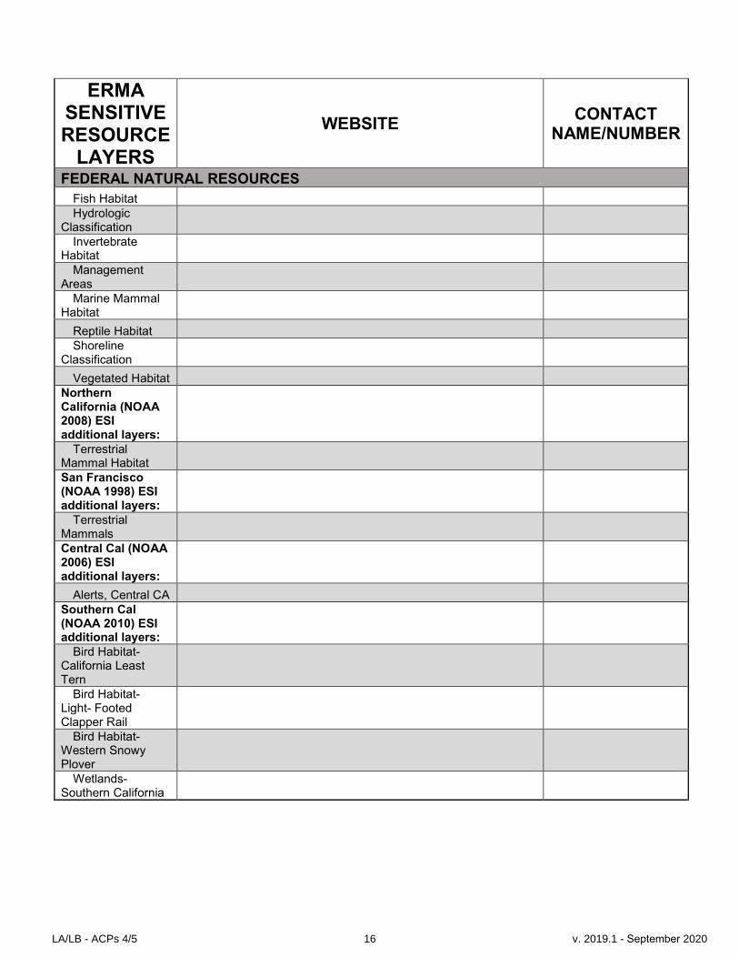
9803.6 ERMA Resource Layers
The Environmental Response Management Application® (ERMA) is a NOAA developed web-based Geographic Information System (GIS) tool that assists both emergency responders and environmental resource managers in dealing with incidents that may adversely impact the environment. ERMA integrates and synthesizes various real-time and static datasets into a single interactive map, thus providing fast visualization of the situation and improving communication and coordination among responders and stakeholders.
The following table shows resources at risk contained as data layers within ERMA that can be accessed during a response.
ERMA SENSITIVE RESOURCE
LAYERS
WEBSITE CONTACT
NAME/NUMBER
FEDERAL NATURAL RESOURCES Federally Designated Critical Habitat (ESA)
BLM: CA Coastal National Monument
http://www.blm.gov/ca/st/en/prog/blm_special_areas/nm/ccnm.html
Bill Standly, CCNM Manager/831-383-9805
James Weigand, Ecologist / 916-716-4809
NOAA: http://www.nmfs.noaa.gov/pr/species/criticalhabitat.htm Joesph Dillon (NOAA) / 707-575-6093
Black Abalone Critical Habitat
Chinook - CA Coast, Central Valley Spring Run
LA/LB - ACPs 4/5 13 v. 2019.1 - September 2020

ERMA SENSITIVE RESOURCE
LAYERS
WEBSITE CONTACT
NAME/NUMBER
FEDERAL NATURAL RESOURCES Steelhead - CA
Central Valley, Central CA Coast, Northern CA, South Central CA Coast, Southern CA
Eulachon Leatherback
Sea Turtle Sturgeon -
Southern DPS Green Sturgeon, Green Sturgeon Streams
NOAA - Essential Fish Habitat (EFH)
http://www.westcoast.fisheries.noaa.gov/habitat/fish_habitat/efh_consultations_go.html
Joesph Dillon (NOAA) / 707-575-6093
Groundfish EFH - Detail
Groundfish EFH 2005
Habitat Area of Particular Concern NOAA - National Marine Sanctuaries & Other Coastal Resources http://sanctuaries.noaa.gov/
Channel Islands NMS Marine Protected Areas http://channelislands.noaa.gov/
Greater Farallones NMS http://farallones.noaa.gov/
Maria Brown (NOAA)/ 415-561-6622
Monterey Bay NMS http://montereybay.noaa.gov/
Paul Michel (NOAA) / 8310-647-4201
Sea Bird Surveys - Spring, Summer, Fall, Winter (1975-2008) Additional NOAA layers
Steelhead - Cal Central Valley, Central Cal Coast Distribution, Northern Cal, South Central Cal Coast, Southern Cal Distribution,
Joesph Dillon (NOAA) / 707-575-6093
LA/LB - ACPs 4/5 14 v. 2019.1 - September 2020

ERMA SENSITIVE RESOURCE
LAYERS
WEBSITE CONTACT
NAME/NUMBER
FEDERAL NATURAL RESOURCES
Summer Range, Winter Range
Chinook - Cal Coast Distribution, Central Valley Spring Run Distribution
Joesph Dillon (NOAA) / 707-575-6093
Coho - Coho Distribution, Coho Salmon Range
Joesph Dillon (NOAA) / 707-575-6093
Antipatharia Cover - Black Coral
Eelgrass Bed Extents - Santa Barbara Co. and Channel Islands
National Estuarine Research Reserves
Pinniped Rookeries and Haulouts
Steller Sea Lion
USFWS http://www.fws.gov/endangered/what-we-do/critical-habitats.html
Damian Higgins(USFWS) / 916-414-6548
Tidewater Goby Western Snowy
Plover NOAA - Environmental Sensitivity Index (ESI) http://response.restoration.noaa.gov/esi
Jordan Stout (NOAA) / 510-437-5344
for Northern Calfironia, San Francisco, Central, and Southern California:
Anadromous Fish Streams
Bird Habitat
Bird Nest
ESI Index
LA/LB - ACPs 4/5 15 v. 2019.1 - September 2020
ERMA SENSITIVE RESOURCE
LAYERS
WEBSITE CONTACT
NAME/NUMBER
FEDERAL NATURAL RESOURCES
Fish Habitat Hydrologic
Classification Invertebrate
Habitat Management
Areas Marine Mammal
Habitat
Reptile Habitat Shoreline
Classification
Vegetated Habitat Northern California (NOAA 2008) ESI additional layers:
Terrestrial Mammal Habitat San Francisco (NOAA 1998) ESI additional layers:
Terrestrial Mammals Central Cal (NOAA 2006) ESI additional layers:
Alerts, Central CA Southern Cal (NOAA 2010) ESI additional layers:
Bird Habitat- California Least Tern
Bird Habitat- Light- Footed Clapper Rail
Bird Habitat- Western Snowy Plover
Wetlands- Southern California
LA/LB - ACPs 4/5 16 v. 2019.1 - September 2020

ERMA SENSITIVE RESOURCE
LAYERS
WEBSITE CONTACT
NAME/NUMBER
CALIFORNIA NATURAL RESOURCES Land Use & Land Cover Bay Area Protected Lands California State Parks http://www.parks.ca.gov/ParkIndex/
Dave Matthews (CSP) / 707-769-5652
California Fish & Wildlife Owned and Operated Lands
CA Lakes
CA Streams
Managed Areas California State Game Refuges http://www.dfg.ca.gov/wildlife/gamerefuges/ California State Marine Life Refuges California Marine Protected Areas (MPAs) http://www.dfg.ca.gov/marine/mpa/mpa_summary.asp
Becky Ota (CDFW) / (650) 631-6789
Sea Otter Distribution (Spring 2012 Census) Sea Otter - Linear Density
CALIFORNIA ECONOMIC RESOURCES ACP Economic Sensitive Sites California Aquaculture Lease Locations https://www.wildlife.ca.gov/aquaculture Coastal Marinas of California NOAA - Environmental Sensitivity Index: Human- Use Sites
9804 Human Health and Safety and Critical Infrastructure
The primary purpose of this section is to identify and incorporate into emergency response planning, the specific resources subject to injury from an oil spill event. Other local entities, like water agencies, are tasked with ensuring the protection of human health and safety. This ACP has listed contact information for water intakes, one of many sites concerned with human health and safety that are
LA/LB - ACPs 4/5 17 v. 2019.1 - September 2020
located on the coast in these counties. More sites may be addressed on a spill-specific basis, and some are not identifiable on maps or in plans due to safety (e.g., power plant intakes). People involved with response planning recognize that throughout California's marine waters, along the State's shoreline, and within coastal communities are many more sites that could be severely impacted by an oil spill incident.
Examples of resources or critical infrastructure that will receive a first priority response (human health and safety) include:
- Drinking water intakes - Desalinization plants - Power plant intakes - Other health/safety intakes - Critical infrastructure or areas at risk
9805 Economic Sensitive Sites
The primary purpose of this section is to identify and incorporate into emergency response planning, the specific resources subject to injury from an oil spill event. It identifies a list of many of the economic resources that face potential injuries, but due to limitations of time, personnel, and the availability of information, not all resources of significant economic value and susceptibility to marine oil spills are identified in this section.
Strictly economic resources are designated as the third priority for dedication of oil spill response resources, following human health and safety and environmental resources. The economic sites are ranked using a continuation of the environmental scale with D and E categories. Economic resources that have a greater potential for long-term damages receive a higher rank or priority for emergency response.
Response planners recognize that marine resources can have environmental, economic, and cultural or historical importance, such as coastal parks or important fishing areas. In these cases, the higher environmental ranking would be used for response planning. The need to set priorities for protection will occur only when response equipment or resources are inadequate to handle a given spill volume.
There are additional resources that could face economic impacts from a marine spill, but are not captured in the ACPs. This category includes economic resources such as waterfront hotels, restaurants, and shops. These resources that are impacted can be handled via the third party claims process. Some of these businesses may have access to private protection resources, and some city and county governments may have a limited amount of boom available to deploy at these locations too.
9805.1 Types of Economic Sensitive Sites
The following types of economic resources that are captured in this section:
D = Economic activities and resources which require high water quality for their operations or existence or for human health and safety. Resources that fall into this category could face severe, long-term economic impacts from a spill. This category includes drinking water intakes, aquarium water intakes, power plants with water intakes, aquaculture and mariculture areas, marine labs, salt pond intakes, etc.
E = Facilities, businesses, or resources which directly use coastal or bay waters within their economic activity and which are at risk of oiling from a spill in marine waters. The resources falling into this category could face significant disruption of their activity, but shorter term potential
LA/LB - ACPs 4/5 18 v. 2019.1 - September 2020

injuries from oiling than the above described resources in the "D" category. This category would include resources such as vessel/boat traffic areas, marinas, harbors, ferries, tour boats, commercial piers, ship/boat repair, beaches, parks, recreational areas, and commercial or recreational fishing areas.
9805.2 Economic Sensitive Sites Information
Each GRA or County contains lists of sensitive economic areas or resources. Below is a description of the types of information that can be provided for each identified economic resource or facility. Some information is unavailable for specific resources identified within this section.
-Resource or facility identification number -Geographic location of resource or facility -Contact numbers (24 hour access if available) -Priority response if of human health and safety concern
Economic Sensitive Sites are based on an assigned site number (ACP number- GRA number- Two Letter County Identifier - Site Number- Priority Code [D or E]). The economic site location information that is currently available (excluding sites that have health and safety concerns, e.g., power plant intake locations that are not mapped for security purposes) can be found in the Environmental Response Management Application (ERMA or https://erma.noaa.gov/southwest/erma.html).
9806 Shoreline Operational Divisions
Shoreline Operational Divisions are presented in the ACP as front-loaded information to assist in rapid response planning to provide for quickly organized operational objectives and assignments along affected shorelines. The Operational Divisions have been developed in conjunction with the US Coast Guard, California Fish and Wildlife OSPR, and various Oil Spill Response Organizations. Experience has demonstrated that in the earliest stages of spill response having organizational structures in place facilitates an effective response.
The Shoreline Operational Divisions are organized and named according to County boundaries. Within county domains, division boundaries are guided by logical geopolitical features such as coastal physical characteristics and land ownership/management issues, shoreline cleanup logistical considerations, and manageable sized coastline segments (generally not longer than ten miles). Logistics, access, and manageability were driving considerations in this effort, particularly as it relates to types of cleanup operations required and problems likely to be present.
In ACP areas having more than one county, Shoreline Operational Divisions will utilize county codes followed by a single alpha character (A to Z). Shoreline Operational Divisions are labeled from north to south in each county. For example, the northern-most Operational Division in Los Angeles County is “LA-A.” In large bays (i.e. San Diego), the labeling will progress in a clockwise direction to accommodate changing coastline angles. Divisions can be easily subdivided (as necessary) by the Operations Section management to provide for appropriate work assignment effort. Double digit alpha characters (AA to ZZ) will be used for all offshore operational areas and any other special operational areas needed during response.
9807 Shoreline Access
Some Area Committees have provided detailed shoreline access to aid Planning and Operations Section managers in the rapid deployment of field response personnel and equipment on coastal beaches during the emergency phase of spill response. If this information is available for a particular
LA/LB - ACPs 4/5 19 v. 2019.1 - September 2020
Area Committee area of responsibility, it will be found in a separate document or computer application such as the Environmental Response Management Application (ERMA).
9808 California Strategy Concepts, Systems Approach, and Nomenclature
Every geographic area has its own approach and a certain amount of variability in language. This section will aid responders unfamiliar with California response to understand local methods, concepts, and vernacular.
9808.1 Booming Systems
Boom and booming systems are described here to enable planning and operations staff to better achieve their objectives. First, boom terminology used on the west coast is different than much of the rest of the U.S. and the World Oil Spill Catalog. In general, harbor boom (see definition below) is used as primary site protection in ACP 4 and 5, although some strategies call for swamp boom (river boom - see below). For response and planning purposes, harbor boom may be substituted for swamp boom and two consecutive layers of swamp boom are roughly equivalent to one layer of harbor boom. Swamp boom may be used in low energy applications: areas with little chop or waves and light currents.
However, responders should be aware of several issues and amend actions as necessary. Long- skirted booms in shallow channels can aggravate entrainment problems. In such instances, it may be inadvisable to substitute harbor boom for swamp boom. Also, wherever oil accumulates against booms in rough or choppy conditions, there can often be the problem of oil washing over the flotation. This nullifies the booming. To avoid this problem, protective strategies are designed to avoid collection of oil in pockets (except for the purposes of skimming), and instead, are oriented to keep oil moving along booms to collection or deflection as much as the situation permits. Responders, both in operations and planning will need to adjust boom configurations to prevent excessive “pocketing” to minimize entrainment and over-wash. This situation may mean altering boom angles. This may also be unavoidable and require back-up layering of boom. Some strategies include this as a contingent alternative, but regardless, if over-wash is a problem, then a second layer should be viewed as the containment and deployed in the “shadow” of the becalming first layer. In some instances the lesser freeboard of swamp boom may provide adequate control once the wave has been broken.
Regardless of strategy design, deployment and adjustment remain key to successful booming. If strategies are not properly deployed, whether prescribed or amended, and maintained through proper anchoring and tending, the protective booming will be neutralized. Every effort by managers and responders should be made to ensure proper execution.
9808.2 Skimming Systems
This paragraph provides an introduction to skimming issues in site strategies. In the following strategies, the inclusion of self-powered skimming vessels is minimized in recognition that the first response resource priority is on-water skimming: the best protection for sensitive sites is to minimize oil impacting sites by best available means (on water recovery). However, shore-side skimming and deflection offshore to skimming are integral parts of protecting the sensitive site or nearby sites at risk. The philosophy of strategy development includes the intent to leverage opportunities to control, capture, immobilize or collect oil at shorelines where possible. Once oil has been immobilized, either contained or confined near shore, oil skimming efficacy dramatically improves. Also, once oil has impacted a site, it may be a reasonable tactic to keep it at that locale rather than let it re-mobilize to impact yet another site.
Since there are a variety of skimming units that may be included in the strategy, this preamble provides an opportunity to define skimming systems so that the elaborate descriptive verbiage need
LA/LB - ACPs 4/5 20 v. 2019.1 - September 2020
not be repeated in each strategy. A number of acronyms for skimming systems are included in the Acronyms and Nomenclature section below: TSA, SFS, SPS, and SSS.
A skimming system includes four elements: a skimming device, storage for skimmed oil, a pumping device to move captured oil from skimming device to storage, and a power supply capable of enabling all devices.
9809 Glossary of Acronyms and Nomenclature Used in Strategies
To minimize repetitious verbiage in protection strategies, the following acronyms and nomenclature may be used in the strategies. Anchoring Systems – Whether expressly stated or not, anchoring systems must be sufficient to hold boom in the currents wherever boom may be deployed. To insure successful anchoring, the anchoring system should include: anchors with anchor buoys to control placement and anchor chains which equal or exceed the weight of anchors indicated, enough line to produce adequate scope to hold anchors (rule of thumb is 3:1 (line to depth), but 5-7:1 (for high current areas), and a buoy between anchor line and boom (crown buoys) to keep the anchor from sinking the boom under tension conditions. BBE – boom boat equivalent: A vessel able to safely transport and deploy 600 feet of harbor boom or 1800 feet of swamp boom.
Bboat – see Boom Boat. Boom Boat – a boat suitable for transporting, towing and deploying large amounts of boom, usually crewed with a helmsman and two deck hands for handling the boom deployment. Boom boats should generally be capable of grounding without sustaining damage. (Also see Shallow Water Boom Boat and Very Shallow Water Boom Boat). Danforth – refers to “Danforth anchors” with chain, typically presented as a number of anchors and minimal weight (e.g., 3/12+ - means three anchors of a minimum of 12 lbs each) with at least an equal weight of anchor chain. Without substantial anchor chain mass, anchors will not hold. Northill anchors are equivalent. Harbor Boom – an inland waters type boom (greater than 18” and less than 42” overall (flotation and skirt)) of a curtain boom design (skirted boom with solid flotation). Some strategies clarify boom size by indicating flotation and skirt as follows: 9” x 9” which indicates a boom with at least 9” of flotation and 9” of skirt. Hboom – see Harbor Boom. Shallow Water Boom Boat – a boom boat capable of safely working in three feet of water depth or less, which can also withstand routine beaching or stranding. SKF – see Skiff. Skiff – a small two person craft able to operate in 3 foot waves or larger and capable of delivering personnel and equipment to shores. SORBM – Sorbent Boom, with or without a skirt.
LA/LB - ACPs 4/5 21 v. 2019.1 - September 2020
SPS – Self-Propelled Skimmer - a small to medium sized skimmer with its own propulsion and storage – which could be a VOSS. SFS – Stationary Floating Skimmer - a floating platform supporting a skimmer and storage, including VOSS equipment. SSS – Shore Side Skimmer, includes a skimming unit, such as a rope-mop or weir skimmer and its support pack and a storage container such as a vacuum truck, baker tank, or other tank. Swamp Boom – a river boom type (less than 18” overall) of a curtain boom design. SWPBM – see Swamp Boom. Towed Skimming Array – a skimming system with two boats towing collection booms which funnel oil to a skimming system. TSA – see Towed Skimming Array “V” – Skimming Array -Same as TSA. Very Shallow Water Boom Boat – a boom boat capable of working in two feet of water or less, which should be durable enough to withstand repeated stranding without sustaining damage. VOSS – Vessel of Opportunity Skimming System – a portable skimming system (skimming device, pump, power supply, and storage) installed on a vessel not designed for skimming. VSA – “V”-Skimming Array -Same as TSA. Weir Skimmer – a skimmer with an adjustable dam, to minimize water collection. Xboom – is any boom other than harbor boom, swamp, or sorbent boom. This term is used to simplify equipment tables. A type designator should be used as well as a length. Type designators include: • TB or TBB – tidal barrier boom • OB – ocean boom • FB – fence boom • OS – oil snare • BB – bushy boom
LA/LB - ACPs 4/5 22 v. 2019.1 - September 2020