seminar on hydrological modelling
TRANSCRIPT

Prepared By:
VISHVAM PANCHOLI
(130280712013)
ME-Water Resources & Management
L.D.College of Engineering,Ahmedabad-380061

Outline of seminar
*Basic Concept of modelling
*Introduction of modelling
*Introduction to HEC RAS Model
*Overview of HEC RAS Model

What is
Hydrological
modelling

Hydrologic models are simplified, conceptual representations of the
Hydrologic cycle.
Source:- U.S.D.S

Why Modelling is Required ?
Modelling has become an integral part of the decision making
process for water engineers and managers.
Recent research in hydrologic modelling tries to have a more global
approach to the understanding of the behaviour of hydrologic systems to
make better predictions and to face the major challenges in water
resources management.
Recently, Hydrological models have taken over the most important tasks in
problem solving in hydrology (UNESCO, 1985). It is valuable for studying
potential impacts of changes in land use or climate.
As one report of CSDMS ( Community Surface Dynamics Modelling
System) 56 Hydrological models are Present.

What are the use of a model?
Forecast / Prediction
Instead of expensive and time consuming measurements
What happens if’ questions
Summarize and test knowledge
Education

Hydrological Modelling
Black Box
Conceptual
Deterministic
Lumped
Semi-Distributed
Distibuted

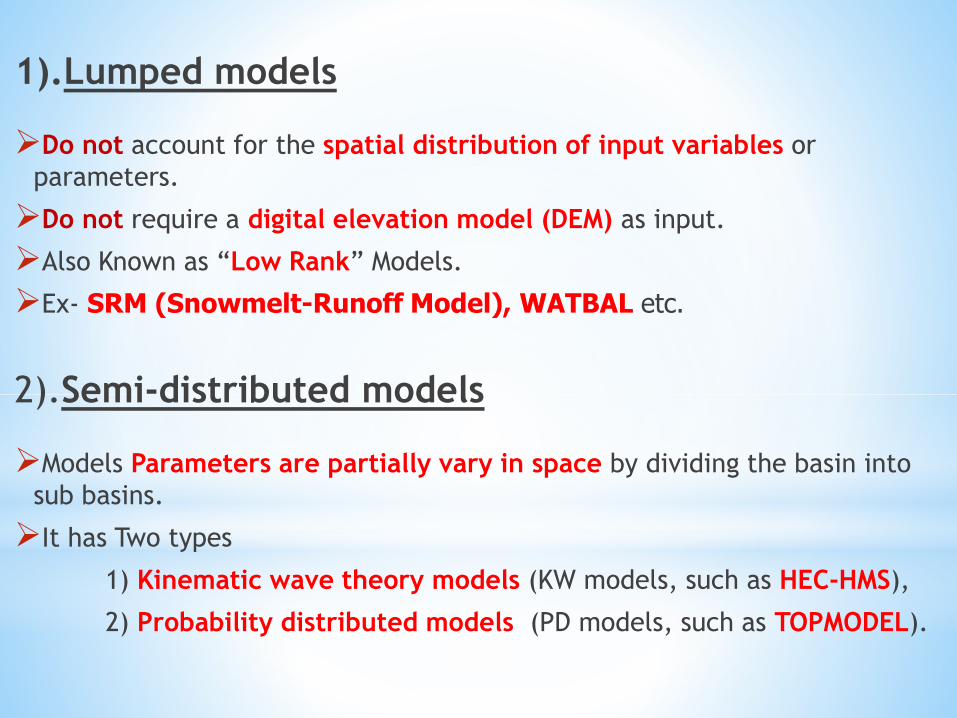
1).Lumped models
Do not account for the spatial distribution of input variables or
parameters.
Do not require a digital elevation model (DEM) as input.
Also Known as “Low Rank” Models.
Ex- SRM (Snowmelt-Runoff Model), WATBAL etc.
2).Semi-distributed models
Models Parameters are partially vary in space by dividing the basin into
sub basins.
It has Two types
1) Kinematic wave theory models (KW models, such as HEC-HMS),
2) Probability distributed models (PD models, such as TOPMODEL).

The KW models are simplified versions of the surface and/or subsurface
flow equations
The PD models are accounted distributions of input parameters across the
basin.
Also Known as “Medium Rank” Models.
Ex-HEC-HMS,HEC-RAS, Storm Water Management Model (SWMM),
TOPMODEL.
3).Distributed models
Parameters are fully allowed to vary in space.
It require large amounts of (often unavailable) data.
Distributed models require a DEM as input.
Also Known as “High Rank” Models.
EX-MIKE11/SHE, WATFLOOD etc.

Introduction to HEC RAS

HEC-RAS(Hydrologic Engineering Centers River Analysis System)
HEC-RAS is a one-dimensional flow hydraulic model designed to
aid hydraulic engineers in channel flow analysis and floodplain
determination.
HEC-RAS program was developed by the US Army Corps of
Engineers to manage the rivers, harbors,other public works under
their jurisdiction.

HEC-RAS model offering a simple way to set model parameters and
a graphical user interface(GUI) to run the model and visualize the
results.
River Analysis
Water depth
Flow

Use of HES RAS
Water flowing through systems of open channels ;
Computing water surface profiles.
Floodplain management ;
Flood insurance studies to evaluate floodway encroachments.
Additional uses
Bridge and culvert design and analysis,
Levee studies,
Channel modification studies,
Dam breach analysis.

Graphical User Interface(GUI)
Data storage/management Graphics,
Tabular Output & Reporting
GeoRAS – GIS pre and post processor

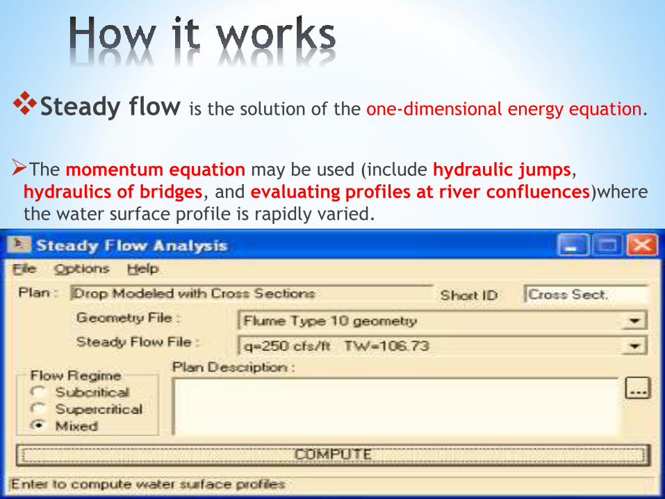
Steady flow is the solution of the one-dimensional energy equation.
The momentum equation may be used (include hydraulic jumps,
hydraulics of bridges, and evaluating profiles at river confluences)where
the water surface profile is rapidly varied.


Unsteady flow is based on solution of 1-D Saint Venant Equation
using an finite difference method.
It is capable of modelling subcritical, supercritical, and mixed flow
regime flow along with the effects of bridges, culverts, weirs, and
structures.


Advantages :-
It support by the US Army Corps of Engineers, also acceptance by
many government agencies and private firms.
It is in the public domain and peer-reviewed,
available to download free of charge from HEC's web site.
Various private companies are registered as official "vendors" and
offer consulting support and add on software.
Limitations :-
Steep bed slopes (HEC RAS User's manual says >10%);
multi-dimensional flow characteristics;
complex pipe systems.
Large Data Accuracy Required

The HEC-RAS (4.1) Software New Features:
(1) Steady flow water surface profile computations;
(2) unsteady flow simulation;
(3) Movable boundary sediment transport computations;
(4) New RAS mapper floodplain delineation capabilities;
(5) Hydrologic routing reaches within an unsteady flow model run;
(6) Groundwater leakage for storage areas;
(7) Water quality modelling enhancements.

*
http://www.hec.usace.army.mil
http://csdms.colorado.edu/wiki/Hydrological_Models
http://en.wikipedia.org/wiki/HEC-RAS
http://www.forrex.org
http://www.eng.uwo.ca/research
http://www.fema.gov