shale gas risk assessment and evolving technology · shale gas risk assessment and evolving...
TRANSCRIPT

National Energy Technology Laboratory
Daniel J. Soeder Health Effects Institute Workshop December 10, 2014
Shale Gas Risk Assessment and Evolving Technology

• In 2011, after the BP oil spill on the Macondo well, and in the wake of several contentious EPA stakeholder meetings on hydraulic fracturing, USDOE Secretary Steven Chu ordered DOE oil and gas research to focus on the environmental impacts of deepwater drilling and shale gas development.
• In April 2012, President Obama ordered the EPA, DOE and the U.S. Department of the Interior (mainly the USGS) to cooperate on “fracking” research.
• The three agencies signed an MOU, and assembled a study plan submitted to the White House in November 2012.
• The Administration asked for funding in the FY14 budget. • DOE and EPA are moving forward using existing funds; USGS is awaiting
funding. • Study plan available at http://unconventional.energy.gov/
Federal Government Activities

Multi-Agency Environmental Assessment Steering Committee of senior agency executives; chair alternates annually; Technical Committee of experts • Assess the risks and receptors of hydraulic fracturing
• Unconventional Oil and Gas (UOG) national study plan; built on case studies (Marcellus, Barnett, Bakken)
• Focus on air, water, seismicity, and locations of future impact.
• Incorporates relevant current studies
• HHS and NAS have since been added to the MOU to address health issues and basic science.
• Six flagship projects developed in 2013 to interest Congress.
Study Areas: 1) Future resource development, 2) Water availability, 3) Water quality, 4) Air quality, 5) Induced seismicity. Added later: ecosystems and human health.

ORD Approach for Shale Gas Development Risk
Goal: Deliver Risk Assessments for • Fugitive Air Emissions and GHG • Produced Water Management • Subsurface Migration of Gas and Fluids • Induced Seismicity
Research Plan Organization • U.S. Department of Energy • Office of Fossil Energy • National Energy Technology Laboratory • NETL Office of Research & Development (ORD)
Approach: •Field Data to establish baselines and impacts of development •Laboratory Data for simulations, to understand processes and confirm field data •Computational Tools to characterize and predict system baselines and behavior

• Primarily developed for engineered geologic systems – Underground nuclear waste isolation – CO2 geologic storage – Oil and gas production: ultra deepwater and unconventional – Also known as a site performance assessment
• Approach is probabilistic, focus is on the release of a hazardous material into the accessible environment.
• System divided into components • High fidelity, validated models are developed for each • Uncertainty reduction by focused data collection • Potential impacts of release generally not considered
• Reduced order models (ROMs) are used to simplify predictions of high fidelity models for computation.
• ROMs are integrated into an Integrated Assessment Model (IAM) to predict total system performance and risk.
• Model is calibrated using field data and databases. • IAM scenarios are run to test different system interactions.
Engineering Risk Assessment
Reference DOE-NRAP study plan

• October 20, 1973 to Spring 1974: OPEC oil embargo against United States
– Price of gasoline quadrupled ($0.40-$1.60) – Gasoline was in short supply
• U.S. Department of Energy formed by the Carter Administration on August 4, 1977
• DOE funded R&D projects to increase domestic energy supplies: – Eastern Gas Shales – Western Tight Gas Sands – Coal Bed Methane – Geopressured Aquifers
• Later projects (1990s) – Methane hydrates – Ultra deep gas
• Objective: offset imported oil by increasing domestic energy production (in an environmentally-responsible manner).
Whence Shale Gas?
Yergin, Daniel, 1991, The Prize: The Epic Quest for Oil, Money, and Power: New York, Simon & Schuster, 912 p. (ISBN: 0671502484)

• Resources were known and in some cases substantial, but production was typically small. – Dunkirk Shale in NY (1821) – Huron Shale in KY (early 1900s) – Coal seam gas – Tight sands
• Engineering challenges – Natural fractures = natural gas (not
always) – Two-phase flow is difficult in low
permeability rocks – Formation contact limited with
vertical wells and single hydraulic fractures
• Economic challenges – Not enough production to justify the
cost of wells
Schrider, L. A. and Wise, R.L., 1980, Potential new sources of natural gas: Journal of Petroleum Technology, April 1980, p. 703-716.
New Sources of Natural Gas

DOE Eastern Gas Shales Project 1976-1992
All photos - DOE

Gas Shale Geology
Soeder, D. J., 1988, Porosity and permeability of eastern Devonian gas shale: SPE Formation Evaluation, v. 3, no. 2, p. 116-124, DOI 10.2118/15213-PA.
Fine-grained, clastic mudrock, composed of clay, quartz, carbonate, organic matter, and other minerals.
Shale is organic-rich (black), or organic lean (gray), and commonly fissile.
Shale. porosity (φ) ~ 10% Shale permeability (k) µd to nd. Small grains = small pores; φ can be
intergranular, intragranular, and intra-organic.
Gas occurs in fractures, in pores and adsorbed or dissolved onto organic materials and clays.
The gas potential of the Marcellus Shale is “surprising” – Soeder, 1988

Petroleum Geology
Charpentier, R.R., and Cook, T.A., 2011, USGS Methodology for Assessing Continuous Petroleum Resources: U.S. Geological Survey Open File Report 2011–1167, 75 p.
Conventional Reservoir: concentrated deposit of recoverable oil and/or gas.
NEED: 1. Source rock: 1-2% organics (kerogen)
a. Types I and II kerogen (petroleum + gas) b. Type III kerogen (coal + gas)
2. Thermal maturity 3. Reservoir rock 4. Trap and Seal 5. Migration pathway If any one of these is missing, no production. Shale gas is "unconventional": produced directly from thermally-mature high-organic content source rock. No reservoir, trap or seal needed. USGS calls this a “continuous resource” producible anywhere

Why is the resource so large?

Figure from Soeder, D.J., 2012, Shale gas development in the United States, Chapter 1 in Advances in Natural Gas Technology, Edited by Hamid A. Al-Megren, ISBN 978-953-51-0507-7, InTech Open Access, Rijeka, Croatia, April 11, 2012; DOI: 10.5772/2324, 542 pages.
New Technology for Natural Gas Production
not to scale
Developed for deepwater tension leg platforms; applied onshore. Directional drilling
•Downhole hydraulic motors •Geosteering:
Measurement while drilling Inertial navigation Telemetry: better electronics
•5,000+ ft laterals Staged hydraulic fracturing
•Light sand frac •Slickwater frac •Fast flowpaths in contact with large volume of rock
Barnett Shale: 1997; Mitchell Energy Fayetteville Shale: 2004; Southwestern Energy Haynesville Shale: 2004; Chesapeake Energy Marcellus Shale: 2007; Range Resources: Gulla #9; IP 4.9 MMCFD

the ENERGY lab
Large drill rigs are needed to reach depths of gas shales (typically 5,000 to 15,000 ft) and construct long laterals (typically 3,000 to 9,000 ft)
High volume hydraulic fracturing is needed to recover economic amounts of gas.
Large volumes of water, sand and chemicals are needed to support the operation.
Produced water is recycled; residual waste disposed of down UIC wells.
New Technology Triple Flex rig in southwestern Pennsylvania, 2011

Hydraulic fracturing operation near Waynesburg, PA, 2011 (Photo by D. Soeder)


Shale Resources Worldwide
Source: U.S. Energy Information Administration

• Identified by National Groundwater Association at a workshop in Pittsburgh, November 2014:
• Single biggest “contaminant” is methane gas (even though there is no MCL). Explosive limits are 5% to 15%.
• Single biggest cause is poor wellbore integrity – bad casing threads, poor cement job, improper curing, etc.
• Source and migration pathways of stray gas are notoriously hard to determine.
• Surface spills of drilling fluids, frac chemicals, and produced water are second largest concern.
• Risks come from human error – when prescribed engineering practices are followed, risks are low.
Risks to Groundwater
https://www.mathesongas.com/pdfs/products/Lower-%28LEL%29-&-Upper-%28UEL%29-Explosive-Limits-.pdf

Production Activity Potential GW Risks
initial spud-in air/fluid infiltration into aquifer
set surface casing; drill vertical well well integrity: annular migration of fluids from open hole
set intermediate casing; drill lateral low risk to groundwater
set production casing; complete well frac chemicals on site; surface spills, potential leakage
hydraulic fracturing abandoned wells, faults; frac chemicals on site; P-wave through aquifer
flowback and produced waters frac chemicals and high TDS waters on site; surface spills, potential leakage
long-term gas production well integrity: casing/cement deterioration; potential weathering of cuttings
Groundwater Risk per Production Phase
Source: Soeder, D. J., Sharma, S., Pekney, N., Hopkinson, L., Dilmore, R., Kutchko, B., Stewart, B., Carter, K., Hakala, A., and Capo, R., 2014, An approach for assessing engineering risk from shale gas wells in the United States, International Journal of Coal Geology, Vol. 126, p. 4-19

Frac Fluid Chemicals
Average Hydraulic Fracturing Fluid Composition for US Shale PlaysAcid
0.07%Corrosion Inhibitor
0.05%
Friction Reducer0.05%
Clay Control0.034%
Crosslinker0.032%
Scale Inhibitor0.023%
Breaker0.02%Iron Control
0.004%Biocide0.001%
Gellant0.50%
OTHER0.79%
Source: Ground Water Protection Council, 2012, FracFocus well records: January 1, 2011 through February 27, 2012: accessed on-line at http://www.fracfocus.org

Out of Zone Fractures
Reference: Fisher, Kevin, 2010, Data confirm safety of well fracturing, The American Oil and Gas Reporter, July 2010, www.aogr.com

• Surface spills and leaks – Drilling fluids – Frac chemicals – Produced water
• Direct aquifer impacts – Drilling through aquifer – Pressure pulse from frac – Well integrity problems – Reservoir leakage
• Land use impacts – Headwater streams – Small watersheds
Environmental Risks to Water Resources
Photograph of Indian Run by Doug Mazer, used with permission

the ENERGY lab
Does shale gas development cause stray gas migration in shallow aquifers?
Stray gas
Upward leakage from hydraulically-fractured target formation? Wellbore integrity/direct leakage? Mobilization of pre-existing methane in aquifer? • Drilling through the aquifer • Vibration caused by surface activity • Compression from frac p-wave Two questions: What is the source of the methane? How is the methane being mobilized?

Asking the Right Questions Duke University study on 68 wells shows methane in groundwater in NE PA occurs in much higher concentrations near gas wells, and concluded it is related to wells. (Osborn, Stephen G., Avner Vengosh, Nathaniel R. Warner, and Robert B. Jackson, 2011, Methane contamination of drinking water accompanying gas-well drilling and hydraulic fracturing: PNAS Early Edition Direct Submission article, available on-line only; Proceedings of the National Academy of Sciences, 5 p)
Baseline data on 1700 water wells prior to gas drilling shows methane is common in NE PA groundwater, and related to topography (highest in stream valleys). (Molofsky, L. J., J.A. Connor, S.K. Farhat, A.S. Wylie, Jr., and Tom Wagner, 2011, Methane in Pennsylvania water wells unrelated to Marcellus shale fracturing: Oil & Gas Journal, Vol. 109, no. 49, December 5, 2011, p. 54-67)
The proper question might be: how might drilling affect domestic water wells when methane is present in the aquifer?
Norma Fiorentino's exploded well vault
Soeder, D.J., 2012, Field test of an alternative hypothesis for stray gas migration from shale gas development (abstract): Stray Gas Incidence and Response Forum: Ground Water Protection Council, July 24-26, 2012, Cleveland, Ohio (http://gwpc.brocodev.com/events/gwpc-proceedings/2012-stray-gas-incidence-response-forum)

Air Infiltration at Sardis, WV
Domestic Water Well
Well Pad
< Outcrop June 6, 2012, Sardis, WV (near Clarksburg) Drilled to 290 ft using water and air; bit got stuck around 150-170 ft. while withdrawing The air compressor was left on as crews attempted to dislodge bit Pressurized groundwater surged out of several old, unused wells nearby
Geng, Xiaolong, Nicholas C. Davatzes, Daniel J. Soeder, Jagadish Torlapati, Rebecca S. Rodriguez, and Michel C. Boufadel, 2013, Migration of high-pressure air during gas well drilling in the Appalachian Basin, Journal of Environmental Engineering; posted ahead of print July 25, 2013. doi:10.1061/(ASCE)EE.1943-7870.0000769, 46 p.

• Prong 1: Field Studies – Synoptic sampling and continuous monitoring
• Downgradient wells to monitor contaminant migration • Upgradient well for reference and to monitor methane migration • Springs for discrete discharge sampling; stream for integrated samples
– Schedule: • Baseline monitoring pre-drilling (monthly) • Frequent monitoring during drilling and hydraulic fracturing operations • Baseline monitoring for some time after well completion.
• Prong 2: Laboratory Analyses – Natural attenuation processes and rates
• Drilling fluids • Frac chemicals
– Instrumentation response and sensitivity thresholds • Prong 3: Hydrologic Modeling
– Gas/water displacement two-phase flow models – Reactive transport models
Water Resources Research Trident
Soeder, D. J., Sharma, S., Pekney, N., Hopkinson, L., Dilmore, R., Kutchko, B., Stewart, B., Carter, K., Hakala, A., and Capo, R., 2014, An approach for assessing engineering risk from shale gas wells in the United States, International Journal of Coal Geology, Vol. 126, p. 4-19

Field Monitoring Research Issues Problem Question Approach How do we drill a monitoring well? (not a trivial question)
How do we avoid contaminating the aquifer with the very drilling chemicals we want to monitor?
Clean tubulars, no additives in cement, sample and analyze everything that goes into well, document all steps.
Methane in groundwater.
How do CH4 concentrations vary in “undisturbed” groundwater? How is it mobilized by drilling?
Collect data to improve knowledge of CH4 in aquifers; investigate potential gas migration mechanisms.
How much “baseline” data are needed to recognize an anomaly?
How do dissolved chemical species vary temporally and spatially in “undisturbed” groundwater?
Collect data to improve knowledge of natural groundwater chemistry variability.
Effective use of geochemical tracers for drilling/frac fluids.
What are “undisturbed” groundwater values for common geochemical tracers?
Collect data to improve knowledge of variation in Sr, Ba, Br, Cl (water), and C, O, H isotopes (dissolved and gas-phase CH4)
Soluble organic chemicals and polymers.
What are the background levels of these chemicals in groundwater? Do they change with drilling?
Collect data on baseline levels of organic chemicals at site, and monitor for changes.

the ENERGY lab
How can the scientific community obtain access to wells, cores, data, produced fluids and groundwater?
The Issue of Access
Access to sites, samples, and data for independent researchers has been difficult. Industry scientists are not usually permitted to investigate issues that are unrelated to hydrocarbon production. Public shale drill cores are 30 to 40 years old. New core is locked down by consortia and not generally available to outsiders. Obtaining fluid samples is very hit or miss. Most shales are deep – drilling is expensive.
Pierre Shale core recovery in 2014 by South Dakota Geological Survey

Research Well Non-commercial well drilled for research purposes. Driller is paid up-front for cost of well; does not need to produce it for revenue. Greatest freedom for researchers, but also the most expensive. Transparent Well Commercial well drilled on university or government land. Agency/university owns mineral rights; driller must produce well for revenue. Lease agreement may require the driller to allow various environmental monitoring programs to take place during well development. Commercial Well Investor-owned well drilled on a commercial lease. Driller must produce well for revenue to cover costs. Research access is at the discretion of the driller, and the landowner holding the lease. Other options include piggy-back coring operations, formation water sampling during drilling, additional geophysics and logging, etc., usually for the cost of rig time.
Types of Accessible Gas Wells

• A stand-alone research well has not been funded. • Several transparent wells have been planned:
– Ohio State University in the Utica/Point Pleasant Shale. • Location: Southeastern Ohio on OSU land • Status: Awaiting drilling and land access agreements.
– University of Tennessee in the Chattanooga Shale • Location: Knoxville (possibly in research forest) • Status: No industry interest in location, intense local opposition; project
abandoned. – West Virginia University in the Marcellus Shale
• Location: WVU Animal Husbandry Farm, Morgantown • Status: No pipelines nearby, uneconomical dry gas, project abandoned.
• Discussions by NETL-ORD with nearly a dozen companies so far have not resulted in access to commercial sites for groundwater studies.
Adventures in Groundwater Monitoring

• Potential new regulatory requirements – Success could require monitoring wells at every gas well pad. – Government agencies subject to FOIA requests may be forced to
give up company “secrets.” – Research work by DOE is not regulatory, and sensitive information is protected
from FOIA release. • Negative data
– If industry “does everything right” there will be nothing to measure, and we are wasting our time.
– Making the measurement, even if nothing is found, reduces the level of uncertainty in the probabilistic risk assessment model.
• Already doing hydrologic monitoring – Industry is collecting pre-drilling water quality samples from
domestic supply wells within a kilometer or more radius of the pad.
– These samples are for exposure assessment and liability, not hydrology. – Domestic water supply wells are typically open hole completions and mix water
from various levels in the aquifer, making them of little use for understanding aquifer behavior and groundwater flow paths.
– Monitoring wells with multilevel samplers will better define aquifers.
Reasons Access has been Denied on Commercial Wells
Results of discussions held with eleven active drilling companies on the Marcellus and Utica plays

DOE-NETL in the Marcellus Shale. Location: Commercial field in Greene County, PA. Status: Microseismic data collected during frac; ongoing collection of produced water and tracer sampling. Problems: No groundwater component in study. West Virginia University in the Marcellus Shale. Location: Westover, WV on existing pad in industrial park. Status: Agreements are in place with driller, university and DOE. Problems: Hydrogeology is disturbed and very challenging for a groundwater study. Pennsylvania DCNR in the Marcellus Shale. Location: Moshannon State Forest adjacent to commercial lease. Status: NETL moving forward to begin baseline monitoring. Problems: Dry gas area; may not drill for several years if ever.
Active and Recent Accessible Well Sites


Greene County Well Site
Marcellus horizontal well drilled below existing Upper Devonian production sands. Pre-existing vertical Marcellus well between laterals. PFC tracers in frac fluid to detect gas migration. No groundwater component.
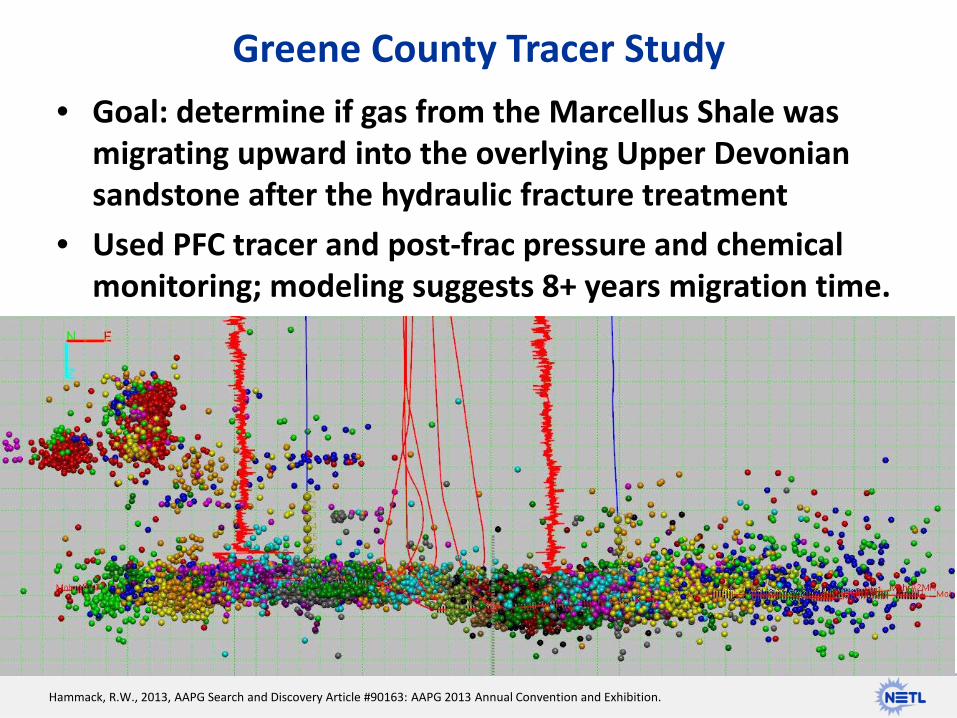
• Goal: determine if gas from the Marcellus Shale was migrating upward into the overlying Upper Devonian sandstone after the hydraulic fracture treatment
• Used PFC tracer and post-frac pressure and chemical monitoring; modeling suggests 8+ years migration time.
Greene County Tracer Study
Hammack, R.W., 2013, AAPG Search and Discovery Article #90163: AAPG 2013 Annual Convention and Exhibition.

• Marcellus Shale well on existing wellpad in Westover industrial park.
• First two wells on site were drilled and hydraulically fractured in 2012. • Legacy environmental issues include an ammunition factory from WWII,
and an adjacent Superfund site. • Land access upgradient and downgradient is held by industrial park. • Pittsburgh Coal was mined from this site sometime in the past. • New gas wells will be installed in summer 2015, limiting baseline.
West Virginia University Study Site
Photo: Northeast Natural Energy drillpad with wells in Westover, West Virginia. Photo by Dan Soeder

Moshannon State Forest, Tract 325, Pad B
Map by Rebecca Rodriguez, ORISE research associate, DOE-NETL
• Exact location of monitoring wells will be defined by hydrogeology and flowpaths.
• One upgradient; at least 3 downgradient
• Continuous water quality and flow monitoring in stream.
• Samples from springs in area.
• GW wells planned spring 2015; gas wells maybe 2017, maybe never.

Multilevel sampler port with packer system for isolating aquifer flow zones.

Target Analytes for Sampling and Chemistry Analytes Method Location Team Members
Major cations (Na, K, Mg, Ca) ICP-OES Pittsburgh Analytical Laboratory
William Garber, Tracy Bank (URS)
Metals and minor cations (Be, Sr, Ba, Cr, Mn, Fe, Al, As, Se)
ICP-OES Pittsburgh Analytical Laboratory
William Garber, Tracy Bank (URS)
Anions (NO3-, SO4
2-, Cl-, Br-) IC Pittsburgh Analytical Laboratory
Brian Kail (URS)
Bicarbonate Alkalinity titration Pittsburgh Analytical Laboratory
David Blaushild (URS)
Dissolved methane, BTEX, DRO, GRO, HEM
GC-MS Chromatography Laboratory Dirk Link (NETL), Brian Kail (URS)
Total Organic Carbon TOC Analyzer Environmental Geochemistry Laboratory
Vidhi Mishra (ORISE)
Strontium isotopes Rapid analysis MC-ICPMS
NETL Multicollector/University of Pittsburgh
Thai Phan (ORISE)
Carbon and Hydrogen isotopes in dissolved and gaseous CH4
IRMS External subcontract (Isotech labs in the past)
TBD
Field parameters to be measured: hydraulic head, pH, temperature, dissolved oxygen, specific conductance, oxidation-reduction potential, turbidity.

Moshannon Fieldwork
All photos by Dan Soeder, DOE

Complimentary Laboratory Studies
Photo: Sand column experiments in NETL Pittsburgh lab. Photo by Dan Soeder
1. Sensor assessment – Can current water quality monitoring
technology be used to detect hydraulic fracturing chemicals in surface water or groundwater?
2. Natural Attenuation – If chemicals associated with hydraulic
fracturing were to spill or leak, what will be the fate and transport of such contaminants? Are NA processes and rates capable of keeping these chemicals out of the accessible environment?
3. Gas migration/Groundwater quality – Do drilling operations through aquifers
affect shallow groundwater?

• NETL-ORD research agreement is with state DCNR, although driller has agreed to collaborate.
• Lease is in place and pad has been designed (on paper) for gas wells. • Driller needs $5.00/MCF gas price for these wells to be profitable. • Current price $3.70/MCF; other wells in area are marginal, so company focus
is on Greene County (SW PA). • If they never drill: site will have exceptionally-well characterized
groundwater above the Marcellus Shale. • This could provide a reference for other sites where there might not be
baseline or pre-drilling data. • If operator abandons the lease, site could potentially be used for a research
well. • Other interested researchers could be invited to join in, turning this into a
showcase monitoring and sampling site.
Gas Wells at Moshannon

the ENERGY lab Photo by Dan Soeder
Dan Soeder
Questions? Contact Information:
Geology and Environmental Systems
304-285-5258