social and economic effect of surveying, portraying and ... · 5/16/2016 · social and economic...
TRANSCRIPT
Social and economic effect of
surveying, portraying
and safeguarding Land
1
Yasushi Shimoyama
GeoSpatial Information Authority(GSI),
Ministry of Land, Infrastructure,
Transport and Tourism, Japan
Basic Act built in 2006
• Basic Act on the Advancement of Utilizing
Geospatial Information (2006)
– Article 3 Basic Principles (4)
• Policies for the advancement of utilizing geospatial
information must contribute to the promotion of
effective use, development and conservation of the
national land, and to the protection of the lives of
the people, their persons and their property by
enhancing the effective and efficient management
of public facilities, and the promotion of measures
against disasters, etc., through active engagement
of the state and local governments in
accomplishing their administrative work and
projects.
2
• Basic Act on the Advancement of Utilizing
Geospatial Information (2006)
– Article 3 (5)
• Policies for the advancement of utilizing geospatial
information must contribute to the improvement of
the administrative efficiency of governments as
well as to their functional enhancement through the
prevention of unnecessary duplication of mapping
and the improvement of integration, flexibility and
transparency of policies, etc., by sharing
geospatial information that is essential for each
section of government administration.
3
Basic Act built in 2006
• Basic Act on the Advancement of Utilizing
Geospatial Information (2006)
– Article 14
• Concerning the advancement of utilizing
geospatial information, the state and local
governments shall take measures including the
broader use of geographic information systems in
their administrative work and projects, the
diversification and improvement of the quality of
public services thereof, and other necessary
measures in order to enhance the people’s
convenience as well as the efficiency and
functionality of administrative management.
4
Basic Act built in 2006
• Basic Act on the Advancement of Utilizing
Geospatial Information (2006)
– Article 18 (2)
• As a general rule, the state state should provide
the fundamental geospatial data that it possesses
through the Internet without compensation.
5
Basic Act built in 2006
• During past decade
– Recognition of government changed. Many of
government officials know “geospatial
information”
– Activities of local governments are
progressing, but not sufficient.
– The fundamental geospatial data was
provided free of charge and are now updating.
– Raw data received at GNSS control station
from positioning satellite is also free.
(Receivers of 1,300 GNSS control stations almost
accept GLONASS data, now about 60% stations
accepted Galileo data, after periodic replacement) 6
Basic Act built in 2006
• We should go to further stages based on the
concept of the basic act.
• Our organization should continue to prepare
fundamental geospatial data (urban area:
1:2,500, rural area: 1:25,000), distributed free
of charge.
• Raw data received at GNSS control station
from positioning satellite is also free.
• We should insist on the benefit of these basic
work. How to explain?
7
Target of this presentation
: How to understand “impact”?
1. Impact to the society in general
2. Impact to an individual user/application
3. Impact of each geospatial technology
or work (to users)
8
9
1. Impact of geospatial Information to
the society in general
• We need to be:
–Laterally expressed
–Geospacially expressed
10
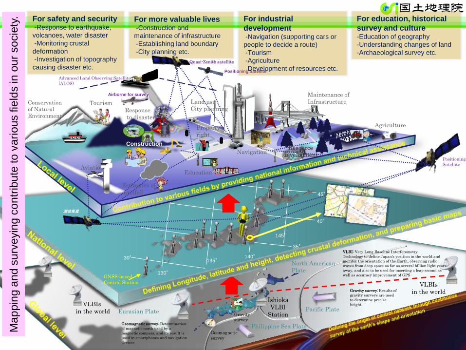
Environment
GNSS-based
Control Station
Geomagnetic
survey
Gravity
survey
Aviation
Navigation
Eurasian Plate
Philippine Sea Plate
Pacific Plate
North American
Plate
Ishioka
VLBI
Station
Conservation
of Natural
Environment Response
to disaster
Maintenance of
Infrastructure
45°
40°
35°
130°
135° 140°
145°
Tourism
Agriculture
Construction
Estimates of
rainfall
測位衛星
Quasi-Zenith satellite
Positioning Satellite
Positioning
Satellite
Advanced Land Observing Satellite
(ALOS)
Property
right
Education
Resource
development
For safety and security -Response to earthquake,
volcanoes, water disaster
-Monitoring crustal
deformation
-Investigation of topography
causing disaster etc.
For more valuable lives -Construction and
maintenance of infrastructure
-Establishing land boundary
-City planning etc.
For industrial
development -Navigation (supporting cars or
people to decide a route)
-Tourism
-Agriculture
-Development of resources etc.
For education, historical
survey and culture -Education of geography
-Understanding changes of land
-Archaeological survey etc.
VLBI: Very Long Baseline Interferometry
Technology to define Japan's position in the world and
monitor the orientation of the Earth, observing radio
waves from deep space as far as several billion light years
away, and also to be used for inserting a leap second as
well as accuracy improvement of GPS
Airborne for survey
30°
Land use
City planning
Ma
pp
ing a
nd
su
rveyin
g c
on
trib
ute
to
va
rio
us fie
lds in
ou
r so
cie
ty.
Geomagnetic survey: Determination
of magnetic north used by a
magnetic compass, and its result is
used in smartphones and navigation
devices
Gravity survey: Results of
gravity surveys are used
to determine precise
height
VLBIs
in the world
VLBIs
in the world
12
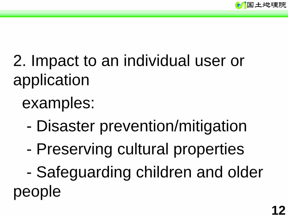
2. Impact to an individual user or
application
examples:
- Disaster prevention/mitigation
- Preserving cultural properties
- Safeguarding children and older
people
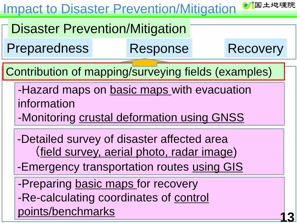
-Hazard maps on basic maps with evacuation
information
-Monitoring crustal deformation using GNSS
-Detailed survey of disaster affected area (field survey, aerial photo, radar image)
-Emergency transportation routes using GIS
Impact to Disaster Prevention/Mitigation
-Preparing basic maps for recovery
-Re-calculating coordinates of control
points/benchmarks
水害・土砂災害への
脆弱さを表す
土地条件図
ハザードマップ JAXA/ALOS-2データを利用した
干渉SAR分析による
面的な地表変動の観測
空中写真による被災前後の比較
浸水範囲図作成
航空機やドローン
による被災調査
防災センター (国土交通省)
被害の全体像を把握
ヘリ画像や空中写真から被災状況を広範に把握
災害対応状況の把握、 連絡手段としての活用
被害報 等
基盤地図情報
震度情報
防災ヘリ
現地情報 等
事前情報
統合災害情報システム(DiMAPS)
Contribution of mapping/surveying fields (examples)
Preparedness
Disaster Prevention/Mitigation
Response Recovery
13
Ministry of Land, Infrastructure, Transport and Tourism Geospatial Information Authority of Japan
Geospatial Information
Authority of Japan
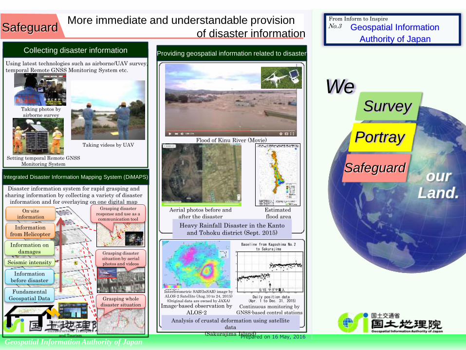
No.3 More immediate and understandable provision
of disaster information
Disaster information system for rapid grasping and
sharing information by collecting a variety of disaster
information and for overlaying on one digital map
Integrated Disaster Information Mapping System (DiMAPS)
Flood of Kinu River (Movie)
Providing geospatial information related to disaster
Estimated
flood area
Collecting disaster information
Using latest technologies such as airborne/UAV survey,
temporal Remote GNSS Monitoring System etc.
Aerial photos before and
after the disaster
Daily position data (Apr. 1 to Dec. 31, 2015)
Interferometric SAR(InSAR) image by
ALOS-2 Satellite (Aug.10 to 24, 2015)
(Original data are owned by JAXA)
Disaster Response Center at Ministry of Land,
Infrastructure, Transport
and Tourism
Grasping whole
disaster situation
Grasping disaster
situation by aerial
photos and videos
Grasping disaster
response and use as a
communication tool
Taking videos by UAV
Taking photos by
airborne survey
Setting temporal Remote GNSS
Monitoring System
Information on
damages
Fundamental
Geospatial Data
Seismic intensity
Information
from Helicopter
On-site
information
Information
before disaster
Prepared on 16 May, 2016
Image-based observation by
ALOS-2 Continuous monitoring by
GNSS-based control stations
Baseline from Kagoshima No.2 to Sakurajima
From Inform to Inspire
Heavy Rainfall Disaster in the Kanto
and Tohoku district (Sept. 2015)
Analysis of crustal deformation using satellite
data
(Sakurajima Island)
Safeguard
We
Portray
Survey
Safeguard our
Land.
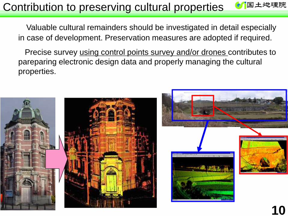
Valuable cultural remainders should be investigated in detail especially
in case of development. Preservation measures are adopted if required.
Precise survey using control points survey and/or drones contributes to
pareparing electronic design data and properly managing the cultural
properties.
Contribution to preserving cultural properties
10
Safeguarding children and older people
How to safeguard children and older people is a strong concern of society.
Visualizing the places of some accidents or other information through basic map and positioning system enables them to live more prepared/peaceful life.
Where did crimes/accidnts happen?
Providng a well in case of disaster
Evacuation Center 広域給水拠点に指定されています。 National route ○
Emergency Transportation
○△Shop Providing goods in case of disaster
○ May : snatching
○△Hospital Connecting At midnight TEL:03-1234-5678
○△crossing Frequent traffic accidents
11
17
3. Impact of each geospatial
technology or work (to users)
-UAV
-GNSS-based Control Stations
-National Maps
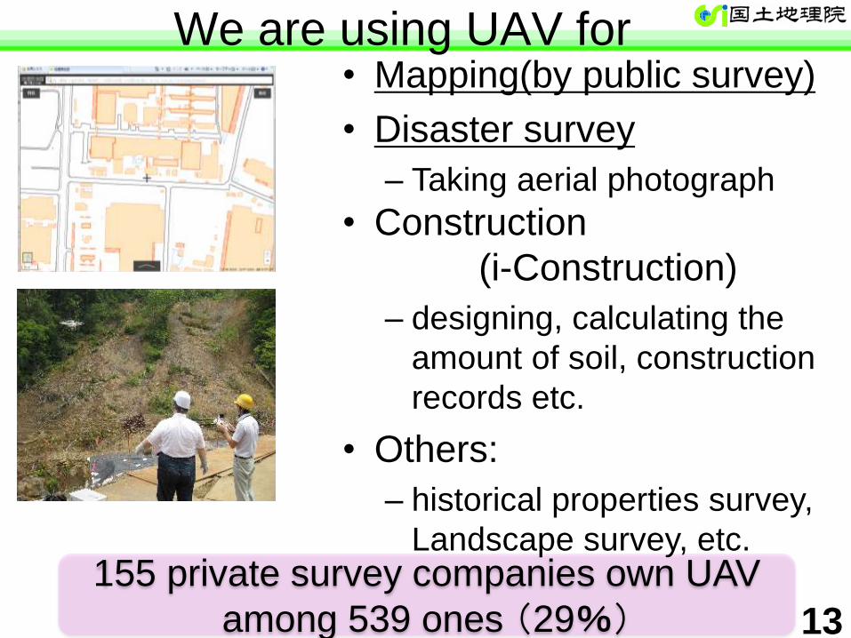
We are using UAV for
155 private survey companies own UAV
among 539 ones (29%)
• Mapping(by public survey)
• Disaster survey
– Taking aerial photograph
• Construction
(i-Construction)
– designing, calculating the
amount of soil, construction
records etc.
• Others:
– historical properties survey,
Landscape survey, etc.
13
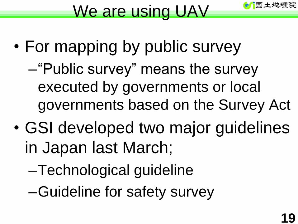
19
• For mapping by public survey
–“Public survey” means the survey
executed by governments or local
governments based on the Survey Act
• GSI developed two major guidelines
in Japan last March;
–Technological guideline
–Guideline for safety survey
We are using UAV
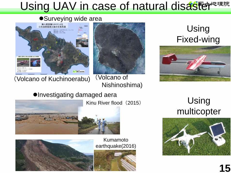
Using UAV in case of natural disaster
(Volcano of Kuchinoerabu)
Kinu River flood(2015)
Using
Fixed-wing
Using
multicopter
(Volcano of
Nishinoshima)
Investigating damaged aera
Kumamoto
earthquake(2016)
Surveying wide area
15
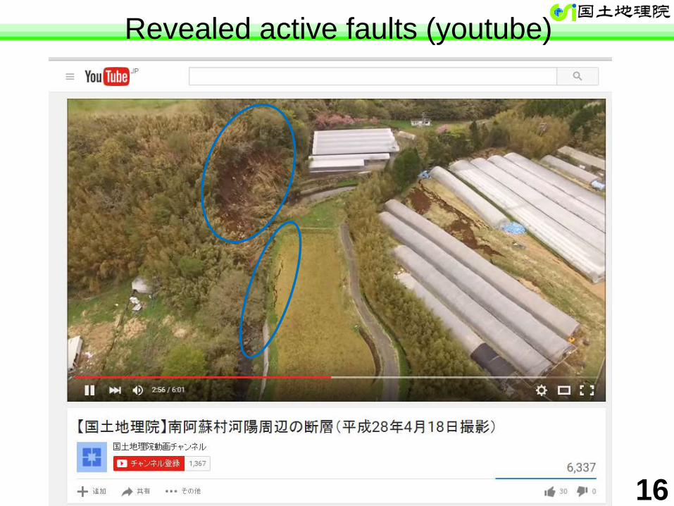
Revealed active faults (youtube)
2
1 16
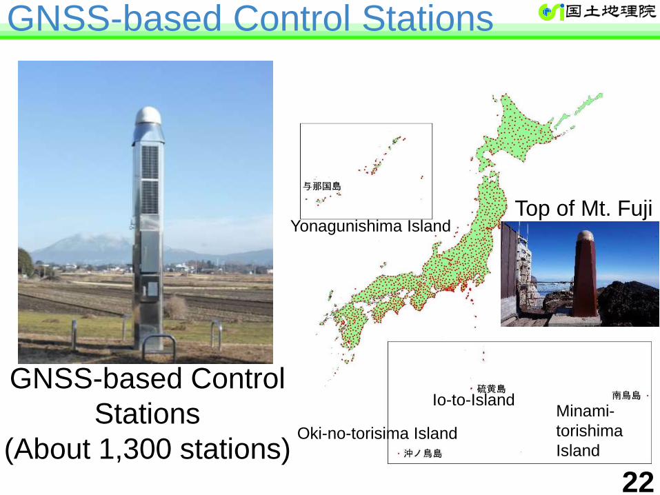
GNSS-based Control Stations
22
GNSS-based Control
Stations
(About 1,300 stations)
Yonagunishima Island
Oki-no-torisima Island
Io-to-Island Minami-
torishima
Island
Top of Mt. Fuji
23
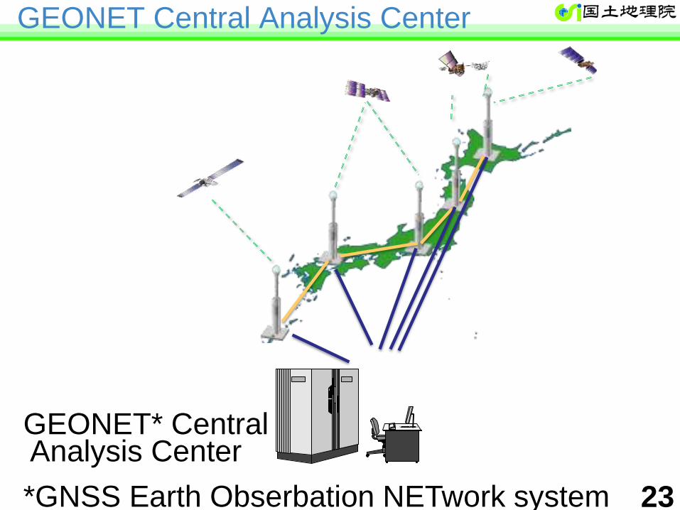
GEONET* Central Analysis Center
*GNSS Earth Obserbation NETwork system
GEONET Central Analysis Center
24
• Survey (control point survey, photogrammetry)
– Cost reduction
• Disaster prevention/mitigation
– Crustal deformation
– Revising coordinates of control points • Contribution to immediate recovery
– Forecasting the amount of rainfall
• Contribution to weather forecasting by Meteorological
Agency
How is the GEONET used?
25
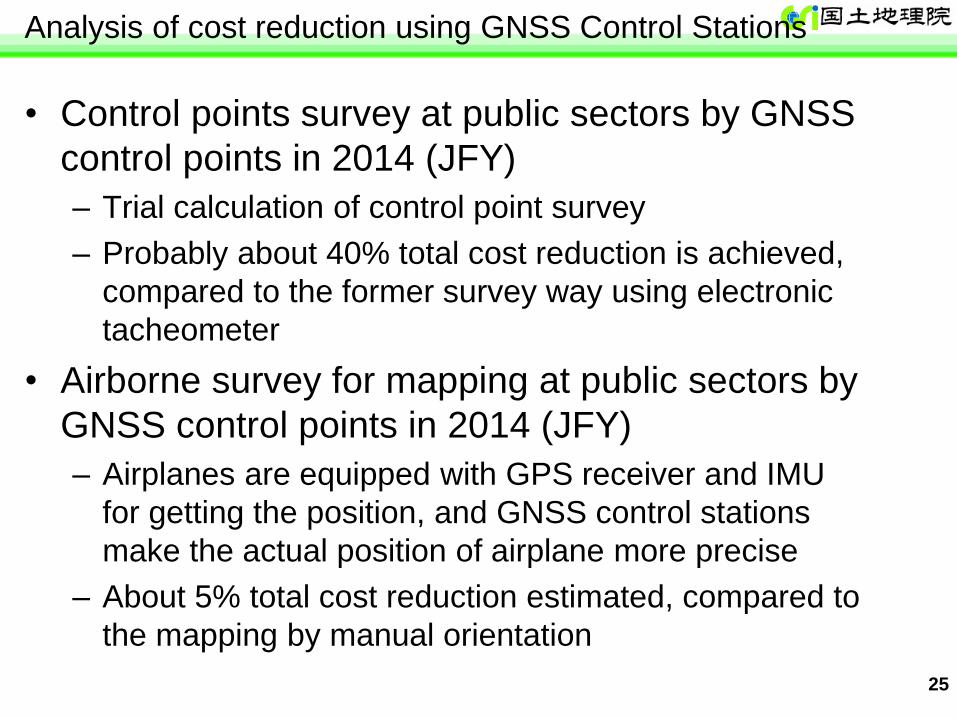
Analysis of cost reduction using GNSS Control Stations
• Control points survey at public sectors by GNSS
control points in 2014 (JFY)
– Trial calculation of control point survey
– Probably about 40% total cost reduction is achieved,
compared to the former survey way using electronic
tacheometer
• Airborne survey for mapping at public sectors by
GNSS control points in 2014 (JFY)
– Airplanes are equipped with GPS receiver and IMU
for getting the position, and GNSS control stations
make the actual position of airplane more precise
– About 5% total cost reduction estimated, compared to
the mapping by manual orientation
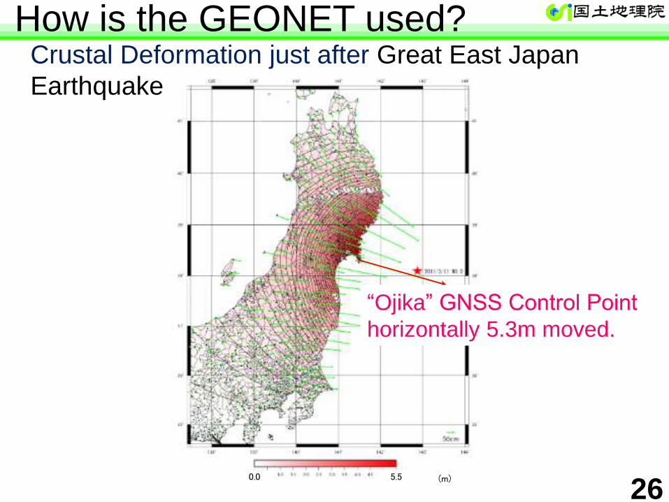
26 0.0 5.5 (m)
“Ojika” GNSS Control Point
horizontally 5.3m moved.
Crustal Deformation just after Great East Japan
Earthquake
How is the GEONET used?
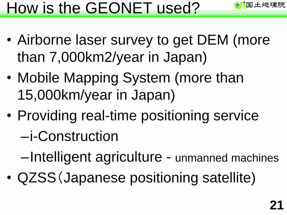
• Airborne laser survey to get DEM (more
than 7,000km2/year in Japan)
• Mobile Mapping System (more than
15,000km/year in Japan)
• Providing real-time positioning service
– i-Construction
–Intelligent agriculture - unmanned machines
• QZSS(Japanese positioning satellite)
21
How is the GEONET used?
28
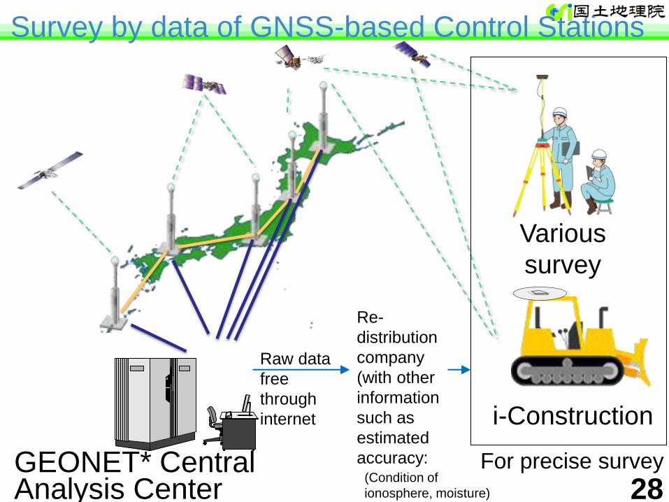
i-Construction
GEONET* Central Analysis Center
Various
survey
Re-
distribution
company
(with other
information
such as
estimated
accuracy: For precise survey
Survey by data of GNSS-based Control Stations
Raw data
free
through
internet
(Condition of
ionosphere, moisture)
29
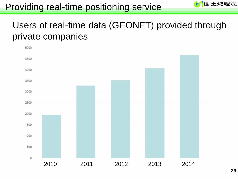
Users of real-time data (GEONET) provided through
private companies
Providing real-time positioning service
2010 2011 2012 2013 2014
30
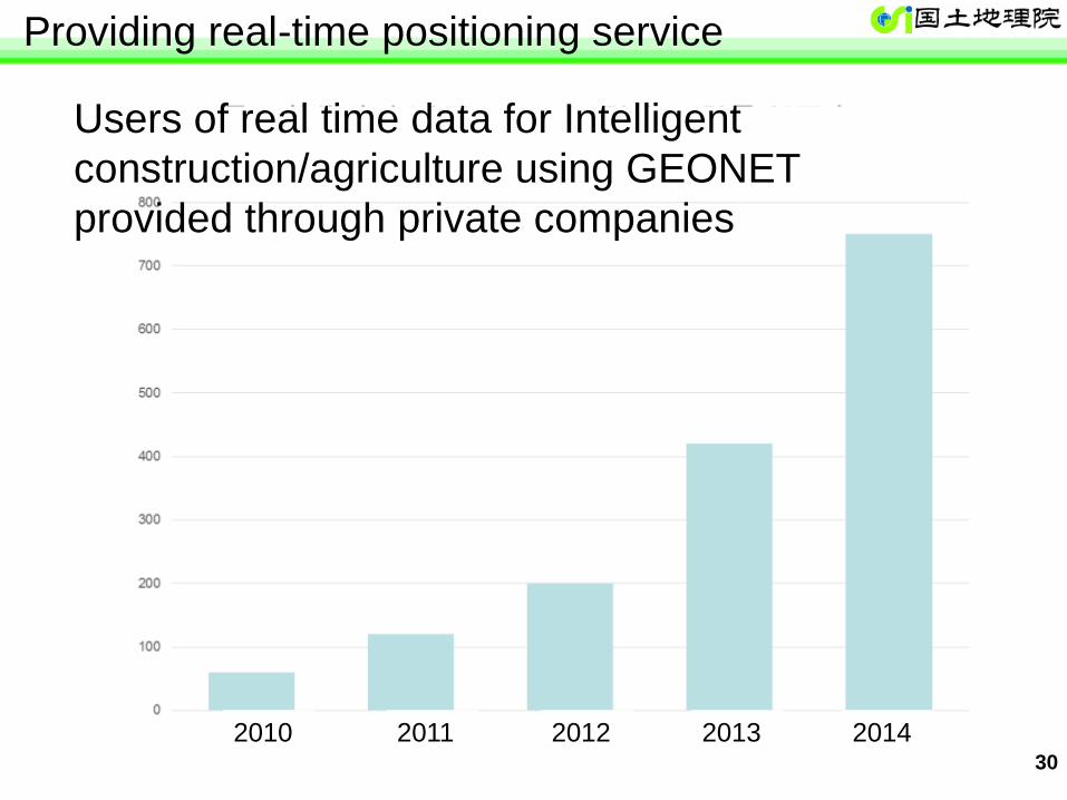
Users of real time data for Intelligent
construction/agriculture using GEONET
provided through private companies
Providing real-time positioning service
2010 2011 2012 2013 2014

31
Digital Elevation Model (by Laser scanner/digitalized contour)
Printed map Image map data
Vector data
(seen through viewer software)
Impact of National Mapping
32
Impact of National Mapping
• National Maps of GSI are used for various purpose.
• They are also the basic map for disaster
management in our country.
• The area where national map 1:25,000 (or more)
was seen by the webmap of GSI “GSIMaps” in 2013
FY is about 4 billion km2.
• The area where the use of national map 1:25,000 for
making other contents was requested by users and
approved by GSI based on Survey Act is estimated
as 50 million km2 in 2014FY – Printed maps
– Image map data
– Vector data
– Digital Elevation Model(mesh size is 10m(partly 5m))
33
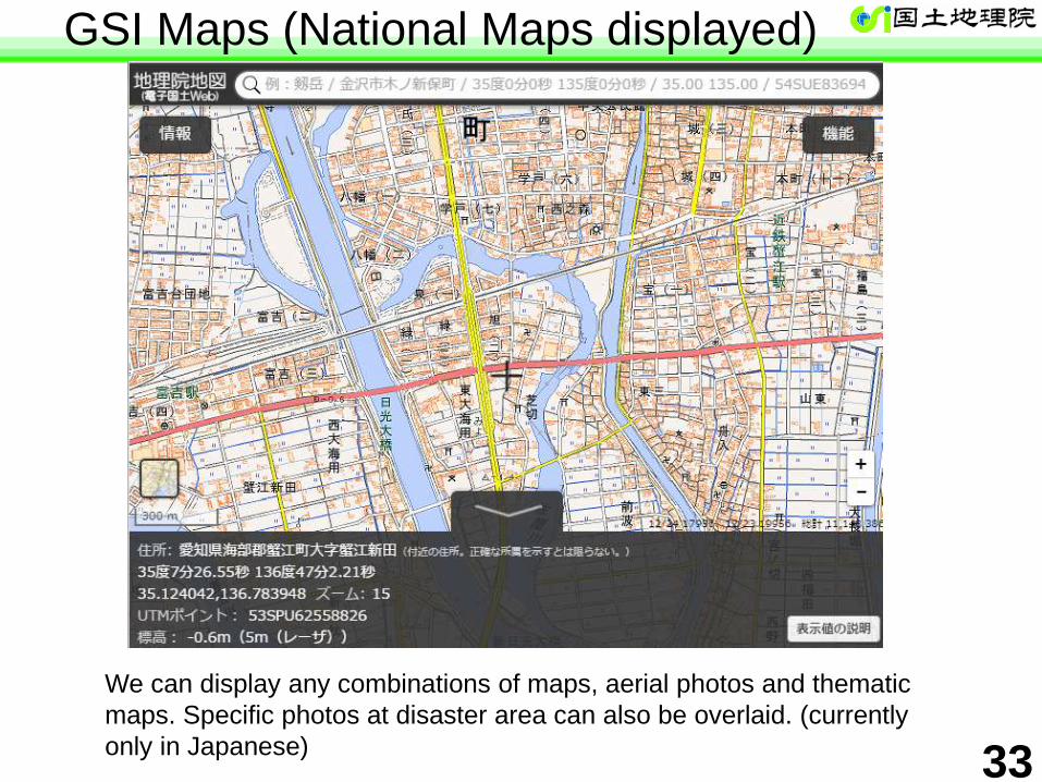
GSI Maps (National Maps displayed)
We can display any combinations of maps, aerial photos and thematic
maps. Specific photos at disaster area can also be overlaid. (currently
only in Japanese)
34
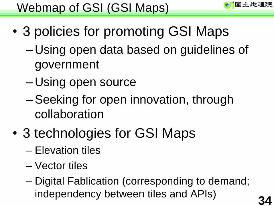
Webmap of GSI (GSI Maps)
• 3 policies for promoting GSI Maps
– Using open data based on guidelines of
government
– Using open source
– Seeking for open innovation, through
collaboration
• 3 technologies for GSI Maps – Elevation tiles
– Vector tiles
– Digital Fablication (corresponding to demand;
independency between tiles and APIs)
35
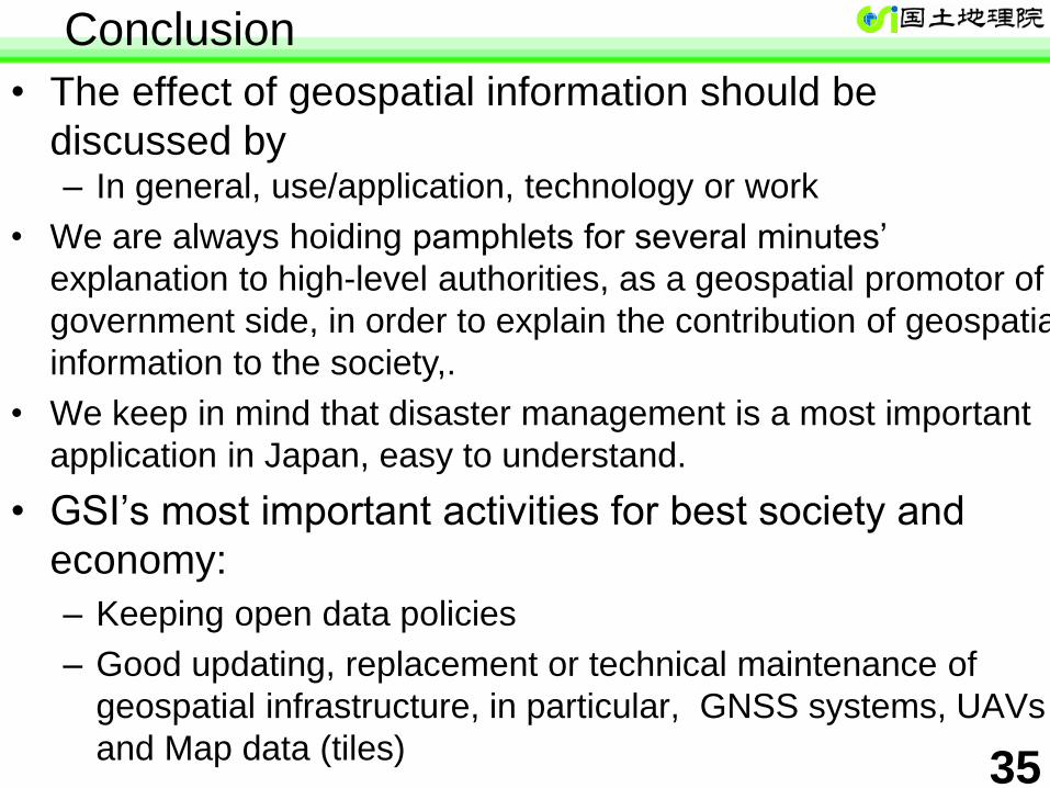
Conclusion
• The effect of geospatial information should be
discussed by – In general, use/application, technology or work
• We are always hoiding pamphlets for several minutes’
explanation to high-level authorities, as a geospatial promotor of
government side, in order to explain the contribution of geospatial
information to the society,.
• We keep in mind that disaster management is a most important
application in Japan, easy to understand.
• GSI’s most important activities for best society and
economy:
– Keeping open data policies
– Good updating, replacement or technical maintenance of
geospatial infrastructure, in particular, GNSS systems, UAVs
and Map data (tiles)
Quasar
VLBI Stations
Lo
ng
itud
e, L
atitu
de
H
eig
ht
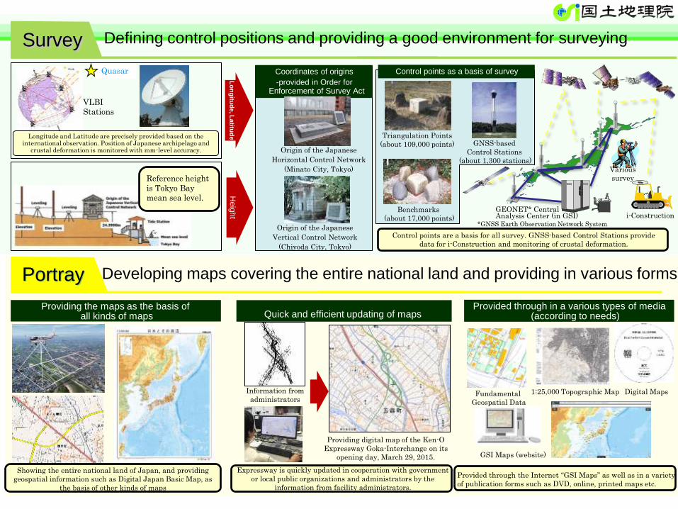
Survey
Portray Developing maps covering the entire national land and providing in various forms
GEONET* Central Analysis Center (in GSI) i-Construction
Origin of the Japanese
Horizontal Control Network
(Minato City, Tokyo)
Origin of the Japanese
Vertical Control Network
(Chiyoda City, Tokyo)
Coordinates of origins
-provided in Order for Enforcement of Survey Act
Triangulation Points
(about 109,000 points)
Benchmarks
(about 17,000 points)
GNSS-based
Control Stations
(about 1,300 stations)
Quick and efficient updating of maps Providing the maps as the basis of
all kinds of maps Provided through in a various types of media
(according to needs)
Providing digital map of the Ken-O
Expressway Goka-Interchange on its
opening day, March 29, 2015.
Expressway is quickly updated in cooperation with government
or local public organizations and administrators by the
information from facility administrators.
Showing the entire national land of Japan, and providing
geospatial information such as Digital Japan Basic Map, as
the basis of other kinds of maps
Provided through the Internet “GSI Maps” as well as in a variety
of publication forms such as DVD, online, printed maps etc.
Various
survey
Longitude and Latitude are precisely provided based on the international observation. Position of Japanese archipelago and
crustal deformation is monitored with mm-level accuracy.
Control points as a basis of survey
Control points are a basis for all survey. GNSS-based Control Stations provide
data for i-Construction and monitoring of crustal deformation.
Information from
administrators Fundamental
Geospatial Data
1:25,000 Topographic Map Digital Maps
GSI Maps (website)
Defining control positions and providing a good environment for surveying
Reference height
is Tokyo Bay
mean sea level.
*GNSS Earth Observation Network System